
Airport Overview
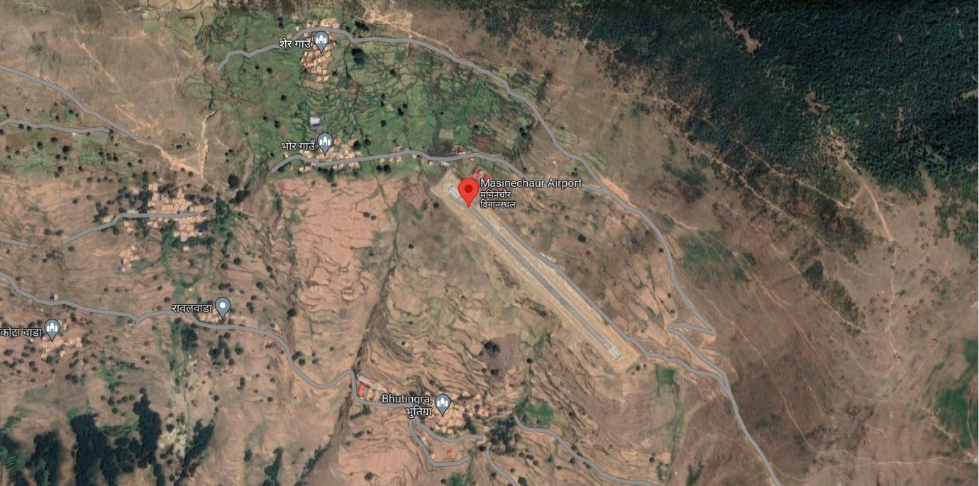
Ariel view of Dolpa Masinechaur Airport
Masinechaur Airport is situated at Pahada Rural Municipal of Dolpa District, Karnali Province. The airport is about 6 Km from the existing airport at Juphal. The popular trekking route to Jumla from this airport is nearly 4 days walking distance from the airport. This airport is getting upgraded to Asphalt Concrete. This airport is currently not in operation.
|
Airport Location and Contact |
|
|---|---|
|
Country |
Nepal |
|
Province or District |
Karnali |
|
Nearest Town or City |
6 KM |
|
Airport’s Complete Name |
Dolpa Masinechaur Airport |
|
Latitude |
29.05918 |
|
Longitude |
82.74408 |
|
Elevation (ft and m) |
9200 ft./ 2804 m. |
|
IATA Code |
|
|
ICAO Code |
VNMC |
|
Managing Company or Airport Authority |
Civil Aviation Authority of Nepal (CAAN) |
|
Management Contact Person |
|
|
NGO and/or UN Presence at Airport? |
No |
Runway(s)
|
Runway #1 |
|
|---|---|
|
Runway Dimensions |
600 m x 30 m |
|
Runway Orientation |
14 / 32 |
|
Runway Surface |
Gravel |
|
Runway Condition |
Not operational |
Airport Infrastructure Details
|
Infrastructure |
|||
|---|---|---|---|
|
Passenger / Cargo Security Screening |
N/A |
Runway Lighting |
No |
|
Refueling Capacity |
No |
Ground Handling Services |
N/A |
|
Air Traffic Control |
N/A |
Fire Fighting Equipment |
No |
|
Weather Information |
N/A |
Aircraft Parking Space |
Two DHC6 types |
|
Navigation Aids |
N/A |
Perimeter Fencing |
|
|
Windsock |
N/A |
|
|
Fuel Services Charges
Refueling is not available at this airport
Royalties / Non Objection Fees (NOFs)
N/A
