
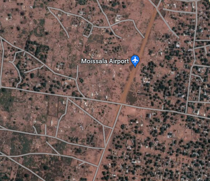
Airport Overview
The Moissala Airstrip is used primarily for humanitarian purposes (Doctors without Borders utilizes the landing strip frequently). The landing strip has been partially converted into a road and is theoretically inside of the town of Moissala.
|
Airport Location and Contact |
|
|---|---|
|
Country |
Chad |
|
Province or District |
Mandoul |
|
Nearest Town or City |
Moissala In town (<1km) |
|
Airport’s Complete Name |
Moissala Airport |
|
Latitude |
8.34575° |
|
Longitude |
17.72611° |
|
Elevation (ft and m) |
1315 ft / 400 m |
|
NGO and/or UN Presence at Airport? |
Yes Doctors without Borders (MSF) |
Airport Picture
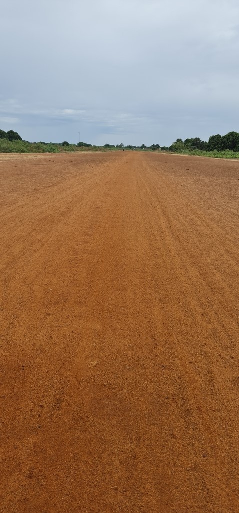
Runway(s)
|
Runway #1 |
|
|---|---|
|
Runway Dimensions |
1100 m x 20 m |
|
Runway Orientation |
RWY 02 / RWY 20 |
|
Runway Surface |
Gravel with grass |
|
Runway Condition |
Good |
The runway has been converted into a road, so it is hard to define the actual length of the airstrip.
Airport Infrastructure Details
|
Infrastructure |
|||
|---|---|---|---|
|
Passenger / Cargo Security Screening |
No |
Runway Lighting |
No |
|
Refuelling Capacity |
No |
Ground Handling Services |
No |
|
Air Traffic Control |
No |
Fire Fighting Equipment |
No |
|
Weather Information |
Yes |
Aircraft Parking Space |
No |
|
Navigation Aids |
No |
Perimeter Fencing |
No |
|
Windsock |
No |
|
|
