Nepal - 2.2.22 Minor Domestic Airport - Bajura
Airport Overview
|
|
|
Picture: Arial view of Bajura Airport- Sudurpashchim province |
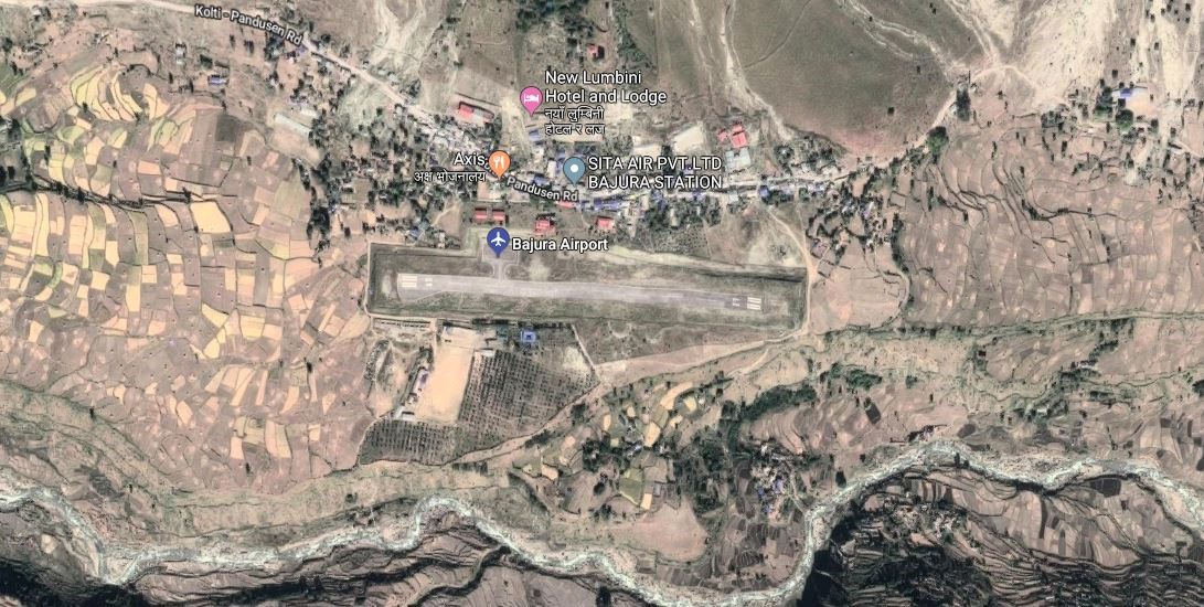
Bajura Airport resides at an elevation of 4,300 feet (1,311 m) above sea level. It has one runway which is 520 metres (1,706 ft) in length. National airline operators provide services from the airport to Nepalgunj and Dhangadi
|
Airport Location and Contact |
|
|---|---|
|
Country |
Nepal |
|
Province or District |
Sudurpashchim |
|
Nearest Town or City |
Bajura-Martadi DISTANCE (40 KM) |
|
Airport’s Complete Name |
Bajura (Kolte) |
|
Latitude |
29.50338 |
|
Longitude |
81.66713 |
|
Elevation (ft and m) |
1404 m |
|
IATA Code |
BJU |
|
ICAO Code |
VNBR |
|
Managing Company or Airport Authority |
Civil Aviation Authority –Bajura-Kolti
|
|
Management Contact Person |
Airport Chief Office Phone: +977-9858488215 Email: bajura_cao@caanepal.gov.np |
|
NGO and/or UN Presence at Airport? |
No |
Runway(s)
|
Runway #1 |
|
|---|---|
|
Runway Dimensions |
520 × 20 m |
|
Runway Orientation |
09 / 27 |
|
Runway Surface |
Asphalt |
|
Runway Condition |
Good, Blacktop and operational |
Airport Infrastructure Details
|
Infrastructure |
|||
|---|---|---|---|
|
Passenger / Cargo Security Screening |
No-Manual |
Runway Lighting |
No |
|
Refueling Capacity |
No |
Ground Handling Services |
Yes, however, all ground handling is done manually. |
|
Air Traffic Control |
Yes |
Fire Fighting Equipment |
No- only fire extinguishers are available. |
|
Weather Information |
Yes, Tower Observation |
Aircraft Parking Space |
Yes- 2 Aircrafts |
|
Navigation Aids |
Yes / |
Perimeter Fencing |
Yes |
|
Windsock |
Yes |
|
|
Fuel Services Charges
Not Available in this Airport
Royalties / Non Objection Fees (NOFs)
N/A
Link for ICAO and IATA Code: https://en.wikipedia.org/wiki/List_of_airports_in_Nepal