Madagascar - 2.1 Port Assessment

Surrounded by 5,000 km of coastline, Madagascar has a network of 17 ports: Toamasina, Antsiranana, Nosy Be, Mahajanga, Toliara, Antalaha, Vohémar, Morondava, Tolagnaro, Port Saint-Louis, Morombe, Manakara, Antsohihy, Maintirano, Sainte Marie, Maroantsetra and Antalaha.
Only five of them (Antsiranana, Toliara, Vohémar, Toamasina, Tolagnaro) have adequate port facilities: wharves, drafts, land, shops, handlers, allowing commercial loading and unloading of goods at the dock.
Even if the 5 previous ports have customs and allowed importation of goods, 75% of freight in Madagascar is made in Toamasina port.
For the 12 remaining ports, access is restricted to small traditional vessels providing regional service or to vessels requiring only a modest draft and limited facilities.
The national agency responsible for port maintenance is APMF (Agence Portuaire Maritime et Fluviale), which was created in 2003 by ministerial decree. APMF is a public institution placed under budget trusteeship of the Ministry of Finance and technical trusteeship of Ministry of Transport.
APMF’s mission is to coordinate the implementation of the National Policy regarding port, sea and river navigation sectors.
Key port information may also be found at: http://www.maritime-database.com
For more information on port contacts, please see the following link: HQ staff will input a link to section 4.4 Port and Waterways Companies Contact List here.
International shipments
Most import shipments (containerized) coming to Madagascar are transshipped via Port Louis (Mauritius) or Longoni (Mayotte). This leads to relatively long transit times and – compared to direct calls – expensive services. In case of minor volumes, ports are also skipped from the schedule; minimum requirements for a port call are around 100 full container moves.
The economic downturn of the country lowered demand and produced fewer cargo for export and therefore led to general schedule changes like with MSC who cancelled the port calls of Toliara and Tolanaro (Fort Dauphin) in 2015. MSC considers the suspension of services as temporary and is trying to identify cooperation partners to offer feeder services to Ehoala and the minor ports on the southeast coast. This includes companies such as CFS Fort Dauphin, with its new beacher (47m long LCT, capacity twelve 20’ Containers).
The national agency responsible for port maintenance is APMF (Agence Portuaire Maritime et Fluviale), which was created in 2003 e. APMF is a public institution placed under budget trusteeship of Ministry of Finance and technical trusteeship of Ministry of Transport. APMF’s mission is to coordinate the implementation of the National Policy regarding port, sea and river navigation sectors.
National cabotage
Since the liquidation of the Compagnie Malagasy de Navigation (CMN), the national cabotage is only operated by private domestic and foreign armaments. The average age of vessels operating in Madagascar is around 20 years.
The density of the Malagasy land transport network remains low, and the seaway opens up several regions even if the quality of the tools used and the services provided do not follow the minimum standards for sea transport.
Traditional maritime transport
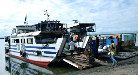
Traditional maritime transport ensures the movement of passengers and goods in the enclaved areas. Transportation is by non-motorized "sailing boatry" on the West Coast, or motorized "lakana" boats on the East Coast. This type of transport plays an important role in the opening up of un-serviced areas, connected by road infrastructure, the evacuation of local production and the circulation of the population.
Inland waterway navigation
Madagascar has no inland waterway for inland waterway transport on a large scale. The “Canal des Pangalanes”, which was natural for most of its length of 650 km along the East Coast, was the subject of extensive renovation work in order to make it navigable to convoys of a draft of 1.40m and a maximum width of 4.5m. For lack of regular maintenance thereafter, the Canal is largely impassable today, due to obstruction of the track by freshwater hyacinths, silting at mouths and degradation of the banks.
As the only means of access to basic services for the riparian population, the Canal continues to be used for the transport of products and people by artisanal canoes and rafts to the main centers of the area.
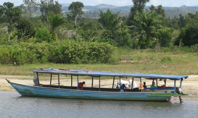
River navigation by traditional canoeing and craft units (kanota, laka) ensures the circulation of local products and the population and tourists along the rivers of the West Coast: Tsiribihina in Miandrivazo, Sofia in Port Bergé, and Betsiboka in Marovoay.
For information on Madagascar Ports contact details, please see the following link: 4.4 Madagascar Port and Waterways Companies Contact List
Madagascar - 2.1.1 Port of Toamasina (Tamatave)
Port Overview
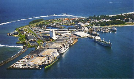
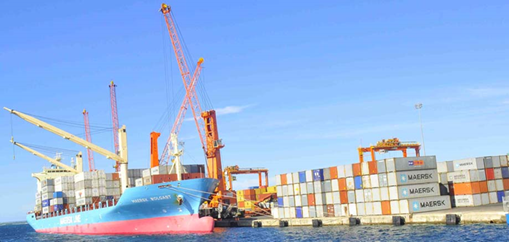
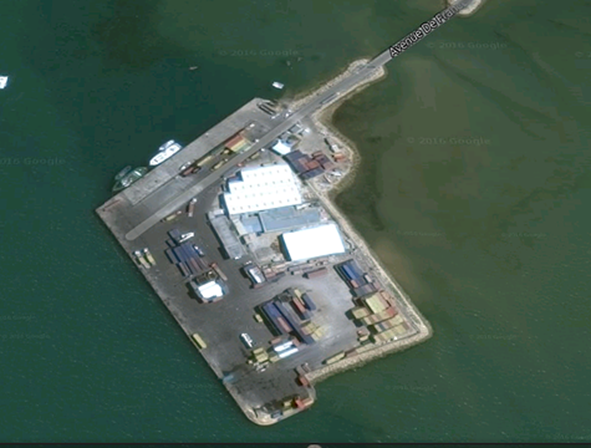
The Port of Toamasina is the first Port of Madagascar. Located in the Atsinanana region is located on the east coast some 370 km from the capital of Madagascar. Located at 18°09 South latitude and 49°25 East longitude, between Ivondro Bay and the long beach that borders the harbor and the Indian Ocean; the Port of Toamasina covers an area of 63 hectares.
The Port of Toamasina is classified as a "Port of National Interest" (PIN) with sufficiently adequate port infrastructure (quay, draft, embankment, storage warehouses), allowing the carrying out of commercial loading and unloading of long-distance ships.
In accordance with Article 3 of Law No. 2003-025, Decree No. 2004-702 confers on the Port of Toamasina the status of Port of National Interest with autonomous management, delimits its district, creates the Société du Port à gestion Autonome de Toamasina (S.P.A.T.) and authorizes the State to participate in its capital. The Port of Toamasina is subject to an autonomous management mode, hence the name of "Autonomous Management Ports" (PGA)
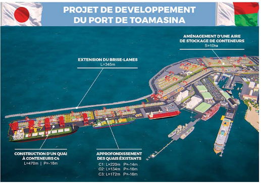
A current project of extension will last 4 years and consists in of adding 474 m of quay to the container terminal , rehabilitating the old quays , extending the breakwater (protective dike) of a length of 345m, but also proceed with the coating of the 18 ha embankment for the storage of containers.
Port web site: https://port-toamasina.com/ (under construction)
Key port information may also be found at: http://www.maritime-database.com.
|
Port Location and Contact |
|
|---|---|
|
Country |
Madagascar |
|
Province or District |
Toamasina |
|
Nearest Town or City with Distance from Port |
Toamasina distance (km) N/A |
|
Port's Complete Name |
Port de Toamasina |
|
Latitude |
-18.156797° |
|
Longitude |
49.426842° |
|
Managing Company or Port Authority |
SPAT (Société du Port à gestion Autonome de Toamasina) |
|
Management Contact Person |
Capitaine de port: Mr Avellin Christian Eddy Phone: 020 53 321 55 |
|
Nearest Airport and Airlines with Frequent International Arrivals/Departures |
Toamasina Airport : 7km Air Madagascar: Antanarivo, Ste Marie, Antalaha, La Réunion |
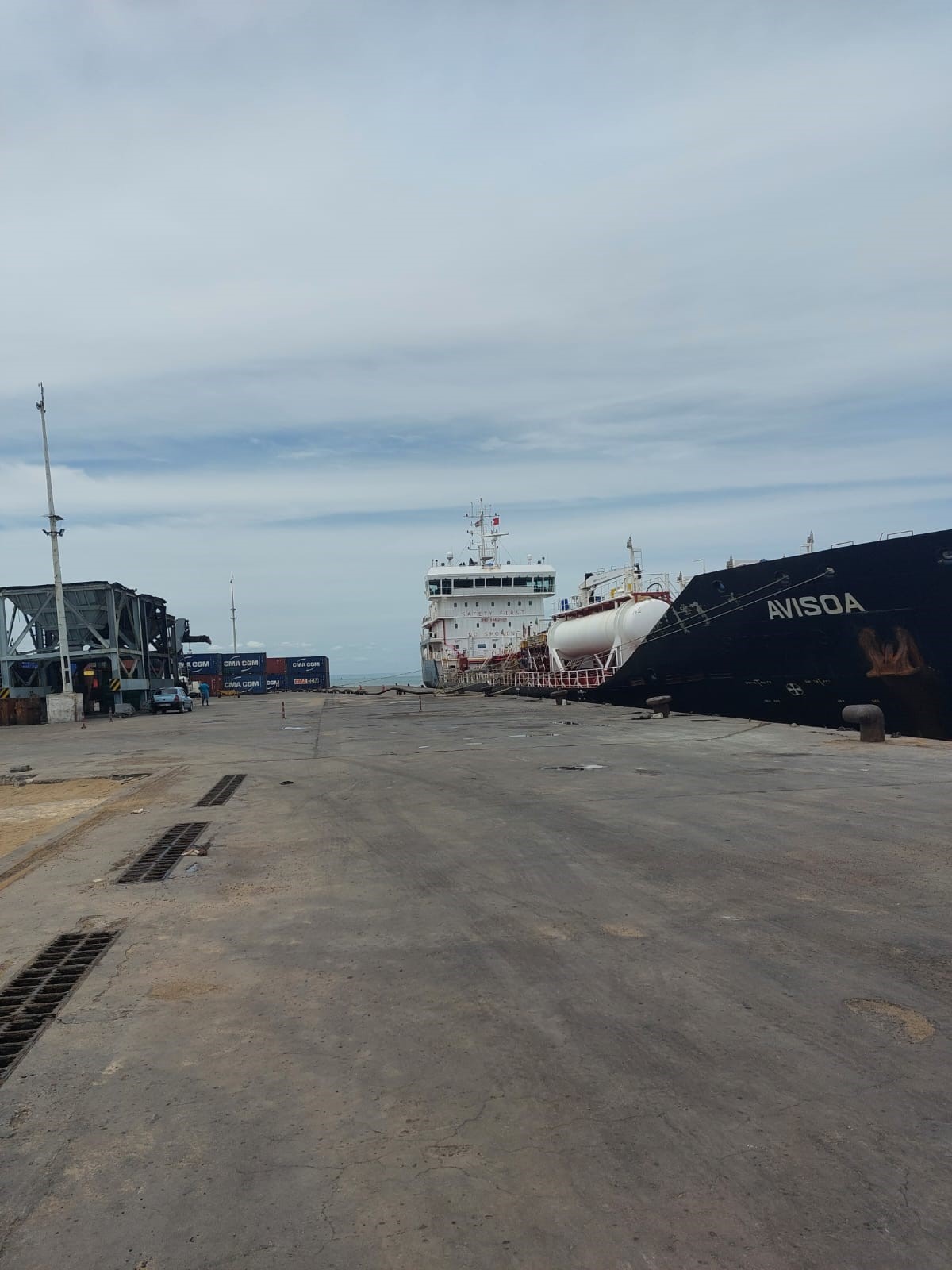
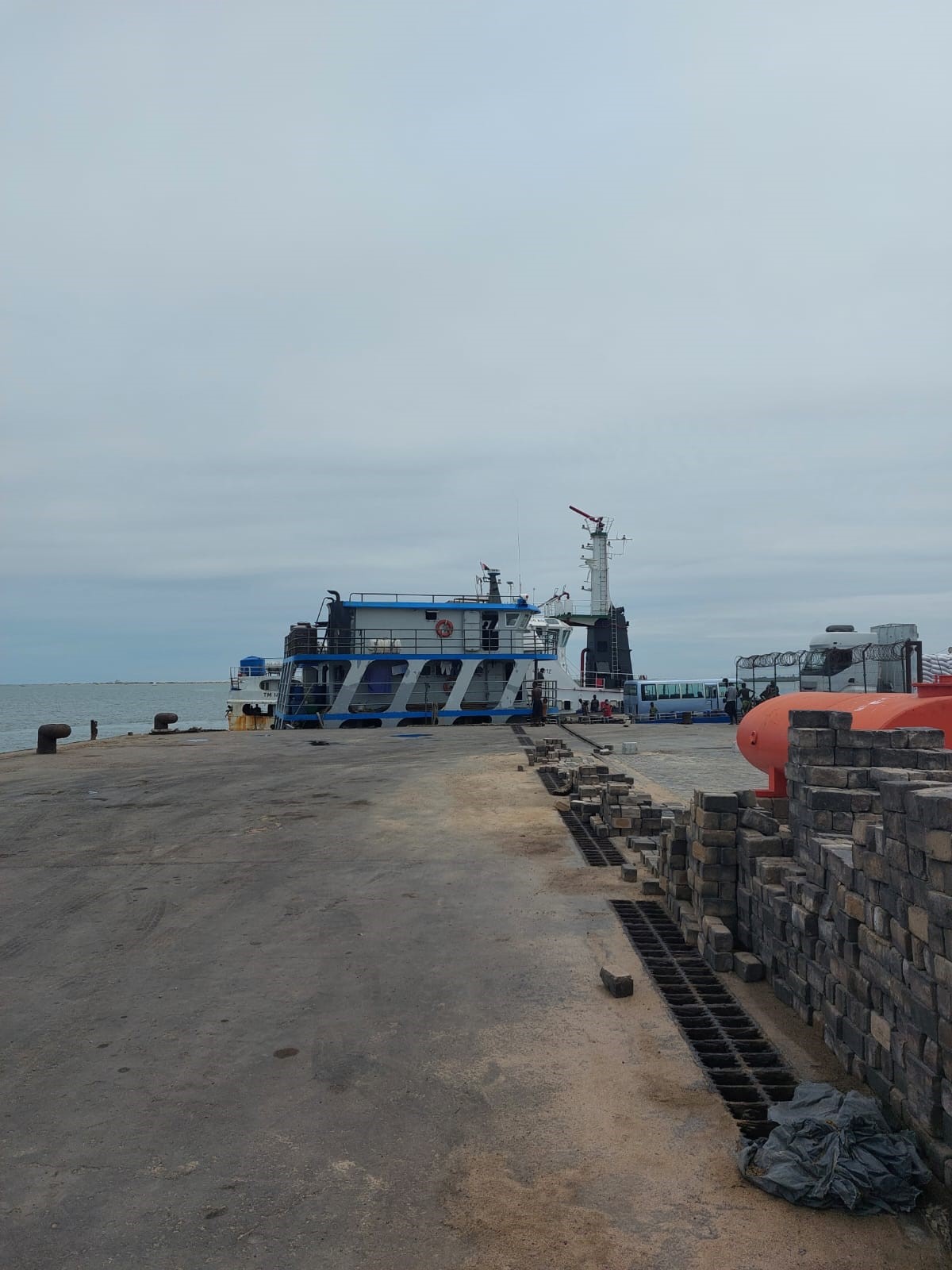
Port Picture
Port of Toamasina View of the port from Pointe Tanio – belo
Extension project of the Port of Toamasina Extension project of the Port of Toamasina: Installation of a 10Ha landfill on the Hastie Reef, including additional embankment and a breakwater – below
Description and Contacts of Key Companies
|
COMPANY |
DESCRIPTION |
CONTACT |
|---|---|---|
|
SPAT |
Port management, piloting, towing, boatage |
|
|
MICTSL |
Stevedoring (container only) |
|
|
SMMC |
Conventional Handling |
|
|
GRT |
Oil terminal management |
+261 2 05 39 68 15 |
|
AMBATOVY |
Mining Company |
+261 32 33 691 40 |
|
APMF |
THE MARITIME AND FLUVIAL PORT AGENCY |
For more information on port contacts, please see the following link: 4.2.3 Madagascar Port and Waterways Company Contact List
Port Performance
The port can accommodate ships with a draft not exceeding 9.5 m and weighing about 50,000 tons. However, work is underway to extend the length of the berth by 450 m which would bring the draft to 15 m. After completion, ships weighing more than 70,000 tons could also dock at the port.
Current monthly use by WFP 50 TEUs/ month - 1,000 MT/month
Total cargo handling (m.tons) – 194 169 MT/month
Total capacity of the port - 20 416 TEUs/month 218 750 MT/month
(Current extension planning – 2026 - to reach 83 833 TEUs/month 900 000 MT/month )
|
Seasonal Constraints |
||
|---|---|---|
|
Occurs |
Time Frame |
|
|
Rainy Season |
Yes |
From December to May |
|
Major Import Campaigns |
No |
N/A |
|
Other Comments |
Work is often delayed by rain. Average fall is 120 in per year Cyclonic season from February to May |
|
| Handling Figures for 2021 | |
|---|---|
|
Vessel Calls |
1898 |
|
Container Traffic (TEUs) |
195,318 |
| Handling Figures Bulk and Break Bulk for 2021 | |
|---|---|
|
Bulk (MT) |
172 155 |
|
Break bulk (MT) |
1 029 364 |
Discharge Rates and Terminal Handling Charges
For information on port rates and charges, please see the following link: The collection of port tariffs will be available on the new website soon online.
Berthing Specifications
|
Type of Berth |
Quantity |
Length (m) |
Maximum Draft (m) |
Comments |
|---|---|---|---|---|
|
Conventional Berth |
2 |
180
200 |
8,5
11 |
Mall B is also used for RoRo operations
|
|
Container Berth |
1 |
286 |
10,5 |
|
|
Silo berth |
1 |
60 |
14 |
Platform is 60 m and can welcome 230 m long tankers maximum |
|
Berthing Tugs |
1 |
20 |
8,5 |
|
|
Water Barges |
N/A |
N/A |
N/A |
|
General Cargo Handling Berths
|
Cargo Type |
Berth Identification |
|---|---|
|
Imports - Bagged Cargo |
Mall B Mall Ambatovy |
|
Exports - Bagged Cargo |
Mall B Mall Ambatovy |
|
Imports and Exports - RoRo |
Mall B |
|
Other Imports |
Mall C1 Mall C3 Terminal pétrolier |
Port Handling Equipment
The port equipment is managed by the government.
The SMMC is managing the handling at the port of Toamasina.
|
Equipment |
Available |
Capacity Available |
Comments on Current Condition and Actual Usage |
|---|---|---|---|
|
Dockside Crane |
Yes |
1 x 15 T |
Functioning ok |
|
Container Gantries |
Yes |
2 x 45 T |
Functioning ok |
|
Mobile Cranes |
Yes |
2x 100 MT- 2 x120 MT (twin lift) 41 MT under spreader |
Functioning ok |
|
Reachstacker |
Yes |
6 x 40 T |
Functioning ok |
|
RoRo Tugmaster (with Trailer) |
Yes |
1 x 70 T |
Functioning ok |
|
Grain Elevator with Bagging Machines |
No |
|
|
|
Transtainer |
Yes |
2 x 45 T |
Functioning ok |
|
Forklifts |
Yes |
12 x 2.5 T 9 x 3 T 2 x 7 t 2 x 8 T 3 x 8.5 T 1 x 16 T |
Functioning ok |
Container Facilities
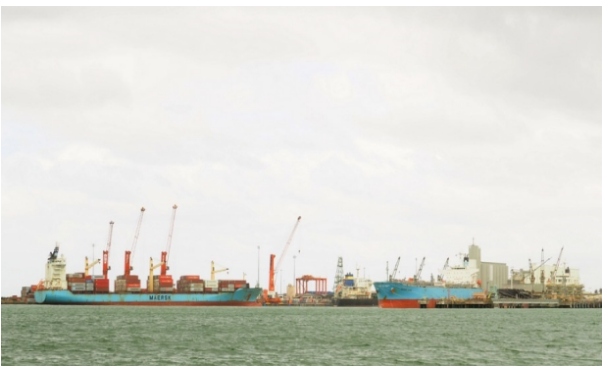
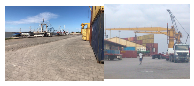
On 16 June 2005, Madagascar International Container Terminal Services, Ltd. (MICTSL) signed a 20-year concession with Société de Gestion du Port Autonome de Toamasina (SPAT) for the operation, management, financing, rehabilitation, and development of the container terminal in the Port of Toamasina, on a public-private partnership basis. The Port of Toamasina is Madagascar's main port. The Madagascar International Container Terminal handles over 90 percent of the country's container traffic.
The concession represents a breakthrough in the Malagasy Government's efforts, backed by the World Bank, to develop a sustainable transport system for the country and, in the case of Toamasina, to equip it with improved container handling facilities designed to facilitate Madagascar’s growing international trade.
Sector analysts, Ocean Shipping Consultants, forecast a positive outlook for Malagasy import-export container traffic.
Container traffic is projected to reach in 2025 83 833 TEUs/month (currently 20 416 TEUs/month)
Madagascar International Container Terminal Services Ltd. is part of ICTSI (International Container Terminal Services, Inc.) group companies created to manage the terminal in Toamasina, Madagascar. ICTSI is a global pioneer in container terminal management and operation having been involved in this activity since the early 1990s. ICTSI is widely acknowledged to be a leading developer in the sector specializing in container terminals in the 50,000 TEU to 1,500,000 TEU range.
|
Facilities |
20 ft |
40 ft |
|---|---|---|
|
Container Facilities Available |
YES |
YES |
|
Container Freight Station (CFS) |
NO |
NO |
|
Refrigerated Container Stations |
YES |
YES |
|
Other Capacity Details |
N/A |
N/A |
|
Daily Take Off Capacity |
300 to 400 TEUs |
N/A |
|
Number of Reefer Stations |
120 |
N/A |
|
Emergency Take-off Capacity |
N/A |
N/A |
|
Off take Capacity of Gang Shift |
N/A |
N/A |
Customs Guidance
Customs are available on site at any time for any declaration/clearance and can process to visa delivery on arrival.
In emergency situations, the custom procedure can be streamlined. The cargo, which has been announced electronically prior vessel’s arrival (normal procedure), can be delivered after its discharge directly into the emergency area. The clearance-related administration and fees / duties can be settled afterwards.
For more information on customs in Madagascar please see the following link: 1.3 Madagascar Customs Information
Terminal Information
Multipurpose Terminal
One berth capable of handling tankers up to 230 m length and 12 m draught. Limiting distance between stern and manifold is 115 m. Facilities for all petroleum products including liquefied gas.
Grain and Bulk Handling
Two grain silos of 20,000 and 32,000 tons for cereals, one cement silo of 20,000 tons. Conveyor belt for cereals.
Main Storage Terminal
|
M2 |
TYPE |
COMMENT |
|---|---|---|
|
32720 |
AREA |
NON PERISHABLE GOODS |
|
17400 |
AREA |
STORAGE VEHICLES |
|
1709 |
AREA |
TRANSHIPMENT |
|
1377 |
AREA |
OPERATIONAL ZONE |
|
2807 |
AREA |
PROHIBITED VEHICLES |
|
4324 |
AREA |
BUFFER ZONE |
|
15560 |
WAREHOUSES |
PERISHABLE GOODS |
|
7540 |
WAREHOUSES |
CIMENT |
|
5290 |
AREA |
HANDLING EQUIPMENT |
|
Storage Type |
Number of Storage Facilities |
Area (m2) |
|---|---|---|
|
Bagged Cargo |
3 |
15,560 |
|
General Cargo |
14 |
73,167 |
Stevedoring
- non-containerized cargo operation is managed by SMMC, a State-owned company.
- container terminal equipment is managed by MITCSL, a private company
- national cabotage: each company has its own workers
Hinterland Information
The APMF is managing the hinterland traffic
Due to the increase in fuel prices, all transporters gathered at the Fluvial Port today, July 13, 2022, and decided to raise all fares for passengers and all goods that leave and call at the Port. Fluvial Manangareza Toamasina.
|
Toamasina |
Destination |
Km |
Price per person |
|---|---|---|---|
|
Toamasina |
Tapakala/Ambodisaina |
9 |
2500 |
|
|
Ambodisiny |
11 |
3000 |
|
|
Ambodipont/Ambony lavoie |
15 |
3000 |
|
|
Vohiteza |
17 |
3000 |
|
|
Aboditandroho |
18 |
3000 |
|
|
Ambodikalpitus |
20 |
4000 |
|
|
Vohimay |
21 |
4000 |
|
|
Ambavarano |
22 |
4000 |
|
|
Ambalasogna/Zarah |
25 |
4000 |
|
|
PK 40 |
23 |
4000 |
|
|
Ampandratokana |
28 |
5000 |
|
|
Ankarefo |
30 |
5000 |
|
|
Manambolo |
29 |
5000 |
|
|
Ampasimazava |
27 |
5000 |
|
|
Ampasimitimotra |
27 |
5000 |
|
|
Mahatsara II |
34 |
7000 |
|
|
Tanambao |
47 |
7000 |
|
|
Terahana |
46 |
7000 |
|
|
Tampolo |
44 |
7000 |
|
|
Ambodivila |
36 |
7000 |
Charbon/gony ………………………1500Ar
Carée10/10…………………………… 1500Ar
Bois rond/Tezavava ……..………1200Ar
Bois rond/échafaudage …………..300Ar
Riz, ciment, sac de 50kg……………. 2000Ar
Mangahazo /Voajabo/gony…………4000Ar
|
Toamasina |
Toerana aleha |
Km |
Anciens prix |
Nouveaux prix |
|
|
Tampina |
50 |
8000 |
7000 |
|
|
Ambodirotra |
53 |
8000 |
7000 |
|
|
Andranokoditra |
60 |
10000 |
7000 |
|
|
Ampahantany |
67 |
10000 |
8000 |
|
|
Ampanotoamaizina |
73 |
12000 |
9000 |
|
|
Vavony |
80 |
12000 |
9000 |
|
|
Ambila |
90 |
12000 |
9000 |
Charbon/gony ………………………2000Ar
Bois rond/échafaudage ………..600Ar
Tezavava/Bois rond………………1500Ar
Traverse……………………………….. 3000Ar
Carrée de 10…………………………. 2000Ar
Carrée 12/12 ………………………..3000Ar
Madrié …………………………………..3000Ar
Vary, Ciment/Gony………………. 4000Ar
Cageot …………………………………..2000Ar
Port Security
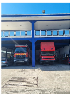
In 2021 the port received two new fire trucks
|
Security |
|
|---|---|
|
ISPS Compliant |
Yes |
|
Current ISPS Level |
Level 1 (can be increased up to 3 if necessary) |
|
Police Boats |
No, but police can request port boats anytime if needed |
|
Fire Engines |
Yes |
Madagascar - 2.1.2 Port of Toliara
Port Overview
This port is a Medium-sized Port. The types of vessels regularly calling at Tulear are General Cargo (23%).
The port of Toliara is the 2nd biggest port in Madagascar and can receive international vessel and all type of cargo for import and export activities.
The port facilities are in good condition and are well maintained.
The two existing docks can receive vessels with a draft of 7m50 max.
The port is suitable for all type of activities: bulk and break-bulk handling, container handling, fuel handling (rigid pipe for all three types of fuel).
RoRo operation is possible with side vessels and quarter-ramp vessels.
Port website: The port has no specific website
Key port information may also be found at: Maritime Database (maritime-database.com)
|
Port Location and Contact |
|
|---|---|
|
Country |
MADAGASCAR
|
|
Province or District |
TOLIARA |
|
Nearest Town or City with Distance from Port |
TOLIARA 1km |
|
Port's Complete Name |
PORT DE TOLIARA |
|
Latitude |
-23.377523° |
|
Longitude |
43.664782° |
|
Managing Company or Port Authority
|
APMF (Agence Portuaire, Maritime et Fluviale) |
|
Management Contact Person |
Inspecteur des Affaires Maritimes FARALAHY Germain Patrick M Directeur Régional de l’APMF Toliara Phone: +261321125790 E-mail: germpatrick@yahoo.fr |
|
Nearest Airport and Airlines with Frequent International Arrivals/Departures |
Aéroport de Toliara Compagnies : Air Mad et Tsaradia |
Port Picture
![]()
Description and Contacts of Key Companies
|
|
ENTITES |
|
CONTACT |
|---|---|---|---|
|
REMORQUAGE |
AMS |
034 01 049 15 |
|
|
PILOTAGE |
SMOI |
034 80 571 66 |
|
|
CONSIGNATAIRES |
AUXIMAD |
032 02 554 08 |
|
|
CMA CGM |
032 07 359 73 |
||
|
CELERO SHIPPING |
032 11 711 15 |
||
|
BOLLORE |
033 37 851 38 |
||
|
SHARAF SHIPPING AGENCY |
034 05 230 07 |
||
|
LPSA |
033 04 002 22 |
||
|
TOLY SHIPPING |
034 18 583 15 |
||
|
MANUTENTIONNAIRES |
COMATO |
034 02 152 70 |
|
|
SEMS |
034 18 583 15 |
||
|
PERMISSIONNAIRES |
COPEFRITO |
032 02 290 45 |
|
|
|
GASYNET |
032 05 465 50 |
|
|
TRANSITAIRES |
MAILAKA TRANSIT |
033 41 669 73 |
|
|
|
SORESUD |
034 07 721 78 |
|
|
|
FTL |
032 07 169 56 |
|
|
|
MUREX |
034 25 985 48 |
|
|
|
VELOGIC |
034 44 990 92 |
|
|
FRONTIERES |
POLICE |
034 99 479 81 |
|
|
GENDARMERIE |
034 54 033 90 |
||
|
DOUANES |
034 02 019 85 |
For more information on port contacts, please see the following link: 4.4 Port and Waterways Companies Contact List.
Port Performance
The port of TULEAR is an international commercial port that can accommodate ships up to 7.30m draught: oil tankers, bulk carriers, container ships, cruise ships and thus receives different types of goods (cereals, bulk, bagged goods, containers, etc ...).
A container ship (CMA/CGM), regional line, serves the port for transhipments of goods mainly in Port Louis / Mauritius.
The terminal is in good condition and container storage is managed appropriately.
Three safety beacons are installed along the mooring channel to facilitate navigation and berthing actions.
The berthing of a ship depends on Decision No. 002 APMF/DG/2012 on priority rules for ships. Humanitarian cargos may have priority if they provide a letter of requisition from the competent authorities. (HQ of APMF Antananarivo)
Any ship wishing to enter the port must complete the entry formalities and its docking must be assisted by the public pilotage service (SMOI) of Toliara.
Average waiting time:
72 hours for an oil tanker, 144 hours for a bulk carrier and 72 hours for a container ship.
The Port works 24/7.
|
Seasonal Constraints |
||
|---|---|---|
|
|
Occurs |
Time Frame |
|
Rainy Season |
No |
From January to May |
|
Major Import Campaigns |
No |
N/A |
|
Other Comments |
N/A |
|
|
Handling Figures for 2022 |
|
|---|---|
|
Vessel Calls |
90 |
|
Container Traffic (TEUs) |
2871 |
|
Handling Figures Bulk and Break Bulk for 2022 |
|
|---|---|
|
Bulk (MT) |
Rice : 238 MT Sugar : 7.700 MT Ciment: 36.100 MT Soft drink : 19.799 MT Flour : 16.4 MT |
|
Break bulk (MT) |
N/A |
Discharge Rates and Terminal Handling Charges
.
See reference price list at 2.1 Port Assessment
Berthing Specifications
|
Type of Berth |
Quantity |
Length (m) |
Maximum Draft (m) |
Comments |
|---|---|---|---|---|
|
Conventional Berth |
1
1
|
195m
145 m
|
7,30 m
6 m
|
International
National
|
|
Container Berth |
N/A |
N/A |
N/A |
N/A |
|
Silo Berth |
N/A |
N/A |
N/A |
N/A |
|
Berthing Tugs |
1 |
29.5 m |
4.77 m |
|
|
Water Barges |
N/A |
N/A |
N/A |
N/A |
General Cargo Handling Berths
|
Cargo Type |
Berth Identification |
|---|---|
|
Imports - Bagged Cargo |
Long-haul dock |
|
Exports - Bagged Cargo |
Batelage wharf |
|
Imports and Exports - RoRo |
Long-haul dock |
|
Other Imports |
N/A |
Port Handling Equipment
Is the port equipment managed by the government or privately? Government APMF
|
Equipment |
Available
|
Total Quantity and Capacity Available |
Comments on Current Condition and Actual Usage |
|---|---|---|---|
|
Dockside Crane |
No |
|
N/A |
|
Container Gantries |
No |
|
N/A |
|
Mobile Cranes |
Yes |
1 x 22 MT 1x 40 MT 1x 70 MT
|
Good condition |
|
Reachstacker |
Yes |
2 x 45 MT |
Good condition |
|
RoRo Tugmaster (with Trailer) |
Yes |
6 x 30 MT |
Good condition |
|
Grain Elevator with Bagging Machines |
No |
|
N/A |
|
Transtainer |
No |
|
N/A |
|
Forklifts |
Yes |
3 x 10 MT 1 x 3 MT 2 x 26 MT 1x28 MT 1x12 MT 1x6 MT |
Good condition |
Container Facilities
|
Facilities |
20 ft |
40 ft |
|---|---|---|
|
Container Facilities Available |
10000m2 (5000 for SEMS/ and 5000m2 for COMATO) |
|
|
Container Freight Station (CFS) |
N/A |
|
|
Refrigerated Container Stations |
N/A |
|
|
Other Capacity Details |
N/A |
|
|
Daily Take Off Capacity |
15 units / hour |
|
|
Number of Reefer Stations |
N/A |
|
|
Emergency Take-off Capacity |
N/A |
|
|
Off take Capacity of Gang Shift |
N/A |
|
Customs Guidance
In general, the effectiveness of customs activities takes 2 days.
Importation:, if the files are incomplete, the processing time extends up to 2 days;
Exportation:, the processing of files is done in half a day.
For more information on customs in MADAGASCAR, please see the following link: 1.3 Customs Information.
Terminal Information
MULTIPURPOSE TERMINAL
The container berth on the level of the port is suitable to receive all types of cargo: bagged cargo, break-bulk and bulk, containers.
GRAIN AND BULK HANDLING
All activities of grain and bulk handling are managed by SEMS and COMATO and most of the time by using different facilities / equipment and for some specifics activities (break-bulk handling) there are day-laborers (Dockers) for assistance.
MAIN STORAGE TERMINAL
The Port of Toliara has a storage warehouse with a capacity of 4500 MT.
|
Storage Type |
Number of Storage Facilities |
Area (m2) |
|---|---|---|
|
Bagged Cargo |
2 |
2 x 3000 m2 |
|
Refrigerated Cargo |
2 |
2 x 2000 m2 |
|
General Cargo |
N/A |
N/A |
Stevedoring
The cargo handling activities in the port and for the barge operation are shared by two stevedore companies. COMATO (blue equipment) operates CMA/CGM vessels; SEMS (red / green equipment) handles for UAFL.
Hinterland Information
Despite the presence of a national airport, the port of Toliara is mainly connected to the hinterland destinations by road.
All kind of truck can access the port and his berth.
After payment of the various customs and port duties and taxes and follow-up of the customs removal order, a request for access of cars to the Port, for removal of goods must be made and endorsed by the APMF on presentation of the customs removal order.
It should be noted that only the freight forwarder is authorized to make the customs declaration of imported and/or exported goods.
Port Security
Currently, the Port is partially fenced but part of the fence is being rehabilitated on the southern part of the long-haul Quay.
It is equipped with surveillance cameras, various types of detector equipment/devices. Inside the IP round officers of the brigade of the Gendarmerie, the National Police and the Navy (marine detachment) for port security and safety.
|
Security |
|
|---|---|
|
ISPS Compliant |
Yes / |
|
Current ISPS Level |
Level ! |
|
Police Boats |
Yes |
|
Fire Engines |
Yes / |
Madagascar - 2.1.3 Port of Mahajanga
Port Overview
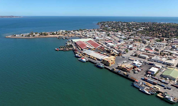
Mahajanga is the third busiest port in Madagascar, but no rehabilitation has been taken place since many years. The port is mainly used for local traffic on Madagascar's West coast and neighboring islands, as well as by local operators. Big prawn farms are located South and North of Mahajanga and use the port to export their products.
Mahajanga port has no strategic importance for humanitarian activities, unless cyclones and floods result in major road cuts. In that case, humanitarian aid could be dispatched from Mahajanga to North (Antsohihy) or South (Maintirano, Morondava) using coasters or landing crafts (beachers).
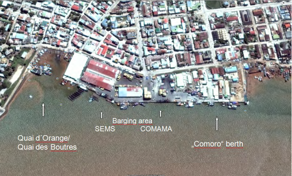
Long haul vessels cannot berth at Mahajanga port and a transhipment to barges has to take place for any big or medium sized vessel. The barges are towed to the berth by the tugs of two stevedore companies, where the cargoes are handled and stored in warehouses or respectively stacked in the relevant container yards.
Only cargo for Comoros, fishing vessels and small crafts for national trades are operated directly at the berth. Long haul vessels or container ships may anchor in deeper waters at best position of the port. Draught at quay is 4.50 meters only and is calculated on high tide. Transhipment can result in more damages caused by double handling.
Service vessels, tugs, barges etc. fall dry, the small craft area (Quai d’Oranges / Quai des Boutres) used by wooden sailing vessels falls completely dry, too.
Same counts for the main anchorage area with a stated depth of 12 meters, according to international standards it should read 8 meters. Considering this, a maximum draft of 6.5 to 7 meters is the limit. The data for the fairway channel are from the end of the 1950s, more actual soundings have not been carried out. Sedimentation from the Betsiboka River increases the uncertainties. According to the Port Authority, new soundings are planned for the next years.
The draft restrictions for Mahajanga roads also limit the vessel size.
In average, 800 TEU vessels are in service.
Port website: This port has no specific website available
Key port information may also be found at: http://www.maritime-database.com
|
Port Location and Contact |
|
|---|---|
|
Country |
Madagascar |
|
Province or District |
Mahajanga |
|
Nearest Town or City with Distance from Port |
Mahajanga I 0 km |
|
Port's Complete Name |
Port Be/ Grand Port de Mahajanga |
|
Latitude |
15°44’08’’S |
|
Longitude |
46°18’50’’ E |
|
Managing Company or Port Authority |
Agence Portuaire Maritime et Fluviale |
|
Management Contact Person |
Directeur Régional de l’APMF Mahajanga Mr RAINIMBAHY Jacquy Georges +261 32 11 257 44 |
|
Nearest Airport and Airlines with Frequent International Arrivals/Departures |
Aéroport Philibert Tsiranana (Mahajanga) |
Port Picture
Description and Contacts of Key Companies
- SEMS, manutentionnaire: Mr Michel Le Treust, directeur des opérations, 0340260250, michellt@semsmjn.mg
- COMAMA, manutentionnaire: Mr BAKARY Fanomeza Angelo, responsable classe 2 , 0340224279, exploitation@comama.mg
- SMOI PT: Steering / boatage
- EUSTRATIOU: BAC Boeny operator
OPERATORS:
GASY NET: Scanner control
LPSA: Setting up fuel pipe line
VITOGAZ: Setting up fuel pipe line
SOMAPECHE: Fishing and Treatment Company
REFRIGEPECHE: Fishing and Treatment Company
COLAS: Logistics base
SEMS: Slipway and fairing
For more information on port contacts, please see the following link: 4.4 Port and Waterways Companies Contact List
Port Performance
|
Seasonal Constraints |
||
|---|---|---|
|
|
Occurs |
Time Frame |
|
Rainy Season |
Yes |
From December to March |
|
Major Import Campaigns |
No |
N/A |
|
Other Comments |
Cyclonic season from February to May |
|
|
Handling Figures for 2021 |
|
|---|---|
|
Vessel Calls |
490 |
|
Container Traffic (TEUs) |
11578 |
|
Handling Figures Bulk and Break Bulk for 2021 |
|
|---|---|
|
Bulk (MT) |
343 576 |
|
Break bulk (MT) |
N/A |
Discharge Rates and Terminal Handling Charges
To warehouse/trucks - Breakbulk: 200/gang/crane
Pilotage fees compulsory, request to be cabled 24 hours prior to arrival. A launching boat assists with the in and out manoeuvres.
28 containers per hour may be discharged to barges to transfer to the quay where there is another handling/lifting from barge to quay.
Berthing Specifications
|
Type of Berth |
Quantity |
Length (m) |
Maximum Draft (m) |
Comments |
|---|---|---|---|---|
|
Conventional Berth |
8 |
765 m total |
4.5 |
|
|
Container Berth |
1 |
765 m |
4.5 |
Capacity 3500 TEU’s |
|
Silo Berth |
No |
N/A |
N/A |
Pilotage service available, provided by SMOI |
|
Berthing Tugs |
No |
N/A |
N/A |
Pilotage service available, provided by SMOI |
|
Water Barges |
No |
N/A |
N/A |
Barges are used for handling in the harbour. SEMS had 8 barges in 2021 and COMAMA 2 |
General Cargo Handling Berths
|
Cargo Type |
Berth Identification |
|---|---|
|
Imports - Bagged Cargo |
Usually COMAMA docks |
|
Exports - Bagged Cargo |
Usually COMAMA docks |
|
Imports and Exports - RoRo |
No |
|
Other Imports |
Oil products |
Port Handling Equipment
|
Equipment |
Available
|
Total Quantity and Capacity Available |
Comments on Current Condition and Actual Usage |
|---|---|---|---|
|
Dockside Crane |
No |
N/A |
N/A |
|
Container Gantries |
No |
N/A |
N/A |
|
Mobile Cranes |
Yes |
COMAMA ( 2021) - 3 x 10 T. - 1 x 16 T. - 1 x 40 T. - 02 reach stacker 45 T. - 01 reach stacker 35 T.
|
|
|
Reachstacker |
Yes |
3 x 45 T. |
|
|
RoRo Tugmaster (with Trailer) |
No |
N/A |
N/A |
|
Grain Elevator with Bagging Machines |
No |
N/A |
N/A |
|
Transtainer |
Yes |
SEMS (2021) 02 cranes LIEBHERR 45 T. |
|
|
Forklifts |
Yes |
- 2 x 2 T. - 2 x 2.5 T. - 1 x 20 T. SEMS (2021) - 2 x 10 T - 3 x 3.5 T. - 1 x 2.5 T. |
|
Container Facilities
|
Facilities |
20 ft |
40 ft |
|---|---|---|
|
Container Facilities Available |
Yes |
Yes |
|
Container Freight Station (CFS) |
Yes |
Yes |
|
Refrigerated Container Stations |
Yes |
Yes |
|
Other Capacity Details |
Yes |
Yes |
|
Daily Take Off Capacity |
200 |
200 |
|
Number of Reefer Stations |
48 in total |
48 in total |
|
Emergency Take-off Capacity |
Yes, on demand 24 / 24 |
Yes, on demand 24 / 24 |
|
Off take Capacity of Gang Shift |
No data |
No data |
Customs Guidance
Customs are available on site at any time for any declaration/clearance and can process to visa delivery on arrival.
In emergency situations, the custom procedure can be streamlined. The cargo, which has been announced electronically prior vessel’s arrival (normal procedure), can be delivered after its discharge directly into the emergency area. The clearance-related administration and fees / duties can be settled afterwards.
For more information on customs in Madagascar, please see the following link: 1.3 Customs Information
Terminal Information
MULTIPURPOSE TERMINAL
N/A
GRAIN AND BULK HANDLING
N/A
MAIN STORAGE TERMINAL
The SEMS warehouse is generally feasible to store bagged cargo / foodstuff.
Another warehouse used by COMAMA for the storage of cement is contaminated with cement dust and difficult to clean for the purpose of food storage.
|
Storage Type |
Number of Storage Facilities |
Area (m2) |
|---|---|---|
|
Bagged Cargo |
1 |
2,300 |
|
Refrigerated Cargo |
2 |
5,200 |
|
General Cargo |
5 |
600 |
Stevedoring
The cargo handling activities in the port and for the barge operation are shared by two stevedore companies. COMAMA (blue equipment) operates CMA/CGM vessels; SEMS (red / green equipment) handles MSC. The stevedore companies have an agreement to share the equipment (pooling), which counts for reach-stackers, trucks and forklifts.
Mobile berth cranes to load / unload the barges are more dedicated to the relevant berth area adjacent to the container stacks of the two container shipping lines. Next to the equipment share of the stevedores, it can be estimated that the handling rates of both are similar or same. SEMS also operates a feeder vessel and a landing craft.
Hinterland Information
Despite the presence of an international airport, the port of Toliara is mainly connected to the hinterland destinations by road.
All types of truck can have access on the port and his berth for cargo off take but the majority are containers trucks (20ft and 40 ft).
Port Security
|
Security |
|
|---|---|
|
ISPS Compliant |
Yes |
|
Current ISPS Level |
Level 1 |
|
Police Boats |
Yes |
|
Fire Engines |
No* |
*No fire service in the port.
Each company has fire trucks and works together with MJN firefighters
Madagascar - 2.1.4 Port of Taolagnaro (Ehoala – Fort Dauphin)
Port Overview
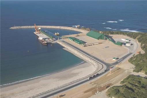
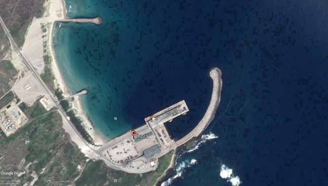
Built outside any settlement near Taolagnaro airport, it opened on July 8, 2009.This port, located in Saint Luke's Bay, just at Cape Ranavalona, was built to accommodate ships exporting bulk goods.
It is a multifunctional port of public utility in deep water (15.75 meters at quayside) with private management. From a new concept, it includes:
- A breakwater with a length of 625 meters
- 1 multipurpose pier with 3 berths that can accommodate different types of vessels
- Two riprap spikes to contain the movement of coastal sand
- A secure median for the storage of containers and general cargo
- An electrical power supply for refrigerated containers.
- 2 warehouses for the storage of ilmenite
- 2 warehouses for the storage of general goods
- 400 hectares of available space reserved for industrial development for investors: EHOALA PARK & EHOALA VILLAGE supplied with water and electricity by Rio Tinto QMM.
The port is covered by International Ship and Port Security (ISPS) international security standards.
In addition to the proximity of the airport and the port, one of the advantages of the Ehoala site is the availability of a development area of 400 ha. The convergence of these physical factors favours the establishment of a commercial and industrial zone that would constitute a significant potential for the development of the country in general and various economic activities in the southern region in particular.
Port website: This port has no specific website
Key port information may also be found at: Maritime Database (maritime-database.com)
|
Port Location and Contact |
|
|---|---|
|
Country |
Madagascar |
|
Province or District |
Toliara |
|
Nearest Town or City with Distance from Port |
Taolagnaro |
|
Port's Complete Name |
Port d’Ehoala |
|
Latitude |
25.067274° S |
|
Longitude |
46.963602° E |
|
Managing Company or Port Authority
|
Port d’Ehoala |
|
Management Contact Person |
Mr. Andriantsoa Rabiaza, Directeur du Port d’Ehoala +261 34 65 213 08 |
|
Nearest Airport and Airlines with Frequent International Arrivals/Departures |
Aéroport de Taolagnaro, Air Madagascar |
Port Picture
Description and Contacts of Key Companies
-
SEPL (Strang Ehoala Port Logistics): Stevedoring - towing
-
ISPS-FSO: Security
-
G4S: Guarding/caretaking
For more information on port contacts, please see the following link: 4.4 Port and Waterways Companies Contact List.
Port Performance
The port of EHOALA can accommodate international vessels and all types of goods (grain, bulk, bagged goods, containers). The terminal is in good condition and container storage is carried out appropriately.
Safety beacons are installed along the mooring channel to facilitate navigation and berthing operations.
The port is not congested all the time, but there are unloading's and loads almost every day. Vessels carrying humanitarian cargo may have priority for berth access, but it is recommended to negotiate directly with the relevant authorities. It is recommended that you negotiate directly with port users for this action. Mining activities (ilmenite) are always a priority, whatever the situation.
|
Seasonal Constraints |
||
|---|---|---|
|
|
Occurs |
Time Frame |
|
Rainy Season |
Yes |
From December to May |
|
Major Import Campaigns |
No |
N/A |
|
Other Comments |
N/A |
|
|
Handling Figures for 2022 |
|
|---|---|
|
Vessel Calls |
76 |
|
Container Traffic (TEUs) |
7978 |
|
Handling Figures Bulk and Break Bulk for 2022 |
|
|---|---|
|
Bulk (MT) |
504 219 T |
|
Break bulk (MT) |
|
Discharge Rates and Terminal Handling Charges
See point 2.1 Port Assessment for the reference price list
Berthing Specifications
|
Type of Berth |
Quantity |
Length (m) |
Maximum Draft (m) |
Comments |
|---|---|---|---|---|
|
Conventional Berth |
1 |
150 |
8 |
|
|
Container Berth |
2 |
275 |
12 |
|
|
Silo Berth |
n/a |
n/a |
n/a |
|
|
Berthing Tugs |
2 |
30 |
3,50 |
|
|
Water Barges |
n/a |
n/a |
n/a |
|
General Cargo Handling Berths
|
Cargo Type |
Berth Identification |
|---|---|
|
Imports - Bagged Cargo |
Container berth |
|
Exports - Bagged Cargo |
Container berth |
|
Imports and Exports - RoRo |
Container berth |
|
Other Imports |
Container berth |
Port Handling Equipment
Is the port equipment managed by the government or privately?
Port equipment and facilities are managed by SEPL.
Apart from those listed in the table below, the following equipment are also used at the level of the port.
- Telehandler: 1 x 3,5 T
- Trailer for container: 5 (2x40ft, 3x20ft)
- Tractor: 1
|
Equipment |
Available
|
Total Quantity and Capacity Available |
Comments on Current Condition and Actual Usage |
|---|---|---|---|
|
Dockside Crane |
No |
n/a |
n/a |
|
Container Gantries |
No |
n/a |
n/a |
|
Mobile Cranes |
No |
n/a |
n/a |
|
Reachstacker |
Yes |
2 |
Good condition |
|
RoRo Tugmaster (with Trailer) |
No |
n/a |
n/a |
|
Grain Elevator with Bagging Machines |
No |
n/a |
n/a |
|
Transtainer |
No |
n/a |
n/a |
|
Forklifts |
Yes |
1x2,5T 2x5T 3x7T |
Good condition |
Container Facilities
|
Facilities |
20 ft |
40 ft |
|---|---|---|
|
Container Facilities Available |
Air de stockage : 1000 conteneurs (EVP 20ft) |
|
|
Container Freight Station (CFS) |
||
|
Refrigerated Container Stations |
6 |
|
|
Other Capacity Details |
n/a |
n/a |
|
Daily Take Off Capacity |
En moyenne 18 conteneurs par jour |
|
|
Number of Reefer Stations |
6 |
|
|
Emergency Take-off Capacity |
n/a |
n/a |
|
Off take Capacity of Gang Shift |
|
|
Customs Guidance
Customs are available on site at any time for any declaration/clearance and can process to visa delivery on arrival.
In emergencies, the custom procedure can be streamlined. The cargo, which has been announced electronically prior vessel’s arrival (normal procedure), can be delivered after its discharge directly into the emergency area. The clearance-related administration and fees / duties can be settled afterwards.
For more information on customs in Madagascar, please see the following link: 1.3 Customs Information.
Terminal Information
MULTIPURPOSE TERMINAL
The container berth on the level of the port is suitable to receive all types of cargo: bagged cargo, break-bulk and bulk, containers.
GRAIN AND BULK HANDLING
All activities of grain and bulk handling are managed by SEPL and most of the time by using different facilities / equipment and for some specifics activities (break-bulk handling) there are day-laborers (Dockers) for assistance.
MAIN STORAGE TERMINAL
The port has three main storage warehouses, but one of them is specifically designed for mineral (ilmenite) cargoes.
|
Storage type |
Number of Storage Facilities |
m2 |
|---|---|---|
|
Mineral Cargo |
1 |
Able to receive 64 000 metric tones (ilmenite) |
|
Refrigerated Cargo |
n/a |
n/a |
|
Bagged Cargo |
2 |
2 X 1000 m² |
|
General Cargo |
Stevedoring
The stevedoring is managed by SEPL with his own terminal handling charge.
Hinterland Information
Despite the presence of a national airport, the port of Ehaola is mainly connected to the hinterland destinations by road.
All types of truck can have access on the port and his berth for cargo off take but the majority are containers trucks (20ft and 40ft).
Port Security
The port is fenced and there is a security service (G4S) for days and nights port guarding.
|
Security |
|
|---|---|
|
ISPS Compliant |
Yes |
|
Current ISPS Level |
1 |
|
Police Boats |
No |
|
Fire Engines |
Yes |
Madagascar - 2.1.5 Port of Antsiranana (Diego Suarez)
Port Overview
Diego Suarez is a Medium-sized Port. The types of vessels regularly calling at DIEGO SUAREZ are Fishing Vessel (30%), General Cargo (15%), Oil Products Tanker (5%). The maximum length of the vessels recorded to having entered this port is 229 meters.
The maximum draught is 8.8 meters. The maximum Deadweight is 79403t.
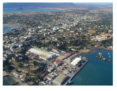
This port has long time been the third busiest port of Madagascar and the centre of social activity of the citizen.
Today, it is specialized on container handling and most of the fishing companies have stop their activities decreasing consequently the vitality of the port.
- Water depth of 8.5 m at the berth is sufficient for relevant vessel / feeder traffic
- RoRo operation is possible with side- and quarter-ramp vessels
- Passage into the bay for larger vessels may be critical
- Road connections to the South in bad condition
- Berth is feasible for both breakbulk and RoRo operations (upon vessel acceptance)
- Ships gear mandatory, no berth cranes
- 2 very small operational tug for berthing assistance
- Small coaster and landing craft can also be found alongside in the tugs docking area
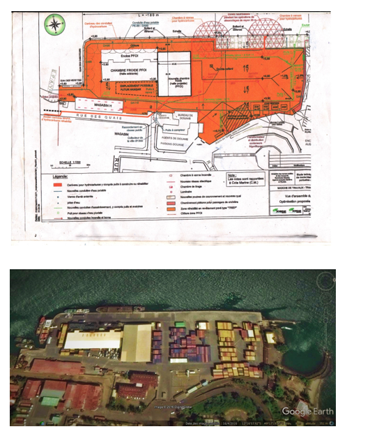
The PFOI (Pêche et Froid de l'Océan Indien) and La Saline (a salt factory) still operate it, as does the SECREN (Société d'Exploitation, de Construction et Réparations Navales) - which is in fact the former DCAN (Direction of Constructions and Naval Weapons).
Port website: This port has no specific website available
Key port information may also be found at: http://www.maritime-database.com
|
Port Location and Contact |
|
|---|---|
|
Country |
MADAGASCAR |
|
Province or District |
ANTSIRANANA |
|
Nearest Town or City with Distance from Port |
DIEGO SUAREZ N/A |
|
Port's Complete Name |
PORT OF ANTSIRANANA |
|
Latitude |
-12.268972° |
|
Longitude |
49.288464° |
|
Managing Company or Port Authority |
APMF (Agence Portuaire Maritime et Fluviale) |
|
Management Contact Person |
APMF Regional Director: Mr Jean Paul Rabilahy |
|
Nearest Airport and Airlines with Frequent International Arrivals/Departures |
Antsiranana Arrachart Airport Air Madagascar: Dzaoudzi, La Réunion, Antananarivo, Mahajanga, Sambava Ewa Air : Dzaoudzi |
Port Picture
Description and Contacts of Key Companies
CMDMD: Stevedoring for MSC container line / contact@cmdmd.mg
COMADIE / SGTPSM: Stevedoring for CGA-CGM container line / comadiecompte@moov.mg
SMOI PT: Steering / boatage / smoi.mar@moov.mg
SOMAPOR: Manufacture of metal cans
PFOI: Fishing and storage / 020 82 221 21
CSM: Salt Company / 020 82 293 94
GASY NET: Scanner control / mgdiego@sgs.com
LPSA: Setting up pipe line / contact@logpetro.com
For more information on port contacts, please see the following link: 4.4 Port and Waterways Companies Contact List
Port Performance
Going in line with a further containerization of ports, the Port of Antsiranana was converted from a multipurpose facility to an almost exclusive container terminal. Sheds and warehouses on the berth have been demolished in favour of storage area for containers.
Two container lines (MSC and CMA/CGM) are serving the port, the cargo mainly transhipped in Port Louis / Mauritius. The terminal is in a good condition and the storage of the containers is handled in a proper manner.
|
Seasonal Constraints |
||
|---|---|---|
|
Occurs |
Time Frame |
|
|
Rainy Season |
Yes |
From December to June |
|
Major Import Campaigns |
No |
N/A |
|
Other Comments |
Cyclonic season from February to May |
|
|
Handling Figures for 2021 |
|
|---|---|
|
Vessel Calls |
290 |
|
Container Traffic (TEUs) |
6200 |
|
Handling Figures Bulk and Break Bulk for 2021 |
|
|---|---|
|
Bulk (MT) |
157663 (total Bulk and break bulk) / no detail available |
|
Break bulk (MT) |
157663 (total Bulk and break bulk) / no detail available |
Discharge Rates and Terminal Handling Charges
Container handling productivity is between 12 and 18 containers / hour with two cranes.
Berthing Specifications
|
Type of Berth |
Quantity |
Length (m) |
Maximum Draft (m) |
|---|---|---|---|
|
Conventional Berth |
1 |
307 |
8.5 |
|
Container Berth |
N/A |
||
|
Silo Berth |
N/A |
||
|
Berthing Tugs |
N/A |
||
|
Water Barges |
N/A |
General Cargo Handling Berths
|
Cargo Type |
Berth Identification |
|---|---|
|
Imports - Bagged Cargo |
N/A |
|
Exports - Bagged Cargo |
N/A |
|
Imports and Exports - RoRo |
N/A |
|
Other Imports |
N/A |
Port Handling Equipment
The port equipment is managed by the government (APMF).
No fixed cranes, gantries or transtainers are available; the stacking is done by reach-stackers only.
The mobile handling equipment is shared by the two stevedore companies COMADIE and CMDMD.
For loading / unloading of containers vessels ship’s gear is mandatory. The feeder vessels calling the Madagascan ports are normally equipped with two cranes, limited in size in order to fit into other ports apart from Antsiranana, too. Container handling productivity is between 12 and 18 containers / hour with two cranes.
|
Equipment |
Available |
Total Quantity and Capacity Available |
Comments on Current Condition and Actual Usage |
|---|---|---|---|
|
Dockside Crane |
No |
N/A |
N/A |
|
Container Gantries |
No |
N/A |
N/A |
|
Mobile Cranes |
No |
N/A |
N/A |
|
Reachstacker |
Yes |
2 |
Good condition |
|
RoRo Tugmaster (with Trailer) |
No |
N/A |
N/A |
|
Grain Elevator with Bagging Machines |
No |
N/A |
N/A |
|
Transtainer |
No |
N/A |
N/A |
|
Forklifts |
Yes |
6 x 2.5 tons 2 x 15 tons 2 x 10 tons |
Good condition |
Container Facilities
|
Facilities |
20 ft |
40 ft |
|---|---|---|
|
Container Facilities Available |
Yes |
Yes |
|
Container Freight Station (CFS) |
Yes |
Yes |
|
Refrigerated Container Stations |
Yes |
Yes |
|
Other Capacity Details |
Dangerous goods |
Dangerous goods |
|
Daily Take Off Capacity |
150 |
N/A |
|
Number of Reefer Stations |
N/A |
N/A |
|
Emergency Take-off Capacity |
N/A |
N/A |
|
Off take Capacity of Gang Shift |
N/A |
N/A |
Customs Guidance
Customs are available on site at any time for any declaration/clearance and can process to visa delivery on arrival.
In emergency situations, the custom procedure can be streamlined. The clearance-related administration and fees / duties can be settled afterwards.
For more information on customs in MADAGASCAR, please see the following link: 1.3 Customs Information
Terminal Information
MULTIPURPOSE TERMINAL
N/A
GRAIN AND BULK HANDLING
N/A
MAIN STORAGE TERMINAL
|
Storage Type |
Number of Storage Facilities |
Area (m2) |
|---|---|---|
|
Bagged Cargo |
N/A |
N/A |
|
Refrigerated Cargo |
2 |
1 x 2,700 1 x 2,800 |
|
General Cargo |
1 |
CMDMD : 3,500 CO.MA.DIE : 3,200 |
Stevedoring
There are two stevedore companies COMADIE and CMDMD for the two container lines (MSC and CMA/CGM) which are serving the port.
Both stevedore companies charge the same rates to their customers.
CMDMD – MSC containers
COMADIE – CGA CGM containers
Hinterland Information
N/A
Port Security
|
Security |
|
|---|---|
|
ISPS Compliant |
Yes |
|
Current ISPS Level |
Level 1 |
|
Police Boats |
Yes (BANA) (Base Navale de la Marine Nationale) |
|
Fire Engines |
No |
Madagascar - 2.1.6 Port of Mananjary
A thorough Port Assessment was undertaken in the second half of 2015 with the friendly support of Capt. Wolf Lampe and Capt. Ferdinand Moehring of BLG LOGISTICS, Bremen, Germany. The information found in this section has been updated according to their final report.
Port Overview
In 2004 loading of vessels at the anchorage in Port of Mananjary was suspended. Previously barges had transported coffee and spices out to vessels the anchorage. Open sea and lagoon/canal are connected by one or two gaps in the sand dune separating both bodies of water.
The(se) entry channel(s) become(s) more pronounced during the rainy season. The sea in front of the channel is rough; the seabed is dotted with reefs and rocks. Finding a possible passage from the ever-changing gap in the dune (permanent marking of an access with buoys is consequently not feasible) to the anchorage was a task that was reported to have taken days before cargo handling could commence. During the passage out, cargo on the barges was likely to suffer from waves breaking over the barges. After careful sounding off the beach and preparation entering the lagoon with a beacher might be possible, but it is still a risky operation.
The “Canal des Pangalanes” was until 1999 able to transport containers (two 20ft Cont. on each barge) with relief cargo from Tamatave to Mananjary. The traverse of the channel took 8 days. A stripping site was used next to the IMI’s (Institut Malgache d’Innovation) huge barge repair hangar, which would have doubled as a warehouse should no trucks have been available. Usually the cargo was manhandled directly from the containers onto the trucks.
A sunken dredger at the former landing indicates the general degeneration of navigation on the channel.
Key port information can also be found at: Maritime Database information on Madagascar
|
Port Location and Contacts |
|
|---|---|
|
Country |
Madagascar |
|
Town or City (Closest location) with Distance (km) |
Name: Mananjary km: n/a |
|
Latitude |
-21.23333 |
|
Longitude |
48.36667 |
|
Managing Company or Port Authority (If more than one operator, break down by area of operation) |
APMF |
Port Picture
Description and Contacts of Key Companies
For information on Madagascar Port of Mananjary contact details, please see the following link: 4.2.3 Madagascar Port and Waterways Company Contact List
Port Performance
|
Seasonal Constraints |
Yes / No |
From <month> to <month> |
|---|---|---|
|
Other: Cyclone Season |
Yes | December to April |
Berthing Specifications
|
Type of Berth |
Quantity |
Length (m) |
|---|---|---|
|
Conventional Berth |
1 | 42 |
Port Handling Equipment
|
Equipment |
Available (Yes / No) |
|---|---|
|
Dockside Crane |
No |
|
Container Gantries |
No |
|
Mobile Cranes |
No |
|
Reachstacker |
No |
|
RoRo Tugmaster (w/ Trailer) |
No |
|
Grain Elevator w/ Bagging Machines |
No |
|
Transtrainer |
No |
|
Forklifts |
No |
Customs Guidance
For information on Madagascar Customs details, please see the following link: 1.3 Madagascar Customs Information
Terminal Information
Main Storage Terminal
|
Storage Type |
Number of Storage Facilities |
Area (square meters) |
|---|---|---|
|
General Cargo |
3 |
1,600 |
Hiterland Information
Presently rehabilitation works are announced for Ambalavontaka, Analapotsy, Andrangazavaka between Mananjary and Mahanoro. There is road access from Tamatave to Mahanoro.
Of some 560 km to Tamatave, only about 200 km up to Mahanoro are still navigable for larger barges. Towards the south just 60 km to Namorona are navigable for smaller craft, carrying up to 10 tons. The lack of availability of this inland waterway is even more frustrating as the bridge spanning Mananjary River some 12 km west of Mananjary on RN25 has a limited capacity of 10 tons – further reducing the agility of trucking cargo into the Mananjary-zone. Bigger trucks have to use a barge allowing 25 T max. Chef of the barge 0341348758 Mr Jean Claude.
Transport capacities:
Ambava-sahavato : 20000 Ar per pax / 5000 Ar per bag 50 KG / 18 T max
Nousy varika 15000 Ar per pax / 4000 Ar per bag 50 kg / 18 T max
Ambohitsara 8000 Ar per pax / 2000 Ar per bag 50 kg / 18 T max
Andara 8000 Ar per pax / 2000 Ar per bag 50 kg / 18 T max
Mahaela 1000 Ar per pax / 1500 Ar per bag 50 kg / 18 T max
Ambodiria Sahafary 20000 Ar per pax / 5000 Ar per bag 50 kg / 18 T max
60 boats available in total
Currently each owner is independent. An association is being set up gathering all the boats.
Contact of 2 owners: 0344080458 ; 3 boats / 0349703542 ; 1 boat
APMF Director Mr Edgard 0341143038
Adjoint APMF Mr Christian 034489310
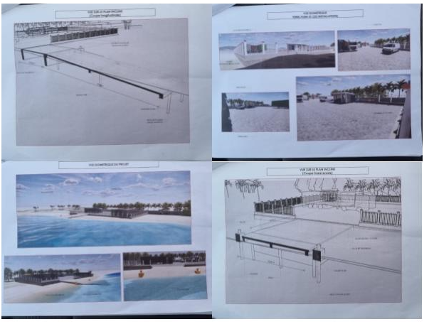
Madagascar - 2.1.7 Port of Manakara
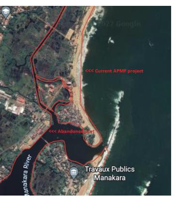
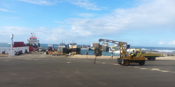
Port Overview
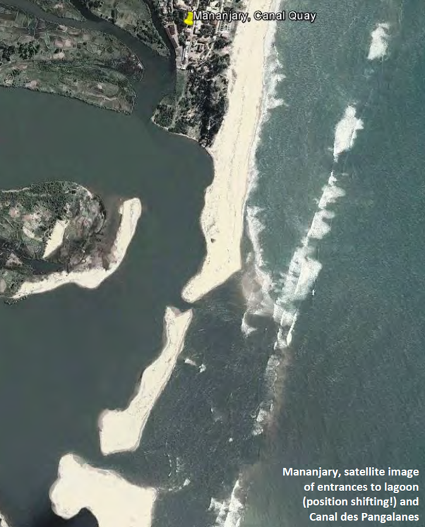
The port of Manakara is situated inside a lagoon which is part of the Canal des Pangalanes. The entrance channel has a depth between 1.5 m (low tide) and 2.5 m (high tide)
In 2013 the bridge connecting the two parts of Manakara town on both sides of the Canal des Pangalanes collapsed under a truck. Repair has been done and the bridge is functional..
Of the port’s warehouses (offering a total storage space of 4,700 m²) three are in relatively good condition. The remaining would need to be rehabilitated
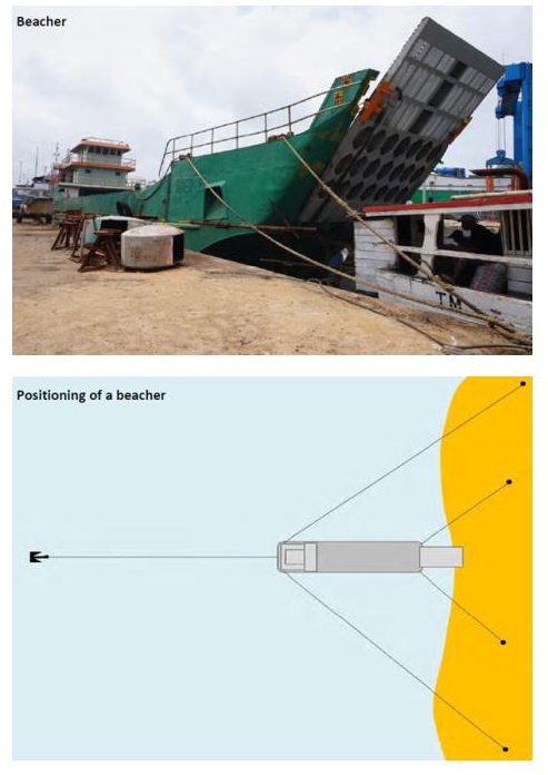
Beaching operations have been conducted on several sites in and around Manakara. Using landing crafts remains the most feasible option as long as the channel into the lagoon is not dredged and maintained on a sufficient depth for barge operations.
Key port information can also be found at: Maritime Database information on Madagascar
|
Port Location and Contacts |
|
|---|---|
|
Country |
Madagascar |
|
Province or District |
Fianarantsoa |
|
Town or City (Closest location) with Distance (km) |
Name: Manakara km: n/a |
|
Port's Complete Name |
Port of Manakara |
|
Latitude |
-22.15196 |
|
Longitude |
48.02455 |
|
Managing Company or Port Authority (If more than one operator, break down by area of operation) |
APMF |
|
Management Contact Person |
Mr Lova +26132421718 |
|
Closest Airport and Frequent Airlines to / from International Destinations |
Airport Name: Aerodrome d’Ambokala (2 km) Airlines: n/a |
Port Picture
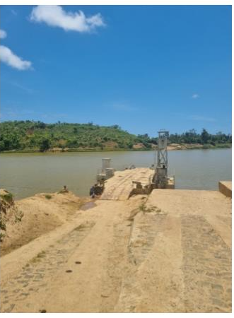
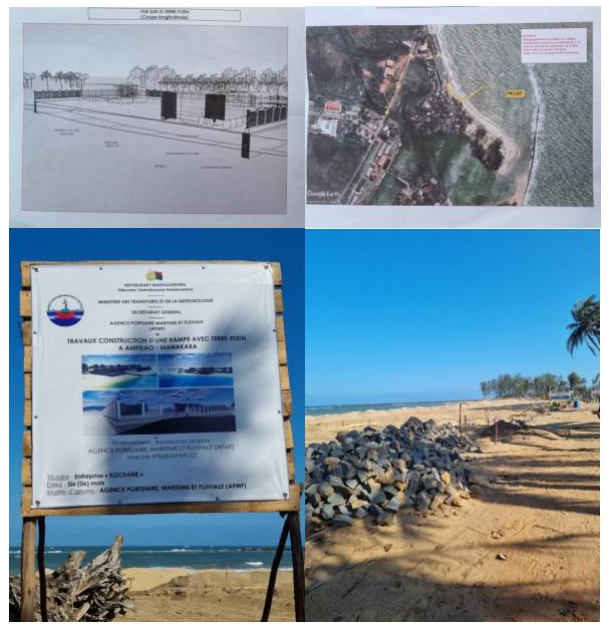
The APMF is currently rehabilitating the access for the boats: (6 months project started 07/11/2022)
Description and Contacts of Key Companies
For information on Madagascar Port of Manakara contact details, please see the following link: 4.2.3 Madagascar Port and Waterways Company Contact List
Port Performance
Lighthouses are in existence. Gutted of their lighting equipment they still offer orientation during daytime and facilitate the passage through the coastal reef.
Standard procedure for the beachers is to approach the shore bow first, dropping a stern anchor in safe distance to the shore while still going slow ahead and letting out chain. Two forelines are brought out to the beach and made fast on sand anchors or other suitable objects. Once the beacher is in position two aft-springs are put in position and the ramp is lowered onto the beach.
|
Seasonal Constraints |
Yes / No |
From <month> to <month> |
|---|---|---|
|
Other: Cyclone Season |
Yes | December to April |
Berthing Specifications
|
Type of Berth |
Quantity |
Length (m) |
Maximum Draft (m) |
|---|---|---|---|
|
Conventional Berth |
1 | 380 (but blocked by bridge) | 1.5 |
Port Handling Equipment
|
Equipment |
Available (Yes / No) |
|---|---|
|
Dockside Crane |
No |
|
Container Gantries |
No |
|
Mobile Cranes |
No |
|
Reachstacker |
No |
|
RoRo Tugmaster (w/ Trailer) |
No |
|
Grain Elevator w/ Bagging Machines |
No |
|
Transtrainer |
No |
|
Forklifts |
No |
Customs Guidance
For information on Madagascar Customs details, please see the following link: 1.3 Madagascar Customs Information
Terminal Information
Main Storage Terminal
|
Storage Type |
Area (square meters) |
|---|---|
|
General Cargo |
4,700 to be rehabilitated |
Hinterland Information
Manakara is connected to Fianarantsoa (on RN7) by railway. While there used to be two trains daily the service is down to two trains a week, creating a notable drop of trade and tourism.
Madagascar - 2.1.8 Port of Antalaha
Port Overview
The port of Antalaha is the second biggest of the SAVA region after Vohemar.
This port is not able to receive containers or to do international shipment but local cabotage with Toamasina and local product transfer (vanilla, cloves…) ensure enough activity to keep the port busy all year long.
The SAMA Company (Henry Fraise subsidiary) is in charge of the port management.
While the port is still operational, it suffers of a lack of maintenance and the SAMA is advocating to get funds to consolidate and rehabilitate the berths.
The port is also suffering with a silting problem at the docking ramp level and needs to be dragged to receive bigger “beachers” boats.
Today, because of the shallow waters, only vessels with a draft of less than 1m80 can berth in Antalaha.
RoRo operation is possible with side- and quarter-ramp vessels.
Port website: This port has no specific website
Key port information may also be found at: Port of Antalaha MGANM map, contact details and vessel arrivals by Maritime Database (maritime-database.com)
|
Port Location and Contact |
|
|---|---|
|
Country |
Madagascar |
|
Province or District |
Antsiranana |
|
Nearest Town or City with Distance from Port |
Antalaha N/A |
|
Port's Complete Name |
Port of ANTALAHA |
|
Latitude |
-14.901217° |
|
Longitude |
50.282216° |
|
Managing Company or Port Authority
|
SAMA (Société D’Acconage et de Manutention d’Antalaha) |
|
Management Contact Person |
APMF Port Officer : Mr RAKOTONIRINA Alain +26132 07 160 64 |
|
Nearest Airport and Airlines with Frequent International Arrivals/Departures |
Sambava Airport: 90 km Only domestic flights Antananarivo and Antsiranana
|
Port Picture
Description and Contacts of Key Companies
The SAMA has the global concession and manages all types of activities at the port level: safety, handling, and material / facilities management.
For more information on port contacts, please see the following link: 4.4 Port and Waterways Companies Contact List.
Port Performance
|
Seasonal Constraints |
||
|---|---|---|
|
|
Occurs |
Time Frame |
|
Rainy Season |
Yes |
From December to June |
|
Major Import Campaigns |
No |
n/a |
|
Other Comments |
Cyclonic season from February to May |
|
|
Handling Figures for 2022 |
|
|---|---|
|
Vessel Calls |
384 |
|
Container Traffic (TEUs) |
N/A |
|
Handling Figures Bulk and Break Bulk for 2022 |
|
|---|---|
|
Bulk (MT) |
29 000 |
|
Break bulk (MT) |
|
Discharge Rates and Terminal Handling Charges
See point 2.1 Port Assessment for the reference price list
Berthing Specifications
|
Type of Berth |
Quantity |
Length (m) |
Maximum Draft (m) |
Comments |
|---|---|---|---|---|
|
Conventional Berth |
2 |
115 m 62 m |
1 m 80 |
N/A |
|
Container Berth |
N/A |
N/A |
N/A |
N/A |
|
Silo Berth |
N/A |
N/A |
N/A |
N/A |
|
Berthing Tugs |
N/A |
N/A |
N/A |
N/A |
|
Water Barges |
N/A |
N/A |
N/A |
N/A |
General Cargo Handling Berths
|
Cargo Type |
Berth Identification |
|---|---|
|
Imports - Bagged Cargo |
Main quay |
|
Exports - Bagged Cargo |
Main Quay |
|
Imports and Exports - RoRo |
N/A |
|
Other Imports |
N/A |
Port Handling Equipment
Is the port equipment managed by the government or privately? Governement APMF
The port equipment and facilities are owned by SAMA (privately) and are managed by its own staff.
|
Equipment |
Available
|
Total Quantity and Capacity Available |
Comments on Current Condition and Actual Usage |
|---|---|---|---|
|
Dockside Crane |
No |
N/A |
N/A |
|
Container Gantries |
No |
N/A |
N/A |
|
Mobile Cranes |
Yes |
2 x 3t |
Conventional mobile crane (small), of low capacity, in good condition, used for handling assistance. |
|
Reachstacker |
No |
N/A |
N/A |
|
RoRo Tugmaster (with Trailer) |
No |
N/A |
N/A |
|
Grain Elevator with Bagging Machines |
No |
N/A |
N/A |
|
Transtainer |
No |
N/A |
N/A |
|
Forklifts |
No |
N/A |
N/A |
Container Facilities
|
Facilities |
20 ft |
40 ft |
|---|---|---|
|
Container Facilities Available |
N/A |
|
|
Container Freight Station (CFS) |
||
|
Refrigerated Container Stations |
||
|
Other Capacity Details |
N/A |
|
|
Daily Take Off Capacity |
||
|
Number of Reefer Stations |
||
|
Emergency Take-off Capacity |
||
|
Off take Capacity of Gang Shift |
||
Customs Guidance
Customs are available on site; they are mainly doing the regulation of loading and unloading.
For more information on customs in Madagascar, please see the following link: 1.3 Customs Information here.
Terminal Information
MULTIPURPOSE TERMINAL
The 2 conventional berth on the level of the port can received all types of cargo: bagged cargo, break-bulk and bulk.
GRAIN AND BULK HANDLING
All activities of grain and bulk handling are done manually by Dockers, with possibility of a crane assistance.
MAIN STORAGE TERMINAL
SAMA has a warehouse located nearest at the port for temporary storage of FRETs. This is in good condition, accessible to trucks and can store all categories of conventional cargo (which does not require specific installation). The storage cost is 5000 Ar / Tonnes / 15 days.
|
Storage Type |
Number of Storage Facilities |
Area (m2) |
|---|---|---|
|
Bagged and General Cargo |
1 |
200 m2 (500T max) |
|
Refrigerated Cargo |
None |
n/a |
Stevedoring
All handling activities / stevedoring at the level of the port can either be done by SAMA either by the receiver but SAMA rates are much higher than if negotiated directly with the Dockers.
Hinterland Information
The Antalaha port is only connected to the hinterland destinations by road within the SAVA region.
All types of truck can have access on the port and his berth.
Port Security
|
Security |
|
|---|---|
|
ISPS Compliant |
No |
|
Current ISPS Level |
n/a |
|
Police Boats |
No |
|
Fire Engines |
No |
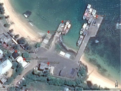
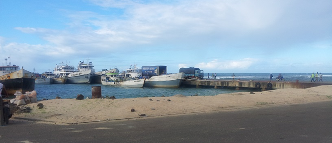
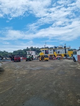
Madagascar - 2.1.9 Port de Sainte Marie
Port Overview
The island of Sainte Marie has 3 port facilities. All essentials, including fuel, food and other needs of the inhabitants, are met by items imported from other ports.
The port has a general cargo quay of 150m with a draft of 4.5m which can accommodate only small cargo ships, weighing no more than 250 tons.
The main facility called Port de l'Ilot Madame handles all imports. There is a second port which is frequented by passenger ships carrying tourists. The third facility is being developed to handle the growing number of cruise ships and to promote tourism on the island.
Goods from the port of Ilot Madame are transported to other parts of the island. However, the process is slow as the facility is congested, with little operational port equipment. Financial constraints have prevented the development of this important but local port.
All type of fuel was previously coming by barrel of 200L but since 2018 the company Logistique Petroliere is providing the fuel for trucks, cars and boats.
For the passengers, several companies are offering boat transfer between Sainte Marie (Bar à Choix) to Soanierana Ivongo or Mahombo with the possibility to continue by road to Toamasina. The full Pointe Sainte Marie crossing has ceased since 2021.
Port website: This port has no specific website available
Key port information may also be found at: http://www.maritime-database.com
|
Port Location and Contact |
|
|---|---|
|
Country |
MADAGASCAR |
|
Province or District |
TOAMASINA |
|
Nearest Town or City with Distance from Port |
Sainte Marie 1 km |
|
Port's Complete Name |
PORT ILOT MADAME DE SAINTE MARIE |
|
Latitude |
-17.003539° |
|
Longitude |
49.846490° |
|
Managing Company or Port Authority |
APMF (Agence Portuaire Maritime et Fluviale) |
|
Management Contact Person |
Mr Fenosoa Michel |
|
Nearest Airport and Airlines with Frequent International Arrivals/Departures |
Sainte Marie Ravohara Airport: 10km Air Madagascar: Antanarivo, La Réunion (No more connection with Toamasina) |
Port Picture
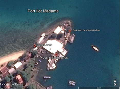
The port has only one berth which limits the number of vessel
The port can receive vessels of 250 t max.
The port is often congested due to the lack of planning and communication within the different actors.
Beach operations with landing crafts can be executed on the south part of the port.
Description and Contacts of Key Companies
Only 1 company is registered at that port :
- SOCIETE DE PECHE DE SAINTE MARIE (SPSM)
Contact : +261 34 35 488 36
For more information on port contacts, please see the following link: 4.4 Port and Waterways Companies Contact List
Port Performance
|
Seasonal Constraints |
||
|---|---|---|
|
Occurs |
Time Frame |
|
|
Rainy Season |
Yes |
From December to June |
|
Major Import Campaigns |
No |
N/A |
|
Other Comments |
Cyclonic season from February to May |
|
|
Handling Figures for 2021 |
|
|---|---|
|
Vessel Calls |
No figures |
|
Container Traffic (TEUs) |
N/A |
|
Handling Figures Bulk and Break Bulk for 2021 |
|
|---|---|
|
Bulk (MT) |
No figures |
|
Break bulk (MT) |
No figures |
Discharge Rates and Terminal Handling Charges
All handling operation are made by manpower, prices have to be negotiated on site with the dockers depending on the weight and packaging of the goods.
Berthing Specifications
|
Type of Berth |
Quantity |
Length (m) |
Maximum Draft (m) |
Comments |
|---|---|---|---|---|
|
Conventional Berth |
1 |
60 |
7 |
Vessels of 250 T max |
|
Container Berth |
N/A |
N/A |
N/A |
N/A |
|
Silo Berth |
N/A |
N/A |
N/A |
N/A |
|
Berthing Tugs |
N/A |
N/A |
N/A |
N/A |
|
Water Barges |
N/A |
N/A |
N/A |
N/A |
General Cargo Handling Berths
|
Cargo Type |
Berth Identification |
|---|---|
|
Imports - Bagged Cargo |
No figures |
|
Exports - Bagged Cargo |
No figures |
|
Imports and Exports - RoRo |
N/A |
|
Other Imports |
N/A |
Port Handling Equipment
The port equipment is managed by the government( APMF)
|
Equipment |
Available |
Total Quantity and Capacity Available |
Comments on Current Condition and Actual Usage |
|---|---|---|---|
|
Dockside Crane |
No |
|
|
|
Container Gantries |
No |
|
|
|
Mobile Cranes |
No |
|
|
|
Reachstacker |
No |
|
|
|
RoRo Tugmaster (with Trailer) |
No |
|
|
|
Grain Elevator with Bagging Machines |
No |
|
|
|
Transtainer |
No |
|
|
|
Forklifts |
No |
|
Container Facilities
No container facilities available
|
Facilities |
20 ft |
40 ft |
|---|---|---|
|
Container Facilities Available |
N/A |
N/A |
|
Container Freight Station (CFS) |
N/A |
N/A |
|
Refrigerated Container Stations |
N/A |
N/A |
|
Other Capacity Details |
N/A |
N/A |
|
Daily Take Off Capacity |
N/A |
N/A |
|
Number of Reefer Stations |
N/A |
N/A |
|
Emergency Take-off Capacity |
N/A |
N/A |
|
Off take Capacity of Gang Shift |
N/A |
N/A |
Customs Guidance
Not on site. the closest office is the airport (10 km)
For more information on customs in Madagascar, please see the following link: 1.3 Customs Information
Terminal Information
MULTIPURPOSE TERMINAL
Platform of 60 meters long available to accommodate medium-sized fishing vessels and cargo vessels. No installation for Ro-Ro ships nor Container ship available.
GRAIN AND BULK HANDLING
No handling facilities available: loading and unloading of goods is done manually.
- No bagging companies
- The SPSM has its own handling tools but only for its needs
MAIN STORAGE TERMINAL
No storage warehouse available
The SPSM has a storage unit but for its exclusive use
|
Storage Type |
Number of Storage Facilities |
Area (m2) |
|---|---|---|
|
Bagged Cargo |
N/A |
N/A |
|
Refrigerated Cargo |
N/A |
N/A |
|
General Cargo |
N/A |
N/A |
Stevedoring
Stowage activities are carried out under the supervision of a crew member (often either the ship's captain or the pointer).
Hinterland Information
Port berth can be accessed by any trucks between 5t and 20t.
Port Security
Nothing has been done in term security, there is no fence, no security guard, no barrier, and anybody can access the berth.
|
Security |
|
|---|---|
|
ISPS Compliant |
No |
|
Current ISPS Level |
N/A |
|
Police Boats |
2 boats from a detachment of the navy, they can patrol with an APMF staff if necessary |
|
Fire Engines |
No |
Madagascar - 2.1.10 Port of Maroantsetra
Port Overview
Maroantsetra is one of the most isolated places in Madagascar.
Unreachable by road, the area is very dependent on its port. Unlikely, there are no suitable facilities, and the two small ports are on a river channel and only accessible when the tide is high.
The two ports are called Ankiakabe and Anjahanambo.
The access of these ports depends on the tide level. The water draft is 1.5 meter only on low tide and until 3 meters on high tide.
At the high tide, the port of Anjahanambo allowed 40MT vessel maximum and 300MT maximum for Ankiakabe.
For the port of Anjahanambo, vessels whose tonnage exceeds 40MT can’t access the berth because of the mouth and must transship goods at the level of Nosy Mangabe Island (7km from coast of Maroantsetra)
The two ports are specialized on bulk and break-bulk handling and not are of course suitable for container handling.
All handling activities are done manually by day workers paid directly by vessels owner or the carrier.
The APMF plans to build a dock in andranonangozy (not started)
Port website: This port has no website available
Key port information may also be found at: http://www.maritime-database.com
|
Port Location and Contact |
|
|---|---|
|
Country |
Madagascar |
|
Province or District |
Tamatave |
|
Nearest Town or City with Distance from Port |
Maroantsetra : 3km from Ankiakabe 1 km from Anjahanambo |
|
Port's Complete Name |
Port of Ankiakabe Port of Anjahanambo |
|
Latitude |
Ankiakabe : -15.430748° Anjahanambo : -15.440622° |
|
Longitude |
Ankiakabe : 49.758325° Anjahanambo : 49.742230° |
|
Managing Company or Port Authority
|
Agence Portuaire Maritime et Fluviale de Madagascar (APMF) |
|
Management Contact Person |
APMF Regional director Mr Arlo Soandro +261 32 11 25 724
|
|
Nearest Airport and Airlines with Frequent International Arrivals/Departures |
Maroantsetra Airport Regular flights ex Antananarivo each Monday and Friday. |
Port Picture
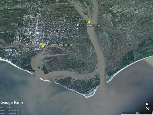
Port of Ankiakabe
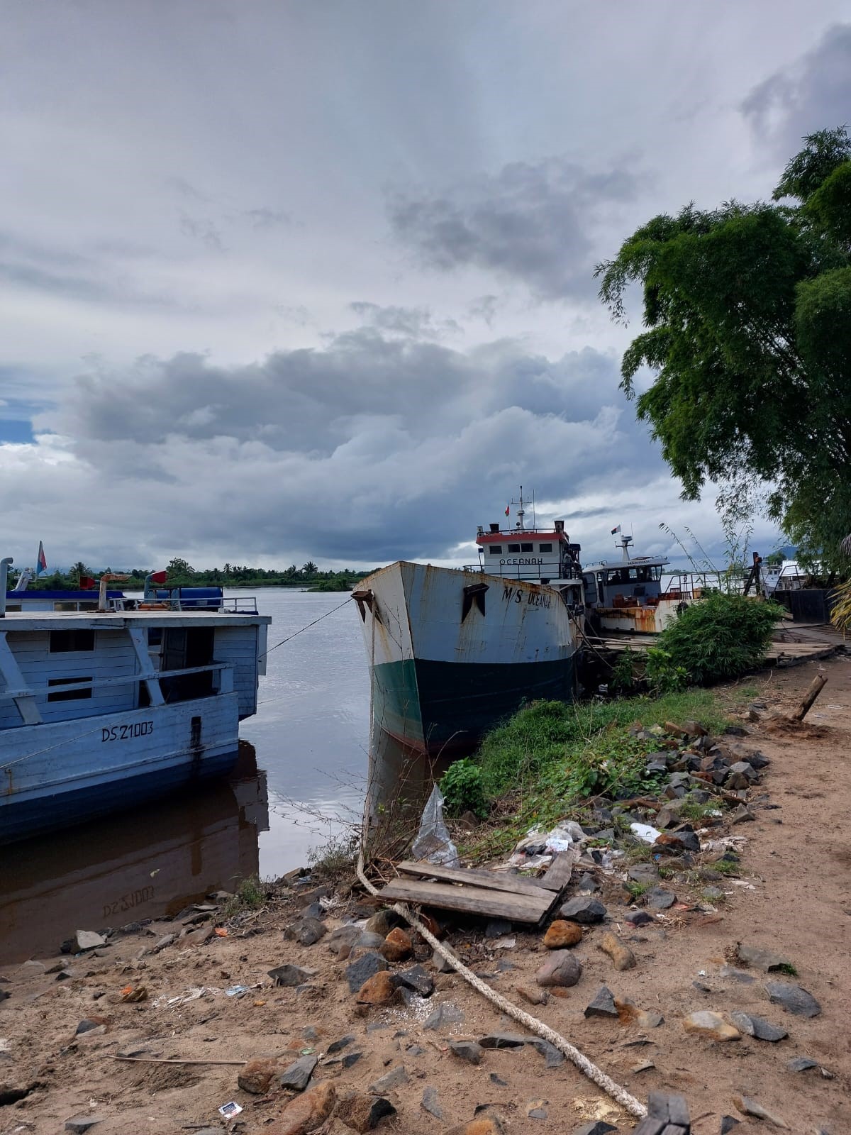
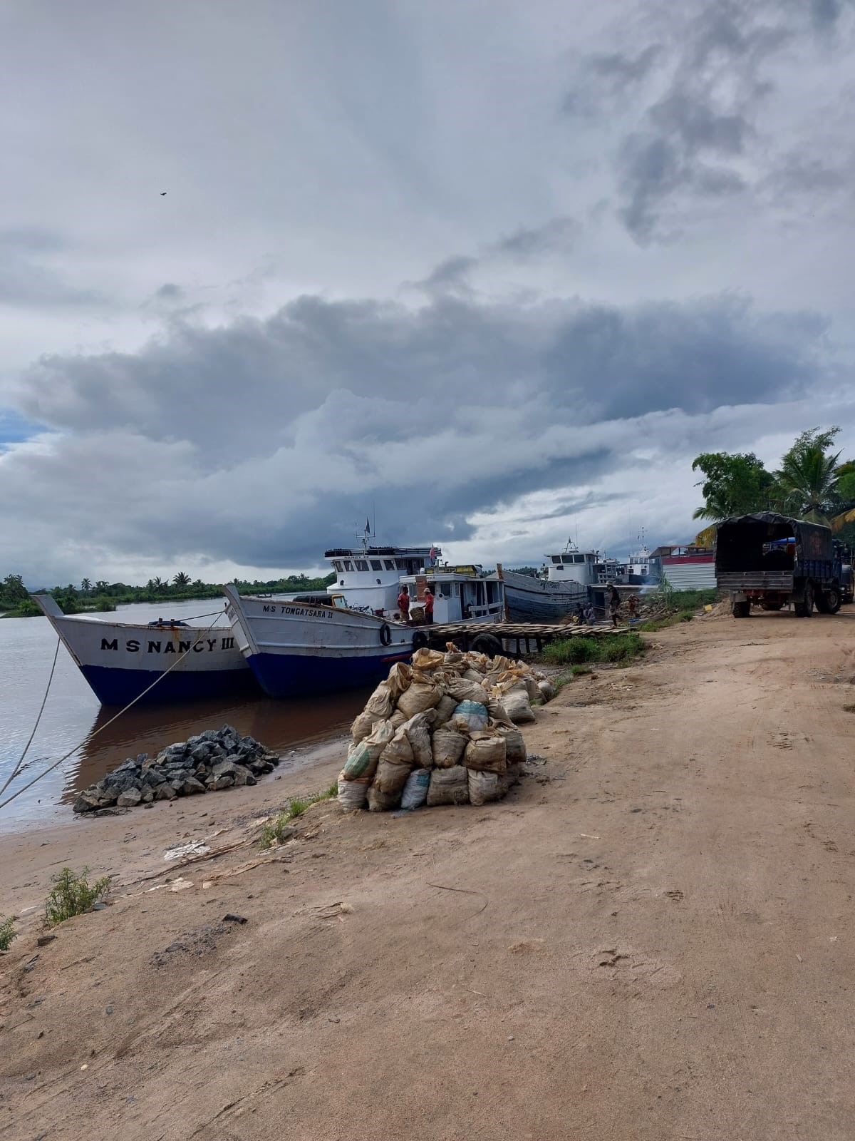
Port of Anjahanambo
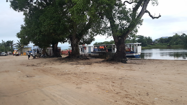
Description and Contacts of Key Companies
The main is the company Dounia
BE Berchmans Jean
DGA
DOUNIA GROUPE S.A
+261 32 05 346 00
|
DESIGNATION MARCHANDISES |
COLISSAGE |
MAROANTSETRA-TAMATAVE |
TAMATAVE-MAROANTSETRA |
|---|---|---|---|
|
|
|
|
|
|
RIZ |
SAC |
200 Ar/kg |
200 Ar/kg |
|
SUCRE |
SAC |
200 Ar/kg |
200 Ar/kg |
|
FARINE |
SAC |
200 Ar/kg |
200 Ar/kg |
|
CIMENT |
SAC |
200 Ar/kg |
200 Ar/kg |
|
SEL |
SAC |
200 Ar/kg |
200 Ar/kg |
|
EPICE |
SAC |
200 Ar/kg |
200 Ar/kg |
|
GAZ |
BOUTEILLE |
600 Ar/kg |
600 Ar/kg |
|
HUILE |
BIDON |
600 Ar/kg |
600 Ar/kg |
|
HUILE |
CARTON |
600 Ar/kg |
600 Ar/kg |
|
BISCUIT |
CARTON |
600 Ar/kg |
600 Ar/kg |
|
MARCHANDISES DIVERSES |
|
600 Ar/kg |
600 Ar/kg |
|
TOLE |
|
1 000 Ar/mètre |
1 000 Ar/mètre |
|
MATELAS 1 PLACE |
|
10 000 Ar/Pièce |
10 000 Ar/Pièce |
|
MATELAS 2 PLACES |
|
20 000 Ar/Pièce |
20 000 Ar/Pièce |
|
PLANCHE |
|
1 000 Ar/mètre |
1 000 Ar/mètre |
|
|
|
|
|
|
PASSGERS |
|
120 000 Ar/Personne |
120 000 Ar/Personne |
|
|
|
|
|
|
Boats available : |
|
|
|
|
. 1 x 200 MT |
|
|
|
|
. 1 x 250 MT |
|
|
|
|
. 1 x 300 MT |
|
|
|
|
. 1 x 500 MT |
|
|
|
Unregistered small boats are also available (see with the Agence Portuaire Maritime et Fluviale de Madagascar APMF) with the following prices per Pax from Maroantsetra :
-
Tamatave 500 000 Ar
-
Mananara 250 000 Ar
-
Antalaha 750 000 Ar
-
Sainte Marie 400 000 Ar
|
NOM DE L'ENTREPRISE ou NOM DU NAVIRE |
DESTINATIONS AU DEPART DE MAROANTSETRA |
NOM DU MANAGER |
CONTACT |
|---|---|---|---|
|
ESPERANCE III |
Foulpointe |
Mr RAHALISON Justin Philippe |
032 64 929 71 |
|
ESPERANCE III |
Toamasina |
Mr RAHALISON Justin Philippe |
032 64 929 71 |
|
MELISSA EXPRESS III |
Foulpointe |
Mr HARISON Thierry |
032 02 073 64 |
|
FANTASTIC |
Mananara Nord |
Mr EDDY Michel |
032 02 351 85 |
|
ROXANA II |
Toamasina |
Mr TIANDRAZANA Jean Jacques |
032 43 314 64 |
|
ROXANA III |
Toamasina |
Mr TIANDRAZANA Jean Jacques |
032 43 314 64 |
|
MANJAKELY |
Mananara Nord |
Mr KWONG Eugéne |
034 05 885 11 |
|
PRESTIGE IV |
Toamasina |
Mr KWONG Eugéne |
034 05 885 11 |
|
SALAH |
Toamasina |
Mr SALEH Sylvio |
034 45 151 13 |
|
MARINAH |
Toamasina |
Mr RAZAFINDRAKOTO Iouri Garisse |
033 12 118 73 |
|
MAGNEVA |
Toamasina |
Mr RAZAFINDRAKOTO Iouri Garisse |
033 12 118 73 |
|
OCEANAH |
Toamasina |
Mr INGAHIBE Hermann |
032 70 060 57 |
|
NANCY III |
Toamasina |
Mr RAVELOSON Autin |
032 77 004 42 |
|
TONGATSARA II |
Mananara Nord |
Mr RAVELOSON Autin |
032 77 004 42 |
|
TIANYA |
Toamasina |
Mr INTEMA Antoine |
032 07 220 70 |
|
JENNY II |
Toamasina |
Mr TIANDRAZANA Jean Jacques |
034 55 866 56 |
|
STEPHANOT MELODY |
Antalaha |
Mr BELALAHY Jean Felix |
032 04 150 93 |
|
YOANN |
Toamasina |
Sté DOUNIA SARL |
032 05 952 75 |
|
ROMUNA II |
Toamasina |
Mr IBE Jerôme Pierre |
032 49 513 26 |
|
SEA HORSE I |
Foulpointe |
Mr MAXENE Canton |
032 07 733 56 |
|
RAYAN MICHEL |
Toamasina |
Mr DAHY Marco |
032 04 897 06 |
|
MEVA V |
Toamasina |
Mr MOURAD Ismael |
034 20 274 13 |
|
MANAMBOLOSY EXPRESS |
Mananara Nord |
Mr DESCOMBE Samson |
034 47 367 17 |
|
BIG SAMY |
Antalaha |
Mme RASOARINETY Marie Hortensia |
032 77 078 27 |
|
LUTCHIANA |
Toamasina |
Mr SOAZILINY Bestine |
|
|
ARSHANAH |
Mananara Nord |
Mme VOLAZAKA Natacha |
032 77 539 91 |
|
POUR LA VIE |
Foulpointe |
Mr HERY Dominique |
032 07 733 56 |
|
JASON |
Toamasina |
Mr DJISTERA Mario |
032 97 184 55 |
|
PAPRIKA + BARGE XIII |
Toamasina |
Mr RABEARIVELO Francaire |
032 02 504 06 |
For more information on port contacts, please see the following link: 4.4 Port and Waterways Companies Contact List.
Port Performance
There are no facilities or equipment in the two ports; all activities are made by daily workers.
As the ports are the economic powerhouse of the area, they are most of the time crowded with loading/unloading activities every day.
Vessels carrying humanitarian freight may have priority for access to the berth, but it needs to be discussed beforehand with the local authorities (via the APMF)
|
Seasonal Constraints |
||
|---|---|---|
|
|
Occurs |
Time Frame |
|
Rainy Season |
No |
From November to April |
|
Major Import Campaigns |
No |
n/a |
|
Other Comments |
Cyclonic season from February to May |
|
|
Handling Figures for 2022 |
|
|---|---|
|
Vessel Calls |
475 |
|
Container Traffic (TEUs) |
N/A |
|
Handling Figures Bulk and Break Bulk for 2022 |
|
|---|---|
|
Bulk (MT) |
37 000 MT for the 2 ports |
|
Break bulk (MT) |
|
Discharge Rates and Terminal Handling Charges
All handling activities / stevedoring at the level of the port are managed directly by carriers or vessels owner and have his own discharge rates and terminal handling charges.
(250 000Ar per 10MT in average)
Rates applicable in the ports of Maroantsetra for loading and unloading activities (by APMF)
- Loading charges: 0,23$ per ton
- Unloading charges: 0,50$ per ton
Berthing Specifications
|
Type of Berth |
Quantity |
Length (m) |
Maximum Draft (m) |
Comments |
|---|---|---|---|---|
|
Conventional Berth |
Ankiakabe : 1 |
n/a |
1m80 (300MT max) on high tide |
No berth but one docking ramp |
|
Conventional Berth |
Anjahanambo : 1 |
85 m |
1m50 (40MT max) on high tide |
|
|
Container Berth |
N/A |
|
|
|
|
Silo Berth |
N/A |
|
|
|
|
Berthing Tugs |
1 |
|
|
Belongs to the company DOUNIA +261 32 05 346 00
|
|
Water Barges |
N/A |
|
|
|
General Cargo Handling Berths
|
Cargo Type |
Berth Identification |
|---|---|
|
Imports - Bagged Cargo |
Ciment, riz blanc, farine, pois du cap (venant du Toamasina) Importations - Cargaison en sac
|
|
Exports - Bagged Cargo |
Girofle, vanille (Envoi pour Toamasina) Exportations - Cargaison en sac
|
|
Imports and Exports - RoRo |
N/A |
|
Other Imports |
Produit STAR, Huile en bidon ou caste, Tôle (venant de Toamsina) Autres importations |
Port Handling Equipment
Is the port equipment managed by the government or privately? Government APMF
Manpower only. No handling equipment.
Container Facilities
No container facilities available
Customs Guidance
The Customs Officer in Maroantsetra does not monitor the goods on board.
Office opening hours from 8:00 to 12:00 and from 14:30 to 18:00.
The office is located next to the Office of TVM – RNM (Television Malagasy- Radio National Malagasy) Ambatomasina
For more information on customs in MADAGASCAR, please see the following link: 1.3 Customs Information.
Terminal Information
MULTIPURPOSE TERMINAL
The two Maroantsetra ports can received all types of cargo: bagged cargo, break-bulk and bulk.
GRAIN AND BULK HANDLING
Manpower only. People hired directly at the port.
Direct bagging from the unloading of the ship is possible but at the expense of the owner of goods
MAIN STORAGE TERMINAL
There are no storage facilities at the ports level.
The goods/cargo are directly received by their owner and load on vehicles straight after vessels unloading.
|
Storage Type |
Number of Storage Facilities |
Area (m2) |
|---|---|---|
|
Bagged Cargo |
N/A |
N/A |
|
Refrigerated Cargo |
N/A |
N/A |
|
General Cargo |
N/A |
N/A |
Stevedoring
There is no stevedoring company.
Hinterland Information
Trucks less than 10MT are the only ones able to access ports.
Port Security
|
Security |
|
|---|---|
|
ISPS Compliant |
No |
|
Current ISPS Level |
N/A |
|
Police Boats |
No |
|
Fire Engines |
No |
Madagascar - 2.1.11 Port of Ankify
Port Overview
The port of Ankify is the gateway of the island of Nosy be for all persons or goods coming from Madagasacar.
The port is quite well organized, and offer different transport services such as rapid shuttle for tourists, regular transport of person with motor boat, BAC for the transport of vehicles and commodities and cargo dedicated boats.
To avoid too much competition, the transporters are grouped in an association called GOTMANO (Groupement des Transporteurs d’Ankify Nosy Be), the prices are fix and the boats leave the port according to a pre-established schedule.
The APMF is on site both in Ankify and in Nosy be and remain the port authority.
A crossing between Ankify and Nosy be takes around 1 hour. Even if during the trip, coasts are always visible, and it is recommended to travel on the morning when the sea is calm. All the boats transporting peoples have life jacket on board.
Port website: No specific link for this port
Key port information may also be found at: http://www.maritime-database.com
|
Port Location and Contact |
|
|---|---|
|
Country |
MADAGASCAR |
|
Province or District |
Antsiranana |
|
Nearest Town or City with Distance from Port |
Ambanja 25 km |
|
Port's Complete Name |
Ankify port |
|
Latitude |
-13.557351° |
|
Longitude |
48.370003° |
|
Managing Company or Port Authority |
AMPF (Agence Portuaire Maritime et Fluviale) |
|
Management Contact Person |
APMF director based in Nosy Be Capitaine de vaisseau RATSIMBA Eric APMF representant in Ankify Mr angelot |
|
Nearest Airport and Airlines with Frequent International Arrivals/Departures |
Nosy Be - Facène International Airport Air Madagascar : Antananarivo, Mahajanga, EWA Air : Mamoudzou, Mayotte Meridiana : Milan, Italie Neos S.P.A.: Rome, Italie Air Austral : Saint-Denis, La Réunion |
Port Picture
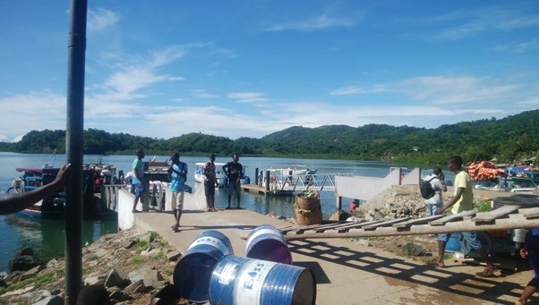
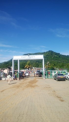
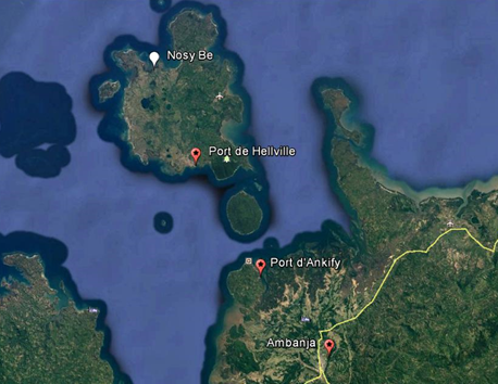
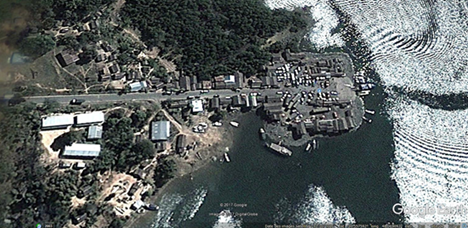
Description and Contacts of Key Companies
GOTMANO: Boat owner association working in-between Ankify and Nosy Be leaded by Nosy Be mayor.
Maire de Nosy Be : +261 32 43 303 28
Mr Simon: +261 32 77 332 51
Cotrasma: Boat owner association working in-between Ankify and Nosy Be
Contact: Mr Narlice: +261 32 80 903 03
The two association of boat owner have around 80 boats.
For more information on port contacts, please see the following link:4.4 Port and Waterways Companies Contact List
Port Performance
Even if the Ankify port is most of the time crowded, it has not vocation to receive any good, it is only an access point to Nosy Be for the peoples and a supply point for the locally purchased items to reach the island.
There are 10 wooden transport vessel with a capacity of 30t , 6 barges with a capacity of 40t. they have an average of 40 to 100 trips per day in total.
There are no import/export activities in Ankify.
|
Seasonal Constraints |
||
|---|---|---|
|
Occurs |
Time Frame |
|
|
Rainy Season |
Yes |
From December to June |
|
Major Import Campaigns |
No |
N/A |
|
Other Comments |
Navigation must have approbation of APMF during rainy season |
|
|
Handling Figures for 2021 |
|
|---|---|
|
Vessel Calls |
n/a |
|
Container Traffic (TEUs) |
n/a |
Discharge Rates and Terminal Handling Charges
N/A
Berthing Specifications
|
Type of Berth |
Quantity |
Length (m) |
Maximum Draft (m) |
Comments |
|---|---|---|---|---|
|
Conventional Berth |
3 1 |
2*8 20*35 |
4 m |
|
|
Container Berth |
none |
N/A |
N/A |
|
|
Silo Berth |
none |
N/A |
N/A |
|
|
Berthing Tugs |
none |
N/A |
N/A |
|
|
Water Barges |
none |
N/A |
N/A |
|
General Cargo Handling Berths
|
Cargo Type |
Berth Identification |
|---|---|
|
Imports - Bagged Cargo |
n/a |
|
Exports - Bagged Cargo |
n/a |
|
Imports and Exports - RoRo |
n/a |
|
Other Imports |
n/a |
Port Handling
The port equipment is managed by the government (APMF).
There is no handling equipment, everything is done by manpower.
|
Equipment |
Available |
Total Quantity and Capacity Available |
Comments on Current Condition and Actual Usage |
|---|---|---|---|
|
Dockside Crane |
No |
||
|
Container Gantries |
No |
||
|
Mobile Cranes |
No |
||
|
Reachstacker |
No |
||
|
RoRo Tugmaster (with Trailer) |
No |
||
|
Grain Elevator with Bagging Machines |
No |
||
|
Transtainer |
No |
||
|
Forklifts |
No |
Container Facilities
|
Facilities |
20 ft |
40 ft |
|---|---|---|
|
Container Facilities Available |
N/A |
N/A |
|
Container Freight Station (CFS) |
N/A |
N/A |
|
Refrigerated Container Stations |
N/A |
N/A |
|
Other Capacity Details |
N/A |
N/A |
|
Daily Take Off Capacity |
N/A |
N/A |
|
Number of Reefer Stations |
N/A |
N/A |
|
Emergency Take-off Capacity |
N/A |
N/A |
|
Off take Capacity of Gang Shift |
N/A |
N/A |
Customs Guidance
Customs are not available on site. The closest office is at Nosy Be port level.
For more information on customs in MADAGASCAR, please see the following link: 1.3 Customs Information
Terminal Information
MULTIPURPOSE TERMINAL
N/A
GRAIN AND BULK HANDLING
By manpower only
MAIN STORAGE TERMINAL
There are no facilities for storage but 2 large-paved platforms of 3000 m2 and 3095 m2 also usable if needed (reserved for future constructions)
|
Storage Type |
Number of Storage Facilities |
Area (m2) |
|---|---|---|
|
Bagged Cargo |
0 |
N/A |
|
Refrigerated Cargo |
0 |
N/A |
|
General Cargo |
0 |
N/A |
Stevedoring
Stevedoring by ropes
Hinterland Information
Port berth can be accessed by small trucks (max 20t).
Port Security
|
Security |
|
|---|---|
|
ISPS Compliant |
No |
|
Current ISPS Level |
N/A |
|
Police Boats |
No |
|
Fire Engines |
No |
Madagascar - 2.1.12 Port of Morondava
Port Overview
Morondava port is situated in a lagoon bordered by mangroves and frequented by wooden, gaff rigged “boutres.” Dhow. The small vessels fall dry in front of the 110 m long quay at low water.
The maximum draft for the Eliot Channel connecting the port with the open sea and the anchorage for larger vessels is given at 2.5 m (low tide).
A lighthouse at the southern shore of the channel entrance provides navigation guidance to the anchorage.
Arrival and departure at and from the port, which falls dry on low tide, is only possible at high tide.
Key port information may also be found at: Port of Morondava MGMOQ map, contact details and vessel arrivals by Maritime Database (maritime-database.com)
|
Port Location and Contact |
|
|---|---|
|
Country |
Madagascar |
|
Province or District |
Toliara |
|
Nearest Town or City with Distance from Port |
Morondava N/A |
|
Port's Complete Name |
Port bebe Morondava |
|
Latitude |
-20.293974° |
|
Longitude |
44.272302° |
|
Managing Company or Port Authority
|
APMF (Agence Portuaire Maritime et Fluviale) |
|
Management Contact Person |
Directeur Régional APMF Mr Ratovonjanahary Pascal +261 321125720 (Will be retired in August 2023. Replacement not yet confirmed) |
|
Nearest Airport and Airlines with Frequent International Arrivals/Departures |
Morondava Airport Only domestic flights |
Port Picture
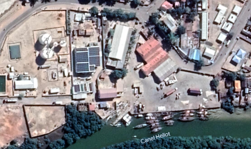
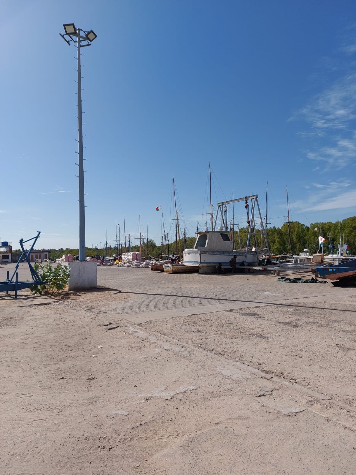
Description and Contacts of Key Companies
SOPEMO : Fishing
This company has 13 boats and stocks under negative temperature,
They exported 850 t of products in 2022.
Director : Mr Zacharie 034 20 803 86
Infrastructure available:
- Elevator that can lift 2 tons
- Tanker water tank of 120 M3
- 02 Cold rooms with capacity 600 t
22 m x12 m x 7 m (x 2)
Can produce 500kg/h of ice
For more information on port contacts, please see the following link: 4.4 Port and Waterways Companies Contact List.
Port Performance
|
Seasonal Constraints |
||
|---|---|---|
|
|
Occurs |
Time Frame |
|
Rainy Season |
Yes |
From December to May |
|
Major Import Campaigns |
No |
N/A |
|
Other Comments |
Cyclonic season from February to April |
|
|
Handling Figures for 2022 |
|
|---|---|
|
Vessel Calls |
170 |
|
Container Traffic (TEUs) |
N/A |
|
Handling Figures Bulk and Break Bulk for 2022 |
|
|---|---|
|
Bulk (MT ) and Break bulk (MT) |
480 |
Discharge Rates and Terminal Handling Charges
See point 2.1 Port Assessment for the reference price list
Berthing Specifications
|
Type of Berth |
Quantity |
Length (m) |
Maximum Draft (m) |
Comments |
|---|---|---|---|---|
|
Conventional Berth |
1 |
105 |
2.5 (high tide) |
Allowed around 20 boats to berth at the same time |
|
Container Berth |
N/A |
N/A |
N/A |
N/A |
|
Silo Berth |
N/A |
N/A |
N/A |
N/A |
|
Berthing Tugs |
N/A |
N/A |
N/A |
N/A |
|
Water Barges |
N/A |
N/A |
N/A |
N/A |
General Cargo Handling Berths
|
Cargo Type |
Berth Identification |
|---|---|
|
Imports - Bagged Cargo |
Main quay |
|
Exports - Bagged Cargo |
Main quay |
|
Imports and Exports - RoRo |
N/A |
|
Other Imports |
N/A |
Port Handling Equipment
Is the port equipment managed by the government or privately? Government APMF
|
Equipment |
Available
|
Total Quantity and Capacity Available |
Comments on Current Condition and Actual Usage |
|---|---|---|---|
|
Dockside Crane |
No |
N/A |
N/A |
|
Container Gantries |
No |
N/A |
N/A |
|
Mobile Cranes |
No |
N/A |
N/A |
|
Reachstacker |
No |
N/A |
N/A |
|
RoRo Tugmaster (with Trailer) |
No |
N/A |
N/A |
|
Grain Elevator with Bagging Machines |
No |
N/A |
N/A |
|
Transtainer |
No |
N/A |
N/A |
|
Forklifts |
Yes |
1 x 2 T |
Good condition |
Container Facilities
No container facilities available
|
Facilities |
20 ft |
40 ft |
|---|---|---|
|
Container Facilities Available |
N/A |
N/A |
|
Container Freight Station (CFS) |
N/A |
N/A |
|
Refrigerated Container Stations |
N/A |
N/A |
|
Other Capacity Details |
N/A |
N/A |
|
Daily Take Off Capacity |
N/A |
N/A |
|
Number of Reefer Stations |
N/A |
N/A |
|
Emergency Take-off Capacity |
N/A |
N/A |
|
Off take Capacity of Gang Shift |
N/A |
N/A |
Customs Guidance
Customs are available on site mainly to control the exportations of the SOPEMO, they have to be informed at least one day in advance if services are needed.
For more information on customs in Madagascar, please see the following link: 1.3 Customs Information.
Terminal Information
MULTIPURPOSE TERMINAL
N/A
GRAIN AND BULK HANDLING
There is no equipment at port level, the handling is only done by accredited daily workers always available at the port on a fix rate: 1250 MGA / t.
MAIN STORAGE TERMINAL
Warehouses are available at the port level for the price of 4000 MGA / t / month.
Refrigerated cargo is only available at the SOPEMO level.
|
Storage Type |
Number of Storage Facilities |
Area (m2) |
|---|---|---|
|
Bagged and General Cargo |
5 warehouses |
1280 |
|
Refrigerated Cargo |
2 |
528 |
Stevedoring
No agency or stevedoring company is still in existence; work force has to be contracted individually.
Hinterland Information
Port is linked by the accessible by the RN 35 / 34 / 7 to the capital.
All type of truck can access the berth as long as the port manager has been informed.
Port Security
|
Security |
|
|---|---|
|
ISPS Compliant |
No |
|
Current ISPS Level |
N/A |
|
Police Boats |
No |
|
Fire Engines |
No |
Madagascar - 2.1.13 Port of Antsohihy
Port Overview
The port of Antsohihy is situated on the river bank and its only function is to ensure the connection with the district of Analalava (population estimated at more than 100’000 inhab.) Analalava is located about 60 km northwest and is only accessible this way.
Departures are daily passengers/goods.
The boats are mostly “boutres”, (local wooden made), and the goods that transit are bagged or packaged in small quantities.
Port website: This port has no website available
Key port information may also be found at: http://www.maritime-database.com
|
Port Location and Contact |
|
|---|---|
|
Country |
Madagascar |
|
Province or District |
Mahajanga |
|
Nearest Town or City with Distance from Port |
Antsohihy N/A |
|
Port's Complete Name |
Solema port (old port) Port Voavoa (New port) |
|
Latitude |
-14.881507° |
|
Longitude |
47.983629° |
|
Managing Company or Port Authority |
APMF (Agence Portuaire Maritime et Fluviale) |
|
Management Contact Person |
APMF Regional director : Mme VIAL MARYELZIA : +261321125807 |
|
Nearest Airport and Airlines with Frequent International Arrivals/Departures |
Antsohihy Airport Only on-demand private flights |
Port Picture
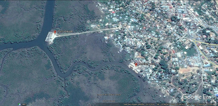
2 ports are currently active
The old port named “Solema”:
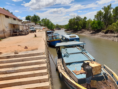
The new port (Port Voa Voa) at 1 km from old port:
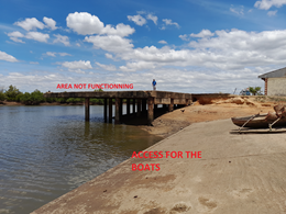
Description and Contacts of Key Companies
|
Company |
Owner |
Contact |
|---|---|---|
|
Savrifice B |
Ramanantenaina Justin |
|
|
Rose Marie |
Chocky Jean |
|
|
Jao Be |
Ranarisoa Yvette Allain |
|
|
Tusera |
Zafizandriny Rondiline |
|
|
Ylang Ylang Fils |
Abdoukarim Hazel H |
|
|
Bienvenue |
Ramanganaza Modestine |
For more information on port contacts, please see the following link: 4.4 Madagascar Port and Waterways Companies Contact List
Port Performance
Before the deterioration of the old port, international cargo could use the structure. A request for rehabilitation has been made to the government.
Now only wooden boats can reach the area with a maximum load of 30 T.
|
Seasonal Constraints |
||
|---|---|---|
|
Occurs |
Time Frame |
|
|
Rainy Season |
Yes |
From December to May |
|
Major Import Campaigns |
No |
N/A |
|
Other Comments |
Cyclonic season from February to April |
|
|
Handling Figures for year |
|
|---|---|
|
Vessel Calls |
N/A |
|
Container Traffic (TEUs) |
N/A |
|
Handling Figures Bulk and Break Bulk for 2021 |
|
|---|---|
|
Bulk (MT) |
781 T |
|
Break bulk (MT) |
N/A |
Discharge Rates and Terminal Handling Charges
N/A
Berthing Specifications
|
Type of Berth |
Quantity |
Length (m) |
Maximum Draft (m) |
Comments |
|---|---|---|---|---|
|
Conventional Berth |
N/A |
|
||
|
Container Berth |
N/A |
|
||
|
Silo Berth |
N/A |
|
||
|
Berthing Tugs |
N/A |
|
||
|
Water Barges |
20 |
14 m |
4 m |
|
General Cargo Handling Berths
|
Cargo Type |
Berth Identification |
|---|---|
|
Imports - Bagged Cargo |
N/A |
|
Exports - Bagged Cargo |
N/A |
|
Imports and Exports - RoRo |
N/A |
|
Other Imports |
N/A
|
Port Handling Equipment
There is no handling equipment available.
Container Facilities
No container facilities
Customs Guidance
Customs procedures have to be done at Mahajanga port
For more information on customs in Antsohihy, please see the following link: 1.3 Madagascar Customs Information
Terminal Information
Multipurpose terminal
N/A
Grain and Bulk handling
N/A
Main storage terminal
There is one warehouse available at the new port and two at the old port
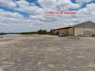
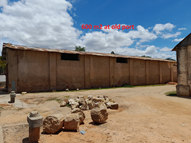

|
Storage Type |
Number of Storage Facilities |
Area (m2) |
|---|---|---|
|
Bagged Cargo |
N/A |
|
|
Refrigerated Cargo |
N/A |
|
|
General Cargo |
3 |
1,550 m3 |
Stevedoring
Basic with ropes on the ground
Hinterland Information
|
Destination |
Price Ar |
|---|---|
|
Analalava |
20 000 Per Pax 4 000 Per Bag 50 Kg |
|
Ampasimbe |
25 000 Per Pax 5000 Per Bag 50 Kg |
|
Antohobe |
25 000 Per Pax 5000 Per Bag 50 Kg |
Port Security
Local police
|
Security |
|
|---|---|
|
ISPS Compliant |
No |
|
Current ISPS Level |
N/A |
|
Police Boats |
No |
|
Fire Engines |
No |
Madagascar - 2.1.14 Port of Belo sur Tsiribihina
Port Overview
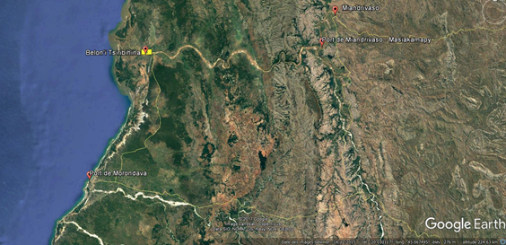
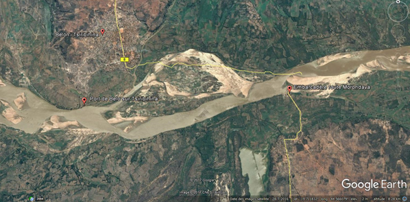
The port of Belo sur Tsiribihina is the terminal point on the Tsiribihina River.
The main function of this port is to be the end point for the tourist boats that descend the Tsibihina from Miandrivaso and the arrival for the vehicles using the ferry to come from Morondava.
Due to the good condition of the road coming from Morondava, this port is not used for the supply of the city but the surrounding villages come here to purchase and commerce with motor boats.
While this port is well known in the region, it remains undeveloped, there is no wharf or other infrastructure, but APMF is on site to control and supervise the port activities.
Key port information may also be found at: http://www.maritime-database.com
|
Port Location and Contact |
|
|---|---|
|
Country |
Madagascar |
|
Province or District |
Toliara |
|
Nearest Town or City with Distance from Port |
Belo sur Tsirbihina 2 km |
|
Port's Complete Name |
Port of Belo sur Tsiribihina |
|
Latitude |
-19.713060° |
|
Longitude |
44.540171° |
|
Managing Company or Port Authority
|
APMF |
|
Management Contact Person |
Responsable de port: Mr Paul +261 34 988 05 82 |
|
Nearest Airport and Airlines with Frequent International Arrivals/Departures |
Morondava Airport: 170km Air Madagascar: Daily flight to Antananarivo |
Port Picture
Port of Belo sur Tsiribihina
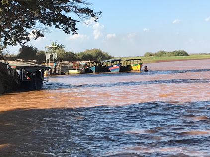
Embarcadère route de Morondava
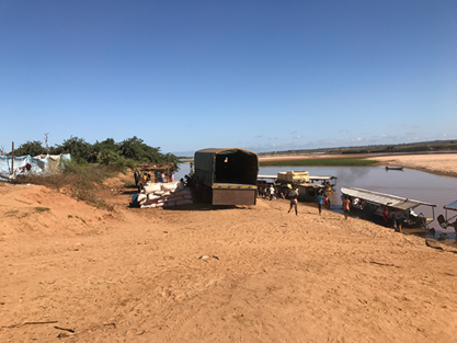
Ferry to access Belo sur Tsiribihina from Morondava
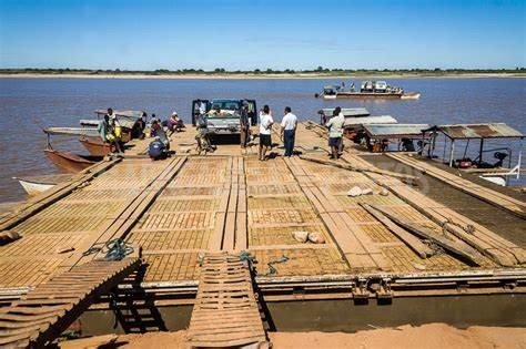
Description and Contacts of Key Companies
No company registered at that port
For more information on port contacts, please see the following link: 4.4 Port and Waterways Companies Contact List.
Port Performance
No data available
|
Seasonal Constraints |
||
|---|---|---|
|
|
Occurs |
Time Frame |
|
Rainy Season |
Yes |
December to June |
|
Major Import Campaigns |
No |
N/A |
|
Other Comments |
Between January and March there is a phenomenon called Asar, the level of water increases and greatly impairs river transport. |
|
Discharge Rates and Terminal Handling Charges
See point 2.1 Port Assessment for the reference price list
Berthing Specifications
|
Type of Berth |
Quantity |
Length (m) |
Maximum Draft (m) |
Comments |
|---|---|---|---|---|
|
Water Barges |
1 |
200 m |
2.5 m |
|
General Cargo Handling Berths
|
Cargo Type |
Berth Identification |
|---|---|
|
Imports - Bagged Cargo |
All goods received / sent form the ground |
|
Exports - Bagged Cargo |
All goods received / sent form the ground |
|
Imports and Exports - RoRo |
All goods received / sent form the ground |
|
Other Imports |
All goods received / sent form the ground |
Port Handling Equipment
No equipment available
Is the port equipment managed by the government or privately? Government APMF
Container Facilities
No container facilities
Customs Guidance
No customs available on sit
Terminal Information
No terminal no storage available on site
Stevedoring
Basic manutention from the ground. No company available. Work has to be requested on site with daily workers.
Hinterland Information
To access to Belo sur Tsiribihina, there is a 170 kms sand track in quite good condition, daily used by cars, trucks and public transport (can be done in 3h30).
At the end of the road, there are small BAC to cross the Tsiribihina River (crossing takes around 15min).
Port Security
|
Security |
|
|---|---|
|
ISPS Compliant |
No |
|
Current ISPS Level |
N/A |
|
Police Boats |
No |
|
Fire Engines |
No |
Madagascar - 2.1.15 Port of Farafangana
Port Overview
The port of Farafangana is a small river port used as for passenger as for cargo to reach remote areas on the Manampatrana river.
The 2 companies working there are covering 2 axes:
North:
- Tangainony: 3 hours
- Ivato: 6 hours
- Ambalatany: 12 hours
West:
- Mahafasa: 6 hours
- Bevoay: 7 hours
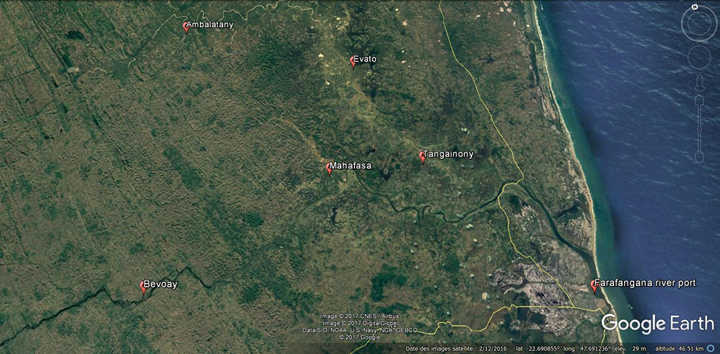
Key port information may also be found at: http://www.maritime-database.com
|
Port Location and Contact |
|
|---|---|
|
Country |
Madagascar |
|
Province or District |
Fianarantsoa |
|
Nearest Town or City with Distance from Port |
Farafangana N/A |
|
Port's Complete Name |
Farafangana port |
|
Latitude |
-22.812605° |
|
Longitude |
47.830337° |
|
Managing Company or Port Authority |
APMF should open an office in 2017 |
|
Management Contact Person |
N/A |
|
Nearest Airport and Airlines with Frequent International Arrivals/Departures |
Farafangana Airport N/A |
Port Picture
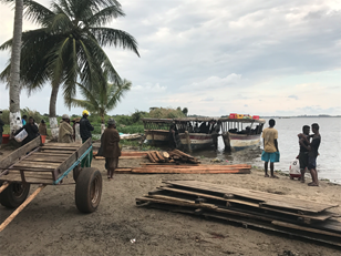
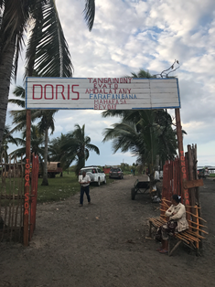
Description and Contacts of Key Companies
Only 2 companies are working there:
- Sté Doris: 4 boats with capacity of 5t each
Mr Schweitzer: 0347978329
- Sté Tsivahiny: 8 boats with capacity of 10t each
Mr Ely: 0348160161
For more information on port contacts, please see the following link: HQ staff will input a link to section 4.4 Port and Waterways Companies Contact List here.
Port Performance
There are no official statistics but the commercial traffic is estimated at around 50 t of commodities per day.
Main items coming in are local products such as coffee, cloves, green pepper, bananas… while main products going out are first necessity items, rice, beans, construction material …
|
Seasonal Constraints |
||
|---|---|---|
|
Occurs |
Time Frame |
|
|
Rainy Season |
Yes |
December to August |
|
Major Import Campaigns |
No |
N/A |
|
Other Comments |
Cyclonic season from February to May. The river can be affected. |
|