Nepal - 2.2.38 Manamaya Rai Khanidanda Domestic Airport
Airport Overview
|
|
|
Pic: Aerial view of Khani Danda Aiport at Diktel |
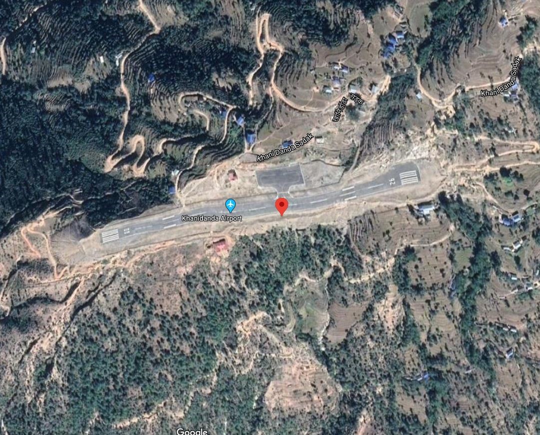
Khani Danda Airport also known as Manmaya Rai Airport is located in Diktel of Rupakot Majhuwagadhi municipality, Khotang district, Koshi Province. It is 6 kms SW of District HQ which is accessed via Khani Danda Road.
The runway was upgraded to bituminous Asphalt in 2015. The airport is not in operation.
|
Airport Location and Contact |
|
|---|---|
|
Country |
Nepal |
|
Province or District |
Koshi Province/ Khotang |
|
Nearest Town or City |
6 kms SW of District HQ which is accessed via Khani Danda Road |
|
Airport’s Complete Name |
Manamaya Rai Khanidanda Airport |
|
Latitude |
27.18142 |
|
Longitude |
86.77254 |
|
Elevation (ft and m) |
1352 m./4435 ft. |
|
IATA Code |
KDN |
|
ICAO Code |
VNKD |
|
Managing Company or Airport Authority |
Civil Aviation Authority of Nepal, Khani Danda Airport AFS VNKDYDYX |
|
Management Contact Person |
|
|
NGO and/or UN Presence at Airport? |
NO |
Runway
|
Runway #1 |
|
|---|---|
|
Runway Dimensions |
1903 × 82 ft (580 × 25 m) |
|
Runway Orientation |
08 - 26- |
|
Runway Surface |
Asphalt Concrete |
|
Runway Condition |
Not in operation |
Airport Infrastructure Details
|
Infrastructure |
|||
|---|---|---|---|
|
Passenger / Cargo Security Screening |
Handheld metal detector |
Runway Lighting |
No |
|
Refuelling Capacity |
NO |
Ground Handling Services |
|
|
Air Traffic Control |
One Man Position Tower Console with Associated Equipment and Accessories |
Fire Fighting Equipment |
No |
|
Weather Information |
AFIS Tower Observation |
Aircraft Parking Space |
2800 sqm of Concrete Apron |
|
Navigation Aids |
No |
Perimeter Fencing |
|
|
Windsock |
|
|
|
Fuel Services Charges
n/a
Royalties / Non Objection Fees (NOFs)
n/a