2.2.8 Myanmar Pyay Airport
Airport Overview
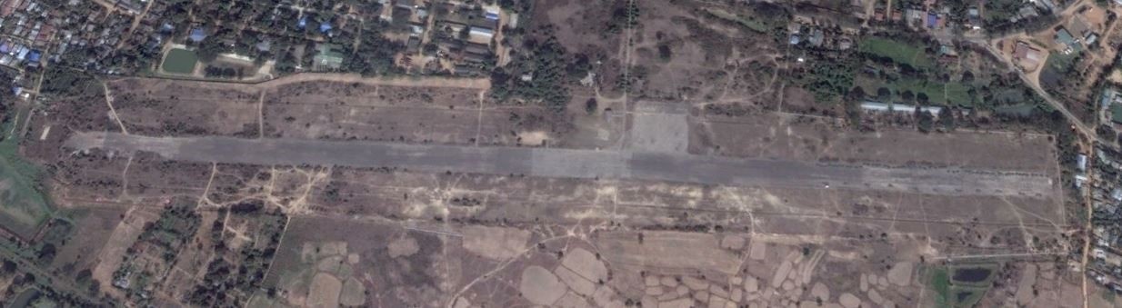
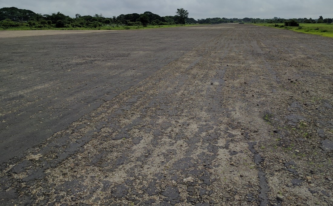
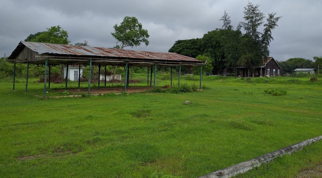
Unused national airport. No terminal building, no Air Traffic Control. Not used by national airlines. Pyay airport area is fenced and under control of Civil Aviation Department. The tarmac of the airstrip has some superficial damage but is probably still suitable to be used for airplanes.
In case of emergencies, the large open space of the airport could be considered for setup of temporary storage or shelters, however there are also good alternative sites in Pyay industrial zone 2.
|
Airfield Details |
|||
|
Country |
Myanmar |
Latitude |
18°49'33.00"N |
|
Province / District |
Bago |
Longitude |
95°15'60.00"E |
|
Airfield Name |
Pyay |
Elevation (ft) |
36.6m / 120 ft |
|
IATA & ICAO codes |
PRU / VYPY |
Surface |
Tarmac |
|
Town or City (closest) |
Pyay, 5km East of city. |
Runway Condition |
Fair. Superficial damage to tarmac |
|
NGO / UN (on ground) |
No |
Passenger / Cargo Security Screening (Yes / No) |
No |
|
Runway Dimension |
1372m x 40m |
Ground Handling (Yes / No) |
No |
|
Refueling Capacity |
No |
Runway Lighting (Yes / No) |
No |
|
Runway Heading |
07 / 025 |
Fire Fighting Equipment (Yes / No) |
No |
|
Air Traffic Control (Yes / No) |
No |
Windsock (Yes / No) |
No |
|
Weather Information (Yes / No) |
No |
Aircraft Parking space (Yes / No) |
Yes. Tarmac apron |
|
Navigation Aids (Yes / No) |
No |
Perimeter fencing (Yes / No) |
Yes |
Fuel Services Charges
n/a
Royalties / Non Objection Fees (NOFs)
n/a