2.5 Indonesia Waterways Network
The following section contains information on the waterways in Indonesia
For information on Indonesia Waterways contact details, please see the following link:

2.5.1 Indonesia Bali Waterways Assessment
Indonesia Bali Waterways Assessment
There are currently no inland navigable waterways in use in Bali. However, the use of seaports is extensive for the movement of cargo and people. This section should be read in conjunction with the Ports assessment for Bali which contains more detailed information regards the capacity and use of the ports within Bali.
Company Information
4.2.4 Indonesia Port and Waterways Company Contact Lists
Passengers and cargo are moved throughout the Bali region primarily through ferries. There are some “fast boats” or speed boats used for passengers, however this is mostly for tourists to move between Bali and Lombok. The companies that are documented below are a combination of the larger ferry companies which can carry 350-400 passengers and the smaller fast boats which can carry 25-50 passengers.
|
Passenger Carrying Capacity |
|||
|---|---|---|---|
|
PT. PELNI (Persero) |
PT. ASDP Ferry Indonesia |
Fast Boat Blue Water Express |
|
|
Number of Passenger Vessels < 20 pax |
N/A |
N/A |
N/A |
|
Number of Passenger Vessels < 50 pax |
N/A |
N/A |
2 |
|
Number of Passenger Vessels < 100 pax |
N/A |
N/A |
1 |
|
Number of Passenger Vessels > 100 pax |
N/A |
29 |
N/A |
Travel Time
|
Passenger Carrying Capacity |
|||
|---|---|---|---|
|
PT. PELNI (Persero) |
PT. ASDP Ferry Indonesia |
Fast Boat Blue Water Express |
|
|
Number of Boats |
N/A |
29 |
3 |
|
Tonnage / Volume Carrying Capacity |
N/A |
45 mt per trip |
N/A |
|
Number of Barges |
N/A |
N/A |
N/A |
|
Tonnage / Volume Carrying Capacity |
N/A |
N/A |
N/A |
|
Number of Tugs |
N/A |
N/A |
N/A |
|
Tonnage / Volume Carrying Capacity |
N/A |
N/A |
N/A |
|
Other (specify) |
N/A |
N/A |
N/A |
Time Travel Matrix
|
Travel Time from Main port to other major Ports (hours / days) Ferries |
|||||||
|---|---|---|---|---|---|---|---|
|
Benoa |
Gilimanuk |
Padang Bai |
Celukan Bawang |
Surabaya |
Lembar |
Kupang |
|
|
Benoa |
N/A |
N/A |
N/A |
1-4 days |
4 hours |
3-4 days |
|
|
Gilimanuk |
N/A |
N/A |
N/A |
N/A |
N/A |
N/A |
|
|
Padang Bai |
N/A |
N/A |
N/A |
N/A |
4-6 hours |
N/A |
|
|
Celukan Bawang |
N/A |
N/A |
N/A |
N/A |
N/A |
N/A |
|
|
Surabaya |
N/A |
N/A |
N/A |
N/A |
N/A |
3 days |
|
|
Lembar |
5 hours |
N/A |
4-5 hours |
N/A |
N/A |
N/A |
|
|
Kupang |
3 days |
N/A |
N/A |
N/A |
3-7 days |
N/A |
|
Key Routes
|
Key Route Information Domestic / International |
|||
|---|---|---|---|
|
From: Bali To: Lombok |
From: Bali To: Lombok |
From: Bali To: Kupang |
|
|
Total Distance (km) |
76.4 km |
136 km |
1,366 km |
|
Width (m): Broadest Narrowest |
Ocean Width |
Ocean Width |
Ocean Width |
|
River Flow (m³ / second) |
N/A |
N/A |
N/A |
|
Seasonal Affects |
Rainy season and windy season |
Rainy season and windy season |
Rainy season and windy season |
|
Maximum Weight and Size of Vessels |
N/A |
N/A |
N/A |
|
Regular Traffic Passenger / Cargo |
Passenger & Cargo |
Passenger & Cargo |
Passenger & Cargo |
|
Companies Operating Along the Route |
ASDP ferry, Fast Boat Blue Water Express |
PT. PELNI (Persero) |
PT. PELNI (Persero) |
|
Security Concerns (Yes / No) |
No |
No |
No |
|
Main Ports |
Padang Bai - Lembar |
Benoa - Lembar |
Benoa - Tenau |
Port Information
|
Key Port Information |
|||
|---|---|---|---|
|
Padang Bai |
Benoa |
Celukan Bawang |
|
|
Location |
South. 080, 31’, 963”, East. 1150, 30’, 485” |
S. 08o, 44’, 546” E. 115o, 12’, 743 |
South 8° 11' 26" East 114° 50' 8" |
|
Contact Information |
PT.ASDP |
Pelindo |
PT. ASDP |
|
Connections with other transport means (road/waterways/air) |
Road |
Road, Air |
Road |
|
Storage Capacity (square meters and cubic meters) |
No |
1400m2 |
n/a |
|
Handling Equipment |
No |
Yes |
n/a |
|
Customs Clearance Available (Yes / No) |
No |
Yes |
n/a |
|
Other Comments |
n/a | n/a | n/a |
|
Key Port Information |
|
|---|---|
|
Gilimanuk |
|
|
Location |
South 080, 09’, 692”, East. 1140, 26’, 226” |
|
Contact Information |
PT. ASDP Ferry Indonesia |
|
Connections with other transport means (road/waterways/air) |
Road |
|
Storage Capacity (square meters and cubic meters) |
No |
|
Handling Equipment |
No |
|
Customs Clearance Available (Yes / No) |
No |
|
Other Comments |
This is a port for RoRo cargo and passengers. |
2.5.2 Indonesia Aceh and North Sumatra Waterways Assessment
Indonesia Aceh and North Sumatra Waterways Assessment
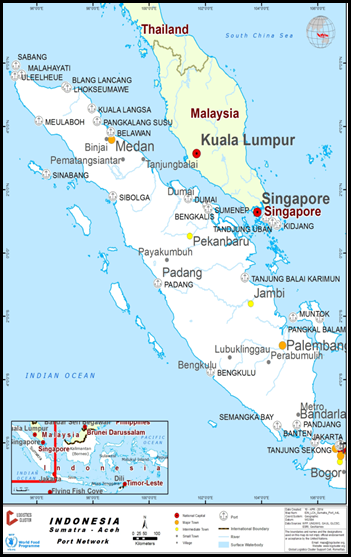
There are no major waterways used for internal transport in Aceh province.
There are some small boats that are used in the rivers which carry mostly wood and agriculture products from the mountains to the estuaries.
In this section we have documented the waterway movements with the Aceh province and surrounding islands.
Company Information
For information on Indonesia Waterways contact details, please see the following link:
4.2.4 Indonesia Port and Waterways Company Contact Lists
|
Passenger Carrying Capacity |
|||
|---|---|---|---|
|
PT. ASDP Indonesia Ferry |
PT Sea Asih Line |
PT Pelayaran Sakti Inti Makmur |
|
|
Number of Passenger Vessels < 20 pax |
N/A |
N/A |
N/A |
|
Number of Passenger Vessels < 50 pax |
N/A |
N/A |
N/A |
|
Number of Passenger Vessels < 100 pax |
N/A |
N/A |
N/A |
|
Number of Passenger Vessels > 100 pax |
2 Units |
1 Unit |
2 Units |
|
Passenger Carrying Capacity |
|||
|---|---|---|---|
|
PT. ASDP Indonesia Ferry |
PT Sea Asih Line |
PT Pelayaran Sakti Inti Makmur |
|
|
Number of Boats |
2 Units |
1 Unit |
2 Units |
|
Tonnage / Volume Carrying Capacity |
400-450 pax 20 trucks (10mt) or 40 vehicles or 100 motorcycles |
Speed boat – no cargo capacity |
Speed boat – no cargo capacity |
|
Number of Barges |
N/A |
N/A |
N/A |
|
Tonnage / Volume Carrying Capacity |
N/A |
N/A |
N/A |
|
Number of Tugs |
N/A |
N/A |
N/A |
|
Tonnage / Volume Carrying Capacity |
N/A |
N/A |
N/A |
|
Other (specify) |
KMP BRR and KMP Papuyu |
Speedboat Pulo Rondo |
KM Express Bahari 3B KM Express Bahari 9 |
Travel Time Matrix
|
Travel Time from Main port to other major Ports (hours / days) Ferry |
|||||||
|---|---|---|---|---|---|---|---|
|
Ulee Lheu |
Balohan Sabang |
Sinabang |
Singkil |
Labuhan Haji |
Pulau Banyak |
Gunung Sitoli |
|
|
Ulee Lheu |
ASDP: 2-3 hours Speedboat:45 minutes |
N/A |
N/A |
N/A |
N/A |
N/A |
|
|
Balohan Sabang |
ASDP: 2-3 hours Speedboat:45 minutes |
N/A |
N/A |
N/A |
N/A |
N/A |
|
|
Sinabang |
N/A |
N/A |
ASDP |
ASDP |
N/A |
N/A |
|
|
Singkil |
N/A |
N/A |
ASDP |
N/A |
ASDP |
ASDP |
|
|
Labuhan Haji |
N/A |
N/A |
ASDP |
N/A |
N/A |
N/A |
|
|
Pulau Banyak |
N/A |
N/A |
ASDP |
ASDP |
N/A |
N/A |
|
|
Gunung Sitoli |
N/A |
N/A |
N/A |
ASDP |
N/A |
N/A |
|
Key Routes
|
|
Key Route Information Domestic / International |
|||
|---|---|---|---|---|
|
From: Banda Aceh To: Balohan |
From: Banda Aceh To: Sabang |
From: Sinabang To: Singkil |
From: Singkil To: Pulau Banyak |
|
|
Total Distance (km) |
27,36 km |
48,3 km |
160,78 km |
64.28 km |
|
Width (m): Broadest Narrowest |
Ocean |
Ocean |
Ocean |
Ocean |
|
River Flow (m³ / second) |
N/A |
N/A |
N/A |
N/A |
|
Seasonal Affects |
Rainy Season and Winds |
Rainy Season and Winds |
Rainy Season and Winds |
Rainy Season and Winds |
|
Maximum Weight and Size of Vessels |
N/A |
N/A |
N/A |
N/A |
|
Regular Traffic Passenger / Cargo |
Passenger & Cargo |
Passenger & Cargo |
Passenger & Cargo |
Passenger & Cargo |
|
Companies Operating Along the Route |
PT. ASDP Indonesia Ferry, PT Sea Asih Line (Fast Boat), and PT Pelayaran Sakti Inti Makmur (Fast Boat) |
PT. ASDP Indonesia Ferry |
PT. ASDP Indonesia Ferry |
PT. ASDP Indonesia Ferry |
|
Security Concerns (Yes / No) |
No |
No |
No |
No |
|
Main Ports |
Ulee Lheu – Balohan |
Ulee Lheue – Teluk Sabang |
Sinabang – Singkil |
Singkil – Pulau Banyak |
Port Information
|
Key Port Information |
||||
|---|---|---|---|---|
|
Belawan |
Kuala Langsa |
Lhokseumawe |
Malahayati |
|
|
Location |
N 3 47’ 15" E 98 41’ 34" |
N 4° 31' 27" E 98° 1' 15" |
N 05°14.450 E 97°02.340 |
N 05° 35’ 50” E 95° 30’ 35” |
|
Contact Information |
PT. Pelindo (Persero) Regional I Northern Sumatra |
PT. Pelindo (Persero) Pelabuhan Perwakilan Kuala Langsa |
PT. (Persero) Pelabuhan Indonesia |
PT. (Persero) Pelabuhan Indonesia, Branch Port of Malahayati |
|
Connections with other transport means (road/waterways/air) |
PT. PELINDO (waterways) |
PT. PELINDO (waterways) |
PT. PELINDO (waterways) |
PT. PELINDO (waterways) |
|
Storage Capacity (square meters and cubic meters) |
Bagged Cargo: 52,399.12 m2 Open Storage: 112,949.76m2 |
Bagged Cargo: 300, 500 m2 Open Storage: 5,000 m2 |
Bagged Cargo 4,120 m2 Open storage 25,158 m2 |
Bagged Cargo: 2,720 m2 General Cargo: 22,021 m2 |
|
Handling Equipment |
Yes |
Yes |
Yes |
Yes |
|
Customs Clearance Available (Yes / No) |
Yes |
Yes |
Yes |
Yes |
|
Other Comments |
|
|||
2.5.3 Indonesia Makassar Waterways Assessment
Indonesia Makassar Waterways Assessment
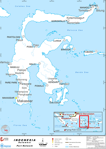
The use of seaports is extensive for the movement of cargo and people. This section should be read in conjunction with the Ports assessment for Makassar which contains more detailed information regards the capacity and use of the ports.
Company Information
For information on Indonesia Waterways contact details, please see the following link:
4.2.4 Indonesia Port and Waterways Company Contact Lists
PT Pelni and PT ASDP are the two main ferry operators for cargo and passenger movements from Makassar and throughout Sulawesi province.
|
PT. PELNI |
PT. ASDP |
|
|---|---|---|
|
Number of Passenger Vessels < 20 pax |
N/A |
N/A |
|
Number of Passenger Vessels < 50 pax |
N/A |
N/A |
|
Number of Passenger Vessels < 100 pax |
N/A |
N/A |
|
Number of Passenger Vessels > 100 pax |
13 500 - 3000 pax |
17 300-400 pax |
|
PT. PELNI |
PT. ASDP |
|
|---|---|---|
|
Number of Boats |
13 |
17 |
|
Tonnage / Volume Carrying Capacity |
500-1500mt (passenger and cargo) |
500mt (passenger and cargo) |
|
Number of Barges |
N/A |
N/A |
|
Tonnage / Volume Carrying Capacity |
N/A |
N/A |
|
Number of Tugs |
N/A |
N/A |
|
Tonnage / Volume Carrying Capacity |
N/A |
N/A |
|
Other (specify) |
N/A |
N/A |
Travel Time Matrix
|
Travel Time from Main port to other major Ports (hours / days) Ferry |
||||||||
|---|---|---|---|---|---|---|---|---|
|
Makassar |
Pare-Pare |
Gorontalo |
Selayar |
Bau Bau |
Talaud Island |
Luwuk |
Bitung |
|
|
Makassar |
PT. PELNI (3-4 hours) |
N/A |
PT. PELNI (11-12 hours) |
PT. PELNI (14 hours) |
N/A |
PT. PELNI (2 days) |
PT. PELNI (3-4 days) |
|
|
Pare-Pare |
PT. PELNI (3-4 hours) |
N/A |
N/A |
PT. PELNI (1 day) |
N/A |
N/A |
N/A |
|
|
Gorontalo |
N/A |
N/A |
N/A |
PT. PELNI (2 days) |
N/A |
PT. ASDP and PT. PELNI (12-13 hours) |
PT. PELNI (14 hours) |
|
|
Selayar |
PT. PELNI (11-12 hours) |
N/A |
N/A |
N/A |
N/A |
N/A |
N/A |
|
|
Bau Bau |
PT. PELNI (14 hours) |
PT. PELNI (1 day) |
PT. PELNI (2 days) |
N/A |
N/A |
PT. PELNI (1-2 days) |
PT. PELNI (2-3 days) |
|
|
Talaud Island |
N/A |
N/A |
N/A |
N/A |
N/A |
N/A |
PT. ASDP (3-4 hours) |
|
|
Luwuk |
PT. PELNI (2 days) |
N/A |
PT. ASDP and PT. PELNI (12-13 hours) |
N/A |
PT. PELNI (1-2 days) |
N/A |
PT. PELNI (1 day) |
|
|
Bitung |
PT. PELNI (2 days) |
N/A |
PT. PELNI (14 hours) |
N/A |
PT. PELNI (2-3 days) |
PT. ASDP (3-4 hours) |
PT. PELNI (1 day) |
|
Key Routes
|
Key Route Information Domestic / International |
|||
|---|---|---|---|
|
From: Makassar To: Pare Pare |
From: Luwuk To: Gorontalo |
From: Bitung To: Talaud Island |
|
|
Total Distance (km) |
150 km |
353 km |
346 km |
|
Width (m): Broadest Narrowest |
Ocean Width |
Ocean Width |
Ocean Width |
|
River Flow (m³ / second) |
N/A |
N/A |
N/A |
|
Seasonal Affects |
Rainy season and Winds |
Rainy season and Winds |
Rainy season and Winds |
|
Maximum Weight and Size of Vessels |
N/A |
N/A |
N/A |
|
Regular Traffic Passenger / Cargo |
Passenger & Cargo |
Passenger & Cargo |
Passenger & Cargo |
|
Companies Operating Along the Route |
PT. PELNI |
PT. PELNI and ASDP |
PT. ASDP |
|
Security Concerns (Yes / No) |
No |
No |
No |
|
Main Ports |
Makassar – Pelabuhan Nusantara |
Banggai - Gorontalo |
Bitung - Miangas |
Port Information
|
Key Port Information |
||||
|---|---|---|---|---|
|
Makassar |
Gorontalo |
Selayar |
Bitung |
|
|
Location |
05008’007”S 119024’00’E |
0030’02.50”S 123003’35.05’E |
06004’44.25”S 120026’15.06’E |
01026’21.81”S 125011’55.29’E |
|
Contact Information |
PT. Pelabuhan Indonesia IV (Persero) |
PT. Pelabuhan Indonesia IV (Persero) and PT. ASDP Ferry |
PT. Pelabuhan Indonesia IV (Persero) and PT. ASDP Ferry |
PT. Pelabuhan Indonesia IV (Persero) and PT. ASDP Ferry |
|
Connections with other transport means (road/waterways/air) |
PT. PELNI |
PT. PELNI and PT. ASDP Ferry |
PT. PELNI and PT. ASDP Ferry |
PT. PELNI and PT. ASDP Ferry |
|
Storage Capacity (square meters and cubic meters) |
Permanent wh – 15,400sqm Open Storage – 179,888sqm |
N/A |
N/A |
N/A |
|
Handling Equipment |
Yes |
Yes |
Yes |
Yes |
|
Customs Clearance Available (Yes / No) |
Yes |
No |
No |
No |
|
Other Comments |
|
|||
2.5.4 Indonesia Nusa Tenggara Barat (NTB) Waterways Assessment
Indonesia Nusa Tenggara Barat (NTB) Waterways Assessment
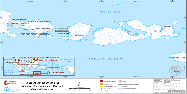
The use of the waterways between islands is a key mode of transport for cargo and passengers within the NTB province.
Ports are located throughout the islands and there are ferry options to move within the islands or to Bali.
In case of an emergency operation PT. ASDP would offer ferries available for rental.
The port of Surabaya is a major hub for the NTB with regular sailings of boats and ferries with passengers and cargo.
Company Information
For information on Indonesia waterways contact details, please see the following link:
4.2.4 Indonesia Port and Waterways Company Contact Lists
Two companies operate scheduled passenger and cargo ferry services on a large scale within NTB - PT.Pelni and PT ASDP.
In addition to the larger services there are a number of tourism operators who provide “speed” boat services between NTB and Bali.
|
Passenger Carrying Capacity |
|||
|---|---|---|---|
|
PT. PELNI |
PT. ASDP Ferry |
Fast Boat Blue Water Express |
|
|
Number of Passenger Vessels < 20 pax |
N/A |
N/A |
N/A |
|
Number of Passenger Vessels < 50 pax |
N/A |
N/A |
2 |
|
Number of Passenger Vessels < 100 pax |
N/A |
N/A |
1 |
|
Number of Passenger Vessels > 100 pax |
6 |
8 |
N/A |
|
Passenger Carrying Capacity |
|||
|---|---|---|---|
|
PT. PELNI (Persero) |
PT. ASDP Ferry Indonesia |
Fast Boat Blue Water Express |
|
|
Number of Boats |
6 |
8 |
3 |
|
Tonnage / Volume Carrying Capacity |
45mt |
45 mt per trip |
N/A |
|
Number of Barges |
N/A |
N/A |
N/A |
|
Tonnage / Volume Carrying Capacity |
N/A |
N/A |
N/A |
|
Number of Tugs |
N/A |
N/A |
N/A |
|
Tonnage / Volume Carrying Capacity |
N/A |
N/A |
N/A |
|
Other (specify) |
N/A |
N/A |
N/A |
Travel Time Matrix
|
|
Travel Time from Main port to other major Ports (hours / days) by Passenger ferry (PELNI) and Ferry (ASDP) |
|||||
|---|---|---|---|---|---|---|
|
Lembar |
Kayangan |
Bima |
Pototano |
Padang Bai |
Labuhan Bajo |
|
|
Lembar |
N/A |
PELNI: 17-18 hours |
N/A |
ASDP: 3-6 hours |
PELNI: 1 days |
|
|
Kayangan |
N/A |
N/A |
ASDP: 1,5 hours |
N/A |
N/A |
|
|
Bima |
PELNI: 17 hours |
N/A |
N/A |
N/A |
PELNI: 1,5 days |
|
|
Pototano |
N/A |
ASDP: 1,5 hours |
N/A |
|
N/A |
N/A |
|
Padang Bai |
ASDP: 3-6 hours |
N/A |
N/A |
N/A |
N/A |
|
|
Labuhan Bajo |
PELNI: 1 days |
N/A |
PELNI: 1,5 days |
N/A |
N/A |
|
Key Routes
|
Key Route Information Domestic / International |
|||
|---|---|---|---|
|
From: Lombok To: Bali |
From: Lombok To: Sumbawa Island |
From: Sumbawa Island To: East Nusa Tenggara (NTT) |
|
|
Total Distance (km) |
70.899 km |
19.312 km |
77.249 km |
|
Width (m): Broadest Narrowest |
Ocean Width |
Ocean Width |
Ocean Width |
|
River Flow (m³ / second) |
N/A |
N/A |
N/A |
|
Seasonal Affects |
Rainy season and Winded |
Rainy season and Winded |
Rainy season and Winded |
|
Maximum Weight and Size of Vessels |
N/A |
N/A |
N/A |
|
Regular Traffic Passenger / Cargo |
Passenger & Cargo |
Passenger & Cargo |
Passenger & Cargo |
|
Companies Operating Along the Route |
PELNI & ASDP |
ASDP |
ASDP |
|
Security Concerns (Yes / No) |
No |
No |
No |
|
Main Ports |
Lembar – Padang Bai |
Kayangan – Poto Tano |
Sape – Labuhan Bajo |
Port Information
|
Tanjung Lembar |
Kayangan |
|
|---|---|---|
|
Location |
S. 0900, 43’, 50” E. 11600 4’, 20” |
S. 080, 29’, 07,7”, E. 1160, 40’, 28,7” |
|
Contact Information |
PT. Pelabuhan Indonesia III (Persero) |
Kayangan Port Office (Kantor Pelabuhan Kayangan) |
|
Connections with other transport means (road/waterways/air) |
PT. PELNI and PT. ASDP Ferry |
PT. PELNI and PT. ASDP Ferry |
|
Storage Capacity (square meters and cubic meters) |
1.008 - 2.016 mt/m3 and open storage 8.925 mt/m3 |
1.500 metric tons |
|
Handling Equipment |
Yes |
No |
|
Customs Clearance Available (Yes / No) |
Yes |
No |
2.5.5 Papua Waterways Assessment
Papua Waterways Assessment
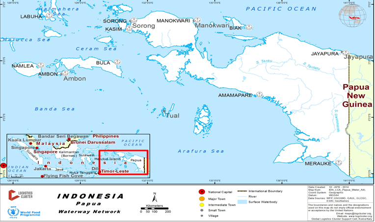
The primary waterway usage in the Papua province is between the island and main ports. Jayapura port is the main port where cargo (which is already customs cleared) enters the province. From there cargo is then distributed onwards to other districts such as Biak and Merauke.
Cargo is also moved by rivers in Merauke and Wamena districts via speed boats. There is a development plan underway to increase the capacity of the river movements using larger ferries for passengers and cargo.
However, development of the appropriate infrastructure is not complete and there is no indication of when they will be operational.
During the summer months (August – December) the water level can often be too low to reach Tanah Merah from Merauke. During this time cargo and passengers are trans-shipped to smaller boats for onward movement.
Company Information
4.2.4 Indonesia Port and Waterways Company Contact Lists
|
Passenger Carrying Capacity |
||
|---|---|---|
|
PT. PELNI |
PT. ASDP Ferry Indonesia |
|
|
Number of Passenger Vessels < 20 pax |
N/A |
N/A |
|
Number of Passenger Vessels < 50 pax |
N/A |
N/A |
|
Number of Passenger Vessels < 100 pax |
N/A |
N/A |
|
Number of Passenger Vessels > 100 pax |
8 Units |
6 Units |
|
Passenger Carrying Capacity |
||
|---|---|---|
|
PT. PELNI |
PT. ASDP Ferry Indonesia |
|
|
Number of Boats |
8 Units |
6 Units |
|
Tonnage / Volume Carrying Capacity |
Up to 700 mt per trip (depending on the passenger numbers) |
45 mt cargo per trip |
|
Number of Barges |
N/A |
N/A |
|
Tonnage / Volume Carrying Capacity |
N/A |
N/A |
|
Number of Tugs |
N/A |
N/A |
|
Tonnage / Volume Carrying Capacity |
N/A |
N/A |
|
Other (specify) |
N/A |
N/A |
Travel Time Matrix
|
Travel Time from Main port to other major Ports (hours / days) VESSEL TYPE |
|||||||
|---|---|---|---|---|---|---|---|
|
Biak |
Merauke |
Sorong |
Timika |
Jayapura |
Nabire |
Manokwari |
|
|
Biak |
N/A |
Pelni: 1-3 days |
N/A |
Pelni: 20-21 hours |
ASDP: 2 days |
ASDP: 12 hours |
|
|
Merauke |
N/A |
N/A |
Pelni: 2 days |
N/A |
N/A |
N/A |
|
|
Sorong |
Pelni: 1-3 days |
N/A |
N/A |
Pelni: 2-3 days |
Pelni: 1-4 days |
Pelni: 1-3 days |
|
|
Timika |
N/A |
Pelni: 2 days |
N/A |
N/A |
N/A |
N/A |
|
|
Jayapura |
Pelni: 20-21 hours |
N/A |
Pelni: 2-3 days |
N/A |
Pelni: 1 day |
Pelni: 1-2 days |
|
|
Nabire |
ASDP: 2 days |
N/A |
Pelni: 1-4 days |
N/A |
Pelni: 1 day |
Pelni: 12 hours – 1 day |
|
|
Manokwari |
ASDP: 12 hours |
N/A |
Pelni: 1-3 days |
N/A |
Pelni: 1-2 days |
Pelni: 1-3 days |
|
Key Routes
|
Key Route Information Domestic / International |
|||||
|---|---|---|---|---|---|
|
From: Biak To: Sorong |
From: Biak To: Manokwari |
From: Biak To: Nabire |
From: Biak To: Jayapura |
From: Timika To: Merauke |
|
|
Total Distance (km) |
526.82 (Air Distance) |
214.39 (Air Distance) |
276.29 (Air Distance) |
552.69 (Air Distance) |
926.06 (Driving Distance) |
|
Width (m): Broadest Narrowest |
Ocean Width |
Ocean Width |
Ocean Width |
Ocean Width |
Ocean Width |
|
River Flow (m³ / second) |
N/A |
N/A |
N/A |
N/A |
N/A |
|
Seasonal Affects |
Rainy season and Winded |
Rainy season and Winded |
Rainy season and Winded |
Rainy season and Winded |
Rainy season and Winded |
|
Maximum Weight and Size of Vessels |
N/A |
N/A |
N/A |
N/A |
N/A |
|
Regular Traffic Passenger / Cargo |
Passenger & Cargo |
Passenger & Cargo |
Passenger & Cargo |
Passenger & Cargo |
Passenger & Cargo |
|
Companies Operating Along the Route |
PT. PELNI |
PT. ASDP Ferry |
PT. ASDP Ferry |
PT. PELNI |
PT. PELNI |
|
Security Concerns (Yes / No) |
No |
No |
No |
No |
No |
|
Main Ports |
Biak - Sorong |
Biak - Manokwari |
Biak - Nabire |
Biak - Jayapura |
Timika - Jayapura |
Port Information
|
Key Port Information |
||||
|---|---|---|---|---|
|
Biak |
Sorong |
Jayapura |
Merauke |
|
|
Location |
01° 11’ 05” S 136° 05’ 46” E |
00° 53' 00” S 131° 10' 00” E |
02° 32' 30" S 140° 42' 30" E |
8° 28’ 40’’ S 140° 23’ 26’’ E |
|
Contact Information |
PT. Pelabuhan Indonesia IV ( Persero) |
PT. Pelabuhan Indonesia IV (Persero) |
PT. Pelabuhan Indonesia IV (Persero) |
Jayapura Port Office Administration (ADPEL Pelabuhan Jayapura) |
|
Connections with other transport means (road/waterways/air) |
PT. PELNI and ASDP |
PT. PELNI |
PT. PELNI |
PT. PELNI |
|
Storage Capacity (square meters and cubic meters) |
576 T/M2 and 2.280 T/M2 |
1.170 T/M2 and Open Storage 3.840 T/M2 |
2.200 m2 and Open storage 11,867 m2 |
3.090 m² |
|
Handling Equipment |
Yes |
Yes |
Yes |
Yes |
|
Customs Clearance Available (Yes / No) |
Yes |
Yes |
Yes |
Yes |
|
Other Comments |
http://www.dephub.go.id/files/media/file/25%20pelabuhan/Biak.pdf |
http://www.dephub.go.id/files/media/file/25%20pelabuhan/Sorong.pdf |
|
|