Nepal - 2.2.29 Jiri Domestic Airport
Airport Overview
|
|
|
Pic: Aerial view of the location of Jiri Airport at Jiri Municipality |
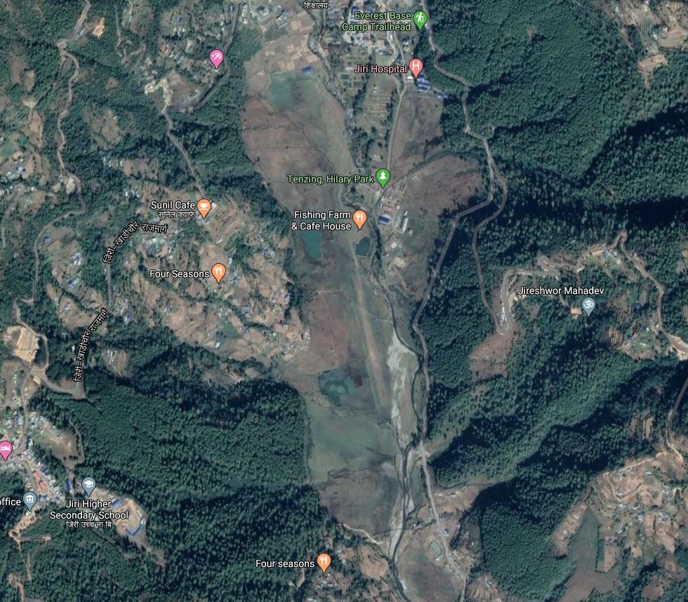
Jiri Airport is a small serving the of Jiri, Dolakha district in the north-eastern region of Bagmati of . It is 57 km East of district headquarter at Charikot, Dolakha. It can be accessed via blacktopped F32 and then Jiri Khadichaur local road.
The airport served as the gateway to Mount Everest when it opened in 1979.
|
Airport Location and Contact |
|
|---|---|
|
Country |
Nepal |
|
Province or District |
Bagmati Province / Dolakha |
|
Nearest Town or City |
57 Km E of District HQ in Charikot, Jiri Bazaar is in close proximity and Ramechhap Airport is located in close proximity to the city on distance of 2 and a half hours and is about 30km from Ramechhap Airport to Jiri. |
|
Airport’s Complete Name |
Jiri Airport |
|
Latitude |
27.62629 |
|
Longitude |
86.23039 |
|
Elevation (ft and m) |
6063 ft/1848m |
|
IATA Code |
JIR |
|
ICAO Code |
VNJI |
|
Managing Company or Airport Authority |
Civil Aviation Authority of Nepal, Jiri Airport Tel 977 AFS VNJIYDYX |
|
Management Contact Person |
|
|
NGO and/or UN Presence at Airport? |
NO |
Runway
|
Runway #1 |
|
|---|---|
|
Runway Dimensions |
1197 × 59 ft (365 × 18 m) |
|
Runway Orientation |
14/32 |
|
Runway Surface |
Earthen |
|
Runway Condition |
Not in Operation |
Airport Infrastructure Details
|
Infrastructure |
|||
|---|---|---|---|
|
Passenger / Cargo Security Screening |
NO |
Runway Lighting |
NO |
|
Refuelling Capacity |
NO |
Ground Handling Services |
NO |
|
Air Traffic Control |
Visual Flight Rules (VFR) |
Fire Fighting Equipment |
NO |
|
Weather Information |
AFIS |
Aircraft Parking Space |
Not available, Earthen |
|
Navigation Aids |
NO |
Perimeter Fencing |
Yes |
|
Windsock |
N/A |
|
|
Fuel Services Charges
N/A
Royalties / Non-Objection Fees (NOFs)
N/A