2.3 Indonesia Road Network
The following section contains information on the road network in Indonesia.
For information on Indonesia road contact details, please see the following link:
4.2.1 Indonesia Government Contact List

2.3.1 Indonesia Bali Road Network
Indonesia Bali Road Network
The road network in Bali is severely congested most of the time. Development of the road network is going by the Government to reduce congestion, one such effort is the 2.48 trillion (IDR) (US$220 million), 12.7 kilometre Nusa Dua-Ngurah Rai-Benoa toll road. This connects Port Benoa-Kuta-Nusa Dua Airport and has eased congestion in an area increasingly notorious for traffic blockages.
For information on Indonesia Bali Road Network contact details, please see the following link:
4.2.1 Indonesia Government Contact List
Distance Matrix
|
Denpasar |
Kuta |
Ngurah Rai Airport |
Benoa Port |
Padang Bai |
Gilimanuk |
|
|---|---|---|---|---|---|---|
|
Denpasar |
5 |
25 |
25 |
51 |
131 |
|
|
Kuta |
5 |
10 |
12 |
56 |
137 |
|
|
Ngurah Rai Airport |
25 |
10 |
37 |
61 |
162 |
|
|
Benoa Port |
25 |
12 |
37 |
77 |
182 |
|
|
Padang Bai |
51 |
56 |
61 |
77 |
208 |
|
|
Gilimanuk |
131 |
137 |
162 |
182 |
208 |
Travel Time Matrix
|
Travel Time from Capital City to Major Towns (km) |
||||||
|---|---|---|---|---|---|---|
|
Denpasar |
Kuta |
Ngurah Rai Airport |
Benoa Port |
Padang Bai |
Gilimanuk |
|
|
Denpasar |
30 min |
20 min |
30 min |
60 min |
2 hrs 30 min |
|
|
Kuta |
30 min |
15 min |
25 min |
1 hr 30 min |
2 hrs 45 min |
|
|
Ngurah Rai Airport |
20 min |
15 min |
20 min |
1 hr 30 min |
2 hrs 30 min |
|
|
Benoa Port |
30 min |
25 min |
20 min |
1hr 30 mins |
2hrs 30 min |
|
|
Padang Bai |
60 min |
1 hr 30 min |
1 hr 30 min |
1hr 30 mins |
2hrs 40 min |
|
|
Gilimanuk |
2 hrs 30 min |
2 hrs 45 min |
2 hrs 30 min |
2hrs 30 min |
2hrs 40 min |
|
Road Security
There are no height restrictions, however roads, with the exception of the double carriageways are narrow and certain sectors have fairly steep gradients. The roads are busy in terms of commercial traffic. Tailbacks and severe traffic congestion are common.
Weighbridges and Axle Load Limits
|
Axle load limits |
Bali |
|---|---|
|
Truck with 2 axles |
18 mt |
|
Truck with 3 axles |
20 mt |
|
Truck with 4 axles |
N/A |
|
Semi-trailer with 3 axles |
N/A |
|
Semi-trailer with 4 axles |
N/A |
|
Semi-trailer with 5 axles |
N/A |
|
Semi-trailer with 6 axles |
N/A |
|
Truck & drawbar trailer with 4 axles |
N/A |
|
Truck & drawbar trailer with 5 axles |
N/A |
|
Truck & drawbar trailer with 6 axles |
N/A |
|
Truck & drawbar trailer with 7 axles |
N/A |
2.3.2 Indonesia Aceh and North Sumatra Road Network
For information on Indonesia Road Network contact details, please see the following link: 4.1 Indonesia Government Contact List
Aceh Road Network
Distance Matrix
|
Distances from Capital City to Major Towns (km) |
|||||
|
|
Banda Aceh |
Calang |
Meulaboh |
Blang Pidie |
Tapak Tuan |
|
Banda Aceh |
|
149 |
238 |
358 |
434 |
|
Calang |
149 |
|
89 |
209 |
285 |
|
Meulaboh |
238 |
89 |
|
120 |
196 |
|
Blang Pidie |
358 |
209 |
120 |
|
76 |
|
Tapak Tuan |
434 |
285 |
196 |
76 |
|
|
Travel Time from Capital City to Major Towns (hours) |
|||||
|
|
Banda Aceh |
Calang |
Meulaboh |
Blang Pidie |
Tapak Tuan |
|
Banda Aceh |
|
3 |
4.30 |
7 |
8.30 |
|
Calang |
3 |
|
1.30 |
4 |
5.30 |
|
Meulaboh |
4.30 |
1.30 |
|
2.30 |
4 |
|
Blang Pidie |
7 |
4 |
2.30 |
|
1.30 |
|
Tapak Tuan |
8.30 |
5.30 |
4 |
1.30 |
|
Road Security
Road from Banda Aceh – Calang – Meulaboh – Blang Pidie – Tapak Tuan are in relatevely good condition and accessible. The road from Banda Aceh to Calang passing Geurute Mountain about 15 km contains a few extreme turns, steep, narrows, with cliffs on the side of the roads. Road from Meulaboh to Blang Pidie is through Babah Rot Mountain, the road is wide along hills and is bumpy.
Sibolga – Medan Road Network
Distance Matrix
| Distances from Capital City to Major Towns (km) | |||||||
|
Routes |
Sibolga |
Tarutung |
Siborong - Borong |
Balige |
Simalungun |
Tebing |
Medan |
|
Sibolga |
|
65 |
95 |
112 |
250 |
265 |
345 |
|
Tarutung |
65 |
37 |
250 |
265 |
345 |
285 |
|
|
Siborong - Borong |
95 |
37 |
|
32 |
170 |
185 |
260 |
|
Balige |
112 |
250 |
32 |
|
140 |
154 |
232 |
|
Simalungun |
250 |
265 |
170 |
140 |
|
85 |
155 |
|
Tebing |
265 |
345 |
185 |
154 |
85 |
|
78 |
|
Medan |
345 |
285 |
260 |
232 |
155 |
78 |
|
|
Travel Time Capital City to Major Towns (hours) |
|||||||
|
Routes |
Sibolga |
Tarutung |
Siborong - Borong |
Balige |
Simalungun |
Tebing |
Medan |
|
Sibolga |
|
2.0 |
3.0 |
3.5 |
6.5 |
7.0 |
8.5 |
|
Tarutung |
2.0 |
|
1.0 |
2.0 |
4.2 |
5.0 |
6.5 |
|
Siborong - Borong |
3.0 |
1.0 |
|
1.5 |
4.0 |
4.5 |
6.0 |
|
Balige |
3.5 |
2.0 |
1.5 |
|
3.5 |
4.2 |
5.0 |
|
Simalungun |
6.5 |
4.2 |
4.0 |
3.5 |
|
2.0 |
3.5 |
|
Tebing |
7.0 |
5.0 |
4.5 |
4.2 |
2.0 |
|
1.5 |
|
Medan |
8.5 |
6.5 |
6.0 |
5.0 |
3.5 |
1.5 |
|
Road Security
The road condition from Sibolga to Medan is relatively good. There are deep valleys and the road is steep, narrow and curvy between Tapteng to Tarutung. Traffic jams can be seen in small towns along the route, particularly in and around Medan city.
Road assessment from Sibolga to Panyabungan (Mandailing natal) took 4 hours by driving, with total distance 166 km. Approximately 60 km long between Sibolga to Batang Toru (Tapanuli Selatan), the road is narrow and damaged. Parlimbungan Ketek is a port located in Mandailing Natal, 110 km away from its capital town of Panyabungan. Access to the port is bad due to an ongoing road construction.
2.3.3 Indonesia Papua Road Network
Indonesia Papua Road Network
There is currently no connecting road network throughout the Papua province, particularly in the central highlands. Where there is road access it is centred around major towns and where possible spreads out to more regional areas. Roads are a combination of asphalt and dirt/gravel in more inaccessible locations. There is currently no road that links Jayapura in the North to Merauke in the South of the highlands.
The development of the “Trans Papua” road is on-going. This road aims to link all the major towns in the Papua central highlands via an asphalt road. The interconnected highways would connect seven regions, namely Nabire - Waghete - Enarotali sepanjang (262 km), Timika -Mapurujaya - Pomako (42 km), Serui - Menawi - Saubeba (49 km),Jayapura - Wamena - Mulia (733 km), Jayapura - Sarmi (364 km), Jayapura - Hamidi - Holtekam - Skow - Papua New Guinea border (53 km) and Merauke – Waropko (557 km).
Construction on the road has been on-going for many years and there is currently no date for completion as it is dependent upon funding. However, parts of this road have been completed, for example the roads in the Merauke district are now complete with asphalt up to the district border. In other sections of the road it is classified as “jungle” as is only able to be passed with a 4x4 vehicle if there has been no rains or other issues for a number of weeks.
Wamena is not accessible by road from any direction and air operations are the only option for the movement of passengers and cargo.
For information on Indonesia Road Network contact details, please see the following link:
4.2.1 Indonesia Government Contact List
Distance Matrix – Jayapura Area
|
Jayapura |
Abepura |
Sentani Airport |
Sarmi |
Keerom |
PNG Border |
|
|---|---|---|---|---|---|---|
|
Jayapura |
13 |
38 |
364 |
60 |
42 |
|
|
Abepura |
13 |
25 |
351 |
N/A |
N/A |
|
|
Sentani Airport |
38 |
25 |
N/A |
N/A |
N/A |
|
|
Sarmi |
364 |
351 |
N/A |
N/A |
N/A |
|
|
Keerom |
60 |
N/A |
N/A |
N/A |
N/A |
|
|
PNG Border |
42 |
N/A |
N/A |
N/A |
N/A |
Jayapura to Senggi is 159kms of asphalt road, after this the road to Wamena is classified as “jungle”.
Distance Matrix – Biak Area
|
Biak |
Bosnik |
Samber |
Korem |
Warsa |
Yenggarbun |
Wardo |
Sorendiweri |
|
|---|---|---|---|---|---|---|---|---|
|
Biak |
15 |
26 |
36 |
47 |
116 |
60 |
110 |
|
|
Bosnik |
15 |
20 |
N/A |
N/A |
N/A |
N/A |
N/A |
|
|
Samber |
26 |
20 |
N/A |
N/A |
N/A |
34 |
N/A |
|
|
Korem |
36 |
N/A |
N/A |
N/A |
80 |
55 |
74 |
|
|
Warsa |
47 |
N/A |
N/A |
N/A |
N/A |
N/A |
63 |
|
|
Yenggarbun |
116 |
N/A |
N/A |
80 |
N/A |
N/A |
N/A |
|
|
Wardo |
60 |
N/A |
34 |
55 |
N/A |
N/A |
|
N/A |
|
Sorendirweri |
110 |
N/A |
N/A |
74 |
63 |
N/A |
N/A |
|
Distance Matrix – Merauke Area
|
Merauke |
Sota |
Bupul |
Muting |
Asike |
Tanah Merah |
|
|---|---|---|---|---|---|---|
|
Merauke |
|
76 |
244 |
247 |
370 |
458 |
|
Sota |
76 |
|
168 |
171 |
294 |
382 |
|
Bupul |
244 |
168 |
|
3 |
126 |
214 |
|
Muting |
247 |
171 |
3 |
|
123 |
211 |
|
Asike |
370 |
294 |
126 |
123 |
|
88 |
|
Tanah Merah |
458 |
382 |
214 |
211 |
88 |
|
All the roads listed above are asphalt and are available for all vehicle access.
Distance Matrix – Wamena Area
|
Wamena |
Karubaga |
Tiom |
Elelin |
Mulia |
Yonguru |
Jayapura |
|
|---|---|---|---|---|---|---|---|
|
Wamena |
|
90 |
90 |
135 |
240 |
170 |
680 |
|
Karubaga |
90 |
|
180 |
225 |
150 |
N/A |
N/A |
|
Tiom |
90 |
180 |
|
N/A |
N/A |
N/A |
N/A |
|
Elelin |
135 |
225 |
N/A |
|
N/A |
N/A |
N/A |
|
Mulia |
240 |
150 |
N/A |
N/A |
|
N/A |
N/A |
|
Yonguru |
170 |
N/A |
N/A |
N/A |
N/A |
|
N/A |
|
Jayapura |
680 |
N/A |
N/A |
N/A |
N/A |
N/A |
|
Wamena to Elelin is an asphalt road. In general the roads are in a poor condition and very narrow in this area.
Travel Time Matrix
Travel times for the Papua central highlands are unpredictable and it is recommended to refer to conditions on the ground when making arrangements.
|
Travel Time from Capital City to Major Towns (km) |
||||||
|---|---|---|---|---|---|---|
|
Jayapura |
Abepura |
Sentani Airport |
Sarmi |
Keerom |
PNG Border |
|
|
Jayapura |
25 mins |
1 hr |
8hrs |
2 hrs |
||
|
Abepura |
25 mins |
40 mins |
||||
|
Sentani Airport |
1 hr |
40 mins |
||||
|
Sarmi |
8 hrs |
|||||
|
Keerom |
2 hrs |
|||||
|
PNG Border |
||||||
Road Security
As road conditions can be unpredictable due to weather conditions, planning in advance of any mission is advised. In Wamena and the surrounding areas, there have been instances in the past of violence against vehicles or their occupants. Therefore, checks should be made with the local Papuan authorities as well as UNDSS for security issues along the road network
Weighbridges and Axle Load Limits
Roads that are dirt or gravel should use 4x4 vehicle transport
only and carry a maximum load of 3 tonnes.
The bridges in Biak province are wooden and the maximum load for
use is 10mt.
Road transportation in Wamena is via 4x4 vehicles and the maximum
load is 5mt.
|
Axle load limits |
Papua |
|---|---|
|
Truck with 2 axles |
18mt |
|
Truck with 3 axles |
18mt |
|
Truck with 4 axles |
N/A |
|
Semi-trailer with 3 axles |
N/A |
|
Semi-trailer with 4 axles |
N/A |
|
Semi-trailer with 5 axles |
N/A |
|
Semi-trailer with 6 axles |
N/A |
|
Truck & drawbar trailer with 4 axles |
N/A |
|
Truck & drawbar trailer with 5 axles |
N/A |
|
Truck & drawbar trailer with 6 axles |
N/A |
|
Truck & drawbar trailer with 7 axles |
N/A |
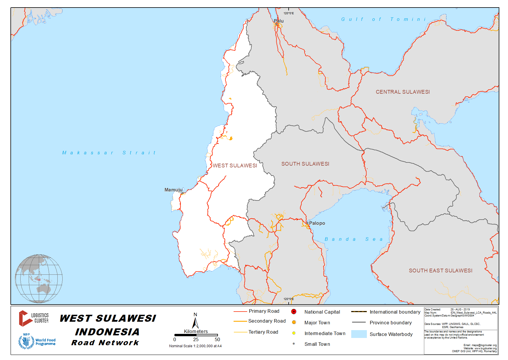
2.3.4 Indonesia Sulawesi Road Network
Map of Sulawesi Road Network
Click here for information related to road conditions in Sigi District, Central Sulawesi Province following the 2018 Earthquake and Tsunami.
For information on Indonesia Road Network contact details, please see the following link:
4.2.1 Indonesia Government Contact List
The roads in Makassar have the same challenges as those throughout most of Indonesia – traffic jams and occasional flooding. There are plans in place to improve traffic flow at the local level.
One such policy has been the introduction of restrictions of vehicles carrying heavy loads driving through the city centre.
In late 2013 a law was implemented that meant that between the hours of 05.00 – 21.00 containers can no longer be carried on trucks if they are going to be driving through the city limits.
Instead containers must be unpacked and re-loaded onto smaller vehicles.
There are plans in place to develop a ring road and additional by-pass’ to ease congestion, however there is currently no timeline of when construction will commence.
Distance Matrix
|
Makassar |
Pare-pare |
Palopo |
Mamuju |
Bitung |
Manado |
|
|---|---|---|---|---|---|---|
|
Makassar |
154 |
374 |
448 |
1765 |
1715 |
|
|
Pare-pare |
154 |
221 |
392 |
1612 |
1562 |
|
|
Palopo |
374 |
221 |
335 |
1392 |
1342 |
|
|
Mamuju |
448 |
392 |
335 |
1331 |
1281 |
|
|
Bitung |
1765 |
1612 |
1392 |
1331 |
48 |
|
|
Manado |
1715 |
1562 |
1342 |
1281 |
48 |
|
Travel Time Matrix
|
Makassar |
Pare-pare |
Palopo |
Mamuju |
Bitung |
Manado |
|
|---|---|---|---|---|---|---|
|
Makassar |
2hrs 30min |
5hrs 30min |
7hrs 30min |
28hrs |
27hr |
|
|
Pare-pare |
2hrs 30min |
3hrs 15mins |
7hrs 30min |
26hrs |
25hr |
|
|
Palopo |
5hrs 30min |
3hrs 15mins |
10hrs |
23hrs |
22hr |
|
|
Mamuju |
7hrs 30min |
7hrs 30min |
10hrs |
23hrs 30min |
23hr |
|
|
Bitung |
28hrs |
26hrs |
23hrs |
23hrs 30min |
1hr |
|
|
Manado |
27hr |
25hr |
22hr |
23hr |
1hr |
|
Weighbridges and Axle Load Limits
|
Axle load limits |
Makassar |
|---|---|
|
Truck with 2 axles |
10mt |
|
Truck with 3 axles |
10mt |
|
Truck with 4 axles |
10mt |
Road Class and Surface Conditions
There are restrictions in place for cargo movements within Makassar city.
Where there are movements from within Makassar city (i.e. Gowa to Makassar) the following roads must be taken :
- Jl Sultan Alaudiin
- Jl A.P. Pettarani
- Jl Landak Baru
- Jl Veteran
- Jl Dr.Ratulangi
- Jl Kakatua
- Jl Gagak
- Jl Rajawali
- Jl H.M. Patompo
However if the cargo movement is from Makassar to Gowa the following roads must be taken :
- Jl H.M Patompo
- Jl Penghibur
- Jl Maipa
- Jl Lamaddukelleng
- Jl I.H. Saleh
- Jl Areif Rate
- Jl Cendrawasih
- Jl Kakatua
- Jl Landak Lama
- Jl Veteran
- Jl Sultan Alauddin
At all times the cargo weight on these roads should not exceed 10 metric tonnes.
2.3.5 Indonesia Nusa Tenggara Barat (NTB) Road Network
Indonesia Nusa Tenggara Barat (NTB) Road Network
For information on Indonesia Road Network contact details, please see the following link:
4.2.1 Indonesia Government Contact List
There are no height restrictions on the roads in NTB. However roads through to Lombok and rural areas are narrow and have sections of relatively steep gradients. In addition to narrow roads they are routed through heavily populated areas.
Distance Matrix
|
Distances from Capital City to Major Towns (km) |
||||||||
|---|---|---|---|---|---|---|---|---|
|
Mataram |
Lombok International Airport |
Senggigi |
Lembar |
Kayangan |
Sumbawa |
Bima |
Dompu |
|
|
Mataram |
33km |
20km |
27km |
65km |
667km |
404km |
465km |
|
|
Lombok International Airport |
33km |
53km |
53km |
97km |
679km |
416km |
476km |
|
|
Senggigi |
20km |
53km |
43km |
71km |
682km |
419km |
476km |
|
|
Lembar |
27km |
53km |
43km |
92km |
652km |
389km |
449km |
|
|
Kayangan |
65km |
97km |
71km |
92km |
732km |
469km |
530km |
|
|
Sumbawa |
667km |
679km |
682km |
652km |
732km |
262km |
214km |
|
|
Bima |
404km |
416km |
419km |
389km |
469km |
262km |
61km |
|
|
Dompu |
465km |
476km |
480km |
449km |
530km |
214km |
61km |
|
Travel Time Matrix
PLEASE NOTE: Travel time has been calculated on the average speed of 50 Kilometres per hour, ‘Best Case scenarios” plus 25 percent.
|
Travel Time from Capital City to Major Towns (km) |
||||||||
|---|---|---|---|---|---|---|---|---|
|
Mataram |
Lombok International Airport |
Senggigi |
Lembar |
Kayangan |
Sumbawa |
Bima |
Dompu |
|
|
Mataram |
|
1 Hour |
1 Hour |
1 Hour |
2 Hours |
26 Hours |
22 Hours |
23 Hours |
|
Lombok International Airport |
1 Hour |
|
2 Hours |
1 Hour |
2 Hours |
27 Hours |
22 Hours |
24 Hours |
|
Senggigi |
1 Hour |
2 hours |
1 Hour |
2 Hours mnt |
27 hrs |
22 Hours |
24 Hours |
|
|
Lembar |
1 Hour |
1 Hour |
2 hrs |
26 Hours |
22 Hours |
23 Hours |
||
|
Kayangan |
2 hours |
2 Hours |
2 hours |
2 hrs |
28 Hours |
23 Hours |
24 Hours |
|
|
Sumbawa |
26 Hours |
27 Hours |
27 Hours |
26 hrs |
28 Hours |
|
5 Hours |
4 Hours |
|
Bima |
22 Hours |
23 Hours |
22 Hours |
22 Hours |
23 Hours |
5 hours |
2 Hours |
|
|
Dompu |
23 Hours |
23 Hours |
23 Hours |
23 Hours |
24 Hours |
4 Hours |
2 Hours |
|
Road Security
There are no known security issues with the roads in NTB.
Weighbridges and Axle Load Limits
|
Axle load limits |
NTB |
|---|---|
|
Truck with 2 axles |
16.4mt |
|
Truck with 3 axles |
24.6mt |
|
Truck with 4 axles |
32.8mt |
|
Semi-trailer with 3 axles |
N/A |
|
Semi-trailer with 4 axles |
N/A |
|
Semi-trailer with 5 axles |
N/A |
|
Semi-trailer with 6 axles |
N/A |
|
Truck & drawbar trailer with 4 axles |
N/A |
|
Truck & drawbar trailer with 5 axles |
N/A |
|
Truck & drawbar trailer with 6 axles |
N/A |
|
Truck & drawbar trailer with 7 axles |
N/A |
2.3.6 Indonesia Nusa Tenggara Timur (NTT) Road Network
Indonesia Nusa Tenggara Timur (NTT) Road Network
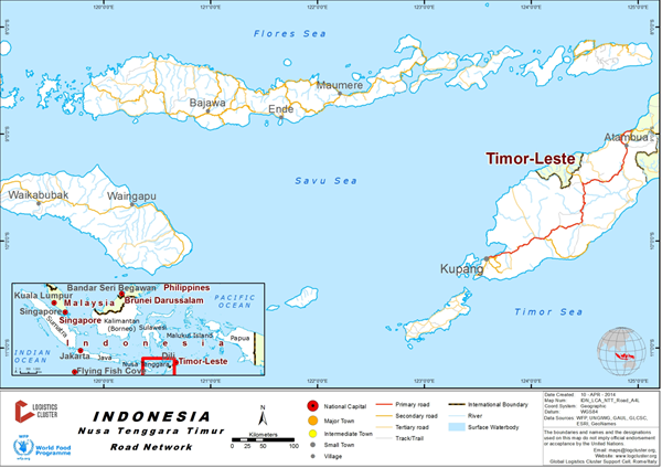
For information on Indonesia Road Network contact details, please see the following link:
4.2.1 Indonesia Government Contact List
Overall the bridges and roads in the NTT main land from Kupang and outwards are rated as good. There are no height restrictions on roads throughout NTT. However roads through to Atambua and rural areas are narrow (Wini, Atapapa), have fairly steep gradients and acute corners that may cause problems for articulated vehicles, thus single bed vehicles are recommended.
Distance Matrix
|
Kupang |
Soe |
Atambua |
Timor Leste Border |
|
|---|---|---|---|---|
|
Kupang |
111 |
280 |
293 |
|
|
Soe |
111 |
170 |
185 |
|
|
Atambua |
280 |
170 |
17 |
|
|
Timor Leste Border |
293 |
185 |
17 |
Travel Time Matrix
|
Kupang |
Soe |
Atambua |
Timor Leste Border |
|
|---|---|---|---|---|
|
Kupang |
2hrs |
5hrs |
5hrs 30 mins |
|
|
Soe |
2hrs |
3hrs |
3hrs 30mins |
|
|
Atambua |
5hrs |
3hrs |
30mins |
|
|
Timor Leste Border |
5hrs 30 mins |
3hrs 30mins |
30mins |
Road Security
There are no security issues on the roads in NTT.
Weighbridges and Axle Load Limits
|
Axle load limits |
NTT |
|---|---|
|
Truck with 2 axles |
16mt |
|
Truck with 3 axles |
22mt |
|
Truck with 4 axles |
30mt |
|
Semi-trailer with 4 axles |
34mt |
|
Semi-trailer with 5 axles |
40mt |
|
Semi-trailer with 6 axles |
43mt |
2.3.7 Indonesia West Java Road Network
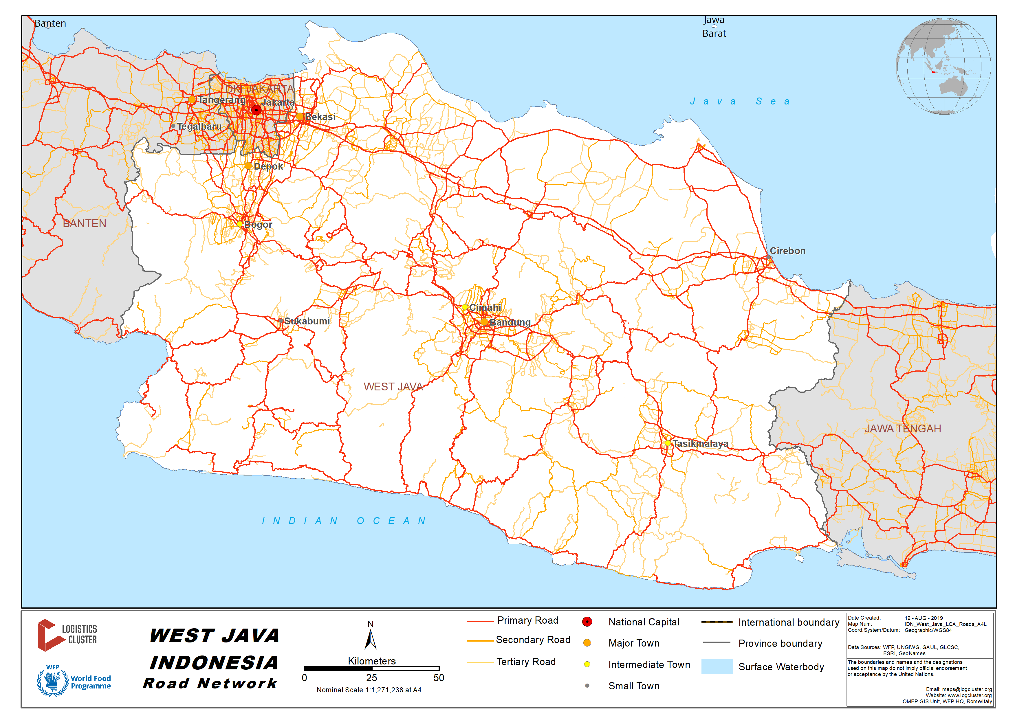
There are two main road access from Bandung to Jakarta (and vice versa):
- Toll ways via Bekasi and Cikampek with approx. distance 150 km, 3.5 hours travel time, depending on the traffic. During the weekend this may increase up to 7 hours.
- National highways combined with toll ways via Cianjur, Sukabumi and Bogor with approx. distance 215 km, 9 hours travel time. During the weekend this may increase up to 12 hours.
Distance Matrix
|
|
Bandung |
Cianjur |
Sukabumi |
Jakarta |
|
Bandung |
|
67 |
99 |
215 |
|
Cianjur |
67 |
|
32 |
148 |
|
Sukabumi |
99 |
32 |
|
116 |
|
Jakarta |
215 |
148 |
116 |
|
|
Travel Time from Capital City to Major Towns (hours) |
||||
|
|
Bandung |
Cianjur |
Sukabumi |
Jakarta |
|
Bandung |
|
2 |
3.5 |
9 |
|
Cianjur |
2 |
|
1.5 |
7 |
|
Sukabumi |
3.5 |
1.5 |
|
3.5 |
|
Jakarta |
9 |
7 |
3.5 |
|
Road Security
The road condition from Bandung to Jakarta via Cianjur, Sukabumi and Bogor is relatively good. Some part of the roads along Bandung to Sukabumi are hilly and narrow. Traffic jams are seen in most small towns along the way, limiting the speeds to max. 20 km/hour.
2.3.8 Indonesia West Sumatra Road Network
Distance Matrix
|
Distances from Capital City to Major Towns (km) |
||||||
|
|
Padang |
Pasaman |
Lubuk Basung |
Bukit tinggi |
Solok |
|
|
Padang |
|
171 |
254 |
96 |
81 |
|
|
Pasaman |
171 |
|
83 |
85 |
211 |
|
|
Lubuk Basung |
254 |
83 |
|
65 |
187 |
|
|
Bukit Tinggi |
96 |
85 |
65 |
|
89 |
|
|
Solok |
81 |
211 |
187 |
89 |
|
|
|
Travel Time from Capital City to Major Towns (hours) |
|||||
|
|
Padang |
Pasaman |
Lubuk Basung |
Bukit Tinggi |
Solok |
|
Padang |
|
3.30 |
4.15 |
2.45 |
1.30 |
|
Pasaman |
3.30 |
|
2.15 |
2.15 |
5.45 |
|
Lubuk Basung |
4.15 |
2.15 |
|
2.15 |
5.15 |
|
Bukit Tinggi |
2.45 |
2.15 |
2.15 |
|
3.30 |
|
Solok |
1.30 |
5.45 |
5.15 |
3.30 |
|
Road Security
The road from Padang to Pasaman and Lubuk Basung is in relatively good condition.
The road from Lubuk Basung to Bukit Tinggi through Kelok 44 area is only accessible by smaller truck (3 mt max) due to being steep with numerous extreme turns.
The road from Bukit Tinggi to Solok is in relatively good condition.
The road from Solok to Padang passes the mountainous area, with some extreme turns, steep, and fog in several spots reduces visibility between 5-20 metres.
2.3.9 Indonesia North Maluku Road Network
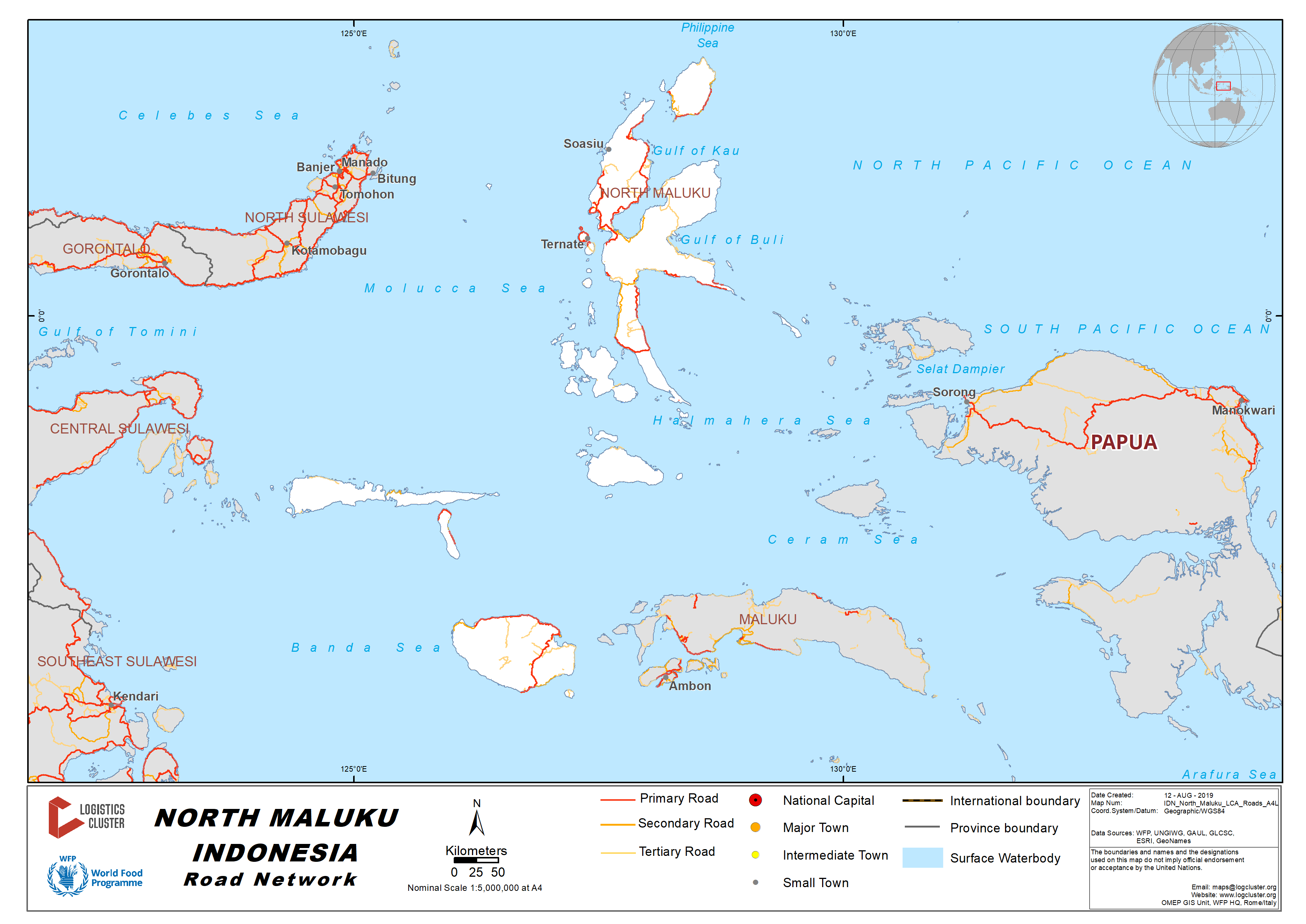
Distance and Time Matrices – Northern Halmahera Island
|
Distances from Capital City to Major Towns (km) |
|||||
|
|
Sofifi |
Jailolo |
Kuabang Kao Airport |
Tobelo |
Gamar Malamo |
|
Sofifi |
- |
80 |
107 |
188 |
222 |
|
Jailolo |
80 |
- |
64 |
145 |
180 |
|
Kuabang Kao Airport |
107 |
64 |
- |
86 |
120 |
|
Tobelo |
188 |
145 |
86 |
- |
39 |
|
Gamar Malamo |
222 |
180 |
120 |
39 |
- |
|
Travel Time from Capital City to Major Towns (hours) |
||||||
|
|
Sofifi |
Jailolo |
Kuabang Kao Airport |
Tobelo |
Gamar Malamo |
|
|
Sofifi |
- |
2h |
2h 15m |
3h 45m |
4h 45m |
|
|
Jailolo |
2h |
- |
1h 45m |
3h |
4h |
|
|
Kuabang Kao Airport |
2h 15m |
1h 45m |
- |
1h 45m |
2h 45m |
|
|
Tobelo |
3h 45m |
3h |
1h 45m |
- |
1h |
|
|
Gamar Malamo |
4h 45m |
4h |
2h 30m |
1h |
- |
|
Road Security
The road is in relatively good condition
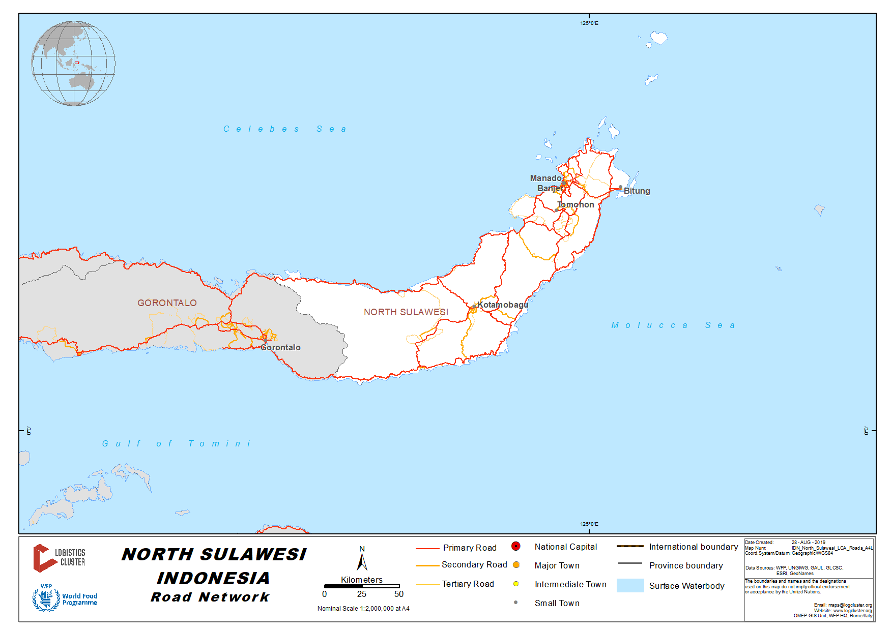
2.3.10 Indonesia North Sulawesi Road Network
Distance Matrix
|
Distances from Capital City to Major Towns (km) |
|||||
|
|
Manado |
Minahasa Utara |
Bitung |
Minahasa Selatan |
Minahasa Tenggara |
|
Manado |
- |
24 |
43 |
84 |
76 |
|
Minahasa Utara |
24 |
- |
22 |
109 |
96 |
|
Bitung |
43 |
22 |
- |
125 |
90 |
|
Minahasa Selatan |
84 |
109 |
125 |
- |
59 |
|
Minahasa Tenggara |
76 |
96 |
90 |
59 |
- |
|
Travel Time from Capital City to Major Towns (hours) |
||||||
|
|
Manado |
Minahasa Utara |
Bitung |
Minahasa Selatan |
Minahasa Tenggara |
|
|
Manado |
- |
1 |
1.5 |
2.5 |
2.5 |
|
|
Minahasa Utara |
1 |
- |
1 |
3 |
3 |
|
|
Bitung |
1.5 |
1 |
- |
3.5 |
3 |
|
|
Minahasa Selatan |
2.5 |
3 |
3.5 |
- |
2 |
|
|
Minahasa Tenggara |
2.5 |
3 |
3 |
2 |
- |
|
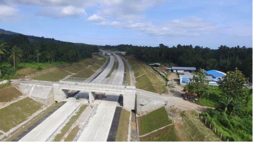
Road Development - New Toll Road in North Sulawesi
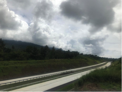
The toll road is under the final development phase. It connects the two major cities of Manado and Bitung in North Sulawesi Province. The toll road is part of the Trans Sulawesi Toll Road Network, and it will be the first toll road within the province. The total length of the road is 39 km, it is expected to reduce the travel time between these two cities from around 90-120 minutes to 30 minutes only. The toll road is expected operational in Q4 2019.
Road Security
The road condition from Manado City to surrounding districts and cities are relatively in good condition.
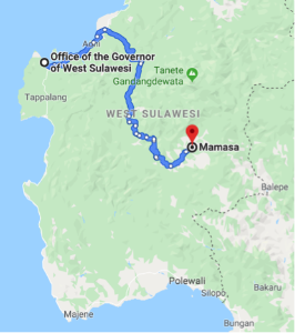
2.3.11 Indonesia West Sulawesi Road Network
Distance Matrix – From Coastal to Mountainous Route
|
Distances from Capital City to Major Towns (km) |
||||
|
|
Mamuju |
Majene |
Polewali Mandar |
Mamasa |
|
Mamuju |
- |
140 |
195 |
267 |
|
Majene |
140 |
- |
55 |
127 |
|
Polewali Mandar |
195 |
55 |
- |
80 |
|
Mamasa |
267 |
127 |
80 |
- |
|
Travel Time from Capital City to Major Towns (hours) |
||||
|
|
Mamuju |
Majene |
Polewali Mandar |
Mamasa |
|
Mamuju |
- |
3.5 |
5 |
7.5 |
|
Majene |
3.5 |
- |
1.5 |
4 |
|
Polewali Mandar |
5 |
1.5 |
- |
3 |
|
Mamasa |
7.5 |
4 |
3 |
- |
Road Security
There are 2 (two) main road access from Mamuju City to Mamasa District:
- Coastal route, passing through Majene City with total distance about 267 km. The road is geographically located along the coastal area up to Majene (140 km) with relatively good condition. When entering Mamasa District, the road is damaged with potential landslide during rainy season. The overall travel time is about 7.5 hours.
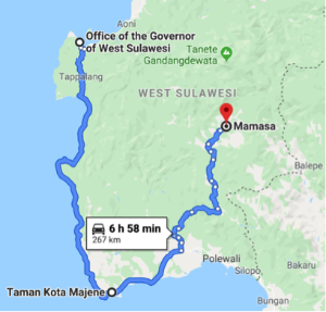
- Mountainous route, passing through Mambi, with total distance about 150 km. The road is geographically located along the mountainous area, with mostly damaged condition, hilly and winding. The overall travel time is about 5 hours.
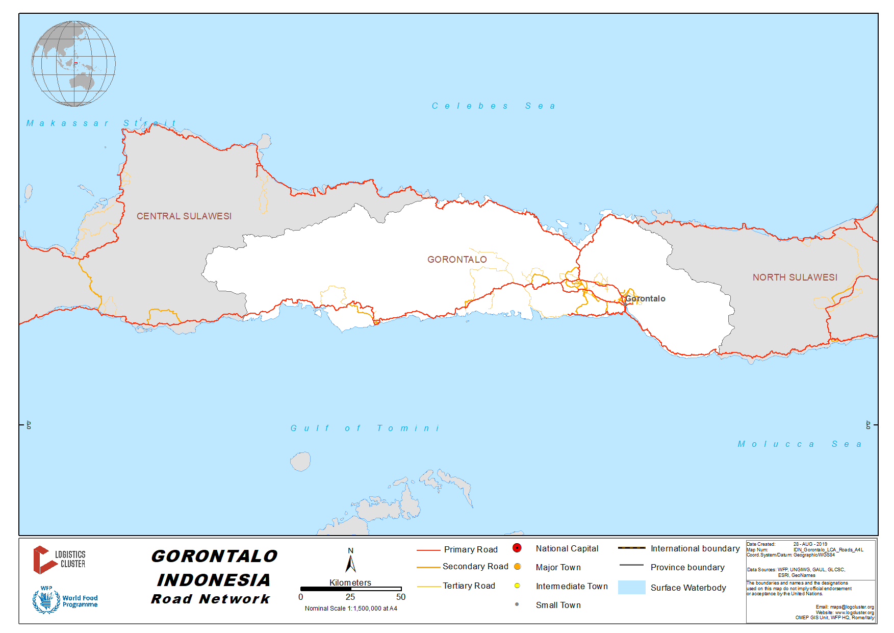
2.3.12 Indonesia Gorontalo Road Network
Distance Matrix
|
Distances from Capital City to Major Towns (km) |
||||||
|
|
Gorontalo |
Sawawa |
Limboto |
Kwandang |
Tilamuta |
Marisa |
|
Gorontalo |
- |
16 |
22 |
58 |
103 |
159 |
|
Sawawa |
16 |
- |
39 |
74 |
119 |
177 |
|
Limboto |
22 |
39 |
- |
47 |
92 |
147 |
|
Kwandang |
58 |
74 |
47 |
- |
103 |
158 |
|
Tilamuta |
103 |
119 |
92 |
103 |
- |
62 |
|
Marisa |
159 |
177 |
147 |
158 |
62 |
- |
|
Travel Time from Capital City to Major Towns (hours) |
||||||
|
|
Gorontalo |
Sawawa |
Limboto |
Kwandang |
Tilamuta |
Marisa |
|
Gorontalo |
- |
0.5 |
1 |
1.5 |
3 |
4 |
|
Sawawa |
0.5 |
- |
1 |
2 |
3 |
4.5 |
|
Limboto |
1 |
1 |
- |
1.5 |
2.5 |
3.5 |
|
Kwandang |
1.5 |
2 |
1.5 |
- |
2.5 |
4 |
|
Tilamuta |
3 |
3 |
2.5 |
2.5 |
- |
1.5 |
|
Marisa |
4 |
4.5 |
3.5 |
4 |
1.5 |
- |
Road Security
The road conditions within Gorontalo City and surrounding are relatively in good condition.