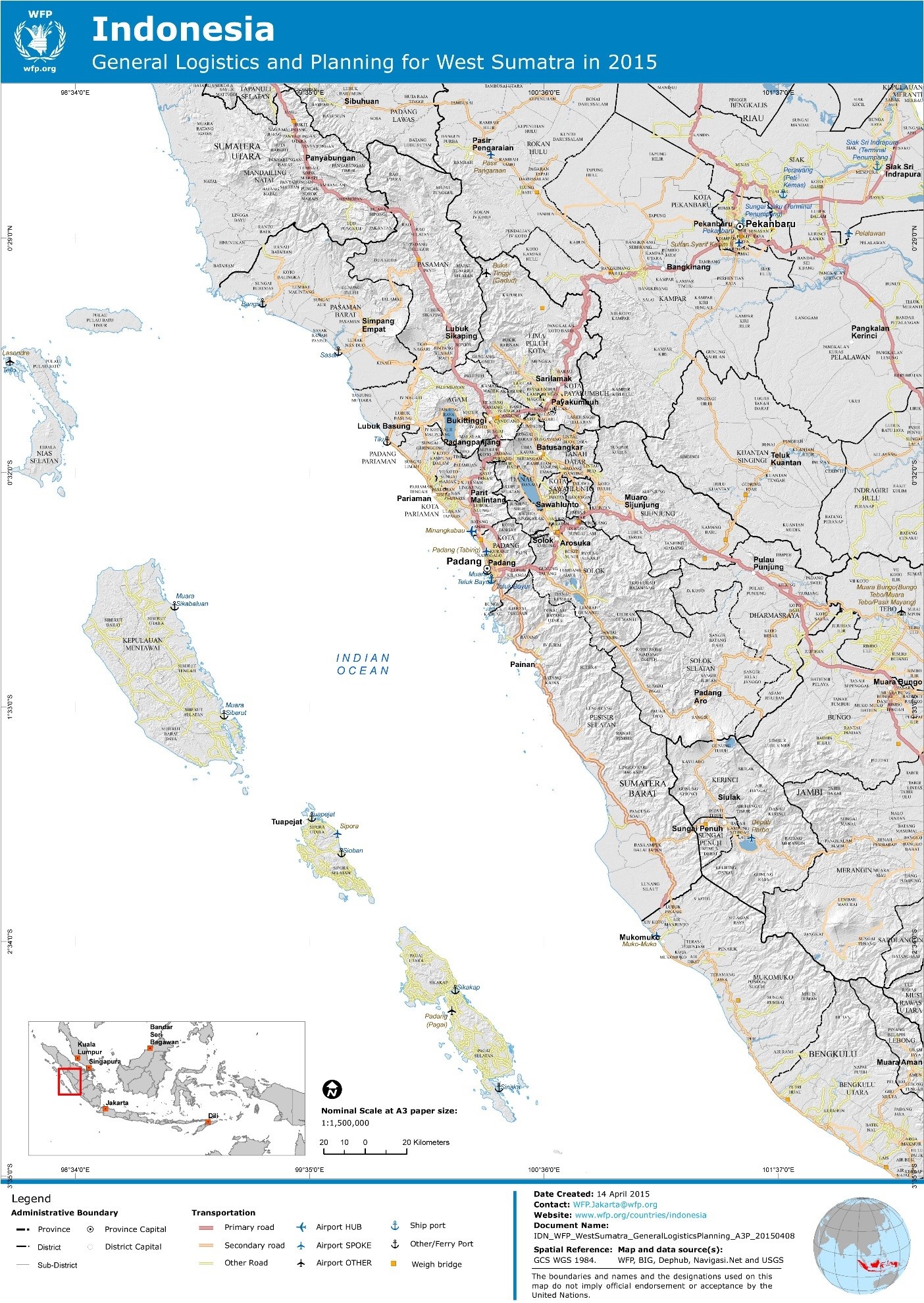
2 Indonesia Logistics Infrastructure
Indonesia Logistics Infrastructure Narrative
Although Indonesia has been significantly impacted by a number
of natural disasters, there is significant logistics capacity
nationally. In the provinces, the majority of the population are
able to be accessed by asphalt roads and there are a number of sea
ports located throughout the country which enable large scale
movement of cargo by sea.
The structure of the primary logistics providers is that they are
controlled by the Indonesian government. The sea ports (Pelindo),
airports (Angkasa Pura), passenger ferries (ASDP), airlines (Garuda
Indonesia) are controlled by majority owned government entities.
Currently substantial investment is on-going on these logistics
hubs, in particular with new seaports being constructed in Surabaya
and airports under-going extensive renovations or new development
areas such as Bali, Medan and Kupang. Private companies also
operate in the land transport and shipping areas to supplement
logistics movements.
The most substantial constraint that is faced by logistics
operations within Indonesia is road congestion. Congestion of the
roads can add hours or days onto transit times for cargo movements.
This congestion is most evident within the larger cities, as well
as the exit and entry in major sea ports.
Projects are underway to improve road access, for example the Trans
Papua road which is set to connect all of Papua province. However,
the construction of these roads is complex and expensive so may
take years to reach completion.
2.1 Indonesia Port Assessment

Because Indonesia encompasses a sprawling archipelago, maritime shipping provides essential links between different parts of the country. Boats in common use include large container ships, a variety of ferries, passenger ships, sailing ships, and smaller motorized vessels. Traditional wooden vessel pinisi still widely used as the inter-island freight service within Indonesian archipelago. Main pinisi traditional harbors are Sunda Kelapa in Jakarta and Paotere harbour in Makassar.
The Indonesia Port Corporations or PT Pelabuhan Indonesia (Pelindo) are state corporations responsible for the governance, regulation, maintenance and operation of ports and harbors in Indonesia. Company numbers correspond to regional coverage of ports, they are numbered 1 through 4 from west (Sumatra) to east (Papua).
-
Pelindo I is responsible for ports in Aceh, North Sumatra, Riau and Riau Islands.
-
Pelindo II is responsible for ports in West Sumatra, Jambi, South Sumatra, Bengkulu, Lampung, Bangka Belitung, Banten, Jakarta, West Java and West Kalimantan.
-
Pelindo III is responsible for ports in Central Java, East Java, Bali, South Kalimantan, Central Kalimantan, West Nusa Tenggara and East Nusa Tenggara
-
Pelindo IV.is responsible for ports in Papua, Maluku, East Kalimantan and Sulawesi.
In relation to the emergency plan herein; shippers would deal with:
-
Pelindo II for;Tanjung Priok (Jakarta), Teluk Bayur (West Sumatra), Pulau Baai (Bengkulu) and with;
-
Pelindo I for; Belawan (North Sumatra), Sibolga (North Sumatra)
Port Authorities
Indonesian port authorities answer to the Director General of Sea Transportation and are generally responsible for matters related to management of marine navigation, shipping lanes, port security, port road networks, cargo through flows, development plans and port tariffs.
Based on Law No. 17/2010 about shipping and Government Decree No. 61/2009 about Ports, it is defined as:
-
Port Authority is a government agency in the port as an authority which undertakes the function of setting, control, and monitoring the commercial activities inside the ports.
-
Port Technical Implementer Unit (UPT) is a government agency in the port as an authority which undertakes the function of setting, control, supervision of port activities, and provision of port to port services which are not related to commercial activities.
-
Syahbandar (Harbor Master) is a government official at the port which was appointed by the Minister and has the highest authority to execute and supervise the compliance with laws and regulations to ensure the safety and security of shipping.
Based on the Hierarchy of ports which stated in the Law No 17/2010, ports are classified into several types; according to the type of service to vessel and its cargo, ports are classified into:
-
Major Port (Pelabuhan Utama): a port that serves large ships and a collector port / cargo divider. The four Mayor Ports in Indonesia are: Tanjung Priok (Jakarta), Tanjung Perak (Surabaya), Belawan (Medan) and Makasar (Sulawesi). In Major Ports, Port Autority (OP) and Harbor Master (Syahbandar) are divided. It usually called Kantor Otoritas Pelabuhan Utama and Kantor Kesyahbandaran Utama.
-
Branch Port (feeder port): a port which is serving smaller vessels and serve to the main port. In feeder ports, the port authority and harbor master are merged. The office is called Kantor Kesyahbandaran dan Otoritas pelabuhan (KSOP) class I – V (the classification is based on the Number of vessel calls and cargo movement (TEUs or MT) per year.
Ports in Sumatra Island
In relation to the emergency plan for Western Sumatra, herein:
A. Major Ports include:
-
Tanjung priok (Jakarta)
-
Belawan (Medan)
B. Branch/ Feeder ports include:
-
Sibolga (Sibolga)
-
Pulau Baai (Bengkulu)
-
Teluk bayur (Padang)
Ports in Java Island
In relation to the emergency plan for Southern Java, herein:
A. Major Ports include:
-
Tanjung priok (Jakarta)
-
Tanjung Perak (Surabaya)
B. Branch/ Feeder Ports include:
-
Tanjung Emas (Semarang)
-
Ciwandan (Banten)
-
Merak Mas (Banten)
-
Tanjung Intan (Cilacap)
-
Lamong Bay (Surabaya)
2.1.1 Indonesia Jakarta Port of Tanjung Priok
Port Overview
Key port information can also be found at: http://www.jict.co.id or http://www.priokport.co.id
or http://www.indonesiaport.co.id/
- Located in North Jakarta, Tanjung Priok is the busiest port in Indonesia. It handles more than 30% of non-oil-and-gas cargo in the country, and around 50% of the entire flow of goods into and out of Indonesia.
- The area operated covers 197 hectares consisting of three (3) main terminals, Terminal 1, Terminal 2 and Terminal 3; then Two lines area, as well as areas managed by the Property Division.
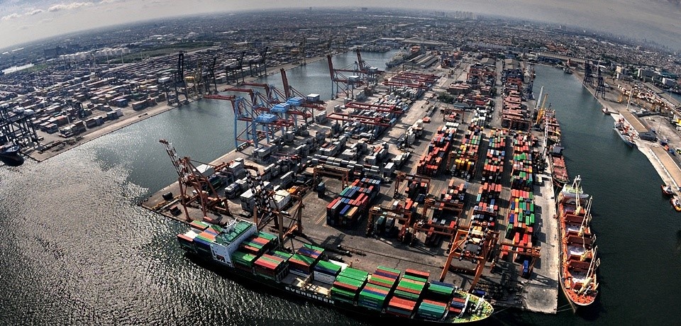
The Port of Tanjung Priok contains a total of 81 berths with a total length over 12.830 meters with alongside depths ranging from 3 to 14 meters.
- The Port of Tanjung Priok's 21 warehouses cover 101,972 M2, 62 conventional yards cover.
- Its open storage yards cover total of 1,995,074M2.
- The basin area covers 424 hectares, and the total land area is 604 hectares.
- The breakwater for the Port of Tanjung Priok is 8,456 m long.
- The channel is 3 Km long and it is 150 meters wide with a depth of 10 meters.
- The port has a rail connection, trains are loaded in the port and can connect to locations across Java
Indonesia Ports Corporation Tanjung Priok (IPC or PELINDO II) branch manages vessel traffic in port waters and basins, including anchoring and berthing of cargo ships. It provides:
- Pilotage and towing services
- Port facilities for berthing hand handling cargoes.
- Terminals for containers, conventional, bulk, and roll-on/roll-off cargoes and a passenger terminal.
- Management of the cargo distribution centre and inland container depot operations.
- Electricity and telephone services and drinking water.
- Space for office buildings, reception facilities, and industrial estates
The port business conducted by the Company is divided into several types of business, namely Ship Services, Goods Services and other services.
Ship Services
Ship operational activities renaging from entry to exit the port, covering:
- Mooring Services,
- Water Services and Refuelling Services.
Goods Services
Loading and unloading cargo from ships to delivery to the owner of the goods that includes:
- Stevedoring Services,
- Stacking Services,
- Pier Services,
- Warehouse Services,
- Goods Distributions and Consolidation Center Services
Other Services
Other services or also called miscellaneous services business is services beyond the ship, from items that support the activities of the port, covering:
- Port tools Rental Services,
- Other Services,
- Water Supply and Public Phone
- Passenger/Vehicle services
|
Port Contacts |
|||
|---|---|---|---|
|
Port Operating Company |
PT Pelabuhan Indonesia II (Persero) Cabang Tanjung Priok Address: Jl. Raya Pelabuhan No. 9, Tanjung Priok, Jakarta 14310 |
||
|
Latitude |
06°6’20” S |
Longitude |
106o 51'38” E |
|
Management (Central) Contact |
President Director |
Address |
Jl. Pasoso No. 1, Tanjung Priok, Jakarta Utara, Jakarta 14310 |
|
Telephone |
+62214367505 +62214301080 |
Fax |
|
|
|
Web |
||
|
Port Operating Company |
Jakarta International Container Terminal Address: Jl. Sulawesi Ujung No. 1, Tanjung Priok, Jakarta 14310 |
||
|
Telephone |
Fax |
||
|
|
N/A |
Web |
|
|
Port Operating Company |
KPPBC Type A (Customs) Tanjung Priok Address: Jl. Customs Port of Tanjung Priok 1, Jakarta Utara |
||
|
Contact |
Information Service Unit |
Mob |
|
|
Telephone |
Fax |
+622143931365 |
|
|
|
Web |
http://bcpriok.beacukai.go.id/?8d4ffc0a49351f557085d705494202d2 |
|
Port Picture
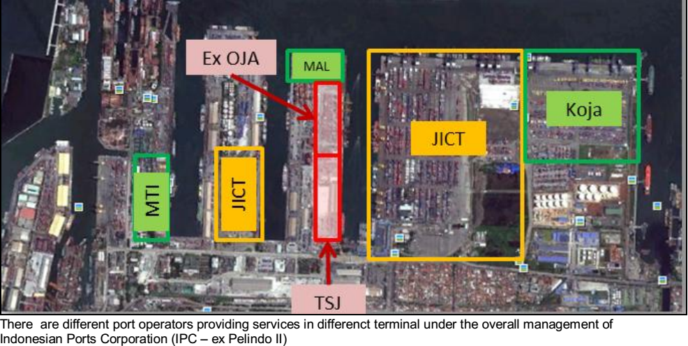
The port operators are:
- JICT: Jakarta International Container Terminal (http://www.jict.co.id)
- Koja: KOJA Container Terminal (http://www.tpkkoja.co.id)
- TSJ: PT. TANGGUH SAMUDERA JAYA (http://www.pttsj.com)
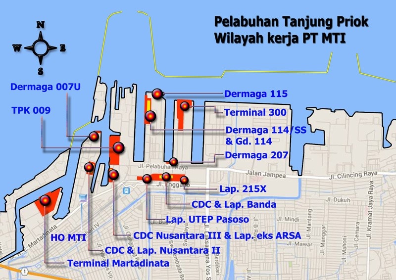
- MTI: Multi Terminal Indonesia (www.multiterminal.co.id)
- MAL: Mustika Alam Lestari
Description and Contacts of Key Companies
The Company’s head office is in Jakarta with operational areas across 10 provinces and managing 12 ports which are:
- Teluk Bayur Port in West Sumatra Province
- Jambi Port in Jambi Province
- Palembang Boom Baru Port in South Sumatra
- Bengkulu Port in Bengkulu Province
- Panjang Port in Lampung Province
- Tanjung Pandan Port
- Pangkal Balam Port in Bangka Belitung Province
- Banten Port in Banten Province
- Tanjung Priok Port
- Sunda Kelapa Port in DKI Jakarta Province
- Cirebon Port in West Java Province
- Pontianak Port in West Kalimantan Province
In addition, the Company has planned the construction of three new ports which are Kalibaru Utara Port (Jakarta), Sorong (West Papua) and Batam (Riau Island).
The Pelindo II also has ten subsidiaries being:
- KSO Terminal Petikemas Koja (TPK Koja)
- PT Jakarta International Container Terminal (JICT)
- PT Rumah Sakit Pelabuhan (RSP)
- PT EDI Indonesia (EDII)
- PT Multi Terminal Indonesia (MTI)
- PT Integrasi Logistik Cipta Solusi (ILCS)
- PT Indonesia Kendaraan Terminal (IKT)
- PT Jasa Peralatan Pelabuhan Indonesia (JPPI)
- PT Pengembang Pelabuhan Indonesia (PPI)
- PT Energi Pelabuhan Indonesia (EPI)
Besides conducting the port management activities, the Company is also engaged in other relevant business areas such as equipment maintenance, port energy supply, and port development. In running the port’s management and operational activities, the Company establishes Business Partner Cooperation (KSMU) together with business partners from private companies such as Terminal Operator cooperation, tug boats, and management of other port facilities.
Port Performance
The growth of International container flow from 232,87 thousand TEUs in 2015 to 503,90 thousand TEUs in 2016. While for the domestic container flow from 1.32 million TEUs in 2015 to 1.41 million TEUs in 2016.
Discharge Rates
http://www.priokport.co.id/index.php/tariff/berthing
Pilotage Fees
http://www.jict.co.id/?x0=Calculate&x1=18&x2=app
- Pilotage is required in the Port of Tanjung Priok.
- Pilots board vessels at the outer anchorage.
- Pilot services are available 24 hours a day.
- Ships must inform the pilotage division at least 24 hours before they arrive in Port.
Tug Services
- Tugs are available (the operator's name: P.N. Tunda Bara)
- Tug working hours: On Call.
- NB: vessels over 70 m have to use at least 1
tug.
Dry Dock Services
- The state-owned PN Dock provides repair services for vessels.
- Three floating dry docks with maximum capacity for 17,500 MT.
- Seven slipways have maximum capacity for 3.275 tons.
- Divers are available at PN Dock.
Hire of Labour and Equipment
All service charges are negotiated according to
requirements.
Berthing Equipment & Specification
http://www.priokport.co.id/index.php/facilities/equipment
|
Berthing Specifications |
|||
|---|---|---|---|
|
Berths |
Quantity |
Length (m) |
Draft (m) |
|
General Cargo Terminal |
42 |
6,329 |
5-11 |
|
Multipurpose Terminal |
5 |
772 |
8-11 |
|
Container Terminal |
15 |
3,193 |
9-14 |
|
Scraps iron Terminal |
2 |
200 |
11 |
|
Passenger Terminal |
1 |
375 |
9 |
|
Dry Bulk Terminal |
8 |
1242 |
3.5-10 |
|
Special Liquid Bulk Oil Terminal |
4 |
100 |
9-12 |
|
Special Bulk Liquid Chemical Terminal |
1 |
276 |
9 |
|
Beaching Point |
1 |
305 |
3 |
|
Car Terminal (U.Cons) |
2 |
268 |
10th |
|
Berthing Tugs |
15 Units |
||
|
Pilot Boats |
7 Units |
||
|
Water Barges |
1 Unit |
||
|
Police Boats |
YES |
||
|
Anti-Pollution Boats |
4 Units |
||
|
Speed Boats |
2 Units |
||
|
Pilot Boat |
7 Units |
||
|
Tugboat |
6 Units |
||
| Survey Ship |
1 Units |
||
| Trailer Boat |
7 Units |
||
| Cleaner Service Ship |
6 Units |
||
Port Cargo Handling Equipment
|
Port Cargo Equipment (Operational) |
|
|---|---|
|
Appliances & Models |
Quantity |
|
Shore Gantry (Container Crane) |
31 |
|
Mobile (rail-mounted) (Transtainer) |
94 |
|
Top loader |
1 |
|
Side loader |
1 |
|
Reachstacker |
40 |
|
Forklifts |
20 |
|
Tractors |
206 |
|
Trailers |
215 |
|
Vacuvators |
2 (600-1000 MT / HR) |
|
Bagging Machines |
Privately Owned (Indofood) |
General Services
All service charges are negotiated according to requirements.
Discharging Facilities
|
Container Facilities |
|
|
|---|---|---|
|
20 ft (TEU’s) |
40ft (FEU’s) |
|
|
Container facilities |
1,389,608 m² |
|
|
Container Freight Stations (CFS) |
2 Units - 16,447 m² |
|
|
Reefer Stations |
Available |
|
Port Terminals
|
Type Terminal |
Pier Number |
Length (m) |
Draft (m) |
|---|---|---|---|
|
General Cargo Terminal |
42 |
6.597 |
5-11 |
|
Multipurpose Terminal |
5 |
914 |
8-11 |
|
Container Terminal |
13 |
2800 |
9-14 |
|
Passenger Terminal |
3 |
450 |
9 |
|
Dry Bulk Terminal |
8 |
1242 |
4-10 |
|
Special Liquid Bulk Oil Terminal |
4 |
377 |
12 |
|
Special Bulk Liquid Chemical Terminal |
1 |
204 |
8 |
|
Beaching Point |
1 |
66 |
6 |
|
Car Terminal |
2 |
308 |
10 |
Oil Handling Terminal
- The Port of Tanjung Priok's Liquid Bulk Oil Terminal has four berths with a total length of 377 meters and alongside depth of 12 meters.
- The Bulk Liquid Chemical Terminal in the Port of Tanjung Priok
has one berth of 204 meters and alongside depth of 8
meters.
Multipurpose Terminal
- The General Cargo Terminal in the Port of Tanjung Priok contains 42 berths with a total length of almost 660 meters (over 2.1 million feet) and with alongside depths from five to 11 meters.
- The Multi-purpose Terminal in the Port of Tanjung Priok
contains five berths with a total length of 914 meters and
alongside depths from eight to 11 meters.
Grain & Bulk Handling
- The Port of Tanjung Priok's Dry Bulk Terminal has 8 berths with
a total length of more than 1,200 meters with alongside depth from
4 to 10 meters.
Main Storage Terminalals
- The Port of Tanjung Priok conventional terminal contains 169
thousand square meters of warehouse and 424 thousand square meters
of open yard.
Bagging-Grain Handling
- Operated by privately owned food company (INDOFOOD).
Ro/Ro Terminals
- The Car Terminal in the Port of Tanjung Priok has 2 berths with a total length of 308 meters and alongside depth of 10 meters (32.8 feet).
- The open storage yard for vehicles in the Port of Tanjung Priok
covers 12.4 acres.
Passenger Terminal
The Passenger Terminal in the Port of Tanjung Priok has 3 berths with a total length of 450 meters (1.5 thousand feet) with alongside depth of 9 meters (29.5 feet).
Container Terminal
- The container terminals offer 13 berths with total length of 2800 meters with alongside depths from 9 to 14 meters
- The Port boasts 2 container freight stations covering a total of 164.5 hectares and 3 container yards covering 387 acres
Jakarta International Container Terminal
Website: www.jict.co.id
- The Jakarta International Container Terminal (JICT) has 2,350 meters of berths. JICT I has 1.8 thousand meters of berths with alongside depths of 11 and 14 meters.
- JICT II has 516.6 meters of berths with alongside depth of 9 meters.
- JICT facilities are summarized below:
|
Description |
Terminal I |
Terminal II |
Total |
|---|---|---|---|
|
I. Berth |
|||
|
- Length |
1640 M |
510 M |
2150 M |
|
- Width |
26.5 - 34.9 M |
16 M |
|
|
- Draught |
11 - 14 M |
8.6 M |
|
|
II. Container Yard |
|||
|
- Area |
45.50 Ha |
9.24 Ha |
54.74 Ha |
|
- Capacity |
39,884 Teus |
7,056 Teus |
46.940 Teus |
|
1. Import |
1,027 Teus |
104 Teus |
1,131 Teus |
|
2. Export |
693 Teus |
200 Teus |
893 Teus |
|
3. Reefer |
546 Plug |
78 Plug |
624 Plug |
|
III. Equipment |
|||
|
- Quay Crane Container |
16 Unit |
3 Unit |
19 Unit |
|
- Rubber Tired Gantry Crane |
63 Unit |
11 Unit |
74 Unit |
|
- Head Truck |
128 Unit |
13 Unit |
141 Unit |
|
- Chassis / Trailers |
128 Unit |
21 Unit |
149 Unit |
|
- Forklif Diesel |
15 Unit |
6 Unit |
21 Unit |
|
- Reach Stacker |
4 Unit |
1 Unit |
5 Unit |
|
- Side Loader |
6 Unit |
- |
6 Unit |
|
IV. Number of Berth |
7 |
2 |
9 |
KOJA Container Terminal
Website: http://www.tpkkoja.co.id
- The Koja Container Terminal in the Port of Tanjung Priok has 650 meters of berthing space with alongside depth of 14 meters
- The Koja Container Terminal facilities are summarized below:
|
Description |
Total |
Unit |
|---|---|---|
|
I. Berth |
||
|
Length |
650 |
meters |
|
Width |
40 |
meters |
|
Draft Channel |
-14 |
m LWS |
|
Draft Wharf |
-13 |
m LWS |
|
II. Container Yard |
||
|
TGS |
5,700 |
slot |
|
Area |
25.72 |
HA |
|
Static Capacity for CY Import |
7,560 |
TEUs |
|
Static Capacity for CY Export |
7,696 |
TEUs |
|
Reefer Plug |
310 |
Plug |
|
III. Equipment |
||
|
Gate |
6 |
units |
|
Gantry/Container Crane |
7 |
units |
|
Head Truck |
48 |
units |
|
Chassis |
60 |
units |
|
RTG |
25 |
units |
|
Reachstacker |
3 |
units |
|
Fire Fighting Car |
1 |
unit |
Multi Terminal Indonesia
Website: http://www.multiterminal.co.id
The MTI Container Terminal facilities are summarized below:
|
Multi Purpose Terminal |
||
|---|---|---|
|
Facilities |
Length (M) |
Draft (LWS) |
|
Berth 007 |
75 |
-6 |
|
Berth 114/SS |
350 |
-14 |
|
Berth 115 |
250 |
-14 |
|
Berth 300 |
258 |
-12 |
|
Berth EX. ARSA |
60 |
-6 |
|
Berth INGGOM |
200 |
-6 |
|
Berth 207 |
144 |
-4 |
|
Facilities |
Size(M²) |
Capacity (cbm) |
|
Warehouse 114 |
4,950,00 |
20,000,00 |
|
Facilities |
Area (M²) |
Capacity (teus) |
|
Yard: Inggom |
88,500.00 |
14,426,91 |
|
Yard: 115 |
10,753,00 |
1,505,42 |
|
Yard: 300 |
41,661.33 |
- |
|
Equipment |
Capacity |
Number (Unit) |
|
Gantry Luffing Crane |
40 |
5 |
|
Grab |
3 |
3 |
|
Grab |
5 |
3 |
|
Electric Motor Grab |
Kap. 22 cbm |
3 |
|
Electric Motor Grab Multijaw |
Kap. 6 cbm |
2 |
|
Conveyor |
- |
4 |
|
Conveyor Transfer |
- |
8 |
|
Spreader Fixed |
40 |
1 |
|
Spreader Engkel |
40 |
1 |
|
Spreader Engkel |
20 |
2 |
|
Hopper Set |
- |
4 |
|
MesinJahit/Baging Scale |
- |
9 |
|
Baging Scale Manual |
- |
8 |
|
Conveyor Belt |
350 tons/hour |
2 |
|
Container Terminal |
||
|---|---|---|
|
Facility |
Total |
Unit |
|
Berth |
404,00 |
Meter |
|
Draft |
-9 |
LWS |
|
Yard Size |
63,935,47 |
M2 |
|
Holding Capacity |
4,179,00 |
Teus |
|
Reefer Plug |
104,00 |
Unit |
|
CFS |
100,00 |
M2 |
|
Equipment (Type) |
Capacity (MT) |
No. Units |
|
Container Crane |
35 |
4 |
|
Rubber Tyred Gantry Crane |
35 |
11 |
|
Head Truck |
35 |
16 |
|
Chasis |
35 |
18 |
|
Top Loader |
35 |
1 |
|
Side Loader |
15 |
2 |
|
Reach Stacker |
25 |
0 |
|
Weight Bridge |
50 |
3 |
Clearing Agents
Please refer to the annex for details of available clearing and forwarding agents.
Port Security
The port security systems appear to be well adhered to, there is also a Naval base at the west side of the port.
|
Security |
|
|---|---|
|
ISPS Compliant |
Yes |
|
ISPS Level (current) |
1=Normal |
|
Police Boats |
YES |
|
Fire Engines |
YES |
Storage Facilities
|
Port Storage - Managed by? |
||
|---|---|---|
|
Total Floor Space = m² |
Quantity |
Floor Area (m²) |
|
Conventional Warehouses |
21 |
101,972 m² |
|
Conventional Yards |
62 |
361,627 m² |
|
CFS Warehouses |
2 |
16,447 m² |
|
Dangerous Goods Warehouse |
6 Units |
10,260 m² |
|
Vehicles Yard |
1 Unit |
5 Ha |
|
Container Yards |
156.7 Ha |
|
2.1.2 Indonesia North Sumatra Port of Belawan Medan
Port Overview
Key port information can be found at: http://www.pelindo1.co.id/cabang/BLW/id/Default.aspx
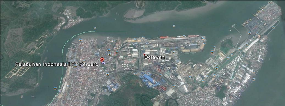
Belawan is a port city on the northeast coast of Sumatra, Indonesia. Located on the Deli River near the city of Medan, Belawan is Indonesia's busiest port outside of Java.
|
PORT’s LOCATION & CONTACTS |
|
|---|---|
|
Country |
Indonesia |
|
Province and District |
North Sumatera and Medan |
|
Town or City (Closest) |
Medan |
|
Port Name |
Belawan |
|
Latitude |
N 3’47’15 |
|
Longitude |
E 98’41’34 |
|
Company / Port Authority |
PT. Pelindo (Persero) Regional I Northern Sumatra / Belawan Port Authority |
|
Management contact and Position |
General Manager |
|
Management contact and Position |
Manager Humas |
|
Closest Airport and Frequent Airlines to / from International Destinations |
Airport name : Kualanamu International Airport Airlines: Air Asia, Air Asia Indonesia, Firefly, Jetstar Asia Airways, Lion Air, Malaysia Airlines, Mihin Lanka, Silk Air, Sriwijaya Air, Thai Lion Air |
The port of Belawan is located on the east coast of North Sumatra province. Approximately 12 km from the center of Medan, the capital of North Sumatra province.
- Belawan port is the biggest port in Sumatra island and ranked at 3rd biggest port in Indonesia.
- Belawan port is the main sea transportation gateway of import and export of various industrial products for Sumatra island and is able to support all container types, RoRo, bulk and break-bulk cargo.
- Under administration by PT. Pelindo (Persero) Regional I Northern Sumatera which manages, operates and supervises 3 branches companies and 1 subsidiary :
- Pelindo Branch Belawan Port as the port operator for provision of general services.
- Belawan International Container Terminal (BICT) as container terminal operator which provides the services of loading and discharging international container
- Belawan Domestic Container Terminal (TPKDB) as container terminal operator which provides the services of loading and discharging domestic container
- Prima Indonesia Logistik (PIL) a subsidiary company engaged in container depots and logistics services, providing integrated services between container handling services in BICT, TPKDB with PIL.
- PT. (Persero) Pelabuhan Indonesia I Branch Port of Belawan is also supervising the port of Pangkalan Susu and Pangkalan Brandan.
|
PERFORMANCE FOR YEAR: |
|
|---|---|
|
Seasonal Constraints |
No |
|
Rainy Season |
Yes; October to March |
|
Major Import Campaigns |
No |
|
Vessels calls |
2014: 4,192 calls |
|
Container traffic (TEUs) |
2014 Container Traffic 1. Belawan Domestic Container Terminal (TPKDB)
2. Belawan International Container Terminal (BICT)
|
|
Total cargo handling (m.tons) |
2014: 11,772,529 MT |
|
Handling Figures Bulk and Break Bulk |
January to April 2015
|

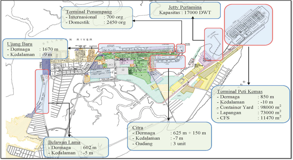
Belawan port has 4 general berths located along the port up to BICT area.
- Those berths consist of many smaller berths or jetties which used for specific activities; general cargo, bulk cargo, Crude Palm Oil (CPO), containers and passenger.
- Belawan port also has specific berth equipped with modern facilities and equipment for domestic and international container movements.
- The port has other equipment’s; speed boat, police boat, etc (but not under management of PT. Pelindo Belawan Port), operators; these equipment’s are under management of respective government departments or commercial sectors.
|
PORT SPECIFICATIONS |
|||
|---|---|---|---|
|
TOTAL BERTHS |
Quantity |
Length (m) |
Draft (m) |
|
Conventional Berths |
17 |
(7) 688.71m (4) 1670m (2) 625m (4) 300m |
5-7m MLWS 9m MLWS 5-8m MLWS 4-6m MLWS |
|
Container Berths |
2 |
Domestic: 400m International: 500m |
8-10m MLWS 8-10m MLWS |
|
Bulk Oil Jetties (PT. Pertamina) |
1 |
Capacity: 17,000 DWT |
|
|
Berthing Tugs & Mooring Boats |
3 |
|
|
|
Water Barges |
YES |
||
|
Police Boats |
6 units |
||
Port of Belawan is an international port services includes:
-
Port and harbour services
-
Pilotage service
-
Towage service
-
Cargo and goods services
-
Basin/pool and waters services
-
Warehouse, open storage, container yard and Container Freight Station (CFS) services
-
Containers services
-
Operating and rental of handling equipment
-
Operating TBAL (Land, Building, Water, Electricity)
-
And provide other services.
General services are organized by respective agents and operators, therefore all rates for general services vary depending on the services provided.
Port of Belawan Branch (PELINDO I) manages vessel traffic in port waters and basins, including anchoring and berthing of cargo ships. It provides:
-
Pilotage and towing services
-
Port facilities for berthing hand handling cargoes.
-
Terminals for containers, conventional, bulk, and roll-on/roll-off cargoes and a passenger terminal.
-
Management of the cargo distribution centre and inland container depot operations.
-
Electricity and telephone services and drinking water.
-
Space for office buildings, reception facilities, and industrial estates
Ship Services; PELINDO provides ship services, from the time ships enter the port until their departure. The services provided are:
-
Anchorage Service
-
Mooring Service
-
Pilotage Service
-
Towage Service
-
Fresh Water Service
-
Near Service
Cargo Services; PELINDO provides a stevedoring services of the ships to the delivery of the cargoes to the owners. The provided services are:
-
Public Berth
-
Storage Warehouse
-
Storage Yard
-
Private Berth
-
Other Services
-
General services are organized by respective agents and operators, therefore all rates for general services vary depending on the services provided.
-
A regular ferry service connects Belawan to across the Strait of Malacca to Penang, Malaysia; at times a ferry has also run from Belawan to Satun, Thailand.
PT. National Shipping Indonesia (PELNI) is a national shipping company that provides marine transportation freight services, including transport services of passengers and cargo between islands. The link can be found at website : www.pelni.co.id
-
Currently operates 25 ships and 3 passenger ships goods that serve a variety of routes within the archipelago and connects all the main islands of Indonesia from Sumatra to Papua
-
The 3 Roro types are Caraka 3600 GT; CJN III-4, CJN III-2, and CJN III-1
-
PT. PELNI is also provide Freight Forwarding, Stevedoring and Cargo dooring Services.
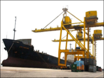
Port Handling Equipment
-
Port cargo handling equipment are available everywhere at the port.
-
Most of large scale companies operating at the port have their owned equipments to support their operations, some of them also provide service of rental handling equipment, etc.
-
PT. Pelindo (Persero) Belawan Port as port operator, PT. Pelindo (Persero) Belawan International Container Terminal (BICT) as operator of International container terminal and PT. Pelindo (Persero) Belawan Logistics Centre (BLC) are the main players in the port.
|
PORT CARGO EQUIPMENT (OPERATIONAL) |
|
|
|---|---|---|
|
Appliance |
Quantity |
Capacity |
|
Fire engines |
3 |
4 T (2 Units) 2 T (1 Unit) |
|
Reachstacker at BICT+TPKDB |
8 |
40-45 MT |
|
Container Crane at BICT+TPKDB |
11 |
|
|
Rubber Tyred Gantry Crane at BICT+TPKDB |
22 |
|
|
Side Loader at BICT+TPKDB |
3 |
|
|
Headtruck at BICT+TPKDB |
43 |
|
|
Chassis at BICT+TPKDB |
52 |
|
Custom Guidance
-
For Emergency situation priority given for humanitarian aid (logistic and equipment)
-
Customs clearance is available through the local customs office in the port.
Multi-Purpose Terminal
Most of Belawan Port’s terminals are multi purpose terminals.
-
Belawan Lama Terminal
-
Ujung Baru Terminal
-
Citra Terminal
-
IKD Terminal
-
IKD-2 Terminal
For Ujung Baru Terminal, quay number 109 to 111 dedicated berth for dry bulk cargo vessels and quay number 105 to 107 dedicated berth for liquid cargo vessels.
Grain and Bulk Handling
Port of Belawan’s bulk handling terminal facilities are:
-
Dry bulk terminal dedicated for fertilizer with length 100 m and 500,000 tons/year capacity
-
Dry bulk terminal dedicated for cement with length 100 m and 500,000 tons/year capacity
-
Dry bulk terminal dedicated for residue of copra with length 100 m and 985,000 tons/year capacity.
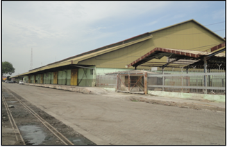
Main Storage Terminal
-
Port of Belawan has 25 warehouses with the total area 61,474.04 m2.
-
It has 23 yards with the total area 64,386.96 m2 and 7 container yards with the total area 262,490 m2.
|
Port Storage Managed by PT. Pelindo |
||
|---|---|---|
|
Total floor space |
No, of Storage Facilities |
Area (sqm) |
|
Storage Type |
25 |
61,474 |
|
Bagged Cargo |
2 |
|
|
Refrigerated Cargo |
Reefer Plug : 144 point |
|
|
General Cargo |
Included above. |
|
Stavedoring
There are 36 Stevedoring Companies operating at Belawan Port
-
Stevedoring activities are organizing by third parties (stevedoring company/PBM) through Labor Union Associations (TKBM) at Belawan port under supervision of Port Authority.
-
The owner/importer can also discharge their own cargo directly through the Labor Union Associations.
-
Shore handling activities for containers are organized by Pelindo or stevedoring companies at Belawan port.
-
All of them provide full or semi-full package services; organizing labor and handling equipment, discharging goods at the port, and delivering the goods at the customers’ warehouses directly.
Hinterland Information
Belawan is the main port for the island of Sumatra which is the largest island that is entirely in Indonesia and the sixth largest island in the world at 473,481 km2.
-
Sumatra has great natural wealth; about 70% of the country's income is produced there
-
The island has some of Indonesia's richest oil fields, its finest coalfields, and deposits of gold and silver
-
Its offshore offshore islands are known for their tin and bauxite
-
Most of the country's rubber and coffee is grown in Sumatra; pepper, tea, sugarcane, and oil palms are also grown on plantations
-
The Deli region around Medan is famous for its tobacco
-
Rice, corn, and root crops are raised for local consumption. Timber cut includes camphor and ebony
Port Security
Belawan port has applied the International Ship and Port Security Service Code (ISPS Code)
- Based on the Government Statement of Compliance of Port Facility No. KL.94/93/ISPS/DV/ST-04 in accordance to International Maritime Organization’s (IMO) rules and regulations.
|
Security |
|
|---|---|
|
ISPS Compliant |
Yes |
|
ISPS Level (current) |
1= Normal |
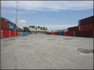
Storage Facilities
Belawan port has many storages facilities; warehouses, open storages, container yards and Container Freight Stations (CFS).
|
Port Storage |
||
|---|---|---|
|
(Managed by PT. Pelindo Belawan Port, PT. Pelindo BICT and PT. PIL) |
Quantity |
Floor area (m²) |
|
Main Quay Transit Sheds |
Multiple (open storage locations) |
Total 112,949.76 m2 |
|
Back of Port Transit Sheds |
||
|
Warehouses |
Multiple |
Total 52,399.12 m2 |
|
Container Yards |
3 container yards |
Total 362,326 m2 |
|
Container Freight Stations (CFS), |
3 units |
Total 7,000 m2 |
|
Lighterage Area Transit Sheds |
At the open storage |
At the open storage |
|
Customs Warehouses |
Yes |
Yes |
|
Total |
|
534,614 m² |
PT. Pelindo Warehouse
PT. PIL General Container Yard
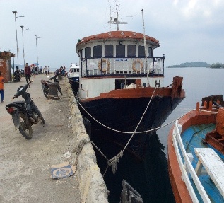
2.1.3 Indonesia North Sumatra Port of Sibolga
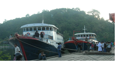
Port Overview
Sibolga port is located on the west coast of Sumatra island and is 1 km away from the Sibolga downtown. Beside catering transport of goods, it also connects the ferry line to Nias island. The coastal hydrography around the Sibolga Port is curvy, steep, and rocky.
Port website: https://www.pelindo1.co.id/cabang/sbg/id/default.aspx
|
Port Location and Contact |
|
|
Country |
Indonesia |
|
Province or District |
North Sumatra, Central Tapanuli District |
|
Nearest Town or City with Distance from Port |
Tarutung, North Tapanuli District (60 km) |
|
Port's Complete Name |
Sibolga Port |
|
Latitude |
01 43′ 48 N |
|
Longitude |
98 46′ 57 E |
|
Managing Company or Port Authority |
PT. Pelindo I Sibolga Office Branch |
|
Management Contact Person |
Suhari GM Pelindo I Sibolga Phone: (+62) 0812 6031 923 Email: sibolga@pelindo1.co.id |
|
Nearest Airport and Airlines with Frequent International Arrivals/Departures |
Domestic airport: DR. Ferdinand Lumban Tobing Garuda Indonesia Citilink Wings Air Aviastar |
Port Picture

Description and Contacts of Key Companies
There are several big companies collaborated with the Sibolga Port Authority such as PT. Meratus Line: http://www.meratusline.com/eng/home/
For more information on port contacts, please see the following link: 4.4 Indonesia Port and Waterways Company Contact Lists
Port Performance
The Sibolga port provides services for domestic and international cargo movements, including containers. The port also caters inter-island connections.
|
Seasonal Constraints |
||
|
|
Occurs |
Time Frame |
|
Rainy Season |
Yes |
September - December |
|
Major Import Campaigns |
No |
|
|
Other Comments |
N/A |
|
|
Handling Figures for 2018 |
|
|
Vessel Calls |
250 |
|
Container Traffic (TEUs) |
7,500 |
Discharge Rates and Terminal Handling Charges
Port rates and charges of various services can be referred to the government regulation under PP.11 tahun 2015. The full regulation can be download here: http://jdih.dephub.go.id/assets/uudocs/pp/2015/PP_11_Tahun_20152.pdf
Berthing Specifications
|
Type of Berth |
Quantity |
Length (m) |
Maximum Draft (m) |
Comments |
|
Conventional Berth |
1 |
153 x 31.5 m |
8 |
|
|
Container Berth |
- |
- |
- |
- |
|
Silo Berth |
- |
- |
- |
- |
|
Berthing Tugs |
1 |
- |
- |
- |
|
Water Barges |
- |
- |
- |
- |
General Cargo Handling Berths
|
Cargo Type |
Berth Identification |
|
Imports - Bagged Cargo |
Conventional Berth |
|
Exports - Bagged Cargo |
Conventional Berth |
|
Imports and Exports - RoRo |
|
|
Other Imports |
|
Port Handling Equipment
|
Equipment |
Available |
Total Quantity and Capacity Available |
Comments on Current Condition and Actual Usage |
|
Dockside Crane |
No |
|
|
|
Container Gantries |
No |
|
|
|
Mobile Cranes |
Yes |
1 unit, 45 MT |
Good |
|
Reachstacker |
Yes |
1 unit, 45 MT |
Good |
|
RoRo Tugmaster (with Trailer) |
Yes |
15 units |
Good |
|
Grain Elevator with Bagging Machines |
No |
|
|
|
Transtainer |
No |
|
|
|
Forklifts |
Yes |
2 unit (1 unit of 5 MT and 1 unit of 15 MT) |
Good |
Container Facilities
|
Facilities |
20 ft |
40 ft |
|
Container Facilities Available |
Yes |
Yes |
|
Container Freight Station (CFS) |
Yes |
Yes |
|
Refrigerated Container Stations |
N/A |
N/A |
|
Other Capacity Details |
||
|
Daily Take Off
Capacity |
200 |
|
|
Number of Reefer
Stations |
N/A |
|
|
Emergency Take-off Capacity |
N/A |
N/A |
|
Off take Capacity of Gang
Shift |
|
|
Customs Guidance
Customs clearance is available at the nearest office:
KPPBC TP SIBOLGA:Jalan Horas Pelabuhan Sambas Sibolga 22532
Terminal Information
MULTIPURPOSE TERMINAL
Sibolga port is a multipurpose terminal for cargo as well as passengers. The passenger terminal is a two-story building and can accommodate up to 500 passengers. The previous building could only accommodate around 80 passengers. Currently, Sibolga port can be berthed up to 4 vessels with capacity up to 6,000 GT in size. Facilities available in the port includes container yard with capacity of 20,000 TEUs per year, trestle reinforcement, and breasting dolphin.
GRAIN AND BULK HANDLING
There is no handling activity for grain and built in the port.
MAIN STORAGE TERMINAL
There are two warehouses as follows:
-
PT. Pelindo
- Dimension: 20 m x 45 m
- Capacity : 900m2
- Private
owned
- Dimension: 16 m x 50 m
- Capacity: 800m2
|
Storage Type |
Number of Storage Facilities |
Area (m2) |
|
Bagged Cargo |
N/A |
|
|
Refrigerated Cargo |
N/A |
|
|
General Cargo |
1 |
120 x 45 m = 900 m2 |
Stevedoring
Stevedoring activities are organized and managed by third party company (stevedoring company or Tenaga Kerja Bongkar Muat-TKBM).
Hinterland Information
Sibolga port is the main access for transportation and distributions of goods and basic needs to the West Coast of North Sumatra. The port also serves incoming goods from both domestic and International liners as well as ferries to and from Nias.
The main commodities productions from the surrounding area are rubber, copra, plywood and beam/timber.
Port Security
|
Security |
|
|
ISPS Compliant |
Yes |
|
Current ISPS Level (Level 1 = Normal, Level 2 = Heightened, Level 3 = Exceptional) |
1 |
|
Police Boats |
1 |
|
Fire Engines |
1 |
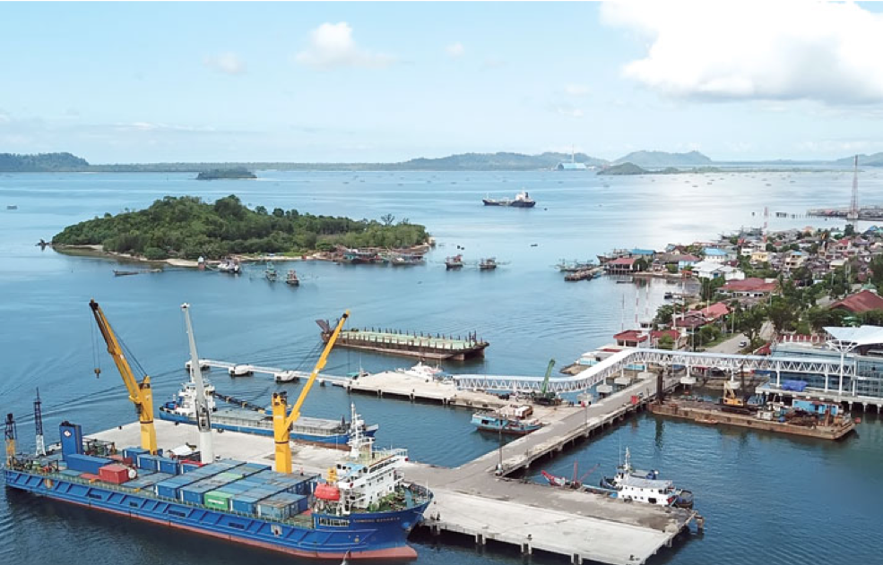
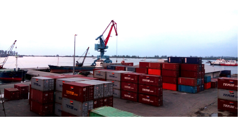
2.1.4 Indonesia Bengkulu Port of Bengkulu
Port Overview
The port of Bengkulu is located in Baai Island, about 20 kilometres from Bengkulu city. The port is under the authorization of the Harbor Master’s Office and Port Authority (KSOP) and is operated by PT. Pelabuhan Indonesia II (Persero) Pulau Baai Bengkulu Branch. Bengkulu port as a natural harbor is sheltered from the ocean waves as the entrance channel to the port is limited.
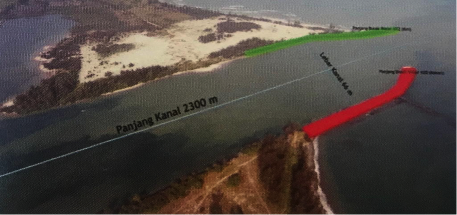
Bengkulu port entrance channel is supported by a breakwater:
- Channel length 2,300m
- Channel width 6m
- Channel Draft: -2 to -12m LWS
- Vessels capacity: 3,000 to 35,000 DWT
Port website: http://www.bengkuluport.co.id/
Key port information may also be found at: http://www.indonesiaport.co.id/
|
Port Location and Contact |
|
|
Country |
Indonesia |
|
Province or District |
Bengkulu Province |
|
Nearest Town or City with Distance from Port |
Bengkulu City ~17 km ( ~30 minute travel time) |
|
Port's Complete Name |
Pulau Baai Port |
|
Latitude |
3° 54` 26" S |
|
Longitude |
102° 18` 09" E |
|
Managing Company or Port Authority
|
PT. Pelabuhan Indonesia II (Persero) Cabang Bengkulu |
|
Management Contact Person |
Amir Wijaya, SE Operation Manager PT. Pelindo II M. +62 821 846 99998 / +62 811 730 966 Email. Amir.wahab866@gmail.com |
|
Nearest Airport and Airlines with Frequent International Arrivals/Departures |
Fatmawati Soekarno Airport. Frequent Domestic airlines:
|
Port Picture
Port Performance
Pulau Baai Port service system (new) operates 24 hours a day and seven days a week (24/7). The utilisation of the new system is part of the strategy to improve the efficiency of the port.
|
Seasonal Constraints |
||
|
|
Occurs |
Time Frame |
|
Rainy Season |
Yes |
From October to February |
|
Major Import Campaigns |
No |
n/a |
|
Other Comments |
The main problem of the port is a high rate of sedimentation in the quay, which requires routine dredging at relatively high cost and is time consuming. |
|
|
Handling Figures for 2018 |
|
|
Vessel Calls |
1,704 |
|
Container Traffic (TEUs) |
27,185 |
|
Handling Figures Bulk and Break Bulk for 2018 |
|
|
Bulk (MT) |
2,582,958 |
|
Break bulk (MT) |
503,874 |
Discharge Rates and Terminal Handling Charges
For information on port rates and charges, please see the following link:
www.dephub.go.id (PP.11 tahun 2015)
Berthing Specifications
|
Type of Berth |
Quantity |
Length (m) |
Maximum Draft (m) |
Comments |
|
Conventional Berth |
Berth Samudera |
165 x 18 |
-9.1 m LWS |
Dry bulk (coal shell and clinker) |
|
Berth Nusantara |
84 x 16 |
- (6-7) m LWS |
Liquid Bulk and General Cargo |
|
|
Berth Lokal |
102.5 x 10 |
-4.5 m LWS |
Ship and General Cargo |
|
|
Container Berth |
Berth Nusantara I |
126.6 x 20 |
- (7-8) m LWS |
Container and General Cargo |
|
Silo Berth |
1 |
|
|
|
|
Berthing Tugs |
2 |
|
|
|
|
Water Barges |
1 |
|
|
|
Port
website: http://www.bengkuluport.co.id/
General Cargo Handling Berths
|
Cargo Type |
Berth Identification |
|
Imports - Bagged Cargo |
Berth Nusantara I |
|
Exports - Bagged Cargo |
Berth Nusantara I |
|
Imports and Exports - RoRo |
Nil |
|
Other Imports |
Nil |
Port Handling Equipment
The port equipment is managed by PT. Pelindo II Bengkulu.
|
Equipment |
Available
|
Total Quantity and Capacity Available |
Comments on Current Condition and Actual Usage |
|
Dockside Crane |
Undetermined |
|
|
|
Container Gantries |
Yes |
1 unit |
Good |
|
Mobile Cranes |
Yes |
1 unit (PT. SAI) – 25 MT |
Good |
|
Reachstacker |
Yes |
2 units - 45 MT |
Good |
|
RoRo Tugmaster (with Trailer) |
Undetermined |
|
- |
|
Grain Elevator with Bagging Machines |
Undetermined |
|
- |
|
Transtainer |
Undetermined |
|
- |
|
Forklifts |
Yes |
5 units - 2,5 T |
Good |
|
Gantry Luffing Crane (GLC) SWL |
Yes |
1 unit – 40 MT |
Good |
|
Head Truck |
Yes |
4 units – 40 MT |
Good |
|
Bulldozer |
Yes |
1 unit 75 HP |
Good |
|
Wheel Loader |
Yes |
2 units |
Good |
|
Chassis 40'' |
Yes |
4 units |
Good |
|
Chassis 20'' |
Yes |
2 units |
Good |
|
Conveyor Belt |
Yes |
2 units |
Good |
Container Facilities
Services for loading and unloading containers to and from ships / barges uses Gantry Luffing Crane. Container Yard (CY) Nusantara I (12,000 m2) and Nusantara II (8,000 m2) can accommodate around 1,000 (TEUs) of containers.
The Container Service Procedure is summarised in the following document:
|
Facilities |
20 ft |
40 ft |
|
Container Facilities Available |
Yes |
Yes |
|
Container Freight Station (CFS) |
Yes |
Yes |
|
Refrigerated Container Stations |
1 |
1 |
|
Other Capacity Details |
1,000 TEUs Capacity at Berth Nusantara I & II |
|
|
Daily Take Off
Capacity |
80 |
|
|
Number of Reefer
Stations |
4 |
|
|
Emergency Take-off Capacity |
Nil |
|
|
Off take Capacity of Gang
Shift |
Nil |
|
Customs Guidance
Customs clearance is available through the local customs office in the port. http://www.beacukai.go.id/ (note: website is available in Indonesian only)
Further information can also be found at the following link: 1.3 Indonesia Customs Information
Terminal Information
MULTIPURPOSE TERMINAL
There are several open areas that can be used for multipurpose activities:
- Stacking Yard at Samudra Berth →12,000 m2
- Stacking Yard at Nusantara I (CY) →12,000 m2
- Stacking Yard at Nusantara II (CY) →8,000 m2
- Stacking Yard at Stockpile Area Berth 50,000 m2
All conventional berths can be used for multipurpose activities.
- Berth Nusantara Lama Length 84 m and width 18m (-9 MLWS)
- Berth Lokal Length 124m and width 10m(-3 MLWS)
- Berth Samudera Lenght 165m and width 18m (-9 MLWS)
PT. Indonesia Ferry (ASDPPersero) as operator for Ro-Roferry, provides the services from Pulau Baai (island) to Pulau Enggano (island). The capacity of Ro-Ro ferry is 750 GRT, which uses Berth Lokal with Length 124m and width 10m (-3 MLWS).
GRAIN AND BULK HANDLING
Pulau Baai port has two conveyor belts to load and unload the commodity in dry bulk terminal with existing capacity ± 2,2 million tons/year and designed capacity ± 10 million tons/years
MAIN STORAGE TERMINAL
|
Storage Type |
Number of Storage Facilities |
Area (m2) |
|
Bagged Cargo |
1 (General) |
1,750 m2 |
|
Refrigerated Cargo |
Nil |
Nil |
|
General Cargo |
1 (General) |
1,750 m2 |
Stevedoring
Stevedoring activities organized by third parties (authorised stevedoring company) in coordination with the Labour Union Association (TKBM) administered by Port Authority (KSOP) Office. The owner/importer can also discharge their own cargo by contacting the Labour Union Association directly.
All provide full or semi-full package services; organizing labourer and handling equipment, discharging goods at the port, and delivering the goods at the customer’s warehouses directly.
Hinterland Information
The port serves a vast inland area with mining, plantation and forestry potential.
Hinterland activities along the west coast of Sumatra includes palm oil, coffee, crumb rubber, ginger, cacao, molding and mining products. However, these industries are not fully utilizing the Pulau Baai Bengkulu Port but rather using other ports, such as Palembang Port, Panjang Port and Teluk Bayur Port.
Port Security
|
Security |
|
|
ISPS Compliant |
Yes |
|
Current ISPS
Level |
1 |
|
Police Boats |
Yes |
|
Fire Engines |
Yes |
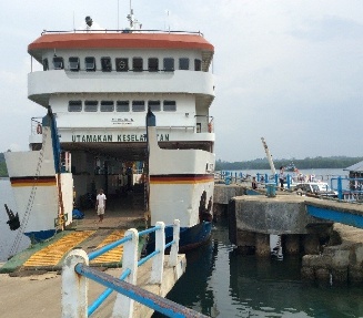
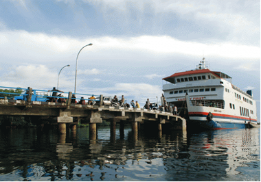
2.1.5 Indonesia West Sumatra Port of Teluk Bayur Padang
Port Overview
Teluk Bayur is a port located in Bayur Bay of Padang city, West Sumatra. It is the largest and busiest port in the western coast of Sumatra and is operated by the government state-owned company PT (Persero) Pelabuhan Indonesia II (Indonesia Port Corporation II). A new container terminal officially opened in 2013, serving more than 4,000 containers in 46,886 sqm.
Port website: http://telukbayurport.co.id/
Key port information may also be found at: http://www.maritime-database.com
|
Port Location and Contact |
|
|
Country |
Indonesia |
|
Province or District |
West Sumatra Province |
|
Nearest Town or City with Distance from Port |
Padang 8 km |
|
Port's Complete Name |
Teluk Bayur |
|
Latitude |
-0.995901 |
|
Longitude |
100.370505 |
|
Managing Company or Port Authority |
PT Pelabuhan Indonesia II (Persero) Cabang Teluk Bayur |
|
Management Contact Person |
Mr. Armen Amir Operation Manager Pelindo II +62751 61646 /61638 /61639 |
|
Nearest Airport and Airlines with Frequent International Arrivals/Departures |
Minangkabau International Airport Airlines with International Arrival/Departures: Air Asia, Lion Air, Garuda Indonesia |
Port Picture
Description and Contacts of Key Companies
Kantor Syahbandar dan Otoritas Pelabuhan (KSOP) Class II Teluk Bayur is a Technical Implementation Unit (UPT) under the General Director of Sea Transportation, the Ministry of Transportation. The operational area is along the coast of West Sumatra province starting from Pesisir Selatan district to West Pasaman district.
Contacts:
Address : Jl. Tanjung Priok No. 4 Teluk Bayur, Kecamatan Padang Selatan, Kota Padang. Provinsi Sumatera Barat 25217
Phone : (0751) 61633, 62017
Fax: (0751) 767388
PT. PELINDO II Teluk Bayur Port (IPC) PT Pelabuhan Indonesia II (Persero) or often known as Pelindo II is a government state-owned company engaged in logistics, specifically in port management and development.
Contacts:
Address : Jl. Semarang no 3 Teluk Bayur, Kecamatan Padang Selatan, Kota Padang. Provinsi Sumatera Barat 25217
Phone : +62751 61639
Mobile : +6281267131602
For more information on port contacts, please see the following link: 4.4 Indonesia Port and Waterways Company Contact Lists
Port Performance
Average loading rate 9,000 – 10,000 mt / day, consist of 4 working gangs and subject to cargo readiness. Maximum draft 9,8 mtr, with channel depth -10mlws.
|
Seasonal Constraints |
||
|
|
Occurs |
Time Frame |
|
Rainy Season |
Yes |
September – January |
|
Major Import Campaigns |
No |
|
|
Handling Figures for 2017 |
|
|
Vessel Calls |
2,746 |
|
Container Traffic (TEUs) |
68,629 |
|
Handling Figures Bulk and Break Bulk for 2017 |
|
|
Bulk (mt) |
11,121,331 |
|
Break bulk (mt) |
677,650 |
Discharge Rates and Terminal Handling Charges
Information about port rates and charges are available at:
http://www.telukbayurport.co.id/index.php/fasilitas/pelayanan-fasilitas
http://www.telukbayurport.co.id/index.php/tarif-kapal-dalam-negeri
http://www.telukbayurport.co.id/index.php/penumpukan
Berthing Specifications
|
Type of Berth |
Quantity |
Length (m) |
Maximum Draft (m) |
Comments |
|
Conventional Berth |
11 |
|
|
|
|
Container Berth |
3 |
|
|
|
|
Silo Berth |
3 |
|
|
|
|
Berthing Tugs |
3 |
|
|
|
|
Water Barges |
|
|
|
|
Port Handling Equipment
|
Equipment |
Available |
Total Quantity and Capacity Available |
Comments on Current Condition and Actual Usage |
|
Gantry Jib Crane |
Yes |
3 units / 25 mt |
Good |
|
Luffing Gantry Crane |
Yes |
4 units / 40 mt |
Good |
|
Mobile Cranes |
Yes |
1 unit / 25 mt |
Good |
|
Reachstacker |
Yes |
3 units / 45 mt |
Good |
|
RoRo Tugmaster (with Trailer) |
Yes |
16 units / 9 unit 40” and 7 units 45” |
Good |
|
Grain Elevator with Bagging Machines |
No |
|
|
|
Transtainer |
Yes |
|
|
|
Forklifts |
Yes |
10 units |
Good |
|
Weighbridge |
Yes |
1 unit |
Good |
|
Reefer Plug Portable |
Yes |
|
|
|
Dump Truck |
Yes |
6 units |
Good |
|
Excavator |
Yes |
3 units |
Good |
|
Wheel loader |
Yes |
6 units |
Good |
Container Facilities
|
Facilities |
20 ft |
40 ft |
|
Container Facilities Available |
Yes |
Yes |
|
Container Freight Station (CFS) |
Total 5,250 m2 |
|
|
Refrigerated Container Stations |
Yes |
Yes |
|
Other Capacity Details |
|
|
|
Daily Take Off
Capacity |
120 |
|
|
Number of Reefer
Stations |
|
|
|
Emergency Take-off Capacity |
Nil |
Nil |
|
Off take Capacity of Gang
Shift |
Nil |
Nil |
Customs Guidance
Customs clearance is available through the local customs office located in the port. http://www.beacukai.go.id/
For more information on Customs in Indonesia, please see the following link: 1.3 Indonesia Customs Information
Terminal Information
Multipurpose Terminal
All conventional berths and jetties can be used for multipurposes activities.
- Berth 1: 150m
- Berth 2: 150m
- Berth 3: 142m
- Berth KS: 98m
- Berth Muara Padang 1: 100m
- Berth Muara Padang 2: 37m
- Jetty for CPO: 30m
- Jetty for Coal : 45m
- Berth for Coal : 21m
- Berth Air Bangis: 55m
- Multipurpose berth: 175m
Main Storage Terminal
There are 12 permanent warehouses and 1 warehouse dedicated for cold storage.
|
Storage Type |
Number of Storage Facilities |
Area (m2) |
|
Bagged Cargo |
12 |
19,516 |
|
Refrigerated Cargo |
1 |
5,250 |
|
General Cargo |
|
|
Stevedoring
Stevedoring activities organized by third parties (authorised stevedoring company) in coordination with the Labour Union Association (TKBM) and administered by Port Authority (KSOP) Office. The owner/importer can also discharge their own cargo by contacting the Labour Union Association directly.
Hinterland Information
The main hinterland of Teluk Bayur Port is in West Sumatra Province which covers 42,297 km2. As the main port in the West Coast of Sumatra, Teluk Bayur Port serves commodity from its hinterland area, such as coal, cement, palm oil, rubber, fertilizer, etc.
Teluk Bayur Port is open for international trade activities supported by several economic centres including Muara Padang and Air Bangis.
Port Security
|
Security |
|
|
ISPS Compliant |
Yes |
|
Current ISPS
Level |
1 |
|
Police Boats |
Yes |
|
Fire Engines |
Yes |
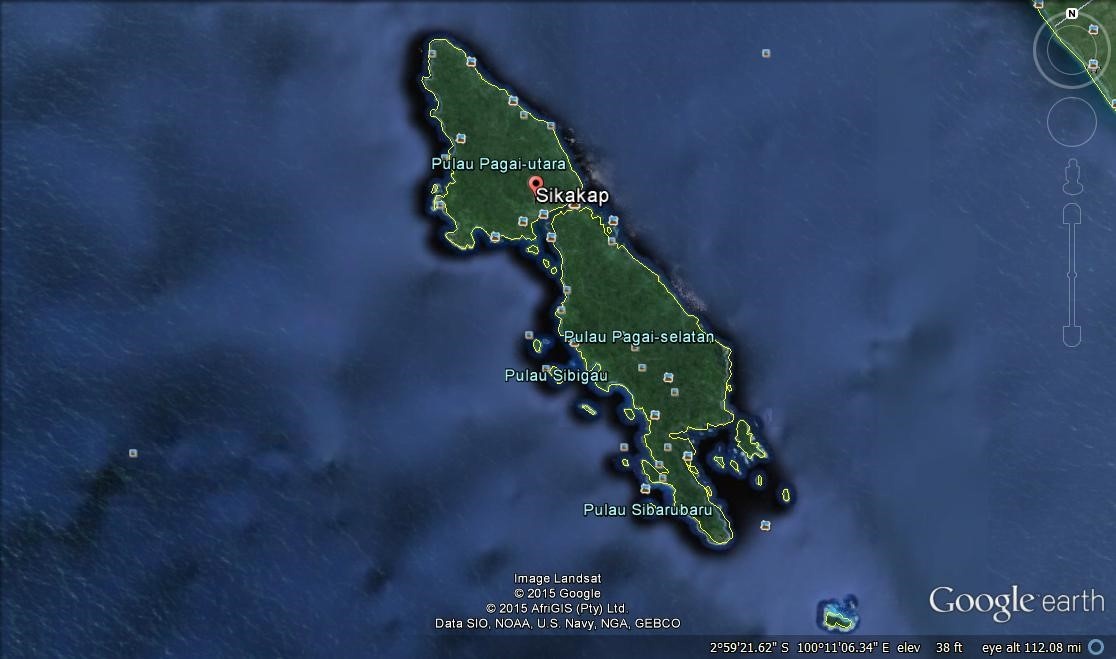
2.1.6 Indonesia West Sumatra Port of Mentawai
- The Mentawai Islands are a chain of about seventy islands and islets off the western coast of Sumatra where Siberut (4,030 km²) is the largest of these islands.
-
The other major islands are Sipura, North Pagai (Pagai Utara) and South Pagai (Pagai Selatan). These islands lie approximately 150 km off the Sumatran coast, across the Mentawai Strait.
-
The Mentawai Islands have been administered as a regency within the West Sumatra province since 1999.
-
The regency (district) capital is Tua Pejat, on the island of Sipora.
-
The regency is divided into ten districts:
-
South Pagai
-
Sikakap
-
North Pagai
-
South Sipora
-
North Sipora
-
South Siberut
-
South West Siberut
-
Middle Siberut
-
North Siberut
-
West Siberut
2.1.7 Indonesia West Sumatra Port of Tua Pejat

|
PORT’s LOCATION & CONTACTS |
||
|---|---|---|
|
Country |
Indonesia |
|
|
Province and District |
West Sumatera / Mentawai Island |
|
|
Town or City (Closest) |
Tua Pejat |
|
|
Port Name |
Tua Pejat |
|
|
Island |
Sipura Island |
|
|
Latitude |
002″ 10’ 50” S |
|
|
Longitude |
099″ 35’ 10” E |
|
|
Berth |
68.5 x 8M |
|
|
Depth |
- 5 LWS |
|
|
Trestle |
6.5 x 6 M |
|
|
Warehouse |
300 M2 |
|
|
Open Storage |
1200 M2 |
|
|
Passenger Terminal |
150 M2 |
|
|
Parking Yard |
537.13 M2 |
|
|
Generator |
15 KVA |
|
|
Fence |
300 M’ |
|
|
Operated by |
DISHUBKOMINFO |
|
|
Company / Port |
KUPP Sioban |
|
|
Closest Airport and Frequent Airlines to / from International Destinations |
Airport name : Rokot Airlines :Susi Air |
|
2.1.8 Indonesia West Sumatra Port of Sikakap
|
PORT’s LOCATION & CONTACTS |
|
|---|---|
|
Country |
Indonesia |
|
Province and District |
West Sumatera / Mentawai Island |
|
Town or City (Closest) |
Sikakap |
|
Port Name |
Sikakap |
|
Island |
South Pagai Island |
|
Latitude |
002″ 16’ 15” S |
|
Longitude |
099″ 12’ 20” E |
|
Berth |
128 x 8 M |
|
Depth |
6 LWS |
|
Trestle |
37.30 x 6 M |
|
Warehouse |
150 M2 |
|
Open Storage |
1000 M2 |
|
Generator |
15 KVA |
|
Fence |
231 M’ |
|
Operated by |
DISHUBKOMINFO |
|
Company / Port |
KUPP Sikakap |
|
Closest Airport and Frequent Airlines to / from International Destinations |
Airport name : Rokot Airlines :Susi Air |
2.1.9 Indonesia West Sumatra Port of Siberut
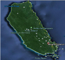
|
PORT’s LOCATION & CONTACTS |
|
|---|---|
|
Country |
Indonesia |
|
Province and District |
West Sumatera / Mentawai Island |
|
Town or City (Closest) |
SIberut |
|
Port Name |
Siberut |
|
Island |
Siberut Island |
|
Latitude |
001″ 35’ 50” S |
|
Longitude |
099″ 12’ 10” E |
|
Berth |
52 x 8 M |
|
Depth |
- 5 LWS |
|
Trestle |
33.50 x 5 M |
|
Causeway |
55.5 x 7 M |
|
Generator |
15 KVA |
|
Fence |
284 M’ |
|
Operated by |
DISHUBKOMINFO |
|
Company / Port |
KUPP Siberut |
|
Closest Airport and Frequent Airlines to / from International Destinations |
Airport name : Rokot Airlines :Susi Air |
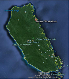
2.1.10 Indonesia West Sumatra Port of Sikabaluan
|
PORT’s LOCATION & CONTACTS |
|
|---|---|
|
Country |
Indonesia |
|
Province and District |
West Sumatera / Mentawai Island |
|
Town or City (Closest) |
SIkabaluan |
|
Port Name |
Sikabaluan |
|
Island |
Siberut Island |
|
Latitude |
001″ 35’ 50” S |
|
Longitude |
099″ 12’ 10” E |
|
Berth |
52 8 M |
|
Depth |
- 5 LWS |
|
Trestle |
33.5 x 5 M |
|
Causway |
55.5 x 7 M |
|
Generator |
15 KVA |
|
Fence |
284 M’ |
|
Operated by |
DISHUBKOMINFO |
|
Company / Port |
KUPP Siberut |
|
Closest Airport and Frequent Airlines to / from International Destinations |
Airport name : Rokot Airlines :Susi Air |
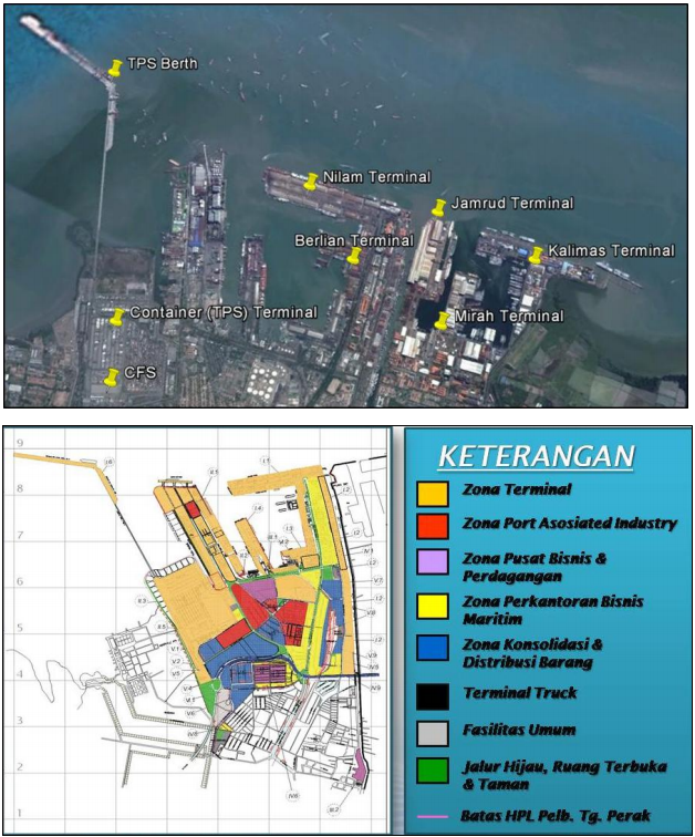
2.1.11 Indonesia East Java Port of Tanjung Perak Surabaya
- Port Overview
- Port Performance
- Discharge Rates
- Hire of Labour and Equipment
- General Cargo Handling Berths
- Port Cargo Handling Equipment
- General Services
- Port Security
- Storage Facilities
- Container Terminal of Perak Port
- Port Handling Equipment
- Container Facilities
- Customs Guidance
- Terminal Information
- Port Security
Port Overview
Link to port website: https://www.pelindo.co.id/profil-perusahaan/cabang-anak-perusahaan/cabang-perusahaan/q/tanjung-perak
|
Location of the Port |
|||||
|---|---|---|---|---|---|
|
Port Name |
Port of Tanjung Perak, Surabaya |
||||
|
Latitude |
7° 11′ 0.00″ S |
Longitude |
112° 44′ 60.00″ E |
||
|
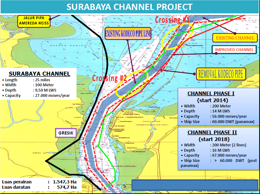
Channel The shipping channel between Java and Madura Island is 25 miles long with a minimum width of 80 meters, minimum depth of ebb tide is 9.5 meters. The channel is clearly marked and 24 hours pilotage service is available.
Summary of Role and Services:
|
|||||
|
Port Contacts |
|||
|---|---|---|---|
|
Port Operating Company |
PT Pelabuhan Indonesia III (Persero) Cabang Tanjung Perak Address: Jl. Perak Timur No. 610, Surabaya 60165, Indonesia |
||
|
Telephone |
+6231 3298631 – 37 (Management) +6231 – 3293994, 3291992 – 96 (Public Relations) |
Fax |
+6231 3295204, 3295207 (Management) +6231 – 3281545, 3293994 (Public Relations) |
|
|
Web |
https://www.pelindo.co.id/profil-perusahaan/cabang-anak-perusahaan/cabang-perusahaan/q/tanjung-perak |
|
|
Port Operations |
PT Berlian Jasa Terminal Indonesia Address: Jl. Prapat Kurung Utara No. 60, Indonesia |
||
|
Telephone |
+62313291596-97 +62313287120-1 |
Fax |
+62313291598 |
|
|
Web |
||
|
Port Operations |
PT Terminal Petikemas Surabaya (Container Terminal) Address: Jl. Tanjung Mutiara 1, Surabaya 60177 Jawa Timur - Indonesia |
||
|
Contact |
President Director |
Mob |
NA |
|
Telephone |
+62313283265-70 |
Fax |
+62313291628 |
|
|
Web |
||
|
Port Customs |
KPPBC Tipe Madya Pabean Tanjung Perak Address: Jl. Perak Timur 498, Surabaya 60165 |
||
|
Telephone |
Fax |
+62313295141 |
|
|
|
Web |
||
Port Performance
There are three main companies’ managing different parts of the port as follows:
PT Pelabuhan Indonesia III (Persero) - Cabang Tanjung Perak
-
Mooring
-
Berthing
-
Pilotage
-
Tugging
-
Water Supply
-
Warehouse and Open Storage
-
Wharf Service
-
Land & Building Rent (& Power Supply)
-
Port Entry Pass
-
Reception Facility
PT Berlian Terminal Services Indonesia (PT BJTI)
This is a subsidiary of PT Pelabuhan Indonesia III (Limited) as a port operator offering the following services:
- Handling of General Cargo
- Handling Liquid Bulk Goods
- Handling Coal
- Terminal RO-RO / Car Carrier Cargo.
- Container Yard (CY)
- Forwarding Services, including:
-
Consolidation (Exports Warehouse)
-
Container Freight Station
-
Customs Clearance Services
-
Intermodal Container Services
-
Quarantine Installation Services
-
Container Transit Services
PT Terminal Petikemas Surabaya (TPS)
TPS have their dedicated container terminal where they manage domestic and international container traffic and provide transportation services. Currently TPS holds the following certificates; ISO 9001 (Quality Standard), ISO 14001 (Environment Standard), OHSAS 18001 (Occupational Health & Safety), ISPS Code (Vessel Safety and Port Facilities Standard), Certificate of C-TPAT and ISO 28000:2007 (Security Management System for Supply Chain).
|
PERFORMANCE FOR YEAR: 2014 |
|
|---|---|
|
Vessels Calls |
75.6GT |
|
Container Traffic (TEUs) |
3.1 million TEUs |
|
Total Annual Capacity of the Port |
5.7 million |
Discharge Rates
Each of the three main companies offer container handling services and have distinct charges and tariffs; PT BJTI:
-
PT Pelabuhan Indonesia III (Persero) - Tanjung Perak
-
PT Berlian Terminal Services Indonesia (PT BJTI)
http://tpk.bjti.co.id/index.php?option=com_content&view=article&id=289&Itemid=394
PT. Terminal Petikemas Surabaya (TPS)
http://www.tps.co.id/document-download?category=Tariff
The TPS terminal is a large and well-equipped facility running modern effective container services. The tables below are quoting the TPS rates for container charges and PT PELABUHAN INDONESIA III rates for conventional cargo handling.
Pilotage Fees
-
PILOT STATION, stand by 24 Hours
-
VHF CHANNEL:
-
156 600. (12). 1
-
56 700 (14),
-
156 800 (15)
Tug Service
-
TUGGING SERVICE
-
Tug Boats (10) :
-
Capacities: 1.400 HP, 2.000 HP2.400 HP, 3.000 HP, 3.200 HP
Hire of Labour and Equipment
Charges quoted according to requirements.
Berthing Equipment & Specifications
|
Berthing Specifications |
|||
|---|---|---|---|
|
Berths |
Usage |
Length (m) |
Draft (m) |
|
TPS (Container Terminal) |
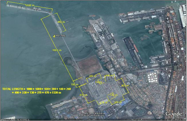
International |
1000 |
10.5 |
|
TPS (Container Terminal) |
Domestichs |
450 |
7.5 |
|
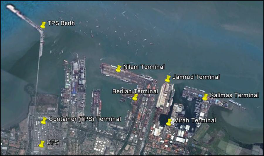
North Jamrud |
Passenger/General Cargo |
1200 |
9 |
|
South Jamrud |
Inter-Island General Cargo |
800 |
7 |
|
West Jamrud |
General Cargo |
217 |
6 |
|
East Berlian |
International Dry and Liquid Bulk |
780 |
9.7 |
|
West Berlian |
Dry Bulk, General Cargo, Domestic Containers |
700 |
8.2 |
|
North Berlian |
Domestic Containers |
140 |
7 |
|
East Nilam |
Domestic Dry Bulk, Liquid Bulk, General Cargo |
920 |
8 |
|
Mirah |
Domestic General Cargo |
640 |
6 |
|
Kalimas |
Traditional Sail & Motor Boats |
2270 |
2.5 |
|
RO RO Terminal (S. Jamrud) |
Passenger |
140 |
7.2 |
|
Berthing Tugs |
10 Units, with capacities: 1.400 HP, 2.000 HP, 2.400 HP, 3.000 HP, 3.200 HP |
|
|
|
Pilot Boats |
5 Units: 630 HP, 800 HP, 1450 HP |
||
|
Water Barges |
3 Units |
||
|
Police Boats |
3 Units |
||
|
Mooring Boats |
3 Units: 150 HP (2 Units) and 240 HP (1 Units) |
||
|
Speed Boats |
1 Units of 150 PK |
||
General Cargo Handling Berths
|
General Cargo - Imports |
Berths |
|---|---|
|
Imports & Exports – Ro-Ro |
Jamrud Terminal |
|
Others Imports |
Coal - Berlian Terminal |
Port Cargo Handling Equipment
|
Port Cargo Equipment (Operational) |
||
|---|---|---|
|
Appliances & Models |
Quantity |
Capacity |
|
Shore Gantry (Rubber Tyred) |
27 |
45 MT |
|
Mobile (rail-mounted) |
11 |
45 MT |
|
Forklifts (Electric) |
11 |
2.5 MT |
|
Forklifts (Diesel) |
4 |
TBC |
|
Forklifts (Skystacker) |
3 |
8 MT |
|
Forklifts (Reachstacker) |
2 |
40 MT |
|
Tractors (Head Truck) |
63 |
NA |
|
Tractors (Chassis) |
110 |
20' / 40' / 45' |
|
Trailers (Side Loaders) |
1 |
NA |
|
Trailers (Double Drop Neck) |
3 |
40' |
|
Dolly Systems |
47 |
NA |
General Services
|
Service (Per day of part thereof) |
Charge (indicate currency) |
|---|---|
|
Bagging plant operators, per unit of plant |
Available - Charges negotiated according to requirements. |
|
Vacuvators, per unit of plant |
Available - Charges negotiated according to requirements. |
|
Bunker Supplier |
Available - Charges negotiated according to requirements. |
|
Bunkering Agent |
Available - Charges negotiated according to requirements. |
|
Barge operator, per barge |
Available - Charges negotiated according to requirements. |
|
Fresh Water suppliers (road tankers) |
Available - Charges negotiated according to requirements. |
|
Ship Contractors |
Available - Charges negotiated according to requirements. |
|
Ship Chandlers |
Available - Charges negotiated according to requirements. |
|
Safety equipment supplier & service |
Available - Charges negotiated according to requirements. |
|
Marine Contractors |
Available - Charges negotiated according to requirements. |
|
Scrap Metal Dealers |
Available - Charges negotiated according to requirements. |
|
Ship Watchmen Supplier |
Available - Charges negotiated according to requirements. |
|
Marine Engineer |
Available - Charges negotiated according to requirements. |
|
Marine Surveyor |
Available - Charges negotiated according to requirements. |
|
Ship Surveyor |
Available - Charges negotiated according to requirements. |
|
Cargo Surveyor |
Available - Charges negotiated according to requirements. |
|
Sludge Collector |
Available - Charges negotiated according to requirements. |
|
Small Boat Operator |
Available - Charges negotiated according to requirements. |
Discharging Facilities
|
Container Facilities |
20 ft (TEU’s) |
|---|---|
|
Container facilities |
27,639 - TPS 1786 - BJTI |
|
Daily off-take capacity: No of containers/day |
3503 - TPS (Average 2011) 2171 - BJTI (Average 2011) |
|
Container Freight Stations (CFS) |
10,000 m² - TPS 1,640 m² - BJTI |
|
Reefer Stations |
324 TPS 72 BJTI |
Multipurpose Terminal
Multipurpose terminals in Tanjung Perak include Mirah, West Berlian Quays and Jamrud North and South Quays.
Please see aerial image in introduction for their respective positions.
-
Mirah Terminal
|
For details on Mirah Terminal see sections on Berths above and Storage Areas below.
|
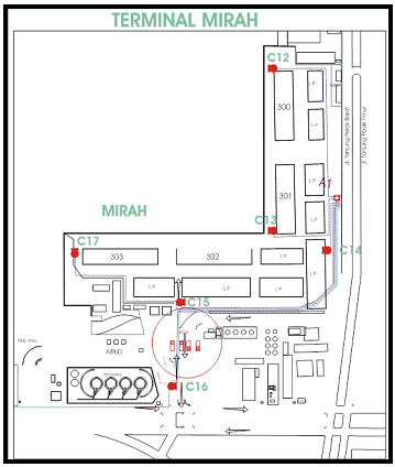
-
West Berlian (Berlian Barat)
|
For details on Berlian Terminals please see sections on Berths above and Storage Areas below.
|
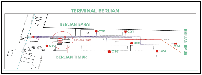
-
Jamrud North and South
|
For details on Jamrud Terminals please see sections on Berths above and Storage Areas below.
|
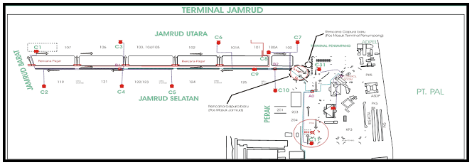
Grain & Bulk Handling
-
Nilam Terminal
For details on Nilam Terminal please see sections on Berths above and Storage Areas below.
|
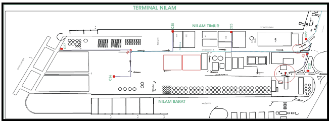
Main Storage Terminal
All the terminals have different storage facilities - details are provided in the related section below.
Clearing Agents
|
Port Clearing Agents |
|||
|---|---|---|---|
|
Name & Address |
CV Karya Mandiri |
||
|
Contact |
Mr. Gunawan |
Telephone |
+62361247535
|
|
Name & Address |
PT Bhanda Ghara Reksa Surabaya |
||
|
Contact |
Mr. Yoyo Taryo |
Telephone |
+62216916666
|
|
Name & Address |
PT Flores Jaya |
||
|
Contact |
Mr. Gabriel Teti Nahak |
Telephone |
+62313282725 |
|
Name & Address |
CV Sarana Transport |
||
|
Contact |
Mr. Achmad Faisal |
Telephone |
+62313578762 |
|
Name & Address |
PT Artalapan Bintang Jaya |
||
|
Contact |
Mr. Triyanto R. Hamidy |
Telephone |
+623132812000 |
|
Name & Address |
PT Mutiara Pratama Logistik |
||
|
Contact |
Mr. R. Suharto Rekso J |
Telephone |
+62313548075 +62318959262 |
Port Security
|
Security |
|
|---|---|
|
ISPS Compliant |
Yes |
|
ISPS Level (current) |
1=Normal |
|
Certificate International Ship and Port Facility Security Code (ISPS-Code) : 2004 |
|
Certificate ISO 9001 : 2008 Vessel, Handling and Passengers Terminal (Quality Service) |
|
Certificate ISO 14001 : 2004 Environment |
|
Certificate Occupational Safety and Health Management System : KEP.40/MEN/II/2009 |
Storage Facilities
|
Port Storage – |
|||
|---|---|---|---|
|
Location |
Open Storage (m²) |
Warehouse Units |
Warehouse Area (m²) |
|
North Jamrud |
30,670 |
6 |
22,812 |
|
South Jamrud |
10,429 |
6 |
19,248 |
|
West Jamrud |
975 |
NA |
NA |
|
East Berlian |
1,506 |
2 |
8,780 |
|
West Berlian |
10,429 |
1 |
2,956 |
|
North Berlian |
975 |
NA |
NA |
|
Nilam |
17,999 |
4 |
19,336 |
|
Mirah |
15,965 |
4 |
13,700 |
|
|
Open Storage |
Capacity TEUs |
|
|
TPS - International |
29 Ha |
21,989 |
|
|
TPS - Domestic |
9 Ha |
5,650 |
|
|
TPS - CFS |
10,000 |
NA |
|
|
TPS - Customs Inspection |
NA |
NA |
|
|
TPS - Dangerous Goods |
6,500 m² |
NA |
|
Container Terminal of Perak Port
Key port information can also be found at: http://www.tps.co.id/
Port Overview
PT. Terminal Petikemas Surabaya (TPS) provides container terminal facilities either for domestic or international trade for the traders at the eastern part of Indonesia. TPS also provides efficient and on time transportation service. Currently TPS holds ISO 9001 (Quality Standard), ISO 14001 (Environment Standard), OHSAS 18001 (Occupational Health & Safety) and ISPS Code (Vessel Safety and Port Facilities Standard). TPS is the only terminal operator in Indonesia who holds the Certificate of C-TPAT and ISO 28000:2007 (Security Management System for Supply Chain)
|
Port Contacts |
|||
|---|---|---|---|
|
Port Operating Company |
PT Terminal Petikemas Surabaya / TPS Address: Jl. Tanjung Mutiara, Surabaya, Indonesia |
||
|
Latitude |
7° 12'23" S |
Longitude |
112° 43'41" E |
|
Contact |
President Director |
Mob |
+62313283265 -70 |
|
Telephone |
+62313283265 – 70 |
Fax |
+62313291628 |
|
|
Web |
||
Port Picture
TPS location is very strategic, as it directly connects to the Surabaya toll way and the railway routes. Because of this location, TPS is called as The Gateway to East Java and Eastern Indonesia.
Geographically, TPS is located on the west part of Tantung Perak Port with the coordinates of 7;12; S, 112;40E, at the end of the shipping channel between Java island and Madura island for 25 miles length.
The minimum width of the channel is 80 meters, the minimum depth of ebb tide is 9.5 meters. The shipping channel is clearly marked, and 24-hour pilotage service is available.
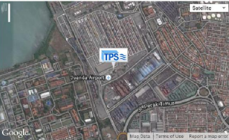
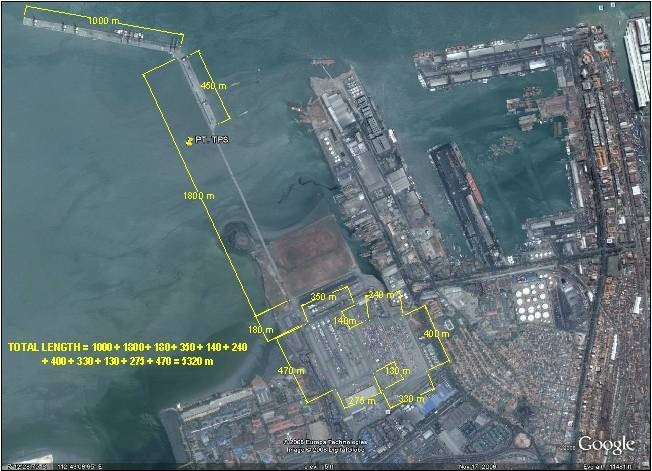
Port Performance
TPS have their dedicated container terminal where they manage domestic and international container traffic and provide transportation services. Currently TPS holds:
|
PERFORMANCE FOR YEAR: 2013 |
|
|---|---|
|
Container Traffic (TEUs) |
1,365,617 TEUs |
Discharge Rates and General Services
Details can be seen via this link: http://www.tps.co.id/download/Default.aspx?bahasa=ENG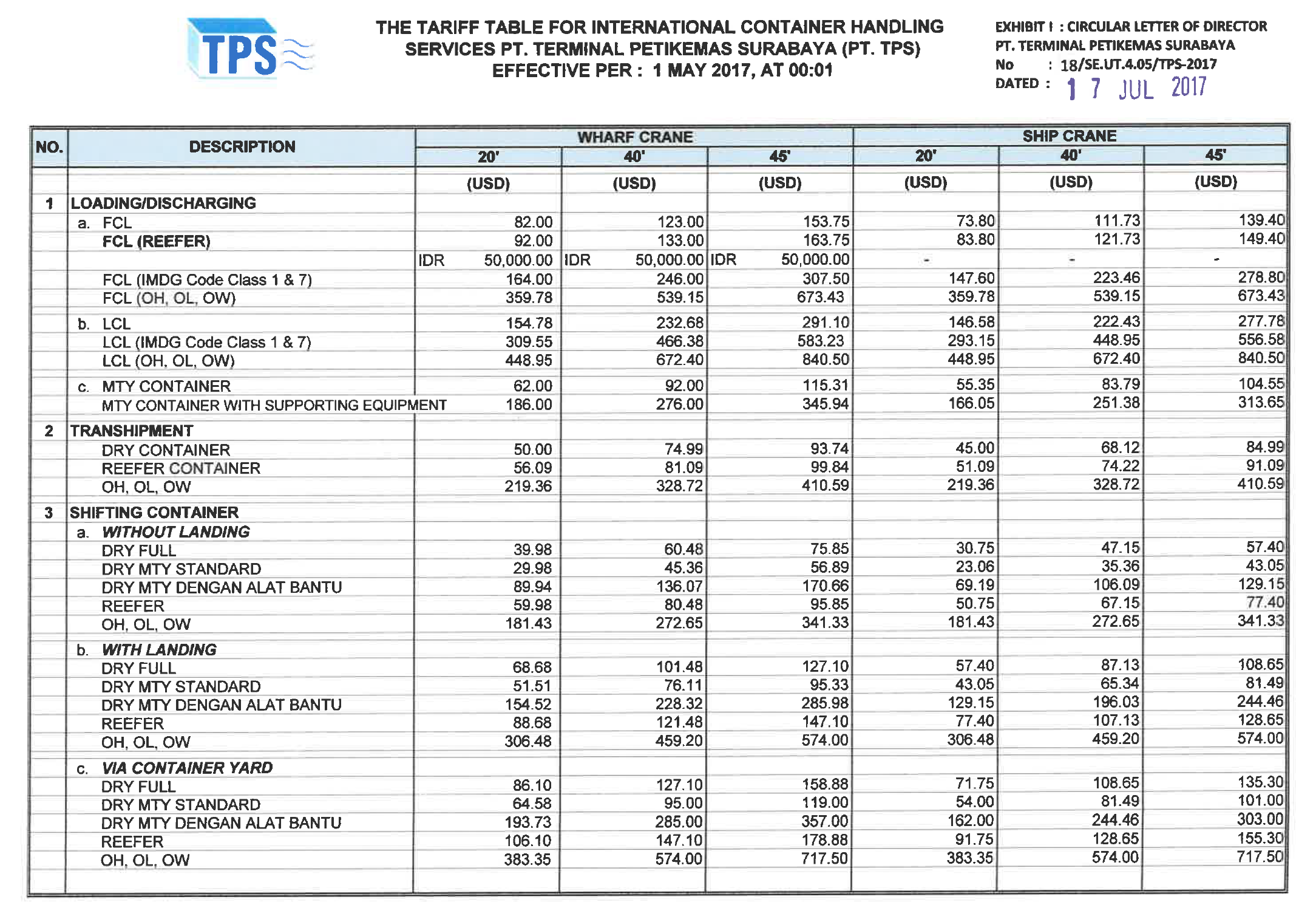
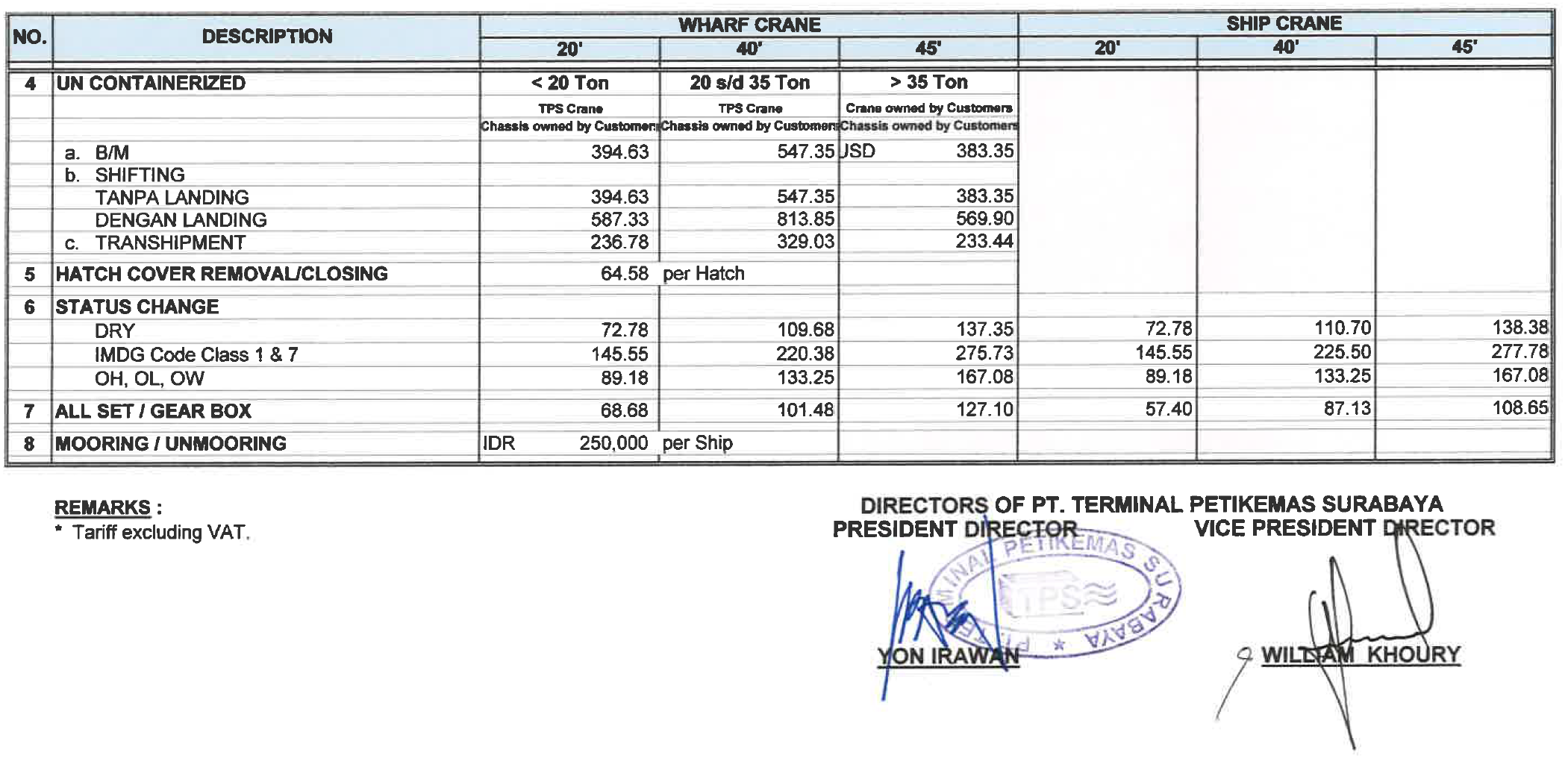
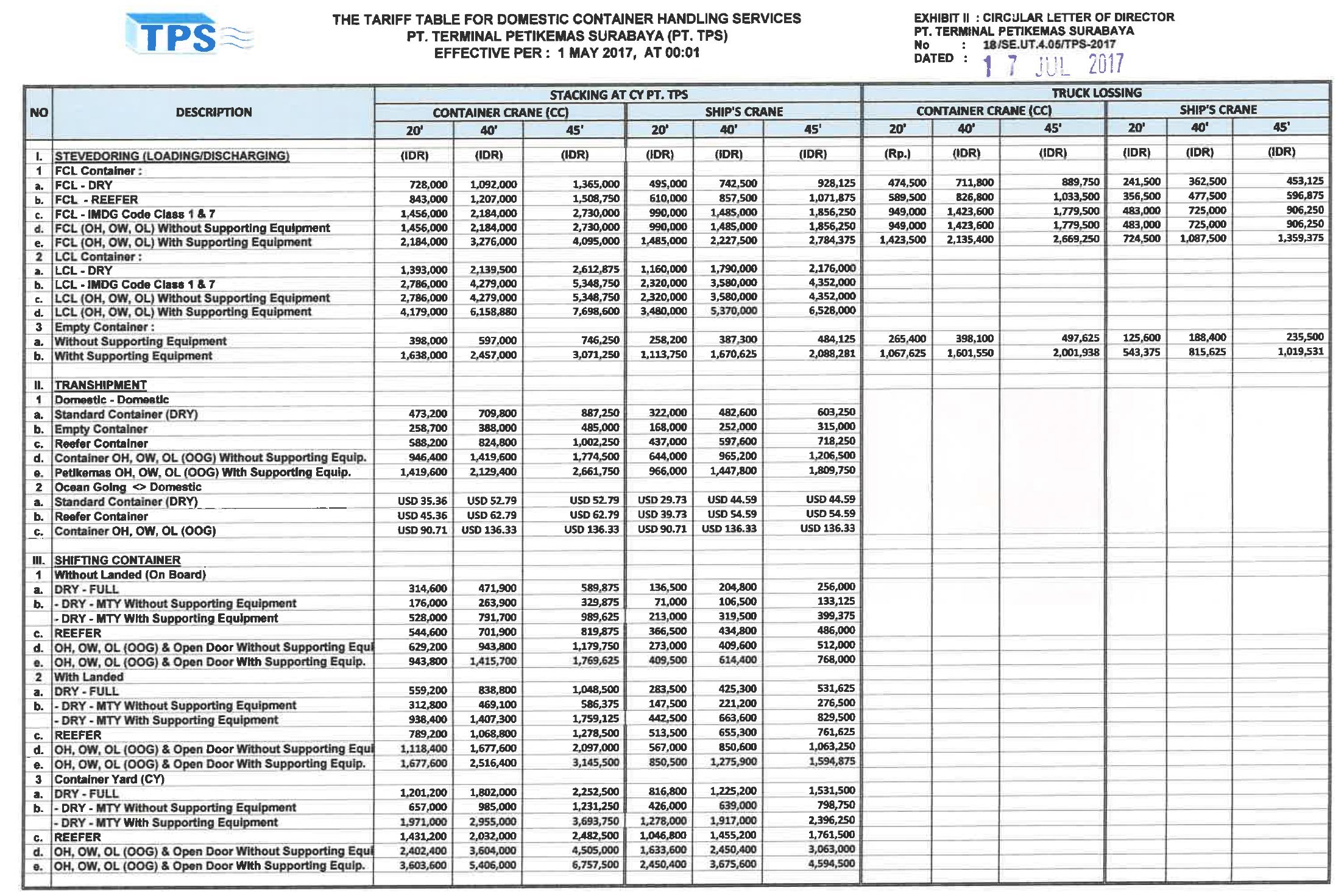
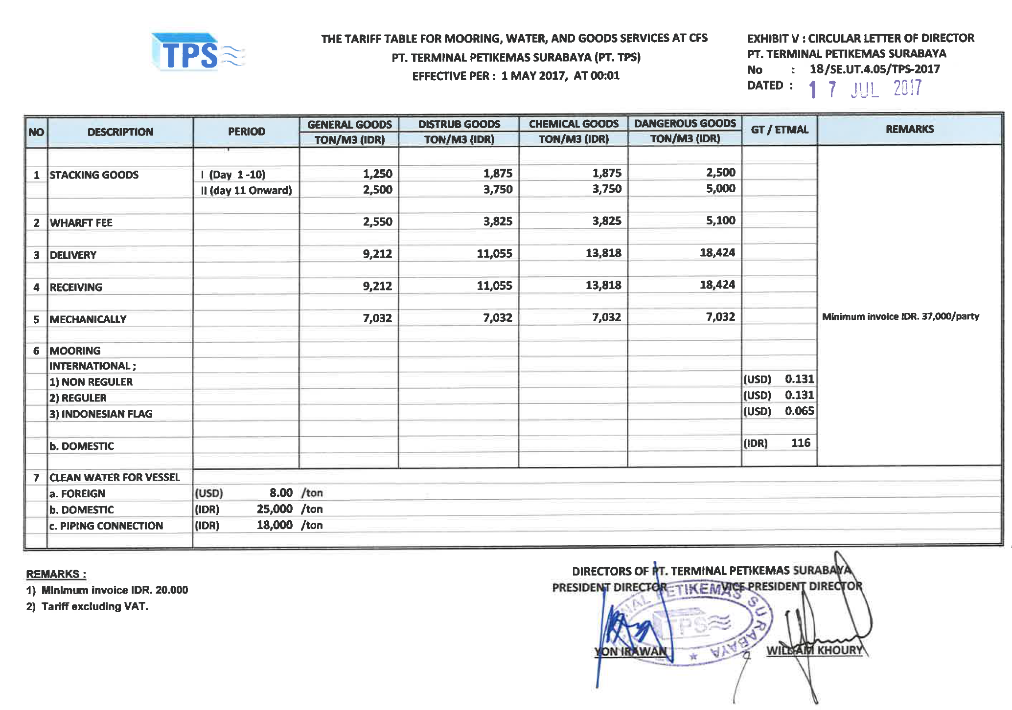
Port Handling Equipment
|
Port Cargo Equipment (Operational) |
|
|---|---|
|
Appliances & Models |
Quantity |
|
Dockside/Container Crane |
11 |
|
Container Gantries |
27 |
|
Reachstacker |
6 |
|
Sky Stacker |
3 |
|
Grain Elevator (with bagging machines) |
NA |
|
Trainstrainer/Translifter |
7 |
|
Forklifts |
18 |
Container Facilities
|
Container Yard (CY) |
Capacity |
|---|---|
|
Capacity for Export |
9,179 TEUS |
|
Capacity for Import |
14,445 TEUS |
|
Capacity for Domestic |
2,974 TEUS |
|
Capacity for Behandle |
482 TEUS |
|
Capacity for Reefer |
1.960 TEUS |
|
Total Capacity |
29,040 TEUS |
Customs Guidance
|
Capacity of Customs Inspection |
380 TEUs / day |
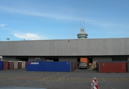
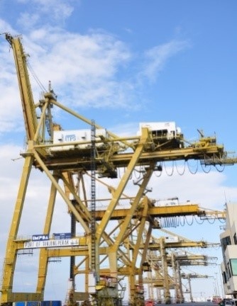
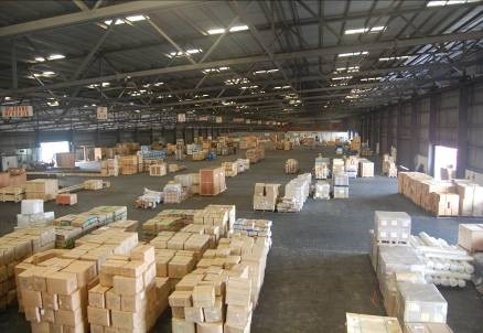
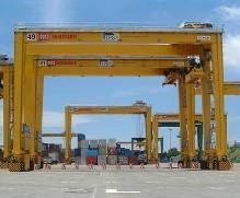
Terminal Information
Container Information
|
Container Terminal |
|||
|---|---|---|---|
|
Wharf |
Length (m) |
Width (m) |
Depth (m) |
|
International Wharf |
1,000 |
50 |
10.5 |
|
Domestic Wharf |
450 |
50 |
7.5 |
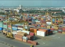 |
|||
Port Security
|
Security |
|
|---|---|
|
ISPS Compliant |
Yes (Certificate ISO 28000) |
|
ISPS Level (current) |
1=Normal |
2.1.12 Indonesia Central Java Port of Tanjung Emas Semarang
Port Overview
Located in Semarang, Central Java, Tanjung Emas is the only sea port in Semarang City for both passengers and cargo. It is located approximately 5 km from Tugu Muda, city center. The port is managed by state-owned company PT. (Persero) Pelabuhan Indonesia III (Indonesia Port Company III) Semarang branch
Port website: https://www.pelindo.co.id/id/port-terminal/tanjung-emas
Key port information may also be found at: http://www.maritime-database.com
|
Port Location and Contact |
|
|
Country |
Indonesia |
|
Province or District |
Central Java, Semarang City |
|
Nearest Town or City with Distance from Port |
Semarang - 5 km |
|
Port's Complete Name |
Tanjung Emas Port |
|
Latitude |
-6.942098 |
|
Longitude |
110.423772 |
|
Managing Company or Port Authority
|
PT. (Persero) Pelabuhan Indonesia III, Cabang Tanjung Emas Address : Jl Coaster No 10 Semarang, Central Java Ph. +62-24-35457421 / 4 Fax. +62-24-3542649 Email. tanjungemas@pelindo.co.id |
|
Management Contact Person |
Muh Junaedhy (Deputy Manager of Terminal Service) Ph. +62 81327936556 Email. Muh.junaedhy@pelindo.co.id |
|
Nearest Airport and Airlines with Frequent International Arrivals/Departures |
Jenderal Ahmad Yani International Airport Airlines with International Arrival/Departures: Air Asia, Lion/Wings Air, Garuda Indonesia, Citilink, Sriwijaya/NAM Air, Batik Air |
Port Picture

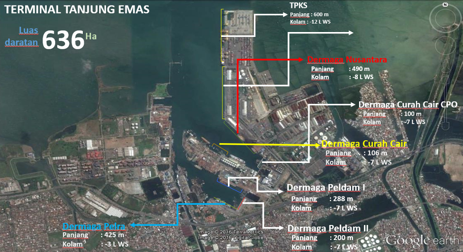
Description and Contacts of Key Companies
The port is operated by the state-owned company PT (Persero) Pelabuhan Indonesia III Tanjung Emas Branch and under authority of Kantor Syahbandar dan Otoritas Pelabuhan (KSOP) Class I Tanjung Emas, a Technical Implementation Unit (UPT) under the Directorate General of Sea Transportation, Ministry of Transportation.
Kantor Syahbandar dan Otoritas Pelabuhan (KSOP) Class I Tanjung Emas
Contacts
Address : Jl. Yos Sudarso No. 30 Semarang 50174
Phone : +62-24-3540687
Fax: +62-24-3582335
Email: adpeltanjungmas@yahoo.co.id / ksoptanjungemas@dephub.go.id
PT. PELINDO III Tanjung Emas PT Pelabuhan Indonesia III (Persero) or often known as Pelindo III is a State-Owned Company engaged in logistics, specifically in port management and development.
Contacts
Address : Jl Coaster No 10 Semarang, Central Java
Ph. : +62-24-35457421 – 4
Fax. : +62-24-3542649
Email. : tanjungemas@pelindo.co.id
Port Performance
|
Seasonal Constraints |
||
|
|
Occurs |
Time Frame |
|
Rainy Season |
Yes |
September – January |
|
Major Import Campaigns |
No |
|
|
Other Comments |
|
|
|
Handling Figures for 2018 |
|
|
Vessel Calls |
3,933 |
|
Container Traffic (TEUs) |
642,901 |
|
Handling Figures Bulk and Break Bulk for 2018 |
|
|
Bulk (MT) |
29,040.930 |
|
Break bulk (MT) |
3,741.745 |
Discharge Rates and Terminal Handling Charges
For information on port rates and charges, please see the following link: http://online.tpks.co.id/webaccess/#
Berthing Specifications
|
Type of Berth |
Quantity |
Length (m) |
Maximum Draft (m) |
Comments |
|
Conventional Berth |
7 units |
|
|
|
|
Container Berth |
1 unit |
600 x 25 m |
|
|
|
Silo Berth |
|
|
|
|
|
Berthing Tugs |
|
|
|
|
|
Water Barges |
|
|
|
|
Port Handling Equipment
|
Equipment |
Available |
Total Quantity and Capacity Available |
Comments on Current Condition and Actual Usage |
|
Gantry Jib Crane |
Yes |
7 units / 25 tons |
Good |
|
Rubber Tyred Gantry |
Yes |
9 units / 40 tons |
Good |
|
Automatic RTG |
Yes |
20 units / 25 tons |
Good |
|
Reachstacker |
Yes |
4 units / 20 and 45 tons |
Good |
|
RoRo Tugmaster (with Trailer) |
Yes |
43 units / 9 units 40” and 7 units 45” |
Good |
|
Hopper |
Yes |
2 units, capacity 10 tons |
Good |
|
Luffing Crane |
Yes |
2 units, capacity 20 tons |
Good |
|
Forklifts |
Yes |
11 units, capacity 10-7-3 tons |
Good |
|
Weighbridge |
Yes |
1 unit, capacity 70 tons |
Good |
|
Reefer Plug Portable |
Yes |
96 points |
Good |
|
Side Loader |
Yes |
1 unit |
Good |
|
Excavator |
Yes |
2 units, bucket capacity 0,92 m3 |
Good |
|
Wheel loader |
Yes |
1 unit, bucket capacity 2,5 m3 |
Good |
|
Grab |
Yes |
4 units, capacity 5-10 tons |
|
Container Facilities
|
Facilities |
20 ft |
40 ft |
|
Container Facilities Available |
Yes |
Yes |
|
Container Freight Station (CFS) |
2,500 sqm |
|
|
Refrigerated Container Stations |
Yes |
Yes |
|
Other Capacity Details |
|
|
|
Daily Take Off
Capacity |
500 |
|
|
Number of Reefer
Stations |
96 |
|
|
Emergency Take-off Capacity |
No information |
|
|
Off take Capacity of Gang
Shift |
No information |
|
Customs Guidance
Customs clearance is available through the local customs office within the port vicinity.
KPPBC TMP Tanjung Emas
Jl. Arteri. Yos Sudarso,
Tawangsari, Kec. Semarang Barat.,
Kota Semarang, Jawa Tengah 50144
Phone : +62-24-76631968
Website: https://bctemas.beacukai.go.id/
Other information related the customs clearance in Indonesia is available in this link http://beacukai.go.id
Terminal Information
MULTIPURPOSE TERMINAL
Master Plan for Tanjung Emas Ultimate
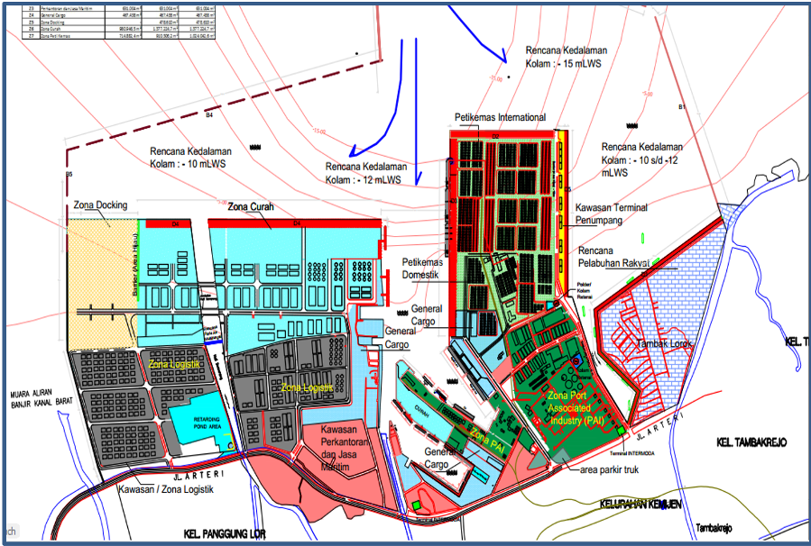
MAIN STORAGE TERMINAL
There are 3 warehouses with roof and concrete floor and 3 open storages.
|
Storage Type |
Number of Storage Facilities |
Area (m2) |
|
Bagged Cargo |
3 |
9,260 |
|
Open Storage |
3 |
40,687 |
|
General Cargo |
|
|
Stevedoring
Stevedoring activities are organized by third parties (stevedoring company) in coordination with Labour Union Associations (TKBM) administered by Port Authority (KSOP) Office. The owner/importer can also discharge their own cargo by directly contacting the Labour Union Associations.
All of them provide full or semi-full package services; organizing labourer and handling equipment, discharging goods at the port, and delivering the goods directly to the customer’s warehouses.
Hinterland Information
The main hinterland of Tanjung Emas Port is Central Java and Yogyakarta Province. As the main port on the Central Java, Tanjung Emas Port serves commodity from its hinterland area, such as coal, cement, palm oil, rubber, fertilizer, etc.
Tanjung Emas Port is open for international trade activities supported by several economic centres including Yogyakarta and other districts within Central Java.
Port Security
|
Security |
|
|
ISPS Compliant |
Yes |
|
Current ISPS Level (Level 1 = Normal, Level 2 = Heightened, Level 3 = Exceptional) |
Level 1 |
|
Police Boats |
Yes |
|
Fire Engines |
Yes |
2.1.13 Indonesia Banten Port of Ciwandan and Merak
Port Overview
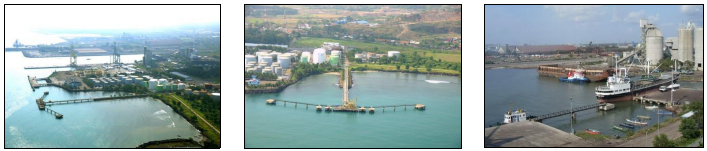
Link to port website: http://www.bantenport.co.id
NB: The website relates only to Ciwandan Terminal (although
Merak Mas is subject to the same regulations and port
dues).
Located at the province of Banten, Port of Banten has become a transit destination and trading, both domestic and international.
-
The port, which is located at 10 km from the central city of Serang, was once an important harbor for international trade in the 15th century, of which vessels from Persia, the Middle East, China, England, and Portugal came to trade.
-
Today, the port serves an inland area that is experiencing rapid growth in the metal processing, mechanical, chemical and palm oil processing industries.
-
Banten Port boasts three coal terminals and a multipurpose dock with cargo-handling equipment that includes two rubber-tired gantry cranes and two multipurpose gantry cranes.
|
Port Contacts |
|||
|---|---|---|---|
|
Port Operating Company |
PT Pelabuhan Indonesia II (Persero) / Indonesia Port Corporation (IPC) Address: Jl. Raya Pelabuhan No. 1 Ciwandan, Cilegon 42166 |
||
|
Latitude |
6°1'17.47" S |
Longitude |
105°57'17.94" E |
|
Telephone |
+62254601417 |
Fax |
+6225460n1419 |
|
|
N/A |
Web |
|
|
|
|||
|
Port Operations |
Merak Mas Port of Banten
|
||
|
Latitude |
5°55'14.09" S |
Longitude |
105°59'51.30" E |
|
Contact |
General Manager |
Mob |
|
|
Telephone |
+62254572007 +62254572008 |
Fax |
+62254572922 |
|
|
N/A |
Web |
|
|
|
|||
|
Port Customs |
KPPBC Tipe Madya Pabean Merak Address: Jl. Raya Pulorida No. 101, Merak 42438, Banten |
||
|
Telephone |
+62254571318 |
Fax |
+62254571011 |
|
|
Web |
||
-
Banten Port is managed by Indonesian Port Corporation (IPC), formerly known as Pelabuhan Indonesia (Pelindo) II.
-
There are 2 terminals approximately 20 Km apart.
-
Ciwandan Terminal is managed directly by IPC and handles bulk and multipurpose cargoes.
-
Merak Mas Terminal is operated by Sinarmas Group and handles containers and multipurpose cargoes.
Merak Mas Terminal
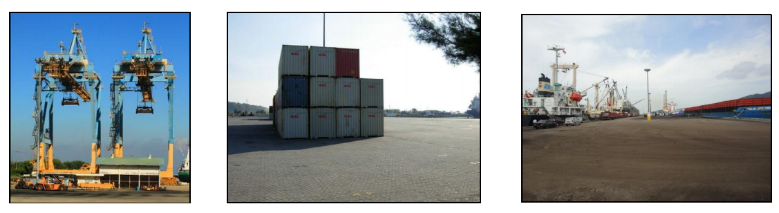
Port Performance
Liquid bulk and dry bulk cargo service dominate the stevedoring activity at Port of Banten. In 2013, the liquid bulk flow reached 835,358 tons, while dry bulk flow was 4,683,912 tons, particularly for coal commodity. In 2013, the realization of overseas trade goods flow was 2,799,492 tons, while domestic trade flow was 3,133,569 tons.
Discharge Rates
Refer to letter stating "Directors Decisions" PT Pelabuhan Indonesia II No. HK.56/2/3/PI.II - 2000.
Pilotage Services
-
Pilot services are available on call 24/7.
-
There are 2 pilot boats in the port MP.I-035 and MP.1-040, they are stationed in North Merak.
Tug Services
There are 6 tug boats in the port:
-
2 units 1,600 HP
-
2 units 2,400 HP
-
2 units 3,200 HP
Hire of Labour and Equipment
|
Service (Per hour or part thereof) |
Charge (indicate currency) |
|---|---|
|
Floating Crane, incl. of minimum crew and exclusive of towage |
Negotiated according to requirements |
|
Mobile Crane more than 5 mt inclusive of driver |
Negotiated according to requirements |
|
Mobile Crane less than 5 mt or equal inclusive of driver |
Negotiated according to requirements |
|
VIP launch inclusive of crew |
Negotiated according to requirements |
|
Pilot boat inclusive of crew |
Negotiated according to requirements |
|
Fire appliance inclusive of minimum crew |
Negotiated according to requirements |
|
Tipper truck or flatbed lorry inclusive of driver |
Negotiated according to requirements |
|
Forklift or Tractor more than 5 mt inclusive of driver |
Negotiated according to requirements |
|
Forklift or Tractor less than 5 mt or equal of inclusive of driver |
3 MT (Old Condition) Charges Negotiated |
|
Van, Pick-up or Saloon Car inclusive of driver |
Negotiated according to requirements |
|
Management or supervisory staff |
Negotiated according to requirements |
|
Skilled staff: e.g. Crane or Forklift Driver, Artisan, Firemen or Clerk |
Negotiated according to requirements |
|
Semi-skilled staff: e.g. Labourers, Watchman |
Negotiated according to requirements |
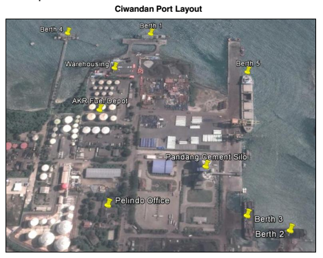
Berthing Equipment &
Specifications
|
Berthing Specifications |
|||
|---|---|---|---|
|
Total Berths |
Quantity |
Length (m) |
Draft (m) |
|
Ciwandan - Public Berth No. 1 |
1 |
122 |
10 |
|
Ciwandan - Coal Berth No. 2, 3, 7 |
3 |
218 (total) |
7 |
|
Ciwandan - Multipurpose Berth No. 5 |
1 |
402 |
15 |
|
Ciwandan - Beaching Berth No. 6 |
1 |
10 |
3 |
|
Ciwandan - Bulk Liquid Berth No. 4 |
1 |
56 |
10 |
|
Merak Mas Container Berth No. 1 & 2 |
2 |
300 |
11 |
|
Merak Mas Conventional Berth No. 3-7 |
5 |
875 |
8-14 |
|
Berthing Tugs |
6 Units |
|
|
|
Pilot Boats |
6 Units |
||
|
Water Barges |
Private |
||
|
Police Boats |
On Call (Merak Coast Guard) |
||
|
Mooring Boats |
2 Units |
||
|
Anti-pollution Boats |
None |
||
|
Speed Boats |
Private |
||
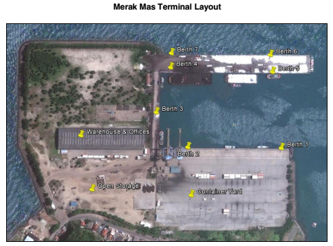
Port Handling Equipment
|
Port Cargo Equipment (Operational) |
||
|---|---|---|
|
Appliances & Models |
Quantity |
Capacity |
|
Shore Gantry - Merak Mas |
2 |
40 MT |
|
Reach Stacker - Merak Mas |
2 |
40 MT |
|
Container Spreader |
2 |
30 MT |
|
Forklifts - Merak Mas |
1 |
2 MT |
|
Hooper - Merak Mas |
3 |
5 MT |
|
Multipurpose Crane - Ciwandan |
2 |
35 MT |
|
RoRo Tugmaster (with Trailer) |
1 |
|
|
RTG - Ciwandan |
2 |
10 BCH |
|
Forklifts - Ciwandan |
2 |
3 MT |
|
Hooper - Ciwandan |
4 |
|
|
Tractors |
Private |
NA |
|
Trailers |
Private |
NA |
|
Vacuvators) |
Private |
NA |
|
Bagging Machines |
None (cement) |
NA |
General Services
|
Service (Per day of part thereof) |
Charge (indicate currency) |
|---|---|
|
Bagging plant operators, per unit of plant |
None |
|
Vacuvators, per unit of plant |
None |
|
Bunker Supplier |
Private Barge in Merak; charges are negotiated according to requirements. |
|
Bunkering Agent |
Charges negotiated according to requirements. |
|
Barge operator, per barge |
Charges negotiated according to requirements. |
|
Fresh Water suppliers (road tankers) |
Charges negotiated according to requirements. |
|
Ship Contractors |
Charges negotiated according to requirements. |
|
Ship Chandlers |
Charges negotiated according to requirements. |
|
Safety equipment supplier & service |
Available - Charges negotiated according to requirements. |
|
Marine Contractors |
Available - Charges negotiated according to requirements. |
|
Scrap Metal Dealers |
Charges negotiated according to requirements. |
|
Ship Watchmen Supplier |
Charges negotiated according to requirements. |
|
Marine Engineer |
Available - Charges negotiated according to requirements. |
|
Marine Surveyor |
Available - Charges negotiated according to requirements. |
|
Ship Surveyor |
Available - Charges negotiated according to requirements. |
|
Cargo Surveyor |
Available - Charges negotiated according to requirements. |
|
Sludge Collector |
Charges negotiated according to requirements. |
|
Small Boat Operator |
Charges negotiated according to requirements. |
Stevedoring- Ciwandan
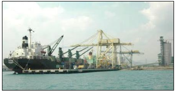
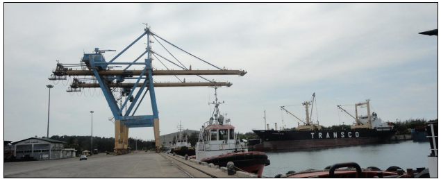
Port Security
Banten Port has been awarded ISPS level 1 in 2004
|
Security |
|
|---|---|
|
ISPS Compliant |
Yes |
|
ISPS Level (current) |
1=Normal |
|
Police Boats |
YES |
|
Fire Engines |
YES |
Storage Facilities
|
||
|---|---|---|
|
Total Floor Space = m² |
Quantity |
Floor Area (m²) |
|
Open Yard |
1 |
4.2 Ha |
|
Container Yard |
1 |
4.1 Ha |
|
Warehousing |
3 |
8000 m² |
|
Port Storage - Merak Mas |
||
|---|---|---|
|
Total Floor Space = m² |
Quantity |
Floor Area (m²) |
|
Open Yard |
1 |
78,000 m² |
|
Container Yard |
1 |
41,000 m² |
|
Warehousing |
1 |
8,000 m² |
2.1.14 Indonesia Central Java Port of Tanjung Intan Cilacap
Port Overview
Categorized as a Class II port, port of Tanjung Intan is a commercial port managed by the state-owned company PT Pelabuhan Indonesia III also known as Pelindo III (Persero) Cilacap Branch. It is the only general port in Java’s southern coast and serves as a sea economic gate for Southern and Central Java and Yogyakarta, and to Southern West Java for export-import and inter island trade. The port has Pilotage and Towage services available and has sea channel length 9.5 nautical miles with depth -7.5 to -11.5 MLWS and 250 meter wide.
Port website: https://www.pelindo.co.id/id/port-terminal/tanjung-intan
Key port information may also be found at: http://www.maritime-database.com
|
Port Location and Contact |
|
|
Country |
Indonesia |
|
Province or District |
Cilacap District, Central Java Province |
|
Nearest Town or City with Distance from Port |
Cilacap City, 7 km |
|
Port's Complete Name |
Port of Tanjung Intan |
|
Latitude |
-7.732292 South |
|
Longitude |
108.993006 East |
|
Managing Company or Port Authority |
PT. PELINDO III Pelabuhan Tanjung Intan |
|
Management Contact Person |
Edward Nul Johar (General Manager) Imam Haromain (Superintendent of Operation Support) Mobile : +62 81251471399 JL. Tambak Reja , Cilacap , Cilacap Selatan , Jawa Tengah, Klega, Tambakreja, South Cilacap, Cilacap Regency, Central Java 53211 Phone: +62-282-534651 / 52, Fax: +62-282 534653 E-Mail: tu.tgintan@pp3.co.id |
|
Nearest Airport and Airlines with Frequent International Arrivals/Departures |
Adi Sucipto Airport, Yogyakarta (192 km) Airlines: Air Asia, Silk Air |
Port Picture
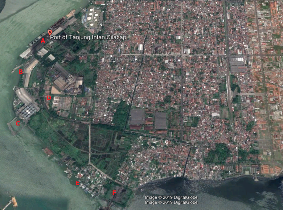
A: Berth I, II, III, Multipurpose and IV
B: Berth for Fertilizer (PT Pusri)
C: Berth VI
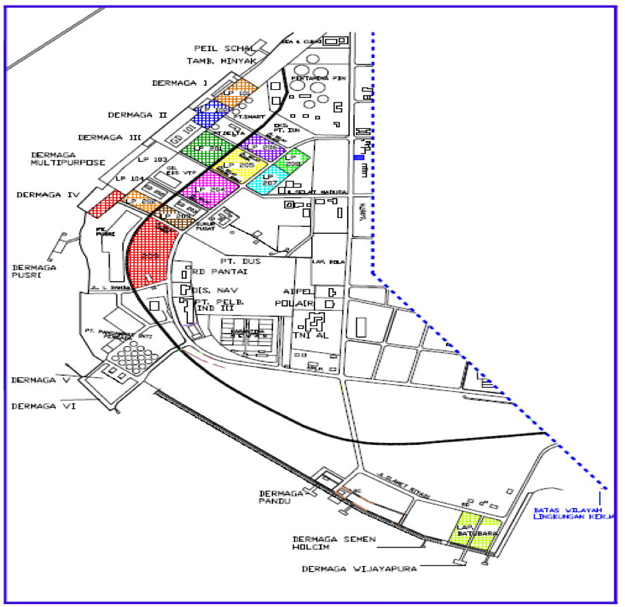
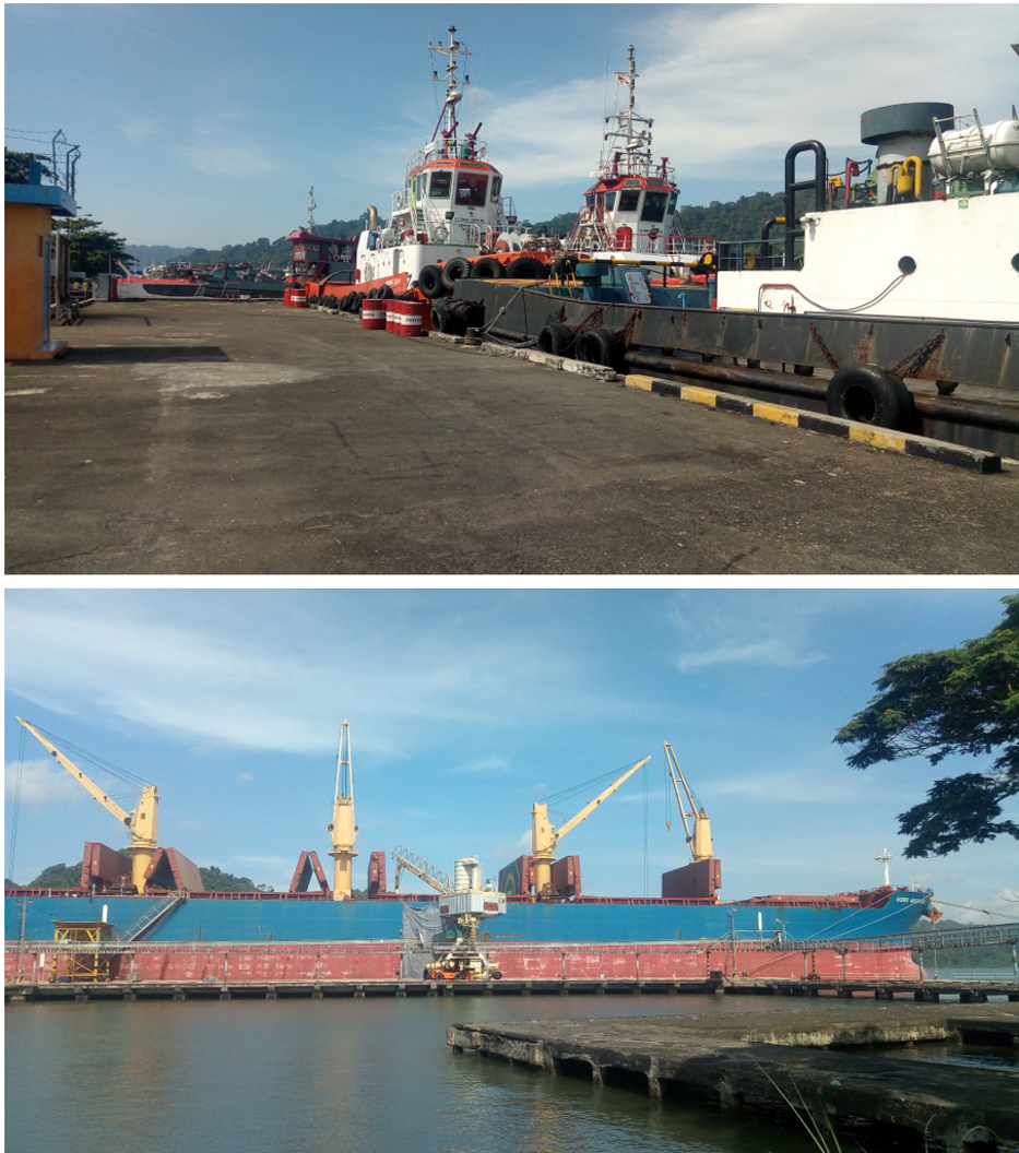
Description and Contacts of Key Companies
KSOP Kelas II Cilacap (Port Authority)
Address Jl Niaga No 9 Cilacap, Central Java
Ph. +62-282–532158
Fax. +62-282-532711
Contact Wigyo, S.Sos, MH (Head of KSOP Cilacap)
Email syahbandarclp@gmail.com
PT Pelabuhan Indonesia III (Pelindo III) Persero, Port of Tanjung Intan
Address JL. Tambak Reja, Cilacap, Jawa Tengah, Klega, Tambakreja, South Cilacap, Cilacap Regency, Central Java 53211
Contact Edward Nul Johar (General Manager)
Imam Haromain (Superintendent of Operation Support)
Ph. +62 81251471399
Port Performance
Located in Cilacap district, Central Java Indonesia, Cilacap has many industrial plants such as PT Holchim Indonesia (cement factory), PT. Pupuk Sriwidjaja (fertilizer factory), PT Dharmapala Usaha Sukses (Sugar factory), Steam power plant (PLTU) and Pertamina refinery. Main commodities load and discharge at Tanjung Intan port are dry bulk cargo, such as coal, clinker, fertilizer, soybean, sugar and wheat, and other commodities such as cement, cattle and fuel oils. The Port of Tanjung Intan contains a total of 8 berths with total length 833 meters, 5 open storage sites with total area 30,000 m2, and 3 sheds with total area 7,100 m2.
|
Seasonal Constraints |
||
|
|
Occurs |
Time Frame |
|
Rainy Season |
Yes |
November - March |
|
Major Import Campaigns |
No |
|
|
Other Comments |
Information on Weather conditions for the port vicinity and surrounding area coming from Cilacap Meteorological Station. Chances of mild to moderate rains and lightning sometimes occur between night until morning. In general, the wind blows from the Northwest, with an average speed ranging from 5-12 knots. The air temperature around 23-31 degrees Celsius and humidity is 66-97 percent. Sea wave height of about 0.1 to 0.6 meters. Tide occurred at 14.00, while the low tide occurred at 07:00, with a height ranging from 0.5 to 1.8 meters |
|
|
Handling Figures for 2018 |
|
|
Vessel Calls |
190 |
|
Container Traffic (TEUs) |
N/A |
|
Handling Figures Bulk and Break Bulk for 2018 |
|
|
Bulk (MT) |
123,060 |
|
Break bulk (MT) |
|
Discharge Rates and Terminal Handling Charges
Port rates and charges of various services can be referred to the government regulation under PP.11 tahun 2016 at the following link: http://jdih.dephub.go.id/assets/uudocs/perpres/2016/PP_15_Tahun_2016.pdf
Berthing Specifications
|
Type of Berth |
Quantity |
Length (m) |
Maximum Draft (m) |
Comments |
|
Conventional Berth |
6 |
Berth I: 157x15 Berth II: 134x25 Berth III: 50x15 Multipurpose: 150x26 Berth IV: 72x17 Berth VI: 120x15 |
-11 -11 -11 -11.5 -10 -11 |
|
|
Container Berth |
N/A |
|
|
|
|
Silo Berth |
N/A |
|
|
|
|
Berthing Tugs |
1 |
50x11 |
-4 |
|
|
Water Barges |
1 |
70x16 |
-3 |
|
Towage and Pilotage services
available for berthing, A safe anchorage position
is located outside the sea
channel; Ships may stay
at
anchoring positions while
waiting for berth. Maps and regulation referred to government
regulation
under KP 476 tahun 2015 at
the following link: http://jdih.dephub.go.id/assets/uudocs/kepmen/2015/KP_476_Tahun_2015.pdf
General Cargo Handling Berths
|
Cargo Type |
Berth Identification |
|
Imports - Bagged Cargo |
|
|
Exports - Bagged Cargo |
|
|
Imports and Exports - RoRo |
|
|
Other Imports |
|
Port Handling Equipment
Port handling equipment is managed by Government state-owned company, PT. Pelindo III (Persero) Cilacap Branch. Terminal operation is carried out on 3 shifts for 24/7.
|
Equipment |
Available |
Total Quantity and Capacity Available |
Comments on Current Condition and Actual Usage |
|
Dockside Crane |
No |
|
|
|
Container Gantries |
No |
|
|
|
Mobile Cranes |
No |
|
|
|
Reachstacker |
No |
|
|
|
RoRo Tugmaster (with Trailer) |
No |
|
|
|
Grain Elevator with Bagging Machines |
No |
|
|
|
Transtainer |
No |
|
|
|
Forklifts |
Yes |
5 tonnage |
|
Container Facilities
There is no container operation at the port.
Customs Guidance
Customs clearance is available through the local customs office at the port. For more information on customs in Indonesia, please see the following link: http://www.beacukai.go.id/
Stevedoring
Stevedoring activities organised by third parties (authorised stevedoring company) in coordination with the Labour Union Association (TKBM) administered by the Port Authority (KSOP) Office. The owner/shipper can also discharge their own cargo by contacting the Labour Union Association directly.
Hinterland Information
Most of the cargo traded in the port is from industrial plants located in Cilacap District such as cement, fertilizer, sugar, wheat flour. Cargo movement from the port to Cilacap district, Southern Central Java, Yogyakarta, and southern West Java is connected via road access.
Port Security
Conduct business based on Quality Management System, Environmental & K3 (Occupational health & safety) as per the requirements of the ISO 9001: 2015, ISO 14001: 2015 & SMK3 (Occupational health & safety system management) PP No. 50/2012 (Government regulation).
|
Security |
|
|
ISPS Compliant |
Yes |
|
Current ISPS Level (Level 1 = Normal, Level 2 = Heightened, Level 3 = Exceptional) |
Level 1 |
|
Police Boats |
Yes |
|
Fire Engines |
Yes |
2.1.15 Indonesia East Java Port of Teluk Lamong
Port Overview
Key port information can also be found at www.teluklamong.co.id
1st semi-automated terminal in Indonesia with Green Technology (Green Port). As the implementation of the development of Tanjung Perak Port - Surabaya, it is equipped with adequate loading and unloading technology.
As an effort to support the flow of goods from and the territory of Eastern Indonesia to anticipate the increasing of container traffic and bulk as result of the global market in Port of Tanjung Perak.
To avoid the congestion in Tanjung Perak Port of Surabaya so it does not bring negative impact to Indonesian port globally.
The construction of Lamong Bay Terminal is included in the Indonesian Economic Development Acceleration and Expansion (MP3EI) particularly in Java corridor. By developing and operating Lamong Bay Multipurpose Terminal, PT Pelabuhan Indonesia III (Persero) expects to reduce ship waiting time in Tanjung Perak Port as economic gate of East Java and Eastern Indonesia.
Port website : http://www.teluklamong.co.id/index.php/terminal-information/facilities/ship-to-shore-sts-crane
|
Port Contacts |
|||
|---|---|---|---|
|
Port Operating Company |
PT Terminal Teluk Lamong Address: Jl. Raya Tambak Osowilangun Km. 12, Kelurahan Tambak Osowilangun, Kecamatan Benowo, Surabaya, Jawa Timur 60191 |
||
|
Latitude |
7° 12'20" S |
Longitude |
112° 39'53" E |
|
Telephone |
+623199001500 |
Fax |
+623199001480 +623199001490 |
|
|
Web |
http:// www.teluklamong.co.id |
|
Port Picture
Port Performance
Multipurpose terminal and provides services for container (international and domestic) and dry bulk (feed grain and food grain).
Berthing Specifications
|
Conventional Berth |
2 |
500 m |
- 14 |
Port Handling Equipment
|
Equipment |
Available (Yes/No) |
Total Quantity & Capacity Available |
Comments on Current Condition and Actual Usage |
|---|---|---|---|
|
Dockside Crane |
YES |
5 |
Brand New |
|
Container Gantries |
YES |
10 |
Brand New |
|
Straddle Carriers |
YES |
5 |
Brand New |
|
Combined Tractor Trailers |
YES |
50 |
Brand New |
|
Grain Elevator (with Bagging Machines) |
None |
||
Development Plans
The Government and Pelindo have development plans involving the construction of a flyover roadway which will remove a series of bottlenecks around the port (construction has been initiated and is due to be completed by 2019) and to install a mono – rail system which will connect the main container terminals to each other and the national rail network.
2.1.16 Indonesia South Sulawesi Port of Nusantara Kendari
Port Overview
Goods supply to Southeast Sulawesi Province mainly comes from Surabaya, through sea transportation to Kendari City, which then being distributed within Kendari City and surrounding sub-districts, and small part of it being distributed to smaller island by boats. Some goods also come from Makassar City by a multi-modal transportation (loaded into the truck, then transferred by Ferry, and continued with the truck till Kendari City). Kendari Port is classified as Port Class II. It is a conventional port for multi-purposes. The Port is operated by PT. Pelabuhan Indonesia IV Kendari Branch, with yearly traffic around 74,000 containers and 558,000 passengers (2014 figures). The port has 270 M length of Docking Area and 24,252 M² of Container Yard.
Port website: http://inaport4.co.id/?p=521
Key port information may also be found
at: http://www.maritime-database.com
|
PORT LOCATION & CONTACT |
|
|---|---|
|
Country: |
INDONESIA |
|
Province or District: |
South East Sulawesi Province |
|
Town or City: (Nearest location with distance from port) |
Kendari, 0 Km |
|
Port's Complete Name: |
Nusantara Port of Kendari |
|
Latitude: |
03° 58’ 25” S |
|
Longitude: |
125° 11’ 00” E |
|
Managing Company or Port Authority: (If more than one operator, break down by area of operation) |
PT. Pelabuhan Indonesia IV Branch Kendari Port |
|
Address: |
Jl. Konggoasa No. 1 Phone. +62 (0) 401- 321087 Fax. +62 (0) 401 – 321 976 |
|
Nearest Airport and Airlines: (Airlines with frequent international arrivals/departures) |
|
Port Picture
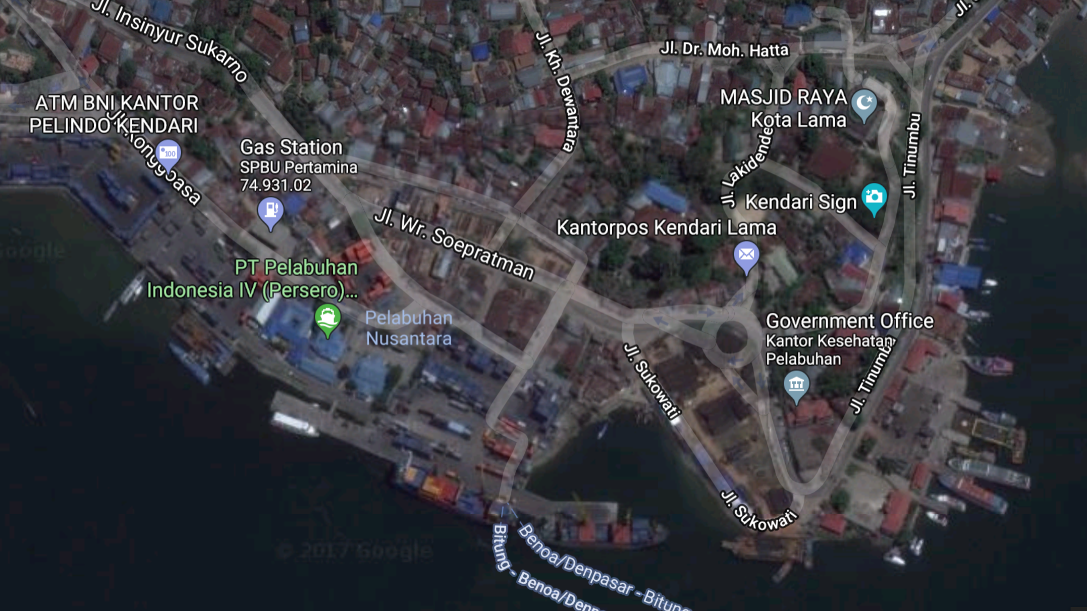
Description and Contacts of Key Companies:
Clearing Agents
|
Company Name and address |
Contact Names / Email |
Tel / Fax |
Website |
|---|---|---|---|
|
Meratus LINES |
Jl. W.R Supratman no. 61, Kandai, Kendari – Sulawesi Tenggara Email: info@meratusline.com |
Tel1: +62 (0) 401 - 325277 |
For additional information on port contacts, please see the following link: ANNEX 4.2.4: PORT COMPANY CONTACT LIST
Port Performance
|
SEASONAL CONSTRAINTS |
||
|---|---|---|
|
Yes / No |
From <month> to <month> |
|
|
Rainy Season |
YES |
October to March |
|
Major Import Campaigns |
NO |
|
|
HANDLING FIGURES 2014 |
|
|---|---|
|
Vessel Calls: |
4,420 Calls |
|
Container Traffic: (TEUs) |
74,585 TEUs |
|
Handling Figures Bulk and Break Bulk |
Year 2014 |
|---|---|
|
Bulk (MT) |
1,702,737 (including general cargoes) |
|
Break bulk (MT) |
Discharge Rates and Terminal Handling Charges
For information on port rates and charges, please see the following link: http://inaport4.co.id/?p=521
Note: Discharge Rates are issued by PT. Pelabuhan Indonesia IV (Persero) Headquarters in Makassar City, and it is vary from one port to another.
Berthing Specifications
|
Type of Berth |
Quantity |
Length (m) |
Maximum Draft (m) |
Comments |
|---|---|---|---|---|
|
Conventional Berth |
2 units |
270 & 110 |
9 |
A multi-purpose berth, and also used as container berth |
|
Container Berth |
|
|
|
Using a conventional berth |
|
Water Barges |
15 Tons/hr |
|
General Cargo Handling Berths
|
Cargo Type |
Berth Identification |
|---|---|
|
Imports - Bagged Cargo |
Using a Conventional berth |
|
Other Imports |
Using a Conventional berth |
Port Handling Equipment
PT. Pelabuhan Indonesia IV Branch Kendari Port is in charge for port operations. They have some handling equipment such as reach-stacker and forklifts, and there are few private companies also operates similar handling equipment. The handling equipment can be rented according to their standard rates.
|
Equipment |
Available (Yes / No) |
Total Quantity and Capacity Available |
|---|---|---|
|
Dockside Crane |
NO |
|
|
Container Gantries |
NO |
|
|
Mobile Cranes |
NO |
|
|
Reachstacker |
YES |
2 unit; 45 Tons |
|
RoRo Tugmaster (w/ Trailer) |
NO |
|
|
Grain Elevator w/ Bagging Machines |
NO |
|
|
Transtainer |
NO |
|
|
Forklifts |
YES |
1 unit (7 Ton); 1 Unit (32 Ton) |
Container Facilities
There are 3 (three) Container Yards at the port with total area of 24,252 M², which can also be used as open storage.
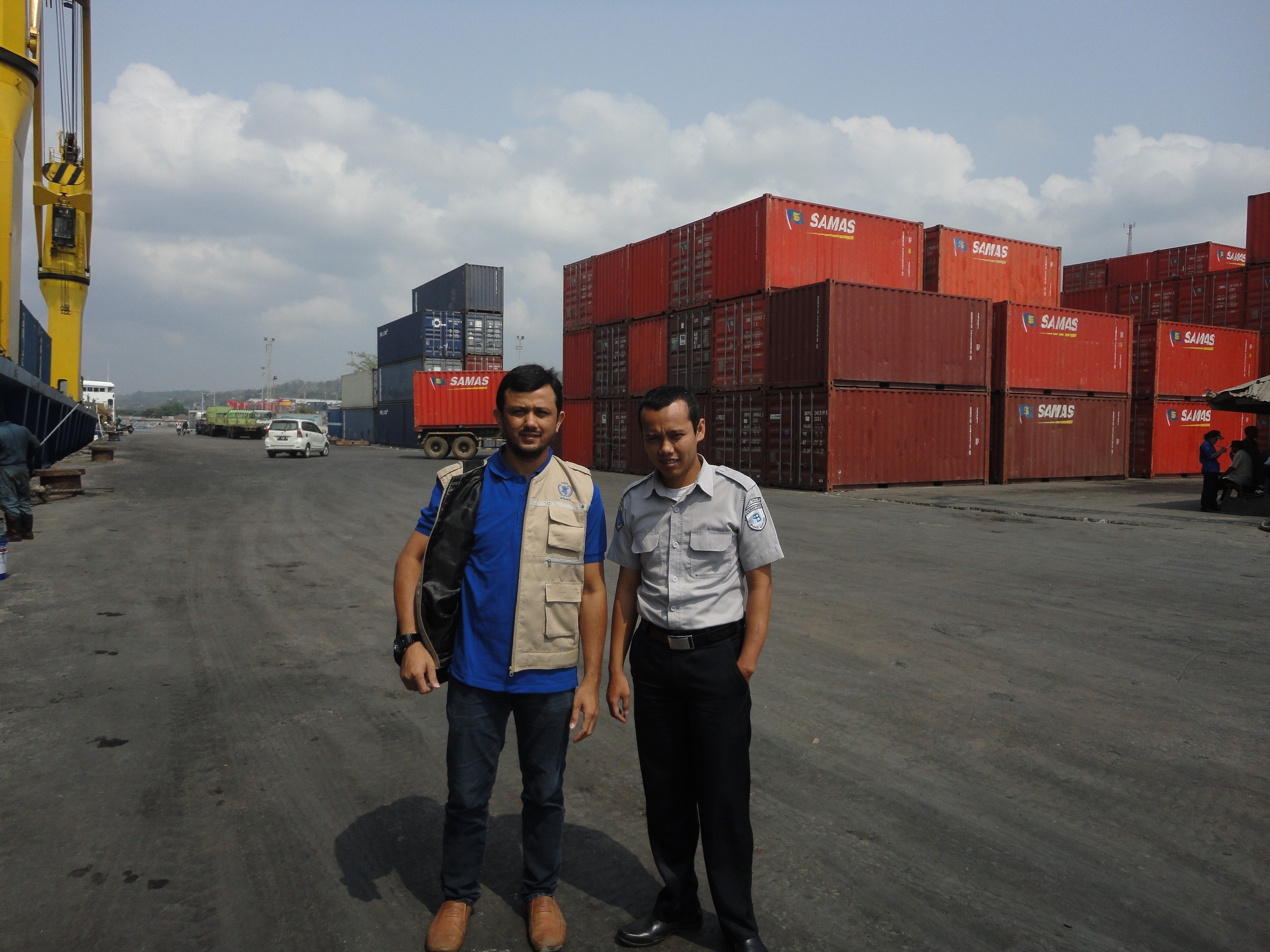
|
Facilities |
20 ft |
40 ft |
|---|---|---|
|
Container Facilities Available |
YES |
YES |
|
Container Freight Station (CFS) |
YES, 3 Container Yards (mixed 20’ and 40’ Container) |
|
|
Refrigerated Container Stations |
NO |
NO |
|
Daily Take Off Capacity (Containers per day) |
Depending on the ship, there is no mobile crane available at the Port to offload containers from the Ship, only vessel equipped with Ship-crane can offload the containers. |
|
Customs Guidance
There is only import activities at Kendari Port, and no export activities.
Note: Customs Clearances procedures should be complied with the Regulations issued by the Directorate General of Customs and Excises under the Ministry of Finance.
For information on customs, please see the following link: INSERT LINK TO COUNTRY PROFILE 1.4: CUSTOMS INFORMATION – create the contact list by completing the 'Country Profile 1.4: Customs Information’ template. Once saved in the appropriate annex section, copy and paste the link here.
Terminal Information
Multipurpose Terminal
Kendari Port (03° 58’ 25” S / 125° 11’ 00” E)
Pier: 270 M
Grain and Bulk Handling
There is no grain handling activities at Kendari Port, however there are some bulk handling activities for liquid and dry cargoes.
Main Storage Terminal
There is a warehouse at the port.
|
Storage Type |
Number of Storage Facilities |
Area (square meters) |
|---|---|---|
|
General Cargo |
1 |
Unknown |
Stevedoring
There is a Labour Association (TKBM) at Kendari Port administered by the Port Authority (KSOP). PT. Pelabuhan Indonesia IV Branch Kendari Port is in charge for port operations. They have some handling equipment such as reach-stacker and forklifts, and there are few private companies also operates similar handling equipment. The handling equipment can be rented according to their standard rates.
Hinterland Information:
Goods supply to Southeast Sulawesi Province is mainly comes from Surabaya, through sea transportation to Kendari City, which then being distributed within Kendari City and surrounding sub-districts, and small part of it being distributed to smaller island by boats. Some goods also come from Makassar City by a multi-modal transportation (loaded into the truck towards a ferry port, then crossing by ferry from South Sulawesi to Southeast Sulawesi, then continued with the truck towards Kendari City).
Port Security
The Kendari Port has adopted ISPS, and the overall security situation at the port is considered as normal.
|
Security |
|
|---|---|
|
ISPS Compliant (Yes / No) |
YES (Certificate No: 02-0203-DN) |
|
Current ISPS Level |
1 |
Level 1 = Normal, Level 2 = Heightened, Level 3 =
Exceptional
2.1.17 Indonesia West Papua Port of Sorong
Port Overview
The city of Sorong is strategic as the main gateway to West Papua Province. Sorong is also known as the city of Industry, trade and services. Goods that are being supplied to Sorong city mainly comes from Makassar and Surabaya by sea transport to the Port of Sorong and then distributed within Sorong city and surrounding districts. A small quantity are distributed to smaller islands by Ferry and Pioneer Ship.
Sorong Port is the largest port in West Papua province, located in Papua’s bird’s head peninsula, and it is classified as Port Class I. Sorong port is a conventional port for multi-purposes, it is operated by government state-owned company, PT. Pelabuhan Indonesia IV Sorong Branch.
Port website: https://inaport4.co.id/branch/read/2/1
Key port information may also be found at: https://inaport4.co.id/
|
Port Location and Contact |
|
|
Country |
INDONESIA |
|
Province or District |
Sorong City, West Papua Province |
|
Nearest Town or City with Distance from Port |
Sorong City - 7 km |
|
Port's Complete Name |
Port of Sorong |
|
Latitude |
00° 53’ 00” S |
|
Longitude |
131° 14’ 00” E |
|
Managing Company or Port Authority |
PT. Pelabuhan Indonesia IV (Persero) Sorong Branch |
|
Management Contact Person |
M. Rasul Manager Business Development Transformation Ph. +62-0951-323805 |
|
Nearest Airport and Airlines with Frequent International Arrivals/Departures |
Domine Eduar Osok Airport
|
Port Picture
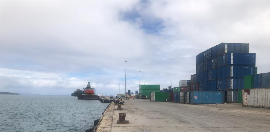
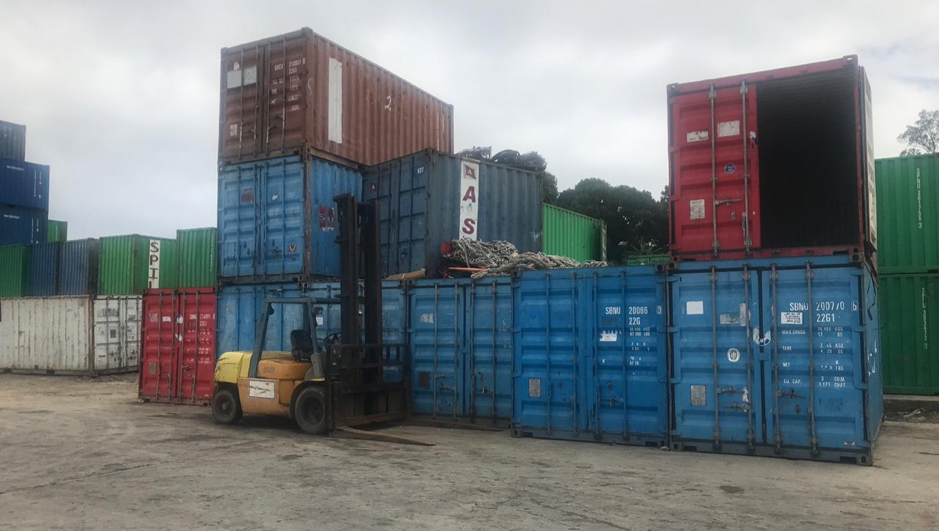
Port Performance
|
Length of channel |
3,5 Mile |
|
Width of channel |
926 m |
|
Max. depth of channel |
20 m |
|
Min. depth of channel |
13 m |
|
Min. depth of Basin |
11 m |
|
Max. depth of Basin |
20 m |
|
Max. depth beside of Wharf |
9 m |
|
Wave Height |
3 m |
|
High Water Spring |
20 m LWS |
|
Low Water Spring |
8 m LWS |
|
Seasonal Constraints |
||
|
|
Occurs |
Time Frame |
|
Rainy Season |
Yes |
From October to February |
|
Major Import Campaigns |
No |
From (month) to (month) |
|
Other Comments |
- |
|
|
Handling Figures for 2018 |
|
|
Vessel Calls |
139 |
|
Container Traffic (TEUs) |
49,686 |
|
Handling Figures Bulk and Break Bulk for 2018 |
|
|
Bulk (MT) |
300 |
|
Break bulk (MT) |
23,415 |
Discharge Rates and Terminal Handling Charges
For information on port rates and charges, please see the following link: www.dephub.go.id (PP.15 Tahun 2016)
http://jdih.dephub.go.id/assets/uudocs/perpres/2016/PP_15_Tahun_2016.pdf
Berthing Specifications
|
Type of Berth |
Quantity |
Length (m) |
Maximum Draft (m) |
Comments |
|
Conventional Berth |
1 |
220 |
12 – 14 LWS |
Conventional Port |
|
Container Berth |
1 |
250 |
12 – 14 LWS |
|
|
Passenger Terminal |
1 |
220 |
12 – 14 LWS |
Conventional Port |
|
Silo Berth |
Nil |
|
|
|
|
Berthing Tugs |
Nil |
|
|
|
|
Water Barges |
|
|
|
Water filling facilities to the ship using pipes and pushing machines from water tank, 100 tons per hours, 800 ton water tank capacity |
Port website: https://inaport4.co.id/branch/read/2/1
General Cargo Handling Berths
|
Cargo Type |
Berth Identification |
|
Imports - Bagged Cargo |
Wharf 1 Wharf 2 |
|
Exports - Bagged Cargo |
Wharf 1 Wharf 2 |
|
Imports and Exports - RoRo |
Nil |
|
Other Imports |
Nil |
Port Handling Equipment
There are various types of handling equipment at the Port of Sorong.
|
Equipment |
Available |
Total Quantity and Capacity Available |
Comments on Current Condition and Actual Usage |
|
Fixed Crane |
1 |
- |
Maintenance |
|
Rubber Tyred Gantry |
Nil |
- |
- |
|
Mobile Cranes |
1 |
15 T |
Maintenance |
|
Reachstacker |
4 |
45 tons |
Good |
|
Side Loader |
Nil |
- |
- |
|
Transtainer |
Nil |
- |
- |
|
Forklifts |
2 |
7 tons |
Good |
|
Chassis Head Truck |
4 |
- |
Good |
|
Head Truck |
8 |
40 tons and 30 tons |
Good |
|
Tugboat |
1 |
- |
Good |
|
Pilot Boat |
1 |
- |
Good |
Container Facilities
There is a Container Yard at the port with total area of 27,000 m2, which can also be used as open storage.
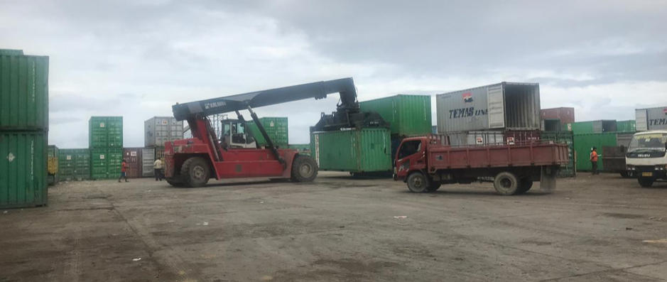
|
Facilities |
20 ft |
40 ft |
|
Container Facilities Available |
Yes |
Yes |
|
Container Freight Station (CFS) |
No |
No |
|
Refrigerated Container Stations |
Yes |
Yes |
|
Other Capacity Details |
800 ton water tank capacity |
|
|
Daily Take
Off
Capacity |
200 - 250 Container per day – Using Ship Crane |
|
|
Number of Reefer
Stations |
35 |
|
|
Emergency Take-off Capacity |
Nil |
|
|
Off take Capacity of Gang
Shift |
Nil |
|
Customs Guidance
Customs clearance is available through the local customs office in the port. http://www.beacukai.go.id/
Terminal Information
PT. PELNI and PT. ASDP are the two main ferry operators for cargo and passenger movements from Sorong and throughout West Papua province. The routes for PT. PELNI are Manokwari – Jayapura – Biak – Serui – Fak-Fak – Ambon – Wasior – Nabire – Bau Bau – Ternate – Bitung – Morotai – Bacan – Makassar – Surabaya – Tanjung Priok and for PT. ASDP are Sorong – Arefi – Pam – Lemalas – Waigama – Wejim - Kofiau.
MULTIPURPOSE TERMINAL
Existing capacity at Sorong Port:
- Container yard 27,000 m2
- Only diesel and marine fuel, supplied by PERTAMINA - depend on request
- Water Tank 800 Tons
- 24 working hours
GRAIN AND BULK HANDLING
There are no grain and bulk handling activities at the Port of Sorong.
MAIN STORAGE TERMINAL
|
Storage Type |
Number of Storage Facilities |
Area (m2) |
|
Bagged Cargo |
Nil |
Nil |
|
Refrigerated Cargo |
Nil |
Nil |
|
General Cargo |
Nil |
Nil |
Stevedoring
Stevedoring activities at the port organised by third parties (authorised stevedoring company) in coordination with the Labour Union Association (TKBM) and administered by the Port Authority (KSOP) Office. The owner/importer can also discharge their own cargo by contacting the Labour Union Association directly.
Hinterland Information
The port serves the trading of local commodities; fisheries, wood, and sawdust.
Port Security
|
Security |
|
|
ISPS Compliant |
Yes |
|
Current ISPS Level (Level 1 = Normal, Level 2 = Heightened, Level 3 = Exceptional) |
1 |
|
Police Boats |
Yes |
|
Fire Engines |
Yes |
2.1.18 Indonesia North Maluku Port of Ahmad Yani Ternate
Port Overview
Ahmad Yani is the largest port in North Maluku Province, and is located in Ternate city, Ternate island. The port is the economic gate for the Northern Maluku islands.
Goods supplied to North Maluku come mainly from Makassar and Surabaya by sea transportation to Ternate City, and are then distributed to other districts and Islands by ferry or speed boat. A small amount of commodities also comes from Manado in North Sulawesi.
The port is geographically located on the volcanic island of Ternate. During previous eruptions of Mount Gamalama the port remained operational.
Port website: https://inaport4.co.id/branch/read/5/8
Key port information may also be found at: https://inaport4.co.id/
|
Port Location and Contact |
|
|
Country |
INDONESIA |
|
Province or District |
North Maluku Province, Ternate Island |
|
Nearest Town or City with Distance from Port |
Ternate City 1 km |
|
Port's Complete Name |
Ahmad Yani Port |
|
Latitude |
00° - 46’ 95” N |
|
Longitude |
127° - 23‘ 02” E |
|
Managing Company or Port Authority
|
PT. Pelabuhan Indonesia IV (Persero) Cabang Pelabuhan Ahmad Yani Ternate |
|
Management Contact Person |
Habibuddar Soleman HR and General Affair Manager M. +62 813 4496 2332 |
|
Nearest Airport and Airlines with Frequent International Arrivals/Departures |
Sultan Babullah Airport
|
Port Picture
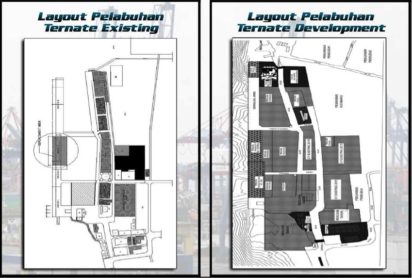
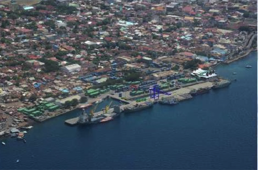
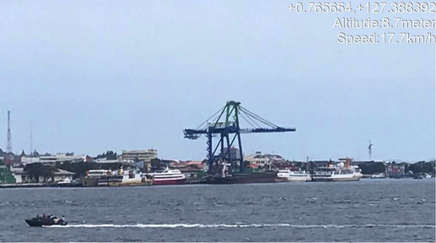
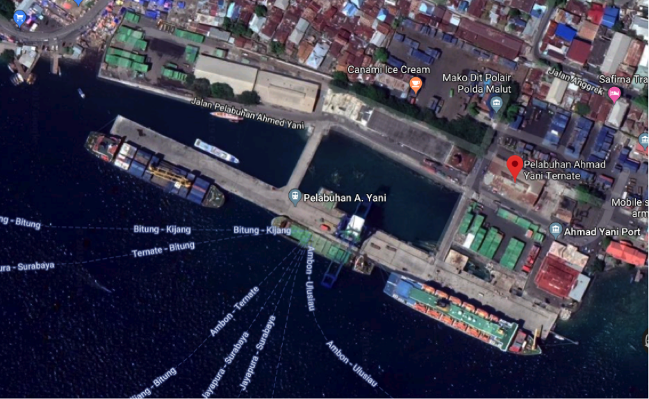
Port Performance
Tidal: High water spring: 2m and Low – water spring: 0.9m
Wave: High wave in the harbour pool as between 0 – 1m and between 0 – 2m area at anchor
|
Seasonal Constraints |
||
|
|
Occurs |
Time Frame |
|
Rainy Season |
Yes |
From October to February |
|
Major Import Campaigns |
No |
From (month) to (month) |
|
Handling Figures for 2018 |
|
|
Vessel Calls |
2,046 |
|
Container Traffic (TEUs) |
38,259 |
|
Handling Figures Bulk and Break Bulk for 2018 |
|
|
Bulk (MT) |
584,102 MT (including general cargoes) |
|
Break bulk (MT) |
|
Discharge Rates and Terminal Handling Charges
For information on port rates and charges, please see the following link:
Berthing Specifications
|
Type of Berth |
Quantity |
Length (m) |
Maximum Draft (m) |
Comments |
|
Conventional Berth |
1 |
415 |
8 |
A multi-purpose berth, and also used as container berth |
|
Container Berth |
|
|
|
Using a conventional berth |
|
Passenger Berth |
2 |
600 m2 and 98 m2 |
- |
Passenger berth |
|
Silo Berth |
Nil |
|
|
|
|
Berthing Tugs |
Nil |
|
|
|
|
Water Barges |
1 |
|
|
|
Port website: https://inaport4.co.id/branch/read/5/8
General Cargo Handling Berths
|
Cargo Type |
Berth Identification |
|
Imports - Bagged Cargo |
Concrete Pier Ahmad Yani |
|
Exports - Bagged Cargo |
Concrete Pier Ahmad Yani |
|
Imports and Exports - RoRo |
Nil |
|
Other Imports |
Nil |
Port Handling Equipment
The port equipment is managed by PT. Pelindo IV Ternate.
|
Equipment |
Available |
Total Quantity and Capacity Available |
Comments on Current Condition and Actual Usage |
|
Dockside Crane |
No |
N/A |
N/A |
|
Container Gantries |
Yes |
1 unit – 40 T |
Good |
|
Mobile Cranes |
Yes |
1 unit |
Good |
|
Reachstacker |
Yes |
2 unit - 45 MT |
Good |
|
RoRo Tugmaster (with Trailer) |
No |
N/A |
N/A |
|
Grain Elevator with Bagging Machines |
No |
N/A |
N/A |
|
Transtainer |
Yes |
1 unit |
Good |
|
Forklifts |
Yes |
3 unit - 5 T, 7 T and 33 T |
Good |
|
Gantry Luffing Crane (GLC) SWL |
No |
N/A |
N/A |
|
Head Truck |
Yes |
3 unit |
Good |
|
Tronton |
Yes |
6 unit |
Good |
|
Pilot Boat |
Yes |
2 unit |
Good |
Container Facilities
Services for loading and unloading activities to and from ships / barges utilises Container Gantries. Container Yard can accommodate 3,000 – 4,000 (TEUs) of containers.
|
Facilities |
20 ft |
40 ft |
|
Container Facilities Available |
Yes |
Yes |
|
Container Freight Station (CFS) |
Yes |
Yes |
|
Refrigerated Container Stations |
NO |
NO |
|
Other Capacity Details |
3000 – 4000 TEUs Capacity at Concrete Pier Ahmad Yani |
|
|
Daily Take Off
Capacity |
20 – 25 Containers per hour |
|
|
Number of Reefer
Stations |
Nil |
|
|
Emergency Take-off Capacity |
Nil |
|
|
Off take Capacity of Gang
Shift |
Nil |
|
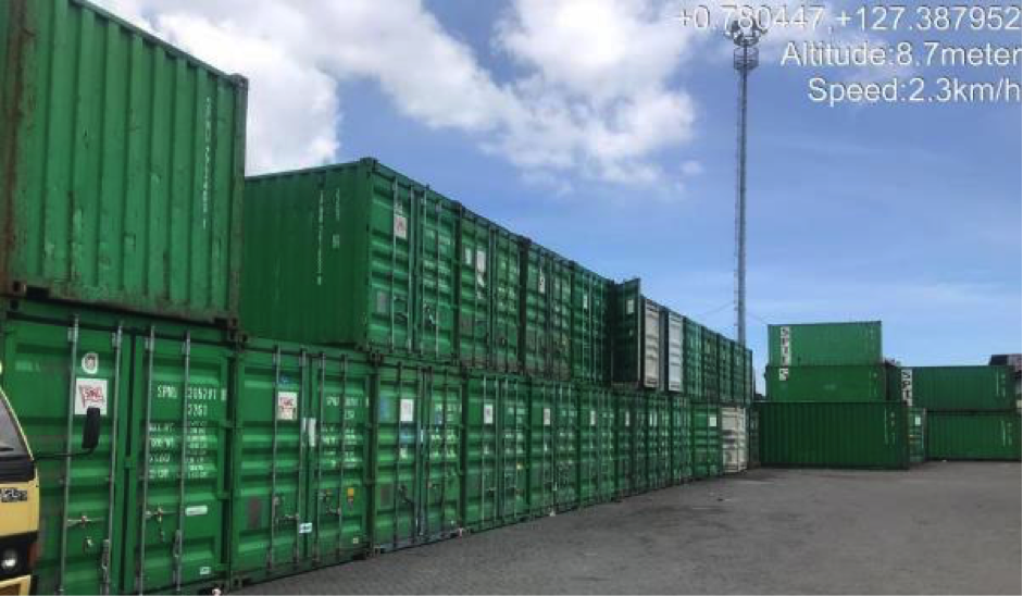
Customs Guidance
Customs clearance is available through the local customs office in the port: http://www.beacukai.go.id/
Terminal Information
MULTIPURPOSE TERMINAL
- Concrete Pier AhmadYani415 M
- Concrete PierbaseBastiong 60 M
- Dock iron/wood baseBastiong56 M
- Pilot Boat 2 unit (40 HP x 2 and 85 HP x 2)
- Clean Water cap. 375 T / M3 and supply cap. 100 T
- Transit Shed 900 M2 and 1.000 M2
- ContainerYard 21.112 M2
- Forklift 3 units cap. 5 T, 7 T and 33 T
PT. Indonesia Ferry (ASDP) operatesRo-Roferries in the Ternate. ASDP operates 13 ferries for 12 routes inter-island within North Maluku. ASDP also provides charter services for inter-island ferries in North Maluku.
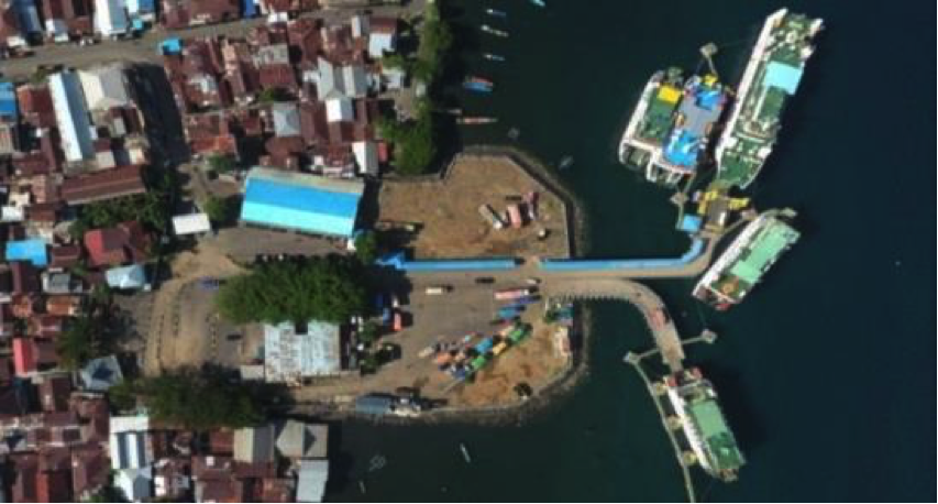
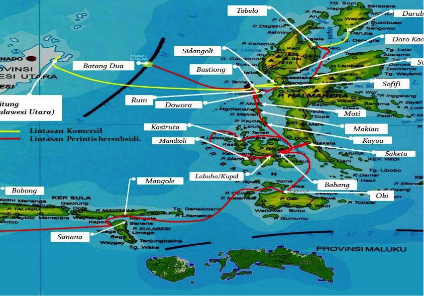
GRAIN AND BULK HANDLING
There is no grain and bulk handling activities at the Ahmad Yani Port.
MAIN STORAGE TERMINAL
|
Storage Type |
Number of Storage Facilities |
Area (m2) |
|
Bagged Cargo |
2 (General) |
1900 m2 |
|
Refrigerated Cargo |
Nil |
Nil |
|
General Cargo |
2 (General) |
1900 m2 |
Stevedoring
Stevedoring activities organized by third parties (authorised stevedoring company) in coordination with the Labour Union Association (TKBM) and administered by the Port Authority (KSOP) Office. The owner/importer can also discharge their own cargo by contacting the Labour Union Association directly.
Hinterland Information
The port serves a vast inland area of many smaller islands in Northern Maluku with vast mining, plantations and forestry potential.
Hinterland along the island has commodities such as cocoa, cloves, cinnamon, pepper and nutmeg, as well as seeded Maize, sweet potato and cassava.
Port Security
|
Security |
|
|
ISPS Compliant |
Yes |
|
Current ISPS
Level |
1 |
|
Police Boats |
Yes |
|
Fire Engines |
Yes |
2.1.19 Indonesia Bali Port of Benoa
Key port information can also be found at: Maritime Database Website information on Bali Port of Benoa
Port Overview
Benoa port is located close to Denpasar and attends to passenger
cruises vessels, freighters and traditional Indonesia coasters..
The port has a new berth intended for use by larger cargo vessels
(containerized and bulk) and passenger services. A recently
completed toll bypass road has aided in easing access between the
Port and to the Ngurah Rai International Airport.
Benoa port is the most suitable port for the receiving of
containerized cargo for Bali. The other ports on the island are set
up for RoRo operations, bulk commodities (cement) and passenger
movements.
Port website: Port of Benoa Website
|
Port Location and Contacts |
|
|---|---|
|
Country |
Indonesia |
|
Province or District |
Bali |
|
Town or City (Closest location) with Distance (km) |
Name: Denpasar km: 9,5 km |
|
Port's Complete Name |
Benoa |
|
Latitude |
-8.73646736 |
|
Longitude |
115.222862 |
|
Managing Company or Port Authority (If more than one operator, break down by area of operation) |
Pelindo III |
|
Management Contact Person |
Siti Juairiah |
|
Closest Airport and Frequent Airlines to / from International Destinations |
Airport Name: Ngurah Rai International Airport Airlines: Garuda Indonesia, Cathay Pacific, Jetstar, Malaysia Airlines, China Southern, Qatar Airways |
Port Picture
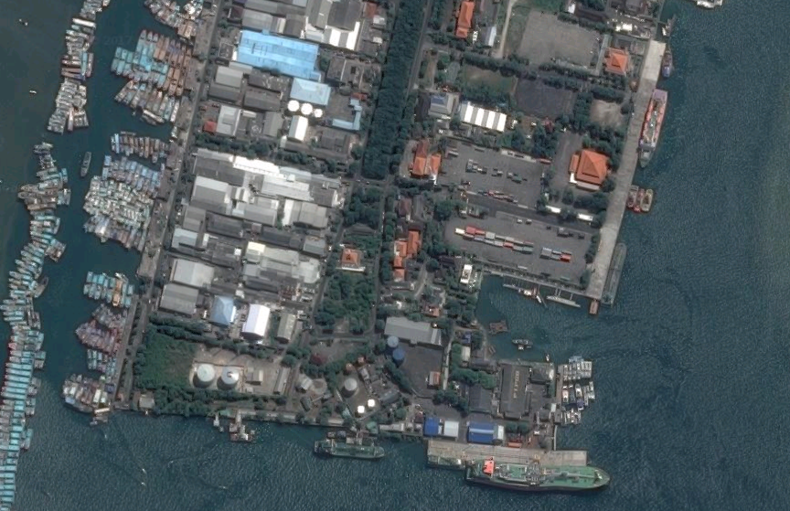
Description and Contacts of Key Companies
4.2.4 Indonesia Port and Waterways Company Contact Lists
Pelindo III is the port operator in Benoa and manages movements of both cargo and passenger vessels. The majority of passenger ferry operations in Bali (and Indonesia) are run by PT. ASDP and PT Pelini.
Port Performance
|
Seasonal Constraints |
Yes / No |
From <month> to <month> |
|||
|---|---|---|---|---|---|
|
Rainy Season |
Yes |
Dec - Apr |
|||
|
Major Import Campaigns |
No |
n/a |
|||
|
Handling Figures |
Year 2016 |
||||
|
Vessel Calls |
1613 |
||||
|
Container Traffic (TEUs) |
500 |
Discharge Rates and Terminal Handling Charges
|
Containerised Cargo Handling Charges |
|
|
|---|---|---|
|
(TEU’s) |
(FEU’s) |
|
|
Discharge, loading, shifting within the hold or shifting on deck without landing |
$136 |
$269 |
|
Containers handled via a conventional ship |
$136 |
$269 |
|
Empty containers |
$136 |
$136 |
|
Transhipment containers, overland containers, containers shipped and re-landed or landed and re-shipped or shifted from hold to hold |
No tariff |
No tariff |
Berthing Specifications
|
Type of Berth |
Quantity |
Length (m) |
Maximum Draft (m) |
|---|---|---|---|
|
Conventional Berth |
1 |
340m |
9 m LWOST |
|
Container Berth |
Conventional Berth is used. |
n/a |
n/a |
|
Silo Berth |
0 |
n/a |
n/a |
|
Berthing Tugs |
1 |
n/a |
n/a |
|
Water Barges |
0 |
n/a |
n/a |
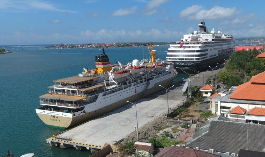
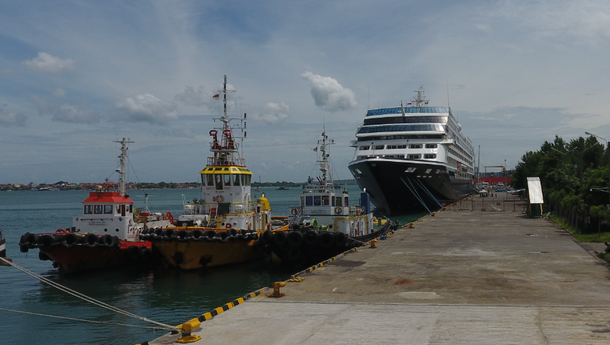
General Cargo Handling Berths
|
Cargo Type |
Berth Identification |
|
Imports - Bagged Cargo |
Conventional |
|
Exports - Bagged Cargo |
Conventional |
|
Imports and Exports - RoRo |
No RoRo capability |
|
Other Imports |
Conventional |
Port Handling Equipment
The port equipment is privately owned and operated.
-
Conventional cargo in the form of bagged, unitised, cars and general cargo are handled over the quay using ship’s gear.
-
The cargo is either loaded or discharged from the vessels direct to road trucks.
-
Port handling equipment is available for rental from private operators.
-
Refer to contact information for further details.
|
Equipment |
Available (Yes / No) |
Total Quantity and Capacity Available |
Comments on Current Condition and Actual Usage |
|---|---|---|---|
|
Dockside Crane |
n/a |
n/a |
n/a |
|
Container Gantries |
n/a |
n/a |
n/a |
|
Mobile Cranes |
n/a |
n/a |
n/a |
|
Reachstacker |
Yes |
1 |
Maximum weight is 40mt. |
|
RoRo Tugmaster (w/ Trailer) |
n/a |
n/a |
n/a |
|
Grain Elevator w/ Bagging Machines |
n/a |
n/a |
n/a |
|
Container Spreader |
Yes |
2 units – @ 35 MT |
Good condition |
|
Forklifts |
n/a |
n/a |
n/a |
Container Facilities
Container storage is available via an open yard which is surrounded by a fence
|
Facilities |
20 ft |
40 ft |
|---|---|---|
|
Container Facilities Available |
Yes |
Yes |
|
Container Freight Station (CFS) |
No |
No |
|
Refrigerated Container Stations |
Yes |
n/a |
|
Other Capacity Details |
||
|
Daily Take Off Capacity (Containers per day) |
150 |
|
|
Number of Reefer Stations (connection points) |
10 |
|
|
Emergency Take-off Capacity (Give an indication) |
n/a |
|
|
Off take capacity of gang shift (in Containers per shift) |
n/a |
n/a |
Customs Guidance
The Port of Benoa is classified as an international port.
-
Therefore, internationally sourced cargo may only move in or out of the port in conformity with Indonesian Customs Rules and Regulation.
-
However, the customs clearances for International cargo entering Bali are processed through another port in Indonesia (typically Surabaya or Jakarta).
-
There are no customs officers available at the port itself.
-
All customs issues must be resolved in Denpasar Customs office.
-
For information on Bali customs guidance, please see the following links: 1.3 Indonesia Customs Information
Terminal Information
Multipurpose Terminal
There is no designated multipurpose terminal as the main quay at the Port of Benoa is used for a number of functions. These functions include passenger ferry terminal, general cargo and other traffic movements.
Grain and Bulk Handling
There are no silos or bulk storage facilities at Benoa Port, nor are there any bagging facilities or bagging units. Also, there is no bulk handling equipment available (i.e. Grabs and Hoppers) thus cement, fertilizers and other potential free flowing cargo is handled ‘ break-bulk’ or palletized.
Main Storage Terminal
|
Storage Type |
Number of Storage Facilities |
Area (square meters) |
|
Bagged Cargo |
1 |
1400m2 |
|
Refrigerated Cargo |
Only via reefer containers |
n/a |
|
General Cargo |
Outdoor area for containers |
15,000m2 |
Stevedoring
Stevedoring is done via private companies who are generally the providers of the handling equipment.
Hiterland Information
Cargo is moved out of the seaport via road transport. Often containers are loaded directly onto trucks for onward movement.
Port Security
|
Security |
||
|---|---|---|
|
ISPS Compliant (Yes / No) |
Yes |
|
|
Current ISPS Level |
1 |
Level 1 = Normal, Level 2 = Heightened, Level 3 = Exceptional |
|
Police Boats |
1 |
|
|
Fire Engines |
n/a |
2.1.20 Indonesia Bali Port of Celukan Bawang
Port Overview

Celukan Bawang is a cargo port which is located in Northern Bali. It is dedicated to the import of cement in bulk and facilitated the tourist cruise ship, Pelindo III as port operator will expand the size of berth number 1 from 160 to 335 in 2018 to accommodate the cruise vessel. Port website: Bali Port of Celukan Website
|
Port Location and Contacts |
|
|---|---|
|
Country |
Indonesia |
|
Province or District |
Bali |
|
Town or City (Closest location) with Distance (km) |
Name: Singaraja City, Buleleng District km: 34 km |
|
Port's Complete Name |
Celukan Bawang |
|
Latitude |
-8.188311 |
|
Longitude |
114.831953 |
|
Managing Company or Port Authority (If more than one operator, break down by area of operation) |
Pelindo III |
|
Closest Airport and Frequent Airlines to / from International Destinations |
Airport Name: Denpasar Airlines: Garuda Indonesia, Cathay Pacific, Jetstar, Malaysia Airlines, China Southern, Qatar Airways |
Port Picture
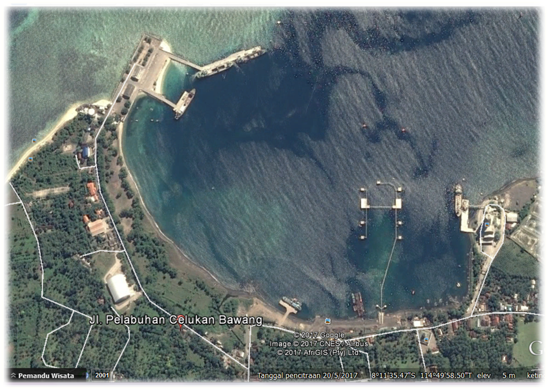
Description and Contacts of Key Companies
The port has long term agreement with cement factory (Tonasa & Gresik); 4.2.4 Indonesia Port and Waterways Company Contact Lists
Port Performance
|
Seasonal Constraints |
Yes / No |
From <month> to <month> |
|
Rainy Season |
Yes |
December-April |
|
Major Import Campaigns |
No |
n/a |
|
Other |
No |
n/a |
Discharge Rates and Terminal Handling Charges
Rates are not publicly available for this port.
Berthing Specifications
|
Type of Berth |
Quantity |
Length (m) |
Maximum Draft (m) |
|---|---|---|---|
|
Conventional Berth |
3 |
58m 160m 50m |
17m 19m 7m |
|
Container Berth |
N/A |
N/A |
N/A |
|
Silo Berth |
2 |
N/A |
N/A |
|
Berthing Tugs |
N/A |
N/A |
N/A |
|
Helipad |
1 |
N/A |
N/A |
|
Water Barges |
N/A |
N/A |
N/A |
|
Beaching Berth |
1 |
N/A |
N/A |
|
LNG terminal |
1 |
300m |
|
General Cargo Handling Berths
|
Cargo Type |
Berth Identification |
|---|---|
|
Imports - Bagged Cargo |
Conventional |
|
Exports - Bagged Cargo |
Conventional |
|
Imports and Exports - RoRo |
Conventional |
|
Other Imports |
Conventional |
Port Handling Equipment
There is no any type of crane, they only have 1 forklift with 7 MT capacity, because normally import cement using crane vessel.
Customs Guidance
There is no customs clearance available at the port.
1.3 Indonesia Customs Information
Terminal Information
Multipurpose Terminal
There is no multipurpose terminal at the port.
Grain and Bulk Handling
Cement is discharged in bulk at a special berth situated on the Eastern side of the harbor.
Main Storage Terminal
The port is facilitated by 3 storage buildings with capacity 8000 MT, 1000 MT & 1000 MT Pelindo III also have 10 hectares idle area could considered for temporary open storage.
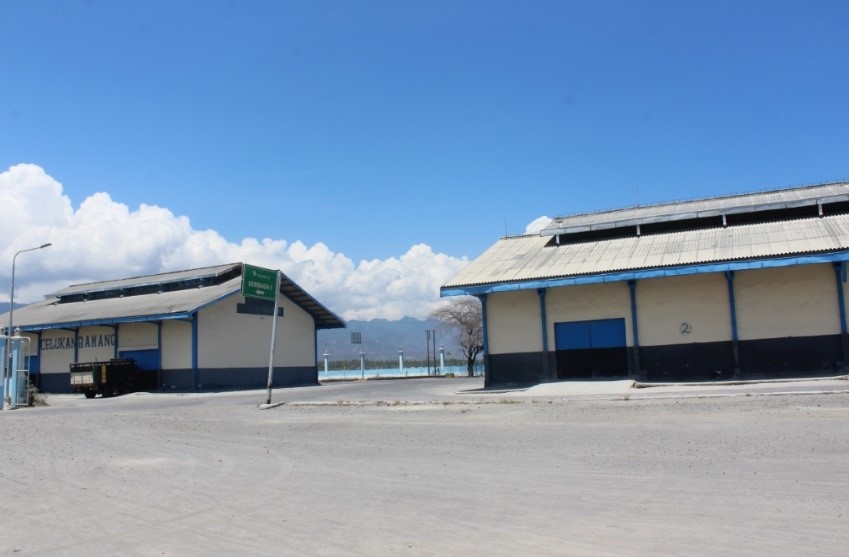
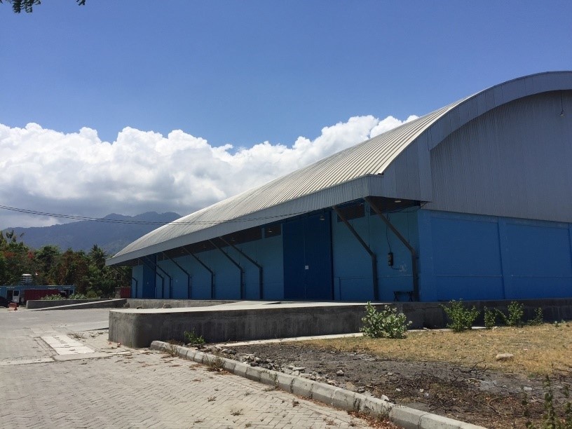
Hiterland Information
Cargo is loaded onto road transport and then moved to its final destination.
Port Security
|
Security |
||
|---|---|---|
|
ISPS Compliant (Yes / No) |
Yes |
|
|
Current ISPS Level |
n/a |
Level 1 = Normal, Level 2 = Heightened, Level 3 = Exceptional |
|
Police Boats |
1 |
|
|
Fire Engines |
1 |
2.1.21 Indonesia Bali Port of Gilimanuk
Port Overview
Key port information can also be found at: Maritime Database Website information on Bali Port of Gilimanuk
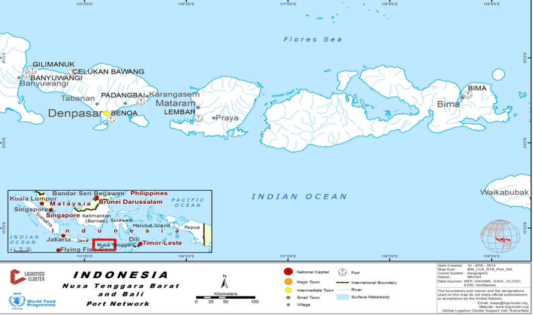
The Port Gilimanuk is 129 kilometers from the city of Denpasar with a good (although very busy) road connection.
-
This is an important gateway linking the islands of Bali and Java.
-
Gilimanuk is the primary port for passenger ferries and Roll on Roll off (RoRo) cargo from Surabaya in Java.
-
The ferries leave on a regular basis, 24 hours a day, 7 days a week between Gilimanuk and Banyuwangi (Surabaya) on Java Island.
-
In addition, this port provides connection to other destinations such as Pandang Bai and Nusa Tenggara archipelago.
-
Port website: PT. ASDP Website
|
Port Location and Contacts |
|
|---|---|
|
Country |
Indonesia |
|
Province or District |
Bali |
|
Town or City (Closest location) with Distance (km) |
Name: Denpasar km: 129 |
|
Port's Complete Name |
Gilimanuk |
|
Latitude |
-8.162972 |
|
Longitude |
114.4371 |
|
Managing Company or Port Authority (If more than one operator, break down by area of operation) |
PT. ASDP |
|
Closest Airport and Frequent Airlines to / from International Destinations |
Airport Name: Ngurah Rai International Airport Airlines: Garuda Indonesia, Cathay Pacific, Jetstar, Malaysia Airlines, China Southern, Qatar Airways |
Port Picture
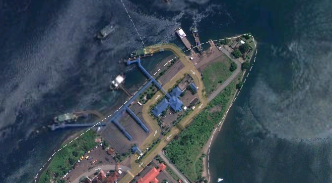
Description and Contacts of Key Companies
PT ASDP Indonesia Ferry (Persero) Indonesia operates the port
and a number of passenger and cargo ferry services.
PT. Pelni shipping lines provide inter-island sea connections for
passenger travel throughout the archipelago of Indonesia.
There is also an independent facility managed by Pertamina for the
discharge and loading of petroleum products.
For information on Bali Port contact details, please see the following link: 4.2.4 Indonesia Port and Waterways Company Contact Lists
Port Performance
Gilimanuk Port is primarily used for RoRo cargo and passenger movements. Ferries depart on a regular basis 24 hours a day, 7 days a week. ASDP has 52 ferries average 280 trips/days (10 minutes interval/schedule)
|
Seasonal Constraints |
Yes / No |
From <month> to <month> |
|---|---|---|
|
Rainy Season |
Yes |
December – April |
|
Major Import Campaigns |
No |
n/a |
|
Other |
n/a |
n/a |
Discharge Rates and Terminal Handling Charges
|
Type of Vehicle |
Rate (Rupiah) |
|---|---|
|
Truck 5-7m length |
242,000 |
|
Truck with 20-foot container |
505,000 |
|
Truck with trailer and container |
732,000 |
|
All vehicles above 15m length |
1,045,000 |
As all cargo is “driven” on and off the vessel (RoRo) there are no additional discharge rates or terminal handling charges for cargo.
Berthing Specifications
|
Type of Berth |
Quantity |
Length (m) |
Maximum Draft (m) |
|---|---|---|---|
|
Conventional Berth |
i. Hydraulic Ramps 3 units ii. Pontoon: 1 unit iii. Jetty 3 units |
i. 94.8m ii. 54 Meters iii. 15m by 12m |
|
|
Container Berth |
N/A |
N/A |
N/A |
|
Silo Berth |
N/A |
N/A |
N/A |
|
Berthing Tugs |
1 |
N/A |
N/A |
|
Water Barges |
N/A |
N/A |
N/A |
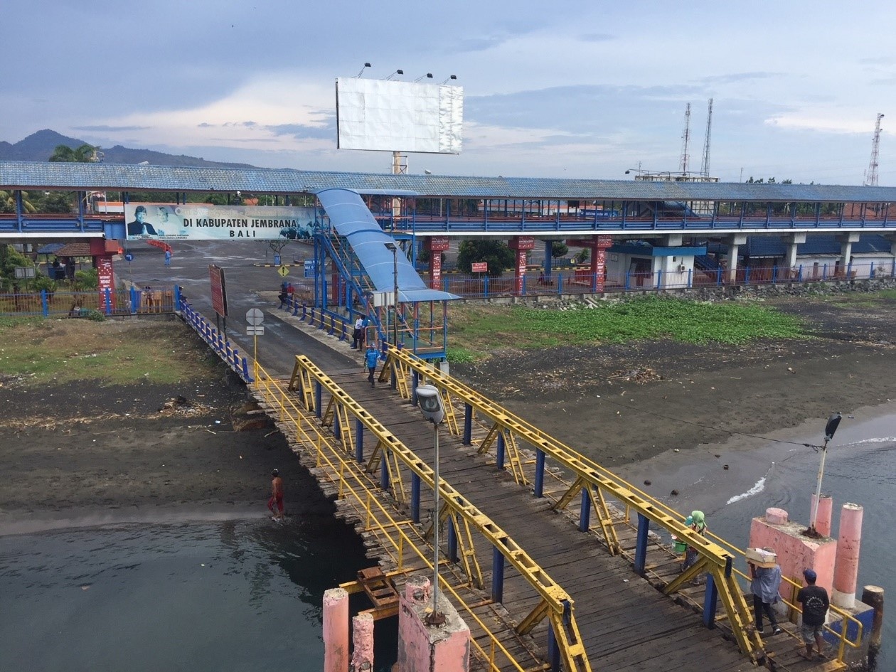
General Cargo Handling Berths
|
Cargo Type |
Berth Identification |
|---|---|
|
Imports - Bagged Cargo |
n/a |
|
Exports - Bagged Cargo |
n/a |
|
Imports and Exports - RoRo |
Conventional |
|
Other Imports |
n/a |
Port Handling Equipment
As this is port only handles RoRo cargo, there is no handling equipment.
Customs Guidance
The Port of Gilimanuk is classified as an international port.
-
Therefore, internationally sourced cargo may only move in or out of the port in conformity with Indonesian Customs Rules and Regulation.
-
However, the customs clearances for International cargo entering Bali are processed through another port in Indonesia (typically Surabaya or Jakarta).
-
If there are cargoes that need clearance in Bali; there are no customs officers available at the port itself.
-
All customs issues must be resolved in Denpasar Customs office; then documentation provided to release cargo.
-
For information on Bali customs guidance, please see the following links: 1.3 Indonesia Customs Information
Terminal Information
Multipurpose Terminal
There is no designated multipurpose terminal, the quay at the Port of Gilimanuk is used for a number of functions including passenger ferry terminal, general cargo and other transport movements.
Grain and Bulk Handling
There is no grain and bulk handling at the port.
Main Storage Terminal
There are no storage facilities at the port.
Stevedoring
There is no stevedoring at the port.
Hiterland Information
Cargo is moved out of the port on the vehicles that it arrived on – this is the only way that it can be moved.
Port Security
|
Security |
||
|---|---|---|
|
ISPS Compliant (Yes / No) |
Yes |
|
|
Current ISPS Level |
Normal |
Level 1 = Normal, Level 2 = Heightened, Level 3 = Exceptional |
|
Police Boats |
1 |
|
|
Fire Engines |
n/a |
2.1.22 Indonesia Bali Port of Padangbai
Port Overview

Key port information can also be found at:Maritime Database Website
Padangbai port is located 55km from Denpasar. The port operated by ASDP, this port serves ferry services for routes to Lembar NTB and Nusa Penida Island Padang Bai facilitated with 2 berths and staging area for trucks and passenger vehicles There are an average of 18 ferry trips a day to Lembar Port (in Lombok) carrying approximately 45mt of cargo per trip and 3 ferry trips a day to Nusa Penida.
Port website: Port of Padangbai Website
|
Port Location and Contacts |
|
|---|---|
|
Country |
Indonesia |
|
Province or District |
Bali |
|
Town or City (Closest location) with Distance (km) |
Name : Denpasar km: 55 |
|
Port's Complete Name |
Padangbai |
|
Latitude |
-8.533057 |
|
Longitude |
115.5117 |
|
Managing Company or Port Authority (If more than one operator, break down by area of operation) |
PT.ASDP |
|
Management Contact Person |
|
|
Closest Airport and Frequent Airlines to / from International Destinations |
Airport Name: Ngurah Rai International Airport Airlines: Garuda Indonesia, Cathay Pacific, Jetstar, Malaysia Airlines, China Southern, Qatar Airways |
Port Picture
The picture above displays the two berths that are at Padangbai port.
Description and Contacts of Key Companies
PT. ASDP is the primary operator at the port for the movement of passengers and RoRo cargo. Pertamina also operate fuel tankers from the port for onward distribution throughout Bali and NTB
For information on Indonesia Port contact details, please see the following link:
4.2.4 Indonesia Port and Waterways Company Contact Lists
Port Performance
|
Seasonal Constraints |
Yes / No |
From <month> to <month> |
||
|---|---|---|---|---|
|
Rainy Season |
Yes |
November - April |
||
|
Major Import Campaigns |
No |
n/a |
||
|
Other |
Yes |
The port only handles RoRo cargo and passengers. |
||
|
Handling Figures |
Year 2016 |
|||
|
Vessel Calls |
39 ferries / day |
|||
|
Container Traffic (TEUs) |
N/A |
|||
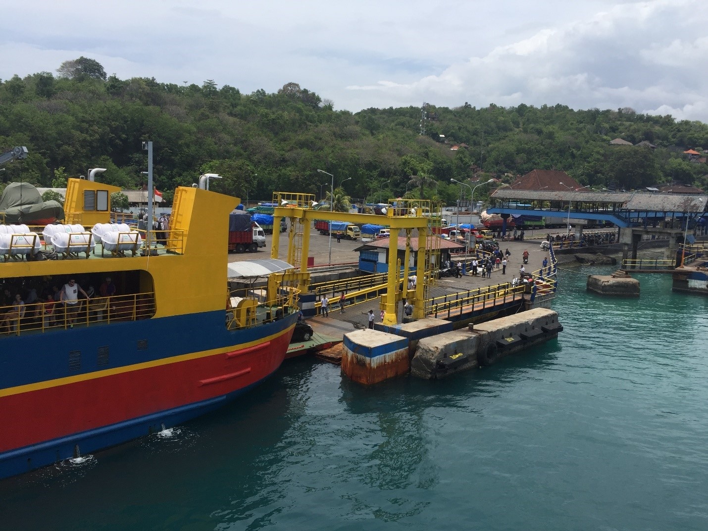
Discharge Rates and Terminal Handling Charges
All cargo movements are RoRo and the rates are based on the vehicle size rather than the weight of the cargo. These rates are current as of October 2017.
|
Type of Vehicle |
Rate (Rupiah) |
|---|---|
|
Truck 5-7m length |
1,460,000 |
|
Truck with 20 foot container |
2,398,000 |
|
Truck with trailer and container |
3,060,000 |
|
All vehicles above 15m length |
6,830,000 |
Berthing Specifications
|
Type of Berth |
Quantity |
Length (m) |
Maximum Draft (m) |
|---|---|---|---|
|
Hydrolic Berth |
2 |
50m each |
5 m5 m |
|
Container Berth |
N/A |
n/a |
n/a |
|
Silo Berth |
N/A |
n/a |
n/a |
|
Berthing Tugs |
N/A |
n/a |
n/a |
|
Water Barges |
N/A |
n/a |
n/a |
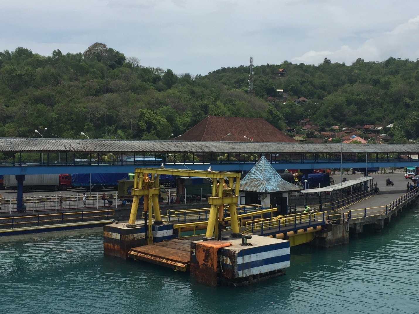
General Cargo Handling Berths
|
Cargo Type |
Berth Identification |
|---|---|
|
Imports - Bagged Cargo |
N/A |
|
Exports - Bagged Cargo |
N/A |
|
Imports and Exports - RoRo |
Conventional |
|
Other Imports |
N/A |
Port Handling Equipment
As this is port only handles Roll-On Roll-Off (RoRo) cargo, there is no handling equipment.
Customs Guidance
The Port of Padang Bai is classified as an international port.
-
Therefore, internationally sourced cargo may only move in or out of the port in conformity with Indonesian Customs Rules and Regulation.
-
However, the customs clearances for International cargo entering Bali are processed through another port in Indonesia (typically Surabaya or Jakarta).
-
There are no customs officers available at the port itself.
-
All customs issues must be resolved in Denpasar Customs office.
-
For information on Bali customs guidance, please see the following links: 1.3 Indonesia Customs Information
Terminal Information
Multipurpose Terminal
There is no multipurpose terminal at the port.
Grain and Bulk Handling
There is no grain and bulk handling at the port.
Main Storage Terminal
There is no storage at the port.
Stevedoring
There is no stevedoring at the port.
Hiterland Information
Cargo is moved out of the port on the vehicles that it arrived on – this is the only way that it can be moved.
Port Security
|
Security |
||
|---|---|---|
|
ISPS Compliant (Yes / No) |
Yes |
|
|
Current ISPS Level |
1 |
Level 1 = Normal, Level 2 = Heightened, Level 3 = Exceptional
|
|
Police Boats |
0 |
|
|
Fire Engines |
0 |
2.1.23 Indonesia Nusa Tenggara Barat (NTB) Port of Lembar
Port Overview
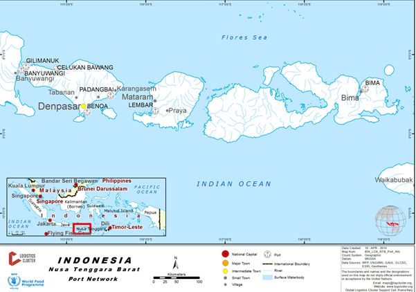
Key port information can also be found at: http://www.marinetraffic.com/en/ais/details/ports/19834
Tanjung Lembar is Lombok's main port and handles small freighters, fishing boats and the combination vehicle and passenger ferries that cross the Lombok straight on a regular basis to Padangbai in Bali.
The Port is demarcated between the area to handle general cargo and the area to designate for the Passenger and Freight Ferry service. Scheduled ferry services using multipurpose RORO Ferries offer services to destinations within the region.
- Lembar Lombok - Padang Bai, Bali, (Lombok Strait) operating 36 ferries with 18 trips per day per each route, with regular schedule every 2 hours (approximately).
- Lembar – Surabaya – Lembar every 2 weeks with capacity 500 passengers and 33 units of 10 tonner trucks.
- Labuhan Lombok - Pototano, Sumbawa (Alat Strait) with 8 ferries providing 18 crossings per day.
- Other scheduled services also connect Senggigi across the Lombok strait westward to Bali via the Gili islands.
The port currently operates 7 days a week. 24 hours operating for loading and off-loading container and break bulk. General cargo and bulk until 10pm.
Port website: Port of Lembar Website
Port cranes are restricted to two dockside cranes (in operation since 2015) with capacity 35 MT per unit. Vessels that are consigned to the Port should be ‘geared’ if possible. Mobile cranes can also be hired locally. Typical cargo handling method is to discharge direct from the vessels to trucks.
Port Picture
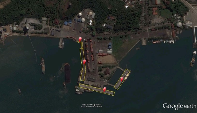
Description and Contacts of Key Companies
PT ASDP Indonesia Ferry (Persero) Indonesia operates the ferry ports and a number of ferry services for passengers and cargo. These RORO ferries provide the principal facilities for road transport movements in and out of Lombok.
Disruptions on these routes can significantly affect trade and the provision of supplies to the island as the shipping operators on these routes, may be suspend or delayed due to weather conditions or operational issues.
The use of the ferry service is an important alternative to the movement of passengers and freight during the periods of the rainy season to secondary and tertiary ports located in the various islands.
For information on Indonesia port contact details, please see the following link:
4.2.4 Indonesia Port and Waterways Company Contact Lists
Port Performance
|
Handling Figures |
Year 2016 |
|---|---|
|
Vessel Calls |
4120 |
|
Container Traffic (TEUs) |
22053 |
Berthing Specifications
|
Type of Berth |
Quantity |
Length (m) |
Maximum Draft (m) |
|---|---|---|---|
|
Multi Purpose Berth |
3 |
133m, 163m, 150m |
6, 7 & 5 m LWOST |
|
Silo Berth |
2 units |
N/A |
N/A |
|
Berthing Tugs |
1 |
N/A |
N/A |
|
Water Barges |
1 |
N/A |
N/A |
Both silo berths are cement facilities each with conveyor discharge. There is an independent port facility managed by the State Oil Enterprise, Pertamina, due east of the Port of Lembar. The fuel is off-loaded into tanks and then shipped throughout NTB by Pertamina to local depots.
General Cargo Handling Berths
|
Cargo Type |
Berth Identification |
|---|---|
|
Imports - Bagged Cargo |
One General Cargo berth – 192 meters |
|
Exports - Bagged Cargo |
One General Cargo berth – 192 meters |
|
Imports and Exports - RoRo |
General cargo pier. Alternative is the use of the piers at the ferry port nearby. |
|
Other Imports |
One General Cargo berth – 192 meters |
Port Handling Equipment
Is the port equipment managed by the government (Pelindo III)
|
Equipment |
Available (Yes / No) |
Total Quantity and Capacity Available |
Comments on Current Condition and Actual Usage |
|---|---|---|---|
|
Dockside Crane |
Yes |
2 units |
Good condition |
|
Container Gantries |
N/A |
n/a |
n/a |
|
Reachstacker |
Yes |
2 units |
n/a |
|
RoRo Tugmaster (w/ Trailer) |
N/A |
n/a |
n/a |
|
Grain Elevator w/ Bagging Machines |
1 |
n/a |
n/a |
|
Transtrainer |
N/A |
n/a |
n/a |
|
Forklifts |
Yes |
2, 7mt, 30mt |
n/a |
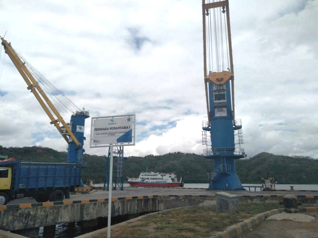
Container Facilities
Standard ISO containers are handled over the general cargo quay. There is a large container storage yard with capacity for 1052 containers (33,000m2). The container yard is being expanded in early 2016..
|
Facilities |
20 ft |
40 ft |
|---|---|---|
|
Container Facilities Available |
Yes – outside storage (33,000m2) |
Yes – outside storage (33,000m2) |
|
Container Freight Station (CFS) |
N/A |
N/A |
|
Refrigerated Container Stations |
yes – 2 units |
N/A |
|
Other Capacity Details |
N/A |
N/A |
|
Daily Take Off Capacity (Containers per day) |
average 60 TEU’s / day |
N/A |
|
Number of Reefer Stations (connection points) |
Yes – 12 units |
N/A |
|
Emergency Take-off Capacity (Give an indication) |
Average 20 TEU’s / day |
N/A |
|
Off take capacity of gang shift (in Containers per shift) |
Average 20 TEU’s / day |
N/A |
Customs Guidance
Generally, cargo is already customs cleared before it gets to Lembar port. However, if there is cargo that requires customs clearance this can be done at the Port of Lembar.
For more information on Indonesia Customs guidance, please see the following link:
1.3 Indonesia Customs Information
Terminal Information
Multipurpose Terminal
There is no designated multipurpose terminal. The quay at the Port of Lembar is used for a number of functions, including passenger ferry terminal, general cargo and other traffic movements.
Grain and Bulk Handling
There are no silos or bulk storage facilities at Lembar Port. Hoppers are available for bulk cargo.
Main Storage Terminal
There is one warehouse available for short term storage at the port – measuring 50m x 25m
|
Storage Type |
Number of Storage Facilities |
Area (square meters) |
|---|---|---|
|
Bagged Cargo |
1 |
1250m2 |
|
Refrigerated Cargo |
N/A |
N/A |
|
General Cargo |
See bagged cargo area |
See bagged cargo area |
Stevedoring
The General cargo area is limited. Vessels that are consigned to the Port should if possible be ‘geared’ as there are limited port cranes, mobile cranes that may be hired. The cargo handling method is to discharge direct from the vessels to Road Transport.
The productivity is based on two gangs, which is attributable to the quay space and the area for the road vehicles to manoeuvre and position themselves for loading.
Hiterland Information
Container traffic to the Island of Lombok and Sumbawa is limited. A high percentage of the traffic is carried on road vehicles from East Java over Bali on the inter-island passenger and Freight Ferry service.
Containers handled over the general cargo quay, are handled by fixed crane from boat into container yard and continue by truck to costumer.
Port Security
The Port is ISPS compliant, under normal operating conditions, all entry points are secure and access is subject to permits.
The Port area is demarcated with secure fencing and access gates. The access to the ferry/passenger vessels is through a fenced and demarcated walkway, ensuring passengers have no access to the cargo operational areas of the port. Passengers and/or vehicles without a ‘ticket’ cannot access the Ferry Port Operations area.
The ships in port have to employ and arrange their own security and ‘gangway watch’
| Security | ||
|---|---|---|
|
ISPS Compliant (Yes / No) |
Yes |
|
|
Current ISPS Level |
1 |
Level 1 = Normal, Level 2 = Heightened, Level 3 = Exceptional With capacity 2000 liters |
|
Police Boats |
3 units |
|
|
Fire Engines |
2 |
|
2.1.24 Indonesia Port of Ketapang, Banyuwangi
Port Overview

Ketapang Port is an important infrastructure to connecting Java and Bali island by land, located in Banyuwangi District East Java, 282 km from Surabaya City by road, 27 km from Blimbingsari Airport and this port also connected with the railway station to Surabaya. The port only serving passenger and RoRo cargo by ferry, there is an average of 280 trips a day to Gilimanuk port utilizing 32 ferries equipped with 7 docking berths. The port managed by PT. ASDP Ketapang, Banyuwangi operating 24 hours per day.
Port website: http://ports.com/indonesia/port-of-ketapang/
Key port information may also be found at: http://www.maritime-database.com
|
Port Location and Contact |
|
|---|---|
|
Country |
Indonesia |
|
Province or District |
Banyuwangi, East Java |
|
Nearest Town or City with Distance from Port |
Banyuwangi City 10 km |
|
Port's Complete Name |
Ketapang Port |
|
Latitude |
-8.1427111 |
|
Longitude |
114.400176 |
|
Managing Company or Port Authority |
PT. ASDP |
|
Management Contact Person |
Mr. Ardi Ekapati – Business Manager |
|
Nearest Airport and Airlines with Frequent International Arrivals/Departures |
Surabaya Juanda International Airport Singapore Airlines, British Airways, China Airlines, Cathay Pacific, Malaysia Airlines and Saudi |
Port Picture
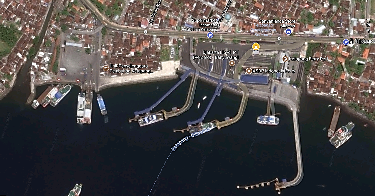
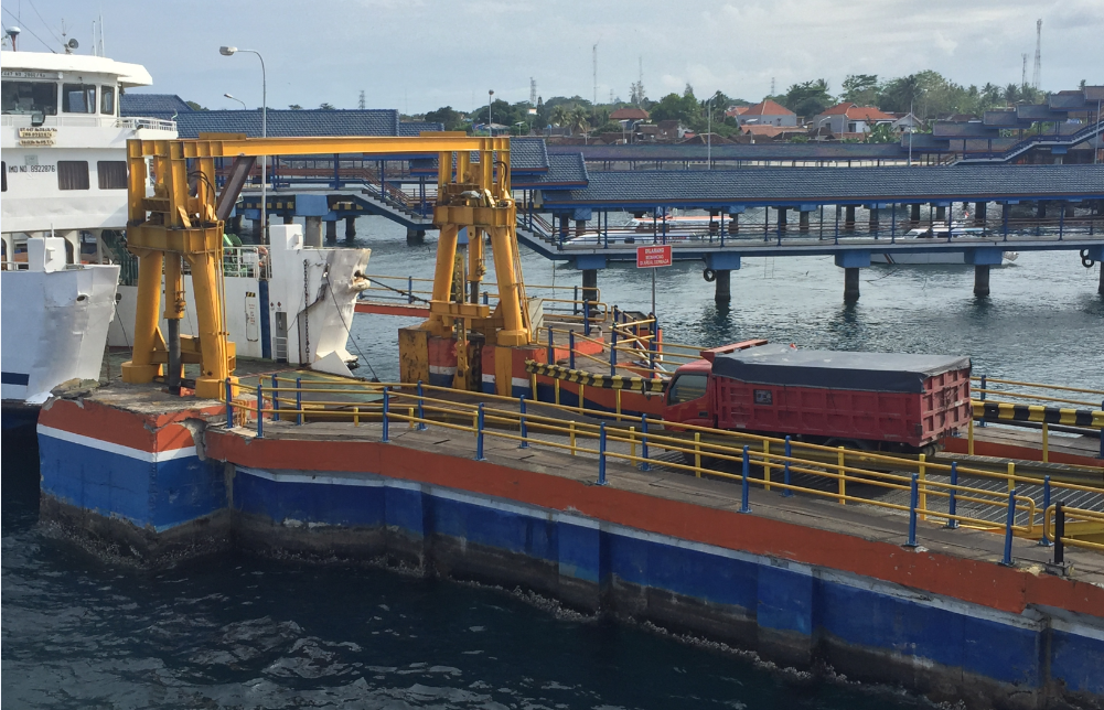
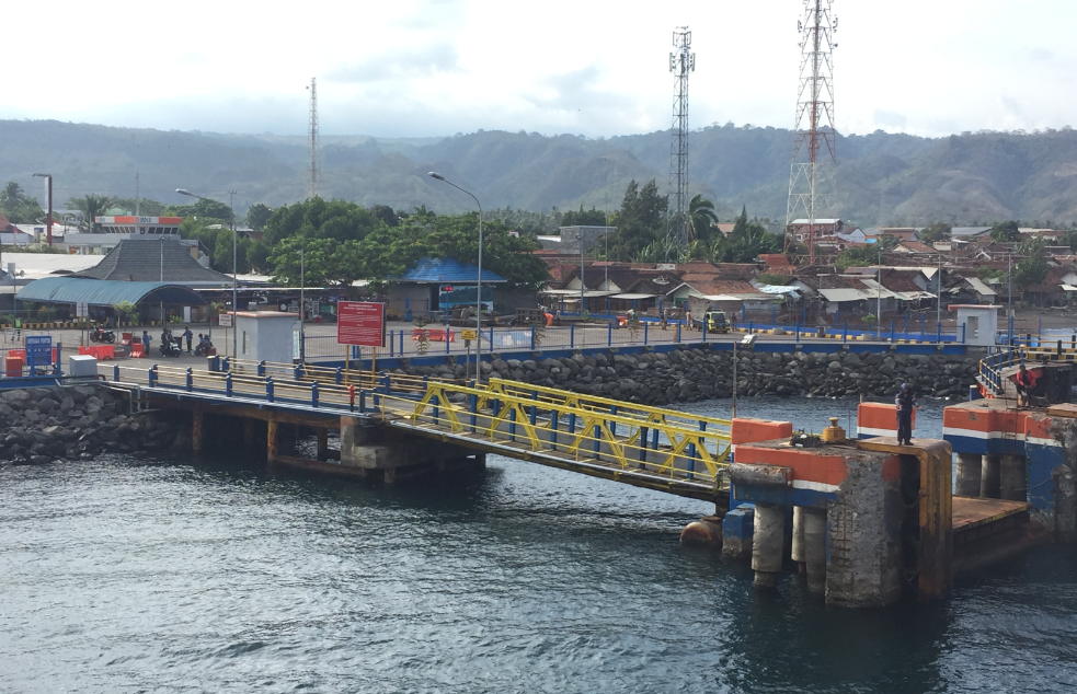
Description and Contacts of Key Companies
PT. ASDP is the primary operator at the port for the movement of passengers and Roll-On – Roll Off (RoRo) cargo.
For information on Indonesia Port contact details, please see the following link:
4.2.4 Indonesia Port and Waterways Company Contact Lists
Port Performance
PT. ASDP office in Ketapang manages the ports of Ketapang & Gilimanuk, Ketapang (with an operations manager at Gilimanuk)
-
They have 45 ferries in total, but only 32 ferries operated with an average 9 trips per ferry per day.
-
During the peak seasons (Ied & Nyepi), contingency plans are already in place to avoid any traffic congestion.
-
The typical waiting time for berthing in average during normal time is 8-10 minutes.
|
Seasonal Constraints |
||
|---|---|---|
|
Occurs |
Time Frame |
|
|
Rainy Season |
Yes |
Nov - Apr |
|
Christmas & New year |
Yes |
Dec - Jan |
|
Balinese “Day of Silence” |
Yes |
March (1 day) |
|
Eid Al-Fitr |
Yes |
Varies |
|
Handling Figures for 2016 |
|
|---|---|
|
Vessel Calls |
105,000 |
|
Container Traffic (TEUs) |
N/A |
Discharge Rates and Terminal Handling Charges
All cargo movements are RoRo and the rates are based on the vehicle size rather than the weight of the cargo. These rates are current as of October 2017.
|
Type of Vehicle |
Rate (Rupiah) |
|---|---|
|
Truck 5-7m length |
242,000 |
|
Truck with 20-foot container |
505,000 |
|
Truck with trailer and container |
732,000 |
|
All vehicles above 15m length |
1,045,000 |
Berthing Specifications
|
Type of Berth |
Quantity |
Length (m) |
Maximum Draft (m) |
|---|---|---|---|
|
Hydraulic Berth |
3 units |
50 m each |
7 m |
|
LCM Berth |
3 units |
- |
5 m |
|
Pontoon Berth |
1 unit |
3 m |
7 m |
General Cargo Handling Berths
|
Cargo Type |
Berth Identification |
|---|---|
|
Imports - Bagged Cargo |
N/A |
|
Exports - Bagged Cargo |
N/A |
|
Imports and Exports - RoRo |
Conventional |
|
Other Imports |
N/A |
Port Handling Equipment
As this is port only handles Roll-On Roll-Off (RoRo) cargo, there is no handling equipment.
Container Facilities
As this is port only handles Roll-On Roll-Off (RoRo) cargo, there is no container facilities
Customs Guidance
Internationally sourced cargo may only move in or out of the port in conformity with Indonesian Customs Rules and Regulation.
-
Customs clearances for International cargo are processed through another port in Indonesia (typically Surabaya or Jakarta).
-
There are no customs officers available at the port itself.
-
All customs issues must be resolved in Surabaya/Denpasar Customs offices.
-
For information on Indonesian customs guidance, please see the following links: 1.3 Indonesia Customs Information
Terminal Information
MULTIPURPOSE TERMINAL
There is no multipurpose terminal at the port.
GRAIN AND BULK HANDLING
There is no grain and bulk handling at the port.
MAIN STORAGE TERMINAL
There are no dedicated storage facilities available at the port.
Stevedoring
There are no dedicated stevedoring services available at the port.
Hinterland Information
As the port is dedicated to RoRo operations cargoes are moved out of the port on their respective vehicles.
Port Security
|
Security |
|
|---|---|
|
ISPS Compliant |
Yes |
|
Current ISPS Level |
Level 1 |
|
Police Boats |
Yes |
|
Fire Engines |
Yes |
2.1.25 Indonesia Central Sulawesi Port of Pantoloan
Port Overview
This assessment has been done following the earthquake and tsunami that struck Palu, Central Sulawesi on 28 September 2018. As of 12 October 2018, the port has returned to normal operations for commercial and non-commercial cargo.
Key port information may also be found at: http://www.inaport4.co.id/branch/read/1/19 or http://www.maritime-database.com
|
Port Location and Contact |
|
|---|---|
|
Country |
Indonesia |
|
Province or District |
Central Sulawesi |
|
Nearest Town or City with Distance from Port |
Palu City |
|
Port's Complete Name |
PT. Pelabuhan Indonesia IV (Persero) Cabang Pelabuhan Pantoloan |
|
Latitude |
00° 42’ 03” S |
|
Longitude |
119° 51’ 03” E |
|
Managing Company or Port Authority |
PT. Pelabuhan Indonesia IV (Persero) Cabang Pelabuhan Pantoloan (State-owned company) |
|
Management Contact Person |
Mr. Nengah, General Manager, Mob: +6282154935594/+6281318888270 Mr. Rusdin, Operations Manager, Mob: +6281341686877 |
|
Nearest Airport and Airlines with Frequent International Arrivals/Departures |
Mutiara SIS Al-Jufrie Airport, Palu, Central Sulawesi, located about 30 km away from the port |
Port Picture

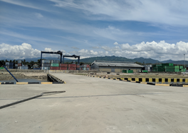
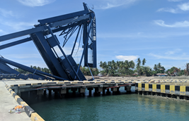
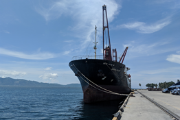
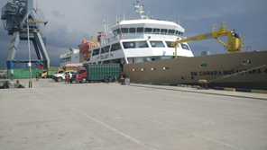
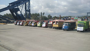
Source: WFP
Description and Contacts of Key
Companies
The main shipping companies operating at the Port of Pantoloan:
- PT. Meratus Line
- PT. Temas Line
- SPIL
The main freight forwarding company operating at the Port of Pantoloan:
- Association of Logistics and Forwarders Indonesia (ALFI)
For more information regarding port contacts, please see the following link:
Discharge Rates and Terminal Handling Charges
The port operator, Pelindo, is planning to increase the port service charges by 15 percent, and the ship service charges by 30 percent. The new rates will be applicable from 1 December 2018. Rates breakdown will be provided once available.
Berthing Specifications
All vessels can berth however, due to damage to port infrastructure, vessels must be equipped with a ship crane for unloading purposes
|
Type of Berth |
Quantity |
Length (m) |
Maximum Draft (m) |
Comments |
|---|---|---|---|---|
|
Conventional Berth |
One general berth |
420 meters |
16 meters (14 meters before tsunami) |
|
|
Container Berth |
|
|||
|
Silo Berth |
Not available |
|
||
|
Berthing Tugs |
In the general berth |
No dedicated berth |
||
|
Water Barges |
Temporarily supplied by PDAM via water tank truck |
Drilled wells are not operational |
Port Handling Equipment
Port handling equipment is managed by the port operator, Pelindo.
|
Equipment |
Available |
Total Quantity and Capacity Available |
Comments on Current Condition and Actual Usage |
|---|---|---|---|
|
Dockside Crane |
No |
||
|
Container Gantries |
No – collapsed |
Plan to rebuild by the end of 2018 |
|
|
Mobile Cranes |
No |
||
|
Reachstacker |
Yes |
2 units available (45 tons capacity) |
Both operational |
|
RoRo Tugmaster (with Trailer) |
No |
||
|
Grain Elevator with Bagging Machines |
No |
||
|
Transtainer |
Yes |
2 units |
1 operational, 1 broken |
|
Forklifts |
Yes |
3 units available (32 ton; 7 ton; 3 ton) |
Operational |
Container Facilities
One 5,000 hectare Container Yard (CY) is currently available.
|
Facilities |
20 ft |
40 ft |
|---|---|---|
|
Container Facilities Available |
Yes, 5 hectares of CY for 20” and 40” containers (capacity 200,000 TEUs / year) |
|
|
Container Freight Station (CFS) |
No dedicated station, the existing CY and warehouse can be used as CFS |
|
|
Refrigerated Container Stations |
6 plug-in points available |
|
|
Other Capacity Details |
||
|
Daily Take Off Capacity |
Following the earthquake on 28 September 2018, the only available option for offloading cargoes from the vessel is via onboard ship crane as the existing container crane was damaged. With one ship crane, maximum take-off capacity is around 7 to 9 units of 20” container per hour (before the earthquake, the daily take of using the container crane was around 120 to 150 TEUs per day) |
|
|
Number of Reefer Stations |
6 plug-in points available |
|
|
Emergency Take-off Capacity |
Please refer to “Daily Take Off Capacity” |
|
|
Off take Capacity of Gang Shift |
- |
- |
Customs Guidance
The cargo is largely customs cleared before it gets to the Port of Pantoloan. However, if there is cargo that requires customs clearance, the procedure can be done at Pantoloan.
For more information on Indonesia Customs guidance, please see the following link: 1.3 Indonesia Customs Information
Terminal Information
Main Storage Terminal
There are two warehouses of 1,000 m2 capacity. One of the warehouses is currently rented out, the other warehouse unit is available, but the door is damaged (currently guarded by port security).
Stevedoring
There are two stevedoring companies working at the port:
- PT. BGR (Persero) –State-owned company
- Labour Association from Wani Port
Port Security
|
Security |
|
|---|---|
|
ISPS Compliant |
Yes (before earthquake) |
|
Current ISPS Level |
Considering the damage sustained by the port perimeters, the levelling system is not applicable at the moment. |
|
Police Boats |
No dedicated. |
|
Fire Engines |
To be checked. |
2.1.26 Indonesia North Sulawesi Port of Bitung
Port Overview
The port of Bitung is located in Bitung City, about 40 km East of Manado City. There are two ports in Bitung City managed by Pelindo IV North Sulawesi; conventional port and container port. The conventional port segment consists of LCT berth, passenger berth, and container berth, while the container port is specially for container handling activities. Port of Bitung is functioning as the East International Gate port in North Sulawesi that is visited and anchored by passenger ships between major cities in Indonesia and internationally.
Goods supplied to North Sulawesi mainly come from Makassar and Surabaya by sea transport through Conventional Port of Bitung and are then distributed to Manado City, other districts and Islands.
Port website:
https://inaport4.co.id/branch/read/1/22
Key port information can also be found at: http://www.maritime-database.com
|
Port Location and Contact |
|
|
Country |
Indonesia |
|
Province or District |
North Sulawesi Province |
|
Nearest Town or City with Distance from Port |
Bitung City 1 km |
|
Port's Complete Name |
Port of Bitung |
|
Latitude |
01°26’00” S |
|
Longitude |
125°11’00”E |
|
Managing Company or Port Authority |
PT. Pelabuhan Indonesia IV (Persero) Cabang Pelabuhan Bitung |
|
Management Contact Person |
Makmur Syam Operation Manager Container Port Bitung M. +62 8114106419 Email: lholegagah@yahoo.com Anugerah Amelia Public Relation Conventional Port M. +62 85398831904 Email. bitung@pelabuhan4.co.id |
|
Nearest Airport and Airlines with Frequent International Arrivals/Departures |
Sam Ratulangi International Airport, about 35 km
|
Port Picture
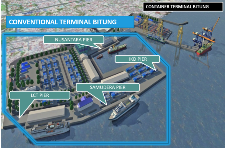
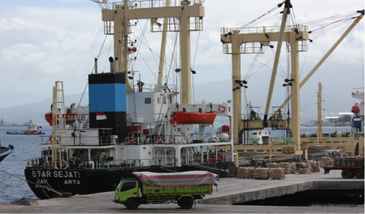
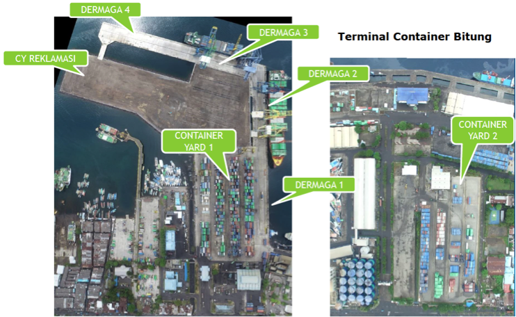
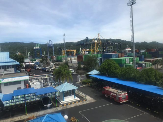
Description and Contacts of Key Companies
For more information on port contacts, please see the following link: 4.4 Indonesia Port and Waterways Company Contact Lists
Port Performance
|
Length of channel |
9 miles |
|
Width of channel |
600m |
|
Min. depth of channel |
12m |
|
Max. depth of channel |
15m |
|
Minimum Depth In Basin |
7m |
|
Max. depth beside of Wharf |
12m |
|
Tidal Height |
1m |
|
Average High |
0.8m |
|
High Water Spring |
1.8m LWS |
|
Low Water Spring |
1.2m LWS |
|
Seasonal Constraints |
||
|
|
Occurs |
Time Frame |
|
Rainy Season |
Yes |
From October to January |
|
Major Import Campaigns |
No |
|
|
Handling Figures for 2018 |
|
|
Vessel Calls |
Conventional Port = 2,839 Container Port = 299 |
|
Container Traffic (TEUs) |
Conventional Port = 1,447 Container Port = 277 |
|
Handling Figures Bulk and Break Bulk for 2018 |
|
|
Bulk (MT) |
1,573,924 |
|
Break bulk (MT) |
|
Discharge Rates and Terminal Handling Charges
For information on port rates and charges, please see the following link:
www.dephub.go.id (PP.15 Tahun 2016)
http://jdih.dephub.go.id/assets/uudocs/perpres/2016/PP_15_Tahun_2016.pdf
Berthing Specifications
|
Type of Berth |
Quantity |
Length (m) |
Maximum Draft (m) |
Comments |
|
Conventional Berth |
Samudera I Samudera II Samudera III Dermaga IKD Nusantara I Nusantara II Nusantara III Dermaga Lokal Dermaga LCT |
190 m 243 m 175 m 146 m 251 m 148 m 207 m 60 m 20 m |
9 m 10 m 10 m 7 m 6 m 5 m 6 m 7 m 7 m |
Conventional Port |
|
Container Berth |
Dermaga TPB Dermaga 1 Dermaga 2 Dermaga 3 Dermaga 4 Trastle |
358 m 182m x 25m 176.5m x 35m 195.25m x 35m 131m x 35m 49m x 11.5m |
11 m 11 – 14 m 11 – 14 m 11 – 14 m 11 – 14 m 11 – 14 m |
Conventional Port Container Port Container Port Container Port Container Port Container Port |
|
Passenger Terminal |
1 |
1,272 m2 |
- |
Passenger Terminal |
|
Silo Berth |
Nil |
|
|
|
|
Berthing Tugs |
Nil |
|
|
|
|
Water Barges |
Nil |
|
|
|
General Cargo Handling Berths
|
Cargo Type |
Berth Identification |
|
Imports - Bagged Cargo |
Samudera and Nusantara Piers |
|
Exports - Bagged Cargo |
Samudera and Nusantara Piers |
|
Imports and Exports - RoRo |
Nil |
|
Other Imports |
Nil |
Port Handling Equipment
|
Equipment |
Available |
Total Quantity and Capacity Available |
Comments on Current Condition and Actual Usage |
|
Container Gantries |
4 |
- |
Good (Container Port) |
|
Rubber Tyred Gantry |
8 |
- |
Good (Container Port) |
|
Mobile Cranes |
1 |
25 tons |
Good (Conventional Port) |
|
Reachstacker |
2 1 |
45 tons 45 tons |
Good (Container Port) Good (Conventional Port) |
|
Side Loader |
1 |
- |
Good (Container Port) |
|
Transtainer |
2 |
36.5 Tons |
Good (Conventional Port) |
|
Forklifts |
4 4 |
2 tons, 5 tons, 7 tons and 32 tons 2 tons, 5 tons, 7 tons |
Good (Container Port) Good (Conventional Port) |
|
Chassis Head Truck |
26 |
40 ft |
Good (Container Port) |
|
Head Truck |
27 3 |
30 tons 30 tons |
Good (Container Port) Good (Conventional Port) |
|
Tugboat |
2 |
2 X 750 PS, 2 X 1000 HP |
Good (Conventional Port) |
|
Pilot Boat |
3 |
2 X 130 HP-6 KNOT, 2 X 300 HP-8 KNOT, 2 X 350 HP-25 KNOT |
Good (Conventional Port) |
Container Facilities
|
Facilities |
20 ft |
40 ft |
|
Container Facilities Available |
Yes |
Yes |
|
Container Freight Station (CFS) |
Yes |
Yes |
|
Refrigerated Container Stations |
Yes |
Yes |
|
Other Capacity Details |
Water Reservoir 200 tons and Generator set cap. 500 & 800 KVA |
|
|
Daily Take
Off
Capacity |
648 Container per day |
|
|
Number of Reefer
Stations |
138 refer plug |
|
|
Emergency Take-off Capacity |
Nil |
|
|
Off take Capacity of Gang
Shift |
Nil |
|
Customs Guidance
Customs clearance is available through the local customs office in the port: http://www.beacukai.go.id/
Terminal Information
There is a large passenger terminal at the Port of Bitung (1,272 m2).
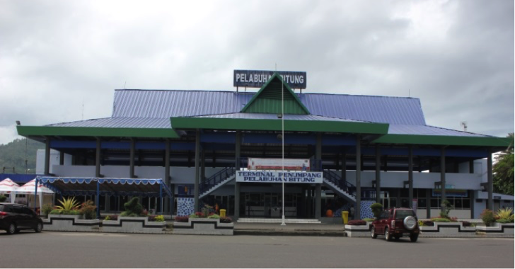
MULTIPURPOSE TERMINAL
Existing capacity at multipurpose terminal at Conventional Port:
- Container yard 43,414 m2
- Warehouses in total 9,072 m2
- Generator 500 KVA
- Electricity (PLN) 555 KVA
- Water (PDAM) Max 200 tons
- Fuel Bunker (Pertamina) Max 150 tons
Existing capacity at Container terminal at Container Port:
- Container yard 1 - 30,000 m2
- Container yard 2 - 22,000 m2
- Container yard 3 - 50,000 m2
- Workshop 6,083 m2
- Reefer plug Container yard 1 – 84 units and Container yard 2 - 54 units
- Water Reservoir – 200 tons
- Generator Set Container yard 1 – 500 & 800 KVA and Container yard 2 – 500 KVA
- Temporary Container Yard (export – import) 1,260 m2
- Fuel tank 20,000 litre
Short-term development plan of Multipurpose Terminal at Bitung Port (2015 – 2019):
- Arrangement of container stacking / depot fields
- Underdeck repair
- Procurement of loading and unloading equipment
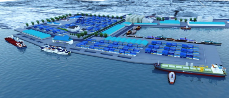
GRAIN AND BULK HANDLING
There are no grain and bulk handling activities at the Port of Bitung.
MAIN STORAGE TERMINAL
|
Storage Type |
Number of Storage Facilities |
Area (m2) |
|
Bagged Cargo |
Nil |
Nil |
|
Refrigerated Cargo |
Container yard 1 Container yard 2 |
30,000 m2 22,000 m2 |
|
General Cargo |
Warehouse A Warehouse B Warehouse Buttler |
4,320 m2 4,320 m2 432 m2 |
Stevedoring
Stevedoring activities organized by third parties (authorised stevedoring company) in coordination with the Labour Union Association (TKBM) administered by the Port Authority (KSOP) Office. The owner/shipper can also discharge their own cargo by contacting the Labour Union Association directly.
All of them provide full or semi-full package services; organizing labourer and handling equipment, discharging goods at the port, and delivering the goods at the customer’s warehouses directly.
Hinterland Information
The port serves to smaller islands within Northern Sulawesi with fisheries, agriculture, plantation and manufacturing industries.
Bitung city's economy was dominated by agriculture and plantation. However, in the development of the industrial sector was growing rapidly and reached the highest value.
Port Security
|
Security |
|
|
ISPS Compliant |
Yes |
|
Current ISPS
Level |
1 |
|
Police Boats |
Yes |
|
Fire Engines |
Yes |
2.1.27 Indonesia North Sulawesi Port of Manado
Port Overview
The port of Manado is located in Manado City. The port was formerly under the management branch of PT. Pelindo IV Bitung. Since 1st January 2011, Port of Manado became a stand-alone branch under PT. Pelindo IV Headquarters in Makassar. The business segment of the port are ships services, goods, passengers, storage and property. The main business segment of Manado port is passengers service for inter-island (fast ferry/speed boat).
In general, the ships berthing in the port of Manado are fast ferry serves to Sangir and Talaud Islands. The large-sized of vessels such as container vessel, conventional vessel and passenger vessel owned by PT. PELNI (Persero) are berthing in the port of Bitung, which is located about 40 km East of Manado City.
Port website: https://inaport4.co.id/branch/read/1/21
Key port information may also be found at: https://inaport4.co.id/
|
Port Location and Contact |
|
|
Country |
Indonesia |
|
Province or District |
North Sulawesi Province |
|
Nearest Town or City with Distance from Port |
Manado City 1 km |
|
Port's Complete Name |
Port of Manado |
|
Latitude |
01° 30’ 02’’ N |
|
Longitude |
124° 50’ 12’’ E |
|
Managing Company or Port Authority |
PT. Pelabuhan Indonesia IV (Persero) Cabang Pelabuhan Manado |
|
Management Contact Person |
Mursito Operation Manager M. +62 812 4303 066 Email. Mursito77@yahoo.com |
|
Nearest Airport and Airlines with Frequent International Arrivals/Departures |
Sam Ratulangi International Airport
|
Port Picture
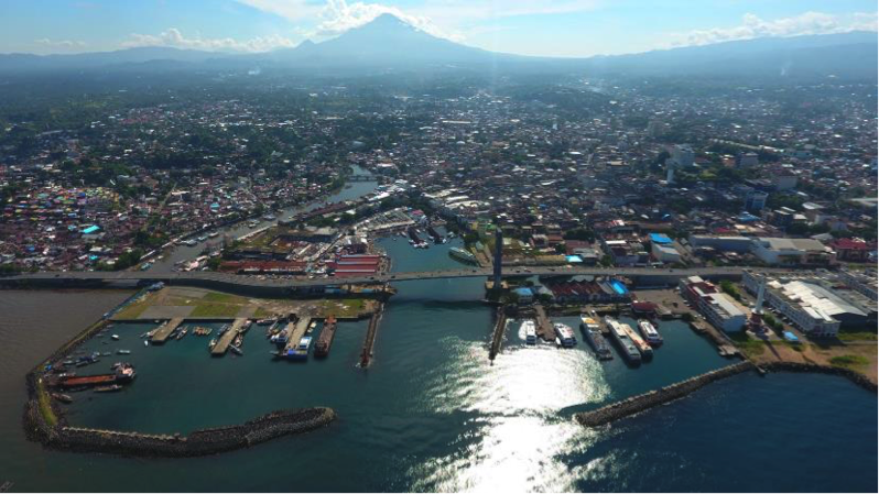
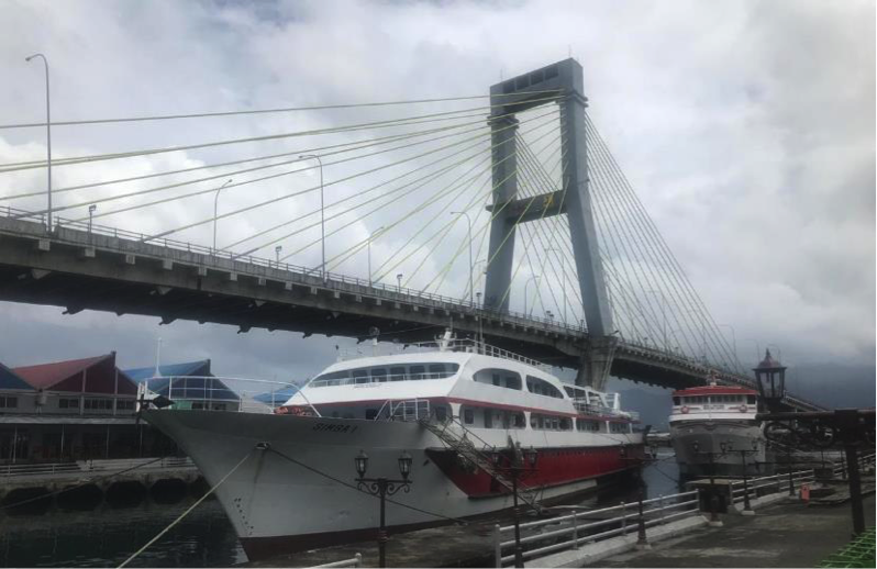
Description and Contacts of Key Companies
For more information on port contacts, please see the following link: 4.4 Indonesia Port and Waterways Company Contact Lists
Port Performance
|
Length of channel |
250 Mile |
|
Width of channel |
70m |
|
Min. depth of channel |
4 M.LWS |
|
Basin Area |
2.12 Ha |
|
Minimum Depth In Basin |
3 M.LWS |
|
Depth On Wharf |
1.5 M.LWS |
|
Wind Felocity |
3 Knot |
|
Current Velocity |
3 Knot |
|
Tidal Height |
1m |
|
High Water Spring |
1.6 M.LWS |
|
Low Water Spring |
0.9 M.LWS |
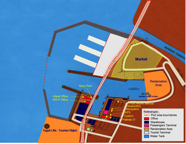
|
Seasonal Constraints |
||
|
|
Occurs |
Time Frame |
|
Rainy Season |
Yes |
From October to January |
|
Major Import Campaigns |
No |
|
|
Handling Figures for 2018 |
|
|
Vessel Calls |
1,312 |
|
Container Traffic (TEUs) |
Nil |
|
Handling Figures Bulk and Break Bulk for 2018 |
|
|
Bulk (MT) |
57,038 |
|
Break bulk (MT) |
|
Discharge Rates and Terminal Handling Charges
For information on port rates and charges, please see the following link:
www.dephub.go.id (PP.15 Tahun 2016)
http://jdih.dephub.go.id/assets/uudocs/perpres/2016/PP_15_Tahun_2016.pdf
Berthing Specifications
|
Type of Berth |
Quantity |
Length (m) |
Maximum Draft (m) |
Comments |
|
Conventional Berth |
Dermaga 1 Dermaga 2 Dermaga 3 |
40.2 m x 10.1 m 60.35 m x 10.1 m 60 m x 10 m |
2 m |
|
|
Container Berth |
Nil |
|
|
|
|
Passenger Terminal |
1 |
2,100 m2 |
- |
Passenger Terminal |
|
Silo Berth |
Nil |
|
|
|
|
Berthing Tugs |
Nil |
|
|
|
|
Water Barges |
Nil |
|
|
|
General Cargo Handling Berths
|
Cargo Type |
Berth Identification |
|
Imports - Bagged Cargo |
Nil |
|
Exports - Bagged Cargo |
Nil |
|
Imports and Exports - RoRo |
Nil |
|
Other Imports |
Nil |
Port Handling Equipment
There is no handling equipment at the Port of Manado.
Container Facilities
There are no container facilities at the Port of Manado.
Customs Guidance
Customs clearance is available through the local customs office in the port: http://www.beacukai.go.id/
Terminal Information
There is a large passenger terminal at the Port of Manado (2,100 m2).
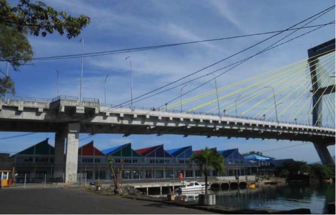
MULTIPURPOSE TERMINAL
Port of Manado does not have a multipurpose terminal because of low commodity movement and in small volume. The cargoes are usually directly loaded onto the ship or taken directly from the service user.
GRAIN AND BULK HANDLING
There are no grain and bulk handling activities at the Port of Manado.
MAIN STORAGE TERMINAL
|
Storage Type |
Number of Storage Facilities |
Area (m2) |
|
Bagged Cargo |
Nil |
Nil |
|
Refrigerated Cargo |
Nil |
Nil |
|
General Cargo |
1 (General) |
1,432 m2 |
Stevedoring
Stevedoring activities organized by third parties (authorised stevedoring company) in coordination with the Labour Union Association (TKBM) administered by the Port Authority (KSOP) Office. The owner/shipper can also discharge their own cargo by contacting the Labour Union Association directly.
All of them provide full or semi-full package services; organizing labourer and handling equipment, discharging goods at the port, and delivering the goods at the customer’s warehouses directly.
Hinterland Information
The port serves a vast inland area of many smaller islands within Northern Sulawesi with vast mining, plantations and forestry potential and the fisheries sector is also one of the main sectors.
Hinterland along the island consists of several commodities such as cloves, nutmeg and copra. These commodities originating from the Sangihe, Talaud, Tagulandang, Sitaro and North Maluku islands are the main commodities that pass through the Manado port, where market demand for these commodities is quite high both in Manado and other regions including Java.
Port Security
|
Security |
|
|
ISPS Compliant |
No |
|
Current ISPS
Level |
- |
|
Police Boats |
No |
|
Fire Engines |
No |
2.1.28 Indonesia West Sulawesi Port of Belang-Belang
Port Overview
Port of Belang – Belang is located in Mamuju District, about 46 km from Mamuju City, the capital of West Sulawesi Province. The port is under the management of Unit Penyelenggara Pelabuhan (UPP) Belang-Belang, Directorate General of Sea Transportation. Belang – Belang Port is a conventional port and is classified as Port Class III.
|
Port Location and Contact |
|
|
Country |
Indonesia |
|
Province or District |
West Sulawesi Province |
|
Nearest Town or City with Distance from Port |
Mamuju City 46 km |
|
Port's Complete Name |
Belang – Belang Port |
|
Latitude |
02°28’474” S |
|
Longitude |
119°07’666”T |
|
Managing Company or Port Authority
|
Unit Penyelenggara Pelabuhan (UPP) Belang-Belang, Directorate General of Sea Transportation, Ministry of Transport |
|
Management Contact Person |
Isra (Assistant of Operations) M. +62 822 9249 5146 Email. NAUFAL36NIZAR@gmail.com |
|
Nearest Airport and Airlines with Frequent International Arrivals/Departures |
Tampa Padang Airport
|
Port Picture
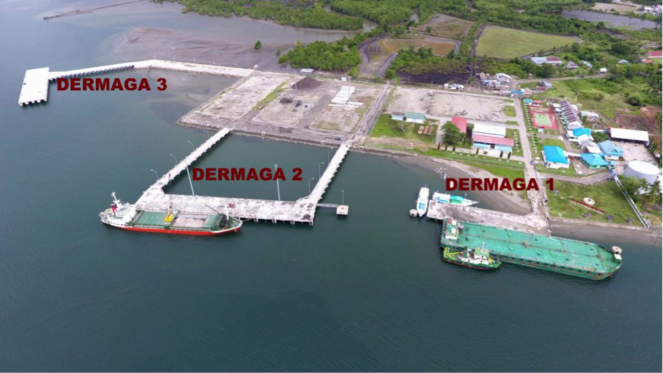
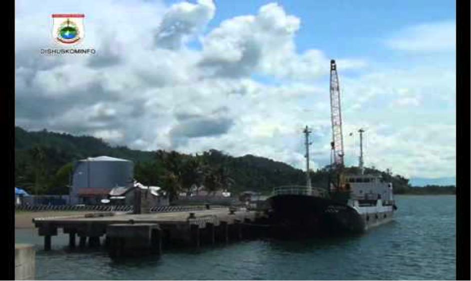
Port Performance
|
Seasonal Constraints |
||
|
|
Occurs |
Time Frame |
|
Rainy Season |
Yes |
From June to September |
|
Major Import Campaigns |
No |
From (month) to (month) |
|
Handling Figures for 2018 |
|
|
Vessel Calls |
994 |
|
Container Traffic (TEUs) |
No |
|
Handling Figures Bulk and Break Bulk for 2018 |
|
|
Bulk (MT) |
Nil |
|
Break bulk (MT) |
|
Discharge Rates and Terminal Handling Charges
For information on port rates and charges, please see the following link:
www.dephub.go.id (PP.15 Tahun 2016)
http://jdih.dephub.go.id/assets/uudocs/perpres/2016/PP_15_Tahun_2016.pdf
Berthing Specifications
|
Type of Berth |
Quantity |
Length (m) |
Maximum Draft (m) |
Comments |
|
Conventional Berth |
3 |
|
13 |
General cargo vessel |
|
Container Berth |
|
|
|
Using conventional berth |
|
Passenger Berth |
|
|
|
|
|
Silo Berth |
Nil |
|
|
|
|
Berthing Tugs |
Nil |
|
|
|
|
Water Barges |
Nil |
|
|
|
General Cargo Handling Berths
|
Cargo Type |
Berth Identification |
|
Imports - Bagged Cargo |
Concrete Pier |
|
Exports - Bagged Cargo |
Concrete Pier |
|
Imports and Exports - RoRo |
Nil |
|
Other Imports |
Nil |
Port Handling Equipment
|
Equipment |
Available |
Total Quantity and Capacity Available |
Comments on Current Condition and Actual Usage |
|
Dockside Crane |
No |
N/A |
N/A |
|
Container Gantries |
No |
N/A |
N/A |
|
Mobile Cranes |
No |
N/A |
N/A |
|
Reachstacker |
No |
N/A |
N/A |
|
RoRo Tugmaster (with Trailer) |
No |
N/A |
N/A |
|
Grain Elevator with Bagging Machines |
No |
N/A |
N/A |
|
Transtainer |
No |
N/A |
N/A |
|
Forklifts |
Yes |
3 units - 1 unit 10 T - 1 unit 6 T - 1 unit 3 T
|
Good |
|
Gantry Luffing Crane (GLC) SWL |
No |
N/A |
N/A |
|
Head Truck |
No |
N/A |
Good |
|
Tronton |
No |
N/A |
Good |
|
Pilot Boat |
No |
N/A |
Good |
Container Facilities
Belang - Belang port has only forklift equipment to support port activities. The port has 13,863 m2 of container yard that can be rented according to the requirement and standard rate.
|
Facilities |
20 ft |
40 ft |
|
Container Facilities Available |
Yes |
Yes |
|
Container Freight Station (CFS) |
Nil |
Nil |
|
Refrigerated Container Stations |
Nil |
Nil |
|
Other Capacity Details |
Nil |
|
|
Daily Take Off
Capacity |
Nil |
|
|
Number of Reefer
Stations |
Nil |
|
|
Emergency Take-off Capacity |
Nil |
|
|
Off take Capacity of Gang
Shift |
Nil |
|
Customs Guidance
The Customs clearance is on call from Custom Office in Mamuju City, while the Immigration service is from Kendari City, Southeast Sulawesi Province.
Terminal Information
MULTIPURPOSE TERMINAL
A 13,863 m2 container yard can be used for multipurpose activities.
All conventional berths can be used for multipurpose activities:
- Berth # 1: width 15m and length 64m (-13 MLWS)
- Berth # 2: width 15m and length 101.4m (-13 MLWS)
- Berth # 3: width 15m and length 101.4m (-13 MLWS)
GRAIN AND BULK HANDLING
There are no grain and bulk handling activities at the Port.
MAIN STORAGE TERMINAL
|
Storage Type |
Number of Storage Facilities |
Area (m2) |
|
Bagged Cargo |
Nil |
Nil |
|
Refrigerated Cargo |
Nil |
Nil |
|
General Cargo |
2 Units x 350 m2 |
700 m2 |
Stevedoring
Stevedoring activities organized by third parties (authorised stevedoring company) in coordination with the Labour Union Association (TKBM) administered by Unit Penyelenggara Pelabuhan (UPP) Office. The owner/shipper can also discharge their own cargo by contacting the Labour Union Association directly.
All of them provide full or semi-full package services; organizing labourer and handling equipment, discharging goods at the port, and delivering the goods at the customer’s warehouses directly.
Hinterland Information
The port has not much activity in trading the local products/commodities. Most of supplies comes from Makassar, South Sulawesi Province by land transport, takes about 12-15 hours (around 480 km).
Port Security
|
Security |
|
|
ISPS Compliant |
No |
|
Current ISPS
Level |
1 |
|
Police Boats |
Yes |
|
Fire Engines |
Yes |
2.1.29 Indonesia Gorontalo Port of Gorontalo
Port Overview
Gorontalo Port is located at the mouth of the river, a confluence of two rivers, Bone and Bolango Rivers. This forms an estuary called Muara Milango that enters into the sea. The distance from Gorontalo Port to Gorontalo City is about 5 km.
Goods that are being supplied to Gorontalo mainly comes from Makassar and Surabaya by sea transport to Port of Gorontalo, which then distributed to Gorontalo City and surrounding districts.
Port website: https://inaport4.co.id/branch/read/1/26
Key port information may also be found at: https://inaport4.co.id/
|
Port Location and Contact |
|
|
Country |
Indonesia |
|
Province or District |
Gorotalo Province |
|
Nearest Town or City with Distance from Port |
Gorontalo City 5 km |
|
Port's Complete Name |
Gorontalo Port |
|
Latitude |
00º 29’ 32” N |
|
Longitude |
123º 03’ 26” E |
|
Managing Company or Port Authority
|
PT. Pelabuhan Indonesia IV (Persero) Cabang Pelabuhan Gorontalo |
|
Management Contact Person |
Teddy Indra Yudhana General Manager Ph. 0435 8530416 Andi Muslam Operation Manager and commercial M. +62 81241529447 Email. keuangan.sdm.gto@gmail.com |
|
Nearest Airport and Airlines with Frequent International Arrivals/Departures |
Djalaluddin Gorontalo Airport
|
Port Picture
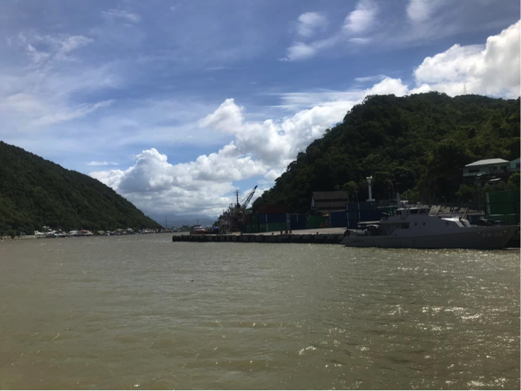
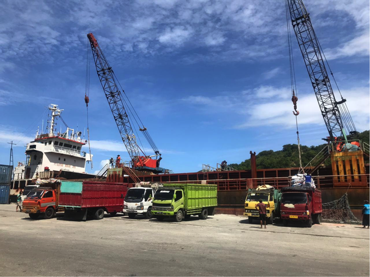
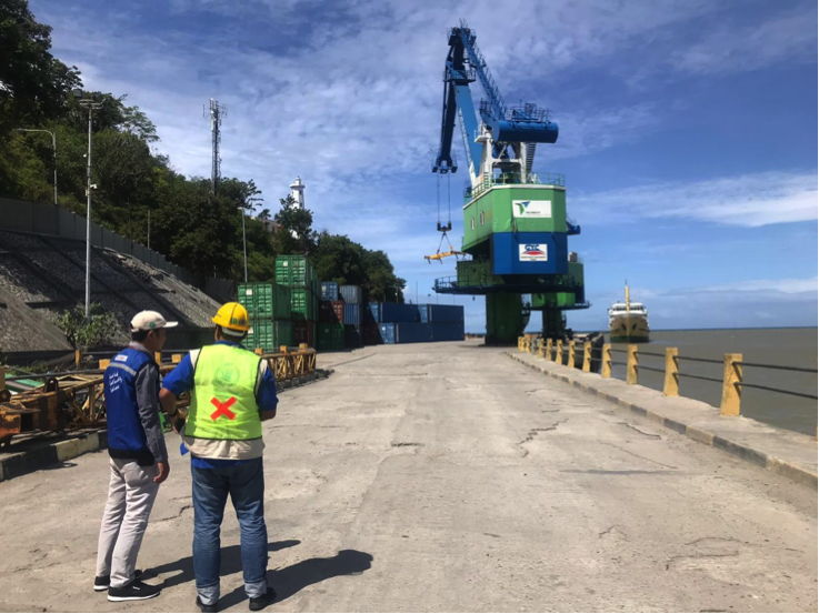
Port Performance
|
Length of channel |
1.02 m |
|
Width of channel |
0.60 m |
|
Draft Channel |
10 m |
|
Min. depth of channel |
30 m |
|
Pool Minimum Depth |
20 m |
|
Wind Speed |
16 knots |
|
Flow speed |
8 knots |
|
Wave Height |
1.50 m |
|
High Water Spring |
1.50 m LWS |
|
Low Water Spring |
0,00m LWS |
|
Seasonal Constraints |
||
|
|
Occurs |
Time Frame |
|
Rainy Season |
Yes |
From June to September |
|
Major Import Campaigns |
No |
From (month) to (month) |
|
Handling Figures for 2018 |
|
|
Vessel Calls |
468 |
|
Container Traffic (TEUs) |
43.164 |
|
Handling Figures Bulk and Break Bulk for 2018 |
|
|
Bulk (MT) |
925.834 |
|
Break bulk (MT) |
|
Discharge Rates and Terminal Handling Charges
For information on port rates and charges, please see the following link:
www.dephub.go.id (PP.15 Tahun 2016)
http://jdih.dephub.go.id/assets/uudocs/perpres/2016/PP_15_Tahun_2016.pdf
Berthing Specifications
|
Type of Berth |
Quantity |
Length (m) |
Maximum Draft (m) |
Comments |
|
Conventional Berth |
Wharf 1 Wharf 2 Wharf 3 |
60 m 119.5 m 188 m |
4-6 m 6-8 m 9-12 m |
Conventional Port |
|
Container Berth |
Nil |
|
|
|
|
Passenger Terminal |
1 |
500 m2 |
- |
Conventional Port |
|
Silo Berth |
Nil |
|
|
|
|
Berthing Tugs |
Nil |
|
|
|
|
Water Barges |
Nil |
|
|
|
General Cargo Handling Berths
|
Cargo Type |
Berth Identification |
|
Imports - Bagged Cargo |
Wharf 1 Wharf 2 Wharf 3 |
|
Exports - Bagged Cargo |
Wharf 1 Wharf 2 Wharf 3 |
|
Imports and Exports - RoRo |
Nil |
|
Other Imports |
Nil |
Port Handling Equipment
|
Equipment |
Available |
Total Quantity and Capacity Available |
Comments on Current Condition and Actual Usage |
|
Fixed Crane |
2 |
32 tons |
Good |
|
Rubber Tyred Gantry |
Nil |
- |
|
|
Mobile Cranes |
Nil |
- |
|
|
Reachstacker |
1 |
45 tons |
Good |
|
Side Loader |
Nil |
- |
|
|
Transtainer |
Nil |
- |
|
|
Forklifts |
2 |
7 tons and 32 tons |
Good |
|
Chassis Head Truck |
Nil |
- |
|
|
Head Truck |
5 |
40 tons and 30 tons |
Good |
|
Tugboat |
Nil |
- |
|
|
Pilot Boat |
1 |
- |
Good |
Container Facilities
|
Facilities |
20 ft |
40 ft |
|
Container Facilities Available |
Yes |
Yes |
|
Container Freight Station (CFS) |
Yes |
Yes |
|
Refrigerated Container Stations |
No |
No |
|
Other Capacity Details |
Electricity 7 KVA |
|
|
Daily Take
Off
Capacity |
400 - 500 Container per day |
|
|
Number of Reefer
Stations |
Nil |
|
|
Emergency Take-off Capacity |
Nil |
|
|
Off take Capacity of Gang
Shift |
Nil |
|
Customs Guidance
Customs clearance is available through the local customs office at the port: http://www.beacukai.go.id/
Terminal Information
The government state-owned companies: PT. PELNI (Persero) and PT. ASDP (Persero), are the two main ferry operators for cargo and passenger movements from Gorontalo throughout Sulawesi province. The routes for PT. PELNI are Bitung – Togian – Poso – Luwuk – Kendari – Raha – Baubau – Ternate – Sanana – Namlea – Ambon – Makasar – Labuanbajo – Bima – Lembar – Benoa, and for PT. ASDP are Pagima – Wakai – Ampana.
MULTIPURPOSE TERMINAL
Shipping Service Companies operating in the port of Gorontalo:
- PT. PELNI (Persero)
- PT. Pertamina (Persero)
- PT. Tanto Intim Line
- PT. Kurnia Maritime Line
- PT. Karya Segara Eternal
- PT. Wasaka S.Putra
Stevedoring Companies operating in the port Gorontalo:
- PT. Pelindo IV
- PT. Means National Airport
- PT. Bone Muara Bahari
Cargo Transportation Companies (EMKL) operating in the port of Gorontalo:
- PT. Kurnia Muara Bone;
- PT. Darly works;
- PT. Yusminto;
- PT. Ocean Adhiguna
Existing capacity at Gorontalo Port:
- Container yard 500 m2
- Warehouses 560 m2
- Electricity 7 KVA
- Water Supply (PDAM)
- 24 working hours
GRAIN AND BULK HANDLING
There are no grain and bulk handling activities at the Port of Gorontalo.
MAIN STORAGE TERMINAL
|
Storage Type |
Number of Storage Facilities |
Area (m2) |
|
Bagged Cargo |
Nil |
Nil |
|
Refrigerated Cargo |
Nil |
Nil |
|
General Cargo |
1 |
560 m2 |
Stevedoring
Stevedoring activities at the port organize by the third parties (authorised stevedoring company) in coordination with the Labour Union Association (TKBM) administered by the Port Authority (KSOP) Office. The owner/shipper can also discharge their own cargo by contacting the Labour Union Association directly.
All of them provide full or semi-full package services; organizing labourer and handling equipment, discharging goods at the port, and delivering the goods at the customer’s warehouses directly.
Hinterland Information
The port serves the trading of local commodities; corn, fisheries, rattan, molasses and cement.
Port Security
|
Security |
|
|
ISPS Compliant |
Yes |
|
Current ISPS
Level |
1 |
|
Police Boats |
Yes |
|
Fire Engines |
Yes |
2.1.30 Indonesia North Sumatra Port of Gunungsitoli
Port Overview
Administratively located in Nias Regency, North Sumatra Province, Gunungsitoli port is the main access gate to Nias island. Thus, Gunungsitoli port plays an important role in the development of Nias island and connecting the island with the surrounding regions. The distance from Sibolga port to Gunungsitoli is approximately 80 miles.
Port website: https://www.pelindo1.co.id/cabang/sbg/id/default.aspx
|
Port Location and Contact |
|
|
Country |
Indonesia |
|
Province or District |
North Sumatra, Gunungsitoli |
|
Nearest Town or City with Distance from Port |
Tarutung, North Tapanuli District (60 km) |
|
Port's Complete Name |
Gunungsitoli Port |
|
Latitude |
01°18′28″ N |
|
Longitude |
97°36′25″ E |
|
Managing Company or Port Authority
|
PT. Pelindo I Gunung Sitoli Branch |
|
Management Contact Person |
Tema General section Phone: 0822 7438 0939 |
|
Nearest Airport and Airlines with Frequent International Arrivals/Departures |
Domestic airport: Binaka Garuda Indonesia Citilink Wings Air Aviastar |
Port Picture
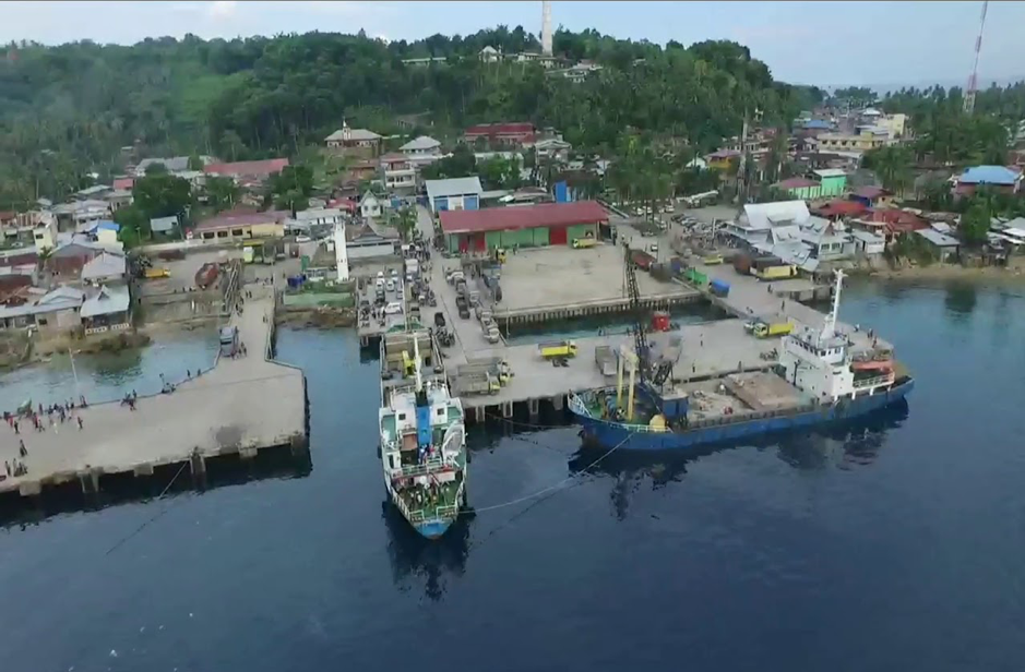
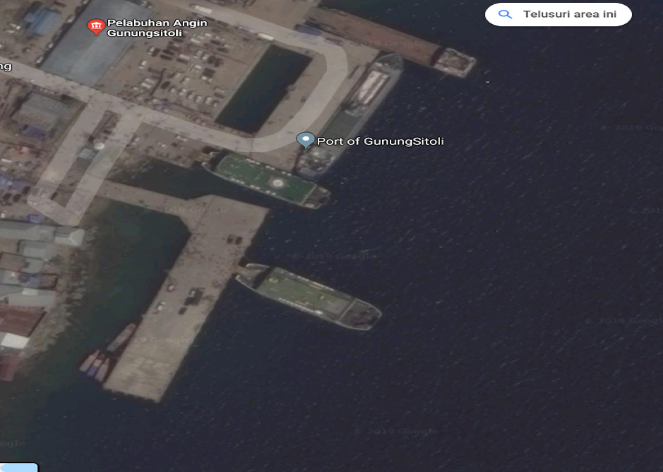
Description and Contacts of Key Companies
For more information on port contacts, please see the following link: 4.4 Indonesia Port and Waterways Company Contact Lists
Port Performance
Tidal: High water spring: 0.5 m and Low – water spring: 0.2 m
Wave: High wave in the harbour pool as between 0.75 – 2 m (June – November)
|
Seasonal Constraints |
||
|
|
Occurs |
Time Frame |
|
Rainy Season |
Yes |
September - December |
|
Major Import Campaigns |
No |
|
|
Other Comments |
|
|
Discharge Rates and Terminal Handling Charges
Port rates and charges of various services can be referred to the government regulation under PP.11 tahun 2015. The full regulation can be download here: http://jdih.dephub.go.id/assets/uudocs/pp/2015/PP_11_Tahun_20152.pdf
Berthing Specifications
|
Type of Berth |
Quantity |
Length (m) |
Maximum Draft (m) |
Comments |
|
Conventional Berth |
3 |
20 m x 18 m 60 m x 18 m 86 m x 20 m |
7 |
|
|
Container Berth |
- |
- |
- |
- |
|
Silo Berth |
- |
- |
- |
- |
|
Berthing Tugs |
- |
- |
- |
- |
|
Water Barges |
- |
- |
- |
- |
General Cargo Handling Berths
|
Cargo Type |
Berth Identification |
|
Imports - Bagged Cargo |
NIL |
|
Exports - Bagged Cargo |
NIL |
|
Imports and Exports - RoRo |
|
|
Other Imports |
|
Port Handling Equipment
|
Equipment |
Available |
Total Quantity and Capacity Available |
Comments on Current Condition and Actual Usage |
|
Dockside Crane |
No |
|
|
|
Container Gantries |
No |
|
|
|
Mobile Cranes |
No |
|
|
|
Reachstacker |
No |
|
|
|
RoRo Tugmaster (with Trailer) |
No |
|
|
|
Grain Elevator with Bagging Machines |
No |
|
|
|
Transtainer |
No |
|
|
|
Forklifts |
Yes |
3 unit (1 unit of 2 MT, 1 unit of 5 MT and 1 unit of 6.5 MT |
Good |
Container Facilities
|
Facilities |
20 ft |
40 ft |
|
Container Facilities Available |
Yes |
N/A |
|
Container Freight Station (CFS) |
Yes |
N/A |
|
Refrigerated Container Stations |
N/A |
N/A |
|
Other Capacity Details |
||
|
Daily Take Off
Capacity |
N/A |
N/A |
|
Number of Reefer
Stations |
N/A |
N/A |
|
Emergency Take-off Capacity |
N/A |
N/A |
|
Off take Capacity of Gang
Shift |
N/A |
N/A |
Customs Guidance
Customs clearance is available at the nearest office:
KPPBC TP
SIBOLGA
Jalan Horas
Pelabuhan Sambas Sibolga 22532
Terminal Information
MULTIPURPOSE TERMINAL
Gunungsitoli port is a multi-purpose port that functions as cargo terminal as well as passenger terminal.
GRAIN AND BULK HANDLING
There is no handling activity for grain and bulk in the port.
MAIN STORAGE TERMINAL
The capacity of the main storage is up to 1,000 m2.
|
Storage Type |
Number of Storage Facilities |
Area (m2) |
|
Bagged Cargo |
N/A |
|
|
Refrigerated Cargo |
N/A |
|
|
General Cargo |
1 |
1,000 |
Stevedoring
Stevedoring activities are organized and managed by third party (stevedoring company or Tenaga Kerja Bongkar Muat-TKBM).
Hinterland Information
The island produces various commodities including rubber, coconuts and patchouli oil. One of its beaches called ‘Lagundri’ is the most popular tourism destination of Nias. The beach is known as well-suited for water sports, particularly surfing.
Port Security
|
Security |
|
|
ISPS Compliant |
Yes |
|
Current ISPS Level (Level 1 = Normal, Level 2 = Heightened, Level 3 = Exceptional) |
No |
|
Police Boats |
No |
|
Fire Engines |
1 |
2.1.31 Indonesia Maluku Port of Yos Sudarso
Port Overview
Yos Sudarso port is the main port in Maluku Province, located in Ambon City. Since Maluku province is comprised of small islands, the seaport is crucial in supply chain distributions around the province. Goods supplied from outside the province are mainly transported by sea and subsequently distributed to the districts and small islands around the province either by ferries or speed boats.
Port website: https://inaport4.co.id/branch/read/5/7
Key port information may also be found at: https://inaport4.co.id/
|
Port Location and Contact |
|
|
Country |
INDONESIA |
|
Province or District |
Maluku Province |
|
Nearest Town or City with Distance from Port |
Ambon City 1 km |
|
Port's Complete Name |
Yos Sudarso Port |
|
Latitude |
03°41’00” S |
|
Longitude |
128°10’00” E |
|
Managing Company or Port Authority |
PT. Pelabuhan Indonesia IV (Persero) Ambon |
|
Management Contact Person |
Safri (Mr.) Assistant Operation M. +62 821 8942 0531 Email. ambon@inaport4.co.id |
|
Nearest Airport and Airlines with Frequent International Arrivals/Departures |
Pattimura Airport
|
Port Picture
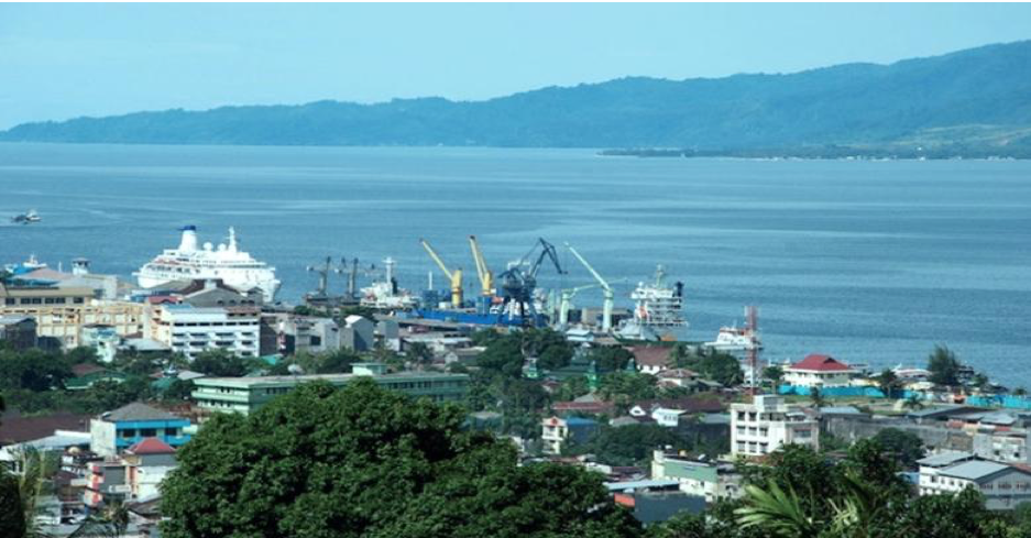
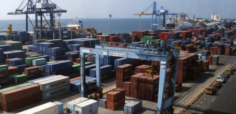
Port Performance
|
Seasonal Constraints |
||
|
|
Occurs |
Time Frame |
|
Rainy Season |
Yes |
From October to February |
|
Major Import Campaigns |
No |
From (month) to (month) |
|
Other Comments |
- |
|
|
Handling Figures for 2018 |
|
|
Vessel Calls |
360 |
|
Container Traffic (TEUs) |
120,000 |
|
Handling Figures Bulk and Break Bulk for 2018 |
|
|
Bulk (MT) |
164,032 MT (Conventional) |
|
Break bulk (MT) |
|
Discharge Rates and Terminal Handling Charges
Port rates and charges of various services can refer to the government regulation under PP.11 tahun 2015. The full regulation can be download here: http://jdih.dephub.go.id/assets/uudocs/pp/2015/PP_11_Tahun_20152.pdf
Berthing Specifications
Port website: https://inaport4.co.id/pelabuhan
|
Type of Berth |
Quantity |
Length (m) |
Maximum Draft (m) |
Comments |
|
Conventional Berth |
1 |
250 |
10 |
General cargo vessel |
|
Container Berth |
1 |
436 |
10 |
Container vessel (only) |
|
Passenger Berth |
Using conventional berth |
|||
|
Silo Berth |
Nil |
|
|
|
|
Berthing Tugs |
Nil |
|
|
|
|
Water Barges |
1 |
|
|
|
General Cargo Handling Berths
|
Cargo Type |
Berth Identification |
|
Imports - Bagged Cargo |
Concrete Pier |
|
Exports - Bagged Cargo |
Concrete Pier |
|
Imports and Exports - RoRo |
Nil |
|
Other Imports |
Nil |
Port Handling Equipment
The port equipment is managed by PT. Pelindo IV under its branch office in Ambon city.
|
Equipment |
Available |
Total Quantity and Capacity Available |
Comments on Current Condition and Actual Usage |
|
Dockside Crane |
No |
N/A |
N/A |
|
Container Gantries |
Yes |
5 unit – 40 T |
Good |
|
Mobile Cranes |
Yes |
2 unit |
Good |
|
Reachstacker |
Yes |
4 unit - 45 MT |
Good |
|
RoRo Tugmaster (with Trailer) |
No |
N/A |
N/A |
|
Grain Elevator with Bagging Machines |
No |
N/A |
N/A |
|
Transtainer |
Yes |
1 unit |
Good |
|
Forklifts |
Yes |
2 unit - 5 T, 1 unit 7 T |
Good |
|
Gantry Luffing Crane (GLC) SWL |
No |
N/A |
N/A |
|
Head Truck |
Yes |
5 unit |
Good |
|
Tronton |
Yes |
11 unit |
Good |
|
Pilot Boat |
Yes |
2 unit |
Good |
Container Facilities
Yos Sudarso port has facilities to support daily activities such as the availability of 54 sqm area that can accommodate up to 7,500 (TEUs) of containers.
|
Facilities |
20 ft |
40 ft |
|
Container Facilities Available |
Yes |
Yes |
|
Container Freight Station (CFS) |
Yes |
Yes |
|
Refrigerated Container Stations |
Yes |
Yes |
|
Other Capacity Details |
7500 TEUs Capacity |
|
|
Daily Take Off
Capacity |
500 Containers |
|
|
Number of Reefer
Stations |
Nil |
|
|
Emergency Take-off Capacity |
Nil |
|
|
Off take Capacity of Gang
Shift |
Nil |
|
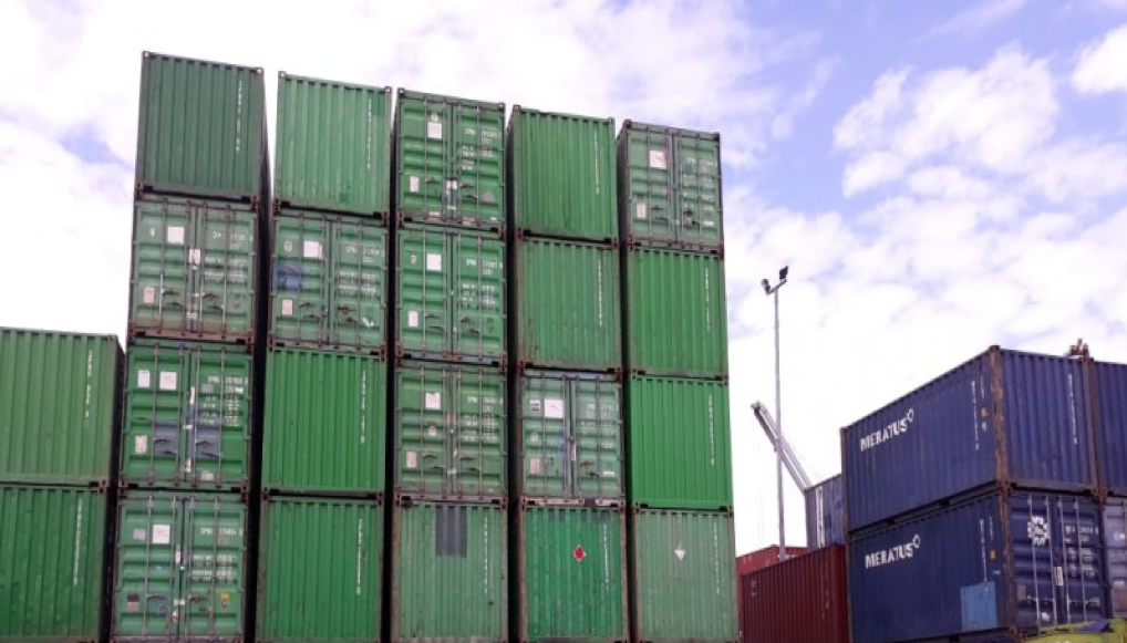
Customs Guidance
Customs clearance is available within the port vicinity.
Terminal Information
MULTIPURPOSE TERMINAL
Maluku consists of islands, hence public transport is required for crossing between these islands. The State-owned Enterprises under PT. Indonesia Ferry (ASDP) operates Ro-Ro ferries as inter-island transportations with total up to 9 ferries for 10 routes on daily basis. The ferry schedule can be seen in the following table:
|
No. |
Ro-Ro Ferry |
Destination |
|
1. |
KMP. Dolosi |
Hunimua - Waipirit |
|
2. |
KMP. Temi/PMOE |
Galala – Namlea |
|
3. |
KMP. Inelika/YEHO |
Hunimua - Waipirit |
|
4. |
KMP. Terubuk/YEZX |
Hunimua – Waipirit |
|
5. |
KMP. Samandar/YDBL |
Waai – Umeputtih – Nalahia – Amahai |
|
6. |
KMP. Layur/YB-4284 |
Wailey - Umeputtih |
|
7. |
KMP. Danau Rana/YB 6228 |
Namlea – Kayeli |
|
8. |
KMP. Rokatenda/YEYW |
Hunimua – Waipirit |
|
9. |
KMP. Wayangan/JZCO |
Galala – Namlea |
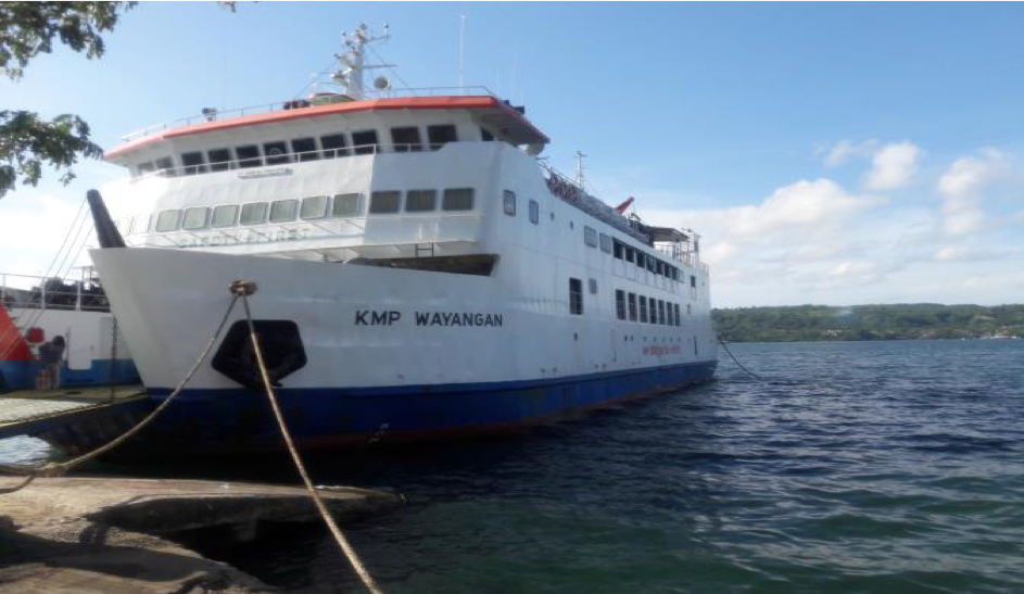
GRAIN AND BULK HANDLING
These type of handling activities are not available at the Port.
MAIN STORAGE TERMINAL
|
Storage Type |
Number of Storage Facilities |
Area (m2) |
|
Bagged Cargo |
Nil |
Nil |
|
Refrigerated Cargo |
Nil |
Nil |
|
General Cargo |
2 (General) |
1400 m2 |
Stevedoring
Stevedoring activities are mainly organizsd by third party (authorised stevedoring company) in coordination with the Labour Union Association (Tenaga Kerja Bongkar Muat - TKBM) and PT. Pelindo as the port operator. However, importers and/or ship owners can also discharge their cargoes by directly contacting the Labour Union Association.
Hinterland Information
With total of 632 big and small islands, livelihood of the community is mainly fisheries, livestock, and trade.
Port Security
|
Security |
|
|
ISPS Compliant |
Yes |
|
Current ISPS Level (Level 1 = Normal, Level 2 = Heightened, Level 3 = Exceptional) |
1 |
|
Police Boats |
Yes |
|
Fire Engines |
Yes |
2.1.32 Indonesia Aceh Port of Calang
Port Overview
The Port of Calang is located in Calang city, the capital of Aceh Jaya district about 150 km from Banda Aceh city, the capital of Aceh Province. The port is classified as Class III and is operated by the Unit Penyelenggara Pelabuhan (UPP), Directorate General Sea Transportation, the Ministry of Transportation. Following the massive incoming rehabilitation and reconstruction materials to Calang and surrounding via Landing Craft Tank (LCT) from 2005 to 2008, in 2009 the Government of Aceh started the construction of Calang port and completed in 2015. The port is designed to anticipate up to 5,000 DWT ship.
Port website: http://hubla.dephub.go.id/unit/upt/Unit-Penyelenggara-Pelabuhan.aspx
Key port information may also be found at: http://www.maritime-database.com
|
Port Location and Contact |
|
|
Country |
Indonesia |
|
Province or District |
Aceh Jaya district, Aceh Province |
|
Nearest Town or City with Distance from Port |
Calang City - 0.5 km |
|
Port's Complete Name |
Calang Port |
|
Latitude |
4.631364 |
|
Longitude |
95.572044 |
|
Managing Company or Port Authority
|
Unit Penyelenggara Pelabuhan (UPP), Directorate General Sea Transportation, the Ministry of Transportation Calang Address Jalan Kejaksaan, Calang – Aceh Jaya, Aceh Province |
|
Management Contact Person |
Ory Dharmansyah (Kesyahbandaran) Ph. 081260189735 Email odharmansyah@yahoo.co.id |
|
Nearest Airport and Airlines with Frequent International Arrivals/Departures |
Sultan Iskandar Muda International Airport (located in Banda Aceh city, about 160 km away). Garuda Indonesia, Batik Air, Lion Air, Citilink, Air Asia, Wings Airlines, Susi Air |
Port Picture
Note:
- Berthing area
- Stacking Yard (5,010 m2)
- Warehouse (800 m2)
- Port Office
Description and Contacts of Key Companies
UPP Kelas III Calang
Contacts: Ory Dharmansyah
Ph. 081260189735
Ph/Fax. 0654 - 2210219
Address : Jl. Kejaksaan no 01, Calang Aceh Jaya, Province Aceh
For more information on port contacts, please see the following link: 4.4 Indonesia Port and Waterways Company Contact Lists
Port Performance
|
Seasonal Constraints |
||
|
|
Occurs |
Time Frame |
|
Rainy Season |
Yes |
October - February |
|
Major Import Campaigns |
No |
|
|
Other Comments |
|
|
|
Handling Figures for 2018 |
|
|
Vessel Calls |
73 |
|
Container Traffic (TEUs) |
No containerized cargoes |
Discharge Rates and Terminal Handling Charges
For information on port rates and charges, please see the following link:
www.dephub.go.id (PP.15 Tahun 2016)
http://jdih.dephub.go.id/assets/uudocs/perpres/2016/PP_15_Tahun_2016.pdf
Berthing Specifications
|
Type of Berth |
Quantity |
Length (m) |
Maximum Draft (m) |
Comments |
|
Conventional Berth |
1 |
289 m |
|
|
|
Container Berth |
- |
|
|
|
|
Silo Berth |
- |
|
|
|
|
Berthing Tugs |
- |
|
|
|
|
Water Barges |
- |
|
|
|
Port Handling Equipment
|
Equipment |
Available |
Total Quantity and Capacity Available |
Comments on Current Condition and Actual Usage |
|
Gantry Jib Crane |
No |
|
|
|
Luffing Gantry Crane |
No |
|
|
|
Mobile Cranes |
No |
|
|
|
Reachstacker |
No |
|
|
|
RoRo Tugmaster (with Trailer) |
No |
|
|
|
Grain Elevator with Bagging Machines |
No |
|
|
|
Transtainer |
No |
|
|
|
Forklifts |
Yes |
2 units; 5 ton and 2 ton |
|
|
Weighbridge |
No |
|
|
|
Reefer Plug Portable |
No |
|
|
|
Dump Truck |
No |
|
|
|
Excavator |
No |
|
|
|
Wheel loader |
No |
|
|
Container Facilities
|
Facilities |
20 ft |
40 ft |
|
Container Facilities Available |
No |
No |
|
Container Freight Station (CFS) |
|
|
|
Refrigerated Container Stations |
No |
No |
|
Other Capacity Details |
|
|
|
Daily Take Off
Capacity |
|
|
|
Number of Reefer
Stations |
|
|
|
Emergency Take-off Capacity |
Nil |
Nil |
|
Off take Capacity of Gang
Shift |
Nil |
Nil |
Customs Guidance
Customs clearance and immigration are available through the local Customs office located in Meulaboh city, about 90 km away. Website: http://www.beacukai.go.id/
Terminal Information
Passenger Terminal with area 168 m2.
Multipurpose Terminal
Port warehouse and its open yard area can be used for multi-purpose activities.
Main Storage Terminal
|
Storage Type |
Number of Storage Facilities |
Area (m2) |
|
Bagged Cargo |
|
|
|
Refrigerated Cargo |
|
|
|
General Cargo |
1 unit warehouse |
800 m2 |
Stevedoring
Loading and unloading activities done through Labour Union Association (TKBM) and administered by the Port Authority (UPP) Office. The owner/shipper can also discharge their own cargo by contacting the Labour Union Association directly.
Hinterland Information
The main hinterland of Calang Port is Aceh Jaya district, Aceh Province. Calang Port serves commodity from its hinterland area, such as palm commodity.
Port Security
|
Security |
|
|
ISPS Compliant |
No |
|
Current ISPS Level (Level 1 = Normal, Level 2 = Heightened, Level 3 = Exceptional) |
N/A |
|
Police Boats |
Yes |
|
Fire Engines |
No |
2.1.33 Indonesia Aceh Port of Malahayati
Port Overview
Port of Malahayati is located in Krueng Raya bay, Aceh Besar district about 35 km from Banda Aceh city, the capital of Aceh Province. Malahayati port is the largest port in Aceh Province and is operated by PT. Pelabuhan Indonesia I (Persero) Brach Malahayati. Since 2013, a new container terminal is officially opened, serving more than 4,000 containers, and in 2018 serving more than 8,000 containers. During Indian Ocean Tsunami in 2004, the port was heavily damaged, and the shores near the port was massively utilised for Landing Craft Operations (LCT).
Port website: https://www.pelindo1.co.id/cabang/MLH/id/Default.aspx
Key port information may also be found at: http://www.maritime-database.com
|
Port Location and Contact |
|
|
Country |
Indonesia |
|
Province or District |
Aceh Province |
|
Nearest Town or City with Distance from Port |
Banda Aceh City 35 km |
|
Port's Complete Name |
Malahayati |
|
Latitude |
5.595854 |
|
Longitude |
95.526809 |
|
Managing Company or Port Authority |
PT Pelabuhan Indonesia I (Persero) Branch Malahayati |
|
Management Contact Person |
Sam Arifin Wiwi (General Manager) Ph.08127510847 Email: Sam.arifinw@gmail.com Ali Nafia (Operational Staff) Ph. 082160626414 |
|
Nearest Airport and Airlines with Frequent International Arrivals/Departures |
Sultan Iskandar Muda International Airport, about 40 km away, passing Banda Aceh city (main route). Airlines with International Arrival/Departures: Air Asia, Lion Air, Garuda Indonesia, Citilink, Malindo Air, Susi Air, Batik Air |
Port Picture
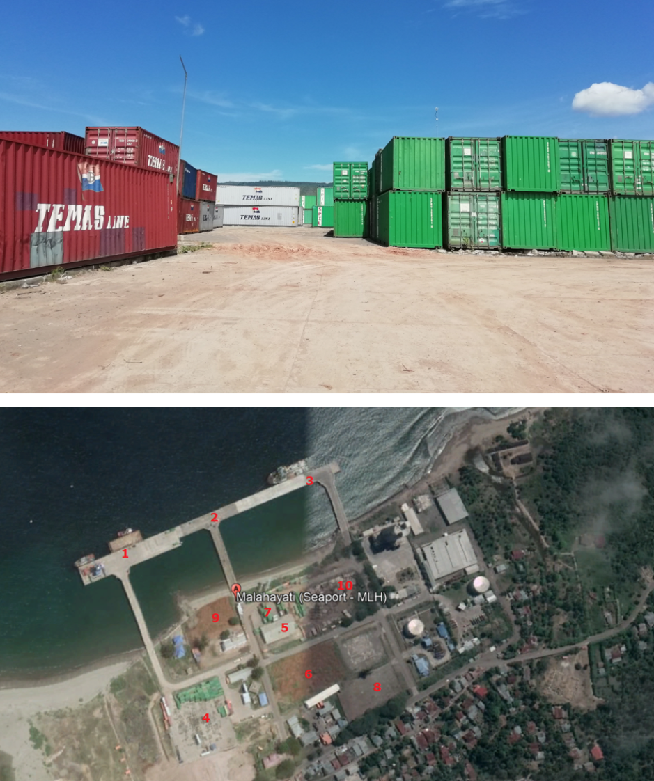
|
Information:
|
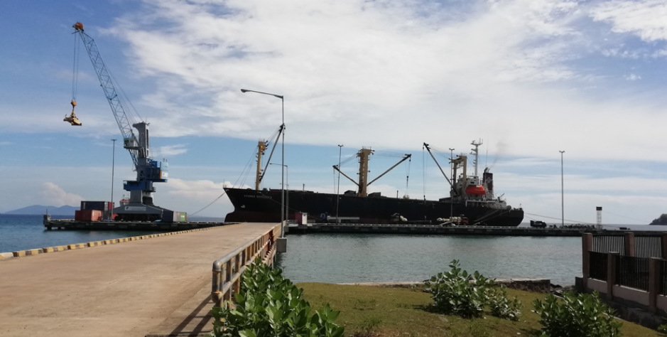
Additional Information
Terminal for RoRo Ferry Ship in Banda Aceh is located in Ulee Lheue Port. The port is about 6 km away from Banda Aceh city centre, it is operated by PT ASDP Indonesia Ferry (Persero) Banda Aceh Branch. There are 3 (three) RoRo Ship available, serving routes Ulee Lheu – Balohan (Sabang Island) vv and Ulee Lheue – Lamteng (Pulo Aceh) vv. The Type of ships are Passenger Ferry with open RoRo cargo Space. Call sign for these routes are KMP Papuyu, KMP BRR and KMP Tanjung Burang
Description and Contacts of Key Companies
Kantor Syahbandar dan Otoritas Pelabuhan (KSOP) Class IV Malahayati is a Unit Penyelenggara Pelabuhan (UPP) under the Directorate General Sea Transportation, the Ministry of Transportation.
Contacts: Sutrisna, (Plh) Kepala KSOP
Address : Jl Pattimura No 94 Kelurahan Sukaramai, Blower Banda Aceh
Phone : (0651) 48555 - 08126915052
Fax: (0651) 48555
PT. PELINDO I Malahayati Port PT Pelabuhan Indonesia I (Persero) or often known as Pelindo I is a government state-owned company engaged in logistics, specifically in port management and development.
Contacts: Sam Arifin Wiwi (General Manager)
Ali Nafia (Operational Staff)
Ph. 082160626414
Address : Jl. Laksamana Malahayati KM. 32,5 Krueng Raya Aceh Besar
Mobile : +6281267131602
PT ASDP Indonesia Ferry (Persero) Banda Aceh Branch (Ulee Lheue Ferry Port) is a government state-owned company engage in the business of Port and Ferry services.
Contact: Ricky Akmal (Document Control Manager)
Address Jl. Rama Setia Desa Deah Geulumpang Banda Aceh -Provinsi Aceh
Ph. 082367567560
Email akmal@indonesiaferry.co.id
For more information on port contacts, please see the following link: 4.4 Indonesia Port and Waterways Company Contact Lists
Port Performance
|
Seasonal Constraints |
||
|
|
Occurs |
Time Frame |
|
Rainy Season |
Yes |
September – January |
|
Major Import Campaigns |
No |
|
|
Other Comments |
|
|
|
Handling Figures for 2018 |
|
|
Vessel Calls |
335 |
|
Container Traffic (TEUs) |
8,761 |
|
Handling Figures Bulk and Break Bulk for 2018 |
|
|
Bulk (MT) |
339,298 |
|
Break bulk (MT) |
677,650 |
Discharge Rates and Terminal Handling Charges
The official discharge rates and handling charges are yet finalised. For the time being, the rates and charges from the Ministry of Transportation is applied. Please see the following link:
www.dephub.go.id (PP.15 Tahun 2016)
http://jdih.dephub.go.id/assets/uudocs/perpres/2016/PP_15_Tahun_2016.pdf
Berthing Specifications
|
Type of Berth |
Quantity |
Length (m) |
Maximum Draft (m) |
Comments |
|
Conventional Berth |
3 |
|
|
|
|
Container Berth |
|
|
|
|
|
Silo Berth |
|
|
|
|
|
Berthing Tugs |
|
|
|
|
|
Water Barges |
|
|
|
|
Port Handling Equipment
|
Equipment |
Available |
Total Quantity and Capacity Available |
Comments on Current Condition and Actual Usage |
|
Gantry Jib Crane |
No |
|
|
|
Luffing Gantry Crane |
No |
|
|
|
Mobile Cranes |
Yes |
2 unit, 25 mt |
|
|
Reachstacker |
Yes |
1 unit, 45 mt |
|
|
RoRo Tugmaster (with Trailer) |
No |
|
|
|
Grain Elevator with Bagging Machines |
No |
|
|
|
Transtainer |
No |
|
|
|
Forklifts |
Yes |
7 units, 5 ton and 3 ton |
Good |
|
Weighbridge |
Yes |
1 unit |
Good |
|
Reefer Plug Portable |
Yes |
|
|
|
Dump Truck |
No |
|
|
|
Excavator |
No |
|
|
|
Wheel loader |
No |
|
|
Container Facilities
|
Facilities |
20 ft |
40 ft |
|
Container Facilities Available |
Yes |
Yes |
|
Container Freight Station (CFS) |
23,991 m2 |
|
|
Refrigerated Container Stations |
No |
No |
|
Other Capacity Details |
Container Yard 6,980 m2 |
|
|
Daily Take Off
Capacity |
40-50 |
|
|
Number of Reefer
Stations |
|
|
|
Emergency Take-off Capacity |
Nil |
Nil |
|
Off take Capacity of Gang
Shift |
Nil |
Nil |
Customs Guidance
Customs clearance and immigration are available through the local Customs office located in Banda Aceh city. about 35 km away. Website: http://www.beacukai.go.id/
Terminal Information
Passenger Terminal area consist of 510 m2.
Multipurpose Terminal
Port warehouse and its container yard area can be used for multi-purpose activities.
Main Storage Terminal
|
Storage Type |
Number of Storage Facilities |
Area (m2) |
|
Bagged Cargo |
|
|
|
Refrigerated Cargo |
|
|
|
General Cargo |
1-unit |
800 m2 |
Stevedoring
Stevedoring activities organised by third parties (authorised stevedoring company) in coordination with the Labour Union Association (TKBM) administered by Port Authority (KSOP) Office. The owner/importer can also discharge their own cargo by contacting the the Labour Union Association directly.
Hinterland Information
The main hinterland of Malahayati Port is Banda Aceh and Aceh Besar area, Aceh Province. Malahayati Port serves commodity from its hinterland area, such as cement, coconut, etc.
Malahayati Port is open for international trade activities supported by several economic centres including Banda Aceh and Aceh Besar.
Port Security
|
Security |
|
|
ISPS Compliant |
Yes |
|
Current ISPS Level (Level 1 = Normal, Level 2 = Heightened, Level 3 = Exceptional) |
1 |
|
Police Boats |
Yes |
|
Fire Engines |
Yes |
2.1.34 Indonesia Aceh Port of Tapaktuan
Port Overview
Port of Tapaktuan is located in Tapaktuan city, South Aceh district about 430 km from Banda Aceh city, the capital of Aceh Province. The port is classified as Class III and is operated by the Unit Penyelenggara Pelabuhan (UPP), Directorate General Sea Transportation in the Ministry of Transportation.
Port website: http://hubla.dephub.go.id/unit/upt/Unit-Penyelenggara-Pelabuhan.aspx
Key port information may also be found at: http://www.maritime-database.com
|
Port Location and Contact |
|
|
Country |
Indonesia |
|
Province or District |
South Aceh district, Aceh Province |
|
Nearest Town or City with Distance from Port |
Tapaktuan City 0.5 km |
|
Port's Complete Name |
Tapaktuan Port |
|
Latitude |
3.253603 |
|
Longitude |
97.179726s |
|
Managing Company or Port Authority
|
Unit Penyelenggara Pelabuhan (UPP), Directorate General Sea Transportation, the Ministry of Transportation Address Jalan Merdeka no 41, Tapaktuan Aceh Selatan, Province Aceh |
|
Management Contact Person |
Fizar (Kesyahbandaran) Ph. 082363613476 Ph/Fax. 0656-21337 |
|
Nearest Airport and Airlines with Frequent International Arrivals/Departures |
Kualanamu International Airport (located in Medan city, about 385 km away). Garuda Indonesia, Batik Air, Lion Air, Citilink, Air Asia, Wings Airlines, Susi Air, Silk Air, Jetstar |
Port Picture
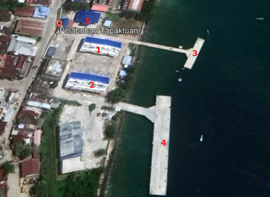
Note:
- Warehouse 1 (495m2)
- Warehouse 2 (495 m2)
- Berth 1 (old) 30m x 8m
- Berth 2 (new) 100m x 10m
- Port Office
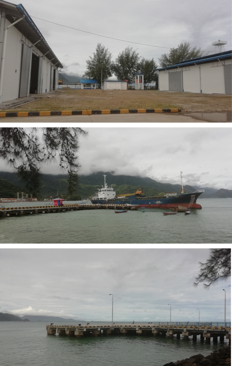
Description and Contacts of Key
Companies
UPP Kelas III Tapak Tuan
Contacts: Fizar
Ph. 082363613476
Ph/Fax. 0656-21337
Address : Jl. Merdeka No. 41 Tapak Tuan Aceh Selatan
Port Performance
|
Seasonal Constraints |
||
|
|
Occurs |
Time Frame |
|
Rainy Season |
Yes |
September – January |
|
Major Import Campaigns |
No |
|
|
Other Comments |
|
|
|
Handling Figures for 2018 |
|
|
Vessel Calls |
171 |
|
Container Traffic (TEUs) |
No containerised cargoes |
|
Handling Figures Bulk and Break Bulk for 2018 |
|
|
Bulk (MT) |
152,765 |
|
Break bulk (MT) |
|
Discharge Rates and Terminal Handling Charges
For information on port rates and charges, please see the following link:
www.dephub.go.id (PP.15 Tahun 2016)
http://jdih.dephub.go.id/assets/uudocs/perpres/2016/PP_15_Tahun_2016.pdf
Berthing Specifications
|
Type of Berth |
Quantity |
Length (m) |
Maximum Draft (m) |
Comments |
|
Conventional Berth |
2 |
|
16-25 |
|
|
Container Berth |
- |
|
|
|
|
Silo Berth |
- |
|
|
|
|
Berthing Tugs |
- |
|
|
|
|
Water Barges |
- |
|
|
|
Port Handling Equipment
|
Equipment |
Available |
Total Quantity and Capacity Available |
Comments on Current Condition and Actual Usage |
|
Gantry Jib Crane |
No |
|
|
|
Luffing Gantry Crane |
No |
|
|
|
Mobile Cranes |
No |
|
|
|
Reachstacker |
No |
|
|
|
RoRo Tugmaster (with Trailer) |
No |
|
|
|
Grain Elevator with Bagging Machines |
No |
|
|
|
Transtainer |
No |
|
|
|
Forklifts |
Yes |
1 unit, 5 ton |
|
|
Weighbridge |
No |
|
|
|
Reefer Plug Portable |
No |
|
|
|
Dump Truck |
No |
|
|
|
Excavator |
No |
|
|
|
Wheel loader |
No |
|
|
Container Facilities
|
Facilities |
20 ft |
40 ft |
|
Container Facilities Available |
No |
No |
|
Container Freight Station (CFS) |
|
|
|
Refrigerated Container Stations |
No |
No |
|
Other Capacity Details |
|
|
|
,Daily Take
Off
Capacity |
|
|
|
Number of Reefer
Stations |
|
|
|
Emergency Take-off Capacity |
Nil |
Nil |
|
Off take Capacity of Gang
Shift |
Nil |
Nil |
Customs Guidance
Customs clearance and immigration are available through the local Customs office located in Meulaboh City, about 200 km away. Website: http://www.beacukai.go.id/
Terminal Information
No information about terminal facility.
Multipurpose Terminal
Port warehouses and its open yard area can be used for multi-purpose activities.
Main Storage Terminal
|
Storage Type |
Number of Storage Facilities |
Area (m2) |
|
Bagged Cargo |
|
|
|
Refrigerated Cargo |
|
|
|
General Cargo |
2-unit warehouses |
990 m2 |
Stevedoring
Loading and unloading activities done through Labour Union Association (TKBM) and administered by the Port Authority (UPP) Office. The owner/shipper can also discharge their own cargo by contacting the Labour Union Association directly.
There are 4 companies for Loading/Offloading
- PT. Pantai Selatan
- PT. Putra Jasa Bumi
- CV Aida & Co
- PT Kana Tuah Mandiri
Hinterland Information
The main hinterland of Tapaktuan port is South Aceh and West Aceh area, Aceh Province. Tapaktuan port serves commodity from its hinterland area, such as palm oil and iron ore.
Port Security
|
Security |
|
|
ISPS Compliant |
No |
|
Current ISPS Level (Level 1 = Normal, Level 2 = Heightened, Level 3 = Exceptional) |
N/A |
|
Police Boats |
No |
|
Fire Engines |
No |
2.1.35 Indonesia East Java Port of Tanjung Wangi
Port Overview
Tanjung Wangi port is located in Banyuwangi district, about 14 km from Banyuwangi city, the easternmost part of Java island. The port is located next to the ferry crossing port of Ketapang which serves a large number of passengers between Java and Bali islands. Tanjung Wangi port facilitates cargo movement service between the islands of Java and Bali. The port is also considered as entry point for any kind of cargoes from eastern part of Indonesia. Most are categorised as raw material cargoes to supply the production of factories around Banyuwangi city and surrounding districts. The port has 1 conventional berth to support the movement of the vessels with limited handling equipment.
Port website: https://www.pelindo.co.id/id/port-terminal/tanjung-wangi
Port key information may also be found at: https://www.maritime-database.com/port.php?pid=3435
|
Port Location and Contact |
|
|
Country |
Indonesia |
|
Province or District |
East Java / Banyuwangi District |
|
Nearest Town or City with Distance from Port |
Banyuwangi city, 14 km |
|
Port's Complete Name |
Tanjung Wangi Port |
|
Latitude |
8°07'43.9"S |
|
Longitude |
114°23'57.1"E |
|
Managing Company or Port Authority |
PT. Pelindo III (Persero) Cabang Tanjung Wangi |
|
Management Contact Person |
M. Nisar Fauzi Telp: +62-333-510636 |
|
Nearest Airport and Airlines with Frequent International Arrivals/Departures |
Banyuwangi International Airport, with distance approx. 30 km (1 hour drive by car). |
Port Picture
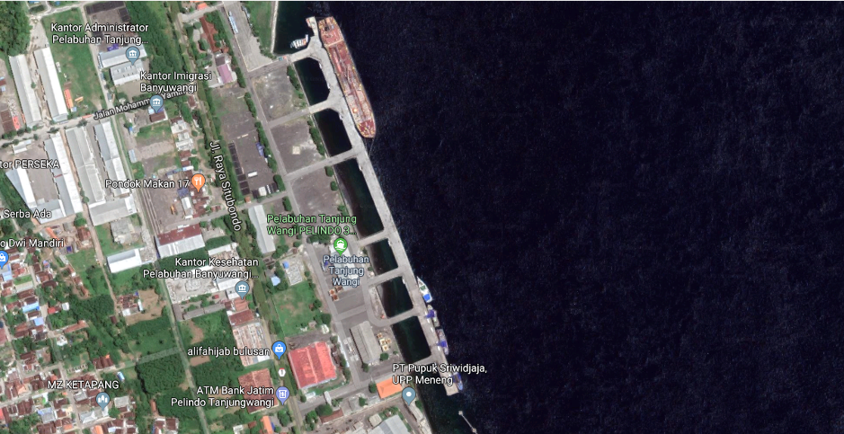
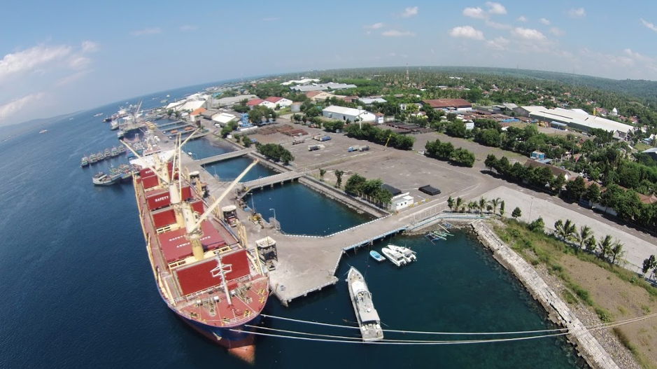
Description and Contacts of Key Companies
The port is operated by the state-owned company PT (Persero) Pelabuhan Indonesia III, branch Tanjung Wangi, Banyuwangi District. The port regulator is located within the port area, Kantor Syahbandar dan Otoritas Pelabuhan (KSOP) Class III Tanjung Wangi. This is a Technical Implementation Unit (UPT) under the Directorate General of Sea Transportation, the Ministry of Transportation.
Contact details of port authority and port operator:
- Port Authority: KSOP Class III Tanjung Wangi: Jl. Raya Situbondo Ketapang Banyuwangi Jawa Timur 68451, Office phone: +62-333-510939 / 510253 and Fax: +62-333-510295.
- Port Operator: PT. Pelindo III Tanjung Wangi: Jl. Situbondo - Banyuwangi, Lkr. Kp. Baru, Bulusan, Kalipuro, Kabupaten Banyuwangi, Jawa Timur 68455, Office phone: +62–333-510636.
For more information on port contacts, please see the following link: https://www.pelindo.co.id/id/port-terminal/tanjung-wangi
Port Performance
Most cargoes handled at the port are either grains, bulk, liquids and or bags. The dockside crane is unavailable; however, the operator has standby agreement with external mobile crane rental. Average loading and offloading capacity is around 7,000 MT/day, including daily workers. The working hours are between 7 AM to 6 PM local time due to lighting system limitations at the port. No handling equipment or other facilities available for discharging containerised cargoes. Open space can be utilised for multiple purposes in case needed. With the current capacities, the port operator is willing to support and cooperate in providing any kind of services related to emergency response operations.
|
Seasonal Constraints |
||
|
|
Occurs |
Time Frame |
|
Rainy Season |
Yes |
From October to January |
|
Major Import Campaigns |
No |
|
|
Other Comments |
- |
|
|
Handling Figures for 2018 |
|
|
Vessel Calls |
70 vessels per Month |
|
Container Traffic (TEUs) |
No information |
|
Handling Figures Bulk and Break Bulk for 2018 |
|
|
Bulk, Grain and Bags (MT) |
2,510,501 MT |
|
Break bulk (MT) |
N/A |
Discharge Rates and Terminal Handling Charges
For information on port rates and charges, please see the following link:
Details for local surcharge in following link:
Berthing Specifications
|
Type of Berth |
Quantity |
Length (m) |
Maximum Draft (m) |
Comments |
|
Conventional Berth |
1 |
543 m |
(-12 down to -14 m MLWS) |
Size of the berth 15 x 543 m |
|
Container Berth |
N/A |
|
|
|
|
Silo Berth |
N/A |
|
|
|
|
Berthing Tugs |
N/A |
|
|
|
|
Water Barges |
N/A |
|
|
|
General Cargo Handling Berths
|
Cargo Type |
Berth Identification |
|
Imports - Bagged Cargo |
N/A |
|
Exports - Bagged Cargo |
N/A |
|
Imports and Exports - RoRo |
N/A |
|
Other Imports |
N/A |
Port Handling Equipment
Port handling equipment is limited. The equipment is managed by the state-owned company PT. Pelindo III Branch Tanjung Wangi. Most of the vessels are equipped with their own ship crane. The operator only has a backup grain grabber to support the loading and offloading of grains or bulk cargoes. The operator has a standby agreement with external mobile crane rental at Banyuwangi city in case needed. Two-unit tag boats are available to support the operation.
|
Equipment |
Available |
Total Quantity and Capacity Available |
Comments on Current Condition and Actual Usage |
|
Dockside Crane |
No |
|
|
|
Container Gantries |
No |
|
|
|
Mobile Cranes |
No |
|
|
|
Reach stacker |
No |
|
|
|
RoRo Tug master (with Trailer) |
No |
|
|
|
Grain Elevator with Bagging Machines |
No |
|
|
|
Transtainer |
No |
|
|
|
Forklifts |
Yes |
2 units (5 & 10 MT) |
|
Container Facilities
There is no container movement at the port, however there is an open space that can be utilised in case needed for temporary container yard, but the availability of handling equipment is limited to support the operation.
|
Facilities |
20 ft |
40 ft |
|
Container Facilities Available |
N/A |
N/A |
|
Container Freight Station (CFS) |
N/A |
N/A |
|
Refrigerated Container Stations |
Currently there are no activities related to cold chain operations |
|
|
Other Capacity Details |
N/A |
N/A |
|
Daily Take Off
Capacity |
N/A |
N/A |
|
Number of Reefer
Stations |
25 points |
|
|
Emergency Take-off Capacity |
N/A |
N/A |
|
Off take Capacity of Gang
Shift |
N/A |
N/A |
Customs Guidance
There is no international shipment at the port, however the Customs office is available in the nearest city in the following address:
KPPBC Tipe Madya Pabean C Banyuwangi
Jl. Raya Situbondo No. 37 Ketapang Banyuwangi 68451
Email : kppbc_bwi@yahoo.co.id
Telp : +62-333-510177
Fax : +62-333-510858
Website: http://bcbanyuwangi.beacukai.go.id/
Other information related the customs clearance is available at this link: http://beacukai.go.id
Terminal Information
MULTIPURPOSE TERMINAL
A conventional berth, open space and storage facility can be used for multipurpose activities.
GRAIN AND BULK HANDLING
It is mandatory for incoming vessels to be equipped with build-in ship crane. In addition, offloading and loading process will be supported manually by daily workers from/to the trucks.
MAIN STORAGE TERMINAL
|
Storage Type |
Number of Storage Facilities |
Area (m2) |
|
Bagged Cargo |
Open space |
38,897 |
|
Refrigerated Cargo |
N/A |
N/A |
|
General Cargo |
1-unit storage building |
9,550 |
Stevedoring
Stevedoring activities are organised by third parties (authorised stevedoring company) in coordination with the Labour Union Association (TKBM), administered by Port Authority (KSOP) Office. The owner/shipper can also discharge their own cargo by directly contacting the Labour Union Association.
Service provision includes full and or semi-full packages; organize daily workers and handling equipment, goods discharge at the port, and deliver the goods at the customer’s warehouses directly.
Hinterland Information
Cargo movement from the port to Banyuwangi district and surrounding East Java region is connected through road access. A railway is also located nearby the port for cargo movement to capital city of East Java.
Port Security
|
Security |
|
|
ISPS Compliant |
Yes |
|
Current ISPS Level (Level 1 = Normal, Level 2 = Heightened, Level 3 = Exceptional) |
Level 1 |
|
Police Boats |
Yes |
|
Fire Engines |
Yes |
2.1.36 Indonesia West Nusa Tenggara Port of Badas
Port Overview
The Port of Badas-Sumbawa is located in Sumbawa district, the island of Sumbawa, West Nusa Tenggara (NTB) Provinsi. Badas port is the largest port on Sumbawa island and provides services for multi-purposes activities; domestic and international cargo shipment including container. The port is operated by PT. Pelabuhan Indonesia III (Persero) Brach Badas-Sumbawa.
Port website: https://www.pelindo.co.id/port-terminal/badas
Key port information may also be found at: https://www.maritime-database.com/
|
Port Location and Contact |
|
|
Country |
Indonesia |
|
Province or District |
West Nusa Tenggara, Sumbawa District |
|
Nearest Town or City with Distance from Port |
Sumbawa City (12 km) |
|
Port's Complete Name |
Badas Port |
|
Latitude |
08°27′47″S |
|
Longitude |
117°22′34″T |
|
Managing Company or Port Authority |
PT. Pelindo III (Persero) Badas-Sumbawa Branch |
|
Management Contact Person |
Yuda GM Pelindo III Sumbawa Phone: +62 8122463 4777 |
|
Nearest Airport and Airlines with Frequent International Arrivals/Departures |
The closest international airport is in Lombok island, with distance approx. 177 km (6-7 hours’ drive by car, using ferry crossing between the island of Lombok and Sumbawa). There are several airlines companies operating in Lombok; Garuda Indonesia, Air Asia, Lion Group, etc. The closest domestic airport is Sultan Muhammad Kaharuddin III, with distance approx. 10 km (20 mins drive by car). The airline available: * Garuda Indonesia (recently stopped their operations) * Wings Air |
Port Picture
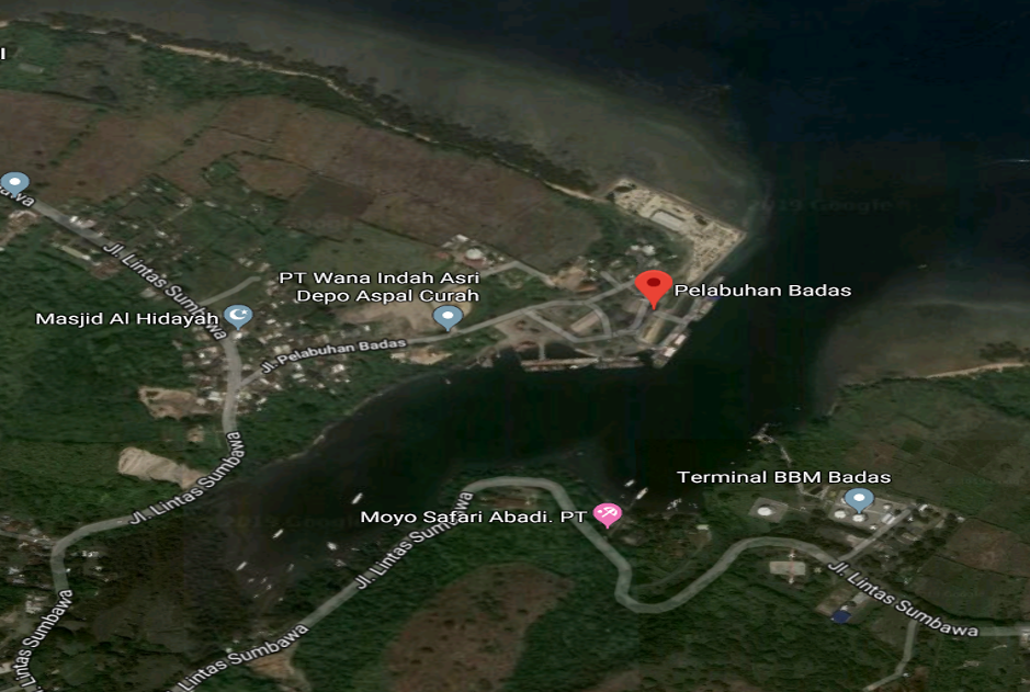
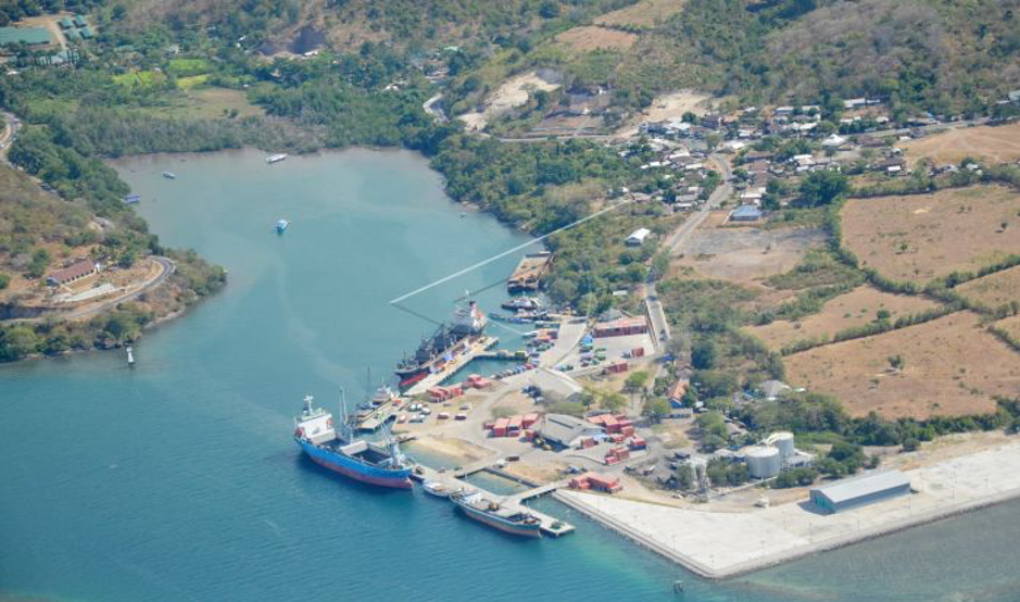
Additional Information
Indonesia Ferry/ASDP (Persero) as operator for Ro-Ro ferry, provides 22 ferries to serve from Pulau Sumbawa (island) to Pulau Lombok (island). From 22 ferries available, only 8 in operation, 8 on stand-by to anticipate the increase of demand/frequency, and 6 is off (not for operational).
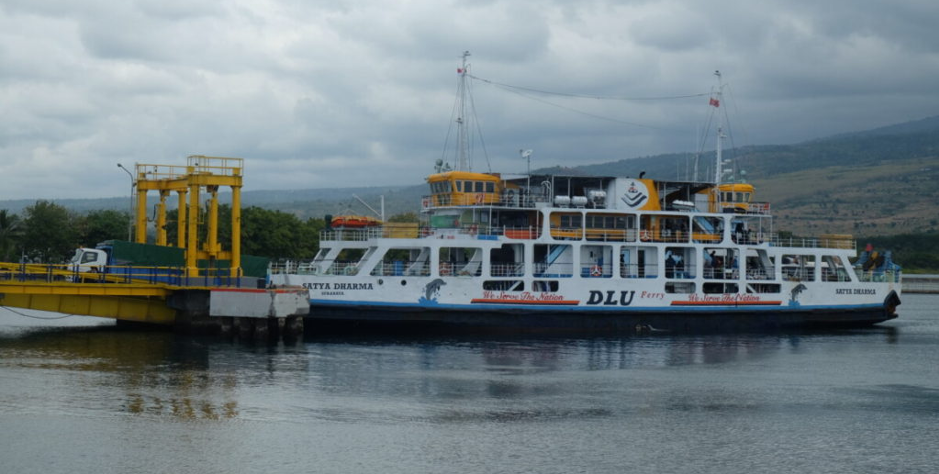
Description and Contacts of Key Companies
There are several companies operates at Badas port:
- PT Mentari Sejati Perkasa
- PT Alken Abadi
- PT Timur Asri Laut.
Port Performance
|
Seasonal Constraints |
||
|
|
Occurs |
Time Frame |
|
Rainy Season |
Yes |
December – April |
|
Major Import Campaigns |
No |
|
|
Other Comments |
||
|
Handling Figures for 2018 |
|
|
Vessel Calls |
5,000 |
|
Container Traffic (TEUs) |
14,500 |
|
Handling Figures Bulk and Break Bulk for YEAR |
|
|
Bulk (MT) |
No Information |
|
Break bulk (MT) |
No Information |
Discharge Rates and Terminal Handling Charges
For information on port rates and charges, please see the following link:
www.dephub.go.id (PP.15 Tahun 2016)
http://jdih.dephub.go.id/assets/uudocs/perpres/2016/PP_15_Tahun_2016.pdf
Berthing Specifications
|
Type of Berth |
Quantity |
Length (m) |
Maximum Draft (m) |
Comments |
|
Conventional Berth |
5 Units |
|
12 |
Assets of Pelindo III Badas & KSOP Badas |
|
Container Berth |
- |
- |
- |
- |
|
Silo Berth |
- |
- |
- |
- |
|
Berthing Tugs |
- |
- |
- |
- |
|
Water Barges |
- |
- |
- |
- |
General Cargo Handling Berths
|
Cargo Type |
Berth Identification |
|
Imports - Bagged Cargo |
Conventional Berth |
|
Exports - Bagged Cargo |
Conventional Berth |
|
Imports and Exports – RoRo |
- |
|
Other Imports |
- |
Port Handling Equipment
Pelabuhan Indonesia III Branch Badas-Sumbawa Port is in charge for port operations. They have several handling equipment such as reach-stackers and mobile cranes. There are few private companies also operating similar handling equipment.
|
Equipment |
Available |
Total Quantity and Capacity Available |
Comments on Current Condition and Actual Usage |
|
Dockside Crane |
No |
|
|
|
Container Gantries |
No |
|
|
|
Mobile Cranes |
Yes |
1 unit, 30 tons |
Good, owned by PT. Mertari |
|
Reachstacker |
Yes |
1 unit, 45 tons |
Good, owned by PT. Pelindo |
|
RoRo Tugmaster (with Trailer) |
Yes |
20 units |
Good, owned by Partner |
|
Grain Elevator with Bagging Machines |
No |
|
|
|
Transtainer |
No |
|
|
|
Forklifts |
Yes |
1 unit |
Reach-stacker, good |
|
Trainer |
Yes |
5 units |
good |
Container Facilities
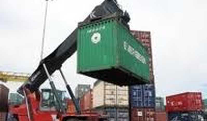
|
Facilities |
20 ft |
40 ft |
|
Container Facilities Available |
Yes, Container Yard: 6,610 m2 |
|
|
Container Freight Station (CFS) |
No |
No |
|
Refrigerated Container Stations |
No |
No |
|
Other Capacity Details |
5000 KVA |
|
|
Daily Take Off
Capacity |
200 - 240 |
|
|
Number of Reefer
Stations |
No |
No |
|
Emergency Take-off Capacity |
Yes |
Yes |
|
Off take Capacity of Gang
Shift |
No information |
No Information |
Customs Guidance
Customs clearance is available through the local customs office. For more information on customs in Indonesia, please see the following link: http://www.beacukai.go.id/
Terminal Information
MULTIPURPOSE TERMINAL
Port warehouses and container yards area can be used for multi-purpose activities.
GRAIN AND BULK HANDLING
There is no grain handling activity at the port.
MAIN STORAGE TERMINAL
There are 3 main storage facilities at the port with different owner.
|
Storage Type |
Number of Storage Facilities |
Area (m2) |
|
Bagged Cargo |
N/A |
|
|
Refrigerated Cargo |
N/A |
|
|
General Cargo |
|
800 m2 600 m2 600 m2 |
Stevedoring
There is a labour association (TKBM) at the Sumbawa port administrated by port authority.
Stevedoring activities organised by Labour Union Association (TKBM) administered by Port Authority (KSOP) Office.
Hinterland Information
Goods that are supplied to Sumbawa city mainly comes from Surabaya, East Java, by sea transportation through Sumbawa Port, which are then distributed within western part of Sumbawa island (Sumbawa city and surrounding) by land transport.
Port Security
Security and safety arrangement within the port are handled directly by Port Security and backed up by the Port Security Implementation Unit (Kesatuan Pelaksana Pengamanan Pelabuhan/KP3) and the Indonesia Sea and Coast Guard (Kesatuan Penjagaan Laut dan Pantai Indonesia/KPLP).
|
Security |
|
|
ISPS Compliant |
No |
|
Current ISPS Level (Level 1 = Normal, Level 2 = Heightened, Level 3 = Exceptional) |
Level 1 |
|
Police Boats |
Yes |
|
Fire Engines |
Yes |
2.1.37 Indonesia West Nusa Tenggara Port of Bima
Port Overview
Port of Bima is located in Bima city, the island of Sumbawa, West Nusa Tenggara (NTB) Provinsi. Bima port is designed as collecting and feeder port for local commodities such as rice, corn and soy beans. Bima port is one of the largest ports in Sumbawa island and provides services for multi-purpose activities; domestic and international cargo shipment including container. The port is operated by PT. Pelabuhan Indonesia III (Persero) Brach Bima.
Port website: https://www.pelindo.co.id/port-terminal/bima
Key port information may also be found at: https://www.maritime-database.com/
|
Port Location and Contact |
|
|
Country |
Indonesia |
|
Province or District |
West Nusa Tenggara, Bima City |
|
Nearest Town or City with Distance from Port |
Bima City (15 km ) |
|
Port's Complete Name |
Bima Port |
|
Latitude |
08°27′10″S |
|
Longitude |
118°43′20″T |
|
Managing Company or Port Authority
|
PT. Pelindo III (Persero) Bima Branch |
|
Management Contact Person |
Wahyu Wirawan GM Pelindo III Bima Phone : +62 8123200 3831 |
|
Nearest Airport and Airlines with Frequent International Arrivals/Departures |
The closest international airport is in Lombok island, with distance approx. 420 km (10-12 hours’ drive by car, using ferry crossing between the island of Lombok and Sumbawa). There are several airline companies operating in Lombok; Garuda Indonesia, Air Asia, Lion Group, etc. The closest domestic airport is Sultan Muhammad Kaharuddin , with distance approx. 10 km (20 mins drive by car). Domestic airports : Sultan Muhammad Salahuddin, with distance approx. 14 km (25 mins drive by car). The airline available: * Garuda Indonesia * Wings Air * NAM Air |
Port Picture
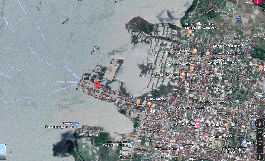
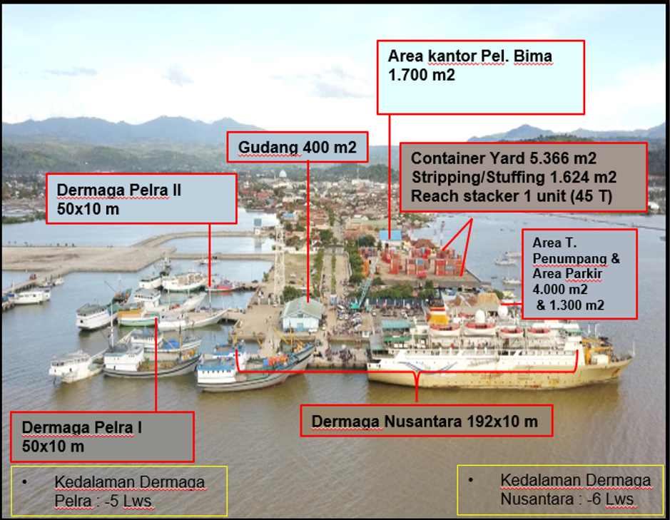
Description and Contacts of Key Companies
There are several companies operates at Bima port:
- PT Mentari Sejati Perkasa
- PT Alken Abadi
- PT Timur Asri Laut.
Port Performance
The port has Length of Flow: 3.9 Nautical Mile, Flow Width: 1,500 M, Flow Depth: 9-13 MLWS.
Tidal: High water spring: 1.7m and Low – water spring: 0.8m
Wave: High wave in the harbour pool as between 0 – 0.75m
|
Seasonal Constraints |
||
|
|
Occurs |
Time Frame |
|
Rainy Season |
Yes |
December – April |
|
Major Import Campaigns |
No |
|
|
Other Comments |
||
|
Handling Figures for 2018 |
|
|
Vessel Calls |
4,500 |
|
Container Traffic (TEUs) |
8,600 |
|
Handling Figures Bulk and Break Bulk for YEAR |
|
|
Bulk (MT) |
- |
|
Break bulk (MT) |
- |
Discharge Rates and Terminal Handling Charges
For information on port rates and charges, please see the following link:
www.dephub.go.id (PP.15 Tahun 2016)
http://jdih.dephub.go.id/assets/uudocs/perpres/2016/PP_15_Tahun_2016.pdf
Berthing Specifications
|
Type of Berth |
Quantity |
Length (m) |
Maximum Draft (m) |
Comments |
|
Conventional Berth |
3 units |
|
6 5 4 |
Asset of Pelindo III Bima & KSOP Bima |
|
Container Berth |
- |
- |
- |
|
|
Silo Berth |
- |
- |
- |
|
|
Berthing Tugs |
- |
- |
- |
|
|
Water Barges |
- |
- |
- |
|
General Cargo Handling Berths
|
Cargo Type |
Berth Identification |
|
Imports - Bagged Cargo |
Conventional Berth |
|
Exports - Bagged Cargo |
Conventional Berth |
|
Imports and Exports - RoRo |
- |
|
Other Imports |
- |
Port Handling Equipment
Pelabuhan Indonesia III Branch Bima Port is in charge of port operations. They have several handling equipment such as reach-stackers and mobile cranes. There are few private companies also operating similar handling equipment.
|
Equipment |
Available |
Total Quantity and Capacity Available |
Comments on Current Condition and Actual Usage |
|
Dockside Crane |
No |
|
|
|
Container Gantries |
No |
|
|
|
Mobile Cranes |
Yes |
1 unit, 30 tons |
Good |
|
Reachstacker |
Yes |
1 unit, 45 tons |
Good |
|
RoRo Tugmaster (with Trailer) |
Yes |
2 units |
Good |
|
Grain Elevator with Bagging Machines |
No |
|
|
|
Transtainer |
No |
|
|
|
Forklifts |
Yes |
1 Unit, 5 tons |
Good |
|
Top Loader |
Yes |
1 Unit, 40 tons |
Good |
|
Trailer |
Yes |
2 Units |
Good |
Container Facilities
|
Facilities |
20 ft |
40 ft |
|
Container Facilities Available |
Yes Container Yard: 6,972 m2 |
|
|
Container Freight Station (CFS) |
No |
No |
|
Refrigerated Container Stations |
No |
No |
|
Other Capacity Details |
|
|
|
Daily Take Off
Capacity |
300 - 400 |
|
|
Number of Reefer
Stations |
No |
No |
|
Emergency Take-off Capacity |
Yes |
Yes |
|
Off take Capacity of Gang
Shift |
No information |
No Information |
Customs Guidance
Customs clearance is available through the local customs office. For more information on customs in Indonesia, please see the following link: Website: http://www.beacukai.go.id/
Terminal Information
The port has 2 passenger terminals: 13,000 m2 and 520 m2
MULTIPURPOSE TERMINAL
Port warehouses and container yards area can be used for multi-purpose activities.
GRAIN AND BULK HANDLING
There is no grain handling activity at the port.
MAIN STORAGE TERMINAL
There is only one storage with capacity 400 m2 , built with permanent concrete.
|
Storage Type |
Number of Storage Facilities |
Area (m2) |
|
Bagged Cargo |
- |
- |
|
Refrigerated Cargo |
- |
- |
|
General Cargo |
1 unit |
400 |
Stevedoring
There is a labour association (TKBM) at the Bima port administrated by port authority.
Stevedoring activities organized by Labour Union Association (TKBM) administered by Port Authority (KSOP) Office.
Hinterland Information
Goods that are supplied to Bima city mainly come from Surabaya, East Java, by sea transportation through Bima Port, and then distributed within eastern part of Sumbawa island (Bima city and surrounding) by land transport. The city of Bima on the island of Sumbawa has several agricultural and livestock commodities, such as rice, corns, soy beans, beef and shallot. The shallot commodity is mainly shipped to the islands of Java, Kalimantan, Sulawesi and Papua, while beef shipped to Surabaya, East Java.
Port Security
Security and safety arrangement within the port are handled directly by Port Security and backed up by the Port Security Implementation Unit (Kesatuan Pelaksana Pengamanan Pelabuhan/KP3) and the Indonesia Sea and Coast Guard (Kesatuan Penjagaan Laut dan Pantai Indonesia/KPLP).
|
Security |
|
|
ISPS Compliant |
No |
|
Current ISPS Level (Level 1 = Normal, Level 2 = Heightened, Level 3 = Exceptional) |
Level 1 |
|
Police Boats |
Yes |
|
Fire Engines |
No |
2.2 Indonesia Aviation Assessment

Civil Aviation
In Indonesia, the Civil Aviation matters are regulated by the Directorate General Civil Aviation (DGCA); under authorization of the Ministry of Transportation.
Overview
|
Company Name & Address |
Contact Names & Email |
Telephone & Fax |
|---|---|---|
|
Directorate General Civil Aviation Karsa Building 5th Floor, Transportation Dept., Jl. Medan Merdeka Barat No. 8 Jakarta 10110 |
Title: Director General of Civil Aviation |
Tel : +6221 3505550 / 3505006 Fax: +6221 3505135 / 3505139
|
|
Summary of Role and Services
|
||
Directorate General of Civil Aviation Organisation Structure
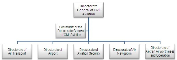
Source: http://hubud.dephub.go.id
The Directorate General of Civil Aviation shall perform the following functions:
-
Preparing the formulation of policies of the Ministry of Transportation on the field of air transportation, airports, flight security, air navigation, aircraft airworthiness and operation;
-
Implementing policies on air transportation, airports, flight security, air navigation, aircraft airworthiness and operation;
-
Preparing standardization, norms, guidance, criteria, system and procedures for air transportation, airports, flight security, air navigation, aircraft airworthiness and operation:
-
Performing certification and/or licensing on air transportation, airports, flight security, air navigation, aircraft airworthiness and operation;
-
Supervising (in the sense of monitoring and assessment) the implementation of policies on air transportation, airports, flight security, air navigation, aircraft airworthiness and operation;
-
Controlling (in the sense of providing directives, guidance, technical guidance on the implementation of policies in air transportation, airports, flight security, air navigation, aircraft airworthiness and operation;
-
Law enforcement/corrective actions with respect to the implementation of policies in air transportation, airports, flight security, air navigation, aircraft airworthiness and operation;
-
Evaluating and reporting the implementation of policies in air transportation, airports, flight security, air navigation, aircraft airworthiness and operation;
-
Carrying out administrative affairs on the Directorate General of Civil Aviation.
Procedures for Foreign Registered Aircraft
In this country, the following requirements need to be applied, presented and approved before preposition of foreign registered aircraft:
A. Application
-
Air Operator Certificate: http://hubud.dephub.go.id/?id/izin/detail/153
-
Permit for non-commercial Air Transport: http://hubud.dephub.go.id/?en/izin/detail/2
-
Air Transport License (non - scheduled): http://hubud.dephub.go.id/?en/izin/detail/1
-
Requirements for Charter Air Carriers: http://hubud.dephub.go.id/files/dsku/CASR%20PART%20135%20%20Amdt.%208.pdf
B. Permits
-
Air transport Company License: (scheduled and non- scheduled): http://hubud.dephub.go.id/?id/izin/detail/1
-
Permission of non-commercial air transport: http://hubud.dephub.go.id/?id+izin+detail+2
C. Approvals
-
Flight Approvals: http://hubud.dephub.go.id/?id/izin/detail/38
Registration and Safety
A. Registrations
- Registration of Aircraft: http://hubud.dephub.go.id/files/dsku/CASR%20PART%2047%20Amdt.3.pdf
B. Airworthiness
-
Propeller Engines: http://hubud.dephub.go.id/files/dsku/CASR35.pdf
-
Clarifications: http://hubud.dephub.go.id/files/dsku/CASR39%20Amdt1.pdf
C. Safety Regulations
-
Medical Standards & Certification: http://hubud.dephub.go.id/files/dsku/CASR%20PART%2067%20Amdt.%200.pdf
-
General Operating & Flight Rules: http://hubud.dephub.go.id/files/dsku/CASR%20PART%2091%20Amdt.%202.pdf
-
Safe Transport of Dangerous Goods by Air: http://hubud.dephub.go.id/files/dsku/CASR92.pdf
-
Foreign Air Carriers & Foreign Operations of Indonesia: http://hubud.dephub.go.id/files/dsku/CASR129.pdf
-
Aerodromes: http://hubud.dephub.go.id/files/dsku/CASR139.pdf
-
Air Traffic Rules: http://hubud.dephub.go.id/files/dsku/CASR170.pdf
-
Safety Management System: http://hubud.dephub.go.id/files/dsku/CASRSMS.pdf
Operator, Aircraft and Crew Documentation
-
Rotary Aircraft External Loads : http://hubud.dephub.go.id/files/dsku/CASR133.pdf
-
Approved Maintenance Organizations: http://hubud.dephub.go.id/files/dsku/CASR145%20Amdt3.pdf
Other Comments (e.g. process timelina, issues, etc)
-
Aeronautical Information Service (AIS): http://hubud.dephub.go.id/files/dsku/CASR175.pdf
Airport Operations
PT. Angkasa Pura (Sanskrit for Sky City) is a state enterprise of the Indonesian Department of Transport that is responsible for the management of airports and air traffic services in Indonesia and is made up of two parts: PT. Angkasa Pura I & PT Angkasa Pura II.
A. Main Tasks & Functions Air Side
-
Regulate the movement of aircrafts
-
Regulate the entry of aircraft into and out of aprons
-
Ensuring the safety and speed of movements
-
Setting the standard aircraft parking allocations
-
Conducting setting the engine run-up, aircraft towing, monitor start-up clearance
-
Provide marshaled follow me service
-
Provide / disseminate information to the operators
-
Ensure cleanliness apron
-
Provide support and assistance to aircraft in a state of emergency
B. Main Tasks & Functions Land Side
-
Terminal Services courtyard parking
-
Terminal Facilities Services
-
Airport Information services which include:
-
Service Customers Service Centre (CSC),
C. Main Tasks & Functions Rescue and Fire Aviation Accidents (PKP-PK)
-
Provide assistance in the event of accidents
-
Implement fire prevention at the airport and surrounding
D. Main Tasks and Functions Airport Security
-
Aviation Security (AVSEC): Security
-
Non Avsec: Security in the Public Area (PA)
Angkasa Pura I has its head office in Jakarta and operates the following airports:
-
Ngurah Rai International Airport
-
Juanda International Airport
-
Sultan Aji Muhammad Sulaiman International Airport
-
Hasanuddin International Airport
-
Sam Ratulangi Airport
-
Adisumarmo International Airport
-
Frans Kaisiepo Airport
-
Lombok International Airport
-
Pattimura Airport
-
Achmad Yani International Airport
-
Adisucipto International Airport
-
Syamsudin Noor Airport
-
El Tari Airport
Angkasa Pura II has its head office at Soekarno-Hatta International Airport in Tangerang, Banten and operates the following airports in western Indonesia.
-
Soekarno–Hatta International Airport, Cengkareng, Banten
-
Halim Perdanakusuma Airport
-
Kualanamuj International Airport, Medan, North Sumatra
-
Sultan Mahmud Badaruddin II Airport
-
Sultan Syarif Kasim II Airport, Pekanbaru, Riau
-
Minangkabau Airport
-
Husein Sastranegara International Airport, Bandung, West Java
-
Supadio Airport, Pontianak, West Kalimantan/Borneo
-
Raja Haji Fisabilillah International Airport
-
Sultan Iskandarmuda Airport
-
Sultan Thaha Airport
-
Depati Amir Airport
PT. Angkasa Pura is a state enterprise of the Indonesian Department of Transport that is responsible for the management of airports and air traffic services in Indonesia involving:
-
Air Side Operations
-
Land Side Operations
-
Rescue and Fire Aviation Accidents
-
Airport Security
Airport Location in Java Island
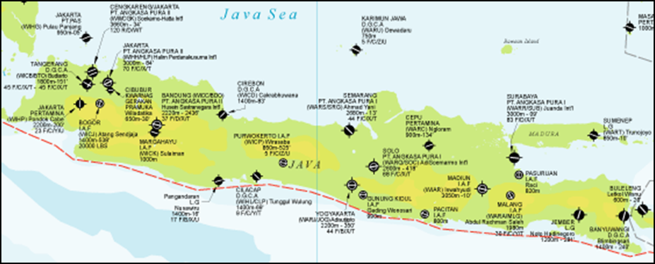
Weight Factor is based on the Weight Factor Table provided by The Directorate General of Civil Aviation, as follow:
2.2.1 Indonesia Jakarta Soekarno-Hatta International Airport
Overview

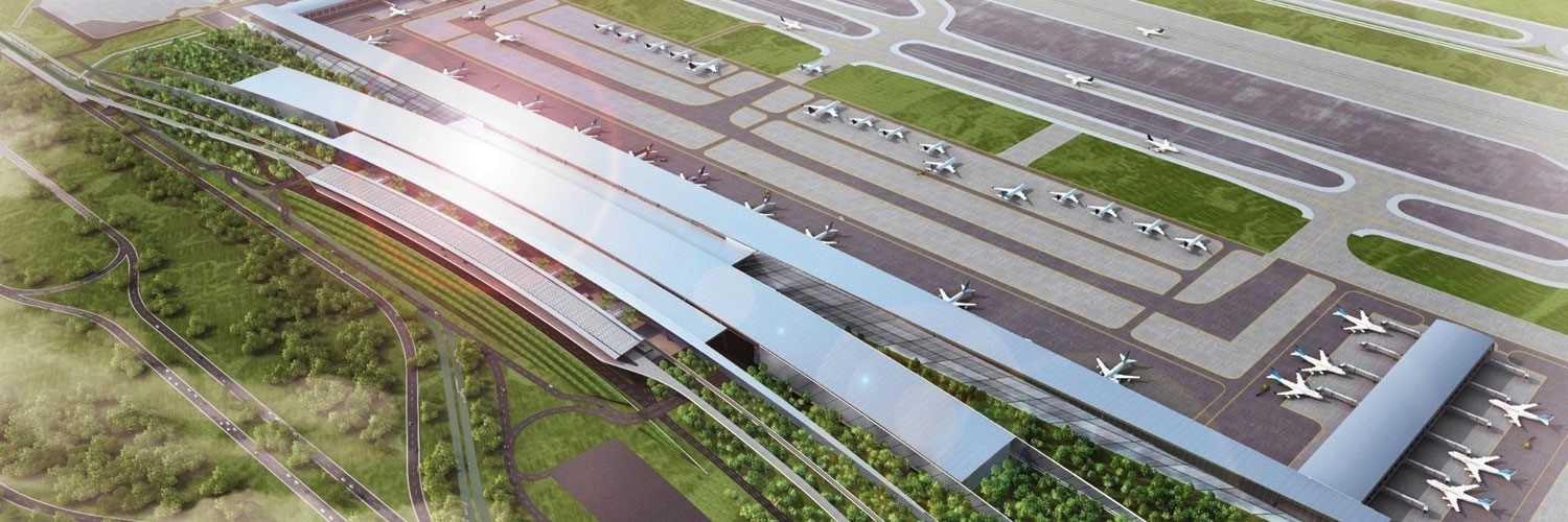
|
Company Name & Address |
Contact Names & Email |
Telephone & Fax |
|---|---|---|
|
Kantor Cabang Utama Gedung 601, Bandara Soekarno-Hatta, Jakarta 19110 |
Title: General Manager |
|
Location Details |
|||
|---|---|---|---|
|
Country |
Indonesia |
Latitude |
06°07’32” S |
|
Province / District |
DKI Jakarta / Tangerang |
Longitude |
106°39’21” E |
|
Town or City (closest) |
Jakarta |
Elevation |
34 ft / 10 m |
|
Airfield Name |
Soekarno-Hatta Int. Airport |
International Airport |
Yes |
|
IATA & ICAO codes |
CGK / WIII |
Open from/to (hours) |
24 hours |
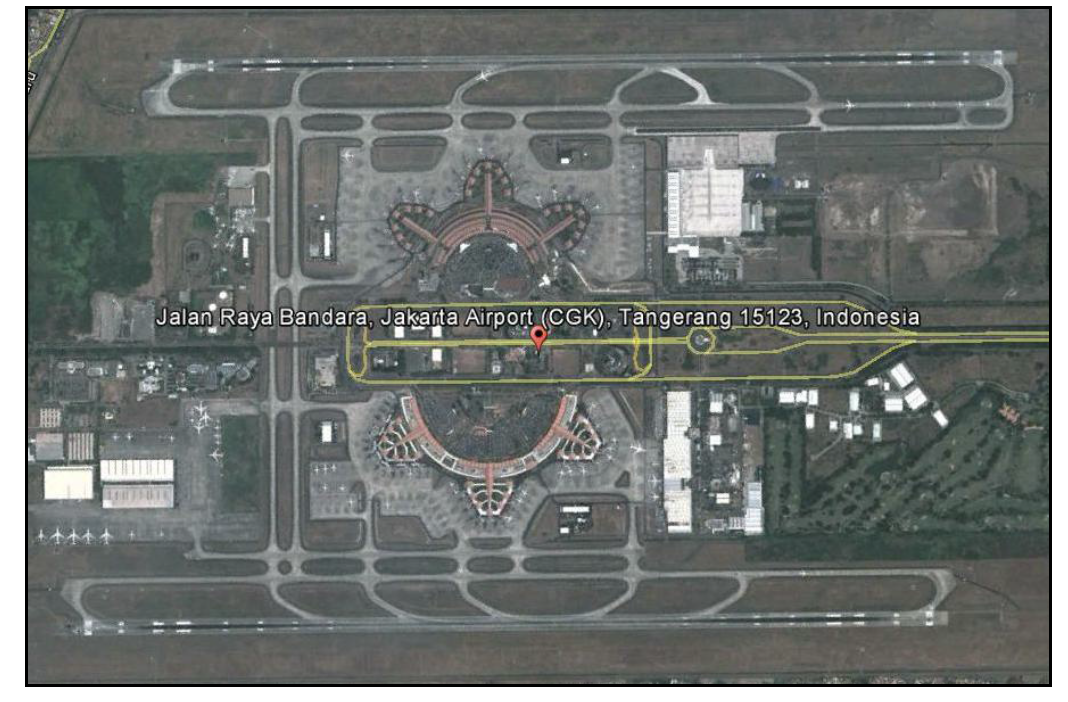
Performance
|
Performance |
Year(s) and figures |
|---|---|
|
Total Aircraft Movements |
2015 - 386,615 |
|
Total Passengers |
2015 - 54,291,366 |
Cargo Capacity
Cargo Development Plan
The increasing growth of air
cargo, resulted the demand of management Warehouse Operator in
terms to fulfill the facilities, infrastructure and system of cargo
services in warehousing area at Soekarno-Hatta International
Airport, hence in the future there will be a development of new
cargo terminal that become cargo village.
The plan of Cargo village
development of ± 300,000 m² and can accommodate capacity of cargo
up to 1,500,000 tons per year and has main facilities such as
Dedicated Apron, Integrated Cargo Terminal, ICT System and
Automated Cargo Handling Terminal System.
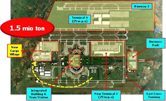
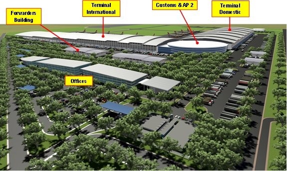
Source: http://www.angkasapura2.co.id/id/business/kargo
|
Capacity Cargo |
Year(s) and figures |
|---|---|
|
Total Aircraft Movements |
2015 - 386,615 |
|
Current activity of the airport (mt) |
2015 - 614,821 |
Airfield Details
|
Airfield Details |
|||
|---|---|---|---|
|
Customs |
Yes |
JET A-1 fuel |
Yes |
|
Immigration |
Yes |
AVGAS 100 |
Yes |
|
Terminal Building |
Yes |
Single Point Refueling |
Yes |
|
Passenger Terminal |
Yes |
Air Starter Units |
Yes |
|
Cargo terminal |
Yes |
Ground Power (mobile) |
Yes |
|
Pax transport to airfield |
Yes |
Crash Crew |
Yes |
|
Control Tower |
Yes |
Aircraft Support Services |
Yes |
|
Weather Facilities |
Yes |
Latrine Servicing |
Yes |
|
Catering Services |
Yes |
Fire Fighting |
Yes |
|
Base Operating Room |
Yes |
Fire Fighting Category (ICAO) |
Category: IX |
|
Airport Radar |
Yes |
Fire Fighting Equipment |
Yes |
|
NDB |
Yes |
De-icing Equipment |
No |
|
VOR |
Yes |
IFR Procedures |
Yes |
|
ILS |
Yes |
Runway Lights |
Yes |
|
Approach Lights |
Yes |
Parking Ramp Lighting |
Yes |
Runway
|
Runway #07L/25L |
|
|---|---|
|
Published Length (m) |
3,600 |
|
Usable Length (m) |
3,600 |
|
Width (m) |
60 |
|
Orientation |
068.38 / 258.38 |
|
Surface |
PCN 120 RDWT |
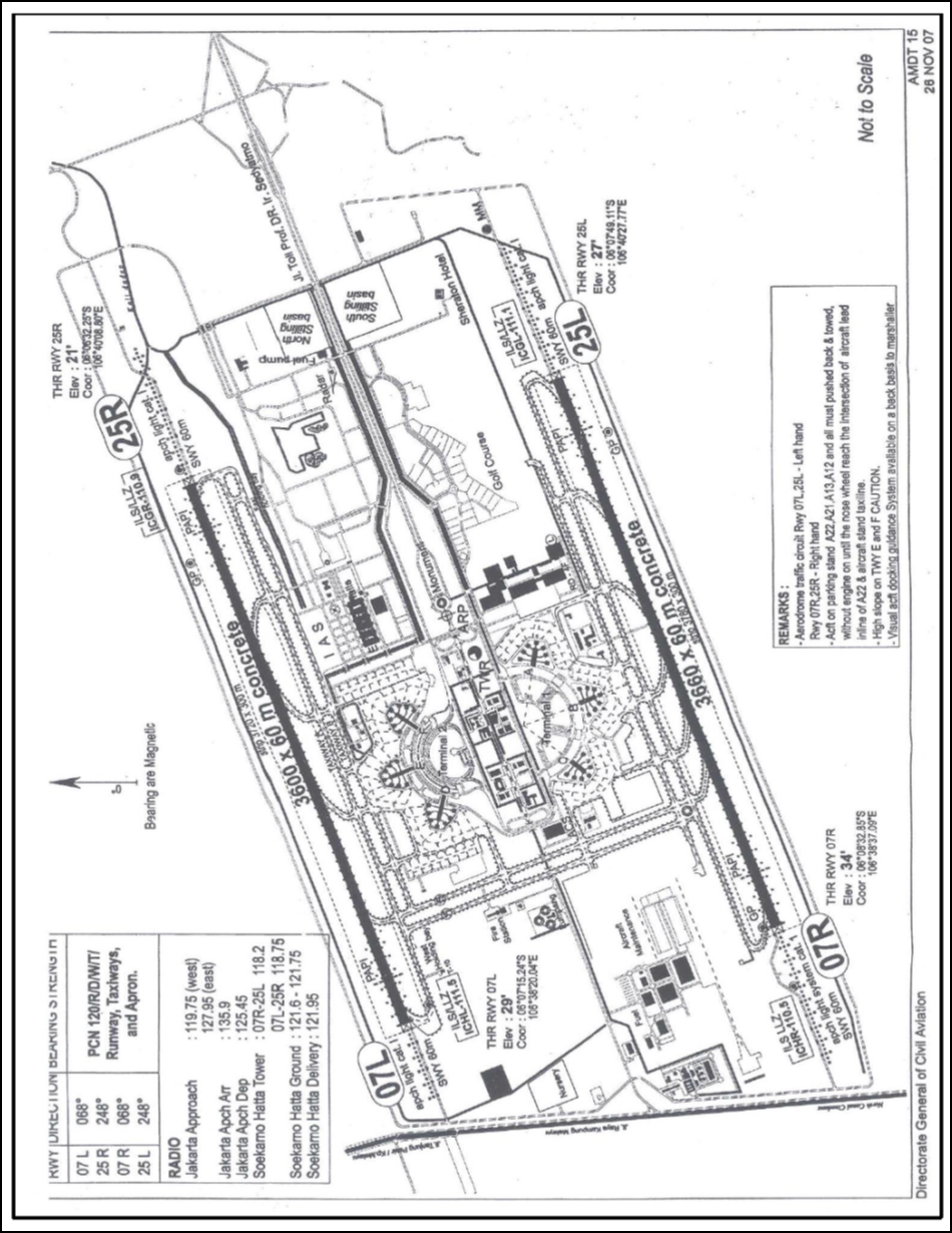
|
Runway #07R/25R |
|
|---|---|
|
Published Length (m) |
3,600 |
|
Usable Length (m) |
3,600 |
|
Width (m) |
60 |
|
Orientation |
068.38 / 258.38 |
|
Surface |
PCN 120 RDWT |
Helicopter Pads
There are three helipads in Soekarno-Hatta:
- One of which is within the cargo terminal and has an asphalt surface and could be used for heli freight.
- Another is on top of the Angkasa Pura Building.
- The third is allocated to Search and Rescue (grass surface only)
Airport Operating Details
|
Airport Operating Details |
|||||||
|---|---|---|---|---|---|---|---|
|
Max size aircraft that can be offloaded on bulk cargo |
B-747, , B-777-300, C17 |
||||||
|
Cargo Handling Equipment |
Yes |
No |
If yes, specify below |
||||
|
- Elevators / Hi-loaders |
Yes |
Max. Capacity: |
27 |
mt |
Can reach the upper deck of B747? |
Yes |
|
|
- Loading Ramps |
Yes |
||||||
Costs- Navigation Charges
http://soekarnohatta-airport.co.id/en/business/aviation-charges
Costs-Airfield Charges
http://soekarnohatta-airport.co.id/en/business/aviation-charges
Costs-Aircraft Charges
http://soekarnohatta-airport.co.id/en/business/aviation-charges
Costs-Aircraft Servicing Charges
http://soekarnohatta-airport.co.id/en/business/aviation-charges
Ground Handling Company
Contact for Aircraft, Passenger and Cargo handling services
|
Aircraft Handling Agent |
|||
|---|---|---|---|
|
Name & Address |
PT Jasa Angkutan Semesta, Tbk. (JAS Airport Services) Address: Building 521 Cargo Area Soekarno-Hatta International Airport, Jakarta 19111, Indonesia |
||
|
Telephone |
Fax |
||
|
|
|
Web |
|
|
Aircraft Handling Agent |
|||
|---|---|---|---|
|
Name & Address |
PT. UNEX Inti Indonesia |
||
|
Telephone |
+62 21 5500 000 |
Fax |
+62 21 2315 511 |
|
Aircraft Handling Agent |
|||
|---|---|---|---|
|
Name & Address |
PT. Gapura Angkasa Bandara Internasional Soekarno Hatta Jl. Prof Sediyatmo Bandara Internasional Soekarno-Hatta Cargo Area Gedung JPT Bl P-22/50, Benda, Benda - Tangerang Kota 15125 DKI Jakarta |
||
|
Telephone |
+62 21 654 5410 (+62 21) 5502402, 55912454 |
Fax |
+62 21 654 5408 |
|
|
|
Web |
|
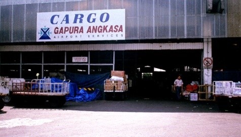
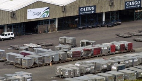
Costs-Cargo Terminal Charges
|
Cargo Terminal Charges |
|
|---|---|
|
Import |
Rate US$ / kg |
|
Handling Charge per kg |
|
|
Break Bulk Fee |
|
|
Diplomatic Mail |
|
|
Strong Room – per consignment |
|
|
Cold Storage Fee |
|
|
Delivery outside normal working hours |
|
|
Preparation of substitute AOA – Invoice – Receipt |
|
|
Storage per kg per day – Grace period? hours |
|
|
Export |
Rate US$ / kg |
|
Handling charges – Unpalletized cargo |
|
|
International Air Way Bill |
|
|
Local Air Way Bill |
|
|
Air Way Bill Amendment - Cancellation |
|
|
Air Way Bill Documentation |
|
|
Diplomatic Mail |
|
|
Storage charges per kg per day |
|
Costs-Air Bridge Charges
http://soekarnohatta-airport.co.id/en/business/aviation-charges
Costs-Fuel Services Charges
|
Fuel Service Company |
|||
|---|---|---|---|
|
Name & Address |
PT. Pertamina (Persero)/Aviation Head Office : Wisma Nusantara 22nd Floor, Jalan MH Thamrin Kav 59 Jakarta - 10350 |
||
|
Telephone |
+62 21-3920811 ext 2231 |
Fax |
+62 21 3818934 +62 21 3920579 |
|
|
Web |
||
|
Fuel Charges |
|
|---|---|
|
Jet A1 |
Rate |
|
For international flights ** |
|
|
For domestic flights * |
|
|
Not Into Aircraft Delivery * |
|
|
Packaged product * |
|
|
AVGAS |
|
|
Packaged product * |
|
Security
The airport is purely civilian, security is of a good standard with airport police, civil police, CCTV and standard X-Ray /metal-detector checks, searches etc.
|
Security |
||
|---|---|---|
|
X Good |
Marginal |
Bad |
Storage Facilities
Soekarno-Hatta Airport has access to ample storage facilities:
-
There is a large cargo terminal with several warehouses, which are rented out to different handling companies;
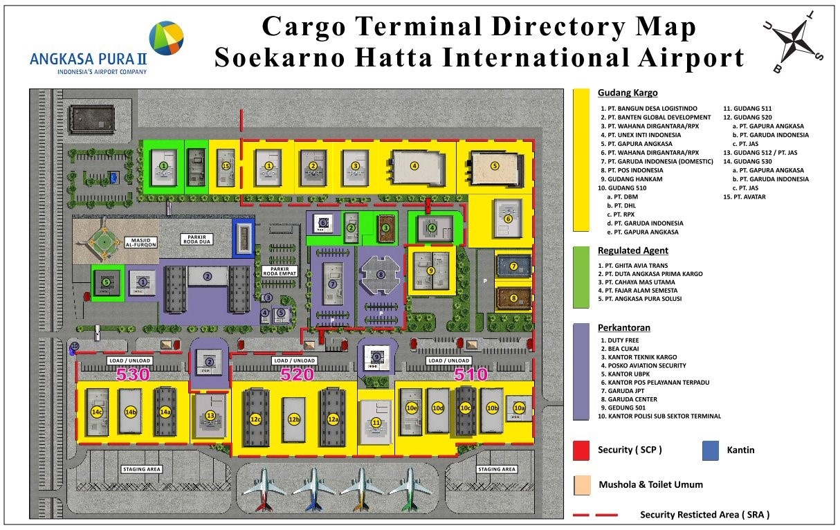
Additional Storage:
-
An industrial business park within the airport compound with 30 Ha dedicated for storage space, of which there are 9000m2 of purpose built warehouse space (with additional offices and car parking etc.) and the remainder is open land that could be utilized for temporary storage in humanitarian crisis.
-
There are a large number of commercial warehouses in the areas surrounding the airport, these are reputedly space is these facilities is easy to secure - as the airport is using relatively low volumes of air freight.
Customs Contact
|
Customs |
|||
|---|---|---|---|
|
Name & Address |
KPPBC Tipe Madya Pabean Soekarno-Hatta Kotak Pos 1023, Cengkareng 19111 |
||
|
Contact |
Mob |
|
|
|
Telephone |
+62 21 5502072/5502056/5507056/4890308 |
Fax |
+62 21-5502105/4890973 |
2.2.2 Indonesia Jakarta Halim Perdana Kusuma International Airport
General
Overview

|
Company Name & Address |
Contact Names & Email |
Telephone & Fax |
|---|---|---|
|
PT. Angkasa Pura II (Persero) Halim Perdana Kusuma International
Airport |
Title: Commercial Unit |
|
|
|
Title : General Affairs Unit |
Tel : 62 21 80899441 |
-
Halim Perdanakusuma Airport (Indonesian: Bandar Udara Halim Perdanakusuma) (IATA: HLP, ICAO: WIHH) is located in East Jakarta in the Indonesian capital Jakarta.
-
This airport is also used for military, private and presidential purposes. Government officials are also allowed to use it. On January 10, 2014, Halim Perdanakusuma began to serve domestic scheduled commercial flights to ease the overloaded Soekarno–Hatta International Airport.
|
Location Details |
|||
|---|---|---|---|
|
Country |
Indonesia |
Latitude |
06°15’59” S |
|
Province / District |
DKI Jakarta / Jakarta |
Longitude |
106°53’28 E |
|
Town or City (closest) |
Jakarta |
Elevation |
82 ft (25 m) |
|
Airfield Name |
Halim Perdana Kusuma International Airport |
International Airport |
Yes |
|
IATA & ICAO codes |
HLP / WIHH |
Open from/to (hours) |
24 Hrs |
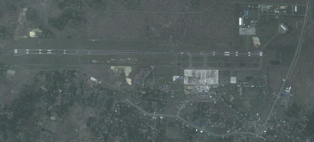
Performance
Halim is the main airport used by corporate aviation with frequent arrivals and departures of corporate jet aircraft both domestically and internationally.
Airfield Details
|
Airfield Details |
|||
|---|---|---|---|
|
Customs |
Yes |
JET A-1 fuel |
Yes |
|
Immigration |
Yes |
AVGAS 100 |
Yes |
|
Terminal Building |
Yes |
Single Point Refueling |
|
|
Passenger Terminal |
Yes |
Air Starter Units |
Yes |
|
Cargo terminal |
Yes |
Ground Power (mobile) |
Yes |
|
Pax transport to airfield |
Yes |
Crash Crew |
Yes |
|
Control Tower |
Yes |
Aircraft Support Services |
Yes |
|
Weather Facilities |
Yes |
Latrine Servicing |
Yes |
|
Catering Services |
Yes |
Fire Fighting |
Yes |
|
Base Operating Room |
Yes |
Fire Fighting Category (ICAO) |
Category: IX |
|
Airport Radar |
Yes |
Fire Fighting Equipment |
Yes |
|
NDB |
Yes |
De-icing Equipment |
No |
|
VOR |
Yes |
IFR Procedures |
Yes |
|
ILS |
Yes |
Runway Lights |
Yes |
|
Approach Lights |
Yes |
Parking Ramp Lighting |
Yes |
Runway
|
Runway #06/24 |
|
|---|---|
|
Published Length (m) |
3,000 |
|
Usable Length (m) |
3,000 |
|
Width (m) |
45 |
|
Orientation |
064/244 |
|
Surface |
PCN 086FCXT |
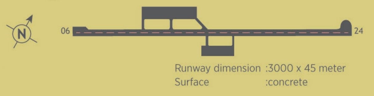
Helicopter Pad(s)
There is no dedicated helipad on the civil side of the airport – apron can potentially be utilized for this purpose in Emergency situations:
|
Helipad |
|
|---|---|
|
Present |
Not specifically available, but apron can be utilized as a helipad during emergency situation |
|
Width and Length (metres) |
North Apron: 710 x 125 m |
|
Surface |
PCN 44 RCXT (concrete) |
|
Width and Length (metres) |
South Apron: 470 x 135 m |
|
Surface |
PCN 71 RCXT (concrete) |
Airport Operating Details
|
Airport Operating Details |
|||||||
|---|---|---|---|---|---|---|---|
|
Max size aircraft that can be offloaded on bulk cargo |
B – 747 (main deck loader – limited equipment) |
||||||
|
Max size cargo aircraft that can be offloaded on pallet |
|
||||||
|
Total Parking Area |
m² |
North apron = 88,787.5 m2 South apron = 63,382.5 m2 |
|||||
|
Storage Capacity |
mt |
1,000 |
|||||
|
Cargo Handling Equipment |
Yes |
No |
If yes, specify below |
||||
|
- Elevators / Hi-loaders |
Yes |
Max. Capacity: |
4 |
mt |
Can reach the upper deck of B747? |
NO |
|
|
- Loading Ramps |
High Loader |
||||||
Costs- Navigation Charges
http://halimperdanakusuma-airport.co.id/id/business/aviation-charges
Cost- Airfield Charges
http://halimperdanakusuma-airport.co.id/id/business/aviation-charges
Cost- Aircraft Handling Charges
http://halimperdanakusuma-airport.co.id/id/business/aviation-charges
Costs- Aircraft Servicing Charges
http://halimperdanakusuma-airport.co.id/id/business/aviation-charges
Ground Handling Company
Contact for Aircraft, Passenger and Cargo handling services.
|
Aircraft Handling Agent |
|||
|---|---|---|---|
|
Name & Address |
PT Jasa Angkutan Semesta, Tbk. (JAS Airport Services) Jl. Raya Halim Perdanakusuma Level II/A. 14 A/PK, Jakarta 13650, Indonesia |
||
|
Telephone |
Fax |
||
|
|
Web |
||
Cost-Cargo Terminal Charges
|
Cargo Terminal Charges |
|
|---|---|
|
Import |
Rate US$ / kg |
|
Handling Charge per kg |
|
|
Break Bulk Fee |
|
|
Diplomatic Mail |
|
|
Strong Room – per consignment |
|
|
Cold Storage Fee |
|
|
Delivery outside normal working hours |
|
|
Preparation of substitute AOA – Invoice – Receipt |
|
|
Storage per kg per day – Grace period? hours |
|
|
Export |
Rate US$ / kg |
|
Handling charges – Unpalletized cargo |
|
|
International Air Way Bill |
|
|
Local Air Way Bill |
|
|
Air Way Bill Amendment - Cancellation |
|
|
Air Way Bill Documentation |
|
|
Diplomatic Mail |
|
|
Storage charges per kg per day |
|
Cost- Air-bridge Charges
http://www.angkasapura2.co.id/id/bisnis/kebandarudaraan_garbarata/garbarata
Costs- Fuel Services Charges
http://www.pertamina.com/aviation/News.aspx?p=price
|
Fuel Service Company |
|||
|---|---|---|---|
|
Name & Address |
PT. Pertamina (Persero)/Aviation Head Office : Wisma Nusantara 22nd Floor, Jalan MH Thamrin Kav 59 Jakarta - 10350 |
||
|
Telephone |
Fax |
||
|
|
Web |
||
Security
The airport is owned by the Indonesia Army – – there is a permanent military presence as Army facilities are in operation and security regulations are well enforced.
|
Security |
||
|---|---|---|
|
X Good |
Marginal |
Bad |
Storage Facilities
There are small purpose built warehouses for the ground handling companies:
-
Import Cargo WH of 500 M²
-
Export Cargo WH of 500 M²
There are no cold storage facilities.
For emergency responses Angkasa Pura indicated 3 distinct areas
within the civil airport that could be used for Humanitarian
Staging Area storage facilities:
-
Disused car park and tennis court – est: 2,400 m2
-
Disused Ware house (with rooms for office space) est: 1500 m2
-
Disused Apron space (in front of cargo area) est: 650 m2
The Army base within the airport compound has substantially larger open areas, surfaced aprons and hangars that could facilitate a HSA within the airport perimeter – if permissions was obtained.
Cargo Flow and Regulation
http://www.angkasapura2.co.id/nuweb/NUWEB_PUBLIC_FILES/angkasapura2/cargo_regulated_warehouse.png
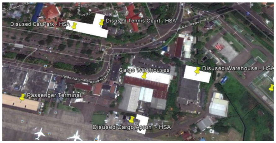
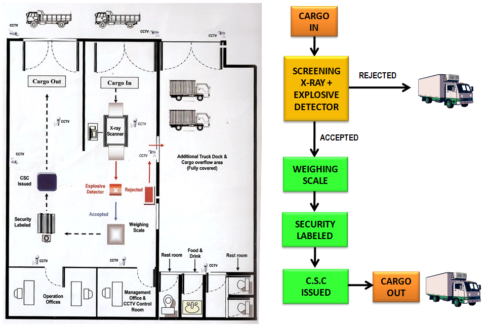
Customs Contact
|
Customs |
|||
|---|---|---|---|
|
Name & Address |
KPPBC Tipe Madya Pabean A Jakarta Bandara Halim Perdanakusuma, Jakarta Timur Email: kibc.jakarta@gmail.com / pengaduan.bcjakarta@yahoo.com |
||
|
Telephone |
+62 21-8092548 |
Fax |
|
| Days |
Mon - Sun |
Hours |
24 Hrs |
2.2.3. Indonesia North Sumatra Kualanamu International Airport Medan
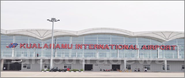
|
Airport Name & Management |
Contact Names & Email |
Tel & Fax |
Website |
|---|---|---|---|
|
Kulalanamu International Airport |
Title : General Manager |
Tel:(62-61) 8888.0300 E-mail :ap2_mes@angkasapura2.co.id |
General Overview
The airport is located in Deli Serdang, North Sumatera, 39 km from Medan and 46km South-East of the port of Belawan.
-
This is the second largest airport after Soekarno-Hatta International Airport and opened on 25th July 2013.
|
LOCATION DETAILS |
|||
|---|---|---|---|
|
Country |
Indonesia |
Latitude |
3°38'32"N |
|
Province / District |
North Sumatra / Deli Serdang |
Longitude |
98°53'7"E |
|
Town or City (closest) |
Medan |
Elevation |
7M (23 ft) |
|
Airfield Name |
Kualanamu International Airport (KNIA) |
International airport |
Yes |
|
IATA & ICAO codes |
KNO & WIMM |
Open from/to (hours) |
06:00 - 2400 |
Performance
Kualanamu as the first airport in Indonesia integrated with trains Airport Railink Service toward the center of Medan.
|
Performance |
Year(s) and figures |
|---|---|
|
Total Aircraft Movements |
2014 : 61,031 |
|
Total Passengers |
2014 : 8,046,398 people |
Cargo Capacity
Cargo is generally carried by passenger aircraft without dedicated cargo flights during normal operations
-
Cargo storage is located 1.5 km from passanger terminal apron side
-
A cargo apron is available; which can accommodate three aircrafts wide body
-
The apron is not provided with fuel hydrant pitch
Cargo Development Plan
-
Phase I: 13.000 m2 (65.000 ton/year)
-
Phase II: 18.963 m2
-
Ultimate: 27.318 m2
In line with government plan of MP3EI and
Siglognas, the area of Kualanamu International Airport is expected
for:
1) Government tool for trade facilities, especially for
international trade strategy;
2) increase the attractiveness of hinterland investment;
3) As a drive for hinterland economic development;
4) To make effectivity and efficient connectivity of national
logistics system.
To achieve the above plan, the government will be develop the
International Air Logistics Hub which will be a driver for national
trade and industrial development as well as support facilities for
production and ASEAN trade.
Below are the master plan for the development of International Air Logistics Hub
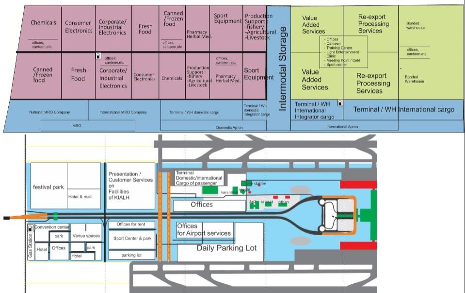
|
Capacity Cargo |
Year(s) and figures |
|---|---|
|
Total Aircraft Movements |
In 2014 : 61,031 (passenger aircrafts) |
|
Total capacity of the airport (mt) |
In 2015 : 65,000 MT / year (estimated) |
|
Current activity of the airport (mt) |
In 2014 : 49,294 MT |
|
Current monthly use by Humanitarian flights (UNHAS) |
N/A |
Airfield Details
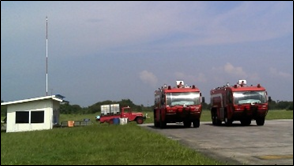
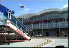
|
Airfield Details |
|||
|---|---|---|---|
|
Customs |
Yes |
JET A-1 fuel |
Yes |
|
Immigration |
Yes |
AVGAS 100 |
Yes |
|
Terminal Building |
Yes |
Single point refueling |
Yes |
|
Passenger Terminal |
Yes |
Starter units (press air) |
Yes |
|
Cargo terminal |
Yes |
ILS |
Yes |
|
Pax transport to airfield |
Yes |
Approach Lights |
Yes |
|
Control Tower |
Yes |
Ground power (mobile) |
Yes |
|
Weather Facilities |
Yes |
Latrine servicing |
Yes |
|
Catering Services |
Yes |
Fire fighting |
Category : 9 |
|
Base Operating Room |
Yes |
Fire fighting category (ICAO) |
Yes |
|
Airport Radar |
Yes |
Fire fighting equipment |
Yes |
|
NDB |
Yes |
De-icing equipment |
No |
|
VOR |
Yes |
Runway lights |
Yes |
Runway
The entire length of the runway is useable.
-
It has a parallel taxi-way of 3,750 m x 30 M and 2,000 m x 30m
-
Can accommodate wide-body aircraft
Apron area 200,000 m² capable of handling 35 aircrafts; 7 wide body + 28 narrow body
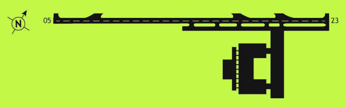
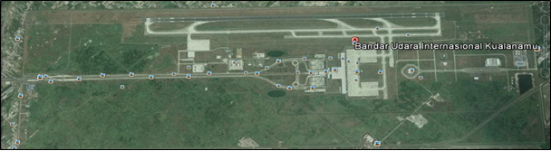
|
RUNWAY # 1 |
|
|---|---|
|
Published length (metres) |
3,750 M |
|
Width (meter) |
60 M |
|
Orientation |
05/23 |
|
Surface |
Asphalt 81 pcn |
Helicopter Pad(s)
-
There is no dedicated helicopter pad at the airport.
-
Helicopters can land on the main runway and Taxi/Park in a designated area by Air Traffic Control.
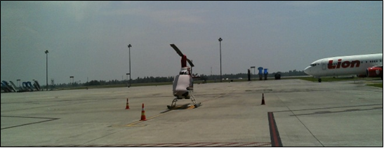
|
Helipad |
|
|---|---|
|
Present |
Yes |
|
Width and Length (metres) |
43 M x 43 M |
|
Surface |
Rigid |
Airport Operating Details
There are 6 Ground Handling Companies currently operating in Kuala Namu airport:
|
PT. Gapura Angkasa |
|||
|---|---|---|---|
|
Address |
Kualanamu Airport |
||
|
Contact |
Mob |
|
|
|
Telephone |
Fax |
||
|
Website |
|
|
|
|
PT. Jasa Angkutan Semesta (JAS Airport Service) |
|||
|
Address |
Kualanamu Airport |
||
|
Telephone |
Fax |
||
|
Website |
|
|
|
|
PT. NATS Nusantara |
|||
|
Address |
Kualanamu Airport / Jl. Teuku Cik Ditiro No. 124 Medan |
||
|
Telephone |
Fax |
||
|
PT. Jasa Karya Semesta (JKS) |
|||
|
Address |
Kualanamu Airport |
||
|
PT. Wawasan |
|||
|
Address |
Kualanamu Airport |
||
|
Airport Operating Details |
||
|---|---|---|
|
Max size cargo aircraft that bulk cargo can be offloaded |
Boeing – 747-400 Boeing – 737-900 Airbus A330-300 Hercules C130 Antonov AN12 – Transal |
|
|
Max size cargo aircraft that can be offloaded on pallet |
Boeing – 747-400 Boeing – 737-900 Airbus A330-300 Hercules C130 Antonov AN12 – Transal |
|
|
Total Parking Area (m²) |
50,820 m2 |
|
|
Storage Capacity |
15,225 m2 |
|
|
Cargo Handling Equipment |
Yes |
6 Aircraft Towing Tractor Narrow Body 2 Aircraft Towing Tractor Wide Body 2 Airconditioning Unit Trucks 3 Air Starter Unit / GasTurbine Compressor 12 Baggage Towing Tractor 9 Belt Conveyor Loader 2 Forklift Truck 3 Ground Power Unit 3 Lavatory Service Truck 3 High Lift Loader 9 Passenger Boarding Stair 1 Water Service Truck 1 Marseling Car 1 Fuel Refueling Defueling Car 1 Lowdeck Bus 8 Container Dolly 9 Pallet Dolly 4 Pallet Rack 8 Container Rack 15 Aircraft Tow Bar 2 Mannual Passanger Boarding Stair 1 Water Service Car |
|
Elevators |
Yes |
Max. capacity (tons): 7 T |
|
Can reach the upper deck of a B747 ? Yes |
||
|
Loading ramps |
Yes |
|
Costs- Aircraft Charges
http://www.kualanamu-airport.co.id/id/business/aviation-charges
Costs- Aircraft Servicing Charges
http://www.kualanamu-airport.co.id/id/business/aviation-charges
Costs- Cargo Terminal Charges
All storage facilities at the airport are for transit storage only, there is no long term storage available.
-
There are two warehouses of total 5000 m2 space available for international cargo and two warehouses of total 10,000m2 space available for domestic cargo.
-
There are storage rooms for diplomatic cargo (75m3), valuable cargo (75m3) and dangerous goods (75m3).
-
Two ( 2) cold rooms available for transit storage. The first is 0 to 7 degrees Celsius (75m3) and the second is -25 to 0 degrees Celsius (75m3). All are operated by PT Jasa Angkasa Semesta, TBK.
http://www.angkasapura2.co.id/en/bisnis/kargo
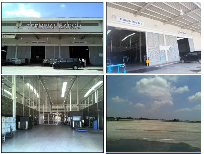
|
Cargo Terminal Charges |
|
|---|---|
|
IMPORT |
Rate IDR / kg |
|
Handling charge per kg |
|
|
Break bulk fee |
|
|
Cargo Service Charge (CSC) |
|
|
Diplomatic mail |
|
|
Strong room – per consignment |
|
|
Cold storage fee |
|
|
Delivery outside normal working hours |
|
|
Preparation of substitute AOA – Invoice – Receipt |
|
|
Storage per kg per day – Grace period? Hours |
|
|
Export |
Rate IDR / kg |
|
Handling charges – Unpalletized cargo |
|
|
International Air Way Bill |
|
|
Local Air Way Bill |
|
|
Cargo Service Charge (CSC) |
|
|
Air Way Bill Amendment – Cancellation |
|
|
Air Way Bill Documentation |
|
|
Diplomatic Mail |
|
|
Storage charges per kg per day |
|
|
Cargo Terminal Charges |
|
|---|---|
|
INBOUND |
Rate IDR / kg |
|
Handling charge per kg |
|
|
Break bulk fee |
|
|
Cargo Service Charge (CSC) |
|
|
Diplomatic mail |
|
|
Strong room – per consignment |
|
|
Cold storage fee |
|
|
Delivery outside normal working hours |
|
|
Preparation of substitute AOA – Invoice – Receipt |
|
|
Storage per kg per day – Grace period? Hours |
|
|
OUTBOUND |
Rate IDR / kg |
|
Handling charges – Unpalletized cargo |
|
|
International Air Way Bill |
|
|
Local Air Way Bill |
|
|
Cargo Service Charge (CSC) |
|
|
Air Way Bill Amendment – Cancellation |
|
|
Air Way Bill Documentation |
|
|
Diplomatic Mail |
|
|
Storage charges per kg per day |
|
Costs- Air-bridge Charges
http://www.kualanamu-airport.co.id/id/business/aviation-charges
Costs- Fuel Services Charges
Purchase in advance using the payment system in the bank's perception and then the order can be followed up. It is different when there is an agreement (could pay after purchase).
|
Price per Unit |
|
|---|---|
|
Jet A-1 |
http://aviation.pertamina.com/News.aspx?p=price
|
|
Avgas |
|
Security
Angkasa Pura II is committed to providing airport security and safety against all kinds of threats and disturbances.
-
The airport is equipped with modern security facilities, including X-ray equipment for baggage and cargo check, walk-through and handheld metal detector, CCTV system and perimeter fences.
-
The apron side cargo warehouse area has 25 CCTV cameras
|
Security |
||
|---|---|---|
|
X Good |
Marginal |
Bad |
Storage
All storage facilities at the airport are for transit storage only, there is no long term storage available.
-
There are two warehouses of total 5000 m2 space available for international cargo and two warehouses of total 10,000m2 space available for domestic cargo.
-
There are storage rooms for diplomatic cargo (75m3), valuable cargo (75m3) and dangerous goods (75m3).
-
There is also 2 cold rooms available for transit storage. The first is 0 to 7 degrees Celsius (75m3) and the second is -25 to 0 degrees Celsius (75m3). All are operated by PT Jasa Angkasa Semesta, TBK.
-
There are 8 (eight) Cargo companies in public area;
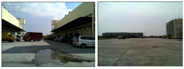
2.2.4 Indonesia Riau Sultan Syarif Kasim II International Airport Pekanbaru
Overview
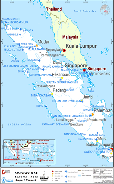
|
Airport Name & Management |
Contact Names & Email |
Tel & Fax |
Website |
|---|---|---|---|
|
Sultan Syarif Kasim II International Airport & PT (Persero) Angkasa Pura II |
General Manager |
Tel:(62-761) 674 694 Fax: (62-761) 674 827 |
Sultan Syarief Kasim II Internatiomal Airport:
-
Located in Pekan Baru, Riau, Sumatra.
-
The airport area and runway is also shared with Roesmin Nurjadin Air Force Base, a type A airbase of the Indonesian Air Force.
-
The existing runway is 2240 x 45 m, but is currently being expanded to 2600 x45 (under construction).
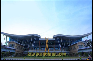
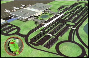
|
LOCATION DETAILS |
|||
|---|---|---|---|
|
Country |
Indonesia |
Latitude |
0°27'48"S |
|
Province / District |
Riau / Pekan Baru |
Longitude |
101°26'48"E |
|
Town or City (closest) |
Pekan Baru |
Elevation |
31.7M (104 ft) |
|
Airfield Name |
Sultan Syarif Kasim II International Airport |
International airport |
Yes |
|
IATA & ICAO codes |
PKU & WIBB |
Open from/to (hours) |
23:00 – 17:00 |
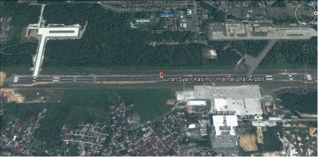
Performance
|
Performance |
Year(s) and figures |
|---|---|
|
Total Aircraft Movements |
90 Movements / day (Avarage) |
|
Total Passengers |
+/- 3,000,000 / year |
|
Current monthly use by Humanitarian flights (UNHAS) |
NIL |
Cargo Capacity
Cargo Handling Equipment includes:
-
1 Forklift 3.5MT, Belt
-
Conveyor Loader,
-
Hand pallets etc.
-
Container Dolly
-
Pallet Dolly
-
Chartered aircraft cargo usually brings their own handling equipment.
|
Capacity Cargo |
Year(s) and figures |
|---|---|
|
Total Aircraft Movements |
Chartered cargo aircraft |
|
Total capacity of the airport (mt) |
45 T |
|
Current activity of the airport (mt) |
39 T |
|
Current monthly use by Humanitarian flights (UNHAS) |
NIL |
Airfield Details
Existing Apron area capable of handling 7 wide body aircraft and now being expand (under construction) to 12 wide body aircraft
|
Airfield Details |
|||
|---|---|---|---|
|
Customs |
Yes |
JET A-1 fuel |
Yes |
|
Immigration |
Yes |
AVGAS 100 |
No |
|
Terminal Building |
Yes |
Single point refueling |
No |
|
Passenger Terminal |
Yes |
Starter units (press air) |
No |
|
Cargo terminal |
Yes |
ILS |
Yes |
|
Pax transport to airfield |
Yes |
Approach Lights |
Yes |
|
Control Tower |
Yes |
Ground power (mobile) |
Yes |
|
Weather Facilities |
Yes |
Latrine servicing |
Yes |
|
Catering Services |
Yes |
Fire fighting |
Category: 7 |
|
Base Operating Room |
Yes |
Fire fighting category (ICAO) |
Yes |
|
Airport Radar |
Yes |
Fire fighting equipment |
Yes |
|
NDB |
Yes |
De-icing equipment |
No |
|
VOR |
Yes |
Runway lights |
Yes |
Runway
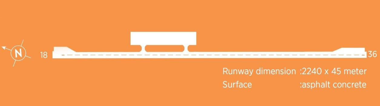
|
RUNWAY # 1 |
|
|---|---|
|
Published length (metres) |
2240 M |
|
Width (meter) |
45 M |
|
Orientation |
18 - 36 |
|
Surface |
Asphalt Concrete / Flexible |
Helicopter Pad(s)
There are no dedicated helipads on the civil side of the airport – however the apron can be utilised for this purpose in emergency situations:
East Apron
Dimensions: 476 M x 110.5 M
Strength: PCN 70 RBWT
West Apron A
Dimensions: 90 M x 80 M
Strength: PCN 70 RBWT
Surface: Asphalt
|
Helipad |
|
|---|---|
|
Present |
No |
|
Largest helicopter that can land |
SA 330 |
|
Width and Length (metres) |
NIL |
|
Surface |
NIL |
Airport Operating
Details
There are four ground handling companies operating in Sultan Syarif Kasim II International Airport
|
Airport Operating Details Detil operasi bandara |
||
|---|---|---|
|
Max size cargo aircraft that bulk cargo can be offloaded |
B 737 |
|
|
Total Parking Area (m²) |
1,926,250 |
|
|
Storage Capacity |
400 |
|
|
Cargo Handling Equipment |
No |
If yes, specify below |
|
Elevators |
No |
Max. capacity (tons): |
|
Can reach the upper deck of a B747? No |
||
Costs- Airfield Charges
http://sultansyarifkasim2-airport.co.id/en/business/aviation-charges
|
|
Airfield Charges (US$) |
||||||
|---|---|---|---|---|---|---|---|
|
Aircraft Weight – MTOW (Ton)
|
Navigation (per journey) |
Landing |
Night Landing |
Night Take-off |
Parking |
Handling Charges |
|
|
0 - 40 |
|
http://www.sultansyarifkasim2-airport.co.id/en/business/aviation-charges
|
|||||
|
40 - 100 |
|
||||||
|
over 100 |
|
||||||
|
Note 1: Night landing hours are counted outside of published hours of the airport |
|||||||
|
Note 2: Parking charges are free for first 2 hours. Parking surcharge is counted for the following hours. |
|||||||
|
Note 3: All of these charges are administered by the Directorate General Civil Aviation and are different for all airports in Indonesia |
|||||||
Costs- Cargo Terminal Charges
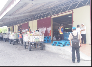
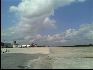
|
Cargo Terminal Charges |
|
|---|---|
|
Import |
Rate US$ / kg |
|
Handling charge per kg |
http://www.sultansyarifkasim2-airport.co.id/en/business/aviation-charges
|
|
Break bulk fee |
|
|
Diplomatic mail |
|
|
Strong room – per consignment |
|
|
Cold storage fee |
|
|
Delivery outside normal working hours |
|
|
Preparation of substitute AOA – Invoice – Receipt |
|
|
Storage per kg per day – Grace period? Hours |
|
|
Export |
Rate US$ / kg |
|
Handling charges – Unpalletized cargo |
http://www.sultansyarifkasim2-airport.co.id/en/business/aviation-charges
|
|
International Air Way Bill |
|
|
Local Air Way Bill |
|
|
Air Way Bill Amendment – Cancellation |
|
|
Air Way Bill Documentation |
|
|
Diplomatic Mail |
|
|
Storage charges per kg per day |
|
Costs- Air-bridge Charges
http://www.sultansyarifkasim2-airport.co.id/en/business/aviation-charges
Costs- Fuel Service Charges
There is a pertamina depot within the airport compound – refuelling is arranged through the ground handling companies.
-
Fleet of fuel trucks: 3 units@ 12KL, 1 unit @ 7 KL and 1 unit @ 25 KL.
-
Fuels types
-
Jet A1, without icing inhibitor.
-
73 octane gasoline, unleaded, No MIL Spec.
-
100/130 MIL Spec, low lead, aviation gasoline (BLUE)
|
Price per Unit |
|
|---|---|
|
Jet A-1 |
|
Security
The airport is a joint airbase with the Indonesian Air Force – there is a permanent military presence and secuirty regulations are well enforced.
|
Security |
||
|---|---|---|
|
X Good |
Marginal |
Bad |
Storage Facilities
There are small purpose built warehouses for the ground handling companies:
-
Import Cargo WH of approximately 500 M2
-
Export Cargo WH of approximately 500 M2
-
There are no cold storage or strong box facilities.
-
For emergency responses Angkasa Pura indicated that there is plenty of un-surfaced space to the north end of the cargo terminal that could be used as open storage if the airport was to be utilized as a Humanitarian Staging Area (HSA).
-
Angkasa Pura also indicated that they could desigante 0.6 Ha of apron space in fron of the cargo terminal for the HSA.
-
Additionally there is an area of approximately 2 Ha that has been cleared as part of the construction of the new terminal but has no designated use.
-
The air force base on the opposite side of the runway has much larger open areas and surfaces aprons and hangers that could facilitate a HSA within the airport perimeter – if permission was obtained.
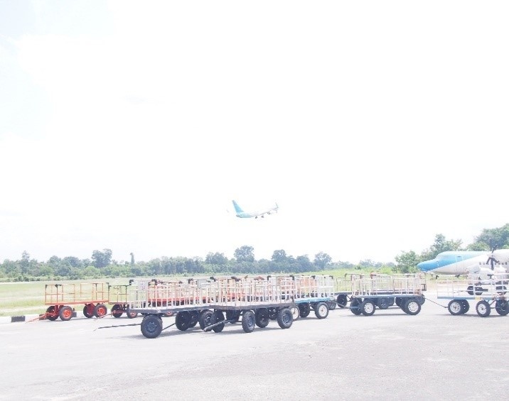
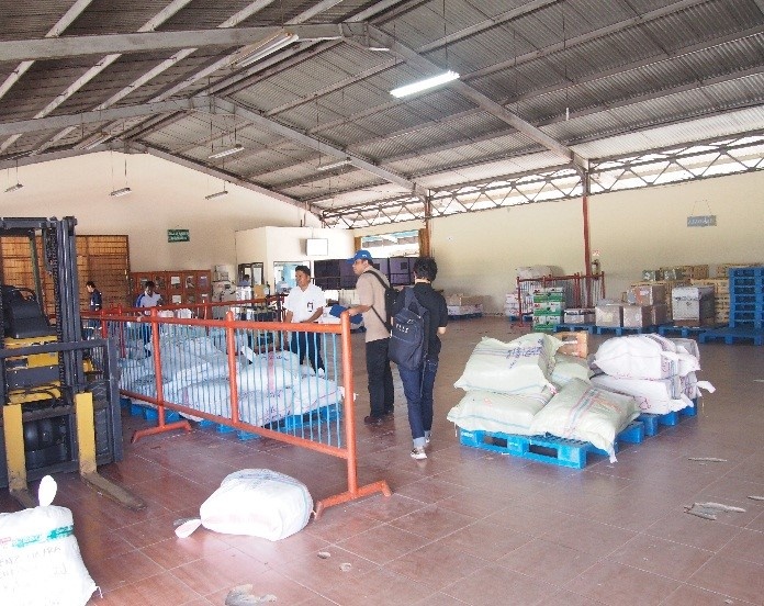
2.2.5 Indonesia West Sumatra Minangkabau International Airport
Airport Overview
Minangkabau International Airport is located at Ketaping, Padang Pariaman district about 23 km north-west of Padang. The airport started operations in July 2005, replacing the old Tabing Airport in Padang which is currently used as an Air Force base. There is only one terminal building covering both international and domestic flights.
|
Airport Location and Contact |
|
|
Country |
Indonesia |
|
Province or District |
West Sumatra Province |
|
Nearest Town or City |
Padang, 28 km Padang Pariaman, 41 km |
|
Airport’s Complete Name |
Minangkabau International Airport |
|
Latitude |
-0.788802 |
|
Longitude |
100.282894 |
|
Elevation (ft and m) |
5.5m (18 ft) |
|
IATA Code |
PDG |
|
ICAO Code |
WIEE |
|
Managing Company or Airport Authority |
PT. Angkasa Pura II (Persero) Bandara Internatioanal Minangkabau |
|
Management Contact Person |
Nico Yuwandri, Asst. Manager Safety and Risk M: 085275223407 |
|
Open From (hours) |
05.00 |
|
Open To (hours) |
24.00 |
Airport Picture
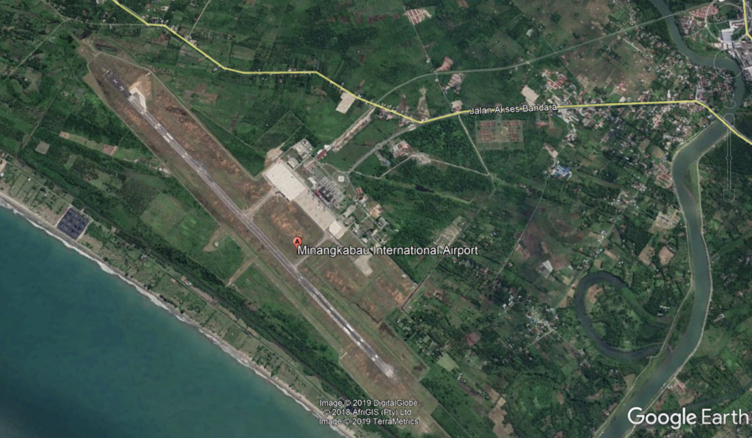
Description and Contacts of Key Companies
|
Airlines |
Destination |
Website |
|
Air Asia |
Kuala Lumpur |
|
|
Batik Air |
Jakarta–Halim Perdanakusuma and Soekarno–Hatta |
|
|
Citilink |
Batam, Jakarta–Halim Perdanakusuma and Soekarno–Hatta, Palembang |
|
|
Garuda Indonesia |
Batam, Gunungsitoli, Jakarta–Soekarno–Hatta, Palembang |
|
|
Lion Air |
Batam, Jakarta–Soekarno–Hatta, Medan, Surabaya, Yogyakarta |
|
|
Sriwijaya Air |
Jakarta–Soekarno–Hatta, Medan |
|
|
Susi Air |
Batu Islands, Mukomuko, |
|
|
Wings Air |
Bengkulu, Gunung Sitoli, Jambi, Palembang, Pekanbaru |
|
|
XpressAir |
Bandung |
|
Information on some aviation service providers can be found at: http://www.azfreight.com/
Passenger and Cargo Performance Indicator
Development of passenger terminal is still ongoing, estimate to complete by 2020. Expansion of apron area has completed with total 92,340 m2
|
Performance for 2018 |
|
|
|
Per Year |
|
Total Aircraft Movements |
29,991 |
|
Total Passengers |
4,200,000 |
|
Total Capacity of the Airport (mt) |
18,250 |
|
Current Activity of the Airport (mt) |
18,834 |
|
Current use by Humanitarian Flights (UNHAS) |
None |
Runways
|
Runway #1 |
|
|
Runway Dimensions |
2,750 x 45 m |
|
Orientation |
15/33 |
|
Surface |
Asphalt (PCN 72) |
Helicopter Pad(s)
|
Helipad #1 |
|
|
Present |
No |
|
Largest Helicopter that can Land |
n/a |
|
Width and Length (m) |
n/a |
|
Surface |
n/a |
Airport Infrastructure Details
|
Customs |
Yes |
JET A-1 fuel |
Yes |
|
Immigration |
Yes |
AVGAS 100 |
No |
|
Terminal Building |
Yes |
Single Point Refueling |
No |
|
Passenger Terminal |
Yes |
Air Starter Units |
Yes |
|
Cargo terminal |
Yes |
Ground Power (mobile) |
Yes |
|
Pax Transport to Airfield |
Yes |
Ground Handling Services |
Yes |
|
Control Tower |
Yes |
Latrine Servicing |
Yes |
|
Weather Facilities |
Yes |
Fire Fighting Category (ICAO) |
Cat : 9 |
|
Catering Services |
Yes |
De-icing Equipment |
No |
|
Base Operating Room |
Yes |
Parking Ramp Lighting |
Yes |
|
Airport Radar |
No |
Approach & Runway Lights |
Yes |
|
NDB |
Yes |
VOR |
Yes |
|
ILS |
Yes |
Airport Operating Details
|
Operating Details |
|||
|
Maximum Sized Aircraft that can be Offloaded on Bulk Cargo |
Boeing 747-400 Boeing 737-900 |
||
|
Maximum Sized Aircraft that can be Offloaded on Pallet |
|||
|
Total Aircraft Parking Area (m²) |
648 x 142,5 = 92,340 |
||
|
Storage Area (m²) |
1,389 |
||
|
Handling Equipment |
|||
|
Elevators / Hi Loaders |
Yes |
Max Capacity (mt) |
|
|
Max Height (m) |
|
||
|
Loading Ramps |
Yes |
||
Customs Guidance
For more information on customs in Indonesia, please see the following link: 1.3 Indonesia Customs Information
Storage Facilities
- Storage capacity - 1,389 m²
- Warehouse - 195 m²
- Office area - 13,314 m²
- X-Ray - 2 Units
- Cold storage - 4 units
- Forklift - 1 (2.5 mt)
- Plastic pallet - 100 pcs
- Wooden Pallet - 120 pcs
Airfield Costs
Navigation Charges
|
Charges |
Aircraft Weight - MTOW (kg) |
||
|
|
0 - 7,000 |
7,001 - 136,000 |
136,001 and over |
|
Navigation (per journey) USD - $ |
15% of the cost of flight navigation services for domestic routes and 10% for international routes |
||
|
Landing USD - $ |
Domestic : IDR 5,000 International : USD 4.00 |
Domestic : IDR 200,000 + IDR 6,000 per T International : USD 160 + USD 4.50 per T |
Domestic : IDR 560,000 + IDR 7,000 per T International : USD 430 + USD 5.10 per T |
|
Night Landing USD - $ |
|||
|
Night Take-Off USD - $ |
|
|
|
|
Parking |
Domestic : IDR 1,100 per T per 12 jam International : USD 0.40 per T per 12 jam |
||
|
Handling Charges |
|
|
|
Fuel Services Charges
|
Price per Litre (March 2019) |
|
|
Jet A-1 |
Into Aircraft Delivery * 9,550.00 IDR per litre / 68.00 US Cent per litre Not Into Aircraft Delivery * 9,550.00 IDR per litre / 68.00 US Cent per litre Packaged product * 2,540,000.00 IDR per Drum |
|
Avgas |
n/a |
Cargo Terminal Charges
|
Import Charges |
||
|
Type of Charge |
Rate USD - $ per kg |
Comments |
|
Handling Charge |
All Import/Export services costs are handled by PT. Gapura Angkasa and PT Prahita Titian Nusantara |
|
|
Break Bulk Fee |
||
|
Diplomatic Mail |
||
|
Strong Room – per consignment |
||
|
Cold Storage Fee |
||
|
Delivery Outside Normal Working Hours |
||
|
Preparation of substitute AOA – Invoice – Receipt |
||
|
Storage per Day |
||
|
Export |
||
|
Handling Charges – Un-palletized Cargo |
All Import/Export services costs are handled by PT. Gapura Angkasa and PT Prahita Titian Nusantara |
|
|
International Air Waybill |
||
|
Local Air Waybill |
||
|
Air Way Bill Amendment - Cancellation |
||
|
Air Way Bill Documentation |
||
|
Diplomatic Mail |
||
|
Storage Charges per Day |
||
Air-Bridge Charges
Standard official tariffs are not yet set for air bridge services, currently ad-hoc rates being used as temporary basis.
Security
The airport is purely civilian, overall the security system is good, consisting of airport police, civil police, CCTV and standard X-Ray /metal-detector checks, searches, etc.
2.2.6 Indonesia Bengkulu Fatmawati Soekarno Airport
Airport Overview
Fatmawati Soekarno Airport is located in the southern part of Bengkulu City, the capital of Bengkulu Province. The road access from and to Fatmawati Soekarno uses the national road which is in fair condition. The road is also part of the west coast Sumatra national highway connecting Lampung Province to West Sumatra Province.
The airport is operated by UPBU (Airport Technical Implementation Unit) Region VI under the Authority of Minangkabau International Airport in Padang, ensuring airport operations are in line with official regulations & procedures.
|
Airport Location and Contact |
|
|
Country |
Indonesia |
|
Province or District |
Bengkulu Province |
|
Nearest Town or
City |
|
|
Airport’s Complete Name |
Fatmawati Soekarno |
|
Latitude |
3.8619° S |
|
Longitude |
102.3367° E |
|
Elevation (ft and m) |
50 ft / 15.2 m |
|
IATA Code |
BKS |
|
ICAO Code |
WIGG |
|
Managing Company or Airport Authority |
Unit Penyelenggara Bandar Udara (UPBU) |
|
Management Contact Person |
Widjajanti Email:faisawidjajanti@yahoo.com Tel1: +62 813 6797 9509 |
|
Open From (hours) |
06.00 |
|
Open To (hours) |
21:00 |
Airport Picture
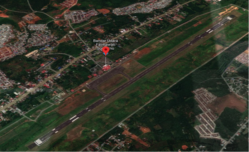
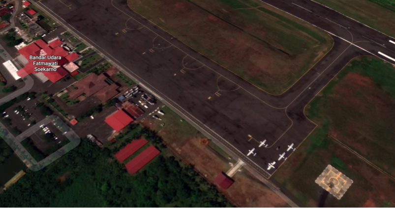
Description and Contacts of Key Companies
Airlines operating in Fatmawati Soekarno include:
Garuda Indonesia: (www.garuda-indonesia.com)
Lion Air: (http://www.lionair.co.id)
Citilink Indonesia: (www.citilink.co.id)
Batik Air: (www.batikair.com)
Sriwijaya Air: (www.sriwijayaair.co.id)
Passenger and Cargo Performance Indicator
|
Performance for 2018 |
|
|
|
Per Year (2018) |
|
Total Aircraft Movements |
4,861 |
|
Total Passengers |
531,156 |
|
Total Capacity of the Airport (MT) |
3,488 |
|
Current Activity of the Airport (MT) |
3,488 |
|
Current use by Humanitarian Flights (UNHAS) |
No |
Runways
|
Runway #1 |
|
|
Runway Dimensions |
W45 x L2250 |
|
Orientation |
13 – 31 |
|
Surface |
Asphalt Flexible (hotmix) - PCN 51 |
Helicopter Pad(s)
|
Helipad #1 |
|
|
Present |
Yes |
|
Largest Helicopter that can Land |
- |
|
Width and Length (m) |
24m x 24m |
|
Surface |
Rigid Concrete |
Airport Infrastructure Details
|
Customs |
No |
JET A-1 fuel |
Yes |
|
Immigration |
No |
AVGAS 100 |
No |
|
Terminal Building |
Yes |
Single Point Refueling |
No |
|
Passenger Terminal |
Yes |
Air Starter Units |
No |
|
Cargo terminal |
Yes |
Ground Power (mobile) |
Yes |
|
Pax Transport to Airfield |
Yes |
Ground Handling Services |
Yes |
|
Control Tower |
Yes |
Latrine Servicing |
Yes |
|
Weather Facilities |
Yes |
Fire Fighting Category (ICAO) |
Category: 7 |
|
Catering Services |
Yes |
De-icing Equipment |
No |
|
Base Operating Room |
Yes |
Parking Ramp Lighting |
Yes |
|
Airport Radar |
No |
Approach & Runway Lights |
Yes |
|
NDB |
Yes |
VOR |
Yes |
|
ILS |
Yes |
|
|
Airport Operating Details
|
Operating Details |
|||
|
Maximum Sized Aircraft that can be Offloaded on Bulk Cargo |
A 320, Boeing 737-900 (limited) |
||
|
Maximum Sized Aircraft that can be Offloaded on Pallet |
C-130 |
||
|
Total Aircraft Parking Area (m²) |
375 M x 80 M |
||
|
Storage Area (m3 and MT) |
2,024 m3 |
||
|
Handling Equipment |
|||
|
Elevators / Hi Loaders |
No |
Max Capacity (MT) |
|
|
Max Height (m) |
|
||
|
Loading Ramps |
In Cargo area |
||
Storage Facilities
There is a new 400 m2 warehouse built near the main terminal building which has a special parking / loading area. This warehouse is just behind the old, outdated warehouse (220 m2) with physical infrastructure in good condition.
Airfield Costs
Flight costs can be found at: www.dephub.go.id PP.11 Tahun 2015
NAVIGATION CHARGES
|
Charges |
Aircraft Weight - MTOW (kg) |
||
|
|
0 - 7,000 |
7,001 - 136,000 |
136,001 and over |
|
Navigation (per journey) USD - $ |
15% of the cost of flight navigation services for domestic routes and 10% for international routes |
||
|
Landing USD - $ |
$ 0.21/1000 kg domestic $ 3.60/1000 kg international
|
$ 8.84/1000 kg domestic $ 148.1 / 1000 kg international |
$ 26.02/1000 kg domestic $ 394.7 /1000 kg international |
|
Night Landing USD - $ |
available but pricing to be determined |
||
|
Night Take-Off USD - $ |
|||
|
Parking |
$ 0.07 / 1000 kg / 12 hours – domestic $ 0.30 / 1000 kg / 12 hours - international |
||
|
Handling Charges |
available but pricing to be determined |
||
FUEL SERVICES CHARGES
There is a Pertamina depot within the airport complex. Refuelling is arranged through the ground handling company. The refuelling capacity is 500 KL (Jet A1).
Purchases are made first by using the bank payment system and then orders can be followed up. The system is different if there is a prior agreement (can pay after purchase).
|
|
Price per Litre USD - $ |
|
Jet A-1 |
9,700.00 IDR per litre / 69.10 US cent per litre |
|
Avgas |
n/a |
CARGO TERMINAL CHARGES
PT. GrahaDirgantara Servis is the only ground handling company operating in Fatmawati Soekarno Airport handling domestic cargo.
|
Import Charges |
||
|
Type of Charge |
Rate USD - $ per kg |
Comments |
|
Handling Charge |
All costs Import/Export services are handled by PT. Graha Dirgantara Jakarta |
|
|
Break Bulk Fee |
||
|
Diplomatic Mail |
||
|
Strong Room – per consignment |
||
|
Cold Storage Fee |
||
|
Delivery Outside Normal Working Hours |
||
|
Preparation of substitute AOA – Invoice – Receipt |
||
|
Storage per Day |
||
|
Export |
||
|
Handling Charges – Un-palletized Cargo |
All costs Import/Export services are handled by PT. Graha Dirgantara Jakarta |
|
|
International Air Waybill |
||
|
Local Air Waybill |
||
|
Air Way Bill Amendment - Cancellation |
||
|
Air Way Bill Documentation |
||
|
Diplomatic Mail |
||
|
Storage Charges per Day |
||
AIR-BRIDGE CHARGES
Standard official tariffs are not yet set for air bridge services, currently ad-hoc rates being used on temporary basis.
Security
Fatmawati Soekarno Airport is a civil airport and has 7 (seven) security posts:
- 5 (two) are on the perimeter road
- 2 (three) are at the entrance gate
The overall security situation is relatively good.
2.2.7 Indonesia North Sumatra Sibolga FL Tobing Airport
|
Airport Name & Management |
Contact Names & Email |
Tel & Fax |
|---|---|---|
|
UPBU DR. Ferdinand Lumbantobing |
Title:General Manager |
Tel: +0631391003 |
General Overview
Dr. Ferdinand Lumbantobing airport is located 40 km from Sibolga
-
The airport is classified as class III
-
Operated by Airport Implementations Unit (UPBU)
| Runway | 2190m x 30m (PCN 34 FCYT) |
|---|---|
| Taxiway | 150m x 23m (PCN 22 FCYT) |
| Apron | 120m x 80m (PCN 22 FCYT) |
| Over run | 30m x 30m (PCN 34 FCYT) |
|
LOCATION DETAILS |
|||
|---|---|---|---|
|
Country |
Indonesia |
Latitude |
01°33'12,84492"N |
|
Province / District |
North Sumatra / Tapanuli Tengah |
Longitude |
98°53’37,65374"E |
|
Town or City (closest) |
Pandan, Sibolga |
Elevation |
10 M |
|
Airfield Name |
Dr. Ferdinand Lumban Tobing Sibolga |
International airport |
No |
|
IATA & ICAO codes |
FLZ & WIMS |
Open from/to (hours) |
07:00 – 14:00 |
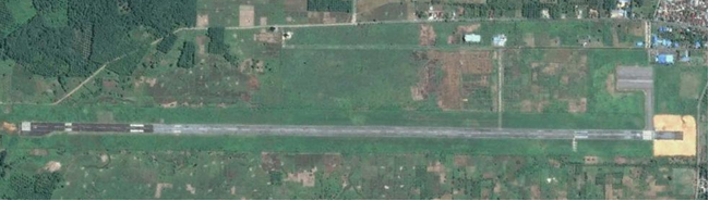
Performance
-
Five aircraft movements a day; Garuda Airlines, Wings Air, Susi Air
-
Radar control is provided from Medan
-
FL Tobing air crew experienced handling hundreds of aircraft movements per day during Aceh and Nias Emergency Response
|
Performance |
Year(s) and figures |
|---|---|
|
Total Aircraft Movements |
Year 2014 : 1,218 |
|
Total Passengers |
Year 2014 : 96,954 |
Cargo Capacity
-
Cargos carried by passenger aircrafts
-
There are two ground handling companies; Gapura handling for Garuda and Koperasi Angkasa handling for Lion and Susi Air
-
Available ground handling equipment :
-
Manual Lavatory Truck
-
1 Unit Baggage Conveyor Loader (BCL
-
1 Unit Ground Power Unit
-
1 Unit Back Loader
-
4 units BCT
-
|
Capacity Cargo |
Year(s) and figures |
|---|---|
|
Total Aircraft Movements |
Year 2014 : 63 (Garuda) |
|
Total capacity of the airport (mt) |
Year 2014 : 22.708 (Garuda) |
|
Current activity of the airport (mt) |
12 MT |
Airfield Details
|
Airfield Details |
|||
|---|---|---|---|
|
Customs |
No |
JET A-1 fuel |
Yes |
|
Immigration |
No |
AVGAS 100 |
No |
|
Terminal Building |
Yes |
Single point refueling |
No |
|
Passenger Terminal |
Yes |
Starter units (press air) |
No |
|
Cargo terminal |
No |
ILS |
No |
|
Pax transport to airfield |
No |
Approach Lights |
Yes |
|
Control Tower |
Yes |
Ground power (mobile) |
Yes |
|
Weather Facilities |
Yes |
Latrine servicing |
No |
|
Catering Services |
Yes |
Fire fighting |
Category: 4 |
|
Base Operating Room |
No |
Fire fighting category (ICAO) |
Yes |
|
Airport Radar |
No |
Fire fighting equipment |
Yes |
|
NDB |
Yes |
De-icing equipment |
No |
|
VOR |
Yes |
Runway lights |
Yes |
Runway
|
RUNWAY # 1 |
|
|---|---|
|
Published length (metres) |
2.190 |
|
Width (meter) |
30 |
|
Orientation |
12/30 |
|
Surface |
Hot mix PCN 34 FCYT |
Helicopter Pad(s)
There are no dedicated helicopter pads at the airport. However helicopters can land on the Apron or in a designated area by Air Traffic Control
Airport Operating Details
|
Airport Operating Details Detil operasi bandara |
||
|---|---|---|
|
Max size cargo aircraft that bulk cargo can be offloaded |
Fokker 100 |
|
|
Max size cargo aircraft that can be offloaded on pallet |
NA |
|
|
Total Parking Area (m²) |
120 m x 80 m |
|
|
Storage Capacity |
50 m x 20 m |
|
|
Cargo Handling Equipment |
No |
If yes, specify below |
|
Elevators |
No |
Max. capacity (tons): |
|
Can reach the upper deck of a B747 ? No |
||
Costs – Airfield Charges
|
|
Airfield Charges (US$) |
||
|---|---|---|---|
|
Aircraft Weight – MTOW (kg) |
Landing |
Parking |
|
|
ALL AIRCRAFT WEIGHT |
IDR 2,000 / kg |
IDR. 700 / 1000 kg / 12 hrs |
|
|
Note 1: Night landing hours are counted outside of published hours of the airport |
|||
|
Note 2: Parking charges are free for first 2 hours. Parking surcharge is counted for the following hours. |
|||
|
Note 3: All of these charges are administered by the Directorate General Civil Aviation and are different for all airports in Indonesia |
|||
Costs – Cargo Terminal Charges
Two cargo handling companies operate in FL Tobing:
|
PT. Gapura |
|||
|---|---|---|---|
|
Address |
FL Tobing Airport Sibolga |
||
|
Cargo Terminal Charges |
|
|---|---|
|
INBOUND |
Rate US$ / kg |
|
Handling charge per kg |
All services are available; carriers negotiate individual rates with ground handling companies respectively. |
|
Break bulk fee |
|
|
Diplomatic mail |
|
|
Strong room – per consignment |
|
|
Cold storage fee |
|
|
Delivery outside normal working hours |
|
|
Preparation of substitute AOA – Invoice – Receipt |
|
|
Storage per kg per day – Grace period? Hours |
|
|
OUTBOUND |
Rate US$ / kg |
|
Handling charges – Unpalletized cargo |
IDR. 1000 / Kg |
|
Local Air Way Bill |
IDR. 7000 / Kg |
Costs – Fuel Services Charges
Jet A-1 Fuel is supplied from Medan 24,000 liter every two days with 2 tankers available (capacity of 12,000 liters and 18,000 liters).
Security
FL Tobing is a civilian airport, the total area of the airport is 183.03 ha surrounded by double wire fence for a ground boundary and for a runway / air side boundary.
|
Security |
||
|---|---|---|
|
X Good |
Marginal |
Bad |
Storage Facilities
A storage room 1000m2 is available (owned by the local government) although it is in relatively poor condition as it has not been utilised for some time.
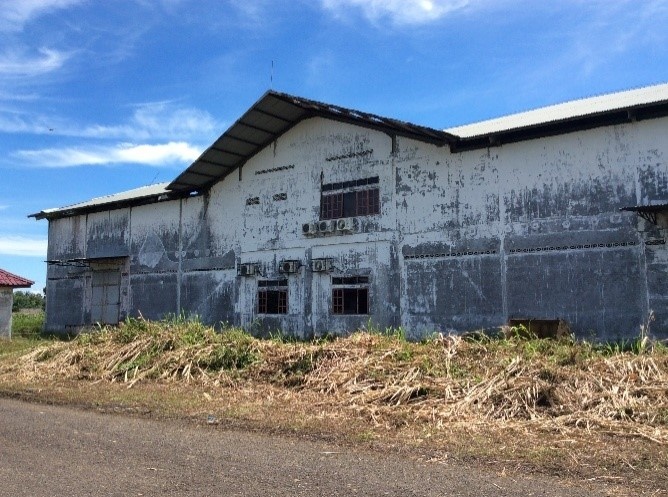
2.2.8 Indonesia Bengkulu Mukomuko Airport
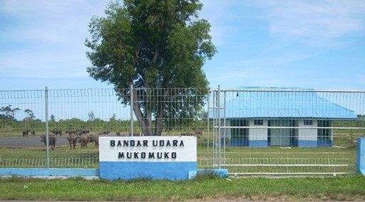
|
Airport Name & Management |
Contact Names & Email |
Tel & Fax |
|---|---|---|
|
UPBU Mukomuko, Bengkulu Jl. Sudirman Km. 5, Kel. Bandar Ratu Mukomuko |
Title:Head of UPBU
|
Tel: +0737.71632 Email: bandaramukomuko@ymail.com |
General overview
Muko Muko Airport is a small airport belongs to local government.
-
Muko Muko airport is located 5 km from City
-
Operated by Airport Implemantation Unit (UPBU)
-
Susi Air serve twice a week
-
No BMKG info throuh mobile phone
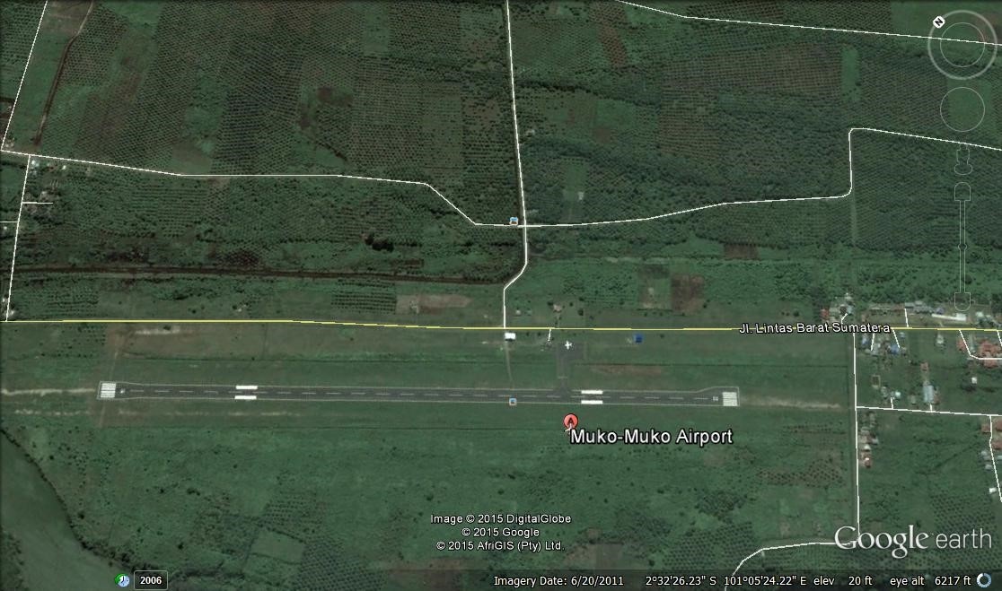
|
LOCATION DETAILS |
|||
|---|---|---|---|
|
Country |
Indonesia |
Latitude |
2° 32' 32,23" S |
|
Province / District |
Bengkulu / Mukomuko |
Longitude |
101° 5' 24,04" E |
|
Town or City (closest) |
Mukomuko |
Elevation |
4,88 M |
|
Airfield Name |
Mukomuko |
Surface |
Asphalt |
|
IATA & ICAO codes |
MPC / WIPU |
Condition |
- |
|
Runway Length (m) |
1400 (PCN 22 FCYT) |
Runway Width (m) |
30 (PCN 22 FCYT) |
|
Apron Length (m) |
60 (PCN 17 FCYT) |
Apron Width (m) |
40 (PCN 17 FCYT) |
|
Passenger / Cargo Security Screening |
No |
Open from/to (hours) |
08:00 – 17:00 |
|
Refueling Capacity |
No |
Runway Lighting (Yes / No) |
Yes |
|
Runway Heading |
- |
Fire Fighting Equipment / Category |
Yes / Category 4 |
|
Air Traffic Control (Yes / No) |
No |
Windsock (Yes / No) |
Yes |
|
Weather |
No |
Aircraft Parking Space |
Yes |
|
Information (Yes / No) |
Yes |
Navigation Aids (Yes / No) |
No |
|
Perimeter Fencing (Yes / No) |
Yes |
Ground Handling (Yes /No) |
No |
2.2.9 Indonesia West Sumatra Pusako Anak Nagari Airport
General Overview
|
Airport Name & Management |
Contact Names & Email |
Tel & Fax |
|---|---|---|
|
Pusako Anak Nagari Airport & UPBU Transportation Department (DISHUB) West Pasaman Region Jorong Laban, Nagari Kapa, Luhak Nan Duo, West Pasaman, West Sumatra, Indonesia |
Title : Head of UPBU |
|
|
Airfield Details
|
Location Details |
|||
|---|---|---|---|
|
Country |
Indonesia |
Latitude |
0°04′35.6″S |
|
Province / District |
West Sumatra / West Pasaman |
Longitude |
99°47′05″E |
|
Town or City (closest) |
West Pasaman |
Elevation (ft) |
55 m |
|
Airfield Name |
Bandara Pusako Anak nagari, Simpang Ampek |
Surface |
Asphalt hot mix (15 cm thickness) |
|
IATA & ICAO codes |
N/A |
Condition |
Good |
|
Runway Length (m) |
800 m |
Runway Width (m) |
18 m |
|
Passenger / Cargo Security Screening |
No |
Ground Handling (Yes /No) |
No |
|
Refueling Capacity |
No |
Runway Lighting (Yes / No) |
No |
|
Runway Heading |
06/24 |
Fire Fighting Equipment (Yes / No) |
Yes |
|
Air Traffic Control (Yes / No) |
No (Information Service from BIM) |
Windsock (Yes / No) |
Yes |
|
Weather |
No |
Aircraft Parking Space |
Yes (Accommodate two Cessna Aircraft) |
|
Information (Yes / No) |
Yes |
Navigation Aids (Yes / No) |
No |
|
Perimeter Fencing (Yes / No) |
Yes (25 %) |
|
|
-
The existing runway is 800 x 18 m (2015 data).
-
Open yards within the perimeter can accommodate MSU.
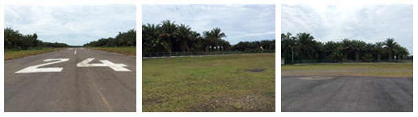
2.2.10 Indonesia Jambi Depati Parbo Airport
General Overview
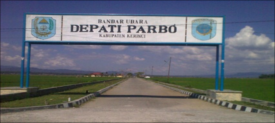
|
Airport Name & Management |
Contact Names & Email |
Tel & Fax |
|---|---|---|
|
Depati Parbo Airport & UPBU Transportation Department (DISHUB) Kerinci District Desa Angkasa Pura, Kel. Hiang Tinggi, Kec. Sitinjau Laut, Kab. Kerinci, Jambi, 37171
|
Title : Head of UPBU |
Email: bandara.kerinci@gmail.com |
http://hubud.dephub.go.id/?id/bandara/detail/99
-
Depati Parbo Airport is a pioneer airport belongs to local government.
-
Located 7 km from Sungai Penuh
-
Its operated by Airport Implemantation Unit (UPBU)
-
Susi Air serves flight from and to Depati Parbo (four times/week)
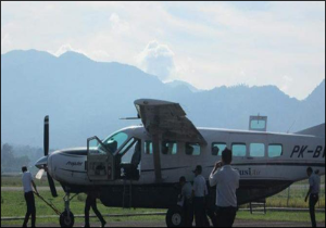
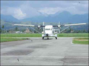
Airfield Details
Facilities :
-
Meteorology and geophysics station.
-
Telecommunication facilities (AFIS, SSB, VHF Portable)
-
Navigation Facility (NDB, VOR, DME)
-
Facilities landing aids (PAPI)
-
Supporting aviation facilities and airport operation (Tractor)
-
Aviation support facility (generator sets)
-
Airport capacity: 1,500,000 passenger / year
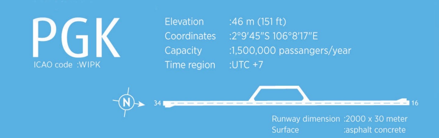
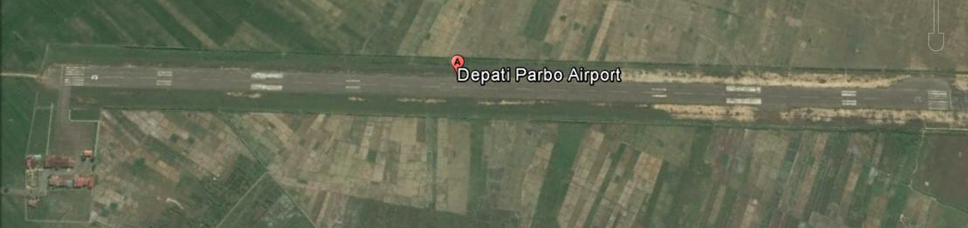
|
LOCATION DETAILS |
|||
|---|---|---|---|
|
Country |
Indonesia |
Latitude |
02° 05' 28" S |
|
Province / District |
Jambi / Kerinci |
Longitude |
101° 27' 46" E |
|
Town or City (closest) |
Kerinci |
Elevation |
1 M / 3 ft |
|
Airfield Name |
Depati Parbo |
Surface |
Asphalt concrete |
|
IATA & ICAO codes |
KRC / WIPH |
Condition |
Good |
|
Runway Length (m) |
2000 |
Runway Width (m) |
30 |
|
Passenger / Cargo Security Screening |
- |
Open from/to (hours) |
08:00 – 16:00 |
|
Refueling Capacity |
- |
Runway Lighting (Yes / No) |
Yes |
|
Runway Heading |
16L / 34R |
Fire Fighting Equipment / Category |
Yes |
|
Air Traffic Control (Yes / No) |
Airdrop Flight Information Service (AFIS) |
Windsock (Yes / No) |
Yes |
|
Weather |
Yes |
Aircraft Parking Space |
Yes |
|
Information (Yes / No) |
Yes |
Navigation Aids (Yes / No) |
Yes |
|
Perimeter Fencing (Yes / No) |
Yes |
Ground Handling (Yes /No) |
|
2.2.11 Indonesia West Sumatra Mentawai Rokot Airport
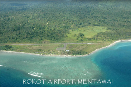
|
Airport Name & Management |
Contact Names & Email |
|---|---|
|
Rokot Airport & UPBU Transportation Department (DISHUB) Sipora, Mentawai District |
Title: Head of Transportation Department (DISHUB) Sipora |
General Overview
-
Rokot Airport is an airport in Sipora, West Sumatra.
-
Currently, only small body aircraft can land at the airport.
-
The airport was completed in 1980 with a runway size of 850 x 23 m.
-
However, the airport is now threatened by possible submersion as erosion near the shoreline (a mere 25 meters away) means that only 800 meters of runway are still usable.
-
Plans to extend the runway to 1,600 x 30 meters (still land acquisition process in 2017)
|
Location Details |
|||
|---|---|---|---|
|
Country |
Indonesia |
Latitude |
02″ 06’ 56” S |
|
Province / District |
West Sumatra / Sipora Island Mentawai |
Longitude |
099″ 42’ 15” E |
|
Town or City (closest) |
Tua Pejat |
Elevation (ft) |
1.5 m / 5 ft |
|
Airfield Name |
Rokot |
Surface |
Asphalt |
|
IATA & ICAO codes |
RKI & WBIR |
Condition |
|
|
Runway Length (m) |
850m |
Runway Width (m) |
23 m |
|
Passenger / Cargo Security Screening |
No |
|
|
|
Runway Dimension |
850 m X 23 m |
Ground Handling (Yes /No) |
No |
|
Refueling Capacity |
No |
Runway Lighting (Yes / No) |
No |
|
Runway Heading |
17/35 |
Fire Fighting Equipment (Yes / No) |
No |
|
Air Traffic Control (Yes / No) |
No |
Windsock (Yes / No) |
Yes |
|
Weather |
No |
Aircraft Parking Space |
Yes |
|
Information (Yes / No) |
Yes |
Navigation Aids (Yes / No) |
Yes |
|
Perimeter Fencing (Yes / No) |
Yes |
|
|
2.2.12 Indonesia East Java Juanda International Airport Surabaya
General Overview
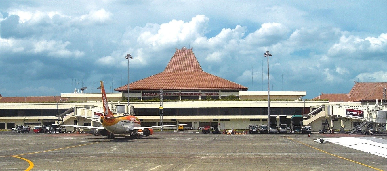
|
Company Name & Address |
Contact Names & Email |
Telephone & Fax |
|---|---|---|
|
PT. Angkasa Pura I (Persero) Juanda International Airport, Surabaya |
Title: General Manager Email:sub@angkasapura1.co.id |
Fax:+6231-8667506 |
|
Summary of Role and Services |
||
|
Location Details |
|||
|---|---|---|---|
|
Country |
Indonesia |
Latitude |
7°22’53” S |
|
Province / District |
East Java / Sidoarjo |
Longitude |
112°46’34” E |
|
Town or City (closest) |
Surabaya |
Elevation |
9 ft (3m) |
|
Airfield Name |
Juanda Int. Airport |
International Airport |
Yes |
|
IATA & ICAO codes |
SUB / WARR |
Open from/to (hours) |
06:00 TO 24:00 (24 Hour upon request) |


Airfield Details
|
Airfield Details |
|||
|---|---|---|---|
|
Customs |
Yes |
JET A-1 fuel |
Yes |
|
Immigration |
Yes |
AVGAS 100 |
Yes |
|
Terminal Building |
Yes |
Single Point Refueling |
Yes |
|
Passenger Terminal |
Yes |
Air Starter Units |
Yes |
|
Cargo terminal |
Yes |
Ground Power (mobile) |
Yes |
|
Pax transport to airfield |
Yes |
Crash Crew |
Yes |
|
Control Tower |
Yes |
Aircraft Support Services |
Yes |
|
Weather Facilities |
Yes |
Latrine Servicing |
Yes |
|
Catering Services |
Yes |
Fire Fighting |
Yes |
|
Base Operating Room |
Yes |
Fire Fighting Category (ICAO) |
Category: VIII |
|
Airport Radar |
Yes |
Fire Fighting Equipment |
Yes |
|
NDB |
Yes |
De-icing Equipment |
No |
|
VOR |
Yes |
IFR Procedures |
Yes |
|
ILS |
Yes |
Runway Lights |
Yes |
|
Approach Lights |
Yes |
Parking Ramp Lighting |
Yes |
Runway
|
Runway #10/28 |
|
|---|---|
|
Published Length (m) |
3,100 (ASDA) |
|
Usable Length (m) |
3,000 (TORA/TODA/LDA) |
|
Width (m) |
45 |
|
Orientation |
279 - 099 |
|
Surface |
PCN 83 FDXT |
Helicopter Pads
There is no dedicated helipad on the civil side of the airport – apron can be utilized for this purpose in emergency situations:
|
Helipad |
|
|---|---|
|
Present |
Yes (Improvised: Apron) |
|
Width and Length (metres) |
152 x 1,229 meters (North Apron) |
|
Surface |
PCN 98 RCXT |
|
Width and Length (metres) |
120 x 195 meters (South Apron A) |
|
Surface |
PCN 73 RCXU |
|
Width and Length (metres) |
135 x 200 meters (South Apron B) |
|
Surface |
PCN 73 RCXU |
|
Width and Length (metres) |
130 x 298 meters (South Apron C) |
|
Surface |
PCN 73 RCXU |
Airport Operating Details
|
Airport Operating Details |
|||||||
|---|---|---|---|---|---|---|---|
|
Max size aircraft that can be offloaded on bulk cargo |
2 aircraft for A330 or B – 744 (18 aircraft simultaneously, including two wide body, 11 medium and five small aircraft) |
||||||
|
Max size cargo aircraft that can be offloaded on pallet |
60 Tons |
||||||
|
Total Parking Area |
m² |
148,000 square metres (1,590,000 sq ft) |
|||||
|
Storage Capacity |
mt |
1,770 |
|||||
|
Cargo Handling Equipment |
Yes |
No |
If yes, specify below |
||||
|
- Elevators / Hi-loaders |
Yes |
Max. Capacity: |
13.6 Tons |
mt |
Can reach the upper deck of B747? |
Yes |
|
|
- Loading Ramps |
Yes |
||||||
Costs- Navigation Charges
https://www.ap1.co.id/en/information/tarif-jasa-kebandarudaraan
Costs- Airfield Charges
https://www.ap1.co.id/en/information/tarif-jasa-kebandarudaraan
Costs- Aircraft Handling Charges
https://www.ap1.co.id/en/information/tarif-jasa-kebandarudaraan
Costs – Aircraft Servicing Charges
https://www.ap1.co.id/en/information/tarif-jasa-kebandarudaraan
Ground Handling Company
There are several different ground handling companies operating in Juanda Airport:
JAS and Gapura Angkasa are well established nationwide companies with their own mechanical handling equipment.
JAS is the only company if Juanda with a main deck loader that can service the upper deck of a 747.
|
Aircraft Handling Agent |
|||
|---|---|---|---|
|
Name & Address |
PT Angkasa Pura Logistik (Angkasa Pura Logistics) Address: Terminal Cargo Internasional Bandara Juanda Surabaya 61253 A, Indonesia |
||
|
Telephone |
Fax |
||
|
Aircraft Handling Agent |
|||
|---|---|---|---|
|
Name & Address |
JAS Airport Services (PT JASA ANGKASA SEMESTA, Tbk.) Address: Internal Cargo Area Juanda International Airport Surabaya, Indonesia |
||
|
Telephone |
Fax |
||
|
|
|
Web |
|
Costs- Cargo Terminal Charges
|
Cargo Terminal Charges |
|
|---|---|
|
Import |
Rate US$ / kg |
|
Handling Charge per kg |
https://www.ap1.co.id/en/information/tarif-jasa-kebandarudaraan |
|
Break Bulk Fee |
|
|
Diplomatic Mail |
|
|
Strong Room – per consignment |
|
|
Cold Storage Fee |
|
|
Delivery outside normal working hours |
|
|
Preparation of substitute AOA – Invoice – Receipt |
|
|
Storage per kg per day – Grace period? hours |
|
|
Export |
Rate US$ / kg |
|
Handling charges – Unpalletized cargo |
https://www.ap1.co.id/en/information/tarif-jasa-kebandarudaraan |
|
International Air Way Bill |
|
|
Local Air Way Bill |
|
|
Air Way Bill Amendment - Cancellation |
|
|
Air Way Bill Documentation |
|
|
Diplomatic Mail |
|
|
Storage charges per kg per day |
|
Costs- Air Bridge Charges
https://www.ap1.co.id/en/information/tarif-jasa-kebandarudaraan
Costs- Fuel Services Charges
This airport is equipped with a Pertamina Depot incorporating 4 fuel tanks with capacities 2,000 KL.
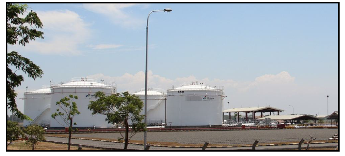
Ground handling companies will liaise with fuel suppliers to arrange purchase orders.
|
Jet A-1 Prices |
Rates |
|---|---|
|
For international flights ** |
|
|
For domestic flights * |
|
|
Not Into Aircraft Delivery * |
|
|
Packaged product * |
|
Avgas Prices |
Rates |
|---|---|
|
Packaged product * |
|
Methmix Prices |
Rates |
|---|---|
|
Packaged product * |
0.00 IDR per litre |
|
* |
Government tax is inclusive (not applicable for International Flights) |
|
** |
Fuel price for International flight is only applicable for outbound flights from Indonesian Airports to overseas |
Security
The airport is a joint airbase with the navy – there is a permanent military presence and security regulations are well enforced.
|
Security |
||
|---|---|---|
|
X Good |
Marginal |
Bad |
Storage Facilities
There are purpose built warehouses for the ground handling companies:
-
Import Cargo WH = 670 M²
-
Export Cargo WH = 1100 M²
-
There is a small cold storage facility – 64M².
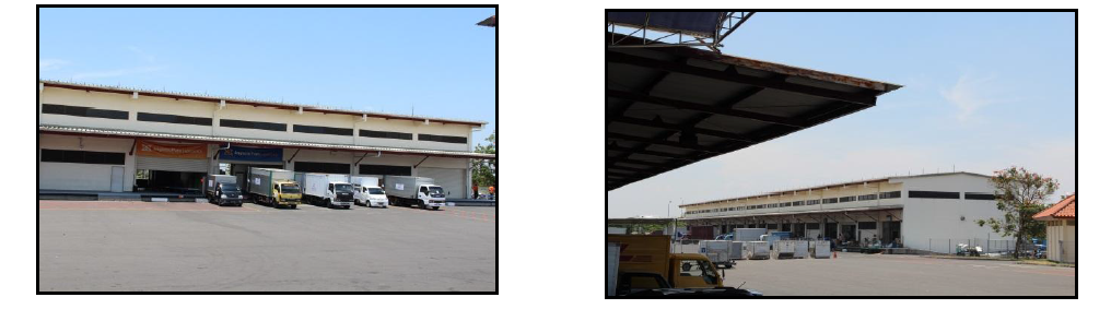
Customs Contact
|
Customs |
|||
|---|---|---|---|
|
Name & Address |
Customs Juanda International Airport Address: Jl. Bandara Juanda KM 3-4, Sidoarjo, Jawa Timur 61253 Email: kppbcjuanda@yahoo.com or informasi@bcjuanda.net |
||
|
Contact |
|
Mob |
|
|
Telephone |
Fax |
||
|
Days |
Mon - Sun |
Hours |
06:00 – 00:00 (24 hours) |
2.2.13 Indonesia Central Java Ahmad Yani International Airport
Airport Overview
Ahmad Yani airport is located in Semarang city, the capital of Central Java province. The airport serves as the air gateway for the province as well as surrounding districts. The airport was originally a military airbase (army) and expanded for civilian aviation. With the inauguration of the new terminal in June 2018, the military and civilian have separated the terminal area. The new terminal is replacing the old terminal with capacity up to 7 million passengers a year. The airport serves domestic and international flights.
|
Airport Location and Contact |
|
|
Country |
Indonesia |
|
Province or District |
Central Java Province, Semarang City |
|
Nearest Town or City with Distance from Airport |
Semarang City Centre, 8 km |
|
Airport’s Complete Name |
Ahmad Yani International Airport |
|
Latitude |
-6.966374 |
|
Longitude |
110.374951 |
|
Elevation (ft and m) |
11 ft / 3.96 m |
|
IATA Code |
SRG |
|
ICAO Code |
WAHS |
|
Managing Company or Airport Authority |
PT. ANGKASA PURA I (PERSERO) Address Jl. Puad Achmad Yani,Semarang 50145 Ph +62-24-7608735 / 7612282 / 603506 / 612281 Fax +62-24-7603506 Email srg@angkasapura1.co.id |
|
Management Contact Person |
Agus Sine (Administration Manager) Ph. +62 85345628910 |
|
Open From (hours) |
23.00 UTC (06.00 WIB) |
|
Open To (hours) |
17.00 UTC (24.00 WIB) |
Airport Picture
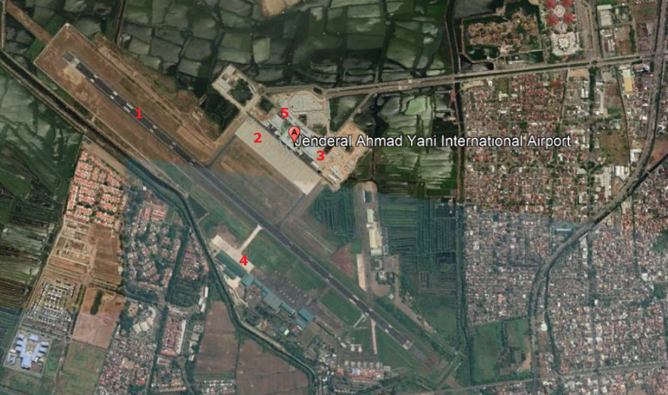
1) Runway
2) Apron
3) Terminal Building
5)Airport Management Office
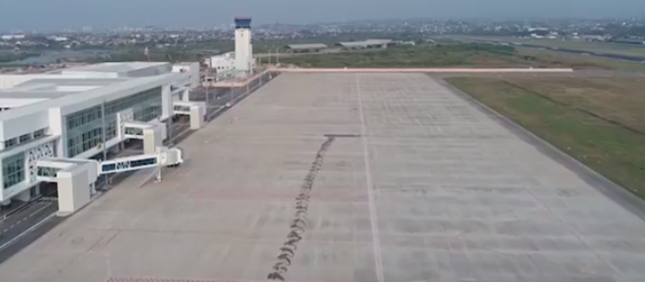
Description and Contacts of Key Companies
The airport is managed by the government state-owned company PT. Angkasa Pura I (Persero), Semarang branch. Several Ground handling companies operates at the airport.
PT. Angkasa Pura I (Persero) Bandara International Jenderal Ahmad Yani Semarang
Address: Jl. Puad Achmad Yani,Semarang 50145
Ph : +62-24-7608735 / 7612282 / 603506 / 612281
Fax : +62-24-7603506
Email: srg@angkasapura1.co.id
Contact : Agus Sine (Administration Manager)
Ph. : +62 85345628910
Kokapura Bandara International Jenderal Ahmad Yani Semarang (Ground Handling Services)
Address : Bandara Ahmad Yani, JL Puad A Yani, Tambakharjo, Semarang Bar., Kota Semarang, Jawa Tengah 50129, Indonesia
Ph: +62-24-7605637
PT. PRATHITA TITIAN NUSANTARA (Ground Handling Services)
Address : Bandara International Jenderal Ahmad Yani Semarang
Ph: +62-24-7617622
Website: http://www.ptn.co.id
Gapura Angkasa Achmad Yani Airport
(SRG)
Address : Puri Anjasmoro Blok
GI No.54
Semarang Jawa Tengah
Ph :
+62-24-7614208
Fax:
+62-24-7614209
Website: http://www.gapura.id
Information on some aviation service providers can be found at: http://www.azfreight.com/
Passenger and Cargo Performance Indicator
|
Performance for 2018 |
|||
|
|
Per Year |
Per Month |
Per Day |
|
Total Aircraft Movements |
63.000 |
5.250 |
175 |
|
Total Passengers |
5.072.040 |
422.670 |
14.090 |
|
Total Capacity of the Airport (MT) |
|
|
14 |
|
Current Activity of the Airport (MT) |
|
|
14 |
|
Current use by Humanitarian Flights (UNHAS) |
0 |
0 |
0 |
Runways
|
Runway #1 |
|
|
Runway Dimensions |
2,560 m x 45 m |
|
Orientation |
13/31 |
|
Surface |
Asphalt PCN 56/F/D/X/T |
Helicopter Pad(s)
There is no dedicated helipad within the airport, however parking stands no 1 and 12 at the Apron area can be utilised for Helicopter operation, if needed.
|
Helipad #1 |
|
|
Present |
No |
|
Largest Helicopter that can Land |
NIL |
|
Width and Length (m) |
NIL |
|
Surface |
NIL |
Airport Infrastructure Details
|
Customs |
|
JET A-1 fuel |
|
|
Immigration |
YES |
AVGAS 100 |
YES |
|
Terminal Building |
YES |
Single Point Refueling |
|
|
Passenger Terminal |
YES |
Air Starter Units |
YES |
|
Cargo terminal |
YES |
Ground Power (mobile) |
YES |
|
Pax Transport to Airfield |
NO |
Ground Handling Services |
YES |
|
Control Tower |
YES |
Latrine Servicing |
YES |
|
Weather Facilities |
YES |
Fire Fighting Category (ICAO) |
VII |
|
Catering Services |
YES |
De-icing Equipment |
NO |
|
Base Operating Room |
YES |
Parking Ramp Lighting |
YES |
|
Airport Radar |
NO |
Approach & Runway Lights |
YES |
|
NDB |
YES |
VOR |
YES |
|
ILS |
NO |
|
|
Airport Operating Details
|
Operating Details |
|||
|
Maximum Sized Aircraft that can be Offloaded on Bulk Cargo |
B-737-900 ER |
||
|
Maximum Sized Aircraft that can be Offloaded on Pallet |
B-737-900 ER |
||
|
Total Aircraft Parking Area (m²) |
12 Parking Stand ( 551 x 135 m²) |
||
|
Storage Area (m3 and MT) |
2,560 m² |
||
|
Handling Equipment |
|||
|
Elevators / Hi Loaders |
Yes |
Max Capacity (MT) |
No Info |
|
Max Height (m) |
No Info |
||
|
Loading Ramps |
Yes |
||
|
Other Comments |
|
||
Customs Guidance
Customs services is available through local customs office:
KPPBC TMP Tanjung Emas
Jl. Arteri. Yos Sudarso,
Tawangsari, Kec. Semarang Barat.,
Kota Semarang, Jawa Tengah 50144
Phone : +62-24-76631968
Website: https://bctemas.beacukai.go.id/
For more information on customs in Indonesia, please see the following link: http://www.beacukai.go.id/
Storage Facilities
The new cargo terminal was officially inaugurated in January 2019 with total area of 2,560 m². This new cargo terminal is expected to handle up to 60,000 tons of cargo a year.
Airfield Costs
NAVIGATION CHARGES
Information related to airport charges can be found at: https://ap1.co.id/en/information/tarif-jasa-kebandarudaraan
|
Charges |
Aircraft Weight - MTOW (kg) |
||
|
|
20.000-40.000 |
40.000-100.000 |
100.000 and over |
|
Navigation (per journey) USD - $ |
|
|
|
|
Landing USD - $ |
3.28 |
3.93 |
4.72 |
|
Night Landing USD - $ |
|
|
|
|
Night Take-Off USD - $ |
|
|
|
|
Parking |
4.72 |
|
|
|
Handling Charges |
|
|
|
FUEL SERVICES CHARGES
Updated price can be found at: https://www.pertamina.com/aviation/News.aspx?p=price
|
|
Price per Litre USD - $ |
|
Jet A-1 |
9,300.00 IDR per litre / 67.20 US Cent per litre |
|
Avgas |
4,082,670.00 IDR per Drum |
*Government taxes (VAT 10% and income tax 0.3%) are excluded (not applicable for International Flights)
** Fuel price for International flight is only applicable for outbound flights from Indonesian Airports to overseas
CARGO TERMINAL CHARGES
|
Import Charges |
||
|
Type of Charge |
Rate IDR per kg |
Comments |
|
Handling Charge |
IDR 650 IDR 860 IDR 500 |
Incoming international Outgoing international Incoming and outgoing domestic |
|
Break Bulk Fee |
- |
|
|
Diplomatic Mail |
- |
|
|
Strong Room – per consignment |
- |
|
|
Cold Storage Fee |
- |
|
|
Delivery Outside Normal Working Hours |
IDR 600 |
|
|
Preparation of substitute AOA – Invoice – Receipt |
- |
|
|
Storage per Day |
- |
|
|
Export |
||
|
Handling Charges – Un-palletized Cargo |
IDR 650 IDR 860 IDR 500 |
Incoming international Outgoing international Incoming and outgoing domestic |
|
International Air Waybill |
- |
|
|
Local Air Waybill |
- |
|
|
Air Way Bill Amendment - Cancellation |
- |
|
|
Air Way Bill Documentation |
- |
|
|
Diplomatic Mail |
- |
|
|
Storage Charges per Day |
IDR 650 |
|
AIR-BRIDGE CHARGES
There are air-bridges facilities at the airport, however the official rate is not published yet.
Security
The airport is located within the same area and close proximity with the Military Airbase.
Security Equipment:
- X-Ray Baggage
- X-Ray Cabin
- Handheld Metal Detector
- Walkthrough Metal Detector
- Handy Talkie
- Car Patrol
- CCTV
2.2.14 Indonesia Central Java Adisumarmo International Airport Surakarta

|
Company Name & Address |
Contact Names & Email |
Telephone & Fax |
|---|---|---|
|
PT. Angkasa
Pura I (Persero) Bandara Internasional Adi Sumarmo |
Title: General Manager Email: soc@angkasapura1.co.id |
Tel: +62 271781543 |
|
Summary of Role and Services |
||
General Overview
|
Location Details |
|||
|---|---|---|---|
|
Country |
Indonesia |
Latitude |
07°30’58” S |
|
Province / District |
Central Java / Boyolali |
Longitude |
110°45’25” E |
|
Town or City (closest) |
Surakarta (14 km) |
Elevation |
419 ft/ 128 m |
|
Airfield Name |
Adi Sumarmo International Airport |
International Airport |
Yes |
|
IATA & ICAO codes |
SOC / WARQ |
Open from/to (hours) |
06:00 TO 19:00 ( 23.00 - 12.00 UTC) Outside operating hours, service upon request |
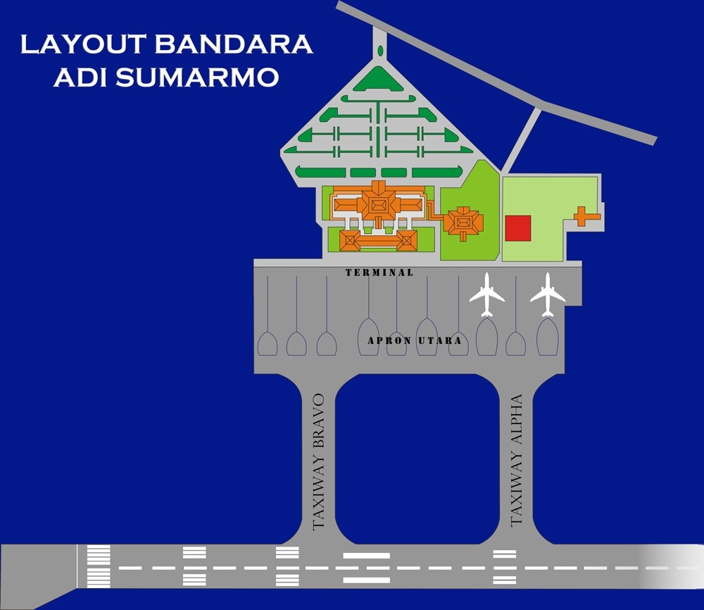
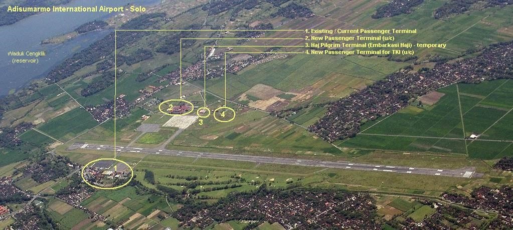
Airfield Details
|
Airfield Details |
|||
|---|---|---|---|
|
Customs |
Yes |
JET A-1 fuel |
Yes |
|
Immigration |
Yes |
AVGAS 100 |
No |
|
Terminal Building |
Yes |
Single Point Refueling |
No |
|
Passenger Terminal |
Yes |
Air Starter Units |
Yes |
|
Cargo terminal |
Yes |
Ground Power (mobile) |
Yes |
|
Pax transport to airfield |
Yes |
Crash Crew |
Yes |
|
Control Tower |
Yes |
Aircraft Support Services |
Yes |
|
Weather Facilities |
Yes |
Latrine Servicing |
Yes |
|
Catering Services |
Yes |
Fire Fighting |
Yes |
|
Base Operating Room |
Yes |
Fire Fighting Category (ICAO) |
Category: VIII |
|
Airport Radar |
No |
Fire Fighting Equipment |
Yes |
|
NDB |
Yes |
De-icing Equipment |
No |
|
VOR |
Yes |
IFR Procedures |
Yes |
|
ILS |
Yes |
Runway Lights |
Yes |
|
Approach Lights |
Yes |
Parking Ramp Lighting |
Yes |
Runway
|
Runway #1 |
|
|---|---|
|
Published Length (m) |
2,600 |
|
Usable Length (m) |
2,600 |
|
Width (m) |
45 |
|
Orientation |
077/257 or 08/26 |
|
Surface |
PCN 68/F/C/X/T |
|
Taxiway |
Asphalt; 240 m x 23 m |
|
Apron |
Rigid (Alpha) & Asphal Concrete (Bravo) 420 m x 135 m |
Helicopter Pad(s)
|
Helipad : South Apron |
|
|---|---|
|
Present |
Yes |
|
Width and Length (metres) |
137 X 83 meters |
|
Surface |
PCN 31 FXCT - Asphalt |
|
Helipad : North Apron |
|
|---|---|
|
Present |
Yes |
|
Width and Length (metres) |
375 X 135 meters |
|
Surface |
PCN 71 FXCT – Rigid pavement |
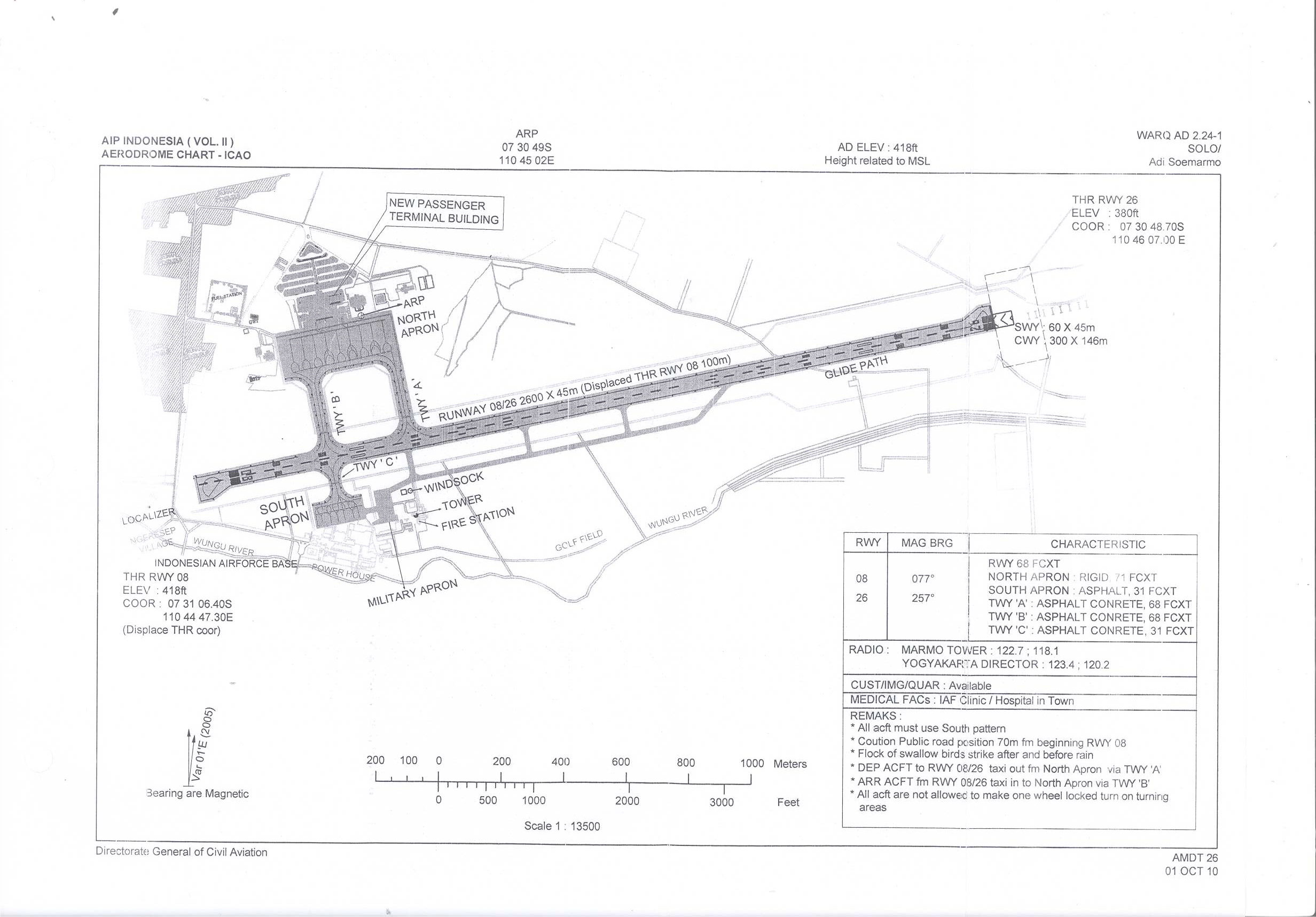
Airport Operating Details
|
Airport Operating Details |
|||||||
|---|---|---|---|---|---|---|---|
|
Max size aircraft that can be offloaded on bulk cargo |
Boeing 747 – Limitation on payload |
||||||
|
Max size cargo aircraft that can be offloaded on pallet |
Boeing 747 – Limitation on payload |
||||||
|
Total Parking Area |
m² |
13,673 |
|||||
|
Storage Capacity |
mt |
500 |
|||||
|
Cargo Handling Equipment |
Yes |
No |
If yes, specify below |
||||
|
- Elevators / Hi-loaders |
Yes |
Max. Capacity: |
5 |
mt |
Can reach the upper deck of B747? |
No |
|
|
- Loading Ramps |
YES |
||||||
Costs-Navigation Charges
https://www.ap1.co.id/en/information/tarif-jasa-kebandarudaraan
Costs-Airfield Charges
https://www.ap1.co.id/en/information/tarif-jasa-kebandarudaraan
Costs – Aircraft Handling Charges
https://www.ap1.co.id/en/information/tarif-jasa-kebandarudaraan
Airfcraft Servicing Charges
https://www.ap1.co.id/en/information/tarif-jasa-kebandarudaraan
Ground Handling Company
Contact for Aircraft, Passenger and Cargo handling services
|
Aircraft Handling Agent |
|||
|---|---|---|---|
|
Name & Address |
PT. Gapura Angkasa Surakarta Bandara Int. Adi Sumarmo Surakarta, Central Java |
||
|
Telephone |
Fax |
||
|
|
|
Web |
|
Costs – Cargo Terminal Charges
|
Cargo Terminal Charges |
|
|---|---|
|
Import |
Rate US$ / kg |
|
Handling Charge per kg |
https://www.ap1.co.id/en/information/tarif-jasa-kebandarudaraan. |
|
Break Bulk Fee |
|
|
Diplomatic Mail |
|
|
Strong Room – per consignment |
|
|
Cold Storage Fee |
|
|
Delivery outside normal working hours |
|
|
Preparation of substitute AOA – Invoice – Receipt |
|
|
Storage per kg per day – Grace period? hours |
|
|
Export |
Rate US$ / kg |
|
Handling charges – Unpalletized cargo |
https://www.ap1.co.id/en/information/tarif-jasa-kebandarudaraan |
|
International Air Way Bill |
|
|
Local Air Way Bill |
|
|
Air Way Bill Amendment - Cancellation |
|
|
Air Way Bill Documentation |
|
|
Diplomatic Mail |
|
|
Storage charges per kg per day |
|
Costs – Air-bridge Charges
https://www.ap1.co.id/en/information/tarif-jasa-kebandarudaraan
Costs – Fuel Services Charges
There is a Pertamina depot within the airport stocking AVTUR, with fleet of 10 fuel tankers to supplying aircraft on the apron.
|
Jet A-1 Prices |
Rates |
|---|---|
|
For international flights ** |
|
|
For domestic flights * |
|
|
Not Into Aircraft Delivery * |
|
|
Packaged product * |
|
Avgas Prices |
Rates |
|
|---|---|---|
|
Packaged product * |
||
|
Methmix Prices |
Rates |
|
|
Packaged product * |
0.00 IDR per litre |
|
|
* |
Government tax is inclusive (not applicable for International Flights) |
|
|
** |
Fuel price for International flight is only applicable for outbound flights from Indonesian Airports to overseas |
|
Security
The airport is a joint airbase with the air force – there is a permanent military presence and security regulations are well enforced.
|
Security |
||
|---|---|---|
|
X Good |
Marginal |
Bad |
Storage Facilities
There are small purpose built warehouses for the ground handling companies:
- Import Cargo WH of 500 M2
- Export Cargo WH of 500 M2
There are no cold storage (reefer) facilities.
For emergency responses, Angkasa Pura indicated that there is
plenty of un-surfaced space adjacent to the apron and cargo area
that could be used as open storage if the airport was to be
utilized as a Humanitarian Staging Area.
The air force base within the airport compound has much larger open
areas and surfaces aprons and hangars that could facilitate a HSA
within the airport perimeter – if permission was obtained.
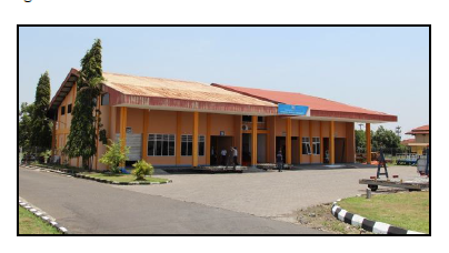
Customs Contact
|
Customs |
|||
|---|---|---|---|
|
Name & Address |
KPPBC Tipe Madya Pabean B Surakarta Jl. L. U. Adi Sucipto No. 36, Colomadu, Surakarta |
||
|
Telephone |
Fax |
||
2.2.15 Indonesia Yogyakarta Adisutjipto International Airport
Airport Overview
Yogyakarta Adisutjipto airport is located in Sleman district, about 6 km from the city centre of Yogyakarta. The airport serves as the air gateway for the province as well as surrounding districts under Central Java Province. The airport was originally a military airbase and expanded for civilian aviation, covering domestic and international flights. Due to overcapacity and limitation of land for development and expansion, some commercial flights have gradually relocated to the new Yogyakarta International Airport located in Kulon Progo, about 43 km from the city centre (1,5 hours’ drive by car), expected to be fully operational by early 2020. Once the new airport is fully operational, Adisutjipto airport will only serve limited commercial flights for domestic, private aviation (chartered) and military.
The airport operates from 05.00 – 24.00 WIB (22.00 – 17.00 UTC).
|
Airport Location and Contact |
|
|
Country |
INDONESIA |
|
Province or District |
YOGYAKARTA |
|
Nearest Town or City with Distance from Airport |
Yogyakarta 6 (km) from city centre |
|
Airport’s Complete Name |
BANDAR UDARA ADISUTJIPTO YOGYAKARTA |
|
Latitude |
-7.786905 |
|
Longitude |
110.431330 |
|
Elevation (ft and m) |
379 ft (115.5 m) |
|
IATA Code |
WAHH |
|
ICAO Code |
JOG |
|
Managing Company or Airport Authority |
PT. Angkasa Pura I (Persero) Adisutjipto International Airport Jalan Raya Solo km.
9 Yogyakarta Indonesia |
|
Management Contact Person |
Abdul Rokhim (Sales Department Head) Ph. +62 81216216550 Email abdul.rokhim@ap1.co.id |
|
Open From (hours) |
22:00 UTC (05.00 WIB) |
|
Open To (hours) |
17:00 UTC (24.00 WIB) |
Airport Picture
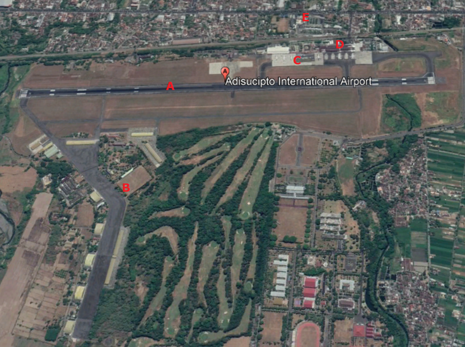
A : Runway
B : Indonesian Air Force Flying School
C : Apron
D : Terminal A and B
E : Office Airport
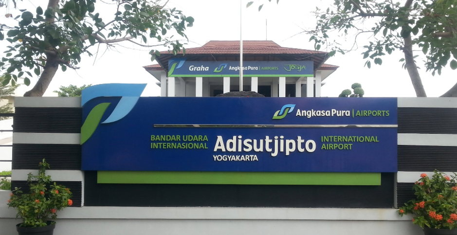
Description and Contacts of Key Companies
The airport is managed by the government state-owned company PT. Angkasa Pura I (Persero).
PT. Angkasa Pura I (Persero) Adisutjipto Airport
Address Jalan Raya Solo km. 9 Yogyakarta Indonesia
Ph. +62-274-484261
Email humas.jog@ap1.co.id
Contact Abdul Rokhim (Sales Department Head)
Ph. +62 81216216550
Email abdul.rokhim@ap1.co.id
Airlines that operates at Adisutjipto International Airport Yogyakarta:
|
Lion Air |
Sriwijaya Air |
|
Wings Air |
Express Air |
|
Air Asia |
Batik Air |
|
Garuda Indonesia |
Citilink |
|
Nam Air |
|
Information on some aviation service providers can be found at: http://www.azfreight.com/
Passenger and Cargo Performance Indicator
|
Performance for 2018 |
|||
|
|
Per Year |
Per Month |
Per Day |
|
Total Aircraft Movements |
32,400 |
2,700 |
90 |
|
Total Passengers |
4,156,920 |
346,410 |
11,547 |
|
Total Capacity of the Airport (MT) |
1,000,000 |
|
|
|
Current Activity of the Airport (MT) |
|
|
|
|
Current use by Humanitarian Flights (UNHAS) |
N/A |
|
|
Runways
|
Runway #1 |
|
|
Runway Dimensions |
2200 m |
|
Orientation |
09 – 27 |
|
Surface |
Asphalt 57 F/C/X/T |
Helicopter Pad(s)
Helipad is available at the Military area.
|
Helipad #1 |
|
|
Present |
Yes |
|
Largest Helicopter that can Land |
No Info |
|
Width and Length (m) |
No Info |
|
Surface |
Asphalt PCN 68 F/C/X/T and Grass |
Airport Infrastructure Details
|
Customs |
YES |
JET A-1 fuel |
YES |
|
Immigration |
YES |
AVGAS 100 |
YES |
|
Terminal Building |
YES |
Single Point Refueling |
No |
|
Passenger Terminal |
YES |
Air Starter Units |
YES |
|
Cargo terminal |
YES |
Ground Power (mobile) |
YES |
|
Pax Transport to Airfield |
YES |
Ground Handling Services |
YES |
|
Control Tower |
YES |
Latrine Servicing |
YES |
|
Weather Facilities |
YES |
Fire Fighting Category (ICAO) |
Cat VII |
|
Catering Services |
YES |
De-icing Equipment |
NO |
|
Base Operating Room |
YES |
Parking Ramp Lighting |
YES |
|
Airport Radar |
YES |
Approach & Runway Lights |
YES |
|
NDB |
YES |
VOR |
YES |
|
ILS |
YES |
|
|
Airport Operating Details
|
Operating Details |
|||
|
Maximum Sized Aircraft that can be Offloaded on Bulk Cargo |
B 737 - 800 |
||
|
Maximum Sized Aircraft that can be Offloaded on Pallet |
B 737 – 800 |
||
|
Total Aircraft Parking Area (m²) |
15,646 |
||
|
Storage Area (m3 and MT) |
Available and use for cargo International = 384 sqm Domestic = 450 sqm |
||
|
Handling Equipment |
|||
|
Elevators / Hi Loaders |
Yes |
Max Capacity (MT) |
No Info |
|
Max Height (m) |
No Info |
||
|
Loading Ramps |
Yes |
||
|
Other Comments |
|
||
Customs Guidance
Customs services is available at the airport area during airport operational hours.
KPPBC Tipe Madya Pabean B Yogyakarta
Jl. Solo km.9-10, Kotak Pos 10 YKAP, Yogyakarta 55282
Phone: +62-274-489405 ext 111
Mobile: +62 8112831051 (WhatsApp only)
Website: http://bcyogyakarta.beacukai.go.id
For more information on customs in Indonesia, please see the following link: http://www.beacukai.go.id/
Storage Facilities
Storage facilities are available at the airport for cargoes:
- International = 384 m2
- Domestic = 450 m2
Airfield Costs
NAVIGATION CHARGES
Information about the rates and charges can be found at the following link: https://ap1.co.id/en/information/tarif-jasa-kebandarudaraan/
|
Charges |
Aircraft Weight - MTOW (kg) |
||
|
|
20.000-40.000 |
40.000-100.000 |
100.000 and over |
|
Navigation (per journey) USD - $ |
|
|
|
|
Landing USD - $ |
3.28 |
3.93 |
4.72 |
|
Night Landing USD - $ |
|
|
|
|
Night Take-Off USD - $ |
|
|
|
|
Parking |
4.72 |
|
|
|
Handling Charges |
|
|
|
FUEL SERVICES CHARGES
Updated fuel cost can be found at: https://www.pertamina.com/aviation/News.aspx?p=price
|
|
Price per Litre USD - $ |
|
Jet A-1 |
9,210.00 IDR per litre / 66.60 US Cent per litre |
|
Avgas |
4,082,670.00 IDR per Drum |
*Government taxes (VAT 10% and income tax 0.3%) are excluded (not applicable for International Flights)
**Fuel price for International flight is only applicable for outbound flights from Indonesian Airports to overseas
CARGO TERMINAL CHARGES
|
Import Charges |
||
|
Type of Charge |
Rate IDR per kg |
Comments |
|
Handling Charge |
IDR 650 IDR 860 IDR 500 |
Incoming international Outgoing international Incoming and outgoing domestic |
|
Break Bulk Fee |
- |
|
|
Diplomatic Mail |
- |
|
|
Strong Room – per consignment |
- |
|
|
Cold Storage Fee |
- |
|
|
Delivery Outside Normal Working Hours |
IDR 600 |
|
|
Preparation of substitute AOA – Invoice – Receipt |
- |
|
|
Storage per Day |
- |
|
|
Export |
||
|
Handling Charges – Un-palletized Cargo |
IDR 650 IDR 860 IDR 500 |
Incoming international Outgoing international Incoming and outgoing domestic |
|
International Air Waybill |
- |
|
|
Local Air Waybill |
- |
|
|
Air Way Bill Amendment - Cancellation |
- |
|
|
Air Way Bill Documentation |
- |
|
|
Diplomatic Mail |
- |
|
|
Storage Charges per Day |
IDR 650 |
|
AIR-BRIDGE CHARGES
There is no air-bridge facility at the airport.
Security
The airport is located within the same area and in close proximity with the Military Airbase.
2.2.16 Indonesia Central Java Tunggul Wulung Airport
Airport Overview
Tunggul Wulung Airport is a small airport (class III) and generally serves passenger for the city of Cilacap in Central Java. It is located 9 km from the city downtown. The airport has one runway, with dimensions of 1,400m (4,593 ft) by 30m (98 ft) which allows the operation of aircraft up to ATR 72-600. The airport is operated by the Airport Implementing Technical Unit (UPBU) under authorisation of Directorate General of Civil Aviation, Ministry of Transportation. It is operated from 08.00 – 16.00 WIB (01.00 – 09.00 UTC).
|
Airport Location and Contact |
|
|
Country |
Indonesia |
|
Province or District |
Cilacap District, Central Java Province |
|
Nearest Town or
City |
Cilacap 9 km |
|
Airport’s Complete Name |
TUNGGUL WULUNG AIRPORT |
|
Latitude |
-7.645182 |
|
Longitude |
109.033814 |
|
Elevation (ft and m) |
69 ft / 21 m |
|
IATA Code |
CXP |
|
ICAO Code |
WAHL |
|
Managing Company or Airport Authority |
Directorate General of Civil Aviation Airport Tunggul Wulung Address JL. Tritih – Wangon, Jeruk legi – Cilacap
Phone: +62-282-5255122 |
|
Management Contact Person |
Name Muhammad Syaiful Zuhri Ph. +62 811406669 Email Bandara_twl@yahoo.co.id |
|
Open From (hours) |
01.00 UTC (08:00 WIB) |
|
Open To (hours) |
09.00 UTC (16:00 WIB) |
Airport Picture
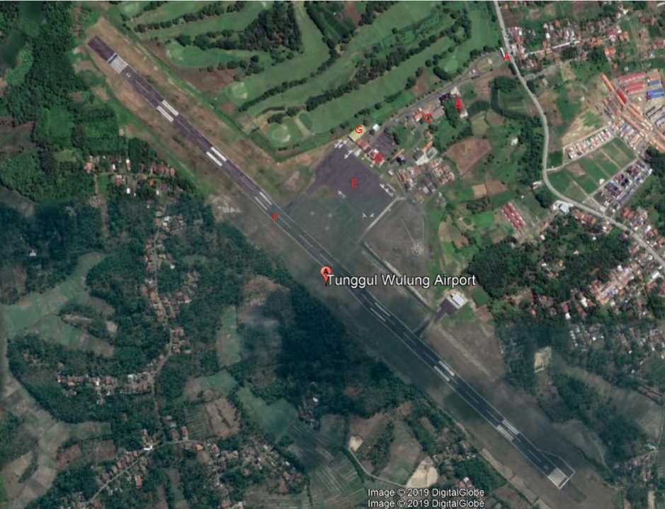
|
A = Gate B = Agricultural Quarantine Station C = DGCA Office D = Passenger Terminal |
E = Apron F = Runway G = International Flight School |
Description and Contacts of Key Companies
UPBU Tunggul Wulung Airport
Address JL. Tritih – Wangon, Jeruk legi – Cilacap
Phone: +62-282-5255122
Fax: +62-282-525512
Contact Muhammad Syaiful Zuhri
Ph 0811406669
Email Bandara_twl@yahoo.co.id
Airlines that operates in Tunggul Wulung:
- Pelita Air (www.pelita-air.com) -Charter
- Susi Air (www.susiair.com)
Information on some aviation service providers can be found at: http://www.azfreight.com/
Passenger and Cargo Performance Indicator
|
Performance for 2018 |
|||
|
|
Per Year |
Per Month |
Per Day |
|
Total Aircraft Movements |
16,081 |
1,341 |
51 |
|
Total Passengers |
9,646 |
803 |
26 |
|
Total Capacity of the Airport (MT) |
- |
- |
- |
|
Current Activity of the Airport (MT) |
- |
- |
- |
|
Current use by Humanitarian Flights (UNHAS) |
- |
- |
- |
Runways
The current runway is planned to be extended to 1,600 m to serve bigger size airplane. The development work is planned to start in 2020
|
Runway #1 |
|
|
Runway Dimensions |
1400 m x 30 m |
|
Orientation |
Runway 13 and 31 |
|
Surface |
Asphalt, 16 F/C/Y/T |
Helicopter Pad(s)
There are 3 helipads available at the airport. No further info about the specifications.
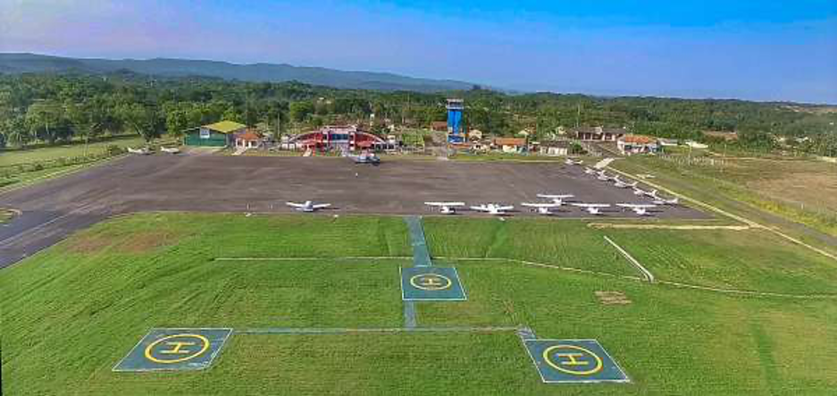
Picture source: Directorate general of Civil Aviation, Ministry of Transportation
Airport Infrastructure Details
|
Customs |
|
JET A-1 fuel |
Yes |
|
Immigration |
No |
AVGAS 100 |
Yes |
|
Terminal Building |
Yes |
Single Point Refueling |
No |
|
Passenger Terminal |
Yes |
Air Starter Units |
No |
|
Cargo terminal |
No |
Ground Power (mobile) |
No |
|
Pax Transport to Airfield |
No |
Ground Handling Services |
Yes |
|
Control Tower |
Yes |
Latrine Servicing |
No |
|
Weather Facilities |
Yes |
Fire Fighting Category (ICAO) |
5 |
|
Catering Services |
No |
De-icing Equipment |
No |
|
Base Operating Room |
No |
Parking Ramp Lighting |
No |
|
Airport Radar |
No |
Approach & Runway Lights |
Runway Light Yes |
|
NDB |
Yes |
VOR |
Yes |
|
ILS |
No |
|
|
Airport Operating Details
|
Operating Details |
|||
|
Maximum Sized Aircraft that can be Offloaded on Bulk Cargo |
ATR 72 – 500 |
||
|
Maximum Sized Aircraft that can be Offloaded on Pallet |
No Info |
||
|
Total Aircraft Parking Area (m²) |
190 x 96.5 m |
||
|
Storage Area (m3 and MT) |
|
||
|
Handling Equipment |
|||
|
Elevators / Hi Loaders |
No |
Max Capacity (MT) |
|
|
Max Height (m) |
|
||
|
Loading Ramps |
No |
||
|
Other Comments |
|
||
Customs Guidance
Customs office is located in Cilacap City, about 10 km from the airport.
KPPBC Tipe Madya Pabean C Cilacap
Jl. Jend. Sudirman (Sleko), Cilacap – 53213,
Phone: +62-282-534127 / 534126,
Fax: +62-282-533846,
Website: http://bccilacap.beacukai.go.id
For more information on customs in Indonesia, please see the following link: http://www.beacukai.go.id/
Storage Facilities
No cargo terminal and storage facility at the airport; however, open space can be utilised.
Airfield Costs
For information on airport rates and charges, refer to government regulation on the following link:
www.dephub.go.id (PP.15 Tahun 2016)
http://jdih.dephub.go.id/assets/uudocs/perpres/2016/PP_15_Tahun_2016.pdf
NAVIGATION CHARGES
|
Charges |
Aircraft Weight - MTOW (kg) |
||
|
|
0 - 7,000 |
7,001 - 136,000 |
136,001 and over |
|
Navigation (per journey) USD - $ |
|
|
|
|
Landing USD - $ per 1,000 kgs |
0.14 |
0.14 |
|
|
Night Landing USD - $ |
13.85 |
13.85 |
|
|
Night Take-Off USD - $ |
13.85 |
13.85 |
|
|
Parking per hours per 1,000 kgs |
0.02 |
0.02 |
|
|
Handling Charges |
|
|
|
FUEL SERVICES CHARGES
Update price can be found in https://www.pertamina.com/aviation/News.aspx?p=price
|
|
Price per Litre USD - $ per Mei 2019 |
|
Jet A-1 |
9,300.00 IDR per litre / 67.20 US Cent per litre |
|
Avgas |
1.254 |
* Government taxes (VAT 10% and income tax 0.3%)
are excluded (not applicable
for International
Flights)
**Fuel price for
International flight is only applicable for outbound flights from
Indonesian Airports to
overseas
***valid
until 14 Dec
2019
CARGO TERMINAL CHARGES
No cargo terminal and storage facility at the airport.
AIR-BRIDGE CHARGES
No air-bridge facility at the airport.
Security
Security facility at Tunggul Wulung Airport:
- X-Ray (Cabin and Baggage)
- CCTV
- WTMD
- Hand radio
- Hand Held Metal Detector
2.2.17 Indonesia West Java Pangandaran Nusawiru Airport
Overview
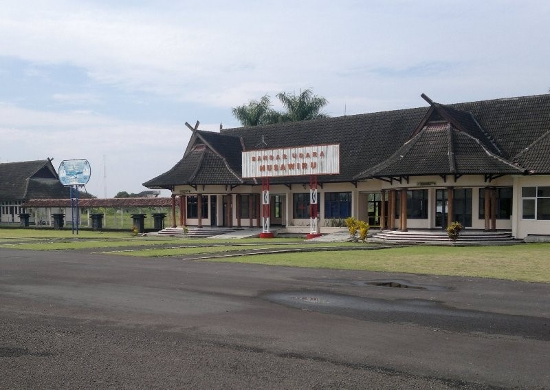
|
Company Name & Address |
Contact Names & Email |
Telephone & Fax |
|---|---|---|
|
|
|
|
|
Nusawiru Airport (Indonesian: Bandara Nusawiru ), also known as Pangandaran Airport, is an airport near Pangandaran, Ciamis, a city in the province of West Java on the island of Java in Indonesia. |
||
|
Location Details |
|||
|---|---|---|---|
|
Country |
Indonesia |
Latitude |
07° 43' 13.40" S |
|
Province / District |
West Java / Cijulang, Ciamis |
Longitude |
108° 29' 23.78" E |
|
Town or City (closest) |
Ciamis / Pangandaran |
Elevation |
16 ft / 5 meter |
|
Airfield Name |
Nusawiru / Pangandaran Airport |
International Airport |
NO |
|
IATA & ICAO codes |
N/A |
Open from/to (hours) |
N/A |
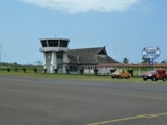
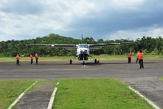
Airfield Details
|
Airfield Details |
|||
|---|---|---|---|
|
Customs |
No |
JET A-1 fuel |
Yes |
|
Immigration |
Yes |
AVGAS 100 |
No |
|
Terminal Building |
Yes |
Single Point Refueling |
No |
|
Passenger Terminal |
Yes |
Air Starter Units |
No |
|
Cargo terminal |
No |
Ground Power (mobile) |
No |
|
Pax transport to airfield |
No |
Crash Crew |
Yes |
|
Control Tower |
Yes |
Aircraft Support Services |
Yes |
|
Weather Facilities |
Yes |
Latrine Servicing |
Yes |
|
Catering Services |
No |
Fire Fighting |
Yes |
|
Base Operating Room |
Yes |
Fire Fighting Category (ICAO) |
Category: N/A |
|
Airport Radar |
No |
Fire Fighting Equipment |
Yes |
|
NDB |
No |
De-icing Equipment |
No |
|
VOR |
No |
IFR Procedures |
No |
|
ILS |
No |
Runway Lights |
No |
|
Approach Lights |
No |
Parking Ramp Lighting |
No |
Runway
|
Runway #15/33 |
|
|---|---|
|
Published Length (m) |
1387 meter |
|
Usable Length (m) |
1387 meter |
|
Width (m) |
29 meter |
|
Orientation |
072/252 |
|
Surface |
PCN 017FBXU |
2.2.18 Indonesia East Java Abdul Rachman Saleh Airport Malang Airport
Airport Overview
The airport is located in Malang district, East Java Province, about 76 km from Surabaya city the capital of East Java province, and 17 km from Malang city. The airport was originally used as an operating base by the Indonesian Air Force, and civil aviation activities used the terminal inside the air force base for passenger service. On 30 December 2011 a new terminal was opened separating the civil aviation terminal from the air force base.
|
Airport Location and Contact |
|
|
Country |
Indonesia |
|
Province or District |
East Java / Malang District |
|
Nearest Town or City |
Malang City, 17 km |
|
Airport’s Complete Name |
Abdul Rachman Saleh Airport |
|
Latitude |
07°55′35.60″S |
|
Longitude |
112°42’52.25″E |
|
Elevation (ft and m) |
1726 Ft / 526 M |
|
IATA Code |
MLG |
|
ICAO Code |
WARA |
|
Managing Company or Airport Authority |
Air Force Military and East Java Government |
|
Management Contact Person |
Purwo Cahyo, Phone: +62 82131617370 Email: bandaraABDsaleh@yahoo.com |
|
Open From (hours) |
07.00 – 17.00 WIB |
Airport Picture
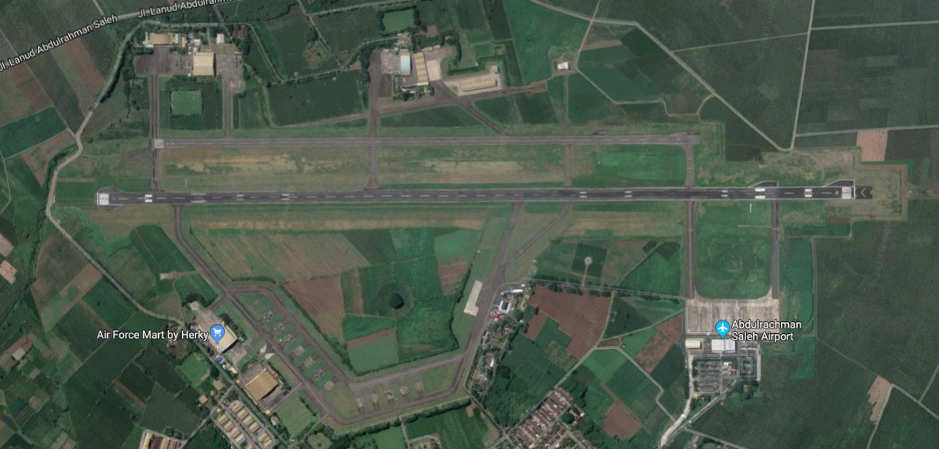
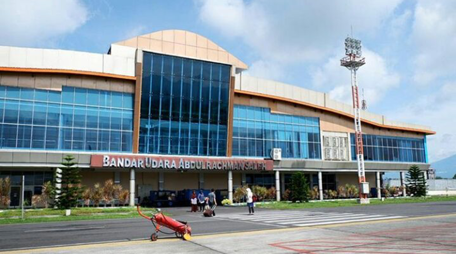
Description and Contacts of Key Companies
The airport is the only airport managed by the provincial government and regulated under local government regulation of East Java Province number 10, 2012. The airport is operated by UPTD Bandar Udara (Airport Regional Technical Implementation Unit) under Transportation Office of East Java Province.
The airlines that operate at the airport include:
|
Airlines |
Destination |
Website |
|
Citilink |
Jakarta (HLP, CGK) |
|
|
Wings Air |
Bandung (BDO), Surakarta (SOC), Denpasar (DPS) |
|
|
Lion Air |
Jakarta (CGK) |
|
|
Sriwijaya Air |
Jakarta (CGK) |
|
|
Batik Air |
Jakarta (HLP) |
|
|
Garuda Indonesia |
Jakarta (CGK) |
Information on some aviation service providers can be found at: http://www.azfreight.com/
Passenger and Cargo Performance Indicator
|
Performance for YEAR 2018 |
|||
|
|
Per Year |
Per Month |
Per Day |
|
Total Aircraft Movements |
10,004 |
834 |
30 |
|
Total Passengers |
1,332,863 |
111,072 |
3,700 |
|
Total Capacity of the Airport (MT) |
2,435 |
200 |
3 |
|
Current Activity of the Airport (MT) |
n/a |
n/a |
n/a |
|
Current use by Humanitarian Flights (UNHAS) |
n/a |
n/a |
n/a |
Runways
|
Runway #1 |
|
|
Runway Dimensions |
2500 m X 40 m |
|
Orientation |
165/345 |
|
Surface |
53 FCXT |
Helicopter Pad(s)
There is no dedicated helipad facility in this airport. However, the open space can be utilised if needed.
|
Helipad #1 |
|
|
Present |
No |
|
Largest Helicopter that can Land |
No |
|
Width and Length (m) |
No |
|
Surface |
No |
Airport Infrastructure Details
|
Customs |
N/A |
JET A-1 fuel |
Yes |
|
Immigration |
N/A |
AVGAS 100 |
N/A |
|
Terminal Building |
Yes |
Single Point Refueling |
N/A |
|
Passenger Terminal |
Yes |
Air Starter Units |
No |
|
Cargo terminal |
Yes |
Ground Power (mobile) |
Yes |
|
Pax Transport to Airfield |
Yes |
Ground Handling Services |
Yes |
|
Control Tower |
Yes |
Latrine Servicing |
N/A |
|
Weather Facilities |
Yes |
Fire Fighting Category (ICAO) |
Yes |
|
Catering Services |
No Info |
De-icing Equipment |
N/A |
|
Base Operating Room |
Yes |
Parking Ramp Lighting |
Yes |
|
Airport Radar |
Yes |
Approach & Runway Lights |
Approach Light: Yes Runway Light: Yes |
|
NDB |
N/A |
VOR |
N/A |
|
ILS |
N/A |
Airport Operating Details
|
Operating Details |
|||
|
Maximum Sized Aircraft that can be Offloaded on Bulk Cargo |
AIR BUS A – 320 & Boeing 737 900 ER |
||
|
Maximum Sized Aircraft that can be Offloaded on Pallet |
AIR BUS A – 320 & Boeing 737 900 ER |
||
|
Total Aircraft Parking Area (m²) |
300 M X 110 M |
||
|
Storage Area (m3 and MT) |
1000 SQM |
||
|
Handling Equipment |
|||
|
Elevators / Hi Loaders |
No |
Max Capacity (MT) |
Nil |
|
Max Height (m) |
Nil |
||
|
Loading Ramps |
Yes |
||
|
Other Comments |
No |
||
Customs Guidance
Since the airport only serves domestic flight, there is no CIQ facility at the airport. Customs office is available in Malang City at below address (on-call basis):
Jl. Surabaya No. 2 - Malang
Telp. +62-341-551628 Fax. +62-341-554193
Website: www.beacukaimalang.com
Email: informasi_kppbcmalang@ymail.com | kppbcmalang@yahoo.co.id
For more information on customs in Indonesia, please see the following link: http://www.beacukai.go.id/websitenewV2/index.html
Storage Facilities
One storage facility is available at the airport, with a capacity of 1,000 m2 for storing the cargoes.
Security
- 2 security posts
- 1-unit ETD (Explosive Trace Detection)
- CCTV Terminal
2.2.19 Indonesia Maluku Pattimura International Airport Ambon
Airport Overview
Located in the capital of Maluku Province, the Pattimura International airport is about a 60-minute drive or 38 km from Ambon city. However, the newly constructed Merah Putih Bridge that passed-over the bay of Ambon will help to shorten the travel time by 30 minutes.
|
Airport Location and Contact |
|
|
Country |
Indonesia |
|
Province or District |
Maluku Province |
|
Nearest Town or City with Distance from Airport |
Ambon city, 38 km |
|
Airport’s Complete Name |
Pattimura International Airport |
|
Latitude |
03°42'27"S |
|
Longitude |
128°05'23"E |
|
Elevation (ft and m) |
33 ft |
|
IATA Code |
AMQ |
|
ICAO Code |
WAPP |
|
Managing Company or Airport Authority |
PT. Angkasa Pura I Bandara Internatioanal Pattimura |
|
Management Contact Person |
Ida Made Dwipayana Asst. Operation Mobile: +62 8124642639 |
|
Open From (hours) |
06.00 WIT |
|
Open To (hours) |
23.00 WIT |
Airport Picture
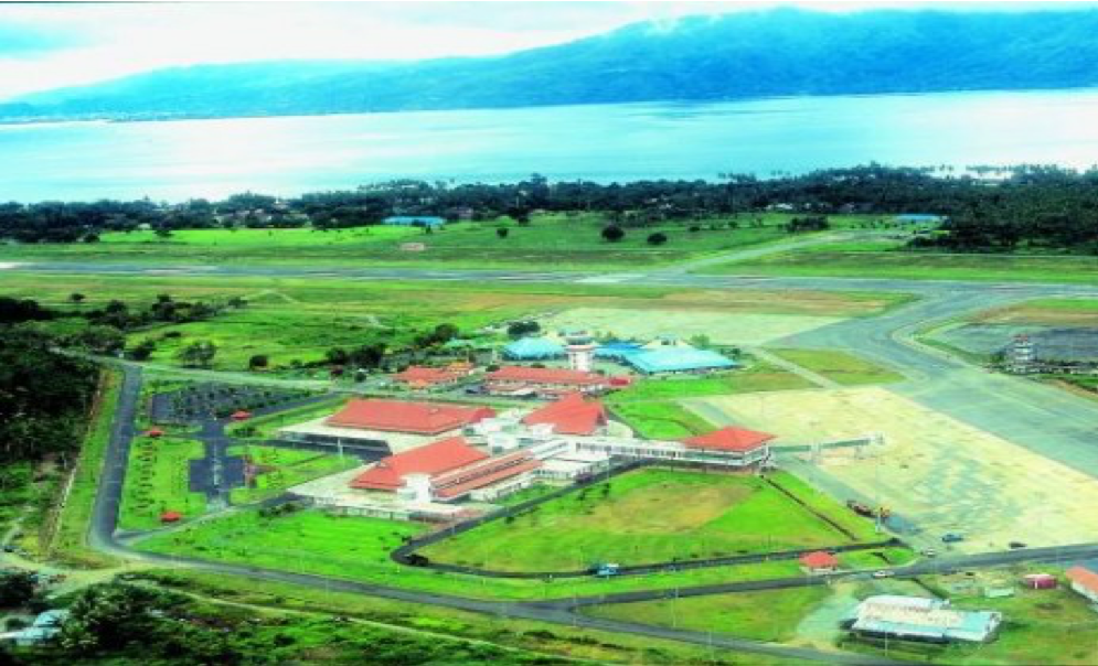
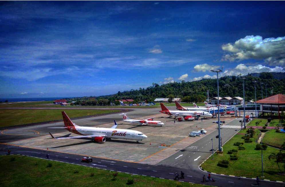
Description and Contacts of Key Companies
|
Airlines |
Destination |
Website |
|
Aviastar |
Banda, Kaisar, Kufar, Namlea, Namrole, Wahai |
|
|
Garuda Indonesia |
Jakarta (Soekarno Hatta), Makassar |
|
|
Lion Air |
Jakarta (Soekarno Hatta), Makassar |
|
|
Express Air |
Saumlaki |
|
|
Batik Air |
Jakarta (HLP), Jakarta (CGG), Makassar, Surabaya |
|
|
Nam Air |
Manado, Sorong |
|
|
Sriwijaya Air |
Ternate |
|
|
Susi Air |
Banda, Kufar, Namlea, Wahai |
|
|
Trigana Air Service |
Dobo, Langgur, Namrole, Saumlaki |
|
|
Wings Air |
Dobo, Langgur, FakFak, Kaimana, Langgur, Manokwari,Nabire, Saumlaki, Sorong |
|
|
Citilink |
Makassar, Jakarta (CGK), Surabaya |
Passenger and Cargo Performance Indicator
|
Performance for 2018 |
|||
|
|
Per Year |
Per Month |
Per Day |
|
Total Aircraft Movements |
20,012 |
|
|
|
Total Passengers |
1,410,000 |
|
|
|
Total Capacity of the Airport (MT) |
4,895 |
|
|
|
Current Activity of the Airport (MT) |
4,088 |
|
|
|
Current use by Humanitarian Flights (UNHAS) |
N/A |
|
|
Runways
|
Runway #1 (Existing) |
|
|
Runway Dimensions |
2500 m X 45 m |
|
Orientation |
04/22 |
|
Surface |
Asphalt ( PCN 68 RCXT ) |
|
Runway #2 (Under Development) * |
|
|
Runway Dimensions |
n/a |
|
Orientation |
|
|
Surface |
|
Airport Infrastructure Details
|
Customs |
On call |
JET A-1 fuel |
Yes |
|
Immigration |
Yes |
AVGAS 100 |
N/A |
|
Terminal Building |
Yes |
Single Point Refueling |
N/A |
|
Passenger Terminal |
Yes |
Air Starter Units |
Yes |
|
Cargo terminal |
Yes |
Ground Power (mobile) |
Yes |
|
Pax Transport to Airfield |
Yes |
Ground Handling Services |
Yes |
|
Control Tower |
Yes |
Latrine Servicing |
Yes |
|
Weather Facilities |
Yes |
Fire Fighting Category (ICAO) |
ICAO 7 |
|
Catering Services |
Yes |
De-icing Equipment |
N/A |
|
Base Operating Room |
Yes |
Parking Ramp Lighting |
Yes |
|
Airport Radar |
Yes |
Approach & Runway Lights |
Yes |
|
NDB |
Yes |
VOR |
Yes |
|
ILS |
Yes |
|
|
Airport Operating Details
|
Operating Details |
|||
|
Maximum Sized Aircraft that can be Offloaded on Bulk Cargo |
Boing 737 – 900 ER |
||
|
Maximum Sized Aircraft that can be Offloaded on Pallet |
C- 320 |
||
|
Total Aircraft Parking Area (m²) |
23,735 M2 |
||
|
Storage Area (m3 and MT) |
862 M2 |
||
|
Handling Equipment |
|||
|
Elevators / Hi Loaders |
Elevator (YES) Hi Loaders (NO) |
Max Capacity (MT) |
0.630 |
|
Max Height (m) |
|
||
|
Loading Ramps |
No |
||
|
Other Comments |
|
||
Storage Facilities
Located inside the airport compound, there is total 1400 m2 storage facility available for general cargoes.
Airfield Costs
NAVIGATION CHARGES
|
Charges |
Aircraft Weight - MTOW (kg) |
||
|
|
0 - 7,000 |
7,001 - 136,000 |
136,001 and over |
|
Navigation (per journey) USD - $ |
|||
|
Landing USD - $ |
|
||
|
Night Landing USD - $ |
|
||
|
Night Take-Off USD - $ |
|
||
|
Parking |
|
||
|
Handling Charges |
|
|
|
FUEL SERVICES CHARGES
Pertamina Depot is available in the airport compound and managed by the ground handling companies.
|
|
Price per Litre USD - $ |
|
Jet A-1 |
76.90 US Cent per litre (May 2019) |
|
Avgas |
N/A |
Update on fuel service charges can be found at Pertamina Posting Price website in the link below: http://aviation.pertamina.com/News.aspx?p=price
CARGO TERMINAL CHARGES
Cargo handling is managed by PT. Prathita Titan Nusantara (PTN) and PT. Gapura Angkasa.
|
Import Charges |
||
|
Type of Charge |
Rate USD - $ per kg |
Comments |
|
Handling Charge |
Currently, import charges are not applicable in Pattimura International airport. All the International cargoes should land in Jakarta International airport or international airports in other provinces.
|
|
|
Break Bulk Fee |
||
|
Diplomatic Mail |
||
|
Strong Room – per consignment |
||
|
Cold Storage Fee |
||
|
Delivery Outside Normal Working Hours |
||
|
Preparation of substitute AOA – Invoice – Receipt |
||
|
Storage per Day |
||
|
Export |
||
|
Handling Charges – Un-palletized Cargo |
|
|
|
International Air Waybill |
||
|
Local Air Waybill |
||
|
Air Way Bill Amendment - Cancellation |
||
|
Air Way Bill Documentation |
||
|
Diplomatic Mail |
||
|
Storage Charges per Day |
||
AIR-BRIDGE CHARGES
The current charge for take-off and landing costs IDR750,000.00 (or seven hundred fifty thousand rupiah).
Security
Currently, security facilities in the airport include:
- Five security posts
- One unit of Explosive Trace Detection (ETD)
- Waste and Hazardous Materials Division (WHMD)
- Walk Through Metal Detectors (WTMD)
- CCTCs terminal
2.2.20 Indonesia Sorong Domine Eduard Osok Airport
Airport Overview
Domine Eduard Osok Airport is located in Remu Selatan, Sorong City, West Papua Province, about 4 km from Sorong city and is operated by the Unit Penyelenggara Bandar Udara (UPBU), Directorate General of Civil Aviation (DGCA), Ministry of Transportation. The airport has a new terminal building, and its status has been upgraded from Class III to Class I (Main). This airport will continue to be renovated and developed to become the largest air gateway in Papua Island.
|
Airport Location and Contact |
|
|
Country |
Indonesia |
|
Province or District |
West Papua Province |
|
Nearest Town or
City |
Sorong City 4 KM |
|
Airport’s Complete Name |
Domine Eduard Osok Airport |
|
Latitude |
00°53′30″ S |
|
Longitude |
131°17′13″ E |
|
Elevation (ft and m) |
13 Feet |
|
IATA Code |
SOQ |
|
ICAO Code |
WASS |
|
Managing Company or Airport Authority |
Unit Penyelenggara Bandar Udara (UPBU), Directorate General of Civil Aviation (DGCA), Ministry of Transportation |
|
Management Contact Person |
Rasburhany U. ST, MT Head of Office Ph. +62 951 – 321631 / 327698 Baharun Ompusunggu Flight Safety and Security M. +62 813 1222 2858 Email. Domine.eduard@gmail.com |
|
Open From (hours) |
06.00 (WIT) |
|
Open To (hours) |
19.00 (WIT) |
Airport Picture
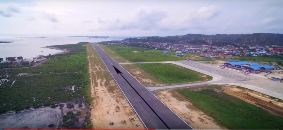
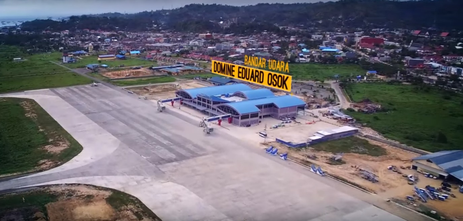
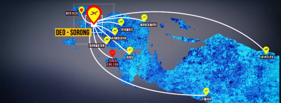
Description and Contacts of Key Companies
The airline companies in Domine Eduard Osok Airport:
|
Airlines |
Destination |
Website |
|
Batik Air |
Jakarta–Soekarno–Hatta, Makassar |
|
|
Nam Air |
Jakarta—Soekarno—Hatta, Jayapura, Manado |
|
|
Garuda Indonesia |
Ambon, Jayapura, Makassar, Manado, Manokwari, Timika |
|
|
XpressAir |
Jakarta—Soekarno—Hatta, Jayapura, Manado, Manokwari |
|
|
Sriwijaya Air |
Makassar, Manokwari, Timika |
|
|
Wings Air |
Ambon, Babo, Fak—Fak, Manado, Manokwari, Waisai |
|
|
Susi Air |
Ayawasi, Bintuni, Inanwatan, Kabare, Kambuaya, Teminabuan, Waisai |
Passenger and Cargo Performance Indicator
|
Performance for 2018 |
|||
|
|
Per Year |
Per Month |
Per Day |
|
Total Aircraft Movements |
9,654 |
804 |
26 |
|
Total Passengers |
778,288 |
64,857 |
2,161 |
|
Total Capacity of the Airport (MT) |
3,334 |
|
|
|
Current Activity of the Airport (MT) |
278 |
|
|
|
Current use by Humanitarian Flights (UNHAS) |
No |
|
|
Runways
|
Runway #1 |
|
|
Runway Dimensions |
L2500 x W45 |
|
Orientation |
09-27 |
|
Surface |
44/F/C/X/T Asphalt |
Airport Infrastructure Details
|
Customs |
Yes |
JET A-1 fuel |
Yes |
|
Immigration |
Yes |
AVGAS 100 |
No |
|
Terminal Building |
Yes |
Single Point Refueling |
No |
|
Passenger Terminal |
Yes |
Air Starter Units |
No |
|
Cargo terminal |
Yes |
Ground Power (mobile) |
Yes |
|
Pax Transport to Airfield |
Yes |
Ground Handling Services |
Yes |
|
Control Tower |
Yes |
Latrine Servicing |
Yes |
|
Weather Facilities |
Yes |
Fire Fighting Category (ICAO) |
Category: 8 |
|
Catering Services |
Yes |
De-icing Equipment |
No |
|
Base Operating Room |
Yes |
Parking Ramp Lighting |
Yes |
|
Airport Radar |
Yes |
Approach & Runway Lights |
Yes |
|
NDB |
Yes |
VOR |
Yes |
|
ILS |
Yes |
|
|
Airport Operating Details
|
Operating Details |
|||
|
Maximum Sized Aircraft that can be Offloaded on Bulk Cargo |
Boing 737 – 900 ER |
||
|
Maximum Sized Aircraft that can be Offloaded on Pallet |
Boing 737 – 900 ER |
||
|
Total Aircraft Parking Area (m²) |
495 m x 131 m (64,845 m2) |
||
|
Storage Area (m3 and MT) |
600 m2 |
||
|
Handling Equipment |
|||
|
Elevators / Hi Loaders |
No |
Max Capacity (MT) |
|
|
Max Height (m) |
|
||
|
Loading Ramps |
Yes |
||
|
Other Comments |
- |
||
Airfield Costs
For information on airport rates and charges, please see the following link:
www.dephub.go.id (PP.15 Tahun 2016)
http://jdih.dephub.go.id/assets/uudocs/perpres/2016/PP_15_Tahun_2016.pdf
NAVIGATION CHARGES
The costs below are charged based on the operational hours.
|
Charges |
Aircraft Weight - MTOW (kg) |
||
|
|
0 - 7,000 |
7,001 - 136,000 |
136,001 and over |
|
Navigation (per journey) USD - $ |
15% of the cost of flight navigation services for domestic routes and 10% for international routes* |
||
|
Landing USD - $ |
$ 0.21/1000 kg domestics $ 3.60/1000 kg international* |
$ 8.84/1000 kg domestics $ 148.1 / 1000 kg international* |
$ 26.02/1000 kg domestics $ 394.7 /1000 kg international* |
|
Night Landing USD - $ |
- |
- |
- |
|
Night Take-Off USD - $ |
- |
- |
- |
|
Parking |
$ 0.07 / 1000 kg / 12 hours – domestic $ 0.30 / 1000 kg / 12 hours – international* |
||
|
Handling Charges |
- |
- |
- |
* in case any international flights
FUEL SERVICES CHARGES
The Aircraft Refuelling Depot is available at the airport for aviation fuel. It is managed by PT. Pertamina (Persero).
More details can be found at: http://aviation.pertamina.com/News.aspx?p=price
|
|
Price per Litre USD - $ |
|
Jet A-1 |
10,970.00 IDR per litre / 81.50 US Cent per litre |
|
Avgas |
Nil |
CARGO TERMINAL CHARGES
Lintas Megantara and PT. IPTN are the ground handling companies at Domine Eduard Osok Airport for handling the cargo.
|
Import Charges |
||
|
Type of Charge |
Rate USD - $ per kg |
Comments |
|
Handling Charge |
All service costs are handled by each ground handling company with the approval of the Airport Authority* |
|
|
Break Bulk Fee |
||
|
Diplomatic Mail |
||
|
Strong Room – per consignment |
||
|
Cold Storage Fee |
||
|
Delivery Outside Normal Working Hours |
||
|
Preparation of substitute AOA – Invoice – Receipt |
||
|
Storage per Day |
||
|
Export |
||
|
Handling Charges – Un-palletized Cargo |
All service costs are handled by handled by each ground handling company with the approval of the Airport Authority* |
|
|
International Air Waybill |
||
|
Local Air Waybill |
||
|
Air Way Bill Amendment - Cancellation |
||
|
Air Way Bill Documentation |
||
|
Diplomatic Mail |
||
|
Storage Charges per Day |
||
* in case import and export activities
AIR-BRIDGE CHARGES
There is an air bridge facility at the airport of Domine Eduar Osok Sorong. The official tariffs for using the service at $14.26 per use.
Security
Domine Eduar Osok Airport is a civil airport. The overall security system is good. Security facilities at the airport include:
- 3 (Three) AVSEC post
- X-ray Machine
- Walkthrough Metal Detector
- Handheld Metal Detector
- CCTV
- Patrol Vehicle
2.2.21 Indonesia North Maluku Sultan Babullah Airport Ternate
The Airport of Ternate is 15 km from Ternate city centre on Ternate island in North Maluku Province. The airport operates from 05:00 – 20:00hrs for air traffic movements. It is a domestic airport serving as the main access point to the province, with a high flow of passengers and cargo.
The airport is geographically located in the volcanic island of Ternate, with numerous records of closure during the periodic eruptions of Mount Gamalama.
Airport Overview
|
Airport Location and Contact |
|
|
Country |
Indonesia |
|
Province or District |
North Maluku Province |
|
Nearest Town or
City |
Ternate 6 KM |
|
Airport’s Complete Name |
Sultan Babullah Airport |
|
Latitude |
00° 49’ 52“ N |
|
Longitude |
127° 22’ 49“ E |
|
Elevation (ft and m) |
49 Feet / 15 Meters |
|
IATA Code |
TTE |
|
ICAO Code |
WAEE |
|
Managing Company or Airport Authority |
Airport Implementation Unit (Unit Penyelenggara Bandar Udara/UPBU), Ministry of Transportation |
|
Management Contact Person |
Lilik Nirwanto M. +62 813 4063 9694 Email. Milarauf1@gmail.com |
|
Open From (hours) |
05:00 WIT |
|
Open To (hours) |
20:00 WIT |
Airport Picture
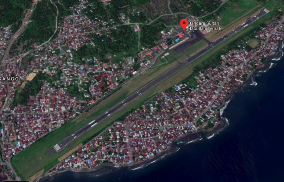
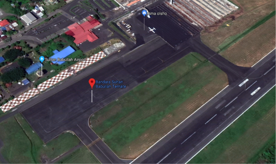
Description and Contacts of Key Companies
The airline companies in Sultan Babullah:
Garuda Indonesia (www.garuda-indonesia.com)
Lion Air (http://www.lionair.co.id)
Citilink Indonesia (www.citilink.co.id)
Batik Air (www.batikair.com)
Sriwijaya Air (www.sriwijayaair.co.id)
NAM Air (www.flynamair.com)
Passenger and Cargo Performance Indicator
|
Performance for 2018 |
|
|
|
Per Year |
|
Total Aircraft Movements |
2018 : 5773 |
|
Total Passengers |
2018 : 434,972 |
|
Total Capacity of the Airport (MT) |
2018 : 3,063 |
|
Current Activity of the Airport (MT) |
2018 : 3,063 |
|
Current use by Humanitarian Flights (UNHAS) |
No |
Runways
|
Runway #1 |
|
|
Runway Dimensions |
L2300 x W45 |
|
Orientation |
14-32 |
|
Surface |
Asphalt (45 F/C/X/T) |
Airport Infrastructure Details
|
Customs |
No |
JET A-1 fuel |
Yes |
|
Immigration |
No |
AVGAS 100 |
No |
|
Terminal Building |
Yes |
Single Point Refueling |
No |
|
Passenger Terminal |
Yes |
Air Starter Units |
No |
|
Cargo terminal |
Yes |
Ground Power (mobile) |
Yes |
|
Pax Transport to Airfield |
Yes |
Ground Handling Services |
Yes |
|
Control Tower |
Yes |
Latrine Servicing |
Yes |
|
Weather Facilities |
Yes |
Fire Fighting Category (ICAO) |
Category: 6 |
|
Catering Services |
Yes |
De-icing Equipment |
No |
|
Base Operating Room |
Yes |
Parking Ramp Lighting |
Yes |
|
Airport Radar |
No |
Approach & Runway Lights |
Yes |
|
NDB |
Yes |
VOR |
Yes |
|
ILS |
Yes |
|
|
Airport Operating Details
|
Operating Details |
|||
|
Maximum Sized Aircraft that can be Offloaded on Bulk Cargo |
B737-800NG |
||
|
Maximum Sized Aircraft that can be Offloaded on Pallet |
C-130 |
||
|
Total Aircraft Parking Area (m²) |
270 M x 60 M |
||
|
Storage Area (m3 and MT) |
Nil |
||
|
Handling Equipment |
|||
|
Elevators / Hi Loaders |
No |
Max Capacity (MT) |
|
|
Max Height (m) |
|
||
|
Loading Ramps |
In Cargo Area |
||
Airfield Costs
Flight costs can be seen at www.dephub.go.id.
NAVIGATION CHARGES
The costs below are charged based on the operational hours.
|
Charges |
Aircraft Weight - MTOW (kg) |
||
|
|
0 - 7,000 |
7,001 - 136,000 |
136,001 and over |
|
Navigation (per journey) USD - $ |
15% of the cost of flight navigation services for domestic routes and 10% for international routes* |
||
|
Landing USD - $ |
$ 0.21/1000 kg domestics $ 3.60/1000 kg international*
|
$ 8.84/1000 kg domestics $ 148.1 / 1000 kg international* |
$ 26.02/1000 kg domestics $ 394.7 /1000 kg international* |
|
Night Landing USD - $ |
- |
- |
- |
|
Night Take-Off USD - $ |
- |
- |
- |
|
Parking |
$ 0.07 / 1000 kg / 12 hours – domestic $ 0.30 / 1000 kg / 12 hours – international* |
||
|
Handling Charges |
- |
- |
- |
*in case any international flights
FUEL SERVICES CHARGES
The Aircraft Refuelling Depot is available at the airport for aviation fuel. It is managed by PT. Pertamina (Persero).
For more details can be found: http://aviation.pertamina.com/News.aspx?p=price
|
|
Price per Litre USD - $ |
|
Jet A-1 |
11,080.00 IDR per litre / USD 0.79 per litre |
|
Avgas |
Nil |
CARGO TERMINAL CHARGES
PT. Langgang Buana Perkasa (LBP) and PT. Adele are the ground handling companies in Sultan Babullah Airport for handling domestic cargo.
|
Import Charges |
||
|
Type of Charge |
Rate USD - $ per kg |
Comments |
|
Handling Charge |
All service costs are handled by each ground handling company with the approval of the Port Authority. |
|
|
Break Bulk Fee |
||
|
Diplomatic Mail |
||
|
Strong Room – per consignment |
||
|
Cold Storage Fee |
||
|
Delivery Outside Normal Working Hours |
||
|
Preparation of substitute AOA – Invoice – Receipt |
||
|
Storage per Day |
||
|
Export |
||
|
Handling Charges – Un-palletized Cargo |
All service costs are handled by handled by each ground handling company with the approval of the Port Authority. |
|
|
International Air Waybill |
||
|
Local Air Waybill |
||
|
Air Way Bill Amendment - Cancellation |
||
|
Air Way Bill Documentation |
||
|
Diplomatic Mail |
||
|
Storage Charges per Day |
||
AIR-BRIDGE CHARGES
Standard official tariffs are not yet set for air bridge services, currently ad-hoc rates are being used on temporary basis.
Security
Sultan Babullah Airport is a civil airport and has 4 (four) security posts:
- 2 (two) at run way edges
- 2 (two) at the entrance gate
2.2.22 Indonesia Bali Ngurah Rai International Airport
Port Overview
Bali's Ngurah Rai International Airport is one of Indonesia's main tourist gateways. It is served by the national flag carrier, Garuda Indonesia, on its international and domestic routes as well as by 12 international airlines on scheduled daily services and charter operators during the tourist holiday seasons. It is located 13 km south of Denpasar and 2.5 km from Kuta Beach Resort. This is Indonesia's third-busiest international airport.
The airport has four domestic air bridge/ gates and 14 International air bridges/gates. Aircraft that are not positioned at the terminal will be accommodated on the apron with 53 aircraft bays. Passengers are conveyed to and from the aircraft by air-bridge or bus.
The airport is currently undergoing extensive expansion in
regard to the passenger arrival and departure facilities. The
international terminal facilities will be increasing to 120,000m2
whilst the domestic terminal will increase to 65,800m2. The new
terminals will be able to support up to 17 million passengers per
annum by 2020.
For an up to date listing of airlines flying to the airport refer
to the following link:
Bali Ngurah Rai Airport Website
|
Location Details |
|||
|---|---|---|---|
|
Country |
Indonesia |
Latitude |
-8.748056 |
|
Province / District |
Bali |
Longitude |
115.1675 |
|
Town or City (Closest) |
Denpasar |
Elevation (ft and m) |
4m 13.12 feet |
|
Airfield Name |
Ngurah Rai International Airport |
IATA and ICAO Codes |
DPS WADD |
|
Open From (hours) |
00.00 |
Open To (hours) |
24.00 |

Runways
|
Runway #1 |
|
|---|---|
|
Runway Dimensions |
3000m x 45m |
|
Orientation |
09 |
|
Surface |
Asphalt 083FCXT |
|
Runway #2 |
|
|
Runway Dimensions |
3000m x 45m |
|
Orientation |
27 |
|
Surface |
Asphalt 083FCXT |
Helicopter Pad(s)
The aiport has 3 dedicated helicopter landing areas / pads, the largest helicopter can handle is Super Puma and the ground staff can handle 3 helicopters simultaneously.
Airport Infrastructure Details
|
Customs |
Yes |
JET A-1 fuel |
Yes |
|---|---|---|---|
|
Immigration |
Yes |
AVGAS 100 |
Yes |
|
Terminal Building |
Yes |
Single Point Refueling |
Yes |
|
Passenger Terminal |
Yes |
Air Starter Units |
Yes |
|
Cargo terminal |
Yes |
Ground Power (mobile) |
Yes |
|
Pax transport to airfield |
Yes |
Ground Handling Services |
Yes |
|
Control Tower |
Yes |
Latrine Servicing |
Yes |
|
Weather Facilities |
Yes |
Fire Fighting Category (ICAO) |
Category : IX |
|
Catering Services |
Yes |
De-icing Equipment |
No |
|
Base Operating Room |
Yes |
Parking Ramp Lighting |
Yes |
|
Airport Radar |
Yes |
Approach & Runway Lights |
Yes |
|
NDB |
Yes |
VOR |
Yes |
|
ILS |
Yes |
|
|
Passenger and Cargo Performance Indicator
|
Performance for 2016 |
Annual Figures |
|---|---|
|
Total aircraft movements |
127,750 |
|
Total passengers |
19,986,415 |
|
Total capacity of the airport (metric tonnes) |
n/a |
|
Current activity of the airport (metric tonnes) |
n/a |
|
Current use by Humanitarian flights (UNHAS) |
0 |
The airport currently has no capacity issues in relation to cargo handling
Airport Operating Details
|
Operating Details |
|||
|---|---|---|---|
|
Maximum sized aircraft which can be offloaded on bulk cargo: |
Boeing – 777 - 300 |
||
|
Maximum sized aircraft that can be offloaded on pallet |
Boeing – 777 - 300 |
||
|
Total aircraft parking area (m²) |
297,644 m2 |
||
|
Storage Area (mt) |
4771 m2 (Domestic & International cargo) |
Cubic Meters (m³) |
N/A |
|
Cargo Handling Equipment Available (Yes / No) |
Yes |
If "Yes" specify below Forklifts, hydraulic lifts, elevators, dollies |
|
|
Elevators / Hi Loaders (Yes / No) |
Yes |
Max Capacity (mt) |
7 |
|
Can elevators / hi loaders reach the upper level of a B747 (Yes / No) |
Yes |
||
|
Loading Ramps (Yes / No) |
Yes |
||
Storage Facilities
Current storage capacity at the airport is 3,835 m2in the international terminal and the domestic cargo storage is 936m2. There is limited cold storage available at the airport.
Airfield Cost
Navigation Charges
|
Aircraft Weight - MTOW (kg) |
Navigation (per journey) USD - $ |
Landing USD - $ |
Night Landing USD - $ |
Parking |
|
|---|---|---|---|---|---|
|
0 |
7,000 |
0.36/tonne |
Domestic:IDR3,885 / ton International: US $ 4.01 / ton (excluding VAT 10%) |
Night Landing Surcharge: 25 % or 50 % from Landing Charges |
Parking Charges: Domestic:IDR900 / ton International:US $ 0.41 / ton Parking Surcharge: Domestic:IDR200 / ton / hour International:US $ 0.11 / ton / hour Hangar Charges: Domestic:IDR900 / ton International:US $ 0.82 / ton |
|
7,001 |
136,000 |
0.29/tonne |
Domestic: IDR465,000 +IDR6,030 / ton International: US $ 437.60 + US $ 5.21 / ton (excluding VAT 10%) |
Night Landing Surcharge: 25 % or 50 % from Landing Charges |
Parking Charges: Domestic:IDR900 / ton International:US $ 0.41 / ton Parking Surcharge: Domestic:IDR200 / ton / hour International:US $ 0.11 / ton / hour Hangar Charges: Domestic:IDR900 / ton International:US $ 0.82 / ton |
|
136,001 |
and over |
28.12/tonne |
Domestic: IDR465,000 +IDR6,030 / ton International: US $ 437.60 + US $ 5.21 / ton (excluding VAT 10%) |
Night Landing Surcharge: 25 % or 50 % from Landing Charges |
Parking Charges: Domestic:IDR900 / ton International:US $ 0.41 / ton Parking Surcharge: Domestic:IDR200 / ton / hour International:US $ 0.11 / ton / hour Hangar Charges: Domestic:IDR900 / ton International:US $ 0.82 / ton |
|
Note 1: Night landing hours are between 1900 - 0700 hours Note 2: Parking charges are for each 6 hours or part therof Note 3: All of these charges are administered by the airport authorities and are the same for all airports in Bali |
|||||
Fuel Services Charges
Fuel is supplied by Pertamina from the onsite Tank farm. The fuel supply and fuel tariff is managed by PT. Pertamina.
|
|
Price per Unit |
|
Jet A-1 |
0.907 (USD) per litre for International Flights 1.00 (USD) per litre for Domestic Flights |
|
Avgas |
530.36 (USD) per 200 litre drum |
Cargo Terminal Charges
|
Import |
Rate US$ / kg |
|---|---|
|
Handling Charge per kg |
$0.30 per kg or part thereof |
|
Break Bulk Fee |
Based on airline tariffs |
|
Diplomatic Mail |
On request |
|
Strong Room – per consignment |
200% of the base tariff |
|
Cold Storage Fee |
200% of the base tariff |
|
Delivery outside normal working hours |
On request |
|
Preparation of substitute AOA – Invoice – Receipt |
$1.00 per kg or cbm or part thereof |
|
Storage per kg per day – Grace period? hours |
72 hours of storage is available free of charge. |
|
Export |
Rate US$ / kg |
|
Handling charges – Unpalletized cargo |
$0.30 per kg or cbm or part there of (abnormal consignment to be agree) |
|
International Air Way Bill |
$1.00 per kg or cbm or part there of + any airline fees surcharges applicable |
|
Local Air Way Bill |
$1.00 per kg or cbm or part there of + any airline fees surcharges applicable |
|
Air Way Bill Amendment - Cancellation |
$1.00 per kg or cbm or part there of + any airline fees surcharges applicable |
|
Air Way Bill Documentation |
$1.00 per kg or cbm or part there of + any airline fees surcharges applicable |
|
Diplomatic Mail |
On request |
|
Storage charges per kg per day |
$1.27 for 3 days or part there of (minimum) Dangerous good 100% of tariff |
Air-bridge Charges
Airbridge charges are included in the landing charges listed in the table above.
Security
Security at the airport is good with the use of x-ray scanners for cargo and passengers.
Companies Available
For information on Indonesia Airport contact details, please see the following link:
4.2.5 Indonesia Airport Company Contact List
Information on some aviation service providers can be found at: AZ Freight Website
2.2.23 Indonesia Nusa Tenggara Barat (NTB) Lombok International Airport
Airport Overview
The main airport in NTB is Lombok International Airport (Bandara International Lombok) (IATA: LOP, ICAO: WADL). Lombok International is
-
The island's only fully operational airport.
-
linked by road to the city of Mataram; approximately 40 kilometers to the northwest.
-
situated on 551.8 hectares (Indonesias’ second largest airport by surface area after Soekarno-Hatta International in Jakarta).
Airport website: Lombok Airport Website
|
Location Details |
|||
|---|---|---|---|
|
Country |
Indonesia |
Latitude |
-8.45290 |
|
Province / District |
NTB |
Longitude |
116.1635 |
|
Town or City (Closest) |
Mataram |
Elevation (ft and m) |
319 ft / 97 m |
|
Airfield Name |
Lombok International Airport |
IATA and ICAO Codes |
LOP/WADL |
|
Open From (hours) |
06.00 |
Open To (hours) |
24.00 |
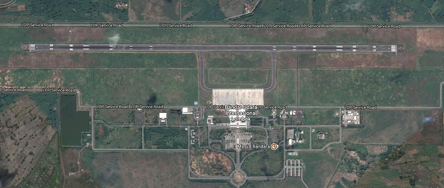
Runways
|
Runway #1 |
|
|---|---|
|
Runway Dimensions |
2750m x 45m |
|
Orientation |
East 31 – West 13 |
|
Surface |
56/F/A/X/T; (Flexible/Asphalt) |
|
Taxiway A |
371m x 23m |
|---|---|
|
Surface |
48/F/A/X/T; (Flexible/Asphalt) |
|
Taxiway B |
356m x 23m |
|
Surface |
60F/A/X/T; (Flexible/Asphalt) |
|
Apron |
132m x 382,5m |
|
Surface |
72/R/A/X/T; (Rigid/Concrete) |
Helicopter Pad(s)
There are no designated helicopter pads however there is adequate parking space for helicopters within the airport boundaries.
Airport Infrastructure Details
|
Customs |
Yes |
JET A-1 fuel |
Yes |
|---|---|---|---|
|
Immigration |
Yes |
AVGAS 100 |
No |
|
Terminal Building |
Yes |
Single Point Refueling |
No |
|
Passenger Terminal |
Yes |
Air Starter Units |
Yes |
|
Cargo terminal |
Yes |
Ground Power (mobile) |
Yes |
|
Pax transport to airfield |
No |
Ground Handling Services |
Yes |
|
Control Tower |
Yes |
Latrine Servicing |
Yes |
|
Weather Facilities |
Yes |
Fire Fighting Category (ICAO) |
Yes Cat: 7 |
|
Catering Services |
Yes |
De-icing Equipment |
No |
|
Base Operating Room |
Yes |
Parking Ramp Lighting |
Yes |
|
Airport Radar |
No |
Approach & Runway Lights |
Yes |
|
NDB |
No |
VOR |
Yes |
|
ILS |
Yes |
|
|
Passenger and Cargo Performance Indicator
|
Performance for 2016 |
Annual Figures |
|---|---|
|
Total aircraft movements |
34,975 for domestic flight 1,967 for international flight |
|
Total passengers |
3,196,918 for domestic 264,666 for international |
|
Total capacity of the airport (metric tonnes) |
n/a |
|
Current activity of the airport (metric tonnes) |
11,990 mt |
|
Current use by Humanitarian flights (UNHAS) |
0 |
Airport Operating Details
|
Operating Details |
|||
|---|---|---|---|
|
Maximum sized aircraft which can be offloaded on bulk cargo: |
Boeing - 737-400 (38.9 m³) and 737-900 (44 m³) Airbus 330-300 & 747-400 |
||
|
Maximum sized aircraft that can be offloaded on pallet |
Boeing - 737-400 (38.9 m³) and 737-900 (44 m³). Airbus 330-300 & 747-400 |
||
|
Total aircraft parking area (m²) |
53,200m2 8 parking stands |
||
|
Storage Area (mt) |
2416 m2 |
Cubic Meters (m³) |
|
|
Cargo Handling Equipment Available (Yes / No) |
Yes |
If "Yes" specify below. Forklifts, hydraulic lifts, elevators, dollies |
|
|
Elevators / Hi Loaders (Yes / No) |
Yes |
Max Capacity (mt) |
7 |
|
Can elevators / hi loaders reach the upper level of a B747 (Yes / No) |
Yes |
||
|
Loading Ramps (Yes / No) |
Yes |
||
Storage Facilities
There is one building of 1000m2 for limited storage facilities within the airport complex. Space is available to for temporary external storage in the advent of an emergency.
Airfield Cost
Navigation Charges
Refer to the Lombok Airport Website for landing charges.
Fuel Services Charges
Fuel is supplied by Pertamina from the onsite Tank farm. The fuel supply and fuel tariff is managed by PT. Pertamina, the latest charges are available on their website: http://www.pertamina.com/aviation/News.aspx?p=price
Security
Security at the airport is good. All airport boundaries are monitored, access to cargo and passenger areas are restricted with access by permit only. All entrances are monitored with X-ray equipment.
Companies Available
Refer to the Airport Company contact list for companies that operate passenger and cargo air services from the airport which can be accessed at the following link:4.2.5 Indonesia Airport Company Contact List
2.2.24 Indonesia East Java Blimbingsari Banyuwangi National Airport
Airport Overview
Formerly known as Blimbingsari Airport, Banyuwangi Airport opened in 29 December 2010 and is managed by Government state-owned company, PT. Angkasa Pura II (Persero). The airport is located in Banyuwangi district, East Java Province, about 18 km from Banyuwangi city. The airport serves passenger and cargo movements from Banyuwangi city and surrounding area to Surabaya, Malang, Manado and Jakarta. The airport also serves International flights once a day to and from Kuala Lumpur, Malaysia.
Airport website: http://banyuwangi-airport.co.id/
|
Airport Location and Contact |
|
|
Country |
Indonesia |
|
Province or District |
East Java / Banyuwangi District |
|
Nearest Town or City |
Banyuwangi City, 18 km |
|
Airport’s Complete Name |
Banyuwangi International Airport |
|
Latitude |
-8.311969 |
|
Longitude |
114.340058 |
|
Elevation (ft and m) |
120 Ft / 36.5 M |
|
IATA Code |
BWX |
|
ICAO Code |
WADY |
|
Managing Company or Airport Authority |
PT. Angkasa Pura II (Persero) |
|
Management Contact Person |
+62-333-636680 Email: ap2bwy@angkasapura2.co.id |
|
Open From (hours) |
23.00 UTC ( 06.00 WIB ) |
|
Open To (hours) |
11.00 UTC ( 18.00 WIB ) |
Airport Picture

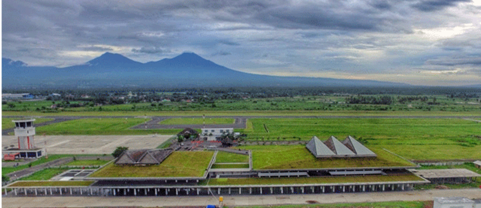
Description and Contacts of Key Companies
The airport operator is PT. Angkasa Pura II (Persero) branch Banyuwangi. The airport serves local routes to/from Jakarta, Malang, Surabaya and International routes to/ from Kuala Lumpur. The airlines and ground handling companies that operate at Banyuwangi Airport are the following:
|
Company |
Service |
Website |
|
Citilink |
Airlines: Jakarta (CGK), Kuala Lumpur (KUL) |
|
|
Wings Air |
Airlines: Malang (MLG), Surabaya (SUB) |
|
|
Nam Air |
Airlines: Jakarta (CGK) |
|
|
Garuda Indonesia |
Airlines: Jakarta (CGK), Malang (MLG), Surabaya (SUB) |
|
|
Gapura Angkasa |
Ground Handler |
Phone: +62 8113862168 Fax: +62 8123012 3207 +62 8123259 137 |
For more information on airport contacts, please see the following link: https://banyuwangi-airport.co.id/
Information on some aviation service providers can be found at: https://www.azfreight.com/
Passenger and Cargo Performance Indicator
The airport terminal is designed with an open-air concept to reduce dependency on air conditioners. With an area of 20,000 m2, the terminal can accommodate two million passengers annually.
Storage facilities are not available at the airport, a small building is utilised and sufficient for handling passenger luggage.
|
Performance for YEAR 2018 |
|||
|
|
Per Year |
Per Month |
Per Day |
|
Total Aircraft Movements |
4782 |
398 |
14 |
|
Total Passengers |
366,164 |
30,513 |
1,003 |
|
Total Capacity of the Airport (MT) |
10,000 MT |
840 MT |
28 MT |
|
Current Activity of the Airport (MT) |
--------------- |
------------- |
----------- |
|
Current use by Humanitarian Flights (UNHAS) |
N/A |
N/A |
N/A |
Runways
The runway of the airport is 2500 x 45 m2, and the apron has 41,000 m2 area which can accommodate 9 narrow-bodied aircraft.
|
Runway #1 |
|
|
Runway Dimensions |
2,250 X 30 |
|
Orientation |
08 / 26 |
|
Surface |
56 FCXT |
Helicopter Pad(s)
One Helipad available at the airport and can be used for airlift if needed, it is normally used for VIP service and for the movement of staff from mining companies.
|
Helipad #1 |
|
|
Present |
Yes |
|
Largest Helicopter that can Land |
HI |
|
Width and Length (m) |
40 X 80 m |
|
Surface |
21 FCYT |
Airport Infrastructure Details
|
Customs |
Yes |
JET A-1 fuel |
Yes |
|
Immigration |
Yes |
AVGAS 100 |
Yes (for training facilities) |
|
Terminal Building |
Yes |
Single Point Refuelling |
No |
|
Passenger Terminal |
Yes |
Air Starter Units |
No |
|
Cargo terminal |
Yes |
Ground Power (mobile) |
Yes |
|
Pax Transport to Airfield |
Yes |
Ground Handling Services |
Yes |
|
Control Tower |
Yes |
Latrine Servicing |
No |
|
Weather Facilities |
Yes |
Fire Fighting Category (ICAO) |
Yes |
|
Catering Services |
No info |
De-icing Equipment |
No |
|
Base Operating Room |
Yes |
Parking Ramp Lighting |
Yes |
|
Airport Radar |
Yes |
Approach & Runway Lights |
Approach Light: No Runway Light: Yes |
|
NDB |
Yes |
VOR |
No |
|
ILS |
No |
Airport Operating Details
|
Operating Details |
|||
|
Maximum Sized Aircraft that can be Offloaded on Bulk Cargo |
AIRBUS A – 320 |
||
|
Maximum Sized Aircraft that can be Offloaded on Pallet |
AIRBUS A – 320 |
||
|
Total Aircraft Parking Area (m²) |
31,472.5 SQM |
||
|
Storage Area (m3 and MT) |
|||
|
Handling Equipment |
|||
|
Elevators / Hi Loaders |
No |
Max Capacity (MT) |
No info |
|
Max Height (m) |
No info |
||
|
Loading Ramps |
Yes |
||
|
Other Comments |
No |
||
Customs Guidance
Customs services are available at the airport for international flights. Their branch office is located at the capital city of Banyuwangi on following address:
KPPBC Tipe Madya Pabean C Banyuwangi
Jl. Raya Situbondo No. 37 Ketapang Banyuwangi 68451
Email : kppbc_bwi@yahoo.co.id
Telp : +62-333-510177
Fax : +62-333-510858
Website: http://bcbanyuwangi.beacukai.go.id/
For more general information on customs in Indonesia, please check on this link: http://www.beacukai.go.id/websitenewV2/index.html
Storage Facilities
Storage facilities are not available at the airport. There is a small space/workshop that is currently being utilised for equipment storage. However, in case of emergency, the open space available (approx. 10,000 m2) can be utilised for the establishment of temporary storage, such as Mobile Storage Unit (MSUs), if needed.
Airfield Costs
NAVIGATION CHARGES
|
Charges |
Aircraft Weight - MTOW (kg) |
||
|
|
0 - 7,000 |
7,001 - 136,000 |
136,001 and over |
|
Navigation (per journey) USD - $ |
- |
- |
- |
|
Landing USD - $ |
$ 55 |
$ 725.47 |
- |
|
Night Landing USD - $ |
- |
- |
- |
|
Night Take-Off USD - $ |
- |
- |
- |
|
Parking |
$ 49.29 ( per hour) |
$ 118.29 ( per hour ) |
- |
|
Handling Charges |
- |
- |
- |
FUEL SERVICES CHARGES
Updated price can be found at the following link; https://www.pertamina.com/aviation/News.aspx?p=price (Blimbingsari Airport)
|
Price per Litre USD - $ |
|
|
Jet A-1 |
9,920.00 IDR per litre / 71.60 US Cent per litre |
|
Avgas |
4,048,670.00 IDR per Drum |
CARGO TERMINAL CHARGES
Al information related the airport charge located in this link: https://www.angkasapura2.co.id/id/bisnis/kebandarudaraan-landing/landing
AIR-BRIDGE CHARGES
Al information related the airport charge located in this link: https://www.angkasapura2.co.id/id/bisnis/kebandarudaraan-landing/landing
Security
- 5 security posts
- 1 unit ETD (Explosive Trace Detection)
- WTMD
- WHMD (Waste and Hazardous Materials Division)
- CCTV Terminal
2.2.25 Indonesia Sultan Aji Muhammad Sulaiman International Airport
Airport Overview
|
Airport Location and Contact |
|
|---|---|
|
Country |
Indonesia |
|
Province or District |
East Kalimantan area on the island of Kalimantan |
|
Nearest Town or City |
Balikpapan |
|
Airport’s Complete Name |
Sultan Aji Muhammad Sulaiman Airport (prev. Sepinggan) |
|
Latitude |
01°16′06″S |
|
Longitude |
116°53′40″E |
|
Elevation (ft and m) |
n/a |
|
IATA Code |
BPN |
|
ICAO Code |
WALL |
|
Managing Company or Airport Authority |
n/a |
|
Management Contact Person |
Mr. Farid Indra Nugraha, +62 812 1098599, farid.nugraha@ap1.co.id |
|
Open From (hours) |
n/a |
|
Open To (hours) |
n/a |
Description and Contacts of Key Companies
For more information on airport contacts, please see the following link: 4.5 Indonesia Airport Company Contact List
Information on some aviation service providers can be found at: http://www.azfreight.com/
Runways
|
Runway #1 |
|
|---|---|
|
Runway Dimensions |
|
|
Orientation |
n/a |
|
Surface |
n/a |
| Taxiway |
|
| Apron |
|
Ground Handling Facilities
BPN Airport has ground handling facilities that may support the A330 and Boeing 747-400.
There are 5 ground handling companies in BPN:
- Gapura Angkasa (serving: Cargo and mail handling, passenger and baggage handling, warehouse, aircraft technical on ground service)
- Jasa Angkasa Semesta (JAS) (serving cargo and mail handling, passenger and baggage handling, warehouse, aircraft technical on ground service)
- Prathita Titian Nusantara (serving cargo and mail handling, passenger and baggage handling, warehouse, aircraft technical on ground service)
- Sari Rahayu Biomantara (serving ground handling and passenger and baggage handling)
- Aviako Sepinggan (serving passenger and baggage handling and aircraft technical on ground service)
Customs Guidance
Customs regulations are based on the Finance Ministerial Decree No. 69/PMK.04/2012, stating that import duty (taxes) will not be charged for goods that of disaster reliefs and or donations during the disaster emergency response period to the transition during emergency response to reconstruction and during the reconstruction period, However, every single donation be it from NGOs, Central Government and or District Government and or from International organisation must be submitted through The National Disaster Mitigation Agency (BNPB) and the organization must fill and apply for duty exemption forms prior to transporting the donations. Mr. Sutopo, Chief of Data and Information Center BNPB: 4.1 Indonesia Government Contact List
Immigration: To conform with the Presidential Decree No.21/2016 that as of March 2nd 2016, Indonesia has exempted visa requirements to citizens of 169 nationalities for only 30 days visit, non extendable or convertible into another kind of stay permit. IMIGRASI Website
For more information on customs in Indonesia please see the following link: 1.3 Indonesia Customs Information
Storage Facilities
BPN Airport utilises Hangar D
| Height | 46 x 85 m |
| Dimension | 8 - 13,5m |
| Areal dimension | 4,675 m2 |
| Cargo terminal | 4,815 m2 |
2.2.26 Indonesia Mutiara Sis Al Jufri Airport
|
Airport Location and Contact |
|
|---|---|
|
Country |
Mutiara Sis Al Jufri Airport |
|
Province or District |
Palu, Sulawesi |
|
Nearest Town or City |
Palu |
|
Airport’s Complete Name |
Mutiara Sis Al Jufri Airport |
|
Latitude |
0° 55ʹ 7ʺ S |
|
Longitude |
119° 54ʹ 35ʺ |
|
Management Contact Person |
Mr Novy Pantaryanto, General Manager Makasar ATM, designated emergency coordinator |
Click here for Palu Airport Situation Update 7 October 2018 following the earthquake and tsunami in October 2018
2.2.27 Indonesia West Java Kertajati International Airport
Airport Overview
Kertajati International airport is located in Majalengka district about 63 km from Cirebon City, 176 km from Bandung city and 185 km from Jakarta city. The airport started operations in June 2018 as West Java’s main domestic airport and second international airport. The airport mainly serves West Java and some parts of Central Java.
|
Airport Location and Contact |
|
|
Country |
Indonesia |
|
Province or District |
West Java, Majalengka |
|
Nearest Town or City |
Majalengka City 6 KM Indramayu District 50 KM Sumedang District 51 KM Subang District 53 KM Cirebon City 63 KM Kuningan District 67 KM Purwakarta District 82 KM |
|
Airport’s Complete Name |
Kertajati |
|
Latitude |
6°38'52"S (-6.647777) |
|
Longitude |
108°09'58"E (108.166111) |
|
Elevation (ft and m) |
134 feet / 41m |
|
IATA Code |
KJT |
|
ICAO Code |
WICA |
|
Managing Company or Airport Authority |
PT. Angkasa Pura II Bandara Internatioanal Kertajati |
|
Management Contact Person |
Muhidin, Asst. Manager Quality Assurance Mobile: +62 81382721611 |
|
Open From (hours) |
06.00 WIB |
|
Open To (hours) |
19.00 WIB |
Airport Picture
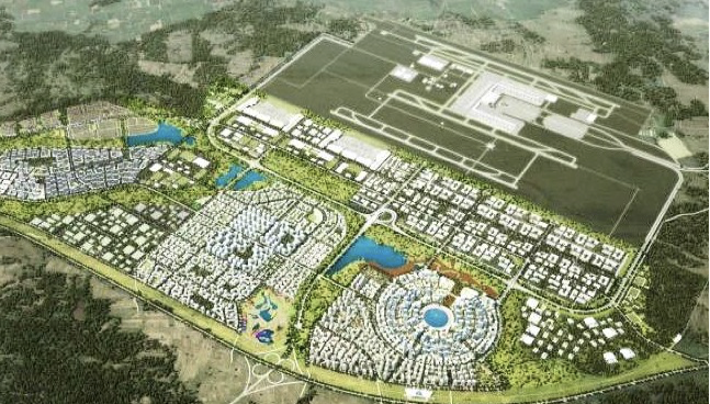
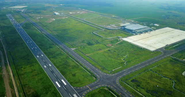
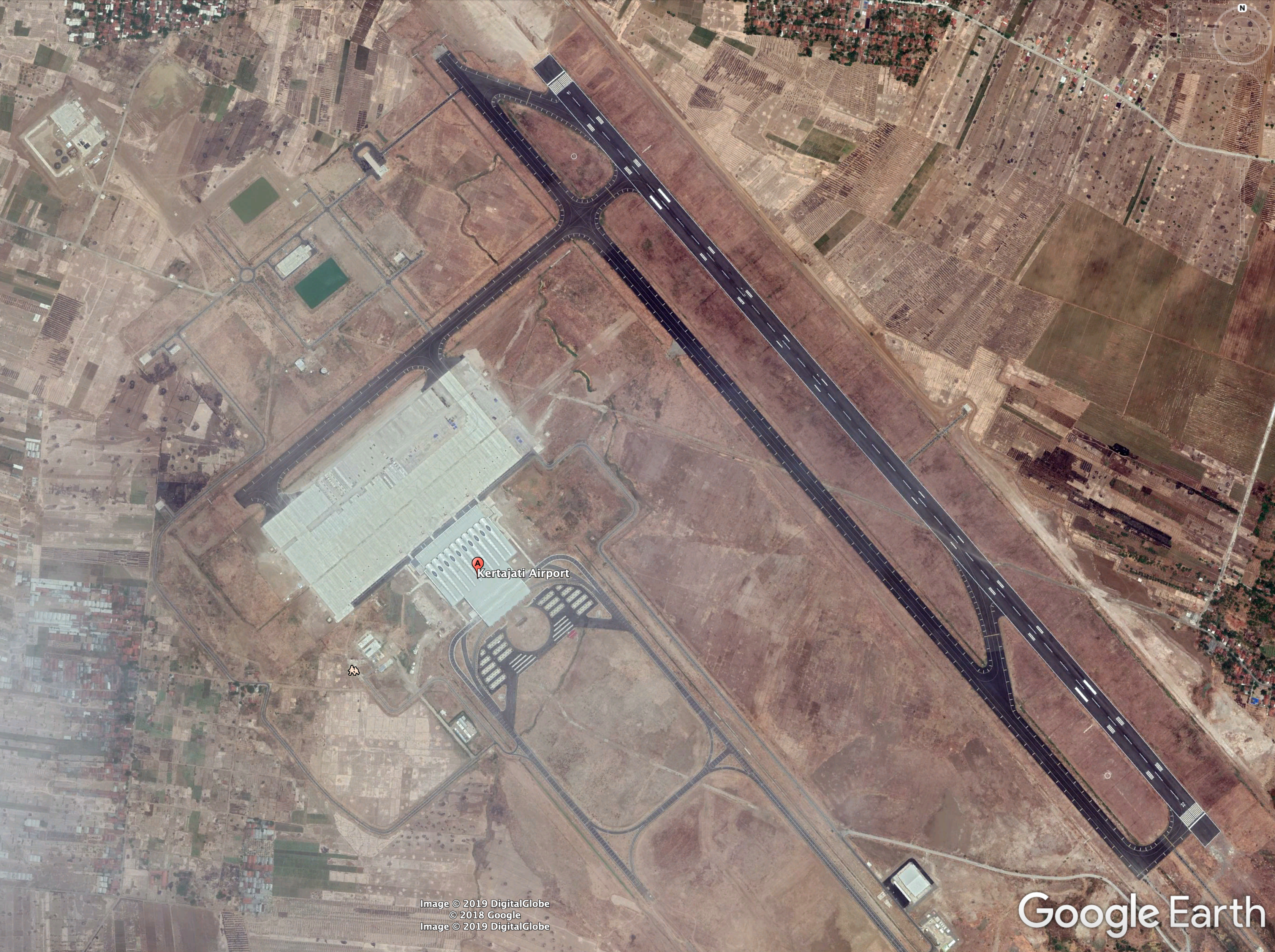
Description and Contacts of Key Companies
|
Airlines |
Destination |
Website |
|
Citilink |
Kertajati (KJT) - Kualanamu (KNO) |
|
|
Garuda Indonesia |
Kertajati (KJT) - Bandar Lampung (TKG), Kertajati (KJT) - Balikpapan (BPN) |
|
|
Lion Air |
Kertajati (KJT) - Balikpapan (BPN), Kertajati (KJT) - Jawa Tengah (SOC), Sukarno Hatta (CGK) - Kertajati (KJT) |
|
|
Transnusa |
Kertajati (KJT) - Semarang (SRG), Kertajati (KJT) - Bandar Lampung (TKG), |
|
|
Wings Air |
Kertajati (KJT) – Halim Perdanakusuma (HLP), Kertajati (KJT) - Jogja (JOG), |
Information on some aviation service providers can be found at: http://www.azfreight.com/
Passenger and Cargo Performance Indicator
|
Performance for 2018 |
|
|
Per Year |
|
|
Total Aircraft Movements |
440 |
|
Total Passengers |
35,168 |
|
Total Capacity of the Airport (MT) |
21,504 |
|
Current Activity of the Airport (MT) |
5,000 |
|
Current use by Humanitarian Flights (UNHAS) |
None |
Runways
|
Runway #1 (Existing) |
|
|
Runway Dimensions |
2500 m X 60 m |
|
Orientation |
14/32 |
|
Surface |
Asphalt ( PCN 89 ) |
|
Runway #2 (Under Development) * |
|
|
Runway Dimensions |
3000 m X 60 m |
|
Orientation |
14/32 |
|
Surface |
Asphalt ( PCN 89 ) |
* Note: expected to be completed within 2019
Helicopter Pad(s)
There is no dedicated helipad, however the apron can be used for helicopter operations.
Airport Infrastructure Details
|
Customs |
Yes |
JET A-1 fuel |
Yes |
|
Immigration |
Currently, Immigration Officer will come as per requested from Cirebon Office (55 km, 1 hour by road) |
AVGAS 100 |
No |
|
Terminal Building |
Yes |
Single Point Refueling |
No |
|
Passenger Terminal |
Yes |
Air Starter Units |
Yes |
|
Cargo terminal |
Yes |
Ground Power (mobile) |
Yes |
|
Pax Transport to Airfield |
Yes |
Ground Handling Services |
Yes |
|
Control Tower |
Yes |
Latrine Servicing |
Yes |
|
Weather Facilities |
Yes |
Fire Fighting Category (ICAO) |
Yes |
|
Catering Services |
Yes |
De-icing Equipment |
Yes |
|
Base Operating Room |
Yes |
Parking Ramp Lighting |
Yes |
|
Airport Radar |
Yes |
Approach & Runway Lights |
Yes |
|
NDB |
Yes |
VOR |
Yes |
|
ILS |
Yes |
Airport Operating Details
|
Operating Details |
|||
|
Maximum Sized Aircraft that can be Offloaded on Bulk Cargo |
Boing 737 – 900 ER (existing) Boeing 777-300 ER (once extension of runway is completed) |
||
|
Maximum Sized Aircraft that can be Offloaded on Pallet |
C- 130 |
||
|
Total Aircraft Parking Area (m²) |
86,976 m2 |
||
|
Storage Area (m3 and MT) |
4,500 m2 |
||
|
Handling Equipment |
|||
|
Elevators / Hi Loaders |
No |
Max Capacity (mt) |
|
|
Max Height (m) |
|
||
|
Loading Ramps |
Yes |
||
Storage Facilities
There is a 4,500 m2 storage facility inside the airport compound with a capacity of 21,504 MT general cargoes, not yet operational, and open storage next to the storage building with capacity 22,000 MT general cargoes.
Airfield Costs
NAVIGATION CHARGES
As the airport has just recently commenced operation, currently there are no parking and landing fees according to BIJB Kertajati Airport Authority.
|
Charges |
Aircraft Weight - MTOW (kg) |
||
|
0 - 7,000 |
7,001 - 136,000 |
136,001 and over |
|
|
Navigation (per journey) USD - $ |
0 |
||
|
Landing USD - $ |
0 |
||
|
Night Landing USD - $ |
0 |
||
|
Night Take-Off USD - $ |
0 |
||
|
Parking |
0 |
||
|
Handling Charges |
|
|
|
FUEL SERVICES CHARGES
|
Price per Litre USD - $ |
|
|
Jet A-1 |
67.70 US Cent per Litre (per April 2019) |
|
Avgas |
N/A |
Information on fuel service charges can be found at: http://aviation.pertamina.com/News.aspx?p=price
CARGO TERMINAL CHARGES
Cargo handling activity is managed by PT. Prathita Titan Nusantara (PTN).
|
Import Charges |
||
|
Type of Charge |
Rate USD - $ per kg |
Comments |
|
Handling Charge |
Currently no scheduled international flights. However, some Hajj charter flights may occur. |
|
|
Break Bulk Fee |
||
|
Diplomatic Mail |
||
|
Strong Room – per consignment |
||
|
Cold Storage Fee |
||
|
Delivery Outside Normal Working Hours |
||
|
Preparation of substitute AOA – Invoice – Receipt |
||
|
Storage per Day |
||
|
Export |
||
|
Handling Charges – Un-palletized Cargo |
Currently there are no international flight being scheduled. |
|
|
International Air Waybill |
||
|
Local Air Waybill |
||
|
Air Way Bill Amendment - Cancellation |
||
|
Air Way Bill Documentation |
||
|
Diplomatic Mail |
||
|
Storage Charges per Day |
|
|
AIR-BRIDGE CHARGES
There are four units of air bridge facilities at the airport free of charges (subsidized by the government).
Security
- WTMD
- WHMD (Waste and Hazardous Materials Division)
- Explosive Detector
- CCTV Terminal
2.2.28 Indonesia North Maluku Kuabang (Kao) Airport
Kuabang Airport, also known as Kao Airport, is located in Kao town, North Halmahera district, on Halmahera island in North Maluku Province.
The airport is about 107 km, around 2-hour drive using land transport to Sofifi city (Government Administration). The airport currently serves daily domestic flight to Manado, operated by Wings Air using the ATR-72 aircraft.
Airport Overview
|
Airport Location and Contact |
|
|
Country |
Indonesia |
|
Province or District |
North Maluku Province |
|
Nearest Town or
City |
Tobelo 86 KM – 1 and half hours Sofifi 107 KM - 2 hours |
|
Airport’s Complete Name |
Kuabang KAO Airport |
|
Latitude |
01° 11’ 12.49“ N |
|
Longitude |
127° 53’ 45.63“ E |
|
Elevation (ft and m) |
44 Feet / 13.5 Meters |
|
IATA Code |
KAZ |
|
ICAO Code |
WAMK |
|
Managing Company or Airport Authority |
Airport Implementation Unit (Unit Penyelenggara Bandar Udara/UPBU), Ministry of Transportation |
|
Management Contact Person |
Rusdi Ali M. +62 812 4167 4114 Dewi Estunut M. +62 852 8337 7792 Email. Rosedewi.ds@gmail.com |
|
Open From (hours) |
06:00 WIT |
|
Open To (hours) |
17:00 WIT |
Airport Picture
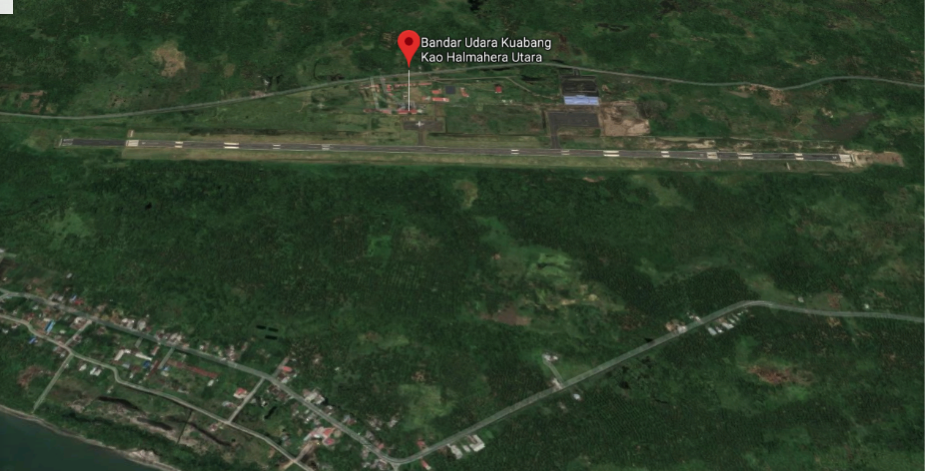
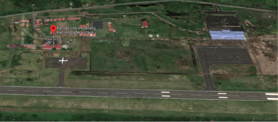
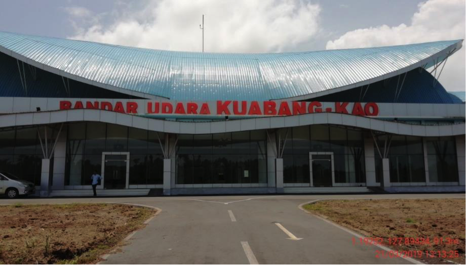
Description and Contacts of Key Companies
Wings Air - http://www.lionair.co.id
Passenger and Cargo Performance Indicator
A new passenger terminal is currently being finalised, and a new flight route to Makassar (to be operated by Sriwijaya Airlines) in the process of being established. These are expected to commence mid-2019.
|
Performance for 2018 |
|
|
|
Per Year (2018) |
|
Total Aircraft Movements |
362 |
|
Total Passengers |
12,894 |
|
Total Capacity of the Airport (mt) |
14,999 |
|
Current Activity of the Airport (mt) |
14,999 |
|
Current use by Humanitarian Flights (UNHAS) |
No |
Runways
|
Runway #1 |
|
|
Runway Dimensions |
L2400 x W30 |
|
Orientation |
18-36 |
|
Surface |
Asphalt (54 F/C/X/T) |
Airport Infrastructure Details
|
Customs |
No |
JET A-1 fuel |
No |
|
Immigration |
No |
AVGAS 100 |
No |
|
Terminal Building |
Yes |
Single Point Refueling |
No |
|
Passenger Terminal |
Yes |
Air Starter Units |
No |
|
Cargo terminal |
No |
Ground Power (mobile) |
No |
|
Pax Transport to Airfield |
No |
Ground Handling Services |
Yes |
|
Control Tower |
Yes |
Latrine Servicing |
No |
|
Weather Facilities |
Yes |
Fire Fighting Category (ICAO) |
Category: 5 |
|
Catering Services |
No |
De-icing Equipment |
No |
|
Base Operating Room |
Yes |
Parking Ramp Lighting |
Yes |
|
Airport Radar |
No |
Approach & Runway Lights |
Yes |
|
NDB |
Yes |
VOR |
Yes |
|
ILS |
Yes |
|
|
Airport Operating Details
|
Operating Details |
|||
|
Maximum Sized Aircraft that can be Offloaded on Bulk Cargo |
B737-500 |
||
|
Maximum Sized Aircraft that can be Offloaded on Pallet |
C-130 |
||
|
Total Aircraft Parking Area (m²) |
157 M x 72 M |
||
|
Storage Area (m3 and MT) |
Nil |
||
|
Handling Equipment |
|||
|
Elevators / Hi Loaders |
No |
Max Capacity (MT) |
|
|
Max Height (m) |
|
||
|
Loading Ramps |
No |
||
Airfield Costs
Flight costs can be seen at www.dephub.go.id
NAVIGATION CHARGES
The costs below are charged based on the operational hours.
|
Charges |
Aircraft Weight - MTOW (kg) |
||
|
|
0 - 7,000 |
7,001 - 136,000 |
136,001 and over |
|
Navigation (per journey) USD - $ |
15% of the cost of flight navigation services for domestic routes |
||
|
Landing USD - $ |
$ 0.21/1000 kg domestic |
$ 8.84/1000 kg domestic |
$ 26.02/1000 kg domestic |
|
Night Landing USD - $ |
- |
- |
- |
|
Night Take-Off USD - $ |
- |
- |
- |
|
Parking |
$ 0.07 / 1000 kg / 12 hours – domestic |
||
|
Handling Charges |
- |
- |
- |
FUEL SERVICES CHARGES
The Aircraft Refuelling Depot is not available at the airport for aviation fuel.
|
|
Price per Litre USD - $ |
|
Jet A-1 |
Nil |
|
Avgas |
Nil |
CARGO TERMINAL CHARGES
PT. CV.Nurul Perkasais the only ground handling company in Kuabang KAO Airport that handles domestic cargo.
|
Import Charges |
||
|
Type of Charge |
Rate USD - $ per kg |
Comments |
|
Handling Charge |
All services costs are handled by CV. Nurul Perkasa. |
|
|
Break Bulk Fee |
||
|
Diplomatic Mail |
||
|
Strong Room – per consignment |
||
|
Cold Storage Fee |
||
|
Delivery Outside Normal Working Hours |
||
|
Preparation of substitute AOA – Invoice – Receipt |
||
|
Storage per Day |
||
|
Export |
||
|
Handling Charges – Un-palletized Cargo |
All services costs are handled by CV. Nurul Perkasa. |
|
|
International Air Waybill |
||
|
Local Air Waybill |
||
|
Air Way Bill Amendment - Cancellation |
||
|
Air Way Bill Documentation |
||
|
Diplomatic Mail |
||
|
Storage Charges per Day |
||
AIR-BRIDGE CHARGES
No air-bridge facility is available.
Security
Kuabang Kao Airport is a civil airport. It has 3 security posts:
- 2 at the passenger terminal
- 1 at the entrance gate
2.2.29 Indonesia North Sulawesi Sam Ratulangi International Airport
Airport Overview
Sam Ratulangi International Airport is located in North Sulawesi, about 13 km northeast of Manado City. The airport operates 24/7 for air traffic movement. The airport serves domestic and international routes both for passenger and cargo movements.
|
Airport Location and Contact |
|
|
Country |
Indonesia |
|
Province or District |
North Sulawesi Province |
|
Nearest Town or
City |
Manado City 13 kM |
|
Airport’s Complete Name |
Sam Ratulangi International Airport |
|
Latitude |
1°32′57″ N |
|
Longitude |
124°55′35″ E |
|
Elevation (ft and m) |
270 Feet / 30° |
|
IATA Code |
WAMM |
|
ICAO Code |
MDC |
|
Managing Company or Airport Authority |
PT. Angkasa Pura I (Persero) |
|
Management Contact Person |
General Manager - Minggus E.T Gandeguai Ph. +62 431 – 814320 Public Relation – Chyntia Eliza P M. +62 878-9757-6450 |
|
Open From (hours) |
24 hours |
|
Open To (hours) |
24 hours |
Airport Picture
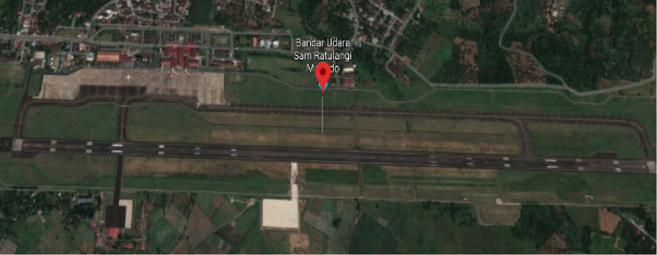

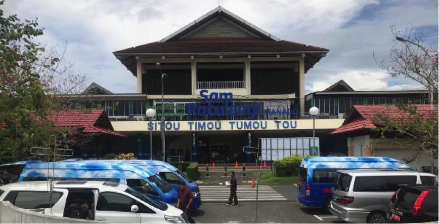
Description and Contacts of Key Companies
The airline companies in Sam Ratulangi Airport:
|
Airlines |
Destination |
Website |
|
Batik Air |
Jakarta–Soekarno–Hatta |
|
|
Citilink |
Jakarta–Soekarno–Hatta, Makassar |
|
|
Garuda Indonesia |
Jakarta–Soekarno–Hatta, Makassar, Ternate |
|
|
Lion Air |
Balikpapan, Changsha, Denpasar/Bali, Guangzhou, Jakarta–Soekarno–Hatta, Makassar, Shanghai-Pudong, Shenzhen, Sorong, Surabaya, |
|
|
NAM Air |
Sorong, Ternate |
|
|
SilkAir |
Singapore |
|
|
Sriwijaya Air |
Sorong, Ternate |
|
|
Wings Air |
Ambon, Galela, Gorontalo, Luwuk, Melangguane, Miangas, Tahuna, Ternate, Kao |
Passenger and Cargo Performance Indicator
|
Performance for 2018 |
|
|
|
Per Year |
|
Total Aircraft Movements |
27,617 |
|
Total Passengers |
2,747,441 |
|
Total Capacity of the Airport (MT) |
15,260 |
|
Current Activity of the Airport (MT) |
Jan – Mar 19: 1,995 |
|
Current use by Humanitarian Flights (UNHAS) |
No |
Runways
|
Runway #1 |
|
|
Runway Dimensions |
L2650 x W45 |
|
Orientation |
18-36 |
|
Surface |
Asphalt (flexible) |
Airport Infrastructure Details
|
Customs |
Yes |
JET A-1 fuel |
Yes |
|
Immigration |
Yes |
AVGAS 100 |
No |
|
Terminal Building |
Yes |
Single Point Refueling |
No |
|
Passenger Terminal |
Yes |
Air Starter Units |
No |
|
Cargo terminal |
Yes |
Ground Power (mobile) |
Yes |
|
Pax Transport to Airfield |
Yes |
Ground Handling Services |
Yes |
|
Control Tower |
Yes |
Latrine Servicing |
Yes |
|
Weather Facilities |
Yes |
Fire Fighting Category (ICAO) |
Category: 7 |
|
Catering Services |
Yes |
De-icing Equipment |
No |
|
Base Operating Room |
Yes |
Parking Ramp Lighting |
Yes |
|
Airport Radar |
No |
Approach & Runway Lights |
Yes |
|
NDB |
Yes |
VOR |
Yes |
|
ILS |
Yes |
|
|
Airport Operating Details
|
Operating Details |
|||
|
Maximum Sized Aircraft that can be Offloaded on Bulk Cargo |
AirBus 330 (Restricted – Not fully loaded) |
||
|
Maximum Sized Aircraft that can be Offloaded on Pallet |
AirBus 330 |
||
|
Total Aircraft Parking Area (m²) |
108.327 m2 (22 Aircraft parking stand) |
||
|
Storage Area (m3 and MT) |
3.456 m2 |
||
|
Handling Equipment |
|||
|
Elevators / Hi Loaders |
Yes |
Max Capacity (MT) |
|
|
Max Height (m) |
|
||
|
Loading Ramps |
Yes |
||
Airfield Costs
For information on airport rates and charges, please see the following link:
www.dephub.go.id (PP.15 Tahun 2016)
http://jdih.dephub.go.id/assets/uudocs/perpres/2016/PP_15_Tahun_2016.pdf
NAVIGATION CHARGES
The costs below are charged based on the operational hours.
|
Charges |
Aircraft Weight - MTOW (kg) |
||
|
|
0 - 7,000 |
7,001 - 136,000 |
136,001 and over |
|
Navigation (per journey) USD - $ |
15% of the cost of flight navigation services for domestic routes and 10% for international routes* |
||
|
Landing USD - $ |
$ 0.21/1000 kg domestics $ 3.60/1000 kg international*
|
$ 8.84/1000 kg domestics $ 148.1 / 1000 kg international* |
$ 26.02/1000 kg domestics $ 394.7 /1000 kg international* |
|
Night Landing USD - $ |
- |
- |
- |
|
Night Take-Off USD - $ |
- |
- |
- |
|
Parking |
$ 0.07 / 1000 kg / 12 hours – domestic $ 0.30 / 1000 kg / 12 hours – international* |
||
|
Handling Charges |
- |
- |
- |
*in case any international flights
FUEL SERVICES CHARGES
The Aircraft Refuelling Depot is available at the airport for aviation fuel. It is managed by PT. Pertamina (Persero).
For more details: http://aviation.pertamina.com/News.aspx?p=price
|
Price per Litre |
|
|
Jet A-1 |
10,270.00 IDR per litre / 73.10 US Cent per litre |
|
Avgas |
Nil |
CARGO TERMINAL CHARGES
PT. Gapura Angkasa, PT. Jasa Angkasa Semesta (JAS) and PT. Prahita Titian Nusantar are the ground handling companies in Sam Ratulangi International Airport for cargo handling activities.
|
Import Charges |
||
|
Type of Charge |
Rate USD - $ per kg |
Comments |
|
Handling Charge |
All service costs are handled by each ground handling company with the approval of the Airport Authority. |
|
|
Break Bulk Fee |
||
|
Diplomatic Mail |
||
|
Strong Room – per consignment |
||
|
Cold Storage Fee |
||
|
Delivery Outside Normal Working Hours |
||
|
Preparation of substitute AOA – Invoice – Receipt |
||
|
Storage per Day |
||
|
Export |
||
|
Handling Charges – Un-palletized Cargo |
All service costs are handled by handled by each ground handling company with the approval of the Airport Authority. |
|
|
International Air Waybill |
||
|
Local Air Waybill |
||
|
Air Way Bill Amendment - Cancellation |
||
|
Air Way Bill Documentation |
||
|
Diplomatic Mail |
||
|
Storage Charges per Day |
||
AIR-BRIDGE CHARGES
Standard official tariffs for using the air bridge service in Sam Ratulangi International Airport is equal or less than 100 tons will charge $48.10 for usage for the first two hours.
Security
Sam Ratulangi International Airport is a civil airport. The overall security system is relatively good, security equipment and facilities in place:
- 3 (three) AVSEC post
- X-ray Machine
- Walkthrough Metal Detector
- Handheld Metal Detector
- CCTV
- Patrol Vehicle
2.2.30 Indonesia West Sulawesi Sumarorong Airport
Airport Overview
Sumarorong airport is located in Mamasa District, West Sulawesi Province, about 40 km from Mamasa City, and 170 km from Mamuju City, the capital of West Sulawesi Province. The airport is under the management of Unit Penyelenggara Bandar Udara (UPBU), Directorate General of Civil Aviation. The airport is classified as Service Unit (airfield category). The airport is geographically located in Mamasa highland, 923 m above sea level. The airport is in active status, but currently there are no commercial flights scheduled for incoming or outgoing.
|
Airport Location and Contact |
|
|
Country |
Indonesia |
|
Province or District |
West Sulawesi Province |
|
Nearest Town or
City |
Mamasa City, 40 KM |
|
Airport’s Complete Name |
Sumarorong Airport |
|
Latitude |
03 08 52.34 S |
|
Longitude |
119 18 12.37 E |
|
Elevation (ft and m) |
3.030 ft, 923 m |
|
IATA Code |
MSA |
|
ICAO Code |
WAFS |
|
Managing Company or Airport Authority |
Directorate General of Ministry of Transportation |
|
Management Contact Person |
Fadly (Head of Office) M. +62 813 4200 6429 Email. Busm.msa@yahoo.com |
|
Open From (hours) |
07:00 WITA (23 UTC) |
|
Open To (hours) |
14:00 WITA (06:00 UTC) |
Airport Picture
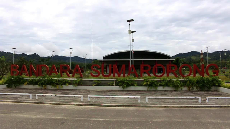
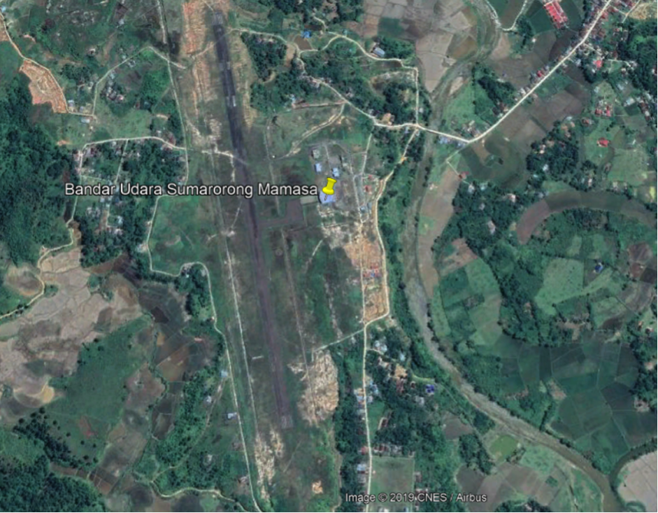
Description and Contacts of Key Companies
Currently there are no commercial flights scheduled.
Passenger and Cargo Performance Indicator
|
Performance for 2018 |
|||
|
|
Per Year |
Per Month |
Per Day |
|
Total Aircraft Movements |
N/A |
|
|
|
Total Passengers |
N/A |
|
|
|
Total Capacity of the Airport (MT) |
N/A |
|
|
|
Current Activity of the Airport (MT) |
N/A |
|
|
|
Current use by Humanitarian Flights (UNHAS) |
No |
|
|
Runways
|
Runway #1 |
|
|
Runway Dimensions |
L1150 x W30 |
|
Orientation |
17-35 |
|
Surface |
Asphalt (24 F/C/X/T) |
Airport Infrastructure Details
|
Customs |
No |
JET A-1 fuel |
No |
|
Immigration |
No |
AVGAS 100 |
No |
|
Terminal Building |
Yes |
Single Point Refuelling |
No |
|
Passenger Terminal |
Yes |
Air Starter Units |
No |
|
Cargo terminal |
No |
Ground Power (mobile) |
No |
|
Pax Transport to Airfield |
No |
Ground Handling Services |
No |
|
Control Tower |
No |
Latrine Servicing |
No |
|
Weather Facilities |
No |
Fire Fighting Category (ICAO) |
Category: - |
|
Catering Services |
No |
De-icing Equipment |
No |
|
Base Operating Room |
No |
Parking Ramp Lighting |
No |
|
Airport Radar |
No |
Approach & Runway Lights |
No |
|
NDB |
Yes |
VOR |
No |
|
ILS |
No |
|
|
Airport Operating Details
|
Operating Details |
|||
|
Maximum Sized Aircraft that can be Offloaded on Bulk Cargo |
Cessna 208, DHC-6 Twin Otter |
||
|
Maximum Sized Aircraft that can be Offloaded on Pallet |
- |
||
|
Total Aircraft Parking Area (m²) |
60 x 40 m2 |
||
|
Storage Area (m3 and MT) |
Nil |
||
|
Handling Equipment |
|||
|
Elevators / Hi Loaders |
No |
Max Capacity (MT) |
|
|
Max Height (m) |
|
||
|
Loading Ramps |
- |
||
Airfield Costs
For information on airport rates and charges, please see the following link:
www.dephub.go.id (PP.15 Tahun 2016)
http://jdih.dephub.go.id/assets/uudocs/perpres/2016/PP_15_Tahun_2016.pdf
NAVIGATION CHARGES
In case any domestic flight (chartered or scheduled), the costs below are charged based on the operational hours.
|
Charges |
Aircraft Weight - MTOW (kg) |
||
|
|
0 - 7,000 |
7,001 - 136,000 |
136,001 and over |
|
Navigation (per journey) USD - $ |
15% of the cost of flight navigation services for domestic routes |
||
|
Landing USD - $ |
$ 0.21/1000 kg domestics |
$ 8.84/1000 kg domestics |
$ 26.02/1000 kg domestics |
|
Night Landing USD - $ |
- |
- |
- |
|
Night Take-Off USD - $ |
- |
- |
- |
|
Parking |
$ 0.07 / 1000 kg / 12 hours – domestic |
||
|
Handling Charges |
- |
- |
- |
FUEL SERVICES CHARGES
There is no Pertamina Depot at the airport.
CARGO TERMINAL CHARGES
There are no ground handling activities at the airport.
AIR-BRIDGE CHARGES
There is no air bridge facility at the airport.
Security
Sumarorong Airport is a civil airport and has only 1 (one) security post at the entrance.
2.2.31 Indonesia West Sulawesi Tampa Padang Airport
Airport Overview
Tampa Padang airport is located in Mamuju District, West Sulawesi Province, about 31 km from Mamuju City, the capital of West Sulawesi Province. The airport is under the management of Unit Penyelenggara Bandar Udara (UPBU), Directorate General of Civil Aviation. The airport is classified as Class II serves domestic flight only. The airport is currently under development of new passenger terminal of 5,000 m2 which is expected to be operational in 2021.
|
Airport Location and Contact |
|
|
Country |
Indonesia |
|
Province or District |
West Sulawesi, Mamuju |
|
Nearest Town or City |
Mamuju, 31 km |
|
Airport’s Complete Name |
Tampa Padang Airport |
|
Latitude |
02°35'00"S |
|
Longitude |
119°02'00"E |
|
Elevation (ft and m) |
16.4 ft / 5 m |
|
IATA Code |
MJU |
|
ICAO Code |
WAFJ |
|
Managing Company or Airport Authority |
Unit Penyelenggara Bandar Udara (UPBU), Directorate General of Civil Aviation, Ministry of Transportation. |
|
Management Contact Person |
Yudha (Technical Unit) Phone: (0426) 232 1504 Mobile: +62 81332559401 |
|
Open From (hours) |
06.25 WITA |
|
Open To (hours) |
17.00 WITA |
Airport Picture
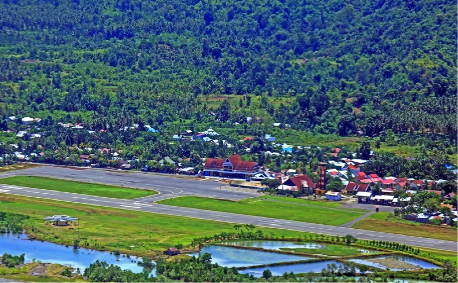
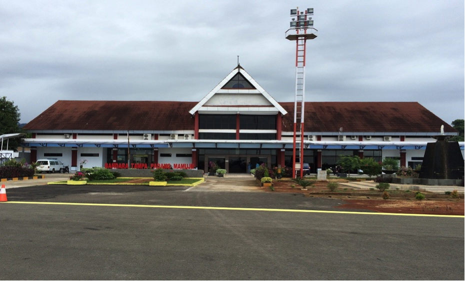
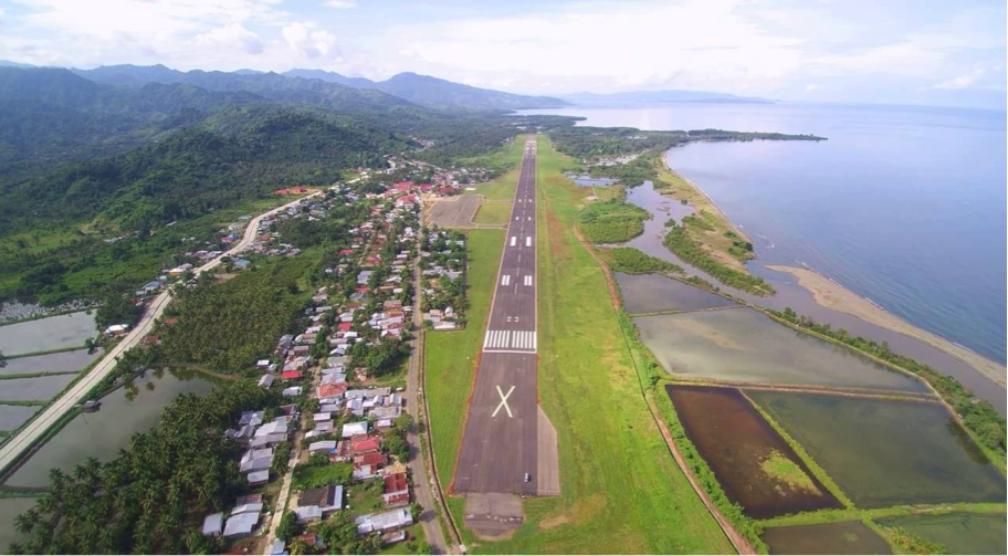
Description and Contacts of Key Companies
Airlines and Destinations
|
Airlines |
Destination |
Website |
|
Garuda Indonesia |
Jakarta via Makassar Makassar |
|
|
Wings Air |
Jakarta via Makassar & Balikpapan Surabaya via Balikpapan Makassar Balikpapan |
|
Information on some aviation service providers can be found at: http://www.azfreight.com/
Passenger and Cargo Performance Indicator
|
Performance for 2018 |
|
|
|
Per Year |
|
Total Aircraft Movements |
3,314 |
|
Total Passengers |
171,797 |
|
Total Capacity of the Airport (MT) |
Nil |
|
Current Activity of the Airport (MT) |
Nil |
|
Current use by Humanitarian Flights (UNHAS) |
No |
Runways
|
Runway #1 (Existing) |
|
|
Runway Dimensions |
2,500 m X 45 m |
|
Orientation |
05/23 |
|
Surface |
Asphalt ( PCN 37 ) |
Helicopter Pad(s)
There is no dedicated helipad at the airport. Apron can be functioned as Helipad.
Airport Infrastructure Details
|
Customs |
On call |
JET A-1 fuel |
Yes |
|
Immigration |
No |
AVGAS 100 |
No |
|
Terminal Building |
Yes |
Single Point Refuelling |
Yes |
|
Passenger Terminal |
Yes |
Air Starter Units |
No |
|
Cargo Terminal |
No |
Ground Power (mobile) |
No |
|
Pax Transport to Airfield |
Yes |
Ground Handling Services |
Yes |
|
Control Tower |
Yes |
Latrine Servicing |
No |
|
Weather Facilities |
Yes |
Fire Fighting Category (ICAO) |
Yes, ICAO 5 |
|
Catering Services |
Yes |
De-icing Equipment |
No |
|
Base Operating Room |
Yes |
Parking Ramp Lighting |
No |
|
Airport Radar |
No |
Approach & Runway Lights |
Yes |
|
NDB |
Yes |
VOR |
Yes |
|
ILS |
No |
Airport Operating Details
|
Operating Details |
|||
|
Maximum Sized Aircraft that can be Offloaded on Bulk Cargo |
Boeing 737 – 300 / 500 W |
||
|
Maximum Sized Aircraft that can be Offloaded on Pallet |
C-130 |
||
|
Total Aircraft Parking Area (m²) |
20,400 m2 |
||
|
Storage Area (m3 and MT) |
862 m2 (as cargo transit point, attached to the passenger terminal) |
||
|
Handling Equipment |
|||
|
Elevators / Hi Loaders |
No |
Max Capacity (MT) |
|
|
Max Height (m) |
|
||
|
Loading Ramps |
No |
||
Storage Facilities
There is no dedicated storage facility and cargo terminal for general cargo in the airport compound.
Airfield Costs
For information on airport rates and charges, please see the following link:
www.dephub.go.id (PP.15 Tahun 2016)
http://jdih.dephub.go.id/assets/uudocs/perpres/2016/PP_15_Tahun_2016.pdf
NAVIGATION CHARGES
|
Charges |
Aircraft Weight - MTOW (kg) |
||
|
|
0 - 7,000 |
7,001 - 136,000 |
136,001 and over |
|
Navigation (per journey) USD - $ |
15% of the cost of flight navigation services for domestic routes and 10% for international routes* |
||
|
Landing USD - $ |
USD 0.173/ 1000 Kg |
USD 6.94 + 0.242 / 1000 Kg |
- |
|
Night Landing USD - $ |
- |
- |
- |
|
Night Take-Off USD - $ |
- |
- |
- |
|
Parking |
$ 0.07 / 1000 kg / 12 hours – domestic $ 0.30 / 1000 kg / 12 hours – international* |
||
|
Handling Charges |
- |
- |
- |
*The airport currently serves only domestic flights
FUEL SERVICES CHARGES
Pertamina Depot is available in the airport compound. The refuelling service is arranged through the ground handling company.
|
Price per Litre USD - $ |
|
|
Jet A-1 |
76.92 US Cent per litre (June 2019) |
|
Avgas |
N/A |
Information on fuel service charges can be found at: http://aviation.pertamina.com/News.aspx?p=price
CARGO TERMINAL CHARGES
Cargo handling activity is managed by PT. Gapura Angkasa. Phone: +62 426 2321 502. Mobile: +62 823 4974 7366
AIR-BRIDGE CHARGES
There is no air bridge facility at the airport.
Security
- Security posts
- ETD (Explosive Trace Detection)
- WTMD
- WHMD (Waste and Hazardous Materials Division)
- CCTV Terminal
2.2.32 Indonesia Gorontalo Djalaluddin Airport
Airport Overview
Djalaluddin Airport is in Gorontalo District, about 30 km West of Gorontalo City - the capital of Gorontalo Province. The airport is operated by Unit Penyelenggara Bandar Udara (UPBU), Directorate General Civil Aviation. The airport is classified as Class I serves domestic flight only.
|
Airport Location and Contact |
|
|
Country |
Indonesia |
|
Province or District |
Gorontalo Province |
|
Nearest Town or
City |
Gorontalo 30 km |
|
Airport’s Complete Name |
Djalaluddin Gorontalo Airport |
|
Latitude |
00°38′18″ N |
|
Longitude |
122°51′08″ E |
|
Elevation (ft and m) |
33 m |
|
IATA Code |
GTO |
|
ICAO Code |
WAMG |
|
Managing Company or Airport Authority |
Unit Penyelenggara Bandar Udara (UPBU), Directorate General Civil Aviation, Ministry of Transportation |
|
Management Contact Person |
Kolonel. Lek Power AS Sihaloho, S.Sos Head of Office Ph. +62 435 - 890494 Wandy Gobel Flight Safety and Security M. +62 853 4117 0008 Email. bandara_jalaluddin@yahoo.com |
|
Open From (hours) |
05.00 (WITA) / 21.00 (UTC) |
|
Open To (hours) |
19.00 (WITA) / 11.00 (UTC) |
Airport Picture
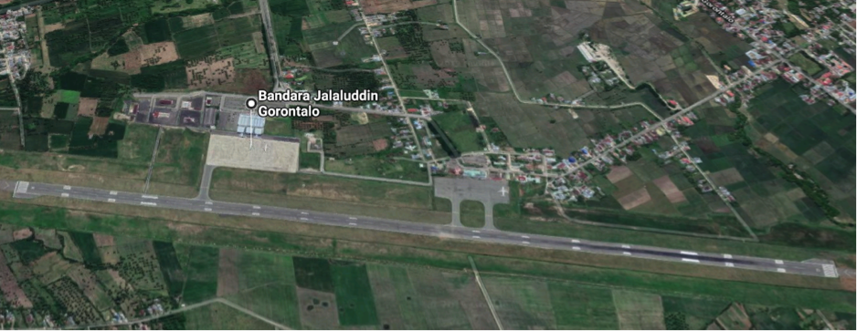
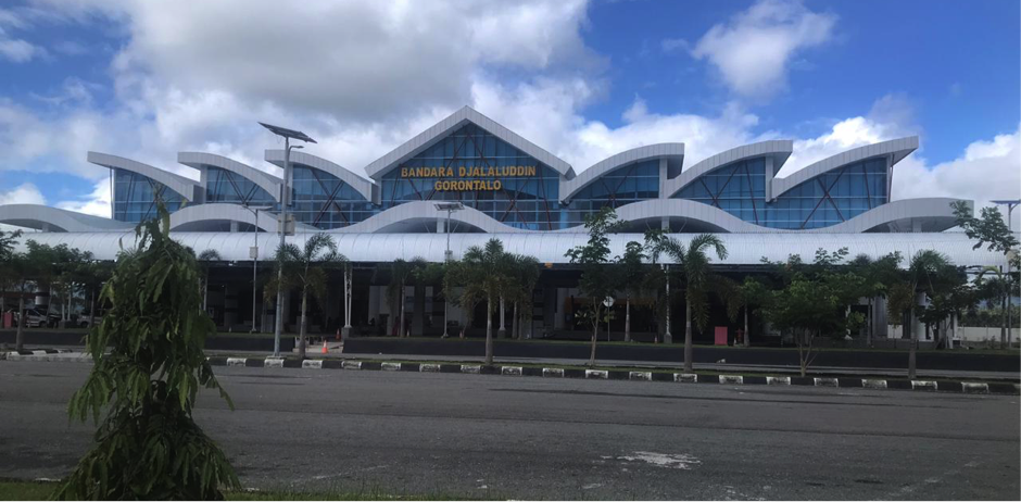
Description and Contacts of Key Companies
The airline companies operating in the airport of DJalaluddin:
|
Airlines |
Destination |
Website |
|
Batik Air |
Jakarta–Soekarno–Hatta, Makassar |
|
|
Citilink |
Makassar |
|
|
Garuda Indonesia |
Jakarta–Soekarno–Hatta, Makassar, Manado |
|
|
Lion Air |
Jakarta–Soekarno–Hatta, Makassar, Surabaya, Batam |
|
|
Sriwijaya Air |
Surabaya,Makassar |
|
|
Wings Air |
Bandung, Luwuk, Manado, Tarakan, Palu |
Passenger and Cargo Performance Indicator
|
Performance for 2018 |
|||
|
|
Per Year |
Per Month |
Per Day |
|
Total Aircraft Movements |
6,642 |
668 |
11 |
|
Total Passengers |
685,187 |
63,726 |
2,124 |
|
Total Capacity of the Airport (MT) |
4,391 |
|
|
|
Current Activity of the Airport (MT) |
May : 533 |
|
|
|
Current use by Humanitarian Flights (UNHAS) |
No |
|
|
Runways
|
Runway #1 |
|
|
Runway Dimensions |
L2500 x W45 |
|
Orientation |
09-27 |
|
Surface |
50/F/A/W/T Asphalt |
Airport Infrastructure Details
|
Customs |
No |
JET A-1 fuel |
Yes |
|
Immigration |
No |
AVGAS 100 |
No |
|
Terminal Building |
Yes |
Single Point Refueling |
No |
|
Passenger Terminal |
Yes |
Air Starter Units |
No |
|
Cargo terminal |
Yes |
Ground Power (mobile) |
Yes |
|
Pax Transport to Airfield |
No |
Ground Handling Services |
Yes |
|
Control Tower |
Yes |
Latrine Servicing |
No |
|
Weather Facilities |
Yes |
Fire Fighting Category (ICAO) |
Category: 8 |
|
Catering Services |
Yes |
De-icing Equipment |
No |
|
Base Operating Room |
Yes |
Parking Ramp Lighting |
Yes |
|
Airport Radar |
No |
Approach & Runway Lights |
Yes |
|
NDB |
Yes |
VOR |
Yes |
|
ILS |
Yes |
|
|
Airport Operating Details
|
Operating Details |
|||
|
Maximum Sized Aircraft that can be Offloaded on Bulk Cargo |
AirBus 320 |
||
|
Maximum Sized Aircraft that can be Offloaded on Pallet |
AirBus 320 |
||
|
Total Aircraft Parking Area (m²) |
37,830 m2 |
||
|
Storage Area (m3 and MT) |
1,705 m2 |
||
|
Handling Equipment |
|||
|
Elevators / Hi Loaders |
No |
Max Capacity (MT) |
|
|
Max Height (m) |
|
||
|
Loading Ramps |
No |
||
Airfield Costs
For information on airport rates and charges, please see the following link:
www.dephub.go.id (PP.15 Tahun 2016)
http://jdih.dephub.go.id/assets/uudocs/perpres/2016/PP_15_Tahun_2016.pdf
NAVIGATION CHARGES
The costs below are charged based on the operational hours.
|
Charges |
Aircraft Weight - MTOW (kg) |
||
|
|
0 - 7,000 |
7,001 - 136,000 |
136,001 and over |
|
Navigation (per journey) USD - $ |
15% of the cost of flight navigation services for domestic routes and 10% for international routes* |
||
|
Landing USD - $ |
$ 0.21/1000 kg domestics $ 3.60/1000 kg international*
|
$ 8.84/1000 kg domestics $ 148.1 / 1000 kg international* |
$ 26.02/1000 kg domestics $ 394.7 /1000 kg international* |
|
Night Landing USD - $ |
- |
- |
- |
|
Night Take-Off USD - $ |
- |
- |
- |
|
Parking |
$ 0.07 / 1000 kg / 12 hours – domestic $ 0.30 / 1000 kg / 12 hours – international* |
||
|
Handling Charges |
- |
- |
- |
* in case any international flights
FUEL SERVICES CHARGES
The Aircraft Refuelling Depot is available at the airport for aviation fuel. It is managed by PT. Pertamina (Persero).
For more details can be found: http://aviation.pertamina.com/News.aspx?p=price
|
|
Price per Litre USD - $ |
|
Jet A-1 |
10,050.00 IDR per litre / 70.70 US Cent per litre |
|
Avgas |
Nil |
CARGO TERMINAL CHARGES
PT. Koperdjaland PT. Angkasa Pura Logistics are the ground handling companies operating in Djalaluddin Airport for cargo handling activities.
|
Import Charges |
||
|
Type of Charge |
Rate USD - $ per kg |
Comments |
|
Handling Charge |
All service costs are handled by each ground handling company with the approval of the Airport Authority* |
|
|
Break Bulk Fee |
||
|
Diplomatic Mail |
||
|
Strong Room – per consignment |
||
|
Cold Storage Fee |
||
|
Delivery Outside Normal Working Hours |
||
|
Preparation of substitute AOA – Invoice – Receipt |
||
|
Storage per Day |
||
|
Export |
||
|
Handling Charges – Un-palletized Cargo |
All service costs are handled by handled by each ground handling company with the approval of the Airport Authority* |
|
|
International Air Waybill |
||
|
Local Air Waybill |
||
|
Air Way Bill Amendment - Cancellation |
||
|
Air Way Bill Documentation |
||
|
Diplomatic Mail |
||
|
Storage Charges per Day |
||
* in case import and export activities
AIR-BRIDGE CHARGES
There is an air bridge facility at the airport of Gorontalo. The official tariffs for using the service at $17.68 per hour.
Security
Djalaluddin Airport is a civil airport, the security system is relatively good.
Security equipment and facilities at the airport:
- 1 (one) AVSEC post
- X-ray Machine
- Walkthrough Metal Detector
- Handheld Metal Detector
- CCTV
- Patrol Vehicle
2.2.33 Indonesia North Sumatra Binaka Gunungsitoli Airport
Airport Overview
Built in 1959 as a defence field, Binaka airport currently it serves as a domestic airport and can accommodate aircraft such as Bombardier CRJ1000 Nextgen ER.
Surrounded by hilly terrain, the aircrafts must take-off from runway 09 and land on the runway 27.
|
Airport Location and Contact |
|
|
Country |
Indonesia |
|
Province or District |
North Sumatra, Nias Distrct |
|
Nearest Town or City with Distance from Airport |
Gunungsitoli District - 19.5 Km |
|
Airport’s Complete Name |
Binaka Airport |
|
Latitude |
01°09′58″N |
|
Longitude |
97°42′16″E |
|
Elevation (ft and m) |
20 ft / 6 m |
|
IATA Code |
GNS |
|
ICAO Code |
WIMB |
|
Managing Company or Airport Authority |
Unit Penyelenggara Bandar Udara (UPBU) under Ministry of Transportation |
|
Management Contact Person |
Susi General Section Mobile: 085260269626 Phone: 0639 – 8000003/8000005 Email: airport_binaka@yahoo.co.id |
|
Open From (hours) |
07:00 WIB |
|
Open To (hours) |
17:00 WIB |
Airport Picture
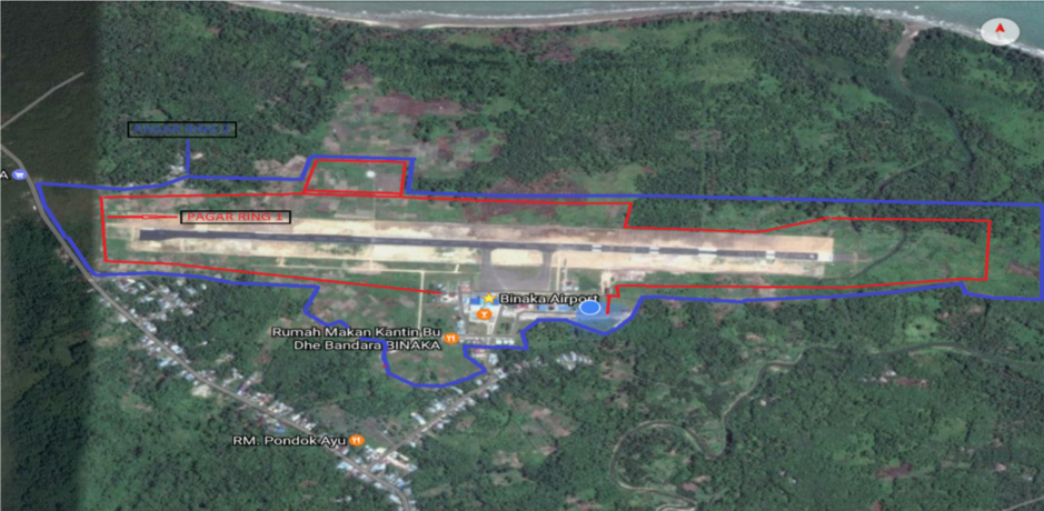
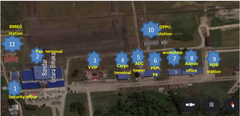
Description and Contacts of Key Companies
|
Airlines |
Destination |
Website |
|
Garuda Indonesia |
Jakarta |
|
|
Wings Air |
Padang |
|
|
Citilink |
Medan |
|
|
Aviastar |
Simeulue |
Passenger and Cargo Performance Indicator
With the increased number of passengers, airlines and weight of aircrafts every year, it requires good quality of runway at the airport. Binaka airport continuously extending and widening the runway pavement in order to accommodate larger aircraft in the next three years.
|
Performance for 2018 |
|||
|
|
Per Year |
Per Month |
Per Day |
|
Total Aircraft Movements |
2,805 |
234 |
8 |
|
Total Passengers |
Arrival : 145,273 Depart : 147,407 Total : 292,680 |
Arrival : 12.106 Depart : 12.284 Total : 24,390 |
Arrival : 398 Depart : 403 Total : 801 |
|
Total Capacity of the Airport (MT) |
65,856 |
|
|
|
Current Activity of the Airport (MT) |
49,212 |
|
|
|
Current use by Humanitarian Flights (UNHAS) |
N/A |
N/A |
N/A |
Currently, the construction of the cargo terminal is almost completed and expected to be up and running by 2020.
Runways
|
Runway #1 |
|
|
Runway Dimensions |
2,250 m x 30 m |
|
Orientation |
PCN 27 F/C/Y/T |
|
Surface |
Asphalt Hotmix (Flexible) |
The quality of the runway based on 3S (Safety, Security & Service) + 1C (Compliance).
Helicopter Pad(s)
There is no specific helipad in the airport however, an open area nearby is available for helicopter landing.
Airport Infrastructure Details
|
Customs |
No |
JET A-1 fuel |
Yes |
|
Immigration |
No |
AVGAS 100 |
No |
|
Terminal Building |
Yes |
Single Point Refueling |
No |
|
Passenger Terminal |
Yes |
Air Starter Units |
Yes |
|
Cargo terminal |
Yes |
Ground Power (mobile) |
Yes |
|
Pax Transport to Airfield |
No |
Ground Handling Services |
Yes |
|
Control Tower |
Yes |
Latrine Servicing |
Yes |
|
Weather Facilities |
Yes |
Fire Fighting Category (ICAO) |
Yes, Category 5 |
|
Catering Services |
Yes |
De-icing Equipment |
N/A |
|
Base Operating Room |
No |
Parking Ramp Lighting |
Yes |
|
Airport Radar |
Yes |
Approach & Runway Lights |
Yes |
|
NDB |
Yes |
VOR |
Yes |
|
ILS |
No |
Airport Operating Details
|
Operating Details |
|||
|
Maximum Sized Aircraft that can be Offloaded on Bulk Cargo |
Bombardier CRJ1000 Nextgen ER |
||
|
Maximum Sized Aircraft that can be Offloaded on Pallet |
C130 |
||
|
Total Aircraft Parking Area (m²) |
Apron : 180 m x 80 m = 14.400 m² |
||
|
Storage Area (m3 and MT) |
No |
||
|
Handling Equipment |
|||
|
Elevators / Hi Loaders |
No |
Max Capacity (MT) |
|
|
Max Height(m) |
|
||
|
Loading Ramps |
No |
||
|
Other Comments |
|
||
Customs Guidance
Customs is not available in the airport (domestic flights only).
Storage Facilities
No storage facility available for general cargo within the airport compound.
Airfield Costs
Airport rates and charges of various services can be referred to the government regulation under PP.11 tahun 2015. The full regulation can be download here: http://jdih.dephub.go.id/assets/uudocs/pp/2015/PP_11_Tahun_20152.pdf
NAVIGATION CHARGES
|
Charges |
Aircraft Weight - MTOW (kg) |
||
|
|
0 - 7,000 |
7,001 - 136,000 |
136,001 and over |
|
Navigation (per journey) USD - $ |
|||
|
Landing USD - $ |
|||
|
Night Landing USD - $ |
|||
|
Night Take-Off USD - $ |
|
|
|
|
Parking |
|
|
|
|
Handling Charges |
|
|
|
FUEL SERVICES CHARGES
No fuel depot/station in the airport.
|
|
Price per Litre USD - $ |
|
Jet A-1 |
Information on fuel service charges can be found at: http://aviation.pertamina.com/News.aspx?p=price |
|
Avgas |
CARGO TERMINAL CHARGES
PT. Gapura Angkasa is the main ground handling company operates in the airport.
|
Import Charges |
||
|
Type of Charge |
Rate USD - $ per kg |
Comments |
|
Handling Charge |
There is no significant cargo operations in this airport |
|
|
Break Bulk Fee |
||
|
Diplomatic Mail |
||
|
Strong Room – per consignment |
||
|
Cold Storage Fee |
||
|
Delivery Outside Normal Working Hours |
||
|
Preparation of substitute AOA – Invoice – Receipt |
||
|
Storage per Day |
||
|
Export |
||
|
Handling Charges – Un-palletized Cargo |
No significant cargo operations in this airport |
|
|
International Air Waybill |
||
|
Local Air Waybill |
||
|
Air Way Bill Amendment - Cancellation |
||
|
Air Way Bill Documentation |
||
|
Diplomatic Mail |
||
|
Storage Charges per Day |
||
AIR-BRIDGE CHARGES
Air bridge is not available.
Security
Airport security is available 24/7 for passengers inspections, goods and vehicles checking. Security Standard Operational Procedures (SOP) is in place.
2.2.34 Indonesia North Sumatra Ferdinand Lumban Tobing Airport
Airport Overview
Dr. Ferdinand Lumban Tobing airport is located in Pinangsori sub-district, Central Tapanuli district North Sumatra. The airport is managed under the Directorate General of Civil Aviation, Ministry of Transportation. The airport distance to the downtown of Sibolga is about 30 km and can be reached in approximately 50 minutes drive by road. The road condition to and from the airport is relatively good.
|
Airport Location and Contact |
|
|
Country |
Indonesia |
|
Province or District |
North Sumatra, Central Tapanuli Distrct |
|
Nearest Town or City with Distance from Airport |
Pandan - 24 km |
|
Airport’s Complete Name |
Dr. Ferdinand Lumban Tobing |
|
Latitude |
01°33′12″N |
|
Longitude |
98°53′37″E |
|
Elevation (ft and m) |
32,81 Ft / 10 m |
|
IATA Code |
FLZ |
|
ICAO Code |
WIMS |
|
Managing Company or Airport Authority |
Unit Penyelenggara Bandar Udara / UPBU (Airport Operational Unit), Ministry of Transportation |
|
Management Contact Person |
Bill Akbar Head of Administration Mobile: +62 811 6070 951 and +62 813 7660 3098 |
|
Open From (hours) |
07:00 WIB |
|
Open To (hours) |
14:00 WIB |
Airport Picture
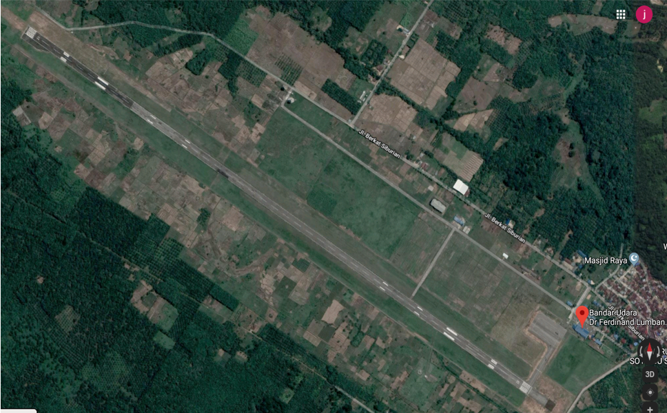
Description and Contacts of Key Companies
|
Airlines |
Destination |
Website |
|
Garuda Indonesia |
Jakarta |
|
|
Wings Air |
Medan |
|
|
Aviastar |
Sibisa, Toba Samosir |
|
|
Citilink |
Jakarta & Medan |
Passenger and Cargo Performance Indicator
|
Performance for 2018 |
|||
|
|
Per Year |
Per Month |
Per Day |
|
Total Aircraft Movements |
1,576 |
|
|
|
Total Passengers |
164,502 |
|
|
|
Total Capacity of the Airport (MT) |
22,708 MT |
|
|
|
Current Activity of the Airport (MT) |
9,041 MT |
|
|
|
Current use by Humanitarian Flights (UNHAS) |
N/A |
|
|
Runways
|
Runway #1 |
|
|
Runway Dimensions |
2190 m X 30 m |
|
Orientation |
12/30 |
|
Surface |
Hot mix PCN 34 FCYT |
Additional runway planning to be constructed in 2020.
|
Runway #2 |
|
|
Runway Dimensions |
2500 m X 45 m |
|
Orientation |
12/30 |
|
Surface |
Asphalt |
Helicopter Pad(s)
No helipad in the airport, however an open space nearby is available if needed for helicopter landing.
Airport Infrastructure Details
|
Customs |
No |
JET A-1 fuel |
Yes |
|
Immigration |
No |
AVGAS 100 |
No |
|
Terminal Building |
Yes |
Single Point Refueling |
No |
|
Passenger Terminal |
Yes |
Air Starter Units |
No |
|
Cargo terminal |
No |
Ground Power (mobile) |
Yes |
|
Pax Transport to Airfield |
No |
Ground Handling Services |
Yes |
|
Control Tower |
Yes |
Latrine Servicing |
No |
|
Weather Facilities |
Yes |
Fire Fighting Category (ICAO) |
Yes, Category 5 |
|
Catering Services |
Yes |
De-icing Equipment |
No |
|
Base Operating Room |
No |
Parking Ramp Lighting |
Yes |
|
Airport Radar |
No |
Approach & Runway Lights |
Yes |
|
NDB |
Yes |
VOR |
Yes |
|
ILS |
No |
|
|
Airport Operating Details
|
Operating Details |
|||
|
Maximum Sized Aircraft that can be Offloaded on Bulk Cargo |
Bombardier CRJ1000 |
||
|
Maximum Sized Aircraft that can be Offloaded on Pallet |
C130 |
||
|
Total Aircraft Parking Area (m²) |
9,600 m2 |
||
|
Storage Area (m3 and MT) |
|
||
|
Handling Equipment |
|||
|
Elevators / Hi Loaders |
No |
Max Capacity (MT) |
|
|
Max Height (m) |
|
||
|
Loading Ramps |
No |
||
|
Other Comments |
|
||
Customs Guidance
No customs services and facility is available in the airport.
Storage Facilities
No storage facility dedicated to general cargo in the airport.
Airfield Costs
Flight costs can be found at: www.dephub.go.id PP.11 Tahun 2015
NAVIGATION CHARGES
|
Charges |
Aircraft Weight - MTOW (kg) |
||
|
|
0 - 7,000 |
7,001 - 136,000 |
136,001 and over |
|
Navigation (per journey) USD - $ |
|||
|
Landing USD - $ |
|
|
|
|
Night Landing USD - $ |
|
|
|
|
Night Take-Off USD - $ |
|
|
|
|
Parking |
|
|
|
|
Handling Charges |
|
|
|
FUEL SERVICES CHARGES
There is no fuel depot in the airport.
|
|
Price per Litre USD - $ |
|
Jet A-1 |
Information on fuel service charges can be found at: http://aviation.pertamina.com/News.aspx?p=price |
|
Avgas |
|
CARGO TERMINAL CHARGES
PT. Gapura Angkasa and Union of Angkasa are the ground handling company for domestic activities.
|
Import Charges |
||
|
Type of Charge |
Rate USD - $ per kg |
Comments |
|
Handling Charge |
No significant cargo operations in the airport |
|
|
Break Bulk Fee |
||
|
Diplomatic Mail |
||
|
Strong Room – per consignment |
||
|
Cold Storage Fee |
||
|
Delivery Outside Normal Working Hours |
||
|
Preparation of substitute AOA – Invoice – Receipt |
||
|
Storage per Day |
||
|
Export |
||
|
Handling Charges – Un-palletized Cargo |
No significant cargo operations in the airport |
|
|
International Air Waybill |
||
|
Local Air Waybill |
||
|
Air Way Bill Amendment - Cancellation |
||
|
Air Way Bill Documentation |
||
|
Diplomatic Mail |
||
|
Storage Charges per Day |
||
Security
The airport compound is protected by wire fence.
2.2.35 Indonesia Aceh Sultan Iskander Muda Airport
Sultan Iskandar Muda International Airport is located in Aceh Besar district, about 17 km from Banda Aceh city, the capital of Aceh Province. It is an international airport and is the largest airport in Aceh Province, as well as the main access point to the province, with a high flow of passengers to and from Jakarta, Medan and Malaysia. The airport is operated by PT. Angkasa Pura II (Persero) Branch Iskandar Muda Airport.
The airport operates from 23:00 – 15.00 UTC (07:00 – 23:00 WIB) for air traffic movements
Airport Overview
|
Airport Location and Contact |
|
|
Country |
Indonesia |
|
Province or District |
Aceh Province |
|
Nearest Town or City with Distance from Airport |
Banda Aceh City, 17 km |
|
Airport’s Complete Name |
Sultan Iskandar Muda International Airport |
|
Latitude |
5.517959 |
|
Longitude |
95.417288 |
|
Elevation (ft and m) |
65 ft / 19.8 m |
|
IATA Code |
BTJ |
|
ICAO Code |
WITT |
|
Managing Company or Airport Authority |
PT. Angkasa Pura II (Persero) |
|
Management Contact Person |
Rizki Lestari (Safety, Risk and Quality Staff) Ph. 082161913693 Email: rizki.lestari@angkasapura2.co.id / esrq.btj@gmail.com / ap2_btj@angkasapura2.co.id |
|
Open From (hours) |
23:00 UTC (07:00 WIB) |
|
Open To (hours) |
15:00 UTC (23:00 WIB) |
Airport Picture
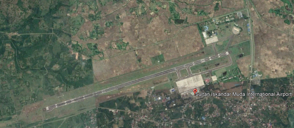
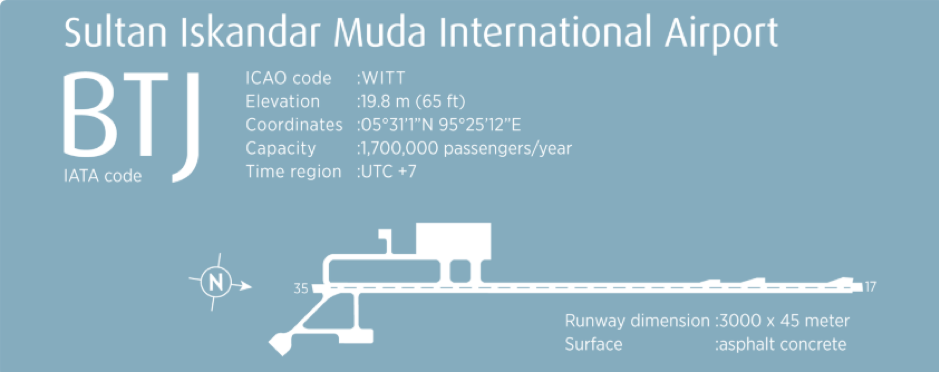
Description and Contacts of Key Companies
The airline companies in Sultan Iskandar Muda:
Garuda Indonesia (www.garuda-indonesia.com)
Lion Air (http://www.lionair.co.id)
Citilink Indonesia (www.citilink.co.id)
Batik Air (www.batikair.com)
Susi Air (https://www.susiair.com/)
Air Asia (www.airasia.com)
Malindo Air (www.malindoair.com)
Passenger and Cargo Performance Indicator
|
Performance for 2018 |
|||
|
|
Per Year |
Per Month |
Per Day |
|
Total Aircraft Movements |
2018 : 10.510 |
||
|
Total Passengers |
2018 : 1.273.410 |
||
|
Total Capacity of the Airport (MT) |
2018 : 9,361.357 |
||
|
Current Activity of the Airport (MT) |
2018 : 5,836.445 |
||
|
Current use by Humanitarian Flights (UNHAS) |
No |
||
Runways
|
Runway #1 |
|
|
Runway Dimensions |
L3000 x W45 |
|
Orientation |
17 – 35 |
|
Surface |
Asphalt (88 F/C/W/T) |
Airport Infrastructure Details
|
Customs |
Yes |
JET A-1 fuel |
Yes |
|
Immigration |
Yes |
AVGAS 100 |
No |
|
Terminal Building |
Yes |
Single Point Refueling |
No |
|
Passenger Terminal |
Yes |
Air Starter Units |
Yes |
|
Cargo terminal |
Yes |
Ground Power (mobile) |
Yes |
|
Pax Transport to Airfield |
Yes (On Request) |
Ground Handling Services |
Yes |
|
Control Tower |
Yes |
Latrine Servicing |
Yes |
|
Weather Facilities |
Yes |
Fire Fighting Category (ICAO) |
Category: 7 |
|
Catering Services |
Yes |
De-icing Equipment |
No |
|
Base Operating Room |
Yes |
Parking Ramp Lighting |
Yes |
|
Airport Radar |
No |
Approach & Runway Lights |
Yes |
|
NDB |
Yes |
VOR |
Yes |
|
ILS |
Yes |
Airport Operating Details
|
Operating Details |
|||
|
Maximum Sized Aircraft that can be Offloaded on Bulk Cargo |
Boeing 747-300 |
||
|
Maximum Sized Aircraft that can be Offloaded on Pallet |
Boeing 747-400 |
||
|
Total Aircraft Parking Area (m²) |
400 m x 200 m |
||
|
Storage Area (m3 and MT) |
Nil |
||
|
Handling Equipment |
|||
|
Elevators / Hi Loaders |
Yes |
Max Capacity (MT) |
|
|
Max Height (m) |
|
||
|
Loading Ramps |
Yes |
||
|
Other Comments |
- |
||
Customs Guidance
Customs and immigration are available in Airport area, with operating hour from 23:00 – 15:00 UTC (07:00 – 23:00 WIB)
For more information on customs in Indonesia, please see the following link: http://www.beacukai.go.id/
Storage Facilities
Storage facilities are available only for cargo handling.
(1 unit building with stacker, pallet and 3 mt Forklift)
Airfield Costs
For information on airport rates and charges, please see the following link:
www.dephub.go.id (PP.15 Tahun 2016)
http://jdih.dephub.go.id/assets/uudocs/perpres/2016/PP_15_Tahun_2016.pdf
NAVIGATION CHARGES
Info about the navigation charges are not available.
FUEL SERVICES CHARGES
The Aircraft Refuelling Depot is available at the airport for aviation fuel. It is managed by PT. Pertamina (Persero).
For more details can be found: http://aviation.pertamina.com/News.aspx?p=price
|
|
Price per Litre USD - $ as per 20 Aug 2019 |
|
Jet A-1 |
9,540.00 IDR per litre / USD 0.68 per litre |
|
Avgas |
Nil |
CARGO TERMINAL CHARGES
PT. Gapura Angkasa and PT. Jaya Karya Semesta (JKS) are the ground handling companies in Sultan Iskandar Muda Airport for handling international and domestic cargoes.
|
Import Charges |
||
|
Type of Charge |
Rate USD - $ per kg |
Comments |
|
Handling Charge |
All service costs are handled by each ground handling company with the approval of the Airport Authority. |
|
|
Break Bulk Fee |
||
|
Diplomatic Mail |
||
|
Strong Room – per consignment |
||
|
Cold Storage Fee |
||
|
Delivery Outside Normal Working Hours |
||
|
Preparation of substitute AOA – Invoice – Receipt |
||
|
Storage per Day |
||
|
Export |
||
|
Handling Charges – Un-palletized Cargo |
All service costs are handled by handled by each ground handling company with the approval of the Airport Authority. |
|
|
International Air Waybill |
||
|
Local Air Waybill |
||
|
Air Way Bill Amendment - Cancellation |
||
|
Air Way Bill Documentation |
||
|
Diplomatic Mail |
||
|
Storage Charges per Day |
||
*in case any international flights
AIR-BRIDGE CHARGES
There are air-bridge facilities available at the airport. Info about the charges are not available.
Security
Sultan Iskandar Muda Airport is a civil airport and has 4 (four) security posts:
- Two at run way edges
- Two at the entrance gate
2.2.36 Indonesia Aceh Cut Nyak Dhien Airport
Cut Nyak Dhien Airport is located in Nagan Raya district, about 21 km from Meulaboh city, the capital of West Aceh district. It is a domestic airport that serves as the main access point to the West and South Aceh districts and is operated by the Unit Penyelenggara Bandar Udara (UPBU), Directorate General of Civil Aviation (DGCA), Ministry of Transportation.
Since January 2019 there are no commercial flights scheduled in this airport due to low of load factor from and to the destination. The airport operates from 23:00 – 06.00 UTC (07:00 – 14:00 WIB) for air traffic movements
Airport Overview
|
Airport Location and Contact |
|
|
Country |
Indonesia |
|
Province or District |
Nagan Raya District, Aceh Province |
|
Nearest Town or City with Distance from Airport |
Meulaboh City, 21km |
|
Airport’s Complete Name |
Cut Nyak Dhien Airport |
|
Latitude |
4.047344 |
|
Longitude |
96.250612 |
|
Elevation (ft and m) |
16.42 ft / 5 m |
|
IATA Code |
MEQ |
|
ICAO Code |
WITC |
|
Managing Company or Airport Authority |
Unit Penyelenggara Bandar Udara (UPBU), Directorate General of Civil Aviation (DGCA), Ministry of Transportation Cut Nyak Dhien Airport |
|
Management Contact Person |
Darus (Head of Administration) Ph.081377706680 Email cnd_naganraya@yahoo.com |
|
Open From (hours) |
23:00 UTC (07:00 WIB) |
|
Open To (hours) |
06:00 UTC (14:00 WIB) |
Airport Picture
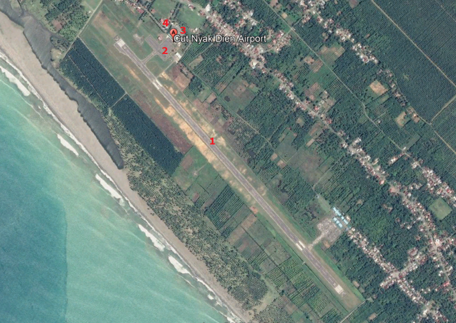
|
Note: 1. Runway 2. Apron 3. Passenger Terminal 4. Airport Office |
Description and Contacts of Key Companies
UPBU Cut Nyak Dhien, operator in Airport Cut Nyak Dhien, Nagan Raya.
Contact: Roni (Plt Head of UPBU)
Ph. 087882844116 / 082166676667
Email t.cut.ali@gmail.com
Airlines in Cut Nyak Dhien Airport:
Susi Air (www.susiair.com)
Wings Air (lionair.co.id)
Passenger and Cargo Performance Indicator
|
Performance for 2018 |
|||
|
|
Per Year |
Per Month |
Per Day |
|
Total Aircraft Movements |
1,268 |
||
|
Total Passengers |
37,889 |
||
|
Total Capacity of the Airport (MT) |
|
||
|
Current Activity of the Airport (MT) |
|
||
|
Current use by Humanitarian Flights (UNHAS) |
No |
||
Runways
|
Runway #1 |
|
|
Runway Dimensions |
L1,800m x 30m |
|
Orientation |
14 – 32 |
|
Surface |
Asphalt (PCN 23 F/C/Y/T) |
Airport Infrastructure Details
|
Customs |
No |
JET A-1 fuel |
No |
|
Immigration |
No |
AVGAS 100 |
No |
|
Terminal Building |
Yes |
Single Point Refueling |
No |
|
Passenger Terminal |
Yes |
Air Starter Units |
No |
|
Cargo terminal |
No |
Ground Power (mobile) |
Yes |
|
Pax Transport to Airfield |
No |
Ground Handling Services |
Yes |
|
Control Tower |
Yes |
Latrine Servicing |
No |
|
Weather Facilities |
Yes |
Fire Fighting Category (ICAO) |
Category: IV |
|
Catering Services |
No |
De-icing Equipment |
No |
|
Base Operating Room |
Yes |
Parking Ramp Lighting |
Yes |
|
Airport Radar |
No |
Runway Lights |
Yes |
|
NDB |
Yes |
VOR |
No |
|
ILS |
No |
Airport Operating Details
|
Operating Details |
|||
|
Maximum Sized Aircraft that can be Offloaded on Bulk Cargo |
ATR 72-600 |
||
|
Maximum Sized Aircraft that can be Offloaded on Pallet |
|||
|
Total Aircraft Parking Area (m²) |
60 m x 40 m |
||
|
Storage Area (m3 and MT) |
Nil |
||
|
Handling Equipment |
|||
|
Elevators / Hi Loaders |
No |
Max Capacity (MT) |
|
|
Max Height (m) |
|
||
|
Loading Ramps |
No |
||
|
Other Comments |
- |
||
Customs Guidance
For more information on customs in Indonesia, please see the following link: http://www.beacukai.go.id/
Storage Facilities
No storage facility available.
Airfield Costs
For information on airport rates and charges, please see the following link:
www.dephub.go.id (PP.15 Tahun 2016)
http://jdih.dephub.go.id/assets/uudocs/perpres/2016/PP_15_Tahun_2016.pdf
NAVIGATION CHARGES
The costs below are charged based on the operational hours.
|
Charges |
Aircraft Weight - MTOW (kg) |
||
|
|
0 - 7,000 |
7,001 - 136,000 |
136,001 and over |
|
Navigation (per journey) USD - $ |
|
||
|
Landing USD - $ |
- |
- |
- |
|
Night Landing USD - $ |
- |
- |
- |
|
Night Take-Off USD - $ |
- |
- |
- |
|
Parking |
|
||
|
Handling Charges |
- |
- |
- |
FUEL SERVICES CHARGES
The Aircraft Refuelling Depot is available at the airport for aviation fuel. It is managed by PT. Pertamina (Persero).
For more details can be found: http://aviation.pertamina.com/News.aspx?p=price
CARGO TERMINAL CHARGES
|
Import Charges |
||
|
Type of Charge |
Rate USD - $ per kg |
Comments |
|
Handling Charge |
All service costs are handled by each ground handling company with the approval of the Airport Authority. |
|
|
Break Bulk Fee |
||
|
Diplomatic Mail |
||
|
Strong Room – per consignment |
||
|
Cold Storage Fee |
||
|
Delivery Outside Normal Working Hours |
||
|
Preparation of substitute AOA – Invoice – Receipt |
||
|
Storage per Day |
||
|
Export |
||
|
Handling Charges – Un-palletized Cargo |
All service costs are handled by handled by each ground handling company with the approval of the Airport Authority. |
|
|
International Air Waybill |
||
|
Local Air Waybill |
||
|
Air Way Bill Amendment - Cancellation |
||
|
Air Way Bill Documentation |
||
|
Diplomatic Mail |
||
|
Storage Charges per Day |
||
*in case any international flights
AIR-BRIDGE CHARGES
No air-bridge facility available.
Security
Cut Nyak Dhien Airport is a civil airport and has 2 (two) security posts:
- One at run way edges
- One at the entrance gate
2.2.37 Indonesia Aceh Teuku Cut Ali Airport
Teuku Cut Ali Airport is located in Pasie Raja sub-district, about 21 km from Tapaktuan city, the capital of South Aceh district. It is a domestic airport that serves as the alternative access point to South Aceh district and is operated by the Unit Penyelenggara Bandar Udara (UPBU), Directorate General of Civil Aviation (DGCA), Ministry of Transportation.
Since January 2019, there are no commercial flights scheduled in this airport due to low load factor from and to the destination. The airport operates from 23:00 – 06.00 UTC (07:00 – 14:00 WIB) for air traffic movements.
Airport Overview
|
Airport Location and Contact |
|
|
Country |
Indonesia |
|
Province or District |
South Aceh district, Aceh Province |
|
Nearest Town or City with Distance from Airport |
Tapak Tuan City, 21km |
|
Airport’s Complete Name |
Teuku Cut Ali Airport |
|
Latitude |
3.173076 |
|
Longitude |
97.288197 |
|
Elevation (ft and m) |
9.84 ft / 3 m |
|
IATA Code |
TPK |
|
ICAO Code |
WITA |
|
Managing Company or Airport Authority |
Unit Penyelenggara Bandar Udara (UPBU), Directorate General of Civil Aviation (DGCA), Ministry of Transportation. Teuku Cut Ali Airport |
|
Management Contact Person |
Roni (Plt Head of UPBU) Ph. 087882844116 / 082166676667 Email t.cut.ali@gmail.com |
|
Open From (hours) |
23:00 UTC (07:00 WIB) |
|
Open To (hours) |
06:00 UTC (14:00 WIB) |
Airport Picture
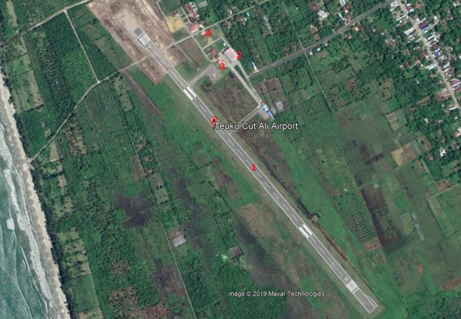
Note:
- Runway
- New Passenger Terminal
- Old Passenger Terminal
- Airport Office
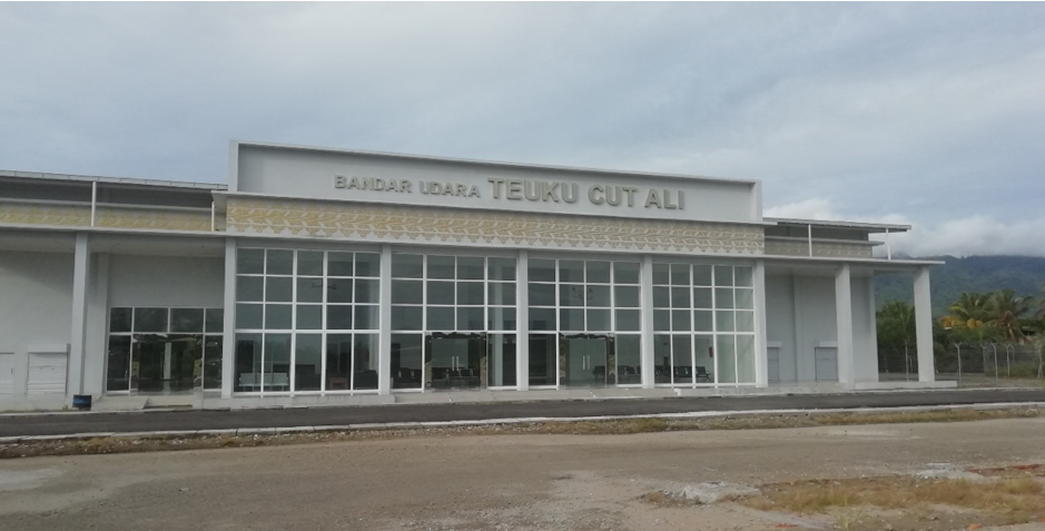
Description and Contacts of Key Companies
UPBU Teuku Cut Ali, operator in Airport Teuku Cut Ali. The airport is still declared active, even though there is no commercial flight scheduled
Contact: Roni (Plt Head of UPBU)
Ph. 087882844116 / 082166676667
Email t.cut.ali@gmail.com
Passenger and Cargo Performance Indicator
|
Performance for 2018 |
|||
|
|
Per Year |
Per Month |
Per Day |
|
Total Aircraft Movements |
52 |
|
|
|
Total Passengers |
n/a |
|
|
|
Total Capacity of the Airport (MT) |
|
|
|
|
Current Activity of the Airport (MT) |
|
|
|
|
Current use by Humanitarian Flights (UNHAS) |
No |
|
|
Runways
|
Runway #1 |
|
|
Runway Dimensions |
L1,180m x 30m |
|
Orientation |
14 – 32 |
|
Surface |
Asphalt (5 F/C/Z/U) |
Airport Infrastructure Details
|
Customs |
No |
JET A-1 fuel |
No |
|
Immigration |
No |
AVGAS 100 |
No |
|
Terminal Building |
Yes |
Single Point Refueling |
No |
|
Passenger Terminal |
Yes |
Air Starter Units |
No |
|
Cargo terminal |
No |
Ground Power (mobile) |
Yes |
|
Pax Transport to Airfield |
No |
Ground Handling Services |
Yes |
|
Control Tower |
No |
Latrine Servicing |
No |
|
Weather Facilities |
No |
Fire Fighting Category (ICAO) |
Category: - |
|
Catering Services |
No |
De-icing Equipment |
No |
|
Base Operating Room |
No |
Parking Ramp Lighting |
No |
|
Airport Radar |
No |
Approach & Runway Lights |
No |
|
NDB |
No |
VOR |
No |
|
ILS |
No |
|
|
Airport Operating Details
|
Operating Details |
|||
|
Maximum Sized Aircraft that can be Offloaded on Bulk Cargo |
Cessna |
||
|
Maximum Sized Aircraft that can be Offloaded on Pallet |
- |
||
|
Total Aircraft Parking Area (m²) |
60 m x 40 m |
||
|
Storage Area (m3 and MT) |
Nil |
||
|
Handling Equipment |
|||
|
Elevators / Hi Loaders |
No |
Max Capacity (MT) |
|
|
Max Height (m) |
|
||
|
Loading Ramps |
No |
||
|
Other Comments |
- |
||
Customs Guidance
For more information on customs in Indonesia, please see the following link: http://www.beacukai.go.id/
Storage Facilities
No storage facility available.
Airfield Costs
For information on airport rates and charges, please see the following link:
www.dephub.go.id (PP.15 Tahun 2016)
http://jdih.dephub.go.id/assets/uudocs/perpres/2016/PP_15_Tahun_2016.pdf
NAVIGATION CHARGES
|
Charges |
Aircraft Weight - MTOW (kg) |
||
|
|
0 - 7,000 |
7,001 - 136,000 |
136,001 and over |
|
Navigation (per journey) USD - $ |
- |
||
|
Landing USD - $ |
- |
- |
- |
|
Night Landing USD - $ |
- |
- |
- |
|
Night Take-Off USD - $ |
- |
- |
- |
|
Parking |
|
||
|
Handling Charges |
- |
- |
- |
FUEL SERVICES CHARGES
The Aircraft Refuelling Depot is available at the airport for aviation fuel. It is managed by PT. Pertamina (Persero).
For more details can be found: http://aviation.pertamina.com/News.aspx?p=price
CARGO TERMINAL CHARGES
|
Import Charges |
||
|
Type of Charge |
Rate USD - $ per kg |
Comments |
|
Handling Charge |
All service costs are handled by each ground handling company with the approval of the Airport Authority. |
|
|
Break Bulk Fee |
||
|
Diplomatic Mail |
||
|
Strong Room – per consignment |
||
|
Cold Storage Fee |
||
|
Delivery Outside Normal Working Hours |
||
|
Preparation of substitute AOA – Invoice – Receipt |
||
|
Storage per Day |
||
|
Export |
||
|
Handling Charges – Un-palletized Cargo |
All service costs are handled by handled by each ground handling company with the approval of the Airport Authority. |
|
|
International Air Waybill |
||
|
Local Air Waybill |
||
|
Air Way Bill Amendment - Cancellation |
||
|
Air Way Bill Documentation |
||
|
Diplomatic Mail |
||
|
Storage Charges per Day |
||
* in case any international flights
AIR-BRIDGE CHARGES
No air-bridge facility available.
Security
Teuku Cut Ali Airport is a civil airport and has 2 (two) security posts:
- One at run way edges
- One at the entrance gate
2.2.38 Indonesia East Java Notohadinegoro Jember Airport
Airport Overview
The airport is located in Jember District, East Java Province. Notohadinegoro airport is the first civilian airport that was built by the local district government. It is operated by the Office of Transportation of Jember District (Dinas Perhubungan Kabupaten Jember). The airport has temporary aerodrome certificate valid until 22 December 2019, and is in the process of getting a permanent aerodrome certificate from the Ministry of Transportation.
|
Airport Location and Contact |
|
|
Country |
Indonesia |
|
Province or District |
East Java / Jember District |
|
Nearest Town or City |
7 km from Jember City |
|
Airport’s Complete Name |
Notohadinegoro |
|
Latitude |
113°14′37.0″S |
|
Longitude |
08°41’43.5″E |
|
Elevation (ft and m) |
264 Ft / 32 M |
|
IATA Code |
JBB |
|
ICAO Code |
WARE |
|
Managing Company or Airport Authority |
Unit Pelaksana Bandar Udara (UPBU) Jember |
|
Management Contact Person |
Edy Office: +62-331-4355 399 Mobile: +62 8563274 751 |
|
Open From (hours) |
08.00 UTC + 07.00 |
|
Open To (hours) |
17.00 UTC + 07.00 |
Airport Picture
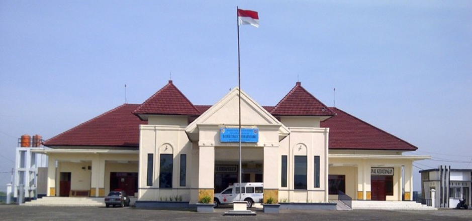
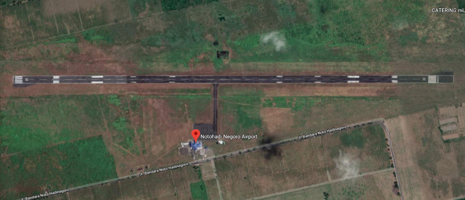
Description and Contacts of Key Companies
Information on some aviation service providers can be found at: http://www.azfreight.com/
Airlines and Destinations
|
Airlines |
Destination |
Website |
|
Citilink |
Surabaya (SUB) – Notohadi Negoro (JBB ) - Surabaya (SUB) |
|
|
Wings Air |
Surabaya (SUB) – Notohadi Negoro (JBB ) - Surabaya (SUB) |
Passenger and Cargo Performance Indicator
|
Performance for YEAR 2018 |
|||
|
|
Per Year |
Per Month |
Per Day |
|
Total Aircraft Movements |
1,436 |
120 |
4 |
|
Total Passengers |
77,918 |
6,390 |
213 |
|
Total Capacity of the Airport (MT) |
1,095 |
90 |
3 |
|
Current Activity of the Airport (MT) |
730 |
60 |
2 |
|
Current use by Humanitarian Flights (UNHAS) |
NIL |
NIL |
NIL |
Runways
|
Runway #1 |
|
|
Runway Dimensions |
1,645 m X 30 m |
|
Orientation |
02 / 20 |
|
Surface |
Asphalt 24 FCYT |
Helicopter Pad(s)
|
Helipad #1 |
|
|
Present |
No |
|
Largest Helicopter that can Land |
No |
|
Width and Length (m) |
No |
|
Surface |
No |
Airport Infrastructure Details
|
Customs |
No |
JET A-1 fuel |
No |
|
Immigration |
Yes |
AVGAS 100 |
No |
|
Terminal Building |
Yes |
Single Point Refueling |
No |
|
Passenger Terminal |
Yes |
Air Starter Units |
No |
|
Cargo terminal |
No |
Ground Power (mobile) |
No |
|
Pax Transport to Airfield |
No |
Ground Handling Services |
Yes |
|
Control Tower |
Yes |
Latrine Servicing |
No |
|
Weather Facilities |
Yes |
Fire Fighting Category (ICAO) |
Yes, ICAO IV |
|
Catering Services |
No |
De-icing Equipment |
No |
|
Base Operating Room |
No |
Parking Ramp Lighting |
No |
|
Airport Radar |
No |
Approach & Runway Lights |
No |
|
NDB |
Yes |
VOR |
No |
|
ILS |
No |
Airport Operating Details
|
Operating Details |
|||
|
Maximum Sized Aircraft that can be Offloaded on Bulk Cargo |
ATR 72 - 600 |
||
|
Maximum Sized Aircraft that can be Offloaded on Pallet |
ATR 72 - 600 |
||
|
Total Aircraft Parking Area (m²) |
6,528 |
||
|
Storage Area (m3 and MT) |
Not available |
||
|
Handling Equipment |
|||
|
Elevators / Hi Loaders |
NO |
Max Capacity (MT) |
Nil |
|
Max Height (m) |
Nil |
||
|
Loading Ramps |
NO |
||
|
Other Comments |
NO |
||
Customs Guidance
Customs services are not available at the airport, Nearest Customs office is located in the city, about 11 km from the airport at the following address:
KPPBC TMP C Jember (Bea Cukai Jember)
Jalan Kalimantan No. 33 Jember 68121
Phone: +62-331-5444442 / 5444470
Email: kppbc.jember@gmail.com
Website: https://www.bcjember.beacukai.go.id/
For more information on customs in Indonesia, please see the following link: www.beacukai.go.id
Storage Facilities
No storage facilities available at the airport. An open space is currently being utilised for cargo handling.
Airfield Costs
For information on airport rates and charges, please see the following link:
www.dephub.go.id (PP.15 Tahun 2016)
http://jdih.dephub.go.id/assets/uudocs/perpres/2016/PP_15_Tahun_2016.pdf
NAVIGATION CHARGES
|
Charges |
Aircraft Weight - MTOW (kg) |
||
|
|
0 - 7,000 |
7,001 - 136,000 |
136,001 and over |
|
Navigation (per journey) USD - $ |
- |
- |
- |
|
Landing USD - $ |
- |
- |
- |
|
Night Landing USD - $ |
- |
- |
- |
|
Night Take-Off USD - $ |
- |
- |
- |
|
Parking |
- |
- |
- |
|
Handling Charges |
- |
- |
- |
FUEL SERVICES CHARGES
|
|
Price per Litre USD - $ |
|
Jet A-1 |
$ 73. 02 / Litre |
|
Avgas |
$ 141.8 / Drum (200 Litre) |
CARGO TERMINAL CHARGES
Cargo handling activity are managed by PT. Gapura Angkasa and Radhitia Avio Jasa (RAJ).
|
Import Charges |
||
|
Type of Charge |
Rate USD - $ per kg |
Comments |
|
Handling Charge |
All service costs are handled by each ground handling company with the approval of the Airport Authority* |
|
|
Break Bulk Fee |
||
|
Diplomatic Mail |
||
|
Strong Room – per consignment |
||
|
Cold Storage Fee |
||
|
Delivery Outside Normal Working Hours |
||
|
Preparation of substitute AOA – Invoice – Receipt |
||
|
Storage per Day |
||
|
Export |
||
|
Handling Charges – Un-palletized Cargo |
All service costs are handled by each ground handling company with the approval of the Airport Authority* |
|
|
International Air Waybill |
||
|
Local Air Waybill |
||
|
Air Way Bill Amendment - Cancellation |
||
|
Air Way Bill Documentation |
||
|
Diplomatic Mail |
||
|
Storage Charges per Day |
||
*) in case any import and export activities
AIR-BRIDGE CHARGES
There is no airbridge facility at the airport.
Security
- 5 security posts
- 1-unit ETD (Explosive Trace Detection)
- WTMD
- WHMD (Waste and Hazardous Materials Division)
- CCTV Terminal
2.2.39 Indonesia West Nusa Tenggara Sultan Muhammad Kaharuddin III Airport
Airport Overview
Sultan Muhammad Kaharuddin airport is located in Sumbawa Besar district, about 3 km from Sumbawa city, in the island of Sumbawa, West Nusa Tenggara Province. The airport is under the management of Unit Penyelenggara Bandar Udara (UPBU), Directorate General Civil Aviation, Region IV under the Authority of Ngurah Rai International Airport in Denpasar, Bali. The airport has a new terminal facility with capacity of 2,790 m2. The airport serves domestic flights only.
|
Airport Location and Contact |
|
|
Country |
Indonesia |
|
Province or District |
West Nusa Tenggara, Sumbawa Distrct |
|
Nearest Town or City |
Sumbawa City 3.3 km |
|
Airport’s Complete Name |
Sultan Muhammad Kaharuddin III |
|
Latitude |
8°29′20″S |
|
Longitude |
117°24′43″E |
|
Elevation (ft and m) |
5 ft and 1 m |
|
IATA Code |
SWQ |
|
ICAO Code |
WADS |
|
Managing Company or Airport Authority |
Unit Penyelenggara Bandar Udara / UPBU, Directorate General Civil Aviation, Ministry of Transportation |
|
Management Contact Person |
Yayat Ruhiyat Technic Mobile: +62 8123773100 |
|
Open From (hours) |
07:00 UTC+8 |
|
Open To (hours) |
17:00 WITA |
Airport Picture
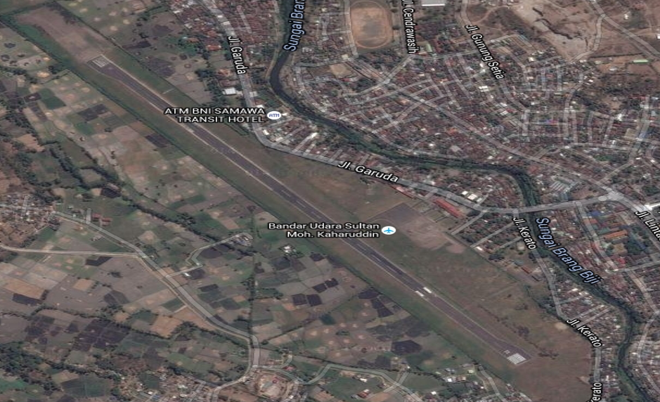
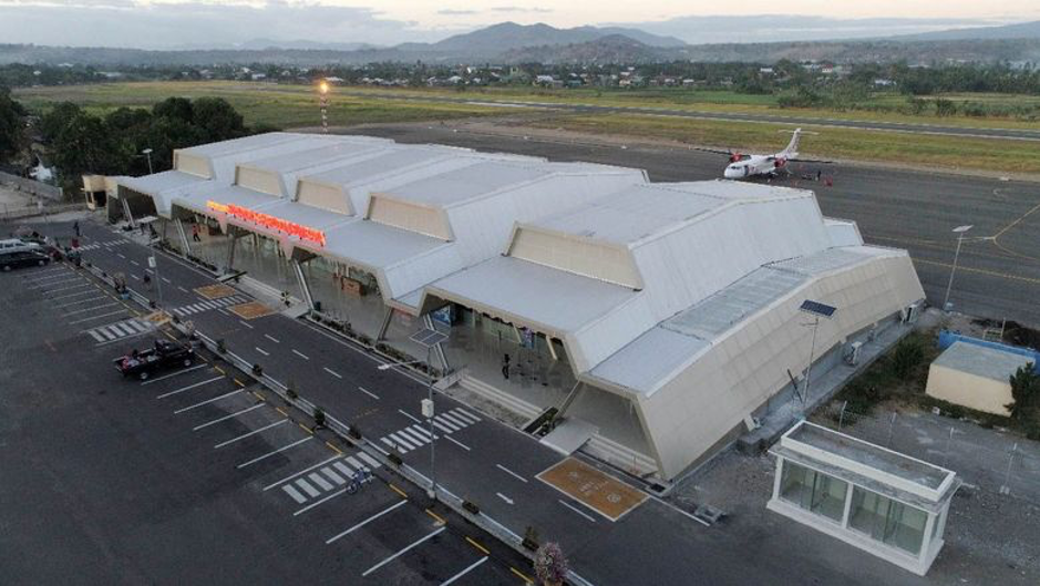
Description and Contacts of Key Companies
|
Airlines |
Destination |
Website |
|
Garuda Indonesia |
Note: recently stopped their operation from Lombok to Sumbawa (return trip) due to low passenger load. |
|
|
Wings Air |
Lombok, Surabaya |
Passenger and Cargo Performance Indicator
|
Performance for 2018 |
|||
|
|
Per Year |
Per Month |
Per Day |
|
Total Aircraft Movements |
1,729 |
||
|
Total Passengers |
81,464 |
||
|
Total Capacity of the Airport (MT) |
40,300 MT |
||
|
Current Activity of the Airport (MT) |
13,088 MT |
||
|
Current use by Humanitarian Flights (UNHAS) |
N/A |
||
Runways
|
Runway #1 |
|
|
Runway Dimensions |
1650 m X 30 m |
|
Orientation |
14/32 |
|
Surface |
Asphalt |
Helicopter Pad(s)
There is no dedicated helipad at the airport, but the apron and grass areas can be used, if needed.
|
Helipad #1 |
|
|
Present |
No |
|
Largest Helicopter that can Land |
No |
|
Width and Length (m) |
No |
|
Surface |
No |
Airport Infrastructure Details
|
Customs |
No |
JET A-1 fuel |
No |
|
Immigration |
No |
AVGAS 100 |
No |
|
Terminal Building |
Yes |
Single Point Refueling |
No |
|
Passenger Terminal |
Yes |
Air Starter Units |
No |
|
Cargo terminal |
No |
Ground Power (mobile) |
No |
|
Pax Transport to Airfield |
No |
Ground Handling Services |
Yes |
|
Control Tower |
Yes |
Latrine Servicing |
Yes |
|
Weather Facilities |
Yes |
Fire Fighting Category (ICAO) |
Yes, Category 4 |
|
Catering Services |
Yes |
De-icing Equipment |
N/A |
|
Base Operating Room |
Yes |
Parking Ramp Lighting |
Yes |
|
Airport Radar |
No |
Approach & Runway Lights |
Yes |
|
NDB |
Yes |
VOR |
No |
|
ILS |
No |
Airport Operating Details
|
Operating Details |
|||
|
Maximum Sized Aircraft that can be Offloaded on Bulk Cargo |
ATR 72 - 800 |
||
|
Maximum Sized Aircraft that can be Offloaded on Pallet |
C130 |
||
|
Total Aircraft Parking Area (m²) |
16,800 sqm |
||
|
Storage Area (m3 and MT) |
Not available |
||
|
Handling Equipment |
|||
|
Elevators / Hi Loaders |
No |
Max Capacity (MT) |
|
|
Max Height (m) |
|
||
|
Loading Ramps |
No |
||
|
Other Comments |
|
||
Customs Guidance
There is no Customs office available at the airport.
Storage Facilities
There is no storage facility for general cargo at the airport.
Airfield Costs
For information on airport rates and charges, please see the following link:
www.dephub.go.id (PP.15 Tahun 2016)
http://jdih.dephub.go.id/assets/uudocs/perpres/2016/PP_15_Tahun_2016.pdf
NAVIGATION CHARGES
The costs below are charged based on the operational hours.
|
Charges |
Aircraft Weight - MTOW (kg) |
||
|
|
0 - 7,000 |
7,001 - 136,000 |
136,001 and over |
|
Navigation (per journey) USD - $ |
15% of the cost of flight navigation services for domestic routes and 10% for international routes* |
||
|
Landing USD - $ |
$ 0.21/1000 kg domestics $ 3.60/1000 kg international* |
$ 8.84/1000 kg domestics $ 148.1 / 1000 kg international* |
$ 26.02/1000 kg domestics $ 394.7 /1000 kg international* |
|
Night Landing USD - $ |
- |
- |
- |
|
Night Take-Off USD - $ |
- |
- |
- |
|
Parking |
$ 0.07 / 1000 kg / 12 hours – domestic $ 0.30 / 1000 kg / 12 hours – international* |
||
|
Handling Charges |
- |
- |
- |
*) in case any international flights
FUEL SERVICES CHARGES
There is no fuel depot at the airport.
|
|
Price per Litre USD - $ |
|
Jet A-1 |
Information on fuel service charges can be found at: http://aviation.pertamina.com/News.aspx?p=price |
|
Avgas |
Not available |
CARGO TERMINAL CHARGES
Gapura Angkasa and PT. Prathita Titian Nusantara are the ground handling companies for domestic flight activities.
Gapura Angkasa contact details:
Sultan Muhammad Kaharuddin III Airport (SWQ)
Bandara Sultan Muhammad Kaharuddin Jln. Garuda No 41 Sumbawa Besar
NTB 84312
Phone: +62-371-2628365
Fax: +62-371-2628365
|
Import Charges |
||
|
Type of Charge |
Rate USD - $ per kg |
Comments |
|
Handling Charge |
All service costs are handled by each ground handling company with the approval of the Airport Authority* |
|
|
Break Bulk Fee |
||
|
Diplomatic Mail |
||
|
Strong Room – per consignment |
||
|
Cold Storage Fee |
||
|
Delivery Outside Normal Working Hours |
||
|
Preparation of substitute AOA – Invoice – Receipt |
||
|
Storage per Day |
||
|
Export |
||
|
Handling Charges – Un-palletized Cargo |
All service costs are handled by each ground handling company with the approval of the Airport Authority* |
|
|
International Air Waybill |
||
|
Local Air Waybill |
||
|
Air Way Bill Amendment - Cancellation |
||
|
Air Way Bill Documentation |
||
|
Diplomatic Mail |
||
|
Storage Charges per Day |
||
*) in case any import and export activities
AIR-BRIDGE CHARGES
There is no airbridge facility at the airport.
Security
Security at the airport is relatively good. Access to passenger areas is restricted. All entrances are monitored with X-ray equipment.
The facilities:
- Security post
- Polish post
- X ray – 2 units
- CCTV
2.2.40 Indonesia West Nusa Tenggara Sultan Muhammad Salahuddin Airport
Airport Overview
Sultan Muhammad Salahuddin airport is located in Bima district, about 12 km from Bima city, in the island of Sumbawa, West Nusa Tenggara Province. The airport is under the management of Unit Penyelenggara Bandar Udara (UPBU), Directorate General Civil Aviation, Region IV under the Authority of Ngurah Rai International Airport in Denpasar, Bali. The airport serves domestic flights only.
|
Airport Location and Contact |
|
|
Country |
Indonesia |
|
Province or District |
West Nusa Tenggara, Bima Distrct |
|
Nearest Town or City |
Bima City 12 km |
|
Airport’s Complete Name |
Sultan Muhammad Salahuddin |
|
Latitude |
08°32′23″S |
|
Longitude |
118°41′14″E |
|
Elevation (ft and m) |
3 ft and 1 m |
|
IATA Code |
BMU |
|
ICAO Code |
WADB |
|
Managing Company or Airport Authority |
Unit Penyelenggara Bandar Udara / UPBU, Directorate General Civil Aviation, Ministry of Transportation |
|
Management Contact Person |
Sudarmana Head of Administration Phone : +62-374-42171 Fax : +62-374-81471 Mobile: +62 81223654 5222 |
|
Open From (hours) |
07:00 UTC+8 |
|
Open To (hours) |
17:00 WITA |
Airport Picture
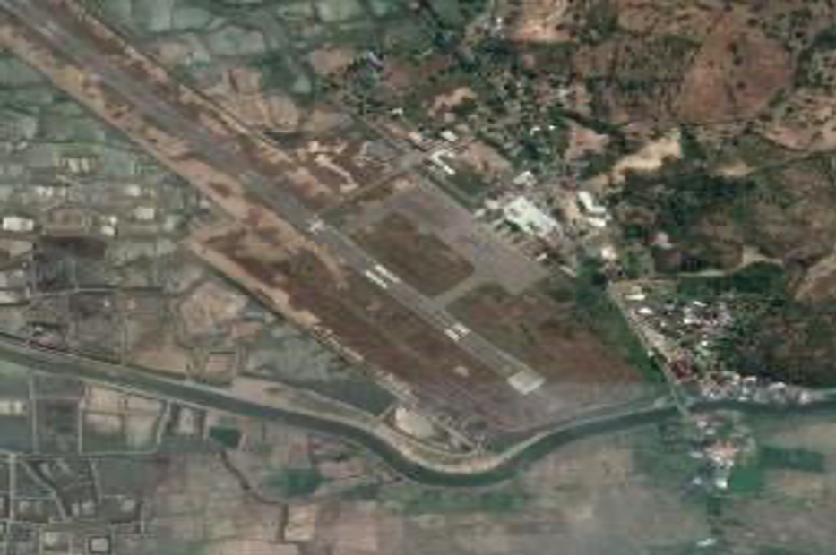
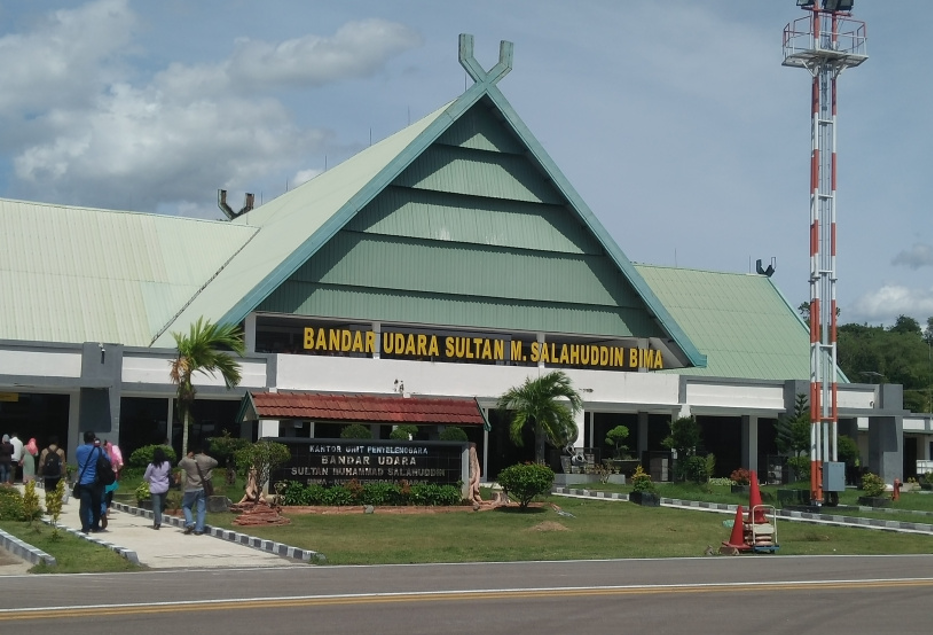
Description and Contacts of Key Companies
|
Airlines |
Destination |
Website |
|
Garuda Indonesia |
Note: recently stopped their operation from Lombok to Bima (return trip) due to low passenger load |
|
|
Wings Air |
Lombok, Makassar |
Passenger and Cargo Performance Indicator
|
Performance for 2018 |
|||
|
|
Per Year |
Per Month |
Per Day |
|
Total Aircraft Movements |
3,033 |
||
|
Total Passengers |
378,931 |
||
|
Total Capacity of the Airport (MT) |
103,454 MT |
||
|
Current Activity of the Airport (MT) |
35,699 MT |
||
|
Current use by Humanitarian Flights (UNHAS) |
N/A |
||
Runways
|
Runway #1 |
|
|
Runway Dimensions |
1650 m X 30 m |
|
Orientation |
14/32 |
|
Surface |
Asphalt (PCN 39 FD YT) |
Helicopter Pad(s)
There is no dedicated helipad at the airport, but the apron and grass areas can be used, if needed.
|
Helipad #1 |
|
|
Present |
N/A |
|
Largest Helicopter that can Land |
N/A |
|
Width and Length (m) |
N/A |
|
Surface |
N/A |
Airport Infrastructure Details
|
Customs |
No |
JET A-1 fuel |
Yes |
|
Immigration |
No |
AVGAS 100 |
No |
|
Terminal Building |
Yes |
Single Point Refueling |
No |
|
Passenger Terminal |
Yes |
Air Starter Units |
No |
|
Cargo terminal |
Yes |
Ground Power (mobile) |
No |
|
Pax Transport to Airfield |
No |
Ground Handling Services |
Yes |
|
Control Tower |
Yes |
Latrine Servicing |
Yes |
|
Weather Facilities |
Yes |
Fire Fighting Category (ICAO) |
Yes, Category 5 |
|
Catering Services |
Yes |
De-icing Equipment |
No |
|
Base Operating Room |
Yes |
Parking Ramp Lighting |
Yes |
|
Airport Radar |
No |
Approach & Runway Lights |
Yes |
|
NDB |
Yes |
VOR |
No |
|
ILS |
No |
Airport Operating Details
|
Operating Details |
|||
|
Maximum Sized Aircraft that can be Offloaded on Bulk Cargo |
ATR 600 |
||
|
Maximum Sized Aircraft that can be Offloaded on Pallet |
C130 |
||
|
Total Aircraft Parking Area (m²) |
18,970 sqm |
||
|
Storage Area (m3 and MT) |
Terminal cargo with capacity 200 sqm |
||
|
Handling Equipment |
|||
|
Elevators / Hi Loaders |
No |
Max Capacity (MT) |
|
|
Max Height(m) |
|
||
|
Loading Ramps |
No |
||
|
Other Comments |
|
||
Customs Guidance
There is no Customs office available at the airport.
Storage Facilities
There is a terminal cargo with capacity of 200 m2.
Airfield Costs
For information on airport rates and charges, please see the following link:
www.dephub.go.id (PP.15 Tahun 2016)
http://jdih.dephub.go.id/assets/uudocs/perpres/2016/PP_15_Tahun_2016.pdf
NAVIGATION CHARGES
The costs below are charged based on the operational hours.
|
Charges |
Aircraft Weight - MTOW (kg) |
||
|
|
0 - 7,000 |
7,001 - 136,000 |
136,001 and over |
|
Navigation (per journey) USD - $ |
15% of the cost of flight navigation services for domestic routes and 10% for international routes* |
||
|
Landing USD - $ |
$ 0.21/1000 kg domestics $ 3.60/1000 kg international* |
$ 8.84/1000 kg domestics $ 148.1 / 1000 kg international* |
$ 26.02/1000 kg domestics $ 394.7 /1000 kg international* |
|
Night Landing USD - $ |
- |
- |
- |
|
Night Take-Off USD - $ |
- |
- |
- |
|
Parking |
$ 0.07 / 1000 kg / 12 hours – domestic $ 0.30 / 1000 kg / 12 hours – international* |
||
|
Handling Charges |
- |
- |
- |
*) in case any international flights
FUEL SERVICES CHARGES
There is no fuel depot at the airport.
|
|
Price per Litre USD - $ |
|
Jet A-1 |
Information on fuel service charges can be found at: http://aviation.pertamina.com/News.aspx?p=price |
|
Avgas |
Not available |
CARGO TERMINAL CHARGES
Gapura Angkasa, PT. Merpati and PT. Ginta Titian Nusantara are the ground handling companies for domestic flight activities.
Gapura Angkasa contact details:
Sultan Muhammad Salahuddin Airport (BMU)
Bandar Udara Sultan Muhammad Salahuddin – Bima 84173
Phone: +62-374-646093
Fax: +62-374-646093
Mobile: +62 81338810414
|
Import Charges |
||
|
Type of Charge |
Rate USD - $ per kg |
Comments |
|
Handling Charge |
All service costs are handled by each ground handling company with the approval of the Airport Authority* |
|
|
Break Bulk Fee |
||
|
Diplomatic Mail |
||
|
Strong Room – per consignment |
||
|
Cold Storage Fee |
||
|
Delivery Outside Normal Working Hours |
||
|
Preparation of substitute AOA – Invoice – Receipt |
||
|
Storage per Day |
||
|
Export |
||
|
Handling Charges – Un-palletized Cargo |
All service costs are handled by each ground handling company with the approval of the Airport Authority* |
|
|
International Air Waybill |
||
|
Local Air Waybill |
||
|
Air Way Bill Amendment - Cancellation |
||
|
Air Way Bill Documentation |
||
|
Diplomatic Mail |
||
|
Storage Charges per Day |
||
*) in case any import and export activities
AIR-BRIDGE CHARGES
There is no airbridge facility at the airport.
Security
Security at the airport is relatively good.
The facilities:
- Security post
- Metal Detector
- CCTV
2.2.41 Indonesia Yogyakarta New Yogyakarta International Airport
Airport Overview
The New Yogyakarta International airport is located in Temon Sub District of Kulon Progo District, about 43 km from the Yogyakarta city. The airport is planned to replace Adisutjipto International Airport as the air gateway to Yogyakarta Province, which is overcapacity. For the time being, the airport only serves domestic flight and is expected to be fully operational for International flights starting April 2020. The airport is expected to accommodate 20 million passengers annually. Currently the airport operates from 06.00 WIB – 18.00 WIB (23.00 UTC – 11.00 UTC).
Airport website: https://yogyakarta-airport.co.id/
|
Airport Location and Contact |
|
|
Country |
INDONESIA |
|
Province or District |
YOGYAKARTA Province, Kulon Progo |
|
Nearest Town or
City |
Yogyakarta 43 km from Yogyakarta City Centre |
|
Airport’s Complete Name |
NEW YOGYAKARTA INTERNATIONAL AIRPORT |
|
Latitude |
-7.900344 |
|
Longitude |
110.060689 |
|
Elevation (ft and m) |
24 ft (7.3 m) |
|
IATA Code |
WAHI |
|
ICAO Code |
YIA |
|
Managing Company or Airport Authority |
PT. Angkasa Pura I (Persero) Yogyakarta International Airport Jl. Wates km.42
Kulon Progo Yogyakarta
55282 |
|
Management Contact Person |
Abdul Rokhim (Sales Department Head) Ph. +62 81216216550 Email abdul.rokhim@ap1.co.id |
|
Open From (hours) |
23:00 UTC (06.00 WIB) |
|
Open To (hours) |
11:00 UTC (18.00 WIB) |
Airport Picture
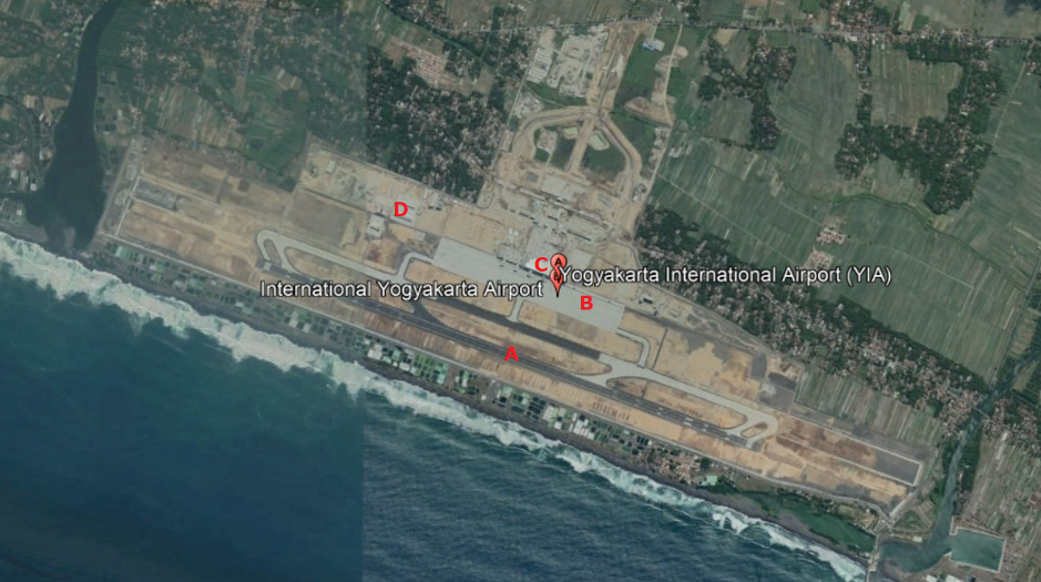
A : Runway
B : Apron
C : Terminal Building
D : Cargo Area and Office Area
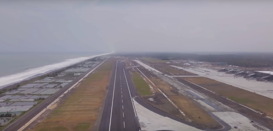
Description and Contacts of Key Companies
PT. Angkasa Pura I (Persero) New Yogyakarta International Airport
Address Jl. Wates km.42 Kulon Progo Yogyakarta 55282
Ph. +62-274-2890224
Email jog.airport@ap1.co.id
Airlines that operates at New Yogyakarta International Airport
|
Airlines |
Routes |
|
Batik Air |
Jakarta, Denpasar, Palangkaraya |
|
Lion Air |
Medan, Makasar, Balikpapan, Pontianak |
|
Citilink |
Jakarta, Denpasar |
Information on some aviation service providers can be found at: http://www.azfreight.com/
Passenger and Cargo Performance Indicator
The airport is expected to accommodate 20 million passengers annually, upon completion.
The airport is currently under ongoing development. The development is divided into two phases:
- Phase 1: the airport will have a terminal area of 130,000 m2 with a capacity of up to 15 million passengers per year, with runway length 3,250 meters x 60 meters. The total land area of the airport is about 645 hectares
- Phase 2: the extension of the airport terminal with total area of 195,000 m2 that can accommodate up to 20 million passengers per year. The length of the runway will be extended by 350 meters to 3,600 meters and 45 meters wide with apron capacity that can park up to 45 aircrafts.
Future plans also include to turn the airport land into an airport city integrated with industrial and tourism areas. The airport is designed to be resistant to earthquakes measuring up to 8.8 on the Richter magnitude scale as it was constructed in an earthquake-prone area and will be equipped with tsunami mitigation facilities.
|
Performance |
|||
|
|
Per Year |
Per Month |
Per Day |
|
Total Aircraft Movements |
N/A |
|
|
|
Total Passengers |
N/A |
|
|
|
Total Capacity of the Airport (MT) |
N/A |
|
|
|
Current Activity of the Airport (MT) |
N/A |
|
|
|
Current use by Humanitarian Flights (UNHAS) |
N/A |
|
|
Runways
|
Runway #1 |
|
|
Runway Dimensions |
3250 m x 45 m |
|
Orientation |
11 – 29 |
|
Surface |
Asphalt 93 F/C/X/T |
Helicopter Pad(s)
There is no dedicated helipad at the moment.
|
Helipad #1 |
|
|
Present |
No |
|
Largest Helicopter that can Land |
|
|
Width and Length (m) |
|
|
Surface |
|
Airport Infrastructure Details
For the time being, about 12,900 m2 terminal building is completed and in operational.
The airport is planned to be connected to Yogyakarta city centre via a toll road and railway line. Railway line (airport railway) will be built starting 2020 and expected to be operational in 2021.
|
Customs |
Yes - On-call |
JET A-1 fuel |
Yes |
|
Immigration |
YES |
AVGAS 100 |
No |
|
Terminal Building |
YES |
Single Point Refueling |
Yes |
|
Passenger Terminal |
YES |
Air Starter Units |
YES |
|
Cargo terminal |
YES |
Ground Power (mobile) |
YES |
|
Pax Transport to Airfield |
YES |
Ground Handling Services |
YES |
|
Control Tower |
YES |
Latrine Servicing |
YES |
|
Weather Facilities |
YES |
Fire Fighting Category (ICAO) |
Cat VII |
|
Catering Services |
YES |
De-icing Equipment |
NO |
|
Base Operating Room |
YES |
Parking Ramp Lighting |
YES |
|
Airport Radar |
YES |
Approach & Runway Lights |
YES |
|
NDB |
YES |
VOR |
YES |
|
ILS |
YES |
|
|
Airport Operating Details
|
Operating Details |
|||
|
Maximum Sized Aircraft that can be Offloaded on Bulk Cargo |
B777, B747, A380 |
||
|
Maximum Sized Aircraft that can be Offloaded on Pallet |
B777, B747, A380 |
||
|
Total Aircraft Parking Area (m²) |
1,250 m x 160 m |
||
|
Storage Area (m3 and MT) |
On development |
||
|
Handling Equipment |
|||
|
Elevators / Hi Loaders |
Not available |
Max Capacity (MT) |
|
|
Max Height (m) |
|
||
|
Loading Ramps |
|
||
|
Other Comments |
|
||
Customs Guidance
Customs office and facilities are under the development process and is expected to be operational in 2020. For the time being, all International flights are directed through Adisutjipto International airport.
For more information on customs in Indonesia, please see the following link: http://www.beacukai.go.id/
Storage Facilities
The cargo terminal and storage facilities are under the ongoing development.
Airfield Costs
Updated costs can be found in https://ap1.co.id/id/information/tarif-jasa-kebandarudaraan
FUEL SERVICES CHARGES
Fuel Service charges can be found in http://aviation.pertamina.com/News.aspx?p=price
CARGO TERMINAL CHARGES
The cargo terminal and storage facilities are under the ongoing development.
AIR-BRIDGE CHARGES
The air-bridge facilities are under the ongoing development.
Security
No detailed information about the security facilities.
2.3 Indonesia Road Network
The following section contains information on the road network in Indonesia.
For information on Indonesia road contact details, please see the following link:
4.2.1 Indonesia Government Contact List

2.3.1 Indonesia Bali Road Network
Indonesia Bali Road Network
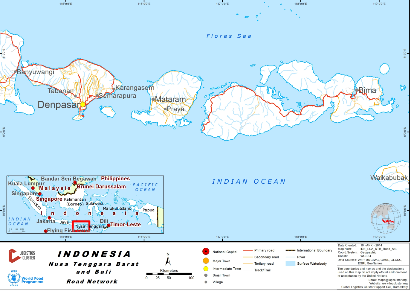
The road network in Bali is severely congested most of the time. Development of the road network is going by the Government to reduce congestion, one such effort is the 2.48 trillion (IDR) (US$220 million), 12.7 kilometre Nusa Dua-Ngurah Rai-Benoa toll road. This connects Port Benoa-Kuta-Nusa Dua Airport and has eased congestion in an area increasingly notorious for traffic blockages.
For information on Indonesia Bali Road Network contact details, please see the following link:
4.2.1 Indonesia Government Contact List
Distance Matrix
|
Denpasar |
Kuta |
Ngurah Rai Airport |
Benoa Port |
Padang Bai |
Gilimanuk |
|
|---|---|---|---|---|---|---|
|
Denpasar |
5 |
25 |
25 |
51 |
131 |
|
|
Kuta |
5 |
10 |
12 |
56 |
137 |
|
|
Ngurah Rai Airport |
25 |
10 |
37 |
61 |
162 |
|
|
Benoa Port |
25 |
12 |
37 |
77 |
182 |
|
|
Padang Bai |
51 |
56 |
61 |
77 |
208 |
|
|
Gilimanuk |
131 |
137 |
162 |
182 |
208 |
Travel Time Matrix
|
Travel Time from Capital City to Major Towns (km) |
||||||
|---|---|---|---|---|---|---|
|
Denpasar |
Kuta |
Ngurah Rai Airport |
Benoa Port |
Padang Bai |
Gilimanuk |
|
|
Denpasar |
30 min |
20 min |
30 min |
60 min |
2 hrs 30 min |
|
|
Kuta |
30 min |
15 min |
25 min |
1 hr 30 min |
2 hrs 45 min |
|
|
Ngurah Rai Airport |
20 min |
15 min |
20 min |
1 hr 30 min |
2 hrs 30 min |
|
|
Benoa Port |
30 min |
25 min |
20 min |
1hr 30 mins |
2hrs 30 min |
|
|
Padang Bai |
60 min |
1 hr 30 min |
1 hr 30 min |
1hr 30 mins |
2hrs 40 min |
|
|
Gilimanuk |
2 hrs 30 min |
2 hrs 45 min |
2 hrs 30 min |
2hrs 30 min |
2hrs 40 min |
|
Road Security
There are no height restrictions, however roads, with the exception of the double carriageways are narrow and certain sectors have fairly steep gradients. The roads are busy in terms of commercial traffic. Tailbacks and severe traffic congestion are common.
Weighbridges and Axle Load Limits
|
Axle load limits |
Bali |
|---|---|
|
Truck with 2 axles |
18 mt |
|
Truck with 3 axles |
20 mt |
|
Truck with 4 axles |
N/A |
|
Semi-trailer with 3 axles |
N/A |
|
Semi-trailer with 4 axles |
N/A |
|
Semi-trailer with 5 axles |
N/A |
|
Semi-trailer with 6 axles |
N/A |
|
Truck & drawbar trailer with 4 axles |
N/A |
|
Truck & drawbar trailer with 5 axles |
N/A |
|
Truck & drawbar trailer with 6 axles |
N/A |
|
Truck & drawbar trailer with 7 axles |
N/A |
2.3.2 Indonesia Aceh and North Sumatra Road Network
For information on Indonesia Road Network contact details, please see the following link: 4.1 Indonesia Government Contact List
Aceh Road Network
Distance Matrix
|
Distances from Capital City to Major Towns (km) |
|||||
|
|
Banda Aceh |
Calang |
Meulaboh |
Blang Pidie |
Tapak Tuan |
|
Banda Aceh |
|
149 |
238 |
358 |
434 |
|
Calang |
149 |
|
89 |
209 |
285 |
|
Meulaboh |
238 |
89 |
|
120 |
196 |
|
Blang Pidie |
358 |
209 |
120 |
|
76 |
|
Tapak Tuan |
434 |
285 |
196 |
76 |
|
|
Travel Time from Capital City to Major Towns (hours) |
|||||
|
|
Banda Aceh |
Calang |
Meulaboh |
Blang Pidie |
Tapak Tuan |
|
Banda Aceh |
|
3 |
4.30 |
7 |
8.30 |
|
Calang |
3 |
|
1.30 |
4 |
5.30 |
|
Meulaboh |
4.30 |
1.30 |
|
2.30 |
4 |
|
Blang Pidie |
7 |
4 |
2.30 |
|
1.30 |
|
Tapak Tuan |
8.30 |
5.30 |
4 |
1.30 |
|
Road Security
Road from Banda Aceh – Calang – Meulaboh – Blang Pidie – Tapak Tuan are in relatevely good condition and accessible. The road from Banda Aceh to Calang passing Geurute Mountain about 15 km contains a few extreme turns, steep, narrows, with cliffs on the side of the roads. Road from Meulaboh to Blang Pidie is through Babah Rot Mountain, the road is wide along hills and is bumpy.
Sibolga – Medan Road Network
Distance Matrix
| Distances from Capital City to Major Towns (km) | |||||||
|
Routes |
Sibolga |
Tarutung |
Siborong - Borong |
Balige |
Simalungun |
Tebing |
Medan |
|
Sibolga |
|
65 |
95 |
112 |
250 |
265 |
345 |
|
Tarutung |
65 |
37 |
250 |
265 |
345 |
285 |
|
|
Siborong - Borong |
95 |
37 |
|
32 |
170 |
185 |
260 |
|
Balige |
112 |
250 |
32 |
|
140 |
154 |
232 |
|
Simalungun |
250 |
265 |
170 |
140 |
|
85 |
155 |
|
Tebing |
265 |
345 |
185 |
154 |
85 |
|
78 |
|
Medan |
345 |
285 |
260 |
232 |
155 |
78 |
|
|
Travel Time Capital City to Major Towns (hours) |
|||||||
|
Routes |
Sibolga |
Tarutung |
Siborong - Borong |
Balige |
Simalungun |
Tebing |
Medan |
|
Sibolga |
|
2.0 |
3.0 |
3.5 |
6.5 |
7.0 |
8.5 |
|
Tarutung |
2.0 |
|
1.0 |
2.0 |
4.2 |
5.0 |
6.5 |
|
Siborong - Borong |
3.0 |
1.0 |
|
1.5 |
4.0 |
4.5 |
6.0 |
|
Balige |
3.5 |
2.0 |
1.5 |
|
3.5 |
4.2 |
5.0 |
|
Simalungun |
6.5 |
4.2 |
4.0 |
3.5 |
|
2.0 |
3.5 |
|
Tebing |
7.0 |
5.0 |
4.5 |
4.2 |
2.0 |
|
1.5 |
|
Medan |
8.5 |
6.5 |
6.0 |
5.0 |
3.5 |
1.5 |
|
Road Security
The road condition from Sibolga to Medan is relatively good. There are deep valleys and the road is steep, narrow and curvy between Tapteng to Tarutung. Traffic jams can be seen in small towns along the route, particularly in and around Medan city.
Road assessment from Sibolga to Panyabungan (Mandailing natal) took 4 hours by driving, with total distance 166 km. Approximately 60 km long between Sibolga to Batang Toru (Tapanuli Selatan), the road is narrow and damaged. Parlimbungan Ketek is a port located in Mandailing Natal, 110 km away from its capital town of Panyabungan. Access to the port is bad due to an ongoing road construction.
2.3.3 Indonesia Papua Road Network
Indonesia Papua Road Network
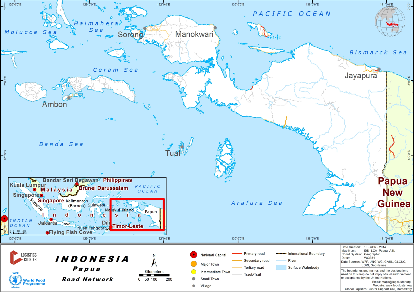
There is currently no connecting road network throughout the Papua province, particularly in the central highlands. Where there is road access it is centred around major towns and where possible spreads out to more regional areas. Roads are a combination of asphalt and dirt/gravel in more inaccessible locations. There is currently no road that links Jayapura in the North to Merauke in the South of the highlands.
The development of the “Trans Papua” road is on-going. This road aims to link all the major towns in the Papua central highlands via an asphalt road. The interconnected highways would connect seven regions, namely Nabire - Waghete - Enarotali sepanjang (262 km), Timika -Mapurujaya - Pomako (42 km), Serui - Menawi - Saubeba (49 km),Jayapura - Wamena - Mulia (733 km), Jayapura - Sarmi (364 km), Jayapura - Hamidi - Holtekam - Skow - Papua New Guinea border (53 km) and Merauke – Waropko (557 km).
Construction on the road has been on-going for many years and there is currently no date for completion as it is dependent upon funding. However, parts of this road have been completed, for example the roads in the Merauke district are now complete with asphalt up to the district border. In other sections of the road it is classified as “jungle” as is only able to be passed with a 4x4 vehicle if there has been no rains or other issues for a number of weeks.
Wamena is not accessible by road from any direction and air operations are the only option for the movement of passengers and cargo.
For information on Indonesia Road Network contact details, please see the following link:
4.2.1 Indonesia Government Contact List
Distance Matrix – Jayapura Area
|
Jayapura |
Abepura |
Sentani Airport |
Sarmi |
Keerom |
PNG Border |
|
|---|---|---|---|---|---|---|
|
Jayapura |
13 |
38 |
364 |
60 |
42 |
|
|
Abepura |
13 |
25 |
351 |
N/A |
N/A |
|
|
Sentani Airport |
38 |
25 |
N/A |
N/A |
N/A |
|
|
Sarmi |
364 |
351 |
N/A |
N/A |
N/A |
|
|
Keerom |
60 |
N/A |
N/A |
N/A |
N/A |
|
|
PNG Border |
42 |
N/A |
N/A |
N/A |
N/A |
Jayapura to Senggi is 159kms of asphalt road, after this the road to Wamena is classified as “jungle”.
Distance Matrix – Biak Area
|
Biak |
Bosnik |
Samber |
Korem |
Warsa |
Yenggarbun |
Wardo |
Sorendiweri |
|
|---|---|---|---|---|---|---|---|---|
|
Biak |
15 |
26 |
36 |
47 |
116 |
60 |
110 |
|
|
Bosnik |
15 |
20 |
N/A |
N/A |
N/A |
N/A |
N/A |
|
|
Samber |
26 |
20 |
N/A |
N/A |
N/A |
34 |
N/A |
|
|
Korem |
36 |
N/A |
N/A |
N/A |
80 |
55 |
74 |
|
|
Warsa |
47 |
N/A |
N/A |
N/A |
N/A |
N/A |
63 |
|
|
Yenggarbun |
116 |
N/A |
N/A |
80 |
N/A |
N/A |
N/A |
|
|
Wardo |
60 |
N/A |
34 |
55 |
N/A |
N/A |
|
N/A |
|
Sorendirweri |
110 |
N/A |
N/A |
74 |
63 |
N/A |
N/A |
|
Distance Matrix – Merauke Area
|
Merauke |
Sota |
Bupul |
Muting |
Asike |
Tanah Merah |
|
|---|---|---|---|---|---|---|
|
Merauke |
|
76 |
244 |
247 |
370 |
458 |
|
Sota |
76 |
|
168 |
171 |
294 |
382 |
|
Bupul |
244 |
168 |
|
3 |
126 |
214 |
|
Muting |
247 |
171 |
3 |
|
123 |
211 |
|
Asike |
370 |
294 |
126 |
123 |
|
88 |
|
Tanah Merah |
458 |
382 |
214 |
211 |
88 |
|
All the roads listed above are asphalt and are available for all vehicle access.
Distance Matrix – Wamena Area
|
Wamena |
Karubaga |
Tiom |
Elelin |
Mulia |
Yonguru |
Jayapura |
|
|---|---|---|---|---|---|---|---|
|
Wamena |
|
90 |
90 |
135 |
240 |
170 |
680 |
|
Karubaga |
90 |
|
180 |
225 |
150 |
N/A |
N/A |
|
Tiom |
90 |
180 |
|
N/A |
N/A |
N/A |
N/A |
|
Elelin |
135 |
225 |
N/A |
|
N/A |
N/A |
N/A |
|
Mulia |
240 |
150 |
N/A |
N/A |
|
N/A |
N/A |
|
Yonguru |
170 |
N/A |
N/A |
N/A |
N/A |
|
N/A |
|
Jayapura |
680 |
N/A |
N/A |
N/A |
N/A |
N/A |
|
Wamena to Elelin is an asphalt road. In general the roads are in a poor condition and very narrow in this area.
Travel Time Matrix
Travel times for the Papua central highlands are unpredictable and it is recommended to refer to conditions on the ground when making arrangements.
|
Travel Time from Capital City to Major Towns (km) |
||||||
|---|---|---|---|---|---|---|
|
Jayapura |
Abepura |
Sentani Airport |
Sarmi |
Keerom |
PNG Border |
|
|
Jayapura |
25 mins |
1 hr |
8hrs |
2 hrs |
||
|
Abepura |
25 mins |
40 mins |
||||
|
Sentani Airport |
1 hr |
40 mins |
||||
|
Sarmi |
8 hrs |
|||||
|
Keerom |
2 hrs |
|||||
|
PNG Border |
||||||
Road Security
As road conditions can be unpredictable due to weather conditions, planning in advance of any mission is advised. In Wamena and the surrounding areas, there have been instances in the past of violence against vehicles or their occupants. Therefore, checks should be made with the local Papuan authorities as well as UNDSS for security issues along the road network
Weighbridges and Axle Load Limits
Roads that are dirt or gravel should use 4x4 vehicle transport
only and carry a maximum load of 3 tonnes.
The bridges in Biak province are wooden and the maximum load for
use is 10mt.
Road transportation in Wamena is via 4x4 vehicles and the maximum
load is 5mt.
|
Axle load limits |
Papua |
|---|---|
|
Truck with 2 axles |
18mt |
|
Truck with 3 axles |
18mt |
|
Truck with 4 axles |
N/A |
|
Semi-trailer with 3 axles |
N/A |
|
Semi-trailer with 4 axles |
N/A |
|
Semi-trailer with 5 axles |
N/A |
|
Semi-trailer with 6 axles |
N/A |
|
Truck & drawbar trailer with 4 axles |
N/A |
|
Truck & drawbar trailer with 5 axles |
N/A |
|
Truck & drawbar trailer with 6 axles |
N/A |
|
Truck & drawbar trailer with 7 axles |
N/A |
2.3.4 Indonesia Sulawesi Road Network
Map of Sulawesi Road Network
Click here for information related to road conditions in Sigi District, Central Sulawesi Province following the 2018 Earthquake and Tsunami.
For information on Indonesia Road Network contact details, please see the following link:
4.2.1 Indonesia Government Contact List
The roads in Makassar have the same challenges as those throughout most of Indonesia – traffic jams and occasional flooding. There are plans in place to improve traffic flow at the local level.
One such policy has been the introduction of restrictions of vehicles carrying heavy loads driving through the city centre.
In late 2013 a law was implemented that meant that between the hours of 05.00 – 21.00 containers can no longer be carried on trucks if they are going to be driving through the city limits.
Instead containers must be unpacked and re-loaded onto smaller vehicles.
There are plans in place to develop a ring road and additional by-pass’ to ease congestion, however there is currently no timeline of when construction will commence.
Distance Matrix
|
Makassar |
Pare-pare |
Palopo |
Mamuju |
Bitung |
Manado |
|
|---|---|---|---|---|---|---|
|
Makassar |
154 |
374 |
448 |
1765 |
1715 |
|
|
Pare-pare |
154 |
221 |
392 |
1612 |
1562 |
|
|
Palopo |
374 |
221 |
335 |
1392 |
1342 |
|
|
Mamuju |
448 |
392 |
335 |
1331 |
1281 |
|
|
Bitung |
1765 |
1612 |
1392 |
1331 |
48 |
|
|
Manado |
1715 |
1562 |
1342 |
1281 |
48 |
|
Travel Time Matrix
|
Makassar |
Pare-pare |
Palopo |
Mamuju |
Bitung |
Manado |
|
|---|---|---|---|---|---|---|
|
Makassar |
2hrs 30min |
5hrs 30min |
7hrs 30min |
28hrs |
27hr |
|
|
Pare-pare |
2hrs 30min |
3hrs 15mins |
7hrs 30min |
26hrs |
25hr |
|
|
Palopo |
5hrs 30min |
3hrs 15mins |
10hrs |
23hrs |
22hr |
|
|
Mamuju |
7hrs 30min |
7hrs 30min |
10hrs |
23hrs 30min |
23hr |
|
|
Bitung |
28hrs |
26hrs |
23hrs |
23hrs 30min |
1hr |
|
|
Manado |
27hr |
25hr |
22hr |
23hr |
1hr |
|
Weighbridges and Axle Load Limits
|
Axle load limits |
Makassar |
|---|---|
|
Truck with 2 axles |
10mt |
|
Truck with 3 axles |
10mt |
|
Truck with 4 axles |
10mt |
Road Class and Surface Conditions
There are restrictions in place for cargo movements within Makassar city.
Where there are movements from within Makassar city (i.e. Gowa to Makassar) the following roads must be taken :
- Jl Sultan Alaudiin
- Jl A.P. Pettarani
- Jl Landak Baru
- Jl Veteran
- Jl Dr.Ratulangi
- Jl Kakatua
- Jl Gagak
- Jl Rajawali
- Jl H.M. Patompo
However if the cargo movement is from Makassar to Gowa the following roads must be taken :
- Jl H.M Patompo
- Jl Penghibur
- Jl Maipa
- Jl Lamaddukelleng
- Jl I.H. Saleh
- Jl Areif Rate
- Jl Cendrawasih
- Jl Kakatua
- Jl Landak Lama
- Jl Veteran
- Jl Sultan Alauddin
At all times the cargo weight on these roads should not exceed 10 metric tonnes.
2.3.5 Indonesia Nusa Tenggara Barat (NTB) Road Network
Indonesia Nusa Tenggara Barat (NTB) Road Network
For information on Indonesia Road Network contact details, please see the following link:
4.2.1 Indonesia Government Contact List
There are no height restrictions on the roads in NTB. However roads through to Lombok and rural areas are narrow and have sections of relatively steep gradients. In addition to narrow roads they are routed through heavily populated areas.
Distance Matrix
|
Distances from Capital City to Major Towns (km) |
||||||||
|---|---|---|---|---|---|---|---|---|
|
Mataram |
Lombok International Airport |
Senggigi |
Lembar |
Kayangan |
Sumbawa |
Bima |
Dompu |
|
|
Mataram |
33km |
20km |
27km |
65km |
667km |
404km |
465km |
|
|
Lombok International Airport |
33km |
53km |
53km |
97km |
679km |
416km |
476km |
|
|
Senggigi |
20km |
53km |
43km |
71km |
682km |
419km |
476km |
|
|
Lembar |
27km |
53km |
43km |
92km |
652km |
389km |
449km |
|
|
Kayangan |
65km |
97km |
71km |
92km |
732km |
469km |
530km |
|
|
Sumbawa |
667km |
679km |
682km |
652km |
732km |
262km |
214km |
|
|
Bima |
404km |
416km |
419km |
389km |
469km |
262km |
61km |
|
|
Dompu |
465km |
476km |
480km |
449km |
530km |
214km |
61km |
|
Travel Time Matrix
PLEASE NOTE: Travel time has been calculated on the average speed of 50 Kilometres per hour, ‘Best Case scenarios” plus 25 percent.
|
Travel Time from Capital City to Major Towns (km) |
||||||||
|---|---|---|---|---|---|---|---|---|
|
Mataram |
Lombok International Airport |
Senggigi |
Lembar |
Kayangan |
Sumbawa |
Bima |
Dompu |
|
|
Mataram |
|
1 Hour |
1 Hour |
1 Hour |
2 Hours |
26 Hours |
22 Hours |
23 Hours |
|
Lombok International Airport |
1 Hour |
|
2 Hours |
1 Hour |
2 Hours |
27 Hours |
22 Hours |
24 Hours |
|
Senggigi |
1 Hour |
2 hours |
1 Hour |
2 Hours mnt |
27 hrs |
22 Hours |
24 Hours |
|
|
Lembar |
1 Hour |
1 Hour |
2 hrs |
26 Hours |
22 Hours |
23 Hours |
||
|
Kayangan |
2 hours |
2 Hours |
2 hours |
2 hrs |
28 Hours |
23 Hours |
24 Hours |
|
|
Sumbawa |
26 Hours |
27 Hours |
27 Hours |
26 hrs |
28 Hours |
|
5 Hours |
4 Hours |
|
Bima |
22 Hours |
23 Hours |
22 Hours |
22 Hours |
23 Hours |
5 hours |
2 Hours |
|
|
Dompu |
23 Hours |
23 Hours |
23 Hours |
23 Hours |
24 Hours |
4 Hours |
2 Hours |
|
Road Security
There are no known security issues with the roads in NTB.
Weighbridges and Axle Load Limits
|
Axle load limits |
NTB |
|---|---|
|
Truck with 2 axles |
16.4mt |
|
Truck with 3 axles |
24.6mt |
|
Truck with 4 axles |
32.8mt |
|
Semi-trailer with 3 axles |
N/A |
|
Semi-trailer with 4 axles |
N/A |
|
Semi-trailer with 5 axles |
N/A |
|
Semi-trailer with 6 axles |
N/A |
|
Truck & drawbar trailer with 4 axles |
N/A |
|
Truck & drawbar trailer with 5 axles |
N/A |
|
Truck & drawbar trailer with 6 axles |
N/A |
|
Truck & drawbar trailer with 7 axles |
N/A |
2.3.6 Indonesia Nusa Tenggara Timur (NTT) Road Network
Indonesia Nusa Tenggara Timur (NTT) Road Network
For information on Indonesia Road Network contact details, please see the following link:
4.2.1 Indonesia Government Contact List
Overall the bridges and roads in the NTT main land from Kupang and outwards are rated as good. There are no height restrictions on roads throughout NTT. However roads through to Atambua and rural areas are narrow (Wini, Atapapa), have fairly steep gradients and acute corners that may cause problems for articulated vehicles, thus single bed vehicles are recommended.
Distance Matrix
|
Kupang |
Soe |
Atambua |
Timor Leste Border |
|
|---|---|---|---|---|
|
Kupang |
111 |
280 |
293 |
|
|
Soe |
111 |
170 |
185 |
|
|
Atambua |
280 |
170 |
17 |
|
|
Timor Leste Border |
293 |
185 |
17 |
Travel Time Matrix
|
Kupang |
Soe |
Atambua |
Timor Leste Border |
|
|---|---|---|---|---|
|
Kupang |
2hrs |
5hrs |
5hrs 30 mins |
|
|
Soe |
2hrs |
3hrs |
3hrs 30mins |
|
|
Atambua |
5hrs |
3hrs |
30mins |
|
|
Timor Leste Border |
5hrs 30 mins |
3hrs 30mins |
30mins |
Road Security
There are no security issues on the roads in NTT.
Weighbridges and Axle Load Limits
|
Axle load limits |
NTT |
|---|---|
|
Truck with 2 axles |
16mt |
|
Truck with 3 axles |
22mt |
|
Truck with 4 axles |
30mt |
|
Semi-trailer with 4 axles |
34mt |
|
Semi-trailer with 5 axles |
40mt |
|
Semi-trailer with 6 axles |
43mt |
2.3.7 Indonesia West Java Road Network
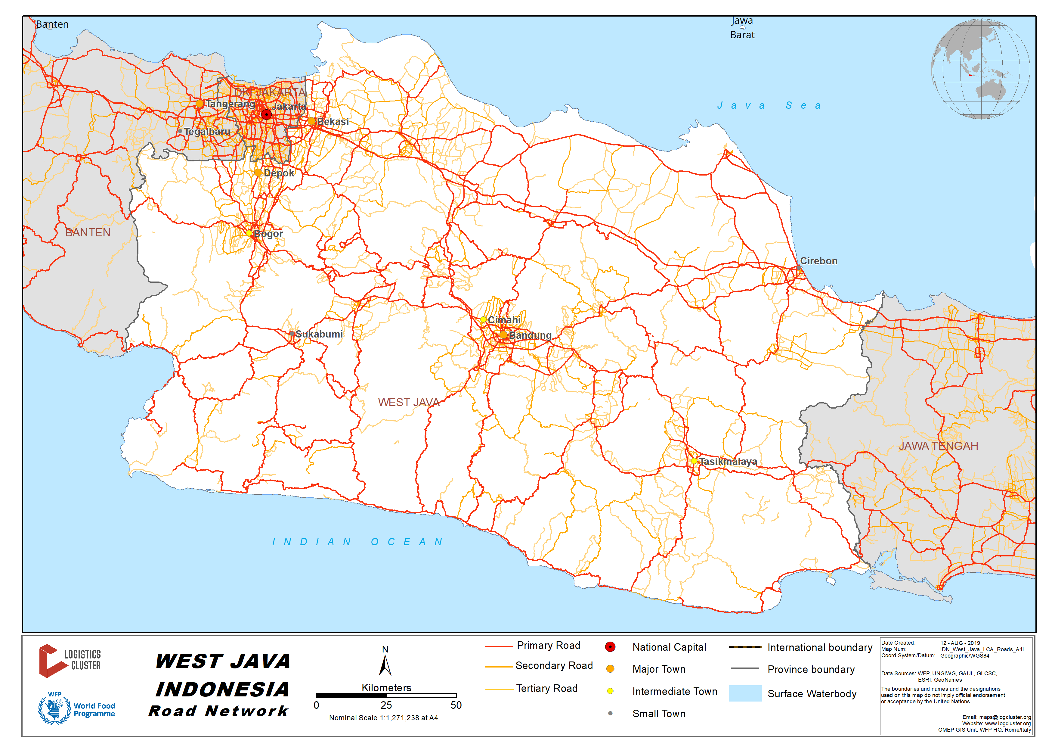
There are two main road access from Bandung to Jakarta (and vice versa):
- Toll ways via Bekasi and Cikampek with approx. distance 150 km, 3.5 hours travel time, depending on the traffic. During the weekend this may increase up to 7 hours.
- National highways combined with toll ways via Cianjur, Sukabumi and Bogor with approx. distance 215 km, 9 hours travel time. During the weekend this may increase up to 12 hours.
Distance Matrix
|
|
Bandung |
Cianjur |
Sukabumi |
Jakarta |
|
Bandung |
|
67 |
99 |
215 |
|
Cianjur |
67 |
|
32 |
148 |
|
Sukabumi |
99 |
32 |
|
116 |
|
Jakarta |
215 |
148 |
116 |
|
|
Travel Time from Capital City to Major Towns (hours) |
||||
|
|
Bandung |
Cianjur |
Sukabumi |
Jakarta |
|
Bandung |
|
2 |
3.5 |
9 |
|
Cianjur |
2 |
|
1.5 |
7 |
|
Sukabumi |
3.5 |
1.5 |
|
3.5 |
|
Jakarta |
9 |
7 |
3.5 |
|
Road Security
The road condition from Bandung to Jakarta via Cianjur, Sukabumi and Bogor is relatively good. Some part of the roads along Bandung to Sukabumi are hilly and narrow. Traffic jams are seen in most small towns along the way, limiting the speeds to max. 20 km/hour.
2.3.8 Indonesia West Sumatra Road Network
Distance Matrix
|
Distances from Capital City to Major Towns (km) |
||||||
|
|
Padang |
Pasaman |
Lubuk Basung |
Bukit tinggi |
Solok |
|
|
Padang |
|
171 |
254 |
96 |
81 |
|
|
Pasaman |
171 |
|
83 |
85 |
211 |
|
|
Lubuk Basung |
254 |
83 |
|
65 |
187 |
|
|
Bukit Tinggi |
96 |
85 |
65 |
|
89 |
|
|
Solok |
81 |
211 |
187 |
89 |
|
|
|
Travel Time from Capital City to Major Towns (hours) |
|||||
|
|
Padang |
Pasaman |
Lubuk Basung |
Bukit Tinggi |
Solok |
|
Padang |
|
3.30 |
4.15 |
2.45 |
1.30 |
|
Pasaman |
3.30 |
|
2.15 |
2.15 |
5.45 |
|
Lubuk Basung |
4.15 |
2.15 |
|
2.15 |
5.15 |
|
Bukit Tinggi |
2.45 |
2.15 |
2.15 |
|
3.30 |
|
Solok |
1.30 |
5.45 |
5.15 |
3.30 |
|
Road Security
The road from Padang to Pasaman and Lubuk Basung is in relatively good condition.
The road from Lubuk Basung to Bukit Tinggi through Kelok 44 area is only accessible by smaller truck (3 mt max) due to being steep with numerous extreme turns.
The road from Bukit Tinggi to Solok is in relatively good condition.
The road from Solok to Padang passes the mountainous area, with some extreme turns, steep, and fog in several spots reduces visibility between 5-20 metres.
2.3.9 Indonesia North Maluku Road Network
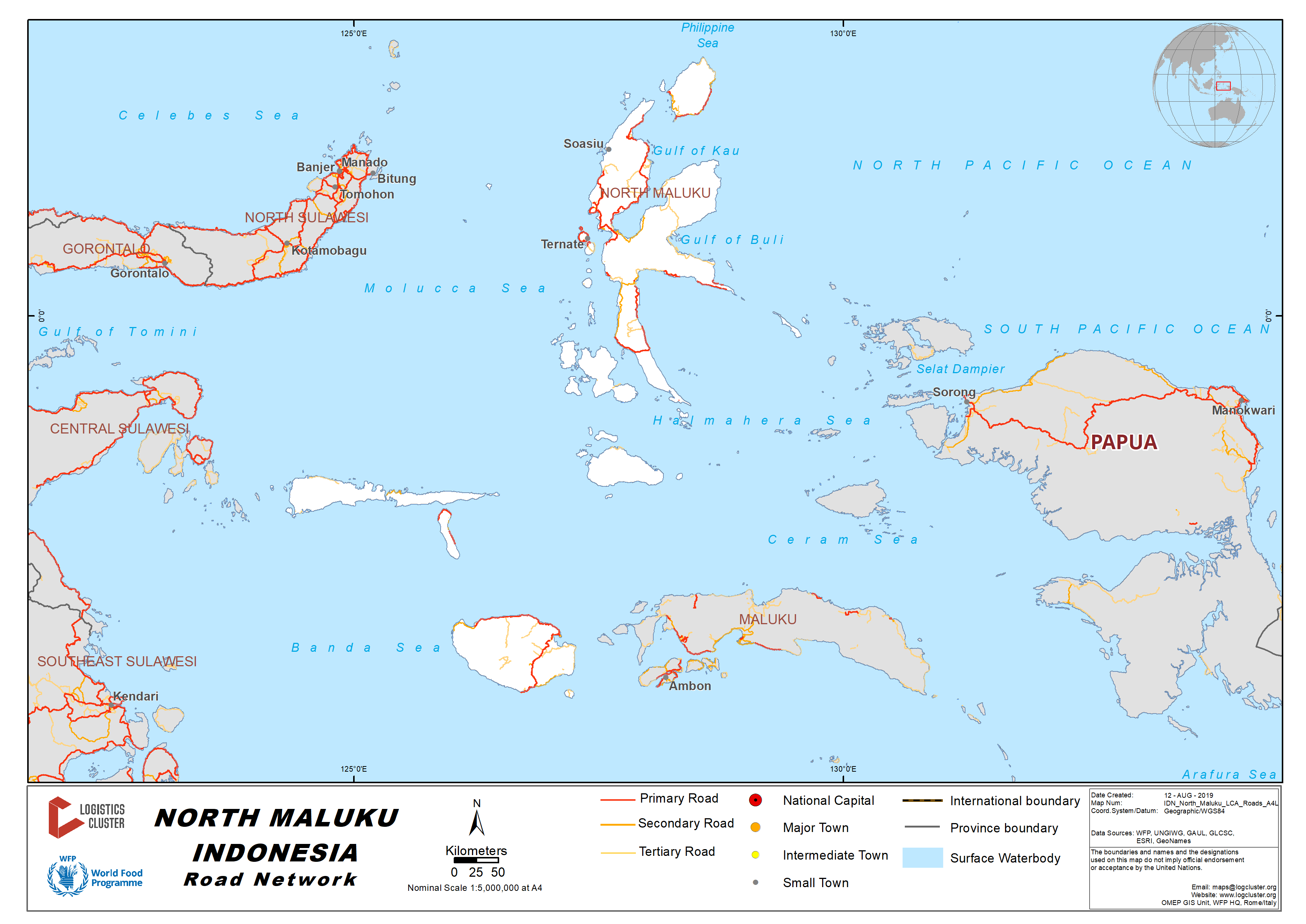
Distance and Time Matrices – Northern Halmahera Island
|
Distances from Capital City to Major Towns (km) |
|||||
|
|
Sofifi |
Jailolo |
Kuabang Kao Airport |
Tobelo |
Gamar Malamo |
|
Sofifi |
- |
80 |
107 |
188 |
222 |
|
Jailolo |
80 |
- |
64 |
145 |
180 |
|
Kuabang Kao Airport |
107 |
64 |
- |
86 |
120 |
|
Tobelo |
188 |
145 |
86 |
- |
39 |
|
Gamar Malamo |
222 |
180 |
120 |
39 |
- |
|
Travel Time from Capital City to Major Towns (hours) |
||||||
|
|
Sofifi |
Jailolo |
Kuabang Kao Airport |
Tobelo |
Gamar Malamo |
|
|
Sofifi |
- |
2h |
2h 15m |
3h 45m |
4h 45m |
|
|
Jailolo |
2h |
- |
1h 45m |
3h |
4h |
|
|
Kuabang Kao Airport |
2h 15m |
1h 45m |
- |
1h 45m |
2h 45m |
|
|
Tobelo |
3h 45m |
3h |
1h 45m |
- |
1h |
|
|
Gamar Malamo |
4h 45m |
4h |
2h 30m |
1h |
- |
|
Road Security
The road is in relatively good condition
2.3.10 Indonesia North Sulawesi Road Network
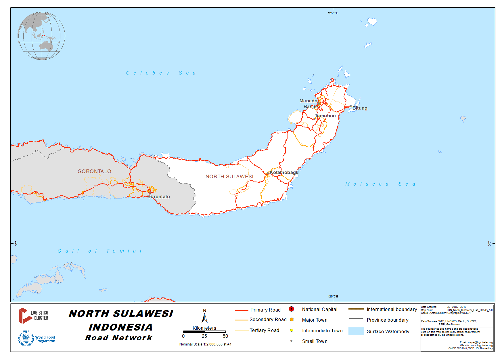
Distance Matrix
|
Distances from Capital City to Major Towns (km) |
|||||
|
|
Manado |
Minahasa Utara |
Bitung |
Minahasa Selatan |
Minahasa Tenggara |
|
Manado |
- |
24 |
43 |
84 |
76 |
|
Minahasa Utara |
24 |
- |
22 |
109 |
96 |
|
Bitung |
43 |
22 |
- |
125 |
90 |
|
Minahasa Selatan |
84 |
109 |
125 |
- |
59 |
|
Minahasa Tenggara |
76 |
96 |
90 |
59 |
- |
|
Travel Time from Capital City to Major Towns (hours) |
||||||
|
|
Manado |
Minahasa Utara |
Bitung |
Minahasa Selatan |
Minahasa Tenggara |
|
|
Manado |
- |
1 |
1.5 |
2.5 |
2.5 |
|
|
Minahasa Utara |
1 |
- |
1 |
3 |
3 |
|
|
Bitung |
1.5 |
1 |
- |
3.5 |
3 |
|
|
Minahasa Selatan |
2.5 |
3 |
3.5 |
- |
2 |
|
|
Minahasa Tenggara |
2.5 |
3 |
3 |
2 |
- |
|
Road Development - New Toll Road in North Sulawesi
The toll road is under the final development phase. It connects the two major cities of Manado and Bitung in North Sulawesi Province. The toll road is part of the Trans Sulawesi Toll Road Network, and it will be the first toll road within the province. The total length of the road is 39 km, it is expected to reduce the travel time between these two cities from around 90-120 minutes to 30 minutes only. The toll road is expected operational in Q4 2019.
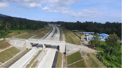
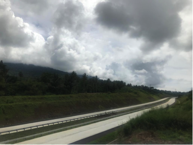
Road Security
The road condition from Manado City to surrounding districts and cities are relatively in good condition.
2.3.11 Indonesia West Sulawesi Road Network
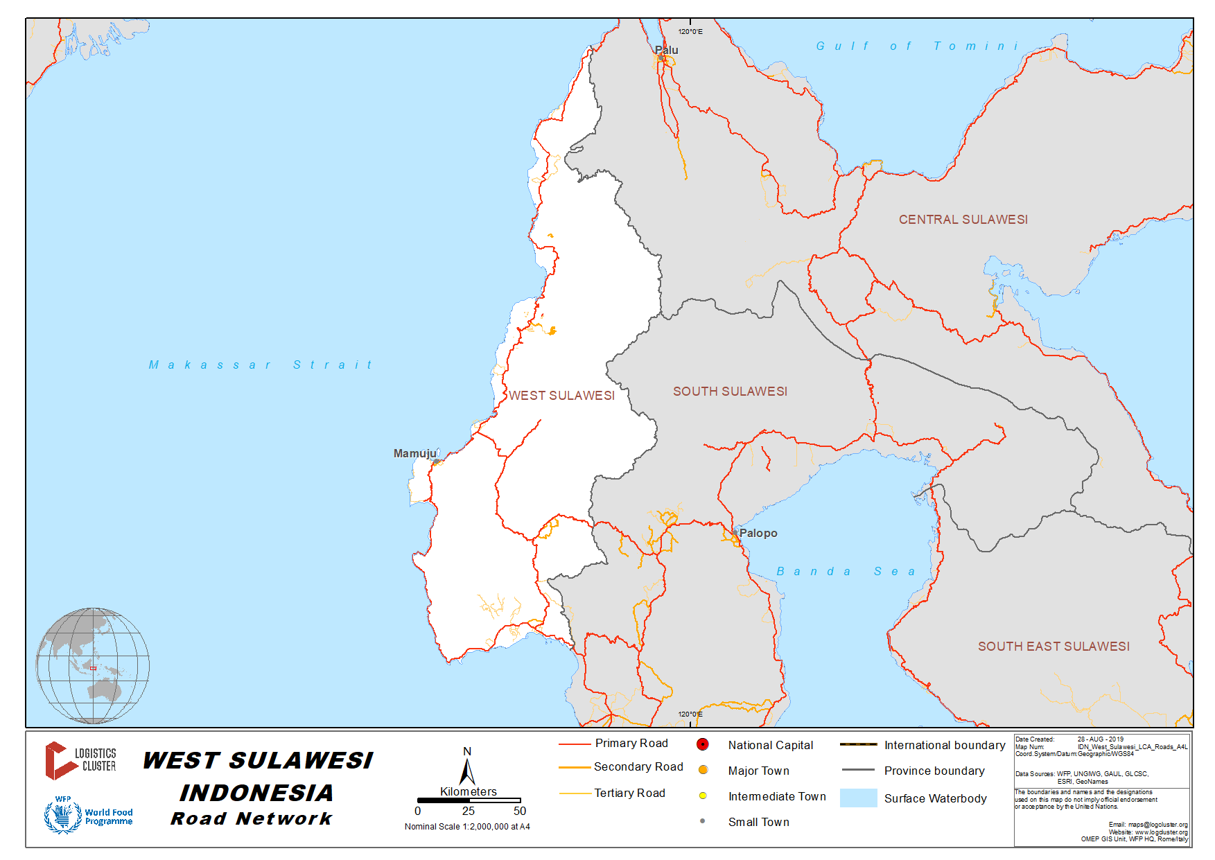
Distance Matrix – From Coastal to Mountainous Route
|
Distances from Capital City to Major Towns (km) |
||||
|
|
Mamuju |
Majene |
Polewali Mandar |
Mamasa |
|
Mamuju |
- |
140 |
195 |
267 |
|
Majene |
140 |
- |
55 |
127 |
|
Polewali Mandar |
195 |
55 |
- |
80 |
|
Mamasa |
267 |
127 |
80 |
- |
|
Travel Time from Capital City to Major Towns (hours) |
||||
|
|
Mamuju |
Majene |
Polewali Mandar |
Mamasa |
|
Mamuju |
- |
3.5 |
5 |
7.5 |
|
Majene |
3.5 |
- |
1.5 |
4 |
|
Polewali Mandar |
5 |
1.5 |
- |
3 |
|
Mamasa |
7.5 |
4 |
3 |
- |
Road Security
There are 2 (two) main road access from Mamuju City to Mamasa District:
- Coastal route, passing through Majene City with total distance about 267 km. The road is geographically located along the coastal area up to Majene (140 km) with relatively good condition. When entering Mamasa District, the road is damaged with potential landslide during rainy season. The overall travel time is about 7.5 hours.
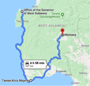
- Mountainous route, passing through Mambi, with total distance about 150 km. The road is geographically located along the mountainous area, with mostly damaged condition, hilly and winding. The overall travel time is about 5 hours.
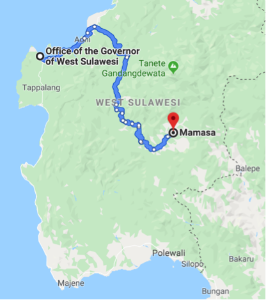
2.3.12 Indonesia Gorontalo Road Network
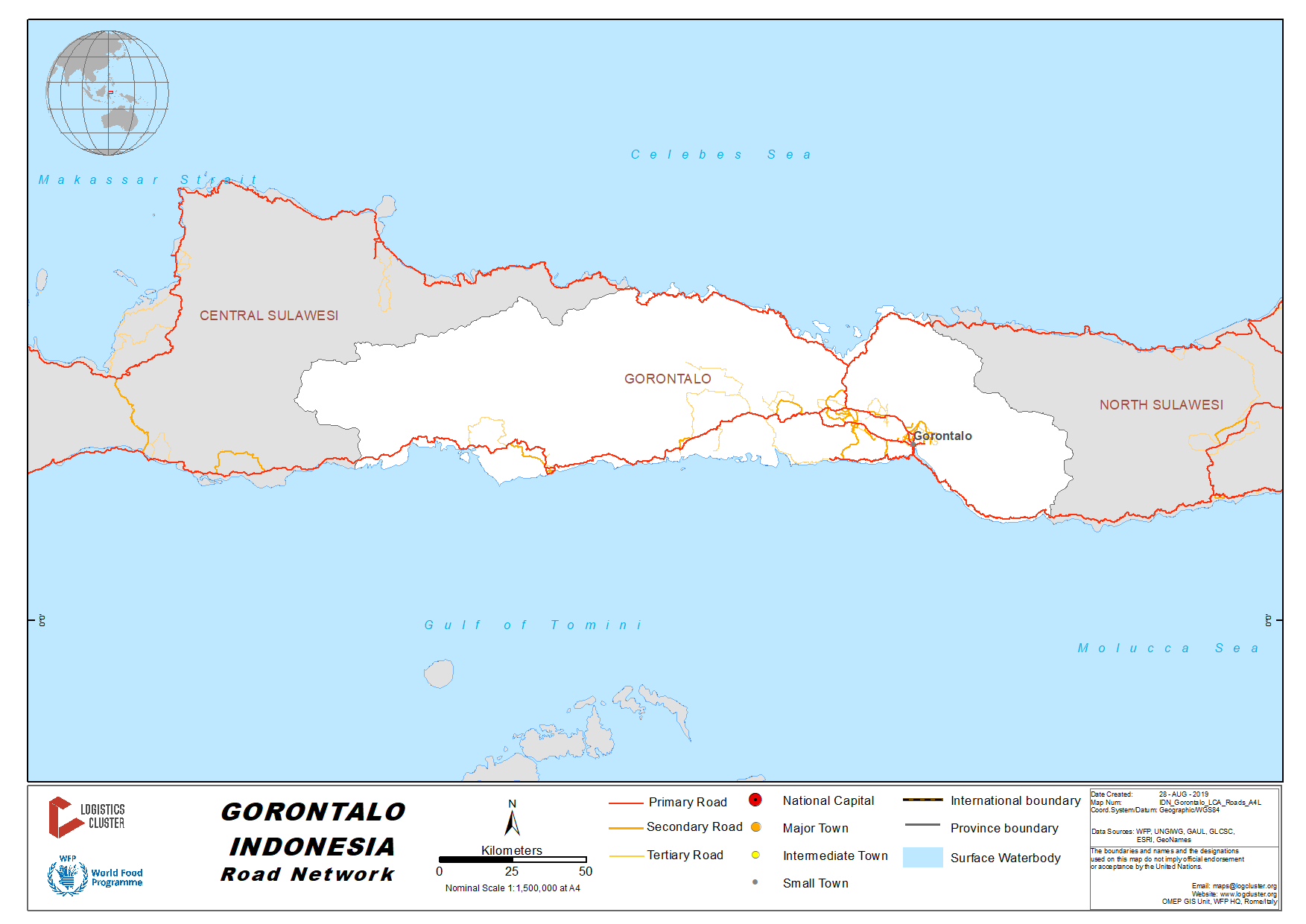
Distance Matrix
|
Distances from Capital City to Major Towns (km) |
||||||
|
|
Gorontalo |
Sawawa |
Limboto |
Kwandang |
Tilamuta |
Marisa |
|
Gorontalo |
- |
16 |
22 |
58 |
103 |
159 |
|
Sawawa |
16 |
- |
39 |
74 |
119 |
177 |
|
Limboto |
22 |
39 |
- |
47 |
92 |
147 |
|
Kwandang |
58 |
74 |
47 |
- |
103 |
158 |
|
Tilamuta |
103 |
119 |
92 |
103 |
- |
62 |
|
Marisa |
159 |
177 |
147 |
158 |
62 |
- |
|
Travel Time from Capital City to Major Towns (hours) |
||||||
|
|
Gorontalo |
Sawawa |
Limboto |
Kwandang |
Tilamuta |
Marisa |
|
Gorontalo |
- |
0.5 |
1 |
1.5 |
3 |
4 |
|
Sawawa |
0.5 |
- |
1 |
2 |
3 |
4.5 |
|
Limboto |
1 |
1 |
- |
1.5 |
2.5 |
3.5 |
|
Kwandang |
1.5 |
2 |
1.5 |
- |
2.5 |
4 |
|
Tilamuta |
3 |
3 |
2.5 |
2.5 |
- |
1.5 |
|
Marisa |
4 |
4.5 |
3.5 |
4 |
1.5 |
- |
Road Security
The road conditions within Gorontalo City and surrounding are relatively in good condition.
2.4 Indonesia Railway Network
The following section contains information on the railway network in Indonesia.
For information on Indonesia railway network contact details, please see the following link:
4.2.8 Indonesia Railway Company Contact List

2.4.1 Indonesia Aceh and Sumatra Railway Assessment
Indonesia Aceh and Sumatra Railway Assessment
The railway transport in Aceh and North Sumatra provinces is under management of PT. Kereta Api Indonesia (Persero) Regional Division I North Sumatra, a state-owned company operating in Java and Sumatra islands.
The railway from the border of Aceh-North Sumatra province in Besitang to Binjai city is no longer in function due to damage in several locations. However the railway from Binjai to Medan is operational.
There is also a railway line of 28km from Medan to Kuala Namu International Airport. The rail link between Medan and Kuala Namu International Airport is the first of its kind in the Republic of Indonesia. Transit time is between 35-45 minutes and there are currently 15 scheduled services per day.
Railway Companies and Consortia
For information on Indonesia railway contact details, please see the following link:
4.2.8 Indonesia Railway Company Contact List
Capacity Table
|
Rail Operator Capacity |
|
|---|---|
|
PT. Kereta Api Indonesia (Persero) Regional Division |
|
|
Operates on (lines) |
From Lhokseumawe City to Krueng Geukueh Sub-District: 14km only 12km passable |
|
Max train length and/or pulling capacity |
2 carriages |
|
Locomotives (electric/diesel/steam) |
1 diesel |
|
Freight Wagons (covered) / size |
0 |
|
Freight Wagons (flat bed) / size |
0 |
|
Freight Wagons (high-sided)/size |
0 |
|
Freight Wagons (drop-side)/size |
0 |
Key Route Information
|
Standard Route Information |
|
|---|---|
|
Route A Lhokseumawe City to Krueng Geukueh |
|
|
Track gauge |
1,067 mm (3 ft 6 in) |
|
Ruling gradient |
N/A |
|
Total track distance (single and/or double) |
14, only 12km passable |
|
Type of rail (weight and if welded or not) |
N/A |
|
Type of sleeper and fastenings |
N/A |
|
Total track travel time |
N/A |
|
Maintenance (Good, marginal, bad) |
Marginal |
|
Companies-consortiums operating on line |
N/A |
|
Traffic frequency (monthly/weekly/daily) |
N/A |
|
Security (Good, marginal, bad) |
N/A |
|
Main stations (Add details below) |
N/A |
Key Stations
From Lhokseumawe City to Krueng Geukueh Sub-District 12 km is passable.
2.4.2 Indonesia West Java Railway Assessment
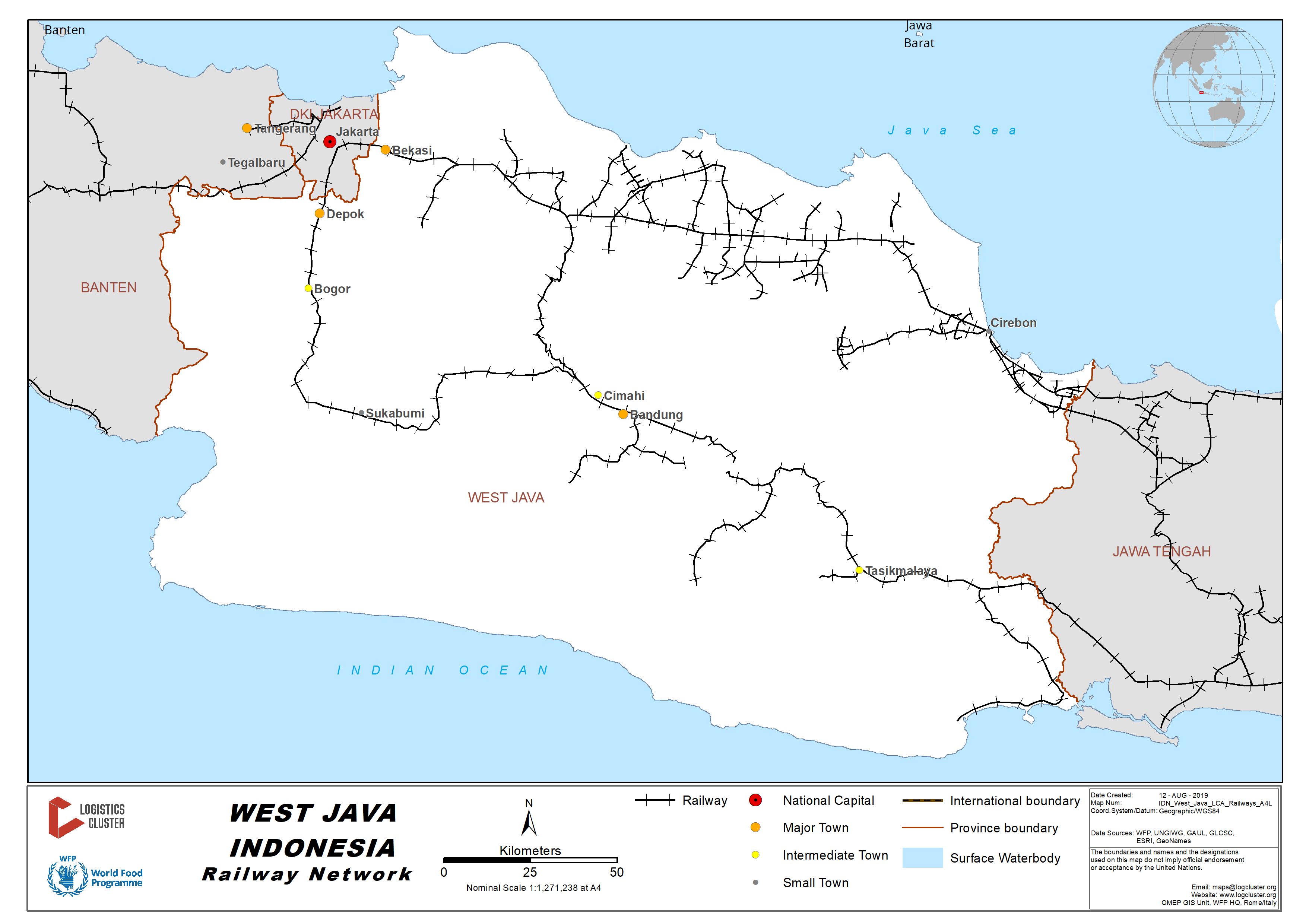
KeretaApi Indonesia (Persero) is a state-owned company specialising in managing and operating the railways networks throughout Indonesia. The network in West Java is managed by the Operational Region Office II or DAOP 2 Bandung. Under DAOP 2 Bandung, PT. KAI manages four types of railway systems:
- Local railway operates from Bandung city to Pangandaran district
- Pioneer railway operates from Bandung city to Cianjur and Sukabumi
- Long-distance railway operates from Bandung city to Jakarta on one side (North), and to East Java on the other side (South).
- Cargo railway operates from Bandung city to Jakarta on one side (North), and to East Java on the other side (South).
Travel matrices
Distance Travel Matrix (km) – Long-distance railway (Northern)
|
|
Bandung |
Padalarang |
Purwakarta |
Cikampek |
|
Bandung |
|
5 |
52 |
71 |
|
Padalarang |
5 |
|
44 |
75 |
|
Purwakarta |
52 |
44 |
|
19 |
|
Cikampek |
71 |
75 |
19 |
|
Travel Time Matrix (Hours) – Long-distance railway (Northern)
|
|
Bandung |
Padalarang |
Purwakarta |
Cikampek |
|
Bandung |
|
45 mins |
2 hours |
2.5 hours |
|
Padalarang |
45 mins |
|
1 hour 15 min |
1 hour 45 mins |
|
Purwakarta |
2 hours |
1 hour 15 mins |
|
30 mins |
|
Cikampek |
2.5 hours |
1 hour 45 mins |
30 mins |
|
Distance Travel Matrix (km) – Long-distance railway (Southern)
|
|
Bandung |
Kiaracondong |
Cicalengka |
Cibatu |
Tasikmalaya |
Banjar |
|
Bandung |
|
5 |
27 |
55 |
115 |
155 |
|
Kiaracondong |
5 |
|
22 |
53 |
110 |
150 |
|
Cicalengka |
27 |
22 |
|
31 |
88 |
128 |
|
Cibatu |
55 |
53 |
31 |
|
57 |
97 |
|
Tasikmalaya |
115 |
110 |
88 |
57 |
|
40 |
|
Banjar |
155 |
150 |
128 |
97 |
40 |
|
Travel Matrix (Hours) – Long-distance railway (Southern)
|
|
Bandung |
Kiaracondong |
Cicalengka |
Cibatu |
Tasikmalaya |
Banjar |
|
Bandung |
|
15 mins |
1 hour |
2 hours |
3 hours |
4 hours |
|
Kiaracondong |
15 mins |
|
45 mins |
1 hour 45 mins |
2 hours 45 mins |
3 hours 45 mins |
|
Cicalengka |
1 hour |
45 mins |
|
1 hour |
2 hours |
3 hours |
|
Cibatu |
2 hours |
1 hour 45 mins |
1 hour |
|
1 hour |
2 hours |
|
Tasikmalaya |
3 hours |
2 hours 45 mins |
2 hours |
1 hour |
|
1 hour |
|
Banjar |
4 hours |
3 hours 45 mins |
3 hours |
2 hours |
1 hour |
|
Railway Companies and Consortia
PT. Kereta Api Indonesia (Persero) is the railway authority in Indonesia. The operation in Bandung city and surrounding area is managed by the Operational Region Office II or DAOP 2 Bandung.
For more information on railway company contact details, please see the following link: 4.9 Indonesia Railway Company Contact List
Capacity Table
|
Rail Operator Capacity |
|
|
|
Operator / Company Name |
|
Lines Operates On |
PT. Kereta Api (Persero) DAOP 2 Bandung |
|
Max Train Length and / or Pulling Capacity |
11 carriages |
|
Locomotives |
Diesel |
|
Covered Freight Wagons Size (m) |
0 |
|
Flatbed Freight Wagons Size (m) |
0 |
|
High-sided Freight Wagons Size (m) |
0 |
|
Drop-side Freight Wagons Size (m) |
0 |
Key Route Information
|
Standard Route Information |
||
|
|
Bandung - Banjar |
Bandung - Cikampek |
|
Track Gauge |
1.067 mm (3ft 6 in) |
1.067 mm (3ft 6 in) |
|
Ruling Gradient |
N/A |
N/A |
|
Total Track Distance |
Single |
Single |
|
Type of Rail |
UIC 54 / R54 |
UIC 54 / R54 |
|
Type of Sleeper and Fastenings |
Steel and Clip |
Steel and Clip |
|
Total Track Travel Time |
4 hours |
2.5 hours |
|
Maintenance |
Marginal |
Marginal |
|
Companies / Consortiums Operating on Line |
N/A |
N/A |
|
Traffic Frequency |
Daily |
Daily |
|
Security |
Good |
Good |
|
Main Stations |
Bandung |
Bandung |
2.5 Indonesia Waterways Network
The following section contains information on the waterways in Indonesia
For information on Indonesia Waterways contact details, please see the following link:

2.5.1 Indonesia Bali Waterways Assessment
Indonesia Bali Waterways Assessment
There are currently no inland navigable waterways in use in Bali. However, the use of seaports is extensive for the movement of cargo and people. This section should be read in conjunction with the Ports assessment for Bali which contains more detailed information regards the capacity and use of the ports within Bali.
Company Information
4.2.4 Indonesia Port and Waterways Company Contact Lists
Passengers and cargo are moved throughout the Bali region primarily through ferries. There are some “fast boats” or speed boats used for passengers, however this is mostly for tourists to move between Bali and Lombok. The companies that are documented below are a combination of the larger ferry companies which can carry 350-400 passengers and the smaller fast boats which can carry 25-50 passengers.
|
Passenger Carrying Capacity |
|||
|---|---|---|---|
|
PT. PELNI (Persero) |
PT. ASDP Ferry Indonesia |
Fast Boat Blue Water Express |
|
|
Number of Passenger Vessels < 20 pax |
N/A |
N/A |
N/A |
|
Number of Passenger Vessels < 50 pax |
N/A |
N/A |
2 |
|
Number of Passenger Vessels < 100 pax |
N/A |
N/A |
1 |
|
Number of Passenger Vessels > 100 pax |
N/A |
29 |
N/A |
Travel Time
|
Passenger Carrying Capacity |
|||
|---|---|---|---|
|
PT. PELNI (Persero) |
PT. ASDP Ferry Indonesia |
Fast Boat Blue Water Express |
|
|
Number of Boats |
N/A |
29 |
3 |
|
Tonnage / Volume Carrying Capacity |
N/A |
45 mt per trip |
N/A |
|
Number of Barges |
N/A |
N/A |
N/A |
|
Tonnage / Volume Carrying Capacity |
N/A |
N/A |
N/A |
|
Number of Tugs |
N/A |
N/A |
N/A |
|
Tonnage / Volume Carrying Capacity |
N/A |
N/A |
N/A |
|
Other (specify) |
N/A |
N/A |
N/A |
Time Travel Matrix
|
Travel Time from Main port to other major Ports (hours / days) Ferries |
|||||||
|---|---|---|---|---|---|---|---|
|
Benoa |
Gilimanuk |
Padang Bai |
Celukan Bawang |
Surabaya |
Lembar |
Kupang |
|
|
Benoa |
N/A |
N/A |
N/A |
1-4 days |
4 hours |
3-4 days |
|
|
Gilimanuk |
N/A |
N/A |
N/A |
N/A |
N/A |
N/A |
|
|
Padang Bai |
N/A |
N/A |
N/A |
N/A |
4-6 hours |
N/A |
|
|
Celukan Bawang |
N/A |
N/A |
N/A |
N/A |
N/A |
N/A |
|
|
Surabaya |
N/A |
N/A |
N/A |
N/A |
N/A |
3 days |
|
|
Lembar |
5 hours |
N/A |
4-5 hours |
N/A |
N/A |
N/A |
|
|
Kupang |
3 days |
N/A |
N/A |
N/A |
3-7 days |
N/A |
|
Key Routes
|
Key Route Information Domestic / International |
|||
|---|---|---|---|
|
From: Bali To: Lombok |
From: Bali To: Lombok |
From: Bali To: Kupang |
|
|
Total Distance (km) |
76.4 km |
136 km |
1,366 km |
|
Width (m): Broadest Narrowest |
Ocean Width |
Ocean Width |
Ocean Width |
|
River Flow (m³ / second) |
N/A |
N/A |
N/A |
|
Seasonal Affects |
Rainy season and windy season |
Rainy season and windy season |
Rainy season and windy season |
|
Maximum Weight and Size of Vessels |
N/A |
N/A |
N/A |
|
Regular Traffic Passenger / Cargo |
Passenger & Cargo |
Passenger & Cargo |
Passenger & Cargo |
|
Companies Operating Along the Route |
ASDP ferry, Fast Boat Blue Water Express |
PT. PELNI (Persero) |
PT. PELNI (Persero) |
|
Security Concerns (Yes / No) |
No |
No |
No |
|
Main Ports |
Padang Bai - Lembar |
Benoa - Lembar |
Benoa - Tenau |
Port Information
|
Key Port Information |
|||
|---|---|---|---|
|
Padang Bai |
Benoa |
Celukan Bawang |
|
|
Location |
South. 080, 31’, 963”, East. 1150, 30’, 485” |
S. 08o, 44’, 546” E. 115o, 12’, 743 |
South 8° 11' 26" East 114° 50' 8" |
|
Contact Information |
PT.ASDP |
Pelindo |
PT. ASDP |
|
Connections with other transport means (road/waterways/air) |
Road |
Road, Air |
Road |
|
Storage Capacity (square meters and cubic meters) |
No |
1400m2 |
n/a |
|
Handling Equipment |
No |
Yes |
n/a |
|
Customs Clearance Available (Yes / No) |
No |
Yes |
n/a |
|
Other Comments |
n/a | n/a | n/a |
|
Key Port Information |
|
|---|---|
|
Gilimanuk |
|
|
Location |
South 080, 09’, 692”, East. 1140, 26’, 226” |
|
Contact Information |
PT. ASDP Ferry Indonesia |
|
Connections with other transport means (road/waterways/air) |
Road |
|
Storage Capacity (square meters and cubic meters) |
No |
|
Handling Equipment |
No |
|
Customs Clearance Available (Yes / No) |
No |
|
Other Comments |
This is a port for RoRo cargo and passengers. |
2.5.2 Indonesia Aceh and North Sumatra Waterways Assessment
Indonesia Aceh and North Sumatra Waterways Assessment
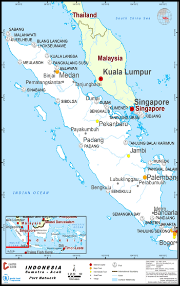
There are no major waterways used for internal transport in Aceh province.
There are some small boats that are used in the rivers which carry mostly wood and agriculture products from the mountains to the estuaries.
In this section we have documented the waterway movements with the Aceh province and surrounding islands.
Company Information
For information on Indonesia Waterways contact details, please see the following link:
4.2.4 Indonesia Port and Waterways Company Contact Lists
|
Passenger Carrying Capacity |
|||
|---|---|---|---|
|
PT. ASDP Indonesia Ferry |
PT Sea Asih Line |
PT Pelayaran Sakti Inti Makmur |
|
|
Number of Passenger Vessels < 20 pax |
N/A |
N/A |
N/A |
|
Number of Passenger Vessels < 50 pax |
N/A |
N/A |
N/A |
|
Number of Passenger Vessels < 100 pax |
N/A |
N/A |
N/A |
|
Number of Passenger Vessels > 100 pax |
2 Units |
1 Unit |
2 Units |
|
Passenger Carrying Capacity |
|||
|---|---|---|---|
|
PT. ASDP Indonesia Ferry |
PT Sea Asih Line |
PT Pelayaran Sakti Inti Makmur |
|
|
Number of Boats |
2 Units |
1 Unit |
2 Units |
|
Tonnage / Volume Carrying Capacity |
400-450 pax 20 trucks (10mt) or 40 vehicles or 100 motorcycles |
Speed boat – no cargo capacity |
Speed boat – no cargo capacity |
|
Number of Barges |
N/A |
N/A |
N/A |
|
Tonnage / Volume Carrying Capacity |
N/A |
N/A |
N/A |
|
Number of Tugs |
N/A |
N/A |
N/A |
|
Tonnage / Volume Carrying Capacity |
N/A |
N/A |
N/A |
|
Other (specify) |
KMP BRR and KMP Papuyu |
Speedboat Pulo Rondo |
KM Express Bahari 3B KM Express Bahari 9 |
Travel Time Matrix
|
Travel Time from Main port to other major Ports (hours / days) Ferry |
|||||||
|---|---|---|---|---|---|---|---|
|
Ulee Lheu |
Balohan Sabang |
Sinabang |
Singkil |
Labuhan Haji |
Pulau Banyak |
Gunung Sitoli |
|
|
Ulee Lheu |
ASDP: 2-3 hours Speedboat:45 minutes |
N/A |
N/A |
N/A |
N/A |
N/A |
|
|
Balohan Sabang |
ASDP: 2-3 hours Speedboat:45 minutes |
N/A |
N/A |
N/A |
N/A |
N/A |
|
|
Sinabang |
N/A |
N/A |
ASDP |
ASDP |
N/A |
N/A |
|
|
Singkil |
N/A |
N/A |
ASDP |
N/A |
ASDP |
ASDP |
|
|
Labuhan Haji |
N/A |
N/A |
ASDP |
N/A |
N/A |
N/A |
|
|
Pulau Banyak |
N/A |
N/A |
ASDP |
ASDP |
N/A |
N/A |
|
|
Gunung Sitoli |
N/A |
N/A |
N/A |
ASDP |
N/A |
N/A |
|
Key Routes
|
|
Key Route Information Domestic / International |
|||
|---|---|---|---|---|
|
From: Banda Aceh To: Balohan |
From: Banda Aceh To: Sabang |
From: Sinabang To: Singkil |
From: Singkil To: Pulau Banyak |
|
|
Total Distance (km) |
27,36 km |
48,3 km |
160,78 km |
64.28 km |
|
Width (m): Broadest Narrowest |
Ocean |
Ocean |
Ocean |
Ocean |
|
River Flow (m³ / second) |
N/A |
N/A |
N/A |
N/A |
|
Seasonal Affects |
Rainy Season and Winds |
Rainy Season and Winds |
Rainy Season and Winds |
Rainy Season and Winds |
|
Maximum Weight and Size of Vessels |
N/A |
N/A |
N/A |
N/A |
|
Regular Traffic Passenger / Cargo |
Passenger & Cargo |
Passenger & Cargo |
Passenger & Cargo |
Passenger & Cargo |
|
Companies Operating Along the Route |
PT. ASDP Indonesia Ferry, PT Sea Asih Line (Fast Boat), and PT Pelayaran Sakti Inti Makmur (Fast Boat) |
PT. ASDP Indonesia Ferry |
PT. ASDP Indonesia Ferry |
PT. ASDP Indonesia Ferry |
|
Security Concerns (Yes / No) |
No |
No |
No |
No |
|
Main Ports |
Ulee Lheu – Balohan |
Ulee Lheue – Teluk Sabang |
Sinabang – Singkil |
Singkil – Pulau Banyak |
Port Information
|
Key Port Information |
||||
|---|---|---|---|---|
|
Belawan |
Kuala Langsa |
Lhokseumawe |
Malahayati |
|
|
Location |
N 3 47’ 15" E 98 41’ 34" |
N 4° 31' 27" E 98° 1' 15" |
N 05°14.450 E 97°02.340 |
N 05° 35’ 50” E 95° 30’ 35” |
|
Contact Information |
PT. Pelindo (Persero) Regional I Northern Sumatra |
PT. Pelindo (Persero) Pelabuhan Perwakilan Kuala Langsa |
PT. (Persero) Pelabuhan Indonesia |
PT. (Persero) Pelabuhan Indonesia, Branch Port of Malahayati |
|
Connections with other transport means (road/waterways/air) |
PT. PELINDO (waterways) |
PT. PELINDO (waterways) |
PT. PELINDO (waterways) |
PT. PELINDO (waterways) |
|
Storage Capacity (square meters and cubic meters) |
Bagged Cargo: 52,399.12 m2 Open Storage: 112,949.76m2 |
Bagged Cargo: 300, 500 m2 Open Storage: 5,000 m2 |
Bagged Cargo 4,120 m2 Open storage 25,158 m2 |
Bagged Cargo: 2,720 m2 General Cargo: 22,021 m2 |
|
Handling Equipment |
Yes |
Yes |
Yes |
Yes |
|
Customs Clearance Available (Yes / No) |
Yes |
Yes |
Yes |
Yes |
|
Other Comments |
|
|||
2.5.3 Indonesia Makassar Waterways Assessment
Indonesia Makassar Waterways Assessment
The use of seaports is extensive for the movement of cargo and people. This section should be read in conjunction with the Ports assessment for Makassar which contains more detailed information regards the capacity and use of the ports.
Company Information
For information on Indonesia Waterways contact details, please see the following link:
4.2.4 Indonesia Port and Waterways Company Contact Lists
PT Pelni and PT ASDP are the two main ferry operators for cargo and passenger movements from Makassar and throughout Sulawesi province.
|
PT. PELNI |
PT. ASDP |
|
|---|---|---|
|
Number of Passenger Vessels < 20 pax |
N/A |
N/A |
|
Number of Passenger Vessels < 50 pax |
N/A |
N/A |
|
Number of Passenger Vessels < 100 pax |
N/A |
N/A |
|
Number of Passenger Vessels > 100 pax |
13 500 - 3000 pax |
17 300-400 pax |
|
PT. PELNI |
PT. ASDP |
|
|---|---|---|
|
Number of Boats |
13 |
17 |
|
Tonnage / Volume Carrying Capacity |
500-1500mt (passenger and cargo) |
500mt (passenger and cargo) |
|
Number of Barges |
N/A |
N/A |
|
Tonnage / Volume Carrying Capacity |
N/A |
N/A |
|
Number of Tugs |
N/A |
N/A |
|
Tonnage / Volume Carrying Capacity |
N/A |
N/A |
|
Other (specify) |
N/A |
N/A |
Travel Time Matrix
|
Travel Time from Main port to other major Ports (hours / days) Ferry |
||||||||
|---|---|---|---|---|---|---|---|---|
|
Makassar |
Pare-Pare |
Gorontalo |
Selayar |
Bau Bau |
Talaud Island |
Luwuk |
Bitung |
|
|
Makassar |
PT. PELNI (3-4 hours) |
N/A |
PT. PELNI (11-12 hours) |
PT. PELNI (14 hours) |
N/A |
PT. PELNI (2 days) |
PT. PELNI (3-4 days) |
|
|
Pare-Pare |
PT. PELNI (3-4 hours) |
N/A |
N/A |
PT. PELNI (1 day) |
N/A |
N/A |
N/A |
|
|
Gorontalo |
N/A |
N/A |
N/A |
PT. PELNI (2 days) |
N/A |
PT. ASDP and PT. PELNI (12-13 hours) |
PT. PELNI (14 hours) |
|
|
Selayar |
PT. PELNI (11-12 hours) |
N/A |
N/A |
N/A |
N/A |
N/A |
N/A |
|
|
Bau Bau |
PT. PELNI (14 hours) |
PT. PELNI (1 day) |
PT. PELNI (2 days) |
N/A |
N/A |
PT. PELNI (1-2 days) |
PT. PELNI (2-3 days) |
|
|
Talaud Island |
N/A |
N/A |
N/A |
N/A |
N/A |
N/A |
PT. ASDP (3-4 hours) |
|
|
Luwuk |
PT. PELNI (2 days) |
N/A |
PT. ASDP and PT. PELNI (12-13 hours) |
N/A |
PT. PELNI (1-2 days) |
N/A |
PT. PELNI (1 day) |
|
|
Bitung |
PT. PELNI (2 days) |
N/A |
PT. PELNI (14 hours) |
N/A |
PT. PELNI (2-3 days) |
PT. ASDP (3-4 hours) |
PT. PELNI (1 day) |
|
Key Routes
|
Key Route Information Domestic / International |
|||
|---|---|---|---|
|
From: Makassar To: Pare Pare |
From: Luwuk To: Gorontalo |
From: Bitung To: Talaud Island |
|
|
Total Distance (km) |
150 km |
353 km |
346 km |
|
Width (m): Broadest Narrowest |
Ocean Width |
Ocean Width |
Ocean Width |
|
River Flow (m³ / second) |
N/A |
N/A |
N/A |
|
Seasonal Affects |
Rainy season and Winds |
Rainy season and Winds |
Rainy season and Winds |
|
Maximum Weight and Size of Vessels |
N/A |
N/A |
N/A |
|
Regular Traffic Passenger / Cargo |
Passenger & Cargo |
Passenger & Cargo |
Passenger & Cargo |
|
Companies Operating Along the Route |
PT. PELNI |
PT. PELNI and ASDP |
PT. ASDP |
|
Security Concerns (Yes / No) |
No |
No |
No |
|
Main Ports |
Makassar – Pelabuhan Nusantara |
Banggai - Gorontalo |
Bitung - Miangas |
Port Information
|
Key Port Information |
||||
|---|---|---|---|---|
|
Makassar |
Gorontalo |
Selayar |
Bitung |
|
|
Location |
05008’007”S 119024’00’E |
0030’02.50”S 123003’35.05’E |
06004’44.25”S 120026’15.06’E |
01026’21.81”S 125011’55.29’E |
|
Contact Information |
PT. Pelabuhan Indonesia IV (Persero) |
PT. Pelabuhan Indonesia IV (Persero) and PT. ASDP Ferry |
PT. Pelabuhan Indonesia IV (Persero) and PT. ASDP Ferry |
PT. Pelabuhan Indonesia IV (Persero) and PT. ASDP Ferry |
|
Connections with other transport means (road/waterways/air) |
PT. PELNI |
PT. PELNI and PT. ASDP Ferry |
PT. PELNI and PT. ASDP Ferry |
PT. PELNI and PT. ASDP Ferry |
|
Storage Capacity (square meters and cubic meters) |
Permanent wh – 15,400sqm Open Storage – 179,888sqm |
N/A |
N/A |
N/A |
|
Handling Equipment |
Yes |
Yes |
Yes |
Yes |
|
Customs Clearance Available (Yes / No) |
Yes |
No |
No |
No |
|
Other Comments |
|
|||
2.5.4 Indonesia Nusa Tenggara Barat (NTB) Waterways Assessment
Indonesia Nusa Tenggara Barat (NTB) Waterways Assessment
The use of the waterways between islands is a key mode of transport for cargo and passengers within the NTB province.
Ports are located throughout the islands and there are ferry options to move within the islands or to Bali.
In case of an emergency operation PT. ASDP would offer ferries available for rental.
The port of Surabaya is a major hub for the NTB with regular sailings of boats and ferries with passengers and cargo.
Company Information
For information on Indonesia waterways contact details, please see the following link:
4.2.4 Indonesia Port and Waterways Company Contact Lists
Two companies operate scheduled passenger and cargo ferry services on a large scale within NTB - PT.Pelni and PT ASDP.
In addition to the larger services there are a number of tourism operators who provide “speed” boat services between NTB and Bali.
|
Passenger Carrying Capacity |
|||
|---|---|---|---|
|
PT. PELNI |
PT. ASDP Ferry |
Fast Boat Blue Water Express |
|
|
Number of Passenger Vessels < 20 pax |
N/A |
N/A |
N/A |
|
Number of Passenger Vessels < 50 pax |
N/A |
N/A |
2 |
|
Number of Passenger Vessels < 100 pax |
N/A |
N/A |
1 |
|
Number of Passenger Vessels > 100 pax |
6 |
8 |
N/A |
|
Passenger Carrying Capacity |
|||
|---|---|---|---|
|
PT. PELNI (Persero) |
PT. ASDP Ferry Indonesia |
Fast Boat Blue Water Express |
|
|
Number of Boats |
6 |
8 |
3 |
|
Tonnage / Volume Carrying Capacity |
45mt |
45 mt per trip |
N/A |
|
Number of Barges |
N/A |
N/A |
N/A |
|
Tonnage / Volume Carrying Capacity |
N/A |
N/A |
N/A |
|
Number of Tugs |
N/A |
N/A |
N/A |
|
Tonnage / Volume Carrying Capacity |
N/A |
N/A |
N/A |
|
Other (specify) |
N/A |
N/A |
N/A |
Travel Time Matrix
|
|
Travel Time from Main port to other major Ports (hours / days) by Passenger ferry (PELNI) and Ferry (ASDP) |
|||||
|---|---|---|---|---|---|---|
|
Lembar |
Kayangan |
Bima |
Pototano |
Padang Bai |
Labuhan Bajo |
|
|
Lembar |
N/A |
PELNI: 17-18 hours |
N/A |
ASDP: 3-6 hours |
PELNI: 1 days |
|
|
Kayangan |
N/A |
N/A |
ASDP: 1,5 hours |
N/A |
N/A |
|
|
Bima |
PELNI: 17 hours |
N/A |
N/A |
N/A |
PELNI: 1,5 days |
|
|
Pototano |
N/A |
ASDP: 1,5 hours |
N/A |
|
N/A |
N/A |
|
Padang Bai |
ASDP: 3-6 hours |
N/A |
N/A |
N/A |
N/A |
|
|
Labuhan Bajo |
PELNI: 1 days |
N/A |
PELNI: 1,5 days |
N/A |
N/A |
|
Key Routes
|
Key Route Information Domestic / International |
|||
|---|---|---|---|
|
From: Lombok To: Bali |
From: Lombok To: Sumbawa Island |
From: Sumbawa Island To: East Nusa Tenggara (NTT) |
|
|
Total Distance (km) |
70.899 km |
19.312 km |
77.249 km |
|
Width (m): Broadest Narrowest |
Ocean Width |
Ocean Width |
Ocean Width |
|
River Flow (m³ / second) |
N/A |
N/A |
N/A |
|
Seasonal Affects |
Rainy season and Winded |
Rainy season and Winded |
Rainy season and Winded |
|
Maximum Weight and Size of Vessels |
N/A |
N/A |
N/A |
|
Regular Traffic Passenger / Cargo |
Passenger & Cargo |
Passenger & Cargo |
Passenger & Cargo |
|
Companies Operating Along the Route |
PELNI & ASDP |
ASDP |
ASDP |
|
Security Concerns (Yes / No) |
No |
No |
No |
|
Main Ports |
Lembar – Padang Bai |
Kayangan – Poto Tano |
Sape – Labuhan Bajo |
Port Information
|
Tanjung Lembar |
Kayangan |
|
|---|---|---|
|
Location |
S. 0900, 43’, 50” E. 11600 4’, 20” |
S. 080, 29’, 07,7”, E. 1160, 40’, 28,7” |
|
Contact Information |
PT. Pelabuhan Indonesia III (Persero) |
Kayangan Port Office (Kantor Pelabuhan Kayangan) |
|
Connections with other transport means (road/waterways/air) |
PT. PELNI and PT. ASDP Ferry |
PT. PELNI and PT. ASDP Ferry |
|
Storage Capacity (square meters and cubic meters) |
1.008 - 2.016 mt/m3 and open storage 8.925 mt/m3 |
1.500 metric tons |
|
Handling Equipment |
Yes |
No |
|
Customs Clearance Available (Yes / No) |
Yes |
No |
2.5.5 Papua Waterways Assessment
Papua Waterways Assessment
The primary waterway usage in the Papua province is between the island and main ports. Jayapura port is the main port where cargo (which is already customs cleared) enters the province. From there cargo is then distributed onwards to other districts such as Biak and Merauke.
Cargo is also moved by rivers in Merauke and Wamena districts via speed boats. There is a development plan underway to increase the capacity of the river movements using larger ferries for passengers and cargo.
However, development of the appropriate infrastructure is not complete and there is no indication of when they will be operational.
During the summer months (August – December) the water level can often be too low to reach Tanah Merah from Merauke. During this time cargo and passengers are trans-shipped to smaller boats for onward movement.
Company Information
4.2.4 Indonesia Port and Waterways Company Contact Lists
|
Passenger Carrying Capacity |
||
|---|---|---|
|
PT. PELNI |
PT. ASDP Ferry Indonesia |
|
|
Number of Passenger Vessels < 20 pax |
N/A |
N/A |
|
Number of Passenger Vessels < 50 pax |
N/A |
N/A |
|
Number of Passenger Vessels < 100 pax |
N/A |
N/A |
|
Number of Passenger Vessels > 100 pax |
8 Units |
6 Units |
|
Passenger Carrying Capacity |
||
|---|---|---|
|
PT. PELNI |
PT. ASDP Ferry Indonesia |
|
|
Number of Boats |
8 Units |
6 Units |
|
Tonnage / Volume Carrying Capacity |
Up to 700 mt per trip (depending on the passenger numbers) |
45 mt cargo per trip |
|
Number of Barges |
N/A |
N/A |
|
Tonnage / Volume Carrying Capacity |
N/A |
N/A |
|
Number of Tugs |
N/A |
N/A |
|
Tonnage / Volume Carrying Capacity |
N/A |
N/A |
|
Other (specify) |
N/A |
N/A |
Travel Time Matrix
|
Travel Time from Main port to other major Ports (hours / days) VESSEL TYPE |
|||||||
|---|---|---|---|---|---|---|---|
|
Biak |
Merauke |
Sorong |
Timika |
Jayapura |
Nabire |
Manokwari |
|
|
Biak |
N/A |
Pelni: 1-3 days |
N/A |
Pelni: 20-21 hours |
ASDP: 2 days |
ASDP: 12 hours |
|
|
Merauke |
N/A |
N/A |
Pelni: 2 days |
N/A |
N/A |
N/A |
|
|
Sorong |
Pelni: 1-3 days |
N/A |
N/A |
Pelni: 2-3 days |
Pelni: 1-4 days |
Pelni: 1-3 days |
|
|
Timika |
N/A |
Pelni: 2 days |
N/A |
N/A |
N/A |
N/A |
|
|
Jayapura |
Pelni: 20-21 hours |
N/A |
Pelni: 2-3 days |
N/A |
Pelni: 1 day |
Pelni: 1-2 days |
|
|
Nabire |
ASDP: 2 days |
N/A |
Pelni: 1-4 days |
N/A |
Pelni: 1 day |
Pelni: 12 hours – 1 day |
|
|
Manokwari |
ASDP: 12 hours |
N/A |
Pelni: 1-3 days |
N/A |
Pelni: 1-2 days |
Pelni: 1-3 days |
|
Key Routes
|
Key Route Information Domestic / International |
|||||
|---|---|---|---|---|---|
|
From: Biak To: Sorong |
From: Biak To: Manokwari |
From: Biak To: Nabire |
From: Biak To: Jayapura |
From: Timika To: Merauke |
|
|
Total Distance (km) |
526.82 (Air Distance) |
214.39 (Air Distance) |
276.29 (Air Distance) |
552.69 (Air Distance) |
926.06 (Driving Distance) |
|
Width (m): Broadest Narrowest |
Ocean Width |
Ocean Width |
Ocean Width |
Ocean Width |
Ocean Width |
|
River Flow (m³ / second) |
N/A |
N/A |
N/A |
N/A |
N/A |
|
Seasonal Affects |
Rainy season and Winded |
Rainy season and Winded |
Rainy season and Winded |
Rainy season and Winded |
Rainy season and Winded |
|
Maximum Weight and Size of Vessels |
N/A |
N/A |
N/A |
N/A |
N/A |
|
Regular Traffic Passenger / Cargo |
Passenger & Cargo |
Passenger & Cargo |
Passenger & Cargo |
Passenger & Cargo |
Passenger & Cargo |
|
Companies Operating Along the Route |
PT. PELNI |
PT. ASDP Ferry |
PT. ASDP Ferry |
PT. PELNI |
PT. PELNI |
|
Security Concerns (Yes / No) |
No |
No |
No |
No |
No |
|
Main Ports |
Biak - Sorong |
Biak - Manokwari |
Biak - Nabire |
Biak - Jayapura |
Timika - Jayapura |
Port Information
|
Key Port Information |
||||
|---|---|---|---|---|
|
Biak |
Sorong |
Jayapura |
Merauke |
|
|
Location |
01° 11’ 05” S 136° 05’ 46” E |
00° 53' 00” S 131° 10' 00” E |
02° 32' 30" S 140° 42' 30" E |
8° 28’ 40’’ S 140° 23’ 26’’ E |
|
Contact Information |
PT. Pelabuhan Indonesia IV ( Persero) |
PT. Pelabuhan Indonesia IV (Persero) |
PT. Pelabuhan Indonesia IV (Persero) |
Jayapura Port Office Administration (ADPEL Pelabuhan Jayapura) |
|
Connections with other transport means (road/waterways/air) |
PT. PELNI and ASDP |
PT. PELNI |
PT. PELNI |
PT. PELNI |
|
Storage Capacity (square meters and cubic meters) |
576 T/M2 and 2.280 T/M2 |
1.170 T/M2 and Open Storage 3.840 T/M2 |
2.200 m2 and Open storage 11,867 m2 |
3.090 m² |
|
Handling Equipment |
Yes |
Yes |
Yes |
Yes |
|
Customs Clearance Available (Yes / No) |
Yes |
Yes |
Yes |
Yes |
|
Other Comments |
http://www.dephub.go.id/files/media/file/25%20pelabuhan/Biak.pdf |
http://www.dephub.go.id/files/media/file/25%20pelabuhan/Sorong.pdf |
|
|
2.6 Indonesia Storage Assessment
The following sections contain information on Indonesia Storage.
For information on Indonesia storage contact details, please see the following link: 4.6 Indonesia Storage and Milling Company Contact List
2.6.1 Indonesia Aceh Storage Assessment
For more information on storage company contact details, please see the following link: 4.6 Indonesia Storage and Milling Company Contact List
Commercial Storage
|
Location |
Owner |
Available for Rent |
Capacity (MT / m² / m³) |
Type [1] |
Access [2] |
Condition [3] |
|
Port of Malahayati, Aceh Besar |
Pelindo I (Persero) |
|
800 m2 |
Concrete |
Flat |
Good |
|
Port of Tapaktuan, South Aceh |
UPP Tapak Tuan |
|
990 m2 |
Concrete |
Flat |
Good |
[1] Warehouse Type: Open storage, container, rub-hall, silo, concrete, other, unspecified
[2] Warehouse Access: Raised-siding, flat
[3] Warehouse condition: Appears intact, appears damaged, under construction/repair
Storage Used by Humanitarian Organizations
Indonesian Red Cross (PMI) is the only organisation has the storage facility in Aceh Province.
|
Location |
Ministry / Agency |
Use Possibility |
Capacity (MT / m² / m³) |
Type [1] |
Access [2] |
Condition [3] |
|
Banda Aceh |
Indonesian Red Cross (PMI) |
Yes |
1950 m2 |
Concrete |
Flat |
Good |
[1] Warehouse Type: Open storage, container, rub-hall, silo, concrete, other, unspecified
[2] Warehouse Access: Raised-siding, flat
[3] Warehouse condition: Appears intact, appears damaged, under construction/repair
Public Sector Storage
Public sector storage facilities are owned by government agencies such as the National Logistics Agency (BULOG), Provincial Disaster Management Office (BPBA), Social Office, etc.
BULOG has many warehouses within Aceh Province that can be rented depending on space availability. For utilisation or renting purposes, an official request should be addressed to the Head of BULOG at Provincial level in Aceh Province.
|
Location |
Ministry / Agency |
Use Possibility |
Capacity (MT / m² / m³) |
Type [1] |
Access [2] |
Condition [3] |
|
Banda Aceh |
BULOG |
|
12,000 mt |
Concrete |
Flat |
Good |
|
Sabang Island |
BULOG |
|
1,500 mt |
Concrete |
Flat |
Good |
|
Lhokseumawe |
BULOG |
|
15,500 mt |
Concrete |
Flat |
Good |
|
Takengon |
BULOG |
|
1,500 mt |
Concrete |
Flat |
Good |
|
Langsa |
BULOG |
|
7,000 mt |
Concrete |
Flat |
Good |
|
Meulaboh |
BULOG |
|
6,000 mt |
Concrete |
Flat |
Good |
|
Sigli |
BULOG |
|
12,500 mt |
Concrete |
Flat |
Good |
|
Kutacane |
BULOG |
|
6,500 mt |
Concrete |
Flat |
Good |
|
Blang Pidie |
BULOG |
|
6,000 mt |
Concrete |
Flat |
Good |
|
Labui, Aceh Besar |
Dinas Sosial Province |
|
500 m2 (2 floor) |
Concrete |
Flat |
Good |
[1] Warehouse Type: Open storage, container, rub-hall, silo, concrete, other, unspecified
[2] Warehouse Access: Raised-siding, flat
[3] Warehouse condition: Appears intact, appears damaged, under construction/repair
Cold Chain
No Cold chain facilities in Banda Aceh, West Aceh, South Aceh and Aceh Besar districts. However, BULOG Regional Aceh is planning to have it in 2020.
2.6.2 Indonesia Bali Storage Assessment
Indonesia Bali Storage Assessment
There is limited bonded warehouse in Bali Province area except
the ones belonging to BULOG (Indonesian Bureau for Logistics) and
the shops and stores departure lounge for international
destinations, which are deemed to be Bonded.
There are different types and condition of warehouses and storage
available throughout the Bali Region. A limited number of the
warehouses have raised-platforms the majority of warehouses have
flat working areas with no platforms that would assist in receiving
and dispatching cargoes.
The commercial sector has warehouses from small warehouses to large
fabricated warehouses for specific cargoes. Primarily warehouses
are built by owner/operators for their own purposes and are not
available for rent.
The Port of Benoa, Padang Bai, Celukan Bawang and Gilimanuk are all
classified as international ports. Therefore internationally
sourced cargo may only move in or out of the port in conformity
with Customs Rules and Regulation.
For information on Indonesia storage contact details, please see the following link:
4.2.6 Indonesia Storage and Milling Company Contact List
Commercial Storage
The commercial sector has warehouses from small warehouses to large fabricated warehouses for specific cargo. Primarily warehouses are built by owner/operators for their own purpose, therefore at the time of the assessment there was no warehouses available for rental.
|
Location |
Owner |
Available for Rent |
Capacity mt / m² / m³ |
Type [1] |
|---|---|---|---|---|
|
Denpasar |
Karunia Abadi Cargo |
Yes |
144m2 |
Building |
|
Denpasar |
ISW Bali Transport |
Yes |
600m2 |
n/a |
[1] Warehouse Type: Open storage, container, rub-hall, silo, concrete, other, unspecified
[2] Warehouse Access: Raised-siding, flat
[3] Warehouse condition: Appears intact, appears damaged, under construction/repair
Storage Used by Humanitarian Organizations
There is currently very limited storage used by humanitarian
organisations in Bali. PMI utilises rooms for the storage of blood
products and vaccines.
In the event of an emergency the erection of Mobile Storage Units’
(MSU) will likely be required to meet storage requirements. Space
is limited in Bali, therefore organisations should liaise with the
local BPBD branch to identify suitable locations.
|
Location |
Organization |
Sharing Possibility (Yes / No) |
Capacity mt / m² / m³ |
Type* |
|---|---|---|---|---|
|
Denpasar |
PMI |
No |
n/a |
Cold Chain Storage |
Public Sector Storage
BULOG is the national Logistics organization for the Republic of Indonesia, is well established in Bali with a network of warehouses and distribution processes through the archipelago. BULOG Website: BULOG Website
|
Location |
Ministry / Agency |
Use Possibility (Yes / No) |
Capacity mt / m² / m³ |
Type* |
Access** |
Condition*** |
|---|---|---|---|---|---|---|
|
Singaraja |
BULOG |
No |
2000 mt |
Brick – Zinc |
No Platform |
Good |
|
Jembrana |
BULOG |
No |
2000 mt |
Brick – Zinc |
No Platform |
Good |
|
Tabanan |
BULOG |
No |
15000 mt |
Brick – Zinc |
No Platform |
Good |
|
Sempidi |
BULOG |
No |
7000 mt |
Brick – Zinc |
No Platform |
Good |
|
Batu Bulan Gianyer |
BULOG |
No |
3500 mt |
Brick – Zinc |
No Platform |
Good |
|
Klunkung and Bangli |
BULOG |
No |
4000 mt |
Brick – Zinc |
No Platform |
Good |
|
Jembaran |
BULOG |
No |
8000 mt |
Brick – Zinc |
No Platform |
Good |
|
Singaraja |
BULOG |
No |
2000 mt |
Brick – Zinc |
No Platform |
Good |
|
Jembrana |
BULOG |
No |
2000 mt |
Brick – Zinc |
No Platform |
Good |
Cold Chain
The ‘Cold Chain’ with in the Region of Bali may be limited but is adequate to service the tourist and hospitality industry. Currently there are cold chain facilities available at Dinas Kesehatan (Department of Health) in Denpasar and in Kuta.
2.6.3 Indonesia Makassar Storage Assessment
Indonesia Makassar Storage Assessment
There are ample space and storage options available in Makassar. In addition, in the advent of an emergency BPBD has indicated that land would also be made available to support any logistics response.
For information on Indonesia storage contact details, please see the following link:
4.2.6 Indonesia Storage and Milling Company Contact List
Commercial Storage
There are two main industrial parks in Makassar that offer
storage for rental. PT. Kima is the state owned enterprise. They
primarily build warehouses to meet customer requirements and there
is an 80 year lease requirement for any rental. There may be
options for smaller leases, however they are extremely rare (at the
time of the assessment there was one warehouse available on a 17
year lease).
The other option is the Natura Industrial estate. This industrial
park has pre-built warehouses available for rental. There is also a
vast amount of land available in this area which may be useful if
MSU parks were to be established.
Both industrial areas are in the same location and offer good links
to the toll roads and airport in Makassar.
|
Location |
Owner |
Available for Rent |
Capacity mt / m² / m³ |
Type [1] |
Access [2] |
Condition [3] |
|---|---|---|---|---|---|---|
|
Makassar |
Kawasan Industries |
No |
17,640m3 |
Permanent |
N/A |
N/A |
|
Makassar |
Limbunan |
No |
19,600m2 |
Permanent |
N/A |
N/A |
|
Makassar |
FKS Land |
Yes |
Different types |
Permanent |
Good |
Good |
[1] Warehouse Type: Open storage, container, rub-hall, silo, concrete, other, unspecified
[2] Warehouse Access: Raised-siding, flat
[3] Warehouse condition: Appears intact, appears damaged, under construction/repair
Storage Used by Humanitarian Organizations
There are currently no storage facilities in use by humanitarian organisations.
Public Sector Storage
BULOG has 8 locations throughout Sulawesi :
1) Polmas
2) Pare-pare
3) Sidrap
4) Wajo
5) Bulukumba
6) Palopo
7) Makassar
8) Mamugu
BULOG has a presence in Makassar and four surrounding sub-districts. The coverage from Makassar includes – Pangkep, Maros, Gowa and Takalar. The storage capacity is designed to support the storing of at least 56,500mt of food in its area of operations. There are 187
|
Location |
Ministry / Agency |
Use Possibility (Yes / No) |
Capacity mt / m² / m³ |
Type* |
Access** |
Condition*** |
|---|---|---|---|---|---|---|
|
GBB Panaikang |
BULOG |
No |
48m x 30m x 12m |
Permanent |
N/A |
N/A |
|
GBL Panaikang |
BULOG |
No |
48m x 30m x 12m |
Permanent |
N/A |
N/A |
|
GSP Somba Opu, Gowa |
BULOG |
No |
30m x 16m x 10.45m |
N/A |
N/A |
N/A |
|
GSP Mandai, Maros |
BULOG |
No |
30m x 16m x 10.45m |
N/A |
N/A |
N/A |
|
GSP Palleko, Takalar |
BULOG |
No |
30m x 16m x 10.45m |
N/A |
N/A |
N/A |
|
GBB Lembang, Pangkep |
BULOG |
No |
48m x 30m x 12m |
N/A |
N/A |
N/A |
|
GBM Panaikang |
N/A |
N/A |
54m x 36m x 19m |
N/A |
N/A |
N/A |
Cold Chain
Commercially available cold chain facilities are limited. However the Dinas Kesehatan (Health Department) does have cold chain that is used for vaccines and medicines.
|
Location |
Organisation / Owner |
Type [1] |
Cooling / Power [2] |
Quantity |
Total Capacity m³ |
Condition |
|---|---|---|---|---|---|---|
|
Makassar |
Dinas Kesehatan |
Refrigerator and Freezer |
Not specified |
3 Fridges, 1 Freezer |
6m x 4m room |
Good (24/7 mains power with generator back-up) |
2.6.4 Indonesia Nusa Tenggara Barat (NTB) Storage Assessment
Indonesia Nusa Tenggara Barat (NTB) Storage Assessment
There are different types and condition of warehouses available throughout the NTB region. There are no bonded warehouses in area except the ones belonging to BULOG (Indonesian Bureau for Logistics).
A limited number of the warehouses have raised-platforms. However, the majority of warehouses have flat working areas with no platforms that would assist in receiving and dispatching cargo.
For information on Indonesia storage contact details, please see the following link:
4.2.6 Indonesia Storage and Milling Company Contact List
Commercial Storage
The commercial sector has warehouses from small warehouses to large fabricated warehouses for specific cargo available for rental.
|
Location |
Owner |
Available for Rent |
Capacity mt / m² / m³ |
Type [1] |
Access [2] |
Condition [3] |
|---|---|---|---|---|---|---|
|
Cakranegara lombok |
Property Link Lombok |
Yes |
2000 m2 |
Open storage with fence |
Good |
Good |
|
JL. Cemara, Lembar, Lombok-NTB |
PT Carisma Sentra |
Yes |
378 m2 |
Concrete |
Good |
Good |
|
Lembar Port |
PT. Pelindo III |
Yes |
4320 m2 (2 units) |
Concrete |
Good |
Good |
|
Lembar Port |
PT. Pelindo III |
Yes |
12750 m2 |
Open storage |
Good |
Good |
|
Kayangan Port |
Kantor Pelabuhan (Kanpel) |
Yes |
225 m2 |
Concrete |
Good |
Good |
|
Mataram |
Yaysan Swadaya Membangun |
Yes |
400m2 |
Open storage |
N/A |
N/A |
|
Mataram |
PT. Surya Indah Cakrawala |
No |
750m2 450m2 432m2 407m2 475m2 563m2 |
Concrete |
N/A |
N/A |
|
Mataram |
PT. Lombok Express |
No |
2000m2 |
Concrete |
N/A |
N/A |
|
Mataram |
PT. Maju Jayadi |
No |
1250m2 |
Concrete |
N/A |
N/A |
[1] Warehouse Type: Open storage, container, rub-hall, silo, concrete, other, unspecified
[2] Warehouse Access: Raised-siding, flat
[3] Warehouse condition: Appears intact, appears damaged, under construction/repair
Storage Used by Humanitarian Organizations
There is currently no UN organisations operating in NTB.
Public Sector Storage
BULOG is the national Logistics organization for the Republic of Indonesia, is well established in NTB with a network of warehouses and distribution processes through the archipelago. BULOG Website: BULOG Website
|
Location |
Ministry / Agency |
Use Possibility (Yes / No) |
Capacity mt / m² / m³ |
Type* |
Access** |
Condition*** |
|---|---|---|---|---|---|---|
|
Dasan Cermen |
BULOG |
No |
11,000mt |
Fixed Structure – Zinc and Brick |
Good |
Good |
|
Sweta |
BULOG |
No |
8,000 mt |
Fixed Structure – Zinc and Brick |
Good |
Good |
|
Lembar |
BULOG |
No |
5,000 mt |
Fixed Structure – Zinc and Brick |
Good |
Good |
|
Ubung |
BULOG |
No |
8,000 mt |
Fixed Structure – Zinc and Brick |
Good |
Good |
|
Dompu |
BULOG |
No |
2000 mt |
Fixed Structure – Zinc and Brick |
Good |
Good |
|
Sengkol |
BULOG |
No |
3,500 mt |
Fixed Structure – Zinc and Brick |
Good |
Good |
|
Sikur |
BULOG |
No |
10,000 mt |
Fixed Structure – Zinc and Brick |
Good |
Good |
|
Sukamulya |
BULOG |
No |
8000 mt |
Fixed Structure – Zinc and Brick |
Good |
Good |
|
Sakra |
BULOG |
No |
8000 mt |
Fixed Structure – Zinc and Brick |
Good |
Good |
|
Labuhan |
BULOG |
No |
7000 mt |
Fixed Structure – Zinc and Brick |
Good |
Good |
|
Lape Lapok |
BULOG |
No |
9000 mt |
Fixed Structure – Zinc and Brick |
Good |
Good |
|
Alas |
BULOG |
No |
4000 mt |
Fixed Structure – Zinc and Brick |
Good |
Good |
|
Jatiwangi |
BULOG |
No |
4000 mt |
Fixed Structure – Zinc and Brick |
Good |
Good |
|
Bolo |
BULOG |
No |
4000 mt |
Fixed Structure – Zinc and Brick |
Good |
Good |
Cold Chain
Commercially available cold chain storage was unable to be identified during the assessment. However, there is currently cold chain warehousing being used by Dinas Kesehatan (Health Office) for the storage of vaccines which may be available in an emergency.
It is powered 24/7 by mains electricity or a backup generator if required.
2.6.5 Indonesia Nusa Tenggara Timur (NTT) Storage Assessment
Nusa Tenggara Timur (NTT) Storage Assessment
There are no bonded warehouses in Kupang area except the ones belong to BULOG (Indonesian Bureau for Logistics that primarily manages rice commodities). Commercial warehouses are located around the Osmok area (close to the seaport). However, these warehouses were built by local traders for their own use and are not available for rent. As there is no designated industrial zone rented warehouses are difficult to find.
For information on Indonesia storage contact details, please see the following link:
4.2.6 Indonesia Storage and Milling Company Contact List
Commercial Storage
The commercial sector has warehouses from small warehouses to large fabricated warehouses for specific cargo. Primarily warehouses are built by owner/operators for their own purpose, therefore at the time of the assessment there was no warehouses available for rental.
|
Location |
Owner |
Available for Rent |
Capacity mt / m² / m³ |
Type [1] |
Access [2] |
Condition [3] |
|---|---|---|---|---|---|---|
|
Osmok Kupang |
Toko Avia Jaya |
No |
2700m3 |
Permanent |
Good |
Good |
|
Osmok Kupang |
Toko Kaen |
No |
7830m3 |
Permanent |
Good |
Not Good |
|
Osmok Kupang |
Toko Murah |
No |
4320m3 |
Permanent |
Good |
Good but not recommended for food storage |
|
Osmok Kupang |
UD. Sumber Cipta |
No |
3000m3 |
Permanent |
Good |
Good |
[1] Warehouse Type: Open storage, container, rub-hall, silo, concrete, other, unspecified
[2] Warehouse Access: Raised-siding, flat
[3] Warehouse condition: Appears intact, appears damaged, under construction/repair
Storage Used by Humanitarian Organizations
Currently WFP Kupang sub office rents a warehouse (consisting of two building namely Bumi Indah A & Bumi Indah K) in the Osmok area called Gudang Bumi Indah.
|
Location |
Organization |
Sharing Possibility (Yes / No) |
Capacity mt / m² / m³ |
Type* |
Access** |
Condition*** |
|---|---|---|---|---|---|---|
|
OSMOK |
WFP |
Yes |
4000 m3 |
Permanent |
Good |
Good |
|
OSMOK |
WFP |
Yes |
3200 m3 |
Permanent |
Good |
Good |
Public Sector Storage
|
Location |
Ministry / Agency |
Use Possibility (Yes / No) |
Capacity mt / m² / m³ |
Type* |
Access** |
Condition*** |
|---|---|---|---|---|---|---|
|
Osmok – Tenau |
Bulog |
No |
3000mt |
Permanent |
Good |
Good |
Cold Chain
Cold chain facilities are available at Tenau Port in Kupang with capacity for 7 TEU’s to be plugged in to the system.
2.6.6 Indonesia Papua Storage Assessment
Indonesia Papua Storage Assessment
Access to facilities that offer storage in constructed warehouses is limited in the Papua province. The option to use open storage should be considered as it is easily accessible and available throughout the province. However due to the weather conditions the type and length of time that outdoor storage can be used will be limited. The erection of MSU’s would be the most likely solution to the shortage of warehousing in the province for the humanitarian community. There is adequate space amongst the airports, port area or government compounds for MSU’s.
For information on Indonesia Storage contact details, please see the following link:
4.2.6 Indonesia Storage and Milling Company Contact List
Commercial Storage
|
Location |
Owner |
Available for Rent |
Capacity mt / m² / m³ |
Type [1] |
Access [2] |
Condition [3] |
|---|---|---|---|---|---|---|
|
Jayapura |
PT. SKB |
Yes |
2,310 m2 |
Concrete |
Flat |
Very Good |
|
Jayapura |
Cipta Jaya |
No |
4 unit @ 800 m2 |
Concrete |
Flat |
Damaged |
|
Jayapura |
Kartika |
Yes |
800 m2 |
Concrete |
Flat |
Good |
|
Jayapura |
Bintang Makmur |
Yes |
96 m2 |
Concrete |
Flat |
Good |
|
Jayapura |
PT. Nayag |
Yes |
4 unit @3,600 m2 |
Concrete |
Flat |
Good |
|
Jayapura |
PT Pegasus Air |
No |
54m2 |
|
|
|
|
Wamena |
MAF |
No |
120 m2 |
Concrete |
Flat |
Good |
|
Wamena |
AMA |
Yes |
50m2 |
|
|
|
|
Merauke |
CV. Sari Jaya |
Yes |
80m2 |
|
|
|
[1] Warehouse Type: Open storage, container, rub-hall, silo, concrete, other, unspecified
[2] Warehouse Access: Raised-siding, flat
[3] Warehouse condition: Appears intact, appears damaged, under construction/repair
Storage Used by Humanitarian Organizations
No storage in use by humanitarian organisations could be identified
Public Sector Storage
BULOG is the national Logistics organization for the Republic of Indonesia, is well established in Bali with a network of warehouses and distribution processes through the archipelago. BULOG Website: www.bulog.go.id
There is also a BNPB warehouse is situated due east of the centre of Jayapura. The warehouse is part of a larger warehouse that has been split into two sections with a dividing wall separating each area. The warehouse area is 1500m2. The warehouse is a permanent structure with cement block walls and zinc roof. There is no platform access to the warehouse.
The access road to the warehouse is an unpaved road, 5 metres in width. There is a limited turning circle which will restrict the type of vehicles that can access the warehouse.
There is no cargo handling equipment at the warehouse. Therefore, cargo handling is reliant on labour or the hiring of appropriate lifting equipment.
|
Location |
Ministry / Agency |
Use Possibility (Yes / No) |
Capacity mt / m² / m³ |
Type* |
Access** |
Condition*** |
|---|---|---|---|---|---|---|
|
Jayapura |
Bulog |
No |
2 units x 3,500 tons |
Concrete |
Flat |
Good |
|
Biak |
Bulog |
No |
3 units x 3,500 tons |
Concrete |
Flat |
Good |
|
Wamena |
Bulog |
No |
3 units x 1,000 tons |
Concrete |
Flat |
Good |
|
Merauke |
Bulog |
No |
8 units x 10,800 tons |
Concrete |
Flat |
Good |
|
Jayapura |
BPBD |
No |
1500m2 |
Cement |
Narrow |
Good |
Cold Chain
Currently there are cold chain facilities available at Dinas Kesehatan (Department of Health) in Jayapura.
2.6.7 Indonesia West Java Storage Assessment
There are two international airports in West Java: Husein International airport and Kertajati International airport. Both have adequate storage facilities, including open storage.
Commercial Storage
|
Location |
Owner |
Available for Rent |
Capacity (mt / m² / m³) |
Type [1] |
Access [2] |
Condition [3] |
|
Subang district |
Bhanda Ghara Reksa |
Yes |
4000 mt |
Concrete |
Flat |
Good |
|
Tasik district |
Bhanda Ghara Reksa |
Yes |
8000 mt |
Concrete |
Flat |
Good |
|
Indramayu district |
Bhanda Ghara Reksa |
Yes |
4000 mt |
Concrete |
Flat |
Good |
[1] Warehouse Type: Open storage, container, rub-hall, silo, concrete, other, unspecified
[2] Warehouse Access: Raised-siding, flat
[3] Warehouse condition: Appears intact, appears damaged, under construction/repair
Storage Used by Humanitarian Organizations
PMI West Java Province has a number of storage facilities across the province to support humanitarian operations. Their facilities are divided into 5 zones:
Zone 1: Logistics Centre Sukabumi, managed by PMI Sukabumi city. Operational areas; Bogor, Depok, Sukabumi and Cianjur.
Zone 2: Logistics Centre Bekasi, managed by PMI Bekasi district. Operational areas; Purwakarta, Bekasi, Karawang and Subang.
Zone 3: Logistics Centre Cirebon, managed by PMI Cirebon district. Operational areas; Cirebon, Indramayu, Majalengka and Kuningan.
Zone 4: Logistics Centre Banjar, managed by PMI Banjar city. Operational areas; Tasikmalaya, Ciamis, Banjar, Pangandaran and Garut.
Zone 5: Logistics Centre Bandung managed by PMI Bandung district. Operational areas; Bandung, Cimahi, Bandung Barat and Sumedang.
|
Location |
Organization |
Sharing Possibility |
Capacity (mt / m² / m³) |
Type [1] |
Access [2] |
Condition [3] |
|
West Java |
PMI West Java Province |
Yes |
96 m3 |
Concrete |
Flat |
Good |
|
West Java |
PMI West Java Province |
Yes |
540 m3 |
Concrete |
Flat |
Good |
[1] Warehouse Type: Open storage, container, rub-hall, silo, concrete, other, unspecified
[2] Warehouse Access: Raised-siding, flat
[3] Warehouse condition: Appears intact, appears damaged, under construction/repair
Public Sector Storage
The National Logistics Agency (BULOG) and Social Offices have storage facilities across the province. BULOG warehouses can be rented for emergency response, depending on the space availability.
|
Location |
Ministry / Agency |
Use Possibility |
Capacity (mt / m² / m³) |
Type [1] |
Access [2] |
Condition [3] |
|
Bandung |
BULOG |
Yes |
17000 mt |
Concrete |
Flat |
Good |
|
Cianjur |
BULOG |
Yes |
9500 mt |
Concrete |
Flat |
Good |
|
Cirebon |
BULOG |
Yes |
28500 mt |
Concrete |
Flat |
Good |
|
Indramayu |
BULOG |
Yes |
22000 mt |
Concrete |
Flat |
Good |
|
Karawang |
BULOG |
Yes |
32100 mt |
Concrete |
Flat |
Good |
|
Subang |
BULOG |
Yes |
15500mt |
Concrete |
Flat |
Good |
|
Ciamis |
BULOG |
Yes |
21250 mt |
Concrete |
Flat |
Good |
|
Bandung |
Dinas Sosial |
Yes |
180 m3 |
Concrete |
Flat |
Good |
|
Bandung |
Dinas Sosial |
Yes |
180 m3 |
Concrete |
Flat |
Good |
|
Bandung |
Dinas Sosial |
Yes |
384 m3 |
Concrete |
Flat |
Good |
[1] Warehouse Type: Open storage, container, rub-hall, silo, concrete, other, unspecified
[2] Warehouse Access: Raised-siding, flat
[3] Warehouse condition: Appears intact, appears damaged, under construction/repair
Cold Chain
BULOG also has number of cold storages for meat refrigeration.
|
Location |
Organization / Owner |
Type [1] |
Cooling / Power [2] |
Quantity |
Total Capacity (mt) |
Condition |
|
Bandung |
BULOG |
Mini Cold Storage |
Not Specified |
1 |
2 mt |
Good |
|
Cianjur |
BULOG |
Mini Cold Storage |
Not Specified |
1 |
2 mt |
Good |
|
Cirebon |
BULOG |
Mini Cold Storage |
Not Specified |
1 |
2 mt |
Good |
|
Indramayu |
BULOG |
Mini Cold Storage |
Not Specified |
1 |
2 mt |
Good |
|
Karawang |
BULOG |
Mini Cold Storage |
Not Specified |
1 |
2 mt |
Good |
|
Subang |
BULOG |
Mini Cold Storage |
Not Specified |
1 |
2 mt |
Good |
|
Ciamis |
BULOG |
Mini Cold Storage |
Not Specified |
1 |
2 mt |
Good |
[1] Cold Room Positive, Cold Room Negative, Refrigerator, Freezer,
[2] Compression, Absorption, Solar, Other, unspecified
2.6.8 Indonesia West Sumatra Storage Assessment
For more information on storage company contact details, please see the following link: 4.6 Indonesia Storage and Milling Company Contact List
Commercial Storage
Most of the commercial storage in by-pass areas are rented by private companies on long term leases.
|
Location |
Owner |
Available for Rent |
Capacity (mt / m² / m³) |
Type [1] |
Access [2] |
Condition [3] |
|
Padang City |
PT. Pelindo II (SoE) |
Yes |
6000 m2 |
Concrete |
Flat |
Good |
|
Padang City |
PT. Pelindo II (SoE) |
Yes |
8000 m2 |
Open storage |
Flat |
Good |
|
Parak Laweh |
PT. Bhanda Ghara Reksa (SoE) |
Yes |
25000 mt |
Concrete |
Flat |
Good |
|
Solok |
PT. Bhanda Ghara Reksa (SoE) |
Yes |
2000 mt |
Concrete |
Flat |
Good |
|
Bukit Tinggi |
PT. Bhanda Ghara Reksa (SoE) |
Yes |
1000 mt |
Concrete |
Flat |
Good |
|
Pasaman Barat |
PT. Bhanda Ghara Reksa (SoE) |
Yes |
1000 mt |
Concrete |
Flat |
Good |
|
Batu Sangkar |
PT. Bhanda Ghara Reksa (SoE) |
Yes |
1000 mt |
Concrete |
Flat |
Good |
|
Payah Kumbuh |
PT. Bhanda Ghara Reksa (SoE) |
Yes |
1500 mt |
Concrete |
Flat |
Good |
|
Painan |
PT. Bhanda Ghara Reksa (SoE) |
Yes |
1500 mt |
Concrete |
Flat |
Good |
|
Dharmasraya |
PT. Bhanda Ghara Reksa (SoE) |
Yes |
1200 mt |
Concrete |
Flat |
Good |
|
Painan |
PT. Bhanda Ghara Reksa (SoE) |
Yes |
2000 mt |
Concrete |
Flat |
Good |
|
Pasaman-Rao |
PT. Bhanda Ghara Reksa (SoE) |
Yes |
1000 mt |
Concrete |
Flat |
Good |
|
Pasaman Barat |
PT. Bhanda Ghara Reksa (SoE) |
Yes |
1200 mt |
Concrete |
Flat |
Good |
|
Solok Selatan |
PT. Bhanda Ghara Reksa (SoE) |
Yes |
1000 mt |
Concrete |
Flat |
Good |
[1] Warehouse Type: Open storage, container, rub-hall, silo, concrete, other, unspecified
[2] Warehouse Access: Raised-siding, flat
[3] Warehouse condition: Appears intact, appears damaged, under construction/repair
Note: SoE is the Government State-owned Enterprise.
Storage Used by Humanitarian Organizations
There is only the Indonesian Red Cross (PMI) as a humanitarian organization who have storage facilities in West Sumatra Province.
|
Location |
Ministry / Agency |
Use Possibility |
Capacity (MT / m² / m³) |
Type [1] |
Access [2] |
Condition [3] |
|
Padang City |
Indonesian Red Cross (PMI) |
Yes |
1950 M2 |
Concrete |
Flat |
Good |
[1] Warehouse Type: Open storage, container, rub-hall, silo, concrete, other, unspecified
[2] Warehouse Access: Raised-siding, flat
[3] Warehouse condition: Appears intact, appears damaged, under construction/repair
Public Sector Storage
Public sector storage facilities are owned by government agencies such as the National Logistics Agency (BULOG), Social Office, etc.
BULOG has many warehouses within West Sumatra Province, which can be rented depending on space availability. For utilisation or renting purposes, an official request should be made, addressed to the Head of BULOG at Provincial levels in West Sumatra Province.
|
Location |
Ministry / Agency |
Use Possibility |
Capacity (mt / m² / m³) |
Type [1] |
Access [2] |
Condition [3] |
|
GBB Rawang Timur |
BULOG (SoE) |
Yes |
10500 mt |
Concrete |
Flat |
Good |
|
GBB Pampangan |
BULOG (SoE) |
Yes |
7000 mt |
Concrete |
Flat |
Good |
|
GSP Sago Pesel |
BULOG (SoE) |
Yes |
2000 mt |
Concrete |
Flat |
Good |
|
GBB Dama |
BULOG (SoE) |
Yes |
1000 mt |
Concrete |
Flat |
Good |
|
GSP KT. Malintang |
BULOG (SoE) |
Yes |
2000 mt |
Concrete |
Flat |
Good |
|
GSP Sago LB. Basung |
BULOG (SoE) |
Yes |
1000 mt |
Concrete |
Flat |
Good |
|
GSP Tanjung Pati |
BULOG (SoE) |
Yes |
1000 mt |
Concrete |
Flat |
Good |
|
GSP Batuang Baririk |
BULOG (SoE) |
Yes |
1000 mt |
Concrete |
Flat |
Good |
|
GBB Bukit Kili |
BULOG (SoE) |
Yes |
2000 mt |
Concrete |
Flat |
Good |
|
GSP Panti |
BULOG (SoE) |
Yes |
1000 mt |
Concrete |
Flat |
Good |
|
GSP Muaro Sijunjung |
BULOG (SoE) |
Yes |
1000 mt |
Concrete |
Flat |
Good |
|
Distribution Center |
BULOG (SoE) |
Yes |
1000 mt |
Concrete |
Flat |
Good |
|
Padang City |
Dinas Sosial |
Yes |
96 m2 |
Concrete |
Flat |
Good |
|
Padang City |
Dinas Sosial |
Yes |
96 m2 |
Concrete |
Flat |
Good |
[1] Warehouse Type: Open storage, container, rub-hall, silo, concrete, other, unspecified
[2] Warehouse Access: Raised-siding, flat
[3] Warehouse condition: Appears intact, appears damaged, under construction/repair
Cold Chain
Cold chain facilities are limited in West Sumatra Province. However, the BULOG have a cold chain that is used for meat.
|
Location |
Organization / Owner |
Type [1] |
Cooling / Power [2] |
Quantity |
Total Capacity (m³) |
Condition |
|
Padang City |
BULOG (SoE) |
Refrigerator |
Not specified |
2 Fridges |
7 mt / fridges |
Good |
|
Padang City |
PT. Pelindo (SoE) |
Refrigerator |
Not specified |
- |
5250 m2 |
Good |
[1] Cold Room Positive, Cold Room Negative, Refrigerator, Freezer,
[2] Compression, Absorption, Solar, Other, unspecified
2.6.9 Indonesia Bengkulu Storage Assessment
There are many empty space and storage options available within Bengkulu City. In the event of an emergency, Fatmawati Soekarno Airport Authority has indicated that the empty land within the airport perimeter can also be made available to support logistics response operations.
For more information on storage company contact details, please see the following link: 4.6 Indonesia Storage and Milling Company Contact List
Commercial Storage
Commercial warehouses are mostly located along the main road from Bengkulu City to Pulau Baai Port. These warehouses were generally built by commercial companies for their internal requirements and are rarely available for rent.
Most of the commercial storage in Bengkulu are rented by private companies on long term leases.
|
Location |
Owner |
Available for Rent |
Capacity (mt / m² / m³) |
Type [1] |
Access [2] |
Condition [3] |
|
Bengkulu City |
PT. Pelindo II (SoE) |
Yes |
1,750 m2 |
Concrete |
Flat |
Good |
|
Bengkulu City |
PT. Pelindo II (SoE) |
Yes |
12,000 m2 |
Open storage |
Flat |
Good |
|
Bengkulu City |
PT. Bhanda Ghara Reksa (SoE) |
Yes |
4,000 mt |
Concrete |
Flat |
Good |
[1] Warehouse Type: Open storage, container, rub-hall, silo, concrete, other, unspecified
[2] Warehouse Access: Raised-siding, flat
[3] Warehouse condition: Appears intact, appears damaged, under construction/repair
Note: SoE is the Government State-owned Enterprise.
Storage Used by Humanitarian Organizations
The Indonesian Red Cross (PMI) is the only humanitarian organization with storage facilities in Bengkulu Province.
|
Location |
Ministry / Agency |
Use Possibility |
Capacity (mt / m² / m³) |
Type [1] |
Access [2] |
Condition [3] |
|
Bengkulu |
PMI |
Yes |
192 m2 |
Concrete |
Flat |
under construction/repair |
[1] Warehouse Type: Open storage, container, rub-hall, silo, concrete, other, unspecified
[2] Warehouse Access: Raised-siding, flat
[3] Warehouse condition: Appears intact, appears damaged, under construction/repair
Public Sector Storage
Public sector storage facilities are owned by government agencies such as the National Logistics Agency (BULOG), Social Office, etc.
BULOG has many warehouses within Bengkulu Province, which can be rented depending on space availability. For utilisation or renting purposes, an official request should be made, addressed to the Head of BULOG at Provincial level in Bengkulu Province.
BULOG has 4 warehouse complexes throughout Bengkulu:
- GBB Sidomulyo covering Benteng, Seluma and Enggano districts.
- GBB Taba Tembilang covering North Bengkulu and Muko Muko districts.
- GDT Kota Pandang covering South Bengkulu and Kaur districts
- GBB Durian Depun covering Kepahiyang, Lebong and Rejang Lebong districts.
|
Location |
Ministry / Agency |
Use Possibility |
Capacity (mt / m² / m³) |
Type [1] |
Access [2] |
Condition [3] |
|
GBB Sidomulyo |
BULOG (SoE) |
Yes |
7,000 mt |
Concrete |
Flat |
Good |
|
GBB Taba Tembilang |
BULOG (SoE) |
Yes |
1,000 mt |
Concrete |
Flat |
Good |
|
GDT Kota Padang |
BULOG (SoE) |
Yes |
1,000 mt |
Concrete |
Flat |
Good |
|
GBB Durian Depun |
BULOG (SoE) |
Yes |
2,000 mt |
Concrete |
Flat |
Good |
|
Bengkulu City |
Dinas Sosial (Natural Disaster) |
Yes |
48 m2 |
Concrete |
Flat |
Good |
|
Bengkulu City |
Dinas Sosial (Social Disaster) |
Yes |
48 m2 |
Concrete |
Flat |
Good |
[1] Warehouse Type: Open storage, container, rub-hall, silo, concrete, other, unspecified
[2] Warehouse Access: Raised-siding, flat
[3] Warehouse condition: Appears intact, appears damaged, under construction/repair
Cold Chain
Cold chain facilities are limited in Bengkulu Province. However, the BULOG have a cold chain that is used for meat.
|
Location |
Organization / Owner |
Type [1] |
Cooling / Power [2] |
Quantity |
Total Capacity (m³) |
Condition |
|
Bengkulu |
BULOG |
Refrigerator |
Not specified |
3 Fridges |
7 mt / fridges |
Good |
|
Bengkulu |
BULOG |
Freezer |
Not specified |
1 Freezer |
3 mt |
Good |
[1] Cold Room Positive, Cold Room Negative, Refrigerator, Freezer,
[2] Compression, Absorption, Solar, Other, unspecified
2.6.10 Indonesia North Maluku Storage Assessment
There are extremely limited storage facilities available in Sofifi, located in Halmahera island, the capital of North Maluku, but there are plenty of empty yards available everywhere, including inside the Kao Airport perimeter. Meanwhile, for Ternate city, located in Ternate island (former capital of North Maluku), there are several warehouses available.
For more information on storage company contact details, please see the following link: 4.6 Indonesia Storage and Milling Company Contact List
Commercial Storage
Commercial warehouses are located arround the Ahmad Yani Port and Tobelo. These warehouses were generally built by commercial companies for their internal requirements and are rarely available for rent.
|
Location |
Owner |
Available for Rent |
Capacity (mt / m² / m³) |
Type [1] |
Access [2] |
Condition [3] |
|
Ternate city, Ternate Island |
PT. Pelindo IV |
Yes |
1,900 m2 |
Concrete |
Flat |
Good |
|
Ternate city, Ternate Island |
PT. Pelindo IV |
Yes |
21,112 m2 |
Open storage |
Flat |
Good |
|
Tobelo, Halmahera Island |
UPP Tobelo |
Yes |
300 m2 |
Concrete |
Flat |
Good |
|
Tobelo, Halmahera Island |
UPP Tobelo |
Yes |
30,118 m2 |
Open storage |
Flat |
Good |
[1] Warehouse Type: Open storage, container, rub-hall, silo, concrete, other, unspecified
[2] Warehouse Access: Raised-siding, flat
[3] Warehouse condition: Appears intact, appears damaged, under construction/repair
Storage Used by Humanitarian Organizations
The Indonesian Red Cross (PMI) has storage facilities in North Maluku Province.
|
Location |
Ministry / Agency |
Use Possibility |
Capacity (mt / m² / m³) |
Type [1] |
Access [2] |
Condition [3] |
|
Ternate |
PMI |
Yes |
72 m3 |
Container |
Flat |
Good |
[1] Warehouse Type: Open storage, container, rub-hall, silo, concrete, other, unspecified
[2] Warehouse Access: Raised-siding, flat
[3] Warehouse condition: Appears intact, appears damaged, under construction/repair
Public Sector Storage
Public sector storage facilities are owned by government agencies such as the National Logistics Agency (BULOG), Social Office, etc.
BULOG has four warehouses within North Maluku Province, that can be rented depending on space availability. For utilisation or renting purposes, an official request should be made, addressed to the Head of BULOG at Provincial levels in North Maluku Province.
BULOG warehouses are located in three different locations throughout North Maluku:
- GBB Salahuddin covering Ternate, Tidore, South Halmahera, Sula Island, Kaliabu, East Halmahera and Central of Halmahera districts.
- GBB Maliaro covering Ternate, Tidore, Halmahera selatan, Kep. Sula, Kab, Kaliabu, Halmahera timur and Halmahera tengah districts.
- GBB Gamsungi covering South Halmahera and Morotai districts
|
Location |
Ministry / Agency |
Use Possibility |
Capacity (mt / m² / m³) |
Type [1] |
Access [2] |
Condition [3] |
|
GBB Salahuddin |
BULOG |
Yes |
3,500 mt |
Concrete |
Flat |
Good |
|
GBB Maliaro |
BULOG |
Yes |
3,500 mt |
Concrete |
Flat |
Good |
|
GBB Gamsungi |
BULOG |
Yes |
1,000 mt |
Concrete |
Flat |
Good |
|
GBB Gamsungi |
BULOG |
Yes |
2,000 mt |
Concrete |
Flat |
Good |
|
Ternate |
Dinas Sosial |
Yes |
144 m2 |
Concrete |
Flat |
Good |
[1] Warehouse Type: Open storage, container, rub-hall, silo, concrete, other, unspecified
[2] Warehouse Access: Raised-siding, flat
[3] Warehouse condition: Appears intact, appears damaged, under construction/repair
Cold Chain
There are no cold chain facilities in North Maluku Province.
2.6.11 Indonesia North Sulawesi Storage Assessment
For more information on storage company contact details, please see the following link: 4.6 Indonesia Storage and Milling Company Contact List
Commercial Storage
Most of the commercial storages in Manado City are located at Ario Lasut street area. Meanwhile in Bitung City, the commercial storages are located at Wolter Monginsidi street area. These warehouses were generally built by commercial companies for their internal requirements and are rarely available for rent. The available option for renting a warehouse space in Manado and Bitung is through the existing warehouses managed by Government state-owned companies of PT. Pelindo (Persero) as Port Operator, and PT. Bhanda Ghara Reska (Persero) as logistics service provider.
|
Location |
Owner |
Available for Rent |
Capacity (MT / m² / m³) |
Type [1] |
Access [2] |
Condition [3] |
|
Manado city |
PT. Pelindo IV |
Yes |
1,432 m2 |
Concrete |
Flat |
Good |
|
Manado city |
PT. Pelindo IV |
Yes |
720 m2 |
Open storage |
Flat |
Good |
|
Bitung City, Conventional Port |
PT. Pelindo IV |
Yes |
9,072 m2 |
Concrete |
Flat |
Good |
|
Bitung City, Conventional Port |
PT. Pelindo IV |
Yes |
43,414 m2 |
Open storage |
Flat |
Good |
|
Bitung City, Container Port |
PT. Pelindo IV |
Yes |
102,000 m2 |
Open storage |
Flat |
Good |
|
Manado City |
PT. Bhanda Ghara Reksa |
Yes |
1,620 m3 |
Concrete |
Flat |
Good |
|
Bitung City |
PT. Bhanda Ghara Reksa |
Yes |
10,000 MT |
Concrete |
Flat |
Good |
[1] Warehouse Type: Open storage, container, rub-hall, silo, concrete, other, unspecified
[2] Warehouse Access: Raised-siding, flat
[3] Warehouse condition: Appears intact, appears damaged, under construction/repair
Storage Used by Humanitarian Organizations
The Indonesian Red Cross (PMI) has storage facility in North Sulawesi Province.
|
Location |
Ministry / Agency |
Use Possibility |
Capacity (MT / m² / m³) |
Type [1] |
Access [2] |
Condition [3] |
|
Manado City |
PMI |
Yes |
60 m2 |
Concrete |
Flat |
Good |
[1] Warehouse Type: Open storage, container, rub-hall, silo, concrete, other, unspecified
[2] Warehouse Access: Raised-siding, flat
[3] Warehouse condition: Appears intact, appears damaged, under construction/repair
Public Sector Storage
Public sector storage facilities are owned by government agencies such as the National Logistics Agency (BULOG), Social Office, etc.
Division Regional BULOG in North Sulawesi Province supervises three regional sub divisions, consisting of Bolmong, Tahuna and Gorontalo. In total, BULOG manages 11 (eleven) warehouse complexes with total capacity 46,850 tons of rice (or equivalent), that can be rented depending on space availability. For utilisation or renting purposes, an official request should be made addressed to the Head of BULOG at Provincial level in North Sulawesi Province.
BULOG warehouses are located in 11 (eleven) different locations throughout North Sulawesi and Gorontalo Provinces:
- GBB Paceda I, covering Manado city, Minahasa Tenggara district, Tomohon city, Minahasa district, Minahasa Utara district, Minahasa Selatan district and Bitung city.
- GBB Paceda II, covering Manado city, Minahasa Tenggara district, Tomohon city, Minahasa district, Minahasa Utara district, Minahasa Selatan district and Bitung city.
- GBB Mogolaing, covering Kotamobagu city, Bolmong Timur district, Bolmong Utara district, Bolmong Selatan district and Bolaang Mongondow district.
- GBB Tona, covering Kepulauan Sangihe district.
- GSP Beo, covering Kepulauan Talaud district.
- GSP Melonguane, covering Kepulauan Talaud district.
- GSP Lirung, covering Kepulauan Talaud district.
- GSP TataHadeng, covering Kepulauan Sitaro
- GBB Talumolo, covering Gorontalo city, Gorontalo district, Gorontalo Utara district and Bone Bolango district.
- GSP Bongo, covering Boalemo district.
- GSP Marisa, covering Pohuwato district.
|
Location |
Ministry / Agency |
Use Possibility |
Capacity (MT / m² / m³) |
Type [1] |
Access [2] |
Condition [3] |
|
GBB PACEDA I |
BULOG |
Yes |
17,500 MT |
Concrete |
Flat |
Good |
|
GBB PACEDA I |
BULOG |
Yes |
10,500 MT |
Concrete |
Flat |
Good |
|
GBB MOGOLAING |
BULOG |
Yes |
3,500 MT |
Concrete |
Flat |
Good |
|
GBB TONA |
BULOG |
Yes |
3,500 MT |
Concrete |
Flat |
Good |
|
GSP BEO |
BULOG |
Yes |
500 MT |
Concrete |
Flat |
Good |
|
GSP MELONGUANE |
BULOG |
Yes |
1,000 MT |
Concrete |
Flat |
Good |
|
GSP LIRUNG |
BULOG |
Yes |
350 MT |
Concrete |
Flat |
Good |
|
GSP TATAHADENG |
BULOG |
Yes |
1,000 MT |
Concrete |
Flat |
Good |
|
GBB TALUMOLO |
BULOG |
Yes |
7,000 MT |
Concrete |
Flat |
Good |
|
GSP BONGO |
BULOG |
Yes |
1,000 MT |
Concrete |
Flat |
Good |
|
GSP MARISA |
BULOG |
Yes |
1,000 MT |
Concrete |
Flat |
Good |
[1] Warehouse Type: Open storage, container, rub-hall, silo, concrete, other, unspecified
[2] Warehouse Access: Raised-siding, flat
[3] Warehouse condition: Appears intact, appears damaged, under construction/repair
Cold Chain
Cold chain facilities are limited in North Sulawesi Province. However, BULOG has a cold chain facility that is used for meat.
|
Location |
Organization / Owner |
Type [1] |
Cooling / Power [2] |
Quantity |
Total Capacity |
Condition |
|
Manado City |
BULOG |
Refrigerator |
Not specified |
1 |
5.5 mt |
Good |
[1] Cold Room Positive, Cold Room Negative, Refrigerator, Freezer
[2] Compression, Absorption, Solar, Other, unspecified
2.6.12 Indonesia West Sulawesi Storage Assessment
There are extremely limited storage facilities available in Mamuju City and surrounding. There are very few commercial storages available at Belang-Belang Port which can be rented or utilised during emergency situation.
For more information on storage company contact details, please see the following link: 4.6 Indonesia Storage and Milling Company Contact List
Commercial Storage
|
Location |
Owner |
Available for Rent |
Capacity (MT / m² / m³) |
Type [1] |
Access [2] |
Condition [3] |
|
Belang-Belang Port, Mamuju |
Unit Penyelenggara Pelabuhan (UPP) |
Yes |
700 m2 (2 Units x 350 m2) |
Concrete |
Flat |
Good |
[1] Warehouse Type: Open storage, container, rub-hall, silo, concrete, other, unspecified
[2] Warehouse Access: Raised-siding, flat
[3] Warehouse condition: Appears intact, appears damaged, under construction/repair
Storage Used by Humanitarian Organizations
There is only the Indonesian Red Cross (PMI) as a humanitarian organization who have storage facilities in West Sulawesi Province.
|
Location |
Organization |
Sharing Possibility |
Capacity (MT / m² / m³) |
Type [1] |
Access [2] |
Condition [3] |
|
Mamuju |
PMI |
Yes |
120 m2 |
Concrete |
Flat |
Good |
[1] Warehouse Type: Open storage, container, rub-hall, silo, concrete, other, unspecified
[2] Warehouse Access: Raised-siding, flat
[3] Warehouse condition: Appears intact, appears damaged, under construction/repair
Public Sector Storage
Public sector storage facilities are owned by government agencies such as the National Logistics Agency (BULOG), Social Office, etc.
BULOG and Social Office have storage facilities to store their commodities. BULOG warehouses can be rented for emergency response, depending on the space availability.
|
Location |
Ministry / Agency |
Use Possibility |
Capacity (MT / m² / m³) |
Type [1] |
Access [2] |
Condition [3] |
|
Mamuju |
BULOG |
Yes |
1,000 MT |
Concrete |
Flat |
Good |
|
Pasang Kayu |
BULOG |
Yes |
1,000 MT |
Concrete |
Flat |
Good |
|
Mamuju |
Social Office |
Yes |
160 m2 |
Concrete |
Flat |
Good |
|
Mamuju |
Social Office |
Yes |
160 m2 |
Concrete |
Flat |
Good |
[1] Warehouse Type: Open storage, container, rub-hall, silo, concrete, other, unspecified
[2] Warehouse Access: Raised-siding, flat
[3] Warehouse condition: Appears intact, appears damaged, under construction/repair
Cold Chain
There are no cold chain facilities in West Sulawesi Province.
2.6.13 Indonesia Gorontalo Storage Assessment
For more information on storage company contact details, please see the following link: 4.6 Indonesia Storage and Milling Company Contact List
Commercial Storage
|
Location |
Owner |
Available for Rent |
Capacity (MT / m² / m³) |
Type [1] |
Access [2] |
Condition [3] |
|
Gorontalo |
PT. Pelindo IV |
Yes |
560 m2 |
Concrete |
Flat |
Good |
|
Gorontalo |
PT. Pelindo IV |
Yes |
500 m2 |
Open storage |
Flat |
Good |
|
Gorontalo |
PT. Bhanda Ghara Reksa |
Yes |
3,700 MT |
Concrete |
Flat |
Good |
|
Pohuwato District, Gorontalo |
PT. Bhanda Ghara Reksa |
Yes |
1,500 MT |
Concrete |
Flat |
Good |
[1] Warehouse Type: Open storage, container, rub-hall, silo, concrete, other, unspecified
[2] Warehouse Access: Raised-siding, flat
[3] Warehouse condition: Appears intact, appears damaged, under construction/repair
Storage Used by Humanitarian Organizations
The Indonesian Red Cross (PMI) has storage facility in Gorontalo Province.
|
Location |
Ministry / Agency |
Use Possibility |
Capacity (MT / m² / m³) |
Type [1] |
Access [2] |
Condition [3] |
|
Gorontalo |
PMI |
Yes |
20 m2 |
Concrete |
Flat |
Good |
[1] Warehouse Type: Open storage, container, rub-hall, silo, concrete, other, unspecified
[2] Warehouse Access: Raised-siding, flat
[3] Warehouse condition: Appears intact, appears damaged, under construction/repair
Public Sector Storage
Public sector storage facilities are owned by government agencies such as the National Logistics Agency (BULOG), Social Office, etc.
Sub Division Regional BULOG in Gorontalo Province supervises three warehouses consist of Talumolo, Bongo and Marisa with total capacity 9,000 tons of rice, which can be rented depending on space availability. For utilisation or renting purposes, an official request should be made, addressed to the Head of BULOG at Provincial level in Gorontalo Province.
BULOG warehouses are located in three different locations in Gorontalo:
- GBB Talumolo covering Gorontalo city, Gorontalo district, Gorontalo Utara district and Bone Bolango district.
- GSP Bongo covering Boalemo district.
- GSP Marisa covering Pohuwato district.
|
Location |
Ministry / Agency |
Use Possibility |
Capacity (MT / m² / m³), |
Type [1] |
Access [2] |
Condition [3] |
|
GBB TALUMOLO |
BULOG |
Yes |
7,000 MT |
Concrete |
Flat |
Good |
|
GSP BONGO |
BULOG |
Yes |
1,000 MT |
Concrete |
Flat |
Good |
|
GSP MARISA |
BULOG |
Yes |
1,000 MT |
Concrete |
Flat |
Good |
|
Gorontalo |
Dinas Social |
Yes |
60 m2 |
Concrete |
Flat |
Good |
[1] Warehouse Type: Open storage, container, rub-hall, silo, concrete, other, unspecified
[2] Warehouse Access: Raised-siding, flat
[3] Warehouse condition: Appears intact, appears damaged, under construction/repair
Cold Chain
There is no cold chain facility in Gorontalo Province.
2.6.14 Indonesia Sorong Storage Assessment
For more information on storage company contact details, please see the following link: 4.6 Indonesia Storage and Milling Company Contact List
Commercial Storage
|
Location |
Owner |
Available for Rent |
Capacity (MT / m² / m³) |
Type [1] |
Access [2] |
Condition [3] |
|
Sorong |
PT. Pelindo IV |
Yes |
27,000 m² |
Open storage |
Flat |
Good |
|
Sorong |
PT. Bhanda Ghara Reksa |
Yes |
1,000 MT |
Concrete |
Flat |
Good |
|
Manokwari |
PT. Bhanda Ghara Reksa |
Yes |
1,000 MT |
Concrete |
Flat |
Good |
[1] Warehouse Type: Open storage, container, rub-hall, silo, concrete, other, unspecified
[2] Warehouse Access: Raised-siding, flat
[3] Warehouse condition: Appears intact, appears damaged, under construction/repair
Storage Used by Humanitarian Organizations
The Indonesian Red Cross (PMI) has storage facility in Sorong City.
|
Location |
Ministry / Agency |
Use Possibility |
Capacity (MT / m² / m³) |
Type [1] |
Access [2] |
Condition [3] |
|
Sorong |
PMI |
Yes |
20 m² |
Concrete |
Flat |
Good |
[1] Warehouse Type: Open storage, container, rub-hall, silo, concrete, other, unspecified
[2] Warehouse Access: Raised-siding, flat
[3] Warehouse condition: Appears intact, appears damaged, under construction/repair
Public Sector Storage
Public sector storage facilities are owned by government agencies such as the National Logistics Agency (BULOG), Social Office, etc.
Sub Division Regional BULOG in Sorong City supervise three warehouses with total capacity of 12,500 tons (for rice), that can be rented depending on space availability. For utilisation or renting purposes, an official request should be made, addressed to the Head of BULOG at Provincial level in Manokwari, the capital of West Papua Province.
BULOG warehouses are located in three different locations in Sub Divre Sorong:
- GBB Klaligi covering Sorong Raya: Sorong city, Sorong district, Maybrat district, Raja Ampat district, Tambaru district and Bone Sorong Selatan district.
- GBB Sapor Danco covering Raja Ampat district.
- GSP Wernas covering Sorong Selatan district.
|
Location |
Ministry / Agency |
Use Possibility |
Capacity (MT / m² / m³) |
Type [1] |
Access [2] |
Condition [3] |
|
GBB KLALIGI |
BULOG |
Yes |
10,500 MT |
Concrete |
Flat |
Good |
|
GBB SAPOR DANCO |
BULOG |
Yes |
1,000 MT |
Concrete |
Flat |
Good |
|
GSP WERNAS |
BULOG |
Yes |
1,000 MT |
Concrete |
Flat |
Good |
|
SORONG |
DINAS SOSIAL |
Yes |
20 m2 |
Concrete |
Flat |
Good |
[1] Warehouse Type: Open storage, container, rub-hall, silo, concrete, other, unspecified
[2] Warehouse Access: Raised-siding, flat
[3] Warehouse condition: Appears intact, appears damaged, under construction/repair
Cold Chain
There is no cold chain facility in Sorong city.
2.6.15 Indonesia Maluku Storage Assessment
Storage facilities are available both in Pattimura international airport as well as in Yos Sudarso sea port. These storage facilities can be utilised in the event of an emergency. If additional storage is required for emergency response operations, Mobile Storage Units (MSUs) can be erected within the airport vicinity upon receiving permission and approval by Indonesian Military (Air Force).
For more information on storage company contact details, please see the following link: 4.6 Indonesia Storage and Milling Company Contact List
Commercial Storage
|
Location |
Owner |
Available for Rent |
Capacity (MT / m² / m³) |
Type [1] |
Access [2] |
Condition [3] |
|
Ambon |
Bhanda Ghara Reksa |
Yes |
500 m² |
Concrete |
Flat |
Good |
[1] Warehouse Type: Open storage, container, rub-hall, silo, concrete, other, unspecified
[2] Warehouse Access: Raised-siding, flat
[3] Warehouse condition: Appears intact, appears damaged, under construction/repair
Storage Used by Humanitarian Organizations
Currently, the National Red Cross (Palang Merah Indonesia or PMI) in Maluku Province does not have storage facilities However, they plan to build a warehouse facility in Tual town, Southeast Maluku District.
Public Sector Storage
Storage facilities belonging to the public sector such as the National Logistics Agency (BULOG) and Social Office (Dinsos) at the Provincial and District level are available. However, Dinsos warehouses have limited capacity for use in any emergency response. Meanwhile, BULOG warehouses may be utilised for any emergency event.
|
Location |
Ministry/Agency |
Use Possibility |
Capacity (MT / m² / m³) |
Type [1] |
Access [2] |
Condition [3] |
|
Ambon |
BULOG |
Yes |
7000 MT |
Concrete |
Flat |
Good |
|
Ambon |
BULOG |
Yes |
10500 MT |
Concrete |
Flat |
Good |
|
Maluku Tengah |
BULOG |
Yes |
1000 MT |
Concrete |
Flat |
Good |
|
Kab. Buru |
BULOG |
Yes |
2000 MT |
Concrete |
Flat |
Good |
|
Kota Tual |
BULOG |
Yes |
2000 MT |
Concrete |
Flat |
Good |
|
Kota Tual |
BULOG |
Yes |
1000 MT |
Concrete |
Flat |
Good |
|
Maluku Tenggara Barat |
BULOG |
Yes |
2000 MT |
Concrete |
Flat |
Good |
|
Ambon |
Dinas Sosial |
Yes |
160 m² |
Concrete |
Flat |
Good |
|
Ambon |
Dinas Sosial |
Yes |
20 m² |
Concrete |
Flat |
Good |
[1] Warehouse Type: Open storage, container, rub-hall, silo, concrete, other, unspecified
[2] Warehouse Access: Raised-siding, flat
[3] Warehouse condition: Appears intact, appears damaged, under construction/repair
Cold Chain
Not available in Maluku Province.
2.6.16 Indonesia North Sumatra Storage Assessment
Storage Assessment of Sibolga and Gunungsitoli.
For more information on storage company contact details, please see the following link: 4.6 Indonesia Storage and Milling Company Contact List
Commercial Storage
|
Location |
Owner |
Available for Rent |
Capacity (MT / m² / m³) |
Type [1] |
Access [2] |
Condition [3] |
|
Sibolga |
Pelindo I |
Yes |
900 m2 |
concrete |
flat |
Appears intact |
|
Gunungsitoli |
Pelindo I |
Yes |
9780 m2 |
concrete |
flat |
Appears intact |
[1] Warehouse Type: Open storage, container, rub-hall, silo, concrete, other, unspecified
[2] Warehouse Access: Raised-siding, flat
[3] Warehouse condition: Appears intact, appears damaged, under construction/repair
Storage Used by Humanitarian Organizations
The Indonesian Red Cross (PMI) is the only humanitarian organization based in this location and has no storage facility.
Public Sector Storage
The National Logistics Agency (BULOG) and Social Offices (Dinsos) have storage facilities for their commodities. BULOG warehouse can be rented in event of emergency, however it is subjects to availability.
Note: no assessment conducted for Bulog and Dinsos in Sibolga.
|
Location |
Ministry / Agency |
Use Possibility |
Capacity (MT / m² / m³) |
Type [1] |
Access [2] |
Condition [3] |
|
Gunungsitoli |
BULOG |
Yes |
2,250 MT |
Concrete |
Flat |
Good |
|
Gunungsitoli |
DINSOS |
Yes |
48 m2 |
Concrete |
Flat |
Good |
[1] Warehouse Type: Open storage, container, rub-hall, silo, concrete, other, unspecified
[2] Warehouse Access: Raised-siding, flat
[3] Warehouse condition: Appears intact, appears damaged, under construction/repair
Cold Chain
BULOG has no cold storage facility.
2.6.17 Indonesia West Nusa Tenggara Bima Storage Assessment
There are limited warehouse facilities available in Bima city and the surrounding area. Bima airport has a terminal cargo with capacity of 200 m2, Bima seaport has a storage facility with capacity 400 m2. Both facilities can be used in case of emergency. The empty yards at the airport and seaport can be used for erecting a temporary storage facility, such as Mobile Storage Units (MSU).
Commercial Storage
|
Location |
Owner |
Available for Rent |
Capacity (MT / m² / m³) |
Type [1] |
Access [2] |
Condition [3] |
|
Bima Port |
Pelindo III |
Yes |
400 sqm |
Concrete |
Flat |
Good / Appears intact |
[1] Warehouse Type: Open storage, container, rub-hall, silo, concrete, other, unspecified
[2] Warehouse Access: Raised-siding, flat
[3] Warehouse condition: Appears intact, appears damaged, under construction/repair
Storage Used by Humanitarian Organizations
There is no humanitarian organization based in Bima city and surrounding area. The Indonesian Red Cross (PMI) has a small office facility in Bima, located at Jl. Ishaka Abdullah No. 21 Raba. 84113
|
Location |
Organization |
Sharing Possibility |
Capacity (MT / m² / m³) |
Type [1] |
Access [2] |
Condition [3] |
|
Bima |
PMI |
None |
- |
- |
- |
- |
[1] Warehouse Type: Open storage, container, rub-hall, silo, concrete, other, unspecified
[2] Warehouse Access: Raised-siding, flat
[3] Warehouse condition: Appears intact, appears damaged, under construction/repair
Public Sector Storage
The National Logistics Agency (BULOG) and Social Offices have storage facilities to store their commodities and relief items. BULOG warehouses can be rented for emergency response, depending on space availability.
|
Location |
Ministry / Agency |
Use Possibility |
Capacity (MT / m² / m³) |
Type [1] |
Access [2] |
Condition [3] |
|
Bima |
BULOG |
Yes |
4,500 MT of rice |
Concrete |
Flat |
Good |
|
Bima |
BULOG |
Yes |
7,500 MT of rice |
Concrete |
Flat |
Good |
|
Bima |
BULOG |
Yes |
2,500 MT of rice |
Concrete |
Flat |
Good |
|
Bima |
Dinas Sosial |
Yes |
28 m2 |
Concrete |
Flat |
Good |
[1] Warehouse Type: Open storage, container, rub-hall, silo, concrete, other, unspecified
[2] Warehouse Access: Raised-siding, flat
[3] Warehouse condition: Appears intact, appears damaged, under construction/repair
Cold Chain
There is no cold chain facility at Bima city and surrounding.
2.6.18 Indonesia West Nusa Tenggara Sumbawa Storage Assessment
There are limited warehouse facilities available in Sumbawa city and surrounding areas. Sumbawa seaport has 3 storage facilities that can be used in case of emergency. The empty yards at the airport and seaport can be used for erecting a temporary storage facility, such as Mobile Storage Units (MSU).
Commercial Storage
|
Location |
Owner |
Available for Rent |
Capacity (MT / m² / m³) |
Type [1] |
Access [2] |
Condition [3] |
|
Sumbawa Port |
Pelindo III |
Yes |
800 m2 |
Concrete |
flat |
Good / Appears intact |
|
Sumbawa Port |
Pelindo III |
Yes |
600 m2 |
concrete |
flat |
Good / Appears intact |
|
Sumbawa Port |
Pelindo III |
Yes |
600 m2 |
concrete |
flat |
Good / Appears intact |
[1] Warehouse Type: Open storage, container, rub-hall, silo, concrete, other, unspecified
[2] Warehouse Access: Raised-siding, flat
[3] Warehouse condition: Appears intact, appears damaged, under construction/repair
Storage Used by Humanitarian Organizations
There is no humanitarian organization based in Sumbawa city and surrounding. Indonesian Red Cross (PMI) has a small office facility in Sumbawa, located at Jl. Garuda No. 81 Sumbawa Besar. 84312
|
Location |
Organization |
Sharing Possibility |
Capacity (MT / m² / m³) |
Type [1] |
Access [2] |
Condition [3] |
|
Sumbawa |
PMI |
None |
- |
- |
- |
- |
[1] Warehouse Type: Open storage, container, rub-hall, silo, concrete, other, unspecified
[2] Warehouse Access: Raised-siding, flat
[3] Warehouse condition: Appears intact, appears damaged, under construction/repair
Public Sector Storage
The National Logistics Agency (BULOG) and Social Offices have storage facilities to store their commodities and relief items. BULOG warehouses can be rented for emergency response, depending on the space availability.
|
Location |
Ministry / Agency |
Use Possibility |
Capacity (MT / m² / m³) |
Type [1] |
Access [2] |
Condition [3] |
|
Sumbawa |
BULOG |
Yes |
10,000 MT of rice |
Concrete |
Flat |
Good |
|
Sumbawa |
BULOG |
Yes |
8,000 MT of rice |
Concrete |
Flat |
Good |
|
Sumbawa |
BULOG |
Yes |
6,000 MT of rice |
Concrete |
Flat |
Good |
|
Sumbawa |
BULOG |
Yes |
3,500 MT of rice |
Concrete |
Flat |
Good |
|
Sumbawa |
DINSOS |
Yes |
70 m2 |
Concrete |
Flat |
Good |
[1] Warehouse Type: Open storage, container, rub-hall, silo, concrete, other, unspecified
[2] Warehouse Access: Raised-siding, flat
[3] Warehouse condition: Appears intact, appears damaged, under construction/repair
Cold Chain
There is no cold chain facility at Sumbawa city and surrounding.
2.6.19 Indonesia Central Java and Yogyakarta Storage Assessment
Commercial Storage
|
Location |
Owner |
Available for Rent |
Capacity (MT / m² / m³) |
Type [1] |
Access [2] |
Condition [3] |
|
Tanjung Emas Seaport |
Pelindo II |
Yes, for any type of goods |
9,260 m² |
Concrete |
Flat |
Good |
|
Ahmad Yani Airport |
Angkasa Pura I |
Yes, for air cargo only |
2,560 m² |
Concrete |
Flat |
Good |
|
Adisutjipto Airport |
Angkasa Pura I |
Yes, for air cargo only |
834 m² |
Concrete |
Flat |
Good |
[1] Warehouse Type: Open storage, container, rub-hall, silo, concrete, other, unspecified
[2] Warehouse Access: Raised-siding, flat
[3] Warehouse condition: Appears intact, appears damaged, under construction/repair
Note: SoE is the Government State-owned Enterprise.
Storage Used by Humanitarian Organizations
Only Indonesian Red Cross (PMI) as humanitarian organization has storage facilities in Semarang, Central Java Province.
|
Location |
Agency |
Use Possibility |
Capacity (MT / m² / m³) |
Type [1] |
Access [2] |
Condition [3] |
|
Arum Sari Sambiroto Kedungmundu, Sambiroto, Kec. Tembalang, Kota Semarang, Jawa Tengah 50276 |
Indonesian Red Cross (PMI) |
No Info |
No Info |
No Info |
No Info |
No Info |
[1] Warehouse Type: Open storage, container, rub-hall, silo, concrete, other, unspecified
[2] Warehouse Access: Raised-siding, flat
[3] Warehouse condition: Appears intact, appears damaged, under construction/repair
Public Sector Storage
Public sector storage facilities are owned by government agencies such as the National Logistics Agency (BULOG), Social Office, etc.
BULOG has 31 warehouse complexes within Central Java Province, consisting of several warehouse facilities in each complex, which can be rented depending on space availability. For utilisation or renting purposes, an official request should be made, addressed to the Head of BULOG at Provincial level in Central Java and Yogyakarta Province respectively.
|
Location |
Ministry / Agency |
Use Possibility |
Capacity (MT / m² / m³) |
Type [1] |
Access [2] |
Condition [3] |
|
Sub Divre Semarang (8 Location WHs complexes) |
BULOG |
Yes |
105,000 MT of rice |
Concrete |
Flat |
Good |
|
Sub Divre Pati (7 Location WHs complexes) |
BULOG |
Yes |
43,500 MT of rice |
Concrete |
Flat |
Good |
|
Sub Divre Surakarta (9 location WHs complexes) |
BULOG |
Yes |
99,000 MT of rice |
Concrete |
Flat |
Good |
|
Sub Divre Pekalongan (7 location WHs complexes) |
BULOG |
Yes |
85,500 MT of rice |
Concrete |
Flat |
Good |
|
Dinas Sosial Central Java Province |
Dinas Sosial |
Yes |
|
|
|
|
[1] Warehouse Type: Open storage, container, rub-hall, silo, concrete, other, unspecified
[2] Warehouse Access: Raised-siding, flat
[3] Warehouse condition: Appears intact, appears damaged, under construction/repair
Cold Chain
No information about cold chain facility in both provinces.