2 Philippines Logistics Infrastructure
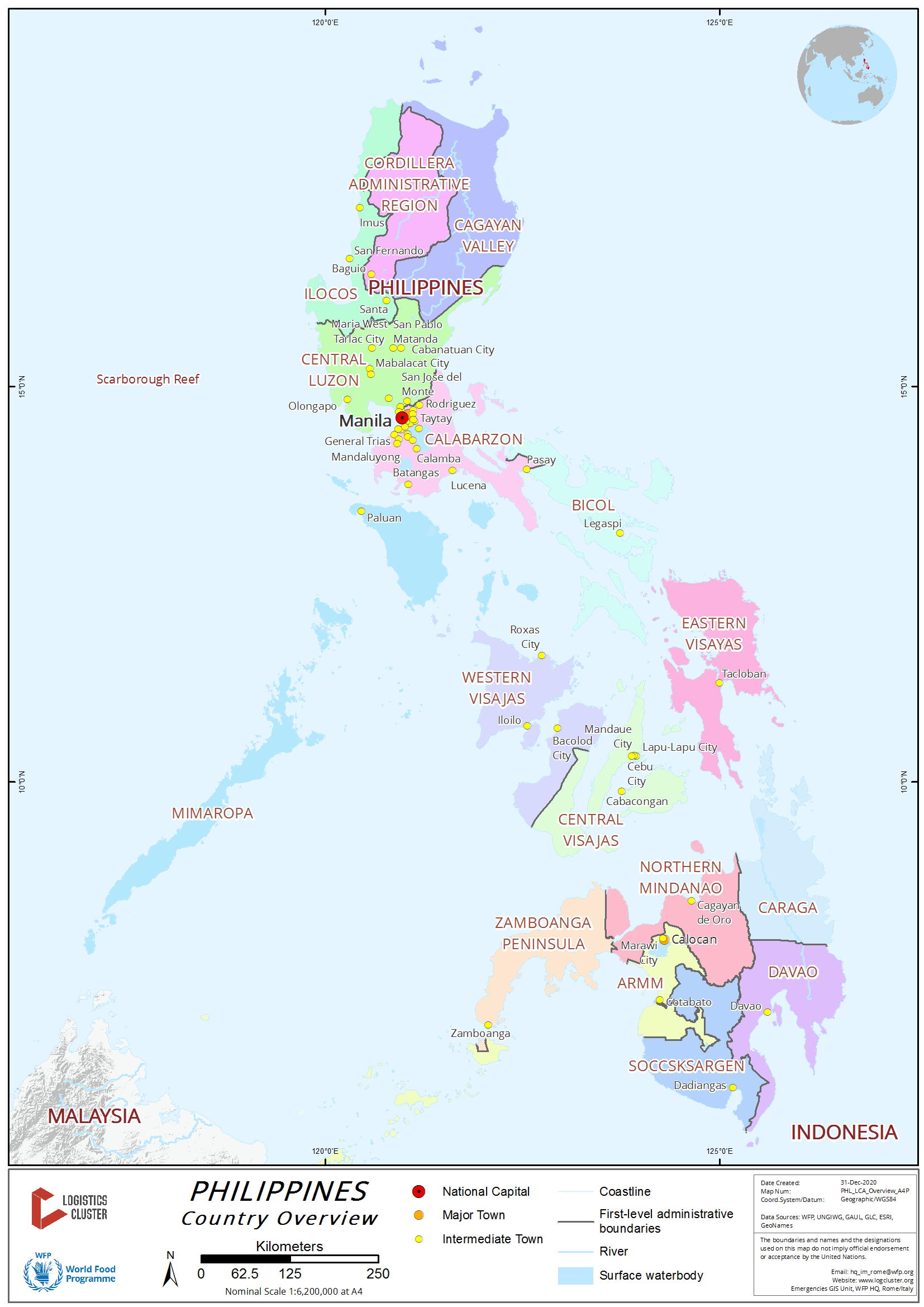
The following sections contain information on the logistics infrastructure of the Philippines.
2.1 Philippines Port Assessment

The following pages would show the port assessments in the Luzon, Visayas, and Mindanao regions.
2.1.1 Philippines - Luzon Port Assessment
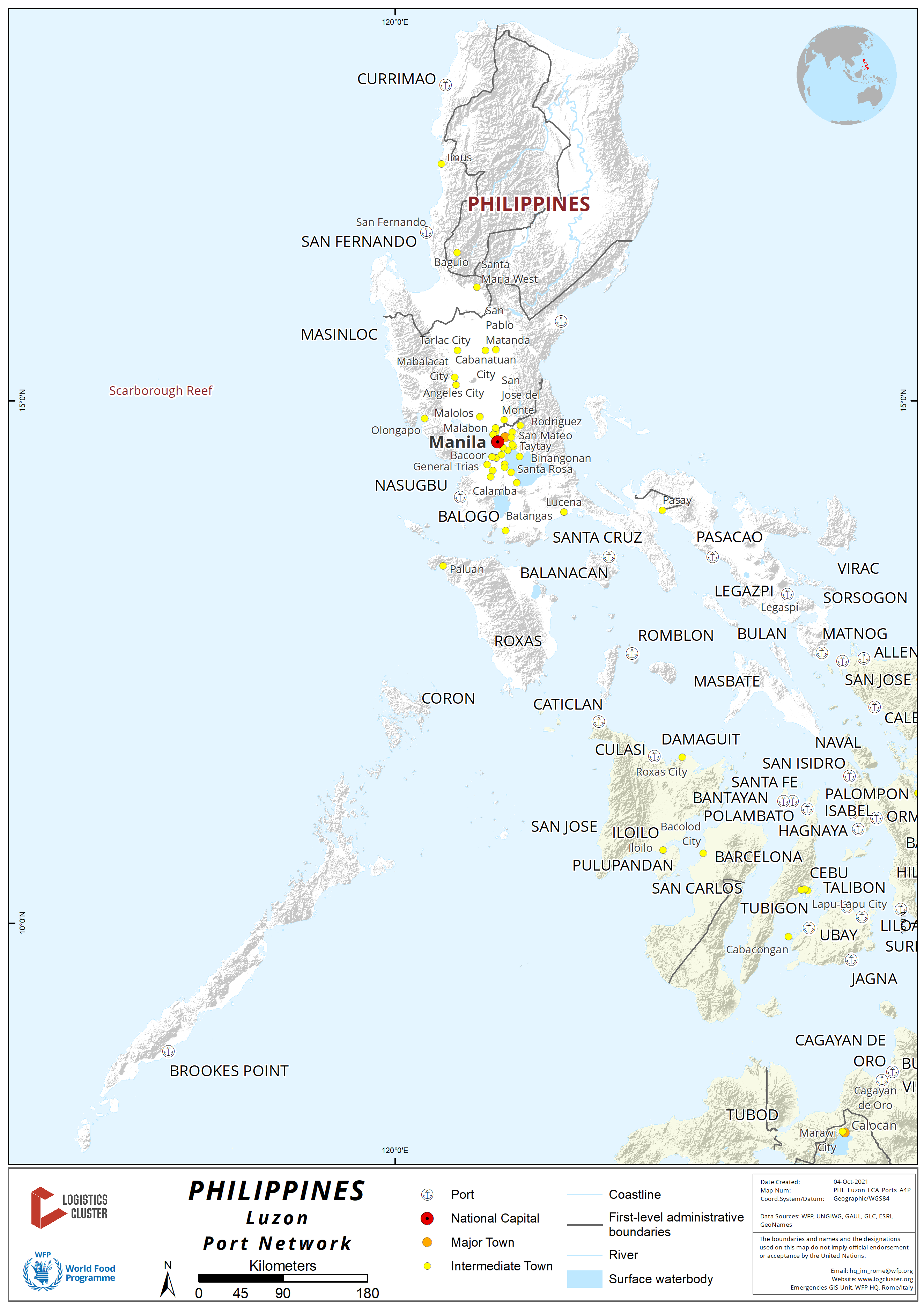
Key port information on several Philippine ports can be found at: Website of the Maritime Database on Ports of the Philippines
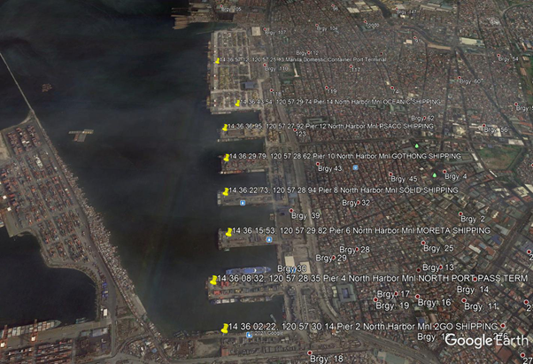
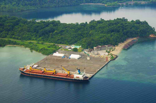
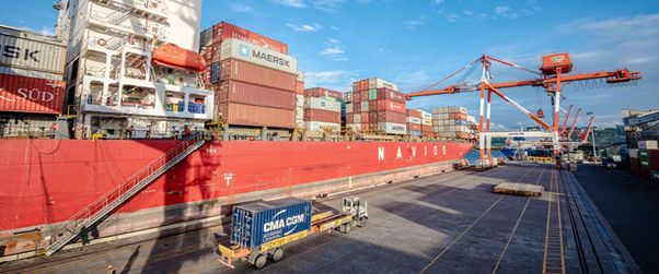
2.1.1.1 Philippines - Luzon Port of North Harbor
Manila Harbor, located at the east end of Manila Bay, consists of North Harbor and South Harbor, both of which are protected by breakwaters. The two harbors are separated by the Pasig River. The city of Manila, located on both sides of the Pasig River, is the principal port of the Philippines and a port of entry. The channel between the quarantine anchorage and the entrance to South Harbor is dredged to 11m. The north and south edges of the channel are defined by the light on the head of the west breakwater and the light on the northern head of the south breakwater, each in line with the Customs House.
Port website: ppa.gov.ph
Key port information may also be found at: http://www.maritime-database.com
|
Port Location and Contact |
|
|---|---|
|
Country |
Philippines |
|
Province or District |
National Capital Region |
|
Nearest Town or City with Distance from Port |
City of Manila (port is in the city) |
|
Port's Complete Name |
Port of Manila (North Harbor) |
|
Latitude |
14.615946 |
|
Longitude |
120.956828 |
|
Managing Company or Port Authority |
Philippine Ports Authority |
|
Management Contact Person |
Annie Lee F. Manese, Port Manager PMO NCR North +63 2 8245-2930 / 8245-2931 |
|
Nearest Airport and Airlines with Frequent International Arrivals/Departures |
Ninoy Aquino International Airport (NAIA) All Nippon Airways, Cathay Pacific Airways, Delta Air Lines, Emirates, Etihad Airways, KLM Royal Dutch Airlines, Qantas Airways, Qatar Airways, Singapore Airlines, Turkish Airlines, United Airlines; Cebu Pacific Air, PAL Express, Philippines AirAsia. |
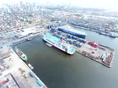
Port Picture
Description and Contacts of Key Companies
Philippine Ports Authority
Annie Lee F. Manese, Port Manager
PMO NCR North
+63 2 8245-2930 / 8245-2931
Bureau of Customs
Agnes M. Ramirez, Sub-Port Collector
+63 2 8245 3021
North Harbor Tugs Corp
Rm 105-A The Mercantile Insurance Building
General Luna cor Beaterio Street
Intramuros, Manila
https://www.northharbortugs.com/index.html
+63.922.889.9964 / +63.917.309.6559 / +63.2.526.6764
Manila North Harbor Port, Inc. (NORTHPORT)
MNHPI Corporate Office, Manila North Harbor,
Tondo, Manila 1012, Philippines
+63 2 588 9000 / 588-9011
For more information on port contacts, please see the following link: 4.4 Port and Waterways Companies Contact List.
Port Performance
|
Seasonal Constraints |
||
|---|---|---|
|
Occurs |
Time Frame |
|
|
Rainy Season |
Yes |
From August to December |
|
Major Import Campaigns |
None |
Domestic Cargoes Only |
|
Other Comments |
|
|
|
Handling Figures for 2020 |
|
|---|---|
|
Vessel Calls |
6,407 |
|
Container Traffic (TEUs) |
1,227,033 TEU |
|
Handling Figures Bulk and Break Bulk for 2020 |
|
|---|---|
|
Bulk (MT) |
3,892,609 MT |
|
Break bulk (MT) |
12,712,814 MT |
Discharge Rates and Terminal Handling Charges
For information on port rates and charges, please see the following link from the Philippine Ports Authority website:
Philippine Ports Authority website
Vessel: https://www.ppa.com.ph/?q=content/charges-vessel
Cargoes: https://www.ppa.com.ph/?q=content/charges-cargoes
Storage: https://www.ppa.com.ph/?q=content/charges-storage
Cargo Handling Tariff: Foreign / Domestic
Berthing Specifications
|
Type of Berth |
Quantity |
Length |
Maximum Draft |
Comments |
|---|---|---|---|---|
|
Conventional Berth |
19 |
220 m |
11 m |
RORO capable berth |
|
Container Berth |
1 |
665 m |
10 m |
|
|
Silo Berth |
None |
|
||
|
Berthing Tugs |
6 |
Operated by North Harbor Tugs Corp |
||
|
Water Barges |
Yes |
Operated by North Harbor Tugs Corp |
General Cargo Handling Berths
|
Cargo Type |
Berth Identification |
|---|---|
|
Imports - Bagged Cargo |
None Domestic Only |
|
Exports - Bagged Cargo |
None |
|
Imports and Exports - RoRo |
None |
|
Other Imports |
none |
Port Handling Equipment
The North Harbor Port is operated by Manila North Harbor Port Inc.
|
Equipment |
Available |
Total Quantity and Capacity Available |
Comments on Current Condition and Actual Usage |
|---|---|---|---|
|
Dockside Crane |
Yes |
||
|
Container Gantries |
Yes |
8 |
Crane Gantries |
|
Mobile Cranes |
Yes |
||
|
Reachstacker |
Yes |
||
|
RoRo Tugmaster (with Trailer) |
Yes |
||
|
Grain Elevator with Bagging Machines |
None |
Contractors |
|
|
Transtainer |
Yes |
Rubber Tire Gantries |
|
|
Forklifts |
Yes |
Container Facilities
Situated at the north end of the Manila North Harbor, the key facilities in this terminal are the berth space for ship to shore crane operation, container yard and Operations Center 1 building. The Operation Center 1 consolidates all shipping lines and the PPA satellite office to give our clients a comfortable and safe area to conveniently process transactions.
The container yard was rehabilitated to fit the growing volume of containerized cargo. Ship to shore cranes and rubber tired gantries are deployed for efficient vessel operation and cargo movement in the container yard. Weigh bridge and truck holding areas are also among the facilities that are within Terminal 1.
Customs Guidance
Agnes M. Ramirez, Sub-Port Collector
Sub-Port of North Harbor
+63 2 8245 3021
For more information on customs in the Philippines, please see the following link: 1.3 Customs Information.
Terminal Information
Multipurpose Terminal
The Port of Manila North Harbor covers about 52.5 hectares of land and contains about 5,2000 meters (17,000 feet) of quays with ten berths and eight quays that can accommodate a wide range of inter-island vessels. The quays contain 54 berthing areas, and there are areas for rolling cargoes at all piers.
|
Name
|
Length
|
Depth
|
Remarks
|
|---|---|---|---|
| Pier 2 N | 420 m | 6.0 m | Fast ferry, Ro-Ro/Lo-Lo, container, general cargo |
| Pier 4 N | 270 m | 10.0 m | Cruise, fast ferry, container, general cargo |
| Pier 4 S | 270 m | - | Cruise, Ro-Rax, container, breakbulk, general cargo |
| Pier 4 Head | 95 m | - | Container, transshipment, breakbulk, general cargo |
| Pier 6 N 2 | 10 m | - | Grain, container, breakbulk, general cargo |
| Pier 6 S | 210 m | - | Ro-Rax, general cargo |
| Pier 6 Head | 80 m | - | Grain, container, breakbulk, general cargo |
| Pier 8 N | 220 m | - | Container, transshipment, general cargo |
| Pier 8 S | 220 m | - | Container, transshipment, general cargo |
| Pier 8 Head | 80 m | - | Container, transshipment, general cargo |
| Pier 10 N | 220 m | - | Container, transshipment, general cargo |
| Pier 10 S | 220 m | - | Container, transshipment, breakbulk, general cargo |
| Pier 10 Head | 80 m | - | Ro-Ro/Lo-Lo, containers, general cargo |
| Pier 12 N | 220 m | - | Ro-Rax, Container, transshipments, general cargo |
| Pier 12 S | 220 m | - | Ro-Rax, Container, transshipments, general cargo |
| Pier 12 Head | 80 m | - | Ro-Rax, Container, transshipments, general cargo |
| Pier 14 N | 180 m | - | Container, transshipment, general cargo |
| Pier 14 S | - | - | Container, transshipment, general cargo |
| Pier 14 Head | - | - | Container, transshipment, general cargo |
| Pier 16 | 665 m | 10.0 m | Ro-Rax, container, breakbulk, general cargo |
| Pier 18 W | 315 m | - | Coal, Ro-Rax, general cargo |
| Pier 18 NE | 330 m | - | Ro-Rax, container, breakbulk, general cargo |
North Harbor
Grain and Bulk Handling
NFIs B/Bulk and Bulk cargo vessels will be berth at 5 locations at the Harbor Center Port Terminal.
North No. 4 — 11.5m Grain, Project/Heavy, Steel Products. LOA: 180m
North No. 5 — 10.5m Project/Heavy, Steel Products, Breakbulk. LOA: 180m
North No. 6 — 11.5m Grain, Sugar, Steel Products, Breakbulk. LOA: 180m
North No. 7 — 11.5m Project/Heavy, Steel Products, Breakbulk. LOA: 180m
North No. 8 — 10.5m Project/Heavy, Steel Products, Breakbulk. LOA: 180m
A new facility for grain discharging was built by another port services provider Asian Terminal Inc in Mariveles, Bataan. The terminal can cope with two ships at a time. Four unloaders have capacity for daily discharge of a minimum 10,000 metric tons of wheat, corn and free-flowing grains and 7,000 tons of soybean meal.
Main Storage Terminal
|
Storage Type |
Number of Storage Facilities |
Area (m2) |
|---|---|---|
|
Bagged Cargo |
None, containerized |
|
|
Refrigerated Cargo |
Yes, Container marshalling yard |
|
|
General Cargo |
Yes, Breakbulk open area in each pier |
Stevedoring
CONTAINER PORT HANDLING
Manila North Harbor Port, Inc. (NORTHPORT)
MNHPI Corporate Office, Manila North Harbor,
Tondo, Manila 1012, Philippines
+63 2 588 9000 | 588-9011
NorthPort services includes:
- Cargo handling Services
- Berth Management
- Ancillary (bunkering, watering, weighbridge operations)
- Passenger Terminal Management
Hinterland Information
Transporter representatives must present approved cargo withdrawals / payment of all dues and taxes before transporting cargoes out of the Port. All types of trucks with different capacities can access the port considering the NCR LGUs that allow truck to travel from 10PM – 5AM.
Max load capacity per type of trucks strictly enforced in NCR. For oversized load transporter must secure permit to travel from concerning govt agencies especially if using the NLEX / SLEX route.
Local containers can be withdraw depending of the services of the shipping lines Door to Door(DTD), Door to Pier(DTP) and or Pier to Pier(PTP). In a DTD shipping lines will cater all services from place of origin up to destination. In a DTP shipping lines will secure the cargo from client premises and withdrawal will be done by consignee at port of Destination. In a PTP, services will be done at Port of Entry and Port of Discharge only. Consignee will facilitate the cargo in bringing it to Port of Entry and facilitate also at Port of Discharge.
Port Security
PPA PMO Northern Luzon Port Police manage the deployment of local security services within the port premises. It has designated fire hydrant each wharf/pier. Fire engine boats can be deploy when necessary
|
Security |
|
|---|---|
|
ISPS Compliant |
Yes |
|
Current ISPS Level |
Level 1 |
|
Police Boats |
Coastguard/ PNP Maritime Command |
|
Fire Engines |
Yes |
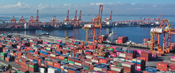
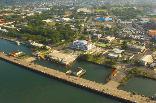
2.1.1.2 Philippines - Luzon Port of South Harbor
Port Overview
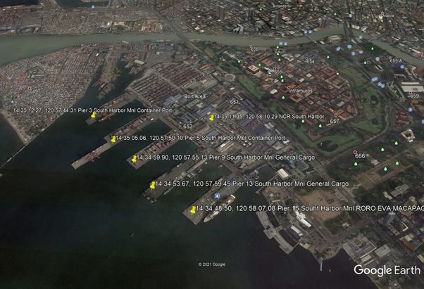
South Harbor is the part of Manila Harbor that has an area of about 145 acres encompassing five finger piers (numbered 3, 5, 9, 13, and 15 from N). They have a total berthing length of over 4331 m, providing docking. An additional 27 vessels can be accommodated at the anchorage. A barge point, capable of accommodating 30 barges or lighters, is also situated in the area a few meters across from Pier 3. 1.86 m and greater depths alongside the South Harbor berths have been reported. Mariners are advised to consult the port authorities for confirmation.
Port website: ppa.gov.ph
Key port information can also be found at: http://www.maritime-database.com
|
Port Location and Contact |
|
|---|---|
|
Country |
Philippines |
|
Province or District |
National Capital Region |
|
Nearest Town or City with Distance from Port |
Manila (Port is in city limits) |
|
Port's Complete Name |
Port of Manila (South Harbor) |
|
Latitude |
14.585956 |
|
Longitude |
120.968485 |
|
Managing Company or Port Authority |
Philippine Ports Authority (PPA) |
|
Management Contact Person |
Eligio P. Fortajada, Port Manager PMO NCR South +63 2 8527 4424 |
|
Nearest Airport and Airlines with Frequent International Arrivals/Departures |
Ninoy Aquino International Airport (NAIA) All Nippon Airways, Cathay Pacific Airways, Delta Air Lines, Emirates, Etihad Airways, KLM Royal Dutch Airlines, Qantas Airways, Qatar Airways, Singapore Airlines, Turkish Airlines, United Airlines; Cebu Pacific Air, PAL Express, Philippines AirAsia. |
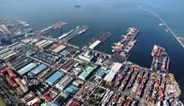
Port Picture
Description and Contacts of Key Companies
|
Agency / Company
|
Focal Person
|
Title
|
Address
|
Email
|
Phone Number
|
|---|---|---|---|---|---|
| Philippine Ports Authority | Eligio P. Fortajada | Port Manager | PMO NCR South | epfortajada@ppa.com.ph | +63 2 8527 4424 |
| Bureau of Customs | Noah M. Dimaporo | Sub-Port Collector | Sub-Port of Harbor Center | noah.dimaporo@customs.gov.ph | +63 2 8480 1729 |
| Asian Terminals Inc (Cargo Handler) |
1 Bonifacio Drive corner Pres. Sergio Osmeña Highway, Port Area, Manila |
+632 8 5286000 | |||
| Harbor Star Shipping Services Inc (Berthing Tug Services) | 2224, A. Bonifacio Street, Bangkal, Makati City, 1233 | info@harborstar.com.ph | +632) 8553-1502 / 8886-3703 |
For more information on port contacts, please see the following link: 4.3 Philippines Port and Waterways Company Contact List.
Port Performance
|
Seasonal Constraints |
||
|---|---|---|
|
Occurs |
Time Frame |
|
|
Rainy Season |
Yes |
From Aug to Dec |
|
Major Import Campaigns |
Yes |
From Oct to Dec |
|
Other Comments |
|
|
|
Handling Figures for 2020 |
|
|---|---|
|
Vessel Calls |
4,291 |
|
Container Traffic (TEUs) |
1,042,120 TEU |
|
Handling Figures Bulk and Break Bulk for 2020 |
|
|---|---|
|
Bulk (MT) |
881,257 MT |
|
Break bulk (MT) |
1,102,197 MT |
Discharge Rates and Terminal Handling Charges
For information on port rates and charges, please see the following link from the Philippine Ports Authority website: Philippine Ports Authority website
Vessel: https://www.ppa.com.ph/?q=content/charges-vessel
Cargoes: https://www.ppa.com.ph/?q=content/charges-cargoes
Storage: https://www.ppa.com.ph/?q=content/charges-storage
Cargo Handling Tariff: Foreign / Domestic
Berthing Specifications
|
Type of Berth |
Quantity |
Length |
Maximum Draft |
Comments |
|---|---|---|---|---|
|
Conventional Berth |
12 |
178 m |
11 m |
RORO capable berth |
|
Container Berth |
17 |
192 m |
12 m |
|
|
Silo Berth |
None |
|
||
|
Berthing Tugs |
12 |
Harbor Star Shipping Services Inc |
||
|
Water Barges |
Yes |
North Harbor Tugs |
Berthing Facilities - South Harbor International Container Terminal
| Pier | Berth No. | Length | Depth | Description |
|---|---|---|---|---|
| Pier 3 |
1 | 183 m | 1.0 m | Container, transshipment, reefer |
| 2 | 165 m | 8.8 m | Container, transshipment, reefer | |
| 3 | 375 m | 12.0 m | Container, transshipment, reefer | |
| 4 | 375 m | 12.0 m | Container, transshipment, reefer | |
| Pier 5 | 1 | 365 m | 7.6 m | Container, transshipment, reefer |
| 2 | 365 m | 9.5 m | Container, transshipment, reefer | |
| 3 | 255 m | 9.5 m | Container, transshipment, reefer | |
| 4 | 255 m | 11.3 m | Container, transshipment, reefer | |
| 5 | 51 m | 11.4 m | Container, transshipment, reefer | |
| 6 | 615 m | 12.0 m | Container, transshipment, reefer | |
| 7 | 615 m | 12.0 m | Container, transshipment, reefer | |
| 8 | 615 m | 12.0 m | Container, transshipment, reefer | |
| Pier 9 | 1 | 360 m | 10.0 m | Container, transshipment |
| 2 | 360 m | 10.0 m | Container, transshipment | |
| 3 | 103 m | 10.0 m | Container, transshipment | |
| 4 | 360 m | 10.0 m | Container, transshipment | |
| 5 | 360 m | 10.0 m | Container, transshipment | |
| Pier 13 | 1 | 127 m | 9.6 m | Ro-Ro/Lo-Lo, coastal |
| 2 | 127 m | 10.0 m | Ro-Ro/Lo-Lo, coastal | |
| 3 | 127 m | 6.7 m | Ro-Ro/Lo-Lo, coastal | |
| 4 | 82 m | 8.0 m | Ro-Ro/Lo-Lo, coastal | |
| 5 | 127 m | 10.9 m | Ro-Ro/Lo-Lo, coastal | |
| 6 | 127 m | 10.0 m | Ro-Ro/Lo-Lo, coastal | |
| 7 | 127 m | 7.9 m | Ro-Ro/Lo-Lo, coastal | |
| Pier 15 | 1 | 163 m | 11.5 m | Ro/pax, PCC, naval, general / bulk cargo |
| 2 | 163 m | 11.9 m | Cruise, Ro/pax, PCC, naval, general / bulk cargo | |
| 3 | 103 m | 8.8 m | Ro/pax, PCC, naval, general / bulk cargo | |
| 4 | 178 m | 10.1 m | Ro/pax, PCC, naval, general / bulk cargo | |
| 5 | 148 m | 8.5 m | Cruise, Ro/pax, PCC, naval, general / bulk cargo |
General Cargo Handling Berths
|
Cargo Type |
Berth Identification |
|---|---|
|
Imports - Bagged Cargo |
None |
|
Exports - Bagged Cargo |
None |
|
Imports and Exports - RoRo |
Yes, Pier 13 |
|
Other Imports |
Yes, Pier 15 |
Port Handling Equipment
Asian Terminals Inc is the port handler for Manila South Harbor.
|
Equipment |
Available |
Total Quantity and Capacity Available |
Comments on Current Condition and Actual Usage |
|---|---|---|---|
|
Dockside Crane |
Yes |
||
|
Container Gantries |
Yes |
9 |
Crane Gantries |
|
Mobile Cranes |
Yes |
23 |
|
|
Reachstacker |
Yes |
||
|
RoRo Tugmaster (with Trailer) |
Yes |
||
|
Grain Elevator with Bagging Machines |
None |
Contractors |
|
|
Transtainer |
Yes |
Rubber Tire Gantries |
|
|
Forklifts |
Yes |
|
Container Facilities
Container facilities are operated by the Asian Terminals Inc Container Terminal Division (South Harbor). ATI’s Container Terminal Division (CTD) is among the country’s major international trade gateways. CTD provides 24/7 arrastre and stevedoring services to international shipping lines along Piers 3 and 5 which have 5 working berths with draft of 12 meters. There are 9 ship-to-shore cranes, 23 modern rubber-tired gantries (RTGs), internal transfer vehicles and dedicated areas for reefer and dangerous cargoes and support facilities for stripping and stuffing, container freight services, x-ray examination and truck marshaling.
South Harbor’s multiple access gates are equipped with weighbridges and supported by automated truck queuing and call-up systems. The gates are installed with radiation detection portals for cargo security. Additional container yards are being developed within Manila South Harbor Expanded Port Zone, while deployment of new equipment and continuous systems upgrades are underway.
https://www.asianterminals.com.ph/ati_containerterminal.aspx
Berths: 5
Depth: 12m
Quay Cranes: 9
RTGs: 23
Others Equipment: Side loaders, Reach Stackers, Internal Transfer Vehicles, Forklifts
Reefer Outlets: 260
Truck slots: 250
|
Facilities |
20 and 40 ft |
|---|---|
|
Container Facilities Available |
Yes |
|
Container Freight Station (CFS) |
Yes |
|
Refrigerated Container Stations |
Yes |
|
Other Capacity Details |
|
|
Daily Take Off Capacity |
|
|
Number of Reefer Stations |
260 |
|
Emergency Take-off Capacity |
|
|
Off take Capacity of Gang Shift |
Customs Guidance
Noah M. Dimaporo, Sub-Port Collector
Sub-Port of Harbor Center
+63 2 8480 1729
For more information on customs in the Philippines, please see the following link: 1.3 Customs Information.
Terminal Information
Multipurpose Terminal
The multipurpose terminal is operated by Asian Terminals Inc (ATI) - General Cargo Division (South Harbor).
Berths: 4
Depth: 10.5 m
Warehouses: 2
Forklifts: 3 to 32 tons
- ATI’s Manila South Harbor is a comprehensive international seaport providing full-range of port services.
- South Harbor’s General Stevedoring Division (GSD) can simultaneously accommodate various ships from foreign cruise vessels, to sensitive military ships on goodwill visits, to international sea freighters that deliver conventional cargoes and oversized shipment for the country’s major industries.
https://www.asianterminals.com.ph/ati_generalstevedoring.aspx
Grain and Bulk Handling
Asian Terminals Inc built a new facility located at Mariveles, Bataan which handles grains and bulk shipment.
https://www.joc.com/maritime-news/philippines-mariveles-port-eases-manilas-grain-load_19960226.html
Main Storage Terminal
|
Storage Type |
Number of Storage Facilities |
Area (m2) |
|---|---|---|
|
Bagged Cargo |
Yes, 2 warehouses at Pier 15 |
|
|
Refrigerated Cargo |
Yes, at the container marshalling yard |
|
|
General Cargo |
Yes, 2 warehouses at Pier 15 |
Stevedoring
Stevedoring services are provided by:
Asian Terminals Inc (Cargo Handler)
Head Office: Manila South Harbor, 1 Bonifacio Drive
Port Area, Manila
Trunkline: +632 8 5286000
Hinterland Information
Transporter representatives must present approved cargo withdrawals / payment of all dues and taxes before transporting cargoes out of the Port. All types of trucks with different capacities can access the port considering the NCR LGUs that allow truck to travel from 10PM – 5AM.
Max load capacity per type of trucks strictly enforced in NCR. For oversized load transporter must secure permit to travel from concerning govt agencies especially if using the NLEX / SLEX route.
Local containers can be withdraw depending of the services of the shipping lines Door to Door(DTD), Door to Pier(DTP) and or Pier to Pier(PTP). In a DTD shipping lines will cater all services from place of origin up to destination. In a DTP shipping lines will secure the cargo from client premises and withdrawal will be done by consignee at port of Destination. In a PTP, services will be done at Port of Entry and Port of Discharge only. Consignee will facilitate the cargo in bringing it to Port of Entry and facilitate also at Port of Discharge.
Port Security
PPA PMO Northern Luzon Port Police manage the deployment of local security services within the port premises. It has designated fire hydrant each wharf/pier. Fire engine boats can be deploy when necessary.
|
Security |
|
|---|---|
|
ISPS Compliant |
Yes |
|
Current ISPS Level |
Level 1 |
|
Police Boats |
Coast Guard/ PNP Maritime Command |
|
Fire Engines |
Yes |
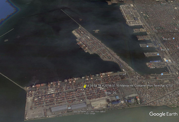
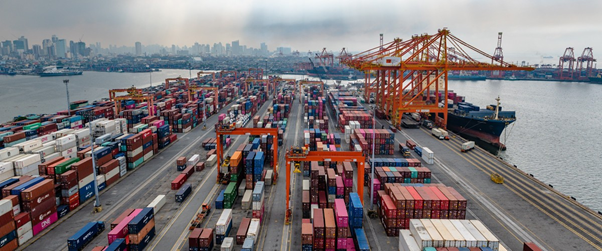
2.1.1.3 Philippines - Luzon Port of Manila International Container Terminal (MICT)
Port Overview
The MICT is situated between the North and the South Harbors in the Port of Manila, protruding westward into the Manila Bay at the mouth of the Pasig River–the city’s major waterway. In 1988, International Container Terminal Services, Inc. (ICTSI) won the 25 + 25 years concession to operate the Manila International Container Terminal (MICT) in an international tender.
Port website: https://www.mict.com.ph/
Key port information may also be found at: http://www.maritime-database.com
|
Port Location and Contact |
|
|---|---|
|
Country |
Philippines |
|
Province or District |
National Capital Region |
|
Nearest Town or City with Distance from Port |
Manila (Port is in city limits) |
|
Port's Complete Name |
Manila Int’l Container Terminal |
|
Latitude |
14.600031 |
|
Longitude |
120.953319 |
|
Managing Company or Port Authority |
Int’l Container Terminal Services, Inc (ICTSI) |
|
Management Contact Person |
MICT South Access Road, Port of Manila, 1012 Manila, Philippines Customer Service Group: customercare@ictsi.com MICT Trunk Line: +63 (2) 8245-4101 extensions 8267, 8269, 8298 |
|
Nearest Airport and Airlines with Frequent International Arrivals/Departures |
Ninoy Aquino International Airport (NAIA) All Nippon Airways, Cathay Pacific Airways, Delta Air Lines, Emirates, Etihad Airways, KLM Royal Dutch Airlines, Qantas Airways, Qatar Airways, Singapore Airlines, Turkish Airlines, United Airlines; Cebu Pacific Air, PAL Express, Philippines AirAsia. |
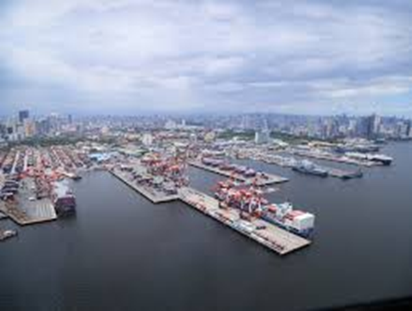
Port Picture
Description and Contacts of Key Companies
| Agency / Company | Description | Focal Person | Address | Phone Number | Email Address |
|---|---|---|---|---|---|
| Bureau of Customs |
Romeo Allan R. Rosales, Acting District Collector |
Manila International Container Port | +63 2 8245 5796 local 2402 | romeoallan.rosales@yahoo.com | |
| Int’l Container Terminal Services Inc | Port Operator / Cargo Handler | MICT South Access Road, 1012 Manila | +63 2 8245 1010 | customercare@ictsi.com | |
| Harbor Star Shipping Services, Inc. | Berthing tugs service |
2224 A. Bonifacio Street corner Pres. Sergio Osmeña Highway, Bangkal, Makati City, 1233 |
+63 2 8553-1502 / 8886-3703 | info@harborstar.com.ph |
For more information on port contacts, please see the following link: 4.4 Port and Waterways Companies Contact List.
Port Performance
|
Seasonal Constraints |
||
|---|---|---|
|
Occurs |
Time Frame |
|
|
Rainy Season |
Yes |
From August to December |
|
Major Import Campaigns |
Yes |
From October to December |
|
Other Comments |
|
|
|
Handling Figures for 2020 |
|
|---|---|
|
Vessel Calls |
1,410 |
|
Container Traffic (TEUs) |
2,088,821 TEU |
|
Handling Figures Bulk and Break Bulk for 2020 |
|
|---|---|
|
Bulk (MT) |
0.00 MT |
|
Break bulk (MT) |
20,327,702 MT |
Discharge Rates and Terminal Handling Charges
Please see the following links:
- https://cdnweb.mict.com.ph/s3fs-public/inline-files/ppa-omc-02-2018-cargo-handling-tariff-table_1.pdf
- https://cdnweb.mict.com.ph/s3fs-public/inline-files/ppa-ao-02-1989-dangerous-cargo.pdf
- https://cdnweb.mict.com.ph/s3fs-public/inline-files/ppa-mc-10-2013-storage-charges-for-containerized-cargo.pdf
- https://cdnweb.mict.com.ph/s3fs-public/inline-files/ppa-mc-13-2014-clarifications-on-storage-charges.pdf
Berthing Specifications
|
Type of Berth |
Quantity |
Length |
Maximum Draft |
Comments |
|---|---|---|---|---|
|
Conventional Berth |
None |
|
|
|
|
Container Berth |
6 |
5-250m 1-450m |
11m |
5- LOA 200 m 1 - 85000DWT |
|
Silo Berth |
None |
|
||
|
Berthing Tugs |
12 |
Harbor Star Shipping Services Inc |
||
|
Water Barges |
Yes |
North Harbor Tugs |
General Cargo Handling Berths
|
Cargo Type |
Berth Identification |
|---|---|
|
Imports - Bagged Cargo |
None |
|
Exports - Bagged Cargo |
None |
|
Imports and Exports - RoRo |
None |
|
Other Imports |
Containerized |
Port Handling Equipment
International Container Terminal Services Inc (ICTSI) is the port handler for MICT.
|
Equipment |
Available |
Total Quantity and Capacity Available |
Comments on Current Condition and Actual Usage |
|---|---|---|---|
|
Dockside Crane |
Yes |
||
|
Container Gantries |
Yes |
||
|
Mobile Cranes |
Yes |
||
|
Reachstacker |
Yes |
||
|
RoRo Tugmaster (with Trailer) |
Yes |
||
|
Grain Elevator with Bagging Machines |
None |
Contractors |
|
|
Transtainer |
Yes |
Rubber Tire Gantries |
|
|
Forklifts |
Yes |
Container Facilities
|
Facilities |
20 ft and 40 ft |
|---|---|
|
Container Facilities Available |
Yes both 50-ha |
|
Container Freight Station (CFS) |
Yes both 2.88-ha |
|
Refrigerated Container Stations |
Yes both |
|
Other Capacity Details |
|
|
Daily Take Off Capacity |
|
|
Number of Reefer Stations |
Yes |
|
Emergency Take-off Capacity |
|
|
Off take Capacity of Gang Shift |
Customs Guidance
CD2B, Manila International Container Port
Romeo Allan R. Rosales, Acting District Collector
https://customs.gov.ph/directory/
romeoallan.rosales@customs.gov.ph
+632 8245 2796 Loc. 2402
For more information on customs in the Philippines, please see the following link: 1.3 Customs Information.
Terminal Information
Multipurpose Terminal
The port is designed for container berthing. No warehouses for break/bulk storage facilities.
| Infrastructure | Description |
|---|---|
| Terminal Area | 94.8 hectares |
| Annual Capacity | 3.3 million TEUs |
| Container Yard | 50 hectares |
| Container freight station | 2.88 hectares |
| Berth length | 1,700 m |
| Berthing positions | 7 |
| Berth Depth (alongside) | 13.5 m |
| Reefer Stack | 1,534 |
| Automated Entry Gates | 7 lanes |
| Weighbridge | 9 |
| Truck holding area | 4 hectares |
Grain and Bulk Handling
There is no grain and bulk handling equipment in the port. ATI-Asian Terminals Inc has new grain discharging facilities in Mariveles, Bataan.
Main Storage Terminal
| Storage Type | Number of Storage Facilities | Area |
|---|---|---|
| Bagged Cargo | None | |
| Refrigerated Cargo | Yes, at the container marshalling yard | |
| General Cargo | Yes, containerized. |
Stevedoring
MICT has no stevedore as the port only handles containers.
Hinterland Information
WFP has short listed transporters which caters from Manila to anywhere in the Philippines.
Port Security
MICT/ICTSI manages the deployment of local security services within the port premises. It has designated fire hydrants for each wharf/pier. Fire engine boats can be deployed when necessary.
|
Security |
|
|---|---|
|
ISPS Compliant |
Yes |
|
Current ISPS Level |
Level 1 |
|
Police Boats |
Coastguard/ PNP Maritime Command |
|
Fire Engines |
Yes |
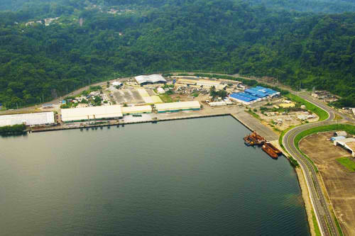
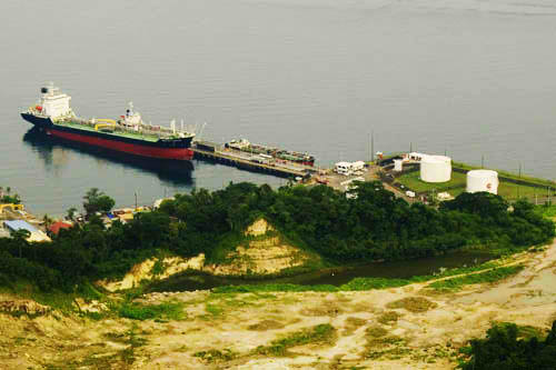
2.1.1.4 Philippines - Luzon Port of Curimao
Port Overview
The Port of Curimao is located in the province of Ilocos Norte, in Region I. It is located at the northwest coast of Luzon Island, at Gaang Bay,26 km from Laoag City, 512 km from the Port of Manila, and 488 km from the Subic Freeport. Cargoes handled are fertilizers, feldspar, petroleum products, and cement.
Port website: ppa.gov.ph
Key port information may also be found at: http://www.maritime-database.com
|
Port Location and Contact |
|
|---|---|
|
Country |
Philippines |
|
Province or District |
Ilocos Norte |
|
Nearest Town or City with Distance from Port |
Curimao (7km) |
|
Port's Complete Name |
Port of Curimao |
|
Latitude |
17.986976 |
|
Longitude |
120.489059 |
|
Managing Company or Port Authority |
Philippine Ports Authority |
|
Management Contact Person |
Marieta G. Odicta, Port Manager PMO Northern Luzon (072) 607-4607 |
|
Nearest Airport and Airlines with Frequent International Arrivals/Departures |
Laoag International Airport (Temporary unavailable due to Covid-19 restrictions) Clark International Airport Tiger Air/Singapore Air, Qatar Airways, Emirates, Jetstar, Philippine Airlines, Cebu Pacific |
Port Picture
26kms from Laoag City, Ilocos Norte
Description and Contacts of Key Companies
Marieta G. Odicta
Port Manager, PMO Northern Luzon
(072) 607-4607
Arienito M. Claveria
Acting District Collector, CD15, Port of APARRI / Sub-Port of Currimao
arienitoantonio.claveria@customs.gov.ph
(078) 888-0721
For more information on port contacts, please see the following link: 4.4 Port and Waterways Companies Contact List.
Port Performance
|
Seasonal Constraints |
||
|---|---|---|
|
Occurs |
Time Frame |
|
|
Rainy Season |
Yes |
From August to December |
|
Major Import Campaigns |
Yes |
From August to December |
|
Other Comments |
Port operations are interrupted during typhoon. |
|
|
Handling Figures for 2020 |
|
|---|---|
|
Vessel Calls |
20 |
|
Container Traffic (TEUs) |
1 |
|
Handling Figures Bulk and Break Bulk for 2020 |
|
|---|---|
|
Bulk (MT) |
65,432 MT |
|
Break bulk (MT) |
0.00 |
Discharge Rates and Terminal Handling Charges
For information on port rates and charges, please see the following links:
Vessel: https://www.ppa.com.ph/?q=content/charges-vessel
Cargoes: https://www.ppa.com.ph/?q=content/charges-cargoes
Storage: https://www.ppa.com.ph/?q=content/charges-storage
Berthing Specifications
|
Type of Berth |
Quantity |
Length |
Maximum Draft |
Comments |
|---|---|---|---|---|
|
Conventional Berth |
3 |
320 m |
7 m |
|
|
Container Berth |
None |
|
||
|
Silo Berth |
None |
|
||
|
Berthing Tugs |
N/A |
|
||
|
Water Barges |
N/A |
|
General Cargo Handling Berths
|
Cargo Type |
Berth Identification |
|---|---|
|
Imports - Bagged Cargo |
None |
|
Exports - Bagged Cargo |
None |
|
Imports and Exports - RoRo |
None |
|
Other Imports |
none |
Port Handling Equipment
The Port of Curimao has no equipment for container loading and offloading.
Container Facilities
The Port of Curimao has no container facilities.
Customs Guidance
The Port of Curimao is under the Customs District Office of Aparri, Cagayan.
https://customs.gov.ph/directory/
For more information on customs in the Philippines, please see the following link: 1.3 Customs Information.
Terminal Information
Multipurpose Terminal
Terminal and Admin building area is 8600 sqm2.
Grain and Bulk Handling
The port has an open storage area (3300 m2). There are no grain and bulk handling equipment.
Main Storage Terminal
|
Storage Type |
Number of Storage Facilities |
Area (m2) |
|---|---|---|
|
Bagged Cargo |
None |
|
|
Refrigerated Cargo |
None |
|
|
General Cargo |
Open area |
3300 m2 |
Stevedoring
Stevedoring is handled by the PPA PMO Northern Luzon office.
Hinterland Information
JPC TRUCKING / Laoag City / +63 077 770 3910
WWBM TRUCKING SERVICE / Laoag City / +63 077 770 3910
JUNE’S TRUCKING SERVICES / Laoag City / +63 916 257 6957 / +63 02 8775 7942
DBA TRUCKING / Laoag City / +63 975 800 2452
Port Security
PPA PMO Northern Luzon Port Police manages the deployment of local security services within the port premises.
|
Security |
|
|---|---|
|
ISPS Compliant |
Yes |
|
Current ISPS Level |
Level 1 |
|
Police Boats |
Coast Guard |
|
Fire Engines |
LGU fire trucks |
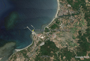
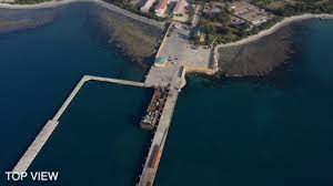
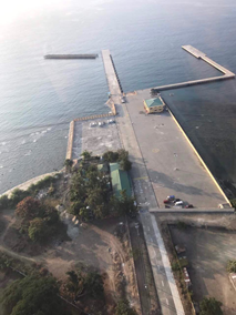
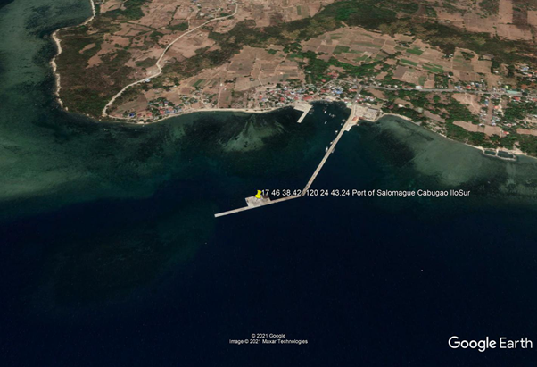
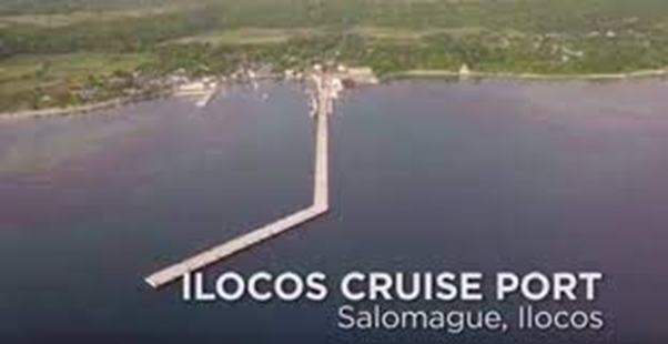
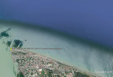
2.1.1.5 Philippines - Luzon Port of Salomague
Port Overview
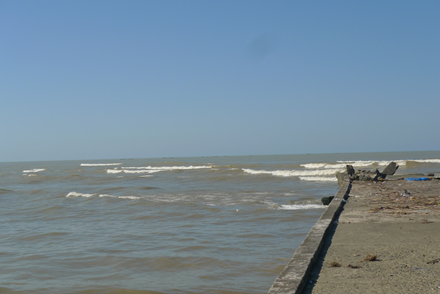
The Port of Salomague is located at Cabugao, Ilocos Sur. It is a North Luzon tourism port destination of cruise liners. The Port of Salomague stands at the head of the north cove. A concrete pier, with a depth of 4.9m at its head, also lies in the north cove. There is a stranded wreck on the west side of the pier. The ruins of an old stone church lie near the foot of the pier 1.26. The approach to the pier is foul and the pier is not fully operational; however, it is used by vessels seeking shelter from typhoons.
Port website: ppa.gov.ph
Key port information may also be found at: http://www.maritime-database.com
|
Port Location and Contact |
|
|---|---|
|
Country |
Philippines |
|
Province or District |
Ilocos Sur |
|
Nearest Town or City with Distance from Port |
Cabugao |
|
Port's Complete Name |
Port of Salomague |
|
Latitude |
17.780787 |
|
Longitude |
120.415189 |
|
Managing Company or Port Authority |
Philippine Ports Authority |
|
Management Contact Person |
Marieta G. Odicta Port Manager, PMO Northern Luzon (072) 607-4607 |
|
Nearest Airport and Airlines with Frequent International Arrivals/Departures |
Clark International Airport Tiger Air/Singapore Air, Qatar Airways, Emirates, Jetstar, Philippine Airlines, Cebu Pacific |
Port Picture
Description and Contacts of Key Companies
Marieta G. Odicta
Port Manager
PMO Northern Luzon
(072) 607-4607
Atty. Halleck A. Valdez
Acting Sub-Port Collector, Sub-Port of Salomague
(072) 607- 9066 (072) 888-7434 09172741017
For more information on port contacts, please see the following link: 4.4 Port and Waterways Companies Contact List.
Port Performance
|
Seasonal Constraints |
||
|---|---|---|
|
Occurs |
Time Frame |
|
|
Rainy Season |
Yes |
From August to December |
|
Major Import Campaigns |
No |
|
|
Other Comments |
Interruptions of port operations during typhoons. |
|
|
Handling Figures for 2020 |
|
|---|---|
|
Vessel Calls |
2 |
|
Container Traffic (TEUs) |
0 |
|
Handling Figures Bulk and Break Bulk for 2020 |
|
|---|---|
|
Bulk (MT) |
1,822 MT – anchorage |
|
Break bulk (MT) |
N/A |
Discharge Rates and Terminal Handling Charges
For information on port rates and charges, please see the following links:
Vessel: https://www.ppa.com.ph/?q=content/charges-vessel
Cargoes: https://www.ppa.com.ph/?q=content/charges-cargoes
Storage: https://www.ppa.com.ph/?q=content/charges-storage
Berthing Specifications
|
Type of Berth |
Quantity |
Length |
Maximum Draft |
Comments |
|---|---|---|---|---|
|
Conventional Berth |
2 |
234 m |
6m - cargo 15m - anchorage |
|
|
Container Berth |
None |
|
||
|
Silo Berth |
None |
|
||
|
Berthing Tugs |
None |
|
||
|
Water Barges |
None |
|
General Cargo Handling Berths
|
Cargo Type |
Berth Identification |
|---|---|
|
Imports - Bagged Cargo |
None |
|
Exports - Bagged Cargo |
None |
|
Imports and Exports - RoRo |
None |
|
Other Imports |
None |
Port Handling Equipment
The Port of Salomague has no equipment for container loading and offloading.
Container Facilities
The Port of Salomague has no container facilities.
Customs Guidance
Port of Sual Customs Officer:
Atty. Halleck A. Valdez, Acting Sub-Port Collector
Sub-Port of Sual
For more information on customs in the Philippines, please see the following link: 1.3 Customs Information.
Terminal Information
Multipurpose Terminal
The TMO Admin building area is 4158 sqm2 . The wharf area is 500 m long.
Grain and Bulk Handling
No grain and bulk handling equipment
Main Storage Terminal
|
Storage Type |
Number of Storage Facilities |
Area (m2) |
|---|---|---|
|
Bagged Cargo |
None |
|
|
Refrigerated Cargo |
None |
|
|
General Cargo |
1 |
1600 m2 |
Stevedoring
PPA PMO Port of Salamague handles the stevedoring at the port.
Hinterland Information
Transporters in Vigan, Ilocos Sur
- ABest Express / Lyric Bldg, Alcantara St., Santa Elena Village / +63 926 367 9579
- JRCJ Trucking / San Vicente, Ilocos Sur / +63 917 316 4439
- Ricks Trucking / Vigan / 17.5702714, 120.384532
Port Security
PPA PMO Northern Luzon Port Police manage the deployment of local security services within the port premises.
|
Security |
|
|---|---|
|
ISPS Compliant |
Yes |
|
Current ISPS Level |
Level 1 |
|
Police Boats |
Coast Guard |
|
Fire Engines |
LGU Fire trucks |
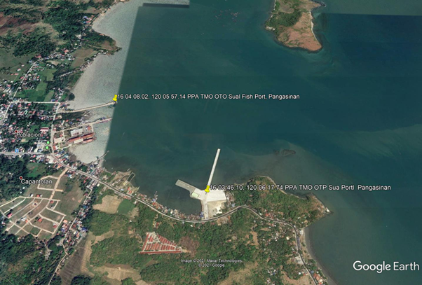
2.1.6 Philippines - Luzon Port of Sual
Port Overview
The Port of Sual serves as both commercial and fishing port.A new port was constructed by PPA to cater and boast commercial shipping lanes within Pangasinan and nearby provinces.
Port website: ppa.gov.ph
Key port information may also be found at: http://www.maritime-database.com
|
Port Location and Contact |
|
|---|---|
|
Country |
Philippines |
|
Province or District |
Pangasinan |
|
Nearest Town or City with Distance from Port |
Sual (0 km) |
|
Port's Complete Name |
Port of Sual |
|
Latitude |
16.067109 |
|
Longitude |
120.097749 |
|
Managing Company or Port Authority |
Philippine Port Authority |
|
Management Contact Person |
Marieta G. Odicta Port Manager, PMO Northern Luzon (072) 607-4607 |
|
Nearest Airport and Airlines with Frequent International Arrivals/Departures |
Clark International Airport Tiger Air/Singapore Air, Qatar Airways, Emirates, Jetstar, Philippine Airlines, Cebu Pacific |
Port Picture
Description and Contacts of Key Companies
Marieta G. Odicta
Port Manager, PMO Northern Luzon
(072) 607-4607
Arienito M. Claveria
Acting District Collector, CD15, Port of APARRI / Sub-Port of Currimao
arienitoantonio.claveria@customs.gov.ph
(078) 888-0721
For more information on port contacts, please see the following link: 4.4 Port and Waterways Companies Contact List.
Port Performance
|
Seasonal Constraints |
||
|---|---|---|
|
Occurs |
Time Frame |
|
|
Rainy Season |
Yes |
From August to December |
|
Major Import Campaigns |
No |
|
|
Other Comments |
Interruptions of port operations during typhoons. |
|
|
Handling Figures for 2020 |
|
|---|---|
|
Vessel Calls |
14 |
|
Container Traffic (TEUs) |
0 |
|
Handling Figures Bulk and Break Bulk for 2020 |
|
|---|---|
|
Bulk (MT) |
4,838 MT |
|
Break bulk (MT) |
0.00 MT |
Discharge Rates and Terminal Handling Charges
Vessel: https://www.ppa.com.ph/?q=content/charges-vessel
Cargoes: https://www.ppa.com.ph/?q=content/charges-cargoes
Storage: https://www.ppa.com.ph/?q=content/charges-storage
Berthing Specifications
|
Type of Berth |
Quantity |
Length |
Maximum Draft |
Comments |
|---|---|---|---|---|
|
Conventional Berth |
2 |
57 m |
13 m |
|
|
Container Berth |
None |
|
||
|
Silo Berth |
None |
|
||
|
Berthing Tugs |
None |
|||
|
Water Barges |
None |
General Cargo Handling Berths
|
Cargo Type |
Berth Identification |
|---|---|
|
Imports - Bagged Cargo |
None |
|
Exports - Bagged Cargo |
None |
|
Imports and Exports - RoRo |
None |
|
Other Imports |
Coal |
Port Handling Equipment
The Port of Sual has no equipment for container loading and offloading.
|
Equipment |
Available |
Total Quantity and Capacity Available |
Comments on Current Condition and Actual Usage |
|---|---|---|---|
|
Dockside Crane |
None |
||
|
Container Gantries |
None |
||
|
Mobile Cranes |
Yes |
1 |
|
|
Reachstacker |
None |
||
|
RoRo Tugmaster (with Trailer) |
None |
||
|
Grain Elevator with Bagging Machines |
None |
||
|
Transtainer |
None |
||
|
Forklifts |
Yes |
|
Container Facilities
The Port of Sual has no container facilities. However new port plan will handle container vessels.
Customs Guidance
Atty. Halleck A. Valdez
Port of Sual Customs Officer, Sub-Port of Sual
Acting Sub-Port Collector
Terminal Information
Multipurpose Terminal
The TMO Admin building area is 144 sqm2. Wharf area is 252 m in length.
Grain and Bulk Handling
No grain and bulk handling equipment in the Port of Sual.
Stevedoring
Contact PPA PMO Port of Sual for stevedoring.
Hinterland Information
Available Transporter in Lingayen Pangasinan:
- DANUCO Movers Trucking Services / 360 Bay North / +63 917 579 1015
- Rafanan Trucking Service / Dagupan, Pangasinan / +63 075 522 8299
- Dagupan Freight Services / 523 Tebeng Road / +63 075 515 8628
Port Security
The PPA PMO Northern Luzon Port Police manages the deployment of local security services within the port premises.
|
Security |
|
|---|---|
|
ISPS Compliant |
Yes |
|
Current ISPS Level |
Level 1 |
|
Police Boats |
Coast Guard |
|
Fire Engines |
LGU Fire trucks |
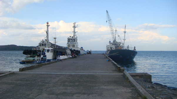
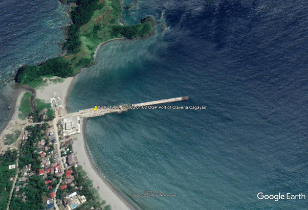
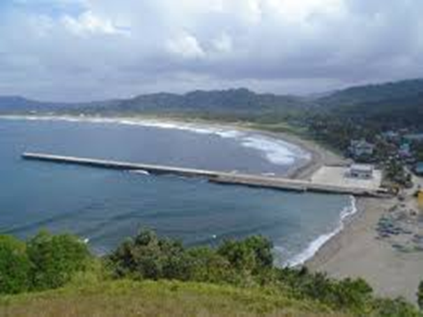
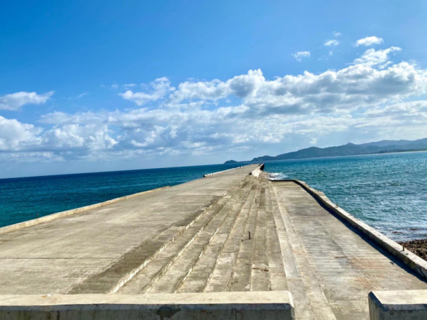
2.1.7 Philippines - Luzon Port of Claveria
Port Overview
The Port of Claveria is located in Claveria, in the province of Cagayan. It was rehabilitated as of February 2020. Reinforced concrete platforms were added to serve as additional back up area, and additional RORO ramps were built, and the causeway was restored.
Port website: ppa.gov.ph
Key port information may also be found at: http://www.maritime-database.com
|
Port Location and Contact |
|
|---|---|
|
Country |
Philippines |
|
Province or District |
Cagayan |
|
Nearest Town or City with Distance from Port |
Claveria (within city limits) |
|
Port's Complete Name |
Port of Claveria |
|
Latitude |
18.612431 |
|
Longitude |
121.049885 |
|
Managing Company or Port Authority |
Philippine Ports Authority |
|
Management Contact Person |
Marieta G. Odicta Port Manager, PMO Northern Luzon (072) 607-4607 |
|
Nearest Airport and Airlines with Frequent International Arrivals/Departures |
Clark International Airport Tiger Air/Singapore Air, Qatar Airways, Emirates, Jetstar, Philippine Airlines, Cebu Pacific |
Port Picture
Description and Contacts of Key Companies
Marieta G. Odicta
Port Manager, PMO Northern Luzon
(072) 607-4607
Atty. Halleck A. Valdez
Acting Sub-Port Collector, Sub-Port of Salomague
(072) 607- 9066 (072) 888-7434 09172741017
For more information on port contacts, please see the following link: 4.4 Port and Waterways Companies Contact List.
Port Performance
|
Seasonal Constraints |
||
|---|---|---|
|
Occurs |
Time Frame |
|
|
Rainy Season |
Yes |
From August to December |
|
Major Import Campaigns |
N/A |
|
|
Other Comments |
Interruptions of port operations during typhoons. |
|
Discharge Rates and Terminal Handling Charges
Vessel: https://www.ppa.com.ph/?q=content/charges-vessel
Cargoes: https://www.ppa.com.ph/?q=content/charges-cargoes
Storage: https://www.ppa.com.ph/?q=content/charges-storage
Berthing Specifications
|
Type of Berth |
Quantity |
Length |
Maximum Draft |
Comments |
|---|---|---|---|---|
|
Conventional Berth |
2 |
221 m |
6 m |
|
|
Container Berth |
None |
|
||
|
Silo Berth |
None |
|
||
|
Berthing Tugs |
None |
|
||
|
Water Barges |
None |
General Cargo Handling Berths
|
Cargo Type |
Berth Identification |
|---|---|
|
Imports - Bagged Cargo |
None |
|
Exports - Bagged Cargo |
None |
|
Imports and Exports - RoRo |
None |
|
Other Imports |
None |
Port Handling Equipment
The Port of Claveria has no equipment for container loading and offloading.
Container Facilities
The Port of Claveria has no container facilities.
Customs Guidance
Atty. Halleck A. Valdez
Port of Sual Customs Officer, Sub-Port of Claveria
For more information on customs in the Philippines, please see the following link: 1.3 Customs Information.
Terminal Information
Multipurpose Terminal
The TMO Admin building area is estimated 1900 sqm2, and the wharf area is 221 m long.
Grain and Bulk Handling
There is no grain and bulk handling equipment in the port.
Main Storage Terminal
Stevedoring
Contact the PPA PMO Port of Claveria for stevedoring.
Port Security
The PPA PMO Northern Luzon Port Police manages the deployment of local security services within the port premises.
|
Security |
|
|---|---|
|
ISPS Compliant |
Yes |
|
Current ISPS Level |
Level 1 |
|
Police Boats |
Coast Guard |
|
Fire Engines |
LGU Fire trucks |
2.1.8 Philippines - Luzon Port of Port Irene
Port Overview
The Port of Irene is located in Casambalangan, close to the mouth of Cagayan River on the NW coast of Luzon. It was reported that the port is to be developed and is expected to serve as a transshipment point. The harbor has an area of 40,000 square meters. There is a T-shaped jetty, 60m long, extending southeast from an area of reclaimed land on the northeast side of the bay. It was reported that the port has handled vessels of 15,000 gt with a draft of 7.7m. Anchorage can be taken in 12.2 m to 13.7 m mud, good holding ground and protection from south winds, about 0.5 mile offshore, with Puerto Point bearing 356° and Batulinao Point bearing 248°.
Port website: https://ceza.gov.ph/
Key port information may also be found at: http://www.maritime-database.com
|
Port Location and Contact |
|
|---|---|
|
Country |
Philippines |
|
Province or District |
Cagayan |
|
Nearest Town or City with Distance from Port |
Santa Ana, Cagayan |
|
Port's Complete Name |
Port Irene |
|
Latitude |
18.382593 |
|
Longitude |
122.109823 |
|
Managing Company or Port Authority |
Cagayan Economic Zone Authority (CEZA) |
|
Management Contact Person |
CEZA Sta. Ana Cagayan Admin Complex, Centro, Sta Ana, Cagayan + 63 78 395 0509 Mr. Patrick M. Iloy – Seaport Section |
|
Nearest Airport and Airlines with Frequent International Arrivals/Departures |
Clark International Airport Tiger Air/Singapore Air, Qatar Airways, Emirates, Jetstar, Philippine Airlines, Cebu Pacific |
Port Picture


Description and Contacts of Key Companies
Cagayan Economic Zone Authority
Mr. Patrick M. Iloy
Seaport Section
Admin Complex, Centro, Sta Ana, Cagayan
+ 63 78 395 0509
Arienito M. Claveria
Acting District Collector
CD15, Port of Aparri
arienitoantonio.claveria@customs.gov.ph
(078) 888-0721
For more information on port contacts, please see the following link: 4.4 Port and Waterways Companies Contact List.
Port Performance
As a Freeport, it operates as a separate customs territory similar to Hong Kong, Singapore, Lubuan in Malaysia and Hamburg in Germany. It is envisioned to be a major transshipment point for trade in the Asia-Pacific rim. The rehabilitation and upgrading of the existing facilities have the following phases:
Phase I – immediate port upgrading including repairing, lengthening and widening of the existing berth; developing of a container yard; provision of cold storage facilities and general cargo warehousing.
Phase II – Construction of additional berths to accommodate up to 300,000 TEUs; expansion of the container yard area.
Phase III – Construction of additional berths to accommodate an incremental capacity of up to 200,000 TEUs; proportionate expansion of the container yard and acquisition of modern equipment for cargo handling and storage.
https://ppp.gov.ph/ppp_projects/redevelopment-of-port-irene/
|
Seasonal Constraints |
||
|---|---|---|
|
Occurs |
Time Frame |
|
|
Rainy Season |
Yes |
From August to December |
|
Major Import Campaigns |
Yes |
|
|
Other Comments |
Interruptions of port operations during typhoons. |
|
Berthing Specifications
|
Type of Berth |
Quantity |
Length |
Maximum Draft |
Comments |
|---|---|---|---|---|
|
Conventional Berth |
1 |
185 m |
7.7 m |
|
|
Container Berth |
None |
|
||
|
Silo Berth |
None |
|
||
|
Berthing Tugs |
None |
|||
|
Water Barges |
None |
General Cargo Handling Berths
|
Cargo Type |
Berth Identification |
|---|---|
|
Imports - Bagged Cargo |
None |
|
Exports - Bagged Cargo |
None |
|
Imports and Exports - RoRo |
1 |
|
Other Imports |
Rolling cargoes, B/Bulk |
Container Facilities
Port Irene is under rehabilitation, including container berths.
Customs Guidance
Arienito M. Claveria, Port Irene Customs Officer
Sub-Port of Irene
For more information on customs in the Philippines, please see the following link: 1.3 Customs Information.
Terminal Information
Multipurpose Terminal
Port Irene's terminal is 22,550 sqm2.
Grain and Bulk Handling
There is no grain and bulk handling equipment in Port Irene.
Main Storage Terminal
|
Storage Type |
Number of Storage Facilities |
Area (m2) |
|---|---|---|
|
Bagged Cargo |
None |
|
|
Refrigerated Cargo |
None |
|
|
General Cargo |
Open Area |
33,480 m2 |
Stevedoring
CEZA handles stevedoring services.
Port Security
CEZA manages the deployment of local security services within the port premises.
|
Security |
|
|---|---|
|
ISPS Compliant |
Yes |
|
Current ISPS Level |
Level 1 |
|
Police Boats |
Coast Guard |
|
Fire Engines |
LGU Fire trucks |
2.1.9 Philippines - Luzon Port of Aparri
Port Overview
The Port of Aparri is located close to the mouth of Cagayan River, on the northwest coast of Luzon Island. It is the principal port in North Luzon and is a port of entry. Logs and lumber are exported from the port. The port accommodates small passenger craft plying between Batanes and Luzon Islands. It handles general cargo and petroleum products.
Load line zone: Summer.
https://shipnext.com/port/basco-phbso-phl
Port website: ppa.gov.ph
Key port information may also be found at: http://www.maritime-database.com
|
Port Location and Contact |
|
|---|---|
|
Country |
Philippines - Luzon |
|
Province or District |
Cagayan |
|
Nearest Town or City with Distance from Port |
Aparri (in city limits) |
|
Port's Complete Name |
Port of Aparri Anchorage |
|
Latitude |
18.359602 |
|
Longitude |
121.630924 |
|
Managing Company or Port Authority |
Philippine Ports Authority (PPA) |
|
Management Contact Person |
Marieta G. Odicta Port Manager, PMO Northern Luzon (072) 607-4607 |
|
Nearest Airport and Airlines with Frequent International Arrivals/Departures |
Laoag International Airport (Temporary unavailable due to Covid-19 restrictions) Clark International Airport Tiger Air/Singapore Air, Qatar Airways, Emirates, Jetstar, Philippine Airlines, Cebu Pacific |
Port Picture
Description and Contacts of Key Companies
Marieta G. Odicta
Port Manager, PMO Northern Luzon
(072) 607-4607
Arienito M. Claveria
Acting District Collector, CD15, Port of Aparri
arienitoantonio.claveria@customs.gov.ph
(078) 888-0721
For more information on port contacts, please see the following link: 4.4 Port and Waterways Companies Contact List.
Port Performance
|
Seasonal Constraints |
||
|---|---|---|
|
Occurs |
Time Frame |
|
|
Rainy Season |
Yes |
From August to December |
|
Major Import Campaigns |
No |
|
|
Other Comments |
Interruption of port operations during typhoons. |
|
|
Handling Figures for 2020 |
|
|---|---|
|
Vessel Calls |
3 |
|
Container Traffic (TEUs) |
0 |
|
Handling Figures Bulk and Break Bulk for 2020 |
|
|---|---|
|
Bulk (MT) |
0.00 |
|
Break bulk (MT) |
0.00 |
Discharge Rates and Terminal Handling Charges
Vessel: https://www.ppa.com.ph/?q=content/charges-vessel
Cargoes: https://www.ppa.com.ph/?q=content/charges-cargoes
Storage: https://www.ppa.com.ph/?q=content/charges-storage
Cargo Handling Tariff: Anchorage only
Berthing Specifications
|
Type of Berth |
Quantity |
Length |
Maximum Draft |
Comments |
|---|---|---|---|---|
|
Conventional Berth |
anchorage |
3 m |
||
|
Container Berth |
None |
|
||
|
Silo Berth |
None |
|
||
|
Berthing Tugs |
None |
|
||
|
Water Barges |
None |
General Cargo Handling Berths
|
Cargo Type |
Berth Identification |
|---|---|
|
Imports - Bagged Cargo |
None |
|
Exports - Bagged Cargo |
None |
|
Imports and Exports - RoRo |
None |
|
Other Imports |
none |
Port Handling Equipment
The Port of Aparri has no equipment for container loading and offloading.
Container Facilities
The Port of Aparri has no container facilities.
Customs Guidance
The Port of Aparri has a customs district processing unit.
CD15, Port of Aparri
Acting District Collector
Arienito M. Claveria
arienitoantonio.claveria@customs.gov.ph
(078) 888-0721
For more information on customs in the Philippines, please see the following link: 1.3 Customs Information.
Terminal Information
Multipurpose Terminal
The port does not have a multipurpose terminal.
Grain and Bulk Handling
The port does not have grain and bulk handling facilities.
Main Storage Terminal
|
Storage Type |
Number of Storage Facilities |
Area (m2) |
|---|---|---|
|
Bagged Cargo |
None |
|
|
Refrigerated Cargo |
None |
|
|
General Cargo |
None |
Stevedoring
The port does not have stevedoring service providers.
Hinterland Information
The port is for anchorage only.
Port Security
The port is for anchorage only.
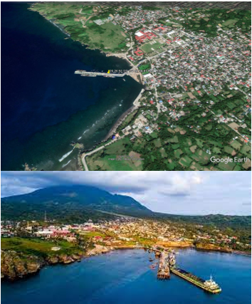
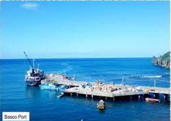
2.1.10 Philippines - Luzon Port of Basco
Port Overview
The Port of Basco is situated at the head of Baluarte Bay on the west coast of Batan Island in the province of Batanes. Basco is the principal town of the island. Load line zone: Summer. Max draught 3.0 m.
Port website: ppa.gov.ph
Key port information may also be found at: http://www.maritime-database.com
|
Port Location and Contact |
|
|---|---|
|
Country |
Philippines |
|
Province or District |
Batanes |
|
Nearest Town or City with Distance from Port |
Basco (port is in town limits) |
|
Port's Complete Name |
Port of Basco |
|
Latitude |
20.447396 |
|
Longitude |
121.966192 |
|
Managing Company or Port Authority |
Philippine Ports Authority (PPA) |
|
Management Contact Person |
Marieta G. Odicta Port Manager, PMO Northern Luzon (072) 607-4607 |
|
Nearest Airport and Airlines with Frequent International Arrivals/Departures |
Laoag International Airport (Temporarily unavailable covid-19 restrictions) Clark International Airport Tiger Air/Singapore Air, Qatar Airways, Emirates, Jetstar, Philippine Airlines, Cebu Pacific |
Port Picture
Description and Contacts of Key Companies
Marieta G. Odicta
Port Manager, PMO Northern Luzon
(072) 607-4607
For more information on port contacts, please see the following link: 4.4 Port and Waterways Companies Contact List.
Port Performance
|
Seasonal Constraints |
||
|---|---|---|
|
Occurs |
Time Frame |
|
|
Rainy Season |
Yes |
From August to December |
|
Major Import Campaigns |
No |
|
|
Other Comments |
Interruption of port operations during typhoons. |
|
|
Handling Figures for 2020 |
|
|---|---|
|
Vessel Calls |
631 |
|
Container Traffic (TEUs) |
163 |
|
Handling Figures Bulk and Break Bulk for 2020 |
|
|---|---|
|
Bulk (MT) |
0.00 |
|
Break bulk (MT) |
118,693 MT |
Discharge Rates and Terminal Handling Charges
For information on port rates and charges, please see the following links:
Vessel: https://www.ppa.com.ph/?q=content/charges-vessel
Cargoes: https://www.ppa.com.ph/?q=content/charges-cargoes
Storage: https://www.ppa.com.ph/?q=content/charges-storage
Berthing Specifications
|
Type of Berth |
Quantity |
Length |
Maximum Draft |
Comments |
|---|---|---|---|---|
|
Conventional Berth |
3 |
320 m |
3 m |
|
|
Container Berth |
None |
|
||
|
Silo Berth |
None |
|
||
|
Berthing Tugs |
None |
|
||
|
Water Barges |
None |
|
General Cargo Handling Berths
|
Cargo Type |
Berth Identification |
|---|---|
|
Imports - Bagged Cargo |
Yes |
|
Exports - Bagged Cargo |
None |
|
Imports and Exports - RoRo |
None |
|
Other Imports |
None |
Port Handling Equipment
The Port of Basco does not have equipment for container loading and offloading.
Container Facilities
The Port of Basco does not have container facilities.
Customs Guidance
The Port of Basco does not have a customs collection office. Local goods and commodities only.
For more information on customs in the Philippines, please see the following link: 1.3 Customs Information.
Terminal Information
Multipurpose Terminal
The port has a 1600 m2 Terminal and Admin building.
Grain and Bulk Handling
There are no grain and bulk handling equipment in the port. There is an 3000 m2 open storage area.
Main Storage Terminal
|
Storage Type |
Number of Storage Facilities |
Area (m2) |
|---|---|---|
|
Bagged Cargo |
None |
|
|
Refrigerated Cargo |
None |
|
|
General Cargo |
Open area |
3000 m2 |
Stevedoring
Batanes Merchants Services Cooperatives provides stevedoring services for the port.
Hinterland Information
Coordinate with PPA PMO Office for possible transporter in Port of Basco, Batanes.
Port Security
PPA PMO Northern Luzon Port Police manages the deployment of local security services within the port premises.
|
Security |
|
|---|---|
|
ISPS Compliant |
Yes |
|
Current ISPS Level |
Level 1 |
|
Police Boats |
Coast Guard |
|
Fire Engines |
LGU Fire trucks |
2.1.11 Philippines - Luzon Port of Subic Bay
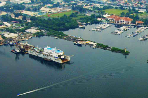
Port Overview
The Port of Subic Bay is a strategic regional gateway to Asia and has 15 operational piers and wharves plus modern terminals for cruise ships, fertilizers, grains and general containerized cargo. It is operated by the Subic Bay International Terminal Corporation (SBITC) and serves the industries located within the freeport areas as well as industries in Northern and Central Luzon. The freeport is also alternative international gateway to the Port of Manila.
In 2004, SBMA began constructing a dedicated container terminal, the New Container Terminal Compound (NCT-1), as part of its Port Development Master Plan. In October 2007, SBITC was awarded the Management and Operation of the New Container Terminal-1 (NCT-1). In April 2008, commercial operations commenced and container handling operations at the NSD Terminal were transferred to the NCT-1 located at the Freeport´s Cubi Point. As the NCT-1 terminal operator, SBITC is committed to further develop facilities and provide services at par with the world´s leading container terminals.
https://www.searates.com/port/subic_bay_ph.htm
Port website: https://www.sbitc.ph/company
Key port information may also be found at: http://www.maritime-database.com
|
Port Location and Contact |
|
|---|---|
|
Country |
Philippines |
|
Province or District |
Zambales |
|
Nearest Town or City with Distance from Port |
Olongapo City (within city limits) |
|
Port's Complete Name |
Port of Subic Bay |
|
Latitude |
14.802240 |
|
Longitude |
120.264404 |
|
Managing Company or Port Authority |
Subic Bay International Terminal Corporation (SBITC) |
|
Management Contact Person |
Subic Bay International Terminal Corporation San Bernardino Road, Subic Port District, Subic Bay Freeport Zone, Olongapo City 2222, Philippines + 63 47 / 252 6477 - Admin Office + 63 47 / 250 2252 - Operations Center |
|
Nearest Airport and Airlines with Frequent International Arrivals/Departures |
Subic International Airport (no international flights) Clark International Airport Tiger Air/Singapore Air, Qatar Airways, Emirates, Jetstar, Philippine Airlines, Cebu Pacific |
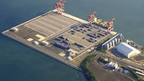
Port Picture
Subic Bay International Terminal Corporation Wharves
https://www.ictsi.com/what-we-do/our-terminals/subic-bay-international-terminal-corp
SBMA Wharves
Alava Wharf
Boton Wharf
Bravo Wharf

Leyte Wharf

Marine Wharf
Nabasan Wharf
POL Pier
Rivera Wharf
Sattler Pier
Description and Contacts of Key Companies
Port Operator / Cargo Handler
Subic Port District
Subic Bay Freeport Zone, San Bernardino Road
Olongapo City 2222, Philippines
+ 63 47 252 6477 - Admin Office
+ 63 47 250 2252 - Operations Center
Berthing Tugs Services
Malayan Towage and Salvage Corp.
Administration Building, Bldg. 229, Waterfront Road, Subic Bay Freeport Zone
Trunkline Numbers: +6347.252.4000 / +6347.252.4004
Trucking, Arrastre, Stevedoring
J.T. Cargo Handling & Port Services, Inc.
Lot 9 EMS Area, Perimeter Rd. Subic Bay Freeport Zone,
Olongapo City Zambales
+63 47 252-76-40 / +63 47 252-52-79
Bureau of Customs
Maritess T. Martin
Acting District Collector, CD13, Port of SUBIC
maritess.martin@customs.gov.ph
+63 47 252 7465
For more information on port contacts, please see the following link: 4.4 Port and Waterways Companies Contact List.
Port Performance
SBMA provides port transshipment, freight forwarding, cargo handling, warehousing and storage services. Its warehouse and storage leases processing plants, meat importers, fruits/vegetables importers for local and exports, ice makers/manufacturers. Port users are from from Northern Luzon, Central Luzon, and Manila. Other services are ship lay-ups, petroleum, oil and lubricants storage, import/export and/or transshipment, bulk grain storage. It is also a passenger and/or cruise ship destination.
|
Seasonal Constraints |
||
|---|---|---|
|
Occurs |
Time Frame |
|
|
Rainy Season |
Yes |
From August to December |
|
Major Import Campaigns |
Yes |
From August to December |
|
Other Comments |
|
|
|
Handling Figures for 2020 |
|
|---|---|
|
Vessel Calls |
1,988 |
|
Container Traffic (TEUs) |
226,174 TEU |
|
Handling Figures Bulk and Break Bulk for 2020 |
|
|---|---|
|
Bulk (MT) |
N/A |
|
Break bulk (MT) |
7,094,000 MT |
Discharge Rates and Terminal Handling Charges
Berthing Specifications
|
Type of Berth |
Quantity |
Length |
Maximum Draft |
Comments |
|---|---|---|---|---|
|
Conventional Berth |
9 |
|
|
|
|
Container Berth |
2 |
280 m |
13 m |
|
|
Silo Berth |
Yes |
300 m |
14 m |
|
|
Berthing Tugs |
Yes |
Malayan Towage and Salvage Corp |
||
|
Water Barges |
Yes |
Subic Water Inc |
http://ship.mysubicbay.com.ph/port-services
General Cargo Handling Berths
|
Cargo Type |
Berth Identification |
|---|---|
|
Imports - Bagged Cargo |
Yes |
|
Exports - Bagged Cargo |
Yes |
|
Imports and Exports - RoRo |
Yes |
|
Other Imports |
Containerized |
|
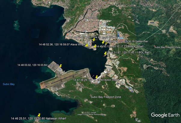
SBMA Wharves
|
Berthing vessels /
Usage
|
Facilities
|
Coordinates
|
Length
|
Width
|
Depth
|
|---|---|---|---|---|---|---|
| Alava Wharf | Naval vessels, passenger ships, ferries, general cargo |
14.814499, 120.283256 |
520 m | 18 m | 12 m | |
|
Boton Wharf (East Side - C2 and C3) |
Transshipment vessels, fishing boats, bulk carriers, fertilizer terminal |
|
14.793969, 120.288869 | 411 m | 18.9 m | 10.2 m |
| Bravo Wharf | Cargo vessels, port service boats and tug boats |
|
14.818614, 120.287486 | 411 m | 15 m | 6 m |
| Leyte Wharf | Grain terminals operated by Subic Bay Freeport Grain Terminal, Inc. |
|
14.800839, 120.267733 | 300 m | 32.5 m | 14 m |
| Marine Wharf | General cargo, RoRo, tug boats, tankers, fishing boats |
|
14.816369, 120.295369 |
East bulkhead: 237 m West bulkhead: 35 m MT-9: 12.9 m |
East bulkhead: 237 m West bulkhead: 35 m MT-9: 12.9 m |
East bulkhead: 237 m West bulkhead: 35 m MT-9: 12.9 m |
| Nabasan Wharf | Maritime training facility (IDESS) | 14.773753, 120.259056 | 180 m | 18.9 m | 14 m | |
| POL Pier | Tanker (privately operated by Costal Subic Bay Petroleum, Inc.) |
|
14.808853, 120.294475 | 253 m | 23.1 m | 12.8 m |
| Rivera Wharf |
|
14.813922, 120.288258 | 906 m | 18 m | 9 m | |
| Sattler Wharf | General cargo |
|
14.816803, 120.293383 | 180 m | 24.4 m | 12 m |
Port Handling Equipment
|
Equipment |
Available |
Total Quantity and Capacity Available |
Comments on Current Condition and Actual Usage |
|---|---|---|---|
|
Dockside Crane |
Yes |
For assessment |
|
|
Container Gantries |
Yes |
4 quay cranes |
|
|
Mobile Cranes |
Yes |
For assessment |
|
|
Reachstacker |
Yes |
9 |
7 - Loader stacker 2 – Empty stacker |
|
RoRo Tugmaster (with Trailer) |
Yes |
20 tractor heads |
20’ 40’ and 45’ chassis |
|
Grain Elevator with Bagging Machines |
Yes |
SBMA Leyte Wharf |
|
|
Transtainer |
Yes |
6 RTG |
|
|
Forklifts |
Yes |
1 – 11.5T 2 – 3.0T |
Container Facilities
|
Infrastructure
|
Description
|
|---|---|
| Terminal Area | 26.32 hectares |
| Annual Capacity |
600,000 TEUs |
| Container Yard Storage Area | 11.14 hectares |
| Container Yard Reefer Station | 240 units at 440v |
| Berth Length | 560 m |
| Berthing Positions | 2 |
| Berth Controlling Depth | 13.7 m |
| Gates | 12 |
| Power Stations |
2 units of 750 kVA Standby Generators each station, with a total capacity of 1,500 kVA or 1.5 mVA per Station. |
|
Facilities |
20 and 40 ft |
|---|---|
|
Container Facilities Available |
Yes |
|
Container Freight Station (CFS) |
Yes |
|
Refrigerated Container Stations |
Yes |
|
Other Capacity Details |
|
|
Daily Take Off Capacity |
|
|
Number of Reefer Stations |
Yes, 240 units 440v |
|
Emergency Take-off Capacity |
Give an indication |
|
Off take Capacity of Gang Shift |
|
Customs Guidance
Maritess T. Martin
Acting District Collector, CD13, Port of Subic
maritess.martin@customs.gov.ph
+63 47 252 7465
For more information on customs in the Philippines, please see the following link: 1.3 Customs Information.
Terminal Information
Multipurpose Terminal - Marine Wharf
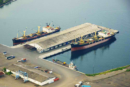
|
Marine Wharf
|
Length
|
Width
|
Depth
|
|---|---|---|---|
| East Bulkhead | 237 m | 35 m | 9 m |
| West Bulkhead | 237 m | 35 m | 9 m |
| MT-9 | 98 m | 35 m | 9 m |
Berthing vessel: General Cargo, RoRo, Cargo Ship and Tug Boat, Tanker, Fishing Boat
Facilities: 19 warehouses, 3 weighbridges
Grain and Bulk Handling - Leyte Wharf
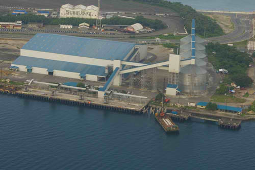
Length: 300 m
Width: 32.5 m
Depth: 14 m
Berthing vessel: Grain terminals operated by Subic Bay Freeport Grain Terminals Inc
Facilities: 5 grain storage tanks (57 mt/silo), 3 portal crane with clam shells, 1ha WH, weighbridge
Main Storage Terminal
|
Storage Type
|
Number of Storage
Facilities
|
Area (m2)
|
|---|---|---|
| Bagged Cargo | Yes – Marine Wharf | |
| Refrigerated Cargo | YES - CFS | |
| General Cargo | Yes – containerized only |
Stevedoring
The Port of Subic Bay is managed and operated by Subic Bay International Terminals. No stevedore as port caters only to containerized cargo, but piers and wharves are managed by the Subic Bay Metropolitan Authority (SBMA).
Hinterland Information
SBMA issued guidelines for port procedures underlying the port operations and can be accessible on this link: http://ship.mysubicbay.com.ph/port-procedures. Subic Port is managed by ICTSI as main contractor of port operations. Import and Export Containers can be facilitated at the Port upon completion of BOC documentation and clearances. Withdrawal of containers from the Port can be facilitated by shipping lines itself to its supply chain partners or by the consignee itself as long as cleared from Customs. Bulk cargo withdrawal can also be managed at the designated wharf at the Port.
Port Security
SBITC and SBMA manages the deployment of local security services within the port premises. It has designated fire hydrant each wharf/pier. Fire engine boats can be deploy when necessary.
|
Security |
|
|---|---|
|
ISPS Compliant |
Yes |
|
Current ISPS Level |
Level 1 |
|
Police Boats |
Coast Guard/ PNP Maritime Command |
|
Fire Engines |
Yes |
2.1.12 Philippines - Luzon Port of Lamao
Port Overview
The Port of Lamao is a base port managed by Philippine Ports Authority (PPA) under Port Management Office (PMO) of Bataan/Aurora (PMO-BNA). It is situated and located at Barangay Lamao, Municipality of Limay, Province of Bataan, 173 km from Manila Port Area and 61 km from Subic Freeport. The port operations concentrate on non-RORO vessels. It is located beside a Petron oil refinery. Port operations documentation can be accessed here: https://www.ppa.com.ph/sites/default/files/citizen_charter_docs/pmo_bataan_cc_2016.pdf.
Port website: ppa.gov.ph
Key port information may also be found at: http://www.maritime-database.com
|
Port Location and Contact |
|
|---|---|
|
Country |
Philippines |
|
Province or District |
Bataan |
|
Nearest Town or City with Distance from Port |
Limay, Bataan (7.67 kms) |
|
Port's Complete Name |
Port of Lamao |
|
Latitude |
14.514084 |
|
Longitude |
120.611115 |
|
Managing Company or Port Authority |
Philippine Ports Authority |
|
Management Contact Person |
Allan M. Rojo Acting Port Manager, PMO Bataan / Aurora (047) 244-6936 / 244-6246 |
|
Nearest Airport and Airlines with Frequent International Arrivals/Departures |
Clark International Airport Tiger Air/Singapore Air, Qatar Airways, Emirates, Jetstar, Philippine Airlines, Cebu Pacific |
Port Picture
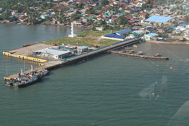
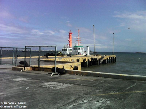
Description and Contacts of Key Companies
Allan M. Rojo
Acting Port Manager, PMO Bataan / Aurora
(047) 244-6936 / 244-6246
Guillermo Pedro A. Francia IV
Acting District Collector, CD16, Port of Limay
GuillermoPedro.FranciaIV@customs.gov.ph
(047) 633-1996
For more information on port contacts, please see the following link: 4.4 Port and Waterways Companies Contact List.
Port Performance
Port operations were mostly anchorage vessel as per PPA cargo statistics of 2020. Port congestion is minimal, major cargo hubs are in Subic or Manila Ports.
|
Seasonal Constraints |
||
|---|---|---|
|
Occurs |
Time Frame |
|
|
Rainy Season |
Yes |
From August to December |
|
Major Import Campaigns |
No |
|
|
Other Comments |
||
|
Handling Figures for 2020 |
|
|---|---|
|
Vessel Calls |
259 - anchorage |
|
Container Traffic (TEUs) |
None - 0 |
|
Handling Figures Bulk and Break Bulk for 2020 |
|
|---|---|
|
Bulk (MT) |
100,715 MT |
|
Break bulk (MT) |
0.00 |
Discharge Rates and Terminal Handling Charges
For information on port rates and charges, please see the following links:
Vessels: https://www.ppa.com.ph/?q=content/charges-vessel
Cargoes: https://www.ppa.com.ph/?q=content/charges-cargoes
Storage: https://www.ppa.com.ph/?q=content/charges-storage
Berthing Specifications
|
Type of Berth |
Quantity |
Length |
Maximum Draft |
Comments |
|---|---|---|---|---|
|
Conventional Berth |
3 |
110 m |
|
|
|
Container Berth |
None |
|
||
|
Silo Berth |
None |
|
||
|
Berthing Tugs |
None |
|
||
|
Water Barges |
None |
|
General Cargo Handling Berths
|
Cargo Type |
Berth Identification |
|---|---|
|
Imports - Bagged Cargo |
None |
|
Exports - Bagged Cargo |
None |
|
Imports and Exports - RoRo |
None |
|
Other Imports |
None |
Port Handling Equipment
The Port of Lamao has no equipment for container loading and offloading.
|
Equipment |
Available |
Total Quantity and Capacity Available |
Comments on Current Condition and Actual Usage |
|---|---|---|---|
|
Dockside Crane |
None |
||
|
Container Gantries |
None |
||
|
Mobile Cranes |
None |
||
|
Reachstacker |
None |
||
|
RoRo Tugmaster (with Trailer) |
None |
||
|
Grain Elevator with Bagging Machines |
None |
||
|
Transtainer |
None |
||
|
Forklifts |
Yes |
Container Facilities
The Port of Lamao has no container facilities.
Customs Guidance
The Port of Lamao's vessel entrance and departure time frame can be found here: https://www.ppa.com.ph/sites/default/files/citizen_charter_docs/pmo_bataan_cc_2016.pdf.
For more information on customs in the Philippines, please see the following link: 1.3 Customs Information.
Terminal Information
Multipurpose Terminal
The port has a 4,000 m2 terminal and admin building.
Grain and Bulk Handling
There is no grain and bulk handling equipment in the port, aside from a 5,400 m2 open storage area.
Main Storage Terminal
|
Storage Type |
Number of Storage Facilities |
Area (m2) |
|---|---|---|
|
Bagged Cargo |
None |
|
|
Refrigerated Cargo |
None |
|
|
General Cargo |
Open area |
5,400 m2 |
Stevedoring
Stevedoring can be arranged through the PPA PMO BNA Office.
Hinterland Information
Transporters within Limay, Bataan:
- NBB Trucking Services / Contact Number : (047) 633 1395
- NC David Construction and Trucking / Contact Number: (047) 244 4170
- AGL Trucking / Contact Number: +63 930 081 3060
- TLI Containers Group Phils, Inc / +63 910 992 4060 / Lower Tundol, Limay
- 3 ACES Trucking and Allied Services Corp / +63 47 244 7620 / Reformista St., Limay
Port Security
PPA Port Police manage the deployment of security services within the port premises.
|
Security |
|
|---|---|
|
ISPS Compliant |
Yes |
|
Current ISPS Level |
Level 1 |
|
Police Boats |
Coast Guard |
|
Fire Engines |
LGU Fire Trucks |
2.1.13 Philippines - Luzon Port of Capinpin
Port Overview
The Port of Capinpin is a terminal management operation (TMO) under the jurisdiction and management of the Philippine Ports Authority, under the Port Management Office (PMO) of Bataan / Aurora provinces (PMO-BNA). It is located in Barangay Lati, Municipality of Orion, Province of Bataan. It is an alternate passenger vessel route via seacraft from Manila to Bataan. The Port of Capinpin was designated as one of the PPA quarantine facilities for change crew hub for international seafarers. https://www.ppa.com.ph/sites/default/files/citizen_charter_docs/pmo_bataan_cc_2016.pdf
Port website: ppa.gov.ph
Key port information may also be found at: http://www.maritime-database.com
|
Port Location and Contact |
|
|---|---|
|
Country |
Philippines |
|
Province or District |
Bataan |
|
Nearest Town or City with Distance from Port |
Orion, Bataan (within city limits) |
|
Port's Complete Name |
Port of Capinpin |
|
Latitude |
14.585502 |
|
Longitude |
120.590933 |
|
Managing Company or Port Authority |
Philippine Ports Authority |
|
Management Contact Person |
Allan M. Rojo Acting Port Manager, PMO Bataan / Aurora (047) 244-6936 / 244-6246 |
|
Nearest Airport and Airlines with Frequent International Arrivals/Departures |
Clark International Airport (81 km) Tiger Air/Singapore Air, Qatar Airways, Emirates, Jetstar, Philippine Airlines, Cebu Pacific |
Port Picture
Description and Contacts of Key Companies
For more information on port contacts, please see the following link: 4.4 Port and Waterways Companies Contact List.
Port Performance
The TMO Port of Capinpin is a Non-RORO port.
|
Seasonal Constraints |
||
|---|---|---|
|
Occurs |
Time Frame |
|
|
Rainy Season |
Yes |
From August to December |
|
Major Import Campaigns |
None |
|
|
Other Comments |
Disruption of passenger vessel operations during typhoons. |
|
|
Handling Figures for 2020 |
|
|---|---|
|
Vessel Calls |
307 |
|
Container Traffic (TEUs) |
1 |
|
Handling Figures Bulk and Break Bulk for 2020 |
|
|---|---|
|
Bulk (MT) |
none |
|
Break bulk (MT) |
133,174 MT |
Discharge Rates and Terminal Handling Charges
For information on port rates and charges, please see the following links:
Vessels: https://www.ppa.com.ph/?q=content/charges-vessel
Cargoes: https://www.ppa.com.ph/?q=content/charges-cargoes
Storage: https://www.ppa.com.ph/?q=content/charges-storage
Berthing Specifications
|
Type of Berth |
Quantity |
Length |
Maximum Draft |
Comments |
|---|---|---|---|---|
|
Conventional Berth |
3 |
240 m |
||
|
Container Berth |
None |
|
||
|
Silo Berth |
None |
|
||
|
Berthing Tugs |
None |
|
||
|
Water Barges |
None |
|
General Cargo Handling Berths
|
Cargo Type |
Berth Identification |
|---|---|
|
Imports - Bagged Cargo |
None |
|
Exports - Bagged Cargo |
None |
|
Imports and Exports - RoRo |
None |
|
Other Imports |
None |
Port Handling Equipment
The Port of Capinpin has no equipment for container loading and offloading.
Container Facilities
The Port of Capinpin has no equipment for container facilities.
Customs Guidance
The Port of Capinpin has no custom collection office. The Customs district is under the Limay District Office.
For more information on customs in the Philippines, please see the following link: 1.3 Customs Information.
Terminal Information
Multipurpose Terminal
The Port of Capinpin has a 3,840 m2 Terminal and Admin building area.
Grain and Bulk Handling
The open storage area is estimated 9,000 sqm and the port has no grain and bulk handling equipment.
Main Storage Terminal
|
Storage Type |
Number of Storage Facilities |
Area (m2) |
|---|---|---|
|
Bagged Cargo |
None |
|
|
Refrigerated Cargo |
None |
|
|
General Cargo |
Open area |
9,000 m2 |
Stevedoring
Stevedoring may be coordinated with the PPA PMO Office.
Hinterland Information
Available transporters in Orion, Bataan:
- Four J Trucking / +63 917 564 6256
- Goldland Trucking and Allied Services Company / (047) 244 547
- Cabrera’s Marine International Lines / Port Capinpin, Puting Buhanging, Orion
Port Security
The PMO BNA manages the deployment of local security at the port areas.
|
Security |
|
|---|---|
|
ISPS Compliant |
For assessment |
|
Current ISPS Level |
Level 1 |
|
Police Boats |
None |
|
Fire Engines |
LGU Firetrucks |
2.1.14 Philippines - Luzon Port of Casiguran
Port Overview
The Port of Casiguran, 370 km from Manila, was designed to be a freeport zone in Casiguran, Aurora Province. It has 2 berths in its pier and can accommodate 20,000 DWT vessels. The port has reinforced wharfs, breakwater, revetment and stacking area. The AFP also has planned to put up a naval station in Casiguran Port to protect and monitor Benham Rise in the Philippine Sea.
Port website: ppa.gov.ph
Key port information may also be found at: http://www.maritime-database.com
|
Port Location and Contact |
|
|---|---|
|
Country |
Philippines |
|
Province or District |
Aurora |
|
Nearest Town or City with Distance from Port |
Casiguran (8 km) |
|
Port's Complete Name |
Port of Casiguran |
|
Latitude |
16.240738 |
|
Longitude |
122.077597 |
|
Managing Company or Port Authority |
Philippine Ports Authority |
|
Management Contact Person |
Allan M. Rojo Acting Port Manager, PMO Bataan / Aurora (047) 244-6936 / 244-6246 |
|
Nearest Airport and Airlines with Frequent International Arrivals/Departures |
Clark International Airport (148 km) Tiger Air/Singapore Air, Qatar Airways, Emirates, Jetstar, Philippine Airlines, Cebu Pacific |
Port Picture


Description and Contacts of Key Companies
For more information on port contacts, please see the following link: 4.4 Port and Waterways Companies Contact List.
Port Performance
The TMO Port of Casiguran is a Non-RORO port. There has been no commercial vessel and cargo movement in 2020.
|
Seasonal Constraints |
||
|---|---|---|
|
Occurs |
Time Frame |
|
|
Rainy Season |
Yes |
From August to December |
|
Major Import Campaigns |
None |
|
|
Other Comments |
Typhoon risk area |
|
|
Handling Figures for 2020 |
|
|---|---|
|
Vessel Calls |
None |
|
Container Traffic (TEUs) |
None |
|
Handling Figures Bulk and Break Bulk for 2020 |
|
|---|---|
|
Bulk (MT) |
None |
|
Break bulk (MT) |
None |
Discharge Rates and Terminal Handling Charges
For information on port rates and charges, please see the following links:
Vessel: https://www.ppa.com.ph/?q=content/charges-vessel
Cargoes: https://www.ppa.com.ph/?q=content/charges-cargoes
Storage: https://www.ppa.com.ph/?q=content/charges-storage
Cargo handling will be based on PPA PMO Limay tariffs.
Berthing Specifications
|
Type of Berth |
Quantity |
Length |
Maximum Draft |
Comments |
|---|---|---|---|---|
|
Conventional Berth |
2 |
167 m |
|
|
|
Container Berth |
None |
|
||
|
Silo Berth |
None |
|
||
|
Berthing Tugs |
None |
|
||
|
Water Barges |
None |
|
General Cargo Handling Berths
|
Cargo Type |
Berth Identification |
|
Imports - Bagged Cargo |
None |
|
Exports - Bagged Cargo |
None |
|
Imports and Exports - RoRo |
None |
|
Other Imports |
None |
Port Handling Equipment
The Port of Casiguran has no equipment for container loading and offloading.
Container Facilities
The Port of Casiguran has no container facilities but has open areas for storage.
Customs Guidance
The Port of Casiguran has no custom collection office. Customs jurisdiction is under the Limay District of Bataan.
For more information on customs in the Philippines, please see the following link: 1.3 Customs Information.
Terminal Information
Multipurpose Terminasl
The Casiguran Port has a 5,900 m2 Terminal and an Admin building.
Grain and Bulk Handling
The Port has an open storage area. There are no grain and bulk handling equipment in the port.
Main Storage Terminal
|
Storage Type |
Number of Storage Facilities |
Area (m2) |
|---|---|---|
|
Bagged Cargo |
None |
|
|
Refrigerated Cargo |
None |
|
|
General Cargo |
Open area |
5900 m2 |
Stevedoring
There is no stevedoring company in the port, but the PPA PMO Office may be contacted for assistance.
Hinterland Information
There are no existing transporter operators in the area. Contact the LGU/PPA for hauling and assistance.
Port Security
PMO BNA manages the deployment of local security at the Port area.
|
Security |
|
|---|---|
|
ISPS Compliant |
For assessment |
|
Current ISPS Level |
Level 1 |
|
Police Boats |
None |
|
Fire Engines |
LGU Firetrucks |
2.1.15 Philippines - Luzon Port of Dingalan
Port Overview
The Port of Dingalan is a terminal management operation (TMO) under the jurisdiction of and managed by Philippine Ports Authority (PPA) under the Port Management Office (PMO) of Bataan/Aurora (PMO-BNA). It is located on the east coast of Luzon, 232 km from Manila. Facilities include a reinforced concrete pier, platform area, and a Ro-Ro ramp. It is projected that the port will be able to handle 10,000 TEU once completed. Maximum draft is 14.6 m.
https://www.ppa.com.ph/sites/default/files/citizen_charter_docs/pmo_bataan_cc_2016.pdf
Port website: ppa.gov.ph
Key port information may also be found at: http://www.maritime-database.com
|
Port Location and Contact |
|
|---|---|
|
Country |
Philippines |
|
Province or District |
Aurora |
|
Nearest Town or City with Distance from Port |
Dingalan (2 km) |
|
Port's Complete Name |
Port of Dingalan |
|
Latitude |
15.381040 |
|
Longitude |
121.396649 |
|
Managing Company or Port Authority |
Philippine Ports Authority |
|
Management Contact Person |
Allan M. Rojo Acting Port Manager, PMO Bataan / Aurora (047) 244-6936 / 244-6246 |
|
Nearest Airport and Airlines with Frequent International Arrivals/Departures |
Clark International Airport (148 km) Tiger Air/Singapore Air, Qatar Airways, Emirates, Jetstar, Philippine Airlines, Cebu Pacific |
Port Picture
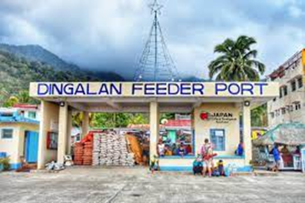
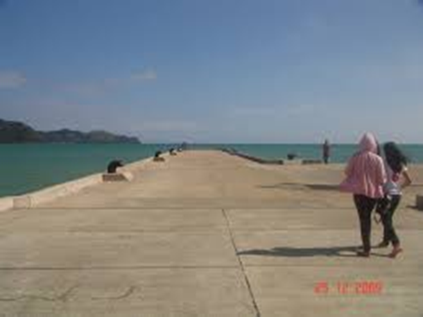
Description and Contacts of Key Companies
For more information on port contacts, please see the following link:4.4 Port and Waterways Companies Contact List.
Port Performance
The Port of Dingalan is a Non-RORO port. There were no commercial vessel and cargo movements in 2020.
|
Seasonal Constraints |
||
|---|---|---|
|
Occurs |
Time Frame |
|
|
Rainy Season |
Yes |
From August to December |
|
Major Import Campaigns |
None |
|
|
Other Comments |
The port is in a typhoon risk area. |
|
|
Handling Figures for 2020 |
|
|---|---|
|
Vessel Calls |
None |
|
Container Traffic (TEUs) |
None |
|
Handling Figures Bulk and Break Bulk for 2020 |
|
|---|---|
|
Bulk (MT) |
None |
|
Break bulk (MT) |
None |
Discharge Rates and Terminal Handling Charges
For information on port rates and charges, please see the following links:
Vessel: https://www.ppa.com.ph/?q=content/charges-vessel
Cargoes: https://www.ppa.com.ph/?q=content/charges-cargoes
Storage: https://www.ppa.com.ph/?q=content/charges-storage
Berthing Specifications
|
Type of Berth |
Quantity |
Length |
Maximum Draft |
Comments |
|---|---|---|---|---|
|
Conventional Berth |
2 |
82 m |
||
|
Container Berth |
None |
|
||
|
Silo Berth |
None |
|
||
|
Berthing Tugs |
None |
|
||
|
Water Barges |
None |
|
General Cargo Handling Berths
|
Cargo Type |
Berth Identification |
|---|---|
|
Imports - Bagged Cargo |
None |
|
Exports - Bagged Cargo |
None |
|
Imports and Exports - RoRo |
None |
|
Other Imports |
None |
Port Handling Equipment
The Port of Dingalan does not have equipment for loading and offloading.
Container Facilities
The Port of Dingalan does not have container facilities.
Customs Guidance
The Port of Dingalan does not have Customs facilities.
For more information on customs in the Philippines, please see the following link: 1.3 Customs Information.
Terminal Information
Multipurpose Terminal
The port has a 3000 m2 terminal and an Admin building.
Grain and Bulk Handling
The port has a 63 m2 open shed storage area, but does not have grain and bulk handling equipment.
Main Storage Terminal
|
Storage Type |
Number of Storage Facilities |
Area (m2) |
|---|---|---|
|
Bagged Cargo |
None |
|
|
Refrigerated Cargo |
None |
|
|
General Cargo |
Open shed area |
63 m2 |
Stevedoring
There are no stevedoring companies in place at the port.
Hinterland Information
There are no existing transporter operators in the area. The local government may be contacted for assistance.
Port Security
The PMO BNA manages the deployment of local security at the Port area.
|
Security |
|
|---|---|
|
ISPS Compliant |
For assessment |
|
Current ISPS Level |
Level 1 |
|
Police Boats |
None |
|
Fire Engines |
LGU Firetrucks |
2.1.16 Philippines - Luzon Port of Batangas
Port Overview
The Batangas City Port is the jump off point for travelers who wish to visit nearby islands. It serves to passengers mostly from the Cavite-Laguna- Batangas-Rizal-Quezon (Calabarzon) Region but travelers from Manila are also common. There are two major terminals here, one for passengers and the other for cargo and shipping.
The Bauan International Port is operated by the Integrated Container Terminal Services Inc (ICTSI).The Bauan terminal is approximately 120 kilometers south of Manila and nine kilometers west of Batangas City. Facing the Batangas Bay, the terminal is within a natural cove, and is protected from adverse weather conditions by several islands, which are clearly visible from the bay. The terminal supports cargo movements in and out of the Calabarzon. An agro-industrial hub, Bauan is a first-class municipality in the Batangas province. Batangas, in turn, is one of five provinces that compose the CALABARZON region, the Philippines’ automotive hub. For instance, shipment from the Philippine operations of Japanese car makers Mitsubishi and Honda pass through the Bauan port.
https://www.ictsi.com/what-we-do/our-terminals/bauan-international-port-inc
The Batangas Container Terminal (BCT) is operated by the Asian Terminals Inc (ATI). It is a major trading port outside Metro Manila serving major industries in Southern Luzon.
https://www.asianterminals.com.ph/ati_batangascontainer.aspx
Port website: ppa.gov.ph
Key port information may also be found at: http://www.maritime-database.com
|
Port Location and Contact |
|
|---|---|
|
Country |
Philippines |
|
Province or District |
Batangas |
|
Nearest Town or City with Distance from Port |
Batangas City |
|
Port's Complete Name |
Port of Batangas |
|
Latitude |
13.756665 |
|
Longitude |
121.041851 |
|
Managing Company or Port Authority |
Philippine Ports Authority |
|
Management Contact Person |
Joselito O. Sinocruz Port Manager, PMO Batangas +6343 722-2429 / 723-0164 |
|
Nearest Airport and Airlines with Frequent International Arrivals/Departures |
Ninoy Aquino International Airport All Nippon Airways, Cathay Pacific Airways, Delta Air Lines, Emirates, Etihad Airways, KLM Royal Dutch Airlines, Qantas Airways, Qatar Airways, Singapore Airlines, Turkish Airlines, United Airlines; Cebu Pacific Air, PAL Express, Philippines AirAsia. |
Port Picture
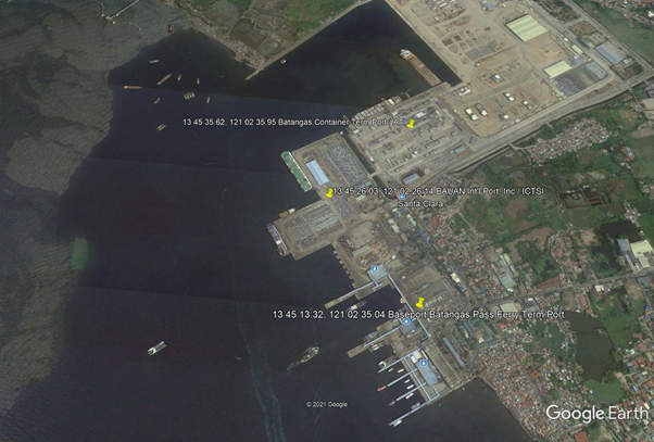
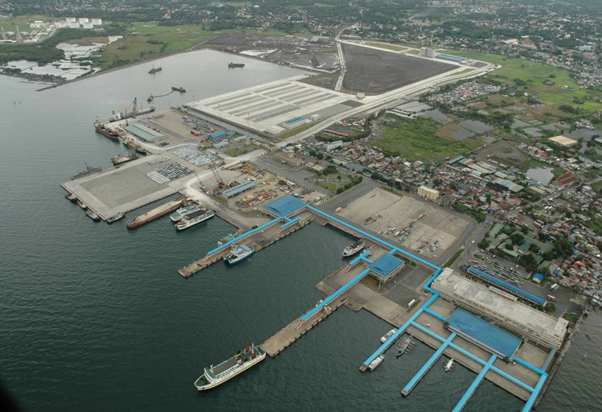

Port of Batangas
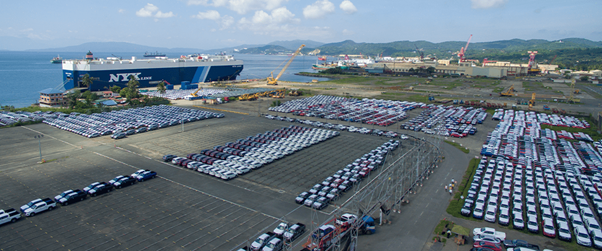
Port of Batangas / ICTSI – Bauan International Port
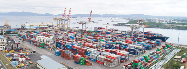
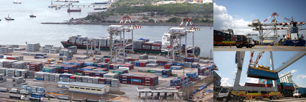
Port of Batangas / ATI Batangas Container Terminal
Description and Contacts of Key Companies
| Company / Government Authority | Focal Person | Title | Address | Phone Number | Email address |
|---|---|---|---|---|---|
| Philippine Ports Authority | Joselito O. Sinocruz | Port Manager, PMO Batangas | +63 43 722-2429 / 723-0164 | josinocruz@ppa.com.ph | |
| Bureau of Customs | Atty. Ma. Rhea M. Gregorio | District Collector, CD4, Port of Batangas | +63 995 459 7555 / +63 43 722 0705 | marhea.gregorio@customs.gov.ph | |
| Asian Terminals Inc (ATI) | A. Bonifacio Drive, Port Area, Manila | +632 8 5286000 | ati_contactus.aspx | ||
| ICTS – Bauan International Port, Inc. (BIPI) | Port Area, Barangay San Roque, Bauan 4201, Batangas, Philippines | +6343 779 8240 (Admin) | FSMagtalas@ictsi.com |
Ferry Operators at Port of Batangas
2GO Travel
Oceanjet Ferry
Montenegro Lines Shipping
Sikat Ferry Bus
Starlite Ferries
Island Water Ferry
FastCat Ferry
For more information on port contacts, please see the following link: 4.4 Port and Waterways Companies Contact List.
Port Performance
|
Seasonal Constraints |
||
|---|---|---|
|
Occurs |
Time Frame |
|
|
Rainy Season |
Yes |
From August to December |
|
Major Import Campaigns |
None |
|
|
Other Comments |
Port congestion and the typhoon season are the top operating constraints. |
|
|
Handling Figures for 2020 |
|
|---|---|
|
Vessel Calls |
19,552 |
|
Container Traffic (TEUs) |
285,175 TEUs |
|
Handling Figures Bulk and Break Bulk for 2020 |
|
|---|---|
|
Bulk (MT) |
504,591 MT |
|
Break bulk (MT) |
2,308,506 MT |
Discharge Rates and Terminal Handling Charges
For information on port rates and charges, please see the following links:
Vessels: https://www.ppa.com.ph/?q=content/charges-vessel
Cargoes: https://www.ppa.com.ph/?q=content/charges-cargoes
Storage: https://www.ppa.com.ph/?q=content/charges-storage
Cargo Handling: Phase 1 / Phase 2
Berthing Specifications
Port of Batangas – Domestic Ferry / RoRo / Cargo Vessel
|
Type of Berth |
Quantity |
Length |
Maximum Draft |
|---|---|---|---|
|
Conventional Berth |
10 |
110 m |
7.3 m |
|
Container Berth |
None |
||
|
Silo Berth |
None |
||
|
Berthing Tugs |
None | ||
|
Water Barges |
None |
ICSTI – Bauan International Port
|
Type of Berth |
Quantity |
Length |
Maximum Draft |
|---|---|---|---|
|
Conventional Berth |
1 |
225 m |
10.00 m |
|
Container Berth |
None |
||
|
Silo Berth |
None |
||
|
Berthing Tugs |
None | ||
|
Water Barges |
None |
ATI – Batangas Container Terminal
|
Type of Berth |
Quantity |
Length |
Maximum Draft |
|---|---|---|---|
|
Conventional Berth |
0 |
||
|
Container Berth |
2 |
335 m |
13 m |
|
Silo Berth |
None |
||
|
Berthing Tugs |
None | ||
|
Water Barges |
None |
General Cargo Handling Berths
|
Cargo Type |
Berth Identification |
|---|---|
|
Imports - Bagged Cargo |
None, containerized cargo only |
|
Exports - Bagged Cargo |
None, containerized cargo only |
|
Imports and Exports - RoRo |
Main Wharf - Bauan International Port |
|
Other Imports |
containerized |
Port Handling Equipment
|
Equipment |
Available |
Total Quantity and Capacity Available |
Comments on Current Condition and Actual Usage |
|---|---|---|---|
|
Dockside Crane |
None |
||
|
Container Gantries |
2 |
ATI Equipment |
|
|
Mobile Cranes |
4 |
RTG | |
|
Reachstacker |
Yes |
ATI Equipment |
|
|
RoRo Tugmaster (with Trailer) |
Yes |
ATI and Domestic RoRo |
|
|
Grain Elevator with Bagging Machines |
None |
||
|
Transtainer |
4 |
ATI Equipment |
|
|
Forklifts |
Yes |
ATI Equipment |
Container Facilities
ATI’s Batangas Container Terminal (BCT) is a modern container terminal outside the Port of Manila and an alternative international gateway. Complemented by two quay cranes (QC), four rubber-tired gantry cranes (RTG), tractors and other cargo handling gears. The 15-hectare BCT can handle in excess of 300,000 TEUs annually, or more than sufficient to accommodate Calabarzon’s current and potential volume.
|
Facilities |
20 and 40 ft |
|---|---|
|
Container Facilities Available |
15 ha total area |
|
Container Freight Station (CFS) |
yes |
|
Refrigerated Container Stations |
352 units |
|
Other Capacity Details |
|
|
Daily Take Off Capacity |
N/A |
|
Number of Reefer Stations |
352 units |
|
Emergency Take-off Capacity |
N/A |
|
Off take Capacity of Gang Shift |
N/A |
Customs Guidance
CD4, Port of BATANGAS
Atty. Ma. Rhea M. Gregorio
District Collector
0995-459-7555 / (043) 722-0705
marhea.gregorio@customs.gov.ph
For more information on customs in the Philippines, please see the following link: 1.3 Customs Information.
Terminal Information
Multipurpose Terminal
Port of Batangas / Bauan Int’l Port - ICTSI
- Terminal area – 20 ha
- Berthing position – 2
- Berth length – 240m
- Open storage (paved) – 0.9 ha
- Open storage (unpaved) – 0.5 ha
- PDI Pre delivery inspection WH – 0.331 ha
Grain and Bulk Handling
Batangas Port has no grain discharging facilities but the following companies have grain terminals:
General Milling Corporation
Southwest Berth / Length: 95 m / Draft: 10 m
Sto. Niño, Batangas City 4200, Batangas
+63 (43) 723 0771
San Miguel Foods Inc.
Golden Bay Grain Terminal / Length: 252 m / Draft: 13 m
(GPS Coordinates 13.73981,120.94619)
Mabini (Batangas)
+63 2 702 5000
Main Storage Terminal
|
Storage Type |
Number of Storage Facilities |
Area (m2) |
|---|---|---|
|
Bagged Cargo |
None, containerized cargo only |
|
|
Refrigerated Cargo |
Yes, Batangas Cont Port-ATI |
|
|
General Cargo |
Yes Both ICTSI & ATI terminal |
|
Stevedoring
The Integrated Container Terminal Services Inc (ICTSI) manages and operates the container port in Bauan International Port and the Port of Batangas, while the Asian Terminals Inc (ATI) manages the Roro Port in the Port of Batangas.
Port of Batangas – ATI
Aries Arrastre Services Inc
Port of Batangas, P.O. Box 37223 Brgy. Sta. Clara Batangas, Batangas Batangas, Region 4
Telephone: (043) 723-0571
Hinterland Information
Containerized cargo is loaded on a 20 or 40-footer trailer by ATI, while B/Bulk cargoes (mostly imported vehicles) are offloaded on a Ro-Ro vessel by ICTSI.
Port Security
The PPA Port Police manages the deployment of security services within the port premises.
|
Security |
|
|---|---|
|
ISPS Compliant |
Yes |
|
Current ISPS Level |
Level 1 |
|
Police Boats |
Coast Guard / PNP Maritime Command |
|
Fire Engines |
LGU Firetrucks |
2.1.17 Philippines - Luzon Port of Bauan
Port Overview
The Port of Bauan, Batangas is located in Barangay Aplaya, Bauan, Batangas. Its port operations are for domestic cargo vessels only, going to the province of Mindoro.
Port website: ppa.gov.ph
Key port information may also be found at: http://www.maritime-database.com
|
Port Location and Contact |
|
|---|---|
|
Country |
Philippines |
|
Province or District |
Batangas |
|
Nearest Town or City with Distance from Port |
Batangas City (7 km) |
|
Port's Complete Name |
Port of Bauan, Batangas |
|
Latitude |
13.779463 |
|
Longitude |
121.007700 |
|
Managing Company or Port Authority |
Philippine Ports Authority (PPA) |
|
Management Contact Person |
Joselito O. Sinocruz Port Manager, PMO Batangas +6343 722-2429 / 723-0164 |
|
Nearest Airport and Airlines with Frequent International Arrivals/Departures |
Ninoy Aquino International Airport (107 km) All Nippon Airways, Cathay Pacific Airways, Delta Air Lines, Emirates, Etihad Airways, KLM Royal Dutch Airlines, Qantas Airways, Qatar Airways, Singapore Airlines, Turkish Airlines, United Airlines; Cebu Pacific Air, PAL Express, Philippines AirAsia. |
Port Picture
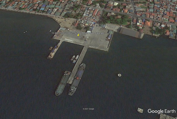
Description and Contacts of Key Companies
For more information on port contacts, please see the following link: 4.4 Port and Waterways Companies Contact List.
Port Performance
|
Seasonal Constraints |
||
|---|---|---|
|
Occurs |
Time Frame |
|
|
Rainy Season |
Yes |
From August to December |
|
Major Import Campaigns |
None |
|
|
Other Comments |
Port congestion and the typhoon season are the top operating constraints. |
|
|
Handling Figures for 2020 |
|
|---|---|
|
Vessel Calls |
207 |
|
Container Traffic (TEUs) |
0 TEUs |
|
Handling Figures Bulk and Break Bulk for 2020 |
|
|---|---|
|
Bulk (MT) |
0 MT |
|
Break bulk (MT) |
172,355 MT |
Discharge Rates and Terminal Handling Charges
For information on port rates and charges, please see the following links:
Vessel: https://www.ppa.com.ph/?q=content/charges-vessel
Cargoes: https://www.ppa.com.ph/?q=content/charges-cargoes
Storage: https://www.ppa.com.ph/?q=content/charges-storage
Berthing Specifications
|
Type of Berth |
Quantity |
Length |
Maximum Draft |
Comments |
|---|---|---|---|---|
|
Conventional Berth |
4 |
2 berths at 95 m 2 berths at 50 m |
10 m |
|
|
Container Berth |
None |
|
||
|
Silo Berth |
None |
|
||
|
Berthing Tugs |
N/A |
|
||
|
Water Barges |
N/A |
|
General Cargo Handling Berths
|
Cargo Type |
Berth Identification |
|---|---|
|
Imports - Bagged Cargo |
None |
|
Exports - Bagged Cargo |
None |
|
Imports and Exports - RoRo |
None |
|
Other Imports |
None |
Port Handling Equipment
There are no handling equipment in the port.
Container Facilities
The Port of Bauan does not have container facilities.
Customs Guidance
The Port of Bauan does not have import and export activities.
For more information on customs in the Philippines, please see the following link: 1.3 Customs Information.
Terminal Information
Multipurpose Terminal
The Port of Bauan does not haveRo-Ro facilities, conventional berthing only for domestic ferries and vessels. It has a 5000 m2 open storage area / port facilities and 4 berthing locations.
Grain and Bulk Handling
The Port of Bauan does not have grain discharging facilities.
General Milling Corporation
General Milling Corporation operates a private port on the Southwest Berth. It is 95 m long with a draft of 10 m. It is located in Sto. Niño, Batangas City 4200 Batangas. +63 (43) 723 0771
San Miguel Foods
San Miguel Foods operates the Golden Bay Grain Terminal in Mabini, Batangas. It is 252 m long with a draft of 13 m.
Stevedoring
PMO Batangas has the mandate for stevedoring activities at the port. San Miguel Arrastre and Stevedoring Services operates at the port.
Hinterland Information
Batangas Hauling and Trucking Services, Inc
- +63 43 723 2879
O-Seven Trucking Services
- Tanauan, Batangas
AMIEL Trucking Services
- Diversion Road 4200 Batangas City
Golden ARM Trucking Services
- Diversion Road, Balagtas, Batangas City
- +63 43 277 6682
- goldenarmtrucking@gmail.com
RMJC Wareshouse Trucking and Hauling Services
- Tinga Labac, Batangas City
- +63 43 300 4151
Penbrooke Trucking Services
- SoroSoro Karsada Batangas City
- +63 43 300 4716
Port Security
The PPA Port Police manages the deployment of security services within the port premises.
|
Security |
|
|---|---|
|
ISPS Compliant |
Yes |
|
Current ISPS Level |
Level 1 |
|
Police Boats |
Coast Guard / PNP Maritime Command |
|
Fire Engines |
LGU Firetrucks |
2.1.18 Philippines - Luzon Port of Romblon
Port Overview
Romblon Island is strategically situated at the center of the Philippine archipelago. Port Romblon may be approached by the channels between Alad Island and Romblon Island,Alad Island and Lugbang Island, or Lugbang Island and Romblon Island. Vessels using the port are mostly domestic Ro-Ro vessels coming from Manila and the nearby island provinces. Port Romblon's LOCODE is PHROM.
Port website: ppa.gov.ph
Key port information may also be found at: http://www.maritime-database.com
|
Port Location and Contact |
|
|---|---|
|
Country |
Philippines |
|
Province or District |
Romblon Province |
|
Nearest Town or City with Distance from Port |
Romblon, Romblon (Port is in city limits) |
|
Port's Complete Name |
Port of Romblon |
|
Latitude |
12.578292 |
|
Longitude |
122.268933 |
|
Managing Company or Port Authority |
Philippine Ports Authority (PPA) |
|
Management Contact Person |
Joselito O. Sinocruz Port Manager, PMO Batangas +6343 722-2429 / 723-0164 |
|
Nearest Airport and Airlines with Frequent International Arrivals/Departures |
Ninoy Aquino International Airport All Nippon Airways, Cathay Pacific Airways, Delta Air Lines, Emirates, Etihad Airways, KLM Royal Dutch Airlines, Qantas Airways, Qatar Airways, Singapore Airlines, Turkish Airlines, United Airlines; Cebu Pacific Air, PAL Express, Philippines AirAsia. |
Port Picture
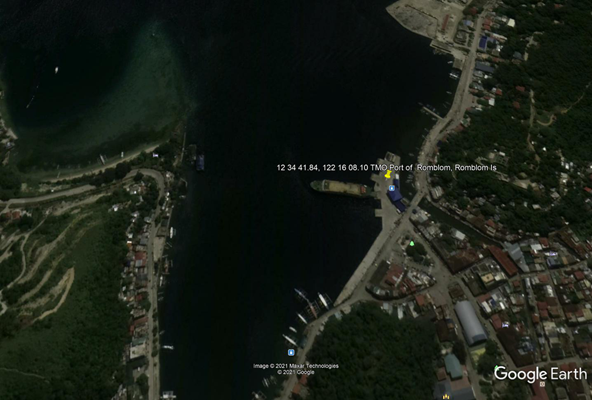
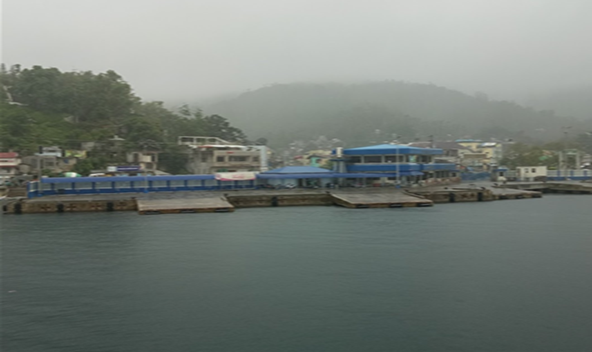
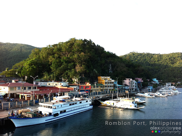
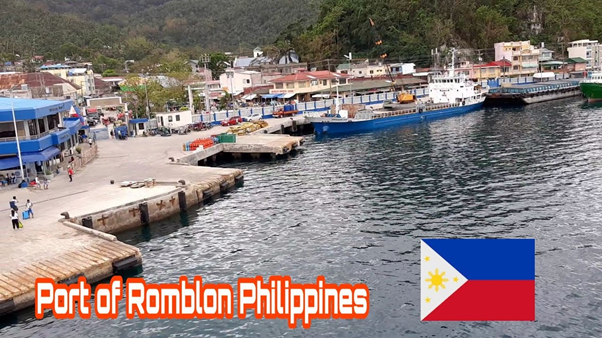
Description and Contacts of Key Companies
For more information on port contacts, please see the following link: 4.4 Port and Waterways Companies Contact List.
Port Performance
|
Seasonal Constraints |
||
|---|---|---|
|
Occurs |
Time Frame |
|
|
Rainy Season |
Yes |
From August to December |
|
Major Import Campaigns |
None |
N/A |
|
Other Comments |
Port congestion and typhoon season |
|
|
Handling Figures for 2020 |
|
|---|---|
|
Vessel Calls |
1,544 |
|
Container Traffic (TEUs) |
0 TEUs |
|
Handling Figures Bulk and Break Bulk for 2020 |
|
|---|---|
|
Bulk (MT) |
0 MT |
|
Break bulk (MT) |
49,960 MT |
Discharge Rates and Terminal Handling Charges
For information on port rates and charges, please see the following links:
Vessel: https://www.ppa.com.ph/?q=content/charges-vessel
Cargoes: https://www.ppa.com.ph/?q=content/charges-cargoes
Storage: https://www.ppa.com.ph/?q=content/charges-storage
Berthing Specifications
|
Type of Berth |
Quantity |
Length |
Maximum Draft |
Comments |
|---|---|---|---|---|
|
Conventional Berth |
4 |
100 m |
9 m |
Mediterranean docking |
|
Container Berth |
None |
|
||
|
Silo Berth |
None |
|
||
|
Berthing Tugs |
None |
|
||
|
Water Barges |
None |
|
General Cargo Handling Berths
|
Cargo Type |
Berth Identification |
|---|---|
|
Imports - Bagged Cargo |
None |
|
Exports - Bagged Cargo |
None |
|
Imports and Exports - RoRo |
None |
|
Other Imports |
None |
Port Handling Equipment
The Port of Romblon does not have port handling equipment.
Container Facilities
The Port of Romblon does not have container handling facilities.
Customs Guidance
The Port of Romblon does not have import and export activities.
For more information on customs in the Philippines, please see the following link: 1.3 Customs Information.
Terminal Information
Multipurpose Terminal
The Port of Romblon has a Ro-Ro berthing facility using Mediterranean docking. It is a domestic ferry and vessel port only. The port has 1100 m2 open storage area / port facilities, and 4 berthing locations.
Grain and Bulk Handling
The Port of Romblon does not have grain handling facilities.
Main Storage Terminal
|
Storage Type |
Number of Storage Facilities |
Area (m2) |
|---|---|---|
|
Bagged Cargo |
None |
|
|
Refrigerated Cargo |
None |
|
|
General Cargo |
Yes, terminal open space |
1,100 m2 |
Stevedoring
PPA TMO Romblon manages the stevedoring activities at the port.
Hinterland Information
Provision of cargo movement and hauling arriving at the port are managed by the cargo owners.
Port Security
The PPA TMO Tablas manages the deployment of security services within the port premises.
|
Security |
|
|---|---|
|
ISPS Compliant |
Yes |
|
Current ISPS Level |
Level 1 |
|
Police Boats |
Coast Guard / PNP Maritime Command |
|
Fire Engines |
LGU Firetrucks |
2.1.19 Philippines - Luzon Port of Tablas
Port Overview
The Port of Tablas (formerly Port of Poctoy) in Romblon is a major seaport serving the largest municipality in the province of Romblon in terms of population and income. it caters to vessels to and from Roxas in Capiz, Caticlan in Aklan, Batangas, Manila, and Romblon town. It serves as inter-island passenger and vehicle transportation port (RoRo). It is located in Brgy Batiano, 5505 Odiongan, Tablas Island, Romblon.
Port website: ppa.gov.ph
Key port information may also be found at: http://www.maritime-database.com
|
Port Location and Contact |
|
|---|---|
|
Country |
Philippines |
|
Province or District |
Romblon |
|
Nearest Town or City with Distance from Port |
Odiongan, Tablas Island |
|
Port's Complete Name |
Port of Tablas |
|
Latitude |
12.418407 |
|
Longitude |
121.988847 |
|
Managing Company or Port Authority |
Philippine Ports Authority |
|
Management Contact Person |
Joselito O. Sinocruz Port Manager, PMO Batangas +6343 722-2429 / 723-0164 |
|
Nearest Airport and Airlines with Frequent International Arrivals/Departures |
Ninoy Aquino International Airport - – via ferry, Manila – Tablas Island All Nippon Airways, Cathay Pacific Airways, Delta Air Lines, Emirates, Etihad Airways, KLM Royal Dutch Airlines, Qantas Airways, Qatar Airways, Singapore Airlines, Turkish Airlines, United Airlines; Cebu Pacific Air, PAL Express, Philippines AirAsia. |
Port Picture
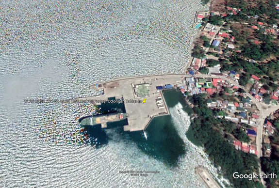
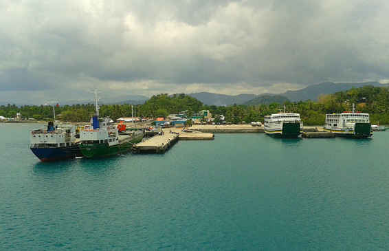
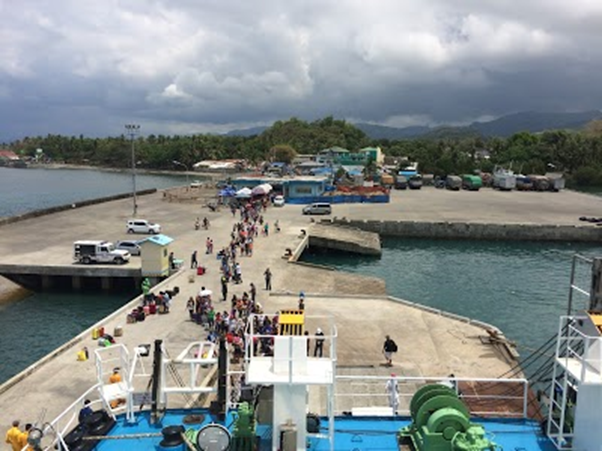
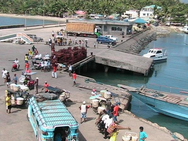
Description and Contacts of Key Companies
For more information on port contacts, please see the following link: 4.4 Port and Waterways Companies Contact List.
Port Performance
|
Seasonal Constraints |
||
|---|---|---|
|
Occurs |
Time Frame |
|
|
Rainy Season |
Yes |
From August to December |
|
Major Import Campaigns |
None |
|
|
Other Comments |
Port congestion and typhoon season |
|
|
Handling Figures for 2020 |
|
|---|---|
|
Vessel Calls |
1,544 |
|
Container Traffic (TEUs) |
0 TEUs |
|
Handling Figures Bulk and Break Bulk for 2020 |
|
|---|---|
|
Bulk (MT) |
0 MT |
|
Break bulk (MT) |
71,658 MT |
Discharge Rates and Terminal Handling Charges
For information on port rates and charges, please see the following links:
Vessel: https://www.ppa.com.ph/?q=content/charges-vessel
Cargoes: https://www.ppa.com.ph/?q=content/charges-cargoes
Storage: https://www.ppa.com.ph/?q=content/charges-storage
Berthing Specifications
|
Type of Berth |
Quantity |
Length |
Maximum Draft |
Comments |
|---|---|---|---|---|
|
Conventional Berth |
4 |
110 m |
10 m |
|
|
Container Berth |
None |
|
||
|
Silo Berth |
None |
|
||
|
Berthing Tugs |
None | |||
|
Water Barges |
None |
General Cargo Handling Berths
|
Cargo Type |
Berth Identification |
|---|---|
|
Imports - Bagged Cargo |
None |
|
Exports - Bagged Cargo |
None |
|
Imports and Exports - RoRo |
None |
|
Other Imports |
None |
Port Handling Equipment
There are no port handling equipment in Tablas Port.
Container Facilities
There are no container handling facilities in Tablas Port.
Customs Guidance
The Port of Tablas does not have import and export activities.
For more information on customs in the Philippines please see the following link: 1.3 Customs Information.
Terminal Information
Multipurpose Terminal
The Port of Tablas is a Ro-Ro berthing facility for domestic ferries and vessels only, using Mediterranean docking. It has 3500 m2 open storage area / port facilities and 4 berthing locations.
Grain and Bulk Handling
The Port of Tablas does not have grain discharging facilities.
Main Storage Terminal
|
Storage Type |
Number of Storage Facilities |
Area (m2) |
|---|---|---|
|
Bagged Cargo |
None |
|
|
Refrigerated Cargo |
None |
|
|
General Cargo |
Yes, Terminal open space |
3500 m2 |
Stevedoring
PPA TMO TABLAS manages the stevedoring activities at the port.
Hinterland Information
The provision of movement and hauling services for cargo arriving at the port are managed by the cargo owners.
Port Security
PPA TMO Tablas manages the deployment of security services within the port premises.
|
Security |
|
|---|---|
|
ISPS Compliant |
Yes |
|
Current ISPS Level |
Level 1 |
|
Police Boats |
Coast Guard / PNP Maritime Command |
|
Fire Engines |
LGU Firetrucks |
2.1.20 Philippines - Luzon Port of Lucena
Port Overview
The Port of Lucena is located 140 km southeast of Manila. The port serves a significant number of passenger and commercial vessels that stop at the pier to pick up and drop off goods and supplies as well as to ferry passengers to and from nearby provinces. It is considered as one of the most important commercial and trading center of the Calabarzon Region.
- Port Management Office – Marinduque/Quezon
Port website: ppa.gov.ph
Key port information may also be found at: http://www.maritime-database.com
|
Port Location and Contact |
|
|---|---|
|
Country |
Philippines |
|
Province or District |
Quezon Province |
|
Nearest Town or City with Distance from Port |
Lucena City |
|
Port's Complete Name |
Port of Lucena |
|
Latitude |
13.906251 |
|
Longitude |
121.626837 |
|
Managing Company or Port Authority |
Philippine Ports Authority |
|
Management Contact Person |
Francisquiel O. Mancile Port Manager, PMO Marinduque and Quezon 2/F Padillo Bldg., Quezon Avenue corner Trinidad St., Lucena City Tel No. : (042) 785 1250 |
|
Nearest Airport and Airlines with Frequent International Arrivals/Departures |
Ninoy Aquino International Airport (131 km) All Nippon Airways, Cathay Pacific Airways, Delta Air Lines, Emirates, Etihad Airways, KLM Royal Dutch Airlines, Qantas Airways, Qatar Airways, Singapore Airlines, Turkish Airlines, United Airlines; Cebu Pacific Air, PAL Express, Philippines AirAsia. |
Port Picture
Description and Contacts of Key Companies
| Company | Address | Phone Number |
|---|---|---|
|
NLT Trucking Services |
Km. 131 Diversion Rd., Ibabang Dupay, Lucena City | +63 42 373 4721 |
| 4M Transport & Sales Corp | 1080 Dona Aurora Boulevard, Lucena, 4301 Quezon Province | +63 472 373 5808 |
| CVR Express Lucena City | 36 Quezon Ave. Brgy 11, Poblacion Lucena City | +63 0916 256 0942 |
| Magadia Trucking Services | Pan-Philippine Hwy, Tayabas, 4327 Quezon | +63 927 502 7704 |
| Daily Overland Freight Forwarder | 47 Cabana St, Lucena, 4301 Quezon |
Warehouses in Lucena City
- No commercial warehouse for rent
- NFA Lucena WH
- PPA PMO MarQuez
For more information on port contacts, please see the following link: 4.4 Port and Waterways Companies Contact List.
Port Performance
|
Seasonal Constraints |
||
|---|---|---|
|
Occurs |
Time Frame |
|
|
Rainy Season |
Yes |
From August to December |
|
Major Import Campaigns |
None |
|
|
Other Comments |
Interruptions of port operations during typhoons. |
|
|
Handling Figures for 2020 |
|
|---|---|
|
Vessel Calls |
4,424 |
|
Container Traffic (TEUs) |
0 TEUs |
|
Handling Figures Bulk and Break Bulk for 2020 |
|
|---|---|
|
Bulk (MT) |
82,005 MT |
|
Break bulk (MT) |
1,949 MT |
Discharge Rates and Terminal Handling Charges
For information on port rates and charges, please see the following links:
Vessel: https://www.ppa.com.ph/?q=content/charges-vessel
Cargoes: https://www.ppa.com.ph/?q=content/charges-cargoes
Storage: https://www.ppa.com.ph/?q=content/charges-storage
Berthing Specifications
|
Type of Berth |
Quantity |
Length |
Maximum Draft |
Comments |
|---|---|---|---|---|
|
Conventional Berth |
9 |
172 m |
6 m |
With 4 RORO ramps, 9 m wide |
|
Container Berth |
None |
|
||
|
Silo Berth |
None |
|
||
|
Berthing Tugs |
None |
|||
|
Water Barges |
None |
|
General Cargo Handling Berths
|
Cargo Type |
Berth Identification |
|---|---|
|
Imports - Bagged Cargo |
None |
|
Exports - Bagged Cargo |
None |
|
Imports and Exports - RoRo |
None |
|
Other Imports |
None |
Port Handling Equipment
The Port of Lucena does not have port handling equipment.
Container Facilities
The Port of Lucena does not have container facilities.
Customs Guidance
The Port of Lucena handles domestic RORO passenger and cargo vessels only.
For more information on customs in the Philippines, please see the following link: 1.3 Customs Information.
Terminal Information
Multipurpose Terminal
The Port of Lucena Terminal has an 8000 m2 open general cargo area.
Grain and Bulk Handling
The Port of Lucena has no grain discharging facilities.
Main Storage Terminal
|
Storage Type |
Number of Storage Facilities |
Area (m2) |
|---|---|---|
|
Bagged Cargo |
None |
|
|
Refrigerated Cargo |
None |
|
|
General Cargo |
Open storage area |
8000 m2 |
Stevedoring
TMO Lucena will provide stevedoring at the port.
Port Security
PPA PMO Lucena manages the deployment of security services within the port premises.
|
Security |
|
|---|---|
|
ISPS Compliant |
Yes |
|
Current ISPS Level |
Level 1 |
|
Police Boats |
Coast Guard / PNP Maritime Command |
|
Fire Engines |
LGU Firetrucks |
2.1.21 Philippines - Luzon Port of Balanacan
Port Overview
The Port of Balanacan is one of the major ports of entry in the province of Marinduque, on the western side of the province. It links Marinduque to the main Island of Luzon and to the island provinces in the Visayas region. Port Balanacan is made up of two small but perfectly-protected anchorages which can accommodate moderate-sized vessels. The harbor is backed by high hills and, except for one reef in the entrance, is free from dangers.
Port website: ppa.gov.ph
Key port information may also be found at: http://www.maritime-database.com
|
Port Location and Contact |
|
|---|---|
|
Country |
Philippines |
|
Province or District |
Marinduque |
|
Nearest Town or City with Distance from Port |
Mogpog, Marinduque |
|
Port's Complete Name |
Port of Balanacan |
|
Latitude |
13.534115 |
|
Longitude |
121.865174 |
|
Managing Company or Port Authority |
Philippine Ports Authority |
|
Management Contact Person |
Feancisquiel O. Mancile Port Manager, PMO Marinduque and Quezon Tel No. : (042) 785 1250 |
|
Nearest Airport and Airlines with Frequent International Arrivals/Departures |
Ninoy Aquino International Airport All Nippon Airways, Cathay Pacific Airways, Delta Air Lines, Emirates, Etihad Airways, KLM Royal Dutch Airlines, Qantas Airways, Qatar Airways, Singapore Airlines, Turkish Airlines, United Airlines; Cebu Pacific Air, PAL Express, Philippines AirAsia. |
Port Picture
Description and Contacts of Key Companies
Transporters in Marinduque
RL MONTALBAN TRUCKING
Balimbing Boac Marinduque 4900 Boac, Philippines
+63 968 252 9947 Smart
+63 916 569 3865 Globe
VENNICE TRUCKING & HAULING SERVICES
Duyay, Boac 4900 Boac, Philippines
+63 939 719 2816
Warehouses in Marinduque City
There are no commercial warehouses for rent in Marinduque City, but the National Food Authority (NFA) and the Port of Balanacan warehouses may be available.
For more information on port contacts, please see the following link: 4.4 Port and Waterways Companies Contact List.
Port Performance
|
Seasonal Constraints |
||
|---|---|---|
|
Occurs |
Time Frame |
|
|
Rainy Season |
Yes |
From August to December |
|
Major Import Campaigns |
None |
|
|
Other Comments |
Typhoons may disrupt port operations. | |
|
Handling Figures for 2020 |
|
|---|---|
|
Vessel Calls |
3,713 |
|
Container Traffic (TEUs) |
0 TEUs |
|
Handling Figures Bulk and Break Bulk for 2020 |
|
|---|---|
|
Bulk (MT) |
0 MT |
|
Break bulk (MT) |
4,515 MT |
Discharge Rates and Terminal Handling Charges
For information on port rates and charges, please see the following links:
Vessels: https://www.ppa.com.ph/?q=content/charges-vessel
Cargoes: https://www.ppa.com.ph/?q=content/charges-cargoes
Storage: https://www.ppa.com.ph/?q=content/charges-storage
Berthing Specifications
|
Type of Berth |
Quantity |
Length |
Maximum Draft |
Comments |
|---|---|---|---|---|
|
Conventional Berth |
3 |
126 m |
6 m |
With 2 RORO ramps 9m wide |
|
Container Berth |
None |
|
||
|
Silo Berth |
None |
|
||
|
Berthing Tugs |
None |
|||
|
Water Barges |
None |
General Cargo Handling Berths
|
Cargo Type |
Berth Identification |
|---|---|
|
Imports - Bagged Cargo |
None |
|
Exports - Bagged Cargo |
None |
|
Imports and Exports - RoRo |
None |
|
Other Imports |
None |
Port Handling Equipment
The Port of Balanacan does not have port handling equipment.
Container Facilities
The Port of Balanacan does not have container facilities.
Customs Guidance
The Port of Balanacan handles domestic RORO passenger and cargo vessels only.
For more information on customs in the Philippines, please see the following link: 1.3 Customs Information.
Terminal Information
Multipirpose Terminal
The nearby Port of Lucena has an open air terminal open area and a 4000 m2 general cargo area. It also has a 200 m2 cargo shed.
Grain and Bulk Handling
The Port of Balanacan does not have grain discharging facilities.
Main Storage Terminal
|
Storage Type |
Number of Storage Facilities |
Area (m2) |
|---|---|---|
|
Bagged Cargo |
None |
|
|
Refrigerated Cargo |
None |
|
|
General Cargo |
Open storage area |
4000 m2 |
Stevedoring
The TMO Balanacan will provide stevedoring at the port.
Hinterland Information
Cargoes coming from mainland Luzon are coming on trucks via Roro vessels.
Port Security
PPA PMO Balanacan manages the deployment of security services within the port premises.
|
Security |
|
|---|---|
|
ISPS Compliant |
Yes |
|
Current ISPS Level |
Level 1 |
|
Police Boats |
Coast Guard / PNP Maritime Command |
|
Fire Engines |
LGU Firetrucks |
2.1.22 Philippines - Luzon Port of Cawit
Port Overview
The Port of Cawit is another alternative entry point for Marinduque, aside from the Port of Balanacan and Buyabod. It is located at Bgry. Cawit, Boac, Marinduque. The reinforced concrete L-shaped pier handles agricultural and marine products, consumer goods and accommodates passengers.
The Port of Cawit was re-opened in 2008, and is situated on the mid-western side of mainland Marinduque serving as a major port for the towns of Boac, Gasan and Buenavista. It handles agricultural and trade products, construction materials and passenger services.
Port website: ppa.gov.ph
Key port information may also be found at: http://www.maritime-database.com
|
Port Location and Contact |
|
|---|---|
|
Country |
Philippines |
|
Province or District |
Marinduque |
|
Nearest Town or City with Distance from Port |
Boac, Marinduque |
|
Port's Complete Name |
Port of Kawit |
|
Latitude |
13.382112 |
|
Longitude |
121.821274 |
|
Managing Company or Port Authority |
Philippine Ports Authority |
|
Management Contact Person |
Francisquiel O. Mancile Port Manager, PMO Marinduque and Quezon Tel No. : (042) 785 1250 |
|
Nearest Airport and Airlines with Frequent International Arrivals/Departures |
Ninoy Aquino International Airport All Nippon Airways, Cathay Pacific Airways, Delta Air Lines, Emirates, Etihad Airways, KLM Royal Dutch Airlines, Qantas Airways, Qatar Airways, Singapore Airlines, Turkish Airlines, United Airlines; Cebu Pacific Air, PAL Express, Philippines AirAsia. |
Port Picture
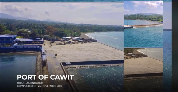
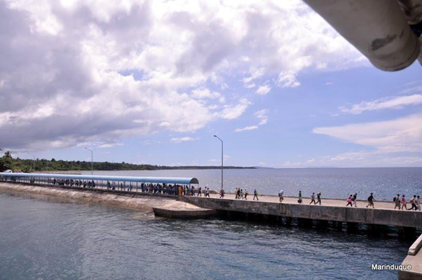
Description and Contacts of Key Companies
Transporters in Marinduque
RL MONTALBAN TRUCKING
Balimbing Boac Marinduque 4900 Boac, Philippines
+63 968 252 9947 Smart
+63 916 569 3865 Globe
VENNICE TRUCKING & HAULING SERVICES
Duyay, Boac 4900 Boac, Philippines
+63 939 719 2816
Warehouses in Marinduque City
There are no commercial warehouses for rent in Marinduque City, but the National Food Authority (NFA) and the Port of Balanacan warehouses may be available.
For more information on port contacts, please see the following link: 4.4 Port and Waterways Companies Contact List.
Port Performance
|
Seasonal Constraints |
||
|---|---|---|
|
Occurs |
Time Frame |
|
|
Rainy Season |
Yes |
From August to December |
|
Major Import Campaigns |
None |
|
|
Other Comments |
Typhoons may disrupt port operations. |
|
|
Handling Figures for 2020 |
|
|---|---|
|
Vessel Calls |
269 |
|
Container Traffic (TEUs) |
0 TEUs |
|
Handling Figures Bulk and Break Bulk for 2020 |
|
|---|---|
|
Bulk (MT) |
0 MT |
|
Break bulk (MT) |
23,514 MT |
Discharge Rates and Terminal Handling Charges
For information on port rates and charges, please see the following link:
Vessel: https://www.ppa.com.ph/?q=content/charges-vessel
Cargoes: https://www.ppa.com.ph/?q=content/charges-cargoes
Storage: https://www.ppa.com.ph/?q=content/charges-storage
Berthing Specifications
|
Type of Berth |
Quantity |
Length |
Maximum Draft |
Comments |
|---|---|---|---|---|
|
Conventional Berth |
3 |
120 m |
11 m |
With 2 RORO ramp 7 m wide |
|
Container Berth |
None |
|
||
|
Silo Berth |
None |
|
||
|
Berthing Tugs |
None |
|
||
|
Water Barges |
None |
|
General Cargo Handling Berths
|
Cargo Type |
Berth Identification |
|---|---|
|
Imports - Bagged Cargo |
None |
|
Exports - Bagged Cargo |
None |
|
Imports and Exports - RoRo |
None |
|
Other Imports |
None |
Port Handling Equipment
The Port of Cawit has no handling eguipment.
Container Facilities
The Port of Cawit has no container facilities.
Customs Guidance
The Port of Cawit handles domestic RORO passenger and cargo vessels only.
For more information on customs in the Philippines, please see the following link: 1.3 Customs Information.
Terminal Information
Multipurpose Terminal
The Port of Cawit terminal has a 2500 m2 open general cargo area.
Grain and Bulk Handling
The Port of Cawit has no grain discharging facilities.
Main Storage Terminal
|
Storage Type |
Number of Storage Facilities |
Area (m2) |
|---|---|---|
|
Bagged Cargo |
None |
|
|
Refrigerated Cargo |
None |
|
|
General Cargo |
Open storage area |
2500 m2 |
Stevedoring
The TMO CAWIT Office will provide stevedoring at the port.
Hinterland Information
Cargoes coming from mainland Luzon are coming on trucks via Roro vessels.
Port Security
The PPA PMO Cawit manages the deployment of security services within the port premises.
|
Security |
|
|---|---|
|
ISPS Compliant |
Yes |
|
Current ISPS Level |
Level 1 |
|
Police Boats |
Coast Guard / PNP Maritime Command |
|
Fire Engines |
LGU fire trucks |
2.1.23 Philippines - Luzon Port of Santa Cruz
Port Overview
The Port of Sta. Cruz in the province of Marinduque is one of the three (3) main entry point of the province. It serves the eastern side of Marinduque catering to the towns of Sta. Cruz and Torrijos. Port Buyabud, which can be identified by its lengthy pier, is located on the south side of the mouth of the Santa Cruz River, in a position about 0.5 miles south of Tabignan Point, the new entrance point of the river. It is the loading place for the village of Santa Cruz.
There is an ore pier at Balogo, about 0.4 mile north of the light structure. The T-shaped pier, 55.8 m long, 13.8 m wide with a depth alongside of 10.1 m, can take vessels with a draft of 9 m. The pier lies in a 317°-137° direction at the head of a causeway 387m long, built out from the shore. Pier No. 2 is 39 m long and 12.6 m wide. Concrete dolphins are provided off each end of the pier to take mooring lines.
Port website: ppa.gov.ph
Key port information may also be found at: http://www.maritime-database.com
|
Port Location and Contact |
|
|---|---|
|
Country |
Philippines |
|
Province or District |
Marinduque |
|
Nearest Town or City with Distance from Port |
Santa Cruz, Marinduque |
|
Port's Complete Name |
Port of Santa Cruz (Buyabod) |
|
Latitude |
13.480637 |
|
Longitude |
122.055994 |
|
Managing Company or Port Authority |
Philippine Ports Authority (PPA) |
|
Management Contact Person |
Francisquiel O. Mancile Port Manager, PMO Marinduque and Quezon Tel No. : (042) 785 1250 |
|
Nearest Airport and Airlines with Frequent International Arrivals/Departures |
Ninoy Aquino International Airport All Nippon Airways, Cathay Pacific Airways, Delta Air Lines, Emirates, Etihad Airways, KLM Royal Dutch Airlines, Qantas Airways, Qatar Airways, Singapore Airlines, Turkish Airlines, United Airlines; Cebu Pacific Air, PAL Express, Philippines AirAsia. |
Port Picture


Description and Contacts of Key Companies
Transporters in Marinduque
RL MONTALBAN TRUCKING
Balimbing Boac Marinduque 4900 Boac, Philippines
+63 968 252 9947 (Smart)
+63 916 569 3865 (Globe)
VENNICE TRUCKING & HAULING SERVICES
Duyay, Boac 4900 Boac, Philippines
+63 939 719 2816
Warehouses in Marinduque City
There are no commercial warehouses for rent in Marinduque City, but the National Food Authority (NFA) and the Port of Balanacan warehouses may be available.
For more information on port contacts, please see the following link: 4.4 Port and Waterways Companies Contact List.
Port Performance
|
Seasonal Constraints |
||
|---|---|---|
|
Occurs |
Time Frame |
|
|
Rainy Season |
Yes |
From August to December |
|
Major Import Campaigns |
None |
|
|
Other Comments |
Typhoons may disrupt port operations. |
|
|
Handling Figures for 2020 |
|
|---|---|
|
Vessel Calls |
231 |
|
Container Traffic (TEUs) |
0 TEUs |
|
Handling Figures Bulk and Break Bulk for 2020 |
|
|---|---|
|
Bulk (MT) |
0 MT |
|
Break bulk (MT) |
29,146 MT |
Discharge Rates and Terminal Handling Charges
For information on port rates and charges, please see the following links:
Vessel: https://www.ppa.com.ph/?q=content/charges-vessel
Cargoes: https://www.ppa.com.ph/?q=content/charges-cargoes
Storage: https://www.ppa.com.ph/?q=content/charges-storage
Berthing Specifications
|
Type of Berth |
Quantity |
Length |
Maximum Draft |
Comments |
|---|---|---|---|---|
|
Conventional Berth |
2 |
86 m |
7 m |
With 1 RORO ramp 9 m wide |
|
Container Berth |
None |
|
||
|
Silo Berth |
None |
|
||
|
Berthing Tugs |
None |
|
||
|
Water Barges |
None |
|
General Cargo Handling Berths
|
Cargo Type |
Berth Identification |
|---|---|
|
Imports - Bagged Cargo |
None |
|
Exports - Bagged Cargo |
None |
|
Imports and Exports - RoRo |
None |
|
Other Imports |
None |
Port Handling Equipment
The Port of Santa Cruz does not have port handling equipment.
Container Facilities
The Port of Santa Cruz does not have container facilities.
Customs Guidance
The Port of Santa Cruz handles domestic RORO passenger and cargo vessels only.
For more information on customs in the Philippines, please see the following link: 1.3 Customs Information.
Terminal Information
Multipurpose Terminal
The Port of Santa Cruz Terminal has a 2900 m2 open general cargo area.
Grain and Bulk Handling
The Port of Santa Cruz does not have grain discharging facilities.
Main Storage Terminal
|
Storage Type |
Number of Storage Facilities |
Area (m2) |
|---|---|---|
|
Bagged Cargo |
None |
|
|
Refrigerated Cargo |
None |
|
|
General Cargo |
Open storage area |
2900 m2 |
Stevedoring
The TMO STA CRUZ will provide stevedoring at the port.
Hinterland Information
Cargoes coming from mainland Luzon are coming on trucks via Roro vessels.
Port Security
The PPA PMO Santa Cruz manages the deployment of security services within the port premises.
|
Security |
|
|---|---|
|
ISPS Compliant |
Yes |
|
Current ISPS Level |
Level 1 |
|
Police Boats |
Coast Guard / PNP Maritime Command |
|
Fire Engines |
LGU fire trucks |
2.1.24 Philippines - Luzon Port of Calapan
Port Overview
The Port of Calapan is on Calapan Bay, which is exposed to all winds from north through west is not considered a safe port during the northeast monsoon. The recommended anchorage is in 13 to 18 m, rocky bottom, with the church bearing 177°, and the N extremity of Calapan Point, bearing 063°. The holding ground is poor. The government wharf, on the west side of Calapan Point, is T-headed and extends about 45m from the shore. The T-head is 33m long, with 3 to 5.5 m alongside. The north end is broadened and provides a berth 30m long with a controlling depth of 3.6 m alongside. The port has at least seven berths which can accommodate fastcraft, conventional and RoRo vessels. Primary items handled at the port are agricultural products such as copra, rice, and banana for outgoing cargo and cement, fertilizer and general commodities for incoming cargo.
Port website: ppa.gov.ph
Key port information may also be found at: http://www.maritime-database.com
|
Port Location and Contact |
|
|---|---|
|
Country |
Philippines |
|
Province or District |
Oriental Mindoro |
|
Nearest Town or City with Distance from Port |
Calapan |
|
Port's Complete Name |
Port of Calapan |
|
Latitude |
13.428324 |
|
Longitude |
121.194585 |
|
Managing Company or Port Authority |
Philippine Ports Authority (PPA) |
|
Management Contact Person |
Leo A. Romero Acting Port Manager, PMO Mindoro |
|
Nearest Airport and Airlines with Frequent International Arrivals/Departures |
Ninoy Aquino International Airport - via seacraft Calapan Port to Batangas Port to Manila All Nippon Airways, Cathay Pacific Airways, Delta Air Lines, Emirates, Etihad Airways, KLM Royal Dutch Airlines, Qantas Airways, Qatar Airways, Singapore Airlines, Turkish Airlines, United Airlines; Cebu Pacific Air, PAL Express, Philippines AirAsia. |
Port Picture

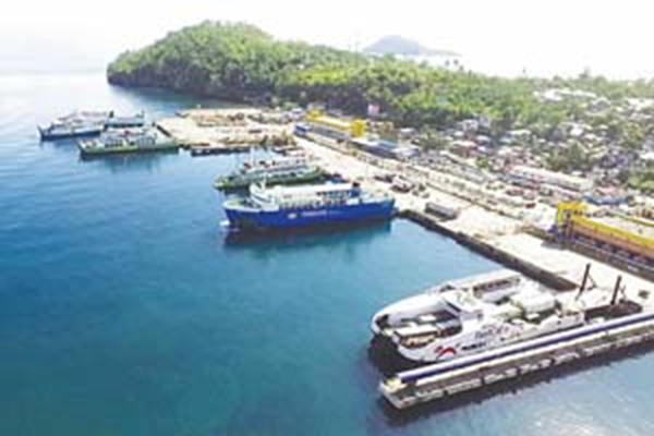
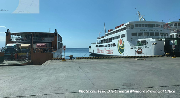
Description and Contacts of Key Companies
Calapan Labor Service Development Cooperative (Stevedoring Services)
Roxas Drive, LumangBayan 5200 Calapan, Philippines
For more information on port contacts, please see the following link: 4.4 Port and Waterways Companies Contact List.
Port Performance
|
Seasonal Constraints |
||
|---|---|---|
|
Occurs |
Time Frame |
|
|
Rainy Season |
Yes |
From August to December |
|
Major Import Campaigns |
None |
|
|
Other Comments |
Typhoons may disrupt port operations. |
|
|
Handling Figures for 2020 |
|
|---|---|
|
Vessel Calls |
10,672 |
|
Container Traffic (TEUs) |
0 TEUs |
|
Handling Figures Bulk and Break Bulk for 2020 |
|
|---|---|
|
Bulk (MT) |
0 MT |
|
Break bulk (MT) |
68,188 MT |
Discharge Rates and Terminal Handling Charges
For information on port rates and charges, please see the following links:
Vessels: https://www.ppa.com.ph/?q=content/charges-vessel
Cargoes: https://www.ppa.com.ph/?q=content/charges-cargoes
Storage: https://www.ppa.com.ph/?q=content/charges-storage
Berthing Specifications
|
Type of Berth |
Quantity |
Length |
Maximum Draft |
Comments |
|---|---|---|---|---|
|
Conventional Berth |
7 |
500 m |
5 m |
|
|
Container Berth |
None |
|||
|
Silo Berth |
None |
|
||
|
Berthing Tugs |
None |
|||
|
Water Barges |
None |
General Cargo Handling Berths
|
Cargo Type |
Berth Identification |
|---|---|
|
Imports - Bagged Cargo |
None |
|
Exports - Bagged Cargo |
None |
|
Imports and Exports - RoRo |
None |
|
Other Imports |
None |
Port Handling Equipment
|
Equipment |
Available |
Total Quantity and Capacity Available |
Comments on Current Condition and Actual Usage |
|---|---|---|---|
|
Dockside Crane |
None |
||
|
Container Gantries |
None |
||
|
Mobile Cranes |
None |
||
|
Reachstacker |
None |
||
|
RoRo Tugmaster (with Trailer) |
None |
||
|
Grain Elevator with Bagging Machines |
None |
||
|
Transtainer |
None |
||
|
Forklifts |
Yes |
Container Facilities
The Port of Calapan does not have container facilities.
Customs Guidance
The Port of Calapan handles domestic RORO passenger and cargo vessels only.
For more information on customs in the Philippines, please see the following link: 1.3 Customs Information.
Terminal Information
Multipurpose Terminal
The Port of Calapan Terminal has an 800 m2 open area along with an existing terminal building.
Grain and Bulk Handling
The Port of Calapan has no grain discharging facilities.
Main Storage Terminal
|
Storage Type |
Number of Storage Facilities |
Area (m2) |
|---|---|---|
|
Bagged Cargo |
None |
|
|
Refrigerated Cargo |
None |
|
|
General Cargo |
Open storage area |
800 m2 |
Stevedoring
CALSEDECO is presently the operator of Cargo Handling Services at the Port of Calapan City, Oriental Mindoro having been authorized as service provider by and has a permit to operate and management contract with the Philippine Ports Authority since 1975.
Hinterland Information
There are no commercial transporter and warehouse vendors in Calapan.
Port Security
The PPA PMO Calapan manages the deployment of security services within the port premises.
|
Security |
|
|---|---|
|
ISPS Compliant |
Yes |
|
Current ISPS Level |
Level 1 |
|
Police Boats |
Coast Guard / PNP Maritime Command |
|
Fire Engines |
LGU fire trucks |
2.1.25 Philippines - Luzon Port of Abra de Ilog
Port Overview
The Matabang Port, Abra De Ilog, is about 2.5 hours by RORO ferry from the Port of Batangas. Incoming cargoes are mainly household goods and construction materials, and outgoing cargoes mainly consist of rice, livestock and corn.
Port website: ppa.gov.ph
Key port information may also be found at: http://www.maritime-database.com
|
Port Location and Contact |
|
|---|---|
|
Country |
Philippines |
|
Province or District |
Occidental Mindoro |
|
Nearest Town or City with Distance from Port |
Abra De Ilog (in town limits) |
|
Port's Complete Name |
Port of Abra De Ilog |
|
Latitude |
13.467514 |
|
Longitude |
120.772079 |
|
Managing Company or Port Authority |
Philippine Ports Authority (PPA) |
|
Management Contact Person |
Leo A. Romero Acting Port Manager, PMO Mindoro |
|
Nearest Airport and Airlines with Frequent International Arrivals/Departures |
Ninoy Aquino International Airport - via seacraft, Calapan Port to Batangas Port, and then to Manila All Nippon Airways, Cathay Pacific Airways, Delta Air Lines, Emirates, Etihad Airways, KLM Royal Dutch Airlines, Qantas Airways, Qatar Airways, Singapore Airlines, Turkish Airlines, United Airlines; Cebu Pacific Air, PAL Express, Philippines AirAsia. |
Port Picture
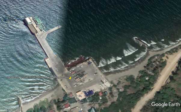
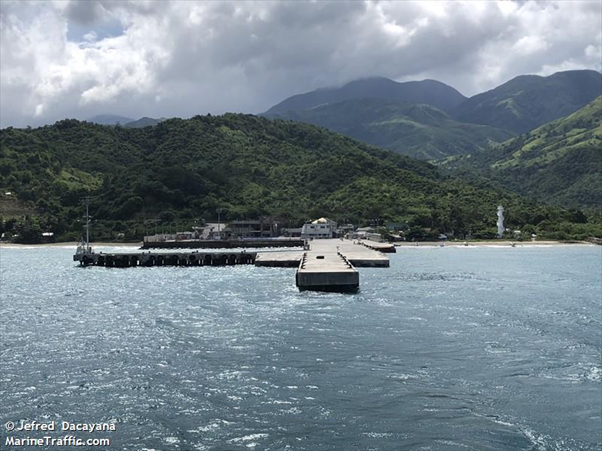
Description and Contacts of Key Companies
For more information on port contacts, please see the following link: 4.4 Port and Waterways Companies Contact List.
Port Performance
|
Seasonal Constraints |
||
|---|---|---|
|
Occurs |
Time Frame |
|
|
Rainy Season |
Yes |
From August to December |
|
Major Import Campaigns |
None |
|
|
Other Comments |
Typhoons may disrupt port operations. |
|
|
Handling Figures for 2020 |
|
|---|---|
|
Vessel Calls |
4,163 |
|
Container Traffic (TEUs) |
0 TEUs |
|
Handling Figures Bulk and Break Bulk for 2020 |
|
|---|---|
|
Bulk (MT) |
0 MT |
|
Break bulk (MT) |
2,188 MT |
Discharge Rates and Terminal Handling Charges
For information on port rates and charges, please see the following links:
Vessel: https://www.ppa.com.ph/?q=content/charges-vessel
Cargoes: https://www.ppa.com.ph/?q=content/charges-cargoes
Storage: https://www.ppa.com.ph/?q=content/charges-storage
Berthing Specifications
|
Type of Berth |
Quantity |
Length |
Maximum Draft |
Comments |
|---|---|---|---|---|
|
Conventional Berth |
4 |
170 m |
5 m |
With 3 RORO ramps, 8 m wide |
|
Container Berth |
None |
|
||
|
Silo Berth |
None |
|
||
|
Berthing Tugs |
None |
|
||
|
Water Barges |
None |
|
General Cargo Handling Berths
|
Cargo Type |
Berth Identification |
|---|---|
|
Imports - Bagged Cargo |
None |
|
Exports - Bagged Cargo |
None |
|
Imports and Exports - RoRo |
None |
|
Other Imports |
None |
Port Handling Equipment
The port of Abra de Ilog does not have port handling equipment. Cargoes are on trucks via RORO vessels.
Container Facilities
The port of Abra de Ilog does not have container facilities.
Customs Guidance
The Port of Abra de Ilog handles domestic RORO passenger and cargo vessels only.
For more information on customs in the Philippines, please see the following link: 1.3 Customs Information.
Terminal Information
Multipurpose Terminal
The Port of Abra de Ilog Terminal has a 4000 m2 open area with an existing terminal building.
Grain and Bulk Handling
The Port of Abra de Ilog does not have grain discharging facilities.
Main Storage Terminal
|
Storage Type |
Number of Storage Facilities |
Area (m2) |
|---|---|---|
|
Bagged Cargo |
None |
|
|
Refrigerated Cargo |
None |
|
|
General Cargo |
Open storage area |
4000 m2 |
Stevedoring
The TMO ABRA DE ILOG will provide stevedoring services at the port.
Hinterland Information
Cargoes coming from mainland Luzon are coming on trucks via Roro vessels.
Port Security
The PPA PMO Abra De Ilog manage the deployment of security services within the port premises.
|
Security |
|
|---|---|
|
ISPS Compliant |
Yes |
|
Current ISPS Level |
Level 1 |
|
Police Boats |
Coast Guard / PNP Maritime Command |
|
Fire Engines |
LGU fire trucks |
2.1.26 Philippines - Luzon Port of Dangay
Port Overview
The Port of Roxas, Oriental Mindoro or Dangay Port is the seaport in Roxas, Oriental Mindoro in the Philippines. The seaport serves as a gateway to Mindanao and Visayas from Luzon with passengers being transported from the Dangay port to Caticlan.
Port website: ppa.gov.ph
Key port information may also be found at: http://www.maritime-database.com
|
Port Location and Contact |
|
|---|---|
|
Country |
Philippines |
|
Province or District |
Oriental Mindoro |
|
Nearest Town or City with Distance from Port |
Roxas, Oriental Mindoro |
|
Port's Complete Name |
Port of Dangay, Roxas |
|
Latitude |
12.592977 |
|
Longitude |
121.530576 |
|
Managing Company or Port Authority |
Philippine Ports Authority (PPA) |
|
Management Contact Person |
Leo A. Romero Acting Port Manager, PMO Mindoro |
|
Nearest Airport and Airlines with Frequent International Arrivals/Departures |
Ninoy Aquino International Airport All Nippon Airways, Cathay Pacific Airways, Delta Air Lines, Emirates, Etihad Airways, KLM Royal Dutch Airlines, Qantas Airways, Qatar Airways, Singapore Airlines, Turkish Airlines, United Airlines; Cebu Pacific Air, PAL Express, Philippines AirAsia. |
Port Picture
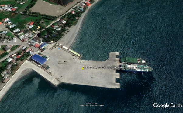
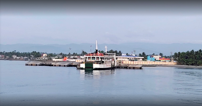
Description and Contacts of Key Companies
Transporters in Mindoro
- O. PONGYAN TRUCKING SERVICES, Bongabong, Oriental Mindoro
- LIZA PANGANIBAN GRAVEL and SAND, Tall Bridge, Panganiban Compound, Strong Republic Nautical Hwy, Naujan, Oriental Mindoro. +63 918 201 5030
- PINK KANGAROO TRUCKING SERVICES, San Jose, Occidental Mindoro, +63 43 491 1553
For more information on port contacts, please see the following link: 4.4 Port and Waterways Companies Contact List.
Port Performance
|
Seasonal Constraints |
||
|---|---|---|
|
Occurs |
Time Frame |
|
|
Rainy Season |
Yes |
From August to December |
|
Major Import Campaigns |
None |
|
|
Other Comments |
Typhoons may disrupt port operations. |
|
|
Handling Figures for 2020 |
|
|---|---|
|
Vessel Calls |
1,925 |
|
Container Traffic (TEUs) |
0 TEUs |
|
Handling Figures Bulk and Break Bulk for 2020 |
|
|---|---|
|
Bulk (MT) |
0 MT |
|
Break bulk (MT) |
402,825 MT |
Discharge Rates and Terminal Handling Charges
For information on port rates and charges, please see the following links:
Vessel: https://www.ppa.com.ph/?q=content/charges-vessel
Cargoes: https://www.ppa.com.ph/?q=content/charges-cargoes
Storage: https://www.ppa.com.ph/?q=content/charges-storage
Berthing Specifications
|
Type of Berth |
Quantity |
Length |
Maximum Draft |
Comments |
|---|---|---|---|---|
|
Conventional Berth |
1 |
90 m |
5 m |
With 5 RORO ramps, 8 m wide |
|
Container Berth |
None |
|
||
|
Silo Berth |
None |
|
||
|
Berthing Tugs |
None |
|
||
|
Water Barges |
None |
|
General Cargo Handling Berths
|
Cargo Type |
Berth Identification |
|---|---|
|
Imports - Bagged Cargo |
None |
|
Exports - Bagged Cargo |
None |
|
Imports and Exports - RoRo |
None |
|
Other Imports |
None |
Port Handling Equipment
The Port of Dangay does not have port handling equipment.
Container Facilities
The Port of Dangay does not have container facilities.
Customs Guidance
The Port of Dangay handles domestic RORO passenger and rolling cargo vessels only.
For more information on customs in the Philippines, please see the following link: 1.3 Customs Information.
Terminal Information
Multipurpose Terminal
The Port of Dangay Terminal has an 1800 m2 open area and an existing terminal building.
Grain and Bulk Handling
The Port of Dangay does not have grain discharging facilities.
Main Storage Terminal
|
Storage Type |
Number of Storage Facilities |
Area (m2) |
|---|---|---|
|
Bagged Cargo |
None |
|
|
Refrigerated Cargo |
None |
|
|
General Cargo |
Open storage area |
1,800 m2 |
Stevedoring
The TMO Dangay will provide stevedoring services at the port.
Hinterland Information
Mostly truck are coming from Batangas City Port.
Port Security
The PPA PMO Dangay manages the deployment of security services within the port premises.
|
Security |
|
|---|---|
|
ISPS Compliant |
Yes |
|
Current ISPS Level |
Level 1 |
|
Police Boats |
Coast Guard / PNP Maritime Command |
|
Fire Engines |
LGU fire trucks |
2.1.27 Philippines - Luzon Port of Balatero / Puerto Galera
Port Overview
The Ports of Puerto Galera and Balatero are under TMO Puerto Galera. The Port of Puerto Galera is used by fast craft passenger vessels while the Port of Balatero is used by rolling cargo vessels. The Port of Balatero has two RORO ramp for rolling cargoes and a wharf for small passenger vessel seacraft. Rolling cargoes are mostly from the Port of Batangas.
Port website: ppa.gov.ph
Key port information may also be found at: http://www.maritime-database.com
|
Port Location and Contact |
|
|---|---|
|
Country |
Philippines |
|
Province or District |
Oriental Mindoro |
|
Nearest Town or City with Distance from Port |
Puerto Galera |
|
Port's Complete Name |
Port of Balatero |
|
Latitude |
13.506847 |
|
Longitude |
120.933098 |
|
Managing Company or Port Authority |
Philippine Ports Authority |
|
Management Contact Person |
Leo A. Romero Acting Port Manager, PMO Mindoro |
|
Nearest Airport and Airlines with Frequent International Arrivals/Departures |
Ninoy Aquino International Airport All Nippon Airways, Cathay Pacific Airways, Delta Air Lines, Emirates, Etihad Airways, KLM Royal Dutch Airlines, Qantas Airways, Qatar Airways, Singapore Airlines, Turkish Airlines, United Airlines; Cebu Pacific Air, PAL Express, Philippines AirAsia. |
Port Picture
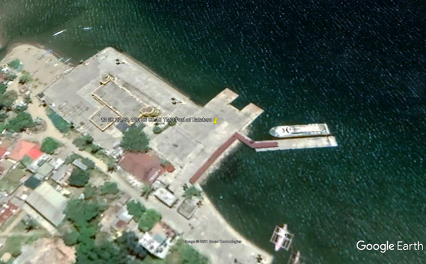
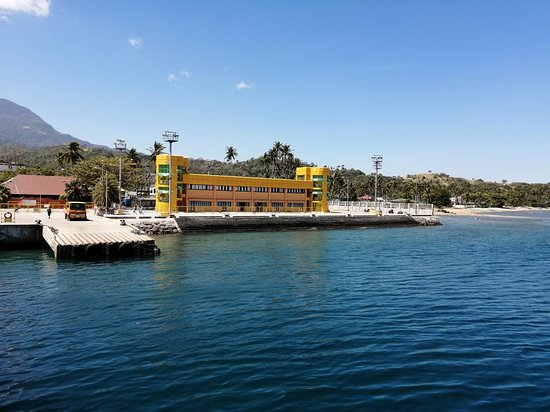
Description and Contacts of Key Companies
Transporters in Oriental Mindoro
O. PONGYAN TRUCKING SERVICES / Bongabong, Oriental Mindoro
LIZA PANGANIBAN GRAVEL and SAND / Tall Bridge, Panganiban Compound, Strong Republic Nautical Hwy, Naujan, Oriental Mindoro. +63 918 201 5030
PINK KANGAROO TRUCKING SERVICES / San Jose, Occidental Mindoro, +63 43 491 1553
For more information on port contacts, please see the following link:4.4 Port and Waterways Companies Contact List.
Port Performance
|
Seasonal Constraints |
||
|---|---|---|
|
Occurs |
Time Frame |
|
|
Rainy Season |
Yes |
From August to December |
|
Major Import Campaigns |
None |
|
|
Other Comments |
Typhoons may disrupt port operations |
|
|
Handling Figures for 2020 |
|
|---|---|
|
Vessel Calls |
1,011 |
|
Container Traffic (TEUs) |
0 TEUs |
|
Handling Figures Bulk and Break Bulk for 2020 |
|
|---|---|
|
Bulk (MT) |
0 MT |
|
Break bulk (MT) |
62 MT |
Discharge Rates and Terminal Handling Charges
For information on port rates and charges, please see the following links:
Vessel: https://www.ppa.com.ph/?q=content/charges-vessel
Cargoes: https://www.ppa.com.ph/?q=content/charges-cargoes
Storage: https://www.ppa.com.ph/?q=content/charges-storage
Berthing Specifications
|
Type of Berth |
Quantity |
Length |
Maximum Draft |
Comments |
|---|---|---|---|---|
|
Conventional Berth |
1 |
100 m |
5 m |
With 2 RORO ramps, 8 m wide |
|
Container Berth |
None |
|
||
|
Silo Berth |
None |
|
||
|
Berthing Tugs |
None |
|
||
|
Water Barges |
None |
|
General Cargo Handling Berths
|
Cargo Type |
Berth Identification |
|---|---|
|
Imports - Bagged Cargo |
None |
|
Exports - Bagged Cargo |
None |
|
Imports and Exports - RoRo |
None |
|
Other Imports |
None |
Port Handling Equipment
There are no port handling equipment in the Port of Puerto Galera and Balatero as they cater only to passenger traffic and rolling cargo.
Container Facilities
There are no container handling facilities in the Ports of Puerto Galera and Balatero.
Customs Guidance
The Port of Balatero handles domestic RORO passenger and cargo vessels only.
For more information on customs in the Philippines, please see the following link: 1.3 Customs Information.
Terminal Information
Multipurpose Terminal
The Port of Balatero Terminal has a 1000 m2 open storage area and an existing terminal building.
Grain and Bulk Handling
The Port of Balatero does not have grain discharging facilities.
Main Storage Terminal
|
Storage Type |
Number of Storage Facilities |
Area (m2) |
|---|---|---|
|
Bagged Cargo |
None |
|
|
Refrigerated Cargo |
None |
|
|
General Cargo |
Open storage area |
1000 m2 |
Stevedoring
The TMO Balatero will provide stevedoring at the port.
Hinterland Information
Most trucks are coming from Batangas City Port on RORO vessels.
Port Security
The PPA PMO Balatero manages the deployment of security services within the port premises.
|
Security |
|
|---|---|
|
ISPS Compliant |
Yes |
|
Current ISPS Level |
Level 1 |
|
Police Boats |
Coast Guard / PNP Maritime Command |
|
Fire Engines |
LGU fire trucks |
2.1.28 Philippines - Luzon Port of San Jose
Port Overview
The Port of San Jose, also known as Caminawit Port, is the main port serving Occidental Mindoro. It was the main seaport of Occidental Mindoro both in shipping cargo and ferrying passengers, but has been suspended by the port authority due to heavy siltation. Main exports include rock salt, palay, rice, seafood, tobacco, bulbs and other agricultural products. Imports include cement, fertilizers and general commodities.
.The port has at least two piers, with the old pier measuring 60 m long and 15 m which is made from wood and a new pier measuring 74 m long and has 32 m wide ramp at the offshore end and a 32 m berth at the west side of the pier. The concrete pier is connected to 60m concrete ramp. An asphalt paved open storage area measuring 1612 m2 and a multi-purposed building with a 225 m2 covered storage area, and an additional 300 m2 is allotted for the passenger terminal with amenities and parking area.
Port website: ppa.gov.ph
Key port information may also be found at: http://www.maritime-database.com
|
Port Location and Contact |
|
|---|---|
|
Country |
Philippines |
|
Province or District |
Occidental Mindoro |
|
Nearest Town or City with Distance from Port |
San Jose, Occidental Mindoro |
|
Port's Complete Name |
Port of San Jose |
|
Latitude |
12.330444 |
|
Longitude |
121.087704 |
|
Managing Company or Port Authority |
Philippine Ports Authority (PPA) |
|
Management Contact Person |
Leo A. Romero Acting Port Manager, PMO Mindoro |
|
Nearest Airport and Airlines with Frequent International Arrivals/Departures |
Ninoy Aquino International Airport All Nippon Airways, Cathay Pacific Airways, Delta Air Lines, Emirates, Etihad Airways, KLM Royal Dutch Airlines, Qantas Airways, Qatar Airways, Singapore Airlines, Turkish Airlines, United Airlines; Cebu Pacific Air, PAL Express, Philippines AirAsia. |
Port Picture
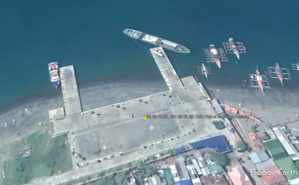
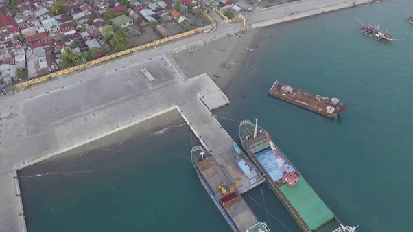
Description and Contacts of Key Companies
For more information on port contacts, please see the following link: 4.4 Port and Waterways Companies Contact List.
Port Performance
|
Seasonal Constraints |
||
|---|---|---|
|
Occurs |
Time Frame |
|
|
Rainy Season |
Yes |
From August to December |
|
Major Import Campaigns |
None |
|
|
Other Comments |
Typhoons may disrupt port operations. |
|
|
Handling Figures for 2020 |
|
|---|---|
|
Vessel Calls |
439 |
|
Container Traffic (TEUs) |
0 TEUs |
|
Handling Figures Bulk and Break Bulk for 2020 |
|
|---|---|
|
Bulk (MT) |
213,892 MT |
|
Break bulk (MT) |
9,717 MT |
Discharge Rates and Terminal Handling Charges
For information on port rates and charges, please see the following links:
Vessel: https://www.ppa.com.ph/?q=content/charges-vessel
Cargoes: https://www.ppa.com.ph/?q=content/charges-cargoes
Storage: https://www.ppa.com.ph/?q=content/charges-storage
Berthing Specifications
|
Type of Berth |
Quantity |
Length |
Maximum Draft |
Comments |
|---|---|---|---|---|
|
Conventional Berth |
2 |
50 m |
5 m |
With 2 RORO ramp, 8 m wide |
|
Container Berth |
None |
|
||
|
Silo Berth |
None |
|
||
|
Berthing Tugs |
None |
|
||
|
Water Barges |
None |
|
General Cargo Handling Berths
|
Cargo Type |
Berth Identification |
|---|---|
|
Imports - Bagged Cargo |
None |
|
Exports - Bagged Cargo |
None |
|
Imports and Exports - RoRo |
None |
|
Other Imports |
None |
Port Handling Equipment
The Port of San Jose does not have port handling equipment.
Container Facilities
The Port of San Jose does not have container facilities.
Customs Guidance
The Port of San Jose handles domestic RORO passenger and cargo vessels only.
For more information on customs in Philippines, please see the following link: 1.3 Customs Information.
Terminal Information
Multipurpose Terminal
The Port of San Jose terminal has a 2000 m2 open area and an existing terminal building.
Grain and Bulk Handling
The Port of San Jose does not have grain discharging facilities.
Main Storage Terminal
|
Storage Type |
Number of Storage Facilities |
Area (m2) |
|---|---|---|
|
Bagged Cargo |
None |
|
|
Refrigerated Cargo |
None |
|
|
General Cargo |
Open storage area |
2000 m2 |
Stevedoring
The TMO San Jose will provide stevedoring at the port.
Hinterland Information
The Port of San Jose handles domestic RORO passenger and cargo vessels only.
Port Security
The PPA PMO San Jose manages the deployment of security services within the port premises.
|
Security |
|
|---|---|
|
ISPS Compliant |
Yes |
|
Current ISPS Level |
Level 1 |
|
Police Boats |
Coast Guard / PNP Maritime Command |
|
Fire Engines |
LGU fire trucks |
2.1.29 Philippines - Luzon Port of Tilik
Port Overview
Port Tilik is entered about 5 miles southeast of Lubang, sheltered from all winds, and is completely protected from the sea. The holding ground within Port Tilik is good, but the small anchorage area is restricted to small vessels with local knowledge. A light marks the west side of the entrance to the port. The narrow entrance, between the reefs on either side, is open to the north-northwest and has depths of 18 to 26 m. A drying reef divides the head of the port into two small, but good anchorages. The west shore of the port can be approached until the anchorage off the west entrance point is reached, where there are depths of 6 to 9 m, mud and sand.
Port website: ppa.gov.ph
Key port information may also be found at: http://www.maritime-database.com
|
Port Location and Contact |
|
|---|---|
|
Country |
Philippines |
|
Province or District |
Oriental Mindoro |
|
Nearest Town or City with Distance from Port |
Lubang Island |
|
Port's Complete Name |
Port of Tilik |
|
Latitude |
13.816200 |
|
Longitude |
120.201682 |
|
Managing Company or Port Authority |
Philippine Ports Authority (PPA) |
|
Management Contact Person |
Leo A. Romero Acting Port Manager, PMO Mindoro |
|
Nearest Airport and Airlines with Frequent International Arrivals/Departures |
Ninoy Aquino International Airport All Nippon Airways, Cathay Pacific Airways, Delta Air Lines, Emirates, Etihad Airways, KLM Royal Dutch Airlines, Qantas Airways, Qatar Airways, Singapore Airlines, Turkish Airlines, United Airlines; Cebu Pacific Air, PAL Express, Philippines AirAsia. |
Port Picture


Description and Contacts of Key Companies
For more information on port contacts, please see the following link: 4.4 Port and Waterways Companies Contact List.
Port Performance
|
Seasonal Constraints |
||
|---|---|---|
|
Occurs |
Time Frame |
|
|
Rainy Season |
Yes |
From August to December |
|
Major Import Campaigns |
None |
|
|
Other Comments |
Typhoons may disrupt port operations. |
|
|
Handling Figures for 2020 |
|
|---|---|
|
Vessel Calls |
497 |
|
Container Traffic (TEUs) |
0 TEUs |
|
Handling Figures Bulk and Break Bulk for 2020 |
|
|---|---|
|
Bulk (MT) |
82,710 MT |
|
Break bulk (MT) |
16,318 MT |
Discharge Rates and Terminal Handling Charges
For information on port rates and charges, please see the following links:
Vessel: https://www.ppa.com.ph/?q=content/charges-vessel
Cargoes: https://www.ppa.com.ph/?q=content/charges-cargoes
Storage: https://www.ppa.com.ph/?q=content/charges-storage
Berthing Specifications
|
Type of Berth |
Quantity |
Length |
Maximum Draft |
Comments |
|---|---|---|---|---|
|
Conventional Berth |
1 |
43 m |
5 m |
With RORO ramp, 8 m wide |
|
Container Berth |
None |
|||
|
Silo Berth |
None |
|
||
|
Berthing Tugs |
None |
|
||
|
Water Barges |
None |
|
General Cargo Handling Berths
|
Cargo Type |
Berth Identification |
|---|---|
|
Imports - Bagged Cargo |
None |
|
Exports - Bagged Cargo |
None |
|
Imports and Exports - RoRo |
None |
|
Other Imports |
None |
Port Handling Equipment
The Port of Tilik does not have port handling equipment.
Container Facilities
The Port of Tilik does not have container facilities.
Customs Guidance
The Port of Tilik handles domestic RORO passenger and cargo vessels only.
For more information on customs in the Philippines, please see the following link: 1.3 Customs Information.
Terminal Information
Multipurpose Terminal
The Port of Tilik has an existing terminal building and an open 1200 m2 storage area.
Grain and Bulk Handling
The Port of Tilik does not have grain discharging facilities.
Main Storage Terminal
|
Storage Type |
Number of Storage Facilities |
Area (m2) |
|---|---|---|
|
Bagged Cargo |
None |
|
|
Refrigerated Cargo |
None |
|
|
General Cargo |
Open storage area |
1200 m2 |
Stevedoring
The TMO Tilik will provide stevedoring at the port.
Hinterland Information
The port handles mostly rolling cargoes mostly coming from Batangas Port.
Port Security
The PPA PMO Tilik manages the deployment of security services within the port premises.
|
Security |
|
|---|---|
|
ISPS Compliant |
Yes |
|
Current ISPS Level |
Level 1 |
|
Police Boats |
Coast Guard / PNP Maritime Command |
|
Fire Engines |
LGU fire trucks |
2.1.30 Philippines - Luzon Port of Puerto Princesa
Port Overview
The Port of Puerto Princesa has a multipurpose quay and two CBMs. The multipurpose quay handles breakbulk, containers, cruise, general and passenger ferries. The south side of the harbour/bay are two CBMs for petroleum product and LPG imports. The Port of Puerto Princesa is located on the mid-east coast of Palawan 320 nautical miles south-southwest of Manila, between Bancao-Bancao Point and Panagtaran Point.
Port website: ppa.gov.ph
Key port information may also be found at: http://www.maritime-database.com
|
Port Location and Contact |
|
|---|---|
|
Country |
Philippines |
|
Province or District |
Palawan |
|
Nearest Town or City with Distance from Port |
Puerto Princesa |
|
Port's Complete Name |
Port of Puerto Princesa |
|
Latitude |
9.742951 |
|
Longitude |
118.727570 |
|
Managing Company or Port Authority |
Philippine Ports Authority |
|
Management Contact Person |
Elizalde M. Ulson Acting Port Manager, PMO Palawan +63 48 434 5626 / 434 4881 |
|
Nearest Airport and Airlines with Frequent International Arrivals/Departures |
Ninoy Aquino International Airport All Nippon Airways, Cathay Pacific Airways, Delta Air Lines, Emirates, Etihad Airways, KLM Royal Dutch Airlines, Qantas Airways, Qatar Airways, Singapore Airlines, Turkish Airlines, United Airlines; Cebu Pacific Air, PAL Express, Philippines AirAsia. |
Port Picture
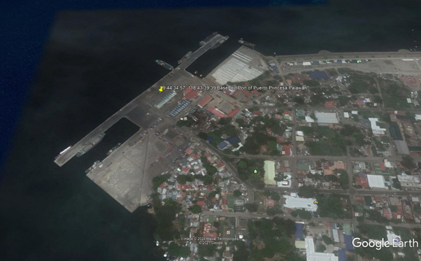
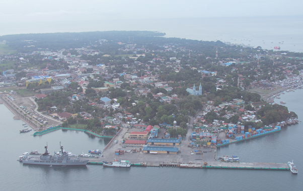
Description and Contacts of Key Companies
| Company | Services | Address | Contact information |
|---|---|---|---|
| Prudential Customs Brokerage Services Inc | Arrastre, stevedoring, and cargo handling |
Port Area Barangay Liwanag Puerto Princesa City, Palawan |
+63484332052/ +63484332451 |
|
GRM International Inc |
Transport |
No 259 Rizal Ave, Puerto Princesa City, Puerto Princesa, Palawan |
+63 (0)48 434-3793 |
| Link Ri Logistics Incorporated | Transport |
Puerto Princesa City Port, Puerto Princesa City 5300 |
+63 (0)91 7598-1258 |
|
Connext Warehouse |
Warehousing |
Barangay San Pedro Puerto Princesa, Palawan |
|
| JT Int’l Philippines Inc | Courier services |
Ligaya Street, F. Ponce de Leon Rd, Barangay San Pedro Puerto Princesa, Palawan |
|
| Rigen Enterprises Palawan |
Brt Compound, BM road, Puerto Princesa North Road, Barangay San Pedro, Puerto Princesa, Palawan |
+63 998 980 2188 | |
| BTDT Distributor | Valencia St, Puerto Princesa, 5300 Palawan | ||
| SCPA Palawan | Abad Santos St, Puerto Princesa, Palawan |
For more information on port contacts, please see the following link: 4.4 Port and Waterways Companies Contact List.
Port Performance
|
Seasonal Constraints |
||
|---|---|---|
|
Occurs |
Time Frame |
|
|
Rainy Season |
Yes |
From August to December |
|
Major Import Campaigns |
None |
|
|
Other Comments |
Typhoons and congestion may disrupt port operations. |
|
|
Handling Figures for 2020 |
|
|---|---|
|
Vessel Calls |
768 |
|
Container Traffic (TEUs) |
72,128 TEUs |
|
Handling Figures Bulk and Break Bulk for 2020 |
|
|---|---|
|
Bulk (MT) |
0 MT |
|
Break bulk (MT) |
1,686,827 MT |
Discharge Rates and Terminal Handling Charges
For information on port rates and charges, please see the following links:
Vessel: https://www.ppa.com.ph/?q=content/charges-vessel
Cargoes: https://www.ppa.com.ph/?q=content/charges-cargoes
Storage: https://www.ppa.com.ph/?q=content/charges-storage
Cargo Handling Tariff: https://www.ppa.com.ph/sites/default/files/citizen_charter_docs/ARTA-PMO_Puerto_Princesa.pdf
Berthing Specifications
|
Type of Berth |
Quantity |
Length |
Maximum Draft |
|---|---|---|---|
|
Conventional Berth |
1 2 |
519 m 150 m |
10 m 10 m |
|
Container Berth |
2 |
150 m |
10 m |
|
Silo Berth |
None |
||
|
Berthing Tugs |
None |
||
|
Water Barges |
None |
General Cargo Handling Berths
|
Cargo Type |
Berth Identification |
|---|---|
|
Imports - Bagged Cargo |
Yes, 1 |
|
Exports - Bagged Cargo |
None |
|
Imports and Exports - RoRo |
None |
|
Other Imports |
None |
Port Handling Equipment
|
Equipment |
Available |
|---|---|
|
Dockside Crane |
None |
|
Container Gantries |
None |
|
Mobile Cranes |
Yes |
|
Reachstacker |
Yes |
|
RoRo Tugmaster (with Trailer) |
Yes |
|
Grain Elevator with Bagging Machines |
None |
|
Transtainer |
None |
|
Forklifts |
Yes |
Container Facilities
|
Facilities |
20 & 40 ft |
|---|---|
|
Container Facilities Available |
Yes |
|
Container Freight Station (CFS) |
Yes |
|
Refrigerated Container Stations |
N/A |
|
Other Capacity Details |
|
|
Daily Take Off Capacity |
N/A |
|
Number of Reefer Stations |
N/A |
|
Emergency Take-off Capacity |
N/A |
|
Off take Capacity of Gang Shift |
N/A |
Customs Guidance
Port of Puerto Princesa
Gladys D. Fontanilla-Estrada
Acting Sub-Port Collector
+63 48 434 3124
gladys.fontanilla@customs.gov.ph
For more information on customs in the Philippines, please see the following link: 1.3 Customs Information.
Terminal Information
Multipurpose Terminal
- Container yard 15,000 m2
- Open storage area 7500 m2
- Transit Shed area 800 m2
- 2 Conventional berthing
- 2 open spaces for container and multi-purpose open storage
Grain and Bulk Handling
The Port of Puerto Princesa does not have grain discharging facilities.
Main Storage Terminal
REPLACE THIS TEXT with a 3 - 4 sentences describing the main storage facilities. Identify the number of warehouses available, square meters available, square meters available for storage of food supplies.
|
Storage Type |
Number of Storage Facilities |
Area (m2) |
|---|---|---|
|
Bagged Cargo |
Yes |
800 m2 |
|
Refrigerated Cargo |
None |
|
|
General Cargo |
Yes, Terminal open space |
7500 m2 |
Stevedoring
Prudential Customs Brokerage Services Inc provides arrastre, stevedoring, and cargo handling services.
Hinterland Information
Commercial cargoes that enter and exit in Puerto Princisa Port must be cleared from all duties and taxes. Shipping lines have accredited transporters that will handle their cargoes in and out the port. Shipping Lines has multi modal services on this Port: DTD, DTP and PTP. Withdrawal of cargoes can be managed by Shipping Lines on a DTD basis, while consignee or its representative can also facilitate the withdrawal at designated CY of shipping lines. Bulk cargo can also be facilitated on this Port thru consignee’s contractor of its representative.
Transporters in Puerto Princesa:
GRM International Inc
No 259 Rizal Ave, Puerto Princesa City,
Puerto Princesa, Philippines .
+63 (0)48 434-3793
Link Ri Logistics Incorporated
Puerto Princesa City Port, Puerto Princesa City 5300
+63 (0)91 7598-1258
Warehouses in Puerto Princesa:
Connext Warehouse
Barangay San Pedro, Puerto Princesa, Palawan
JT Int’l Philippines Inc
Ligaya Street, F. Ponce de Leon Rd, Barangay San Pedro, Puerto Princesa, Palawan
Rigen Enterprises Palawan
Brt Compound, BM road, Puerto Princesa North Road,
Barangay San Pedro, Puerto Princesa, Palawan
Phone: +63 998 980 2188
BTDT Distributor
Valencia St, Puerto Princesa, 5300 Palawan
SCPA Palawan
Abad Santos St, Puerto Princesa, Palawan
Port Security
PPA PMO Palawan manages the deployment of security services within the port premises.
|
Security |
|
|---|---|
|
ISPS Compliant |
Yes |
|
Current ISPS Level |
Level 1 |
|
Police Boats |
Coast Guard / PNP Maritime Command |
|
Fire Engines |
LGU fire trucks |
2.1.31 Philippines - Luzon Port of Brooke's Point
Port Overview
The Port of Brooke's Point is in the southeastern section of Palawan Island, approximately 215 km (134 mi) from Puerto Princesa City. The Port of Brooke’s Point is a local seaport managed by the Philippine Ports Authority, and is the only seaport in the municipality of Brooke’s Point, Palawan, where local cargo and passenger from the southern part of the Philippines dock.
Port website: ppa.gov.ph
Key port information may also be found at: http://www.maritime-database.com
|
Port Location and Contact |
|
|---|---|
|
Country |
Philippines |
|
Province or District |
Palawan |
|
Nearest Town or City with Distance from Port |
Brooke's Point (in town limits) City of Puerto Princesa – 195 km |
|
Port's Complete Name |
Port of Brooke's Point |
|
Latitude |
8.772500 |
|
Longitude |
117.828750 |
|
Managing Company or Port Authority |
Philippine Ports Authority |
|
Management Contact Person |
Elizalde M. Ulson Acting Port Manager, PMO Palawan +63 48 434 5626 / 434 4881 |
|
Nearest Airport and Airlines with Frequent International Arrivals/Departures |
Ninoy Aquino International Airport All Nippon Airways, Cathay Pacific Airways, Delta Air Lines, Emirates, Etihad Airways, KLM Royal Dutch Airlines, Qantas Airways, Qatar Airways, Singapore Airlines, Turkish Airlines, United Airlines; Cebu Pacific Air, PAL Express, Philippines AirAsia. |
Port Picture
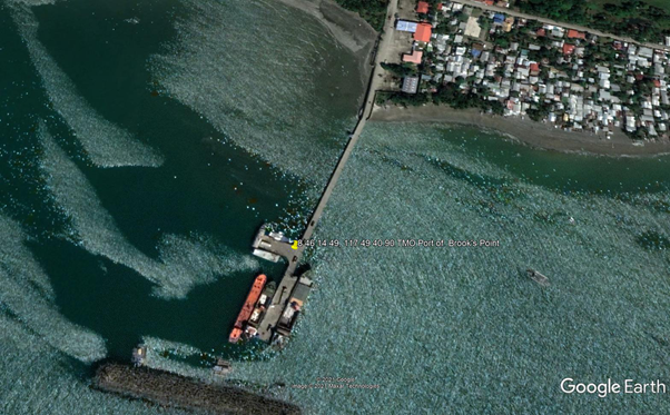
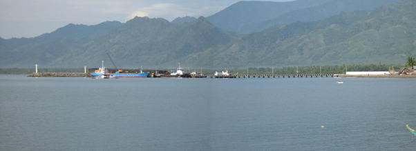
Description and Contacts of Key Companies
Transporter in Brooke's Point
- Kevin Trucking Services Palawan
- Rickman Trading / Tub-Tub Brooke’s Point, Palawan / +63 917 154 5450
Warehouses in Brooke's Point
- National Food Authority (NFA) warehouse, Brooke's Point
- PPA TMO Brooke's Point warehouse
For more information on port contacts, please see the following link: 4.4 Port and Waterways Companies Contact List.
Port Performance
|
Seasonal Constraints |
||
|---|---|---|
|
Occurs |
Time Frame |
|
|
Rainy Season |
Yes |
From August to December |
|
Major Import Campaigns |
None |
N/A |
|
Other Comments |
Typhoons may disrupt port operations. |
|
|
Handling Figures for 2020 |
|
|---|---|
|
Vessel Calls |
233 |
|
Container Traffic (TEUs) |
2,858 TEUs via Port of Puerto Princesa |
|
Handling Figures Bulk and Break Bulk for 2020 |
|
|---|---|
|
Bulk (MT) |
0 MT |
|
Break bulk (MT) |
174,377 MT |
Discharge Rates and Terminal Handling Charges
For information on port rates and charges, please see the following links:
Vessel: https://www.ppa.com.ph/?q=content/charges-vessel
Cargoes: https://www.ppa.com.ph/?q=content/charges-cargoes
Storage: https://www.ppa.com.ph/?q=content/charges-storage
Berthing Specifications
|
Type of Berth |
Quantity |
Length |
Maximum Draft |
Comments |
|---|---|---|---|---|
|
Conventional Berth |
2 2 |
60 m 30 m |
5 m 5 m |
Cargo vessels Passenger vessels |
|
Container Berth |
None |
|
||
|
Silo Berth |
None |
|
||
|
Berthing Tugs |
None |
|
||
|
Water Barges |
None |
|
General Cargo Handling Berths
|
Cargo Type |
Berth Identification |
|---|---|
|
Imports - Bagged Cargo |
None |
|
Exports - Bagged Cargo |
None |
|
Imports and Exports - RoRo |
None |
|
Other Imports |
None |
Port Handling Equipment
The Port of Brooke's Point does not have handling equipment.
Container Facilities
The Port of Brooke's Point does not have container facilities.
Customs Guidance
Sub-Port of Puerto Princesa
Gladys D. Fontanilla-Estrada
Acting Sub-Port Collector
+63 48 434 3124
gladys.fontanilla@customs.gov.ph
For more information on customs in the Philippines, please see the following link: 1.3 Customs Information.
Terminal Information
Multipurpose Terminal
The Port of Brooke’s Point has a warehouse operated by the TMO as well as open storage along the pier.
Grain and Bulk Handling
The Port of Brooke’s Point has no grain discharging facilities.
Main Storage Terminal
|
Storage Type |
Number of Storage Facilities |
Area (m2) |
|---|---|---|
|
Bagged Cargo |
Yes, TMO Brookes Point |
|
|
Refrigerated Cargo |
None |
|
|
General Cargo |
Yes, Pier open space |
Stevedoring
Port of Brooke’s Point TMO will provide stevedoring through the Prudential Customs Brokerage Services Inc.
Port Security
The PPA TMO Brookes Point manages the deployment of security services within the port premises.
|
Security |
|
|---|---|
|
ISPS Compliant |
Yes |
|
Current ISPS Level |
Level 1 |
|
Police Boats |
Coast Guard / PNP Maritime Command |
|
Fire Engines |
LGU fire trucks |
2.1.32 Philippines - Luzon Port of Coron
Port Overview
Port website: ppa.gov.ph
Key port information may also be found at: http://www.maritime-database.com
|
Port Location and Contact |
|
|---|---|
|
Country |
Philippines |
|
Province or District |
Palawan |
|
Nearest Town or City with Distance from Port |
Coron, Palawan |
|
Port's Complete Name |
Port of Coron |
|
Latitude |
11.990769 |
|
Longitude |
120.211969 |
|
Managing Company or Port Authority |
Philippine Ports Authority |
|
Management Contact Person |
Elizalde M. Ulson Acting Port Manager, PMO Palawan +63 48 434 5626 / 434 4881 |
|
Nearest Airport and Airlines with Frequent International Arrivals/Departures |
Ninoy Aquino International Airport All Nippon Airways, Cathay Pacific Airways, Delta Air Lines, Emirates, Etihad Airways, KLM Royal Dutch Airlines, Qantas Airways, Qatar Airways, Singapore Airlines, Turkish Airlines, United Airlines; Cebu Pacific Air, PAL Express, Philippines AirAsia. |
Port Picture
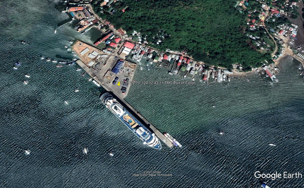
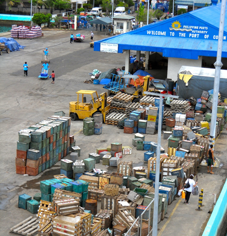
Description and Contacts of Key Companies
For more information on port contacts, please see the following link: 4.4 Port and Waterways Companies Contact List.
Port Performance
|
Seasonal Constraints |
||
|---|---|---|
|
Occurs |
Time Frame |
|
|
Rainy Season |
Yes |
From August to December |
|
Major Import Campaigns |
None |
From (month) to (month) |
|
Other Comments |
Typhoons may disrupt port operations. |
|
|
Handling Figures for 2020 |
|
|---|---|
|
Vessel Calls |
1,617 |
|
Container Traffic (TEUs) |
1,849 TEUs |
|
Handling Figures Bulk and Break Bulk for 2020 |
|
|---|---|
|
Bulk (MT) |
0 MT |
|
Break bulk (MT) |
187,555 MT |
Discharge Rates and Terminal Handling Charges
For information on port rates and charges, please see the following links:
Vessel: https://www.ppa.com.ph/?q=content/charges-vessel
Cargoes: https://www.ppa.com.ph/?q=content/charges-cargoes
Storage: https://www.ppa.com.ph/?q=content/charges-storage
Berthing Specifications
|
Type of Berth |
Quantity |
Length |
Maximum Draft |
Comments |
|---|---|---|---|---|
|
Conventional Berth |
1 |
350 m |
10 m |
|
|
Container Berth |
None |
|
||
|
Silo Berth |
None |
|
||
|
Berthing Tugs |
None |
|
||
|
Water Barges |
None |
|
General Cargo Handling Berths
|
Cargo Type |
Berth Identification |
|---|---|
|
Imports - Bagged Cargo |
None |
|
Exports - Bagged Cargo |
None |
|
Imports and Exports - RoRo |
None |
|
Other Imports |
None |
Port Handling Equipment
|
Equipment |
Available |
Total Quantity and Capacity Available |
Comments on Current Condition and Actual Usage |
|---|---|---|---|
|
Dockside Crane |
None |
||
|
Container Gantries |
None |
||
|
Mobile Cranes |
None |
|
|
|
Reachstacker |
None |
|
|
|
RoRo Tugmaster (with Trailer) |
None |
|
|
|
Grain Elevator with Bagging Machines |
None |
||
|
Transtainer |
None |
||
|
Forklifts |
Yes |
2 |
|
Container Facilities
The Port of Coron does not have container facilities.
Customs Guidance
The Port of Coron handles domestic cargoes only.
For more information on customs in the Philippines, please see the following link: 1.3 Customs Information.
Terminal Information
Multipurpose Terminal
The Port of Coron has a 2900 m2 open storage as well as the TMO warehouse.
Brain and Bulk Handling
The Port of Coron does not have grain discharging facilities.
Main Storage Terminal
|
Storage Type |
Number of Storage Facilities |
Area (m2) |
|---|---|---|
|
Bagged Cargo |
None |
|
|
Refrigerated Cargo |
None |
|
|
General Cargo |
Yes, at the pier open space |
2900 m2 |
Stevedoring
Port of Coron TMO will provide stevedoring through Coron Stevedoring & Arrastre.
Hinterland Information
There are no transporter and warehouse providers in Coron Port.
Port Security
The PPA TMO Coron manages the deployment of security services within the port premises.
|
Security |
|
|---|---|
|
ISPS Compliant |
Yes |
|
Current ISPS Level |
Level 1 |
|
Police Boats |
Coast Guard / PNP Maritime Command |
|
Fire Engines |
LGU fire trucks |
2.1.33 Philippines - Luzon Port of Culion
Port Overview
The Port of Culion is located on Culion Island, in the Calamian Islands,an archipelago located in Northern Palawan. Cruise ships bound for Culion Island dock at the Culion port on the eastern coast. The port is a narrow inlet about 160 m wide and 0.5 mile long, and opens into Coron Bay. The head of this pier had a reported depth of 9.4 to 10.1 m. Vessels should approach the pier from the northeast and maneuver to go alongside port side to. Small vessels, with a maximum draft of 3.1 m, can berth alongside the outer face of the pier. Larger vessels should approach the pier with caution and anchor well off its face.
Port website: ppa.gov.ph
Key port information may also be found at: http://www.maritime-database.com
|
Port Location and Contact |
|
|---|---|
|
Country |
Philippines |
|
Province or District |
Palawan |
|
Nearest Town or City with Distance from Port |
Coron, Palawan |
|
Port's Complete Name |
Port of Culion |
|
Latitude |
11.895097 |
|
Longitude |
120.019940 |
|
Managing Company or Port Authority |
Philippine Ports Authority |
|
Management Contact Person |
Elizalde M. Ulson Acting Port Manager, PMO Palawan +63 48 434 5626 / 434 4881 |
|
Nearest Airport and Airlines with Frequent International Arrivals/Departures |
Ninoy Aquino International Airport All Nippon Airways, Cathay Pacific Airways, Delta Air Lines, Emirates, Etihad Airways, KLM Royal Dutch Airlines, Qantas Airways, Qatar Airways, Singapore Airlines, Turkish Airlines, United Airlines; Cebu Pacific Air, PAL Express, Philippines AirAsia. |
Description and Contacts of Key Companies
For more information on port contacts, please see the following link: 4.4 Port and Waterways Companies Contact List.
Port Performance
|
Seasonal Constraints |
||
|---|---|---|
|
Occurs |
Time Frame |
|
|
Rainy Season |
Yes |
From August to December |
|
Major Import Campaigns |
None |
N/A |
|
Other Comments |
Typhoons may disrupt port operations. |
|
|
Handling Figures for 2020 |
|
|---|---|
|
Vessel Calls |
491 |
|
Container Traffic (TEUs) |
0 TEUs |
|
Handling Figures Bulk and Break Bulk for 2020 |
|
|---|---|
|
Bulk (MT) |
0 MT |
|
Break bulk (MT) |
44,387 MT |
Discharge Rates and Terminal Handling Charges
Vessel: https://www.ppa.com.ph/?q=content/charges-vessel
Cargoes: https://www.ppa.com.ph/?q=content/charges-cargoes
Storage: https://www.ppa.com.ph/?q=content/charges-storage
Berthing Specifications
|
Type of Berth |
Quantity |
Length |
Maximum Draft |
Comments |
|---|---|---|---|---|
|
Conventional Berth |
1 |
30 m |
10 m |
|
|
Container Berth |
None |
|||
|
Silo Berth |
None |
|
||
|
Berthing Tugs |
None |
|||
|
Water Barges |
None |
General Cargo Handling Berths
|
Cargo Type |
Berth Identification |
|---|---|
|
Imports - Bagged Cargo |
None |
|
Exports - Bagged Cargo |
None |
|
Imports and Exports - RoRo |
None |
|
Other Imports |
None |
Port Handling Equipment
There are no port handling activities in the Port of Culion.
Container Facilities
The Port of Culion has no container facilities.
Customs Guidance
The Port of Culion handles domestic cargoes only.
For more information on customs in the Philippines, please see the following link: 1.3 Customs Information.
Terminal Information
Multipurpose Terminal
The Port of Culion has a 750 m2 open terminal area.
Grain and Bulk Handling
The Port of Culion does not have grain discharging facilities.
Main Storage Terminal
|
Storage Type |
Number of Storage Facilities |
Area (m2) |
|---|---|---|
|
Bagged Cargo |
None |
|
|
Refrigerated Cargo |
None |
|
|
General Cargo |
Open storage area |
750 m2 |
Stevedoring
The Port of Culion TMO will provide stevedoring services.
Hinterland Information
There are no commercial transporters and warehouses in the Port of Culion.
Port Security
The PPA TMO Culion manages the deployment of security services within the port premises.
|
Security |
|
|---|---|
|
ISPS Compliant |
Yes |
|
Current ISPS Level |
Level 1 |
|
Police Boats |
Coast Guard / PNP Maritime Command |
|
Fire Engines |
LGU fire trucks |
2.1.34 Philippines - Luzon Port of Cuyo
Port Overview
The Port of Cuyo on the west coast of Cuyo Island, the largest town in the Cuyo Island group. Buoys mark the north and south entrance points to the port. The entrance channel at the buoys is 7.3 m deep and 160 m wide. Depths decrease to 1.5 m off a pier. There are two piers at Cuyo. The stone mole, about 240 m long, has a reported depth of 2.1 m off its head. The stone causeway extends almost 640 m offshore, with its outer 40 m submerged 0.3 m below water. The remaining part of the causeway is in disrepair and used only by small boats. Small vessels can anchor about 800 m of the pier, in 7.3 m, or closer in if draft will allow.
During the Southwest Monsoon (May to September), vessels can anchor closer off the reef that fringes the north side of Bisucay Island. Anchorage can also be taken during southwest storms in the bay on the southeast side of Cuyo Island.
Port website: ppa.gov.ph
Key port information may also be found at: http://www.maritime-database.com
|
Port Location and Contact |
|
|---|---|
|
Country |
Philippines |
|
Province or District |
Palawan |
|
Nearest Town or City with Distance from Port |
Cuyo, Palawan |
|
Port's Complete Name |
Port of Cuyo |
|
Latitude |
10.852189 |
|
Longitude |
121.006825 |
|
Managing Company or Port Authority |
Philippine Ports Authority |
|
Management Contact Person |
Elizalde M. Ulson Acting Port Manager, PMO Palawan +63 48 434 5626 / 434 4881 |
|
Nearest Airport and Airlines with Frequent International Arrivals/Departures |
Ninoy Aquino International Airport All Nippon Airways, Cathay Pacific Airways, Delta Air Lines, Emirates, Etihad Airways, KLM Royal Dutch Airlines, Qantas Airways, Qatar Airways, Singapore Airlines, Turkish Airlines, United Airlines; Cebu Pacific Air, PAL Express, Philippines AirAsia. |
Port Picture


Description and Contacts of Key Companies
For more information on port contacts, please see the following link: 4.4 Port and Waterways Companies Contact List.
Port Performance
|
Seasonal Constraints |
||
|---|---|---|
|
Occurs |
Time Frame |
|
|
Rainy Season |
Yes |
From August to December |
|
Major Import Campaigns |
None |
N/A |
|
Other Comments |
Typhoons may disrupt port operations. |
|
|
Handling Figures for 2020 |
|
|---|---|
|
Vessel Calls |
467 |
|
Container Traffic (TEUs) |
0 TEUs |
|
Handling Figures Bulk and Break Bulk for 2020 |
|
|---|---|
|
Bulk (MT) |
0 MT |
|
Break bulk (MT) |
78,716 MT |
Discharge Rates and Terminal Handling Charges
For information on port rates and charges, please see the following links:
Vessel: https://www.ppa.com.ph/?q=content/charges-vessel
Cargoes: https://www.ppa.com.ph/?q=content/charges-cargoes
Storage: https://www.ppa.com.ph/?q=content/charges-storage
Berthing Specifications
|
Type of Berth |
Quantity |
Length |
Maximum Draft |
Comments |
|---|---|---|---|---|
|
Conventional Berth |
2 |
85 m |
5 m |
|
|
Container Berth |
None |
|
||
|
Silo Berth |
None |
|||
|
Berthing Tugs |
None |
|||
|
Water Barges |
None |
|
General Cargo Handling Berths
|
Cargo Type |
Berth Identification |
|---|---|
|
Imports - Bagged Cargo |
None |
|
Exports - Bagged Cargo |
None |
|
Imports and Exports - RoRo |
None |
|
Other Imports |
None |
Port Handling Equipment
The Port of Cuyo does not have handling equipment.
Container Facilities
The Port of Cuyo does not have container facilities.
Customs Guidance
The Port of Cuyo handles domestic cargoes only.
For more information on customs in the Philippines, please see the following link: 1.3 Customs Information.
Terminal Information
Multipurpose Terminal
The Port of Cuyo terminal building is 1800 m2.
Grain and Bulk Handling
The Port of Cuyo does not have grain discharging facilities.
Main Storage Terminal
|
Storage Type |
Number of Storage Facilities |
Area (m2) |
|---|---|---|
|
Bagged Cargo |
None |
|
|
Refrigerated Cargo |
None |
|
|
General Cargo |
Open storage area |
750 m2 |
Stevedoring
Port of CUYO TMO will provide stevedoring through Buena Suerte Arrastre & Stevedoring.
Hinterland Information
There are no commercial transport and warehouse providers in the Port of Cuyo.
Port Security
The PPA TMO CUYO manages the deployment of security services within the port premises.
|
Security |
|
|---|---|
|
ISPS Compliant |
Yes |
|
Current ISPS Level |
Level 1 |
|
Police Boats |
Coast Guard / PNP Maritime Command |
|
Fire Engines |
LGU fire trucks |
2.1.35 Philippines - Luzon Port of El Nido
Port Overview
The Port of El Nido on the island of Bacuit (El Nido), the most important town on the west coast of Palawan, is situated on the east of the peninsula of which Ipil Point is the southwest extremity. The town is situated at the head of a small bay which is fringed by a drying reef and fronted by foul ground as far as 800 m off its head. A stone causeway, its outer end in ruins, is located at the west end of town where a church is a prominent landmark. Anchorage can be taken 1.6 km north of town, in depths of 15 to 16.5 m, mud, protected from all but north winds. Occasional variable squalls of hurricane force blow through the gaps in the highlands making the anchorage untenable. Vessels approach the anchorage from the west via the narrow passage between the headland and Cadlao Island.From the north, the approach lies east and southeast of this island.
Port website: ppa.gov.ph
Key port information may also be found at: http://www.maritime-database.com
|
Port Location and Contact |
|
|---|---|
|
Country |
Philippines |
|
Province or District |
Palawan |
|
Nearest Town or City with Distance from Port |
El Nido, Palawan |
|
Port's Complete Name |
Port of El Nido |
|
Latitude |
11 10 51.50 N |
|
Longitude |
119 23 12.39 E |
|
Managing Company or Port Authority |
Philippine Ports Authority |
|
Management Contact Person |
Elizalde M. Ulson Acting Port Manager, PMO Palawan +63 48 434 5626 / 434 4881 |
|
Nearest Airport and Airlines with Frequent International Arrivals/Departures |
Ninoy Aquino International Airport All Nippon Airways, Cathay Pacific Airways, Delta Air Lines, Emirates, Etihad Airways, KLM Royal Dutch Airlines, Qantas Airways, Qatar Airways, Singapore Airlines, Turkish Airlines, United Airlines; Cebu Pacific Air, PAL Express, Philippines AirAsia. |
Port Picture
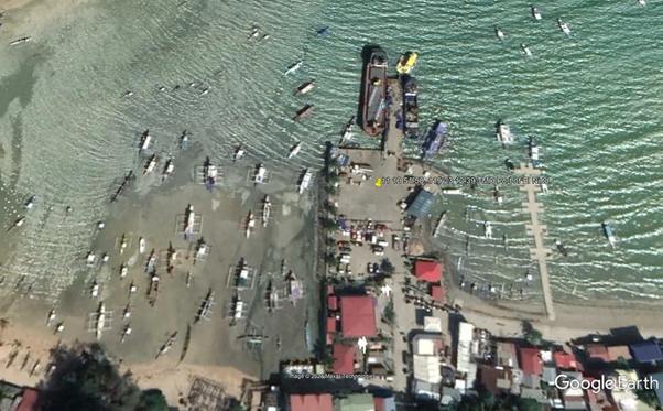
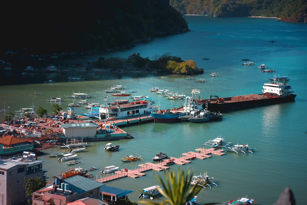
Description and Contacts of Key Companies
For more information on port contacts, please see the following link: 4.4 Port and Waterways Companies Contact List.
Port Performance
|
Seasonal Constraints |
||
|---|---|---|
|
Occurs |
Time Frame |
|
|
Rainy Season |
Yes |
From August to December |
|
Major Import Campaigns |
None |
N/A |
|
Other Comments |
Typhoons may disrupt port operations. |
|
|
Handling Figures for 2020 |
|
|---|---|
|
Vessel Calls |
1,121 |
|
Container Traffic (TEUs) |
0 TEUs |
|
Handling Figures Bulk and Break Bulk for 2020 |
|
|---|---|
|
Bulk (MT) |
0 MT |
|
Break bulk (MT) |
85 589 MT |
Discharge Rates and Terminal Handling Charges
For information on port rates and charges, please see the following links:
Vessel: https://www.ppa.com.ph/?q=content/charges-vessel
Cargoes: https://www.ppa.com.ph/?q=content/charges-cargoes
Storage: https://www.ppa.com.ph/?q=content/charges-storage
Berthing Specifications
|
Type of Berth |
Quantity |
Length |
Maximum Draft |
Comments |
|---|---|---|---|---|
|
Conventional Berth |
2 |
50 m |
5 m |
|
|
Container Berth |
None |
|||
|
Silo Berth |
None |
|
||
|
Berthing Tugs |
None |
|||
|
Water Barges |
None |
General Cargo Handling Berths
|
Cargo Type |
Berth Identification |
|---|---|
|
Imports - Bagged Cargo |
None |
|
Exports - Bagged Cargo |
None |
|
Imports and Exports - RoRo |
None |
|
Other Imports |
None |
Port Handling Equipment
The Port of El Nido does not have port handling equipment.
Container Facilities
The Port of El Nido does not have container facilities.
Customs Guidance
The Port of El Nido handles domestic cargoes only.
For more information on customs in the Philippines, please see the following link: 1.3 Customs Information.
Terminal Information
Multipurpose Terminal
The Port of El Nido Terminal has an existing terminal building with a 800 m2 open storage area.
Grain and Bulk Handling
The Port of El Nido does not have grain discharging facilities.
Main Storage Terminal
|
Storage Type |
Number of Storage Facilities |
Area (m2) |
|---|---|---|
|
Bagged Cargo |
None |
|
|
Refrigerated Cargo |
None |
|
|
General Cargo |
Open storage area |
800 m2 |
Stevedoring
The Port of El Nido TMO will provide stevedoring.
Hinterland Information
The Port of El Nido does not have commercial transporters and warehouses.
Port Security
The PPA TMO El Nido manages the deployment of security services within the port premises.
|
Security |
|
|---|---|
|
ISPS Compliant |
Yes |
|
Current ISPS Level |
Level 1 |
|
Police Boats |
Coast Guard / PNP Maritime Command |
|
Fire Engines |
LGU fire trucks |
2.1.36 Philippines - Luzon Port of Legaspi
Port Overview
The Port of Legaspi is the principal seaport on the east coast of Luzon and lies at the head of Albay Gulf. It is the center of the largest hemp-producing area of the Philippines. Legaspi is the primary port for a region that exports copra and abaca. The city has facilities for storing petroleum, and it is the centre of a large abaca-fibre handicraft industry. The Port of Legaspi has been renowned as haven for ships cruising the Pacific Ocean and voyage-weary seafarers. More than this, it has become a main channel for the exchange of seaborne commodities between the Bicol peninsula and certain trade centers in the country.
Port website: ppa.gov.ph
Key port information may also be found at: http://www.maritime-database.com
|
Port Location and Contact |
|
|---|---|
|
Country |
Philippines |
|
Province or District |
Albay |
|
Nearest Town or City with Distance from Port |
Legaspi City |
|
Port's Complete Name |
Port of Legaspi |
|
Latitude |
13.146064 |
|
Longitude |
123.756977 |
|
Managing Company or Port Authority |
Philippine Ports Authority |
|
Management Contact Person |
Maria Magnolia S. Requejo Acting Port Manager, PMO Bicol +63 52 482 0303 |
|
Nearest Airport and Airlines with Frequent International Arrivals/Departures |
Ninoy Aquino International Airport All Nippon Airways, Cathay Pacific Airways, Delta Air Lines, Emirates, Etihad Airways, KLM Royal Dutch Airlines, Qantas Airways, Qatar Airways, Singapore Airlines, Turkish Airlines, United Airlines; Cebu Pacific Air, PAL Express, Philippines AirAsia. |
Port Picture

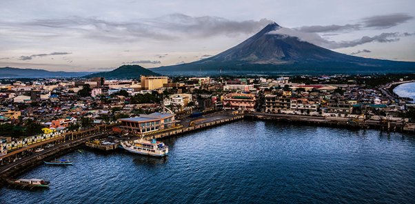
Description and Contacts of Key Companies
For more information on port contacts, please see the following link: 4.4 Port and Waterways Companies Contact List.
Port Performance
|
Seasonal Constraints |
||
|---|---|---|
|
Occurs |
Time Frame |
|
|
Rainy Season |
Yes |
From August to December |
|
Major Import Campaigns |
None |
|
|
Other Comments |
Port congestion and typhoon season may disrupt port operations. |
|
|
Handling Figures for 2020 |
|
|---|---|
|
Vessel Calls |
16,343 |
|
Container Traffic (TEUs) |
0 TEUs |
|
Handling Figures Bulk and Break Bulk for 2020 |
|
|---|---|
|
Bulk (MT) |
41,980 MT |
|
Break bulk (MT) |
400,879 MT |
Discharge Rates and Terminal Handling Charges
For information on port rates and charges, please see the following links:
Vessel: https://www.ppa.com.ph/?q=content/charges-vessel
Cargoes: https://www.ppa.com.ph/?q=content/charges-cargoes
Storage: https://www.ppa.com.ph/?q=content/charges-storage
Berthing Specifications
|
Type of Berth |
Quantity |
Length |
Maximum Draft |
Comments |
|---|---|---|---|---|
|
Conventional Berth |
6 |
560 m |
B1-11m B/other – 2-5m |
|
|
Container Berth |
None |
|
||
|
Silo Berth |
None |
|
||
|
Berthing Tugs |
None |
|
||
|
Water Barges |
None |
|
Safe Berth Lengths
- a) Berth # 1 - 85 meters
- b) Berth # 2 - 110 meters
Controlling Drafts at MLLW
- a) Berth # 1 - 11.8 meters
- b) Berth # 2 - 5.7 meters
- c) Berth # 3 - 4 meters
- d) Berth # 4 - 3 meters
- e) Berth # 5 - 2 meters
- f) Berth # 6 - 2 meter
General Cargo Handling Berths
|
Cargo Type |
Berth Identification |
|---|---|
|
Imports - Bagged Cargo |
None |
|
Exports - Bagged Cargo |
None |
|
Imports and Exports - RoRo |
None |
|
Other Imports |
None |
Port Handling Equipment
|
Equipment |
Available |
Total Quantity and Capacity Available |
Comments on Current Condition and Actual Usage |
|---|---|---|---|
|
Dockside Crane |
Yes |
|
|
|
Container Gantries |
None |
||
|
Mobile Cranes |
None |
||
|
Reachstacker |
None |
||
|
RoRo Tugmaster (with Trailer) |
None |
||
|
Grain Elevator with Bagging Machines |
None |
||
|
Transtainer |
None |
||
|
Forklifts |
Yes |
Container Facilities
The Port of Legaspi does not have container facilities.
Customs Guidance
Bureau of Customs
Arsenia C. Ilagan
District Collector, CD5, Port of Legaspi
0912-475-2588; 0915-261-9622
For more information on customs in the Philippines, please see the following link: 1.3 Customs Information.
Terminal Information
Multipurpose Terminal
The Port of Legaspi is a non-RoRo berthing facility and uses conventional docking for domestic passenger vessels and export vessels. It has 3200 m2 open storage area / port facilities and 6 berthing locations.
Port Area Utilization
- Total Port Area 18,749.48 sq. m.
- Operational Area 11,091.00 sq. m
- R.C. Wharf 10,054.50 sq. m
- R.C. Pier 2,376.00 sq. m
- Commercial Area 190.84 sq. m.
- Leased Area 154.84 sq. m
- Back-Up Area 7,658.48 sq. m.
Grain and Bulk Handling
The Port of Legaspi does not have grain discharging facilities.
Main Storage Terminal
|
Storage Type |
Number of Storage Facilities |
Area (m2) |
|---|---|---|
|
Bagged Cargo |
None |
|
|
Refrigerated Cargo |
None |
|
|
General Cargo |
Yes Terminal open space |
3200 m2 |
Stevedoring
The PPA PMO Legaspi will arrange for stevedoring activities at the port through Regal Arrastre and Stevedoring Inc (RASI)
Address: Pier Site, 4500 Legazpi, Albay
Hinterland Information
Transporters in Legaspi City, Albay
- CLA Trucking, Tiwi, Legaspi
- Esquillo Trucking and Management Services, Legaspi
- Pulvinar Trading and Trucking, Legaspi
Port Security
The PPA TMO Legaspi manages the deployment of security services within the port premises.
|
Security |
|
|---|---|
|
ISPS Compliant |
Yes |
|
Current ISPS Level |
Level 1 |
|
Police Boats |
Coast Guard / PNP Maritime Command |
|
Fire Engines |
LGU fire trucks |
2.1.37 Philippines - Luzon Port of Bulan
Port Overview
The Port of Bulan is located at the southeast end of Luzon, is the ideal jump-off point to Masbate, Cebu and Western Samar islands not traversed by the Pan Philippine Highway. Bulan is the most important town in this vicinity, and stands on the north side of the entrance to the Sabang River, north of Sabang Point. Bulan Light is shown from a concrete tower, 8m high, standing on the shore near the middle of the town.
Port website: ppa.gov.ph
Key port information may also be found at: http://www.maritime-database.com
|
Port Location and Contact |
|
|---|---|
|
Country |
Philippines |
|
Province or District |
Sorsogon |
|
Nearest Town or City with Distance from Port |
Bulan |
|
Port's Complete Name |
TMO Port of Bulan |
|
Latitude |
12.666188 |
|
Longitude |
123.872439 |
|
Managing Company or Port Authority |
Philippine Ports Authority |
|
Management Contact Person |
Maria Magnolia S. Requejo Acting Port Manager, PMO Bicol +63 52 482 0303 |
|
Nearest Airport and Airlines with Frequent International Arrivals/Departures |
Ninoy Aquino International Airport All Nippon Airways, Cathay Pacific Airways, Delta Air Lines, Emirates, Etihad Airways, KLM Royal Dutch Airlines, Qantas Airways, Qatar Airways, Singapore Airlines, Turkish Airlines, United Airlines; Cebu Pacific Air, PAL Express, Philippines AirAsia. |
Port Picture


Description and Contacts of Key Companies
For more information on port contacts, please see the following link: 4.4 Port and Waterways Companies Contact List.
Port Performance
|
Seasonal Constraints |
||
|---|---|---|
|
Occurs |
Time Frame |
|
|
Rainy Season |
Yes |
From August to December |
|
Major Import Campaigns |
None |
N/A |
|
Other Comments |
Typhoons may disrupt port operations. |
|
|
Handling Figures for 2020 |
|
|---|---|
|
Vessel Calls |
3,031 |
|
Container Traffic (TEUs) |
0 TEUs |
|
Handling Figures Bulk and Break Bulk for 2020 |
|
|---|---|
|
Bulk (MT) |
0 MT |
|
Break bulk (MT) |
110,198 MT |
Discharge Rates and Terminal Handling Charges
For information on port rates and charges, please see the following links:
Vessel: https://www.ppa.com.ph/?q=content/charges-vessel
Cargoes: https://www.ppa.com.ph/?q=content/charges-cargoes
Storage: https://www.ppa.com.ph/?q=content/charges-storage
Berthing Specifications
|
Type of Berth |
Quantity |
Length |
Maximum Draft |
Comments |
|---|---|---|---|---|
|
Conventional Berth |
2 |
200 m |
4 m |
|
|
Container Berth |
None |
|
||
|
Silo Berth |
None |
|
||
|
Berthing Tugs |
None |
|||
|
Water Barges |
None |
Port Facilities
RC Pier - 1,192.20 m2
RORO Ramp - 81 m2
Concrete Causeway - 2,184 m2
Concrete Approach Road - 1,220.50 m2
Reclamation Area - 2,750 m2
PPA TMO Building - 220.50 m2
Sideslope w/deflector wall - Passenger Terminal Building - 108 m2
Lighthouse - Port Lighting System - 2
Powerhouse - 24 m2
Draft: Average draft alongside RC Pier is 2.5 m at its west side. At the east side, average draft is 1.8 m.
General Cargo Handling Berths
|
Cargo Type |
Berth Identification |
|---|---|
|
Imports - Bagged Cargo |
None |
|
Exports - Bagged Cargo |
None |
|
Imports and Exports - RoRo |
None |
|
Other Imports |
None |
Port Handling Equipment
The Port of Bulan does not have port handling equipment.
Container Facilities
The Port of Bulan does not have container facilities.
Customs Guidance
The Port of Bulan caters only domestic ferry and vessel cargo.
For more information on customs in the Philippines, please see the following link: 1.3 Customs Information.
Terminal Information
Multipurpose Terminal
The Port of Bulan is a non Ro-Ro berthing facility and uses conventional docking for domestic passenger ferry and cargo vessels. It has 1700 m2 open storage area and 2 berthing locations. The 2,750 m2 reclamation area is available for storage of cargo.
Grain and Bulk Handling
The Port of Bulan does not have grain discharging facilities.
Main Storage Terminal
|
Storage Type |
Number of Storage Facilities |
Area (m2) |
|---|---|---|
|
Bagged Cargo |
None |
|
|
Refrigerated Cargo |
None |
|
|
General Cargo |
Yes, Terminal open space |
1700 m2 |
Stevedoring
TMO Bulan will arrange for stevedoring activities at the port.
Hinterland Information
Bulan transport company: BULAN SORSOGON TRUCKING / bulansorsogontrucking@gmail.com
Port Security
The PPA TMO Bulan manages the deployment of security services within the port premises.
|
Security |
|
|---|---|
|
ISPS Compliant |
Yes |
|
Current ISPS Level |
Level 1 |
|
Police Boats |
Coast Guard / PNP Maritime Command |
|
Fire Engines |
LGU fire trucks |
2.1.38 Philippines - Luzon Port of Matnog
Port Overview
The Port of Matnog is the busiest passenger terminal in southern Luzon and is the jump off point to Central Visayas and Mindanao. Small vessels can take anchorage in Matnog Bay, in a depth of 5.5 m, about 400 m from the beach. Larger vessels can anchor in the middle of the bay in depths of 14.6 m. Vessels wishing to enter Matnog Bay may bring the sharp conical summit on Ticlin Island astern, bearing 090°, and anchor according to draft. Matnog's LOCODE is PHMTN.
Port website: ppa.gov.ph
Key port information may also be found at: http://www.maritime-database.com
|
Port Location and Contact |
|
|---|---|
|
Country |
Philippines |
|
Province or District |
Sorsogon |
|
Nearest Town or City with Distance from Port |
Matnog, Sorsogon |
|
Port's Complete Name |
TMO Port of Matnog |
|
Latitude |
12.584439 |
|
Longitude |
124.086160 |
|
Managing Company or Port Authority |
Philippine Ports Authority |
|
Management Contact Person |
Maria Magnolia S. Requejo Acting Port Manager, PMO Bicol +63 52 482 0303 |
|
Nearest Airport and Airlines with Frequent International Arrivals/Departures |
Ninoy Aquino International Airport All Nippon Airways, Cathay Pacific Airways, Delta Air Lines, Emirates, Etihad Airways, KLM Royal Dutch Airlines, Qantas Airways, Qatar Airways, Singapore Airlines, Turkish Airlines, United Airlines; Cebu Pacific Air, PAL Express, Philippines AirAsia. |
Port Picture
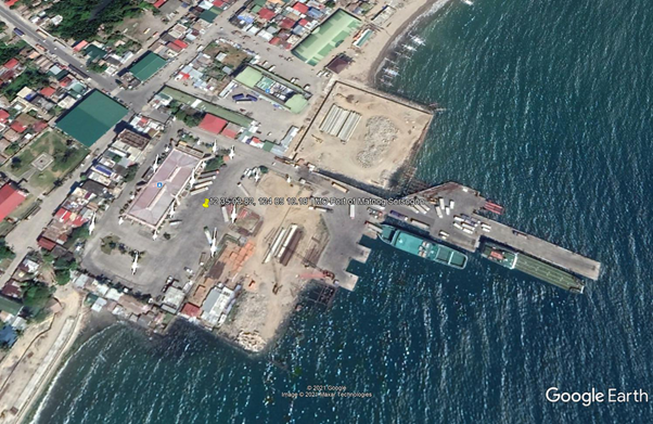
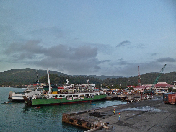
Description and Contacts of Key Companies
For more information on port contacts, please see the following link: 4.4 Port and Waterways Companies Contact List.
Port Performance
|
Seasonal Constraints |
||
|---|---|---|
|
Occurs |
Time Frame |
|
|
Rainy Season |
Yes |
From August to December |
|
Major Import Campaigns |
None |
N/A |
|
Other Comments |
The port is located in a typhoon-prone area, and typhoons may disrupt port operations. |
|
|
Handling Figures for 2020 |
|
|---|---|
|
Vessel Calls |
6,982 |
|
Container Traffic (TEUs) |
0 TEUs |
|
Handling Figures Bulk and Break Bulk for 2020 |
|
|---|---|
|
Bulk (MT) |
0 MT |
|
Break bulk (MT) |
258,683 rolling cargoes/RORO |
Discharge Rates and Terminal Handling Charges
For information on port rates and charges, please see the following links:
Vessel: https://www.ppa.com.ph/?q=content/charges-vessel
Cargoes: https://www.ppa.com.ph/?q=content/charges-cargoes
Storage: https://www.ppa.com.ph/?q=content/charges-storage
Trucks and Buses on-board RORO vessels are not charged handling fees.
Berthing Specifications
|
Type of Berth |
Quantity |
Length |
Maximum Draft |
Comments |
|---|---|---|---|---|
|
Conventional Berth |
6 |
10 m |
9 m |
C. Pier - 15 m. x 105 m. (1,575 m2) RORO Ramp 1 - 9 x 11 meters (99 m2) RORO Ramp 2 - 9 x 11 meters (99 m2) RORO Ramp 3 - 5 x 9 meters (45 m2) RORO Ramp 4 - 9 x 11 meters (99 m2) RORO Ramp 5 - 5 x 9 meters (45 m2) RORO Ramp 6 - 5 x 9 meters (45 m2) |
|
Container Berth |
None |
|
||
|
Silo Berth |
None |
|
||
|
Berthing Tugs |
None |
|||
|
Water Barges |
None |
|
Draft
Northeast side of R. C. pier - 5.69 meters
Southwest side of pier - 7.48 meters
Controlling depth - 6.39 meters
General Cargo Handling Berths
|
Cargo Type |
Berth Identification |
|---|---|
|
Imports - Bagged Cargo |
None |
|
Exports - Bagged Cargo |
None |
|
Imports and Exports - RoRo |
None |
|
Other Imports |
None |
Port Handling Equipment
The Port of Matnog serves mostly rolling cargoes.
Container Facilities
The Port of Matnog does not have container facilities.
Customs Guidance
The Port of Matnog caters only domestic ferry and cargo vessels.
For more information on customs in the Philippines, please see the following link: 1.3 Customs Information.
Terminal Information
Multipurpose Terminal
The Port of Matnog is a Ro-Ro berthing facility using Mediterranean docking and caters to domestic passenger ferries and cargo vessels. It has a 5000 m2 open storage area and 5 berthing locations. The terminal building is 2,144 m2.
Grain and Bulk Handling
The Port of Matnog does not have grain discharging facilities.
Main Storage Terminal
Trestle - 11m. x 120m. (1,320 m2)
Back-up Area 1 - 9,246.88 m2
Back-up Area 2 - 4,734 m2
|
Storage Type |
Number of Storage Facilities |
Area (m2) |
|---|---|---|
|
Bagged Cargo |
None |
|
|
Refrigerated Cargo |
None |
|
|
General Cargo |
Yes, terminal open space |
5000 m2 |
Stevedoring
TMO Matnog manages the stevedoring activities at the port.
Hinterland Information
There is no large scale transporter based in Matnog as the port is only a connecting RORO point for vehicles from Luzon going to Visayas and Mindanao.
Port Security
TMO Matnog manages the deployment of security services within the port premises.
|
Security |
|
|---|---|
|
ISPS Compliant |
Yes |
|
Current ISPS Level |
Level 1 |
|
Police Boats |
Coast Guard / PNP Maritime Command |
|
Fire Engines |
LGU fire trucks |
2.1.39 Philippines - Luzon Port of Pasacao
Port Overview
The national PORT OF PASACAO serves most of the seaborne cargoes bound for or from the province of Camarines Sur. Just 27 kilometers southwest of Naga City, it ordinarily caters to such goods as cement, rice, sugar, fish and other prime commodities. LGU has a Port Management Office that will cater port services at the Municipal port.
Port website: ppa.gov.ph
Key port information may also be found at: http://www.maritime-database.com
|
Port Location and Contact |
|
|---|---|
|
Country |
Philippines |
|
Province or District |
Camarines Sur |
|
Nearest Town or City with Distance from Port |
Pasacao, Camarines Sur Naga City, Camarines Sur (27 km) |
|
Port's Complete Name |
TMO Port of Pasacao |
|
Latitude |
13.505588 |
|
Longitude |
123.040821 |
|
Managing Company or Port Authority |
Philippine Ports Authority |
|
Management Contact Person |
Maria Magnolia S. Requejo Acting Port Manager, PMO Bicol +63 52 482 0303 |
|
Nearest Airport and Airlines with Frequent International Arrivals/Departures |
Ninoy Aquino International Airport All Nippon Airways, Cathay Pacific Airways, Delta Air Lines, Emirates, Etihad Airways, KLM Royal Dutch Airlines, Qantas Airways, Qatar Airways, Singapore Airlines, Turkish Airlines, United Airlines; Cebu Pacific Air, PAL Express, Philippines AirAsia. |
Port Picture
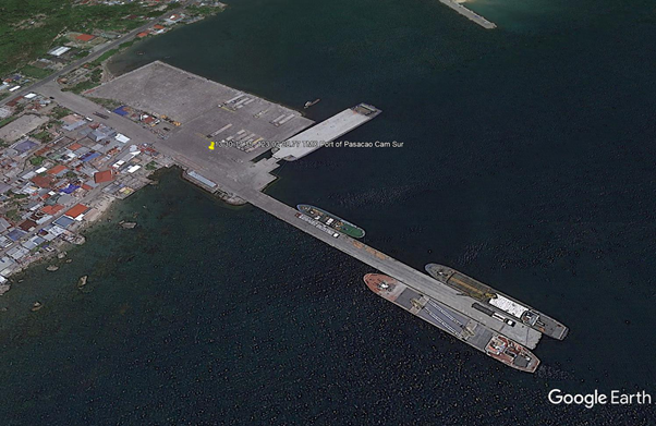
Description and Contacts of Key Companies
Transporters in Naga City, Camarines Sur:
-
- Daily Overland Freight Forwarder / SR Romero Bldg
- RD Salazar Trucking Services / Pili, CamSur
- MRHACS Trading / HSR Bldg, Concepcion Peguena / +63 54 472 0288
- MUNSEC Trucking Sesrvices / Ateneo Ave / +63 54 473 5398 / 9927
- TJRF Truking Services / Naga City / +63 920 889 8500
- Daniel Matthew Tragura Trucking Services / Magsaysay Ave / dmtragura@gmail.com
For more information on port contacts, please see the following link: 4.4 Port and Waterways Companies Contact List.
Port Performance
|
Seasonal Constraints |
||
|---|---|---|
|
Occurs |
Time Frame |
|
|
Rainy Season |
Yes |
From August to December |
|
Major Import Campaigns |
None |
N/A |
|
Other Comments |
Typhoons may disrupt port operations. |
|
|
Handling Figures for 2020 |
|
|---|---|
|
Vessel Calls |
392 |
|
Container Traffic (TEUs) |
0 TEUs |
|
Handling Figures Bulk and Break Bulk for 2020 |
|
|---|---|
|
Bulk (MT) |
0 MT |
|
Break bulk (MT) |
270,345 MT |
Discharge Rates and Terminal Handling Charges
For information on port rates and charges, please see the following links:
Vessel: https://www.ppa.com.ph/?q=content/charges-vessel
Cargoes: https://www.ppa.com.ph/?q=content/charges-cargoes
Storage: https://www.ppa.com.ph/?q=content/charges-storage
Berthing Specifications
|
Type of Berth |
Quantity |
Length |
Maximum Draft |
Comments |
|---|---|---|---|---|
|
Conventional Berth |
3 |
140 m |
4 m |
|
|
Container Berth |
None |
|
||
|
Silo Berth |
None |
|
||
|
Berthing Tugs |
None |
|||
|
Water Barges |
None |
Port Facilities
R.C. Pier - 12 m. x 109.35 m
RORO Ramp - 9.0 m. x 11 m
Concrete Causeway - 10.55 m. x 34.20 m
Depth - 6 m
General Cargo Handling Berths
|
Cargo Type |
Berth Identification |
|---|---|
|
Imports - Bagged Cargo |
None |
|
Exports - Bagged Cargo |
None |
|
Imports and Exports - RoRo |
None |
|
Other Imports |
None |
Port Handling Equipment
The Port of Pasacao does not have port handling equipment.
Container Facilities
The Port of Pasacao does not have container facilities.
Customs Guidance
The Port of Pasacao caters only to domestic ferries and cargo vessels.
For more information on customs in the Philippines, please see the following link: 1.3 Customs Information.
Terminal Information
Multipurpose Terminal
The Port of Pasacao is a RORO berthing facility using Mediterranean docking and 2 berths for conventional berthing for domestic passenger ferries and cargo vessels. It has a 3500 m2 open storage area with 3 berthing locations.
PORT AREA UTILIZATION
- Total Port Area - 11,733.00 m2
- Operational Area - 9,554.20 m2
- Commercial Area - 29.44 m2
- Back-up Area - 8,026 m2
Grain and Bulk Handling
The Port of Pasacao does not have grain discharging facilities.
Main Storage Terminal
|
Storage Type |
Number of Storage Facilities |
Area (m2) |
|---|---|---|
|
Bagged Cargo |
None |
|
|
Refrigerated Cargo |
None |
|
|
General Cargo |
Yes, terminal open space |
3500 m2 |
Stevedoring
TMO Pasacao may provide for stevedoring activities at the port.
Hinterland Information
Transporters in Naga City, Camarines Sur:
-
- Daily Overland Freight Forwarder / SR Romero Bldg
- RD Salazar Trucking Services / Pili, CamSur
- MRHACS Trading / HSR Bldg, Concepcion Peguena / +63 54 472 0288
- MUNSEC Trucking Sesrvices / Ateneo Ave / +63 54 473 5398 / 9927
- TJRF Truking Services / Naga City / +63 920 889 8500
- Daniel Matthew Tragura Trucking Services / Magsaysay Ave / dmtragura@gmail.com
Port Security
The PPA TMO Pasacao managse the deployment of security services within the port premises.
|
Security |
|
|---|---|
|
ISPS Compliant |
Yes |
|
Current ISPS Level |
Level 1 |
|
Police Boats |
Coast Guard / PNP Maritime Command |
|
Fire Engines |
LGU fire trucks |
2.1.40 Philippines - Luzon Port of Pio Duran
Port Overview
The Port of Pio Duran is the major jump-off point for vehicles and passengers from the island of Luzon going to Masbate. It serves domestic rolling cargoes on board RORO passenger vessels. There was a 200% increase in RoRO units and 100% increase in passenger volume from CY 2012 to 2016.
Port website: ppa.gov.ph
Key port information may also be found at: http://www.maritime-database.com
|
Port Location and Contact |
|
|---|---|
|
Country |
Philippines |
|
Province or District |
Albay |
|
Nearest Town or City with Distance from Port |
Pio Duran, Albay Ligao, Albay (38 km) |
|
Port's Complete Name |
TMO Port of Pio Duran |
|
Latitude |
13.028415 |
|
Longitude |
123.444235 |
|
Managing Company or Port Authority |
Philippine Ports Authority |
|
Management Contact Person |
Maria Magnolia S. Requejo Acting Port Manager, PMO Bicol +63 52 482 0303 |
|
Nearest Airport and Airlines with Frequent International Arrivals/Departures |
Ninoy Aquino International Airport All Nippon Airways, Cathay Pacific Airways, Delta Air Lines, Emirates, Etihad Airways, KLM Royal Dutch Airlines, Qantas Airways, Qatar Airways, Singapore Airlines, Turkish Airlines, United Airlines; Cebu Pacific Air, PAL Express, Philippines AirAsia. |
Port Picture
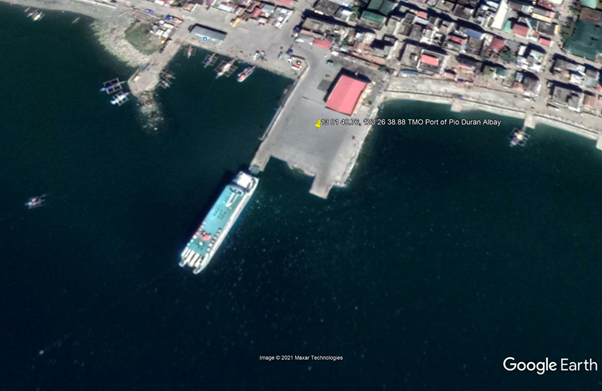
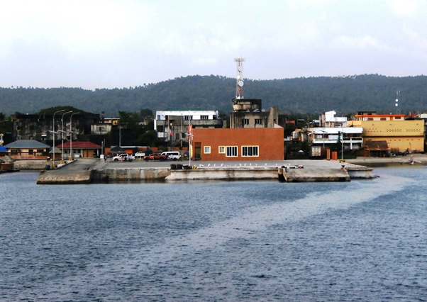
Description and Contacts of Key Companies
For more information on port contacts, please see the following link: 4.4 Port and Waterways Companies Contact List.
Port Performance
|
Seasonal Constraints |
||
|---|---|---|
|
Occurs |
Time Frame |
|
|
Rainy Season |
Yes |
From August to December |
|
Major Import Campaigns |
None |
N/A |
|
Other Comments |
Typhoons may disrupt port operations. |
|
|
Handling Figures for 2020 |
|
|---|---|
|
Vessel Calls |
1,011 |
|
Container Traffic (TEUs) |
0 TEUs |
|
Handling Figures Bulk and Break Bulk for 2020 |
|
|---|---|
|
Bulk (MT) |
0 MT |
|
Break bulk (MT) |
0 MT |
Discharge Rates and Terminal Handling Charges
For information on port rates and charges, please see the following link: INSERT LINK TO PORT RATES/TARIFFS PAGE – link directly to an external webpage which has relevant rates, tariffs, and/or charges for the port, if available.
Vessel: https://www.ppa.com.ph/?q=content/charges-vessel
Cargoes: https://www.ppa.com.ph/?q=content/charges-cargoes
Storage: https://www.ppa.com.ph/?q=content/charges-storage
Berthing Specifications
|
Type of Berth |
Quantity |
Length |
Maximum Draft |
Comments |
|---|---|---|---|---|
|
Conventional Berth |
2 |
10 m |
6 m |
RORO Ramp 1 (9 m x 11 m) - 99 m2 RORO Ramp 2 (9 m x 11 m) - 99 m2 Rock Causeway (83 m x 6 m) - 498 m2 Rock Causeway Extension (20 m x 20 m) – 400 m2 |
|
Container Berth |
None |
|
||
|
Silo Berth |
None |
|
||
|
Berthing Tugs |
None |
|||
|
Water Barges |
None |
General Cargo Handling Berths
|
Cargo Type |
Berth Identification |
|---|---|
|
Imports - Bagged Cargo |
None |
|
Exports - Bagged Cargo |
None |
|
Imports and Exports - RoRo |
None |
|
Other Imports |
None |
Port Handling Equipment
The Port of Pio Duran does not have port handling equipment.
Container Facilities
The Port of Pio Duran does not have container facilities.
Customs Guidance
The Port of Pio Duran caters only to domestic ferries and cargo vessels.
For more information on customs in the Philippines, please see the following link: 1.3 Customs Information.
Terminal Information
Multipurpose Terminal
The Port of Pio Duran has a 2 RORO ramp berthing facility using Mediterranean docking for domestic passenger ferries and cargo vessels. It has a 1500 m2 open storage area and 2 berthing locations.
Grain and Bulk Handling
The Port of Pio Duran does not have grain discharging facilities.
Main Storage Terminal
|
Storage Type |
Number of Storage Facilities |
Area (m2) |
|---|---|---|
|
Bagged Cargo |
None |
|
|
Refrigerated Cargo |
None |
|
|
General Cargo |
Yes, terminal open space |
1500 m2 |
Stevedoring
The TMO Pio Duran may provide stevedoring activities at the port.
Hinterland Information
Transporter in Ligao City, Albay:
Daily Overland Freight Forwarder / Dunao, Ligao City / info@dailyoverland.com /
Port Security
The PPA TMO Pio Duran manages the deployment of security services within the port premises.
|
Security |
|
|---|---|
|
ISPS Compliant |
Yes |
|
Current ISPS Level |
Level 1 |
|
Police Boats |
Coast Guard / PNP Maritime Command |
|
Fire Engines |
LGU fire trucks |
2.1.41 Philippines - Luzon Port of Tabaco
Port Overview
The Port of Tabaco serves as the main gateway to the island-province of Catanduanes, with Catanduanes residents accounting for around 90 percent of the total number of passengers taking the routes to Virac and San Andres, Catanduanes. Tabaco's LOCODE is PHTBC.
Port website: ppa.gov.ph
Key port information may also be found at: http://www.maritime-database.com
|
Port Location and Contact |
|
|---|---|
|
Country |
Philippines |
|
Province or District |
Albay |
|
Nearest Town or City with Distance from Port |
Tabaco City, Albay |
|
Port's Complete Name |
TMO Tabaco International Seaport |
|
Latitude |
13.361501 |
|
Longitude |
123.737243 |
|
Managing Company or Port Authority |
Philippine Ports Authority |
|
Management Contact Person |
Maria Magnolia S. Requejo Acting Port Manager, PMO Bicol +63 52 482 0303 |
|
Nearest Airport and Airlines with Frequent International Arrivals/Departures |
Ninoy Aquino International Airport All Nippon Airways, Cathay Pacific Airways, Delta Air Lines, Emirates, Etihad Airways, KLM Royal Dutch Airlines, Qantas Airways, Qatar Airways, Singapore Airlines, Turkish Airlines, United Airlines; Cebu Pacific Air, PAL Express, Philippines AirAsia. |
Port Picture
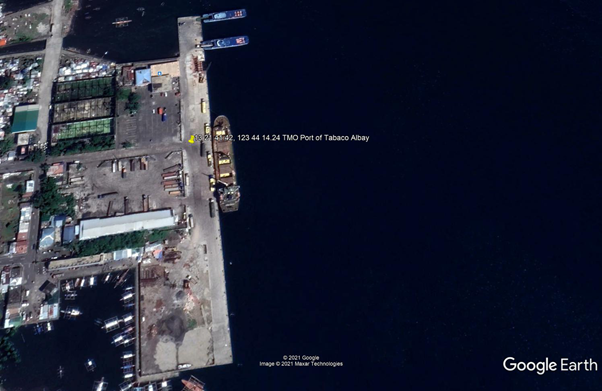
Description and Contacts of Key Companies
Tabaco Port Cargo Corp
Pier Site, Tabaco Port, Tabaco City
+63 (54) 472 2208
Tabaco Port Warehouse
- Barrio San Roque, Tabaco City – near Tabaco Port
- WH area 1500 sqm with existing guard house, bathroom and office
- Land Area 2157 sqm
- Php1,500.00 monthly rental
For more information on port contacts, please see the following link: 4.4 Port and Waterways Companies Contact List.
Port Performance
|
Seasonal Constraints |
||
|---|---|---|
|
Occurs |
Time Frame |
|
|
Rainy Season |
Yes |
From August to December |
|
Major Import Campaigns |
None |
N/A |
|
Other Comments |
The typhoon season may disrupt port operations. |
|
|
Handling Figures for 2020 |
|
|---|---|
|
Vessel Calls |
1,381 |
|
Container Traffic (TEUs) |
0 TEUs |
|
Handling Figures Bulk and Break Bulk for 2020 |
|
|---|---|
|
Bulk (MT) |
0 MT |
|
Break bulk (MT) |
209,673 MT |
Discharge Rates and Terminal Handling Charges
For information on port rates and charges, please see the following links:
Vessels: https://www.ppa.com.ph/?q=content/charges-vessel
Cargoes: https://www.ppa.com.ph/?q=content/charges-cargoes
Storage: https://www.ppa.com.ph/?q=content/charges-storage
Berthing Specifications
|
Type of Berth |
Quantity |
Length |
Maximum Draft |
Comments |
|---|---|---|---|---|
|
Conventional Berth |
1 |
300 m |
6 m |
RORO Ramp 1 - 6 m. x 8 m. RORO Ramp 2 - 6 m. x 12 m. |
|
Container Berth |
None |
|
||
|
Silo Berth |
None |
|
||
|
Berthing Tugs |
None |
|||
|
Water Barges |
None |
Port Facilities
Marginal Wharf - 11.45 m. x 297.45 m.
Mooring Bollards - 5 pcs.
Mooring Bitts - 12 pcs
Mooring Cleats - 5 pcs.
Fendering System - Horizontal and Vertical Rubber Dock Fender
Controlling Depth & Pier Load Capacity
MLLW (berth length) - 8.5 m
General Cargo Handling Berths
|
Cargo Type |
Berth Identification |
|---|---|
|
Imports - Bagged Cargo |
Yes |
|
Exports - Bagged Cargo |
None |
|
Imports and Exports - RoRo |
None |
|
Other Imports |
None |
Port Handling Equipment
|
Equipment |
Available |
Total Quantity and Capacity Available |
Comments on Current Condition and Actual Usage |
|---|---|---|---|
|
Dockside Crane |
None |
||
|
Container Gantries |
None |
||
|
Mobile Cranes |
Yes |
||
|
Reachstacker |
None |
||
|
RoRo Tugmaster (with Trailer) |
None |
||
|
Grain Elevator with Bagging Machines |
NONE |
||
|
Transtainer |
None |
||
|
Forklifts |
Yes |
Container Facilities
The Port of Tabaco has a storage area and container yard - 7,425 m2.
Customs Guidance
Judith P. Barrameda, Sub-Port Collector
Sub-Port of Tabaco
judith.barrameda@customs.gov.ph
For more information on customs in the Philippines, please see the following link: 1.3 Customs Information.
Terminal Information
Multipurpose Terminal
Port of Tabaco has 2 RORO ramps, and the berthing facility uses Mediterranean docking for up to 4 domestic passenger ferries and cargo vessels bound for Virac, Catanduanes. It has a 4200 m2 open storage area. For passenger facilities, there is a 390.67 m2 shed and a new 1,371.98 m2 passenger terminal building.
Grain and Bulk Handling
The Port of Tabaco does not have grain discharging facilities.
Main Storage Terminal
|
Storage Type |
Number of Storage Facilities |
Area (m2) |
|---|---|---|
|
Bagged Cargo |
Yes, warehouse/cargo shed |
933.12 m2 |
|
Refrigerated Cargo |
None |
|
|
General Cargo |
Yes, terminal open space |
4200 m2 |
Stevedoring
The TMO Tabaco will organize stevedoring activities at the port through the Tabaco Port Cargo Corporation (Pier Site, Tabaco Port, Tabaco City, +6354 472 2208).
Port Security
PPA TMO Tabaco manages the deployment of security services within the port premises.
|
Security |
|
|---|---|
|
ISPS Compliant |
Yes |
|
Current ISPS Level |
Level 1 |
|
Police Boats |
Coast Guard / PNP Maritime Command |
|
Fire Engines |
LGU fire trucks |
2.1.42 Philippines - Luzon Port of Virac
Port Overview
The Port of Virac is a port of entry located on the west side of the head of Cabugao Bay, on the south coast of Catanduanes Island. The main exports are hemp, logs and copra. Approximately 400 vessels and 118,000 MT of cargo are handled annually. Max draught is 6.8 m. Catanduanes Island is situated on the eastern side of Luzon and is on the usual path of tropical depressions originating from the Pacific Ocean. UN LOCODE: PHVRC
Port website: ppa.gov.ph
Key port information may also be found at: http://www.maritime-database.com
|
Port Location and Contact |
|
|---|---|
|
Country |
Philippines |
|
Province or District |
Catanduanes |
|
Nearest Town or City with Distance from Port |
Virac, Catanduanes |
|
Port's Complete Name |
TMO Port of Virac |
|
Latitude |
13.581831 |
|
Longitude |
124.233935 |
|
Managing Company or Port Authority |
Philippine Ports Authority |
|
Management Contact Person |
Maria Magnolia S. Requejo Acting Port Manager, PMO Bicol +63 52 482 0303 |
|
Nearest Airport and Airlines with Frequent International Arrivals/Departures |
Ninoy Aquino International Airport All Nippon Airways, Cathay Pacific Airways, Delta Air Lines, Emirates, Etihad Airways, KLM Royal Dutch Airlines, Qantas Airways, Qatar Airways, Singapore Airlines, Turkish Airlines, United Airlines; Cebu Pacific Air, PAL Express, Philippines AirAsia. |
Port Picture
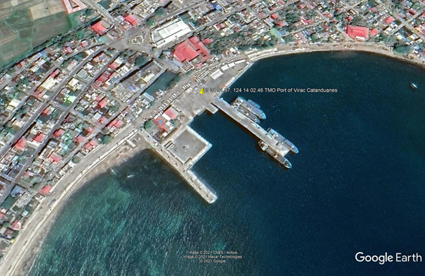
Description and Contacts of Key Companies
For more information on port contacts, please see the following link: 4.4 Port and Waterways Companies Contact List.
Port Performance
|
Seasonal Constraints |
||
|---|---|---|
|
Occurs |
Time Frame |
|
|
Rainy Season |
Yes |
From August to December |
|
Major Import Campaigns |
None |
N/A |
|
Other Comments |
Typhoon and vessel congestion may disrupt port operations. |
|
|
Handling Figures for 2020 |
|
|---|---|
|
Vessel Calls |
650 |
|
Container Traffic (TEUs) |
0 TEUs |
|
Handling Figures Bulk and Break Bulk for 2020 |
|
|---|---|
|
Bulk (MT) |
106,289 MT |
|
Break bulk (MT) |
27,339 MT |
Discharge Rates and Terminal Handling Charges
For information on port rates and charges, please see the following links:
Vessels: https://www.ppa.com.ph/?q=content/charges-vessel
Cargoes: https://www.ppa.com.ph/?q=content/charges-cargoes
Storage: https://www.ppa.com.ph/?q=content/charges-storage
Berthing Specifications
|
Type of Berth |
Quantity |
Length |
Maximum Draft |
Comments |
|---|---|---|---|---|
|
Conventional Berth |
1 |
141 m |
7 m |
R.C. Pier - 15 m x 139 m. RORO Ramps: 1. 9 m x 11 m 2. 5 m x 8 m Causeway - 15 m x 33 m |
|
Container Berth |
None |
|
||
|
Silo Berth |
None |
|
||
|
Berthing Tugs |
None |
|
||
|
Water Barges |
None |
|
General Cargo Handling Berths
|
Cargo Type |
Berth Identification |
|---|---|
|
Imports - Bagged Cargo |
None |
|
Exports - Bagged Cargo |
None |
|
Imports and Exports - RoRo |
None |
|
Other Imports |
None |
Port Handling Equipment
|
Equipment |
Available |
|---|---|
|
Dockside Crane |
None |
|
Container Gantries |
None |
|
Mobile Cranes |
Yes |
|
Reachstacker |
None |
|
RoRo Tugmaster (with Trailer) |
None |
|
Grain Elevator with Bagging Machines |
None |
|
Transtainer |
None |
|
Forklifts |
Yes |
Container Facilities
The Port of Virac does not have container facilities.
Customs Guidance
The Port of Tabaco caters only to domestic passenger RORO ferries and cargo vessels.
For more information on customs in the Philippines, please see the following link: 1.3 Customs Information.
Terminal Information
Multipurpose Terminal
The Port of Virac has 2 RORO ramp berthing facilities, using Mediterranean docking for domestic passenger ferries and cargo vessels from Tabaco Albay. There is a 1200 m2 open storage area and 4 berthing locations. The passenger and cargo terminal building is 384 m2.
Grain and Bulk Handling
The Port of Virac does not have grain discharging facilities.
Main Storage Terminal
|
Storage Type |
Number of Storage Facilities |
Area (m2) |
|---|---|---|
|
Bagged Cargo |
None |
|
|
Refrigerated Cargo |
None |
|
|
General Cargo |
Yes, terminal open space |
1200 m2 |
Stevedoring
TMO Virac will coordinate stevedoring activities at the port through the Catanduanes Island Port Stevedoring Services Corporation.
Hinterland Information
| Services | Company | Contact Information |
|---|---|---|
| Transporter | Virac Lucky Trucking Services | + 63 935 961 9970 |
| Transporter | Rich Trucking Services |
Bigaa, Virac +63 918 56 5178 |
| Shipping | Ocean Coast Shipping Corporation | + 63 52 775 6376 |
| Warehousing | National Food Authority |
San Isidro II, Virac, Catanduanes +63 52 811 3184 |
Port Security
PPA TMO Virac manages the deployment of security services within the port premises.
|
Security |
|
|---|---|
|
ISPS Compliant |
Yes |
|
Current ISPS Level |
Level 1 |
|
Police Boats |
Coast Guard / PNP Maritime Command |
|
Fire Engines |
LGU fire trucks |
2.1.43 Philippines - Luzon Port of Masbate
Port Overview
The Port of Masbate is the only national port of the island province of Masbate. The province has has cattle, coconut, mining and fishing for its main industries which attract traders from Manila, Cebu, Bicol mainland and Panay provinces. Its port exclusively handles containerized cargoes among the Bicol terminals, aside from palletized, bulk and breakbulk commodities. Its fastcraft operation connects Bicol mainland via the port of Pilar in Sorsogon. The main pier for ocean vessels is 210 m long, with an alongside depth of 12.1 m and a width of 10 m. Present port facilities can only accommodate 1 vessel at a time due to draft limitation and physical length of wharf. The largest vessel that can be accommodated is 300 m in length, with a maximum draft of 12 m.
Port website: ppa.gov.ph
Key port information may also be found at: http://www.maritime-database.com
|
Port Location and Contact |
|
|---|---|
|
Country |
Philippines |
|
Province or District |
Masbate |
|
Nearest Town or City with Distance from Port |
Masbate City |
|
Port's Complete Name |
Port of Masbate |
|
Latitude |
12.369654 |
|
Longitude |
123.615743 |
|
Managing Company or Port Authority |
Philippine Ports Authority |
|
Management Contact Person |
Oliver S. Rodulfo Jr. Acting Port Manager, PMO Masbate +63 56 333-2217 |
|
Nearest Airport and Airlines with Frequent International Arrivals/Departures |
Ninoy Aquino International Airport All Nippon Airways, Cathay Pacific Airways, Delta Air Lines, Emirates, Etihad Airways, KLM Royal Dutch Airlines, Qantas Airways, Qatar Airways, Singapore Airlines, Turkish Airlines, United Airlines; Cebu Pacific Air, PAL Express, Philippines AirAsia. |
Port Picture
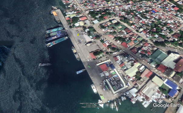
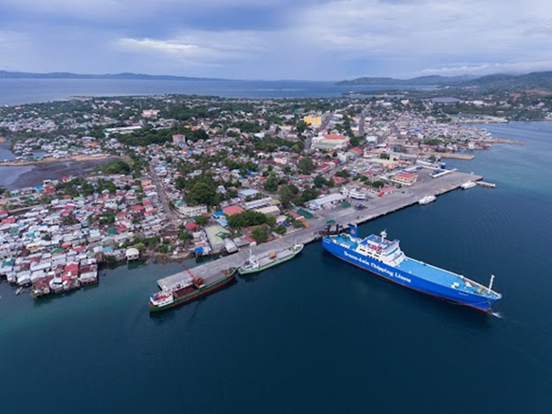
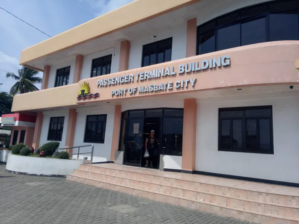
Description and Contacts of Key Companies
| Services | Company | Contact Information |
|---|---|---|
| Transport | JD Trucking Services | Masbate City / +63 916 742 7171 |
| Transport | Julius N Sia Trucking Services | 27 Quezon St, Masbate City, Masbate |
| Transport | Sweet Movers and Packers Trucking Services | +63 923 293 1800 |
| Transport | VL Trucking |
Aroroy, Masbate / +63 921 216 7082 |
| Transport | Gelly Trucking Services | Cawayan, Masbate / +63 921 977 5000 |
| Stevedoring | Masbate Consolidated Arrastre Inc |
Port Area Zurbito Street, 5400 Masbate, Masbate - Philippines +63 52 481 4489 |
| Warehousing | National Food Authority - Masbate | Masbate City |
For more information on port contacts, please see the following link: 4.4 Port and Waterways Companies Contact List.
Port Performance
|
Seasonal Constraints |
||
|---|---|---|
|
Occurs |
Time Frame |
|
|
Rainy Season |
Yes |
From August to December |
|
Major Import Campaigns |
None |
|
|
Other Comments |
Typhoons may disrupt port operations. |
|
|
Handling Figures for 2020 |
|
|---|---|
|
Vessel Calls |
3,156 |
|
Container Traffic (TEUs) |
3,986 TEUs |
|
Handling Figures Bulk and Break Bulk for 2020 |
|
|---|---|
|
Bulk (MT) |
175,507 MT |
|
Break bulk (MT) |
167,678 MT |
Discharge Rates and Terminal Handling Charges
For information on port rates and charges, please see the following links:
Vessels: https://www.ppa.com.ph/?q=content/charges-vessel
Cargoes: https://www.ppa.com.ph/?q=content/charges-cargoes
Storage: https://www.ppa.com.ph/?q=content/charges-storage
Berthing Specifications
|
Type of Berth |
Quantity |
Length |
Maximum Draft |
Comments |
|---|---|---|---|---|
|
Conventional Berth |
6 |
420 m |
12 m |
With 5 RORO ramps, 9 m wide |
|
Container Berth |
None |
|
||
|
Silo Berth |
None |
|
||
|
Berthing Tugs |
None |
|
||
|
Water Barges |
None |
|
General Cargo Handling Berths
|
Cargo Type |
Berth Identification |
|---|---|
|
Imports - Bagged Cargo |
None |
|
Exports - Bagged Cargo |
None |
|
Imports and Exports - RoRo |
None |
|
Other Imports |
None |
Port Handling Equipment
|
Equipment |
Available |
|---|---|
|
Dockside Crane |
None |
|
Container Gantries |
None |
|
Mobile Cranes |
None |
|
Reachstacker |
None |
|
RoRo Tugmaster (with Trailer) |
None |
|
Grain Elevator with Bagging Machines |
None |
|
Transtainer |
None |
|
Forklifts |
Yes |
Container Facilities
The Port of Masbate has open spaces for container on-top trailer for loading and off-loading from a RORO vessel.
Customs Guidance
The Port of Masbate handles domestic RORO passenger and cargo vessels only.
For more information on customs in the Philippines, please see the following link: 1.3 Customs Information.
Terminal Information
Multipurpose Terminal
The Port of Masbate terminal building has a 280 m2 general cargo area.
Open storage area 24,566sqm
Grain and Bulk Handling
The Port of Masbate does not have grain discharging facilities.
Main Storage Terminal
|
Storage Type |
Number of Storage Facilities |
Area (m2) |
|---|---|---|
|
Bagged Cargo |
None |
|
|
Refrigerated Cargo |
None |
|
|
General Cargo |
Open storage area |
24,566 m2 |
Stevedoring
The PMO Masbate will provide stevedoring at the port through:
Masbate Consolidated Arrastre Inc.
Port Area Zurbito Street,5400 Masbate City, Masbate, Philippines
+63 52 481 4489
Hinterland Information
| Services | Company | Contact Information |
|---|---|---|
| Transport | JD Trucking Services | Masbate City / +63 916 742 7171 |
| Transport | Julius N Sia Trucking Services | 27 Quezon St, Masbate City, Masbate |
| Transport | Sweet Movers and Packers Trucking Services | +63 923 293 1800 |
| Transport | VL Trucking |
Aroroy, Masbate / +63 921 216 7082 |
| Transport | Gelly Trucking Services | Cawayan, Masbate / +63 921 977 5000 |
| Stevedoring | Masbate Consolidated Arrastre Inc |
Port Area Zurbito Street, 5400 Masbate, Masbate - Philippines +63 52 481 4489 |
| Warehousing | National Food Authority - Masbate | Masbate City |
Port Security
The PPA PMO Masbate manages the deployment of security services within the port premises.
|
Security |
|
|---|---|
|
ISPS Compliant |
Yes |
|
Current ISPS Level |
Level 1 |
|
Police Boats |
Coast Guard / PNP Maritime Command |
|
Fire Engines |
LGU fire trucks |
2.1.44 Philippines - Luzon Port of Aroroy
Port Overview
The Port of Aroroy is a feeder port on which operation, management and maintenance was turned over by the Department of Transportation (DOTr) thru PMO Ports to the local government of Aroroy by virtue of a memorandum of agreement signed on 18 February 2003. The port handles the transport of goods and passengers to Manila, Lucena, Romblon Islands and Bicol mainland and vice versa.
Port website: ppa.gov.ph
Key port information may also be found at: http://www.maritime-database.com
|
Port Location and Contact |
|
|---|---|
|
Country |
Philippines |
|
Province or District |
Masbate |
|
Nearest Town or City with Distance from Port |
Aroroy, Masbate |
|
Port's Complete Name |
Port of Aroroy |
|
Latitude |
12.513823 |
|
Longitude |
123.396407 |
|
Managing Company or Port Authority |
Philippine Ports Authority |
|
Management Contact Person |
Oliver S. Rodulfo Jr. Acting Port Manager, PMO Masbate +63 56 333-2217 |
|
Nearest Airport and Airlines with Frequent International Arrivals/Departures |
Ninoy Aquino International Airport All Nippon Airways, Cathay Pacific Airways, Delta Air Lines, Emirates, Etihad Airways, KLM Royal Dutch Airlines, Qantas Airways, Qatar Airways, Singapore Airlines, Turkish Airlines, United Airlines; Cebu Pacific Air, PAL Express, Philippines AirAsia. |
Port Picture
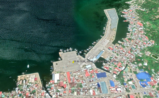
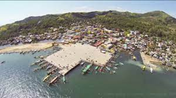
Description and Contacts of Key Companies
|
Services |
Company |
Contact Information |
|---|---|---|
| Transport | JD Trucking Services | Masbate City / +63 916 742 7171 |
| Transport | Julius N Sia Trucking Services | 27 Quezon St, Masbate City, Masbate |
| Transport | Sweet Movers and Packers Trucking Services | +63 923 293 1800 |
| Transport | VL Trucking |
Aroroy, Masbate / +63 921 216 7082 |
| Transport | Gelly Trucking Services | Cawayan, Masbate / +63 921 977 5000 |
| Stevedoring | Masbate Consolidated Arrastre Inc |
Port Area Zurbito Street, 5400 Masbate, Masbate - Philippines +63 52 481 4489 |
| Warehousing | National Food Authority - Masbate | Masbate City |
| Warehousing | Fast Cargo Logistics Corporation | Masbate City |
For more information on port contacts, please see the following link: 4.4 Port and Waterways Companies Contact List.
Port Performance
|
Seasonal Constraints |
||
|---|---|---|
|
Occurs |
Time Frame |
|
|
Rainy Season |
Yes |
From August to December |
|
Major Import Campaigns |
None |
|
|
Other Comments |
Typhoons may disrupt port operations. |
|
|
Handling Figures for 2020 |
|
|---|---|
|
Vessel Calls |
No data |
|
Container Traffic (TEUs) |
0 TEUs |
|
Handling Figures Bulk and Break Bulk for 2020 |
|
|---|---|
|
Bulk (MT) |
No data |
|
Break bulk (MT) |
No data |
Discharge Rates and Terminal Handling Charges
For information on port rates and charges, please see the following links:
Vessels: https://www.ppa.com.ph/?q=content/charges-vessel
Cargoes: https://www.ppa.com.ph/?q=content/charges-cargoes
Storage: https://www.ppa.com.ph/?q=content/charges-storage
Berthing Specifications
|
Type of Berth |
Quantity |
Length |
Maximum Draft |
Comments |
|---|---|---|---|---|
|
Conventional Berth |
2 |
54 m |
5 m |
With 1 RORO ramp, 9 m wide |
|
Container Berth |
None |
|
||
|
Silo Berth |
None |
|
||
|
Berthing Tugs |
None |
|
||
|
Water Barges |
None |
|
General Cargo Handling Berths
|
Cargo Type |
Berth Identification |
|---|---|
|
Imports - Bagged Cargo |
None |
|
Exports - Bagged Cargo |
None |
|
Imports and Exports - RoRo |
None |
|
Other Imports |
None |
Port Handling Equipment
There are no port handling equipment at the Port of Aroroy.
Container Facilities
The Port of Aroroy does not have container facilities.
Customs Guidance
The Port of Aroroy handles domestic RORO passenger and cargo vessels only.
For more information on customs in the Philippines, please see the following link: 1.3 Customs Information.
Terminal Information
Multipurpose Terminal
The Port of Aroroy has 2 backup general cargo areas: 5000 m2 and 1400 m2.
Grain and Bulk Handling
Port of Aroroy does not have grain discharging facilities.
Main Storage Terminal
|
Storage Type |
Number of Storage Facilities |
Area (m2) |
|---|---|---|
|
Bagged Cargo |
None |
|
|
Refrigerated Cargo |
None |
|
|
General Cargo |
Open storage area |
6400 m2 |
Stevedoring
The PMO Masbate will coordinate and provide stevedoring at the port.
Hinterland Information
|
Services |
Company |
Contact Information |
|---|---|---|
| Transport | JD Trucking Services | Masbate City / +63 916 742 7171 |
| Transport | Julius N Sia Trucking Services | 27 Quezon St, Masbate City, Masbate |
| Transport | Sweet Movers and Packers Trucking Services | +63 923 293 1800 |
| Transport | VL Trucking |
Aroroy, Masbate / +63 921 216 7082 |
| Transport | Gelly Trucking Services | Cawayan, Masbate / +63 921 977 5000 |
| Stevedoring | Masbate Consolidated Arrastre Inc |
Port Area Zurbito Street, 5400 Masbate, Masbate - Philippines +63 52 481 4489 |
| Warehousing | National Food Authority - Masbate | Masbate City |
| Warehousing | Fast Cargo Logistics Corporation | Masbate City |
Port Security
The PPA PMO Aroroy manages the deployment of security services within the port premises.
|
Security |
|
|---|---|
|
ISPS Compliant |
Yes |
|
Current ISPS Level |
Level 1 |
|
Police Boats |
Coast Guard / PNP Maritime Command |
|
Fire Engines |
LGU fire trucks |
2.1.45 Philippines - Luzon Port of Cataingan
Port Overview
The Port of Cataingan serves as an alternative for commuters bound for/from the Visayas and Mindanao via the ports in the cities of Cebu and Bogo, who cannot avail of the regular RORO ferry service to Masbate City. Likewise, traders from Samar and Leyte provinces have established business conduits via the Port of Cataingan. Considered the most progressive terminal next to the Port of Masbate in terms of vessel, cargo and passenger traffic, the Port of Cataingan has a natural harbor with sufficient depth that makes an ideal shelter for ships in distress or during inclement weather.
Port website: ppa.gov.ph
Key port information may also be found at: http://www.maritime-database.com
|
Port Location and Contact |
|
|---|---|
|
Country |
Philippines |
|
Province or District |
Masbate |
|
Nearest Town or City with Distance from Port |
Cataingan, Masbate |
|
Port's Complete Name |
Port of Cataingan |
|
Latitude |
12.003076 |
|
Longitude |
124.002320 |
|
Managing Company or Port Authority |
Philippine Ports Authority |
|
Management Contact Person |
Oliver S. Rodulfo Jr. Acting Port Manager, PMO Masbate +63 56 333-2217 |
|
Nearest Airport and Airlines with Frequent International Arrivals/Departures |
Ninoy Aquino International Airport All Nippon Airways, Cathay Pacific Airways, Delta Air Lines, Emirates, Etihad Airways, KLM Royal Dutch Airlines, Qantas Airways, Qatar Airways, Singapore Airlines, Turkish Airlines, United Airlines; Cebu Pacific Air, PAL Express, Philippines AirAsia. |
Port Picture
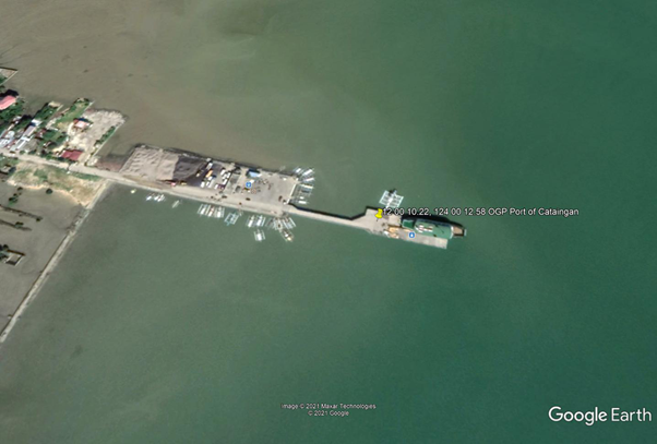
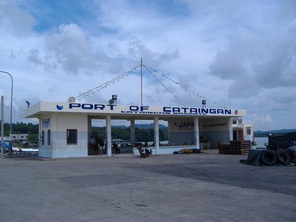
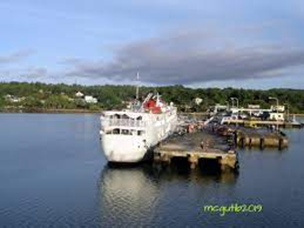
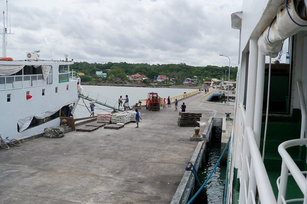
Description and Contacts of Key Companies
For more information on port contacts, please see the following link: 4.4 Port and Waterways Companies Contact List.
Port Performance
|
Seasonal Constraints |
||
|---|---|---|
|
Occurs |
Time Frame |
|
|
Rainy Season |
Yes |
From August to December |
|
Major Import Campaigns |
None |
N/A |
|
Other Comments |
Typhoons may disrupt port operations. |
|
|
Handling Figures for 2020 |
|
|---|---|
|
Vessel Calls |
No data |
|
Container Traffic (TEUs) |
0 TEUs |
|
Handling Figures Bulk and Break Bulk for 2020 |
|
|---|---|
|
Bulk (MT) |
No data |
|
Break bulk (MT) |
No data |
Discharge Rates and Terminal Handling Charges
Vessels: https://www.ppa.com.ph/?q=content/charges-vessel
Cargoes: https://www.ppa.com.ph/?q=content/charges-cargoes
Storage: https://www.ppa.com.ph/?q=content/charges-storage
Berthing Specifications
|
Type of Berth |
Quantity |
Length |
Maximum Draft |
Comments |
|---|---|---|---|---|
|
Conventional Berth |
2 |
100 m |
5 m |
With 1 RORO ramp 9 m wide |
|
Container Berth |
None |
|
||
|
Silo Berth |
None |
|
||
|
Berthing Tugs |
None |
|
||
|
Water Barges |
None |
|
General Cargo Handling Berths
|
Cargo Type |
Berth Identification |
|---|---|
|
Imports - Bagged Cargo |
None |
|
Exports - Bagged Cargo |
None |
|
Imports and Exports - RoRo |
None |
|
Other Imports |
None |
Port Handling Equipment
The Port of Cataingan does not have port handling equipment.
Container Facilities
The Port of Cataingan has no container facilities.
Customs Guidance
The Port of Cataingan handles domestic RORO passenger and cargo vessels only.
For more information on customs in the Philippines, please see the following link: 1.3 Customs Information.
Terminal Information
Multipurpose Terminal
The Port of Cataingan has a back-up general cargo area 2700 m2.
Grain and Bulk Handling
The Port of Cataingan has no grain discharging facilities.
Main Storage Terminal
|
Storage Type |
Number of Storage Facilities |
Area (m2) |
|---|---|---|
|
Bagged Cargo |
None |
|
|
Refrigerated Cargo |
None |
|
|
General Cargo |
Open storage area |
2700 m2 |
Stevedoring
PMO Cataingan will coordinate to provide stevedoring at the port.
Hinterland Information
|
Services |
Company |
Contact Information |
|---|---|---|
| Transport | JD Trucking Services | Masbate City / +63 916 742 7171 |
| Transport | Julius N Sia Trucking Services | 27 Quezon St, Masbate City, Masbate |
| Transport | Sweet Movers and Packers Trucking Services | +63 923 293 1800 |
| Transport | VL Trucking |
Aroroy, Masbate / +63 921 216 7082 |
| Transport | Gelly Trucking Services | Cawayan, Masbate / +63 921 977 5000 |
| Stevedoring | Masbate Consolidated Arrastre Inc |
Port Area Zurbito Street, 5400 Masbate, Masbate - Philippines +63 52 481 4489 |
| Warehousing | National Food Authority - Masbate | Masbate City |
| Warehousing | Fast Cargo Logistics Corporation | Masbate City |
Port Security
The PPA TMO Cataiungan manages the deployment of security services within the port premises.
|
Security |
|
|---|---|
|
ISPS Compliant |
Yes |
|
Current ISPS Level |
Level 1 |
|
Police Boats |
Coast Guard / PNP Maritime Command |
|
Fire Engines |
LGU fire trucks |
2.1.46 Philippines - Luzon Port of Cawayan
Port Overview
The Port of Cawayan is a terminal port with a roll-on/roll-off facility southwest of the province of Masbate, about 66 km away from the national port of Masbate City. The Port of Cawayan's proximity to the Visayas via Bogo City Port, cargo owners need not go to Masbate City for the shipment of RORO cargoes to and from Cebu.
Port website: ppa.gov.ph
Key port information may also be found at: http://www.maritime-database.com
|
Port Location and Contact |
|
|---|---|
|
Country |
Philippines |
|
Province or District |
Masbate |
|
Nearest Town or City with Distance from Port |
Cawayan, Masbate |
|
Port's Complete Name |
Port of Cawayan |
|
Latitude |
11.920128 |
|
Longitude |
123.753178 |
|
Managing Company or Port Authority |
Philippine Ports Authority |
|
Management Contact Person |
Oliver S. Rodulfo Jr. Acting Port Manager, PMO Masbate +63 56 333-2217 |
|
Nearest Airport and Airlines with Frequent International Arrivals/Departures |
Ninoy Aquino International Airport All Nippon Airways, Cathay Pacific Airways, Delta Air Lines, Emirates, Etihad Airways, KLM Royal Dutch Airlines, Qantas Airways, Qatar Airways, Singapore Airlines, Turkish Airlines, United Airlines; Cebu Pacific Air, PAL Express, Philippines AirAsia. |
Port Picture
Description and Contacts of Key Companies
|
Services |
Company |
Contact Information |
|---|---|---|
| Transport | JD Trucking Services | Masbate City / +63 916 742 7171 |
| Transport | Julius N Sia Trucking Services | 27 Quezon St, Masbate City, Masbate |
| Transport | Sweet Movers and Packers Trucking Services | +63 923 293 1800 |
| Transport | VL Trucking |
Aroroy, Masbate / +63 921 216 7082 |
| Transport | Gelly Trucking Services | Cawayan, Masbate / +63 921 977 5000 |
| Stevedoring | Masbate Consolidated Arrastre Inc |
Port Area Zurbito Street, 5400 Masbate, Masbate - Philippines +63 52 481 4489 |
| Warehousing | National Food Authority - Masbate | Masbate City |
| Warehousing | Fast Cargo Logistics Corporation | Masbate City |
For more information on port contacts, please see the following link: 4.4 Port and Waterways Companies Contact List.
Port Performance
|
Seasonal Constraints |
||
|---|---|---|
|
Occurs |
Time Frame |
|
|
Rainy Season |
Yes |
From August to December |
|
Major Import Campaigns |
None |
N/A |
|
Other Comments |
Typhoons may disrupt port operations. |
|
|
Handling Figures for 2020 |
|
|---|---|
|
Vessel Calls |
No data |
|
Container Traffic (TEUs) |
0 TEUs |
|
Handling Figures Bulk and Break Bulk for 2020 |
|
|---|---|
|
Bulk (MT) |
No data |
|
Break bulk (MT) |
No data |
Discharge Rates and Terminal Handling Charges
For information on port rates and charges, please see the following links:
Vessels: https://www.ppa.com.ph/?q=content/charges-vessel
Cargoes: https://www.ppa.com.ph/?q=content/charges-cargoes
Storage: https://www.ppa.com.ph/?q=content/charges-storage
Berthing Specifications
|
Type of Berth |
Quantity |
Length |
Maximum Draff |
Comments |
|---|---|---|---|---|
|
Conventional Berth |
1 |
25 m |
5 m |
With 1 RORO ramp, 9 m wide |
|
Container Berth |
None |
|
||
|
Silo Berth |
None |
|
||
|
Berthing Tugs |
None |
|
||
|
Water Barges |
None |
|
General Cargo Handling Berths
|
Cargo Type |
Berth Identification |
|---|---|
|
Imports - Bagged Cargo |
None |
|
Exports - Bagged Cargo |
None |
|
Imports and Exports - RoRo |
None |
|
Other Imports |
None |
Port Handling Equipment
The Port of Cawayan does not have port handling equipment.
Container Facilities
The Port of Cawayan does not have container facilities.
Customs Guidance
The Port of Cawayan handles domestic RORO passenger and cargo vessels only.
For more information on customs in the Philippines, please see the following link: 1.3 Customs Information.
Terminal Information
Multipurpose Terminal
The Port of Cawayan has a back-up general cargo area 270 m2.
Grain and Bulk Handling
The Port of Cawayan does not have grain discharging facilities.
Main Storage Terminal
|
Storage Type |
Number of Storage Facilities |
Area (m2) |
|---|---|---|
|
Bagged Cargo |
None |
|
|
Refrigerated Cargo |
None |
|
|
General Cargo |
Open storage area |
270 m2 |
Stevedoring
The PMO Cawayan will coordinate to provide stevedoring at the port.
Hinterland Information
|
Services |
Company |
Contact Information |
|---|---|---|
| Transport | JD Trucking Services | Masbate City / +63 916 742 7171 |
| Transport | Julius N Sia Trucking Services | 27 Quezon St, Masbate City, Masbate |
| Transport | Sweet Movers and Packers Trucking Services | +63 923 293 1800 |
| Transport | VL Trucking |
Aroroy, Masbate / +63 921 216 7082 |
| Transport | Gelly Trucking Services | Cawayan, Masbate / +63 921 977 5000 |
| Stevedoring | Masbate Consolidated Arrastre Inc |
Port Area Zurbito Street, 5400 Masbate, Masbate - Philippines +63 52 481 4489 |
| Warehousing | National Food Authority - Masbate | Masbate City |
| Warehousing | Fast Cargo Logistics Corporation | Masbate City |
Port Security
The PPA TMO Cawayan manages the deployment of security services within the port premises.
|
Security |
|
|---|---|
|
ISPS Compliant |
Yes |
|
Current ISPS Level |
Level 1 |
|
Police Boats |
Coast Guard / PNP Maritime Command |
|
Fire Engines |
LGU fire trucks |
2.1.47 Philippines - Luzon Port of Claveria (Burias Island)
Port Overview
The Port of Claveria is a Terminal Port of PMO Masbate located at southern part of Burias Island. This port caters to passengers sailing from Burias Island to Pio Duran, Albay and Masbate City and vice versa.
Port website: ppa.gov.ph
Key port information may also be found at: http://www.maritime-database.com
|
Port Location and Contact |
|
|---|---|
|
Country |
Philippines |
|
Province or District |
Masbate |
|
Nearest Town or City with Distance from Port |
Claveria, Burias Island |
|
Port's Complete Name |
Port of Claveria |
|
Latitude |
18.612315 |
|
Longitude |
121.049823 |
|
Managing Company or Port Authority |
Philippine Ports Authority |
|
Management Contact Person |
Oliver S. Rodulfo Jr. Acting Port Manager, PMO Masbate +63 56 333-2217 |
|
Nearest Airport and Airlines with Frequent International Arrivals/Departures |
Ninoy Aquino International Airport All Nippon Airways, Cathay Pacific Airways, Delta Air Lines, Emirates, Etihad Airways, KLM Royal Dutch Airlines, Qantas Airways, Qatar Airways, Singapore Airlines, Turkish Airlines, United Airlines; Cebu Pacific Air, PAL Express, Philippines AirAsia. |
Port Picture
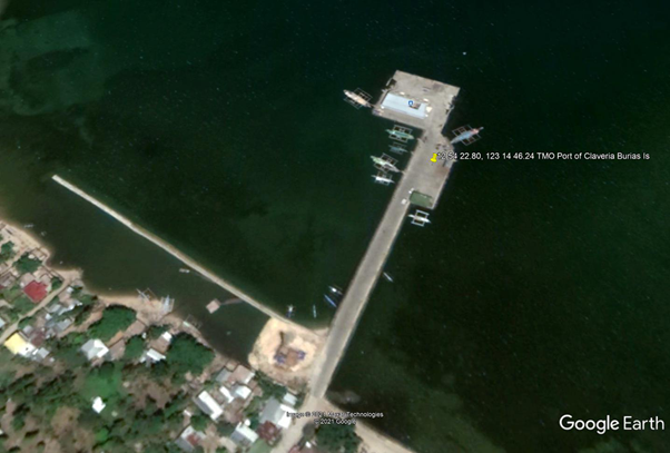
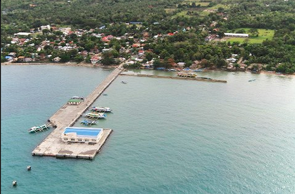
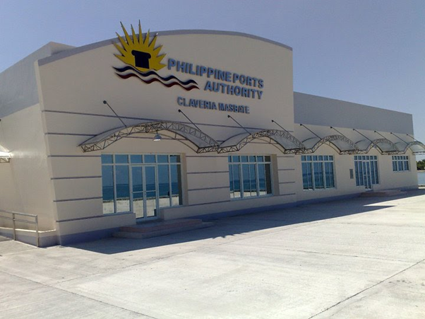
Description and Contacts of Key Companies
|
Services |
Company |
Contact Information |
|---|---|---|
| Transport | JD Trucking Services | Masbate City / +63 916 742 7171 |
| Transport | Julius N Sia Trucking Services | 27 Quezon St, Masbate City, Masbate |
| Transport | Sweet Movers and Packers Trucking Services | +63 923 293 1800 |
| Transport | VL Trucking |
Aroroy, Masbate / +63 921 216 7082 |
| Transport | Gelly Trucking Services | Cawayan, Masbate / +63 921 977 5000 |
| Stevedoring | Masbate Consolidated Arrastre Inc |
Port Area Zurbito Street, 5400 Masbate, Masbate - Philippines +63 52 481 4489 |
| Warehousing | National Food Authority - Masbate | Masbate City |
| Warehousing | Fast Cargo Logistics Corporation | Masbate City |
For more information on port contacts, please see the following link: 4.4 Port and Waterways Companies Contact List.
Port Performance
|
Seasonal Constraints |
||
|---|---|---|
|
Occurs |
Time Frame |
|
|
Rainy Season |
Yes |
From August to December |
|
Major Import Campaigns |
None |
N/A |
|
Other Comments |
Typhoons may disrupt port operations. |
|
|
Handling Figures for 2020 |
|
|---|---|
|
Vessel Calls |
No data |
|
Container Traffic (TEUs) |
0 TEUs |
|
Handling Figures Bulk and Break Bulk for 2020 |
|
|---|---|
|
Bulk (MT) |
No data |
|
Break bulk (MT) |
No data |
Discharge Rates and Terminal Handling Charges
For information on port rates and charges, please see the following links:
Vessels: https://www.ppa.com.ph/?q=content/charges-vessel
Cargoes: https://www.ppa.com.ph/?q=content/charges-cargoes
Storage: https://www.ppa.com.ph/?q=content/charges-storage
Berthing Specifications
|
Type of Berth |
Quantity |
Length |
Maximum Draft |
Comments |
|---|---|---|---|---|
|
Conventional Berth |
2 |
61 m |
5 m |
With 1 RORO ramp, 9 m wide |
|
Container Berth |
None |
|||
|
Silo Berth |
None |
|
||
|
Berthing Tugs |
None |
|
||
|
Water Barges |
None |
|
General Cargo Handling Berths
|
Cargo Type |
Berth Identification |
|---|---|
|
Imports - Bagged Cargo |
None |
|
Exports - Bagged Cargo |
None |
|
Imports and Exports - RoRo |
None |
|
Other Imports |
None |
Port Handling Equipment
The Port of Claveria does not have port handling equipment.
Container Facilities
The Port of Claveria does not have container facilities.
Customs Guidance
The Port of Claveria handles domestic RORO passenger and cargo vessels only.
For more information on customs in the Philippines, please see the following link: 1.3 Customs Information.
Terminal Information
Multipurpose Terminal
The Port of Claveria has a 2000 m2 back-up general cargo area.
Grain and Bulk Handling
The Port of Claveria does not have bulk grain discharging facilities.
Main Storage Terminal
|
Storage Type |
Number of Storage Facilities |
Area (m2) |
|---|---|---|
|
Bagged Cargo |
None |
|
|
Refrigerated Cargo |
None |
|
|
General Cargo |
Open shed storage area |
2000 m2 |
Stevedoring
The PMO Cawayan will coordinate to provide stevedoring at the port.
Port Security
The PPA TMO Claveria manages the deployment of security services within the port premises.
|
Security |
|
|---|---|
|
ISPS Compliant |
Yes |
|
Current ISPS Level |
Level 1 |
|
Police Boats |
Coast Guard / PNP Maritime Command |
|
Fire Engines |
LGU fire trucks |
2.1.48 Philippines - Luzon Port of Esperanza
Port Overview
The Port of Esperanza is located on the southernmost tip of Masbate province, and is a stone’s throw to the northernmost port of Bogo City in Cebu province. With only 2 to 3 hours to negotiate the distance between Esperanza and Bogo City, commuters avoiding a long sea travel will find the port convenient for them. It is a practical jump off point to the fish-rich Bantayan Island and other fishing areas in Northern Cebu and to Malapascua Island, a popular dive site.
Port website: ppa.gov.ph
Key port information may also be found at: http://www.maritime-database.com
|
Port Location and Contact |
|
|---|---|
|
Country |
Philippines |
|
Province or District |
Masbate |
|
Nearest Town or City with Distance from Port |
Esperanza, Masbate |
|
Port's Complete Name |
Port of Esperanza |
|
Latitude |
11.735244 |
|
Longitude |
124.038775 |
|
Managing Company or Port Authority |
Philippine Ports Authority |
|
Management Contact Person |
Oliver S. Rodulfo Jr. Acting Port Manager, PMO Masbate +63 56 333-2217 |
|
Nearest Airport and Airlines with Frequent International Arrivals/Departures |
Ninoy Aquino International Airport All Nippon Airways, Cathay Pacific Airways, Delta Air Lines, Emirates, Etihad Airways, KLM Royal Dutch Airlines, Qantas Airways, Qatar Airways, Singapore Airlines, Turkish Airlines, United Airlines; Cebu Pacific Air, PAL Express, Philippines AirAsia. No direct flights from Mactan International Airport (Cebu) |
Port Picture
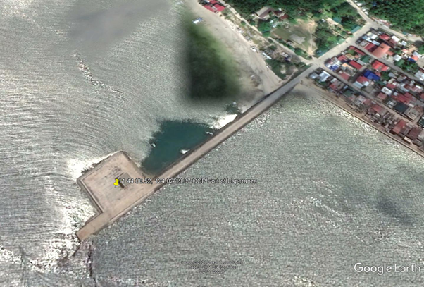
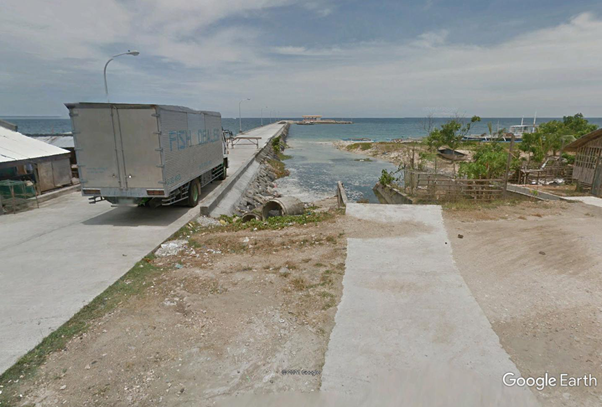
Description and Contacts of Key Companies
|
Services |
Company |
Contact Information |
|---|---|---|
| Transport | JD Trucking Services | Masbate City / +63 916 742 7171 |
| Transport | Julius N Sia Trucking Services | 27 Quezon St, Masbate City, Masbate |
| Transport | Sweet Movers and Packers Trucking Services | +63 923 293 1800 |
| Transport | VL Trucking |
Aroroy, Masbate / +63 921 216 7082 |
| Transport | Gelly Trucking Services | Cawayan, Masbate / +63 921 977 5000 |
| Stevedoring | Masbate Consolidated Arrastre Inc |
Port Area Zurbito Street, 5400 Masbate, Masbate - Philippines +63 52 481 4489 |
| Warehousing | National Food Authority - Masbate | Masbate City |
| Warehousing | Fast Cargo Logistics Corporation | Masbate City |
For more information on port contacts, please see the following link: 4.4 Port and Waterways Companies Contact List.
Port Performance
|
Seasonal Constraints |
||
|---|---|---|
|
Occurs |
Time Frame |
|
|
Rainy Season |
Yes |
From August to December |
|
Major Import Campaigns |
None |
N/A |
|
Other Comments |
Typhoons may disrupt port operations. |
|
|
Handling Figures for 2020 |
|
|---|---|
|
Vessel Calls |
No data |
|
Container Traffic (TEUs) |
0 TEUs |
|
Handling Figures Bulk and Break Bulk for 2020 |
|
|---|---|
|
Bulk (MT) |
No data |
|
Break bulk (MT) |
No data |
Discharge Rates and Terminal Handling Charges
For information on port rates and charges, please see the following links:
Vessels: https://www.ppa.com.ph/?q=content/charges-vessel
Cargoes: https://www.ppa.com.ph/?q=content/charges-cargoes
Storage: https://www.ppa.com.ph/?q=content/charges-storage
Berthing Specifications
|
Type of Berth |
Quantity |
Length |
Maximum Draft |
Comments |
|---|---|---|---|---|
|
Conventional Berth |
2 |
55 m |
5 m |
With 1 RORO ramp, 9 m wide |
|
Container Berth |
None |
|
||
|
Silo Berth |
None |
|
||
|
Berthing Tugs |
None |
|
||
|
Water Barges |
None |
|
General Cargo Handling Berths
|
Cargo Type |
Berth Identification |
|---|---|
|
Imports - Bagged Cargo |
None |
|
Exports - Bagged Cargo |
None |
|
Imports and Exports - RoRo |
None |
|
Other Imports |
None |
Port Handling Equipment
The Port of Esperanza does not have port handling equipment.
Container Facilities
The Port of Esperanza does not have container facilities.
Customs Guidance
The Port of Esperanza handles domestic RORO passenger and cargo vessels only.
For more information on customs in the Philippines, please see the following link: 1.3 Customs Information.
Terminal Information
Multipurpose Terminal
The Port of Esperanza has a 120 m2 back-up general cargo area.
Grain and Bulk Handling
The Port of Esperanza does not have grain discharging facilities.
Main Storage Terminal
|
Storage Type |
Number of Storage Facilities |
Area (m2) |
|---|---|---|
|
Bagged Cargo |
None |
|
|
Refrigerated Cargo |
None |
|
|
General Cargo |
Open shed storage area |
120 m2 |
Stevedoring
The PMO Esperanza will coordinate and provide stevedoring at the port.
Hinterland Information
|
Services |
Company |
Contact Information |
|---|---|---|
| Transport | JD Trucking Services | Masbate City / +63 916 742 7171 |
| Transport | Julius N Sia Trucking Services | 27 Quezon St, Masbate City, Masbate |
| Transport | Sweet Movers and Packers Trucking Services | +63 923 293 1800 |
| Transport | VL Trucking |
Aroroy, Masbate / +63 921 216 7082 |
| Transport | Gelly Trucking Services | Cawayan, Masbate / +63 921 977 5000 |
| Stevedoring | Masbate Consolidated Arrastre Inc |
Port Area Zurbito Street, 5400 Masbate, Masbate - Philippines +63 52 481 4489 |
| Warehousing | National Food Authority - Masbate | Masbate City |
| Warehousing | Fast Cargo Logistics Corporation | Masbate City |
Port Security
The PPA TMO Esperanza manages the deployment of security services within the port premises.
|
Security |
|
|---|---|
|
ISPS Compliant |
Yes |
|
Current ISPS Level |
Level 1 |
|
Police Boats |
Coast Guard / PNP Maritime Command |
|
Fire Engines |
LGU fire trucks |
2.1.49 Philippines - Luzon Port of San Pascual (Burias Island)
Port Overview
The Port of San Pascual is a secondary/feeder port of PMO Masbate, located at the northernmost tip of Burias Island.. This port caters to passengers sailing from Burias Island to Pasacao, Camarines Sur and Masbate City and vice versa.
Port website: ppa.gov.ph
Key port information may also be found at: http://www.maritime-database.com
|
Port Location and Contact |
|
|---|---|
|
Country |
Philippines |
|
Province or District |
Masbate |
|
Nearest Town or City with Distance from Port |
San Pascual, Burias Island |
|
Port's Complete Name |
Port of San Pascual |
|
Latitude |
13.128302 |
|
Longitude |
122.975576 |
|
Managing Company or Port Authority |
Philippine Ports Authority |
|
Management Contact Person |
Oliver S. Rodulfo Jr. Acting Port Manager, PMO Masbate +63 56 333-2217 |
|
Nearest Airport and Airlines with Frequent International Arrivals/Departures |
Ninoy Aquino International Airport All Nippon Airways, Cathay Pacific Airways, Delta Air Lines, Emirates, Etihad Airways, KLM Royal Dutch Airlines, Qantas Airways, Qatar Airways, Singapore Airlines, Turkish Airlines, United Airlines; Cebu Pacific Air, PAL Express, Philippines AirAsia. |
Port Picture
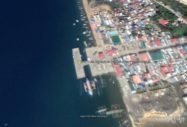
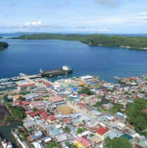
Description and Contacts of Key Companies
|
Services |
Company |
Contact Information |
|---|---|---|
| Transport | JD Trucking Services | Masbate City / +63 916 742 7171 |
| Transport | Julius N Sia Trucking Services | 27 Quezon St, Masbate City, Masbate |
| Transport | Sweet Movers and Packers Trucking Services | +63 923 293 1800 |
| Transport | VL Trucking |
Aroroy, Masbate / +63 921 216 7082 |
| Transport | Gelly Trucking Services | Cawayan, Masbate / +63 921 977 5000 |
| Stevedoring | Masbate Consolidated Arrastre Inc |
Port Area Zurbito Street, 5400 Masbate, Masbate - Philippines +63 52 481 4489 |
| Warehousing | National Food Authority - Masbate | Masbate City |
| Warehousing | Fast Cargo Logistics Corporation | Masbate City |
For more information on port contacts, please see the following link: 4.4 Port and Waterways Companies Contact List.
Port Performance
|
Seasonal Constraints |
||
|---|---|---|
|
Occurs |
Time Frame |
|
|
Rainy Season |
Yes |
From August to December |
|
Major Import Campaigns |
None |
N/A |
|
Other Comments |
Typhoons may disrupt port operations. |
|
| Handling Figures for 2020 | |
|---|---|
| Vessel Calls | No data |
| Container Traffic (TEUs) |
0 TEUs |
|
Handling Figures Bulk and Break Bulk for 2020 |
|
|---|---|
|
Bulk (MT) |
No data |
|
Break bulk (MT) |
No data |
Discharge Rates and Terminal Handling Charges
For information on port rates and charges, please see the following links:
Vessels: https://www.ppa.com.ph/?q=content/charges-vessel
Cargoes: https://www.ppa.com.ph/?q=content/charges-cargoes
Storage: https://www.ppa.com.ph/?q=content/charges-storage
Berthing Specifications
|
Type of Berth |
Quantity |
Length |
Maximum Draft |
Comments |
|---|---|---|---|---|
|
Conventional Berth |
2 |
57 m |
5 m |
With 1 RORO ramp, 9 m wide |
|
Container Berth |
None |
|
||
|
Silo Berth |
None |
|
||
|
Berthing Tugs |
None |
|
||
|
Water Barges |
None |
|
General Cargo Handling Berths
|
Cargo Type |
Berth Identification |
|---|---|
|
Imports - Bagged Cargo |
None |
|
Exports - Bagged Cargo |
None |
|
Imports and Exports - RoRo |
None |
|
Other Imports |
None |
Port Handling Equipment
The Port of San Pascual does not have port handling equipment.
Container Facilities
The Port of San Pascual does not have container facilities.
Customs Guidance
The Port of San Pascual handles domestic RORO passenger and cargo vessels only.
For more information on customs in the Philippines, please see the following link: 1.3 Customs Information.
Terminal Information
Multipurpose Terminal
The Port of San Pascual has a back-up general cargo area 1787 m2.
Grain and Bulk Handling
The Port of San Pascual does not have grain discharging facilities.
Main Storage Terminal
|
Storage Type |
Number of Storage Facilities |
Area (m2) |
|---|---|---|
|
Bagged Cargo |
None |
|
|
Refrigerated Cargo |
None |
|
|
General Cargo |
Open storage area |
1787 m2 |
Stevedoring
PMO San Pascual will coordinate and provide stevedoring at the port.
Hinterland Information
|
Services |
Company |
Contact Information |
|---|---|---|
| Transport | JD Trucking Services | Masbate City / +63 916 742 7171 |
| Transport | Julius N Sia Trucking Services | 27 Quezon St, Masbate City, Masbate |
| Transport | Sweet Movers and Packers Trucking Services | +63 923 293 1800 |
| Transport | VL Trucking |
Aroroy, Masbate / +63 921 216 7082 |
| Transport | Gelly Trucking Services | Cawayan, Masbate / +63 921 977 5000 |
| Stevedoring | Masbate Consolidated Arrastre Inc |
Port Area Zurbito Street, 5400 Masbate, Masbate - Philippines +63 52 481 4489 |
| Warehousing | National Food Authority - Masbate | Masbate City |
| Warehousing | Fast Cargo Logistics Corporation | Masbate City |
Port Security
The PPA TMO San Pascual manages the deployment of security services within the port premises.
|
Security |
|
|---|---|
|
ISPS Compliant |
Yes |
|
Current ISPS Level |
Level 1 |
|
Police Boats |
Coast Guard / PNP Maritime Command |
|
Fire Engines |
LGU fire trucks |
2.1.2 Philippines - Visayas Port Assessment
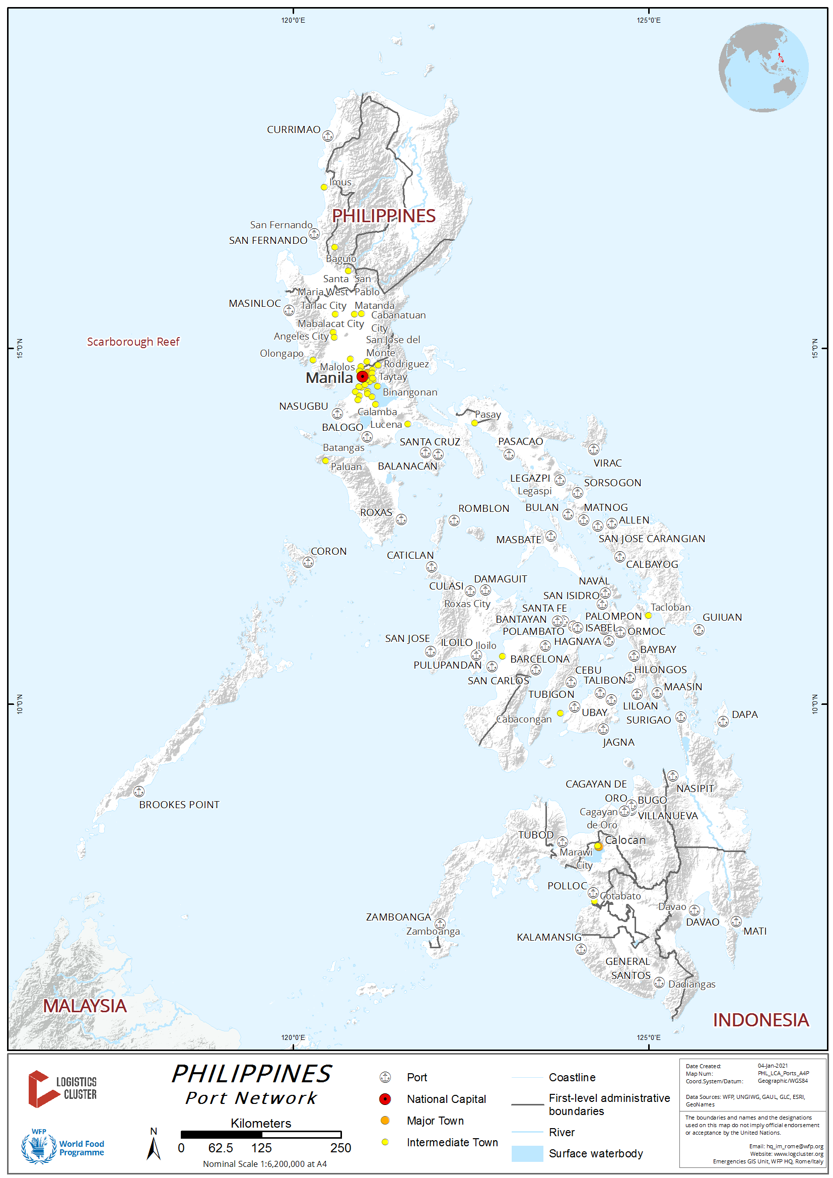
The following pages contain information on ports in the Philippines, Visayas.
2.1.2.1 Philippines - Visayas Port of Cebu
Key port information can also be found at: Maritime Database Website information on Port of Cebu
Port Overview
The Cebu Port Network is composed of the Baseport and the Subports. Located in Cebu City, the Cebu Baseport is divided into Cebu International Port and Cebu Baseport Domestic Zone. The Subports are the secondary hubs or the management offices of the Cebu Port Authority strategically located in different areas of the entire province of Cebu. Under each subport are the outports - these are the ports under the smaller systems of subports. There are five Subport under the Cebu Port Network: Mandaue, Danao, Sta. Fe, Toledo, and Argao. Cebu baseport is suited at the city frontage between Cebu and Mactan Island, the port runs a total length of 4,202 meters (from International to Domestic Zone). The international zone has a length of 690 meters and the Domestic zone has 3,707 meters.
Source: Cebu Port Authority (publisher). http://www.cpa.gov.ph/index.php Date Last Accessed 09 Dec 2013
Port website: Cebu Port Authority Website
|
Port Location and Contacts |
|
|---|---|
|
Country |
Philippines |
|
Province or District |
Central Visayas |
|
Town or City (Closest location) with Distance (km) |
Name: Cebu km: n/a |
|
Port's Complete Name |
Port of Cebu |
|
Latitude |
10.3 |
|
Longitude |
123.8833 |
|
Managing Company or Port Authority (If more than one operator, break down by area of operation) |
Cebu Port Authority |
|
Management Contact Person |
+63.32.232-1461 to 63 |
|
Closest Airport and Frequent Airlines to / from International Destinations |
Airport Name: n/a Airlines: n/a |
Port Picture
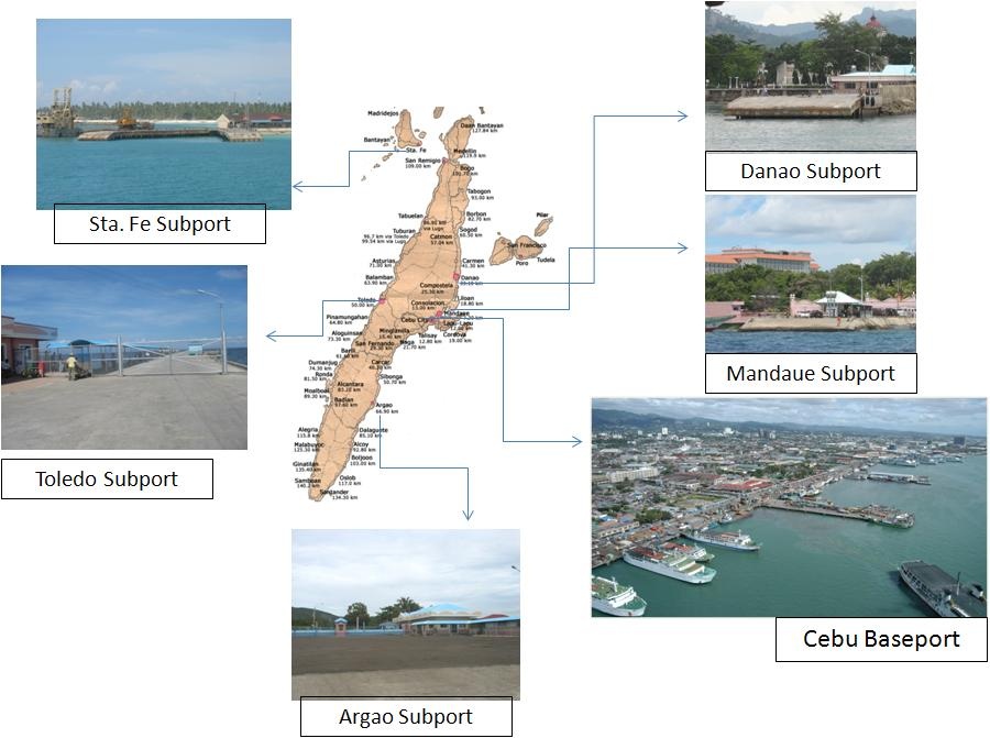
Source: Cebu Port Authority (publisher). http://www.cpa.gov.ph/index.php Date Last Accessed 09 Dec 2013
Description and Contacts of Key Companies
The Cebu Port Authority (CPA) was created through the enactment of Republic Act No. 7621 signed on June 26, 1992 to specifically administer all ports located in Cebu Province, thus, effectively separating these ports from the Philippine Ports Authority (PPA) system. CPA began operations and officially took over all Cebu ports on January 1, 1996. The Cebu Port Authority missions includes to build, operate and maintain ports under its network and implement an integrated management systems aligned with internationally accepted standards and practices for operations, planning and development of ports within its territorial jurisdiction enhancing trade and commerce.
Source: Cebu Port Authority (publisher). http://www.cpa.gov.ph/index.php Date Last Accessed 09 Dec 2013
For information on Port of Cebu contact details, please see the following links:
Cebu Port Authority Contact Directory
4.3 Philippines Port and Waterways Company Contact List
Port Performance
For information on port performance figures, please see the following link:
Cebu Port Authority website information on Port Statistics
Discharge Rates and Terminal Handling Charges
For information on port Discharge Rates and Handling charges, please see the following link:
Cebu Port
Authority Webiste on Port Rates
Port Specifications and Facilities
For information on port specifications and facilities, please see the following link:
Cebu Port
Authority Website information on Port Services and
Facilities
Customs Guidance
For information on Philippines Port of Cebu Customs Guidance, please see the following links:
1.3 Philippines Customs Information
Cebu Port Authority Website information on Cebu Harbour Entry requirements
PLEASE NOTE: Following the response to Typhoon Haiyan (Yolanda) on 09 Nov 2013, additional Philippines Customs information is avalible and can be found in the following document:
Logistics Cluster Philippines Customs Snapshot 131114
In order to streamline the customs procedures for humanitarian organisations bringing relief good into the Philippines, a “One-Stop-Shop” has been established in Manila, Cebu and Naia. The Purpose of the “One-Stop-Shop” is to bring together in a single location the key staff, necessary for expediting customs clearances for humanitarian cargo, for the selected agencies including representatives of: the Department of Social Welfare and Development (DSWD), the Department of Health, The Bureau of Food and Drugs, the Ministry of Finance (MoF), and the Department of Foreign Affairs (DFA).
2.1.2.2 Philippines - Visayas Port of Roxas
PLEASE NOTE: THIS ASSESSMENT HAS BEEN CARRIED OUT FOLLOWING THE EMERGENCY RESPONSE TO TYPHOON HAIYAN (YOLANDA) ON 09 NOV 2013
The information given in the below assessment is correct as of 01 Dec 2013, however it may be suject to change at short notice.
It has been provided following the emergency response to Typhoon Haiyan (Yolanda) therefore the format of the assessment is presented differently from information provided for a non-emergency LCA.
|
Port Location and Contacts |
|
|---|---|
|
Country |
Philippines |
|
Province or District |
Capiz |
|
Town or City (Closest location) with Distance (km) |
Name: Roxas km: n/a |
|
Port's Complete Name |
Port of Roxas |
|
Latitude |
11.6046 |
|
Longitude |
122.7086 |
|
Managing Company or Port Authority (If more than one operator, break down by area of operation) |
n/a |
|
Management Contact Person |
Port Operations Manager: Mr. Al De Jesus 0906 947 1802 / 0947 890 4860 |
|
Closest Airport and Frequent Airlines to / from International Destinations |
Airport Name: n/a Airlines: n/a |

General Overview
| Main entrance | Hanging electricity cables, therefore non-passable for container trucks. |
|---|---|
| Road Entrance | Sometimes congested |
| Other comments | No congestion as confirmed by Port Manager |
Port Profile
Please note: The port can handle RORO / cargo ship, Passenger Ferries and Containers (10', 20', 40')
| Berth | Length / Comments |
|---|---|
| Old Wharf | 162.16m |
| New Wharf | 232.17m |
| Breakwater | 160.5m |
| Finger Pier | 62.75m x 12m |
|
RoRo Ramp 1 RoRo Ramp 2 |
1 - 15m x 12m 2 - 15m x 9m |
| Container Yard | 9,120m |
| Open Storage | 5,538m |
| PTB | 729m2 |
| Draft | 6.1m |
For information on the current Port of Roxas depths, please see the following diagrams:
Port Rates and Handling Charges
| Arrastre Fee | |
|---|---|
|
Charges Against Cargo |
Rate/RT or MT |
| General Cargo | 98.60 |
| Palletized | 76.80 |
| Sugar | 55.85 |
| Rice | 45.50 |
| Stevedoring Fees | |
|---|---|
| General Cargo | 19.50 |
| Palletized | 13.90 |
| Sugar | 19.50 |
| Rice | 19.50 |
| Stripping/Stuffing Fee | 398.50/Unit |
| Charges Against Vessel | |
|---|---|
| Mooring / Unmooring Fee | 487.05 |
Please Note:
- Dangerous Cargo e.g. Cement etc plus 25% to the Arrastre and Stevedoring Rate
- For unloading of RORO / cargo ship, WFP has to pay charges to port authorities as handling charges.
- For unloading / loading containers, the handler (M/s MORETA) has an official contract from the Government and is authorized to render services (cranes / forklifts, etc) for which he will be paid directly. No other handler can be on ground as per his contract.
- The port authority will waive off the port charges if a letter from the Government is presented.
- As it is humanitarian aid so no demurrage will be claimed.
Port Contacts
| Title | Name | Contact |
|---|---|---|
| Port Operations Manger | Mr. Al De Jesus |
0906 947 1802 0947 890 4860 |
Port Pictures
Port of Roxas RoRo Ramps:


Port of Roxas:


For additional photographs of Philippines Port of Roxas, please see the following links:
2.1.2.3 Philippines - Visayas Port of Isabel
PLEASE NOTE: THIS ASSESSMENT HAS BEEN CARRIED OUT FOLLOWING THE EMERGENCY RESPONSE TO TYPHOON HAIYAN (YOLANDA) ON 09 NOV 2013
The information given in the below assessment is correct as of 11 Dec 2013, however it may be suject to change at short notice.
It has been provided following the emergency response to Typhoon Haiyan (Yolanda) therefore the format of the assessment is presented differently from information provided for a non-emergency LCA.
Key port information can also be found at: Maritime Database Website information on Philippines Port of Isabel
Port Overview
The terminal suffered extensive damage during typhoon Yolanda.
PhilPhos is currently advising that they expect their terminal to
be back in operation earliest in March,2014. Meantime they are
prepared to consider alternative business such as Relief.
During a recent visit, one barge was discharging relief rice with a
shore crane hired from outside.
Port website: Philippines Port Authority Wesbite for Port of Isabel
For information on Philippines Port of Isabel Contact details, please see the following link:
4.2.3 Philippines Port and Waterways Company Contact List
|
Port Location and Contacts |
|
|---|---|
|
Country |
Philippines |
|
Province or District |
Leyte Island |
|
Town or City (Closest location) with Distance (km) |
Name: Ormoc km: 44 km west |
|
Port's Complete Name |
Port of Isabel |
|
Latitude |
10.91667 |
|
Longitude |
124.4333 |
|
Managing Company or Port Authority (If more than one operator, break down by area of operation) |
Philippine Ports Authority |
|
Management Contact Person |
Mr Raoul Port Operation manager |
|
Closest Airport and Frequent Airlines to / from International Destinations |
Airport Name: n/a Airlines: n/a |
Discharge Rates and Terminal Handling Charges
| Discharge Rates | |
|---|---|
| Per Hook (Depending on Vessel design) | Up to 500mt |
| Gears |
Max 2000mt per day |
Please Note:
- Nets are available,
- Terminal avails itself of labour through a contractor
| Costs | |
|---|---|
| Ex hold of the ship to stacked in Terminal WH | 150 Pesos per mt |
| Ex stack to on trucks | 5 Pesos per bags |
For additional rates and costs information, please contact Mr Cesar Banaag (Vice-President of Manufacturing)
Berthing Specifications
|
Berth |
Length (m) |
Comments |
|---|---|---|
|
1 |
280 m by 12.00m | For use to handle phosrocks |
|
2 |
180 m by 9.50 m | Berth that would be made available to Relief operations |
|
3 |
120 m by 8.00 m | n/a |
| 4 | 110 m by 7.00 m | n/a |
| 5 | 75 m by 5.00 m | n/a |
Please Note:
- There is NO shore gear available at the berths. GEARED vessels only.
- Short option to rent a mobile crane but to be checked long in advance of vessel’s arrival. Only valid for coasters and barges ,as discharge performance with a mobile crane would be insufficient to match speed required under charter contracts.
- Since this is a private Terminal, berth availability should checked directly their Port Operation manager Mr. Raoul
Customs Guidance
Customs is available in the Port of Isabel
For information on Philippines Customs Guidance please see the following links:
1.3 Philippines Customs Information
PLEASE NOTE: Following the response to Typhoon Haiyan (Yolanda) on 09 Nov 2013, additional Philippines Customs information is available and can be found in the following document:
Logistics Cluster Philippines Customs Snapshot 131114
In order to streamline the customs procedures for humanitarian organisations bringing relief good into the Philippines, a “One-Stop-Shop” has been established in Manila, Cebu and Naia. The Purpose of the “One-Stop-Shop” is to bring together in a single location the key staff, necessary for expediting customs clearances for humanitarian cargo, for the selected agencies including representatives of: the Department of Social Welfare and Development (DSWD), the Department of Health, The Bureau of Food and Drugs, the Ministry of Finance (MoF), and the Department of Foreign Affairs (DFA).
Port Security
Private company for gates, but presence of army inside warehousing compound
2.1.2.4 Philippines - Visayas Port of Tacloban
Port Overview
Strategically located at the heart of Eastern Visayas or Region 8, Tacloban City lies along the northeastern side of the island of Leyte. Tacloban`s location and accessibility have made the city the commercial, government and political hub of the region.
Bodies of water that surround the city are Panalaron Bay and Cancabato Bay. On its eastern shores is the San Juanico Strait - reputedly the narrowest navigable channel in the world. On the southern side the city is flanked by the waters of San Pedro Bay stretching towards Leyte Gulf.

Port website: www.ppa.com.ph
Key port information may also be found at: http://www.maritime-database.com/port.php?pid=475
|
Port Location and Contact |
|||||||||||
|
Country |
Philippines |
||||||||||
|
Region Province |
Region 8, Eastern Visayas Leyte |
||||||||||
|
Nearest Town or City with Distance from Port |
Tacloban |
||||||||||
|
Port's Complete Name |
Port of Tacloban |
||||||||||
|
Latitude |
11.248526 |
||||||||||
|
Longitude |
124.999924 |
||||||||||
|
Managing Company or Port Authority
|
Philippines Port Authority (PPA) Head Office of Port Management Office Eastern Leyte / Samar (PMOELS) |
||||||||||
|
Management Contact Person |
Mr. Emiliano M Esparaguera Port Manager 0533216704 |
||||||||||
|
Nearest Airport and Airlines with Frequent national Arrivals/Departures |
Tacloban Daniel Z. Romualdez Airport (9km)
|
||||||||||
Port Picture


Description and Contacts of Key Companies
Cargo handling services: Leyte Integrated Port Services Inc. (LIPSI)
Mr.Ignacio b. Malate
General Manager
Tel. 053 321-3641
Pilotage services: Tacloban Pilot Association
Capt. Ramon L. de Rama
Tel. 053 832-1006
Port security services: Lockheed Global Security and Investigation Services Inc. (LGSISI)
Mr. Noel Cajipo
Acting detachment commander
Ancillary external services can be arrange by contacting the port authorities:
- Bunkering
- Transport service
- Water supply
- Handling
- Cargo surveying
Port Performance
The sea is shallow along the San Juanico Strait. The port does not have navigational facilities for the vessels to enter the Tacloban City Port at night time or in the afternoon.
The northern channel passing by San Pedro bay is 5.6 m draft with a 120 feet (36.5m) clearance maximum due to the San Francisco bridge, while the southern channel is 4.8 m draft only.
The port is rarely congested and humanitarian cargo will be prioritized in case of relief operations.

|
Seasonal Constraints |
||
|
|
Occurs |
Time Frame |
|
Rainy Season |
Yes |
Most frequent during December and January |
|
Major Import Campaigns |
No |
n/a |
|
Other Comments |
Rainfalls and typhoons are throughout the year with no pronounced dry seasons. |
|
|
Handling Figures for 2018 |
|
|
Vessel Calls |
701 |
|
Container Traffic (TEUs) |
54,087 |
|
Handling Figures Bulk and Break Bulk for 2018 |
|
|
Bulk (MT) |
n/a |
|
Break bulk (MT) |
505’557 |
Discharge Rates and Terminal Handling Charges

Berthing Specifications
|
Type of Berth |
Quantity |
Length (m) |
Maximum Draft (m) |
Comments |
|
Conventional Berth |
Pier Warf |
287 750 |
7m 7 m |
Cast Iron mooring bollards, T head 25T capacity |
Port Handling Equipment
The port equipment belongs to the LIPSI. They use to rent additional equipment (mobile cranes, forklifts) from the shipping companies when they have a shortage. These equipment are habitually staying at the port and could be rented if necessary to speed up the offloading in case of relief operations.
|
Equipment |
Available |
Total Quantity and Capacity Available |
Comments on Current Condition and Actual Usage |
|
Dockside Crane |
No |
n/a |
n/a |
|
Container Gantries |
No |
n/a |
n/a |
|
Mobile Cranes |
Yes |
50 MT |
Good condition |
|
Reachstacker |
No |
n/a |
n/a |
|
RoRo Tugmaster (with Trailer) |
No |
n/a |
n/a |
|
Grain Elevator with Bagging Machines |
No |
n/a |
n/a |
|
Transtainer |
No |
n/a |
n/a |
|
Forklifts |
Yes |
1 x 15 MT 1 x 10 MT 1 x 7 MT 1 x 5 MT 3 x 3 MT |
Good condition |
Container Facilities
There are no containers facilities, the containers are offloaded with a ship/mobile crane and stored on an open space.
|
Facilities |
10/20/40 ft |
|
Container Facilities Available |
None |
|
Container Freight Station (CFS) |
None |
|
Refrigerated Container Stations |
None |
|
Other Capacity Details |
Open container yard: 2,094 m2 |
|
Daily Take Off
Capacity |
72 units regardless the size |
|
Number of Reefer
Stations |
None |
|
Emergency Take-off Capacity |
n/a |
|
Off take Capacity of Gang
Shift |
24 units regardless the size |
Customs Guidance
A customs office stand just behind the port, they can process import/export clearance. If all documents are in order, vessels clearances take about 1 hour and all payments have to be done by bank wire only.
The custom office is open from Monday to Friday with a permanence on the weekend. Office hours are from 8.00 to 17.00.
District Collector Office; Bocportoftacloban@yahoo.fr , 09175272351 / 0535306939
For more information on customs in Philippines, please see the following link: 1.3 Philippines Customs Information
Terminal Information
Multipurpose Terminal
The conventional berth is suitable to receive all different types of cargo: bagged cargo, break-bulk, containers.
There are 3 Ro-Ro ramps:
Ro-Ro ramp 1: 18m
Ro-Ro ramp 2: 10.5m
Ro-Ro ramp 3: 10.5m
Grain and Bulk Handling
Some bulk cargos can be handled (liquid bulk and dry bulk). Generally molasses for liquid bulk and copra for dry bulk cargoes.
Main Storage Terminal
There are no warehouses available in the port enclosure. All goods are either picked up directly on vessels arrival and loaded on trucks or stored on open areas.
|
Storage Type |
Number of Storage Facilities |
Area (m2) |
|
Refrigerated Cargo |
None |
n/a |
|
Container yard |
1 open space |
2’094 m2 |
|
General Cargo |
1 open space |
4’459 m2 |
|
Transit shed |
1 open space |
540 m2 |
Stevedoring
Stevedoring activities are provided by a private company contracted by the port authorities. Please refer to “Description and Contacts of Key Companies” above.
Hinterland Information
All items are moved out of the port by trucks contracted independently. Temporary vehicle pass are provided at the main gate by the port police division.
Port Security
The port is fenced; there are security guards at the main gate and in the terminal building. The coastguards have an office outside the port perimeter and do regular patrol in the area. Manual and wheeled fire extinguisher are available, if needed, fire trucks can be called from the municipality.
There are 7 high mast steel tower equipped with halogen flood light.
First aid shelters are disseminated along the port with some staff trained on emergency services.
|
Security |
|
|
ISPS Compliant |
Yes |
|
Current ISPS Level (Level 1 = Normal, Level 2 = Heightened, Level 3 = Exceptional) |
Level 1 |
|
Police Boats |
Yes (coastguards) |
|
Fire Engines |
No |
2.1.2.5 Philippines Visayas Port of Ormoc
Port Overview
Ormoc port is the head office of the Port Management Office of Western Leyte / Biliran (PMOWLB). It is the second port of Region 8 and its location make it a good alternative to Tacloban port for cargo coming from Cebu.
The port of Ormoc can cater to both small foreign and domestic vessels, and receive containerized cargoes as well as bulk and breakbulk cargoes. The main inbound cargoes are cement and the outbound commodities are copra. Cement from Cebu and copra/s are bound for Jimenez.
Port website: www.ppa.com.ph
Key port information may also be found at: http://www.maritime-database.com/port.php?pid=3956
|
Port Location and Contact |
|||||||||||
|
Country |
Philippines |
||||||||||
|
Region Province |
Region 8, Eastern Visayas Leyte |
||||||||||
|
Nearest Town or City with Distance from Port |
Ormoc |
||||||||||
|
Port's Complete Name |
Port of Ormoc |
||||||||||
|
Latitude |
11.002685 |
||||||||||
|
Longitude |
124.606696 |
||||||||||
|
Managing Company or Port Authority
|
Philippines Ports Authority (PPA) Head Office of the Port Management Office of Western Leyte / Biliran (PMOWLB) – Head Office in Ormoc |
||||||||||
|
Management Contact Person |
Mr. Manuel A. Boholano Port Manager 0535614663 |
||||||||||
|
Nearest Airport and Airlines with Frequent national Arrivals/Departures |
Tacloban “Daniel Z. Romualdez” Airport (109 km)
|
||||||||||
Port Picture

Description and Contacts of Key Companies
Cargo Handling: New Eagle Arrastre Services, Inc.(NEASI)
Bldg.A Public Market
Real St., Ormoc City
Tel.no. 561-2168/255-3726
Mr. Ram Capahi
COO/Comptroller
Pilotage: Tacloban Harbor Pilots Association (THPA)
Port Security: Lockheed Global Security and Investigation Services
Inc. (LGSISI)
Other port related services:
- Bunkering:Petrologistics
- Ship Repair Facilities: IDHI, Albuera, Leyte
Port Performance
The port is often congested but there is a port expansion project. The average waiting time before berthing depends upon the availability of the berthing space but can be up to 3 days. The channel draft of Ormoc port is 11.7 m. The limitation of the vessels is 91 m length and 7m draft maximum.
|
Seasonal Constraints |
||
|
|
Occurs |
Time Frame |
|
Rainy Season |
Yes |
Most frequent during December and January |
|
Major Import Campaigns |
No |
n/a |
|
Other Comments |
Rainfalls and typhoons are throughout the year with no pronounced dry seasons. |
|
|
Handling Figures for 2018 |
|
|
Vessel Calls |
5,442 |
|
Container Traffic (TEUs) |
4,857 TEUs |
|
Handling Figures Bulk and Break Bulk for 2018 |
|
|
Bulk (MT) |
41,597.90 MT |
|
Break bulk (MT) |
368,807.02 MT |
Discharge Rates and Terminal Handling Charges

Berthing Specifications
|
Type of Berth |
Quantity |
Length (m) |
Maximum Draft (m) |
Comments |
|
Conventional Berth |
9 |
649 m |
9 m |
n/a |
Berth details:
Draft; as of August 2015 survey
|
Berth # |
Length (m) |
Draft (m) |
|
1 |
63 |
2 |
|
2 |
65 |
5.46 |
|
3 |
65 |
5.46 |
|
4 |
90 |
5.91 |
|
5 |
30 |
9 |
|
6 |
69 |
7.46 |
|
7 |
69 |
5.74 |
|
8 |
67 |
4.21 |
|
9 |
15 |
4.15 |
|
10 |
70 |
3.2 |
Port Handling Equipment
Port equipment is managed by the authorised cargo handling operator, the New Eagle Arrastre Services, Inc. (NEASI).
|
Equipment |
Available |
Total Quantity and Capacity Available |
Comments on Current Condition and Actual Usage |
|
Dockside Crane |
No |
n/a |
n/a |
|
Container Gantries |
No |
n/a |
n/a |
|
Mobile Cranes |
No |
n/a |
n/a |
|
Reachstacker |
No |
n/a |
n/a |
|
RoRo Tugmaster (with Trailer) |
No |
n/a |
n/a |
|
Grain Elevator with Bagging Machines |
No |
n/a |
n/a |
|
Transtainer |
No |
n/a |
n/a |
|
Forklifts |
Yes |
Forklifts 3.5 Tons = 3 Forklifts 4.0 Tons = 1 Forklifts 5.0 Tons = 1 Forklifts 15 Tons = 1 |
Good condition |
RORO Facilities: 2 RORO ramps, dimension 15 m.
1 fast craft ramp
Container Facilities
There are no containers facilities, the containers are offloaded with a ship/mobile crane directly loaded to the trucks. There are not yet containers yards put it is in includes in the future development,
|
Facilities |
10/20/40 ft |
|
Container Facilities Available |
None |
|
Container Freight Station (CFS) |
None |
|
Refrigerated Container Stations |
None |
|
Other Capacity Details |
None |
|
Daily Take Off
Capacity |
168 units regardless the size |
|
Number of Reefer
Stations |
None |
|
Emergency Take-off Capacity |
n/a |
|
Off take Capacity of Gang
Shift |
56 |
Customs Guidance
There is a custom office outside the port, they can process import/export clearance. If all documents are in order, vessels clearances take about 1 hour and all payments have to be done by bank wire only.
The custom office is open from Monday to Friday with a permanence on the weekend. Office hours are from 8.00 to 17.00.
For more information on customs in Philippines, please see the following link: 1.3 Philippines Customs Information
Terminal Information
Multipurpose Terminal
The conventional berth is suitable to receive all different types of cargo: bagged cargo, break-bulk or containers.
Containerized cargoes operations (loading and unloading) are done with using the ship's crane.
There are 2 x 15m width RoRo ramps.
Grain and Bulk Handling
Some bulk cargos can be handle (liquid bulk and dry bulk). Generally molasses for liquid bulk and copra for dry bulk cargoes.
Main Storage Terminal
There are no warehouses available in the port enclosure. All goods are either picked up directly on vessels arrival and loaded on trucks or stored on open areas.
|
Storage Type |
Number of Storage Facilities |
Area (m2) |
|
General Cargo |
3 |
|
Stevedoring
Stevedoring activities are provided by the authorized cargo handling operator, the New Eagle Arrastre Services, Inc. (NEASI).
Port Security
The port is fenced; there are security guards at the main gate and in the terminal building. The coastguards have an office outside the port perimeter and do regular patrol in the area. Manual and wheeled fire extinguisher are available, if needed, fire trucks can be called from the municipality.
|
Security |
|
|
ISPS Compliant |
Yes |
|
Current ISPS Level (Level 1 = Normal, Level 2 = Heightened, Level 3 = Exceptional) |
Level 1 |
|
Police Boats |
No |
|
Fire Engines |
No |
2.1.2.6 Philippines Port of Catbalogan
Port Overview
Situated in Eastern Samar, the port of Catbalogan is the main port for cargo of the three provinces of Samar Island. There are regular shipping lines to Cebu carrying mainly cement, construction material, animal feeds and other general cargos in break bulk.
During the Yolanda typhoon emergency response, it played a key role in the supply of relief items to Tacloban city.

Port website: www.ppa.com.ph
Key port information may also be found at: http://www.maritime-database.com/port.php?pid=3916
|
Port Location and Contact |
|||||||||||
|
Country |
Philippines |
||||||||||
|
Region Province |
Region 8, Eastern Visayas Samar |
||||||||||
|
Nearest Town or City with Distance from Port |
Catbalogan |
||||||||||
|
Port's Complete Name |
Port of Catbalogan |
||||||||||
|
Latitude |
11.774260 |
||||||||||
|
Longitude |
124.879266 |
||||||||||
|
Managing Company or Port Authority
|
Philippines Port Authority (PPA) Under supervision of Port Management Office Eastern Leyte / Samar (PMOELS) – Head Office in Tacloban |
||||||||||
|
Management Contact Person |
Ildifonso A. Quilitano PPA Division Manager 09219848490 |
||||||||||
|
Nearest Airport and Airlines with Frequent International Arrivals/Departures |
Tacloban Daniel Z. Romualdez Airport : 112 km
|
||||||||||
Port Picture


Description and Contacts of Key Companies
Cargo handling services: Leyte Integrated Port Services, INC. (LIPSI)
M. Ignacio B. Malate
General Manager
055 251-5483
Pilotage service: Catbalogan Pilotage District
Capt. Enriquito Y. Cahatol
09277642333
Security: Lockheed Global Security and Investigation Services Inc. (LGSISI)
Port Performance
Catbalogan port is rarely congested. When it happens, the vessels can wait up to two days maximum at anchorage. In such situation, the vessels carrying humanitarian cargos would be prioritized in case of emergency.
|
Seasonal Constraints |
||
|
|
Occurs |
Time Frame |
|
Rainy Season |
Yes |
Most frequent during December and January |
|
Major Import Campaigns |
No |
n/a |
|
Other Comments |
Rainfalls and typhoons are throughout the year with no pronounced dry seasons. |
|
|
Handling Figures for 2018 |
|
|
Vessel Calls |
1704 |
|
Container Traffic (TEUs) |
n/a |
|
Handling Figures Bulk and Break Bulk for 2018 |
|
|
Bulk (MT) |
n/a |
|
Break bulk (MT) |
513,183 |
Discharge Rates and Terminal Handling Charges

Berthing Specifications
|
Type of Berth |
Length (m) |
Maximum Draft (m) |
|
Pier 1 |
E 102 m W 102 m |
5 m |
|
Pier 2 |
E 108 m W 108 m |
5 m |
Port Handling Equipment
The port handling is done by the Leyte Integrated Port Services, INC. (LIPSI). They have four gangs of 12 staffs able to discharge an average of 21 MT per hour.
|
Equipment |
Available |
Total Quantity and Capacity Available |
Comments on Current Condition and Actual Usage |
|
Dockside Crane |
No |
n/a |
n/a |
|
Container Gantries |
No |
n/a |
n/a |
|
Mobile Cranes |
No |
n/a |
n/a |
|
Reachstacker |
No |
n/a |
n/a |
|
RoRo Tugmaster (with Trailer) |
No |
n/a |
n/a |
|
Grain Elevator with Bagging Machines |
No |
n/a |
n/a |
|
Transtainer |
No |
n/a |
n/a |
|
Forklifts |
Yes |
1 x 2.5 MT 1 x 4 MT |
Good condition |
Customs Guidance
Not available.
Terminal Information
Multipurpose Terminal
The conventional berth is suitable to receive bagged and break-bulk cargos.
There are 2 Ro-Ro ramps:
Ro-Ro ramp pier 1: 11m
Ro-Ro ramp pier 2: 11m
Main Storage Terminal
One open space and two warehouses are available.
|
Storage Type |
Number of Storage Facilities |
Area (m2) |
|
Refrigerated Cargo |
None |
n/a |
|
General Cargo |
Transit shed 1 Transit shed 2 Opening area |
648 m2 1170 m2 640 m2 |
Hinterland Information
All items are moved out of the port by trucks contracted independently by the cargo owners.
Port Security
The port is fenced; there are security guards at the main gate and in the terminal building. The coastguards have an office outside the port perimeter and do regular patrol in the area. Manual and wheeled fire extinguisher are available, if needed, fire trucks can be called 24/24 from the municipality.
|
Security |
|
|
ISPS Compliant |
Yes |
|
Current ISPS
Level |
Level 1 |
|
Police Boats |
Yes |
|
Fire Engines |
No |
2.1.2.7 Philippines Visayas Port of Naval
Port Overview
The port of Naval is the main port serving the Biliran province. Mainly used for passengers traveling to/from Cebu and the islands surrounding the area such as Maripipi or Higatangan. In 2018, 2,400 passengers have transited from Naval port.
Coming from Cebu, the main cargos coming in are cement, aggregate/construction material, fertilizers (in big bags or sacs), and few general goods such as rice, corn in break bulk. Copra is the only product transiting out of the port, there are no regular or seasonal schedule, it mainly depends on the market price.
Bunkering is not common but can be arranged on demand.

Port website: www.ppa.com.ph
Key port information may also be found at: https://www.maritime-database.com/
|
Port Location and Contact |
|||||||||||
|
Country |
Philippines |
||||||||||
|
Region and Province |
Biliran (Region 8, Eastern Visayas) |
||||||||||
|
Nearest Town or City with Distance from Port |
Naval |
||||||||||
|
Port's Complete Name |
Naval Port |
||||||||||
|
Latitude |
11.560233 |
||||||||||
|
Longitude |
124.391277 |
||||||||||
|
Managing Company or Port Authority
|
Philippines Ports Authority (PPA) Under the supervision of the Port Management Office of Western Leyte / Biliran (PMOWLB) – Head Office in Ormoc |
||||||||||
|
Management Contact Person |
Reyselle J.Gaviola Port Manager 0535009676 |
||||||||||
|
Nearest Airport and Airlines with Frequent National Arrivals/Departures |
Tacloban Daniel Z. Romualdez Airport (120 km)
|
||||||||||
Port Picture


Description and Contacts of Key Companies
Stevedoring: AWG Port Services (AWGPS)
Mr. Alex Lim Ang
General Manager
053 500-9617
Security: Lockheed Global Security and Investigation Services Inc. (LGSISI)
Port Performance
The Naval port is a small port serving the Biliran province only, which is the less populated in the Region 8. Never congested, vessels transporting relief cargos would be prioritised anyway in case of emergency.
The average cargo transiting per month is 1,800 mt.
There is no equipment to receive containers or heavy equipment. There is a possibility of renting a crane and other equipment outside the port but it is preferable to contract ships with cranes.
| Seasonal Constraints | ||
|
|
Occurs |
Time Frame |
|
Rainy Season |
Yes |
Most frequent during December and January |
|
Major Import Campaigns |
No |
n/a |
|
Other Comments |
Rainfalls and typhoons are throughout the year with no pronounced dry seasons. |
|
|
Handling Figures for 2018 |
|
|
Vessel Calls |
1014 |
|
Container Traffic (TEUs) |
N/A (ceased operation last 2017 for .50 TEU of 10 footer container) |
|
Handling Figures Bulk and Break Bulk for 2018 |
||
|
Bulk (MT) |
Inbound (aggregates) 53,067.78 MT |
Outbound (copra) 14,260.38 MT |
|
Break bulk (MT) |
Inbound (General Cargo) 6,879.008 MT |
Outbound (General Cargo) 70,698.433 MT |
Discharge Rates and Terminal Handling Charges

Berthing Specifications
|
Berth no. |
Quantity |
Length (m) |
Maximum Draft (m) |
|
Conventional Berthing area |
1 |
300 m |
4 m |
There is a total of 5 berths:
- Berth 1 is used for the Bancas (local made boats)
- Berth 2 is the deeper and generally used for the vessels transporting copra
- Berth 3 Ro-Ro
- Berth 4 is used for the Cebu’s regular ferries
- Berth 5 is habitually not used (draft is only 2.2m)

Port Handling Equipment
|
Equipment |
Available |
Total Quantity and Capacity Available |
Comments on Current Condition and Actual Usage |
|
Dockside Crane |
No |
n/a |
n/a |
|
Container Gantries |
No |
n/a |
n/a |
|
Mobile Cranes |
No |
n/a |
n/a |
|
Reachstacker |
No |
n/a |
n/a |
|
RoRo Tugmaster (with Trailer) |
No |
n/a |
n/a |
|
Grain Elevator with Bagging Machines |
No |
n/a |
n/a |
|
Transtainer |
No |
n/a |
n/a |
|
Forklifts |
Yes |
3 x 3.4 MT |
Good condition |
Container Facilities
Not available
Customs Guidance
Not available, only national transport.
Terminal Information
Multipurpose Terminal
The terminal is a passenger terminal. The cargos are discharged and loaded directly on trucks or stored on an open space; however, the owners are asked to pick up their goods within the day.
There is a 9m large Ro-Ro ramps at the extremity of the berth.
Grain and Bulk Handling
Not available.
Main Storage Terminal
|
Storage Type |
Number of Storage Facilities |
Area (m2) |
|
General / bagged Cargo |
1 open space |
1904 m2 |
|
Marshalling area |
1 open space |
2300 m2 |
Stevedoring
The cargo activities are not common but a private company provides stevedoring services. They can hire manual labour on demand; it is recommended to contact them before coming.
Port Security
The port is fenced; there are security guards at the main gate and in the terminal building. The coastguards have an office outside the port and do regular patrol in the area. Manual and wheeled fire extinguisher are available, if needed, fire trucks can be called from the municipality.
|
Security |
|
|
ISPS Compliant |
Yes |
|
Current ISPS Level (Level 1 = Normal, Level 2 = Heightened, Level 3 = Exceptional) |
Level 1 |
|
Police Boats |
Yes, coast guards |
|
Fire Engines |
No |
2.1.2.8 Philippines Visayas Port of Maasin
Port Overview
Maasin is the first chartered city in the Province of Southern Leyte, Region VIII. The port strategically faces Bohol Island and Canigao Channelin the northeast and opens up to the Mindanao Sea southward. This port serves vessels plying to Cebu City.
Commercial consists mainly of agricultural products such as copra and other commercial and industrial products coming from Cebu and Mindanao such cement, feeds, flour, rice and some steel or construction products.

Port website: www.ppa.com.ph
Key port information may also be found at: http://www.maritime-database.com/port.php?pid=3948
|
Port Location and Contact |
|||||||||||
|
Country |
Philippines |
||||||||||
|
Region Province |
Region 8, Eastern Visayas Southern Leyte |
||||||||||
|
Nearest Town or City with Distance from Port |
Maasin |
||||||||||
|
Port's Complete Name |
Port of Maasin |
||||||||||
|
Latitude |
10.131290 |
||||||||||
|
Longitude |
124.841361 |
||||||||||
|
Managing Company or Port Authority
|
Philippines Ports Authority (PPA) Under the supervision of the Port Management Office of Western Leyte / Biliran (PMOWLB) – Head Office in Ormoc |
||||||||||
|
Management Contact Person |
Me Joeniet M. Docena Officer-In-Charge / Sr. Terminal Operations Officer Phone: (053) 570-9812 pmowlb_maasin@yahoo.com.ph |
||||||||||
|
Nearest Airport and Airlines with Frequent National Arrivals/Departures |
Tacloban Daniel Z. Romualdez Airport : 178 km
|
||||||||||
Port Picture


Description and Contacts of Key Companies
Cargo Handling: Panaon Arrastre Service, Inc. (PASI-Maasin Branch)
Alfredo O. Bantug, Jr.
Branch Manager
Phone: (053) 381-2973
Security: Lockheed Global Security and Investigation Services Inc. (LGSISI)
Port Performance
| Seasonal Constraints | ||
|
|
Occurs |
Time Frame |
|
Rainy Season |
Yes |
Most frequent during December and January |
|
Major Import Campaigns |
No |
n/a |
|
Other Comments |
Rainfalls and typhoons are throughout the year with no pronounced dry seasons. |
|
|
Handling Figures for 2018 |
|
|
Vessel Calls |
515 |
|
Container Traffic (TEUs) |
In-137.5 / Out-140.50 |
|
Handling Figures Bulk and Break Bulk for 2018 |
||
|
Bulk (MT) |
Inbound (aggregates) 23,601.18 MT |
Outbound (copra) 20,387.12 MT |
|
Break bulk (MT) |
Inbound (General Cargo) 68,976.55 MT |
Outbound (General Cargo) 1,698.38 MT |
Discharge Rates and Terminal Handling Charges

Berthing Specifications
|
Type of Berth |
Quantity |
Length (m) |
Maximum Draft (m) |
Comments |
|
Conventional Berth |
6 |
420 m |
6 m |
Domestic cargoes only |
Berth details:
Pier 1: 102m x 18m
Pier 2 :105m x 15m
Ro-Ro ramp: 15m x 15m
Wharf: 102m
Controlling draft along berth: 6m
Port Handling Equipment
The port cargoes are handled through duly authorized Cargo Handling Operator, PANAON ARRASTRE SERVICES, INC. (PASI-MAASIN) using forklift equipment with gang complement deployed by the cargo handling operator.
|
Equipment |
Available |
Total Quantity and Capacity Available |
Comments on Current Condition and Actual Usage |
|
Dockside Crane |
No |
n/a |
n/a |
|
Container Gantries |
No |
n/a |
n/a |
|
Mobile Cranes |
No |
n/a |
n/a |
|
Reachstacker |
No |
n/a |
n/a |
|
RoRo Tugmaster (with Trailer) |
No |
n/a |
n/a |
|
Grain Elevator with Bagging Machines |
No |
n/a |
n/a |
|
Transtainer |
No |
n/a |
n/a |
|
Forklifts |
Yes |
1 x 3 MT 1 x 5 MT |
Good condition |
Container Facilities
None.
Terminal Information
Multipurpose Terminal
The terminal is suitable for bagged cargos. They are unloaded through a semi-mechanized scheme using vessel cranes with gang complement deployed by cargo handling operators
Bulk cargoes such as copra are contained in boxes being loaded to the vessel through the its crane equipment.
There is a RORO ramp, dimension: 15 X 15 meters and a marshalling area of 2,300 m2 for the vehicles.

Grain and Bulk Handling
Not available.
Main Storage Terminal
|
Storage Type |
Number of Storage Facilities |
Area (m2) |
|
Refrigerated Cargo |
None |
n/a |
|
General Cargo |
Open area |
1904 |
Stevedoring
Stevedoring services are also being provided through the same cargo handling operator, the Panaon Arrastre Services, Inc. (PASI)
Hinterland Information
Delivery of cargoes is also being undertaken by the Cargo Handling Operator (CHO)-PASI but most cargoes are being withdrawn by the cargo owners using their own/rented trucks or vehicles. Cargoes are being transferred from the port’s stacking area to tail end of truck using the forklift equipment provided by the CH operator.
Port Security
The port is fenced; there are security guards at the main gate and in the terminal building. The coastguards have an office outside the port and do regular patrol in the area. Manual and wheeled fire extinguisher are available, if needed, fire trucks can be called from the municipality.
The port has also newly installed Baggage X-Ray Machine Equipment and a Walk-Thru Metal Detector.
|
Security |
|
|
ISPS Compliant |
Yes |
|
Current ISPS Level (Level 1 = Normal, Level 2 = Heightened, Level 3 = Exceptional) |
Level 1 |
|
Police Boats |
Yes |
|
Fire Engines |
No |
2.1.2.9 Philippines Visayas Port of Hilongos
Port Overview
Hilongos is the second busiest port in the western coast of Leyte after Ormoc.
There are regular ferry lines to Cebu 4 times a day and to Ubay once a day.
Cargo vessels are calling the port regularly to supply cement, fertilizer, floor and feeding products for livestock while the only commodity going out is copra.
Bunkering is possible on demand but unusual as the prices in Cebu are cheaper.

Port website: http://www.ppa.com.ph/
Key port information may also be found at https://www.maritime-database.com/port.php?pid=3929
|
Port Location and Contact |
|||||||||||
|
Country |
Philippines |
||||||||||
|
Region Province |
Region 8, Easter Visayas Leyte |
||||||||||
|
Nearest Town or City with Distance from Port |
Hilongos |
||||||||||
|
Port's Complete Name |
Port of Hilongos |
||||||||||
|
Latitude |
10.369507 |
||||||||||
|
Longitude |
124.742072 |
||||||||||
|
Managing Company or Port Authority
|
Philippines Ports Authority (PPA) Under the supervision of the Port Management Office of Western Leyte / Biliran (PMOWLB) – Head Office in Ormoc |
||||||||||
|
Management Contact Person |
Melvin D. Narajos Port Manager 09178880781 |
||||||||||
|
Nearest Airport and Airlines with Frequent National Arrivals/Departures |
Tacloban Daniel Z. Romualdez Airport : 140 km
|
||||||||||
Port Picture


Description and Contacts of Key Companies
Cargo handling:
San Vicente Arrastre and Stevedoring Services (SVASS)
09178880781
Security: Lockheed Global Security and Investigation Services Inc. (LGSISI)
Port Performance
The port is never congested and vessels carrying relief items would be prioritised in case of emergency.
The handling capacities are very limited, it is highly recommended to charter either vessels with cranes for heavy cargo or RoRo vessels for light cargos and wheeled equipment.
Navigational approach is 14.5 km along Canigao channel (8m draft).
|
Seasonal Constraints |
||
|
|
Occurs |
Time Frame |
|
Rainy Season |
Yes |
Most frequent during December and January |
|
Major Import Campaigns |
No |
n/a |
|
Other Comments |
Rainfalls and typhoons are throughout the year with no pronounced dry seasons. |
|
|
Handling Figures for 2018 |
|
|
Vessel Calls |
1710 |
|
Container Traffic (TEUs) |
n/a |
|
Handling Figures Bulk and Break Bulk for 2018 |
|
|
Bulk (MT) |
n/a |
|
Break bulk (MT) |
447’580 MT |
Discharge Rates and Terminal Handling Charges

Berthing Specifications
|
Type of Berth |
Quantity |
Length (m) |
Maximum Draft (m) |
|
Conventional Berth |
1 pier |
161,5 x 15 m |
6 m |
|
RoRo ramps |
3 ramps |
9 x 11 m |
6 m |

Port Handling Equipment
Handling equipment are owned, maintained and managed by SVASS.
|
Equipment |
Available |
Total Quantity and Capacity Available |
Comments on Current Condition and Actual Usage |
|
Dockside Crane |
No |
n/a |
n/a |
|
Container Gantries |
No |
n/a |
n/a |
|
Mobile Cranes |
No |
n/a |
n/a |
|
Reachstacker |
No |
n/a |
n/a |
|
RoRo Tugmaster (with Trailer) |
No |
n/a |
n/a |
|
Grain Elevator with Bagging Machines |
No |
n/a |
n/a |
|
Transtainer |
No |
n/a |
n/a |
|
Forklifts |
Yes |
1 x 5 MT 1x 20 MT |
Good condition |
Container Facilities
Not available.
Customs Guidance
Not available.
Terminal Information
Multipurpose Terminal
Most of the cargo are coming with passengers travelling on the ferries, by vehicles with Ro-Ro vessels, or in bags with crane ships. The terminal is not equipped to receive bulk or containerised commodities.
3 Ro-Ro ramps available, dimensions: 9m x 11m.
Grain and Bulk Handling
Not available.
Main Storage Terminal
There are no warehouses available at the port.
|
Storage Type |
Number of Storage Facilities |
Area (m2) |
|
Refrigerated Cargo |
n/a |
n/a |
|
General Cargo |
Open storage area |
2000 |
Stevedoring
Very limited capacity, provided by SVASS. Possibility to rent crane or other equipment from outside, by calling the port authorities in advance.
Hinterland Information
All items are moved out of the port by trucks contracted independently by the cargo owners.
Port Security
The port is fenced; there are security guards at the main gate and in the terminal building. The coastguards have an office outside the port and do regular patrol in the area. Manual and wheeled fire extinguisher are available, if needed, fire trucks can be called from the municipality.
|
Security |
|
|
ISPS Compliant |
Yes |
|
Current ISPS Level (Level 1 = Normal, Level 2 = Heightened, Level 3 = Exceptional) |
Level 1 |
|
Police Boats |
Yes (coastguards) |
|
Fire Engines |
No |
2.1.2.10 Philippines Visayas Port of Baybay
Port Overview
Baybay is the second city of the western coast of Leyte but its port is less developed. There are regular ferry lines to Cebu twice a day and few cargo vessels coming depending the demand.
Generally, the cargo vessels come to supply cement, fertilizer or animal feeding product from Cebu while the only commodities going out are copra product.
Bunkering is possible on demand but unusual as the prices in Cebu are cheaper.

Port website: www.ppa.com.ph
Key port information may also be found at: http://www.maritime-database.com/port.php?pid=4931
|
Port Location and Contact |
|||||||||||
|
Country |
Philippines |
||||||||||
|
Region Province |
Region 8, Eastern Visayas Leyte |
||||||||||
|
Nearest Town or City with Distance from Port |
Baybay |
||||||||||
|
Port's Complete Name |
Port of Baybay |
||||||||||
|
Latitude |
10.674779 |
||||||||||
|
Longitude |
124.796334 |
||||||||||
|
Managing Company or Port Authority
|
Philippines Ports Authority (PPA) Under the supervision of the Port Management Office of Western Leyte / Biliran (PMOWLB) – Head Office in Ormoc |
||||||||||
|
Management Contact Person |
Marissa M.Florendo Acting Division Manager 09167555027 |
||||||||||
|
Nearest Airport and Airlines with Frequent International Arrivals/Departures |
Tacloban Daniel Z. Romualdez Airport: 104 km
|
||||||||||
Port Picture

Description and Contacts of Key Companies
Cargo handling services:
Leyte Integrated Port Services Inc. (LIPSI)
053 321-3641
Port security services:
Lockheed Global Security and Investigation Services Inc. (LGSISI)
Port Performance
The port is never congested and vessels carrying relief items would be prioritised in case of emergency.
|
Seasonal Constraints |
||
|
|
Occurs |
Time Frame |
|
Rainy Season |
Yes |
Most frequent during December and January |
|
Major Import Campaigns |
No |
n/a |
|
Other Comments |
Rainfalls and typhoons are throughout the year with no pronounced dry seasons. |
|
|
Handling Figures for 2018 |
|
|
Vessel Calls |
586 |
|
Container Traffic (TEUs) |
n/a |
|
Handling Figures Bulk and Break Bulk for 2018 |
|
|
Bulk (MT) |
126,713 MT |
|
Break bulk (MT) |
n/a |
Discharge Rates and Terminal Handling Charges

Berthing Specifications
|
Type of Berth |
Quantity |
Length (m) |
Maximum Draft (m) |
Comments |
|
Conventional Berth |
7 |
482 m |
5 m |
Only domestic cargos |
Berth details:
Pier 1: 204 m x 13 m
Ro-Ro ramp: 13 m
Wharf: 74 m
Controlling draft along berth: 3 to 5 m
Port Handling Equipment
|
Equipment |
Available |
Total Quantity and Capacity Available |
Comments on Current Condition and Actual Usage |
|
Dockside Crane |
No |
n/a |
n/a |
|
Container Gantries |
No |
n/a |
n/a |
|
Mobile Cranes |
No |
n/a |
n/a |
|
Reachstacker |
No |
n/a |
n/a |
|
RoRo Tugmaster (with Trailer) |
No |
n/a |
n/a |
|
Grain Elevator with Bagging Machines |
No |
n/a |
n/a |
|
Transtainer |
No |
n/a |
n/a |
|
Forklifts |
Yes |
1 x 2,5 MT 1x 3.5 MT 1 x 6 MT |
Good condition |
Container Facilities
Not available.
Customs Guidance
Not available.
Terminal Information
Multipurpose Terminal
Most of the cargo are coming with passengers travelling on the ferries, by vehicles with Ro-Ro vessels, or in bags with crane ships. The terminal is not equipped to receive bulk or containerised commodities.
There is a Ro-Ro ramp: berth No.7
Grain and Bulk Handling
Not available.
Main Storage Terminal
There are no warehouse available at the port.
|
Storage Type |
Number of Storage Facilities |
Area (m2) |
|
Refrigerated Cargo |
None |
n/a |
|
General Cargo |
Open storage area |
2’000 |
|
Marshalling area |
Open place |
7’086 |
Stevedoring
Stevedoring services are provided by the Leyte Integrated Port Services Inc (LIPSI). Cargo are unloaded through a semi-mechanized scheme using vessel cranes with gang complement deployed by cargo handling operators).
Bulk cargoes such as copra are contained in boxes being loaded to the vessel through the its crane equipment.
Hinterland Information
All items are moved out of the port by trucks contracted independently. Temporary vehicle pass are provided at the main gate by the port police division.
Port Security
The port is fenced; there is security guards at the main gate and in the terminal building. The coastguards have an office outside the port perimeter and do regular patrol in the area. Manual and wheeled fire extinguisher are available, if needed, fire trucks from the municipality can be called.
|
Security |
|
|
ISPS Compliant |
Yes |
|
Current ISPS Level (Level 1 = Normal, Level 2 = Heightened, Level 3 = Exceptional) |
Level 1 |
|
Police Boats |
Yes (coastguards) |
|
Fire Engines |
No |
2.1.2.11 Philippines Visayas Port of Borongan
Port Overview
The Port of Borongan a small national port and can accommodate only medium-draft sea vessels.
The port is only serving the city of Borongan and few surrounding islands; it is mainly called by vessels coming from Cebu with cement and by fishing boats based in the city. Other commodities usually come by road from Tacloban.
Bunkering is possible on demand.

Port website: www.ppa.com.ph
Key port information may also be found at: http://www.maritime-database.com/port.php?pid=3897
|
Port Location and Contact |
|||||||||||
|
Country |
Philippines |
||||||||||
|
Region Province |
Region 8, Easter Visayas, Eastern Samar |
||||||||||
|
Nearest Town or City with Distance from Port |
Borongan |
||||||||||
|
Port's Complete Name |
Port of Borongan |
||||||||||
|
Latitude |
11°36'33.15"N |
||||||||||
|
Longitude |
125°26'43.66"E |
||||||||||
|
Managing Company or Port Authority
|
Philippines Port Authorities (PPA) Under supervision of the Port Management Office Eastern Leyte / Samar (PMOELS) – Head office in Tacloban |
||||||||||
|
Management Contact Person |
Me. Fe Perosa Officer in charge 09552013157 |
||||||||||
|
Nearest Airport and Airlines with Frequent National Arrivals/Departures |
Tacloban “Daniel Z. Romualdez” Airport: 200km
|
||||||||||
Port Picture


Description and Contacts of Key Companies
Cargo handling:
Mr. Gil Estrobo
Company owner
09287139555
Security:
Lockheed Global Services
Port Performance
Activities are very limited with only few cargo vessels per year. The port is mainly used by fishing boats; they are asked to leave when a cargo vessel is calling the port.
|
Seasonal Constraints |
||
|
|
Occurs |
Time Frame |
|
Rainy Season |
Yes |
Most frequent during December and January |
|
Major Import Campaigns |
No |
n/a |
|
Other Comments |
Rainfalls and typhoons are throughout the year with no pronounced dry seasons. |
|
|
Handling Figures for 2018 |
|
|
Vessel Calls |
10 |
|
Container Traffic (TEUs) |
n/a |
|
Handling Figures Bulk and Break Bulk for 2018 |
|
|
Bulk (MT) |
n/a |
|
Break bulk (MT) |
4,229.06 MT |
Discharge Rates and Terminal Handling Charges
Arrastre: Php 5 / sac
Stevedoring: Php 13 / MT
Berthing Specifications
|
Type of Berth |
Quantity |
Length (m) |
Maximum Draft (m) |
|
Conventional Berth |
1 |
45 m |
6 m |
Port Handling Equipment
There is no equipment; the cargo handling is done manually.
Terminal Information
The Borongan port can only receive break bulk commodities, the storage space is very limited.
|
Storage Type |
Number of Storage Facilities |
Area (m2) |
|
Refrigerated Cargo |
Not available |
n/a |
|
General Cargo |
Open space |
200 m2 |
Port Security
The port is fenced; there are security guards at the main gate.
|
Security |
|
|
ISPS Compliant |
Yes |
|
Current ISPS Level (Level 1 = Normal, Level 2 = Heightened, Level 3 = Exceptional) |
Level 1 |
|
Police Boats |
No |
|
Fire Engines |
No |
2.1.2.12 Philippines Visayas Ports of Allen
Overview
There are no cargo ports in Northern Samar, but three private Ro-Ro ports in Allen serving as an important transit point, connecting Samar and Luzon. These are:
- Looc Port
- DapDap Port
- Jubasan Port
Ferries cross the strategically important Strait of San Bernardino, transporting passengers and vehicles to and from Allen in Samar and Matnog in Luzon. Travel time ranges between one hour to 2 hours depending on the speed of the ferry. Its opposite point is the municipality of Matnog in Luzon.


Website: https://silent-gardens.com/sea-shipping.php
Key port information may also be found at: https://www.maritime-database.com/
|
Port Location and Contact |
|||||||||||
|
Country |
Philippines |
||||||||||
|
Region Province |
Region 8, Eastern Visayas Northern Samar |
||||||||||
|
Port's Complete Name |
Looc Port DapDap Port Jubasan Port |
||||||||||
|
Latitude |
Looc: 12.504492 Dapdap: 12.489756 Jubasan: 12.477812 |
||||||||||
|
Longitude |
Looc: 124.283915 DapDap: 124.284723 Jubasan: 124.283193 |
||||||||||
|
Nearest Airport and Airlines with Frequent International Arrivals/Departures |
Catarman airport: 46 km
Calbayog airport: 68 km
|
||||||||||
Looc Port
The port is managed by BALWHARTECO. This is the oldest private port of Allen, two shipping lines are operating there with several vessels: Montenegro Shipping line and Madre Amorosa. Some of the vessels are specialised in heavy trucks transportation.
Contact:
Zenon Gutay; Port manager; 09474127615
Boy Gutay; PM Assistant; 09085886544


DapDap Port
The port is managed by Philippines Archipelagos Port and Terminal Services Inc.
Only one vessel called the “Fast Cat” is operating doing 5 round trips per day. This vessel is more focus in passengers transport compere to the others. The deck capacity for vehicles is very limited (32 light cars & 7 bus/Trucks)
Contact:
Limuel P. Erilla; Terminal Manager; 09778035356


Jubasan Port
The Jubasan port is managed by Santa Clara Shipping Corporation (SCSC). Two shipping lines are operating with an average of 13 to 16 round trips per day. All vessels carry both vehicles and passengers but some with a larger deck are more specialised in trucks and heavy vehicles transports.
- SCSC with 4 vessels
- Peñafrancia with 2 vessels
Contact:
Mr Dan B.Dias; Port operation Manager; 09152156312


Hinterland Information
The port of Allen is a sea crossing point on thee Pan-Philippine Highway, also known as the Maharlika Highway; a 3,517km (2,185 mi) network of roads, bridges, and ferry services that connect the islands of Luzon, Samar, Leyte, and Mindanao, serving as the country's principal transport backbone. It is the longest highway in the Philippines that forms the country's north–south backbone. The entire highway is designated as Asian Highway 26 (AH26) of the Asian Highway Network.
Trucks and buses from the various provinces of the Visayas and Mindanao bound for various destinations in Luzon pass through Allen, riding the ferry services of Allen to Matnog, and vice versa.
The bus terminals servicing the numerous passengers crossing the San Bernardino Strait are located at the piers and ports that are operational in Allen. Booking offices for buses that ply the route are also located at these terminals.
2.1.3 Philippines - Mindanao Port Assessment
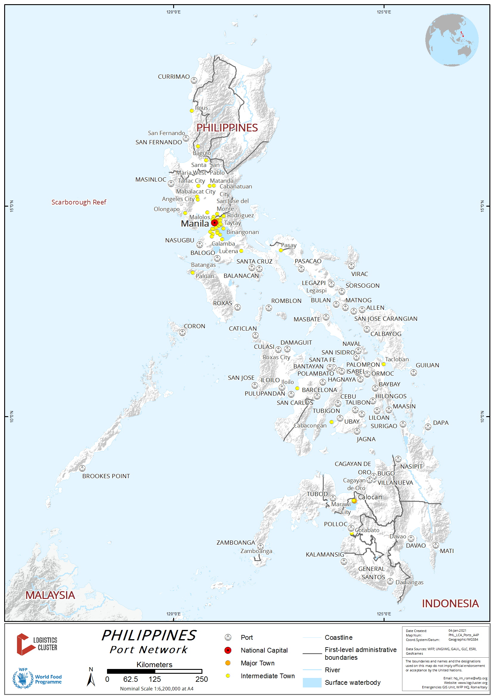
The Philippines being an archipelagic country, sea ports plays a significant link between islands, provinces, municipalities and barangays and this is particularly true in island provinces like Sulu, Basilan and Tawi-Tawi which are provinces that are part of Bangsamoro Autonomous Region in Muslim Mindanao. The sea crafts being utilized within in the BARMM region varies from small boats for two passengers to passenger boats that can take 20 people. In island provinces they have fast crafts and small cargo ships. Because the people of Lanao del Sur live around the Lake Lanao which is the second biggest lake in the country, the said lake is also being utilized in transporting people and cargoes. Municipalities have their small sea ports but mostly poorly maintained and mostly privately owned.
2.1.3.1 Philippines - Mindanao Polloc Free Port
Port Overview
Polloc Free Port is located in Parang, Maguindanao, and was constructed in 1977 funded by the ADB and started its operation in March 1980. Currently the Port is being managed by the Bangsamoro Autonomous Region in Muslim Mindanao (BARMM) through the BARMM Regional Economic Zone Authority. Polloc Free Port is being positioned by the BARMM as a halal hub. It is the biggest sea port in the BARMM Region but compared to other free ports in the country, Polloc Free Port is not that busy.
Only two shipping lines have regular schedule in Polloc Free Port. Other vessels are mainly chartered loaded with construction materials.
Polloc Free port’s main wharf is 400 meters. Storage spaces are:
- 11,960 m2 transit sheds
- 42,940 m2 open storage area
- 75,654 m2 private warehouse area
Port website: Polloc Free Port.
Key port information can also be found at: http://www.maritime-database.com
|
Port Location and Contact |
|
|---|---|
|
Country |
Philippines |
|
Province or District |
Parang, Maguindanao Province |
|
Nearest Town or City with Distance from Port |
Parang, Maguindanao (4km) Cotabato City (27 km) |
|
Port's Complete Name |
Polloc Free Port |
|
Latitude |
7.338940 |
|
Longitude |
124.227600 |
|
Managing Company or Port Authority |
BARMM Regional Economic Zone Authority |
|
Management Contact Person |
Iharyf Sucol, Port Manager +63 935 884 5334 |
|
Nearest Airport and Airlines with Frequent International Arrivals/Departures |
Davao International Airport |
Port Picture
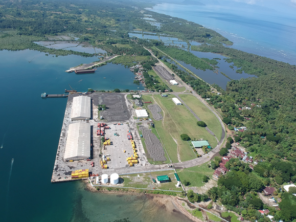
Source: http://www.armmtransition.ph/armm-polloc/
Shown in the picture above are:
- Two transit sheds facing the wharf
- The company yard which has very minimal container vans stored
- The office of the BARMM Regional Economic Zone Authority (green roof)
- The entrance and exit gates
Description and Contacts of Key Companies
- BARMM Regional Economic Zone Authority – an agency of BARMM that is managing the sea ports in the areas of operation of BARMM.
- Bangsamoro Terminal Services, Inc. (BTSI) has an exclusive contract for arrastre and stevedoring services in Polloc Free Port.
For more information on port contacts, please see the following link: 4.4 Port and Waterways Companies Contact List.
Port Performance
|
SEASONAL CONSTRAINTS |
||
|---|---|---|
|
Occurs |
Time Frame |
|
|
Rainy Season |
Yes |
June to December |
|
Major Import Campaigns |
No |
N/A |
|
Other Comments |
N/A |
|
Discharge Rates and Terminal Handling Charges
For information on port rates and charges, please see the following: Schedule of Restructured Cargo Tariff, Sub-Port of Cotabato.
Source: Philippine Ports Authority. (ppa.com.ph)
Berthing Specifications
|
Type of Berth |
Quantity |
Length (m) |
Maximum Draft (m) |
Comments |
|---|---|---|---|---|
|
Conventional Berth |
1 | 400 m | 10.5 m |
|
|
Container Berth |
N/A |
|
||
|
Silo Berth |
N/A |
|
||
|
Berthing Tugs |
N/A |
|
||
|
Water Barges |
N/A |
|
General Cargo Handling Berths
|
Cargo Type |
Berth Identification |
|---|---|
|
Imports - Bagged Cargo |
n/a |
|
Exports - Bagged Cargo |
n/a |
|
Imports and Exports - RoRo |
n/a |
|
Other Imports |
n/a |
Port Handling Equipment
The port equipment is managed privately.
|
Equipment |
Available |
Total Quantity and Capacity Available |
Comments on Current Condition and Actual Usage |
|---|---|---|---|
|
Dockside Crane |
No |
||
|
Container Gantries |
No |
||
|
Mobile Cranes |
Yes |
||
|
Reachstacker |
No |
||
|
RoRo Tugmaster (w/ Trailer) |
No |
||
|
Grain Elevator w/ Bagging Machines |
No |
||
|
Transtainer |
No |
||
|
Forklifts |
Yes |
2 units x 3.5 MT |
Container Facilities
There are no container facilities in Polloc Port. Containers are offloaded via onboard cranes.
Customs Guidance
The Bureau of Customs in Cotabato City manages the Polloc Free Port. With complete documents and giving them an advance information of arriving cargo it takes less than a week to process customs clearance, Bureau of Customs charges include the visit to the port area.
For more information on customs in the Philippines, please see the following link: 1.3 Customs Information.
Terminal Information
Multipurpose Terminal
Polloc Port has a passenger terminal and 2 transit sheds but it does not have a multi-purpose terminal.
Grain and Bulk Handling
The Bangsamoro Terminal Services, Inc (BTSI) has an exclusive contract on all handling activities in Polloc Free port, both arrastre and stevedoring. Direct bagging from ship is not normally done by BTSI but this can be negotiated with them. The port is receiving both containerized and break bulk cargo.
Main Storage Terminal
Polloc Free Port has two transit sheds fronting the wharf, WFP is occupying a portion of one of the transit sheds. The total are of the two transit sheds is 11,960 m2 and the open space storage area is 42,940 m2. For containerized cargo the company yard is right inside the compound of the port.
|
Storage Type |
Number of Storage Facilities |
Area (m2) |
|---|---|---|
|
Bagged Cargo |
2 transit sheds | 11,960 m2 |
|
Refrigerated Cargo |
n/a | |
|
General Cargo |
Open space | 42,940 m2 |
Stevedoring
For stevedoring operations, Bangsamoro Terminal Services, Inc. receives palletized, breakbulk cargo, heavy lift and dangerous cargoes and containerized cargo.
The manpower and equipment available are:
- stevedores (number depends on the type of cargo)
- gangboss
- winchman
- checker
- slingman
- forklifts and
- all gears below the hook
Port Security
BARMM is managing the vicinity of the port, they have security guards in the entrance and exit gates. The Philippines Coast Guards secures the sea shore, they have personnel who are securing the area. The agencies occupying the transit sheds and warehouses have their own set of security guards.
2.1.3.2 Philippines - Mindanao Port of Jolo
Port Overview
Port of Jolo is the main port of the island of Sulu but it is a very small port. This port is very significant to the people of Sulu, particularly those involve in commerce and considered one of the busiest ports in Western Mindanao. The Port of Jolo has been one of the earliest hubs for trade and commerce in the region even before the Spanish invasion. Sulu Region has been the gateway of trading from the country towards Java, Borneo, Celebes, China, Malaysia, Singapore and Brunei.
Among the shipping companies present in the Port are Aleson Shipping Lines, Montenegro Shipping Lines, Sing Shipping Lines, SRN Fast crafts and Theresian Star Shipping Lines. The port is managed by the BARMM Regional Economic Zone Authority.
| Port of Jolo | |
|---|---|
| Anchorage Depth | 21.6 m - 22.9 m |
| Cargo Pier Depth | 11 m - 12.2 m |
| Oil Terminal Depth | 4.9 m - 6.1 m |
| Harbor Size | Very small |
| Railway Size | Small |
| Harbor Type | Open Roadstead |
| Max Size | up to 500 ft in length |
| Repairs | None |
| Shelter | Good |
Key port information can also be found at: http://www.maritime-database.com
|
Port Location and Contact |
|
|---|---|
|
Country |
Philippines |
|
Province or District |
Sulu |
|
Nearest Town or City with Distance from Port |
Jolo (0 km) |
|
Port's Complete Name |
Port of Jolo |
|
Latitude |
6.055680 |
|
Longitude |
121.020960 |
|
Managing Company or Port Authority |
BARMM – BARMM Economic Zone Authority |
|
Management Contact Person |
|
|
Nearest Airport and Airlines with Frequent International Arrivals/Departures |
Zamboanga International Airport |
Port Picture

In the above picture, the Office of the Ports Authority (blue roof) is seen, the container yard (although there are no container vans that go to Jolo Port), and the wharfs.
Description and Contacts of Key Companies
- BARMM Regional Economic Zone Authority
- Local Government of Jolo, Sulu
For more information on port contacts, please see the following link: 4.3 Port and Waterways Companies Contact List.
Port Performance
|
SEASONAL CONSTRAINTS |
||
|---|---|---|
|
Occurs |
Time Frame |
|
|
Rainy Season |
Yes |
June to December |
|
Major Import Campaigns |
No |
|
|
Other Comments |
N/A |
|
Discharge Rates and Terminal Handling Charges
For information on port rates and charges, please see the following link: https://www.ppa.com.ph/
Port Handling Equipment
The port is managed by the BARMM Regional Economic Zone Authority.
Customs Guidance
For more information on customs in the Philippines, please see the following link: 1.3 Customs Information.
2.1.3.3 Philippines - Mindanao Port of Lamitan
Port Overview
Lamitan Port is located in the City of Lamitan in Basilan which is a 6th class city and the capital of Basilan Province. The Port had been expanded in 2017. Lamitan City’s economy is based primarily on agriculture. The Port is used primarily for passengers and commerce such as transportation of local products in Basilan going to other parts of the country.
Key port information can also be found at: http://www.maritime-database.com
|
Port Location and Contact |
|
|---|---|
|
Country |
Philippines |
|
Province or District |
Basilan, Bangsamoro Autonomous Region in Muslim Mindanao |
|
Nearest Town or City with Distance from Port |
Lamitan (0 km) |
|
Port's Complete Name |
Port of Lamitan |
|
Latitude |
6.658610 |
|
Longitude |
122.137440 |
|
Managing Company or Port Authority |
BARMM Economic Zone Authority |
|
Management Contact Person |
|
|
Nearest Airport and Airlines with Frequent International Arrivals/Departures |
Zamboanga International Airport |
Port Picture

Description and Contacts of Key Companies
For more information on port contacts, please see the following link: 4.4 Port and Waterways Companies Contact List.
Discharge Rates and Terminal Handling Charges
For information on port rates and charges, please see the following link: https://www.ppa.com.ph/.
Port Handling Equipment
Is the port equipment managed by the BARMM Economic Zone Authority.
Customs Guidance
For more information on customs in the Philippines, please see the following link: 1.3 Customs Information.
2.1.3.4 Philippines - Mindanao Port of Dapitan
Port Overview
Pulauan Port, better known as Dapitan Port, is located in Barangay San Vicente in Dapitan City. It is situated in a cove fully protected by mountainous terrain. The harbor can be accessed through the waters of North Western Mindanao, particularly in Dapitan Bay which is part of the Sulu Sea. This port is about 404 nautical miles (650 km) southwest of Manila, 156 nautical miles to Zamboanga City and 111 nautical miles to Cebu City.
Port of Dapitan has been in the limelight as it continues to play an important role in connecting the network of roads and RORO ports to form a highway known as the Strong Republic Nautical Highway (SRNH) along the Western Seaboard. The port is the jump off point to/from Luzon and Visayas. Since the initial launching of the SRNH in 2003, a significant increase in RORO traffic in both cargo and passengers has taken place in the Port of Dapitan.
https://maritimereview.ph/2019/07/26/the-port-management-office-of-zamboanga-del-norte-pmo-zdn/
Port website: http://pmozamboangadelnorte.com/port-profile/pmo-zamboanga-del-norte/
Key port information can also be found at: http://www.maritime-database.com
|
Port Location and Contact |
|
|---|---|
|
Country |
Philippines |
|
Province or District |
Zamboanga Del Norte |
|
Nearest Town or City with Distance from Port |
Dapitan (0 km), Dipolog (18 km) |
|
Port's Complete Name |
PMO Port of Dapitan |
|
Latitude |
8.6558333 |
|
Longitude |
123.3905555 |
|
Managing Company or Port Authority |
Philippine Ports Authority (PPA) |
|
Management Contact Person |
Salvador L. Delina Port Manager, PMO Zamboanga Del Norte (064) 213-6595 / 213-3606 |
|
Nearest Airport and Airlines with Frequent International Arrivals/Departures |
Dipolog Airport PAL, Cebu Pacific |
Port Picture
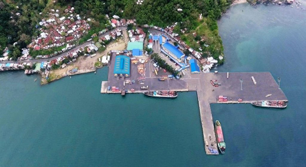
Description and Contacts of Key Companies
| Company | Address | Phone Number | Services |
|---|---|---|---|
|
Prudential Custom Brokerage Services, Inc (PCBSI) Dapitan Branch |
Port Of Dapitan, Dapitan City 7101 Zamboanga del Norte Philippines |
(065) 302 0772 | Customs clearing, transport and domestic cargo forwarding, shipping, and port cargo handling services |
For more information on port contacts, please see the following link: 4.4 Port and Waterways Companies Contact List.
Port Performance
PMO Port of Dapitan serves domestic passenger and cargo vessels, may it be RORO berth or conventional berthing. The draft of the port is between 6 m to 11 m, thus ship should observe when berthing to the assigned berthing place. Humanitarian cargoes are always a priority in all Philippine ports. Containerized cargo can be offloaded on the Port depending on the arrangement with the local shipping lines.
|
Seasonal Constraints |
||
|---|---|---|
|
Occurs |
Time Frame |
|
|
Rainy Season |
Yes |
June to November |
|
Major Import Campaigns |
No |
N/A |
|
Other Comments |
||
|
HANDLING FIGURES for 2020 |
|
|---|---|
|
Vessel Calls |
2,269 |
|
Container Traffic (TEUs) |
11,950 |
|
Handling Figures Bulk and Break Bulk for 2020 |
|
|---|---|
|
Bulk (MT) |
179,372 MT |
|
Break bulk (MT) |
117,390 MT |
Sources:
http://nro9.neda.gov.ph/regional-development-report/
https://www.ppa.com.ph/annual-statistical-report-by-year-vol-1
Discharge Rates and Terminal Handling Charges
Charges on Cargoes: https://www.ppa.com.ph/?q=content/charges-cargoes
Charges on Storage: https://www.ppa.com.ph/?q=content/charges-storage
Charges on Vessels: https://www.ppa.com.ph/?q=content/charges-vessel
Berthing Specifications
|
Type of Berth |
Quantity |
Length (m) |
Maximum Draft (m) |
Comments |
|---|---|---|---|---|
|
Conventional Berth |
7 | 410 m | 11 m |
Berth 4 & 5: 11 m draft |
|
Container Berth |
0 |
|
||
|
Silo Berth |
0 |
|
||
|
Berthing Tugs |
0 |
Pilotage Services |
||
|
Water Barges |
0 |
Dapitan City Water District |
General Cargo Handling Berths
|
Cargo Type |
Berth Identification |
|---|---|
|
Imports - Bagged Cargo |
Berths 4 & 5 |
|
Exports - Bagged Cargo |
Berths 4 & 5 |
|
Imports and Exports - RoRo |
None |
|
Other Imports |
Berths 4 & 5 |
Port Handling Equipment
Cargo Handling Services: Prudential Customs Brokerage Services, Inc. (PCBSI)
|
Equipment |
Available |
Total Quantity and Capacity Available |
Comments on Current Condition and Actual Usage |
|---|---|---|---|
|
Dockside Crane |
No |
||
|
Container Gantries |
No |
||
|
Mobile Cranes |
Yes |
1 x 35 MT | |
|
Reachstacker |
No |
||
|
RoRo Tugmaster (w/ Trailer) |
No |
||
|
Grain Elevator w/ Bagging Machines |
No |
||
|
Transtainer |
No |
||
|
Forklifts |
Yes |
8 | From 3 MT to 25 T |
Container Facilities
There are no container facilities in Dapitan Port, and it uses an open area for storage.
Customs Guidance
Custom documents must be filed and cleared at the Port of Zamboanga Customs Office.
Contact:
Segundo Sigmundfreud Z. Barte
Acting District Collector, Port of Zamboanga
segundosigmundfreud.barte@customs.gov.ph
+63 62 992 6844
For more information on customs in the Philippines, please see the following link: 1.3 Customs Information.
Terminal Information
Multipurpose Terminal
Passenger terminal and arrival area and Roro ramps.
| Roro Ramps (11 m x 9 m) | |
|---|---|
| Ramp 1 | 6 m MLLW |
| Ramp 2 | 4 m MLLW |
| Ramp 3 | 6 m MLLW |
Grain and Bulk Handling
None
Main Storage Terminal
- 1,000 m2 cargo stacking shed
- 7,667 m2 cargo stacking area and CY
|
Storage Type |
Number of Storage Facilities |
Area (m2) |
|---|---|---|
|
Bagged Cargo |
None | |
|
Refrigerated Cargo |
None | |
|
General Cargo |
1 | 1,000 m2 |
Stevedoring
Prudential Customs Brokerage Services, Inc. (PCBSI) is the cargo and porterage provider.
Hinterland Information
FCL shipping companies will handle delivery and offloading including transport, LCL cargo owner provide transport and withdrawal from port.
Transport Companies
- Rural Transit Inc.
- Evergood Trucking Services
- Fastpak Trucking Services
- Sagario Trucking Services
- Certified Express Inc
Port Security
- PPA Port Police Officers
- PPA Safety Officer
- PPA-Hired Security Guards
- PCBSI-Hired Security Guards/Watchmen
- PCBSI Safety Officer
|
Security |
|
|---|---|
|
ISPS Compliant |
No |
|
Current ISPS
Level |
N/A |
|
Police Boats |
PNP Maritime Command |
|
Fire Engines |
Supported by the Dapitan Local Government Unit |
2.1.3.5 Philippines - Mindanao Port of Liloy
Port Overview
The Port of Liloy is located in Lamao, Liloy, Zamboanga del Norte. 127 kms from Dipolog City, the Port of Lamao can be traversed through the coastal road network of Zamboanga del Norte. It has 1 RORO ramp with a draft of 10 meters; 2 R.C. piers, one with a draft of 6 meters and the other between 6 to 15 meters; and a back-up area yard of 3,550 sqm.
Port website: http://pmozamboangadelnorte.com/port-profile/tmo-liloy/
Key port information can also be found at: http://www.maritime-database.com
|
Port Location and Contact |
|
|---|---|
|
Country |
Philippines |
|
Province or District |
Zamboanga Del Norte (Region IX) |
|
Nearest Town or City with Distance from Port |
Dipolog City (127 km) |
|
Port's Complete Name |
TMO Liloy / Port of Lamao |
|
Latitude |
8.137775 |
|
Longitude |
122.678599 |
|
Managing Company or Port Authority |
Philippine Ports Authority |
|
Management Contact Person |
Romeo C. Buenaobra – OIC TMO Liloy Salvador L. Delina, Port Manager +63 64 213-6595 / 213-3606 PMO Zamboanga Del Norte |
|
Nearest Airport and Airlines with Frequent International Arrivals/Departures |
Dipolog Airport Domestic airlines only (PAL, Cebu Pacific) |
Port Picture
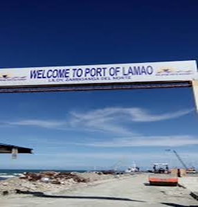
Description and Contacts of Key Companies
| Company | Address | Contact Information | Services |
|---|---|---|---|
| Liloy Cargo Handling Services Inc | Port Area, Barangay Lamao, Liloy, Zamboanga Del Norte | Ms Jean Lim, +63 917 3290868 | Stevedoring |
| Evergood Delivery & Freight Services Corp. | Galas, Dipolog City | George Ryan Lim, +63 912 338 1962 | Transport, cargo forwarding, hauling, and trucking |
For more information on port contacts, please see the following link: 4.4 Port and Waterways Companies Contact List.
Port Performance
Based on the 2018 PPA report, TMO Liloy has cargo throughput of 12,750 MT for the 1st quarter and 23,805 MT for the 2nd quarter.
https://www.ppa.com.ph/sites/default/files/qtr_stat/2018%20Cargo%20Statistics.pdf
|
SEASONAL CONSTRAINTS |
||
|---|---|---|
|
Occurs |
Time Frame |
|
|
Rainy Season |
Yes |
June to November |
|
Major Import Campaigns |
No |
N/A |
|
Other Comments |
N/A |
|
|
HANDLING FIGURES for 2020 |
|
|---|---|
|
Vessel Calls |
42 |
|
Container Traffic (TEUs) |
None |
|
Handling Figures Bulk and Break Bulk for 2020 |
|
|---|---|
|
Bulk (MT) |
58,058 MT |
|
Break bulk (MT) |
None |
Discharge Rates and Terminal Handling Charges
For information on port rates and charges, please see the following link: http://pmozamboangadelnorte.com/port-tariff/tmo-liloy-tariff/
Berthing Specifications
|
Type of Berth |
Quantity |
Length (m) |
Maximum Draft (m) |
Comments |
|---|---|---|---|---|
|
Conventional Berth |
3 | 174 m | 10 m |
1 berth with Roro ramp |
|
Container Berth |
0 |
|
||
|
Silo Berth |
0 |
|
||
|
Berthing Tugs |
0 |
|
||
|
Water Barges |
0 |
|
General Cargo Handling Berths
|
Cargo Type |
Berth Identification |
|---|---|
|
Imports - Bagged Cargo |
2 & 3 |
|
Exports - Bagged Cargo |
2 & 3 |
|
Imports and Exports - RoRo |
1 (9 x 10 m) |
|
Other Imports |
None |
Port Handling Equipment
The port equipment is managed by the PPA.
|
Equipment |
Available |
Total Quantity and Capacity Available |
Comments on Current Condition and Actual Usage |
|---|---|---|---|
|
Dockside Crane |
No |
||
|
Container Gantries |
No |
||
|
Mobile Cranes |
No |
||
|
Reachstacker |
No |
||
|
RoRo Tugmaster (w/ Trailer) |
No |
||
|
Grain Elevator w/ Bagging Machines |
No |
||
|
Transtainer |
No |
||
|
Forklifts |
Yes |
2 | 2.5 ton capacity |
Container Facilities
There are no container facilities in the Port of Liloy.
Customs Guidance
Custom clearance must be filed and cleared at Port of Zamboanga Customs Office.
Contact:
Segundo Sigmund Freud Z. Barte, Acting District Collector
Port of Zamboanga
segundosigmundfreud.barte@customs.gov.ph
+63 62 992 6844
For more information on customs in the Philippines, please see the following link: 1.3 Customs Information.
Terminal Information
Multipurpose Terminal
- Back-up Area 3,120 sq. m.
- Vehicle Parking Area 45 sq. m.
- Cargo Handling Equipment
- Other port facilities / amenities
- Fenders: V-type 500H x 1500L = 42 units
- Power Plant Station: 30 sq. m.
- Two (2) units 2.5 tonner forklift
Grain and Bulk Handling
There are no grain and bulk handling facilities in the Port of Liloy.
Main Storage Terminal
There are is no main storage terminal in the Port of Liloy.
Stevedoring
Stevedoring is managed by the PPA.
Hinterland Information
Cargo owners are responsible for withdrawal and transport.
Port Security
The Port of Liloy has locally-hired security guards.
|
Security |
|
|---|---|
|
ISPS Compliant |
Yes |
|
Current ISPS
Level |
Level 1 |
|
Police Boats |
None |
|
Fire Engines |
Provided by the local government |
2.1.3.6 Philippines - Mindanao Port of Sindangan
Port Overview
The Port of Sindangan is located in Calatunan, Sindangan, Zamboanga del Norte. It has 1 RORO ramp and 2 R.C. piers with a draft of up to 6 meters, and a paved reclaimed area for open storage of 5,250 sqm. The Port of Sindangan, TMO Sindangan is connected by a concrete road to the national highway about three 2.20 kilometers away, approximately 89 kilometers away from Dipolog City and 234 kilometers away from Zamboanga City. The total port area is 8,167.39 m2.
Proposed Development:
- Repair of 58M x 9M RC Pier and Provision of Offshore Outlet Port of Sindangan.
- Repair of Port Lighting System Harnessing Solar Power Energy.
Port website: http://pmozamboangadelnorte.com/port-profile/tmo-sindangan/
Key port information can also be found at: http://www.maritime-database.com
|
Port Location and Contact |
|
|---|---|
|
Country |
Philippines |
|
Province or District |
Zamboanga Del Norte (Region IX) |
|
Nearest Town or City with Distance from Port |
Dipolog City (80 km) |
|
Port's Complete Name |
TMO Sindangan |
|
Latitude |
8.251345 |
|
Longitude |
122.985496 |
|
Managing Company or Port Authority |
Philippine Port Authority |
|
Management Contact Person |
Salvador L. Delina, Port Manager PMO Zamboanga Del Norte +63 64 213-6595 / 213-3606 |
|
Nearest Airport and Airlines with Frequent International Arrivals/Departures |
Dipolog Airport (Domestic only) PAL, Cebu Pacific |
Port Picture
Description and Contacts of Key Companies
Philippine Port Authority - Sindangan Port Services.
For more information on port contacts, please see the following link: 4.4 Port and Waterways Companies Contact List.
Port Performance
Please see the following link for the 2020 Sindangan Port performance data: https://www.ppa.com.ph/sites/default/files/qtr_stat/2018%20Cargo%20Statistics.pdf.
|
SEASONAL CONSTRAINTS |
||
|---|---|---|
|
Occurs |
Time Frame |
|
|
Rainy Season |
Yes |
June to November |
|
Major Import Campaigns |
No |
N/A |
|
Other Comments |
|
|
|
HANDLING FIGURES for 2020 |
|
|---|---|
|
Vessel Calls |
17 |
|
Container Traffic (TEUs) |
0.00 |
|
Handling Figures Bulk and Break Bulk for 2020 |
|
|---|---|
|
Bulk (MT) |
0.00 |
|
Break bulk (MT) |
11,745 MT |
https://www.ppa.com.ph/annual-statistical-report-by-year-vol-1
Discharge Rates and Terminal Handling Charges
For information on port rates and charges, please see the following link: Port of Sindangan (Domestic & Import Export) CH Tariff.
Berthing Specifications
|
Type of Berth |
Quantity |
Length (m) |
Maximum Draft (m) |
Comments |
|---|---|---|---|---|
|
Conventional Berth |
4 | 213 m | 7 m |
With Roro ramp |
|
Container Berth |
0 |
|
||
|
Silo Berth |
0 |
|
||
|
Berthing Tugs |
0 |
|
||
|
Water Barges |
0 |
|
http://pmozamboangadelnorte.com/port-profile/tmo-sindangan/
General Cargo Handling Berths
|
Cargo Type |
Berth Identification |
|---|---|
|
Imports - Bagged Cargo |
1 & 2 |
|
Exports - Bagged Cargo |
0 |
|
Imports and Exports - RoRo |
0 |
|
Other Imports |
0 |
Port Handling Equipment
The are no port handling equipment in the Port of Sindangan.
Container Facilities
There are no container facilities in the Port of Sindangan.
Customs Guidance
Customs documents must be filed and cleared at Port of Zamboanga customs office.
Contact:
Segundo Sigmundfreud Z. Barte, Acting District Collector
Port of ZZamboanga
segundosigmundfreud.barte@customs.gov.ph
+63 62 992 6844
For more information on customs in the Philippines, please see the following link: 1.3 Customs Information.
Terminal Information
Multipurpose Terminal
60 sqm PPA office, back up area 3,635 m2, Parking area 1,345 m2.
Grain and Bulk Handling
There are no grain and bulk handling facilities in the Port of Sindangan.
Main Storage Terminal
5,250 m2 reclaimed open storage area.
Stevedoring
PPA Sindangan manages the cargo handling in Sindangan Port.
Sindangan Port Services (STU)
Port Area, Barangay Calatunan, Sindangan, ZDN
(065)224 5040
Hinterland Information
Cargo owners are responsible for the withdrawal of their cargo at the port.
Port Security
The port of Sindangan has locally-hired security guards.
|
Security |
|
|---|---|
|
ISPS Compliant |
No |
|
Current ISPS
Level |
N/A |
|
Police Boats |
No |
|
Fire Engines |
provided by the local government. |
2.1.3.7 Philippines - Mindanao Port of Pagadian
Port Overview
The port of Pagadian is served by shipping lines operating for both passenger and cargo vessels. Ports of call include Zamboanga City, Jolo, Siasi, Bongao, Sitangkai and Cotabato City. It is under the administration of TMO Zamboanga del Sur with direct supervision from PMO Zamboanga.
Cargo vessel traffic has dropped significantly as new concrete roads from Pagadian City to Zamboanga City, Davao City, Cagayan de Oro City were built or rehabilitated. Buses also added units to their fleet to serve commuters.
Fishing vessels now use the port to unload their catch of the day. Aleson Shipping operates passenger and cargo vessels bound for Zamboanga but since the road was rehabilitated, Aleson Shipping concentrated on their route from Zamboanga to Isabela, Basilan.
Key port information can also be found at: http://www.maritime-database.com
|
Port Location and Contact |
|
|---|---|
|
Country |
Philippines |
|
Province or District |
Zamboanga Del Sur (Region IX) |
|
Nearest Town or City with Distance from Port |
Pagadian City (0 km) |
|
Port's Complete Name |
OTP Pagadian Port |
|
Latitude |
7.1818451 |
|
Longitude |
123.438972 |
|
Managing Company or Port Authority |
Philippine Ports Authority |
|
Management Contact Person |
Arcidi S. Jumaani, Port Manager PMO Zamboanga (062) 991-2037 to 39 / 991-2360 |
|
Nearest Airport and Airlines with Frequent International Arrivals/Departures |
Pagadian Airport (Domestic Only) PAL, Cebu Pacific |
Port Picture


Description and Contacts of Key Companies
Aleson Shipping Lines, Inc.
Main Office
172 Veterans Ave., Zamboanga City
Tel # (062) 991-4258, 991-2687
Fax # (062) 991-2099
http://aleson-shipping.com/index.html
Cargo Office
Alejo Alvarez St., Zamboanga City
Tel # (062) 992-3853, 992-5506
International Office
Standard Marine Agencies Sdn Bhd
Block G, Lot 1, 1st floor, Bandar
Ramai-Ramai, Jalan Leila,
Sandakan, Sabah Malaysia
Tel # (0060)(89) 216-996, 217-607, 271-998
E-mail Address: chowyangann@standard-marine.com.my
For more information on port contacts, please see the following link: 4.4 Port and Waterways Companies Contact List.
Port Performance
For information on port performance, please see the following link: https://www.ppa.com.ph/sites/default/files/qtr_stat/2018%20Cargo%20Statistics.pdf
|
SEASONAL CONSTRAINTS |
||
|---|---|---|
|
Occurs |
Time Frame |
|
|
Rainy Season |
Yes |
From June to November |
|
Major Import Campaigns |
No |
N/A |
|
Other Comments |
N/A | |
|
Handling Figures for 2020 |
|
|---|---|
|
Vessel Calls |
282 |
|
Container Traffic (TEUs) |
None |
|
Handling Figures Bulk and Break Bulk for 2020 |
|
|---|---|
|
Bulk (MT) |
None |
|
Break bulk (MT) |
58,710 MT |
https://www.ppa.com.ph/annual-statistical-report-by-year-vol-1
Discharge Rates and Terminal Handling Charges
For information on port rates and charges, please see the following link: Port of Pagadian (Domestic) CH Tariff Rates.
Berthing Specifications
|
Type of Berth |
Quantity |
Length (m) |
Maximum Draft (m) |
Comments |
|---|---|---|---|---|
|
Conventional Berth |
1 | 165 m | 7 m |
|
|
Container Berth |
N/A |
|
||
|
Silo Berth |
N/A |
|
||
|
Berthing Tugs |
N/A |
|
||
|
Water Barges |
N/A |
|
General Cargo Handling Berths
|
Cargo Type |
Berth Identification |
|---|---|
|
Imports - Bagged Cargo |
Berth 1 |
|
Exports - Bagged Cargo |
N/A |
|
Imports and Exports - RoRo |
N/A |
|
Other Imports |
N/A |
Port Handling Equipment
There is no port handling equipment in Pagadian Port.
Container Facilities
N/A
Customs Guidance
Customs documents must be filed and cleared at Port of Zamboanga customs office.
Contact:
Segundo Sigmundfreud Z. Barte, Acting District Collector
Port of Zamboanga
segundosigmundfreud.barte@customs.gov.ph
+63 62 992 6844
For more information on customs in the Philippines, please see the following link: 1.3 Customs Information.
Terminal Information
Multipurpose Terminal
There is a 4,000 m2 open space at the port.
Grain and Bulk Handling
There are no grain and bulk handling facilities at Pagadian Port.
Main Storage Terminal
There is no storage terminal at Pagadian Port.
Stevedoring
Currently there is no stevedoring company at the port and it is in the process of bidding.
Hinterland Information
The cargo owner is responsible for withdrawal and transport of their own cargo.
Port Security
Local security guards were hired by the PPA.
|
Security |
|
|---|---|
|
ISPS Compliant |
No |
|
Current ISPS
Level |
N/A |
|
Police Boats |
N/A |
|
Fire Engines |
N/A |
2.1.3.8 Philippines - Mindanao Port of Margosatubig
Port Overview
The Port of Margosatubig has the following port facilities: A RC pier 12m x 30.50m Rock Causeway 11m x 22.3m PPA Terminal Office and guard house. Controlling water depth of the port alongside the pier is 10.0m while alongside the rock causeway is 5.0m at MLLW 0.00 elevation. The port is linked by a concrete roadway of about 26.0 km from the national road junction of Pagadian-Zamboanga Highway and approximately 55 km. southwest of Pagadian City. This port has a cargo pier depth of 4.6 m.
Proposed developments are the construction of an RC landing and a Roro ramp and the repair of damages to the RC pier approach.
https://zamboanga.com/z/index.php?title=Margosatubig,_Zamboanga_del_Sur,_Philippines
Port website: http://ports.com/philippines/port-of-margosatubig/
Key port information can also be found at: http://www.maritime-database.com
|
Port Location and Contact |
|
|---|---|
|
Country |
Philippines |
|
Province or District |
Zamboanga Del Sur (Region IX) |
|
Nearest Town or City with Distance from Port |
Pagadian City (52 km) |
|
Port's Complete Name |
Port of Margosatubig |
|
Latitude |
7.579057 |
|
Longitude |
123.167551 |
|
Managing Company or Port Authority |
Philippine Ports Authority |
|
Management Contact Person |
Arcidi S. Jumaani, Port Manager PMO Zamboanga (062) 991-2037 to 39 / 991-2360 |
|
Nearest Airport and Airlines with Frequent International Arrivals/Departures |
Pagadian Airport Domestic only - PAL, Cebu Pacific |
Port Picture

Description and Contacts of Key Companies
For more information on port contacts, please see the following link: 4.4 Port and Waterways Companies Contact List.
Port Performance
Please see the following link: https://www.ppa.com.ph/sites/default/files/qtr_stat/2018%20Cargo%20Statistics.pdf
|
SEASONAL CONSTRAINTS |
||
|---|---|---|
|
Occurs |
Time Frame |
|
|
Rainy Season |
Yes |
From June to November |
|
Major Import Campaigns |
None |
N/A |
|
Other Comments |
|
|
|
Handling Figures for 2020 |
|
|---|---|
|
Vessel Calls |
128 |
|
Container Traffic (TEUs) |
None |
|
Handling Figures Bulk and Break Bulk for 2020 |
|
|---|---|
|
Bulk (MT) |
None |
|
Break bulk (MT) |
28,519 MT |
https://www.ppa.com.ph/annual-statistical-report-by-year-vol-1
Discharge Rates and Terminal Handling Charges
For information on port rates and charges, please see the following link: https://www.ppa.com.ph/.
Berthing Specifications
|
Type of Berth |
Quantity |
Length (m) |
Maximum Draft (m) |
Comments |
|---|---|---|---|---|
|
Conventional Berth |
1 | 100 m | 5 m |
|
|
Container Berth |
0 |
|
||
|
Silo Berth |
0 |
|
||
|
Berthing Tugs |
0 |
|
||
|
Water Barges |
0 |
|
General Cargo Handling Berths
N/A
Port Handling Equipment
There are no port handling equipment in the Port of Margosatubig.
Container Facilities
There are no container facilities at the Port of Margosatubig.
Customs Guidance
Custom documents must be filed and cleared at Port of Zamboanga Customs Office.
Contact:
Segundo Sigmundfreud Z. Barte, Acting District Collector
Port of Zamboanga
segundosigmundfreud.barte@customs.gov.ph
+63 62 992 6844
For more information on customs in the Philippines, please see the following link: 1.3 Customs Information.
Terminal Information
Multipurpose Terminal
There is no multipurpose terminal at the Port of Margosatubig.
Grain and Bulk Handling
There are no grain and bulk handling facilities at the Port of Margosatubig.
Main Storage Terminal
There is no storage terminal at the Port of Margosatubig.
Stevedoring
PPA is currently bidding for stevedoring services.
Hinterland Information
It is the cargo owner's responsibility to provide transport.
Port Security
There is a locally-hired guard.
|
Security |
|
|---|---|
|
ISPS Compliant |
No |
|
Current ISPS
Level |
N/A |
|
Police Boats |
N/A |
|
Fire Engines |
N/A |
2.1.3.9 Philippines - Mindanao Port of Ipil
Port Overview
The Port of Ipil is located at Illana Bay. This port is being used by smaller sea vessels with routes going to Zamboanga City Port. This port now caters to cargo vessels only as road networks going to Zamboanga City were developed for better road travel.
Key port information can also be found at: http://www.maritime-database.com
|
Port Location and Contact |
|
|---|---|
|
Country |
Philippines |
|
Province or District |
Zamboanga Sibugay (Region IX) |
|
Nearest Town or City with Distance from Port |
Pagadian City (134 km) Zamboanga City (136 km) |
|
Port's Complete Name |
Port of Ipil |
|
Latitude |
7.74525662 |
|
Longitude |
122.58369774 |
|
Managing Company or Port Authority |
Philippine Ports Authority |
|
Management Contact Person |
Arcidi S. Jumaani, Port Manager PMO Zamboanga +63 62 991-2037 to 39 / 991-2360 |
|
Nearest Airport and Airlines with Frequent International Arrivals/Departures |
Pagadian and Zamboanga Airports Domestic Only (PAL and Cebu Pacific) |
Port Picture


Description and Contacts of Key Companies
For more information on port contacts, please see the following link: 4.4 Port and Waterways Companies Contact List.
Port Performance
For more information on the 2020 port performance, please see the following link: https://www.ppa.com.ph/sites/default/files/qtr_stat/2018%20Cargo%20Statistics.pdf
|
SEASONAL CONSTRAINTS |
||
|---|---|---|
|
Occurs |
Time Frame |
|
|
Rainy Season |
Yes |
June to November |
|
Major Import Campaigns |
No |
N/A |
|
Other Comments |
N/A |
|
|
HANDLING FIGURES for 2020 |
|
|---|---|
|
Vessel Calls |
32 |
|
Container Traffic (TEUs) |
None |
|
Handling Figures Bulk and Break Bulk for 2020 |
|
|---|---|
|
Bulk (MT) |
None |
|
Break bulk (MT) |
50,577 MT |
https://www.ppa.com.ph/annual-statistical-report-by-year-vol-1
Discharge Rates and Terminal Handling Charges
For information on port rates and charges, please see the following link: Port of Ipil Tariff Rates.
Berthing Specifications
|
Type of Berth |
Quantity |
Length (m) |
Maximum Draft (m) |
Comments |
|---|---|---|---|---|
|
Conventional Berth |
2 | 119 m | 5 m |
|
|
Container Berth |
N/A |
|
||
|
Silo Berth |
N/A |
|
||
|
Berthing Tugs |
N/A |
|
||
|
Water Barges |
N/A |
|
General Cargo Handling Berths
|
Cargo Type |
Berth Identification |
|---|---|
|
Imports - Bagged Cargo |
1 & 2 |
|
Exports - Bagged Cargo |
|
|
Imports and Exports - RoRo |
|
|
Other Imports |
Port Handling Equipment
There is no handling equipment in the port.
Container Facilities
There are no container handling facilities at the Port of Ipil.
Customs Guidance
Custom documents must be filed and cleared at Port of Zamboanga Customs Office.
Contact:
Segundo Sigmundfreud Z. Barte, Acting District Collector
Port of Zamboanga
segundosigmundfreud.barte@customs.gov.ph
+63 62 992 6844
For more information on customs in the Philippines, please see the following link: 1.3 Customs Information.
Terminal Information
Multipurpose Terminal
N/A
Grain and Bulk Handling
N/A
Main Storage Terminal
N/A
Stevedoring
PPA is currently bidding for stevedoring services at the port.
Hinterland Information
Cargo owners are responsible for withdrawal and transport of their own cargo.
Port Security
Locally-hired security guard.
|
Security |
|
|---|---|
|
ISPS Compliant |
No |
|
Current ISPS
Level |
N/A |
|
Police Boats |
No |
|
Fire Engines |
Yes, provided by local government. |
2.1.3.10 Philippines - Mindanao Port of Malangas
Port Overview
Proposed developments:
- Repair of damaged RC Pier
- Selection of cargo handling service provider.
Port website: https://www.ppa.com.ph/projects?field_office_value=PMO%20Zamboanga&page=6
Key port information can also be found at: http://www.maritime-database.com
|
Port Location and Contact |
|
|---|---|
|
Country |
Philippines |
|
Province or District |
Zamboanga Sibugay |
|
Nearest Town or City with Distance from Port |
Pagadian City (81 km) |
|
Port's Complete Name |
OTP Malangas Port |
|
Latitude |
7.625785 |
|
Longitude |
123.034086 |
|
Managing Company or Port Authority |
Philippine Ports Authority |
|
Management Contact Person |
PPA PMO Zamboanga Arcidi S. Jumaani, Port Manager PMO Zamboanga (062) 991-2037 to 39 / 991-2360 |
|
Nearest Airport and Airlines with Frequent International Arrivals/Departures |
Pagadian Airport Domestic only PAL/Cebu Pacific |
Port Picture
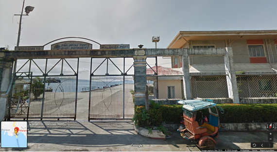
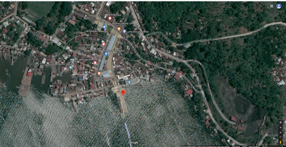
Description and Contacts of Key Companies
For more information on port contacts, please see the following link: 4.3 Port and Waterways Companies Contact List.
Port Performance
For more information on 2020 port performance, please see the following link: https://www.ppa.com.ph/sites/default/files/qtr_stat/2018%20Cargo%20Statistics.pdf
|
SEASONAL CONSTRAINTS |
||
|---|---|---|
|
Occurs |
Time Frame |
|
|
Rainy Season |
Yes |
June to November |
|
Major Import Campaigns |
No |
N/A |
|
Other Comments |
N/A |
|
|
HANDLING FIGURES for 2020 |
|
|---|---|
|
Vessel Calls |
23 |
|
Container Traffic (TEUs) |
0 |
|
Handling Figures Bulk and Break Bulk for 2020 |
|
|---|---|
|
Bulk (MT) |
0 |
|
Break bulk (MT) |
18,051 MT |
Discharge Rates and Terminal Handling Charges
For information on port rates and charges, please see the following link: Port of Malangas CH Tariff Rates.
Berthing Specifications
|
Type of Berth |
Quantity |
Length (m) |
Maximum Draft (m) |
Comments |
|---|---|---|---|---|
|
Conventional Berth |
2 | 56 m | 5 m |
|
|
Container Berth |
N/A |
|
||
|
Silo Berth |
N/A |
|
||
|
Berthing Tugs |
N/A |
|
||
|
Water Barges |
N/A |
|
General Cargo Handling Berths
|
Cargo Type |
Berth Identification |
|---|---|
|
Imports - Bagged Cargo |
1 and 2 |
|
Exports - Bagged Cargo |
N/A |
|
Imports and Exports - RoRo |
N/A |
|
Other Imports |
N/A |
Port Handling Equipment
There are no handling equipment in the Port of Malangas.
Container Facilities
There are no container facilities in Malangas Port.
Customs Guidance
Custom documents must be filed and cleared at Port of Zamboanga Customs Office.
Contacts:
Segundo Sigmundfreud Z. Barte, Acting District Collector
Port of Zamboanga
segundosigmundfreud.barte@customs.gov.ph
+63 62 992 6844
For more information on customs in the Philippines, please see the following link: 1.3 Customs Information.
Terminal Information
Multipurpose Terminal
N/A
Grain and Bulk Handling
N/A
Main Storage Terminal
N/A
Stevedoring
Bidding process for new stevedoring service provider not yet concluded as of writing.
Hinterland Information
Cargo owners are responsible for the withdrawal and transport of their own cargo.
Port Security
Locally-hired security guard.
|
Security |
|
|---|---|
|
ISPS Compliant |
No |
|
Current ISPS
Level |
N/A |
|
Police Boats |
No |
|
Fire Engines |
Yes, supported by local government. |
2.1.3.11 Philippines - Mindanao Port of Zamboanga
Port Overview
The Port of Zamboanga is a seaport located in Zamboanga City located in western Mindanao. The international container Port of Zamboanga ranked 2nd in Asia according to the 2010 Super Efficient Ports in Asia study. The Seaport of Zamboanga has 19 docks, 12 of which are privately owned. The largest dock has capacity for up to 20 vessels, and is operated by the Philippine Ports Authority (PPA).
Sources:
https://maritimereview.ph/2019/01/25/the-port-of-zamboanga/
https://www.zamboanga.com/html/tourist_Seaport.htm
https://www.searates.com/port/zamboanga_ph.htm
Key port information can also be found at: http://www.maritime-database.com
|
Port Location and Contact |
|
|---|---|
|
Country |
Philippines |
|
Province or District |
Zamboanga Del Sur |
|
Nearest Town or City with Distance from Port |
Zamboanga City (0 km) |
|
Port's Complete Name |
PMO Zamboanga |
|
Latitude |
6.9027778 |
|
Longitude |
122.074167 |
|
Managing Company or Port Authority |
Zamboanga City Special Economic Zone Authority |
|
Management Contact Person |
Arcidi S. Jumaani, Port Manager PMO Zamboanga (062) 991-2037 to 39 / 991-2360 |
|
Nearest Airport and Airlines with Frequent International Arrivals/Departures |
Zamboanga Airport Domestic only PAL / Cebu Pacific / Air Asia |
Port Picture
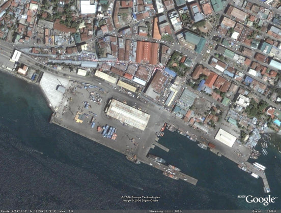
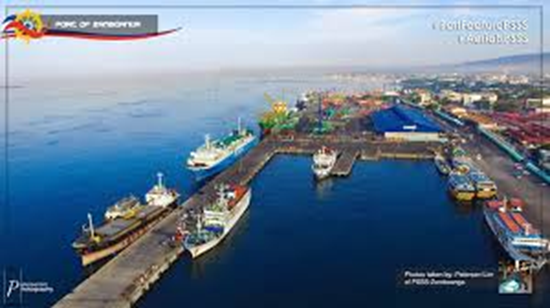
Description and Contacts of Key Companies
| Cargo Handling | ||
|---|---|---|
| Company | Contact Person | Contact Details |
| Unified Stevedoring and Arrastre Corporation |
Bienvenido Ruste, President |
|
| PTC-Mindanao Port Services Inc |
Guillermo L. Laureano, President |
|
| Zamboanga Arrastre and Stevedoring Corporation |
Hadji Harun Dimarunsing, President/General Manager |
|
https://www.zamboanga.com/html/tourist_Seaport.htm
For more information on port contacts, please see the following link: 4.3 Port and Waterways Companies Contact List.
Port Performance
Based on the PPA 2018 Cargo Throughput Report, PMO Zamboanga had 44,927(RORO) and 551,045(Non RORO) for the 1st quarter and 42,028(RORO) and 624,437(Non RORO) in the 2nd quarter of 2018. There are nineteen seaports or wharves in Zamboanga City, twelve of which are privately owned. The biggest and most modern is the Zamboanga Port, which is operated by the Philippine Port Authority (PPA). It is located at the City's southern tip, and it's main entrance is on R.T. Lim Boulevard. It can hold 20 vessels at a time. This port is designed for larger vessel and can accommodate within 10m draft. Container handling if DTD FCL mode will be shoulder by shipping company.
Humanitarian cargoes are priorities in all Philippine ports during an emergency.
Sources:
https://www.ppa.com.ph/sites/default/files/qtr_stat/2018%20Cargo%20Statistics.pdf
https://www.zamboanga.com/html/tourist_Seaport.htm
|
SEASONAL CONSTRAINTS |
||
|---|---|---|
|
Occurs |
Time Frame |
|
|
Rainy Season |
Yes |
From June to November |
|
Major Import Campaigns |
No |
N/A |
|
Other Comments |
Small vessel bound for Basilan, Sulu, and Tawi-tawi provinces also use this port. |
|
|
HANDLING FIGURES for 2018 |
|
|---|---|
|
Vessel Calls |
9,721 |
|
Container Traffic (TEUs) |
48,705 TEUs |
https://www.ppa.com.ph/sites/default/files/qtr_stat/2018%20Container%20Statistics.pdf
https://maritimereview.ph/2019/01/25/the-port-of-zamboanga/
http://www.neda.gov.ph/regional-development-councils/
https://www.ppa.com.ph/sites/default/files/qtr_stat/2018%20Container%20Statistics.pdf
|
Handling Figures Bulk and Break Bulk for 2018 |
|
|---|---|
|
Bulk (MT) |
58,631 MT |
|
Break bulk (MT) |
1,179,149 MT |
https://www.ppa.com.ph/sites/default/files/List%20of%20Ports%20covered%20in%20PPA%20Statistics.pdf
https://www.ppa.com.ph/annual-statistical-report-by-year-vol-1
Discharge Rates and Terminal Handling Charges
For information on port rates and charges, please see the following links:
https://www.ppa.com.ph/?q=content/charges-vessel
https://www.ppa.com.ph/?q=content/charges-cargoes
https://www.ppa.com.ph/?q=content/charges-storage
https://www.ppa.com.ph/?q=content/exemption-port-charges
Berthing Specifications
|
Type of Berth |
Quantity |
Length (m) |
Maximum Draft (m) |
Comments |
|---|---|---|---|---|
|
Conventional Berth |
6 |
320 m |
6-13 m |
Finger pier w/ 2-RORO berth 1,000 m |
|
Container Berth |
0 |
|
||
|
Silo Berth |
0 |
|
||
|
Berthing Tugs |
0 |
|
||
|
Water Barges |
0 |
|
https://www.skyscrapercity.com/threads/zamboanga-ports-and-shipping.1490265/
General Cargo Handling Berths
|
Cargo Type |
Berth Identification |
|---|---|
|
Imports - Bagged Cargo |
|
|
Exports - Bagged Cargo |
|
|
Imports and Exports - RoRo |
|
|
Other Imports |
Container Facilities
PMO Zamboanga has CFS and an open area for bulk storage.
|
Facilities |
20 & 40 ft |
|---|---|
|
Container Facilities Available |
13,700 m2 |
|
Container Freight Station (CFS) |
5,040 m2 |
|
Refrigerated Container Stations |
Yes |
|
Other Capacity Details |
|
|
Daily Take Off Capacity |
|
|
Number of Reefer Stations |
8 |
|
Emergency Take-off Capacity |
|
|
Off take Capacity of
Gang Shift |
https://www.zamboanga.com/html/tourist_Seaport.htm
https://www.skyscrapercity.com/threads/zamboanga-ports-and-shipping.1490265/
Customs Guidance
Customs clearing is done at the port. Customs clearing and operations normally takes the usual process and time frame provided that all clearance, exemption and document are process on time.
Operating Hours: 8am - 5pm, Mon-Fri. Closed on Saturdays and Sundays.
Phone: +6362 992 6844
For more information on customs in the Philippines, please see the following link: 1.3 Customs Information.
Terminal Information
Multipurpose Terminal
2 passenger terminal sheds (1,620 m2 and 960 m2)
Grain and Bulk Handling
There are no grain and bulk handling facilities at Zamboanga Port.
Main Storage Terminal
- 5,400 m2 open storage area
- 6,200 m2 unpaved area
- 13,700 m2 container marshalling yard
|
Storage Type |
Number of Storage Facilities |
Area (m2) |
|---|---|---|
|
Bagged Cargo |
1 (transit shed) |
5,050 m2 |
|
Refrigerated Cargo |
None (cold storage) |
|
|
General Cargo |
1 (Transit Shed) |
5,050 m2 |
Stevedoring
- Unified Stevedoring and Arrastre Corporation (USAC)
- PTC-Mindanao Port Services, Inc. (PTC-MPSI)
- Zamboanga Arrastre and Stevedoring Corporation (ZASCO)
Hinterland Information
- Shipping companies will facilitate withdrawal and delivery of DTD FCL thru their contracted transporters.
- LCL cargoes will be facilitated by the owner or their authorized representative.
Port Security
24/7 guarded gate 1 and 2 complex With Astrophysics baggage X-Ray machine and metal detectors.
|
Security |
|
|---|---|
|
ISPS Compliant |
|
|
Current ISPS
Level |
|
|
Police Boats |
Provided by Maritime Command |
|
Fire Engines |
Provided by the local government |
2.1.3.12 Philippines - Mindanao Port of Iligan
Port Overview
The Port of Iligan is located along the northern central coastal area of Mindanao facing the Iligan Bay. It serves the port users and passengers coming from the hinterlands of the provinces of Lanao del Sur, Lanao del Norte, parts of Misamis Oriental, and the cities of Iligan and Marawi. Passenger and cargo shipping lines operating in the Port of Iligan serves the cities of Manila, Cebu City and Ozamiz. Iligan Port is not the first port of entry and it only caters to domestic vessels.
Key port information can also be found at: http://www.maritime-database.com
|
Port Location and Contact |
|
|---|---|
|
Country |
Philippines |
|
Province or District |
Lanao Del Norte |
|
Nearest Town or City with Distance from Port |
Iligan City (0 km) |
|
Port's Complete Name |
Port of Iligan |
|
Latitude |
8.240287 |
|
Longitude |
124.2377 |
|
Managing Company or Port Authority |
Philippine Ports Authority |
|
Management Contact Person |
Noeme W. Calderon, Port Manager +63 221 1346 |
|
Nearest Airport and Airlines with Frequent International Arrivals/Departures |
Laguindingan Airport |
Port Picture

Description and Contacts of Key Companies
Imasco Arrastre and Stevedoring Corporation
+6363 221 1341
For more information on port contacts, please see the following link: 4.3 Port and Waterways Companies Contact List.
Port Performance
| Port Details | |
|---|---|
| Anchorage Depth | 76 feet |
| Cargo pier depth | 12 - 20 feet (4.9 - 6.1 m) |
| Oil terminal depth | 16 - 20 feet (4.9 – 6.1m) |
| Dry dock | N/A |
| Harbor size | Very small |
| Harbor type | Open roadstead |
| Max size | up to 500 feet in length |
| Channel | 76 feet – over (23.2m – over) |
| Repairs | None |
| Shelter | Fair |
http://www.worldportsource.com/ports/portCall/PHL_Port_of_Iligan_1983.php
|
SEASONAL CONSTRAINTS |
||
|---|---|---|
|
Occurs |
Time Frame |
|
|
Rainy Season |
Yes |
June to December |
|
Major Import Campaigns |
No |
|
|
Other Comments |
N/A |
|
Discharge Rates and Terminal Handling Charges
For information on port rates and charges, please see the following link: Port of Iligan Cargo Handling Tariff Rates
2.1.3.13 Philippines - Mindanao Port of Balbagon
Port Overview
The Port of Balbagon is located in the eastern part of the municipality of Mambajao, Camiguin Island. This port serves general cargoes coming from Cebu and Bohol. It is being managed by PPA TMO Camiguin Province.
Port website: https://ppapmocdo.wordpress.com/port-profile/tmo-camiguin/portofbalbagon/
Key port information can also be found at: http://www.maritime-database.com
|
Port Location and Contact |
|
|---|---|
|
Country |
Philippines |
|
Province or District |
Camiguin |
|
Nearest Town or City with Distance from Port |
Mambajao (0 km) Cagayan De Oro (105 km, multi-modal transport) |
|
Port's Complete Name |
Port of Balbagon |
|
Latitude |
9.2436111 |
|
Longitude |
124.7375 |
|
Managing Company or Port Authority |
Philippine Ports Authority PMO Cagayan De Oro |
|
Management Contact Person |
Isidro V. Butaslac, Jr. , Port Manager PMO Misamis Oriental / Cagayan De Oro +63 88 856-9098 / 856-1264 |
|
Nearest Airport and Airlines with Frequent International Arrivals/Departures |
Laguindingan Airport (Cagayan De Oro) Philippine Airlines, Cebu Pacific, Air Asia |
Port Picture
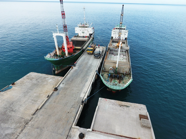
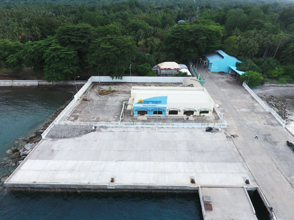
Description and Contacts of Key Companies
PPA PMO CAGAYAN de ORO
ISIDRO V. BUTASLAC, Jr., Port Manager
PMO Misamis Oriental / Cagayan De Oro
+63 88 856-9098 / 856-1264
Balbagon Arrastre, Stevedoring and Porterage Services (BASPS)
Lagundi St Joseph Street Poblacion, 9100 Mambajao - Mambajao, Camiguin – Philippines
+63 917 727 1305
For more information on port contacts, please see the following link: 4.3 Port and Waterways Companies Contact List.
Port Performance
The port only handles local vessels coming from nearby provinces.
|
SEASONAL CONSTRAINTS |
||
|---|---|---|
|
Occurs |
Time Frame |
|
|
Rainy Season |
Yes |
June to November |
|
Major Import Campaigns |
No |
N/A |
|
Other Comments |
Caters only to domestic vessels. |
|
|
HANDLING FIGURES for 2018 |
|
|---|---|
|
Vessel Calls |
618 |
|
Container Traffic (TEUs) |
None |
|
Handling Figures Bulk and Break Bulk for 2018 |
|
|---|---|
|
Bulk (MT) |
None |
|
Break bulk (MT) |
311,265 MT |
Discharge Rates and Terminal Handling Charges
Unified tariff for Camiguin Ports.
Berthing Specifications
|
Type of Berth |
Quantity |
Length (m) |
Maximum Draft (m) |
Comments |
|---|---|---|---|---|
|
Conventional Berth |
2 | 44 m | 6 m |
|
General Cargo Handling Berths
|
Cargo Type |
Berth Identification |
|---|---|
|
Imports - Bagged Cargo |
1 & 2 |
|
Exports - Bagged Cargo |
N/A |
|
Imports and Exports - RoRo |
N/A |
|
Other Imports |
N/A |
Port Handling Equipment
General and rolling cargoes are handled by Balbagon Arrastre. There are no handling equipment in the port.
|
Equipment |
Available |
Total Quantity and Capacity Available |
Comments on Current Condition and Actual Usage |
|---|---|---|---|
|
Dockside Crane |
No |
||
|
Container Gantries |
No |
||
|
Mobile Cranes |
No |
||
|
Reachstacker |
No |
||
|
RoRo Tugmaster (w/ Trailer) |
No |
||
|
Grain Elevator w/ Bagging Machines |
No |
||
|
Transtainer |
No |
||
|
Forklifts |
No |
Container Facilities
There are no container facilities in Balbagon Port.
Customs Guidance
There are no customs facilities as this port only handles domestic traffic. Customs documents must be filed and cleared at BOC Cagayan de Oro.
Contact:
Atty. Elvira Cruz, District Collector
Port of Cagayan De Oro
+63 88 856-9406
For more information on customs in the Philippines, please see the following link: 1.3 Customs Information.
Terminal Information
Multipurpose Terminal
There is a passenger terminal and a small warehouse.
Grain and Bulk Handling
There are no grain and bulk handling facilities in Balbagon Port.
Main Storage Terminal
There is no storage terminal in Balbagon Port.
Stevedoring
Stevedoring only to assist vessel on board crane from setting the cargoes to be offloaded to trucks.
Hinterland Information
Owner of the cargoes must provide provide its own trucks.
Port Security
Local security is assisted by the local government police.
|
Security |
|
|---|---|
|
ISPS Compliant |
No |
|
Current ISPS
Level |
N/A |
|
Police Boats |
Coast Guard |
|
Fire Engines |
Yes, supported by Camiguin Provincial Government |
2.1.3.14 Philippines - Mindanao Port of Benoni
Port Overview
The Port of Benoni is located in the southern part of the Municipality of Mahinog, Camiguin. This port will be the destination of vessels coming from the Port of Balingoan. Only domestic vessels and small cargo ships with rolling cargoes dock on this port.
Port website: https://ppapmocdo.wordpress.com/port-profile/tmo-camiguin/portofbenoni/
Key port information can also be found at: http://www.maritime-database.com
|
Port Location and Contact |
|
|---|---|
|
Country |
Philippines |
|
Province or District |
Camiguin Province |
|
Nearest Town or City with Distance from Port |
Mahinog (0 km) Cagayan De Oro (85 km, multi-modal travel) |
|
Port's Complete Name |
Port of Benoni |
|
Latitude |
9.139558 |
|
Longitude |
124.793906 |
|
Managing Company or Port Authority |
Philippine Ports Authority |
|
Management Contact Person |
Isidro V. Butaslac Jr., Port Manager PMO Misamis Oriental / Cagayan De Oro +63 88 856-9098 / 856-1264 |
|
Nearest Airport and Airlines with Frequent International Arrivals/Departures |
Laguindingan Airport Philippine Airlines, Cebu Pacific, Air Asia |
Port Picture

Description and Contacts of Key Companies
Cargo handling operations is being handled by the Balbagon Arrastre, Stevedoring and Porterage Services (BASPS).
Contact:
Lagundi St Joseph Street Poblacion
9100 Mambajao, Camiguin, Philippines
+63 917 727 1305
For more information on port contacts, please see the following link: 4.3 Port and Waterways Companies Contact List.
Port Performance
|
SEASONAL CONSTRAINTS |
||
|---|---|---|
|
Occurs |
Time Frame |
|
|
Rainy Season |
Yes |
From June to November |
|
Major Import Campaigns |
No |
N/A |
|
Other Comments |
N/A |
|
|
HANDLING FIGURES for 2020 |
|
|---|---|
|
Vessel Calls |
1552 |
|
Container Traffic (TEUs) |
None |
|
Handling Figures Bulk and Break Bulk for 2020 |
|
|---|---|
|
Bulk (MT) |
None |
|
Break bulk (MT) |
487 MT |
Discharge Rates and Terminal Handling Charges
Unified Camiguin CH Tariff Rates.
Berthing Specifications
|
Type of Berth |
Quantity |
Length (m) |
Maximum Draft (m) |
Comments |
|---|---|---|---|---|
|
Conventional Berth |
3 | 137 m | 6 m |
|
|
Container Berth |
0 |
|
||
|
Silo Berth |
0 |
|
||
|
Berthing Tugs |
0 |
|
||
|
Water Barges |
0 |
|
General Cargo Handling Berths
|
Cargo Type |
Berth Identification |
|---|---|
|
Imports - Bagged Cargo |
1 |
|
Exports - Bagged Cargo |
None |
|
Imports and Exports - RoRo |
None |
|
Other Imports |
None |
Port Handling Equipment
There is no port handling equipment in the Port of Benoni. Cargo is handled manually.
Container Facilities
There are no container handling facilities at the Port of Benoni.
Customs Guidance
Customs documents must be filed and cleared at BOC Cagayan de Oro.
Contact:
Atty. Elvira Cruz, District Collector
Port of Cagayan De Oro
+63 88 856-9406
For more information on customs in the Philippines, please see the following link: 1.3 Customs Information.
Terminal Information
Multipurpose Terminal
There is a passenger terminal and terminal office building.
Grain and Bulk Handling
There is no grain and bulk handling facilities in the Port of Benoni.
Main Storage Terminal
There is no storage terminal in the Port of Benoni.
Stevedoring
Stevedores will assist with the setting of cargoes for offloading directly to truck via the crane mounted on the ship.
Hinterland Information
Cargo owners are responsible for providing trucks.
Port Security
Contracted local guard with the assistance of local police during peak travel season.
2.1.3.15 Philippines - Mindanao Port of Guinsiliban
Port Overview
The Port of Guinsiliban is located at the eastern part of the Municipality of Guinsiliban, Camiguin Province. It serves vessel coming from Port of Balingoan.
Port website: https://ppapmocdo.wordpress.com/port-profile/tmo-camiguin/portofguinsiliban/
Key port information can also be found at: http://www.maritime-database.com
|
Port Location and Contact |
|
|---|---|
|
Country |
Philippines |
|
Province or District |
Camiguin |
|
Nearest Town or City with Distance from Port |
Guinsiliban (0 km) Cagayan De Oro (85 km by land / 1 hr by Roro) |
|
Port's Complete Name |
Port of Guinsiliban |
|
Latitude |
9.0986111 |
|
Longitude |
124.7877778 |
|
Managing Company or Port Authority |
Philippine Ports Authority |
|
Management Contact Person |
Isidro V. Butaslac Jr, Port Manager PMO Misamis Oriental / Cagayan De Oro +63 88 856-9098 / 856-1264 |
|
Nearest Airport and Airlines with Frequent International Arrivals/Departures |
Laguindingan Airport Philippine Airlines, Cebu Pacific, Air Asia |
Port Picture
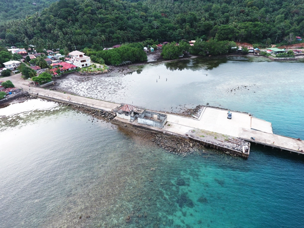
Description and Contacts of Key Companies
There are no port handlers at the Guinsiliban Port as only passenger vessels use this port.
For more information on port contacts, please see the following link: 4.4 Port and Waterways Companies Contact List.
Port Performance
|
SEASONAL CONSTRAINTS |
||
|---|---|---|
|
Occurs |
Time Frame |
|
|
Rainy Season |
Yes |
From June to November |
|
Major Import Campaigns |
No |
N/A |
|
Other Comments |
N/A |
|
|
HANDLING FIGURES for 2020 |
|
|---|---|
|
Vessel Calls |
N/A |
|
Container Traffic (TEUs) |
N/A |
|
Handling Figures Bulk and Break Bulk for 2020 |
|
|---|---|
|
Bulk (MT) |
None |
|
Break bulk (MT) |
None |
Discharge Rates and Terminal Handling Charges
There is no port handling operation at this port. Passengers individually take good care of their cargoes.
Berthing Specifications
|
Type of Berth |
Quantity |
Length (m) |
Maximum Draft (m) |
Comments |
|---|---|---|---|---|
|
Conventional Berth |
1 | 5 m | 6 m |
|
|
Container Berth |
0 |
|
||
|
Silo Berth |
0 |
|
||
|
Berthing Tugs |
0 |
|
||
|
Water Barges |
0 |
|
General Cargo Handling Berths
|
Cargo Type |
Berth Identification |
|---|---|
|
Imports - Bagged Cargo |
N/A |
|
Exports - Bagged Cargo |
N/A |
|
Imports and Exports - RoRo |
N/A |
|
Other Imports |
N/A |
Port Handling Equipment
There are no port handling equipment in the Port of Benoni.
Container Facilities
There are no container facilities at the Port of Benoni.
Customs Guidance
The Port of Guinsiliban only serves domestic passenger traffic, customs is not needed.
For more information on customs in the Philippines, please see the following link: 1.3 Customs Information.
Terminal Information
Multipurpose Terminal
None
Grain and Bulk Handling
None
Main Storage Terminal
None
Stevedoring
None
Hinterland Information
Passengers individually take good care of their cargoes.
Port Security
None
2.1.3.16 Philippines - Mindanao Port of Jimenez
Port Overview
Jimenez is a third class municipality located at Barangay Taboo, Jimenez, Misamis Occidental. The Port of Jimenez exclusively caters to petroleum products of Filipinas Shell, Chevron Philippines, and Petron whose depots are situated nearby. It also serves the incoming copra of Third Millennium Oil Mills Inc. (TMOMI) when its private port is occupied. Its sole use is for transport of copra products such as coconut oil, copra pellets and copra cakes.
For Humanitarian Use
Small sea craft can carry humanitarian cargoes and dock at the port. This port can be use if Ozamis main port will be not operational. Port has no RORO ramp.
- Anchorage depth:22.9m
- Cargo Pier depth:12.2m
- Harbor size: very small
- Harbor type: Coastal Natural
- Pier Max Size: 500 ft in length
Port website: https://maritimereview.ph/tag/port-of-jimenez/
Key port information can also be found at: http://www.maritime-database.com
|
Port Location and Contact |
|
|---|---|
|
Country |
Philippines |
|
Province or District |
Misamis Occidental, Region X |
|
Nearest Town or City with Distance from Port |
Ozamis City (24 km) |
|
Port's Complete Name |
Port of Jimenez |
|
Latitude |
8.3333333 |
|
Longitude |
123.866667 |
|
Managing Company or Port Authority |
Philippine Ports Authority PMO Misamis Occidental |
|
Management Contact Person |
Subanrio I. Lim, Acting Port Manager PMO Misamis Occidental / Ozamiz +63 88 521-0238 / 521-1538 |
|
Nearest Airport and Airlines with Frequent International Arrivals/Departures |
Labo/Ozamis Airport Domestic only: Philippine Airlines, Cebu Pacific |
Port Picture
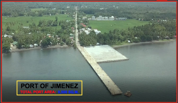
Description and Contacts of Key Companies
For more information on port contacts, please see the following link: 4.4 Port and Waterways Companies Contact List.
Port Performance
The Port of Jimenez exclusively caters to petroleum products of Filipinas Shell, Chevron Philippines, and Petron whose depots are situated nearby. Ships will at anchorage near the port and moored then connect to the pipes to unload their products and stored at the nearby depot.
https://maritimereview.ph/tag/port-of-jimenez/
Berthing Specifications
|
Type of Berth |
Quantity |
Length (m) |
Maximum Draft (m) |
Comments |
|---|---|---|---|---|
|
Conventional Berth |
2 | 95 m | 7m |
|
|
Container Berth |
N/A |
|
||
|
Silo Berth |
N/A |
|
||
|
Berthing Tugs |
N/A |
|
||
|
Water Barges |
N/A |
|
General Cargo Handling Berths
|
Cargo Type |
Berth Identification |
|---|---|
|
Imports - Bagged Cargo |
1 and 2 |
|
Exports - Bagged Cargo |
N/A |
|
Imports and Exports - RoRo |
N/A |
|
Other Imports |
N/A |
Port Handling Equipment
N/A
Container Facilities
N/A
Customs Guidance
Custom documents must file and cleared at BOC Ozamis City Sub-Port.
Contact:
Ernie E. Lacpao, OIC Sub-Port Collector
Sub-Port of Ozamis
+63 88 856-9406
For more information on customs in the Philippines, please see the following link: 1.3 Customs Information.
Terminal Information
Multipurpose Terminal
N/A
Grain and Bulk Handling
N/A
Main Storage Terminal
N/A
Stevedoring
N/A
Hinterland Information
N/A
Port Security
Locally-hired security guards.
|
Security |
|
|---|---|
|
ISPS Compliant |
No |
|
Current ISPS
Level |
N/A |
|
Police Boats |
Coast Guard Ozamis |
|
Fire Engines |
Yes, provided by the local government |
2.1.3.17 Philippines - Mindanao Port of Mindanao Container Terminal
Port Overview
This port caters foreign containerized vessels only. Foreign flag vessels will have to dock on this port and offload their containers. Located just outside Cagayan de Oro, this port helps to decongest vessel traffic arrivals at Cagayan de Oro Port.
Port website: https://www.ictsi.com/what-we-do/our-terminals/mindanao-international-container-terminal-services-inc
Key port information can also be found at: http://www.maritime-database.com
|
Port Location and Contact |
|
|---|---|
|
Country |
Philippines |
|
Province or District |
Region X |
|
Nearest Town or City with Distance from Port |
Cagayan De Oro (20 km) |
|
Port's Complete Name |
Mindanao Container Terminal |
|
Latitude |
8.5233025 |
|
Longitude |
124.7490825 |
|
Managing Company or Port Authority |
Integrated Container Terminal Services Inc (ICTSI) |
|
Management Contact Person |
Mindanao International Container Terminal Services Inc. (MICTSI) Phividec Industrial Estate, Tagoloan 9001 Misamis Oriental, Philippines +63 917 717 6693 (Operations) |
|
Nearest Airport and Airlines with Frequent International Arrivals/Departures |
Laguindingan Airport Philippine Airlines, Cebu Pacific, Air Asia |
Port Picture
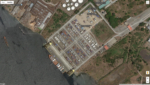
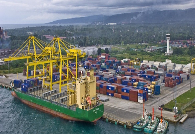
Description and Contacts of Key Companies
ICTSI manages the entire operations of the Port.
For more information on port contacts, please see the following link: 4.3 Port and Waterways Companies Contact List.
Port Performance
Mindanao Container Port has a draft depth of 13 m. Vessel size should be consider as the berthing length of the port is 300 m. The port is not heavily congested as it mainly served containerized cargoes which is much easier to handle than LCL cargoes. Vessel traffic on this port is not that tight as foreign vessel arrivals is on intervals schedule.
https://cdnweb.ictsi.com/s3fs-public/2019-04/stc_mictsi_new.pdf
|
SEASONAL CONSTRAINTS |
||
|---|---|---|
|
Occurs |
Time Frame |
|
|
Rainy Season |
No |
June to November |
|
Major Import Campaigns |
N/A |
|
|
Other Comments |
Port operations continue as containers are water tight. |
|
|
Handling Figures for 2018 |
|
|---|---|
|
Vessel Calls |
499 |
|
Container Traffic (TEUs) |
229,633 TEUs |
http://nro10.neda.gov.ph/rdr-2018/
|
Handling Figures Bulk and Break Bulk for 2018 |
|
|---|---|
|
Bulk (MT) |
None |
|
Break bulk (MT) |
None |
http://nro10.neda.gov.ph/rdr-2018/
Discharge Rates and Terminal Handling Charges
No breakbulk rates as port only handles containerized cargoes.
Berthing Specifications
|
Type of Berth |
Quantity |
Length (m) |
Maximum Draft (m) |
Comments |
|---|---|---|---|---|
|
Conventional Berth |
None |
|
||
|
Container Berth |
2 | 300 m | 13 m |
|
|
Silo Berth |
None |
|
||
|
Berthing Tugs |
Pilotage |
|||
|
Water Barges |
Water Hydrant |
General Cargo Handling Berths
|
Cargo Type |
Berth Identification |
|---|---|
|
Imports - Bagged Cargo |
None |
|
Exports - Bagged Cargo |
None |
|
Imports and Exports - RoRo |
None |
|
Other Imports |
Containerized |
Port Handling Equipment
|
Equipment |
Available |
Total Quantity and Capacity Available |
Comments on Current Condition and Actual Usage |
|---|---|---|---|
|
Dockside Crane |
Yes |
2 | |
|
Container Gantries |
Yes |
1 | |
|
Mobile Cranes |
No |
||
|
Reachstacker |
Yes |
||
|
RoRo Tugmaster (w/ Trailer) |
No |
||
|
Grain Elevator w/ Bagging Machines |
No |
||
|
Transtainer |
No |
||
|
Forklifts |
Yes |
Container Facilities
For more information please see the following link: https://www.ictsi.com/what-we-do/our-terminals/mindanao-international-container-terminal-services-inc
|
Facilities |
20 and 40 ft |
|---|---|
|
Container Facilities Available |
|
|
Container Freight Station (CFS) |
11,000 m2 over all |
|
Refrigerated Container Stations |
Yes, 262 |
|
Other Capacity Details |
|
|
Daily Take Off Capacity |
|
|
Number of Reefer Stations |
262 |
|
Emergency Take-off Capacity |
|
|
Off take Capacity of
Gang Shift |
Customs Guidance
Customs clearance is done in Cagayan De Oro.
Contact:
John M. Simon, Acting Sub-Port Collector
Mindanao Container Terminal
+63 88 742642
For more information on customs in the Philippines, please see the following link: 1.3 Customs Information.
Terminal Information
Multipurpose Terminal
Port has no multi-purpose terminal as it only serves containerized cargoes.
Grain and Bulk Handling
No grain bulk handler, containers only.
Main Storage Terminal
The Port only has a 11,000 m2 container yard.
|
Storage Type |
Number of Storage Facilities |
Area (m2) |
|---|---|---|
|
Bagged Cargo |
None | |
|
Refrigerated Cargo |
None | |
|
General Cargo |
None |
Stevedoring
None, the port only handles containers.
Hinterland Information
Shipping lines has a pool of contracted truckers to move their containers from the port and bring them to their own container yards.
Port Security
The port has security personnel stationed at 8 different strategic areas inside the port.
|
Security |
|
|---|---|
|
ISPS Compliant |
Yes |
|
Current ISPS
Level |
Level 1 |
|
Police Boats |
Yes, provided by the Coast Guard |
|
Fire Engines |
Yes , provided by the local government |
2.1.3.18 Philippines - Mindanao Port of Plaridel
Port Overview
The Port of Plaridel is located at Barangay Looc, Ozamis City. It provides passenger and cargo services to and from: Cebu City, Tagbilaran City and Larena, Siquijor. A fish port also exists at Southern Looc adjacent to the Port of Plaridel intended for landing of commercial and local fishing boats.
Port website: https://maritimereview.ph/tag/port-of-plaridel/
Key port information can also be found at: http://www.maritime-database.com
|
Port Location and Contact |
|
|---|---|
|
Country |
Philippines |
|
Province or District |
Misamis Occidental |
|
Nearest Town or City with Distance from Port |
Ozamis City (67 km) |
|
Port's Complete Name |
Port of Plaridel |
|
Latitude |
8.606262 |
|
Longitude |
123.727550 |
|
Managing Company or Port Authority |
PPA PMO Misamis Occidental / Ozamis |
|
Management Contact Person |
Subanrio I. Lim , Acting Port Manager PMO Misamis Occidental / Ozamiz +63 88 521-0238 / 521-1538 |
|
Nearest Airport and Airlines with Frequent International Arrivals/Departures |
Ozamiz Airport Domestic only - Philippine Airlines, Air Asia, Cebu Pacific |
Port Picture

Description and Contacts of Key Companies
Lite Ferries Corporation
1022 Mj Cuenco, Cebu City, 6000 Cebu
+639778225483 / +639989995483
+639253475483 / +63 32 255-1721
Ocean Jet
Pier 1, CPA Bldg., Cebu City
Cebu Philippines
+63(32)255-7560, Sun: 0922-857-5500
Globe: 0917-638-0000
For more information on port contacts, please see the following link: 4.3 Port and Waterways Companies Contact List.
Port Performance
The port only services passenger fast craft vessel coming from Cebu City, Tagbilaran City, and Siquijor. RORO vessels with small capacities are also docked on this port. The port has limited cargo handling capacity. Passenger traders usually take care of their own cargoes.
|
SEASONAL CONSTRAINTS |
||
|---|---|---|
|
Occurs |
Time Frame |
|
|
Rainy Season |
Yes |
From June to December |
|
Major Import Campaigns |
No |
|
|
Other Comments |
|
|
|
HANDLING FIGURES for 2020 |
|
|---|---|
|
Vessel Calls |
153 |
|
Container Traffic (TEUs) |
None |
|
Handling Figures Bulk and Break Bulk for 2020 |
|
|---|---|
|
Bulk (MT) |
None |
|
Break bulk (MT) |
46,919 MT |
Discharge Rates and Terminal Handling Charges
For information on port rates and charges, please see the following link: Unified Tariff from Ozamis Base Port.
Berthing Specifications
|
Type of Berth |
Quantity |
Length (m) |
Maximum Draft (m) |
Comments |
|---|---|---|---|---|
|
Conventional Berth |
3 | 80 m | 5 m |
|
|
Container Berth |
N/A |
|
||
|
Silo Berth |
N/A |
|
||
|
Berthing Tugs |
N/A |
|
||
|
Water Barges |
N/A |
|
General Cargo Handling Berths
|
Cargo Type |
Berth Identification |
|---|---|
|
Imports - Bagged Cargo |
Berth 1 |
|
Exports - Bagged Cargo |
N/A |
|
Imports and Exports - RoRo |
N/A |
|
Other Imports |
N/A |
Port Handling Equipment
There are no handling equipment as traffic is mostly passengers and rolling cargo.
Container Facilities
There are no container facilities in the port.
Customs Guidance
Customs documents must file and cleared at BOC Ozamis Sub-Port.
Contact:
Ernie E. Lacpao, OIC Sub-Port Collector
Sub-Port of Ozamis
+63 88 856-9406
For more information on customs in the Philippines, please see the following link: 1.3 Customs Information.
Terminal Information
Multipurpose Terminal
The port only has a passenger terminal.
Grain and Bulk Handling
N/A
Main Storage Terminal
The port has an open storage space of 720 m2.
Stevedoring
Stevedoring is handled by the Misamis Occidental (Plaridel) Integrated Arrastre and Stevedoring Services Inc.
Hinterland Information
- For rolling cargoes on board a RORO vessel will exit the port after cargo clearance from PPA.
- Passenger cargoes will be facilitated by porterage services.
Port Security
The port has locally-hired guards.
|
Security |
|
|---|---|
|
ISPS Compliant |
No |
|
Current ISPS
Level |
N/A |
|
Police Boats |
Yes, provided by the Coast Guard. |
|
Fire Engines |
Yes, provided by the local government. |
2.1.3.19 Philippines - Mindanao Port of Tubod
Port Overview
The Port of Tubod is a terminal port supervised by the Terminal Management Office of Tubod under the administrative area of jurisdiction of the Port Management Office Iligan. It is about 69 kilometers from Iligan City and about 12 nautical miles from the Port of Ozamiz across Panguil Bay.
Boats from Tamula Shipping used to ferry cargoes and passengers from the Port of Tubod to the Port of Ozamiz and vice versa. In early 1980’s Millennium Shipping Co. operated RoRo barges that ferried vehicles and passengers from the Port of Tubod to the Port of Silanga in Tangub City (about 20 kms. from Ozamiz City) and vice versa. The ferry services of Tamula Shipping and Millennium Shipping Co., however, halted in the late 1996 because of the introduction of more modern, more convenient and faster RoRo ferry services by Daima Shipping Corporation which operated its own private port and ferry services in Mukas, Municipality of Kolambugan, Province of Lanao del Norte, about 15 kms. from Tubod, and nearer to Iligan City.
At present, the Port of Tubod caters to passengers carried by outriggers or small watercraft coming from parts of Lanao del Norte to Tangub City and vice versa.
Port Facilities:
Total Port Area : 17,840 m2
R.C. Pier : 125 meters x 9 meters
RoRo Ramp : 11.0 meters x 6.0 meters
Open Storage/Back-up Area : 4,500 m2
Passenger Terminals : 120 m2
Port website: https://www.skyscrapercity.com/threads/lanao-del-norte-ports-and-shipping.1713832/
Key port information can also be found at: http://www.maritime-database.com
|
Port Location and Contact |
|
|---|---|
|
Country |
Philippines |
|
Province or District |
Lanao Del Norte |
|
Nearest Town or City with Distance from Port |
Iligan (68 km) |
|
Port's Complete Name |
TMO Port of Tubod |
|
Latitude |
8.0555556 |
|
Longitude |
123.7875 |
|
Managing Company or Port Authority |
PPA PMO Lanao del Norte/Iligan |
|
Management Contact Person |
Omar A. Sabdani, Acting Manager Terminal Management Office of Tubod Medardo I. Sosobrado, Jr., Acting Port Manager PMO Lanao Del Norte / Iligan +63 63 223-1346 / 223-9124 |
|
Nearest Airport and Airlines with Frequent International Arrivals/Departures |
Laguindingan Airport Philippine Airlines / Cebu Pacific / AirAsia |
Port Picture
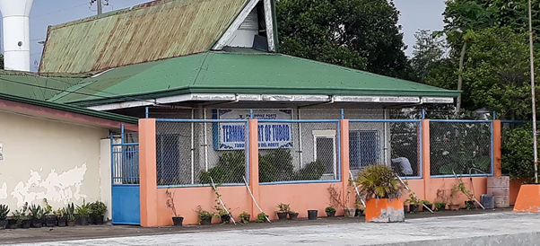
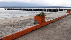
Description and Contacts of Key Companies
PORT SERVICES: Cargo Handling Operator
The authorized Cargo Handling Operator Tubod Arrastre Services, Inc.
Address : Port Area, Tubod, Lanao del Norte, Philippines
Telephone No : (063) 341-5292
https://www.skyscrapercity.com/threads/lanao-del-norte-ports-and-shipping.1713832/
For more information on port contacts, please see the following link: 4.3 Port and Waterways Companies Contact List.
Port Performance
|
SEASONAL CONSTRAINTS |
||
|---|---|---|
|
Occurs |
Time Frame |
|
|
Rainy Season |
Yes |
From June to December |
|
Major Import Campaigns |
No |
N/A |
|
Other Comments |
N/A |
|
|
HANDLING FIGURES for 2020 |
|
|---|---|
|
Vessel Calls |
6 |
|
Container Traffic (TEUs) |
None |
|
Handling Figures Bulk and Break Bulk for 2020 |
|
|---|---|
|
Bulk (MT) |
9,947 MT |
|
Break bulk (MT) |
None |
https://www.ppa.com.ph/annual-statistical-report-by-year-vol-2
Discharge Rates and Terminal Handling Charges
Please see the following link: Port of Iligan Cargo Handling Tariff Rates (Domestic and International)
Berthing Specifications
|
Type of Berth |
Quantity |
Length (m) |
Maximum Draft (m) |
Comments |
|---|---|---|---|---|
|
Conventional Berth |
2 | 125 m | 6 m |
With Roro ramp |
|
Container Berth |
None |
|
||
|
Silo Berth |
None |
|
||
|
Berthing Tugs |
None |
|
||
|
Water Barges |
None |
|
General Cargo Handling Berths
|
Cargo Type |
Berth Identification |
|---|---|
|
Imports - Bagged Cargo |
1 |
|
Exports - Bagged Cargo |
N/A |
|
Imports and Exports - RoRo |
N/A |
|
Other Imports |
N/A |
Port Handling Equipment
There is no port handling equipment in the Port, cargoes are loaded/ offloaded with manual labour.
Container Facilities
N/A
Customs Guidance
Custom documents to be filed and cleared at BOC Sub-Port of Iligan.
Contact:
Nasrudin D. Guro, Sub-Port Collector, Sub-Port of Iligan
(063) 221-6066
For more information on customs in the Philippines, please see the following link: 1.3 Customs Information.
Terminal Information
Multipurpose Terminal
N/A
Grain and Bulk Handling
N/A
Main Storage Terminal
There is an open area of 4,500 m2 which serves as the main storage terminal.
Stevedoring
Tubod Arrastre Services, Inc.
Address : Port Area, Tubod, Lanao del Norte, Philippines
Telephone No : (063) 341-5292
Hinterland Information
Rolling cargoes will exit upon clearance from PPA. Passenger cargo will be managed by porterage port services.
Port Security
The port has locally-hired security guards.
|
Security |
|
|---|---|
|
ISPS Compliant |
No |
|
Current ISPS
Level |
N/A |
|
Police Boats |
Provided by the Coast Guard |
|
Fire Engines |
Provided by Tubod Municipality |
2.1.3.20 Philippines - Mindanao Port of Balingoan
Port Overview
The Port of Balingoan is located at Barangay Buak-Buak, Baligoan, Misamis Oriental. This port mainly caters to passenger and vehicles going to Camiguin Island. RORO and small sea craft operates on this port, which is vital for the travel linkage to Camiguin and Bohol.
Port website: https://ppapmocdo.wordpress.com/port-profile/tmo-of-balingoan/
Key port information can also be found at: http://www.maritime-database.com
|
Port Location and Contact |
|
|---|---|
|
Country |
Philippines |
|
Province or District |
Misamis Oriental |
|
Nearest Town or City with Distance from Port |
Cagayan De Oro (84 km) |
|
Port's Complete Name |
TMO Balingoan |
|
Latitude |
9.005605 |
|
Longitude |
124.846478 |
|
Managing Company or Port Authority |
Philippine Ports Authority PA PMO Misamis Oriental / Cagayan de Oro |
|
Management Contact Person |
Isidro V. Butaslac, Jr. Port Manager PMO Misamis Oriental / Cagayan De Oro +63 88 856-9098 / 856-1264 |
|
Nearest Airport and Airlines with Frequent International Arrivals/Departures |
Laguindingan Airport Philippine Airlines, Cebu Pacific, Air Asia |
Port Picture


Description and Contacts of Key Companies
Prudential Customs Brokerage Services, Inc. (PCBSI) manages port handling and manpower services.
- Port of Balingoan, Balingoan, Misamis Oriental
- Prudential Custom Brokerage Services, Inc (PCBSI) Dapitan
Branch
- Port Of Dapitan, Dapitan City 7101 Zamboanga del Norte Philippines (+63 65 302 0772)
- Main Office
- 7603 Dela Rosa Centre, Dela Rosa Street, Makati, Metro Manila, Philippines (+63 2 812 6085 )
For more information on port contacts, please see the following link: 4.3 Port and Waterways Companies Contact List.
Port Performance
The Port of Balingoan has no major cargo movements. This port only cater mostly passenger and their hand carried luggage. There is a RORO that serves for cargo truck that will directly board the ship and immediately depart upon arrival at Camiguin. This Port ceases operations during stormy weather and severe high wind at sea.
|
SEASONAL CONSTRAINTS |
||
|---|---|---|
|
Occurs |
Time Frame |
|
|
Rainy Season |
Yes |
From June to November |
|
Major Import Campaigns |
No |
N/A |
|
Other Comments |
Port only cater local cargoes and passengers |
|
|
HANDLING FIGURES for 2020 |
|
|---|---|
|
Vessel Calls |
2,129 |
|
Container Traffic (TEUs) |
None |
|
Handling Figures Bulk and Break Bulk for 2018 |
|
|---|---|
|
Bulk (MT) |
None |
|
Break bulk (MT) |
None |
https://www.ppa.com.ph/annual-statistical-report-by-year-vol-2
Discharge Rates and Terminal Handling Charges
Please see the foloowing link for Port of Balingoan tariff rates: Port of Balingoan (Domestic) CH Tariff
Berthing Specifications
|
Type of Berth |
Quantity |
Length (m) |
Maximum Draft (m) |
Comments |
|---|---|---|---|---|
|
Conventional Berth |
4 | 205 m | 6 m |
3 Roro ramps |
|
Container Berth |
None |
|
||
|
Silo Berth |
None |
|
||
|
Berthing Tugs |
None |
|
||
|
Water Barges |
None |
|
||
| Roro Berths | 4 |
|
|
|
General Cargo Handling Berths
|
Cargo Type |
Berth Identification |
|---|---|
|
Imports - Bagged Cargo |
1 |
|
Exports - Bagged Cargo |
None |
|
Imports and Exports - RoRo |
None |
|
Other Imports |
None |
Port Handling Equipment
Handling operators has no cargo equipment for loading. RORO vessel directly load the trucks while conventional vessel uses manpower for cargo handling, if any.
Container Facilities
No container facilities at this Port.
Customs Guidance
The port only serves domestic cargo and customs clearance is not needed. Customs documents should file and cleared at BOC Cagayan de Oro Port.
Contact:
Atty. Elvira Cruz, District Collector, Port of Cagayan De Oro
+63 88 856-9406
For more information on customs in the Philippines, please see the following link: 1.3 Customs Information.
Terminal Information
Multipurpose Terminal
The port only has a passenger terminal and an 2,000 m2 parking lot for trucks.
Grain and Bulk Handling
None
Main Storage Terminal
None
Stevedoring
Prudential Customs Brokerage Services, Inc. (PCBSI) handles the stevedoring services in the port.
Hinterland Information
Passengers are responsible for the handling of their cargoes as most cargo are rolling cargoes. Trucks and service vehicles will take RORO for transshipment to Camiguin Island.
Port Security
Security guards manage the port security with the help of local police during peak travel season.
|
Security |
|
|---|---|
|
ISPS Compliant |
No |
|
Current ISPS
Level |
N/A |
|
Police Boats |
Supported by the Coast Guard |
|
Fire Engines |
Supported by the Local Government |
2.1.3.21 Philippines - Mindanao Port of Davao (Sasa Wharf)
Port Overview
The Port of Davao is the gateway to southern Philippines, considered the most important port in Mindanao, as it is the busiest international container port serving both Visayas and Mindanao regions.
The Port of Davao has a natural coastal harbor. It has a small dry dock and a small harbor with over 500 ft in length. Nevertheless, its anchorage depth is between 21.6 m-22.9 m deep; its cargo pier depth is between 9.4m-10m; and it oil terminal depth is between 6.4 m-7.6 m, all perfect for large cargo carriers and tankers. It has a transit shed of 1,200 m2 and 360 m2 for passenger terminals and parking. Its container yard is 33,000 m2, with storage area of 20,000 m2, and a warehouse of 6,000 m2.
Port Website: https://www.ictsi.com/what-we-do/our-terminals/davao-integrated-port-and-stevedoring-services-corp.
Key port information can also be found at: http://www.maritime-database.com
|
Port Location and Contact |
|
|---|---|
|
Country |
Philippines |
|
Province or District |
Davao Del Sur |
|
Nearest Town or City with Distance from Port |
Davao City (0 km) |
|
Port's Complete Name |
Sasa Wharf, Port of Davao |
|
Latitude |
7.1270 |
|
Longitude |
125.6621 |
|
Managing Company or Port Authority |
Integrated Container Terminal Services Inc. / Philippine Port Authority |
|
Management Contact Person |
|
|
Nearest Airport and Airlines with Frequent International Arrivals/Departures |
Davao International Airport Philippine Airlines, Cebu Pacific, Silk Air, Air Asia |
Port Picture


Location map of Davao Port:
- Gatehouse complex
- Customs Office
- Motor pool
- Transit shed
- Old quay
- Administration Office
- Container yard 1
- Reefer racks
- Container yard 2
- Container yard 3
- New quay
Description and Contacts of Key Companies
Port of Davao (Sasa) is managed by PPA XI. Two (2) handling companies are operating in the port of Sasa. DIPSSCOR-ICTSI handles foreign vessel while Filipinas Port handles domestic vessels.
| Company | Contact Person | Address | Email Address / Website | Phone Number |
|---|---|---|---|---|
| Davao Integrated Port and Stevedoring Services Corp. (DIPSSCOR) | International Port of Davao, Km 10, Port Area Sasa Wharf, Davao City | jdomingo@ictsi.com |
+63822344470, +63 0822347618 Fax: +63 0822331642 |
|
| Filipinas Port Services Inc. (FILPORT) | Km. 10, Port Area, Sasa, Davao City, | https://filport.com.ph/ | +63 822340109 | |
| Phil. Ports Authority Port District Office of Southern Mindanao Port of Davao | Analee Aguilar, Port Manager | Panabo City Rd., Buhangin, Davao City | +63 822352564 to 68. | |
| Bureau of Customs Davao | Sasa wharf, Port area, Sasa, Buhangin, Davao City | +63 822331258. |
For more information on port contacts, please see the following link: 4.3 Port and Waterways Companies Contact List.
Port Performance
The Sasa Port in Davao City serves as the main base port, catering to both domestic and foreign vessels and handling the bulk of cargo shipments in the region. The volume of cargo at the Sasa Port registered a decline based on data gathered from the period 2010-2013 by 2% for domestic cargo and -4% for foreign cargo. The downtrend is attributed mainly to the poor container handling facilities at Sasa Port and also due to the devastation brought about by Typhoon Pablo which affected the major cargo product, bananas. However, with the expected increase in the volume of cargo and vessels, the modernization of the Sasa Port through a Public Private Partnership is proposed. Currently Sasa Port is now managed by private company – DIPSSCOR, subsidiary of ICTSI.
|
SEASONAL CONSTRAINTS |
||
|---|---|---|
|
Occurs |
Time Frame |
|
|
Rainy Season |
No |
N/A |
|
Major Import Campaigns |
No |
N/A |
|
Other Comments |
N/A |
|
|
HANDLING FIGURES for 2019 |
|
|---|---|
|
Vessel Calls |
777 |
|
Container Traffic (TEUs) |
233,062 |
|
Handling Figures Bulk and Break Bulk for 2008 |
|
|---|---|
|
Bulk (MT) |
93,738 |
|
Break bulk (MT) |
134,031 |
Discharge Rates and Terminal Handling Charges
For information on port rates and charges, please see the following link: (https://www.ppa.com.ph/sites/default/files/citizen_charter_docs/ARTA-PMO_Davao.pdf)
Berthing Specifications
Currently there is no dedicated berths. Bulk vessels may berth at the container quay anytime & wait for cargo there.
|
Type of Berth |
Quantity |
Length (m) |
Maximum Draft (m) |
Comments |
|---|---|---|---|---|
|
Conventional Berth |
1 |
92 m |
|
Currently there is no dedicated berths. Bulk vessels may berth at the container quay anytime & wait for cargo there. |
|
Container Berth |
N/A |
|
|
|
|
Silo Berth |
N/A |
|
|
|
|
Berthing Tugs |
N/A |
|
|
|
|
Water Barges |
N/A |
|
|
|
Port Handling Equipment
Port equipment is currently managed a private company, ICTSI / DIPSSCOR.
|
Equipment |
Available |
Total Quantity and Capacity Available |
Comments on Current Condition and Actual Usage |
|---|---|---|---|
|
Dockside Crane |
Yes |
Unit acquired after ICTSI operated the port. | |
|
Container Gantries |
Yes |
Unit acquired after ICTSI operated the port. | |
|
Mobile Cranes |
Yes |
Operational | |
|
Reachstacker |
Yes |
Operational | |
|
RoRo Tugmaster (w/ Trailer) |
Yes |
Operational | |
|
Grain Elevator w/ Bagging Machines |
N/A |
||
|
Transtainer |
N/A |
||
|
Forklifts |
Yes |
Operational |
Container Facilities
|
Facilities |
20 and 40 ft |
|---|---|
|
Container Facilities Available |
Yes |
|
Container Freight Station (CFS) |
Yes |
|
Refrigerated Container Stations |
Yes |
|
Other Capacity Details |
N/A |
|
Daily Take Off Capacity |
N/A |
|
Number of Reefer Stations |
288 reefer plugs |
|
Emergency Take-off Capacity |
N/A |
|
Off take Capacity of
Gang Shift |
N/A |
Customs Guidance
Procedures for incoming humanitarian cargo:http://customs.gov.ph/wp-content/uploads/2014/08/Guidelines-and-Procedures-on-International-Donations.pdf
For more information on customs in the Philippines, please see the following link: 1.3 Customs Information.
Terminal Information
Operational areas consist of a container storage yard with 41,490 m2, an open storage yard with 19,737 m2 and other storage areas with 6,250 m2. The total length of the current berth is 1,093 m. PPA has also leased a reefer yard facility to DIPSSCOR. The reefer yard is about 2,000 m2, and is currently fitted with 288 reefer plugs installed in four level racks.
Multipurpose Terminal
N/A
Grain and Bulk Handling
For info on bulk & breakbulk handling figures, please follow this link & under table 6.7-1: https://openjicareport.jica.go.jp/pdf/12022869_03.pdf
Stevedoring
Port of Davao is operated by private company DIPSSCOR, subsidiary of ICTSI.
Hinterland Information
Cargoes – general & containerized – are moved out by trucks, trailer trucks by different trucking companies. Some cargoes are delivered directly to the consignees while others are transferred to container yards.
Port Security
Security is in place with perimeter fence & gates to control traffic.
|
Security |
|
|---|---|
|
ISPS Compliant |
Yes |
|
Current ISPS
Level |
Level 1 |
|
Police Boats |
Yes |
|
Fire Engines |
Yes |
2.1.3.22 Philippines - Mindanao TEFASCO Port
Port Overview
The Terminal Facilities and Services Corporation (TEFASCO) Port is a private commercial & common user port strategically located in Barangay Ilang, Davao City's north side, a 30-minute drive from the downtown area. TEFASCO started operations in November 1977 in augmentation to the City Government’s port in Sasa which was experiencing berth congestion at the time when export of lumber and other agricultural products were at its peak. TEFASCO is operating 24/7, observing only three holidays (New Year, Good Friday & Christmas Day) in a year.
Port website: http://www.tefasco.net/
Key port information can also be found at: http://www.maritime-database.com
|
Port Location and Contact |
|
|---|---|
|
Country |
Philippines |
|
Province or District |
Davao Del Sur |
|
Nearest Town or City with Distance from Port |
Davao City (40 km) |
|
Port's Complete Name |
TEFASCO Port |
|
Latitude |
7.1020 |
|
Longitude |
125.3925 |
|
Managing Company or Port Authority |
Terminal Facilities and Services Corporation |
|
Management Contact Person |
|
|
Nearest Airport and Airlines with Frequent International Arrivals/Departures |
Davao International Airport Philippine Airlines, Cebu Pacific, Silk Air, Air Asia |
Port Picture
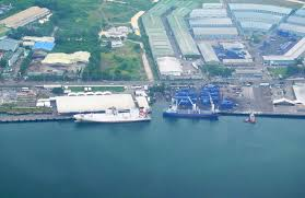
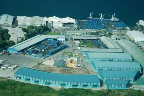
Description and Contacts of Key Companies
For more information on port contacts, please see the following link: 4.3 Port and Waterways Companies Contact List.
Port Performance
During the 2012 Typhoon Bopha response, WFP utilized the port facilities of TEFASCO for the breakbulk rice. Storage facilities of the company were contracted for the disaster response activities. The TEFASCO port facilities are complete and sufficient with supporting manpower complement. The necessary port equipment to handle breakbulk commodities are also present.
Discharge Rates and Terminal Handling Charges
For information on port rates and charges, please see the following link: (https://www.ppa.com.ph/sites/default/files/citizen_charter_docs/ARTA-PMO_Davao.pdf)
Berthing Specifications
|
Type of Berth |
Quantity |
Length (m) |
Maximum Draft (m) |
Comments |
|---|---|---|---|---|
|
Conventional Berth |
1 | 550 m | 10 m |
Can accommodate 4 to 5 vessels depending on the vessel’s length. |
|
Container Berth |
N/A |
|
||
|
Silo Berth |
N/A |
|
||
|
Berthing Tugs |
N/A |
|
||
|
Water Barges |
N/A |
|
General Cargo Handling Berths
|
Cargo Type |
Berth Identification |
|---|---|
|
Imports - Bagged Cargo |
No specific berth |
|
Exports - Bagged Cargo |
N/A |
|
Imports and Exports - RoRo |
N/A |
|
Other Imports |
N/A |
Port Handling Equipment
The TEFASCO port facilities are complete and sufficient with supporting staff. The necessary port equipment to handle breakbulk commodities are also present.
|
Equipment |
Available |
Total Quantity and Capacity Available |
Comments on Current Condition and Actual Usage |
|---|---|---|---|
|
Dockside Crane |
Yes |
Operational | |
|
Container Gantries |
Yes |
2 units, 60 ton capacity | Operational |
|
Mobile Cranes |
Yes |
1 unit, 130 ton capacity | Operational |
|
Reachstacker |
Yes |
4 units | Operational |
|
RoRo Tugmaster (w/ Trailer) |
Yes |
6 units | Operational |
|
Grain Elevator w/ Bagging Machines |
N/A |
||
|
Transtainer |
N/A |
||
|
Forklifts |
Yes |
15 units, 4-ton capacities | Operational |
Container Facilities
|
Facilities |
20 and 40 ft |
|---|---|
|
Container Facilities Available |
Yes |
|
Container Freight Station (CFS) |
Yes |
|
Refrigerated Container Stations |
Yes |
|
Other Capacity Details |
N/A |
|
Daily Take Off Capacity |
N/A |
|
Number of Reefer Stations |
N/A |
|
Emergency Take-off Capacity |
N/A |
|
Off take Capacity of
Gang Shift |
N/A |
Reference: http://www.tefasco.net/facilities.html
Customs Guidance
For more information on the entry of humanitarian donations, please see the following link: http://customs.gov.ph/wp-content/uploads/2014/08/Guidelines-and-Procedures-on-International-Donations.pdf
For more information on customs in the Philippines, please see the following link: 1.3 Customs Information.
Stevedoring
Based on WFP experience TEFASCO has the equipment & can provide the manpower to handle the operations.
Pls refer to this link: http://www.tefasco.net/facilities.html
Port Security
Security is good. Perimeter fence is in place with gates controlling the flow of cargoes, people & trucks.
|
Security |
|
|---|---|
|
ISPS Compliant |
|
|
Current ISPS
Level |
|
|
Police Boats |
No |
|
Fire Engines |
Yes |
2.1.3.23 Philippines - Mindanao Davao International Container Port
Port Overview
Davao International Container Terminal, Inc. (DICT) is a container port terminal in the Philippines. It is a joint venture between the Anflo Management and Investment Corporation (ANFLOCOR) and Dole-Stanfilco, the leading producers and exporters of fresh Cavendish bananas in the Philippines.
Formerly known as San Vicente Terminal and Brokerage Services, Inc. (SVT), DICT has a long history in port operations servicing the stevedoring and arrastre requirements of break bulk shipments of fresh produce like bananas and pineapples in TADECO wharf. DICT operates in an advanced port facility using the latest terminal operating system (TOS) that powers the efficient movement of incoming and outgoing containerized cargoes.
Port website: http://www.dict.com.ph/
Key port information can also be found at: http://www.maritime-database.com
|
Port Location and Contact |
|
|---|---|
|
Country |
Philippines |
|
Province or District |
Davao del Norte |
|
Nearest Town or City with Distance from Port |
Davao City (37 km) |
|
Port's Complete Name |
Davao International Container Terminal |
|
Latitude |
7.2968 |
|
Longitude |
125.7131 |
|
Managing Company or Port Authority |
Davao International Container Terminal, Inc. (DICT) |
|
Management Contact Person |
|
|
Nearest Airport and Airlines with Frequent International Arrivals/Departures |
Davao International Airport Philippine Airlines, Cebu Pacific, Silk Air, Air Asia |
Port Picture
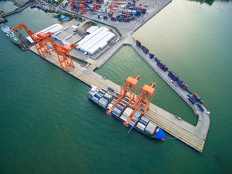
Description and Contacts of Key Companies
For more information on port contacts, please see the following link: 4.3 Port and Waterways Companies Contact List.
Port Performance
Various international shipping lines utilize the port facilities for the handling of its cargoes. Similarly, the discharge port of the last shipments of WFP (rice & RUSFs) were undertaken in the DICT port.
|
SEASONAL CONSTRAINTS |
||
|---|---|---|
|
Occurs |
Time Frame |
|
|
Rainy Season |
No |
|
|
Major Import Campaigns |
No |
|
|
Other Comments |
N/A | |
|
HANDLING FIGURES for 2015 |
|
|---|---|
|
Vessel Calls |
287 |
|
Container Traffic (TEUs) |
267,283 |
Discharge Rates and Terminal Handling Charges
For information on port rates and charges, please see the following link: (https://www.ppa.com.ph/sites/default/files/citizen_charter_docs/ARTA-PMO_Davao.pdf)
Berthing Specifications
|
Type of Berth |
Quantity |
Length (m) |
Maximum Draft (m) |
Comments |
|---|---|---|---|---|
|
Conventional Berth |
1 | 2 quays | 15 m |
This berth services breakbulk cargoes. |
|
Container Berth |
2 | 4 quays | 15 m |
These berths cater to container ships. |
|
Silo Berth |
N/A |
|
||
|
Berthing Tugs |
N/A |
|
||
|
Water Barges |
N/A |
|
Port Handling Equipment
Private port & equipment are managed also by DICT.
|
Equipment |
Available |
Total Quantity and Capacity Available |
Comments on Current Condition and Actual Usage |
|---|---|---|---|
|
Dockside Crane |
Yes |
Operational | |
|
Container Gantries |
Yes |
Operational | |
|
Mobile Cranes |
Yes |
Operational | |
|
Reachstacker |
Yes |
8 units | Operational |
|
RoRo Tugmaster (w/ Trailer) |
Yes |
Operational | |
|
Grain Elevator w/ Bagging Machines |
N/A |
||
|
Transtainer |
N/A |
||
|
Forklifts |
Yes |
Operational |
Container Facilities
|
Facilities |
20 and 40 ft |
|---|---|
|
Container Facilities Available |
Yes |
|
Container Freight Station (CFS) |
Yes |
|
Refrigerated Container Stations |
Yes |
|
Other Capacity Details |
N/A |
|
Daily Take Off Capacity |
N/A |
|
Number of Reefer Stations |
Yes |
|
Emergency Take-off Capacity |
N/A |
|
Off take Capacity of
Gang Shift |
N/A |
Customs Guidance
For more information on customs in the Philippines, please see the following link: 1.3 Customs Information.
2.1.3.24 Philippines - Mindanao Port of Malalag
Port Overview
The Malalag Port is along the south-west coastline of Malalag Bay, about 25 kilometres (16 mi) south of Digos and approximately 88 kilometres (55 mi) south of Davao City. It is more than 4 kilometres (2.5 mi) long and 1 kilometre (0.62 mi) wide. Port facilities include:
- 50m wharf
- One berth, 30m x 15m
- Controlling depth of 9m - 12m below MLLW
- Fendering system is of clustered timber files distributed equally alongside the wharf
- Tanks and pipelines for shipment of molasses
- Malalag Arrastre Porters and Stevedoring Multi-Purpose Coop (MAPOSTMUCO) are the cargo handling operators of general cargoes such as molasses, sugar, steel products, vehicle and heavy equipment.
Approach for Malalag Port is through the Malalag Bay. Ships can anchor at a depth of 21 fathoms free of hazardous underwater obstructions/currents and is notably sheltered from direct exposure to the open sea. Vessels entering the Malalag Port navigate through the south-west route of the Malalag Bay which is a tributary of the larger Davao Gulf waters.
|
Ships serving the Malalag Port |
|||
|
Vessel |
GRT |
LOA |
Route |
|
M/T Ocean Queen Nine |
1058 |
68.14 |
Manila-Malalag-Batangas |
|---|---|---|---|
|
M/T Alvin |
164.88 |
39 |
Manila-Malalag-Batangas |
|
M/V Grand Pacific III |
498.27 |
67.37 |
Davao-Malalag-Manila |
|
LCT Nicia |
483.25 |
68 |
Ormoc-Malalag-Davao |
|
LCT Jaime Ongpin |
497.54 |
61.4 |
Davao-Malalag-Iloilo |
|
LCT Filipino |
857.94 |
65.39 |
Iloilo-Malalag-Cebu |
This port was rehabilitated and completed last December 2019. The types of vessels that usually docks in this port are LCTs & M/T (tankers).
Key port information can also be found at: http://www.maritime-database.com
|
Port Location and Contact |
|
|---|---|
|
Country |
Philippines |
|
Province or District |
Malalag, Davao Del Sur |
|
Nearest Town or City with Distance from Port |
Digos City (25 km) |
|
Port's Complete Name |
Malalag Port |
|
Latitude |
6.5960 |
|
Longitude |
125.3990 |
|
Managing Company or Port Authority |
Philippine Ports Authority |
|
Management Contact Person |
|
|
Nearest Airport and Airlines with Frequent International Arrivals/Departures |
Davao International Airport Philippine Airlines, Cebu Pacific, Silk Air, Air Asia |
Port Picture
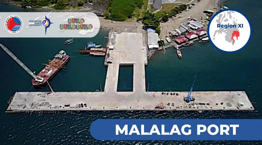
Description and Contacts of Key Companies
For more information on port contacts, please see the following link: 4.3 Port and Waterways Companies Contact List.
Port Performance
|
SEASONAL CONSTRAINTS |
||
|---|---|---|
|
Occurs |
Time Frame |
|
|
Rainy Season |
No |
N/A |
|
Major Import Campaigns |
No |
N/A |
|
Other Comments |
|
|
Discharge Rates and Terminal Handling Charges
For information on port rates and charges, please see the following link: (https://www.ppa.com.ph/sites/default/files/citizen_charter_docs/ARTA-PMO_Davao.pdf)
Port Handling Equipment
Malalag Arrastre Porters and Stevedoring Multi-Purpose Coop (MAPOSTMUCO) are the cargo handling operators of general cargoes.
Customs Guidance
For more information on customs in the Philippines, please see the following link: 1.3 Customs Information.
2.1.3.25 Philippines - Mindanao Port of Mati
Port Overview
Port of Mati is a terminal port of PMO-Davao, located at Mati, Davao Oriental in Pujada Bay. It has 80 m long concrete wharf with water depth of 6.5 m and open storage area of 1,595 m2. The port is small size & port type is jetty or wharf which is used primarily for corn, copra, logs and general cargo.
Port website: http://www.worldportsource.com/ports/PHL_Port_of_Mati_1994.php
Key port information can also be found at: http://www.maritime-database.com
|
Port Location and Contact |
|
|---|---|
|
Country |
Philippines |
|
Province or District |
Davao Oriental |
|
Nearest Town or City with Distance from Port |
Davao City (179 km) |
|
Port's Complete Name |
Port of Mati |
|
Latitude |
6.5624 |
|
Longitude |
126.1327 |
|
Managing Company or Port Authority |
Philippine Ports Authority |
|
Management Contact Person |
|
|
Nearest Airport and Airlines with Frequent International Arrivals/Departures |
Davao International Airport Philippine Airlines, Cebu Pacific, Silk Air, Air Asia |
Port Picture


Description and Contacts of Key Companies
For more information on port contacts, please see the following link: 4.3 Port and Waterways Companies Contact List.
Port Performance
|
SEASONAL CONSTRAINTS |
||
|---|---|---|
|
Occurs |
Time Frame |
|
|
Rainy Season |
N/A |
|
|
Major Import Campaigns |
N/A |
|
|
Other Comments |
N/A |
|
Customs Guidance
For more information on customs in the Philippines, please see the following link: 1.3 Customs Information.
2.1.3.26 Philippines - Mindanao Port of General Santos
Port Overview
The Port of General Santos City (Gensan) is the gateway the SOCCSKSARGEN Region. It is a certified International Ship and Port Facility (ISPS) and is a ISO-compliant cargo handling operator (ISO 901 and ISO 14001). GenSan’s port is the city’s gateway by sea, covering one base port, called the Makar Wharf; two terminal ports: Glan and Mabila; and four private ports: Dole, Cargill, General Milling Co., and Southern Fishing Inc. The Philippine Ports Authority’s (PPA) management office in General Santos City oversees the city’s port.
The Makar Wharf, centrally located at the tip of Sarangani Bay, serves as the city’s gateway for people and trade in Soccsksargen and handles various types of cargoes. It is the southern city’s main international seaport and is one of the finest seaports in the country. GenSan’s port scored high in port safety, health and environment management, and port security according to the Regional Development Council of Region XII – Soccsksargen region. The port’s safety system facilitates efficient, safe, secure, and environment-friendly movement of cargoes in the port. The PPA’s regional office implements the system.
Port website: www.ppa.com.ph
Key port information can also be found at: http://www.maritime-database.com
|
Port Location and Contact |
|
|---|---|
|
Country |
Philippines |
|
Province or District |
Region XII |
|
Nearest Town or City with Distance from Port |
General Santos City (0 km) |
|
Port's Complete Name |
Port of General Santos City |
|
Latitude |
6.093391 |
|
Longitude |
125.157096 |
|
Managing Company or Port Authority |
Philippine Ports Authority, PMO General Santos |
|
Management Contact Person |
PPA Administration Building, Makar,General Santos City, Philippines Email Address: ppa_gensan@yahoo.com |
|
Nearest Airport and Airlines with Frequent International Arrivals/Departures |
General Santos International Airport (10.8km) Cebu Pacific, Philippine Airlines, AirAsia, PAL Express, Leading Edge |
Port Picture


Description and Contacts of Key Companies
South Cotabato Integrated Port Services, Inc. (SCIPSI)
Makar Wharf Llido Arrastre and Stevedoring Services (LLSSI)
Dole Pier Calumpang Wharf Services, Inc. (CALWHARF)
Dole Pier delas Masias Brokerage (DELAMAR)
GMC Pier Tambler Manpower Coop., Services, Inc. (TAMANCO)
Agrotex
For more information on port contacts, please see the following link: 4.3 Port and Waterways Companies Contact List.
Port Performance
|
SEASONAL CONSTRAINTS |
||
|---|---|---|
|
Occurs |
Time Frame |
|
|
Rainy Season |
Yes |
June to December |
|
Major Import Campaigns |
No |
|
|
Other Comments |
N/A |
|
2.1.3.27 Philippines - Mindanao Port of Surigao
Port Overview
Surigao Port is is a large-sized port. The types of vessels regularly calling at SURIGAO are Ro-Ro/Passenger Ship (24%), General Cargo (16%), Cargo (16%), Passenger (13%), Landing Craft (8%). The maximum length of the vessels recorded to having entered this port is 122 meters. The maximum draught is 6.3 meters. The maximum deadweight is 7787 tons.
The Port Management Office of Surigao has jurisdiction over various ports in the provinces of Surigao Del Norte (including Siargao and Bucas Grande Islands), Surigao del Sur and the Province of Dinagat Islands. Passengers and cargoes from Southern Leyte and even Agusan Del Sur and Agusan Del Norte are handled at Surigao thereby making it the premier port in the Caraga region.
Under PMO Surigao’s supervision are the four Terminal Management Offices (TMO) namely TMO Lipata in Surigao del Norte and TMO Siargao, which oversees ports in Siargao and Bucas Grande Islands from its base at the Port of Dapa in Siargao Islands, Surigao del Norte. TMO Dinagat Islands oversees government ports in the island province from its base in the Port of San Jose, while TMO Tandag manages ports in the Province of Surigao del Sur from its base at the Port of Tandag in Tandag City.
Port website: https://ppasurigao.weebly.com/
Key port information can also be found at: http://www.maritime-database.com
|
Port Location and Contact |
|
|---|---|
|
Country |
Philippines |
|
Province or District |
Surigao |
|
Nearest Town or City with Distance from Port |
Surigao City (0 km) |
|
Port's Complete Name |
Port of Surigao |
|
Latitude |
9.782382 |
|
Longitude |
125.500878 |
|
Managing Company or Port Authority |
Philippine Ports Authority |
|
Management Contact Person |
Froilan Caturla (+63853425352) |
|
Nearest Airport and Airlines with Frequent International Arrivals/Departures |
Surigao Airport (5 km) PAL, Cebu Pacific |
Port Picture
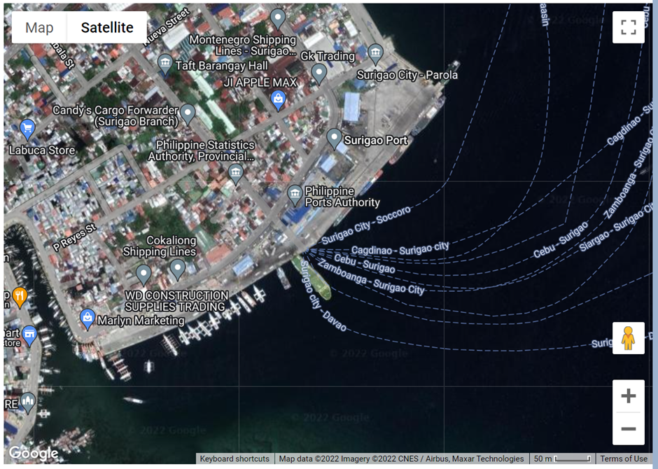
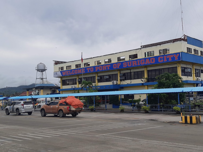
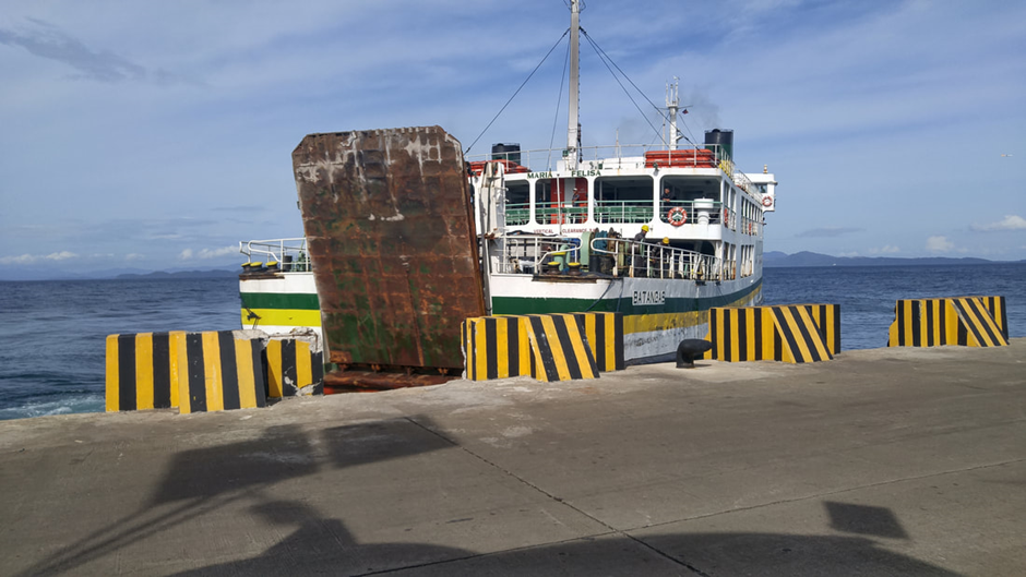
Description and Contacts of Key Companies
Froilan U. Caturla, Acting Port Manager
Port Management Office of Surigao, PPA Administration Building, Borromeo Street, Port Area, Surigao City, Surigao del Norte, 8400 Philippines
Rowee Endaya – (+63) 917 107 5367 General Manager
Globalport Terminals, Inc - Port Of Surigao City Cargo Handler
For more information on port contacts, please see the following link: 4.3 Port and Waterways Companies Contact List.
Port Performance
|
Seasonal Constraints |
||
|---|---|---|
|
Occurs |
Time Frame |
|
|
Rainy Season |
Yes |
Aug to Dec |
|
Major Import Campaigns |
No |
N/A |
|
Other Comments |
N/A |
|
|
Handling Figures for 2021 |
|
|---|---|
|
Vessel Calls |
6,818 |
|
Container Traffic (TEUs) |
5,866 |
|
Handling Figures for 2021 |
|
|---|---|
|
Vessel Calls |
6,818 |
|
Container Traffic (TEUs) |
5,866 |
Discharge Rates and Terminal Handling Charges
For information on port rates and charges, please see the following link: Port of Surigao Handling Charges
Berthing Specifications
|
Type of Berth |
Quantity |
Length |
Maximum Draft |
Comments |
|---|---|---|---|---|
|
Conventional Berth |
10 |
729 m |
10 m |
Conventional Berth 2,3,4,9,10 RORO Berth 1,5,6,7,8 |
|
Container Berth |
2 |
200 m |
10 m |
Berth 2,3 |
|
Silo Berth |
None |
N/A |
||
|
Berthing Tugs |
None |
N/A |
||
|
Water Barges |
none |
|
General Cargo Handling Berths
|
Cargo Type |
Berth Identification |
|---|---|
|
Imports - Bagged Cargo |
2,3 |
|
Exports - Bagged Cargo |
2,3 |
|
Imports and Exports - RoRo |
None |
|
Other Imports |
None |
Port Handling Equipment
The port equipment is managed by Global Port Terminals Inc.
|
Equipment |
Available |
Total Quantity and Capacity Available |
Comments on Current Condition and Actual Usage |
|---|---|---|---|
|
Dockside Crane |
No |
||
|
Container Gantries |
No |
||
|
Mobile Cranes |
No |
||
|
Reachstacker |
No |
||
|
RoRo Tugmaster (w/ Trailer) |
No |
||
|
Grain Elevator w/ Bagging Machines |
No |
||
|
Transtainer |
No |
||
|
Forklifts |
Yes |
1 unit, 25 T | Other equipment to deploy once Port operations are in full swing after major repairs to infrastructure damaged by TY Odette. |
Container Facilities
There are no container facilities, only a marshalling yard. Shipping companies have container yards outside the port.
Customs Guidance
Customs Clearances can be filed at the Port of Surigao Bureau of Customs Office. For more information on customs in the Philippines, please see the following link: 1.3 Customs Information.
Terminal Information
Multipurpose Terminal
Location: Block 2
Total Area 4,617 m3
Container Yard / Marshalling Yard
Location: Block 6
Total Area 636 m3
Cargo Shed Area
Location: Block 6
Total Area 716 m3
Open Storage Area
Stevedoring
Global Port handles all port and stevedoring operations.
Hinterland Information
Accredited transporter from the shipping lines will load the incoming and outgoing TEUs. RORO cargoes will be the responsibility of the owners to book for loading to a RORO vessel.
Port Security
PPA Police secure the Port with augmentation of local contracted security forces.
2.1.3.28 Philippines - Mindanao Port of Dapa (Siargao)
Port Overview
The Port of Dapa is a general-purpose port facility that can accommodate both conventional and RORO type vessels. It serves as the principal maritime gateway to the island of Siargao at the northeastern tip of Mindanao. The Terminal Management Office of Siargao is based at the port. Facilities at the Port of Dapa include a pier and two RORO ramps. Paved back-up-area, marshalling yard and open storage area complements the berthing facilities. A closed (secure) cargo shed is also available at the port. It is located at the southeastern end of Siargao Island, Northeast of Bucas point, Dapa, Surigao del Norte.
Port website: https://ppasurigao.weebly.com/uploads/1/5/0/4/15042190/brochure-siargao.pdf
Key port information can also be found at: http://www.maritime-database.com
|
Port Location and Contact |
|
|---|---|
|
Country |
Philippines |
|
Province or District |
Surigao Del Norte |
|
Nearest Town or City with Distance from Port |
Dapa (2.3 km) |
|
Port's Complete Name |
Port of Dapa |
|
Latitude |
9.4517 |
|
Longitude |
126.259 |
|
Managing Company or Port Authority |
Philippine Ports Authority |
|
Management Contact Person |
Francisco M. Suriaga Jr Terminal Manager |
|
Nearest Airport and Airlines with Frequent International Arrivals/Departures |
Mactan-Cebu International Airport PAL, Cebu Pacific, Eva Air, Emirates, China Airlines, Qatar Airways |
Port Picture
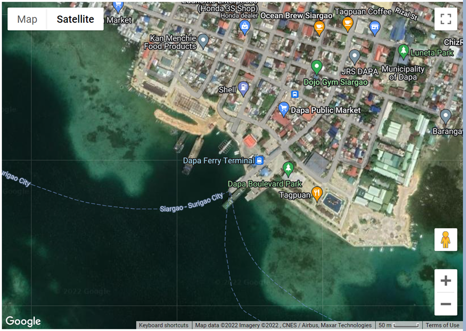
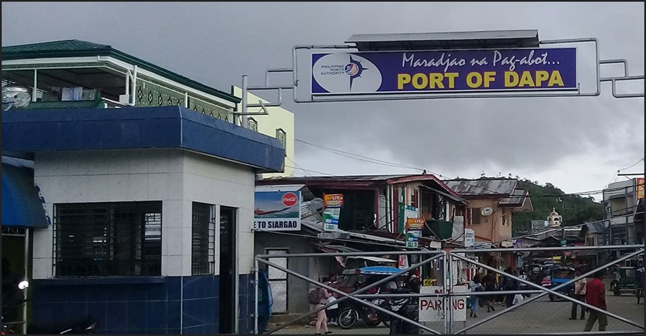
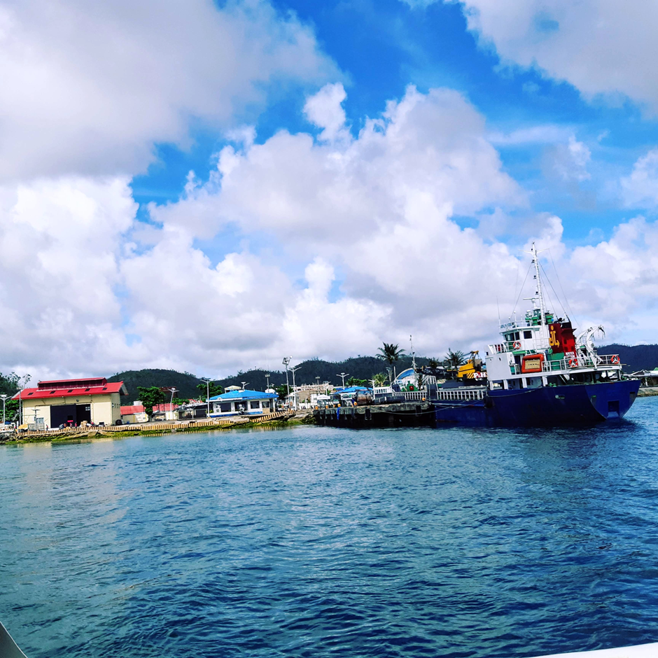
Description and Contacts of Key Companies
For more information on port contacts, please see the following link: 4.4 Port and Waterways Companies Contact List.
Berthing Specifications
|
Type of Berth |
Quantity |
Length (m) |
Maximum Draft (m) |
Comments |
|---|---|---|---|---|
|
Conventional Berth |
2 RORO Ramps 1 Pier |
30 m | 6 m |
2 RORO Ramps and 1 general purpose pier |
|
Container Berth |
None |
|
||
|
Silo Berth |
None |
|
||
|
Berthing Tugs |
None |
|
||
|
Water Barges |
None |
|
General Cargo Handling Berths
There are no cargo-handling berths.
Port Handling Equipment
There are no available port handling equipment.
Container Facilities
There are no container-handling facilities.
Customs Guidance
The port of Dapa is not an entry/exit port. The Port of Surigao is the nearest port that handles exports and imports.
For more information on customs in the Philippines, please see the following link: 1.3 Customs Information.
Terminal Information
Multipurpose Terminal
Passenger Terminal- 330 m2 (approximately 100 person capacity)
Marshalling yard – 3,345 m2
Grain and Bulk Handling
None.
Main Storage Terminal
Open air storage – 1,556 m2
Cargo shed - 300 m2
Stevedoring
Dapa Labor and Arrastre Services
2.1.3.29 Philippines - Mindanao Port of Lipata
Port Overview
The Port of Lipata is one of the four (4) Ferry Terminals under the Eastern Nautical Highway—the Roll-on, Roll-Off ports and highway system built in the Philippines to connect the Luzon, Visayas and Mindanao main island groups. Serving as a hub to two spoke ferry terminals (namely the ports of Liloan and San Ricardo, all in Southern Leyte), the Port of Lipata has three RORO ramps, one RORO berth and one specialized steel ramp.
As of 28 Apr 2022, only three RORO ramps were operational. Two RORO ramps were damaged by Typhoon Rai's (Odette in the Philippines) onslaught on 16 Dec 2021.
Port website: https://ppasurigao.weebly.com/uploads/1/5/0/4/15042190/brochure_lipata.pdf
Key port information can also be found at: http://www.maritime-database.com
|
Port Location and Contact |
|
|---|---|
|
Country |
Philippines |
|
Province or District |
Surigao Del Norte |
|
Nearest Town or City with Distance from Port |
Surigao City (3 km) |
|
Port's Complete Name |
Port of Lipata |
|
Latitude |
9.815582 |
|
Longitude |
125.454812 |
|
Managing Company or Port Authority |
Philippine Ports Authority |
|
Management Contact Person |
Allan P. Yap, TMO Port Manager +63 86 827-1434 / (086) 827-1434 |
|
Nearest Airport and Airlines with Frequent International Arrivals/Departures |
Surigao Airport (4 km) Domestic flight only via CEBU |
Port Picture
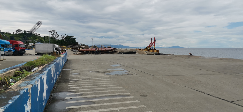
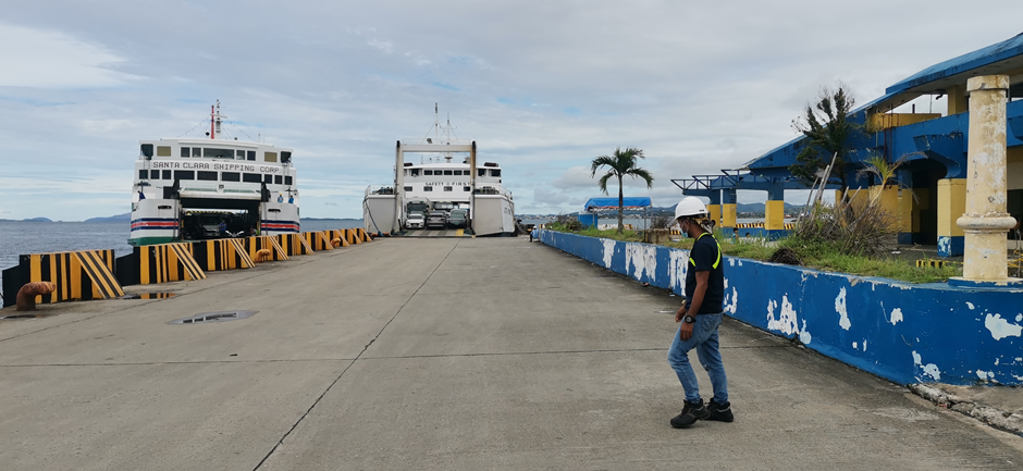
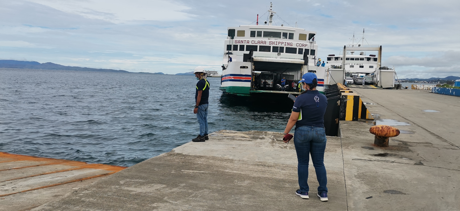
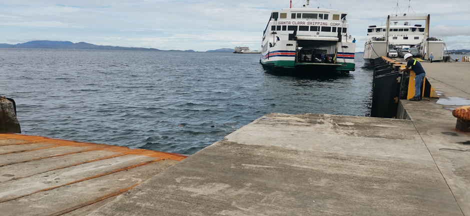
Description and Contacts of Key Companies
Philippine Archipelago Ports & Terminal Services Inc (PAPTSI): Cargo Handler at Lipata Port
Contacts:
Merv Jim Diola, Port Operations OIC (+63 9484477382)
Merlyn Eludo-Sebial, Passenger Terminal OIC (+63 950 957 1471)
For more information on port contacts, please see the following link: 4.4 Port and Waterways Companies Contact List.
Discharge Rates and Terminal Handling Charges
| RORO Terminal Fee | ||
|---|---|---|
| Vehicle Type | Description | Terminal Fee |
| Type 1 | Motorcycle, tricycle, scooter | Php 65.00 |
| Type 2 | Car, minivan, SUV, AUV, Owner-type jeep, PUJ | Php 129.00 |
| Type 3 | Light delivery van, pickup truck, PUJ | Php 258.00 |
| Type 4 | Stake truck, heavy delivery truck, passenger bus, prime mover/tractor head (with or without trailer/chassis) | Php 516.00 |
The above rates shall be an inclusive charge for the use of port facilities collected on a per sea-leg journey at the port of embarkation. No fees or charges shall be collected at the port of disembarkation.
Berthing Specifications
|
Type of Berth |
Quantity |
Length (m) |
Maximum Draft (m) |
Comments |
|---|---|---|---|---|
|
Conventional Berth |
5 (RORO) | 110 m | 4 m |
RORO Ramps (3) RORO Berth (1) Specialized RORO Steel Ramp (1) |
General Cargo Handling Berths
There are no cargo handling berths.
Port Handling Equipment
There are no port handling equipment as the port only serves RORO cargo.
Container Facilities
There are no container facilities.
Customs Guidance
Lipata Port is not an entry /exit port for imports and exports. The Port of Surigao is the nearest port that handles imports and exports.
For information on donated humanitarian goods, please the http://customs.gov.ph/wp-content/uploads/2014/08/Guidelines-and-Procedures-on-International-Donations.pdf
For more information on customs in the Philippines, please see the following link: 1.3 Customs Information.
Terminal Information
Lipata Port is a passenger terminal. RORO cargoes queue in an open space (1,315 m3).
Stevedoring
Philippine Archipelago Ports & Terminal Services Inc (PAPTSI): Stevedoring services at Lipata Port
Contacts:
Merv Jim Diola, Port Operations OIC (+63 9484477382)
Merlyn Eludo-Sebial, Passenger Terminal OIC (+63 950 957 1471)
For more information on port contacts, please see the following link: 4.4 Port and Waterways Companies Contact List.
Hinterland Information
Cargo owners are responsible for loading and withdrawal at the port. Truck owners will be the one to board and disembark the truck from the vessel.
Port Security
Local security guards man the port, with support from the Philippine National Police and the Philippine Coast Guard.
2.1.3.30 Philippines - Mindanao Port of Nasipit
Port Overview
The Port of Nasipit is the major seaport or base port in Agusan del Norte. It is a reinforced concrete general purpose wharf utilized for foreign and domestic general cargoes and passengers. Berthing facilities are as follows: A 184.25-meter container berth with a load capacity of 68.67 MPa and an apron width of 20 meters. Ro-Ro berth with a berth of 134 meters and 4 units 20 x 20 meters square Ro-Ro ramp having a load capacity of 51-71 MPa.
The wharf is protected by rubber fenders and provided with mooring facilities. For small vessels, a 10 m depth is safe. For large vessels, 47 m is the safe depth for anchorage. Anchorage has limited swing for large vessels. Services offered: cargo handling, porterage, ancillary, bunkering, water supply, tug, pilotage, line mooring.
Port website: https://pmonasipit.weebly.com/port-profile.html
Key port information can also be found at: http://www.maritime-database.com
|
Port Location and Contact |
|
|---|---|
|
Country |
Philippines |
|
Province or District |
Agusan Del Norte |
|
Nearest Town or City with Distance from Port |
Butuan City (25 km) |
|
Port's Complete Name |
Nasipit Port |
|
Latitude |
8.969 |
|
Longitude |
125.295 |
|
Managing Company or Port Authority |
Philippine Ports Authority |
|
Management Contact Person |
|
|
Nearest Airport and Airlines with Frequent International Arrivals/Departures |
Mactan-Cebu International Airport PAL, Cebu Pacific, Eva Air, Emirates, China Airlines, Qatar Airways |
Port Picture

Description and Contacts of Key Companies
For more information on port contacts, please see the following link: 4.4 Port and Waterways Companies Contact List.
Port Performance
|
SEASONAL CONSTRAINTS |
||
|---|---|---|
|
Occurs |
Time Frame |
|
|
Rainy Season |
No |
N/A |
|
Major Import Campaigns |
No |
N/A |
|
Other Comments |
|
|
Berthing Specifications
|
Type of Berth |
Quantity |
Length (m) |
Maximum Draft (m) |
Comments |
|---|---|---|---|---|
|
Container Berth |
1 | 184.25 m | 10 m |
|
| RoRo Berth | 1 | 134 m | 10 m |
Port Handling Equipment
The port equipment is managed by the government.
Customs Guidance
For incoming donations of humanitarian goods, please see the following link: http://customs.gov.ph/wp-content/uploads/2014/08/Guidelines-and-Procedures-on-International-Donations.pdf
For more information on customs in the Philippines, please see the following link: 1.3 Customs Information.
2.1.3.31 Philippines - Mindanao Port of San Jose (Dinagat Islands)
Port Overview
The Terminal Management Office of Dinagat Islands supervises all ports in the Province of Dinagat Islands and based at the Port of San Jose. The Port of San Jose is the principal port serving the Province of Dinagat Islands. Situated at the capital town of San Jose, the port serves as the main maritime hub to serve shipping and logistics requirements of the seven towns in Dinagat Islands.
Key port information can also be found at: http://www.maritime-database.com
|
Port Location and Contact |
|
|---|---|
|
Country |
Philippines |
|
Province or District |
Dinagat Islands |
|
Nearest Town or City with Distance from Port |
San Jose (4.9 km) |
|
Port's Complete Name |
Port of San Jose |
|
Latitude |
10.006189 |
|
Longitude |
125.570017 |
|
Managing Company or Port Authority |
If more than one operator, break down by area of operation |
|
Management Contact Person |
Jerk E. Comparativo Terminal Manager |
|
Nearest Airport and Airlines with Frequent International Arrivals/Departures |
Surigao Airport (154 km, includes travel by ferry) Domestic flights only via Cebu & Manila |
Port Picture


Description and Contacts of Key Companies
Mr Allan P. Yap, Terminal Manager
Terminal Management Office of Dinagat
Poblacion, San Jose, Dinagat Islands 8400 PHILIPPINES
For more information on port contacts, please see the following link: 4.4 Port and Waterways Companies Contact List.
Port Performance
|
Seasonal Constraints |
||
|---|---|---|
|
Occurs |
Time Frame |
|
|
Rainy Season |
Yes |
Aug to Dec |
|
Major Import Campaigns |
No |
N/A |
|
Other Comments |
N/A | |
Berthing Specifications
|
Type of Berth |
Quantity |
Length (m) |
Maximum Draft (m) |
Comments |
|---|---|---|---|---|
|
Conventional Berth |
1 Roro | 11 m | 3 m |
|
General Cargo Handling Berths
There are no cargo handling berths.
Port Handling Equipment
There are no port handling equipment.
Container Facilities
There are no container facilities.
Customs Guidance
San Jose Port is not an entry/exit port for imports and imports. The nearest port for import and export is the Port of Surigao.
For more information on customs in the Philippines, please see the following link: 1.3 Customs Information.
Terminal Information
Multipurpose Terminal
Passenger Terminal - 240m2 (approximately 100 person capacity)
Marshalling Yard - 140m2
Main Storage Terminal
Storage Open Area – 1,137 m2
Cargo Shed - 40 m2
2.1.3.32 Philippines - Mindanao Port of Hayanggabon
Port Overview
The Port of Hayanggabon is located at the south end of Surigao del Norte within the municipality of Claver. It serves as an alternate port en route to the Municipality of Socorro and the Municipality of Dapa with regular motorized bancas that can cater passengers and commercial goods.
|
Port Location and Contact |
|
|---|---|
|
Country |
Philippines |
|
Province or District |
Surigao Del Norte |
|
Nearest Town or City with Distance from Port |
Claver (3 km), Surigao City (80 km) |
|
Port's Complete Name |
Port of Hayanggabon |
|
Latitude |
9.541326 |
|
Longitude |
125.840387 |
|
Managing Company or Port Authority |
Philippine Ports Authority |
|
Management Contact Person |
Renelyn Caprecho: +63 907 5583607 Ginalee Galinato: +63 908 8976949 |
|
Nearest Airport and Airlines with Frequent International Arrivals/Departures |
Surigao Airport (80 km) Butuan Airport (210 km) |
Port Picture


Description and Contacts of Key Companies
Port handling is managed by the Barangay LGU of Hayanggabon, Claver, Surigao del Norte.
Mr. Rito Placencia
Councilor, Barangay Hayanggabon, Claver, Suligao Del Norte
+63 929 601 5702
For more information on port contacts, please see the following link: 4.4 Port and Waterways Companies Contact List.
Port Performance
|
Seasonal Constraints |
||
|---|---|---|
|
Occurs |
Time Frame |
|
|
Rainy Season |
Yes |
Aug to Dec |
|
Major Import Campaigns |
No |
N/A |
|
Other Comments |
N/A | |
Discharge Rates and Terminal Handling Charges
Rates for port handling is Php 10.00 per 50 kg bag.
Berthing Specifications
|
Type of Berth |
Quantity |
Length (m) |
Maximum Draft (m) |
Comments |
|---|---|---|---|---|
|
Conventional Berth |
1 | 50 m | 3 m |
Only for motorized bancas. |
Port Handling Equipment
There are no port handling equipment.
Customs Guidance
REPLACE THIS TEXT with a paragraph outlining the customs activities at the port. Give guidance on how long it normally takes, recommendations on working with custom officials at the port, location of customs offices and operating hours, and any other relevant issues. Ensure custom contact details are given and any relevant websites. ENSURE YOU HAVE COMPLETED SECTION 1.3 CUSTOMS INFORMATION.
For more information on customs in the Philippines, please see the following link: 1.3 Customs Information.
Terminal Information
Multipurpose Terminal
There is no terminal, just an open-air space.
Stevedoring
Port handling is managed by the Barangay LGU of Hayanggabon, Claver, Surigao del Norte.
Hinterland Information
Cargo owners are responsible for loading and withdrawal at the port.
Port Security
Philippine National Police Maritime Command, the Coast Guard, and local government provides security for the port.
2.2 Philippines Aviation


Overview
The Philippines Civil Aviation Authority (CAAP), formerly the Air Transportation Office (ATO), is an agency of the Philippine government under the Department of Transportation and Communications responsible for implementing policies on civil aviation to assure safe, economic and efficient air travel. Based in Pasay City, the agency, which also has the responsibility of accident investigation, was created on December 3, 2007 through the filing of senate bill number 1932.
Note: Special provisions for aircraft engaged in non-commercial activities, mercy and humanitarian missions, or government sponsored missions, subject to approval of the Civil Aviation Authority of the Philippine
The Civil Aeronautics Board (CAB) is the agency of the government mandated to regulate the economic aspect of air transportation, and shall have the general supervision, control and jurisdiction over air carriers, general sales agents, cargo sales agents, and air freight forwarders as well as their property, property rights, equipment, facilities, and franchise (R.A. No. 776, as amended by P.D. 1462). CAB is an attached agency of the Department of Transportation and Communications (DOTC). In the exercise of its regulatory powers, it is authorized to issue Certificates of Public Convenience and Necessity (CPCN) to domestic carriers, Foreign Air Carrier's Permit (FACP) to foreign carriers, and Letters of Authority to airfreight forwarders, general sales agents, cargo sales agents who are fit, willing, and able to perform services as required by public convenience and necessity. CAB likewise performs quasi-judicial functions.
Further information on civil aviation can be found in the following document: Philippines Aviation Additional Information
Key airport information may also be found at:Worldaerodata on the Philippines
Fees and Charges
Based on the below inserted General Provisions (D.O. 99E-02 and D.O.98-1178) the payment of fees and charges applicable to aircraft on international, domestic and general aviation operations flying into and out of the airports in the Republic of the Philippines, and aircraft overflying the Manila Flight Information Region without landing at any airport in the Republic of the Philippines for the use of air navigation facilities provided at those airports and / or associated en-route point shall not apply unless otherwise specifically provided.
General Provisions (D.O. 98-1178)
Revised Schedule of Fees and Charges for Air Navigation Facilities
Applicability
The fees and charges prescribed herein shall apply for the use of the alternate international airports such as Zamboanga, Davao, Puerto Princesa, Laoag and National Airports, their facilities, services, utilities and properties under the management control of the Civil Aviation Authority of the Philippines.
The fees and charges herein prescribed shall be applied as follows:
1. Landing for Domestic Flight Operation at national airports other than alternate international airports.
- 100% for trunkline airports
- 75% for secondary airports
- 50% for feeder airports
2. Other Fees / Charges
- 100% for alternate International and Trunkline
- 75% for secondary airports
- 50% for feeder airports
Effects on existing contract
The fees and charges prescribed herein shall not affect contract, leases or concession permits executed or approved prior to the effectivity of this Department Order, except when otherwise provided in said contract, leases or permits.
Exemptions
Unless otherwise specifically provided, the fees and charges provided herein shall not apply to the following:
- Aircraft registered and / or operated by the government of the Republic of the Philippines solely for the governmental functions;
- State-owned aircraft exclusively used by diplomatic and consular representatives of foreign governments; (Civil registered aircraft other than state-owned aircraft, which are chartered or hired by representatives, or personnel of foreign governments are not exempted by this provision);
- Aircraft engaged in humanitarian mission for the particular flight;
- Aircraft which, by provisions of existing laws or treaties, are exempted from the payment of fees and other charges; and
- Other non-revenue flights as may be exempted by the Director General - CAAP.
Reductions
Unless otherwise specifically provided herein, aircraft operating under the following categories shall be charged fifty percent (50%) of the prescribed rates;
- Ferry flight of aircraft, aircraft parts or crews.
- Flights diverted due to in-flight emergency.
- Airmen flight proficiency training or test flight.
- Technical landing by non-scheduled flights.
- Aircraft demonstration flights.
- Other flights as may be authorized by the Director General - CAAP.
Other Fees and Charges
The fees and charges prescribed herein shall not prejudice the
right of the Civil Aviation Authority of the Philippines to impose
and collect such other reasonable charges as maybe determined by
the Director General - CAAP for the use of such properties,
facilities, utilities and services in national airports not covered
herein.
Improvements on buildings, building spaces and areas
Physical improvements on all buildings, building spaces and areas, owned by the Civil Aviation Authority of the Philippines may be undertaken by and at the expense of the tenants. However, no improvement may be commenced without prior approval of the plans by the Director General - CAAP, and whenever deemed necessary, a cash deposit shall be made in favour of the Civil Aviation Authority of the Philippines, which shall be equivalent to the cost of restoration of any portion of the property affected by such alteration or improvements.
General Provisions (D.O. 99E-02)
Revised Schedule of Fees and Charges for Air Navigation Facilities
Applicability
The charges prescribed herein shall be applicable to aircraft on international, domestic and general aviation operations flying into and out of the airports in the Republic of the Philippines, and aircraft overflying the Manila Flight Information Region without landing at any Philippine airport, for the use of air navigation facilities provided at this airports and/or associated en-route points.
Exemptions
Unless otherwise specifically provided, the payment of fees and charges prescribed herein shall not apply to the following:
- Aircraft registered in the name of and operated by the Republic of the Philippines;
- Aircraft exclusively used by head of states and diplomatic and consular representatives of foreign governments, (Civil registered aircraft's other than state owned aircraft, which are chartered or hired by or for representatives or personnel of foreign governments are not exempted by this provision);
- Aircraft engaged in non-commercial activities, mercy and humanitarian missions, or government-sponsored missions, subject to the approval of the Civil Aviation Authority of the Philippines.
- Aircraft's which, by provision of existing laws or treaties, is exempted from payment of fees and other charges;
- Military aircraft's of foreign government where such governments provide similar exemptions to military aircraft of the Republic of the Philippines;
- Aircraft's diverted from its planned route or forced to return to the airport of departure due to emergency.
4.1 Philippines Government Contact List
For further information on the Roles and Services of the CAA of the Philippines, please refer to the following documents:
Philippines Aviation
Additional Information
4.4 Philippines Airport Company Contact List
Procedures for Foreign Registered Aircraft
The following requirements need to be applied, presented and approved before preposition of foreign registered aircraft:
- Procedure for the Entry, Transit, Exit of Foreign Registered Aircraft
- Hire the services of a Philippine ground handler
- Request for flight operations clearance through the Philippine ground handler
Basic requirements:
International traffic
Overfly:
- Letter request for overfly permit
- Letter request must have billing address
Entry/Exit:
- Letter request for entry/exit permit
- Copy of airworthiness certificate of the aircraft
- Copy of pilots’ licenses
- Copy of pilots’ latest medical certificates
Note: Only thru International Airports or non-International Airports with available CIQ services
Local (Philippine) Operations
After securing entry/exit permit:
- Letter request for entry/exit permit
Entry/Exit due medevac:
- Letter request for entry/exit permit, with names of doctor/s and patient
- Copy of airworthiness certificate of the aircraft
- Copy of pilots’ licenses
- Copy of pilots’ latest medical certificates
Note: Only thru International Airports or non-International Airports with available CIQ services
- Flights will be billed for air navigation fees, permit fee, parking fee, others (please check the AIP)
- Humanitarian Flights
The basic requirements for these flights still apply, but some fees and charges are waived. If possible, clearance from the Department of Foreign Affairs may be obtained to confirm the purpose of the flight.
2.2.1 Philippines - Luzon Aviation

The following pages would show airport assessments in the Luzon group of Islands, covering Regions 1, 2, 3, 4A, 4B, 5, Cordillera Administrative Region, and the National Capital Region.
2.2.1.1 Philippines - Luzon Ninoy Aquino International Airport
Airport Overview
|
Airport Location and Contact |
|
|---|---|
|
Country |
Philippines |
|
Province or District |
National Capital Region |
|
Nearest Town or City with Distance from Airport |
Pasay City |
|
Airport’s Complete Name |
Ninoy Aquino International Airport (NAIA) |
|
Latitude |
14.513252 |
|
Longitude |
121.014967 |
|
Elevation (ft and m) |
75 ft /23 m |
|
IATA Code |
MNL |
|
ICAO Code |
RPLL |
|
Managing Company or Airport Authority |
Manila International Airport Authority (MIAA) |
|
Management Contact Person |
MIAA gmo@miaagovphils.onmicrosoft.com +63.2.8877-1109 local 2336 / 716 NAIA Terminal 1 tm.1@miaagovphils.onmicrosoft.com +63.2.8.8771-720 +63.2.8.877-1109 NAIA Terminal 2 tm.2@miaagovphils.onmicrosoft.com +63.2.8.877-1807 +63.2.8.877-1109 NAIA Terminal 3 tm.3@miaagovphils.onmicrosoft.com +63.2.8.877-7888 local 8085 +63.2.8.877-7888 NAIA Terminal 4 tm.4@miaagovphils.onmicrosoft.com +63.2.8.852-4142 / +63.2.8.877-1109 local 4342 +63.2.8.877-1109 |
|
Open From (hours) |
24 H |
|
Open To (hours) |
24 H |
Airport Picture
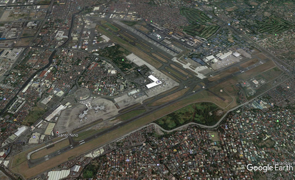
Description and Contacts of Key Companies
The MIAA International Cargo Terminal is Manila’s hub for air cargo processing, handling and holding. From import, export or transit cargo, the ICT’s expertise ensures utmost efficiency in the safeguarding and handling of shipments.
Key Companies
- NAIA International Cargo Operations Division
- +63.2.877-1109 local 3447 / 4323
- icod@miaa.gov.ph
- CargoHaus
- +63.2.879-4331
- chiops@cargohaus.com
- DHL
- +63.2.552-8888
- customercare@dhl.com
- Federal Express
- +63.2.854-9791
- phcall@af2100.com
- LBC
- +63.2.854-9791 / +63.2.851-1414
- Nippon Cargo
- +63.2.854-8188
- People's Air Cargo
- +63.2.851-7386
- Philippine Skylander, Inc.
- +63.2.855-1062
- psicargoall@philskylander.com
- Swiss Air
- +63.2.852-9399
- U-Freight
- +63.2.879-4601
- mnlcs@ufreight.com
Secure customs bonded warehouses in the ICT are operated by Philippine Airlines and Philippine Skylanders Inc.
For more information on airport contacts, please see the following link: 4.5 Airport Companies Contact List.
Information on some aviation service providers can be found at: http://www.azfreight.com/
Passenger and Cargo Performance Indicator
|
Performance for 2020 |
|
|---|---|
|
Per Year |
|
|
Total Aircraft Movements |
20,524 |
|
Total Passengers |
2,623,577 |
|
Total Capacity of the Airport (MT) |
168,854.31 MT (incoming) 157,380.93 MT (outgoing) |
|
Current Activity of the Airport (MT) |
|
|
Current use by Humanitarian Flights (UNHAS) |
N/A |
https://www.miaa.gov.ph/miaa/images/stories/Downloads/20210601_Cargo_Statistics.pdf
Runways
|
Runway #1 |
|
|---|---|
|
Runway Dimensions |
3410 x 60 m |
|
Orientation |
06/24 |
|
Surface |
Asphalt/Concrete |
| Condition | Good |
|
Runway #2 |
|
|---|---|
|
Runway Dimensions |
1998 x 45 m |
|
Orientation |
13/31 |
|
Surface |
Asphalt/Concrete |
| Condition | Good |
Helicopter Pads
|
Helipad #1 Between NAIA Terminal 2 and Terminal 4 (beside Nayong Pilipino) |
|
|---|---|
|
Present |
Yes |
|
Largest Helicopter that can Land |
Not known |
|
Width and Length (m) |
120 m x 300 m |
|
Surface |
Concrete tarmac |
|
Helipad #2 PAF Villamor Air Base |
|
|---|---|
|
Present |
Yes |
|
Largest Helicopter That Can Land |
Unknown |
|
Width and Length (m) |
90 x 200 m |
|
Surface |
Concrete / Hard |
Airport Infrastructure Details
|
Customs |
Yes |
JET A-1 fuel |
Yes |
|---|---|---|---|
|
Immigration |
Yes |
AVGAS 100 |
Yes |
|
Terminal Building |
Yes |
Single Point Refueling |
Yes |
|
Passenger Terminal |
Yes |
Air Starter Units |
Yes |
|
Cargo terminal |
Yes |
Ground Power (mobile) |
Yes |
|
Pax Transport to Airfield |
Yes |
Ground Handling Services |
Yes |
|
Control Tower |
Yes |
Latrine Servicing |
Yes |
|
Weather Facilities |
Yes |
Fire Fighting Category (ICAO) |
Yes |
|
Catering Services |
Yes |
De-icing Equipment |
None |
|
Base Operating Room |
Yes |
Parking Ramp Lighting |
Yes |
|
Airport Radar |
Yes |
Approach & Runway Lights |
Yes |
|
NDB |
Yes |
VOR |
Yes |
|
ILS |
Yes |
Customs Guidance
Carmelita M. Talusan
District Collector, Ninoy Aquino International Airport
+63 919-925-6785
+63 932-844-3390
Carmelita.Talusan@customs.gov.ph
For more information on customs in the Philippines, please see the following link: 1.3 Customs Information.
2.2.1.2 Philippines - Luzon Laoag International Airport
Airport Overview
The Laoag Airport is the main airport serving the general area of Laoag, the capital city of the province of Ilocos Norte. It is the only airport in Ilocos Norte and is the northernmost international airport in the Philippines.
|
Airport Location and Contact |
|
|---|---|
|
Country |
Philippines |
|
Province or District |
Ilocos Norte |
|
Nearest Town or City with Distance from Airport |
Laoag City |
|
Airport’s Complete Name |
Laoag International Airport |
|
Latitude |
18.1781006 |
|
Longitude |
120.5319977 |
|
Elevation (ft and m) |
25 ft / 8 m |
|
IATA Code |
LAO |
|
ICAO Code |
RPLI |
|
Managing Company or Airport Authority |
Civil Aviation Authority of the Philippines |
|
Management Contact Person |
CAAP Designated Officer-in-Charge +63 77 670-0446 +63 77 670-8577 |
|
NGO and/or UN Presence at Airport? |
None |
Runway
|
Runway #1 |
|
|---|---|
|
Runway Dimensions |
2780 x 45 m |
|
Runway Orientation |
01/19 |
|
Runway Surface |
Hard |
|
Runway Condition |
Concrete |
Airport Infrastructure Details
|
Infrastructure |
|||
|---|---|---|---|
|
Passenger / Cargo Security Screening |
Yes |
Runway Lighting |
Yes |
|
Refueling Capacity |
Yes |
Ground Handling Services |
Yes |
|
Air Traffic Control |
Yes |
Fire Fighting Equipment |
Yes |
|
Weather Information |
Yes |
Aircraft Parking Space |
Yes |
|
Navigation Aids |
Yes |
Perimeter Fencing |
Yes |
|
Windsock |
Yes |
|
|
Fuel Services Charges
With existing major and local supplier of Jet A1 and Aviation gas within the region.
2.2.1.3 Philippines - Luzon San Fernando Airport
Airport Overview
The San Fernando Airport serves the general area of San Fernando, located in the province of La Union in the Philippines. The airport is classified as a community airport by the Civil Aviation Authority of the Philippines. No commercial airlines currently serve the airport to and from Manila. No airlines currently serve the airport. The San Fernando Airport continues to handle increasing traffic as a result of upgrading activities. 27 flying schools are using the airport for cross-country training flights. The airport caters only small to medium size passenger aircraft.
|
Airport Location and Contact |
|
|---|---|
|
Country |
Philippines |
|
Province or District |
La Union |
|
Nearest Town or City with Distance from Airport |
San Fernando |
|
Airport’s Complete Name |
San Fernando Airport |
|
Latitude |
16.5956001 |
|
Longitude |
120.3030014 |
|
Elevation (ft and m) |
13 ft / 4 m |
|
IATA Code |
SFE |
|
ICAO Code |
RPUS |
|
Managing Company or Airport Authority |
Poro Point Management Corporation |
|
Management Contact Person |
Josefa Catherine T. Bada Officer-in-Charge, Bases Conversion Development Authority (BCDA) +63 72 888-2072 |
|
NGO and/or UN Presence at Airport? |
None |

Runway
|
Runway #1 |
|
|---|---|
|
Runway Dimensions |
2120 x 30 m |
|
Runway Orientation |
01/19 |
|
Runway Surface |
Hard |
|
Runway Condition |
Concrete |
Airport Infrastructure Details
|
Infrastructure |
|||
|---|---|---|---|
|
Passenger / Cargo Security Screening |
Yes |
Runway Lighting |
Yes |
|
Refueling Capacity |
No |
Ground Handling Services |
Yes |
|
Air Traffic Control |
Yes |
Fire Fighting Equipment |
Yes |
|
Weather Information |
Yes |
Aircraft Parking Space |
Yes |
|
Navigation Aids |
Yes |
Perimeter Fencing |
Yes |
|
Windsock |
Yes |
|
|
Fuel Services Charges
There is a local supplier of aviation fuel.
Royalties / Non Objection Fees (NOFs)
N/A
2.2.1.4 Philippines - Luzon Vigan Airport
Airport Overview
Vigan Airport serves the general area of Vigan, the capital of the province of Ilocos Sur. It is located in Barangay Mindoro, Vigan, Ilocos Sur. The airport caters only to small passenger aircraft.
|
Airport Location and Contact |
|
|---|---|
|
Country |
Philippines |
|
Province or District |
Ilocos Sur |
|
Nearest Town or City with Distance from Airport |
Vigan |
|
Airport’s Complete Name |
Vigan Airport |
|
Latitude |
17.5552998 |
|
Longitude |
120.3560028 |
|
Elevation (ft and m) |
34 ft / 10 m |
|
IATA Code |
N/A |
|
ICAO Code |
RPUQ |
|
Managing Company or Airport Authority |
Civil Aviation Authority of the Philippines |
|
Management Contact Person |
Filipino Panilo Officer-in-Charge, CAAP |
|
NGO and/or UN Presence at Airport? |
None |
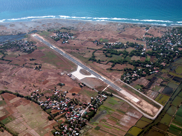
Runway
|
Runway #1 |
|
|---|---|
|
Runway Dimensions |
1045 x 30 m |
|
Runway Orientation |
02/20 |
|
Runway Surface |
Hard |
|
Runway Condition |
Asphalt |
|
Airlines |
Destinations |
|
Platinum Skies |
Basco, Batanes and Manila |
Airport Infrastructure Details
|
Infrastructure |
|||
|---|---|---|---|
|
Passenger / Cargo Security Screening |
Yes |
Runway Lighting |
Yes |
|
Refueling Capacity |
No |
Ground Handling Services |
No |
|
Air Traffic Control |
Yes |
Fire Fighting Equipment |
Yes |
|
Weather Information |
No |
Aircraft Parking Space |
Yes |
|
Navigation Aids |
Yes |
Perimeter Fencing |
Yes |
|
Windsock |
Yes |
|
|
Fuel Services Charges
There is a local supplier of aviation fuel.
|
Price per Litre USD - $ |
|
|---|---|
|
Jet A-1 |
0.459 USD / Ltr |
|
Avgas |
Royalties / Non Objection Fees (NOFs)
N/A
2.2.1.5 Philippines - Luzon Lingayen Airport
Overview
Lingayen Airport is the airport serving the general area of Lingayen, the capital of the province of Pangasinan in the Philippines. It is one of two airports in the province, the other being Rosales Airport in Rosales town. It is classified as a community airport by the Civil Aviation Authority of the Philippines. Small aircraft only use this airport point-to-point.
|
Airport Location and Contact |
|
|---|---|
|
Country |
Philippines |
|
Province or District |
Pangasinan |
|
Nearest Town or City with Distance from Airport |
Lingayen |
|
Airport’s Complete Name |
Lingayen Airport |
|
Latitude |
16.0347996 |
|
Longitude |
120.2409973 |
|
Elevation (ft and m) |
7 ft / 2 m |
|
IATA Code |
- |
|
ICAO Code |
RPUG |
|
Managing Company or Airport Authority |
Civil Aviation Authority of the Philippines (CAAP) |
|
Management Contact Person |
Elvis S. Dela Cruz Officer-in-Charge, CAAP +63 75 542-6585 |
|
NGO and/or UN Presence at Airport? |
None |
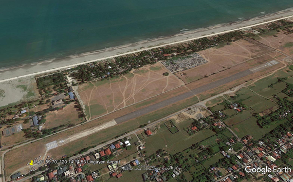
Runway
|
Runway #1 |
|
|---|---|
|
Runway Dimensions |
1043 x 30 m |
|
Runway Orientation |
08/29 |
|
Runway Surface |
Hard |
|
Runway Condition |
Asphalt |
Airport Infrastructure Details
|
Infrastructure |
|||
|---|---|---|---|
|
Passenger / Cargo Security Screening |
Yes |
Runway Lighting |
No |
|
Refueling Capacity |
No |
Ground Handling Services |
No |
|
Air Traffic Control |
No |
Fire Fighting Equipment |
No |
|
Weather Information |
No |
Aircraft Parking Space |
Yes |
|
Navigation Aids |
Yes |
Perimeter Fencing |
Yes |
|
Windsock |
Yes |
|
|
Fuel Services Charges
Lingayen Airport has no fuel servicing facility and relies on local suppliers only.
|
Price per Litre USD - $ |
|
|---|---|
|
Jet A-1 |
0.459 USD / liter |
|
Avgas |
N/A |
Royalties / Non Objection Fees (NOFs)
N/A
2.2.1.6 Philippines - Luzon Rosales Airport
Airport Overview
Rosales Airport is an airfield located in Barangay Carmen, Rosales, Pangasinan, in the Philippines. During World War II, before and after the occupation of Clark Air Base by the Japanese, Rosales Airport acted as a secondary airfield for U.S. Air Force aircraft stationed there. It is currently non-operational.
|
Airport Location and Contact |
|
|---|---|
|
Country |
Philippines |
|
Province or District |
Pangasinan |
|
Nearest Town or City with Distance from Airport |
Rosales |
|
Airport’s Complete Name |
Rosales Airport |
|
Latitude |
15.884982 |
|
Longitude |
120.604485 |
|
Elevation (ft and m) |
84 ft / 25 m |
|
IATA Code |
- |
|
ICAO Code |
RPLR |
|
Managing Company or Airport Authority |
Civil Aviation Authority of the Philippines (CAAP) |
|
Management Contact Person |
Efren Santiago Officer-in-Charge, CAAP |
|
NGO and/or UN Presence at Airport? |
None |
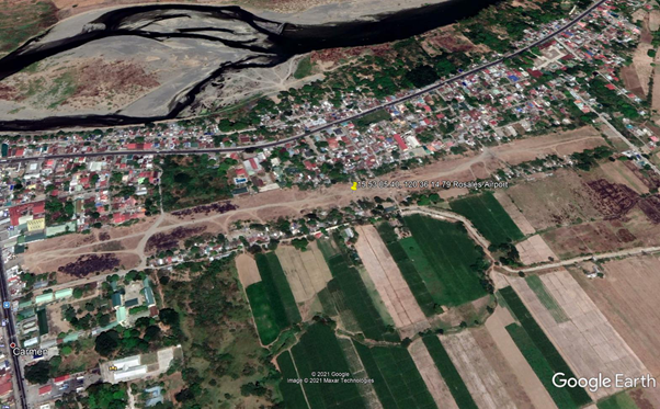
Runway
|
Runway #1 |
|
|---|---|
|
Runway Dimensions |
1043 x 30 m |
|
Runway Orientation |
- |
|
Runway Surface |
Soft |
|
Runway Condition |
Gravel |
Airport Infrastructure Details
|
Infrastructure |
|||
|---|---|---|---|
|
Passenger / Cargo Security Screening |
No |
Runway Lighting |
No |
|
Refueling Capacity |
No |
Ground Handling Services |
No |
|
Air Traffic Control |
No |
Fire Fighting Equipment |
No |
|
Weather Information |
No |
Aircraft Parking Space |
No |
|
Navigation Aids |
No |
Perimeter Fencing |
No |
|
Windsock |
No |
|
|
Fuel Services Charges
Airport is non-operational.
Royalties / Non Objection Fees (NOFs)
N/A
2.2.1.7 Philippines - Luzon Loakan Airport
Overview
Loakan Airport serves the general area of Baguio, Philippines. It is classified as a Class 2 principal airport by the Civil Aviation Authority of the Philippines. Loakan Airport, the city's only airport, was built in 1934. The airport is currently closed for commercial operations but is still used by military and private aircraft. Plans to revive the airport have been announced by numerous entities over the years.
|
Airport Location and Contact |
|
|---|---|
|
Country |
Philippines |
|
Province or District |
Benguet |
|
Nearest Town or City with Distance from Airport |
Baguio City |
|
Airport’s Complete Name |
Baguio Airport |
|
Latitude |
16.3750992 |
|
Longitude |
120.6200027 |
|
Elevation (ft and m) |
4251 ft / 1296 m |
|
IATA Code |
BAG |
|
ICAO Code |
RPUB |
|
Managing Company or Airport Authority |
Civil Aviation Authority of the Philippines (CAAP) |
|
Management Contact Person |
Rosito G. Tamayo Jr Officer-in-Charge, CAAP +63 74 447-2601 +63 74 446-5583 +63 74 246-0683 |
|
NGO and/or UN Presence at Airport? |
None |
Runway
|
Runway #1 |
|
|---|---|
|
Runway Dimensions |
1680 x 30 m |
|
Runway Orientation |
09/27 |
|
Runway Surface |
Hard |
|
Runway Condition |
Concrete |
Airport Infrastructure Details
|
Infrastructure |
|||
|---|---|---|---|
|
Passenger / Cargo Security Screening |
Yes |
Runway Lighting |
Yes |
|
Refueling Capacity |
No |
Ground Handling Services |
Yes |
|
Air Traffic Control |
Yes |
Fire Fighting Equipment |
Yes |
|
Weather Information |
Yes |
Aircraft Parking Space |
Yes |
|
Navigation Aids |
Yes |
Perimeter Fencing |
Yes |
|
Windsock |
Yes |
|
|
Fuel Services Charges
Baguio Airport does not have a fuel servicing
facility. Aircraft must have enough fuel for the return
flight.
Royalties / Non Objection Fees (NOFs)
N/A
2.2.1.8 Philippines - Luzon Basco Airport
Airport Overview
The Basco Airport (Filipino: Paliparan ng Basco, Ilocano: Pagtayaban ti Basco) (IATA: BSO, ICAO: RPUO) is an airport serving the province of Batanes in the Philippines. It is located in the provincial capital, Basco, and is one of two airports in the Batanes Islands, the other being Itbayat Airport.
The airport is classified as a Class 2 principal (minor domestic) airport by the Civil Aviation Authority of the Philippines (CAAP).
|
Airport Location and Contact |
|
|---|---|
|
Country |
Philippines |
|
Province or District |
Batanes |
|
Nearest Town or City with Distance from Airport |
Basco |
|
Airport’s Complete Name |
Basco Airport |
|
Latitude |
20.4512997 |
|
Longitude |
121.9800034 |
|
Elevation (ft and m) |
291 ft / 89 m |
|
IATA Code |
BSO |
|
ICAO Code |
RPUO |
|
Managing Company or Airport Authority |
Civil Aviation Authority of the Philippines (CAAP) |
|
Management Contact Person |
Louie Asantor Officer-in-Charge, CAAP |
|
NGO and/or UN Presence at Airport? |
None |
|
Airlines |
Destinations |
|
AirSWIFT |
Manila |
|
Cebgo |
Manila |
|
Northsky Air |
Itbayat, Tuguegarao |
|
PAL Express |
Clark, Manila |
|
Platinum Skies |
Vigan |
|
Royal Air Philippines |
Charter: Clark |
|
SkyJet |
Manila |
|
Sky Pasada |
Tuguegarao |

Runway
|
Runway #1 |
|
|---|---|
|
Runway Dimensions |
1164 x 30 m |
|
Runway Orientation |
06/24 |
|
Runway Surface |
Hard |
|
Runway Condition |
Asphalt |
Airport Infrastructure Details
|
Infrastructure |
|||
|---|---|---|---|
|
Passenger / Cargo Security Screening |
Yes |
Runway Lighting |
Yes |
|
Refueling Capacity |
No |
Ground Handling Services |
Yes |
|
Air Traffic Control |
Yes |
Fire Fighting Equipment |
Yes |
|
Weather Information |
Yes |
Aircraft Parking Space |
Yes |
|
Navigation Aids |
Yes |
Perimeter Fencing |
Yes |
|
Windsock |
Yes |
|
|
Fuel Services Charges
Basco Airport has no fuel servicing capacity.
Royalties / Non Objection Fees (NOFs)
N/A
2.2.1.9 Philippines - Luzon Itbayat Airport
Airport Overview
The Jorge Abad Airport (Filipino: Paliparang Jorge Abad, Ilocano: Pagtayaban ti Jorge Abad), also known as Itbayat Airport, is an airport serving the island of Itbayat, the largest island in the province of Batanes, Philippines. The province's only other airport, Basco Airport, is located in the provincial capital, Basco, on Batan Island. The airport is classified as a community airport by the Civil Aviation Authority of the Philippines (CAAP).
|
Airport Location and Contact |
|
|---|---|
|
Country |
Luzon |
|
Province or District |
Batanes |
|
Nearest Town or City with Distance from Airport |
Itbayat |
|
Airport’s Complete Name |
Itbayat Airport |
|
Latitude |
20.723604 |
|
Longitude |
121.809374 |
|
Elevation (ft and m) |
328 ft / 100 m |
|
IATA Code |
IBB |
|
ICAO Code |
RPLT |
|
Managing Company or Airport Authority |
Civil Aviation Authority of the Philippines (CAAP) |
|
Management Contact Person |
Louie Asantor Officer-in-Charge, CAAP |
|
NGO and/or UN Presence at Airport? |
None |
|
Airlines |
Destinations |
|
Northsky Air |
Basco, Tuguegarao |

Runway
|
Runway #1 |
|
|---|---|
|
Runway Dimensions |
801 x 30 m |
|
Runway Orientation |
18/36 |
|
Runway Surface |
Hard |
|
Runway Condition |
Concrete |
Airport Infrastructure Details
|
Infrastructure |
|||
|---|---|---|---|
|
Passenger / Cargo Security Screening |
No |
Runway Lighting |
No |
|
Refueling Capacity |
No |
Ground Handling Services |
No |
|
Air Traffic Control |
No |
Fire Fighting Equipment |
No |
|
Weather Information |
No |
Aircraft Parking Space |
Yes |
|
Navigation Aids |
No |
Perimeter Fencing |
Yes |
|
Windsock |
No |
|
|
Fuel Services Charges
Itbayat Airport does not have fuel servicing capacity.
Royalties / Non Objection Fees (NOFs)
N/A
2.2.1.10 Philippines - Luzon Cauayan Airport
Airport Overview
Cauayan Airport serves chartered flights from/to Manila and major airports nearby. It has current commercial flights to and from Manila catered by Cebu Pacific Air.
|
Airport Location and Contact |
|
|---|---|
|
Country |
Philippines |
|
Province or District |
Isabela |
|
Nearest Town or City with Distance from Airport |
Cauayan |
|
Airport’s Complete Name |
Cauayan Airport |
|
Latitude |
16.9298992 |
|
Longitude |
121.7529984 |
|
Elevation (ft and m) |
200 ft / 61 m |
|
IATA Code |
CYZ |
|
ICAO Code |
RPUY |
|
Managing Company or Airport Authority |
Civil Aviation Authority of the Philippines (CAAP) |
|
Management Contact Person |
Greysen Viloria Officer-in-Charge, CAAP |
|
NGO and/or UN Presence at Airport? |
None |
| Airlines | Destinations |
|---|---|
|
Cebu Pacific |
Manila |
|
Cyclone Airways |
Palanan |
|
Royal Air Philippines |
Clark |
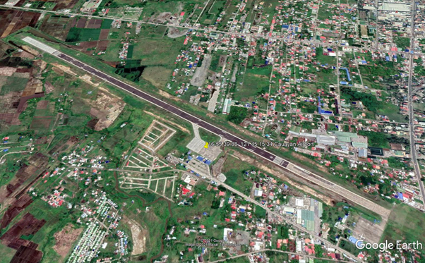
Runway
|
Runway #1 |
|
|---|---|
|
Runway Dimensions |
2098 m x 36 m |
|
Runway Orientation |
12/30 |
|
Runway Surface |
Hard |
|
Runway Condition |
Concrete |
Airport Infrastructure Details
|
Infrastructure |
|||
|---|---|---|---|
|
Passenger / Cargo Security Screening |
Yes |
Runway Lighting |
No |
|
Refueling Capacity |
No |
Ground Handling Services |
Yes |
|
Air Traffic Control |
Yes |
Fire Fighting Equipment |
Yes |
|
Weather Information |
Yes |
Aircraft Parking Space |
Yes |
|
Navigation Aids |
Yes |
Perimeter Fencing |
Yes |
|
Windsock |
Yes |
|
|
Fuel Services Charges
Aircraft must have fuel for turn around from/to Manila, there is no fuel servicing capacity in Cauayan Airport.
Royalties / Non Objection Fees (NOFs)
N/A
2.2.1.11 Philippines - Luzon Palanan Airport
Airport Overview
Palanan Airport is a community airport in the Philippines located in the Pacific coastal town of Palanan, Isabela. It serves chartered flights of small aircraft from Cauayan, Isabela and Tuguegarao, Cagayan.
|
Airport Location and Contact |
|
|---|---|
|
Country |
Philippines |
|
Province or District |
Isabela |
|
Nearest Town or City with Distance from Airport |
Palanan |
|
Airport’s Complete Name |
Palanan Airport |
|
Latitude |
17.0656669 |
|
Longitude |
122.427671 |
|
Elevation (ft and m) |
167ft / 50m |
|
IATA Code |
N/A |
|
ICAO Code |
RPLN |
|
Managing Company or Airport Authority |
Civil Aviation Authority of the Philippines (CAAP) |
|
Management Contact Person |
Greysen Viloria Officer-in-Charge, CAAP |
|
NGO and/or UN Presence at Airport? |
None |
|
Airlines |
Destinations |
|
Cyclone Airways |
Cauayan |
|---|---|
|
Sky Pasada |
Tuguegarao |
|
Northsky Air |
Tuguegarao |

Runway
|
Runway #1 |
|
|---|---|
|
Runway Dimensions |
1000 m x 30 m |
|
Runway Orientation |
12/30 |
|
Runway Surface |
Hard |
|
Runway Condition |
Concrete |
Airport Infrastructure Details
|
Infrastructure |
|||
|---|---|---|---|
|
Passenger / Cargo Security Screening |
Yes |
Runway Lighting |
No |
|
Refueling Capacity |
No |
Ground Handling Services |
No |
|
Air Traffic Control |
No |
Fire Fighting Equipment |
No |
|
Weather Information |
No |
Aircraft Parking Space |
Yes |
|
Navigation Aids |
No |
Perimeter Fencing |
Yes |
|
Windsock |
Yes |
|
|
Fuel Services Charges
Palanan Airport caters only smaller size passenger aircraft. There is no local supplier of aviation fuel.
Royalties / Non Objection Fees (NOFs)
N/A
2.2.1.12 Philippines - Luzon Bagabag Airport
Airport Overview
Bagabag Airport (Ilocano: Pagtayaban ti Bagabag, Filipino: Paliparan ng Bagabag) is an airport serving the general area of Bagabag, located in the province of Nueva Vizcaya in the Philippines. It is the only airport in Nueva Vizcaya and is classified as a community airport, serving small chartered aircraft.
|
Airport Location and Contact |
|
|---|---|
|
Country |
Philippines |
|
Province or District |
Nueva Vizcaya |
|
Nearest Town or City with Distance from Airport |
Bagabag |
|
Airport’s Complete Name |
Bagabag Airport |
|
Latitude |
16.619194 |
|
Longitude |
121.252319 |
|
Elevation (ft and m) |
820 ft / 250 m |
|
IATA Code |
N/A |
|
ICAO Code |
RPUZ |
|
Managing Company or Airport Authority |
Civil Aviation Authority of the Philippines (CAAP) |
|
Management Contact Person |
Oscar Nambuca Officer-in-Charge, CAAP +63 78 392-0673 |
|
NGO and/or UN Presence at Airport? |
None |
|
Airlines |
Destinations |
|
Platinum Skies Aviation |
Clark |

Runway
|
Runway #1 |
|
|---|---|
|
Runway Dimensions |
1200 m x 30 m |
|
Runway Orientation |
09/27 |
|
Runway Surface |
Hard |
|
Runway Condition |
Concrete |
Airport Infrastructure Details
|
Infrastructure |
|||
|---|---|---|---|
|
Passenger / Cargo Security Screening |
Yes |
Runway Lighting |
No |
|
Refueling Capacity |
No |
Ground Handling Services |
Yes |
|
Air Traffic Control |
Yes |
Fire Fighting Equipment |
Yes |
|
Weather Information |
Yes |
Aircraft Parking Space |
Yes |
|
Navigation Aids |
Yes |
Perimeter Fencing |
Yes |
|
Windsock |
Yes |
|
|
Fuel Services Charges
Bagabag Airport caters only smaller size passenger aircraft. There is no local supplier of aviation fuel.
Royalties / Non Objection Fees (NOFs)
N/A
2.2.1.13 Philippines - Luzon Tuguegarao Airport
Airport Overview
Tuguegarao Airport serves the general area of Tuguegarao, the capital city of the province of Cagayan in the Philippines. Located along Maharlika Highway, the airport is accessible from adjacent municipalities in Cagayan and northern Isabela.
|
Airport Location and Contact |
|
|---|---|
|
Country |
Philippines |
|
Province or District |
Cagayan |
|
Nearest Town or City with Distance from Airport |
Tuguegarao City |
|
Airport’s Complete Name |
Tuguegarao Airport |
|
Latitude |
17.6433677 |
|
Longitude |
121.7331505 |
|
Elevation (ft and m) |
70 ft / 21 m |
|
IATA Code |
TUG |
|
ICAO Code |
RPUT |
|
Managing Company or Airport Authority |
Civil Aviation Authority of the Philippines (CAAP) |
|
Management Contact Person |
Mary Sulyn A. Sagorsor Acting Area Manager, CAAP +63 78 304-1015 / +63 78 304-1177 |
|
NGO and/or UN Presence at Airport? |
None |
|
Airlines |
Destinations |
|
Cebu Pacific |
Manila |
|
Northsky Air |
Charter: Basco, Itbayat, Palanan |
|
Sky Pasada |
Charter: Basco, Palanan |

Runway
|
Runway #1 |
|
|---|---|
|
Runway Dimensions |
1976 x 30 m |
|
Runway Orientation |
17/35 |
|
Runway Surface |
Hard |
|
Runway Condition |
Concrete |
Airport Infrastructure Details
|
Infrastructure |
|||
|---|---|---|---|
|
Passenger / Cargo Security Screening |
Yes |
Runway Lighting |
Yes |
|
Refueling Capacity |
No |
Ground Handling Services |
Yes |
|
Air Traffic Control |
Yes |
Fire Fighting Equipment |
Yes |
|
Weather Information |
Yes |
Aircraft Parking Space |
Yes |
|
Navigation Aids |
Yes |
Perimeter Fencing |
Yes |
|
Windsock |
Yes |
|
|
Fuel Services Charges
Tuguegarao Airport caters only smaller to medium size passenger aircraft. Local supplier of aviation fuel.
Royalties / Non Objection Fees (NOFs)
N/A
2.2.1.14 Philippines - Luzon Subic Bay International Airport
Airport Overview
The Subic Bay International Airport is a 200-hectare aviation facility ready for commercial or chartered aircraft operations, air cargo handling and warehousing, aircraft repair and maintenance, and other general aviation businesses.
|
Airport Location and Contact |
|
|---|---|
|
Country |
Philippines |
|
Province or District |
Zambales |
|
Nearest Town or City with Distance from Airport |
Olongapo City (5km) |
|
Airport’s Complete Name |
Subic Bay International Airport |
|
Latitude |
14.795434 |
|
Longitude |
120.282485 |
|
Elevation (ft and m) |
64 ft / 20 m |
|
IATA Code |
SFS |
|
ICAO Code |
RPLB |
|
Managing Company or Airport Authority |
Subic Bay International Airport Authority |
|
Management Contact Person |
Marcelo S. Santos Airport Manager, Subic Bay International Airport Authority +63 47 252-3131 Jerico D. Campus Officer-in-Charge +63 47 252-6450 loc. 3460 |
|
Open From (hours) |
24 hours |
|
Open To (hours) |
24 hours |
Airport Picture
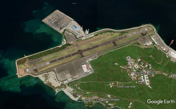
Description and Contacts of Key Companies
Subic Bay International Airport Authority
- General Manager
- +63 47 252 3131
- Airfield Services
- +63 47 252 5104
- +63 47 252 5530
- Operation Center-Terminal Operations
- +63 47 252 5535
- +63 47 252 9362
Bureau of Customs
Maritess T. Martin
Acting District Collector, CD13, Port of Subic
+63 047 252 7465
maritess.martin@customs.gov.ph
Ground Handling
South Pac Diversified Services, Inc.
South East Apron, Bldg. 8015, Rm. 153, Subic Bay International Airport,
Argonaut Highway, Subic Freeport Zone, Philippines 2222
+63 47 250-3010 | +63 998-863-5750
For more information on airport contacts, please see the following link: 4.5 Airport Companies Contact List.
Information on some aviation service providers can be found at: http://www.azfreight.com/
Runways
|
Runway #1 |
|
|---|---|
|
Runway Dimensions |
3410 m x 60 m |
|
Orientation |
07/25 |
|
Surface |
Asphalt/Concrete |
Helicopter Pad
|
Helipad #1 |
|
|---|---|
|
Present |
Yes |
|
Largest Helicopter that can Land |
Not specified |
|
Width and Length (m) |
150 m x 500 m |
|
Surface |
Concrete tarmac |
Airport Infrastructure Details
|
Customs |
Yes |
JET A-1 fuel |
Yes |
|---|---|---|---|
|
Immigration |
Yes |
AVGAS 100 |
Yes |
|
Terminal Building |
Yes |
Single Point Refueling |
Yes |
|
Passenger Terminal |
Yes |
Air Starter Units |
Yes |
|
Cargo terminal |
Yes |
Ground Power (mobile) |
Yes |
|
Pax Transport to Airfield |
Yes |
Ground Handling Services |
Yes |
|
Control Tower |
Yes |
Latrine Servicing |
Yes |
|
Weather Facilities |
Yes |
Fire Fighting Category (ICAO) |
Yes |
|
Catering Services |
Yes |
De-icing Equipment |
None |
|
Base Operating Room |
Yes |
Parking Ramp Lighting |
Yes |
|
Airport Radar |
Yes |
Approach & Runway Lights |
Yes |
|
NDB |
Yes |
VOR |
Yes |
|
ILS |
Yes |
Customs Guidance
Bureau of Customs
Maritess T. Martin
Acting District Collector, CD13, Port of Subic
+63 047 252 7465
maritess.martin@customs.gov.ph
For more information on customs in the Philippines, please see the following link: 1.3 Customs Information.
Storage Facilities
Fixed rates for the lease/rental of space at the SBIA terminal buildings, hangars, offices, factories and other airport buildings shall be upon mutual consent of the SBMA, thru the SBMA Administrator or his duly authorized representatives, and the parties involved.
Airfield Costs
Navigation Charges
Please refer to the following link for airport fees and charges: http://fly.mysubicbay.com.ph/fees-and-charges
LANDING AND TAKE-OFF FEES
International Operations
Fees are computed based on the maximum take-off weight (MTOW) in aircraft's Certification and per aircraft cycle (landing and take-off).
- Up to 50,000 kg: US$1.84/500 kgs. or a fraction thereof
- 50,001-100,000 kg: US$184.00 plus US$1.95/500 or a fraction thereof in excess of 50,000 kg
- 100,001-150,000 kg: US$398.75 plus US$2.25/500 kg or fraction thereof in excess of 100,000 kg
- 150,001 kg. and over: US$646.25 plus US$2.40/500 kg or fraction thereof in excess of 150,000 kg.
LIGHTING CHARGES
Aircraft that land, take-off or park during nighttime at the airport shall be levied additional lighting charges. Nighttime is between 6:00 P.M. to 6:00 A.M.
- Landing/take-off (International): US$12.00 per landing and/or take-off
- Landing/take-off (Domestic): Php300.00 per landing and/or take-off
- Parking: Additional 15% of the rate for daytime parking.
OPERATIONAL CHARGES
For each departing/arriving flight at SBIA, a charge of US$225.00 or its equivalent in pesos at the time of payment shall be imposed for the use of the enroute and airport/terminal navigation facilities and radar services of the SBIA regardless of the type of flight and its duration.
PARKING CHARGES
International Operations:
- Fees are computed based on the maximum take-off weight in
aircraft's certification and the number of hours parked after the
first two (2) hours free parking period.
- Up to 50,000 kgs.: 1st half-hour US$3.00. Each additional half hour thereafter or fraction thereof US$3.00.
- 50,001-100,000kgs: 1st half-hour US$17.00. Each additional half-hour thereafter or fraction thereof US$5.00
- 100,001-150,000kgs: 1st half-hour US$21.00. Each additional half-hour thereafter or fraction thereof US$7.00
- 150,001 kgs. and over: 1st half-hour US$21.00. Each additional half-hour thereafter or fraction thereof US$7.00
Fuel Service Charges
A royalty fee shall be imposed on any person, firm or corporation, selling or delivery, directly or indirectly, aviation fuel, oil, grease or lubricants to any aircraft at the airport for their use. This royalty fee shall be as follows:
Aviation Fuel: US$0.0040/US gallon
Oil: US$0.015/US gallon
Grease: US$0.015/pound
|
Price per Litre USD - $ |
|
|---|---|
|
Jet A-1 |
0.459 / liter |
|
Avgas |
N/A |
Cargo Terminal Charges
Lease/rental charges for SBMA-owned building other than the passenger/cargo terminal buildings inclusive of the land area occupied by said buildings shall be charged the following minimum rates:
Steel/Concrete hangars: US$4.00/m2/mo.
Open space (paved/unpaved): US$2.10/m2/mo.
Air-Bridge Charges
Ground Handling Service Fees: A fee shall be charged for the use of the ramp facilities in accordance with the following schedule:
- Ground handling services at Terminal: 5% of Gross Income
- In-flight Catering: 5% of Gross Income
- Repair and Maintenance Service: 5% of Gross Income
Security
Aside from regular law enforcement units that secure the airport, the Philippine National Police Aviation Security Group also provides back-up security.
2.2.1.15 Philippines - Luzon Iba Airport
Operator: Air Transportation Office (Feeder Airport) - The Airport is currently a training ground for the Philippines Air Force.
|
Airport Details |
|||
|---|---|---|---|
|
Country |
Philippines |
Latitude |
15.62597 |
|
Province / District |
Zambales |
Longitude |
119.9685 |
|
Airport Name |
Iba Airport |
Elevation (ft) |
5 |
|
IATA & ICAO codes |
Unknown – RPUI |
Surface |
Concrete |
|
Town or City (closest) |
Barangay Santo Rosario, Iba |
Runway Condition |
TO be confirmed before landing |
|
NGO / UN (on ground) |
n/a |
Passenger / Cargo Security Screening (Yes / No) |
n/a |
|
Runway Dimension |
900 m x n/a |
Ground Handling (Yes / No) |
n/a |
|
Refueling Capacity |
n/a |
Runway Lighting (Yes / No) |
n/a |
|
Runway Heading |
n/a |
Fire Fighting Equipment (Yes / No) |
n/a |
|
Air Traffic Control (Yes / No) |
n/a |
Windsock (Yes / No) |
n/a |
|
Weather Information (Yes / No) |
n/a |
Aircraft Parking space (Yes / No) |
n/a |
|
Navigation Aids (Yes / No) |
n/a |
Perimeter fencing (Yes / No) |
n/a |
2.2.1.16 Philippines - Luzon Clark International Airport
Airport Overview
Clark International Airport serves Central Luzon, Northern Luzon, and to an extent, Metro Manila. The name is derived from the former American Clark Air Base which was the largest overseas base of the United States Air Force until it was closed in 1991 and handed over to the Government of the Philippines. The airport serves both international and domestic flights. A new passenger terminal building has been constructed and inaugurated in June 2021.
|
Airport Location and Contact |
|
|---|---|
|
Country |
Philippines |
|
Province or District |
Pampanga |
|
Nearest Town or City with Distance from Airport |
Angeles City (5 km) |
|
Airport’s Complete Name |
Clark International Airport |
|
Latitude |
15.1859999 |
|
Longitude |
120.5599976 |
|
Elevation (ft and m) |
484 ft / 148 m |
|
IATA Code |
CRK |
|
ICAO Code |
RPLC |
|
Managing Company or Airport Authority |
Clark International Airport Corporation (clarkinternationalairport.com) Luzon International Premier Airport Development (LIPAD) Corporation |
|
Management Contact Person |
Marcelo S. Santos Airport Manager +63 47 252-3131 Jerico D. Campus Officer-in-Charge +63 47 252-6450 loc. 3460 |
|
Open From (hours) |
24 hours |
|
Open To (hours) |
24 hours |
Airport Picture
Description and Contacts of Key Companies
Philippine Airport Ground Support Solutions Inc.
(PAGSS)
Bldg.7590 A. Bonifacio Ave.
Sector 6, Clark Aviation Complex,
Clark Freeport Zone, 2023 Philippines
+63 45 499 0853
Clark Airport Support Services, Corp.
Bldg. 7585, CASS Cargo Center,
Clark International Airport,
Clark Freeport Zone,
Philippines 2009
Tel: +63 45 599-6688
Fax: +63 45 599-6299
dnata Philippines
Clark International Airport
Bldg. 7588, Clark Civil Aviation Complex
Clark Freeport Zone, Pampanga 2023
Clark Airport Ground Handling Systems Inc
Clark International Airport
Diosdado Macapagal International Airport, Angeles
+63 45 599 2885
https://www.linkedin.com/company/clark-airport-ground-handling-systems-inc
For more information on airport contacts, please see the following link: 4.5 Airport Companies Contact List.
Information on some aviation service providers can be found at: http://www.azfreight.com/
Passenger and Cargo Performance Indicator
https://ciac.gov.ph/wp-content/uploads/2020/09/annual-report-2019.pdf
|
Performance for 2019 |
|
|---|---|
|
Per Year |
|
|
Total Aircraft Movements |
35,738 |
|
Total Passengers |
4 million |
|
Total Capacity of the Airport (MT) |
26,332 |
|
Current Activity of the Airport (MT) |
No data |
|
Current use by Humanitarian Flights (UNHAS) |
N/A |
|
Passenger Airlines |
Destinations |
|
Asiana Airlines |
Seoul–Incheon |
|
Cebu Pacific |
Cebu, Davao |
|
Emirates |
Dubai–International |
|
Jeju Air |
Seoul–Incheon |
|
Jetstar Asia |
Osaka–Kansai, Singapore |
|
Jin Air |
Seoul–Incheon |
|
Korean Air |
Seoul–Incheon |
|
PAL Express |
Cebu, Davao |
|
Philippines AirAsia |
Davao |
|
Qatar Airways |
Doha |
|
Saudia |
Riyadh |
|
Scoot |
Singapore |
|
Sunlight Air |
Busuanga |
|
Cargo Airlines |
Destinations |
|
AirBridgeCargo Airlines |
Hong Kong |
|
FedEx Express |
Guangzhou, Taipei–Taoyuan |
|
Suparna Airlines Cargo |
Xiamen |
|
Tri-MG Intra Asia Airlines |
Hong Kong |
|
UPS Airlines |
Dubai–International, Hong Kong, Shenzhen, Taipei–Taoyuan, Tokyo–Narita |
Runways
Clark Airport used to have two 3,200-meter parallel runways. Since the runways are closely spaced, the secondary runway (02L/20R) has been decommissioned and is no longer in use. A new maintenance hangar is currently being constructed on the stopway of Runway 02L.
|
Runway #1 |
|
|---|---|
|
Runway Dimensions |
3200 m x 45 m |
|
Orientation |
02L / 20R |
|
Surface |
Asphalt/Concrete |
|
Runway #2 |
|
|---|---|
|
Runway Dimensions |
3200 m x 60 m |
|
Orientation |
02R / 20L |
|
Surface |
Asphalt/Concrete |
Helicopter Pad
|
Helipad # 1: PAF Clark Tarmac |
|
|---|---|
|
Present |
Yes |
|
Largest Helicopter that can Land |
Not known |
|
Width and Length (m) |
137 m x 200 m |
|
Surface |
Concrete tarmac |
Airport Infrastructure Details
|
Customs |
Yes |
JET A-1 fuel |
Yes |
|---|---|---|---|
|
Immigration |
Yes |
AVGAS 100 |
Yes |
|
Terminal Building |
Yes |
Single Point Refueling |
Yes |
|
Passenger Terminal |
Yes |
Air Starter Units |
Yes |
|
Cargo terminal |
Yes |
Ground Power (mobile) |
Yes |
|
Pax Transport to Airfield |
Yes |
Ground Handling Services |
Yes |
|
Control Tower |
Yes |
Latrine Servicing |
Yes |
|
Weather Facilities |
Yes |
Fire Fighting Category (ICAO) |
Yes |
|
Catering Services |
Yes |
De-icing Equipment |
None |
|
Base Operating Room |
Yes |
Parking Ramp Lighting |
Yes |
|
Airport Radar |
Yes |
Approach & Runway Lights |
Yes |
|
NDB |
Yes |
VOR |
Yes |
|
ILS |
Yes |
Airport Operating Details
|
Operating Details |
|||
|---|---|---|---|
|
Maximum Sized Aircraft that can be Offloaded on Bulk Cargo |
INSERT INFORMATION |
||
|
Maximum Sized Aircraft that can be Offloaded on Pallet |
|||
|
Total Aircraft Parking Area (m²) |
230 x 155 m / 35,650 m2 |
||
|
Storage Area (m3 and MT) |
55x75 m / 4125 m2 |
||
|
Handling Equipment |
|||
|
Elevators / Hi Loaders |
Yes |
Max Capacity (MT) |
|
|
Max Height (m) |
|
||
|
Loading Ramps |
Yes |
||
|
Other Comments |
|
||
Customs Guidance
Bureau of Customs
Ruby Claudia M. Alameda
Acting District Collector
CD14, Port of CLARK
+63 45 499-0831
rubyclaudia.alameda@customs.gov.ph
For more information on customs in the Philippines, please see the following link: 1.3 Customs Information.
Storage Facilities
Airfield Costs
Navigation Charges
|
Charges |
Aircraft Weight - MTOW (kg) |
||
|---|---|---|---|
|
0 - 7,000 |
7,001 - 136,000 |
136,001 and over |
|
|
Navigation (per journey) USD - $ |
|||
|
Landing USD - $ |
|||
|
Night Landing USD - $ |
|||
|
Night Take-Off USD - $ |
|
|
|
|
Parking |
|
|
|
|
Handling Charges |
|
|
|
Fuel Service Charges
|
Price per Litre USD - $ |
|
|---|---|
|
Jet A-1 |
0.459 USD / Ltr |
|
Avgas |
Cargo Terminal Charges
https://customs.gov.ph/boc-fees-and-charges/
2.2.1.17 Philippines - Luzon Jomalig Airport
Airport Overview
|
Airport Location and Contact |
|
|---|---|
|
Country |
Philippines |
|
Province or District |
Quezon |
|
Nearest Town or City with Distance from Airport |
Jomalig |
|
Airport’s Complete Name |
Jomalig Community Airport |
|
Latitude |
14.704314 |
|
Longitude |
122.331127 |
|
Elevation (ft and m) |
37 ft / 11.27 m |
|
IATA Code |
N/A |
|
ICAO Code |
RPLJ |
|
Managing Company or Airport Authority |
Civil Aviation Authority of the Philippines (CAAP) |
|
Management Contact Person |
Ronan Caminian Officer-in-Charge |
|
NGO and/or UN Presence at Airport? |
None |
Runway
|
Runway #1 |
|
|---|---|
|
Runway Dimensions |
570 x 30 m |
|
Runway Orientation |
05/23 |
|
Runway Surface |
Unknown |
|
Runway Condition |
unknown |
Airport Infrastructure Details
No commercial flights on this airport.
|
Infrastructure |
|||
|---|---|---|---|
|
Passenger / Cargo Security Screening |
No |
Runway Lighting |
No |
|
Refueling Capacity |
No |
Ground Handling Services |
No |
|
Air Traffic Control |
No |
Fire Fighting Equipment |
No |
|
Weather Information |
No |
Aircraft Parking Space |
No |
|
Navigation Aids |
No |
Perimeter Fencing |
No |
|
Windsock |
No |
|
|
Fuel Services Charges
JomaligAirport has no fuel servicing facility
Royalties / Non Objection Fees (NOFs)
N/A
2.2.1.18 Philippines - Luzon Alabat Airport
Airport Overview
Alabat Airport is located at the northern tip of Alabat Island, a part of Quezon Province. It is non-operational but is under CAAP management.
|
Airport Location and Contact |
|
|---|---|
|
Country |
Philippines |
|
Province or District |
Quezon |
|
Nearest Town or City with Distance from Airport |
Alabat |
|
Airport’s Complete Name |
Alabat Airport |
|
Latitude |
14.233055 |
|
Longitude |
121.929054 |
|
Elevation (ft and m) |
6.00 ft / 1.8 m |
|
IATA Code |
N/A |
|
ICAO Code |
RPLY |
|
Managing Company or Airport Authority |
Civil Aviation Authority of the Philippines (CAAP) |
|
Management Contact Person |
Ronan Caminian Officer-in-Charge, CAAP |
|
NGO and/or UN Presence at Airport? |
None |
Runway
|
Runway #1 |
|
|---|---|
|
Runway Dimensions |
670 x 40 m |
|
Runway Orientation |
Unknown |
|
Runway Surface |
Unknown |
|
Runway Condition |
unknown |
Airport Infrastructure Details
There are no commercial flights on this airport.
|
Infrastructure |
|||
|---|---|---|---|
|
Passenger / Cargo Security Screening |
Yes / No |
Runway Lighting |
Yes / No |
|
Refueling Capacity |
Yes / No |
Ground Handling Services |
Yes / No |
|
Air Traffic Control |
Yes / No |
Fire Fighting Equipment |
Yes / No |
|
Weather Information |
Yes / No |
Aircraft Parking Space |
Yes / No |
|
Navigation Aids |
Yes / No |
Perimeter Fencing |
Yes / No |
|
Windsock |
Yes / No |
|
|
Fuel Services Charges
Alabat Airport has no fuel servicing facility.
Royalties / Non Objection Fees (NOFs)
N/A
2.2.1.19 Philippines - Luzon Baler Airport
Operator: Air Transportation Office (Feeder Airport) - Magnetic Variation 001˚ W (01/06) – PCN 029RBWT – NO ILS – Runway 05 (Heading 050.0) Slope 0.4˚ – Runway 23 (Heading 230.0) Slope -0.4˚.
Caution trees on approach end of runway 23.
Operating hours: 2300 – 0800Z. Nil permanent communications. No navaid.
|
Airport Details |
|||
|---|---|---|---|
|
Country |
Philippines – UTC + 8 |
Latitude |
15.72984 |
|
Province / District |
Luzon, Aurora |
Longitude |
121.5001 |
|
Airport Name |
Baler Airport |
Elevation (ft) |
108 |
|
IATA & ICAO codes |
BQA - RPUR |
Surface |
Concrete |
|
Town or City (closest) |
Baler City |
Runway Condition |
Old surface but acceptable; however to be confirmed before landing |
|
NGO / UN (on ground) |
n/a |
Passenger / Cargo Security Screening (Yes / No) |
n/a |
|
Runway Dimension |
1,151 m x 30 m |
Ground Handling (Yes / No) |
n/a |
|
Refueling Capacity |
n/a |
Runway Lighting (Yes / No) |
No |
|
Runway Heading |
n/a |
Fire Fighting Equipment (Yes / No) |
n/a |
|
Air Traffic Control (Yes / No) |
n/a |
Windsock (Yes / No) |
n/a |
|
Weather Information (Yes / No) |
n/a |
Aircraft Parking space (Yes / No) |
n/a |
|
Navigation Aids (Yes / No) |
n/a |
Perimeter fencing (Yes / No) |
n/a |
2.2.1.20 Philippines - Luzon Plaridel Airport
Operator: Air Transportation Office (Secondary Airport)– Airport is used extensively as a training ground for all types of pilots, civilians and military. Temporary closed.
|
Airport Details |
|||
|---|---|---|---|
|
Country |
Philippines |
Latitude |
14.89067 |
|
Province / District |
Bulacan |
Longitude |
120.8527 |
|
Airport Name |
Plaridel Airport |
Elevation (ft) |
19 |
|
IATA & ICAO codes |
Unknown - RPUX |
Surface |
Asphalt |
|
Town or City (closest) |
Barangay Lumang Bayan, Plaridel, Mega Manila |
Runway Condition |
To be confirmed before landing |
|
NGO / UN (on ground) |
n/a |
Passenger / Cargo Security Screening (Yes / No) |
n/a |
|
Runway Dimension |
900 m x n/a |
Ground Handling (Yes / No) |
n/a |
|
Refueling Capacity |
n/a |
Runway Lighting (Yes / No) |
No |
|
Runway Heading |
n/a |
Fire Fighting Equipment (Yes / No) |
n/a |
|
Air Traffic Control (Yes / No) |
n/a |
Windsock (Yes / No) |
n/a |
|
Weather Information (Yes / No) |
n/a |
Aircraft Parking space (Yes / No) |
n/a |
|
Navigation Aids (Yes / No) |
n/a |
Perimeter fencing (Yes / No) |
n/a |
2.2.1.21 Philippines - Luzon Marinduque Airport
Airport Overview
Marinduque Airport is the only airport located on and serving the island province of Marinduque in the Philippines. It is a Principal Class 2 Airport as classified by CAAP. Commercial flights from/to Manila are provided by Cebu Pacific, operated by CebGo.
|
Airport Location and Contact |
|
|---|---|
|
Country |
Philippines |
|
Province or District |
Marinduque |
|
Nearest Town or City with Distance from Airport |
Gasan, Marinduque Province |
|
Airport’s Complete Name |
Marinduque Airport |
|
Latitude |
13.358112 |
|
Longitude |
1121.827762 |
|
Elevation (ft and m) |
16 ft / 5 m |
|
IATA Code |
MRQ |
|
ICAO Code |
RPUW |
|
Managing Company or Airport Authority |
Civil Aviation Authority of the Philippines (CAAP) |
|
Management Contact Person |
Kerwin S. Laudit Officer-in-Charge, CAAP +63 42 342-1001 / +63 42 332 1002 |
|
NGO and/or UN Presence at Airport? |
None |
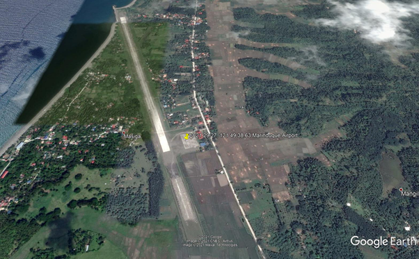
Runway
|
Runway #1 |
|
|---|---|
|
Runway Dimensions |
1458 m x 29 m |
|
Runway Orientation |
16/34 |
|
Runway Surface |
Hard |
|
Runway Condition |
Asphalt |
Airport Infrastructure Details
With domestic flights from/to Manila cater by CebuPac
|
Infrastructure |
|||
|---|---|---|---|
|
Passenger / Cargo Security Screening |
Yes |
Runway Lighting |
No |
|
Refueling Capacity |
No |
Ground Handling Services |
Yes |
|
Air Traffic Control |
Yes |
Fire Fighting Equipment |
Yes |
|
Weather Information |
Yes |
Aircraft Parking Space |
Yes |
|
Navigation Aids |
Yes |
Perimeter Fencing |
Yes |
|
Windsock |
Yes |
|
|
Fuel Services Charges
Marinduque Airport has no fuel servicing facility but has a contracted local supplier for aviation gas refueling.
|
Price per Litre USD - $ |
|
|---|---|
|
Jet A-1 |
0.459 USD / liter |
Royalties / Non Objection Fees (NOFs)
N/A
2.2.1.22 Philippines Puerto Princesa International Airport
Airport Overview
Puerto Princesa International Airport serves the general area of Puerto Princesa City, capital Palawan Province in the Philippines. It is classified as an international airport by the Civil Aviation Authority of the Philippines. International PAX flights are coming from/to Kota Kinabalu, Malaysia.
|
Airport Location and Contact |
|
|---|---|
|
Country |
Philippines |
|
Province or District |
Palawan |
|
Nearest Town or City with Distance from Airport |
Puerto Princesa City |
|
Airport’s Complete Name |
Puerto Princesa International Airport |
|
Latitude |
9.745862 |
|
Longitude |
118.750629 |
|
Elevation (ft and m) |
71 ft / 22 m |
|
IATA Code |
PPS |
|
ICAO Code |
RPVP |
|
Managing Company or Airport Authority |
Civil Aviation Authority of the Philippines. |
|
Management Contact Person |
MS. Florevic P. Sonota Acting Area Manager, CAAP +63 48 433 4965 |
|
NGO and/or UN Presence at Airport? |
None |

|
Airlines |
Destinations |
|
Air Juan |
Busuanga, Cuyo, San Vicente, Sipalay, Taytay |
|---|---|
|
AirSWIFT |
Busuanga, El Nido |
|
Cebu Pacific |
Cebu, Clark, Hong Kong, Iloilo, Manila |
|
Eastar Jet |
Seoul–Incheon |
|
Philippine Airlines |
Manila |
|
Philippine Airlines |
Cebu, Clark, Manila |
|
Philippines AirAsia |
Cebu, Clark, Manila |
|
Royal Air Philippines |
Cebu, Clark |
|
Tigerair Taiwan |
Taipei–Taoyuan |
Runway
|
Runway #1 |
|
|---|---|
|
Runway Dimensions |
2600 m x 45 m |
|
Runway Orientation |
09/27 |
|
Runway Surface |
Hard |
|
Runway Condition |
Asphalt |
Airport Infrastructure Details
|
Infrastructure |
|||
|---|---|---|---|
|
Passenger / Cargo Security Screening |
Yes |
Runway Lighting |
Yes |
|
Refueling Capacity |
Yes |
Ground Handling Services |
Yes |
|
Air Traffic Control |
Yes |
Fire Fighting Equipment |
Yes |
|
Weather Information |
Yes |
Aircraft Parking Space |
Yes |
|
Navigation Aids |
Yes |
Perimeter Fencing |
Yes |
|
Windsock |
Yes |
|
|
Fuel Services Charges
Local supplier available at the airport.
Royalties / Non Objection Fees (NOFs)
N/A
2.2.1.23 Philippines - Luzon Cuyo Airport
Airport Overview
Cuyo Airport is a Principal Class 2 Airport. It is a P2P airport of smaller aircraft.
|
Airport Location and Contact |
|
|---|---|
|
Country |
Philippines |
|
Province or District |
Palawan |
|
Nearest Town or City with Distance from Airport |
Cuyo, Palawan |
|
Airport’s Complete Name |
Cuyo Airport |
|
Latitude |
10.859882 |
|
Longitude |
121.070751 |
|
Elevation (ft and m) |
13 ft / 4 m |
|
IATA Code |
CYU |
|
USUICAO Code |
RPLO |
|
Managing Company or Airport Authority |
Civil Aviation Authority of the Philippines (CAAP) |
|
Management Contact Person |
Lesher Gabo Officer-in-Charge, CAAP +63 909 411 3073 |
|
NGO and/or UN Presence at Airport? |
None |
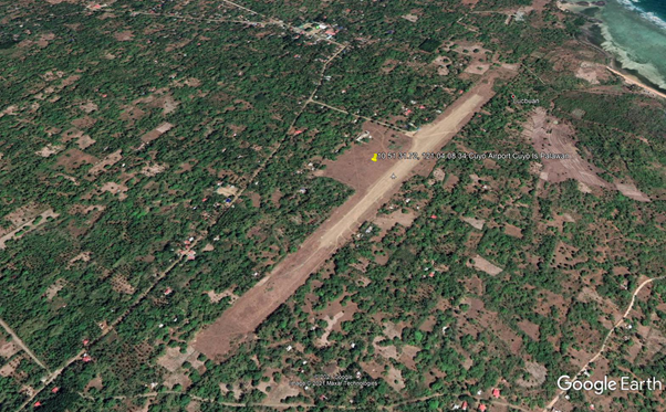
Runway
|
Runway #1 |
|
|---|---|
|
Runway Dimensions |
1200 m x 40 m |
|
Runway Orientation |
04/22 |
|
Runway Surface |
Medium |
|
Runway Condition |
Gravel |
Airport Infrastructure Details
|
Infrastructure |
|||
|---|---|---|---|
|
Passenger / Cargo Security Screening |
No |
Runway Lighting |
No |
|
Refueling Capacity |
No |
Ground Handling Services |
No |
|
Air Traffic Control |
No |
Fire Fighting Equipment |
No |
|
Weather Information |
No |
Aircraft Parking Space |
No |
|
Navigation Aids |
No |
Perimeter Fencing |
No |
|
Windsock |
No |
|
|
Royalties / Non Objection Fees (NOFs)
N/A
2.2.1.24 Philippines - Luzon Francisco B. Reyes Airport (Busuanga)
Airport Overview
Francisco B. Reyes Airport, more commonly known as Busuanga Airport, is a Principal Class 2 airport serving the general area of Coron, located in Busuanga Island in the province of Palawan, Philippines. It is also shared with the neighboring municipality of Busuanga, located on the western half of the island.
|
Airport Location and Contact |
|
|---|---|
|
Country |
Philippines |
|
Province or District |
Palawan |
|
Nearest Town or City with Distance from Airport |
Busuanga, Palawan |
|
Airport’s Complete Name |
Francisco B. Reyes Airport |
|
Latitude |
12.119985 |
|
Longitude |
120.099037 |
|
Elevation (ft and m) |
148 ft / 45 m |
|
IATA Code |
USU |
|
USUICAO Code |
RPVV |
|
Managing Company or Airport Authority |
Civil Aviation Authority of the Philippines (CAAP) |
|
Management Contact Person |
Wilfredo G. Cabitac Airport Manager, CAAP +63 48 723 2886 +63 917676 7394 |
|
NGO and/or UN Presence at Airport? |
None |

|
Airlines |
Destinations |
|
Air Juan |
Caticlan, Manila, Puerto Princesa, San Vicente |
|---|---|
|
AirSWIFT |
El Nido, Puerto Princesa |
|
Cebu Pacific operated by Cebgo |
Cebu, Manila |
|
Philippine Airlines operated by PAL Express |
Cebu, Clark, Manila |
|
SkyJet |
Manila |
|
Sunlight Air |
Clark |
Runway
|
Runway #1 |
|
|---|---|
|
Runway Dimensions |
917 m x 30 m |
|
Runway Orientation |
08/26 |
|
Runway Surface |
Hard |
|
Runway Condition |
Concrete |
Airport Infrastructure Details
|
Infrastructure |
|||
|---|---|---|---|
|
Passenger / Cargo Security Screening |
Yes |
Runway Lighting |
No |
|
Refueling Capacity |
No |
Ground Handling Services |
Yes |
|
Air Traffic Control |
Yes |
Fire Fighting Equipment |
Yes |
|
Weather Information |
Yes |
Aircraft Parking Space |
Yes |
|
Navigation Aids |
Yes |
Perimeter Fencing |
Yes |
|
Windsock |
Yes |
|
|
Fuel Services Charges
There is a local supplier for aviation fuel in Busuanga Airport.
Royalties / Non Objection Fees (NOFs)
N/A
2.2.1.25 Philippines - Luzon San Vicente Airport
Airport Overview
San Vicente Airport is classified as a Community Airport by CAAP, serving commercial flights using smaller aircraft from/to Puerto Princesa Airport. The airport was opened for general aviation flights on 22 June 2017, and opened for commercial flights by the end of 2017.
|
Airport Location and Contact |
|
|---|---|
|
Country |
Philippines |
|
Province or District |
Palawan |
|
Nearest Town or City with Distance from Airport |
San Vicente, Palawan |
|
Airport’s Complete Name |
San Vicente Airport |
|
Latitude |
10.523564 |
|
Longitude |
119.274190 |
|
Elevation (ft and m) |
62 ft / 19 m |
|
IATA Code |
SWL |
|
USUICAO Code |
RPSV |
|
Managing Company or Airport Authority |
Civil Aviation Authority of the Philippines (CAAP) |
|
Management Contact Person |
Rafael V. Servando Jr. Officer-in-Charge, CAAP +63 48 723 1659 |
|
NGO and/or UN Presence at Airport? |
None |
|
Airlines |
Destinations |
|
Air Juan |
Charter: Busuanga, Puerto Princesa |
|---|---|
|
Philippine Airlines |
Clark |
|
Royal Air Philippines |
Charter: Clark |
|
SkyJet |
Manila |
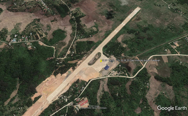
Runway
|
Runway #1 |
|
|---|---|
|
Runway Dimensions |
1600 m x 30 m |
|
Runway Orientation |
04/22 |
|
Runway Surface |
Hard |
|
Runway Condition |
concrete |
Airport Infrastructure Details
|
Infrastructure |
|||
|---|---|---|---|
|
Passenger / Cargo Security Screening |
Yes |
Runway Lighting |
No |
|
Refueling Capacity |
No |
Ground Handling Services |
Yes |
|
Air Traffic Control |
Yes |
Fire Fighting Equipment |
Yes |
|
Weather Information |
Yes |
Aircraft Parking Space |
Yes |
|
Navigation Aids |
Yes |
Perimeter Fencing |
Yes |
|
Windsock |
Yes |
|
|
Fuel Services Charges
There are no fuel servicing facilities in Busuanga Airport.
Royalties / Non Objection Fees (NOFs)
N/A
2.2.1.26 Philippines - Luzon Calapan Airport
Airport Overview
Calapan Airport is classified as a Community Airport by CAAP.
|
Airport Location and Contact |
|
|---|---|
|
Country |
Luzon |
|
Province or District |
Oriental Mindoro |
|
Nearest Town or City with Distance from Airport |
Calapan, Oriental Mindoro |
|
Airport’s Complete Name |
Calapan Airport |
|
Latitude |
13.423655 |
|
Longitude |
121.198852 |
|
Elevation (ft and m) |
11 ft / 3.35 m |
|
IATA Code |
CPP |
|
ICAO Code |
RPUK |
|
Managing Company or Airport Authority |
Civil Aviation Authority of the Philippines (CAAP) |
|
Management Contact Person |
Marlon Soriquez Officer-in-Charge, CAAP +63 43 288-1966 |
|
NGO and/or UN Presence at Airport? |
None |

|
Airlines |
Destinations |
|
Cebu Pacific |
Manila |
Runway
|
Runway #1 |
|
|---|---|
|
Runway Dimensions |
900 m x 30 m |
|
Runway Orientation |
11/29 |
|
Runway Surface |
Hard |
|
Runway Condition |
unknown |
Airport Infrastructure Details
|
Infrastructure |
|||
|---|---|---|---|
|
Passenger / Cargo Security Screening |
Yes |
Runway Lighting |
Yes |
|
Refueling Capacity |
No |
Ground Handling Services |
Yes |
|
Air Traffic Control |
Yes |
Fire Fighting Equipment |
Yes |
|
Weather Information |
Yes |
Aircraft Parking Space |
Yes |
|
Navigation Aids |
Yes |
Perimeter Fencing |
Yes |
|
Windsock |
Yes |
|
|
Fuel Services Charges
Calapan Airport has no fuel servicing facility.
Royalties / Non Objection Fees (NOFs)
N/A
2.2.1.27 Philippines - Luzon Mamburao Airport
Airport Overview
Mamburao Airport is a community airport serving Mamburao, a municipality in and the capital of the province of Occidental Mindoro in the Philippines. It is one of three airports in Occidental Mindoro.
|
Airport Location and Contact |
|
|---|---|
|
Country |
Philippines |
|
Province or District |
Occidental Mindoro |
|
Nearest Town or City with Distance from Airport |
Mamburao, Occidental Mindoro |
|
Airport’s Complete Name |
Mamburao Airport |
|
Latitude |
13.212100 |
|
Longitude |
120.603804 |
|
Elevation (ft and m) |
42 ft / 13 m |
|
IATA Code |
MBO |
|
ICAO Code |
RPUM |
|
Managing Company or Airport Authority |
Civil Aviation Authority of the Philippines (CAAP) |
|
Management Contact Person |
Joel Deodosio Officer-in-Charge, CAAP +63 43 711-1008 |
|
NGO and/or UN Presence at Airport? |
None |

Runway
|
Runway #1 |
|
|---|---|
|
Runway Dimensions |
1200 m x 30 m |
|
Runway Orientation |
16/34 |
|
Runway Surface |
Hard |
|
Runway Condition |
Asphalt |
Airport Infrastructure Details
Mamburao Airport is currently being renovated.
Fuel Services Charges
Mamburao Airport has no fuel servicing facility.
Royalties / Non Objection Fees (NOFs)
N/A
2.2.1.28 Philippines - Luzon Pinamalayan Airport
Airport Overview
Pinamalayan Airport is a community airport serving P2P flights.
|
Airport Location and Contact |
|
|---|---|
|
Country |
Philippines |
|
Province or District |
Oriental Mindoro |
|
Nearest Town or City with Distance from Airport |
Gloria, Oriental Mindoro |
|
Airport’s Complete Name |
Pinamalayan Airport |
|
Latitude |
12.985123 |
|
Longitude |
121.424861 |
|
Elevation (ft and m) |
92 ft / 28 m |
|
IATA Code |
N/A |
|
ICAO Code |
RPLA |
|
Managing Company or Airport Authority |
Civil Aviation Authority of the Philippines (CAAP) |
|
Management Contact Person |
Manuel C. Soriquez Officer-in-Charge, CAAP |
|
NGO and/or UN Presence at Airport? |
None |
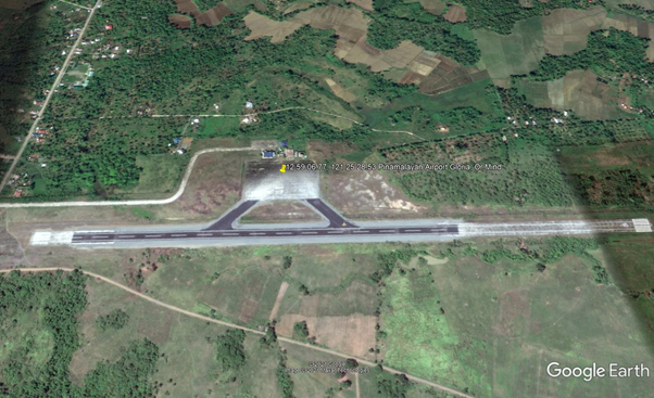
Runway
|
Runway #1 |
|
|---|---|
|
Runway Dimensions |
1200 m x 30 m |
|
Runway Orientation |
01/19 |
|
Runway Surface |
Hard |
|
Runway Condition |
Asphalt |
Airport Infrastructure Details
|
Infrastructure |
|||
|---|---|---|---|
|
Passenger / Cargo Security Screening |
Yes |
Runway Lighting |
No |
|
Refueling Capacity |
No |
Ground Handling Services |
No |
|
Air Traffic Control |
Yes |
Fire Fighting Equipment |
No |
|
Weather Information |
No |
Aircraft Parking Space |
Yes |
|
Navigation Aids |
No |
Perimeter Fencing |
Yes |
|
Windsock |
No |
|
|
Fuel Services Charges
Airport has no fuel servicing facility.
Royalties / Non Objection Fees (NOFs)
N/A
2.2.1.29 Philippines - Luzon Tugdan Airport (Romblon)
Airport Overview
Tugdan Airport is a Principal Class 2 Airport located in the province of Romblon in the Philippines. It is the only airport in the province of Romblon. The airport is located in Barangay Tugdan in the municipality of Alcantara, from which the airport derives its name. Cebu Pacific operates flights to and from Manila.
|
Airport Location and Contact |
|
|---|---|
|
Country |
Philippines |
|
Province or District |
Romblon |
|
Nearest Town or City with Distance from Airport |
Alcantara, Romblon |
|
Airport’s Complete Name |
Romblon Airport |
|
Latitude |
12.315709 |
|
Longitude |
122.081347 |
|
Elevation (ft and m) |
10 ft / 3 m |
|
IATA Code |
TBH |
|
ICAO Code |
RPVU |
|
Managing Company or Airport Authority |
Civil Aviation Authority of the Philippiines (CAAP) |
|
Management Contact Person |
Nonie June G. Lucidos Officer-in-Charge, CAAP +63 42 198-8210 |
|
NGO and/or UN Presence at Airport? |
None |

Runway
|
Runway #1 |
|
|---|---|
|
Runway Dimensions |
1390 m x 30 m |
|
Runway Orientation |
03/21 |
|
Runway Surface |
Hard |
|
Runway Condition |
Concrete |
Airport Infrastructure Details
|
Infrastructure |
|||
|---|---|---|---|
|
Passenger / Cargo Security Screening |
Yes |
Runway Lighting |
No |
|
Refueling Capacity |
No |
Ground Handling Services |
Yes |
|
Air Traffic Control |
Yes |
Fire Fighting Equipment |
Yes |
|
Weather Information |
Yes |
Aircraft Parking Space |
Yes |
|
Navigation Aids |
Yes |
Perimeter Fencing |
Yes |
|
Windsock |
Yes |
|
|
Fuel Services Charges
Airport has no fuel servicing facility, but there is a local
supplier of aviation fuel.
|
Price per Litre USD - $ |
|
|---|---|
|
Jet A-1 |
0.459 USD / Ltr |
Royalties / Non Objection Fees (NOFs)
N/A
2.2.1.30 Philippines - Luzon San Jose Airport
Airport Overview
San Jose, Mindoro Airport, formerly known as McGuire Field, serves the city of San Jose, Mindoro Province. The airport is classified as a Principal Class 1 domestic airport by the Civil Aviation Authority of the Philippines (CAAP). It caters to commercial flights from/to Manila cater by Cebu Pacific. The airport primarily serves as a general aviation facility but receives commercial air services by local carriers, Cebgo and Cebu Pacific. It is operated by the CAAP.
|
Airport Location and Contact |
|
|---|---|
|
Country |
Philippines |
|
Province or District |
Occidental Mindoro |
|
Nearest Town or City with Distance from Airport |
San Jose, Occidental Mindoro |
|
Airport’s Complete Name |
San Jose Airport |
|
Latitude |
12.360223 |
|
Longitude |
121.045313 |
|
Elevation (ft and m) |
14 ft / 4 m |
|
IATA Code |
SJI |
|
ICAO Code |
RPUH |
|
Managing Company or Airport Authority |
Civil Aviation Authority of the Philippines (CAAP) |
|
Management Contact Person |
Cristopher Enriquez Officer-in-Charge, CAAP +63 43 491-1828 FAX +63 43 491-1514 |
|
NGO and/or UN Presence at Airport? |
None |

Runway
|
Runway #1 |
|
|---|---|
|
Runway Dimensions |
1836 m x 30 m |
|
Runway Orientation |
10/28 |
|
Runway Surface |
Hard |
|
Runway Condition |
Concrete |
Airport Infrastructure Details
|
Infrastructure |
|||
|---|---|---|---|
|
Passenger / Cargo Security Screening |
Yes |
Runway Lighting |
No |
|
Refueling Capacity |
No |
Ground Handling Services |
Yes |
|
Air Traffic Control |
Yes |
Fire Fighting Equipment |
Yes |
|
Weather Information |
Yes |
Aircraft Parking Space |
Yes |
|
Navigation Aids |
Yes |
Perimeter Fencing |
Yes |
|
Windsock |
Yes |
|
|
Fuel Services Charges
Airport has no fuel servicing facility. There is a contracted local supplier for aviation gas.
Royalties / Non Objection Fees (NOFs)
N/A
2.2.1.31 Philippines - Luzon Lubang Airport
Airport Overview
Lubang Airport services the Lubang Islands, in the Occidental Mindoro. It is a community airport which primarily handles general aviation services. It is under renovation for future domestic flights and P2P flights. Lubang Airport is operated by the Civil Aviation Authority of the Philippines.
|
Airport Location and Contact |
|
|---|---|
|
Country |
Philippines |
|
Province or District |
Occidental Mindoro |
|
Nearest Town or City with Distance from Airport |
Lubang Island, Occidental Mindoro |
|
Airport’s Complete Name |
Lubang Airport |
|
Latitude |
13.856132 |
|
Longitude |
120.108952 |
|
Elevation (ft and m) |
43 ft / 13 m |
|
IATA Code |
LBX |
|
ICAO Code |
RPLU |
|
Managing Company or Airport Authority |
Civil Aviation Authority of the Philippines (CAAP) |
|
Management Contact Person |
Adrian Valisno Officer-in-Charge |
|
NGO and/or UN Presence at Airport? |
None |

Runway
|
Runway #1 |
|
|---|---|
|
Runway Dimensions |
1210 m x 30 m |
|
Runway Orientation |
07/25 |
|
Runway Surface |
Hard |
|
Runway Condition |
Asphalt |
Airport Infrastructure Details
Lubang Airport is currently being renovated.
Fuel Services Charges
Lubang Airport has no fuel servicing facility.
Royalties / Non Objection Fees (NOFs)
N/A
2.2.1.32 Philippines - Luzon Wasig Airport
Airport Overview
Wasig Airport is a community airport classification operated by the Civil Aviation Authority of the Philippines (CAAP) in Mansalay, Oriental Mindoro.
|
Airport Location and Contact |
|
|---|---|
|
Country |
Philippines |
|
Province or District |
Oriental Mindoro |
|
Nearest Town or City with Distance from Airport |
Mansalay, Oriental Mindoro |
|
Airport’s Complete Name |
Wasig Airport |
|
Latitude |
12.533050 |
|
Longitude |
121.479476 |
|
Elevation (ft and m) |
13 ft / 4 m |
|
IATA Code |
- |
|
ICAO Code |
RPLG |
|
Managing Company or Airport Authority |
Civil Aviation Authority of the Philippines (CAAP) |
|
Management Contact Person |
Maximo O. Padilla Officer-in-Charge, CAAP +63 43 288-3105 |
|
NGO and/or UN Presence at Airport? |
None |
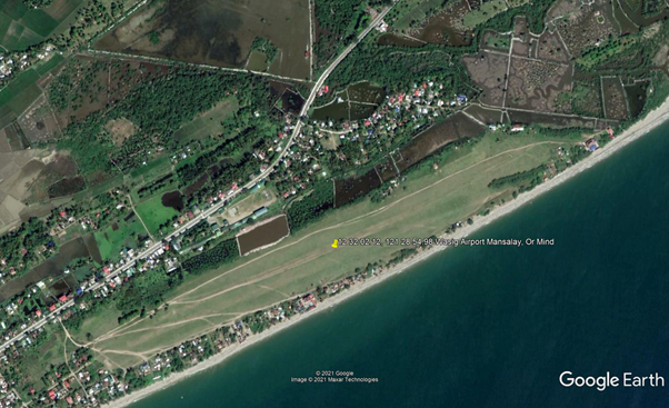
Runway
|
Runway #1 |
|
|---|---|
|
Runway Dimensions |
900 m x 100 m |
|
Runway Orientation |
9/27 |
|
Runway Surface |
Grass |
|
Runway Condition |
unknown |
Airport Infrastructure Details
|
Infrastructure |
|||
|---|---|---|---|
|
Passenger / Cargo Security Screening |
No |
Runway Lighting |
No |
|
Refueling Capacity |
No |
Ground Handling Services |
No |
|
Air Traffic Control |
No |
Fire Fighting Equipment |
No |
|
Weather Information |
No |
Aircraft Parking Space |
No |
|
Navigation Aids |
No |
Perimeter Fencing |
No |
|
Windsock |
No |
|
|
Fuel Services Charges
Airport has no fuel servicing facility.
Royalties / Non Objection Fees (NOFs)
N/A
2.2.1.33 Philippines - Luzon Naga Airport
Operator: Air Transportation Office (Secondary Airport or Minor Commercial Domestic Airport) - Magnetic Variation 001˚ W (01/06) – Beacon - PCN 041RBWU - NO ILS – Runway 04 (Heading 045.0), slope 1.0˚, lighting HIRL / PAPI GS 3.05 – Runway 22 (Heading 225.0), slope -0.1˚, lighting HIRL / PAPI GS 3.00. Operating hours: Tue-Sun 2200 – 0600Z, Mon 0000 – 0800Z.
Caution: Approach runway 04 obstructed by trees, electric post and bamboo groves.
Communications RDO (2200-0600Z) 122.1 / 5447.5 / 3834, Tower (HS OT PN) 122.1. Navaid: Type VOR-DME, ID NGA, Name NAGA, Channel 094X, Freq 114.7, coordinates Lat 13˚ 34’ 55.99” N – Long 123˚ 16’ 10.35” E at airfield.
|
Airport Details |
|||
|---|---|---|---|
|
Country |
Philippines – UTC + 8 |
Latitude |
13.58489 |
|
Province / District |
Camarines Sur, Luzon |
Longitude |
123.2702 |
|
Airport Name |
Naga Airport |
Elevation (ft) |
142 |
|
IATA & ICAO codes |
WNP - RPUN |
Surface |
Concrete |
|
Town or City (closest) |
Pili, Naga City |
Runway Condition |
To be confirmed before landing |
|
NGO / UN (on ground) |
n/a |
Passenger / Cargo Security Screening (Yes / No) |
n/a |
|
Runway Dimension |
1,402 m x 30 m |
Ground Handling (Yes / No) |
n/a |
|
Refueling Capacity |
n/a |
Runway Lighting (Yes / No) |
n/a |
|
Runway Heading |
n/a |
Fire Fighting Equipment (Yes / No) |
n/a |
|
Air Traffic Control (Yes / No) |
n/a |
Windsock (Yes / No) |
n/a |
|
Weather Information (Yes / No) |
n/a |
Aircraft Parking space (Yes / No) |
n/a |
|
Navigation Aids (Yes / No) |
n/a |
Perimeter fencing (Yes / No) |
n/a |
2.2.1.34 Philippines - Luzon Legazpi Airport
Operator: Air Transportation Office (Major Airport) – (In 2008 – Pax 282,409, Cargo 979 MT, Movement 2,556) – Night landing on advance notice. Been 12 km from the crater of Mayon volcano, the airport has currently no ILS and plans are worked out to get the airport relocated away from the volcanic risk. - Magnetic Variation 001˚ W (01/06) – Beacon - PCN 046RBWT - NO ILS – Runway 06 (Heading 057.0), slope -0.6˚, Landing distance reduced to 2,180 m (displaced threshold length 100 m) lighting HIRL / A2 / PAPI GS 3.5 – Runway 24 (Heading 237.0), slope 0.6˚, Landing distance reduced to 2,080 m(displaced threshold length 200 m), lighting HIRL / A2 / PAPI. Operating hours: 2200 – 1000Z.
Caution: Approach runway 06 - 24 obstructed by trees and building. Radiosonde balloon released daily to a minimum height of 21,340’. Red and white painted antenna 82’ high located on 1,237’ AMSL site 5.4 NM North / North East of the airfield. Volcano known as Mount Mayon (8,077’) located 6NM North / North West.
Communications Tower and RDO 118.1 – 123.3 / 5447.5 / 3834. Navaid: Type VOR-DME, ID LP, Name LEGAZPI, Channel 059X, Freq 112.2, coordinates Lat 13˚ 09’ 00.89” N – Long 123˚ 43’ 41.09” E 1.1NM from airfield Bearing 070.0, Type NDB, ID JV, Name JOVELLAR, Freq 360, coordinates Lat 13˚ 04’ 42.91” N – Long 123˚ 35’ 44.09” E 9.9NM from airfield Bearing 062.9.
|
Airport Details |
|||
|---|---|---|---|
|
Country |
Philippines – UTC + 8 |
Latitude |
13.15706 |
|
Province / District |
Bicol, Luzon |
Longitude |
123.7462 |
|
Airport Name |
Legazpi Airport |
Elevation (ft) |
66 |
|
IATA & ICAO codes |
LGP - RPLP |
Surface |
Asphalt |
|
Town or City (closest) |
Legazpi City |
Runway Condition |
To be confirmed before landing |
|
NGO / UN (on ground) |
n/a |
Passenger / Cargo Security Screening (Yes / No) |
n/a |
|
Runway Dimension |
2,280 m x 36 m |
Ground Handling (Yes / No) |
n/a |
|
Refueling Capacity |
n/a |
Runway Lighting (Yes / No) |
Yes |
|
Runway Heading |
n/a |
Fire Fighting Equipment (Yes / No) |
n/a |
|
Air Traffic Control (Yes / No) |
n/a |
Windsock (Yes / No) |
n/a |
|
Weather Information (Yes / No) |
n/a |
Aircraft Parking space (Yes / No) |
n/a |
|
Navigation Aids (Yes / No) |
n/a |
Perimeter fencing (Yes / No) |
n/a |
2.2.1.35 Philippines - Luzon Bagasbas Airport
Operator: Air Transportation Office (Secondary Airport or Minor Commercial Domestic Airport) - Magnetic Variation 001˚ W (01/06) – PCN 009FBYU – NO ILS – Runway 06 (Heading 058.0) Slope 0.2˚ – Runway 24 (Heading 238.0) Slope -0.2˚.
Caution approach zone of runway 06 is obstructed by trees and tall antenna and approach zone runway 24 obstructed by coco grove, clock tower and antenna.
Operating hours: 2300 – 0800Z. Nil permanent communications. Navaid: Type NDB, ID DT, Name DAET, Freq 215, coordinates Lat 14˚ 08’ 00.47” N– Long 122˚ 58’ 58.92” E at airfield.
|
Airport Details |
|||
|---|---|---|---|
|
Country |
Philippines – UTC + 8 |
Latitude |
14.12917 |
|
Province / District |
Luzon, Camarines Norte |
Longitude |
122.9802 |
|
Airport Name |
Bagasbas Airport, Daet Airport |
Elevation (ft) |
10 |
|
IATA & ICAO codes |
DTE - RPUD |
Surface |
Asphalt |
|
Town or City (closest) |
Barangay Bagasbas, Daet |
Runway Condition |
GOOD however to be confirmed before landing |
|
NGO / UN (on ground) |
n/a |
Passenger / Cargo Security Screening (Yes / No) |
n/a |
|
Runway Dimension |
1,150 m x 30 m |
Ground Handling (Yes / No) |
n/a |
|
Refueling Capacity |
n/a |
Runway Lighting (Yes / No) |
No |
|
Runway Heading |
n/a |
Fire Fighting Equipment (Yes / No) |
n/a |
|
Air Traffic Control (Yes / No) |
n/a |
Windsock (Yes / No) |
n/a |
|
Weather Information (Yes / No) |
n/a |
Aircraft Parking space (Yes / No) |
n/a |
|
Navigation Aids (Yes / No) |
n/a |
Perimeter fencing (Yes / No) |
n/a |
2.2.1.36 Philippines - Luzon Virac Airport
Operator: Air Transportation Office (Secondary Airport or Minor Commercial Domestic Airport) - (in 2008 – Pax 28,946, Cargo 81 MT, Movement 680) - Magnetic Variation 001˚ W (01/06) – PCN 037RBZT - NO ILS – Runway 06 (Heading 060.0)
Landing distance reduced to 1,455m (displaced threshold length 105m) Take off distance increased to 1,619m (overrun asphalt pad 59m) – Runway 24 (Heading 240.0) Take off distance increased to 1,575m (overrun concrete pad 15m). Lighting system PAPI 06/GS 3.15 – 24/GS 3.2.
Operating hours: 2200 – 0600Z - Communications: RDO (2200 – 0600Z) 122.2 / 5447.5 / 3834. FSS OT 24hr PN. Navaid: Type NDB, ID VC, Name VIRAC, Freq 268, coordinates Lat 13˚ 37’ 36.77” N– Long 124˚ 12’ 47.10” E, distance from field 3.0 NM, bearing from Navaid 189.3.
|
Airport Details |
|||
|---|---|---|---|
|
Country |
Philippines – UTC + 8 |
Latitude |
13.57644 |
|
Province / District |
Catanduanes |
Longitude |
124.2057 |
|
Airport Name |
Virac Airport |
Elevation (ft) |
121 |
|
IATA & ICAO codes |
VRC - RPUV |
Surface |
Concrete |
|
Town or City (closest) |
Virac City |
Runway Condition |
GOOD however to be confirmed before landing |
|
NGO / UN (on ground) |
n/a |
Passenger / Cargo Security Screening (Yes / No) |
n/a |
|
Runway Dimension |
1,560 m x 30 m |
Ground Handling (Yes / No) |
n/a |
|
Refueling Capacity |
n/a |
Runway Lighting (Yes / No) |
Yes |
|
Runway Heading |
n/a |
Fire Fighting Equipment (Yes / No) |
n/a |
|
Air Traffic Control (Yes / No) |
n/a |
Windsock (Yes / No) |
n/a |
|
Weather Information (Yes / No) |
n/a |
Aircraft Parking space (Yes / No) |
n/a |
|
Navigation Aids (Yes / No) |
n/a |
Perimeter fencing (Yes / No) |
n/a |
2.2.1.37 Philippines - Luzon Masbate Airport
Operator: Air Transportation Office (Minor Commercial Domestic Airport) – (In 2008 – Pax 26,084, Cargo 142 MT, Movement 724) - Magnetic Variation 001˚ W (01/06) – PCN 012FCYT - NO ILS – Runway 03 (Heading 038.0) Take off distance increased to 1,261m (overrun asphalt pad 61m), slope -0.8˚ – Runway 21 (Heading 218.0) Take off distance increased to 1,279m (overrun asphalt pad 79m). slope 0.8˚. Operating hours: 2200 – 0600Z –
Caution Mountain at 3,281’ (0.5 NM) from approach end runway 03. RESTRICTION: LANDING ON RWY 21 AND TAKE OFF ON RWY 03.
Communications: RDO 122.0 / 5447.5 / 3834. Navaid: Type VOR-DME, ID MBT, Name MASBATE, Channel 104X, Freq 115.7, coordinates Lat 12˚ 22’ 09.22” N– Long 123˚ 37’ 49.85” E at field.
|
Airport Details |
|||
|---|---|---|---|
|
Country |
Philippines – UTC + 8 |
Latitude |
12.36937 |
|
Province / District |
Masbate |
Longitude |
123.6292 |
|
Airport Name |
Masbate Airport |
Elevation (ft) |
n/a |
|
IATA & ICAO codes |
MBT – RPVJ |
Surface |
Asphalt |
|
Town or City (closest) |
Masbate City |
Runway Condition |
FAIR however to be confirmed before landing |
|
NGO / UN (on ground) |
n/a |
Passenger / Cargo Security Screening (Yes / No) |
n/a |
|
Runway Dimension |
1,200 m x 30 m |
Ground Handling (Yes / No) |
n/a |
|
Refueling Capacity |
n/a |
Runway Lighting (Yes / No) |
n/a |
|
Runway Heading |
n/a |
Fire Fighting Equipment (Yes / No) |
n/a |
|
Air Traffic Control (Yes / No) |
n/a |
Windsock (Yes / No) |
n/a |
|
Weather Information (Yes / No) |
n/a |
Aircraft Parking space (Yes / No) |
n/a |
|
Navigation Aids (Yes / No) |
n/a |
Perimeter fencing (Yes / No) |
n/a |
2.2.2 Philippines - Visayas Aviation
The following pages shows the Airport Assessments for the Visayas group of islands, which covers the administrative regions 6 (Western Visayas), 7 (Central Visayas), and 8 (Eastern Visayas).
2.2.2.1 Philippines - Visayas Mactan-Cebu International Airport
PLEASE NOTE: Following the response to Typhoon Haiyan (Yolanda) on 09 Nov 2013, additional Philippines Customs information is avalible and can be found in the following document:
Logistics Cluster Philippines Customs Snapshot 131114
In order to streamline the customs procedures for humanitarian organisations bringing relief good into the Philippines, a “One-Stop-Shop” has been established in Manila, Cebu and Naia. The Purpose of the “One-Stop-Shop” is to bring together in a single location the key staff, necessary for expediting customs clearances for humanitarian cargo, for the selected agencies including representatives of: the Department of Social Welfare and Development (DSWD), the Department of Health, The Bureau of Food and Drugs, the Ministry of Finance (MoF), and the Department of Foreign Affairs (DFA).
Operator: Civil Aviation Authority of the Philippines (International Airport – Military / Civil joint use Airport) - (in 2008 – Pax 3,642,862, Cargo 45,403 MT, Movement 46,206) – Magnetic Variation 000˚ W (01/06) – PCN 070FBWT – Beacon – ILS - Airport of Entry - Runway 04 (Heading 045.0) Take off distance increased to 3,360 (overrun asphalt pad 60 m), slope 0.1˚, Lighting HIRL / CL / M / PAPI– Runway 22 (Heading 225.0) Take off distance increased to 3,360 (overrun asphalt pad 60 m), slope -0.1˚, Lighting HIRL / CL / M / PAPI.
Caution: to avoid FOD (due to work in progress) lift off while taxiing aircraft type 747 or same range advise to use inboard engine only. BASH, heavy activity from April to September. Work in Progress. RESTRICTION:TWO-WAY RADIO REQUIRED. TAXIWAY NE OF MILITARY RAMP RESTRICTED TO AIRCRAFT OPERATION WHEN MILITARY JETS ARE PARKED BESIDE THE RUNWAY.
Operating hours: 0000 – 0000Z. Fuel Jet A1, A+ and B without icing inhibitor. Communications: TWR 118.1, GROUND 121.9, 124.0 RDO 5205, 3872.5 OPS (2200 – 1000Z) 118.5 CLNC 125.1 ATIS (2100 – 1300Z) 126.6 APP 124.7, 121.2 con 127.5, 132.2 – Navaid: Type VOR-DME, ID MCT, Name MACTAN, Channel 090X, Freq 114.3, at Airport, Coordinates Lat 10˚ 18’ 48.84” N Long 123˚ 59’ 17.87” E. Navaid: Type NDB, ID MCT, Name MACTAN, Freq 331, at Airport, Coordinates Lat 10˚ 18’ 33.24” N Long 123˚ 59’ 03.90” E.
|
Airport Details |
|||
|---|---|---|---|
|
Country |
Philippines – UTC + 8 |
Latitude |
10.30754 |
|
Province / District |
Mactan Island, Visayas |
Longitude |
123.9794 |
|
Airport Name |
Mactan-Cebu International Airport |
Elevation (ft) |
31 |
|
IATA & ICAO codes |
CEB - RPVM |
Surface |
Asphalt |
|
Town or City (closest) |
Lapu-Lapu City, Cebu City |
Runway Condition |
GOOD however to be confirmed before landing |
|
NGO / UN (on ground) |
n/a |
Passenger / Cargo Security Screening (Yes / No) |
n/a |
|
Runway Dimension |
3,300 m x 45 m |
Ground Handling (Yes / No) |
n/a |
|
Refueling Capacity |
n/a |
Runway Lighting (Yes / No) |
Yes |
|
Runway Heading |
n/a |
Fire Fighting Equipment (Yes / No) |
n/a |
|
Air Traffic Control (Yes / No) |
n/a |
Windsock (Yes / No) |
n/a |
|
Weather Information (Yes / No) |
n/a |
Aircraft Parking space (Yes / No) |
n/a |
|
Navigation Aids (Yes / No) |
n/a |
Perimeter fencing (Yes / No) |
n/a |
2.2.2.2 Philippines - Visayas Iloilo International Airport
Operator: Civil Aviation Authority of the Philippines (Class 1 principal – major domestic ) - (in 2008 – Pax 1,073,907, Cargo 9,360 MT, Movement 12,160) - Magnetic Variation 000˚ W (01/06) – PCN 046RBWU – Beacon – ILS – Runway 02 (Heading 024.0). Slope 0.1˚, Lighting A2 / PAPI / LIGHTS – Runway 20 (Heading 204.0) Slope -0.1˚, Landing distance reduced to 1,950 (displaced threshold length 150m) Lighting PAPI 2.9 / LIGHT
Caution: trees are partially obstructing approach runway 02 and 20. Roads are passing at both ends of the runways. RESTRICTION:TWO-WAY RADIO REQUIRED
Operating hours: 0000 – 0900Z.. Fuel Jet A1, NC, AvGas available. Communications: TWR 123.4, 5205, 3872.5 (Operator from 2100 to 1300Z / BACOLOD Airport reachable for assistance on 121.0 – Navaid: Type VOR-DME, ID IOO, Name ILOILO, Channel 110X, Freq 116.3, at Airport, Coordinates Lat 10˚ 42’ 34.25” N Long 122˚ 32’ 31.90” E. The cargo terminal is 1,281 m2 and is designed to handle approx 11,500 MT per year.
|
Airport Details |
|||
|---|---|---|---|
|
Country |
Philippines – UTC + 8 |
Latitude |
10.71304 |
|
Province / District |
Iloilo, Western Visayas, Panay |
Longitude |
122.5453 |
|
Airport Name |
Iloilo International Airport |
Elevation (ft) |
27 |
|
IATA & ICAO codes |
ILO – RPVI |
Surface |
Asphalt |
|
Town or City (closest) |
Barangay Duyan-Duyan, between Cabatuan and Santa Barbara |
Runway Condition |
GOOD however to be confirmed before landing |
|
NGO / UN (on ground) |
n/a |
Passenger / Cargo Security Screening (Yes / No) |
n/a |
|
Runway Dimension |
2,500 m x 45 m |
Ground Handling (Yes / No) |
n/a |
|
Refueling Capacity |
n/a |
Runway Lighting (Yes / No) |
Yes |
|
Runway Heading |
n/a |
Fire Fighting Equipment (Yes / No) |
n/a |
|
Air Traffic Control (Yes / No) |
n/a |
Windsock (Yes / No) |
n/a |
|
Weather Information (Yes / No) |
n/a |
Aircraft Parking space (Yes / No) |
n/a |
|
Navigation Aids (Yes / No) |
n/a |
Perimeter fencing (Yes / No) |
n/a |
2.2.2.3 Philippines - Visayas Kalibo Airport
Operator: Civil Aviation Authority of the Philippines (International Airport) - (in 2008 – Pax 400,042, Cargo 1,508 MT, Movement 4,706) – Magnetic Variation 000˚ W (01/06) – PCN 047RBWU – Beacon - Runway 05 (Heading 049.0) Take off distance increased to 2,227 (overrun Concrete pad 40m), Lighting HIRL / PAPI GS 2.95 – Runway 23 (Heading 229.0) Take off distance increased to 2,247 (overrun concrete pad 60m), Lighting HIRL / A2 / PAPI GS 3.0.
Caution: Runways 05 – 23 approach obstructed by trees and antennas. RESTRICTION:TWO-WAY RADIO REQUIRED. CTLZ LIMITED TO KALIBO TRAFFIC W/O ATC PERMISSION. AIRCRAFT RESTRICTED TO MAX 200 KTS W/O ATC PERMISSION IN CTLZ. VFR FLIGHT FROM SOUTH NEED TO CONTACT TOWER 10NM PRIOR KALIBO CTLZ. WORK IN PROGRESS.
Operating hours: 2200 – 1000Z. Communications: TWR 123.1, 5205, 3872.5 – Navaid: Type VOR-DME, ID KLO, Name KALIBO, Channel 077X, Freq 113, at Airport, Coordinates Lat 11˚ 41’ 00.90” N Long 122˚ 22’ 59.80” E.
|
Airport Details |
|||
|---|---|---|---|
|
Country |
Philippines – UTC + 8 |
Latitude |
11.67943 |
|
Province / District |
Boracay, Aklan, Panay |
Longitude |
122.3763 |
|
Airport Name |
Kalibo International Airport |
Elevation (ft) |
14 |
|
IATA & ICAO codes |
KLO - RPVK |
Surface |
Concrete |
|
Town or City (closest) |
Kalibo, Aklan |
Runway Condition |
GOOD however to be confirmed before landing |
|
NGO / UN (on ground) |
n/a |
Passenger / Cargo Security Screening (Yes / No) |
n/a |
|
Runway Dimension |
2,187 m 45 m |
Ground Handling (Yes / No) |
n/a |
|
Refueling Capacity |
n/a |
Runway Lighting (Yes / No) |
Yes |
|
Runway Heading |
n/a |
Fire Fighting Equipment (Yes / No) |
n/a |
|
Air Traffic Control (Yes / No) |
n/a |
Windsock (Yes / No) |
n/a |
|
Weather Information (Yes / No) |
n/a |
Aircraft Parking space (Yes / No) |
n/a |
|
Navigation Aids (Yes / No) |
n/a |
Perimeter fencing (Yes / No) |
n/a |
2.2.2.4 Philippines - Visayas Caticlan Airport
Operator: Civil Aviation Authority (Class 2 Airport) – Project in course to extend the runway and to build a new terminal. The operator should then be Caticlan International Airport and Development Corporation - Magnetic Variation 000˚ W (01/06) – PCN 040RCWU - NO ILS – Runway 06 (Heading 064.0) Landing distance reduced to 900 m (displaced threshold length 50 m). – Runway 24 (Heading 244.0) Landing distance reduced to 884 m (displaced threshold length 66 m)..
Operating hours: 2200 – 1000Z –
Caution presence of a 128’ hill at 719 m from runway 24 threshold. RESTRICTION: LANDING ON RWY 06 AND TAKE OFF ON RWY 24. DURING STRONG WIND TOWER APPROVAL REQUIRED FOR LANDING RWY 24 AND TAKE OFF RUNWAY 06 . Communications: TWR / RDO 122.7 / 5205 / 3872.5. Navaid: Type NDB, ID CT, Name CATICLAN, Freq 379, coordinates Lat 11˚ 55’ 30.03” N– Long 121˚ 57’ 29.83” E at field.
|
Airport Details |
|||
|---|---|---|---|
|
Country |
Philippines – UTC + 8 |
Latitude |
11.9245 |
|
Province / District |
Aklan, Panay, Western Visayas |
Longitude |
121.9541 |
|
Airport Name |
Godofredo P. Ramos Airport or Caticlan Airport |
Elevation (ft) |
7 |
|
IATA & ICAO codes |
MPH - RPVE |
Surface |
Concrete |
|
Town or City (closest) |
Barangay Caticlan, Malay City |
Runway Condition |
To be confirmed before landing |
|
NGO / UN (on ground) |
n/a |
Passenger / Cargo Security Screening (Yes / No) |
n/a |
|
Runway Dimension |
950 m x 30 m |
Ground Handling (Yes / No) |
n/a |
|
Refueling Capacity |
n/a |
Runway Lighting (Yes / No) |
No |
|
Runway Heading |
n/a |
Fire Fighting Equipment (Yes / No) |
n/a |
|
Air Traffic Control (Yes / No) |
n/a |
Windsock (Yes / No) |
n/a |
|
Weather Information (Yes / No) |
n/a |
Aircraft Parking space (Yes / No) |
n/a |
|
Navigation Aids (Yes / No) |
n/a |
Perimeter fencing (Yes / No) |
n/a |
2.2.2.5 Philippines - Visayas Roxas Airport
Operator: Air Transportation Office (Trunkline Airport or Major Commercial Domestic Airport) – (In 2008 – Pax 115,375, Cargo 1,347 MT, Movement 1,498). - Magnetic Variation 000˚ W (01/06) – Beacon - PCN 047RBWU - NO ILS – Runway 14 (Heading 145.0),
Landing distance reduced to 1,785 m (displaced threshold length 105 m), take off distance increased to 1,916 m (overrun concrete pad 26m) Lighting system PAPI GS 2.95 / HIRL – Runway 32 (Heading 325.0), Landing distance reduced to 1,820 m (displaced threshold length 70 m Lighting system PAPI / HIRL. Operating hours: 2100 – 0500Z .
Caution: Approach runway 32 obstructed by trees and antena. Lighting on request only.Communications RDO 118.5 / 5205 / 3872. (24/24) Navaid: Type VOR-DME, ID ROX, Name ROXAS, Channel 076X, Freq 112.9, coordinates Lat 11˚ 35’ 48.93” N – Long 122˚ 45’ 18.43” E at field.
|
Airport Details |
|||
|---|---|---|---|
|
Country |
Philippines – UTC + 8 |
Latitude |
11.59767 |
|
Province / District |
Capiz |
Longitude |
122.7517 |
|
Airport Name |
Roxas Airport |
Elevation (ft) |
10 |
|
IATA & ICAO codes |
RXS - RPVR |
Surface |
Concrete |
|
Town or City (closest) |
Barangay Gabuan, Roxas City |
Runway Condition |
To be confirmed before landing |
|
NGO / UN (on ground) |
n/a |
Passenger / Cargo Security Screening (Yes / No) |
n/a |
|
Runway Dimension |
1,890 m x 45 m |
Ground Handling (Yes / No) |
n/a |
|
Refueling Capacity |
n/a |
Runway Lighting (Yes / No) |
Yes |
|
Runway Heading |
n/a |
Fire Fighting Equipment (Yes / No) |
n/a |
|
Air Traffic Control (Yes / No) |
n/a |
Windsock (Yes / No) |
n/a |
|
Weather Information (Yes / No) |
n/a |
Aircraft Parking space (Yes / No) |
n/a |
|
Navigation Aids (Yes / No) |
n/a |
Perimeter fencing (Yes / No) |
n/a |
2.2.2.6 Philippines - Visayas Dumaguete Airport
Operator: Air Transportation Office (Trunkline Airport or Major Commercial Domestic Airport) – (In 2008 – Pax 306,452, Cargo 2,655, Movement 2,714). - Magnetic Variation 000˚ W (01/06) – Beacon - PCN 033FBXU - NO ILS – Runway 09 (Heading 093.0), lighting HIRL / REIL / PAPI – Runway 27 (Heading 273.0) take off distance increased to 1,926 m (overrun asphalt pad 56m)., lighting HIRL / REIL / PAPI. Operating hours: 2100 – 1000Z.
Caution: Trees and houses along approach runway 09. Runway grooved. Beacon out of service.
Communications Tower 129.7 – 123.5 / 5205 / 3822.5. Navaid: Type VOR, ID DG, Name DUMAGUETTE, Freq 114.1, coordinates Lat 09˚ 20’ 01.18” N – Long 123˚ 18’ 23.06” E at airfield.
|
Airport Details |
|||
|---|---|---|---|
|
Country |
Philippines |
Latitude |
9.333714 |
|
Province / District |
Negros Oriental |
Longitude |
123.3005 |
|
Airport Name |
Barangay Boloc-Boloc, Sibulan City |
Elevation (ft) |
15 |
|
IATA & ICAO codes |
DGT - RPVD |
Surface |
Asphalt |
|
Town or City (closest) |
Dumaguete Airport or Sibulan Airport |
Runway Condition |
To be confirmed before landing |
|
NGO / UN (on ground) |
n/a |
Passenger / Cargo Security Screening (Yes / No) |
n/a |
|
Runway Dimension |
1,870 m x 36 m |
Ground Handling (Yes / No) |
n/a |
|
Refueling Capacity |
n/a |
Runway Lighting (Yes / No) |
Yes |
|
Runway Heading |
n/a |
Fire Fighting Equipment (Yes / No) |
n/a |
|
Air Traffic Control (Yes / No) |
n/a |
Windsock (Yes / No) |
n/a |
|
Weather Information (Yes / No) |
n/a |
Aircraft Parking space (Yes / No) |
n/a |
|
Navigation Aids (Yes / No) |
n/a |
Perimeter fencing (Yes / No) |
n/a |
2.2.2.7 Philippines - Visayas Bacolod - Silay Airport
Operator: Air Transportation Office (Class 1 Principal Domestic Airport) – (In 2008 – Pax 843,488, Cargo 8,244 MT, Movement 9,860). The airport is built to receive International traffic. The runway is to be upgraded to 2,500 m in order to receive larger aircraft.
The cargo handling capacity of the airport is 16,715 MT and its storage capacity 10,075 m2. - Magnetic Variation 000˚ W (01/06) – Beacon - PCN 041RCWU - ILS – Runway 04 (Heading 040.0), Landing distance reduced to 1,896 m (displaced threshold length 60 m), lighting PAPI / HIRL / A2 – Runway 22 (Heading 193.0), Landing distance reduced to 1,885 m (displaced threshold length 71 m), ), take off distance increased to 1,993 m (overrun concrete pad 37m), lighting PAPI / HIRL / A2. Operating hours: Mon – Fri 0000 – 0900Z.
Caution: Approach runway 22 obstructed by building and antenna. First 584m of runway 04 are 45m wider than rest of the runway RESTRICTION: TWO WAY RADIO REQUIRED.
Fuel available on PPR (NC-A1), Communications TWR (2100 – 1300Z), RDO (2100 – 1100Z), 118.8 / 5205 / 3872.5, APP (2100 – 1300Z) 121.0. Navaid: Type VOR, ID BC, Name BACOLOD, Freq 114.9, coordinates Lat 10˚ 38’ 15.35” N – Long 122˚ 55’ 28.62” E at airfield.
|
Airport Details |
|||
|---|---|---|---|
|
Country |
Philippines – UTC + 8 |
Latitude |
10.64251 |
|
Province / District |
Negros Occidental |
Longitude |
122.9296 |
|
Airport Name |
Bacolod-Silay Airport |
Elevation (ft) |
25 |
|
IATA & ICAO codes |
BCD - RPVB |
Surface |
Asphalt |
|
Town or City (closest) |
Barangay Bagtic, Silay City |
Runway Condition |
To be confirmed before landing |
|
NGO / UN (on ground) |
n/a |
Passenger / Cargo Security Screening (Yes / No) |
n/a |
|
Runway Dimension |
1,956 m x 30 m |
Ground Handling (Yes / No) |
n/a |
|
Refueling Capacity |
n/a |
Runway Lighting (Yes / No) |
Yes |
|
Runway Heading |
n/a |
Fire Fighting Equipment (Yes / No) |
n/a |
|
Air Traffic Control (Yes / No) |
n/a |
Windsock (Yes / No) |
n/a |
|
Weather Information (Yes / No) |
n/a |
Aircraft Parking space (Yes / No) |
n/a |
|
Navigation Aids (Yes / No) |
n/a |
Perimeter fencing (Yes / No) |
n/a |
2.2.2.8 Philippines - Visayas Tagbilaran Airport
Operator: Civil Aviation Authority (Secondary Airport or Minor Commercial Domestic Airport) – (In 2008 – Pax 400,814, Cargo 5,496, Movement 5,612) - Magnetic Variation 000˚ W (01/06) – PCN 049RBWU - NO ILS – Runway 17 (Heading 174.0), Lighting system PAPI GS 3.1 – Runway 35 (Heading 354.0),Landing distance reduced to 1,663 m (displaced threshold length 116 m) Lighting system PAPI, HIRL, A2. Operating hours: 2200 – 1000Z –
Caution runway 35 threshold lts unserviced due WIP on taxiway. Trees each end of runway. Runway 35 approach obstructed by ant 470’ high 0.89 NM south, ant 433’ high 0.38NM south, building 440’ high 0.79NM south of the runway. Hi tension cable 790m long across the Juanico Strait approx 1.2NM North / North-West of Airport. 157’ mid span rising to 289’ at both ends.
Communications RDO 122.2 / 5205 / 3872.5. No Navaid.
|
Airport Details |
|||
|---|---|---|---|
|
Country |
Philippines – UTC + 8 |
Latitude |
9.664081 |
|
Province / District |
Bohol |
Longitude |
123.8532 |
|
Airport Name |
Tagbilaran Airport |
Elevation (ft) |
38 |
|
IATA & ICAO codes |
TAG - RPVT |
Surface |
Asphalt |
|
Town or City (closest) |
Barangay Taloto, Tagbilaran City |
Runway Condition |
To be confirmed before landing |
|
NGO / UN (on ground) |
n/a |
Passenger / Cargo Security Screening (Yes / No) |
n/a |
|
Runway Dimension |
1,779 m x 30 m |
Ground Handling (Yes / No) |
n/a |
|
Refueling Capacity |
n/a |
Runway Lighting (Yes / No) |
Yes |
|
Runway Heading |
n/a |
Fire Fighting Equipment (Yes / No) |
n/a |
|
Air Traffic Control (Yes / No) |
n/a |
Windsock (Yes / No) |
n/a |
|
Weather Information (Yes / No) |
n/a |
Aircraft Parking space (Yes / No) |
n/a |
|
Navigation Aids (Yes / No) |
n/a |
Perimeter fencing (Yes / No) |
n/a |
2.2.2.9 Philippines - Visayas Tacloban Airport
PLEASE NOTE: Following the response to Typhoon Haiyan (Yolanda) on 09 Nov 2013, additional Philippines Customs information is available and can be found in the following document:
Logistics
Cluster Philippines Customs Snapshot
131114
Normal customs procedures must now be followed for the import of all cargo. The “One-Stop-Shop” and the Logistics Cluster remain available to assist in an advisory role if required. Requests may be sent to Oliver Bartolo (LET Customs Procedures Advisor, +63 9158481559).
Operator: Civil Aviation Authority (Class 1 Principal or Major Domestic Airport) – (In 2008 – Pax 627,201, Cargo 4,546, Movement 7,954). - Magnetic Variation 000˚ W (01/06) – Beacon – PCN 046RBWU - NO ILS – Runway 18 (Heading 184.0), slope 0.1˚, Lighting system PAPI 3.1 / LIGHTS – Runway 36 (Heading 004.0), Slope -0.1˚, Lighting system PAPI 3.0 / A2 / LIGHTS, take off distance increased to 2,198 m (overrun asphalt pad 60m). Operating hours: 2100 – 0900Z –
Caution: Ant 92’ high situated 250m west of the runway and 350m north west of the control tower. Ant 57’ high situated 197m south west of control tower. Water tank 82’ high situated 270m west of the runway and 300m north west of the control tower. Few houses less than 500m from threshold runway 36. Hi tension power lines 158’ AMSL 2.7NM North / North West from Airport. Span 900m across San Juanico strait with midspan 88m AMSL with steel tower supports on both sides. RESTRICTION: BEACON OUT OF ORDER, NO TIGHT TURNS ON ASPHALT, TAXING AIRCRAFT USE TURNAROUND PAD.
Communications Control tower 122.1 / 5205 / 3872.5, Airport 120.8. Navaid: Type VOR-DME, ID TAC, Name TACLOBAN, Channel 102X, Freq 115.5, coordinates Lat 11˚ 13’ 55.16” N – Long 125˚ 01’ 33.57” E at field.
|
Airport Details |
|||
|---|---|---|---|
|
Country |
Philippines – UTC + 8 |
Latitude |
11.22763 |
|
Province / District |
Leyte |
Longitude |
125.0278 |
|
Airport Name |
Daniel Z. Romualdez Airport or DZR Airport or Tacloban Domestic Airport |
Elevation (ft) |
10 |
|
IATA & ICAO codes |
TAC - RPVA |
Surface |
Asphalt |
|
Town or City (closest) |
Barangay Costa Brava, San Jose, Tacloban City |
Runway Condition |
To be confirmed before landing |
|
NGO / UN (on ground) |
UNHAS |
Passenger / Cargo Security Screening (Yes / No) |
n/a |
|
Runway Dimension |
2,138 m x 45 m |
Ground Handling (Yes / No) |
Yes |
|
Refueling Capacity |
Yes (Petron) |
Runway Lighting (Yes / No) |
Yes |
|
Runway Heading |
18-36 |
Fire Fighting Equipment (Yes / No) |
Yes |
|
Air Traffic Control (Yes / No) |
Yes |
Windsock (Yes / No) |
Yes |
|
Weather Information (Yes / No) |
Yes |
Aircraft Parking space (Yes / No) |
3+Southern Remote |
|
Navigation Aids (Yes / No) |
n/a |
Perimeter fencing (Yes / No) |
n/a |
2.2.2.10 Philippines - Visayas Maasin Airport
Operator: Air Transportation Office (Feeder Airport) – Even if the only airport in the region the airport as no terminal, no commercial flight. The maximum take off weight is 12,000 lbs.
The airport is in need of maintenance. Magnetic Variation 000˚ W (01/06) – NO ILS – Runway 16 (Heading 165.0) Take off distance increased to 1,133m (overrun mixt rolled / graded earth pad with grass 23m) – Runway 34 (Heading 345.0) Take off distance increased to 1,133m (overrun mixt rolled / graded earth pad with grass 23m).
Operating hours: Sunrise to Sunset (SR-SS). Nil permanent communications. No Navaid.
|
Airport Details |
|||
|---|---|---|---|
|
Country |
Philippines – UTC + 8 |
Latitude |
10.18733 |
|
Province / District |
Leyte, Southern Leyte |
Longitude |
124.7823 |
|
Airport Name |
Panan-awan Airport or Maasin Airport |
Elevation (ft) |
328 |
|
IATA & ICAO codes |
MSN – RPSM |
Surface |
Concrete |
|
Town or City (closest) |
Barangay Panan-awan Maasin City |
Runway Condition |
Need maintenance however to be confirmed before landing |
|
NGO / UN (on ground) |
n/a |
Passenger / Cargo Security Screening (Yes / No) |
n/a |
|
Runway Dimension |
1,110 m x 30 m |
Ground Handling (Yes / No) |
n/a |
|
Refueling Capacity |
n/a |
Runway Lighting (Yes / No) |
Yes |
|
Runway Heading |
n/a |
Fire Fighting Equipment (Yes / No) |
n/a |
|
Air Traffic Control (Yes / No) |
n/a |
Windsock (Yes / No) |
n/a |
|
Weather Information (Yes / No) |
n/a |
Aircraft Parking space (Yes / No) |
n/a |
|
Navigation Aids (Yes / No) |
n/a |
Perimeter fencing (Yes / No) |
n/a |
2.2.2.11 Philippines - Visayas Hilongos Airport
Operator: Air Transportation Office (Feerder Airport)
|
Airport Details |
|||
|---|---|---|---|
|
Country |
Philippines |
Latitude |
10.37667 |
|
Province / District |
Leyte |
Longitude |
124.7611 |
|
Airport Name |
Hilongos Airport |
Elevation (ft) |
12 |
|
IATA & ICAO codes |
Unknown – RPVH |
Surface |
n/a |
|
Town or City (closest) |
Hilongos, Leyte Island |
Runway Condition |
To be confirmed before landing |
|
NGO / UN (on ground) |
n/a |
Passenger / Cargo Security Screening (Yes / No) |
n/a |
|
Runway Dimension |
1,000 m x n/a |
Ground Handling (Yes / No) |
n/a |
|
Refueling Capacity |
n/a |
Runway Lighting (Yes / No) |
n/a |
|
Runway Heading |
n/a |
Fire Fighting Equipment (Yes / No) |
n/a |
|
Air Traffic Control (Yes / No) |
n/a |
Windsock (Yes / No) |
n/a |
|
Weather Information (Yes / No) |
n/a |
Aircraft Parking space (Yes / No) |
n/a |
|
Navigation Aids (Yes / No) |
n/a |
Perimeter fencing (Yes / No) |
n/a |
2.2.2.12 Philippines - Visayas Guiuan Airport
Operator: Air Transportation Office (Feeder Airport) – The government is planning to develop the airport to support the commercial and tourism industry of the region (especially Calicoan Island). The airport has two runways but only one is currently operative. Magnetic Variation 000˚ W (01/06) – PCN 028FBXU – NO ILS – Runway 07 (Heading 066.0) - Runway 25 (Heading 246.0)
Caution runway is marked 06/24 repainting operation to be carried out. Tall trees (90’) in the path of runway 07 approach.
Operating hours: 2300 – 0800Z. No permanent communications. No navaid.
|
Airport Details |
|||
|---|---|---|---|
|
Country |
Philippines – UTC + 8 |
Latitude |
11.03554 |
|
Province / District |
Samar, Eastern Samar |
Longitude |
125.7415 |
|
Airport Name |
Guiuan Airport |
Elevation (ft) |
7 |
|
IATA & ICAO codes |
SAA - RPVG |
Surface |
Asphalt |
|
Town or City (closest) |
Guiuan |
Runway Condition |
GOOD however to be confirmed before landing |
|
NGO / UN (on ground) |
n/a |
Passenger / Cargo Security Screening (Yes / No) |
n/a |
|
Runway Dimension |
2,094 m x 45 m |
Ground Handling (Yes / No) |
n/a |
|
Refueling Capacity |
n/a |
Runway Lighting (Yes / No) |
No |
|
Runway Heading |
n/a |
Fire Fighting Equipment (Yes / No) |
n/a |
|
Air Traffic Control (Yes / No) |
n/a |
Windsock (Yes / No) |
n/a |
|
Weather Information (Yes / No) |
n/a |
Aircraft Parking space (Yes / No) |
n/a |
|
Navigation Aids (Yes / No) |
n/a |
Perimeter fencing (Yes / No) |
n/a |
2.2.2.13 Philippines - Visayas Catbalogan Airport
Operator: Air Transportation Office (Feeder Airport) – Long outstanding unfinished project in the area. Airport operationality to be confirmed every time.
|
Airport Details |
|||
|---|---|---|---|
|
Country |
Philippines |
Latitude |
11.81001 |
|
Province / District |
Samar |
Longitude |
124.8302 |
|
Airport Name |
Catbalogan Airport |
Elevation (ft) |
|
|
IATA & ICAO codes |
Unknown – RPVY |
Surface |
Concrete |
|
Town or City (closest) |
Buri, Catbalogan City |
Runway Condition |
To be confirmed before landing |
|
NGO / UN (on ground) |
n/a |
Passenger / Cargo Security Screening (Yes / No) |
n/a |
|
Runway Dimension |
1,200 m x n/a |
Ground Handling (Yes / No) |
n/a |
|
Refueling Capacity |
n/a |
Runway Lighting (Yes / No) |
n/a |
|
Runway Heading |
n/a |
Fire Fighting Equipment (Yes / No) |
n/a |
|
Air Traffic Control (Yes / No) |
n/a |
Windsock (Yes / No) |
n/a |
|
Weather Information (Yes / No) |
n/a |
Aircraft Parking space (Yes / No) |
n/a |
|
Navigation Aids (Yes / No) |
n/a |
Perimeter fencing (Yes / No) |
n/a |
2.2.2.14 Philippines - Visayas Borongan Airport
Operator: Air Transportation Office (Feeder Airport) - Magnetic Variation 000˚ W (01/06) – NO ILS – Runway 02 (Heading 021.0) – Runway 20 (Heading 201.0).
Caution runway 02 – 20 temporally closed due to lack of runway markers.
Operating hours: Sunrise to Sunset (SR-SS). Nil permanent communications. No Navaid.
|
Airport Details |
|||
|---|---|---|---|
|
Country |
Philippines – UTC + 8 |
Latitude |
11.67433 |
|
Province / District |
Samar, Eastern Samar |
Longitude |
125.4788 |
|
Airport Name |
Borongan |
Elevation (ft) |
7 |
|
IATA & ICAO codes |
BPR - RPVW |
Surface |
Concrete |
|
Town or City (closest) |
Barangay Punta Maria, Borongan |
Runway Condition |
Currently close due to lack of runway markers |
|
NGO / UN (on ground) |
n/a |
Passenger / Cargo Security Screening (Yes / No) |
n/a |
|
Runway Dimension |
1,199 m x 29 m |
Ground Handling (Yes / No) |
n/a |
|
Refueling Capacity |
n/a |
Runway Lighting (Yes / No) |
No |
|
Runway Heading |
n/a |
Fire Fighting Equipment (Yes / No) |
n/a |
|
Air Traffic Control (Yes / No) |
n/a |
Windsock (Yes / No) |
n/a |
|
Weather Information (Yes / No) |
n/a |
Aircraft Parking space (Yes / No) |
n/a |
|
Navigation Aids (Yes / No) |
n/a |
Perimeter fencing (Yes / No) |
n/a |
2.2.2.15 Philippines - Visayas Ormoc Airport
PLEASE NOTE: Following the response to Typhoon Haiyan (Yolanda) on 09 Nov 2013, additional Philippines Ormoc Airport information was provided on the 21 Nov 2013:
The Ormoc airport was not operational before the typhoon.
It has been rehabilitated with the support of the US army.
It can receive up to C130 aircraft
No JET A fuel available
Operator: Air Transportation Office (Secondary Airport or Minor Commercial Domestic Airport) – (In 2008 – Pax 15,830, Cargo 8 MT, Movement 2,790) - Magnetic Variation 000˚ W (01/06) – PCN 029RBWT - NO ILS – Runway 18 (Heading 184.0)
Landing distance reduced to 1,410m (displaced threshold length 456 m). – Runway 36 (Heading 364.0).
Caution runway 36 approach zone is obstructed by trees, ant and electric power line with high tension power lines.
Operating hours: 0000 – 1000Z – Nil permanent communication. No Navaid.
|
Airport Details |
|||
|---|---|---|---|
|
Country |
Philippines – UTC + 8 |
Latitude |
11.058 |
|
Province / District |
Leyte |
Longitude |
124.5653 |
|
Airport Name |
Ormoc Airport |
Elevation (ft) |
83 |
|
IATA & ICAO codes |
OMC – RPVO |
Surface |
Concrete |
|
Town or City (closest) |
Barangay Airport, Ormoc City |
Runway Condition |
FAIR however to be confirmed before landing |
|
NGO / UN (on ground) |
n/a |
Passenger / Cargo Security Screening (Yes / No) |
n/a |
|
Runway Dimension |
1,865 m x 36 m |
Ground Handling (Yes / No) |
n/a |
|
Refueling Capacity |
n/a |
Runway Lighting (Yes / No) |
n/a |
|
Runway Heading |
n/a |
Fire Fighting Equipment (Yes / No) |
n/a |
|
Air Traffic Control (Yes / No) |
n/a |
Windsock (Yes / No) |
n/a |
|
Weather Information (Yes / No) |
n/a |
Aircraft Parking space (Yes / No) |
n/a |
|
Navigation Aids (Yes / No) |
n/a |
Perimeter fencing (Yes / No) |
n/a |
2.2.2.16 Philippines - Visayas Catarman Airport
Operator: Air Transportation Office (Class 2 Principal Airport) – (In 2008 – Pax 22,624, Cargo 100 MT, Movement 454) - Magnetic Variation 001˚ W (01/06) – PCN 024RBWT - NO ILS – Runway 04 (Heading 044.0). – Runway 22 (Heading 224.0) Take off distance increased to 1,617m (overrun concrete pad 267m).. Operating hours: 2200 – 0800Z – Caution road crossing runway 04 threshold.
RESTRICTION: LANDING ON RWY 06 AND TAKE OFF ON RWY 24. DURING STRONG WIND TOWER APPROVAL REQUIRED FOR LANDING RWY 24 AND TAKE OFF RUNWAY 06 . Nil permanent communications. No Navaid.
|
Airport Details |
|||
|---|---|---|---|
|
Country |
Philippines – UTC + 8 |
Latitude |
12.50242 |
|
Province / District |
Northern Samar |
Longitude |
124.6358 |
|
Airport Name |
Catarman National Airport, Catarman Airport |
Elevation (ft) |
6 |
|
IATA & ICAO codes |
CRM – RPVF |
Surface |
Concrete |
|
Town or City (closest) |
Barangay Airport Village, Catarman |
Runway Condition |
To be confirmed before landing |
|
NGO / UN (on ground) |
n/a |
Passenger / Cargo Security Screening (Yes / No) |
n/a |
|
Runway Dimension |
1,350 m x 30 m |
Ground Handling (Yes / No) |
n/a |
|
Refueling Capacity |
n/a |
Runway Lighting (Yes / No) |
No |
|
Runway Heading |
n/a |
Fire Fighting Equipment (Yes / No) |
n/a |
|
Air Traffic Control (Yes / No) |
n/a |
Windsock (Yes / No) |
n/a |
|
Weather Information (Yes / No) |
n/a |
Aircraft Parking space (Yes / No) |
n/a |
|
Navigation Aids (Yes / No) |
n/a |
Perimeter fencing (Yes / No) |
n/a |
2.2.2.17 Philippines - Visayas Calbayog Airport
Operator: Civil Aviation Authority (Class 2 Prinicipal Airport) – (In 2008 – Pax 20,616, Cargo 65 MT, Movement 454) - Magnetic Variation 001˚ W (01/06) – PCN 020RBWT - NO ILS – Runway 17 (Heading 166.0), Take off distance increased to 1,548m (overrun concrete pad 72m). – Runway 35 (Heading 346.0), Take off distance increased to 1,491m (overrun concrete pad 15m).. Operating hours: 2200 – 0800Z - Lighting PAPI –
Caution approach zone runway 17 – 35 obstructed with trees, antenna and coconut groves. There are hills at approx 0.5 NM from the threshold and an unmarked fence a 1NM from runway end creates potential disturbance in the approach / departure path by 5,331’. Note the presence of a road less than 100m from the threshold. Nil permanent communications. No Navaid.
|
Airport Details |
|||
|---|---|---|---|
|
Country |
Philippines – UTC + 8 |
Latitude |
12.07271 |
|
Province / District |
Samar |
Longitude |
124.5451 |
|
Airport Name |
Calbayog Airport |
Elevation (ft) |
12 |
|
IATA & ICAO codes |
CYP – RPVC |
Surface |
Concrete |
|
Town or City (closest) |
Barangay Trinidad, Calbayog City |
Runway Condition |
To be confirmed before landing |
|
NGO / UN (on ground) |
n/a |
Passenger / Cargo Security Screening (Yes / No) |
n/a |
|
Runway Dimension |
1,476 m x 30 m |
Ground Handling (Yes / No) |
n/a |
|
Refueling Capacity |
n/a |
Runway Lighting (Yes / No) |
Yes |
|
Runway Heading |
n/a |
Fire Fighting Equipment (Yes / No) |
n/a |
|
Air Traffic Control (Yes / No) |
n/a |
Windsock (Yes / No) |
n/a |
|
Weather Information (Yes / No) |
n/a |
Aircraft Parking space (Yes / No) |
n/a |
|
Navigation Aids (Yes / No) |
n/a |
Perimeter fencing (Yes / No) |
n/a |
2.2.3 Philippines - Mindanao Aviation

Key airport information may also be found at: http://worldaerodata.com/
2.2.3.1 Philippines - Mindanao Awang Airport
Airport Overview
Awang Airport is an airport serving the general area of Cotabato City, North Cotabato and Maguindanao, located in the province of Maguindanao in the Philippines. An International Airport is proposed to be built to Barangay Tamontaka, Cotabato City, while the existing domestic airport will serve as a Military Air Base.
|
Airport Location and Contact |
|
|---|---|
|
Country |
Philippines |
|
Province or District |
Maguindanao |
|
Nearest Town or City with Distance from Airport |
Cotabato City |
|
Airport’s Complete Name |
Awang Airport |
|
Latitude |
7.1652398 |
|
Longitude |
124.2099991 |
|
Elevation (ft and m) |
183ft / 56m |
|
IATA Code |
CBO |
|
ICAO Code |
RPMC |
|
Managing Company or Airport Authority |
Civil Aviation Authority of the Philippines |
|
Management Contact Person |
Mohammad Naga S. Rascal, Officer-in-Charge +063 431-0216 / 557-5015 |
|
NGO and/or UN Presence at Airport? |
None |
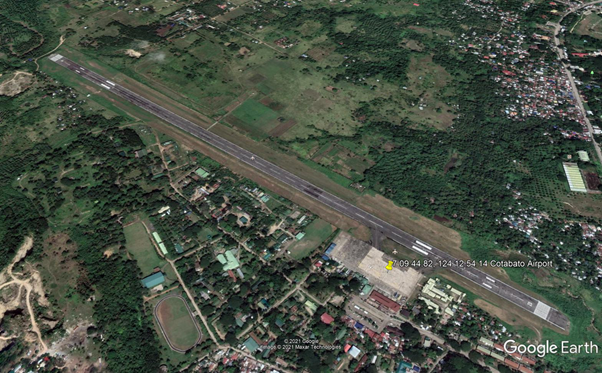
Runway
|
Runway #1 |
|
|---|---|
|
Runway Dimensions |
1913 m x 30 m |
|
Runway Orientation |
10/28 |
|
Runway Surface |
Asphalt |
|
Runway Condition |
Good |
Airport Infrastructure Details
|
Infrastructure |
|||
|---|---|---|---|
|
Passenger / Cargo Security Screening |
Yes |
Runway Lighting |
Yes |
|
Refueling Capacity |
No |
Ground Handling Services |
Yes |
|
Air Traffic Control |
Yes |
Fire Fighting Equipment |
Yes |
|
Weather Information |
Yes |
Aircraft Parking Space |
Yes |
|
Navigation Aids |
Yes |
Perimeter Fencing |
Yes |
|
Windsock |
Yes |
|
|
Fuel Services Charges
Cotabato Airport has no fuel servicing facility. Airline must have enough fuel for return flight to Manila.
Royalties / Non Objection Fees (NOFs)
N/A
2.2.3.2 Philippines - Mindanao Allah Valley Airport
Operator: Air Transportation Office (Secondary Airport or Minor Commercial Domestic Airport) - Magnetic Variation 000˚ E (01/06) – PCN 012FBYU - NO ILS – Runway 16 (Heading 155.0) Take off distance increased to 1,390m (overrun asphalt pad 50m) – Runway 34 (Heading 335.0) Take off distance increased to 1,408m (overrun asphalt pad 69)
Caution approach zone end of runways 16 -34 are obstructed by trees and houses.
Operating hours: 2300 – 0800Z. Nil permanent communications. No navaid. Open only for general aviation.
|
Airport Details |
|||
|---|---|---|---|
|
Country |
Philippines – UTC + 8 |
Latitude |
6.366817 |
|
Province / District |
Mindanao, South Cotabato |
Longitude |
124.7513 |
|
Airport Name |
Allah Valley Airport |
Elevation (ft) |
659 |
|
IATA & ICAO codes |
AAV – RPMA |
Surface |
Asphalt |
|
Town or City (closest) |
Surallah, Allah Valley close to Lake Sebu |
Runway Condition |
GOOD however to be confirmed before landing |
|
NGO / UN (on ground) |
n/a |
Passenger / Cargo Security Screening (Yes / No) |
n/a |
|
Runway Dimension |
1,340 m x 18 m |
Ground Handling (Yes / No) |
n/a |
|
Refueling Capacity |
n/a |
Runway Lighting (Yes / No) |
n/a |
|
Runway Heading |
n/a |
Fire Fighting Equipment (Yes / No) |
n/a |
|
Air Traffic Control (Yes / No) |
n/a |
Windsock (Yes / No) |
n/a |
|
Weather Information (Yes / No) |
n/a |
Aircraft Parking space (Yes / No) |
n/a |
|
Navigation Aids (Yes / No) |
n/a |
Perimeter fencing (Yes / No) |
n/a |
2.2.3.3 Philippines - Mindanao Jolo Airport
Operator: Civil Aviation Authority (Class 2 Principal Airport) – (in 2008 – Pax 18,749, Cargo 13 MT, Movement 862) – Current ongoing work to extend the runway to 1,800m with a width of 60m. - Magnetic Variation 000˚ E (01/06) – PCN 010FBWT - NO ILS – Runway 09 (Heading 088.7) Landing distance reduced to 1,200m (displaced threshold length 63 m). – Runway 27 (Heading 268.7) Landing distance reduced to 1,219m (displaced threshold length 44 m).. Operating hours: 2200 – 0600Z –
Caution approach zone of runway 09 obstructed by trees and ant. In addition 98’ antennas are on both side of the runway. RESTRICTION: LANDING ON RWY 09 AND TAKE OFF ON RWY 27.
Communications: RDO 122.2 / 6765 / 4454. Navaid: Type NDB, ID JL, Name JOLO, Freq 404, coordinates Lat 06˚ 03’ 20.05” N– Long 121˚ 01’ 05.03” E at field.
|
Airport Details |
|||
|---|---|---|---|
|
Country |
Philippines – UTC + 8 |
Latitude |
6.053672 |
|
Province / District |
Jolo, Sulu |
Longitude |
121.011 |
|
Airport Name |
Jolo Airport |
Elevation (ft) |
118 |
|
IATA & ICAO codes |
JOL - RPMJ |
Surface |
Asphalt |
|
Town or City (closest) |
Barangay Bus-Bus, Jolo, Sulu |
Runway Condition |
FAIR however to be confirmed before landing |
|
NGO / UN (on ground) |
n/a |
Passenger / Cargo Security Screening (Yes / No) |
n/a |
|
Runway Dimension |
1,263 m x 30 m |
Ground Handling (Yes / No) |
n/a |
|
Refueling Capacity |
n/a |
Runway Lighting (Yes / No) |
No |
|
Runway Heading |
n/a |
Fire Fighting Equipment (Yes / No) |
n/a |
|
Air Traffic Control (Yes / No) |
n/a |
Windsock (Yes / No) |
n/a |
|
Weather Information (Yes / No) |
n/a |
Aircraft Parking space (Yes / No) |
n/a |
|
Navigation Aids (Yes / No) |
n/a |
Perimeter fencing (Yes / No) |
n/a |
2.2.3.4 Philippines - Mindanao Sanga Airport
Operator: Civil Aviation Authority (Class 2 Principal Airport) – The Airport is fully operational and been maintenained with funds provided by USAID and the local Government . - Magnetic Variation 000˚ E (01/06) – PCN 010FBYT - NO ILS – Runway 02 (Heading 018.0) Slope 0.3˚ - Runway 20 (Heading 198.0) Take off distance increased to 1,614 m (overrun concrete pad 60m) Slope -0.3˚.. Operating hours: Sunrise to sunset (SR-SS) – Caution presence of trees in the vicinity of runway 20 approach, 1122’ hill at 1.5NM South and 705’ hill 2NM South East from Airport.
Nil permanent communications. No Navaid.
|
Airport Details |
|||
|---|---|---|---|
|
Country |
Philippines – UTC + 8 |
Latitude |
5.046994 |
|
Province / District |
Tawi – Tawi, Sanga - Sanga |
Longitude |
119.743 |
|
Airport Name |
Sanga – Sanga Airport |
Elevation (ft) |
15 |
|
IATA & ICAO codes |
SGS - RPMN |
Surface |
Part concrete, part asphalt or part bitumen –bound macadam |
|
Town or City (closest) |
Barangay Sanga – Sanga , Bongao |
Runway Condition |
To be confirmed before landing |
|
NGO / UN (on ground) |
n/a |
Passenger / Cargo Security Screening (Yes / No) |
n/a |
|
Runway Dimension |
1,554 m x 30 m |
Ground Handling (Yes / No) |
n/a |
|
Refueling Capacity |
n/a |
Runway Lighting (Yes / No) |
No |
|
Runway Heading |
n/a |
Fire Fighting Equipment (Yes / No) |
n/a |
|
Air Traffic Control (Yes / No) |
n/a |
Windsock (Yes / No) |
n/a |
|
Weather Information (Yes / No) |
n/a |
Aircraft Parking space (Yes / No) |
n/a |
|
Navigation Aids (Yes / No) |
n/a |
Perimeter fencing (Yes / No) |
n/a |
2.2.3.5 Philippines - Mindanao Zamboanga International Airport
Airport Overview
Zamboanga International Airport is located in Zamboanga City, Philippines. The airport is operated by Civil Aviation Authority of the Philippines. It is the main airport serving the region. The single terminal building of the airport accommodates 400 passengers. The terminal features a metal detector and an X-ray machine at the main entrance of the airport. There are check-in counters, two baggage carousels and push carts. There is a single shop in the terminal managed by the Air Transportation Office. The apron covers an area of 30,000m² and has two taxiways, each 25m wide. It is capable of handling four Airbus A320s and eight heavier aircraft simultaneously.
The airport has a single runway designated 9/27. The length and width of the runway are 2,610m and 45m respectively. It is surfaced with asphalt. There are plans to extend the runway by another 400m to suit heavier aircraft.
https://www.airport-technology.com/projects/zamboangainternation/
|
Airport Location and Contact |
|
|---|---|
|
Country |
Philippines |
|
Province or District |
REGION IX – Zamboanga City |
|
Nearest Town or City |
Zamboanga City (0 km) Pagadian City (270 km) |
|
Airport’s Complete Name |
Zamboanga International Airport |
|
Latitude |
6.9246944 |
|
Longitude |
122.0554833 |
|
Elevation (ft and m) |
33ft / 10m |
|
IATA Code |
ZAM |
|
ICAO Code |
RPMZ |
|
Managing Company or Airport Authority |
Civil Aviation Authority of the Philippines |
|
Management Contact Person |
Reynaldo Alforte, Officer-in-Charge CAAP-Zamboanga |
|
Open From (hours) |
0400H |
|
Open To (hours) |
1800H |
Airport Picture
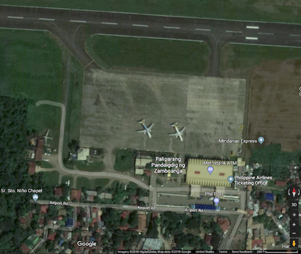
Description and Contacts of Key Companies
CAAP manages the operations of the Airport.
For more information on airport contacts, please see the following link: 4.5 Airport Companies Contact List.
Information on some aviation service providers can be found at: http://www.azfreight.com/
Passenger and Cargo Performance Indicator
|
Performance for 2018 |
|||
|---|---|---|---|
|
Per Year |
Per Month |
Per Day |
|
|
Total Aircraft Movements |
11,870 |
989 |
33 |
|
Total Passengers |
1,276,097 |
106,341 |
3,544 |
|
Total Capacity of the Airport (MT) |
13,617MT |
1,135MT |
38.MT |
|
Current Activity of the Airport (MT) |
|||
|
Current use by Humanitarian Flights (UNHAS) |
No |
||
For 2018 airport information, please see the following links:
Aircraft Movement: https://caap.gov.ph/wp-content/uploads/2020/02/Aircraft-ANNUAL-2018.pdf
Cargo: https://caap.gov.ph/wp-content/uploads/2020/02/Cargo-ANNUAL-2018.pdf
Passengers: https://caap.gov.ph/wp-content/uploads/2020/02/Passenger-ANNUAL-2018.pdf
Runways
|
Runway #1 |
|
|---|---|
|
Runway Dimensions |
2,609 m x 44 m |
|
Orientation |
9/27 |
|
Surface |
Asphalt |
Airport Infrastructure Details
|
Customs |
Yes |
JET A-1 fuel |
Yes |
|---|---|---|---|
|
Immigration |
Yes |
AVGAS 100 |
Yes |
|
Terminal Building |
Yes |
Single Point Refueling |
TBD |
|
Passenger Terminal |
Yes |
Air Starter Units |
TBD |
|
Cargo terminal |
Yes |
Ground Power (mobile) |
TBD |
|
Pax Transport to Airfield |
TBD |
Ground Handling Services |
Yes |
|
Control Tower |
Yes |
Latrine Servicing |
Yes |
|
Weather Facilities |
TBD |
Fire Fighting Category (ICAO) |
Yes |
|
Catering Services |
Yes |
De-icing Equipment |
No |
|
Base Operating Room |
Yes |
Parking Ramp Lighting |
TBD |
|
Airport Radar |
Yes |
Approach & Runway Lights |
Yes |
|
NDB |
TBD |
VOR |
Yes |
|
ILS |
TBD |
https://worldaerodata.com/wad.cgi?id=RP21477&sch=RPMZ
Airport Operating Details
|
Operating Details |
|||
|---|---|---|---|
|
Maximum Sized Aircraft that can be Offloaded on Bulk Cargo |
Boeing 737 and Airbus A320 |
||
|
Maximum Sized Aircraft that can be Offloaded on Pallet |
Boeing 737 and Airbus A320 |
||
|
Total Aircraft Parking Area (m²) |
30,000sqm apron |
||
|
Storage Area (m3 and MT) |
Apron |
||
|
Handling Equipment |
|||
|
Elevators / Hi Loaders |
No |
Max Capacity (MT) |
N/A |
|
Max Height |
N/A |
||
|
Loading Ramps |
Yes |
||
|
Other Comments |
|
||
Customs Guidance
Customs clearance and documentations available at the airport.
For more information on customs in the Philippines, please see the following link: 1.3 Customs Information.
Storage Facilities
- 30,000 sqm Apron
- 400 pax capacity terminal building
2.2.3.6 Philippines - Mindanao Pagadian Airport
Operator: Civil Aviation Authority (Class 1 Principal Airport or Major Domestic Airport) - Magnetic Variation 000˚ W (01/06) – PCN 021RCXT - NO ILS – Runway 02 (Heading 017.0), take off distance increased to 1,782 m (overrun asphalt pad 102m) – Runway 20 (Heading 197.0), take off distance increased to 1,722 m (overrun asphalt pad 42m). Operating hours: 2330 – 0730Z OT 24hr PN.
Caution: Trees and building in the vicinity of approach at end of both runways 02 – 20. Fence located both sides of runway, 35m from runway centre line.
Communications RDO 122 / 6795 / 4454, FSS ATS service extended 24hr PN. Navaid: Type NDB, ID PN, Name PAGADIAN, Freq 242, coordinates Lat 07˚ 49’ 37.56” N – Long 123˚ 47’ 47.04” E 1.3NM from airfield bearing 270.2.
|
Airport Details |
|||
|---|---|---|---|
|
Country |
Philippines – UTC + 8 |
Latitude |
7.827197 |
|
Province / District |
Zamboanga del Sur, Mindanao |
Longitude |
123.4583 |
|
Airport Name |
Pagadian Airport |
Elevation (ft) |
5 |
|
IATA & ICAO codes |
PAG - RPMP |
Surface |
Asphalt |
|
Town or City (closest) |
Barangays Muricay and Tiguma, Pagadian City |
Runway Condition |
To be confirmed before landing |
|
NGO / UN (on ground) |
n/a |
Passenger / Cargo Security Screening (Yes / No) |
n/a |
|
Runway Dimension |
1,680 m x 30 m |
Ground Handling (Yes / No) |
n/a |
|
Refueling Capacity |
n/a |
Runway Lighting (Yes / No) |
No |
|
Runway Heading |
n/a |
Fire Fighting Equipment (Yes / No) |
n/a |
|
Air Traffic Control (Yes / No) |
n/a |
Windsock (Yes / No) |
n/a |
|
Weather Information (Yes / No) |
n/a |
Aircraft Parking space (Yes / No) |
n/a |
|
Navigation Aids (Yes / No) |
n/a |
Perimeter fencing (Yes / No) |
n/a |
2.2.3.7 Philippines - Mindanao Dipolog Airport
Airport Overview
Dipolog Airport is the main airport serving the general area of Dipolog, the capital city of Zamboanga del Norte, in the Philippines. While it is classified as a domestic airport, Dipolog Airport is one of the country’s busiest. It is considered one of the primary entry points to the second largest island of the Philippines, Mindanao.
|
Airport Location and Contact |
|
|---|---|
|
Country |
Philippines |
|
Province or District |
Region IX Zamboanga Del Norte |
|
Nearest Town or City |
Dipolog City (2 km) Dapitan City (8 km) |
|
Airport’s Complete Name |
Dipolog Airport |
|
Latitude |
8.601261 |
|
Longitude |
123.3345 |
|
Elevation (ft and m) |
12ft / 4m |
|
IATA Code |
DPL |
|
ICAO Code |
RPMG |
|
Managing Company or Airport Authority |
Civil Aviation Authority of the Philippines (CAAP) |
|
Management Contact Person |
|
|
NGO and/or UN Presence at Airport? |
None |
Runway
|
Runway |
|
|---|---|
|
Runway Dimensions |
1,912 m x 30 m |
|
Runway Orientation |
02/20 |
|
Runway Surface |
Concrete |
|
Runway Condition |
Check before landing |
Airport Infrastructure Details
|
Infrastructure |
|||
|---|---|---|---|
|
Passenger / Cargo Security Screening |
Yes |
Runway Lighting |
TBC |
|
Refueling Capacity |
TBC |
Ground Handling Services |
TBC |
|
Air Traffic Control |
TBC |
Fire Fighting Equipment |
Yes |
|
Weather Information |
TBC |
Aircraft Parking Space |
TBC |
|
Navigation Aids |
TBC |
Perimeter Fencing |
TBC |
|
Windsock |
TBC |
|
|
Fuel Services Charges
|
Price per Litre USD - $ |
|
|---|---|
|
Jet A-1 |
|
|
Avgas |
Royalties / Non Objection Fees (NOFs)
Domestic Airports:
Php55.00 per 1,000 kgs (concrete paved runway)
Php45.00 per 1,000 kgs (asphaltic concrete macadam paved runway)
2.2.3.8 Philippines - Mindanao Ipil Airport
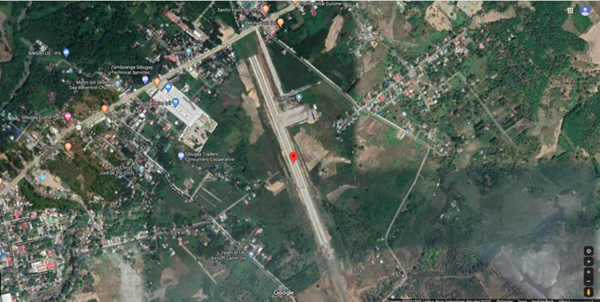
Airport Overview
Ipil Airport is an airport serving the general area of Ipil, the capital of the province of Zamboanga Sibugay in the Philippines. Located at Barangay Sanito Ipil Zamboanga Sibugay, the airport is under expansion and once completed it will support the Zamboanga International Airport to ease air traffic.
|
Airport Location and Contact |
|
|---|---|
|
Country |
Philippines |
|
Province or District |
Region IX Zamboanga Sibugay |
|
Nearest Town or City |
Zamboanga City (136 kms) Pagadian City (133 kms) |
|
Airport’s Complete Name |
Ipil Airport |
|
Latitude |
7.786139 |
|
Longitude |
122.6011 |
|
Elevation (ft and m) |
52 ft / 17 m |
|
IATA Code |
IPE |
|
ICAO Code |
RPMV |
|
Managing Company or Airport Authority |
Civil Aviation Authority of the Philippines |
|
Management Contact Person |
|
|
NGO and/or UN Presence at Airport? |
None |
Runway
|
Runway |
|
|---|---|
|
Runway Dimensions |
960 m |
|
Runway Orientation |
16/34 |
|
Runway Surface |
Concrete |
|
Runway Condition |
To be confirmed upon landing |
Airport Infrastructure Details
|
Infrastructure |
|||
|---|---|---|---|
|
Passenger / Cargo Security Screening |
Yes |
Runway Lighting |
TBC |
|
Refueling Capacity |
TBC |
Ground Handling Services |
TBC |
|
Air Traffic Control |
TBC |
Fire Fighting Equipment |
TBC |
|
Weather Information |
TBC |
Aircraft Parking Space |
TBC |
|
Navigation Aids |
TBC |
Perimeter Fencing |
TBC |
|
Windsock |
TBC |
|
|
Fuel Services Charges
|
Price per Litre USD - $ |
|
|---|---|
|
Jet A-1 |
TBC |
|
Avgas |
TBC |
Royalties / Non Objection Fees (NOFs)
N/A
2.2.3.9 Philippines - Mindanao Laguindingan International Airport
Airport Overview
Laguindingan Airport is situated along the coastal side of Barangay Moog, Laguindingan, Misamis Oriental facing Macajalar Bay. It has a single runway with a length of 2,100 m and a width of 45 m of which can accommodate four takeoffs and landings an hour. Runway will exit to Macajalar Bay.
|
Airport Location and Contact |
|
|---|---|
|
Country |
Philippines |
|
Province or District |
Misamis Oriental |
|
Nearest Town or City with Distance from Airport |
Cagayan De Oro City (46 km) |
|
Airport’s Complete Name |
Laguindingan International Airport |
|
Latitude |
8.608332 |
|
Longitude |
124.458403 |
|
Elevation (ft and m) |
190 ft / 58 m |
|
IATA Code |
CGY |
|
ICAO Code |
RPMY |
|
Managing Company or Airport Authority |
Civil Aviation Authority of the Philippines (CAAP) |
|
Management Contact Person |
Jose Budiongan |
|
Open From (hours) |
24H |
|
Open To (hours) |
24H |
Description and Contacts of Key Companies
For more information on airport contacts, please see the following link: 4.5 Airport Companies Contact List.
Information on some aviation service providers can be found at: http://www.azfreight.com/
Runways
|
Runway #1 |
|
|---|---|
|
Runway Dimensions |
2100 m x 45 m |
|
Orientation |
09/27 |
|
Surface |
Concrete |
2.2.3.10 Philippines - Mindanao Iligan Airport
Operator: Air Transportation Office (Secondary Airport / Minor Commercial Airport) – Based on the current project concerning the construction of Laguindingan International Airport in Misamis Oriental this airport could be replaced by the new Airport combine with Lumbia Airport in Cagayan de Oro City - Magnetic Variation 000˚ W (01/06) – PCN 012FBYU – NO ILS – Runway 02 (Heading 020.0) Take off distance increased to 1,450m (overrun asphalt pad 50m) – Runway 20 (Heading 200.0) Take off distance increased to 1,446m (overrun asphalt pad 46m)
Caution approach zone of runway 02 is obstructed by trees and the presence of a 59’ tall antenna behind the terminal building.
Operating hours: 2300 – 0800Z. Communications: RDO 123.5 (from 0000 to 0900Z) 122.1 / 6802.5. No navaid.
|
Airport Details |
|||
|---|---|---|---|
|
Country |
Philippines – UTC + 8 |
Latitude |
8.130525 |
|
Province / District |
Mindanao, Lanao del Norte |
Longitude |
124.2149 |
|
Airport Name |
Maria Cristina Airport, Iligan Airport |
Elevation (ft) |
1,300 |
|
IATA & ICAO codes |
IGN – RPMI |
Surface |
Concrete |
|
Town or City (closest) |
Barangay Maria Cristina, Baloi |
Runway Condition |
GOOD however to be confirmed before landing |
|
NGO / UN (on ground) |
n/a |
Passenger / Cargo Security Screening (Yes / No) |
n/a |
|
Runway Dimension |
1,400 m x 18 m |
Ground Handling (Yes / No) |
n/a |
|
Refueling Capacity |
n/a |
Runway Lighting (Yes / No) |
No |
|
Runway Heading |
n/a |
Fire Fighting Equipment (Yes / No) |
n/a |
|
Air Traffic Control (Yes / No) |
n/a |
Windsock (Yes / No) |
n/a |
|
Weather Information (Yes / No) |
n/a |
Aircraft Parking space (Yes / No) |
n/a |
|
Navigation Aids (Yes / No) |
n/a |
Perimeter fencing (Yes / No) |
n/a |
2.2.3.11 Philippines - Mindanao Ozamiz Airport
Airport Overview
Labo Airport also known as Ozamiz Airport, is an airport serving the general area of the city of Ozamiz in the Philippines. It is the only airport in the province of Misamis Occidental. The airport takes its name from its location, the barangay of Labo in Ozamiz.
https://en.wikipedia.org/wiki/Labo_Airport
|
Airport Location and Contact |
|
|---|---|
|
Country |
Philippines |
|
Province or District |
REGION X / Misamis Occidental |
|
Nearest Town or City with Distance from Airport |
Ozamis City – 5 kms |
|
Airport’s Complete Name |
Labo Airport |
|
Latitude |
8.178525 |
|
Longitude |
123.841386 |
|
Elevation (ft and m) |
5m / 16ft |
|
IATA Code |
OZC |
|
ICAO Code |
RPMO |
|
Managing Company or Airport Authority |
Civil Aviation Authority of the Philippines |
|
Management Contact Person |
|
|
NGO and/or UN Presence at Airport? |
No |
Runway
|
Runway |
|
|---|---|
|
Runway Dimensions |
1,743 m x 29 m |
|
Runway Orientation |
03/21 |
|
Runway Surface |
Part concrete, part asphalt or bitumen-bound macadam |
|
Runway Condition |
Acceptable however to be confirmed before landing |
Airport Infrastructure Details
|
Infrastructure |
|||
|---|---|---|---|
|
Passenger / Cargo Security Screening |
Yes |
Runway Lighting |
No |
|
Refueling Capacity |
No |
Ground Handling Services |
Yes |
|
Air Traffic Control |
Yes |
Fire Fighting Equipment |
Yes |
|
Weather Information |
No |
Aircraft Parking Space |
Yes |
|
Navigation Aids |
No |
Perimeter Fencing |
Yes |
|
Windsock |
No |
|
|
Fuel Services Charges
Fuel tankers may refuel the aircraft upon landing, if
necessary.
|
Price per Litre USD - $ |
|
|---|---|
|
Jet A-1 |
PHP 96.09 as of Dec 2019 |
|
Avgas |
Royalties / Non Objection Fees (NOFs)
Landing Fees National Airports:
- Php55.00 per 1,000 kg (concrete paved runway)
- Php45.00 per 1,000 kg (asphaltic concrete macadam paved runway)
- Additional 15% if night-time landing
2.2.3.12 Philippines - Mindanao Camiguin Airport
Operator: Air Transportation Office (Feeder Airport) - Magnetic Variation 000˚ W (01/06) – PCN 014FBYU - NO ILS – Runway 07 (Heading 071.0) Slope -0.3˚, Take off distance increased to 1,401m (overrun asphalt pad 199m). – Runway 25 (Heading 251.0) Slope 0.3˚, Take off distance increased to 1,256m (overrun asphalt pad 54m)..
Operating hours: 2300 – 0800Z – Caution tree on approach runway 07. Nil permanent communications. No Navaid.
|
Airport Details |
|||
|---|---|---|---|
|
Country |
Philippines – UTC + 8 |
Latitude |
9.253525 |
|
Province / District |
Camiguin |
Longitude |
124.7071 |
|
Airport Name |
Camiguin Airport |
Elevation (ft) |
53 |
|
IATA & ICAO codes |
CGM - RPMH |
Surface |
Asphalt |
|
Town or City (closest) |
Mambajao |
Runway Condition |
To be confirmed before landing |
|
NGO / UN (on ground) |
n/a |
Passenger / Cargo Security Screening (Yes / No) |
n/a |
|
Runway Dimension |
1,202 m x 30 m |
Ground Handling (Yes / No) |
n/a |
|
Refueling Capacity |
n/a |
Runway Lighting (Yes / No) |
No |
|
Runway Heading |
n/a |
Fire Fighting Equipment (Yes / No) |
n/a |
|
Air Traffic Control (Yes / No) |
n/a |
Windsock (Yes / No) |
n/a |
|
Weather Information (Yes / No) |
n/a |
Aircraft Parking space (Yes / No) |
n/a |
|
Navigation Aids (Yes / No) |
n/a |
Perimeter fencing (Yes / No) |
n/a |
2.2.3.13 Philippines - Mindanao Lumbia Airport
Operator: Air Transportation Office (Trunkline Airport or Major Commercial Domestic Airport). (In 2008 – Pax 902,184, Cargo 11,034 MT, Movement 7,260). Might be replaced in 2011 by a new International airport name Laguindingan International Airport currently under construction. The airport will be then just accommodating a small Air Force Base. - Magnetic Variation 000˚ W (01/06) – Beacon - PCN 044RAWU - NO ILS – Runway 01 (Heading 013.0),Landing distance reduced to 2,320 m (displaced threshold length 134 m), lighting PAPI / HIRL – Runway 19 (Heading 193.0), lighting PAPI / HIRL. Operating hours: 2100 – 1000Z. OT PN before 0900Z.
Caution: Approach runway 01 terrain obstructed between 2,500m and 1,500m from runway threshold. RESTRICTION: NO TIGHT TURNS ON RUNWAY, TWO WAY RADIO REQUIRED.
Fuel Jet A1 / A1+ with icing inhibitor available from 2200 to 0800Z, Communications TWR 127.9 / 5205 / 3872.5, APP 122.3, 123.6. Navaid: Type VOR-DME, ID CGO, Name CAGAYAN DE ORO, Channel 080X, Freq 113.3, coordinates Lat 08˚ 24’ 56.47” N – Long 124˚ 36’ 32.95” E at airfield.
|
Airport Details |
|||
|---|---|---|---|
|
Country |
Philippines – UTC + 8 |
Latitude |
8.415619 |
|
Province / District |
Mindanao, Misamis Oriental |
Longitude |
124.6112 |
|
Airport Name |
Lumbia Airport or Cagayan de Oro Airport |
Elevation (ft) |
601 |
|
IATA & ICAO codes |
CGY - RPML |
Surface |
Asphalt |
|
Town or City (closest) |
Barangay Lumbia, Cagayan de Oro City |
Runway Condition |
To be confirmed before landing |
|
NGO / UN (on ground) |
n/a |
Passenger / Cargo Security Screening (Yes / No) |
n/a |
|
Runway Dimension |
2,454 m x 36 m |
Ground Handling (Yes / No) |
n/a |
|
Refueling Capacity |
n/a |
Runway Lighting (Yes / No) |
Yes |
|
Runway Heading |
n/a |
Fire Fighting Equipment (Yes / No) |
n/a |
|
Air Traffic Control (Yes / No) |
n/a |
Windsock (Yes / No) |
n/a |
|
Weather Information (Yes / No) |
n/a |
Aircraft Parking space (Yes / No) |
n/a |
|
Navigation Aids (Yes / No) |
n/a |
Perimeter fencing (Yes / No) |
n/a |
2.2.3.14 Philippines - Mindanao General Santos International Airport
Airport Overview
General Santos City International Airport is an alternate international airport located in the city of General Santos, Philippines serving the greater area of SOCCSKSARGEN (Region XII). It is the largest airport in the island of Mindanao and is officially classified an International Airport by the Civil Aviation Authority of the Philippines (CAAP), a government bureau which is responsible for the management and operations of General Santos International Airport and all other airports in the country except regular international airports.
Magnetic Variation 000˚ E (01/06) – PCN 073FCWT – ILS – Beacon - Runway 17 (Heading 173.0) Take off distance increased to 3,352m (overrun Concrete pad 126m), Lighting HIRL / A2 / PAPI, slope -0.4˚ – Runway 35 (Heading 353.0) Take off distance increased to 3,352m (overrun concrete pad 126m), Lighting HIRL / PAPI, slope +0.4˚.
Caution: Mount Matutum (2,286m – 7,500’) 18NM N of the airport. Airport Beacon HO. RESTRICTION: VFR OPERATION ONLY, CLSD TO NORDO.
Operating hours: 2300 – 0700Z. Fuel available (Jet A1, JetA1 with icing inhibitor, NC-A1). Communications: TWR 118.1, 255.4 / RDO 6802.5, 3671 / APP 119.1, 118.2 – Navaid: Type VOR-DME, ID GSA, Name TAMBLER, Channel 092X, Freq 114.5, at Airport, Coordinates Lat 06˚ 04’ 32.42” N Long 125˚ 05’ 31.87” E.
| Airport Location and Contact | |
|---|---|
| Country | Philippines |
| Province or District | South Cotabato |
| Nearest Town or City with Distance from Airport | General Santos City (17 km) |
| Airport's Complete Name | General Santos International Airport |
| Latitude | 6.0580028 |
| Longitude | 125.0960333 |
| Elevation | 505 ft / 154 m |
| IATA Code | GES |
| ICAO Code | RPMR |
| Managing Company or Airport Authority | Civil Aviation Authority of the Philippines |
| Management Contact Person | |
| Open From | 24 H |
| Open To | 24 H |
Description and Contacts of Key Companies
| Airline Company | Destinations |
|---|---|
|
Cebu Pacific |
Cebu, Iloilo, Manila |
|
Leading Edge |
Clark, Zamboanga |
|
Philippine Airlines |
Manila |
|
PAL Operated by PAL Express |
Cebu, Iloilo |
|
Philippine AirAsia |
Cebu, Clark, Manila |
For more information on airport contacts, please see the following
link: 4.5
Airport Companies Contact List.
Information on some aviation service providers can be found at: http://www.azfreight.com/
Passenger and Cargo Performance Indicator
|
Performance for YEAR |
|||
|---|---|---|---|
|
Per Year |
Per Month |
Per Day |
|
|
Total Aircraft Movements |
4,656 (2015) |
||
|
Total Passengers |
920,670 (2018) |
||
|
Total Capacity of the Airport (MT) |
21,003 (2015) |
||
|
Current Activity of the Airport (MT) |
|||
|
Current use by Humanitarian Flights (UNHAS) |
Number of Flights |
||
Runways
General Santos International Airport has a single 3,227-meter lighted runway designated as runways 17/35. Made entirely of reinforced concrete and macadam, the airport's runway is the third-longest runway in the Philippines, after Runway 06/24 of Ninoy Aquino International Airport and runway 04/22 of Mactan-Cebu. International Airport respectively and it can access Airbus A380.
|
Runway ID # 17/35 |
|
|
Runway Dimensions |
10587 x 148 feet 3227 x 45 meters |
|
Orientation |
17/35 |
|
Surface |
Concrete, paved |
2.2.3.15 Philippines - Mindanao Francisco Bangoy International Airport (Davao)
Airport Overview
Laguindingan Airport is situated along the coastal side of Barangay Moog, Laguindingan, Misamis Oriental facing Macajalar Bay. It has a single runway with a length of 2,100 m and a width of 45 m of which can accommodate four takeoffs and landings an hour. Runway will exit to Macajalar Bay.
|
Airport Location and Contact |
|
|---|---|
|
Country |
Philippines |
|
Province or District |
Davao City |
|
Nearest Town or City with Distance from Airport |
Davao City (36 km) |
|
Airport’s Complete Name |
Francisco Bangoy International Airport |
|
Latitude |
7.125522 |
|
Longitude |
125.6458 |
|
Elevation (ft and m) |
96 ft / 29 m |
|
IATA Code |
DVO |
|
ICAO Code |
RPMD |
|
Managing Company or Airport Authority |
Civil Aviation Authority of the Philippines (CAAP) |
|
Management Contact Person |
|
|
Open From (hours) |
24H |
|
Open To (hours) |
24H |
Description and Contacts of Key Companies
For more information on airport contacts, please see the following link: 4.5 Airport Companies Contact List.
Information on some aviation service providers can be found at: http://www.azfreight.com/
Customs Guidance
For more information on customs in the Philippines, please see the following link: 1.3 Customs Information.
2.2.3.16 Philippines - Mindanao Mati National Airport
Operator: Air Transportation Office (Secondary Airport) - Magnetic Variation 000˚ E (01/06) – PCN 032RBWT – NO ILS – Runway 14 (Heading 139.0) – Runway 32 (Heading 319.0).
|
Airport Details |
|||
|---|---|---|---|
|
Country |
Philippines – UTC + 8 |
Latitude |
6.949367 |
|
Province / District |
Mindanao, Davao Oriental |
Longitude |
126.273 |
|
Airport Name |
Imelda R. Marcos Airport or Mati National Airport |
Elevation (ft) |
156 |
|
IATA & ICAO codes |
MXI – RPMQ |
Surface |
Concrete |
|
Town or City (closest) |
Mati City |
Runway Condition |
Acceptable however to be confirmed before landing |
|
NGO / UN (on ground) |
n/a |
Passenger / Cargo Security Screening (Yes / No) |
n/a |
|
Runway Dimension |
1,625 m x 32 m |
Ground Handling (Yes / No) |
n/a |
|
Refueling Capacity |
n/a |
Runway Lighting (Yes / No) |
No |
|
Runway Heading |
n/a |
Fire Fighting Equipment (Yes / No) |
n/a |
|
Air Traffic Control (Yes / No) |
n/a |
Windsock (Yes / No) |
n/a |
|
Weather Information (Yes / No) |
n/a |
Aircraft Parking space (Yes / No) |
n/a |
|
Navigation Aids (Yes / No) |
n/a |
Perimeter fencing (Yes / No) |
n/a |
2.2.3.17 Philippines - Mindanao Malita Airport
Operator: Private sector (?) (Community Airport) – Magnetic Variation 000˚ E (01/06) – NO ILS – Runway 17 (Heading 171.0) – Runway 35 (Heading 351.0).
Caution: Subject to strong side winds.
No permanent communications. No Navaid.
|
Airport Details |
|||
|---|---|---|---|
|
Country |
Philippines – UTC + 8 |
Latitude |
6.402281 |
|
Province / District |
Mindanao, Davao del Sur |
Longitude |
125.6194 |
|
Airport Name |
Malita Airport |
Elevation (ft) |
43 |
|
IATA & ICAO codes |
n/a |
Surface |
Asphalt |
|
Town or City (closest) |
Malita |
Runway Condition |
Good however be confirmed before landing |
|
NGO / UN (on ground) |
n/a |
Passenger / Cargo Security Screening (Yes / No) |
n/a |
|
Runway Dimension |
1,200 m x 30 m |
Ground Handling (Yes / No) |
n/a |
|
Refueling Capacity |
n/a |
Runway Lighting (Yes / No) |
No |
|
Runway Heading |
n/a |
Fire Fighting Equipment (Yes / No) |
n/a |
|
Air Traffic Control (Yes / No) |
n/a |
Windsock (Yes / No) |
n/a |
|
Weather Information (Yes / No) |
n/a |
Aircraft Parking space (Yes / No) |
n/a |
|
Navigation Aids (Yes / No) |
n/a |
Perimeter fencing (Yes / No) |
n/a |
2.2.3.18 Philippines - Mindanao Surigao Airport
Airport Overview
Surigao Airport is an airport serving the general area of Surigao City, located in the province of Surigao del Norte in the Philippines. The airport is classified as a Class 2 principal (minor domestic) airport by the Civil Aviation Authority of the Philippines, a body of the Department of Transportation and Communications that is responsible for the operations of not only this airport but also of all other airports in the Philippines except the major international airports.
|
Airport Location and Contact |
|
|---|---|
|
Country |
Philippines |
|
Province or District |
Surigao Del Norte |
|
Nearest Town or City with Distance from Airport |
Surigao City (4 km) |
|
Airport’s Complete Name |
Surigao Airport |
|
Latitude |
9.757567 |
|
Longitude |
125.4793 |
|
Elevation (ft and m) |
20 ft / 7 m |
|
IATA Code |
SUG |
|
ICAO Code |
RPMS |
|
Managing Company or Airport Authority |
Civil Aviation Authority of the Philippines (CAAP) |
|
Management Contact Person |
Engr. Junelito P. Abrazado |
|
NGO and/or UN Presence at Airport? |
No |
Runway(s)
|
Runway #1 |
|
|---|---|
|
Runway Dimensions |
1,700 m x 45 m |
|
Runway Orientation |
18/36 |
|
Runway Surface |
Concrete |
|
Runway Condition |
Good |
Airport Infrastructure Details
|
Infrastructure |
|||
|---|---|---|---|
|
Passenger / Cargo Security Screening |
Yes |
Runway Lighting |
Yes |
|
Refueling Capacity |
No |
Ground Handling Services |
Yes |
|
Air Traffic Control |
Yes |
Fire Fighting Equipment |
Yes |
|
Weather Information |
Yes |
Aircraft Parking Space |
Yes |
|
Navigation Aids |
Yes |
Perimeter Fencing |
Yes |
|
Windsock |
Yes |
|
|
2.2.3.19 Philippines - Mindanao Bislig Airport
Operator: Air Transportation Office (Secondary Airport or Minor Commercial Domestic Airport) - Magnetic Variation 000˚ E (01/06) – NO ILS – Runway 05 (Heading 052.0) Take off distance increased to 1,260m (overrun asphalt pad 60m) – Runway 23 (Heading 232.0) Take off distance increased to 1,296m (overrun asphalt pad 96m)
Caution approach zone end of runway 05 is obstructed by trees. Old equipment stuck unused on Apron.
Operating hours: 2300 – 0800Z. Nil permanent communications. No navaid.
|
Airport Details |
|||
|---|---|---|---|
|
Country |
Philippines – UTC + 8 |
Latitude |
8.19595 |
|
Province / District |
Mindanao, Surigao del Sur |
Longitude |
126.3216 |
|
Airport Name |
Bislig Airport |
Elevation (ft) |
12 |
|
IATA & ICAO codes |
BPH - RPMF |
Surface |
Concrete |
|
Town or City (closest) |
Bislig City |
Runway Condition |
Old surface but acceptable; however to be confirmed before landing |
|
NGO / UN (on ground) |
n/a |
Passenger / Cargo Security Screening (Yes / No) |
n/a |
|
Runway Dimension |
1,200 m x 30 m |
Ground Handling (Yes / No) |
n/a |
|
Refueling Capacity |
n/a |
Runway Lighting (Yes / No) |
No |
|
Runway Heading |
n/a |
Fire Fighting Equipment (Yes / No) |
n/a |
|
Air Traffic Control (Yes / No) |
n/a |
Windsock (Yes / No) |
n/a |
|
Weather Information (Yes / No) |
n/a |
Aircraft Parking space (Yes / No) |
n/a |
|
Navigation Aids (Yes / No) |
n/a |
Perimeter fencing (Yes / No) |
n/a |
2.2.3.20 Philippines - Mindanao Tandag Airport
Airport Overview
Tandag Airport is the airport serving the general area of Tandag, the capital city of Surigao del Sur in the Philippines. It is one of two airports in Surigao del Sur, the other being Bislig Airport. The airport is classified as a Class 2 principal (minor domestic) airport by the Civil Aviation Authority of the Philippines, a body of the Department of Transportation and Communications that is responsible for the operations of not only this airport but also of all other airports in the Philippines except the major international airports.
|
Airport Location and Contact |
|
|---|---|
|
Country |
Philippines |
|
Province or District |
Surigao Del Sur |
|
Nearest Town or City with Distance from Airport |
Tandag City (0km) |
|
Airport’s Complete Name |
Tandag Airport |
|
Latitude |
9.072111 |
|
Longitude |
126.1714 |
|
Elevation (ft and m) |
16 ft / 5 m |
|
IATA Code |
TDG |
|
ICAO Code |
RPMW |
|
Managing Company or Airport Authority |
Civil Aviation Authority of the Philippines |
|
Management Contact Person |
|
|
NGO and/or UN Presence at Airport? |
No |
Runway(s)
|
Runway |
|
|---|---|
|
Runway Dimensions |
1,452 m x 30 m |
|
Runway Orientation |
03/21 |
|
Runway Surface |
Concrete |
|
Runway Condition |
Good |
2.2.3.21 Philippines - Mindanao Sayak Airport
Operator: Air Transportation Office (Feeder Airport) - Magnetic Variation 000˚ W (01/06) – PCN 029RBWT - NO ILS – Runway 01 (Heading 010.0) – Runway 19 (Heading 190.0). Operating hours: 2300 – 0800Z. Nil permanent communications. No Navaid
|
Airport Details |
|||
|---|---|---|---|
|
Country |
Philippines – UTC + 8 |
Latitude |
9.859097 |
|
Province / District |
Surigao del Norte, Siargao Island |
Longitude |
126.014 |
|
Airport Name |
Sayak Airport or Siargao Airport |
Elevation (ft) |
10 |
|
IATA & ICAO codes |
IAO - RPNS |
Surface |
Concrete |
|
Town or City (closest) |
Barangay Sayak, Del Carmen |
Runway Condition |
GOOD however to be confirmed before landing |
|
NGO / UN (on ground) |
n/a |
Passenger / Cargo Security Screening (Yes / No) |
n/a |
|
Runway Dimension |
1,270 m x 30 m |
Ground Handling (Yes / No) |
n/a |
|
Refueling Capacity |
n/a |
Runway Lighting (Yes / No) |
n/a |
|
Runway Heading |
n/a |
Fire Fighting Equipment (Yes / No) |
n/a |
|
Air Traffic Control (Yes / No) |
n/a |
Windsock (Yes / No) |
n/a |
|
Weather Information (Yes / No) |
n/a |
Aircraft Parking space (Yes / No) |
n/a |
|
Navigation Aids (Yes / No) |
n/a |
Perimeter fencing (Yes / No) |
n/a |
2.2.3.22 Philippines - Mindanao Bancasi Airport
Operator: Civil Aviation Authority (Trunkline Airport or Major Commercial Domestic Airport). (In 2008 – Pax 308,405, Cargo 2,602 MT, Movement 3,294) - Magnetic Variation 000˚ W (01/06) – Beacon - PCN 047RBWU - NO ILS – Runway 12 (Heading 117.0), slope 0.2˚, lighting PAPI – Runway 30 (Heading 297.0), lighting PAPI. Operating hours: 0000 – 0800Z..
|
Airport Details |
|||
|---|---|---|---|
|
Country |
Philippines – UTC + 8 |
Latitude |
8.951322 |
|
Province / District |
Caraga, Agusan del Norte, Mindanao |
Longitude |
125.478 |
|
Airport Name |
Bancasi Airport or Butuan Airport |
Elevation (ft) |
141 |
|
IATA & ICAO codes |
BXU - RPME |
Surface |
Concrete |
|
Town or City (closest) |
Barangay Bancasi, Butuan City |
Runway Condition |
To be confirmed before landing |
|
NGO / UN (on ground) |
n/a |
Passenger / Cargo Security Screening (Yes / No) |
n/a |
|
Runway Dimension |
1,966 m x 46 m |
Ground Handling (Yes / No) |
n/a |
|
Refueling Capacity |
n/a |
Runway Lighting (Yes / No) |
Yes |
|
Runway Heading |
n/a |
Fire Fighting Equipment (Yes / No) |
n/a |
|
Air Traffic Control (Yes / No) |
n/a |
Windsock (Yes / No) |
n/a |
|
Weather Information (Yes / No) |
n/a |
Aircraft Parking space (Yes / No) |
n/a |
|
Navigation Aids (Yes / No) |
n/a |
Perimeter fencing (Yes / No) |
n/a |
2.3 Philippines Road Network

4.1 Philippines Government Contact List
Further information on the Departmen of Public Works and Highways can be found in the following document:
Philippines Road
Assessment Additional Information
Distance Matrix
|
Distances from Capital City to Major Towns (km) |
||||||||
|---|---|---|---|---|---|---|---|---|
|
|
Manila |
Baguio |
San Fernando, La Union |
Laoag City, Illocos Norte |
Tuguegarao, Cagayan |
Bontoc, Mountain Province |
Pagsanjan, Laguna |
Legazpi City, Bicol |
|
Manila |
|
246 |
264 |
477 |
483 |
394 |
102 |
538 |
|
Baguio |
246 |
|
47 |
254 |
230 |
101 |
308 |
711 |
|
San Fernando, La Union |
264 |
47 |
|
406 |
408 |
274 |
335 |
540 |
|
Laoag City, Illocos Norte |
477 |
254 |
406 |
|
180 |
230 |
550 |
975 |
|
Tuguegarao, Cagayan |
483 |
230 |
408 |
180 |
|
130 |
526 |
964 |
|
Bontoc, Mountain Province |
394 |
101 |
274 |
230 |
130 |
|
416 |
842 |
|
Pagsanjan, Laguna |
102 |
308 |
335 |
550 |
526 |
416 |
|
403 |
|
Legazpi City, Bicol |
538 |
711 |
540 |
975 |
964 |
842 |
403 |
|
Travel Time Matrix
|
Travel Time from Capital City to Major Towns (hours) |
||||||||
|---|---|---|---|---|---|---|---|---|
|
|
Manila |
Baguio |
San Fernando, La Union |
Laoag City, Illocos Norte |
Tuguegarao, Cagayan |
Bontoc, Mountain Province |
Pagsanjan, Laguna |
Legazpi City, Bicol |
|
Manila |
|
5 |
4 |
10 |
12 |
7 |
1.5 |
12 |
|
Baguio |
5 |
|
2 |
5 |
7 |
2 |
8 |
17 |
|
San Fernando, La Union |
4 |
2 |
|
6 |
8 |
5 |
6 |
16 |
|
Laoag City, Illocos Norte |
10 |
5 |
6 |
|
8 |
7 |
12 |
22 |
|
Tuguegarao, Cagayan |
12 |
7 |
8 |
8 |
|
6 |
14 |
24 |
|
Bontoc, Mountain Province |
7 |
2 |
5 |
7 |
6 |
|
9 |
19 |
|
Pagsanjan, Laguna |
1.5 |
8 |
6 |
12 |
14 |
9 |
|
12 |
|
Legazpi City, Bicol |
12 |
17 |
16 |
22 |
24 |
19 |
12 |
|
Due to traffic congestion, all times are best approximations only and may be out by several hours depending on traffic. Travel times are based on car travel. Travel by truck or bus will increase travel times.
Transport Corridors
The main transport Corridor in the Philippines is an integrated network of highways and vehicle ferries that form the Strong Republic Nautical Highway (SRNH). The 919 kilometres SRNH covers the provinces and cities of Oriental Mindoro, Tagaytay City (Cavite), Marindugue, Romblon, and Batangas City in Luzon; Aklan, Antique, Iloilo, Capiz, Negros Oriental, Negros Occidental, Bohol, Bebu, Guimaras and Siguijor in the Visayas; and Misamis Occidental, Misamis Oriental, Lanao del Norte and Dapitan City in Mindanao.

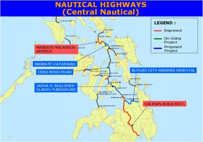
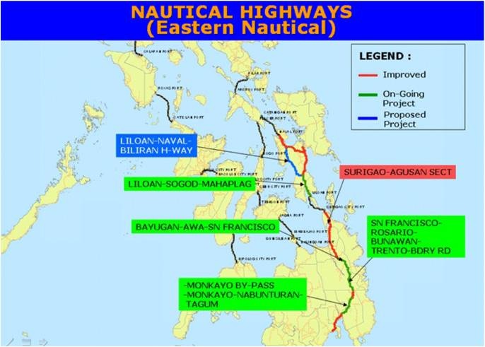
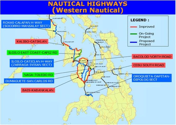
Road Security
Security Level: Good
Road security in the Philippines is generally good. However there are a few problem areas which transporters will know about. Areas around Apayo (Ilocos) and Maguindanao (Mindanao) have reported unauthorised roadblocks where drivers have been forced to handover money, weapons and any high-end goods. Cargo (including food) is generally unaffected.
Weighbridges and Axle Load Limits
Weighbridges
Weighbridges are operational 24 hours and are well-signed upon approach. They are under the management of the Department of Public Works and Highways and the exact locations are listed below.
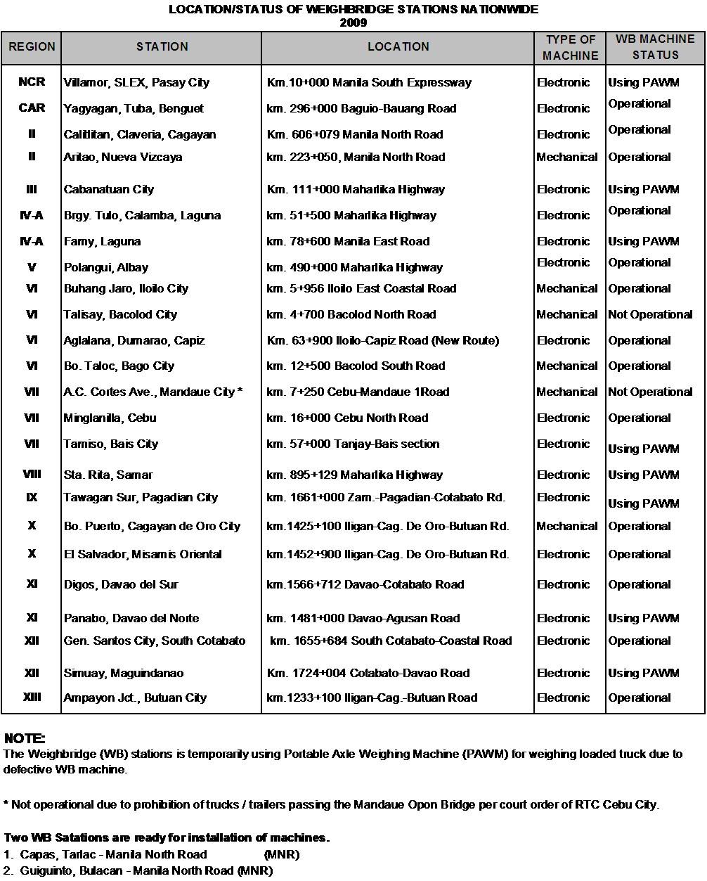
Axle Load Limits
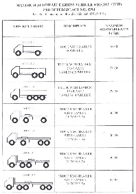
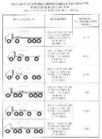
Bridges
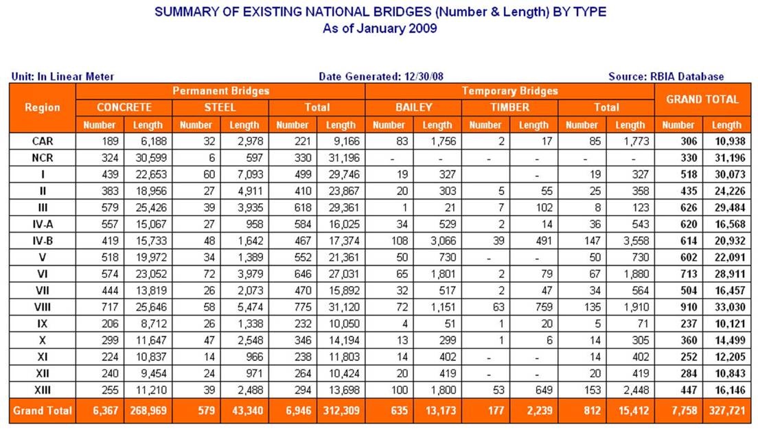
Bridges in the Philippines are prone to collapse during typhoons and landslides. Under regular use most bridges in the Philippines do not pose any particular problems, although drivers should note that sometimes they are inadequately signed and without load limits. In some cases, bridges may have a capacity less than the regular traffic load of the road and as a result, occasionally collapse, however DPWH pointed out this usually only occurs when transporters over-load their vehicles.
Road Class and Surface Conditions
Road Construction / Maintenance
In general, there are three type of maintenance conducted within the Philippines; periodic, preventative and routine. Further information on ongoing construction and maintenance projects can be found on the Department of Public Works and Highways website: http://www.dpwh.gov.ph/ and through the relevant Bureaus which can be contacted through the main telephone line.
Road Classification
Road classification in the Philippines is completed based on the strategic importance of the road. Road classification does not indicate the surface, quality or width of the road.
| Classification | Description |
|---|---|
|
Primary/National/Arterial (includes the North-South, East-West
and Other Roads classifications in the table below)
|
Main roads in the Philippines that form the backbone of the
road network. Surfaces can be concrete, asphalt, gravel or
earth.
|
|
Secondary
|
Secondary roads do not have as many connecting roads as the
primary roads. Surfaces can be concrete, asphalt, gravel or
earth.
|
|
Local
|
Local road classification includes all other provincial,
municipal, city and barangay roads. Surfaces can be concrete,
asphalt, gravel or earth.
|
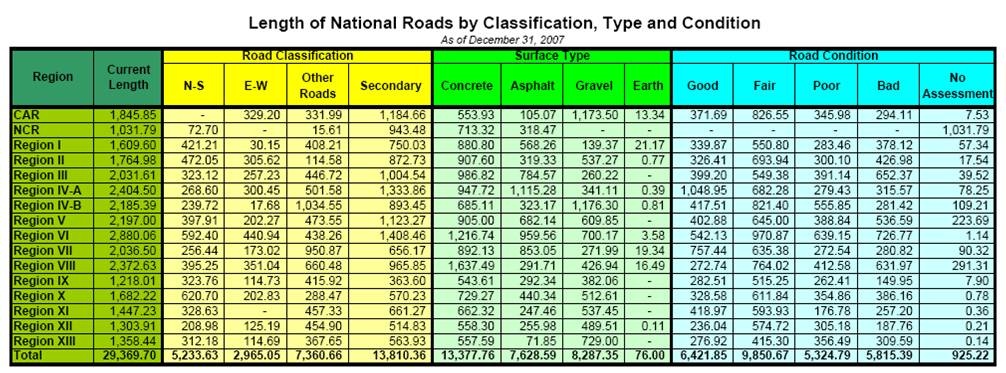
Further information on the Road Network of the Philippines can be found on the following webpage: Road and Bridge Information Application (RBIA)
2.3.1 Philippines - Luzon Road Network
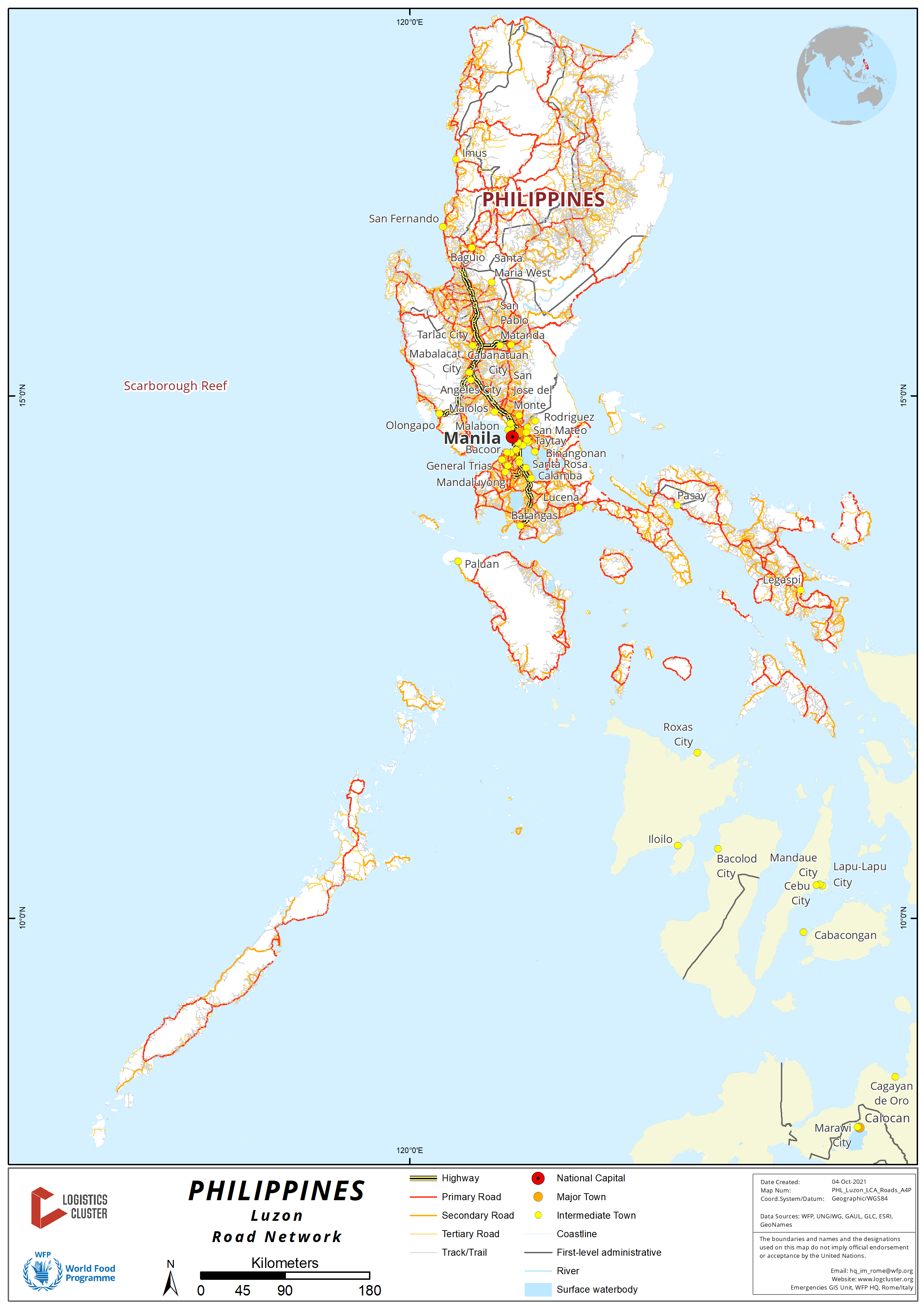
For more information on government contact details, please see the following link: 4.1 Government Contact List.
Distance Matrix
|
Distances from Capital City to Major Towns (Region 1) |
|||||||
|---|---|---|---|---|---|---|---|
|
Manila |
Clark, Angeles City |
Subic, Olongapo City |
Dagupan City |
San Fernando, La Union |
Vigan City |
Laoag City |
|
|
Manila |
93 km |
161 km |
223 km |
273 km |
410 km |
488 km |
|
|
Clark, Angeles City |
93 km |
68 km |
130 km |
180 km |
317 km |
395 km |
|
|
Subic, Olongapo City |
161 km |
68 km |
62 km |
112 km |
249 km |
327 km |
|
|
Dagupan City |
223 km |
130 km |
62 km |
50 km |
187 km |
265 km |
|
|
San Fernando, La Union |
273 km |
180 km |
112 km |
50 km |
137 km |
215 km |
|
|
ViganCity |
410 km |
317 km |
249 km |
187 km |
137 km |
78 km |
|
|
Laoag City |
488 km |
395 km |
327 km |
265 km |
215 km |
78 km |
|
| Distances from Capital City to Major Towns (Region 2) | |||||||
|---|---|---|---|---|---|---|---|
|
|
Manila | Cabanatuan City, Nueva Ecija* | Bayombong, Nueva Vizcaya | Santiago City, Isabela | Ilagan City, Isabela | Tuguegarao City, Cagayan | Aparri, Cagayan |
| Manila | 167 km | 303 km | 364 km | 442 km | 491 km | 594 km | |
| Cabanatuan City, Nueva Ecija (Region 3)* | 167 km | 136 km | 197 km | 275 km | 324 km | 427 km | |
| Bayombong, Nueva Vizcaya | 303 km | 136 km | 61 km | 139 km | 188 km | 291 km | |
| Santiago City, Isabela | 364 km | 197 km | 61 km | 78 km | 127 km | 230 km | |
| Ilagan City, Isabela | 442 km | 275 km | 139 km | 78 km | 49 km | 152 km | |
| Tuguegarao City, Cagayan | 491 km | 324 km | 188 km | 127 km | 49 km | 103 km | |
| Aparri, Cagayan | 594 km | 427 km | 291 km | 230 km | 152 km | 103 km | |
*Cabanatuan City is a major jump-off point to Region 2 cities.
|
Distances from Capital City to Major Towns (Region 3 and Route to Cordillera Administrative Region) |
||||||||
|---|---|---|---|---|---|---|---|---|
|
Manila |
Malolos, Bulacan |
San Fernando, Pampanga |
Tarlac City, Tarlac |
Baguio City |
Bontoc, Mountain Province |
Tabuk, Kalinga |
Kabugao, Apayao |
|
| Manila |
|
48 km |
70 km |
137 km |
253 km |
395 km |
471 km |
595 km |
| Malolos, Bulacan |
48 km |
|
22 km |
89 km |
205 km |
347 km |
423 km |
547 km |
| San Fernando, Pampanga |
70 km |
22 km |
|
67 km |
183 km |
325 km |
401 km |
525 km |
| Tarlac City, Tarlac |
137 km |
89 km |
67 km |
|
116 km |
258 km |
334 km |
458 km |
| Baguio City |
253 km |
205 km |
183 km |
116 km |
|
142 km |
218 km |
342 km |
| Bontoc, Mountain Province |
395 km |
347 km |
325 km |
258 km |
142 km |
|
76 km |
200 km |
| Tabuk, Kalinga |
471 km |
423 km |
401 km |
334 km |
218 km |
76 km |
124 km |
|
| Kabugao, Apayao |
595 km |
547 km |
525 km |
458 km |
342 km |
200 km |
124 km |
|
|
Distances from Capital City to Major Towns (Aurora) |
||||
|---|---|---|---|---|
|
Manila |
Cabarroguis, Quirino |
Baler, Aurora |
Casiguran, Aurora |
|
|
Manila |
|
375 km |
291 km |
376 km |
|
Cabarroguis, Quirino |
375 km |
|
156 km |
145 km |
|
Baler, Aurora |
291 km |
156 km |
|
85 km |
|
Casiguran, Aurora |
376 km |
145 km |
85 km |
|
|
Distances from Capital City to Major Towns (This route will lead to the island of Mindoro via Batangas Port RORO) |
||||||||
|---|---|---|---|---|---|---|---|---|
|
Manila |
Calamba, Laguna |
Santo Tomas, Batangas |
Lipa City, Batangas |
Batangas Port, Batangas City |
Calapan, Oriental Mindoro |
Roxas, Oriental Mindoro |
San Jose, Occidental Mindoro |
|
|
Manila |
|
55 km |
70 km |
104 km |
129 km |
216 km |
304 km |
404 km |
|
Calamba, Laguna |
55 km |
|
15 km |
49 km |
74 km |
161 km |
249 km |
349 km |
|
Santo Tomas, Batangas |
70 km |
15 km |
|
34 km |
59 km |
146 km |
234 km |
334 km |
|
Lipa City, Batangas |
104 km |
49 km |
34 km |
|
25 km |
112 km |
200 km |
300 km |
|
Batangas Port, Batangas City |
129 km |
74 km |
59 km |
25 km |
|
87 km |
175 km |
275 km |
|
Calapan, Oriental Mindoro |
216 km |
161 km |
146 km |
112 km |
87 km |
|
88 km |
188 km |
|
Roxas, Oriental Mindoro |
304 km |
249 km |
234 km |
200 km |
175 km |
88 km |
|
100 km |
|
San Jose, Occidental Mindoro |
337 km |
282 km |
267 km |
233 km |
208 km |
188 km |
100 km |
|
|
Distances from Capital City to Major Towns (This route will lead to the island of Samar via Matnog Port RORO) |
|||||||
|---|---|---|---|---|---|---|---|
|
Manila |
Lucena City, Quezon |
Naga, Camarines Sur |
Tabaco City, Albay |
Legazpi City, Albay |
Sorsogon City, Sorsogon |
Matnog Port, Sorsogon |
|
|
Manila |
|
133 km |
382 km |
473 km |
501 km |
557 km |
621 km |
|
Lucena City, Quezon |
133 km |
|
249 km |
340 km |
368 km |
424 km |
488 km |
|
Naga, Camarines Sur |
382 km |
249 km |
|
91 km |
119 km |
175 km |
239 km |
|
Tabaco City, Albay |
473 km |
340 km |
91 km |
|
28 km |
84 km |
148 km |
|
Legazpi City, Albay |
501 km |
368 km |
119 km |
28 km |
|
56 km |
120 km |
|
Sorsogon City, Sorsogon |
557 km |
424 km |
175 km |
84 km |
56 km |
|
64 km |
|
Matnog Port, Sorsogon |
621 km |
488 km |
239 km |
148 km |
120 km |
64 km |
|
|
Distances from Capital City to Major Towns (This route will lead to the island of Catanduanes via Tabaco Port RORO) |
|||||
|---|---|---|---|---|---|
|
Manila |
Lucena City, Quezon |
Naga, Camarines Sur |
Tabaco City, Albay |
Virac, Catanduanes |
|
|
Manila |
|
133 km |
382 km |
473 km |
543 km |
|
Lucena City, Quezon |
133 km |
|
249 km |
340 km |
410 km |
|
Naga, Camarines Sur |
382 km |
249 km |
|
91 km |
161 km |
|
Tabaco City, Albay |
473 km |
340 km |
91 km |
|
70 km |
|
Virac, Cantanduanes |
543 km |
410 km |
161 km |
70 km |
|
|
Distances from Capital City to Major Towns (This route will lead to the island of Marinduque via RORO in Lucena Port) |
||||
|---|---|---|---|---|
|
Manila |
Lucena City, Quezon |
Boac, Marinduque |
Mogpog, Marinduque |
|
|
Manila |
|
133 km |
223 km |
230 km |
|
Lucena City, Quezon |
133 km |
90 km |
97 km |
|
|
Boac, Marinduque |
223 km |
90 km |
|
7 km |
|
Mogpog, Marinduque |
230 km |
97 km |
7 km |
|
|
Distances from Capital City to Major Towns (km) (This route will lead to the island of Romblon via RORO in Roxas Port, Oriental Mindoro) |
||||||
|---|---|---|---|---|---|---|
|
Manila |
Batangas Port, Batangas |
Calapan, Oriental Mindoro |
Roxas Port, Roxas Oriental Mindoro |
Odiongan, Tablas |
Romblon, Romblon |
|
|
Manila |
|
129 km |
216 km |
304 km |
363 km |
437 km |
|
Batangas Port, Batangas |
129 km |
|
87 km |
175 km |
234 km |
308 km |
|
Calapan, Oriental Mindoro |
216 km |
87 km |
|
88 km |
147 km |
221 km |
|
Roxas Port, Roxas Oriental Mindoro |
304 km |
175 km |
88 km |
|
59 km |
133 km |
|
Odiongan, Tablas |
363 km |
234 km |
147 km |
59 km |
|
74 km |
|
Romblon, Romblon |
437 km |
308 km |
221 km |
133 km |
74 km |
|
|
Distances from Capital City to Major Towns (km) (This route will lead to the island of Masbate via Pilar, Sorsogon RORO but there are also direct shipping lanes from Manila Domestic Port to Masbate) |
|||||
|---|---|---|---|---|---|
|
Manila |
Legazpi City, Albay |
Pilar Port in Pilar, Sorsogon |
Aroroy Port in Aroroy, Masbate |
Masbate City, Masbate |
|
|
Manila |
|
501 km |
551 km |
611 km |
651 km |
|
Legazpi City, Albay |
501 km |
|
50 km |
110 km |
150 km |
|
Pilar Port in Pilar, Sorsogon |
551 km |
50 km |
|
60 km |
100 km |
|
Aroroy Port in Aroroy, Masbate |
611 km |
110 km |
60 km |
|
40 km |
|
Masbate City, Masbate |
651 km |
150 km |
100 km |
40 km |
|
|
Travel Time from Capital City to Major Towns (Region 1) |
|||||||
|---|---|---|---|---|---|---|---|
|
Manila |
Clark, Angeles City |
Subic, Olongapo City |
Dagupan City |
San Fernando, La Union |
Vigan City |
Laoag City |
|
|
Manila |
2 hours |
3 hours |
5 hours |
6 hours |
10 hours |
12 hours |
|
|
Clark, Angeles City |
2 hours |
1 hours |
3 hours |
4 hours |
5 hours |
7 hours |
|
|
Subic, Olongapo City |
3 hours |
1 hour |
3 hours |
4 hours |
5 hours |
7 hours |
|
|
Dagupan City |
5 hours |
3 hours |
3 hours |
2 hours |
4 hours |
5 hours |
|
|
San Fernando, La Union |
6 hours |
4 hours |
4 hours |
2 hours |
3 hours |
4 hours |
|
|
Vigan City |
10 hours |
5 hours |
5 hours |
4 hours |
3 hours |
2 hours |
|
|
Laoag City |
12 hours |
7 hours |
7 hours |
5 hours |
4 hours |
2 hours |
|
|
Travel Time from Capital City to Major Towns (Region 2) |
|||||||
|---|---|---|---|---|---|---|---|
|
Manila |
Cabanatuan City, Nueva Ecija |
Bayombong, Nueva Vizcaya |
Santiago City, Isabela |
Ilagan City, Isabela |
Tuguegarao City, Cagayan |
Aparri, Cagayan |
|
|
Manila |
3 hours |
5 hours |
6 hours |
7 hours |
8 hours |
11 hours |
|
|
Cabanatuan City, Nueva Ecija |
3 hours |
3 hours |
5 hours |
7 hours |
8 hours |
10 hours |
|
|
Bayombong, Nueva Vizcaya |
5 hours |
3 hours |
3 hours |
5 hours |
7 hours |
8 hours |
|
|
Santiago City, Isabela |
6 hours |
5 hours |
3 hours |
2 hours |
4 hours |
7 hours |
|
|
Ilagan City, Isabela |
7 hours |
7 hours |
5 hours |
2 hours |
2 hours |
6 hours |
|
|
Tuguegarao City, Cagayan |
8 hours |
8 hours |
7 hours |
4 hours |
2 hours |
4 hours |
|
|
Aparri, Cagayan |
11 hours |
10 hours |
8 hours |
7 hours |
6 hours |
4 hours |
|
|
Travel Time from Capital City to Major Towns (Region 3 and route to Cordillera Administrative Region) |
||||||||
|---|---|---|---|---|---|---|---|---|
|
Manila |
Malolos, Bulacan |
San Fernando, Pampanga |
Tarlac City |
Baguio City |
Bontoc, Mountain Province |
Tabuk, Kalinga |
Kabugao, Apayao |
|
|
Manila |
1 hour |
2 hours |
4 hours |
7 hours |
8 hours |
10 hours |
12 hours |
|
|
Malolos, Bulacan |
1 hour |
2 hours |
3 hours |
6 hours |
7 hours |
9 hours |
11 hours |
|
|
San Fernando, Pampanga |
2 hours |
2 hours |
2 hours |
5 hours |
6 hours |
8 hours |
10 hours |
|
|
Tarlac City |
4 hours |
3 hours |
2 hours |
4 hours |
5 hours |
7 hours |
9 hours |
|
|
Baguio City |
7 hours |
6 hours |
5 hours |
4 hours |
3 hours |
5 hours |
6 hours |
|
|
Bontoc, Mountain Province |
8 hours |
7 hours |
6 hours |
5 hours |
3 hours |
2 hours |
4 hours |
|
|
Tabuk, Kalinga |
10 hours |
9 hours |
8 hours |
7 hours |
5 hours |
2 hours |
2 hours |
|
|
Kabugao, Apayao |
12 hours |
11 hours |
10 hours |
8 hours |
6 hours |
4 hours |
2 hours |
|
|
Travel Time from Capital City to Major Towns (Aurora) |
||||
|---|---|---|---|---|
|
Manila |
Cabarroguis, Quirino |
Baler, Aurora |
Casiguran, Aurora |
|
|
Manila |
6 hours |
7 hours |
8 hours |
|
|
Cabarroguis, Quirino |
6 hours |
3 hours |
4 hours |
|
|
Baler, Aurora |
7 hours |
3 hours |
2 hours |
|
|
Casiguran, Aurora |
8 hours |
4 hours |
2 hours |
|
|
Travel Time from Capital City to Major Towns (This route will lead to the island of Mindoro via Batangas Port seacraft) |
||||||||
|---|---|---|---|---|---|---|---|---|
|
Manila |
Calamba, Laguna |
Santo Tomas, Batangas |
Lipa City, Batangas |
Batangas Port, Batangas City |
Calapan, Oriental Mindoro |
Roxas, Oriental Mindoro |
San Jose, Occidental Mindoro |
|
|
Manila |
2 hours |
3 hours |
4 hours |
5 hours |
10 hours |
13 hours |
15 hours |
|
|
Calamba, Laguna |
2 hours |
1 hour |
2 hours |
3 hours |
8 hours |
11 hours |
13 hours |
|
|
Santo Tomas, Batangas |
3 hours |
1 hour |
1 hour |
2 hours |
7 hours |
10 hours |
12 hours |
|
|
Lipa City, Batangas |
4 hours |
2 hours |
1 hour |
1 hour |
6 hours |
9 hours |
11 hours |
|
|
Batangas Port, Batangas City |
5 hours |
3 hours |
2 hours |
1 hour |
5 hours |
8 hours |
10 hours |
|
|
Calapan, Oriental Mindoro |
10 hours |
8 hours |
7 hours |
6 hours |
5 hours |
3 hours |
5 hours |
|
|
Roxas, Oriental Mindoro |
13 hours |
11 hours |
10 hours |
9 hours |
8 hours |
3 hours |
2 hours |
|
|
San Jose, Occidental Mindoro |
15 hours |
13 hours |
12 hours |
11 hours |
10 hours |
5 hours |
2 hours |
|
|
Travel Time from Capital City to Major Towns (This route will lead to the island of Samar via Matnog Port seacraft) |
|||||||
|---|---|---|---|---|---|---|---|
|
Manila |
Lucena City, Quezon |
Naga, Camarines Sur |
Tabaco City, Albay |
Legazpi City, Albay |
Sorsogon City, Sorsogon |
Matnog Port in Matnog, Sorsogon |
|
|
Manila |
5 hours |
12 hours |
15 hours |
18 hours |
22 hours |
26 hours |
|
|
Lucena City, Quezon |
5 hours |
8 hours |
11 hours |
14 hours |
20 hours |
24 hours |
|
|
Naga, Camarines Sur |
12 hours |
8 hours |
4 hours |
7 hours |
13 hours |
17 hours |
|
|
Tabaco City, Albay |
15 hours |
11 hours |
4 hours |
2 hours |
8 hours |
12 hours |
|
|
Legazpi City, Albay |
18 hours |
14 hours |
7 hours |
2 hours |
2 hours |
8 hours |
|
|
Sorsogon City, Sorsogon |
22 hours |
20 hours |
13 hours |
8 hours |
2 hours |
4 hours |
|
|
Matnog Port in Matnog, Sorsogon |
26 hours |
24 hours |
17 hours |
12 hours |
8 hours |
4 hours |
|
|
Travel Time from Capital City to Major Towns (This route will lead to the island of Catanduanes via Tabaco Port seacraft) |
|||||
|---|---|---|---|---|---|
|
Manila |
Lucena City, Quezon |
Naga, Camarines Sur |
Tabaco City, Albay |
Virac, Catanduanes |
|
|
Manila |
5 hours |
12 hours |
15 hours |
20 hours |
|
|
Lucena City, Quezon |
5 hours |
7 hours |
10 hours |
15 hours |
|
|
Naga, Camarines Sur |
12 hours |
7 hours |
3 hours |
5 hours |
|
|
Tabaco City, Albay |
15 hours |
10 hours |
3 hours |
5 hours |
|
|
Virac, Cantanduanes |
20 hours |
15 hours |
5 hours |
5 hours |
|
|
Travel Time from Capital City to Major Towns (This route will lead to the island of Marinduque via Lucena Port seacraft) |
||||
|---|---|---|---|---|
|
Manila |
Lucena City, Quezon |
Boac, Marinduque |
Mogpog, Marinduque |
|
|
Manila |
5 hours |
8 hours |
9 hours |
|
|
Lucena City, Quezon |
5 hours |
3 hours |
4 hours |
|
|
Boac, Marinduque |
8 hours |
3 hours |
1 hour |
|
|
Mogpog, Marinduque |
9 hours |
4 hours |
1 hour |
|
|
Travel Time from Capital City to Major Towns (This route will lead to the island of Romblon via Roxas Port in Oriental Mindoro) |
||||||
|---|---|---|---|---|---|---|
|
Manila |
Batangas Port, Batangas |
Calapan, Oriental Mindoro |
Roxas Port in Roxas, Oriental Mindoro |
Odiongan, Tablas |
Romblon, Romblon |
|
|
Manila |
5 hours |
10 hours |
13 hours |
15 hours |
18 hours |
|
|
Batangas Port, Batangas |
5 hours |
5 hours |
8 hours |
10 hours |
13 hours |
|
|
Calapan, Oriental Mindoro |
10 hours |
5 hours |
3 hours |
5 hours |
8 hours |
|
|
Roxas Port in Roxas, Oriental Mindoro |
13 hours |
8 hours |
3 hours |
2 hours |
5 hours |
|
|
Odiongan, Tablas |
15 hours |
10 hours |
5 hours |
2 hours |
3 hours |
|
|
Romblon, Romblon |
18 hours |
13 hours |
8 hours |
5 hours |
3 hours |
|
|
Travel Time from Capital City to Major Towns (This route will lead to the island of Masbate via Pilar, Sorsogon seacraft, but has also direct shipping lanes from Manila Domestic Port to Masbate |
||||||
|---|---|---|---|---|---|---|
|
Manila |
Batangas Port, Batangas |
Calapan, Oriental Mindoro |
Roxas Port in Roxas, Oriental Mindoro |
Odiongan, Tablas |
Romblon, Romblon |
|
|
Manila |
5 hours |
10 hours |
13 hours |
15 hours |
18 hours |
|
|
Batangas Port, Batangas |
5 hours |
5 hours |
8 hours |
10 hours |
13 hours |
|
|
Calapan, Oriental Mindoro |
10 hours |
5 hours |
3 hours |
5 hours |
8 hours |
|
|
Roxas Port in Roxas, Oriental Mindoro |
13 hours |
8 hours |
3 hours |
2 hours |
5 hours |
|
|
Odiongan, Tablas |
15 hours |
10 hours |
5 hours |
2 hours |
3 hours |
|
|
Romblon, Romblon |
18 hours |
13 hours |
8 hours |
5 hours |
3 hours |
|
Road Security
There are no major issues regarding road security in Luzon. Transporters can travel 24/7 in Luzon-wide transport road network except in local governments where timed truck bans and allowable load capacity are imposed. Dalton Pass in Nueva Ecija going to Nueva Vizcaya, Isabela and Cagayan is dangerous, drivers should be careful due to zigzag and uphill road path. For information on Metropolitan Manila Development Authority (MMDA) truck bans, please see the following link: https://mmda.gov.ph/20-faq/299-truck-ban-ordinance.html. 12 – 14 wheeler trucks are temporarily not allowed in the North Luzon Expressway (NLEX) due to repairs made in Candaba Viaduct. Expressways will not allow vehicles with total height exceeding 7.5 meters. Please see the following link for vehicle classifications: http://www.trb.gov.ph/8-transparency/39-vehicle-classifications.html.
Toll Fees can be checked through the links below:
Weighbridges and Axle Load Limits
12 – 14 wheeler trucks are temporarily not allowed in NLEX due to repairs made in Candaba Viaduct. Expressway load limit for 10-wheeler (3-axle) load limit 13.5 MT. Non-expressway road networks like McArthur Highway load limits are based on truck capacity.
2.3.2 Philippines - Visayas Road Network
Eastern Visayas
The road network in Region 8 is well developed and maintained. Primary roads are generally 4 ways but concrete paved and rarely asphalted decreasing the speed limit.
The weight limitation is 23 MT on the primary roads, 15 MT on the secondary roads and can be less on the tertiaries. The 15 MT is used as a safety measure as the Department of Public Works and Highway (DPWH) is conducting a review to allow heavier vehicles in the future.
The Eastern Visayas Islands own some of the most famous bridges of Philippines including the longest and the tallest road structures.
- San Juanico Bridge: San Juanico Bridge connects the islands of Leyte and Samar by linking the city of Tacloban to the town of Santa Rita, Samar. It passes over the San Juanico Strait. It is the longest bridge in the Philippines measuring 2,164m. The weight limitation is 23 MT (Gross weight).
- Agas-Agas Bridge: The Agas-Agas Bridge is the highest bridge ever built in the Philippines. It is constructed between two mountains and crosses the Mahaplag-Sogod section of Maharlika Highway. The bridge is located in Sogod, Southern Leyte and provides a significant link to travellers coming from Luzon or Mindanao. It was built to avoid the perennial landslide danger in the area during heavy rains. It keeps the Mahaplag-Sogod open and safe by creating the by-pass of the original road that was build on the side of the mountain. The weight limitation is 23 MT (Gross weight).
- Wawa bridge: Wawa Bridge is located in Liloan, Southern Leyte. It connects Panaon Island and the mainland of Leyte. The weight limitation is 15 MT (Gross weight).
- Biliran Bridge: The Biliran Bridge serves as a link between the islands and provinces of Biliran and Leyte. Spans across a very narrow channel around 100m below it. It is approximately 150m long. The weight limitation is 15 MT (Gross weight).
For more information on government contact details, please see the following link: 4.1 Philippines Visayas Government Contact List
Distance Matrix
|
Distances from Capital City to Major Towns (km) |
||||||||
|
|
Tacloban |
Ormoc |
Baybay |
Maasin |
Naval |
Catbalogan |
Catarman |
Borongan |
|
Tacloban |
|
108 |
104 |
178 |
120 |
106 |
251 |
193 |
|
Ormoc |
108 |
|
46 |
74 |
87 |
210 |
355 |
297 |
|
Baybay |
104 |
46 |
|
77 |
133 |
207 |
251 |
294 |
|
Maasin |
178 |
74 |
77 |
|
210 |
281 |
425 |
368 |
|
Naval |
120 |
87 |
133 |
210 |
|
223 |
367 |
310 |
|
Catbalogan |
106 |
210 |
207 |
281 |
223 |
|
145 |
136 |
|
Catarman |
251 |
355 |
251 |
425 |
367 |
145 |
|
256 |
|
Borongan |
193 |
297 |
294 |
368 |
310 |
136 |
256 |
|
|
Travel Time from Capital City to Major Towns (hours) |
||||||||
|
|
Tacloban |
Ormoc |
Baybay |
Maasin |
Naval |
Catbalogan |
Catarman |
Borongan |
|
Tacloban |
|
1.50 |
1.45 |
3 |
2 |
1.45 |
4.30 |
3.30 |
|
Ormoc |
1.50 |
|
0.50 |
1.15 |
1.30 |
3.30 |
6 |
5 |
|
Baybay |
1.45 |
0.50 |
|
1.20 |
2.15 |
3.30 |
4.15 |
5 |
|
Maasin |
3 |
1.15 |
1,20 |
|
3.30 |
3 |
7 |
6.15 |
|
Naval |
2 |
1.30 |
2.15 |
3.30 |
|
3.45 |
6.15 |
5.15 |
|
Catbalogan |
1.45 |
3.30 |
3.30 |
3 |
3.45 |
|
2.30 |
2.20 |
|
Catarman |
4.30 |
6 |
4.15 |
7 |
6.15 |
2.30 |
|
4,20 |
|
Borongan |
3.30 |
5 |
5 |
6.15 |
5.15 |
2.20 |
4.20 |
|
Road Security
Security Level: Good
Roads are in good conditions, and most users respect the speed limits. Drivers are used to but they can sometime be dangerous due to the large amount of motorbikes, motorised tricycles, or other public transports that might come to halt in the middle of the road at any time.
2.3.3 Philippines - Mindanao Road Network
Overview
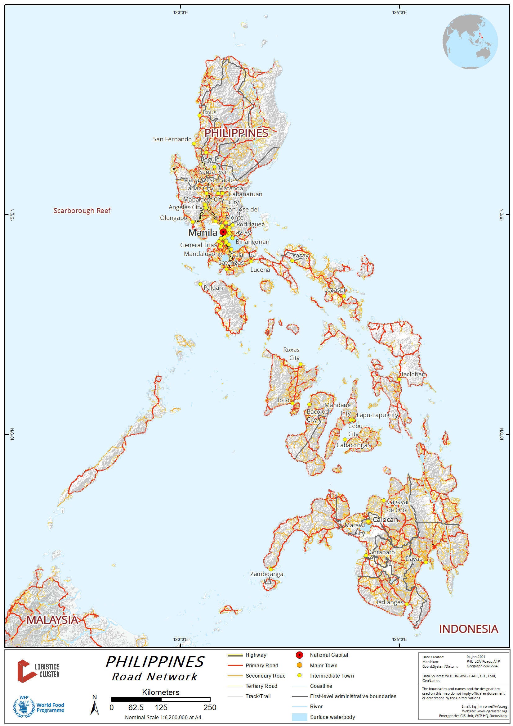
For more information on government contact details, please see the following link: 4.1 Government Contact List.
For more information about the Philippine road network, please see the following link: 2020 DPWH Road and Bridges Inventory Survey.
Zamboanga Peninsula (Region IX)
As of 2018, Department of Public Works and Highways (DPWH) IX was able to build 56.49 km of national roads along the priority corridors, widened with complete features to 4 lanes, which is 9.16 km short of the target of 65.65 km. A total of 24.05 km of new roads were constructed to close gaps in the national road network which is 4.78 km or 16.58% less than the total target of 28.83 km.
Northern Mindanao (Region X)
Coming from Cagayan de Oro City going east, the road networks will lead to Bukidnon and eastern part of Misamis Oriental up to its chartered city of Gingoog. From Cagayan de Oro going westward the road networks will lead to western part of Misamis Oriental, Iligan City, Province of Lanao del Norte, Marawi City, Lanao del Sur, Zamboanga City and its northern part road network going to Dipolog City. Challenges on this road network are damaged bridges cause by natural calamities. Additional development and construction of new bridges and road widening are underway to lessen the travel time in going to other regions. The Department of Public Works and Highways (DPWH) is the lead government agency for road repairs and widening to cope with the growing economy in Region X and its adjacent Regions of IX and Basilan, Sulu, and Tawi-Tawi (BASULTA) provinces.
Davao Region (Region XI)
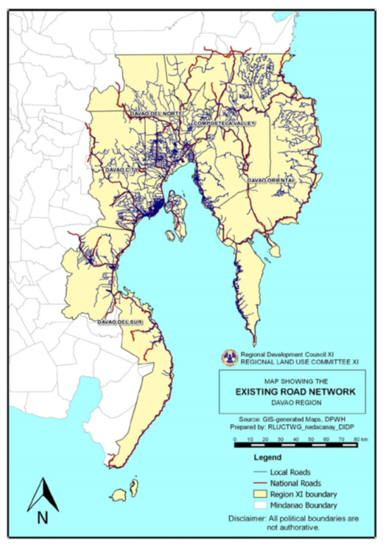
Davao Region Road Network. Source: Davao Regional Land Use Committee
The road system of Davao Region is comprised of national and local road networks connecting the regional center externally and internally, particularly the provincial capitals and strategic destinations in the region.
As of December 2013, the total national road network of Davao Region was 1,662.37 kilometers or 18 percent of the total national road network of Mindanao. Among the provinces/cities, Davao Oriental had the longest national road network and paved surface road length with 431.66 kilometers and 350.55 kilometers, respectively, while Digos City had the shortest length with 24.03 kilometers. In terms of the proportion of paved roads to total length of national roads, the cities of Digos, Panabo, IGACOS and Tagum posted the highest percentage with 100% of their national roads already paved, whereas Davao del Sur had the lowest pavement ratio with 44%.
The Road Inventory and Road Condition Survey conducted by DPWH in 2013 revealed that 61 percent of the national road network in the region (1,017.76 kilometers) was in good or fair condition. On the other hand, roads in poor condition had a total length of 268.03 kilometers while those in bad condition had a total length of 211.47 kilometers.
Currently, high traffic volumes are seen along the Region’s major thoroughfares, particularly along the Tagum-Panabo-Davao City-Digos corridor. The volume-capacity ratio (VCR) is the basis being used by DPWH in considering road sections to be widened, at a threshold of more than 0.5. As of CY 2013, 73 km of national roads in the Region had VCR of more than 0.5, with 72 km experiencing moderate to heavy traffic flow, and about 1 km in Davao City already with saturation traffic volumes. However, widening in these sections is contingent to the availability of road right-of-way. Traffic congestion is expected to worsen in the coming years due to population growth, increasing urbanization and heightened economic activities. Other options may have to be considered, such as the opening/upgrading to high standard highways and establishment of mass transit systems.
Davao Region Physical Framework Plan: http://nro11.neda.gov.ph/wp-content/uploads/2017/08/DRPFP-2015-2045.pdf
SOCCSKSARGEN (Region XII)
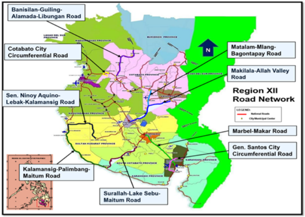
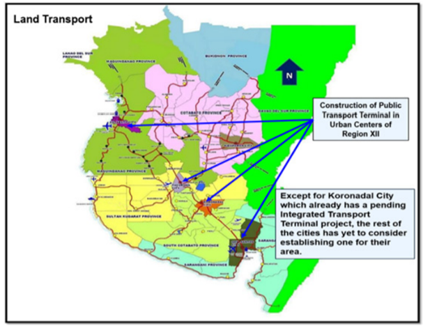
The region recognizes the importance of improving the transportation sector to support its rapid and inclusive economic growth. Prudent strategies were pursued and strategic projects were implemented to accelerate the development of the sector’s safe, reliable, cost-effective, and sustainable infrastructure facilities to ensure the efficient transport of people and products. Adhering to the policy of full transparency and accountability to its people, the region engaged the general public to participate in the governance, monitoring and feedback in the implementation of infrastructure projects. The implementation of strategic road projects has enhanced the accessibility to production areas, major tourism destinations and basic service facilities like schools, hospitals, and attracted investments to the region. In terms of providing an integrated transport terminal in urban centers in the region, Koronadal City has an ongoing construction of an Integrated Transport Terminal project.
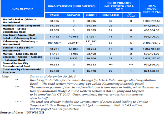
Road Security
| Corridor | Comments |
|---|---|
|
Davao City – Butuan – Surigao City |
There are no reported security issues and transporters and buses are using this route network travel 24 hours a day. |
| Davao – Cagayan de Oro – Iligan City | Can be accessed 24 hours, but with caution at night due to fog along Calinan District, Davao City and Bukidnon Province. |
| Davao City – Davao de Oro – Tandag City, Surigao del Sur – Surigao City | This road network was noted to have rampant non-government actors especially along Surigao del Sur going to Surigao City. From Carrascal, Surigao del Sur to Surigao City, the KM 90 (Noventa) highway stretch has minimal population and is noted for highway robbery and hijacking. |
| Davao City – General Santos City |
This road network is accessible 24 hours a day with no reported security issues even though non-government actors are present. The stretch of roads in Malungon Municipality is prone to landslides during heavy rains. |
| General Santos City - Cotabato City | Travelling on this route at night is risky as lawless elements stage unauthorized checkpoints in order to commit robberies. |
| Cagayan de Oro City – Iligan City – Pagadian City – Zamboanga City | This road network is accessible 24 hours but observe precautionary measures at night especially on the highway from Pagadian City to Zamboanga City where long stretches of the road is sparsely populated. |
| Cagayan de Oro City – Butuan City – Surigao City | This road network is accessible 24 hours a day but caution is advised at night due to the large volume of trucks and buses heading to Manila and to Visayas. |
| Cagayan de Oro – Ozamis City – Oroquieta City – Dipolog/Dapitan City | This road network can be accessed any time of the day but take note that the RORO vessel docked at Mukas Port in the municipality of Kolambugan, Lanao del Norte has time off between 2000H to 0400H. As an alternative, travelers should take the long route via Aurora, Zamboanga del Sur to Molave, Zamboanga de Sur and then heading to Ozamis City all the way to Dipolog City. |
| Davao City – Kidapawan City – Cotabato City | Travelers can access this route any time of the day but UV Express passenger vans are known to drive carelessly along this route. |
Distance Matrices
Davao City – Butuan City – Surigao City
|
Distances from Davao to Major Towns in the Davao City - Butuan City - Surigao City Corridor |
||||||||
|---|---|---|---|---|---|---|---|---|
|
Davao City |
Panabo City |
Tagum City |
Nabunturan, Davao de Oro |
Montevista, Davao de Oro |
Monkayo, Davao de Oro |
Butuan City |
Surigao City |
|
|
Davao City |
|
29 km |
53 km |
86 km |
98 km |
116 km |
287 km |
392 km |
|
Panabo City |
29 km |
|
24 km |
57 km |
69 km |
87 km |
258 km |
363 km |
|
Tagum City |
53 km |
24 km |
|
33 km |
45 km |
63 km |
234 km |
339 km |
|
Nabunturan, Davao de Oro |
86 km |
57 km |
33 km |
|
12 km |
30 km |
201 km |
306 km |
|
Montevista, Davao de Oro |
98 km |
69 km |
45 km |
12 km |
|
18 km |
189 km |
294 km |
|
Monkayo, Davao de Oro |
116 km |
87 km |
63 km |
30 km |
18 km |
|
171 km |
276 km |
|
Butuan City |
287 km |
258 km |
234 km |
201 km |
189 km |
171 km |
|
105 km |
|
Surigao City |
392 km |
363 km |
339 km |
306 km |
294 km |
276 km |
105 km |
|
|
Travel Time from Davao to Major Towns in the Davao City - Butuan City - Surigao City Corridor |
||||||||
|---|---|---|---|---|---|---|---|---|
|
Davao City |
Panabo City |
Tagum City |
Nabunturan, Davao de Oro |
Montevista, Davao de Oro |
Monkayo, Davao de Oro |
Butuan City |
Surigao City |
|
|
Davao City |
|
1 hr |
1 hr |
2 hrs |
3 hrs |
4 hrs |
7 hrs |
10 hrs |
|
Panabo City |
1 hr |
|
1 hr |
1 hr |
3 hrs |
3 hrs |
7 hrs |
9 hrs |
|
Tagum City |
1 hr |
1 hrs |
|
1 hr |
2 hrs |
3 hrs |
6 hrs |
8 hrs |
|
Nabunturan, Davao de Oro |
2 hrs |
1 hrs |
1 hr |
|
1 hr |
2 hrs |
6 hrs |
7 hrs |
|
Montevista, Davao de Oro |
3 hrs |
3 hrs |
2 hrs |
1 hr |
|
1 hr |
5 hrs |
7 hrs |
|
Monkayo, Davao de Oro |
4 hrs |
3 hrs |
3 hrs |
2 hrs |
1 hr |
|
5 hrs |
7 hrs |
|
Butuan City |
7 hrs |
7 hrs |
6 hrs |
6 hrs |
5 hrs |
5 hrs |
|
3 hrs |
|
Surigao City |
9 hrs |
9 hrs |
8 hrs |
7 hrs |
7 hrs |
7 hrs |
3 hrs |
|
Davao City – Davao de Oro – Tandag, Surigao Sur – Surigao City
|
Distances from Davao City to Major Towns in the Davao City - Davao De Oro - Tandag - Surigao City Corridor |
||||||||
|---|---|---|---|---|---|---|---|---|
|
Davao City |
Mati City, Davao Oriental |
Tarragona, Davao Oriental |
Man-Ay, Davao Oriental |
Carraga, Davao Oriental |
Boston, Davao Oriental |
Tandag City |
Surigao City |
|
|
Davao City |
|
157 km |
196 km |
224 km |
244 km |
348 km |
566 km |
739 km |
|
Mati City, Davao Oriental |
157 km |
|
39 km |
67 km |
87 km |
191 km |
409 km |
582 km |
|
Tarragona, Davao Oriental |
196 km |
39 km |
|
28 km |
48 km |
152 km |
370 km |
543 km |
|
Man-Ay, Davao Oriental |
224 km |
67 km |
28 km |
|
20 km |
124 km |
342 km |
515 km |
|
Carraga, Davao Oriental |
244 km |
87 km |
48 km |
20 km |
|
104 km |
322 km |
495 km |
|
Boston, Davao Oriental |
348 km |
191 km |
152 km |
124 km |
104 km |
|
218 km |
391 km |
|
Tandag City |
566 km |
409 km |
370 km |
342 km |
322 km |
218 km |
|
173 km |
|
Surigao City |
739 km |
582 km |
543 km |
515 km |
495 km |
391 km |
173 km |
|
|
Travel Time from Davao City to Major Towns in the Davao City - Davao De Oro - Tandag - Surigao City Corridor |
||||||||
|---|---|---|---|---|---|---|---|---|
|
Davao City |
Mati City, Davao Oriental |
Tarragona, Davao Oriental |
Man-Ay, Davao Oriental |
Carraga, Davao Oriental |
Boston, Davao Oriental |
Tandag City |
Surigao City |
|
|
Davao City |
|
3 hrs |
4 hrs |
6 hrs |
6 hrs |
8 hrs |
10 hrs |
12 hrs |
|
Mati City, Davao Oriental |
3 hrs |
|
1 hr |
1 hr |
2 hrs |
5 hrs |
8 hrs |
10 hrs |
|
Tarragona, Davao Oriental |
4 hrs |
1 hr |
|
1 hr |
1 hr |
3 hrs |
7 hrs |
9 hrs |
|
Man-Ay, Davao Oriental |
6 hrs |
1 hr |
1 hr |
|
1 hr |
2 hrs |
6 hrs |
8 hrs |
|
Carraga, Davao Oriental |
6 hrs |
2 hrs |
1 hr |
1 hr |
|
2 hrs |
5 hrs |
7 hrs |
|
Boston, Davao Oriental |
8 hrs |
5 hrs |
3 hrs |
2 hrs |
2 hrs |
|
4 hrs |
6 hrs |
|
Tandag City |
10 hrs |
8 hrs |
7 hrs |
6 hrs |
5 hrs |
4 hrs |
|
5 hrs |
|
Surigao City |
12 hrs |
10 hrs |
9 hrs |
8 hrs |
7 hrs |
3 hrs |
5 hrs |
|
Davao City – Digos City – General Santos City – Cotabato City – Zamboanga City
|
Distances from Davao City to Major Towns in the Davao City - Digos City - General Santos City - Cotabato City - Zamboanga City Corridor |
||||||||
|---|---|---|---|---|---|---|---|---|
|
Davao City |
Digos City |
General Santos City |
Koronadal City |
Tacurong City |
Cotabato City |
Pagadian City |
Zamboanga City |
|
|
Davao City |
|
54 km |
141 km |
196 km |
234 km |
330 km |
510 km |
781 km |
|
Digos City |
54 km |
|
87 km |
142 km |
180 km |
276 km |
453 km |
727 km |
|
General Santos City |
141 km |
87 km |
|
55 km |
93 km |
189 km |
369 km |
640 km |
|
Koronadal City |
196 km |
142 km |
55 km |
|
38 km |
134 km |
314 km |
585 km |
|
Tacurong City |
234 km |
180 km |
93 km |
38 km |
|
96 km |
276 km |
547 km |
|
Cotabato City |
330 km |
276 km |
189 km |
134 km |
96 km |
|
180 km |
451 km |
|
Pagadian City |
510 km |
453 km |
369 km |
314 km |
276 km |
180 km |
|
271 km |
|
Zamboanga City |
781 km |
727 km |
640 km |
585 km |
547 km |
451 km |
271 km |
|
|
Travel Time from Davao City to Major Towns in the Davao City - Digos City - General Santos City - Cotabato City - Zamboanga City Corridor |
||||||||
|---|---|---|---|---|---|---|---|---|
|
Davao City |
Digos City |
General Santos City |
Koronadal City |
Tacurong City |
Cotabato City |
Pagadian City |
Zamboanga City |
|
|
Davao City |
|
1 hr |
3 hrs |
4 hrs |
6 hrs |
8 hrs |
12 hrs |
16 hrs |
|
Digos City |
1 hr |
|
2 hrs |
3 hrs |
5 hrs |
7 hrs |
11 hrs |
15 hrs |
|
General Santos City |
3 hrs |
2 hrs |
|
1 hr |
2 hrs |
6 hrs |
10 hrs |
14 hrs |
|
Koronadal City |
4 hrs |
3 hrs |
1 hr |
|
1 hr |
4 hrs |
8 hrs |
12 hrs |
|
Tacurong City |
6 hrs |
5 hrs |
2 hrs |
1 hr |
|
3 hrs |
6 hrs |
10 hrs |
|
Cotabato City |
8 hrs |
7 hrs |
6 hrs |
4 hrs |
3 hrs |
|
5 hrs |
8 hrs |
|
Pagadian City |
12 hrs |
11 hrs |
10 hrs |
8 hrs |
6 hrs |
5 hrs |
|
7 hrs |
|
Zamboanga City |
16 hrs |
15 hrs |
14 hrs |
12 hrs |
10 hrs |
8 hrs |
7 hrs |
|
Davao City – Bukidnon – Cagayan de Oro – Iligan City – Pagadian – Zamboanga City
|
Distances from Davao City to Major Towns in the Davao City - Bukidnon - Cagayan De Oro - Iligan - Pagadian - Zamboanga City Corridor |
||||||
|---|---|---|---|---|---|---|
|
Davao City |
Malaybalay City, Bukidnon |
Cagayan De Oro City |
Iligan City |
Pagadian City |
Zamboanga City |
|
|
Davao City |
|
190 km |
288 km |
377 km |
519 km |
790 km |
|
Malaybalay City, Bukidnon |
190 km |
|
98 km |
187 km |
329 km |
600 km |
|
Cagayan De Oro City |
288 km |
98 km |
|
89 km |
231 km |
502 km |
|
Iligan City |
377 km |
187 km |
89 km |
|
142 km |
413 km |
|
Pagadian City |
519 km |
329 km |
231 km |
142 km |
|
271 km |
|
Zamboanga City |
790 km |
600 km |
502 km |
413 km |
271 km |
|
|
Travel Time from Davao City to Major Towns in the Davao City - Bukidnon - Cagayan De Oro - Iligan - Pagadian - Zamboanga City Corridor |
||||||
|---|---|---|---|---|---|---|
|
Davao City |
Malaybalay City, Bukidnon |
Cagayan De Oro City |
Iligan City |
Pagadian City |
Zamboanga City |
|
|
Davao City |
|
6 hrs |
8 hrs |
10 hrs |
14 hrs |
21 hrs |
|
Malaybalay City, Bukidnon |
6 hrs |
|
3 hrs |
6 hrs |
10 hrs |
17 hrs |
|
Cagayan De Oro City |
8 hrs |
3 hrs |
|
2 hrs |
6 hrs |
13 hrs |
|
Iligan City |
10 hrs |
6 hrs |
2 hrs |
|
4 hrs |
10 hrs |
|
Pagadian City |
14 hrs |
10 hrs |
6 hrs |
4 hrs |
|
7 hrs |
|
Zamboanga City |
21 hrs |
17 hrs |
13 hrs |
10 hrs |
7 hrs |
|
Davao City – Cotabato City
|
Distances from Davao City to Major Towns in the Davao City to Cotabato City Corridor |
||||
|---|---|---|---|---|
|
Davao City |
Digos City |
Kidapawan City |
Cotabato City |
|
|
Davao City |
|
54 km |
108 km |
231 km |
|
Digos City |
54 km |
|
54 km |
177 km |
|
Kidapawan City |
108 km |
54 km |
|
123 km |
|
Cotabato City |
231 km |
177 km |
123 km |
|
|
Travel Time from Davao City to Major Towns in the Davao City to Cotabato City Corridor |
||||
|---|---|---|---|---|
|
Davao City |
Digos City |
Kidapawan City |
Cotabato City |
|
|
Davao City |
|
1 |
3 |
5 |
|
Digos City |
1 |
|
1 |
4 |
|
Kidapawan City |
3 |
1 |
|
3 |
|
Cotabato City |
5 |
4 |
3 |
|
Davao City – Ozamis City - Dipolog City, Zamboanga del Norte
|
Distances from Davao City to Major Towns in the Davao City - Ozamis City - Dipolog City Corridor Via RORO from Mukas Port Kolambugan, Lanao Norte To Port of Ozamis City |
||||||
|---|---|---|---|---|---|---|
|
Davao City |
Cagayan De Oro City |
Iligan City |
Ozamis City |
Oroquieta City |
Dipolog City |
|
|
Davao City |
|
288 km |
377 km |
439 km |
481 km |
574 km |
|
Cagayan De Oro City |
288 km |
|
89 km |
151 km |
193 km |
286 km |
|
Iligan City |
377 km |
89 km |
|
62 km |
104 km |
197 km |
|
Ozamis City |
439 km |
151 km |
62 km |
|
42 km |
135 km |
|
Oroquieta City |
481 km |
193 km |
104 km |
42 km |
|
93 km |
|
Dipolog City |
574 km |
286 km |
197 km |
135 km |
93 km |
|
|
Travel Time from Davao City to Major Towns in the Davao City - Ozamis City - Dipolog City Corridor Via RORO from Mukas Port Kolambugan, Lanao Norte To Port of Ozamis City |
||||||
|---|---|---|---|---|---|---|
|
Davao City |
Cagayan De Oro City |
Iligan City |
Ozamis City |
Oroquieta City |
Dipolog City |
|
|
Davao City |
|
8 hrs |
10 hrs |
14 hrs |
15 hrs |
18 hrs |
|
Cagayan De Oro City |
8 hrs |
|
2 hrs |
7 hrs |
8 hrs |
11 hrs |
|
Iligan City |
10 hrs |
2 hrs |
|
3 hrs |
5 hrs |
8 hrs |
|
Ozamis City |
14 hrs |
7 hrs |
3 hrs |
|
2 hrs |
6 hrs |
|
Oroquieta City |
15 hrs |
8 hrs |
5 hrs |
2 hrs |
|
4 hrs |
|
Dipolog City |
18 hrs |
11 hrs |
8 hrs |
6 hrs |
4 hrs |
|
Road Security
| Corridor | Comments |
|---|---|
|
Davao City – Butuan – Surigao City |
There are no reported security issues and transporters and buses are using this route network travel 24 hours a day. |
| Davao – Cagayan de Oro – Iligan City | Can be accessed 24 hours, but with caution at night due to fog along Calinan District, Davao City and Bukidnon Province. |
| Davao City – Davao de Oro – Tandag City, Surigao del Sur – Surigao City | This road network was noted to have rampant non-government actors especially along Surigao del Sur going to Surigao City. From Carrascal, Surigao del Sur to Surigao City, the KM 90 (Noventa) highway stretch has minimal population and is noted for highway robbery and hijacking. |
| Davao City – General Santos City |
This road network is accessible 24 hours a day with no reported security issues even though non-government actors are present. The stretch of roads in Malungon Municipality is prone to landslides during heavy rains. |
| General Santos City - Cotabato City | Travelling on this route at night is risky as lawless elements stage unauthorized checkpoints in order to commit robberies. |
| Cagayan de Oro City – Iligan City – Pagadian City – Zamboanga City | This road network is accessible 24 hours but observe precautionary measures at night especially on the highway from Pagadian City to Zamboanga City where long stretches of the road is sparsely populated. |
| Cagayan de Oro City – Butuan City – Surigao City | This road network is accessible 24 hours a day but caution is advised at night due to the large volume of trucks and buses heading to Manila and to Visayas. |
| Cagayan de Oro – Ozamis City – Oroquieta City – Dipolog/Dapitan City | This road network can be accessed any time of the day but take note that the RORO vessel docked at Mukas Port in the municipality of Kolambugan, Lanao del Norte has time off between 2000H to 0400H. As an alternative, travelers should take the long route via Aurora, Zamboanga del Sur to Molave, Zamboanga de Sur and then heading to Ozamis City all the way to Dipolog City. |
| Davao City – Kidapawan City – Cotabato City | Travelers can access this route any time of the day but UV Express passenger vans are known to drive carelessly along this route. |
Weighbridges and Axle Load Limits
|
Axle Load Limits |
Philippines |
|---|---|
|
Truck with 2 Axles |
7-10 MT |
|
Truck with 3 Axles |
20-22 MT |
|
Truck with 4 Axles |
22-25 MT |
|
Semi-trailer with 3 Axles |
25-30 MT |
|
Semi-trailer with 4 Axles |
N/A |
|
Semi-trailer with 5 Axles |
N/A |
|
Semi-trailer with 6 Axles |
N/A |
|
Truck & Drawbar Trailer with 4 Axles |
N/A |
|
Truck & Drawbar Trailer with 5 Axles |
N/A |
|
Truck & Drawbar Trailer with 6 Axles |
N/A |
|
Truck & Drawbar Trailer with 7 Axles |
N/A |
2.4 Philippines Railway Assessment
Philippines Railway Assessment
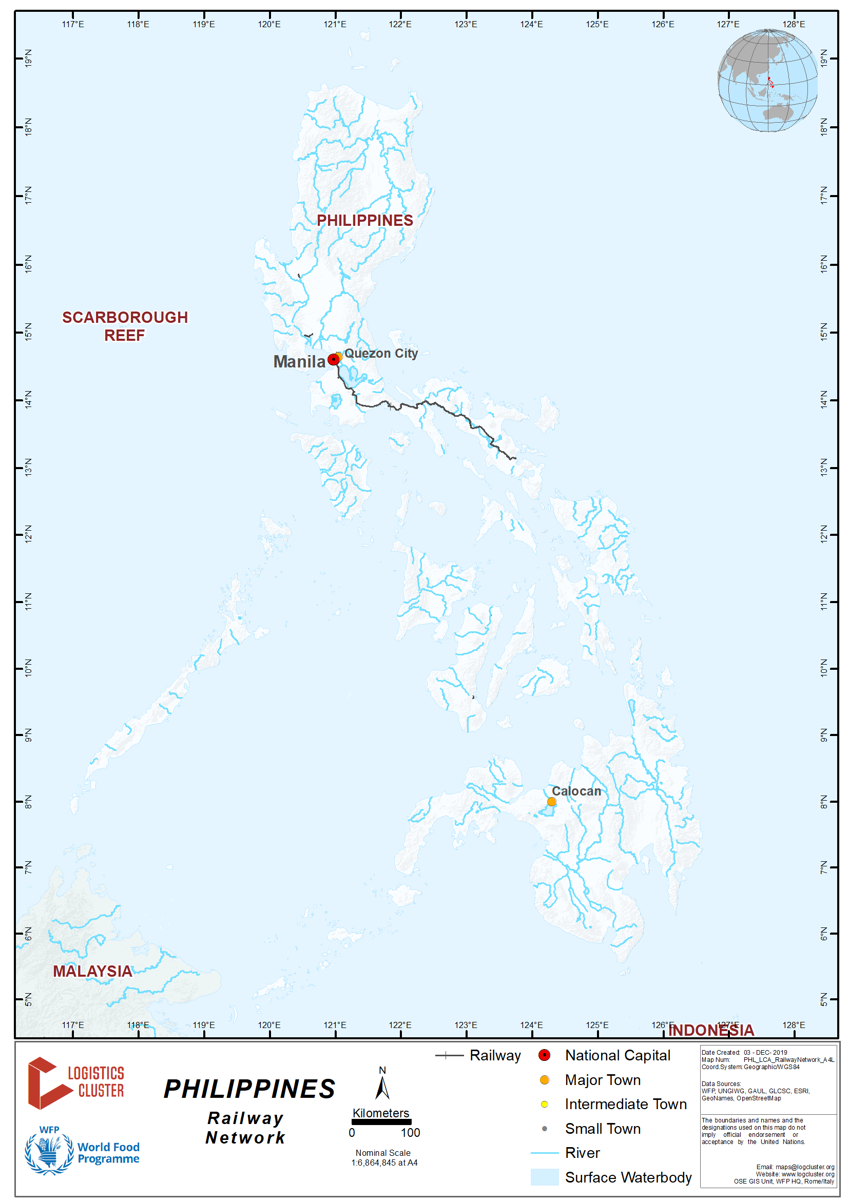

The state-owned Philippine National Railways, commonly abbreviated as PNR, is the sole operator of the most extensive intra-island railway on Luzon, the largest island in the Philippines. It operates two commuter rail services in Metro Manila and the Bicol Region. The Bicol service is currently under rehabilitation in preparation for the resumption of the Bicol Express run to Naga City in Camarines Sur province, and eventually to the southern terminal in Legazpi City in Albay. The existing and well-patronized commuter service in Metro Manila is part of the metropolitan transit system and referred to as the Orange Line.
PNR officially began operations on June 26, 1875 as the Ferrocarril de Manila-Dagupan, during the Spanish colonial period, and later becoming the Manila Railroad Company(MRR) during the American colonial period. It became the Philippine National Railways on June 20, 1946 by virtue of Republic Act No. 4156. The PNR is an attached agency under the Department of Transportation and Communications. PNRs efforts to link areas across Luzon have been beset with problems regarding degraded infrastructure and lack of funding and only the Southline is currently operational and the cargo branch of operations largely defunct. Narrow gauge standard results in lateral instability. Together with the age of most of the passenger rolling-stock, this means trains can only run up to 50 km/h (31 mph). Due to PNR financial difficulties, very limited cargo service available. Most freight cars are in varying states of disrepair.
Railway Companies and Consortia
For information on Philippines Railway company contact details, please see the following link:
4.9 Philippines Railway Company Contact List
Key Route Information
| Standard Route Information | |
|---|---|
|
Intra-island railway on Luzon |
|
|
Track gauge |
Single track Cape guage: 1,067 mm / 3 foot 6 inches |
|
Ruling gradient |
n/a |
|
Total track distance (single and/or double) |
Northline (Manila – San Fernando) 266 kms / 165 miles CLOSED Southline (Manila – Legazpi): 479 kms / 267 miles |
|
Type of rail (weight and if welded or not) |
n/a |
|
Type of sleeper and fastenings |
n/a |
|
Total track travel time |
n/a |
|
Maintenance (Good, marginal, bad) |
n/a |
|
Companies-consortiums operating on line |
Philippine National Railways |
|
Traffic frequency (monthly/weekly/daily) |
n/a |
|
Security (Good, marginal, bad) |
n/a |
|
Main stations (Add details below) |
Manila, Legazpi |
2.5 Philippines Storage Assessment
Philippines Storage Assessment
For information on Philippines Storage Company contact details, please see the following link:
4.6 Philippines Storage and Milling Company Contact List
Commercial Storage
| Location | Owner | Available for rent | Capacity | Type | Access | Condition |
|---|---|---|---|---|---|---|
|
Kabihasnan,
Sucat
|
Fast Cargo
|
Yes
|
300
|
Open Storage
|
n/a
|
Secure compound. Occupied but
available to share.
|
|
Kabihasnan,
Sucat
|
Fast Cargo
|
Yes |
650
|
Open Storage
|
n/a
|
Secure compound. Low roof,
small doors. Not well ventilated.
|
|
Kabihasnan,
Sucat
|
Fast Cargo
|
Yes |
1,278
|
Open Storage
|
n/a
|
No Fence. Single Door.
History of leakage from adjacent WH
|
|
Perfecto Drive, Manalac
Industrial Subd. Tanyag, Taguig
|
Fast Cargo
|
Yes |
1,860
|
Open Storage
|
n/a
|
Fence under construction.
Capacity includes mezzanine (ground 970 sqm + mezz 890 sqm). One
main door, 2 small doors.
|
|
Carlo Drive, Manalac
Taguig
|
Fast Cargo
|
Yes |
1,500
|
Open Storage
|
n/a
|
Security may be an issue.
Capacity includes mezzanine, one door (many adjacent
warehouses)
|
|
First Ave, Manalac,
Industrial Subd, Tanyag, Taguig
|
Fast Cargo
|
Yes |
1,200
|
Open Storage
|
n/a
|
Secure compound. Only one
door.
|
|
William St, Corner Sheridan,
Mandaluyong City
|
Fast Cargo
|
Yes |
5,000
|
Open Storage
|
n/a
|
Non-concrete fence. Capacity
includes all facilities and other buildings within the compound,
under renovation.
|
|
Tondo Manila
|
+63 (0)
906 305 2598
|
Yes |
100
|
Open Storage
|
n/a
|
Within a warehouse. COLD
STORAGE available. Rates vary based on volume and temperature
required.
|
|
KM 17, Taguig
|
+63
(02) 813 7164
|
Yes |
4000
|
Open Storage
|
n/a
|
Secure compound. Only one of
the 3 gates has door. Floor not very good. Entrance from highway is
a narrow road, not good for big trucks.
|
|
1st Street, KM 17,
Taguig
|
+63
(02) 823 4255 / +63
(02) 824 1024 / +63
(02) 824 1023
|
Yes |
520
|
Open Storage
|
n/a
|
Secure compound. Looking for
1 year contract minimum.
|
| 1st Street, KM 17, Taguig | +63 (02) 823 4255 / +63 (02) 824 1024 / +63 (02) 824 1023 | Yes |
620
|
Open Storage
|
n/a
|
Secure compound. Looking for 1 year contract minimum. |
|
Baesa, Quezon
City
|
+63 (0)
906 305 2598
|
Yes |
3,700
|
Open Storage
|
n/a
|
Secure compound. Additional
charge for security and WH maintenance. Big trucks cannot access
inside WH. A small space within the WH is already
occupied.
|
|
KM 23 West Service Road,
Brgy. Cupant Muntinlupa, Sucat Extension, Paranaque
|
+63 (0)
906 305 2598
|
Yes |
1,600
|
Open Storage
|
n/a
|
All 4 warehouses located in
one compound. Includes mezzanine. Big trucks cannot access
inside.
|
| KM 23 West Service Road, Brgy. Cupant Muntinlupa, Sucat Extension, Paranaque | +63 (0) 906 305 2598 | Yes |
1,200
|
Open Storage
|
n/a
|
All 4 warehouses located in one compound. Includes mezzanine. Big trucks cannot access inside. |
| KM 23 West Service Road, Brgy. Cupant Muntinlupa, Sucat Extension, Paranaque | +63 (0) 906 305 2598 | Yes |
1,900
|
Open Storage
|
n/a
|
All 4 warehouses located in one compound. Includes mezzanine. Big trucks cannot access inside. |
| KM 23 West Service Road, Brgy. Cupant Muntinlupa, Sucat Extension, Paranaque | +63 (0) 906 305 2598 | Yes |
1,500
|
Open Storage
|
n/a
|
All 4 warehouses located in one compound. Includes mezzanine. Big trucks cannot access inside. |
|
232 Querina Highway, Quezon
City
|
Evelyn +63
(02) 330 6951
|
Yes |
300
|
Open Storage
|
n/a
|
n/a |
|
232 Querina Highway, Quezon
City
|
Evelyn +63 (02) 330 6951 | Yes |
500
|
Open Storage
|
n/a
|
n/a |
| 232 Querina Highway, Quezon City | Evelyn +63 (02) 330 6951 | Yes |
700
|
Open Storage
|
n/a
|
n/a |
| 232 Querina Highway, Quezon City | Evelyn +63 (02) 330 6951 | Yes |
900
|
Open Storage
|
n/a
|
n/a |
| 232 Querina Highway, Quezon City | Evelyn +63 (02) 330 6951 | Yes |
1,000
|
Open Storage
|
n/a
|
n/a |
| 232 Querina Highway, Quezon City | Evelyn +63 (02) 330 6951 | Yes |
Up to 3,000
|
Open Storage
|
n/a
|
n/a |