2 Myanmar Logistics Infrastructure
Myanmar Logistics Infrastructure
The following sections contain information regarding the logistics infrastructure of Myanmar
Myanmar’s domestic and international connectivity are inadequate for its logistics requirements for the production of goods and the movement of people. Transport links to neighbouring countries are both limited and substandard. In the World Bank’s 2014 Logistics performance index, Myanmar scored the lowest among Southeast Asian countries in overall logistics performance and quality of trade- and transport-related infrastructure.
Roads
Among ASEAN countries, Myanmar’s roads are the most underdeveloped. Although the road network expanded to 148,690 km (92,392 mi) as of March 2012 from 90,713km in 2004, road density remains among the lowest in the region. Only 39% (57,840 km) of the network is paved and 61% (90,850 km) unpaved, with the secondary and local road network generally in poor condition and not passable during the monsoon season. The government of Myanmar has two ministries controlling transportation: Ministry of Rail Transportation and the Ministry of Transport. The Ministry of Construction is responsible for construction and maintenance of roads, bridges and airports. Only 26% of roads (39,083 km) fall under responsibility of the Ministry of Construction.
The main highways are:
- 1 – 1577 km : Runs from Myawadi (Thai border)-Thaton-Payagyi-Nay Pyi Taw-Meiktila-Mandalay-Gangaw-Kale-Tamu (India border) (AH-1).
- 2 – 804 km: Runs from Tachileik (Thai border)-Keng Tung-Taunggyi-Meiktila-Mandalay-Gangaw-Kale-Tamu (India border) (AH-2).
- 3 – 90 km; Runs from AH-2 at Keng Tung-Mongla (PR China border) (AH-3).
- 4 – 460 km: Runs from Mandalay-Lashio-Muse (PR China border) (AH-14).
- 5 – 250 km: Runs from Thaton-Mawlamyine-Dawei-Myeik-Kawthaung (AH-112).
- 6 – 196 km: Runs from Yangon-Kyaunggon-Pathein (Western Union Highway).
- 7 – 279km: Runs from Yangon-Tharrawaddy-Pyay (Route 2).
- 8 – 134 km: Runs from Dawei-Sinbhyudaing (Tikee) (to Thai border) (AH-123).
There is one expressway, the Yangon-Mandalay expressway, featuring a double carriageway and four lanes on its entire length of 587km. The government has plans to privatize 82 roads and there is on going privatization of road construction and maintenance. The first phase of a 3,200km highway connecting India, Myanmar and Thailand, the India-Myanmar friendship highway is set to complete by 2016 connecting Guwahati in India to Mandalay in Myanmar.
Ports and inland waterways
Upgrading and rehabilitation is required. For the most part, navigational aids and safety equipment are outdated and need to be modernized. There are nine maritime (sea) ports in Myanmar that fall under the Myanmar Port Authority, from North to South:
- Rakhine state: Sittwe, Kyaukphyu, Thandwe
- Ayeryarwaddy Division: Pathein port
- Yangon Division: Yangon Ports (Asia World Port, Myanmar Industrial Port, Bo Aung Kyaw Port)
- Mon State: Mawlamyine
- Tanitharyi region: Dawei, Myeik, Kawthoung
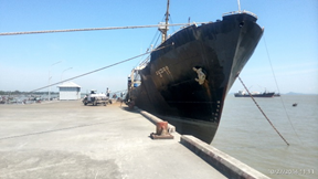
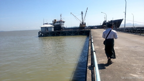
Freight volume in maritime ports was 22m MT in 2012, with most of the freight being handled in the Ports of Yangon (Myanmar Industrial Port, Asia World Port, Bo Aung Kyaw Port). Except Yangon and Kyauk Phyu (deep water) port, all ports have concrete jetties or metal jetties with barges, no fixed structures and still use simple, non-mechanized handling facilities. The port of Yangon can only handle small ship up to 15,000 dead weight tons (DWT) because it does not have deep-water access close to the city. However, the ports are being upgraded and renovations are to be completed in 2015. Thilawa is the biggest port in Yangon located near the Andaman Sea, this port can accommodate larger vessels up to 20,000 DWT
There is construction on-going of deep-water ports and Kyaukphyu in the North (in association with China) and planned in Dawei in the South (in association with Thailand) in special economic zones. However, the main coastal ports at Thandwe, Pathein, Mawlamyine, Myeik and Kawthoung are deteriorating. The government has identified sites in Kalegauk and Bokpyin for the development of ports. Kyaukphyu deep water port can’t be used for commercial vessels. It is being used by a private Chinese company jointly with Myanmar Oil and Gas Enterprise.
As of 2008, there were 12,800km (7,954 mi) of rivers of which 6,650km are navigable by commercial vessels. Myanmar’s rivers remain an important mode of transport to remote area’s of the country, as of 2011 4.7m tons of cargo was transported by river. The main river Irrawady runs in the center of the country from north to south. Other rivers are the Kaladan, Chindwin, Paunglaung, Salween and Mekong river on the border with Laos. More then 400 river vessels for passengers and freight are state owned by the Department of Inland Water Transport. Dams for hydroelectric power are being constructed on several rivers and tributaries especially in the North-East of the country.
Railways
The rail network, under responsibility of the Ministry of Rail Transportation and operated by state-owned Myanmar Railways, has nearly doubled since 1988, with a total length of 3,722km in 2014, all 1,000mm gauge. This expansion however been done at the cost of regular maintenance. The core railway infrastructure and locomotives and coaches are in poor condition, which has slowed operating speeds and made rides uncomfortable. There are no rail links to adjacent countries and the status of planned cross-border rail connections to China, India and Thailand, as well as the Thanbyuzayet-Three Pagoda pass connection remains uncertain. In 2011 67.6m passengers and 3.3m tons were transported, using 248 passenger trains/day and 21 freight trains/day. The rail capacity includes 386 locomotives, 1,252 passenger coaches and 3,311 freight wagons.
Under the framework for economic and social reform the government has committed to improve the quality of the Yangon-Mandalay-Myitkyina and the Bago-Mawlamyine section. There are existing plans to build a high speed railway to connect Kunming in Southwest China with Vietnam, Lao PDF and Myanmar respectively. Construction on the section connecting to Myanmar, the Dali-Ruili railway, began in May 2011 and is scheduled to take six year.
Airports
Myanmar has a total of 69 airports, of which 27 are operational airports with commercial flights and paved runways, out of these 11 have runways over 10,000 feet (3248m). There are three international airports, Yangon, Mandalay and Naypyitaw International, with adequate facilities to handle larger jets. A new tender was awarded in Oct 2014 to develop Hanthawaddy International airport in Bago region, about 80km from Yangon and there are plans to develop Dawei airport, in Thanintharyi region, into an International airport. Twenty-six international airlines and nine domestic airlines operate regular flights serving 20 regional destinations.
The domestic airlines are: Air Bagan, Air Kanbawza (KBZ), Air Mandalay, Asian Wings, Golden Myanmar airlines, Mann Yadanarpon Airlines, Myanmar Airways, Myanmar Airways International and Yangon airways, including one charter operator FMI air charter
As of 2012, according to the Department of Civil Aviation, there were 3.5m domestic and 2.0m international passengers transported by air. The volume of airfreight is negligible.
References:
ADB (publisher) Myanmar unlocking the potential, Aug 2014, Date accessed 21 Nov 2014.
JICA (publisher) Myanmar’s National Transport Master Plan, 24 July 2014, Date accessed 21 Nov 2014.
Ministry of Construction (publisher) Plenary meeting road infrastructure development, 30 Oct 2013,, Date accessed 21 Nov 2014.
World Bank (publisher) Logistics Performance Index 2014, Date accessed 21 Nov 2014.
KPMG (Publisher) Infrastructure in Myanmar, May 2013, Date accessed 21 Nov 2014.
Wikipedia (publisher) Transport in Burma, Date accessed 21 Nov 2014.
COE-DMHA (publisher), Burma (Myanmar) Disaster Management Reference Handbook, May 2014, Date accessed: 19 Nov 2014.
2.1 Myanmar Port Assessment
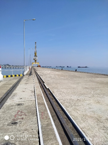
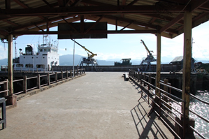
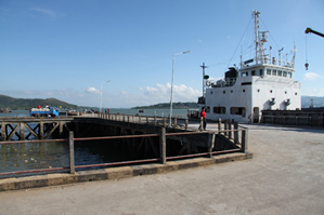
The main ports of Myanmar can be found in 9 cities: Sittwe, Thandwe, Kyuak Phyu (Rakkhine State), Pathein (Ayeyarwaddy Division), Yangon (Yangon Division), Mawlamyine (Mon State), Dawei, Myeik and Kawthaung (Tanintharyi Division). Most international cargo arrives at Yangon port. The other ports are mostly used for inland transportation and handle much less international cargo. The other ports are also not accessible for large ocean going vessels –only for drafts to 4-5m- and there is no mechanical cargo handling equipment available.
4.2.3 Myanmar Port and Waterways Company Contact List

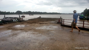
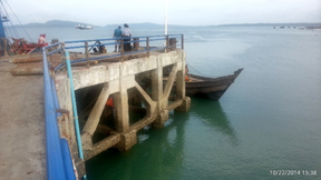
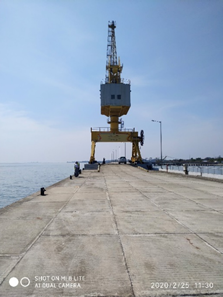
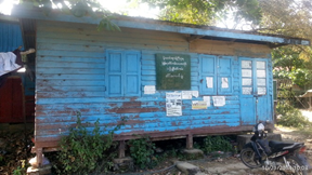
2.1.1 Myanmar Port of Pathein, Ayeyarwaddy
4.4 Myanmar Port and Waterways Company Contact List
Port Overview
Pathein is one of the larger, more developed cities of
Ayeyarwaddy division. The port consists of several jetties along
the Pathein River, but most jetties are not suitable for cargo
vessels. The hovercraft and small boats use the jetties within
Pathein downtown. The Wel Kyi Daunt wharf is the largest and it is
privatised. This wharf is located within the compound that was
owned by Department of Trade Promotion (DOTP). The warehouses in
this compound are controlled by Logistics Department of the Myanmar
army.
Wel Kyi Daunt wharf is designed for cargo vessels up to 600 GRT.
There is no cargo handling equipment at any of the jetties in
Pathein. The draft of Wel Kyi Daunt wharf is 7 metres. It has a
concrete jetty.
|
Port Location and Contacts |
|
|---|---|
|
Country |
Myanmar |
|
Province or District |
Ayeyarwaddy division |
|
Town or City (Closest location) with Distance (km) |
Name : Pathein km: 5 km |
|
Port's Complete Name |
Pathein port, |
|
Latitude |
16.77277 |
|
Longitude |
94.71819 |
|
Managing Company or Port Authority (If more than one operator, break down by area of operation) |
Myanma Port Authority |
|
Management Contact Person |
U Ko Ko Naing, Harbor Officer Phone: 042-24430 |
|
Closest Airport and Frequent Airlines to / from International Destinations |
Airport Name: Pathein airport Airlines: Only for military use. |
Port Picture
Wel Kyi Daunt Port Warehouse Compound, Pathein. There are many warehouses in this compound. For more details on warehouses, see storage section.
Description and Contacts of Key Companies
4.4 Myanmar Port and Waterways Company Contact List
There are no key companies responsible for stevedoring, freight forwarding or cargo handling. The Myanmar Port Authority, The Customs department and the Township Labour Exchange Office for daily labourers are the main organisations active.
Port Performance
There is no congestion; the average waiting time until berthing is 1 day. The maximum draft is 7 metres and maximum vessel size 600 GRT. There is no container handling capacity.
|
Seasonal Constraints |
Yes / No |
From <month> to <month> |
|---|---|---|
|
Rainy Season |
No | n/a |
|
Major Import Campaigns |
No | n/a |
|
Other |
n/a | n/a |
Discharge Rates and Terminal Handling Charges
Unknown, contact Port Authority for details.
Berthing Specifications
|
Type of Berth |
Quantity |
Length (m) |
Width (m) |
Maximum Draft (m) |
|---|---|---|---|---|
|
Conventional Berth |
1 * |
120 |
15 |
7 |
|
Container Berth |
n/a |
n/a |
n/a |
n/a |
|
Silo Berth |
n/a |
n/a |
n/a |
n/a |
|
Berthing Tugs |
n/a |
n/a |
n/a |
n/a |
|
Water Barges |
n/a |
n/a |
n/a |
n/a |
* Wei Kyi Daunt wharf: concrete jetty.
General Cargo Handling Berths
|
Cargo Type |
Berth Identification |
|---|---|
|
Imports - Bagged Cargo |
Wei Kyi Daunt wharf |
|
Exports - Bagged Cargo |
Wei Kyi Daunt wharf |
|
Imports and Exports - RoRo |
n/a |
|
Other Imports |
Wei Kyi Daunt wharf |
Port Handling Equipment
No port handling equipment available. Only manual labour.
Container Facilities
There is no container handling facility available.
Customs Guidance
A customs office is available, operating at normal working hours. The customs clearance process takes about 1 day.
1.3 Myanmar Customs Information
Terminal Information
Multipurpose Terminal
There is no multipurpose handling facility available.
Grain and Bulk Handling
There is no specific grain and bulk handling facility available, nor bagging facilities
Main Storage Terminal
|
Storage Type |
Number of Storage Facilities |
Area (square meters) |
|---|---|---|
|
Bagged Cargo |
no |
n/a |
|
Refrigerated Cargo |
no |
n/a |
|
General Cargo |
no |
n/a |
Stevedoring
There is no specific stevedoring company available. Daily labourers must take care of loading and unloading. The Township Labour Exchange Office, under control of the ministry of labour, is able to provide daily labourers for the port. The port authority can assist too with sourcing daily workers.
Hinterland Information
There are no local transport companies, only a limited number of private trucks. There is no railroad. Cargo can be transported by river using small wooden hull vessels, with a capacity of up to 100 GRT.
Port Security
There is no port security and no perimeter fencing because the jetties are separate.
|
Security |
||
|---|---|---|
|
ISPS Compliant (Yes / No) |
No
|
|
|
Current ISPS Level |
n/a |
Level 1 = Normal, Level 2 = Heightened, Level 3 = Exceptional |
|
Police Boats |
No | |
|
Fire Engines |
No |
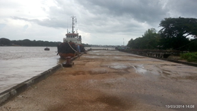
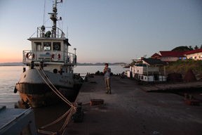
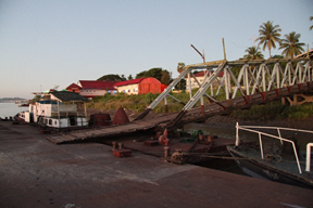
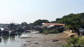
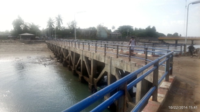
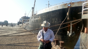
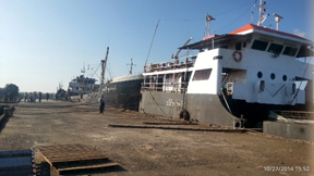
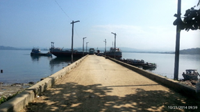
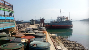
2.1.2 Myanmar Port of Mawlamyine, Mon state
Port Overview
Mawlamyine port is situated on the Thanlwin River about 28 nautical miles inland from the Kyaikkhame point on the Gulf of Martaban. Pilot service is compulsory for vessels over 200 GRT. Navigation has to be timed with high tide to cross the shallow water near the Hiintha Kyun Island.
There are five pontoon jetties of 36m to 72m length by 6m wide (120 to 240ft by 20ft) and two concrete wharfs of 36m by 6m. No container handling capacity is available. There is general cargo handling capacity for paddy, rice, and general cargo. The tidal range is about 4.2m at spring tide and 2.4m at neap tide. Velocity of the Thanlwin River is 4-6 knots at spring.
|
Port Location and Contacts |
|
|---|---|
|
Country |
Myanmar |
|
Province or District |
Mawlamyine |
|
Town or City (Closest location) with Distance (km) |
Name : Mawlamyine km: 0 km |
|
Port's Complete Name |
Port of Mawlamyine |
|
Latitude |
16.48092 |
|
Longitude |
97.61865 |
|
Managing Company or Port Authority (If more than one operator, break down by area of operation) |
Mawlamyine Port Authority |
|
Management Contact Person |
U Thar Win, District Port Officer, Mawlamyine |
|
Closest Airport and Frequent Airlines to / from International Destinations |
Airport Name: Mawlamyine airport Airlines: domestic flights by Myanma airlines |
Port Picture
Description and Contacts of Key Companies
4.4 Myanmar Port and Waterways Company Contact List
There are no key companies responsible for stevedoring, freight forwarding or cargo handling. The Dawei Port Authority, The Customs department and the Township Labour Exchange Office for daily labourers are the main organisations.
There is a separate jetty for fuel, which is managed by Myanma Petroleum Products Enterprise (MPPE).
Port Performance
The Mawlamyine port is accessible to vessels of 70m LOA, GRT 2000, 4.5m draft. Halfway anchorage is accessible to vessels of 100m LOA, GRT 7000 and 6.5m draft.
Port performance in 2013:
Import: no. of vessels 203, Fuel 19,904+5,344 MT, general cargo 1,588 MT.
Export: no of vessels 201, stones 122,818 MT, cement 77,901 MT, Sand 5,940 MT, Fuel 437 MT, General cargo 1,202 MT.
No congestion issues. Average waiting time between arrival and berthing is 2-3 hours.
|
Seasonal Constraints |
Yes / No |
From <month> to <month> |
|---|---|---|
|
Rainy Season |
No |
n/a |
|
Major Import Campaigns |
No |
n/a |
|
Other |
n/a |
n/a |
|
Handling Figures |
Year 2013 |
|---|---|
|
Vessel Calls |
404 |
|
Container Traffic (TEUs) |
0 |
|
Handling Figures Bulk and Break Bulk |
Year 2013 |
|---|---|
|
Break bulk import (MT) |
26,836 |
|
Break bulk export (MT) |
208,298 |
Discharge Rates and Terminal Handling Charges
Not applicable.
Fuel is offloaded by Myanma Petroleum Products Enterprise (MPPE), pumped from the vessel to storage tanks at the berth of MPPE. (N 16 26.204, E 97 36.743)
Berthing Specifications
|
Type of Berth |
Quantity |
Length (m) |
Maximum Draft (m) |
|---|---|---|---|
|
Conventional Berth |
2 |
36x 6m |
4.5 |
|
Barge |
4 |
36x 6m |
4.5 |
|
Barge |
1 |
72x 6m |
4.5 |
General Cargo Handling Berths
|
Cargo Type |
Berth Identification |
|---|---|
|
Imports - Bagged Cargo |
n/a |
|
Exports - Bagged Cargo |
n/a |
|
Imports and Exports - RoRo |
n/a |
|
Other Imports |
n/a |
Port Handling Equipment
There is no advanced port handling equipment available. Cargo handling is done by workers of the Township Labour Exchange Office.
Container Facilities
No container handling facilities available.
Customs Guidance
A customs office and customs officers are available, operating within normal office hours. Customs clearance time depends on the type of cargo, it normally takes about 1 day.
1.3 Myanmar Customs Information
Terminal Information
Multipurpose Terminal
Not available
Grain and Bulk Handling
No facility for handling bulk and gains. No bagging facilities.
Main Storage Terminal
Two warehouses that used to belong to the port authority, were privatised, only one can be available. This can be used for general cargo. Available warehouse size: 13.7x25.9m (45 x 85ft) plus 27.4x7m (90x23ft).
|
Storage Type |
Number of Storage Facilities |
Area (square meters) |
|---|---|---|
|
Bagged Cargo |
none |
n/a |
|
Refrigerated Cargo |
none |
n/a |
|
General Cargo |
2 |
546 sq.m. |
Stevedoring
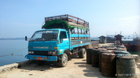
No stevedoring companies are available. Cargo handling is done by workers of the Township Labour Exchange Office, which is controlled by the ministry of Labour. Capacity is about 80-100 laborers.
Same daily labour rates as in Yangon between 4000-6000 MMK/day, but it depends on the cargo, for rice it is calculated by weight, 150 MMK per 50kg bag.
Hinterland Information
Thanawin and Gyaing river are navigable for boats and barges up to 4m draft, but it is currently not used for passenger and freight transport because most people prefer transport by road. Inland Water Transport currently has passenger services to two villages.
There is no railway connection available to the port area and the railway station is located 2-3km away from the port (over a hill).
There are no local transporters available, most transporters come from Yangon. There are a limited number of private trucks available locally.
Port Security
There are no port security facilities and no guards at night. There is no customs bonded area. There areas around the jetties are open, not fenced.
|
Security |
||
|---|---|---|
|
ISPS Compliant (Yes / No) |
No |
|
|
Current ISPS Level |
n/a |
Level 1 = Normal, Level 2 = Heightened, Level 3 = Exceptional |
|
Police Boats |
No | |
|
Fire Engines |
No |
2.1.3 Myanmar, Port of Rakhine , Kyauk Phyu
There are three main jetties in Kyauk Phyu downtown named as No.1, No.2 & No.3. Only port number 2 and 3 are available for commercial cargo. The government of Myanmar in corporation with China is in the process of constructing a deep- sea port at Pa Del Kyun village which is 1 hour by boat from Kyauk Phyu downtown. This deep sea port is almost finished but it will be used by the oil & gas industry only, it will not be available for commercial cargo. Myanmar oil and gas enterprise (MOGE) and a Chinese corporation will control this deep-sea port.
Port website: there is no website available.
1 Kyauk Phyu Port no. 1: Deawoo Company port
Port Overview
Port No. (1) port can be found near Kyuak Phyu downtown. This port is privatised by the Daewoo Company and is not available for commercial cargo. At the No. (1) Port compound area, there is a water treatment plant that is run by the Daewoo company. This port’s draft is 20 metres with high tide and 10 metres with low tide, accessible for vessels up to 500 GRT.
|
Port Location and Contacts |
|
|---|---|
|
Country |
Myanmar |
|
Province or District |
Rakhine State |
|
Town or City (Closest location) with Distance (km) |
Name : Kyauk Phyu km: 1 km |
|
Port's Complete Name |
Port no.1 or Daewoo port |
|
Latitude |
19.43519 |
|
Longitude |
93.54785 |
|
Managing Company or Port Authority (If more than one operator, break down by area of operation) |
Deawoo Company |
|
Management Contact Person |
U Aung Kyaw Soe, Harbor Engineer, |
|
Closest Airport and Frequent Airlines to / from International Destinations |
Airport Name: Airlines: 3 km. |
Port Pictures
No.(1) Port or Daewoo Port Pictures with Water treatment unit plant
Description and Contacts of Key Companies
Deawoo Company. This port is not available for commercial cargo.
Port Performance
n/a
Discharge Rates and Terminal Handling Charges
n/a
Berthing Specifications
|
Type of Berth |
Quantity |
Length (m) |
Width (m) |
Maximum Draft (m) |
|---|---|---|---|---|
|
Conventional Berth |
1 |
37 |
6 |
10 |
|
Container Berth |
n/a |
n/a |
n/a |
n/a |
|
Silo Berth |
n/a |
n/a |
n/a |
n/a |
|
Berthing Tugs |
n/a |
n/a |
n/a |
n/a |
|
Water Barges |
n/a |
n/a |
n/a |
n/a |
General Cargo Handling Berths
|
Cargo Type |
Berth Identification |
|---|---|
|
Imports - Bagged Cargo |
Port no.1 |
|
Exports - Bagged Cargo |
Port no. 1 |
|
Imports and Exports - RoRo |
n/a |
|
Other Imports |
Port no. 1 |
Port Handling Equipment
No port handling equipment available. Only manual labour.
|
Equipment |
Available (Yes / No) |
Total Quantity and Capacity Available |
Comments on Current Condition and Actual Usage |
|---|---|---|---|
|
Dockside Crane |
No |
n/a |
n/a |
|
Container Gantries |
No |
n/a |
n/a |
|
Mobile Cranes |
No |
n/a |
n/a |
|
Reachstacker |
No |
n/a |
n/a |
|
RoRo Tugmaster (w/ Trailer) |
No |
n/a |
n/a |
|
Grain Elevator w/ Bagging Machines |
No |
n/a |
n/a |
|
Transtrainer |
No |
n/a |
n/a |
|
Forklifts |
No |
n/a |
n/a |
Container Facilities
There is no container handling facility available.
Customs Guidance
There is no customs office available.
1.3 Myanmar Customs Information
Terminal Information
Multipurpose Terminal
There is no multipurpose handling facility available.
Grain and Bulk Handling
There is no specific grain and bulk handling facility available, nor bagging facilities.
Main Storage Terminal
There is no storage facility available.
|
Storage Type |
Number of Storage Facilities |
Area (square meters) |
|---|---|---|
|
Bagged Cargo |
n/a |
n/a |
|
Refrigerated Cargo |
n/a |
n/a |
|
General Cargo |
n/a |
n/a |
Stevedoring
n/a
Hinterland Information
n/a
Port Security
|
Security |
||
|---|---|---|
|
ISPS Compliant (Yes / No) |
No |
|
|
Current ISPS Level |
n/a |
Level 1 = Normal, Level 2 = Heightened, Level 3 = Exceptional |
|
Police Boats |
No |
n/a |
|
Fire Engines |
No |
n/a |
2 Kyauk Phyu Port No. 2, Nga Lel Pwe Port
Port Overview
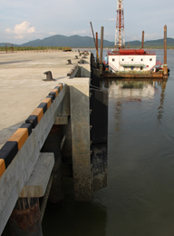
There are two jetties at Nga Lel Pwe port. Nga Lel Pwe port is a concrete jetty with floating bridge and floating buoy. This port’s draft is maximum 4.3m (14 ft), accessible for vessels up to 600 GRT.
|
Port Location and Contacts |
|
|---|---|
|
Country |
Myanmar |
|
Province or District |
Rakhine State |
|
Town or City (Closest location) with Distance (km) |
Name : Kyauk Phyu km: 1 km |
|
Port's Complete Name |
Port no. 2 Port or Nga Lel Pwe Port |
|
Latitude |
19.41117 |
|
Longitude |
92.54957 |
|
Managing Company or Port Authority (If more than one operator, break down by area of operation) |
Myanmar Port Authority (MPA) |
|
Management Contact Person |
U Aung Kyaw Soe, Harbor Engineer, Phone: 09-8510252 |
|
Closest Airport and Frequent Airlines to / from International Destinations
|
Airport Name: Airlines: 5 km |
Port Pictures
Description and Contacts of Key Companies
There are no key companies responsible for stevedoring, freight forwarding or cargo handling. The Myanmar Port Authority, The Customs department and the Township Labour Exchange Office for daily labourers are the main organisations active.
Port Performance
There is no congestion; the average waiting time until berthing is 1 day. There is no container handling capacity.
|
Seasonal Constraints |
Yes / No |
From <month> to <month> |
|---|---|---|
|
Rainy Season |
No |
n/a |
|
Major Import Campaigns |
No |
n/a |
|
Other |
n/a |
n/a |
Discharge Rates and Terminal Handling Charges
Unknown.
Berthing Specifications
|
Type of Berth |
Quantity |
Length (m) |
Width (m) |
Maximum Draft (m) |
|---|---|---|---|---|
|
Conventional Berth |
1 |
37 |
6 |
4.3 |
|
Container Berth |
n/a |
n/a |
n/a |
n/a |
|
Silo Berth |
n/a |
n/a |
n/a |
n/a |
|
Berthing Tugs |
n/a |
n/a |
n/a |
n/a |
|
Water Barges |
n/a |
n/a |
n/a |
n/a |
General Cargo Handling Berths
|
Cargo Type |
Berth Identification |
|---|---|
|
Imports - Bagged Cargo |
Port no.2 |
|
Exports - Bagged Cargo |
Port no.2 |
|
Imports and Exports - RoRo |
n/a |
|
Other Imports |
Port no.2 |
Port Handling Equipment
No port handling equipment available. Only manual labour.
Container Facilities
There is no container handling facility available.
Customs Guidance
A customs office is available, operating at normal working hours. The customs clearance process takes about 1 day.
Terminal Information
Multipurpose Terminal
There is no multipurpose handling facility available.
Grain and Bulk Handling
There is no specific grain and bulk handling facility available, nor bagging facilities.
Main Storage Terminal
There is no storage facility available.
Stevedoring
n/a
Hinterland Information / multi-modal
There are no local transport companies available and there is no railroad connection to the port.
Port Security
|
Security |
||
|---|---|---|
|
ISPS Compliant (Yes / No) |
No |
|
|
Current ISPS Level |
n/a |
Level 1 = Normal, Level 2 = Heightened, Level 3 = Exceptional |
|
Police Boats |
No |
|
|
Fire Engines |
No |
3 Kyauk Phyu Port no. 3
No.(3) port is very close to No.(1) port. It is direct under control of Myanmar Port Authority (MPA). This port is available for commercial use. This port is a concrete jetty with no floating buoy. This port’s draft is 20 metres with high tide and 10 metres with low tide, accessible for vessels up to 500 GRT.
|
Port Location and Contacts |
|
|---|---|
|
Country |
Myanmar |
|
Province or District |
Rakhine State |
|
Town or City (Closest location) with Distance (km) |
Name : Kyauk Phyu km: 1 km |
|
Port's Complete Name |
Port no.3 |
|
Latitude |
19.43444 |
|
Longitude |
93.55694 |
|
Managing Company or Port Authority (If more than one operator, break down by area of operation) |
Myanmar Port Authority (MPA) |
|
Management Contact Person |
U Aung Kyaw Soe, Phone: 09-8510252 |
|
Closest Airport and Frequent Airlines to / from International Destinations |
Airport Name: Airlines: 3 km |
Port Pictures
Description and Contacts of Key Companies
There are no key companies responsible for stevedoring, freight forwarding or cargo handling. The Myanmar Port Authority, The Customs department and the Township Labour Exchange Office for daily labourers are the main organisations active.
4.4 Myanmar Port and Waterways Company Contact List
Port Performance
There is no congestion; the average waiting time until berthing is 1 day. There is no container handling capacity.
|
Seasonal Constraints |
Yes / No |
From <month> to <month> |
|---|---|---|
|
Rainy Season |
No |
n/a |
|
Major Import Campaigns |
No |
n/a |
|
Other |
n/a |
n/a |
Discharge Rates and Terminal Handling Charges
Unknown
Berthing Specifications
|
Type of Berth |
Quantity |
Length (m) |
Width (m) |
Maximum Draft (m) |
|---|---|---|---|---|
|
Conventional Berth |
1 |
73 |
6 |
10 |
|
Conventional Berth |
1 |
73 |
6 |
10 |
|
Container Berth |
n/a |
|
||
|
Silo Berth |
n/a |
|
||
|
Berthing Tugs |
n/a |
|
||
|
Water Barges |
n/a |
|
General Cargo Handling Berths
|
Cargo Type |
Berth Identification |
|---|---|
|
Imports - Bagged Cargo |
Port no.3, jetty 1+2 |
|
Exports - Bagged Cargo |
Port no.3, jetty 1+2 |
|
Imports and Exports - RoRo |
n/a |
|
Other Imports |
Port no.3, jetty 1+2 |
Container Facilities
There is no container handling facility available.
Customs Guidance
A customs office is available, operating at normal working hours. The customs clearance process takes about 1 day.
1.3 Myanmar Customs Information
Terminal Information
Multipurpose Terminal
There is no multipurpose handling facility available.
Grain and Bulk Handling
There is no specific grain and bulk handling facility available, nor bagging facilities.
Main Storage Terminal
There is no storage facility available.
Stevedoring
n/a
Hinterland Information / multi-modal
There are no local transport companies available and there is no railroad connection to the port.
Port Security
|
Security |
||
|---|---|---|
|
ISPS Compliant (Yes / No) |
No |
|
|
Current ISPS Level |
n/a |
Level 1 = Normal, Level 2 = Heightened, Level 3 = Exceptional |
|
Police Boats |
No |
|
|
Fire Engines |
No |
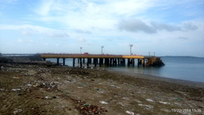
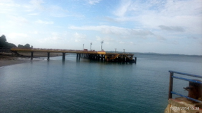
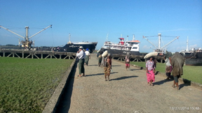
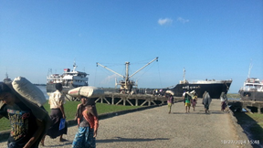
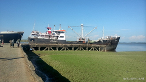
2.1.4 Myanmar Port of Sittwe
Five Star Port or No. 1 Port Overview
Sittwe is a more developed city as other cities in Rakhine State. It is recommended to transport cargo from Yangon to Sittwe by water. Similar to Pathein in Ayeyarwaddy Division (Delta Region), many small ports can be found near Sittwe, but those ports are mostly accessible to small local vessels (up to 500 GRT) only.
There are 2 main ports in Sittwe. The largest one is located in Sittwe downtown within the Myanma Port Authority (MPA) compound, named Five Star gate. The second port is Min Gan port. This port is located far from Sittwe downtown, 20 min by car. Both ports have a maximum draft of 4.6m (15 ft) and are accessible for vessels up to 4000 GRT.
A third port is still under construction by India Investment Corporation. It will be larger as Five Star gate.
Yangon to Siitwe is 895km (560mi) by road, which is a two-day, non-stop drive by express bus. Although sufficient transporters and bus services that offer transport to Sittwe can be found at highway express gates, cargo transport by road to Sittwe is not recommended due to the long distance and steep road crossing the Rakkhine Roma mountain range (Arakan Mountain). Many road accidents happen at Kan Zauk Mountain, between Kyauk Taw Township and Ponna Kyun Township.
| Port Location and Contacts | |
|---|---|
| Country | Myanmar |
| Province or District | Rakhine State |
| Town or City (Closest location) with Distance (km) |
Sittwe (0 km) |
| Port's Complete Name |
Five Star Port or Phaung Zauk Gyi Port or No.1 Port. Plus Min Gan port |
| Latitude | 20.1937 |
| Longitude | 92.91868 |
| Managing Company or Port Authority | Myanma Port Authority (MPA) |
| Management Contact Person | Colonel U Htun Htay, District Harbor Officer, Phone: 09-8503019 |
| Closest Airport and Frequent Airlines to / from International Destinations |
Airport Name: Sittwe Airport Airlines: n/a (military) |
Port Pictures
Five Star Port (or) Phaung Zauk Kyi Port (or) No.1 Port
Min Gan Port
Description and Contacts of Key Companies
There are no key companies available for stevedoring, freight forwarding or cargo handling: 4.4 Myanmar Port and Waterways Company Contact List
Port Performance
Five Star gate and Min Gan port are concrete jetties. Both ports have a maximum draft of 4.6m (15 ft) and are accessible for vessels up to 4000 GRT. There is no container handling capacity.
|
Seasonal Constraints |
Yes / No |
|---|---|
|
Rainy Season |
No |
|
Major Import Campaigns |
No |
|
Other |
n/a |
Discharge Rates and Terminal Handling Charges
Unknown, contact Port Authority for details.
Berthing Specifications
|
Type of Berth |
Quantity |
Length (m) |
Width (m) |
Maximum Draft (m) |
|---|---|---|---|---|
|
Conventional berth |
1: Five star gate |
73 |
14.6 |
4.6 |
|
Conventional berth |
1: Min Gan port |
73 |
11 |
4.6 |
|
Container Berth |
n/a |
|
||
|
Silo Berth |
n/a |
|
||
|
Berthing Tugs |
n/a |
|
||
|
Water Barges |
n/a |
|
General Cargo Handling Berths
|
Cargo Type |
Berth Identification |
|---|---|
|
Imports - Bagged Cargo |
Five star gate & Min Gan port |
|
Exports - Bagged Cargo |
Five star gate & Min Gan port |
|
Imports and Exports - RoRo |
n/a |
|
Other Imports |
Five star gate & Min Gan port |
Port Handling Equipment
No port handling equipment available. Loading and offloading only by manual labour.
Container Facilities
There is no container handling facility available.
Customs Guidance
There is a customs office available at Sittwe town, operating at normal office hours. The customs clearance process takes normally maximum 1 day.
1.3 Myanmar Customs Information
Terminal Information
Multipurpose Terminal
There is no multipurpose handling facility available.
Grain and Bulk Handling
There is no specific grain and bulk handling facility available, nor bagging facilities.
Main Storage Terminal
At Five Star gate, the MPA has a compound with two warehouses available of 500MT capacity each, which are only suitable for temporary or transit storage, not for longterm storage.
|
Storage Type |
Number of Storage Facilities |
Area (square meters) |
|---|---|---|
|
Bagged Cargo |
2 MPA warehouses |
2x 220 sq.m. |
|
Refrigerated Cargo |
n/a |
|
|
General Cargo |
2 MPA warehouses (same) |
2x 220 sq.m. |
Stevedoring
There is no specific stevedoring company available. Daily labourers must take care of loading and unloading. The Township Labour Exchange Office, under control of the ministry of labour, is able to provide daily labourers for the port. The port authority can assist with sourcing daily workers
Hinterland Information
There are no local transport companies available, only private trucks for hire up to 15MT capacity. There is no railroad connection to the port. Small boats (up to 100 GRT) can carry cargo from Sittwe port to nearby villages along the river.
Port Security
There is no port security and no perimeter fencing.
| ISPS Compliant | No |
|---|---|
| Current ISPS Level | N/A |
| Police Boats |
No |
| Fire Engines | No |
Kaladan Multi-modal Transit Transport Project (India Jetty)
Port Overview
The Kaladan project was jointly initiated by India and Myanmar to create a multi-modal platform for cargo shipments from the eastern ports to Myanmar and to the North-eastern parts of India through Myanmar. The Kaladan Multi-Modal Transit Transport Project connects the eastern Indian seaport of Kolkata with Sittwe seaport. It will then link Sittwe seaport to Paletwa in Chin State via the Kaladan river boat route, and then from Paletwa by road to Mizoram state in Northeast India. Originally, the project was scheduled to be completed by 2014, but is expected to be operational only by 2020-2021 as all components of the project, including Sittwe port and power, river dredging, Paletwa jetty, have been completed, except the under construction Zorinpui-Paletwa Road, construction of which commenced in April 2018. Although this port is mainly used as an India corridor it can be considered for emergency response if the Myanmar Port Authority assists for docking permission.
http://www.mpa.gov.mm/facts-figures/sittwe-port
|
Port Location and Contacts |
|
|---|---|
|
Country |
Myanmar |
|
Province or District |
Rakhine State |
|
Town or City (Closest location) with Distance (km) |
Name: Sittwe km: 0 km |
|
Port's Complete Name |
Kaladan Multimodal Transit Transport Project (India Jetty) |
|
Latitude |
20° 8'18.00"N |
|
Longitude |
92°54'9.38"E |
|
Managing Company or Port Authority (If more than one operator, break down by area of operation) |
A To Z Exim and Group of Companies |
|
Management Contact Person |
Mr. Captain Percy D. Rodrigues, KMTTP Port Captain, Sittwe & Paletwa, Myanmar. Ph: +959259748066, +959252910388 Email. portcaptain@atozexim.com |
|
Closest Airport and Frequent Airlines to / from International Destinations |
Airport Name: Sittwe airport Airlines: N/A (military) |
|
Port Location and Contacts |
|
|---|---|
|
Country |
Myanmar |
|
Province or District |
Chin State |
|
Town or City (Closest location) with Distance (km) |
Paletwa |
|
Port's Complete Name |
Kaladan multi-modal Transit Transport Project (India Jetty) |
|
Latitude |
21°18'17.62"N |
|
Longitude |
92°51'39.86"E |
|
Managing Company or Port Authority |
A To Z Exim and Group of Companies |
|
Management Contact Person |
Mr. Captain Percy D. Rodrigues, KMTTP Port Captain, Sittwe & Paletwa, Myanmar. Ph: +959259748066, +959252910388 Email. portcaptain@atozexim.com |
|
Closest Airport and Frequent Airlines to / from International Destinations |
Airport Name: Sittwe airport Airlines: N/A (military) |
Port Pictures

Kaladan Multi-modal Transit Transport Port (India Jetty)
Description and Contacts of Key Companies
KMMTTP (India Jetty) port is developed and operated by A To Z Exim and Group of Companies. For contacts details see: 4.4 Myanmar Port and Waterways Company Contact List 4.4 Myanmar Port and Waterways Company Contact List
Port Performance
KMMTTP (India Jetty) port are concrete jetties. The ports have a maximum draft of 4.6m (15 ft) and are accessible for vessels up to 4000 GRT. There is no container handling capacity.
|
Seasonal Constraints |
Yes / No |
From <month> to <month> |
|---|---|---|
|
Rainy Season |
No |
|
|
Major Import Campaigns |
No |
|
|
Other |
N/A |
|
Discharge Rates and Terminal Handling Charges
No operating until March 2020. Unknown, contact KMMTTP for details.
Berthing Specifications
|
Type of Berth |
Quantity |
Length (m) |
Width (m) |
Maximum Draft (m) |
|---|---|---|---|---|
|
Conventional berth |
1: KMMTTP (Sittwe) |
219 |
15.2 |
4.6 |
|
Conventional berth |
1: KMMTTP (IWT-Sittwe) |
54 |
15.2 |
4.6 |
|
Conventional berth |
1: KMMTTP (IWT-Paletwa) |
78.6 |
19.2 |
unknown |
|
Container Berth |
N/A |
|
|
|
|
Silo Berth |
N/A |
|
|
|
|
Berthing Tugs |
N/A |
|
|
|
|
Water Barges |
N/A |
|
|
|
General Cargo Handling Berths
|
Cargo Type |
Berth Identification |
|---|---|
|
Imports - Bagged Cargo |
N/A |
|
Exports - Bagged Cargo |
N/A |
|
Imports and Exports- Ro Ro |
N/A |
|
Other Imports |
N/A |
Port Handling Equipment
|
Equipment |
Available |
Total Quantity and Capacity Available (KMMTTP-Sittwe) |
Total Quantity and Capacity Available (IWT-Sittwe) |
Total Quantity and Capacity Available (KMMTTP-Paletwa) |
Comments on Current Condition and Actual Usage |
|---|---|---|---|---|---|
|
Dockside Crane |
Yes |
10T ELL crane (25.5Mts out Reach) |
N/A |
10T ELL crane (12Mts outreach) |
New |
|
Container Gantries |
Yes |
30m x 40m (10 Mt) |
N/A |
N/A |
N/A |
|
Mobile Cranes |
N/A |
N/A |
N/A |
N/A |
N/A |
|
Reach stacker |
N/A |
N/A |
N/A |
N/A |
N/A |
|
RoRo Tug master (w/ Trailer) |
Yes |
4T cap (8 nos) |
4T cap (8 nos) |
N/A |
New |
|
Grain Elevator w/ Bagging Machines |
N/A |
N/A |
N/A |
N/A |
N/A |
|
Tractors |
Yes |
40 Hp (4 nos) |
40 Hp (2 nos) |
10T Trucks (4 nos) |
New |
|
Forklifts |
Yes |
3T cap (4 nos) |
3T cap (2 nos) |
3T cap (2 nos) |
New |
Container Facilities
There is no container handling facility available.
Customs Guidance
There is a customs office available at Sittwe town, operating at normal office hours. The customs clearance process takes normally maximum 1 day.
Terminal Information
Multipurpose Terminal
There is no multipurpose handling facility available.
Grain and Bulk Handling
There is no specific grain and bulk handling facility available, nor bagging facilities.
Main Storage Terminal
At KMMTTP, the port has a compound with two storage shed available of 1000MT capacity each, which are only suitable for temporary or transit storage, for long-term storage.
|
Storage Type |
Number of Storage Facilities |
Area (square meters) |
|---|---|---|
|
Bagged Cargo (KMMTTP) |
2 Storage Sheds |
24m x 36m |
|
Bagged Cargo (IWT/Sittwe) |
1 Storage Sheds |
24m x 36m |
|
Bagged Cargo (IWT/Paletwa) |
1 Storage Sheds |
24m x 36m |
|
Refrigerated Cargo |
N/A |
|
|
General Cargo (KMMTTP) |
2 Storage Sheds (Same) |
24m x 36m |
|
General Cargo (IWT/Sittwe) |
1 Storage Sheds (Cargo Handling Equipment Parking) |
20m x 25m |
|
General Cargo (IWT/Paletwa) |
1 Storage Sheds (Same) |
24m x 36m |
Stevedoring
N/A
Hinterland Information
There are no local transport companies available, only private trucks for hire up to 15MT capacity. There is no railroad connection to the port. Small boats (up to 100 GRT) can carry cargo from Sittwe port to nearby villages along the river.
Port Security
There is port security and perimeter fencing. There have Fire water monitoring system and 19 fire Hydrants and 11 fire hose cabinets at the Sittwe Port and 9 fire Hydrants and 9 fire hose cabinets at the Paletwa Port.
| Security | |
|---|---|
|
SPS Compliant (Yes / No) |
No |
| Current ISPS Level | N/A |
| Police Boats | No |
| Fire Engines | No |
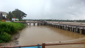
2.1.5 Myanmar Port of Rakkhine, Thandwe
Key port information can also be found at: http://www.maritime-database.com/ports/topports.php
Port Overview
Thandwe is a city in Rakkhine state. Most people prefer transport of cargo by road because the port is located far from Thandwe downtown. The main wharf of Thandwe port is the Tha Pyu Chain wharf and it is about 43km or 3 hours from Thandwe via a very bad road. (There are several small bridges on the way, some broken down with road diversions).
In addition there is Jade Taw jetty at Ngapali beach near Thandwe town, but this is small and unsuitable for larger cargo vessels. Cargo vessels normally use Tha Pyu Chaing wharf and then the cargo is shipped to Jade Taw by small boats. Jade Taw is 30 minutes from Tha Pyu Chaing by waterway. The draft of Jade Taw port is 3m (10 ft) at high tide and 1.8m (6 ft) at low tide. A third option is a wooden jetty at Kim Hmaw village, about 8km from Thandwe. It has a maximum draft of 2.1m (7 ft), accessible by CB vessel.
Port website: there is no website available.
|
Port Location and Contacts |
|
|---|---|
|
Country |
Myanmar |
|
Province or District |
Rakhine State |
|
Town or City (Closest location) with Distance (km) |
Name : Thandwe km: 43 km |
|
Port's Complete Name |
Thandwe port, |
|
Latitude |
18.30198 |
|
Longitude |
94.35762 |
|
Managing Company or Port Authority (If more than one operator, break down by area of operation) |
Myanma Port Authority |
|
Management Contact Person |
U Tin Htun Aung, Tha Pyu Chaing Village,Tha Pyu Chaing Port |
|
Closest Airport and Frequent Airlines to / from International Destinations |
Airport Name: Airlines: n/a |
Port Pictures
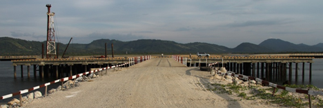
Tha Pyu Chaing wharf (2 Concrete Jetties with a Floating Buoy)
Description and Contacts of Key Companies
4.2.3 Myanmar Port and Waterways Company Contact List
There are no key companies available for stevedoring, freight forwarding or cargo handling. According to Myanmar Port Authority (MPA), daily laborers are not available at Pyu Chaing wharf for cargo loading and offloading.
Port Performance
Tha Pyu Chaing wharf has two concrete jetties with floating type buoy. The maximum draft is about 6.1m (20 ft) at high tide and 5.5m (18ft) at low tide. Due to access restrictions and lack of daily workers this wharf should be considered only as a back-up option when cargo can’t be transported by road to Thandwe. Myanma Five Star shipping Line used this wharf 10 years ago, but not anymore. Currently it is privatized and used by some fishing businesses. There is no container handling capacity.
Discharge Rates and Terminal Handling Charges
Unknown, contact Port Authority for details.
Berthing Specifications
|
Type of Berth |
Quantity |
Length (m) |
Width (m) |
Maximum Draft (m) |
|---|---|---|---|---|
|
Conventional berth |
2 * |
120 |
20 |
6.1 |
|
Conventional berth |
1 |
80 |
n/a |
2.1 (Kim Hmaw jetty) |
|
Container Berth |
n/a |
|
||
|
Silo Berth |
n/a |
|
||
|
Berthing Tugs |
n/a |
|
||
|
Water Barges |
n/a |
|
* Tha Pyu Chaing wharf: 2 concrete jetties.
General Cargo Handling Berths
|
Cargo Type |
Berth Identification |
|---|---|
|
Imports - Bagged Cargo |
Tha Pyu Chaing wharf |
|
Exports - Bagged Cargo |
Tha Pyu Chaing wharf |
|
Imports and Exports - RoRo |
n/a |
|
Other Imports |
Tha Pyu Chaing wharf |
Port Handling Equipment
No port handling equipment available. Limited manual labour available.
|
Equipment |
Available (Yes / No) |
|---|---|
|
Dockside Crane |
No |
|
Container Gantries |
No |
|
Mobile Cranes |
No |
|
Reachstacker |
No |
|
RoRo Tugmaster (w/ Trailer) |
No |
|
Grain Elevator w/ Bagging Machines |
No |
|
Transtrainer |
No |
|
Forklifts |
No |
Container Facilities
There is no container handling facility available.
Customs Guidance
There is no customs office available.
1.3 Myanmar Customs Information
Terminal Information
Multipurpose Terminal
There is no multipurpose handling facility available.
Grain and Bulk Handling
There is no specific grain and bulk handling facility available, nor bagging facilities.
Main Storage Terminal
There are no storage facilities available at Tha Pyu Chaing wharf.
At Kim Hmaw jetty there are eight warehouses that are owned by the Department of Trade Promotion. Some warehouses are still in good condition and some are not.
|
Storage Type |
Number of Storage Facilities |
Area (square meters) |
|---|---|---|
|
Bagged Cargo |
6 x DOTP |
6 x 950 sqm 2 x 500 sqm |
|
Refrigerated Cargo |
n/a |
|
|
General Cargo |
8 x DOTP |
6 x 950 sqm 2 x 500 sqm |
Stevedoring
There is no specific stevedoring company available. According to Myanmar Port Authority (MPA), daily laborers are not available at Pyu Chaing wharf for cargo loading and offloading.
Hinterland Information
There are no local transport companies available and there is no railroad connection to the port. Small boats can carry cargo from Tha Pyu Chaing wharf to Jade Taw jetty.
Port Security
There is no port security and no perimeter fencing.
|
Security |
||
|---|---|---|
|
ISPS Compliant (Yes / No) |
No
|
|
|
Current ISPS Level |
n/a |
Level 1 = Normal, Level 2 = Heightened, Level 3 = Exceptional |
|
Police Boats |
No | |
|
Fire Engines |
No |
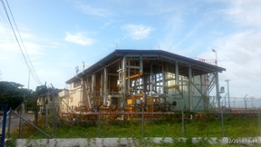
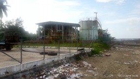
2.1.6 Myanmar, Tanintharyi, Dawei Deep Sea Port
The Dawei deep sea port is a special economic development zone which is expected to be operational by 2020. Currently there is no deep sea port yet, only the “small port” which consists of one concrete jetty, planned to be used by feeder vessels from the (river) port of Dawei, after the draft can be deepened from 1m currently to 7.5m planned depth.
The work on the deep sea port hasn’t started yet and it’s not confirmed when it will begin.
There are several port administration buildings, a construction yard and an 18km 2-lane gravel road which stops at the Dawei river. A 150km road is planned to connect the economic development zone to the border of Thailand but still falls short of a bridge across the river Dawei and minimum 40km, as the crow flies, to reach the border across difficult mountainous terrain. The economic development zone is connected by a 20km, 1-lane winding dirt road to nearby Maungmagan and from there by a 13km 2-lane tarmac road to Dawei town.
Contact: Mr. Win Myo Oo, Secretary of the supporting working body of the Dawei deep sea port. (Dec. 2014, the secretaries are rotated every 2 months).
|
Port Location and Contacts |
|
|---|---|
|
Country |
Myanmar |
|
Province or District |
Tanantharyi |
|
Town or City (Closest location) with Distance (km) |
Name: Dawei km: 33 km |
|
Port's Complete Name |
Dawei deep sea port |
|
Latitude |
14.257 |
|
Longitude |
98.04283 |
|
Managing Company or Port Authority (If more than one operator, break down by area of operation) |
Supporting working body of Dawei deep sea port |
|
Management Contact Person |
Mr. Win Myo Oo, Secretary |
|
Closest Airport and Frequent Airlines to / from International Destinations |
Airport Name: Dawei airport Airlines: Domestic carrier Myanma airlines only. |
Port Pictures
Description and Contacts of Key Companies
There is currently only the Italian-Thai Development Public Company Ltd. and the Dawei Development Company Ltd., but it appears that the Italians have pulled their support from the project.
4.2.3 Myanmar Port and Waterways Company Contact List
Port Performance
No vessels can be handled yet. There is only one jetty at the “small port”, with a draft of 1m, to shallow to be used.
Berthing Specifications
Tidal difference is 2 to 7m. The single jetty is only for general cargo, not for containers.
Dredging is required before this berth can be used. Construction materials for the port are now brought by truck by road. Location of the jetty at the “small port”: 14°10.833' 98°4.873'.
|
Type of Berth |
Quantity |
Length (m) |
Maximum Draft (m) |
|---|---|---|---|
|
Conventional Berth |
1 |
100mx25m |
1m actual. 7.8m, 400 TEU (planned) |
|
Container Berth |
No |
||
|
Silo Berth |
No |
||
|
Berthing Tugs |
No |
||
|
Water Barges |
No |
Concrete jetty side and front view:
General Cargo Handling Berths
|
Cargo Type |
Berth Identification |
|---|---|
|
Imports - Bagged Cargo |
No |
|
Exports - Bagged Cargo |
No |
|
Imports and Exports - RoRo |
No |
|
Other Imports |
n/a |
Port Handling Equipment
The Italian-Thai Development Public Company Ltd. has forklifts as part of their port construction equipment. There is not any type of port handling equipment available yet. Nor facilities for bagging and storage.
Container Facilities
None available yet.
Customs Guidance
There is no customs office yet. The Customs department is part of the supporting working body of the Dawei deep sea port, as are 14 ministries in total.
1.3 Myanmar Customs Information
Terminal Information
Dawei Deep sea port master plan
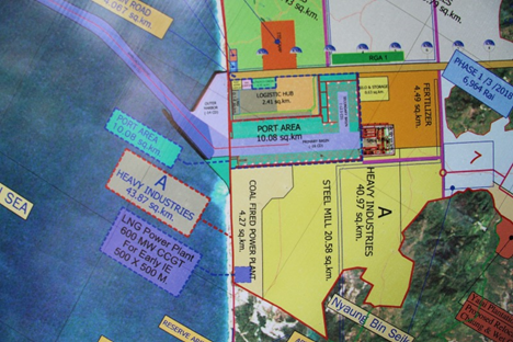
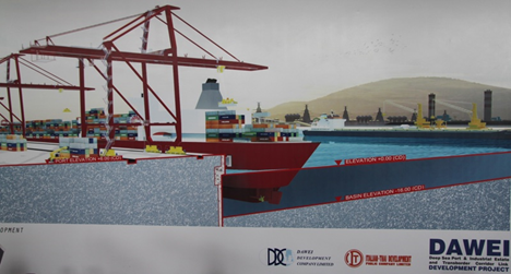
The plan for the Dawei deep sea port includes two basins suitable for large deep water vessels up to 16m draft and a port area of 10.08 sq.km. The first basin of approximately 3.5km length and 16m draft, will include a container terminal on one side with container gantry cranes, and a bulk cargo terminal on the other side. The secondary basin of 12.5m draft will have access to a large logistics hub area on one side and grain silo’s and fertilizer storage on the other side.
The master plan for the deep-sea port includes large area’s (outside the 10.08 sq.km. port area) for oil & gas industry, a steel mill, heavy industries, a coal fired power plant and an LNG power plant. There is an outer harbour planned with jetties for vessels of a maximum draft of 16.5m.
Stevedoring
There are no stevedoring companies available yet.
Hinterland Information
The master plan includes a railway connection and a 4 to 6 lane highway from the port to the border of Thailand. There is currently no railway connection and a 2-lane gravel road of 150km connecting the port area to the border of Thailand.
Port Security
There is no port security yet and no police post.
2.1.7 Myanmar, Port of Tanintharyi, Dawei
Key port information can also be found at: http://www.maritime-database.com/ports/topports.php
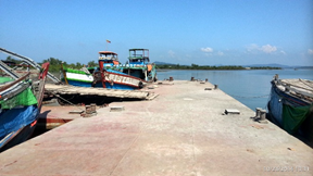
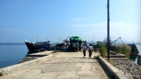
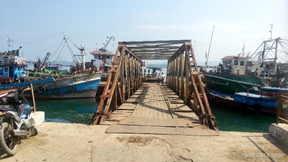
Port Overview
The port of Dawei is a collection of five jetties, 1 concrete and 4 barges, along the Tevoy River, about 24 nautical miles (44km) inland from the Andaman sea. The port is accessible for vessels up to 2000 GRT and maximum 4m draft. The port does not have any handling equipment and is suitable for general cargo and fuel only. Difference between tides is 3m. There is no pilot service available.
The Dawei Deep sea port development project is managed separately, it is 33km from Dawei and it is unknown when this will be operational.
|
Port Location and Contacts |
|
|---|---|
|
Country |
Myanmar |
|
Province or District |
Tanintharyi |
|
Town or City (Closest location) with Distance (km) |
Name: Dawei km: 0km |
|
Port's Complete Name |
Port of Dawei (no 1 and no. 2) |
|
Latitude |
14.05198 |
|
Longitude |
98.18883 |
|
Managing Company or Port Authority (If more than one operator, break down by area of operation) |
Dawei port authority |
|
Management Contact Person |
09-8742712 / 059-21004 |
|
Closest Airport and Frequent Airlines to / from International Destinations |
Airport Name: Dawei Airport Airlines: Domestic carrier Myanma Airways only. |
Port Pictures
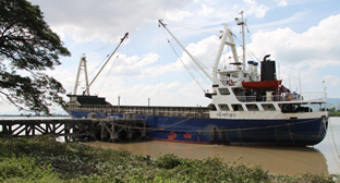
Jetty 1 (Concrete)
Description and Contacts of Key Companies
4.4 Myanmar Port and Waterways Company Contact List
There are no key companies responsible for stevedoring, freight forwarding or cargo handling. The Dawei Port Authority, The Customs department and the Township Labour Exchange Office for daily labourers are the main organisations active.
There is a separate jetty for fuel, which is managed by MOGE.
Port Performance
There is no congestion. The maximum draft is 4m (13 ft) and maximum vessel size is 2000 GRT. The port has five separate jetties, one concrete and four with steel barges. Per month 25 to 30 vessels visit, about 300 to 360 per year. There is no container handling capacity.
During the monsoon season access to the port is difficult due to winds and high river velocity. Average waiting time is from 1 day to 1 week depending on the season. The port can be busy during November to December due to extra handling of cement.
|
Seasonal Constraints |
Yes / No |
From <month> to <month> |
|---|---|---|
|
Rainy Season |
Yes |
May to September |
|
Major Import Campaigns |
Yes |
November - December |
|
Other |
n/a |
|
Handling Figures |
Year 2013 |
|---|---|
|
Vessel Calls |
300 - 360 |
|
Container Traffic (TEUs) |
0 |
|
Handling Figures Bulk and Break Bulk |
Year 2013 |
|---|---|
|
Bulk (MT) |
0 |
|
Break bulk (MT) |
166,000 MT in 229,000 MT out |
Discharge Rates and Terminal Handling Charges
Not applicable
Berthing Specifications
|
Type of Berth |
Quantity |
Length (m) |
Maximum Draft (m) |
|---|---|---|---|
|
Conventional Berth |
5 barges |
120x20 ft |
13 ft / 2000 GRT |
|
Container Berth |
No |
||
|
Silo Berth |
No |
||
|
Berthing Tugs |
No |
||
|
Water Barges |
No |
All five berths are for general cargo: five barges for vessels up to max 2000 GRT.
Port No. 1 is one wooden jetty, Port No. 2 is one concrete jetty. There is a capacity for fuel and general cargo at Thaundyed, 20 miles on the way to Myeik.
General Cargo Handling Berths
|
Cargo Type |
Berth Identification |
|---|---|
|
Imports - Bagged Cargo |
No |
|
Exports - Bagged Cargo |
No |
|
Imports and Exports - RoRo |
No |
|
Other Imports |
No |
Port Handling Equipment
Is the port equipment managed by the government or privately?
The port is managed by the government.
Container Facilities
None
Customs Guidance
Customs office is available, operating at office hours 9am to 4pm daily, including weekends. The customs clearance process takes about 1 day.
1.3 Myanmar Customs Information
Terminal Information
Main Storage Terminal
There are two warehouses that belong to the Myanmar Port Authority, one near the port authority office and another one that is privatised.
|
Storage Type |
Number of Storage Facilities |
Area (square meters) |
|---|---|---|
|
Bagged Cargo |
Same as GC storage |
150x35x12 feet |
|
Refrigerated Cargo |
None |
|
|
General Cargo |
2 |
Stevedoring
There is no specific stevedoring company available. Daily labourers must take care of loading and unloading. The Township Labour Exchange Office, under control of the ministry of labour, is able to provide daily labourers for the port. The port authority can assist with sourcing daily workers.
Daily worker rates:
Unskilled: 5000 MMK/day
For bags 50kg, 150 MMK/bag, up to 40m distance.
Skilled: 12000 MMK/day
Hinterland Information
There is no connection with the railway, but the railway station is about 250m from the port, therefor transhipment to the railway could be done.
There are no activities for inland water transportation by river: the river Tevoy is not navigable much further up-river as it becomes too narrow and shallow.
Port Security
There is no port security and no perimeter fencing because the jetties are separate.
|
Security |
||
|---|---|---|
|
ISPS Compliant (Yes / No) |
No |
|
|
Current ISPS Level |
n/a |
Level 1 = Normal, Level 2 = Heightened, Level 3 = Exceptional |
|
Police Boats |
No | |
|
Fire Engines |
No |
2.1.8 Myanmar, Port of Thanintharyi, Kawthoung
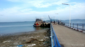
Port Overview
The port of Kawthoung consists of three jetties managed by the Myanma Port Authority (MPA). The largest is Tawwin port jetty, about 2km North East of downtown Kawthoung. This is a concrete jetty with two access bridges and a berth of 110m (360 ft) length by 10m (30 ft) wide. It has a second berth section of 40m (130ft long) and 10m (30ft) wide. It’s maximum draft is 5m (20 ft) at low tide and 10.5m (34 ft) at high tide and the maximum vessel size is 2000 GRT, for ships of about 92m length. The jetty is used for general cargo.
The MPA is responsible for two other jetties: Myoma jetty is used for passenger services and arrivals from Thailand (it has customs & immigration services) and Bayint Naung jetty, which is mostly used for fishery business, tourist industry and passenger services to villages along the coast and to the islands of the archipelago. Both jetties are located downtown Kawthoung and are water barge type that can handle vessels of maximum 200 GRT.
There is no pilot service and no tug-boat available for the port of Kawthoung. Most cargo handled at Kawthoung is transport by sea of locally produced palm oil to Yangon and imports of fertilizer from Malaysia and cement from Thailand. Most cargo passes through Kawthoung in transit from Thailand to Yangon. This cargo is not offloaded, only registered and noted by customs.
Port website: There is no website available.
|
Port Location and Contacts |
|
|---|---|
|
Country |
Myanmar |
|
Province or District |
Thanintharyi |
|
Town or City (Closest location) with Distance (km) |
Name : Kawthoung km: 0 |
|
Port's Complete Name |
Port of Kawthoung |
|
Latitude |
9.998967 |
|
Longitude |
98.56602 |
|
Managing Company or Port Authority (If more than one operator, break down by area of operation) |
Myanma Port Authority (MPA) |
|
Management Contact Person |
U Tin Oo Port Oficer, |
|
Closest Airport and Frequent Airlines to / from International Destinations |
Airport Name: Kawthoung airport Airlines: Domestic airlines, see Kawthoung airport details |
Port Pictures
Description and Contacts of Key Companies
There are no key companies available for stevedoring, freight forwarding or cargo handling.
The Myanma Port Authority, The Customs department and the Township Labour Exchange Office for daily labourers are the main organisations active.
4.4 Myanmar Port and Waterways Company Contact List
Port Performance
There are no seasonal constraints. There is some congestion at the port during the year: average waiting time is 3 days to berthing, the ships are anchored outside while waiting.
|
Seasonal Constraints |
Yes / No |
From <month> to <month> |
|---|---|---|
|
Rainy Season |
No | |
|
Major Import Campaigns |
No | |
|
Other |
n/a |
|
Handling Figures |
Year 2013 |
|---|---|
|
Vessel Calls |
379 |
|
Container Traffic (TEUs) |
0 |
|
Handling Figures Bulk and Break Bulk |
Year 2013 |
|---|---|
|
Bulk (MT) |
Export domestic 33,215 MT |
|
Break bulk (MT) |
Discharge Rates and Terminal Handling Charges
Terminal handling charges depend on the length of the ship: 500 MMK per 25ft length of ship, per day. Plus a charge per cargo: 200 MMK per MT loaded or unloaded (MPA, Dec. 2014). These rates are standard for all ports in Myanmar.
Berthing Specifications
There is no fuel bunker service available, for fuel the vessels can go to a jetty of a private company Golden Bell company, which is about 2km North of Taw Win port jetty, or Golden Bell can come to the jetty with a tank truck. Fuel is also available from MPPE jetty at Par Paw Island, about 1km south, but large vessels can not access this jetty due to shallow draft. Private companies provide fresh water, which is delivered by tank trucks.
|
Type of Berth |
Quantity |
Length (m) |
Width (m) |
Maximum Draft (m) |
|---|---|---|---|---|
|
Conventional Berth |
1: Taw Win port |
110 |
10 |
5m (low) 10.5 (high) |
|
Conventional Berth |
2: Myoma jetty |
37 |
10 |
5m (low) 9.5 (high) |
|
Conventional Berth |
3: Bayint Naung |
37 |
10 |
5m (low) 9.5 (high) |
|
Container Berth |
No |
|
||
|
Silo Berth |
No |
|
||
|
Berthing Tugs |
No |
|
||
|
Water Barges |
No |
|
General Cargo Handling Berths
|
Cargo Type |
Berth Identification |
|---|---|
|
Imports - Bagged Cargo |
Taw win port |
|
Exports - Bagged Cargo |
Taw win port |
|
Imports and Exports - RoRo |
n/a |
|
Other Imports |
n/a |
Port Handling Equipment
No port handling equipment available. Only manual labour.
|
Equipment |
Available (Yes / No) |
Total Quantity and Capacity Available |
Comments on Current Condition and Actual Usage |
|---|---|---|---|
|
Dockside Crane |
No |
|
|
|
Container Gantries |
Np |
|
|
|
Mobile Cranes |
No |
|
|
|
Reachstacker |
No |
|
|
|
RoRo Tugmaster (w/ Trailer) |
No |
|
|
|
Grain Elevator w/ Bagging Machines |
No |
|
|
|
Transtrainer |
No |
|
|
|
Forklifts |
No |
|
|
Container Facilities
There is no container handling facility available.
Customs Guidance
Customs office is available, operating at office hours 9 to 4pm daily, including weekends. The customs clearance process takes about 1 day.
1.3 Myanmar Customs Information
Terminal Information
Multipurpose Terminal
There is no multipurpose handling facility available.
Grain and Bulk Handling
There is no specific grain and bulk handling facility available, nor bagging facilities.
Main Storage Terminal
There are two warehouses controlled by MPA, located next to the Taw Win port jetty.
|
Storage Type |
Number of Storage Facilities |
Area (square meters) |
|---|---|---|
|
Bagged Cargo |
2 |
2x 30x12x3m (720 sqm) |
|
Refrigerated Cargo |
n/a |
|
|
General Cargo |
2 (same as above) |
2x 30x12x3m (720 sqm) |
Stevedoring
There is no specific stevedoring company available. Daily labourers must take care of loading and unloading. The Township Labour Exchange Office, under control of the ministry of labour, is able to provide daily labourers for the port. There is a capacity of about XX labourers, organised by the Township Labour Exchange Office. The port authority can assist with sourcing daily workers.
Hinterland Information
There are no road transport companies, only private trucks (up to 100 4-5MT trucks could be available). It is not so common to transfer cargo from larger ships to small ships (100 GRT) for inland transport, but it is possible. Inland Water Transport is not active in Kawthoung, but there are three private companies offering passenger services to the islands in the archipelago (Fortune, HiFi, Ayeyarnaddy), using boats of 200 to 400 passengers. Kawthoung to Myiek is 6 hours, Kawthoung to Dawei is 13 hours. There is no regular passenger service to Thailand but private charter boats up to 10 passenger capacity can be rented.
Port Security
The police department is responsible, The area is fenced, with a gate for access.
|
Security |
||
|---|---|---|
|
ISPS Compliant (Yes / No) |
No |
|
|
Current ISPS Level |
n/a |
Level 1 = Normal, Level 2 = Heightened, Level 3 = Exceptional |
|
Police Boats |
No | |
|
Fire Engines |
No |
2.1.9 Myanmar Port of Tanintharyi, Myeik
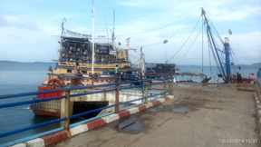
Port Overview
The port of Myeik consists of four wharfs managed by the Myanma Port Authority (MPA).
The largest is Yaw Gyi Wa port. This is one jetty with two water barges of 73m (240 ft) length by 6m (20 ft) wide. It has a maximum draft of 3.4m (11ft) at low tide and 6.4m (21ft) at high tide and the maximum vessel size is 1500 GRT, about 75m (250ft) length. The jetty is used for general cargo as well as by private passenger boats that provide regular service to villages along the coast and on the islands.
The port of Myeik has three other jetties controlled by the MPA: Seik Nge of two barges total 73m (240ft) by 6m (20ft), maximum draft 1.8m (6ft) at low tide, 4.9m (16ft) at high tide, maximum vessel size 500 GRT. Nauk Le no.1, which has two wooden jetties. Nauk Le no. 2 is a concrete jetty of 29m (96ft) by 11m (36ft) wide. Nauk Le no. 1 and no. 2 have the same draft and maximum vessel size as Seik Nge. Fishing boats predominantly use Nauk Le no. 1 and no. 2.
Five star shipping line has a regular service, three times per month, from Yangon-Myeik-Kawthoung of a combined cargo-passenger ship of 1500 GRT. There are no tug-boats, but there is a pilot service available. Pilot service is only required for foreign vessels that are not familiar with the port. The port of Myeik has several more private wooden jetties along Myeik island and on Pahtaw-pahtet island (facing Myeik) that are used by private fishery businesses. The port of Myeik is significantly larger and more active as the ports of Dawei and Mawlamyine.
Port website: There is no website available.
|
Port Location and Contacts |
|
|---|---|
|
Country |
Myanmar |
|
Province or District |
Tanintharyi |
|
Town or City (Closest location) with Distance (km) |
Name : Myeik km: 0 km |
|
Port's Complete Name |
Port of Myeik |
|
Latitude |
12.43417 |
|
Longitude |
98.41833 |
|
Managing Company or Port Authority (If more than one operator, break down by area of operation) |
Myanma Port Authority (MPA) |
|
Management Contact Person |
U Ye Naing Oo, Phone: 09- 4100 5542 |
|
Closest Airport and Frequent Airlines to / from International Destinations |
Airport Name: Myeik Airport Airlines: Domestic airlines, see Myeik airport details |
Port Pictures
Description and Contacts of Key Companies
4.4 Myanmar Port and Waterways Company Contact List
There are no key companies available for stevedoring, freight forwarding or cargo handling.
The Myanma Port Authority, The Customs department and the Township Labour Exchange Office for daily labourers are the main organisations active.
Port Performance
There are no seasonal constraints, access to the port is restricted only in case of winds up over 65 km/hr (40 mi/hr). There is no congestion at the port; average waiting time is only 1 to 2 hours to berthing.
|
Seasonal Constraints |
Yes / No |
|---|---|
|
Rainy Season |
No |
|
Major Import Campaigns |
No |
|
Other |
n/a |
|
Handling Figures |
Year 2013 |
|---|---|
|
Vessel Calls |
339 foreign vessel |
|
Container Traffic (TEUs) |
n/a |
|
Handling Figures Bulk and Break Bulk |
Year 2013 |
|---|---|
|
Bulk (MT) |
77,734 MT for Domestic import |
|
Break bulk (MT) |
106,817 MT for Domestic export |
Discharge Rates and Terminal Handling Charges
Terminal handling charges depend on the length of the ship: 500 MMK per 25ft length of ship, per day. Plus a charge per cargo: 200 MMK per MT loaded or unloaded (MPA, Dec. 2014). These rates are standard for all ports within the Tanintharyi division; they may vary for other states and divisions.
Berthing Specifications
There is no fuel bunker service available, for fuel the vessels need to go to the jetty of MPPE, which is next to the Phyu Chaing wharf. Liquid cargo can be transferred ship-to-ship to barges, and from the barges to bowsers or tank trucks. Only the MPPE jetty has the capacity to offload fuel. Private companies provide fresh water, which is delivered by trucks in drums.
|
Type of Berth |
Quantity |
Length (m) |
Width (m) |
Maximum Draft (m) |
|---|---|---|---|---|
|
Jetty+ water barges |
1: Yaw Gyi Wa |
73 |
6 |
3.4 low / 6.4 high |
|
Jetty+ water barges |
2: Seik Nge |
73 |
6 |
1.8 low / 4.9 high |
|
Conventional Berth |
3: Nauk Le (1) |
6 + 6 |
6 |
1.8 low / 4.9 high |
|
Conventional Berth |
4: Nauk Le (2) |
29 |
11 |
1.8 low / 4.9 high |
|
Container Berth |
No |
|
||
|
Silo Berth |
No |
|
||
|
Berthing Tugs |
No |
|
||
|
Water barges |
No |
|
General Cargo Handling Berths
|
Cargo Type |
Berth Identification |
|---|---|
|
Imports - Bagged Cargo |
Yaw Gyi Wa+ Seik Nge |
|
Exports - Bagged Cargo |
Yaw Gyi Wa+ Seik Nge |
|
Imports and Exports - RoRo |
n/a |
|
Other Imports |
n/a |
Port Handling Equipment
No port handling equipment available. Only manual labour.
|
Equipment |
Available (Yes / No) |
|---|---|
|
Dockside Crane |
No |
|
Container Gantries |
No |
|
Mobile Cranes |
No |
|
Reachstacker |
No |
|
RoRo Tugmaster (w/ Trailer) |
No |
|
Grain Elevator w/ Bagging Machines |
No |
|
Transtrainer |
No |
|
Forklifts |
No |
Container Facilities
There is no container handling facility available.
Customs Guidance
Customs office is available at the Yaw Gyi Wa port, operating at normal office hours, but can be available 24hrs for emergencies. Customs clearance process takes about 1 day. The Customs head office is in downtown Myeik next to the Myanma Port authority office.
1.3 Myanmar Customs Information
Terminal Information
Multipurpose Terminal
There is no multipurpose handling facility available.
Grain and Bulk Handling
There is no specific grain and bulk handling facility available, nor bagging facilities.
Main Storage Terminal
There are four warehouses controlled by MPA, close to Yaw Gyi Wa port. These warehouses are all rented out to private companies. Near Nauk Le no.1 there is one warehouse controlled by MPA, there are no warehouses near Seik Nge and Nauk Le no.2.
|
Storage Type |
Number of Storage Facilities |
Area (square meters) |
|---|---|---|
|
Bagged Cargo |
n/a |
|
|
Refrigerated Cargo |
Privately owned by fishery business |
|
|
General Cargo |
5 owned by MPA |
5x 300 sqm 25mx12m each |
Stevedoring
There is no specific stevedoring company available. Daily labourers must take care of loading and unloading. The Township Labour Exchange Office, under control of the ministry of labour, is able to provide daily labourers for the port. There is a capacity of about 60-70 labourers, organised by the Township Labour Exchange Office. The port authority can assist with sourcing daily workers.
Hinterland Information
Most cargo is moved to small ships (max 100 GRT) for onwards transport, by private boat owners. Landing vessels could carry more cargo, depending on the tide. There are no road transport companies, only private trucks (up to 20x 15MT trucks can be available). Inland Water Transport is not active in Myeik, but there are several private companies offering passenger services to many villages along the coast and on the Tanintharyi river, Yaw gyi Chaung river and northern river.
Port Security
Port security is managed by police staff, 3 staff day and night at Yaw Gyi Wa. The area is fenced and access is controlled through a gate. However, many people walk in and out uncontrolled, to access the private passenger vessels at the same jetty. The level of security is low.
|
Security |
||
|---|---|---|
|
ISPS Compliant (Yes / No) |
No |
|
|
Current ISPS Level |
n/a |
Level 1 = Normal, Level 2 = Heightened, Level 3 = Exceptional |
|
Police Boats |
No |
|
|
Fire Engines |
No |
2.1.10 Myanmar Port of Yangon
Port Overview
The Port of Yangon is the main port of Myanmar that handles approximately 90% of import and export activities in the country. The average tidal range is around 19 feet (5.85m) at sprint tide and 8.4 feet (2.5m) at neap tide. Waves within the Yangon river normally do not hinder marine operations, even at the river mouth point, wave conditions are rarely rough with less than 2-meter height. Current velocity ranges between 4 to 6 knots during springtime. Pilotage is compulsory for vessels above 200 GRT. Navigation is provided from the offshore fixed Pilot station located 20 nautical miles from Yangon, which can handle traffic of around 600 vessels every month. Currently, the port has capacity for vessels of up to 15,000 –20,000 DWT and works are scheduled to increase the port’s capacity for vessels up to 35,000 DWT.
There are two restricted bars along the approached
channel:
(1) Inner Bar (near Yangon Port at Monkey
Point)
(2) Outer Bar (at the mouth of the
River)
Crossing both the inner and outer bar is timed for high tide to allow sufficient depth. Since the channel width at Monkey Point is rather limited at 100 meters, navigation requires close attention.
The Port of Yangon maintain 2 shifts. Day shift is from 08:00 hours to 16:00 hours. Night shift is from 20:00 hours to 04:00 hours. Overtime works is available on request for periods between shift hours. It takes a week to discharge cargo from port since arrive if all require document (such as Shipping documents and government approve letter) are complete. Yangon Port is free from congested, generally. But all port located in Yangon has pros and cons.
For more information please see 1.3 Myanmar Customs Information.
Yangon port is divided into two ports. The largest is the Myanmar International Terminal Thilawa, used mostly for RORO ships for transporting cars from nearby automotive factories. This port is located 16 km from Yangon downtown and river bay. It is strategically located next to the Thilawa Special Economic Zone developed by a Japanese Joint-venture company. The International Terminal Thilawa consists of 2 terminals and 6 wharfs and accessible to vessels of 200 m LOA, 20000 DWT, 9 m Draft: The current traffic level at MITT does not pose congestion risk as yet with vacant container yard space available.. However, since MITT is located outside of Yangon, transport cost and longer travel distance Should be expected.
(1) MITT (Myanmar International Terminal Thilawa)
(2) MIPL (Myanmar Integrated Port Limited)
The other is the old Yangon port area, which covers 4 terminals and 15 wharfs. Most general cargo vessels use Myanmar Industrial Port (MIP) and Asia World Port terminal (AWP) because they are located close to downtown at 32km from the Yangon river bay. The old Yangon Port area covers the following 4 terminals and 15 wharfs and accessible to vessels of 167m LOA, 9m Draft, 15000 DWT:
(3) Bo Aung Kyaw Street Wharf (BAK)
(4) Myanmar Industrial Port (MIP).
(5) Asia World Port Terminal (AWPT)
(6) Sule Pagoda Wharf (SPW)
Regarding the coastal and inland water transport cargo and passenger are handled from downtown domestic terminal such as Lamadaw, Pansodan, and Botathaung. Especially, Pansodan and Botathaung are where passenger transport is the major operation are situated very close to the city area. But Lamadaw handle almost all domestic cargo though cargo handling area is quite narrow.
Further to the above-mentioned ports, there are two dry ports available in Ywar Thar Gyi in Yangon region and Myit Nge in Mandalay region built by Resources Group Logistics Co., Ltd. It was officially opened in November 2018 to boost logistics capabilities in country with a rail line operated by Myanma Railways. The dry ports are intended to ease traffic jam between ports in Yangon and Thilawa SEZ and to reduce transportation cost. It is equipped with customs inspections and 24-hour services with freight charges and taxes set by Myanmar Railways. The loop-train service runs on a weekly basis with 15-27 carriages between the 2 ports. Carriage capacity is around 33 metric tons.
Port websites: Myanmar Port Authority Website and Maritime Database information on Myanmar Port of Yangon.
|
PORT LOCATION & CONTACT |
|
|
Country: |
MYANMAR |
|
Province or District: |
Yangon |
|
Town or City: (Nearest location with distance from port) |
Yangon distance: 0.5 km |
|
Port's Complete Name: |
Port of Yangon (Asia World Port) |
|
Latitude: |
16.78333 |
|
Longitude: |
96.16667 |
|
Managing Company or Port Authority: (If more than one operator, break down by area of operation) |
Asia World Port Management Co. Ltd |
|
Management Contact Person: |
Myat Kyaw |
|
Nearest Airport: |
Airport Name: Yangon Airport |
Port Picture
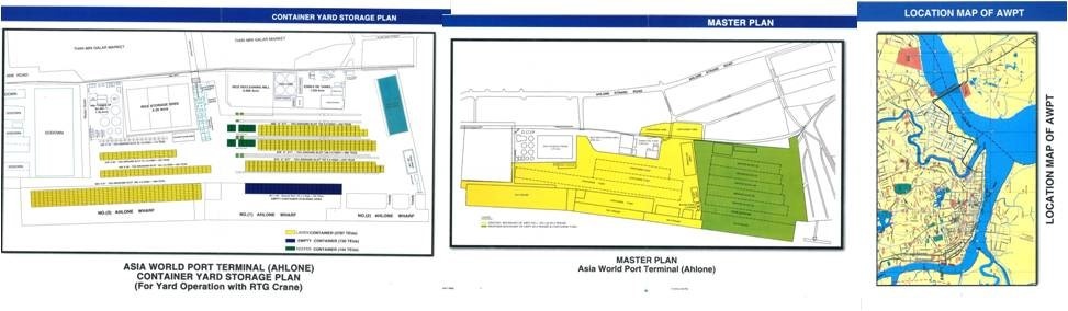
Description and Contacts of Key Companies
Port authorities and port customs authority officers are rotated on a two months basis. For information on Myanmar Port of Yangon contact details, please see the following link: 4.6 Myanmar Port and Waterways Company Contact List
Port Performance
|
Port Performance (2018) |
|
|
Vessels Calls |
2,267 |
|
Container traffic (TEU’s) |
1,043,469 |
|
Total General Cargo Handling (MT) |
9,074,558 |
|
Capacity 2017-2018 |
General Cargo |
Container |
|
MT / Year |
TEU’s / Year |
|
|
Export activity of the Port |
761,782 |
518,937 |
|
Import activity of the port |
8,312,776 |
524,532 |
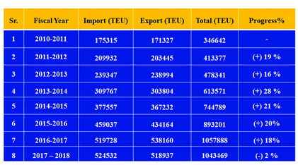
Container traffic statistics by fiscal year (source: Myanmar Port Authority)
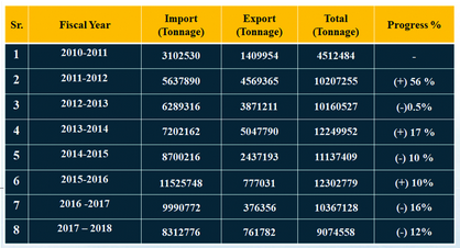
General cargo statistics by fiscal year (source: Myanmar Port Authority
|
Seasonal Constraints |
|
|---|---|
|
Dry Season |
No |
|
Major Import Campaigns |
No |
|
Other |
None |
For further statistics and the latest development of the Yangon port, please refer to this website: http://www.mpa.gov.mm/facts-figures/statistics.
International Shipments and Shipping Lines dealing in Yangon
|
No. |
Shipping Line |
Frequency |
Last port/ hub before Yangon |
Yangon Port of Discharge |
|---|---|---|---|---|
|
1 |
Inter Asia Lines |
Two vessels every two weeks |
Singapore / Port Klang |
AWPT/ HPT |
|
Samudera Shipping Lines Yang Ming Lines |
One vessel every two weeks |
Singapore, Malaysia |
AWPT |
|
|
3 |
Advanced Container Lines |
One vessel every ten days |
Singapore |
AWPT/ MITT |
|
4 |
New Golden Sea Shipping Lines |
One vessel per week One vessel every five days One vessel per week |
Port Klang, Malaysia Singapore / Port Klang Belawan |
AWPT AWPT / MIP AWPT |
|
5 |
BLPL Shipping Lines |
One vessel every two weeks |
India |
BSW |
|
6 |
Ever Green Lines |
One vessel per week / one vessel from China every ten days |
Singapore, Tanjung, Pelepas |
HPT |
|
7 |
X-Press Feeder Lines Silkargo Lines Mitsuie O.S.K Lines Continental Shipping Lines |
One vessel every two weeks |
Singapore / Port Klang, Malaysia |
MIP |
|
8 |
Regional Container Lines |
One vessel every two weeks |
Singapore |
MIP/MITT MITT/AIPT |
|
9 |
Maersk |
One vessel every two weeks (from Singapore & Malaysia) One vessel every one and a half months from China |
Singapore, Malaysia, China |
MITT MIP |
|
10 |
Land & Sea Intermodal Logistics |
One vessel every month |
Banda Abbas |
MITT |
Yangon Dry Port: Ywar Thar Gyi Terminal
Port Overview
The Ywar Thar Gyi dry port started operating in 2018 under a 50-year agreement with Myanmar Railway under a Build-Operate-Transfer (BOT) system and provides a one-stop service for cargo handling and logistics solutions for international export and import, as well as domestic distribution. They offer scheduled rail transportation services between Yangon and Mandalay through their two ports, Ywar Thar Gyi and Myitnge. They offer the package services of custom service, warehouse service, and transport service. Custom office will be opened at Ywar Thar Gyi and Myitnge ports soon. They own a total of 100 containers in 20ft and 40ft. Currently the Yangon dry port is running with 28 permanent staff and 12 laborers. ISO certificates process is ongoing.
|
Port Location and Contacts |
|
|---|---|
|
Country |
Myanmar |
|
Province or District |
Yangon |
|
Port's Complete Name |
Ywar Thar Gyi Dry Port |
|
Latitude |
16.915806 |
|
Longitude |
96.251420 |
|
Managing Company or Port Authority |
Resources Group Logistics Co. Ltd |
|
Management Contact Person |
U Pe Maung Chit (COO) |
|
Nearest Airport |
Yangon Airport |
Port Picture / Layout
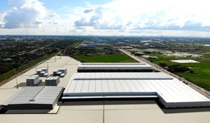

Description and Contacts of Key Companies
Ywar Thar Gyi dry port is developed and operated by Resource Group Logistics Co.,ltd.
|
Contact Person for Operations |
U Pe Maung Chit |
|---|---|
|
Position |
Chief Operation Officer |
|
Contact |
+959 253976146, 899880202, 899880303, 899880404, +951 8610656 |
|
|
|
|
Contact Person for Costing |
Daw Cherry Aung |
|
Position |
Assistant General Manager |
|
Contact |
+959 777007823 |
Port Performance
|
Handling Figures (2019) |
|
|---|---|
|
Container (TEU) |
Over 4,000 |
|
Type of Cargo handled |
Containers international and domestic (ISO and non-ISO) Breakbulk freight for unloading from or loading into containers Non-containerized breakbulk freight Bulk freight |
|
Type of Goods handled |
Food in various packaging, fertilizer, steel, general merchandise on pallets, construction materials such as cement, and chemicals. |
Types of Services
|
Type of services |
Available |
|---|---|
|
Container handling and storage |
Yes |
|
Container stripping and stuffing |
Yes |
|
Breakbulk / Bulk cargo handling and storage |
Yes |
|
Customs inspection and clearance |
Yes |
|
Container light repairs |
Yes |
|
Freight forwarding and cargo consolidation service |
Yes |
|
Warehouse Rental service |
Yes |
|
Weight scale service |
Yes |
|
Cold Room Storage |
No |
|
Export / Import service |
Not yet. Planned to provide soon at both dry ports. |
|
IBC tank for oil storage |
Yes |
Port Features
|
Description |
Size |
Area |
|---|---|---|
|
Railroad |
- |
1.13 Acre |
|
Marshalling Area |
- |
1.43 Acre |
|
Internal Road Area |
- |
4.78 Acre |
|
DC-1 |
120 m x 162 m |
20,640 m2 |
|
DC-2 |
120 m x 60 m |
9,714 m2 |
|
CFS |
60 m x 50 m |
3,000 m2 |
|
Main Office |
12 m x 28 m |
336 m2 |
|
Utilities and Main Gate |
13 m x 28 m |
280 m2 |
|
X- Ray Check |
- |
0.62 Acre |
|
Workshop |
- |
0.18 Acre |
|
Empty Deport |
- |
0.43 Acre |
|
Reefer Area |
- |
0.22 Acre |
|
Container Yard 2 |
- |
0.34 Acre |
|
Container Yard 1A |
G. S=280 units |
3.40 Acres |
|
Container Yard 1B |
G. S=392 units |
5 Acres |
|
Warehouse |
180 m x 162 m |
- |
Port Facilities
|
Description |
Size |
|---|---|
|
Container Yard (TEU) |
4,200 |
|
Container Freight Station (sqm) |
3,000 |
|
Bonded Warehouse (sqm) |
10,000 |
|
General Warehouse (sqm) |
20,000 |
|
Reefer Points (units) |
20 |
Cargo Handling Equipment
|
Equipment |
Available |
|---|---|
|
Reach-Stackers |
Yes (45 Tons, 2 units) |
|
Empty Lifters |
Yes (12) |
|
Forklifts |
Yes (10 Ton-2 units, 4 Ton- 4 units, 3 Ton-10 units and 2 Ton-10 units) |
|
Container Chassis |
Yes |
|
24 Prime Movers |
Yes |
|
X-ray |
Not yet. Planned to be installed soon. |
|
Empty Handler (till 6 layers) |
Yes (12 MT) |
Available Transport Services
Land Transportation
|
Type |
Specification |
|---|---|
|
Vehicle |
24 Isuzu 40 ft tractors/trailers |
|
Loading Capacity (Max) |
30 ton/trailer |
|
Services |
Door to door pick up, last mile delivery services |
|
Distance |
Short-haul/Long-haul delivery |
|
Tracking |
Real-time truck location as per customer request |
Rail Transportation
|
Type |
Specification |
|---|---|
|
Available wagons per trip |
11 to 15 wagons |
|
Loading Capacity (Max) |
32 tons/wagon |
|
Type of train transport |
Fuel and Freight |
|
Route |
Between Ywarthargyi and Myitnge railway stations |
Rail Transportation Schedule
|
Route |
Departure |
Arrival |
|---|---|---|
|
YGN-MDY |
Every Saturday Evening |
Monday Morning |
|
MDY-YGN |
Every Tuesday Evening |
Thursday Morning |
Myanmar International Terminal Thilawa (MITT)
Port Overview
MITT is Myanmar’s first purpose-built, multi-purpose international container port. Hutchison Port Holdings (HPH), which developed the facilities, has managed MITT since 1998. MITT is located at Thilawa 25 km for downtown Yangon, close to mouth of the Yangon River, and adjacent to the Special Industrial Zone, Thanlyin-Kyauktan. Most container traffic in Myanmar is handled by AWPT and MIP ports, not by MITT, because these ports are located closer to downtown Yangon and businesses active in Bayint Naung Compound, Hlaing Thar Yar Industrial Zone.
MITT is the only port in Myanmar that can handle RORO (Roll-on Roll-off) car carriers.
|
PORT LOCATION & CONTACT |
|
|
Country: |
MYANMAR |
|
Province or District: |
Yangon |
|
Town or City: (Nearest location with distance from port) |
Yangon City/ 25 km from Downtown of Yangon |
|
Port's Complete Name: |
Myanmar International Terminals Thilawa (MITT) |
|
Latitude: |
16.66639 |
|
Longitude: |
96.25417 |
|
Managing Company or Port Authority: (If more than one operator, break down by area of operation) |
Hutchison Port Holdings (HPH) |
|
Management Contact Person: |
U Wai Phyo +95-9-8613909 +95-9-8613929 |
|
Nearest Airport and Airlines: (Airlines with frequent international arrivals/departures) |
Airport Name: Yangon Airport Airlines: Please see in the airport information |
Port Picture
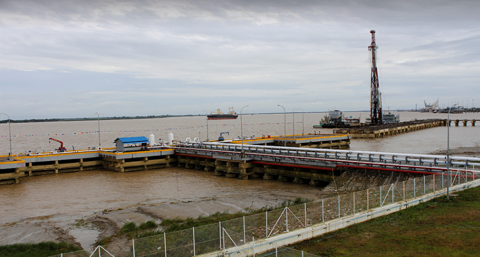
Description and Contacts of Key Companies
MITT port is developed and operated by Hutchison Port Holdings (HPH).
4.2.3 Myanmar Port and Waterways Company Contact List
Port Performance
|
Seasonal Constraints |
|
|
Dry Season |
No |
|
Major Import Campaigns |
No |
|
Other |
N/A |
Discharge Rates and Terminal Handling Charges
For more information of discharge rates and terminal handling charges rate, see http://www.mot.gov.mm/pdf/tariff_dues.pdf
Berthing Specifications
|
Type of Berth |
Quantity |
Length (m) |
Maximum Draft (m) |
Comments |
|
Conventional Berth |
5 Nos, No.1 to 5 |
200 m |
9 m |
Tidal range 4.5m to 5.5m Max acceptable LOA is 238m Up to 20,000 DWT |
|
Container Berth |
Please refer to above line |
|
|
|
|
Silo Berth |
n/a |
|
|
|
|
Berthing Tugs |
n/a |
|
|
|
|
Water Barges |
n/a |
|
|
|
General Cargo Handling
Berths
|
Cargo Type |
Berth Identification |
|
Imports - Bagged Cargo |
Berths 1 to 4 |
|
Exports - Bagged Cargo |
Berths 1 to 4 |
|
Imports and Exports - RoRo |
n/a |
|
Other Imports |
Berths 1 to 4 |
Port Handling Equipment
|
Equipment |
Available |
Total Quantity and Capacity Available |
Comments on Current Condition and Actual Usage |
|---|---|---|---|
|
Dockside Crane |
No |
|
|
|
Container Gantries |
Yes |
2, 40MT |
N/A |
|
Mobile Harbor Cranes |
Yes |
2, Tractor 15 nos. |
N/A |
|
Reach stacker |
No |
2 nos |
N/A |
|
RoRo Tugmaster (w/ Trailer) |
No |
N/A |
N/A |
|
Grain Elevator w/ Bagging Machines |
No |
N/A |
N/A |
|
Transtainer |
N/A |
N/A |
N/A |
|
Forklifts |
Yes |
28 |
N/A |
|
Front Loader |
Yes |
9 |
N/A |
|
Trailors |
Yes |
56 |
N/A |
Container
Facilities
N/A
Customs
Guidance
Same as other ports, customs office is set up and customs officers are available within office hours, but it can vary and depend on workload. Customs clearance time normally takes one week since Myanmar Automated Cargo Clearance System (MACCS) system in place.
For information on customs, please see the following link: 1.3 Myanmar Customs Information
Terminal Information
Main Storage Terminal
|
Storage Type |
Number of Storage Facilities |
Area (square meters) |
|
Bagged Cargo |
N/A |
|
|
Refrigerated Cargo |
N/A |
N/A |
|
General Cargo |
1 |
20,000 sqm |
Land area: 75
hectares
|
Storage Type |
Number of Storage Facilities |
|
Bagged Cargo |
No |
|
Refrigerated Cargo |
No |
|
General Cargo |
No |
Hinterland Information /
multi-modal
Containers are moved out of the port by trucks and there is also a container barge service between MITT and Shweyi Thar and Hlaing Tharyar Industrial Zone in Yangon. On top of that, MITT facilitate container trucking service and inland shipping barges for cost effective and efficient movement of cargoes.
Myanmar Integrated Port Limited (MIPL) Overview
Port Overview
MIPL is located next to MITT port and started since 1998. MIPL facilities are designed to handle general cargo such as steel, heavy equipment, and vehicles. This port is rarely used for other cargo and passenger transport.
|
PORT LOCATION & CONTACT |
|
|
Country: |
MYANMAR |
|
Province or District: |
Yangon |
|
Town or City: (Nearest location with distance from port) |
Yangon City/ 25 km from Downtown of Yangon |
|
Port's Complete Name: |
Myanmar International Port Limited (MIPL) |
|
Latitude: |
16.67028 |
|
Longitude: |
96.25222 |
|
Managing Company or Port Authority: (If more than one operator, break down by area of operation) |
Navigation Asia Pte; Ltd |
|
Management Contact Person: |
N/A |
|
Nearest Airport and Airlines: |
Airport Name: Yangon Airport |
Port Picture
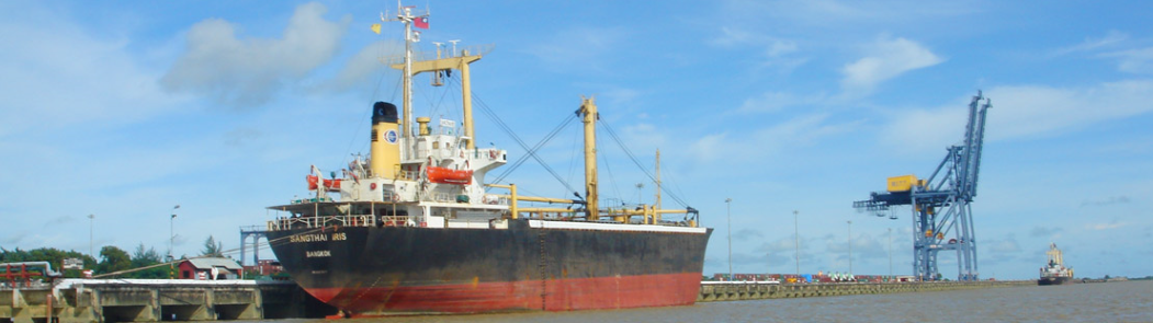
MIPL Port from http://www.miplmyanmar.com/index.php/aboutus
Description and Contacts of Key Companies
MIPL port is developed and operated by Austin Navigation Asia Pte; Ltd. For contacts details see: 4.4 Myanmar Port and Waterways Company Contact List
Port Performance
The water depth alongside the wharves is 9.5 m in accordance with the maximum draft of the Yangon River.
|
Seasonal Constraints |
|
|
Dry Season |
No |
|
Major Import Campaigns |
No |
|
Other |
N/A |
Discharge Rates and Terminal Handling Charges
For more information of terminal handling charges rate, please refer to the latest available information in the link below http://www.mpa.gov.mm/sites/default/files/tariff_dues.pdf.
Berthing Specifications
|
Type of Berth |
Quantity |
Length (m) |
Maximum Draft (m) |
Comments |
|
Conventional Berth |
N/A |
N/A |
9.5 |
|
|
Container Berth |
N/A |
N/A |
|
|
|
Silo Berth |
N/A |
|
|
|
|
Berthing Tugs |
N/A |
|
|
|
|
Water Barges |
N/A |
|
|
|
General Cargo Handling Berths
|
Cargo Type |
Berth Identification |
|
Imports - Bagged Cargo |
N/A |
|
Exports - Bagged Cargo |
N/A |
|
Imports and Exports - RoRo |
N/A |
|
Other Imports |
N/A |
Port Handling
Equipment
|
Equipment |
Available |
Total Quantity and Capacity Available |
Comments on Current Condition and Actual Usage |
|---|---|---|---|
|
Dockside Crane |
N/A |
N/A |
N/A |
|
Container Gantries |
N/A |
N/A |
N/A |
|
Mobile Cranes |
N/A |
N/A |
N/A |
|
Reach stacker |
N/A |
N/A |
N/A |
|
RoRo Tugmaster (w/ Trailer) |
N/A |
N/A |
N/A |
|
Grain Elevator w/ Bagging Machines |
N/A |
N/A |
N/A |
|
Transtainer |
N/A |
N/A |
N/A |
|
Forklifts |
Yes |
4 |
6 MT, 2 MT, 1.5 MT & 1 MT |
Terminal
Information
Main Storage Terminal
|
Storage Type |
Number of Storage Facilities |
Area (square meters) |
|
Bagged Cargo |
N/A |
|
|
Refrigerated Cargo |
N/A |
N/A |
|
General Cargo |
1 |
20,000 m2 |
Land area: 30,000 m²of well demarcated open space area is made available to use for storage of steels and other materials.
|
Storage Type |
Number of Storage Facilities |
Area (square meters) |
|
Bagged Cargo |
No |
|
|
Refrigerated Cargo |
No |
|
|
General Cargo |
No |
Stevedoring
MIPL employs permanent stevedore gangs on 2 shifts basis, day shift 08:00 am to 04:00 pm and night shift 08:00 pm to 04:00 am hours. Overtime work is available on request for intervals between shift hours. Since the port area continues to be under development, for the latest information on port facilities available for use at the Port of Yangon, please refer to http://www.mpa.gov.mm/facts-figures/port-equipment-facilities.
Bo Aung Kyaw Street Wharf (BAK) / TMT Port
Port Overview
Bo Aung Kyaw port is under management of Myanmar Economics Holdings that (MEH) and located at Botahtaung Township, Yangon.
TMT port is under the management of KT Services & Logistics Co., Ltd (Fully Owned Subsidiary of KT Group) and located at Botahtaung Township, Yangon. Previously port was called Bo Aung Kyaw and operated by Myanmar Economics Holdings. KT Services & Logistics acquired the rights to manage and operate the port on 2016 for five years contract from MEH and changed the port name to TMT ports. It has weekly container vessels and break-bulk vessels connectivity to Malaysia, Singapore, Thailand, China, Vietnam, India and Bangladesh. They have 3 Berths capable to serve container and general cargo vessels ranging from 137 to 183 meters. They can provide the loading and unloading facilities of container and general cargo including heavy-lift project cargo.
Source: https://ktgroup.com/core-business/
|
Port Location and Contact |
|
|---|---|
|
Country: |
Myanmar |
|
Province or District: |
Yangon |
|
Town or City: (Nearest location with distance from port) |
Yangon City/ 2 km from downtown of Yangon |
|
Port's Complete Name: |
Bo Aung Kyaw Street Wharf (BKW) / TMT Port |
|
Latitude: |
16.7675 |
|
Longitude: |
96.1652 |
|
Managing Company or Port Authority: |
KT Services & Logistics Co., Ltd |
|
Management Contact Person: |
U Banyar Aung (Chief Operating Officer) |
|
Nearest Airport and Airlines: |
Airport Name: Yangon Airport (Minglardon) |
Port Picture
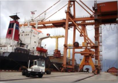
Description and Contacts of Key Companies
TMT ports is operated by KT Services & logistics Co.,ltd . The original was developed and operated by MEH group and management changed to KT services & logistics Co, ltd on late 2016.
|
Contact Person |
U Banyar Aung |
|---|---|
|
Position |
Chief Operating Officer |
|
Contact |
+959 5192337 |
|
|
|
|
Contact Person |
U Phoe Zaw and Zaw Lin Myat |
|
Position |
Assistant Manager (Customer Relations) |
|
Contact |
+959 961026757 |
|
|
For more information please see: 4.4 Myanmar Port and Waterways Company Contact List.
Port Performance
The water depth alongside the wharves is 9 metres in accordance with the maximum draft of the Yangon River.
|
SEASONAL CONSTRAINTS |
|
|---|---|
|
Dry Season |
No |
|
Major Import Campaigns |
No |
|
Other |
n/a |
Note: Normally port is fully engaged in second quarter with rice
export cargo.
|
HANDLING FIGURES 2019 |
|
|---|---|
|
Vessel Calls: |
80 |
|
Container Traffic: (TEUs) |
97066 |
Discharge Rates and Terminal Handling Charges
For more information of discharge rates and terminal handling charges rate, please refer to the latest available information in the following link: MPA Tariff and Dues.
Berthing Specifications
|
Type of Berth |
Quantity |
Length (m) |
Maximum Draft (m) |
Comments |
|
Conventional Berth |
3 |
2 berths of 137 m 1 berth of 30 m |
9 |
|
|
Container Berth |
N/A |
N/A |
|
|
|
Silo Berth |
N/A |
|
|
|
|
Berthing Tugs |
N/A |
|
|
|
|
Water Barges |
N/A |
|
|
|
Since the port area continues to be under development, for the latest information on port facilities available for use at the Port of Yangon, please refer to http://www.mot.gov.mm/mpa/port_facilities.html.
Port Handling Equipment
|
Equipment |
Available |
Total Quantity and Capacity Available |
Comments on Current Condition and Actual Usage |
|---|---|---|---|
|
Dockside Crane |
Yes |
1 unit, 40 tons |
In operation |
|
Container Gantries |
Yes |
2 units, 30 and 35 tons |
In operation |
|
Mobile Cranes |
N/A |
N/A |
N/A |
|
Reach stacker |
Yes |
4 units, 45 tons |
In operation |
|
RoRo Tugmaster (w/ Trailer) |
N/A |
N/A |
N/A |
|
Grain Elevator w/ Bagging Machines |
N/A |
N/A |
N/A |
|
Transtainer |
N/A |
N/A |
N/A |
|
Forklifts |
Yes |
1 unit, 36 tons |
In operation |
|
Rubber Tyred Gentry |
Yes |
3 unit, 35 tons |
In operation |
Note: Total Area :24 Acres
Total CFS Area : 4,000 sqm.
Total Storage Capacity : 3,900 TEU's
Total Berth Length : 457 Meters (Berth 1 = 137 m (G.C), Berth 2= 137 m (G.C & Container), Berth 3 = 183 m (Container))
|
Container Yard Capacity |
|
|---|---|
|
Area |
284,675 sq. ft |
|
Laden Storage Area |
104,328 sq. ft |
|
Empty Storage Area |
78,720 sq. ft |
|
Total Storage Capacity |
4,352 TEU's |
|
Container Freight Station |
|
|---|---|
|
Length |
243 ft |
|
Width |
197 ft |
|
Total Area |
47,871 sq. ft |
|
Storage Area |
22,400 sq. ft |
|
Storage Capacity |
2,867 tons |
Asia World Port Terminal (AWPT) Overview
Port Overview
The Asia World Port Terminal (AWPT) is located upstream of the Yangon River, situated at about 32 kilometers inland from Elephant Point on the Gulf of Martaban.
|
PORT LOCATION & CONTACT |
|
|
Country: |
Myanmar |
|
Province or District: |
Yangon |
|
Town or City: (Nearest location with distance from port) |
Yangon City/ 10 km from Downtown of Yangon |
|
Port's Complete Name: |
Asia World Port Terminal |
|
Latitude: |
16.78333 |
|
Longitude: |
96.16667 |
|
Managing Company or Port Authority: (If more than one operator, break down by area of operation) |
Asia World Port Management Co. Ltd |
|
Management Contact Person: |
U Aung Bo Bo (Asst. Manager) |
|
Nearest Airport and Airlines: |
Airport Name: Yangon Airport (Mingalardon Airport) |
Port Picture
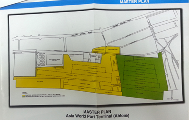
Description and Contacts of Key Companies
AWPT port is developed and operated by Asia World Port Management Co. Ltd, a subsidiary of Asia World Co. Ltd, which is a private enterprise. For contacts details see 4.4 Myanmar Port and Waterways Company Contact List.
Port Performance
The water depth alongside the wharves is 9.5 meters in accordance with the maximum draft of the Yangon River. Boats with with a draft of exceeding 9.5 meters cannot be accommodated at the Yangon old port area. Most of the berths are designed for General Cargo.
|
SEASONAL CONSTRAINTS |
|
|
Dry Season |
No |
|
Major Import Campaigns |
No |
|
Other |
n/a |
Discharge Rates and Terminal Handling Charges
For more information on discharge rates and terminal handling charges rates, see http://www.mot.gov.mm/pdf/tariff_dues.pdf
Berthing Specifications
|
Type of Berth |
Quantity |
Length (m) |
Maximum Draft (m) |
|
Conventional Berth |
4 berths |
No.1:198 m No.2: 156 m No.3: 260 m No.4: 238 m |
9.5 |
|
Container Berth |
n/a |
|
|
|
Silo Berth |
n/a |
|
|
|
Berthing Tugs |
No |
|
|
|
Water Barges |
n/a |
|
|
No.2 Wharf: is an island type
wharf with 3 trestles (length: 23 m, width: 7.6 m).
No.4 Wharf: Is planned under an expansion project.
Since the port area continues to be under development, for the latest information on port facilities available for use at the Port of Yangon, please refer to http://www.mot.gov.mm/mpa/port_facilities.html .
General Cargo Handling Berths
|
Cargo Type |
Berth Identification |
|
Imports - Bagged Cargo |
Berth 1 to 3 |
|
Exports - Bagged Cargo |
Berth 1 to 3 |
|
Imports and Exports - RoRo |
n/a |
|
Other Imports |
Berth 1 to 3 |
Port Handling
Equipment
The handling equipment at AWPT is managed by the private company: Asia World Co. Ltd. The AWPT offers a variety of facilities and handling equipment plus three mobile harbour cranes to cater to break-bulk, container, dry and liquid bulk operations. It does not have any dock-side cranes or container gantry cranes.
|
Equipment |
Available |
Total Quantity and Capacity Available |
Comments on Current Condition and Actual Usage |
|---|---|---|---|
|
Dockside Crane |
No |
||
|
Container Gantries |
N/A |
N/A |
N/A |
|
Mobile Cranes |
Yes |
2 / LIEBHEER Model LM 320 with lifting capacity of 104 tons 1 / LIEBHEER Model LM 400 with lifting capacity of 104 tons |
N/A |
|
Reach stacker |
No |
9 / KALMAR Model DRD 420-65 S5 with stacking capacity of 5 tiers |
N/A |
|
RoRo Tugmaster (w/ Trailer) |
No |
4 / SANY Model DCE 70-45 E8 with stacking capacity of 8 tiers |
N/A |
|
Grain Elevator w/ Bagging Machines |
No |
N/A |
N/A |
|
Transtainer |
No |
N/A |
N/A |
|
Forklifts |
No |
4 / 3 ton to 6 ton Diesel Forklift Trucks for CFS Operations 1 / 2.5 ton Battery Forklift Truck for CFS Operations |
N/A |
Container Facilities
|
Facilities |
20 ft |
40 ft |
|
Container Facilities Available |
30 |
30 |
|
Container Freight Station (CFS) |
No |
|
|
Refrigerated Container Stations |
288 |
|
|
Other Capacity Details |
||
|---|---|---|
|
Daily Take Off Capacity (Containers per day) |
n/a |
|
|
Number of Reefer Stations (connection points) |
No |
|
|
Emergency Take-off Capacity (Give an indication) |
n/a |
|
|
Off take capacity of gang shift (in Containers per shift) |
n/a |
Customs
Guidance
A customs office was set up at AWPT compound. Customs officers are available within office hours, but it can vary depend on workload. Customs clearance time normally takes 1 to 2 weeks since the MACCS system in place.
For information on customs at the Myanmar Port of Yangon (Asia World Port), please see the following link: 1.3 Myanmar Customs Information.
Terminal Information
Multipurpose Terminal
RoRo facilities are not available at AWPT. There are fuel storage tanks and liquid cargo handling facilities.
Main Storage Terminal
|
Storage Type |
Number of Storage Facilities |
Area (square meters) |
|
Bagged Cargo |
1 (groupage shed) |
2,676 sq.m. |
|
Refrigerated Cargo |
No |
NA |
|
General Cargo |
1 (groupage shed) |
2,676 sq.m. |
|
Storage Type |
Number of Storage Facilities |
Area (square meters) |
|
Bagged Cargo |
No |
|
|
Refrigerated Cargo |
No |
|
|
General Cargo |
No |
Stevedoring
No stevedoring companies are available at AWPT port. Cargo handling is done by workers of the Township Labour Exchange Office, which is controlled by the ministry of Labour. Daily labour rates is 5,000-10,000 Kyats.
Hinterland Information / multi-modal
The terminal facilities of AWPT are in the heart of Yangon City, within 15 minutes drive to the City Hall and 30 minutes drive to Mingaladon International Airport, yet just outside of the downtown area, thus avoiding rush hour traffic. AWPT is within easy reach of Bayint Naung Commercial Centre, Hlaing Tharyar Industrial Development Region, Shwe Pyithar Industrial Estate, Mingaladon Industrial Park, Pyinmabin Industrial Complex and South Dagon Industrial Zone.
Port Security
Asia World Co. Ltd. is responsible for AWPT port security. The port compound is fenced with concrete wall.
Myanmar Industrial Port (MIP) Overview
Port Overview
Myanmar Industrial Port (MIP) is located close to downtown Yangon. MIP Container Terminal and the Inland Container Depot of Myanmar Annawa Swan-er-shin Group (MAS) –was opened on Jan 2003. MIP handles mainly containers: It has two containers terminals that can handle two container ships at one time and a third is under construction expected to be completed in 2015. There is a container yard, a container freight station and an inspection bay. MIP can handle ships up to 15,000 GRT at the terminals. There are safety and fire prevention systems at the port and a clinic.
Port website: www.myanmarindustrialport.com
|
PORT LOCATION & CONTACT |
|
|
Country: |
Myanmar |
|
Province or District: |
Yangon |
|
Town or City: (Nearest location with distance from port) |
Yangon City/ 8 km from Downtown of Yangon |
|
Port's Complete Name: |
Myanmar Industrial Port |
|
Latitude: |
16.76667 |
|
Longitude: |
96.11667 |
|
Managing Company or Port Authority: (If more than one operator, break down by area of operation) |
Myanmar Annawa Swan-er-shin Group (S) Co Ltd (MAS) |
|
Management Contact Person: |
Thant Sin Htoo(Terminal Manager) |
|
Nearest Airport and Airlines: |
Airport Name: Yangon Airport (Mingalardon Airport) |
Description and Contacts of Key Companies
MIP port is managed and operated by Myanmar Annawa Swan-er-shin Group (S) Co Ltd (MAS).
Port Performance
|
SEASONAL CONSTRAINTS |
|
|
Yes / No |
|
|
Dry Season |
No |
|
Major Import Campaigns |
No |
|
Other |
n/a |
|
HANDLING FIGURES 2013 |
|
|
Vessel Calls: |
216 |
|
Container Traffic: (TEUs) |
n/a |
Discharge Rates and Terminal Handling Charges
For more information of discharge rates and terminal handling charges rate, see 2.Reference docs\MPA_Tariff & Dues.pdf
Berthing Specifications
For Terminal 3 there are 748,668 sq.m. (185 acres) under construction. Together with terminal 1 & 2, the total capacity is expected to increase to 1,200 TEU per day. Upon completion of Terminal 3, expected in 2015, with an extra 1,800m wharf, the entire MIP wharf will be 2,800m (2.8km) long.
|
Type of Berth |
Quantity |
Length (m) |
Maximum Draft (m) |
Comments |
|
Conventional Berth |
Terminal 1 to 3 |
10,000 (can accommodate 5 berths) |
9.5 |
|
|
Container Berth |
3 terminals |
155-1,800 |
|
|
|
Silo Berth |
n/a |
|
|
|
|
Berthing Tugs |
No |
|
|
|
|
Water Barges |
n/a |
|
|
|
Terminal 1: Can handle 2 x 15,000 GRT
container ships at one time.
Terminal 2: Land area is 291,374 sqm (72 acres).
Since the port area continues to be under development, for the latest information on port facilities available for use at the Port of Yangon, please refer to http://www.mot.gov.mm/mpa/port_facilities.html.
Port Handling Equipment
MIP Port handling is managed by the private company: Myanmar Annawa Swan-er-shin Group (S) Co Ltd (MAS). There are four ship-to-shore quay cranes, eight mobile harbour cranes and four boom cranes. In addition there are sufficient gantry cranes, reach stackers and forklifts as specified below.
|
Equipment |
Available |
Total Quantity and Capacity Available |
Comments on Current Condition and Actual Usage |
|---|---|---|---|
|
Dockside Crane |
No |
||
|
Container Gantries |
Yes |
4 units/ 30 to 35 move/hour |
N/A |
|
Mobile Cranes |
Yes |
8 units / 30-35move/Hr),HMK4406 Panamax size (100tons) |
N/A |
|
Reach stacker |
Yes |
25 units / 45tons 5 tiers |
N/A |
|
RoRo Tugmaster (w/ Trailer) |
No |
N/A |
N/A |
|
Grain Elevator w/ Bagging Machines |
No |
N/A |
N/A |
|
Transtainer |
No |
N/A |
N/A |
|
Forklifts |
Yes |
35 units / 1.5tons-16tons |
N/A |
Container Facilities
|
Facilities |
20 ft |
|
Container Facilities Available |
Three sections total: |
|
Container Freight Station (CFS) |
6,140 sq.m |
|
Refrigerated Container Stations |
n/a |
|
Other Capacity Details |
n/a |
|
Daily Take Off Capacity (Containers per day) |
n/a |
|
Number of Reefer Stations (connection points) |
1,000 |
|
Emergency Take-off Capacity (Give an indication) |
n/a |
|
Off take capacity of gang shift (in Containers per shift) |
n/a |
Customs Guidance
A customs office was set up at MIP compound. Customs officers are available within office hours but it can vary depend on workload. Customs clearance time normally takes 1 to 2 weeks since the MACCS system in place.
For information on customs at the MIP, please see the following link: 1.3 Myanmar Customs Information
Terminal Information
Multipurpose Terminal
There are no multi-purpose handling facilities available.
Grain and Bulk Handling
There are no grain and bulk handling facilities available.
Main Storage Terminal
Total land area: 6,142m2. Including a 6-storey customs-bonded warehouse of 22,297 sq.m., 183m by 122m (600 ft. x 400 ft). The area of container yard and the terminal is 102,385 square meters and the area of container freight station is 6,140 square meters. About 3,260 containers can be stored per section, for total capacity of 8,120 containers in three sections. Fifty-two containers can be inspected simultaneously at the inspection bay.
Container Storage Capacity
Laden Containers: 3260 TEUs
Reefer Containers: 360 TEUs
Empty Containers: 4500 TEUs
|
Storage Type |
Number of Storage Facilities |
Area (sqm) |
|
Bagged Cargo |
3 (8,120 TEU) |
6,142 |
|
Refrigerated Cargo |
360 TEU |
|
|
General Cargo |
1(Bounded Warehouse) |
22,297 |
Stevedoring
Myanmar Annawa Swan-er-shin Group (S) Co Ltd (MAS) provides all container handling and stevedoring activities, such as stuffing and un-stuffing containers.
Hinterland Information / multi-modal
Containers are moved out of the port by trucks. There is no railway connection available. Containers are not transported inland via waterways, because the river ports do not have container handling capacity, nor the required equipment.
Port Security
MAS group is responsible for port security. The port compound is fenced with a high concrete wall. The compound is controlled by a gate with port security.
Sule Pagoda Wharf (SPW)
Sule Pagoda wharf is located at 16.7675 and 96.01222 and controlled by Myanmar Port Authority (MPA). This port is used by ferry boats (Yangon to Dala route), wooden boats, and dredging vessels from MPA. No foreign going vessel uses this wharf. It is very close to Bo Aung Kyaw Port (BAK). No storage facilities, no port facilities. Wharf is pontoon type.
2.1.11 Myanmar Port of Pyay
Port Overview
The port of Pyay in the Bago region consists of two locations in the centre of Pyay, one mooring point used for general cargo and one used for passengers located close to each other. There is no stable port access point of Pyay due to the narrow passage of Ayeyarwaddy River depending on water level and no stable mooring points at the riverbank. Only construction materials are still handled at a temporary port near the center of Pyay at the riverbank for commercial purpose.
The Inland Waterways and Transport department IWD is responsible management of the port of Pyay, but it has stopped monitoring port operations since July 2013. Since then, there has been no registrations of the number of vessels calls and quantity of cargo handled and there has been no passenger boats operating in the area. For transportation, residents mainly use road transportation. Given the narrow passage and longer delivery period, this port is not recommended for cargo movement. However, in case of emergencies, this can be an option if road transport becomes inaccessible. As the road between Yangon and Pyay is generally in particularly good condition (5 to 6 hours driving time), most of the humanitarian organizations opt for transporting their cargo by road.
The cargo port is in the centre of Pyay and can be accessed by maximum capacity 8 MT 6-wheeler trucks only.
Key port information can also be found at: http://www.maritime-database.com
|
Port Location and Contacts |
|
|
Country |
Myanmar |
|
Province or District |
(West) Bago region |
|
Town or City |
Pyay (0 km) |
|
Port's Complete Name |
Pyay Port |
|
Latitude, Longitude |
18.818722, 95.213750 (Cargo) 18.821139, 95.212722 (Passengers) |
|
Managing Company or Port Authority |
Inland Water Transport - Pyay District Office (coordinates: 18.817833, 95.214000) |
|
Management Contact Person |
U Min Zaw. District Manager Phone: 09-401538729 |
|
Nearest Airport and Airlines |
Pyay airport is not in use for private transport. Nearest airport is Yangon International, 270 km distance or Naypyitaw International, 300 km distance. |
Port Picture
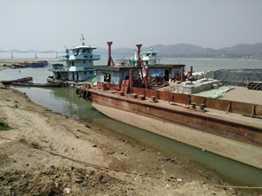
Pyay cargo port
Pyay cargo port access.
Description and Contacts of Key Companies
There are only a limited number of cargo shipping companies operating in Pyay, mostly for construction materials, and they are all based in Yangon. No detailed information available.
For more information on port contacts, please see the following link: 4.4 Port and Waterways Companies Contact List.
Port Performance
Since 2013 no statistics have been kept on the port performance. The main reason is that the Yangon-Pyay road has been improved and most cargo transport has shifted to trucks.
The minimum draft of the channel from Yangon to Pyay is up to 10.6m (35ft) in the wet season and minimum 1.2m (4ft) in the dry season. During dry season there is a restriction on the maximum amount of cargo allowed due to the shallow draft of the river. There is enough mooring space, there are no bottle necks. No handling equipment is available, loading and unloading takes place with manual labour.
Distance Pyay-Magway: 180 km (11hrs downstream, 19hrs upstream).
Pyay-Yangon: 421 km (26.5 hrs downstream, 44 hrs upstream) via Twante canal.
To go from Yangon to Pyay there are two options:
Option 1: Via Twante canal (124 km length) at Twantay City. Twante Canal is preferred by Inland Water Transport.
Option 2: Via the Hlaing river (98km length) at Nyaungdon city is 26km (1.5 hr/3 hrs) shorter. The Hlaing river is preferred by the private sector, but is more difficult to navigate due to narrow sections with many bends.
|
SEASONAL CONSTRAINTS |
||
|
Dry Season |
Yes |
Mid-Nov to mid-May, shallow draft. Boats take 50% cargo depending on the channel draft. |
|
Major Import Campaigns |
No |
|
|
Other |
None |
|
Discharge Rates and Terminal Handling Charges
Ships are charged a standard fee for use of the waterway by the Directorate of Water Resources and Improvement of River System (DWRIRS), under the Ministry of Transport & Communications. DWRIRS charges 0.20 Kyat/MT capacity/mile, per trip (rate as of Jun 2016). This is charged at the river stations Twante, Nyaungdong, Pyay, Magway, Mandalay and Kathar.
Berthing Specifications
|
Type of Berth |
Quantity |
Length (m) |
Maximum Draft (m) |
Comments |
|
Conventional Berth |
1 |
20 |
2m / 6ft 1.2m / 4ft |
wet season dry season |
|
Container Berth |
None |
|
||
|
Silo Berth |
None |
|
||
|
Berthing Tugs |
None |
|
||
|
Water Barges |
None |
|
General Cargo Handling Berths
|
Cargo Type |
Berth Identification |
|
Imports - Bagged Cargo |
1 berth |
|
Exports - Bagged Cargo |
1 berth (same) |
|
Imports and Exports - RoRo |
None |
|
Other Imports |
None |
Port Handling Equipment
There is no port handling equipment, manual labor only.
Container Facilities
There are no container facilities in Pyay Port.
Customs Guidance
No customs office is available.
Terminal Information
Multipurpose Terminal
None.
Grain and Bulk Handling
None.
Main Storage Terminal
None. Normally direct transhipment to and from trucks.
Stevedoring
All loading and offloading is manual. Daily workers are arranged through the Labour Exchange Office and rates can be changes time to time. Current rates are as follow:
- The daily labour rate is 2,000 MMK/MT for unskilled labour.
- Daily casual rate is 5000-8,000 MMK/day for unskilled labour and 8,000-12,000 MMK/day for skilled labour.
Reference: Minimum Wage (“National Committee”) issued the Notification No.1/2018
Hinterland Information
Cargo can be moved by truck only. Because the port is inside town, only small trucks can be used to load cargo: 6-wheeler, 8 MT capacity maximum.
Port Security
None. The port is not fenced.
|
Security |
|
|---|---|
|
ISPS Compliant |
No |
|
Current ISPS
Level |
N/A |
|
Police Boats |
N/A |
|
Fire Engines |
N/A |
2.1.12 Myanmar Port of Aunglan
Port Overview
The port of Aunglan in the Magway Region consists of a gravel ramp for ferries located in the centre of Aunglan and a passenger mooring point close to it. At both locations there are no jetties or berths, vessels moor at the riverbank and use gangways for loading and unloading. Most cargo activity happens across the river at Thayet which can only be reached by ferry from Aunglan. The Ayeyawady Bridge (Thayet-Aunglan) is under construction in Thayet District Magway Region and connects Aunglan Town on the east bank of the river with Thayet Town on the west bank of the river. The bridge has a total length of 2,272.5 meter with 8.5-meter-wide road and a meter wide pedestrian path on both side of the bridge. Waterway clearance beneath the bridge was 130 meters wide and 16 meters high. The bridge is an steel frame arch type with AASHTO HS 25-44 loading capacity. The bridge is one of the important bridges that lie on the economic corridor road that connects Kyaukpyu Special Economic Zone with Shweli (Ruili) passing through Thayet, Aunglan and Nay Pyi Taw.
In terms of cargo movement, this port mostly handles cement and construction materials, while food items and other general supplies are transported by road all year round. The port is also used for passenger vessels. The range of load capacity of the wooden boats operating in the area is between 25 to 100 MT. The port area is generally safe from risk of flash flood or other hazards. The port can be used as one of potential for emergency preparedness/response operation if the road network is inaccessible in case of a large-scale emergency such as earthquake and flooding in the area.
Due to the absence of lighting facility in the port area, cargo operations are strictly only during day time.
The Directorate of Water Resources and Improvement of River System (DWRIRS) is responsible for daily management of the port of Aunglan and Thayet,
The cotton factory, a site with several warehouses (see Aunglan, storage), has an independent ramp with stairs for cargo ships about 1.8km South of the ferry ramp.
Key port information can also be found at: http://www.maritime-database.com
|
Port Location and Contact Information |
|
|---|---|
|
Country |
Myanmar |
|
Province or District |
Magway |
|
Town or City |
Aunglan (0 km) |
|
Port's Complete Name |
Aunglan Port |
|
Latitude, Longitude |
N19 22’ 12.1”, E95 12’ 41.7” (Ferry / cargo) N19 22’ 14.3”, E95 12’ 42.1” (Passengers) N19 21’ 13.4”, E95 12’ 39.8” (Cotton factory) |
|
Managing Company or Port Authority |
Directorate of Water Resources and Improvement of River System (DWRIRS), under the Ministry of Transport & Communications. Located in Thayet, Aunglan is a subregion under the management of DWRIRS Region (4) Magway. |
|
Management Contact Person |
Mr. U Zaw Win Director, Region (4) Magway Office Phone: + 95 063-23056, Hand Phone: +95 67 411428 / +95 9 444032614) Email: dwir.npt@gmail.com / zawwin77@gmail.com |
|
Nearest Airport and Airlines |
Naypyitaw airport (distance 203 km). |
Port Picture
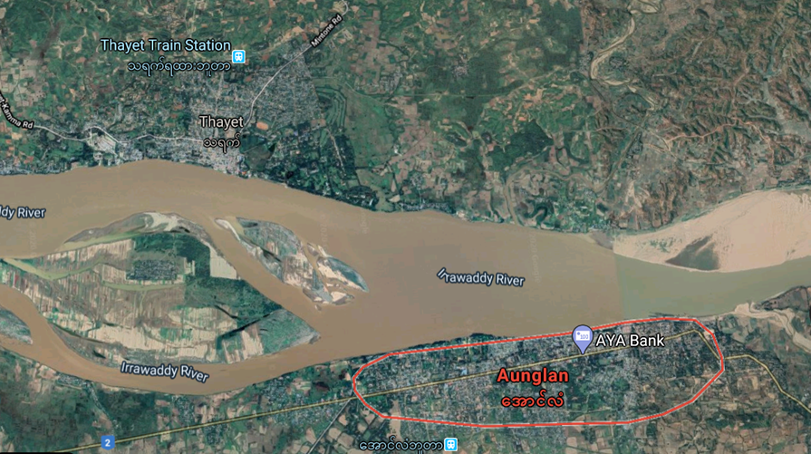
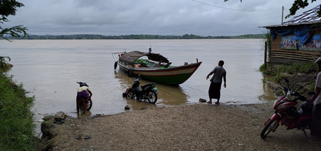
Ferry/cargo ramp
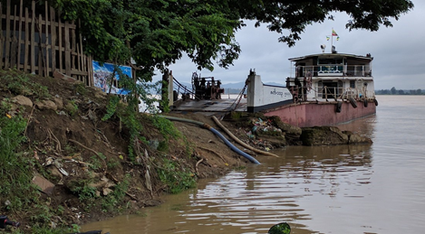
Ferry at Aunglan port.
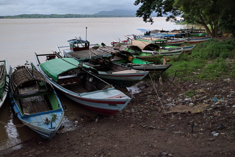
Aunglan port, passengers boats
Cotton factory ramp
Description and Contacts of Key Companies
For transport of vehicles across the river there is one ferry that operates twice a day departing from Aunglan to Thayet (6:30am, 4:00pm) with maximum capacity of 8x 6-wheeler trucks, 1000 GRT. There are also several small boats operating in the area that transport passengers in and out of the area. Shipping companies are mostly based in Thayet.
Port Performance
Cargo handling statistics are not available. There is no container handling capacity on site. The channel draft in the dry season is approximately 2.2 meters (in Feb~April), and 3 meters during the rainy season (in May~Jan). In the dry season, the maximum draft allowed is 1.2m (4ft) while in the wet season a maximum draft of 1.8m (6ft). Maximum vessel size that are normally operating in the Ayeyarwaddy river are 60mx12m (200ftx40ft) using 200 HP engines.
Distance Aunglan/ Thayet - Pyay: 67 km (downstream).
Aunglan/ Thayet - Magway: 104 km (upstream)
Aunglan/ Thayet – Chauk: 278 km (upstream)
Aunglan/ Thayet – Nyaung-U: 315 km (upstream)
Aunglan/ Thayet – Pakokku: 340 km (upstream)
Aunglan/ Thayet – Mandalay: 955 km (upstream)
|
SEASONAL CONSTRAINTS |
||
|---|---|---|
|
Dry Season |
Yes |
Mid-Nov to mid-May, shallow draft. Boats take 50% cargo depending on the channel draft. |
|
Major Import Campaigns |
No |
|
|
Other |
None |
|
Discharge Rates and Terminal Handling Charges
Ships are charged a standard fee for use of the waterway by the Directorate of Water Resources and Improvement of River System (DWRIRS), under the Ministry of Transport & Communications. DWRIRS charges 0.20 Kyat/MT capacity/mile, per trip (rate as of Jun 2016). This is charged at the river stations Twantay, Nyaungdong, Pyay, Magway, Mandalay and Kathar.
Berthing Specifications
|
Type of Berth |
Quantity |
Length (m) |
Maximum Draft (m) |
Comments |
|---|---|---|---|---|
|
Conventional Berth |
1 |
5 |
6m / 20ft 1.2m / 4ft |
wet season |
|
Container Berth |
None |
|
||
|
Silo Berth |
None |
|
||
|
Berthing Tugs |
None |
|
||
|
Water Barges |
None |
|
General Cargo Handling Berths
|
Cargo Type |
Berth Identification |
|---|---|
|
Imports - Bagged Cargo |
1 berth |
|
Exports - Bagged Cargo |
1 berth (same) |
|
Imports and Exports - RoRo |
None |
|
Other Imports |
None |
Port Handling Equipment
There is no port handling equipment, manual only.
Container Facilities
No container facilities.
Customs Guidance
No customs office is available.
Terminal Information
Multipurpose Terminal
None
Grain and Bulk Handling
None
Main Storage Terminal
None. Normally direct transhipment to and from trucks.
Stevedoring
All loading and offloading processes are done manually. The labourers are contracted by the local businesses carrying the cargo and rate can be changed from time to time. Current labour rates are as follows.
- 2000 MMK/MT for break bulk cargo.
- 4000-6000 MMK/day for unskilled labour (only loading and offloading).
- 8000-12000 MMK/day for skilled labour. (includes record keeping, tally counting and managing stack)
Cargo can be moved by truck only. There is no connection to the railway and there is no local airport available. The common types of trucks operating in the area are 6-wheeler (10 MT capacity) and 12-wheeler (18 MT capacity).
Hinterland Information
Cargo can be moved by truck only. There is no connection to the railway and there is no local airport available.
Port Security
None. The port is not fenced and there is no inspection check point and weighbridge nearby.
2.1.13 Myanmar Ports of Magway and Minbu
Port Overview
The port of Magway and Minbu are connected through the Magway Irrawaddy bridge. The port of Magway consists of a passenger boat ramp located in the center of Magway and a general cargo mooring point close to it. The port of Minbu is on the opposite side of the river from Magway and consists of three mooring points accessible by truck, one for general cargo and the another two mostly used for fuel. At both ports there are no jetties or berths, vessels moor at the river bank and use gangways for loading and unloading. There is no congestion and no bottlenecks (no waiting time to dock). The Directorate of Water Resources and Improvement of River System (DWRIRS) in Magway is responsible for daily management of the port of Magway and Minbu. Depending on the water level and mooring space for cargo shipments, the port of Minbu is more often used in the dry season (Nov to May) and the port of Magway can be used only in the wet season (June to Oct).
Key port information can also be found at: http://www.maritime-database.com
|
PORT LOCATION & CONTACT |
|
|
Country |
Myanmar |
|
Province or District |
Magway |
|
Town or City |
Magway / Minbu (0 km) |
|
Port's Complete Name: |
Magway Port and Minbu Port |
|
Latitude, Longitude: |
Magway: 20.157917, 94.916583 |
|
Latitude, Longitude: |
Minbu: 20.150028, 94.891417 |
|
Managing Company or Port Authority: (If more than one operator, break down by area of operation) |
Directorate of Water Resources and Improvement of River System (DWRIRS), under the Ministry of Transport & Communications. 20.138833, 94.924389 |
|
Management Contact Person: |
Mr. U Zaw Win Director, Region (4) Magway Office Phone: + 95 063-23056, Hand Phone: +95 67 411428 / +95 9 444032614) Email: dwir.npt@gmail.com / zawwin77@gmail.com |
|
Nearest Airport and Airlines: (Airlines with frequent international arrivals/departures) |
Magway Airport (10 km) Myanmar National Airways |
Port Picture
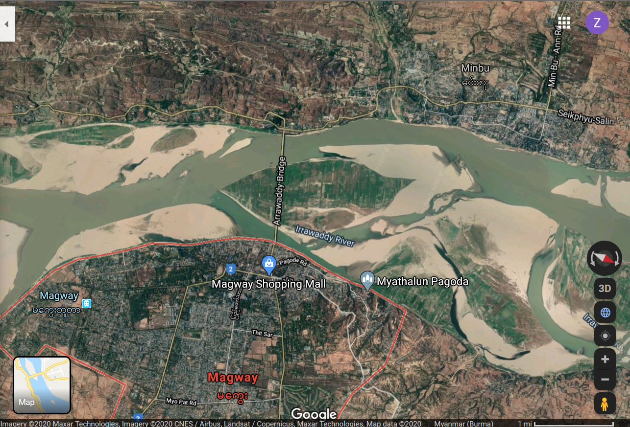
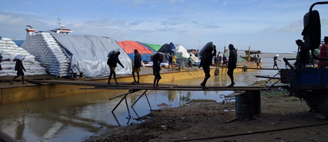
Cargo port Magway
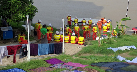
Passenger port Magway
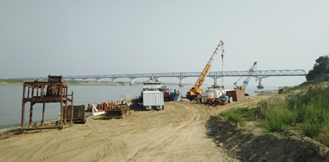
Cargo port Minbu
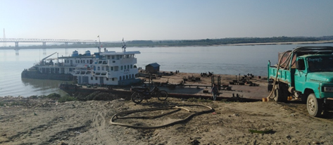
Fuel port Minbu
Description and Contacts of Key Companies
In Magway vessel owners have organized themselves in a committee. There are five owners that have 2 or more vessels. The vessels are 1500 GRT capacity, while in the dry season they have max 800 MT capacity because of the draft situation as water recedes. For more information on port contacts, please see the following link: 4.4 Myanmar Port and Waterways Company Contact List.
Port Performance
Port performance in 2019 was approximately 20 vessels visit per day, average 600 vessels per month. About 47,500 MT of cargo per month, mostly fuel, rice, pulses, oil, crude oil, construction materials (cement, iron bars). There is no container handling capacity.
The minimum draft of the channel from Pyay to Magway and Magway to Pakokku is 10.6m (35ft) in the wet season and in the dry season, minimum 1.5m (5ft) in four places. During dry season, there is a restriction on the maximum amount of cargo allowed due to the shallow draft of the river. There is enough mooring space and no bottlenecks reported. 2 mobile cranes with Max 5MT capacity are available for hire, however, loading and unloading are normally takes place with manual labour.
Distance Pyay-Magway: 180 km (downstream)
Magway - Aug Lang / Tha yat: 109 km (downstream)
Distance Magway-Nyaung-U: 152 km.(upstream)
Magway-Chauk: 115 km (upstream)Magway – Nyaung-U: 211 km (upstream)
Magway – Pakokku: 236 km (upstream)Magway - Mandalay: 451 km (upstream)
|
SEASONAL CONSTRAINTS |
||
|
Dry Season |
Yes |
Mid-Nov to mid-May, shallow draft. Boats take 50% cargo depending on the channel draft. |
|
Major Import Campaigns |
No |
|
|
Other |
None |
|
|
HANDLING FIGURES 2019 |
|
|
Vessel Calls: |
1,000/Month |
|
Container Traffic: (TEUs) |
0 |
|
Handling Figures Bulk and Break Bulk |
Year 2019 |
|
Bulk (MT) |
570,000 MT |
Discharge Rates and Terminal Handling Charges
Ships are charged a standard fee for use of the waterway by the Directorate of Water Resources and Improvement of River System (DWRIRS), under the Ministry of Transport & Communications. DWRIRS charges 0.20 Kyat/MT capacity/mile, per trip (rate as of Jun 2016). This is charged at the river stations Twantay, Nyaungdong, Pyay, Magway, Mandalay and Kathar. The Sanitory Dept. under Regional government charges a docking charge per vessel per visit; this responsibility is planned to be handed over to the DWRIRS.
Berthing Specifications
|
Type of Berth |
Quantity |
Length (m) |
Maximum Draft (m) |
Comments |
|
Conventional Berth |
1 |
20 |
6m / 20ft 2m / 6ft |
wet season dry season |
General Cargo Handling Berths
|
Cargo Type |
Berth Identification |
|
Imports - Bagged Cargo |
1 berth |
|
Exports - Bagged Cargo |
1 berth (same) |
|
Imports and Exports - RoRo |
None |
|
Other Imports |
None |
Port Handling Equipment
There is no port handling equipment, manual only.
Container Facilities
No container facilities.
Customs Guidance
No customs office is available.
Terminal Information
Multipurpose Terminal
None
Grain and Bulk Handling
None
Main Storage Terminal
None. Normally direct transhipment to and from trucks.
Stevedoring
All loading and offloading are normally performed manually. Daily workers are normally arranged by the cargo owners with prior arrangement butrate can change from time to time.
- Current labour rate is 2,000 MMK/MT for unskilled labour (only loading and offloading)
- 5,000-7,000 MMK/day for unskilled labour
- 8,000-12,000 MMK/day for skilled labour ((includes record keeping, tally counting and managing stack).
Hinterland Information
Cargo can be moved by truck only. There is no connection to the railway and Magway airport is not handling cargo.
Port Security
None. The port is not fenced, no inspection check point and weighbridge nearby.
2.1.15 Myanmar, Mandalay Port of Mandalay
Port Overview
The port of Mandalay has only one jetty for passengers, a repurposed barge, along the Ayeyarwaddy River. The port does not have any handling equipment and is suitable for general cargo only. There is no connection to the railroad. The main general cargo & fuel port is Shwe Kyat Yat, located 16km South of town close to the Ayeyarwaddy bridge (location: 21° 52' 37.3"N, 96° 00' 08.9"E). This port is privately managed by Sky & Moon co. for general cargo and Denko co. for fuel. Sky & Moon co. is operating a 25MT mobile crane from a barge for loading & off-loading, suitable for handing 20ft containers. The port is accessible for vessels & barges up to 1000 GRT and maximum 2.1m draft. (fuel port location: 21° 53' 28.7"N, 96° 00' 46.5"E). Maximum draft in the dry season is around 1.2m.
A new cargo port and container terminal is being developed by the regional government with JICA funding in Semeikhon (21° 44' 53.8"N, 95° 25' 23.4"E, Myingyan township), 47km North of Myingyan and 94km South-West of Mandalay. It is expected that a barge with 50MT crane will be floated and operational by August 2016 and additional handling equipment and infrastructure may be in place by 2018. As of June 2016 this port is lacking access roads suitable for heavy trucks from Nabuaing town and suitable port infrastructure and handing equipment. There is a concrete boat ramp and a 50MT crane, plus supporting offices.
Port website Semeikhon: http://www.mmidproject.com/SMP.aspx
Key port information can also be found at: http://www.maritime-database.com
|
Port Location and Contacts |
|
|
Country |
Myanmar |
|
Province or District |
Mandalay |
|
Town or City (Closest location) with Distance (km) |
Name : Mandalay km: 16km South |
|
Port's Complete Name |
Shwe Kyat Yat Port of Mandalay |
|
Latitude |
21° 52' 37.3"N (cargo), 21°58'16.04"N (pax) |
|
Longitude |
96° 00' 08.9"E (cargo), 96° 3'22.08"E (pax) |
|
Managing Company or Port Authority (If more than one operator, break down by area of operation) |
Inland Water Transport (IWT) department, Mandalay division |
|
Management Contact Person |
U Khin Maung Aye |
|
Closest Airport and Frequent Airlines to / from International Destinations |
Airport Name: Mandalay International Airport Airlines: Air Asia, Bangkok Airways, China Eastern, SilkAir, Thai airways, Thai Smile, Myanmar Airways Inter’l. |
Port Picture
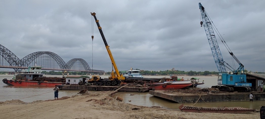
Shwe Kyat Yat Sky general cargo facility & mobile cranes
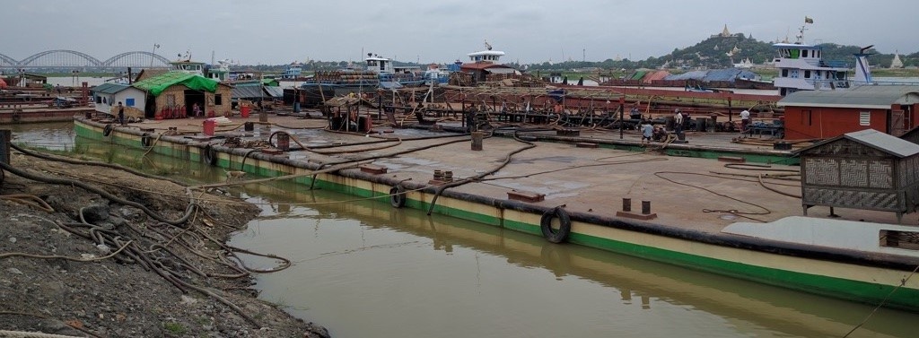
Shwe Kyat Yat Sky fuel port
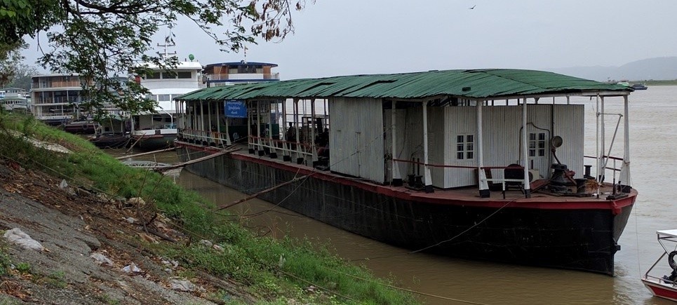
Passenger port Jetty 1 (Steel boat of 45x8m)
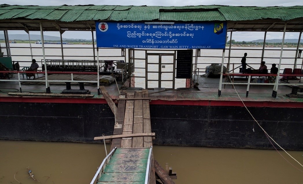
Description and Contacts of Key Companies
Inland Water Transport is responsible for the port operations. The passenger jetty (1) is located in town (location: 21°58'15.88"N, 96° 3'37.88"E). This jetty is mostly used for passenger boats for tourism by Century Ananda, Upland, Sun Far Co. Ltd.
The general cargo & fuel port is Shwe Kyat Yat, located outside town (location: 21° 52' 37.3"N, 96° 00' 08.9"E) and managed by a private company: Sky & Moon Co. Ltd. for general cargo and Denko Co. Ltd. for fuel (fuel port location: 21° 53' 28.7"N, 96° 00' 46.5"E).
Sky & Moon Co. Ltd.
Mr. Thant Zin Tun (Director)
No. 5, 34th St. at 68 th and
69th st., Mandalay
Phone: +95-9 5151648, +95-9-33116116
Port Performance
There is no congestion. The maximum draft is 2.1m (7 ft) and in the dry season average draft along the river is 1.2m (4ft). Maximum vessel size is 60m (200ft) length, 1000 GRT. 60 vessels visit average per month, about 720 per year. Near jetty (1) is a fuel barge with diesel for boats, which is being refuelled regularly from a government refinery in Chauk.
|
Seasonal Constraints |
Yes / No |
From <month> to <month> |
|
Dry Season (low draft) |
Yes |
October to April |
|
Major Import Campaigns |
No |
|
|
Other |
n/a |
|
Handling Figures |
Year 2015 |
|
Vessel Calls |
720 |
|
Container Traffic (TEUs) |
0 |
|
Handling Figures Bulk and Break Bulk |
Year 2015 |
|
Bulk (MT) |
0 |
|
Break bulk (MT) |
94,244 MT |
Discharge Rates and Terminal Handling Charges
Contact Sun & Moon Co. Ltd., the discharge rates depend on the type of cargo.
Ships are charged a standard fee for use of the waterway by the Directorate of Water Resources and Improvement of River System (DWRIRS), under the Ministry of Transport & Communications. DWRIRS charges 0.20 Kyat/MT capacity/mile, per trip (rate as of Jun 2016). This is charged at the river stations Twantay, Nyaungdong, Pyay, Magway, Mandalay and Kathar and for the Chindwin river at Monywa and Kalewa.
Berthing Specifications
|
Type of Berth |
Quantity |
Length (m) |
Maximum Draft (m) |
|
Conventional Berth |
1 barge |
45mx8m |
2.1m / 1000 GRT |
|
Container Berth |
No |
||
|
Silo Berth |
No |
||
|
Water Barges |
Yes |
20x10m with |
2m, of Sky&Moon |
|
Berthing Tugs |
No |
General Cargo Handling Berths
|
Cargo Type |
Berth Identification |
|
Imports - Bagged Cargo |
No |
|
Exports - Bagged Cargo |
No |
|
Imports and Exports - RoRo |
No |
|
Other Imports |
Yes, Shwe Kyat Yat |
Port Handling Equipment
There is no handling equipment at the passenger terminal.
At the general cargo port Shwe Kyat Yat Sky & Moon Co. Ltd. is
operating a barge with a 25MT crane truck on it for loading and
offloading vessels. In total they have three cranes. Sun & Moon has
trucks, flatbed 16 wheeler: 12x30MT, closed body 12-wheeler: 2x16MT
and can organize up to 20 barges of 67mx16mx3.5m draft.
|
Equipment |
Available (Yes / No) |
Total Quantity and Capacity Available |
Comments on Current Condition and Actual Usage |
|
Dockside Crane |
No |
n/a |
|
|
Container Gantries |
No |
n/a |
|
|
Mobile Cranes |
Yes |
(1) 25MT, (1) 35MT, (1) 17MT capacity with steel tracks |
Operational |
|
Reachstacker |
No |
n/a |
|
|
RoRo Tugmaster (w/ Trailer) |
No |
n/a |
|
|
Grain Elevator w/ Bagging Machines |
No |
n/a |
|
|
Transtrainer |
No |
n/a |
|
|
Forklifts |
No |
n/a |
Container Facilities
Sky & Moon Co. Ltd. can handle 20ft containers, but containers are not commonly used.
Customs Guidance
There is no customs office available.
Terminal Information
Multipurpose Terminal
None.
Grain and Bulk Handling
None.
Main Storage Terminal
None
|
Storage Type |
Number of Storage Facilities |
Area (square meters) |
|
Bagged Cargo |
None |
|
|
Refrigerated Cargo |
None |
|
|
General Cargo |
None |
Stevedoring
Daily workers are arranged by by private businesses themselves. Due to low volume of cargo this is no longer handled by the Township Labour Exchange Office.
Hinterland Information
There is no direct connection with the railway from the passenger or general cargo/fuel port.
The railway cargo terminal is about 6.7km away from the passenger port, by road through downtown Mandalay, with railway connections to Monywa, Bagan, Yangon and Myitkyina.
From Shwe Kyat Yat Sky port there is quick access for trucks via the primary roads to Mandalay, Monywa and Nay Pyi Taw.
From Semeikhon port there is a 22km new gravel road that leads to a new industrial park development project near Myo Thar. However, access to the nearest tarmac road from Semeikhon is minimum 18.5 km / 1 hour via narrow dirt roads, not suitable for heavy trucks. Until road infrastructure to Semeikhon is improved, this port has no attractive hinterland connection for trucks.
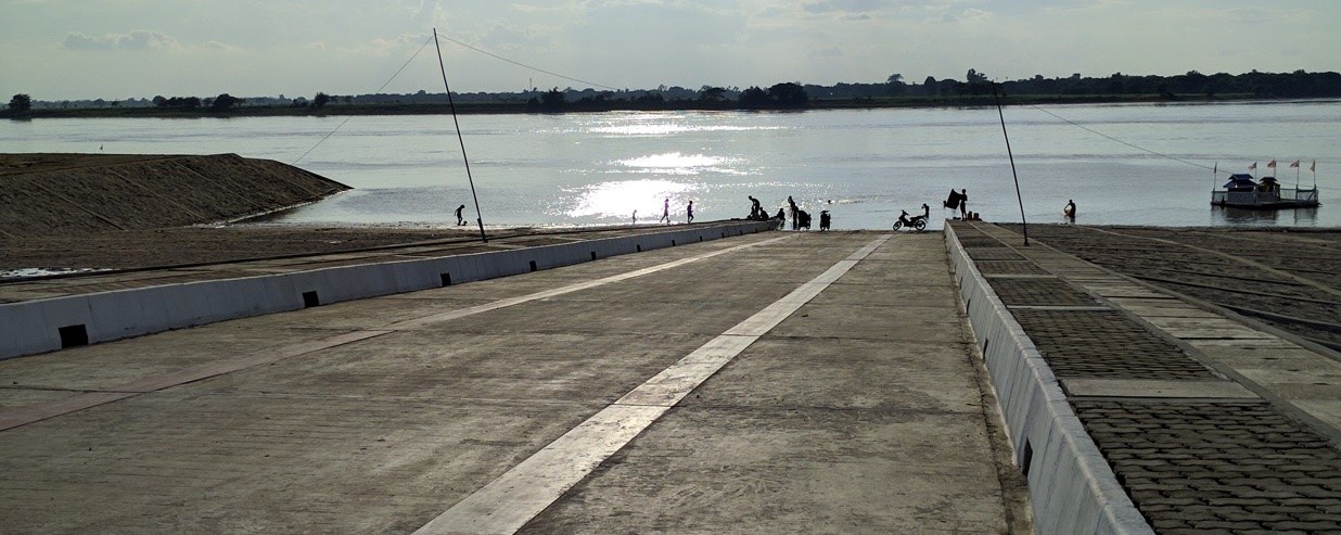
Semeikhon boat ramp

Semeikhon 50MT crane
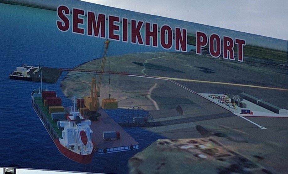
Simeekhon future plan
Port Security
There is no port security and no perimeter fencing.
|
Security |
|
|---|---|
|
ISPS Compliant |
No |
|
Current ISPS
Level |
|
|
Police Boats |
No |
|
Fire Engines |
No |
2.1.16 Myanmar Port of Nyaung-U
Port Overview
Nyaung-U in the Mandalay region is close to Pakokku, on the other side of the Ayeyarwaddy river. Most activities in the Nyang-U port relate to passengers movement; about 100 small local boats used for passenger transport and tourist sightseeing (6m long, 20HP engine boats plus larger boats (30m length, 6m width). A privately owned fuel and general cargo port - Latt Htout jetty- is located 24km outside Nyaun-U, which is used for fuel, cement and coal. The private port is restricted for other vessels to use. There is no congestion and no bottlenecks (no waiting time to dock). The port area is accessible by 12-wheeler trucks (20 MT capacity). Based on our recent assessment of the port operating conditions, the port is not particularly suitable for humanitarian operations.
Key port information can also be found at: http://www.maritime-database.com
|
PORT LOCATION & CONTACT |
|
|
Country |
Myanmar |
|
Province or District |
Mandalay |
|
Town or City |
Distance to Nyaung-U: 24 km cargo & fuel port (24 km), passenger port (0 km) |
|
Port's Complete Name |
Port of Nyaung-U and Latt Htout jetty |
|
Latitude |
21°17'22.37"N (cargo) / 21°12'30.10"N (pax) |
|
Longitude |
95° 6'13.45"E (cargo) / 94°55'0.40"E (pax) |
|
Managing Company or Port Authority |
Inland Water Transport office, Nyaung-U. However the cargo port is privately owned & operated by Famous OK and Apache Cement. |
|
Management Contact Person |
Mr. U Aung Cho Myint (Manager- Inland Waterway Department, Pakokku-Nyaung-U), Nyaung U Office Ph#-95-9-43008220 |
|
Nearest Airport and Airlines |
Nyang-U airport, 26km distance (Myanmar Airlines, Air KBZ, General Airways, MANN Yadanarpon Airlines, Golden Myanmar Airlines, FMI Air, Yangon Airways, Asian Wings Airways) |
Port Picture
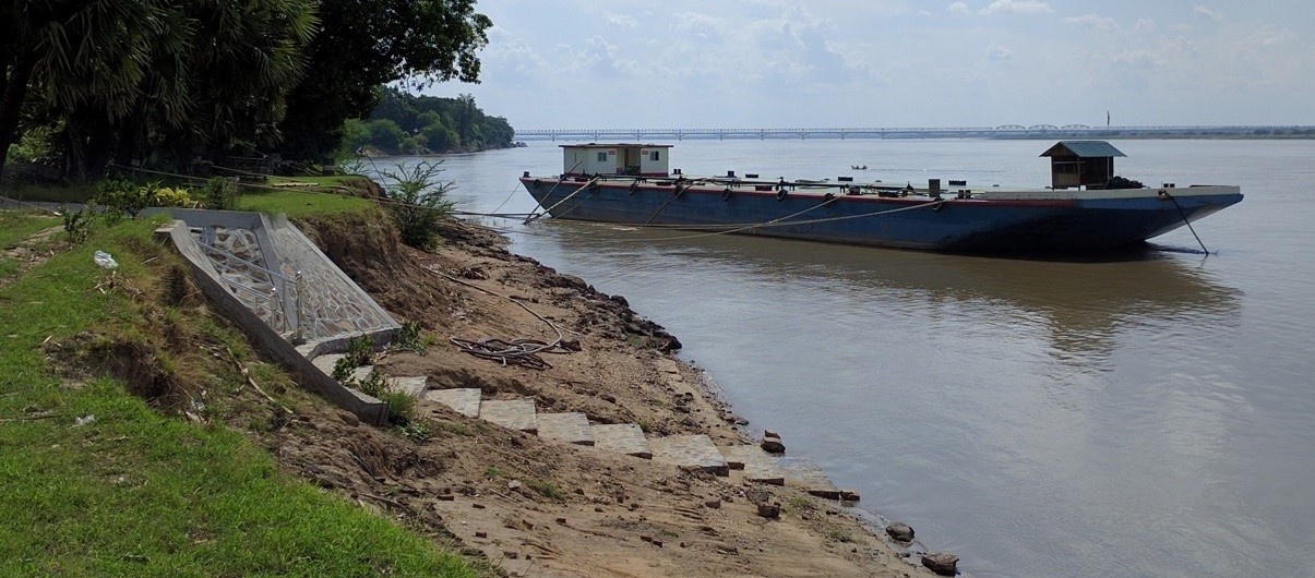
Famous OK fuel port, Nyaung-U
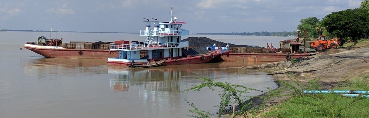
Apache Cement cargo port, Nyaung-U
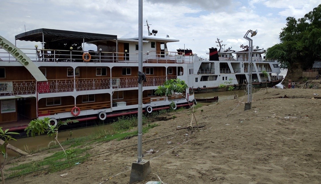
Passenger port, Nyaung-U
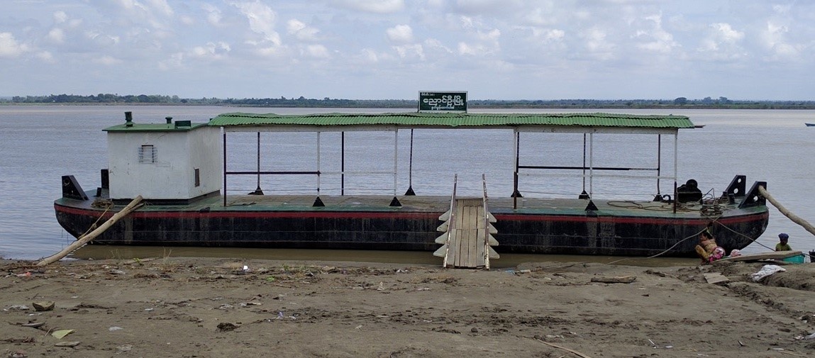
Passenger Jetty, Nyaung-U
Description and Contacts of Key Companies
At Latt Htout jetty, the fuel port is managed by Famous OK (U Kyaw Myint Thu, Ph#+95-66-22865 ) and the cargo port managed by Apache Cement (U Thein Myint Win Ph# +95-9-977830710). Famous OK has a fuel barge and plus several storage tanks for a total of 500,000 gallons (2.273 million litre) capacity of premium diesel.
At the passenger port there are many individual boat owners, Inland
Water Transport, who compete with (older) 30m long passenger boats
that have cabins and max. 5MT cargo capacity against private
companies that have newer passenger boats with cabins.
Port Performance
Cargo handling is approximately 40 MTs/month at the jetty in Nyaung-U. There is no container handling capacity. The Fuel and cargo port are responsible for about 2000MT/ month, mainly fuel, cement and coal.
The channel draft in the dry season is average 2.12m (in March/April), and above 2,12m in the wet season. In the dry season the maximum draft is 1.3m (4.5ft) and in the wet season a maximum draft of 1.8m (6ft) is allowed. Maximum vessel size that are normally operating in the Ayeyarwaddy are 60mx12m (200ftx40ft) using 200 HP engines.
|
SEASONAL CONSTRAINTS |
||
|
Dry Season |
No |
Dry season March-April, restricted draft to max. 1.3m (4.5ft) |
|
Major Import Campaigns |
Yes |
Busy during Oct-Dec, harvest season |
|
Other |
None |
|
|
HANDLING FIGURES 2019 |
|
|
Vessel Calls: |
178/month NyaungU |
|
Container Traffic: (TEUs) |
None |
|
Handling Figures Bulk and Break Bulk |
Year 2019 |
|
Bulk (MT) |
30,000 MT |
|
Break bulk (MT) |
0 |
Discharge Rates and Terminal Handling Charges
Ships are charged a standard fee for use of the waterway by the Directorate of Water Resources and Improvement of River System (DWRIRS), under the Ministry of Transport & Communications. DWRIRS charges 0.20 Kyat/MT capacity/mile, per trip (rate as of Jun 2016). This is charged at the river stations Twantay, Nyaungdong, Pyay, Magway, Mandalay and Kathar.
Berthing Specifications
|
Type of Berth |
Quantity |
Length (m) |
Maximum Draft (m) |
Comments |
|
Conventional Berth |
1 jetty |
20 m |
2.12 m |
|
|
Container Berth |
No |
|
||
|
Silo Berth |
No |
|
||
|
Berthing Tugs |
No |
|
||
|
Water Barges |
No |
|
General Cargo Handling Berths
|
Cargo Type |
Berth Identification |
|
Imports - Bagged Cargo |
None |
|
Exports - Bagged Cargo |
None |
|
Imports and Exports - RoRo |
None |
|
Other Imports |
None |
Port Handling Equipment
Port handling equipment is normally not available: manual labour only. At Pakokku port it is possible to hire a 5MT mobile crane.
|
Equipment |
Available (Yes / No) |
Total Quantity and Capacity Available |
Comments on Current Condition and Actual Usage |
|
Dockside Crane |
No |
5 MT mobile crane available at Pakokku Port. |
Normally manual labour is used |
|
Container Gantries |
No |
||
|
Mobile Cranes |
No |
||
|
Reachstacker |
No |
||
|
RoRo Tugmaster (w/ Trailer) |
No |
||
|
Grain Elevator w/ Bagging Machines |
No |
||
|
Transtainer |
No |
||
|
Forklifts |
No |
Container Facilities
|
Facilities |
20 ft |
40 ft |
|
Container Facilities Available |
None |
None |
|
Container Freight Station (CFS) |
No |
|
|
Refrigerated Container Stations |
No |
Customs Guidance
No customs office is available.
Terminal Information
Multipurpose Terminal
None
Grain and Bulk Handling
None
Main Storage Terminal
None
Stevedoring
All loading and offloading are normally performed manually. Daily workers are normally arranged by the cargo owner and rate can change from time to time. Current daily labour rates are:
- 2,000 MMK/MT for unskilled labour (only loading and offloading)
- 5000-7,000 MMK/day for unskilled labour.
- 8,000-12,000 MMK/day for skilled labour (includes record keeping, tally counting and managing stack).
Hinterland Information
Road option available only. There is no connection to the railroad.
Port Security
No security, the port is not fenced.
2.1.17 Myanmar, Mandalay region, Semeikhon Port
Port Overview
A new cargo port and container terminal is being developed by the regional government of Mandalay with JICA funding in Semeikhon (Myingyan township), 47km North of Myingyan and 94km South-West of Mandalay. It is expected that a barge with 50MT crane will be floated and operational by August 2016 and additional handling equipment and infrastructure may be in place by 2018.
As of June 2016 this port is lacking access roads suitable for heavy trucks from Nabuaing village track and a suitable port infrastructure and handing equipment. There is a 50m concrete boat ramp and a 50MT crane on a barge, plus supporting offices.
Port website: http://www.mmidproject.com/SMP.aspx
Key port information can also be found at: http://www.maritime-database.com
|
PORT LOCATION & CONTACT |
|
|
Country: |
MYANMAR |
|
Province or District: |
Mandalay |
|
Town or City: (Nearest location with distance from port) |
Mandalay distance: 94 km |
|
Port's Complete Name: |
Semeikhon Port |
|
Latitude: |
21° 44' 53.8"N |
|
Longitude: |
95° 25' 23.4"E |
|
Managing Company or Port Authority: (If more than one operator, break down by area of operation) |
Semeikhon Ayeryarwaddy Port Committee Myingyan township Mandalay region |
|
Management Contact Person: |
U Thein Soe Win (Port Manager) Phone: +95-9-796512259 |
|
Nearest Airport and Airlines: (Airlines with frequent international arrivals/departures) |
Mandalay International airport, 84.6km distance (Air Asia, Bangkok Airways, China Eastern, SilkAir, Thai airways, Thai Smile, Myanmar Airways Inter’l) |
Port Picture
Semeikhon port & Myotha Industrial Park (MIP)

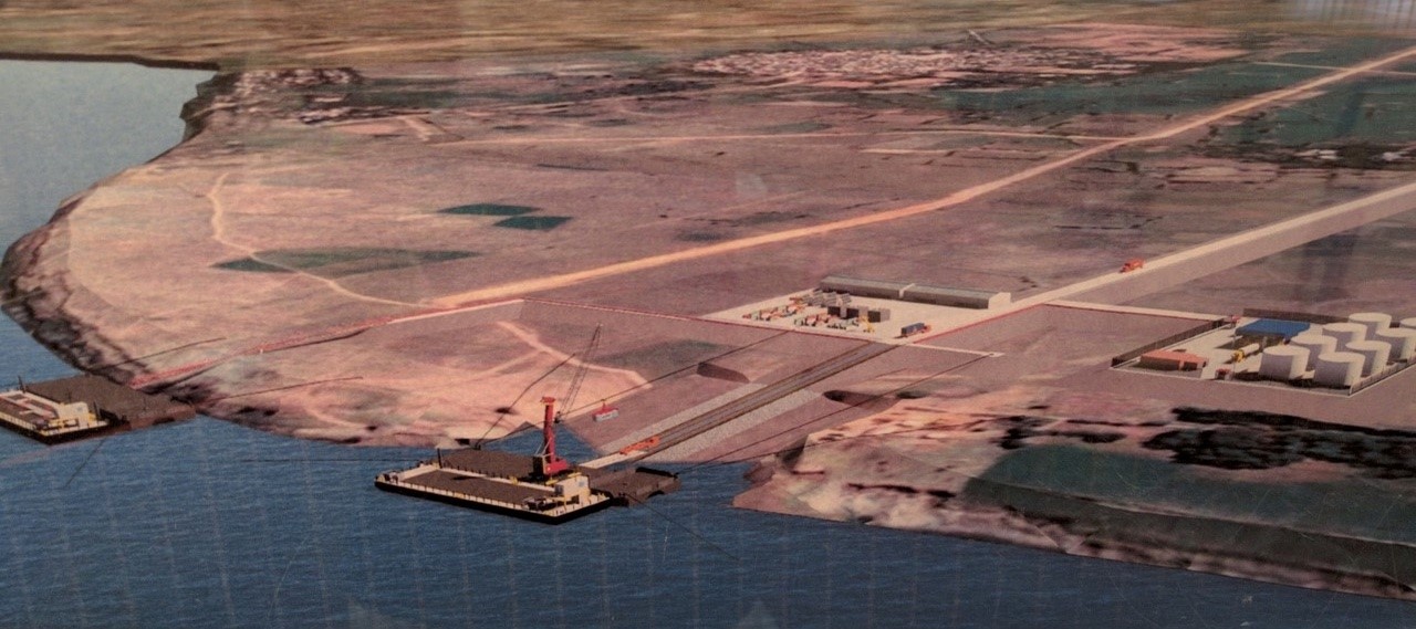
Boat ramp, crane and planned terminal
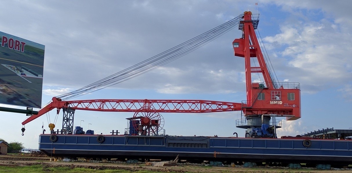
Existing crane on barge

Existing concrete boat ramp
Description and Contacts of Key Companies
Mandalay Myotha Industrial Development is in charge of the Semeikhon port development.
Address: 26th Street, Between 58th and
60th Street,
Aung MyayThar Zan, Mandalay, Phone: +95 2 65958, Fax: +95 2 73088.
Email: info@mmidproject.com
Port Performance
The channel draft at Semeikhon port in the dry season is minimum 4.6m (15ft) in March/April, and above 18m (60ft) in the wet season.
|
SEASONAL CONSTRAINTS |
||
|
Yes / No |
From <month> to <month> |
|
|
Dry Season |
Yes |
Dry season March-April, restricted draft to max. 4.6m |
|
Major Import Campaigns |
No |
|
|
Other |
None |
|
|
HANDLING FIGURES 2015 |
|
|
Vessel Calls: |
Not operational |
|
Container Traffic: (TEUs) |
None |
|
Handling Figures Bulk and Break Bulk |
Year 2015 |
|
Bulk (MT) |
0 |
|
Break bulk (MT) |
0 |
Discharge Rates and Terminal Handling Charges
Not established as of yet.
Ships are charged a standard fee for use of the waterway by the Directorate of Water Resources and Improvement of River System (DWRIRS), under the Ministry of Transport & Communications. DWRIRS charges 0.20 Kyat/MT capacity/mile, per trip (rate as of Jun 2016). This is charged at the river stations Twantay, Nyaungdong, Pyay, Magway, Mandalay and Kathar and for the Chindwin river at Monywa and Kalewa.
Berthing Specifications
|
Type of Berth |
Quantity |
Length (m) |
Maximum Draft (m) |
Comments |
|
Conventional Berth |
1 boat-ramp |
50 |
2.12m |
|
|
Container Berth |
No |
|
||
|
Silo Berth |
No |
|
||
|
Berthing Tugs |
No |
|
||
|
Water Barges |
No |
|
General Cargo Handling Berths
|
Cargo Type |
Berth Identification |
|
Imports - Bagged Cargo |
None |
|
Exports - Bagged Cargo |
None |
|
Imports and Exports - RoRo |
None |
|
Other Imports |
None |
Port Handling Equipment
As of August 2016 it is expected that a crane operated from a barge, with 50MT capacity and container handling capability will be operational.
No additional handling equipment, nor trucks or trailers are locally available. This may be made available by 2018, depending on further development of the port and industrial zone.
|
Equipment |
Available (Yes / No) |
Total Quantity and Capacity Available |
Comments on Current Condition and Actual Usage |
|
Dockside Crane |
No |
||
|
Container Gantries |
No |
||
|
Mobile Cranes |
No |
50 MT mobile crane on a barge |
Capacity to handle 20ft and 40ft containers |
|
Reachstacker |
No |
||
|
RoRo Tugmaster (w/ Trailer) |
No |
||
|
Grain Elevator w/ Bagging Machines |
No |
||
|
Transtainer |
No |
||
|
Forklifts |
No |
Container Facilities
|
Facilities |
20 ft |
40 ft |
|
Container Facilities Available |
None |
None |
|
Container Freight Station (CFS) |
No |
|
|
Refrigerated Container Stations |
No |
|
|
Other Capacity Details |
||
|
Daily Take Off Capacity (Containers per day) |
n/a |
|
|
Number of Reefer Stations (connection points) |
n/a |
|
|
Emergency Take-off Capacity (Give an indication) |
n/a |
|
|
Off take capacity of gang shift (in Containers per shift) |
n/a |
Customs Guidance
No customs office is available.
Terminal Information
Multipurpose Terminal
None.
Grain and Bulk Handling
None
Main Storage Terminal
None
|
Storage Type |
Number of Storage Facilities |
Area (square meters) |
|
Bagged Cargo |
No |
|
|
Refrigerated Cargo |
No |
|
|
General Cargo |
No |
Stevedoring
Not operational yet.
Hinterland Information
As of June 2016 this port is lacking access roads suitable for heavy trucks from Nabuaing town and a suitable port infrastructure and handing equipment.
There is a 22km double lane gravel road that leads East to the new Myotha Industrial Park (MIP), which is under development. The Industrial zone is still lacking an access road to Myo Tha, the nearest town.
There is no connection of Semeikhon port with a railroad.
Port Security
No security, the port is not fenced.
|
Security |
|
|---|---|
|
ISPS Compliant |
No |
|
Current ISPS
Level |
|
|
Police Boats |
No |
|
Fire Engines |
No |
2.1.18 Myanmar Port of Kalewa
Port Overview
The port of of Kalewa consists of a passenger boat ramp located in the center of Kalewa and a general cargo facility located East at the fork of the Chindwin river and the Myitthar river. There are no jetties or berths, vessels moor at the riverbank and use gangways.
Kalewa port is relatively busy with the transport of construction materials and functions as a hub between Monywa, Hommalin, Khamti, Kale, and Tamu. The Myitthar river between Kalewa and Kale is only accessible for 100 MT capacity boats during rainy season (Mid- June to Mid-Nov) as the maximum channel draft in the dry season is only 0.61m (2 ft). There is no port in Kale and boats moor at the riverbank and use gangways for loading and unloading. Since Kalewa and Kale is only 40 km apart and the road network is accessible all year round, general cargo is mainly transported by road from Kalewa to Kale, Tamu, and northern Chin State.
The average draft of the channel from Kalewa to Khanti is 6m deep (20ft) in the wet season and in the dry season it significantly drops to 0.75m (2.5ft). There is enough mooring space and there are no bottle necks. No handling equipment is available, loading and unloading with manual labour. During dry season there is a restriction on the maximum amount of cargo allowed due to the shallow draft of the river. Below is the restriction on the max channel draft in Chindwin river during dry season (15 Nov to 15 May) as stated by the Directorate of Water Resources and Improvement of River System (DWRIRS);
- Monywa to Kalewa = 1m (3.3 ft)
- Kalewa to Hommalin = 0.91m (3 ft)
- Hommalin to Khamti = 0.76m (2.5 ft)
Key port information can also be found at: http://www.maritime-database.com
|
PORT LOCATION & CONTACT |
|
|
Country |
Myanmar |
|
Province or District |
Sagaing |
|
Town or City |
Kalewa (0.5 km) |
|
Port's Complete Name |
Kalewa port |
|
Latitude |
23.194197 |
|
Longitude |
94.309442 |
|
Managing Company or Port Authority |
Directorate of Water Resources and Improvement of River System (DWRIRS), under the Ministry of Transport & Communications. While daily management is sub-contracted to a private company. |
|
Management Contact Person |
Mr. Moe Zaw (Ph+95-9-400545544) |
|
Nearest Airport and Airlines |
Kale Airport (distance 40km). (Myanmar national airline, Air KBZ) |
Port Picture
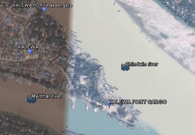
Kalewa port overview
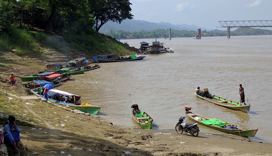
Passenger port Kalewa
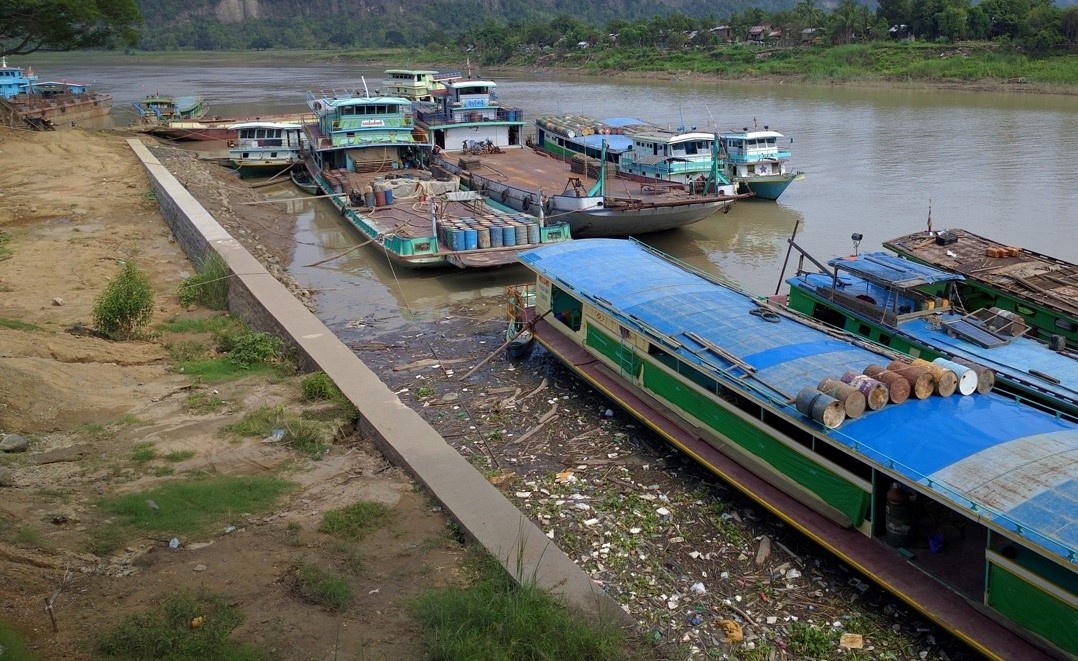
Cargo port Kalewa
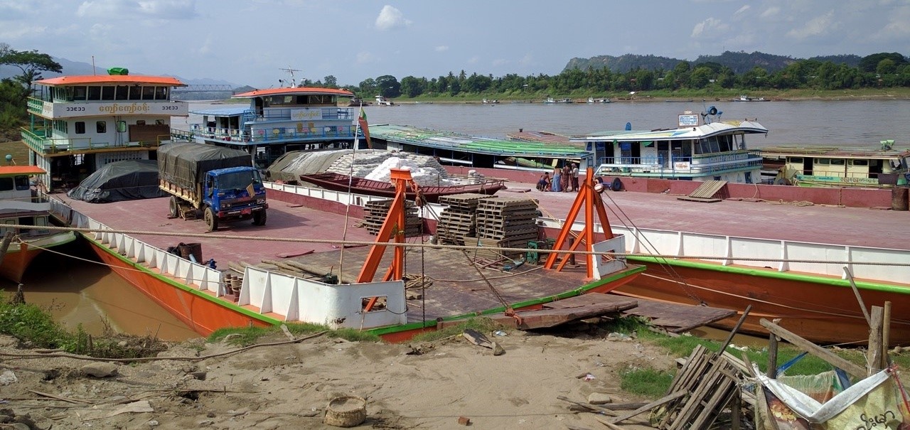
Cargo port Kalewa
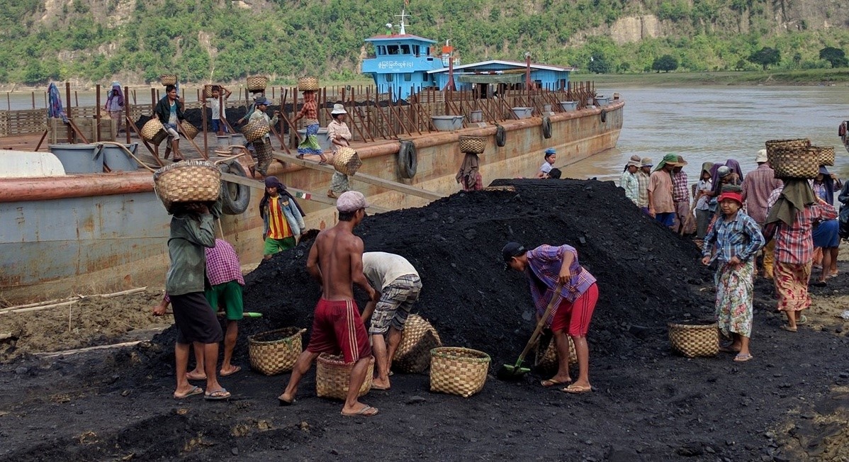
Cargo port manual labor, Kalewa
Description and Contacts of Key Companies
Most vessels are operated by individual vessel owners. One of the main operators at Kalewa for general cargo is U Win Aung of the Kyaw Kyaw Win Line in Minkin, Kalewa (phone number: +95-9-2007910). He owns 3 vessels (200’x50’x draft 8’ with 1000 Mt capacity), (180’x 35’x draft 7’ with 500 Mt capacity) and (145’x15’x draft 4.5’ with 100 Mt capacity).
Port Performance
Port performance in 2019 was approximately 25 vessels visit per day, averaging around 700 vessels per month. About 1,800 MT of cargo per month, mostly construction materials (cement, iron, corrugated sheets, food). However, since port management was sub-contracted, there are no exact statistics maintained on the volume of cargo and port calls.
|
SEASONAL CONSTRAINTS |
||
|
Dry Season |
Yes |
Mid-Nov to May, shallow draft. Boats take 50% cargo depending on the channel draft. |
|
Major Import Campaigns |
No |
|
|
Other |
None |
|
|
HANDLING FIGURES 2019 |
|
|
Vessel Calls: |
8,500 |
|
Container Traffic: (TEUs) |
0 |
|
Handling Figures Bulk and Break Bulk |
Year 2019 |
|
Bulk (MT) |
0 |
|
Break bulk (MT) |
21,000 MT |
*Handling figures are estimates.
Discharge Rates and Terminal Handling Charges
The below are vessel docking charges MMK per vessel per visit period, charged by a private company under supervision of Directorate of Water Resources and Improvement of River System (DWRIRS).
| Engine | Fees |
|---|---|
| Below 20 HP engine | 200 MMK (small boat), 400 MMK (below 30 ft length of boat) 600 MMK (between 30~50 ft length of boat) |
| More than 20 HP Engine | 700 MMK (20~ 30 MT capacity), 1200 MMK (30~40 MT capacity) |
| Big Vessel (40 and over HP Engine) | 1,500 MMK (40~60 MT capacity), 2,000 MMK (60~80 capacity), 2,500 MMK (80~100 MT capacity), 4,500 MMK (100~200 MT capacity), 5,500 MMK (more than 200 MT capacity) |
Ships are charged a standard fee for use of the waterway by the Directorate of Water Resources and Improvement of River System (DWRIRS), under the Ministry of Transport & Communications. DWRIRS charges 0.20 Kyat/MT capacity/mile, per trip. This is charged at the river stations Twantay, Nyaungdong, Pyay, Magway, Mandalay and Kathar and for the Chindwin river at Monywa and Kalewa.
Berthing Specifications
|
Type of Berth |
Quantity |
Length (m) |
Maximum Draft (m) |
Comments |
|
Conventional Berth |
2 |
20 m |
2.5 m |
Less in dry season |
|
Container Berth |
None |
|
||
|
Silo Berth |
None |
|
||
|
Berthing Tugs |
None |
|
||
|
Water Barges |
None |
|
General Cargo Handling Berths
|
Cargo Type |
Berth Identification |
|
Imports - Bagged Cargo |
2 berths |
|
Exports - Bagged Cargo |
2 berths (same) |
|
Imports and Exports - RoRo |
None |
|
Other Imports |
None |
Port Handling Equipment
N/A
Container Facilities
No container facilities.
Customs Guidance
No customs office is available.
Terminal Information
Multipurpose Terminal
None
Grain and Bulk Handling
None
Main Storage Terminal
None. Normally direct transhipment to and from trucks.
Stevedoring
All loading and offloading are normally performed manually. Daily workers are arranged through the labour exchange office.
- The daily labour rate is 2,000 MMK/MT for unskilled labour. (only loading and offloading)
- Daily casual rate is 5000-8,000 MMK/day for unskilled labour
- 8,000-12,000 MMK/day for skilled labour. (includes record keeping, tally counting and managing stack).
Hinterland Information
Cargo can be moved by truck to Kale and Tamu.
Port Security
None. The port is not fenced
2.1.19 Myanmar Port of Monywa
Port Overview
The port of Monywa consists of three locations at the river bank of the Chindwin river near town, used for passengers and general cargo, plus a river bank 2km outside town which is used mainly for timber trade. There are no berths or jetties, vessels moor directly at the river bank and use gangways. From Monywa the Chindwin river goes South to Pakokku, and North to Ta-Naing in Kachin state, via Kalewa.
| Port | GPS Coordinates |
|---|---|
| General Cargo Port |
22.122417, 95.118556 |
| Passenger Port |
22.134972, 95.108333 |
| Timber Port |
22.185667, 95.082056 |
Key port information can also be found at: http://www.maritime-database.com
| Port Location and Contacts | |
|---|---|
| Country | Myanmar |
| Province or District | Sagaing |
| Town or City (closest) | Monywa (0km) |
| Port's complete name | Port of Monywa |
| Latitude |
22.122417 |
| Longitude |
95.118556 |
| Managing Company or Port Authority |
Inland Water Transport (IWT) department, Monywa Division (22.127056, 95.115944) |
| Management Contact Person |
IWT Manager of Chindwin Division: Mr. U Tin Tun Aung, Phone: +95-9-6451984 Office: +95-7121503 |
| Closest Airport with frequent flights to/from international destinations | Monywa Airport. Alone
township, Monywa.15 km North from the port. Weekly flights of Myanmar National Airways |
Port Picture
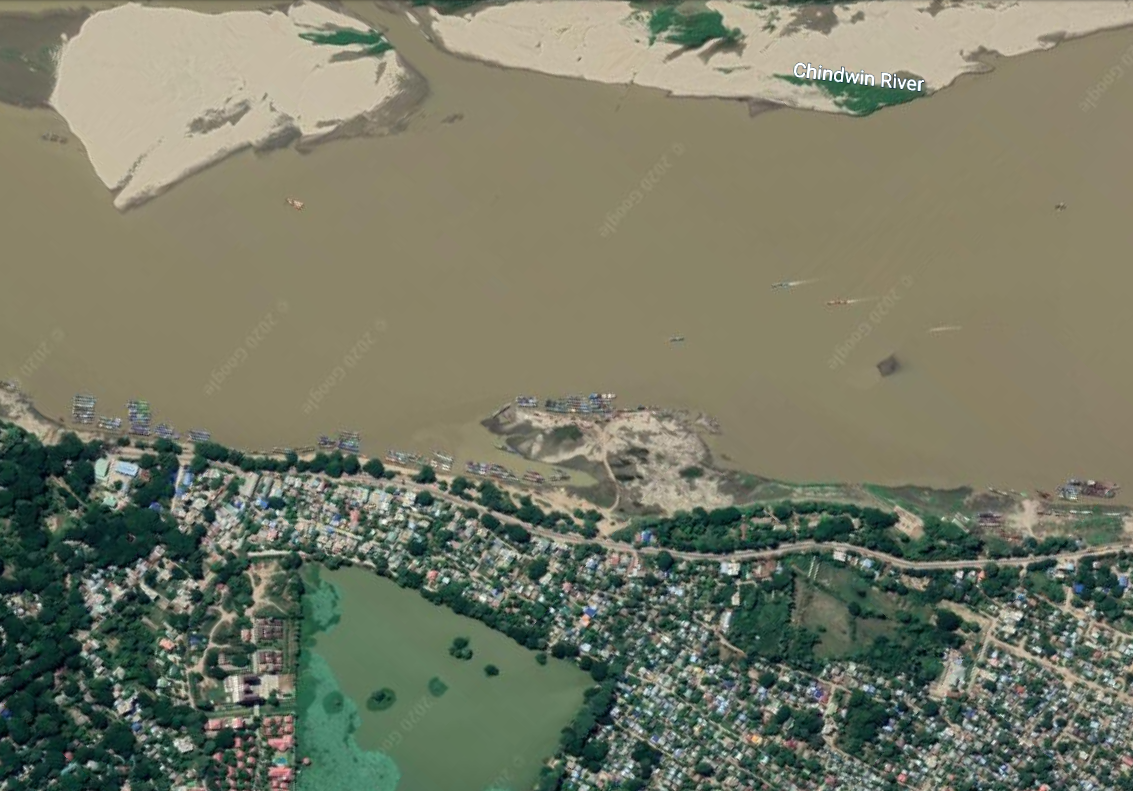
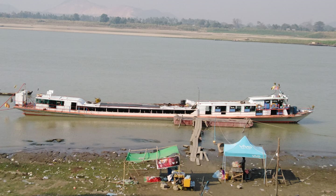
Monywa Passenger Port

Monywa Cargo Port
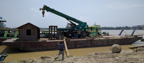
Barge with 25 MT crane at timber port
Description and Contacts of Key Companies
Inland Water Transport is responsible for registering port operations, but general cargo and passenger transport is managed by private companies. The main companies operating at Monywa are for general cargo: Aung Soe Moe Co., Chin Twin Gyi Co., Yae Zar Ni Co., and for passengers: Ayi Nyein Chan Thar Co., Shew Na Dazayar Co., and Moe Zin Yaw Co.,
Vessels for general cargo range from 30MT to 80MT capacity and most are individually operated and booked.
Located at the timber port is a transport company with 5 vessels and 14 trucks: Aung Mya Than Co., they have 5 landing vessels; 2 of 200MT (128x32x5.5ft draft), 1 of 300MT (165x32x5.5ft draft) and 2 of 700MT (200x50x9ft draft), Contact: Mr. Myo Win, Director, phone: +95-9-2131777.
Port Performance
Port performance in 2019 was approximately 40 vessels visit per day, average 1000 vessels per month. About 1,800 MT of cargo per month, mostly construction materials (cement, iron, corrugated sheets, food).
|
Seasonal Constraints |
||
|
Dry Season (low draft) |
Yes |
Mid-Nov to mid-May, boats take 50% cargo depending on the shallow channel draft. |
|
Major Import Campaigns |
No |
|
|
Other |
n/a |
|
|
Handling Figures (2019) |
|
|
Vessel Calls |
10,400 |
|
Container Traffic (TEUs) |
0 |
|
Handling Figures Bulk and Break Bulk (2019) |
|
|
Bulk (MT) |
0 |
|
Break bulk (MT) |
15,000 MT outgoing 3,500 MT incoming |
Discharge Rates and Terminal Handling Charges
The below are vessel docking charges MMK per vessel per visit period, charged by a private company under supervision of Directorate of Water Resources and Improvement of River System (DWRIRS).
Below 20 HP engine
- 200 MMK (small boat),
- 400 MMK (below 30 ft length of boat)
- 600 MMK (between 30~50 ft length of boat)
More than 20 HP Engine
- 700 MMK (20~ 30 MT capacity),
- 1200 MMK (30~40 MT capacity)
Big Vessel (40 and over HP Engine)
- 1,500 MMK (40~60 MT capacity),
- 2,000 MMK (60~80 capacity),
- 2,500 MMK (80~100 MT capacity),
- 4,500 MMK (100~200 MT capacity),
- 5,500 MMK (more than 200 MT capacity)
Ships are charged a standard fee for the use of the waterway by the Directorate of Water Resources and Improvement of River System (DWRIRS), under the Ministry of Transport & Communications. DWRIRS charges 0.20 Kyat/MT capacity/mile, per trip (rate as of Jun 2016). This is charged at the river stations Twantay, Nyaungdong, Pyay, Magway, Mandalay and Kathar and for the Chindwin river at Monywa and Kalewa.
Berthing Specifications
There are no jetties, vessels more directly on the river bank.
General Cargo Handling Berths
None
Port Handling Equipment
At the timber port, there is a barge with a 25 MT crane and a 35MT crane available.
|
Equipment |
Available |
Total Quantity and Capacity Available |
Comments on Current Condition and Actual Usage |
|---|---|---|---|
|
Dockside Crane |
No |
n/a |
|
|
Container Gantries |
No |
n/a |
|
|
Mobile Cranes |
Yes |
25MT and 35 MT on barge |
Tint Win Tun co., Mr. U Lwin Phone: 09-400455011 |
|
Reachstacker |
No |
n/a |
|
|
RoRo Tugmaster (w/ Trailer) |
No |
n/a |
|
|
Grain Elevator w/ Bagging Machines |
No |
n/a |
|
|
Transtrainer |
No |
n/a |
|
|
Forklifts |
No |
n/a |
|
Container Facilities
None.
Customs Guidance
There is no customs office available.
Terminal Information
Multipurpose Terminal
None
Grain and Bulk Handling
None
Main Storage Terminal
No storage facilities available at the port side.
Stevedoring
All loading and offloading activities are manually performed. Daily workers are arranged through the labour exchange office at the port. The daily labour rates are as follows:
- 2,000 MMK/MT for unskilled labour (only loading and offloading)
- 5000-8,000 MMK/day for unskilled labour
- 8,000-12,000 MMK/day for skilled labour. (includes record keeping, tally counting and managing stack)
Hinterland Information
There is a connection to roads at the general cargo/passenger and timber port. No railway connection is available.
Port Security
There is no port security and no perimeter fencing.
2.1.20 Myanmar Port of Pakokku
Port Overview
Pakokku port in the Magway Region is close to Nyaung-U Port, on the other side of the Ayeyarwaddy river. Most cargo activity takes place in the Nyang-U Latt Htout Jetty. Pakokku port is mainly used for small local passenger boats (6m long, 20HP engine boats). The port has no jetties or berths, vessels moor at the riverbank and use gangways for loading and unloading. Pakokku port is managed by the Inland Water Transport office in Nyaung-U. There is no congestion and no bottlenecks (no waiting time to dock). However, given its current conditions, most general cargo is transported by road due to shorter lead time (1/3 of waterway transportation). Humanitarian organizations based in Pakokku mainly utilize Monywa port (114 km away) instead of this port for cargo movement.
The channel draft in the dry season is average 2.12m (in Mid-Nov to Mid-May), and above 2,12m in the wet season. In the dry season the maximum draft is 1.3m (4.5ft) and in the wet season a maximum draft of 1.8m (6ft) is allowed. Maximum vessel size that are normally operating in the Ayeyarwaddy are 60mx12m (200ftx40ft) using 200 HP engines.
Port website: n/a
Key port information can also be found at: http://www.maritime-database.com
|
PORT LOCATION & CONTACT |
|
|
Country |
Myanmar |
|
Province or District |
Magway |
|
Town or City |
Pakokku (0.5 km) |
|
Port's Complete Name |
Port of Pakokku |
|
Latitude |
21.314100 |
|
Longitude |
95.056258 |
|
Managing Company or Port Authority |
Inland Water Transport office, Nyaung-U. |
|
Management Contact Person |
Mr. U Aung Cho Myint (Manager- Inland Waterway Department, Pakokku-Nyaung-U), Nyaung U Office Ph +95-62-21503 Mobile PH #-95-9-43008220 |
|
Nearest Airport and Airlines |
Pakokku airport - 15 km distance, currently not in use and the airport is planned to upgrade as international airport in future. Nyang-U airport - 40 km distance. (Myanmar National Airline, Air KBZ, MANN Yadanarpon airlines, Golden Myanmar Airlines, Asian Wings Airways, Myanmar Airways International) |
Port Picture
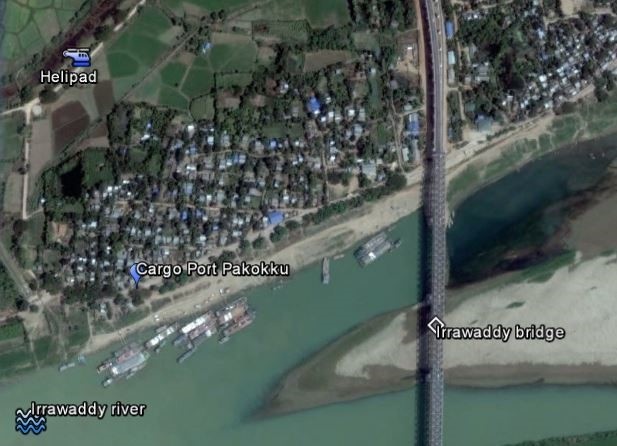
Pakokku port overview
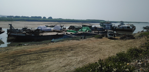
Pakokku cargo port
Description and Contacts of Key Companies
Private companies and boat owners who own individual boats operate mainly in Pakokku. No larger boat transport companies were found. Inland Water Transport can provide 30 m long passenger boats that have cabins and max. 5 MT cargo capacity.
For more information on port contacts, please see the following link: 4.4 Port and Waterways Companies Contact List.
Port Performance
Cargo handling is approximately 1000 MT/month in Pakokku (rice, pulses, lumber). There is no container handling capacity.
|
Seasonal constraints |
||
|
Dry Season |
No |
Mid-Nov to mid-May, shallow draft. Boats take less than 50% cargo depending on the channel draft. Restricted draft to max. 1.3m (4.5 ft) |
|
Major Import Campaigns |
Yes |
Busy during Oct-Dec, harvest season |
|
Handling Figures (2019) |
|
|
Vessel Calls: |
180 /month |
|
Container Traffic: (TEUs) |
None |
|
Handling Figures Bulk and Break Bulk (2019) |
|
|
Bulk (MT) |
10,800 MT |
|
Break bulk (MT) |
0 |
Discharge Rates and Terminal Handling Charges
Ships are charged a standard fee for the use of waterway by the Directorate of Water Resources and Improvement of River System (DWRIRS), under the Ministry of Transport & Communications. DWRIRS charges 0.20 Kyat/MT capacity/mile, per trip (rate as of Jun 2016). This is charged at the river stations Twantay, Nyaungdong, Pyay, Magway, Mandalay and Kathar.
General Cargo Handling Berths
None
Port Handling Equipment
There is no stand-by port handling equipment, manual labour is the most common choice. A mobile crane with a limited capacity of 2.5 to 5 MT is available from two local companies: U Khin Ko Ph#+95-62-21966/ -9-6570217/ -9-2300168 and U Khin Maung Gyi Ph (+95-9-7777790/777778890).
|
Equipment |
Available |
Total Quantity and Capacity Available |
Comments on Current Condition and Actual Usage |
|
Dockside Crane |
No |
2 mobile cranes, Max 5MT capacity can be hired. |
Normally manual labour is used. |
|
Container Gantries |
No |
||
|
Mobile Cranes |
No |
||
|
Reachstacker |
No |
||
|
RoRo Tugmaster (w/ Trailer) |
No |
||
|
Grain Elevator w/ Bagging Machines |
No |
||
|
Transtainer |
No |
||
|
Forklifts |
No |
Container Facilities
None.
Customs Guidance
No customs office is available
Terminal Information
Multipurpose Terminal
None
Grain and Bulk Handling
None
Main Storage Terminal
None.
Stevedoring
The daily labour rate is 2000 Kyatt/MT for unskilled labour. The labourers are contracted by the business people themselves. Daily rate 3000-6000 Kyatt/day for unskilled labour. 8000-12000 Kyatt/day for skilled labour.
The daily labour rates are :
- 2,000 MMK/MT for unskilled labour (only loading and offloading).
- 5000-8,000 MMK/day for unskilled labour
- 8,000-12,000 MMK/day for skilled labour (includes record keeping, tally counting and managing stack).
Hinterland Information
Road option available only. There is no connection to the railroad.
Port Security
No security, the port is not fenced.
2.1.21 Myanmar Myitnge Dry Port
Port Overview
Myitnge Dry Port was officially launched in January 2019. The Myitnge Dry Port is located at a strategy location in Myitnge, Amarapura Township, Mandalay. Mandalay is a central transportation hub with inland connection leading to Tamu near India, Muse near China, and Tachileik near Thailand. The Dry Port is 13km away from the Mandalay downtown, 13.8 km away from Mandalay Chanmyathazi airport and 23 km away from Mandalay International airport. Since the Dry Port is located just outside of the downtown area, its operation is less affected by rush hour traffic.
The Dry Port, as an inland intermodal terminal with road and rail connection, was constructed and operated under a Build-Operate-Transfer (BOT) system through the partnership between KM Terminal and Logistics Ltd (a joint-ventured company of Singapore-based Kerry logistics Network Ltd and Myanmar-based Mother Logistics Co. Ltd) and a local company, Resource Group Logistics Co., Ltd. It is part of the November 13 inter-governmental agreements to construct dry ports along Asian railway routes under the auspices of the United Nations’ Economic and Social Commission for Asia and the Pacific. A total of eight dry ports was planned to be construct in Myanmar under this agreements (in Yangon, Mandalay, Tamu, Muse, Mawlamyine, Bago, Monywa and Pyay). Two of these Dry Ports, Yangon Ywar Thar Gyi Dry Port and Mandalay Myitnge Dry Port, have been completed and are operational currently operational.
Myitnge Dry Port is divided into 2 locations, Plot A and Plot B. Resource Group Logistics Co. Ltd. is operating in Plot A with a total of 34.71 Acres and KM Terminal and Logistics Ltd is operating in Plot B which has 42.67 Acres. Its facilities comprise of Container Freight Station (CFS), General Warehouse, Bonded Warehouse, Container yard (CY), Reefer Plugs, Rail tracks, Empty Depot, Customs clearance area, Customs office, Operator’s office, Parking area and Maintenance workshop. It also offers Freight train cargo services 2 times a week between Mandalay Myitnge Dry Port and Yangon Ywar Thar Gyi Dry Port route using total 27 wagons with max loading capacity at 32 tons / wagon (Wagon Payload Dimension: Max width 8’, height 8’6”, length 40’). 24 wheeler-forty feet tractors with maximum capacity of 30 tons each for the land transportation service that also provide last mile delivery service, door-to-door pick up services, long and short haul deliveries and offers tracking of truck movements.
Since the dry port offers long-term and short-term storage space rental service as well as door to door transportation service, the dry port could be one of a suitable location for humanitarian response in case of a large-scale emergency that takes place in central Myanmar.
Dry Port Picture
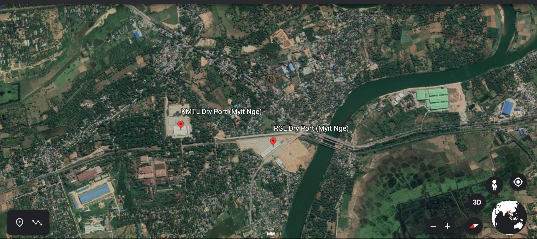
KM Terminal and Logistics Ltd (Myitnge Dry Port)
Dry Port Overview
KM Terminal and Logistics Ltd is a joint-ventured company of Singapore-based Kerry logistics Network Ltd and Myanmar-based Mother Logistics Co. Ltd. KM Terminal and Logistics operate a 42.67 Acres Dry Port in Myitnge, Amarapura Township, Mandalay. A scheduled rail transportation service runs between Yangon Ywar Thar Gyi Dry Port and Mandalay Myitnge Dry Port to support trading between lower and upper Myanmar and to extend trading toward neighboring countries. Currently, the facilities available for 150,000 TEUs, Reefer Plugs 12, Rail 3 tracks, General Warehouse 6945 Sq. m., Bonded Warehouse 2377.5 Sq. m., Container Freight Station 1000 Sq. m., Empty Depot 10000 TEUs and other equipment’s including Reach Stacker 45 Tons, Forklift 3 tons and 5 tons, Reach Truck and 22 wheels truck with Trailer. The services include Container handling and storage, Container stripping and stuffing, Container Maintenance and Cleaning, Breakbulk and Bulk cargo handling and storage, Cargo Insurance, On-site Weight scale machine and Import-Export duty exemption for re-exportation of cargo.
Port website: www.kerrylogistics.com
|
Port Location and Contact |
|
|---|---|
|
Country |
Myanmar |
|
Province or District |
Mandalay |
|
Nearest Town or City with Distance from Port |
Mandalay City/ 13 km from downtown of Mandalay |
|
Port's Complete Name |
KM Terminal and Logistics Ltd (Myitnge Dry Port) |
|
Latitude |
21.853889 |
|
Longitude |
96.073056 |
|
Managing Company or Port Authority |
KM Terminal and Logistics Ltd |
|
Management Contact Person |
U Mg Mg Htwe Senior Admin Officer +95-9-2014294, Email: Mg.MgHtwe@kerrylogistics.com Office: +95-9-0255041, 55042, 55044 (fax) |
|
Nearest Airport and Airlines with Frequent International Arrivals/Departures |
Airport Name: Mandalay International Airport Airlines: Please see in the airport information |
Dry Port Picture
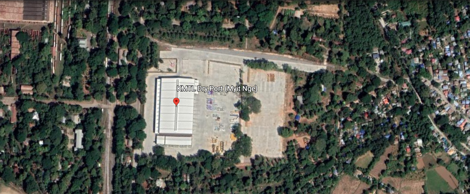
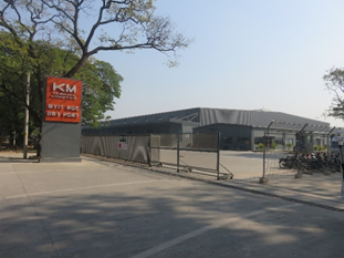
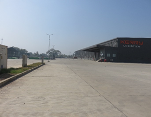
Description and Contacts of Key Companies
KM Terminal and Logistics (Myitnge Dry Port) port is developed and operated by KM Terminal and Logistics Ltd. For more information on port contacts, please see the following link: 4.4 Myanmar Port and Waterways Company Contact List
Dry Port Performance
150,000 TEUs, Reefer Plugs 12, Rail 3 tracks, General Warehouse 6945 Sq. m., Bonded Warehouse 2377.5 Sq. m., Container Freight Station 1000 Sq. m., Empty Depot 10000 TEUs and other equipment’s including Reach Stacker 45 Tons, Forklift 3 tons and 5 tons, Reach Truck and 22 wheels truck with Trailer.
|
Seasonal Constraints |
|
|---|---|
|
Rainy Season |
No |
|
Major Import Campaigns |
N/A |
|
Other Comments |
N/A |
Dry Port Handling Equipment
|
Equipment |
Available |
Total Quantity and Capacity Available |
Comments on Current Condition and Actual Usage |
|---|---|---|---|
|
Dockside Crane |
No |
|
|
|
Container Gantries |
No |
|
|
|
Mobile Cranes |
No |
|
|
|
Reachstacker |
Yes |
45 Tons capacity (1 unit) |
Operational |
|
RoRo Tugmaster (with Trailer) |
No |
|
|
|
Grain Elevator with Bagging Machines |
No |
|
|
|
Transtainer |
No |
|
|
|
Forklifts |
Yes |
2 Tons (1 unit) 3 Tons (2 units) 5 Tons (2 units) |
Operational |
Container Facilities
|
Facilities |
20 ft. |
40 ft. |
|---|---|---|
|
Container Facilities Available |
Yes, 150,000 TEUs, including Container Maintenance and Cleaning |
Yes |
|
Container Freight Station (CFS) |
Yes 1,000 Sq. m. |
Yes |
|
Refrigerated Container Stations |
No |
No |
|
Other Capacity Details |
150,000 TEUs, Reefer Plugs 12, Rail 3 tracks, General Warehouse 6945 Sq. m., Bonded Warehouse 2377.5 Sq. m., Container Freight Station 1000 Sq. m., Empty Depot 10000 TEUs |
Yes |
|
Daily Take Off
Capacity |
N/A |
N/A |
|
Number of Reefer
Stations |
12 Reefer Stations, also 3 Rail tracks |
|
|
Emergency Take-off Capacity |
N/A |
N/A |
|
Off-take Capacity of Gang
Shift |
N/A |
N/A |
Customs Guidance
A customs office is set up at KTML compound. Customs services are available during 10:00 ~ 17:00 / from Monday to Friday (excluding National Holidays). For information on customs, please see the following link: 1.3 Myanmar Customs Information.
Terminal Information
Main Storage Terminal
|
Storage Type |
Number of Storage Facilities |
Area (square meters) |
|---|---|---|
|
Bagged Cargo |
n/a |
n/a |
|
Refrigerated Cargo |
n/a |
n/a |
|
General Cargo |
1 |
6,945.5 Sq. m. |
There is also a bonded warehouse (2,377.5 Sq. m.), a Container Freight Station 1,000 Sq. m. and an Empty Depot with capacity of up to 10,000 TEUs
Dry Port Security
Port Security is managed by KTML Security Staffs. There is a CCTV system in place, handheld metal detectors and Fire Fighting System such as pumps, water storage, supply lines and fire hydrants, fire extinguishers are in place.
|
Security |
|
|---|---|
|
ISPS Compliant |
Yes |
|
Current ISPS
Level |
2 |
|
Fire Engines |
Yes, Fire Fighting System in place |
Resources Group Logistics Co., Ltd. (Myitnge Dry Port)
Dry Port Overview
RG Logistics Co. Ltd is a local company and is operating a 34.71 Acres in Myitnge Dry Port, Amarapura Township, Mandalay. The Dry Port offers scheduled rail transportation services between Yangon Ywar Thar Gyi Dry Port and Mandalay Myit Nge Dry Port. The facilities and services available for 1,100 TEUs, Reefer Points 16 units, Rail 2 tracks, General Warehouse (4600 Sq. m.), Bonded Warehouse (4600 Sqm), Container Freight Station (4600 Sq. m.) and other equipment’s including Reach Stacker 45 Tons, Forklift 2~10 tons and 24 wheels truck 40 feet with Trailer. The services provided includes Container handling and storage, Container stripping and stuffing, Breakbulk cargo handling and storage, Bulk cargo handling and storage, Container light repairs, Freight forwarding and cargo consolidation services, Banking/insurance/financial services.
Port website: https://www.rglogisticsmm.com/mdy-dry-port
|
Port Location and Contact |
|
|---|---|
|
Country |
Myanmar |
|
Province or District |
Mandalay |
|
Nearest Town or City with Distance from Port |
Mandalay City/ 13 km from downtown of Mandalay |
|
Port's Complete Name |
Resource Group Logistics Co., Ltd (Myitnge Dry Port) |
|
Latitude |
21°50'50"N |
|
Longitude |
96°04'06"E |
|
Managing Company or Port Authority |
Resource Group Logistics Co., Ltd |
|
Management Contact Person |
U Soe Min Shin Operational Manager +95-9-765121045, Email: contact@rglogisticsmm.com Website: https://www.rglogisticsmm.com/mdy-dry-port Telephone: Dry Port: +959 899880 202, 303,404 Transport: +959 893161 588, 589 |
|
Nearest Airport and Airlines with Frequent International Arrivals/Departures |
Airport Name: Mandalay International Airport Airlines: Please see in the airport information |
Dry Port Picture
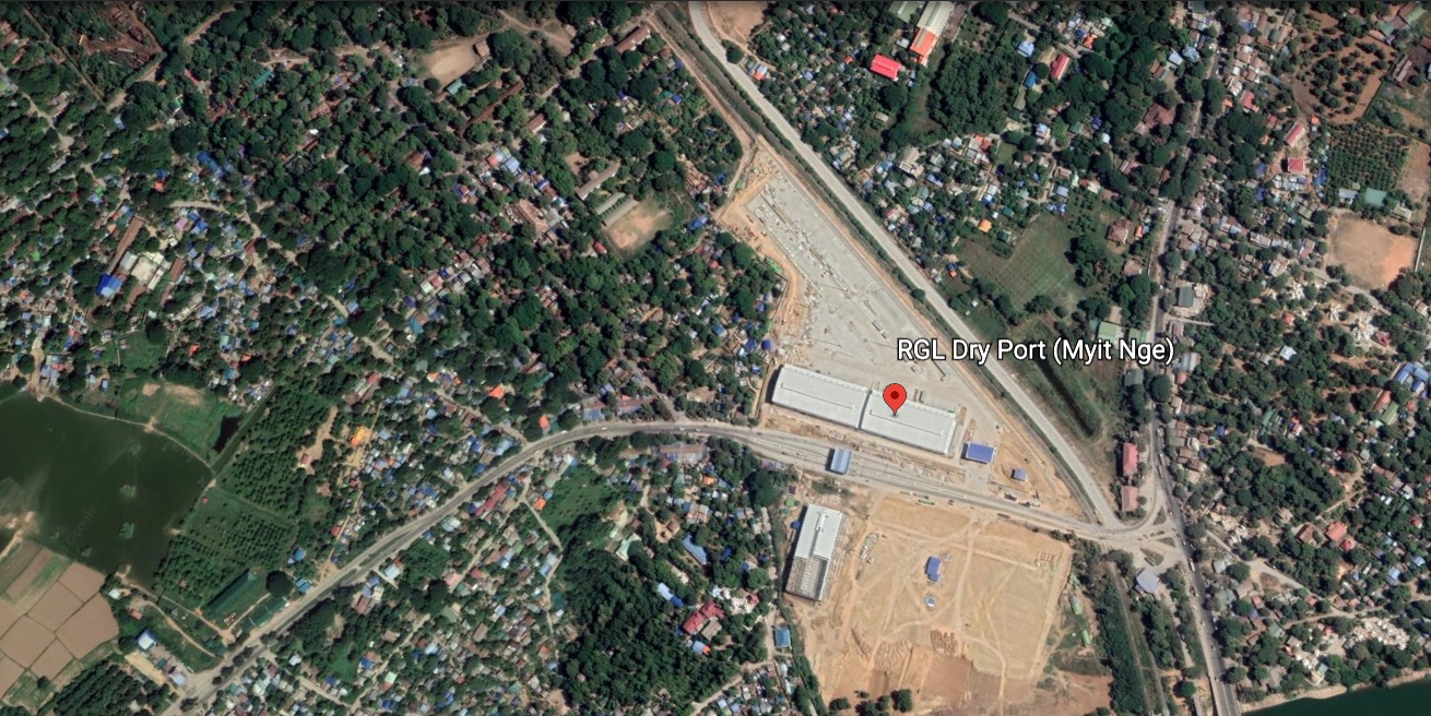
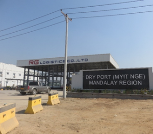
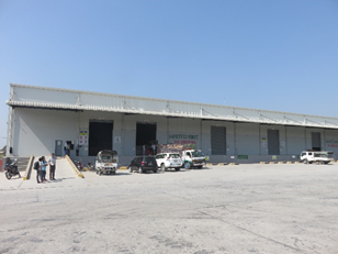
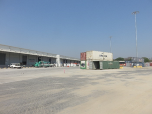
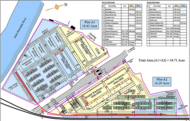
Description and Contacts of Key Companies
RG Logistics (Myitnge Dry Port) is developed and operated by Resource Group Logistics Ltd. For more information on port contacts, please see the following link: 4.4 Myanmar Port and Waterways Company Contact List.
Dry Port Performance
Container Yard 1,100 TEUs, Reefer Plugs 16, Rail 2 tracks, General Warehouse 4600 Sq. m., Bonded Warehouse 4600 Sq. m., Container Freight Station 4600 Sq. m., and other equipment’s including Reach Stacker 45 Tons, Forklift 2,3,4,7 and 10 tons and 24 wheels truck with Trailer. RG Logistics is running Dry Port operation with about 100 staffs (permanent staffs 40 and casual labor 60) daily.
|
Seasonal Constraints |
||
|---|---|---|
|
|
Occurs |
Time Frame |
|
Rainy Season |
No |
|
|
Major Import Campaigns |
N/A |
N/A |
|
Other Comments |
N/A |
|
Dry Port Handling Equipment
|
Equipment |
Available |
Total Quantity and Capacity Available |
Comments on Current Condition and Actual Usage |
|---|---|---|---|
|
Dockside Crane |
No |
|
|
|
Container Gantries |
No |
|
|
|
Mobile Cranes |
No |
2.5 Tons capacity |
Operational |
|
Reachstacker |
Yes |
1.45 Tons capacity |
Operational |
|
RoRo Tugmaster (with Trailer) |
No |
|
|
|
Grain Elevator with Bagging Machines |
No |
|
|
|
Transtainer |
No |
|
|
|
Forklifts |
Yes |
2 Tons (6 units) 3 tons (3 units) 4 tons (2 units) 7 tons (1 unit) 10 tons (1unit) |
Operational |
Container Facilities
|
Facilities |
20 ft. |
40 ft. |
|---|---|---|
|
Container Facilities Available |
Yes, 1,100 TEUs |
Yes |
|
Container Freight Station (CFS) |
Yes 4,600 Sq. m. |
Yes |
|
Refrigerated Container Stations |
No |
No |
|
Other Capacity Details |
Reefer Plugs 16, Rail 2 tracks, General Warehouse 4600 Sq. m., Bonded Warehouse 4600 Sq. m., Container Freight Station 4600 Sq. m. |
Yes |
|
Daily Take Off
Capacity |
N/A |
N/A |
|
Number of Reefer
Stations |
16 Reefer Stations, also 2 Rail tracks |
Yes |
|
Emergency Take-off Capacity |
N/A |
N/A |
|
Off-take Capacity of Gang
Shift |
N/A |
N/A |
Customs Guidance
Currently custom service is not available yet in RG Logistics Myitnge Dry Port and expect to provide service around Mid of 2020.
Terminal Information
Main Storage Terminal
|
Storage Type |
Number of Storage Facilities |
Area (square meters) |
|---|---|---|
|
Bagged Cargo |
n/a |
n/a |
|
Refrigerated Cargo |
n/a |
n/a |
|
General Cargo |
1 |
4,600 Sq. m. |
There is also bonded warehouse 4600 Sq. m. and Container Freight Station 4600 Sq. m.
Dry Port Security
Port Security is managed by RG Logistics Security Staffs. There is a CCTV system in place, handheld metal detectors and Fire Fighting System like are pumps, water storage, supply lines and fire hydrants, fire extinguishers in place.
|
Security |
|
|---|---|
|
ISPS Compliant |
Yes |
|
Current ISPS
Level |
2 |
|
Fire Engines |
Yes, Fire Fighting System in place |
2.2 Myanmar Aviation
Myanmar Aviation

4.5 Myanmar Airport Company Contact List
Key airport information may
also be found at: World Aero Data information on
Myanmar
Overview
This logistics capacity assessment does not include review of military airports.
Myanmar has three international airports: Yangon, Mandalay and Naypyitaw, of which Yangon has most handling capacity for passengers and cargo. Mandalay and Naypyitaw airport normally don’t handle cargo (except luggage) and have few international flights. There is a limited number of helicopter companies available, who mainly operate for the natural gas and oil industry and avoid to fly cargo at high altitudes in the mountains. Obtaining permission, registration and certification for foreign registered aircraft to operate inside Myanmar for emergencies can be a lengthy and complicated process.
Airports assessed for this LCA include the following
|
Location |
Region |
Type |
Status |
|
Yangon |
Yangon |
International |
Operational |
|
Mandalay |
Mandalay |
International |
Operational |
|
Naypyitaw |
Naypyitaw |
International |
Operational |
|
Mawlamyine |
Mon state |
Domestic |
1x/Week use |
|
Dawei |
Tanintharyi |
Domestic |
Operational |
|
KawThaung |
Tanintharyi |
Domestic |
Operational |
|
Myeik |
Tanintharyi |
Domestic |
Operational |
|
Nyaung-U |
Mandalay |
Domestic |
Operational |
|
Pyay |
Bago |
Domestic |
Not in use |
|
Magway |
Magway |
Domestic |
Not in use |
|
Pakokku |
Magway |
Domestic |
Not in use |
|
Mandalay Chanmyathazi |
Mandalay |
Domestic |
2x/Week use |
|
Kale |
Sagaing |
Domestic |
Operational |
|
Monywa |
Sagaing |
Domestic |
Operational |
|
Loikaw |
Kayah State |
Domestic |
Operational |
|
Heho |
Shan State |
Domestic |
Operational |
Myanmar has been a member of the International Civil Aviation Organization (ICAO) since 8-Aug-1948 and a member of the Cooperative Development of Operational Safety and Continuing Airworthiness Programme, (COSCAP) South East Asia, established in 1998.
The Department of Civil Aviation (DCA), under the Ministry of Transport is responsible for the safe, smooth and secure operation of both domestic and international air transport in accordance with the Union of Myanmar Aircraft Act (XXII, 1934), Aircraft rules (1937, 1920 part IX) carriage by Air Act (XX, 1934) and aircraft public health rules. It’s services include:
- Air Traffic Services
- Communication and Radio Navigation Facilities
- Licensing of pilots and aircraft maintenance engineers and flight checks
- Construction, maintenance and management of airports
- Airworthiness Control
- Issue of permits and licenses to domestic and international airlines
- Conclusion of bilateral air agreements
- Relations with ICAO and other international organizations
- Training of civil aviation personnel
As of June 2016, there are about 28 international airlines and 10 domestic airlines that operate regular flights, servicing 20 regional destinations. In 2013 there were in total two runway-safety related air accidents in Myanmar with no fatalities, both by Myanmar Airways. Myanmar’s domestic airlines have varying levels of flight safety: Some are operating older aircraft and some may have had no recognized air operator audit or their regulatory oversight is below target.
|
Domestic Airlines operating in Myanmar (Jun 2016) |
||
|
Airline |
ICAO code |
IATA code |
|
Air Kanbawza (KBZ) |
KBZ |
KZ |
|
Air Mandalay |
AMY |
6T |
|
APEX Airlines |
- |
SO |
|
Asian Wings Airways |
AWM |
AW |
|
Golden Myanmar Airlines |
GMR |
Y5 |
|
Mann Yadanarpon Airlines |
MYP |
7Y |
|
Myanmar National Airlines |
UBA |
UB |
|
Myanmar Airways International |
MMA |
8M |
|
Union Express Charter line |
- |
- |
|
Yangon Airways |
AYG |
HK |
Source: ICAO (Publisher), ICAO safety report 2014 edition, http://www.icao.int/safety/documents/icao_2014%20safety%20report_final_02042014_web.pdf , Date accessed: 27 Nov 2014.
DCA (Publisher) Department of Civil Aviation, http://www.mot.gov.mm/dca/ , Date accessed: 17 Nov 2014.
DCA (Publisher) Aircraft Manual, 31-Mar-2010, http://www.dca.gov.mm/images/dcafiles/files/MyanmarAircraftManual_2010.pdf, Date accessed: 17 Nov 2014.
UNDP (Publisher) Commercial Aviation Risk Management Guidelines, ISMN https://info.undp.org/global/popp/sm/pages/commercial-aviation-risk-management.aspx , Date accessed: 27 Nov 2014.
Procedures for Foreign Registered Aircraft
Aircraft flying into or departing from Myanmar must make their first landing or final departure from an international airport. The airline operator must obtain a permit to operate and a certificate of registration from the DCA. For clearance of entry and departure the following documents must be submitted to airport Customs, Immigration and Health according to ICAO standard: General declaration (5 copies), Passenger manifest (10 copies) and cargo manifest (3 copies) including commercial invoice, certificate of origin and certificate of value.
All aircraft operating in or over Myanmar must carry on board the certificate of registration, licences of the personnel, certificates of airworthiness, journey logbook, aircraft technical logbook and radio station permit or licence issued by the Director General of Post & Telecommunication Department. Certificates of airworthiness issued by EASA or FAA will be automatically accepted.
For clearance of non-scheduled flights, the airline operator must apply for a permit to the Director General of the DCA at least 7 days in advance for over flights and 14 days in advance for landings. The following information must be provided: name of operator, billing address, type of aircraft and aircraft registration, full itinerary, purpose of over flight or landing, consignee/consignor or charterer, contact details, local sponsor’s name and contact details, names & nationalities of passengers and/or type and nature of cargo with consignee/consignor. Consignors of dangerous cargo must apply for a permit for carriage of dangerous cargo by air to the Director General of the DCA and in copy to the Technical Director of the DCA.
In case of a complex emergency or natural disaster, permission for the import of food, humanitarian relief items and rehabilitation materials must be obtained in advance from the National Natural Disaster Management Committee. (ref: Natural Disaster Management Law, 31 Jul 2013). Airline operators are recommended to contact the Aeronautical Information Services (http://www.ais.gov.mm) for the aeronautical information essential to navigation and to obtain NOTAM (notice to Airmen) for the latest information.
Diplomatic flights should be applied for through diplomatic channels through DCA and by informing the Ministry of Foreign Affairs.
Acceptance of foreign military aircraft: No foreign military aircraft may fly over or land in Myanmar except with the invitation or permission in writing of the president of the Union. (ref. part XV, 158, Union of Myanmar aircraft rules, 1937)
Immigration: People entering Myanmar must have a valid entrance visa (normally valid for 90 days and limited to a 28 days stay) or re-entry visa for resident aliens, obtained through a Myanmar embassy abroad or, for tourism purpose only and for citizens of the listed 67 countries, obtained through the government e-visa website: http://evisa.moip.gov.mm. Visa-on-arrival is possible since 1-June-2012 at Yangon Airport for citizens of the listed 43 countries for a business visa, entry visa or 24hr transit visa. For terms and conditions to obtain Visa-on-arrival see: http://www.mip.gov.mm/portfolio/the-required-terms-and-conditions-for-visa-on-arrival/. Flight crew do not require a valid passport and visitor’s visa if they retain their licence do not leave the airport and return on the same aircraft.
For standard and official application documents relevant to the registration of foreign aircraft contact the Department of Civil Aviation. Department of Civil Aviation, http://www.mot.gov.mm/dca/
Source: DCA, Aeronautical Information Publication, AIP 3rd edition 2002, amendment 2/14 1 April 2014. http://www.ais.gov.mm
2.2.1 Myanmar Yangon International Airport
Airport Overview
Yangon International Airport (RGN) was built in 1947 and the first expansion was in May 2007. Over the last few years, Myanmar has seen tremendous growth in visitor traffic and the Yangon International Airport being the main gateway into Myanmar. Thus, the second expansion was started in 2015. The new T1 international terminal was opened in 2016 and T3 was started operating one year after the T1 official opening. Renovation of the T2 is undergoing. This expansion in capacity and integration of facilities aims to serve up to 20 million passengers per annum. In 2019, YIA handled a total of 6.5 million passengers. With 37 international airlines operate to and from 38 international destinations, while five airlines operate our domestic routes. Although the passenger traffic increased, air traffic movements decreased in 2019 to 71,988 landings from 72,242 in 2018 as many airlines upgrade their aircraft to bigger align with the high passenger demand.
Other features include:
- Automated baggage handling system, integrated check-in system
- Four air bridges, capable of handling four Boeing 747s
- Two-story car park with spaces for 340 vehicles.
- VIP section and premium lounge areas
- A custom warehouse
- Mingalardon cargo terminal, operated by Mingalardon Cargo Services
|
Airport Location and Contact |
|
|---|---|
|
Country |
Myanmar |
|
Province or District |
Yangon |
|
Nearest Town or City |
Yangon (0 km) |
|
Airport’s Complete Name |
Yangon International Airport |
|
Latitude |
16.90722 |
|
Longitude |
96.13306 |
|
Elevation (ft and m) |
109 ft / 33 m |
|
IATA Code |
RGN |
|
ICAO Code |
VYYY |
|
Managing Company or Airport Authority |
Department of Civil Aviation |
|
Management Contact Person |
N/A |
|
Open From (hours) |
24 hours |
|
Open To (hours) |
24 hours |
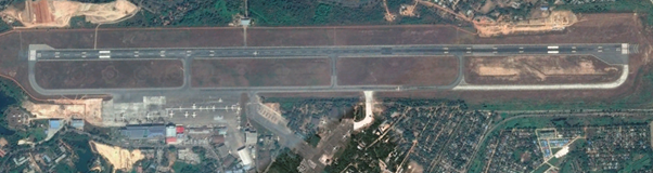
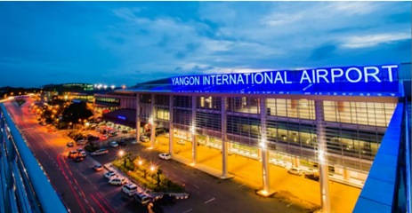
For information on Myanmar airport contact details, please see the following link: 4.5 Myanmar Airport Company Contact List
Runways
The runway is 3,414 m long and can handle Boeing 747-400 airplanes to use the airport.
|
Runway #1 |
|
|---|---|
|
Runway Dimensions |
3,414m x 61 m |
|
Orientation |
03 - 21 |
|
Surface |
Asphalt-concrete PCN 56/R/C/X/T |
Helicopter Pad(s)
There is no designated area with helicopter pads at the airport. The runway is used regularly by helicopters, chartered by the oil and gas business, for flights serving platforms off the coast. Non-scheduled public air traffic with helicopters is permitted only after prior approval from the Department of Civil Aviation. The approval shall be made via the company or directly to the YACL office during working hours and if possible, no later than the day before the flight is to be carried out. The approval of traffic shall contain 1) owner/ operator 2) type of helicopter, registration/ call sign and 3) arrival date and time / departure time, destination(s).
Reference for helicopter landing requirements: https://dcamyanmar.com/dcadca/images/dcafiles/files/DCA2017/FSD2017/MCAR_Part_14_1stEd_July2018.pdf.
|
Helipad #1 |
|
|---|---|
|
Present (Yes / No) |
No |
|
Largest helicopter that can land |
Bell 295 A-1 |
|
Width and Length (metres) |
46m x 829m |
|
Surface |
Smooth Asphalt |
Airport Infrastructure Details
|
Customs |
Yes |
JET A-1 fuel |
Yes |
|---|---|---|---|
|
Immigration |
Yes |
AVGAS 100 |
Yes |
|
Terminal Building |
Yes |
Single Point Refueling |
Yes |
|
Passenger Terminal |
Yes |
Air Starter Units |
Yes |
|
Cargo terminal |
Yes |
Ground Power (mobile) |
Yes |
|
Pax transport to airfield |
Yes |
Ground Handling Services |
Yes |
|
Control Tower |
Yes |
Latrine Servicing |
Yes |
|
Weather Facilities |
Yes |
Fire Fighting Category (ICAO) |
Yes – CAT 9 |
|
Catering Services |
Yes |
De-icing Equipment |
No |
|
Base Operating Room |
Yes |
Parking Ramp Lighting |
Yes |
|
Airport Radar |
Yes |
Approach & Runway Lights |
Yes |
|
NDB |
Yes / YGN |
VOR |
Yes / BGO - HGU |
|
ILS/LLZ |
Yes / IYGN |
ILS/GP/DME |
Yes / IYGN |
Approach & Runway Lighting
|
RWY Designator |
APCH LGT type LEN INTST |
RTHL color WBAR |
VASIS (MEHT) PAPI |
RTZL |
RCLL LEN, spacing, color, INTST |
REDL LEN, spacing, color, INTST |
RENL color, WBAR |
STWL LEN, color |
|---|---|---|---|---|---|---|---|---|
|
3 |
SALS 420 M (from Threshold-White) LIH |
Green |
PAPI 23.9 M |
Nil |
White (Spacing 30 M - Central Part of RWY; Final 900 MT to 300 MT of RWY (white); Altn; Red and White, Final 300 MT of runway; Red Inset High Intensity) |
White (Spacing 60 M, final 600 MT of RWY end; Yellow High Intensity) |
Red |
Nil |
|
21 |
PALS CAT I 900 M (from Threshold – white) LTH |
Green |
PAPI 23.1 M |
Nil |
White (Spacing 30 M - Central Part of RWY; Final 900 MT to 300 MT of RWY (white); Altn; Red and White, Final 300 MT of runway; Red Inset High Intensity) |
White (Spacing 60 M, final 600 MT of RWY end; Yellow High Intensity) |
Red |
Nil |
Other Lighting, Secondary Power Supply
|
ABN/IBN location, characteristics, and hours of operation |
ABN: ELEVATED TANK 165401N 0960805E, Altn Flg WG |
|---|---|
|
LDI location and LGT Anemometer location and LGT |
Nil |
|
TWY edge and center line lighting |
TWY Edge: Blue Center line Light: Nil |
|
Secondary power supply / switch over time |
2x450 KVA / 15 Seconds |
Passenger and Cargo Performance Indicator
|
Performance for 2019 |
Annual Figures |
Monthly |
Daily |
|---|---|---|---|
|
Total aircraft movements |
37 international airlines operate to and from 38 international destinations, while five airlines operate our domestic routes. |
n/a |
n/a |
|
Total passengers |
[1]The latest airport expansion of YIA allows handling of estimated 20 million passengers a year. The airport handles total 6.5 million passengers in 2019. Source: http://www.dca.gov.mm/ |
Estimated 228,389 passengers in December 2019 |
n/a |
|
Total capacity of the airport (metric tons) |
14,760 |
1,230 |
40 |
|
Current activity of the airport (metric tons) |
12,000 |
1,000 |
21 |
|
Current use by Humanitarian flights (UNHAS) |
n/a |
n/a |
n/a |
[1]https://www.asiaworldcompany.com/index.php/news/subsidiary/42-yangon-international-airport-opens-new-international-terminal-for-operations
Handling Services and Facilities
|
Cargo handling facilities |
YACL Cargo Terminal Mobile Conveyer belt: 2,273 kg (5,000 lb.) Main deck loader: 5,455 kg (12,000 lb.) Forklift: 1 of 5 Ton; 2 of 3 Ton – High lift loader conveyor belts, Transporter, Tow tractor, Container pallet dollies |
|---|---|
|
Fuel/oil types |
Fuel: JET, A1 Oil: Nil |
|
Fueling facilities / capacity |
Hydrant system / underground – 697,500 Liters, 4 fuel pits (at Terminal 2 – Stands 8 to 11) (Deport – 1) / 6,200,000 Liters (Deport – 2) JET A1 delivered by hydrant 1000 Liter/min |
|
De-icing facilities |
Nil |
|
Hangar Space for Visiting Aircraft |
Nil |
|
Repair Facilities for Visiting Aircraft |
Available repair for ATR 42, ATR 72 and B737 with limited spares. Capacity for engine replacement and structure light repair. |
Rescue Services
|
Rescue Equipment |
CAT 9 |
|---|---|
|
Capability for removal of disabled aircraft |
2 Cranes with 50 Ton capacity 1 Crane with 30 Ton capacity Several light equipment |
Airport Operating Details
|
Operating Details |
|||
|---|---|---|---|
|
Maximum sized aircraft which can be offloaded on bulk cargo: |
Boeing 747-400 |
||
|
Maximum sized aircraft that can be offloaded on pallet |
Boeing 747 / Airbus 300 |
||
|
Total aircraft parking area (m²) |
133,829 sqm |
||
|
Storage Area (mt) |
536 sqm |
Cubic Meters (m³) |
2,867 m³ |
|
Cargo Handling Equipment Available (Yes / No) |
Yes |
If "Yes" specify below |
|
|
Elevators / Hi Loaders (Yes / No) |
Yes |
Max Capacity (mt) |
n/a |
|
Can elevators / hi loaders reach the upper level of a B747 (Yes / No) |
Yes |
||
|
Loading Ramps (Yes / No) |
n/a |
||
Storage Facilities
Mingalardon Cargo Services (MCS), a subsidiary of the Htoo
Group, operates the Mingalardon Cargo Terminal, which has cargo
facilities and cargo handling equipment. MCS is the sole cargo
handling company at Yangon airport, it’s services include: import
and export cargo handling, labelling, plastic stretch wrapping of
pallets and cargo.
Company Website: http://www.mcscargo.com.
Next to the Mingalardon Cargo Terminal, Customs has a warehouse. Air cargo can be stored in the customs-bonded warehouse for up to two weeks.
Cargo handling equipment of MCS includes:
- 4 Weight scales (2 units 500kg, 2 units 10,000kg)
- 2 cargo X-ray units
- CCTV camera system
- 3 Forklifts (3 MT, 4.5 MT and 1.4 MT)
- Mobile conveyer belt: capacity 2,273 kg (5000 lbs.)
- Main deck loader: capacity 5,455 kg (12,000 lbs.)
- Tow tractor, container pallet dollies, baggage trollies
- A total of 536 sqm/ 2867 CBM storage space, including cold storage and cold rooms, as detailed below.
|
Storage type |
Length (m) |
Width (m) |
Height (m) |
SQM |
CBM |
|---|---|---|---|---|---|
|
General cargo |
8.80 |
3.84 |
4.68 |
33.8 |
158.1 |
|
Special cargo |
10.12 |
5.40 |
3.60 |
54.6 |
196.7 |
|
Cold storage |
23.99 |
14.30 |
5.40 |
343.1 |
1,852.5 |
|
Valuable goods |
10.19 |
4.86 |
5.38 |
49.5 |
266.4 |
|
Dangerous goods |
6.74 |
6.24 |
4.42 |
42.1 |
185.9 |
|
Cold-Freezer rooms |
5.53 |
2.25 |
2.20 |
12.4 |
27.4 |
|
Total |
|
|
|
535.5 |
2,687.1 |
Airfield Costs
The charges are made on per movement basis. Overflights are counted as one movement and arrival & departure are counted as two movements.
|
Aircraft Weight – MTOW (kg) |
International Flight |
Domestic Flight |
|
|---|---|---|---|
|
0 |
25,000 |
USD 32 |
Kyats 6,300 |
|
25,001 |
50,000 |
USD 53 |
Kyats 10,400 |
|
50,001 |
75,000 |
USD 99 |
Kyats 15,500 |
|
75,001 |
100,000 |
USD 119 |
Kyats 20,900 |
|
100,001 |
200,000 |
USD 304 |
Kyats 53,500 |
|
200,001 |
300,000 |
USD 457 |
Kyats 80,150 |
|
300,001 |
400,000 |
USD 609 |
Kyats 106,800 |
|
Source: http://www.dca.gov.mm/, Air Navigation under Fees and Charges |
|||
Airfield Charges (USD)
|
Maximum Take-off Weight |
International Flight |
Domestic Flight |
|---|---|---|
|
Not exceeding 25,000 Kg |
USD 85 |
Kyats 18,800 |
|
25,001 Kg to 50,000 Kg |
USD 168 |
Kyats 37,500 |
|
50,001 Kg to 75,000 Kg |
USD 253 |
Kyats 56,100 |
|
75,001 Kg to 100,000 Kg |
USD 337 |
Kyats 74,900 |
|
100,001 Kg to 200,000 Kg |
USD 760 |
Kyats 168,300 |
|
200,001 Kg to 300,000 Kg |
USD 1138 |
Kyats 252,600 |
|
300,001 Kg to 400,000 Kg |
USD 1518 |
Kyats 336,800 |
*NOTE: All figures as of 2020.
Parking Charges
|
Maximum Take-off Weight |
International Flight |
Domestic Flight |
|
|---|---|---|---|
|
0 |
25,000 |
USD 15 |
Kyats 4,200 |
|
25,001 |
50,000 |
USD 27 |
Kyats 7,500 |
|
50,001 |
75,000 |
USD 41 |
Kyats 11,300 |
|
75,001 |
100,000 |
USD 54 |
Kyats 15,000 |
|
100,001 |
200,000 |
USD 122 |
Kyats 33,800 |
|
200,001 |
300,000 |
USD 182 |
Kyats 50,500 |
|
300,001 |
400,000 |
USD 243 |
Kyats 67,400 |
|
Source: http://www.dca.gov.mm/, Parking and Housing under Fees and Charges |
|||
Housing/ Hangar Charges
|
Maximum Take-off Weight |
International Flight |
Domestic Flight |
|
|---|---|---|---|
|
0 |
25,000 |
USD 41 |
Kyats 11,300 |
|
25,001 |
50,000 |
USD 81 |
Kyats 22,500 |
|
50,001 |
75,000 |
USD 122 |
Kyats 33,800 |
|
75,001 |
100,000 |
USD 162 |
Kyats 44,900 |
|
100,001 |
200,000 |
USD 365 |
Kyats 101,000 |
|
200,001 |
300,000 |
USD 547 |
Kyats 151,600 |
|
300,001 |
400,000 |
USD 729 |
Kyats 202,100 |
|
Source: http://www.dca.gov.mm/, Parking and Housing under Fees and Charges |
|||
Additional Services (Ad-Hoc/USD): update price June 2020
|
Service Type |
Unit of Charge |
Rate (USD) |
|---|---|---|
|
GPU |
Hourly |
170 |
|
ASU |
Hourly |
210 |
|
Air Condition |
Hourly |
230 |
|
Loader |
Hourly |
380 |
|
Tow-Bar |
Hourly |
50 |
|
Passenger Bus |
Per trip |
20 |
|
Crew Bus |
Per trip |
30 |
|
Water Service |
Per operation |
100 |
|
Stairs |
Per unit / Hourly |
these costs are included in the ground handling service package. Average cost of ground handling service package is USD 1,600 per flight. |
|
Toilet Service |
Per aircraft / hourly |
|
|
Pushback |
Per operation |
|
|
Trailer / Dolly |
Per operation |
|
Night Landing hours are between |
12:00 to 06:00 |
|---|---|
|
Parking charges hours (or part of) |
Parking charges are for each 12 after first 24 hours or part thereof Parking charges are levied for any period exceeding 12 hours up to 24 hours. Period exceeds 24 hours is treated as next day and chargeable if exceed 12 hours. Parking charges on non-scheduled flights are levied for any period exceeding 3 hours up to 24 hours. Period exceeds 24 hours is treated as next day and chargeable if exceed 12 hours. Source: GEN 4 Charges for Aerodromes/Heliports and Air Navigation Services provided by DCA |
|
Housing/Hangar charges hours |
Hangar charges are levied for any period exceeding 12 hours up to 24 hours. Period exceeds 24 hours is treated as next day and chargeable if exceed 12 hours. Source: GEN 4 Charges for Aerodromes/Heliports and Air Navigation Services provided by DCA |
|
Charges are administered by |
All these charges are administered by department of Civil Aviation Yangon and are the same for all airports in Myanmar (AIP Myanmar) |
Passenger Service
In terms of airport departure tax, they are normally included in the air ticket price based on the following tariffs:
- USD 20 for each international departing passenger at international airports
- MMK 2000 for each domestic departing passenger at international airports
- MMK 1000 for each domestic departing passenger at national airports
Passenger Guide is available https://yangonairport.aero/index.php/en/passenger-guide
Fuel Services Charges
Jet-A1, JP1 and JP4 is provided by National Energy Puma Aviation Service (a joint venture with the state-owned Myanmar Petroleum Enterprise - MPPE) through an underground Hydrant system with a storage capacity of 50,000 gals of JP1 / 80,000 gals of JP4 delivered by hydrant 80 and 180 gals per minute. Jet fuels are normally imported from Singapore by MPPE in Yangon and price may fluctuate depending on global market prices.
- https://frontiermyanmar.net/en/the-aviation-fuel-market-gets-ready-for-take-off
- https://www.pumaaviation.com/global/en/case-studies/case-i5116-myanmar-case-study/
|
Price per Unit (November 2019) |
||
|---|---|---|
|
|
Kyats (MMK) |
USD * |
|
Jet A-1 |
3833 / gal |
2.5 / gal |
|
Avgas |
n/a |
n/a |
|
Source: https://www.frontiermyanmar.net/en/the-aviation-fuel-market-gets-ready-for-take-off/ |
||
* Exchange rate 1 USD : 1533 MMK UN exchange rate of Nov 2019
Air-bridge Charges
|
Aircraft Seating Capacity |
Aerobridge Basic Charge per flight |
|---|---|
|
0-150 seats |
USD 80 for the first one and half hours or part thereof; and USD 80 for every subsequent one and half hours or part thereof. |
|
151-250 seats |
USD 116.00 for the first 1½ hours or part thereof; and USD 116.00 for every subsequent 1½ hours or part thereof. |
|
251 - 350 seats |
USD 156.00 for the first 1½ hours or part thereof; and USD 156.00 for every subsequent 1½ hours or part thereof. |
|
Exceeding 350 seats |
USD 228.00 for the first 1½ hours or part thereof; and USD 228.00 for every subsequent 1½ hours or part thereof. |
Security
Myanmar police is responsible for airport security. There is a CCTV system in place, X-ray machines for luggage, walk-through metal detectors and handheld metal detectors.
Companies Available
4.5 Myanmar Airport Company Contact List
Information on some aviation service providers can be found at: AZ Freight information on Myanmar
2.2.2 Myanmar Mandalay International Airport
Airport Overview
Mandalay International Airport (MDL), one of three international airports in Myanmar, was opened on Sept 2000. Mandalay International Airport is located 35 km south of Mandalay city, in Tada-U Township. The airport has been designed to handle up to 3 million passengers annually. It has an apron of 610 by 240m (14.64 ha) attached to the terminal building. The terminal building has six bays with boarding bridges of which three can handle Boeing 747-400 aircraft (three for category E and three for category D aircraft) and 11 remote parking stands. There are seven international airlines (Air Asia, Bangkok Airways, China Eastern, SilkAir, Thai airways, Thai Smile, Myanmar Airways Int’l) and seven domestic airlines (Myanmar National Airline, Air KBZ, MANN Yadanarpon airlines, Golden Myanmar Airlines, Air Thanlwin, Asian Wings Airways, Myanmar Airways International) providing regular flights to Mandalay airport. The airport experienced an increase in traffic, especially daily flights from/to China and Bangkok. Domestic passenger traffic through Mandalay has been increasing by 20% every year, while growth in international flights has been growing up to 60% annually. A consortium of Mitsubishi Group and an affiliate from Japan Airlines signed a concession agreement in 2014 with the Myanmar government to operate the airport for 30 years. The joint firm, called MC-Jalux started operations in April 2015 and does the operation, rehabilitation and maintenance of airport facilities, including terminal buildings and runway.
In January 2020, a plan was put in place between Myanmar Department of Civil Aviation and NEC Corporation for the installation and operation of airport surveillance radar (ASR), secondary surveillance radar (SSR) and a multi-sensor data processing system (MSDPS) to increase the efficiency and safety of air traffic control services by October 2020. This is in anticipation of the expansion of economic activities and growing arrivals of international passengers due to the on-going visa requirement relaxation scheme[1]. The equipment will be delivered through the Official Development Assistance (ODA) by the Japan International Cooperation Agency (JICA).
Landing approval for unscheduled international flights has to be normally requested in writing from the Department of Civil Aviation in Yangon 14 days in advance. However, in case of emergencies, the airline carrier may contact the Area Control Center in Mandalay by radio, and they will contact the Department of Civil Aviation in Mandalay to obtain approval. With this fast track process landing approval may be obtained as quick as within 30 minutes.
Airport Website: https://www.mandalayintlairport.com/
[1] https://www.airport-technology.com/news/nec-radar-systems-myanmar/
|
Airport Location and Contact |
|
|---|---|
|
Country |
Myanmar |
|
Province or District |
Mandalay |
|
Nearest Town or City |
Mandalay (30 km) |
|
Airport’s Complete Name |
Mandalay International Airport |
|
Latitude |
21.702222 |
|
Longitude |
95.978056 |
|
Elevation (ft and m) |
301 ft / 91.6 m |
|
IATA Code |
MDL |
|
ICAO Code |
VYMD |
|
Managing Company or Airport Authority |
Department of Civil Aviation |
|
Management Contact Person |
N/A |
|
Open From (hours) |
24 hours |
|
Open To (hours) |
24 hours |
Pictures
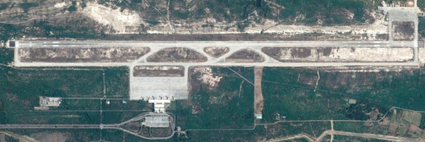
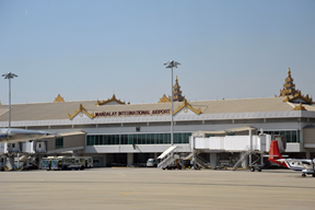
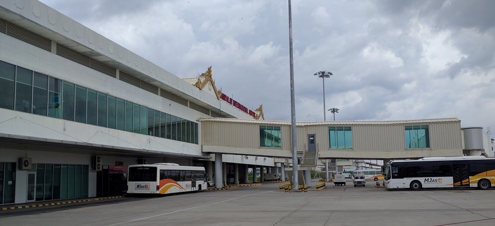
Runways
There is one runway with heading 17 / 35.
|
Runway #1 |
|
|---|---|
|
Runway Dimensions |
4,268 m x 61 m |
|
Orientation |
17 / 35 |
|
Surface |
Concrete PCN 55/R/A/W/T |
Helicopter Pad(s)
Mandalay ATZ has a radius of 5 NM centered at 214203.86 N, 0955838.84 E. Non-scheduled public air traffic with helicopters is permitted only after prior approval from the Department of Civil Aviation.
|
Helipad #I-IV |
|
|
Present (Yes / No) |
Yes |
|
Largest helicopter that can land |
MI-8 |
|
Width and Length (metres) |
80-50 m |
|
Surface |
Concrete |
Airport Infrastructure Details
|
Customs |
Yes |
JET A-1 fuel |
Yes, Jet-A1 and JP1 |
|
Immigration |
Yes |
AVGAS 100 |
No |
|
Terminal Building |
Yes |
Single Point Refuelling |
Yes |
|
Passenger Terminal |
Yes |
Air Starter Units |
Yes |
|
Cargo terminal |
Yes |
Ground Power (mobile) |
Yes |
|
Pax transport to airfield |
Yes |
Ground Handling Services |
Yes |
|
Control Tower |
Yes |
Latrine Servicing |
Yes |
|
Weather Facilities |
Yes |
Fire Fighting Category (ICAO) |
Yes – CAT 9 |
|
Catering Services |
Yes |
De-icing Equipment |
No |
|
Base Operating Room |
Yes |
Parking Ramp Lighting |
Yes |
|
Airport Radar |
Yes |
Approach & Runway Lights |
Yes |
|
NDB |
Yes / MIA |
DVOR/DME |
Yes / MIA |
|
ILS CAT.I/LLZ |
Yes / IMIA |
ILS CAT.I/GP/DME |
Yes / IMIA |
Passenger and Cargo Performance Indicator
|
Performance for 2017 |
Annual Figures |
Monthly |
Daily |
|---|---|---|---|
|
Total aircraft movements |
25,073 (5,592 International and 19,481 Domestic) |
2,090 |
n/a |
|
Total passengers |
1,320,945 (477,922 International and 843,023 Domestic) |
110,080 |
n/a |
|
Total capacity of the airport (metric tonnes) |
Max.100 |
8.3 |
n/a |
|
Current activity of the airport (metric tonnes) |
+/- 100 |
8.3 |
n/a |
|
Current use by Humanitarian flights (UNHAS) |
n/a |
n/a |
n/a |
Airport Operating Details
Handling Equipment includes high loader, 1 forklift (5 MT), 5 tractors and several cargo dollies. They are able to handle airline pallets of double pallet size.
|
Operating Details |
|||
|
Maximum sized aircraft which can be offloaded on bulk cargo: |
B-747 |
||
|
Maximum sized aircraft that can be offloaded on pallet |
Double aircraft pallets possible |
||
|
Total aircraft parking area (m²) |
146,400 sqm |
||
|
Storage Area (mt) |
No |
Cubic Meters (m³) |
No |
|
Cargo Handling Equipment Available (Yes / No) |
Yes |
If "Yes" specify below |
|
|
Elevators / Hi Loaders (Yes / No) |
Yes |
Max Capacity (mt) |
n/a |
|
Can elevators / hi loaders reach the upper level of a B747 (Yes / No) |
High Loader can reach regular deck B747 |
||
|
Loading Ramps (Yes / No) |
Yes |
||
Storage Facilities
A new Air Cargo Terminal initiated its operations in August 2019. The new Air Cargo terminal is designed to handle 4,000 tons of Import and Export cargoes annually. There is also Cold Storage Room and capable of controlling temperature from -20°C. The Air Cargo Terminal facilities comprise with cargo X-ray machine, cold storage room, main desk loader 7 Mt capacity, forklift 2.5 Mt capacity, high lift 6.8 Mt capacity, 2 nos of 2.5 Mt hand lift, two tractor, container pallets dollies and 4 nos of belt loader. All International airlines based in Mandalay are able to transport cargo / freight to any destination across the globe using connections at each of the airlines' way points. Currently, 8 airlines have signed agreement with MJAS among International Airlines operating at Mandalay International Airport. Cargo Warehouse handling is operated by MK Hercules Co., Ltd (MMH), a joint venture between MK Co., Ltd in Hiroshima, Japan and Hercules Logistics Co., Ltd, in Myanmar.
The cargo warehouse is operating during 08:00 ~ 18:00 / Daily and custom service operate during 10:00 ~ 17:00 / from Monday to Friday (excluding National Holidays).
Air Cargo Terminal Contact No: +95 2 40 27110 (Ext. 317)
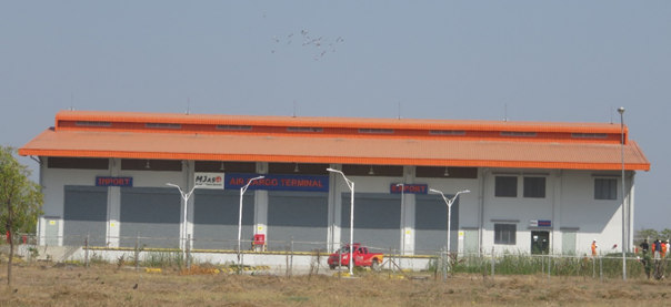
Airfield Costs
Navigation Charges
|
Aircraft Weight – MTOW (kg) |
International Flight |
Domestic Flight |
|
|---|---|---|---|
|
0 |
25,000 |
USD 32 |
6,300 MMK |
|
25,001 |
50,000 |
USD 53 |
10,400 MMK |
|
50,001 |
75,000 |
USD 99 |
15,500 MMK |
|
75,001 |
100,000 |
USD 199 |
20,900 MMK |
|
100,001 |
200,000 |
USD 304 |
53,500 MMK |
|
200,001 |
300,000 |
USD 457 |
80,150 MMK |
|
300,001 |
400,000 |
USD 609 |
106,800 MMK |
|
Note: Basis: Take-off weight in the C of A. |
|||
*NOTE: Applicable to all aircraft engages in International Flight into and out of any airport in the Union of Myanmar, and aircraft over-flying the Yangon Flight Information Region without landing at any airport in Myanmar. The charges are made on per movement basis. Overflights are counted as one movement and arrival and departure are counted as two movements.
Landing and Take-off Charges
|
Maximum Take-off Weight |
International Flight |
Domestic Flight |
|---|---|---|
|
Not exceeding 25,000 Kg |
USD 85 |
18,800 MMK |
|
25,001 Kg to 50,000 Kg |
USD 168 |
37,500 MMK |
|
50,001 Kg to 75,000 Kg |
USD 253 |
56,100 MMK |
|
75,001 Kg to 100,000 Kg |
USD 337 |
74,900 MMK |
|
100,001 Kg to 200,000 Kg |
USD 760 |
168,300 MMK |
|
200,001 Kg to 300,000 Kg |
USD 1,138 |
252,600 MMK |
|
300,001 Kg to 400,000 Kg |
USD 1,518 |
336,800 MMK |
Source : Department of Civil Aviation (https://www.dca.gov.mm/ accessed on 28 Aug 2020)
*NOTE: The payment of the landing charge shall entitle the aircraft to:
- the use of aerodrome for arriving and departure;
- the use of radio and night lighting installed at the aerodrome;
- the supply of all available information as to routes and weather conditions;
- the service of aerodrome personnel, if available, for manual assistance in guiding, housing or parking the aircraft.
Parking Charges
|
Maximum Take-off Weight |
International Flight |
Domestic Flight |
|---|---|---|
|
Not exceeding 25,000 Kg |
USD 15 |
Kyats 4200 |
|
25,001 Kg to 50,000 Kg |
USD 27 |
Kyats 7500 |
|
50,001 Kg to 75,000 Kg |
USD 41 |
Kyats 11300 |
|
75,001 Kg to 100,000 Kg |
USD 54 |
Kyats 15000 |
|
100,001 Kg to 200,000 Kg |
USD 122 |
Kyats 33800 |
|
200,001 Kg to 300,000 Kg |
USD 182 |
Kyats 50500 |
|
300,001 Kg to 400,000 Kg |
USD 243 |
Kyats 67400 |
Housing/Hanger Charges
|
Maximum Take-off Weight |
International Flight |
Domestic Flight |
|---|---|---|
|
Not exceeding 25,000 Kg |
USD 41 |
Kyats 11300 |
|
25,001 Kg to 50,000 Kg |
USD 81 |
Kyats 22500 |
|
50,001 Kg to 75,000 Kg |
USD 122 |
Kyats 33800 |
|
75,001 Kg to 100,000 Kg |
USD 162 |
Kyats 44900 |
|
100,001 Kg to 200,000 Kg |
USD 365 |
Kyats 101000 |
|
200,001 Kg to 300,000 Kg |
USD 547 |
Kyats 151600 |
|
300,001 Kg to 400,000 Kg |
USD 729 |
Kyats 202100 |
Source : Department of Civil Aviation (https://www.dca.gov.mm/, accessed on 28 Aug 2020)
Passenger Service
Currency Import regulations:
Local currency (Myanmar Kyat-MMK): prohibited.
Foreign currencies: unlimited. Nationals of Myanmar must declare
all foreign currency upon arrival. Foreigners must declare amounts
exceeding USD 10,000.- or equivalent.
Currency Export regulations:
Local currency (Myanmar Kyat-MMK): prohibited.
Foreign currencies:
- nationals of Myanmar: export permit required;
- foreign nationals: unlimited, if holding proof of ownership.
Import regulations:
Free import:
- 400 cigarettes or 50 cigars or 250 grams tobacco;
- 2 liters of liquor;
- 150 milliliters of perfume;
- goods for personal use to a max. value of USD 500.-;
- electrical and electronic goods not more than USD 500.- in
value;
- portable (video) camera, HD camera or DV camera and 1 spare (set)
battery;
- portable computer;
- reasonable quantity of medicines for personal use.
All plants or plant products (seeds, bulbs, cut flowers, fresh fruit and vegetables) require a Phytosanitary Certificate and must be declared. Prohibited: host plants of pests and soil.
Baggage Clearance regulations:
Baggage is cleared at the first airport of entry in Myanmar.
https://yangonairport.aero/index.php/en/passenger-guide
In terms of airport departure tax, they are normally included in the air ticket price based on the following tariffs:
- USD 20 for each international departing passenger at international airports
- MMK 2000 for each domestic departing passenger at international airports
- MMK 1000 for each domestic departing passenger at national airports
Fuel Services Charges
Only Jet-A1 is available, provided by National Energy Puma Aviation Service (a Joint Venture company). There are four fuel storage tanks of 600,000L each and a subterranean fueling system for 6 contact gates, 12 fueling points, and refueling by bowsers (tank trucks, 1x7000 plus 3x4000 gallon capacity each) for the remote parking stands. Mandalay airport has an estimated daily demand of 77,000 litre Jet-A1.
International flights are billed in USD and national airlines in Kyat.
|
Price per Unit (May 2019) |
||
|---|---|---|
|
|
Kyat (MMK) |
USD |
|
Jet A-1 |
n/a |
n/a |
|
Avgas |
n/a |
n/a |
Cargo Terminal Charges
|
Import |
Rate US$ / kg* |
|---|---|
|
Handling Charge per kg |
0.3-0.4 |
|
Break Bulk Fee |
n/a |
|
Diplomatic Mail |
No charge |
|
Strong Room – per consignment |
n/a |
|
Cold Storage Fee |
1-10kg=1usd 10-20kg=2.3usd 80kg above=25.5USD for the first ten days. For more info please find the table in the attachment 4. |
|
Delivery outside normal working hours |
100% more (double) |
|
Preparation of substitute AOA – Invoice – Receipt |
n/a |
|
Storage per kg per day – Grace period? Hours |
0.3 (up to 10kg) to 8.5 (over 81kg) for the first ten days, every following ten days price will raise for 80-100% |
|
Export |
Rate US$ / kg* |
|
Handling charges – Unpalletized cargo |
0.5 |
|
International Air Waybill |
n/a |
|
Local Air Waybill |
n/a |
|
Air Waybill Amendment – Cancellation |
n/a |
|
Air Waybill Documentation |
n/a |
|
Diplomatic Mail |
Free |
|
Storage charges per kg per day |
0.5 |
Air-bridge Charges
|
Aircraft Seating Capacity |
Aerobridge Basic Charge per Flight |
|---|---|
|
0 - 150 seats |
USD 80.00 for the first 1½ hours or part thereof; and USD 80.00 for every subsequent 1½ hours or part thereof. |
|
151 - 250 seats |
USD 116.00 for the first 1½ hours or part thereof; and USD 116.00 for every subsequent 1½ hours or part thereof. |
|
251 - 350 seats |
USD 156.00 for the first 1½ hours or part thereof; and USD 156.00 for every subsequent 1½ hours or part thereof. |
|
Exceeding 350 seats |
USD 228.00 for the first 1½ hours or part thereof; and USD 228.00 for every subsequent 1½ hours or part thereof. |
|
0 - 150 seats |
USD 80.00 for the first 1½ hours or part thereof; and USD 80.00 for every subsequent 1½ hours or part thereof. |
|
151 - 250 seats |
USD 116.00 for the first 1½ hours or part thereof; and USD 116.00 for every subsequent 1½ hours or part thereof. |
|
251 - 350 seats |
USD 156.00 for the first 1½ hours or part thereof; and USD 156.00 for every subsequent 1½ hours or part thereof. |
Security
Myanmar police is responsible for airport security, together with security staff of MC-Jalux. There is a CCTV system in place, X-ray machines for luggage, walk-through metal detectors and handheld metal detectors.
Companies Available
For information on Myanmar Airport contact details, please see the following: 4.5 Myanmar Airport Company Contact List.
2.2.3 Myanmar Nay Pyi Taw International Airport
Naypyitaw International Airport (NYT) was opened on 19 Dec 2011. The airport has been designed to handle 3.5 million passengers annually. It has one airport terminal building, with 2 floors that is divided in three halls with a total of 10 boarding bridges: the West hall is for domestic passengers and the East and North halls are for international passengers. It has an apron of 530 by 360m (19.08 ha) attached to the terminal building and a second apron South West of the runway of 365m by 275m (10.04 ha).
There are three international airlines (Air Asia, Bangkok Airways and China Eastern) and four domestic airlines (Air Bagan, Asian Wings airways, Golden Myanmar and Myanma Airlines) providing regular flights to Naypyitaw airport.
Airport Website: http://www.nptia.com
|
Location Details |
|||
|---|---|---|---|
|
Country |
Myanmar |
Latitude |
19.61913 |
|
Province / District |
Nay Pyi Taw Union territory |
Longitude |
96.19994 |
|
Town or City (Closest) |
20 km South East of |
Elevation (ft and m) |
294 ft / 89.7 m |
|
Airfield Name |
Naypyitaw International airport |
IATA and ICAO Codes |
NYT / VYNT |
|
Open From (hours) |
05:00 |
Open To (hours) |
0:00 |
Pictures
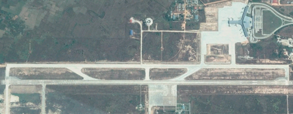
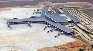
Runways
There is one runway with heading 16 / 34.
|
Runway #1 |
|
|---|---|
|
Runway Dimensions |
3,657 m x 61m |
|
Orientation |
16 / 34 |
|
Surface |
Concrete PCN 56/R/A/W/T |
Helicopter Pad(s)
Naypyitaw ATZ has a radius of 5 NM centered at 193724,78 N, 0961203.60 E. Non-scheduled public air traffic with helicopters is permitted only after prior approval from the Department of Civil Aviation.
|
Helipad #1 |
|
|---|---|
|
Present (Yes / No) |
Yes |
|
Largest helicopter that can land |
Bell 295 A-1 |
|
Width and Length (metres) |
unknown |
|
Surface |
Concrete |
Airport Infrastructure Details
|
Customs |
Yes |
JET A-1 fuel |
Yes, JP1 available on prior request |
|---|---|---|---|
|
Immigration |
Yes |
AVGAS 100 |
No |
|
Terminal Building |
Yes |
Single Point Refueling |
Yes |
|
Passenger Terminal |
Yes |
Air Starter Units |
Yes |
|
Cargo terminal |
Yes |
Ground Power (mobile) |
Yes |
|
Pax transport to airfield |
Yes |
Ground Handling Services |
Yes |
|
Control Tower |
Yes |
Latrine Servicing |
Yes |
|
Weather Facilities |
Yes |
Fire Fighting Category (ICAO) |
Yes – CAT 9 |
|
Catering Services |
Yes |
De-icing Equipment |
No |
|
Base Operating Room |
Yes |
Parking Ramp Lighting |
Yes |
|
Airport Radar |
Yes |
Approach & Runway Lights |
Yes |
|
NDB |
Yes / NT |
DVOR/DME |
Yes / NPT |
|
ILS CAT.I/LLZ |
Yes / INPT |
ILS CAT.I/GP/DME |
Yes / INPT |
Passenger and Cargo Performance Indicator
|
Performance for 2013 |
Annual Figures |
Monthly |
Daily |
|---|---|---|---|
|
Total aircraft movements |
n/a |
n/a |
n/a |
|
Total passengers |
n/a |
n/a |
n/a |
|
Total capacity of the airport (metric tonnes) |
n/a |
n/a |
n/a |
|
Current activity of the airport (metric tonnes) |
n/a |
n/a |
n/a |
|
Current use by Humanitarian flights (UNHAS) |
n/a |
n/a |
n/a |
Airport Operating Details
|
Operating Details |
|||
|---|---|---|---|
|
Maximum sized aircraft which can be offloaded on bulk cargo: |
unknown |
||
|
Maximum sized aircraft that can be offloaded on pallet |
unknown |
||
|
Total aircraft parking area (m²) |
291,175 sqm |
||
|
Storage Area (mt) |
n/a |
Cubic Meters (m³) |
n/a |
|
Cargo Handling Equipment Available (Yes / No) |
n/a |
If "Yes" specify below |
|
|
Elevators / Hi Loaders (Yes / No) |
n/a |
Max Capacity (mt) |
n/a |
|
Can elevators / hi loaders reach the upper level of a B747 (Yes / No) |
n/a |
||
|
Loading Ramps (Yes / No) |
n/a |
||
Storage Facilities
There are no storage facilities available and limited cargo handling capacity. Cargo handling facilities include baggage trolleys and carts.
Airfield Cost
Navigation Charges
|
Aircraft Weight – MTOW (kg) |
International Flight |
Domestic Flight |
|
|---|---|---|---|
|
0 |
2,500 |
USD 32 |
48 |
|
2,501 |
50,000 |
USD 53 |
48 |
|
50,001 |
75,000 |
USD 99 |
48 |
|
75,001 |
100,000 |
USD 119 |
48 |
|
100,001 |
200,000 |
USD 304 |
90 |
|
200,001 |
300,000 |
USD 457 |
276 |
|
300,001 |
400,000 |
USD 609 |
415 up to 553 |
|
Note: Please amend MTOW to suit local rates. (1 US$=1005 MMK at Nov, 2014) |
|||
|
Aircraft Weight – MTOW (kg) |
International Flight |
Domestic Flight |
|
|
0 |
2,500 |
USD 32 |
48 |
|
2,501 |
50,000 |
USD 53 |
48 |
|
50,001 |
75,000 |
USD 99 |
48 |
|
75,001 |
100,000 |
USD 119 |
48 |
|
100,001 |
200,000 |
USD 304 |
90 |
|
200,001 |
300,000 |
USD 457 |
276 |
|
300,001 |
400,000 |
USD 609 |
415 up to 553 |
|
Note: Please amend MTOW to suit local rates. (1 US$=1005 MMK at Nov, 2014) |
|||
*NOTE: All figures as of Mar 2014.
Airfield Charges
|
Maximum Take-off Weight |
International Flight |
Domestic Flight |
|---|---|---|
|
Not exceeding 25,000 Kg |
USD 85 |
Kyats 18800 |
|
25,001 Kg to 50,000 Kg |
USD 168 |
Kyats 37500 |
|
50,001 Kg to 75,000 Kg |
USD 253 |
Kyats 56100 |
|
75,001 Kg to 100,000 Kg |
USD 337 |
Kyats 74900 |
|
100,001 Kg to 200,000 Kg |
USD 760 |
Kyats 168300 |
|
200,001 Kg to 300,000 Kg |
USD 1138 |
Kyats 252600 |
|
300,001 Kg to 400,000 Kg |
USD 1518 |
Kyats 336800 |
*NOTE: All figures as of Mar 2014.
Fuel Services Charges
Jet-A1 can be provided by MPPE on prior request. Jet-A1 is normally imported from Singapore by MPPE in Yangon, price may fluctuate depending on global market prices.
|
Price per Unit (Dec 2014) |
||
|---|---|---|
|
|
Kyatt (MMK) |
Usd * |
|
Jet A-1 |
3090 / imp. gal 680 /litre |
3 / imp. gal 0.66 /litre |
|
Avgas |
n/a |
n/a |
* Exchange rate 1 usd : 1030 MMK
Cargo Terminal Charges
|
Import |
Rate US$ / kg |
|---|---|
|
Handling Charge per kg |
n/a |
|
Break Bulk Fee |
n/a |
|
Diplomatic Mail |
n/a |
|
Strong Room – per consignment |
n/a |
|
Cold Storage Fee |
n/a |
|
Delivery outside normal working hours |
n/a |
|
Preparation of substitute AOA – Invoice – Receipt |
n/a |
|
Storage per kg per day – Grace period? hours |
n/a |
|
Export |
Rate US$ / kg |
|
Handling charges – Unpalletized cargo |
n/a |
|
International Air WayBill |
n/a |
|
Local Air WayBill |
n/a |
|
Air Way Bill Amendment - Cancellation |
n/a |
|
Air Way Bill Documentation |
n/a |
|
Diplomatic Mail |
n/a |
|
Storage charges per kg per day |
n/a |
Air-bridge Charges
n/a
Security
Myanmar police is responsible for airport security. There is a CCTV system in place, X-ray machines for luggage, walk-through metal detectors and handheld metal detectors.
Companies Available
2.2.4 Myanmar Mawlamyine National Airport
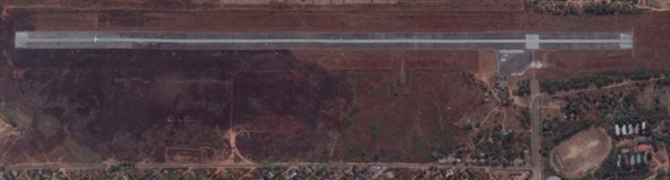
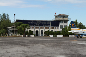
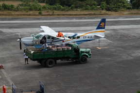
Mawlamyine airport, Google maps (2014)
Only one airline, Myanma Airways, is flying once a week to
Mawlamyine airport, on Mondays, via the route
Yangon-Mawlamyine-Kawthaung.
There is a plan to extend the runway in 2015 depending on available
budget. Currently the ATR-72 is the maximum size airplane that can
land. Myanma Airways staff is responsible for cargo handling. There
is no special cargo handling equipment available, only two cargo
trolleys. Max weight runway 54000 pounds. The airport has a CCTV
system, Walkthrough metal detector, an X-ray machine for
hand-luggage and a Handheld metal detector.
4.5 Myanmar Airport Company Contact List
|
Airfield Details |
|||
|---|---|---|---|
|
Country |
Myanmar |
Latitude |
16.44317 |
|
Province / District |
Mon state |
Longitude |
97.6596 |
|
Airfield Name |
Mawlamyine |
Elevation (ft) |
78 |
|
IATA & ICAO codes |
MNU / VYMN |
Surface |
Bitumen |
|
Town or City (closest) |
Mawlamyine |
Runway Condition |
Good |
|
NGO / UN (on ground) |
No |
Passenger / Cargo Security Screening (Yes / No) |
Yes |
|
Runway Dimension |
1646m x 45.7m 5400 ft x 150 ft |
Ground Handling |
No |
|
Refueling Capacity |
MPPE JetA1, drum, hand pump |
Runway Lighting (Yes / No) |
Yes |
|
Runway Heading |
036 / 216 |
Fire Fighting Equipment (Yes / No) |
50 Kg chem. Dry powder. 2Kg foam. |
|
Air Traffic Control (Yes / No) |
Yes |
Windsock (Yes / No) |
Yes |
|
Weather Information (Yes / No) |
Yes, AWS |
Aircraft Parking space (Yes / No) |
Yes |
|
Navigation Aids (Yes / No) |
Yes, NDP |
Perimeter fencing (Yes / No) |
Inner fencing |
Fuel Services Charges
There is no Jet A1 fuel storage capacity at Mawlamyine airport. The Jet A1 fuel is stored in drums at the airport and the airplanes are filled with a handpump. Myanma Petroleum Product Enterprise (MPPE) supplies the fuel. Their office and fuel jetty is located at Mu Pon Ward, Mawlamyine, a 20 minutes drive from the airport. MPPE has the following storage capacity at this location:
77,284 L / 17,000 gallon tank 1 Nos
81,830 L / 18,000 gallon tank 1 Nos
100,014 L / 22,000 gallon tank 1 Nos
118,198 L / 26,000 gallon tank 1 Nos
281,857 L / 62,000 gallon tank 1 Nos
|
Price per Gallon |
|
|---|---|
|
Jet A-1 |
3090 MMK/gal 680 MMK/litre |
|
Avgas |
No |
Royalties / Non Objection Fees (NOFs)
Landing fees depend on take-off weight. Up to 5,000kg is 149 Usd, 5,000-10,000 Kg is 377 Usd, charged by Civil Aviation office. The landing charges are collected by the head office in Yangon, but the landings fees of foreign aircraft will be collected locally.
2.2.5 Myanmar Dawei National Airport
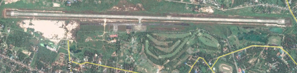
Dawei airport, Google maps (2014)
Domestic airport with regular daily service from Myanma Airways (Yangon-Dawei-Myeik-Kawthaung). The airlines Air Mandaley, Air KBZ and Mann Yadanarpon Airlines offer flights sometimes, depending on the season. Air-ticketing company Sun-Far tours and travel offers charter flights from Myanma airways. The Terminal is in new condition.
Maximum size airplane that can land is a C130. There is one runway, with a parallel taxi way and three separate small aprons with parking space. There is no cargo handling equipment. Ground handling is done by Myanma Airways.
|
Airfield Details |
|||
|---|---|---|---|
|
Country |
Myanmar |
Latitude |
14.10361 |
|
Province / District |
Tanintharyi |
Longitude |
98.20361 |
|
Airfield Name |
Dawei Airport |
Elevation (ft) |
84 ft (25.6 m) |
|
IATA & ICAO codes |
TVY / VYDW |
Surface |
Concrete |
|
Town or City (closest) |
Dawei |
Runway Condition |
good |
|
NGO / UN (on ground) |
none |
Passenger / Cargo Security Screening (Yes / No) |
Yes |
|
Runway Dimension |
3,657 m x 30 m (new) |
Ground Handling (Yes / No) |
Yes / Myanma airlines |
|
Refueling Capacity |
Yes: JetA1 tank by MOGE |
Runway Lighting (Yes / No) |
Yes |
|
Runway Heading |
Runway 16: 157 Runway 34: 337 (1 runway, opposite directions) |
Fire Fighting Equipment (Yes / No) |
Yes, dry chemical powder, & foam canisters. |
|
Air Traffic Control (Yes / No) |
Yes |
Windsock (Yes / No) |
Yes |
|
Weather Information (Yes / No) |
Yes / AWS |
Aircraft Parking space (Yes / No) |
Yes 250ftx250ft 600x300ft 200x175ft |
|
Navigation Aids (Yes / No) |
Yes / VOR/NDB |
Perimeter fencing (Yes / No) |
Yes |
Fuel Services Charges
Refuelling capacity with a tank truck with an automatic fuel pump and a central storage tank managed by MOGE (Not MPPE). The fuel service charges are standardized rates established by MOGE.
|
Price per Unit |
|
|---|---|
|
Jet A-1 |
3090 MMK/gal 680 MMK/litre |
|
Avgas |
No |
Royalties / Non Objection Fees (NOFs)
Landing fees depend on take-off weight. Up to 5,000kg is 149 Usd, 5,000-10,000 Kg is 377 Usd, charged by Civil Aviation office. The landing charges are collected by the head office in Yangon, but the landings fees of foreign aircraft will be collected locally.
Contact Person (Dawei Airport):
U Hla Soe
Staff Officer
Department of Civil Aviation(DCA)
Dawei
Phone: 059-21058, 09-4930 30761
For information on Myanmar airport contact details, please see the following link:
2.2.6 Myanmar Kawthaung National Airport
4.5 Myanmar Airport Company Contact List
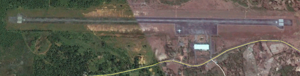
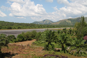
Kawthaung airport, Google maps (2014)
Kawthaung airport is located about 11km from downtown Kawthaung. There are four domestic airlines operating: Myanma Airways, Air Mananday, Yangon airways, Man Yanandor, Air KBZ and the charter company Sun Far.
During the rainy season these airlines have daily flights but
during the dry season these airlines fly to North, to upper Myanmar
for tourists. During dry season only Myanma airlines has flights
(daily flight Kawtoung-Dawei-Yangon) and Sunfar
(Kawtoung-Meyik-Dawei-Yangon).
The terminal building was built in 1991. Maximum take-off weight of
the runway is 6,078 Kg (13,400 Lbs). Maximum size aircraft that can
land is an Embraer-E190 or Boeing 717-200. The airport has an apron
for parking aircraft of 280 by 70m. There is no cargo handling
equipment available. Myanma Airways is responsible for cargo
handling; they have five trolleys. The other airlines have also
five trolleys each. Fire fighting equipment consists of one small
fire truck with water & foam and 4 50kg chemical powder cylinders.
Myanmar police is responsible for airport security. There is a CCTV
system with ten cameras, one X-ray machine for luggage, and one
walk-through metal detector. Two handheld metal detectors.
|
Airfield Details |
|||
|---|---|---|---|
|
Country |
Myanmar |
Latitude |
10.05183 |
|
Province / District |
Tanintharyi |
Longitude |
98.53952 |
|
Airfield Name |
Kawthaung |
Elevation (ft) |
41 ft |
|
IATA & ICAO codes |
KAW / VYKT |
Surface |
Bitumen |
|
Town or City (closest) |
Kawthaung |
Runway Condition |
Good |
|
NGO / UN (on ground) |
no |
Passenger / Cargo Security Screening (Yes / No) |
Yes |
|
Runway Dimension |
1,829 m /6,000 ft (length) 46 m / 150 ft (width) |
Ground Handling (Yes / No) |
Yes |
|
Refueling Capacity |
Yes |
Runway Lighting (Yes / No) |
Yes |
|
Runway Heading |
020 / 200 |
Fire Fighting Equipment (Yes / No) |
Yes |
|
Air Traffic Control (Yes / No) |
Yes |
Windsock (Yes / No) |
Yes |
|
Weather Information (Yes / No) |
Yes / AWS |
Aircraft Parking space (Yes / No) |
Yes |
|
Navigation Aids (Yes / No) |
Yes / NDB |
Perimeter fencing (Yes / No) |
Yes |
Fuel Services Charges
Jet-A1 provided by MPPE by tank truck. MPPE has an office and fuel storage available at the airport in a compound near the control tower. Price of Jet-A1 can vary with other airfields in case it is imported from Thailand. Most other airfields are supplied by Jet-A1 imported from Singapore by MPPE in Yangon, but due to the proximity of Kawthaung to Thailand sometimes the Jet-A1 is imported by MPPE directly from Thailand instead.
|
Price per Unit |
|
|---|---|
|
Jet A-1 |
3090 MMK/gal 680 MMK/litre |
|
Avgas |
No |
Royalties / Non Objection Fees (NOFs)
Landing fees depend on take-off weight. Up to 5,000kg is 149 Usd, 5,000-10,000 Kg is 377 Usd, charged by Civil Aviation office. The landing charges are collected by the head office in Yangon, but the landings fees of foreign aircraft will be collected locally.
2.2.7 Myanmar Myeik National Airport
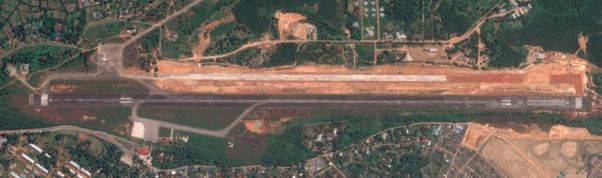
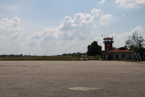
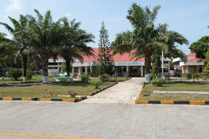
4.2.4 Myanmar Airport Company Contact List
Myeik airport, Google maps (2014)
Myeik airport is located about 3km from downtown Myeik. There
are four domestic airlines operating: Myanma Airways and Golden
Myanmar airlines, Man Yanandorpone, Sun Far. During the rainy
season these airlines fly 3 times per week, during the dry season
these airlines fly to North, upper Myanmar for tourists. Myanma
airlines has a daily flight Yangon-Myeik.
The airport is shared with Myanmar military air force, located
across the runway. The control tower was built in 2011 and the
terminal in 2012. The air force is constructing a new concrete taxi
way, for military use, across the runway. Maximum take-off weight
of aircraft is 150,000 pounds. Maximum size aircraft that can land
is a Boeing 737-200.
There is no cargo handling equipment available. Cargo handling is done by Myanma Airways, they have four trolleys. The other airlines have a few more trolleys.
Security is handled by the military air force together with Myanmar police. The police is responsible for the civilian terminal. There is a CCTV system with nine camera’s, one X-ray machine for luggage, and one walk-through metal detector.
|
Airfield Details |
|||
|---|---|---|---|
|
Country |
Myanmar |
Latitude |
12.43972 |
|
Province / District |
Tanintharyi |
Longitude |
98.62139 |
|
Airfield Name |
Myeik |
Elevation (ft) |
62 ft |
|
IATA & ICAO codes |
MGZ / VYME |
Surface |
Asphalt-concrete |
|
Town or City (closest) |
Myeik |
Runway Condition |
Good |
|
NGO / UN (on ground) |
No |
Passenger / Cargo Security Screening (Yes / No) |
Yes |
|
Runway Dimension |
2,681 m (8,795 ft) X 61 m (200 ft) Width |
Ground Handling (Yes / No) |
Yes |
|
Refueling Capacity |
Yes, Jet A1 only |
Runway Lighting (Yes / No) |
Yes |
|
Runway Heading |
180 / 360 |
Fire Fighting Equipment (Yes / No) |
Yes, fire truck |
|
Air Traffic Control (Yes / No) |
Yes |
Windsock (Yes / No) |
Yes |
|
Weather Information (Yes / No) |
Yes / AWS |
Aircraft Parking space (Yes / No) |
400ft sq. |
|
Navigation Aids (Yes / No) |
NDB non directional beacon. ILS planned |
Perimeter fencing (Yes / No) |
Yes, 1 layer |
Fuel Services Charges
Jet-A1 is available from MPPE who have a compound located inside the airport premises. MPPE has two tanker trucks of 7274 litres (1600 Gal ) capacity each. The MPPE facility has one existing storage tank, and is constructing a new tank of 45,460 litres (10,000 Gal) storage capacity. They have no Avgas available.
|
Price per Unit |
|
|---|---|
|
Jet A-1 |
3090 MMK/gal 680 MMK/litre |
|
Avgas |
No |
Royalties / Non Objection Fees (NOFs)
Landing fees depend on take-off weight. Up to 5,000kg is 149 USD, 5,000-10,000 Kg is 377 USD, charged by Civil Aviation office. The landing charges are collected by the head office in Yangon, but the landings fees of foreign aircraft will be collected locally.
2.2.8 Myanmar Pyay Airport
Airport Overview
Unused national airport. No terminal building, no Air Traffic Control. Not used by national airlines. Pyay airport area is fenced and under control of Civil Aviation Department. The tarmac of the airstrip has some superficial damage but is probably still suitable to be used for airplanes.
In case of emergencies, the large open space of the airport could be considered for setup of temporary storage or shelters, however there are also good alternative sites in Pyay industrial zone 2.
|
Airfield Details |
|||
|
Country |
Myanmar |
Latitude |
18°49'33.00"N |
|
Province / District |
Bago |
Longitude |
95°15'60.00"E |
|
Airfield Name |
Pyay |
Elevation (ft) |
36.6m / 120 ft |
|
IATA & ICAO codes |
PRU / VYPY |
Surface |
Tarmac |
|
Town or City (closest) |
Pyay, 5km East of city. |
Runway Condition |
Fair. Superficial damage to tarmac |
|
NGO / UN (on ground) |
No |
Passenger / Cargo Security Screening (Yes / No) |
No |
|
Runway Dimension |
1372m x 40m |
Ground Handling (Yes / No) |
No |
|
Refueling Capacity |
No |
Runway Lighting (Yes / No) |
No |
|
Runway Heading |
07 / 025 |
Fire Fighting Equipment (Yes / No) |
No |
|
Air Traffic Control (Yes / No) |
No |
Windsock (Yes / No) |
No |
|
Weather Information (Yes / No) |
No |
Aircraft Parking space (Yes / No) |
Yes. Tarmac apron |
|
Navigation Aids (Yes / No) |
No |
Perimeter fencing (Yes / No) |
Yes |
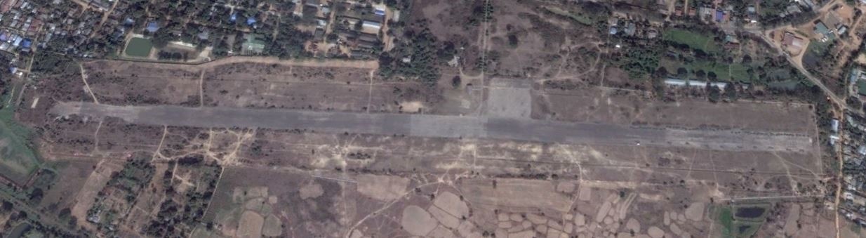
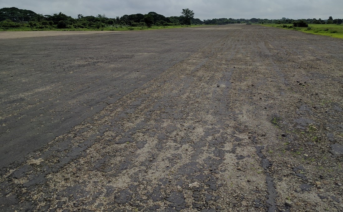
Fuel Services Charges
n/a
Royalties / Non Objection Fees (NOFs)
n/a
2.2.9 Myanmar Magway Airport
Airport Overview
The Magway Airport was constructed on 818.82 acres of land. It was opened on 6 June 2003 but was operational only for a few years. Since 2006, no airplane has landed in the region and the airport has been mainly used by the military for training (Magway Airforce Training Center) located on the opposite side of the runway. At the request of the Magway Regional Government, the Ministry of Transport and Communications resumed flight service starting from May 2019. Only Myanmar National Airline is currently operating Yangon-Magway and Magway-Sittwe twice a week on Mondays and Fridays. The runway includes a taxiway. Based on the above assessment, Magway airport is not ideal to be used in humanitarian response operation. Magway itself is generally accessible by road transportation.
|
Airport Location and Contacts |
|
|
Country |
Myanmar |
|
Province / District |
Magway |
|
Airfield Name |
Magway Airport |
| Nearest City to the Airport | Magway (6km) |
| Latitude |
20.157778 |
| Longitude |
94.973056 |
| IATA Code |
MWQ |
| ICAO Code | VYMW |
|
Elevation |
90.9 m / 298 ft |
| Managing Company or Airport Authority | Department of Civil Aviation |
| Management Contact Person |
Mr.Min Aung, Staff Officer 1 Tel:+959 4500 57761, Tel: +95 63 23713 |
|
NGO / UN (on ground) |
No |
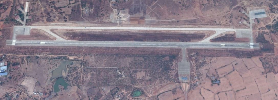
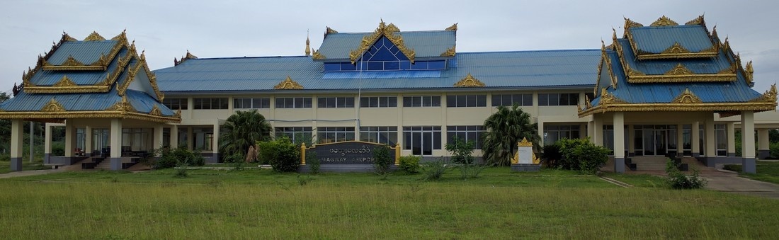
Runway
| Runway # 1 | |
|---|---|
| Runway Dimensions | 2591m x 61m |
| Runway Orientation | 19/01 |
| Runway Surface | Concrete, 165,000kg |
| Runway Condition | Good |
Airport Infrastructure Details
| Infrastructure | |||
|---|---|---|---|
| Passenger / Cargo Security Screening | Yes | Runway Lighting | Yes, edge lighting |
| Refueling Capacity | No | Ground Handling Services | No |
| Air Traffic Control | Yes | Fire Fighting Equipment | Yes, CAT 2 |
| Weather Information | Yes | Aircraft Parking Space | Apron 122m x 122m |
| Navigation Aids | Yes, NDB | Perimeter Fencing | Yes |
| Windsock | Yes, 2 | ||
Fuel Services Charges
N/A. In case of emergency, Jet-A1 fuel can be provided by the military (Magway Airforce Training Center).
Royalties / Non Objection Fees (NOFs)
n/a
2.2.10 Myanmar Pakokku Airport
Airport Overview
This airport is currently not in use. Chartered flights from civilian and government VIP’s also rarely landed at this airport. The airport is located 11km North of town. Condition of the runway is good, condition of the terminal building and control tower is good, although it needs some minor repairs and cleaning.
Following Bagan’s recognition as a UNESCO World Heritage site, the possibility of direct international route to Nyaung-U Airport was raised by international airlines but rejected by Ministry of Transport and Communication considering that Nyaung Oo Airport is closely located to the Bagan archaeological zone. Based on the current planning, Nyaung Oo Airport is not intended to handle international flights. Therefore, the Ministry of Transport and Communication is planning to upgrade Pakokku Airport to an international airport in future since the airport area has enough land space to upgrade.
Since the airport is situated at the center of Myanmar, it could be a suitable location for a humanitarian cargo hub or open space for temporary shelters, in case of a large-scale emergency such as earthquake in Magway region and central Myanmar. If there is a need to use this airport for humanitarian purposes, approval would need to be obtained from the Department of Civil Aviation in Yangon. The largest plane that can be handled is medium-sized 100-seat planes such as EMB-190 / B-717.
|
Airport Location and Contact |
|
|---|---|
|
Country |
Myanmar |
|
Province or District |
Magway |
|
Nearest Town or City |
Pakokku, 11km |
|
Airport’s Complete Name |
Pakokku Airport |
|
Latitude |
21.406299 |
|
Longitude |
95.114321 |
|
Elevation (ft and m) |
106.8m / 350ft |
|
IATA Code |
PKK |
|
ICAO Code |
VYPU |
|
Managing Company or Airport Authority |
Department of Civil Aviation |
|
Management Contact Person |
Mr. Zaw Myint (Chief Officer): +95-9-402580973 Mr. Phoe Khaung Kyaw (Deputy Chief Officer): +95-9-250069054 |
|
NGO and/or UN Presence at Airport? |
Yes, WFP |
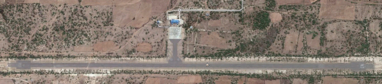
Pakkokku Airport Overview
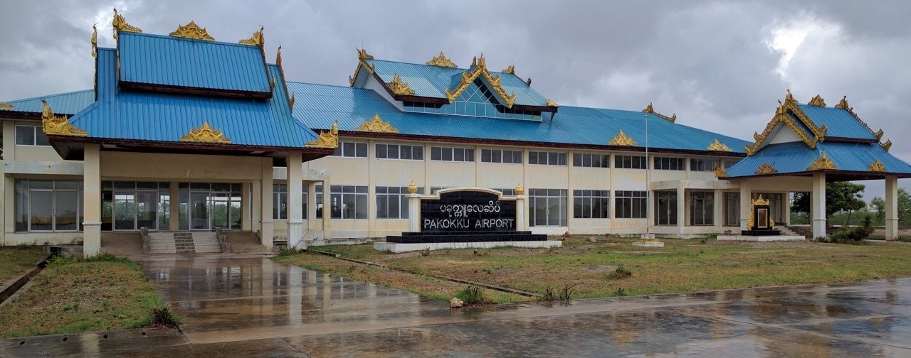
Pakkokku Airport Terminal
Runways
|
Runway #1 |
|
|---|---|
|
Runway Dimensions |
2591 m x 30 m |
|
Runway Orientation |
18 / 36 |
|
Runway Surface |
Asphalt/concrete |
|
Runway Condition |
Good |
Airport Infrastructure Details
|
Infrastructure |
|||
|---|---|---|---|
|
Passenger / Cargo Security Screening |
No |
Runway Lighting |
No |
|
Refueling Capacity |
No |
Ground Handling Services |
No |
|
Air Traffic Control |
No |
Fire Fighting Equipment |
No |
|
Weather Information |
No |
Aircraft Parking Space |
No |
|
Navigation Aids |
None |
Perimeter Fencing |
No |
|
Windsock |
No |
|
|
Fuel Services Charges
N/A. Jet A-1 fuel is not available in Pakokku. The nearest potential availability could be from military bases in Nyaung-U and Monywa, however this requires prior arrangement and coordination.
Royalties / Non Objection Fees (NOFs)
N/A
2.2.11 Myanmar Nyaung-U Airport
Airport Overview
The airport is located 4.5km southeast of Nyaung-U town in the Mandalay Region. It is the primary air gateway to the ancient sites of Bagan and surrounding areas. The airport is mainly used for tourism and normally no cargo is handled at this airport. There are 7 domestic airlines that fly to Nyaung Oo from/to Yangon, Mandalay, Heho and Thandwe: (Myanmar National Airline, Air KBZ, MANN Yadanarpon Airlines, Golden Myanmar Airlines, Air Thanlwin, Asian Wings Airways, Myanmar Airways International). Condition of the runway is good.
There are no international airlines since this is a regional airport. There are 6 to 7 daily regular flights during the low tourist season and up to about 20 daily flights during the peak tourist season. There is no helipad. The airport area is divided into civilian operations as well as for military purpose under the control of Middle regional command. The largest plane that can be handled are medium-sized 100-seat planes such as EMB-190 / B-717. There is no storage facility at the airport complex, however, there are some potential storage facilities in nearby town of Nyaung-U and Pakokku (Please refer to 2.6 Myanmar Storage Assessment.)
After Bagan’s recognition as a UNESCO World Heritage site, direct international flights to Nyaung-U Airport were proposed by International Airlines but the request was rejected by Ministry of Transport and Communication since Nyaung Oo airport is closely located to Bagan archaeological zone and it is not intended to handle international flights. Department of Civil Aviation is carrying out renovation work on airport terminal to enable it to handle more passengers and working on a parallel plan to upgrade the nearby Pakokku Airport, given the available ground space for expansion.
|
Airport Location and Contact |
|
|---|---|
|
Country |
Myanmar |
|
Province or District |
Mandalay Region |
|
Nearest Town or City |
Pakokku, 31km |
|
Airport’s Complete Name |
Bagan Airport |
|
Latitude |
21.174936 |
|
Longitude |
94.928497 |
|
Elevation (ft and m) |
95 m / 312 ft |
|
IATA Code |
NYU |
|
ICAO Code |
VYBG |
|
Managing Company or Airport Authority |
Department of Civil Aviation |
|
Management Contact Person |
Phone: +95-61-60941. |
|
NGO and/or UN Presence at Airport? |
Yes, WFP |
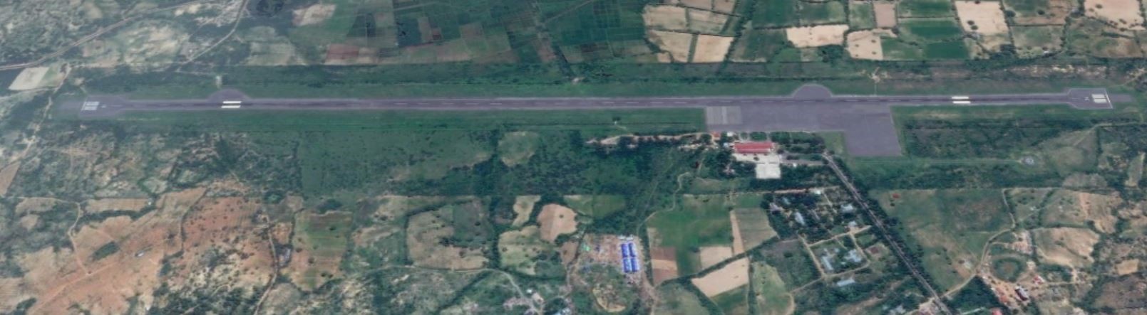
Bagan-Nyaung-U Airport Overview
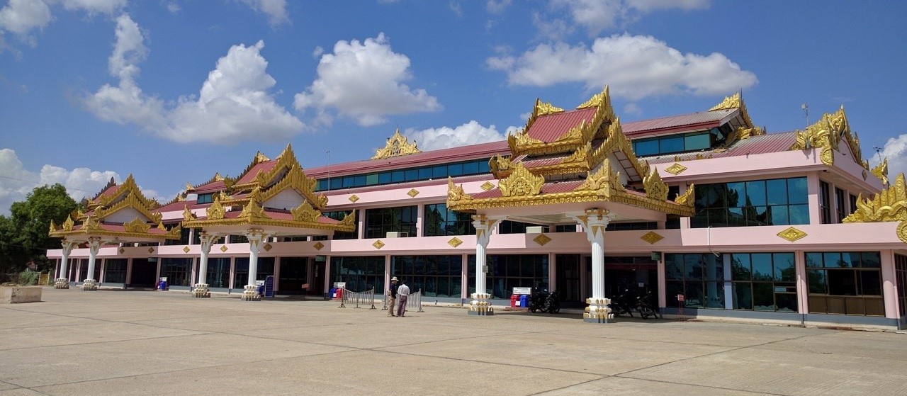
Bagan-Nyaung-U Airport Terminal
Runways
|
Runway #1 |
|
|---|---|
|
Runway Dimensions |
2591 m x 30 m |
|
Runway Orientation |
18 / 36 |
|
Runway Surface |
Asphalt/concrete |
|
Runway Condition |
Good |
Airport Infrastructure Details
|
Infrastructure |
|||
|---|---|---|---|
|
Passenger / Cargo Security Screening |
Yes |
Runway Lighting |
Yes |
|
Refueling Capacity |
No |
Ground Handling Services |
Yes, manual luggage trolleys |
|
Air Traffic Control |
Yes |
Fire Fighting Equipment |
Yes, CAT 4 |
|
Weather Information |
Yes |
Aircraft Parking Space |
Yes, apron |
|
Navigation Aids |
Yes, NDB, DVOR/DME |
Perimeter Fencing |
Yes |
|
Windsock |
Yes |
|
|
Fuel Services Charges
N/A. In case of emergency Jet-A1 fuel can be provided by the military, who have a base nearby and who can bring a bowser truck.
Royalties / Non Objection Fees (NOFs)
N/A
2.2.12 Myanmar Chanmyathazi Airport
Airport Overview
The Mandalay Chanmyathazi airport is being used for small aircraft only (Cessna). Currently only Myanmar Air is using it for flights twice a week from Yangon, on Monday and Tuesday. It is not used for private flights.
There is railway multi-modal capacity nearby with a container gantry crane. It is situated very close to downtown Mandalay, therefore it could be a suitable location for a humanitarian cargo hub or open space for temporary shelters, in case of a large scale emergency such as earthquake. If there is a need to use this airport for humanitarian purposes approval would need to be obtained from the Department of Civil Aviation in Yangon.
|
Airfield Details |
|||
|
Country |
Myanmar |
Latitude |
21°56′25.94″N |
|
Province / District |
Mandalay |
Longitude |
96°5′22.51″E |
|
Airfield Name |
Mandalay downtown |
Elevation (ft) |
300 |
|
IATA & ICAO codes |
VBC / VYCZ |
Surface |
Concrete, for small aircraft only |
|
Town or City (closest) |
Mandalay |
Runway Condition |
good |
|
NGO / UN (on ground) |
none |
Passenger / Cargo Security Screening (Yes / No) |
Yes |
|
Runway Dimension |
1996m x 30m |
Ground Handling (Yes / No) |
No |
|
Refueling Capacity |
No |
Runway Lighting (Yes / No) |
No |
|
Runway Heading |
190 - 010 |
Fire Fighting Equipment (Yes / No) |
Extinguishers only |
|
Air Traffic Control (Yes / No) |
Yes |
Windsock (Yes / No) |
Yes |
|
Weather Information (Yes / No) |
No |
Aircraft Parking space (Yes / No) |
Yes |
|
Navigation Aids (Yes / No) |
VOR, visual only |
Perimeter fencing (Yes / No) |
yes |
Contact: Dept. of Civil Aviation, Chanmyathazi national airport,
Mandalay region, Myanmar.
Phone: +95-02-27011.
Domestic airport Changmyathazi
Mr. Lay Aung (Airport manager) Phone: +95-9-402688214
Mr. Myint Htay(Airport Coordinator) Phone:+95-9-2059679
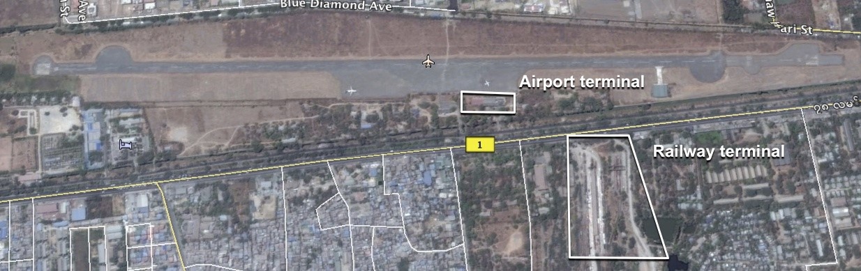
Mandalay Chyanmyathasi airport
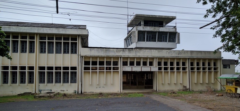
Mandalay Chanmyathazi Airport Terminal
Fuel Services Charges
n/a
Royalties / Non Objection Fees (NOFs)
n/a
2.2.13 Myanmar Kale Airport
Airport Overview
Kale lies in a rustic part of Sagaing Division, very close to the border with Chin State and it is the primary gateway to northern Chin State. Kale Airport is the only one airport that located in the middle of the town in Myanmar. Condition of the runway is good. There are two domestic airlines; Myanmar National Airline and Air KBZ that fly to Kale from/to Yangon and Mandalay. The two airlines operate regular flights on regular basis during the week to Mandalay and Yangon. There is no designated helipad in place at Kale. However, the apron area (91 x 76 meter) can be arranged for VIP flight with prior approval from Department of Civil Aviation in Yangon which takes about minimum 5 working days. The airport is shared with the military (on the other side of the airport), the military has a small storage facility of 33mx8m (100ft x 25ft). Department of Civil Aviation is expanding Kale airport terminal to enable it to handle more passengers since current terminal (120 ft x 60 ft) can handle only around 80 passengers. When the construction of the new expanded airport terminal is complete (120 ft x 100 ft), it can potentially double its current capacity. The construction of terminal expansion is planned to be completed in Sep 2020.
There is a minimum cargo handling equipment mainly to support passenger services in this airport. The largest plane that can be handled is a medium-sized 100-seat planes such as EMB-190, but more commonly used is a 78-seat twin-engine turboprop plane such as ATR-72. The runway is made of Bitumen and strength (PCN) is approximately 33 Metric ton. The airport security is handled by Myanmar police.
|
Airport Location and Contact |
|
|---|---|
|
Country |
Myanmar |
|
Province or District |
Sagaing |
|
Nearest Town or City |
Kale (0 km) |
|
Airport’s Complete Name |
Kale Airport |
|
Latitude |
23.188797 |
|
Longitude |
94.051136 |
|
Elevation |
133.8 m / 438.7 ft |
|
IATA Code |
KMV |
|
ICAO Code |
VYKL |
|
Managing Company or Airport Authority |
Department of Civil Aviation |
|
Management Contact Person |
Mr. Win Tun (Air Traffic Control Officer) Phone: +95-9-400405854 |
|
NGO and/or UN Presence at Airport? |
No |
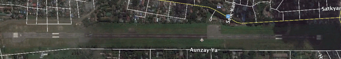
Kale Airport overview
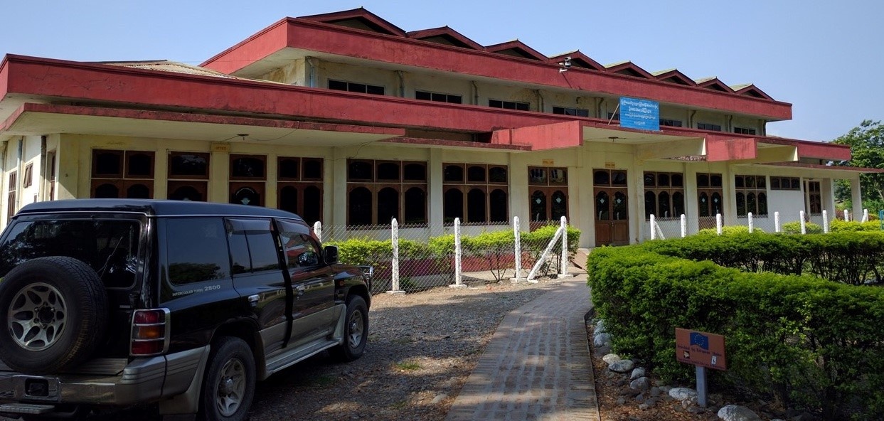
Kale Airport Terminal
Flight Schedules to Kale Airport
|
Airlines |
Sun |
Mon |
Tue |
Wed |
Thu |
Fri |
Sat |
|
Myanmar National Airline |
Y |
Y |
Y |
Y |
Y |
Y |
Y |
|
Air KBZ |
|
|
Y |
|
Y |
|
Y |
Runways
|
Runway #1 |
|
|---|---|
|
Runway Dimensions |
2133 m x 30 m |
|
Runway Orientation |
27 / 09 |
|
Runway Surface |
Bitumen, 33,112 Kg |
|
Runway Condition |
Good |
Airport Infrastructure Details
|
Infrastructure |
|||
|---|---|---|---|
|
Passenger / Cargo Security Screening |
Yes / No |
Runway Lighting |
Yes / No |
|
Refueling Capacity |
Yes / No |
Ground Handling Services |
Yes / No |
|
Air Traffic Control |
Yes / No |
Fire Fighting Equipment |
Yes / No |
|
Weather Information |
Yes / No |
Aircraft Parking Space |
Yes / No |
|
Navigation Aids |
Yes / No |
Perimeter Fencing |
Yes / No |
|
Windsock |
Yes / No |
|
|
Fuel Services Charges
N/A. In case of emergency Jet-A1 fuel can be provided by the military base on the other side of the airport.
Royalties / Non Objection Fees (NOFs)
N/A
2.2.14 Myanmar Monywa Airport
Airport Overview
Condition of the runway is
good. The airport is used by Myanmar National Airlines. There are
regular flights, three times a week; every Tuesday, Thursday and
Saturday to Homlin in Sagaing region. There is no designated
helipad in place. However, it can be arranged at apron area (91 x
91 meters) for VIP flight with prior approval from Department of
Civil Aviation in Yangon which takes about minimum 5 working days.
The airport is shared with the military North-West command
operating from a base with a helipad next to the civilian side of
the airport.
There is 36 m2 storage capacity in the garage of the
fire truck and the terminal (80 m2) has been used for
temporary storage of relief items. There is only basic manual cargo
handling equipment (500 kg capacity) to support passenger services
in this airport. The largest plane that can be handled are
medium-sized 100-seat planes such as EMB-190 / B-717.
|
Airport Location and Contact |
|
|---|---|
|
Country |
Myanmar |
|
Province or District |
Sagaing |
|
Nearest Town or City |
Monywa (13 km) |
|
Airport’s Complete Name |
Monywa Airport |
|
Latitude |
22.221444 |
|
Longitude |
95.094528 |
|
Elevation (ft and m) |
80.3 m / 263 ft |
|
IATA Code |
N/A |
|
ICAO Code |
VYMY |
|
Managing Company or Airport Authority |
Department of Civil Aviation |
|
Management Contact Person |
Mr. San Hein Oo (Air Traffic Control Officer) Phone: +95-9-402634121 / +95-71-3-449 |
|
NGO and/or UN Presence at Airport? |
No |
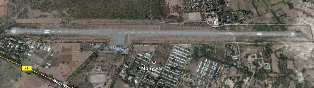 Runways
Monywa airport overview
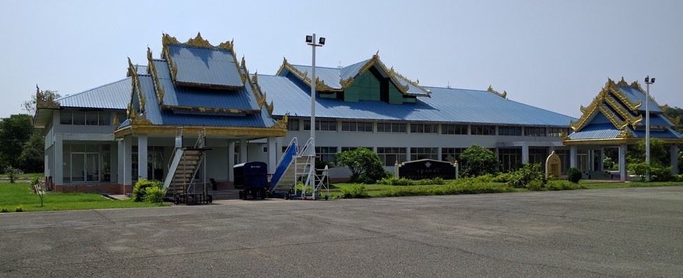
Monywar airport terminal
Runway
|
Runway #1 |
|
|---|---|
|
Runway Dimensions |
2591 m x 30 m |
|
Runway Orientation |
18 / 36 |
|
Runway Surface |
Asphalt/concrete |
|
Runway Condition |
Good |
Airport Infrastructure Details
|
Infrastructure |
|||
|---|---|---|---|
|
Passenger / Cargo Security Screening |
Yes |
Runway Lighting |
No |
|
Refueling Capacity |
No |
Ground Handling Services |
Yes, for luggage |
|
Air Traffic Control |
Yes |
Fire Fighting Equipment |
Yes, CAT 3 |
|
Weather Information |
Yes |
Aircraft Parking Space |
Yes, Apron 91 m x91 m |
|
Navigation Aids |
VFR |
Perimeter Fencing |
Yes |
|
Windsock |
Yes |
|
|
Fuel Services Charges
N/A. In case of emergency Jet-A1 fuel can be provided by the military North-West command upon prior arrangement.
Royalties / Non Objection Fees (NOFs)
N/A
2.2.15 Myanmar Loikaw Airport
The airport is located 2 km North-East of Loikaw town. Condition of the runway is good and the airport is used for year round. Only Myanmar National Airlines (MNA) and Air KBZ are scheduled currently. Other chartered flight from the Government is rarely landed for banking matter. The regular flights are KBZ flight on Mon, Wed and Friday for three days in a week thru Yangon- Naypyidaw-Loikaw- Yangon and the daily flight from MNA between Yangon and Loikaw. However, the schedule can be changed every after 3 months, especially in monsoon season. There is no helipad and need to manage in air apron for VIP helicopter. The airport is shared with the military, Eastern Command. Normally, no cargo is handled at this airport and it’s mainly used for tourism. The largest type of plane that can be handled in this airport is ATR 72. The run way is made of asphalt concrete and strength (PCN) bears 68.039 Mt.
|
Airfield Details |
|||
|
Country |
Myanmar |
Latitude |
19°41'30.32"N |
|
Province / District |
Kayah State/ Loikaw |
Longitude |
97°12'53.58"E |
|
Airfield Name |
Loikaw |
Elevation (ft) |
893.8m / 2932ft |
|
IATA & ICAO codes |
LIW / VYLK |
Surface |
Asphalt/concrete |
|
Town or City (closest) |
Heho, 2km |
Runway Condition |
Good |
|
NGO / UN (on ground) |
Yes, UNHCR/IOM |
Passenger / Cargo Security Screening (Yes / No) |
Yes |
|
Runway Dimension |
1829 (m) x 6000ftx75ft (will be extended up to 7000ft in April) |
Ground Handling (Yes / No) |
Yes, luggage trolleys |
|
Refuelling Capacity |
No *) |
Runway Lighting (Yes / No) |
Yes |
|
Runway Heading |
01/19 |
Fire Fighting Equipment (Yes / No) |
Yes, recently one double cab designed as firefighting truck, no CAT described yet. |
|
Air Traffic Control (Yes / No) |
Yes |
Windsock (Yes / No) |
Yes |
|
Weather Information (Yes / No) |
No |
Aircraft Parking space (Yes / No) |
Yes, Apron |
|
Navigation Aids (Yes / No) |
Only NDB |
Perimeter fencing (Yes / No) |
Yes |
*) In case of emergency Jet-A1, can be considered from Heho (187 km) as a closest airport with fuel storage capacity (approximately 4:30 hrs drive).
No storage facilities in the compound and the empty land can be leased out from the airport authority with the proper communication with Department of Civil Aviation in Yangon. In case of emergency, the existing room from based crew be served as a temporary storage for about 10 Mt of cereal food.
Contact: Dept. of Civil Aviation, Loikaw Airport, Kayah State,
Myanmar
Phone: +95-83-21500.
Mr. U Kyaw Soe (Airport Manager) Phone: +95-9-8614949/ 263937864/
33618332
2.2.16 Myanmar Heho Airport
The airport is located 3.7 Km North West of Heho town. Condition of the runway is good and it runs from South to North. The airport is busy all year round. There are nine airlines; Myanmar National Airlines, Air KBZ, Asia Wings, Yangon airway, Apex Airline, Mann Yadanarpon airlines, Golden Myanmar Airlines, FMI Air and Yangon Airways operates in the Heho airport. There are no international airlines except tour charter and ambulance. There are regular flights, everyday, 32 to 38 times per day in high season (October to February). The routes of the flight runs from Heho to Yangon, Mandalay, Lashio, Kengtung, Tarchileik, Monghsat and Bangan. There is no designated helipad in place. However, it can be arranged on apron for VIP flight. No cargo handling equipment facilities in this airport as it is mainly used for tourism. The largest plane that can be handled are medium-sized 100-seat planes such as EMB-190 / B-717. The run way is made of asphalt concrete and strength (PCN) is approximately 68 Metric ton.
|
Airfield Details |
|||
|
Country |
Myanmar |
Latitude |
20°44'49.36"N |
|
Province / District |
Shan State/ Taunggyi |
Longitude |
96°47' 31.28"E |
|
Airfield Name |
Heho |
Elevation (ft) |
1199.1m / 3933ft |
|
IATA & ICAO codes |
HEH / VYHH |
Surface |
Asphalt/concrete |
|
Town or City (closest) |
Taunggyi 33.1km |
Runway Condition |
Good |
|
NGO / UN (on ground) |
No |
Passenger / Cargo Security Screening (Yes / No) |
Yes |
|
Runway Dimension |
2591 (m) x 45 (m) |
Ground Handling (Yes / No) |
Yes, luggage trolleys |
|
Refuelling Capacity |
National Energy Puma Aviation Service (a Joint Venture company of MPPE). Fuel storage Capacity: 24,000 Gal |
Runway Lighting (Yes / No) |
Yes, functional |
|
Runway Heading |
18 / 36 |
Fire Fighting Equipment (Yes / No) |
Yes, CAT 6 |
|
Air Traffic Control (Yes / No) |
Yes |
Windsock (Yes / No) |
Yes |
|
Weather Information (Yes / No) |
No. only controller observed(physical weather condition) |
Aircraft Parking space (Yes / No) |
Yes, Apron |
|
Navigation Aids (Yes / No) |
NDB, DVOR & DME |
Perimeter fencing (Yes / No) |
Yes |
Contact: Dept. of Civil Aviation, Heho airport, Shan State,
Myanmar
Phone: +95-81-63032
Mr. U Htay Aung (Airport manager) DCA Phone: +95-9-401559049.
Fuel Services Charges
Please find out more information from National Energy Puma Aviation Service (a Joint Venture company of MPPE).
Office 12, Building 27,
Shwe Ohn Pin Housing,
Yanshin St, Yankin Township,
Yangon, Myanmar
2.2.17 Myanmar Anisakhan Airport
Airport Overview
The Anisakhan Airport in the Mandalay Region is not currently used by domestic airlines. The airport is mainly used by The Military Defence Services Academy based in Pyin Oo Lwin. Civilian and government flights rarely route through this airport. In total, there are 13 permanent staff at Anisakhan airport. A total of 22 civilian and military flights landed in 2019. Total airport area is 459.82 acres. The airport is located 21 km away from Pyin Oo Lwin and 54 KM away from Mandalay downtown. Since the airport is approximately a 1-hour drive from Mandalay, it could be a suitable location for a humanitarian cargo hub or open space for temporary shelters, in case of a large-scale emergency such as earthquake in Mandalay region. If there is a need to use this airport for humanitarian purposes, approval would need to be obtained from the Department of Civil Aviation in Yangon.
There is no designated helipad in place but can be arranged in the apron area (183 x 92 meter) for VIP flights. No cargo handling equipment facilities are available in this airport. The largest plane that can be handled are medium-sized 100-seat planes such as EMB-190 / B-717. The runway is made of asphalt concrete and strength (PCN) is approximately 60 MT. The airport security is handled by the Myanmar Air Force together with the Myanmar Police.
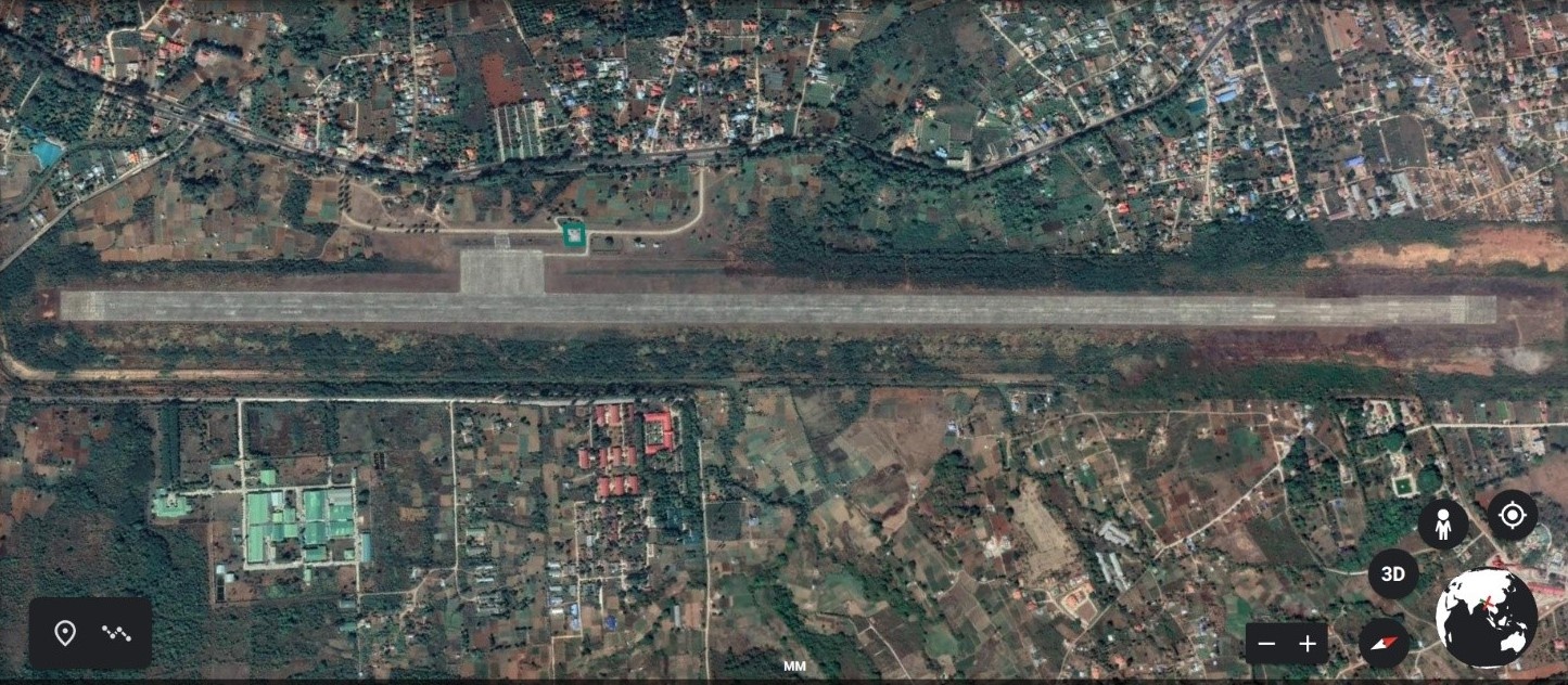
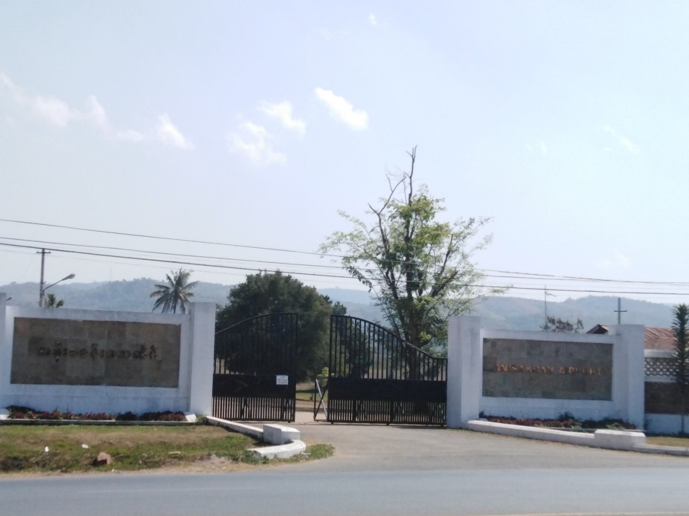
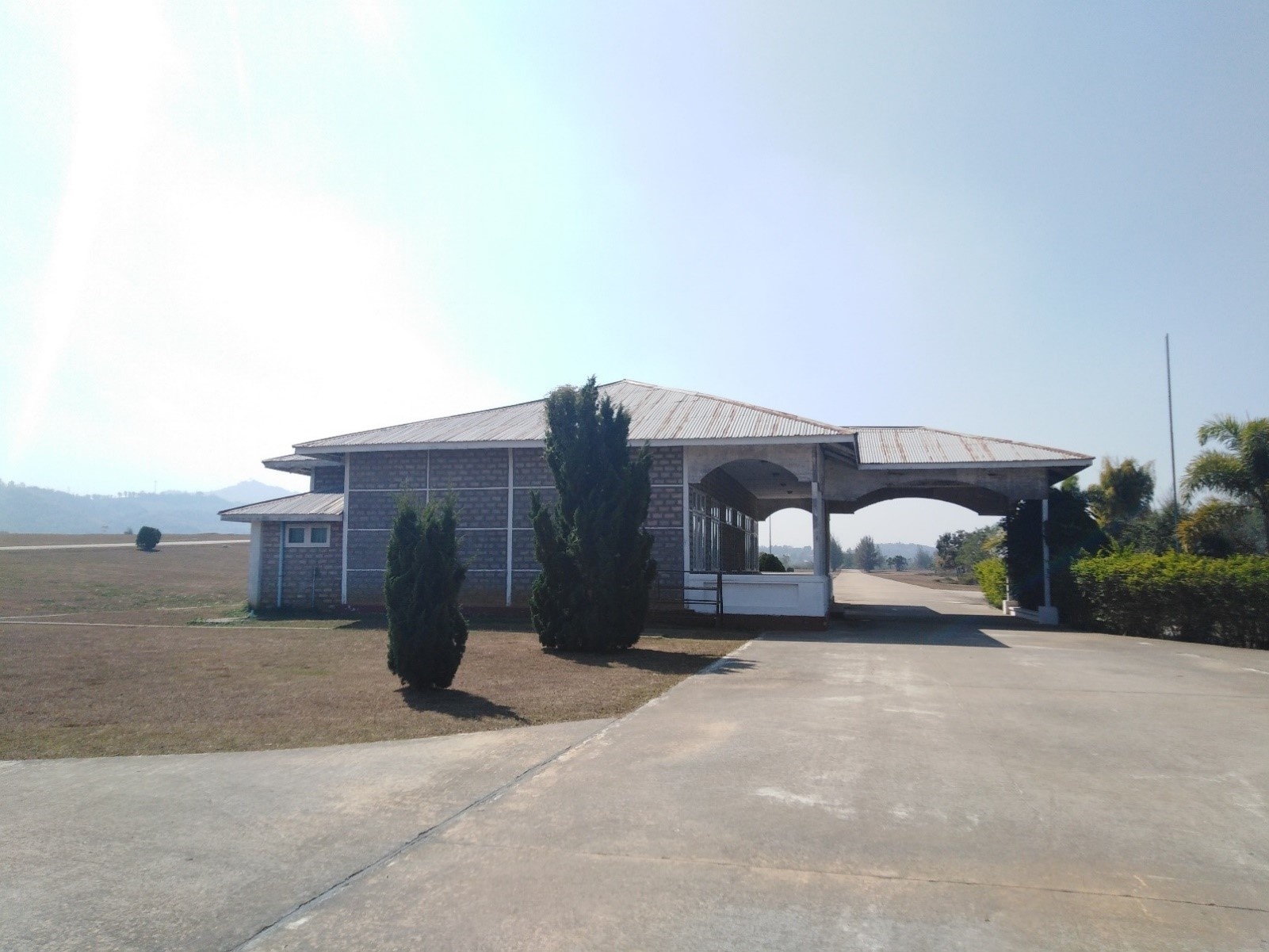
Anisakhan Airport Terminal
|
Airport Location and Contact |
|
|---|---|
|
Country |
Myanmar |
|
Province or District |
Mandalay Region |
|
Nearest Town or City |
Pyin Oo Lwin (21km) Mandalay (54km) |
|
Airport’s Complete Name |
Anisakhan Airport |
|
Latitude |
21.955278 |
|
Longitude |
96.405833 |
|
Elevation (ft and m) |
3130 ft (954 m) |
|
IATA Code |
N/A |
|
ICAO Code |
VYAS |
|
Managing Company or Airport Authority |
Department of Civil Aviation |
|
Management Contact Person |
Mr. Kyaw Kyaw Linn (Airport Coordinator) Phone: +95 9694289322, +95 95504398. |
|
NGO and/or UN Presence at Airport? |
No |
Runway
|
Runway #1 |
|
|---|---|
|
Runway Dimensions |
3054 m x 62 m |
|
Runway Orientation |
210 - 030 |
|
Runway Surface |
Asphalt/concrete |
|
Runway Condition |
Good |
Airport Infrastructure Details
|
Infrastructure |
|||
|---|---|---|---|
|
Passenger / Cargo Security Screening |
No |
Runway Lighting |
No |
|
Refueling Capacity |
No |
Ground Handling Services |
No |
|
Air Traffic Control |
Yes |
Fire Fighting Equipment |
Fire extinguisher only |
|
Weather Information |
No |
Aircraft Parking Space |
Yes, Apron 183 m x 92 m |
|
Navigation Aids |
VOR, visual only |
Perimeter Fencing |
Yes |
|
Windsock |
Yes |
|
|
Fuel Services Charges
N/A
Royalties / Non Objection Fees (NOFs)
N/A
2.2.18 Myanmar Keng Tung Airport
Airport Overview
Keng Tung Airport is located in Kengtung, a town in eastern Shan State. Condition of the runway is good. There are three airlines; Myanmar National Airlines, Air KBZ and Air Thanlwin operates in the Keng Tung airport. There are no international airlines since this is a regional airport. air ambulance medical flight is also not available. There are regular flights taking place three times per day. The routes of the flight run from Kengtung to Yangon, Mandalay, and Heho. Since there is no fuel service at this airport, airplanes refuel at transit airport (e.g. Heho) or carry extra fuel for return journey. There is no designated helipad in place. However, it can be arranged in the apron area upon prior arrangement. No cargo handling equipment facilities in this airport. The largest plane that can be handled are 75-seat planes such as ATR-72. The runway is made of asphalt concrete and strength (PCN) is approximately 31 MT
Kengtung Airport is 96.1 km away from Tachilek Airport and 269.03 km away from Lashio Airport.
|
Airport Location and Contact |
|
|---|---|
|
Country |
Myanmar |
|
Province or District |
Shan State / Keng Tung |
|
Nearest Town or City |
Keng Tung (4.8 km) |
|
Airport’s Complete Name |
Keng Tung Airport |
|
Latitude |
21.303328 |
|
Longitude |
99.630978 |
|
Elevation (ft and m) |
2705 ft (824 m) |
|
IATA Code |
KET |
|
ICAO Code |
VYKG |
|
Managing Company or Airport Authority |
Department of Civil Aviation |
|
Management Contact Person |
Mr. U Soe Paing - Airport Manager, DCA Phone: +95-9-449252429 |
|
NGO and/or UN Presence at Airport? |
Yes, NGO's |
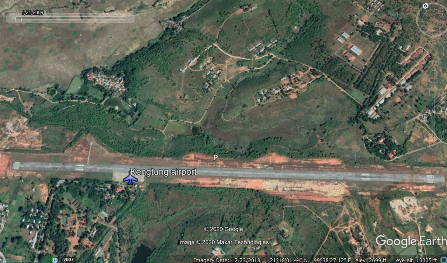
Runway
|
Runway #1 |
|
|---|---|
|
Runway Dimensions |
2382 m x 23 m |
|
Runway Orientation |
12/30 |
|
Runway Surface |
Asphalt/concrete |
|
Runway Condition |
Good |
Airport Infrastructure Details
|
Infrastructure |
|||
|---|---|---|---|
|
Passenger / Cargo Security Screening |
Yes |
Runway Lighting |
No |
|
Refueling Capacity |
No |
Ground Handling Services |
Yes, manual luggage trolleys |
|
Air Traffic Control |
Yes |
Fire Fighting Equipment |
Yes, CAT 3 |
|
Weather Information |
Yes |
Aircraft Parking Space |
Yes, Apron |
|
Navigation Aids |
NDB, DVOR & DME |
Perimeter Fencing |
Yes |
|
Windsock |
Yes |
|
|
Fuel Services Charges
N/A
Royalties / Non Objection Fees (NOFs)
N/A
2.2.19 Myanmar Lashio Airport
Airport Overview
Lashio Airport is in Shan State. The runway is good and it runs from North to South. There are five airlines which operate in the Lashio airport; Myanmar National Airlines, Air KBZ, Air Thanlwin, Mann Yadanarpon Airlines, and Golden Myanmar Airlines. There are no international airlines and air ambulance flight for medical evacuation. There are regular daily flights operated by various airlines up to five to seven times per day. The routes of the flight run from Lashio to Yangon, Mandalay, Heho, Kengtung, Tachilek. There is no designated helipad in place. However, it can be arranged on apron for chartered flight. No cargo handling equipment facilities in this airport. The largest plane that can be handled are 75-seat planes such as ATR-72. The runway is made of asphalt concrete and strength (PCN) is approximately 23 MT.
|
Airport Location and Contact |
|
|---|---|
|
Country |
Myanmar |
|
Province or District |
Shan State / Lashio |
|
Nearest Town or City |
Lashio (4.96 km) |
|
Airport’s Complete Name |
Lashio Airport |
|
Latitude |
22.973944 |
|
Longitude |
97.753642 |
|
Elevation (ft and m) |
2515 ft (766 m) |
|
IATA Code |
LSH |
|
ICAO Code |
VYLS |
|
Managing Company or Airport Authority |
Department of Civil Aviation |
|
Management Contact Person |
Mr. U Myint Naing (Airport Manager, DCA Phone: +95-82-23954, +95-9-400308334 |
|
NGO and/or UN Presence at Airport? |
Yes, WFP, UNICEF, UNOCHA, UNHCR, UNRC, UNFPA, UNDSS, UNOPS, WHO |
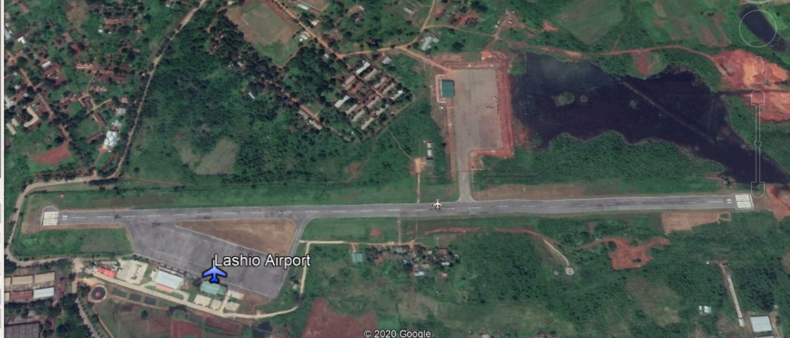
Lashio Airport Terminal
Runway
|
Runway #1 |
|
|---|---|
|
Runway Dimensions |
1600 m x 30 m |
|
Runway Orientation |
01/19 |
|
Runway Surface |
Asphalt/concrete |
|
Runway Condition |
Good |
Airport Infrastructure Details
|
Infrastructure |
|||
|---|---|---|---|
|
Passenger / Cargo Security Screening |
Yes |
Runway Lighting |
No |
|
Refueling Capacity |
No |
Ground Handling Services |
Yes, manual luggage trolleys |
|
Air Traffic Control |
Yes |
Fire Fighting Equipment |
Yes, CAT 2 |
|
Weather Information |
Yes |
Aircraft Parking Space |
Yes, apron |
|
Navigation Aids |
NDB, DVOR & DME |
Perimeter Fencing |
Yes |
|
Windsock |
Yes |
|
|
Fuel Services Charges
N/A
Royalties / Non Objection Fees (NOFs)
N/A
2.2.20 Myanmar Tachileik Airport
Airport Overview
Tachileik Airport is a domestic regional airport serving Tachileik, a town in the Eastern Shan State. Condition of the runway is good, and it runs from North to South. There are five airlines; Myanmar National Airlines, Air KBZ, Air Thanlwin, Mann Yadanarpon airlines, Golden Myanmar Airlines, operates flights to the Tachileik airport. There are no international airlines and no air ambulance medical flight. There are regular daily flights averaging seven times per day. The routes of the flight run from Tachileik to Yangon, Mandalay, Heho, Kengtung, Lashio, and Myitkyina. There is no designated helipad in place. However, it can be arranged on apron for chartered flight. No cargo handling equipment facilities in this airport. The largest plane that can be handled are 75-seat planes such as ATR-72, 700, 600. The runway is made of asphalt concrete and strength (PCN) is approximately 33 MT.
|
Airport Location and Contact |
|
|---|---|
|
Country |
Myanmar |
|
Province or District |
Shan State / Tachileik |
|
Nearest Town or City |
Tachileik (4km) |
|
Airport’s Complete Name |
Tachileik Airport |
|
Latitude |
20.481469 |
|
Longitude |
99.932897 |
|
Elevation (ft and m) |
1275ft / 389 m |
|
IATA Code |
THL |
|
ICAO Code |
VYTL |
|
Managing Company or Airport Authority |
Department of Civil Aviation |
|
Management Contact Person |
Mr. U Win Myint - Airport Manager, DCA Phone: +95-9-263288160 |
|
NGO and/or UN Presence at Airport? |
Yes |
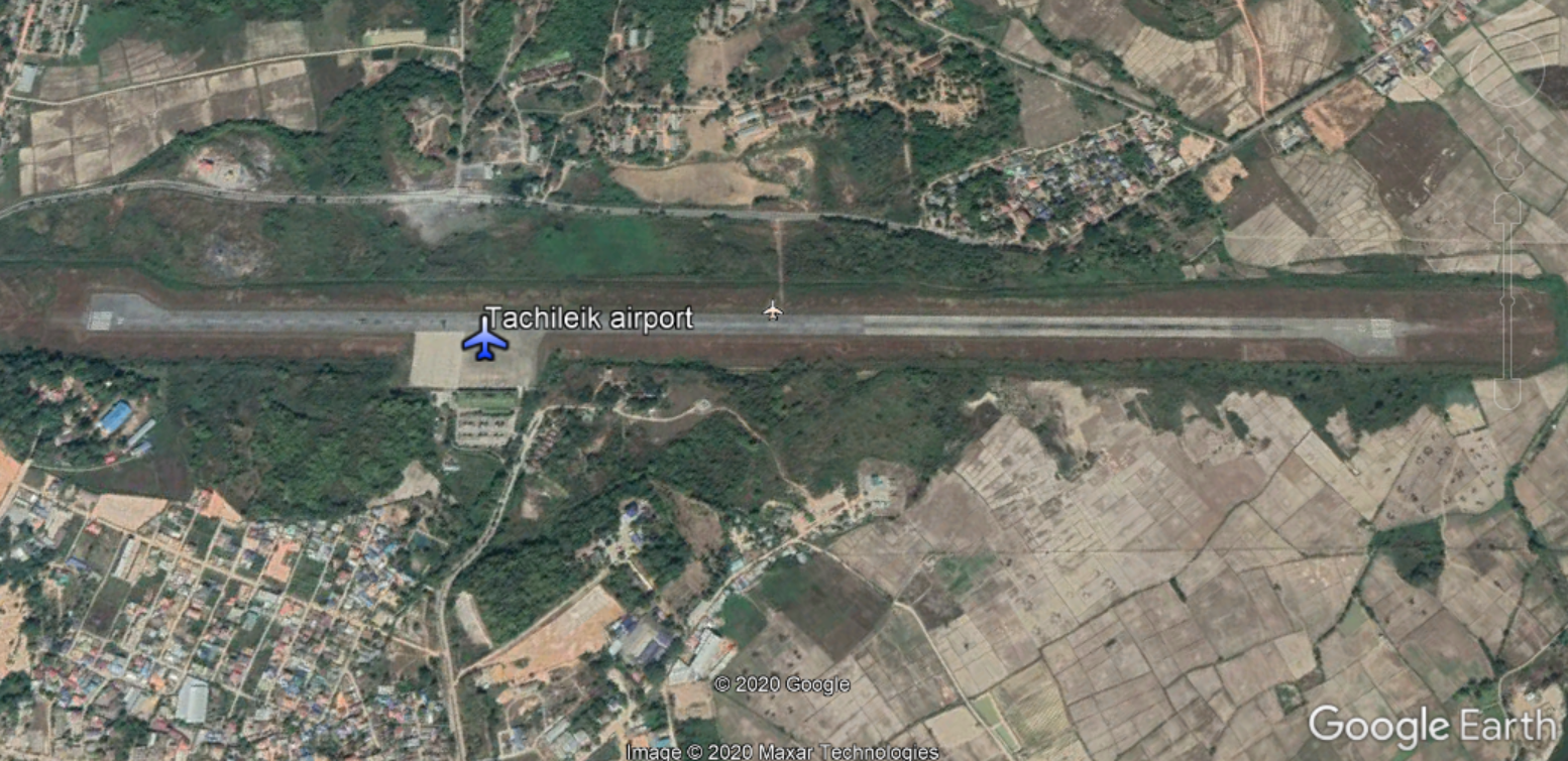
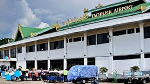
Tachileik Airport Terminal
Runway
|
Runway #1 |
|
|---|---|
|
Runway Dimensions |
2134 m × 30 m |
|
Runway Orientation |
04/22 |
|
Runway Surface |
Asphalt/concrete |
|
Runway Condition |
Good |
Airport Infrastructure Details
|
Infrastructure |
|||
|---|---|---|---|
|
Passenger / Cargo Security Screening |
Yes |
Runway Lighting |
Yes |
|
Refueling Capacity |
Yes |
Ground Handling Services |
Yes, manual luggage trolleys only |
|
Air Traffic Control |
Yes / No |
Fire Fighting Equipment |
Yes, CAT 5 |
|
Weather Information |
Yes / No |
Aircraft Parking Space |
Yes, apron |
|
Navigation Aids |
Yes / No |
Perimeter Fencing |
Yes |
|
Windsock |
Yes / No |
|
|
Fuel Services Charges
National Energy Puma Aviation Service provides fuel service at this domestic airport, with a fuel storage capacity of 10,000 gallons.
Royalties / Non Objection Fees (NOFs)
N/A
2.2.21 Myanmar Ann Airport
Airport Overview
The construction of the Ann Airport runway was completed in 2003 with a control tower installed in 2008 for military purposes. The Ann airport is operating for military aircraft mainly, but started operating for civil aviation only after 2018. There are no international airlines serving this airport. Only Myanmar National Airlines operate in the Ann Airport with flights every Monday and Friday, mainly to serve government staff and other officials who need to attend meetings to other areas. There is a designated area with helicopter pads (50 x 50 ft) in place managed by the military. There are no cargo handling equipment facilities in this airport as it is mainly used for tourism. At this point, the airport only handles ATR 72-600 with the capacity of 70~80 seats.
Airport security, police network, CCTV, and military are in place. Available hand detector walk through x-ray for passenger screening and x-ray for luggage screening.
|
Airport Location and Contact |
|
|---|---|
|
Country |
Myanmar |
|
Province or District |
Rakhine / Ann |
|
Nearest Town or City |
Ann (6 km) |
|
Airport’s Complete Name |
Ann Airport |
|
Latitude |
19.778223 |
|
Longitude |
94.028450 |
|
Elevation (ft and m) |
53 ft (16 m) |
|
IATA Code |
VBA |
|
ICAO Code |
VYAN |
|
Managing Company or Airport Authority |
Department of Civil Aviation |
|
Management Contact Person |
U Than Shwe Maung - Airport Manager, DCA Phone: +95-9-421713549. |
|
NGO and/or UN Presence at Airport? |
No |
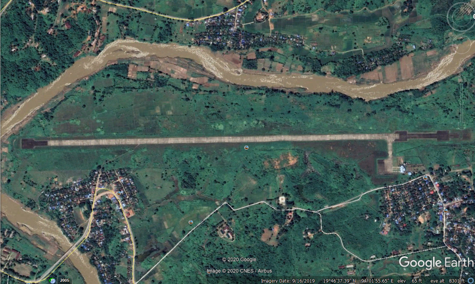
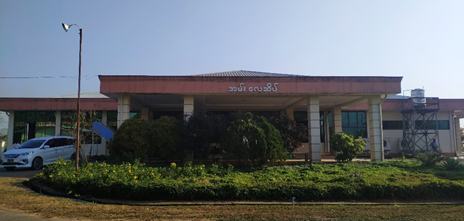
Ann Airport Terminal

Map of 3 airports in Rakhine.
Runway
|
Runway #1 |
|
|---|---|
|
Runway Dimensions |
2,591 m x 30 m |
|
Runway Orientation |
18 / 36 |
|
Runway Surface |
Concrete |
|
Runway Condition |
Good |
Airport Infrastructure Details
|
Infrastructure |
|||
|---|---|---|---|
|
Passenger / Cargo Security Screening |
Yes |
Runway Lighting |
Yes |
|
Refueling Capacity |
No |
Ground Handling Services |
Yes, manual luggage trolleys only |
|
Air Traffic Control |
Yes |
Fire Fighting Equipment |
Yes, CAT 4 1 Fire Truck |
|
Weather Information |
Yes, manual only |
Aircraft Parking Space |
Yes, capacity for 3 ATR aircraft maximum / Apron 50 x 50 feet |
|
Navigation Aids |
Yes, NDB |
Perimeter Fencing |
Yes |
|
Windsock |
Yes |
|
|
Fuel Services Charges
No Jet A1 fuel tank trucks are available at this airport. Planes heading to and from this airport should refuel at Magway Airport before / after reaching Ann Airport. For emergency cases, the military can provide the required fuel from their storage in Ann with prior arrangement or as a last resort. The fuel service charges are unavailable from the military.
Royalties / Non Objection Fees (NOFs)
N/A
2.2.22 Myanmar Kyauk Phyu Airport
Airport Overview
Kyauk Phyu airport was built in 1958 for military operations. Its runway is 4,620 feet long and 100 feet wide. The runway was expanded in 2011 by additional 1,000 feet and in 2013 by another 1,400 feet. Current runway operates with a length of 7,500 feet (2,286 m) and a width of 100 feet. There are two airlines which operates in the Kyauk Phyu airport: Myanmar National Airlines and Air KBZ. There are no international airlines.
The airport handles an estimate of 14 flights per week and flight delays are likely to happen only during the rainy and winter seasons. There are two designated area with helicopter pads in place owned by a private company POSCO international. No cargo handling equipment facilities in this airport as it is mainly used for tourism. Only two types of aircraft; ATR 72-600 with the capacity of 70 seats and C208 (208 Caravan) with the capacity of 9 ~ 13 seats are handled.
|
Airport Location and Contact |
|
|---|---|
|
Country |
Myanmar |
|
Province or District |
Rakhine / Kyauk Phyu |
|
Nearest Town or City |
Kyauk Phyu (1.6 km) |
|
Airport’s Complete Name |
Kyauk Phyu |
|
Latitude |
19.426389 |
|
Longitude |
93.534722 |
|
Elevation (ft and m) |
20 ft / 6 m |
|
IATA Code |
KYP |
|
ICAO Code |
VYKP |
|
Managing Company or Airport Authority |
Department of Civil Aviation |
|
Management Contact Person |
Mr. Nyi Myo Aung (Manager) Phone: +95-9-779633348. |
|
NGO and/or UN Presence at Airport? |
No |
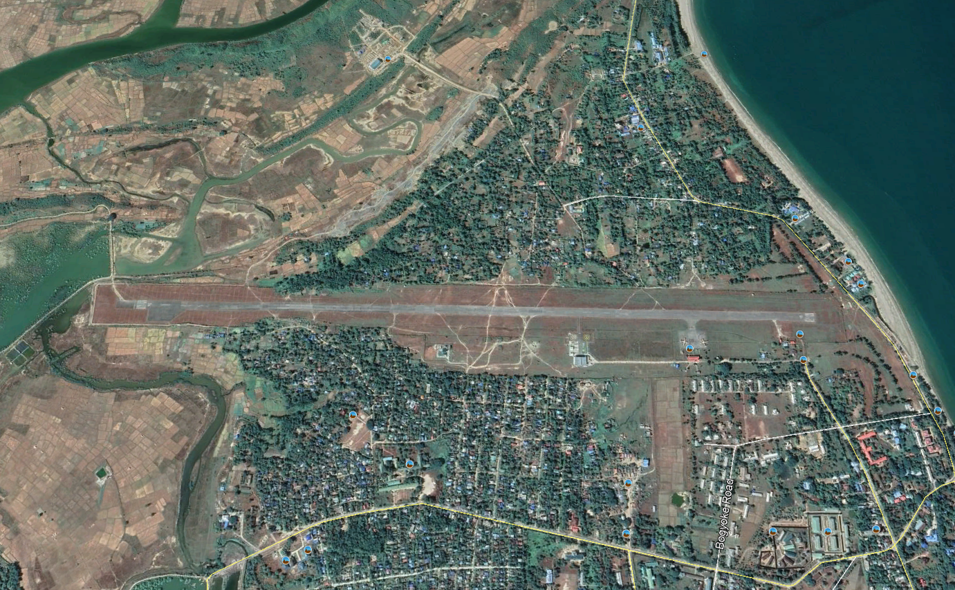
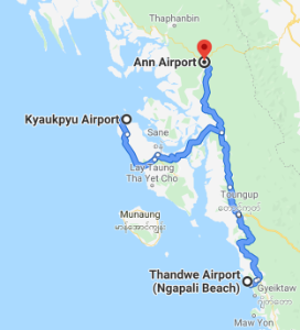
Map of 3 airports in Rakhine.
Runway
|
Runway #1 |
|
|---|---|
|
Runway Dimensions |
2,286 m x 30 m |
|
Runway Orientation |
18 / 36 |
|
Runway Surface |
Bitumen |
|
Runway Condition |
Good |
Airport Infrastructure Details
|
Infrastructure |
|||
|---|---|---|---|
|
Passenger / Cargo Security Screening |
Yes |
Runway Lighting |
No |
|
Refueling Capacity |
Yes. Jet A1 only |
Ground Handling Services |
Yes, manual luggage trolleys only |
|
Air Traffic Control |
Yes |
Fire Fighting Equipment |
Yes, CAT 2 1 firetruck |
|
Weather Information |
Yes, AWS manual only |
Aircraft Parking Space |
Yes |
|
Navigation Aids |
Yes, NDB |
Perimeter Fencing |
Yes |
|
Windsock |
Yes |
|
|
Fuel Services Charges
Only Jet-A1 is available, Provided by National Energy Puma Aviation Service.
Royalties / Non Objection Fees (NOFs)
N/A
2.2.23 Myanmar Sittwe Airport
Airport Overview
Sittwe Airport started as RAF Station Sittwe, a military airfield in World War II, and was handed over to Department of Civil Aviation by the International Aero Limited Company on 24 July 1947. It was upgraded to 6,000 feet long and 140 feet wide gravel mixed asphalt runway in 1960. The airport building was extended to 220 feet by 60 feet from 120 feet by 60 feet and it was opened on 22 March 2002. A four-foot thick asphalt concrete layer was placed on the 6000 x 150 feet runway, the 525 x 75 feet taxiway and the 600 x 300 feet apron and opened on 20 May 2009 for use of F-28 jets. There are five domestic airlines (Golden Myanmar, Air KBZ, Mann Yadarnarpon, Air Thanlwin and Myanmar National Airlines) providing regular flights to Sittwe airport. There is no specified helipad but landing arrangement can be made at apron area.
The largest plane that can be handled is medium-sized 100-seat planes such as the Airbus A320. It is equipped with night landing facilities such as airfield lighting, approach light and remote-control air ground machines. Sittwe Airport handled around 432,000 passengers in 2019. Some private international airlines for offshore projects had been used at Sittwe since 2004 as a base with one fixed wing and one helicopter. It is feasible to use as a humanitarian hub, however a special arrangement needs to be coordinated with DCA and temporary storage facility options need to be looked at since there is limited storage space and ground handling equipment on the ground.
Sources: Site visit and https://en.wikipedia.org/wiki/Sittwe_Airport
|
Airport Location and Contact |
|
|---|---|
|
Country |
Myanmar |
|
Province or District |
Rakhine / Sittwe |
|
Nearest Town or City |
Sittwe (13 km) |
|
Airport’s Complete Name |
Sittwe Airport |
|
Latitude |
20.135658 |
|
Longitude |
92.873325 |
|
Elevation (ft and m) |
38ft / 11.58 m |
|
IATA Code |
AKY |
|
ICAO Code |
VYSW |
|
Managing Company or Airport Authority |
Department of Civil Aviation |
|
Management Contact Person |
Mr. Kyaw Soe, Manager Phone: +95-9-428614949. |
|
NGO and/or UN Presence at Airport? |
Yes |
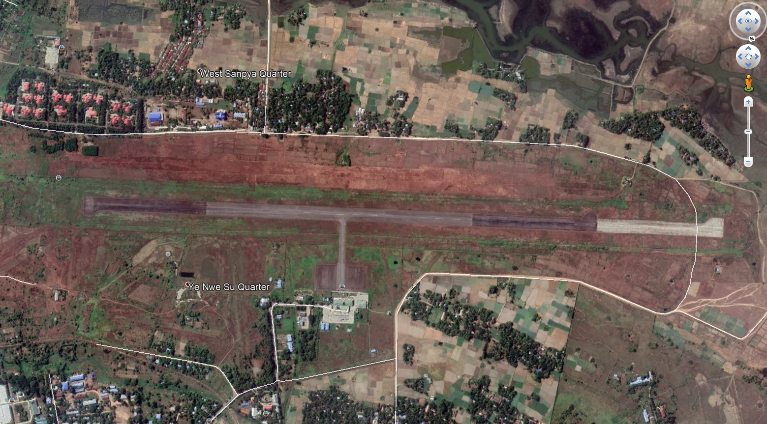
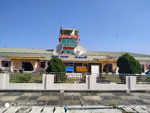
Sittwe Airport Terminal
Runway
|
Runway #1 |
|
|---|---|
|
Runway Dimensions |
2286 m x 46 m |
|
Runway Orientation |
11 / 29 |
|
Runway Surface |
Asphalt/concrete |
|
Runway Condition |
Good |
Airport Infrastructure Details
|
Infrastructure |
|||
|---|---|---|---|
|
Passenger / Cargo Security Screening |
Yes |
Runway Lighting |
Yes |
|
Refueling Capacity |
Yes* |
Ground Handling Services |
Yes |
|
Air Traffic Control |
Yes |
Fire Fighting Equipment |
Yes, CAT 3 1 firetruck |
|
Weather Information |
Yes |
Aircraft Parking Space |
Yes, apron 91 m x 91 m |
|
Navigation Aids |
Yes, VFR |
Perimeter Fencing |
Yes / No |
|
Windsock |
Yes |
|
|
* Only Jet-A1 is available, provided by National Energy Puma Aviation Service.
Fuel Services Charges
Only Jet-A1 is available, provided by National Energy Puma Aviation Service.
Passenger Services
Payable by the passenger:
- USD 10 for each international departing passenger at international airports.
- MMK 1000 for each domestic departing passenger at national airports.
Flight Schedules
|
Airline |
Destinations |
Schedules |
Remark |
|---|---|---|---|
|
MNA (Myanmar National Airlines) |
Yangon |
Daily |
2 flight per day |
|
Man Aung |
Wednesday |
|
|
|
Ann, Magwe |
Mon & Friday |
2 times per week |
|
|
Thandwe, Yangon |
Daily |
|
|
|
Kyauk Phyu, Thandwe, Yangon |
Wednesday & Sunday |
2 times per week |
|
|
Golden Myanmar |
Yangon |
Daily |
2 flight per day |
|
Thandwe |
Tuesday & Wednesday |
|
|
|
Air KBZ |
Yangon |
Daily |
2 flight in Sunday |
|
Mann Yadarnarpon |
Yangon |
Daily |
|
|
Air Thanlwin |
Yangon |
Daily |
|
Royalties / Non Objection Fees (NOFs)
N/A
2.2.24 Myanmar Thandwe Airport
Airport Overview
Thandwe, formerly known as Sandoway, is the largest city in the area and the main gateway to Ngapali Beach. Thandwe Airport has undergone several upgrades in the past. A 500 foot runway extension work at the north portion was completed and the available length (6000 x100 feet) has been operational since August 2010. Another 2000 feet was extended and completed in May 2011 to bring it to 8000 feet. The government planned to expand the runway further to allow international flights and larger commercial planes to land. Currently, it is only able to service ATR 72/500. There are 54 flights on 4 different routes from Thandwe Airport. The most popular routes connect Thandwe to Yangon, Sittwe, Mandalay, and Kyauk Phyu. Better flight connections to international markets is expected to benefit the fisheries industry in the area as the current export practice requires frozen sea products to be shipped to international markets via Yangon.
|
Airport Location and Contact |
|
|---|---|
|
Country |
Myanmar |
|
Province or District |
Rakhine/ Thandwe |
|
Nearest Town or City |
Thandwe (9.3 km) |
|
Airport’s Complete Name |
Thandwe Airport |
|
Latitude |
18.454325 |
|
Longitude |
94.299256 |
|
Elevation (ft and m) |
18 ft (5.49 m) |
|
IATA Code |
SNW |
|
ICAO Code |
VYTD |
|
Managing Company or Airport Authority |
Department of Civil Aviation |
|
Management Contact Person |
U Mann Zaw Airport Manager, DCA Phone: +95-9-250183072. |
|
NGO and/or UN Presence at Airport? |
No |

Thandwe Airport runway
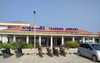
Thandwe Airport Terminal

Map of the 3 airports in Rakhine.
Runway
|
Runway #1 |
|
|---|---|
|
Runway Dimensions |
2591 m x 30 m |
|
Runway Orientation |
02 / 20 |
|
Runway Surface |
Bitumen Strength: 33,112 kg |
|
Runway Condition |
Good |
Airport Infrastructure Details
|
Infrastructure |
|||
|---|---|---|---|
|
Passenger / Cargo Security Screening |
Yes |
Runway Lighting |
Yes |
|
Refueling Capacity |
No |
Ground Handling Services |
Yes, manual baggage trolleys |
|
Air Traffic Control |
Yes |
Fire Fighting Equipment |
Yes, CAT 3 1 firetruck |
|
Weather Information |
Yes, manual only |
Aircraft Parking Space |
Yes, apron 350 x 420 feet |
|
Navigation Aids |
Yes, DVOR |
Perimeter Fencing |
Yes |
|
Windsock |
Yes |
|
|
Fuel Services Charges
Not available. Airplanes must refuel at Yangon or Sittwe Airport prior to transiting at this airport.
Royalties / Non Objection Fees (NOFs)
N/A
2.2.25 Myanmar Bhamo Airport
Airport Overview
Bhamo (Banmaw) is a city in the Kachin State in northern Myanmar. Bhamo Airport was built as a Japanese Air Force base in 1942 and was attacked numerous times by Allied forces before being seized in May 1945. Bhamo Airport is in the north east of the country, close to the Chinese border, south of Myitkyina. It is currently operational for civilian use. During the assessment, only one airline company, Myanmar Airways, flies four times per week from Yangon to Bhamo Airport. The flight is scheduled every Sunday, Monday, Wednesday, and Friday round trip from Yangon to Bhamo via Mandalay and Myitkyina.
Currently the Embraer 190 is the maximum airplane size that can land in Bhamo. Myanmar Airways operates basic cargo handling for passengers’ luggage. There are no special cargo handling equipment available, only five cargo trolleys. Max weight runway 3000 pounds. The airport has a basic CCTV security system in place. A walkthrough metal detector, an X-ray machine for hand-luggage and a Handheld metal detector.
Given the conditions and extremely limited services available at Bhamo Airport, Myitkyina Airport (20 minutes flight time away from Bhamo) is more suitable for humanitarian operations.
|
Airport Location and Contact |
|
|---|---|
|
Country |
Myanmar |
|
Province or District |
Kachine |
|
Nearest Town or City |
Bhamo |
|
Airport’s Complete Name |
Bhamo Airport |
|
Latitude |
24.269033 |
|
Longitude |
97.246153 |
|
Elevation (ft and m) |
378 ft (115 m) |
|
IATA Code |
BMO |
|
ICAO Code |
VYBM |
|
Managing Company or Airport Authority |
Department of Civil Aviation |
|
Management Contact Person |
n/a |
|
NGO and/or UN Presence at Airport? |
No |
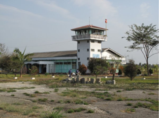
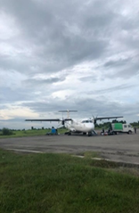
Runway
|
Runway #1 |
|
|---|---|
|
Runway Dimensions |
2286 m x 30.48 m |
|
Runway Orientation |
030 / 151 |
|
Runway Surface |
Bituminous tar or asphalt, mixed in place. |
|
Runway Condition |
Good |
Airport Infrastructure Details
|
Infrastructure |
|||
|---|---|---|---|
|
Passenger / Cargo Security Screening |
Yes |
Runway Lighting |
Yes |
|
Refueling Capacity |
Yes, MPPE JetA1, drum, hand pump |
Ground Handling Services |
Yes, manual baggage trolleys only |
|
Air Traffic Control |
Yes |
Fire Fighting Equipment |
Yes, 6 units of 50 kg chemical dry powder, 2 kg foam, and fire engine. |
|
Weather Information |
Yes, AWS |
Aircraft Parking Space |
Yes, 200 x 300 feet |
|
Navigation Aids |
Yes, NDB |
Perimeter Fencing |
Yes, inner fencing |
|
Windsock |
Yes |
|
|
Fuel Services Charges
Currently there is no fuel storage capacity and fuel refilling services at Bhamo Airport. Planes refuel at either Mandalay or Myitkyina Airports where the flights normally transit for a short time. There is no direct flight from Yangon to Bhamo.
Royalties / Non Objection Fees (NOFs)
N/A
2.3 Myanmar Road Network
Overview
Among ASEAN countries, Myanmar’s roads are the most underdeveloped. Although the road network expanded to 148,690 km (92,392 mi) as of March 2012 from 90,713km in 2004, road density remains among the lowest in the region. Only 39% (57,840 km) of the network is paved and 61% (90,850 km) unpaved, with the secondary and local road network generally in poor condition and not passable during the monsoon season. The government of Myanmar has two ministries controlling transportation: Ministry of Rail Transportation and the Ministry of Transport. The Ministry of Construction is responsible for construction and maintenance of roads, bridges and airports. Only 26% of roads (39,083 km) fall under responsibility of the Ministry of Construction.
All roads are under the management of Ministry of Construction. However, government may engage with private companies on BOT (Build-Operate-Transfer) basis. In such case, the responsibility of maintaining the road condition lies with the operator company.
With continuous improvements that have been undertaken on the expansion and upgrade of Myanmar road network, there is a gradual shift of cargo and passenger movement to road transportation as shown by the increasing volume of road transport assets and the diminishing volume of cargo on waterway and railway transportation on certain major routes or domestic corridors where road transport infrastructures have improved and/or arterial road network expansion has taken place.
The entrance of international logistics companies into Myanmar is driven by the economic opportunities that are present in the country. With continuous increase in export and import activities, and importation of larger fleets into the country, there has been reported a steady decrease of freight costs per ton over the last decade as observed on major route of Yangon to Mandalay which accounts for 60-70% of trucking volume in the country.
Transport market remains fragmented with services concentrated among a handful of large companies with limited trickle-down effect to small and medium haulers with older and smaller fleets. This hopefully changes with the arrival international companies and the emergence of local trucking technology-based platform that connects cargo owners with smallholder transport providers. Another key factor that signifies progress is the opportunity offered by allowing more competition in the fuel provision market by offering entrance to foreign fuel providers. This will reform the fuel market towards higher efficiency and ultimately attracts the availability of new, more efficient trucks in the country.
Due to unequal distribution of economic activities across the country, empty backhaul is a common challenge that impedes progress in transport cost reduction since vehicles productivity maximization is therefore limited.
Humanitarian organizations generally transport cargo by road as road network continues to be upgraded, particularly on the main highway line between Yangon and Mandalay, which is the busiest line in the country. In the North and Central Rakkhine, a higher reliance on waterway transportation given challenges on the road due to potential closures due to sporadic flooding or extremely poor conditions.
NB - 1 Since December 2016, there has been a ban on truck access for the Yangon metropolitan area
The ban for heavy trucks from 0600 to 2100 daily is being implemented by the government for the roads listed below in Yangon:
- Strand Road
- Bayintnaung Road
- Lower Minglardon Road
- Danyingone Junction
- Yadanar Road (Shwe Pyi Thar)
- Waizayantar Junction
- Aungzeya Road
- Pearl Road
- Kayaybin Road
- Pyinmabin Road
- No.3 Highway
- Botahtaung Pagoda Road
- Maha Bandoola Bridge
- Shukinnthar Road
- Ayeywarwun Street
- Bago River Street
- Kanaung Minthargyi Road
In terms of general traffic rules, there are a few points to note:
There are twelve types of driving license, including international driving license. To drive passenger city cars (up to 3 tons), B-type license is required. D-type license allows you to drive all types of registered vehicles, except commercial trucks and buses. E-type license allows you to drive all types of registered vehicle, including commercial trucks and buses. For further detailed information in this regard, please visit http://www.rtad.gov.mm.
Myanmar does not have cross-border agreement to allow trucks from neighbouring countries to operate inside Myanmar and vice-versa; and a number of border crossings do not allow vehicles to cross as well. But Thailand border cross gate is slightly improved as cargo trucks are allowed to enter till Myawaddy gate (Myanmar) and Mae Sot gate (Thailand) by registering at the respective gate for a period of one week.
Primary Roads in Myanmar
- 1 – 1577 km: Runs from Myawaddy (Thai border)-Thaton-Payagyi-Nay Pyi Taw-Meiktila-Mandalay-Gangaw-Kale-Tamu (India border) (AH-1).
- 2 – 804 km: Runs from Tachileik (Thai border)-Keng Tung-Taunggyi-Meiktila-Mandalay-Gangaw-Kale-Tamu (India border) (AH-2).
- 3 – 90 km; Runs from AH-2 at Keng Tung-Mongla (PR China border) (AH-3).
- 4 – 460 km: Runs from Mandalay-Lashio-Muse (PR China border) (AH-14).
- 5 – 250 km: Runs from Thaton-Mawlamyine-Dawei-Myeik-Kawthaung (AH-112).
- 6 – 196 km: Runs from Yangon-Kyaunggon-Pathein (Western Union highway).
- 7 – 279 km: Runs from Yangon-Tharrawaddy-Pyay (Route 2).
- 8 – 134 km: Runs from Dawei-Sinbhyudaing (Tikee) (to Thai border) (AH-123).
In case of emergencies, the primary supply corridors and main border crossings are:
- AH-1: North-West to South-East: from North-East India, Guwahati to East Thailand, Bangkok. Border crossing at Tamu (India) and Myawaddi (Thailand).
- AH-2: Connecting at AH-1 central to East: North Thailand, Chiang Rai. Border crossing at Tachileik (Thailand).
- AH-3: Connecting at AH-2, North-East: China, Kunming. Border crossing at Mongla (China).
- AH-14: Connecting at AH-1 central to North East: China, Kunming. Border crossing at Muse (China).
- AH-123: The border crossing at Tikee is used by locals for cross-border trade but requires special permission for foreigners to cross; it has been used by UNHCR. There is another border crossing in Kayin state near Ye (Mon state) the “Three Pagoda Pass”, which remains closed.
AH-1: The Yangon-Mandalay expressway or Bagan highway is the only expressway in Myanmar featuring a double carriageway and four lanes in good condition on its entire length of 587km. This express way runs from Yangon via Naypyitaw, Meikthila to Mandalay. Trucks are not allowed to use this expressway and must use the old Yangon-Mandalay highway instead, which runs parallel to the Bagan highway. The AH-1 road section between Kale and Tamu has sections 47 bridges with 13 and 24MT weight limit. The condition of the bridges is generally poor.
With improvements made in recent years, the condition of the old Yangon-Mandalay highway is now good. This road is two lanes wide in most places and four lanes in some parts close to Yangon and Mandalay. Private cars rarely use this route because the Bagan highway is shorter, this road is mostly used for cargo traffic.
Route-2: The Yangon-Pyay highway is in good condition.
AH-14: The Road from Mandalay via Lashio to Muse is in acceptable condition. This road was extensively renovated the last ten years to handle the heavy traffic of Myanmar-China border trading. This road now serves as one of the most important trade route in Myanmar.
The Yangon-Pathein highway, or Western Union Highway (196km from East to West) and the Pathein to Magway highway (Pathein-Kyanggon (near)-Oke Shit Pin-Datkon (junction)-Magway) (484km from South-West to North) are both primary roads in good condition.
Apart from these major highways and roads in Central Myanmar, most of the other roads in the coastal regions of Myanmar in the West and South, and in mountainous area’s in the East and North are secondary roads that are in poor conditions. These roads are mostly only one lane wide with a large proportion of unpaved dirt and gravel roads that are often not passable during monsoon season with risk of landslides at various points along the route due to terrain conditions or lack of maintenance. The tarmac surface along these secondary roads is applied manually, resulting in inconsistent, non-durable and of lower quality pavement due to potential poor work standards. Many parts of these secondary roads have cracks and at risk of heavily damaged by passing overloaded / heavy trucks and/or due to exposure to rains and poor drainage. The average speed along these secondary roads is observed to be about 30-40 km/hour for trucks and 4-wheel drive vehicles mainly due those road conditions. These secondary roads are not recommended for city cars.
Traffic density between towns and cities is generally lower across Myanmar compared to its neighboring countries. Narrow bridges where vehicles need to take turn to pass are still commonly found along the coastal roads. Since traffic density in the rural area is low, this is generally not (yet) a problem for cargo traffic.
Road safety remains a risk: speed limits are generally unknown or not applied and high density of motorbikes in towns combined with inexperienced drivers and a general disregard for pedestrians, results in a high incidence of serious accidents (17,451 traffic accidents; 5,184 fatalities with more than 26,000 injuries reported in 2018). Overland travel can be hazardous, particularly in the rainy season (May to October). Roads can become impassable and bridges damaged.
|
Ministry in Charge |
Contact Names, Address & Email |
Telephone & Fax |
|---|---|---|
|
Ministry of Transport |
Name: U Zaw Win Myint Title:Director General Address: DEPARTMENT OF TRANSPORT |
Tel: +95-1 293038, 067-411033 Fax: +95-1 202837, 067-411420 |
|
Summary of Role and Services Report on implementing the objectives of long and short term plans perform by the Departments and Enterprises for roads under the Ministry of Transport. Monitoring the GDP growth rate of the Ministry which estimated by the states. Scrutinize projects which carried out by foreign loans and focused on foreign exchange income of concerned Departments and Enterprises. To consult general administration and records of Departments, Enterprises, University and Institute under the Ministry of Transport. Taking responsibility in relation with the international and regional organization to co-operate all the action plans under the transport sectors. To formulate transport policies and monitor the impacts of policy initiatives To ensure that agreed transport policies are reflected in the laws and regulations governing the sector. To monitor transport costs, prices and the efficiency of the transport system. To co-operate the action plans of the international and regional organizations (e.g. ASEAN, BIMSTEC, ACMECS, GMS). To have efficient promote for human resources development relate of the transport sector.
|
||
Reference:
ADB (publisher) Myanmar unlocking the potential, Aug 2014, http://www.adb.org/publications/myanmar-unlocking-potential
JICA (publisher) Myanmar’s National Transport Master Plan, 24 July 2014, http://www.jica.go.jp/english/news/field/2014/140828_01.html
Ministry of Construction (publisher) Plenary meeting road infrastructure development, 30 Oct 2013, http://www.jica.go.jp/english/news/field/2014/140828_01.html
For contacts of the relevant ministries for the road network, see the following link: 4.1 Myanmar Government Contact List.
Distance Matrix
|
Travel Distance and time from Yangon to Major Cities |
|||
|---|---|---|---|
|
City |
Region |
Distance (Km) |
Travel Times (hr) |
|
Nay Pyi Taw |
Naypyitaw |
363 |
4 hr 30 min |
|
Mandalay |
Mandalay |
622 |
7 hr 30 min |
| Distances and Travel Time from Yangon to Major Towns | ||
|---|---|---|
| From Yangon to | Distance | Travel Time |
| Pyapon (Ayarwaddy Division) | 130 km | 3 hrs |
| Bogale (Ayarwaddy Division) | 178 km | 5 hrs |
| Maubin (Ayarwaddy Division) | 90 km | 3 hrs |
| Kyaik Latt (Ayarwaddy Division) | 128 km | 4 hrs |
| Laputta (Ayarwaddy Division) | 260 km | 6 hrs |
| Pantanaw (Ayarwaddy Division) | 100 km | 2 hrs |
|
Pathein (Ayarwaddy Division) |
200 km | 5 hrs |
| Hygiekyun (Ayarwaddy Division) | 364 km | 10 hrs |
|
Gwa (Rakkhine) |
342 km | 6 hrs |
|
Thanwe (Rakkhine) |
475 km | 11 hrs |
|
Tongup (Rakkhine) *via Gwa Road |
555 km |
15 hrs |
|
Kyauk Phyu (Rakkhine) |
748 km | 21 hrs |
|
Ann (Rakkhine) |
691 km | 21 hrs |
|
Myauk U (Rakkhine) |
1,118 km | 29 hrs |
|
Kyuak Taw (Rakkhine) |
1,152 km | 30 hrs |
|
Pone Nar Kyun (Rakkhine) |
1,224 km | 32 hrs |
| Sittwe (Rakkhine State) | 900 km | 36 hrs |
| Magway (Magway Division) | 520 km | 7 hrs |
| Naypyitaw (Naypyitaw Division) | 370 km | 5 hrs |
| Mandalay (Mandalay Division) | 633 km | 7 hrs |
| Shwe Bo (Sagaing Division) | 710 km | 9 hrs |
| Bago (Bago Division) | 90 km | 2 hrs |
| Meik Tila (Mandalay Division) | 509 km | 6 hrs |
| Kyaik Hto (Mon State) | 166 km | 3 hrs |
| Mawlamyine (Mon State)zone) | 332 km | 6 hrs |
| Mudon (Mon State) | 360 km | 6.5 hrs |
| Than Phyu Zayat (Mon State) | 416 km | 7 hrs |
| Ye (Tanintharri Division) | 600 km | 8 hrs |
| Dawei (Tanintharri Division) | 670 km | 114 hrs |
| Myeik (Tanintharri Division | 930 km | 22 hrs |
| Kaw Thaung (Tanintharri Division | 1370 km | 34 hrs |
Road Security
Road safety awareness, among both drivers and pedestrians, is very low. Many vehicles, including taxis, are in a poor mechanical state. Although Myanmar drives on the right, most cars are right-hand drive since they were imported from Japan, which makes driving, especially overtaking, hazardous. International Driving Licenses are not recognized in Myanmar. Every driver is required to apply for a Myanmar Driving License at the Department for Road Transport and Administration in Yangon, including diplomatic missions.
Weighbridges and Axle Load Limits
Main roads in Myanmar have toll-gates with weighbridges where all trucks must be weighed. Weighbridges are not yet present on all routes, in those cases cargo weights are estimated. Myanmar has introduced the axle load limits that are standard in all ASEAN countries and by it is implemented this ASEAN standard.
|
Type of truck |
Axle load limit |
|---|---|
|
With 2 axles and common 6 tyres |
16 MT |
|
With 3 axles and common 10 Tyres |
23 MT |
|
With 4 axles and common 12 Tyres |
30 MT |
|
With 4 axles and common 14 Tyres |
33 MT |
|
With 5 axles and common 18 Tyres |
46 MT |
|
With 6 axles and common 22 Tyres |
51.5 MT |
Road Class and Surface Conditions
There are 5 types of road classifications in Myanmar. They are categorized as
- Express Way (E)
- National Highway (NH)
- Main Arterial Road (A)
- Asian Highway (AH)
- Sub Arterial Road (S)
|
Classification |
Road Description |
|---|---|
|
Class: Primary Roads |
Broad, wide roads : 2 lanes to 4 lanes wide, tarmac or concrete paved. Maximum speed 50-100 km/hr. |
|
Class: Secondary Roads |
Connecting main cities, often in poor condition, mostly 1
lane wide and sometimes 2 lanes wide. Partially paved (tarmac)
partially dirt/gravel. |
|
Class: Tertiary Roads |
Connecting small cities and villages, 1 lane wide, often in poor condition, unpaved, dirt roads. Maximum speed 10-30 km/hr. |
|
Class: Tracks |
Connecting villages, very narrow, less than 1 lane wide, sometimes only passable by motorbike. unpaved, dirt tracks. Max speed 0-20 km/hr. |
Regional Road Assessments
Mon State-Tanintharyi Region
| Route | Distance | Travel Time | Comments |
|---|---|---|---|
| Yangon – Bago – Thaton – Mawlamyine (AH1) | 300 km | 4.5 - 5 hrs |
|
| Mawlamyine – Mudon – Ye - Dawei (AH112) | 316 km | 7.5 - 8 hrs |
|
| Dawei – Thayetchaung – Palaw – Myeik (AH112) | 261 km | 8 hrs |
|
| Myeik – Tanintharyi – Bokpyin – Kayathuyi – Kawthaung (AH112) | 441 km | 11 hrs |
|
Mandalay - Sagaing Region
AH-1
The Yangon-Mandalay expressway or Bagan highway is the only expressway in Myanmar featuring a double carriageway (concrete, some parts tarmac) and four lanes in good condition on its entire length of 587km. This express way runs from Yangon via Naypyitaw, Meikhtila to Mandalay. Trucks are not allowed to use this expressway and must use the old Yangon-Mandalay highway instead (also designated AH1), which runs parallel to the Bagan highway.
Distance Matrix
|
Travel Time from Capital City to Major Towns (Hours / Days) |
||||||
|---|---|---|---|---|---|---|
|
Mandalay |
Shwebo |
Monywa |
Kalewa |
Kale |
Tamu |
|
|
Mandalay |
|
106 km/ 2 hrs |
124 km / 2hrs |
317 km / 8 hrs |
356 km / 9 hrs |
481 km / 12 hrs |
|
Shwebo |
106 km / 2 hrs |
|
102 km / 2 hrs |
279 km / 9 hrs |
318 km / 10 hrs |
443 km / 12 hrs |
|
Monywa |
124 km / 2 hrs |
102 km / 2 hrs |
|
232 km / 7 hrs |
271 km / 8 hrs |
396 km / 10 hrs |
|
Kalewa |
317 km / 8 hrs |
279 km / 9 hrs |
232 km / 7 hrs |
|
39km / 1 hr |
150 km / 3 hrs |
|
Kale |
356 km / 9 hrs |
318 km / 10 hrs |
271 km / 8 hrs |
39 km / 1 hr |
|
125 km / 2 hrs |
|
Tamu |
481km / 12 hrs |
443 km / 12 hrs |
396 km / 10 hrs |
150 km / 3 hrs |
125 km / 2 hrs |
|
Travel Time Matrix
|
Travel Time from Capital City to Major Towns (Hours / Days) |
||||||||
|---|---|---|---|---|---|---|---|---|
|
|
Mandalay |
Magway |
Pakokku |
Nyaung-U |
Myingyan |
Meiktila |
||
|
Mandalay |
|
350 km / 9 hrs |
161 km / 3 hrs |
190 km / 3 hrs |
105 km / 2 hrs |
148 km / 3 hrs |
||
|
Magway |
350 km / 9 hrs |
|
169 km / 3 hrs |
144 km / 3 hrs |
144 km / 23 hrs |
166 km/ 4 hrs |
||
|
Pakokku |
161 km/ 3 hrs |
169 km / 3 hrs |
|
30km / 1 hr |
56 km / 1 hr |
142 km/ 3 hrs |
||
|
Nyaung-U |
190 km / 3 hrs |
144 km / 3 hrs |
30km / 1 hr |
|
48 km / 1 hr |
148 km/ 3 hrs |
||
|
Myingyan |
105 km / 2 hrs |
206 km / 5 hrs |
56 km / 1 hr |
48 km / 1 hr |
|
93 km/ 1 hr |
||
|
Meiktila |
148 km / 3 hrs |
166 km / 4 hrs |
142 km / 3 hrs |
148 km / 3 hrs |
93 km / 12 hrs |
|
||
Road Assessment Overview
|
Route |
Comments |
|---|---|
| Route 7, Mandalay to Shwebo | Primary road, double lane smooth tarmac, one single lane bridge, suitable for heavy trucks. Includes large double lane, steel Ayeryarwaddy bridge at Sagaing. |
| Shwebo to Kyauk Myaung | Secondary, single lane rough tarmac, suitable for light trucks. Includes large double lane, steel Yadanatheinga bridge over Ayeyarwaddy river at Kyauk Myaung. |
| Mandalay-Myitkyinar Highway from Lat Pan Hla junction | Highway, double lane smooth & rough tarmac, suitable for heavy trucks, with busy traffic. |
| Route 71 Sagaing to Monywa | Primary road, double lane smooth tarmac, suitable for heavy trucks. |
| Monywa to Kalewa via Tongyi | Secondary road about 60% tarmac, the rest is single-lane dirt road over mountainous area (600m climbing), with landslide area’s & large mud-pools during wet season. Unpassable for some periods between June-Mid Nov, depending on the rains. It was designated as AH-1, but this was changed in 2015 to the road North section via Ye-U to Kalewa. The bridge over the Chindwin river to Kalewa had been completed since 2017. |
| Monywa to Kalewa via Ye-U | Secondary road part tarmac, part single-lane dirt road with large mud-pools during wet season. Unpassable for some periods between June-Mid Nov, depending on the rains. Since 2015 it is designated as AH-1 and improvement works have taken place in several parts of this route. The new bridge over the Chindwin river to Kalewa was completed in 2017. However, the road section is still under construction and to be completed by 2021. |
| Kale to Tamu (AH1) |
Secondary road, double lane tarmac. Constraints are mainly on the 49 single-lane bridges: 29 bridges of 24MT weight limit and approximately 20 sign-posted with a 13MT weight limit. However, 12-wheeler trucks of 27MT gross weight (16MT cargo+11MT truck) cross these bridges regularly. It is designated as AH1 because Tamu is the border crossing to India. However due to the high number of single lane bridges it falls short to qualify as a primary road. The only alternative route to Tamu is via boat service along the Chindwin river from Kale to Ton He (8hrs, 16MT max per boat) and from Ton He by dirt & tarmac road to Tamu (4hrs / 88km). There is a security concern in the area North of Tamu due to armed groups movement which may affect access and security in the area. |
| Kale to Pakokku | Via Gangaw, Pale, Myaing rd.,Yesagyo road, secondary road, single lane rough tarmac: need to yield to trucks. Crossing two mountains (Pon & Pon Nyar) of 900m altitude with steep roads and switchbacks. One river crossing with a damaged concrete and one bridge with railroad are two potential bottlenecks. Suitable for heavy trucks. |
| Pakokku to Bagan | via Pakokku-Ayeryawaddy bridge. Secondary road, double lane smooth tarmac. Suitable for heavy trucks. No constraints. |
| Nyaung-U to Semeikhon port | via Myingyan, until Nabuauing: Secondary road, double lane smooth tarmac. Suitable for heavy trucks. No constraints. From Nabuaing village to Semeikhon port (18.4km/1 hr): narrow dirt road, possibility of mud-pools, suitable for light trucks/jeeps only. |
| Myingyan to Pyinmana (Naypyitaw) | Until Meiktila: Secondary road, double lane rough tarmac, winding road with some hills. Suitable for heavy trucks. No constraints. From Meiktila to Pyinmana: (Yangon-Mandalay old road) Primary road for heavy trucks, double lane smooth tarmac. Busy with cargo traffic. No constraints. |
Naypyitaw, East-Bago and South-Mandalay region
Travel times noted below are for 4x4 Jeep / city car. For heavy trucks travel time should be considerably increased by +/- 40-50%. The table below shows the travel distance and time via the old Yangon-Mandalay highway, AH1, the primary road for truck traffic .
Distance Matrix
|
Travel Distance and time from Capital City to Major Towns (km, hr) |
|||
|---|---|---|---|
|
|
Region |
Capital (Km) |
Capital (hr) |
|
Bago |
East-Bago |
75 km |
1hr 25min |
|
Taungoo |
East-Bago |
275 |
5 hrs |
|
Pyinmana |
Naypyitaw |
375 |
7 hr 7min |
|
Meikhtila |
South-Mandalay |
543 |
9hr 52min |
Distance Matrix for Yangon-Naypyitaw
|
Travel Time from Capital City to Major Towns (Hours / Days) |
||||||
|---|---|---|---|---|---|---|
|
|
Yangon |
Bago |
Taungoo |
Pyinmana |
Naypyitaw |
Meikhtila |
|
Yangon |
|
75 km / 1 hr |
275 km/ 5 hrs |
375 km / 7 hrs |
388 km / 7 hrs |
543 km / 10 hrs |
|
Bago |
75 km / 1 hr |
|
200 km / 4 hrs |
300 km / 6 hrs |
313 km/ 6 hrs |
468 km / 9 hrs |
|
Taungoo |
275 km / 5 hrs |
200 km/ 4 hrs |
|
100 km / 2 hrs |
113 km / 3 hrs |
268 km / 5 hrs |
|
Pyinmana |
375 km / 7 hrs |
300km/ 6 hrs |
100 km / 2 hrs |
|
13 km / 15 min |
168 km / 3 hrs |
|
Naypyitaw |
388 km / 7 hrs |
313 km / 6 hrs |
113 km / 3 hrs |
13km / 15 min |
|
155km / 3 hrs |
|
Meikhtila |
543 km / 10 hrs |
468km / 9 hrs |
268 km / 5 hrs |
168 km / 3 hrs |
155 km / 3 hrs |
|
Magway, West-Bago and South Mandalay region
Distance Matrix
|
Travel Distance and time from Meikhtila to Major Towns (km, hr) |
|||
|---|---|---|---|
|
|
Region |
Distance (Km) |
Travel Time (hr) |
|
Kyaukpadaung |
South-Mandalay |
107 |
2 hrs |
|
Magway |
Magway |
217 |
4 hrs |
|
Taungdwingyi |
Magway |
299 |
5 hrs |
|
Aunglan |
Magway |
390 |
7 hrs |
|
Pyay |
West-Bago |
460 |
8 hrs |
|
Yangon |
Yangon |
745 |
14 hrs |
Distance and Travel Time Matrix for Meikthila-Pyay
|
|
Meikhtila |
Kyauk Padaung |
Magway |
Taung dwingyi |
Aunglan |
Pyay |
Yangon |
|---|---|---|---|---|---|---|---|
|
Meikhtila |
|
107 km / 12 hrs |
217 km / 4 hrs |
299 km / 5 hrs |
390 km / 7 hrs |
460 km / 8 hrs |
745 km / 14 hrs |
|
Kyauk Padaung |
107 km / 2 hrs |
|
110 km/ 2 hrs |
192 km / 4 hrs |
283 km / 5 hrs |
353 km / 7 hrs |
638 km / 12 hrs |
|
Magway |
217 km / 4 hrs |
110 km / 2 hrs |
|
82 km /2 hrs |
173 km / 3 hrs |
243 km / 5 hrs |
528 km / 10 hrs |
|
Taung Dwingyi |
299 km / 5 hrs |
192 km / 4 hrs |
82 km /2 hrs |
|
91 km / 2 hrs |
161 km / 3 hrs |
446 km / 9 hrs |
|
Aunglan |
390 km / 7 hrs |
283 km / 5 hrs |
173 km / 3 hrs |
91 km / 2 hrs |
|
70 km / 1 hr |
355 km / 7 hrs |
|
Pyay |
460 km / 8 hrs |
353 km / 7 hrs |
243 km / 5 hrs |
161 km / 3 hrs |
70 km / 1 hr |
|
28 5 km / 6 hrs |
|
Yangon |
745 km / 14 hrs |
638 km / 12 hrs |
528 km / 10 hrs |
446 km / 9 hrs |
355 km / 7 hrs |
28 5 km / 6 hrs |
|
Road Assessment Overview
| Route | Comments |
|---|---|
| AH1 Yangon-Naypyitaw | Yangon via Bago, Taungoo to Naypyitaw via old Yangon-Mandalay highway. Double lane smooth tarmac. Yangon to Bago 4-lane tarmac. Primary road for heavy trucks. Some delays while passing through villages and several railroad crossings were observed along this route. |
| Meikthila-Kyaukpadaung | Double lane tarmac, unnamed secondary road suitable for heavy trucks. Crossing hill country. No constraints. Distance: 107km, Time: 1hr38min, 65 km/hr average, 110 km/hr max speed. |
| Kyaukpadaung-Magway | Via Yenangyaung town. Double lane tarmac, via unnamed secondary road and primary Road-2, suitable for heavy trucks. Crossing hill country. No constraints. Distance: 110km, Time: 2hrs, 53 km/hr average, 87 km/hr max speed. |
| Magway-Taungdwingyi | Double lane tarmac, via primary Road-2, suitable for heavy trucks. Crossing hill country. Three bridges, one single lane. Distance: 82km, Time: 1hr30min, 52 km/hr average, 86 km/hr max speed. |
| Taungdwingyi-Aungsan | Via Koebin town. Double lane, old bumpy, tarmac, via primary Road-2 suitable for heavy trucks. Crossing hill country. Constraints: three single lane bridges. Distance: 91km, Time: 1hr55min, 47 km/hr average, 78 km/hr max speed. |
| Aunglan-Pyay | Via Pyalo and Duyingabo town. Double lane, bumpy tarmac, via primary Road-2, suitable for heavy trucks. Winding road sometimes along the Ayeryawaddy river. Two bridges, no constraints. Distance: 70km, Time: 1hr25min, 47 km/hr average, 85 km/hr max speed. |
| Pyay-Yangon | Primary Road-2 Yangon-Pyay road. Double lane tarmac, large parts with extra concrete shoulder added. Suitable for heavy trucks. Passing through several small towns (Paungde, Nattalin, Zigon, Gyobingauk, Okpho, Minhia, Letpadan, Tharrawaddy, Okekan, Taik Kyi, Hmawbi) which slows average speed. Distance: 285km, Time: 5hr35min, 51 km/hr average, 92 km/hr max speed. |
Yangon to Loikaw, Demoso, Hpruso and Shadaw in Kayah State
Travel times noted below are for 4x4 land cruiser / city car and the travel time and the routes are also noted from Yangon to Taungoo, which used via Yangon-Mandalay Express Road and via newly renovated road from Taungoo to Loikaw. The road from Taungoo to Loikaw is not widely utilized because of its security concern of the landmine on the past and it need to go through Kayin and Shan States. The tourist buses also prefer to use the road via Kalaw of Shan State. For heavy trucks travel time should be considerably increased by +/- 40-50% and it should also take account the alternative route from Yangon to Taungoo.
|
Travel Distance and time from Yangon to Major Towns (km, hr) |
|||
|---|---|---|---|
|
|
Region |
Distance (Km) |
Travel times (hr) |
|
Taungoo |
Bago Region |
277 |
4 hrs |
|
Demoso |
Northern Kayah |
472 |
8 hrs |
|
Hpruso |
Northern Kayah |
488 |
8 hrs |
|
Loikaw |
Northern Kayah |
490 |
9 hrs |
Distance Matrix
Loikaw- Major town in Northern Kayah State: Distance (KM) and Travel Time (Hours) Matrix
|
Travel Time from Capital City to Major Towns (Hours / Days) |
||||
|---|---|---|---|---|
|
|
Loikaw |
Demoso |
Hpruso |
Shadaw |
|
Loikaw |
|
18km/ 30m |
32km/ 50m |
80 km / 3 hrs |
|
Demoso |
18 km/ 30 m |
|
16km/ 20m |
98 km / 3 hrs |
|
Hpruso |
32 km/ 50 m |
16km/ 20m |
|
112 km / 4 hrs |
|
Shadaw |
80 km/ 3 hrs |
98 km / 3 hrs |
112 km / 4 hrs |
|
Road Assessment Overview
| Route | Comments |
|---|---|
| AH1 Yangon-Taungoo | For any heavy truck need to use Yangon- Bago- Taungoo via old Yangon-Mandalay highway. This primary road is with 4-lane tarmac and it can cause some delays while passing through villages and several times crossing the railroad. |
| Taungoo-Loikaw via Thangdaung-LeikTho-Demoso | Double lane tarmac, unnamed secondary road suitable for 6 wheeler x 17ft long trucks due to the road are narrower at some sharp windings and steep condition while crossing hill country. This is the old road which was closed for some decades due to the security inside Kayin(Karen) State and Southern Shan State, especially landmine issue between Thandaung- Leiktho-Demoso. Now, more and more trucks, even 10-wheeler trucks are seen in this route. There is no weighbridge for this road yet except checkpoint run by local militia. The road condition from Demoso to Loikaw(18Km) is wider and in much better condition. The road is under expansion from 3(m) width to 5(m) from the union budget in financial year of 2017-2018. Distance: 213km, Time: 5hr, 40 km/hr average, 50 km/hr max speed. There are two alternative corridor to get Loikaw, such as Yangon-Pyawbwe-Loikaw and Yangon-Naypyitaw-Pinlaung-Pekon-Loikaw. |
| Loikaw-Demoso | Two lane tarmac, via Union Road which serves as a primary road inside Kayah State and it is no constraint for heavy trucks. Distance: 18Km, Time: 25min, 38 km/hr average, 80 km/hr max speed. |
| Loikaw-Hpruso via Demoso | Two lane tarmac, via primary Road-2 and suitable for heavy trucks. No constraint. Distance: 32km, Time: 50min, 40 km/hr in average, 80 km/hr max speed.from Hpruso, this corridor connects to Mese (close Thai border). |
| Loikaw- Shadaw | It is a tarmac and can be classified as secondary road and only suitable for light trucks (12 tonnage) as the mountain range is unreasonably steep with sharp curves at some sections. Only few villages are situated along the road and vehicles need to cross a concrete bridge over the Pawn Chaung River. Constraints: the route is too steep with some U-turns and heavy trucks are rarely seen on this route. This route corridor used to be known for landmines. Many transporters regard this route as high risk for trucking business. No facilities for vehicle maintenance nor proper fuel station in the area. However, there are daily bus lines for this corridor. Distance: 80km, Time: 2hr45min, 29 km/hr average, 60km/hr max speed. |
| Shadaw- San Laung-Tadamaw-Thanlwin River |
It is tarmac road for 8 km and the rest 8 km is graveled road and unpaved and dirt road with many small weak wooden bridges. It was observed that a small scale of road and bridges construction is on-going. The lorry trucks carrying trunks are seen to operate on this route. The ferry over the Salween River is made of five-boat combined with three speedboat engine fixed and it mainly serve the trucks carrying lumbers. The ferry fee is MMK60,000 to 120,000 per trip base on the load and volume. For the passengers, there is a boat ferry which charges MMK3000 per person. There are two checkpoints from Karenni National Progress Party-KNPP and one from Myanmar Army. According to some local people, there is a plan to construct a bridge over the Than Lwin river 16 Km from Shadaw to go up to the Myanmar-Thai Border Point (BP13). There is no proper road on the other side of Salween, however in the dry season, there are some local L/C 4x4 vehicles manage to go up to BP13 with local passengers. Constraints: While bridges still under construction, it will not be easy to cross some criverbeds during the rainy season Distance: 36km, Time: 40 min, 30km/hr average, 45 km/hr max speed. |
Yangon to Mawlamyine Gyun, Bogalay and Phyapon, Kyaiklatt in Ayawaddy Division
Travel times noted below are for 4x4 land cruiser / city car and the travel time
|
Travel Distance and time from Yangon to Major Towns (km, hr) |
|||
|---|---|---|---|
|
|
Region |
Distance (Km) |
Travel Times (hr) |
|
Mawlamyine Gyun |
Ayawaddy Division |
165 |
4 hrs |
|
Bogalay |
Ayawaddy Division |
27 |
40 mins |
|
Pyapon |
Ayawaddy Division |
37 |
1hr |
|
Kyaiklat |
Ayawaddy Division |
21 |
30 mins |
|
Yangon |
Yangon |
122 |
3 hrs |
Road Assessment Overview
| Route | Comments |
|---|---|
Yangon-Mawlamyine Gyun |
Mawlamyine Gyun is a township of Labutta District under Ayawaddy Division in Myanmar. Main business is rice and other agricultural products as well as frozen seafood from the fisheries on their way to Pathain and Yangon. The Main road is 165 km in length and road condition is good and mostly on tarmac and some parts are concrete roads. Due to the bridge capacity, only trucks with maximum load of 13 MTs are allowed to use of Yangon to Mawlamyine Gyun main road. It is observed that passenger traffic from Malamyine Gyun mainly travels with public bus lines, but cargo transportation mainly relies on waterway to save costs since they can carry larger volume. There are no constraints or disruptions as services run throughout the year. There is Highway gate outside of the town. |
| Mawgyun-Bogalay | Before 2008, it was only accessible by waterway from Mawgyun to Bogalay. Razudaing-2 bridge was constructed in 2009 to enhance better logistics infrastructure and to connect each township. This is the only one main road network from Mawgyun to Bogalay which is single lane tarmac road and 27 km long and it takes around 40 minutes by 4x4 land cruiser. |
| Bogalay-Pyapon | This is the only main road from Bogalay to Pyapon which is 37 km long with single lane tarmac road and it takes about 1 hour drive using a land cruiser. |
| Pyapon-Kayiklat | This road is 21 km long with single lane tarmac road and it takes about 30 minutes by 4 x 4 land cruiser. |
| Kyaiklat-Yangon | This road is 122 km from Kyaiklat to Yangon and It is observed that Ministry of transport is upgrading some sections of the road. Most of this section is tarmac road with some concrete sections. There is no constraint and it is accessible throughout the year. |
Mandalay and Northern Sagaing Region
Travel times noted below are for 4x4 Land Cruiser / City car. For heavy trucks travel time should be considerably increased (add +/- 40-50%).
AH-1: The Yangon-Mandalay expressway or Bagan highway: This is the only expressway in Myanmar featuring a double carriageway (concrete, some parts tarmac) and four lanes in good condition on its entire length of 587km. This express way runs from Yangon via Nay Pyi Taw, Meikhtila to Mandalay. Trucks are restricted on this expressway and must proceed on to the old Yangon-Mandalay highway instead (also designated AH1), which runs parallel to the Yangon-Pyay-Meikhtila-Mandalay highway. This section is frequently use and road is wider despite its longer distance than the other. Travel time is quite similar (650 Km ,10 hr30min vs 609Km, 10hr30min).
|
Travel Distance and time from Yangon to Major Towns (km, hr) |
|||
|---|---|---|---|
|
|
Region |
Distance (Km) |
Travel Time (hr) |
|
Nay Pyi Taw |
Naypyidaw |
363 |
4 hr 30 mins |
|
Mandalay, |
Mandalay |
622 |
7 hr 30 mins |
|
Katha |
Sagaing |
995 |
16 hrs |
Distance Matrix
|
Travel Distance and time from Katha to Major Towns |
|||
|---|---|---|---|
|
|
Region |
Distance (Km) |
Travel Time(hr) |
|
Indaw |
Northern Sagaing |
26 |
40 mins |
|
Banmauk |
Northern Sagaing |
69 |
2 hrs 30 mins |
|
Pinlebu |
Northern Sagaing |
160 |
5 hrs 30 mins |
|
Wuntho |
Northern Sagaing |
136 |
4 hrs |
|
Kawlin |
Northern Sagaing |
119 |
4 hrs |
|
Tigyaing |
Northern Sagaing |
66 |
3 hrs |
|
Kanbalu |
Northern Sagaing |
193 |
4 hrs 30 mins |
|
Ye-U |
Northern Sagaing |
277 |
7hr |
Katha-Southern Sagaing: Distance (KM) and Travel Time (Hours) Matrix
|
Travel Time from Capital City to Major Towns (Hours / Days) |
|||||||||
|---|---|---|---|---|---|---|---|---|---|
|
|
Katha |
Indaw |
Banmauk |
Pinlebu |
Wuntho |
Kawlin |
Tigyaing *via Singgu brg |
Kanbalu |
Ye-U |
|
Katha |
|
26 km/ 1 hr |
69 km /3 hrs |
160 km / 6 hrs |
136 km/ 4 hrs |
119 km/ 4 hrs |
66 km / 3 hrs |
193 km / 5 hrs |
277 km / 7hrs |
|
Indaw |
26 km/ 1 hr |
|
43 km / 2 hrs |
134 km / 5 hrs |
96 km / 3 hrs |
93 km / 3 hrs |
89 km / 3 hrs |
167 km / 4 hrs |
251 km / 6 hrs |
|
Banmauk |
69 km /3 hrs |
43 km / 2 hrs |
|
91 km / 3 hrs |
163 km / 7 hrs |
163 km / 7 hrs |
106 km / 5 hrs |
210 km / 5 hrs |
280 km / 10 hrs |
|
Pinlebu |
160 km / 6 hrs |
134 km / 5 hrs |
91 km / 3 hrs |
|
63 km /3 hrs |
63 km / 3 hrs |
223 km / 8 hrs |
133 km / 4 hrs |
217 km/ 7 hrs |
|
Wuntho |
136 km/ 4 hrs |
96 km / 3 hrs |
163 km / 7 hrs |
63 km /3 hrs |
|
16 km/ 20 mins |
199 km / 7 hrs |
86 km/ 2 hrs |
170 km / 5 hrs |
|
Kawlin |
119 km/ 4 hrs |
93 km / 3 hrs |
163 km / 7 hrs |
63 km / 3 hrs |
16 km/ 20 mins |
|
182 km / 6 hrs |
70 km / 1 hr |
154 km / 4 hrs |
|
Tigyaing *via Singgu brg |
66 km / 3 hrs |
89 km / 3 hrs |
106 km / 5 hrs |
223 km / 8 hrs |
199 km / 7 hrs |
182 km / 6 hrs |
|
303 km / 7 hrs |
246 km / 6 hrs |
|
Kanbalu |
193 km / 5 hrs |
167 km / 4 hrs |
210 km / 5 hrs |
133 km / 4 hrs |
86 km/ 2 hrs |
70 km / 1 hr |
303 km / 7 hrs |
|
84 km / 3 hrs |
|
Ye-U |
277 km / 7hrs |
251 km / 6 hrs |
280 km / 10 hrs |
217 km/ 7 hrs |
170 km / 5 hrs |
154 km / 4 hrs |
246 km / 6 hrs |
84 km / 3 hrs |
|
Road Assessment Overview
| Route | Comments |
|---|---|
| Mandalay-Kawlin |
The AH-1 will be ended at Shwebo junction, 111 Km from Mandalay with two lane tarmac as a primary road. From Shwebo to Kawlin, it uses Shwebo-Myitkyina road up to Taungmaw Junction, 203 Km from Shwebo and 22 Km from Kawlin as a secondary road, one lane tarmac road. From the Taungmaw junction of Shwebo-Myitkyi (Strategic) Road, which can also be classified as a secondary road up to Kawlin with 1-lane tarmac. This section was flooded in 2015 and 2016, 15-38 Km area within Kawlin was flooded and the water level flooded the road by 50 to 130 cm in height making Kawlin inaccessible for a week during the flood. Distance: 296km, Time: 7hr, 40 km/hr average, 50 km/hr max speed. |
| Kawlin to Wuntho | It can be classified as secondary road, mostly a single-lane and flash flood may make this route impassable during the rainy season. It is only 16 Km from Kawlin or around 20 minutes’ drive from Kawlin. |
| Wuntho-Pinlebu | It can be classified as secondary, single lane, 70% smooth tarmac and 30% is graveled-dirt road as a tertiary road. However, it is suitable for 6-wheeler trucks with winding section in many places and the roads are not so steep. There are regular mini-bus services between Pinlebu and Mandalay on daily basis. There are very few trucks seen on this road. Distance: 63km, Time: 2hr50min, 23 km/hr average, 30 km/hr max speed. At the time of assessment, a bridge was recently constructed between Wuntho/Kawlin-Pinlebu, however, the road conditions remain the same. |
| Pinlebu-Paungpyin | It can be classified as secondary road for 15% with single lane-tarmac for 15 Km and proper bridges from Pinlebu and the rest 85% can be classified as tertiary road, graveled-dirt road, steep hill and many winding sections. It is not accessible in rainy season. However, in the dry season (Nov-May), there are 6-wheeler light trucks and other minibus observed on this route between Pinlebu and Mandalay on daily basis. There are very few timber trucks seen on this road. This road was developed in 1978 and road conditions have not improved much since then. Distance: 104km, Time: 4hr, 26km/hr average, 30 km/hr max speed. The road had been renovated from Graveled to Tarmac) between Ponpyin & Pinlebu, 16 Km from Pinlebu. |
| Pinlebu-Banmauk | It can be classified as secondary road for 20% wide and graveled road and the rest 80% has no proper bridges, graveled-bumpy, dirty with several small rivers to cross which can be classified as tertiary road. It is not accessible in rainy season. However, in the dry season (Nov-May), there are 6-wheeler timber trucks (16-tonnage). No regular bus service is found, but the light-truck and double cab pickups are visible on the road intermittently. It is not suitable for heavy truck of 10/12 wheeler. Distance: 104km, Time: 3hr, 30km/hr average, 35 km/hr max speed. |
| Banmauk- Indaw | It can be classified as secondary road with proper bridges and tarmac with one lane 70% and remaining 30% is improving. It is generally accessible throughout the year. The regular bus line connects Banmauk via Indaw to Mandalay. Distance: 43km, Time: 1hr50min (max), 34km/hr average, 60 km/hr max speed. |
| Indaw-Katha | It is 100% double lane tar road and can be classified as primary road. It leads to Myitkyina-Shwebo road for about 8 Km near Nabar-Junction and proceed to Katha for 18 Km. This road section is short, but it is qualifiedly in the best condition in the northern part of Sagaing. Distance: 26km, Time: 40min, 40km/hr average, 60 km/hr max speed. |
| Katha- to Singan (Kachin State) | This road section is heading to a new bridge constructed over Ayeyarwadi in name of Singan_Ayeyarwadi bridge. About 30% of this road section are dirty and bumpy-stone road, many heavy truck (10/12-wheelers) take this road on their way to China via Banmaw and Mai Ja Yang (Non-government Control Area). Plenty of large mud-pools may form during wet season and thick dusts are observed during the dry season. It is a strategic route for future use since the road area is very wide (200 ft) provided that the condition is upgraded. Very few villages are seen along the road. Distance: 104km, Time:4hr10min, 25km/hr average, 30km/hr max speed. |
| Katha- Gyanthaw Chaung (Via Ferry) | There is a ferry between Katha to Gyanthaw Chaung crossing over the Ayeyarwaddy River to connect with Mandalay-Shwegu-Banmaw road on the over side of the bank. The ferryfwith full-load truck will cost MMK60,000 for 12-wheelers, MMK55,000 for 10-wheelers and MMK35,000 for 6-wheelers while it charges the empty truck for MMK35,000, MMK30,000 and MMK25,000 respectively. In case of the ferry is not fully loaded, the operator will charge MMK 80,000 per trip for any kind of vehicle and it is a regulated price made by the Township Municipal Office. It takes 15 minutes to cross the river. |
| Katha-Tigyaing |
This road section is still under development. 20% of bridges are not yet ready and this route crosses several riverbeds which makes itimpassable during the rainy season as high water level blocks access. It can be classified as 60% of secondary road, one-lane tarmac and the rest 40% of it can be classified as tertiary road because of bumpy-stone tracks with no roads with some narrow points. Many heavy trucks (10/12-wheelers) rather rely on this road after the completion of the bridge over the Ayeyarwaddy at Tigyaing. A bridge wasconstructed in 2017-18. Distance: 66km, Time: 4hr10min, 16km/hr average, 25km/hr max speed. Note: There are 5 bus line services (Shwe Khit, Thakhinlay, Ngwe Zin Yaw, Tine Min Aung and Aung Myittar) base in Katha and operate from Katha to Mandalay,Moe Ngin, Moe Kaung and Myitkyina. |
| Tigyaing-Shwebo-Kanbalu | Since the road from Tigyaing to Kyauk-Kone the junction of Shwebo-Myintgyi and Tigyaing is still in bad conditions, many drivers opt for an alternative road from Tigyaing to Mandalay-Bamaw road until Singgu and from double-lane Siggu-Ayeyarwaddy Bridge to Shwebo and Kanbalu. This Tigyang-Shwebo- Kanbalu section can be classified as 50% primary and 50% secondary road. It is suitable for any kind of heavy truck. In the section of secondary road, from Ayeyarwaddy bridge of Singgu, there is one lane tarmac up to Kanbalu. This route is not badly affected by seasonal changes. Distance: 303km, Time: 7hr, 43km/hr average, 50km/hr max speed. |
| Kanbalu-Kyun Hla | It can be classified as secondary road as it has single lane-tarmac. Around the road approaching Kyun Hla, it got flooded as high as 2 meter in 2015 flood. Otherwise, it is suitable for 6/10/12-wheeler truck. Distance: 18Km, Time: 25min. 43Km/hr average, 50km/hr max speed. |
| Kanbalu-Ye-U | It can be classified as secondary road due to its single lane tarmac. Eastern part of Ye-U can be flooded up to 1 meter deep. However, the road was accessible during the worst flood that took place in 2015. The Ye-U bridge over the Mu River is a single lane bridge. It is suitable for 6/10/12-wheeler truck. Distance: 84Km, Time: 2hr50min, 30Km/hr average, 35km/hr max speed. |
| Ye U- Shwebo-Mandalay | By crossing over Ye-U Bridge, single lane overlapped with rail track over the Mu river, the road passes by Shwebo to get to Mandalay by taking Shwebo-Mattayar-Mandalay road via the Singgu, Ayeyarwadi bridge. This road can be classified as 80% primary road and only 20% is secondary road. It is suitable for any kind of heavy truck. Two lane tarmac road over the Ayeyarwaddy(Siggu) bridge, there is a single lane tarmac up to Kanbalu. During the rainy season, if the water level of Mu River rises, it will overflow to the riverbank but it does not cause disturbance to road traffic. Distance: 168km, Time: 4 hrs, 42km/hr average, 50km/hr max speed. |
Mandalay to Homlin and Homlin to Naga, Sagaing Region
Travel times noted below are for 4x4 Land Cruiser / Jeep car. For heavy trucks travel time should be considerably increased (add +/- 40-50%).
AH-1: The Yangon-Mandalay expressway or Bagan highway: This is the only expressway in Myanmar featuring a double carriageway (concrete, some parts tarmac) and four lanes in good condition on its entire length of 587km. This express way runs from Yangon via Nay Pyi Taw, Meikthtila to Mandalay. Trucks are not allowed to use this expressway and must use the old Yangon-Mandalay highway instead (also designated AH1), which runs parallel to the Yangon-Pyay-Meikhtila-Mandalay highway which are more frequently used with wider road , however, despite its longer distance than the other alternative route, the travel time is the same(650 Km ,10 hr30min vs 609Km, 10hr30min).
|
Travel Distance and time from Yangon to Major Towns (km, hr) |
|||
|---|---|---|---|
|
|
Region |
Capital (Km) |
Capital (hr) |
|
Nay Pyi Taw |
Naypyitaw |
363 |
4 hrs 30 min |
|
Mandalay, |
Mandalay |
622 |
7 hrs 30 min |
|
Mongywa |
Sagaing |
726 |
10 hrs |
|
Homalin |
Sagaing |
1,193 |
21 hrs |
Distance Matrix
Distances within the Naga Self-Administration Zone (SAZ), Sagaing Region
|
Travel Distance and time from Homalin to Major Towns (km, hr) |
|||
|---|---|---|---|
|
|
Region |
Distance (Km) |
Travel Time (hr) |
|
*Pint Mar (Opposite bank of Hta Man Thi) |
Northern Sagaing |
87 |
1hr 30 mins |
|
**Lay Shi |
Naga SAZ, Sagaing Region |
152 |
8 hrs |
|
Hkamti |
Northern Sagaing |
69 |
5 hrs |
|
Lahe |
Naga SAZ, Sagaing Region |
150 |
6 hrs |
|
Nan Yun |
Naga SAZ, Sagaing Region |
305 |
11 hrs |
|
Pan Saung |
Naga SAZ, Sagaing Region |
357 |
4 hrs |
|
*Pint Mar is a transit point to reach Hta Man Thi, where the ferry service is available to cross over Chindwin river and reach Hta Man Thi ** From Homalin to Lay Shi, need to use ferry between Pint Mar and Hta Man Thi and then proceed to Lay Shi Please note that travel times mentioned above are for 4x4 land cruiser / city car and cargo trucks travel time should be considerably increased (add 70 - 100%) |
|||
Road Assessment Overview
| Route | Comments |
|---|---|
| Monywa - Homalin (467 km) |
For this road section, there are two options of route can be used; 1st route either Monywa-Ye U-Thickegyin- Paungbyin-Homalin(535Km) or 2nd route Moywa-Kawlin-Pinlebu-Paungbyin-Homlin(527Km). The trucks are mostly operated on 1st route while the 2nd route is preferred for minibus with 10 passengers and light vehicles because some parts of the route between Thickegyin and Paungbyin is bumpy and graveled with potholes. From the 1st route, it is later regarded as AH1 section for 210 Km with tarmac and many improved bridges, between the road section of Monywa and Kale. Only 6-wheelers type (Canter & Nissan) are recommended on the route of Thickkeygyin- Paungbyin-Homalin and Pinlebu-Homalin road section and this section can be also regarded as tertiary road with dirt, graveled road and narrow at some places. The road improvement continues year by year however, both these routes remain inaccessible at times during the rainy season (June-Oct). There are 11-minibus stands operates between Homlin to Mandalay and Monywa. But, most of them are mainly based in Monywa and 4 in Homlin. |
| Homalin - Hta Man Thi (87 km) | Involves a ferry ride at Pint Mar bank to cross over the Chindwin River and it will take 5-10 min for cross the river. The ferry barge can load light truck and vehicles, too. It could cost from MMK 30,000 to 50,000 per trip for the ferry charges. It can be classified as tertiary road because of the graveled and narrow, no service for vehicles, rare trucks and sparseness of villages along the road. No access for truck during the rainy season and no regular traffic system in place yet. |
| Hta Man Thi - Layshi (65 km) | This section is dirt, steep and winding and can be classified as tertiary. No sourced information regarding the truck operating in the area. It is potentially not accessible in rainy season. |
| Homlin - Hkamti (69 km) | his section is graveled, partly dirty, narrow and no steep. 6-Wheeler light truck can be also accessible during the dry season (Nov-May), however, due to road conditions, this is not a popular route for most transporters since the waterway is more used. It can be classified as tertiary road. Hkamti is the only place has a domestic airport in the area and in dry season. It is quite common that boats are caught in the mud due to shallow water and could stay entrapped for weeks. |
| Khamti - Lahei Road (81 km) | This is the only and main road network to Lahei from Khamti. The road is one-lane narrow tarmac and the mountain range is unreasonably steep and the curve is sharp in general at some sections. There are no regular passenger service running between Khamti and Lahei as the buses or minibuses only runs when they are full. There is also motorbike taxi transportation service from Khamti to Lahei. Most transporters are based in Lahei with 5 MT trucks and Indian 1.5 tonnage trucks. They operate all year-round between Khamti and Lahe. Government is upgrading and renovating the road gradually and in the past 1-2 years, the road conditions have significantly improved. The team observed that there are possibilities of landslide for some sections between Khamti~Lahei road. |
| Lahei - Nan Yun Road (168 km) | This section of road is wide enough for small carc up to Tonhi, but the road start narrows from Tonhi to Nan Yun. The road is steep with curves on. It is only accessible by cargo truck (5tonnage 6-wheeler) during the dry season and not accessible during the rainy season. There is motorbike transportation service between Lahei and Nan Yun. |
| Nan Yun~Pan Saung Road (52 km) | This section of road condition is very bad as only 15% of stone road is wide enough and the remaining 85% of this section have no proper bridges, graveled-bumpy, dirty and muddy classifiable as tertiary road. It is not accessible in rainy season. However, in the dry season (Nov-May), there are 6-wheeler timber trucks (8-tonnage) operating on this route. No regular transport service is found, but 4x4 vehicles and double cabin pickups do pass through here intermittently. |
Taunggyi and Northern Shan State
Travel times noted below are for 4x4 Land Cruiser / City car. For heavy trucks travel time should be considerably increased by +/- 40-50%. The route from Yangon to Taunggyi. The road branches into two, and those are Yangon-Naypyidaw-Pinlaung-Aungban-Taunggyi Route(AH1 to AH3 connect in Aungban) and Yangon-Naypyitaw-Pyawbwe-Kalaw-Aungban-Taunggyi(AH1 connect AH3 at Pyawbwe-Tharzi Junction). Among two,Yangon-Naypyitaw-Pyawbwe-Kalaw-Aungban-Taunggyi is the preferred route since the terrain is more manageable. The road is wider as well, however, despite its longer distance than the other alternative, the travel time is arguably the same (650 Km ,10 hr30min vs 609Km, 10hr30min).
Distance Matrix
|
Travel Distance and time from Taunggyi to Major Towns (km, hr) |
|||
|---|---|---|---|
|
|
Region |
Distance (km) |
Travel Time (hr) |
|
Aungban |
Southern Shan |
37 |
1 hr |
|
Pekon |
Southern Shan |
160 |
4 hrs |
|
Loilem |
Southern Shan |
96 |
3 hrs |
|
Namsang |
Southern Shan |
123 |
3 hrs |
|
Langkho |
Southern Shan |
198 |
5 hrs |
|
Mongpan |
Southern Shan |
266 |
6 hrs |
|
Mongton |
Southern Shan |
359 |
10 hrs |
|
Ponparkyin |
Southern Shan |
417 |
11 hrs |
Taunggyi-Southern Shan Town: Distance (KM) and Travel Time (Hours) Matrix
|
|
Travel Time from Capital City to Major Towns (Hours / Days) |
||||||||
|---|---|---|---|---|---|---|---|---|---|
|
|
Taunggyi |
Aungban |
Pekon |
Loilem |
Namsang |
Langkho |
Mongpan |
Mongton |
Ponparkyin |
|
Taunggyi |
|
37 km / 1 hr |
160 km / 4 hrs |
96 km / 2 hrs |
123 km / 3 hrs |
198 km / 5 hrs |
266 km / 6 hrs |
359 km / 10 hrs |
417 km / 11 hrs |
|
Aungban |
37 km / 1 hr |
|
124 km / 3 hrs |
151 km / 4 hrs |
179 km/ 5 hrs |
254 km / 6 hrs |
302 km / 7 hrs |
396 km / 11 hrs |
449 km / 11 hrs |
|
Pekon |
160 km / 4 hrs |
124 km / 3 hrs |
|
275 km / 7 hrs |
302 km / 8 hrs |
377 km / 9 hrs |
426 km / 10 hrs |
519 km / 14 hrs |
577 km / 15 hrs |
|
Loilem |
96 km / 2 hrs |
151 km / 4 hrs |
275 km / 7 hrs |
|
27 km / 1 hr |
102 km / 2 hrs |
151 km / 4 hrs |
244 km / 7 hrs |
302 km / 8 hrs |
|
Namsang |
123 km / 3 hrs |
179 km/ 5 hrs |
302 km / 8 hrs |
27 km / 1 hr |
|
79 km / 2 hrs |
124 km / 3 hrs |
217 km / 6 hrs |
275 km / 7 hrs |
|
Langkho |
198 km / 5 hrs |
254 km / 6 hrs |
377 km / 9 hrs |
102 km / 2 hrs |
79 km / 2 hrs |
|
50 km / 1 hr |
143 km / 5 hrs |
200 km / 6 hrs |
|
Mongpan |
266 km / 6 hrs |
302 km / 7 hrs |
426 km / 10 hrs |
151 km / 4 hrs |
124 km / 3 hrs |
50 km / 1 hr |
|
93 km / 4 hrs |
151 km / 5 hrs |
|
Mongton |
359 km / 10 hrs |
396 km / 11 hrs |
519 km / 14 hrs |
244 km / 7 hrs |
217 km / 6 hrs |
143 km / 5 hrs |
93 km / 4 hrs |
|
58 km / 1 hr |
|
Ponparkyin |
417 km / 11 hrs |
449 km / 11 hrs |
577 km / 15 hrs |
302 km / 8 hrs |
275 km / 7 hrs |
200 km / 6 hrs |
151 km / 5 hrs |
58 km / 1 hr |
|
Road Assessment Overview
| Route | Comments |
|---|---|
| AH1 Yangon-Naypyitaw-Pyawbwe | Yangon via Bago, Taungoo to Naypyitaw via old Yangon-Mandalay highway. Double lane smooth tarmac. Yangon to Bago 4-lane tarmac. Primary road for heavy trucks. Some delays while passing through villages and at the railroad crossings. |
| AH3 Pyawbwe-Payarngarzu- Kalaw | It is double lane smooth tarmac and good primary road suitable for heavy trucks. After Payarngarzu junction road is steep and winding up to Kalaw and in this section, many trucks seem to break down due to engine or clutch issues since this section is a long and steep. No major constraints. Distance: 100km, Time: 2hr33min, 40 km/hr average, 80 km/hr max speed. |
| AH3 Kalaw-Aungban-Taunggyi | Via Aungban, Shwe Nyaung and Ayetharyar towns. Double lane tarmac, this is primary road suitable for heavy trucks. Crossing hill country. No constraints. Distance: 71km, Time: 1hr50m, 40 km/hr average, 60 km/hr max speed. |
| Taunggyi-Pekon | Via AH3 up to Aungban and Pinlaung towns. The three-junction point heading to Pekon is situated between Aungban and Kalaw(AH3). Double lane tarmac, via AH3 and secondary road (union road), suitable for heavy trucks. Crossing hill country. No constraint. Distance: 157km, Time: 3hr40min, 43 km/hr average, 70 km/hr max speed. |
| AH3Taunggyi-Hopong-Loilem-Namsang | Via Hopong, Mong Pawn and Loilem town. Double lane, suitable for heavy trucks. Crossing hill country. No special constraints reported. Distance: 123km, Time: 3hr45min, 38 km/hr average, 50km/hr max speed. |
| Namsang-Langkho | Via Mongnai town, Shan ancient place. Double lane, smooth tarmac, via secondary road, suitable for short-body heavy trucks (maximum 10 wheeler) for some turns. No special constraints, except for the sharp turn along the route. Distance: 79km, Time: 1hr30min, 40 km/hr average, 55 km/hr max speed. |
| Langkho-Mongpan | It can be classified as secondary road with smooth tarmac but narrow at hilly places. Suitable for 6-wheeler trucks, however, the 10-wheeler lumber trucks have been seen along this route. Constraints: Steep and winding sections. Distance: 285km, Time: 5hr35min, 51 km/hr average, 92 km/hr max speed. |
| Mongpan-Mongton | It can be classified as a secondary road with bumpy tarmac for 20 Km, tertiary road with narrow, sharp turn around uphill and downhill for 20 Km. It is suitable for 6 wheeler trucks, however, there are still 10-wheeler lumber trucks observed struggling along the way. According to Mongpan township administrator, there is a plan to upgrade the road along Mongpan, Mongton and Monghsat. Constraints: Steep and windings. Distance: 94km, Time: 3hr45min, 51 km/hr average, 92 km/hr max speed. |
| Mongton-Ponparkyin | It can be classified as secondary road with smooth single tarmac via Narkaungmu. It is suitable for heavy trucks(12 wheeler). Although there is no heavy trucks observed during the visit, there are many light vehicles and car workshops. Security risk is present along this route since many heavily armed group operate in the area. Distance: 58km, Time: 1 hr, 58 km/hr average, 65km/hr max speed. |
| Ponparkyin-BP1 | It can be classified as secondary road with bumpy and graveled road. It is not allowed to access up to BP1 by the Government troop stationed at the checkpoint, except for the local villagers and few vendors. However, Thai authorities and other local armed groups based in those area had requested for the opening of the BP1 for the development of the area and there is likelihood that it will be opened in the near future according to the township administrator. Current road condition is suitable for 6 wheeler trucks. Constraints: security, no proper setup for border pass in place yet. Distance: 16km, Time: 1hr, 25 km/hr average, 35 km/hr max speed. |
Sittwe and Rakhine State
Travel times noted below are for 4x4 Land Cruiser / city car. For heavy trucks, travel time should be considerably increased by+/- 40-50%.
There are 3 ways connected to Rakhine from Yangon by road, via Gwa-Ngathaing Chaung, Pyay- Toungup and Minbu-Ann roads. There are several bridges on the roads around in Rakhine State. All routes in Rakhine are limited to a maximum of 16 metric tons with cargo weight limit during in rainy season. Except for the eight-wheel Express vehicles and Tanker(gasoline) which are are allowed. However, 20 metric tons truck with cargo are allowed in dry season. Currently public express and cargo truck are restricted to use Ramaung Bridge for safety reason and only light vehicles are allowed. Waterway (Ferry) is available for heavy vehicles. The new bridge is under construction.
Distance Matrix
|
Travel Distance and time from Sittwe to Major Towns (km, hr) |
|||
|---|---|---|---|
|
|
Region |
Distance (Km) |
Travel Time (hr) |
|
Ponnagyun |
Central Rakhine |
39 km |
1 hr |
|
Kyauk Taw |
Central Rakhine |
100 km |
3 hrs |
|
Mrauk Oo |
Central Rakhine |
146 km |
3 hrs |
|
Myinn Byar |
Central Rakhine |
180 km |
4 hrs |
|
Pauk Taw |
Central Rakhine |
212 km |
5 hrs |
|
Myae Bon |
Central Rakhine |
220 km |
5 hrs |
|
Rathedaung |
Central Rakhine |
74 km |
3 hrs |
|
Buthidaung |
Northern Rakhine |
130 km |
5 hrs |
|
Maungdaw |
Northern Rakhine |
156 km |
6 hrs |
|
Ann |
Central Rakhine |
32 km |
9 hrs |
|
Toungup |
Central Rakhine |
469 km |
12 hrs |
|
Thandwe |
Central Rakhine |
540 km |
13 hrs |
|
Gwa |
Central Rakhine |
671 km |
15 hrs |
|
Kyauk Pyu |
Central Rakhine |
534 km |
13 hrs |
|
Ramree |
Central Rakhine |
487 km |
12 hrs |
|
Ma Ei |
Central Rakhine |
401 km |
10 hrs |
Sittwe-Gwa Town: Distance (KM) and Travel Time (Hours) Matrix
|
Travel Time from Capital City to Major Towns (Hours) |
||||||||||
|---|---|---|---|---|---|---|---|---|---|---|
|
|
Sittwe |
Ponnagyun |
Kyauk Taw |
Mrauk U |
Minbya |
Ann |
Ma Ei |
Toungup |
Thandwe |
Gwa |
|
Sitwe |
|
39 km / 1 hr |
100 km / 3 hrs |
146 km / 3 hrs |
180 km / 4 hrs |
325 km / 9 hrs |
401 km / 10 hrs |
469 km /12 hrs |
540 km / 13 hrs |
671 km / 15 hrs |
|
Ponnagyun |
39 km / 1 hr |
|
61 km / 2 hrs |
107 km / 2 hrs |
141 km / 3 hrs |
286 km / 8 hrs |
362 km / 10 hrs |
430 km / 11 hrs |
501 km / 12 hrs |
632 km / 15 hrs |
|
Kyauk Taw |
100 km / 3 hrs |
61 km / 2 hrs |
|
46 km / 1 hr |
80 km / 2 hrs |
225 km / 8 hrs |
301 km / 8 hrs |
369 km / 9 hrs |
440 km / 11 hrs |
571 km / 13 hrs |
|
Mrauk U |
146 km / 3 hrs |
107 km / 2 hrs |
46 km / 1 hr |
|
34 km / 1 hr |
179 km / 6 hrs |
255 km / 7 hrs |
323 km / 8 hrs |
394 km / 10 hrs |
525 km / 12 hrs |
|
Minbya |
180 km / 4 hrs |
141 km / 3 hrs |
80 km / 2 hrs |
34 km / 1 hr |
|
145 km / 5 hrs |
221 km / 6 hrs |
289 km / 8 hrs |
360 km / 9 hrs |
491 km / 11 hrs |
|
Ann |
325 km / 9 hrs |
286 km / 8 hrs |
225 km / 8 hrs |
179 km / 6 hrs |
145 km / 5 hrs |
|
76 km / 1 hr |
144 km / 3 hrs |
215 km / 4 hrs |
346 km / 6 hrs |
|
Ma Ei |
401 km / 10 hrs |
362 km / 10 hrs |
301 km / 8 hrs |
255 km / 7 hrs |
221 km / 6 hrs |
76 km / 1 hr |
|
68 km / 1 hr |
139 km / 3 hrs |
270 km / 5 hrs |
|
Toungup |
469 km /12 hrs |
430 km / 11 hrs |
369 km / 9 hrs |
323 km / 8 hrs |
289 km / 8 hrs |
144 km / 3 hrs |
68 km / 1 hr |
|
71 km / 1 hr |
202 km /4 hrs |
|
Thandwe |
540 km / 13 hrs |
501 km / 12 hrs |
440 km / 11 hrs |
394 km / 10 hrs |
360 km / 9 hrs |
215 km / 4 hrs |
139 km / 3 hrs |
71 km / 1 hr |
|
131 km / 2 hrs |
|
Gwa |
671 km / 15 hrs |
632 km / 15 hrs |
571 km / 13 hrs |
525 km / 12 hrs |
491 km / 11 hrs |
346 km / 6 hrs |
270 km / 5 hrs |
202 km /4 hrs |
131 km / 2 hrs |
|
|
Travel Time from Capital City to Major Towns (Hours) |
|||||
|---|---|---|---|---|---|
|
|
Sittwe |
Ponnagyun |
Rathedaung |
Buthidaung |
Maungdaw |
|
Sitwe |
|
39 km / 1 hr |
74 km / 3 hrs |
130 km / 5 hrs |
156 km / 6 hrs |
|
Ponnagyun |
39 km / 1 hr |
|
35 km / 2 hrs |
91 km / 4 hrs |
117 km /5 hrs |
|
Rathedaung |
74 km / 3 hrs |
35 km / 2 hrs |
|
56 km / 2 hrs |
82 km / 3 hr |
|
Buthidaung |
130 km / 5 hrs |
91 km / 4 hrs |
56 km / 2 hrs |
|
26 km / 1 hr |
|
Maungdaw |
156 km / 6 hrs |
117 km /5 hrs |
82 km / 3 hr |
26 km / 1 hr |
|
|
Travel Time from Capital City to Major Towns (Hours / Days) |
|||
|---|---|---|---|
|
|
Minbya |
Myae Bon |
Pauk Taw |
|
Minbya |
|
40 km / 2 hrs |
32 km / 2 hrs |
|
Myae Bon |
40 km / 2 hrs |
|
72 km / 3 hr |
|
Pauk Taw |
32 km / 2 hrs |
72 km / 3 hr |
|
|
Travel Time from Capital City to Major Towns (Hours / Days) |
||
|---|---|---|
|
|
Ma Ei |
Kyauk Pyu |
|
Ma Ei |
|
133 km /3 hrs |
|
Kyauk Pyu |
133 km /3 hrs |
|
Road Assessment Overview
| Route | Comments | Constraints |
|---|---|---|
| Sittwe-Minbya | Sittwe to Minbya primary road are in good condition and It is suitable for 6-wheeler trucks. However, a bridge near Kan Sauk Hill are old but public express are allowed to use them. | Highly risk to travel by road in Kyauk Taw, Mrauk U and Minbya area due to the current security tension in Rakhine. Distance: 180km, Time: 4hr10min, 40 km/hr average, 45 km/hr max speed. |
| Minbya-Ann | Minbya to Ann is quite a hilly route in good condition but have many curvy roads. Heavy vehicles such as public express and cargo trucks are required to use the Ferry (water way) to cross the river near Ramaung bride since the new Ramaung bridge is under construction. | High risk of travel by road due to fighting around Minbya and Myae Bon area. Distance: 145km, Time: 5hr, 29 km/hr average, 34 km/hr max speed. |
| Sittwe-Ponnagyun-Rathedaung | Sittwe to Ponnagyun section isin good condition. Road between Ponnagyun and Rathedaung is in very good condition as it is newly constructed, and some parts are still under construction. | Security as there are highly risk around Ratheduang. Distance: 74km, Time: 2hr40min, 28 km/hr average, 35 km/hr max speed. |
| Rathedaung-Buthidaung-Maungdaw | The road between Maungdaw and Buthidaung is manageable, but there are military checkpoints along the route, where travel authorizations are checked. Road conditions are mostly fine along the section between Buthidaung andSittwe. at the section between Buthidaung - Rathedaung, some of bridges are still under construction. Currently cargo truck cannot use this route. | In the rainy season, loaded trucks are not allowed from Rathedaung to Buthidaung and security risk is high around Ratheduang. Distance: 82 km, Time: 3hr, 27 km/hr average, 35 km/hr max speed. |
| Minbya-Pauktaw | Road condition is good. Along to Pauktaw is concrete road but some part is Macadamised road. | 2 bridges are aged, but 6-Wheeler cargo truck can pass. However the bridge can only accommodate vehicles weighing 13 tonnes. Distance: 32.3km, Time: 1hr30min, 22 km/hr average, 26km/hr max speed. |
| Minbya-Myaebon | The road condition is mostly good and 6-wheeler cargo truck can go to Myae Bon by road. The total distance is 40km and 16km with concrete road and the rest distance 24km are Macadamised road. | No special constraints. Distance: 40km, Time: 1hr30min, 26 km/hr average, 30 km/hr max speed. |
| Ann-Maei-Toungup | It can be classified as secondary road with narrow, sharp turns uphill and downhill route on the way to Ma ei. It is suitable for 6-wheeler trucks and not suitable for 10-wheeler trucks. | Steep and winding road. Distance: 144km, Time: 2hr30min, 55km/hr average, 60km/hr max speed. |
| Maei-Kyauk Pyu | It can be classified as tertiary road with flat surface. Some parts are still under construction however public express has already utilized this road. The route is suitable for 6-wheeler trucks. 45km section crosses the mangrove forest area up to Kyauk Pyu. | Several bridges are damaged and are currently under repair. Distance: 133km, Time 3hr, 44 km/hr average, 47 km/hr max speed. |
| Toungup-Thandwe-Gwa | Road condition is good with many parts of this section are under maintenance. It is accessible throughout the year with regular bus line connections. This is a primary road suitable for heavy trucks. | No special constraints. Distance: 202km, Time: 3 hr 40min, 55 km/hr average, 60km/hr max speed. |
2.3.1 Myanmar Border Crossing of Tamu (India)
Overview
Tamu is a town in North West Myanmar in Sagaing region on the border facing the town of Moreh on the Eastern Indian State of Manipur. The Tamu-Moreh crossing is the main channel for Myanmar goods sent to India. Although Tamu is on the International Asean Road AH1 and planned to be a transport hub for cross border traffic, cross border traffic remains limited to local trade in agricultural products and some economic goods mainly produced in India and China. There is no significant potential increase of cross-border trade at Tamu without making significant improvements to the AH1 road section from Monywa or Shewbo to Tamu and improving the border transshipment procedures on both sides. No trucks can cross the border on both sides and all cargo is transshipment by manual labour; hand carried or by using pushcarts. The initiation of a regional bus service between Imphal (India side) to Mandalay which was scheduled to start on 7 April 2020 was delayed. Residents from both sides are normally allowed to travel up to 16 km inside each other’s territory against a day pass (valid up to 1630hrs on the same day) issued on the submission of an identity proof.
Manipur is not a well-developed hinterland. Security has been a concern in Manipur and the area of Moreh (bordering Tamu, on the Indian side) due to insurgency of separatist movements in the area.
|
BORDER CROSSING LOCATION & CONTACT |
|
|
Name of Border Crossing: |
Tamu (Myanmar) / Moreh (India) |
|
Province or District: |
Sagaing |
|
Nearest Town or City: (Nearest location with distance from port) |
Tamu 1 (km) |
|
Latitude: |
24.237892 |
|
Longitude: |
94.300594 |
|
Managing Authority/Agency: |
Border Trade Customs Office |
|
Contact Person |
Mr.Min Aung, Staff Officer |
|
Travel Times |
|
|
Nearest International Airport |
Kale (126 km) Truck: 4 hr Car: 2 hr 35min |
|
Nearest Port |
Kalewa (147 km) Truck: 4:45 hr Car: 3hr 10min |
|
Nearest Major Market |
On Indian side: Imphal 113 km, Truck: 4.5 hrs, Car: 3 hrs
|
|
Other Information
|
Road: AH-1 ASEAN road. |
|
Hours of Operation |
|
|
Sundays to Saturdays |
6:00 am – 6 pm |
|
National Holidays |
Open even on national holidays. |
|
Seasonal constraints |
None |
Customs Clearance
An average of 40 vehicles per day are processed by customs. The main goods exported are beetle nuts, coconut, cigarettes, seasonal fruits (mango, fruit, legumes) and main imported goods from India are pulses, wheat, cotton yarn, motorcycles. Private cars cannot freely move between the borders. Indian vehicles are not allowed inside Myanmar and vice versa. The vehicles are offloaded in a customs compound each respective country, and then the cargo is moved by manual labour, hand carried or by using pushcarts and motorcycles for a distance of about 1km.
For more information on customs in Myanmar, please see the following link: 1.3 Myanmar Customs Information
Main imports and exports in the month of February 2020 in Tamu:
|
Category |
Product |
Weight (MT) |
|---|---|---|
|
Import |
Fertilizer |
157.300 |
|
Mask |
75.616 |
|
|
Plastics film sheet |
1.350 |
|
|
Cotton yarn |
1.280 |
|
|
Iron pipe |
3.170 |
|
|
Metal Grinding, 3 units |
0.015 |
|
|
Dry Jim |
0.500 |
|
|
Nuts |
0.130 |
|
|
Motorcycle spare parts, 15 units |
0.020 |
|
|
Motorcycles, 1 unit |
0.130 |
|
|
Total (1 month) |
239.511 |
|
|
Export |
Pulses |
3554.000 |
|
Betel nuts |
1319.000 |
|
|
Cement |
1051.050 |
|
|
Sugar |
424.000 |
|
|
Garlic |
190.000 |
|
|
Rice |
175.000 |
|
|
Corn seeds |
150.000 |
|
|
Plum fruit |
150.000 |
|
|
Cigarettes |
107.200 |
|
|
Fish |
90.448 |
|
|
Roofing sheet (Iron) |
89.000 |
|
|
Dry chille |
74.000 |
|
|
Ply wood |
315.000 |
|
|
Parkia speciose (or) Cha-aw kao |
83.334 |
|
|
General cargo (products from China, plastic furniture, electric products) |
0.202 |
|
|
|
Total (1 month) |
7,772.234 |
Customs Clearance Process
Customs clearance time takes about 30 minutes, provided the documents are completed and in order. There are no customs clearance fees except the cost of forms: Import declaration form 50 Kyat, export declaration form 40 Kyat. Gross weight of the cargo will be checked. There is no weight bridge, but a scale is used to weigh cargo units.
All imports and exports can be completed in Tamu, it offers a one-stop service for food, medicines and agricultural products. Commercial invoices and letter of credits are not yet required for most local agricultural products because there used to be a barter trade system and invoices were not available for local products. A detailed packing list is not required
As a minimum, the following are required:
- Import License or export license (from dept. of Trade). See Note 1 below.
- Import declaration form (Cusdec 1) or export declaration form (Cusdec 2)
- Commercial invoice or bill of sale.
- For agricultural products: A sanitary certificate (from dept. of Agriculture) for agricultural goods. A fumigation certificate or third party inspection certificate for agricultural products (as is required in Yangon) is not required in Tamu.
Note 1: Depending on the type goods as classified according to the harmonised customs HS-code: licensed / un-licensed goods. Un-licensed goods do not require an import & export license, instead they require only the import and export declaration form and commercial invoice or bill of sale.
Note 2: There is no process possible for goods in transit (form: Cusdec 3) this can only be arranged in Yangon.
Restricted items are precursors (raw materials) for medicines, unregistered medicines, arms & ammunitions, vehicles, radio equipment, illegal drugs, fragrant woods.
Other Relevant Information
In the wet season (June-Oct) volume of cargo is low due to landslides on the Indian side.
For some imported products, like motorcycles and jewellery, these products cross the border somehow.
International banking is restricted in Tamu: it is not possible to make international bank transfers between Tamu and Calcutta (the Main local bank is Kanbawza). This is only possible from approved banks in Yangon.
For more information on government contact details, please see the following link: 4.1 Myanmar Government Contact List
2.3.2 Myanmar Border Crossing of Lwe Jel (China)
Overview
Lwe Jel is the town located in Momauk Township, Bhamo District, North West of Myanmar in Kachin State. It is bordered by Longchuan County, Yunnan Province, China, one of the 10 trade gates with four neighboring countries opened in 2002.
The nearest large town or city in China is Kyan Phone, Longchuan County District, with a population of 170,000, which is smaller as Myitkyina. China accounts for 95 percent of Myanmar’s fruit exports. There is no large potential for cross-border trade at Lwe Jel without making significant improvements of border transshipment procedures on both sides.
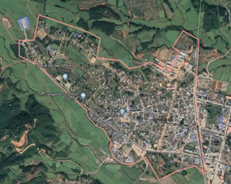
Lwe Jel Town (Momauk Township, Bhamo District, Kachin State, Myanmar)
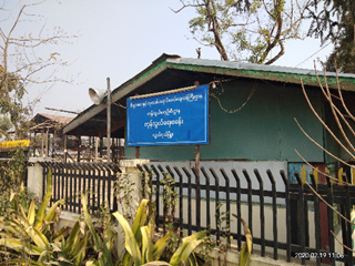
Border Gate, Lwe Jel
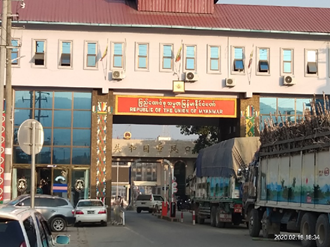
Border Gate, Lwe Jel
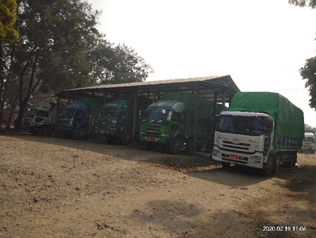
Border Gate, Lwe Jel
|
Border Crossing Location and Contact Information |
|
|---|---|
|
Name of Border Crossing |
Lwe Jel (Myanmar) / Longchuan County (China) |
|
Province or District |
Kachin |
|
Nearest Town or City |
Lwe Jel 1 (km) |
|
Latitude |
24.208389 |
|
Longitude |
97.707444 |
|
Managing Authority/Agency |
Border Trade Customs Office |
|
Contact Person |
N/A |
|
Travel Times |
|
|---|---|
|
Nearest International Airport |
Bhamo (90.1 km) Truck: 9 ½ hours Car: 5 ½ hours |
|
Nearest Port |
Bhamo (92.8 km) Truck: 9 hours 30 minutes Car: 5 hours 45 minutes |
|
Nearest Major Market |
On China side: Longchuan County, Yunnan 17 km, Truck: 0.45 hours, Car: 10 minutes
|
|
Other Information
|
Road: Bhamo - Lwe Jel Highway Road. |
|
Hours of Operation |
|
|---|---|
|
Sundays to Saturdays |
6:00 am – 6:00 pm |
|
National Holidays |
Open even on national holidays. |
|
Seasonal Constraints |
None |
Customs Clearance
Average 70 vehicles per day are processed by customs. Cross border traffic limited to local trade in agricultural products (exported to China), such as beans, rice, onions and fruits and textiles, foodstuffs, and electronics (imported into Myanmar). Private cars cannot freely move between the borders. Cargo trucks can pass the China border up to Liayoon, the vehicles usually do loading/off-loading in Liayoon Village by manual labour, hand carried or by using pushcarts and motorcycles for a distance of about 1km to pass the Myanmar - China border checkpoint.
Customs clearance time will be depending on the type of commodities, provided the documents are completed and in order. There are no customs clearance fees except the cost of forms: Import declaration form 50 Kyat, export declaration form 40 Kyat. Gross weight of the cargo will be checked. There is no weight bridge, but a scale is used to weigh cargo units.
All imports and exports can be completed in Lwe Jel, it offers a one-stop service for food, medicines, and agricultural products. Commercial invoices and letter of credits, license, recommendation letter for Humanitarian Aids from Kachin State Government or respective line ministry will be required. For local agricultural products, there used to be a barter trade system and invoices were not available for local products and detailed packing list is also not required.
Minimum requirements in terms of documentations are:
- Import License or export license (from dept. of Trade). See Note 1 below.
- Import declaration form (Cusdec 1) or export declaration form (Cusdec 2)
- Commercial invoice or bill of sale.
- For Humanitarian Agencies: Recommendation Letter from Kachin State Government or respective line ministry, Tax exemption certificate., etc.
Note 1: Depending on the type goods as classified according to the harmonized customs HS-code: licensed / un-licensed goods. Un-licensed goods do not require an import & export license, instead they only require the import and export declaration form and commercial invoice or bill of sale.
Restricted items are precursors (raw materials) for medicines, unregistered medicines, arms & ammunitions, vehicles, radio equipment, illegal drugs, fragrant woods.
For more information on customs in Myanmar, please see the following link: 1.3 Customs Information.
Other Relevant Information
Since informal trades still dominate the nature of transactions at the border crossing, trades volume remains relatively low although it gradually increases over time. Another factor to be considered is the security risk in the area that may disrupt trading activities.
2.4 Myanmar Railway Assessment
Generally, the trains do not run on time and are not much used for freight. Myanmar Railways (MR) does not accept liability for damage to cargo in transit, therefore it is recommended to transport cargo by rail through third party freight forwarders or transporters. Since MR rents out most freight cargo capacity in advance to private transporters monthly, it is difficult to get freight capacity directly from MR.
Railway transportation should be considered as last resort only if road transportation is temporary inaccessible/cut-off due to disaster or unstable situation. It is not recommended for emergency response situation or for cargo transportation in general as there are other faster alternatives.
The railway network is divided by MR into 11 administrative divisions. In lower Myanmar, to the South the main line starts in Yangon and ends at Dawei, Tanintharyi. Freight can only be transported until Mawlamyine due to the mountainous terrain. In upper Myanmar, to the North the main line runs from Yangon via Nay Pyi Taw to Myitkyina, in Kachin State. This line to Myitkyina is used more frequently for freight by private transporters because it is less costly than road transportation. In its current state, the railway network anchors to two mains stations: Yangon Central and Mandalay Central with most routes are single track.
After many years of inadequate railway system or network development since its first inauguration in May 1877 (rail track between Yangon to Pyay), the railway network expansion, under the responsibility of the Ministry of Rail Transportation and operated by state-owned Myanmar Railways (MR), has been expedited in the last 2 decades. Its network nearly doubled since 1988, with a total route length of 6110.481 km (single route 5405.285 km and double route 705.196 km) in December 2019. The Myanmar railway network is mainly narrow gauge (1,000 mm ~ meter-gauge). This expansion however has not been followed by proper and adequate maintenance work. Approximately 60% of railway infrastructure, including locomotives and coaches are generally in poor condition, which has restricted freight train operating speed and made train rides uncomfortable because of poor tracks and bridge conditions. Some tracks are not passable during the monsoon season. There are no rail links to adjacent countries and the status of planned cross-border rail connections to China, India, and Thailand, as well as the Thanbyuzayet-Three Pagoda pass connection remains uncertain. In 2013- 2014 fiscal year, 60 m passengers and 2.5m tons were transported, using 397 passenger trains/day and 25 freight trains/day. The rail capacity includes 384 locomotives, 1,600 passenger coaches and 3,600 freight wagons.
Overview of Myanmar Railway as of December 2019
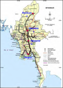
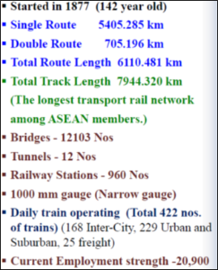
The government has plans to improve the quality of the Yangon-Mandalay-Myitkyitna and the Bago-Mawlamyine section. There are existing plans to build a high-speed railway to connect Kunming in Southwest China with Vietnam, Lao PDF, and Myanmar, respectively. Construction on the section connecting to Myanmar, the Dali-Ruili railway, began in May 2011 and is scheduled to take six years, but there is no progress still in 2020.
There is no rail link between Myanmar and India with the Moreh-Tamu-Kalay line is in the proposal stage. [1]
A list of railway line upgrade projects in Myanmar are presented below (source: presentation of Ministry of Transport and communications in the 2019 Asia PPP Practitioners’ Network Conference, Nov 2019).
|
Lower Myanmar |
||
|---|---|---|
|
Line |
Route |
Notes |
|
Yangon-Mandalay |
Yangon-Bago-Nay Pyi Taw-Thazi-Mandalay |
In frequent use |
|
Yangon-Dawei |
Yangon-Bago-Mawlamyine-Dawei |
No freight Mawlamyine to Dawei |
|
Yangon-Bagan |
Yangon-Letpadan-Taungdwinggyi-Bagan |
Older line, compared to parallel line via Nay Pyi Taw |
|
Yangon-Pathein |
Yangon-Letpadan-Pathein |
LetPadan to Pathein in disuse |
|
Upper Myanmar |
||
|---|---|---|
|
Line |
Route |
Notes |
|
Mandalay-Mytkyina |
Mandalay-Sagaing-Shwebo-Myitkyina |
In frequent use |
|
Mandalay-Lashio (Northern Shan State Railway) |
Mandalay-Pyinoolwin-Kyaukme-Hsipaw-Lashio |
In use |
|
Mandalay-Taunggyi |
Mandalay-Thazi-Taunggyi |
Not in use |
|
Mandalay-Thazi |
Mandalay-Thedaw-Dahuttaw-Hanza-Ywapale-Thazi |
In use |
|
Monywa-Pakokku |
Monywa-Khinu-Mandalay-Pakokku |
In use |
|
Mandalay-Kale |
Mandalay-Sagaing-Monywa-Pakokku-Kale |
Not in use |
|
Pakokku-Thazi |
Pakokku-Taungtha-Meiktila-Thazi |
In use (central West–East) |
|
Sittwe - Mrauk-U |
Sittwe-Mrauk-U |
Since 2013. Not connected to the main railway network |
For more information, please see the following link: 4.9 Myanmar Railway Company Contact List
Travel Time Matrix from Yangon
|
|
Time |
Distance |
|---|---|---|
|
Nay Pyi Taw |
9 hours |
233 mile /372km
|
|
Mandalay |
14 hours |
370 mile /595km
|
|
Myitkyina |
30 hours |
724 mile /1165 km |
Railway Companies and Consortia
There are no private railway companies in Myanmar. MR is the sole railway enterprise in the country.
4.2.1 Myanmar Government Contact List
Capacity Table
|
|
Operator / Company |
|---|---|
|
Operates on (lines) |
Myanmar Railway (MR) |
|
Max train length and/or pulling capacity |
unknown |
|
Locomotives (electric/diesel/steam) |
Diesel |
|
Freight Wagons (covered) / size |
GBHV-36 tons |
|
Freight Wagons (flatbed) / size |
WBY, WBYB – 30 tons WBXV – 36 tons SMBV – 36 tons |
|
Freight Wagons (high-sided)/size |
NA |
|
Freight Wagons (drop-side)/size |
NA |
Key Route Information
|
|
Route A Yangon - Naypyidaw |
Route B Naypyidaw - Mandalay |
Route C Mandalay - Myitkyinar |
|---|---|---|---|
|
Track gauge |
1 meter |
1 meter |
1 meter |
|
Ruling gradient |
Nil |
Nil |
NA |
|
Total track distance (single and/or double) |
Single |
Single |
Single |
|
Type of rail (weight and if welded or not) |
Joint Connection |
Joint Connection |
Joint Connection |
|
Type of sleeper and fastenings |
Cobar (China), ABC |
Cobar (China), ABC |
Cobar (China), ABC |
|
Total track travel time |
NA |
NA |
NA |
|
Maintenance (Good, marginal, bad) |
Marginal |
Marginal |
Marginal |
|
Companies-consortiums operating online |
NA |
NA |
NA |
|
Traffic frequency (monthly/weekly/daily) |
Daily |
Daily |
Daily |
|
Security (Good, marginal, bad) |
Good |
Good |
Good |
|
Main stations (Add details below) |
Bago-Taungoo |
Tharzi |
Khin U-Indaw |
Key Stations
|
Key Station Information |
|||
|---|---|---|---|
|
|
Bago |
Naypyidaw |
Mandalay |
|
Location |
Bago Division |
Naypyidaw Division |
Mandalay Division |
|
Contact Information |
U Thaung Htike, 052 21508 |
U Aung Myint Hlaing, General Manager, Naypyidaw, 067 77014 |
U Myint Thein (Dept. Station Master) Tel: 09-429339636, 02-35069 |
|
Connections with other transport means (road/waterways/air) |
Road only |
Road only |
Road only |
|
Storage Capacity |
No warehouses |
NA |
NA |
|
Handling Equipment |
No Equipment |
No Equipment |
No Equipment |
|
Handling Capacity |
NA |
NA |
NA |
|
Other Comments |
Bago is a big town, well developed and from Yangon to Mandalay and Yangon to Mawlamyine route traffic must pass this town. |
Naypyidaw is the capital of Myanmar and located between the Yangon to Mandalay route |
Mandalay has an international airport and newly established Myitnge Dry Ports run by Kerry Terminal Logistics and RG Logistics Co., Ltd. And, Mandalay is central point to flow good and services of Upper Myanmar. |
Yangon Circular Railway
Yangon Circular Railway is a railway line for local commuters, which serves the Yangon metropolitan area. Operated by Myanmar Railways, the 45.9-kilometre (28.5 mi) 39-station loop system connects satellite towns and suburban areas to the city. The railway has about 200 coaches, runs 20 times a day and serves 85,000 to 100,000 passengers daily. Based on 2019 data, the journey took around 2 hours and 50 minutes. Myanmar Railway and JICA have jointly financed an upgrade project with the aim to increase traffic to 260,000 passengers daily and cut down travel time by an hour once the circular railway is upgraded. This upgrade is also an initial step towards reducing road traffic by increasing the transport market share of Myanmar Railways for daily commuting within Yangon Metropolitan area. The project began in 2018 and is scheduled to be completed in 2022.
The service hours are from 3:45 am to 10:15 pm daily. The cost of a ticket for a distance up to 15 miles is 100 kyats (~nine US cents), and for trips over 15 miles is 200 kyats (~18 US cents).
Myanmar Railway Schedule (Passengers trains attached with cargo train)
Below table is the passenger train schedule. Cargo wagons can be attached to passenger trains along the routes.
It is recommended to check with Rail Road department for every trip to confirm schedule and it can be possible to check out for update on Myanmar Railway social media pages (Facebook page) and government official websites.
https://www.railways.gov.mm/en_US/train-schedule/
Yangon - Mandalay Line
|
Train |
Yangon |
Bago |
Taungoo |
Pyinmana |
Thazi |
Mandalay |
||||||
|---|---|---|---|---|---|---|---|---|---|---|---|---|
|
arrival |
departure |
arrival |
departure |
arrival |
departure |
arrival |
departure |
arrival |
departure |
arrival |
departure |
|
|
1 UP |
- |
04:00 |
05:56 |
06:11 |
13:20 |
13:40 |
16:08 |
16:18 |
21:45 |
00.05 |
03:30 |
- |
|
2 DN |
19:30 |
- |
16:08 |
16:55 |
09:01 |
09:21 |
05:50 |
06:00 |
23:59 |
00:09 |
- |
19:15 |
|
3 UP |
- |
15:45 |
17:45 |
17:55 |
21:30 |
22:00 |
00:30 |
01:00 |
05:30 |
06:00 |
09:00 |
- |
|
4 DN |
21:30 |
- |
19:09 |
19:12 |
14:03 |
14:13 |
11:49 |
11:52 |
08:17 |
08:20 |
- |
05:30 |
|
5 UP |
- |
15:00 |
17:00 |
17:30 |
22:00 |
22:30 |
01:30 |
02:00 |
05:00 |
05:45 |
07:30 |
- |
|
6 DN |
20:10 |
- |
17:49 |
17:52 |
13:08 |
13:18 |
10:58 |
11:01 |
07:45 |
07:48 |
- |
05:00 |
|
9 UP |
- |
08:30 |
10:28 |
10:43 |
17:56 |
18:51 |
21:30 |
- |
- |
- |
- |
- |
|
10 DN |
17:45 |
- |
14:46 |
15:01 |
07:25 |
07:55 |
- |
04:30 |
- |
- |
- |
- |
|
11 UP |
- |
05:00 |
06:48 |
06:50 |
11:47 |
11:57 |
14:22 |
14:25 |
17:45 |
17:48 |
21:00 |
- |
|
12 DN |
22:00 |
- |
19:32 |
19:35 |
14:39 |
14:49 |
12:20 |
12:23 |
09:01 |
09:04 |
- |
06:00 |
|
31 UP |
- |
08:00 |
09:47 |
09:50 |
14:12 |
14:15 |
16:30 |
- |
- |
- |
- |
- |
|
32 DN |
13:45 |
- |
11:29 |
11:32 |
06:57 |
07:00 |
- |
05:00 |
- |
- |
- |
- |
Mandalay - Myitkyina Line
|
Train |
Mandalay |
Shwebo |
Kawlin |
Naba |
Mohnyin |
Myitkyina |
||||||
|---|---|---|---|---|---|---|---|---|---|---|---|---|
|
arrival |
departure |
arrival |
departure |
arrival |
departure |
arrival |
departure |
arrival |
departure |
arrival |
departure |
|
|
37 UP |
- |
11:30 |
13:30 |
13:45 |
17:30 |
17:50 |
20:55 |
21:10 |
24:00 |
00:15 |
06:30 |
- |
|
38 DN |
08:00 |
- |
04:02 |
04:22 |
23:42 |
23:47 |
20:17 |
20:27 |
17:27 |
17:30 |
- |
12:00 |
|
55 UP |
- |
16:00 |
19:30 |
19:45 |
24:00 |
00:15 |
02:45 |
03:00 |
06:00 |
06:15 |
11:15 |
- |
|
56 DN |
05:00 |
- |
01:43 |
01:45 |
20:32 |
20:42 |
16:20 |
16:30 |
13:10 |
13:20 |
- |
07:00 |
|
57 UP |
- |
08:45 |
11:10 |
11:35 |
15:35 |
16:00 |
19:30 |
19:45 |
22:55 |
23:15 |
04:00 |
- |
|
58 DN |
12:10 |
- |
09:02 |
09:04 |
04:20 |
04:25 |
00:29 |
00:34 |
22:12 |
22:17 |
- |
15:30 |
Regional Railway Assessments
Mon State and Thanintharyi Region
The railway network in Myanmar is divided in 11 divisions. The railway network in Mon state and Thanintharyi region are included in Division 8. This railway line starts from Yangon and ends at Dawei in Thanintharyi. Between Ye and Dawei, the railway track has steep inclines and therefore freight trains cannot reach Dawei, only passenger trains run on this line. Myanma Railways (MR) was planning to extend this railway line further South from Dawei to Myeik, but this extension been put on hold due to budget constraints.
Distance (Mile) and Travel Time (Hour) Matrix
|
Travel Time from Capital City to Major Towns (Hours / Days) |
||||
|---|---|---|---|---|
|
|
Yangon |
Mawlamyine |
Ye |
Dawei |
|
Yangon |
|
176.25 miles/ |
276.25 miles/ |
376.25 miles/ |
|
Mawlamyine |
176.25 miles/ |
|
100 miles/ |
200 miles/ |
|
Ye |
276.25 miles/ |
100 miles/ |
|
100 miles/ |
|
Dawei |
376.25 miles/ |
200 miles/ |
100 miles/ |
|
Capacity Table
All trains can travel to Mawlamyine and Ye, but only passenger service train that reaches Dawei due to steep inclines of the railway.
|
Rail Operator Capacity (Myanmar Railways) |
|
|---|---|
|
Operates on (lines) |
Yangon to Dawei (Division 8) |
|
Max train length and/or pulling capacity |
370 miles (Yangon to Dawei) |
|
Locomotives (electric/diesel/steam) |
Diesel |
|
Freight Wagons (covered) / size |
GBHV-36 tons |
|
Freight Wagons (flatbed) / size |
WBY,WBYB – 30 tons WBXV – 36 tons SMBV – 36 tons |
|
Freight Wagons (high-sided)/size |
NA |
|
Freight Wagons (drop-side)/size |
NA |
Key Route Information
|
|
Route A Yangon to Mawlamyine |
Route B Mawlamyine to Ye |
Route C Ye to Dawei |
|---|---|---|---|
|
Track gauge |
1 meter |
1 meter |
1 meter |
|
Ruling gradient |
Nil |
Nil |
1/25, 1/40 |
|
Total track distance (single and/or double) |
Single |
Single |
Single |
|
Type of rail (weight and if welded or not) |
Joint Connection |
Joint Connection |
Joint Connection |
|
Type of sleeper and fastenings |
Cobar (China), ABC |
Cobar (China), ABC |
Cobar (China), ABC |
|
Total track travel time |
10 hours |
6 hours |
9 hours |
|
Maintenance (Good, marginal, bad) |
Marginal |
Marginal |
Marginal |
|
Companies-consortiums operating online |
None |
None |
None |
|
Traffic frequency (monthly/weekly/daily) |
Daily |
Daily |
Daily |
|
Security (Good, marginal, bad) |
Good |
Good |
Good |
|
Main stations (Add details below) |
Bago, Kyaik Hto, Tha Htone, Paung |
Than Phyu Zayat, Nit Kayin, La Mine |
Kan Kaw Taung, Kalar Yaung, Yay Phyu |
Key Stations
|
Key Station Information |
||||
|---|---|---|---|---|
|
|
Bago |
Mawlamyine |
Dawei |
|
|
Location |
Bago Division |
Mon State |
Tanintharri Division |
|
|
Contact Information |
U Thaung Htike, 052 21508 |
U Tin Soe Win, 057 22850 |
NA |
|
|
Multi-modal Connections (road/waterways/air) |
Road only |
Road only |
Road only |
|
|
Storage Capacity (sqm and cubic meters) |
No warehouse |
No warehouse |
No warehouse |
|
|
Handling Equipment |
No Equipment |
No Equipment |
No Equipment |
|
|
Handling Capacity: MT / Hour, TEU / Hour |
n/a |
n/a |
n/a |
|
|
Other Comments |
Limited cargo is transported by Myanma Railways because MR does not accept liability for loss, damage, or delay of freight in transit. |
|||
Kawlin and Sagaing Region
The Kawlin railway station is under the Ywa Htaung Division-2, on the main track of Myitkyina-MyoHoung (MDY). The volume of freight by rail reduces on this line after the road conditions improve and the number of truck increases in the area.
Distance and Travel Time Matrix
|
Travel Time from Capital City to Major Towns (Hours / Days) |
||||||||
|---|---|---|---|---|---|---|---|---|
|
|
Kawlin |
Wun-tho |
Indaw |
Katha |
Myit-kyina |
Kan- balu |
Ywa-Htaung |
Myo-Haung (MDY) |
|
Kawlin |
|
45km/ 23m |
120km/ 4h |
143km/6h20m |
314km/ 12h20m |
41km/ 2h13/ |
195km/ 5h35m |
213km/6h40m |
|
Wun-tho |
45km/ 23m |
|
75km/ 3h37m |
98km/ 5h57m |
269km/ 11h57m |
85km/ 2h36m |
239km/ 5h58m |
258km/ 7h3m |
|
Indaw |
120km/ 4h |
75km/ 3h37m |
|
23km/ 2h20 |
194km/ 8h20m |
161km/ 6h13m |
315km/ 9h35m |
333km/ 10h57m |
|
Katha |
143km/ 6h20m |
98km/ 5h57m |
23km/ 2h20 |
|
219km/10h35 |
184km/8h33m |
338km/ 11h55m |
356km/13h17m |
|
Myit-Kyina |
314km/ 12h20m |
269km/ 11h57m |
194km/ 8h20m |
219km/10h35m |
|
354km/14h33m |
508km/ 17h38m |
526km/ 19h |
|
Kan-balu |
41km/ 2h13 |
85km/ 2h36m |
161km/ 6h13m |
184km/8h33m |
354km/14h33m |
|
154km/ 3h5m |
172km/ 4h27m |
|
Ywa-Htaung |
195km/ 5h35m |
239km/ 5h58m |
315km/ 9h35m |
338km/11h55m |
508km/17h38m |
154km/ 3h5m |
|
18km/ 1h22m |
|
Myo-Hong (MDY) |
213km/6h40m |
258km/ 7h3m |
333km/ 10h57m |
356km/13h17m |
526km/19h |
172km/ 4h27m |
18km/ 1h22m |
|
|
||||||||
Capacity Table
|
Rail Operator Capacity (Myanmar Railways) |
|
|---|---|
|
Operates on (lines) |
Ywa Htaung (Division2) Myitkyina (Division1) |
|
Max train length and/or pulling capacity |
30 Mt (psg) + 48-Mt (parcel) for 12 axles |
|
Locomotives (electric/diesel/steam) |
Diesel/hydraulic hybrid |
|
Freight Wagons (covered) / size |
GBHV 4 axle-32 tons net |
|
Freight Wagons (flatbed) / size |
n/a |
|
Freight Wagons (high-sided)/size |
11 m x 2.6 m x 3.2 m |
|
Freight Wagons (drop-side)/size |
N/A |
Key Route Information
On many sections of the line, there is a common issue of water erosion and land subsidence causing foundation of trestles to erode which results in unevenness and dips in the rails. On sections where these conditions are present, trains must slow down to avoid accidents and derailing.
|
Standard Route Information |
|||
|---|---|---|---|
|
|
Route A Myo-Houng-(MDY)-YwaHtang-Kanblu-Kawlin-Indaw-Naba-Myitkyina |
Route B YeU-KhinU |
Route C Katha-Naba |
|
Track gauge |
1-meter, middle gauge |
1-meter, middle gauge |
1-meter, middle gauge |
|
Ruling gradient |
1 in 25 ft (Bon-Chaung, Nan Khan, Naba) |
0 ft/ 300ft |
1 in 25 ft |
|
Total track distance (single and/or double) |
Single track |
Single track |
Single track |
|
Type of rail (weight and if welded or not) |
Joint Connection, 39ft each |
Joint Connection, 39ft each |
Joint Connection, 39ft each |
|
Type of sleeper and fastenings |
Cobar (China), ABC |
Cobar (China), ABC |
Cobar (China), ABC |
|
Total track travel time |
19-hour drive |
1-hour drive |
1hour 50 min drive |
|
Maintenance (Good, marginal, bad) |
Fair, water erosion |
Fair |
Fair |
|
Companies-consortiums operating online |
MR only |
MR only |
MR only |
|
Traffic frequency (monthly/weekly/daily) |
Daily |
Daily |
Daily |
|
Security (Good, marginal, bad) |
Good (60%) |
Good |
Good |
|
Main stations (Add details below) |
Myohaoung, Shwebo, Kawlin, Naba & Myitkyina |
Khin-U |
Naba |
Key Stations
|
Key Station Information |
|||||
|---|---|---|---|---|---|
|
|
Kawlin |
Wuntho |
Katha |
Kanbalu |
Ye-U |
|
Location |
23°47'29.51"N 95°40'42.25"E Kawlin |
23°54'0.43"N 95°41'31.97"E Wuntho |
24°10'37.09"N 96°20'14.27"E Katha |
23°12'14.67"N 95°30'53.17"E Kanbalu |
22°45'6.33"N 95°24'56.23"E Ye-U |
|
Contact Information |
U Zaw Min Tun (Dty. SM) 09-258988188 U Khin Zaw (Dty. Supervisor) |
Myint Thein (Station master) Tel: 09-43015978 |
U Kyaw Win (SM) Tel:09-402737423 |
U Tin Ko (SM) Tel: 075-27050 / 27024 |
U Zaw Naing Soe (SM) Tel:09-792960497/ 075-40256
|
|
Multi-modal Connections (road/waterways/air) |
Road only |
Road only |
Road only |
Road only |
Road only |
|
Storage Capacity (sqm and cubic meters) |
225sqm/ 900cub m, suitable for temporary use as no good ventilation |
No |
No |
No |
No |
|
Handling Equipment |
None |
None |
None |
None |
None |
|
Handling Capacity: MT / Hour, TEU / Hour |
Manual only, Available from Tsp labor exchange office |
Manual only, Available from Tsp labor exchange office |
Manual only |
Manual only |
Manual only |
|
Other Comments |
Limited cargo is transported by Myanma Railways because MR does not accept liability for loss, damage, or delay of freight in transit. Another factor is due to availability of other means of transport which can reach or trade door to door between buyers and seller for common informal trade activities in the area. |
|
|||
Kawlin and Wuntho rail stations are used to be busy for timber
delivery to Yangon/Mandalay and for local paddy and noodle
transportation to Myitkyina. However, after many heavy trucks were
imported and operational in Myanmar in the recent years, the rail
freight service share dropped more than 70%. up to only two train
wagons traffic is operational on weekly basis. Yangon-Myitkyina or
Mandalay-Myitkyina trains will have to stop at Kawlin when flash
flood occurs, which is quite frequent during the rainy season.
Kawlin station area is on a higher ground than other parts of town
and generally it is safe from risk of
flooding.
Indaw and Kanbalu station are minor stations on the main track of MyoHoung-Myitkyina (MDY) and there is no regular cargo wagon passing through. This line used to be busy for paddy and rice transportation for local growers and traders until road transportation becomes an alternative option for them.
Katha station (South) is the final station on the line that connects to the main track of Myitkyina-Myohoung (Mandalay) at Naba with a small block of passenger trains run in between. No freight wagon operational on this track. The Katha station (North) is no more in use as the rail track heading to Singan under Shwegu township of Kachin state is no longer operational due to poor construction and inefficiency compared to other available transportation means.
Ye-U Station is a less popular and except one bus and local train running for ferry, the line is no longer used for cargo wagon. It is one of the stations in the middle of Shwebo-KhinU track.
Kayah and Southern Shan State
The Loikaw railway station relates to one of the main stations at Tarzi Station and it is under Kalaw Division-4 which comprise of stations along Southern Shan and Kayah State. Among them, Aungban and Lawksawk are active station with cargo and passengers.
Distance (KM) and Travel Time (Hours) Matrix
|
Travel Time from Capital City to Major Towns (Hours / Days) |
||||||
|---|---|---|---|---|---|---|
|
|
Loikaw |
Pekon |
Pinlong |
Aungban |
Kalaw |
Tharzi |
|
Loikaw |
|
36km/ 2h10m |
86km/ 5h30 |
163km/ 10h30m |
174km/ 11h25m |
275km/ 18h15 |
|
Pekon |
36km/ 2h10m |
|
50km/ 3h20m |
128km/ 5h |
139km/ 1h5m |
239km/ 16h50m |
|
Pinlong |
86km/ 5h30 |
50km/ 3h20m |
|
78km/ 1h40m |
89km/ 5h55m |
189km/ 12h45m |
|
Aungban |
163km/ 10h30m |
128km/5h |
78km/ 1h40m |
|
11km/ 1h5m |
122km/ 7h35 |
|
Kalaw |
174km/ 11h25m |
139km/ 1h5m |
89km/ 5h55m |
11km/ 1h5m |
|
101km/ 6hour30h |
|
Tharzi |
275km/ 18h15 |
239km/ 16h50m |
189km/ 12h45m |
122km/ 7h35 |
101km/ 6hour30h |
|
|
Note: Banking locomotive is required for two points in between Kalaw and Tharzi. |
||||||
Capacity Table
|
Rail Operator Capacity (Myanmar Railways) |
|
|---|---|
|
Operates on (lines) |
Kalaw/Aungban (Division 4) |
|
Max train length and/or pulling capacity |
6 Mt (psg) + 28 Mt (parcel) |
|
Locomotives (electric/diesel/steam) |
Diesel/hydraulic hybrid |
|
Freight Wagons (covered) / size |
GBHV 4 axle-32 tons net |
|
Freight Wagons (flatbed) / size |
n/a |
|
Freight Wagons (high-sided)/size |
11(m)x2.6(m)x 3.2(m) |
|
Freight Wagons (drop-side)/size |
NA |
Key Route Information
On many sections of the line, there is a common issue of water erosion and land subsidence causing foundation of trestles to erode which results in unevenness and dips in the rails. On sections where these conditions are present, trains must slow down to avoid accidents and derailing.
|
Standard Route Information |
|||
|---|---|---|---|
|
|
Route A |
Route B |
Route C |
|
Track gauge |
1-meter, middle gauge |
1-meter, middle gauge |
1-meter, middle gauge |
|
Ruling gradient |
1 in 40 ft |
1 in 40 ft |
0 ft/ 300ft |
|
Total track distance (single and/or double) |
Double track |
Double track |
Double track |
|
Type of rail (weight and if welded or not) |
Joint Connection, 39ft each |
Joint Connection, 39ft each |
Joint Connection, 39ft each |
|
Type of sleeper and fastenings |
Cobar (China), ABC |
Cobar (China), ABC |
Cobar (China), ABC |
|
Total track travel time |
275 Km to Tarzi in 18hours15min (15Km per hour in Average) |
217 Km to Tarzi in 14hours (16Km per hour in Average) |
490km/16hours30 min to Yangon (30Km per hour in Average) |
|
Maintenance (Good, marginal, bad) |
Fair |
Fair |
Good |
|
Companies-consortiums operating online |
MR only |
MR only |
MR only |
|
Traffic frequency (monthly/weekly/daily) |
daily |
daily |
daily |
|
Security (Good, marginal, bad) |
Good |
Good |
Good |
|
Main stations (Add details below) |
Aungban and Tharzi |
Aungban, Tharzi and Yangon |
|
Key Stations
|
Key Station Information |
|||
|---|---|---|---|
|
|
Loikaw |
Aungban |
Taunggyi |
|
Location |
19°39'58.16"N 97°13'11.61"E Loikaw |
20°39'14.54"N 96°37'56.41"E Aungban |
20°44'51.99"N 97° 3'5.75"E Taunggyi |
|
Contact Information |
U Kyaw Naing Station Master) Tel: 09-779846923 |
U Khin Maung Yi (Station master) Tel: 075-60144 |
U Thant Zin (SM) Ph# 09-788314015 U Kyaw Naing Win (ASM) 09-793900942 |
|
Multi-modal Connections (road/waterways/air) |
Road only |
Road only |
Road only |
|
Storage Capacity (sqm and cubic meters) |
54 sqm/ 600 cub m, there is no proper walling, it can be only used for temporary |
54 sqm/600cub meter. It is now being used as staff house |
n/a |
|
Handling Equipment |
None |
None |
None |
|
Handling Capacity: MT / Hour, TEU / Hour |
Manual only, no standby labor |
Manual only, 10 daily laborers standby |
Manual only, no standby labor |
|
Other Comments |
Limited cargo is transported by Myanmar Railways because MR does not accept liability for loss, damage, or delay of freight in transit. Another factor is due to availability of other means of transport which can reach or trade door to door between buyers and seller for common informal trade activities in the area. |
||
Loikaw is an end-station. It connects to the main track at Aungban
station. Only one scheduled train operates between Loikaw station
and Tharzi station, while the Lawsawk station has regular scheduled
direct train service up to Yangon. The Namsang and Mongnai was
completely closed from Kalaw Division-4. Another station called
Taunggyi station only operates one daily round-trip service between
Taunggyi and Saikaung for 66 Km to serve local vegetable vendors.
No other train service connects to main track of Aungban/Kalaw.
The ticket fare of ordinary class is MMK 2,300 per person and the first class is MMK3,100 from Loikaw to Tarzi. Freight charges for cargo is MMK 13.74 Ks from Loikaw to Tharzi.
Bago, Naypyitaw and Magway region
Distance and Travel Time Matrix
|
Travel Time from Capital City to Major Towns (Hours / Days) |
||||||
|---|---|---|---|---|---|---|
|
|
Yangon |
Bago |
Taungoo |
Pyinmana |
NayPyitaw |
Taungdwingi |
|
Yangon |
|
74.8 km / 1hour 45mins |
202.8 km / 6hour 15mins |
362.2 km / 8hour 40mins |
375 km / 9 hours |
412km / 12hour30m |
|
Bago |
74.8km / 1hour45m |
|
128 km/ 4h30m |
287.4 km / 6h55m |
300.2 km / 7h15m |
different route |
|
Taungoo |
202.8 km / 6hour15m |
128 km/ 4hour 30m |
|
159.4 km / 2hour 25m |
172.2 km / 2hour 45m |
different route |
|
Pyinmana |
362.2 km / 8hour40m |
287.4 km / 6h55m |
159.4 km / 2h25m |
|
12.8km / 20min |
different route |
|
Naypyitaw |
375 km / 9 hours |
300.2 km / 7h15m |
172.2km / 2h45m |
12.8km /20min |
|
120km / 4hour15m |
|
Taungdwingi |
412km / 12hour30m |
different route |
different route |
different route |
120km / 4hour15m |
|
Capacity Table
|
Rail Operator Capacity |
|
|---|---|
|
|
Operator / Company Myanmar Railway (MR) |
|
Operates on (lines) |
Mandalay (Division 3) Sagaing (Division 10, 2) Magway (Division 11) Bago (Division 6) |
|
Max train length and/or pulling capacity |
500 MT, for uphill 300MT (Shan state) |
|
Locomotives (electric/diesel/steam) |
Diesel/hydraulic hybrid Diesel/electric hybrid |
|
Freight Wagons (covered) / size |
GBHV 4 axle-31 tons net |
|
Freight Wagons (flatbed) / size |
WBY, WBYB – 28 tons net WBXV – 28 tons SMBV – 31 tons |
|
Freight Wagons (high-sided)/size |
36 ft 6 inch by 8ft 6 inch |
|
Freight Wagons (drop-side)/size |
NA |
Key Route Information
On many sections of the line, there is a common issue of water erosion and land subsidence causing foundation of trestles to erode which results in unevenness and dips in the rails. On sections where these conditions are present, trains must slow down to avoid accidents and derailing.
|
Standard Route Information |
|
|
||
|---|---|---|---|---|
|
|
Route A Yangon-Bago-NayPyitaw |
Route B Magway-Taungdwingyi-Pyimina |
Route C Yangon-Aunglan-Bagan-Pakokku |
Route D Yangon-Pyay |
|
Track gauge |
1-meter, middle gauge |
1-meter, middle gauge |
1-meter, middle gauge |
1-meter, middle gauge |
|
Ruling gradient |
0 ft/ 300ft |
0 ft/ 300ft |
1ft/ 60ft |
1ft/ 60ft |
|
Total track distance (single and/or double) |
Double track |
Double track |
Double track |
Double track |
|
Type of rail (weight and if welded or not) |
Joint Connection, 39ft each |
Joint Connection, 39ft each |
Joint Connection, 39ft each |
Joint Connection, 39ft each |
|
Type of sleeper and fastenings |
Cobar (China), ABC |
Cobar (China), ABC |
Cobar (China), ABC |
Cobar (China), ABC |
|
Total track travel time |
1h45m Yangon to Bago |
83km/3hour45m to Taungdwingyi, 203km/8hours to Naypyitaw |
318km/ 8hour Yangon to Aunglan 259km/ 9hour:25m to Bagan, 32 km/1hour 20 min to Pakokku |
258km/ 6hour Yangon Pyay |
|
Maintenance (Good, marginal, bad) |
Fair. Area before Bago can get flooded |
Fair |
Fair |
Fair |
|
Companies-consortiums operating online |
MR only |
MR only |
MR only |
MR only |
|
Traffic frequency (monthly/weekly/daily) |
Express 3x/day Local 2x/day Cargo 2x/day |
Express1x/day to NayPyitaw |
Express2x/day 1 express to NayPyitaw |
Express 1x/day 1 express to Pyay, cargo 2x/day |
|
Security (Good, marginal, bad) |
Good |
Good |
Good |
Good |
|
Main stations (Add details below) |
Bago, Tangoo, Pyinmana |
Magway, Taungdwingyi, Lewe, Pyimana, Naypyitaw |
Yangon Shwedaga (Pyay), Aunglan, Nyaung-U |
Tharyarwaddy |
Note:
Upgrade work funded by ADB and European Investment Bank on the railway line between Yangon-Pyay are expected to commence in 2021 and is scheduled to finish in 2024. Currently, this is the busiest link in the country representing 75% of total passenger traffic.[2]
Key Stations
|
Key Station Information |
||||
|---|---|---|---|---|
|
Bago |
Taungoo |
Pyinmana |
NayPyitaw |
Taungdwingyi |
|
N17 20’ 04.7”, E96 28’ 31.7”, Bago |
N18 56’ 06.3”, E96 26’ 15.2”, Taungoo |
N19 44’ 09.6”, E96 12’ 23.7”, Pyinmana |
N19 50’ 53.5”, E96 11’ 44.0”, Naypyitaw |
N20 00’ 07.4”, E95 32’ 25.9”, Taungdwingyi |
|
U Sein Win Tun (Dept. Station Master) Tel: 052-2221508 ,09454700447 |
U Kyaw Moe Lwin (Station master) Tel: 09-402660745, 067-23308 |
U Nyint Thein (Station Master) tel: 067-22508, |
U Khin Thaw (Station Master) tel: 09-797397910, 067-77133 |
U Hla Yi |
|
Road only |
Road only |
Road only |
Road only |
Road only |
|
Used by Shwe Than Lwin co. (railway maintenance) 36x15m. No other storage |
24x12m, opposite station at 2 disused rails, can be accessed from roadside |
Storage on platform 2/3 |
Storage available: 12x12m. |
Storage available 7x7m, limited cargo is being handled |
|
none |
None |
None |
Cargo dolly’s |
None |
|
Manual only |
Manual only, 10 daily laborers |
Manual only |
Manual only |
Manual only |
|
Limited cargo is transported by Myanma Railways because MR does not accept liability for loss, damage, or delay of freight in transit. |
||||
|
Key Station Information |
|||
|---|---|---|---|
|
|
Aunglan |
Pyay |
Magway |
|
Location |
N19 20’ 57.0”, E95 13’ 30.4”, Aunglan |
N18 49’ 12.5”, E95 12’ 59.3”, Pyay |
N20 07’ 23.3”, E94 56’ 31.8”, Magway |
|
Contact Information |
U Aung Naing Htay (Station Master) Tel: 09-777901775 |
U Soe Hla (Dept. Station Master) Tel: 09-09401588815 |
U Tin Thein (Station Master) Tel: 09-256041457 |
|
Multi-modal Connections (road/waterways/air) |
Road only |
Road only |
Road only |
|
Storage Capacity (sqm and cubic meters) |
None. Limited cargo is being handled |
10x20m at station, handle mostly luggage. |
None |
|
Handling Equipment |
None |
none |
None |
|
Handling Capacity: MT / Hour, TEU / Hour |
Manual Only |
Manual only |
Manual only |
|
Other Comments |
|
Pyay is an end-station. |
Magway is an end-station |
Pyay is an end-station. It connects at Shwedaga station to the line from Yangon to Nyaung-U. The distance between Pyay to Shwedaga is only 3 miles. From Pyay station, there are direct trains to:
- Pyay - Yangon: 161 miles / 8 hours.
- Pyay - Naypyitaw: 160.2 mi / 10hour 30min.
- Frequency: Express to Naypyitaw 1/day, to Yangon 1/day.
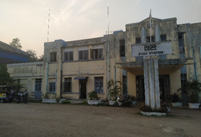
Railway station Pyay
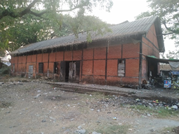
Storage Pyay Station
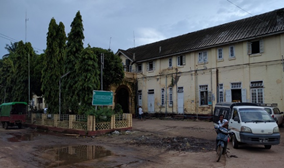
Picture (left): Railway station Bago
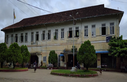
Picture (right): Railway station Taungoo
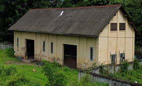
Picture (left): Storage Taungoo station
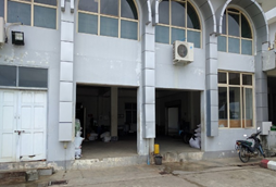
Picture (right): Storage Naypyitaw station
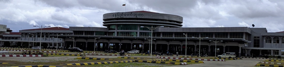
Picture (left): Railway station
Naypyidaw
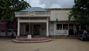
Picture (left): Railway station Pyinmana
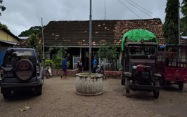
Picture (right): Railway station Taungdwingyi
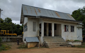
Picture (left): Railway station Aunglan
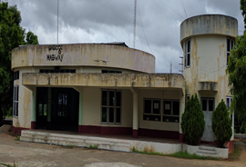
Picture (left): Railway station Magway
Mandalay and Sagaing region
Distance and Travel Time Matrix
|
Travel Time from Capital City to Major Towns (Hours / Days) |
||||||
|---|---|---|---|---|---|---|
|
|
Yangon |
Naypyitaw |
Nyaung-U |
Pakokku |
Mandalay |
Monywa |
|
Yangon |
|
375 km / 9 hours |
579 km / 17.5 hours |
613 km / 18.5 hours |
629 km / 14 hours |
739 km / 22.3 hours |
|
Naypyitaw |
375 km / 9 hours |
|
254 km / 6 hours |
320 km / 11 hours |
254 km / 6 hours |
420 km / 12 hours |
|
Nyaung-U (Bagan) |
579 km / 17.5 hours |
254 km / 6 hours |
|
33.8 km / 1 hour |
192.7 km / 7.5 hours |
133 km / 5.5 hours |
|
Pakokku |
613 km / 18.5 hour |
320 km / 11 hours |
33.8 km / 1 hours |
|
174 km / 5.5 hours |
99.7 km / 4.5 hours |
|
Mandalay |
629 km / 14 hour |
254 km / 6 hours |
192.7 km / 7.5hours |
174 km / 5.5hours |
|
109.4 km / 4.8 hours |
|
Monywa |
739 km / 22.3 hour |
420 km / 12 hours |
133 km / 5.5 hours |
99.7 km / 4.5 hours |
109.4 km / 4.8 hours. |
|
|
Note: The destinations from Mandalay to locations in regions North East such as Myitkyina, Lashio, Kalaw are not included in this matrix. |
||||||
Capacity Table
|
Rail Operator Capacity (Myanmar Railway) |
|
|---|---|
|
Operates on (lines) |
Mandalay (Division 3) Sagaing (Division 10, 2) Magway (Division 11) |
|
Max train length and/or pulling capacity |
500 MT, for uphill 300MT (Shan state) |
|
Locomotives (electric/diesel/steam) |
Diesel/hydraulic hybrid Diesel/electric hybrid |
|
Freight Wagons (covered) / size |
GBHV 4 axle-31 tons net |
|
Freight Wagons (flatbed) / size |
WBY, WBYB – 28 tons net WBXV – 28 tons SMBV – 31 tons |
|
Freight Wagons (high-sided)/size |
36 ft 6 inch by 8ft 6 inch |
|
Freight Wagons (drop-side)/size |
NA |
Key Route Information
On many sections of the line, there is a common issue of water erosion and land subsidence causing foundation of trestles to erode which results in unevenness and dips in the rails. On sections where these conditions are present, trains must slow down to avoid accidents and derailing.
|
Standard Route Information |
|||
|---|---|---|---|
|
|
Route A Yangon-NayPyiTaw-Mandalay |
Route B Yangon-Nyaung-U-Pakokku |
Route C Pakokku-Mandalay |
|
Track gauge |
1-meter, middle gauge |
1-meter, middle gauge |
1-meter, middle gauge |
|
Ruling gradient |
1 ft/ 300ft |
1 ft/ 300ft |
1 ft/ 300ft |
|
Total track distance (single and/or double) |
Double iron, between Pleik and Myinge a bridge is built, single track until July 2016 |
Single iron |
Single iron |
|
Type of rail (weight and if welded or not) |
Joint Connection, 39ft each |
Joint Connection, 39ft each |
Joint Connection, 39ft each |
|
Type of sleeper and fastenings |
Cobar (China), ABC |
Cobar (China), ABC |
Cobar (China), ABC |
|
Total track travel time |
14 hours Yangon to Mandalay |
7.5 hours Yangon to Nyaung-U |
7.5 hours Nyaung-U to Mandalay |
|
Maintenance (Good, marginal, bad) |
Fair, water erosion |
Good |
Good |
|
Companies-consortiums operating online |
MR only |
MR only |
MR only |
|
Traffic frequency (monthly/weekly/daily) |
4 per day, (3 express) |
1 per day |
Currently Suspended |
|
Security (Good, marginal, bad) |
Good |
Good |
Good |
|
Standard Route Information |
|||
|---|---|---|---|
|
|
Route D |
Route E Mandalay-Monywa |
Route F Mandalay to Myitkyina |
|
Track gauge |
1-meter, middle gauge |
1-meter, middle gauge |
1-meter, middle gauge |
|
Ruling gradient |
0 ft |
0 ft |
|
|
Total track distance (single and/or double) |
Single iron |
Single iron. |
Single iron |
|
Type of rail (weight and if welded or not) |
Joint Connection, 39ft each |
Joint Connection, 39ft each |
Joint Connection, 39ft each |
|
Type of sleeper and fastenings |
Cobar (China), ABC |
Cobar (China), ABC |
Cobar (China), ABC |
|
Total track travel time |
|
4hour 50min |
|
|
Maintenance (Good, marginal, bad) |
Fair, water erosion |
Marginal, water erosion |
Fair, water erosion |
|
Companies-consortiums operating online |
MR only |
MR only |
MR only |
|
Traffic frequency (monthly/weekly/daily) |
1 per day |
5 per day to Myitkyina |
6 per day to Myitkyina |
|
Security (Good, marginal, bad) |
Good |
Good |
Good |
|
Main stations (Add details below) |
Bagan, Taungdwin |
Mandalay, Sagaing, Shwebo, Khin-U, Monywa |
Shwebo |
Route B: Nyaung-U station is on the line from Yangon, via Bagan to Pakokku, daily trains. There are also 2 x daily trains from Nyaung-U to Mandalay.
Route E: From Mandalay there is a loop to Monywa. From Khin-U the line continues North to Myitkyina (Kachin State). There are five express trains per day from Shwebo to Myitkyina and 2 local trains per day. There are three destinations from Monywa: Mandalay, Pakokku, Khin-U. From Monywa to Pakokku, one day-trip train operates daily.
Route D: Pakkoko-Naypyitaw: The line connects at Sathwar to the main line from Yangon to Naypyitaw. Quality of the rail track is relatively good, but this line is only used for passenger service. Cargo for Pakokku will be routed via Mandalay. From Pakokku to Kyaw (94 miles to the westward), a small passenger train operates on daily basis.
Route Pakkoku to Kale: This route is interrupted due to landslides at the tunnel of Bon Nyar hill between Kyaw and Yae Myat Ni (for 33.8 km) and at Kanbani bridge between Gangaw and Kale station, 50 km from Kale. Only passenger trains operate between Pakokku to Kyaw and between Yae Myat Ni and Gangaw and between Gangaw and Kale. Kanbani bridge was repaired in 2016 and government is constructing new bridge to replace the old one, however, the line between Kyaw and Yae Myat Ni is not planned to be repaired. For this reason, Pakokku to Kale is not recommended as a key route.
Key Stations
|
Key Station Information |
|||||
|---|---|---|---|---|---|
|
|
Mandalay |
Monywa |
Shwebo |
Nyaung-U |
Pakokku |
|
Location |
Mandalay 21°58'37.87"N, 96° 5'9.51"E |
Monywa 22° 06' 56.4"N, |
Shwebo 22°34'59.79"N, 95°41'39.14"E |
Nyaung-U 21°09'15.24"N, 94°56'06.02"E |
Pakokku 22°21'40.91"N, 95°06'33.42"E |
|
Contact Information |
U Myint Thein (Dept. Station Master) Tel: 09-429339636, 02-35069 |
U Ko Oo (Dept. Headmaster) |
U Hla Zaw One Tel: +95-75-21029 |
U Nyan Tint (Dept. Station Master) Tel: +95-9-794860552 +95-9-782824372 |
U Soe Min (Station Master), Tel:95-9-978270611/ 062-22068 |
|
Multi-modal Connections |
Road only |
Road only |
Road only |
Road only |
Road only |
|
Storage Capacity |
None, only RRD site. |
Yes 13x8m, roof damaged |
10x8=80 sq.m. |
No storage. |
No storage |
|
Handling Equipment |
Can handle 40ft containers |
Manual labor only |
Manual labor only |
Manual labor only |
Manual labor only. |
|
Handling Capacity |
4-8 TEU/ hour |
n/a |
n/a |
n/a |
n/a |
|
Other Comments |
Limited cargo is transported through rail freight because MR does not accept liability for loss, damage, or delay of freight in transit. |
||||
Cargo Terminal, Mandalay
Cargo from and to Yangon is being handled at Myo Houng Railway terminal in Mandalay (21° 56' 12.3"N, 96° 04' 55.4"E) near the RRD warehouses about 2 miles from Mandalay main station, close to the old airport. There is a covered cargo terminal used for manual transshipment to trucks and a yard with an operational gantry crane of 40MT & 16MT capacity, which can handle 20ft and 40ft containers (21° 56' 11.8"N, 96° 05' 12.7"E). Container traffic is unfortunately remaining low in volume.
A newly established Myitnge Dry Port also offers Freight train cargo by Myanmar Railway. It runs 2 times a week between Mandalay Myitnge Dry Port and Yangon Ywar Thar Gyi Dry Port route using a total of 27 wagons with max loading capacity at 32 tons / wagon (Wagon Payload Dimension: Max width 8’, height 8’6”, length 40’).
For more info, please kindly visit Myitnge Dry Port. https://www.rglogisticsmm.com/mdy-dry-port
[1] https://economictimes.indiatimes.com/news/politics-and-nation/how-poor-rail-connectivity-is-acting-as-a-hindrance-to-indias-act-east-policy/articleshow/71665523.cms
[2] https://oxfordbusinessgroup.com/overview/making-inroads-infrastructure-projects-pipeline-are-aimed-improving-national-and-regional
2.5 Myanmar Waterways Assessment
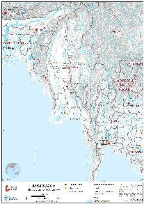
Overview
Myanmar has an extensive river network that serves as a major resource for the people of Myanmar allowing them access to fresh water and source of irrigation water that sustains rice production across Myanmar. It spans through more than 9000 kilometers and it remains unexploited and under-developed. Distortion of subsidies, non-engineered channels and landing river spots serving as ports, lacking adequate terminal facilities. Despite this, river transport still plays a major role in domestic freight transportation. While river transport carries the potential to hold the competitive advantage in transportation of earth materials in bulk or large quantities, this has not been observed to have happened within the local freight market.
Navigating these rivers proves to be a difficult task due to shallow depths, limiting loads or deploying smaller capacity boats which leads to higher costs and inefficiencies as well as longer travel time, particularly during the dry season. Discharge volume and intensity resulting in severe suspended sedimentation and flow changes in the river course along the major upstream rivers remain a challenging issue that hampers maximization or utilization of waterway transportation as navigation channels keeps shifting. Accumulation of sands are commonly observed in most rivers in Myanmar. This confines navigation to daytime especially when water level is down during the dry season and channels are shifting. The need to employ experience pilots across different sections of the river becomes crucial in the absence of channel markers and signs.
The main ports of Myanmar can be found in 9 cities: Sittwe, Thandwe, Kyauk Phyu, Pathein, Yangon, and Mawlamyine. (See link: 2.1 Myanmar Port Assessment) All river ports, except Yangon are undeveloped and lack berths, jetties, and significant handling equipment. The Port of Yangon remains the main port in Myanmar that handles most of all importation and exportation activities. As of 2012, permissions on car importations was streamlined resulting in an increase of the number of trucks operated by private transport companies in the country, the volume of cargo being transported through the waterways have been steadily on a decline. ADB data estimated that in 2014, the market share of waterway transportation is only 16% for freight and 1.5% for passenger transportation. Although it takes longer time to transport goods by road, it remains one of the cheapest transport options in country.
The Ayeyarwaddy river is the most important commercial waterway in Myanmar, running through the center of the country. It is about 1,350 miles (2,170 km) long starting in Kachin State and runs through Yangon to the Delta in Ayeyarwaddy Region. In some parts of the delta, the waterways are sometimes the only form of transport available. It is navigable along most of its length in all seasons. However, in the dry season, cargo boats need to reduce their cargo by 50% due to the shallow water depth. on the lower part of the river, from Mandalay to Yangon, this section is accessible for vessels up to 1000 GRT. However, on the upper part, from Bhamaw in Kachin State to Mandalay, this section is only accessible for vessels up to 300 GRT due to draft condition for most of the months, while during the peak of the dry season, only 100 ton ships can navigate the river safely. As a major channel, this river remains in need of dredging and stabilization efforts along the riverbanks. Limited modern navigation aid and lack of basic river port terminal (dock, storage, and handling equipment) have constrained the use of larger vessels to operate in this channel. This problem is exacerbated with land-access issues at these river ports preventing vehicles to reach closer to the offloading/loading area for the manual handling of commodities to take place.
In many upstream rivers, navigation channels remain undeveloped with heavy sedimentation and collapsed riverbanks. These channels are also not defined and adequately marked. Nautical charts are not always available that increase the risk for safe navigations. Boat operators must rely on their experience to navigate these waters.
In Sagain Region, the Chindwin River is navigable up to Khamti and Homalin all year round. Depending on the water depth, draft conditions, and weight of vessel, it is navigable up to the Tanai (Kachin State). The upper part of the river can be very shallow during the dry season.
In Rakhine state, around Sittwe, the rivers to Buthidaung (MayYu River) and Kyauktaw (Kaladan River) are navigable. Several towns in Rakhine can be accessed both by road and river. Due to the river conditions, road transportation seems to be quicker to transport goods for most of the towns, except for Myaebon town, which can only be accessed by water transportation. Most common transport on these waterways is by local wooden hull vessels that can carry up to 100MT cargo capacity. Larger, shallow draft barges or landing vessels can also pass however they are not commonly used in the area.
In Mon state and Tanintharyi Region that is further upstream, water transport is not common. In Mawlamyine (Mon State), the Thanlyin River and Gyaing River are both navigable, but the river is mainly used for passenger transport and some local transport by wooden hull vessels of up to 100MT.
In Tanintharyi at Dawei, the Dawei River is only navigable for a couple more miles north of Dawei. Therefore, in this area, it is mostly used for local passenger transport. In Myeik, the Kyaukphyar River (North) and Tanintharyi River (South-East) are navigable and mainly used for passenger transport and local cargo transport by wooden hull vessels of up to 100MT. The coastal area around Myeik is interlaced with tributaries and for many small coastal towns, coastal transportation is their primary means, and at times, the only connection available to Myeik.
In Kawthaung the Kra Buri bay and river acts as the border between Myanmar and Thailand. Large vessels of up to 2000 GRT around Kawthaung can pass this navigable upstream for about 50km but there are no significant settlements in that direction.
Company Information
Inland Water Transport (IWT), established in 1865, under the Ministry of Transport is a state-owned enterprise responsible for water transport of passengers and cargo. With 11.239 million passengers and 1.375 million tons of cargo transported (April 2015 to March 2016) it is the largest transport company active on the waterways. River transportation is one of the cheapest means of transport in Myanmar.
IWT has six divisions:
- Delta Division,
- Ayeyarwaddy Division,
- Chindwin Division,
- Thanlwin Division,
- Rakhine Division
- Cargo Division.
It has a fleet of 292 vessels: Passenger, cargo vessels, powered barges, and tugs. 30% of their fleet is more than 60 years old, 26% between 40-60 years old, 35% between 20-40 years old, 4% between 10-20 years old and 5% under 10 years old (as of 15 June 2016). Their cargo vessels are leased out to private contractors on an annual basis, while the passenger vessels are still operated by IWT. Since 2014, their fleet size has dropped by 30% and the volume of cargo transported has shrunk by 34% as more and more passengers resort to other types of transportation means that are perceived to be more efficient.
Shwe Pyi Tan Co. Ltd. and Pathein Thu Co. Ltd. are the largest private transportation companies for inland water transport. They are active in Ayeyarwaddy Region. However, most people and businesses in Ayeyarwaddy Region (in the towns of Bogale, Mawkyun, Laputta, Pathein) rely on IWT for transport of passengers and cargo to Yangon Region. There is minimum competition there because IWT has monopolized this sector in Ayeyarwaddy.
Ships are charged a standard fee for passing through the waterway by the Directorate of Water Resources and Improvement of River System (DWRIRS), under the Ministry of Transport & Communications. DWRIRS charges 0.20 Kyat/MT capacity/mile, per trip (rate as of Jun 2016). This is charged at the river stations Twantay, Nyaungdong, Pyay, Magway, Mandalay and Kathar and for the Chindwin River at Monywa and Kalewa.
Inland Water Transport (IWT) Fleet Composition (15/June/2016)
|
Powered Vessels |
142 |
|---|---|
|
(1) Passenger and cargo |
84 |
|
(2) Cargo |
21 |
|
(3) Powered Barge |
13 |
|
(4) Water Tender |
1 |
|
(5) Tug |
17 |
|
(6) Oil Tanker |
1 |
|
(7) Miscellaneous |
5 |
|
Non-Powered Vessels |
121 |
|
(1) Cargo Barge |
115 |
|
(2) Oil Barge |
6 |
|
Station Pontoons |
29 |
|
Total |
292 |
IWT Services Routes in Myanmar, countrywide.
|
Division/Route |
Schedule |
|
|---|---|---|
|
|
Delta Division |
Sailing Frequency |
|
1. |
Yangon – Dala |
Daily (46) trips |
|
2 |
Wadan – Dala |
Daily (15) trips & 9 trips in Sunday |
|
3 |
Yangon – Kanaungto |
Daily (6) trips & 4 trip in Sunday |
|
4 |
Sintohtan – Sarparchaung |
Suspended |
|
5 |
Wadan – Satekyi |
Suspended |
|
6 |
Hinthada – Pyapon |
Suspended |
|
7 |
Yangon – Bogale |
Suspended |
|
8 |
Yangon - Mawkyun (Night) |
Suspended |
|
9 |
Yangon – Kyonemange |
(1) trip a week |
|
10 |
Yangon - Lattputa (In) |
(1) trip a week |
|
11 |
Yangon - Lattputa (Out) |
(2) trips a week |
|
12 |
Yangon – Myaungmya |
Suspended |
|
13 |
Yangon - Pathein (Night) |
Suspended |
|
14 |
Yangon – Pyay |
Suspended |
|
15 |
Yangon – Kyaunkone |
Suspended |
|
16 |
Yangon – Pyapon |
Suspended |
|
17 |
HlaingTharYar – Sintohtan |
Suspended |
|
2. |
Ayeyarwaddy Division |
Sailing Frequency |
|
1. |
Mandalay - Bamaw (Express) |
Suspended |
|
2. |
Mandalay - Bamaw (Special Express) |
(3) trips a week |
|
3. |
Mandalay - Nyaung Oo (Express) |
Suspended |
|
4. |
Mandalay - Kathar (Special Express) |
Suspended |
|
5. |
Mandalay – Pyay |
Suspended |
|
6. |
Mandalay – Bamaw (normal class) |
Suspended |
|
3. |
Chindwin Division |
Sailing Frequency |
|
1. |
Monywa – Homalin |
Suspended |
|
2. |
Monywa – Kalaywa |
Temporarily Suspended in dry season |
|
3. |
Monywa – Khamti |
Suspended |
|
4. |
Thanlwin Division |
Sailing Frequency |
|
1. |
Chaungnakwa |
Suspended |
|
2. |
Mawlamyaing – Kalwi |
Daily (2) trips |
|
3. |
Mawlamyaing – Nathmaw |
Daily (2) trips |
|
4. |
Mawlamyaing - Nathmaw (Special) |
Suspended |
|
5. |
Rakhine Division |
Sailing Frequency |
|
1. |
Sittwe - Myauk Oo |
Suspended |
|
2. |
Sittwe – Buthetaung |
(3) trips a week |
|
3. |
Taunggote – Manaung |
Suspended |
|
4. |
Sittwe - Taunggote (Special Express) |
Suspended |
|
6. |
Cargo Division |
Sailing Frequency |
|
1. |
Yangon-Mandalay |
Suspended |
Suspended: Lines stopped since 2014 that were uneconomical.
For information about IWT and government contacts see link: 4.1 Myanmar Government Contact List.
For information about port and waterways companies contacts see link: 4.4 Myanmar Port and Waterways Company Contact List.
Ayeyarwaddy River
IWT still operates 14 passenger ships along the Ayeryawaddy River, while 10 of their cargo vessels and 30 passenger/cargo vessels have been privatized since 2013. There are private passenger vessel companies that operate for tourism from Yangon to Pyay (Prome), Nyaung-U (Bagan), Mandalay and Kathar along Ayeyarwady River. There are individually owned vessels, barges and small ferries run along Chindwin River between Pakokku, Monywa, Kalewa, Homlin and Khanti.
World Bank started in 2016 a dredging project that will run until 2021 to increase the depth of the Ayeyarwaddy River from Nyaung-U to Mandalay (191 km) to at least 2 meters. In dry season (Nov-April), the minimum depth currently ranges from 1-1.5m (5-7 ft).
| Passenger Carrying Capacity | |||
|---|---|---|---|
| Number of Passenger Vessels | IWT | MGRG Express | Myanmar Holidays Co., Ltd/ Interconnection/ Shwe Keinnery Vessel |
| < 100 passengers | 3 boats (74 passengers) | 2 boats (56, 60, and 70 passengers) | |
| >100 Passengers | 14 boats (294 - 374 passengers) | 1 boat (220 Pax) only operates from Sept to March | |
| Contacts |
U Min Kyawt (Manager of Transport (Dept. IWT), Ayeyarwaddy Region, Yangon Ph#+95-9-5322324 |
No.38, 38th St, Bet 79thx80th, Maha Aung Myay Tsp, Mandalay +95-9-400080325, 09400401551 |
24 – 26, 38th Street,
Kyauktada Township, Yangon 11182, Myanmar. Tel/ Fax: +(95-1) 371 691, 371 692 E-mail: info@myanmarholiday.com |
|
Cargo Carrying Capacity |
||||
|---|---|---|---|---|
|
|
Dept. IWT U Min Kyawt (Manager of Transport (Dept. IWT) Ph#+95-9-5322324 |
|||
|
Number of Boats |
14 (operating with cargo and passenger) |
|||
|
Tonnage / Volume Capacity |
20-50 Tonnage |
|||
|
Number of Barges |
10 |
|||
|
Tonnage / Volume Capacity |
1,920 Mt/50,000 M3 |
|||
|
Number of Tugs |
No information |
|||
|
Tonnage / Volume Capacity |
|
|||
|
Other (specify) |
About 30 ferries with the capacity of 100-300 pax+ 20-50 Mt each, were tendered each year. |
|||
Travel Time Matrix
Average speed on the Ayeyarwady River for regular 20-60 MT cargo boats is 16 km/hour following the current (downstream), 9.6 km/hour against the current (upstream).
Security: Some robbery incidences have occurred with cargo shipments between Pakokku and Mandalay along the Ayeyarwaddy River. Passenger and tourist vessels however were not targeted.
Corridor: Ayeyarwaddy River (from Yangon to Mandalay)
|
Travel Time from Main port to other major Ports (hours / days) for standard barge 20-60 mt capacity |
||||||||
|---|---|---|---|---|---|---|---|---|
|
|
Yangon |
Pyay |
Magway |
Nyaung-U |
Pakokku |
Mandalay |
Monywa |
Kalewa |
|
Yangon |
|
378Km /39hour (up), 24 hour (down) |
543Km/56hour (up), 34 down |
754Km/ 78.5hour (up) 47 hour (down) |
779Km/82 hour (up) 49 hours (down |
944Km/ /98 hour (up) 59 hour (down) |
918 Km/ 97 hour (up)/ 55 hour (down) |
1153 Km/ 125 hour (up)/ 70 hour (down) |
|
Pyay |
378Km /39hour (up), 24 hour (down) |
|
165Km/17 hour (up), 10 hour (d) |
376Km/ 39hour (up)/ 23.5 hour (down) |
401Km/ 42 hour (up)/ 25 hour (down) |
534Km/ /56 hour (up) 33 hour (down) |
540km/ 57 hour (up)/ 32 hour (down) |
775km/ 85 hour (up)/ 46 hour (down) |
|
Magway |
543Km/56hour (up), 34 hour (down) |
165Km/17 hour (up), 10hour (down) |
|
211 km/ 22 hour (up)/ 13 hour (down) |
236km/ 25 hour (up) 15 hour (down) |
451Km/ 47 hour (up)/ 28 hour (down) |
375 km/ 39 hour (up)/ 73 hour (down) |
610Km/ 64 hour (up)/ 38 hour (down) |
|
Nyaung-U |
754Km/ 78.5hour (up) 47 hour (down) |
376Km/ 39hour (up)/ 23.5 hour (down) |
211 km/ 22 hour (up)/ 13(down) |
|
25Km/ 2.5 hour (up), 1.6 hour (down) |
190Km/20hour (up) 12 hours (down |
125Km/ 13 hour (up) 8hour (down) |
777 Km/ 81 hour/(up)
50 hour (down) |
|
Pakokku |
779Km/82 hour (up) 49 hours (down |
401Km/ 42 hour (up)/ 25 hour (down) |
236km/ 25 hour (up) 15 hour (down) |
25Km/ 2.5 hour (up), 1.6 hour (down) |
|
165Km/17hour (up) 10 hours (down |
100 Km/ 10.4 hour (up)/ 6.3hour (down) |
374km/ 40hour (hour (up)/ 20 hour(down) |
|
Mandalay |
944Km/ /98hour (up) 59hour (down) |
534Km/ /56hour (up) 33 hour (down) |
451Km/ 47 hour (up)/ 28 hour (down) |
190Km/20hour (up) 12 hours (down |
165Km/17hour (up) 10 hours (down |
|
277 Km/ 29hour (up)/ 17(down |
483 Km/ 50(up)/ 30(down) |
|
Monywa |
918 Km/ 97 hour (up)/ 55 hour (down) |
540km/ 57 hour (up)/ 32 hour (down) |
375 km/ 39 hour (up)/ 73(down) |
125Km/ 13 hour (up) 8hour (down) |
100 Km/ 10.4 hour (up)/ 6.3 hour (down) |
277 Km/ 29hour (up)/ 17 hour (down) |
|
235 Km/ 28 hour (up)/ 13 hour (down) |
|
Kalewa |
1153 Km/ 125 hour (up)/ 70 hour (down) |
775km/ 85 hour (up)/ 46 hour (down) |
610Km/ 64hour (up)/ 38hour (down) |
777 Km/ 81 hour (up)/ 50 hour (down) |
374km/ 40hour (up)/ 20 hour(down) |
483 Km/ 50 hour (up)/ 30 hour (down) |
235 Km/ 28 hour (up)/ 13 hour (down) |
|
Corridor: Ayeyarwaddy river (from Mandalay to
Banmaw)
|
Travel Time from Main port to other major Ports (hours / days) for standard barge 20-60 mt capacity |
|||
|---|---|---|---|
|
|
Mandalay |
Katha |
Banmaw |
|
Mandalay |
|
378Km /39hour (up), 24 hour (down) |
440Km/ 56hour (up), 34 (down) |
|
Katha |
317Km /31.7 hour (up), 20 hour (down) |
|
123Km/ 17 hour (up), 10 hour (d) |
|
Banmaw |
440Km/44hour (up), 27.5 hour (down) |
123Km/ 12.3 hour (up), 7.7 hour (down) |
|
Key routes
|
Key Route Information (Domestic / International) |
||||
|---|---|---|---|---|
|
|
Yangon-Pyay-Pakokku- Mandalay |
Pakokku-Monywa-Kalewa-Hommalin-Khamti |
Pakokku to Mandalay |
Mandalay to Banmaw |
|
Total Distance (km) |
944 Km |
888 Km |
165 Km |
440 Km |
|
Width (m): Broadest Narrowest |
In rainy season 1,600m, min. 227m in dry season |
In rainy season 620 m, min. 200 m in dry season |
In rainy season 1524m, min. 9147m in dry season |
395m-1210m Min. 76m (most parts are narrow) |
|
River Flow (m³ / second) |
Unknown |
12-16 km/hour wet season |
unknown |
unknown |
|
Seasonal Affects |
Dry season cargo load is reduced by 50% |
Dry Season during 15 Nov to 15 May, shallow draft. Cargo loading is reduced by 50% depending on the channel draft. Restriction on the max channel draft in Chindwin river during dry season stated by the Directorate of Water Resources and Improvement of River System (DWRIRS): Monywa to Kalewa = 1m (3.3 ft) Kalewa to Hommalin = 0.91m (3 ft) Hommalin to Khamti = 0.76m (2.5 ft) |
Dry season cargo load is reduced by 50% |
Dry season 1m draft. |
|
Maximum Weight and Size of Vessels |
The regular vessel with 2000 GRT Mt, 2meter draft, 24m Width x 91.5m Length |
128 GRT |
|
|
|
Regular Traffic Passenger / Cargo |
No traffic |
Yes, passengers and timber |
Most traffic is passenger tourists |
Yes. Mostly fuel & construction materials |
|
Companies Operating Along the Route |
1. Apache cement Co. 2. Famous OK 3. Denko Trading Co. Ltd. 4. Semeikhon port committee |
1. Aung Mya Than co. at timber port 2. Apache cement Co. 3. Famous OK |
1. Apache cement Co. 2. Famous OK 3. Denko Trading Co. Ltd. 4. Semeikhon port committee |
IWT and private companies |
|
Security Concerns (Yes / No) |
Yes, robbery of cargo at night. Not targeting tourists between PKK-MDY |
No report |
Yes, robbery of cargo at night. Not targeting tourists. |
No |
|
Main Ports |
Yangon & Mandalay |
Pakokku, Monywa, Kalewa, Hommalin, Khamti |
Pakokku, Simee Khon, Mandalay |
Mandalay, Katha & Bamaw |
Water transportation from Yangon to Pyay involves two options.
- Option 1 is via Twantay canal (124 km length) at Twantay city. Twantay canal is preferred by Inland Water Transport.
- Option 2 via the Hlaing River (98km length) at Nyaungdon city is 26km (1.5 - 3 hours) shorter. The Hlaing River is preferred by the private sector but is more difficult to navigate due to narrow sections with many channel turns.
Corridor: Chindwin River (from Pakokku to Kalewa)
|
Travel Time from Main port to other major Ports (hours/days) Barge |
||||||
|---|---|---|---|---|---|---|
|
|
Pakokku |
Monywa |
Kalewa |
Homalin |
Hamanthi |
Hkamti |
|
Pakokku |
|
100 Km/10.4 hour (up)/ 6.3 hour (down) |
374km/40 hour (up)/20 hour (down) |
646 Km/ 61 hour (up) 43 hour (down) |
731Km/ 66.5 hour (up)/ 51.5 hour (down) |
838Km/ 67.2 hour (up)/ 58.5 hour (down) |
|
Monywa |
100 Km/10.4 hour (up)/ 6.3 hour (down) |
|
235 Km/ 28 hour (up)/ 13 hour (down) |
507 Km/ 48 hour (up)/ 34 hour (down) |
631Km/ 63.5 hour (up)/ 42.2 hour (down) |
731Km/ 73.1 hour (up)/ 49 hour (down) |
|
Kalewa |
374km/ 40 hour/ 20 hours |
235 Km/ 28 hour (up)/ 13 hour (down) |
|
292km/ 26 hour (up)/ 18 hour (down) |
384km/ 35.7(up)/24 hour (down) |
495Km/ 46.4 hour (up)/ 31 hour (down) |
|
Homalin |
646 Km/ 61 hour (up) 43 hour (down) |
507 Km/ 48 hour (up)/ 34 hour (down) |
272km/ 26 hour (up)/18 hour (down) |
|
85Km/ 5.5 hour (up)/8.5 hour (down) |
203Km/ 20.3 hour (up) 15 hour (down) |
|
Htamanthi |
731Km/ 66.5 hour (up)/ 51.5 hour (down) |
631Km/ 63.5 hour (up)/ 42.2 hour (down) |
357km/ 35.7(up)/24 hour (down) |
85Km/ 5.5 hour (up)/8.5 hour (down) |
|
107 Km/ 10.7 hour (up)/ 7 hour (down) |
|
Hkamti |
838Km/ 67.2 hour (up)/ 58.5 hour (down) |
731Km/ 73.1 hour (up)/ 49 hour (down) |
464Km/ 46.4 hour (up)/ 31 hour (down) |
203Km/ 20.3 hour (up) 15 hour (down) |
107 Km/ 10.7 hour (up)/ 7 hour (down) |
|
Port Information
| Key Port Information | |||||
|---|---|---|---|---|---|
| Pakokku | Monywa | Kalewa | Sagaing | Mandalay | |
| Location |
21°18'50.76"N 95° 3'22.53"E |
22° 07' 20.7" N 95° 07' 06.8" E |
23°11'39.11"N 94°18'33.99"E |
21°52'59.09"N 95°59'41.44"E |
21°58'16.04"N 96° 3'22.08"E |
|
Contacts |
Mr. U Aung Cho Myint Manager- Inland Waterway Department, Pakokku-Nyaung-U Nyaung U Office Ph#-95-9-43008220 |
U Kyaw Soe Tun Deputy Director Head of Regional Office Monywa Directorate of Water Resources and Improvement of River System (DWRIRS)
|
U Moe Zaw Port Manager Directorate of Water Resources and Improvement of River System (DWRIRS) Phone: +95-9-400545544 |
IWT, U Saw Hla Tun, Assistant General Manager Mandalay Division, Dept. IWT |
IWT, U Saw Hla Tun, Assistant General Manager Mandalay Division, Dept. IWT |
|
Connections with other transport means |
Road | Road | Road | Road | Road |
| Storage Capacity | None | None | None | None | None |
| Handling Equipment | No, but can arrange 3-5 MT mobile crane | Mobile Cranes: 25 units, 35MT | None | None | Mobile Cranes: 25, 35, 17MT |
| Customs Clearance Available | No | No | No | No | No |
| Other Comments | Chindwin river, 2.5ft draft during dry season |
Chindwin river, 2.5ft draft during dry season | Timber port, across from Mandalay port | Private company handles general cargo | |
|
Key Port Information |
||||||||||||||
|---|---|---|---|---|---|---|---|---|---|---|---|---|---|---|
|
|
Semeikhon | Homalin |
Hta Man Thi |
Hkamti |
Katha |
|||||||||
|
Location |
21° 44' 53.8"N 95° 25' 23.4"E |
24°51'47.32"N 94°54'31.92"E |
25°19'55.39"N 95°17'28.28"E |
26° 0'2.73"N 95°41'44.88"E |
24° 9'55.29"N 96°20'32.35"E |
|||||||||
|
Contact Information |
U Thein Soe Win (Port Manager) Ph: +95-9-796512259 |
|
|
U Gyi Myint (Chairman) Waterway Traffic Control Office |
||||||||||
|
Connections with other transport means |
Road (limited) for truck capacity (6-wheeler in dry season) | Road(limited) for truck capacity (6-wheeler in dry season) | Only waterway is accessible on the other side of the bank, there is a ferry to connect road of Homalin-Hkamti |
Road (limited) for truck capacity (6-wheeler in dry season) |
Road |
|||||||||
|
Storage Capacity |
None, but container yard is available | N/A | N/A |
N/A |
None |
|||||||||
|
Handling Equipment |
50m concrete boat ramp and a 50MT crane on a barge | Only manual |
Only manual |
Not for handling purpose, but can hire in case of emergency from DWRIRS based in Mandalay |
||||||||||
|
Customs Clearance Available |
No | No |
No |
No |
No |
|||||||||
|
Other Comments |
Timber to Mandalay, Fuel Supply to Resource Extraction Project in Sagaing. |
Private companies handle general commodities to move to Layshi of Naga Administration Zone. |
Timber to Mandalay, Fuel, and general cargo to Resource Extraction Project in the area and the Naga Administration Zone. |
Diesel fuel drum are trucking to northern part of the city. |
||||||||||
Rakhine State
In Rakhine state, particularly around Sittwe, the rivers to Buthidaung (MayYu River) and Kyauktaw (Kaladan River) are navigable. Several towns in Rakhine can be accessed by both road and river. However, for most towns, road transportation remains the fastest means. Most common transport on these waterways is by local wooden hull vessels of up to 100MT cargo capacity. Larger, shallow draft barges or landing vessels can be used, but are not common in the area.
There are two existing IWT transportation route in Rakhine State. The first route is Sittwe - Rathedaung - Buthidaung and running mile are 40 miles for Rathedaung and 80 for Buthidaung. The second route is Sittwe to Myae Bon and Kyauk Phyu. The running mile are 64 miles to Myae Bon and 128 miles to Kyauk Phyu.
|
Passenger Carrying Capacity |
||||
|---|---|---|---|---|
|
Number of Passenger Vessels |
Dept. IWT U Min Kyawt (Manager of Transport (Dept. IWT), Sittwe, Rakhine State Ph#+95-9-5322324 |
Ma Li Kha Express U Soe Moe Lin (Manager) Ph#+95-926080662 |
Shwe Pyi Tan Express U Aung Than Oo (Manager) Corner Main Rd & U Ottama St +95-9-453543447 |
May Ga Arr Man VIP Express U Tin Htwe Shwe Ein Si, Pa Daung ~ Toungup Road, Kan Paing Quarter, Toungup. +95 9 250768191 |
|
< 20 pax |
n/a |
n/a |
n/a |
n/a |
|
< 50 pax |
n/a |
n/a |
n/a |
n/a |
|
< 100 pax |
n/a |
n/a |
n/a |
n/a |
|
> 100 pax |
3 boats (70-120 pax) |
3 Boats (120 Pax) |
8 Boats (120 ~ 150 Pax) |
2 Boats (50 – 70 pax) |
|
Cargo Carrying Capacity |
|||||
|---|---|---|---|---|---|
|
|
Dept. IWT U Min Kyawt (Manager of Transport (Dept. IWT) Ph#+95-9-5322324 |
U Maung Kyaw Naing Maung Kyaw Naing Transport Ph# +95-9-263685454 |
U Maung Zaw Win Tun Maung Zaw Win Tun Transport Ph# +95-9-453060407 |
U Kyaw Min Thein (Manager) Ba Yint Naung & Rakhine Costal Cargo Transportation Ph# +95-9-5680750 |
U Hla Tun Thein Hla Tun Thein Transport Ph# +95-9-403401479 |
|
Number of Boats |
5 |
4 |
8 |
17 |
2 |
|
Tonnage / Volume Capacity |
50-100 Tonnage |
85-400 Tonnage |
20 – 300 Tonnage |
300 – 1400 Tonnage |
70 Tonnage |
|
Number of Barges |
n/a |
n/a |
n/a |
n/a |
n/a |
|
Tonnage / Volume Capacity |
n/a |
n/a |
n/a |
n/a |
n/a |
|
Number of Tugs |
n/a |
n/a |
n/a |
n/a |
n/a |
|
Tonnage / Volume Capacity |
n/a |
n/a |
n/a |
n/a |
n/a |
|
Other (specify) |
n/a |
n/a |
n/a |
(Secondary transporter of Aung ZayKabar Transport and Phoe Cho) |
n/a |
Corridor: May Ru river (from Sittwe to Buthidaung)
|
Travel Time from Main port to other major Ports (hours / days) for standard barge 20-60 mt capacity |
|||
|---|---|---|---|
|
|
Sittwe |
Rathedaung |
Buthidaung |
|
Sitwe |
|
64Km /4-hour 30 min(up), 5 hour (down) |
128Km/ 9hour (up), 10 hour (down) |
|
Rathedaung |
64Km /4-hour 30 min(up), 5 hour (down) |
|
64Km/ 4-hour 30 min (up), 5 hour (down) |
|
Buthidaung |
128Km/ 9 hour (up), 10 hour (down) |
64Km/ 4-hour 30 min (up), 5 hour (down) |
|
Corridor: Kaladan river (from Sittwe to Kyauk Taw)
|
Travel Time from Main port to other major Ports (hours / days) for standard barge 20-60 mt capacity |
|||
|---|---|---|---|
|
|
Sittwe |
Ponnagyun |
Kyauk Taw |
|
Sitwe |
|
26Km /1 hour 45 min(up), 2 hour (down) |
112Km/ 6 hour (up), 7 hour (down) |
|
Ponnagyun |
26Km /1 hour 45 min(up), 2 hour (down) |
|
86Km/ 4-hour 15 min(up), 5 hour (down) |
|
Kyauk Taw |
112Km/ 6 hour (up), 7 hour (down) |
86Km/ 4-hour 15 min(up), 5 hour (down) |
|
Corridor: from Sittwe to Pauk Taw, Mrauk Oo, Myinn Byar, Myae Bon, Kyauk Phyu & Toungup
|
Travel Time from Main port to other major Ports (hours / days) for standard barge 20-60 mt capacity |
||||||||
|---|---|---|---|---|---|---|---|---|
|
|
Sittwe |
Pauk Taw |
Mrauk Oo |
Myinn Byar |
Myae Bon |
Kyauk Phyu |
Toungup |
|
|
Sittwe |
|
26Km /1 hour 45 min(up), 2 hour (down) |
64Km/ 4-hour 30 min(up), 5 hour (down) |
64Km/ 4 hour (up), 4 hour (down) |
105Km/ 7 hour (up), 7 (down) |
206Km / 9 hour (up), 11 hour (down) |
360Km /19 hour (up), 24 hour (down) |
|
|
Pauk Taw |
26Km /1 hour 45 min(up), 2 hour (down) |
|
38Km/ 2-hour 45 min(up), 3 hour (d) |
38Km/ 2-hour 45 min(up), 3 hour (d) |
79Km/ 5-hour 15 min(up), 5 (down) |
180Km /7-hour 15 min(up), 9 hour (down) |
334Km /17-hour 15min(up), 20 hour (down) |
|
|
Mrauk Oo |
64Km/ 4-hour 30 min(up), 5 hour (down) |
38Km/ 2-hour 45 min(up), 3 hour (d) |
|
n/a |
n/a |
n/a |
n/a |
|
|
Myinn Byar |
64Km/ 4 hour (up), 4 hour (down) |
38Km/ 2-hour 45 min(up), 3 hour (d) |
n/a |
|
41Km/ 2 hour (up), 2-hour 15 min (down) |
142Km /5-hour 30min(up), 6-hour 15 min(down) |
296Km / 14 hour (up), 19-hour 15 min(down) |
|
|
Myae Bon |
105Km/ 7 hour (up), 7 (down) |
79Km/ 5-hour 15 min(up), 5 (down) |
n/a |
41Km/ 2 hour (up), 2-hour 15 min (down) |
|
101Km/ 3-hour 30 min(up), 4 hour (down) |
255Km / 12 hour (up), 17 hour (down) |
|
|
Kyauk Phyu |
206Km / 9 hour (up), 11 hour (down) |
180Km /7-hour 15 min(up), 9 hour (down) |
n/a |
142Km /5-hour 30min(up), 6-hour 15 min(down) |
101Km/ 3-hour 30 min(up), 4 hour (down) |
|
154Km /10 hour (up), 11 hour (down) |
|
|
Toungup |
360Km /19 hour (up), 24 hour (down) |
334Km /17-hour 15min(up), 20 hour (down) |
n/a |
296Km / 14 hour (up), 19-hour 15 min(down) |
255Km / 12 hour (up), 17 hour (down) |
154Km /10 hour (up), 11 hour (down) |
|
|
Port Information
|
Key Port Information |
||||||
|---|---|---|---|---|---|---|
|
|
Sittwe (Shwe Min Gan) |
Sittwe (IWT Jetty) |
Kyauk Phyu (Ngar La Pwae) |
Taungup Jetty |
Shwe Pyi Tan Jetty |
Ma Li Kha Jetty |
|
Location |
20°12'15.08"N 92°54'47.41"E |
20° 9'34.07"N 92°54'1.96"E |
19°24'37.04"N 93°32'53.41"E |
18°50'31.03"N 94°12'39.60"E |
20° 9'34.99"N 92°54'4.41"E |
20° 9'35.35"N 92°54'5.88"E |
|
Contact Information |
U Min Kyawt Nyi Nyi Aung Manager of Transport (Dept. IWT) Phone: +955322324 Email: mknna99@gmail.com |
U Win Naing Manager of Transport (Dept. IWT) Phone: +959450541722, +959787362842 |
U San Lin Manager of Transport (Dept. IWT) Phone: +959254180760 |
Shwe Pyi Tan Express U Aung Than Oo (Manager) Coner Main Rd & U Ottama St +95-9-453543447 |
Ma Li Kha Express U Soe Moe Lin (Manager) Ph#+95-926080662 |
|
|
Connections with other transport means (road/waterways/air) |
Road + Waterway |
Road + Waterway |
Road + Waterway |
Road + Waterway |
Road + Waterway |
Road + Waterway |
|
Storage Capacity (square meters and cubic meters) |
707.9212 m3 |
None |
224.277 m3 |
425.0779 m3 |
None |
None |
|
Handling Equipment |
Only Manual |
Only Manual |
Only Manual |
Only Manual |
Only Manual |
Only Manual |
|
Customs Clearance Available (Yes / No) |
No |
No |
No |
No |
No |
No |
|
Other Comments |
|
|
|
WH is Rented to Shwe Pyi Tan Express |
|
|
Source: http://www.iwt.gov.mm/en/rakhine_division
2.6 Myanmar Storage Assessment
Ayeyarwady Division
Government departments, such as the Department of Trade Promotion (DOTP), the Department of Agriculture and the ministry of commerce, mostly own the large warehouses that can be found in Ayeyarwaddy division. Storage space for commercial use is mostly controlled by local rice millers. Most warehouses can be accessed by both river and road, some are accessible by road only. The most common freight transportation mode in Ayeyarwaddy division is by road or water since no railway network exists in this division. The transport capacity in Ayawaddy Division is maximum 10 MT by road and 250 MT by waterway from other areas, such as Yangon to Ayawaddy Division. For transportation from the main town to the villages within Ayawaddy Division, is only accessible by small boats with cargo capacity of 75 MT, especially for the rural areas since more than 60% of the villages are only accessibly by waterway transportation.
The Ayawaddy is a disaster-prone area. This region was hit badly during the Nargis Cyclone in 2008 resulted in 84,500 casualties and 53,800 missing cases as officially reported. Local disaster management department (DDM) personnel reported that around 40 smaller-scale cyclones hit the area in 2019. Post-Nargis has led the government to build bridges and roads and gradually improve the connectivity within the division. Millers mostly used waterway transport for their rice due to cost consideration.
Given the fact that this region is a disaster-prone area, basic services such as access to clean water and electricity as well as communications infrastructure is sub-standard. Storage space in general is limited as most millers use their small space to store their rice stocks and they are in poor conditions that may require significant repairs. DDM controls the Indian Cyclone Shelter which can potentially be used for humanitarian purposes. It remains advisable to preposition stocks outside this area as well given the existing conditions.
For more information on storage company contact details, please see the following link: 4.6 Myanmar Storage and Milling Company Contact List.
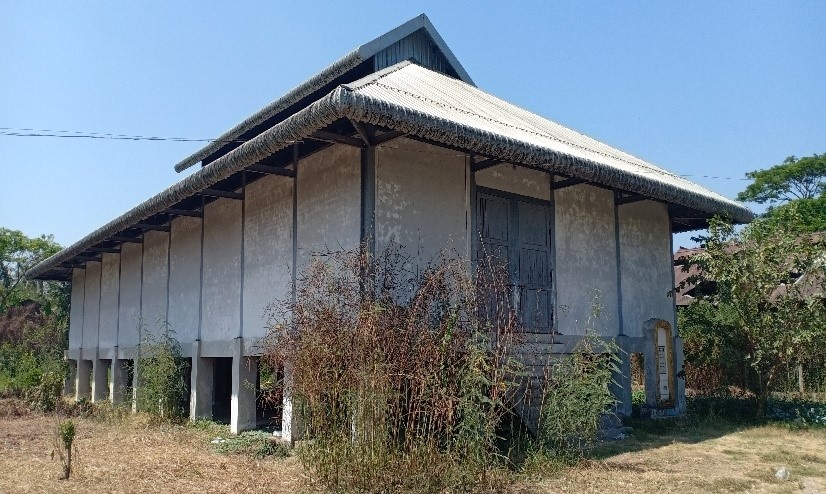
Government cyclone shelter, Ayawaddy Region.
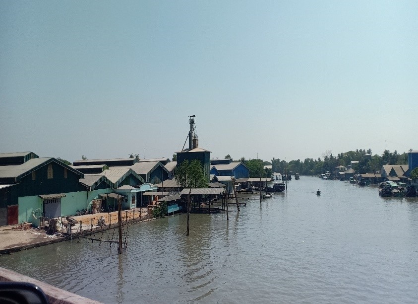
Rice milling in Ayawaddy Region.
Commercial Storage
Most commercial storage in Ayeyarwaddy is owned by local rice milling businesses and mainly used to store paddy and rice. Apart from the rice mill warehouses, there are not many warehouses available in Ayeyarwaddy. Most large warehouses are owned by government departments such as the Department of Trade Promotion (DOTP) of the Ministry of Commerce and the Department of Agriculture.
|
Location |
Owner |
Available for Rent |
Capacity mt / m² / m³ |
Type [1] |
Access [2] |
Condition [3] |
|---|---|---|---|---|---|---|
|
Shwe La Win Rice Mill, Pyapon |
Mr. Kyaw Htun, 098590133 |
No |
1 Nos x (80 x 30 x 7 metre) |
Zinc Roof, Concrete Wall, Concrete Floor |
River, Road |
Good |
|
Monastery compound – San Kyaung, Bogale |
Head of the monks (San Kyaung Monastery) |
Yes |
2 MSU units x 55 mt |
MSU |
Road |
Damaged and not possible to use but enough space to erect mobile storage units (MSU). |
|
Ton 100 Rice Mill, Myaung Mya |
MEC (Myanma Economic Cooperation), c/0 U Toe Lwin, 098585964 (Tsp Officer, DoTP |
Yes |
10 Nos X (27x12x5 metre) |
Zinc Roof, Zinc Wall, Concrete Floor |
River, Road |
Abandoned. Need to be repaired: roof, wall |
|
Ton 100 Rice Mill, Myaung Mya |
MEC (Myanma Economic Cooperation), c/0 U Toe Lwin, 098585964 (Tsp Officer, DoTP |
Yes |
6 Nos X (48x18x4 metre) |
Zinc Roof, Zinc Wall, Concrete Floor |
River, Road |
Good |
|
Yan Aung Mingalar Rice Mill, Laputta |
U Win Aung, 09250224905 |
No |
1 Nos x 500 mt |
Zinc Roof, Bamboo Wall, Ground Floor |
River, Road |
Not Bad |
|
Ton 100 Rice Mill, Maw Gyun |
MEC (Myanmar Economic Cooperation) U Aung Naing Moe, 09 795081490 |
Yes |
4 Nos (144 x 50 x 14 feet) 4 Nos (225 x 50 x 30 feet) |
Zinc Roof, Wooden Wall & Floor Steel Roof, Steel Wall and Concrete Floor |
River, Road |
Used by WFP in 2018 during the Nargis operations. |
|
Infront of WFP Ex warehouse, Zeegone, Pyapon |
U Tin Nyein, Ma Cho Cho Han (Shwesin Lamin Company) 09- 785145388 |
Yes |
1 Nos (67 x 15 x 5 metre) 1 Nos (27 x 15 x 5 metre) 3 Nos (7.6 x 7.6 x 5 metre) |
Zin Roof, Concrete Wall & Floor |
River, Road |
Good (3 Nos can be used as attached office including bathroom, toilet) |
|
Pyapon, Near Pyapon bridge |
U Yin Moe, 09-799 994 963 |
Yes |
1 Nos (48 x 18 x 5 metre) |
Zin Roof, Concrete Wall & Floor |
River, Road |
Good |
[1] Warehouse Type: Open storage, container, rub-hall, silo, concrete, other, unspecified
[2] Warehouse Access: Raised-siding, flat
[3] Warehouse condition: Appears intact, appears damaged, under construction/repair
Storage Used by Humanitarian Organizations
|
Location |
Owner |
Available for Rent |
Capacity mt / m² / m³ |
Type [1] |
Access [2] |
Condition [3] |
|
Monastery compound – San Kyaung, Bogale |
Myanmar Red Cross Society (MRCS) |
No |
2 MSU Units x 500 mt |
MSU |
Road |
Damaged and not possible to use but enough space to erect mobile storage units (MSU’s). Handed over to MRCS from WFP in 2018. |
Warehouses of humanitarian organizations were not assessed. WFP does not have warehouse space available in Ayeyarwaddy division.
Public Sector Storage
Most warehouses in the public sector in Ayeyarwaddy belong to the Department of Trade Promotion (DOTP) which is under the Ministry of Commerce. But it has transferred ownership of their facilities to the private sector except Cyclone Shelters which were built under the India-Myanmar Friendship Project in 2011. This could be considered for short-term storage of humanitarian relief supplies after a natural disaster, in case they are not used as shelter. In March 2020, Department of Trade Promotion (DOTP) is handing over all Cyclone Shelters to the Department of Disaster Management (DDM) under the Ministry of Social Welfare, Relief and Resettlement, which is the main government department in the Delta responsible for emergency preparedness and response.
They cooperate with the Township Disaster Management Committee. They have items prepositioned for 50 house- holds at township level (Mawgyun, Bogalay, Kyaitlatt) and 500 household at district level (Pyapone, Labutta), mostly: Family kits, tarpaulin, buckets, jerry cans, Hygiene Kits. Government construct Cyclone Shelters and School Cum Shelters in several location in delta region with National Disaster Management Fund under the guidance of Vice President, Chairman of National Disaster Management Committee.
|
Location |
Ministry / Agency |
Use Possibility (Yes / No) |
Capacity mt / m² / m³/ft |
Type* |
Access** |
Condition*** |
|
Warehouse Dept. of Trade Promotion (DOTP), Pyapone |
Ministry of Economic and Trade |
Yes |
10 Rooms x (16x16x5 metre) |
Zinc Roof, Wooden Wall, Wooden Floor |
Road, River |
Good/ Not a first choice (Note: The facility was used by WFP in 2008 - Nargis) |
|
India Cyclone shelter - Dept. of Disaster Management, Pyapone |
Ministry of Relief and Resettlement |
Yes |
1 Nos x (30x13x6 metre) |
Zinc Roof, Wooden Wall, Wooden Floor |
Road, River |
In good condition (Small maintenance required) |
|
Warehouse Dept. of Trade Promotion (DOTP), Bogale |
Htoo Group |
No |
10 Rooms x (16x16x5 metre) |
Zinc Roof, Wooden Wall, Wooden Floor |
Road, River |
Not possible to use due to poor infrastructure (Note: The facility was used by WFP in 2008 - Nargis) |
|
India Cyclone shelter – Dept of Disaster Management, Bogale |
Ministry of Relief and Resettlement |
Yes |
1 Nos x (30x13x6 metre) |
Zinc Roof, Concrete Wall, Concrete Floor |
Road, River |
Good |
|
India Cyclone shelter – Department of Trade Promotion (DOTP), Maw Gyun |
Ministry of Commerce |
Yes |
1 Nos x (30x13x6 metre) |
Zinc Roof, Concrete Wall, Concrete Floor |
Road, River |
Good |
|
Warehouse, Pantanaw |
Ministry of National Planning |
Yes |
1 Nos x (43x20x6 metre) |
Zinc Roof, Wooden Wall, Wooden Floor |
Road, River |
Poor storage conditions, access, drainage. |
|
Warehouse, Pantanaw |
Ministry of Agriculture |
Yes |
2 Nos x (40x20x5 metre) |
Zinc Roof, Zinc Wall, Wooden Floor |
Road, River |
Good floors, decent ventilation, many holes in roofing. |
|
Warehouse Dept. of trade promotion (DOTP), Myaung Mya |
Ministry of Economic and Trade |
Yes |
2 Nos x (23x8x5 metre) |
Zinc Roof, Zinc Wall, Wooden Floor |
Road, River |
Not checked inside, but Condition is looking Good |
|
Warehouse, Dept. of Agriculture, Laputta |
Ministry of Agriculture |
Yes |
1 Nos x (40x16x8 metre) |
Zinc Roof, Concrete Wall, Wooden Floor |
Road, River |
Good |
|
Indonesia Cyclone shelter – Tsp Governor, Pyinsalu village, Laputta |
Township Administrative Office |
Yes |
No warehouse but available compound area for MSU |
All Concrete |
Road |
Good |
|
Ex DOTP Warehouse (now run by Private Company), Ye’ Kyi |
Private Company, U Kyaw Kyi Sein, U Kyaw Kyi Sein, Staff from Ye’ Kyi Rice Company, 09422507478 |
Yes |
6 Nos x (48x16x5 metre) |
Zinc Roof, Wooden Wall, Wooden Floor |
Road |
Good |
|
Ex-Warehouse Dept. of trade promotion (DOTP), Pathien |
Pathien Army-Logistics Branch |
Yes |
2 Nos x (10x30x6 metre) |
Zinc Roof, Zinc Wall, Concrete Floor |
River, Road |
Good |
|
DOTP Warehouse, Hinthada |
Ministry of Economic and Trade |
Yes |
2 Nos x (26x10x4 metre) |
Zinc Roof, Zinc Wall, Concrete Floor |
Road |
Good |
Cold Chain
There is no cold chain storage capacity available in Ayeyarwaddy division. There is backup generator in case city power cut off at hospital. Electricity is still one of the challenges in Ayawaddy Division. Medicine is mostly storage in deep freezer.
Mon State, Mawlamyine
Commercial Storage
There are limited commercial storage options available in Mawlamyine. Most purposely built warehouses belong to government departments such as the Department of Trade Promotion (DOTP), the Agriculture Department and the Rescue and Resettlement Department. The private sector mostly uses small storage spaces attached to shops or rent some shared space within the government’s warehouse.
Storage Used by Humanitarian Organizations
There are about 15 NGO’s active in Mawlamyine, but none of them have warehouses except IOM, Myanmar Red Cross, and WFP. IOM has a mobile storage unit (MSU) and is renting a warehouse located within the Mawlamyine Zay Cho warehouse compound, which is used to store rice, beans, oil and salt. Mawlamyine Myanmar Red Cross Society has a warehouse attached to their office where they store non-food items such as family kits and hygiene kits. WFP has a small storage space attached to their office, which is used to store high energy biscuits (HEB’s).
|
Location |
Organization |
Sharing Possibility (Yes / No) |
Capacity mt / m² / m³ |
Type* |
Access** |
Condition*** |
|---|---|---|---|---|---|---|
|
Mawlamyine Zay Cho Warehouse Compound |
IOM |
No |
10x15x4m / 150 sqm / 600 m3 |
Concrete |
flat |
intact |
|
Mawlamyine |
Myanmar Red Cross Societies |
Yes |
10x10x4m / 100 sqm / 400 m3 |
Concrete |
Raised |
intact |
|
Mawlamyine |
WFP |
No |
5x10x4m / 500 sqm / 2000 m3 |
Concrete |
Raised |
intact |
[1] Warehouse Type: Open storage, container, rub-hall, silo, concrete, other, unspecified
[2] Warehouse Access: Raised-siding, flat
[3] Warehouse condition: Appears intact, appears damaged, under construction/repair
Public Sector Storage
The RRD (Relief and Resettlement Department) is the main government department in Mawlamyine responsible for emergency preparedness. They cooperate with the Township Disaster Management Committee. They have items prepositioned for 1,000 households, mostly: Family kits, tarpaulin, buckets, jerry cans. RRD has a budget allocated for food & water, therefore these items are not prepositioned, and delivery is done from central warehouse in Yangon. In addition, CARE Myanmar has donated 300 family kits which are stored in RRD warehouse.
|
Location |
Ministry / Agency |
Use Possibility (Yes / No) |
Capacity |
Type* |
Access** |
Condition*** |
|---|---|---|---|---|---|---|
|
Mawlamyine |
RRD |
Yes |
2x 15x12.5x4m / 366 sqm /1465 m³ |
Concrete |
Raised |
intact |
|
Mawlamyine |
RRD |
Yes |
24.4x12x4m 293 sqm / 1171 m³ |
Concrete |
Raised |
Intact |
|
Mawlamyine |
Min of agriculture |
Yes |
n/a |
Zinc Roof, Concrete Floor (for Fertilizer) |
Raised |
Appears intact |
[1] Warehouse Type: Open storage, container, rub-hall, silo, concrete, other, unspecified
[2] Warehouse Access: Raised-siding, flat
[3] Warehouse condition: Appears intact, appears damaged, under construction/repair
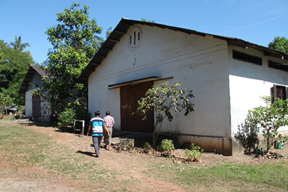
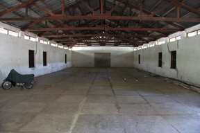
Cold Chain
There are no cold chain storage facilities at INGO’s and UN organizations in Mawlamyine. The public hospital in Mawlamyine has cold chain storage capacity to support regular vaccination activities.
Rakkhine State
Purposely build large warehouses are very rare in Rakkine division. Government departments such as the Department of Trade Promotion (DOTP) of the Ministry of Commerce and Myanma Port Authority (MPA) own most large warehouses. Some warehouses that were previously owned by DOTP have been sold to private companies and some are still under management of DOTP.
WFP has significant warehouse space available in Sittwe and in Maungdaw.
Most of warehouses in Rakkhine can be accessed using both river and road, while some can be accessed only by road. Railway transport is not available in Rakkhine and therefore cargo is delivered mainly through road and water transportation.
Commercial Storage
Unlike in Ayeyarwaddy Division, availability of private sector warehouses in Rakkhine Division is very limited. Local businesses mostly utilize small storage space within or attached to their shops and office compounds. Government departments own most large warehouses in Rakkhine.
|
Location |
Owner |
Available for Rent |
Capacity mt / m² / m³ |
Type [1] |
Access [2] |
Condition [3] |
|---|---|---|---|---|---|---|
|
Millionaire Phyo Rice Mill, No.120, Kudotsate Street, Hsatyo Kya industry ward, Sittwe |
U Zaw Thant Aung |
No |
1000 mt |
Steel Structure Building |
Road, River |
Good, Storage area is attached with Rice Mill |
|
Rakhine Economic Initiative Public Company Satroekya Industry Zone, Sittwe |
U Soe Wai Maung |
No |
750 mt |
Steel Structure Building |
Road, River |
Good |
|
Rakhine Rice & Paddy Co., Ltd, No.58, U Ahthit Rice Mill Street, Yaw Gyi Taung Qr, Sittwe |
Rakhine Rice and Paddy Co., ltd |
No |
3500 mt |
Steel Structure Building |
Road, River |
Good |
|
La Chan Myay Rice Mill, Pyinaychaung village, Wathmaing Kaye Village, near Kistpanadi Bridge, Kyauktaw |
U Nyi Nyi Than |
No |
2500 mt/ 76455 m3 |
Steel Structure Building |
Road, River |
Good, Storage area is attached with Rice Mill |
|
Set Yone Street, Ywar Gyi (North) Ward, Sittwe |
U Aung Naing Win |
Yes |
190 x 80 ft |
Steel Structure Building |
Road, River |
Good |
|
Sittwe Industry Zone, Seik Yoe Kya Ward, Sittwe |
U Kyaw Thein |
Yes |
180 x 60 ft |
Permanent Building/ frozen seafood factory |
Road, River |
The building needs major renovation for roofing and minor renovation for doors, windows and compound cleaning |
[1] Warehouse Type: Open storage, container, rub-hall, silo, and concrete, other, unspecified
[2] Warehouse Access: Raised-siding, flat
[3] Warehouse condition: Appears intact, appears damaged, under construction/repair
Storage Used by Humanitarian Organizations
The main storage space of WFP in Sittwe consists of 6 mobile storage units, of 1,920 sqm space, and several small storage spaces in Maungdaw.
|
Location |
Organization |
Sharing Possibility (Yes / No) |
Capacity mt / m² / m³/ft |
Type [1] |
Access [2] |
Condition [3] |
|
UNICEF Warehouse, Sittwe |
UNICEF, Sittwe |
No |
1 Nos x 350 mt/ 240 m2 |
MSU |
Road |
Good |
|
UNHCR Warehouse, Sittwe |
UNHCR, Sittwe |
No |
2 Nos X 350 mt/ 240 m2 each |
MSU |
Road |
Good |
|
WFP warehouse compound, Sittwe |
WFP, Sittwe |
Yes |
5 Nos x 500 mt / 320 m2 each |
MSU |
Road, River |
Good |
|
No 54, Myin Pyine Kwin Street, San Pya (North), Pyi Daw Thar Quarter, Sittwe |
MHAA |
No |
1 Nos x 14 mt x (20 x 16 x 12 fts) |
Permanent Building |
Road |
Good |
|
No. 100, Pyan Set Street, Ward 3, Ann |
MHAA |
No |
1 Nos x (20 x 30 x 8 fts) |
Permanent Building |
Road |
Good |
|
MHAA, Temporary Storeroom, Toungup |
MHAA |
No |
1 Nos x (44 x 14 x 9 fts) |
Permanent Building |
Road |
Good |
|
Bot Kone, Thandwe |
MHAA |
No |
1 Nos x (45 x 13 x 9 fts) |
Permanent Building |
Road |
Good |
|
Ka Ta (1) Street, Ywar Ma Quarter, Kyauk Taw |
MHAA |
No |
1 Nos x 15 mt x (30 x 20 x 15 fts) |
Permanent Building |
Road |
Good |
|
Aung Thet Sar Street, Pyi Taw Thar Quarter, Min Bya |
MHAA |
No |
1 Nos x 10mt x (25 x 10 x 10 fts) |
Permanent Building |
Road |
Good but need minor renovation |
|
No. 5 street, Taung Yet Quarter, Mrauk Oo |
MHAA |
No |
1 Nos x 11mt x (20 x 14 x 8 fts) |
Permanent Building |
Road |
Good |
|
Plot 035, Rice Mill, Shwe Zar, Maungdaw, (U Tun Tin) |
WFP, Maungdaw |
Yes |
1500 mt, 960 m2 |
Concrete Building |
Road, flat |
Good |
|
Nant Thar Taung village, Maungdaw, (U Salam Oddin) |
WFP, Maungdaw |
Yes |
33 mt, 21 m2 |
Warehouse |
Road, flat |
Good |
|
Nyaung Chaung village tract, Buthidaung, (U Hla Kyaw Htun) |
WFP, Maungdaw |
Yes |
90 mt, 58 m2 |
Warehouse |
Road, flat |
Good |
|
Zaw Ma Tat village tract, Maungdaw, (Noor Ahmed) |
WFP, Maungdaw |
Yes |
40 mt, 26 m2 |
Warehouse |
Road, flat |
Good |
|
Ngan Chaung village tract, Maungdaw, (U Abu Zawmil) |
WFP, Maungdaw |
Yes |
70 mt, 45 m2 |
Warehouse |
Road, flat |
Good |
|
Zedi Taung village tract, Rathedaung, (U Sein Shwe Maung) |
WFP, Maungdaw |
Yes |
90 mt, 58 m2 |
Warehouse |
Road, flat |
Good |
|
Zedi Pyin village tract, Rathedaung, (U Maung) |
WFP, Maungdaw |
Yes |
90 mt, 58 m2 |
Warehouse |
Road, flat |
Good |
|
Aung Mingalar Road, Chaugn Wa Ward |
WFP, Rathedaung |
Yes |
120 mt, 68 m2 |
Warehouse |
Road, flat |
Good |
|
Pan Bai Chaung village tract, Buthidaung, (U Ameran) |
WFP, Maungdaw |
Yes |
90 mt, 58 m2 |
Warehouse |
Road, flat |
Good |
|
Nga Yant Chaung village tract, Buthidaung, (U Aeba Dullah) |
WFP, Maungdaw |
Yes |
|
Warehouse |
Road, flat |
Good |
|
Dabine Sara village tract, Buthidaung, (U Mohammed Rofique) |
WFP, Maungdaw |
Yes |
|
Warehouse |
Road, flat |
Good |
|
Kha Mouk Seik village tract, Maungdaw, (Sharzathar Khatu) |
WFP, Maungdaw |
Yes |
|
Warehouse |
Road, flat |
Good |
|
Kyaung Taung village tract, Buthidaung, (Ali Huson) |
WFP, Maungdaw |
Yes |
|
Warehouse |
Road, flat |
Good |
|
Sein Nyin Pyar village tract, Buthidaung, (U Zafor Ahmed) |
WFP, Maungdaw |
Yes |
60 mt, 38 m2 |
Warehouse |
Road, flat |
Good |
|
Gaw Rahkhar Li Village Tract, Maungdaw, (Daw Hasina Begon) |
WFP, Maungdaw |
Yes |
90 mt, 58 m2 |
Warehouse |
Road, flat |
Good |
|
Alel Than Kyaw Village Tract, Maungdaw, (U Zafor Husson) |
WFP, Maungdaw |
Yes |
50 mt, 32 m2 |
Warehouse |
Road, flat |
Good |
|
Nwah Yon Taung Village Tract, Maungdaw, (Aman Ullah) |
WFP, Maungdaw |
Yes |
40 mt, 26 m2 |
Warehouse |
Road, flat |
Good |
|
Ye Aung San Yah Phwai Village Tract, Marze Ywa, Maungdaw, (Eman Hussein) |
WFP, Maungdaw |
Yes |
60 mt, 38 m2 |
Warehouse |
Road, flat |
Good |
|
Kyun Pauk Pyu Su Village Tract, Maungdaw, (Noor Hasson) |
WFP, Maungdaw |
Yes |
60 mt, 38 m2 |
Warehouse |
Road, flat |
Good |
|
Thu Oo Lah Village Tract, Maungdaw, (Bawdulu Islam) |
WFP, Maungdaw |
Yes |
70 mt, 45 m2 |
Warehouse |
Road, flat |
Good |
|
Ah Myat Taung Village, Rathedaung, (U Wai Sein Aung)- |
WFP, Maungdaw |
Yes |
60 mt, 38 m2 |
Warehouse |
Road, flat |
Good |
|
Chin Khali Village, Maungdaw, (Abdu Lar) |
WFP, Maungdaw |
Yes |
40 mt, 26 m2 |
Warehouse |
Road, flat |
Good |
|
Ye Nauk Ngar Thar Village Tract, Maungdaw, (Maung Mya) |
WFP, Maungdaw |
Yes |
50 mt, 32 m2 |
Warehouse |
Road, flat |
Good |
|
Ywat Nyo Taung Village Tract, Buthidaung, (Abdullah) |
WFP, Maungdaw |
Yes |
80 mt, 51 m2 |
Warehouse |
Road, flat |
Good |
|
Phone Nyo Lake village track, Buthidaung, (Mohammed Sultan) |
WFP, Maungdaw |
Yes |
80 mt, 51 m2 |
Warehouse |
Road, flat |
Good |
|
Buthidaung-Maungdaw Road, Ward (1) |
WFP Buthidaung |
Yes |
450 mt, 330 m2 |
Warehouse |
Road, flat |
Good |
|
Buthidaung-Maungdaw Road, Ward (1) |
WFP Buthidaung |
Yes |
380 mt, 240 m2 |
Warehouse |
Road, flat |
Good |
|
Tha Win Chaung Village Tract, Kwa Sone Village, Maungdaw, (Sawli Mullah) |
WFP, Maungdaw |
Yes |
50 mt, 32 m2 |
Warehouse |
Road, flat |
Good |
|
Wed Kyein Village Tract, Maungdaw, (Zawbir Ahmed) |
WFP, Maungdaw |
Yes |
60 mt, 38 m2 |
Warehouse |
Road, flat |
Good |
|
Kyein Chaung Village Tract, Alel Ywar, Maungdaw, (U Maung Kyi) |
WFP, Maungdaw |
Yes |
50 mt, 32 m2 |
Warehouse |
Road, flat |
Good |
|
Ku Pa Goung Village Tract, Tha Dut Taung village, Maungdaw, (U Mamed Ayub) |
WFP, Maungdaw |
Yes |
60 mt, 38 m2 |
Warehouse |
Road, flat |
Good |
|
Oo Shai Kya Village Tract, Ward (4), Maungdaw, (U Nurul Kawrim) |
WFP, Maungdaw |
Yes |
50 mt, 32 m2 |
Warehouse |
Road, flat |
Good |
Public Sector Storage
Government departments such as the Department of Trade Promotion (DOTP) of the Ministry of Commerce and Myanma Port Authority (MPA) own most large warehouses in Rakkhine.
|
Location |
Ministry / Agency |
Use Possibility (Yes / No) |
Capacity mt / m² / m³ |
Type* |
Access** |
Condition*** |
|---|---|---|---|---|---|---|
|
Khin Hmaw Village, Thandwe |
DOTP |
Yes |
6 Nos x (48x17x4 metre) |
Zinc Roof, Bamboo Wall, Wooden Floor |
Road |
Abandoned, need to be repaired. Protected by a fence. |
|
Khin Hmaw Village, Thandwe |
DOTP |
Yes |
2 Nos x (26x16x4 metre) |
Zinc Roof, Bamboo Wall, Wooden Floor |
Road |
Abandoned, need to be repaired. Protected by a fence. |
|
Tha Pyu Chaung Port, Thandwe |
MPA |
No |
3 Nos x (30x11x8 metre) |
Zinc Roof, Zinc Wall, Concrete Floor |
River, Road |
Now being used for General Cargo. Condition is looking good. Not checked inside. |
|
Tha Pyu Chaung Port, Thandwe |
MPA |
Yes |
1 Nos x (33x10x4 metre) |
Zinc Roof, Zinc Wall, Concrete Floor |
River, Road |
Condition is good. |
|
Nga Le Pwe Port (Port 2), Kyauk Phyu |
MPA |
No |
1 Nos x (25x11x5 metre) |
Zinc Roof, Zinc Wall, Concrete Floor |
River, Road |
Now used for general cargo. Condition is good. |
|
Nga Le Pwe Port (Port 2), Kyauk Phyu |
MPA |
No |
1 Nos x (23x13x4 metre) |
Zinc Roof, Bamboo Wall, Bamboo Floor |
River, Road |
Condition is good. Now used by Logistics Branch (Army). |
|
Nga Le Pwe Port (Port 2), Kyauk Phyu |
MPA |
No |
2 Nos x (16x13x4 metre) |
Zinc Roof, Bamboo Wall, Bamboo Floor |
River, Road |
Condition is good. Now used by Logistics Branch (Army). |
|
Nga Le Pwe Port (Port 2), Kyauk Phyu |
MPA |
No |
1 Nos x (30x20x5 metre) |
Zinc Roof, Wooden Wall, Wooden Floor |
River, Road |
Condition is good. Now used by Logistics Branch (Army). |
|
Port 3(close to No 1 Port), Kyauk Phyu |
MPA |
Yes |
1 Nos x (25x11x5 metre) |
Zinc Roof, Zinc Wall, Concrete Floor |
River, Road |
Bad |
|
Port 3(close to No 1 Port), Kyauk Phyu |
MPA |
Yes |
1 Nos x (30x11x5 metre) |
Zinc Roof, Zinc Wall, Concrete Floor |
River, Road |
Good |
|
Five Star Compound (MPA compound), Sittwe |
MPA |
Yes |
2 Nos x 500 mt |
Zinc Roof, Wood Wall, Concrete Floor |
River, Road |
Good but not suitable for longterm use. Just for transit |
|
Min Gan Port (Outside of Sittwe), Sittwe |
MPA |
Yes |
2 Nos x 250 mt |
Zinc Roof, Wood Wall, Concrete Floor |
River, Road |
Far from Sittwe downtown. Warehouse conditon is bad. |
|
India Jetty, Sittwe |
KMMTTP (India Jetty) |
No |
2 Nos x (36m x 24m) |
Permanent Building |
River, Road |
Good Condition |
|
IWT Terminal, Sittwe (India Jetty) |
KMMTTP (India Jetty) |
No |
1 Nos x (36m x 24m) |
Permanent Building |
River, Road |
Good Condition |
|
DDM WH, Sittwe |
DDM |
No |
1 Nos x (120x60x ft) |
Zinc Roof, Zinc Wall, Concrete Floor |
Road |
Condition is good, Stored relief item for emergency by DDM |
|
DDM WH, Kyauk Phyu |
DDM |
No |
1 Nos X (20x30x12 ft) |
Zinc Roof, Brake Wall, Concrete Floor |
Road |
Attached with office, Condition is good, now stored relief item for emergency by DDM |
|
DDM WH, Kyauk Phyu |
DDM |
No |
1 Nos X (70x40x16 ft) |
Zinc Roof, Zinc Wall, Concrete Floor |
Road |
Condition is good, now stored Relief item for emergency by DDM |
|
Nga Le Pwe (IWT WH), Kyauk Phyu |
IWT |
Yes |
1 Nos X (96x30x16 ft) |
Zinc Roof, Zin Wall, Earth floor |
River, Road |
Abandoned, Condition is Bad, need to be major repair. |
|
Wat Kyate (IWT WH), Taungup |
IWT |
Yes |
1 Nos x (60x25x15 ft) |
Concrete Building |
River, Road |
Condition is bad, Now used by Shwe Pyi Tan |
|
DDM, Thandwe |
DDM |
No |
1 Nos X (60x40x14 ft) |
Concrete Building |
Road |
Under construction, but entrance gate is narrow and not enough space for truck |
|
DDM, Thandwe |
DDM |
No |
1 Nos X (36x24x14 ft) |
Concrete Building |
Road |
Under construction, Multi-purpose use, but entrance gate is narrow and not enough space for truck |
|
IWT Terminal, Paletwa |
KMMTTP (India Jetty) |
No |
1 Nos x (36m x 24m) |
Permanent Building |
River, Road |
Good Condition |
Cold Chain
There is no cold chain warehouse capacity in Rakhine State. There may be backup generators in case the city power lines cut off at larger hospitals, but electricity is still one of the challenges in small towns in Rakhine State. Medicine is mostly stored in deep freezer.
Tanintharyi, Dawei
Commercial Storage
Commercial warehouse space is difficult to find in Dawei. Most business owners rent warehouses from the Department of Trade Promotion (DOTP) and the Agriculture Department. The private sector mostly uses small storage spaces attached to shops or rent government warehouses.
Storage Used by Humanitarian Organizations
Myanmar Red Cross Society (MRCS) has three warehouses located in one compound, located across from the warehouse of the Department of Agriculture, where they store non-food items such as family kits and hygiene kits. The other UN and humanitarian organizations have no storage space in Dawei.
|
Location |
Organization |
Sharing Possibility (Yes / No) |
Capacity mt / m² / m³/ft |
Type* |
Access** |
Condition*** |
|---|---|---|---|---|---|---|
|
Dawei, Byaw Taw Ward |
MRCS |
Yes |
2x |
Concrete |
Raised |
Intact |
|
Dawei, Byaw Taw Ward |
MRCS |
Yes |
12x27x4m / 324 sqm / 1296 m3 |
Concrete |
Flat |
Intact |
[1] Warehouse Type: Open storage, container, rub-hall, silo, concrete, other, unspecified
[2] Warehouse Access: Raised-siding, flat
[3] Warehouse condition: Appears intact, appears damaged, under construction/repair
Public Sector Storage
The Relief and Resettlement Department (RRD) operate one warehouse whose building is owned by the Department of Trade Promotion (DOTP). This warehouse has been rented for one year. DOTP has two additional warehouses which are being rented by the private sector on a yearly basis. The Agriculture Department has two warehouses, which are used to store fertilizer.
|
Location |
Ministry / Agency |
Use Possibility (Yes / No) |
Capacity mt / m² / m³ |
Type* |
Access** |
Condition*** |
|---|---|---|---|---|---|---|
|
Dawei, Byaw Taw Ward |
DOTP |
Yes |
24x30x4m / 720 sqm / 2880 m3 |
Zinc Roof, Zinc Wall, Concrete Floor, |
Raised |
Intact |
|
Dawei, Byaw Taw Ward |
DOTP |
Yes |
15x37x4m / 555 sqm / 2220 m3 |
Zinc Roof, Zinc Wall, Concrete Floor, |
Raised |
Intact |
|
Dawei, Byaw Taw Ward |
RRD |
Yes |
12x31x4m / 372 sqm / 1488 m3 |
Zinc Roof, Zinc Wall, Concrete Floor |
Raised |
Intact |
|
Dawei, Byaw Taw Ward |
Ministry of Agriculture |
No |
14x30x4m / 420 sqm / 1680 m3 |
Zinc Roof, Concrete Wall, Concrete Floor |
Raised |
Intact |
|
Dawei, Byaw Taw Ward |
Ministry of Agriculture |
No |
15x44x4m / 660 sqm / 2640 m3 |
Zinc Roof, Concrete Wall, Concrete Floor |
Raised |
Intact |
[1] Warehouse Type: Open storage, container, rub-hall, silo, concrete, other, unspecified
[2] Warehouse Access: Raised-siding, flat
[3] Warehouse condition: Appears intact, appears damaged, under construction/repair
Cold Chain
There are no cold chain storage facilities at INGO’s and UN organizations in Dawei. The public hospital in Dawei has cold chain storage capacity to support regular vaccination activities.
Tanintharyi, Kawthaung
Commercial Storage
At least three large privately-owned warehouses can be found at Shwe Zin Yaw ward, which are in East Kawthaung along the Kra Buri bay. These warehouses are accessible by road and water transportation. There are no other purposely built warehouses readily available in other wards of Kawthaung. The private sector mainly uses small storage spaces attached to shops or rent space in the government warehouses.
|
Location |
Owner |
Available for Rent |
Capacity mt / m² / m³ |
Type [1] |
Access [2] |
Condition [3] |
|---|---|---|---|---|---|---|
|
Shwe Zin Yaw Ward, Kaw Thaung |
Daw Shwe War, c/0 U Khin Maun Soe (09 250248355) |
Yes |
13x20x 5m / 260 sqm / 1300 m3 |
Zinc Roof, Concrete Wall, Concrete Floor |
Flat |
Intact |
|
Shwe Zin Yaw Ward, Kaw Thaung |
U Sein Gar, 059 51094 |
Yes |
40x20x6m / 800 sqm / 4800 m3 |
Zinc Roof, Concrete Wall, Concrete Floor |
Flat |
Intact |
|
Shwe Zin Yaw Ward, Kaw Thaung |
unknown |
unknown |
15x10x5m / 150 sqm / 750 m3 |
Zinc Roof, Concrete Wall, Concrete Floor |
Flat |
Intact |
[1] Warehouse Type: Open storage, container, rub-hall, silo, concrete, other, unspecified
[2] Warehouse Access: Raised-siding, flat
[3] Warehouse condition: Appears intact, appears damaged, under construction/repair
Storage Used by Humanitarian Organizations
In the humanitarian sector there are only World Vision and Myanmar Red Cross Society active in Kawthaung. Both organisations do not keep any warehouses.
Public Sector Storage
The Relief and Resettlement Department (RRD) is the main government department in Kawthaung responsible for emergency preparedness. They cooperate with the Township Disaster Management Committee. The RRD has two warehouses: a small warehouse next to their office, which can hold relief items for maximum 500 households and currently has items prepositioned for 300 households. The second warehouse is currently rented from the DOTP.
The Department of Trade Promotion (DOTP) has a warehouse compound with two warehouses, of which one is rented to RRD and the other is unavailable because it used as apartments for staff of the Department of Border Affairs.
The Myanma Port Authority (MPA) has two warehouses located next to the Taw Win Port, one is in use, and the other one is empty, which requires further assessment and prior approval if to be used for humanitarian response.
|
Location |
Ministry / Agency |
Use Possibility (Yes / No) |
Capacity mt / m² / m³ |
Type* |
Access** |
Condition*** |
|---|---|---|---|---|---|---|
|
Taw Win Port (the largest jetty in Kaw Thaung) |
Myanmar Port Authority |
Yes |
2x 30x15x3.5m / |
Zinc Roof, Concrete Wall, Concrete Floor |
Road, River |
Good |
|
Near Taw Win Port, Kaw Thaung |
RRD |
Yes |
2 x 30x12x3m / 360 sqm 1080 m³ |
Zinc Roof, Concrete Wall, Concrete Floor |
Road, River |
Good |
|
DOTP Compound, Kaw Thaung |
RRD |
Yes |
1 x 30x15x3.5m/ 450 sqm / 1575 m³ |
Zinc Roof, Concrete Wall, Concrete Floor |
Road |
Good |
|
DOTP Compound, Kaw Thaung |
DOTP |
No |
1 x 30x15x3.5m / 450 sqm / 1575 m³ |
Zinc Roof, Concrete Wall, Concrete Floor |
Road |
Good |
Cold Chain
In the humanitarian sector there are only World Vision and Myanmar Red Cross Society active in Kawthaung. Both organisations do not have cold chain facilities.
Thaintharyi, Myeik
Commercial Storage
Commercial warehouse space is limited in Myeik. Most business owners rent warehouses from the Department of Trade Promotion (DOTP) and Myanma Port Authority (MPA). The private sector mostly uses small storage spaces attached to shops or rent government warehouses.
|
Location |
Owner |
Available for Rent |
Capacity mt / m² / m³ |
Type [1] |
Access [2] |
Condition [3] |
|---|---|---|---|---|---|---|
|
Inlay Kan Ward, Myeik |
U Win |
Yes |
30x15x6m / 450 sqm / 2700 m3 |
Zinc Roof, Concrete Wall, Concrete Floor |
Flat |
Intact |
[1] Warehouse Type: Open storage, container, rub-hall, silo, concrete, other, unspecified
[2] Warehouse Access: Raised-siding, flat
[3] Warehouse condition: Appears intact, appears damaged, under construction/repair
Storage Used by Humanitarian Organizations
UNHCR has storage space attached to the office with relief items prepositioned for 50 to 60 households (mainly tents, tarpaulin, mosquito nets, blankets).
The warehouse of Myanmar Red Cross Society is located at Taw Ywa Kyaung ward and it is used to store non-food items such as family kits and hygiene kits. MRCS warehouse is owned by DOTP and it is within a warehouse compound with two other similar size and type warehouses, of which only one appears in a reasonable conditionfor storage.
Besides MRCS and UNHCR, there are offices of UNICEF and World Vision in Myeik, but they do not have warehouses.
|
Location |
Organization |
Sharing Possibility (Yes / No) |
Capacity mt / m² / m³ |
Type* |
Access** |
Condition*** |
|---|---|---|---|---|---|---|
|
Taw Ywa Kyaung Ward, Myeik |
Myanmar Red Cross Societies (MRCS) |
Yes |
21x10x4.5m / 210 sqm / |
Zinc Roof, Zinc Wall, Concrete Floor |
Raised |
Appears intact |
|
Myeik |
UNHCR |
No |
10x20x3m / 200 sqm / 600 m3 |
Concrete |
Flat |
intact |
[1] Warehouse Type: Open storage, container, rub-hall, silo, concrete, other, unspecified
[2] Warehouse Access: Raised-siding, flat
[3] Warehouse condition: Appears intact, appears damaged, under construction/repair
Public Sector Storage
The Relief and Resettlement Department (RRD) is the main government department in Myeik responsible for emergency preparedness. They cooperate with the Township Disaster Management Committee. The RRD has a warehouse attached to the RRD office that can store items for maximum 500 households. The RRD has items prepositioned for approximately 400 households, mostly: Family kits 1000, tarpaulin, buckets, jerry cans.
The Department of Trade Promotion has a compound in Taw Ywa Kyaung ward with three zinc type, similar size, warehouses, of which one is damaged, one empty and one rented out to MRCS. All three are old buildings with some evidence of previous damages to roof and walls.
The Myanmar Port Authority has a compound close to Yaw Gyi Wa port with four concrete type warehouses. The warehouses appear intact and are rented out on a yearly basis to private businesses.
|
Location |
Ministry / Agency |
Use Possibility (Yes / No) |
Capacity mt / m² / m³ |
Type* |
Access** |
Condition*** |
|---|---|---|---|---|---|---|
|
Myeik |
RRD |
Yes |
8x8x3m / 64 sqm / 192 m3 |
Zinc Roof, Concrete Wall, Concrete Floor |
Raised |
Intact |
|
Myeik |
DOTP |
Yes |
21x10x4.5m / 210 sqm / 945 m3 |
Zinc roof, wall, concrete floor |
Raised |
Appears intact |
|
Myeik, Yaw Gyi Wa port |
MPA |
No (rented) |
4x 25x12x4m / 1200 sqm / 4800 m3 |
Zinc roof, concrete wall & floor |
Flat |
Intact |
[1] Warehouse Type: Open storage, container, rub-hall, silo, concrete, other, unspecified
[2] Warehouse Access: Raised-siding, flat
[3] Warehouse condition: Appears intact, appears damaged, under construction/repair
Cold Chain
The public hospital in Myeik has cold chain storage capacity to support regular vaccination activities.
Myeik has a well-developed fishery business that has cold storage for fish at Pa Htaw island, which is approximately 2km from Myeik across the water. In addition, there are ice factories that supply large quantities of ice to fishing boats.
Yangon, Kachin, Magway, Shan State
Government departments such as the Ministry of Commerce, Department of Trade of Promotion (DOTP), Department of Agriculture, Myanmar Port Authority (MPA) and the Department of Relief and Resettlement control most warehouse space available in Myanmar. These warehouses were used previously for storage of rice and fertilizer or cargo in transit, but now often have been sold to, or rented out on a yearly basis to the private sector.
Although there are no warehouse structures built by the private sector in Myanmar for many years, there has been some recent development observed starting from 2015.Foreign investments including on storage facilities in Yangon have been observed, especially in the Thilawa SEZ (Special Economic Zone). There are some warehouses in Ayeryarwaddy division that are owned by rice mills and in Tanintharyi division warehouses owned by the fishery business. In Sittwe in Rakkhine State and Myitkyina in Kachin State, WFP has built six mobile storage units with a concrete foundation at the WFP office compound that are used for storage of food.
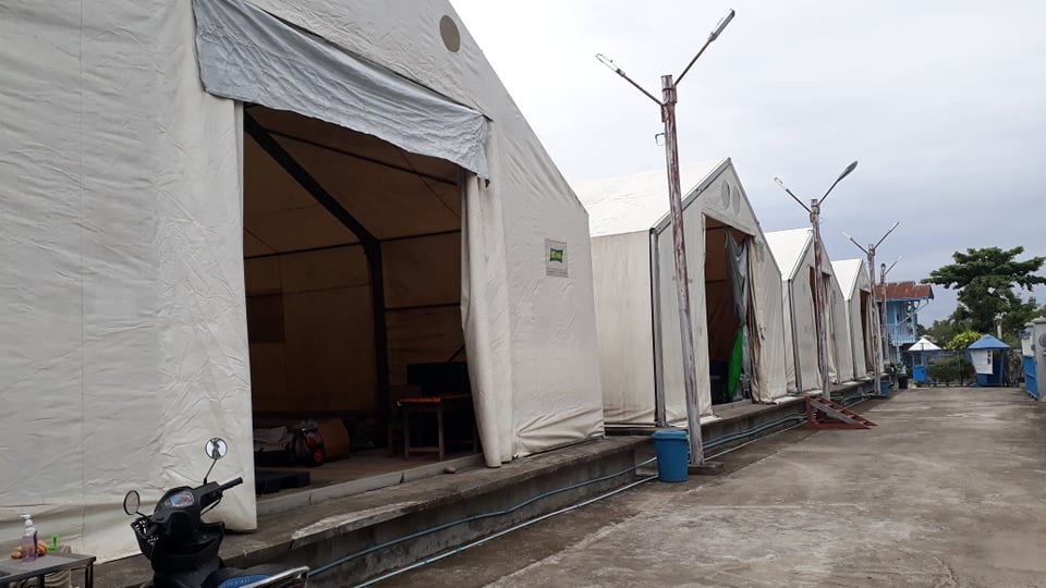
Myitkyina Warehouse, Kachin State
Commercial Storage
|
Location |
Owner |
Available for Rent |
Capacity mt / m² / m³ |
Type [1] |
Access [2] |
Condition [3] |
|---|---|---|---|---|---|---|
|
Lot-C-14, Zone A, Thilawa SEZ, Yangon |
Yusan Logistics, Myanmar |
Yes |
6208 m² |
Zinc Roof, Wooden Wall & Floor |
River, Road |
Good (This company of main service is warehousing including cold storage) |
|
Lot-B-9, Zone A, Thilawa SEZ, Yangon |
Ryobi Myanmar, Mr Yoshiyuki Makio, General Manager +95 9 426 555 140 |
Yes |
36,695 m² |
Zin Roof, Concrete Wall & Floor |
River, Road |
Good (This company of main service is warehousing including cold storage) |
|
Lot-C-13, Zone A, Thilawa SEZ, Yangon |
Daizen Myanmar, Mr Takaaki Yabe, Deputy Managing Director +95 9 7868 32667 |
Yes |
|
Zin Roof, Concrete Wall & Floor |
River, Road |
Good (This company of main service is warehousing and transport) |
|
Inwa Road, Ywarthargyi San Pya Ward, East Dagon Township, Yangon |
RG Logistics, Myanmar |
Yes |
20,000 m² 10,000 m² |
Zin Roof, Concrete Wall & Floor |
Rail, Road |
Good |
Storage Used by Humanitarian Organizations
|
Location |
Ministry / Agency |
Use Possibility (Yes/No) |
Capacity mt/ m²/ m³ |
Type [1] |
Access [2] |
Condition [3] |
|
Hlaing Thar Yar WH- 126/127, Maung Shwe Yoe Street, Hlaing Tharyar Township, Yangon, (U Thein Han) |
WFP, Yangon |
Yes |
42x55x6m 7000 mt, 3061 m2 |
Concrete 4-storey building |
Road, flat |
Good |
|
Myitkyina WH-No-241, Tatkone (Northeast) Quarter, Myitkyina |
WFP, Myitkyina, Kachin state |
Yes |
2000 mt, 4 Nos (10 m x 32 m) |
MSU |
Road |
Good |
|
WFP Pakokku Area Office, No. 241-340, Pakokku-Yesagyo Road, So Twin New Quarter, Pakokku. (U Cho Oo) ph 09 2301020, 47208655, 09 6570383 |
Pakokku Area Office, WFP, Pakokku, Magway Division |
Yes |
1600 mt, 1208 m2 |
Concrete Building and 3 MSUs |
Road, flat |
Good |
|
Lashio Main WH, near 170-mile post, Mandalay-Lashio main Road, (U Myo Myint) |
WFP, Lashio, Shan state |
Yes |
900 mt, 508.75 m2 |
Warehouse/ Concrete Building |
Road, flat |
Good |
|
No. 45, Huan Chen Nan Road Pangkham (Panghsang), Wa Special Region 2 N22°10'18.48", E99° 9'58.26" |
WFP Pang Kham (Sai Nyunt Maung) +95-9-681559551 |
Yes |
300 MT/ (15m x 8.5m x 5m) 127.5m2 / 637.5m3 |
Concrete structure/ cemented floor |
Flat |
No. 45, Huan Chen Nan Road Pangkham (Panghsang), Wa Special Region 2 N22°10'18.48", E99° 9'58.26" |
|
1 A, Highland Avenue, 7.5-mile, 6th quarter, Mayangone Township, Yangon |
ICRC, Yangon |
Yes |
250 m2 |
Warehouse, Medical & NFI |
Road, flat |
Good |
|
No (27) Kyaik Bawdi Quart, Dama Yaung Chi Kyaung Street, Than Lyin Township, Yangon |
MRCS, Yangon |
Yes |
4000 MT, 1440 m³ 2000 MT, 480 m³ |
Concrete Building /MSU / Container |
Road, flat |
Good |
|
No#401/402, Shwe War 3rd Street, Zone (5), |
MAM, Yangon |
Yes |
41 m³ |
Concrete 3-storey building |
Road, flat |
Good |
[1] Warehouse Type: Open storage, container, rub-hall, silo, concrete, other, unspecified
[2] Warehouse Access: Raised-siding, flat
[3] Warehouse condition: Appears intact, appears damaged, unde
Cold Chain
The small scheme of cold chain storage is available for the agencies who are providing health care programme in Yangon Region. However, there is enough cold storage facility including temperature control transport truck facility (-25C°~ 20C°) is available at the commercial sectors.
Lashio Storage Assessment
Lashio is the largest town in northern Shan State, Myanmar,
about 200 kilometers (120 mi) north-east of Mandalay. There
are some maize storage facilities from the local buying centre
around Lashio. The government warehouses owned by Military (Supply
and Logistics Battalion) and Department of Agriculture
Services.
Commercial Storage
Most large private sector compounds and potential storage is in northern Shan State, Lashio, located beside of highway road and in downtown.
|
Location |
Owner |
Available for Rent |
Capacity mt / m² / m³ |
Type [1] |
Access [2] |
Condition [3] |
|---|---|---|---|---|---|---|
|
Nam Khite Qr; Near Mandalay-Lashio highway road, Lashio. +95-9-5260168 N22°54'56.70", E97°43'21.06" |
U Sein Myint |
No |
500MT 27m x 9m x3.9m 243m²/ 948m³ |
I-beam Structure, Brick wall, concrete and flat base |
Road, Flat |
Good |
|
Near Government Computer College, Mandalay-Lashio Pyi htaung Su highway road, Man Han village, Lashio +95-9-6700231, +95-9-403751333 N22°52'37.32" E97°41'35.30" |
Daw Yee |
No |
850 MT 30.5m x 15m x 4.3m 458m²/ 1967m³ |
I-beam Structure, Brick wall, concrete and flat base |
Raised platform |
Good |
|
Near Government Computer College, Mandalay-Lashio Pyi htaung Su highway road, Man Han village, Lashio+95-9-5262023 N22°52'35.78" E97°41'34.62" |
U Nay Min Aung |
No |
750 MT 30.5m x 12m x 4.3m 366m2/ 1574m3 |
I-beam Structure, Brick wall, concrete and flat base |
Raised platform |
Good. |
|
No.156, Theinni Road, Quarter (12), Ward (16), Lashio+95-9-970500232 N22°57'26.83" E97°45'48.81" |
U Zaw Tun |
Yes |
500 MT 24m x 9 m x 5 m 216m2 / 1080m3 |
Wooden post and beam, tin sheet walling & cemented floor |
Raised platform |
Fair, need medium scale renovation |
Storage Used by Humanitarian Organizations
There are many UN agencies, INGOs, NGOs base in Lashio. UNICEF and CARE International manage small storage space in their office premises to store their contingency stock. WFP and ICRC manage one warehouse for each with access to highway road. WFP sharing service with sister agencies such as UNFPA and UNHCR.
|
Location |
Ministry / Agency |
Use Possibility (Yes/No) |
Capacity mt/ m²/ m³ |
Type [1] |
Access [2] |
Condition [3] |
|
Near 170 miles post, beside Mandalay-Lashio highway road, Lashio. N22°54'57.42", E97°43'16.80" |
WFP (Ti Wai Khaung) +95-9-403725029 |
Yes |
1000 MT/ 27m x 18m x 6m 486m2 / 2916m3 |
I-beam Structure, Brick wall, concrete and flat base |
Raised platform |
Good |
|
No.1, Quarter (1), Kan Kaw Street, Lashio. UN Compound N22°56'49.03", E97°44'28.24" |
UNICEF (Tin Lay Naing) +95-9-258865828 |
No |
40 MT/ 7m x 9m x 4m 63m2 / 252m3 |
Iron beam, tin sheet walling & cemented floor |
Raised platform |
Good for small storage |
|
N22°58'9.13", E97°43'3.62" |
ICRC (Hélène Plennevaux) +95-9-425025963 |
No |
380 MT/ 9m x 21m x 3.9m |
Concrete structure/ cemented floor |
Flat |
Good |
|
No (7/13), Namatu Road, Behind Golf Club, Aung Saydanar Ward (11), Corner of street 2, Lashio Township, Northern Shan State. |
Care Myanmar (Dr. Zin Bo Bo Htet) +95-9-450057021 |
No |
60 MT/ (3.5m x 4.3m x 4.5m) x 2 room 30 m2 / 135 m3 |
Concrete structure/ |
Flat |
Good |
|
No. 45, Huan Chen Nan Road Pangkham (Panghsang), Wa Special Region 2 N22°10'18.48", E99° 9'58.26" |
WFP Pang Kham (Sai Nyunt Maung) +95-9-681559551 |
Yes |
300 MT/ (15m x 8.5m x 5m) 127.5m2 / 637.5m3 |
Concrete structure/ cemented floor |
Flat |
Good |
|
Bao Bao Jain Ward, Laokai, Kokang Self-administered Zone |
MHDO (Saw Promise) +95-9-774664334 |
No |
140 MT/ (6m x 15m x 4m) 90 m2 / 360 m3 |
Concrete structure/ cemented floor |
Flat |
Good |
Public Sector Storage
There are eight warehouses under the military (Supply and Logistics Battalion) and 4 warehouses under Department of Agriculture Services but contracted with a private company. These warehouses are not available for rent.
Cold Chain
The small scheme of cold chain storage is supported by the WHO in each of township hospital of Shan States. No specific issues are noted with regards to medicine/vaccine storage.
Bago Region
Bago has no Industrial zone where one can normally find private warehouses and compounds. In the public sector the Department of Consumer Affairss and Township Cooperatives Department have warehouses and compounds which potentially could be made available in case of emergencies. This will require prior approval by the Ministry of Commerce and Ministry of Agriculture, Livestock, and Irrigation. Another government department, MAS (Myanmar Agriculture Service) has leased its warehouses to the private sector.
Commercial Storage
Three large potential storage options were found in the private sector in Bago. Besides these, most other locations were found to be in use by private businesses and unavailable. Most private sector storage is of small size and attached to businesses or private houses.
|
Location |
Owner |
Available for Rent |
Capacity mt / m² / m³ |
Type [1] |
Access [2] |
Condition [3] |
|---|---|---|---|---|---|---|
|
N17 21’ 23.3”, E96 30’ 29.9” Aung Myae Thar, 2nd Street, Bago |
U Min Aung (ex-railway minister) C/O, U Toe Aung (Officer-in-Charge), Ph#+95-9-5059591 |
Yes |
10,100MT 19 nos of 12 x 18m 4,517m2/ |
Brick, corrugated fibre cement roof & walls |
Raised platform |
Good, the repair of roofing, drainage system and fencing are still on-going |
|
N17 19’ 26.9”, E96 31’ 49.8” |
U Tin Win- Manager (Contact Number to be available) |
Yes |
20,000MT 9 nos of 48x18m 11,349m2/ |
Wooden structure |
Raised, wooden platform |
Half of warehouse is in good condition and the rest needs significant renovation to walls and floors |
|
N17 20 03.5”, E96 30’ 52.2” |
U Aung Gyeik, Evergreen Garment Factory Myodaw-Oo, Hinda Kone (18) ward, Bago |
Yes |
950MT 3 nos of 9 x 12m 446m2/ |
Concrete structure |
Raised, with ramp, 2 floors plus offices |
Good, some garment equipment should be removed. |
[1] Warehouse Type: Open storage, container, rub-hall, silo, concrete, other, unspecified
[2] Warehouse
Access: Raised-siding, flat
[3] Warehouse
condition: Appears intact, appears damaged, under
construction/repair
Storage Used by Humanitarian Organizations
There are no humanitarian organisations based in Bago, except MRCS which has an office near the Regional General Hospital. MRCS has a warehouse with an emergency contingency stock for approximately 200 households with: Family kits, kitchen sets, shelter kits and hygiene kits. Bago is only 75km from Yangon where most humanitarian organisations have their head-offices and central warehouses based.
|
Location |
Owner |
Available for Rent |
Capacity mt / m² / m³ |
Type [1] |
Access [2] |
Condition [3] |
|---|---|---|---|---|---|---|
|
N17 20’ 16.7”, E96 29’ 06.3” |
MRCS |
No |
300mt / 12x12m 148m² / 402m³ |
Brick, concrete |
flat |
Good |
[1] Warehouse Type:
Open storage, container, rub-hall, silo, concrete, other,
unspecified
[2] Warehouse Access: Raised-siding,
flat
[3] Warehouse condition: Appears intact,
appears damaged, under construction/repair
Public Sector Storage
There is a Regional Department of Relief and Resettlement office (N17 18’ 37.1”, E96 27’ 30.9”, under the Ministry of Social Welfare, Relief and Resettlement), Township Cooperative Dept. (N17 20’ 07.9”, E96 29’ 03.7”, under the Ministry of Agriculture, Livestock and Irrigation), Bago Regional Government office (N17 20’ 14.2”, E96 29’ 10.3”) and no Natala office in Bago Region. The DRR in Bago keeps emergency contingency stock of family kits for 1000 households. The DRR has two warehouses in their office compound, one which is mostly unused. The Regional Department of Consumer Affairss owns 27 warehouses in East Bago region, but all except 2 have been privatised. These 2 warehouses are planned to be used by the regional Government for emergency contingency stocks. (Contact: Deputy District Commissioner, U Win Naing. Phone: +95-9-423658166.)
|
Location |
Ministry / Agency |
Use Possibility (Yes / No) |
Capacity mt / m² / m³ |
Type* |
Access** |
Condition*** |
|---|---|---|---|---|---|---|
|
N17 18’ 37.1”, E96 27’ 30.9” |
U Thein Htay Aung, Director, Ministry of Dept. of Relief and Resettlement, Ph#+95-9-31116555, 52-2230193 |
Yes |
2,300 MT 30x24(old)
|
Brick, Corrugated roof |
Raised, |
New building is good and old need renovation for roofing, walling and minor repair for flooring. |
|
N17 21’ 14.5”, E96 30’ 10.0” |
U Nay Min Thu Dty. District Administrator Bago, +95-9-420770910 |
Yes, with prior approval from Bago regional office |
3,000 MT |
Wood, corrugated roof |
Raised, with ramp |
Old but usable for temporary storage, minor repairs required |
|
N17 20’ 34.9”, E96 29’ 44.4” |
U Soe Win Township Cooperative Co., Ltd, Bago +95-52-2221550/-9-795290942 |
Yes |
1800 MT 18x12m |
Wood, corrugated roof |
Raised / flat |
Good |
|
N17 17’ 10.6”, E96 34’ 50.4” |
U Win Naing Staff Officer, Dept. of Consumer Affairs Bago, +95-9-423658166 |
Yes, with prior approval from Ministry of Commerce |
2300 MT 4 nos of 44x16m |
Concrete & brick |
Raised/flat |
3 locations in Thanatpin, 12km East of Bago. Note Thanatpin is prone to flooding |
[1] Warehouse Type:
Open storage, container, rub-hall, silo, concrete, other,
unspecified
[2] Warehouse Access:
Raised-siding, flat
[3] Warehouse
condition: Appears intact, appears damaged, under
construction/repair
Cold Chain
No information available regarding medicine/vaccine storage in Bago.
Taungoo, Bago Region
Taungoo has no industrial zone where one can normally find private sector warehouses and compounds. There are not many storage facilities in Taungoo, not in the public sector, nor in the private sector. The only facilities that could be located belong to the Department of Consumer Affairss, the Bago Railway Station and the Mindar open space (which serves as a public open field in the middle of the town). These locations could potentially be made available in case of emergencies.
For more information on storage company contact details, please see the following link: 4.6 Myanmar Storage and Milling Company Contact List.
Commercial Storage
There is very limited private sector storage available in Taungoo. A few large warehouses that exist are in use by rice mills and rice traders. Further commercial storage is limited, small scale and generally unavailable because it is being occupied.
|
Location |
Owner |
Available for Rent |
Capacity mt / m² / m³ |
Type [1] |
Access [2] |
Condition [3] |
|---|---|---|---|---|---|---|
|
N18 55’ 11.2”, E96 26’ 43.9” |
U Tun Khin Than(owner), Ph#+95-9-420700642 |
Yes, Two Storey Building, incl. office |
400MT 223m2/ |
Concrete structure, Corrugated roof |
Raised platform |
New, suitable for INGOs for warehouse and office |
|
N19 00’ 13.6”, E96 23’ 42.2” |
Gas station owner is also transporter |
No |
25x12m |
Concrete structure, Corrugated roof |
flat |
New, empty but not available for rent |
[1] Warehouse Type: Open storage, container, rub-hall, silo, concrete, other, unspecified
[2] Warehouse
Access: Raised-siding, flat
[3] Warehouse
condition: Appears intact, appears damaged, under
construction/repair
Storage Used by Humanitarian Organizations
There are no humanitarian organisations based in Taungoo except MRCS. MRCS has an office near the marketplace without any warehouse or contingency stocks. They have property (80ftx120ft space) on which they plan to build an office and warehouse soon (by 2018-2019).
Public Sector Storage
There is public sector storage that potentially could be made available in case of emergencies that belongs to the Department of Consumer Affairss (N18 56’ 26.2”, E96 26’ 30.2”, under the Ministry of Commerce), Taungoo District Administration Department (N18 56’ 32.8” E96 26’ 39.9”), the Taungoo Railway station (N18 56’ 06.3”, E96 26’ 15.2”, under the Ministry of Transport and Communication). The Cooperation Department and Ministry of Agriculture Services (MAS) both have only small stores which are in use and not available.
There is no Natala Office nor DRR in Bago region. The DRR in Bago keeps emergency contingency stocks which can be sent to Taungoo when needed (see Bago for details).
There are five large wooden warehouses near the Consumer
Affairss warehouse 1 (N18 55’ 50.5”, E96 26’ 26.4”) that belong to
the military and are being used, not available.
MR railway owns land at Kyungon town (N19 02 34.5 E96 21 48.6, 14km
NW of Taungoo) which had an MAPT warehouse on it, but this was
assessed to be too small to be useful.
|
Location |
Ministry / Agency |
Use Possibility (Yes / No) |
Capacity mt / m² / m³ |
Type* |
Access** |
Condition*** |
|---|---|---|---|---|---|---|
|
N18 55’ 59.8”, E96 26’ 27.6” |
U Zaw Min Oo, Dty. Director (Dept of Consumer Affairs, Ministry of Commerce) Taungoo, Ph#+95-9-428159322, 54-23031 |
Yes |
2,500MT |
Brick, Corrugated roof |
Raised, |
Good, has partition and now partially used by privately. |
|
N18 56’ 07.1”, E96 26’ 50.7” |
U Zaw Min Oo, Dty. Director (Dept of Consumer Affairs, Ministry of Commerce) Taungoo, Ph#+95-9-428159322, 54-23031 |
Yes |
1,600 MT |
Brick, Corrugated roof |
Raised, |
Good |
|
N18 56’ 10.1”, E96 26’ 17.4” |
U Kyaw Naing (Selected Station Master, Taungoo Rail Station, Ministry of Transport and Communication +95-54-23308/-9-25013331 |
Yes, |
750 MT 267m2/ |
Brick, corrugated roof |
Raised / flat |
Good |
|
N18 55’ 55.4”, E96 26’ 42.2” Mindar Field, annexes to the Football Ground |
U Aung Soe Moe (District Administrator/ DC) Taungoo District Admin Dept, Ministry of Home Affair +95-54-23054/-9-49403331/ 7788777011 |
Yes, District Compound |
155x309m 47,895m2 |
Empty Land (In front of Independent Post and close to the District Football Ground |
|
Good, very large, potential as a humanitarian hub. Needs fencing, gravel |
[1] Warehouse Type:
Open storage, container, rub-hall, silo, concrete, other,
unspecified
[2] Warehouse Access:
Raised-siding, flat
[3] Warehouse
condition: Appears intact, appears damaged, under
construction/repair
Cold Chain
No information confirmed regarding medicine/vaccine storage in Taungoo.
Aunglan, Magway Region
There are public and private sector warehouses available in Aunglan and no storage facilities of NGO’s. Aunglan district has limited risk of flooding and storm damage.
For more information on storage company contact details, please see the following link: 4.6 Myanmar Storage and Milling Company Contact List
Commercial Storage
There is no Industrial Zone in Aunglan but there are several warehouses available in town, unused that have been previously used for the cotton trade.
|
Location |
Owner |
Available for Rent |
Capacity mt / m² / m³ |
Type [1] |
Access [2] |
Condition [3] |
|---|---|---|---|---|---|---|
|
N19 21’ 41.8”, E95 12’ 56.1”, in centre of Aunglan |
U Myint Soe Daw San San Htay Sett Yone Ward Pyay-Road, Aunglan +95-9-8690112 +95-9-401667208 +95-69-200397 |
Yes |
2,400Mt 3 nos of 12x18m 2 nos of 12x12m 1080m²/ 3,499m³ Area: 3 acres |
Brick, Concrete floor, flat base |
Slightly raised |
Mostly good and minor repair will be required base the type of storage requirement |
|
N19 21’ 18.7”, E95 12’ 58.6”, in centre of Aunglan |
Hercules U Moe Wai+Daw Myint Myint Maw Set Yone Ward Pyay Road, Aunglan +95-9-400009714 +95-9-971201203 |
Yes, also willing to sale |
750Mt 46x9m 414m²/ 1,242m³ |
Wooden Post, Brick wall, concrete and flat base and many supporting posts inside the building |
Slightly raised |
Good, need minor repair |
|
N19 20’ 44.2”, E95 13’ 01.9”, in centre of Aunglan |
U Aung Aung Htoo (U Bo Phyu’s Grandson) Mobile Style-2 Pyay Road, Ya Taung Ward, Aunglan +95-9-974466933/ +95-69- 200224 |
Yes |
800Mt 46x9m 432m²/ 1,296m³ |
Wooden post, brick wall, concrete base |
Raised platform |
Good |
[1] Warehouse Type: Open storage, container, rub-hall, silo, concrete, other, unspecified
[2] Warehouse
Access: Raised-siding, flat
[3] Warehouse
condition: Appears intact, appears damaged, under
construction/repair
Storage Used by Humanitarian Organizations
MRCS has no office in Aunglan except volunteers from government staff (in the township administration office) who act as focal persons, they have no warehouse or emergency contingency stock in place. PACT (Myanmar), Shae Thot and Marie Stopes have offices in Aunglan, but do not have a warehouse, nor emergency contingency stock.
Public Sector Storage
There are several warehouses located at an old cotton factory which is under responsibility of Myanmar Agriculture Service (MAS) department. In addition, the Department of Consumer Affairss, MAS and the Cooperative department has more storage available. As a last resort in case of emergencies, the Town hall and school hall could also be used for temporary storage or shelter.
|
Location |
Ministry / Agency |
Use Possibility (Yes / No) |
Capacity mt / m² / m³ |
Type* |
Access** |
Condition*** |
|---|---|---|---|---|---|---|
|
N19 22’ 16.3”, E95 12’ 55.9”, Town Hall#1 (now using as indoor sport) |
Ministry of Home Affairs/ Dept. of Towship Administration, Aunglan U Aung Ko Ko (Deputy Administrator) +95-9-455599199 +95-9-200057/200058 |
Yes, in case of Emergency |
3,000Mt / 37x40m 1,480m²/ 4,440m³ |
Strong wooden post, half brick-wall and wooden wall, concrete base |
Raised platform |
Good |
|
N19 21’ 56.8”, E95 12’ 53.9”, |
Ministry of Home Affair/ Dept. of Towship Administration, Aunglan U Aung Ko Ko (Deputy Administrator) +95-9-455599199 +95-9-200057/200058 |
Yes, in case of Emergency |
1,750 Mt/ 14x24m 774m²/ 2,554m³ |
Iron frame structure, brick wall, high concrete base |
Raised platform |
Good |
|
N19 20’ 16.0”, E95 13’ 05.4”, Cooperative WH in AL. |
Ministry of Agriculture, Livestock and Agriculture, The Cooperative Co., Ltd U Nyunt Maung (Chairman), Aunglan+95-9-259165833/ +95-9-976541185 |
Yes |
1,380 Mt/ 2 nos of 14x24m 672m²/ 2016m³ |
Wooden post/ Brick wall/Corrugated roof/ concrete floor |
Raised with platform |
Good |
|
N19 21’ 14.1”, E95 12’ 52.3”, MCSE Cotton Factory with Water way access jetty |
Ministry of Agriculture, Livestock and Agriculture, The Cooperative Co., Ltd U Nyunt Maung (Chairman), Aunglan+95-9-259165833/ +95-9-976541185 |
Yes |
5,800Mt/ 22x12m 2nos of 30x12m 6 nos of 30x12m 18x12m 16x9m 2,784m² / 8430m³ |
Brick wall except one of corrugated wall/ wooden post, corrugated roofing |
Raised platform |
Good |
|
N19 22’ 01.7”, E95 12’ 55.9” (Consumer Affairs) |
Ministry of Commerce, Dept. of Consumer Affairs U Kyaw Myo Min +95-9-977511344 U Kan Nyunt (Sr. Clerk) +95-9-33249254 |
Yes |
1,600Mt 37x12m 24x12m 732m² / 2329m³ |
Wooden post, hal brick-half wooden wall, Corrugated |
Rasied concrete platform |
Good, minor repairs required |
|
N19 20’ 53.0”, E95 13’ 00.7”, |
Ministry of Agriculture, Livestock and Agriculture, U Htay Maung (Township Manager), Aunglan +95-69-20017 U Khin Maung Win (District Manager) |
Yes, for NFI |
740 Mt/ 12x30m 360m² / 1080m³ |
roof and concrete base |
Raised with ramp |
Good, new |
[1] Warehouse Type:
Open storage, container, rub-hall, silo, concrete, other,
unspecified
[2] Warehouse Access:
Raised-siding, flat
[3] Warehouse
condition: Appears intact, appears damaged, under
construction/repair
Cold Chain
No cold chain information available from Aunglan. No specific issues noted with regards to medicine/vaccine storage.
Magway and Minbu
Most large warehouses in Magway are owned by the government and some of them are leased out to the private sector. However, several of these warehouses are not in use and could be made available if needed for emergency response. Commercial storage capacity is hard to find in Magway. Minbu, a small town across the river from Magway, offers some additional public sector storage space.
Commercial Storage
Warehouse space in the private sector is scarce and mostly restricted to small and medium size locations attached to businesses or private houses, in use by retail businesses. Even the private sector resorts to renting warehouse space from the government. At the time of the assessment, the mission could only locate one private sector location with two warehouses that can be available for use. A second option is a warehouse of Dept. of Consumer Affairs which is under a 1-year lease by a coffee company.
|
Location |
Owner |
Available for Rent |
Capacity mt / m² / m³ |
Type [1] |
Access [2] |
Condition [3] |
|---|---|---|---|---|---|---|
|
N20 09’ 36.8”, E94 56’ 07.1” |
Neem Pesticide Co. U Nyan Linn (MD) +95-9-5501282 Daw Phyu Thazin Oo +95-9-401593804 |
Yes, check when required |
600Mt/ 18x12m 9x12m 324m² / 972m³ |
Steel structure/corrugated, concrete base |
Raised, ramp access |
Good (leased from MAS and not in use) |
|
N20 09’ 16.7”, E94 55’ 26.1” |
Super Coffee Mix U Myo Hlaing (Manager) +95-9-5374499 Close Mingalar Market, 5th St, Pyow Gyio, Magway |
Currently in use, check when required |
550 Mt/ 25x11m 275m² / 900m³ |
Brick, Wooden post, Corrugated, concrete base |
Raised Ramp |
Good, Super Coffee mix leased from Dept.of Consumer Affairss |
[1] Warehouse Type: Open storage, container, rub-hall, silo, concrete, other, unspecified
[2] Warehouse
Access: Raised-siding, flat
[3] Warehouse
condition: Appears intact, appears damaged, under
construction/repair
Storage Used by Humanitarian Organizations
MRCS has a regional office has storage space annexed to its office.PC Myanmar (Positive Action), Shae Thot, and SC has storage facilities in Magway. Out of all NGO’s in Magway, only MRCS keeps an emergency contingency stock for 300 households, of family kits, hygiene kits, dignity kits, shelter tool kits.
|
Location |
Organization |
Sharing Possibility (Yes / No) |
Capacity mt / m² / m³ |
Type* |
Access** |
Condition*** |
|---|---|---|---|---|---|---|
|
N20 08’ 54.2”, E94 55’ 47.5” |
MRCS U Kyaw Naing Oo (G1) +95-9-5337504 U Kyi Kyi Zaw (SO) +95-9-401572156 |
No |
130Mt 9x7m 63m² / 189m³ |
Concrete structure |
Raised |
Good, small |
|
N20 08’ 17.8”, E94 56’ 45.6” |
PC (Positive Action) U Nay Myo Tun Area Manager |
No |
40 Mt 4.5X6m 27m² / 82m³ |
Walled structure |
|
Good, small |
|
N20 08’ 29.0”, E94 56’ 26.6” |
Pact-Shae Thot office Dr. Okkar Aung 3rd St, Magway +95-9-974242975 |
No |
180Mt 12x6m 4.5x4.5m 92m²/ 298m³ |
Walled structure |
Flat |
Good, small |
|
N20 09’ 21.4”, E94 56’ 49.7” |
Save the Children U Saw Win Regional Logistics Officer Yanpyaw, Magway +95-9-256504116 |
No |
90 Mt 8x6m 48m² / 144m³ |
|
Flat |
Good, small |
[1] Warehouse Type:
Open storage, container, rub-hall, silo, concrete, other,
unspecified
[2] Warehouse Access: Raised-siding,
flat
[3] Warehouse condition: Appears intact,
appears damaged, under construction/repair
Public Sector Storage
The public sector has several large warehouses in Magway, some which are not in use. Most capacity is owned by the Department of Consumer Affairss (6 warehouses), the Cooperative Department (6 warehouses), the Ministry of Transport (2 warehouses), and the Prison Department (2 warehouses). The DRR uses a small warehouse next to their office and half of a warehouse of a warehouse of the Dept. of Consumer Affairss to store emergency contingency stocks (family kits) for 2,000 households.
The compound of the Cooperatives Department and of the Department of Road Transport both offer considerable warehouse capacity and more than sufficient additional space to set up a temporary logistics hub, with office space and extra MSU’s if needed.
|
Location |
Ministry / Agency |
Use Possibility (Yes / No) |
Capacity mt / m² / m³ |
Type* |
Access** |
Condition*** |
|---|---|---|---|---|---|---|
|
N20 08’ 41.7”, E94 55’ 26.7”, Prisons Department |
Ministry of Home Affairs/ Prisons Department U Chit Lwin Regional Deputy Director, Magway +95-9-420706077/ 798267628/ -63-28387/28388 |
Yes, ready to accommodate in case emergency |
2000Mt/ 46x15m 30x12m 1050m²/ 3350m³ |
Corrugated, concrete base, corrugated roof |
Raised, ramp access |
Good |
|
N20 09’ 25.3”, E94 55’ 47.2” and N20 09’ 22.9”, E94 55’ 47.3” (former WFP w/h) |
Ministry of Agriculture, Livestock and Irrigation/ Department of Township Cooperatives/ U Aung Tint (+95-9-4015877, -63-25517) Cooperatives Co, Ltd. |
Yes, possible |
2,200Mt/ 3 nos of 30x12m 1,080m² / 3,240m³ |
Brick Structure and brick walling/ Corrugated roof |
Raised platform with ramp |
Good |
|
N20 08’ 26.0”, E94 55’ 18.1”, |
Ministry of Agriculture, Livestock and Irrigation/ Department of District Cooperatives/ Daw Chaw Yin (+95-9-43009797, -63-25517) Cooperatives Co, Ltd. |
Possible, can check when required |
1400Mt/ 40x18m 720m² / 2160m³ |
Brick Structure and brick walling/ Corrugated roof |
Raised platform |
Good |
|
N20 07’ 18.4”, E94 56’ 16.4”, DRR office |
MoSW, R&R/ Department of Relief and Resettlement U Myint Soe Director 09-5680465 |
No, |
180Mt/ 11x9m 99m² / 297m³ |
Brick Structure and brick walling/ Corrugated roof |
Raised platform |
Good |
|
N20 08’ 16.4”, E94 58’ 29.0”, RTC |
Min of Transport & Communication /Dept of Road Transport (Freight Transport Service) U Aung Maw Assistant Manager +95-9-49229092 063-23153 |
Yes |
2000Mt/ 2 nos of 11x9m 880m² / 3080m³ Area:52 acres |
Reinforced Concrete post, partially bamboo walled, corrugated roof |
Flat, no plat form, but compacted |
Good, need to develop drainage system |
|
N20 08’ 27.0”, E94 55’ 41.4”, |
Min of Commerce /Department of Consumer Affairss U Maung Maung Aye (Deputy Director), Magway Region, Magway +95-9-2300766/-63-23198 |
Yes |
1400Mt/ 44x15m 660m² / 2178m³ |
Wooden Structure |
Raised platform with ramp |
Good |
|
N20 10’ 02.9”, E94 52’ 41.8”, |
Min of Commerce /Department of Consumer Affairss U Myint Kyi (in-charge), Magway Region, Magway +95-9-256330254 |
Yes |
1350Mt/ 30x9m 30x12m 630m² / 2079m³ |
Concrete base, corrugated wall and roof |
Raised platform |
Good |
|
N20 09’ 46.0”, E94 52’ 28.8”, |
Cooperatives Co., Ltd U Hla Myint Thein Chairman +95-9-256312584 |
Need to check when required (current contract up to 31 March 2017) |
1000Mt/ 55x9m 18x9m 650m² / 2160m³ |
Concrete based, brick and wooden wall |
Raised platform |
Good |
[1] Warehouse Type:
Open storage, container, rub-hall, silo, concrete, other,
unspecified
[2] Warehouse Access:
Raised-siding, flat
[3] Warehouse
condition: Appears intact, appears damaged, under
construction/repair
Cold Chain
No cold chain information available from Magway. No specific issues noted with regards to medicine/vaccine storage.
Pakokku, Magway Region
Commercial Storage
Most large private sector compounds and potential storage are located in the Industrial Zone of Pakokku, located between the railway station and airport of Pakokku. The government warehouses owned by the Department of Consumer Affairss and Department of Agriculture Services, located downtown, have been leased out to local businesses such as rice and pulses traders.
|
Location |
Owner |
Available for Rent |
Capacity mt / m² / m³ |
Type [1] |
Access [2] |
Condition [3] |
|---|---|---|---|---|---|---|
|
Pakokku Industrial Zone |
U Myo Lwin No.11, Shwe Rd, Bet 14x15 St, Pakokku Ph+95-9-2300546, 6571095 |
Check when needed |
31x18+ 30x 20m/ 2,500MT/ 1,158m² / 3200m3 5301m² Compound |
2 Concrete WH’s & open storage outside |
Flat, gravel road compacted, next to 100ft wide road |
Good. |
|
Pakokku Industrial |
U ThawZin Oo, Ayer Soe Moe Hein Co., Ltd. Motor Car Manufactory…. Yaw Shwe Pyi, Myo Ma Road, Pakokku Ph#062-21220/09-2302023 |
Check when needed |
35x9m/ 900MT/ 317m² / 1,271m3 5152m² Compound |
Corrugated & concrete foundation |
Compacted dirt road next to 100ft wide road |
Structure & roof good, however without walls. Brick walls will be required for storage. |
|
Pakokku Industrial |
U Kyaw Thura No (10), between the Keyaung Taw Yar street and ManKyi pagoda road, Pakokku +95-9-2301357 |
Check when needed |
31x20m/ 1450MT/ 620m² / 2,170m3 4,615m² Compound |
Corrugated & concrete foundation |
Tarmac road 60ft wide |
Good, minor maintenance will be required. |
|
Pakokku (Pauk Rd) |
Daw Moe Moe Sein District Doctor, Magway Ph#+95-9-5004063 |
Check when needed |
3 Acres Land plot |
No warehouse, no office space |
Tarmac road 60ft wide |
No fencing, need land clearance and significant development |
|
Pakokku (Downtown) |
U Thein Naing Nya/60, Corner of Na Wa Rat Street and Ga Mone Pwint Street, Yat Gwet Gyi (10), Pwin Oo Lwin, Mandalay Region. Tel: 09-6802340, 092301722 |
Check when needed |
1300 Mt/ 600m²/ 1800 m³ |
Concrete/ |
flat |
Good |
|
Road No (3), Pakokku Industrial Zone, Pakokku |
Pakokku Circular Road, Ward (3), Pakokku. Ph: 092301016, 09792301016 |
Check when needed |
300 ft x 100 ft Land Plot |
No warehouse, no office space. Open Land |
"Good access to large truck. Beside Pakokku~Yesagyo Road" |
Good |
|
East Chauk Kan, Pakokku~Myaing Road, Pakokku |
Pakokku Circular Road, Ward (3), Pakokku. Ph: 092301016, 09792301016 |
Check when needed |
220ft x 300ft Land Plot |
No warehouse, no office space. Open Land |
"Good access to large truck. Beside Pakokku~Yesagyo Road" |
Good |
[1] Warehouse Type: Open storage, container, rub-hall, silo, concrete, other, unspecified
[2] Warehouse
Access: Raised-siding, flat
[3] Warehouse
condition: Appears intact, appears damaged, under
construction/repair
Storage Used by Humanitarian Organizations
Among the NGO’s working in Pakokku district (REAM in Pauk, ADRA in Myitchay and OISCA in Pakhangyi-Yasagyio), only OISCA has a warehouse in Pakhangyi, about 27 km north of Pakokku. MRCS has an office in Pakokku, but no warehouse, nor contingency stocks. WFP has 2 warehouses: 1 in the office compound and one located downtown. WFP does not keep emergency contingency food stocks in Pakokku since Pakokku can always be reached by road or river from Yangon. WFP keeps 167 MT’s of HEB contingency stock in Yangon for 100,000 households for 4 days.
|
Location |
Organization |
Sharing Possibility (Yes / No) |
Capacity mt / m² / m³ |
Type* |
Access** |
Condition*** |
|---|---|---|---|---|---|---|
|
Pakokku (21°21'59"N, |
WFP (Soe Thet Nyo- Ph#+95943183534) |
Yes |
32x10m= 2 nos 18 x 12m 1350MT |
2 MSU (Mobile Storage Unit) & one Concrete/ Corrugated Warehouses |
Flat for concrete WH, raised for MSU’s |
Good, new |
|
Pakokku (Pakhangyi) |
OISCA (Daw Ni Ni Soe-Ph#+95-9-258529466 |
Yes, in June 2016 OISCA had no stock |
400 mt/ 58mx8.5m |
Concrete/ |
Flat, beside next to 100ft Mandalay-Pakokku Rd |
Good |
[1] Warehouse Type:
Open storage, container, rub-hall, silo, concrete, other,
unspecified
[2] Warehouse Access: Raised-siding,
flat
[3] Warehouse condition: Appears intact,
appears damaged, under construction/repair
Public Sector Storage
Warehouses of government departments such as Department of Consumer Affairss (ex-MAPT), and Department of Agriculture Service (MAS) have been leased to the private sector to store local crops such as rice and pulses. Pakokku district has no DRR office because it is supported by the DRR office in Magway. Government departments do not have contingency stocks for emergencies in Pakokku. The Transport cargo department has two large facilities that could be used in case of emergencies, one is a former workshop, the other a general warehouse.
Public sector contacts:
U Naing Aung (Chief of Fleet), Ministry of Transport and Communications/ Department Transport-Railway and Transport Cargo (RTC), Pakokku, Magway Region. Ph#+95-9-256313552
U San Lin (Headmaster) Ministry of Border Affair/ Progress of Border Area & National Races Department (Natala) Training Centre, Pakokku, Magway Region. Ph#+95-9-2301948/062-22510.
|
Location |
Ministry / Agency |
Use Possibility (Yes / No) |
Capacity mt / m² / m³ |
Type* |
Access** |
Condition*** |
|---|---|---|---|---|---|---|
|
Pakokku |
Ministry of Transport and Communication/ Department Transport-Railway and Transport Cargo |
Yes, |
26x11 =286m² 50x30 = 1,500m² 5400mt / 1786m² /7144m³ |
Concrete and cemented storage |
Raised site and good accessed road |
Minor repairs required. The former workshop needs roof repairs |
|
Pakokku, |
Ministry of Border Affair/ Natala Training Center |
Yes |
8910 m² of plot is available |
No warehouse, no office space |
Close to tarmac road. Muddy dirt road inside compound |
No fencing, need land clearance and significant development |
[1] Warehouse Type:
Open storage, container, rub-hall, silo, concrete, other,
unspecified
[2] Warehouse Access:
Raised-siding, flat
[3] Warehouse
condition: Appears intact, appears damaged, under
construction/repair
Cold Chain
No information available regarding cold storage in Pakokku.
Taungdwingyi, Magway Region
Most large warehouses in Taungdwingyi are owned by the government and leased out to the private sector. Several of these warehouses are not in use and could be made available if needed for emergency response. There is no DRR office in Taungdwingyi and the township does not keep any emergency contingency stocks, it relies on the support from DRR in Magway. The district has some risk of earthquakes (the latest was in 2003) and fires. Floods are normally not an issue
Commercial Storage
Availability of warehouse space in the private sector is limited, small in size and mostly attached to houses.
|
Location |
Owner |
Available for Rent |
Capacity mt / m² / m³ |
Type [1] |
Access [2] |
Condition [3] |
|---|---|---|---|---|---|---|
|
N20 00’ 41.0”, E95 32’ 46.5”, WH in house |
U Aung Kyaing +95-63-50031/ 9-792822270/ 798801493 |
Yes |
300Mt/ 2x15m 180m² / 371m³ 180 m² |
Wooden post, brick wall, cemented base, Corrugated roof |
With ramp access, flat |
Good, empty land and two-story building of 90m² is also available |
|
N20 01’ 09.8”, E95 33’ 11.9”, 2nd WH in house |
U Aung Kyaing +95-63-50031/ 9-792822270/ 798801493 |
Yes |
550 Mt/ 12x20m 240m² /720m³ |
Wooden post, brick wall, cemented base, Corrugated roof |
Raised Ramp |
Good |
|
N19 59’ 06.9”, E95 33’ 07.4”, route 2 to Aunglan |
Hotel Royal Beikthano Daw Sandar Win +95-9-5333401 63-50791/50461 |
Yes |
800 Mt/ 37x11m 400m² /1200m³ |
Wooden post and structure, cemented based, corrugated roof, no walls |
Slightly raised platform |
Needs walls to be added by the owner, in case of lease |
[1] Warehouse Type: Open storage, container, rub-hall, silo, concrete, other, unspecified
[2] Warehouse
Access: Raised-siding, flat
[3] Warehouse
condition: Appears intact, appears damaged, under
construction/repair
Storage Used by Humanitarian Organizations
MRCS has a township office without storage facilities. In case of emergencies it will receive relief materials from MRCS office in Magway. There are no other INGO’s based in the town.
Public Sector Storage
The public sector has several large warehouses in Taungdwingyi, most of them are not in use. They belong to the Ministry of Agricultural Services and the Department of Consumer Affairss.
|
Location |
Owner |
Available for Rent |
Capacity mt / m² / m³ |
Type [1] |
Access [2] |
Condition [3] |
|---|---|---|---|---|---|---|
|
N19 59’ 46.3”, E95 32’ 56.3” 1st MAS compound |
Ministry of Agriculture, Livestock and Irrigation/ Dept. MAS U Myint Aung +95-9-5333134 063-50278 |
Yes |
330Mt/ 18x9m 162m²/ 486m³ |
Corrugated, cemented base, corrugated roof |
Raised, ramp access |
Fair, some damage to cement foundation |
|
N20 00’ 05.8”, E95 32’ 06.9”, 2nd MAS WH |
Ministry of Agriculture, Livestock and Irrigation/ Dept of MAS/Cotton Unit U Aung Htay +95-9-961500049 |
Yes |
140Mt/ 6x12m 72m² / 216m³ |
Brick structure, brick wall, corrugated roof |
Raised platform |
Good |
|
N19 59’ 56.7”, E95 32’ 05.1”, 3rd MAS WH |
Ministry of Agriculture, Livestock and Irrigation/ Dept. MAS U Myint Aung +95-9-5333134 063-50278 |
Yes |
1,200Mt/ 36x15m 540m²/ 1782m³ |
Wooden post and brick walling/ Corrugated roof |
Raised platform with ramp |
Good |
|
N20 01’ 22.5”, E95 34’ 11.9” (partially used by the military) |
Ministry of Commerce/ Dept. of Consumer Affairs U Sel Maung (Deputy Towship Officer) +95-9-256266704 |
Yes |
3460Mt/ 3 nos of 33x15m 1575m²/ 5040m³ |
Wooden Structure and walling/ Corrugated roof |
Raised platform with ramp |
Good |
|
N20 00’ 21.8”, E95 32’ 50.2”, Township meeting Hall |
Ministry of Home Affair/ Township Administration Department U Thein Zaw Win (TA) U Hein Htet Aung (ATA) +95-63-50002 9-450484900 (ATA) |
Perhaps, in case of emergencies |
4,000Mt/ 65x30m 1,950m² / 5,850m³ |
Concrete base, brick wall and corrugated roof |
Raised platform, very high roofing |
Good |
|
N20 00’ 54.2”, E95 32’ 41.5”, on the way to Myothit |
Ministry of Commerce/ Dept. of Consumer Affairs U Sel Maung (Deputy Township Officer) +95-9-256266704 |
Yes |
1,400Mt/ 44x15m 660m² / 2178m³ |
Wooden Structure |
Raised platform with ramp |
Good |
|
N20 00’ 54.2”, E95 32’ 41.5”, on the way to Myothit |
Ministry of Agriculture, Livestock and Irrigation/ Dept of MAS/Cotton Unit U Aung Htay +95-9-961500049 |
Yes |
1250Mt/ 30x9m 26x12m 582m² / 1840m³ |
Wooden Structure |
Raised platform with ramp |
Good |
[1] Warehouse Type:
Open storage, container, rub-hall, silo, concrete, other,
unspecified
[2] Warehouse Access:
Raised-siding, flat
[3] Warehouse
condition: Appears intact, appears damaged, under
construction/repair
Cold Chain
No information available on cold chain options in Taungdwingyi. No specific issues noted with regards to medicine/vaccine storage.
Kyaukpadaung, Mandalay Region
Kyaukpadaung is a small town about 50km South East of Nyaung-U (Bagan). It is located in hill country, it is not much at risk of floods or earthquakes, the main emergencies are caused by storm damage. Kyaukpadaung was visited for the LCA because several transporters who operate countrywide are based in this town. (see Transporters).
Commercial Storage
There is limited commercial storage available, no large size warehouses for rent. Commercial storage is limited to small storage space attached to businesses or houses, mostly in use for business.
Storage Used by Humanitarian Organizations
There are no UN/NGO’s based in Kyaukpadaung and no UN/NGO storage facilities with emergency contingency stocks are in place.
Public Sector Storage
In Kyaukpadaung there are five warehouses from Myanma Agriculture Service (MAS) Department in two locations, and four warehouses from the Department of Industrial Crops- No.3 Heavy Industrial Dept, No.5 Sub-Cotton Factory on the way to Mt. Poppa, about 6km northeast out of town. Township administration does not keep any emergency contingency stocks, because in case of need they can be easily supported by Nyaung-U DRR.
|
Location |
Ministry / Agency |
Use Possibility (Yes / No) |
Capacity mt / m² / m³ |
Type* |
Access** |
Condition*** |
|---|---|---|---|---|---|---|
|
N20 50’ 03.7”, E95 07’ 19.9” 1st place, Tsp MAS |
Ministry of Agriculture, Livestock and Agriculture, Daw Khin Moe Kyi, Staff Officer (1), Daw Khin Aye Maw, Staff Officer (2) +95-9-25611666/ +95-61-50561 |
Yes |
1900Mt/ 2 nos of 15x30m 900m²/ 2970m³ |
Brick walled, high platform |
Raised platform |
Good |
|
N20 52’ 54.8”, E95 09’ 52.3”, 2nd MAS place (On the way to Mt. Popa) |
Ministry of Agriculture, Livestock and Agriculture, Daw Khin Moe Kyi, Staff Officer (1), Daw Khin Aye Maw, Staff Officer (2) +95-9-25611666/ +95-61-50561 |
Yes, empty |
2200Mt/ 3 nos of 24x14m 1008m² / 3300m³ |
Corrugated wall and structure |
Raised platform, 1 with flat access |
Good, some minor repairs to windows & roof. |
|
N20 52’ 56.6”, E95 09’ 54.2”, On the way to Mt. Popa |
Ministry of Industry, Department of Industrial Crop. Sub-cotton factory, Daw Khin Thi Myint (The factory Manager) +95-61-505689/95-9-401574589 |
Yes, empty |
1750Mt/ 4 nos of 9x30m 1080m² / 3500m³ |
Corrugatedroof. |
Raised platform |
Good base but only three bamboo walls, one side open. |
[1] Warehouse Type:
Open storage, container, rub-hall, silo, concrete, other,
unspecified
[2] Warehouse Access:
Raised-siding, flat
[3] Warehouse
condition: Appears intact, appears damaged, under
construction/repair
Cold Chain
No cold chain information available from Kyaukpadaung.
Mandalay, Mandalay Region
Commercial Storage
Commercial storage is available in Pyi Gyi Tagun township (21° 53.186′N 96° 5.537′E), on the Mandalay-Yangon old road, and in and around the Truck Terminal area and on 62nd Street (Mandalay to Lashio). These are the main industrial areas of Mandalay, where many large companies with big warehouses are situated, however, most of them are being used for regular business and may not necessarily be available for rental. But a newly established Myitnge Dry Port provide warehousing services including container handling and storage, container stripping and stuffing, container maintenance and cleaning, breakbulk and bulk cargo handling and storage and Cargo Insurance. In Mandalay, there are some big Logistics Companies who provides warehousing & handling and door to door transportation services.
A promising site for a humanitarian hub is a Chinese-owned site of 200 by 230m, with a warehouse on it of 50mx12m, currently not in use, including four extra buildings with potential office space. (Located at: 21° 54.427′N 96° 6.361′E).
Other large commercial sites with warehouses, but currently in use, are:
- The Truck terminal area (size 315mx890m); several warehouses of 25x25m and 25x45m.
- Rocket Flour mill (95x145m covered warehouse): 21° 53.281′N 96° 5.782′E
- Kubo Tractor (3 new warehouses of 30x50m): 21° 51.992′N 96° 5.462′E
- Forland-Truck (open area 80x180m): 21° 53.895′N 96° 5.925′E
- Jade City Development (150 acres + 300-acre area): 21°51'40.47"N, 96° 1'14.87"E
|
Location |
Owner |
Available for Rent |
Capacity mt / m² / m³ |
Type [1] |
Access [2] |
Condition [3] |
|---|---|---|---|---|---|---|
|
62nd road, 21° 54.427′N 96° 6.361′E |
C/O: Ma Su 09-5058552 |
Check when needed |
2100 MT/ 620 m² / 2480 m3 + 46000 m² compound |
Concrete & open storage |
Flat, gravel road compacted, next to 200ft wide road |
Good, minor maintenance. |
|
Pyi Gyi Dakhun |
Truck Terminal area, Private individuals |
Check when needed |
625 m² and 1125 m² warehouses |
Corrugated & concrete foundation |
Compacted dirt road next to 100ft wide road |
Good. Busy compound, may be an issue with security |
|
Pyi Gyi Dakhun |
Rocket Flour mill |
Check when needed |
95x145m: 13775 m² covered warehouse |
Corrugated & concrete foundation |
Tarmac road 60ft wide |
Good, but possibly in use |
|
Pyi Gyi Dakhun |
Kubo Tractor |
Check when needed |
3 new warehouses of 30x50m: 4500 m² covered |
Corrugated & concrete foundation |
Tarmac road 100ft wide |
Good, but possibly in use |
|
Pyi Gyi Dakhun |
Forland-Truck |
Check when needed |
80x180m: 14400 m² open area |
Open area |
Compacted earth, next to tarmac road 200ft wide |
Good, but possibly in use |
|
21°51'40.47"N, 96° 1'14.87"E |
Jade city development |
Check when needed, owner is willing to rent |
190x320m 60,800 m² 150-acre compound |
Covered |
Concrete base, for hawker stalls |
A new site of 300 acres will also be developed |
|
Myitnge Dry Port 21°51'14"N 96°04'23"E |
KM Terminal Logistics Plot B1, Yangon-Mandalay Railway Road, Myitnge, Amarapura Tsp, Mandalay U Mg Mg Htwe, Senior Admin Officer Office: +95-9-0255041, 55042, 55044 (fax). Personal: +95-9-2014294 |
The required Sqm can be rent |
150,000 TEUs, Reefer Plugs 12, Rail 3 tracks, General Warehouse 6945 Sqms, Bonded Warehouse 2377.5 Sqms, Container Freight Station 1000 Sqms, Empty Depot 10000 TEUs |
Corrugated & concrete foundation |
Road and Railway |
Good |
|
Myitnge Dry Port 21°50'50"N 96°04'06"E |
RG Logistics Plot A, Corner of Mandalay Railway link and Saigang River Road Crossing, Amarapura Township, Mandalay. U Soe Min Shin Operational Manager +95-9-765121045, Email: contact@rglogisticsmm.com Website: https://www.rglogisticsmm.com/mdy-dry-port Telephone: Dry Port: +959 899880 202, 303,404 Transport: +959 893161 588, 589 |
The required Sqm can be rent |
Container Yard 1,100 TEUs, Reefer Plugs 16, Rail 2 tracks, General Warehouse 4600 Sqms, Bonded Warehouse 4600 Sqms, Container Freight Station 4600 Sqms |
Corrugated & concrete foundation |
Road and Railway |
Good |
|
Pyi Gyi Dakhun 21°50'50"N 96°04'06"E |
Advantis (Beyond Logistics) Daw Phyo Pyae Soe Aye, Business Development Executive. Email: phyo.pyae@advantis.world Website: https://advantis.world/myanmar/ No.H 212-1, 55th Street, Between Phoe Yar Zar Street & Awratt Street, Industrial Zone, Pyi Gyi Dagon Township, Mandalay Division. |
The required Sqm can be rent |
100 x 28 m = 2800 m² 65 x 30 m = 1950 m² 6000 MT |
Corrugated & concrete foundation |
Compacted earth, next to tarmac road 200ft wide |
Good |
|
Pyi Gyi Dakhun 21°53'04"N 96°07'17"E |
Hercules Logistics U Win Lwin Htun, General Manager Email: info@herculeslogs.com, Website: www.herculeslogs.com No. (H-205/9-10) 55th Street, Between Phoe Yar Zar & Ka Naung Road, Industrial Zone (2), Pyi Gyi Dagon Township, Mandalay Division. Office: +95 977181660, +95 253198880,81,82 |
The required Sqm can be rent |
85 x 20 m = 1700 m² 3000 MT |
Corrugated & concrete foundation |
Compacted earth, next to tarmac road 200ft wide |
Good |
|
Paleik, Mandalay 21°48'20"N 96°03'35"E |
E.F.R Logistics and Distribution Centre No.20/B, Near Paleik Station, Sintkaing Township, Kyaukse District. Email: info@efrldcmdy.com Website: www.efrldcmdy.com Office: +959 958112812, +959 958112813, 959 958112814 |
The required Sqm can be rent |
70 x 50 m = 3500 m² 5000 MT |
Corrugated & concrete foundation |
Road and Railway |
Good |
[1] Warehouse Type: Open storage, container, rub-hall, silo, concrete, other, unspecified
[2] Warehouse
Access: Raised-siding, flat
[3] Warehouse
condition: Appears intact, appears damaged, under
construction/repair
Storage Used by Humanitarian Organizations
The main humanitarian organisations present in Mandalay are UNDP, UNICEF, World Vision, PACT, ICRC and Myanmar Red Cross Society (MRCS). ICRC has an office, but it has no logistics presence per se due to its focus on IDP’s and combatants in Shan State.
World Vision has a regional office in Mandalay and an area office and warehouse in Pyi Gyi Tagun. They keep emergency contingency stocks such as purification tablets for 100,000 households and family kits for 400 households. World Vision has a regional disaster team roster of 25 people. Myanmar Red Cross Society (MRCS) has an office and warehouse in Chanmyatharzi, with emergency stocks for 500 households (Family kits, hygiene kits, dignity kits, shelter toolkits, jerry cans). UNICEF has provided family kits to RRD and other supplies (for WASH, Health & Nutrition and education) will be provided from Yangon to government counterparts when emergencies occur. No other (I)NGOs appear to have emergency contingency stocks prepositioned in Mandalay.
|
Location |
Organization |
Sharing Possibility (Yes / No) |
Capacity mt / m² / m³ |
Type* |
Access** |
Condition*** |
|---|---|---|---|---|---|---|
|
Pyi Gyi Dakhun |
World Vision Ms. Naw Emerald San Min, Zonal Manager Ph#+95-2-77926/-9-43146673 |
No |
867 MT/ 12mx21m 252 m²/ 1008 m³ |
Concrete, corrugated roof |
flat |
Good |
|
Chanmyatharzi |
MRCS U Kyaw (Logistics) Ph# 95-2-74365/ -9-977115530 |
No |
1800mt/ 16x34m |
Concrete/ |
Flat, only 5 MT truck allowed in the compound |
Good |
[1] Warehouse Type:
Open storage, container, rub-hall, silo, concrete, other,
unspecified
[2] Warehouse Access: Raised-siding,
flat
[3] Warehouse condition: Appears intact,
appears damaged, under construction/repair
Public Sector Storage
The Relief and Resettlement Department (RRD) of Mandalay has two warehouses at the Myo Haung railway yard. They maintain a contingency stock of family kits normally for 500 households (provided by UNICEF, kits for 200 households in stock) and kitchen sets for communal kitchens. DRR also has a response fund for food for 10,000 households for three days. At the Myo Haung railway yard there are 20 warehouses in total owned by Myanmar Railway, but most are leased to the private sector. Government does not have any other significant storage capacity that could be made available in case of emergencies in Mandalay.
|
Location |
Organization |
Sharing Possibility (Yes / No) |
Capacity mt / m² / m³ |
Type* |
Access** |
Condition*** |
|---|---|---|---|---|---|---|
|
Myo Haung Rail Station |
U Aye Min Thu Director (Mandalay Region), RRD 65 St., Bet34x35St, Chan Aye Thar San Tsp, Mandalay Region Ph##+95-9-420708827. Office: +95-24067470, 4039457 (Fax) |
Yes |
6500mt/ 2000 m²/ 8000 m³ |
Wooden, corrugated iron |
Good, only 5MT truck allowed to reach the compound. Has railway access |
Good. Upon the request made and storage availability, the storage space could be shared. |
|
Pyi Gyi Dakhun |
Myanmar Timber Trading Department (Mandalay Region) U Aung Myint Htay-2, Deputy District Manager. Ph#+95-9-200213 |
Yes |
unconfirmed |
Compound |
Tar road, 6-wheeler is allowed. |
Unconfirmed. The compound can be available, but need their ministry agreement |
|
Myo Haung Rail Station 21° 56' 29.1" N, 96° 04' 46.1" E |
Railway Department U Aye Chan Myint, Division Commercial Manager (DCM) Mandalay Railway Station. Ph#+95-2-66764/-9-4711005/ -9-797308617 |
Yes, tender will be launched, and the winner can be contact via DCM. |
9 wooden warehouses each: 6500mt/ 2000 m²/ 8000 m³ |
Wooden |
Compacted and situated beside the rail track. Only 6-wheeler with 5-7 Mt truck will be accessible. |
Good. Need to sub-contract from company/individual as the tender is about to launch on 26 May 16 for 5 warehouses. |
[1] Warehouse Type:
Open storage, container, rub-hall, silo, concrete, other,
unspecified
[2] Warehouse Access:
Raised-siding, flat
[3] Warehouse
condition: Appears intact, appears damaged, under
construction/repair
Cold Chain
The Department of Health has a cold-room plus all the necessary cold chain equipment (from icepacks, to cold-boxes and vaccine carriers) with sufficient capacity to support the other states and regions in the north & northeast. The cold-room has a power backup generator. The cold chain maintenance is supported by UNICEF. There are no issues or constraints with regards to medicine/vaccine storage.
Meikhtila, Mandalay Region
Most of the private sector warehouses, small to medium size, can be identified in the industrial zone of Meikhtila, on the way to Mandalay. In the public sector most warehouse space is owned by the Myanmar Agriculture Service (MAS) department and Department of Consumer Affairss.
Commercial Storage
Most of the commercial warehouses are in Meikhtila Industrial Zone, which is 12.5km North East of Meikhtila town on the road to Mandalay, just past the Shante Airforce base. Availability of private sector warehouse space in town is limited and mostly in use, attached to businesses or private houses.
|
Location |
Owner |
Available for Rent |
Capacity mt / m² / m³ |
Type [1] |
Access [2] |
Condition [3] |
|---|---|---|---|---|---|---|
|
N20 57’ 45.7”, E95 57’ 03.8”, Meikhtila Industrial Zone |
Golden Lion (Shwe Chindeik) U Myo Thein(owner) C/o U Soe Win Chairman Industrial Monitoring Committee, Meikhtila Industrial Zone, Meikhtila +95-9-43092193 |
Yes, |
900Mt 15x30m 450m²/ 1350m³ Area: 122x60m |
Brick, concrete base, Corrugated roof |
Raised platform |
Good, with other two small building |
|
N20 57’ 44.7”, E95 56’ 51.2”, Meikhtila Industrial Zone |
Yangon Chicken Feeding Co., Ltd Daw Khin Lay Yangon C/o U Soe Win (Chairman) Industrial Monitoring Committee, Meikhtila industrial zone +95-9-43092193 |
Yes |
1600Mt 25x19m 9x12m 583m²/ 2416m³ Area: 60x60m |
Concrete walls and base, Corrugated roof |
Raised platform |
Good, with also two other small building |
|
N20 57’ 46.7”, E95 56’ 45.2”, Meikhtila Industrial Zone |
Swun Ar Canned Beef Factory (Main Building within Office compound) C/o U Soe Win (Chairman) Industrial Monitoring Committee, Meikhtila industrial zone +95-9-43092193 |
Yes, |
1400Mt 2nos of 9x30m 270m²/ 2060m³ Area: 60x60m |
Brick, wood structure, concrete base, corrugated roof |
Raised platform |
Good, includes office building |
|
N20 57’ 46.7”, E95 56’ 45.2” (opposite), Meikhtila Industrial Zone |
Swun Ar Canned Beef Factory (Opposite of Office) C/o U Soe Win (Chairman) Industrial Monitoring Committee, Meikhtila industrial zone +95-9-43092193 |
Yes |
2800Mt 2nos of 12x33m 1nos of 1044m²/ 4198m³ Area: 90x60m |
Brick, wood structure, concrete base, corrugated roof |
Raised platform |
Good |
|
N20 57’ 47.8”, E95 56’ 46.4”, Meikhtila Industrial Zone |
U Khin Mg Oo Canned Beef Factory Ky/3456 Co/ U Maung Myint (Manager) +95-9-2165874 |
Yes |
1700Mt 26x9m 9x9m 9x9m 486m²/ 2590m³ Area: 60x60m |
Brick, wood structure, concrete base, corrugated roof |
Raised platform |
Good |
|
N20 57’ 49.7”, E95 56’ 47.5”, Meikhtila Industrial Zone |
U Khin Mg Oo Canned Beef Factory Ky/3456 Co/ U Maung Myint (Manager) -+95-9-2165874 |
Yes |
2300Mt 12x30m 12x36m 790m²/ 3480m³ Area: 60x60m |
Brick, wood structure, concrete base, corrugated roof |
Raised platform |
Good |
[1] Warehouse Type: Open storage, container, rub-hall, silo, concrete, other, unspecified
[2] Warehouse
Access: Raised-siding, flat
[3] Warehouse
condition: Appears intact, appears damaged, under
construction/repair
Storage Used by Humanitarian Organizations
Action Aid has an office in Meikhtila but has no warehouse, except for a 9 m2 room in the office in case it is needed for emergency contingency stock in place.
There are no other NGO’s based in Meikhtila.
Public Sector Storage
A new DRR office has been built (N20 54’ 36.7”, E95 50’ 56.8”) but no staff has been deployed yet. The public sector has no emergency contingency stocks and relies on DRR in Mandalay to provide support. The main risks of emergencies in the area are storm damage, communal conflicts and rarely floods. There are three warehouses that can be available from Myanmar Agriculture Service (MAS) department, two warehouses from the Department of Consumer Affairss within the town and Natala has one warehouse in their compound. The Department of Consumer Affairss has another compound with 19 warehouses on the road to Mandalay.
|
Location |
Ministry / Agency |
Use Possibility (Yes / No) |
Capacity mt / m² / m³ |
Type* |
Access** |
Condition*** |
|---|---|---|---|---|---|---|
|
N20 52’ 10.1”, E95 54’ 10.2” |
Ministry of Border Affair, NaTaLa, Meikhtila, Tharzi Rd, U Thiha Zaw (Deputy Director) +95-64-23413 |
Yes, possibly in emergency |
1350Mt/ 45x15m 675m²/ 2060m³ |
Iron Frame structure, Walled, corrugated roof |
Raised with platform |
Good, new (no picture) |
|
N20 51’ 52.0”, E95 50’ 50.6” Close to district office |
Ministry of Agriculture, Livestock and Agriculture, U Win Htein, District Staff Officer, Meikhtila+95-9-2201110/ +95-64-22081 |
Yes |
1400Mt/ 17x30m 510m² / 2060m³ |
Brick structure |
Raised platform |
Good (MAS WH1) |
|
N20 52’ 54.8”, E95 09’ 52.3”
|
Ministry of Agriculture, Livestock and Agriculture, U Win Htein, District Staff Officer, Meikhtila+95-9-2201110/ +95-64-22081 |
Yes |
1800Mt/ 30x8m 21x9m 429m² / 2680m³ |
Wooden structure for 30x8m and Brick type for 21x9m, corrugated roof, raised platform |
Raised platform |
Good, 2 locations (MAS WH2, WH3) |
|
N20 52’ 28.8”, E95 51’ 11.0”, |
Ministry of Agriculture, Livestock and Agriculture, Township MAS, Daw Yi Yi Myint (Staff Officer) Meikhtila+95-9-402619214/ +95-64-23116 |
Yes |
1400Mt/ 15x30m 450m² / 2060m³ |
Brick structure |
Raised platform |
Good, (MAS WH 4) |
|
N20 53’ 20.4”, E95 52’ 10.9”, 19 Warehouses, next to Yarn testing laboratory |
Ministry of Agriculture, Livestock and Agriculture, U Win Htein, District Staff Officer, Meikhtila+95-9-2201110/ +95-64-22081 |
Yes, it is empty and not in use at the moment |
2x 14x14m 1x 22x14m 2x 20x10m 1x 18x11m 2x 28x12m 11x 14x10m 8,600 Mt 3510m² / 10,530m³ |
Corrugated |
Concrete platform |
Good, minor repairs required. (MAS WH 5) |
|
N20 52’ 19.9”, E95 50’ 17.0”, Close to Action Aid |
Ministry of Commerce, Dept. of Consumer Affairs U Tin Maung(Staff Officer) |
Check for possibility if needed |
2300Mt/ 12x36m 12x48m 1008m² / 3485m³ |
Corrugated wall, roof and concrete base |
Raised with ramp |
Good, new (MAPT WH 1, WH2) |
[1] Warehouse Type:
Open storage, container, rub-hall, silo, concrete, other,
unspecified
[2] Warehouse Access:
Raised-siding, flat
[3] Warehouse
condition: Appears intact, appears damaged, under
construction/repair
Cold Chain
No information available regarding medicine/vaccine storage in Meikhtila. No specific issues noted with regards to medicine/vaccine storage.
Nyaung-U, Mandalay Region
Commercial Storage
There is limited commercial storage space available in Nyaung-U. During harvest season traders revert to leasing storage space for crops from the Government Cooperative Department downtown due to space limitations locally. Most private sector storage spaces are small, located in offices and retail businesses. Nyaung-U district has no Industrial Zone such as nearby district Pakokku and Myingyan.
Storage Used by Humanitarian Organizations
There are few NGO’s operating in Nyaung-U, and most are working in livelihoods (Action Aid) or the health sector. None of them have warehouses in Nyaung-U.
Public Sector Storage
The Government Cooperative Department storage space is normally not available. However, the Department of Consumable Goods and the Department of Agriculture Services have three warehouses that are available and could be used in case of emergencies. The Nyaung-U districts has a DRR office which has a warehouse and keep a contingency stock of family kits for 500 households. Parts of the Nyaung-U district, islands in the Ayeyarrrawaddy river, experience annual flood emergencies.
|
Location |
Ministry / Agency |
Use Possibility (Yes / No) |
Capacity mt / m² / m³ |
Type* |
Access** |
Condition*** |
|---|---|---|---|---|---|---|
|
Nyaung-U, |
Ministry of Industry/ Department of Foodstuff Industries |
Yes, |
27x15+27x15m =810m² 2000mt / 2835m³ |
Concrete and cemented storage |
Raised site and good accessed road |
Good, Minor repairing required. |
|
Nyaung-U, |
Ministry of Agriculture, Livestock and Irrigation/ Myanma Agricultur Service |
Yes |
21x12 = 252m² 780mt / 1008m³ |
Concreted and Corrugated, firmed |
Raised site, distance between WH and unloading area is 40m and uphill. |
Good, needs some minor repairs. Inside compound with houses. |
|
Nyaung-U, |
Ministry of Social Welfare, Relief and Resettlement |
No |
9x15 = 135m² 400mt / /540m³ |
Concreted and Corrugated, firmed |
Raised platform |
Good, new |
[1] Warehouse Type:
Open storage, container, rub-hall, silo, concrete, other,
unspecified
[2] Warehouse Access:
Raised-siding, flat
[3] Warehouse
condition: Appears intact, appears damaged, under
construction/repair
Contacts
C/O: U Naing Lin Htet, Deputy District Administrator, District Administration Office, Nyaung-U, Mandalay Region
Ph#+95-61-60260, HP: +95-9-421762183. Email:tharrnge89@gmail.com
For the contact of Ministry of Industry/ Department of Myanmar Consumable Goods
U Htay Naing, Drictrict Manager, Ministry of Agriculture, Livestock and Irrigation/ Myanma Agriculture Service (MAS), District Office, Nyuang-U, Mandalay Region. Ph#+95-9-444004423
Daw Thinn Thinn Khaing, Deputy Director of RRD, Ministry of Social Welfare, Relief and Resettlement, District Office, Nabudaw, Nyuang-U, Mandaylay Region. Ph#+95-9-791410849/ 258287938
Cold Chain
No information available regarding cold storage in Nyaung-U.
Naypyitaw and Pyinmana, Naypyitaw Region
Potential storage locations in Naypyitaw region are located mostly in and around Pyinmana. The rest of Naypyitaw consists mostly of roads and government buildings, including official housing units. In case of a large scale disaster in Naypyitaw, as a last resort buildings within the Zabu Thiri Sports complex and Wunna Theikdi stadium could be used for shelter and temporary storage, as it consists of two locations with several large buildings and stadiums (N19 54 05.7 E96 14 56.5 and N19 46 25.3 E96 04 10.2).
Commercial Storage
Pyinmana has a transport and bus terminal (Bawgathiri Highway Station) with small storage/retail units used by the private sector of which most capacity is in use. Opposite the terminal is a workshop zone with several unused plots that offer significant potential storage capacity. This site would also be suitable to set up a temporary Logistics hub, since it is close to Naypyitaw airport and there is enough space available.
|
Location |
Owner |
Available for Rent |
Capacity mt / m² / m³ |
Type [1] |
Access [2] |
Condition [3] |
|---|---|---|---|---|---|---|
|
N19 45’ 27.0”, E96 14’ 01.3”, |
Shwe Naga U Khin Maung Thein (Dty. Direct) Naypyidaw Municipal Committee, Bawga Thiri High-way terminal, Pyinmana+95-9-43123303/964591151 |
Yes, possible |
3200Mt/ 61x22m 1,340m² / 4,697m³ Area:80x90m |
Steel structure/Corrugated, concrete base |
Raised, ramp access |
Good |
|
N19 45’ 17.6”, E96 14’ 01.7”, opposite Bawgathiri Highway Station |
Silver Lion Franchise Co., Ltd 067 – 26391, 067 – 26392 09-43015407 Plot-6, Workshop Row, Bawgathiri Highway Station, Naypyitaw-Pyinmana |
Yes, possible |
1140 Mt 24x16m 10x12m 500m² / 1,660m³ Area: 120x60m |
Steel structure and brick walling/ Corrugated roof |
Raised platform |
Good, including office and garage buildings |
|
N19 45’ 20.9”, E96 14’ 10.1” |
Daw Myo Workshop Row, Bawgathiri Highway Station +95-9-428111105 / 965504900 |
Yes, possible |
1350 Mt 30x21m 630m² / 2070m³ Area: 120x60m |
Steel structure and brick walling/ Corrugated |
Raised platform |
Good, |
|
N19 45’ 20.16”, E96 14’ 10.16” |
“TUN” Automobile Service, Workshop Row, Bawgathiri Highway Station |
Need to check once required |
2,040Mt 30x30m 900m² / 2,970m³ Area:120x60m |
Steel structure and no walls, Corrugated roof |
Raised platform |
Good, but needs corrugated walls & door |
|
N19 45’ 04.4”, E96 14’ 10.5” |
Farmer Phoe Yazar, 187, Bo Myat Tun St., Middle Block, Ward (9), BTHG +95-1-398630 299481 20038 |
Need to check once required |
1120Mt 30x18m 540m² / 1782m³ Area120x60m |
Steel structure and brick walls Corrugated roof |
Raised platform with ramp |
Good |
|
N19 45’ 07.5”, E96 14’ 03.7” |
Yeda Khun Automobile Service, |
Need to check once required |
1400Mt 35x18m 24x10m 3000m² / 2060m³ Area:120x60m |
Steel structure and brick walling/ Corrugated roof |
Raised platform with ramp |
good |
|
N19 45’ 08.7”, E96 14’ 01.7” |
Horsepower, +95-67-2426468/ 26469/ -9-2001600 |
Need to check once required |
2040Mt 30x20m 20x15m 900m² / 2970m³ 120x60m |
Steel structure and no walling, Corrugated roof |
Raised platform with ramp |
Good, needs renovation, it was a pump station and car cleaning service. |
[1] Warehouse Type: Open storage, container, rub-hall, silo, concrete, other, unspecified
[2] Warehouse
Access: Raised-siding, flat
[3] Warehouse
condition: Appears intact, appears damaged, under
construction/repair
Storage Used by Humanitarian Organizations
MRCS has a head office in Naypyitaw with two rubbhalls (mobile storage tents) and one main building used as their national (central) warehouse. MRCS keeps emergency contingency stock for 2,000 households of the following items: family kits, hygiene kits, dignity kits, kitchen sets, shelter tool kits. In addition, they have several Watsan and Health supplies prepositioned. Besides the MRCS, other INGO’s and UN only have liaison officers in Naypyitaw, but no storage facilities. The UN has a shared office with WFP, UNDP, OCHA, UNFPA and UNHCR (at N19 49’ 07.3”, E96 09’ 41.7”). The area around the UN office (Zalathwa street) has several vacant office buildings,which could be used as office and small storage space.
|
Location |
Organization |
Sharing Possibility (Yes / No) |
Capacity mt / m² / m³ |
Type* |
Access** |
Condition*** |
|---|---|---|---|---|---|---|
|
N19 39’ 57.3”, E96 07’ 06.5”, near hotel zone (1) |
MRCS U Myint Sein Director Razathingaha Road, Dekhinathiri, Naypyidaw +95-9-8553276 |
Need to check when necessary |
2 MSU’s & 1 warehouses 2,250Mt/ 20x10m 20x10m 43x12m 960m² / 2750m³ |
Rub-hall, Steel frame and concrete/brick building |
Flat |
Good |
[1] Warehouse Type:
Open storage, container, rub-hall, silo, concrete, other,
unspecified
[2] Warehouse Access: Raised-siding,
flat
[3] Warehouse condition: Appears intact,
appears damaged, under construction/repair
Public Sector Storage
The public sector has limited storage options available: there are only two warehouses of MAS and one warehouse of Naypyitaw Council. TheDept. of Consumer Affairss and Cooperative department does not have warehouses. Other former MAPT warehouse space is in use by the Ministry of Defence. The Ministry of Social Welfare’s Department of Relief and Resettlement’snational office is in Naypyitaw, but it does not have a national central storage location. Instead it relies on the contingency stock of Naypyitaw Council when needed for national response. Naypyitaw council has a storage facility with emergency contingency stock of family kits for 1,000 households. International in-kind donations of relief items to the Department of Relief and Resettlement are received in the warehouse of Naypyitaw Council.
|
Location |
Ministry / Agency |
Use Possibility (Yes / No) |
Capacity mt / m² / m³ |
Type* |
Access** |
Condition*** |
|---|---|---|---|---|---|---|
|
N19 44 35.8 E96 10 22.1, Naypyitaw council, Ywa Thauk village |
Ministry of Social Welfare, Relief and Resettlement, Daw Sandar Kyi, Dpt. director, Naypyitaw Council +95-9-420125124/ 67-550284 |
No |
300Mt/ 10x15m 150m²/ 450m³ |
Brick structure, corrugated roof |
Raised with stairs |
Good, new. |
|
N19 44’ 03.1”, E96 12’ 01.0”, Pagoda road, Pyinmana |
Ministry of Agriculture, Livestock and Agriculture, U Hlaing Wunna, Towship Staff Officer, Pyinmana, Naypyitaw +95-9-425264282/ +95-67-22038 |
Yes |
1350Mt/ 33x12m 21x10m 600m² / 2,000m³ |
Brick structure, corrugated roof |
High ramp for 21x10m warehouse and on the flat and lower platform for 33x12m warehouse |
Good |
|
19°37'39.00"N, 96°12'22.00"E |
Pioneer Aerodrome Services Co. Ltd, Naypyitaw International Airport |
Yes |
5100 Mt 60x30x7m / 1800 m² / 6300 m³ |
Corrugated and concrete base |
flat |
Good |
|
N19 46’ 01.6”, E96 03’ 51.4” |
Min. of Sports and Health, Naypyitaw, Wunna Theikdi Stadium |
Check for possibility if needed |
22,500Mt/ 4 nos of 29x58m 1 nos of 50x95m 9,970m² / 3,290m³ |
Corrugated wall, roof and concrete base |
Raised with ramp |
Good, new |
|
N19 47’ 22.4”, E96 13’ 15.0” |
Min. of Transport and Communications, Naypyitaw |
Yes |
60x590m concrete area. 35,500 m² |
Concrete base for MSU’s |
Dead-end 12-lane highway, close to old AH1 Yangon highway |
Good, suitable as base for humanitarian hub. No fencing |
|
N19 46’ 25.3”, E96 04’ 10.2” and |
Min. of Sports and Health Wunna Theikdi Stadium and Zaya Thiri sports complex |
Check for possibility if needed |
Several large buildings: tennis, volleyball, basketball, squash hall |
Concrete, brick |
Flat & raised |
Good, but normally in use as sports facilities |
[1] Warehouse Type:
Open storage, container, rub-hall, silo, concrete, other,
unspecified
[2] Warehouse Access:
Raised-siding, flat
[3] Warehouse
condition: Appears intact, appears damaged, under
construction/repair
Cold Chain
No information available regarding medicine/vaccine storage in Naypyitaw/Pyinmana. No specific issues noted with regards to medicine/vaccine storage
Kale, Sagaing Region
Commercial Storage
Availability of storage capacity in the private sector is very limited in Kale, except for small storage locations, in and behind offices and houses, used for agricultural products like betel nut. The industrial zone in Kale, 8km west of town, is mainly used by large companies and there is generally no commercial storage available. There are however large plots of land that could be potentially used to setup a temporary storage hub.
Storage Used by Humanitarian Organizations
The main humanitarian organisations working in Kale are WFP, MRCS, PSI, IOM, Marie Stopes and Charity Service for Friends (CSF). All, except WFP and MRCS, keep small storage facilities at their offices with stock for regular program activities. Only MRCS and WFP keep larger warehouses with contingency stocks for emergencies. MRCS keeps a stock of hygiene kits, jerry cans and water purification tablets for 500 households.
|
Location |
Organization |
Sharing Possibility (Yes / No) |
Capacity mt / m² / m³ |
Type* |
Access** |
Condition*** |
|---|---|---|---|---|---|---|
|
Kale 23°11'58.11"N |
WFP (Mr. Ti Wai Khaung- Ph#+95-9-403725029 |
No |
400 MT/ 240 m²/ 840 m³ |
Mobile Storage Unit |
Flat, gravel |
Good (fencing will be improved soon) |
|
Kale |
MRCS (U Tint Wai –G1-Ph#+95-9-6463643 |
No |
600mt/ 27mx9m |
Concrete/ |
Stairs to building, inside the General Hospital Compound |
Good |
|
Kale |
PSI (Dr. Stephen Paley-Field Operation Manager-Ph#+95-73-21295 |
No |
70MT/ 25 m²/ 86 m³ |
Concrete/ |
Flat, inside office |
Good, no contingency stock in regional level |
|
Kale 23°11'32.56"N |
IOM (Mr. Hua Dal-National Officer-+95-9252657932) |
No |
80MT/ 44 m²/ 132 m³ |
Concrete/ |
Flat, inside office |
Good, no contingency stock in regional level |
|
Kale 23°11'23.22"N |
Marie Stopes (U Htet Wai Maung Ph+95-9-400410310) |
No |
200 MT/ 95 m²/ 285m³ |
Concrete/ |
Flat, inside office. |
Good, no contingency stock in regional level |
[1] Warehouse Type:
Open storage, container, rub-hall, silo, concrete, other,
unspecified
[2] Warehouse Access: Raised-siding,
flat
[3] Warehouse condition: Appears intact,
appears damaged, under construction/repair
Public Sector Storage
Most of the existing large storage capacity in Kale belongs to government departments (MAS, Department of Consumer Affairss (ex-MAPT) unfortunately they are mostly situated in the flood-prone area, in the western part of town that was affected by the recent floods of 2015. The DRR department has a plot of land obtained from the District government, 0.6 acres/ 5km east of town on higher ground for the construction of an office and warehouse. This land will have some space that can be shared with humanitarian organizations; however, construction has not started yet. Apart from the Department of Relief and Resettlement (DRR), who keep family kits for 1,500 households in the Kale District office (23°11'30.43"N, 94° 1'39.55"E), no other government department in Kale keeps contingency stock for emergencies.
|
Location |
Ministry / Agency |
Use Possibility (Yes / No) |
Capacity mt / m² / m³ |
Type* |
Access** |
Condition*** |
|---|---|---|---|---|---|---|
|
Kale 23° 9'46.72"N, |
Ministry of Commerce/ Department of Consumer Affairs |
Yes, depends on the emergency scale |
6 nos of 24x12 =2784m² 2 nos of 30x 15 = 930m² 1 nos of 45x15 =4638m² 12,000mt / 4638m² /16233m³ |
Wooden storage site for Paddy |
Raised wooden platform |
Old, temporary storage for rice, pulse oil, and salt is OK. But it should be renovated for longer usage. Please be noted it is in the flood prone area. |
|
Kale |
Ministry of Agriculture, Livestock and Irrigation/ Department of Myanmar Agriculture Services |
Yes |
2 nos of 24x18 =432m² 1 nos of 18x12 =216m² 1 nos of 12x9 =108m² mt / 3457m² /9,300m³ |
Concrete+ |
Raised platform (designated for fertilizer) |
Good, but not suitable for food due to previous fertilizer storage |
|
Kale, |
Ministry of Social Welfare, Relief and Resettlement/ Department of Relief and Resettlement |
No, check when it was built and available |
2416 m² (plot of land) |
Not yet built |
Not yet built. Tarmac road nearby |
Non-Flood Prone Area |
[1] Warehouse Type:
Open storage, container, rub-hall, silo, concrete, other,
unspecified
[2] Warehouse Access:
Raised-siding, flat
[3] Warehouse
condition: Appears intact, appears damaged, under
construction/repair
Cold Chain
No information available regarding cold storage in Kale.
Kalewa, Sagaing Region
Kalewa is a small town at the confluence of the Chindwin River and the Myitthar River in Kale District, Sagaing Region of North-western Myanmar. Trading activities in Kalewa are relatively busy because it functions as a hub between Monywa (east), Kale (west), Tamu (to India) and Khanti (north).
Commercial Storage
There is no industrial area and there is no significant commercial storage capacity available in Kalewa. Storage facilities are restricted to small commercial spaces in offices and houses used for agricultural and retail products. Most commercial cargo that passes through Kalewa is not handled for storage, but rather to be directly transhipped from vessels to trucks and vice versa.
Storage Used by Humanitarian Organizations
There are no humanitarian organisations based in Kalewa with storage facilities. Humanitarian organisation operating in Kalewa are based in Kale. Please refer to the Storage assessment on Sagaing, Kale for further details.
Public Sector Storage
Kalewa has several large government owned warehouses, which are no longer in use because the respective departments have stopped sending their supplies to or via Kalewa.
There are no contingency stocks kept by government departments in Kalewa Township. In case of local emergencies, they will be supplied from the district contingency stocks in Kale. Please refer to the Storage assessment on Sagaing, Kale for further details.
|
Location |
Ministry / Agency |
Use Possibility (Yes / No) |
Capacity mt / m² / m³ |
Type* |
Access** |
Condition*** |
|---|---|---|---|---|---|---|
|
Kalewa (1st MAPT 1 +1B |
Ministry of Commence/ Department of Consumer Affairs |
Yes, depends on the emergency needs |
44x17 =714m² 2,000mt / 2,499m³ 1,000mt / 1260m³ |
Corrugated/ concrete storage site used for rice/paddy storage |
Concrete/brick base, raised |
Good, temporary storage for rice, pulse oil. Minor repairs. Note: it was flooded in 2002 |
|
Kalewa 2nd MAPT 2 |
Ministry of Commerce (MoC)/ Department of Consumer Affairs |
Yes, depends on the emergency needs |
44x17 =714m² 2,000mt / 2,499m³ |
Corrugated storage site used for rice/paddy storage |
Concrete/brick base, raised |
Bad. Several repairs needed to wall and ventilation. Note: it was flooded in 2002 |
|
Kalewa 3rd MAPT (23°12'39.51"N, 94°18'6.42"E |
Ministry of Commerce (Moc)/ Department of Consumer Affairs |
Yes |
17x53=901 m² |
Corrugated/ Wooden walls, storage site for rice storage |
Wooden platform, raised |
Old, need minor repairs. Note: it was flooded in 2002 |
|
Kalewa MAS 1, MAS 1b 23°12'18.46"N, |
Ministry of Agriculture, Livestock and Irrigation/ Department of Myanmar Agriculture Services (MAS) |
Yes |
3 nos of 18x9 = 501 m²/ 1,500Mt/ 1,756m³ |
Corrugated/ Wooden used for storage of fertilizer |
Concrete/brick base, raised. Wooden/brick walls. |
Only minor repair required. Some clearance of shrubs. |
|
Kalewa, Salt branch |
Minister of Natural Resources and Environmental Conservation/ Department of Mineral Resource/ Salt Branch |
Yes |
2 nos of 30.5x9 =558m²/ 1,700Mt/ 1,950m³ |
Corrugated/ Wooden storage site for salt storage |
Corrugated/ Wooden raised. Access road muddy in the rainy season |
Bad. Repairs required for flooring and Walls due to termites. |
|
Kalewa, |
Ministry of Hotel and Tourism (MoHT)/ Department of Beverage |
Yes |
15x9 =135m²/ 365Mt/ 472m³ |
Corrugated/ brick |
Concrete, flat |
Only minor repair required. (Located north of MAS 1+1b) |
|
Kalewa MAS 2 |
Ministry of Agriculture, Livestock and Irrigation/ Department of Myanmar Agriculture Services |
Yes |
10x20= |
Corrugated/ brick. |
Concrete, flat |
Good. |
[1] Warehouse Type:
Open storage, container, rub-hall, silo, concrete, other,
unspecified
[2] Warehouse Access:
Raised-siding, flat
[3] Warehouse
condition: Appears intact, appears damaged, under
construction/repair
Contacts for Public Sector
- In case of emergency inside Kale district, the district administrator, U Aung Zaw Moe (Ph#+95-9-5030141) for all public section in the area, especially for Department of Consumer Affairss (MoC) and Department of Beverage (MoHT).
- U Aung Kyi Win (District Manager), Ministry of Agriculture, Livestock and Irrigation/ Department of Myanmar Agriculture Services, Kale, Kale District, Sagaing Region Ph: +95-9-400552619 +95-72-21337
- U Hla Aye( Saigaing Regional Manager of Salt branch), Ph#-95-943043735, -72-21468, U Myo Htun ( Clerk in Kalewa) Ph#+95-9-256051654, Minister of Natural Resources and Environmental Conservation/ Department of Mineral Resource/ Salt Branch
Cold Chain
No cold chain storage options are available in Kalewa.
Monywa, Sagaing Region
Monywa Industrial Zone is the main area of Monywa to find warehouses and compounds with available space, however many compounds are being used by the private sector. Among the government services, only the Department of Consumer Affairss of Monywa controls several warehouses and compounds which potentially could be made available in case of emergencies; however, this would require prior approval by the Ministry of Commerce of Sagaing. Other government departments do not own significant storage space in Monywa.
Commercial Storage
Monywa Industrial Zone, South of Monywa on route 71 to Sagaing, has several large industrial compounds used by the private sector, some of which are empty compounds, and some have storage facilities available. The industrial zone is managed by the Monywa Industrial Zone office (N22° 05' 39.6" E95° 10' 10.7"), Contact: U Wai Tint (Chairman), Ph: +95-71-25042 / 25047, Fax: +95-71-25284, Ph: +95-9-47050873. Email: monywaindustrialzone@gmail.com. A property agent, Mr. Aung Myint, Ph: 09-6463585, 09-976463585, is available in Monywa who can show small and medium size compounds with available warehouses and/or empty space.
|
Location |
Owner |
Available for Rent |
Capacity mt / m² / m³ |
Type [1] |
Access [2] |
Condition [3] |
|---|---|---|---|---|---|---|
|
Monywa Industrial Zone N22° 05' 51.4" E95° 10' 32.5" |
Thi Ha Tun co., Mrs Daw Su Su Myint, (Chairwomen) Ph#-95-9-516095 |
Yes, under condition of board approval. |
990 MT 18x16m |
Concrete, corrugated |
Flat, |
Good, |
|
Monywa Industrial Zone |
Thi Ha Tun co., Mrs Daw Su Su Myint, (Chairwomen) Ph: 09-516095 |
Yes, under condition of board approval. |
4300 MT |
Concrete, corrugated |
Flat, |
Good, half is used for factory equipment, which can be relocated |
|
Monywa Industrial Zone |
Old Chopstick factory Mr. U Kyaw Kyaw. |
Perhaps, and the warehouse next to it may be for rent |
1500 MT |
Wood/brick |
Raised, ramp access |
Minor repairs. |
[1] Warehouse Type: Open storage, container, rub-hall, silo, concrete, other, unspecified
[2] Warehouse
Access: Raised-siding, flat
[3] Warehouse
condition: Appears intact, appears damaged, under
construction/repair
Storage Used by Humanitarian Organizations
There are no humanitarian organisations in Monywa that keep emergency contingency stocks. MRCS has an office at the Regional General Hospital but has no warehouse and no contingency stocks. In addition, Marie Stopes (N22° 07' 05.7", E95° 08' 03.3"), Care and PSI are active in Monywa on family planning and HIV/AIDS programmes, but neither of them keeps emergency contingency stocks. RRD works with WFP and IOM in the Sagaing Region, but these agencies have no representation in Monywa.
Public Sector Storage
The regional government of Sagaing is based Monywa. There is a Regional department of Natala (N22° 07' 26.1", E95° 07' 30.8", under the Ministry of Border Affairs), and Relief & Resettlement Department (RRD, N22° 07' 40.3" E95° 10' 31.6"). Only the RRD in Monywa keeps emergency contingency stocks: family kits for 1500 households in Kale, for 300 households in Kathar, for 300 households in Mawlait. Contact: Mr. Willy Frank (Regional Director RRD), ph: +959-428335617. The RRD has two warehouses in Monywa. The Regional Department of Consumer Affairs, under the Ministry of Commerce owns several warehouses and large compounds in Monywa, which could be potentially useful in case of emergencies. Contact: Mr. Khin Zaw. Phone: +95-9-5117149. Email: khinzaw.moc@gmail.com.
|
Location |
Ministry / Agency |
Use Possibility (Yes / No) |
Capacity mt / m² / m³ |
Type* |
Access** |
Condition*** |
|---|---|---|---|---|---|---|
|
New Block, Monywa, Saigaing N22° 07' 40.3" E95° 10' 31.6" |
U Sa Willy Frank, Director, Ministry of Dept. of Relief and Resettlement, Ph#09 47093480/071-23221 |
No |
220 MT |
Brick |
Raised, |
Good |
|
Behind railway station |
U Sa Willy Frank, Director, Ministry of Dept. of Relief and Resettlement, Ph#09 47093480/071-23221 |
Yes |
619 MT |
Wood, corrugated roof |
Raised, with ramp |
Old but usable, minor repairs |
|
N22° 07' 49.3" E95° 10' 43.3" |
Dept. of Consumer Affairss (former MAPT) |
Possibly, with prior approval |
Large but un- |
Concrete, brick, corrugated roof |
Raised / flat |
Various |
[1] Warehouse Type:
Open storage, container, rub-hall, silo, concrete, other,
unspecified
[2] Warehouse Access:
Raised-siding, flat
[3] Warehouse
condition: Appears intact, appears damaged, under
construction/repair
Cold Chain
No information confirmed regarding medicine/vaccine storage in Monywa.
Sagaing, Sagaing Region
Commercial Storage
Most commercial storage facility in Sagaing are located in the Monywa Sub-industrial zone, Sagaing, which is on the road to Kaungmu Daw about 2 km outside town (N21° 56' 00.6" E95° 58' 14.0"). It is about 30 km from Tada-U (Mandalay International Airport). Many plots of land of 4-8 acres are walled or fenced and unused. This could be considered as alternative location for humanitarian hubs in case of an emergency in Mandalay Region or Sagaing, if locations in Mandalay are not accessible or suitable.
|
Location |
Owner |
Available for Rent |
Capacity mt / m² / m³ |
Type [1] |
Access [2] |
Condition [3] |
|---|---|---|---|---|---|---|
|
Sagaing |
Daw Ingyin Myaing Sagaing Industrial Zone Management Office+95-9-33199337+95-72-22826 |
Yes |
4100 MT 60mx20m=1200 m²/ 4800 m3 |
Concrete, |
Concrete Raised siding ramp |
Good, |
|
21°55'58.11"N, 95°58'4.79"E.
|
Daw Ingyin Myaing, |
Yes |
125mx125m |
Compound, walled |
Flat |
Good. |
[1] Warehouse Type: Open storage, container, rub-hall, silo, concrete, other, unspecified
[2] Warehouse
Access: Raised-siding, flat
[3] Warehouse
condition: Appears intact, appears damaged, under
construction/repair
Storage Used by Humanitarian Organizations
MRCS has an office and small warehouse with a small contingency stock of emergency (family kit, hygiene kit, toolbox and shelter) for 500 households in the general hospital compound of Sagaing Township. There are no other humanitarian organisations based in Sagaing. Most organizations are based in Monywa and only conduct day trips to Sagaing as needed.
|
Location |
Organization |
Sharing Possibility (Yes / No) |
Capacity mt / m² / m³ |
Type* |
Access** |
Condition*** |
|---|---|---|---|---|---|---|
|
N21° 52' 25.0" E95° 58' 31.5" |
MRCS |
No |
150Mt/ 10x7m 67m²/ |
brick |
flat |
good |
[1] Warehouse Type:
Open storage, container, rub-hall, silo, concrete, other,
unspecified
[2] Warehouse Access: Raised-siding,
flat
[3] Warehouse condition: Appears intact,
appears damaged, under construction/repair
Public Sector Storage
There are no government departments involved in emergency preparedness based in Sagaing, such as Relief & Resettlement Department (RRD) or Department of Rural Development (DRD). The Department of Consumer Affairss has a large compound with 11 acres of land and old warehouses in Sagaing of which only a few are functional. There are no contingency food stocks kept by any government departments.
|
Location |
Ministry / Agency |
Use Possibility (Yes / No) |
Capacity mt / m² / m³ |
Type* |
Access** |
Condition*** |
|---|---|---|---|---|---|---|
|
Sagaing 21° 53' 45.4"N, 95° 58' 32.4"E |
U Hla Aye Ministry of Resource and Environment: Mining Department: Salt Branch, +95-72-21468/ -9-43043735 |
Yes |
24x9=223 m² 30x 9=270 m² 18x9=166m² 1300mt / 659m² /1610m³ |
Wooden, |
Raised platform with ramp, flat |
Old, temporary storage for rice, pulse oil, and salt is OK. But it should be renovated for longer usage. |
|
Sagaing 21°53'51.60"N, 95°58'34.04"E |
U Myint Soe (district manager) Ministry of Commerce/ Department of Consumer Affairs +95-9-5408841 |
Yes, the authorization from union level is required |
8000 m³ (open compound) |
Concrete+ |
Raised platform with ramp, flat |
Two platforms are available for 2 MSU’s |
|
Sagaing |
Ministry of Commerce/ Department of Consumer Affairs |
No, check when needed |
6900MT, |
Concrete, |
Raised platform with ramp, flat |
Good, in use by military for food rations |
[1] Warehouse Type:
Open storage, container, rub-hall, silo, concrete, other,
unspecified
[2] Warehouse Access:
Raised-siding, flat
[3] Warehouse
condition: Appears intact, appears damaged, under
construction/repair
Cold Chain
No information available regarding cold storage in Sagaing.
Shwe Bo, Sagaing Region
Most commercial storage facilities in Shwe Bo are located in the Monywa sub-industrial zone, Shwebo, which is on the route to Myitkyina about 3-4km outside town (22°35'1.80"N, 95°43'27.43"E).
Commercial Storage
Commercial storage options identified in May 2016 are listed below. Organisations who plan to maintain a storage facility in Shwe are recommended to conduct site visit to the Monywa sub-industrial zone.
|
Location |
Owner |
Available for Rent |
Capacity mt / m² / m³ |
Type [1] |
Access [2] |
Condition [3] |
|---|---|---|---|---|---|---|
|
Shwebo industrial zone |
Mr. U Khun Maung Swe. Phone:09-43003152 |
Yes |
15x24=360 sq.m. |
Concrete, |
Raised siding ramp |
New, good |
|
Shwebo industrial zone |
Shwe Pyi Aung. Mr. U Nyi Khin Phone: 09-78969756 / 440056040 |
Yes |
20x28=560 sq.m.+ shed 20x20=400 sq.m. / office 10x15m 70x133m |
Concrete, corrugated roof. |
Raised siding ramp |
Good (old sugar mill) |
|
20 Kyan Sit Thar street., Shwebo 22°31'40.04"N, |
Mr. U Hla Paw (Director) Phone: 075-21117, mobile: 09-6461046 |
Yes, for emergencies. |
27x13m=312 sq.m. 30x13=390 sq.m. |
Concrete, corrugated roof |
Flat, concrete |
New, good |
[1] Warehouse Type: Open storage, container, rub-hall, silo, concrete, other, unspecified
[2] Warehouse
Access: Raised-siding, flat
[3] Warehouse
condition: Appears intact, appears damaged, under
construction/repair
Storage Used by Humanitarian Organizations
There are no humanitarian organizations based in Shwebo and/or maintain contingency stocks in town. The nearest town with active presence of humanitarian organisations is Monywa.
Public Sector Storage
There is no DDR or DRD office based in Shwebo, the nearest is in Monywa. The Ministry of Commerce, Department of Consumer Affairss (ex-MAPT) has six warehouses, of which three have been repaired in 2015 to function as storage for contingency food stocks from the government, the other three could be repaired as well, if necessary. funding for the repairs were provided by the regional government, for emergency preparedness.
|
Location |
Ministry / Agency |
Use Possibility (Yes / No) |
Capacity mt / m² / m³ |
Type* |
Access** |
Condition*** |
|---|---|---|---|---|---|---|
|
Shwebo |
Ministry of Commerce/ Consumer Affairs Department U Kyaw Ngwe (District Manager, Shwebo District, Phone: +95-9-256052660/ -75-21022 |
Yes |
3x 27x13= 1053 sq.m. |
Wooden |
Raised, small doors for daily workers |
Old, needs minor repair. |
|
Kyauk Myauing |
Commerce/ Consumer Affairs Department U Kyaw Ngwe (District Manager, Shwebo District, Phone: +95-9-256052660/ -75-21022 |
Yes |
27x13=351 sq.m. |
Concrete platform + wooden |
flat |
Old, needs minor repair |
[1] Warehouse Type:
Open storage, container, rub-hall, silo, concrete, other,
unspecified
[2] Warehouse Access:
Raised-siding, flat
[3] Warehouse
condition: Appears intact, appears damaged, under
construction/repair
Cold Chain
No information available regarding cold chain capacity in Shwebo.
Tamu, Sagaing Region
See section Roads and Border Crossing at Tamu for information regarding transport and supply via Tamu. The AH1 road from Kale/Kalewa to Tamu is narrow with a high number of 1-lane narrow bridges and there is no large town in the hinterland in India. Due to this, Tamu is not recommended to be used for importation of international emergency humanitarian supplies to Myanmar. On another note, Tamu district has a low probability of earthquake and flood emergencies. The nearest Indian town Imphal has a higher chance of earthquakes, and the Tamu border crossing could be needed to send emergency humanitarian supplies by road from Myanmar to India.
Commercial Storage
Commercial storage capacity is very limited in Tamu. It is mostly restricted to small storage sites in offices and houses, used for agricultural and retail products, all being used by companies. There is no industrial zone in Tamu. Therefor no potential storage sites from the private sector are listed in Tamu. The closest location with potential commercial and public storage capacity is in Kale and Kalewa.
Storage Used by Humanitarian Organizations
Marie Stopes (24°13'7.23"N, 94°18'31.65"E) and Asian Harm Reduction Network (AHRN) are working in Tamu, both active in the health sector. However, none of the humanitarian agencies keep any contingency stock for emergencies, nor have a warehouse.
Public Sector Storage
The Department of Consumer Affairss has two warehouses in the middle of the town, one for fertilizer and a second which is empty. The city sport hall can also be made available for temporary storage space in case of emergencies, with the prior approval from the Tamu District Administration Department (Mr.Zin Min Htay-District Deputy Administrator-Phone: +95-9-428110311). There are no contingency (food) stocks kept by any government department in Tamu.
|
Location |
Ministry / Agency |
Use Possibility (Yes / No) |
Capacity mt / m² / m³ |
Type* |
Access** |
Condition*** |
|---|---|---|---|---|---|---|
|
Tamu 24°12'56.79"N, |
Ministry of Commerce/ Department of Consumer Affairs |
Yes |
2300mt/ 855 m² / 2693m³ |
Concrete+ |
Raised platform with ramp, flat |
Old, needs some repairs |
|
Tamu |
Ministry of Health and Sport/ Department of Sport |
Yes |
1600mt/ 438m² / 2185m³ |
Concrete+ |
Flat, Concrete |
Minor repair to the stage floor |
|
Tamu |
Customs Border Trade office |
No, in use for beetle nuts |
1600mt/ 438m² / 2185m³ |
Concrete+ |
Flat, concrete |
Used for agricultural products |
[1] Warehouse Type:
Open storage, container, rub-hall, silo, concrete, other,
unspecified
[2] Warehouse Access:
Raised-siding, flat
[3] Warehouse
condition: Appears intact, appears damaged, under
construction/repair
Cold Chain
No information available regarding cold storage in Sagaing.
Demoso, Kayah State
There are some maize and rice storage facilities from the local small millers between Demoso and Loikaw. Alternatively, the commercial warehouses in Loikaw can be considered since the distance between Loikaw and Demoso is only 18 Km. This could be one of the main reasons that very few humanitarian agencies maintain their presence in Demoso.
Commercial Storage
Between Demoso and Loikaw, there are some unutilized warehouses
which were previously used to store rice and corn.
|
Location |
Owner |
Available for Rent |
Capacity mt / m² / m³ |
Type [1] |
Access [2] |
Condition [3] |
|---|---|---|---|---|---|---|
|
N19 38’ 0.07”, E97 12’ 12.19” |
U Ba Htay Loikaw Gate, Loikaw-Demoso Rd, Loikaw +95-9-785132136 |
Yes |
450Mt 12x9m 12x 6m 180m²/ 540m³ |
1. I-beam Structure, Brick wall, concrete and flat base 2. Wooden post and beam, brick wall |
Slightly raised |
Fair, require walling for steel structure one. |
|
N19 38’ 43.24”, E97 12’ 13.08” |
Aung Thukha (Daw Tin Hlaing) Loikaw-Demoso Rd, Loikaw +95-9-8603099 |
Yes |
1,300Mt 18x30m 540m²/ 1,620m³ |
Wooden post and beam, Corrugated, brick wall, concrete base |
Raised platform |
Good, needs heavy cleaning |
|
N19 38’ 3.52”, E97 12’ 19.22” |
Shwe Phyae Sone WH C/O U Ba Htay Loikaw Gate, Loikaw-Demoso Rd, Loikaw +95-9-785132136 |
Yes, but it is also for sale |
1500 Mt 16x20m 320m²/ 1,820m³ |
I-beam, Steel structure, Corrugated, brickwall, concerete base |
Raised platform |
Good. No internal access possible as the owner is away |
[1] Warehouse Type: Open storage, container, rub-hall,
silo, concrete, other, unspecified
[2] Warehouse Access: Raised-siding, flat
[3] Warehouse condition: Appears intact, appears damaged, under construction/repair
Storage Used by Humanitarian Organizations
MRCS, World Vision International (WVI) and National Community Driven Development (NCDD) are currently present in Demoso. MRCS and WVI manage small storage space in their respective office premises. Both offices have no contingency stock as there is no high risk for emergency requirements in the area.
|
Location |
Organization |
Sharing Possibility (Yes / No) |
Capacity mt / m² / m³ |
Type* |
Access** |
Condition*** |
|---|---|---|---|---|---|---|
|
Demoso 19°32'46.38"N |
MRCS (U Zaw Zaw Aung- G1 Ph#+95-9-787070127 U Si Thu (Field Supervisor) 09-799273127 |
No |
80 MT/ 6x6m 36m²/ 118 m³ |
Concrete structure/ |
Raised platform |
Good, built in 1980 and renovated on 2013 |
|
Demoso 19°32'45.54"N 97° 9'21.52"E |
WVI Ms. Kabaw Moe Phaw +95-83-40113/9-30626260 |
No |
15mt/ 3.3mx3m |
Wooden post and beam, tin sheet walling & cemented floor |
Flat |
Good for small storage |
Public Sector Storage
There are two warehouses under the General Administration Department (The Property Section) and one warehouse under the Department of Agriculture in Demoso.
|
Location |
Ministry / Agency |
Use Possibility (Yes / No) |
Capacity mt / m² / m³ |
Type* |
Access** |
Condition*** |
|---|---|---|---|---|---|---|
|
19°33'6.93"N 97° 9'24.78"E Demoso |
Ministry of Home Affairs, General Administration Department (Property Section) U Kyaw San Win (State Manager) 083-23076/ 09-5051622 |
Yes, in case of emergency |
740Mt/ 12x30m 360m²/ 1080m³ |
wooden post and beam, tin sheet-walling, cemented |
Slightly raised platform |
Fair, need medium scale renovation |
|
19°33'10.53"N 97° 9'29.20"E Demoso |
Ministry of Home Affair, General Administration Department U Kyaw Thet Win (GAD-Chief Demoso) 09-4007670/09-97729886 |
Yes, in case of emergency |
500Mt/ 10x20m 200m²/ 600m³ |
Wooden post and beam, brick wall, high concrete base |
Raised platform |
Good, need minor renovation |
|
19°33'13.70"N 97° 9'35.15"E Demoso |
Ministry of Agriculture, Livestock and Irrigation, Dept of Agriculture U Myo Khant (State Staff Officer)) Loikaw+95-9-5600945 +95-83-21047 Daw Htay Sein (Tsp Staff Officer) Ph#09-428007370 |
Yes, in case of emergency |
600 Mt/ 30x9m 270m²/ 810m³ |
Wooden post and beam, brick wall, high concrete base |
Flat |
Fair |
Cold Chain
There is basic cold chain storage supported by the WHO in each of the township hospitals in Kayah and Shan States. However, no specific issues are noted with regards to medicine/vaccine storage.
Hpruso, Kayah State
In Hpruso, there is no major commercial or UN/NGOs storage facilities Since Loikaw, Demoso and Hpruso are located relatively close to each other, hence, very few humanitarian agencies open their sub/field office in Demoso.
Commercial Storage
n/a
Storage Used by Humanitarian Organizations
KMSS and National Community Driven Development (NCDD) maintain office presence in Hpruso, however, they do not seem to maintain any storage facilities. There is also Immaculate Conception Church that operates in Demoso that has offered to utilize vacant summer classroom as storage space if there is further requirement for emergency response in the area.
|
Location |
Organization |
Sharing Possibility (Yes / No) |
Capacity mt / m² / m³ |
Type* |
Access** |
Condition*** |
|---|---|---|---|---|---|---|
|
Hpruso 19°24'38.38"N 97° 7'31.74"E |
Immaculate Conception Church (Fr. Francis Ko Latt-Priest, +95-9-780509793 |
Yes |
MT/ 6x6m 36m²/ 118 m³ |
Concrete structure/ |
Raised platform |
Good, built in 1980 and renovated on 2013 |
Public Sector Storage
There are two warehouses under the General Administration Department (The Property Section) and one under the Department of Agriculture in Demoso.
|
Location |
Ministry / Agency |
Use Possibility (Yes / No) |
Capacity mt / m² / m³ |
Type* |
Access** |
Condition*** |
|---|---|---|---|---|---|---|
|
19°33'6.93"N 97° 9'24.78"E Hpruso |
Mnistry of Home Affair, General Administration Department, U Aung Tun Thein (Tsp Admisnitrator) 083-45014/ 09-41005615 |
Yes, in case of emergency |
200Mt / 18x6m 108m²/ 270m³ |
wooden post and beam, tin sheet-walling, cemented |
raised platform |
Good |
|
19°24'44.44"N97° 7'48.45"E Hpruso |
Mnistry of Education, U Phoe Lone (Township TEO) 09-448006301 |
Yes. |
500Mt/ 25x10m 250m²/ 750m³ |
Wooden post and beam, brick wall, high concrete base |
Raised platform |
Good |
Cold Chain
The small scheme of cold chain storage is supported by the WHO in each of township hospital of Kayah and Shan States. However, no specific issues are noted with regards to medicine/vaccine storage.
Loikaw, Kayah State
Both public and private sector have warehouse in Loikaw. Only few NGOs (ACF, CARE, WVI & SC) have small storage place for their own stockpiles. The vast flat land of Loikaw has a risk of flooding up to some extent as the vast arable land of Loikaw township is feed by the water from the Moe Bye dam, which was built many decades.
Commercial Storage
There is no Industrial Zone in Loikaw but there are several
warehouses available in town, unused that have been previously used
for the rice and corn storage.
|
Location |
Owner |
Available for Rent |
Capacity mt / m² / m³ |
Type [1] |
Access [2] |
Condition [3] |
|---|---|---|---|---|---|---|
|
N19 42’ 13.77”, E97 12’ 40.19” N19 41'19.24" E9712'41.31" |
U Philip Koh Thiridaw Rd, Narnatdaw, Loikaw +95-9-5601119 +95-83-21772/3 |
Yes |
900Mt 24x15m 24x15m 360m²/ 2,160m³ Area: 1 acres (2loc) |
I-beam, Brick, Concrete floor, flat base |
Slightly raised |
Mostly good and need to fix the walling |
|
N19 38’ 0.07”, E97 12’ 12.19” |
U Ba Htay Loikaw Gate, Loikaw-Demoso Rd, Loikaw +95-9-785132136 |
Yes |
450Mt 12x9m 12x 6m 180m²/ 540m³ |
1. I-beam Structure, Brick wall, concrete and flat base 2. Wooden post and beam, brick wall |
Slightly raised |
Fair, require walling for steel structure one. |
|
N19 38’ 43.24”, E97 12’ 13.08” |
Aung Thukha (Daw Tin Hlaing) Loikaw-Demoso Rd, Loikaw +95-9-8603099 |
Yes |
1,300Mt 18x30m 540m²/ 1,620m³ |
Wooden post and beam, Corrugated, brick wall, concrete base |
Raised platform |
Good, need heavy cleaning |
|
N19 38’ 3.52”, E97 12’ 19.22” |
Shwe Phyae Sone WH C/O U Ba Htay Loikaw Gate, Loikaw-Demoso Rd, Loikaw +95-9-785132136 |
Yes, but it is also for sale |
1,500 Mt 16x20m 320m²/ 1,820m³ |
I-beam, Steel structure, Corrugated, brick wall, concrete base |
Raised platform |
Good. No internal access possible as the owner is away |
[1] Warehouse Type: Open storage, container, rub-hall, silo, concrete, other, unspecified
[2] Warehouse Access: Raised-siding, flat
[3] Warehouse condition: Appears intact, appears damaged, under construction/repair
Storage Used by Humanitarian Organizations
Although there are more than 50 humanitarian agencies (UN, INGOs, NGOs and CBOs) based in Loikaw, very few of them have warehouses. MRCS and ACF have storage facilities to possibly share in the future. The contingency stock for emergency is usually delivered from Yangon to the affected area for most of the agency as there was the least for the emergency response in the area. However, Loikaw has the emergency stock of family kit for 500 households.
|
Location |
Organization |
Sharing Possibility (Yes / No) |
Capacity mt / m² / m³ |
Type* |
Access** |
Condition*** |
|---|---|---|---|---|---|---|
|
Loikaw 19°40'54.26"N |
MRCS (U. Zaw Aung- G1 Ph#+95-9-787070127 |
Yes |
400 MT/ 2 nos of 10x9m 180 m²/ 540 m³ |
Concrete structure/ |
Raised platform |
Good, built in 1980 and renovated on 2013 |
|
Loikaw 19°40'58.58"N 97°12'38.30"E |
ACF (U Lawrence MAI-Field Manager Ph#+95-9-250257822/ -83-21369 |
Yes |
500mt/ 10mx30m |
Mobile Storage Unit (MSU) |
Flat |
Good |
|
Loikaw 19°39'15.82"N 97°12'7.78"E |
Kayah Hpu Social Service & Development Association (KPBA) |
Yes |
170 Mt 12mx 6m 72m²/ 216m³ |
Wooden post & beam, brick walling, cement floor |
Flat |
Good |
|
Loikaw 97°12'37.32"E |
CARE (U Htin Kyaw Win Field Office Coordinator-Ph#+95-9-254818619/ 83-240128 |
No |
20MT/ 3.5mx3m 10 m²/ 20 m³ |
Concrete/ |
Flat |
Good |
|
Loikaw 19°40'28.02"N |
NRC (Flora Ju, ICLA Officer) +95-83-21303/ Fax:22481/ HP#784011367) |
No |
20MT/ 3.3x3.3m 11 m²/ 33 m³ |
Concrete/ |
Flat, inside office |
Good |
|
Loikaw 23°11'23.22"N |
WVI Saw Gilbert Ph#095601147 |
No |
200 MT/ 6x6m 90 m²/ m³ |
Wooden beam & post/ brick wall, |
Flat, inside office. |
Good |
Public Sector Storage
There are some warehouses located at Department of Consumer Affairs previously known as (Ex-MAPT) and Department of Agriculture.
|
Location |
Ministry / Agency |
Use Possibility (Yes / No) |
Capacity mt / m² / m³ |
Type* |
Access** |
Condition*** |
|---|---|---|---|---|---|---|
|
19°41'15.94"N 97°12'45.47"E Loikaw |
Ministry of Commerce, Dept. of Consumer Affairs U Kham Lian Hsan Dty. Director 083-21497/ 09-43082714 |
Yes, in case of emergency, can also talk with ministry or state level |
1,600Mt/ 37x15m 557m²/ 2,380m³ |
Strong wooden post and beam, tin sheet-wall |
Raised platform |
Good |
|
19°41'1.72"N 97°12'16.68"E |
Ministry of Agriculture, Livestock and Irrigation, Dept of Agriculture U Myo Khant (Manager) Loikaw+95-9-5600945 +95-83-21047 |
Yes, in case of emergency, can talk with state level or ministry level |
420 Mt/ 18x9m 167m²/ 612m³ |
Iron frame structure, brick wall, high concrete base |
Raised platform |
Good |
Cold Chain
There is basic cold chain storage facility supported by the WHO in each of township hospital. However, no specific issues are noted with regards to medicine/vaccine storage.
Shadaw, Kayah State
Shadaw is a very small town and there is no significant infrastructure like Demoso of Kayah state. There is only one NGO, KRSDO (Kainaar Rural Social Development Organization) that is based in Shadaw and the rest of the humanitarian agencies operate mainly from Loikaw.
Commercial Storage
One private individual in Shadaw intends to rent a building of
suitable for office and small storage facilities is noted as
below:
|
Location |
Owner |
Available for Rent |
Capacity mt / m² / m³ |
Type [1] |
Access [2] |
Condition [3] |
|---|---|---|---|---|---|---|
|
19°37'45.20"N 97°31'19.66"E |
Daw Khin Mar Win Loikaw Gate, Saydi St. Shadaw +95-9-49400792/ 457490362 |
Yes |
50 Mt 9.5mx 6m 85m²/ 255m³ |
Wooden post and beam, brick wall |
Slightly raised |
good |
Daw Khin Mar Win’s WH 9.5x6m
[1] Warehouse Type: Open storage, container, rub-hall, silo, concrete, other, unspecified
[2] Warehouse Access: Raised-siding, flat
[3] Warehouse condition: Appears intact, appears damaged, under construction/repair
Storage Used by Humanitarian Organizations
KRSDO office is the only LNGO based in Shadaw and has no storage facilities.
Public Sector Storage
There is no warehouse built by the Government since Shadaw Township is relatively small in size and the area used to be an armed-conflict area. However, the general administration has previously use the Dama hall as a storage facility and the possibility to reuse it as a temporary storage facility during emergencies is there.
|
Location |
Ministry / Agency |
Use Possibility (Yes / No) |
Capacity mt / m² / m³ |
Type* |
Access** |
Condition*** |
|---|---|---|---|---|---|---|
|
19°37'49.22"N 97°31'15.06"E Shadaw |
Ministry of Home Affair, General Administration Department, U Aung Htike (Tsp Administrator) 09-421176335 |
Yes, in case of emergency |
180Mt/ 15x6m 90m²/ 270m³ |
wooden post and beam, brick wall, cemented floor |
Raised platform |
Good, but some roofing sheet need to replace. |
|
19°33'6.93"N 97°31'10.96"E Shadaw |
Ministry of Education U Hla Myint 09-257266808 |
Yes, for nutrition programme of school kids |
10Mt (because of the floor) 10x6m 60m²/ 168m³ |
Wooden post, beam and wall and corrugated roof |
Raised platform |
Good, need minor renovation |
Cold Chain
The is basic chain storage facility supported by the WHO in each of township hospital of Kayah States. However, no specific issues are noted with regards to medicine/vaccine storage.
Banmauk, Sagaing Region
There are three old public warehouses and no commercial warehouse in Banmauk. No storage facilities from NGOs or CBOs in the area. Banmauk is intermittently exposed to local hurricanes and the notable one is in 2016 as it caused damages to around 144 houses, 7 school, 4 monasteries and other Government buildings in the area. A flash flood also damaged 11 bridges in the same year.
Commercial Storage
The private sector, especially local farmers and brokers have very limited warehouse capacity and it is only used to store their rice harvests.
Storage Used by Humanitarian Organizations
No presence of UN/NGOs, except MRCS. MRCS does not have a warehouse or contingency stocks in place.
Public Sector Storage
There are adequate warehouses from Department of Cooperative, Department of Consumer Affairs, and Department of Agriculture.
|
Location |
Ministry / Agency |
Use Possibility (Yes / No) |
Capacity mt / m² / m³ |
Type* |
Access** |
Condition*** |
|---|---|---|---|---|---|---|
|
24°23'48.99"N 95°51'5.43"E COOP WH_BM |
Ministry of Agriculture, Livestock & Irrigation, Dept of Cooperative, Banmauk U Tun Wai (Chairman) +95-9-453189465 |
Yes, one WH out of three is readily available |
1,650Mt/ 3 nos of 20x10m 600m²/ 2,400m³ |
i.Wooden Structure ii.Wooden Structure iii. Wooden post post, beam, damage wall. |
Raised platform |
i.Good ii. Need minor repair for wooden floor. iii. need to do the walling system. |
|
24°23'50.27"N 95°51'9.89"E DOCA_BMK |
Ministry of Commerce, Dept. of Consumer Affairs, Banmauk U Min Zaw Oo (Officer in Charge) +95-9-258800527 |
Yes |
660 Mt/ 20x12m 240m²/ 960m³ |
Corrugated, strong wooden post, beam, wall and floor. |
Raised platform |
Fair, need replace some wooden plank floor |
|
24°24'12.40"N 95°51'30.49"E DOA_BMK |
Ministry of Agriculture, Livestock & Irrigation, Dept of Agriculture, Banmauk, U Han Soe (Staff Officer) +95-9-257863752 |
No, there is a summer class right the moment |
688 Mt 20x10m 200m²/ 800m³ |
Corrugated, strong wooden post, beam and brick wall and concrete floor |
Slightly raised platform |
Good |
Cold Chain
No cold chain information available from Banmauk. No specific issues noted with regards to medicine/vaccine storage.
Indaw, Sagaing Region
There are three public warehouses in flood prone area and no proper commercial warehouses in Indaw. No storage facilities from NGOs or CBOs in the area.
Commercial Storage
apart from small storage facilities from local millers and paddy brokers, there is no proper warehouse available in the area.
Storage Used by Humanitarian Organizations
No presence of UN/NGOs, except MRCS. MRCS has no warehouse or contingency stock in place.
Public Sector Storage
There are warehouses from Department of Consumer Affairss, and Department of Immigration. As a last resort in emergency, the town hall can be used by seeking the approval from the General Administration Department.
|
Location |
Ministry / Agency |
Use Possibility (Yes / No) |
Capacity mt / m² / m³ |
Type* |
Access** |
Condition*** |
|---|---|---|---|---|---|---|
|
24°13'3.97"N 96° 8'41.92"E DOCA_WH_IND |
Ministry of Commerce, Dept. of Consumer Affairs, Indaw U Kyi Naing Oo (Officer in Charge) +95-9-400520847 |
Yes, one WH out of three is readily available |
4,400Mt/ 1 nos of 44x20m 2nos of 24x15m 1,600m²/ 6,400m³ |
All three warehouse in one compound are made of wooden structure and corrugated |
Raised platform |
Warehouse 1 can be flooded during the rainy season. Warehouse 2 and 3 need renovation for wooden floor and replace few roofing sheet |
|
24°13'2.83"N 96° 8'41.75"E LAWAKA_WH_IND |
Ministry of Home Affair, Department of Immigration Banmauk U Kyaw Nyunt Thein (Officer in Charge) +95-9-794276915 /75-29185(Office) |
Yes, half of the warehouse can be available for temporary use |
2,360 Mt/ 44x20m 860m²/ 3,440m³ |
Corrugated, strong wooden post, beam, wall and floor. |
Raised platform |
Fair, it can get flooded during the rainy season |
|
24°13'17.11"N 96° 8'43.49"E TOWN HALL_IND |
Ministry of Home Affair, Department of U Myat Ko (Assistant Director) +95-9-5122853 |
Yes, in case of emergency |
2,360Mt/ 43x20m 860m²/ 3,440m³ |
Corrugated, wooden post, beam, brick wall and concrete floor. |
Slightly raised |
Good |
Cold Chain
There are two refrigerators and one freezer as a cold chain information available from Indaw Hospital. No specific issues noted with regards to medicine/vaccine storage.
Kanbalu, Sagaing Region
There are adequate warehouses in Kanbalu from public sector. The town hall and sport hall are also available in case of emergency through General Administration Department (GAD) apart from Department of Agriculture and Consumer Affairss.
Since Kanbalu became a district township just two years ago, the infrastructure in commercial sector is limited, except those of the rice miller and brokers’ premises. Kanbalu can serve as a staging place to supply for flood-prone town such as Kyune Hla which is only 14 Km away. No storage facilities from NGOs or CBOs in the area.
Commercial Storage
N/A
Storage Used by Humanitarian Organizations
No presence of UN/NGOs, only the MRCS which also has no warehouse facilities. There are four CBOs (Pa Ma Ya, Garuna Shin, Shwe Nirvana and Shwe Taung Oo) which are actively involved in funeral and other general social services.
Public Sector Storage
There are warehouses from Department of Agriculture, Department of Consumer Affairs and Department of Cooperative.
|
Location |
Ministry / Agency |
Use Possibility (Yes / No) |
Capacity mt / m² / m³ |
Type* |
Access** |
Condition*** |
|---|---|---|---|---|---|---|
|
23°11'54.12"N 95°30'58.28"E DOA_KBL_WH |
Ministry of Agriculture, Livestock & Irrigation, Dept of Agriculture, Kanbalu U Myint Maung (Staff Officer) +95-9-256302220 |
Yes, |
1,270 Mt/ 19x8m 24x8m 20x6m 646m²/ 1,856m³ |
Corrugated, strong wooden post & beam, brick wall & concrete floor |
Raised platform |
Good |
|
23°12'1.08"N 95°30'51.83"E DOCA_KBL_WH |
Ministry of Commerce, Dept. of Consumer Affairs, U Myo Aung (Tsp Officer) +95-9-400474418 |
Yes, but not now, the private sector contract will be expired Mar-2017 |
825 Mt/ 25x12m 300m²/ 1,200m³ |
Corrugated, wooden post, beam, wall and floor. |
Raised platform |
Good |
|
23°12'13.39"N 95°31'2.53"E Town Hall_KBL_WH |
Ministry of Home Affair, GAD Kanbalu U Zaw Naing Win (AD) +95-75-27050/ 27024 |
Yes, in case of emergency |
2,420Mt 44x20m 880m²/ 3,520m³ |
Corrugated, wooden post, beam and wall and concrete floor |
Slightly raised platform |
Good |
Cold Chain
No cold chain information available from Kanbalu. No specific issues noted with regards to medicine/vaccine storage.
Katha, Sagaing Region
There are adequate unused warehouses from public sector while it is limited in commercial and none observed to be used for humanitarian purpose. The Katha is one of the busiest port along the Ayeyarwadi River and it is also a transit point connecting the waterway to road neworks in the area, mainly used to supply fuel to resource extraction projects (gem, gold mine and timber) in the northern part of the country. No storage facilities from NGOs or CBOs in the area. The town hall is also available in case of emergency through General Administration Department (GAD).
Commercial Storage
Since the main business is fuel transportation from Katha port to other towns, it has fuel storage tanks in the commercial sector along the riverbank.
Storage Used by Humanitarian Organizations
No presence of UN/NGOs, only the MRCS can be identified. MRCS has no contingency stock nor warehouse facilities in place.
Public Sector Storage
There are warehouses from Department of Consumer Affairs, Department of Agriculture, and Department of Cooperative. The buildings for Relief and Resettlement Department and NATALA are still under construction in Katha and the storage facilities could be noted in the future.
|
Location |
Ministry / Agency |
Use Possibility (Yes / No) |
Capacity mt / m² / m³ |
Type* |
Access** |
Condition*** |
|---|---|---|---|---|---|---|
|
24°10'42.32"N 96°19'40.38"E DOC_KH_WH |
Ministry of Commerce, Dept. of Consumer Affairs, Katha U Kyaw Ohn (AD) +95-9-400423465 |
Yes, |
1,920Mt/ 41x17m 697m²/ 2,788m³ |
Corrugated, strong wooden post & beam, tin sheet wall. |
Raised platform |
Good |
|
24°10'45.11"N 96°20'34.72"E DOA_Katha_WH |
Ministry of Agriculture, Livestock & Irrigation, Dept of Agriculture, Katha Daw Khin Myat Moe (Tsp Staff Officer) +95-9-400521939 +95-75-25054 |
Yes, 1/3 of it is ready for emergency use |
825 Mt/ 25x12m 300m²/ 1,200m³ |
Corrugated, wooden post, beam, wall and floor. |
Raised platform |
Fair, it needs some repair the floor for food storage. |
|
24° 4'49.64"N 95°21'36.64"E DOA |
Ministry of Agriculture, Livestock & Irrigation, Dept of Cooperative, Daw Nyo (Chairman) Tun +95-9-400521939/ 075-25054 |
Yes, |
900 Mt 37x9m 335m²/ 1,325m³ |
Corrugated, wooden post, beam and wall and concrete floor |
Slightly raised platform |
Fair, need to renovate the floor |
|
24°11'46.14"N 96°19'29.53"E Rail Station (North) |
Ministry of Transport & Communication, Dept of Railway Transport, Katha U Kyaw Win (Station Master) +95-9-402737423 |
Yes, in case of emergency as the station is no more in use. |
440 Mt 20x8m 160m²/ 640m³ |
¾ Corrugatedt and ¼ RC roofing, concrete structure; brick wall, concrete floor |
Slightly raised platform |
Good. ½ of the space need the special cover depend on the type of stockpiles. |
Cold Chain
No cold chain information available from Katha. No specific issues noted with regards to medicine/vaccine storage.
Kawlin, Sagaing Region
There are three warehouses from public sector and one from commercial sector in Kawlin, however, none of them are safe from risk of flooding during the rainy season. It has been reported that flood water normally recedes after 1-2 weeks at times which makes it unsuitable to store emergency supplies in the area. No storage facilities from NGOs or CBOs is available in the area. There is an open space (public soccer field and monastery buildings that are located in higher areas within the town which can be considered during emergency and relatively safe from risk of being flooded.
Commercial Storage
There is no Industrial Zone in Kawlin, the largest warehouse is owned by U Thet Tun Aung, which was an ex-MPT paddy warehouse.
|
Location |
Owner |
Available for Rent |
Capacity mt / m² / m³ |
Type [1] |
Access [2] |
Condition [3] |
|---|---|---|---|---|---|---|
|
23°47'41.76"N 95°41'4.35"E Centre of Kawlin |
Thet Tun Aung Industries Co., Ltd U Thet Tun Aung No.258, 19th St, Phuzanma Ward, Kawlin +95-9-6476909 +95-9-6476300 +95-9-786476300 |
Yes |
2,058Mt 44x17m 748m²/ 2,992m³ Area: 2 acres |
Corrugated roofing, brick, wooden floor |
Raised |
Mostly good and minor repair will be required base the type of storage requirement. |
Storage Used by Humanitarian Organizations
MRCS has no office in the town. The “Prahita Ah Pwat” is the only active CBO and they can be contacted for any assistance in case of emergency through their chairperson, U Aung Myo Wei @ +95-9-2037750.
Public Sector Storage
There are some warehouses from Department of Cooperatives, Department of Agriculture, and the Alae Monastery Hall which can also be used short-term through the General Administration Department in case of emergency. The Alae monastery hall is located at one of the highest points in the town and it was safe from previous flood in 1995 and 2015. The rest of the warehouses in the town were not safe from the flood.
|
Location |
Ministry / Agency |
Use Possibility (Yes / No) |
Capacity mt / m² / m³ |
Type* |
Access** |
Condition*** |
|---|---|---|---|---|---|---|
|
23°47'37.06"N 95°40'56.05"E COOP_WH_ KL |
Ministry of Home Affair/ Dept. of Towship Cooperative, Kawlin C/O: U Kyaw Win (AD) +95-9-203775+95-75-42007 |
Yes, |
440Mt/ 15x13m 195m²/ 680m³ |
Corrugated, strong wooden post, brick-wall and concrete base |
Raised platform |
Fair, flood prone area in rainy season |
|
23°47'5.40"N 95°40'52.88"E Alae_Kyaung Monastery Hall |
Ministry of Home Affair/ GAD, Kawlin U Kyaw Win (AD) +95-9-203775+95-75-42007 |
Yes, in case of Emergency |
500Mt/ 25x10m 250m²/ 900 m³ |
Corrugated, Wooden Structure |
Raised platform |
Good |
|
23°47'29.41"N 95°41'27.39"E DOA_WH_KL |
Ministry of Agriculture, Livestock & Irrigation, Dept of Agriculture, Kawlin U Hla Moe Kyaw (Township Manager) +95-9-457456346 |
Yes, in case of Emergency |
50 Mt/ 5x4m 20m²/ 65 m³ |
Wooden post, beam and window, brick wall, concrete base |
Raised platform |
Good |
Cold Chain
No cold chain information available from Kawlin. No specific issues noted with regards to medicine/vaccine storage.
Layshi, Htanmati and Homalin, in Sagaing Region
LayShi
There is limited storage facility in either commercial or public sector and not at all in humanitarian sector in Layshi. Layshi Township is one of the Naga Self Administration zones and located on mountainous area. The town hall, GAD staff house and first floor of township Community Centre are available in case of emergency through General Administration Department (GAD).
Htanmati
Htanmati is located western part of Chindwin riverbank and it is staging location for commercial business of Layshi Township. Storage capacity is also limited. Cooperative Warehouse and two commercial warehouses are observed for storage facility. Cooperative warehouse is being used by businessman and two commercial warehouses is available.
Homalin
There is a warehouse from Department of Consumer Affairss which is being store for construction material and it is going to be handed over to Homalin GAD after bridge construction was finished in early 2018.
Storage Used by Humanitarian Organizations
There was no INGO, NGO at Layshi and Htanmati while Save the Children and Myanmar Medical Association is present at Homalin. Both of them are implementing Malaria-related projects in the area. STC has no contingency stock nor warehouse facilities in the area.
Public Sector Storage
|
Location |
Ministry / Agency |
Use Possibility (Yes / No) |
Capacity mt / m² / m³ |
Type* |
Access** |
Condition*** |
|---|---|---|---|---|---|---|
|
25°26'41.68"N 94°57'16.73"E Township Hall |
General Administration Department, Layshi U Soe Nyunt Oo (AD) +95-9-428 001 454 +95-9-263 645 893 +95-9-492 695 33 |
Being store cement for road renovation and it is possible to use for emergency |
560Mt/ 12x18m 223m²/ 8168m³ |
Corrugated, strong wooden post & beam, brick wall, concrete floor. |
Raised platform |
Good |
|
25°26'45.19"N, 94°56'54.66"E GAD staff house |
General Administration Department, Layshi U Soe Nyunt Oo (AD) +95-9-428 001 454 +95-9-263 645 893 +95-9-492 695 33 |
Yes, it is part of GAD staff house, 11 x 14 meter is free to use |
368 Mt/ 11x14m 154m²/ 535m³ |
Corrugated, wooden post and beam, bamboo sheet wall and concrete floor. |
Raised platform |
Fair, it needs some repair for partition for food storage. |
|
25°26'56.35"N, 94°57'25.65"E Dama Community Centre |
U Agga Da Zah, Headmaster of BaKa Primary School, Layshi +95-9-450029749 |
Yes, it is Dama community Centre and in case of emergency, it can use for storage facility on first floor |
408 Mt 9x18m 167m²/ 510 m³ |
Corrugated, concrete post, beam, wall and floor |
Raised platform |
Good |
|
25°19'59.95"N, 95°17'21.01"E Cooperate Warehouse |
Could not contact |
Being used by a local businessman |
350 Mt 9x15m 139m²/ 510m³ |
Zinc roofing and wall, concrete floor |
Raised platform |
Good |
|
25°20'7.99"N, 95°17'13.05"E, U Shi Ti Warehouse |
U Shi Ti Owner of Viewpoint Guest House, Layshi. 09 259 944 405 09 456 000 356 09 442 306 655 |
Available, 2 warehouses in one compound |
1)360 mt/11x14m=150 m2/ 449 m3 2)122 mt/ 5.5x9 m=50 m2/ 184 m3 |
1)Zinc roofing, tarpaulin plus chain link wall and concrete floor 2) zinc roofing and wall, concrete floor |
Raised platform |
Need to upgrade wall for WH1 and WH 2 is good |
|
24°52'21.50"N, 94°54'51.36"E GAD warehouse (Homalin) |
U Kyaw Soe Lin (AD) General Administration Department, Homalin. 09 2173361 |
Currently under management of DCA and being stored constriction material for Homalin Bridge construction |
3290 mt/ 46 x 23 =1045 m2/ 4782 m3 |
Corrugated, strong wooden post & beam, zinc wall and roof, concrete floor. |
Raised platform |
Good |
Cold Chain
No cold chain information available from Katha. No specific issues noted with regards to medicine/vaccine storage.
Pinlebu, Sagaing Region
There are five old public warehouses and no commercial warehouse in Pinlebu except small paddy stores in some farmers and brokers’ premises for their own use. Most public warehouses in Pinlebu are safe from flash flood which could last up to two to three days during the rainy season. No storage facilities from NGOs or CBOs are reported in the area. The town hall is available in case of emergency through General Administration Department (GAD).
Commercial Storage
N/A
Storage Used by Humanitarian Organizations
No presence of UN/NGOs, except MRCS and two local CBOs, so-called “Prahita Ah Pwat” and “Ah Seintha” in local term. MRCS has no warehouse.
Public Sector Storage
There are warehouses from Department of Agriculture, Department of Consumer Affairs, Department of Cooperative’s old milling factory and Sport Hall from the township authorities.
|
Location |
Ministry / Agency |
Use Possibility (Yes / No) |
Capacity mt / m² / m³ |
Type* |
Access** |
Condition*** |
|---|---|---|---|---|---|---|
|
24° 4'47.19"N 95°22'15.41"E DOCA WH#1 |
Ministry of Commerce, Dept. of Consumer Affairs, Pinlebu U Aung San Oo (Officer in Charge) +95-9-254835477 |
Yes, but need minor renovation |
2,000Mt/ 23x11m 748m²/ 2,990m³ |
Corrugated, strong wooden post & beam, tin sheet wall. |
Raised platform |
Fair, need minor repair |
|
24° 4'47.25"N 95°22'19.03"E DOCA WH#2 |
Ministry of Commerce, Dept. of Consumer Affairs, Pinlebu U Aung San Oo (Officer in Charge) +95-9-254835477 |
Yes, |
695 Mt/ 30x10m 300m²/ 1,012m³ |
Corrugated, strong wooden post, beam, wall and floor. |
Raised platform |
Fair, need intensive renovation |
|
24° 4'49.64"N 95°21'36.64"E DOA |
Ministry of Agriculture, Livestock & Irrigation, Dept of Agriculture, Wuntho U Myint Than Tun (Staff Officer) +95-9-265135900 |
Yes, |
688 Mt 20x10m 200m²/ 800m³ |
Corrugated, strong wooden post, beam and wall and damage concrete floor. |
Slightly raised platform |
Fair, need to renovate the floor |
|
24° 4'50.73"N 95°22'11.83"E Sport-hall, |
Ministry of Health and Sport/ Dept of Sport, Pinlebu GAD Office, Pinlebu U Phyoe Thu Maung +95-9-422496347 |
Yes, in case of emergency |
2,300 Mt 35x24m 840m²/ 3,360m³ |
Corrugated, strong wooden post, beam, ½ wooden and ½ brick wall and wooden floor |
Slightly raised platform |
Good, in case of flash-flood, it needs extra caution |
|
24° 4'3.27"N 95°22'37.88"E Cooperative WH |
Ministry of Agriculture, Livestock & Irrigation, Dept of Cooperative, Pinlebu U San Nyunt (Chairman) +95-9-456579350 |
No intensive renovation needed |
890 Mt 25x13m 325m²/ 1,300m³ |
Corrugated, wooden post, beam, wall and floor |
Raised platform |
Fair, need intensive renovation |
Cold Chain
No cold chain information available from Pinlebu. No specific issues noted with regards to medicine/vaccine storage.
2.7 Myanmar Milling Assessment
Overview
Myanmar is home to commercial rice millers that produce edible rice through husking, polishing, and blending. As of June 2014, there were less than 10 high-tech and modernized rice mills that can produce 100 to 400 tons per day in the country, according to the Myanmar Rice Millers Association. Most mills operate with old, obsolete processing units leading to about 15-20 percent quality and quantity losses during milling.
Figure 1 Mills Statistics (Source: http://www.ffinetwork.org/country_profiles/country.php?record=28)
Since rice is the main staple food in Myanmar, the milling industry continues to grow to meet the demand, some also involves foreign investment, such as MAPCO (a joint venture with a Japanese company). Another one is Wilmar Myanmar (a subsidiary of Singapore based Wilmar International) launched a four mill and consumer pack edible oil processing plan in the Thilawa SEZ in October 2019 to produce, sell and distribute rice and rice related products. Importation remains strictly controlled.
Addressing malnutrition issue in Myanmar is a key national priority. In 2013, a company called PATH became the first company which introduced with fortified rice to Myanmar in 2013. WFP Myanmar started to distribute fortified rice to the beneficiary as a pilot project in central Rakhine. It means fortified rice is available at the market but at a premium quality. To meet the nutritional value, WFP procures fortified kernel locally and blend it with WFP standard rice. There are only two companies which can produce fortified kernel and six registered companies which has blending facility in Myanmar. Production of fortified kernel is still limited in terms of quantity and deviation of produced fortified kernel micronutrients from the acceptable range of specification may occur requiring regular inspections to ensure that they are met and completed within the reasonable timeframe. small scale local millers do not necessarily have certifications. Larger corporations may have permission to export and FDA certificate. Most milling companies are small-scale and privately owned with the exception of industrial ones that are located in the urban areas.
According to Grain and Feed Annual report publish by USDA Foreign Agricultural Network in 2019, there are 11,666 rice mills in Myanmar, 88 percent of them are small mills with low quality and aging machinery. Milling recovery rate for head rice and broken rice is reported at 66% with post used the milling rate as 64% based on their interviews with rice millers[1]. During April to early November 2018, Myanmar exported about 1.3 million MT of rice , worth over USD 440 million breaking a fifty-year record as Myanmar found new rice export markets. Myanmar earned USD 242 million from the export of 680,000 MT of rice and broken rice through the border trade and about USD 200 million from 600,000 MT via maritime trade during the same period.
Medium to large rice mills (40-100/+100 mt/day) are located in Yangon, Ayeyarwady and Bago. Smaller mills are located in Sagaing, Mandalay, Mon and Tanintharyi. These rice mills generally do not have the capacity to produce flour or blend products such as Corn Soya Blend (CSB).
For the small-scale milling companies, especially the ones operating in the rural areas, they still operate traditionally through direct purchase of rice from farmers based on arms-length negotiation. Some of the farmers also receive benefit by advancing some payment to cover their operational costs of planting rice and have a committed buyer that will purchase their paddy at market rate applicable during harvest season. This also benefits the miller by securing supplies from the farmers. Rice is then sold to the various local traders in larger urban areas.
Most rice suppliers are typically members of Myanmar Rice Mill Association. In a concerted effort to address any food insecurity issue, the companies, through Myanmar Rice Federation (MRF) collectively support the government to meet the national rice requirements.
Source:
The World Bank (publisher), Myanmar: Capitalizing on Rice Export Opportunities, Feb 2014, Date accessed: 15 Dec 2014. https://eurocham-myanmar.org/uploads/47d38-agriculture-guide-2020.pdf
WFP Myanmar engages the service of United New Generation Co. Ltd. to produce Rice Soy Blend (RSB) in Myanmar. This company was known previously as Gold Power Co., Ltd.
For a more comprehensive information of companies that offer storage and milling services in Myanmar, please refer to 4.2.9 Myanmar Storage and Milling Company Contact List
[1] Extracted from Grain and Feed Annual report publish by USDA Foreign Agricultural Network in 2019
For details of the milling assessment, please see the following link: Myanmar Rice Mills Assessment.
For rice mill contact information, please see: 4.6 Myanmar Storage and Milling Company Contact List.
Gold Power Co., Ltd.
Gold Power company has been established in 2008. The Company produces cereal products for infants, including special formula such as RSB for the humanitarian sector. Their products are commonly found in the local market. The company also produces fortified kernel.
|
Company Name & Address |
Contact Names & Email |
Telephone & Fax |
|---|---|---|
|
Gold Power Co., Ltd No.220/241, Kanaung Min Thar Gye Road, Shwe Lin Ban Industrial Zone |
Name: U Nsay Myo Hein / Daw Yee Yee Htwe. Title: Director. Email: stvchin.gpgroup@gmail.com, goldpower17@gmail.com. |
Tel:+95-9-43055880. 9-5190927. |
|
Facilities |
|||
|---|---|---|---|
|
Parking area inside compound m² |
1250 m² |
||
|
Drainage (Good / Fair / Poor / Non Existent) |
Good |
||
|
Fire Fighting Equipment (Yes / No) |
Yes |
||
|
Number of Ventilators |
6 |
Screened |
|
|
Electricity Load (KVA) |
315 KVA *2 Pcs |
||
|
Backup Generator (Yes / No / KVA) |
Yes |
375 ,250 |
KVA |
|
Milling Equipment |
|||
|---|---|---|---|
|
Origin of Machinery |
Year of Mfg |
Year of Installation |
Condition |
|
China |
2012 |
2012 |
Good |
|
Maintenance |
|||
|---|---|---|---|
|
Duration (hours / week) |
Every week (regular) Hours ( as requirement planning) |
Type of maintenance |
Regular check Planning |
|
Other Equipment or Machinery Installed |
||||
|---|---|---|---|---|
|
Type of Equipment |
Yes/No |
Number |
Owned |
Comments |
|
Fortification Feeder |
Yes |
2 |
Owned |
|
|
Bag Cleaning Plant |
No |
|
|
|
|
Moisture Tester |
Yes |
1 |
Owned |
|
|
De-stoning Plant |
Yes |
1 |
Owned |
|
|
Metal Extractor |
Yes |
1 |
Owned |
|
|
Staffing |
|
|---|---|
|
Number of full time skilled workers |
33 |
|
Number of full time labourers |
64 |
|
Weighbridge |
||||
|---|---|---|---|---|
|
Number |
n/a |
Capacity (mt) |
Length (m) |
Type |
|
Within Compound |
n/a |
n/a |
n/a |
|
|
Building |
|||
|---|---|---|---|
|
|
Length (m) |
Width (m) |
Height (m) |
|
Building – Wheat Mill |
n/a |
n/a |
n/a |
|
Building – Maize Mill |
n/a |
n/a |
n/a |
|
Building – RSB |
76 |
38 |
10 |
|
Walls |
In good state |
||
|
Roof |
In good state |
||
|
Floor |
In good state |
||
|
Conditions & Cleanliness |
||
|---|---|---|
|
|
Outside |
Inside |
|
Cracks in walls or roof (Yes / No) |
No |
No |
|
Signs of rodent activity (Yes / No) |
No |
No |
|
Signs of birds entry (Yes / No) |
No |
No |
|
Damaged gutters/drains(Yes / No) |
No |
No |
|
Signs of moisture (Yes / No) |
No |
No |
|
Adjacent Vegetation(Yes / No) |
None |
Uncut |
|
Cleanliness (Good / Poor) |
Good |
Good |
|
Pest Control |
|||||
|---|---|---|---|---|---|
|
Fumigation |
R Done? - Every two weeks, contract |
Frequency |
n/a |
Contracted (Yes / No) |
n/a |
|
Spraying |
R Done? - Every two weeks, contract |
Frequency |
n/a |
Contracted (Yes / No) |
n/a |
|
Rodenticides |
R Done? - Every two weeks, contract |
Frequency |
n/a |
Contracted (Yes / No) |
n/a |
|
Rodent Trapping |
R Done? - Every two weeks, contract |
Frequency |
n/a |
Contracted (Yes / No) |
n/a |
|
Security |
|
|---|---|
|
Security (Good / Poor) |
Good |
|
Compound (Fenced / Not Fenced) |
Fenced |
|
Other Comments |
n/a |
|
Access |
|||
|---|---|---|---|
|
Distance from main town (km) |
5 km |
||
|
Travel time if not located in town (hours) |
15 hours |
||
|
Road condition to Mill |
Fair |
||
|
Road limitation (if any) Maximum Width and Max. Tonnage |
None |
||
|
Rail connections (Yes / No) |
No |
||
|
Milling Capacity (Mt) |
||
|---|---|---|
|
Commodities |
Daily Capacity (mt) |
Monthly Activity (mt) |
|
RSB |
7~8 mt |
175~200 mt |
|
Wheat |
n/a |
n/a |
|
Maize |
n/a |
n/a |
|
Storage Capacity |
||
|---|---|---|
|
Storage in Metric Tonnes |
Wheat – Covered (mt) |
Flour – Covered (mt) |
|
Within the Compound |
80~90 MT |
n/a |
|
Outside the Compound |
n/a |
n/a |
|
Capacity to Blend |
|---|
|
Yes |
|
Loading & Discharge Rates |
|---|
|
n/a |
|
Transport Capacity at Mill |
|---|
|
No |
UNITED NEW GENERATION CO, LTD
United New Generation Company has been established in 2008. The Company produces cereal products for infants, especially special formula such as RSB for the humanitarian sector.
|
Company Name & Address |
Contact Names & Email |
Telephone & Fax |
|---|---|---|
|
United New Generation Co., Ltd No.220/241, Kanaung Min Thar Gye Road, Shwe Lin Ban Industrial Zone |
Name: Yee Yee Htwe Email: goldpower17@gmail.com |
Tel:+95-1-515129,515130 Fax:+95-1-539271 |
|
Facilities |
|||
|---|---|---|---|
|
Parking area inside compound m² |
1250 m² |
||
|
Drainage (Good / Fair / Poor / Non Existent) |
Good |
||
|
Fire Fighting Equipment (Yes / No) |
Yes |
||
|
Number of Ventilators |
6 |
Screened |
|
|
Electricity Load (KVA) |
315 KVA *2 Pcs |
||
|
Backup Generator (Yes / No / KVA) |
Yes |
375 ,250 |
KVA |
|
Milling Equipment |
|||
|---|---|---|---|
|
Origin of Machinery |
Year of Mfg |
Year of Installation |
Condition |
|
China |
2012 |
2012 |
Good |
|
Maintenance |
|||
|---|---|---|---|
|
Duration (hours / week) |
Every week (regular) Hours ( as requirement planning) |
Type of maintenance |
Regular check Planning |
|
Other Equipment or Machinery Installed |
|||
|---|---|---|---|
|
Type of Equipment |
Yes/No |
Number |
Owned |
|
Fortification Feeder |
Yes |
2 |
owned |
|
Bag Cleaning Plant |
No |
|
|
|
Moisture Tester |
Yes |
1 |
owned |
|
De-stoning Plant |
Yes |
1 |
owned |
|
Metal Extractor |
Yes |
1 |
owned |
|
Staffing |
|
|---|---|
|
Number of full time skilled workers |
33 |
|
Number of full time labourers |
64 |
|
Weighbridge |
||||
|---|---|---|---|---|
|
Number |
n/a |
Capacity (mt) |
Length (m) |
Type |
|
Within Compound |
n/a |
n/a |
n/a |
|
|
Building |
|||||
|---|---|---|---|---|---|
|
|
Length (m) |
Width (m) |
Height (m) |
||
|
Building – Wheat Mill |
n/a |
n/a |
n/a |
||
|
Building – Maize Mill |
n/a |
n/a |
n/a |
||
|
Building – RSB |
76 |
38 |
10 |
||
|
Walls |
In good state |
||||
|
Roof |
In good state |
||||
|
Floor |
In good state |
||||
|
Conditions & Cleanliness |
|||||
|
|
Outside |
Inside |
|||
|
Cracks in walls or roof (Yes / No) |
No |
No |
|||
|
Signs of rodent activity (Yes / No) |
No |
No |
|||
|
Signs of birds entry (Yes / No) |
No |
No |
|||
|
Damaged gutters/drains(Yes / No) |
No |
No |
|||
|
Signs of moisture (Yes / No) |
No |
No |
|||
|
Adjacent Vegetation(Yes / No) |
None |
Uncut |
|||
|
Cleanliness (Good / Poor) |
Good |
Good |
|||
|
Pest Control |
|||||
|---|---|---|---|---|---|
|
Fumigation |
R Done? - Every two weeks, contract |
Frequency |
n/a |
Contracted (Yes / No) |
n/a |
|
Spraying |
R Done? - Every two weeks, contract |
Frequency |
n/a |
Contracted (Yes / No) |
n/a |
|
Rodenticides |
R Done? - Every two weeks, contract |
Frequency |
n/a |
Contracted (Yes / No) |
n/a |
|
Rodent Trapping |
R Done? - Every two weeks, contract |
Frequency |
n/a |
Contracted (Yes / No) |
n/a |
|
Security |
|
|---|---|
|
Security (Good / Poor) |
Good |
|
Compound (Fenced / Not Fenced) |
Fenced |
|
Other Comments |
n/a |
|
Access |
|||
|---|---|---|---|
|
Distance from main town (km) |
5 km |
||
|
Travel time if not located in town (hours) |
15 hours |
||
|
Road condition to Mill |
Fair |
||
|
Road limitation (if any) Maximum Width and Max. Tonnage |
None |
||
|
Rail connections (Yes / No) |
No |
||
|
On the railway from |
n/a |
to |
n/a |
|
|||
|
Milling Capacity (Mt) |
||
|---|---|---|
|
Commodities |
Daily Capacity (mt) |
Monthly Activity (mt) |
|
RSB |
7~8 mt |
175~200 mt |
|
Wheat |
n/a |
n/a |
|
Maize |
n/a |
n/a |
|
Storage Capacity |
||
|---|---|---|
|
Storage in Metric Tonnes |
Wheat – Covered (mt) |
Flour – Covered (mt) |
|
Within the Compound |
80~90 MT |
n/a |
|
Outside the Compound |
n/a |
n/a |
|
Capacity to Blend |
|---|
|
|
Loading & Discharge Rates |
|---|
|
|
Transport Capacity at Mill |
|---|
|