
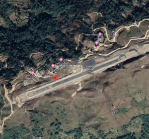
Aerial view of Taplejung Airport.
Airport Overview
Taplejung Airport, also known as Suketar Airport is in Suketar, Taplejung Province 1. It is 4 km due east of district headquarter at Taplejung. It is linked by air with Chandragadhi and Kathmandu. In 2019 it had 435 aircraft movements and 2,079 passengers.
The runway was blacktopped in 2016. The operation hours are as follows:
- Jan, Feb, Nov & Dec: 0100-0645 UTC
- Mar, Apr, Sept & Oct: 0030-0645 UTC
- May, June, July & Aug:015-0645 UTC
|
Airport Location and Contact |
|
|---|---|
|
Country |
Nepal |
|
Province or District |
Province 1/ Taplejung |
|
Nearest Town or City |
4kms Due east of the District HQ |
|
Airport’s Complete Name |
Taplejung Airport |
|
Latitude |
27.35083 |
|
Longitude |
87.69500 |
|
Elevation (ft and m) |
7936 ft (2419 m) |
|
IATA Code |
TPJ |
|
ICAO Code |
VNTJ |
|
Managing Company or Airport Authority |
Civil Aviation Authority of Nepal, Taplejung Airport Tel 977 24460518 AFS VNTJYDYX |
|
Management Contact Person |
N/A |
|
NGO and/or UN Presence at Airport? |
None |
Runway
|
Runway #1 |
|
|---|---|
|
Runway Dimensions |
2297 × 66 ft (700 × 20 m) |
|
Runway Orientation |
07 - 25 - |
|
Runway Surface |
Asphalt Concrete |
|
Runway Condition |
Good, operational |
Airport Infrastructure Details
|
Infrastructure |
|||
|---|---|---|---|
|
Passenger / Cargo Security Screening |
Metal Detector: Handheld |
Runway Lighting |
None |
|
Refueling Capacity |
None |
Ground Handling Services |
|
|
Air Traffic Control |
Uncontrolled |
Fire Fighting Equipment |
|
|
Weather Information |
AFIS |
Aircraft Parking Space |
3600 sqm of concrete Asphalt; 3 D228 Types |
|
Navigation Aids |
None |
Perimeter Fencing |
|
|
Windsock |
|
|
|
