
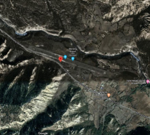
Aerial view of Humde Airport
Airport Overview
Manang Airport also known as Humde Airport is an airport serving Manang valley, a town in the Manang district of Gandaki Province in Nepal. The airport is an hour away 22 Km NW of District HQ at Chame. It can be accessed via Manang Sadak. It is 19th highest civilian airport in the world. It is not in operation but it can be reactivated by the Civil Aviation Authority of Nepal (CAAN) for emergencies.
|
Airport Location and Contact |
|
|---|---|
|
Country |
Nepal |
|
Province or District |
Gandaki Province/ Manang |
|
Nearest Town or City |
2.5 kilometres east of Manang town. |
|
Airport’s Complete Name |
Humde Airport |
|
Latitude |
28.64138 |
|
Longitude |
84.08583 |
|
Elevation (ft and m) |
11093 ft (3381 m) |
|
IATA Code |
NGX |
|
ICAO Code |
VNMA |
|
Managing Company or Airport Authority |
Civil Aviation Authority of Nepal, Humde Airport |
|
Management Contact Person |
N/A |
|
NGO and/or UN Presence at Airport? |
None |
Runway
|
Runway #1 |
|
|---|---|
|
Runway Dimensions |
2952 × 65 ft (900 × 20 m) |
|
Runway Orientation |
11 - 29- |
|
Runway Surface |
Asphalt Concrete |
|
Runway Condition |
Not in operation |
Airport Infrastructure Details
|
Infrastructure (non-operational) |
|||
|---|---|---|---|
|
Passenger / Cargo Security Screening |
N/A |
Runway Lighting |
N/A |
|
Refuelling Capacity |
None |
Ground Handling Services |
N/A |
|
Air Traffic Control |
Uncontrolled |
Fire Fighting Equipment |
N/A |
|
Weather Information |
AFIS, Tower Observation |
Aircraft Parking Space |
1750 sqm of Concrete Apron; 2 D228 types |
|
Navigation Aids |
AFIS |
Perimeter Fencing |
N/A |
|
Windsock |
N/A |
|
|
