
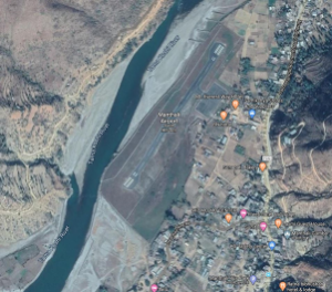
Aerial view of Ramechhap Airport in Manthali
Airport Overview
Ramechhap Airport is an airport serving the municipality of Manthali, the district headquarter of Ramechhap District located in the Tamakoshi River valley in Bagmati Province. It is in proximity to the district HQ. The airport opened in 1979 and was renovated in 2015. It is the closest airfield to Tribhuvan International Airport (TIA) in Kathmandu and is being planned as an emergency alternative to TIA.
|
Airport Location and Contact |
|
|---|---|
|
Country |
Nepal |
|
Province or District |
Bagmati Province / Ramechhap |
|
Nearest Town or City |
In proximity of District HQ at Manthali |
|
Airport’s Complete Name |
Ramechhap Airport |
|
Latitude |
27.39288 |
|
Longitude |
86.06138 |
|
Elevation (ft and m) |
1620 ft (494 m) |
|
IATA Code |
RHP |
|
ICAO Code |
VNRC |
|
Managing Company or Airport Authority |
Civil Aviation Authority of Nepal Tel 977 48540087 AFS VNRCYDYX |
|
Management Contact Person |
Amir Chaurasiya |
|
NGO and/or UN Presence at Airport? |
None |
Runway
|
Runway #1 |
|
|---|---|
|
Runway Dimensions |
1738 × 65 ft (530 × 20 m) |
|
Runway Orientation |
03- 21- |
|
Runway Surface |
Asphalt Concrete |
|
Runway Condition |
Operational |
Airport Infrastructure Details
|
Infrastructure |
|||
|---|---|---|---|
|
Passenger / Cargo Security Screening |
Metal Detector: handheld |
Runway Lighting |
N/A |
|
Refuelling Capacity |
Yes |
Ground Handling Services |
N/A |
|
Air Traffic Control |
N/A |
Fire Fighting Equipment |
N/A |
|
Weather Information |
AFIS, Tower Observation |
Aircraft Parking Space |
5000 sqm Apron for 4 Twin Otter type aircraft |
|
Navigation Aids |
N/A |
Perimeter Fencing |
N/A |
|
Windsock |
N/A |
|
|
Fuel Services Charges
The airport takes support from Nepal Oil Corporation for the
provision of Jet fuel for the aircraft. NOC maintains the reserve
of 60 kilolitres at its office premises.
|
Price per Litre USD - $ |
|
|---|---|
|
Jet A-1 |
0.55 (Duty Paid) * |
|
AVgas |
No |
*As of 03 September 2020
*Exchange rate 1 USD : 117.8 NPR
