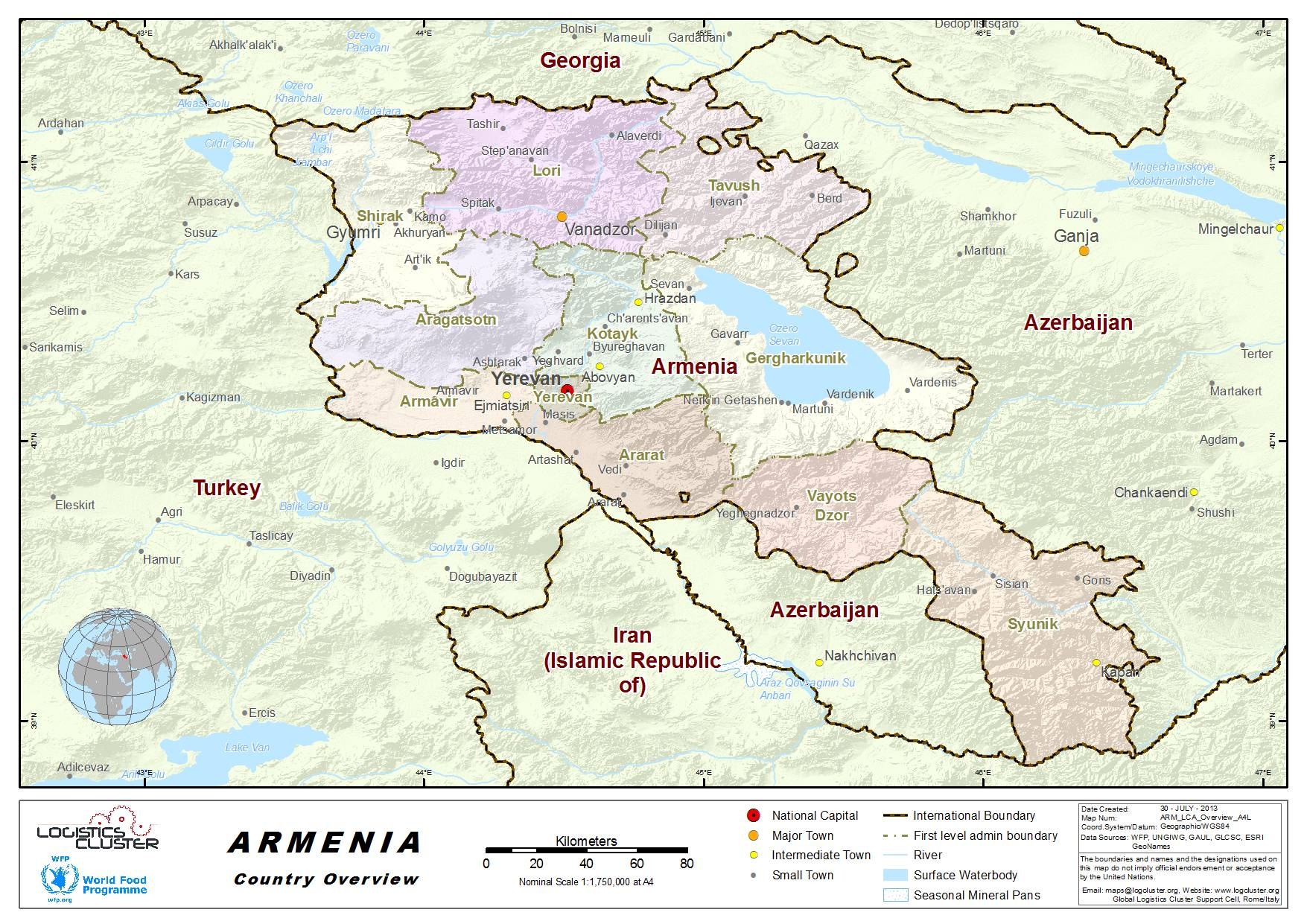
Armenia Country Profile

Generic Information:
Armenia is a landlocked country, bordered by Georgia in the north, Azerbaijan in the east and the Azerbaijani exclave of Naxçývan (Nakhichevan’) in the southwest, Iran in the south, and Turkey in the west, Armenia is 80% mountainous. The average elevation is about 1,800 m with Mount Aragats is the highest point in the country, reaching a height of 4,090 m. Mountain ranges in the republic include the Pambak, Geghama, Vardenis, and Zangezur branches of the Lesser Caucasus mountain system. The Republic has many mountain lakes, the largest of which is Lake Sevan, located in the north east. Lake Sevan is the largest lake in Transcaucasia and one of the largest high-elevation lakes in the world. Armenia has a dry and continental climate that changes radically with elevation.
For information on Armenia additional country and humanitarian details, please see the following document:
Armenia Humanitarian Information
Find the country in the generic links below:
Wikipedia Information on Armenia
Economist Intelligence Unit Information on Armenia*
(*note - this is a paid service)
Humanitarian Info:
Facts and Figures:
Wolfram Alpha Information on Armenia


