
Airport Overview
|
Airport Location and Contact |
|
|---|---|
|
Country |
Marshall Islands |
|
Province or District |
Utrik |
|
Nearest Town or City |
Utrik 1 km |
|
Airport’s Complete Name |
Utrik Airfeild |
|
Latitude |
11.392517314509984 |
|
Longitude |
169.8008928685562 |
|
Elevation (ft and m) |
1 m |
|
IATA Code |
UTK |
|
Managing Company or Airport Authority |
Marshal Islands Port Authority |
|
Management Contact Person |
Thomas Maddison |
|
NGO and/or UN Presence at Airport? |
No |
Airport Picture
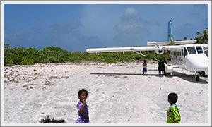
Design Aircraft: Dornier 228
Distance From Majuro: 299 km
Runway(s)
|
Runway #1 |
|
|---|---|
|
Runway Dimensions |
838 m x 43 m |
|
Runway Orientation |
Unknown |
|
Runway Surface |
Coral |
|
Runway Condition |
Fair |
Airport Infrastructure Details
|
Infrastructure |
|||
|---|---|---|---|
|
Passenger / Cargo Security Screening |
No |
Runway Lighting |
No |
|
Refuelling Capacity |
No |
Ground Handling Services |
No |
|
Air Traffic Control |
No |
Fire Fighting Equipment |
No |
|
Weather Information |
No |
Aircraft Parking Space |
No |
|
Navigation Aids |
No |
Perimeter Fencing |
No |
|
Windsock |
Yes |
|
|
