
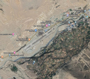
Aerial view of Jomsom Airport
Airport Overview
Jomsom airport is short take off and landing (STOL) airport located on the bank of the Kali Gandaki River serving Jomsom, a town in the Gharapjhong rural municipality of Mustang District in Gandaki Province. It serves as the gateway to the Mustang District that includes Jomsom, Kagbeni, Tangbe, Lo Manthang, and Muktinath temple, which is a popular pilgrimage destination for Nepalis and Indians. It is close to the District HQ of Mustang.
The airport is open through out the year but has the following operating hours
- Jan, Feb, Nov & Dec. 0100-0645 UTC
- Mar, Apr, Sept & Oct. 0030-0645 UTC
- May, June, July & Aug. 0015-0645 UTC
Due to high winds and clouds during the daytime, the operation stops midday year-round. Depending on the season, low clouds that restrict visibility can also halt airport operations.
|
Airport Location and Contact |
|
|---|---|
|
Country |
Nepal |
|
Province or District |
Gandaki Province/ Mustang |
|
Nearest Town or City |
Within the premises of Jomsom |
|
Airport’s Complete Name |
Jomsom Airport |
|
Latitude |
28.78222 |
|
Longitude |
83.72250 |
|
Elevation (ft and m) |
8976 ft (2736 m) |
|
IATA Code |
JOM |
|
ICAO Code |
VNJS |
|
Managing Company or Airport Authority |
Civil Aviation Authority of Nepal, Jomsom Airport Tel: 977 69440126 Tower: 977 69440006 AFS VNJSYDYX Email: jomsom_cao@caanepal.org.np |
|
Management Contact Person |
N/A |
|
NGO and/or UN Presence at Airport? |
NO |
Runway
|
Runway #1 |
|
|---|---|
|
Runway Dimensions |
2424 × 65 ft (739 × 20 m) |
|
Runway Orientation |
06 - 24- |
|
Runway Surface |
Asphalt Concrete |
|
Runway Condition |
Operational |
Airport Infrastructure Details
|
Infrastructure |
|||
|---|---|---|---|
|
Passenger / Cargo Security Screening |
Metal detector: walkthrough and handheld |
Runway Lighting |
Runway endlight Runway Threshold Identification Light |
|
Refuelling Capacity |
None |
Ground Handling Services |
|
|
Air Traffic Control |
AFIS |
Fire Fighting Equipment |
Wheel and portable type of fire extinguisher available |
|
Weather Information |
AFIS, Tower Observation |
Aircraft Parking Space |
6000 sqm of concrete apron, four D228 types |
|
Navigation Aids |
N/A |
Perimeter Fencing |
N/A |
|
Windsock |
N/A |
|
|
