
Overview
Kariba Airport is an international airport serving Kariba, Mashonaland West Province, Zimbabwe. It is 4 kilometres east of the town, and 13 kilometres east of the Kariba Dam, the outlet of Lake Kariba. There are obstacles that include line of hills and electricity transmission lines. No aircraft is to fly below 3,000 ft altitude within the radius of 1 NM of Kariba Dam Wall.
|
Airport Location and Contact |
|
|---|---|
|
Country |
Zimbabwe |
|
Province or District |
Mashonaland West |
|
Nearest Town or City with Distance from Airport |
Kariba (4 km) |
|
Airport’s Complete Name |
Kariba International Airport |
|
Latitude |
-16.517738 |
|
Longitude |
28.887077 |
|
Elevation (ft and m) |
1076 ft / 328 m |
|
IATA Code |
KAB |
|
ICAO Code |
FVKB |
|
Managing Company or Airport Authority |
Civil Aviation Authority of Zimbabwe (CAAZ) |
|
Management Contact Person |
|
|
NGO and/or UN Presence at Airport? |
No |
Airport Picture
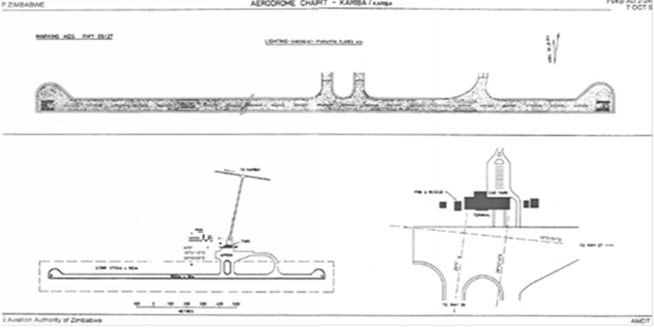
Runway
|
Runway #1 |
|
|---|---|
|
Runway Dimensions |
1650 m x 18 m |
|
Runway Orientation |
09/27 |
|
Runway Surface |
Bitumen – Asphalt |
|
Runway Condition |
Good |
Airport Infrastructure Details
|
Infrastructure |
|||
|---|---|---|---|
|
Passenger / Cargo Security Screening |
Yes |
Runway Lighting |
No |
|
Refuelling Capacity |
Yes |
Ground Handling Services |
No |
|
Air Traffic Control |
Yes |
Fire Fighting Equipment |
Yes |
|
Weather Information |
Yes |
Aircraft Parking Space |
No |
|
Navigation Aids |
No |
Perimeter Fencing |
No |
|
Windsock |
Yes |
|
|
Fuel Services Charges
|
Price per Litre USD - $ |
|
|
Jet A-1 |
Available by arrangement only |
|
Avgas |
Available by arrangement only |
Navigation Charges
|
A/C weight MAUW (Kg) |
Fees (US$) |
|---|---|
|
Up to 3 000 |
15 |
|
3 001 - 5000 |
40 |
|
5 001 - 7 500 |
50 |
|
7 501 - 10 000 |
75 |
|
10 001 - 35 000 |
125 |
|
35 001 - 40 000 |
250 |
|
40 001 - 70 000 |
350 |
|
70 001 - 100 000 |
480 |
|
Fixed charge over 100 000 kg plus US$5 per extra tonne |
480 |
