Tonga - 1 Country Profile
Generic Information
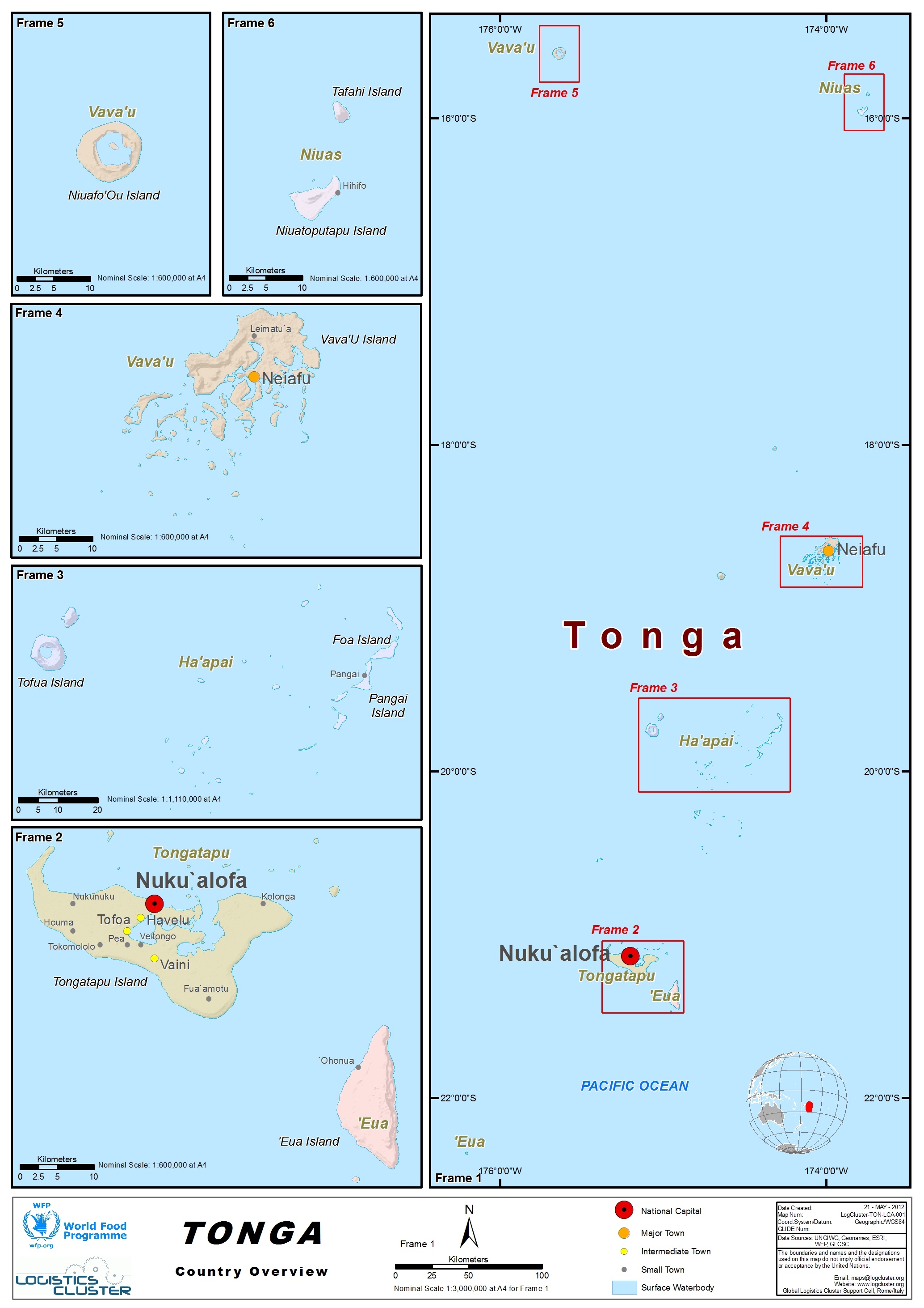
Tonga officially the Kingdom of Tonga is a Polynesian country and archipelago. The country has 171 islands – of which 45 are inhabited. Its total surface area is about 750 km2 (290 sq mi), scattered over 700,000 km2 (270,000 sq mi) in the southern Pacific Ocean. As of 2021, according to Johnson's Tribune, Tonga has a population of 104,494, 70% of whom reside on the main island, Tongatapu.
Tonga stretches approximately 800 km (500 mi) north-south. It is surrounded by Fiji and Wallis and Futuna (France) to the northwest; Samoa to the northeast; New Caledonia (France) and Vanuatu to the west; Niue (the nearest foreign territory) to the east; and Kermadec (New Zealand) to the southwest. Tonga is about 1,800 km (1,100 mi) from New Zealand's North Island. Tonga is a member of The Commonwealth. Source: Wikipedia (publisher), Tonga https://en.wikipedia.org/wiki/Tonga (Last accessed: 13 June 2023)
Tonga Wikipedia Country Information http://en.wikipedia.org/wiki/Tonga Generic country information can be located from sources which are regularly maintained and reflect current facts and figures. For a generic country overview, please consult the following sources:
Tonga Wikipedia Country Information https://en.wikipedia.org/wiki/Tonga
Tonga IMF Country Information https://www.imf.org/en/Countries/TON
Tonga Economist Intelligence Unit Information* http://country.eiu.com/Tonga
(*note - this is a paid service)
Humanitarian Info
Tonga World Food Programme https://www.wfp.org/countries
Pacific Region Logistics Cluster https://logcluster.org/en/ops/pacific
Tonga UN Office for the Coordination of Humanitarian Affairs Information https://www.unocha.org/office-pacific-islands/tonga
Facts and Figures
Tonga Wolfram Alpha Information www.wolframalpha.com/input/?i=tonga
Tonga World Bank Information https://data.worldbank.org/country/TO
Tonga Population Information https://data.worldbank.org/indicator/SP.POP.TOTL?locations=TO
