Chad - 2.2 Chad Aviation
Key airport information may also be found at: http://worldaerodata.com/
Despite lack of significant aviation infrastructure throughout the country, there is a functioning aviation sector which allows for domestic and international flights of a commercial, militaristic, and humanitarian nature. The sector is comprised of two parts: military and civil. The military aviation branch is controlled by the Chadian Airforce (AAT) which operates primarily out of a joint base at the N’Djamena International Airport. The civil aviation sector is managed by the Chad Civil Aviation Authority (ADAC). ADAC supervises and promotes aviation activities in Chad to ensure safety and security at airports, effective development planning, fair competition, and the enforcement of aviation laws and measures. More specifically, ADAC is the primary authority in carrying out the following actions related to the aviation sector:
-
Development of a national network of airports;
-
Issuance of operating permits to airports and licenses to civil aviation personnel, and development of the legislative framework that governs these mechanisms;
-
Organization of a national air traffic control system;
-
Negotiation of traffic rights with other states;
-
Definition of the coordination procedures necessary to avoid conflicts of interest between the development and operation of an airport and the development of the surrounding area;
-
Coordination of civil and military aeronautical activities;
-
Conducting aviation accident investigations.
The Agency for the Security of Arial Navigation (ASECNA) also plays a role in the aviation sector. ASECNA is a regional agency within Africa that offers air navigation safety assistance and provides meteorological information to larger airports within Chad.
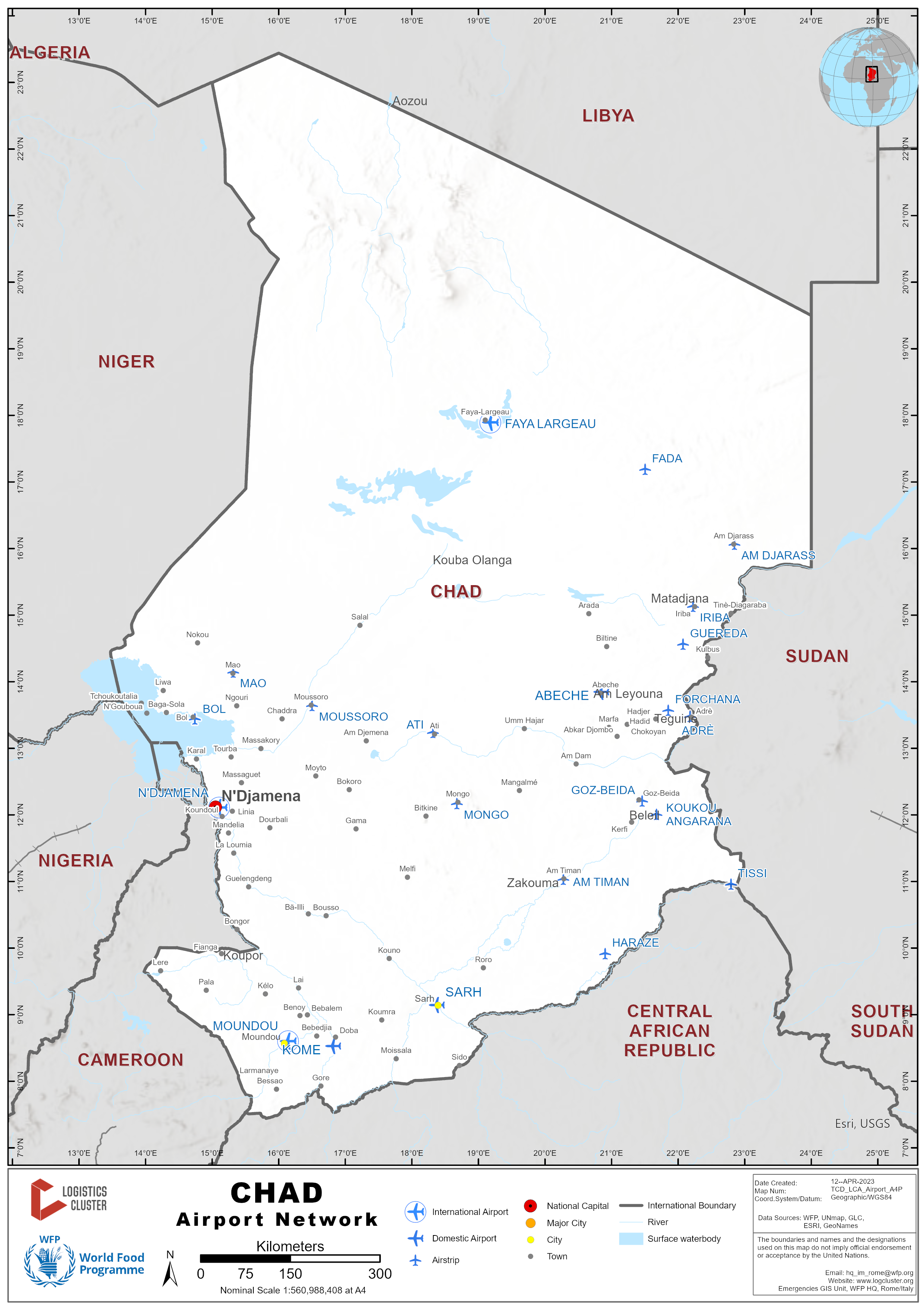
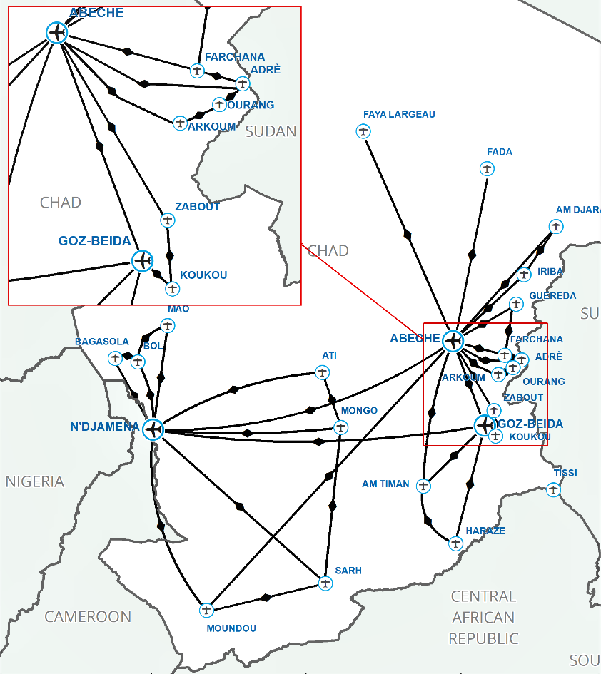
According to the UN Humanitarian Air Service (UNHAS), there are 33 airports (21 “regular” and 12 “non-regular” airfields) in operation as of April 2022. Other unpaved runways do exist throughout the country, but not classified as airports because they do not meet certain standards administered by both UNHAS and ADAC. N’Djamena International airport is the most developed airport in Chad with service to domestic and international locations. The airport’s single runway serves commercial, humanitarian, and military purposes. Detailed information regarding regular airports in Chad can be found in the subsequent subpoints of section 2.2.
Registration of Foreign Aircrafts in Chad
Chad does not produce airports domestically so there is a constant need to register foreign aircrafts. ADAC acts as the primary authority for the registration of foreign aircrafts and requires that a certain protocol be followed. Firstly, the interested party must follow ADAC regulations. To begin the application process, the organization or company must fill out an authorization request for either short-term or long-term registration. For short-term registration, the aircraft will be authorized to stay in Chad for 72 hours following the arrival day of the aircraft. ADAC requires that the registration approval process is initiated at least one month before the estimated day of arrival of the foreign aircraft. The authorization request must be accompanied with the following documents, per ADAC policies:
-
A Customs Clearance Certificate
-
Bill of Entry
-
Certificate of De-Registration from the previous registering authority
-
Evidence that the aircraft has been purchased or is owned by the applicant
In addition, ADAC requires that all aircraft owners uphold regulations by having in their possession the following documents:
-
Registration Certificate
-
Airworthiness Certificate
-
Radio Station License/ Installation Certificate
-
Noise Certificate
-
Insurance Certificate
-
Weight and Balance Certificate
-
AMO Approval Certificate
-
Maintenance Contract
-
Charter Agreement
-
The 3 last Certificates of Release to Service
-
Aircraft History (Incidents/ Accidents Reports)
-
Copy of Normal/ Emergency Checklist
-
Flight Manual (Approved by the Directorate General of Civil Aviation)
-
Minimum Equipment List Approval Page
-
Approval Page of the Operator’s Operational Manual
-
Approval Page of the Maintenance Control Manual
-
The Airworthiness Directives (Ads) and Service Bulletins (SBs) Statements
-
The Life Limited Parts Reports
-
Charter Agreements
-
Approval Page of the Structural Repair Manual (SRM)
-
Approval Page of the Illustrated Parts Catalogue (IPC)
-
Approval Page of the Wiring Diagram (WD)
-
Approval Page of the Trouble Shooting Manual (TSM)
-
Approval Page of the Aircraft Maintenance Manual (AMM)
-
Approval Page of the Component Maintenance Manual (CMM)
-
Air Operator Certificate (AOC)
-
Copy of Overflight and Landing Clearance
After the aircraft arrives, ADAC will conduct an inspection and to complete the authorization process. The inspection team typically consists of three people and costs a total of 90,000 XAF or 152.17 USD* (30,000 XAF/inspector). In the case of UN chartered aircrafts, procedures are subject to change. Specifically, UN chartered aircrafts are required to get Diplomatic Authorization from the Chadian Ministry of Foreign Affairs and African Integration for registration. to register and may be able to get necessary clearances within 24 hours, depending on the urgency of the situation.
The owner or operator of the aircraft must use one of the following maintenance programs as required by ADAC:
-
Calendar inspections according to the maintenance program
-
Inspections by flight hours and cycles
-
Progressive maintenance program.
Private and Non-scheduled Commercial Aircraft Landing Protocol
Private and non-scheduled commercial aircrafts flying over or landing in Chad must request prior permission from ADAC and the Ministry of Foreign Affairs (for UN Aircrafts) at least 10 working days prior to departure. Requests will not be granted more than 48 hours (with exceptions depending on the situation) before the overflight or landing time and must be submitted in duplicate including the following information:
-
Type of aircraft
-
Registration of aircraft
-
Name of pilot
-
Number of crew
-
Number of passengers
-
Origin of aircraft
-
Destination of aircraft
-
Airport of stopover
-
Airport of exit
-
Nature of cargo
-
Date of entry and departure
-
Purpose of visit
-
Services required.
*Conversion rate is 591.43 XAF to 1 USD taken directly from the UN Treasury Operational Rates of Exchange website on July 14th, 2023.
For more information on government agency and airport company contact information, please see the following links: 4.1 Government Contact List and 4.4 Airport Companies Contact List.
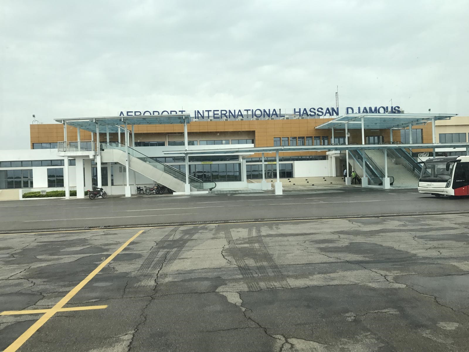
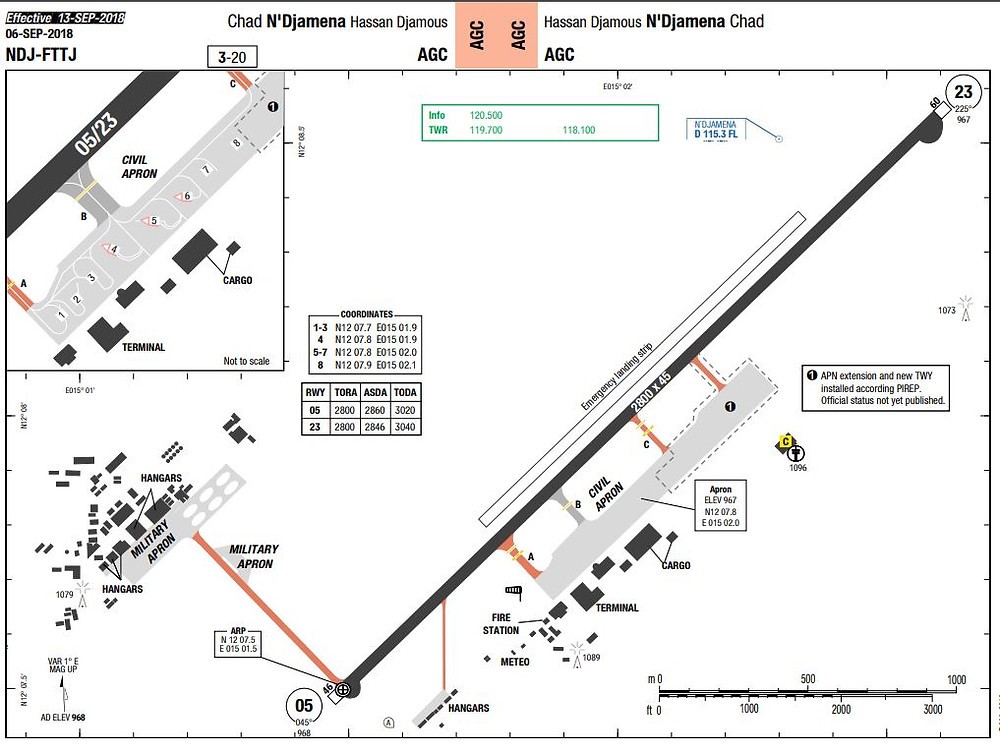
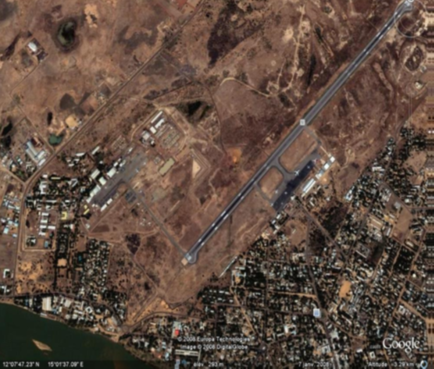
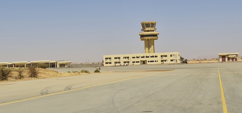
Chad - 2.2.1 Chad N'Djamena International Airport
Airport Overview
The N’Djamena-Hassan Djamous International Airport is the only international airport in Chad, based in the capital, N’Djamena. The airport has a single asphalt runway that serves both a civilian and a military purpose. The runway is sandwiched between a civilian terminal and military installation located right outside the center of N’Djamena. Commercial airlines that operate at N’Djamena International Airport include Air France, ASKY Airlines, Cameroon Airlines, Egypt Air, Ethiopian Airlines, Qatar Airways, Sudan Airlines and Tchadia Airlines (operations are down as of 2022), and Turkish Airlines.
|
Airport Location and Contact |
|
|---|---|
|
Country |
Chad |
|
Province or District |
Chari Baguimi |
|
Nearest Town or City |
N’Djamena 1 km northwest of the city |
|
Airport’s Complete Name |
N’Djamena Hassan Djamous |
|
Latitude |
12.133689° |
|
Longitude |
15.034019° |
|
Elevation (ft and m) |
968 ft/ 295 m |
|
IATA Code |
NDJ |
|
ICAO Code |
FTTJ |
|
Managing Company or Airport Authority |
ASECNA and ADAC |
|
Management Contact Person |
Djafar Assadick, NDJ Airport Manager |
|
Open From (hours) |
00:00 |
|
Open To (hours) |
24:00 |
Airport Picture
Description and Contacts of Key Companies
The Chad Civil Aviation Authority (ADAC) and the Agency for the Security of Arial Navigation (ASECNA) are the primary authorities on operations at N’Djamena International Airport. ASECNA’s role is reserved for matters related to meteorological information and safety assistance for air navigation. ASECNA’s involvement in Chad’s aviation sector is limited compared to ADAC, which acts as the primary civil aviation authority. The United Nations Humanitarian Air Service (UNHAS) operates extensively from N’Djamena International Airport. In 2020, UNHAS had 93 different organizations (including NGOs, UN Agencies, and Government counterparts) utilizing their services.
For more information on airport contacts, please see the following link: 4.4 Airport Companies Contact List.
Passenger and Cargo Performance Indicator
|
Performance for 2022 |
|||
|---|---|---|---|
|
|
Per Year |
Per Month |
Per Day |
|
Total Aircraft Movements* *Including commercial, military, and humanitarian movements |
6403 |
533 |
18 |
|
Total Passengers |
No accurate data from 2022 available In 2016, there was about 220,000 total passengers. |
||
|
Export Activity of the Airport (mt) |
960 |
80 |
2.6 |
|
Import Activity of the Airport (mt) |
<12 |
<1 |
<.1 |
|
Current use by Humanitarian Flights (UNHAS) |
596 |
50 |
1.6 |
Runway
The single runway at N’Djamena international airport is up to international standards and in decent condition.
|
Runway #1 |
|
|---|---|
|
Runway Dimensions |
2800 m x 45 m |
|
Orientation |
05 RWY/ 23 RWY |
|
Surface |
Asphalt |
Helicopter Pad
There are no helicopter pads at the N’Djamena International Airport for civilian purposes. At the airport, Helicopters will typically land on a section of the runway. A single helipad exists at the military base in N’Djamena. The helipad is capable of accommodating helicopters as big as the MI-26.
Airport Infrastructure Details
|
Customs |
Yes |
JET A-1 fuel |
Yes |
|
Immigration |
Yes |
AVGAS 100 |
Yes |
|
Terminal Building |
Yes |
Single Point Refuelling |
Yes |
|
Passenger Terminal |
Yes |
Air Starter Units |
Yes |
|
Cargo terminal |
No |
Ground Power (mobile) |
Yes |
|
Pax Transport to Airfield |
No |
Ground Handling Services |
Yes |
|
Control Tower |
Yes |
Latrine Servicing |
Yes |
|
Weather Facilities |
Yes |
Fire Fighting Category (ICAO) |
Yes, 8 |
|
Catering Services |
Yes |
De-icing Equipment |
No |
|
Base Operating Room |
Yes |
Parking Ramp Lighting |
Yes |
|
Airport Radar |
Yes |
Approach & Runway Lights |
Yes |
|
NDB |
Yes |
VOR |
Yes |
|
ILS |
Yes |
|
|
Airport Operating Details
|
Operating Details |
|||
|---|---|---|---|
|
Maximum Sized Aircraft that can be Offloaded on Bulk Cargo |
Boeing 747/ Ilyushin Il-76/ Antonov An-124 |
||
|
Maximum Sized Aircraft that can be Offloaded on Pallet |
Boeing 747/ Ilyushin Il-76/ Antonov An-124 |
||
|
Total Aircraft Parking Area (m²) |
46,750 |
||
|
Storage Area (mt) |
1,650 |
||
|
Handling Equipment |
|||
|
Elevators / Hi Loaders |
Yes |
Max Capacity (mt) |
35 |
|
Loading Ramps |
Yes |
||
Customs Guidance
Customs procedures typically take 20 to 30 minutes. Arriving passengers exit the plane outside on the tarmac and walk to the terminal where they must go up the stairs to the second floor and begin to fill out declaration forms and present their identification to customs officials. Customs officials primarily speak French and Arabic. Once the documentation screening has been completed, arriving passengers will then walk down to the first floor to collect their luggage, put their luggage through a security scanner, and exit the terminal. Customs procedures differ for non-commercial flights. For UNHAS flights, check-in operations begin at the latest one hour and half before the flight and ends one hour before the aircraft take-off.
For more information on customs in Chad, please see the following link: 1.3 Customs Information.
Storage Facilities
There are currently five different storage buildings which are utilized for import and export storage. The total storage capacity is approximately 1,650 mt. Of the five facilities, four are used for import and only one is used for export storage. The facilities act as a transitory point as most items are typically stored in privately owned and operated warehouses located elsewhere in Ndjamena.
Airfield Costs
NAVIGATION CHARGES
For information on N’Djamena International Airport Landing and Navigation charges, please click on the link here.
|
Charges |
Aircraft Weight - MTOW (tons) |
|||
|---|---|---|---|---|
|
|
0 – 25 |
26-75 |
76-150 |
>150 |
|
Landing USD - $ |
6.58 USD/ton |
13.02 USD/ton |
18.21 USD/ton |
17.10 USD/ton |
|
Night Landing USD - $ |
130.64 USD |
130.64 USD |
165.48 USD |
165.48 USD |
|
Night Take-Off USD - $ |
130.64 USD |
130.64 USD |
165.48 USD |
165.48 USD |
|
Parking |
$.20/hour/ton *First hour is free |
|||
|
Handling Charges |
$1,426/ flight |
|||
FUEL SERVICES CHARGES
|
|
Price per Litre USD - $ |
|---|---|
|
Jet A-1 |
$1.25 |
|
Service Charge |
ASECNA 6 XAF/litre or 1¢/litre ADAC 3 XAF/litre or .5¢/litre |
CARGO TERMINAL CHARGES
Terminal charges were last updated on the 1st of August 2020.
|
|
Import Charges |
|||
|---|---|---|---|---|
|
Type of Charge |
Rate (XAF) |
Rate (USD) |
Comments |
|
|
Handling Charge |
300/kg |
50¢/kg |
|
|
|
Break Bulk Fee |
20,000/waybill |
33.83$/waybill |
|
|
|
Diplomatic Mail |
22,000/waybill |
37.2$/waybill |
|
|
|
Hazardous Materials |
60,000/waybill |
101.45$/waybill |
|
|
|
Cold Storage Fee |
N/A |
N/A |
No current capacity |
|
|
Valuable materials |
120,000/waybill |
202.90$/waybill |
|
|
|
Express charge (additional) |
20,000/waybill |
33.83$/waybill |
|
|
|
Storage per Day |
10/kg/day |
1.7¢/kg/day |
7,500 XAF (12.70 USD) Minimum |
|
|
|
Export |
|||
|
Handling Charges – Un-palletized Cargo |
100/kg |
17¢/kg |
|
|
|
International Air Waybill |
100/kg |
17¢/kg |
10,000 XAF (16.92 USD) Minimum |
|
|
Local Air Waybill |
65/kg |
11¢/kg |
6,500 XAF (11 USD) Minimum |
|
|
Air Waybill Documentation |
20,000/waybill |
33.83$/waybill |
|
|
|
Diplomatic Mail |
100/kg |
17¢/kg |
|
|
|
Storage Charges per Day |
10 |
1.7¢/kg |
7,500 XAF (12.7 USD) Minimum |
|
Agency Charges
|
Import Charges |
|
|---|---|
|
ASECNA |
25 XAF/kg or 4¢/kg |
|
ADAC |
50 XAF/kg or 8¢/kg |
|
Export Charges |
|
|
ASECNA |
10 XAF/kg or 1.7¢/kg |
|
ADAC |
100 XAF/kg or 17¢/kg |
Security
The airport has a good level of security with military personnel, metal detectors, and baggage scanners present. Security officers ensure that international standards are met and are available in case airport patrons need to report suspicious activity. Leaving baggage unattended can lead to destruction of the baggage or even criminal charges. The table below identifies security tax fees per traveller at N’Djamena International Airport.
|
National Traffic |
2,000 XAF or 3.38 USD |
|---|---|
|
Regional Traffic |
2,500 XAF or 4.23 USD |
|
International Traffic |
3,500 XAF or 5.92 USD |
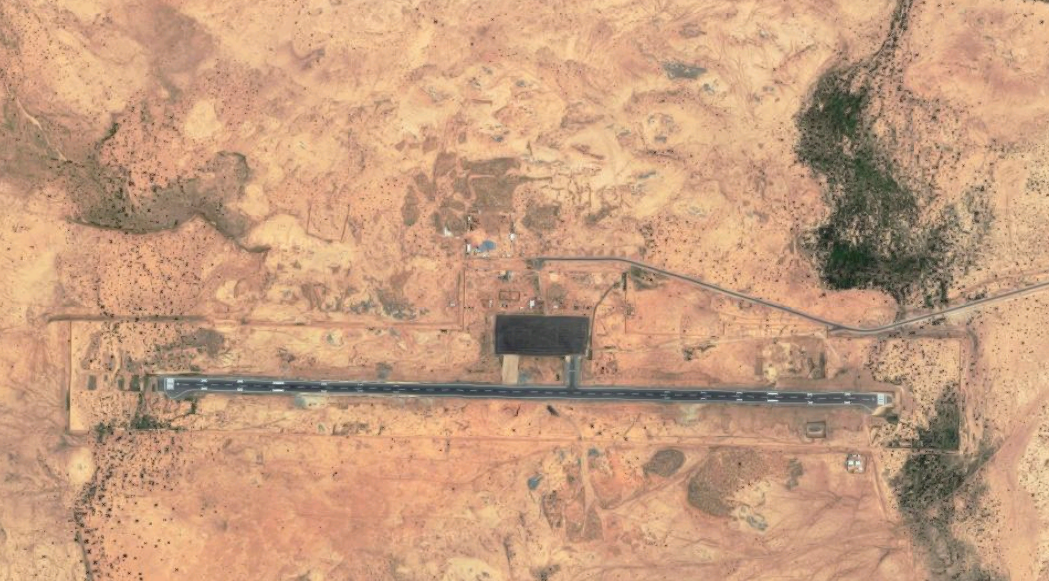
Chad - 2.2.2 Chad Amdjarass International Airport
Airport Overview
Amdjarass International Airport has the longest and best kept asphalt runway in Chad. Serious progress has been made to the airport to receive international status. Although it is unclear whether Amdjarass has received international flights yet, there will likely be international flights in 2023 for the Islamic Pilgrimage (Hajj) to Mecca. Runway incursions are a possibility and there is significant bird activity at the airport during the rainy season.
|
Airport Location and Contact |
|
|---|---|
|
Country |
Chad |
|
Province or District |
Ennedi Est |
|
Nearest Town or City |
Amdjarass 13.97 km |
|
Airport’s Complete Name |
Aéroport Amdjarass |
|
Latitude |
15.97833° |
|
Longitude |
22.77277° |
|
Elevation (ft and m) |
2992 ft / 912 m |
|
IATA Code |
AG17585 |
|
ICAO Code |
FTAA |
|
Managing Company or Airport Authority |
ADAC |
|
Management Contact Person |
Allahoguina Emile |
Airport Picture
Runway(s)
|
Runway #1 |
|
|---|---|
|
Runway Dimensions |
3050 m x 50 m |
|
Runway Orientation |
RWY 09/ RWY 27 |
|
Runway Surface |
Asphalt |
|
Runway Condition |
Good |
Airport Infrastructure Details
|
Infrastructure |
|||
|---|---|---|---|
|
Passenger / Cargo Security Screening |
Yes |
Runway Lighting |
Yes |
|
Refuelling Capacity |
Yes* |
Ground Handling Services |
Yes* |
|
Air Traffic Control |
Yes |
Fire Fighting Equipment |
Yes |
|
Weather Information |
No* |
Aircraft Parking Space |
Yes |
|
Navigation Aids |
No* |
Perimeter Fencing |
Yes |
|
Windsock |
Yes |
|
|
*Under development
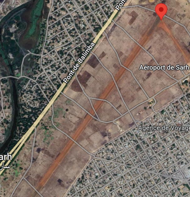
Chad - 2.2.3 Chad Sarh National Airport
Airport Overview
The Sarh national airport is located near the Chari River in South-eastern Chad. The airport has decent infrastructure (including firefighting equipment) and is primarily operated by ASECNA. Potential users of the airport should be aware that baggage and passenger screenings are conducted by local police.
|
Airport Location and Contact |
|
|---|---|
|
Country |
Chad |
|
Province or District |
Moyen-Chari |
|
Nearest Town or City |
Sarh In town (<1 km) |
|
Airport’s Complete Name |
Sarh National Airport |
|
Latitude |
9.15111° |
|
Longitude |
18.37944° |
|
Elevation (ft and m) |
1151 ft / 351 m |
|
IATA Code |
SRH |
|
ICAO Code |
FTTA |
|
Managing Company or Airport Authority |
ASECNA |
|
Management Contact Person |
Djouainante Neldibaye |
|
NGO and/or UN Presence at Airport? |
Yes UNHAS |
Airport Picture
Runway(s)
|
Runway #1 |
|
|---|---|
|
Runway Dimensions |
1800 m x 30 m |
|
Runway Orientation |
RWY 04 / RWY 22 |
|
Runway Surface |
Gravel |
|
Runway Condition |
Good |
Airport Infrastructure Details
|
Infrastructure |
|||
|---|---|---|---|
|
Passenger / Cargo Security Screening |
Yes |
Runway Lighting |
No |
|
Refuelling Capacity |
No |
Ground Handling Services |
No |
|
Air Traffic Control |
No |
Fire Fighting Equipment |
Yes |
|
Weather Information |
Yes |
Aircraft Parking Space |
Yes |
|
Navigation Aids |
Yes |
Perimeter Fencing |
No |
|
Windsock |
Yes |
|
|
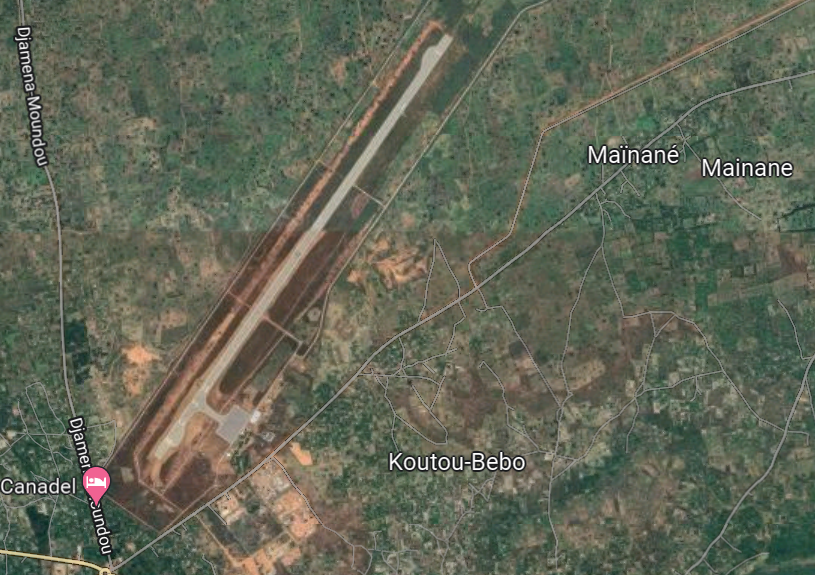
Chad - 2.2.4 Chad Moundou National Airport
Airport Overview
The Moundou International Airport is located on the outskirts of Moundou, the second largest city in Chad. The airport is designated as an international airport but has not received international traffic in several years. Moundou airport has developed infrastructure however, as of October 2022, the navigation aids were not working.
|
Airport Location and Contact |
|
|---|---|
|
Country |
Chad |
|
Province or District |
Logone Occidental |
|
Nearest Town or City |
Moundou 4 km |
|
Airport’s Complete Name |
Moundou National Airport |
|
Latitude |
8.62222° |
|
Longitude |
16.06944° |
|
Elevation (ft and m) |
1409 ft / 429 m |
|
IATA Code |
MQQ |
|
ICAO Code |
FTTD |
|
Managing Company or Airport Authority |
ADAC |
Airport Picture
Runway(s)
|
Runway #1 |
|
|---|---|
|
Runway Dimensions |
3000 m x 45 m |
|
Runway Orientation |
RWY 04 / RWY 22 |
|
Runway Surface |
Asphalt |
|
Runway Condition |
Good |
Airport Infrastructure Details
|
Infrastructure |
|||
|---|---|---|---|
|
Passenger / Cargo Security Screening |
Yes |
Runway Lighting |
No |
|
Refuelling Capacity |
No |
Ground Handling Services |
Yes |
|
Air Traffic Control |
Yes |
Fire Fighting Equipment |
Yes |
|
Weather Information |
No |
Aircraft Parking Space |
Yes |
|
Navigation Aids |
No* Currently out of operation |
Perimeter Fencing |
Yes |
|
Windsock |
Yes |
|
|
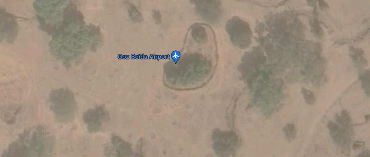
Chad - 2.2.5 Chad Goz Beïda Airport
Airport Overview
The Goz Beïda airport is in eastern Chad in the province of Dar Sila. The airport is equipped with passenger and cargo screening tools and a 50 kg fire extinguisher. High terrain surrounds the airport, and the runway is rough in some parts.
|
Airport Location and Contact |
|
|---|---|
|
Country |
Chad |
|
Province or District |
Dar Sila |
|
Nearest Town or City |
Goz Beïda 6.4 km |
|
Airport’s Complete Name |
Goz Beïda Airport |
|
Latitude |
12.2° |
|
Longitude |
21.46666° |
|
Elevation (ft and m) |
1765 ft / 537.9 m |
|
ICAO Code |
FTTG |
Airport Picture
Runway(s)
|
Runway #1 |
|
|---|---|
|
Runway Dimensions |
1500 m x 40 m |
|
Runway Orientation |
RWY 17 / RWY 35 |
|
Runway Surface |
Gravel and Loose stones |
|
Runway Condition |
Passable |
Airport Infrastructure Details
|
Infrastructure |
|||
|---|---|---|---|
|
Passenger / Cargo Security Screening |
Yes |
Runway Lighting |
No |
|
Refueling Capacity |
No |
Ground Handling Services |
No |
|
Air Traffic Control |
No |
Fire Fighting Equipment |
Yes |
|
Weather Information |
No |
Aircraft Parking Space |
No |
|
Navigation Aids |
Yes |
Perimeter Fencing |
Yes |
|
Windsock |
Yes |
|
|
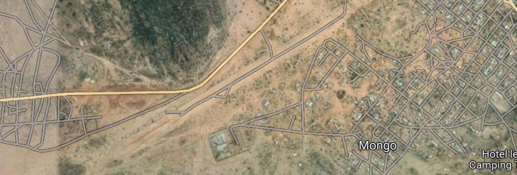
Chad - 2.2.6 Chad Mongo National Airport
Airport Overview
The Mongo airport is located on the outskirts of the city of Mongo. The airstrip has been converted into a road and is unusable when wet. The airport is equipped with some passenger and cargo screening tools.
|
Airport Location and Contact |
|
|---|---|
|
Country |
Chad |
|
Province or District |
Guera |
|
Nearest Town or City |
Mongo (<1 km)
|
|
Airport’s Complete Name |
Mongo National Airport |
|
Latitude |
12.17027° |
|
Longitude |
18.675° |
|
Elevation (ft and m) |
1421 ft / 433 m |
|
IATA Code |
MVO |
|
ICAO Code |
FTTM |
Airport Picture
Runway(s)
|
Runway #1 |
|
|---|---|
|
Runway Dimensions |
1500 m x 30 m |
|
Runway Orientation |
RWY 06 / RWY 24 |
|
Runway Surface |
Compacted Sand |
|
Runway Condition |
Passable |
Airport Infrastructure Details
|
Infrastructure |
|||
|---|---|---|---|
|
Passenger / Cargo Security Screening |
Yes |
Runway Lighting |
No |
|
Refuelling Capacity |
No |
Ground Handling Services |
No |
|
Air Traffic Control |
No |
Fire Fighting Equipment |
No |
|
Weather Information |
No |
Aircraft Parking Space |
No |
|
Navigation Aids |
No |
Perimeter Fencing |
No |
|
Windsock |
Yes |
|
|
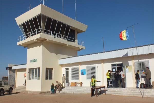
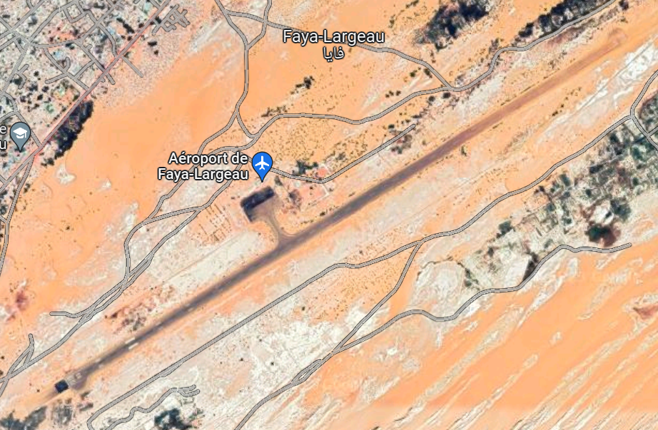
Chad - 2.2.7 Chad Faya Largeau National Airport
Airport Overview
The Faya-Largeau airport is managed by ADAC and has air traffic control capacity. At the airport there are strong winds, and the runway surface is broken in places. The area surrounding the airport can get hot and dusty and caution on landing and take-off should be taken.
|
Airport Location and Contact |
|
|---|---|
|
Country |
Chad |
|
Province or District |
Borkou |
|
Nearest Town or City |
Faya-Largeau In town (1 km) |
|
Airport’s Complete Name |
Faya-Largeau Airport |
|
Latitude |
17.91867 |
|
Longitude |
19.10783 |
|
Elevation (ft and m) |
771 ft / 235 m |
|
IATA Code |
FYT |
|
ICAO Code |
FTTY |
|
Managing Company or Airport Authority |
ADAC |
Airport Picture
Runway(s)
|
Runway #1 |
|
|---|---|
|
Runway Dimensions |
2800 m x 45 m |
|
Runway Orientation |
RWY 06 / RWY 24 |
|
Runway Surface |
Asphalt |
|
Runway Condition |
Passable |
Airport Infrastructure Details
|
Infrastructure |
|||
|---|---|---|---|
|
Passenger / Cargo Security Screening |
Yes |
Runway Lighting |
No |
|
Refuelling Capacity |
Yes* |
Ground Handling Services |
No |
|
Air Traffic Control |
Yes |
Fire Fighting Equipment |
No |
|
Weather Information |
No |
Aircraft Parking Space |
Yes |
|
Navigation Aids |
Yes |
Perimeter Fencing |
No |
|
Windsock |
Yes |
|
|
*In the past, the French airforce has aided planes with Jet-A1 fuel at the airport. Arrangements can be made to secure jet fuel through communications with ADAC.
Chad - 2.2.8 Adre National Airport
Adre Airfield
Airport Overview
The Adre landing strip is located on the Chadian-Sudanese border to the East. The landing zone goes from East to West and has none of the equipment needed for a functioning airport. However, the airstrip does serve a purpose for shipments destined for the Eastern border of Chad where there is a large humanitarian presence.The conflict in Sudan has sparked a large influx of refugees and reinvigorated the need for the Adre landing strip to be active. In early August, the airstrip is expected to be fully operational for both airplanes and helicopters.
|
Airport Location and Contact |
|
|---|---|
|
Country |
Chad |
|
Province or District |
Ouaddai |
|
Nearest Town or City |
Adre 2.9 km |
|
Latitude |
N13°28'84 |
|
Longitude |
E022°10'71" |
|
Elevation (ft and m) |
2624 ft / 800m |
|
NGO and/or UN Presence at Airport? |
No |
Runway(s)
|
Runway #1 |
|
|---|---|
|
Runway Dimensions |
600 m X 30 m |
|
Runway Orientation |
RWY 07/ RWY 25 |
|
Runway Surface |
Sand and loose Gravel |
|
Runway Condition |
Passable |
Airport Infrastructure Details
|
Infrastructure |
|||
|---|---|---|---|
|
Passenger / Cargo Security Screening |
No |
Runway Lighting |
No |
|
Refuelling Capacity |
No |
Ground Handling Services |
No |
|
Air Traffic Control |
No |
Fire Fighting Equipment |
No |
|
Weather Information |
No |
Aircraft Parking Space |
No |
|
Navigation Aids |
No |
Perimeter Fencing |
No |
|
Windsock |
No |
|
|
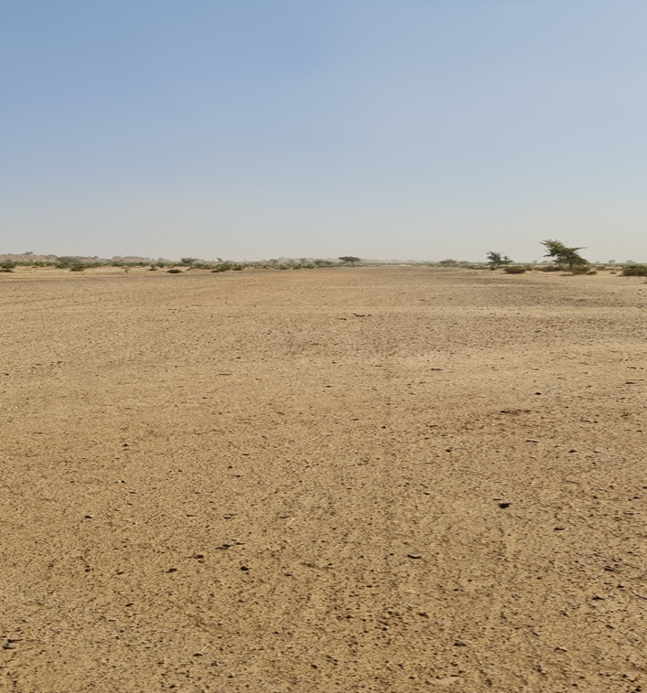
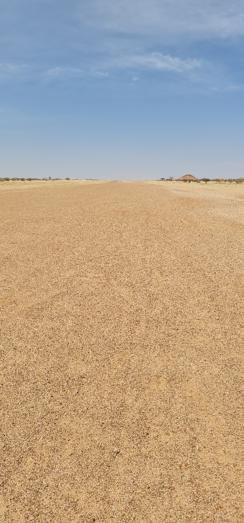
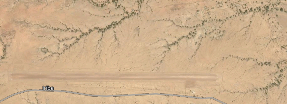
Chad - 2.2.9 Chad Iriba National Airport
Airport Overview
Iriba airfield has basic security measures (metal detectors and a scale) and is located right next to the road heading into town. The airstrip is a little rough and unusable during the wet season. On the approach from the east (RWY 09), there is a small hill which can be dangerous during landing.
|
Airport Location and Contact |
|
|---|---|
|
Country |
Chad |
|
Province or District |
Wadi Fira |
|
Nearest Town or City |
Ouadi Iriba 2.46 km |
|
Airport’s Complete Name |
Iriba Airfield |
|
Latitude |
15.13468° |
|
Longitude |
22.22183° |
|
Elevation (ft and m) |
3136 ft /956 m |
|
NGO and/or UN Presence at Airport? |
Yes WFP-UNHAS |
Airport Picture
Runway(s)
|
Runway #1 |
|
|---|---|
|
Runway Dimensions |
1500 m x 30 m |
|
Runway Orientation |
RWY 09 / RWY 27 |
|
Runway Surface |
Compact Sand/Gravel |
|
Runway Condition |
Good |
Airport Infrastructure Details
|
Infrastructure |
|||
|---|---|---|---|
|
Passenger / Cargo Security Screening |
No |
Runway Lighting |
No |
|
Refuelling Capacity |
No |
Ground Handling Services |
No |
|
Air Traffic Control |
No |
Fire Fighting Equipment |
No |
|
Weather Information |
No |
Aircraft Parking Space |
No |
|
Navigation Aids |
No |
Perimeter Fencing |
No |
|
Windsock |
Yes |
|
|
Chad - 2.2.10 Koukou Angarana National Airport
Koukou Angarana National Airport
This airport is used regularly or on occasional basis by UNHAS or others operators (ASF-B, MSF, ICRC, AIRSERV, MINURCAT) Airport max load DC 3
|
Airport Details |
|||
|---|---|---|---|
|
Country |
Chad |
Latitude |
12° 00' N |
|
Province / District |
n/a |
Longitude |
21° 41' E |
|
Airport Name |
Koukou Angarana |
Elevation (ft) |
512 m |
|
IATA & ICAO codes |
n/a |
Surface |
Gravel |
|
Town or City (closest) |
n/a |
Runway Condition |
n/a |
|
NGO / UN (on ground) |
n/a |
Passenger / Cargo Security Screening (Yes / No) |
n/a |
|
Runway Dimension |
1350m x 40m |
Ground Handling (Yes / No) |
n/a |
|
Refueling Capacity |
n/a |
Runway Lighting (Yes / No) |
n/a |
|
Runway Heading |
n/a |
Fire Fighting Equipment (Yes / No) |
n/a |
|
Air Traffic Control (Yes / No) |
n/a |
Windsock (Yes / No) |
n/a |
|
Weather Information (Yes / No) |
n/a |
Aircraft Parking space (Yes / No) |
n/a |
|
Navigation Aids (Yes / No) |
n/a |
Perimeter fencing (Yes / No) |
n/a |
For information on Chad Airport contact details, please see the following link:
Chad - 2.2.11 Chad Farchana National Airport
Airport Overview
The Farchana airfield is an unfenced, unprotected airfield typically used by humanitarian planes. Located near a military base, the airfield has basic security measures including a scale and metal detectors. The airstrip is unusable during the wet season as there are gullies near the airfield which overflow and flood the landing strip.
|
Airport Location and Contact |
|
|---|---|
|
Country |
Chad |
|
Province or District |
Ouaddai |
|
Nearest Town or City |
Abeche 119 km |
|
Airport’s Complete Name |
Farchana National Airport |
|
Latitude |
13.57222° |
|
Longitude |
21.8525° |
|
Elevation (ft and m) |
2831 ft / 863 m |
|
Managing Company or Airport Authority |
ADAC |
|
Management Contact Person |
Ngarpeni Madjirebe |
|
NGO and/or UN Presence at Airport? |
No |
Airport Picture
Runway(s)
|
Runway #1 |
|
|---|---|
|
Runway Dimensions |
1100 m x 45 m |
|
Runway Orientation |
RWY 09 / RWY 27 |
|
Runway Surface |
Gravel |
|
Runway Condition |
Good |
Airport Infrastructure Details
|
Infrastructure |
|||
|---|---|---|---|
|
Passenger / Cargo Security Screening |
No |
Runway Lighting |
No |
|
Refuelling Capacity |
No |
Ground Handling Services |
No |
|
Air Traffic Control |
No |
Fire Fighting Equipment |
No |
|
Weather Information |
No |
Aircraft Parking Space |
No |
|
Navigation Aids |
Yes |
Perimeter Fencing |
No |
|
Windsock |
Yes |
Windshield |
Yes |
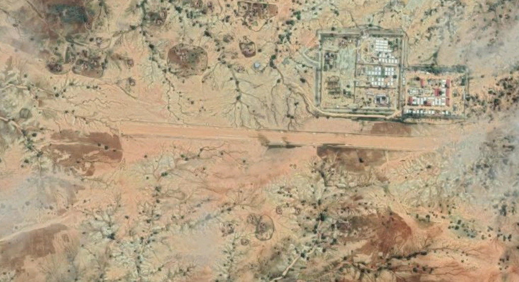
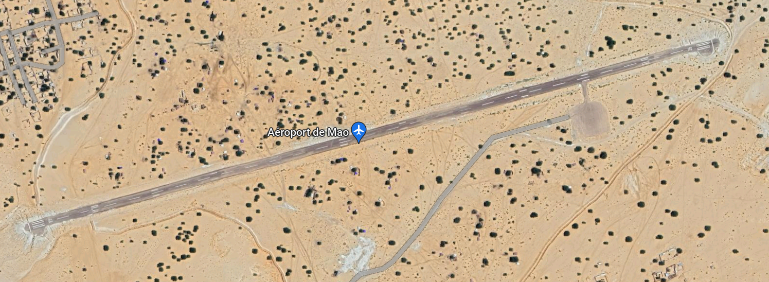
Chad - 2.2.12 Chad Mao National Airport
Airport Overview
The Mao national airport is an IATA and ICAO coded airport with passable airport infrastructure including an asphalt runway and basic passenger and cargo screening. The airport can experience strong winds so caution must be undertaken upon approach.
|
Airport Location and Contact |
|
|---|---|
|
Country |
Chad |
|
Province or District |
Kanem |
|
Nearest Town or City |
Mao 1.6 km |
|
Airport’s Complete Name |
Mao National Airport |
|
Latitude |
N14°08'42" |
|
Longitude |
E015°18'54" |
|
Elevation (ft and m) |
1070 ft / 326 m |
|
IATA Code |
AMO |
|
ICAO Code |
FTTU |
|
Managing Company or Airport Authority |
ASECNA |
|
NGO and/or UN Presence at Airport? |
Yes |
Airport Picture

Runway(s)
|
Runway #1 |
|
|---|---|
|
Runway Dimensions |
1700 m x 20 m |
|
Runway Orientation |
RWY 08 / RWY 26 |
|
Runway Surface |
Asphalt |
|
Runway Condition |
Good |
Airport Infrastructure Details
|
Infrastructure |
|||
|---|---|---|---|
|
Passenger / Cargo Security Screening |
Yes |
Runway Lighting |
No |
|
Refuelling Capacity |
No |
Ground Handling Services |
No |
|
Air Traffic Control |
Yes |
Fire Fighting Equipment |
No |
|
Weather Information |
Yes |
Aircraft Parking Space |
Yes |
|
Navigation Aids |
Yes |
Perimeter Fencing |
No |
|
Windsock |
Yes |
|
|
Chad - 2.2.13 Chad Bahai National Airport
Airport Overview
The landing strip is used on an occasional basis by humanitarian agencies. The airfield has been abandoned and there are no operating facilities currently.
|
Airport Location and Contact |
|
|---|---|
|
Country |
Chad |
|
Province or District |
Ennedi Est |
|
Nearest Town or City |
Amdjarass 43.1 km |
|
Latitude |
15.63263° |
|
Longitude |
22.89738° |
|
Elevation (ft and m) |
2683 ft/ 818 m |
|
NGO and/or UN Presence at Airport? |
No |
Airport Picture
Runway(s)
|
Runway #1 |
|
|---|---|
|
Runway Dimensions |
1650 m x 25 m |
|
Runway Orientation |
RWY 07/ RWY 25 |
|
Runway Surface |
Sand/loose gravel |
|
Runway Condition |
Passable |
Airport Infrastructure Details
|
Infrastructure |
|||
|---|---|---|---|
|
Passenger / Cargo Security Screening |
No |
Runway Lighting |
No |
|
Refuelling Capacity |
No |
Ground Handling Services |
No |
|
Air Traffic Control |
No |
Fire Fighting Equipment |
No |
|
Weather Information |
No |
Aircraft Parking Space |
No |
|
Navigation Aids |
No |
Perimeter Fencing |
No |
|
Windsock |
No |
|
|
Chad - 2.2.14 Chad Tine National Airport
Please note: as of August 2023, the airstrip results currently abandoned.
|
Airport Details |
|||
|---|---|---|---|
|
Country |
Chad |
Latitude |
15° 03' N |
|
Province / District |
n/a |
Longitude |
22° 48' E |
|
Airport Name |
Tine |
Elevation (ft) |
857 m |
|
IATA & ICAO codes |
n/a |
Surface |
Clay & Sand |
|
Town or City (closest) |
n/a |
Runway Condition |
n/a |
|
NGO / UN (on ground) |
n/a |
Passenger / Cargo Security Screening (Yes / No) |
n/a |
|
Runway Dimension |
1900m x 20m |
Ground Handling (Yes / No) |
n/a |
|
Refueling Capacity |
n/a |
Runway Lighting (Yes / No) |
n/a |
|
Runway Heading |
n/a |
Fire Fighting Equipment (Yes / No) |
n/a |
|
Air Traffic Control (Yes / No) |
n/a |
Windsock (Yes / No) |
n/a |
|
Weather Information (Yes / No) |
n/a |
Aircraft Parking space (Yes / No) |
n/a |
|
Navigation Aids (Yes / No) |
n/a |
Perimeter fencing (Yes / No) |
n/a |
For information on Chad Airport contact details, please see the following link:
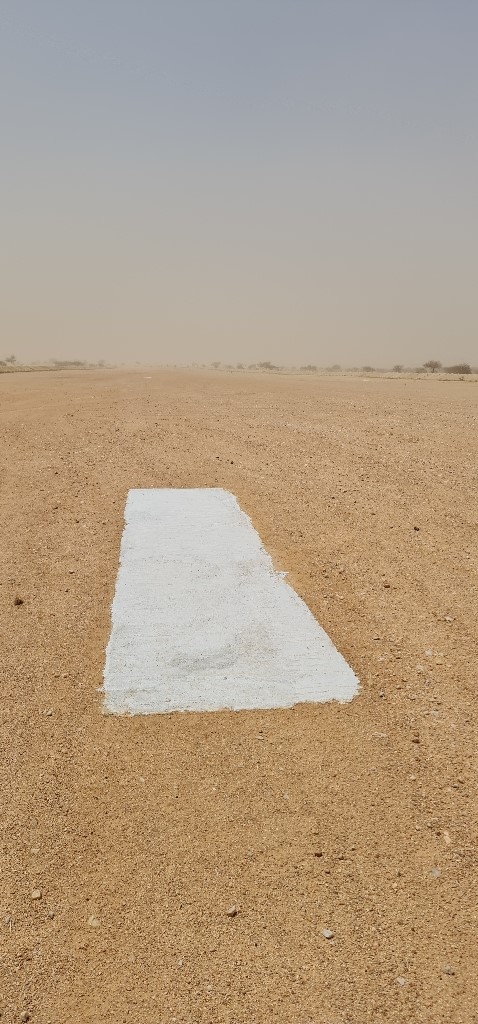
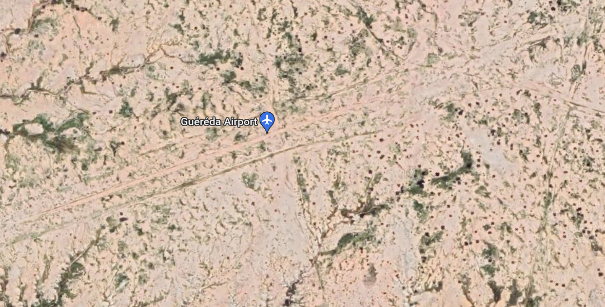
Chad - 2.2.15 Chad Guereda National Airport
Airport Overview
The Guereda airfield is primarily operated by UNHAS. Although airport infrastructure is lacking, the airfield does have metal detectors, a scale, and a windsock. The runway is somewhat rough and inaccessible during the rainy season. On the east end of the runway, there is a small sand knoll which can be dangerous if pilots are unaware. Visibility can also be a problem.
|
Airport Location and Contact |
|
|---|---|
|
Country |
Chad |
|
Province or District |
Wadi Fira |
|
Nearest Town or City |
Guereda 7 km |
|
Airport’s Complete Name |
Guereda Airfield |
|
Latitude |
14.56444° |
|
Longitude |
22.07527° |
|
Elevation (ft and m) |
3349 ft /1021 m |
|
Managing Company or Airport Authority |
World Food Programme- UN Humanitarian Air Service (UNHAS) |
|
Management Contact Person |
Fidele Ngondjim |
|
NGO and/or UN Presence at Airport? |
Yes WFP-UNHAS |
Airport Picture
Runway(s)
|
Runway #1 |
|
|---|---|
|
Runway Dimensions |
1000 m x 30 m |
|
Runway Orientation |
RWY 07/ RWY 25 |
|
Runway Surface |
Gravel with small stones |
|
Runway Condition |
Passable |
Airport Infrastructure Details
|
Infrastructure |
|||
|---|---|---|---|
|
Passenger / Cargo Security Screening |
No |
Runway Lighting |
No |
|
Refuelling Capacity |
No |
Ground Handling Services |
No |
|
Air Traffic Control |
No |
Fire Fighting Equipment |
No |
|
Weather Information |
No |
Aircraft Parking Space |
No |
|
Navigation Aids |
Yes |
Perimeter Fencing |
No |
|
Windsock |
Yes |
|
|
Chad - 2.2.16 Chad Dogdore National Airport
Please note: as of August 2023, the airstrip results currently abandoned.
|
Airport Details |
|||
|---|---|---|---|
|
Country |
Chad |
Latitude |
12° 03' N |
|
Province / District |
n/a |
Longitude |
22° 17' E |
|
Airport Name |
Dogdore |
Elevation (ft) |
578 m |
|
IATA & ICAO codes |
FTTC |
Surface |
Clay & Sand |
|
Town or City (closest) |
n/a |
Runway Condition |
n/a |
|
NGO / UN (on ground) |
n/a |
Passenger / Cargo Security Screening |
n/a |
|
Runway Dimension |
800 m x 20 m |
Ground Handling |
n/a |
|
Refueling Capacity |
n/a |
Runway Lighting |
n/a |
|
Runway Heading |
n/a |
Fire Fighting Equipment |
n/a |
|
Air Traffic Control |
n/a |
Windsock |
n/a |
|
Weather Information |
n/a |
Aircraft Parking space |
n/a |
|
Navigation Aids |
n/a |
Perimeter fencing |
n/a |
For information on Chad Airport contact details, please see the following link:
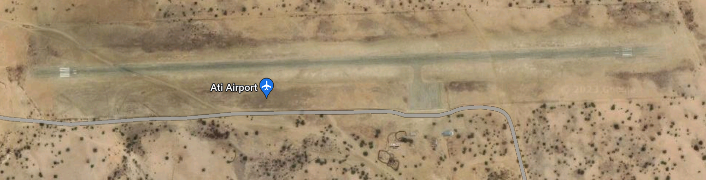
Chad - 2.2.17 Chad Ati National Airport
Airport Overview
Ati National Airport is located on the outskirts of the city of Ati in the Batha province. The airport is recognized by the ICAO and remains fully functional. The area surrounding the airport is generally hot so planes must monitor their temperatures. In addition, livestock are also found to regularly graze in the vicinity of the airport.
|
Airport Location and Contact |
|
|---|---|
|
Country |
Chad |
|
Province or District |
Batha |
|
Nearest Town or City |
Ati 2 km (Located on the outskirts of town) |
|
Airport’s Complete Name |
Ati National Airport |
|
Latitude |
13.24472° |
|
Longitude |
18.31222° |
|
Elevation (ft and m) |
1106 ft / 337 m |
|
IATA Code |
ATV |
|
ICAO Code |
FTTI |
Airport Picture
Runway(s)
|
Runway #1 |
|
|---|---|
|
Runway Dimensions |
1800 m X 30 m |
|
Runway Orientation |
RWY 09 / RWY 27 |
|
Runway Surface |
Smooth Asphalt |
|
Runway Condition |
Good |
Airport Infrastructure Details
|
Infrastructure |
|||
|---|---|---|---|
|
Passenger / Cargo Security Screening |
Yes |
Runway Lighting |
No |
|
Refuelling Capacity |
No |
Ground Handling Services |
No |
|
Windsock |
Yes |
Fire Fighting Equipment |
No |
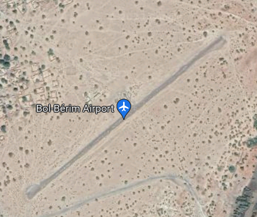
Chad - 2.2.18 Chad Bol National Airport
Airport Overview
The Bol-Bérim National Airport is in the Lac region approximately 2.5 km from the town of Bol. The runway, although made up of asphalt, is relatively rough. The airport is in a military conflict zone. Thus, the presence of militants is probable.
|
Airport Location and Contact |
|
|---|---|
|
Country |
Chad |
|
Province or District |
Lac |
|
Nearest Town or City |
Bol 2.5 km |
|
Airport’s Complete Name |
Bol-Bérim National Airport |
|
Latitude |
N13°26'37.68" |
|
Longitude |
E014°44'22.20" |
|
Elevation (ft and m) |
968 ft / 295 m |
|
IATA Code |
OTC |
|
ICAO Code |
FTTL |
Airport Picture
Runway(s)
|
Runway #1 |
|
|---|---|
|
Runway Dimensions |
800 m x 16 m |
|
Runway Orientation |
RWY 05 / RWY 23 |
|
Runway Surface |
Asphalt |
|
Runway Condition |
Passable |
Airport Infrastructure Details
|
Infrastructure |
||||
|---|---|---|---|---|
|
Passenger / Cargo Security Screening |
Yes |
Runway Lighting |
No |
|
|
Refuelling Capacity |
No |
Ground Handling Services |
No |
|
|
Navigation Aids |
No |
Fire Fighting Equipment |
No |
|
|
Windsock |
Yes |
Aircraft Parking Space |
No |
|
| Perimeter Fencing | No | |||
Chad - 2.2.19 Chad Fada Airport
Airport Overview
The Fada Airport is in an isolated area approximately 10 km from the town of Fada. In the area, visibility may be poor and there are high rocks surrounding the airstrip. In addition, there are high chances of sandstorm and high temperatures.
|
Airport Location and Contact |
|
|---|---|
|
Country |
Chad |
|
Province or District |
Ennedi-Ouest |
|
Nearest Town or City |
Fada 10.2 km |
|
Airport’s Complete Name |
Fada Airport |
|
Latitude |
17.19638° |
|
Longitude |
21.50611° |
|
Elevation (ft and m) |
1820 ft / 554.7 m |
|
ICAO Code |
FTTF |
Airport Picture
Runway(s)
|
Runway #1 |
|
|---|---|
|
Runway Dimensions |
1900 m x 30 m |
|
Runway Orientation |
RWY 11 / RWY 29 |
|
Runway Surface |
Compact Sand |
|
Runway Condition |
Passable |
Airport Infrastructure Details
|
Infrastructure |
|||
|---|---|---|---|
|
Passenger / Cargo Security Screening |
No |
Runway Lighting |
No |
|
Refuelling Capacity |
No |
Ground Handling Services |
No |
|
Air Traffic Control |
No |
Fire Fighting Equipment |
No |
|
Weather Information |
No |
Aircraft Parking Space |
No |
|
Navigation Aids |
No |
Perimeter Fencing |
No |
|
Windsock |
No |
|
|
Chad - 2.2.20 Chad Haraze Airfield
Airport Overview
The Haraze Airfield is primarily operated by UNHCR as a means for serving refugee populations coming from Central African Republic. As of May 2023, construction was ongoing for the development of an office/structure adjacent to the plane parking station (see in photo above) which was recently completed.
|
Airport Location and Contact |
|
|---|---|
|
Country |
Chad |
|
Province or District |
Salamat |
|
Nearest Town or City |
Haraze-Mangeigne 3 km |
|
Airport’s Complete Name |
Haraze Airfield |
|
Latitude |
9.91944° |
|
Longitude |
20.90555° |
|
Elevation (ft and m) |
1368 ft / 417 m |
|
NGO and/or UN Presence at Airport? |
Yes UNHCR |
Airport Picture
Runway(s)
|
Runway #1 |
|
|---|---|
|
Runway Dimensions |
1000 m x 25 m |
|
Runway Orientation |
RWY 03/ RWY 21 |
|
Runway Surface |
Compact Gravel |
|
Runway Condition |
Good |
Airport Infrastructure Details
|
Infrastructure |
|||
|---|---|---|---|
|
Passenger / Cargo Security Screening |
No |
Runway Lighting |
No |
|
Refuelling Capacity |
No |
Ground Handling Services |
No |
|
Air Traffic Control |
Yes |
Fire Fighting Equipment |
No |
|
Weather Information |
No |
Aircraft Parking Space |
Yes* |
|
Navigation Aids |
Yes |
Perimeter Fencing |
No |
|
Windsock |
Yes |
|
|
*Aircraft garage is currently under construction.
Chad - 2.2.21 Chad Kelo Airfield
Airport Overview
The Kelo Airfield has mostly been abandoned as a landing zone for aircrafts. The airstrip is currently being used as a mode of other vehicle transportation. However, the airstrip is still suitable for aircraft landing despite a lack of aviation infrastructure.
|
Airport Location and Contact |
|
|---|---|
|
Country |
Chad |
|
Province or District |
Tandjile |
|
Nearest Town or City |
Kelo 0 km (located in the city of Kelo) |
|
Airport’s Complete Name |
Kelo Airport |
|
Latitude |
9.31680° |
|
Longitude |
15.78947° |
|
Elevation (ft and m) |
1276 ft /389 m |
|
NGO and/or UN Presence at Airport? |
No |
Airport Picture
Runway(s)
The runway is currently being used as a road.
|
Runway #1 |
|
|---|---|
|
Runway Dimensions |
1800 m x 20 m |
|
Runway Orientation |
RWY 04 / RWY 22 |
|
Runway Surface |
Gravel |
|
Runway Condition |
Passable* |
Airport Infrastructure Details
|
Infrastructure |
|||
|---|---|---|---|
|
Passenger / Cargo Security Screening |
No |
Runway Lighting |
No |
|
Refuelling Capacity |
No |
Ground Handling Services |
No |
|
Air Traffic Control |
No |
Fire Fighting Equipment |
No |
|
Weather Information |
No |
Aircraft Parking Space |
No |
|
Navigation Aids |
No |
Perimeter Fencing |
No |
|
Windsock |
No |
|
|
Chad - 2.2.22 Chad Koumra National Airport
Airport Overview
The Koumra National Airport is an asphalt airstrip located minutes away from the city of Koumra. The airport does not have extensive infrastructure but there are basic security and navigation aids.
|
Airport Location and Contact |
|
|---|---|
|
Country |
Chad |
|
Province or District |
Mandoul |
|
Nearest Town or City |
Koumra 10.69 km |
|
Airport’s Complete Name |
Koumra National Airport |
|
Latitude |
8.93333° |
|
Longitude |
17.58333° |
|
Elevation (ft and m) |
1509 ft /460 m |
|
Managing Company or Airport Authority |
ASECNA |
|
Management Contact Person |
Brahim Guihini Dadi |
|
NGO and/or UN Presence at Airport? |
No |
Airport Picture
Runway(s)
|
Runway #1 |
|
|---|---|
|
Runway Dimensions |
1219 m x 40 m |
|
Runway Orientation |
RWY 04 / RWY 22 |
|
Runway Surface |
Asphalt |
|
Runway Condition |
Good |
Airport Infrastructure Details
|
Infrastructure |
|||
|---|---|---|---|
|
Passenger / Cargo Security Screening |
Yes |
Runway Lighting |
No |
|
Refueling Capacity |
No |
Ground Handling Services |
No |
|
Air Traffic Control |
No |
Fire Fighting Equipment |
No |
|
Weather Information |
No |
Aircraft Parking Space |
No |
|
Navigation Aids |
Yes |
Perimeter Fencing |
No |
|
Windsock |
Yes |
|
|
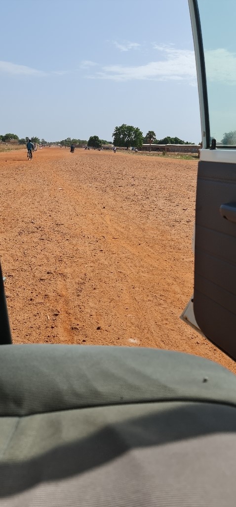
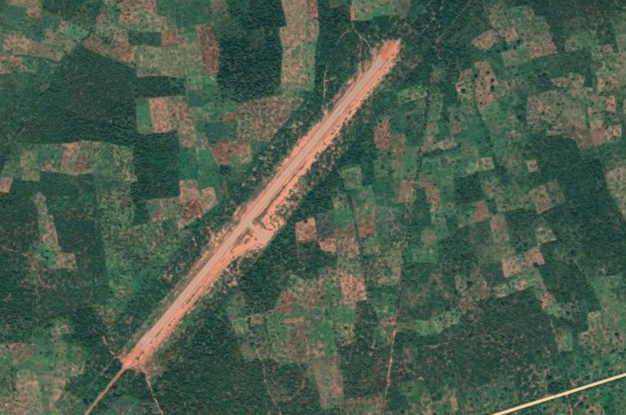
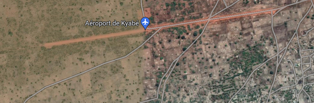
Chad - 2.2.23 Chad Kyabe Airfield
Airport Overview
The Kyabe Airfield is located just outside of the city of Kyabe. A section of the airstrip has been converted into road, but the airstrip is still passable. There is no aviation infrastructure currently at the airfield.
|
Airport Location and Contact |
|
|---|---|
|
Country |
Chad |
|
Province or District |
Moyen Chari |
|
Nearest Town or City |
Kyabe 2 km from town center |
|
Airport’s Complete Name |
Kyabe Airfield |
|
Latitude |
9.44725° |
|
Longitude |
18.92672° |
|
Elevation (ft and m) |
1292 ft / 394 m |
|
NGO and/or UN Presence at Airport? |
No |
Airport Picture
Runway(s)
|
Runway #1 |
|
|---|---|
|
Runway Dimensions |
1800 m x 25 m |
|
Runway Orientation |
RWY 6 / RWY 24 |
|
Runway Surface |
Gravel |
|
Runway Condition |
Passable |
Airport Infrastructure Details
|
Infrastructure |
|||
|---|---|---|---|
|
Passenger / Cargo Security Screening |
No |
Runway Lighting |
No |
|
Refuelling Capacity |
No |
Ground Handling Services |
No |
|
Air Traffic Control |
No |
Fire Fighting Equipment |
No |
|
Weather Information |
No |
Aircraft Parking Space |
No |
|
Navigation Aids |
No |
Perimeter Fencing |
No |
|
Windsock |
No |
|
|
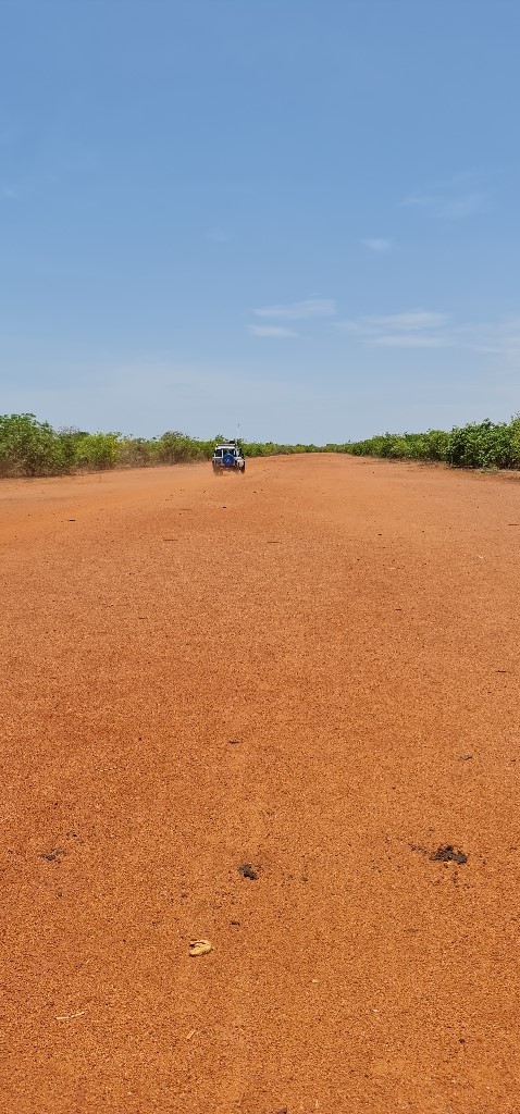
Chad - 2.2.24 Chad Moissala Airfield
Airport Overview
The Moissala Airstrip is used primarily for humanitarian purposes (Doctors without Borders utilizes the landing strip frequently). The landing strip has been partially converted into a road and is theoretically inside of the town of Moissala.
|
Airport Location and Contact |
|
|---|---|
|
Country |
Chad |
|
Province or District |
Mandoul |
|
Nearest Town or City |
Moissala In town (<1km) |
|
Airport’s Complete Name |
Moissala Airport |
|
Latitude |
8.34575° |
|
Longitude |
17.72611° |
|
Elevation (ft and m) |
1315 ft / 400 m |
|
NGO and/or UN Presence at Airport? |
Yes Doctors without Borders (MSF) |
Airport Picture
Runway(s)
|
Runway #1 |
|
|---|---|
|
Runway Dimensions |
1100 m x 20 m |
|
Runway Orientation |
RWY 02 / RWY 20 |
|
Runway Surface |
Gravel with grass |
|
Runway Condition |
Good |
The runway has been converted into a road, so it is hard to define the actual length of the airstrip.
Airport Infrastructure Details
|
Infrastructure |
|||
|---|---|---|---|
|
Passenger / Cargo Security Screening |
No |
Runway Lighting |
No |
|
Refuelling Capacity |
No |
Ground Handling Services |
No |
|
Air Traffic Control |
No |
Fire Fighting Equipment |
No |
|
Weather Information |
Yes |
Aircraft Parking Space |
No |
|
Navigation Aids |
No |
Perimeter Fencing |
No |
|
Windsock |
No |
|
|
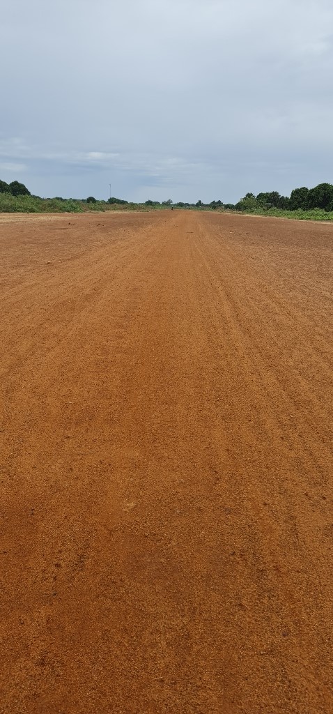
Chad - 2.2.25 Chad Moussoro National Airport
Airport Overview
The Moussoro National Airport has basic infrastructure including a windsock and metal detectors. The runway is rough and sandy and should be avoided when it is wet.
|
Airport Location and Contact |
|
|---|---|
|
Country |
Chad |
|
Province or District |
Bahr El Ghazel |
|
Nearest Town or City |
Moussoro <1km |
|
Airport’s Complete Name |
Moussoro National Airport |
|
Latitude |
13.64388° |
|
Longitude |
16.5° |
|
Elevation (ft and m) |
1014 ft / 309 m |
|
IATA Code |
MXR |
Airport Picture
Runway(s)
|
Runway #1 |
|
|---|---|
|
Runway Dimensions |
900 m x 18 m |
|
Runway Orientation |
RWY 03 / RWY 21 |
|
Runway Surface |
Black cotton with Sand |
|
Runway Condition |
Passable |
Airport Infrastructure Details
|
Infrastructure |
|||
|---|---|---|---|
|
Passenger / Cargo Security Screening |
Yes |
Runway Lighting |
No |
|
Refuelling Capacity |
No |
Ground Handling Services |
No |
|
Air Traffic Control |
No |
Fire Fighting Equipment |
No |
|
Weather Information |
No |
Aircraft Parking Space |
No |
|
Navigation Aids |
No |
Perimeter Fencing |
No |
|
Windsock |
Yes |
|
|
Chad - 2.2.26 Chad Pala Airfield
Airport Overview
Pala Airfield lacks basic aviation infrastructure. However, air traffic control capabilities are operated by ASECNA.
|
Airport Location and Contact |
|
|---|---|
|
Country |
Chad |
|
Province or District |
Mayo Kebbi-Ouest |
|
Nearest Town or City |
Pala Outskirts of town (1 km) |
|
Airport’s Complete Name |
Pala Airfield |
|
Latitude |
9.384° |
|
Longitude |
14.93011° |
|
Elevation (ft and m) |
1551 ft / 473 m |
|
Managing Company or Airport Authority |
ASECNA |
|
Management Contact Person |
Francois Mbaikodou |
|
NGO and/or UN Presence at Airport? |
No |
Airport Picture
Runway(s)
|
Runway #1 |
|
|---|---|
|
Runway Dimensions |
1600 m x 40 m |
|
Runway Orientation |
RWY 05 / RWY 23 |
|
Runway Surface |
Gravel |
|
Runway Condition |
Good |
Airport Infrastructure Details
|
Infrastructure |
|||
|---|---|---|---|
|
Passenger / Cargo Security Screening |
No |
Runway Lighting |
No |
|
Refuelling Capacity |
No |
Ground Handling Services |
No |
|
Air Traffic Control |
Yes |
Fire Fighting Equipment |
No |
|
Weather Information |
No |
Aircraft Parking Space |
Yes |
|
Navigation Aids |
No |
Perimeter Fencing |
No |
|
Windsock |
Yes |
|
|
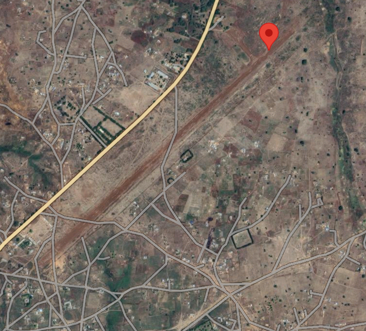
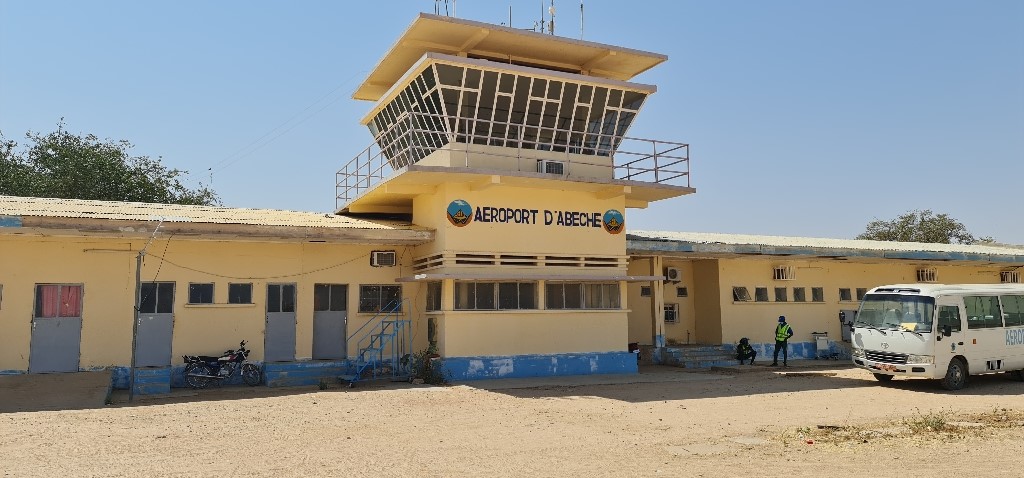
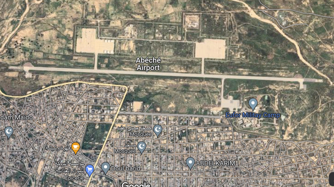
Chad - 2.2.27 Abeche National Airport
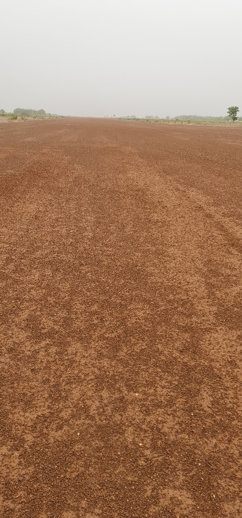
Airport Overview
The Abeche International airport is in decent condition and is considered one of the top secondary airports in Chad with an asphalt runway and refuelling capacity. Despite its international status, the airport at Abeche has not received international traffic in many years. The airport is fenced off and there are potential runway incursions but, overall, the airport is in good condition and has necessary security and communications infrastructure.
|
Airport Location and Contact |
|
|---|---|
|
Country |
Chad |
|
Province or District |
Ouaddai |
|
Nearest Town or City |
Abeche 1.6 km |
|
Airport’s Complete Name |
Abeche Airport |
|
Latitude |
N13°50'00" |
|
Longitude |
E020°51'00" |
|
Elevation (ft and m) |
1837 ft, 560 m |
|
IATA Code |
ABE |
|
ICAO Code |
FTTC |
|
Managing Company or Airport Authority |
ASECNA and ADAC |
|
Contact Person |
Mr Mahamat Ali (Provincial Transport Manager-Abeche) |
|
NGO and/or UN Presence at Airport? |
No |
Airport Picture
Runway
|
Runway |
|
|---|---|
|
Runway Dimensions |
2800 m x35 m |
|
Runway Orientation |
RWY 09/ RWY 27 |
|
Runway Surface |
Asphalt |
|
Runway Condition |
Good |
Airport Infrastructure Details
|
Infrastructure |
|||
|---|---|---|---|
|
Passenger / Cargo Security Screening |
Yes |
Runway Lighting |
No |
|
Refueling Capacity |
Yes |
Ground Handling Services |
Yes |
|
Air Traffic Control |
Yes |
Fire Fighting Equipment |
Yes |
|
Weather Information |
Yes |
Aircraft Parking Space |
Yes |
|
Navigation Aids |
Yes |
Perimeter Fencing |
Yes |
|
Windsock |
Yes |
|
|
Current Emergency Response Operations
UNHAS Flight Patterns in the East
With current operations in the East, Abeche Airport now has helicopter service to Arkoum, Ourang, and Zabout refugee sites.
For information on Chad Airport contact details, please see the following link: 4.4 Airport Company Contact List
Fuel Services Charges
At Abeche International Airport the refuelling capacity is 140,000 litres per year.
|
|
Price per Litre XAF |
|---|---|
|
Jet A-1 |
800 XAF (1.26$/litre) |
|
Avgas |
Not available as of 02/22 |
For more information on airport contacts, please see the following link: 4.4 Airport Companies Contact List.
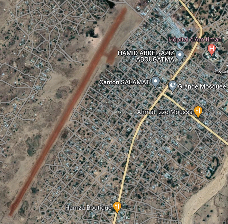
Chad - 2.2.28 Chad Am Timan National Airport
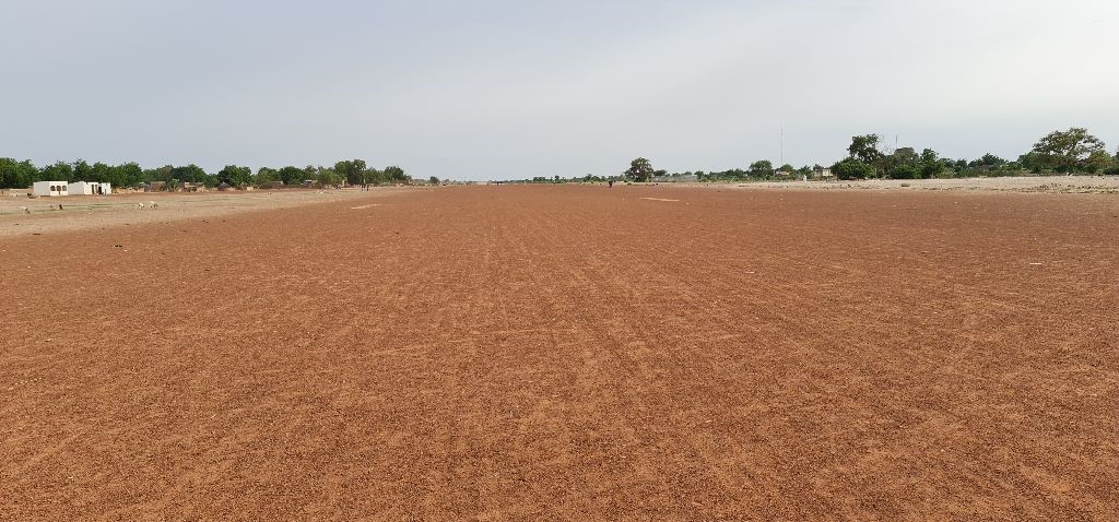
Airport Overview
The Am Timan Airport is in a passable condition yet is relatively underdeveloped. The airport has some infrastructure (metal detectors, scales, and windsocks) but lacks cover from the sun and sufficient security with a market and school close nearby. If the runway is wet, it is not advised to land at Am Timan.
|
Airport Location and Contact |
|
|---|---|
|
Country |
Chad |
|
Province or District |
Salamat |
|
Nearest Town or City |
Am Timan 1.5 km |
|
Airport’s Complete Name |
Am Timan Airport |
|
Latitude |
11.02833° |
|
Longitude |
20.26666° |
|
Elevation (ft and m) |
1473 ft /449 m |
|
IATA Code |
AMC |
|
ICAO Code |
FTTN |
|
Management Company or Management Authority |
ADAC |
|
NGO and/or UN Presence at Airport? |
No. However, the airport was formerly managed by Doctors without Borders |
Airport Picture
Runway(s)
|
Runway #1 |
|
|---|---|
|
Runway Dimensions |
1800 m x 30 m |
|
Runway Orientation |
RWY 03/ RWY 21 |
|
Runway Surface |
Laterite/Gravel |
|
Runway Condition |
Good |
Airport Infrastructure Details
|
Infrastructure |
|||
|---|---|---|---|
|
Passenger / Cargo Security Screening |
Yes |
Runway Lighting |
No |
|
Refuelling Capacity |
No |
Ground Handling Services |
No |
|
Air Traffic Control |
No |
Fire Fighting Equipment |
No |
|
Weather Information |
No |
Aircraft Parking Space |
No |
|
Navigation Aids |
Yes |
Perimeter Fencing |
No |
|
Windsock |
Yes |
|
|
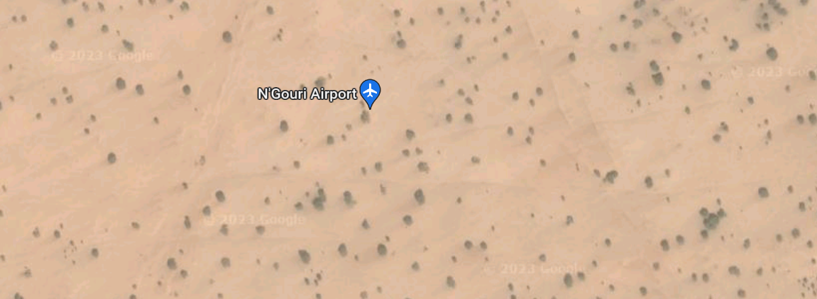
Chad - 2.2.29 Baga Sola N’Gouri National Airport
Airport Overview
The N’Gouri airport is located approximately 30 minutes away from Baga Sola by car. The airport has metal detectors, a scale, and a windsock. The runway is rough and there is a probable presence of militants because of military conflicts in the area.
|
Airport Location and Contact |
|
|---|---|
|
Country |
Chad |
|
Province or District |
Lac |
|
Nearest Town or City |
Baga Sola 18 km
|
|
Airport’s Complete Name |
N’Gouri Airport |
|
Latitude |
13.63441° |
|
Longitude |
14.35167° |
|
Elevation (ft and m) |
968 ft / 295 m |
Airport Picture
Runway(s)
|
Runway #1 |
|
|---|---|
|
Runway Dimensions |
800 m x 20 m |
|
Runway Orientation |
RWY 01 / RWY 19 |
|
Runway Surface |
Compacted Black Cotton with Sand |
|
Runway Condition |
Passable |
Airport Infrastructure Details
|
Infrastructure |
|||
|---|---|---|---|
|
Passenger / Cargo Security Screening |
Yes |
Runway Lighting |
No |
|
Refuelling Capacity |
No |
Ground Handling Services |
No |
|
Air Traffic Control |
No |
Fire Fighting Equipment |
No |
|
Weather Information |
No |
Aircraft Parking Space |
No |
|
Navigation Aids |
No |
Perimeter Fencing |
No |
|
Windsock |
Yes |
|
|