Nepal - 2.2 Aviation
The Civil Aviation Authority of Nepal (CAAN) was established as an autonomous regulatory body on 31 December 1998 under Civil Aviation Act, 1996. The mission of CAAN is to ensure safe, secure, efficient, standard, and quality service in Civil Aviation and Airport Operations. It has dual functions: Regulator of civil aviation as well as a service provider in the areas of Air Navigation Service and Aerodrome Operations.
There are 9 fixed-wing domestic and 12 helicopter operators currently active in Nepal. Most fixed-wing carriers are based in Tribhuvan International Airport in Kathmandu and provide scheduled flights to different urban areas of the country. Some of the carriers have established their bases in Nepalgunj, Dhangadhi, and Surkhet and provide scheduled flight services to remote locations in Karnali and Sudurpaschim provinces. Airstrips in remote locations are STOL airports and are not well equipped with modern navigating instruments. Among the STOL airstrips, the Tenzing-Hillary Airport in Lukla and Jomsom Airport in Mustang are considered commercially lucrative.
For international travel, currently, 30 airlines including two Nepal-based airlines provide services to different destinations around the globe. Nepal has signed Bilateral Air Services Agreement (BASA) and MoU with 40 different countries, and it has direct air connectivity with 18 countries including India, China, Japan, Qatar, and UAE.
The European Union has blacklisted Nepali airlines since 2013 based on serious security concerns raised by ICAO and are restricted from flying in EU member nations’ airspace.
Both fixed-wing aircraft and helicopters can be chartered either for emergency services, cargo services, or for recreational activities. The carrier or their representative must submit a request form to CAAN in the prescribed format for requesting a charter flight. The procedure manual and required forms can be found in this link.
A total of 31 airports are currently operational in Nepal including three international airports. Tribhuvan International Airport, Gautam Buddha International Airport, and Pokhara International Airport are the only international aerodrome in the country. Biratnagar, Pokhara, Dhangadhi, and Nepalgunj airports, are the busiest airports and are considered domestic hub airports. 21 Airports are short take-off and landing (STOL) airports with Aerodrome Flight Information service (AFIS). 22 Airports mentioned below are STOL airports but are not in operation as of 2022.
Airports Not in Operation
-
Baglung Airport
-
Rukum Chaurjahari Airport
-
Darchula Airport
-
Dhorpatan Airport
-
Lamidanda Airport
-
Gorkha Airport
-
Rumjatar Airport
-
Jiri Airport
-
Kangeldanda Airport
-
Khiji Chandeshwori Airport
-
Langtang Airport
-
Mahendranagar Airport
-
Manang Airport
-
Dolpa Masinechaur Airport
-
Meghauli Airport
-
Rolpa Airport
-
Syangboche Airport
-
Tikapur Airport
-
Manamaya Rai Khanidanda Airport
-
Falgunanda (Ilam) Airport
-
Baitadi (Patan) Airport
-
Doti Airport
CAAN does not operate any heliports. In TIA, helicopter operations are authorized in designated areas. There are some areas to be used by helicopters throughout the country located on government as well as private property. CAAN, therefore, does not maintain the landing areas or provide security, Operators are, therefore, required to obtain necessary information before conducting flights in these locations. Details of such locations may be obtained from the Civil Aviation Safety Regulations Directorate (CAAN H/O, Babar Mahal). Source: https://e-aip.caanepal.gov.np/_uploads/_pdf/b8c1e4bd910261b89107ddc3f1eda5a9.pdf
However, CAAN has been working on constructing a new heliport at Nalinchowk of Bhaktapur district in Bagmati province, the location is around 16 KM Northwest of Tribhuvan International Airport. When completed, this facility will be able to accommodate 17 helicopters at a time. (Source: CAAN to construct a modern helipad in Nalinchowk, Bhaktapur (aviationnepal.com)
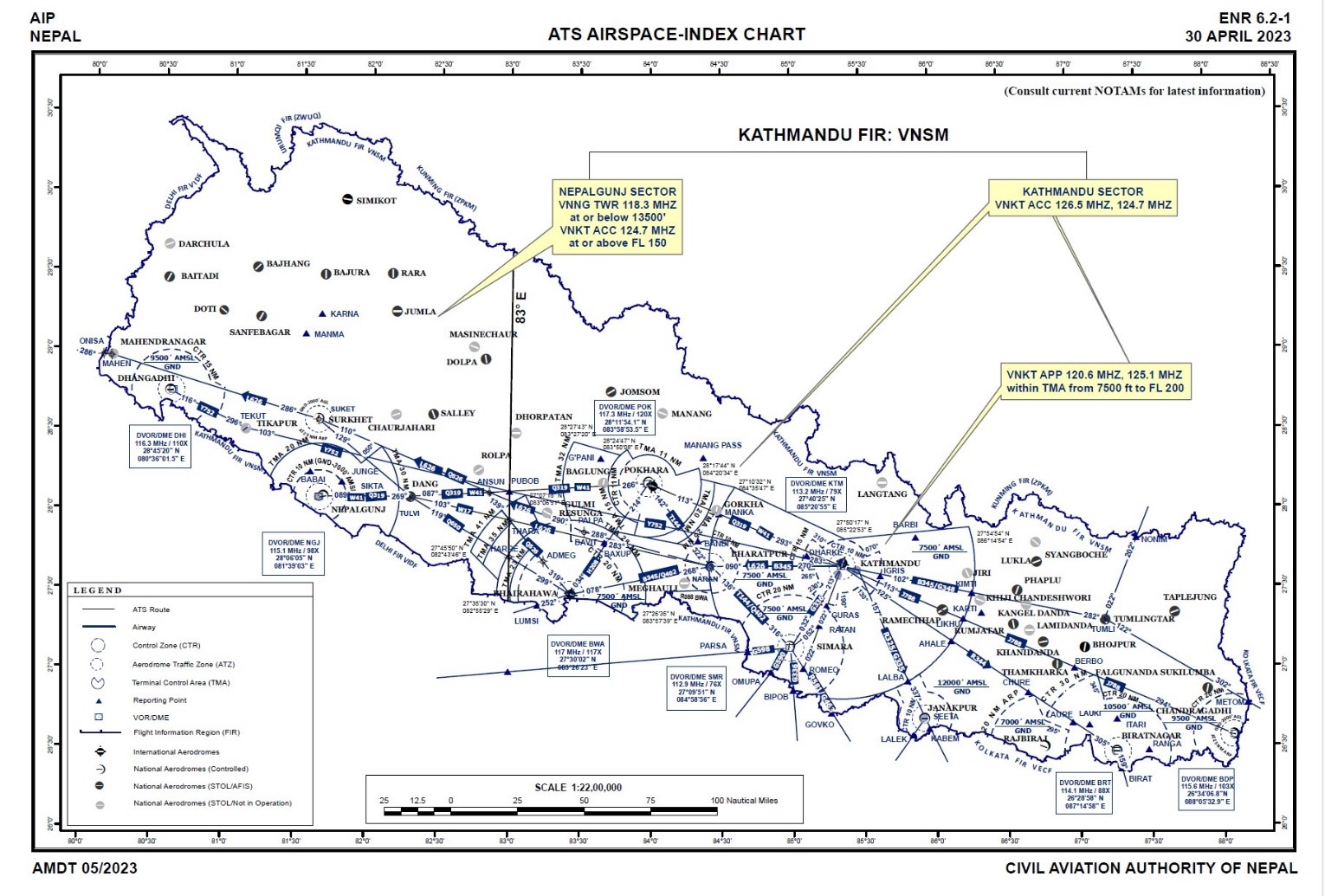
(Source: CAAN ATS AIRSPCAE_INDEX CHART)
Key airport information may also be found at: CAAN_Aeronautical Information Publication Nepal Eighth Edition)
https://www.world-airport-codes.com/
Nepal - 2.2.1 Tribhuvan International Airport
Airport Overview
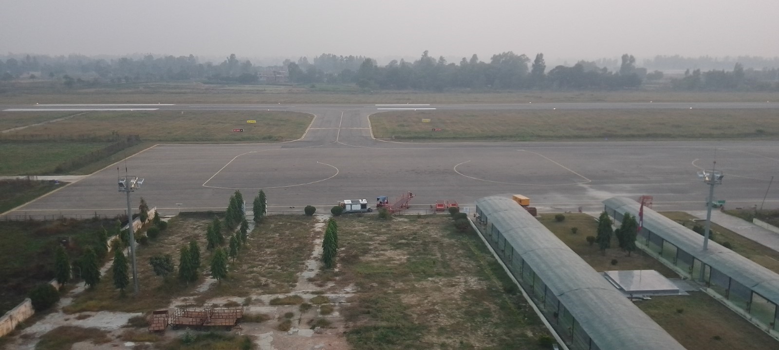
Tribhuvan International Airport (TIA) is one of the major international airports in Nepal. It is located 6 km from the city centre, in the Kathmandu Valley, the country's capital. The airport has one domestic and one international terminal. Both Instrumental Flight Rule (IFR) and Visual Flight Rule (VFR) traffic are permitted in this airport. During winter months, particularly in December and January, flight delays may occur due to foggy conditions. While the airport boasts ample space and cargo handling facilities, it is essential to note that there is no cold storage facility available. Therefore, careful planning is necessary for the shipment of temperature-sensitive and medical cargo.
|
Airport Location and Contact |
|
|---|---|
|
Country |
Nepal |
|
Province or District |
Bagmati Province, Kathmandu District |
|
Nearest Town or City |
Kathmandu 6 km |
|
Airport’s Complete Name |
Tribhuvan International Airport |
|
Latitude |
27.70029 |
|
Longitude |
85.35676 |
|
Elevation (ft and m) |
4394.76 ft and 1339.54 m. |
|
IATA Code |
KTM |
|
ICAO Code |
VNKT |
|
Managing Company or Airport Authority |
Civil Aviation Authority of Nepal (CAAN) Tribhuvan International Airport, Tel +977-1-4113163, 4113033 Fax +977-1-4113180 AFS – VNKTYDYX Email: tia_cao@caanepal.gov.np |
|
Management Contact Person |
Subhash Jha (spokesperson) |
|
Open: Day only or 24 hrs |
February to November: 0600LT - 0330LT (Next Day) November to February: 0630LT – 0330LT (Next Day) |
|
Number of Runways (including length and width) |
1, RWY 02/20, 3350 m x 45 m |
|
Number of helipads, including dimensions |
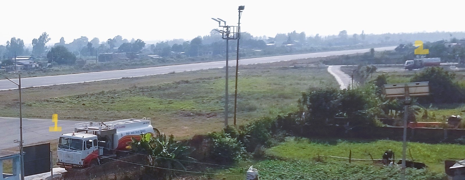
Helicopter operations are authorized in designated areas. TIA has designated the east of runway 02-20 opposite the taxiway no B and C as a helicopter landing area. |
Airport Picture
Description and Contacts of Key Companies
|
SN |
Agencies related to Operation of TIA |
Name |
|---|---|---|
|
1 |
Multimodal Transport Operators |
Nepal Transit and Warehousing Co. Ltd. |
|
2 |
Management Company |
Civil Aviation Authority of Nepal |
|
3 |
Customs |
TIA Customs Office |
|
4 |
Freight Forwarders |
Courier service providers, Nepal Freight Forwarders Association, Export council of Nepal |
|
5 |
Banks |
Rastriya Banijya Bank, TIACO Branch |
|
6 |
Quarantine |
Food Import Export Quality Certification Office TIA |
|
7 |
Shipping lines |
N/A |
|
8 |
Customs Agent |
Customs Agents Association (100 licensed Agents) |
|
9 |
Security |
Nepal Army, Nepal Police |
For more information on airport contacts, please see the following link: 4.5 Airport Companies Contact List.
Information on some aviation service providers can be found at: http://www.azfreight.com/ and https://www.airportdata.com/
Airport Infrastructure Details
TIA has a single runway measuring 3350m in length and 45m in width with an orientation 02 and 20. The Civil Aviation Authority of Nepal (CAAN) is currently working on the extension of the Parallel Taxiway in the northern and southern parts of the runway of TIA that will connect at the end of Runway 02. This expansion of the taxiway is part of the Air Transport Capacity Enhancement Project (ATCEP), upon completion, the total length of the taxiway will be 1400 meters, which will reduce waiting time for aircraft before take-off and landing.
|
Customs |
Yes |
JET A-1 fuel |
Yes |
|
Immigration |
Yes |
AVGAS 100 |
N/A |
|
Terminal Building |
Yes |
Ground Handling Services |
Yes, Available with Local Airlines Operators and Nepal Airlines and other Operators |
|
Passenger Terminal |
Yes |
Cargo terminal |
Yes |
Airport Operating Details
|
Operating Details |
|||
|---|---|---|---|
|
Maximum Sized Aircraft that can be Offloaded on Bulk Cargo |
Airbus 330, Boeing 777, IL76, MD10, DC10, ATR72, CRJ700/200, MA60, ATR42, JS41, B190, D228, L410, DHC6, Y12 |
||
|
Maximum Sized Aircraft that can be Offloaded on Pallet |
A340, B777, B747, MD10, C30, IL76, A350-900, |
||
|
Storage Area (m3 and MT) |
5,430 m² of cargo storage |
||
|
Handling Equipment |
|||
|
Elevators / Hi Loaders |
Yes High loaders: 1 x 7MT BMA high loader; 1 x 7 MT Souam transporter; max pallet size: 96”x125”, 7 MT capacity |
Max Capacity (MT) |
7 mt |
|
Max Height (m) |
|
||
|
Loading Ramps |
Yes, 7 Nos |
||
|
Other Comments |
While only a few B747 aircraft have landed at the airport, they were not being used as cargo aircraft. This is due to the short runway. |
||
Customs Guidance
The government has established a customs office at the airport for smooth clearance of import and export cargo. For individual travellers, all baggage must be declared and cleared through customs on arrival at the port of entry. For the import of cargo, the importer has to submit an application along with air waybill copies to the customs office for clearance of goods. Procedures and custom waiver process for relief items can be found in 1.3 Nepal Customs Information.
|
CLEARING AGENTS |
|||
|---|---|---|---|
|
Company Name |
What categories do they treat (food, fuel, vehicles, pharmaceuticals, or all-rounders)?
|
Bonded/Non-bonded warehouse Capacity |
Temperature controlled /Non temperature controlled |
|
Ultimate Export and Import |
All rounders |
No |
No |
|
Dynamic International Cargo |
All rounders |
No |
No |
For more information on customs in Nepal, please see the following link: 1.3 Customs Information.
Storage Facilities
CAAN contracted Nepal Transit and Warehousing Company Ltd (NTWCL) on a profit-sharing basis to operate the cargo complex especially to manage the warehousing space in clearly demarcated export and import sections. The total capacity of the Air cargo complex at Tribhuvan International Airport (TIA) is 5430 m², and it is divided by mesh wire barricade into equal half for imports and exports. Although the available space for cargo storage seems adequate for normal goods, it is essential to note that there is no cold storage facility available. Therefore, careful planning is necessary for the shipment of temperature-sensitive and medical cargo.
Daily Capacity
Import section: 70-80 mt of goods flow per day from 40-45 international flights of which 20 flights are cargo flights.
Export section: 75-100 mt of goods flow per day.
Import Section: 180-200 Mt storage.
Capacity of 78 mt handling manpower available per day
Handling Equipment
Nepal Airlines is responsible for the ground handling of cargo at Tribhuvan International Airport. Indian Airlines have ground handling equipment for their own needs, whereas Nepal Airlines does ground handling work for the other airlines and themselves.
|
Storage condition |
Number of Storage Facilities |
Total Area (m²) |
Total volume (m³) |
Handling requirement |
|---|---|---|---|---|
|
Open air |
1 |
325 |
1950 |
Forklift = 1 (5 ton) Hand Trolley = 5 Loader = 5 |
|
General cargo (closed) |
2 |
2,450 each |
12,250 each |
Forklift = 1 (1.5 ton) Forklift = 1 (5 ton) Hand Trolley = 10 Loader = 13 |
|
Bagged Cargo |
2 |
227 |
500 |
Hand Trolley = 3 |
|
Temperature controlled (15 to 25 °C) |
N/A |
N/A
|
N/A
|
N/A
|
|
Keep Cool (2 to 8 °C) |
2 |
20 and 93 |
50 and 288 |
Hand Trolley = 2 |
|
Freezing Temp (minus 25 to minus 15°C) |
N/A |
N/A |
N/A |
N/A |
|
Ultra cold-chain temp (minus 80 to minus 60°C) |
N/A |
N/A |
N/A |
N/A |
|
Narcotics Cage |
1 |
6 |
15 |
N/A |
|
NON-BONDED STORAGE (STORAGE AVAILABLE AFTERS CUSTOMS) |
||||
|---|---|---|---|---|
|
Storage condition |
Number of Storage Facilities |
Total Area (m²) |
Total Volume (m³) |
Handling requirement |
|
Open air |
1 |
275 |
1,375 |
|
|
General cargo (closed) |
3 |
275 |
1,375 (including bagged cargo) |
|
|
Bagged Cargo |
N/A |
|
|
|
|
Temperature controlled (15 to 25 °C) |
N/A |
|
|
|
|
Keep Cool (2 to 8 °C) |
N/A |
|
|
|
|
Freezing Temp (minus 25 to minus 15°C) |
N/A |
|
|
|
|
Ultra cold-chain temp (minus 80 to minus 60°C) |
N/A |
|
|
|
|
Narcotics Cage |
N/A |
|
|
|
Airfield Costs
NAVIGATION CHARGES
All fees except the passenger service charge and entrance fees should be paid by the commander of the aircraft or agent without demand before the aircraft departs from the aerodrome. For aircraft carrying out international flights, all payments of fees should be made in US dollars.
|
Charges |
Aircraft Weight - MTOW (kg) |
||
|---|---|---|---|
|
|
0 - 7,000 |
7,001 - 136,000 |
136,001 and over |
|
Navigation (per journey) USD - $ |
$45.90 (up to 25,00 kg) |
$76.50 (25,001 kg to 50,000 kg)
$152.75 (50,001 kg to 75,000 kg) |
$303.50 (any part over 75,000 kg) |
|
Landing USD - $ |
12.50 (up to 10,000 kg) |
12.50 plus, 2.50 each for 1000 kg (10,001 kg to 25,000 kg)
50.00 plus 3.75 for each 1000 kg (25,001 kg to 50,000 kg)
143.75 plus 6.00 for each 1000 kg (50,001 kg to 75,000 kg)
293.75 plus 7.35 for each 1000 kg (75,001 kg to 100,000 kg) |
447.50 plus 8.55 for each 1000 kg (any part over 100,000 kg) |
|
Night Landing USD - $ |
N/A |
N/A |
N/A |
|
Night Take-Off USD - $ |
N/A |
N/A |
N/A |
|
Parking |
$1.00 per 1000 kg (up to 50,000 kg) |
$50.00 plus $1.05 for each 1000kg (50,001 kg to 100,000 kg) |
$22.25 plus $1.95 for each 1000 kg (any part over 100,000 kg) |
|
Handling Charges |
NPR 5,000 (for self-handling) NPR 10,000 (for commercial ground handling) |
NPR 5,000 (for self-handling) NPR 10,000 (for commercial ground handling) |
NPR 5,000 (for self-handling) NPR 10,000 (for commercial ground handling) |
13 % VAT is applicable in the above-mentioned charges. (Source: CAAN AIP Nepal)
An additional charge will be levied for each landing made outside of the published operation hours of the aerodrome based on time used, on an hourly basis. For international flights, this amount is fixed as NRS 35,000 (excluding 13% VAT) per hour.
Security Charges: Security charges at the rate of 10% of the landing fees as mentioned above shall be imposed.
The following aircraft are exempted from payment of landing and parking fees:
a) Foreign diplomatic aircraft engaged on diplomatic missions to Nepal.
b) Aircraft withheld by Director General, CAAN for necessary investigation.
c) Such other aircraft as the Director General, CAAN may approve.
d) UN-registered Aircraft
FUEL SERVICES CHARGES
Tribhuvan International Airport (TIA) has a fuel depot with storage capacity (KL): Physical -7640 and Mobile 161.
Storage Type: Vertical Tank (1600×3, 760×3), UG Tank (70×8).
Refueller Details: AR26, 27, 38 (27 KL). AR34, 35,36,37, 40 (16KL) of ATF and 161 KL of fuel standby in refuellers provided by the Nepal Oil Corporation.
|
|
Price per Litre USD - $ |
|---|---|
|
Jet A-1 |
1.02/litre (Duty Paid)* |
|
Avgas |
N/A |
As of 01 February 2023
Exchange rate: 1 USD = 132.814 NPR
CARGO TERMINAL CHARGES
For information on service rates and charges,
|
Sn |
Category of Goods |
Export |
Import |
|---|---|---|---|
|
1 |
General |
Per kg NPR 1.21 or NPR 242 minimum; whichever is higher |
Per kg NPR 6.47 or NPR 121 minimum; whichever is higher |
|
2 |
Valuable |
Per kg NPR 3.03 or NPR 302.5 minimum; whichever is higher |
Per kg NPR 9.88 or NPR 242 minimum; whichever is higher |
|
3 |
Perishable |
Per kg NPR 2.42 or Rs 242 minimum; whichever is higher |
Per kg NPR 9.88 or NPR 242 minimum; whichever is higher |
|
4 |
Dangerous |
Per kg NPR 6.50 or NPR 650 minimum; whichever is higher |
Per kg NPR 19.36 or NPR 484 minimum; whichever is higher |
|
5 |
Express Courier Bag, Express Courier Parcel and Express Cargo |
Per kg NPR 6.50 or NPR 121 minimum; whichever is higher |
Per kg NPR 6.50 or NPR 242 minimum; whichever is higher |
|
6 |
For the export and import of live animals, the service charge is double of service charge for valuable goods |
||
(Source: TIA Cargo Terminal Charges)
- In case of palletization and de-palletization of the goods NPR 60.50 per ton will be charged.
- In case of a request from the goods owner to manage goods beyond office hours and during the holidays separate charge of NPR 242 per consignment will be levied.
- Demurrage charge will be as follows;
- Export: For the first seven days no charges are applicable, after 7 days for 30 days NPR 0.90 per kg will be charged and from 31 days to 60 days NPR 2.11 per kg will be charged,
- Import: For the first seven days no charges are applicable, after 7 days for 30 days NPR 2.42 per kg will be charged and from 31 days to 60 days NPR 3.03 per kg will be charged. Provided that, if the goods are not taken within the exempted period, demurrage charges shall be levied from the date of receipt of such goods.
Security
Among the three security forces of Nepal, the Nepal Army and Nepal Police work in conjunction to provide security at TIA. Nepal Police has the responsibility to control access and searches for passengers and goods. Nepal Army has the responsibility to control and secure the premises of the TIA. Also, the presence of the Nepal Army’s Kali Dal Battalion adjacent to the premise of TIA bolsters security at all hours of the day and night.
Nepal - 2.2.2 Gautam Buddha (Bhairahawa) International Airport
Airport Overview
Gautam Buddha International Airport, also known as Bhairahawa Airport was initially began as a domestic airport in 1958. In 1977 it was renamed in honour of Lord Gautam Buddha, who was born in Lumbini, located 18 KM west of the airport. This airport was later upgraded to an international airport, on 16 May 2022 it served the first international flight. It has a 3000 m long single runway. It is one of the three international airports of Nepal, others are Tribhuvan International Airport in Kathmandu and Pokhara International Airport in Pokhara. The airport features a cargo building with a capacity of 8000 square meter. However, this storage area often remains unutilized due to the absence of regular scheduled international flights. Unfortunately, there is no cold storage facility available as of now, however, a designated space has been allocated in the newly constructed cargo building to establish the cold storage facility when required. For the transportation of temperature-sensitive and medical cargo, careful planning is essential.
|
Airport Location and Contact |
|
|---|---|
|
Country |
Nepal |
|
Province or District |
Lumbini Province, Rupandehi District |
|
Nearest Town or City |
Bhairahawa, 2.5 km east of the airport |
|
Airport’s Complete Name |
Gautam Budhha International Airport (Bhairahawa Airport) |
|
Latitude |
27.50620 |
|
Longitude |
83.41752 |
|
Elevation (ft and m) |
346.5 ft / 105.6 m |
|
IATA Code |
BWA |
|
ICAO Code |
VNBW |
|
Managing Company or Airport Authority |
Civil Aviation Authority of Nepal (CAAN), Bhairahawa Airport Fax: 977-71455004 AFS: VNBWYDYX E-mail: gautambuddha_cao@caanepal.gov.np |
|
Management Contact Person |
Mr. Hansa Raj Pandey, General Manager |
|
Open: Day only or 24 hrs |
16 Feb to 15 Nov – 06:00 LT to 00:00 LT 16 Nov to 15 Feb – 06:30 LT to 00:00 LT |
|
Number of Runways (including length and width) |
1, RWY 10/28 3000mx45m |
|
Number of helipads, including dimensions |
No designated helipads, with prior approval airport authorities can designate an area for helicopter landing as per requirements |
Airport Picture
Description and Contacts of Key Companies
Although Gautam Buddha International Airport (GBIA) started international operation in May 2022, it is not yet operated at full capacity, it has only served occasional international flights. The key companies present at the airport are the Civil Aviation Authority of Nepal (CAAN), GBIA Customs Office, Nepal Police, and Nepal Army.
For more information on airport contacts, please see the following link: 4.5 Airport Companies Contact List.
Information on some aviation service providers can be found at: http://www.azfreight.com/ and https://www.airportdata.com/
Airport Infrastructure Details
GBIA features a newly built 3000 m x 45 m single runway which is used for take-offs and landings. The old 1500 m runway is currently being used as a parallel taxiway.
|
Customs |
Yes |
JET A-1 fuel |
Yes |
|
Immigration |
Yes |
AVGAS 100 |
No |
|
Terminal Building |
Yes |
Ground Handling Services |
Yes |
|
Passenger Terminal |
Yes |
Cargo terminal |
Yes |
Airport Operating Details
|
Operating Details |
|||
|---|---|---|---|
|
Maximum Sized Aircraft that can be Offloaded on Bulk Cargo |
B777-200 or similar (Remarks: can be parked at International Apron Bay No.2) |
||
|
Maximum Sized Aircraft that can be Offloaded on Pallet |
B777-200 or similar (Remarks: can be parked at International Apron Bay No.2) |
||
|
Storage Area (m3 and MT) |
Existing 500 MT (New Cargo building under construction) |
||
|
Handling Equipment |
|||
|
Elevators / Hi Loaders |
No |
Max Capacity (MT) |
|
|
Max Height (m) |
|
||
|
Loading Ramps |
Yes, 2 available |
||
|
Other Comments |
Nepal Airlines Corporation provides the ground handling service with equipment. In case of requirement, needed equipment can be made available from Kathmandu. (A week advance notice to be provided) |
||
Customs Guidance
The government has established a customs office at the airport for smooth clearance of import and export cargo. For individual travelers, all baggage must be declared and cleared through customs on arrival at the port of entry. For import of cargo, the importer must apply along with air waybill copies to the customs office for clearance of goods.
Procedures and custom waiver process for relief items can be found in 1.3 Nepal Customs Information.
|
CLEARING AGENTS |
|||
|---|---|---|---|
|
Company Name |
What categories do they treat (food, fuel, vehicles, pharmaceuticals, or all-rounders)?
|
Bonded/Non-bonded warehouse Capacity |
Temperature controlled /Non temperature controlled |
|
Rising Star Cargo Pvt Ltd |
All rounder |
No |
No |
|
|
|
|
|
Storage Facilities
Nepal Transit and Warehousing Company Ltd (NTWCL) is managing the newly built cargo building at GBIA. The new building is constructed at an area of 8000 m². The airport has not yet functioned at full capacity and the storage space for cargo generally remains empty, however, it is essential to note that there is no cold storage facility available. Therefore, careful planning is necessary for the shipment of temperature-sensitive and medical cargo.
|
BONDED STORAGE (STORAGE AVAILABLE BEFORE CUSTOMS) |
||||
|---|---|---|---|---|
|
Storage condition |
Number of Storage Facilities |
Total Area (m²) |
Total volume (m³) |
Handling requirement |
|
Open air |
N/A |
|
|
|
|
General cargo (closed) |
N/A |
|
|
|
|
Bagged Cargo |
N/A |
|
|
|
|
Temperature controlled (15 to 25 °C) |
N/A |
|
|
|
|
Keep Cool (2 to 8 °C) |
N/A |
|
|
|
|
Freezing Temp (minus 25 to minus 15°C) |
N/A |
|
|
|
|
Ultra cold-chain temp (minus 80 to minus 60°C) |
N/A |
|
|
|
|
Narcotics Cage |
N/A |
|
|
|
|
NON-BONDED STORAGE (STORAGE AVAILABLE AFTERS CUSTOMS) |
||||
|---|---|---|---|---|
|
Storage condition |
Number of Storage Facilities |
Total Area (m²) |
Total Volume (m³) |
Handling requirement |
|
Open air |
N/A |
|
|
|
|
General cargo (closed) |
1 |
8000 m² |
|
|
|
Bagged Cargo |
N/A |
|
|
|
|
Temperature controlled (15 to 25 °C) |
N/A |
|
|
|
|
Keep Cool (2 to 8 °C) |
N/A |
|
|
|
|
Freezing Temp (minus 25 to minus 15°C) |
N/A |
|
|
|
|
Ultra cold-chain temp (minus 80 to minus 60°C) |
N/A |
|
|
|
|
Narcotics Cage |
N/A |
|
|
|
Airfield Costs
NAVIGATION CHARGES
All fees except the passenger service charge and entrance fees should be paid by the commander of the aircraft or agent without demand before the aircraft departs from the aerodrome. For aircraft carrying out international flights, all payments of fees should be made in US dollars.
|
Charges |
Aircraft Weight - MTOW (kg) |
||
|---|---|---|---|
|
|
0 - 7,000 |
7,001 - 136,000 |
136,001 and over |
|
Navigation (per journey) USD - $ |
$45.90 (up to 25,00 kg) |
$76.50 (25,001 kg to 50,000 kg)
$152.75 (50,001 kg to 75,000 kg) |
$303.50 (any part over 75,000 kg) |
|
Landing USD - $ |
12.50 (up to 10,000 kg) |
12.50 plus, 2.50 each for 1000 kg (10,001 kg to 25,000 kg)
50.00 plus 3.75 for each 1000 kg (25,001 kg to 50,000 kg)
143.75 plus 6.00 for each 1000 kg (50,001 kg to 75,000 kg)
293.75 plus 7.35 for each 1000 kg (75,001 kg to 100,000 kg) |
447.50 plus 8.55 for each 1000 kg (any part over 100,000 kg) |
|
Night Landing USD - $ |
N/A |
N/A |
N/A |
|
Night Take-Off USD - $ |
N/A |
N/A |
N/A |
|
Parking |
$1.00 per kg (up to 50,000 kg) |
$50.00 plus $1.05 for each 1000kg (50,001 kg to 100,000 kg) |
$22.25 plus $1.95 for each 1000 kg (any part over 100,000 kg) |
|
Handling Charges |
NPR 5,000 (for self-handling) NPR 10,000 (for commercial ground handling) |
NPR 5,000 (for self-handling) NPR 10,000 (for commercial ground handling) |
NPR 5,000 (for self-handling) NPR 10,000 (for commercial ground handling) |
13 % VAT is applicable in the above-mentioned charges. (Source: CAAN AIP Nepal)
An additional charge will be levied for each landing made outside of the published operation hours of the aerodrome based on time used, on an hourly basis. For international flights, this amount is fixed as NRS 35,000 (excluding 13% VAT) per hour.
Security Charges: Security charges at the rate of 10% of the landing fees as mentioned above shall be imposed.
The following aircraft are exempted from payment of landing and parking fees:
a) Foreign diplomatic aircraft engaged on diplomatic missions to Nepal.
b) Aircraft withheld by Director General, CAAN for necessary investigation.
c) Such other aircraft as the Director General, CAAN may approve.
d) UN-registered Aircraft
FUEL SERVICES CHARGES
|
|
Price per Litre USD - $ |
|---|---|
|
Jet A-1 |
1.02 / litre (Duty Paid) * |
|
Avgas |
N/A |
As of 9-Jan-2024
*Exchange rate: 1 USD = 133.064 NPR
CARGO TERMINAL CHARGES
A cargo charge at the rate of seventy-five paisa per kilogram is imposed on the cargo imported through the airway.
|
Sn |
Category of Goods |
Export |
Import |
|---|---|---|---|
|
1 |
General |
Per kg NPR 1.00 or NPR 200 minimum; whichever is higher |
Per kg NPR 5.35 or NPR 100 minimum; whichever is higher |
|
2 |
Valuable |
Per kg NPR 2.50 or NPR 250 minimum; whichever is higher |
Per kg NPR 8.00 or NPR 200 minimum; whichever is higher |
|
3 |
Perishable |
Per kg NPR 2.00 or Rs 200 minimum; whichever is higher |
Per kg NPR 8.00 or NPR 250 minimum; whichever is higher |
|
4 |
Dangerous |
Per kg NPR 5.00 or NPR 500 minimum; whichever is higher |
Per kg NPR 16.00 or NPR 400 minimum; whichever is higher |
|
5 |
Express Courier Bag, Express Courier Parcel and Express Cargo |
Per kg NPR 5.00 or NPR 100 minimum; whichever is higher |
Per kg NPR 5.00 or NPR 200 minimum; whichever is higher |
|
6 |
For the export and import of live animals, the service charge is double of service charge for valuable goods |
||
Source: GBIA Cargo Terminal Charges
-
In case of palletization and de-palletization of the goods NPR 50.00 per ton will be charged.
-
In case of a request from the goods owner to manage goods beyond office hours and during the holidays separate charge of NPR 200 per consignment will be levied.
-
Demurrage charge will be as follows;
-
Export: For the first seven days no charges are applicable, after 7 days for 30 days NPR 0.75 per kg will be charged and from 31 days to 60 days NPR 1.75 per kg will be charged,
-
Import: For the first seven days no charges are applicable, after 7 days for 30 days NPR 2.00 per kg will be charged and from 31 days to 60 days NPR 2.50 per kg will be charged. Provided that, if the goods are not taken within the exempted period, demurrage charges shall be levied from the date of receipt of such goods.
Security
The security of terminal area, access control of restricted area, search of passenger and goods is managed by Nepal police and the security of compound area is provided by Nepal army.
Nepal - 2.2.3 Pokhara International Airport
Airport Overview
Pokhara International Airport (PIA) is situated at Chhine Danda, Pokhara in Gandaki Province, Nepal. It is located approximately 3 km east of Pokhara’s existing Domestic Airport and 200 km far west from Kathmandu. The elevation of this airport is around 800 m above mean sea level. This airport serves as the main gateway for pilgrims and tourists to travel to the famous religious places: Muktinath, Jomsom, and Annapurna Round Trek. The airport has three international parking bays and eight domestic parking bays. This airport has a 3500 m² terminal building for customs and cargo, but it lacks a cold storage facility. This storage area often remains unutilized due to the absence of regular scheduled international flights hence the shipment of temperature-sensitive and medical cargo should be planned carefully.
|
Airport Location and Contact |
|
|---|---|
|
Country |
Nepal |
|
Province or District |
Gandaki Province, Kaski District |
|
Nearest Town or City |
Pokhara, 3 km |
|
Airport’s Complete Name |
Pokhara International Airport |
|
Latitude |
28.182803 |
|
84.014894 |
84.014894 |
|
Elevation (ft and m) |
2624 ft / 800 m |
|
IATA Code |
PKR |
|
ICAO Code |
VNPR |
|
Managing Company or Airport Authority |
Civil Aviation Authority of Nepal Pokhara International Airport Civil Aviation Office Tel- +977-61-597007 Fax- +977-61-455725 AFS- VNPRYDYX E-mail- pokhara_cao@caanepal.gov.np Website: PIA (caanepal.gov.np) |
|
Management Contact Person |
Jasoda Subedi (Spokesperson) Tel: 061-597012 |
|
Open: Day only or 24 hrs |
16 Feb to 15 Nov: 0015UTC-1300UTS 16 Nov to 15 Feb: 0045UTC-1215UTC |
|
Number of Runways (including length and width) |
RWY 12/30 2500mx45m |
|
Number of helipads, including dimensions |
No designated helipads, with prior approval airport authorities can designate an area for helicopter landing as per requirements |
Airport Picture

Description and Contacts of Key Companies
The key companies present at the airport are the Civil Aviation Authority of Nepal (CAAN), the Nepal Police, the Armed Police Force and the Nepal Army.
For more information on airport contacts, please see the following link: 4.5 Airport Companies Contact List.
Information on some aviation service providers can be found at: http://www.azfreight.com/ and https://www.airportdata.com/
Airport Infrastructure Details
The runway of PIA is of ICAO 4D Category and is 45 m wide and 2500 m long, and runway designation is 12-30. Runway 12 has a Non-Precision Approach (NPA), and Runway 30 has an ILS System Precision Approach CAT-1 (PA1) facility.
|
Customs |
Yes |
JET A-1 fuel |
Yes |
|
Immigration |
Yes |
AVGAS 100 |
No |
|
Terminal Building |
Yes |
Ground Handling Services |
Yes |
|
Passenger Terminal |
Yes |
Cargo terminal |
Yes |
Airport Operating Details
|
Operating Details |
|||
|---|---|---|---|
|
Maximum Sized Aircraft that can be Offloaded on Bulk Cargo |
Airbus A320 and similar type of aircraft (Narrow body) |
||
|
Maximum Sized Aircraft that can be Offloaded on Pallet |
Airbus A320 and similar type of aircraft (Narrow body) |
||
|
Storage Area (m3 and MT) |
3500 m² |
||
|
Handling Equipment |
|||
|
Elevators / Hi Loaders |
|
Max Capacity (MT) |
|
|
Max Height (m) |
|
||
|
Loading Ramps |
Yes |
||
|
Other Comments |
|
||
Customs Guidance
As of February 2024, despite the approval to establish a customs office from the Council of Ministers in Jan 2023, the government has not yet established a customs office at the Pokhara International Airport. For individual travellers, all baggage must be declared and cleared through customs on arrival at the port of entry. For the import of cargo, the importer must submit an application along with air waybill copies to the customs office for clearance of goods. Procedures and custom waiver process for relief items can be found in 1.3 Nepal Customs Information.
|
CLEARING AGENTS |
|||
|
Company Name |
What categories do they treat (food, fuel, vehicles, pharmaceuticals, or all-rounders)?
|
Bonded/Non-bonded warehouse Capacity |
Temperature controlled /Non temperature controlled |
|
|
|
|
|
|
|
|
|
|
For more information on customs in Nepal, please see the following link: 1.3 Customs Information.
Storage Facilities
This airport has a 3500 m² building for customs and cargo, with a yearly planned turnover of 2600 mt capacity, but it lacks a cold storage facility. Due to the absence of customs office followed regular scheduled international flights, this storage area often remains unutilized. Hence the shipment of temperature-sensitive and medical cargo should be planned carefully.
|
BONDED STORAGE (STORAGE AVAILABLE BEFORE CUSTOMS) |
||||
|---|---|---|---|---|
|
Storage condition |
Number of Storage Facilities |
Total Area (m²) |
Total volume (m³) |
Handling requirement |
|
Open air |
N/A |
|
|
|
|
General cargo (closed) |
N/A |
|
|
|
|
Bagged Cargo |
N/A |
|
|
|
|
Temperature controlled (15 to 25 °C) |
N/A |
|
|
|
|
Keep Cool (2 to 8 °C) |
N/A |
|
|
|
|
Freezing Temp (minus 25 to minus 15°C) |
N/A |
|
|
|
|
Ultra cold-chain temp (minus 80 to minus 60°C) |
N/A |
|
|
|
|
Narcotics Cage |
N/A |
|
|
|
|
NON-BONDED STORAGE (STORAGE AVAILABLE AFTER CUSTOMS) |
||||
|---|---|---|---|---|
|
Storage condition |
Number of Storage Facilities |
Total Area (m²) |
Total Volume (m³) |
Handling requirement |
|
Open air |
N/A |
|
|
|
|
General cargo (closed) |
1 |
3500 m² |
|
|
|
Bagged Cargo |
N/A |
|
|
|
|
Temperature controlled (15 to 25 °C) |
N/A |
|
|
|
|
Keep Cool (2 to 8 °C) |
N/A |
|
|
|
|
Freezing Temp (minus 25 to minus 15°C) |
N/A |
|
|
|
|
Ultra cold-chain temp (minus 80 to minus 60°C) |
N/A |
|
|
|
|
Narcotics Cage |
N/A |
|
|
|
Airfield Costs
NAVIGATION CHARGES
All fees except the passenger service charge and entrance fees should be paid by the commander of the aircraft or agent without demand before the aircraft departs from the aerodrome. For aircraft carrying out international flights, all payments of fees should be made in US dollars.
|
Charges |
Aircraft Weight - MTOW (kg) |
||
|---|---|---|---|
|
|
0 - 7,000 |
7,001 - 136,000 |
136,001 and over |
|
Navigation (per journey) USD - $ |
$45.90 (up to 25,00 kg) |
$76.50 (25,001 kg to 50,000 kg)
$152.75 (50,001 kg to 75,000 kg) |
$303.50 (any part over 75,000 kg) |
|
Landing USD - $ |
12.50 (up to 10,000 kg) |
12.50 plus, 2.50 each for 1000 kg (10,001 kg to 25,000 kg)
50.00 plus 3.75 for each 1000 kg (25,001 kg to 50,000 kg)
143.75 plus 6.00 for each 1000 kg (50,001 kg to 75,000 kg)
293.75 plus 7.35 for each 1000 kg (75,001 kg to 100,000 kg) |
447.50 plus 8.55 for each 1000 kg (any part over 100,000 kg) |
|
Night Landing USD - $ |
N/A |
N/A |
N/A |
|
Night Take-Off USD - $ |
N/A |
N/A |
N/A |
|
Parking |
$1.00 per 1000 kg (up to 50,000 kg) |
$50.00 plus $1.05 for each 1000kg (50,001 kg to 100,000 kg) |
$22.25 plus $1.95 for each 1000 kg (any part over 100,000 kg) |
|
Handling Charges |
NPR 5,000 (for self-handling) NPR 10,000 (for commercial ground handling) |
NPR 5,000 (for self-handling) NPR 10,000 (for commercial ground handling) |
NPR 5,000 (for self-handling) NPR 10,000 (for commercial ground handling) |
13 % VAT is applicable for the above-mentioned charges.
An additional charge will be levied for each landing made outside of the published operation hours of the aerodrome based on time used, on an hourly basis. For international flights, this amount is fixed as NRS 35,000 (excluding 13% VAT) per hour.
Security Charges: Security charges at the rate of 10% of the landing fees as mentioned above shall be imposed.
The following aircraft are exempted from payment of landing and parking fees:
a) Foreign diplomatic aircraft engaged on diplomatic missions to Nepal.
b) Aircraft withheld by Director General, CAAN for necessary investigation.
c) Such other aircraft as the Director General, CAAN may approve.
d) UN-registered Aircraft
FUEL SERVICES CHARGES
PIA manages refuelling service at the airport with support from Nepal Oil Corporation (NOC), a fuel storage with a capacity of 114,000 litres is under construction at the airport premises. For the current use NOC fetches aviation fuel from its storage at Pokhara Domestic Airport on oil tankers.
|
|
Price per Litre USD - $ |
|---|---|
|
Jet A-1 |
1.02/litre (Duty Paid)* |
|
Avgas |
N/A |
As of 01 February 2023
Exchange rate: 1 USD = 132.814 NPR
CARGO TERMINAL CHARGES
On international flights cargo, NPR seventy-five paisa per kilogram is applicable.
For more information on service rates and charges:
|
Sn |
Category of Goods |
Export |
Import |
|---|---|---|---|
|
1 |
General |
Per kg NPR 1.00 or NPR 200 minimum; whichever is higher |
Per kg NPR 5.35 or NPR 100 minimum; whichever is higher |
|
2 |
Valuable |
Per kg NPR 2.50 or NPR 250 minimum; whichever is higher |
Per kg NPR 8.00 or NPR 200 minimum; whichever is higher |
|
3 |
Perishable |
Per kg NPR 2.00 or Rs 200 minimum; whichever is higher |
Per kg NPR 8.00 or NPR 200 minimum; whichever is higher |
|
4 |
Dangerous |
Per kg NPR 5.00 or NPR 500 minimum; whichever is higher |
Per kg NPR 16.00 or NPR 400 minimum; whichever is higher |
|
5 |
Express Courier Bag, Express Courier Parcel and Express Cargo |
Per kg NPR 5.00 or NPR 100 minimum; whichever is higher |
Per kg NPR 5.00 or NPR 200 minimum; whichever is higher |
|
6 |
For the export and import of live animals, the service charge is double of service charge for valuable goods |
||
(Source: PIA Cargo Service Charge)
-
In case of palletization and de-palletization of the goods NPR 50 per ton will be charged.
-
In case of a request from the goods owner to manage goods beyond office hours and during the holidays separate charge of NPR 200 per consignment will be levied.
-
Demurrage charge will be as follows.
-
Export: For the first seven days no charges are applicable, after 7 days for 30 days NPR 0.70 per kg will be charged and from 31 days to 60 days NPR 1.70 per kg will be charged,
-
Import: For the first seven days no charges are applicable, after 7 days for 30 days NPR 2.00 per kg will be charged and from 31 days to 60 days NPR 2.50 per kg will be charged. Provided that, if the goods are not taken within the exempted period, demurrage charges shall be levied from the date of receipt of such goods.
Security
Among the three security forces of Nepal, the Nepal Army, and Nepal Police work in conjunction to provide security at Pokhara International Airport (PIA). Nepal Police has the responsibility to control access and searches for passengers and goods. Nepal Army has the responsibility to control and secure the premises of the PIA.
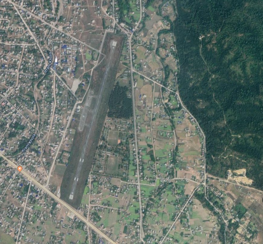
Nepal - 2.2.4 Bharatphur Major Domestic Airport
Airport Overview
|
|
|
Pic: Aerial view of location Bharatpur Airport |
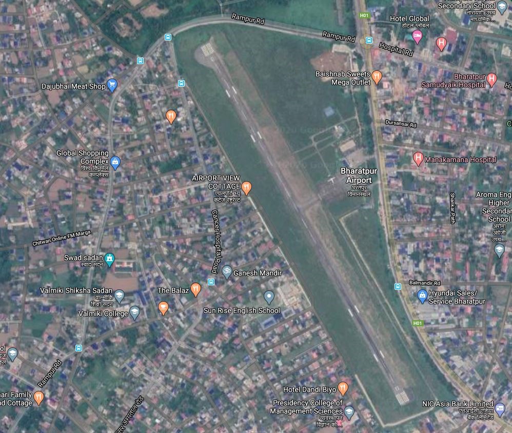
Bharatpur Airport is an all weather operational airport in Bharatpur, a city in the Chitwan District of Bagmati Province. The airport is one of two airports in Bharatpur Metropolitan City, the other one being Meghauli Airport. The airport is located 1 mile (1.6 km) southwest of Bharatpur's city centre/Narayanghat Operating Airlines are Buddha Air, and Yeti Airlines with scheduled connectivity to Kathmandu and Pokhara.
Aerodrome Administration operation hours are as follows:
-
16 February to 15 November: 0600 LT - 1845 LT
-
16 November to 15 February: 0630 LT - 1800 LT
|
Airport Location and Contact |
|
|---|---|
|
Country |
Nepal |
|
Province or District |
Bagmati Province/ Chitwan |
|
Nearest Town or City |
The airport is within Bharatpur City |
|
Airport’s Complete Name |
Bharatpur Airport |
|
Latitude |
27.67805 |
|
Longitude |
84.42944 |
|
Elevation (ft and m) |
679 ft (207 m) |
|
IATA Code |
BHR |
|
ICAO Code |
VNBP |
|
Managing Company or Airport Authority |
Civil Aviation Authority of Nepal Bharatpur Civil Aviation Office, Bharatpur, Chitwan Off: 977-056-526573 Tower: 977-056-520254 Fax - 977-056-526573 AFS – VNBPYDYX |
|
Management Contact Person |
|
|
NGO and/or UN Presence at Airport? |
NO |
Runway
|
Runway #1 |
|
|---|---|
|
Runway Dimensions |
1200 m x 30 m |
|
Runway Orientation |
15/33 |
|
Runway Surface |
Asphalt Concrete |
|
Runway Condition |
Good |
Airport Infrastructure Details
|
Infrastructure |
|||
|---|---|---|---|
|
Passenger / Cargo Security Screening |
X-Ray: Hold Baggage; Metal Detector: Walk Through, Handheld, CCTV Surveillance System, FIDS |
Runway Lighting |
Runway End Light- RWY 15, Runway Threshold Identification Light- TRWY 33
|
|
Refuelling Capacity |
NO |
Ground Handling Services |
Available with local airline operator |
|
Air Traffic Control |
Controlled, Two Men Position Tower Console with Associated Equipment and Accessories Class C Airspace. Visual Flight Rules, HF SSB, VHF, Hot Line, |
Fire Fighting Equipment |
Wheel type Fire Extinguisher Available |
|
Weather Information |
Tower Observation |
Aircraft Parking Space |
8360 sq.m. of Concrete Apron; Four ATR 42 Types |
|
Navigation Aids |
NDB |
Perimeter Fencing |
Yes |
|
Windsock |
No |
|
|
* Runway Threshold Identification lights
Fuel Services Charges
n/a
Royalties / Non Objection Fees (NOFs)
n/a
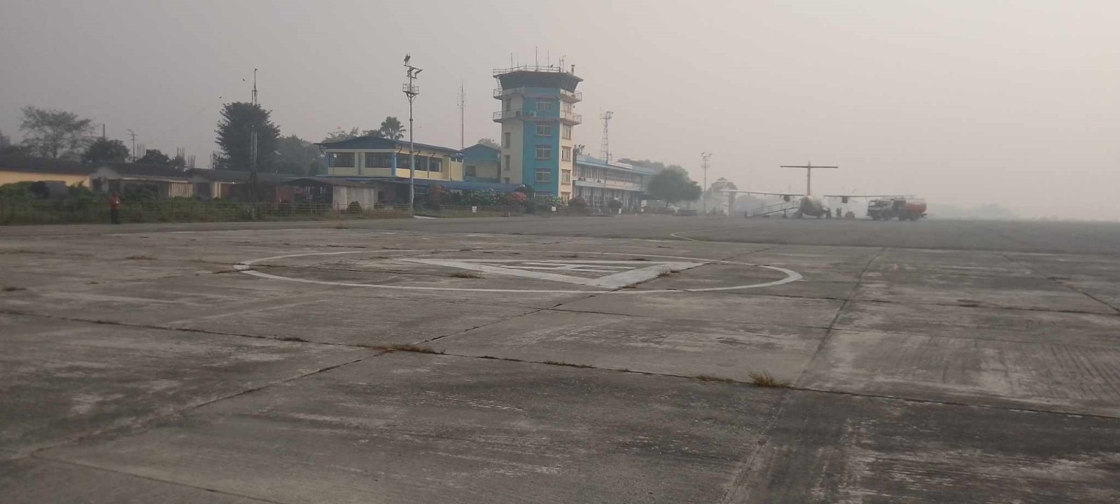
Nepal - 2.2.5 Biratnagar Major Domestic Airport
Airport Overview
|
|
|
Pic: Aerial view of Biratnagar Airport |
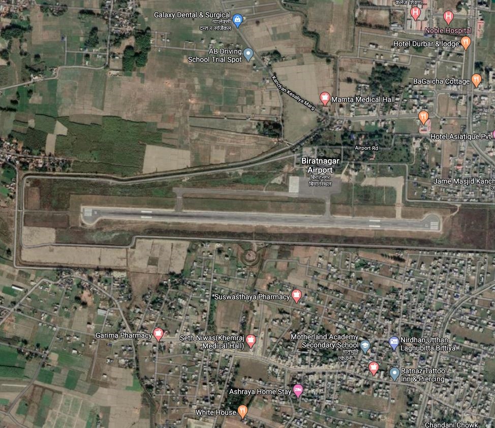
Biratnagar Airport located North of Biratnagar Bazaar, Morang district, in Koshi Province. It is 6 Kms South of Biratnagar City accessed via blacktopped urban road. It is the second busiest domestic airport in Nepal. This airport has a night landing facility as well and supports some short take-off and landing (STOL) airports in the region.The scheduled airlines from Biratnagar Airport with scheduled connectivity to and from Tumlingtar, Bhojpur, Kathmandu are:- Buddha Air, Yeti Airlines, Shree Airlines, Nepal Airlines, and Saurya Airlines. ATR72, CRJ200/700, DHC8, MA60, ATR42, JS-41, B190, D228, DHC6, L410, and Y12 types aircraft are permissible for take-off and landing in Biratnagar airport.
The runaway is at risk of flooding in the monsoon season, which could suspend operations. There was a history of closure of airport operation for fixed wing aircraft due to the flood in the year of 2016 and 2021.
Aerodrome Administration operation hours are as follows:
-
16th Feb to 15th Nov 0600LT-1845LT
-
16th Nov to 15th Feb 0630LT-1800LT
|
Airport Location and Contact |
|
|---|---|
|
Country |
Nepal |
|
Province or District |
Koshi Province/ Morang |
|
Nearest Town or City |
6 km North West |
|
Airport’s Complete Name |
Biratnagar Airport |
|
Latitude |
26.48426 |
|
Longitude |
87.26617 |
|
Elevation (ft and m) |
245.94 ft (74.972 m) |
|
IATA Code |
BIR |
|
ICAO Code |
VNVT |
|
Managing Company or Airport Authority |
Civil Aviation Authority of Nepal, Biratnagar Civil Aviation Office, Biratnagar, Morang. Tel- 977-021-460155, 4602060 AFS - VNVTYDYX, E-mail: biratnagar_cao@caanepal.gov.np |
|
Management Contact Person |
Airport Chief, 9852020859 |
|
NGO and/or UN Presence at Airport? |
NO |
Runway
|
Runway #1 |
|
|---|---|
|
Runway Dimensions |
1500 m x 30 m |
|
Runway Orientation |
9/27 |
|
Runway Surface |
Asphalt Concrete |
|
Runway Condition |
Good |
Airport Infrastructure Details
|
Infrastructure |
|||
|---|---|---|---|
|
Passenger / Cargo Security Screening |
X-Ray: Hold Baggage, Hand Baggage Metal Detector: handheld, Walkthrough, CCTV Surveillance System, FIDS |
Runway Lighting |
Runway Light Approach Light - RWY 09 PAPI Light Both 09/27 Taxiway Light |
|
Refuelling Capacity |
Single point Refuelling. Aviation Fuel Depot. Jet A1. During the period of flight operation 2 refuelers 1000 L/m AR 33- 11KL and AR 53- 16 KL |
Ground Handling Services |
Available with local airline operators, Airlines manage ground handling |
|
Air Traffic Control |
Controlled Class C Airspace, IFR, VFR, HF SSB, AMHS, RCAG, Hot Line, UHF Band Communication System, wo Men Position Tower Console with Associated Equipment and Accessories |
Fire Fighting Equipment |
Category V Rescue equipment, AD Category V Large Foam Tender -1 Medium Foam Tender -1 Ambulance -1 |
|
Weather Information |
METAR VHF |
Aircraft Parking Space |
14,445 sq m with Taxing Area, 5 aircrafts (ATR72 Type Aircraft 4, DH8D Type Aircraft -1) |
|
Navigation Aids |
DVOR 100 NM DME 100 NM |
Perimeter Fencing |
Yes |
|
Windsock |
Yes - 3 |
|
|
 Fuel Services Charges
The airport takes support from Nepal Oil Corporation for the provision of Jet fuel for the aircraft. NOC maintains the reserve of 210 Kilo Litre at its office premises. NOC strictly adheres to the quality it has set for the Air Fuel and the price per litre is as set by the NOC.
|
|
Price per Litre USD - $ |
|---|---|
|
Jet A-1 |
1.02 / ltr (Duty Paid) * |
|
Avgas |
No |
*As of 01 Jan, 2024 Exchange Rate 1 US$ = 133.064 NPR
Nepal - 2.2.6 Chandraghadi Major Domestic Airport
Airport Overview
|
|
|
Pic: Aerial view of Bhadrapur Airport |
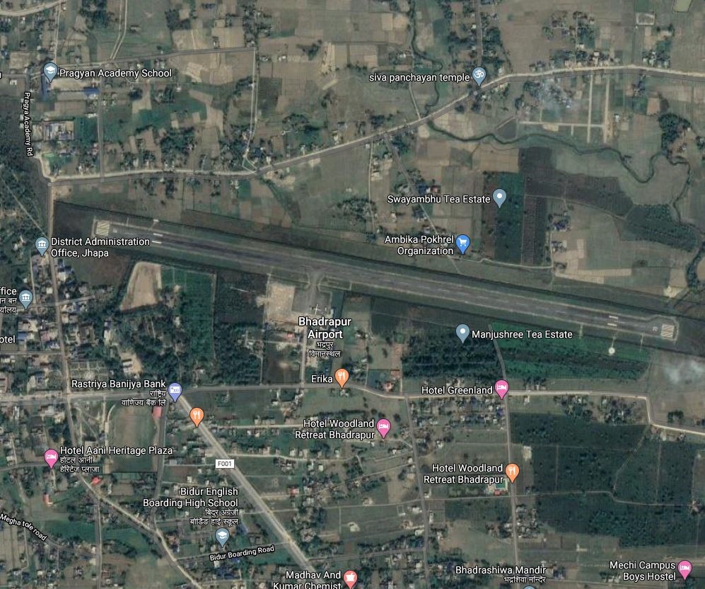
Chandragadhi Airport also known as Bhadrapur Airport, is an airport in Bhadrapur Municipality,- 8 in the Jhapa District of Koshi Province with a distance of 3.2 Km North West from Bhadrapur city. Due proximity to eastern boarder of Nepal, the airport finds strategic significance as well as domestic destination for travellers coming from north eastern states of India, Bhutan and Bangladesh as well. All commercial airlines operate through one small terminal of Chandragadi Airport.
Sita Air, Buddha Air, Saurya Airlines, Yeti Airlines and Shree Airlines operate their flights to and from Kathmandu and Taplejung with scheduled connectivity. Night Flight is also operational from Chandragadi Airport.
10 Flights daily take off from this airport but no cargo flights service is available in this airport.
-
Aerodrome Administration operation hours are as follows: Air Traffic Service operational hours all year-round Night Operation Facilities are as follows:16th Feb to 15th Nov - 0600LT-LT 24:00
-
16th Nov to 15th Feb - 0630LT-1800LT
|
Airport Location and Contact |
|
|---|---|
|
Country |
Nepal |
|
Province or District |
Koshi Province, Jhapa |
|
Nearest Town or City |
In proximity with District Headquarter- Chandragadhi |
|
Airport’s Complete Name |
Chandragadhi Civil Aviation Office
|
|
Latitude |
26.56965 |
|
Longitude |
88.07741 |
|
Elevation (ft and m) |
312.184 ft (95.149 m) |
|
IATA Code |
BDP |
|
ICAO Code |
VNCG |
|
Managing Company or Airport Authority |
Civil Aviation Authority of Nepal Chandragadhi Civil Aviation Office Chandragadhi, Jhapa Office- 977-23455232 Tel- 977-23-455075 Fax - 977-23-456801 AFS – VNCGYDYX |
|
Management Contact Person |
Indra Raj Adhikari Chief Airport Officer Contact: 9852678417 |
|
NGO and/or UN Presence at Airport? |
NO |
Runway
|
Runway #1 |
|
|---|---|
|
Runway Dimensions |
1500 m x 30 m |
|
Runway Orientation |
10/28 |
|
Runway Surface |
Asphalt Concrete |
|
Runway Condition |
Good, operational |
Airport Infrastructure Details
|
Infrastructure |
|||
|---|---|---|---|
|
Passenger / Cargo Security Screening |
X-Ray: Hold baggage; Walk through and Hand-held Metal detector |
Runway Lighting |
‘Yes’ *PAPI 30° on Runway 10 1500m, 60m, White, LIM |
|
Refueling Capacity |
JET A-1, during period of flight operation by NOC with 3 vouchers; 2 mobile voucher and 1 is fixed voucher. |
Ground Handling Services |
Available with local airlines operator, |
|
Air Traffic Control |
Controlled Class C Airspace, Visual Flight Rule (VFR), Instrumental Flight Rule (RNP Approach), Two Men Position Tower Console with Associated Equipment and Accessories |
Fire Fighting Equipment |
Portable type fire extinguisher available |
|
Weather Information |
Tower Observation. MET office information.
|
Aircraft Parking Space |
Four ATR72 Types: DH8D, ATR72, ATR42, CRJ 71, CRJ2 and One Twin Otter 11850 sq m, Concrete |
|
Navigation Aids |
DVOR/DME, UHF Band Communication System |
Perimeter Fencing |
Yes |
|
Windsock |
2 |
|
|
*Precision Approach Path Indicators
Fuel Service Charges
The airport takes support from Nepal Oil Corporation (NOC) for the provision of Jet fuel for the aircraft. NOC maintains the reserve of 60 Kilo Litre at its office premise and installed an airport based depot too. NOC strictly adheres to the quality it has set for the Air Fuel and the price per litre is as set by the NOC.
|
|
Price per Litre USD - $ |
|---|---|
|
Jet A-1 |
0.543 / ltr (Duty Paid) * |
|
Avgas |
No |
*As of 1st October 2023
*Exchange rate 1 USD: 132.86 NPR
Nepal - 2.2.7 Major Domestic Airport - Dhangadhi
Airport Overview
|
|
|
Picture: Arial view of Dhangadhi Airport-Kailali, Sudurpashchim province |
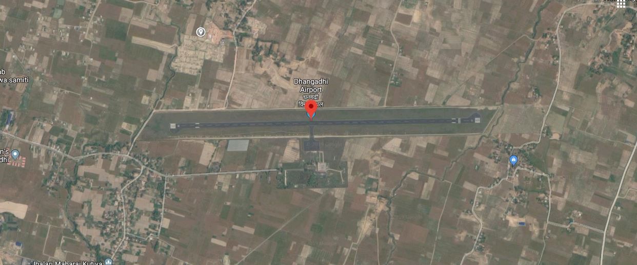
Dhangadhi Airport is situated at Dhangadhi Sub Metropolitan City of Kailali District, Sudurpashchim Province. This airport has direct air link with Kathmandu’s Tribhuvan International Airport (TIA). The airport is located at an elevation of 176 metres (577 ft) above sea level. It has one runway which is 1,800 metres (5,906 ft) in length and is equipped with night landing facility. The operation hours are:
-
01 Nov to 30 Jan: 1000LT – 1600LT
-
01 Feb to 30 Oct: 1000LT – 1700LT
National airline operators provide scheduled air service from this airport to Kathmandu. The largest aircraft it can serve is Fokker 100 or similar type of aircraft. This airport also serves weekly two flights to Bajhang and Sanfebagar airports located in Sudurpaschim Province.
|
Airport Location and Contact |
|
|---|---|
|
Country |
Nepal |
|
Province or District |
Sudurpashchim |
|
Nearest Town or City |
Dhangadi DISTANCE (6 KM-North) |
|
Airport’s Complete Name |
Dhangadi Airport |
|
Latitude |
28.75302 |
|
Longitude |
80.58314 |
|
Elevation (ft and m) |
621 ft. / 189 m. |
|
IATA Code |
DHI |
|
ICAO Code |
VNDH |
|
Managing Company or Airport Authority |
Civil Aviation Authority –Dhangadi, Kailali Off: 977- 91575119 Tower: 977-91575219 Fax: 977-91575119 E-mail: dhangadhi_cao@caanepal.gov.np
|
|
Management Contact Person |
Ganesh Bahadur Singh |
|
NGO and/or UN Presence at Airport? |
Yes, WFP has constructed a Humanitarian Staging Area (HSA) in the premises of the airport |
Runway(s)
|
Runway #1 |
|
|---|---|
|
Runway Dimensions |
1800 m x 30 m |
|
Runway Orientation |
E27 and W09 |
|
Runway Surface |
Asphalt |
|
Runway Condition |
Good, Blacktop and operational |
Airport Infrastructure Details
|
Infrastructure |
|||
|---|---|---|---|
|
Passenger / Cargo Security Screening |
Yes, Walk-through X-Ray, Handheld Metal Detector, CCTV Surveillance, UHF Band Communication System and FIDS |
Runway Lighting |
Yes -PAPI |
|
Refueling Capacity |
Yes 60KL, Available and Provided by Nepal Oil Corporation |
Ground Handling Services |
Yes, with the local airlines. |
|
Air Traffic Control |
Yes |
Fire Fighting Equipment |
Yes, CAT – 5
|
|
Weather Information |
Yes, Tower Observation |
Aircraft Parking Space |
Yes- 4 Aircrafts (ATR 72 types) |
|
Navigation Aids |
Yes / VOR |
Perimeter Fencing |
Yes – iron net fencing |
|
Windsock |
Yes |
|
|
Fuel Services Charges
The airport takes support from Nepal Oil Corporation (NOC) for the provision of Jet fuel for the aircraft. Nepal Oil corporation maintains the reserve of 60 Kilo Litre at its office premise. NOC strictly adheres to the quality it has set for the Air Fuel and the price per liter is as set by the NOC.
|
|
Price per Litre USD - $ |
|---|---|
|
Jet A-1 |
1.02 (Duty Paid) * |
|
Avgas |
No |
*As of 01 Jan, 2024 Exchange Rate 1 US$ = 133.064 NPR
Link for more detail:
DHANGADHI-AIRPORT.pdf (caanepal.gov.np)
Link for ICAO and IATA Code: https://en.wikipedia.org/wiki/List_of_airports_in_Nepal
Nepal - 2.2.8 Nepalgunj Major Domestic Airport
Airport Overview
|
|
|
Pic: Aerial view of Nepalgunj Airport |
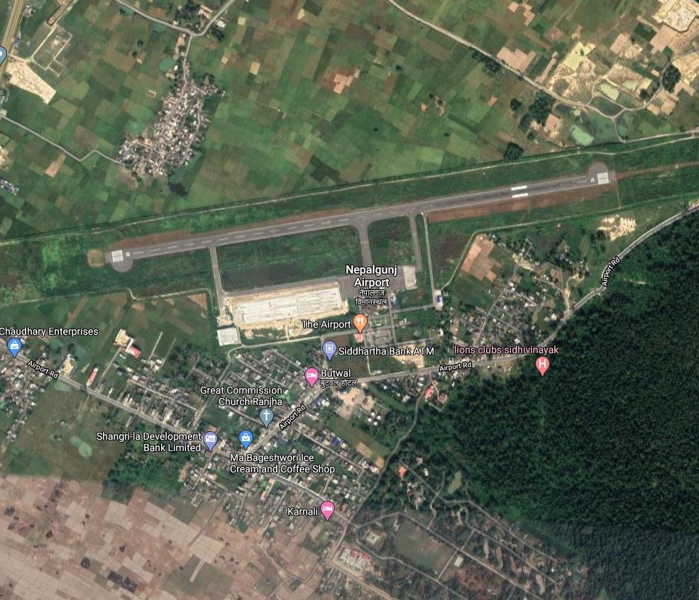
Nepalgunj Airport is a domestic hub airport in Nepalgunj, a sub-Metropolitan city in Banke District of Lumbini Province . It lies 9 km NE of the city and can be accessed via tarmac road H12. This is one of the main domestic hub airports, after Kathmandu airport, having the highest number of air links with 16 airports (8 in operation) of Karnali Province and Sudur-Paschim Province.
It can handle twin engine turbo-prop aircraft types such as: ATR72, CRJ200/700, DHC8, MA60, ATR42, JS-41, B190, D228, DHC6, L410, Y12. Airlines operating scheduled flights are Buddha Air, Yeti Airlines, Tara Air, Shree Airlines, Sita Air, Summit Airways, Nepal Airlines.
Aerodrome Administration operation hours are as follows:
1. SUN-THU 10:00 -17:00 LT (SUMMER), 10:00-1600 LT (WINTER)
2. FRI 10:00-1500 LT
Air Traffic Service operational hours all year-round are as follows:
3. From 16 Feb - 15 Nov 0600 hrs to 1845 hrs LT
4. From 16 Nov - 15 Feb 0630 hrs to 1800 hrs LT
The airport is equipped with night landing facility and can operate at any hour during an emergency or on request.
|
Airport Location and Contact |
|
|---|---|
|
Country |
Nepal |
|
Province or District |
Lumbini Province/ Banke |
|
Nearest Town or City |
9 kms NE of City |
|
Airport’s Complete Name |
Nepalgunj Airport |
|
Latitude |
28.10150 |
|
Longitude |
81.66737 |
|
Elevation (ft and m) |
518 ft (158 m) |
|
IATA Code |
KEP |
|
ICAO Code |
VNNG |
|
Managing Company or Airport Authority |
Civil Aviation Authority of Nepal, Nepalgunj Civil Aviation Office, Nepalgunj, Banke Tel- 977-081-565158 (Director) 565205 (Tower), 565210 (Admin) Fax - 977-081-565204 AFS – VNNGYDYX E-mail: nepalgunj_cao@caanepal.gov.np |
|
Management Contact Person |
Suresh Prasad Khanal |
|
NGO and/or UN Presence at Airport? |
Yes, WFP has constructed an HSA in the airport premises. |
Runway
|
Runway #1 |
|
|---|---|
|
Runway Dimensions |
1700 x 30 m |
|
Runway Orientation |
08 – 26 – |
|
Runway Surface |
Asphalt Concrete |
|
Runway Condition |
Good, operational |
Airport Infrastructure Details
|
Infrastructure |
|||
|---|---|---|---|
|
Passenger / Cargo Security Screening |
X-Ray: Hold baggage, Hand baggage |
Runway Lighting |
PAPI / Runway Lighting / Beacon light / Rails Light / Obstruction Light |
|
Refuelling Capacity |
Jet A1 during Operation Hours |
Ground Handling Services |
Available with local airlines operator |
|
Air Traffic Control |
Controlled Class C Airspace |
Fire Fighting Equipment |
Category V Rescue equipment |
|
Weather Information |
Yes, Tower Observation and Met Forecast relayed by GBIA every half an hour |
Aircraft Parking Space |
15640 sqm of concrete Apron, 1 CRJ, 2 ATR72s, 5 Twin Otters and 2 Helicopters |
|
Navigation Aids |
VOR / DME |
Perimeter Fencing |
Yes |
|
Windsock |
Yes |
|
|
Fuel Services Charges
The airport takes support from Nepal Oil Corporation for the provision of Jet fuel for the aircraft. NOC maintains the reserve of 60 Kilo Litre at its office premise. NOC strictly adheres to the quality it has set for the Air Fuel and the price per litre is as set by the NOC.
|
|
Price per Litre USD - $ |
|---|---|
|
Jet A-1 |
1.02 / ltr (Duty Paid) * |
|
Avgas |
No |
*As of 11 Oct 2023
*Exchange rate 1 USD: 132.90 NPR
Nepal - 2.2.9 Major Domestic Airport - Simara
Airport Overview
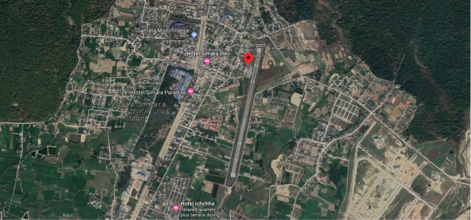
Aerial view of Simara Airport-Bara, Madhesh Province
Simara Airport is situated at Jitpur Simara metropolitan city of Bara District in Madhesh Province. It is considered a strategic domestic airport due to its proximity to Birgunj - Nepal’s fifth biggest city - and 20km from Raxaul, South at the border with India. The airport is located at a distance of 116 km from Kathmandu, via the Kulekhani-Sisneri-Pharping road, which is not suitable for heavy trucks. The airport is located at a distance of 261 km from Kathmandu via the main highway from Narayanghat to Kathmandu.
National airline Budhha Airlines and Yeti Airlines provide services from the airport to Kathmandu only
-
1st Nov to 31 Jan 1000 hrs – 1600 hrs LT
-
1st Feb to 31 Oct 1000 hrs – 1700 hrs LT
|
Airport Location and Contact |
|
|---|---|
|
Country |
Nepal |
|
Province or District |
Madhesh Province |
|
Nearest Town or City |
Birgunj-Parsa - 20 km Hetauda-Makwanpur - 34 km |
|
Airport’s Complete Name |
Simara Airport |
|
Latitude |
27.16382 |
|
Longitude |
84.97964 |
|
Elevation (ft and m) |
137 m / 450 feet 449/37 m 9 (in June month) |
|
IATA Code |
SIF |
|
ICAO Code |
VNSI |
|
Managing Company or Airport Authority |
Civil Aviation Authority –Simara-Bara. Surya Bahadur Khatri Chief Airport Off: 977-53520210 Tower: 977-53-520110 Fax: 977-53-520210 AFS: VNSIYDYX
E-mail: simara_cao@caanepal.gov.np |
|
Management Contact Person |
Off: 977-53-520210 E-mail:simara_cao@caanepal.gov.np |
|
NGO and/or UN Presence at Airport? |
No |
Runway(s)
|
Runway #1 |
|
|---|---|
|
Runway Dimensions |
1192 m x 30 m |
|
Runway Orientation |
01/19 |
|
Runway Surface |
Bituminous Paved (Asphalt Concrete) |
|
Runway Condition |
Operational |
Airport Infrastructure Details
|
Infrastructure |
|||
|---|---|---|---|
|
Passenger / Cargo Security Screening |
Walk through detector Hand Held metel detector
|
Runway Lighting |
PAPI/APAPI Light- APAPI ; Runway Edge light |
|
Refueling Capacity |
Yes: 16 KL dispenser –2 Vouchers and 6 KL dispenser- 1 Voucher ; Available and Provided by Nepal Oil Corporation |
Ground Handling Services |
Yes with the local airline |
|
Air Traffic Control |
Communication System : HF SSB, VHF, AMHS, Hot line and UHF Telephone |
Fire Fighting Equipment |
Yes- Category 5 |
|
Weather Information |
Associated MET Office, all operational hour by meteorological office |
Aircraft Parking Space |
Yes - 2 ATR- 72/42 aircraft |
|
Navigation Aids |
Yes / VOR /DME |
Perimeter Fencing |
Yes – Iron net fencing |
|
Windsock |
Yes |
|
|
For more information, please see this link - SIMARA AIRPORT.pdf (caanepal.gov.np)
Fuel Services Charges
Re- fuelling facility is started from 3rd December 2023 with 16LK and 6 KL dispenser at airport.
-
16LK and 2) 6 KL refueling dispenser at Simara airport.
|
|
Price per Litre USD - $ |
|---|---|
|
Jet A-1 |
1.02 (Duty Paid) * |
|
Avgas |
No |
*As of Oct 13, 2023 Exchange Rate: 1 US$ = 132.90 NPR
Royalties / Non Objection Fees (NOFs)
N/A
Other relevant Information:
Simara airport has also prepared an emergency plan to provide emergency services in case of emergency as per the plan of District Disaster Risk Management Committee of Bara District.
Nepal - 2.2.10 Major Domestic Airport - Surkhet
Airport Overview
Pic: Aerial view of Surkhet Airport with surrounding habitation of Birendranagar
Surkhet Airport is situated at Birendranagar Municipality of Surkhet District, Karnali Province. It is one of the hub airports of mid-Western Nepal and serves most of the remote sectors of the western part of the country – Jumla, Humla, Kalikot, Mugu, Dolpa, Bajhang, Bajura and Rukum (although infrequent). Surkhet Airport serves mainly as transport for cargo rather than passengers to the Karnali and Sudurpaschim Provinces. This airport is strategically important for the transportation of food grains, clothes, medicines, iodine-mixed salt, construction materials, office goods, school materials like books and stationeries as well as other commercial goods. There are scheduled passenger flights from Kathmandu to Surkhet daily.
Expansion of the runway is limited due to the hilly landscape. The approach is only from one side South to North 20 degrees. Aircraft models such as B190, D228, DHC6, L410, Y12, C208 are the appropriate types of aircraft for this airport. Buddha Air operates scheduled flight with ATR72, and Shree Airlines operates with DH8D aircraft from Kathmandu to Surkhet. The Airport has no dedicated landing zones for helicopters. The control tower is well capacitated to oversee a 5-mile radius centered at the Airport Reference Point (ARP).
|
Airport Location and Contact |
|
|---|---|
|
Country |
Nepal |
|
Province or District |
Karnali Province/ Surkhet |
|
Nearest Town or City |
1.5 KM east from Birendranagar City |
|
Airport’s Complete Name |
Surkhet Airport |
|
Latitude |
28.3509 |
|
Longitude |
81.3807 |
|
Elevation (ft and m) |
7395 ft. / 2254 m. |
|
IATA Code |
SKH |
|
ICAO Code |
VNSK |
|
Managing Company or Airport Authority |
Civil Aviation Authority of Nepal, Surkhet Civil Aviation Office, Surkhet Off: 977-83520269 Tel 977 083 520202 (Tower) Fax: 977-83521945 AFS: VNSKYDYX E-mail: surkhet_cao@caanepal.gov.np |
|
Management Contact Person |
Rajan Raj Dhungel, Airport Chief |
|
NGO and/or UN Presence at Airport? |
No |
Runway(s)
|
Runway #1 |
|
|---|---|
|
Runway Dimensions |
1255 m x 30 m |
|
Runway Orientation |
02/20 - |
|
Runway Surface |
Bituminous Paved (Asphalt Concrete) |
|
Runway Condition |
Good |
Airport Infrastructure Details
|
Infrastructure |
|||
|---|---|---|---|
|
Passenger / Cargo Security Screening |
Walk-through X-Ray, Handheld Metal Detector, CCTV Surveillance |
Runway Lighting |
PAPI, Threshold light & End Light |
|
Refueling Capacity |
During the period of flight operation / 60KL/ Provided by Nepal Oil Corporation |
Ground Handling Services |
Yes with Local airlines Operator |
|
Air Traffic Control |
Yes/ VFR |
Fire Fighting Equipment |
Yes, has a fire fighting vehicle with “Small Foam Tender” and water capacity of 3000 litres. |
|
Weather Information |
Associated MET Office, After-hours Met Office Service |
Aircraft Parking Space |
Concrete apron in 13,389.12 m2 has space for 4 small aircraft but no hangar space |
|
Navigation Aids |
VOR |
Perimeter Fencing |
Yes |
|
Windsock |
Yes |
|
|
Fuel Services Charges
The airport takes support from Nepal Oil Corporation (NOC) for the provision of Jet fuel for the aircraft. NOC maintains the reserve of 60 kilo litres at its office premise. NOC strictly adheres to the quality it has set for the Air Fuel and the price per litre is as set by the NOC.
|
|
Price per Litre USD - $ |
|---|---|
|
Jet A-1 |
1.02 (Duty Paid) * |
|
Avgas |
No |
*As of Oct 12, 2023 Exchange Rate: 1 US$ = 132.81 NPR
Royalties / Non Objection Fees (NOFs)
N/A
Nepal - 2.2.11 Minor Domestic Airport - Janakpur
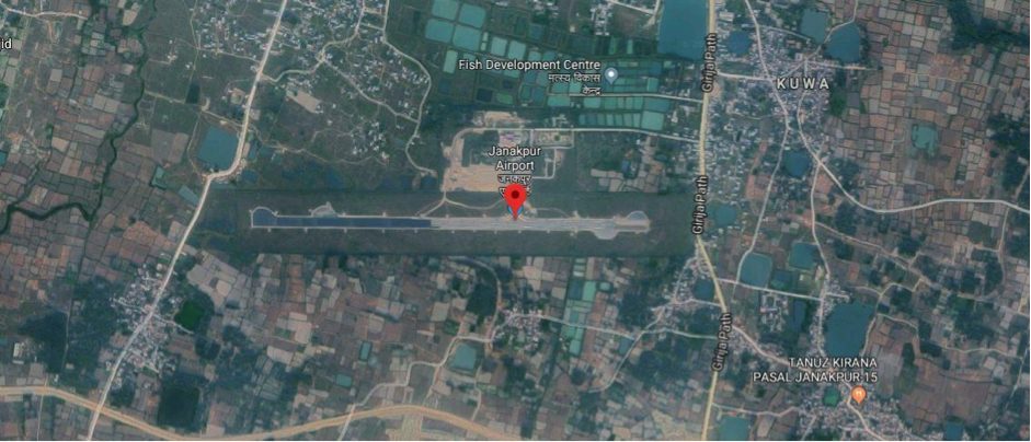
Aerial view of Janakpur Airport-Dhanusa, Province-2
Airport Overview
Janakpur Airport is a domestic airport in Janakpurdham Sub Metropolitan City of Dhanusa district in Madhesh Province and is operated by the Civil Aviation Authority of Nepal (CAAN). It is located 4 km away from Janakpur city. Janakpur Airport was built on 13 February 1960. National airline operators operate direct flights from Kathmandu to Janakpur daily.
The airport resides at an elevation of 233 feet ( 71 m) above mean sea level. It has one runway designated 09/27 with an asphalt surface measuring 1306 by 30 metres ( 4248 ft × 98 ft)
Security of the airport periphery is provided by Nepal Army and security to the passenger is provided by Nepal Police.
Administrative Services:
SUN-THU 10:00 -17:00 LT (SUMMER),
10:00-1600 LT (WINTER), FRI 10:00-1500 LT
Air Traffic Service:
1) From 16 Feb - 15 Nov (0015 - 1815) UTC
2) From 16 Nov - 15 Feb (0045 - 1815) UTC
|
Airport Location and Contact |
|
|---|---|
|
Country |
Nepal |
|
Province or District |
Madhesh |
|
Nearest Town or City |
Janakpur - 4 km |
|
Airport’s Complete Name |
Janakpur Airport |
|
Latitude |
26.71174 |
|
Longitude |
85.92389 |
|
Elevation (ft and m) |
233 ft. / 71 m. |
|
IATA Code |
JKR |
|
ICAO Code |
VNJP |
|
Managing Company or Airport Authority |
Civil Aviation Authority of Nepal Janakpur Civil Aviation Office, Janakpurdham, Dhanusha Te1- 977-041-590057 Hot Line - 977-041- 590053 Tower - 977-041-590052 AFS - VNJPZTZX Email : janakpur_cao@caanepal.gov.np |
|
Management Contact Person |
E-mail: janakpur_cao@caanepal.org.np
|
|
NGO and/or UN Presence at Airport? |
No |
Runway(s)
|
Runway #1 |
|
|---|---|
|
Runway Dimensions |
1306 m x 30 m |
|
Runway Orientation |
|
|
Runway Surface |
Asphalt /10 |
|
Runway Condition |
Good - blacktop and operational |
Airport Infrastructure Details
|
Infrastructure |
|||
|---|---|---|---|
|
Passenger / Cargo Security Screening |
|
Runway Lighting |
|
|
Refueling Capacity |
Yes: 120 KL, Available and Provided by Nepal Oil Corporation Storage Capacity (KL): Bonded Tank I - 30 KL Bonded Tank II - 30 KL Storage Type: Bonded Tank Refueller Details: AR 40 (16KL |
Ground Handling Services |
Yes with the local airline: Self Managed by respective airlines. |
|
Air Traffic Control |
Yes; Aerodrome and Approach Service. Permitted VFR |
Fire Fighting Equipment |
Fire Vehicle and Portable type fire extinguisher available. Complementary Extinguishing Agents and Fire Extinguishers (wheel type fire extinguishers also available, Small fire vehicle available |
|
Weather Information |
Associated MET Office, After-hours Met Office |
Aircraft Parking Space |
Yes- 3 ATR 72 aircraft |
|
Navigation Aids |
Yes / NDB |
Perimeter Fencing |
Yes – Iron net fencing |
|
Windsock |
Yes- 3 ( East- Middle- West points. |
|
|
Fuel Services Charges
The airport takes support from Nepal Oil Corporation (NOC) for the provision of Jet fuel for the aircraft. The fuel reserve owned by Nepal Oil Corporation is maintained outside the airport compound.
|
|
Price per Litre USD - $ |
|---|---|
|
Jet A-1 |
1.02 (Duty Paid) * |
|
Avgas |
No |
*As of Oct 13, 2023 Exchange Rate: 1 US$ = 132.90 NPR
Royalties / Non Objection Fees (NOFs)
Airport charges landing charges as per the Airport Service Charge Regulation 2078
N/A
ADDITIONAL INFORMATION
1. Bird Activity a) Sometimes cases of bird concentrations in the vicinity of aerodrome may be encountered.
b) 2. No Special procedures have been adopted to control these bird concentrations except driving them through guards and security personnel.
Nepal - 2.2.12 Minor Domestic Airport - Jomsom
Airport Overview
|
|
|
Pic: Aerial view of Jomsom Airport |
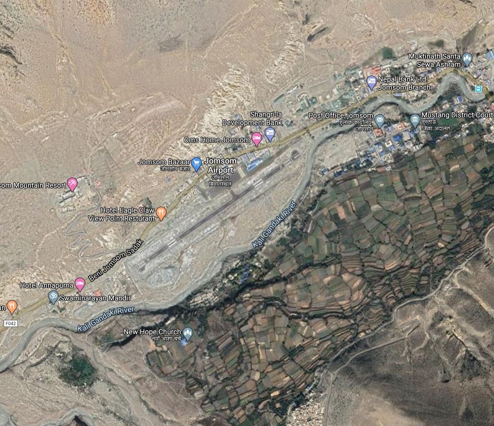
Jomsom airport is short take off and landing (STOL) airport located on the bank of the Kali Gandaki River serving Jomsom, a town in the Gharapjhong rural municipality of Mustang District in Gandaki Province. It serves as the gateway to the Mustang District that includes Jomsom, Kagbeni, Tangbe, Lo Manthang, and Muktinath temple, which is a popular pilgrimage destination for Nepalis and Indians. It is close to the District HQ of Mustang. The airport is open throughout the year but has the following operating hours
-
16th Feb to 15th Nov- 0600LT-1215LT
-
16th Nov to 15th Feb - 0630LT-1215LT
Due to high winds and clouds during the daytime, the operation stops midday year-round. Depending on the season, low clouds that restrict visibility can also halt airport operations. Regular flights are operated from Pokhara Domestic Airport to Jomsom.
|
Airport Location and Contact |
|
|---|---|
|
Country |
Nepal |
|
Province or District |
Gandaki Province/ Mustang |
|
Nearest Town or City |
Within the premises of Jomsom. |
|
Airport’s Complete Name |
Jomsom Airport |
|
Latitude |
28.78222 |
|
Longitude |
83.72250 |
|
Elevation (ft and m) |
8976 ft (2736 m) |
|
IATA Code |
JOM |
|
ICAO Code |
VNJS |
|
Managing Company or Airport Authority |
Civil Aviation Authority of Nepal, Jomsom Airport Tel: 977 69440126 Tower: 977 69440006 AFS VNJSYDYX Email: jomsom_cao@caanepal.org.np |
|
Management Contact Person |
|
|
NGO and/or UN Presence at Airport? |
NO |
Runway
|
Runway #1 |
|
|---|---|
|
Runway Dimensions |
810 m x 20 m |
|
Runway Orientation |
06/24 |
|
Runway Surface |
Asphalt Concrete |
|
Runway Condition |
Operational in all weather |
Airport Infrastructure Details
|
Infrastructure |
|||
|---|---|---|---|
|
Passenger / Cargo Security Screening |
Metal Detector: walk through and handheld and CCTV surveillance system |
Runway Lighting |
Runway End light Runway Threshold identification light |
|
Refuelling Capacity |
NO |
Ground Handling Services |
|
|
Air Traffic Control |
AFIS HF SSB, VHFB |
Fire Fighting Equipment |
Wheel and portable type of fire extinguisher available |
|
Weather Information |
AFIS, Tower Observation |
Aircraft Parking Space |
6000 sqm of concrete Apron, Four D228 Types |
|
Navigation Aids |
|
Perimeter Fencing |
|
|
Windsock |
N/A |
|
|
Fuel Services Charges
N/A
Royalties / Non Objection Fees (NOFs)
N/A
Nepal - 2.2.13 Minor Domestic Airport - Jumla
Airport Overview
|
|
|
Picture: Arial view of Jumla Airport- Karnali province |
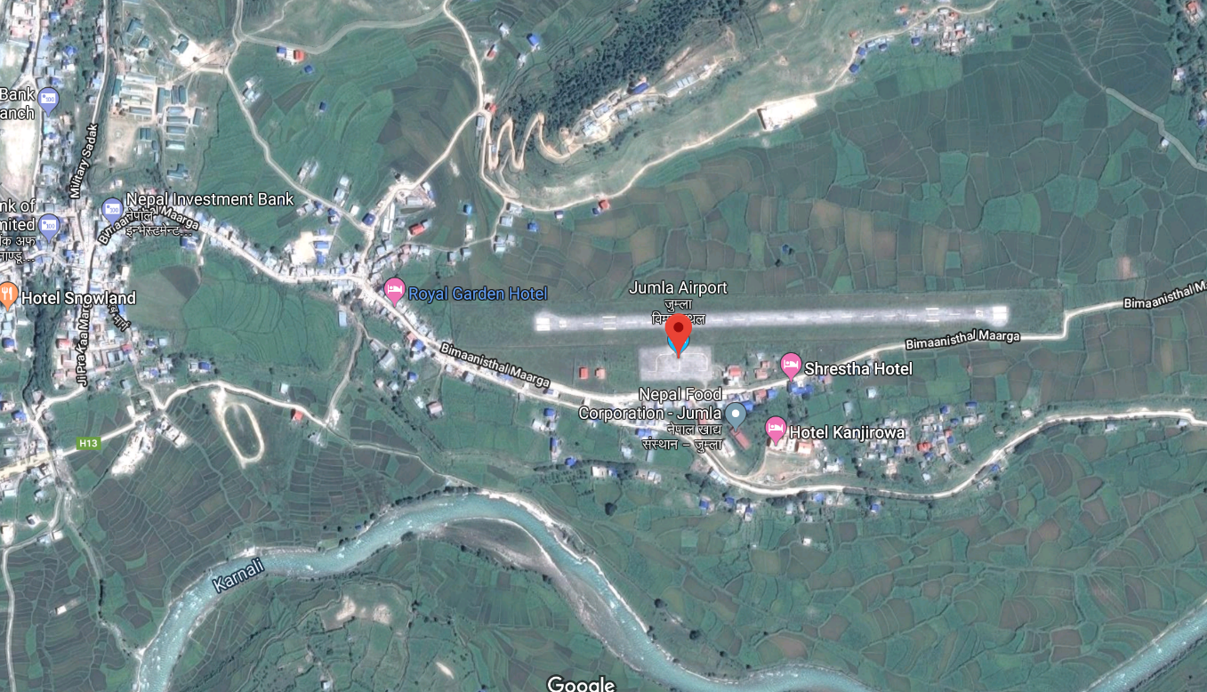
Jumla Airport is situated at Chandannath Municipality of Jumla District, Karnali Province. This airport, close to Jumla Bazaar, is a hub for trade and travel throughout Karnali province (via this airport local products are transported to West Terai).
Nepal Airlines, Tara Air, Summit Air, and Sita Air provides flight services to Jumla Airport, from Nepalgunj and Surkhet airports. For cargo purposes, Surkhet Airport is more cost effective. The serviceability of the airport is all weather but operational hours are as follows:
-
16 Feb to 15 Nov 0600 hrs – 1845 hrs LT
-
16 Nov to 15 Feb 0630 hrs – 1800 hrs LT
|
Airport Location and Contact |
|
|---|---|
|
Country |
Nepal |
|
Province or District |
Karnali Province/ Jumla District |
|
Nearest Town or City |
500m East of Jumla Bazaar |
|
Airport’s Complete Name |
Jumla Airport |
|
Latitude |
29. 1626 |
|
Longitude |
82.1123 |
|
Elevation (ft and m) |
7792 ft (2375 m) |
|
IATA Code |
JUM |
|
ICAO Code |
VNJL |
|
Managing Company or Airport Authority |
Civil Aviation Authority – Jumla Off: 977-87520015 Tower: 977-87520015 Fax: 977- 87520015
AFS: VNJLYDYX Email: jumla_cao@caanepal.gov.np |
|
Management Contact Person |
Santosh Adhikari |
|
NGO and/or UN Presence at Airport? |
No |
Runway(s)
|
Runway #1 |
|
|---|---|
|
Runway Dimensions |
675 m x 20 m |
|
Runway Orientation |
09/ 27 |
|
Runway Surface |
Bituminous Paved (Asphalt Concrete) |
|
Runway Condition |
Operational |
Dornier 228 is the biggest aircraft that is in service among the aircraft like DHC6 Twin Otter, Let
L410 Turbolet, Harbin Y-12, and Cessna 208 Caravan, basically most of the single-engine aircraft, PZL M-28, Mi-8 helicopter.
Civil Aviation Authority of Nepal (CAAN) has planned to expand the existing runway and construct a new terminal building. For this CAAN had already started the process of land acquisition. (Source: (nagariknetwork.com)
Airport Infrastructure Details
|
Infrastructure |
|||
|---|---|---|---|
|
Passenger / Cargo Security Screening |
Handheld Metal Detector |
Runway Lighting |
Approach and Runway Lighting System, PAPI |
|
Refueling Capacity |
No |
Ground Handling Services |
Yes with the local airline |
|
Air Traffic Control |
Yes |
Fire Fighting Equipment |
Wheel and portable type fire extinguisher available by Fire Service (ULHPS), Complementary Extinguishing Agents |
|
Weather Information |
Tower Observation |
Aircraft Parking Space |
Yes - 3 small aircraft |
|
Navigation Aids |
Aerodrome Flight Information service |
Perimeter Fencing |
Yes |
|
Windsock |
Yes |
|
|
Fuel Services Charges
Not available in this Airport
Royalties / Non Objection Fees (NOFs)
Link for more details: Jumla Airport.pdf (caanepal.gov.np)
Nepal - 2.2.14 Minor Domestic Airport - Simikot
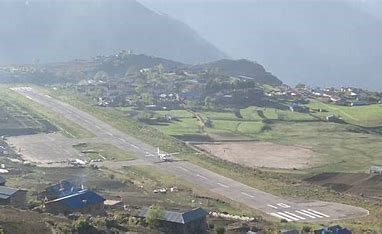
Airport Overview
Simikot Airport which is only one means of transportation of this area situated at Simikot Rural Municipality of Humla District, Karnali Province. It is the gateway to Mount Kailash, Mansarovar Lake and for the rafting in the Karnali River which are considered as famous tourist destinations. Majority of domestic airlines are operating scheduled and chartered flights.
The scheduled operational hour of this airport by Sita Air, Tara Air, Summit Air, Nepal Airlines to Nepalgunj is as follows:
16th Feb to 15th Nov 0600LT-1215LT
16th Nov to 15th Feb 0630LT-1215LT
|
Airport Location and Contact |
|
|---|---|
|
Country |
Nepal |
|
Province or District |
Karnali Province, Humla |
|
Nearest Town or City |
Simikot |
|
Airport’s Complete Name |
Simikot Airport |
|
Latitude |
29.97127 |
|
Longitude |
81.81865 |
|
Elevation (ft and m) |
9747 ft / 2971 m |
|
IATA Code |
IMK |
|
ICAO Code |
VNST |
|
Managing Company or Airport Authority |
Civil Aviation Authority of Nepal Off: 977-87680137 Tower: 977-87680137 AFS: VNSTYDYX E-mail: simikot_cao@caanepal.gov.np |
|
Management Contact Person |
|
|
NGO and/or UN Presence at Airport? |
No |
Runway(s)
|
Runway #1 |
|
|---|---|
|
Runway Dimensions |
650 m x 20 m |
|
Runway Orientation |
10/28 |
|
Runway Surface |
Bituminous Paved (Asphalt Concrete) Surface |
|
Runway Condition |
Good. |
Airport Infrastructure Details
|
Infrastructure |
||||
|---|---|---|---|---|
|
Passenger / Cargo Security Screening |
Yes, Hand Held Metal Detector & CCTV Surveillance System |
Runway Lighting |
Runway End Light Yes, at RWY 10 Runway Threshold Identification Light Yes, at RWY 28 |
|
|
Refueling Capacity |
No |
Ground Handling Services |
Limited |
|
|
Air Traffic Control |
Yes, HF SSB, VHF |
Fire Fighting Equipment |
Limited |
|
|
Weather Information |
Yes, Tower Observation |
Aircraft Parking Space |
3800 sq.m. Apron concrete surface for 3, D228 Type Aircraft |
|
|
Navigation Aids |
Yes, UHF Band Communication System |
Perimeter Fencing |
Yes, but not properly maintained |
|
|
Windsock |
Yes |
|
|
|
Fuel Services Charges
Not Available in this Airport
|
|
Price per Litre USD - $ |
|---|---|
|
Jet A-1 |
n/A |
|
Avgas |
n/A |
Nepal - 2.2.15 Tumlingtar Minor Domestic Airport
Airport Overview
|
|
|
Pic: Aerial view of Tumlingtar Airport |
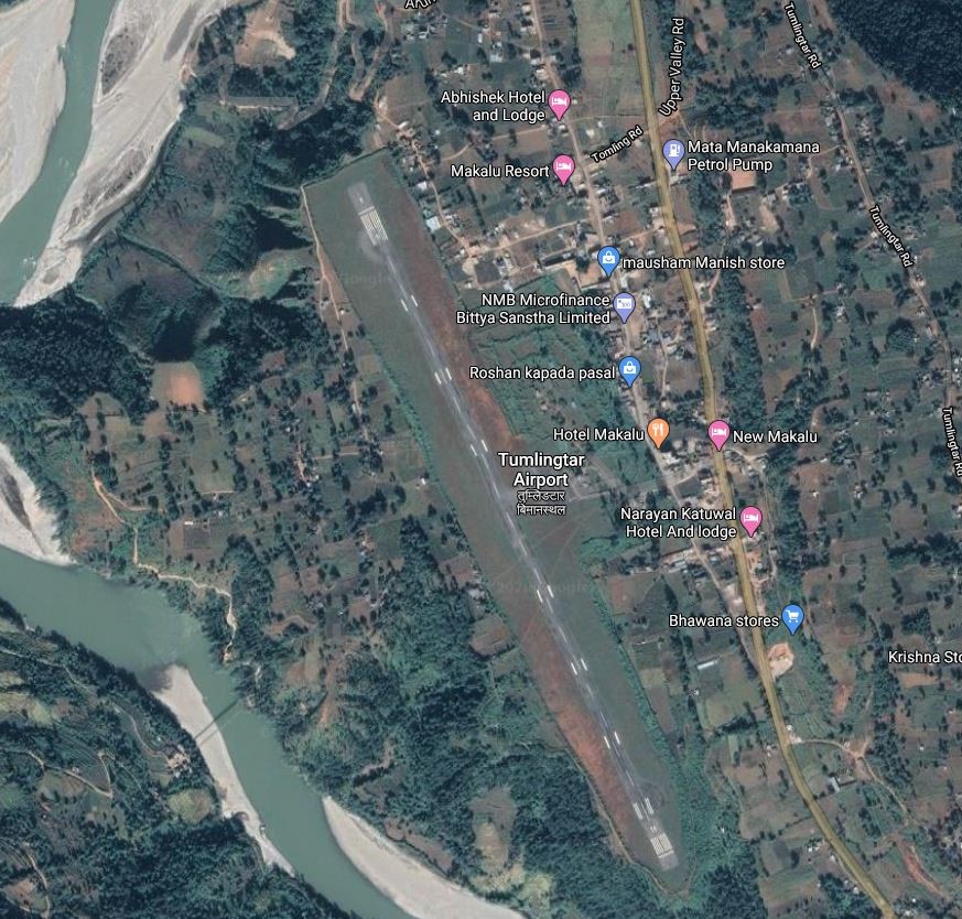
Tumlingtar Airport is located at Tumlingtar, Khandabari Municipality of Sankhuwasabha district, Koshi Province. It is 15 kms South of District HQ in Khandbari.
Buddha Air, and Yeti Airlines operate flights to Tumlingtar from Kathmandu and Biratnagar. They operate on the following hours:
-
1st Nov to 31 Jan 1000 hrs – 1600 hrs LT
-
1st Feb to 31 Oct 1000 hrs – 1700 hrs LT
-
In 2020, 717 flights carried 12,236 passengers and 16,498 kgs of cargo between destinations to and from the airport.
|
Airport Location and Contact |
|
|---|---|
|
Country |
Nepal |
|
Province or District |
Koshi Province / Sankhuwasabha |
|
Nearest Town or City |
15 kms South of District HQ in Khandbari
|
|
Airport’s Complete Name |
Tumlingtar Airport |
|
Latitude |
27.31610 |
|
Longitude |
87.19536 |
|
Elevation (ft and m) |
1316 ft (401 m) |
|
IATA Code |
TMI |
|
ICAO Code |
VNTR |
|
Managing Company or Airport Authority |
Civil Aviation Authority of Nepal Tumlingtar Civil Aviation Office, Tumlingtar, Sankhuwasabha Off: +977- 029 – 575207 Fax – 977-29575207 AFS - VNTRYDYX |
|
Management Contact Person |
|
|
NGO and/or UN Presence at Airport? |
NO |
Runway
|
Runway #1 |
|
|---|---|
|
Runway Dimensions |
1295 m × 30 m |
|
Runway Orientation |
16 / 34 |
|
Runway Surface |
Asphalt Concrete |
|
Runway Condition |
Operational |
Airport Infrastructure Details
|
Infrastructure |
|||
|---|---|---|---|
|
Passenger / Cargo Security Screening |
Handheld / Walknthrough metal detector |
Runway Lighting |
PAPI 3 on Runway 34 |
|
Refuelling Capacity |
NO |
Ground Handling Services |
|
|
Air Traffic Control |
Uncontrolled Airspace Classification G |
Fire Fighting Equipment |
Wheel & portable type fire extinguisher available |
|
Weather Information |
AFIS |
Aircraft Parking Space |
5000 sqm of concrete Asphalt, 1 ATR42, 1 Beechcraft and 1 JS |
|
Navigation Aids |
AFIS |
Perimeter Fencing |
|
|
Windsock |
|
|
|
Nepal - 2.2.16 Tenzing-Hillary Minor Domestic Airport
Airport Overview
|
|
|
Pic: Aerial view of Lukla Airport in Khumbu Pasanglhamu Municipality |
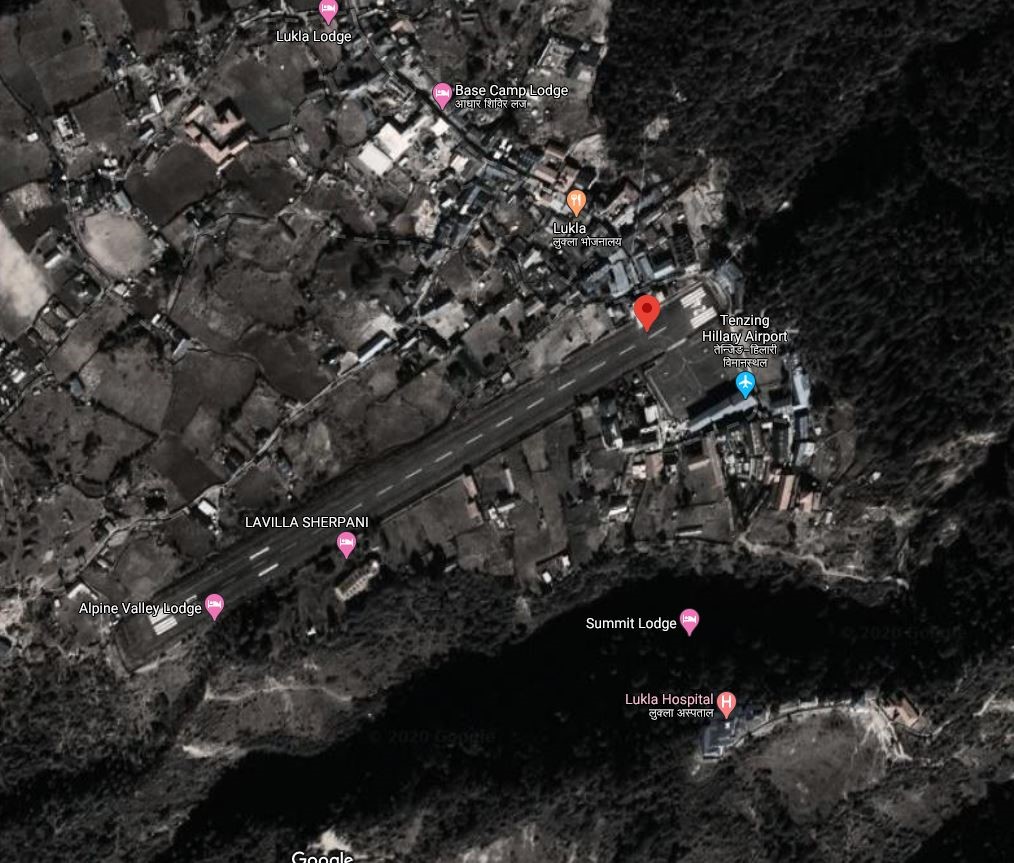
Lukla Airport also known as Tenzing-Hillary Airport, is a small airport in the town of Lukla, in Khumbu, Solukhumbu District, Koshi Province. It is 25 Kms NE of the District HQ with limited road access. It is within the premise of Lukla, the gateway to Mount Everest and inside the buffer zone of Sagarmatha national park. It is one of the four airports (Kangel Danda Airport, Phaplu Airport and Syangboche Airport) in the district.
It has been called one of the most dangerous airports in the world because of a combination of mountainous terrain, unpredictable weather and a very short and steep airstrip.
Between Nepal Airlines, Sita Air, Summit Air and Tara Air, daily flights are scheduled all around the year. Flight cancellation because of the inclement weather is very common.
The operation hours of the airport are as follows:
16 Feb to 15 Nov 0600 hrs – 1845 hrs LT
16 Nov to 15 Feb 0630 hrs – 1800 hrs LT
|
Airport Location and Contact |
|
|---|---|
|
Country |
Nepal |
|
Province or District |
Koshi Province/ Solukhumbu |
|
Nearest Town or City |
Amidst Lukla Bazaar |
|
Airport’s Complete Name |
Tenzing-Hillary (Lukla) Airport |
|
Latitude |
27.68745 |
|
Longitude |
86.73190 |
|
Elevation (ft and m) |
9337 ft (2846 m) |
|
IATA Code |
LUA |
|
ICAO Code |
VNLK |
|
Managing Company or Airport Authority |
Civil Aviation Authority of Nepal, Tenzing-Hillary (Lukla) Airport Off: 977-38550197 Tower: 977-38550044 Fax: 977-38550197 AFS VNLKYDYX |
|
Management Contact Person |
|
|
NGO and/or UN Presence at Airport? |
NO |
Runway
|
Runway #1 |
|
|---|---|
|
Runway Dimensions |
1728 × 65 ft (527 × 20 m) |
|
Runway Orientation |
06 - 24 - |
|
Runway Surface |
Asphalt Concrete |
|
Runway Condition |
Good |
Airport Infrastructure Details
|
Infrastructure |
|||
|---|---|---|---|
|
Passenger / Cargo Security Screening |
Metal Detector: Handheld, Walkthrough, CCTV |
Runway Lighting |
|
|
Refuelling Capacity |
No |
Ground Handling Services |
|
|
Air Traffic Control |
One Man Position Tower Console with Associated Equipment and Accessories |
Fire Fighting Equipment |
Ultra-high pressurize system fire vehicle and portable type fire extinguisher available. |
|
Weather Information |
AFIS, Tower Observation |
Aircraft Parking Space |
2800 sqm of concrete Apron, 4 D228 Type Aircraft |
|
Navigation Aids |
AFIS |
Perimeter Fencing |
|
|
Windsock |
|
|
|
Fuel Services Charges
N/A
Royalties / Non Objection Fees (NOFs)
N/A
Nepal - 2.2.17 Minor Domestic Airport - Rukum Salle
Airport Overview
|
|
|
Picture: Arial view of Rukum Salle Airport |
Rukum Salle Airport (ICAO: VNSL), also known as Musikot Airport, is an airport serving Musikot Khalanga, a municipality located in the Southern region of Karnali Province of Nepal. It was originally opened in 1994. The airport is one of two airports in Rukum District, the other one being Rukum Chaurjahari Airport. The airport was renovated and the runway blacktopped in 2014 after previously only having a grass/clay runway. The airport resides at an elevation of 5,184 feet (1,580 m) above mean sea level. It has one asphalt runway which is 580 metres (1,903 ft) in length and 20 metres width.
The airport is air-linked with Nepalgunj and Kathmandu. National airline operators provide scheduled flights to Musikot airport from Kathmandu and Nepalgunj.
The airport operates all around but in the time allocated as, Operation Hours
-
Nov to Jan 10:00hr-16:00hr
-
Feb to Oct 10:00hr-17:00hr.
The airport is located adjacently to Nepal Army’s Battalion and also shares the boundary with Nepal Food Corporation-Rukum. It is only 3 km away from the Mid Hill Highway that passes through Rukum.
|
Airport Location and Contact |
|
|---|---|
|
Country |
Nepal |
|
Province or District |
Karnali Province, West Rukum |
|
Nearest Town or City |
Musikot Bazaar less than 2 KM |
|
Airport’s Complete Name |
Rukum Salle Airport |
|
Latitude |
28.63692 |
|
Longitude |
82.44916 |
|
Elevation (ft and m) |
5184 ft (1580 m) |
|
IATA Code |
RUK |
|
ICAO Code |
VNSL |
|
Managing Company or Airport Authority |
Off: 977-88680354 Tower: 977-88680354 Fax: Not Available AFS: VNSLYDYX mailto: Email: salle_cao@caanepal.gov.np |
|
Management Contact Person |
|
|
NGO and/or UN Presence at Airport? |
No |
Runway(s)
|
Runway #1 |
|
|---|---|
|
Runway Dimensions |
580 m x 20 m (could be extended to 620 M) |
|
Runway Orientation |
16/34 |
|
Runway Surface |
Bituminous Paved (Asphalt Concrete) Surface |
|
Runway Condition |
Good. |
|
|
|
|
|
|
Dornier 228 is the biggest aircraft that is in service among the aircraft like DHC6 Twin Otter, Let L410 Turbolet, Harbin Y-12, and Cessna 208 Caravan, basically most of the single-engine aircraft.
Airport Infrastructure Details
|
Infrastructure |
|||
|---|---|---|---|
|
Passenger / Cargo Security Screening |
Hand held metal detector and manual checking of luggage |
Runway Lighting |
No, Night landing is not possible |
|
Refueling Capacity |
No |
Ground Handling Services |
Yes with the local airline -manual |
|
Air Traffic Control |
Yes VFR |
Fire Fighting Equipment |
fire extinguisher only |
|
Weather Information |
Yes through Observation Tower |
Aircraft Parking Space |
Yes- 3 DHC6 type Aircraft |
|
Navigation Aids |
NO |
Perimeter Fencing |
Yes, Also Airport shares wall with Nepal Army present at the district |
|
Windsock |
Yes |
|
|
Fuel Services Charges
Not Available in this Airport
|
|
Price per Litre USD - $ |
|---|---|
|
Jet A-1 |
n/A |
|
Avgas |
n/A |
Royalties / Non Objection Fees (NOFs)
Link for more detail :
RUKUM-SALLE-AIRPORT.pdf (caanepal.gov.np)
Link for ICAO and IATA Code: https://en.wikipedia.org/wiki/List_of_airports_in_Nepal
Nepal - 2.2.18 Minor Domestic Airport - Talcha
Airport Overview
|
|
|
Pic: Aerial View of Talcha Airport and small cluster of habitation on the left with ATC Tower |
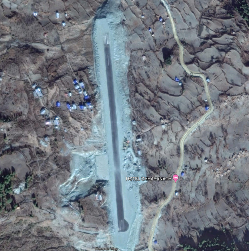
The Talcha Airport is situated at Karkibada Municipality of Mugu District, Karnali Province. It is an important gateway to the Rara National Park and is located about 2.5 hours walking distance from the Rara Lake. This airport is adjacent to the boundary of Rara National Park and within the Buffer Zone of the National Park.
|
Airport Location and Contact |
|
|---|---|
|
Country |
Nepal |
|
Province or District |
Karnali Province/ Mugu |
|
Nearest Town or City |
4 KM south from Gamgadhi |
|
Airport’s Complete Name |
Rara Airport, Talcha |
|
Latitude |
29.52020 |
|
Longitude |
82.14682 |
|
Elevation (ft and m) |
8924 ft (2720 m ) |
|
IATA Code |
THL |
|
ICAO Code |
VNRR |
|
Managing Company or Airport Authority |
Civil Aviation Authority of Nepal |
|
Management Contact Person |
Airport Chief: 9865960795 E-mail: rara_cao@caanepal.gov.np AFS: VNRRYDYX
|
|
NGO and/or UN Presence at Airport? |
NO |
Runway(s)
|
Runway #1 |
|
|---|---|
|
Runway Dimensions |
570 m x 20 m |
|
Runway Orientation |
18/36 |
|
Runway Surface |
Asphalt Concrete |
|
Runway Condition |
Good |
|
|
|
Fig: Asphalt Concrete Runway of Talcha Airport. Runway 36 on the right |
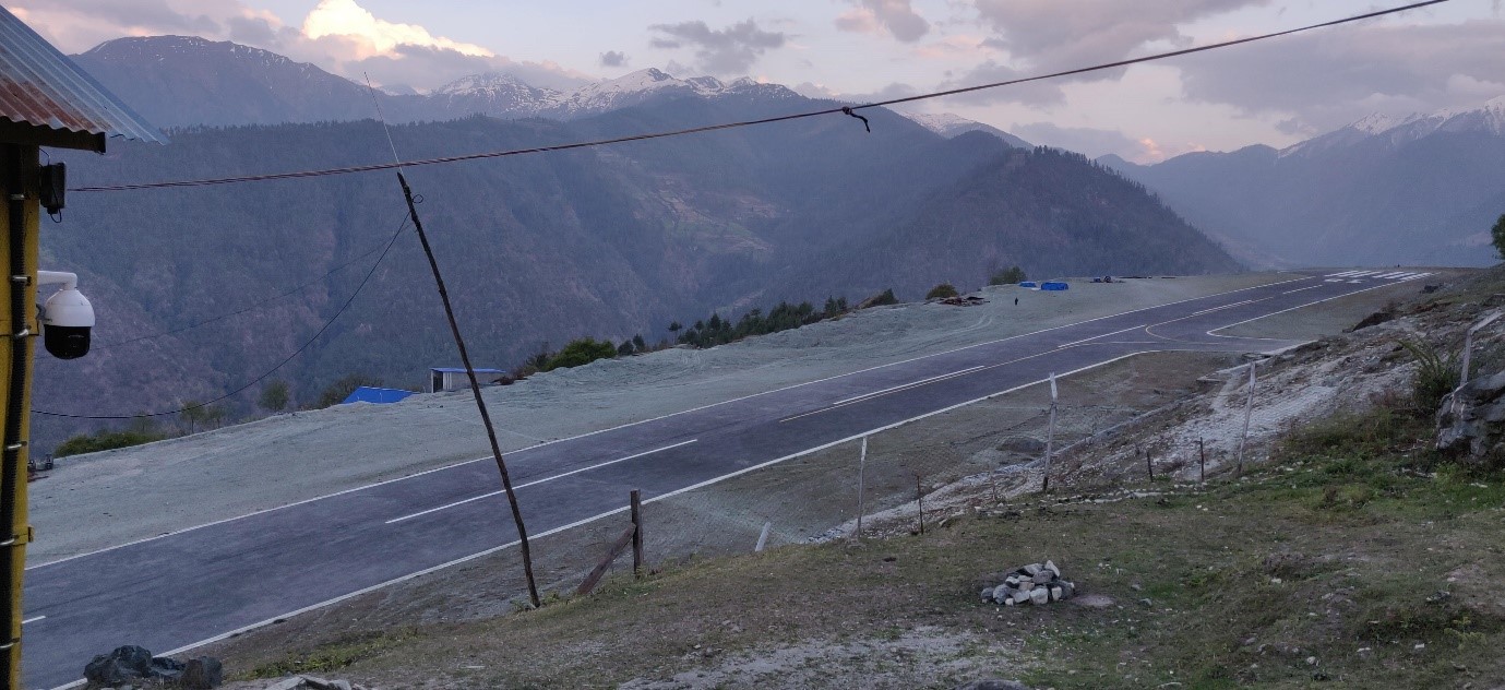
Airport Infrastructure Details
|
Infrastructure |
|||
|---|---|---|---|
|
Passenger / Cargo Security Screening |
Yes, hand-held metal detector |
Runway Lighting |
No |
|
Refueling Capacity |
No |
Ground Handling Services |
Yes with the local airlines operator. |
|
Air Traffic Control |
Yes |
Fire Fighting Equipment |
Yes |
|
Weather Information |
Tower Observation |
Aircraft Parking Space |
Apron for 2 small Aircrafts |
|
Navigation Aids |
No |
Perimeter Fencing |
Yes but have been not maintained properly. |
|
Windsock |
Yes |
|
|
Nepal - 2.2.19 Minor Domestic Airport - Rajbiraj
Airport Overview
Aerial view of Rajbiraj Airport-Saptari, Madesh Province-2
Rajbiraj is the district headquarters of Saptari District, Madesh Province and is located approximately 521 km from the capital, Kathmandu. The airport is situated 5km south of central Rajbiraj at Bisangapur Municipality. The 1st operation of the airport was started on 20th Feb 1960 and was completely shutdown, the airport resumed its operations on 23 May 2018. National airline operate direct flights from Kathmandu to Rajbiraj daily. (flight time 35 minutes).
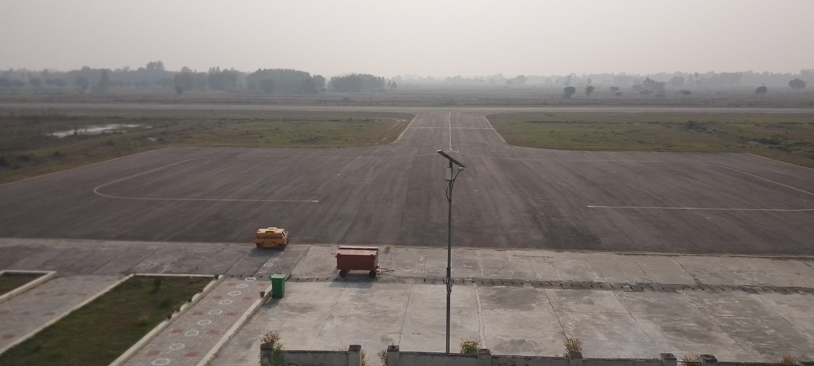
Aerodrome Administrative Operation hours
SUN-THU 10:00 -17:00 LT (SUMMER) & 10:00-1600 LT (WINTER),
FRI 10:00-1500 LT
Air traffic Service30 Jan to 01 Nov: 0415 – 1115 UTC
2 Nov – 29 Jan : 0415- 1015 UTC
Communication
Rajbiraj VHF Frequency 122,5 MGHZ
In 2022-2023 it had 712 aircraft movements, 33829 passengers, and 12160 kg cargo.
|
Airport Location and Contact |
|
|---|---|
|
Country |
Nepal |
|
Province or District |
Madhesh Province / Saptari |
|
Nearest Town or City |
Rajbiraj, Saptari - 5 km |
|
Airport’s Complete Name |
Rajbiraj Airport |
|
Latitude |
26.51089 |
|
Longitude |
86.73795 |
|
Elevation (ft and m) |
249 ft (76m) |
|
IATA Code |
RJB |
|
ICAO Code |
VNRB |
|
Managing Company or Airport Authority |
Civil Aviation Authority of Nepal Rajbiraj, Saptari Tel 1 - 977- 031-532458 Fax – NA AFS - VNRBYDYX Email: rajbiraj_cao@caanepal.gov.np |
|
Management Contact Person |
Tel - 977-031-532458 |
|
NGO and/or UN Presence at Airport? |
No |
|
Flight Service |
IFR & VFR |
Runway
|
Runway |
|
|---|---|
|
Runway Dimensions |
1590/30 m |
|
Runway Orientation |
11/29 |
|
Runway Surface |
Asphalt |
|
Runway Condition |
Good - Blacktop and operational |
Airport Infrastructure Details
|
Infrastructure |
|||
|---|---|---|---|
|
Passenger / Cargo Security Screening |
|
Runway Lighting |
APAPI Light & going to install |
|
Refueling Capacity |
No |
Ground Handling Services |
Yes with the local airline |
|
Air Traffic Control |
Yes |
Fire Fighting Equipment |
Fire extinguisher (portable) |
|
Weather Information |
Tower Observation & RNP observation approach |
Aircraft Parking Space |
5400 sq. 2 ATR Yes - 2 aircraft |
|
Navigation Aids |
Yes /VOR/DME |
Perimeter Fencing |
Yes – iron net fencing |
|
Windsock |
Yes - 1 |
|
|
Link for further details - Civil Aviation Authority of Nepal Rajbiraj Airport
Fuel Services Charges
N/A
Other information:
No Separate Helipad
1. Bird Activity a) Sometimes cases of bird concentrations in the vicinity of aerodrome may be encountered.
b) No Special procedures have been adopted to control these bird concentrations except driving them through guards and security personnel.
Nepal - 2.2.20 Minor Domestic Airport - Dolpa
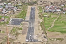
Airport Overview
Dolpa Airport (IATA: DOP, ICAO: VNDP) also referred to as Juphal Airport is located in Juphal, Thuli Bheri that serves the whole of Dolpa District, in Karnali Pradesh in Nepal. It is the only airport of the district. The airport serves as the gate way to Shey- Phoksundo National Park where the Phoksundo Lake is the major attraction. The airport also serves for the means of connection to upper Dolpa Trek which is one of the famous destinations for tourists.
The scheduled Operating airline from this airport are Tara Air, Sita Air, Nepal Airlines, Summit Air with scheduled connectivity services.
In 2020, it had 760 flight movements, 7446 passengers and 280272 kg of cargo. The airport is air-linked with Nepalgunj and Surkhet. National airline operators provide scheduled flights to Juphal airport from Nepalgunj and Surkhet. The airport operates all around with Operation Hours as following:
-
16th Feb to 15th Nov 0600LT-1215LT
-
16th Nov to 15th Feb 0630LT-1215LT
|
Airport Location and Contact |
|
|---|---|
|
Country |
Nepal |
|
Province or District |
Karnali Province, Dolpa |
|
Nearest Town or City |
Dunai, Dolpa |
|
Airport’s Complete Name |
Juphal Airport |
|
Latitude |
28.98554 |
|
Longitude |
82.81948 |
|
Elevation (ft and m) |
8137 ft (2480 m) |
|
IATA Code |
DOP |
|
ICAO Code |
VNDP |
|
Managing Company or Airport Authority |
Civil Aviation Authority of Nepal Off: 977-87690429 Tower: 977-87690429 AFS: VNDPYDYX E-mail: dolpa_cao@caanepal.gov.np |
|
Management Contact Person |
|
|
NGO and/or UN Presence at Airport? |
N/A |
Runway(s)
|
Runway #1 |
|
|---|---|
|
Runway Dimensions |
560 m x 20 m |
|
Runway Orientation |
16/34 |
|
Runway Surface |
Bituminous Paved (Asphalt Concrete) Surface |
|
Runway Condition |
Operational |
Airport Infrastructure Details
|
Infrastructure |
|||
|---|---|---|---|
|
Passenger / Cargo Security Screening |
Yes, Hand Held Metal Detector & CCTV Surveillance System |
Runway Lighting |
No |
|
Refueling Capacity |
No |
Ground Handling Services |
Limited |
|
Air Traffic Control |
Yes, One Man Position Tower Console with Associated Equipment and Accessories |
Fire Fighting Equipment |
|
|
Weather Information |
Yes, Tower Observation |
Aircraft Parking Space |
Two DHC6 Types with 2400 sq. Ashfalt surface |
|
Navigation Aids |
Yes, HF SSB, VHF |
Perimeter Fencing |
Yes, |
|
Windsock |
|
|
|
Fuel Services Charges
Not Available in this Airport
Royalties / Non Objection Fees (NOFs)
Link for more detail :
Link for ICAO and IATA Code: https://en.wikipedia.org/wiki/List_of_airports_in_Nepal
Nepal - 2.2.21 Minor Domestic Airport - Baitadi
|
|
|
Aerial view of Baitadi Airport |
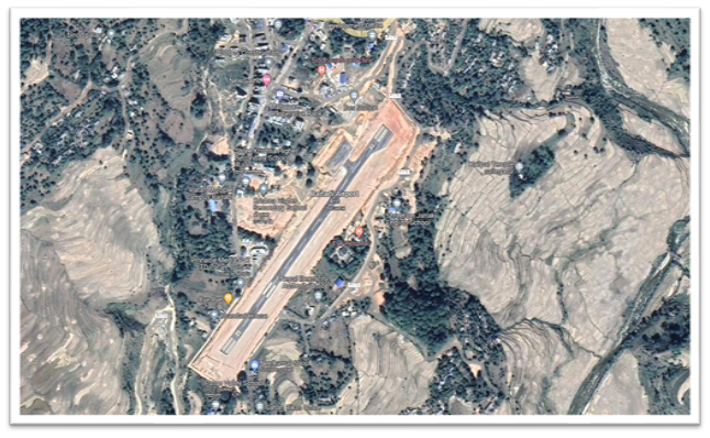
Airport Overview
Baitadi Airport also known as Patan Airport, is situated at Patan Municipality, of Baitadi District, Sudurpaschim Province.
The airport is located at an elevation of 4127 ft (1258 m) above mean sea level. The airport has a Bituminous Paved surface runway with dimensions 590 m x 20 m. Test landing was done on 03 October 2020 after the completion of the Asphalt Concrete Runway. In 2020 it had 16 aircraft movements and 200 pax movement
The airport was air-linked with Nepalgunj and Surkhet. Currently, the airport does not have any scheduled flights due to lack of enough number of air passengers
|
Airport Location and Contact |
|
|---|---|
|
Country |
Nepal |
|
Province or District |
Sudurpaschim, Baitadi |
|
Nearest Town or City |
Patan, Baitadi |
|
Airport’s Complete Name |
Baitadi (Patan) Airport |
|
Latitude |
29.46458 |
|
Longitude |
80.54975 |
|
Elevation (ft and m) |
4127 ft / 1258 m |
|
IATA Code |
BIT |
|
ICAO Code |
VNBT |
|
Managing Company or Airport Authority |
Civil Aviation Authority of Nepal AFS: VNBTYDYX |
|
Management Contact Person |
N/A
|
|
NGO and/or UN Presence at Airport? |
No |
Runway(s)
|
Runway #1 |
|
|---|---|
|
Runway Dimensions |
590 m x 20m |
|
Runway Orientation |
03/21 |
|
Runway Surface |
Bituminous Paved (Asphalt Concrete |
|
Runway Condition |
Asphalt Concrete |
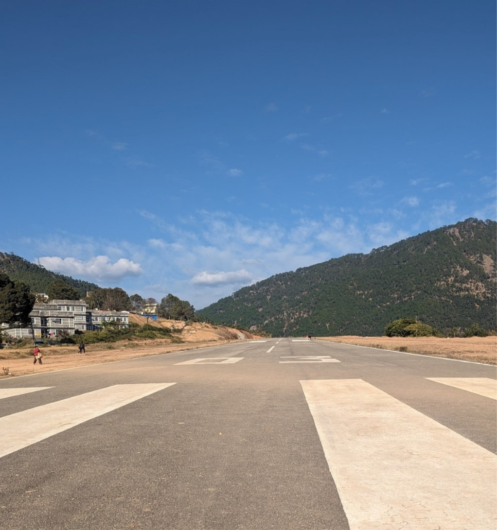
Airport Infrastructure Details
|
Infrastructure |
||||
|---|---|---|---|---|
|
Passenger / Cargo Security Screening |
Handheld Metal Detector |
Runway Lighting |
No |
|
|
Refueling Capacity |
No |
Ground Handling Services |
N/A |
|
|
Air Traffic Control |
Yes, AFIS, VFR |
Fire Fighting Equipment |
No |
|
|
Weather Information |
Tower Observation |
Aircraft Parking Space |
Two DHC6 Aircraft with 2100 sq.m. Asphalt Concrete Apron
|
|
|
Navigation Aids |
Yes VHF |
Perimeter Fencing |
Yes, but not properly maintained |
|
|
Windsock |
Yes |
|
|
|
Fuel Services Charges
Not Available in this Airport
Royalties / Non Objection Fees (NOFs)
N/A
Nepal - 2.2.22 Minor Domestic Airport - Bajura
Airport Overview
|
|
|
Picture: Arial view of Bajura Airport- Sudurpashchim province |
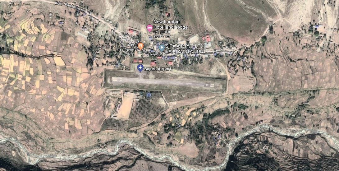
Bajura Airport resides at an elevation of 4,300 feet (1,311 m) above sea level. It has one runway which is 520 metres (1,706 ft) in length. National airline operators provide services from the airport to Nepalgunj and Dhangadi
|
Airport Location and Contact |
|
|---|---|
|
Country |
Nepal |
|
Province or District |
Sudurpashchim |
|
Nearest Town or City |
Bajura-Martadi DISTANCE (40 KM) |
|
Airport’s Complete Name |
Bajura (Kolte) |
|
Latitude |
29.50338 |
|
Longitude |
81.66713 |
|
Elevation (ft and m) |
1404 m |
|
IATA Code |
BJU |
|
ICAO Code |
VNBR |
|
Managing Company or Airport Authority |
Civil Aviation Authority –Bajura-Kolti
|
|
Management Contact Person |
Airport Chief Office Phone: +977-9858488215 Email: bajura_cao@caanepal.gov.np |
|
NGO and/or UN Presence at Airport? |
No |
Runway(s)
|
Runway #1 |
|
|---|---|
|
Runway Dimensions |
520 × 20 m |
|
Runway Orientation |
09 / 27 |
|
Runway Surface |
Asphalt |
|
Runway Condition |
Good, Blacktop and operational |
Airport Infrastructure Details
|
Infrastructure |
|||
|---|---|---|---|
|
Passenger / Cargo Security Screening |
No-Manual |
Runway Lighting |
No |
|
Refueling Capacity |
No |
Ground Handling Services |
Yes, however, all ground handling is done manually. |
|
Air Traffic Control |
Yes |
Fire Fighting Equipment |
No- only fire extinguishers are available. |
|
Weather Information |
Yes, Tower Observation |
Aircraft Parking Space |
Yes- 2 Aircrafts |
|
Navigation Aids |
Yes / |
Perimeter Fencing |
Yes |
|
Windsock |
Yes |
|
|
Fuel Services Charges
Not Available in this Airport
Royalties / Non Objection Fees (NOFs)
N/A
Link for ICAO and IATA Code: https://en.wikipedia.org/wiki/List_of_airports_in_Nepal
Nepal - 2.2.23 Minor Domestic Airport - Sanphebagar
Airport Overview
|
|
|
Pic: Aerial view of Sanfebagar Airport |
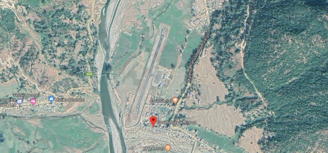
Sanphebagar Airport is situated in Accham District of Sudurpashchim Province. This airport has two scheduled flights connectivity to Dhangadhi, subject to availa. The airport resides at an elevation of 250 feet (76 m) above mean sea level. Since the renovation of the airport in 2018, the airport has one asphalt runway which is 530 metres (1,739 ft) in length. Moreover, due to the strategic location of this airport, heli operations to high altitude regions of Karnali and Sudurpaschim provinces, especially during emergencies, is most suitable.
|
Airport Location and Contact |
|
|---|---|
|
Country |
Nepal |
|
Province or District |
Sudurpaschim Province, Accham |
|
Nearest Town or City |
Mangalsen in 5 KM away from the airport |
|
Airport’s Complete Name |
Sanfebagar Airport |
|
Latitude |
29.23684 |
|
Longitude |
81.21574 |
|
Elevation (ft and m) |
597 m. / 1959 ft. |
|
IATA Code |
FEB |
|
ICAO Code |
VNSR |
|
Managing Company or Airport Authority |
Civil Aviation Authority of Nepal, Sanfebagar Airport AFS: VNSRYDYX |
|
Management Contact Person |
|
|
NGO and/or UN Presence at Airport? |
NO |
Runway
|
Runway #1 |
|
|---|---|
|
Runway Dimensions |
550 m x 20 m |
|
Runway Orientation |
02 / 20 |
|
Runway Surface |
Bituminous Paved (Asphalt Concrete) |
|
Runway Condition |
Operational |
Airport Infrastructure Details
|
Infrastructure |
|||
|---|---|---|---|
|
Passenger / Cargo Security Screening |
Handheld metal detector |
Runway Lighting |
No |
|
Refuelling Capacity |
No |
Ground Handling Services |
Yes, manual |
|
Air Traffic Control |
Yes |
Fire Fighting Equipment |
No |
|
Weather Information |
Tower Observation |
Aircraft Parking Space |
2400 sq. m |
|
Navigation Aids |
AFIS |
Perimeter Fencing |
|
|
Windsock |
Yes |
|
|
Fuel Services Charges
n/a
Royalties / Non Objection Fees (NOFs)
n/a
Nepal - 2.2.24 Baglung Domestic Airport
Airport Overview
|
|
|
Pic: Aerial view of Banglung Airport |
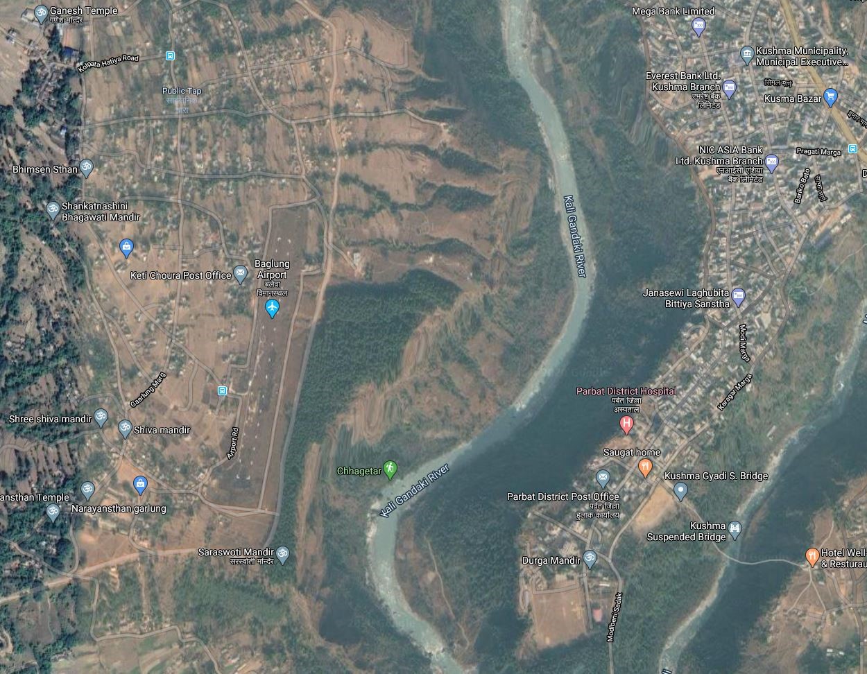
Baglung Airport also known as Balewa Airport, is an airport serving Narayanthan, a municipality located in the western region of Gandaki Province of Nepal. The airport was re-opened in 2018 after 26 years. since the early 2020s, there are no scheduled services to and from Baglung Airport.
Following resumption of the services, the access road to the airport was upgraded.
The airport has the following operation schedule:
-
Nov 1st to Jan 30th (Kartik 16th to Magh 15th) - 1000LT-1600LT
-
Feb 1st to Oct 30th (Magh 16th to Kartik 15th) - 1000LT-1700LT
|
Airport Location and Contact |
|
|---|---|
|
Country |
Nepal |
|
Province or District |
Gandaki Province/ Baglung |
|
Nearest Town or City |
15 KM SE from Baglung Municipality |
|
Airport’s Complete Name |
Baglung Airport |
|
Latitude |
28.78215 |
|
Longitude |
83.72314 |
|
Elevation (ft and m) |
3,248 ft / 990 m |
|
IATA Code |
BGL |
|
ICAO Code |
VNBL |
|
Managing Company or Airport Authority |
Civil Aviation Authority of Nepal, BaglungCivil Aviation Office, Baglung Airport Tel 977-68-413133 AFS: VNBLYDYX |
|
Management Contact Person |
|
|
NGO and/or UN Presence at Airport? |
NO |
Runway
|
Runway #1 |
|
|---|---|
|
Runway Dimensions |
608 x 30 m |
|
Runway Orientation |
01/19
|
|
Runway Surface |
Earthen |
|
Runway Condition |
Good, Overlay work is planned |
Airport Infrastructure Details
|
Infrastructure |
|||
|---|---|---|---|
|
Passenger / Cargo Security Screening |
hand Held Metal Detector |
Runway Lighting |
NO |
|
Re-fuelling Capacity |
NO |
Ground Handling Services |
|
|
Air Traffic Control |
AFIS
|
Fire Fighting Equipment |
No |
|
Weather Information |
Tower Observation, VFR |
Aircraft Parking Space |
Two DHC6 Aircrafts |
|
Navigation Aids |
HF SSB, VHF |
Perimeter Fencing |
|
|
Windsock |
|
|
|
Fuel Services Charges
N/A
Royalties / Non Objection Fees (NOFs)
N/A
Nepal - 2.2.25 Dhorpatan Minor Domestic Airport
Airport Overview
|
|
|
Pic: Aerial view of location of runway at Dhorpatan Airport |
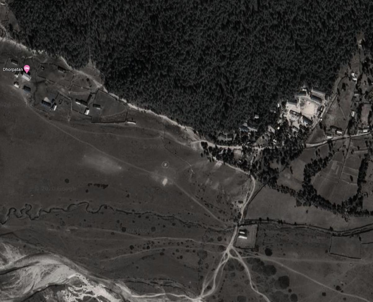
Dhorpatan Airport is located in Bowang, Dhorpatan Municipality of Baglung District. It is 114 kms NW of district Headquarter at Baglung. It takes 4.75 hrs via Mid hill Highway to get to the airport from HQ. It is not in operation. Dhorpatan Hunting reserve is located in this municipality.
|
Airport Location and Contact |
|
|---|---|
|
Country |
Nepal |
|
Province or District |
Gandaki Province/ Baglung |
|
Nearest Town or City |
114 Kms NW from Baglung Municipality |
|
Airport’s Complete Name |
Dhorpatan Airport |
|
Latitude |
28.49220 |
|
Longitude |
83.05125 |
|
Elevation (ft and m) |
8950 ft (2728 m) |
|
IATA Code |
|
|
ICAO Code |
VNDR |
|
Managing Company or Airport Authority |
Civil Aviation Authority of Nepal, Dhorpatan Airport Tel 977 AFS VNDRYDYX |
|
Management Contact Person |
|
|
NGO and/or UN Presence at Airport? |
NO |
Runway
|
Runway #1 |
|
|---|---|
|
Runway Dimensions |
365 m x 30 m |
|
Runway Orientation |
09/ 27 27 - |
|
Runway Surface |
Earthen |
|
Runway Condition |
Not in Operation |
Airport Infrastructure Details
|
Infrastructure |
|||
|---|---|---|---|
|
Passenger / Cargo Security Screening |
Not available |
Runway Lighting |
N/A |
|
Refuelling Capacity |
No |
Ground Handling Services |
N/A |
|
Air Traffic Control |
AFIS |
Fire Fighting Equipment |
N/A |
|
Weather Information |
VFR |
Aircraft Parking Space |
N/A |
|
Navigation Aids |
N/A |
Perimeter Fencing |
N/A |
|
Windsock |
N/A |
|
|
Fuel Services Charges
N/A
Royalties / Non Objection Fees (NOFs)
N/A
Nepal - 2.2.26 Gorkha Domestic Airport
Airport Overview
|
|
|
Pic: Aerial view of location of Gorkha Airport at Palungtar |

Gorkha Airport also known as Palungtar Airport, is an airport serving the municipalities Palungtar and Gorkha of Gorkha District in the Southern region of Gandaki Province of Nepal. It is 42 kms West of district HQ at Gorkha. It can be accessed via blacktopped F35 and then earthen road of Middle hill highway.
The Short Take-off and Landing (STOL) airport was used until 1979, but is now out of operation. Despite being out of operation, the airport served as a major landing site for helicopters distributing relief material after the Gorkha earthquake in 2015. The airport connects nearby districts like Tanahun, Lamjung, Manang and Mustang but the construction of Prithivi Highway has rendered it obsolete.
|
Airport Location and Contact |
|
|---|---|
|
Country |
Nepal |
|
Province or District |
Gandaki Province/ Gorkha |
|
Nearest Town or City |
42 Kms West of District HQ |
|
Airport’s Complete Name |
Gorkha Airport |
|
Latitude |
28.03966 |
|
Longitude |
84.46602 |
|
Elevation (ft and m) |
1460 ft/ 445 m |
|
IATA Code |
GKH |
|
ICAO Code |
VNGK |
|
Managing Company or Airport Authority |
Civil Aviation Authority of Nepal, Gorkha Airport AFS VNGKYDYX |
|
Management Contact Person |
|
|
NGO and/or UN Presence at Airport? |
NO |
Runway
|
Runway #1 |
|
|---|---|
|
Runway Dimensions |
3501 × 151 ft (1067 × 46 m) |
|
Runway Orientation |
02/20 |
|
Runway Surface |
Earthen |
|
Runway Condition |
Not in Operation |
Airport Infrastructure Details
|
Infrastructure |
|||
|---|---|---|---|
|
Passenger / Cargo Security Screening |
None |
Runway Lighting |
None |
|
Refuelling Capacity |
No |
Ground Handling Services |
None |
|
Air Traffic Control |
AFIS |
Fire Fighting Equipment |
None |
|
Weather Information |
VFR |
Aircraft Parking Space |
Two HDC6 types |
|
Navigation Aids |
N/A |
Perimeter Fencing |
N/A |
|
Windsock |
N/A |
|
|
Fuel Services Charges
N/A
Royalties / Non Objection Fees (NOFs)
N/A
Nepal - 2.2.27 Manang Domestic Airport
Airport Overview
|
|
|
Pic: Aerial view of Humde Airport |
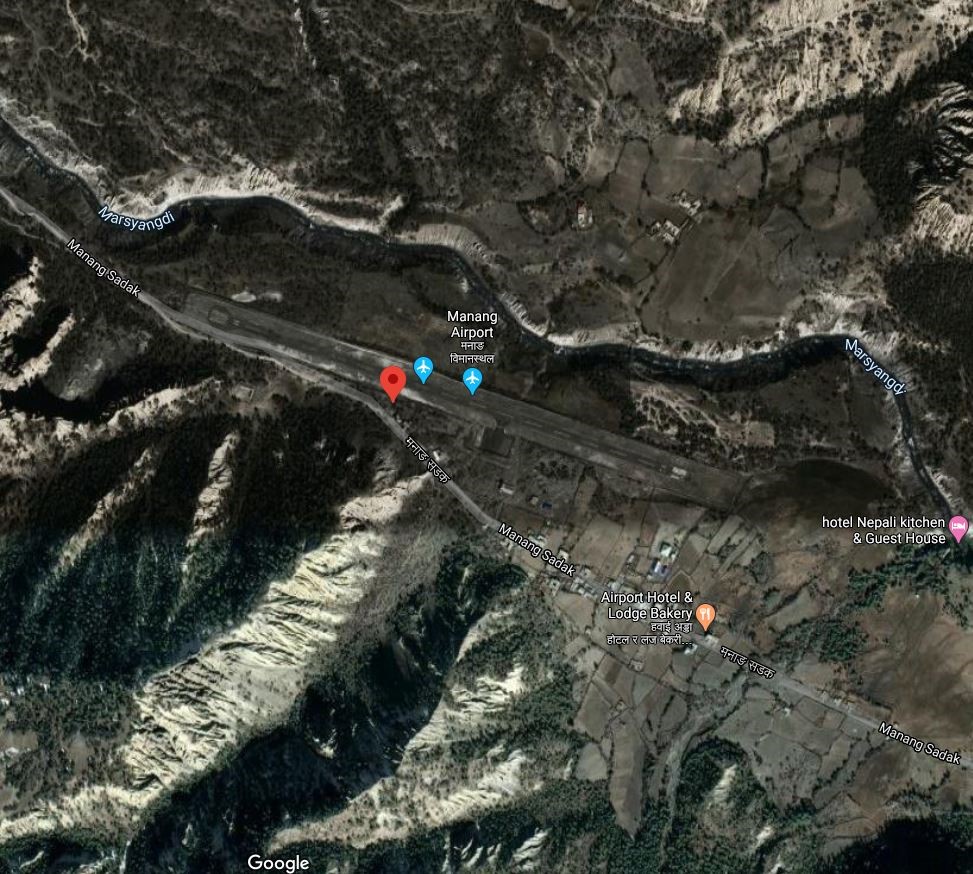
Manang Airport also known as Humde Airport is an airport serving Manang valley with one runway, a town in the Manang district of Gandaki Province in Nepal. It is 7 hours walking distance from district headquarter, Chame and an hour away 22 Km NW of District HQ at Chame. It can be accessed via Manang Sadak. It is 19th highest civilian airport in the world. It is not in operation.
Following are the operational schedules of Monang Airport.
-
16th Feb to 15th Nov- 0600LT-1215LT
-
16th Nov to 15th Feb- 0630LT-1215LT
|
Airport Location and Contact |
|
|---|---|
|
Country |
Nepal |
|
Province or District |
Gandaki Province/ Manang |
|
Nearest Town or City |
2.5 kilometres east of Manang town. |
|
Airport’s Complete Name |
Humde Airport |
|
Latitude |
28.64028 |
|
Longitude |
84.08791 |
|
Elevation (ft and m) |
11093 ft (3381 m) |
|
IATA Code |
NGX |
|
ICAO Code |
VNMA |
|
Managing Company or Airport Authority |
Civil Aviation Authority of Nepal, Humde Airport |
|
Management Contact Person |
|
|
NGO and/or UN Presence at Airport? |
None |
Runway
|
Runway #1 |
|
|---|---|
|
Runway Dimensions |
2952 × 65 ft (900 × 20 m) |
|
Runway Orientation |
11/29
|
|
Runway Surface |
Asphalt Concrete |
|
Runway Condition |
Not in Operation |
Airport Infrastructure Details
|
Infrastructure |
|||
|---|---|---|---|
|
Passenger / Cargo Security Screening |
Manual Search by Nepal Police |
Runway Lighting |
NO |
|
Refuelling Capacity |
NO |
Ground Handling Services |
|
|
Air Traffic Control |
Visual Flight Rules (VFR) |
Fire Fighting Equipment |
Not Available |
|
Weather Information |
AFIS, Tower Observation |
Aircraft Parking Space |
1750 sqm of Concrete Apron; 2 D228 Types |
|
Navigation Aids |
AFIS HF SSB, VHF |
Perimeter Fencing |
|
|
Windsock |
None |
|
|
Fuel Services Charges
N/A
Royalties / Non Objection Fees (NOFs)
N/A
Nepal - 2.2.28 Pokhara Domestic Airport
Airport Overview
|
|
|
Pic: Aerial view of Pokhara Airport |
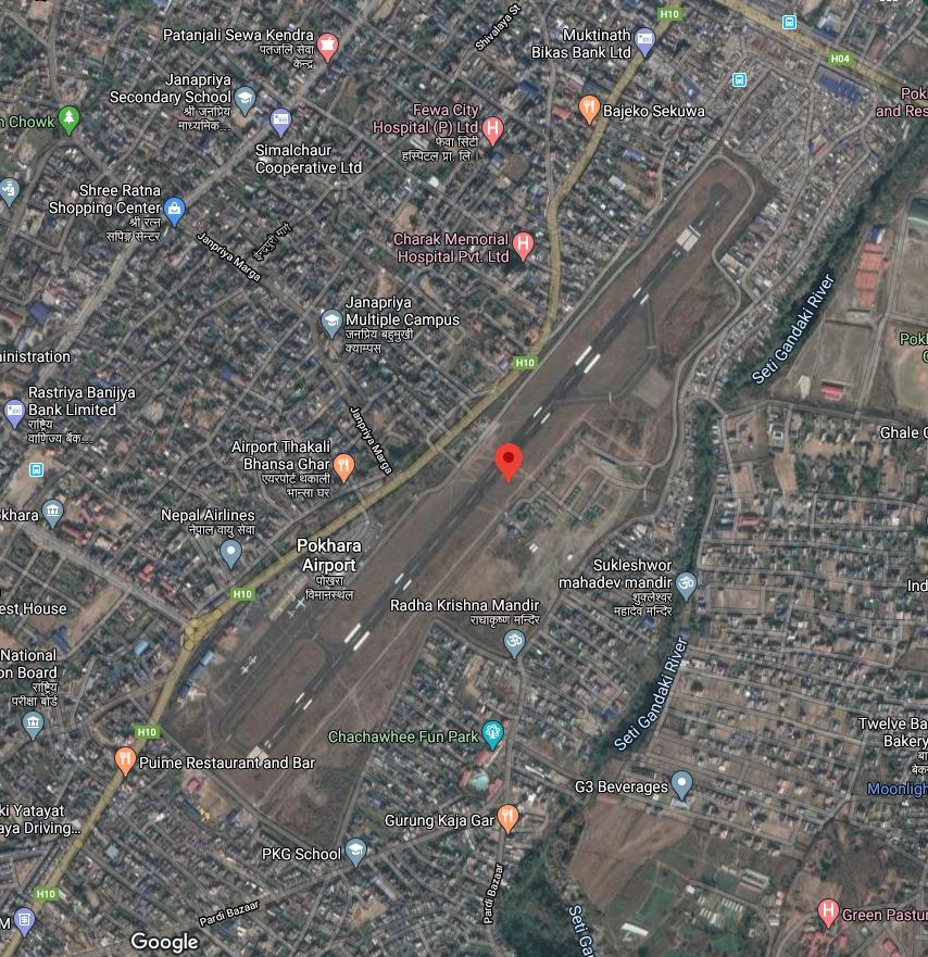
Pokhara Airport is a domestic airport in Pokhara, the provincial capital of Gandaki Province. It is in the proximity of Pokhara metropolitan city. After the inauguration of Pokhara International Airport (PIA) in January 2023, all scheduled and chartered flights commence from the newly built PIA. However, a regular flights to and from Jomsom, ultra-light (sight-seeing), and helicopters continue commencing from the Pokhara domestic airport.
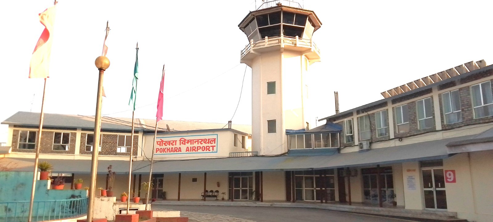
AD Administration Hour:
SUN-THU 10:00 -17:00 LT (SUMMER), 10:00-1600 LT (WINTER), FRI 10:00-1500 LT
Air Traffic Service operational hours all year round are as follows:
-
From 16 Feb - 15 Nov 0600LT-1845LT
-
From 16 Nov - 15 Feb 0630LT-1800LT
|
Airport Location and Contact |
|
|---|---|
|
Country |
Nepal |
|
Province or District |
Gandaki Province/ Kaski |
|
Nearest Town or City |
2 Km away from the main city |
|
Airport’s Complete Name |
Pokhara Airport |
|
Latitude |
28.20634 |
|
Longitude |
83.98020 |
|
Elevation (ft and m) |
2684/818m |
|
IATA Code |
PKR |
|
ICAO Code |
VNPK |
|
Managing Company or Airport Authority |
Jasoda Subedi Chief AoD 9846031773 Civil Aviation Authority of Nepal, Pokhara Civil Aviation Office, Pokhara, Kaski Tel- 977-061-465725, 535725 Fax - 977-061-465725 AFS – VNPKYDYX Email: pokhara_cao@caanepal.gov.np |
|
Management Contact Person |
|
|
NGO and/or UN Presence at Airport? |
NO |
Runway
|
Runway #1 |
|
|---|---|
|
Runway Dimensions |
1447 m x 30 m |
|
Runway Orientation |
04 / 22 |
|
Runway Surface |
Asphalt Concrete |
|
Runway Condition |
Good, operational |
Airport Infrastructure Details
|
Infrastructure |
|||
|---|---|---|---|
|
Passenger / Cargo Security Screening |
X-Ray: Hold Baggage, Hand Baggage Metal Detector: Walk Through, Handheld Metal Detector, CCTV Surveillance |
Runway Lighting |
No |
|
Refuelling Capacity |
JET A-1, during period of flight operation |
Ground Handling Services |
Available with local airlines operator |
|
Air Traffic Control |
Yes |
Fire Fighting Equipment |
Yes; Category II |
|
Weather Information |
Yes (by DHM)/MET |
Aircraft Parking Space |
15844.14 sqm of Concrete Apron, 5 ATR42, 2 Helicopters |
|
Navigation Aids |
DME |
Perimeter Fencing |
Yes |
|
Windsock |
Yes |
|
Isolated parking 65×60m Gravel, ATR 42 and ATR 72 Type |
Fuel Services Charges
The airport takes support from Nepal Oil Corporation for the provision of Jet fuel for the aircraft. NOC maintains the reserve of 60 Kilo Litre at its office premise. Storage Capacity (KL): Physical -64, Mobile-23 Storage Type: UG Tank (16×4) Refueller Details: AR21 (12KL), AR30 (11KL
|
|
Price per Litre USD - $ |
|---|---|
|
Jet A-1 |
1.02 / ltr (Duty Paid) * |
|
Avgas |
No |
*As of 01 October 2023 *Exchange rate 1 USD: 132.86 NPR
Additional Information: LOCAL TRAFFIC REGULATIONS
-
BTN 0515-0915 Daily, Paragliding activities takes place at Mahendradhunga, Pokhara area. Pilots to exercise caution while flying over that area. Airspace: 6000 ft AMSL/GND
-
BTN 0415-1115 Daily, Paragliding activities takes place at Bandipur area, near W41 route 926 NM South East of Pokhara ariport). Pilots to exercise caution while flying over that area. Airspace: 5000ft AMSL/GND
-
BTN 0015 - 1115 Daily, Ultra Light Training Flight zone has been established at 5.6 DME from Pokhara Airport at Laurek, Kaski District within 1NM circle From the mid point of Laurek Air Strip. Ultra light Training flight shall strictly remain to the west of Harpan Khola bridge to separate from the Paragliding Flights. Pilots to exercise caution while flying over that area. Airspace: 4500 ft AMSL/ GND
Nepal - 2.2.29 Jiri Domestic Airport
Airport Overview
|
|
|
Pic: Aerial view of the location of Jiri Airport at Jiri Municipality |
Jiri Airport is a small serving the of Jiri, Dolakha district in the north-eastern region of Bagmati of . It is 57 km East of district headquarter at Charikot, Dolakha. It can be accessed via blacktopped F32 and then Jiri Khadichaur local road.
The airport served as the gateway to Mount Everest when it opened in 1979.
|
Airport Location and Contact |
|
|---|---|
|
Country |
Nepal |
|
Province or District |
Bagmati Province / Dolakha |
|
Nearest Town or City |
57 Km E of District HQ in Charikot, Jiri Bazaar is in close proximity and Ramechhap Airport is located in close proximity to the city on distance of 2 and a half hours and is about 30km from Ramechhap Airport to Jiri. |
|
Airport’s Complete Name |
Jiri Airport |
|
Latitude |
27.62629 |
|
Longitude |
86.23039 |
|
Elevation (ft and m) |
6063 ft/1848m |
|
IATA Code |
JIR |
|
ICAO Code |
VNJI |
|
Managing Company or Airport Authority |
Civil Aviation Authority of Nepal, Jiri Airport Tel 977 AFS VNJIYDYX |
|
Management Contact Person |
|
|
NGO and/or UN Presence at Airport? |
NO |
Runway
|
Runway #1 |
|
|---|---|
|
Runway Dimensions |
1197 × 59 ft (365 × 18 m) |
|
Runway Orientation |
14/32 |
|
Runway Surface |
Earthen |
|
Runway Condition |
Not in Operation |
Airport Infrastructure Details
|
Infrastructure |
|||
|---|---|---|---|
|
Passenger / Cargo Security Screening |
NO |
Runway Lighting |
NO |
|
Refuelling Capacity |
NO |
Ground Handling Services |
NO |
|
Air Traffic Control |
Visual Flight Rules (VFR) |
Fire Fighting Equipment |
NO |
|
Weather Information |
AFIS |
Aircraft Parking Space |
Not available, Earthen |
|
Navigation Aids |
NO |
Perimeter Fencing |
Yes |
|
Windsock |
N/A |
|
|
Fuel Services Charges
N/A
Royalties / Non-Objection Fees (NOFs)
N/A
Nepal - 2.2.30 Langtang Domestic Airport
Airport Overview
|
|
|
Pic: Aerial view of location of Langtang Airport at Rasuwa |
Langtang Airport is an airport in Rasuwa district of Bagmati Province. at It is 30 Km NE from Dhunche with limited accessibility. It is not in Operation.
|
Airport Location and Contact |
|
|---|---|
|
Country |
Nepal |
|
Province or District |
Bagmati Province / Rasuwa |
|
Nearest Town or City |
30 Km due NE of district HQ with limited accessibility |
|
Airport’s Complete Name |
Langtang Airport |
|
Latitude |
28.20000 |
|
Longitude |
85.58527 |
|
Elevation (ft and m) |
11998 ft. / 3658 m |
|
IATA Code |
LTG |
|
ICAO Code |
VNLT |
|
Managing Company or Airport Authority |
Civil Aviation Authority of Nepal, Langtang Airport Tel 977 AFS |
|
Management Contact Person |
N/A |
|
NGO and/or UN Presence at Airport? |
NO |
Runway
|
Runway #1 |
|
|---|---|
|
Runway Dimensions |
1378 × 100 ft (420× 30 m) |
|
Runway Orientation |
09 - 27- |
|
Runway Surface |
Earthen |
|
Runway Condition |
Not in Operation |
Airport Infrastructure Details
|
Infrastructure |
|||
|---|---|---|---|
|
Passenger / Cargo Security Screening |
No |
Runway Lighting |
No |
|
Refuelling Capacity |
No |
Ground Handling Services |
No |
|
Air Traffic Control |
No |
Fire Fighting Equipment |
No |
|
Weather Information |
No |
Aircraft Parking Space |
No |
|
Navigation Aids |
No |
Perimeter Fencing |
No |
|
Windsock |
No |
|
|
Nepal - 2.2.31 Meghauli Domestic Airport
Airport Overview
|
|
|
Pic: Aerial view of Meghauli Airport |
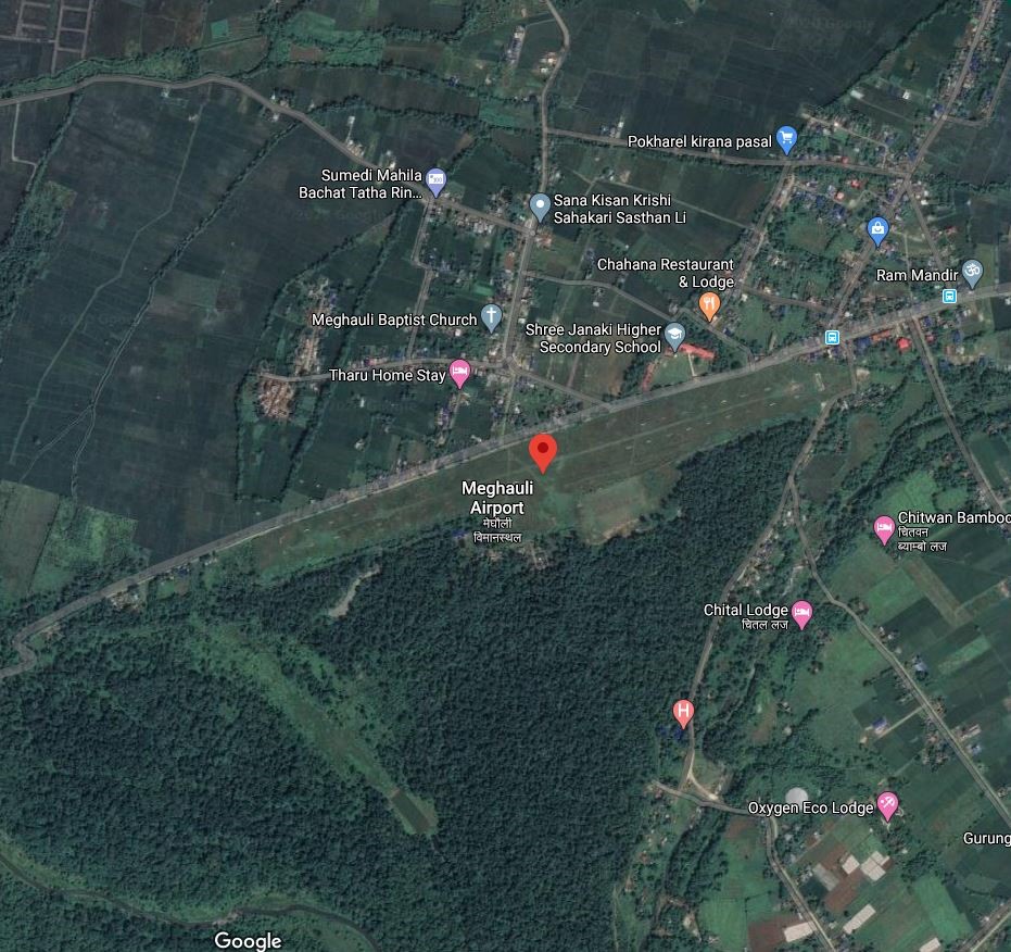
Meghauli Airport is an airport in Meghauli, Bharatpur Metropolitan City in Chitwan district in Bagmati Province. It is one of the two airports in Chitwan, the other being Bharatpur Airport. It is 26 km South W of the district HQ at Bharatpur. It can be accessed via a blacktopped road.
The airport was built in 1961, however, the operation stopped in 2011 and it remains not in operation.
|
Airport Location and Contact |
|
|---|---|
|
Country |
Nepal |
|
Province or District |
Bagmati Province / Chitwan |
|
Nearest Town or City |
24 KM South of district HQ at Bharatpur |
|
Airport’s Complete Name |
Meghauli Airport |
|
Latitude |
27.57682 |
|
Longitude |
84.22802 |
|
Elevation (ft and m) |
498 ft (152 m) |
|
IATA Code |
MEY |
|
ICAO Code |
VNMG |
|
Managing Company or Airport Authority |
Civil Aviation Authority of Nepal, Meghauli Airport Tel 977 AFS: VNMGYDYX |
|
Management Contact Person |
|
|
NGO and/or UN Presence at Airport? |
NO |
Runway
|
Runway #1 |
|
|---|---|
|
Runway Dimensions |
1067 m×46 m |
|
Runway Orientation |
08/26 |
|
Runway Surface |
Earthen |
|
Runway Condition |
Not in operation |
Airport Infrastructure Details
|
Infrastructure |
|||
|---|---|---|---|
|
Passenger / Cargo Security Screening |
Not available |
Runway Lighting |
NO |
|
Refuelling Capacity |
Not available |
Ground Handling Services |
NO |
|
Air Traffic Control |
VFR |
Fire Fighting Equipment |
NO |
|
Weather Information |
AFIS |
Aircraft Parking Space |
3500 sqm of earthen Apron, 2 DHC6 Types |
|
Navigation Aids |
AFIS |
Perimeter Fencing |
|
|
Windsock |
No |
|
|
Fuel Services Charges
N/A
Royalties / Non Objection Fees (NOFs)
N/A
Nepal - 2.2.32 Ramechhap Domestic Airport
Airport Overview
|
|
|
Pic: Aerial view of Ramechhap Airport in Manthali |
Ramechhap Airport is an airport serving the municipality of Manthali, the district headquarter of Ramechhap District located in the Tamakoshi River valley in Bagmati Province. It is in proximity to the district HQ. The Airport opened in 1979 and was renovated in 2015. It is the closest Airfield to Tribhuvan International Airport (TIA) in Kathmandu. Regular commercial flights to Lukla and Phaplu Airport are operated from this airport. While the chartered helicopters to Lukla and Phaplu are operated from TIA. Airport operational hours are as follows:
-
16th Feb to 15th Nov 0600LT-1215LT
-
16th Nov to 15th Feb 0630LT-1215LT
|
Airport Location and Contact |
|
|---|---|
|
Country |
Nepal |
|
Province or District |
Bagmati Province / Ramechhap |
|
Nearest Town or City |
In proximity of District HQ at Manthali |
|
Airport’s Complete Name |
Ramechhap Airport |
|
Latitude |
27.2338 |
|
Longitude |
86.06138 |
|
Elevation (ft and m) |
1620 ft./494 m. |
|
IATA Code |
RHP |
|
ICAO Code |
VNRC |
|
Managing Company or Airport Authority |
Civil Aviation Authority of Nepal, Ramechhap Airport Tel: 977 48540087 Tower: 977 48540087 Fax: 977 48540087 AFS VNRCYDYX |
|
Management Contact Person |
|
|
NGO and/or UN Presence at Airport? |
NO |
Runway
|
Runway #1 |
|
|---|---|
|
Runway Dimensions |
1738 × 65 ft (530 m × 20 m) |
|
Runway Orientation |
03- 21- |
|
Runway Surface |
Asphalt Concrete |
|
Runway Condition |
Operational |
Airport Infrastructure Details
|
Infrastructure |
|||
|---|---|---|---|
|
Passenger / Cargo Security Screening |
Metal Detector: handheld |
Runway Lighting |
No |
|
Refuelling Capacity |
Yes |
Ground Handling Services |
Yes |
|
Air Traffic Control |
Visual Flight Rules (VFR). HF SSB. VHF, One Man Position Tower Console with Associated Equipment and Accessories
|
Fire Fighting Equipment |
Yes |
|
Weather Information |
AFIS, Tower Observation |
Aircraft Parking Space |
5000 sqm Apron for 4 nos of Twinotter akin Aircrafts |
|
Navigation Aids |
HF SSB, VHF |
Perimeter Fencing |
N/A |
|
Windsock |
N/A |
|
|
Fuel Services Charges
The airport takes support from Nepal Oil Corporation for the provision of Jet fuel for the aircraft. NOC maintains the reserve of 60 Kilo Litre at its office premise.
|
|
Price per Litre USD - $ |
|---|---|
|
Jet A-1 |
0.55 (Duty Paid) * |
|
Avgas |
No |
*As of 01 October 2023
*Exchange rate 1 USD: 132.86 NPR
Nepal - 2.2.33 Dang Domestic Airport
Airport Overview
|
|
|
Pic: Aerial view of Dang airport |
Dang Airport, also known as Tarigaun Airport, is in the West of Dang District in Lumbini Province. The airport is located in Tulsipur, 2 km south of the town center, and 23 km (14 mi) NW of Ghorahi.
Nepal Airlines operates weekly 3 fflights to and from Kathmandu. The airport is operational.
The operation hours are as follows:
-
16 Nov to 15 Feb 0630 hrs to 1230 hrs LT
-
16 Feb to 15 Nov 0600 hrs to 1200 hrs LT
|
Airport Location and Contact |
|
|---|---|
|
Country |
Nepal |
|
Province or District |
Lumbini province/ Dang |
|
Nearest Town or City |
2 kms South of Tulsipur |
|
Airport’s Complete Name |
Dang Airport |
|
Latitude |
28.11205 |
|
Longitude |
82.29408 |
|
Elevation (ft and m) |
2080 ft (634 m) |
|
IATA Code |
DNP |
|
ICAO Code |
VNDG |
|
Managing Company or Airport Authority |
Civil Aviation Authority of Nepal, Dang Airport Tel: 977-82521269 AFS: VNDGYDYX |
|
Management Contact Person |
Chet Raj Kapadi Bhatta |
|
NGO and/or UN Presence at Airport? |
NO |
Runway
|
Runway #1 |
|
|---|---|
|
Runway Dimensions |
2460 × 98 ft (750 × 30 m) |
|
Runway Orientation |
16 / 34 |
|
Runway Surface |
Asphalt Concrete |
|
Runway Condition |
Operational |
Airport Infrastructure Details
|
Infrastructure |
|||
|---|---|---|---|
|
Passenger / Cargo Security Screening |
Metal Detector: Handheld |
Runway Lighting |
No |
|
Refuelling Capacity |
Yes |
Ground Handling Services |
Manual |
|
Air Traffic Control |
One Man Position Tower Console with Associated Equipment and Accessories |
Fire Fighting Equipment |
Yes, Four hanhled fire extinguisher of 6 each and One 25 Kg extinguisher |
|
Weather Information |
Tower Observation and Met Display |
Aircraft Parking Space |
4500sqm of concrete Apron; 2 DHC6 Types |
|
Navigation Aids |
AFIS |
Perimeter Fencing |
Yes |
|
Windsock |
Yes |
|
|
Fuel Services Charges
The airport takes support from Nepal Oil Corporation for the provision of Jet fuel for the aircraft.
|
|
Price per Litre USD - $ |
|---|---|
|
Jet A-1 |
1.02 / ltr (Duty Paid) * |
|
Avgas |
No |
*As of 11 Oct 2023
*Exchange rate 1 USD: 132.90 NPR
Royalties / Non Objection Fees (NOFs)
n/a
Nepal - 2.2.34 Rolpa Domestic Airport
Airport Overview
|
|
|
Pic: Aerial view of Rolpa Airport |
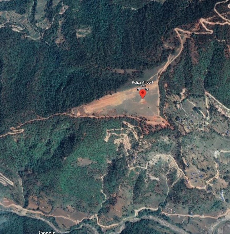
Rolpa Airport is situated at Bodachaur Municipality of Rolpa District, Lumbini Province . This airport is not in operation.
|
Airport Location and Contact |
|
|---|---|
|
Country |
Nepal |
|
Province or District |
Lumbini Province, Rolpa |
|
Nearest Town or City |
Bhalubang 2 hrs, 80 km south |
|
Airport’s Complete Name |
Rolpa Airport |
|
Latitude |
28.26732 |
|
Longitude |
82.75658 |
|
Elevation (ft and m) |
1250 m./4100 ft |
|
IATA Code |
RPA |
|
ICAO Code |
VNRP |
|
Managing Company or Airport Authority |
Civil Aviation Authority of Nepal AFS VNRPYDYX |
|
Management Contact Person |
N/A |
|
NGO and/or UN Presence at Airport? |
NO |
Runway
|
Runway #1 |
|
|---|---|
|
Runway Dimensions |
457 m x 30 m |
|
Runway Orientation |
06/24 |
|
Runway Surface |
Earthen |
|
Runway Condition |
Not in operation |
Nepal - 2.2.35 Bhojpur Domestic Airport
Airport Overview
|
|
|
Pic: Aerial view of Bhojpur Airport |
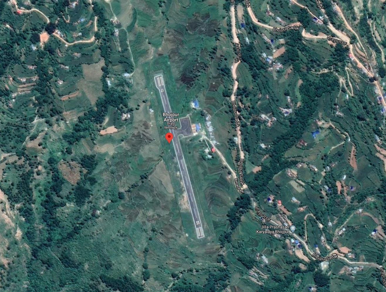
Bhojpur Airport is situated at Bhojpur, a town in the Bhojpur District in Koshi Province.
Currently Nepal Airlines has flights back and forth from Bhojpur to Kathmandu and Biratnagar.
The types of aircrafts that has been making the trip to the airport are DHC6, L410, Y12, C208. In 2019, 436 flights carried 5991 passengers and 713 kgs of cargo between destinations.
The operation is all year but with hour schedules as of now is as follows:
-
16 Feb to 15 Nov 0600 hrs – 1215 hrs LT
-
16 Nov to 15 Feb 0630 hrs – 1215 hrs LT
|
Airport Location and Contact |
|
|---|---|
|
Country |
Nepal |
|
Province or District |
Koshi Province/ Bhojpur |
|
Nearest Town or City |
5 Kms South of the District HQ |
|
Airport’s Complete Name |
Bhojpur Airport |
|
Latitude |
27.14821 |
|
Longitude |
87.05189 |
|
Elevation (ft and m) |
3962 ft (1208 m) |
|
IATA Code |
BHP |
|
ICAO Code |
VNBJ |
|
Managing Company or Airport Authority |
Civil Aviation Authority of Nepal, Bhojpur Airport Tel 977 -29-420118 AFS : VNBJYDYX |
|
Management Contact Person |
|
|
NGO and/or UN Presence at Airport? |
NO |
Runway
|
Runway #1 |
|
|---|---|
|
Runway Dimensions |
1771 × 65 ft (540 × 20 m) |
|
Runway Orientation |
17 - 35 - |
|
Runway Surface |
Asphalt concrete |
|
Runway Condition |
Operational |
Airport Infrastructure Details
|
Infrastructure |
|||
|---|---|---|---|
|
Passenger / Cargo Security Screening |
Handheld Metal Detector / CCTV surveillance |
Runway Lighting |
No |
|
Refuelling Capacity |
Not available |
Ground Handling Services |
|
|
Air Traffic Control |
Communication through HF SSB, VHF |
Fire Fighting Equipment |
No |
|
Weather Information |
Yes (Tower Observation) |
Aircraft Parking Space |
Apron of 65 x 32 m (three small Aircrafts) |
|
Navigation Aids |
None |
Perimeter Fencing |
|
|
Windsock |
|
|
|
Fuel Services Charges
N/A
Royalties / Non Objection Fees (NOFs)
N/A
Nepal - 2.2.36 Phaplu Domestic Airport
Airport Overview
|
|
|
Pic: Aerial view of Phaplu Airport |
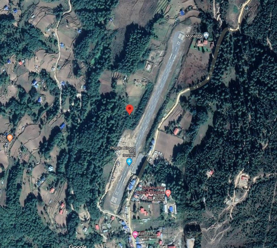
Phaplu Airport is located in Solu Dudhkunda municipality, Solukhumbu District, Koshi Province. It is within the premise of District Headquarter Salleri. It is one of the four airports in Solukhumbu district (Tenzing-Hillary, Kangle Danda, Syangboche). The airport runway was blacktopped in 2013. of Solu Dudhkunda municipality, Solukhumbu District, Koshi Province. It is within the premise of District Headquarter Salleri. It is one of the four airports in Solukhumbu district (Tenzing-Hillary, Kangle Danda, Syangboche). The airport runway was blacktopped in 2013.
Nepal Airlines, Tara Air and Summit Air provide services from Kathmandu all year-round on the following operation hours:
-
16 Feb to 15 Nov 0600 hrs – 1215 hrs LT
-
16 Nov to 15 Feb 0630 hrs – 1215 hrs LT
|
Airport Location and Contact |
|
|---|---|
|
Country |
Nepal |
|
Province or District |
Koshi Province/ Solukhumbu |
|
Nearest Town or City |
3 Kms from District HQ |
|
Airport’s Complete Name |
Phaplu Airport |
|
Latitude |
27.51657 |
|
Longitude |
86.58442 |
|
Elevation (ft and m) |
8097 ft (2468 m) |
|
IATA Code |
PPL |
|
ICAO Code |
VNPL |
|
Managing Company or Airport Authority |
Civil Aviation Authority of Nepal, Phaplu Airport Tel 977 38520153 AFS VNPLYDYX |
|
Management Contact Person |
|
|
NGO and/or UN Presence at Airport? |
NO |
Runway
|
Runway #1 |
|
|---|---|
|
Runway Dimensions |
2230 × 65 ft (680 × 20 m) |
|
Runway Orientation |
02 - 20 - |
|
Runway Surface |
Asphalt Concrete |
|
Runway Condition |
Operational |
Airport Infrastructure Details
|
Infrastructure |
|||
|---|---|---|---|
|
Passenger / Cargo Security Screening |
Metal detector: Handheld |
Runway Lighting |
No |
|
Refuelling Capacity |
No |
Ground Handling Services |
|
|
Air Traffic Control |
Uncontrolled |
Fire Fighting Equipment |
No |
|
Weather Information |
AFIS, Tower Observation |
Aircraft Parking Space |
1600 sqm of concrete apron, 3 D228 Types |
|
Navigation Aids |
None |
Perimeter Fencing |
|
|
Windsock |
|
|
|
Fuel Services Charges
N/A
Royalties / Non Objection Fees (NOFs)
N/A
Nepal - 2.2.37 Kangledanda Domestic Airport
Airport Overview
|
|
|
Pic: Aerial view of kangle Danda Airport at Kangledanda |
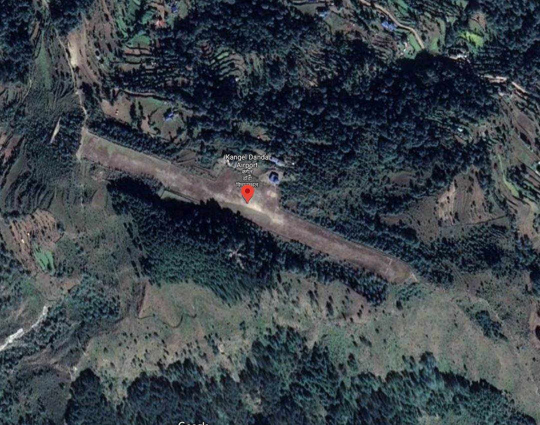
Kangel danda Airport is in Dudhkaushika rural municipality in the central part of Solukhumbu district of Koshi Province. It is one of the four airports in Solukhumbu district (Tenzing-Hillary, Phaplu, Syangboche). It is 12 kms SE of district HQ at Salleri. Road access is limited to the airport and nearest point of feeder road passing by is 6 kms away. This airport is not operational.
The terrain on which the airport is located is hilly and the flights to and from can be difficult due to high wind speeds and low visibility. When it was operational, during rainy season the airport remained closed.
Source: Airports of Nepal: Kangel Danda
|
Airport Location and Contact |
|
|---|---|
|
Country |
Nepal |
|
Province or District |
Koshi Province/ Solukhumbu |
|
Nearest Town or City |
12 kms SE of Salleri bazaar and 6 kms of limited access from the nearest point in F052 |
|
Airport’s Complete Name |
Kangeldanda Airport |
|
Latitude |
27.41096 |
|
Longitude |
86.64686 |
|
Elevation (ft and m) |
6880 ft (2097 m) |
|
IATA Code |
KGN |
|
ICAO Code |
VNKL |
|
Managing Company or Airport Authority |
Civil Aviation Authority of Nepal, Kangeldanda Airport AFS: VNKLYDYX |
|
Management Contact Person |
|
|
NGO and/or UN Presence at Airport? |
NO |
Runway
|
Runway #1 |
|
|---|---|
|
Runway Dimensions |
1706 × 85 ft (520 × 26 m) |
|
Runway Orientation |
11 - 29- |
|
Runway Surface |
Earthen |
|
Runway Condition |
Not in Operation |
Airport Infrastructure Details
|
Infrastructure |
|||
|---|---|---|---|
|
Passenger / Cargo Security Screening |
Manual search by Nepal Police |
Runway Lighting |
No |
|
Refuelling Capacity |
No |
Ground Handling Services |
|
|
Air Traffic Control |
Uncontrolled ATC |
Fire Fighting Equipment |
No |
|
Weather Information |
AFIS, Tower observation |
Aircraft Parking Space |
Two L410 Types, 2100 sq.m. apron |
|
Navigation Aids |
None |
Perimeter Fencing |
Fenced with wire mesh |
|
Windsock |
yes |
|
|
Fuel Services Charges
n/a
Royalties / Non Objection Fees (NOFs)
n/a
Nepal - 2.2.38 Manamaya Rai Khanidanda Domestic Airport
Airport Overview
|
|
|
Pic: Aerial view of Khani Danda Aiport at Diktel |
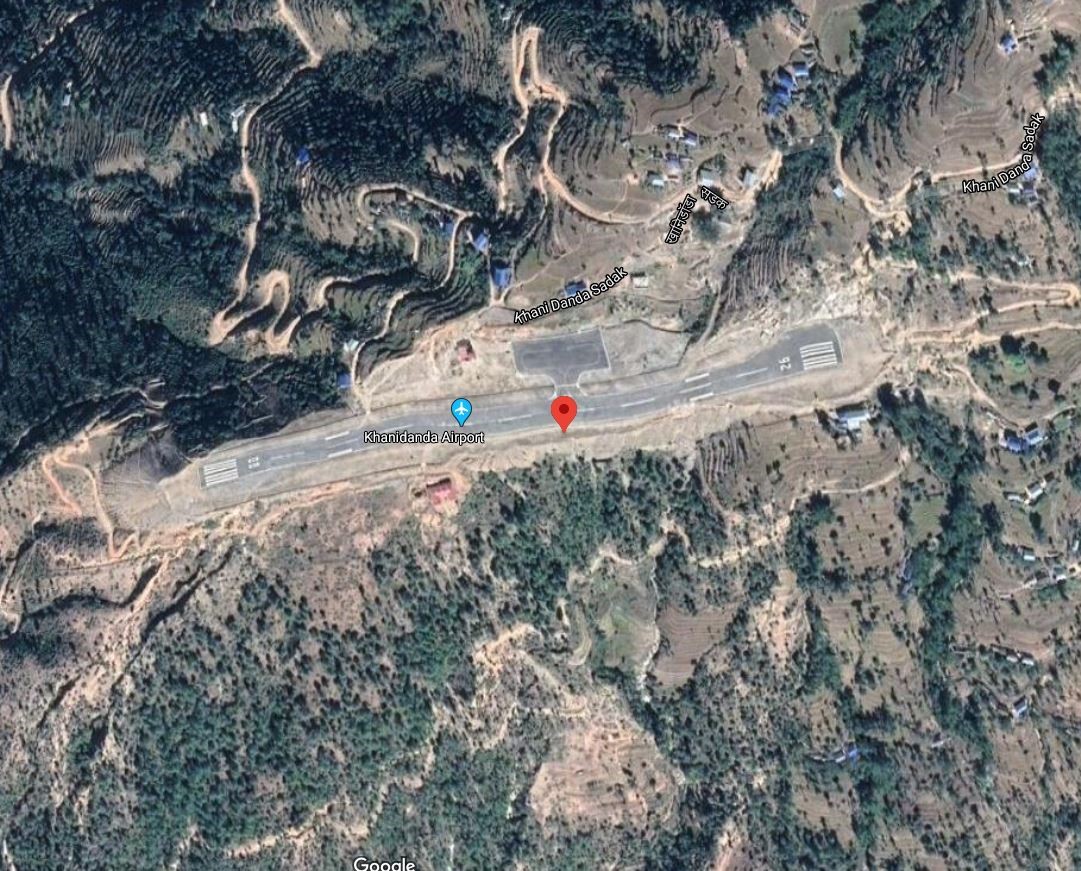
Khani Danda Airport also known as Manmaya Rai Airport is located in Diktel of Rupakot Majhuwagadhi municipality, Khotang district, Koshi Province. It is 6 kms SW of District HQ which is accessed via Khani Danda Road.
The runway was upgraded to bituminous Asphalt in 2015. The airport is not in operation.
|
Airport Location and Contact |
|
|---|---|
|
Country |
Nepal |
|
Province or District |
Koshi Province/ Khotang |
|
Nearest Town or City |
6 kms SW of District HQ which is accessed via Khani Danda Road |
|
Airport’s Complete Name |
Manamaya Rai Khanidanda Airport |
|
Latitude |
27.18142 |
|
Longitude |
86.77254 |
|
Elevation (ft and m) |
1352 m./4435 ft. |
|
IATA Code |
KDN |
|
ICAO Code |
VNKD |
|
Managing Company or Airport Authority |
Civil Aviation Authority of Nepal, Khani Danda Airport AFS VNKDYDYX |
|
Management Contact Person |
|
|
NGO and/or UN Presence at Airport? |
NO |
Runway
|
Runway #1 |
|
|---|---|
|
Runway Dimensions |
1903 × 82 ft (580 × 25 m) |
|
Runway Orientation |
08 - 26- |
|
Runway Surface |
Asphalt Concrete |
|
Runway Condition |
Not in operation |
Airport Infrastructure Details
|
Infrastructure |
|||
|---|---|---|---|
|
Passenger / Cargo Security Screening |
Handheld metal detector |
Runway Lighting |
No |
|
Refuelling Capacity |
NO |
Ground Handling Services |
|
|
Air Traffic Control |
One Man Position Tower Console with Associated Equipment and Accessories |
Fire Fighting Equipment |
No |
|
Weather Information |
AFIS Tower Observation |
Aircraft Parking Space |
2800 sqm of Concrete Apron |
|
Navigation Aids |
No |
Perimeter Fencing |
|
|
Windsock |
|
|
|
Fuel Services Charges
n/a
Royalties / Non Objection Fees (NOFs)
n/a
Nepal - 2.2.39 Lamidanda National Airport
Airport Overview
|
|
|
Pic: Aerial view of Lamidanda Airport |
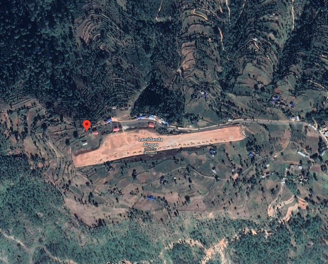
Lamidanda Airport is located at Lamidanda, Rawabesi Rural Municipality in Khotang District, Koshi Province, Nepal. It is 25 km north of the district headquarter Diktel. It is one of the three STOL airports in the district besides Thamkharka Airport and Man Maya (Khani Danda) Airport. The airport is currently not operational.
|
Airport Location and Contact |
|
|---|---|
|
Country |
Nepal |
|
Province or District |
Koshi Province, Khotang |
|
Nearest Town or City |
25 kms north of Diktel |
|
Airport’s Complete Name |
Lamidanda Airport |
|
Latitude |
27.25284 |
|
Longitude |
86.67222 |
|
Elevation (ft and m) |
4026 ft (1227 m) |
|
IATA Code |
LDN |
|
ICAO Code |
VNLD |
|
Managing Company or Airport Authority |
Civil Aviation Authority of Nepal, Lamidanda Airport Tel 977 36690093 AFS VNLDYDYX |
|
Management Contact Person |
|
|
NGO and/or UN Presence at Airport? |
NO |
Runway
|
Runway #1 |
|
|---|---|
|
Runway Dimensions |
1706 × 66 ft (520 × 20 m) |
|
Runway Orientation |
08- 26 - |
|
Runway Surface |
Asphalt Concrete |
|
Runway Condition |
Not in Operation |
Airport Infrastructure Details
|
Infrastructure |
|||
|---|---|---|---|
|
Passenger / Cargo Security Screening |
Metal Detector: Handheld |
Runway Lighting |
No |
|
Refuelling Capacity |
NO |
Ground Handling Services |
No |
|
Air Traffic Control |
One Man Position Tower Console with Associated Equipment and Accessories |
Fire Fighting Equipment |
No |
|
Weather Information |
AFIS, Tower Observation |
Aircraft Parking Space |
1800 sqm of concrete Apron; 2 DHC6 Types |
|
Navigation Aids |
No |
Perimeter Fencing |
Yes |
|
Windsock |
|
|
|
Fuel Services Charges
n/a
Royalties / Non Objection Fees (NOFs)
n/a
Nepal - 2.2.40 Rumjatar Domestic Airport
Airport Overview
|
|
|
Pic: Aerial view of Rumjatar Airport |
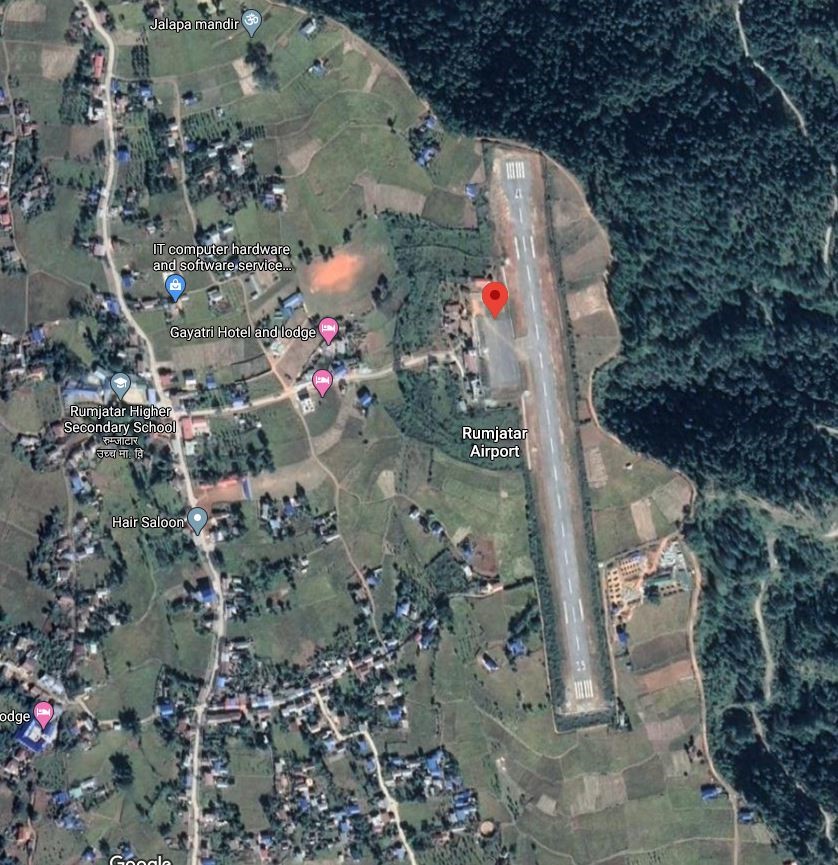
Rumjatar Airport is in Rumjatar, a village in the Okhaldhunga district of Koshi Province . It is 13 kms ESE of District HQ and is accessed Via Feeder Road F052 and Local Road.
The airport came back to operation in 2019 after 3 years of inactivity. Currently, this airport does not have any scheduled flights due to lack of enough passengers. The operating hours are as follows:
-
Nov 1st to Jan 30th (Kartik 16th to Magh 15th) 1000LT-1600LT
-
Feb 1st to Oct 30th (Magh 16th to Kartik 15th) 1000LT-1700LT
|
Airport Location and Contact |
|
|---|---|
|
Country |
Nepal |
|
Province or District |
Koshi rovince/ Okhaldhunga |
|
Nearest Town or City |
13 kms SE of District HQ accessed Via F052 and Local Road |
|
Airport’s Complete Name |
Rumjatar Airport |
|
Latitude |
27.30344 |
|
Longitude |
86.55026 |
|
Elevation (ft and m) |
4498 ft (1371 m) |
|
IATA Code |
RUM |
|
ICAO Code |
VNRT |
|
Managing Company or Airport Authority |
Civil Aviation Authority of Nepal, Rumjatar Airport Tel 977 37540118 Tower: 977-37540149 AFS VNRTYDYX |
|
Management Contact Person |
|
|
NGO and/or UN Presence at Airport? |
NO |
Runway
|
Runway #1 |
|
|---|---|
|
Runway Dimensions |
1906 × 66 ft (581 m × 20 m) |
|
Runway Orientation |
17/35 |
|
Runway Surface |
Asphalt Concrete |
|
Runway Condition |
All weather Operational |
Airport Infrastructure Details
|
Infrastructure |
|||
|---|---|---|---|
|
Passenger / Cargo Security Screening |
Metal Detector: Handheld |
Runway Lighting |
No |
|
Refuelling Capacity |
NO |
Ground Handling Services |
|
|
Air Traffic Control |
AFIS HF SSB, VHF, VFR, One Man Position Tower Console with Associated Equipment and Accessories
|
Fire Fighting Equipment |
Not Available |
|
Weather Information |
AFIS, Tower Observation, |
Aircraft Parking Space |
2700 sqm of concrete Apron, 2 D228 Types a |
|
Navigation Aids |
VHF |
Perimeter Fencing |
|
|
Windsock |
No |
|
|
Fuel Services Charges
N/A
Royalties / Non Objection Fees (NOFs)
N/A
Nepal - 2.2.41 Syangboche Domestic Airport
Airport Overview
|
|
|
Pic: Aerial view of Syangboche Airport |
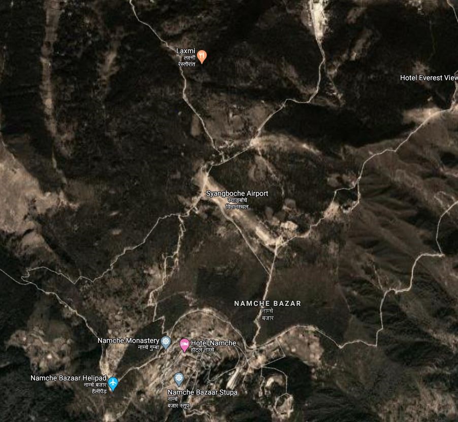
Syangboche Airport is situated at Kumjung Municipality of Solukhumbu District, Koshi Province. It is the gateway to the Mount Everest and is a STOL airport. The airport lies inside the Sagarmatha National Park. Nowadays, this airport is not in operation. It is 37 kms due NNE of the District HQ in Namche Bazar with limited road access.
It is one of the four airports (Tenzing-Hillary Airport, Kangel Danda Airport, and Phaplu Airport) in Solukhumbu district. The airport is not in operation.
|
Airport Location and Contact |
|
|---|---|
|
Country |
Nepal |
|
Province or District |
Koshi Province/ Solukhumbu |
|
Nearest Town or City |
In proximity of Namche Bazaar |
|
Airport’s Complete Name |
Syangboche Airport |
|
Latitude |
27.81141 |
|
Longitude |
86.71259 |
|
Elevation (ft and m) |
12293 ft./3748 m. |
|
IATA Code |
SYH |
|
ICAO Code |
VNSB |
|
Managing Company or Airport Authority |
Civil Aviation Authority of Nepal, Syangboche Airport AFS: VNSBYDYX |
|
Management Contact Person |
|
|
NGO and/or UN Presence at Airport? |
NO |
Runway
|
Runway #1 |
|
|---|---|
|
Runway Dimensions |
1328 × 100 ft (405 × 30 m) |
|
Runway Orientation |
13/31 -
|
|
Runway Surface |
Earthen |
|
Runway Condition |
Not in Operation |
Airport Infrastructure Details
|
Infrastructure |
|||
|---|---|---|---|
|
Passenger / Cargo Security Screening |
No |
Runway Lighting |
No |
|
Refuelling Capacity |
NO |
Ground Handling Services |
N/A |
|
Air Traffic Control |
AFIS, VFR |
Fire Fighting Equipment |
No |
|
Weather Information |
No |
Aircraft Parking Space |
No |
|
Navigation Aids |
No |
Perimeter Fencing |
N/A |
|
Windsock |
|
|
|
Fuel Services Charges
N/A
Royalties / Non Objection Fees (NOFs)
N/A
Nepal - 2.2.42 Taplejung Domestic Airport
Airport Overview
|
|
|
Pic: Aerial view of Taplejung Airport |
Taplejung Airport, also known as Suketar Airport is in Suketar, Taplejung Koshi Province. It is 4kms due east of district HQ at Taplejung and 8 Km from Phungling Bazaar. The airport serves as a gateway to Kanchanjanga Conservation Area and the famous Pathivara Temple thus is a very important destination for tourist movement. It is linked by air with Chandragadhi and Kathmandu with all weather serviceability. In 2020 it had 248 aircraft movements and 2,083 passengers and 30 kg of cargo.The runway was blacktopped in 2016.
The operation hours are as follows:
-
16th Feb to 15th Nov - 0600LT-1215LT
-
16th Nov to 15th Feb - 0630LT-1215LT
|
Airport Location and Contact |
|
|---|---|
|
Country |
Nepal |
|
Province or District |
Koshi Province /Taplejung |
|
Nearest Town or City |
4km Due east of the District HQ |
|
Airport’s Complete Name |
Taplejung Airport |
|
Latitude |
27.35103 |
|
Longitude |
87.69505 |
|
Elevation (ft and m) |
7936 ft (2419 m) |
|
IATA Code |
TPJ |
|
ICAO Code |
VNTJ |
|
Managing Company or Airport Authority |
Civil Aviation Authority of Nepal, Taplejung Airport Tel 977 24460518 AFS VNTJYDYX |
|
Management Contact Person |
|
|
NGO and/or UN Presence at Airport? |
NO |
Runway
|
Runway #1 |
|
|---|---|
|
Runway Dimensions |
2297 × 66 ft (700 m × 20 m) |
|
Runway Orientation |
07/25 |
|
Runway Surface |
Asphalt Concrete |
|
Runway Condition |
Good, operational |
Airport Infrastructure Details
|
Infrastructure |
|||
|---|---|---|---|
|
Passenger / Cargo Security Screening |
Metal Detector: Handheld |
Runway Lighting |
No |
|
Refuelling Capacity |
NO |
Ground Handling Services |
|
|
Air Traffic Control |
HF SSB, VHF, Tower Observation, VFR, One Man Position Tower Console with Associated Equipment and Accessories
|
Fire Fighting Equipment |
Not available |
|
Weather Information |
AFIS,VHF |
Aircraft Parking Space |
3600 sqm of concrete Asphalt; 3 D228 Types |
|
Navigation Aids |
HF, SSB, VHF |
Perimeter Fencing |
|
|
Windsock |
|
|
|
Nepal - 2.2.43 Thamkharka Domestic Airport
Airport Overview
|
|
|
Pic: Aerial view of location of Thamkharka Airport |
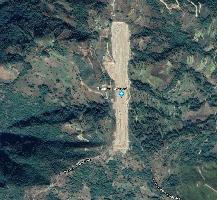
Thamkharka Airport is situated at Badka Diyale Municipality of Khotang District, Koshi Province. The airport has air link with Kathmandu only. Including Thamkharka, Khotang District comprises of three airports. Thamkharka Airport is an airport in Khotehang rural municipality in Khotang district of Koshi Province It is 20 Kms due South of the District HQ at Diktel. It is one of the three airports (Man Maya Airport, Lamidanda Airport) in the district. The airport is operational.
Air Traffic Service operational hours all year-round are as follows:
-
16th Feb to 15th Nov 0600LT-1215LT
-
16th Nov to 15th Feb 0630LT-1215LT
|
Airport Location and Contact |
|
|---|---|
|
Country |
Nepal |
|
Province or District |
Koshi Province Khotang |
|
Nearest Town or City |
Khotang Bazaar is connected by Khotang bazaar -Airport RD. Three hours walking distance from Khotang Bazaar |
|
Airport’s Complete Name |
Thamkharka Airport |
|
Latitude |
27.04817 |
|
Longitude |
86.85791 |
|
Elevation (ft and m) |
5252 ft/1601 m. |
|
IATA Code |
TMK |
|
ICAO Code |
VNTH |
|
Managing Company or Airport Authority |
Civil Aviation Authority of Nepal, Thamkharka Airport Tel 977 AFS VNTHYDYX |
|
Management Contact Person |
|
|
NGO and/or UN Presence at Airport? |
NO |
Runway
|
Runway #1 |
|
|---|---|
|
Runway Dimensions |
2034× 66 ft (620 × 20 m) |
|
Runway Orientation |
18/36
|
|
Runway Surface |
Asphalt Concrete |
|
Runway Condition |
Operational/ Asphalt Concrete |
Airport Infrastructure Details
|
Infrastructure |
|||
|---|---|---|---|
|
Passenger / Cargo Security Screening |
Metal Detector: handheld |
Runway Lighting |
No |
|
Refuelling Capacity |
Not available |
Ground Handling Services |
NO |
|
Air Traffic Control |
AFIS, Tower Observation |
Fire Fighting Equipment |
Not available |
|
Weather Information |
AFIS, VFR |
Aircraft Parking Space |
3600 sqm of concrete Apron; 2 DHC6 Types |
|
Navigation Aids |
HF SSB, VHF |
Perimeter Fencing |
NO |
|
Windsock |
N/A |
|
|
Fuel Services Charges
N/A
Royalties / Non Objection Fees (NOFs)
N/A
Nepal - 2.2.44 Domestic Airport – Bajhang
Airport Overview
|
|
|
Pic: Aerial view of Bajhang airport |
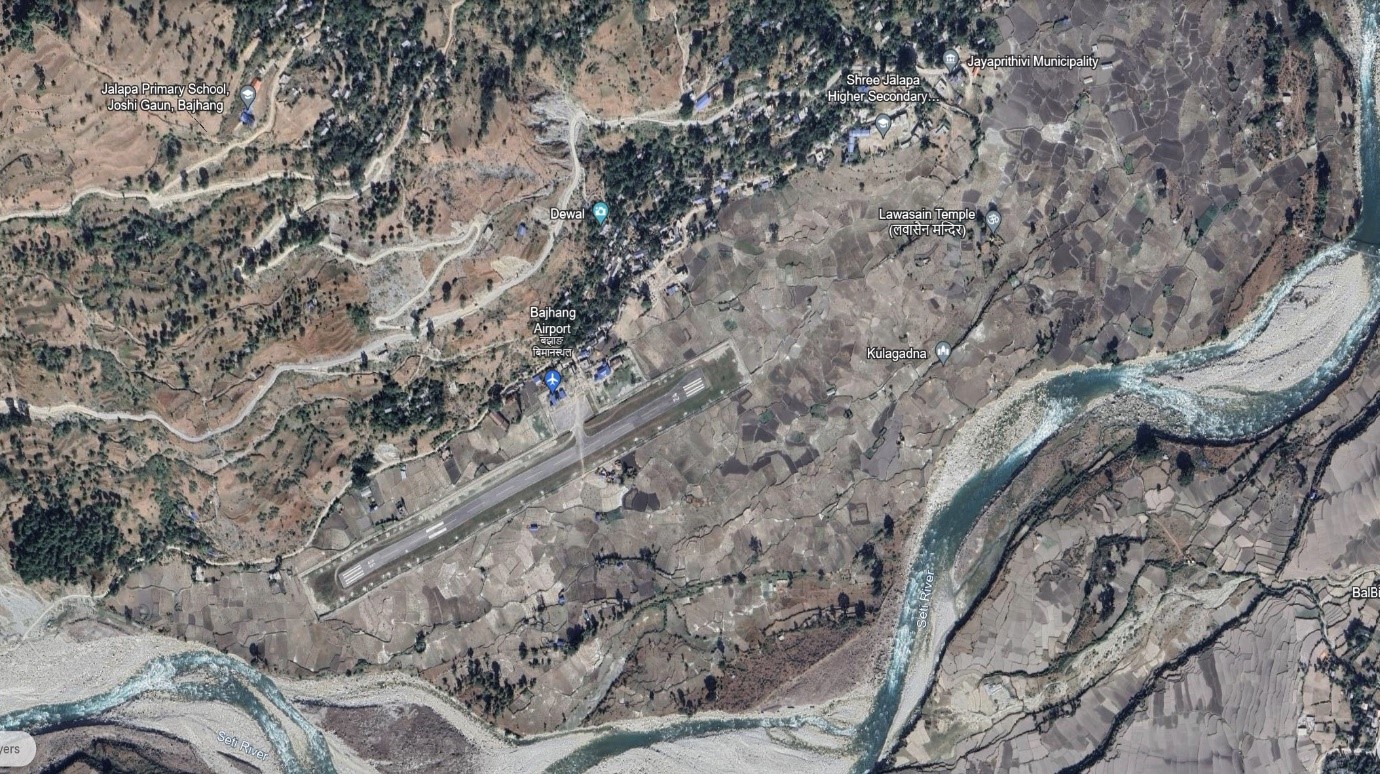
Bajhang Airport is situated at Rithapata Municipality of Bajhang district, Sudurpaschim Province.
The airport is operational. Summit Air operates scheduled flights twice a week from Dhangadhi Airport to Bajhang Airport.
The operation hours are as follows:
-
Nov 1st to Jan 30th (Kartik 16th to Magh 15th) 1000LT-1600LT
-
Feb 1st to Oct 30th (Magh 16th to Kartik 15th) 1000LT-1700LT
|
Airport Location and Contact |
|
|---|---|
|
Country |
Nepal |
|
Province or District |
Sudurpaschim, Bajhang District |
|
Nearest Town or City |
2 kms South of the City Centre |
|
Airport’s Complete Name |
Bajhang Airport |
|
Latitude |
29.53956 |
|
Longitude |
81.18398 |
|
Elevation (ft and m) |
4015 ft (1224 m) |
|
IATA Code |
BJH |
|
ICAO Code |
VNBG |
|
Managing Company or Airport Authority |
Civil Aviation Authority of Nepal, Bajhang Airport Tel: 977-92421060 AFS: VNBGYDYX |
|
Management Contact Person |
|
|
NGO and/or UN Presence at Airport? |
NO |
Runway
|
Runway #1 |
|
|---|---|
|
Runway Dimensions |
2067 × 321 ft (630 × 20 m) |
|
Runway Orientation |
06 / 24 |
|
Runway Surface |
Asphalt Concrete |
|
Runway Condition |
Operational |
Airport Infrastructure Details
|
Infrastructure |
|||
|---|---|---|---|
|
Passenger / Cargo Security Screening |
Manual search |
Runway Lighting |
N/A |
|
Refuelling Capacity |
No |
Ground Handling Services |
N/A |
|
Air Traffic Control |
Visual Flight Rule (VFR), VHF |
Fire Fighting Equipment |
No |
|
Weather Information |
AFIS, Tower Observation |
Aircraft Parking Space |
1800sqm of concrete Apron for Two DHC6 Types or Equivalent |
|
Navigation Aids |
AFIS |
Perimeter Fencing |
Yes |
|
Windsock |
N/A |
|
|
Fuel Services Charges
n/a
Royalties / Non Objection Fees (NOFs)
n/a
Nepal - 2.2.45 Domestic Airport - Doti
Airport Overview
|
|
|
Pic: Aerial view of Doti Airport |
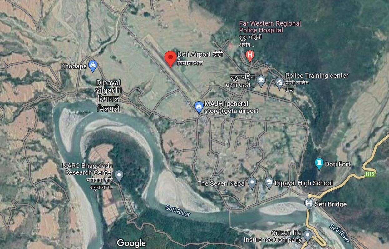
Doti Airport is situated at Dipayal Municipality of Doti District, Sudurpaschim Province. The runway was upgraded in 2022 to asphalt concrete. Currently, there are no scheduled flights from this airport.
|
Airport Location and Contact |
|
|---|---|
|
Country |
Nepal |
|
Province or District |
Sudurpaschim Province, Doti |
|
Nearest Town or City |
Main town of Silgadhi is 2 km southeast from the airport |
|
Airport’s Complete Name |
Doti Airport |
|
Latitude |
29.26316 |
|
Longitude |
80.93617 |
|
Elevation (ft and m) |
577 m / 1893 ft |
|
IATA Code |
SIH |
|
ICAO Code |
VNDT |
|
Managing Company or Airport Authority |
Civil Aviation Authority of Nepal AFS VNDTYDYX |
|
Management Contact Person |
|
|
NGO and/or UN Presence at Airport? |
NO |
Runway
|
Runway #1 |
|
|---|---|
|
Runway Dimensions |
490 m x 20 m |
|
Runway Orientation |
14/32 |
|
Runway Surface |
Bituminous Paved (Asphalt Concrete) |
|
Runway Condition |
Operational |
Airport Infrastructure Details
|
Infrastructure |
|||
|---|---|---|---|
|
Passenger / Cargo Security Screening |
Metal Detector/ Manual search |
Runway Lighting |
No |
|
Refuelling Capacity |
No |
Ground Handling Services |
Yes, Manual |
|
Air Traffic Control |
One man position tower console with associated equipment and accessories |
Fire Fighting Equipment |
No |
|
Weather Information |
Tower Observation |
Aircraft Parking Space |
1800 sqm of concrete Apron |
|
Navigation Aids |
AFIS |
Perimeter Fencing |
Yes |
|
Windsock |
Yes |
|
|
Fuel Services Charges
N/A
Royalties / Non-Objection Fees (NOFs)
N/A
Nepal - 2.2.46 Domestic Airport – Falgunanda
Airport Overview
|
|
|
Pic: Aerial view of Falgunanda Airport in Sukilumba, Ilam District |
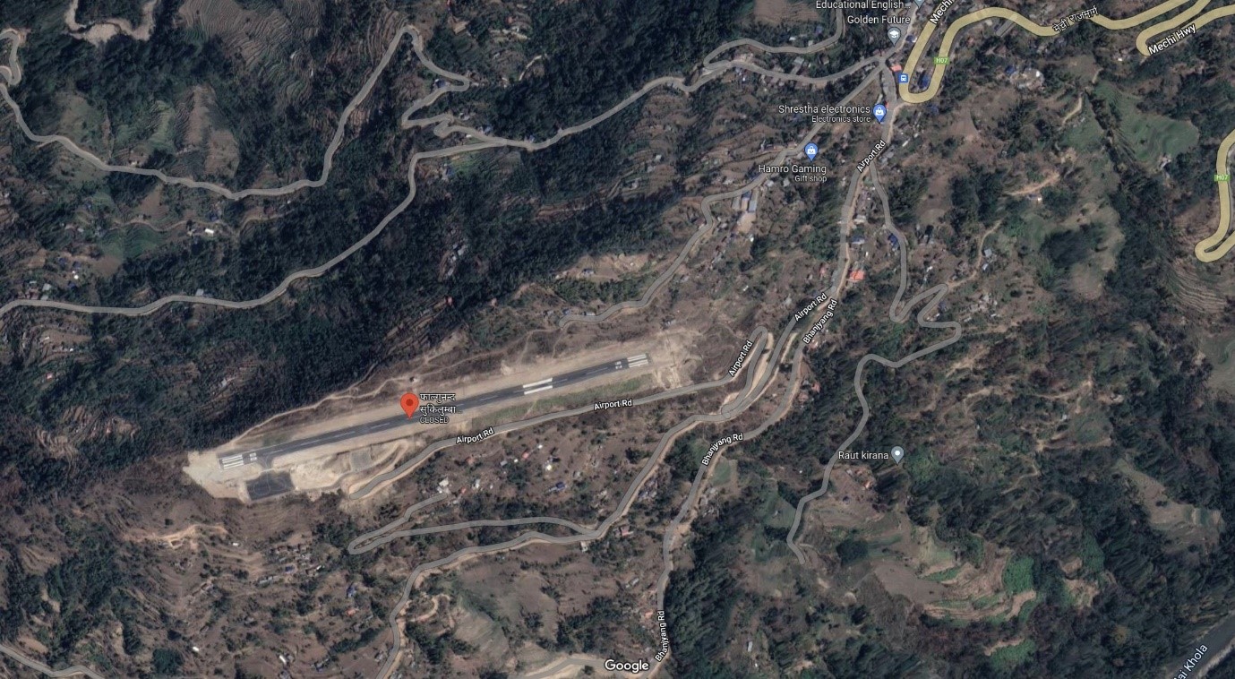
Falgunanda Airport , is a small airport in Sukilumb, Ilam District, Koshi Province in eastern Nepal. It is 1 km west from Golakharka Bhanjyang.
In 2018, the first test flight landed at the airport. As of October 2022, the airport is categorized as operational however no scheduled flights have been materialized. The airport is operational and it operates weekly two flights
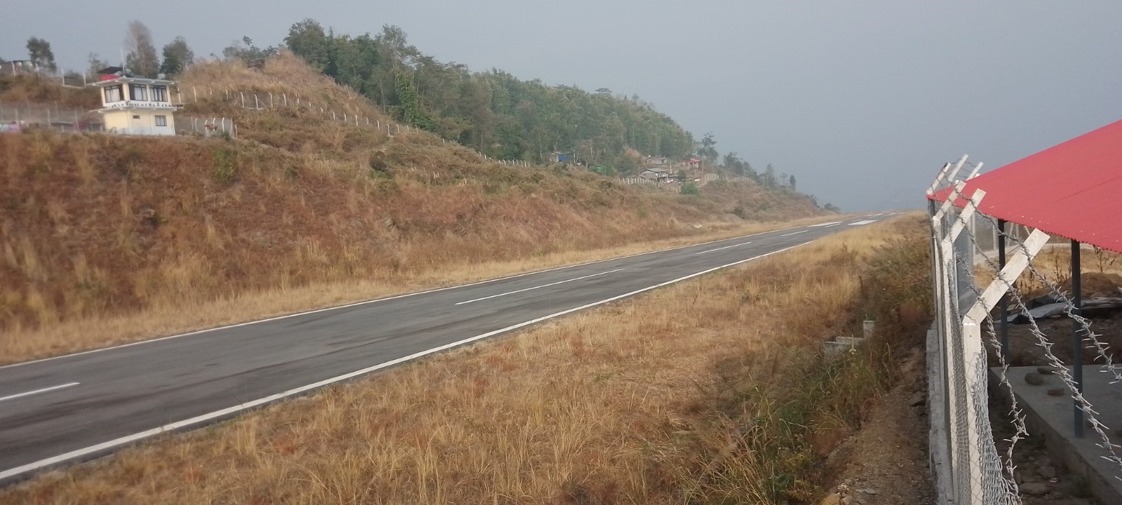
|
Airport Location and Contact |
|
|---|---|
|
Country |
Nepal |
|
Province or District |
Koshi Province / Solukhumbu |
|
Nearest Town or City |
1 km west from Golakharka Bhanjyang |
|
Airport’s Complete Name |
Falgunanda Airport |
|
Latitude |
26.87760 |
|
Longitude |
87.90508 |
|
Elevation (ft and m) |
2800 ft (853.95 m) |
|
IATA Code |
|
|
ICAO Code |
VNFN |
|
Managing Company or Airport Authority |
Civil Aviation Authority of Nepal
|
|
Management Contact Person |
|
|
NGO and/or UN Presence at Airport? |
NO |
Runway
|
Runway #1 |
|
|---|---|
|
Runway Dimensions |
670 m X 20 m |
|
Runway Orientation |
08 / 26 |
|
Runway Surface |
Earthen (Upgrading to Asphalt Concrete) |
|
Runway Condition |
Good |
Fuel Services Charges
n/a
Royalties / Non Objection Fees (NOFs)
n/a
Nepal - 2.2.47 Minor Domestic Airport - Resunga
Airport Overview
Resunga Airport is a domestic airport in Simichaur, Resunga, a town in Gulmi District, Lumbini Province, Nepal. It has a 520-metre-long Asphalt Concrete runway and a has direct airlink with Tribhuvan International Airport, Kathmandu. This airport operates schedule flight twice a week on Wednesdays and Fridays.
|
Airport Location and Contact |
|
|---|---|
|
Country |
Nepal |
|
Province or District |
Lumbini |
|
Nearest Town or City |
Tamghas, 6 Km North |
|
Airport’s Complete Name |
Gulmi (Resunga) Airport |
|
Latitude |
28.02498 |
|
Longitude |
83.25365 |
|
Elevation (ft and m) |
5015 ft. / 1529.267 m. |
|
IATA Code |
|
|
ICAO Code |
VNRG |
|
Managing Company or Airport Authority |
Civil Aviation Authority of Nepal, Gulmi |
|
Management Contact Person |
|
|
NGO and/or UN Presence at Airport? |
No |
Runway(s)
|
Runway #1 |
|
|---|---|
|
Runway Dimensions |
520 m X 20 m |
|
Runway Orientation |
15 / 33 |
|
Runway Surface |
Asphalt Concrete |
|
Runway Condition |
Operational |
Airport Infrastructure Details
|
Infrastructure |
|||
|---|---|---|---|
|
Passenger / Cargo Security Screening |
Yes |
Runway Lighting |
No |
|
Refueling Capacity |
No |
Ground Handling Services |
Yes, manual |
|
Air Traffic Control |
Yes |
Fire Fighting Equipment |
No |
|
Weather Information |
Yes, Tower Observation |
Aircraft Parking Space |
Yes, 1800 sq. m |
|
Navigation Aids |
AFIS |
Perimeter Fencing |
Yes |
|
Windsock |
Yes |
|
|
Fuel Services Charges
Not available at this airport
Royalties / Non Objection Fees (NOFs)
N/A
Nepal - 2.2.48 Tikapur Domestic Airport
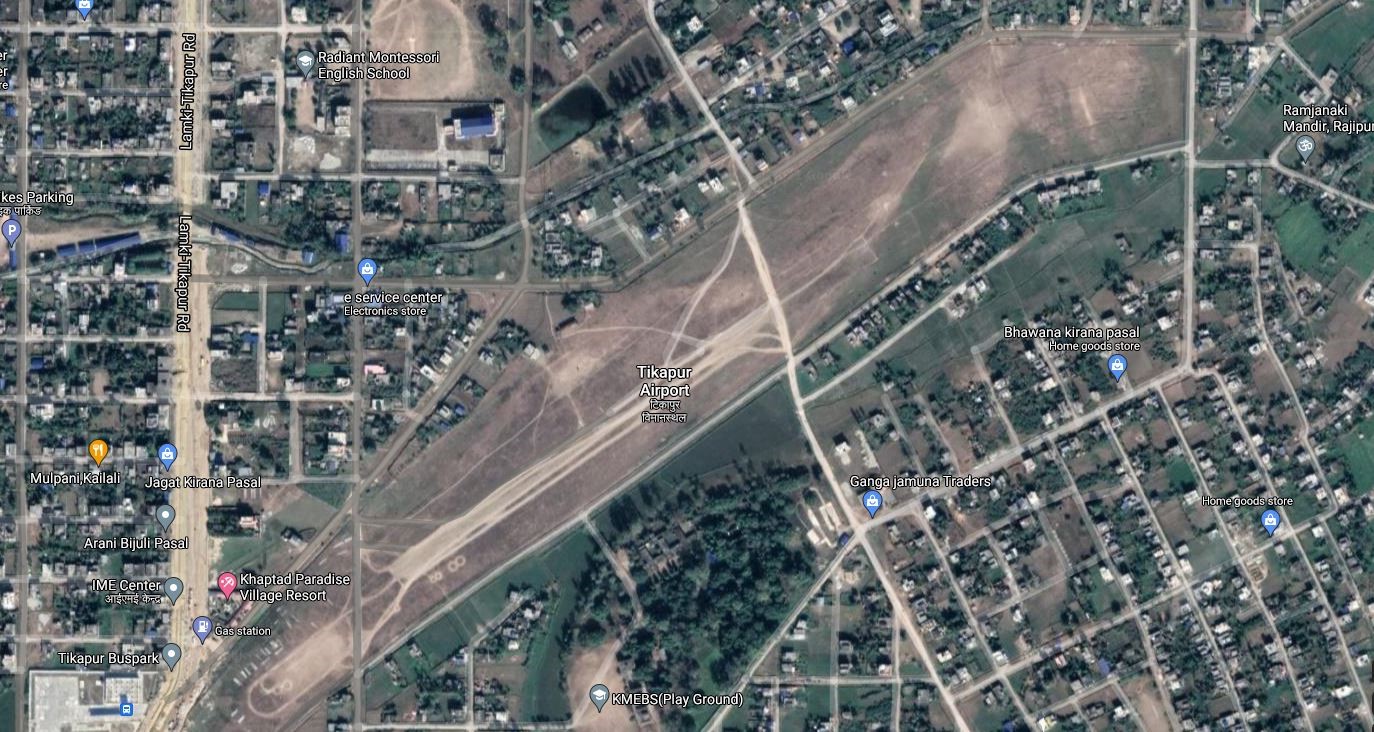
Airport Overview
Tikapur Airport is situated at Tikapur Municipality of Kailali District, Sudur-Paschim Province. The airport began operations on 11 October 1984. It served as a hub in western Nepal, as road connections were lacking until the Nepalese Civil War. This airport is not in operation since 1997.
|
Airport Location and Contact |
|
|---|---|
|
Country |
Nepal |
|
Province or District |
Kailali District, Sudur-Paschim Province |
|
Nearest Town or City |
Tikapur/ Kailali |
|
Airport’s Complete Name |
TIKAPUR AIRPORT |
|
Latitude |
28.52277 |
|
Longitude |
81.12194 |
|
Elevation (ft and m) |
515 ft./157 m. |
|
IATA Code |
TPU |
|
ICAO Code |
VNTP |
|
Managing Company or Airport Authority |
Civil Aviation Authority of Nepal, AFS: VNTPYDYX |
|
Management Contact Person |
|
|
NGO and/or UN Presence at Airport? |
NO |
Runway(s)
|
Runway #1 |
|
|---|---|
|
Runway Dimensions |
573 m x 30 m |
|
Runway Orientation |
05/23 |
|
Runway Surface |
Gravel |
|
Runway Condition |
Not in operation |
Airport Infrastructure Details
|
Infrastructure |
|||
|---|---|---|---|
|
Passenger / Cargo Security Screening |
No |
Runway Lighting |
No |
|
Refueling Capacity |
No |
Ground Handling Services |
No |
|
Air Traffic Control |
No |
Fire Fighting Equipment |
No |
|
Weather Information |
No |
Aircraft Parking Space |
No |
|
Navigation Aids |
No |
Perimeter Fencing |
No |
|
Windsock |
No |
|
|
Fuel Services Charges
N/A
Royalties / Non Objection Fees (NOFs)
N/A
Nepal - 2.2.49 Darchula Domestic Airport
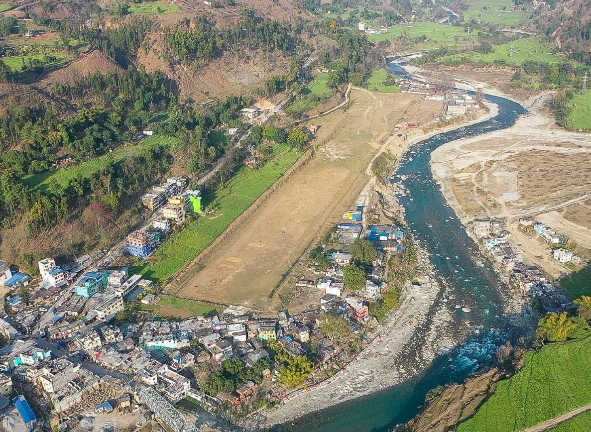
Airport Overview
Darchula Airport is situated at Gokuleswor Municipality of Darchula District, Sudur-Paschim Province. It has an earthen runway but is not clearly marked. This airport is not in operation.
|
Airport Location and Contact |
|
|---|---|
|
Country |
Nepal |
|
Province or District |
Sudur-Paschim/Darchula |
|
Nearest Town or City |
Located at Gokuleswor bazaar. |
|
Airport’s Complete Name |
Darchula Airport |
|
Latitude |
29.66939 |
|
Longitude |
80.54909 |
|
Elevation (ft and m) |
2218 ft./676 m. |
|
IATA Code |
DAP |
|
ICAO Code |
VNDL |
|
Managing Company or Airport Authority |
Civil Aviation Authority of Nepal AFS: VNDLYDYX |
|
Management Contact Person |
N/A |
|
NGO and/or UN Presence at Airport? |
No |
Runway(s)
|
Runway #1 |
|
|---|---|
|
Runway Dimensions |
590 m x 30 m |
|
Runway Orientation |
07/25 |
|
Runway Surface |
Earthen |
|
Runway Condition |
Not in operation |
Airport Infrastructure Details
|
Infrastructure |
|||
|---|---|---|---|
|
Passenger / Cargo Security Screening |
No |
Runway Lighting |
No |
|
Refueling Capacity |
No |
Ground Handling Services |
No |
|
Air Traffic Control |
No |
Fire Fighting Equipment |
No |
|
Weather Information |
No |
Aircraft Parking Space |
Two DHC6 Types |
|
Navigation Aids |
No |
Perimeter Fencing |
No |
|
Windsock |
No |
|
|
Fuel Services Charges
N/A
Royalties / Non Objection Fees (NOFs)
N/A
Nepal - 2.2.50 Minor Domestic Airport – Mahendranagar
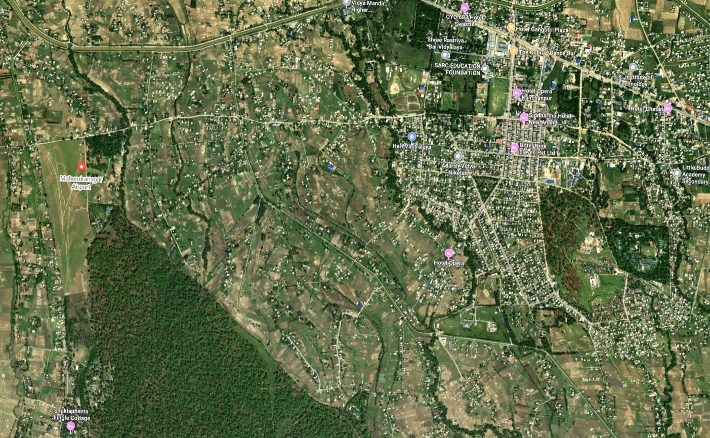
Airport Overview
Mahendranagar Airport is located at Bhimdatta municipality in Kanchanpur district, Sudurpaschim province. It is close to Shukla Phanta Wildlife Reserve. This airport is currently not operational.
|
Airport Location and Contact |
|
|---|---|
|
Country |
Nepal |
|
Province or District |
Sudurpaschim |
|
Nearest Town or City |
Mahendranagar, 2 KM east |
|
Airport’s Complete Name |
Mahendranagar Airport |
|
Latitude |
28.96104 |
|
Longitude |
80.14794 |
|
Elevation (ft and m) |
709 ft. / 216 m. |
|
IATA Code |
XMG |
|
ICAO Code |
VNMN |
|
Managing Company or Airport Authority |
AFS: VNMNYDYX |
|
Management Contact Person |
|
|
NGO and/or UN Presence at Airport? |
No |
Runway(s)
|
Runway #1 |
|
|---|---|
|
Runway Dimensions |
884 m x 30 m |
|
Runway Orientation |
17/35 |
|
Runway Surface |
Earthen |
|
Runway Condition |
Not Operational |
Airport Infrastructure Details
|
Infrastructure |
|||
|---|---|---|---|
|
Passenger / Cargo Security Screening |
No |
Runway Lighting |
No |
|
Refueling Capacity |
No |
Ground Handling Services |
No |
|
Air Traffic Control |
No |
Fire Fighting Equipment |
No |
|
Weather Information |
No |
Aircraft Parking Space |
No |
|
Navigation Aids |
No |
Perimeter Fencing |
Yes |
|
Windsock |
No |
|
|
Fuel Services Charges
Not available at this airport
Royalties / Non Objection Fees (NOFs)
N/A
Nepal - 2.2.51 KHIJI CHANDESHWORI Domestic Airport
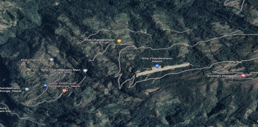
Airport Overview
Khiji Chandeshwori Airport is located in Okhaldhunga District, Koshi Province. It lies near the populated Khiji Phalante locality. The test flight was conducted on 23 December 2019. The airport has one runway and is not in operation.
|
Airport Location and Contact |
|
|---|---|
|
Country |
Nepal |
|
Province or District |
Koshi Province/Okhaldhunga |
|
Nearest Town or City |
24.1 km to the nearest town Okhaldhunga |
|
Airport’s Complete Name |
Khiji Chandreswori |
|
Latitude |
27.45513 |
|
Longitude |
86.30944 |
|
Elevation (ft and m) |
6789 ft./ 2070 m. |
|
IATA Code |
|
|
ICAO Code |
VNKC |
|
Managing Company or Airport Authority |
Civil Aviation Authority |
|
Management Contact Person |
|
|
NGO and/or UN Presence at Airport? |
No |
Runway(s)
|
Runway #1 |
|
|---|---|
|
Runway Dimensions |
580 m x 20 m |
|
Runway Orientation |
15/33 |
|
Runway Surface |
Gravel |
|
Runway Condition |
Gravel |
Airport Infrastructure Details
|
Infrastructure |
|||
|---|---|---|---|
|
Passenger / Cargo Security Screening |
No |
Runway Lighting |
No |
|
Refueling Capacity |
No |
Ground Handling Services |
No |
|
Air Traffic Control |
No |
Fire Fighting Equipment |
No |
|
Weather Information |
No |
Aircraft Parking Space |
Two DHC6 Types Size of Apron 1375 sq.m |
|
Navigation Aids |
No |
Perimeter Fencing |
No |
|
Windsock |
Yes / No |
|
|
Fuel Services Charges
N/A
Royalties / Non Objection Fees (NOFs)
N/A
Nepal - 2.2.52 Dolpa Masinechaur National Airport
Airport Overview
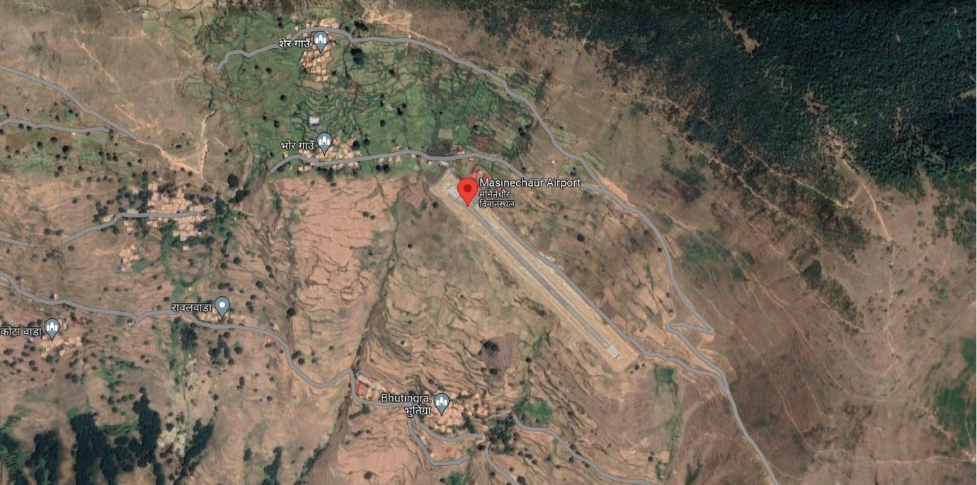
Ariel view of Dolpa Masinechaur Airport
Masinechaur Airport is situated at Pahada Rural Municipal of Dolpa District, Karnali Province. The airport is about 6 Km from the existing airport at Juphal. The popular trekking route to Jumla from this airport is nearly 4 days walking distance from the airport. This airport is getting upgraded to Asphalt Concrete. This airport is currently not in operation.
|
Airport Location and Contact |
|
|---|---|
|
Country |
Nepal |
|
Province or District |
Karnali |
|
Nearest Town or City |
6 KM |
|
Airport’s Complete Name |
Dolpa Masinechaur Airport |
|
Latitude |
29.05918 |
|
Longitude |
82.74408 |
|
Elevation (ft and m) |
9200 ft./ 2804 m. |
|
IATA Code |
|
|
ICAO Code |
VNMC |
|
Managing Company or Airport Authority |
Civil Aviation Authority of Nepal (CAAN) |
|
Management Contact Person |
|
|
NGO and/or UN Presence at Airport? |
No |
Runway(s)
|
Runway #1 |
|
|---|---|
|
Runway Dimensions |
600 m x 30 m |
|
Runway Orientation |
14 / 32 |
|
Runway Surface |
Gravel |
|
Runway Condition |
Not operational |
Airport Infrastructure Details
|
Infrastructure |
|||
|---|---|---|---|
|
Passenger / Cargo Security Screening |
N/A |
Runway Lighting |
No |
|
Refueling Capacity |
No |
Ground Handling Services |
N/A |
|
Air Traffic Control |
N/A |
Fire Fighting Equipment |
No |
|
Weather Information |
N/A |
Aircraft Parking Space |
Two DHC6 types |
|
Navigation Aids |
N/A |
Perimeter Fencing |
|
|
Windsock |
N/A |
|
|
Fuel Services Charges
Refueling is not available at this airport
Royalties / Non Objection Fees (NOFs)
N/A
Nepal - 2.2.53 Rukum Chaujahari Minor Domestic Airport
Airport Overview
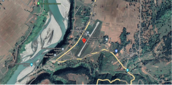
Ariel view of Rukum Chaurjhari Airport
Chaurjahari Airport is situated at Bijeshwori Municipality of West Rukum District, Karnali Province. This airport is currently not operational.
|
Airport Location and Contact |
|
|---|---|
|
Country |
Nepal |
|
Province or District |
Karnali |
|
Nearest Town or City |
Chaurjahari, 1.5 KM South |
|
Airport’s Complete Name |
Rukum Chaurjahari Airport |
|
Latitude |
28.62694 |
|
Longitude |
82.19359 |
|
Elevation (ft and m) |
2431 ft. / 741 m. |
|
IATA Code |
HRJ |
|
ICAO Code |
VNCJ |
|
Managing Company or Airport Authority |
Civil Aviation Authority of Nepal, Chaurjahari, West Rukum Off: 977-89680156 Tower: 977-89680156 Fax: 977-89680156 AFS: VNCJYDYX |
|
Management Contact Person |
|
|
NGO and/or UN Presence at Airport? |
No |
Runway(s)
|
Runway #1 |
|
|---|---|
|
Runway Dimensions |
600 m x 20 m |
|
Runway Orientation |
03/21 |
|
Runway Surface |
Bituminous Paved (Asphalt Concrete) Surface |
|
Runway Condition |
Not in operation |
Airport Infrastructure Details
|
Infrastructure |
|||
|---|---|---|---|
|
Passenger / Cargo Security Screening |
Yes, handheld metal detector |
Runway Lighting |
No |
|
Refueling Capacity |
No |
Ground Handling Services |
N/A |
|
Air Traffic Control |
One Man Position Tower Console with Associated Equipment and Accessories |
Fire Fighting Equipment |
No |
|
Weather Information |
Tower Observation |
Aircraft Parking Space |
2800 sq.m. |
|
Navigation Aids |
HF SSB, VHF |
Perimeter Fencing |
|
|
Windsock |
|
|
|
Fuel Services Charges
Fuel service is not avialable
Royalties / Non Objection Fees (NOFs)
N/A