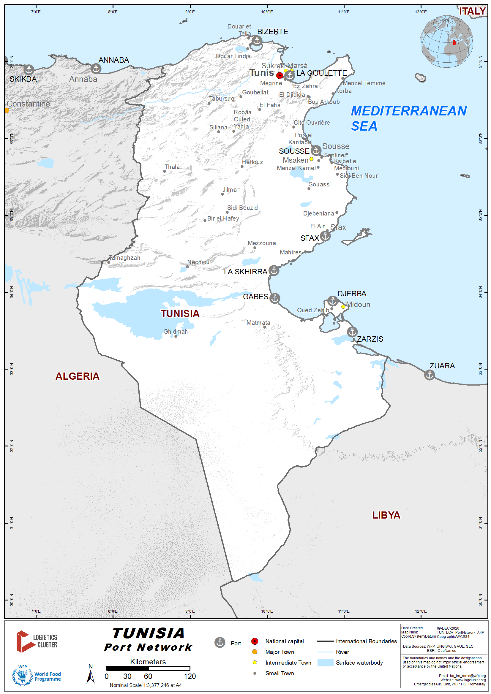
2.1 Tunisia Port Assessment
The Office of the Merchant Marine and Ports (OMMP) in Tunisia is a public establishment, endowed with financial autonomy and civil personality on the ports. The OMMP is responsible for exercising two fundamental powers assigned by the government:
- Ensuring and reassuring the treatment in the best conditions of time, cost, safety and security of all ships and goods passing through Tunisian commercial ports (Bizerte, Goulette, Radès, Sousse, Sfax, Gabès, Zarzis).
- Ensure the authority of the maritime administration in three essential areas; the administration of ships, seafarers and maritime safety through the maritime regions (Bizerte, Tunis, Sousse, Monastir, Sfax, Gabès, Jerba).
The Tunisian port chain that extends over 1300 km of coastline is composed of eight commercial ports open to international traffic. The OMMP is represented regionally by seven maritime regions. Each region has a maritime district responsible for the administration of ships and seafarers and a regional maritime security service responsible for the safety of navigation and vessel safety visits.
The Tunisian maritime landscape underwent a reform in the mid-2000s with a view to restructuring and upgrading commercial seaports particularly the port handling sector. The said reform touched on three main areas, namely:
- the work regime in commercial seaports;
- the mode of management of port infrastructures and superstructures;
- and the technical and economic environment of port handling companies.
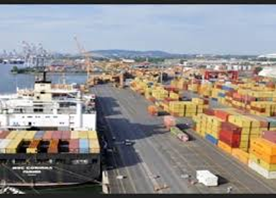
The Tunisian maritime trade is ensured by 7 commercial ports, namely Bizerte-Menzel Bourguiba, Tunis-Goulette-Radès, the port complex of the capital, Sousse, Sfax, Gabés, Zarzis and the oil port of Skhira. With the exception of the oil port of Skhira, all ports are managed by the OMMP. These ports handle the transit of over 30 million tons of goods (including national cabotage). From 1992, the maritime sector underwent more liberalization. Since then, the private sector has started to take over and we have seen the creation of several companies operating owned vessels, in addition to the national armaments, namely the CTN and COTUNAV.
Main ports in Tunisia
- Bizerte Menzel Bourguiba - dominated by oil traffic.
- Radès - mainly specialized in container traffic and rolling units.
- Goulette - characterized in particular by passenger and cruise ship traffic.
- Sousse - processes the traffic of general goods
- Sfax-Sid Youssef - multipurpose port (Miscellaneous, cereals, etc)
- Gabès - industrial port, trafficking in chemicals.
- Skhira - petrochemical port.
- Zarzis - processes oil and sea salt traffic
Annex 2.1: Government Contact List
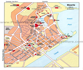
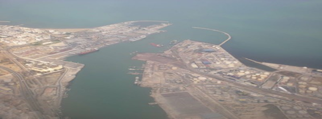
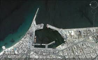
2.1.1 Tunisia Port of Bizerte Menzel Bourgiba
Port Overview
The Office de la Marine Marchande et des Ports (OMMP) is the port authority for the Port of Bizerte. The Port of Bizerte plays an important role in the social, economic, and cultural life of the city of Bizerte due to its strategic position on the Gibraltar-Suez trade route, its proximity to ports in Southern Europe, and its convenience for the many new industrial estates in the region.
Bizerte Port, dominated by oil traffic, is privileged by its strategic position on the axis of maritime access GIBRALTAR-SUEZ, its proximity to Southern Europe and the boom of the industrial estates in the region (Menzel Bourguiba, Menzel Jemil and Utique), the business park of Bizerte (former free zone) and the natural, historical and archaeological picturesque sites, the port of Bizerte-Menzel Bourguiba is called upon to play a predominant role in the socio-economic and cultural development of the city of Bizerte and its back country. Thus, between a strategic maritime position and the developed terrestrial accesses, the port provides to industrialists, investors and tourist professionals an essential commercial tool for conquering Europe and the Mediterranean market.
Nautical Data - Approach: signaled by 24 lights and 07 markup buoys, is done by:
- 2 passes between piers and breakwater
- 350 m wide North Pass
- 650 m wide south pass.
- a canal crossed by a mobile bridge offering a 75 m wide passage with a 13 m draft.
La Houle: It is from North-East to South sector.
Tides: the amplitude of the tides is often less than 40 cm and sometimes reaches 1 m.
The currents: the current regime is regular in good weather.
Dominant Winds: In winter, from west to northwest. In summer from South-East to North-East. Winter winds can reach 30 knots.
Infrastructures:
- Basins
- Before port: 52 ha, at 13 meters (Marina: 34 ha).
- Canal port: 28.8 ha, 12 meters away.
- Sebra Bay: 46 ha, 10 meters away.
The commercial port of Bizerte offers a total length of quays with a length of 1,721 m.
- Protective structures: the harbor is protected by 2 piers:
- The North pier, oriented East - West, 1025 m long, protects the port against the prevailing winds from West to North - West, especially in winter.
- The East pier, oriented North - South, 940 m long, protects the port from the North - East winds.
- Between the two piers, a 610 m long breakwater mole opposes offshore swells and silting up.
Services:
- Road access:
- A main entrance located at the right of the trade quay.
- An exit located west of the bonded area.
- 4 secondary doors, for rescue.
- Rail access: The port rail network is exclusively normal gauge. It is linked to the SNCFT station.
In 2019, the Port of Bizerte handled 5.8 million tons of cargo and welcomed 558 vessels. Of the total cargo volume, 4.7 million was international traffic and 623 thousand was domestic. In addition to cargo-handling facilities, the Port of Bizerte contains a shipyard with four dry docks. Located on Lake Bizerte, the shipyards cover 50 hectares, including 50 thousand square meters of covered structures. The Port of Bizerte also contains a business park (formerly a free zone) that has two sites, one in Bizerte and another in Menzel Bourguiba. The business park plays the role of a multi-sector distribution center.
The multi-purpose Port of Bizerte has direct access to the Mediterranean Sea through a 17-meter deep channel. The Port of Bizerte has easy access to the nation's rail and road networks, and it is only 60 kilometers from the Tunis-Carthage airport. The Port of Bizerte covers 74 hectares of land area and 161 hectares of water surface. The average depth of the Port of Bizerte is 10 meters. The channel to the commercial docks is 75 meters wide with a draft of 13 meters. The Port of Bizerte contains 22 thousand square meters of open-air paved storage areas. It also has five warehouses that support port operations with a total of over two thousand square meters. Additional warehouses covering a total of 6.5 thousand square meters are located at the docks. Port of Bizerte facilities located at Menzel Bourguiba include the North Dock (220 meters long with alongside depth of 5 meters), the Honour Dock (100 meters long with alongside depth of 5.5 meters), and the South Dock (150 meters long with alongside depth of 9.5 meters).
Port Link : Bizerte Menzel Bourguiba Port
Key port information may also be found at:http://www.maritime-database.com
|
Port Location and Contact |
|
|---|---|
|
Country |
Tunisia |
|
Province or District |
Bizerte |
|
Nearest Town or City |
Bizerte (71 km from Tunis) |
|
Port's Complete Name |
Bizerte Menzel Bourguiba |
|
Latitude |
37.274713 |
|
Longitude |
9.878708 |
|
Managing Company or Port Authority: |
OMMP (www.ommp.nat.tn ) |
|
Management Contact Person: |
Address : Quai Tarak Ibn Ziad Bureau frontalier et régional de Bizerte-port. Tél : 72431060. Fax : 72431060. Mail : br.bizerte@douane.gov.tn. Adresse : Port de Bizerte. Responsable : Habib. |
|
Nearest Airport and Airlines |
Tunis-Carthage Airport (TUN / DTTA) - 71 km |
Port Picture
Description and Contacts of Key Companies
The Office of the Merchant Marine and Ports (OMMP) is the agency responsible of the all administrative and financial activities and coordination.
The maritime companies operating in ports sector play an important role in the development and promotion of Tunisia's foreign trade. In fact, 98% of the foreign trade is carried out by sea through the 7 commercial seaports. These ports handled in 2019 around 33 million tones, 985 passenger miles and 420 passenger cars. The maritime transport and ports sector include almost 560 companies working in the maritime professions, freight forwarders and port professions and offering almost 6000 direct jobs.
For additional information on port contacts, please see the following link: PORT COMPANIES CONTACT LIST
Port Performance
The port of Bizerte handled almost 5,207,472 MT in 2018, in import, export and transit of goods, against 4,864,533 MT in 2017 (either an increase of 4%). This grew from 3 million mt in 2014 and continuing to grow. That represents a growth of nearly 60% over 2014, and every year since has seen volumes far above planned or expected volumes.
Bizerte Menzel Bourguiba Terminal presents capacity for container up 500,000 TEU, while the design capacity was 160,000 TEU.
The Alexandria Terminal has:
- Special Depot for Stripping L.C.L.
- Special Yard for Stuffing Exported Cargo in Containers
|
Seasonal Constraints |
||
|---|---|---|
|
Yes / No |
Period |
|
|
Rainy Season |
No |
December-March |
|
Major Import Campaigns |
No |
N/A |
|
Handling Figures 2019 |
|
|---|---|
|
Vessel Calls: |
560 |
|
Container Traffic: (TEUs) |
44,434 |
|
Handling Figures Bulk and Break Bulk |
Year 2019 |
|---|---|
|
Bulk (MT) |
4,594,269 |
|
Break bulk (MT) |
952,510 |
Discharge Rates and Terminal Handling Charges
For information on port rates and charges, please see the following link: tp://www.worldportsource.com/ports/index/TUN.php
Berthing Specifications
In its berthing structures:
- Standard substations / Commercial quay 5 posts - length: 523 m, draft: for post 1 is -9.30 m and posts 2, 3 and 4, it is -09.65m and post 5 it has a draft of waters of -9.80m.
- Specialist petroleum stations A / B: respective lengths: 250m / 150m - and draft respectively -10.67m / -7.80m.
- Cereal wharf length: 200 m and with a draft: -9.75 m.
- Sugar dock length: 168 m and with a draft: -10 m.
- Tunis-Steel substation: length 120 m - draft: - 9.00 m.
- Cement plant: length: 174 m - draft: -9.00 m.
- OXY quay: length: 16 m - draft: -5.5 m,
- Service dock (for tug docking): length: 120 m - draft: -5.5 m.
The Port of Bizerte contains a total of 1721 meters of quays. It has 520 meters of conventional docks with alongside depths from 9.3 to 9.8 meters. It has another five docks that specialize in handling hydrocarbons, steel, metallurgical products, cement and clinker, and cereals. The oil dock has two berths, one that is 250 meters long with alongside depth of 10.67 meters and another that is 150 meters long with alongside depth of 8.25 meters. The cereals dock, which includes a modern silo, is 200 meters long with alongside depth of 9.75 meters. The Acier steel dock is 120 meters long with alongside depth of 9 meters. The cement dock is 180 meters long with alongside depth of 10.5 meters with an extension that is 120 meters long with alongside depth of 5.5 meters. The OXY dock is 16 meters long with alongside depth of 6.2 meters.
|
Type of Berth |
Quantity |
Length (m) |
Maximum Draft (m) |
Comments |
|---|---|---|---|---|
|
Conventional Berth |
5 ocean tugs, 100+ Ton Lifts: equipped with high power motors (1700C.V to 6300 HP) and a tensile strength of 23 tons to 70 tons. |
120 Meters |
7.2 Meters |
Good Status |
|
Container Berth |
5 |
150 : 205 Meters |
9 Meters |
Operate at any time needed and tow services are being given to all of the ships coming to the Port located at the area that is protected with breakwater in length of 1.375 m. |
|
Silo Berth |
0 |
|
||
|
Berthing Tugs |
5 |
|||
|
Water Barges |
0 |
General Cargo Handling Berths
|
Cargo Type |
Berth Identification |
|---|---|
|
Imports - Bagged Cargo |
Conventional Berth (No. 1 ) & K.D. Berth (No. 10 ) |
|
Exports - Bagged Cargo |
Conventional Berth (No. 1) & K.D. Berth (No. 10 ) |
|
Imports and Exports - RoRo |
Container & RoRo Berth (No. 7 ) |
|
Other Imports |
Liquid Bulk Berths ( No. 8 & 9 ) |
Port Handling Equipment
The Office de la Marine Marchande et des Ports (OMMP) is a government society which manages all port equipment. The floating comprises 2 pilot boats, 1 floating crane of 50- 90 tons capacity, 4 tugboats, 2 mooring boats and 1 service boats. Four weigh bridges of up to 120 tons capacity are available.
http://ports.com/tunisia/port-of-bizerte-menzel-bourguiba/
|
Equipment |
Available |
Total Quantity and Capacity Available |
Comments on Current Condition and Actual Usage |
|---|---|---|---|
|
Dockside Crane |
Yes |
|
Maximum capacity 100 + tons |
|
Container Gantries |
n/a |
n/a |
n/a |
|
Mobile Cranes |
n/a |
n/a |
n/a |
|
Reachstacker |
n/a |
n/a |
n/a |
|
RoRo Tugmaster (w/ Trailer) |
n/a |
n/a |
n/a |
|
Grain Elevator w/ Bagging Machines |
n/a |
n/a |
n/a |
|
Transtainer |
n/a |
n/a |
n/a |
|
Forklifts |
Yes |
|
n/a |
Container Facilities
|
Facilities |
20 ft |
40 ft |
|---|---|---|
|
Container Facilities Available |
Yes |
Yes |
|
Container Freight Station (CFS) |
Yes |
Yes |
|
Refrigerated Container Stations |
Yes |
Yes |
|
Other Capacity Details |
||
|
Daily Take Off Capacity (Containers per day) |
1100 TEU/Day (Oct 2019) |
|
|
Number of Reefer Stations (connection points) |
600 |
|
|
Emergency Take-off Capacity (Give an indication) |
N/A |
|
|
Off take capacity of gang shift (in Containers per shift) |
2,700 TEU/Day |
Yes |
Customs Guidance
Customs clearance consists of presenting the goods at a Customs office and allocating them a Customs system. On reaching Customs, goods are automatically sorted by the SINDA (Automated Customs Information System) according to certain criteria, especially the nature of the product and the importer. The sorting leads to a system of channels: the "green channel" for goods which present no risk (brief inspection of the documents), the "orange channel" for medium level risks (normal inspection), the "red channel" for extreme risks (complete inspection).
The inspection may consist of x-raying the whole container, but also x-raying or opening each package. When they have been inspected, the goods receive a temporary collection permit which allows them to be stocked for further inspection or a permit for clearance inward.
For information on customs, please see the following link: 1.3 Customs Information.
Terminal Information
Multipurpose Terminal
The land of 13 Hectares belonging to the public port area of the commercial port of Bizerte, adjacent to the site of the company "CIMENTS DE BIZERTE", overlooking its seafront, on one side, on Sebra bay and on the channel Towards the port of Menzel Bourguiba, on the other side, this land has all the potential to be converted into a port terminal for handling goods through the construction of a quay and development of embankments for storage and handling of goods.
The storage space is made up of warehouses, ground surface and parking spaces.
Multipurpose port handling grain, cement, steel products, clinker and liquid bulk Menzel Bourguiba is a ship building/repair center with four graving docks. Today, the commercial port of Bizerte is experiencing a major boom in terms of development of its economic activity by the very fact of the strategic geographic position in the Mediterranean basin.
Warehouses: The storage facilities available at Lomé Port are summarized hereafter.
- 3,800 m² of quay-side warehouses,
- 4 transit warehouses of 5,500 m² each,
- 2 warehouses of 25,000 m²
- 1 warehouse of 3,600 m²
- 1 warehouse of 2,000 m²
Ground Surfaces: More than 130,000 m² dedicated to the storage of containers and other goods such as building materials.
Parking Spaces: The Bizerte port has several parking spaces for trucks and second-hand vehicles:
- 200,000 m² for secondhand vehicles
- 16,000 m² buffer parking space juxtaposed with the port round about to enable trucks to load within the port
- 30,000 m² space for the stripping of containers
- 10,000 m² Terminal for the parking of trucks and vehicles heading.
Grain and Bulk Handling
- breakbulk: Depth 9.8 m. Bulk: Depth 9.7 m.
- Tankers: LOA 250 m., draft 10.6 m., depth 10.6 m.
- Gas: LOA 150 m., draft 8.2 m., depth 8.2 m.
Main Storage Terminal
About a total port area 55.000 sqm open storage areas 25.200 sqm and covered storage areas 15.560 sqm, and for container storage areas of 12.000 sqm, Bizerte Menzel Bourguiba port’s main Storage capacity was underestimated. Since 2018-2019, an Engineering phase of its extension project started. Bidding process: 2019 and Construction Phase: 2020-2021 is planned to start an open-air storage with a capacity of 80,000 tons. The storage area will be laid out near the future berth of the company 50 m away from the planned storage station.
Another facility available at the terminal is the provision of reefer facilities for refrigerated containers.
The project is managed by the government authorities as follows:
- Unloading at berth: Pet Coke is hauled in bulk carriers specially designed for construction materials (clinker, sand, gravels, etc...) with Deadweight tonnage ranging 10 000 - 20 000 DWT. As a general rule, the bulk carriers concerned are fitted with their own cranes and gantry cranes for unloading from ship to berth. In view of the large volumes handled and the cost of berthing fees the ships unload in bulk. Usually the cement plants have their own depots at the wharf and supply the plant by trucking.
- Supplying the storage zone: Conveying the pet coke from berth to storage station will be by enclosed conveyor belts. The coke will access the 5m high unloading dike along a ramp and unload at the reception dike. The whole facilities including unloading dikes and storage areas is confined within a 3m high net raising above the dike level.
- Storage area arrangement: A concrete slab is provided over the whole storage area with dimensions governed by the zone area, the maximum storage load, the loaded truck weight and the weight of the front-end loaders. The slab will be designed with a slope of 2 %, to prevent from stagnation of rainwater, dedusting and possibly firefighting effluents.
- Handling of PETCOKE inside the storage area: Unloading is done from the protection dike, such that the pet coke owing to its granular properties will slide over the dike embankment. As the coke piles up it is compacted using front-end loader operating from the dike. Trucks will further extend the stockpile by unloading laterally around the dike with adequate compaction.
|
Storage Type |
Number of Storage Facilities |
Area (square meters) |
|---|---|---|
|
Bagged Cargo |
2 |
Approx. 50,200 m2 |
|
Refrigerated Cargo |
3 |
Approx. 3,760 m2 |
|
General Cargo |
2 |
Approx. 86,136 m |
Stevedoring
OMMP performs all stevedoring activities which consist of the loading and unloading of ships and the performance of various tasks required when the vessel is in port, including lashing and unlashing of cargo.
Hinterland Information
Goods are transported out of the port by trucks. Most trucking companies are members of the OMMP and all trucking companies operating at the port must be registered with the Shipping Association of Tunisia (AMT). There are also vessels that depart from Tunisian ports and travel coastwise east to Asian countries crossing Suez canal that transport cargo to that region of the North African and Middle east. Most others is travelling out of Mediterranean sea to Atlantic ocean.
Port Security
- 24/7 monitoring the port and extension areas with 300 CCTV cameras
- Running all Port Operations by the Terminal Operating System. (TOS)
- Monitoring port operations online by the users
| Security | |
|---|---|
| ISPS Compliant | Yes |
|
Current ISPS Level Level 1 = Normal, Level 2 = Heightened, Level 3 = Exceptional |
1 |
| Police Boats | Yes |
| Fire Engines | N/A |
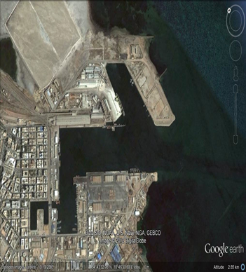
2.1.2 Tunisia Port of Rades
Port Overview
The Office de la Marine Marchande et des Ports (OMMP) is the port authority for the Port of Rades. The port of Radès specializes in container traffic and rolling units (mainly trailer traffic). Thus, the port of Radès ensures 21% of the overall traffic, 79% of the tonnage of containerized goods, 76% of the tonnage of goods loaded in rolling units, 76% of EVP container traffic, 80% of the traffic of rolling units and 18% of the traffic of ships registered in the whole of the Tunisian commercial ports.
In 2019, the Port of Rades handled almost a total of 7.9 million tons of cargo, including 5.8 million tons of foreign cargoes and over 74,000 tons of domestic cabotage, of which 1.8 million tons is containerized cargo. The major cargo categories handled in the Port of Rades included hydrocarbons (970,000 tons) and cereals (642,000 tons) as well as other liquid and solid bulk cargoes and general merchandise.
Rades port is located on the southern bank of the Tunis canal. The commercial port of Radès comprises two terminals:
- Terminal specialized in containers and rolling units.
- Specialized berths.
The access channels: 6.3 km (3.5 miles), depth 12 meters (39.33 ft).
Infrastructure
The canal basin covering a surface of 63.6 hectares separates the port installations of the northern bank from those of the southern bank. This basin, initially dredged at a depth of 11.5 meters, comprises:
- A turning circle exterior to the central basin, with a diameter of 370 meters, dredged at 12 meters, is fitted out below the port’s access channel
- A turning circle with a diameter of 300 meters is located at the level of specialized dock posts of the southern bank.
The access to the terminal goes through the main basin of the port of La Goulette and then through a channel dredged at -12 meters and with head room of 42 meters.
Port Link: Rades Port, Tunis
Key port information may also be found at: http://www.maritime-database.com
|
Port Location & Contact |
|
|---|---|
|
Country |
Tunisia |
|
Province or District |
Rades, Tunis |
|
Closest Town or City |
Tunis, Rades (10 km from Tunis) |
|
Port's Complete Name |
Rades Port |
|
Latitude |
36.801248 |
|
Longitude |
10.276192 |
|
Managing Company or Port Authority |
Office de la Marine Marchande et des Ports (OMMP) |
|
Management Contact Person |
Office of Merchant Navy and Ports Administration building 2060 La Goulette 3029 Tunisia Tel +21671735300. +21671735812 Administrative building 2040 Rades– Tunisie |
|
Nearest Airport and Airlines (Airlines with frequent international arrivals/departures) |
Tunis-Carthage Airport (TUN / DTTA) (5 km) |
Port Picture
Description and Contacts of Key Companies
The Office of the Merchant Marine and Ports (OMMP) is the main agency responsible of the all administrative and financial activities and coordination.
The maritime companies operating in ports sector play an important role in the development and promotion of Tunisia's foreign trade. In fact, 98% of the foreign trade is carried out by sea through the 7 commercial seaports. These ports handled in 2019 around 33 million tones, 985 passenger miles and 420 passenger cars. The maritime transport and ports sector include almost 560 companies working in the maritime professions, freight forwarders and port professions and offering almost 6000 direct jobs.
For additional information on port contacts, please see the following links: 4.4 Port and Waterways Contact List and PORT COMPANIES CONTACT LIST.
Port Performance
The port of Radès specializes in the traffic of containers and rolling units (mainly trailer traffic). It provides 21% of overall traffic, 79% of the tonnage of containerized goods, 76% of the tonnage of goods loaded in rolling units, 76% of container traffic in TEUs, 80% of traffic in rolling units and 18% of traffic of ships registered in all Tunisian commercial ports. The port of Rades has installed automatic management systems (TOS) for containers and rolling units at the port of Radès, between the Tunisian stevedoring and handling company (STAM) and the Tunisian company NEXSTEP and the Spanish company Karlomek, operating in the port management equipment sector. The installation of the Smart Gate systems and TOS in the port of Rades is part of the implementation of investment projects included in the export development program (PDE III). It is financed by the World Bank in order to improve services and increase profitability indicators in the port through the high information and communication technologies adopted in ports.
Handling performance in 2019
The volume of trade at the port of Rades increased by 5% in 2019 at 6.474 Million Dinars (MD), against 6.163 MD in 2018. A number of investment projects were executed in 2019 at the port, including the commissioning of the new RTG cranes, the new terminal management system “TOS” (Terminal Operating System) and the smart gate project, thus enabling reduce waiting times for boats, the number of containers on the docks and average daily container removal. Thus, the activity of 20-foot containers increased by 1% (288,860) against 2,801,004 in 2018 and that of port tractors increased from 111,122 to 112,391 in 2019.
The loading and unloading performance of container vessels has reached 4 vessels per hour in the past two years and vessel waiting times have decreased to two days compared to five in 2018, in addition to the increase in the average daily collection at 451 containers.
The number of boats that docked in 2019 reached 1,120 boats, registering a decrease of 2% compared to 2018 (1,147 boats).
The port of Radès is unable to accommodate large tonnage vessels, depriving its users of significant economies of scale. There is also the problem of duration, an average length of stay of goods which is much longer at the port of Rades. While this duration does not exceed two days in several European ports, it is estimated at the port of Rades at 12 days, which generates significant additional costs for shippers. This is due to the unavailability of cranes, of which half are unavailable for maintenance reasons.
| Seasonal Constraints |
Yes / No |
|---|---|
|
Rainy Season |
No |
|
Major Import Campaigns |
No |
|
HANDLING FIGURES 2019 |
|
|---|---|
|
Vessel Calls: |
1,120 |
|
Container Traffic: (TEUs) |
3,089,864 |
|
Handling Figures Bulk and Break Bulk |
Year 2019 |
|---|---|
|
Bulk (MT) |
6,278,725 |
|
Break bulk (MT) |
1,410,556 |
Discharge Rates and Terminal Handling Charges
For information on port rates and charges, please see the following link: http://www.worldportsource.com/ports/review/TUN_Port_of_Rades_2160.php
Berthing Specifications
The terminal also has four specialized berths with a total length of 640 meters. The berth handling hydrocarbons and other liquid bulk is 170 meters long with alongside depth of 9.45 meters. The cereals berth, which includes a silo, is 190 meters long with alongside depth of 9.75 meters. The K.D. Multi-bulk berth, handling solid and liquid bulk cargoes, is 160 meters long with alongside depth of 9.45 meters. A final berth receiving conventional bulk carriers handles a variety of goods. It is 120 meters long with alongside depth of 7.2 meters.
|
Type of Berth |
Quantity |
Length (m) |
Maximum Draft (m) |
Comments |
|---|---|---|---|---|
|
Conventional Berth |
4 specialized berths with a total length of 640 meters |
170 Meters |
9.45 Meters |
Good Status |
|
Container Berth |
5 |
205 Meters |
9 Meters |
Good status |
|
Silo Berth |
1 |
|
||
|
Berthing Tugs |
2 |
|||
|
Water Barges |
3 |
General Cargo Handling Berths
|
Cargo Type |
Berth Identification |
|---|---|
|
Imports - Bagged Cargo |
Conventional Berth (No. 1) & K.D. Berth (No. 10) |
|
Exports - Bagged Cargo |
Conventional Berth (No. 1) & K.D. Berth (No. 10) |
|
Imports and Exports - RoRo |
Container & RoRo berth (No. 7) |
|
Other Imports |
Liquid bulk berths (No. 8 & 9) |
Port Handling Equipment
OMMP manages all port equipment. The floating comprises 2 pilot boats, 1 floating crane of 50- 90 tons capacity, 4 tugboats, 2 mooring boats and 1 service boats. Four weigh bridges of up to 120 tons capacity are available.
http://ports.com/tunisia/port-of-rades/
|
Equipment |
Available |
Total Quantity and Capacity Available |
Comments on Current Condition and Actual Usage |
|---|---|---|---|
|
Dockside Crane |
Yes |
|
Maximum capacity 100 + tons |
|
Container Gantries |
N/A |
N/A |
N/A |
|
Mobile Cranes |
N/A |
N/A |
N/A |
|
Reachstacker |
N/A |
N/A |
N/A |
|
RoRo Tugmaster (w/ Trailer) |
N/A |
N/A |
N/A |
|
Grain Elevator w/ Bagging Machines |
N/A |
N/A |
N/A |
|
Transtainer |
N/A |
N/A |
N/A |
|
Forklifts |
Yes |
|
N/A |
Container Facilities
|
Facilities |
20 ft |
40 ft |
|---|---|---|
|
Container Facilities Available |
Yes |
Yes |
|
Container Freight Station (CFS) |
Yes |
Yes |
|
Refrigerated Container Stations |
Yes |
Yes |
|
Other Capacity Details |
||
|
Daily Take Off Capacity (Containers per day) |
N/A |
N/A |
|
Number of Reefer Stations (connection points) |
N/A |
N/A |
|
Emergency Take-off Capacity (Give an indication) |
N/A |
N/A |
|
Off take capacity of gang shift (in Containers per shift) |
N/A |
N/A |
Customs Guidance
Customs clearance consists of presenting the goods at a Customs office and allocating them a Customs system. On reaching Customs, goods are automatically sorted by the SINDA (Automated Customs Information System) according to certain criteria, especially the nature of the product and the importer. The sorting leads to a system of channels: the "green channel" for goods which present no risk (brief inspection of the documents), the "orange channel" for medium level risks (normal inspection), the "red channel" for extreme risks (complete inspection).
The inspection may consist of x-raying the whole container, but also x-raying or opening each package. When they have been inspected, the goods receive a temporary collection permit which allows them to be stocked for further inspection or a permit for clearance inward. The latter can take up to 11 days. In total, according to the WTO and in June 2005, the time required for Customs clearance, for unbranded products subject to foreign trade formalities, from arrival at the port/airport to clearance inward, varied from 7 to 20 days. Customs duties are about 3%. The principle is to pay duties and taxes in cash.
Terminal Information
Multipurpose Terminal
The Customs-controlled zone of the container and RO-RO terminal of the port of Radès has a surface of 48ha, comprising 6 hangars with a total surface of 50ha, 3ha of which are warehouses.
Handling materials
- 5 pneumatic cranes
Container terminal equipment
- 22 lifting tackles
- 10 reach-stackers
- 46 RO-RO trucks
Support equipment
- 2 tugboats (3200, 1600 HP)
- 3 patrol boats (Piloting)
- Mooring boats
- Cleaner boat
Mooring service is provided by 2 companies duly approved by the OMNP.
Grain and Bulk Handling
There is available bagging equipment for grain and bulk cargoes. All types of cargo handling equipment pallets, forklifts etc. are available.
Main Storage Terminal
Faced with the geometry of the port, the remoteness of the storage areas of the quays, the existence of stores and hangars near the quays, the intersection between containerized traffic and ro-ro traffic, and the existence of a significant activity of regular lines , STAM and the the port authority, has devoted platforms 1, 6 and 7 to container ships and the other platforms to ro-ro ships. Store No. 2 was demolished in order to gain significant storage space bordering on platform No. 6.
STAM has drawn up a major investment plan on the order of 76MD which aims to increase the number and quality of equipment available:
- The acquisition of 6 RTGs, (amounting to 33MD), new equipment in Tunisia which will allow block storage of 6 rows and which have the capacity to store up to 5 levels, which will increase the port storage capacity to reach 16,000 TEUs.
- Concentrate the container activity on platforms 1, 6 and 7, which practically leads to the division of the port into two terminals: a container terminal and a ro-ro terminal.
- The redevelopment of solid land and storage areas adjacent to platforms 1, 6 and 7 which are operated by RTGs for an amount of 11.5MD.
- The acquisition of SMART GATE technology which will allow the organization and planning of the flow of goods at the entry and exit gates of the terminal, TOS Data center and training actions have been financed by the World Bank as part of the export promotion program PDEIII approximately (7MD)
- The acquisition of 2 Reachstackers, 2 empty Handler, 20 roro trucks and 14 port trailers for 14MD.
- Implementation of a TOS system (Terminal Operating System) for an amount of 10.5MD. This project started initially in 2010 and stopped just after the revolution. He then took over through operator training cycles and the installation of the necessary equipment.
|
Storage Type |
Number of Storage Facilities |
Area (square meters) |
|---|---|---|
|
Bagged Cargo |
2 |
Approx. 50,200 m2 |
|
Refrigerated Cargo |
3 |
Approx. 3,760 m2 |
|
General Cargo |
2 |
Approx. 86,136 m2 |
Stevedoring
OMMP performs all stevedoring activities which consist of the loading and unloading of ships and the performance of various tasks required when the vessel is in port, including lashing and unlashing of cargo.
Hinterland Information
As part of the development of a logistics activity area adjacent to the commercial port, space has been reserved to provide value-added services as well as storage space to help decongest the port. The land is located west of the port of Radés and separated from it by the Radès-La Goulette crossing structure with a total area of 46.5 Ha. A call for tenders has been launched for the extension and construction of platforms 7, 8 and 9 at the Port of Radès. The extension will significantly increase the docking capacity of container ships, and will rationalize the use of the medians adjacent to berths. The port of Radès is linked to the hinterland and to the industrial estates of Tunis-Megrine-Ben Arous by the road MC33, linked in its turn to the motorway Tunis-M’saken by the highway RN1 at less than 10km from the port. The container terminal as well as the specialized posts are linked to the railroad network by means of mixed tracks (metric and normal).
Port Security
- 24/7 monitoring the port and extension areas with more than 400 CCTV cameras
- Running all Port Operations by the Terminal Operating System. (TOS)
- Monitoring port operations online by the users
| Security | |
|---|---|
| ISPS Compliant | Yes |
|
Current ISPS Level Level 1 = Normal, Level 2 = Heightened, Level 3 = Exceptional |
1 |
| Police Boats | Yes |
| Fire Engines | N/A |
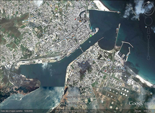
2.1.3 Tunisia Port of Goulette
Port Overview
The port of La Goulette is one of the most popular destinations in the western basin of the Mediterranean. The port of La Goulette is the converging point of the main Tunisian road and railroad networks. In addition to its transit and cruise activities, the port of La Goulette also receives ships carrying homogeneous cargos: cars, bulk cereals, various products. However, the development plan of the port provides for its specialization as a port exclusively reserved for passenger and tourist traffic.
The Access Channel: Length 3.5 miles = 6,3 Km, depth 12 meters = 39’04’’
Superstructures Warehouse:35 600 m2, Platforms: 25 Ha
Dock length: 1096 ml
Passengers Station: Total surface area: 6.5 ha, Capacity: 1160 cars, Waiting room: 5200 m2
Services provided:
- Banks (change)
- Free shop
- Refreshment area
- Sale of hand-crafted articles
- Kiosk
- Office of Tunisians Abroad
- National Office of Tunisian Tourism
- Tunisian Post Office
- Pay phones
- Ticket agency (Shipping companies)
Administration:
- Phytosanitary control
- Veterinary control
- CERT (Telecommunication study and research centre)
Approach: nautical access to the port of La Goulette is provided by a dredged channel at - 12 m, length 6.4 km and width 100 m; marked with 10 buoys.
La Houle: North West (strongest and most frequent is 22%)
Tides: Irregular, between 20 and 40 cm, 60 cm in the event of a storm.
The currents: southward at rising tide (stream current) and northward at ebb tide (ebb current), with a speed between 0.1 and 0.3 m / s → Generally oriented from North to South
Dominant Winds: From the Northeast sector, in summer. From the North West sector, in winter.
Port website: http://www.ommp.nat.tn/goulette/?id_port=1
Key port information may also be found at: http://www.maritime-database.com
|
Port Location and Contact |
|
|---|---|
|
Country |
Tunis - TN |
|
Province or District |
Tunis |
|
Town or City (Nearest location with distance from port) |
La Goulette (10 km from Tunis) |
|
Port's Complete Name: |
La Goulette Port - TNLGN |
|
Latitude: |
36.810559 |
|
Longitude: |
10.303588 |
|
Managing Company or Port Authority: |
Office de la Marine Marchande et des Ports (OMMP) Address : Batiment AdminstratifState : TunisZipcode : 2060Town : La Goulette Country : Tunisia - TN Phone : +216 71 735300 Fax : +216 71 735812Telex : 15386 |
|
Management Contact Person: |
Administrative building 2060 la Goulette – Tunisie |
|
Nearest Airport and Airlines |
Tunis-Carthage Airport (TUN / DTTA), 5km away Airports with scheduled flights sorted by distance to La Goulette Port. |
Port Picture
Description and Contacts of Key Companies
Terminals 5, 6, and 7 offers the usage of all commodities and complies with standard norms ISO 9001 and ISPS code of security and safety. OMMP is responsible of the all administrative and financial activities and coordination. For additional information on port contacts, please see the following link: LINK PORT COMPANY
Port Performance
Established in 1835 and with a privileged location 10 km from Tunis (the capital), the Port de la Goulette specializes in the processing of passenger traffic and cruise lines. Passenger traffic in 2019 marked a slight increase of 1%, or 829 000 passengers. The number of cars on the other hand remained steady compared to 2017, about 475,000 cars in 2016. Conversely, the traffic of cruise passengers experienced total paralysis since March 2015, following the terrorist attacks of Bardo Museum. The total passenger vessels increased by 2%, but still lower than the number recorded since 2018, which is approximately 730 ships, less than 6% compared to 2017. 61,000 tourists registered at the port of La Goulette during the first quarter 2018.
| Seasonal Constraints |
Yes / No |
|---|---|
|
Rainy Season |
No |
|
Major Import Campaigns |
No |
|
HANDLING FIGURES 2019 |
|
|---|---|
|
Vessel Calls: |
876 |
|
Container Traffic: (TEUs) |
17 |
|
Handling Figures Bulk and Break Bulk |
Year 2019 |
|---|---|
|
Bulk (MT) |
801,000 |
|
Break bulk (MT) |
689,000 |
Discharge Rates and Terminal Handling Charges
For information on port rates and charges, please see the following link: PORT RATES/TARIFFS PAGE.
Berthing Specifications
|
Type of Berth |
Quantity |
Length (m) |
Maximum Draft (m) |
Comments |
|---|---|---|---|---|
|
Conventional Berth |
1x specialized berth with a total length of 170 meters |
170 Meters |
9.45 Meters |
Good Status |
|
Container Berth |
1 |
205 Meters |
9 Meters |
Good status |
|
Silo Berth |
1 |
|
||
|
Berthing Tugs |
1 |
|
||
|
Water Barges |
1 |
|
Docking Works
|
Acceptable Length & Draft of Quays |
|||
|---|---|---|---|
|
Poste N° |
Length (m) |
Draught |
|
|
Meters |
In feet |
||
|
1Bis |
150 |
5.10 |
20’04’’ |
|
1 |
150 |
8,2 |
35’ 02 ’’ |
|
2 |
150 |
8,2 |
16’ 05’’ |
|
3 |
150 |
8.8 |
24’ 11’’ |
|
4 |
150 |
8.8 |
22’ |
|
5 |
150 |
8.8 |
34’ 06’’ |
|
6 |
150 |
8.8 |
18’ |
|
7 |
150 |
8.8 |
20’04’’ |
|
C1 |
335 |
9.00 |
20’04’’ |
|
C2 |
335 |
8.8 |
20’04’’ |
General Cargo Handling Berths
|
Cargo Type |
Berth Identification |
|---|---|
|
Imports - Bagged Cargo |
Conventional Berth (No. 3) |
|
Exports - Bagged Cargo |
Conventional Berth (No. 5) & K.D. Berth (No. 6) |
|
Imports and Exports - RoRo |
n/a |
|
Other Imports |
n/a |
Port Handling Equipment
|
Equipment |
Available |
Total Quantity and Capacity Available |
Comments on Current Condition and Actual Usage |
|---|---|---|---|
|
Dockside Crane |
Yes |
|
Maximum capacity 100 + tons |
|
Container Gantries |
n/a |
n/a |
n/a |
|
Mobile Cranes |
n/a |
n/a |
n/a |
|
Reachstacker |
n/a |
n/a |
n/a |
|
RoRo Tugmaster (w/ Trailer) |
n/a |
n/a |
n/a |
|
Grain Elevator w/ Bagging Machines |
n/a |
n/a |
n/a |
|
Transtainer |
n/a |
n/a |
n/a |
|
Forklifts |
Yes |
|
n/a |
Support equipment
- 1 tugboat = 3200 hp
- 1 tugboat = 1600 hp
- 3 patrol boats
- Dock cleaning boat “MAIN BLEUE”
- 2 telescopic passenger gangways
- Floating platform – 30m/40m – Simultaneous docking of two ships (capacity 22 T per axle).
Container Facilities
|
Facilities |
20 ft |
40 ft |
|---|---|---|
|
Container Facilities Available |
Yes |
Yes |
|
Container Freight Station (CFS) |
Yes |
Yes |
|
Refrigerated Container Stations |
Yes |
Yes |
|
Other Capacity Details |
||
|
Daily Take Off Capacity (Containers per day) |
N/A |
N/A |
|
Number of Reefer Stations (connection points) |
N/A |
N/A |
|
Emergency Take-off Capacity (Give an indication) |
N/A |
N/A |
|
Off take capacity of gang shift (in Containers per shift) |
N/A |
N/A |
Customs Guidance
Customs clearance consists of presenting the goods at a Customs office and allocating them a Customs system. On reaching Customs, goods are automatically sorted by the SINDA (Automated Customs Information System) according to certain criteria, especially the nature of the product and the importer. The sorting leads to a system of channels: the "green channel" for goods which present no risk (brief inspection of the documents), the "orange channel" for medium level risks (normal inspection), the "red channel" for extreme risks (complete inspection).
The inspection may consist of x-raying the whole container, but also x-raying or opening each package. When they have been inspected, the goods receive a temporary collection permit which allows them to be stocked for further inspection or a permit for clearance inward. The latter can take up to 11 days. In total, according to the WTO and in June 2005, the time required for Customs clearance, for unbranded products subject to foreign trade formalities, from arrival at the port/airport to clearance inward, varied from 7 to 20 days. Customs duties are about 3%. The principle is to pay duties and taxes in cash.
for more information about Customs in Tunisia, please see the following link: 1.3 Customs Information.
Terminal Information
Multipurpose Terminal
The port of La Goulette is particularly characterized by passengers as well as cruise ship traffic. It is a multipurpose port as well as by a Duty-free Zone.
Infrastructures: The main basin: 63.6 hectares, dredged at -11.5 meters (channel inside the basin) and has a 370 m diameter dredging circle dredged at -12 meters and laid out downstream of the port entrance pass
Berthing structures
These works are as follows:
- The Commerce quay (North) post (1) with return (1 bis) with a length equal to 146 m, and a draft of -8.2 m and -5.1 m respectively.
- The Commerce quay (North) Stations (2, 3, 4, and 5) with a length equal to 584 m, and a draft of -8.2m for station number 2, and -8.8m for 3, 4, and 5.
- The Quai de Commerce (North) post (6) car-ferries + classic ships with a length equal to 180 m and a draft of - 8.8m.
- The post (7) car-ferries 180 m long, and a draft of - 8.8m.
- The commercial port of La Goulette offers a quay line with a total length of 1090 ml.
- Ro-Ro ships.
Cruise terminal
2 berths specializing exclusively in the treatment of cruise ships over a length of 657 ml, and a draft of -9 m and - 8.8 m.
Harbor Station
The commercial port of La Goulette has a passenger terminal at its northern end located at the front of the Port opposite berth n ° 7 which is served by a platform and an access ramp allowing docking and handling of motorized passenger ships (car ferries). This terminal is made up of:
- Three stations with a floor area of 6.5ha and a car capacity of 1600 cars.
- A passenger room for the treatment of pedestrian passengers with an area of 5000 m².
- 04 berths served by a floating platform to accommodate two ships simultaneously and to process RoRo Pax type ships.
- 02 mobile telescopic gangways on rails to ensure pedestrian passage between the ship and the reception room
Protective structures
- South dike in length: 944 m
- North dike in length: 1000 m
Grain and Bulk Handling
From January 2013 the Tunisian stevedoring and handling company (STAM), has officially inaugurated of the new multi-bulk quay located on the south shore of La Goulette commercial port. This 200-meter-long wharf with a handling capacity of more than 1.5 million tonnes is intended for the traffic of solid bulk, such as soybeans, corn and cereals.
Putting this port space into operation has reduced the cost of handling goods and achieve yields in excess of 6000T / D. Consequently, demurrage borne by shippers will be eliminated and the logistics costs of transport will be reduced. STAM is temporarily operating this wharf, pending responses to the announcement of the call for tenders made by the Office of the Merchant Marine and Ports for the concession of this port space.
The STAM has equipped this quay with three 12m³ skips, three 28m³ hoppers, a trax, a weighbridge and has assigned qualified personnel to ensure commercial operations.
Main Storage Terminal
|
Storage Type |
Number of Storage Facilities |
Area (m2) |
|---|---|---|
|
Bagged Cargo |
1 |
Approx. 40,000 m2 |
|
Refrigerated Cargo |
2 |
Approx. 2,456 m2 |
|
General Cargo |
2 |
Approx. 60,500 m |
Stevedoring
OMMP performs all stevedoring activities which consist of the loading and unloading of ships and the performance of various tasks required when the vessel is in port, including lashing and unlashing of cargo.
Hinterland Information
The Port of Goulette is connected to the hinterland and the region's industrial estates by the MC33 highway. The container terminal and specialized berths are also linked to the rail network by both metric and normal tracks. Goods are transported out of the port by trucks.
Most trucking companies are members of the Port “Office de la Marine Marchande et des Port (OMMP) and all trucking companies operating at the port must be registered with the Shipping Association of Tunisia (AMT).
There are also vessels that depart from Tunisian ports and travel coastwise east to Asian countries crossing Suez Canal that transport cargo to that region of the North African and Middle east. Most others are travelling out of Mediterranean Sea to Atlantic Ocean.
Road Access
The port of La Goulette is linked to the national road network by expressways linking the town of La Goulette to the capital Tunis.
- The access to the GP8 and the motorway Tunis-M’saken is situated in the capital Tunis.
- This access was improved through the realization (2006) of a crossing structure linking the northern bank to the southern bank of the canal
Rail Access
The port of La Goulette is linked to the (metric) railroad network by means of the TGM line linking the town center to the northern suburbs and intended for passenger transport.
Overview of port traffic
The port of La Goulette specializes in the reception of passenger ships and cruise lines. It also receives ships carrying cars, trailers and rolling vehicles.
Port Security
- 24/7 monitoring the port and extension areas with more than 250 CCTV cameras
- Running all Port Operations by the Terminal Operating System. (TOS)
- Monitoring port operations online by the users
| Security | |
|---|---|
| ISPS Compliant | Yes |
|
Current ISPS Level Level 1 = Normal, Level 2 = Heightened, Level 3 = Exceptional |
1 |
| Police Boats | Yes |
| Fire Engines | N/A |
2.1.4 Tunisia Port of Sousse
Port Overview
Located at the very center of Tunisia, the port of Sousse occupies a strategic position with a wide hinterland. The port of Sousse, at 35°49′ latitude north and 10°39′ longitude east, is specialized in the handling of various goods. The OMMP ensures the attributions of maritime authority and port authority in accordance with the legislation in force. It also ensures port police powers in commercial seaports. Finally, its mission is to operate and ensure the operation, maintenance and development of commercial seaports. The operation and maintenance of ports by the OMMP extends, according to Tunisian legislation, extends to the harbors, outbuildings and related port facilities.
In addition of the main activity of diverse goods traffic, the fishing sector also occupies an important place in socio-economic terms in Sousse. The average Tunisian consumes 11 Kg of seafood per year and around 100,000 Tunisians live directly or indirectly from fishing and aquaculture activity. Fishing constitutes the main social and economic framework of several localities and regions of the country.
Access to the port:
- Length: 820m
- Wide: 65m
- Depth: 10.5
- Tuning Circle: 300m
- Docking works
Piloting is obligatory for ships with a tonnage exceeding 300 registered tons. Working hours in the port is open 24 hours a day; pilots and tugboats are available at any hour.
Ships out of Quarantine: Off-quarantine certificates are issued at quay.
Fresh Water: It is supplied at quay by means of hoses and at the request of the captain or the shipping agent. Bunkering is done by tank truck.
Preparation: The port of Sousse is located at 15 km from the international airport of Monastir towards the South and at 150 km from the international airport of Tunis-Carthage towards the North.
Port website: http://www.ommp.nat.tn/sousse/
Key port information may also be found at: http://www.maritime-database.com
|
Port Location and Contact |
|
|---|---|
|
Country |
Tunisia - TN |
|
Province or District |
Sousse |
|
Nearest Town or City |
Sousse (149 km from Tunis downtown) |
|
Port's Complete Name |
Port of Sousse |
|
Latitude |
35.825090 |
|
Longitude |
10.641884 |
|
Managing Company or Port Authority |
Office of Merchant Navy and Ports |
|
Management Contact Person |
Office of Merchant Navy and Ports Administrative Building-2060 Tel: +216 71 735 300 / Fax: +216 71 735 812 Email: ommp@ommp.nat.tn Website: http://www.ommp.nat.tn/ |
|
Nearest Airport and Airlines |
Tunis-Carthage Airport (TUN / DTTA) 71 km away |
Port Picture
Description and Contacts of Key Companies
For information on port rates and charges, please see the following link: PORT COMPANIES CONTACT LIST
Port Performance
At the Port of Sousse, handling operations are carried out by public and private operators. The private operator is the Group of Handlers of the Center (GMC). Traffic in 2019 was 6% less than 2018: about 20 million tons cars and approximately 830 ships. 170,000 tourists registered at the port of Sousse during the first quarter 2019.
| Seasonal Constraints |
Yes / No |
|---|---|
|
Rainy Season |
Yes |
|
Major Import Campaigns |
Yes |
|
Other |
Yes |
|
Handling Figures 2019 |
|
|---|---|
|
Vessel Calls: |
830 |
|
Container Traffic: (TEUs) |
3600 |
|
Handling Figures Bulk and Break Bulk |
Year 2019 |
|---|---|
|
Bulk (MT) |
6,000,000 |
|
Break bulk (MT) |
14,000,000 |
Discharge Rates and Terminal Handling Charges
The OMMP has recently launched a study on the restructuring of harbor dues and pricing scales.
Berthing Specifications
|
Type of Berth |
Quantity |
Length (m) |
Maximum Draft (m) |
Comments |
|---|---|---|---|---|
|
Conventional Berth |
6 specialized berths with a total length of 1020 meters |
170 meters |
9.45 meters |
Good Status |
|
Container Berth |
6 |
150 - 205 meters |
9 meters |
Good status |
|
Silo Berth |
0 |
|
||
|
Berthing Tugs |
3 |
|
||
|
Water Barges |
3 |
|
Acceptable Length & Draught of Quays
|
Poste N° |
Length (m) |
Draught |
|---|---|---|
|
Meters |
||
|
1 |
115 |
8.50 |
|
2 |
170 |
8.50 |
|
3 |
170 |
8.50 |
|
4 |
170 |
8.50 |
|
5 |
170 |
8.50 |
|
6 |
170 |
8.50 |
|
7 |
170 |
8.20 |
General Cargo Handling Berths
|
Cargo Type |
Berth Identification |
|---|---|
|
Imports - Bagged Cargo |
Conventional Berth & K.D. Berth |
|
Exports - Bagged Cargo |
Conventional Berth & K.D. Berth |
|
Imports and Exports - RoRo |
Container & RoRo Berth |
|
Other Imports |
Liquid Bulk Berths |
Port Handling Equipment
|
Equipment |
Available |
Total Quantity and Capacity Available |
Comments on Current Condition and Actual Usage |
|---|---|---|---|
|
Dockside Crane |
4 |
4 |
Good condition |
|
Container Gantries |
4 |
4 |
Good condition |
|
Mobile Cranes |
2 |
2 |
Good condition |
|
Reachstacker |
2 |
2 |
Good condition |
|
RoRo Tugmaster (w/ Trailer) |
1 |
1 |
Good condition |
|
Grain Elevator w/ Bagging Machines |
1 |
1 |
Good condition |
|
Transtainer |
1 |
1 |
Good condition |
|
Forklifts |
6 |
6 |
Good condition |
Support Equipment
|
Floating equipment |
Name |
Power |
Number |
|---|---|---|---|
|
Tug boats |
"Ibn Nafaa" |
1750 cv |
1 |
|
Patrol boats |
" Justina " |
600 cv |
2 |
|
Patrol boats |
"Hydrometer " |
220 cv |
2 |
Container Facilities
|
Facilities |
20 ft |
40 ft |
|---|---|---|
|
Container Facilities Available |
Yes |
Yes |
|
Container Freight Station (CFS) |
Yes |
Yes |
|
Refrigerated Container Stations |
Yes |
Yes |
|
Other Capacity Details |
||
|
Daily Take Off Capacity (Containers per day) |
N/A |
N/A |
|
Number of Reefer Stations (connection points) |
N/A |
N/A |
|
Emergency Take-off Capacity (Give an indication) |
N/A |
N/A |
|
Off take capacity of gang shift (in Containers per shift) |
N/A |
N/A |
Customs Guidance
Customs clearance consists of presenting the goods at a Customs office and allocating them a Customs system. On reaching Customs, goods are automatically sorted by the SINDA (Automated Customs Information System) according to certain criteria, especially the nature of the product and the importer. The sorting leads to a system of channels: the "green channel" for goods which present no risk (brief inspection of the documents), the "orange channel" for medium level risks (normal inspection), the "red channel" for extreme risks (complete inspection). The inspection may consist of x-raying the whole container, but also x-raying or opening each package. When they have been inspected, the goods receive a temporary collection permit which allows them to be stocked for further inspection or a permit for clearance inward. The latter can take up to 11 days. In total, according to the WTO and in June 2005, the time required for Customs clearance, for unbranded products subject to foreign trade formalities, from arrival at the port/airport to clearance inward, varied from 7 to 20 days. Customs duties are about 3%. The principle is to pay duties and taxes in cash.
For information on Port of Sousse customs information, please see the following link.
Terminal Information
Multipurpose Terminal
The creation of a new specialized port aims to improve the port of Sousse terminal as follows:
- Modernize the port infrastructure by creating a new port to respond to the growing needs of national and international maritime traffic.
- Make the Sahel region a regional and international center of trade and services.
- Take advantage of economies of scale by operating vessels of 80,000 deadweight tons instead of the current 25,000 tons.
- Drain part of the transshipment traffic of containers and bulk goods in the Mediterranean.
- Create a synergy between the port and the economic and logistical activity areas of the region and ensure the integration of different modes for the development of multimodal transport terminal.
Capital of the Tunisian Sahel, Sousse or "Hadramut" of its Phoenician name, is the 2nd largest city after Tunis. It was chosen in the 9th century AD as the maritime capital of the Aghlabids. Since independence, Sousse has contributed significantly to the country's economic growth since it contains one of the most important commercial ports as well as one of the most famous leisure seaside resorts in Tunisia, in this case the El Kantaoui port.
The commercial port of Sousse benefits from large-scale programs, like the works redevelopment of its northern quays and technical and economic studies dedicated to the enlargement of the port, generating an envelope of 13 million dinars. Port redevelopment studies of the port of Sousse recommend the restructuring of the port infrastructure, the establishment of a station to accommodate the largest cruise ferries at the north shore, as well as the annexation of an area of 3.4 hectares on the south shore side, which facilitates the shoreline transfer of commercial activities and the promotion of freight traffic.
The port of Sousse constitutes a link between the various Tunisian commercial ports, especially since it coexists with the port of Ennfidha, which, when completed, will offer 2500 meters of quays. The same goes for the new deep-sea port of Ennfidha, with the commercial potential it will present in terms of maritime imports and exports of goods and the modern logistical services it should offer, is likely to provide Tunisia an international center of trade and services.
Grain and Bulk Handling
- breakbulk: Depth 9.8 m. Bulk: Depth 9.7 m.
- Tankers: LOA 250 m., draft 10.6 m., depth 10.6 m.
- Gas: LOA 150 m., draft 8.2 m., depth 8.2 m.
Main Storage Terminal
|
Storage Type |
Number of Storage Facilities |
Area (square meters) |
|---|---|---|
|
Bagged Cargo |
1 |
Approx. 80,000 m2 |
|
Refrigerated Cargo |
2 |
Approx. 6,300 m2 |
|
General Cargo |
2 |
Approx. 80,500 m2 |
Stevedoring
OMMP performs all stevedoring activities which consist of the loading and unloading of ships and the performance of various tasks required when the vessel is in port, including lashing and unlashing of cargo.
Maritime ports Code in Tunisia (French)
Hinterland Information
The Port of Sousse is connected to the hinterland and the region's industrial estates by the MC33 highway. The container terminal and specialized berths are also linked to the rail network by both metric and normal tracks. Goods are transported out of the port by trucks.
Most trucking companies are members of the Port “Office de la Marine Marchande et des Port (OMMP) and all trucking companies operating at the port must be registered with the Shipping Association of Tunisia (AMT).
There are also vessels that depart from Tunisian ports and travel coastwise east to Asia, crossing the Suez Canal. Most others are travelling out of the Mediterranean Sea to the Atlantic Ocean.
Port Security
- 24/7 monitoring the port and extension areas with more than 250 CCTV cameras
- Running all Port Operations by the Terminal Operating System. (TOS)
- Monitoring port operations online by the users.
| Security | |
|---|---|
| ISPS Compliant? | Yes |
|
Current ISPS Level Level 1 = Normal, Level 2 = Heightened, Level 3 = Exceptional |
1 |
| Police Boats | Yes |
| Fire Engines | N/A |
2.1.5 Tunisia Port of Sfax-Sidi Youssef
Port Overview
The Sfax-Sidi Youssef port complex is a new multipurpose port located in Kerkennah (governorate of Sfax) which will enter into service during the summer of 2020. Its main traffic consists of solid bulk (phosphate and by-products, sea salt, cereals, etc). The port will create sources of income for thousands of inhabitants of the island who depend mainly on fishing. The extension project of the Port of Sidi Youssef, which started in January 2017 with a budget of around 32 million dinars, will preserve the environmental aspect and improve the services of passenger transport going from and to the island of Kerkennah on board from the ferry connecting it to Sfax.
Sidi Youssef is a Tunisian village and the port of access to the Kerkennah Islands. It is located at the western end of the island of Gharbi, the closest to the continental port of Sfax 18 km away. Sidi Youssef was not always the terminus of this car ferry line since the connections between the Kerkennah and Sfax were previously carried out between Cape Sidi Mansour, located seven kilometers north of Sfax (delegation of Sakiet Eddaïer), and Sidi Fredj (island of Chergui) which today corresponds to the main tourist area of the archipelago. It is a passenger port accommodating up to twelve daily services in summer from the SOMVIK car ferry (Kerkennah Islands Development Company). It is equipped with infrastructure such as a ferry terminal, a bus station for buses and collective taxis (several dozen) that provide collective ground transportation.
But Sfax- Sidi Youssef also shelters a fishing port where sail boats are practicing artisanal fishing. Some services have been set up such as an ice-trade for the conservation of fresh fish, fish merchants as well as catering businesses such as a restaurant operating during the tourist season.
Key port information may also be found at:http://www.maritime-database.com
|
PORT LOCATION & CONTACT |
|
|---|---|
|
Country |
Tunisia |
|
Province or District |
Sfax |
|
Town or City (Nearest location with distance from port) |
Kerkennah (5 km Sfax downtown) |
|
Port's Complete Name |
Sfax- Sidi Youssef |
|
Latitude |
34.721943 |
|
Longitude |
10.761144 |
|
Managing Company or Port Authority |
Office de la Marine Marchande et des Ports (OMMP) Batiment Adminstratif, Tunis 2060, La Goulette, Tunisia Phone : +216 71 735300 Fax : +216 71 735812 Telex : 15386 |
|
Management Contact Person |
Address : Street Houcine El Wazen BP 1155 – Sfax – Tunisia |
|
Nearest Airport and Airlines |
Tunis-Carthage Airport (TUN / DTTA), 71 km away. Airports with scheduled flights sorted by distance to Sfax-Sidi Youssef port |
Port Picture
Description and Contacts of Key Companies
The Office of the Merchant Marine and Ports (OMMP) is the main agency responsible of the all administrative and financial activities and coordination. The maritime companies operating in ports sector play an important role in the development and promotion of Tunisia's foreign trade. In fact, 98% of the foreign trade is carried out by sea through the 7 commercial seaports. These ports handled in 2019 around 33 million tones, 985 passenger miles and 420 passenger cars. The maritime transport and ports sector include almost 560 companies working in the maritime professions, freight forwarders and port professions and offering almost 6000 direct jobs.
Port Performance
The port of Sfax is the second largest port in Tunisia with more than 90,000 TEUs and nearly 784,500 tons of general cargo in 2018. The port of Sfax cannot receive ro-ro ships or trans-Mediterranean carriers. Most of the solid part in the north-eastern part of the port was transferred to Skhira port, thus large spaces were freed which made it possible to receive ro-ro ships.
In Dec 2020, the Ministry of Transport launched a call for expression of interest to set up a logistics platform in connection with the port of Sfax on a 50-hectar plot of land . This land, located 17 km southwest of the port of Sfax, is well connected to the road and rail networks, including a new highway (south of Sfax) which facilitates the connection to Tunis and the port of Radès by highway.
The total volume of OMMP traffic amounted to 22.7 million tons in 2015. Given Sfax port and Skhira oil terminal, the total volume of traffic would be around 28.1 million tons in 2018, against 29 million global traffic volumes in 2019. The distribution of traffic by port and type of merchandise is summarized in the table below:
Contribution (%) of each port in the domestic traffic (with Skhira):
- Goulette 2.7% 746 018
- Skhira 19,3% 5 458 989
- Zarzis 2.6% 736 808
- Gabes 7.8% 2 200 803
- Sfax 15.5% 4 367 465
- Rades 23.7% 6 668 415
- Bizerte 19.9% 5 603 343
- Sousse 8,5% 2 402 182
The port of Sfax is a major asset for the Tunisian and regional economy. Its commercial port is one of the oldest in the country and the second in Tunisia. It was created around 1905. The quantity of products exported in 2018 is evaluated at 3,492,134 tons while imports are evaluated at 3,282,645 tons. These exported products come mainly from the center and the south of the country: sea salt, olive oil, processed phosphates and various other products.
| Seasonal Constraints |
Yes / No |
|---|---|
|
Rainy Season |
Yes |
|
Major Import Campaigns |
Yes |
|
Other |
N/A |
|
HANDLING FIGURES 2019 |
|
|---|---|
|
Vessel Calls: |
Approx. 1300 |
|
Container Traffic: (TEUs) |
Approx. 2800 |
|
Handling Figures Bulk and Break Bulk |
Year 2019 |
|---|---|
|
Bulk (MT) |
367,465 |
|
Break bulk (MT) |
4,000,000 |
Berthing Specifications
The berths consist of 15 berths distributed as follows:
- NPK platform (substation n ° 1) of total length equal to 150 m with a depth of - 10.50 m Hydro.
- Soufrier quay (substation n ° 2) of total length equal to 220 m with a depth of - 10.50 m Hydro
- Quai M’dhila (post 3) with a total length of 243 m with a depth of - 10.5 m Hydro.
- Phosphate platform (item 4.5 and 6) 584 ml long with a depth of -10.50 m
- Trade quay (post no. 7.8 and 9) 520 ml long with a depth of -10.50 m
- Service platform (post 10) 60 ml long with a depth of -10.50 m
- RORO platform (post 11) 150 ml long with a depth of -10.50 m
- Trade quay (posts 12, 13 and 14) 517 ml long with a depth of -10.50 m
- Saltworks quay (post n ° 15) 110 ml long with a depth of -10.50 m
- Oil jetty of length 150 ml with a depth of -10.50 m
- The commercial port of Sfax offers a quay line with a total length of 2704 m.
|
Type of Berth |
Quantity |
Length (m) |
Maximum Draft (m) |
Comments |
|---|---|---|---|---|
|
Conventional Berth |
4 specialized berths with a total length of 600 meters |
150 meters |
9.45 meters |
Good condition |
|
Container Berth |
4 |
150 - 205 meters |
9 meters |
Good condition |
|
Silo Berth |
0 |
|
||
|
Berthing Tugs |
3 |
|
||
|
Water Barges |
3 |
|
General Cargo Handling Berths
|
Cargo Type |
Berth Identification |
|---|---|
|
Imports - Bagged Cargo |
Conventional Berth & K.D. Berth |
|
Exports - Bagged Cargo |
Conventional Berth & K.D. Berth |
|
Imports and Exports - RoRo |
Container & RoRo Berth |
|
Other Imports |
Liquid Bulk Berths |
Port Handling Equipment:
|
Equipment |
Available |
Total Quantity and Capacity Available |
Comments on Current Condition and Actual Usage |
|---|---|---|---|
|
Dockside Crane |
4 |
4 |
Good conditions |
|
Container Gantries |
4 |
4 |
Good conditions |
|
Mobile Cranes |
2 |
2 |
Good conditions |
|
Reachstacker |
2 |
2 |
Good conditions |
|
RoRo Tugmaster (w/ Trailer) |
1 |
1 |
Good conditions |
|
Grain Elevator w/ Bagging Machines |
1 |
1 |
Good conditions |
|
Transtainer |
1 |
1 |
Good conditions |
|
Forklifts |
6 |
6 |
Good conditions |
Container Facilities
|
Facilities |
20 ft |
40 ft |
|---|---|---|
|
Container Facilities Available |
Yes |
Yes |
|
Container Freight Station (CFS) |
Yes |
Yes |
|
Refrigerated Container Stations |
Yes |
Yes |
|
Other Capacity Details |
||
|
Daily Take Off Capacity (Containers per day) |
2200 TEU/Day (Oct 2019) |
N/A |
|
Number of Reefer Stations (connection points) |
1100 |
N/A |
|
Emergency Take-off Capacity (Give an indication) |
N/A |
N/A |
|
Off take capacity of gang shift (in Containers per shift) |
2,200 TEU/Day |
Yes |
Customs Guidance
Customs clearance consists of presenting the goods at a Customs office and allocating them a Customs system. On reaching Customs, goods are automatically sorted by the SINDA (Automated Customs Information System) according to certain criteria, especially the nature of the product and the importer. The sorting leads to a system of channels: the "green channel" for goods which present no risk (brief inspection of the documents), the "orange channel" for medium level risks (normal inspection), the "red channel" for extreme risks (complete inspection). The inspection may consist of x-raying the whole container, but also x-raying or opening each package. When they have been inspected, the goods receive a temporary collection permit which allows them to be stocked for further inspection or a permit for clearance inward.
Terminal Information
Multipurpose Terminal
It is uncovered platforms of 24 Ha of which 16.5 Ha in the extension area. Uncovered platforms for storage: 9.5 Ha.
The main platform is of the characteristics:
- Transit via the logistics area: 3,800,000 tonnes of goods (in 2025)
- Area of the logistics area: 30 hectares
- Administrative area, operators and services: 1.2 hectares
- Land and administrative land building customs: 0.1 ha (floor area: 560 m2)
- Land and operator building: 0.7 ha (ground floor: 3000 m2)
- Car workshops and car parks: 1.3 ha (2700 m2)
The Access Channel
- Length 6,15 Km
- depth 10.50 meters = 34’44”
Ships acceptable in Sfax port
- Maximum Length 205m
- Maximum depth for all ships 10.06 m = 33
Infrastructures
Basins
- A main basin with an area of 42 ha.
- A basin (NPK) with an area of 15.5 ha.
- 1 basin (of sailboats) with an area of 4.5 ha (easement).
- Circle of departure: 300 m in diameter.
Support material
|
Floating equipment |
Name |
Number |
|---|---|---|
|
Tug boats |
– 1600 hp"Ibn Mehri" |
2 |
|
Patrol boats |
220 hp |
1 |
Grain and Bulk Handling
There is no specific grain and bulk handling at sfax port – but there is a primary objective of the proposed project which is to expand grain storage and handling throughput capacity, improve the related domestic transport system and largely complete the conversion from bag to bulk handling in Tunisia's distribution system for imported grain to meet the rapidly rising demand for industrially milled grain. The project consists of:
- rehabilitation, adaptation for imports, and expansion of the existing port silo at sfax, and construction of three storage silos at Sfax, Beja, and Gafsa, and expansion from 8,000 tons to 28,000 tons of the storage silo at Kalaa Seghira;
- rehabilitation of the Manouba storage silo;
- construction and rehabilitation of silo rail sidings; (d) acquisition of about 50 bulk rail hopper cars; and (e) technical assistance and training.
Superstructure of Sfax port from 2000 – 2020
Old commercial port
|
Désignation |
Draft(m²) |
|---|---|
|
Hangar 1 |
1200 |
|
Hangar 2 |
1300 |
|
Warehouse 5 |
1200 |
|
Total |
3700 |
New multipurpose dock
|
Désignation |
Draft(m²) |
|---|---|
|
Hangar 1 |
4000 |
|
Hangar 2 |
4000 |
|
Warehouse 3 |
4000 |
|
Open Hangar 4 |
5000 |
|
Total |
17000 |
Main Storage Terminal
|
Storage Type |
Number of Storage Facilities |
Area (square meters) |
|---|---|---|
|
Bagged Cargo |
1 |
Approx. 60,000 m2 |
|
Refrigerated Cargo |
2 |
Approx. 5,800 m2 |
|
General Cargo |
2 |
Approx. 60,500 m2 |
Stevedoring
The mobile crane Liebherr LHM 550 has been installed at the Sfax port by the Society of the handling groups of Sfax (GMS) to reinforce the stevedoring works.
Hinterland Information
The port is close to the town centre: One entry, close to the port direction, allows the access to the commercial dock (north).
- A 2nd entry gives access to the northern zone of the port.
- A 3rd entry gives access to the southern zone.
Port Security
The bodies of water in the port of Sfax are naturally sheltered by the shallows surrounding the port and by the banks located between the Kerkennah Islands and the coast. North shore with road and rail connections. South shore with road access only.
At all ports in Tunisia including Sfax, the security aspects are the standard credibility and reliability of a port system. Through the application of the ISPS code which required the implementation by all maritime and port players of security measures aimed at preventing any malicious acts against the transport chain, commercial vessels which provide more than 95% of trade, people and ports. From the harbor, a VTS to the busiest port even Sfax takes charge of the ship; it will not leave it again until its docking. The harbor master's office controls all maneuvers carried out on the route to be followed to enter or leave the basins as well as any movement within the port. Radio contact is maintained between the harbor master's office and the vessel at all times 24 hours a day. Specific safety measures are taken for each loading or unloading operation of petroleum products (crude and refined), chemicals and hazardous materials and products. Port operators and officers of each port can thus identify the goods and the nature of the risk that may arise, as well as the measures to be taken to avoid or combat it.
| Security | |
|---|---|
| ISPS Compliant | Yes |
|
Current ISPS Level Level 1 = Normal, Level 2 = Heightened, Level 3 = Exceptional |
Yes |
| Police Boats | Yes |
| Fire Engines | Yes |
2.1.6 Tunisia Port of Gabes
Port Overview
The port of Gabès is located in the middle of the Gulf of Gabès which is bounded to the north by the archipelago and the shallows of Kerkennah and to the west and south by the continent. Located on a sandy coast in an area where the seabed is gently sloping, it provides 19% of the country's trade with the transport of a total of around 4.5 million tons of goods par year. Almost 90% of traffic relates to the chemical industries (chemicals, phosphates, bitumen, metals, etc.). The activity of the commercial port of Gabès is characterized by an industrial purpose, is essentially intended for the transit of chemical products on behalf of the neighboring factories set up in the industrial estate of Gabès. This bulk traffic comprises above all sulphur and ammonia for import and phosphoric acid and phosphate fertilizer for export. The bulk traffic at the Gabès port consists mainly of sulfur and ammonia in the import of phosphoric acid and phosphate fertilizers in export. The port of Gabès was built in 1974 and is equipped for the reception of fuel oil, bitumen, liquid soda, sulfur and for the shipment of sulfuric and phosphoric acids, as well as for the traffic of sacks and miscellaneous goods. It includes the facilities required for the unloading of ammonia and a solid bulk loader (CJB / EAM, 2007).
Nautical data
Approach: Via an access channel 3220 m long, 130 m wide and with a draft of - 13.50 m. Signed by 9 buoys.
Via the dredged entry pass at - 12.50 m and 200 m wide, marked with 2 buoys.
La Houle: East / North East
Tides: Semi-diurnal, regular, the tide reaches 2.45 meters.
- M.V.E: 2.45m
- M.M.E: -1.60m
- M.M.E: -1.10m
- M.V.E: 0.15m
The currents: without influence.
Dominant Winds: Winds of land, in winter, from the West and North / West sector. Winds by the sea, in summer, from East, South-East. The strength varies from 3 to 5 (sometimes 7) on the BEAUFORT scale.
Road access: The port is served from the North and the South by the RN1, to the West the RN5 and the RN6 connect it to Gafsa and Kebili. Two main doors provide access to the port, and seven secondary doors provide access to nearby factories.
Rail access: The SNCFT North-South line ends at Gabès. This same line is connected to that of Sfax-Gafsa. The grain station is served by a railway. See map of the current situation of the Gabès Commercial Port in the appendix Link
Port website: PORT WEBSITE
Key port information may also be found at: http://www.maritime-database.com
|
Port Location & Contact |
|
|---|---|
|
Country |
Tunisia |
|
Province or District |
Gabès |
|
Town or City |
Gabès (6 km from Gabès downtown) |
|
Port's Complete Name |
Gabès Port |
|
Latitude |
33.895293 |
|
Longitude |
10.115780 |
|
Managing Company or Port Authority |
OMMP |
|
Management Contact Person: |
Gabès Port Commandant - Mr Khemaies Ouerfelli OMMP - Batiment administratif, 2060 la Goulette Tunisie
(Tunisia) Adress : Direction of port of Gabes BP 65 – 6000 Gabes –
Tunisie |
|
Nearest Airport and Airlines: (Airlines with frequent international arrivals/departures) |
Gabès Matmata International Airport (1.43 km) Djerba Zarzis International Airport ( 60.82 km) |
Port Picture
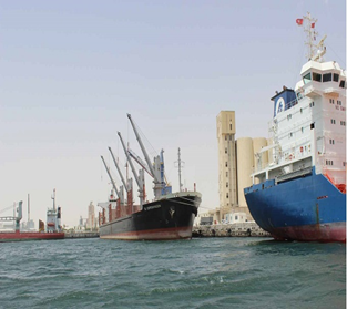
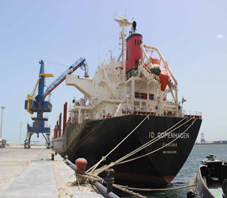
Description and Contacts of Key Companies
Port dues on ships, goods and passengers received by the OMMP are attuned to the changes and developments experienced by the port operation mode and Transport Technology and adapted to the needs of port operators. As part of the reform of the shipping industry, particularly in the port sector, which started from the ninth development plan, several actions were taken to adapt the sector to the various technological, regulatory and organizational regionally and world. For information on port rates and charges, please see the following link: PORT COMPANIES CONTACT LIST.
Port Performance
The port of Gabès is an industrial port in Tunisia with more than 160,000 TEUs and nearly 4,300,000 tons of general cargo in 2019. This bulk traffic consists mainly of sulfur and ammonia in the import of phosphoric acid and phosphate fertilizers in export. The commercial port of Gabès, whose activity is characterized by an industrial vocation, essentially ensures the transit of chemicals on behalf of neighboring factories located in the industrial zone of Gabès. This bulk traffic mainly consists of sulfur and ammonia on import and phosphoric acid and phosphate fertilizers on export. In 2019, freight traffic was 4,224,000 tons, international traffic amounted to 4,048,000 tons and national cabotage to 9,000 tons. The ships amounted to 1223. Regarding the strengthening of its role in supporting and promoting local industries, the master plan established for the development of Gabès port recommends building an oil post as well as a post n ° 11. Maintenance work is also planned for all basins and access canals.
| Seasonal Constraints |
Yes / No |
Occurs |
|---|---|---|
|
Rainy Season |
No |
December-March |
|
Major Import Campaigns |
No |
N/A |
|
Other |
N/A |
N/A |
|
Handling Figures 2019 |
|
|---|---|
|
Vessel Calls |
363 |
|
Container Traffic (TEUs) |
146,850 |
|
Handling Figures Bulk and Break Bulk |
Year 2019 |
|---|---|
|
Bulk (MT) |
2,843,852 |
|
Break bulk (MT) |
1,831,295 |
Discharge Rates and Terminal Handling Charges
The harbour dues on ships, goods and passengers collected by the OMMP fall in with the changes and developments gone through by the port running system and transport technologies and are adapted to the expectations of the port operators. The most recent of these actions bears on the launching of a study on the restructuring of harbour dues and price scales, taking into account the new attributions of the OMMP as ancient authority and the role it is called upon to play within the framework of the concession agreements on the public port domain, offering to public users and other private operators the possibility to build harbour works or to use private material for providing public services.
Berthing Specifications
- West quay posts 5, 6 and 7 with a total length of 600 m with a depth of - 10.50 m Hydro.
- North platform posts 3 and 4 with a total length of 340 m with a depth of - 10.50 m Hydro.
- South quay substations 8, 9 and 10 with a total length of 785 m with a depth of - 11.5 m Hydro.
- Service dock of length 139 ml with a depth of -5.00m.
- The Gabès commercial port offers a quay line with a total length of 1,725 m.
|
Type of Berth |
Quantity |
Length (m) |
Maximum Draft (m) |
Comments |
|---|---|---|---|---|
|
Conventional Berth |
4 ocean tugs, 100+ Ton Lifts: equipped with high power motors (1700C.V to 6300 HP) and a tensile strength of 23 tons to 70 tons. |
120 Meters |
7.2 Meters |
Good Status |
|
Container Berth |
4 |
150 - 205 Meters |
9 Meters |
Operate at any time needed and tow services are being given to all of the ships coming to the Port located at the area that is protected with breakwater in length of 1.375 meters. |
|
Silo Berth |
N/A |
|
||
|
Berthing Tugs |
3 |
|||
|
Water Barges |
3 |
General Cargo Handling Berths
|
Cargo Type |
Berth Identification |
|---|---|
|
Imports - Bagged Cargo |
Conventional Berth & K.D. Berth |
|
Exports - Bagged Cargo |
Conventional Berth & K.D. Berth |
|
Imports and Exports - RoRo |
Container & RoRo Berth |
|
Other Imports |
Liquid Bulk Berths |
Port Handling Equipment
|
Equipment |
Available |
Total Quantity and Capacity Available |
Comments on Current Condition and Actual Usage |
|---|---|---|---|
|
Dockside Crane |
6 |
6 |
Good condition |
|
Container Gantries |
5 |
5 |
Good condition |
|
Mobile Cranes |
2 |
2 |
Good condition |
|
Reachstacker |
2 |
2 |
Good condition |
|
RoRo Tugmaster (w/ Trailer) |
1 |
1 |
Good condition |
|
Grain Elevator w/ Bagging Machines |
2 |
2 |
Good condition |
|
Transtainer |
2 |
1 |
Good condition |
|
Forklifts |
4 |
4 |
Good condition |
Container Facilities
The harbor water area (80 ha) in 2 basins
- An outdoor pool of 50 ha, at -12.5 m.
- An indoor pool of 30 ha, at -10.5 m.
- The swing circle has a diameter of 600 meters.
|
Facilities |
20 ft |
40 ft |
|---|---|---|
|
Container Facilities Available |
Yes |
Yes |
|
Container Freight Station (CFS) |
Yes |
Yes |
|
Refrigerated Container Stations |
Yes |
Yes |
|
Other Capacity Details |
||
|
Daily Take Off Capacity (Containers per day) |
300 TEU/Day (October 2019) |
|
|
Number of Reefer Stations (connection points) |
N/A |
|
|
Emergency Take-off Capacity (Give an indication) |
N/A |
|
|
Off take capacity of gang shift (in Containers per shift) |
300 TEUs/Day |
Yes |
Customs Guidance
Customs clearance consists of presenting the goods at a Customs office and allocating them a Customs system. On reaching Customs, goods are automatically sorted by the SINDA (Automated Customs Information System) according to certain criteria, especially the nature of the product and the importer. The sorting leads to a system of channels: the "green channel" for goods which present no risk (brief inspection of the documents), the "orange channel" for medium level risks (normal inspection), the "red channel" for extreme risks (complete inspection). The inspection may consist of x-raying the whole container, but also x-raying or opening each package. When they have been inspected, the goods receive a temporary collection permit which allows them to be stocked for further inspection or a permit for clearance inward.
Terminal Information
Grain and Bulk Handling
- Basins: The harbor water area (80 ha) in 2 basins
- An outdoor pool of 50 ha, at -12.5 m.
- An indoor pool of 30 ha, at -10.5 m.
- The swing circle has a diameter of 600 meters
Main Storage Terminal
- Fitted ground: 25,000 m2
- Bare land: 100,000 m2
- Store and covered shed: 4000 m2
|
Storage Type |
Number of Storage Facilities |
Area (square meters) |
|---|---|---|
|
Bagged Cargo |
1 |
Approx. 120,000 m2 |
|
Refrigerated Cargo |
2 |
Approx. 9,300 m2 |
|
General Cargo |
2 |
Approx. 100,000 m2 |
Stevedoring
OMMP performs all stevedoring activities which consist of the loading and unloading of ships and the performance of various tasks required when the vessel is in port, including lashing and unlashing of cargo.
Maritime ports Code in Tunisia (French version only).
Hinterland Information
The Port of Gabès is connected to the hinterland and the region's industrial estates by the MC33 highway. The container terminal and specialized berths are also linked to the rail network by both metric and normal tracks. Goods are transported out of the port by trucks. Most trucking companies are members of the Port “Office de la Marine Marchande et des Port (OMMP) and all trucking companies operating at the port must be registered with the Shipping Association of Tunisia (AMT). There are also vessels that depart from Tunisian ports and travel coastwise east to Asian countries crossing Suez Canal that transport cargo to that region of the North African and Middle east. Most others are travelling out of Mediterranean Sea to Atlantic Ocean.
Port Security
Protective structures
- A 2880 m long North pier protects the port against the waves by the prevailing north and north / east winds.
- A 1460 m long South pier completes protection against East and South / East winds.
| Security | |
|---|---|
| ISPS Compliant | Yes |
|
Current ISPS Level Level 1 = Normal, Level 2 = Heightened, Level 3 = Exceptional |
1 |
| Police Boats | 2 |
| Fire Engines | 2 |
2.1.7 Tunisia Port of Skhira
Port Overview
The Port of Skhira is a very small port in eastern Tunisia, on the Gulf of Gabes, in Al-Sāḥil region. Skhira, also spelled Al-Ṣukhayrah, Skhira, or Cekhira, has a LOCODE is TNTBX. La Skhira is one of the six major seaports of Tunisia; it is specialized in handling Algerian and Tunisian petroleum exports. The port is also a pipeline terminal for Al-Dūlāb oil field, in western Tunisia.
The Skhira port is located at about 350 km from the capital Tunis. It has an important infrastructure of storage of crude oil and oil refined products, as well as loading and unloading pipelines. Its port infrastructure is made up of 3 posts on Dukes of Alba (In maritime vocabulary, a Duke of Alba or dolphin - consists of piles of wooden poles, steel tubes, cement blocks - anchored in the bottom of basins or channels, on which a ship can moor or lean in reach, near a lock, in the docks of a seaport).
- 1 post for phosphoric acid to 150 ml of length and a depth of 8.7 m.
- 2 oil posts of 300 m of length and a depth of 15 m, they can receive oil ships of 120,000 tons.
The majority of the seven commercial seaports are former ports, surrounded by cities, with no possibility of extension, limited to the level of the draft which does not exceed 9.5m for container ships and RoRo vessels, and 11.5m for bulk carriers (except the port of Skhira).
Port website PORT WEBSITE
Key port information may also be found at: http://www.maritime-database.com
|
Port Location & Contact |
|
|---|---|
|
Country |
Tunisia |
|
Province or District |
Skhira |
|
Town or City (Nearest location with distance from port) |
356.5 km from Tunis |
|
Port's Complete Name |
Skhira - TNTBX |
|
Latitude |
34.287574 |
|
Longitude |
10.095899 |
|
Managing Company or Port Authority |
OMMP Batiment administratif, 2060 la Goulette Tunisie |
|
Management Contact Person |
Mr Imed DRIDI +21658580102 |
|
Nearest Airport and Airlines (Airlines with frequent international arrivals/departures) |
Gabès Matmata International Airport ( 45.19 km) Sfax Thyna International Airport ( 73 km) |
Port Picture
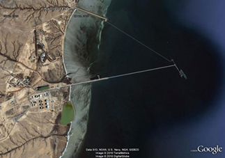
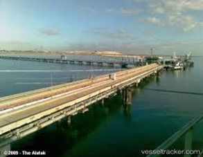
Description and Contacts of Key Companies
Port dues on ships, goods and passengers received by the O.M.M.P, are attuned to the changes and developments experienced by the port operation mode and Transport Technology and adapted to the needs of port operators. As part of the reform of the shipping industry, particularly in the port sector, which started from the ninth development plan, several actions were taken to adapt the sector to the various technological, regulatory and organizational regionally and world. For information on port rates and charges, please see the following link: PORT COMPANIES CONTACT LIST
Port Performance
In 2019, the global traffic of La Skhira port, in hydrocarbons and chemicals 4.7 million tons, consists mainly hydrocarbons and chemical products registering a fall of 18% as compared to 2018. The refined hydrocarbons, imported through the port of la Skhira, are about 1.7 million tons, decreased by 20% contrariwise, the exported refined hyrdrocarbons reached about 0.9 million tons, a decrease by 30% compared to 2018. Crude oil exports recorded a decline by 9% compared to 2018, with 1.75 million tons in 2019. Phosphoric acid decreased by 15% in 2019 compared to the previous year
| Seasonal Constraints |
Yes / No |
Occurs |
|---|---|---|
|
Rainy Season |
No |
December-March |
|
Major Import Campaigns |
No |
N/A |
|
Handling Figures 2019 |
|
|---|---|
|
Vessel Calls |
1190 |
|
Container Traffic (TEUs) |
146,215 |
|
Handling Figures Bulk and Break Bulk |
Year 2019 |
|---|---|
|
Bulk (MT) |
4,665,613 |
|
Break bulk (MT) |
4,343,042 |
Discharge Rates and Terminal Handling Charges
The harbour dues on ships, goods and passengers collected by the OMMP fall in with the changes and developments gone through by the port running system and transport technologies and are adapted to the expectations of the port operators. The most recent of these actions bears on the launching of a study on the restructuring of harbour dues and price scales, taking into account the new attributions of the OMMP as ancient authority and the role it is called upon to play within the framework of the concession agreements on the public port domain, offering to public users and other private operators the possibility to build harbour works or to use private material for providing public services.
Berthing Specifications
- 1 post for phosphoric acid to 150 ml of length and a depth of 8.7 m
- 2 oil posts of 300 ml of length and a depth of 15 m, they can receive oil ships of 120,000 tons.
|
Type of Berth |
Quantity |
Length (m) |
Maximum Draft (m) |
Comments |
|---|---|---|---|---|
|
Conventional Berth |
2 ocean tugs, 100+ Ton Lifts: equipped with high power motors (1700C.V to 6300 HP) and a tensile strength of 23 tons to 70 tons. |
120 meters |
7.2 meters |
Good Status |
|
Container Berth |
2 |
150-205 meters |
9 meters |
Operate at any time needed. Tow services are being given to all of the ships coming to the Port located at the area that is protected. With 1.375 m breakwater. |
|
Silo Berth |
N/A |
|
||
|
Berthing Tugs |
3 tugs of 2,700 horsepower each |
|
||
|
Water Barges |
1 |
|
General Cargo Handling Berths
|
Cargo Type |
Berth Identification |
|---|---|
|
Imports - Bagged Cargo |
Conventional Berth & K.D. Berth |
|
Exports - Bagged Cargo |
Conventional Berth & K.D. Berth |
|
Imports and Exports - RoRo |
Container & RoRo Berth |
|
Other Imports |
Liquid Bulk Berths |
Port Handling Equipment
|
Equipment |
Available |
Total Quantity and Capacity Available |
Comments on Current Condition and Actual Usage |
|---|---|---|---|
|
Dockside Crane |
6 |
6 |
Good condition |
|
Container Gantries |
5 |
5 |
Good condition |
|
Mobile Cranes |
2 |
2 |
Good condition |
|
Reachstacker |
2 |
2 |
Good condition |
|
RoRo Tugmaster (w/ Trailer) |
1 |
1 |
Good condition |
|
Grain Elevator w/ Bagging Machines |
2 |
2 |
Good condition |
|
Transtainer |
2 |
1 |
Good condition |
|
Forklifts |
4 |
4 |
Good condition |
Container Facilities
|
Facilities |
20 ft |
40 ft |
|---|---|---|
|
Container Facilities Available |
Yes |
Yes |
|
Container Freight Station (CFS) |
Yes |
Yes |
|
Refrigerated Container Stations |
Yes |
Yes |
|
Other Capacity Details |
||
|
Daily Take Off Capacity (Containers per day) |
840 TEU/Day (Oct 2019) |
|
|
Number of Reefer Stations (connection points) |
610 |
|
|
Emergency Take-off Capacity (Give an indication) |
Yes |
|
|
Off take capacity of gang shift (in Containers per shift) |
840 TEU (Oct 2019) |
Yes |
Terminal Information
Multipurpose Terminal
The 24'' pipeline intended for the transport of crude oil under high pressure from INAMINAS (Algeria) and Tunisian deposits by heading approximately north over approximately 775Km including 512 km in Tunisia to end on the Mediterranean coast at SKHIRRA (Tunisia). The maximum transport capacity of this pipeline is 10 million tonnes per year. A crude oil storage depot at Skhira contains 11 tanks with a capacity of 35,000 m3 each, and a pumping station comprising three crude loading pumps with a flow rate of 4,000 m3 / h each, controlled by a remote-control network via a control. A Tunisian governmental multinational company has an oil port that can load vessels with a net capacity of up to 130,000 tonnes with a draft of 15 meters. The port is open to maritime traffic every day, 24 hours a day, and allows the simultaneous docking of 2 oil tankers and a chemical tanker. It has a 2,800-meter pier for people and equipment to access the terminal platform.
Pumping station n ° 4:
Located at EL KHAMOUR at PK (Kilometric Point) 557.3 of the pipeline route. It essentially comprises:
- Four main pumping groups of 2028CV (3 in service and 1 in reserve) and two generators.
- A fixed roof storage tank with a capacity of 5000m3.
Pumping station n ° 3:
Located in TIERT at PK 378.5 of the pipeline route. It essentially comprises four main pumping groups of 2028CV and two generator sets. In terms of future development, Tunisia multinational company has adopted a clear vision for the medium and long term with precise objectives and priorities over time to plan for the future in a proactive way that will keep the chances of controlling its future. Such a mission is likely to allow the company to improve its services and best satisfy its customers and therefore face market conditions and the instability of the sector in which it operates.
Grain and Bulk Handling
- Basins: The harbor water area (80 ha) in 2 basins
- An outdoor pool of 50 ha, at -12.5 m.
- An indoor pool of 30 ha, at -10.5 m.
- The swing circle has a diameter of 600 meters
Main Storage Terminal
- Fitted ground: 25,000 m2
- Bare land: 100,000 m2
- Store and covered shed: 4000 m2
|
Storage Type |
Number of Storage Facilities |
Area (square meters) |
|---|---|---|
|
Bagged Cargo |
1 |
Approx. 5,000 m2 |
|
Refrigerated Cargo |
1 |
Approx. 300 m2 |
|
General Cargo |
1 |
Approx. 5,000 m2 |
Customs Guidance
Customs clearance consists of presenting the goods at a Customs office and allocating them a Customs system. On reaching Customs, goods are automatically sorted by the SINDA (Automated Customs Information System) according to certain criteria, especially the nature of the product and the importer. The sorting leads to a system of channels: the "green channel" for goods which present no risk (brief inspection of the documents), the "orange channel" for medium level risks (normal inspection), the "red channel" for extreme risks (complete inspection). The inspection may consist of x-raying the whole container, but also x-raying or opening each package. When they have been inspected, the goods receive a temporary collection permit which allows them to be stocked for further inspection or a permit for clearance inward.
Stevedoring
OMMP performs all stevedoring activities which consist of the loading and unloading of ships and the performance of various tasks required when the vessel is in port, including lashing and unlashing of cargo. Maritime ports Code in Tunisia (French version only).
Port Security
The Petroleum Port of Skhira is also equipped with three tugs of 2,700 horsepower each, equipped with anti-pollution and firefighting means.
| Security | |
|---|---|
| ISPS Compliant | Yes |
|
Current ISPS Level Level 1 = Normal, Level 2 = Heightened, Level 3 = Exceptional |
1 |
| Police Boats | 3 |
| Fire Engines | 4 |
2.1.8 Tunisia Port of Zarzis
Port Overview
The Port of Zarzis is located in the southernmost part of Tunisia, where the diversified economic activity consists mainly in farming, fishery and aquaculture, tourism, an emergent industrial network, craft industries, and various small-scale trades. The port of Zarzis exports sea salt and crude oil and imports pure oil products. The OMMP invested 30 MD between 2017 and 2018 for dredging. In its first commissioning, the ferry terminal of Zarzis port handled three stopovers made by the national shipowner CTN hosting 3000 passengers and 1000 cars. OMMP is developing a passenger terminal on an area 5000 m² equipped with all the modern facilities required for customs and police formalities with a budget of 1.5 MD. This 700 m² terminal has a reception structure for the pedestrian , to be accompanied by the development of the main access north of the port to ensure a better flow of this traffic. The port of Zarzis underwent at the beginning of 2017 a dredging and rehabilitation of the depths to be situated between 10 and 11 m with an investment of 26.5 MD. This project aims to ensure the safety of navigation in the channel and the harbor basin and to encourage operators and shipowners to develop new regular shipping lines with the port. These investments estimated cost of 2 million dinars in the construction of a new passenger terminal and a shelter for cars outside the harbour space on one hand, the promotion of the port and its potential for the other hand
Port website: PORT WEBSITE
Key port information may also be found at: http://www.maritime-database.com
|
Port Location & Contact |
|
|---|---|
|
Country |
Tunisia |
|
Province or District |
Zarzis |
|
Town or City (Nearest location with distance from port) |
Zarzis Town (0.70 km) |
|
Port's Complete Name |
Port of Zarzis |
|
Latitude |
33.494380 |
|
Longitude |
11.118268 |
|
Managing Company or Port Authority |
Office of Merchant Navy and Ports (OMMP) Address : B.P 291 – 4170 Zarzis – Tunisie |
|
Management Contact Person |
Office of Merchant Navy and Ports Administration building 2060 La Goulette 3029 Tunisia Tel +21671735300 / +21671735812 |
|
Nearest Airport and Airlines (Airlines with frequent international arrivals/departures) |
Tunis-Carthage Airport (TUN / DTTA) - 5 km away |
Port Picture
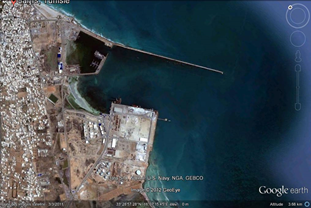
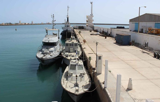
Description and Contacts of Key Companies
The Tunisian sea freight company STTAT, which offers industry and commerce shipping and multimodal groupage traffic services, and its partner TARROS (an Italian container transporter), has collaborated with the GRENDI Group, which provides national cabotage traffic between Marina diCarrara and the capital of Sardinia, Cagliari, to expand this maritime link to Sousse and Sfax, through its newly created subsidiary ProCargo Line. Fifty stopovers at the Ports of Sousse and Sfax have already been made.
For information on port rates and charges, please see the following link: PORT COMPANIES CONTACT LIST
Port Performance
The port of Zarzis is an agricultural and commercial port with more than 140,000 TEUs and nearly 5,000,000 tons of general cargo in 2019. The commercial port of Zarzis is ensures the transit of goods on behalf of neighboring factories located in the industrial zone of Zarzis. This bulk traffic mainly consists of salt and crude oils on export and diverse goods on import. In 2019, freight traffic was 3,786,000 tons, international traffic amounted to 3,900,000 tons and national cabotage to 6,000 tons. The ships amounted to 1226. The Port of Zarzis has a strategic geographic position, well-maintained berths, sufficient draft to accommodate large-capacity vessels, more specifically dedicated to bulk cargo.
| Seasonal Constraints |
Yes / No |
|---|---|
|
Rainy Season |
No |
|
Major Import Campaigns |
No |
|
Handling Figures (2019) |
|
|---|---|
|
Vessel Calls: |
1226 |
|
Container Traffic: (TEUs) |
3600 |
|
Handling Figures Bulk and Break Bulk (2019) |
|
|---|---|
|
Bulk (MT) |
653,000 |
|
Break bulk (MT) |
3,786,000 |
Discharge Rates and Terminal Handling Charges
The harbour dues on ships, goods and passengers collected by the OMMP fall in with the changes and developments gone through by the port running system and transport technologies and are adapted to the expectations of the port operators. The most recent of these actions bears on the launching of a study on the restructuring of harbour dues and price scales, taking into account the new attributions of the OMMP as ancient authority and the role it is called upon to play within the framework of the concession agreements on the public port domain, offering to public users and other private operators the possibility to build harbour works or to use private material for providing public services.
Berthing Specifications
The quays in the port have different structures:
- Port enclosure: 28 hectares.
- Port platforms: 13 hectares.
- Hangars: 5000 m² + 4000 m².
- West quay posts 5, 6 and 7 with a total length of 600 m with a depth of - 10.50 m Hydro.
- North platform posts 3 and 4 with a total length of 340 m with a depth of - 10.50 m Hydro.
- South quay substations 8, 9 and 10 with a total length of 785 m with a depth of - 11.5 m Hydro.
- Service dock of length 139 ml with a depth of -5.00m.
- The Zarzis commercial port offers a quay line with a total length of 1,725 m.
|
Type of Berth |
Quantity |
Length (m) |
Maximum Draft (m) |
Comments |
|---|---|---|---|---|
|
Conventional Berth |
2 ocean tugs, 100+ Ton Lifts: equipped with high power motors (1700C.V to 6300 HP) and a tensile strength of 23 tons to 70 tons. |
120 meters |
7.2 meters |
Good Status |
|
Container Berth |
2 |
150-205 meters |
9 meters |
Operate at any time needed and tow services are being given to all of the ships coming to the Port located at the area that is protected with breakwater in length of 1.375 meters. |
|
Silo Berth |
1 |
|
||
|
Berthing Tugs |
1 Tugboat of 1600 hp. 1 Pilot boat of 300 hp. |
|
||
|
Water Barges |
2 |
|
General Cargo Handling Berths
- Length 9 Km (5 miles)
- Depth acceptable actually 7.5 metres = 24.60 feet
- 1 Tugboat of 1600 hp
- 1 Pilot boat of 300 hp
|
Cargo Type |
Berth Identification |
|---|---|
|
Imports - Bagged Cargo |
Conventional Berth & K.D. Berth |
|
Exports - Bagged Cargo |
Conventional Berth & K.D. Berth |
|
Imports and Exports - RoRo |
Container & RoRo Berth |
|
Other Imports |
Liquid Bulk Berths |
Port Handling Equipment
- 1 Moving charger for salt loading (private operators).
- 1 Charger with conveyor belts for salt loading (private operators).
- 2 pneumatic versatile cranes (100 tons and 150 tons) and forklifts of different tonnages and other various equipment (Handling Companies).
|
Equipment |
Available |
Total Quantity and Capacity Available |
Comments on Current Condition and Actual Usage |
|---|---|---|---|
|
Dockside Crane |
Yes |
3 |
Good condition |
|
Container Gantries |
Yes |
2 |
Good condition |
|
Mobile Cranes |
Yes |
2 |
Good condition |
|
Reachstacker |
Yes |
2 |
Good condition |
|
RoRo Tugmaster (w/ Trailer) |
Yes |
1 |
Good condition |
|
Grain Elevator w/ Bagging Machines |
Yes |
2 |
Good condition |
|
Transtainer |
Yes |
1 |
Good condition |
|
Forklifts |
Yes |
3 |
Good condition |
Container Facilities
The port of Zarzis has a land reserve covering an area of 135 hectares in the port public domain, located on the West side of the harbor and bounded on the North by the city and in the South by the sea, dedicated to the establishment of projects in conjunction with port activity.
|
Facilities |
20 ft |
40 ft |
|---|---|---|
|
Container Facilities Available |
Yes |
Yes |
|
Container Freight Station (CFS) |
Yes |
Yes |
|
Refrigerated Container Stations |
Yes |
Yes |
|
Other Capacity Details |
||
|
Daily Take Off Capacity (Containers per day) |
N/A |
N/A |
|
Number of Reefer Stations (connection points) |
N/A |
N/A |
|
Emergency Take-off Capacity (Give an indication) |
N/A |
N/A |
|
Off take capacity of gang shift (in Containers per shift) |
N/A |
N/A |
Customs Guidance
Customs clearance consists of presenting the goods at a Customs office and allocating them a Customs system. On reaching Customs, goods are automatically sorted by the SINDA (Automated Customs Information System) according to certain criteria, especially the nature of the product and the importer. The sorting leads to a system of channels: the "green channel" for goods which present no risk (brief inspection of the documents), the "orange channel" for medium level risks (normal inspection), the "red channel" for extreme risks (complete inspection). The inspection may consist of x-raying the whole container, but also x-raying or opening each package. When they have been inspected, the goods receive a temporary collection permit which allows them to be stocked for further inspection or a permit for clearance inward. The latter can take up to 11 days. In total, according to the WTO and in June 2005, the time required for Customs clearance, for unbranded products subject to foreign trade formalities, from arrival at the port/airport to clearance inward, varied from 7 to 20 days. Customs duties are about 3%. The principle is to pay duties and taxes in cash.
For information on Port of Sousse customs information, please see the following link.
Terminal Information
Multipurpose Terminal
- Access channel: length of 8400 m – width of 125 m – depth of 11 m
- Surface of man-made lake: 35 Ha
- Mean depth of man-made lake: 11 m
- Breakwater with a length of 1505 m.
- Turning circle of 450 m of diameter.
Grain and Bulk Handling
- Basins: The harbor water area (80 ha) in 2 basins
- An outdoor pool of 50 ha, at -12.5 m.
- An indoor pool of 30 ha, at -10.5 m.
- The swing circle has a diameter of 600 meters
Main Storage Terminal
- Fitted ground: 45,000 m2
- Bare land: 90,000 m2
- Store and covered shed: 3000 m2
|
Storage Type |
Number of Storage Facilities |
Area (square meters) |
|---|---|---|
|
Bagged Cargo |
1 |
Approx. 90,000 m2 |
|
Refrigerated Cargo |
1 |
Approx. 2,300 m2 |
|
General Cargo |
1 |
Approx. 60,000 m2 |
Stevedoring
OMMP performs all stevedoring activities which consist of the loading and unloading of ships and the performance of various tasks required when the vessel is in port, including lashing and unlashing of cargo. Maritime ports Code in Tunisia (French version only)
Hinterland Information
- The MC road 118 leading to Medinine (65 km) and Gabès (140 km).
- The MC road 117 leading to Jerba (50 km).
- The MC road 109 leading to the Libyan border (75 km).
The Port of Zarzis is connected to the hinterland and the region's industrial estates by the MC33 highway. The container terminal and specialized berths are also linked to the rail network by both metric and normal tracks. Goods are transported out of the port by trucks. Most trucking companies are members of OMMP and all trucking companies operating at the port must be registered with the Shipping Association of Tunisia (AMT). There are also vessels that depart from Tunisian ports and travel coastwise east to Asian countries crossing Suez Canal that transport cargo to that region of the North African and Middle east. Most others are travelling out of Mediterranean Sea to Atlantic Ocean.
Port Security
Protective structures
- A 2880 m long North pier protects the port against the waves by the prevailing north and north / east winds.
- A 1460 m long South pier completes protection against East and South / East winds.
| Security | |
|---|---|
| ISPS Compliant | Yes |
|
Current ISPS Level Level 1 = Normal, Level 2 = Heightened, Level 3 = Exceptional |
1 |
| Police Boats | 3 |
| Fire Engines | 3 |