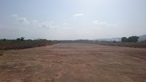
2.2.2 Sierra Leone Kenema National Airfield
Kenema is the third largest city in Sierra Leone and the largest city in the Eastern Province. The city is a major trade centre and is the capital and largest city of Kenema District. This airfield is being used only by UNHAS during the Ebola Response as a Helipad. The airfield is situated next to main paved national road leading to Mano Junction. There is a small taxi way and there are no trees obstructing.
|
Airfield Details |
|||
|---|---|---|---|
|
Country |
Sierra Leone |
Latitude |
7.897222 |
|
Province / District |
Eastern Province |
Longitude |
-11.17361 |
|
Airfield Name |
Kenema |
Elevation (ft) |
110 ft |
|
IATA & ICAO codes |
KEN & GFKE |
Surface |
Gravel |
|
Town or City (closest) |
Kenema |
Runway Condition |
Bad, holes present |
|
NGO / UN (on ground) |
WFP |
Passenger / Cargo Security Screening (Yes / No) |
No |
|
Runway Dimension |
1,100 m X 20 m |
Ground Handling (Yes / No) |
No |
|
Refueling Capacity |
No |
Runway Lighting (Yes / No) |
No |
|
Runway Heading |
No |
Fire Fighting Equipment (Yes / No) |
No |
|
Air Traffic Control (Yes / No) |
No |
Windsock (Yes / No) |
No |
|
Weather Information (Yes / No) |
No |
Aircraft Parking space (Yes / No) |
No |
|
Navigation Aids (Yes / No) |
No |
Perimeter fencing (Yes / No) |
No |
Fuel Services Charges
There is no commercial fuel available at the airfield.
Royalties / Non Objection Fees (NOFs)
No royalties charges are applicable at the airfield.