Nepal - 2 Logistics Infrastructure
Nepal’s logistics infrastructure is generally perceived as underdeveloped and unreliable with the rugged, mountainous terrain further complicating matters. It is crucial to carefully plan any movement through the road or air network, especially during the monsoon season.
Despite these geographical challenges, Nepal has seen some significant infrastructure development in recent years. A 2.68 KM tunnel is currently under construction on the Prithivi Highway and is expected to be completed by April 2024. This tunnel will provide a safer route for commuters entering and exiting Kathmandu, bypassing an eight-km stretch of road with sharp turns. The expansion of the Butwal-Narayangadh section from the existing two-lane road to six lanes of the East-West highway and the widening of the existing two-lane highway into four lanes of the Muglin-Pokhara section of the Prithivi Highway to four lanes is in progress. Another ongoing Mega Highway Project is the Kathmandu-Terai/Madesh Expressway which is 72.5 km and runs along the Bagmati River corridor, at Sano Khokana, travels through Chhaimale Gausel, Malta, Budune, and Chhatitiwan, and reaches to Nijgadh where it connects with East-West Mahendra Highway by 193 km and saves traveling time by more than four hours. In addition to these projects, local and provincial governments are also focusing on road infrastructure development.
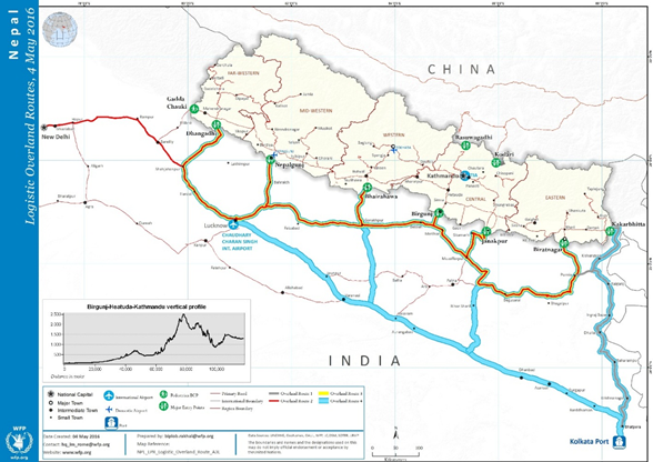
As a landlocked nation, waterways are not a feasible option for the transportation of goods or passengers in Nepal. The country does have three railway lines: the Raxaul–Sirsiya and Bathnaha - Biratnagar lines, which are cargo rail lines, and the Jainagar– Bhangha line, which serves for passenger transport.
In collaboration with the Indian government, Nepal has constructed Integrated Check Posts (ICPs) in Birgunj and Biratnagar, with two additional ICPs in Bhairahawa and Nepalgunj currently under construction. These ICPs, equipped with facilities including customs, quarantine, and warehouses, facilitate easier cross-border trade.
Road Travel
Roads are of poor quality away from the main arterial highways. Bad driving, frequent traffic jams, road blockages caused by landslides or bridge collapses, broken down vehicles, and fuel shortages mean that logistics plans must allow a wide margin of error.
The total road network of Nepal is around 80,078 KM including 26,935 km of roads constructed and maintained by the Department of Roads (DOR) and 53,143 km of roads constructed by the local government. DOR data reflects the total length of National Highways is 11,178.92 KM. The road network is classified in two major groups: Strategic Road Network (SRN) and Local Road Network (LRN). Strategic Road Network (SRN), features featuring eight major north-south and three east-west corridors and assumes a central role in reducing the cost of logistics (including the cost of imports and exports). Mahendra Highway, Postal Highway, and Pushpa Lal Highway traverse east to west of the country, and Tribhuvan Highway, Araniko Highway, Mechi Highway, Koshi Highway, Mahakali Highway, Prithivi Highway, Sagarmatha Highway, Siddhartha Highway are the major highways from south to north. Besides being the major mode of access for passengers and goods, it provides a critical connection to India, the country’s largest trading partner and principal conduit for third-country trade, and China.
(Source: Sector Overview: Road and Transport)
Trade
Located between China in the north and India in the east, west, and south, Nepal’s trade competitiveness suffers from delays when passing through seaports in neighbouring countries, inefficiencies at land border crossings, and limitations on routes for transit cargo. Lack of efficient transit increases the costs of transportation and logistics, pushing up the prices of imported, essential, and nonessential consumer goods, as well as the prices of inputs.
Nepal shares 1770 km long border and 22 border points with India, placing India as the most important trading partner as well as transit for third-country trade. Visakhapatnam Port in Andhra Pradesh and Port of Kolkata in Kolkata are the two seaports from where Nepal brings in or sends goods to third countries. India accounts for over two-third of Nepal’s merchandise trade and almost 100% of petroleum supplies among others.
Trade with China through border points in the North has increased but still is significantly lower compared to trade with India. The Araniko Highway which is part of Asian Highway (AH42) is a major road link between China and Nepal. Nepal signed the Transit Transport Agreement (TTA) with China to boost trade through northern Border. (Source: Project Information Document, Asian Development Bank) As part of the TTA Nepal was granted access to four Chinese seaports at Tianjin, Shenzhen, Lianyungang and Zhanjiang and three dry ports at Lanzhou, Lhasa, and Xigatse. (Source: Ports Open for Nepal) However, since the closest Chinese port is 4,250 km overland distance from Kathmandu, this is not recommended as alternative to importing sea cargo via Kolkota, India.
Supply Chain from India
-
Kolkata
The sea port of Kolkota* is the main entry point for international cargo imported to Nepal. The Kolkata Port Trust (KoPT) manages two separate dock agglomerations: Kolkata Dock System (KDS) in the centre of Kolkota and Haldia Dock Complex (HDC) located 80 km South of KDS on the Haldia river, closer to the Bay of Bengal. The main cargo handled at HDC is petroleum, chemicals, coal, iron ore and steel, while KDS is the main port for containers, coal and fly ash. Birgunj Inland Container Depot (ICD) at Sirsiya is 924 kms away from KDS port; 2-3 days by cargo vehicle. Containers can be transported by Indian Railways which must wait until a full train of 90 container wagons is collected before dispatch, which takes three days to reach Birgunj. During dry season November to February, access to Port of Kolkata is limited due to low draft in the access river, leading to increased waiting times at the port.
The Biratnagar Inland Clearance Depot (ICD) is operational at the border is well connected to the gateway ports of Kolkata (600 kms) by road or by rail till Jogbani, Bihar.
-
Visakhapatnam
Visakhapatnam port in Andhra Pradesh, one of 12 major ports in India, is located 1,436 kms away from Nepal. The port is expected to facilitate Nepal’s third-country trade, as a deep-water port, where deep-water cargo vessels can be docked. To access Haldia Dock Complex of Port of Kolkata, cargo must be taken to Singapore or Sri Lanka and reloaded into smaller feeder vessels to enter India, which adds cost and time. Visakhapatnam with its bigger capacity could reduce shipping cost by sea by avoiding this step, but it adds transport costs and time overland to Nepal due to its longer distance to Nepal. Transport by rail from Visakhapatnam port to Birgunj takes approximately 10 days, while transport by truck will take around 12 days.
Air Transport
Domestic airports have an important role in connecting people across the country and are heavily used in rural areas in times of distress when road connectivity is limited. Presently, the country has three international and 28 domestic airports in operation. The terrain and high altitude of some deliveries mean specialist advice is always necessary, particularly during the monsoon from June to September.
Most airports in remote locations have no material handling equipment, re-fuelling facilities, adequate firefighting capacity, and limited or no storage capacity. However, airports in major towns and cities are well-equipped and have night landing facilities.
Storage
Nepal has several purposely built warehouses (called “go-downs”) that are owned by government entities, such as Food Management and Trading Company (FMTC) and Salt Trading Corporation (STC). There’s a lack of third-party logistics support, and an inadequate number of storage facilities, especially in sub-national and sub-metropolitan areas.
Nepal - 2.1 Port Assessment
Nepal is a landlocked country and relies on the Port of Kolkata in India to handle practically all its sea freight imports. The Government of Nepal owns a Container Freight Station (CFS) at Kolkata Dry Port which can store 500 containers.
Nepal has multiple dry ports. Birgunj dry port is the largest dry port in terms of annual volume of cargo and income from customs duties and taxes.
Nepal Intermodal Transport Development Board (NITDB), is a public-private partnership (PPP) entity that develops, manages, and promotes Inland Clearance Depots (ICDs) for the facilitation of Export and Import in Nepal. Currently, there are five ICDs in operation in the border towns of Nepal – India and Nepal – China border. Birgunj ICD, Bhairahawa ICD, Kakarvitta ICD are located at Nepal’s border town with India, Tatopani ICD is located at Nepal – China border and Chovar ICD is in the capital Kathmandu. The Rasuwagadhi ICD at Nepal – China border is under construction and is expected to be completed by 2026. Birgunj ICD is linked with both rail and road networks, other ICDs are linked via road only.
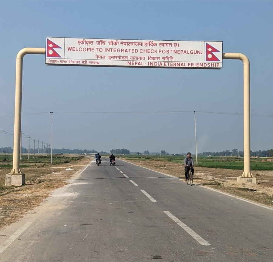
Government of Nepal in collaboration with the Government of India is operating two Integrated Check Points (ICPs) at Birgunj and Biratnagar. Two other ICPs, one at Bhairahawa, is under construction, and another in Nepalgunj, has recently finished the construction and commencing operations are underway.
[An ICP (Integrated check point): is a multipurpose customs check point, operating on both sides of the border, to facilitate cross-border trade and movement of people.]
An ICD (Inland Clearance Depot): is a dry-port, purposely build to handle import, export, intermodal transfer, temporary storage and customs clearance of goods, with storage capacity, terminal buildings and logistics handling equipment. It is combination transport terminal and customs clearance point at an inland facility. Most ICDs in Nepal are operated on the border, next to an ICP (Birgunj, Bhairahawa), but it can also be located some distance away from the border customs check point or ICP (as in Biratnagar and Kathmandu).]
Intergovernmental Agreement on Dry Ports
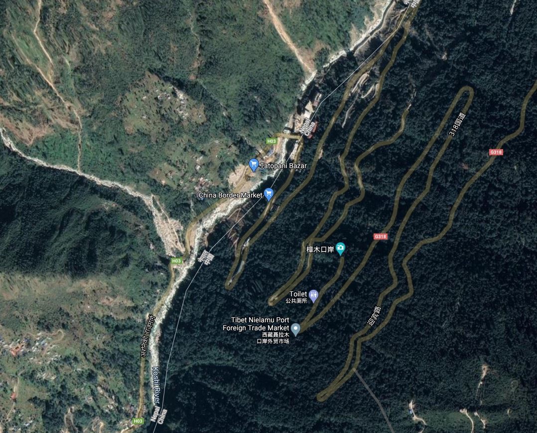
The Intergovernmental Agreement on Dry Ports is aimed at promoting and developing dry ports of international importance as one of the means to establish an international integrated intermodal transport and logistics system within Asia as well as between Asia and its neighbouring regions. The dry ports registered and recognized as “Dry ports of International importance” are: Bhairahawa ICD, Birgunj ICD, Kakarbhitta ICD and Tatopani ICD. Tatopani ICD and Rasuwagadhi customs office are Nepal’s two main customs points with China.
(Source: Intergovernmental Agreement on Dry Ports)
2.1.1 India Port of Kolkata
Port Overview
Nepal is a land-locked country and relies on the Kolkata Port in India for handling practically all of its sea freight imports. Kolkata Port is India's only riverine port with two dock systems - Kolkata Dock System at Kolkata with the oil wharves at Baj Baj and a deep water dock system at Haldia Dock Complex for seaborne trade. It has sophisticated port and extensive storage facilities for diverse cargo. The container terminal is computerized. Large volumes of humanitarian aid for Nepal passes through the Kolkata Port, such as WFP’s food.
|
PORT LOCATION & CONTACT |
|
|---|---|
|
Country |
India |
|
Province or District |
West Bengal |
|
Nearest Town or City |
Kolkata |
|
Port's Complete Name |
Port of Kolkata |
|
Latitude |
22.54806 |
|
Longitude |
88.30139 |
|
Managing Company or Port Authority |
Kolkata Port Trust |
|
Management Contact Person |
Chairman: |
Port Picture
Description and Contacts of Key Companies
For more information on port contacts, please see the following links:
4.4 Nepal Port and Waterways Companies Contact List
Customs and Clearance Agents in Kolkata
World Port Source Port of Kolkata
Port of Kolkata Wikipedia Information
Port Performance
During 2008-09, Kolkata Port (KoPT) handled traffic of 54.05 million tons compared to 57.3 million tons handled in 2007-08. The decline in traffic is due to the transfer of POL (crude oil) through Paradip-Haldia Pipeline, and a decline in iron ore traffic due to the volatile iron ore market and global economic crisis. During 2008-09, KoPT ranked 5th amongst all Indian Major Ports in respect of volume of traffic handled (1st: Kandla – 72.225 million tons; 2nd: Visakhapatnam - 63.908 million tons; 3rd: Chennai – 57.491 million tons, 4th: JNPT – 57.281 million tons). KoPT ranked second among Indian major ports in coke coal handling during 2008-09. The port handled 5.93 million tons and registered a growth of 8.3 percent, higher than the average growth (7.13 percent) registered by Indian major ports. KoPT handled 429,417 TEUs in 2008-09 compared to 425,405 TEUs in 2007-08. Kolkata Port ranked third among Indian Major Ports in respect to containerized cargo handled. By handling 41,379 TEUs, KoPT surpassed its earlier record of 40,220 TEUs handled in February 2008. In August 2008, Kolkata Dock System handled an all-time traffic record. By handling 28,128 TEUs it surpassed its earlier record of 27,562 TEUs handled in August 2007.
Customs Guidance
For more information on customs in Nepal, please see the following link: 1.3 Nepal Customs Information
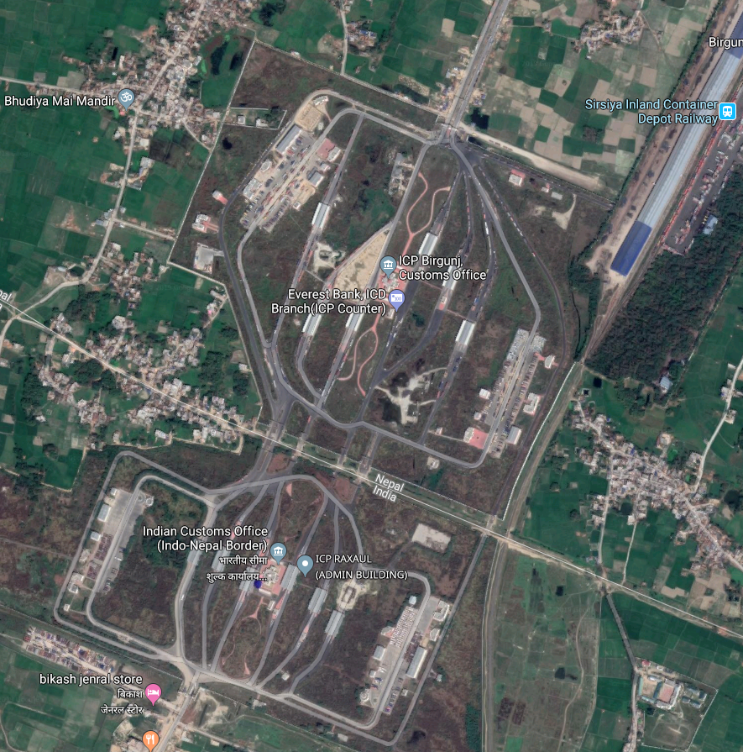
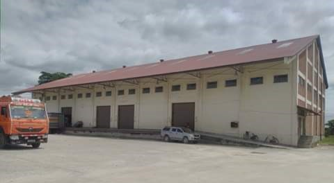
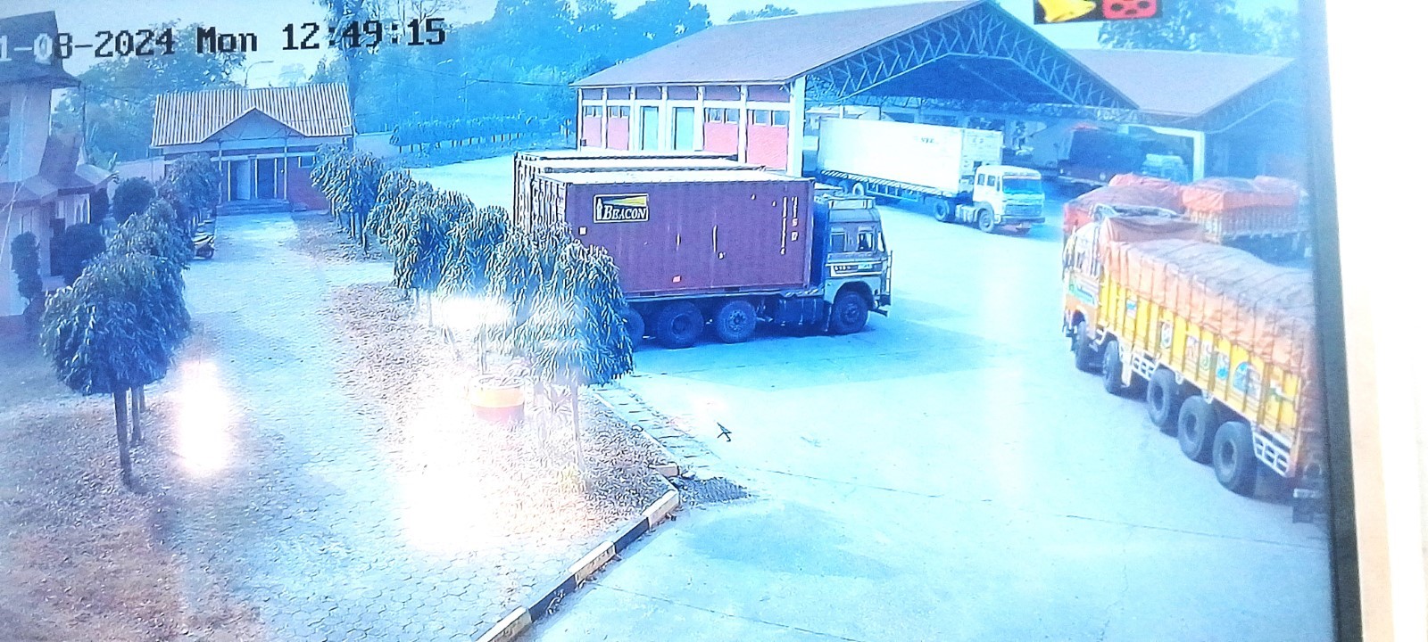
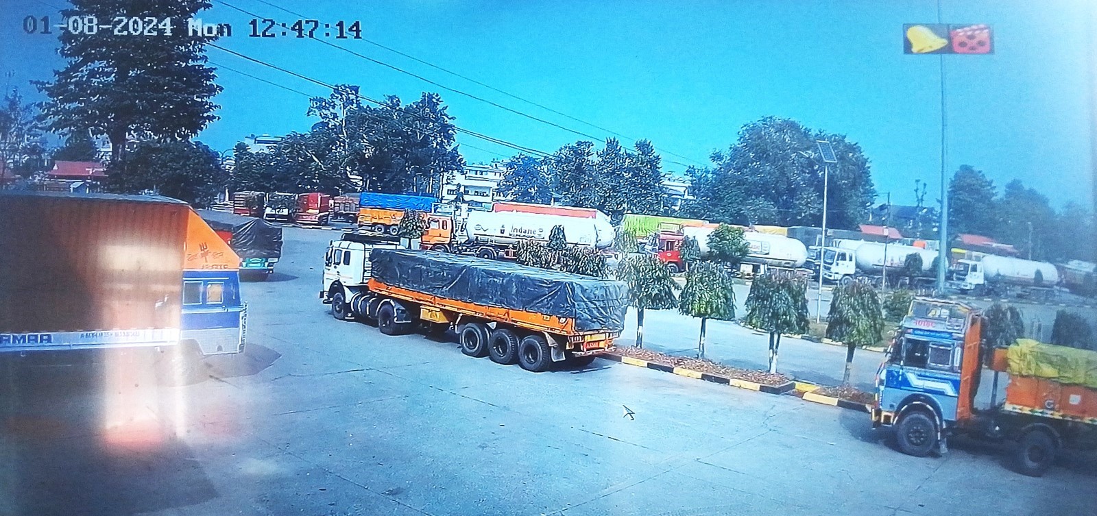
Nepal - 2.1.2 Birgunj Dry Port
Port Overview
Nepal is a land-locked country and relies on the Kolkata Port in India to handle practically all of its imports by sea. Birgunj dry port is the only Rail based ICD at Sirsiya, in Madhesh Province is one of five dry ports (referred to by the Nepal Intermodal Transport Development Board (NITDB) as Inland Clearance Depots, ICDs) currently active in the country. An addition at the Birgunj ICD is the Birgunj Integrated Check Post (ICP) to facilitate customs clearance activities. The purpose of the ICP is to integrate efficient customs clearance processes at the authorized border crossing points to facilitate the clearance of cargo and people in support of trade between Nepal and India. The ICD and ICP facilities are located next to each other at the border. The facilities are awarded by the Nepal Intermodal Transport Development Board to Pristine Valley Dryport Pvt. Ltd for the ICD Birgunj, Sirsiya on 8th July 2021, and TRS Himalayan Logipark (P) Ltd for ICP Birgunj terminal clearance purposes on 1st April 2023. NITDB: http://nitdb.gov.np/en/
The top three land border crossings in Nepal in terms of import and export value are (1) Birgunj (Madhesh Province): 32.82% of import share (2) Bhairahawa (Lumbini Province): 15.19% of import share (3) Biratnagar (Koshi Province): 11.57% of import share value during Mid-July 2022-Mid-July 2023. (Ref: https://www.customs.gov.np)
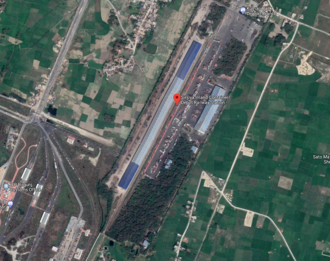
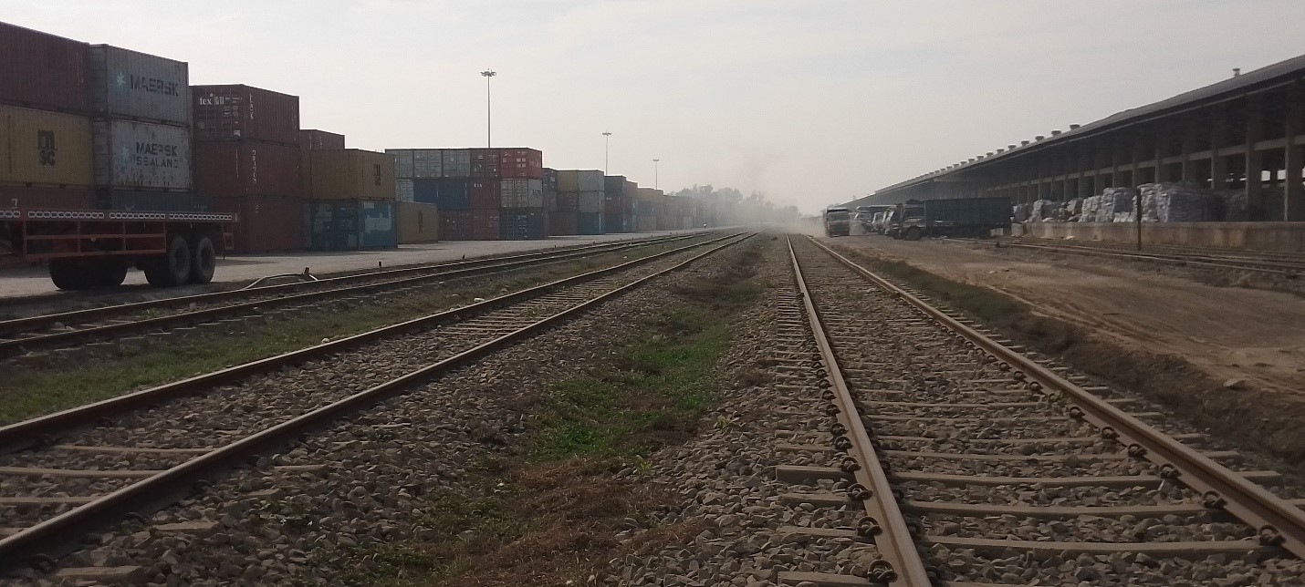
Birgunj Inland Container Depot (ICD) at Sirsiya
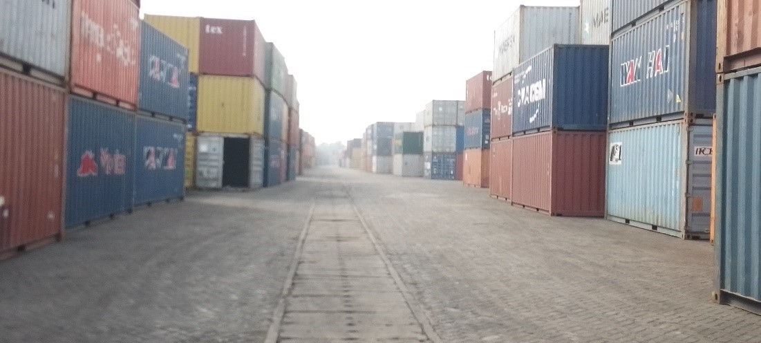
The Inland Clearance Depot (ICD) at Sirsiya, Birgunj is the first terminal in Nepal linked by rail to India and designed to handle the transportation and transshipment of goods between seaports and inland destinations of Nepal. NITDB awarded Pristine Valley Dryport Pvt. Ltd. the contract to operate and manage the Inland Clearance Depot in Sirsiya. It facilitates the direct movement of containers and break-bulk cargo from Kolkata port and other places in India. The ICD has six full-rake railway sidings. It handles more than 20,000 TEU (Twenty-Foot Equivalent Unit) annually. It can store up to 1,568 TEU. It has been constructed on 38 ha (94 acres) land.
Port Website: Birgunj ICD
Key port information may also be found at http://www.maritime-database.com
|
Port Location and Contact |
|
|---|---|
|
Country |
Nepal |
|
Province or District |
Madhesh Province |
|
Nearest Town or City with Distance from Port |
TOWN NAME: Birgunj DISTANCE (km): 8 KM |
|
Port's Complete Name |
Sirsiya Inland Container Depot |
|
Latitude |
27.02421 |
|
Longitude |
84.85377 |
|
Managing Company or Port Authority
|
Pristine Valley Dryport Pvt. Ltd. for ICD
Nepal Intermodal Transport Development Board |
|
Management Contact Person |
Tanka Raj Joshi, 9845886544
|
|
Nearest Airport and Airlines with Frequent International Arrivals/Departures |
AIRPORT NAME: Simara Airport 23.4 KM |
Port Picture
|
|
|
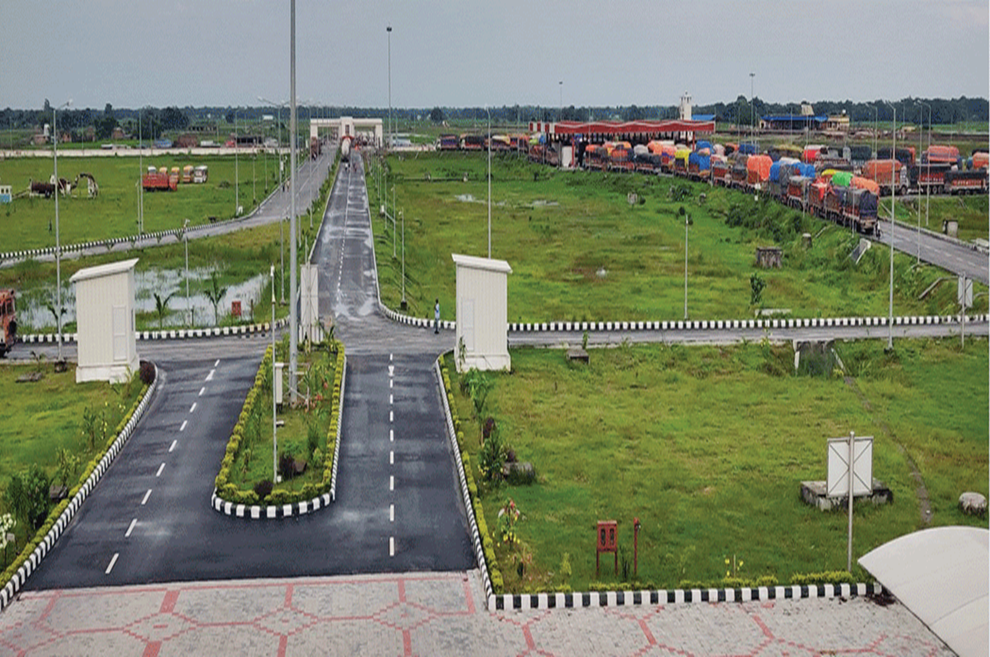
Pic: Ariel view of Birgunj ICD |
Description and Contacts of Key Companies
-
Container Corporation of India Ltd. (CONCOR) is an Indian public sector company currently engaged in India in the business of providing terminal services and facilities for handling and transportation of containerized cargo by rail, road and coastal shipping, and intermodal logistics services for aggregation and distribution of cargo.
(2) Valley Groups as Nepalese Partner Company.
(3) Rivro Logistics Pvt. Ltd. is in the business of transit cargo and warehouse management at the Kolkata and Haldia port in India and in Raxaul, Birgunj, and Kakervitta in Nepal, it also provides clearing and forwarding services to public sector undertakings in Nepal for exports from and imports into Nepal.
For more information on port contacts, please see the following link: HQ staff will input a link to section 4.4 Port and Waterways Companies Contact List here.
Port Performance
During June through August, when it is the monsoon season, the dry port is less busy. During festival season (Dashain, Tihar, Chhath in October/November) the dry port is very busy. From December through February, when it is the winter season, the dry port is most busy, because companies start restocking goods after the monsoon season and stockpiling goods for the winter season. The dry port can be congested during these months.
|
Seasonal Constraints |
||
|---|---|---|
|
|
Occurs |
Time Frame |
|
Rainy Season |
Yes |
From June to August |
|
Major Import Campaigns |
Yes |
Festival season in October/November |
|
Other Comments |
N/A |
|
|
Handling Figures for 2022 |
|
|---|---|
|
Vessel Calls* |
N/A |
|
Container Traffic (TEUs) |
55504 Imports 1200 Export |
*Number of Trains: 641 (in 2022 A.D.)
|
Handling Figures Bulk and Break Bulk for 2022 |
|
|---|---|
|
Bulk (MT) |
520257 |
|
Breakbulk (MT) |
232198 |
Discharge Rates and Terminal Handling Charges.
Following is the tariff charged by the Terminal handling company:
|
Pristine Valley Dry Port Pvt. Ltd. |
||
|---|---|---|
|
Inland Clearance Depot, ICD Birgunj, Sirsiya Dryport, Parsa, Nepal PAN: 609754971 |
||
|
ICD Address: Sirsiya Dryport, ICD Birgunj, Parsa, Nepal |
||
|
Terminal Tariff with effect from 07-Aug-2020 and remain valid till further notification |
||
|
Description of Activities |
Amount in (NPR) |
|
|
20' |
40' |
|
|
IMPORT - Terminal Handling Charges |
|
|
|
Factory Destuffing |
7,054.30 |
9,716.30 |
|
ICD Destuffing |
9,111.30 |
12,136.30 |
|
Warehouse Delivery |
9,111.30 |
12,136.30 |
|
EXPORT - Terminal Handling Charges |
|
|
|
Factory Stuffing |
7,054.30 |
9,716.30 |
|
ICD Stuffing |
9,111.30 |
11,033.00 |
|
Warehouse Delivery |
9,111.30 |
11,033.00 |
|
|
|
|
|
Import warehouse charges |
Per day Per MT |
|
|
1 to 3 days |
Free |
|
|
4th to 10th day |
93.17 |
|
|
11th to 30th day |
119.79 |
|
|
31st day onwards |
186.34 |
|
|
Export warehouse charges |
Per day Per MT |
|
|
1 to 3 days |
Free |
|
|
4th to 10th day |
53.24 |
|
|
11th to 30th day |
66.55 |
|
|
31st day onwards |
93.17 |
|
|
Open Yard Charges - Container |
Per day Per MT |
|
|
1st day (Date of unloading) |
Free |
|
|
2nd to 7th day |
53.24 |
|
|
8th day onwards |
79.86 |
|
|
Container Parking Charges (Loaded/Empty) |
Per day Per Container |
|
|
1st day (Date of unloading) |
Free |
Free |
|
2nd to 7th day |
219.62 |
292.82 |
|
8th day onwards |
292.82 |
439.23 |
|
Vehicle Parking Charges |
Per day Per Vehicle |
|
|
1st day (Date of entry) |
Free |
Free |
|
2nd to 7th day |
219.62 |
219.62 |
|
8th day onwards |
292.82 |
292.82 |
|
Vehicle Entry fee |
|
|
|
Commercial Vehicle (Weight <10 MT) |
146.41 |
|
|
Commercial Vehicle (Weight >10 MT) |
292.82 |
|
|
Light Vehicle (Weight <5 MT) |
73.21 |
|
|
Rikshaw/Hand Trolley |
22.63 |
|
|
Miscellaneous Charges |
|
|
|
Labour Loading Charges |
2057.00 2420.00 |
|
|
Bagging Charges (Per MT) |
220.00 |
|
|
Survey Charges per container |
1210.00 |
|
|
Description of Activity |
Amount in (NPR) |
|
|
20' |
40' |
|
|
CHARGES FOR INDIVIDUAL ACTIVITIES |
|
|
|
Handling of Loaded Container (Complete Cycle) |
3,993.00 |
5,390.55 |
|
Handling of Empty Container (Complete Cycle) |
865.15 |
1,331.00 |
|
Weighment charges |
146.41 |
146.41 |
|
Transfer of loaded container for survey and other purposes (one time operation) |
1,331.00 |
1,663.75 |
|
Transfer of empty container for survey and other purposes (one time operation) |
865.15 |
1,331.00 |
|
Handling of LCL cargo including loading/unloading & stuffing/destuffing (Per MT) |
332.75 |
|
|
Terminal Handling Charges - Bagged, Break Bulk, Bulk Cargo & Loose Cargo |
|
|
|
Bagged Cargo/Break Bulk Cargo (Per MT) |
271.04 |
|
|
Bulk Cargo & Loose Cargo (Per MT) |
399.30 |
|
|
|
|
|
|
Storage Charges - Bagged and Break Bulk Cargo |
Per day per MT |
|
|
1 to 3 days |
Free |
|
|
4th to 10th day |
93.17 |
|
|
11th to 30th day |
119.79 |
|
|
31st day onwards |
186.34 |
|
|
Open Yard Charges - Bulk & Loose Cargo |
Per day per MT |
|
|
1st day (Date of unloading) |
Free |
|
|
2nd to 7th day |
53.24 |
|
|
8th day onwards |
79.86 |
|
|
Railway Freight |
|
|
|
Railway freight to ICD Birgunj from International Border Railway Freight from ICD Birgunj to International Border |
532.40 |
798.60 |
|
Railway freight to ICD Birgunj from the International Border (Bagged & Break Bulk |
532.40 |
798.60 |
|
Railway freight to ICD Birgunj from International Border (Bagged & Break Bulk Cargo per MT) Railway |
20.57 |
|
|
Freight from ICD Birgunj to International Border (Bagged & Break Bulk Cargo per MT) |
20.57 |
|
|
Railway freight to ICD Birgunj from International Border (Bulk & Loose Cargo per MT) |
15.73 |
|
|
Railway Freight from ICD Birgunj to International Border (Bulk & Loose Cargo per MT) |
15.73 |
|
|
Additional Terms: |
||
|
Hazardous cargo : Rates shall be charged double for hazardous cargo |
||
|
Over Dimensional Container : 25% extra shall be charged over the normal charges |
||
|
Cancellation after nomination : Survey Charges of NPR 1,210.00 shall be charged along with Parking & Handling Charges Detention / Stabling Charges levied by Indian Railways on BCN/BRN rakes at Raxaul station shall be on customer account. |
||
|
Transportation shall be on party account, the customer shall make arrangement for trucks/trailers for taking delivery of the cargo on their own. |
||
|
It is proposed that on arrival of Bulk & Loose Cargo (BRN rakes), customers shall arrange at least 14 vehicles in advance for taking direct delivery of cargo, otherwise shifting of cargo will be undertaken and charged at the rate of NPR 279.51 per metric ton. |
||
|
Advance consent of Pristine Valley to be taken for planning a rake into ICD Birgunj for smooth operation and avoid detention. Pristine Valley will not be responsible for any demurrage on BRN rakes carrying Bulk & Loose Cargo, arriving without proper dunnage. |
||
|
Any Railway Detention accrued on Break Bulk & Bagged Cargo in BCN Rakes for reason beyond the control of Pristine Valley shall be on party's account. |
||
|
In case the rake is placed on non-working line (stabling line) then any detention/stabling accrued, will be on party account. |
||
|
It is to be mentioned that iron and steel cargo are to be booked by party on flat wagons only. BOST & other BOXN wagons may be avoided. All Charges to be deposited before taking delivery of cargo/container. |
||
|
Railway Detention/Stabing Charges are to be paid in INR DD. |
||
|
Cheque/DD should be in favour of Pristine Valley Dryport Private Limited payable at Birgunj only. |
||
|
Bank details: Everest Bank Limited, Dryport Branch, Account No. 01500105200331 |
||
|
Note: VAT shall be charged extra as applicable |
||
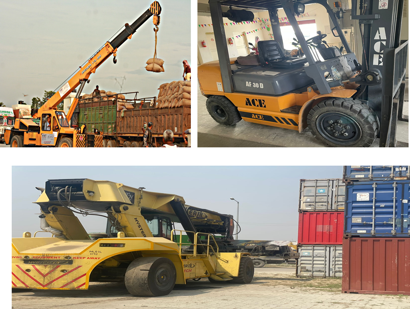
Port Handling Equipment
Port equipment is managed by Pristine Valley Dry port Pvt. Ltd.
|
Equipment |
Available
|
Total Quantity and Capacity Available |
Comments on Current Condition and Actual Usage |
|---|---|---|---|
|
Dockside Crane |
No |
N/A |
N/A |
|
Container Gantries |
No |
N/A |
N/A |
|
Mobile Cranes |
Yes |
8, 60 mt |
Operational and is used for Iron and steel handling |
|
Reach stacker |
Yes |
3, each of 45 mt capacity 1 of 7 mt capacity for empty containers |
Operational and is used for container handling |
|
RoRo Tugmaster (with Trailer) |
No |
|
|
|
Grain Elevator with Bagging Machines |
No |
|
|
|
Transtainer |
No |
|
|
|
Forklifts |
Yes |
2, 3 mt each |
Operational |
Container Facilities
With the increase in trade activities every year and without the improvement in existing infrastructure, congestion in the Dry port is an issue. Lack of proper warehousing capacity also is a contributing factor as importers can be late to clear their cargo on time. Importers would rather pay charges for extra days in the dry port facilities than remove their cargo to find themselves without sufficient warehouse space once they collect the cargo. The container holding capacity of the dry port is 1568 containers.
|
Facilities |
20 ft |
40 ft |
|---|---|---|
|
Container Facilities Available |
1 Container ice Cargo |
1 for bagged Cargo |
|
Container Freight Station (CFS) |
No but planned to have 3 refrigerated CFS
|
|
|
Refrigerated Container Stations |
No |
|
|
Other Capacity Details |
N/A |
|
|
Daily Take Off Capacity |
3-4 Racks in day |
|
|
Number of Reefer Stations |
2 plug in for dual service |
|
|
Emergency Take-off Capacity |
5 fire hydrants around CFS |
|
|
Off take Capacity of Gang Shift |
N/A |
|
Customs Guidance
ASYCUDA system is used for the customs clearance process. The system generates green, red, or yellow signals. Once the declaration documents are uploaded into the system, a registration number is generated and the verification of documents is done by the inspectors in the port, and the tax and duties are determined. Following the payment of the duties and taxes payable, the final verifier selects the container and marks green/blue and red /yellow. If the containers get green/blue, then it is released. If the containers get red/yellow, it is thoroughly checked. If there is no discrepancy, the goods are released. If any discrepancies are found, additional duties are paid and then the goods are released. Once the examination is completed, it is copied to the Risk Management Unit. It is recommended to use a reputable clearing agent. The clearing of goods takes 2 to 3 business days.
For more information on customs in Nepal, please see the following link: 1.3 Customs Information.
Terminal Information
MAIN STORAGE TERMINAL
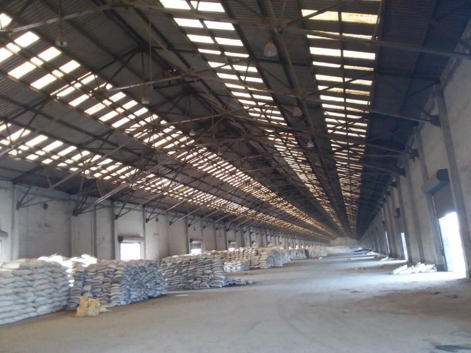
ICD has two warehouses (1. Container Freight Station Shed and 2. Good Shed) of size 7,000 sqm and 10,000 sqm. The Good Shed is divided into a walled section of 300m in length and a section with a roof without walls of 400m (as shown below in the pictures). NITBD has completed upgrading rail-based ICD; broad gauge railway yard with 6 full-length lines; boundary wall of 3.15 km. long and 3.6m. and has come into operation with storage and handling facilities to handle bulk cargo.
Main Features of Rail-based ICD:
ICD Birgunj is a rail-linked terminal, 450 m from the Indian border with the facility to handle all types of traffic including containers, bulk, bagged, break bulk, loose cargo, etc. This terminal covers an area of 38 hectares with the following facilities;
-
Railway tracks: 6 full-length railway lines.
-
Covered Good shed: 450 m x 26.5 m.
-
Open Shed/Platform) in addition to covered shed: 300 m x 26.5 m.
-
Container Yard (CY): 685 m x 64 m with 1568 TEU ground slots.
-
Reach Stakers” 3 x 45 Ton + 1 x 7 Ton capacity.
-
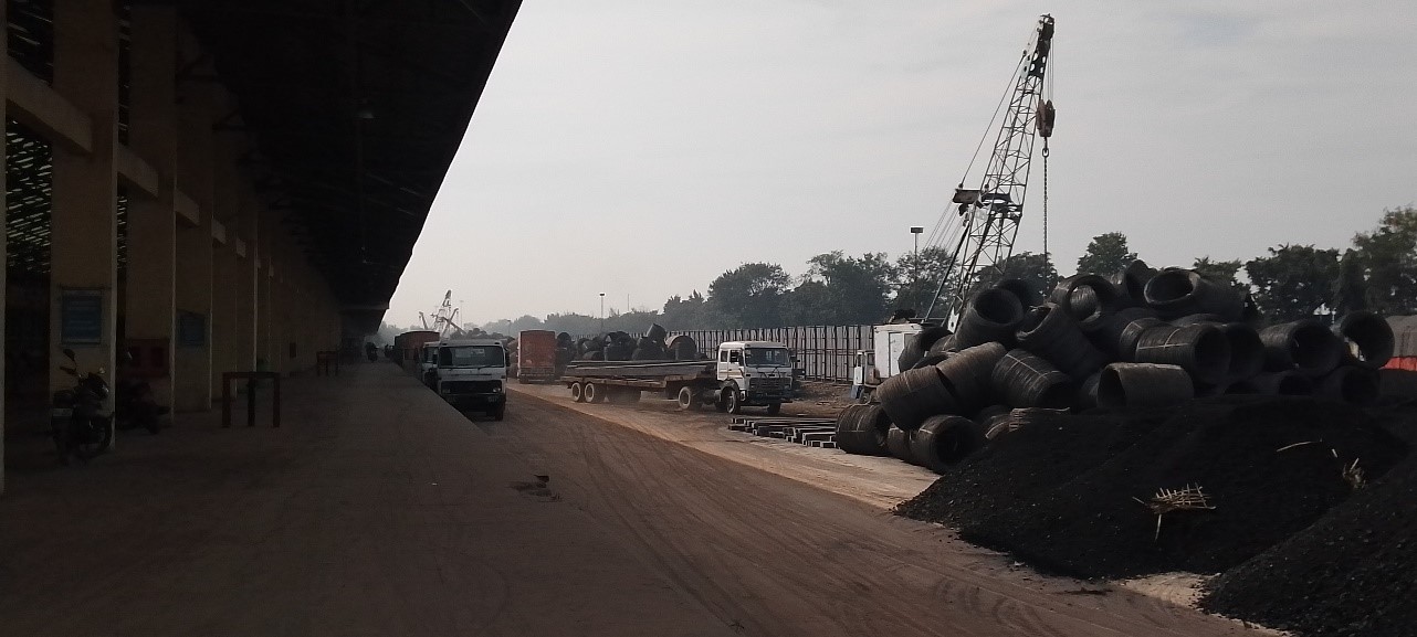
Mineral siding: Loose cargo handling facilities.
-
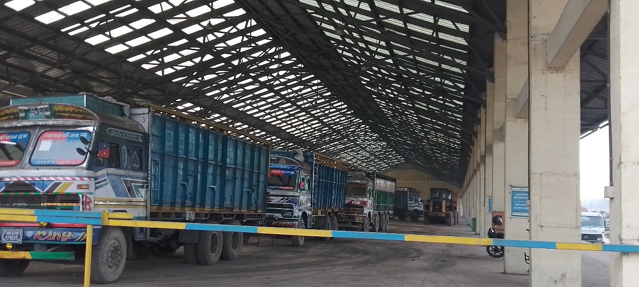
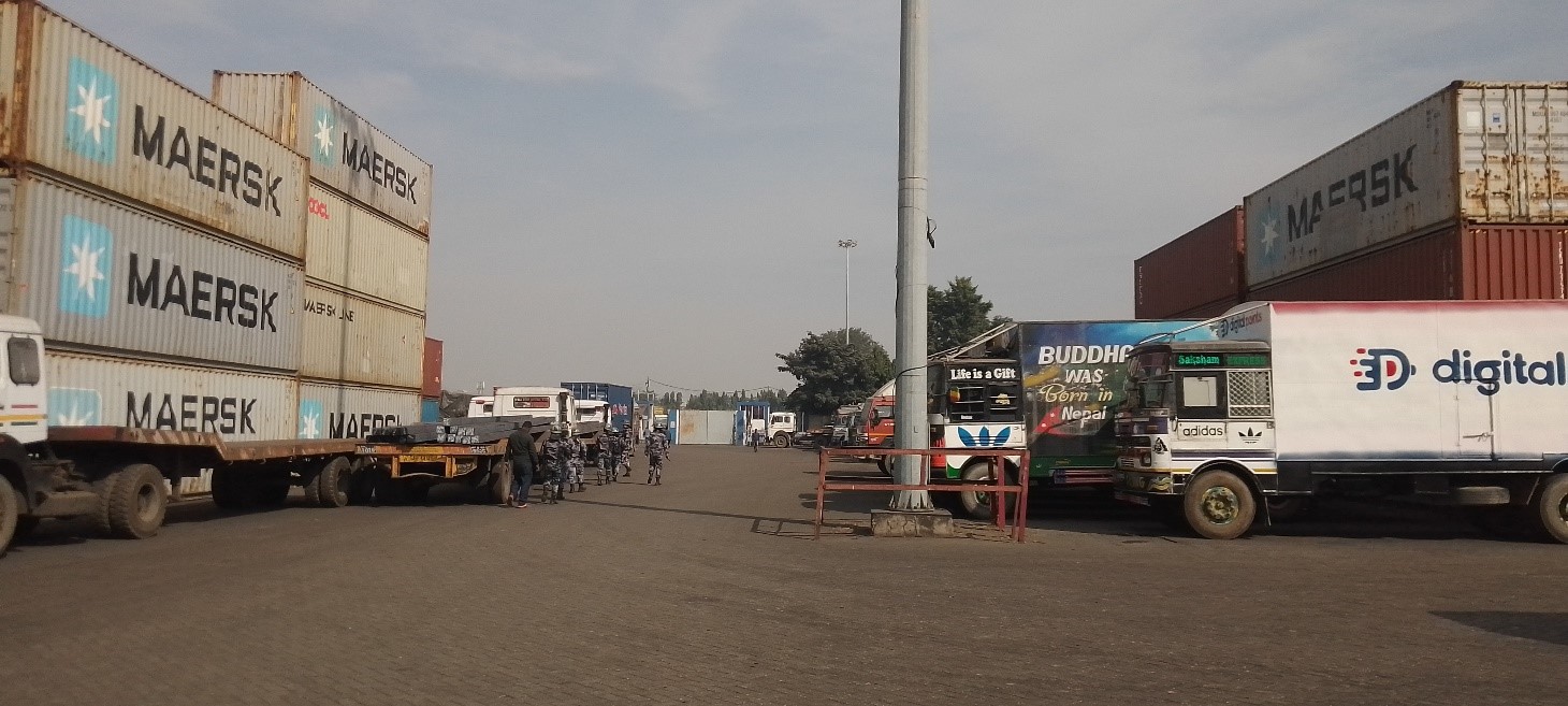
Truck Parking: More than 200 trucks and 50 trailers.
-
High mast lights with generator backup. Electric substation of 630 KVA, 11/0.4 KVA with one 380 KVA D. G. SET; Administrative block of 1130 sq. m. floor area.
-
Administrative block of 1130 sq. m. floor area.
-
Fire detection and alarm system.
-
Cement concrete paved area for parking of 250 freight vehicles and 30 big-size trailers.
Cement concrete paved area for parking of 250 freight vehicles and 30 big-size trailers.
Walled Good Shed of approx. 300 m in length.
Unwalled Good Shed of 400 m in length.
CFS SHED building and area.
CFS SHED building and area.
Port Security
The port is surrounded by a concrete wall. A CCTV monitoring system and security guards are placed in strategic areas to provide surveillance 24/7. Security is provided by Nepal Armed Police Forces of Nepal Government.
|
Security |
|
|---|---|
|
ISPS Compliant |
No |
|
Current ISPS Level |
N/A |
|
Police Boats |
N/A |
|
Fire Engines |
N/A |
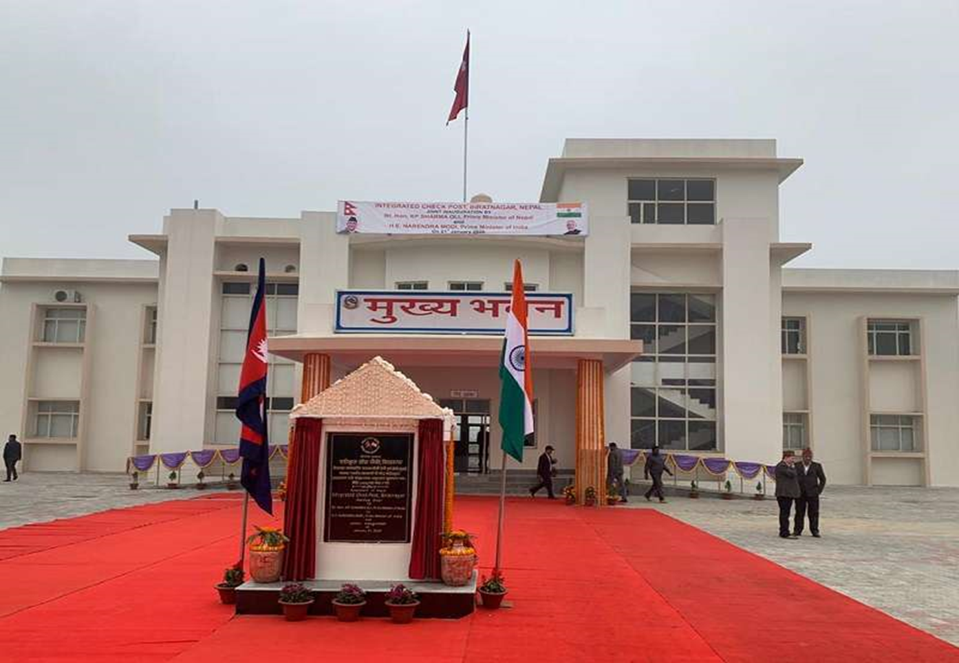
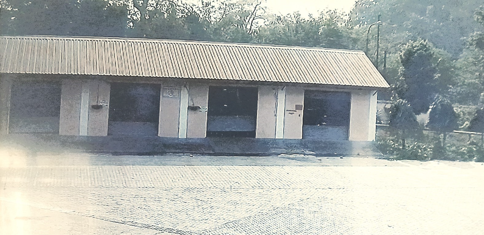
Birgunj Integrated Check Post (ICP)
An addition at the Birgunj ICD is the Integrated Check Post (ICP) to facilitate the customs clearance activities. The ICP Birgunj was inaugurated on 7th of April 2018. As per the legal provision, TRS Himalayan Logipark Pvt Ltd has been awarded for ICP Birgunj terminal clearance purpose on 1st April 2023. Birgunj ICP is currently handling 70 percent of the commerce that used to pass through the Birgunj customs points.
Port website: Bigunj Customs Office
Key port information may also be found at http://www.maritime-database.com
|
Port Location and Contact |
|
|---|---|
|
Country |
Nepal |
|
Province or District |
Madhesh / Parsa |
|
Nearest Town or City with Distance from Port |
TOWN NAME: Birgunj DISTANCE (km): 8 KM |
|
Port's Complete Name |
Birgunj Integrated Check Post
|
|
Latitude |
27.016721 |
|
Longitude |
84.842556 |
|
Managing Company or Port Authority
|
TRS Himalayan Logipark (P) Ltd. ICP, Birgunj |
|
Management Contact Person |
Ganesh Prasad Ghimire (Chief Maneger) 9852032047 Subhash Subedi (General Manager) 9855036917 |
|
Nearest Airport and Airlines with Frequent International Arrivals/Departures |
AIRPORT NAME: Simara Airport 23.4 KM |
Port Picture
Description and Contacts of Key Companies
|
SN |
Agencies related to Operation of ICP |
Name |
|---|---|---|
|
1 |
Multimodal Transport Operators |
N/A |
|
2 |
Transport Management Company |
Trans Himalayana Logipark Pvt. Ltd |
|
3 |
Customs |
Birgunj Customs Office |
|
4 |
Freight Forwarders |
Upyogi Freight Logistics Pvt. Ltd. , Radhe Radhe Clearing and Forwarding, Flash Freight logistics, Oceanstar Logistics, |
|
5 |
Banks |
Everest Bank For Customs clearance and Nabil Bank for Terminal Clearance |
|
6 |
Quarantine |
Food, Animal and Plant with laboratory facility |
|
7 |
Shipping lines |
N/A |
|
8 |
Customs Agent |
Trimurti Clearing Sewa, Laxmi Clearance Agent, Adit Clearance Agent, Aani Clearance Agency, Aashirbad Clearance Agent ete. |
For more information on port contacts, please see the following link: 4.4 Port and Waterways Companies Contact List.
Port Performance
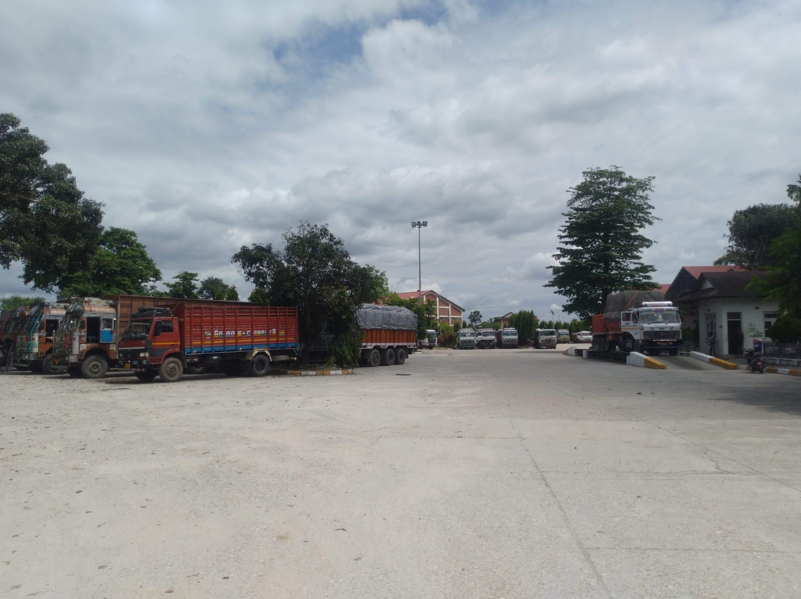
Customs clearance certificates are usually issued to cargo only after 6 pm from the Birgunj Customs office. The cargo truck that enters ICP in the daytime has to hold until 6 pm to exit the customs office premises. This leads to congestion at the gate and ICP premises throughout the day. Also, importers who do not have their warehouses outside of the ICP premises tend to delay the customs clearance procedures to tranship their cargo from truck to truck without having to store their goods in a warehouse and pay additional charges (warehouse charges are applicable if stored in ICP warehouse). Therefore, the parking bay is full most of the time. The exit road is also congested due to trucks standing in queue for the whole day until 6 pm. These are the factors causing congestion at the ICP.
|
Seasonal Constraints |
||
|---|---|---|
|
|
Occurs |
Time Frame |
|
Rainy Season |
Yes |
From June to August |
|
Major Import Campaigns |
Yes / No |
Months of Festivities October/November |
|
Other Comments |
ICP is functioning at full capacity with the facility of 6 6-lane road. |
|
|
Handling Figures for 2022 |
|
|---|---|
|
Vessel Calls |
N/A |
|
No of Vehicles Traffic (TEUs) |
135063 Imports 10140 Exports |
|
Handling Figures Bulk and Break Bulk for 2022 |
|
|---|---|
|
Bulk (MT) |
21998 |
|
Break bulk (MT) |
N/A |
Discharge Rates and Terminal Handling Charges
For information on port rates and charges, please see the following link: Fee-Dar-rate-for-ICP-Birgunj-2.pdf (nitdb.gov.np).
Port Handling Equipment
The port equipment is managed by the TRS Himalayan Logipark (P) Ltd.
|
Equipment |
Available
|
Total Quantity and Capacity Available |
Comments on Current Condition and Actual Usage |
|---|---|---|---|
|
Dockside Crane |
No |
|
|
|
Container Gantries |
No |
|
|
|
Mobile Cranes |
Yes |
|
|
|
Reach stacker |
Yes |
|
|
|
RoRo Tugmaster (with Trailer) |
No |
|
|
|
Grain Elevator with Bagging Machines |
No |
|
|
|
Transtainer |
No |
|
|
|
Hydra |
Yes |
2 |
Operational |
|
Forklifts |
Yes |
1 with 3 mt |
Operational |
Customs Guidance
ASYCUDA system is used for the customs clearance process. The clearing of goods takes 2 to 3 business days.
Terminal Information
MAIN STORAGE TERMINAL
-
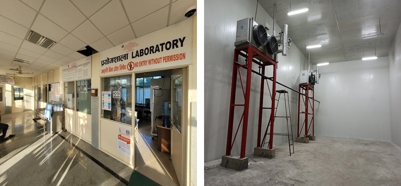
Warehouse with refrigeration facility (import side) - approx. 1374 m 2
-
Warehouse (export side) – approx..692 m 2
-
Inspection shed (import side) – approx. 402 m 2
-
Inspection side (export side) – approx. 234 m 2
-
Confiscated shed (import and export side) – approx. 100 m 2
-
Animal sheds (import side) – approx. 100 m 2
-
Processing sheds – total 6 no with approx. 1250 m 2 each
-
Processing cabins: 16 No, Frisking cabins: 4 No,
Port Security
Port security is overseen by the Nepal Armed Police Force and an additional security company 24/7. The facilities covering the area of 115 acres is well barricaded. As a firefighting measure, there is a firefighting system complete with 5 pumps, water storage, supply lines, and hydrants in strategic locations within the premises.
|
Security |
|
|---|---|
|
ISPS Compliant |
No |
|
Current ISPS Level |
N/A |
|
Police Boats |
N/A |
|
Fire Engines |
N/A |
|
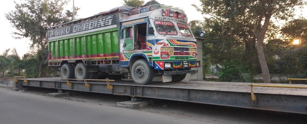
Nos of Weighbridge- 2 with capacity of 80 MT and 100 MT. |
|
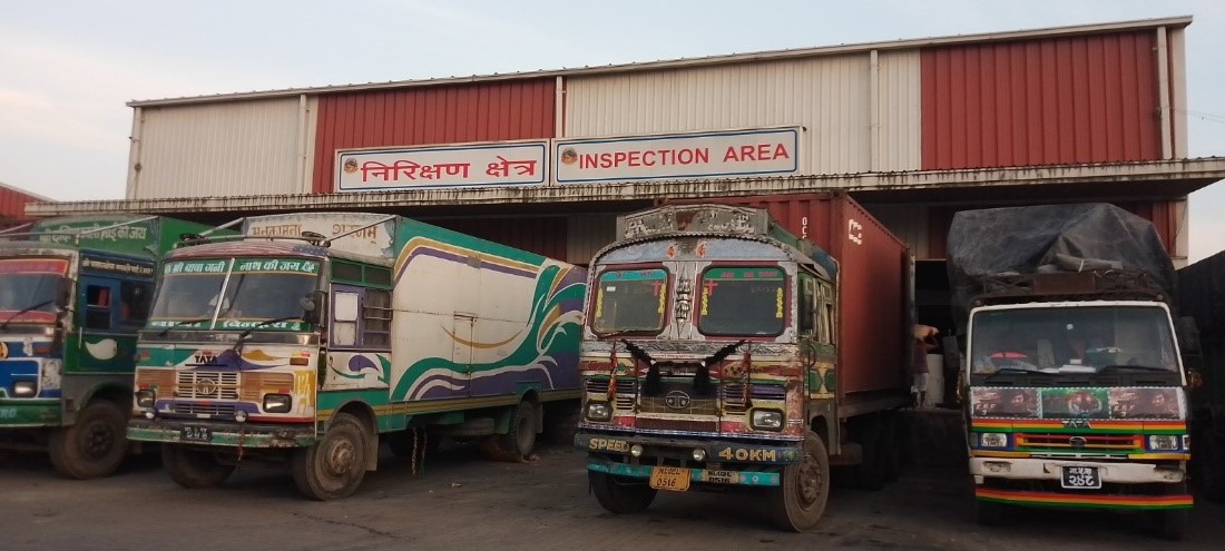
Inspection building.
|
|
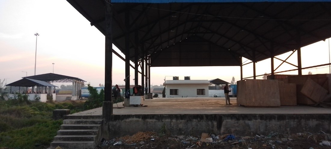
Open yard.
|
Nepal - 2.1.3 Nepalgunj Dry Port
Dry Port Overview
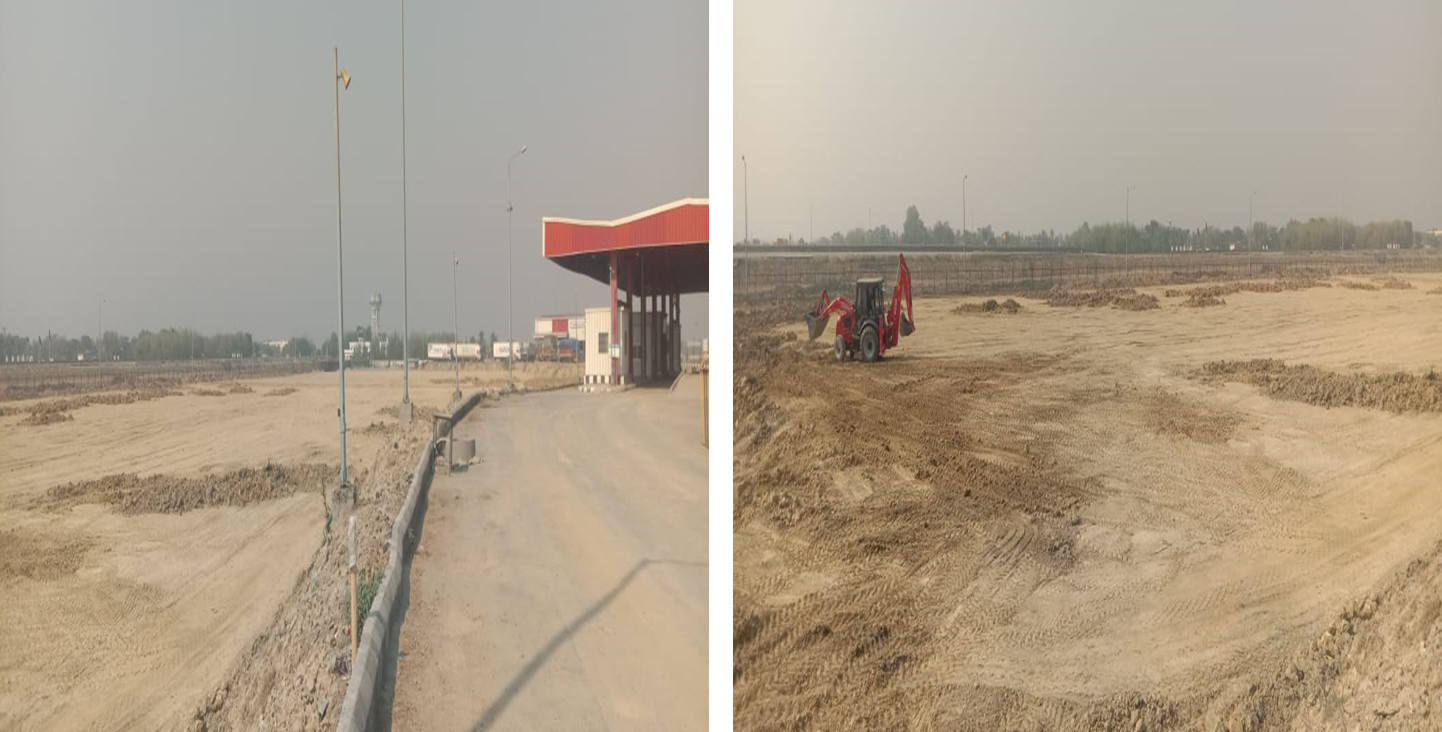
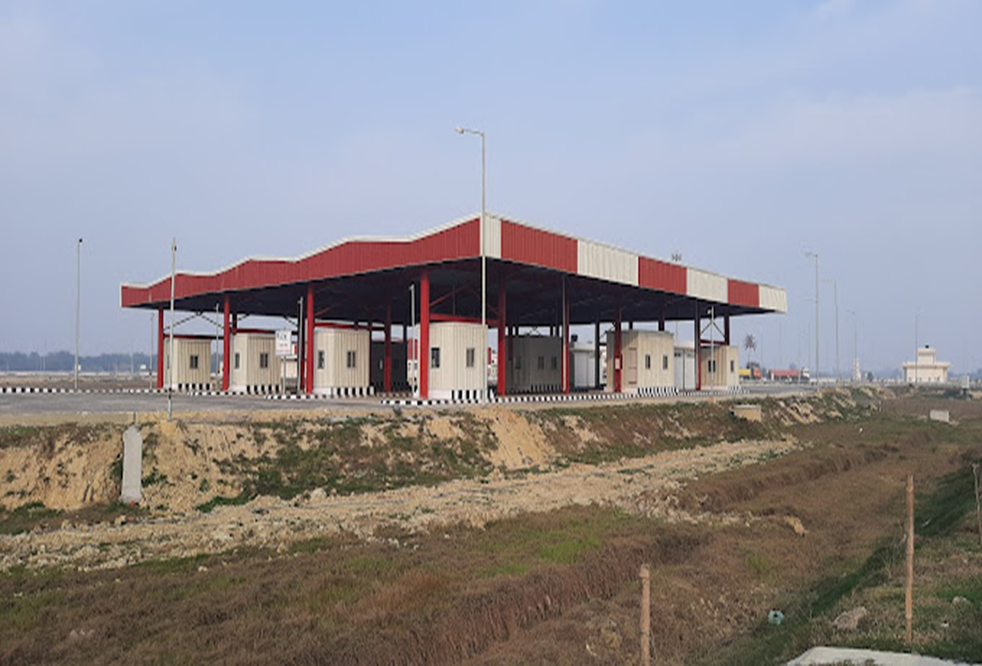
Nepalgunj is a significant border crossing point in Western Nepal that is closest to the Indian capital, New Delhi. There is a four-lane highway on both sides of the border. The Nepalgunj Customs Office is situated in Nepalgunj Sub-Metropolitan Ward No. 16. The Government of Nepal and India are currently constructing an Integrated Check Post (ICP) in Nepalgunj, which was scheduled to be completed in 2020. As of Dec 2023, the civil works of the port is completed, On Jan 4, 2024, the government awarded the operations and management rights of the ICP to TRS Atlas Logi Park Pvt. Ltd. for a period of five years. The ICP will be connected by road to ports in India and operate as a centre for transhipment and importation of cargo to inland destinations into Nepal.
Kolkata is the nearest India seaport for this entry point. The entry point on the Indian side is Rupadiya, Bahraich district, Uttar Pradesh.
Port website: - || Department of Customs ||
|
Port Location and Contact |
|
|---|---|
|
Country |
Nepal |
|
Province or District |
Lumbini Province |
|
Nearest Town or City with Distance from Port |
Nepalgunj |
|
Port's Complete Name |
Nepalgunj Integrated Check Point (ICP) |
|
Latitude |
28.02051 |
|
Longitude |
81.60093 |
|
Managing Company or Port Authority |
Nepal Intermodal Transport Development Board (Port Authority) TRS Atlas Logi Park Pvt. Ltd. (Managing Company) |
|
Management Contact Person |
Custom office: Purna Prasad Lamsal (Information Officer) Contact: Nepalgunj Sub-Metropolitan City Ward No. 16, Jaispur, Banke Tel : +977-81-412001,412004 Fax: +977-81-520276 E-mail: nepalgunj@customs.gov.np |
|
Nearest Airport and Airlines with Frequent International Arrivals/Departures |
Nepalgunj Airport, Banke (Domestic) Distance: 12 KM Gautam Buddha International Airport, Bhairahawa. Distance: 264 KM
|
Link for ICP Nepalgunj: http://nitdb.gov.np/en/nepalgunj-icp/
Port Picture
Link for Custom and clearing agent in Kolkata: https://www.customs.gov.np/district/en/nepalgunj
Description and Contacts of Key Companies
For more information on port contacts, please see the following link: 4.4 Port and Waterways Companies Contact List.
Port Performance
|
Seasonal Constraints |
||
|---|---|---|
|
|
Occurs |
Time Frame |
|
Rainy Season |
No |
N/A |
|
Major Import Campaigns |
No |
N/A |
|
Other Comments |
N/A |
|
|
Handling Figures |
|
|---|---|
|
Vessel Calls |
Not available |
|
Container Traffic (TEUs) |
Not available |
|
Handling Figures Bulk and Break Bulk |
|
|---|---|
|
Bulk (MT) |
Not available |
|
Break bulk (MT) |
Not available |
Discharge Rates and Terminal Handling Charges
The ICP has not yet published the handling charges.
Port Handling Equipment
The ICP is expected to come into operation soon, details on handling equipment are not yet available.
|
Equipment |
Available
|
Total Quantity and Capacity Available |
Comments on Current Condition and Actual Usage |
|---|---|---|---|
|
Dockside Crane |
N/A |
|
|
|
Container Gantries |
N/A |
|
|
|
Mobile Cranes |
N/A |
|
|
|
Reachstacker |
N/A |
|
|
|
RoRo Tugmaster (with Trailer) |
N/A |
|
|
|
Grain Elevator with Bagging Machines |
N/A |
|
|
|
Transtainer |
N/A |
|
|
|
Forklifts |
N/A |
|
|
Container Facilities
|
Facilities |
20 ft. |
40 ft. |
|---|---|---|
|
Container Facilities Available |
N/A |
N/A |
|
Container Freight Station (CFS) |
N/A |
N/A |
|
Refrigerated Container Stations |
N/A |
N/A |
|
Other Capacity Details |
N/A |
N/A |
|
Daily Take Off Capacity |
N/A |
N/A |
|
Number of Reefer Stations |
N/A |
N/A |
|
Emergency Take-off Capacity |
N/A |
N/A |
|
Off-take Capacity of Gang Shift |
N/A |
N/A |
Customs Guidance
Port Security
Port security is overseen by Armed Police force.
|
Security |
|
|---|---|
|
ISPS Compliant |
No |
|
Current ISPS Level |
No |
|
Police Boats |
No |
|
Fire Engines |
No |
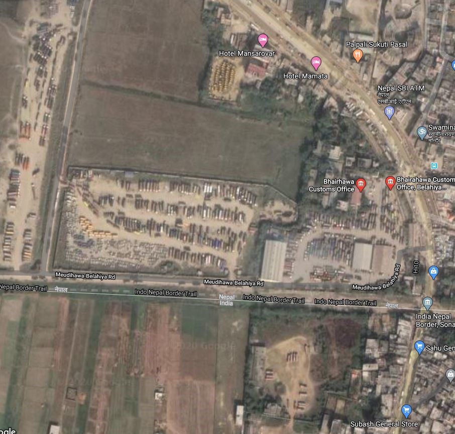
Nepal - 2.1.4 Bhairahawa Dry Port
Port Overview
Bhairahawa Inland Clearance Depot (ICD) is located at Siddharthanagar, 5 kilometres north of Nepal's southern border with Uttar Pradesh state, India. It is one of 5 dry ports currently in operation: Birgunj ICD at Sirsiya, Bhairahawa ICD, Kathmandu (Chobhar) ICD and Kakarvitta ICD. Bhairahawa ICD is well connected to the Port of Kolkata by road. Nautanawa Railway Station (NTV) in Maharajgunj, Uttar Pradesh is 7 km from the border and can be accessed by road (20 mins of travel).
Nepal Intermodal Transport Development Board (NITDB) has leased out management of Bhairahawa ICD to Annapurna Terminals Pvt. Ltd. The Bhairahawa Customs Office ranks 2nd in overall volume of trade of Nepal after Birgunj. Major goods imported through this customs point are Petroleum products, (like Petrol, Diesel, and LPG), new vehicles, Mild steel Billets, rice, vegetables, marble, tiles, and fly ash coal.
Port website: https://nitdb.gov.np/wp-content/uploads/2018/05/Bhairahawa-ICD.pdf
|
Port Location and Contact |
|
|---|---|
|
Country |
Nepal |
|
Province or District |
Lumbini Province, Rupandehi district |
|
Nearest Town or City with Distance from Port |
5 km South of Siddharthanagar accessed Via H10 |
|
Port's Complete Name |
Bhairahawa Inland Container Depot |
|
Latitude |
27.47756 |
|
Longitude |
83.46876 |
|
Managing Company or Port Authority
|
Annapurna Terminals Pvt Ltd |
|
Management Contact Person |
Manager Ravi Parikhe Mobile: 9857020925 |
|
Nearest Airport and Airlines with Frequent International Arrivals/Departures |
Gautam Buddha International Airport 8 km Southeast accessed via H10 and Bhairahawa city road |
Port Picture
|
|
|
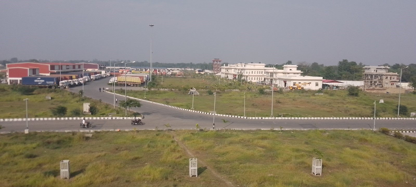
Aerial View of Bhairahawa ICD |
Description and Contacts of Key Companies
|
SN |
Agencies related to the Operation of ICD |
Name |
|---|---|---|
|
1 |
Multimodal Transport Operators |
Nepal Intermodal Transport Development Board (NITDB) |
|
2 |
Transport Management Company |
Annapurna Terminals Pvt. Ltd |
|
3 |
Customs |
Bhairahawa Customs Office |
|
4 |
Freight Forwarders |
N/A |
|
5 |
Banks |
Rastriya Banijaya Bank Dry port Branch |
|
6 |
Quarantine |
Food / Plant Quarantine/Animal Quarantine |
|
7 |
Shipping lines |
N/A |
|
8 |
Customs Agent |
Sattyasai clearing agency, Bhusal Clearing agency, Management consultant agency, Rumjha Traders Etc. |
For more information on port contacts, please see the following link: 4.4 Port and Waterways Companies Contact List.
Port Performance
ICD Bhairahawa is busy and congested due to a lack of parking area. Mainly in the rainy season, the available warehouse and parking space are not enough. The average waiting time between arrival and berthing is 1 to 2 days. The ICD has facilities like warehouses, parking areas, and open yard areas but lacks cold storage facilities for perishable goods.
|
Seasonal Constraints |
||
|---|---|---|
|
|
Occurs |
Time Frame |
|
Rainy Season |
Yes |
From June to August |
|
Major Import Campaigns |
Yes |
From August to October |
|
Other Comments |
|
|
|
Handling Figures for 2022/23 |
|
|---|---|
|
Vessel Calls |
N/A |
|
Container Traffic (TEUs) |
3406 |
|
Handling Figures Bulk and Break Bulk for 2022/23 |
|
|---|---|
|
Bulk (MT) |
128455 mt |
|
Break bulk (MT) |
N/A |
Discharge Rates and Terminal Handling Charges
|
Sn |
Particulars |
Schedule of Charges (NPR) |
|---|---|---|
|
A. |
Freight Vehicle Entry |
|
|
a. |
Truck/Tanker/Tractor/Trailer per entry per trip |
259.39 |
|
b. |
Light vehicles /Bullock Cart with capacity up to 5 Ton per entry per trip |
129.69 |
|
c. |
Rickshaw/Hand Trolley per entry per trip |
38.94 |
|
d. |
Container Truck (fixed container Vehicle) per entry per trip |
389.06 |
|
e. |
Twenty-foot equivalent unit (TEU) per entry per trip |
518.74 |
|
f. |
Forty-foot equivalent unit (FEU) per entry per trip |
778.13 |
|
B. |
Loading/Unloading/Handling of cargo (all activities) |
|
|
a. |
Twenty-foot equivalent unit (TEU) per vehicle |
4000 |
|
b. |
Forty-foot equivalent unit (FEU) per vehicle |
6000 |
|
c. |
For other vehicles |
|
|
i. |
Containerized cargo (per ton) |
250 |
|
ii. |
Non-containerized break bulk/packaged/ bagged cargo (per ton) |
250 |
|
iii. |
Non containerized bulk/loose cargo (per ton) |
129.69 |
|
C. |
Terminal handling charge (Complete Cycle) |
|
|
a. |
Loaded Container |
|
|
i. |
Twenty-foot equivalent unit (TEU) |
2593.75 |
|
ii. |
Forty-foot equivalent unit (FEU) |
4150.00 |
|
b. |
Empty Container |
|
|
i. |
Twenty-foot equivalent unit (TEU) |
1296.89 |
|
ii. |
Forty-foot equivalent unit (FEU) |
2075.01 |
|
c. |
LCL Cargo including, container handling/loading/unloading and stuffing and destuffing (per ton) |
518.74 |
|
D. |
Weighment Charge (one activity) of loaded/empty Vehicles |
259.39 |
|
E. |
Warehousing Charges: 24 hours free time from the time of arrival |
|
|
a. |
Import |
|
|
i. |
2-8 days (per kg per day) |
0.16 |
|
ii. |
9-30 days (per kg per day) |
0.21 |
|
iii. |
31 days onwards |
0.31 |
|
b. |
Export |
|
|
i. |
2-8 days (per kg per day) |
0.08 |
|
Ii. |
9-30 days (per kg per day) |
0.10 |
|
Iii. |
31 days onwards |
0.13 |
|
c. |
Open Yard Storage |
|
|
i. |
2-8 days (per kg per day) |
0.08 |
|
ii. |
9 days onwards (per kg per day) |
0.13 |
|
F. |
Parking and storage charges for loaded/unloaded vehicles (one day free) |
|
|
a. |
Forty-foot equivalent unit (FEU) |
|
|
i. |
2-7 days per day |
518.74 |
|
ii. |
8 days onwards per day |
778.13 |
|
b. |
other vehicles |
|
|
i. |
2-7 days per day |
389.06 |
|
ii. |
8 days onwards per day |
518.74 |
|
G. |
Parking and storage charges for containers |
|
|
a. |
Forty-foot equivalent unit (FEU) Container |
|
|
i. |
2-7 days per day |
518.74 |
|
ii. |
8 days onwards per day |
778.13 |
|
b. |
Twenty-foot equivalent unit (TEU) Container |
|
|
i. |
2-7 days per day |
389.06 |
|
ii. |
8 days onwards per day |
518.74 |
|
H. |
Cleaning of Containers |
|
|
a. |
Twenty-foot equivalent unit (TEU) |
259.39 |
|
b. |
Forty-foot equivalent unit (FEU) |
389.06 |
|
I. |
Forklift Charge |
|
|
a. |
Complete Cycle |
|
|
i. |
Twenty-foot equivalent unit (TEU) |
3865.22 |
|
ii. |
Forty-foot equivalent unit (FEU) |
7730.45 |
|
b. |
Single Cycle |
|
|
i. |
Twenty-foot equivalent unit (TEU) |
2013.80 |
|
ii. |
Forty-foot equivalent unit (FEU) |
4026.28 |
|
c. |
Non-containerized (per ton) |
242.24 |
Port Handling Equipment
The port equipment is managed by the operator.
|
Equipment |
Available
|
Total Quantity and Capacity Available |
Comments on Current Condition and Actual Usage |
|---|---|---|---|
|
Dockside Crane |
No |
N/A |
N/A |
|
Container Gantries |
No |
N/A |
N/A |
|
Mobile Cranes |
No |
N/A |
N/A |
|
Reachstacker |
No |
N/A |
N/A |
|
RoRo Tugmaster (with Trailer) |
No |
N/A |
N/A |
|
Grain Elevator with Bagging Machines |
No |
N/A |
N/A |
|
Transtainer |
No |
N/A |
N/A |
|
Forklifts |
Yes |
One, 3000 kg |
N/A |
|
Pallet Trolly |
Yes |
One, 3000 kg |
N/A |
Customs Guidance
The customs clearance process at the dry port of Bhairahawa is automated using the web based ASYCUDA system, which allows for the pre-clearing of goods. Customs pre-clearance of goods takes approximately 1-2 working days. The location of the Customs office is within the dry port.
For more information on customs in Nepal, please see the following link: 1.3 Customs Information.
Terminal Information
MULTIPURPOSE TERMINAL
N/A
GRAIN AND BULK HANDLING
N/A
MAIN STORAGE TERMINAL
Bhairahawa ICD can accommodate more than 250 vehicles. There is a separate arrangement within the ICD to accommodate tankers carrying petroleum products.
One Covered warehouse of 55x25 metre with a 1.2-meter-high level platform is used to store containers. Also, to facilitate customs inspection, there are the following sheds:
-
Appraisal Shed of 36x24 metre with 1.2-metre-high level platform.
-
Additional Shed of 36x24 metre with a 1.2-meter-high level platform in Bhairahawa to conduct customs inspection on small vehicles.
-
Warehouse accommodated with Electronic Weighing Scales.
-
Reefer plug points for refrigerator cargoes
-
A digital weighbridge installed with a 100-ton capacity.
|
Storage Type |
Number of Storage Facilities |
Area (m2) |
|---|---|---|
|
Bagged Cargo |
N/A |
|
|
Refrigerated Cargo |
N/A |
|
|
General Cargo |
N/A |
|
Port Security
The port is surrounded by a concrete wall. A CCTV monitoring system and security guards are placed in strategic areas to provide surveillance 24/7. Security is provided by Nepal Armed Police Forces of Nepal Government.
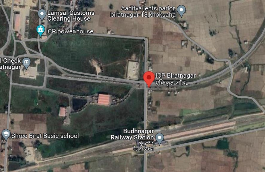
Nepal - 2.1.5 Biratnagar Dry Port
Port Overview
Biratnagar Integrated Check Point (ICP) is spread over a total area of about 186 acres along the Nepal-India borders constructed by India and handed over to Nepal to facilitate for trade logistics between the two countries. It has a common platform for traders to get customs clearance for traded goods and offers services like banking, immigration, quarantine, warehousing, parking yard, etc facilitating both importers and exporters.
Biratnagar ICP is 7 kilometers (4 mi) North of Nepal's southern border with Bihar state, India. Biratnagar Customs Office ranks 4th in the overall volume of trade in Nepal after Birgunj Customs, Bhairahawa Customs, and Birgunj Dry Port. There are nine sub-customs offices under its jurisdiction. Major imported goods through this custom are petroleum products like diesel, petrol, LP gas, crude soya-bean oil, motorcycles, betel nuts, M.S. Billets, iron structures, coal, and glazed tiles. Major exported goods are cardamom, woven fabrics, jute sacking bags, G.I.Wire, PP GI Coil, Dyed Yarn, jute hessian fabric, brass strip in Coils, and corrugated galvanized iron sheets. Biratnagar ICP at the border is well connected to the gateway ports of Kolkata (600 km) by road or by rail to Jogbani, Bihar.
Port website: ICP Biratnagar – Trans Nepal Freight Services (transnepaldryport.com)
|
Port Location and Contact |
|
|---|---|
|
Country |
Nepal |
|
Province or District |
Koshi Province, Morang district |
|
Nearest Town or City with Distance from Port |
7 km North of Biratnagar City accessed Via H08 |
|
Port's Complete Name |
Biratnagar Integrated Check Point |
|
Latitude |
26.38237 |
|
Longitude |
87.26900 |
|
Managing Company or Port Authority
|
TransNepal Freight Services Pvt. Ltd |
|
Management Contact Person |
Anand Kumar Singh TransNepal Tower Head Office Piyush Marga, Biratnagar-5, Morang,Nepal Tel: 021-501441 Fax: 021-501470 E-mail: ananda@transnepaldryport.com
Laxmi Subba Manager ICP Biratnagar, Buddha Nagar Mobile: 9842032956/9814387011
|
|
Nearest Airport and Airlines with Frequent International Arrivals/Departures |
Biratnagar National Airport 12 KM North |
Port Picture
|
|
|
Aerial View of Biratnagar ICP |
Description and Contacts of Key Companies
|
SN |
Agencies related to Operation of ICP |
Name |
|---|---|---|
|
1 |
Multimodal Transport Operators |
TransNepal Freight Services Pvt. Ltd |
|
2 |
Transport Management Company |
N/A |
|
3 |
Customs |
Biratnagar Customs Office |
|
4 |
Freight Forwarders |
N/A |
|
5 |
Banks |
Rastrya Banijya Bank,Rani, Buddhanagar ICP Branch |
|
6 |
Quarantine |
Plant, Animal, Food Quarantine, Lab |
|
7 |
Shipping lines |
N/A |
|
8 |
Customs Agent |
Mrigatrishna clearing, Bijay clearing, Shah clearing, Devekinandan clearing, Eastern clearing, Danfe Custom Clearing, D.G Custom Service, Shivam Clearing House, Rani Clearing services, Pathivara Bhansar Sewa, D.P Clearing services, Trans misson cargo clearing, P.R Regmi bhansar jach pass sewa, Gupta Custom Clearing, Goodwill Clearing & Logistics Service etc (50+ agents are providing customs clearance services) |
For more information on port contacts, please see the following link: 4.4 Port and Waterways Companies Contact List.
Port Performance
The Port is currently not congested and operates on a two-lane road. The average waiting time between arrival and berthing is 1 to 2 days.
|
Seasonal Constraints |
||
|---|---|---|
|
|
Occurs |
Time Frame |
|
Rainy Season |
Yes |
From June to August |
|
Major Import Campaigns |
Yes |
Months of Festivals Aug to Oct |
|
Other Comments |
ICP Biratnagar is in operation merging Rani customs offices. |
|
|
Handling Figures for 2022 |
|
|---|---|
|
Vessel Calls |
40 |
|
Container Traffic (TEUs) |
6651 |
|
Handling Figures Bulk and Break Bulk for 2022 |
|
|---|---|
|
Bulk (MT) |
71340 |
|
Break bulk (MT) |
|
Discharge Rates and Terminal Handling Charges
Biratnagar ICP Tariff effective from 17 August 2022 and following is the Discharge Rates and Terminal Handling Charges: Tariff – Trans Nepal Freight Services (transnepaldryport.com)
Port Handling Equipment
The port equipment is managed by the operator. The port has transitioned from using manual labour to handle cargoes to mechanical port handling equipment as the volume of cargoes passing through increases.
|
Equipment |
Available |
Total Quantity and Capacity Available |
Comments on Current Condition and Actual Usage |
|---|---|---|---|
|
Dockside Crane |
Yes |
40 ton |
|
|
Container Gantries |
N/A |
|
|
|
Mobile Cranes |
Yes |
Escorts F-15 |
Capacity 14 ton at 1.5 m, 900 kg at 15.8 m |
|
Reach stacker |
Yes |
1 – 14 MT. |
|
|
RoRoTugmaster (with Trailer) |
N/A |
|
|
|
Grain Elevator with Bagging Machines |
N/A |
|
|
|
Transtainer |
N/A |
|
|
|
Forklifts |
Yes |
One, 3000kgs |
|
|
Pallet Trolly |
Yes |
Four, 5000 kgs, 3000 kgs |
|
Container Facilities
The space available for the container is sufficient, but the Port does not have a refrigerated container station and storage related to cold storage.
|
Facilities |
20 ft |
40 ft |
|---|---|---|
|
Container Facilities Available |
N/A |
N/A |
|
Container Freight Station (CFS) |
N/A |
N/A |
|
Refrigerated Container Stations |
N/A |
N/A |
|
Other Capacity Details |
N/A |
N/A |
|
Daily Take Off Capacity |
N/A |
N/A |
|
Number of Reefer Stations |
1 with 4 plugs in facility (Dual service for both 20 dt and 40 ft) |
|
|
Emergency Take-off Capacity |
N/A |
N/A |
|
Off take Capacity of Gang Shift |
N/A |
N/A |
Customs Guidance
The customs clearance process at the dry port of Biratnagar is automated using the web-based ASYCUDA system, which allows for the pre-clearing of goods. Customs pre-clearance of goods takes approximately 1-2 working days. The location of the Customs office is within the dry port.
MAIN STORAGE TERMINAL
The Port has a warehouse, parking, and open yard areas as listed below. The port does not have cold storage facilities and does not have a specific area designated for humanitarian cargo.
-
Warehouse arrival with refrigeration facilities (import side) with a capacity of 1520 sqm
-
Warehouse departure (export side) with 740 sqm
-
Animal shed (import side) 100 sqm, Process shed (import side) 2500 sqm, Process shed (export side) 2500 sqm, Process Cabins 31 Nos 418 sqm.
-
A vacant area for adding up to 3,900 m2 warehousing/parking area for holding 150 TEUs.
-
A parking area for 80 trucks
-
Dedicated shed- 1
-
Weight bridge- 2 (1 on the import side and 1 on the export side)
-
Electrical Sub-Station equipment: Two DG Sets, One 380 KVA and 125 KVA Transformer, AVR, LT, and HT panel)
-
Warehouse house Arrival (with refrigeration) facilities (Import Side- 1520 m2
-
Warehouse house Departure (Export Side- 740 m2
-
Process Shed (Import Side) 2500 m2
-
Process Shed (Export Side)- 2500 m2
-
Process Cabins 31 Nos. - 418 m2
-
Firefighting systems including pumps (5 Nos) water storage, supply lines, and hydrants.
|
Storage Type |
Number of Storage Facilities |
Area (m2) |
|---|---|---|
|
Bagged Cargo |
warehouse |
1375 |
|
Refrigerated Cargo |
N/A |
|
|
General Cargo |
Container Cargo New warehouse |
3700 |
Port Security
The port is surrounded by a concrete wall. A CCTV (95 nos.) monitoring system and security is provided by the Nepal Armed Police Forces of Nepal Government and a third-party security company from Sudarshan Security Pvt. Ltd 24/7.
Integrated Check Post (ICP) Biratnagar It is 2.9 Km South of Biratnagar ICP and 14.8 Km South of Biratnagar Airport.
View of ICP from the main building.
Warehouse and parking area
Container yard for railway Container Yard-1 of 4500 m2 is under construction.
Crane, forklift and reach stacker Service
PROCESSING SHED
QUARANTINE BLOCK COOL ROOM
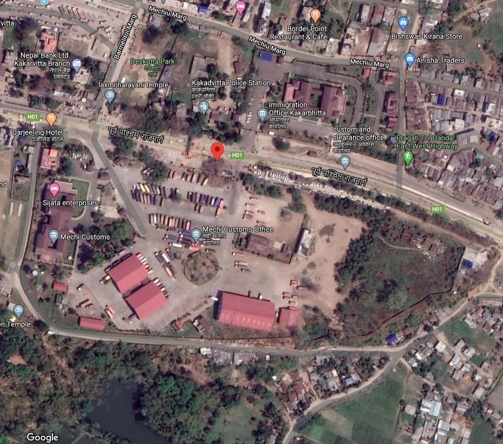
Nepal - 2.1.6 Kakarbhitta Dry Port
Port Overview
Kakarbhitta Inland Clearance Depot (ICD) is in Mechinagar municipality, Jhapa District, Koshi Province, Nepal and is the main entry point from India on Nepal's eastern border. Kakarbhitta is the 7th largest border crossing point, with 2.87% share of total import value based on Annual data (Shrawan-Asar) of FY 2079/80 (Mid July 2022 to Mid July 2023) (ref: Department of Customs, 2022/2023).
The port was built to boost trade with Bangladesh and Bhutan through India. The port is 600 km / 15 hours truck travel time from the port of Kolkota. It is spread over 7.5 hectares of land. Currently, the major imports are clinker and gypsum needed to manufacture cement within the nation, equipment items of hydro power, petroleum items, vegetables, Jute. Nepal Intermodal Transport Development Board (NITDB) awarded TransNepal Freight Service (P) Ltd on 13th February 2021 for terminal management and handling services.
Port website: Kakarbhitta ICD WEBSITE
Key port information may also be found at: http://www.maritime-database.com
|
Port Location and Contact |
|
|---|---|
|
Country |
Nepal |
|
Province or District |
Koshi Province, Jhapa district |
|
Nearest Town or City with Distance from Port |
20 kms NE of the Bhadrapur accessed via black topped H07 and H01 |
|
Port's Complete Name |
Kakarbhitta Inland Container Depot |
|
Latitude |
26.64555 |
|
Longitude |
88.157950 |
|
Managing Company or Port Authority
|
TransNepal Freight Service (P) Ltd |
|
Management Contact Person |
Rajesh Babu Tiwari 9808459913mailto:nitdbkvt@gmail.com |
|
Nearest Airport and Airlines with Frequent International Arrivals/Departures |
21 kms from Bhadrapur Airport Bagdogra Int’l Airport (VEBD), Siliguri, West Bengal India |
Port Picture
Aerial View of Kakarbhitta ICD
|
|
|
|
Shed Storage |
|
|
|
|
|
Weighbridge |
Warehouse |
|
|
|
|
Refrigerated Container Station-1 with 3 plug-in facilities |
Shed and parking area |
|
|
|
|
Parking Area |
|
Description and Contacts of Key Companies
|
SN |
Agencies related to Operation of ICD |
Name |
|---|---|---|
|
1 |
Multimodal Transport Operators |
Transnepal Freight Service (P) Ltd. |
|
2 |
Transport Management Company |
Transnepal Cargo |
|
3 |
Customs |
Kakarbhitta, Mechi Customs |
|
4 |
Freight Forwarders |
N/A |
|
5 |
Banks |
Nepal Bank |
|
6 |
Quarantine |
Animal, Food Quarantine and Plant and Lab testing centre |
|
7 |
Shipping lines |
N/A |
|
8 |
Customs Agent |
Evergreen Trade Centre, Mechi Bajrang Trade Concern, Santosh Nirmana Sewa Customs Clearance and Forwarding Agent, Laya Bhagawati Maa Enterprises and Customs Clearance, Suraj Supplier Customs Clearance and Forwarding, jay Pathibhara Customs Clearance |
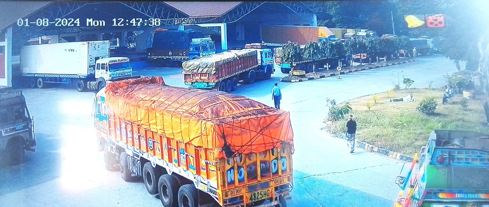
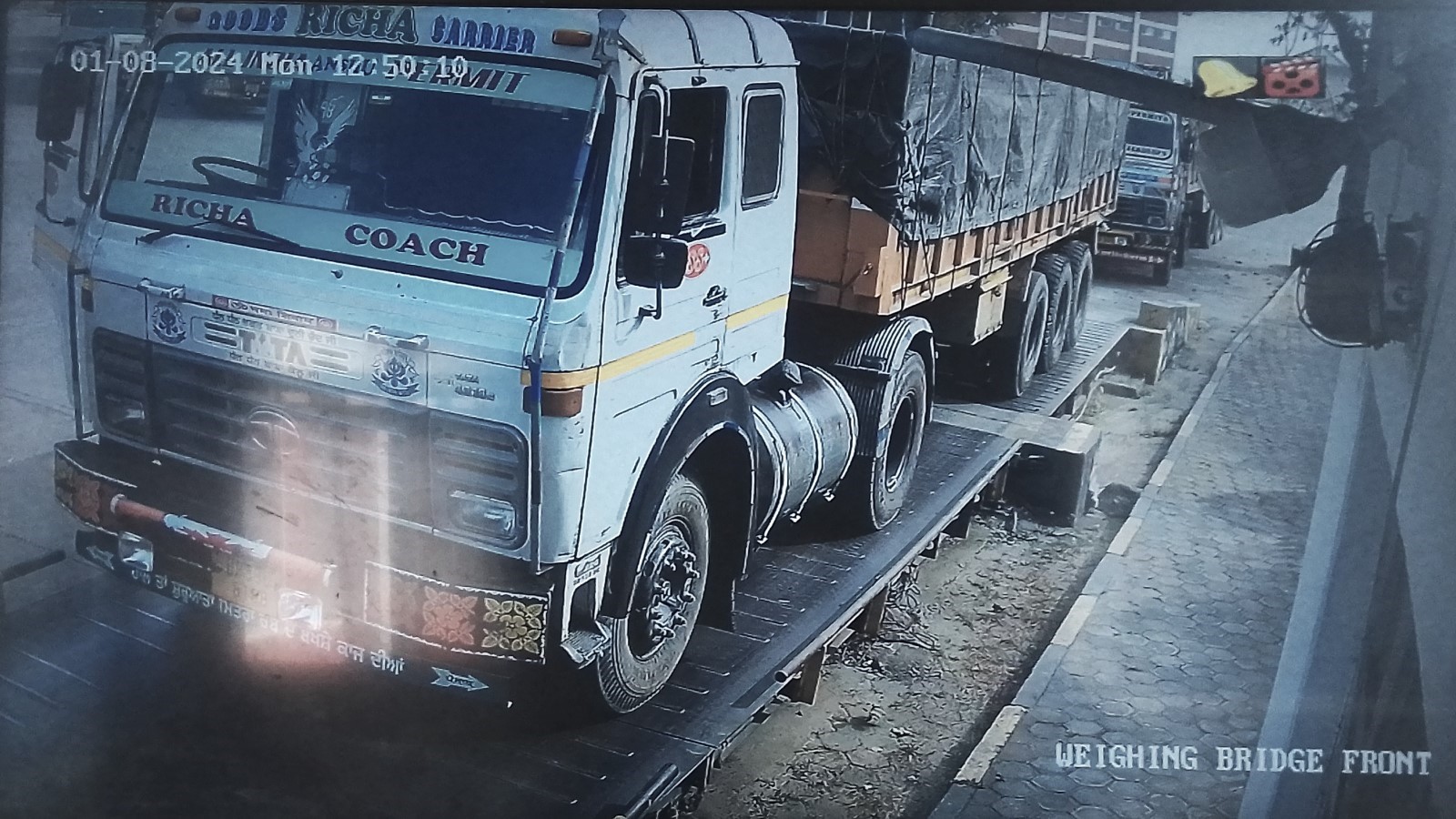
Port Performance
The port handles around 100 trucks a day and normally doesn’t experience congestion. The warehouse, shade area and parking space for trucks have sufficient capacity to store and hold goods. The port has mechanized handling equipment and adequate human labour. It is open from 6 am to 10 pm every day.
|
Seasonal Constraints |
||
|---|---|---|
|
|
Occurs |
Time Frame |
|
Rainy Season |
No |
N/A |
|
Major Import Campaigns |
Yes |
From (September) to (February) Festival season of Sept-Oct and large coal order during Winter season.
|
|
Other Comments |
N/A |
|
|
Handling Figures for 2023 |
|
|---|---|
|
Vessel Calls |
N/A |
|
Container Traffic (TEUs) |
192 |
Discharge Rates and Terminal Handling Charges
For information on port rates and charges, please see the table below: Tariff – Trans Nepal Freight Services (transnepaldryport.com)
Port Handling Equipment
Daily wages human workforce handles the transportation of goods within the port.
|
Equipment |
Available
|
Total Quantity and Capacity Available |
Comments on Current Condition and Actual Usage |
|---|---|---|---|
|
Dockside Crane |
N/A |
N/A |
N/A |
|
Container Gantries |
N/A |
N/A |
N/A |
|
Mobile Cranes |
N/A |
N/A |
N/A |
|
Reachstacker |
N/A |
N/A |
N/A |
|
RoRo Tugmaster (with Trailer) |
N/A |
N/A |
N/A |
|
Grain Elevator with Bagging Machines |
No |
N/A |
N/A |
|
Transtainer |
No |
N/A |
N/A |
|
Forklifts |
Yes |
|
Operational |
Container Facilities
|
Facilities |
20 ft |
40 ft |
|---|---|---|
|
Container Facilities Available |
N/A |
N/A |
|
Container Freight Station (CFS) |
N/A |
N/A |
|
Refrigerated Container Stations |
Yes |
Yes |
|
Other Capacity Details |
N/A |
N/A |
|
Daily Take Off Capacity |
6 |
7 |
|
Number of Reefer Stations |
Yes |
1 station with 3 plugs in facility |
|
Emergency Take-off Capacity |
N/A |
|
|
Off take Capacity of Gang Shift |
N/A |
N/A |
Customs Guidance
All the customs clearances are processed at Kakarbhitta, Mechi Customs Office located inside the Kakarvitta ICD premise. The customs clearance process at the dry port of Kakarbhitta is automated using the web based ASYCUDA system, which allows for the pre-clearing of goods. Customs pre-clearance of goods takes approximately 1-2 working days. The terminal managemen at the Kakarbhitta is done by Transnepal Freight Service (P) Ltd.
For more information on customs in Nepal, please see the following link: 1.3 Customs Information.
Terminal Information
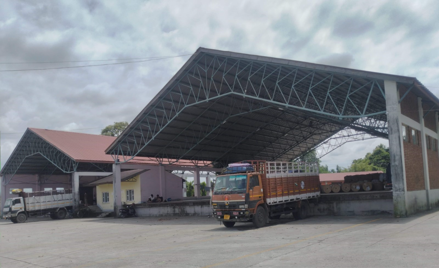
MAIN STORAGE TERMINAL
-
Truck parking capacity: 250- 300 trucks
-
Warehouse – 3; Warehousing space: 1,395 m2
-
Shade- 2; Shade storage: 1,780 m2
-
Litigation house- 1: 233 m2
-
There is one forklift available with a capacity of 3 MT.
-
100 MT weighbridge- 1 and 1 weighbridge with a capacity of 1 MT are available.
Port Security
Total 12 guards from Sudarsan security services provide security 24/7 in ICD premise. The premise of the facility is secured by 8-9 ft. of concrete brick wall. There are fire extinguisher cylinders, fire balls and 6 hydrants inside the ICD. In case of emergency, fire brigade located 4 km away from the port is contacted.
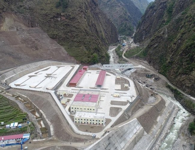
Nepal - 2.1.7 Tatopani Dry Port
Port Overview
Tatopani Inland Clearance Depot (ICD) is located in Tatopani village, Sindhupalchok, Bagmati Province, directly on Nepal’s Northern border with China, 114 km North East of Kathmandu. Tatopani and Rasuwa in Langtang are Nepal’s two main border crossing points with China. Construction of Tatopani ICD included improvement of the 112-meter-long bridge over the Bhotekoshi River and a 6.5 KM road track that connects the two countries.
The entry point was closed from January 27 to March 29, 2020 due to the COVID-19 pandemic. Since the 2015 Nepal Earthquake, the Araniko Highway leading to Tatopani has been frequently blocked for all traffic due to large active landslides. The road has been re-opened, but the landslide risk remains high, especially during monsoon season.
Port website: Tatopani ICD.
|
Port Location and Contact |
|
|---|---|
|
Country |
Nepal |
|
Province or District |
Bagmati Province, Sindhupalchok |
|
Nearest Town or City with Distance from Port |
Banepa at 87 kms SW along H03 |
|
Port's Complete Name |
Inland Container Depot at Tatopani |
|
Latitude |
27.92564 |
|
Longitude |
85.93352 |
|
Managing Company or Port Authority
|
Nepal Intermodal Transport Development Board (Port Authority) Trans Silk Terminal Pvt. Ltd. (Managing Company) |
|
Management Contact Person |
Anirudra Thapa (Trans Silk) Mobile: 9851316958 Tatopani Dry Port Larcha, Sindhupalchok, Nepal |
|
Customs Contact Person |
Dayananda KCLarcha, Sindhupalchok, Nepal Mob: 9851137131 Phone: 011-480131
|
|
Nearest Airport and Airlines with Frequent International Arrivals/Departures |
TIA at Kathmandu District. |
Port Picture
|
|
|
Aerial View of Tatopani ICD |
|
|
|
International Standard Inland Container Depot at Tatopani, Sindhupalchok Picture Source: New Spotlight Online |
Description and Contacts of Key Companies
|
SN |
Agencies related to Operation of ICD |
Name |
|---|---|---|
|
1 |
Multimodal Transport Operators |
Nepal Intermodal Transport Development Board |
|
2 |
Transport Management Company |
Trans Silk Terminal Pvt. Ltd |
|
3 |
Customs |
Tatopani Customs Office |
|
4 |
Freight Forwarders |
Silk, Namaste, Rewang |
|
5 |
Banks |
Nabil Bank |
|
6 |
Quarantine |
Plant, Animal and Food |
|
7 |
Shipping lines |
N/A |
|
8 |
Customs Agent |
Government licensed agents |
For more information on port contacts, please see the following link: 4.4 Port and Waterways Companies Contact List.
Port Performance
Major goods imported via the checkpoint are medicines, fruits, electronic appliances, ready-made garments, and shoes. The movement of cargo happens between 10 am to 8 pm.
-
Maximum trucks: 80-100 per day
-
Daily average: 30 – 40 trucks per day
-
Average clearing time: 2 – 4 hrs/truck
-
There is rarely a backlog. All trucks are cleared daily.
Congestion and in-access to the customs point can happen as a result of landslides blocking the Araniko highway, the only route to and from the Tatopani ICD.
|
Seasonal Constraints |
||
|---|---|---|
|
|
Occurs |
Time Frame |
|
Rainy Season |
Yes |
June - September |
|
Major Import Campaigns |
Yes |
August - October |
|
Other Comments |
The risk of roadblocks due to landslides remains high especially during monsoon season (June – September) |
|
|
Handling Figures for 2023 |
|
|---|---|
|
Vessel Calls |
N/A |
|
Container Traffic (TEUs) |
3362 |
Discharge Rates and Terminal Handling Charges
Service rate declared by the operation committee of Nepal Intermodal Transportation Development Board and issued by Trans Silk Pvt. Ltd. for Tatopani ICD: Tariff – Trans Nepal Freight Services (transnepaldryport.com)
Note: 13% VAT applicable on above-mentioned charges.
Port Handling Equipment
|
Equipment |
Capacity |
Available Numbers
|
|---|---|---|
|
Crane |
25 Ton |
1 |
|
Crane |
20 Ton |
1 |
|
Forklift |
3 Ton |
2 |
The port is also equipped with a Weigh Bridge and a Grant Crane for loading and unloading containers.
Customs Guidance
Tatopani Customs, a significant border-crossing point between Nepal and China, offers both traditional and modern, web-based clearance methods. Small goods are typically cleared using the traditional approach, while larger items and containers are processed through the internationally recognized ASYCUDA system. This port employs an automated customs clearance process via the ASYCUDA system, enabling the pre-clearance of goods. The pre-clearance procedure typically takes 1-2 business days.
For more information on customs in Nepal, please see the following link: 1.3 Customs Information.
Terminal Information
MULTIPURPOSE TERMINAL
A multipurpose terminal at Tatopani ICD serves both import and export cargos. The facility has three open yards capable of storing 10 FEUs each, a warehouse measuring 40 ft x 300 ft and an open shed measuring 40 ft x 300 ft.
GRAIN AND BULK HANDLING
N/A
MAIN STORAGE TERMINAL
-
Parking available for 100 trucks
-
3 Open yards capable of accommodating 10 FEUs each.
-
1 warehouse with an area of 1143.83 m2
-
1 open shed with an area of 1143.83 m2
|
Storage Type |
Number of Storage Facilities |
Area (m2) |
|---|---|---|
|
Bagged Cargo |
No |
|
|
Refrigerated Cargo |
No, but the Plug-in is available |
|
|
General Cargo |
1 warehouse |
1143.83 |
Stevedoring
N/A
Hinterland Information
This port is connected only by road, and goods are transported to and from this port on trucks. Several transport companies are available in this port, Silk Transport and Rewang Transport are the major trucking companies available at this border point, among them Silk has the largest fleet of vehicles.
Port Security
The port premises are secured by a compound wall. A private security firm along with the Armed Police Force (APF) provides security 24/7.
|
Security |
|
|---|---|
|
ISPS Compliant |
No |
|
Current ISPS Level |
N/A |
|
Police Boats |
No |
|
Fire Engines |
No |
Nepal - 2.1.8 Kathmandu Dry Port
Port Overview
Kathmandu Inland Clearance Depot (ICD) also known as Chobhar Dry Port, located at Chobhar, Kirtipur came into operation in April 2022 intending to ease export and import in Kathmandu. The ICD was established to facilitate the loading and distribution of goods in Kathmandu Valley, reducing congestion in central Kathmandu, reducing the turn-around (clearance/unloading) time for trucks, and improving vehicle utilization. Nepal Intermodal Transport Development Board (NITDB) is the managing authority of the ICD.
Port Website: Chobhar ICD
|
Port Location and Contact |
|
|---|---|
|
Country |
Nepal |
|
Province or District |
Bagmati |
|
Nearest Town or City with Distance from Port |
Kathmandu 10 KM |
|
Port's Complete Name |
Kathmandu Dry Port |
|
Latitude |
27.65606 |
|
Longitude |
85.29098 |
|
Managing Company or Port Authority
|
Trans Nepal TRS Logi Park Pvt. Ltd. NITDB |
|
Management Contact Person |
Jiban Dhakal |
|
Nearest Airport and Airlines with Frequent International Arrivals/Departures |
Tribhuvan International Airport Nepal Airlines, Qatar Airways, Thai Airways |
Port Picture
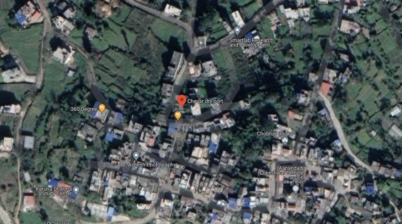
Description and Contacts of Key Companies
|
SN |
Agencies related to the Operation of ICD |
Name |
|---|---|---|
|
1 |
Multimodal Transport Operators |
Nepal Intermodal Transport Development Board (NITDB) |
|
2 |
Transport Management Company |
Trans Nepal TRS Logi Park Pvt. Ltd.
|
|
3 |
Customs |
Chobhar Dry Port Customs, Department of Customs |
|
4 |
Freight Forwarders |
N/A |
|
5 |
Banks |
Nepal Bank |
|
6 |
Quarantine |
Animal, Food Quarantine |
|
7 |
Shipping lines |
No |
|
8 |
Customs Agent |
GoN licensed agents |
For more information on port contacts, please see the following link: 4.4 Port and Waterways Companies Contact List.
Port Performance
The dry port spreads over an area of about 260 ropani (32.69 acres) of land comprises customs, quarantine, bank, and other services. The port has four warehouses, three administrative buildings, three weight measurement sheds, a container yard, a power substation, and other vehicle parking facilities. The port's container yard has a 65,000 square meters parking area that can accommodate 500 containers and 500 trucks.
|
Seasonal Constraints |
||
|---|---|---|
|
|
Occurs |
Time Frame |
|
Rainy Season |
No |
|
|
Major Import Campaigns |
No |
|
|
Other Comments |
N/A |
|
|
Handling Figures for 2022/23 |
|
|---|---|
|
Vessel Calls |
N/A |
|
Container Traffic (TEUs) |
265 |
Discharge Rates and Terminal Handling Charges
For information on port rates and charges, please see the following link: Tariff – Trans Nepal Freight Services (transnepaldryport.com)
Port Handling Equipment
The port equipment is managed by the privately owned company TransNepal TRS Logi Park Pvt. Ltd.
|
Equipment |
Available
|
Total Quantity and Capacity Available |
Comments on Current Condition and Actual Usage |
|---|---|---|---|
|
Dockside Crane |
No |
|
|
|
Container Gantries |
Yes |
2 |
Needs repair |
|
Mobile Cranes |
Yes |
|
Hired from external service provider |
|
Reachstacker |
No |
|
|
|
RoRo Tugmaster (with Trailer) |
No |
|
|
|
Grain Elevator with Bagging Machines |
No |
|
|
|
Transtainer |
No |
|
|
|
Forklifts |
Yes |
2 (3 tons and 5 tons) |
|
Container Facilities
This port can accommodate 116 TEUs (Twenty-foot Equivalent Units) at a time. The port has not yet operated at full capacity. As a common practice, most containers arrive by truck, and the goods inside are offloaded manually. This allows for transfer without unloading the entire container itself.
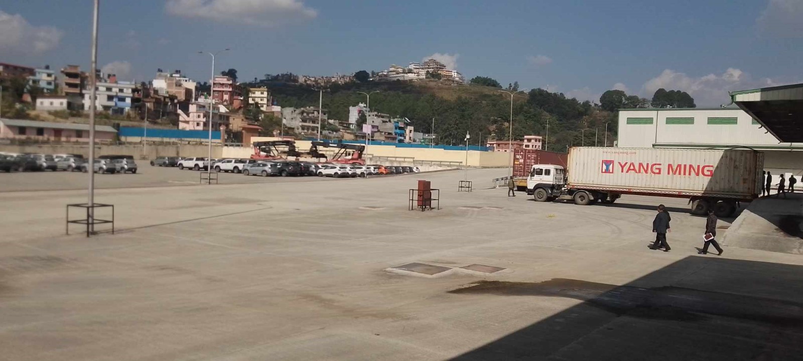
|
Facilities |
20 ft |
40 ft |
|---|---|---|
|
Container Facilities Available |
Yes |
Yes |
|
Container Freight Station (CFS) |
Yes |
Yes |
|
Refrigerated Container Stations |
No |
No |
|
Other Capacity Details |
N/A |
N/A |
|
Daily Take Off Capacity |
N/A |
N/A |
|
Number of Reefer Stations |
1 |
1 |
|
Emergency Take-off Capacity |
N/A |
N/A |
|
Off take Capacity of Gang Shift |
N/A |
N/A |
Customs Guidance
This port allows importers to make customs clearance of their goods in Kathmandu itself, saving them trips to the various border checkpoints from where shipments enter Nepal. Containers coming from the southern and northern border points will get an extra seal at the border point if the importers want to clear them at Kathmandu Dry Port Customs. The customs clearance process at this Port is automated using the web-based ASYCUDA system, which allows for the pre-clearing of goods. Customs pre-clearance of goods takes approximately 1-2 working days.
For more information on customs in Nepal, please see the following link: 1.3 Customs Information.
Terminal Information
MULTIPURPOSE TERMINAL
Chobhar dry port is divided into two sections—export-import (EXIM Terminal) and domestic (Domestic Terminal). The export-import section can accommodate 116 20-foot equivalent units (TEUs).
GRAIN AND BULK HANDLING
N/A
MAIN STORAGE TERMINAL
-
Truck parking capacity: 500 trucks
-
Warehousing space: 4 warehouses with Volume 12960 m3
-
Shade storage: 3
-
Litigation house: 1
-
There are 2 forklifts available with the lifting capacity of 3 mt and 5 mt
-
Weighbridge available- 3
Additional parking area with 8538 m2
|
Storage Type |
Number of Storage Facilities |
Area (m2) |
|---|---|---|
|
Bagged Cargo |
No |
|
|
Refrigerated Cargo |
No, but plug-in facility is available |
|
|
General Cargo |
Yes; 3 |
1296 m2 each |
Stevedoring
N/A
Hinterland Information
This port is connected only by road. Importers and exporters use this facility as the offices required for Import and Export activities like customs, quarantine, and banks are available on the premises. There are fewer activities in this port, the common mode of transport is by road, and goods are transported to and from this port on trucks. Given the limited operations, there are no in-house trucking companies. However, businesses have the flexibility to use their own trucks or engage services from external trucking firms.
Port Security
The port premises are secured by a compound wall. A private security firm along with the Armed Police Force (APF) provides security 24/7.
|
Security |
|
|---|---|
|
ISPS Compliant |
No |
|
Current ISPS Level |
N/A |
|
Police Boats |
No |
|
Fire Engines |
No |
Port Picture
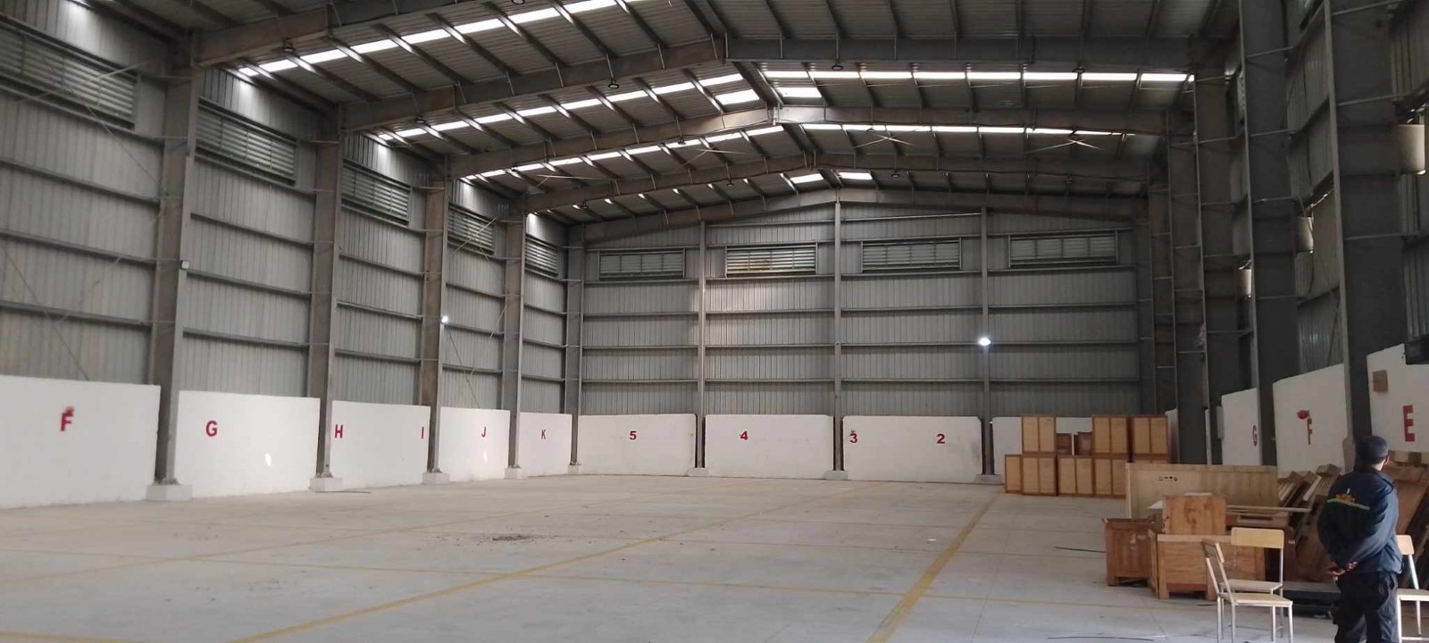
Warehouse
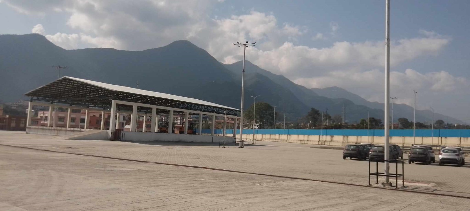
Shed Storage
Nepal - 2.2 Aviation
The Civil Aviation Authority of Nepal (CAAN) was established as an autonomous regulatory body on 31 December 1998 under Civil Aviation Act, 1996. The mission of CAAN is to ensure safe, secure, efficient, standard, and quality service in Civil Aviation and Airport Operations. It has dual functions: Regulator of civil aviation as well as a service provider in the areas of Air Navigation Service and Aerodrome Operations.
There are 9 fixed-wing domestic and 12 helicopter operators currently active in Nepal. Most fixed-wing carriers are based in Tribhuvan International Airport in Kathmandu and provide scheduled flights to different urban areas of the country. Some of the carriers have established their bases in Nepalgunj, Dhangadhi, and Surkhet and provide scheduled flight services to remote locations in Karnali and Sudurpaschim provinces. Airstrips in remote locations are STOL airports and are not well equipped with modern navigating instruments. Among the STOL airstrips, the Tenzing-Hillary Airport in Lukla and Jomsom Airport in Mustang are considered commercially lucrative.
For international travel, currently, 30 airlines including two Nepal-based airlines provide services to different destinations around the globe. Nepal has signed Bilateral Air Services Agreement (BASA) and MoU with 40 different countries, and it has direct air connectivity with 18 countries including India, China, Japan, Qatar, and UAE.
The European Union has blacklisted Nepali airlines since 2013 based on serious security concerns raised by ICAO and are restricted from flying in EU member nations’ airspace.
Both fixed-wing aircraft and helicopters can be chartered either for emergency services, cargo services, or for recreational activities. The carrier or their representative must submit a request form to CAAN in the prescribed format for requesting a charter flight. The procedure manual and required forms can be found in this link.
A total of 31 airports are currently operational in Nepal including three international airports. Tribhuvan International Airport, Gautam Buddha International Airport, and Pokhara International Airport are the only international aerodrome in the country. Biratnagar, Pokhara, Dhangadhi, and Nepalgunj airports, are the busiest airports and are considered domestic hub airports. 21 Airports are short take-off and landing (STOL) airports with Aerodrome Flight Information service (AFIS). 22 Airports mentioned below are STOL airports but are not in operation as of 2022.
Airports Not in Operation
-
Baglung Airport
-
Rukum Chaurjahari Airport
-
Darchula Airport
-
Dhorpatan Airport
-
Lamidanda Airport
-
Gorkha Airport
-
Rumjatar Airport
-
Jiri Airport
-
Kangeldanda Airport
-
Khiji Chandeshwori Airport
-
Langtang Airport
-
Mahendranagar Airport
-
Manang Airport
-
Dolpa Masinechaur Airport
-
Meghauli Airport
-
Rolpa Airport
-
Syangboche Airport
-
Tikapur Airport
-
Manamaya Rai Khanidanda Airport
-
Falgunanda (Ilam) Airport
-
Baitadi (Patan) Airport
-
Doti Airport
CAAN does not operate any heliports. In TIA, helicopter operations are authorized in designated areas. There are some areas to be used by helicopters throughout the country located on government as well as private property. CAAN, therefore, does not maintain the landing areas or provide security, Operators are, therefore, required to obtain necessary information before conducting flights in these locations. Details of such locations may be obtained from the Civil Aviation Safety Regulations Directorate (CAAN H/O, Babar Mahal). Source: https://e-aip.caanepal.gov.np/_uploads/_pdf/b8c1e4bd910261b89107ddc3f1eda5a9.pdf
However, CAAN has been working on constructing a new heliport at Nalinchowk of Bhaktapur district in Bagmati province, the location is around 16 KM Northwest of Tribhuvan International Airport. When completed, this facility will be able to accommodate 17 helicopters at a time. (Source: CAAN to construct a modern helipad in Nalinchowk, Bhaktapur (aviationnepal.com)
(Source: CAAN ATS AIRSPCAE_INDEX CHART)
Key airport information may also be found at: CAAN_Aeronautical Information Publication Nepal Eighth Edition)
https://www.world-airport-codes.com/
Nepal - 2.2.1 Tribhuvan International Airport
Airport Overview
Tribhuvan International Airport (TIA) is one of the major international airports in Nepal. It is located 6 km from the city centre, in the Kathmandu Valley, the country's capital. The airport has one domestic and one international terminal. Both Instrumental Flight Rule (IFR) and Visual Flight Rule (VFR) traffic are permitted in this airport. During winter months, particularly in December and January, flight delays may occur due to foggy conditions. While the airport boasts ample space and cargo handling facilities, it is essential to note that there is no cold storage facility available. Therefore, careful planning is necessary for the shipment of temperature-sensitive and medical cargo.
|
Airport Location and Contact |
|
|---|---|
|
Country |
Nepal |
|
Province or District |
Bagmati Province, Kathmandu District |
|
Nearest Town or City |
Kathmandu 6 km |
|
Airport’s Complete Name |
Tribhuvan International Airport |
|
Latitude |
27.70029 |
|
Longitude |
85.35676 |
|
Elevation (ft and m) |
4394.76 ft and 1339.54 m. |
|
IATA Code |
KTM |
|
ICAO Code |
VNKT |
|
Managing Company or Airport Authority |
Civil Aviation Authority of Nepal (CAAN) Tribhuvan International Airport, Tel +977-1-4113163, 4113033 Fax +977-1-4113180 AFS – VNKTYDYX Email: tia_cao@caanepal.gov.np |
|
Management Contact Person |
Subhash Jha (spokesperson) |
|
Open: Day only or 24 hrs |
February to November: 0600LT - 0330LT (Next Day) November to February: 0630LT – 0330LT (Next Day) |
|
Number of Runways (including length and width) |
1, RWY 02/20, 3350 m x 45 m |
|
Number of helipads, including dimensions |
Helicopter operations are authorized in designated areas. TIA has designated the east of runway 02-20 opposite the taxiway no B and C as a helicopter landing area. |
Airport Picture
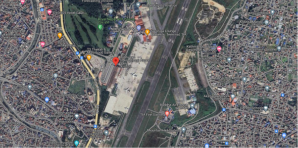
Description and Contacts of Key Companies
|
SN |
Agencies related to Operation of TIA |
Name |
|---|---|---|
|
1 |
Multimodal Transport Operators |
Nepal Transit and Warehousing Co. Ltd. |
|
2 |
Management Company |
Civil Aviation Authority of Nepal |
|
3 |
Customs |
TIA Customs Office |
|
4 |
Freight Forwarders |
Courier service providers, Nepal Freight Forwarders Association, Export council of Nepal |
|
5 |
Banks |
Rastriya Banijya Bank, TIACO Branch |
|
6 |
Quarantine |
Food Import Export Quality Certification Office TIA |
|
7 |
Shipping lines |
N/A |
|
8 |
Customs Agent |
Customs Agents Association (100 licensed Agents) |
|
9 |
Security |
Nepal Army, Nepal Police |
For more information on airport contacts, please see the following link: 4.5 Airport Companies Contact List.
Information on some aviation service providers can be found at: http://www.azfreight.com/ and https://www.airportdata.com/
Airport Infrastructure Details
TIA has a single runway measuring 3350m in length and 45m in width with an orientation 02 and 20. The Civil Aviation Authority of Nepal (CAAN) is currently working on the extension of the Parallel Taxiway in the northern and southern parts of the runway of TIA that will connect at the end of Runway 02. This expansion of the taxiway is part of the Air Transport Capacity Enhancement Project (ATCEP), upon completion, the total length of the taxiway will be 1400 meters, which will reduce waiting time for aircraft before take-off and landing.
|
Customs |
Yes |
JET A-1 fuel |
Yes |
|
Immigration |
Yes |
AVGAS 100 |
N/A |
|
Terminal Building |
Yes |
Ground Handling Services |
Yes, Available with Local Airlines Operators and Nepal Airlines and other Operators |
|
Passenger Terminal |
Yes |
Cargo terminal |
Yes |
Airport Operating Details
|
Operating Details |
|||
|---|---|---|---|
|
Maximum Sized Aircraft that can be Offloaded on Bulk Cargo |
Airbus 330, Boeing 777, IL76, MD10, DC10, ATR72, CRJ700/200, MA60, ATR42, JS41, B190, D228, L410, DHC6, Y12 |
||
|
Maximum Sized Aircraft that can be Offloaded on Pallet |
A340, B777, B747, MD10, C30, IL76, A350-900, |
||
|
Storage Area (m3 and MT) |
5,430 m² of cargo storage |
||
|
Handling Equipment |
|||
|
Elevators / Hi Loaders |
Yes High loaders: 1 x 7MT BMA high loader; 1 x 7 MT Souam transporter; max pallet size: 96”x125”, 7 MT capacity |
Max Capacity (MT) |
7 mt |
|
Max Height (m) |
|
||
|
Loading Ramps |
Yes, 7 Nos |
||
|
Other Comments |
While only a few B747 aircraft have landed at the airport, they were not being used as cargo aircraft. This is due to the short runway. |
||
Customs Guidance
The government has established a customs office at the airport for smooth clearance of import and export cargo. For individual travellers, all baggage must be declared and cleared through customs on arrival at the port of entry. For the import of cargo, the importer has to submit an application along with air waybill copies to the customs office for clearance of goods. Procedures and custom waiver process for relief items can be found in 1.3 Nepal Customs Information.
|
CLEARING AGENTS |
|||
|---|---|---|---|
|
Company Name |
What categories do they treat (food, fuel, vehicles, pharmaceuticals, or all-rounders)?
|
Bonded/Non-bonded warehouse Capacity |
Temperature controlled /Non temperature controlled |
|
Ultimate Export and Import |
All rounders |
No |
No |
|
Dynamic International Cargo |
All rounders |
No |
No |
For more information on customs in Nepal, please see the following link: 1.3 Customs Information.
Storage Facilities
CAAN contracted Nepal Transit and Warehousing Company Ltd (NTWCL) on a profit-sharing basis to operate the cargo complex especially to manage the warehousing space in clearly demarcated export and import sections. The total capacity of the Air cargo complex at Tribhuvan International Airport (TIA) is 5430 m², and it is divided by mesh wire barricade into equal half for imports and exports. Although the available space for cargo storage seems adequate for normal goods, it is essential to note that there is no cold storage facility available. Therefore, careful planning is necessary for the shipment of temperature-sensitive and medical cargo.
Daily Capacity
Import section: 70-80 mt of goods flow per day from 40-45 international flights of which 20 flights are cargo flights.
Export section: 75-100 mt of goods flow per day.
Import Section: 180-200 Mt storage.
Capacity of 78 mt handling manpower available per day
Handling Equipment
Nepal Airlines is responsible for the ground handling of cargo at Tribhuvan International Airport. Indian Airlines have ground handling equipment for their own needs, whereas Nepal Airlines does ground handling work for the other airlines and themselves.
|
Storage condition |
Number of Storage Facilities |
Total Area (m²) |
Total volume (m³) |
Handling requirement |
|---|---|---|---|---|
|
Open air |
1 |
325 |
1950 |
Forklift = 1 (5 ton) Hand Trolley = 5 Loader = 5 |
|
General cargo (closed) |
2 |
2,450 each |
12,250 each |
Forklift = 1 (1.5 ton) Forklift = 1 (5 ton) Hand Trolley = 10 Loader = 13 |
|
Bagged Cargo |
2 |
227 |
500 |
Hand Trolley = 3 |
|
Temperature controlled (15 to 25 °C) |
N/A |
N/A
|
N/A
|
N/A
|
|
Keep Cool (2 to 8 °C) |
2 |
20 and 93 |
50 and 288 |
Hand Trolley = 2 |
|
Freezing Temp (minus 25 to minus 15°C) |
N/A |
N/A |
N/A |
N/A |
|
Ultra cold-chain temp (minus 80 to minus 60°C) |
N/A |
N/A |
N/A |
N/A |
|
Narcotics Cage |
1 |
6 |
15 |
N/A |
|
NON-BONDED STORAGE (STORAGE AVAILABLE AFTERS CUSTOMS) |
||||
|---|---|---|---|---|
|
Storage condition |
Number of Storage Facilities |
Total Area (m²) |
Total Volume (m³) |
Handling requirement |
|
Open air |
1 |
275 |
1,375 |
|
|
General cargo (closed) |
3 |
275 |
1,375 (including bagged cargo) |
|
|
Bagged Cargo |
N/A |
|
|
|
|
Temperature controlled (15 to 25 °C) |
N/A |
|
|
|
|
Keep Cool (2 to 8 °C) |
N/A |
|
|
|
|
Freezing Temp (minus 25 to minus 15°C) |
N/A |
|
|
|
|
Ultra cold-chain temp (minus 80 to minus 60°C) |
N/A |
|
|
|
|
Narcotics Cage |
N/A |
|
|
|
Airfield Costs
NAVIGATION CHARGES
All fees except the passenger service charge and entrance fees should be paid by the commander of the aircraft or agent without demand before the aircraft departs from the aerodrome. For aircraft carrying out international flights, all payments of fees should be made in US dollars.
|
Charges |
Aircraft Weight - MTOW (kg) |
||
|---|---|---|---|
|
|
0 - 7,000 |
7,001 - 136,000 |
136,001 and over |
|
Navigation (per journey) USD - $ |
$45.90 (up to 25,00 kg) |
$76.50 (25,001 kg to 50,000 kg)
$152.75 (50,001 kg to 75,000 kg) |
$303.50 (any part over 75,000 kg) |
|
Landing USD - $ |
12.50 (up to 10,000 kg) |
12.50 plus, 2.50 each for 1000 kg (10,001 kg to 25,000 kg)
50.00 plus 3.75 for each 1000 kg (25,001 kg to 50,000 kg)
143.75 plus 6.00 for each 1000 kg (50,001 kg to 75,000 kg)
293.75 plus 7.35 for each 1000 kg (75,001 kg to 100,000 kg) |
447.50 plus 8.55 for each 1000 kg (any part over 100,000 kg) |
|
Night Landing USD - $ |
N/A |
N/A |
N/A |
|
Night Take-Off USD - $ |
N/A |
N/A |
N/A |
|
Parking |
$1.00 per 1000 kg (up to 50,000 kg) |
$50.00 plus $1.05 for each 1000kg (50,001 kg to 100,000 kg) |
$22.25 plus $1.95 for each 1000 kg (any part over 100,000 kg) |
|
Handling Charges |
NPR 5,000 (for self-handling) NPR 10,000 (for commercial ground handling) |
NPR 5,000 (for self-handling) NPR 10,000 (for commercial ground handling) |
NPR 5,000 (for self-handling) NPR 10,000 (for commercial ground handling) |
13 % VAT is applicable in the above-mentioned charges. (Source: CAAN AIP Nepal)
An additional charge will be levied for each landing made outside of the published operation hours of the aerodrome based on time used, on an hourly basis. For international flights, this amount is fixed as NRS 35,000 (excluding 13% VAT) per hour.
Security Charges: Security charges at the rate of 10% of the landing fees as mentioned above shall be imposed.
The following aircraft are exempted from payment of landing and parking fees:
a) Foreign diplomatic aircraft engaged on diplomatic missions to Nepal.
b) Aircraft withheld by Director General, CAAN for necessary investigation.
c) Such other aircraft as the Director General, CAAN may approve.
d) UN-registered Aircraft
FUEL SERVICES CHARGES
Tribhuvan International Airport (TIA) has a fuel depot with storage capacity (KL): Physical -7640 and Mobile 161.
Storage Type: Vertical Tank (1600×3, 760×3), UG Tank (70×8).
Refueller Details: AR26, 27, 38 (27 KL). AR34, 35,36,37, 40 (16KL) of ATF and 161 KL of fuel standby in refuellers provided by the Nepal Oil Corporation.
|
|
Price per Litre USD - $ |
|---|---|
|
Jet A-1 |
1.02/litre (Duty Paid)* |
|
Avgas |
N/A |
As of 01 February 2023
Exchange rate: 1 USD = 132.814 NPR
CARGO TERMINAL CHARGES
For information on service rates and charges,
|
Sn |
Category of Goods |
Export |
Import |
|---|---|---|---|
|
1 |
General |
Per kg NPR 1.21 or NPR 242 minimum; whichever is higher |
Per kg NPR 6.47 or NPR 121 minimum; whichever is higher |
|
2 |
Valuable |
Per kg NPR 3.03 or NPR 302.5 minimum; whichever is higher |
Per kg NPR 9.88 or NPR 242 minimum; whichever is higher |
|
3 |
Perishable |
Per kg NPR 2.42 or Rs 242 minimum; whichever is higher |
Per kg NPR 9.88 or NPR 242 minimum; whichever is higher |
|
4 |
Dangerous |
Per kg NPR 6.50 or NPR 650 minimum; whichever is higher |
Per kg NPR 19.36 or NPR 484 minimum; whichever is higher |
|
5 |
Express Courier Bag, Express Courier Parcel and Express Cargo |
Per kg NPR 6.50 or NPR 121 minimum; whichever is higher |
Per kg NPR 6.50 or NPR 242 minimum; whichever is higher |
|
6 |
For the export and import of live animals, the service charge is double of service charge for valuable goods |
||
(Source: TIA Cargo Terminal Charges)
- In case of palletization and de-palletization of the goods NPR 60.50 per ton will be charged.
- In case of a request from the goods owner to manage goods beyond office hours and during the holidays separate charge of NPR 242 per consignment will be levied.
- Demurrage charge will be as follows;
- Export: For the first seven days no charges are applicable, after 7 days for 30 days NPR 0.90 per kg will be charged and from 31 days to 60 days NPR 2.11 per kg will be charged,
- Import: For the first seven days no charges are applicable, after 7 days for 30 days NPR 2.42 per kg will be charged and from 31 days to 60 days NPR 3.03 per kg will be charged. Provided that, if the goods are not taken within the exempted period, demurrage charges shall be levied from the date of receipt of such goods.
Security
Among the three security forces of Nepal, the Nepal Army and Nepal Police work in conjunction to provide security at TIA. Nepal Police has the responsibility to control access and searches for passengers and goods. Nepal Army has the responsibility to control and secure the premises of the TIA. Also, the presence of the Nepal Army’s Kali Dal Battalion adjacent to the premise of TIA bolsters security at all hours of the day and night.
Nepal - 2.2.2 Gautam Buddha (Bhairahawa) International Airport
Airport Overview
Gautam Buddha International Airport, also known as Bhairahawa Airport was initially began as a domestic airport in 1958. In 1977 it was renamed in honour of Lord Gautam Buddha, who was born in Lumbini, located 18 KM west of the airport. This airport was later upgraded to an international airport, on 16 May 2022 it served the first international flight. It has a 3000 m long single runway. It is one of the three international airports of Nepal, others are Tribhuvan International Airport in Kathmandu and Pokhara International Airport in Pokhara. The airport features a cargo building with a capacity of 8000 square meter. However, this storage area often remains unutilized due to the absence of regular scheduled international flights. Unfortunately, there is no cold storage facility available as of now, however, a designated space has been allocated in the newly constructed cargo building to establish the cold storage facility when required. For the transportation of temperature-sensitive and medical cargo, careful planning is essential.
|
Airport Location and Contact |
|
|---|---|
|
Country |
Nepal |
|
Province or District |
Lumbini Province, Rupandehi District |
|
Nearest Town or City |
Bhairahawa, 2.5 km east of the airport |
|
Airport’s Complete Name |
Gautam Budhha International Airport (Bhairahawa Airport) |
|
Latitude |
27.50620 |
|
Longitude |
83.41752 |
|
Elevation (ft and m) |
346.5 ft / 105.6 m |
|
IATA Code |
BWA |
|
ICAO Code |
VNBW |
|
Managing Company or Airport Authority |
Civil Aviation Authority of Nepal (CAAN), Bhairahawa Airport Fax: 977-71455004 AFS: VNBWYDYX E-mail: gautambuddha_cao@caanepal.gov.np |
|
Management Contact Person |
Mr. Hansa Raj Pandey, General Manager |
|
Open: Day only or 24 hrs |
16 Feb to 15 Nov – 06:00 LT to 00:00 LT 16 Nov to 15 Feb – 06:30 LT to 00:00 LT |
|
Number of Runways (including length and width) |
1, RWY 10/28 3000mx45m |
|
Number of helipads, including dimensions |
No designated helipads, with prior approval airport authorities can designate an area for helicopter landing as per requirements |
Airport Picture
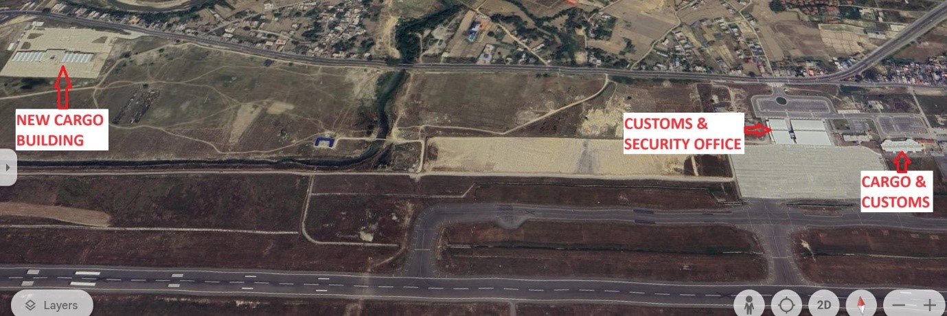
Description and Contacts of Key Companies
Although Gautam Buddha International Airport (GBIA) started international operation in May 2022, it is not yet operated at full capacity, it has only served occasional international flights. The key companies present at the airport are the Civil Aviation Authority of Nepal (CAAN), GBIA Customs Office, Nepal Police, and Nepal Army.
For more information on airport contacts, please see the following link: 4.5 Airport Companies Contact List.
Information on some aviation service providers can be found at: http://www.azfreight.com/ and https://www.airportdata.com/
Airport Infrastructure Details
GBIA features a newly built 3000 m x 45 m single runway which is used for take-offs and landings. The old 1500 m runway is currently being used as a parallel taxiway.
|
Customs |
Yes |
JET A-1 fuel |
Yes |
|
Immigration |
Yes |
AVGAS 100 |
No |
|
Terminal Building |
Yes |
Ground Handling Services |
Yes |
|
Passenger Terminal |
Yes |
Cargo terminal |
Yes |
Airport Operating Details
|
Operating Details |
|||
|---|---|---|---|
|
Maximum Sized Aircraft that can be Offloaded on Bulk Cargo |
B777-200 or similar (Remarks: can be parked at International Apron Bay No.2) |
||
|
Maximum Sized Aircraft that can be Offloaded on Pallet |
B777-200 or similar (Remarks: can be parked at International Apron Bay No.2) |
||
|
Storage Area (m3 and MT) |
Existing 500 MT (New Cargo building under construction) |
||
|
Handling Equipment |
|||
|
Elevators / Hi Loaders |
No |
Max Capacity (MT) |
|
|
Max Height (m) |
|
||
|
Loading Ramps |
Yes, 2 available |
||
|
Other Comments |
Nepal Airlines Corporation provides the ground handling service with equipment. In case of requirement, needed equipment can be made available from Kathmandu. (A week advance notice to be provided) |
||
Customs Guidance
The government has established a customs office at the airport for smooth clearance of import and export cargo. For individual travelers, all baggage must be declared and cleared through customs on arrival at the port of entry. For import of cargo, the importer must apply along with air waybill copies to the customs office for clearance of goods.
Procedures and custom waiver process for relief items can be found in 1.3 Nepal Customs Information.
|
CLEARING AGENTS |
|||
|---|---|---|---|
|
Company Name |
What categories do they treat (food, fuel, vehicles, pharmaceuticals, or all-rounders)?
|
Bonded/Non-bonded warehouse Capacity |
Temperature controlled /Non temperature controlled |
|
Rising Star Cargo Pvt Ltd |
All rounder |
No |
No |
|
|
|
|
|
Storage Facilities
Nepal Transit and Warehousing Company Ltd (NTWCL) is managing the newly built cargo building at GBIA. The new building is constructed at an area of 8000 m². The airport has not yet functioned at full capacity and the storage space for cargo generally remains empty, however, it is essential to note that there is no cold storage facility available. Therefore, careful planning is necessary for the shipment of temperature-sensitive and medical cargo.
|
BONDED STORAGE (STORAGE AVAILABLE BEFORE CUSTOMS) |
||||
|---|---|---|---|---|
|
Storage condition |
Number of Storage Facilities |
Total Area (m²) |
Total volume (m³) |
Handling requirement |
|
Open air |
N/A |
|
|
|
|
General cargo (closed) |
N/A |
|
|
|
|
Bagged Cargo |
N/A |
|
|
|
|
Temperature controlled (15 to 25 °C) |
N/A |
|
|
|
|
Keep Cool (2 to 8 °C) |
N/A |
|
|
|
|
Freezing Temp (minus 25 to minus 15°C) |
N/A |
|
|
|
|
Ultra cold-chain temp (minus 80 to minus 60°C) |
N/A |
|
|
|
|
Narcotics Cage |
N/A |
|
|
|
|
NON-BONDED STORAGE (STORAGE AVAILABLE AFTERS CUSTOMS) |
||||
|---|---|---|---|---|
|
Storage condition |
Number of Storage Facilities |
Total Area (m²) |
Total Volume (m³) |
Handling requirement |
|
Open air |
N/A |
|
|
|
|
General cargo (closed) |
1 |
8000 m² |
|
|
|
Bagged Cargo |
N/A |
|
|
|
|
Temperature controlled (15 to 25 °C) |
N/A |
|
|
|
|
Keep Cool (2 to 8 °C) |
N/A |
|
|
|
|
Freezing Temp (minus 25 to minus 15°C) |
N/A |
|
|
|
|
Ultra cold-chain temp (minus 80 to minus 60°C) |
N/A |
|
|
|
|
Narcotics Cage |
N/A |
|
|
|
Airfield Costs
NAVIGATION CHARGES
All fees except the passenger service charge and entrance fees should be paid by the commander of the aircraft or agent without demand before the aircraft departs from the aerodrome. For aircraft carrying out international flights, all payments of fees should be made in US dollars.
|
Charges |
Aircraft Weight - MTOW (kg) |
||
|---|---|---|---|
|
|
0 - 7,000 |
7,001 - 136,000 |
136,001 and over |
|
Navigation (per journey) USD - $ |
$45.90 (up to 25,00 kg) |
$76.50 (25,001 kg to 50,000 kg)
$152.75 (50,001 kg to 75,000 kg) |
$303.50 (any part over 75,000 kg) |
|
Landing USD - $ |
12.50 (up to 10,000 kg) |
12.50 plus, 2.50 each for 1000 kg (10,001 kg to 25,000 kg)
50.00 plus 3.75 for each 1000 kg (25,001 kg to 50,000 kg)
143.75 plus 6.00 for each 1000 kg (50,001 kg to 75,000 kg)
293.75 plus 7.35 for each 1000 kg (75,001 kg to 100,000 kg) |
447.50 plus 8.55 for each 1000 kg (any part over 100,000 kg) |
|
Night Landing USD - $ |
N/A |
N/A |
N/A |
|
Night Take-Off USD - $ |
N/A |
N/A |
N/A |
|
Parking |
$1.00 per kg (up to 50,000 kg) |
$50.00 plus $1.05 for each 1000kg (50,001 kg to 100,000 kg) |
$22.25 plus $1.95 for each 1000 kg (any part over 100,000 kg) |
|
Handling Charges |
NPR 5,000 (for self-handling) NPR 10,000 (for commercial ground handling) |
NPR 5,000 (for self-handling) NPR 10,000 (for commercial ground handling) |
NPR 5,000 (for self-handling) NPR 10,000 (for commercial ground handling) |
13 % VAT is applicable in the above-mentioned charges. (Source: CAAN AIP Nepal)
An additional charge will be levied for each landing made outside of the published operation hours of the aerodrome based on time used, on an hourly basis. For international flights, this amount is fixed as NRS 35,000 (excluding 13% VAT) per hour.
Security Charges: Security charges at the rate of 10% of the landing fees as mentioned above shall be imposed.
The following aircraft are exempted from payment of landing and parking fees:
a) Foreign diplomatic aircraft engaged on diplomatic missions to Nepal.
b) Aircraft withheld by Director General, CAAN for necessary investigation.
c) Such other aircraft as the Director General, CAAN may approve.
d) UN-registered Aircraft
FUEL SERVICES CHARGES
|
|
Price per Litre USD - $ |
|---|---|
|
Jet A-1 |
1.02 / litre (Duty Paid) * |
|
Avgas |
N/A |
As of 9-Jan-2024
*Exchange rate: 1 USD = 133.064 NPR
CARGO TERMINAL CHARGES
A cargo charge at the rate of seventy-five paisa per kilogram is imposed on the cargo imported through the airway.
|
Sn |
Category of Goods |
Export |
Import |
|---|---|---|---|
|
1 |
General |
Per kg NPR 1.00 or NPR 200 minimum; whichever is higher |
Per kg NPR 5.35 or NPR 100 minimum; whichever is higher |
|
2 |
Valuable |
Per kg NPR 2.50 or NPR 250 minimum; whichever is higher |
Per kg NPR 8.00 or NPR 200 minimum; whichever is higher |
|
3 |
Perishable |
Per kg NPR 2.00 or Rs 200 minimum; whichever is higher |
Per kg NPR 8.00 or NPR 250 minimum; whichever is higher |
|
4 |
Dangerous |
Per kg NPR 5.00 or NPR 500 minimum; whichever is higher |
Per kg NPR 16.00 or NPR 400 minimum; whichever is higher |
|
5 |
Express Courier Bag, Express Courier Parcel and Express Cargo |
Per kg NPR 5.00 or NPR 100 minimum; whichever is higher |
Per kg NPR 5.00 or NPR 200 minimum; whichever is higher |
|
6 |
For the export and import of live animals, the service charge is double of service charge for valuable goods |
||
Source: GBIA Cargo Terminal Charges
-
In case of palletization and de-palletization of the goods NPR 50.00 per ton will be charged.
-
In case of a request from the goods owner to manage goods beyond office hours and during the holidays separate charge of NPR 200 per consignment will be levied.
-
Demurrage charge will be as follows;
-
Export: For the first seven days no charges are applicable, after 7 days for 30 days NPR 0.75 per kg will be charged and from 31 days to 60 days NPR 1.75 per kg will be charged,
-
Import: For the first seven days no charges are applicable, after 7 days for 30 days NPR 2.00 per kg will be charged and from 31 days to 60 days NPR 2.50 per kg will be charged. Provided that, if the goods are not taken within the exempted period, demurrage charges shall be levied from the date of receipt of such goods.
Security
The security of terminal area, access control of restricted area, search of passenger and goods is managed by Nepal police and the security of compound area is provided by Nepal army.
Nepal - 2.2.3 Pokhara International Airport
Airport Overview
Pokhara International Airport (PIA) is situated at Chhine Danda, Pokhara in Gandaki Province, Nepal. It is located approximately 3 km east of Pokhara’s existing Domestic Airport and 200 km far west from Kathmandu. The elevation of this airport is around 800 m above mean sea level. This airport serves as the main gateway for pilgrims and tourists to travel to the famous religious places: Muktinath, Jomsom, and Annapurna Round Trek. The airport has three international parking bays and eight domestic parking bays. This airport has a 3500 m² terminal building for customs and cargo, but it lacks a cold storage facility. This storage area often remains unutilized due to the absence of regular scheduled international flights hence the shipment of temperature-sensitive and medical cargo should be planned carefully.
|
Airport Location and Contact |
|
|---|---|
|
Country |
Nepal |
|
Province or District |
Gandaki Province, Kaski District |
|
Nearest Town or City |
Pokhara, 3 km |
|
Airport’s Complete Name |
Pokhara International Airport |
|
Latitude |
28.182803 |
|
84.014894 |
84.014894 |
|
Elevation (ft and m) |
2624 ft / 800 m |
|
IATA Code |
PKR |
|
ICAO Code |
VNPR |
|
Managing Company or Airport Authority |
Civil Aviation Authority of Nepal Pokhara International Airport Civil Aviation Office Tel- +977-61-597007 Fax- +977-61-455725 AFS- VNPRYDYX E-mail- pokhara_cao@caanepal.gov.np Website: PIA (caanepal.gov.np) |
|
Management Contact Person |
Jasoda Subedi (Spokesperson) Tel: 061-597012 |
|
Open: Day only or 24 hrs |
16 Feb to 15 Nov: 0015UTC-1300UTS 16 Nov to 15 Feb: 0045UTC-1215UTC |
|
Number of Runways (including length and width) |
RWY 12/30 2500mx45m |
|
Number of helipads, including dimensions |
No designated helipads, with prior approval airport authorities can designate an area for helicopter landing as per requirements |
Airport Picture

Description and Contacts of Key Companies
The key companies present at the airport are the Civil Aviation Authority of Nepal (CAAN), the Nepal Police, the Armed Police Force and the Nepal Army.
For more information on airport contacts, please see the following link: 4.5 Airport Companies Contact List.
Information on some aviation service providers can be found at: http://www.azfreight.com/ and https://www.airportdata.com/
Airport Infrastructure Details
The runway of PIA is of ICAO 4D Category and is 45 m wide and 2500 m long, and runway designation is 12-30. Runway 12 has a Non-Precision Approach (NPA), and Runway 30 has an ILS System Precision Approach CAT-1 (PA1) facility.
|
Customs |
Yes |
JET A-1 fuel |
Yes |
|
Immigration |
Yes |
AVGAS 100 |
No |
|
Terminal Building |
Yes |
Ground Handling Services |
Yes |
|
Passenger Terminal |
Yes |
Cargo terminal |
Yes |
Airport Operating Details
|
Operating Details |
|||
|---|---|---|---|
|
Maximum Sized Aircraft that can be Offloaded on Bulk Cargo |
Airbus A320 and similar type of aircraft (Narrow body) |
||
|
Maximum Sized Aircraft that can be Offloaded on Pallet |
Airbus A320 and similar type of aircraft (Narrow body) |
||
|
Storage Area (m3 and MT) |
3500 m² |
||
|
Handling Equipment |
|||
|
Elevators / Hi Loaders |
|
Max Capacity (MT) |
|
|
Max Height (m) |
|
||
|
Loading Ramps |
Yes |
||
|
Other Comments |
|
||
Customs Guidance
As of February 2024, despite the approval to establish a customs office from the Council of Ministers in Jan 2023, the government has not yet established a customs office at the Pokhara International Airport. For individual travellers, all baggage must be declared and cleared through customs on arrival at the port of entry. For the import of cargo, the importer must submit an application along with air waybill copies to the customs office for clearance of goods. Procedures and custom waiver process for relief items can be found in 1.3 Nepal Customs Information.
|
CLEARING AGENTS |
|||
|
Company Name |
What categories do they treat (food, fuel, vehicles, pharmaceuticals, or all-rounders)?
|
Bonded/Non-bonded warehouse Capacity |
Temperature controlled /Non temperature controlled |
|
|
|
|
|
|
|
|
|
|
For more information on customs in Nepal, please see the following link: 1.3 Customs Information.
Storage Facilities
This airport has a 3500 m² building for customs and cargo, with a yearly planned turnover of 2600 mt capacity, but it lacks a cold storage facility. Due to the absence of customs office followed regular scheduled international flights, this storage area often remains unutilized. Hence the shipment of temperature-sensitive and medical cargo should be planned carefully.
|
BONDED STORAGE (STORAGE AVAILABLE BEFORE CUSTOMS) |
||||
|---|---|---|---|---|
|
Storage condition |
Number of Storage Facilities |
Total Area (m²) |
Total volume (m³) |
Handling requirement |
|
Open air |
N/A |
|
|
|
|
General cargo (closed) |
N/A |
|
|
|
|
Bagged Cargo |
N/A |
|
|
|
|
Temperature controlled (15 to 25 °C) |
N/A |
|
|
|
|
Keep Cool (2 to 8 °C) |
N/A |
|
|
|
|
Freezing Temp (minus 25 to minus 15°C) |
N/A |
|
|
|
|
Ultra cold-chain temp (minus 80 to minus 60°C) |
N/A |
|
|
|
|
Narcotics Cage |
N/A |
|
|
|
|
NON-BONDED STORAGE (STORAGE AVAILABLE AFTER CUSTOMS) |
||||
|---|---|---|---|---|
|
Storage condition |
Number of Storage Facilities |
Total Area (m²) |
Total Volume (m³) |
Handling requirement |
|
Open air |
N/A |
|
|
|
|
General cargo (closed) |
1 |
3500 m² |
|
|
|
Bagged Cargo |
N/A |
|
|
|
|
Temperature controlled (15 to 25 °C) |
N/A |
|
|
|
|
Keep Cool (2 to 8 °C) |
N/A |
|
|
|
|
Freezing Temp (minus 25 to minus 15°C) |
N/A |
|
|
|
|
Ultra cold-chain temp (minus 80 to minus 60°C) |
N/A |
|
|
|
|
Narcotics Cage |
N/A |
|
|
|
Airfield Costs
NAVIGATION CHARGES
All fees except the passenger service charge and entrance fees should be paid by the commander of the aircraft or agent without demand before the aircraft departs from the aerodrome. For aircraft carrying out international flights, all payments of fees should be made in US dollars.
|
Charges |
Aircraft Weight - MTOW (kg) |
||
|---|---|---|---|
|
|
0 - 7,000 |
7,001 - 136,000 |
136,001 and over |
|
Navigation (per journey) USD - $ |
$45.90 (up to 25,00 kg) |
$76.50 (25,001 kg to 50,000 kg)
$152.75 (50,001 kg to 75,000 kg) |
$303.50 (any part over 75,000 kg) |
|
Landing USD - $ |
12.50 (up to 10,000 kg) |
12.50 plus, 2.50 each for 1000 kg (10,001 kg to 25,000 kg)
50.00 plus 3.75 for each 1000 kg (25,001 kg to 50,000 kg)
143.75 plus 6.00 for each 1000 kg (50,001 kg to 75,000 kg)
293.75 plus 7.35 for each 1000 kg (75,001 kg to 100,000 kg) |
447.50 plus 8.55 for each 1000 kg (any part over 100,000 kg) |
|
Night Landing USD - $ |
N/A |
N/A |
N/A |
|
Night Take-Off USD - $ |
N/A |
N/A |
N/A |
|
Parking |
$1.00 per 1000 kg (up to 50,000 kg) |
$50.00 plus $1.05 for each 1000kg (50,001 kg to 100,000 kg) |
$22.25 plus $1.95 for each 1000 kg (any part over 100,000 kg) |
|
Handling Charges |
NPR 5,000 (for self-handling) NPR 10,000 (for commercial ground handling) |
NPR 5,000 (for self-handling) NPR 10,000 (for commercial ground handling) |
NPR 5,000 (for self-handling) NPR 10,000 (for commercial ground handling) |
13 % VAT is applicable for the above-mentioned charges.
An additional charge will be levied for each landing made outside of the published operation hours of the aerodrome based on time used, on an hourly basis. For international flights, this amount is fixed as NRS 35,000 (excluding 13% VAT) per hour.
Security Charges: Security charges at the rate of 10% of the landing fees as mentioned above shall be imposed.
The following aircraft are exempted from payment of landing and parking fees:
a) Foreign diplomatic aircraft engaged on diplomatic missions to Nepal.
b) Aircraft withheld by Director General, CAAN for necessary investigation.
c) Such other aircraft as the Director General, CAAN may approve.
d) UN-registered Aircraft
FUEL SERVICES CHARGES
PIA manages refuelling service at the airport with support from Nepal Oil Corporation (NOC), a fuel storage with a capacity of 114,000 litres is under construction at the airport premises. For the current use NOC fetches aviation fuel from its storage at Pokhara Domestic Airport on oil tankers.
|
|
Price per Litre USD - $ |
|---|---|
|
Jet A-1 |
1.02/litre (Duty Paid)* |
|
Avgas |
N/A |
As of 01 February 2023
Exchange rate: 1 USD = 132.814 NPR
CARGO TERMINAL CHARGES
On international flights cargo, NPR seventy-five paisa per kilogram is applicable.
For more information on service rates and charges:
|
Sn |
Category of Goods |
Export |
Import |
|---|---|---|---|
|
1 |
General |
Per kg NPR 1.00 or NPR 200 minimum; whichever is higher |
Per kg NPR 5.35 or NPR 100 minimum; whichever is higher |
|
2 |
Valuable |
Per kg NPR 2.50 or NPR 250 minimum; whichever is higher |
Per kg NPR 8.00 or NPR 200 minimum; whichever is higher |
|
3 |
Perishable |
Per kg NPR 2.00 or Rs 200 minimum; whichever is higher |
Per kg NPR 8.00 or NPR 200 minimum; whichever is higher |
|
4 |
Dangerous |
Per kg NPR 5.00 or NPR 500 minimum; whichever is higher |
Per kg NPR 16.00 or NPR 400 minimum; whichever is higher |
|
5 |
Express Courier Bag, Express Courier Parcel and Express Cargo |
Per kg NPR 5.00 or NPR 100 minimum; whichever is higher |
Per kg NPR 5.00 or NPR 200 minimum; whichever is higher |
|
6 |
For the export and import of live animals, the service charge is double of service charge for valuable goods |
||
(Source: PIA Cargo Service Charge)
-
In case of palletization and de-palletization of the goods NPR 50 per ton will be charged.
-
In case of a request from the goods owner to manage goods beyond office hours and during the holidays separate charge of NPR 200 per consignment will be levied.
-
Demurrage charge will be as follows.
-
Export: For the first seven days no charges are applicable, after 7 days for 30 days NPR 0.70 per kg will be charged and from 31 days to 60 days NPR 1.70 per kg will be charged,
-
Import: For the first seven days no charges are applicable, after 7 days for 30 days NPR 2.00 per kg will be charged and from 31 days to 60 days NPR 2.50 per kg will be charged. Provided that, if the goods are not taken within the exempted period, demurrage charges shall be levied from the date of receipt of such goods.
Security
Among the three security forces of Nepal, the Nepal Army, and Nepal Police work in conjunction to provide security at Pokhara International Airport (PIA). Nepal Police has the responsibility to control access and searches for passengers and goods. Nepal Army has the responsibility to control and secure the premises of the PIA.
Nepal - 2.2.4 Bharatphur Major Domestic Airport
Airport Overview
|
|
|
Pic: Aerial view of location Bharatpur Airport |
Bharatpur Airport is an all weather operational airport in Bharatpur, a city in the Chitwan District of Bagmati Province. The airport is one of two airports in Bharatpur Metropolitan City, the other one being Meghauli Airport. The airport is located 1 mile (1.6 km) southwest of Bharatpur's city centre/Narayanghat Operating Airlines are Buddha Air, and Yeti Airlines with scheduled connectivity to Kathmandu and Pokhara.
Aerodrome Administration operation hours are as follows:
-
16 February to 15 November: 0600 LT - 1845 LT
-
16 November to 15 February: 0630 LT - 1800 LT
|
Airport Location and Contact |
|
|---|---|
|
Country |
Nepal |
|
Province or District |
Bagmati Province/ Chitwan |
|
Nearest Town or City |
The airport is within Bharatpur City |
|
Airport’s Complete Name |
Bharatpur Airport |
|
Latitude |
27.67805 |
|
Longitude |
84.42944 |
|
Elevation (ft and m) |
679 ft (207 m) |
|
IATA Code |
BHR |
|
ICAO Code |
VNBP |
|
Managing Company or Airport Authority |
Civil Aviation Authority of Nepal Bharatpur Civil Aviation Office, Bharatpur, Chitwan Off: 977-056-526573 Tower: 977-056-520254 Fax - 977-056-526573 AFS – VNBPYDYX |
|
Management Contact Person |
|
|
NGO and/or UN Presence at Airport? |
NO |
Runway
|
Runway #1 |
|
|---|---|
|
Runway Dimensions |
1200 m x 30 m |
|
Runway Orientation |
15/33 |
|
Runway Surface |
Asphalt Concrete |
|
Runway Condition |
Good |
Airport Infrastructure Details
|
Infrastructure |
|||
|---|---|---|---|
|
Passenger / Cargo Security Screening |
X-Ray: Hold Baggage; Metal Detector: Walk Through, Handheld, CCTV Surveillance System, FIDS |
Runway Lighting |
Runway End Light- RWY 15, Runway Threshold Identification Light- TRWY 33
|
|
Refuelling Capacity |
NO |
Ground Handling Services |
Available with local airline operator |
|
Air Traffic Control |
Controlled, Two Men Position Tower Console with Associated Equipment and Accessories Class C Airspace. Visual Flight Rules, HF SSB, VHF, Hot Line, |
Fire Fighting Equipment |
Wheel type Fire Extinguisher Available |
|
Weather Information |
Tower Observation |
Aircraft Parking Space |
8360 sq.m. of Concrete Apron; Four ATR 42 Types |
|
Navigation Aids |
NDB |
Perimeter Fencing |
Yes |
|
Windsock |
No |
|
|
* Runway Threshold Identification lights
Fuel Services Charges
n/a
Royalties / Non Objection Fees (NOFs)
n/a
Nepal - 2.2.5 Biratnagar Major Domestic Airport
Airport Overview
|
|
|
Pic: Aerial view of Biratnagar Airport |
Biratnagar Airport located North of Biratnagar Bazaar, Morang district, in Koshi Province. It is 6 Kms South of Biratnagar City accessed via blacktopped urban road. It is the second busiest domestic airport in Nepal. This airport has a night landing facility as well and supports some short take-off and landing (STOL) airports in the region.The scheduled airlines from Biratnagar Airport with scheduled connectivity to and from Tumlingtar, Bhojpur, Kathmandu are:- Buddha Air, Yeti Airlines, Shree Airlines, Nepal Airlines, and Saurya Airlines. ATR72, CRJ200/700, DHC8, MA60, ATR42, JS-41, B190, D228, DHC6, L410, and Y12 types aircraft are permissible for take-off and landing in Biratnagar airport.
The runaway is at risk of flooding in the monsoon season, which could suspend operations. There was a history of closure of airport operation for fixed wing aircraft due to the flood in the year of 2016 and 2021.
Aerodrome Administration operation hours are as follows:
-
16th Feb to 15th Nov 0600LT-1845LT
-
16th Nov to 15th Feb 0630LT-1800LT
|
Airport Location and Contact |
|
|---|---|
|
Country |
Nepal |
|
Province or District |
Koshi Province/ Morang |
|
Nearest Town or City |
6 km North West |
|
Airport’s Complete Name |
Biratnagar Airport |
|
Latitude |
26.48426 |
|
Longitude |
87.26617 |
|
Elevation (ft and m) |
245.94 ft (74.972 m) |
|
IATA Code |
BIR |
|
ICAO Code |
VNVT |
|
Managing Company or Airport Authority |
Civil Aviation Authority of Nepal, Biratnagar Civil Aviation Office, Biratnagar, Morang. Tel- 977-021-460155, 4602060 AFS - VNVTYDYX, E-mail: biratnagar_cao@caanepal.gov.np |
|
Management Contact Person |
Airport Chief, 9852020859 |
|
NGO and/or UN Presence at Airport? |
NO |
Runway
|
Runway #1 |
|
|---|---|
|
Runway Dimensions |
1500 m x 30 m |
|
Runway Orientation |
9/27 |
|
Runway Surface |
Asphalt Concrete |
|
Runway Condition |
Good |
Airport Infrastructure Details
|
Infrastructure |
|||
|---|---|---|---|
|
Passenger / Cargo Security Screening |
X-Ray: Hold Baggage, Hand Baggage Metal Detector: handheld, Walkthrough, CCTV Surveillance System, FIDS |
Runway Lighting |
Runway Light Approach Light - RWY 09 PAPI Light Both 09/27 Taxiway Light |
|
Refuelling Capacity |
Single point Refuelling. Aviation Fuel Depot. Jet A1. During the period of flight operation 2 refuelers 1000 L/m AR 33- 11KL and AR 53- 16 KL |
Ground Handling Services |
Available with local airline operators, Airlines manage ground handling |
|
Air Traffic Control |
Controlled Class C Airspace, IFR, VFR, HF SSB, AMHS, RCAG, Hot Line, UHF Band Communication System, wo Men Position Tower Console with Associated Equipment and Accessories |
Fire Fighting Equipment |
Category V Rescue equipment, AD Category V Large Foam Tender -1 Medium Foam Tender -1 Ambulance -1 |
|
Weather Information |
METAR VHF |
Aircraft Parking Space |
14,445 sq m with Taxing Area, 5 aircrafts (ATR72 Type Aircraft 4, DH8D Type Aircraft -1) |
|
Navigation Aids |
DVOR 100 NM DME 100 NM |
Perimeter Fencing |
Yes |
|
Windsock |
Yes - 3 |
|
|
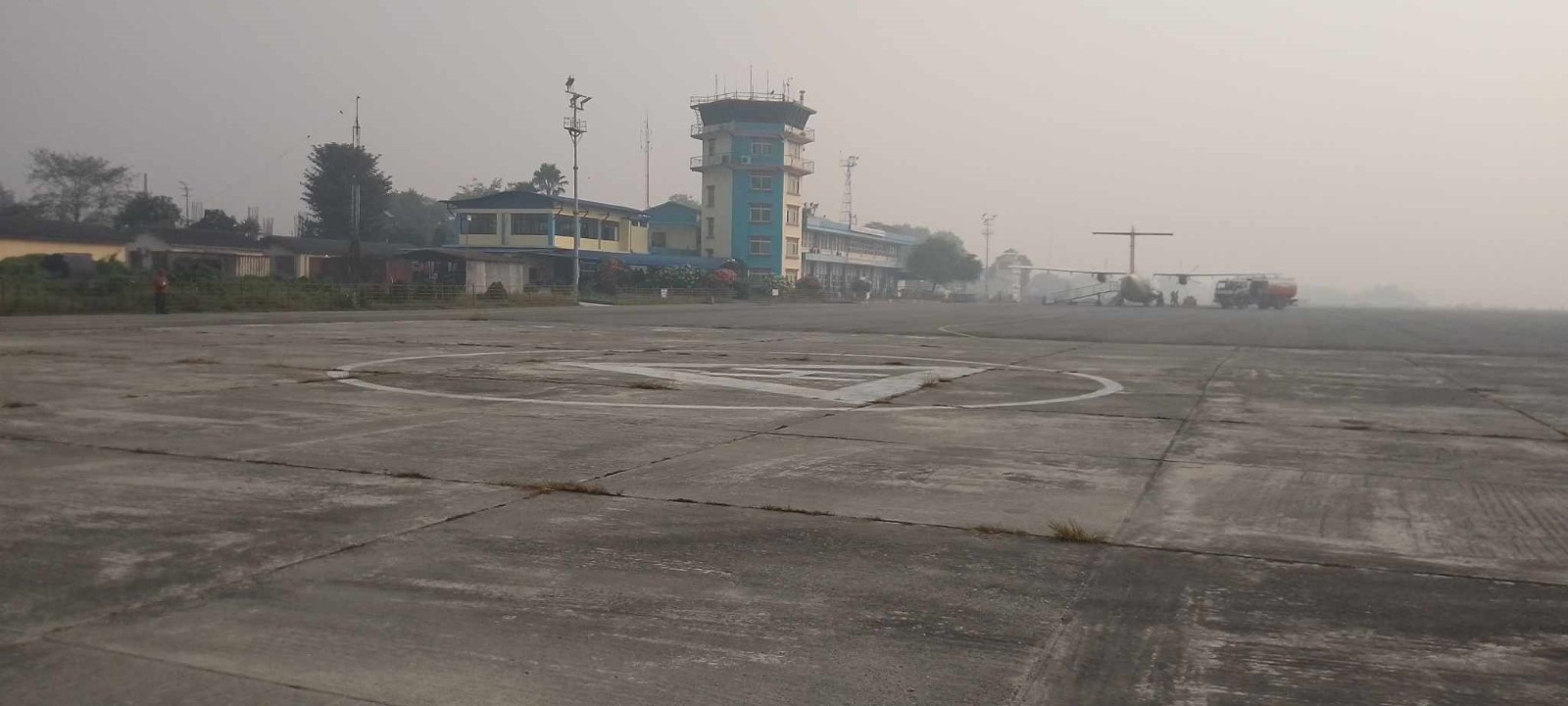 Fuel Services Charges
The airport takes support from Nepal Oil Corporation for the provision of Jet fuel for the aircraft. NOC maintains the reserve of 210 Kilo Litre at its office premises. NOC strictly adheres to the quality it has set for the Air Fuel and the price per litre is as set by the NOC.
|
|
Price per Litre USD - $ |
|---|---|
|
Jet A-1 |
1.02 / ltr (Duty Paid) * |
|
Avgas |
No |
*As of 01 Jan, 2024 Exchange Rate 1 US$ = 133.064 NPR
Nepal - 2.2.6 Chandraghadi Major Domestic Airport
Airport Overview
|
|
|
Pic: Aerial view of Bhadrapur Airport |
Chandragadhi Airport also known as Bhadrapur Airport, is an airport in Bhadrapur Municipality,- 8 in the Jhapa District of Koshi Province with a distance of 3.2 Km North West from Bhadrapur city. Due proximity to eastern boarder of Nepal, the airport finds strategic significance as well as domestic destination for travellers coming from north eastern states of India, Bhutan and Bangladesh as well. All commercial airlines operate through one small terminal of Chandragadi Airport.
Sita Air, Buddha Air, Saurya Airlines, Yeti Airlines and Shree Airlines operate their flights to and from Kathmandu and Taplejung with scheduled connectivity. Night Flight is also operational from Chandragadi Airport.
10 Flights daily take off from this airport but no cargo flights service is available in this airport.
-
Aerodrome Administration operation hours are as follows: Air Traffic Service operational hours all year-round Night Operation Facilities are as follows:16th Feb to 15th Nov - 0600LT-LT 24:00
-
16th Nov to 15th Feb - 0630LT-1800LT
|
Airport Location and Contact |
|
|---|---|
|
Country |
Nepal |
|
Province or District |
Koshi Province, Jhapa |
|
Nearest Town or City |
In proximity with District Headquarter- Chandragadhi |
|
Airport’s Complete Name |
Chandragadhi Civil Aviation Office
|
|
Latitude |
26.56965 |
|
Longitude |
88.07741 |
|
Elevation (ft and m) |
312.184 ft (95.149 m) |
|
IATA Code |
BDP |
|
ICAO Code |
VNCG |
|
Managing Company or Airport Authority |
Civil Aviation Authority of Nepal Chandragadhi Civil Aviation Office Chandragadhi, Jhapa Office- 977-23455232 Tel- 977-23-455075 Fax - 977-23-456801 AFS – VNCGYDYX |
|
Management Contact Person |
Indra Raj Adhikari Chief Airport Officer Contact: 9852678417 |
|
NGO and/or UN Presence at Airport? |
NO |
Runway
|
Runway #1 |
|
|---|---|
|
Runway Dimensions |
1500 m x 30 m |
|
Runway Orientation |
10/28 |
|
Runway Surface |
Asphalt Concrete |
|
Runway Condition |
Good, operational |
Airport Infrastructure Details
|
Infrastructure |
|||
|---|---|---|---|
|
Passenger / Cargo Security Screening |
X-Ray: Hold baggage; Walk through and Hand-held Metal detector |
Runway Lighting |
‘Yes’ *PAPI 30° on Runway 10 1500m, 60m, White, LIM |
|
Refueling Capacity |
JET A-1, during period of flight operation by NOC with 3 vouchers; 2 mobile voucher and 1 is fixed voucher. |
Ground Handling Services |
Available with local airlines operator, |
|
Air Traffic Control |
Controlled Class C Airspace, Visual Flight Rule (VFR), Instrumental Flight Rule (RNP Approach), Two Men Position Tower Console with Associated Equipment and Accessories |
Fire Fighting Equipment |
Portable type fire extinguisher available |
|
Weather Information |
Tower Observation. MET office information.
|
Aircraft Parking Space |
Four ATR72 Types: DH8D, ATR72, ATR42, CRJ 71, CRJ2 and One Twin Otter 11850 sq m, Concrete |
|
Navigation Aids |
DVOR/DME, UHF Band Communication System |
Perimeter Fencing |
Yes |
|
Windsock |
2 |
|
|
*Precision Approach Path Indicators
Fuel Service Charges
The airport takes support from Nepal Oil Corporation (NOC) for the provision of Jet fuel for the aircraft. NOC maintains the reserve of 60 Kilo Litre at its office premise and installed an airport based depot too. NOC strictly adheres to the quality it has set for the Air Fuel and the price per litre is as set by the NOC.
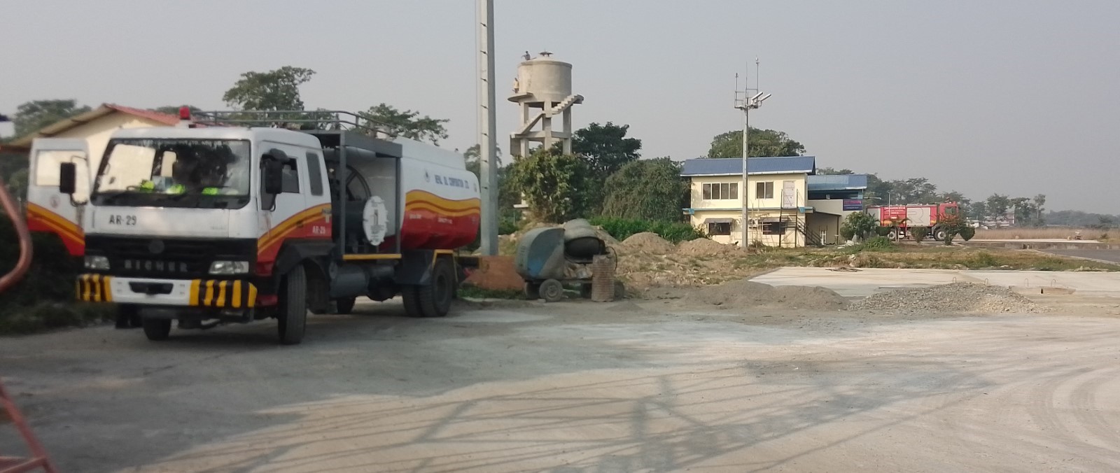
|
|
Price per Litre USD - $ |
|---|---|
|
Jet A-1 |
0.543 / ltr (Duty Paid) * |
|
Avgas |
No |
*As of 1st October 2023
*Exchange rate 1 USD: 132.86 NPR
Nepal - 2.2.7 Major Domestic Airport - Dhangadhi
Airport Overview
|
|
|
Picture: Arial view of Dhangadhi Airport-Kailali, Sudurpashchim province |
Dhangadhi Airport is situated at Dhangadhi Sub Metropolitan City of Kailali District, Sudurpashchim Province. This airport has direct air link with Kathmandu’s Tribhuvan International Airport (TIA). The airport is located at an elevation of 176 metres (577 ft) above sea level. It has one runway which is 1,800 metres (5,906 ft) in length and is equipped with night landing facility. The operation hours are:
-
01 Nov to 30 Jan: 1000LT – 1600LT
-
01 Feb to 30 Oct: 1000LT – 1700LT
National airline operators provide scheduled air service from this airport to Kathmandu. The largest aircraft it can serve is Fokker 100 or similar type of aircraft. This airport also serves weekly two flights to Bajhang and Sanfebagar airports located in Sudurpaschim Province.
|
Airport Location and Contact |
|
|---|---|
|
Country |
Nepal |
|
Province or District |
Sudurpashchim |
|
Nearest Town or City |
Dhangadi DISTANCE (6 KM-North) |
|
Airport’s Complete Name |
Dhangadi Airport |
|
Latitude |
28.75302 |
|
Longitude |
80.58314 |
|
Elevation (ft and m) |
621 ft. / 189 m. |
|
IATA Code |
DHI |
|
ICAO Code |
VNDH |
|
Managing Company or Airport Authority |
Civil Aviation Authority –Dhangadi, Kailali Off: 977- 91575119 Tower: 977-91575219 Fax: 977-91575119 E-mail: dhangadhi_cao@caanepal.gov.np
|
|
Management Contact Person |
Ganesh Bahadur Singh |
|
NGO and/or UN Presence at Airport? |
Yes, WFP has constructed a Humanitarian Staging Area (HSA) in the premises of the airport |
Runway(s)
|
Runway #1 |
|
|---|---|
|
Runway Dimensions |
1800 m x 30 m |
|
Runway Orientation |
E27 and W09 |
|
Runway Surface |
Asphalt |
|
Runway Condition |
Good, Blacktop and operational |
Airport Infrastructure Details
|
Infrastructure |
|||
|---|---|---|---|
|
Passenger / Cargo Security Screening |
Yes, Walk-through X-Ray, Handheld Metal Detector, CCTV Surveillance, UHF Band Communication System and FIDS |
Runway Lighting |
Yes -PAPI |
|
Refueling Capacity |
Yes 60KL, Available and Provided by Nepal Oil Corporation |
Ground Handling Services |
Yes, with the local airlines. |
|
Air Traffic Control |
Yes |
Fire Fighting Equipment |
Yes, CAT – 5
|
|
Weather Information |
Yes, Tower Observation |
Aircraft Parking Space |
Yes- 4 Aircrafts (ATR 72 types) |
|
Navigation Aids |
Yes / VOR |
Perimeter Fencing |
Yes – iron net fencing |
|
Windsock |
Yes |
|
|
Fuel Services Charges
The airport takes support from Nepal Oil Corporation (NOC) for the provision of Jet fuel for the aircraft. Nepal Oil corporation maintains the reserve of 60 Kilo Litre at its office premise. NOC strictly adheres to the quality it has set for the Air Fuel and the price per liter is as set by the NOC.
|
|
Price per Litre USD - $ |
|---|---|
|
Jet A-1 |
1.02 (Duty Paid) * |
|
Avgas |
No |
*As of 01 Jan, 2024 Exchange Rate 1 US$ = 133.064 NPR
Link for more detail:
DHANGADHI-AIRPORT.pdf (caanepal.gov.np)
Link for ICAO and IATA Code: https://en.wikipedia.org/wiki/List_of_airports_in_Nepal
Nepal - 2.2.8 Nepalgunj Major Domestic Airport
Airport Overview
|
|
|
Pic: Aerial view of Nepalgunj Airport |
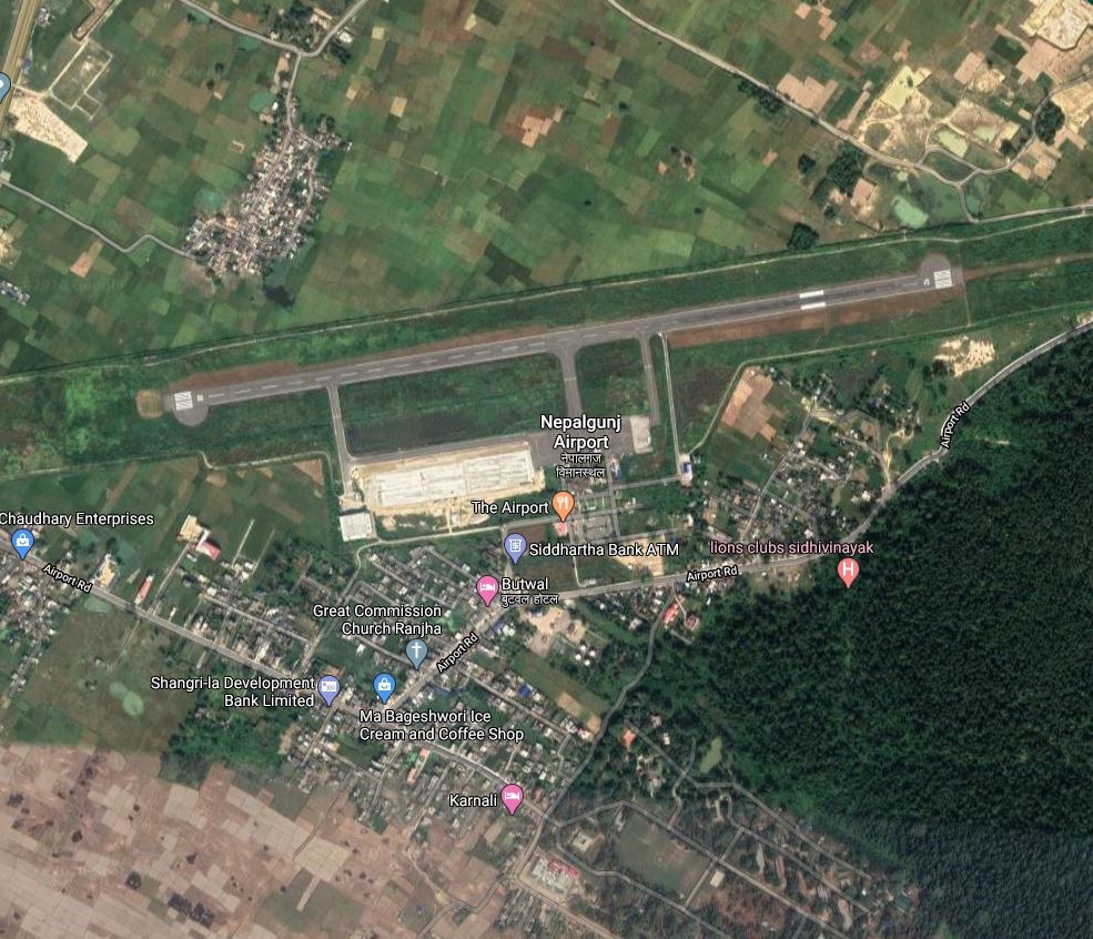
Nepalgunj Airport is a domestic hub airport in Nepalgunj, a sub-Metropolitan city in Banke District of Lumbini Province . It lies 9 km NE of the city and can be accessed via tarmac road H12. This is one of the main domestic hub airports, after Kathmandu airport, having the highest number of air links with 16 airports (8 in operation) of Karnali Province and Sudur-Paschim Province.
It can handle twin engine turbo-prop aircraft types such as: ATR72, CRJ200/700, DHC8, MA60, ATR42, JS-41, B190, D228, DHC6, L410, Y12. Airlines operating scheduled flights are Buddha Air, Yeti Airlines, Tara Air, Shree Airlines, Sita Air, Summit Airways, Nepal Airlines.
Aerodrome Administration operation hours are as follows:
1. SUN-THU 10:00 -17:00 LT (SUMMER), 10:00-1600 LT (WINTER)
2. FRI 10:00-1500 LT
Air Traffic Service operational hours all year-round are as follows:
3. From 16 Feb - 15 Nov 0600 hrs to 1845 hrs LT
4. From 16 Nov - 15 Feb 0630 hrs to 1800 hrs LT
The airport is equipped with night landing facility and can operate at any hour during an emergency or on request.
|
Airport Location and Contact |
|
|---|---|
|
Country |
Nepal |
|
Province or District |
Lumbini Province/ Banke |
|
Nearest Town or City |
9 kms NE of City |
|
Airport’s Complete Name |
Nepalgunj Airport |
|
Latitude |
28.10150 |
|
Longitude |
81.66737 |
|
Elevation (ft and m) |
518 ft (158 m) |
|
IATA Code |
KEP |
|
ICAO Code |
VNNG |
|
Managing Company or Airport Authority |
Civil Aviation Authority of Nepal, Nepalgunj Civil Aviation Office, Nepalgunj, Banke Tel- 977-081-565158 (Director) 565205 (Tower), 565210 (Admin) Fax - 977-081-565204 AFS – VNNGYDYX E-mail: nepalgunj_cao@caanepal.gov.np |
|
Management Contact Person |
Suresh Prasad Khanal |
|
NGO and/or UN Presence at Airport? |
Yes, WFP has constructed an HSA in the airport premises. |
Runway
|
Runway #1 |
|
|---|---|
|
Runway Dimensions |
1700 x 30 m |
|
Runway Orientation |
08 – 26 – |
|
Runway Surface |
Asphalt Concrete |
|
Runway Condition |
Good, operational |
Airport Infrastructure Details
|
Infrastructure |
|||
|---|---|---|---|
|
Passenger / Cargo Security Screening |
X-Ray: Hold baggage, Hand baggage |
Runway Lighting |
PAPI / Runway Lighting / Beacon light / Rails Light / Obstruction Light |
|
Refuelling Capacity |
Jet A1 during Operation Hours |
Ground Handling Services |
Available with local airlines operator |
|
Air Traffic Control |
Controlled Class C Airspace |
Fire Fighting Equipment |
Category V Rescue equipment |
|
Weather Information |
Yes, Tower Observation and Met Forecast relayed by GBIA every half an hour |
Aircraft Parking Space |
15640 sqm of concrete Apron, 1 CRJ, 2 ATR72s, 5 Twin Otters and 2 Helicopters |
|
Navigation Aids |
VOR / DME |
Perimeter Fencing |
Yes |
|
Windsock |
Yes |
|
|
Fuel Services Charges
The airport takes support from Nepal Oil Corporation for the provision of Jet fuel for the aircraft. NOC maintains the reserve of 60 Kilo Litre at its office premise. NOC strictly adheres to the quality it has set for the Air Fuel and the price per litre is as set by the NOC.
|
|
Price per Litre USD - $ |
|---|---|
|
Jet A-1 |
1.02 / ltr (Duty Paid) * |
|
Avgas |
No |
*As of 11 Oct 2023
*Exchange rate 1 USD: 132.90 NPR
Nepal - 2.2.9 Major Domestic Airport - Simara
Airport Overview
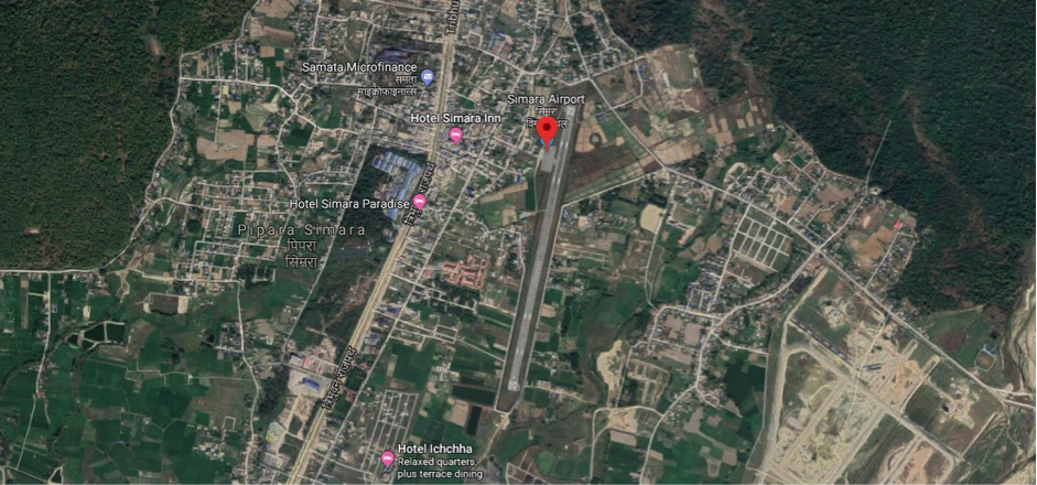
Aerial view of Simara Airport-Bara, Madhesh Province
Simara Airport is situated at Jitpur Simara metropolitan city of Bara District in Madhesh Province. It is considered a strategic domestic airport due to its proximity to Birgunj - Nepal’s fifth biggest city - and 20km from Raxaul, South at the border with India. The airport is located at a distance of 116 km from Kathmandu, via the Kulekhani-Sisneri-Pharping road, which is not suitable for heavy trucks. The airport is located at a distance of 261 km from Kathmandu via the main highway from Narayanghat to Kathmandu.
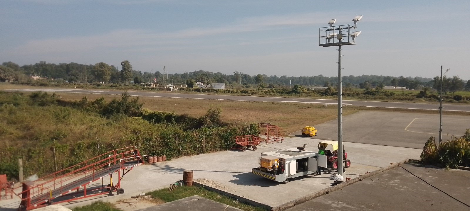
National airline Budhha Airlines and Yeti Airlines provide services from the airport to Kathmandu only
-
1st Nov to 31 Jan 1000 hrs – 1600 hrs LT
-
1st Feb to 31 Oct 1000 hrs – 1700 hrs LT
|
Airport Location and Contact |
|
|---|---|
|
Country |
Nepal |
|
Province or District |
Madhesh Province |
|
Nearest Town or City |
Birgunj-Parsa - 20 km Hetauda-Makwanpur - 34 km |
|
Airport’s Complete Name |
Simara Airport |
|
Latitude |
27.16382 |
|
Longitude |
84.97964 |
|
Elevation (ft and m) |
137 m / 450 feet 449/37 m 9 (in June month) |
|
IATA Code |
SIF |
|
ICAO Code |
VNSI |
|
Managing Company or Airport Authority |
Civil Aviation Authority –Simara-Bara. Surya Bahadur Khatri Chief Airport Off: 977-53520210 Tower: 977-53-520110 Fax: 977-53-520210 AFS: VNSIYDYX
E-mail: simara_cao@caanepal.gov.np |
|
Management Contact Person |
Off: 977-53-520210 E-mail:simara_cao@caanepal.gov.np |
|
NGO and/or UN Presence at Airport? |
No |
Runway(s)
|
Runway #1 |
|
|---|---|
|
Runway Dimensions |
1192 m x 30 m |
|
Runway Orientation |
01/19 |
|
Runway Surface |
Bituminous Paved (Asphalt Concrete) |
|
Runway Condition |
Operational |
Airport Infrastructure Details
|
Infrastructure |
|||
|---|---|---|---|
|
Passenger / Cargo Security Screening |
Walk through detector Hand Held metel detector
|
Runway Lighting |
PAPI/APAPI Light- APAPI ; Runway Edge light |
|
Refueling Capacity |
Yes: 16 KL dispenser –2 Vouchers and 6 KL dispenser- 1 Voucher ; Available and Provided by Nepal Oil Corporation |
Ground Handling Services |
Yes with the local airline |
|
Air Traffic Control |
Communication System : HF SSB, VHF, AMHS, Hot line and UHF Telephone |
Fire Fighting Equipment |
Yes- Category 5 |
|
Weather Information |
Associated MET Office, all operational hour by meteorological office |
Aircraft Parking Space |
Yes - 2 ATR- 72/42 aircraft |
|
Navigation Aids |
Yes / VOR /DME |
Perimeter Fencing |
Yes – Iron net fencing |
|
Windsock |
Yes |
|
|
For more information, please see this link - SIMARA AIRPORT.pdf (caanepal.gov.np)
Fuel Services Charges
Re- fuelling facility is started from 3rd December 2023 with 16LK and 6 KL dispenser at airport.
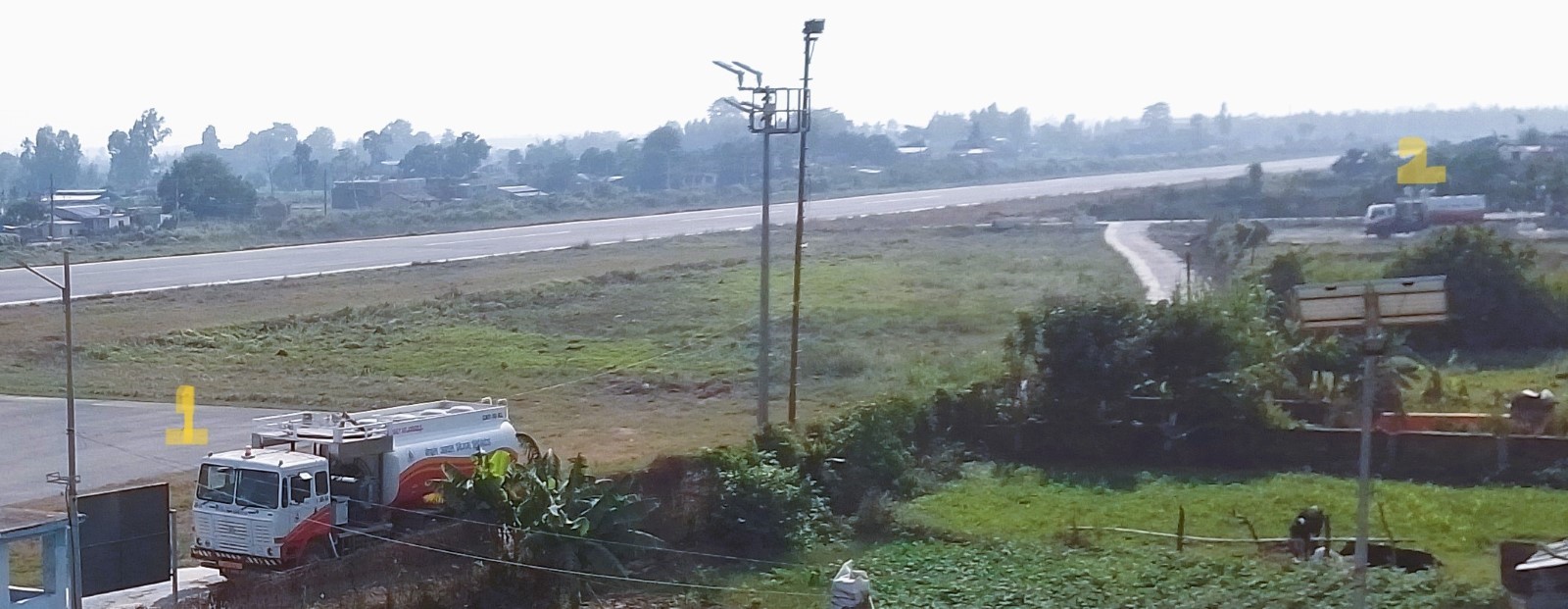
-
16LK and 2) 6 KL refueling dispenser at Simara airport.
|
|
Price per Litre USD - $ |
|---|---|
|
Jet A-1 |
1.02 (Duty Paid) * |
|
Avgas |
No |
*As of Oct 13, 2023 Exchange Rate: 1 US$ = 132.90 NPR
Royalties / Non Objection Fees (NOFs)
N/A
Other relevant Information:
Simara airport has also prepared an emergency plan to provide emergency services in case of emergency as per the plan of District Disaster Risk Management Committee of Bara District.
Nepal - 2.2.10 Major Domestic Airport - Surkhet
Airport Overview
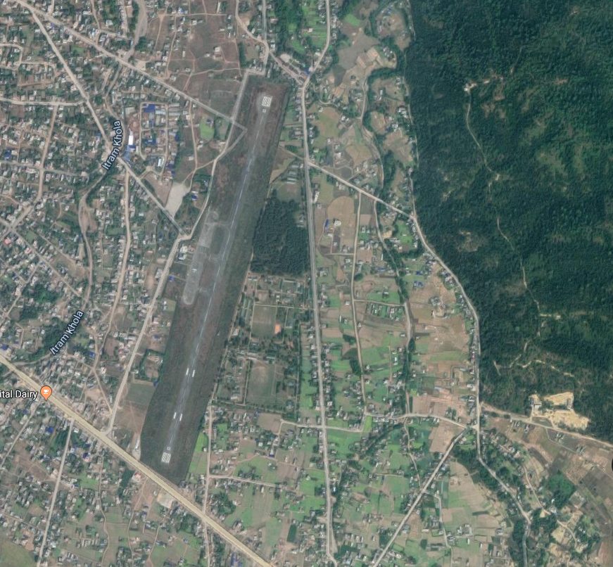
Pic: Aerial view of Surkhet Airport with surrounding habitation of Birendranagar
Surkhet Airport is situated at Birendranagar Municipality of Surkhet District, Karnali Province. It is one of the hub airports of mid-Western Nepal and serves most of the remote sectors of the western part of the country – Jumla, Humla, Kalikot, Mugu, Dolpa, Bajhang, Bajura and Rukum (although infrequent). Surkhet Airport serves mainly as transport for cargo rather than passengers to the Karnali and Sudurpaschim Provinces. This airport is strategically important for the transportation of food grains, clothes, medicines, iodine-mixed salt, construction materials, office goods, school materials like books and stationeries as well as other commercial goods. There are scheduled passenger flights from Kathmandu to Surkhet daily.
Expansion of the runway is limited due to the hilly landscape. The approach is only from one side South to North 20 degrees. Aircraft models such as B190, D228, DHC6, L410, Y12, C208 are the appropriate types of aircraft for this airport. Buddha Air operates scheduled flight with ATR72, and Shree Airlines operates with DH8D aircraft from Kathmandu to Surkhet. The Airport has no dedicated landing zones for helicopters. The control tower is well capacitated to oversee a 5-mile radius centered at the Airport Reference Point (ARP).
|
Airport Location and Contact |
|
|---|---|
|
Country |
Nepal |
|
Province or District |
Karnali Province/ Surkhet |
|
Nearest Town or City |
1.5 KM east from Birendranagar City |
|
Airport’s Complete Name |
Surkhet Airport |
|
Latitude |
28.3509 |
|
Longitude |
81.3807 |
|
Elevation (ft and m) |
7395 ft. / 2254 m. |
|
IATA Code |
SKH |
|
ICAO Code |
VNSK |
|
Managing Company or Airport Authority |
Civil Aviation Authority of Nepal, Surkhet Civil Aviation Office, Surkhet Off: 977-83520269 Tel 977 083 520202 (Tower) Fax: 977-83521945 AFS: VNSKYDYX E-mail: surkhet_cao@caanepal.gov.np |
|
Management Contact Person |
Rajan Raj Dhungel, Airport Chief |
|
NGO and/or UN Presence at Airport? |
No |
Runway(s)
|
Runway #1 |
|
|---|---|
|
Runway Dimensions |
1255 m x 30 m |
|
Runway Orientation |
02/20 - |
|
Runway Surface |
Bituminous Paved (Asphalt Concrete) |
|
Runway Condition |
Good |
Airport Infrastructure Details
|
Infrastructure |
|||
|---|---|---|---|
|
Passenger / Cargo Security Screening |
Walk-through X-Ray, Handheld Metal Detector, CCTV Surveillance |
Runway Lighting |
PAPI, Threshold light & End Light |
|
Refueling Capacity |
During the period of flight operation / 60KL/ Provided by Nepal Oil Corporation |
Ground Handling Services |
Yes with Local airlines Operator |
|
Air Traffic Control |
Yes/ VFR |
Fire Fighting Equipment |
Yes, has a fire fighting vehicle with “Small Foam Tender” and water capacity of 3000 litres. |
|
Weather Information |
Associated MET Office, After-hours Met Office Service |
Aircraft Parking Space |
Concrete apron in 13,389.12 m2 has space for 4 small aircraft but no hangar space |
|
Navigation Aids |
VOR |
Perimeter Fencing |
Yes |
|
Windsock |
Yes |
|
|
Fuel Services Charges
The airport takes support from Nepal Oil Corporation (NOC) for the provision of Jet fuel for the aircraft. NOC maintains the reserve of 60 kilo litres at its office premise. NOC strictly adheres to the quality it has set for the Air Fuel and the price per litre is as set by the NOC.
|
|
Price per Litre USD - $ |
|---|---|
|
Jet A-1 |
1.02 (Duty Paid) * |
|
Avgas |
No |
*As of Oct 12, 2023 Exchange Rate: 1 US$ = 132.81 NPR
Royalties / Non Objection Fees (NOFs)
N/A
Nepal - 2.2.11 Minor Domestic Airport - Janakpur
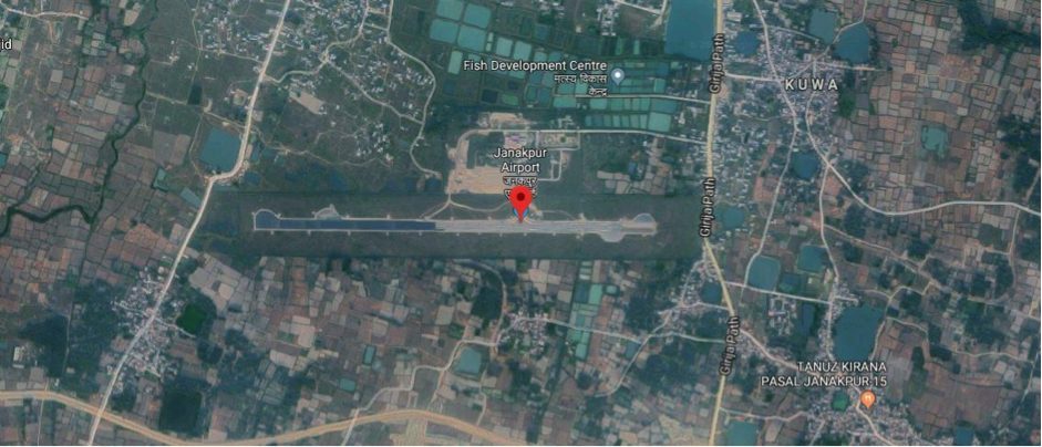
Aerial view of Janakpur Airport-Dhanusa, Province-2
Airport Overview
Janakpur Airport is a domestic airport in Janakpurdham Sub Metropolitan City of Dhanusa district in Madhesh Province and is operated by the Civil Aviation Authority of Nepal (CAAN). It is located 4 km away from Janakpur city. Janakpur Airport was built on 13 February 1960. National airline operators operate direct flights from Kathmandu to Janakpur daily.
The airport resides at an elevation of 233 feet ( 71 m) above mean sea level. It has one runway designated 09/27 with an asphalt surface measuring 1306 by 30 metres ( 4248 ft × 98 ft)
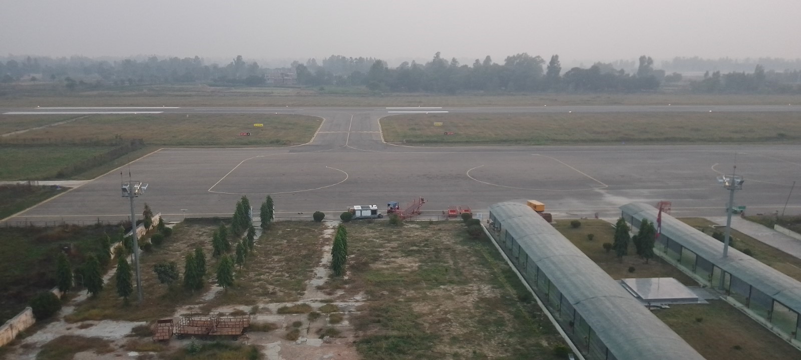
Security of the airport periphery is provided by Nepal Army and security to the passenger is provided by Nepal Police.
Administrative Services:
SUN-THU 10:00 -17:00 LT (SUMMER),
10:00-1600 LT (WINTER), FRI 10:00-1500 LT
Air Traffic Service:
1) From 16 Feb - 15 Nov (0015 - 1815) UTC
2) From 16 Nov - 15 Feb (0045 - 1815) UTC
|
Airport Location and Contact |
|
|---|---|
|
Country |
Nepal |
|
Province or District |
Madhesh |
|
Nearest Town or City |
Janakpur - 4 km |
|
Airport’s Complete Name |
Janakpur Airport |
|
Latitude |
26.71174 |
|
Longitude |
85.92389 |
|
Elevation (ft and m) |
233 ft. / 71 m. |
|
IATA Code |
JKR |
|
ICAO Code |
VNJP |
|
Managing Company or Airport Authority |
Civil Aviation Authority of Nepal Janakpur Civil Aviation Office, Janakpurdham, Dhanusha Te1- 977-041-590057 Hot Line - 977-041- 590053 Tower - 977-041-590052 AFS - VNJPZTZX Email : janakpur_cao@caanepal.gov.np |
|
Management Contact Person |
E-mail: janakpur_cao@caanepal.org.np
|
|
NGO and/or UN Presence at Airport? |
No |
Runway(s)
|
Runway #1 |
|
|---|---|
|
Runway Dimensions |
1306 m x 30 m |
|
Runway Orientation |
|
|
Runway Surface |
Asphalt /10 |
|
Runway Condition |
Good - blacktop and operational |
Airport Infrastructure Details
|
Infrastructure |
|||
|---|---|---|---|
|
Passenger / Cargo Security Screening |
|
Runway Lighting |
|
|
Refueling Capacity |
Yes: 120 KL, Available and Provided by Nepal Oil Corporation Storage Capacity (KL): Bonded Tank I - 30 KL Bonded Tank II - 30 KL Storage Type: Bonded Tank Refueller Details: AR 40 (16KL |
Ground Handling Services |
Yes with the local airline: Self Managed by respective airlines. |
|
Air Traffic Control |
Yes; Aerodrome and Approach Service. Permitted VFR |
Fire Fighting Equipment |
Fire Vehicle and Portable type fire extinguisher available. Complementary Extinguishing Agents and Fire Extinguishers (wheel type fire extinguishers also available, Small fire vehicle available |
|
Weather Information |
Associated MET Office, After-hours Met Office |
Aircraft Parking Space |
Yes- 3 ATR 72 aircraft |
|
Navigation Aids |
Yes / NDB |
Perimeter Fencing |
Yes – Iron net fencing |
|
Windsock |
Yes- 3 ( East- Middle- West points. |
|
|
Fuel Services Charges
The airport takes support from Nepal Oil Corporation (NOC) for the provision of Jet fuel for the aircraft. The fuel reserve owned by Nepal Oil Corporation is maintained outside the airport compound.
|
|
Price per Litre USD - $ |
|---|---|
|
Jet A-1 |
1.02 (Duty Paid) * |
|
Avgas |
No |
*As of Oct 13, 2023 Exchange Rate: 1 US$ = 132.90 NPR
Royalties / Non Objection Fees (NOFs)
Airport charges landing charges as per the Airport Service Charge Regulation 2078
N/A
ADDITIONAL INFORMATION
1. Bird Activity a) Sometimes cases of bird concentrations in the vicinity of aerodrome may be encountered.
b) 2. No Special procedures have been adopted to control these bird concentrations except driving them through guards and security personnel.
Nepal - 2.2.12 Minor Domestic Airport - Jomsom
Airport Overview
|
|
|
Pic: Aerial view of Jomsom Airport |
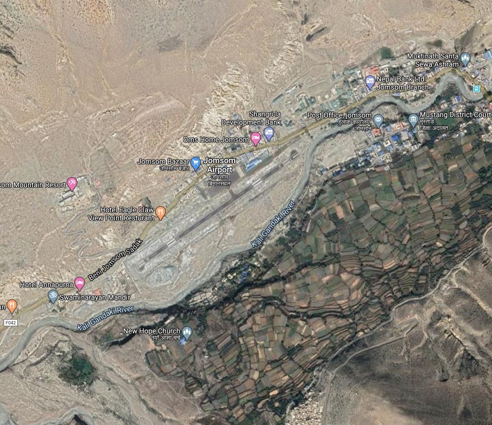
Jomsom airport is short take off and landing (STOL) airport located on the bank of the Kali Gandaki River serving Jomsom, a town in the Gharapjhong rural municipality of Mustang District in Gandaki Province. It serves as the gateway to the Mustang District that includes Jomsom, Kagbeni, Tangbe, Lo Manthang, and Muktinath temple, which is a popular pilgrimage destination for Nepalis and Indians. It is close to the District HQ of Mustang. The airport is open throughout the year but has the following operating hours
-
16th Feb to 15th Nov- 0600LT-1215LT
-
16th Nov to 15th Feb - 0630LT-1215LT
Due to high winds and clouds during the daytime, the operation stops midday year-round. Depending on the season, low clouds that restrict visibility can also halt airport operations. Regular flights are operated from Pokhara Domestic Airport to Jomsom.
|
Airport Location and Contact |
|
|---|---|
|
Country |
Nepal |
|
Province or District |
Gandaki Province/ Mustang |
|
Nearest Town or City |
Within the premises of Jomsom. |
|
Airport’s Complete Name |
Jomsom Airport |
|
Latitude |
28.78222 |
|
Longitude |
83.72250 |
|
Elevation (ft and m) |
8976 ft (2736 m) |
|
IATA Code |
JOM |
|
ICAO Code |
VNJS |
|
Managing Company or Airport Authority |
Civil Aviation Authority of Nepal, Jomsom Airport Tel: 977 69440126 Tower: 977 69440006 AFS VNJSYDYX Email: jomsom_cao@caanepal.org.np |
|
Management Contact Person |
|
|
NGO and/or UN Presence at Airport? |
NO |
Runway
|
Runway #1 |
|
|---|---|
|
Runway Dimensions |
810 m x 20 m |
|
Runway Orientation |
06/24 |
|
Runway Surface |
Asphalt Concrete |
|
Runway Condition |
Operational in all weather |
Airport Infrastructure Details
|
Infrastructure |
|||
|---|---|---|---|
|
Passenger / Cargo Security Screening |
Metal Detector: walk through and handheld and CCTV surveillance system |
Runway Lighting |
Runway End light Runway Threshold identification light |
|
Refuelling Capacity |
NO |
Ground Handling Services |
|
|
Air Traffic Control |
AFIS HF SSB, VHFB |
Fire Fighting Equipment |
Wheel and portable type of fire extinguisher available |
|
Weather Information |
AFIS, Tower Observation |
Aircraft Parking Space |
6000 sqm of concrete Apron, Four D228 Types |
|
Navigation Aids |
|
Perimeter Fencing |
|
|
Windsock |
N/A |
|
|
Fuel Services Charges
N/A
Royalties / Non Objection Fees (NOFs)
N/A
Nepal - 2.2.13 Minor Domestic Airport - Jumla
Airport Overview
|
|
|
Picture: Arial view of Jumla Airport- Karnali province |
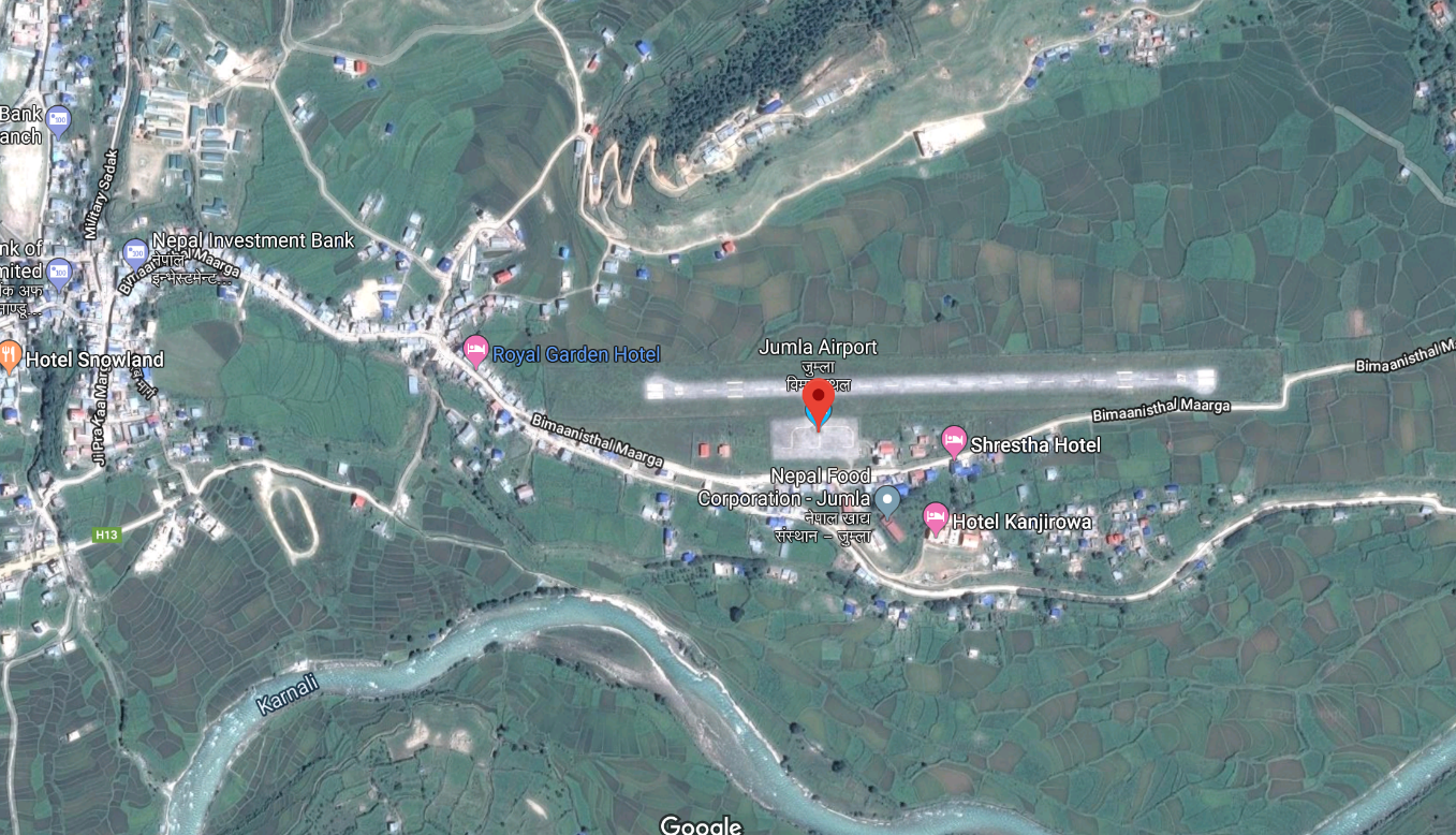
Jumla Airport is situated at Chandannath Municipality of Jumla District, Karnali Province. This airport, close to Jumla Bazaar, is a hub for trade and travel throughout Karnali province (via this airport local products are transported to West Terai).
Nepal Airlines, Tara Air, Summit Air, and Sita Air provides flight services to Jumla Airport, from Nepalgunj and Surkhet airports. For cargo purposes, Surkhet Airport is more cost effective. The serviceability of the airport is all weather but operational hours are as follows:
-
16 Feb to 15 Nov 0600 hrs – 1845 hrs LT
-
16 Nov to 15 Feb 0630 hrs – 1800 hrs LT
|
Airport Location and Contact |
|
|---|---|
|
Country |
Nepal |
|
Province or District |
Karnali Province/ Jumla District |
|
Nearest Town or City |
500m East of Jumla Bazaar |
|
Airport’s Complete Name |
Jumla Airport |
|
Latitude |
29. 1626 |
|
Longitude |
82.1123 |
|
Elevation (ft and m) |
7792 ft (2375 m) |
|
IATA Code |
JUM |
|
ICAO Code |
VNJL |
|
Managing Company or Airport Authority |
Civil Aviation Authority – Jumla Off: 977-87520015 Tower: 977-87520015 Fax: 977- 87520015
AFS: VNJLYDYX Email: jumla_cao@caanepal.gov.np |
|
Management Contact Person |
Santosh Adhikari |
|
NGO and/or UN Presence at Airport? |
No |
Runway(s)
|
Runway #1 |
|
|---|---|
|
Runway Dimensions |
675 m x 20 m |
|
Runway Orientation |
09/ 27 |
|
Runway Surface |
Bituminous Paved (Asphalt Concrete) |
|
Runway Condition |
Operational |
Dornier 228 is the biggest aircraft that is in service among the aircraft like DHC6 Twin Otter, Let
L410 Turbolet, Harbin Y-12, and Cessna 208 Caravan, basically most of the single-engine aircraft, PZL M-28, Mi-8 helicopter.
Civil Aviation Authority of Nepal (CAAN) has planned to expand the existing runway and construct a new terminal building. For this CAAN had already started the process of land acquisition. (Source: (nagariknetwork.com)
Airport Infrastructure Details
|
Infrastructure |
|||
|---|---|---|---|
|
Passenger / Cargo Security Screening |
Handheld Metal Detector |
Runway Lighting |
Approach and Runway Lighting System, PAPI |
|
Refueling Capacity |
No |
Ground Handling Services |
Yes with the local airline |
|
Air Traffic Control |
Yes |
Fire Fighting Equipment |
Wheel and portable type fire extinguisher available by Fire Service (ULHPS), Complementary Extinguishing Agents |
|
Weather Information |
Tower Observation |
Aircraft Parking Space |
Yes - 3 small aircraft |
|
Navigation Aids |
Aerodrome Flight Information service |
Perimeter Fencing |
Yes |
|
Windsock |
Yes |
|
|
Fuel Services Charges
Not available in this Airport
Royalties / Non Objection Fees (NOFs)
Link for more details: Jumla Airport.pdf (caanepal.gov.np)
Nepal - 2.2.14 Minor Domestic Airport - Simikot
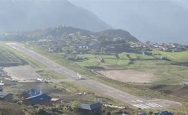
Airport Overview
Simikot Airport which is only one means of transportation of this area situated at Simikot Rural Municipality of Humla District, Karnali Province. It is the gateway to Mount Kailash, Mansarovar Lake and for the rafting in the Karnali River which are considered as famous tourist destinations. Majority of domestic airlines are operating scheduled and chartered flights.
The scheduled operational hour of this airport by Sita Air, Tara Air, Summit Air, Nepal Airlines to Nepalgunj is as follows:
16th Feb to 15th Nov 0600LT-1215LT
16th Nov to 15th Feb 0630LT-1215LT
|
Airport Location and Contact |
|
|---|---|
|
Country |
Nepal |
|
Province or District |
Karnali Province, Humla |
|
Nearest Town or City |
Simikot |
|
Airport’s Complete Name |
Simikot Airport |
|
Latitude |
29.97127 |
|
Longitude |
81.81865 |
|
Elevation (ft and m) |
9747 ft / 2971 m |
|
IATA Code |
IMK |
|
ICAO Code |
VNST |
|
Managing Company or Airport Authority |
Civil Aviation Authority of Nepal Off: 977-87680137 Tower: 977-87680137 AFS: VNSTYDYX E-mail: simikot_cao@caanepal.gov.np |
|
Management Contact Person |
|
|
NGO and/or UN Presence at Airport? |
No |
Runway(s)
|
Runway #1 |
|
|---|---|
|
Runway Dimensions |
650 m x 20 m |
|
Runway Orientation |
10/28 |
|
Runway Surface |
Bituminous Paved (Asphalt Concrete) Surface |
|
Runway Condition |
Good. |
Airport Infrastructure Details
|
Infrastructure |
||||
|---|---|---|---|---|
|
Passenger / Cargo Security Screening |
Yes, Hand Held Metal Detector & CCTV Surveillance System |
Runway Lighting |
Runway End Light Yes, at RWY 10 Runway Threshold Identification Light Yes, at RWY 28 |
|
|
Refueling Capacity |
No |
Ground Handling Services |
Limited |
|
|
Air Traffic Control |
Yes, HF SSB, VHF |
Fire Fighting Equipment |
Limited |
|
|
Weather Information |
Yes, Tower Observation |
Aircraft Parking Space |
3800 sq.m. Apron concrete surface for 3, D228 Type Aircraft |
|
|
Navigation Aids |
Yes, UHF Band Communication System |
Perimeter Fencing |
Yes, but not properly maintained |
|
|
Windsock |
Yes |
|
|
|
Fuel Services Charges
Not Available in this Airport
|
|
Price per Litre USD - $ |
|---|---|
|
Jet A-1 |
n/A |
|
Avgas |
n/A |
Nepal - 2.2.15 Tumlingtar Minor Domestic Airport
Airport Overview
|
|
|
Pic: Aerial view of Tumlingtar Airport |
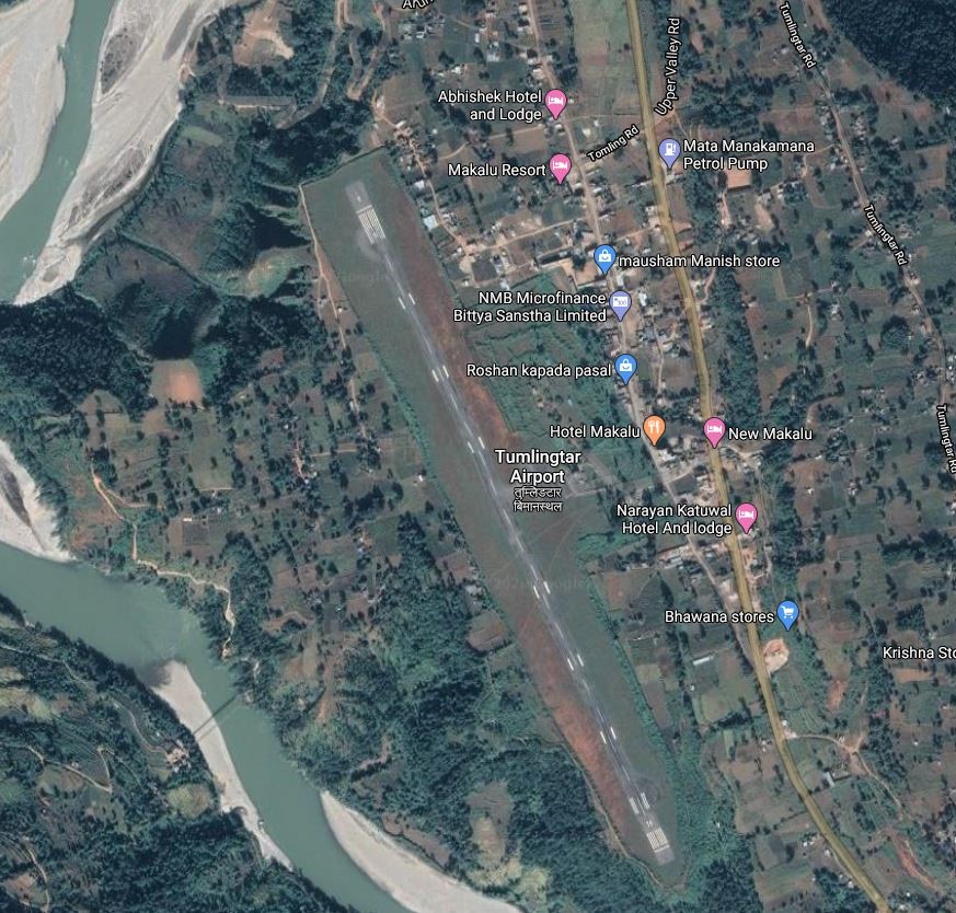
Tumlingtar Airport is located at Tumlingtar, Khandabari Municipality of Sankhuwasabha district, Koshi Province. It is 15 kms South of District HQ in Khandbari.
Buddha Air, and Yeti Airlines operate flights to Tumlingtar from Kathmandu and Biratnagar. They operate on the following hours:
-
1st Nov to 31 Jan 1000 hrs – 1600 hrs LT
-
1st Feb to 31 Oct 1000 hrs – 1700 hrs LT
-
In 2020, 717 flights carried 12,236 passengers and 16,498 kgs of cargo between destinations to and from the airport.
|
Airport Location and Contact |
|
|---|---|
|
Country |
Nepal |
|
Province or District |
Koshi Province / Sankhuwasabha |
|
Nearest Town or City |
15 kms South of District HQ in Khandbari
|
|
Airport’s Complete Name |
Tumlingtar Airport |
|
Latitude |
27.31610 |
|
Longitude |
87.19536 |
|
Elevation (ft and m) |
1316 ft (401 m) |
|
IATA Code |
TMI |
|
ICAO Code |
VNTR |
|
Managing Company or Airport Authority |
Civil Aviation Authority of Nepal Tumlingtar Civil Aviation Office, Tumlingtar, Sankhuwasabha Off: +977- 029 – 575207 Fax – 977-29575207 AFS - VNTRYDYX |
|
Management Contact Person |
|
|
NGO and/or UN Presence at Airport? |
NO |
Runway
|
Runway #1 |
|
|---|---|
|
Runway Dimensions |
1295 m × 30 m |
|
Runway Orientation |
16 / 34 |
|
Runway Surface |
Asphalt Concrete |
|
Runway Condition |
Operational |
Airport Infrastructure Details
|
Infrastructure |
|||
|---|---|---|---|
|
Passenger / Cargo Security Screening |
Handheld / Walknthrough metal detector |
Runway Lighting |
PAPI 3 on Runway 34 |
|
Refuelling Capacity |
NO |
Ground Handling Services |
|
|
Air Traffic Control |
Uncontrolled Airspace Classification G |
Fire Fighting Equipment |
Wheel & portable type fire extinguisher available |
|
Weather Information |
AFIS |
Aircraft Parking Space |
5000 sqm of concrete Asphalt, 1 ATR42, 1 Beechcraft and 1 JS |
|
Navigation Aids |
AFIS |
Perimeter Fencing |
|
|
Windsock |
|
|
|
Nepal - 2.2.16 Tenzing-Hillary Minor Domestic Airport
Airport Overview
|
|
|
Pic: Aerial view of Lukla Airport in Khumbu Pasanglhamu Municipality |
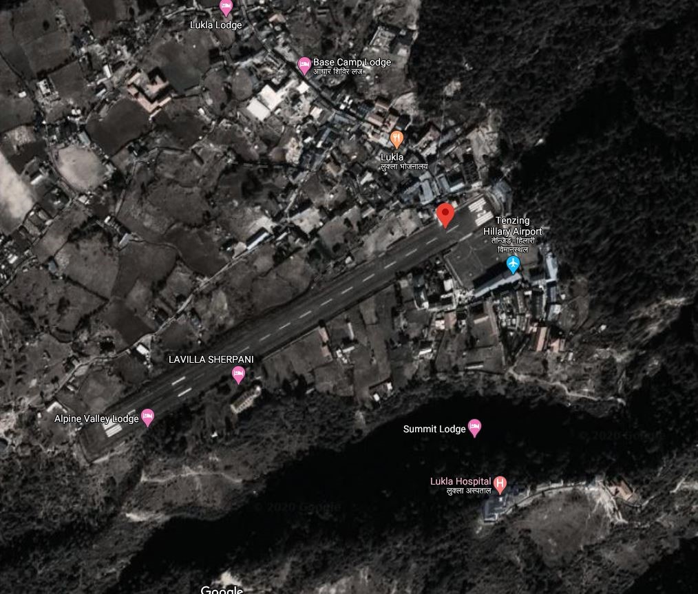
Lukla Airport also known as Tenzing-Hillary Airport, is a small airport in the town of Lukla, in Khumbu, Solukhumbu District, Koshi Province. It is 25 Kms NE of the District HQ with limited road access. It is within the premise of Lukla, the gateway to Mount Everest and inside the buffer zone of Sagarmatha national park. It is one of the four airports (Kangel Danda Airport, Phaplu Airport and Syangboche Airport) in the district.
It has been called one of the most dangerous airports in the world because of a combination of mountainous terrain, unpredictable weather and a very short and steep airstrip.
Between Nepal Airlines, Sita Air, Summit Air and Tara Air, daily flights are scheduled all around the year. Flight cancellation because of the inclement weather is very common.
The operation hours of the airport are as follows:
16 Feb to 15 Nov 0600 hrs – 1845 hrs LT
16 Nov to 15 Feb 0630 hrs – 1800 hrs LT
|
Airport Location and Contact |
|
|---|---|
|
Country |
Nepal |
|
Province or District |
Koshi Province/ Solukhumbu |
|
Nearest Town or City |
Amidst Lukla Bazaar |
|
Airport’s Complete Name |
Tenzing-Hillary (Lukla) Airport |
|
Latitude |
27.68745 |
|
Longitude |
86.73190 |
|
Elevation (ft and m) |
9337 ft (2846 m) |
|
IATA Code |
LUA |
|
ICAO Code |
VNLK |
|
Managing Company or Airport Authority |
Civil Aviation Authority of Nepal, Tenzing-Hillary (Lukla) Airport Off: 977-38550197 Tower: 977-38550044 Fax: 977-38550197 AFS VNLKYDYX |
|
Management Contact Person |
|
|
NGO and/or UN Presence at Airport? |
NO |
Runway
|
Runway #1 |
|
|---|---|
|
Runway Dimensions |
1728 × 65 ft (527 × 20 m) |
|
Runway Orientation |
06 - 24 - |
|
Runway Surface |
Asphalt Concrete |
|
Runway Condition |
Good |
Airport Infrastructure Details
|
Infrastructure |
|||
|---|---|---|---|
|
Passenger / Cargo Security Screening |
Metal Detector: Handheld, Walkthrough, CCTV |
Runway Lighting |
|
|
Refuelling Capacity |
No |
Ground Handling Services |
|
|
Air Traffic Control |
One Man Position Tower Console with Associated Equipment and Accessories |
Fire Fighting Equipment |
Ultra-high pressurize system fire vehicle and portable type fire extinguisher available. |
|
Weather Information |
AFIS, Tower Observation |
Aircraft Parking Space |
2800 sqm of concrete Apron, 4 D228 Type Aircraft |
|
Navigation Aids |
AFIS |
Perimeter Fencing |
|
|
Windsock |
|
|
|
Fuel Services Charges
N/A
Royalties / Non Objection Fees (NOFs)
N/A
Nepal - 2.2.17 Minor Domestic Airport - Rukum Salle
Airport Overview
|
|
|
Picture: Arial view of Rukum Salle Airport |
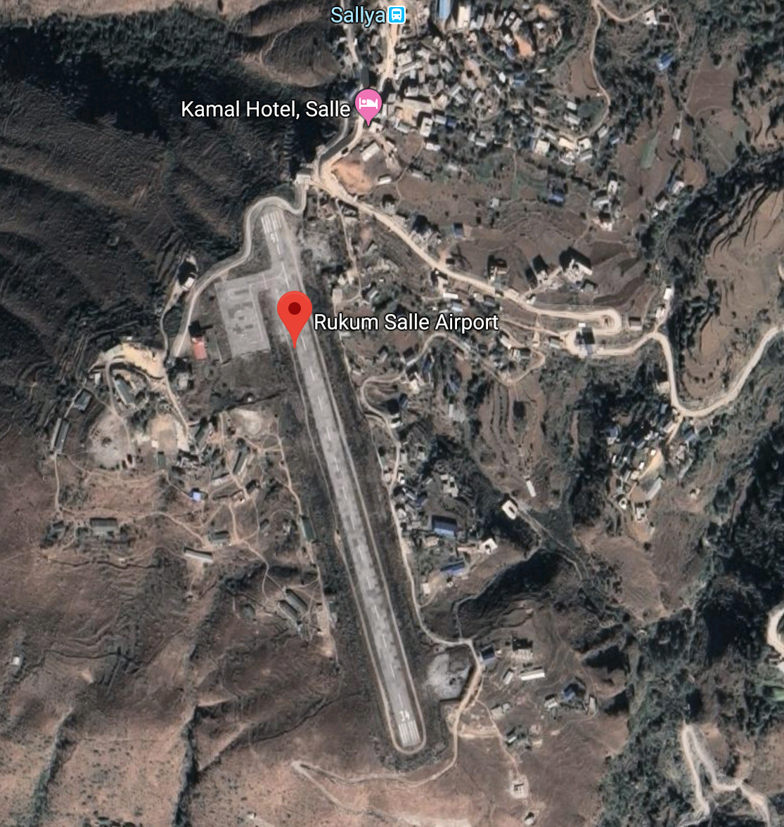
Rukum Salle Airport (ICAO: VNSL), also known as Musikot Airport, is an airport serving Musikot Khalanga, a municipality located in the Southern region of Karnali Province of Nepal. It was originally opened in 1994. The airport is one of two airports in Rukum District, the other one being Rukum Chaurjahari Airport. The airport was renovated and the runway blacktopped in 2014 after previously only having a grass/clay runway. The airport resides at an elevation of 5,184 feet (1,580 m) above mean sea level. It has one asphalt runway which is 580 metres (1,903 ft) in length and 20 metres width.
The airport is air-linked with Nepalgunj and Kathmandu. National airline operators provide scheduled flights to Musikot airport from Kathmandu and Nepalgunj.
The airport operates all around but in the time allocated as, Operation Hours
-
Nov to Jan 10:00hr-16:00hr
-
Feb to Oct 10:00hr-17:00hr.
The airport is located adjacently to Nepal Army’s Battalion and also shares the boundary with Nepal Food Corporation-Rukum. It is only 3 km away from the Mid Hill Highway that passes through Rukum.
|
Airport Location and Contact |
|
|---|---|
|
Country |
Nepal |
|
Province or District |
Karnali Province, West Rukum |
|
Nearest Town or City |
Musikot Bazaar less than 2 KM |
|
Airport’s Complete Name |
Rukum Salle Airport |
|
Latitude |
28.63692 |
|
Longitude |
82.44916 |
|
Elevation (ft and m) |
5184 ft (1580 m) |
|
IATA Code |
RUK |
|
ICAO Code |
VNSL |
|
Managing Company or Airport Authority |
Off: 977-88680354 Tower: 977-88680354 Fax: Not Available AFS: VNSLYDYX mailto: Email: salle_cao@caanepal.gov.np |
|
Management Contact Person |
|
|
NGO and/or UN Presence at Airport? |
No |
Runway(s)
|
Runway #1 |
|
|---|---|
|
Runway Dimensions |
580 m x 20 m (could be extended to 620 M) |
|
Runway Orientation |
16/34 |
|
Runway Surface |
Bituminous Paved (Asphalt Concrete) Surface |
|
Runway Condition |
Good. |
|
|
|
|
|
|
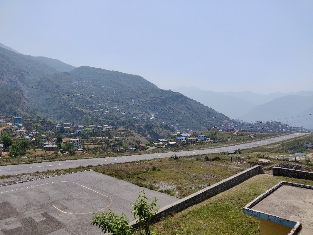
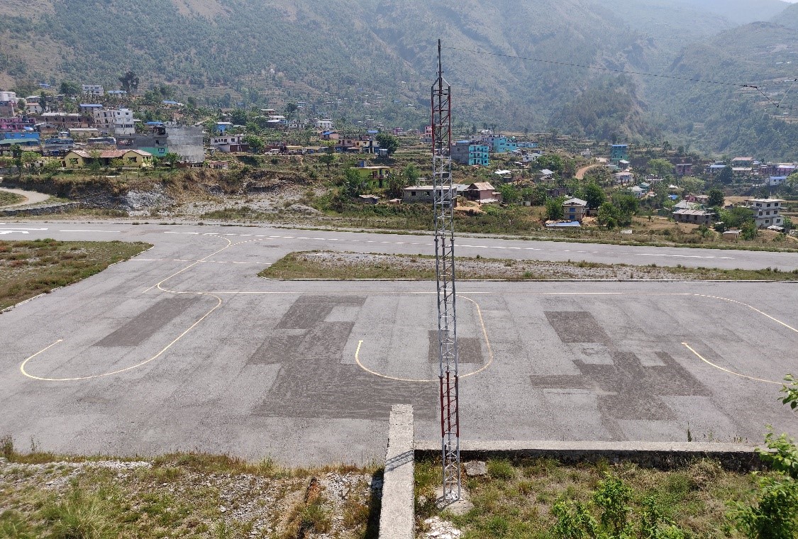
Dornier 228 is the biggest aircraft that is in service among the aircraft like DHC6 Twin Otter, Let L410 Turbolet, Harbin Y-12, and Cessna 208 Caravan, basically most of the single-engine aircraft.
Airport Infrastructure Details
|
Infrastructure |
|||
|---|---|---|---|
|
Passenger / Cargo Security Screening |
Hand held metal detector and manual checking of luggage |
Runway Lighting |
No, Night landing is not possible |
|
Refueling Capacity |
No |
Ground Handling Services |
Yes with the local airline -manual |
|
Air Traffic Control |
Yes VFR |
Fire Fighting Equipment |
fire extinguisher only |
|
Weather Information |
Yes through Observation Tower |
Aircraft Parking Space |
Yes- 3 DHC6 type Aircraft |
|
Navigation Aids |
NO |
Perimeter Fencing |
Yes, Also Airport shares wall with Nepal Army present at the district |
|
Windsock |
Yes |
|
|
Fuel Services Charges
Not Available in this Airport
|
|
Price per Litre USD - $ |
|---|---|
|
Jet A-1 |
n/A |
|
Avgas |
n/A |
Royalties / Non Objection Fees (NOFs)
Link for more detail :
RUKUM-SALLE-AIRPORT.pdf (caanepal.gov.np)
Link for ICAO and IATA Code: https://en.wikipedia.org/wiki/List_of_airports_in_Nepal
Nepal - 2.2.18 Minor Domestic Airport - Talcha
Airport Overview
|
|
|
Pic: Aerial View of Talcha Airport and small cluster of habitation on the left with ATC Tower |
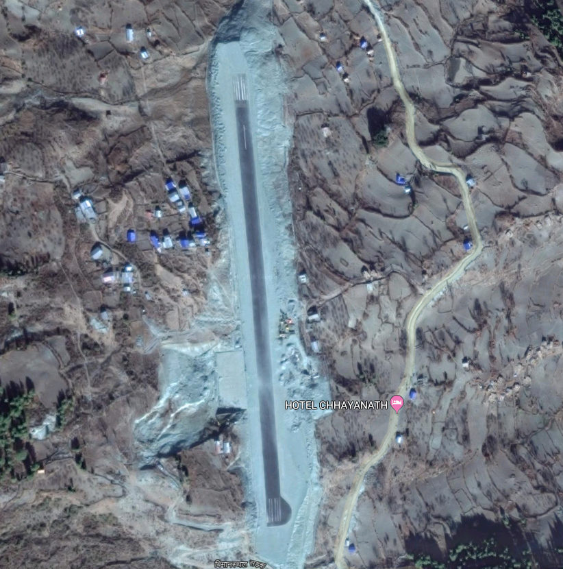
The Talcha Airport is situated at Karkibada Municipality of Mugu District, Karnali Province. It is an important gateway to the Rara National Park and is located about 2.5 hours walking distance from the Rara Lake. This airport is adjacent to the boundary of Rara National Park and within the Buffer Zone of the National Park.
|
Airport Location and Contact |
|
|---|---|
|
Country |
Nepal |
|
Province or District |
Karnali Province/ Mugu |
|
Nearest Town or City |
4 KM south from Gamgadhi |
|
Airport’s Complete Name |
Rara Airport, Talcha |
|
Latitude |
29.52020 |
|
Longitude |
82.14682 |
|
Elevation (ft and m) |
8924 ft (2720 m ) |
|
IATA Code |
THL |
|
ICAO Code |
VNRR |
|
Managing Company or Airport Authority |
Civil Aviation Authority of Nepal |
|
Management Contact Person |
Airport Chief: 9865960795 E-mail: rara_cao@caanepal.gov.np AFS: VNRRYDYX
|
|
NGO and/or UN Presence at Airport? |
NO |
Runway(s)
|
Runway #1 |
|
|---|---|
|
Runway Dimensions |
570 m x 20 m |
|
Runway Orientation |
18/36 |
|
Runway Surface |
Asphalt Concrete |
|
Runway Condition |
Good |
|
|
|
Fig: Asphalt Concrete Runway of Talcha Airport. Runway 36 on the right |
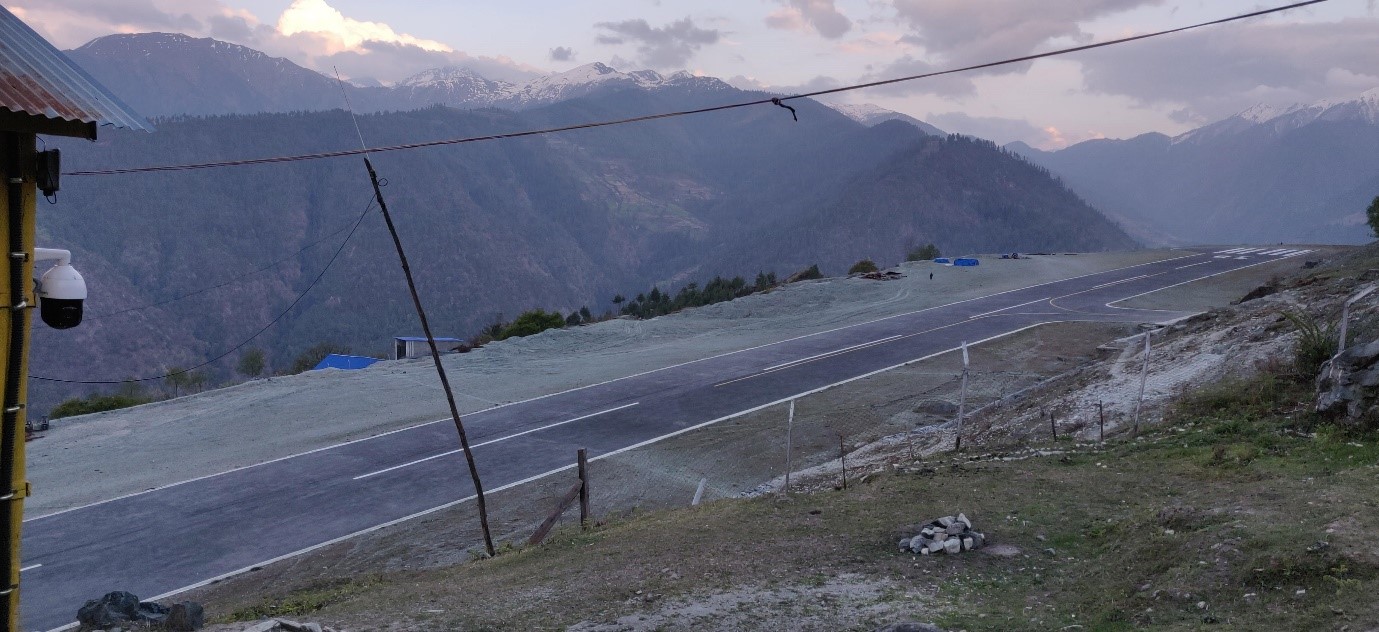
Airport Infrastructure Details
|
Infrastructure |
|||
|---|---|---|---|
|
Passenger / Cargo Security Screening |
Yes, hand-held metal detector |
Runway Lighting |
No |
|
Refueling Capacity |
No |
Ground Handling Services |
Yes with the local airlines operator. |
|
Air Traffic Control |
Yes |
Fire Fighting Equipment |
Yes |
|
Weather Information |
Tower Observation |
Aircraft Parking Space |
Apron for 2 small Aircrafts |
|
Navigation Aids |
No |
Perimeter Fencing |
Yes but have been not maintained properly. |
|
Windsock |
Yes |
|
|
Nepal - 2.2.19 Minor Domestic Airport - Rajbiraj
Airport Overview
Aerial view of Rajbiraj Airport-Saptari, Madesh Province-2
Rajbiraj is the district headquarters of Saptari District, Madesh Province and is located approximately 521 km from the capital, Kathmandu. The airport is situated 5km south of central Rajbiraj at Bisangapur Municipality. The 1st operation of the airport was started on 20th Feb 1960 and was completely shutdown, the airport resumed its operations on 23 May 2018. National airline operate direct flights from Kathmandu to Rajbiraj daily. (flight time 35 minutes).
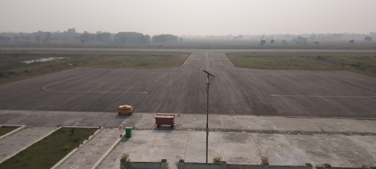
Aerodrome Administrative Operation hours
SUN-THU 10:00 -17:00 LT (SUMMER) & 10:00-1600 LT (WINTER),
FRI 10:00-1500 LT
Air traffic Service30 Jan to 01 Nov: 0415 – 1115 UTC
2 Nov – 29 Jan : 0415- 1015 UTC
Communication
Rajbiraj VHF Frequency 122,5 MGHZ
In 2022-2023 it had 712 aircraft movements, 33829 passengers, and 12160 kg cargo.
|
Airport Location and Contact |
|
|---|---|
|
Country |
Nepal |
|
Province or District |
Madhesh Province / Saptari |
|
Nearest Town or City |
Rajbiraj, Saptari - 5 km |
|
Airport’s Complete Name |
Rajbiraj Airport |
|
Latitude |
26.51089 |
|
Longitude |
86.73795 |
|
Elevation (ft and m) |
249 ft (76m) |
|
IATA Code |
RJB |
|
ICAO Code |
VNRB |
|
Managing Company or Airport Authority |
Civil Aviation Authority of Nepal Rajbiraj, Saptari Tel 1 - 977- 031-532458 Fax – NA AFS - VNRBYDYX Email: rajbiraj_cao@caanepal.gov.np |
|
Management Contact Person |
Tel - 977-031-532458 |
|
NGO and/or UN Presence at Airport? |
No |
|
Flight Service |
IFR & VFR |
Runway
|
Runway |
|
|---|---|
|
Runway Dimensions |
1590/30 m |
|
Runway Orientation |
11/29 |
|
Runway Surface |
Asphalt |
|
Runway Condition |
Good - Blacktop and operational |
Airport Infrastructure Details
|
Infrastructure |
|||
|---|---|---|---|
|
Passenger / Cargo Security Screening |
|
Runway Lighting |
APAPI Light & going to install |
|
Refueling Capacity |
No |
Ground Handling Services |
Yes with the local airline |
|
Air Traffic Control |
Yes |
Fire Fighting Equipment |
Fire extinguisher (portable) |
|
Weather Information |
Tower Observation & RNP observation approach |
Aircraft Parking Space |
5400 sq. 2 ATR Yes - 2 aircraft |
|
Navigation Aids |
Yes /VOR/DME |
Perimeter Fencing |
Yes – iron net fencing |
|
Windsock |
Yes - 1 |
|
|
Link for further details - Civil Aviation Authority of Nepal Rajbiraj Airport
Fuel Services Charges
N/A
Other information:
No Separate Helipad
1. Bird Activity a) Sometimes cases of bird concentrations in the vicinity of aerodrome may be encountered.
b) No Special procedures have been adopted to control these bird concentrations except driving them through guards and security personnel.
Nepal - 2.2.20 Minor Domestic Airport - Dolpa
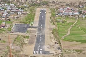
Airport Overview
Dolpa Airport (IATA: DOP, ICAO: VNDP) also referred to as Juphal Airport is located in Juphal, Thuli Bheri that serves the whole of Dolpa District, in Karnali Pradesh in Nepal. It is the only airport of the district. The airport serves as the gate way to Shey- Phoksundo National Park where the Phoksundo Lake is the major attraction. The airport also serves for the means of connection to upper Dolpa Trek which is one of the famous destinations for tourists.
The scheduled Operating airline from this airport are Tara Air, Sita Air, Nepal Airlines, Summit Air with scheduled connectivity services.
In 2020, it had 760 flight movements, 7446 passengers and 280272 kg of cargo. The airport is air-linked with Nepalgunj and Surkhet. National airline operators provide scheduled flights to Juphal airport from Nepalgunj and Surkhet. The airport operates all around with Operation Hours as following:
-
16th Feb to 15th Nov 0600LT-1215LT
-
16th Nov to 15th Feb 0630LT-1215LT
|
Airport Location and Contact |
|
|---|---|
|
Country |
Nepal |
|
Province or District |
Karnali Province, Dolpa |
|
Nearest Town or City |
Dunai, Dolpa |
|
Airport’s Complete Name |
Juphal Airport |
|
Latitude |
28.98554 |
|
Longitude |
82.81948 |
|
Elevation (ft and m) |
8137 ft (2480 m) |
|
IATA Code |
DOP |
|
ICAO Code |
VNDP |
|
Managing Company or Airport Authority |
Civil Aviation Authority of Nepal Off: 977-87690429 Tower: 977-87690429 AFS: VNDPYDYX E-mail: dolpa_cao@caanepal.gov.np |
|
Management Contact Person |
|
|
NGO and/or UN Presence at Airport? |
N/A |
Runway(s)
|
Runway #1 |
|
|---|---|
|
Runway Dimensions |
560 m x 20 m |
|
Runway Orientation |
16/34 |
|
Runway Surface |
Bituminous Paved (Asphalt Concrete) Surface |
|
Runway Condition |
Operational |
Airport Infrastructure Details
|
Infrastructure |
|||
|---|---|---|---|
|
Passenger / Cargo Security Screening |
Yes, Hand Held Metal Detector & CCTV Surveillance System |
Runway Lighting |
No |
|
Refueling Capacity |
No |
Ground Handling Services |
Limited |
|
Air Traffic Control |
Yes, One Man Position Tower Console with Associated Equipment and Accessories |
Fire Fighting Equipment |
|
|
Weather Information |
Yes, Tower Observation |
Aircraft Parking Space |
Two DHC6 Types with 2400 sq. Ashfalt surface |
|
Navigation Aids |
Yes, HF SSB, VHF |
Perimeter Fencing |
Yes, |
|
Windsock |
|
|
|
Fuel Services Charges
Not Available in this Airport
Royalties / Non Objection Fees (NOFs)
Link for more detail :
Link for ICAO and IATA Code: https://en.wikipedia.org/wiki/List_of_airports_in_Nepal
Nepal - 2.2.21 Minor Domestic Airport - Baitadi
|
|
|
Aerial view of Baitadi Airport |
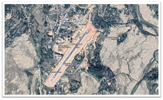
Airport Overview
Baitadi Airport also known as Patan Airport, is situated at Patan Municipality, of Baitadi District, Sudurpaschim Province.
The airport is located at an elevation of 4127 ft (1258 m) above mean sea level. The airport has a Bituminous Paved surface runway with dimensions 590 m x 20 m. Test landing was done on 03 October 2020 after the completion of the Asphalt Concrete Runway. In 2020 it had 16 aircraft movements and 200 pax movement
The airport was air-linked with Nepalgunj and Surkhet. Currently, the airport does not have any scheduled flights due to lack of enough number of air passengers
|
Airport Location and Contact |
|
|---|---|
|
Country |
Nepal |
|
Province or District |
Sudurpaschim, Baitadi |
|
Nearest Town or City |
Patan, Baitadi |
|
Airport’s Complete Name |
Baitadi (Patan) Airport |
|
Latitude |
29.46458 |
|
Longitude |
80.54975 |
|
Elevation (ft and m) |
4127 ft / 1258 m |
|
IATA Code |
BIT |
|
ICAO Code |
VNBT |
|
Managing Company or Airport Authority |
Civil Aviation Authority of Nepal AFS: VNBTYDYX |
|
Management Contact Person |
N/A
|
|
NGO and/or UN Presence at Airport? |
No |
Runway(s)
|
Runway #1 |
|
|---|---|
|
Runway Dimensions |
590 m x 20m |
|
Runway Orientation |
03/21 |
|
Runway Surface |
Bituminous Paved (Asphalt Concrete |
|
Runway Condition |
Asphalt Concrete |
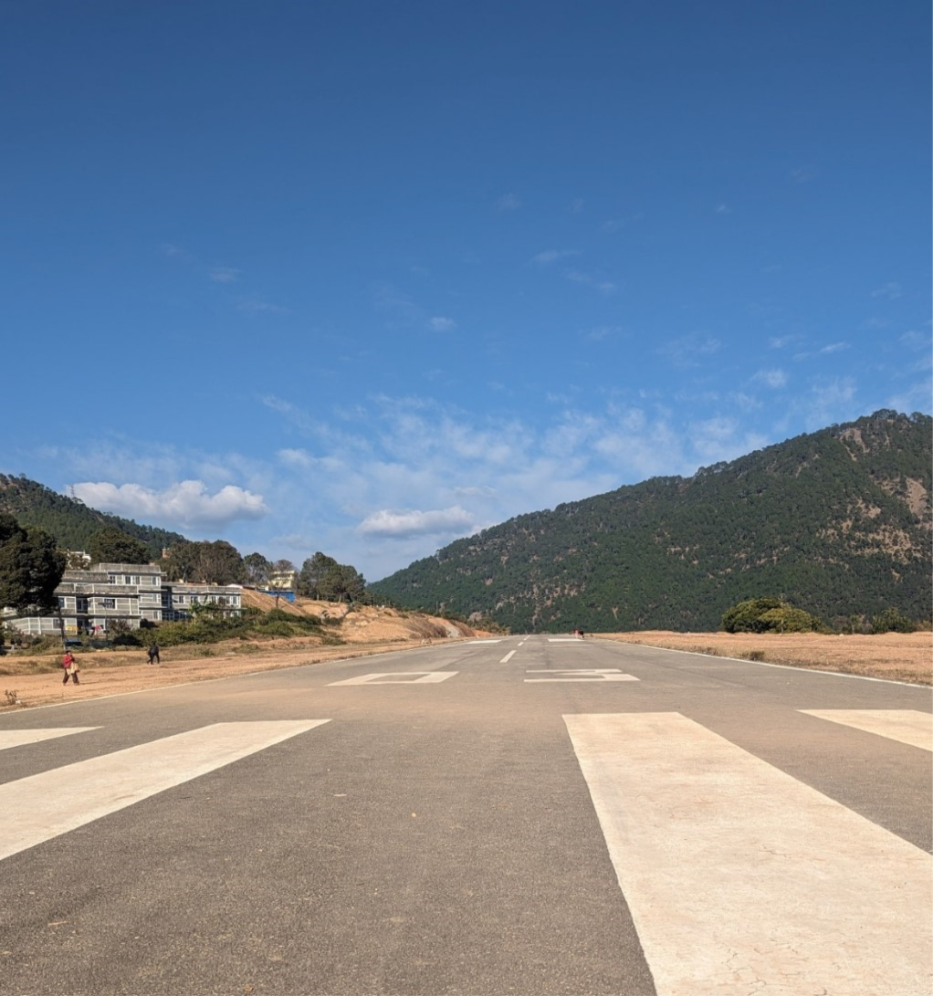
Airport Infrastructure Details
|
Infrastructure |
||||
|---|---|---|---|---|
|
Passenger / Cargo Security Screening |
Handheld Metal Detector |
Runway Lighting |
No |
|
|
Refueling Capacity |
No |
Ground Handling Services |
N/A |
|
|
Air Traffic Control |
Yes, AFIS, VFR |
Fire Fighting Equipment |
No |
|
|
Weather Information |
Tower Observation |
Aircraft Parking Space |
Two DHC6 Aircraft with 2100 sq.m. Asphalt Concrete Apron
|
|
|
Navigation Aids |
Yes VHF |
Perimeter Fencing |
Yes, but not properly maintained |
|
|
Windsock |
Yes |
|
|
|
Fuel Services Charges
Not Available in this Airport
Royalties / Non Objection Fees (NOFs)
N/A
Nepal - 2.2.22 Minor Domestic Airport - Bajura
Airport Overview
|
|
|
Picture: Arial view of Bajura Airport- Sudurpashchim province |
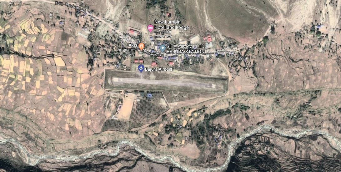
Bajura Airport resides at an elevation of 4,300 feet (1,311 m) above sea level. It has one runway which is 520 metres (1,706 ft) in length. National airline operators provide services from the airport to Nepalgunj and Dhangadi
|
Airport Location and Contact |
|
|---|---|
|
Country |
Nepal |
|
Province or District |
Sudurpashchim |
|
Nearest Town or City |
Bajura-Martadi DISTANCE (40 KM) |
|
Airport’s Complete Name |
Bajura (Kolte) |
|
Latitude |
29.50338 |
|
Longitude |
81.66713 |
|
Elevation (ft and m) |
1404 m |
|
IATA Code |
BJU |
|
ICAO Code |
VNBR |
|
Managing Company or Airport Authority |
Civil Aviation Authority –Bajura-Kolti
|
|
Management Contact Person |
Airport Chief Office Phone: +977-9858488215 Email: bajura_cao@caanepal.gov.np |
|
NGO and/or UN Presence at Airport? |
No |
Runway(s)
|
Runway #1 |
|
|---|---|
|
Runway Dimensions |
520 × 20 m |
|
Runway Orientation |
09 / 27 |
|
Runway Surface |
Asphalt |
|
Runway Condition |
Good, Blacktop and operational |
Airport Infrastructure Details
|
Infrastructure |
|||
|---|---|---|---|
|
Passenger / Cargo Security Screening |
No-Manual |
Runway Lighting |
No |
|
Refueling Capacity |
No |
Ground Handling Services |
Yes, however, all ground handling is done manually. |
|
Air Traffic Control |
Yes |
Fire Fighting Equipment |
No- only fire extinguishers are available. |
|
Weather Information |
Yes, Tower Observation |
Aircraft Parking Space |
Yes- 2 Aircrafts |
|
Navigation Aids |
Yes / |
Perimeter Fencing |
Yes |
|
Windsock |
Yes |
|
|
Fuel Services Charges
Not Available in this Airport
Royalties / Non Objection Fees (NOFs)
N/A
Link for ICAO and IATA Code: https://en.wikipedia.org/wiki/List_of_airports_in_Nepal
Nepal - 2.2.23 Minor Domestic Airport - Sanphebagar
Airport Overview
|
|
|
Pic: Aerial view of Sanfebagar Airport |
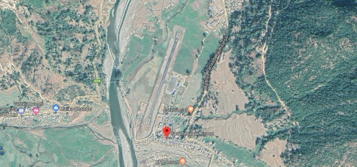
Sanphebagar Airport is situated in Accham District of Sudurpashchim Province. This airport has two scheduled flights connectivity to Dhangadhi, subject to availa. The airport resides at an elevation of 250 feet (76 m) above mean sea level. Since the renovation of the airport in 2018, the airport has one asphalt runway which is 530 metres (1,739 ft) in length. Moreover, due to the strategic location of this airport, heli operations to high altitude regions of Karnali and Sudurpaschim provinces, especially during emergencies, is most suitable.
|
Airport Location and Contact |
|
|---|---|
|
Country |
Nepal |
|
Province or District |
Sudurpaschim Province, Accham |
|
Nearest Town or City |
Mangalsen in 5 KM away from the airport |
|
Airport’s Complete Name |
Sanfebagar Airport |
|
Latitude |
29.23684 |
|
Longitude |
81.21574 |
|
Elevation (ft and m) |
597 m. / 1959 ft. |
|
IATA Code |
FEB |
|
ICAO Code |
VNSR |
|
Managing Company or Airport Authority |
Civil Aviation Authority of Nepal, Sanfebagar Airport AFS: VNSRYDYX |
|
Management Contact Person |
|
|
NGO and/or UN Presence at Airport? |
NO |
Runway
|
Runway #1 |
|
|---|---|
|
Runway Dimensions |
550 m x 20 m |
|
Runway Orientation |
02 / 20 |
|
Runway Surface |
Bituminous Paved (Asphalt Concrete) |
|
Runway Condition |
Operational |
Airport Infrastructure Details
|
Infrastructure |
|||
|---|---|---|---|
|
Passenger / Cargo Security Screening |
Handheld metal detector |
Runway Lighting |
No |
|
Refuelling Capacity |
No |
Ground Handling Services |
Yes, manual |
|
Air Traffic Control |
Yes |
Fire Fighting Equipment |
No |
|
Weather Information |
Tower Observation |
Aircraft Parking Space |
2400 sq. m |
|
Navigation Aids |
AFIS |
Perimeter Fencing |
|
|
Windsock |
Yes |
|
|
Fuel Services Charges
n/a
Royalties / Non Objection Fees (NOFs)
n/a
Nepal - 2.2.24 Baglung Domestic Airport
Airport Overview
|
|
|
Pic: Aerial view of Banglung Airport |
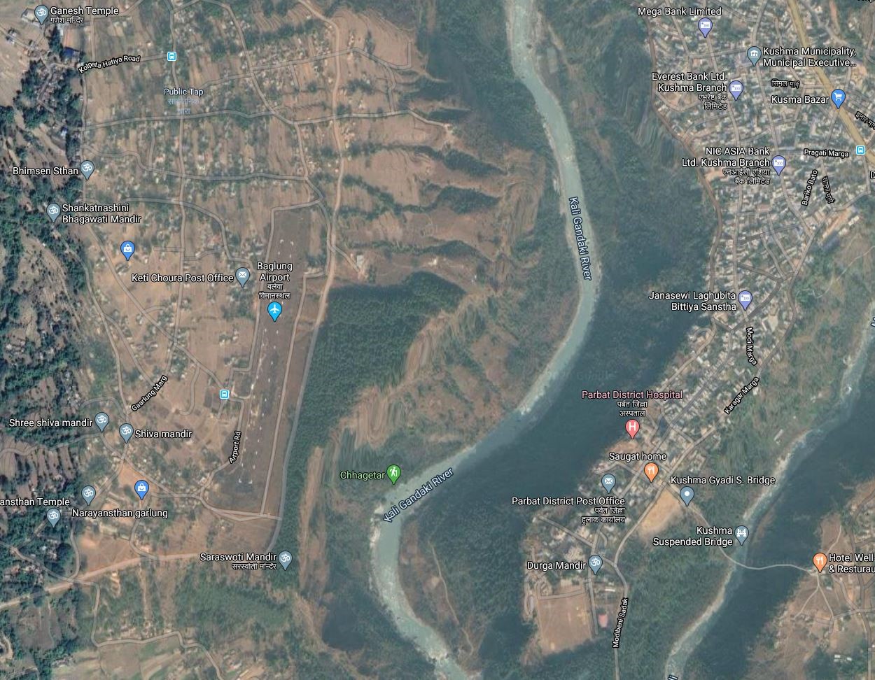
Baglung Airport also known as Balewa Airport, is an airport serving Narayanthan, a municipality located in the western region of Gandaki Province of Nepal. The airport was re-opened in 2018 after 26 years. since the early 2020s, there are no scheduled services to and from Baglung Airport.
Following resumption of the services, the access road to the airport was upgraded.
The airport has the following operation schedule:
-
Nov 1st to Jan 30th (Kartik 16th to Magh 15th) - 1000LT-1600LT
-
Feb 1st to Oct 30th (Magh 16th to Kartik 15th) - 1000LT-1700LT
|
Airport Location and Contact |
|
|---|---|
|
Country |
Nepal |
|
Province or District |
Gandaki Province/ Baglung |
|
Nearest Town or City |
15 KM SE from Baglung Municipality |
|
Airport’s Complete Name |
Baglung Airport |
|
Latitude |
28.78215 |
|
Longitude |
83.72314 |
|
Elevation (ft and m) |
3,248 ft / 990 m |
|
IATA Code |
BGL |
|
ICAO Code |
VNBL |
|
Managing Company or Airport Authority |
Civil Aviation Authority of Nepal, BaglungCivil Aviation Office, Baglung Airport Tel 977-68-413133 AFS: VNBLYDYX |
|
Management Contact Person |
|
|
NGO and/or UN Presence at Airport? |
NO |
Runway
|
Runway #1 |
|
|---|---|
|
Runway Dimensions |
608 x 30 m |
|
Runway Orientation |
01/19
|
|
Runway Surface |
Earthen |
|
Runway Condition |
Good, Overlay work is planned |
Airport Infrastructure Details
|
Infrastructure |
|||
|---|---|---|---|
|
Passenger / Cargo Security Screening |
hand Held Metal Detector |
Runway Lighting |
NO |
|
Re-fuelling Capacity |
NO |
Ground Handling Services |
|
|
Air Traffic Control |
AFIS
|
Fire Fighting Equipment |
No |
|
Weather Information |
Tower Observation, VFR |
Aircraft Parking Space |
Two DHC6 Aircrafts |
|
Navigation Aids |
HF SSB, VHF |
Perimeter Fencing |
|
|
Windsock |
|
|
|
Fuel Services Charges
N/A
Royalties / Non Objection Fees (NOFs)
N/A
Nepal - 2.2.25 Dhorpatan Minor Domestic Airport
Airport Overview
|
|
|
Pic: Aerial view of location of runway at Dhorpatan Airport |
Dhorpatan Airport is located in Bowang, Dhorpatan Municipality of Baglung District. It is 114 kms NW of district Headquarter at Baglung. It takes 4.75 hrs via Mid hill Highway to get to the airport from HQ. It is not in operation. Dhorpatan Hunting reserve is located in this municipality.
|
Airport Location and Contact |
|
|---|---|
|
Country |
Nepal |
|
Province or District |
Gandaki Province/ Baglung |
|
Nearest Town or City |
114 Kms NW from Baglung Municipality |
|
Airport’s Complete Name |
Dhorpatan Airport |
|
Latitude |
28.49220 |
|
Longitude |
83.05125 |
|
Elevation (ft and m) |
8950 ft (2728 m) |
|
IATA Code |
|
|
ICAO Code |
VNDR |
|
Managing Company or Airport Authority |
Civil Aviation Authority of Nepal, Dhorpatan Airport Tel 977 AFS VNDRYDYX |
|
Management Contact Person |
|
|
NGO and/or UN Presence at Airport? |
NO |
Runway
|
Runway #1 |
|
|---|---|
|
Runway Dimensions |
365 m x 30 m |
|
Runway Orientation |
09/ 27 27 - |
|
Runway Surface |
Earthen |
|
Runway Condition |
Not in Operation |
Airport Infrastructure Details
|
Infrastructure |
|||
|---|---|---|---|
|
Passenger / Cargo Security Screening |
Not available |
Runway Lighting |
N/A |
|
Refuelling Capacity |
No |
Ground Handling Services |
N/A |
|
Air Traffic Control |
AFIS |
Fire Fighting Equipment |
N/A |
|
Weather Information |
VFR |
Aircraft Parking Space |
N/A |
|
Navigation Aids |
N/A |
Perimeter Fencing |
N/A |
|
Windsock |
N/A |
|
|
Fuel Services Charges
N/A
Royalties / Non Objection Fees (NOFs)
N/A
Nepal - 2.2.26 Gorkha Domestic Airport
Airport Overview
|
|
|
Pic: Aerial view of location of Gorkha Airport at Palungtar |

Gorkha Airport also known as Palungtar Airport, is an airport serving the municipalities Palungtar and Gorkha of Gorkha District in the Southern region of Gandaki Province of Nepal. It is 42 kms West of district HQ at Gorkha. It can be accessed via blacktopped F35 and then earthen road of Middle hill highway.
The Short Take-off and Landing (STOL) airport was used until 1979, but is now out of operation. Despite being out of operation, the airport served as a major landing site for helicopters distributing relief material after the Gorkha earthquake in 2015. The airport connects nearby districts like Tanahun, Lamjung, Manang and Mustang but the construction of Prithivi Highway has rendered it obsolete.
|
Airport Location and Contact |
|
|---|---|
|
Country |
Nepal |
|
Province or District |
Gandaki Province/ Gorkha |
|
Nearest Town or City |
42 Kms West of District HQ |
|
Airport’s Complete Name |
Gorkha Airport |
|
Latitude |
28.03966 |
|
Longitude |
84.46602 |
|
Elevation (ft and m) |
1460 ft/ 445 m |
|
IATA Code |
GKH |
|
ICAO Code |
VNGK |
|
Managing Company or Airport Authority |
Civil Aviation Authority of Nepal, Gorkha Airport AFS VNGKYDYX |
|
Management Contact Person |
|
|
NGO and/or UN Presence at Airport? |
NO |
Runway
|
Runway #1 |
|
|---|---|
|
Runway Dimensions |
3501 × 151 ft (1067 × 46 m) |
|
Runway Orientation |
02/20 |
|
Runway Surface |
Earthen |
|
Runway Condition |
Not in Operation |
Airport Infrastructure Details
|
Infrastructure |
|||
|---|---|---|---|
|
Passenger / Cargo Security Screening |
None |
Runway Lighting |
None |
|
Refuelling Capacity |
No |
Ground Handling Services |
None |
|
Air Traffic Control |
AFIS |
Fire Fighting Equipment |
None |
|
Weather Information |
VFR |
Aircraft Parking Space |
Two HDC6 types |
|
Navigation Aids |
N/A |
Perimeter Fencing |
N/A |
|
Windsock |
N/A |
|
|
Fuel Services Charges
N/A
Royalties / Non Objection Fees (NOFs)
N/A
Nepal - 2.2.27 Manang Domestic Airport
Airport Overview
|
|
|
Pic: Aerial view of Humde Airport |
Manang Airport also known as Humde Airport is an airport serving Manang valley with one runway, a town in the Manang district of Gandaki Province in Nepal. It is 7 hours walking distance from district headquarter, Chame and an hour away 22 Km NW of District HQ at Chame. It can be accessed via Manang Sadak. It is 19th highest civilian airport in the world. It is not in operation.
Following are the operational schedules of Monang Airport.
-
16th Feb to 15th Nov- 0600LT-1215LT
-
16th Nov to 15th Feb- 0630LT-1215LT
|
Airport Location and Contact |
|
|---|---|
|
Country |
Nepal |
|
Province or District |
Gandaki Province/ Manang |
|
Nearest Town or City |
2.5 kilometres east of Manang town. |
|
Airport’s Complete Name |
Humde Airport |
|
Latitude |
28.64028 |
|
Longitude |
84.08791 |
|
Elevation (ft and m) |
11093 ft (3381 m) |
|
IATA Code |
NGX |
|
ICAO Code |
VNMA |
|
Managing Company or Airport Authority |
Civil Aviation Authority of Nepal, Humde Airport |
|
Management Contact Person |
|
|
NGO and/or UN Presence at Airport? |
None |
Runway
|
Runway #1 |
|
|---|---|
|
Runway Dimensions |
2952 × 65 ft (900 × 20 m) |
|
Runway Orientation |
11/29
|
|
Runway Surface |
Asphalt Concrete |
|
Runway Condition |
Not in Operation |
Airport Infrastructure Details
|
Infrastructure |
|||
|---|---|---|---|
|
Passenger / Cargo Security Screening |
Manual Search by Nepal Police |
Runway Lighting |
NO |
|
Refuelling Capacity |
NO |
Ground Handling Services |
|
|
Air Traffic Control |
Visual Flight Rules (VFR) |
Fire Fighting Equipment |
Not Available |
|
Weather Information |
AFIS, Tower Observation |
Aircraft Parking Space |
1750 sqm of Concrete Apron; 2 D228 Types |
|
Navigation Aids |
AFIS HF SSB, VHF |
Perimeter Fencing |
|
|
Windsock |
None |
|
|
Fuel Services Charges
N/A
Royalties / Non Objection Fees (NOFs)
N/A
Nepal - 2.2.28 Pokhara Domestic Airport
Airport Overview
|
|
|
Pic: Aerial view of Pokhara Airport |
Pokhara Airport is a domestic airport in Pokhara, the provincial capital of Gandaki Province. It is in the proximity of Pokhara metropolitan city. After the inauguration of Pokhara International Airport (PIA) in January 2023, all scheduled and chartered flights commence from the newly built PIA. However, a regular flights to and from Jomsom, ultra-light (sight-seeing), and helicopters continue commencing from the Pokhara domestic airport.
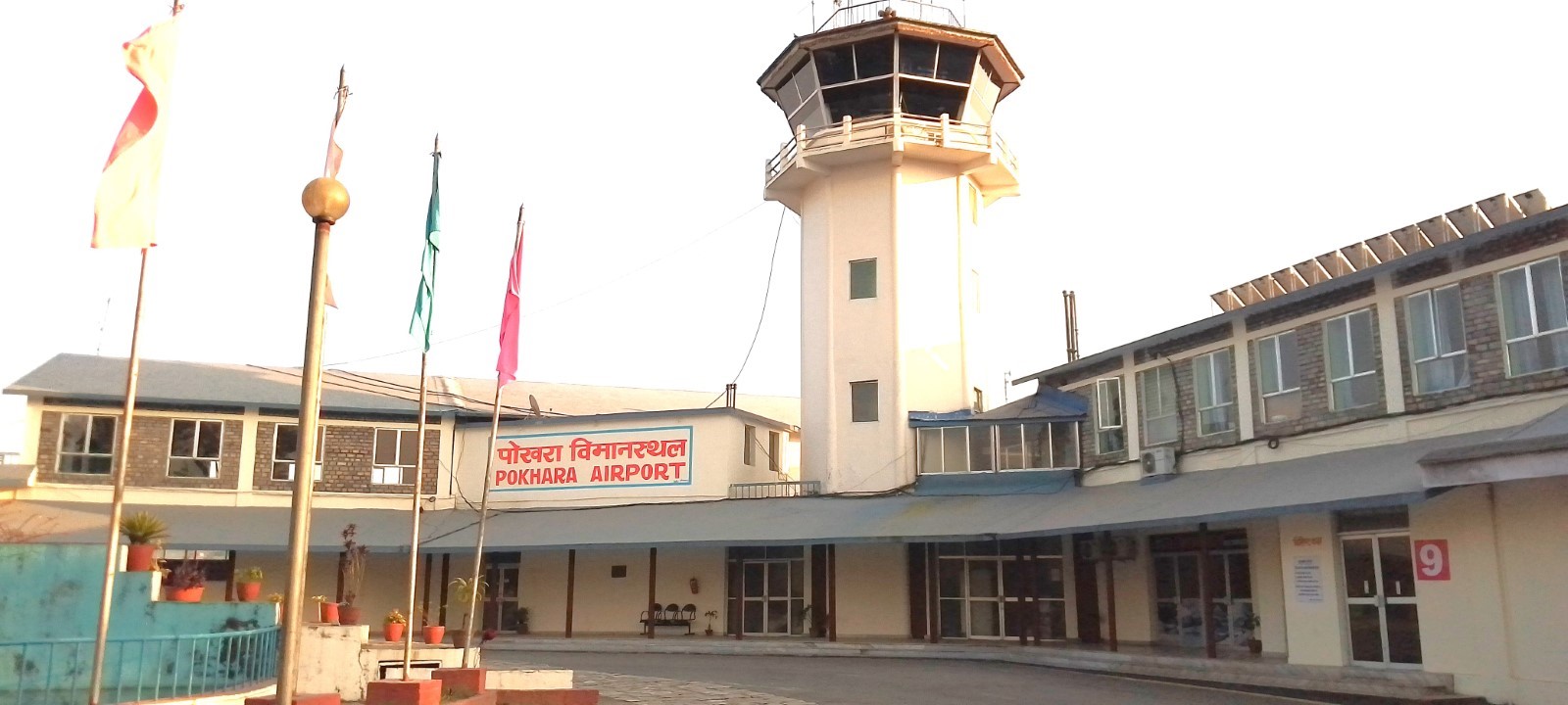
AD Administration Hour:
SUN-THU 10:00 -17:00 LT (SUMMER), 10:00-1600 LT (WINTER), FRI 10:00-1500 LT
Air Traffic Service operational hours all year round are as follows:
-
From 16 Feb - 15 Nov 0600LT-1845LT
-
From 16 Nov - 15 Feb 0630LT-1800LT
|
Airport Location and Contact |
|
|---|---|
|
Country |
Nepal |
|
Province or District |
Gandaki Province/ Kaski |
|
Nearest Town or City |
2 Km away from the main city |
|
Airport’s Complete Name |
Pokhara Airport |
|
Latitude |
28.20634 |
|
Longitude |
83.98020 |
|
Elevation (ft and m) |
2684/818m |
|
IATA Code |
PKR |
|
ICAO Code |
VNPK |
|
Managing Company or Airport Authority |
Jasoda Subedi Chief AoD 9846031773 Civil Aviation Authority of Nepal, Pokhara Civil Aviation Office, Pokhara, Kaski Tel- 977-061-465725, 535725 Fax - 977-061-465725 AFS – VNPKYDYX Email: pokhara_cao@caanepal.gov.np |
|
Management Contact Person |
|
|
NGO and/or UN Presence at Airport? |
NO |
Runway
|
Runway #1 |
|
|---|---|
|
Runway Dimensions |
1447 m x 30 m |
|
Runway Orientation |
04 / 22 |
|
Runway Surface |
Asphalt Concrete |
|
Runway Condition |
Good, operational |
Airport Infrastructure Details
|
Infrastructure |
|||
|---|---|---|---|
|
Passenger / Cargo Security Screening |
X-Ray: Hold Baggage, Hand Baggage Metal Detector: Walk Through, Handheld Metal Detector, CCTV Surveillance |
Runway Lighting |
No |
|
Refuelling Capacity |
JET A-1, during period of flight operation |
Ground Handling Services |
Available with local airlines operator |
|
Air Traffic Control |
Yes |
Fire Fighting Equipment |
Yes; Category II |
|
Weather Information |
Yes (by DHM)/MET |
Aircraft Parking Space |
15844.14 sqm of Concrete Apron, 5 ATR42, 2 Helicopters |
|
Navigation Aids |
DME |
Perimeter Fencing |
Yes |
|
Windsock |
Yes |
|
Isolated parking 65×60m Gravel, ATR 42 and ATR 72 Type |
Fuel Services Charges
The airport takes support from Nepal Oil Corporation for the provision of Jet fuel for the aircraft. NOC maintains the reserve of 60 Kilo Litre at its office premise. Storage Capacity (KL): Physical -64, Mobile-23 Storage Type: UG Tank (16×4) Refueller Details: AR21 (12KL), AR30 (11KL
|
|
Price per Litre USD - $ |
|---|---|
|
Jet A-1 |
1.02 / ltr (Duty Paid) * |
|
Avgas |
No |
*As of 01 October 2023 *Exchange rate 1 USD: 132.86 NPR
Additional Information: LOCAL TRAFFIC REGULATIONS
-
BTN 0515-0915 Daily, Paragliding activities takes place at Mahendradhunga, Pokhara area. Pilots to exercise caution while flying over that area. Airspace: 6000 ft AMSL/GND
-
BTN 0415-1115 Daily, Paragliding activities takes place at Bandipur area, near W41 route 926 NM South East of Pokhara ariport). Pilots to exercise caution while flying over that area. Airspace: 5000ft AMSL/GND
-
BTN 0015 - 1115 Daily, Ultra Light Training Flight zone has been established at 5.6 DME from Pokhara Airport at Laurek, Kaski District within 1NM circle From the mid point of Laurek Air Strip. Ultra light Training flight shall strictly remain to the west of Harpan Khola bridge to separate from the Paragliding Flights. Pilots to exercise caution while flying over that area. Airspace: 4500 ft AMSL/ GND
Nepal - 2.2.29 Jiri Domestic Airport
Airport Overview
|
|
|
Pic: Aerial view of the location of Jiri Airport at Jiri Municipality |
Jiri Airport is a small serving the of Jiri, Dolakha district in the north-eastern region of Bagmati of . It is 57 km East of district headquarter at Charikot, Dolakha. It can be accessed via blacktopped F32 and then Jiri Khadichaur local road.
The airport served as the gateway to Mount Everest when it opened in 1979.
|
Airport Location and Contact |
|
|---|---|
|
Country |
Nepal |
|
Province or District |
Bagmati Province / Dolakha |
|
Nearest Town or City |
57 Km E of District HQ in Charikot, Jiri Bazaar is in close proximity and Ramechhap Airport is located in close proximity to the city on distance of 2 and a half hours and is about 30km from Ramechhap Airport to Jiri. |
|
Airport’s Complete Name |
Jiri Airport |
|
Latitude |
27.62629 |
|
Longitude |
86.23039 |
|
Elevation (ft and m) |
6063 ft/1848m |
|
IATA Code |
JIR |
|
ICAO Code |
VNJI |
|
Managing Company or Airport Authority |
Civil Aviation Authority of Nepal, Jiri Airport Tel 977 AFS VNJIYDYX |
|
Management Contact Person |
|
|
NGO and/or UN Presence at Airport? |
NO |
Runway
|
Runway #1 |
|
|---|---|
|
Runway Dimensions |
1197 × 59 ft (365 × 18 m) |
|
Runway Orientation |
14/32 |
|
Runway Surface |
Earthen |
|
Runway Condition |
Not in Operation |
Airport Infrastructure Details
|
Infrastructure |
|||
|---|---|---|---|
|
Passenger / Cargo Security Screening |
NO |
Runway Lighting |
NO |
|
Refuelling Capacity |
NO |
Ground Handling Services |
NO |
|
Air Traffic Control |
Visual Flight Rules (VFR) |
Fire Fighting Equipment |
NO |
|
Weather Information |
AFIS |
Aircraft Parking Space |
Not available, Earthen |
|
Navigation Aids |
NO |
Perimeter Fencing |
Yes |
|
Windsock |
N/A |
|
|
Fuel Services Charges
N/A
Royalties / Non-Objection Fees (NOFs)
N/A
Nepal - 2.2.30 Langtang Domestic Airport
Airport Overview
|
|
|
Pic: Aerial view of location of Langtang Airport at Rasuwa |
Langtang Airport is an airport in Rasuwa district of Bagmati Province. at It is 30 Km NE from Dhunche with limited accessibility. It is not in Operation.
|
Airport Location and Contact |
|
|---|---|
|
Country |
Nepal |
|
Province or District |
Bagmati Province / Rasuwa |
|
Nearest Town or City |
30 Km due NE of district HQ with limited accessibility |
|
Airport’s Complete Name |
Langtang Airport |
|
Latitude |
28.20000 |
|
Longitude |
85.58527 |
|
Elevation (ft and m) |
11998 ft. / 3658 m |
|
IATA Code |
LTG |
|
ICAO Code |
VNLT |
|
Managing Company or Airport Authority |
Civil Aviation Authority of Nepal, Langtang Airport Tel 977 AFS |
|
Management Contact Person |
N/A |
|
NGO and/or UN Presence at Airport? |
NO |
Runway
|
Runway #1 |
|
|---|---|
|
Runway Dimensions |
1378 × 100 ft (420× 30 m) |
|
Runway Orientation |
09 - 27- |
|
Runway Surface |
Earthen |
|
Runway Condition |
Not in Operation |
Airport Infrastructure Details
|
Infrastructure |
|||
|---|---|---|---|
|
Passenger / Cargo Security Screening |
No |
Runway Lighting |
No |
|
Refuelling Capacity |
No |
Ground Handling Services |
No |
|
Air Traffic Control |
No |
Fire Fighting Equipment |
No |
|
Weather Information |
No |
Aircraft Parking Space |
No |
|
Navigation Aids |
No |
Perimeter Fencing |
No |
|
Windsock |
No |
|
|
Nepal - 2.2.31 Meghauli Domestic Airport
Airport Overview
|
|
|
Pic: Aerial view of Meghauli Airport |
Meghauli Airport is an airport in Meghauli, Bharatpur Metropolitan City in Chitwan district in Bagmati Province. It is one of the two airports in Chitwan, the other being Bharatpur Airport. It is 26 km South W of the district HQ at Bharatpur. It can be accessed via a blacktopped road.
The airport was built in 1961, however, the operation stopped in 2011 and it remains not in operation.
|
Airport Location and Contact |
|
|---|---|
|
Country |
Nepal |
|
Province or District |
Bagmati Province / Chitwan |
|
Nearest Town or City |
24 KM South of district HQ at Bharatpur |
|
Airport’s Complete Name |
Meghauli Airport |
|
Latitude |
27.57682 |
|
Longitude |
84.22802 |
|
Elevation (ft and m) |
498 ft (152 m) |
|
IATA Code |
MEY |
|
ICAO Code |
VNMG |
|
Managing Company or Airport Authority |
Civil Aviation Authority of Nepal, Meghauli Airport Tel 977 AFS: VNMGYDYX |
|
Management Contact Person |
|
|
NGO and/or UN Presence at Airport? |
NO |
Runway
|
Runway #1 |
|
|---|---|
|
Runway Dimensions |
1067 m×46 m |
|
Runway Orientation |
08/26 |
|
Runway Surface |
Earthen |
|
Runway Condition |
Not in operation |
Airport Infrastructure Details
|
Infrastructure |
|||
|---|---|---|---|
|
Passenger / Cargo Security Screening |
Not available |
Runway Lighting |
NO |
|
Refuelling Capacity |
Not available |
Ground Handling Services |
NO |
|
Air Traffic Control |
VFR |
Fire Fighting Equipment |
NO |
|
Weather Information |
AFIS |
Aircraft Parking Space |
3500 sqm of earthen Apron, 2 DHC6 Types |
|
Navigation Aids |
AFIS |
Perimeter Fencing |
|
|
Windsock |
No |
|
|
Fuel Services Charges
N/A
Royalties / Non Objection Fees (NOFs)
N/A
Nepal - 2.2.32 Ramechhap Domestic Airport
Airport Overview
|
|
|
Pic: Aerial view of Ramechhap Airport in Manthali |
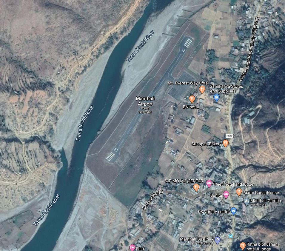
Ramechhap Airport is an airport serving the municipality of Manthali, the district headquarter of Ramechhap District located in the Tamakoshi River valley in Bagmati Province. It is in proximity to the district HQ. The Airport opened in 1979 and was renovated in 2015. It is the closest Airfield to Tribhuvan International Airport (TIA) in Kathmandu. Regular commercial flights to Lukla and Phaplu Airport are operated from this airport. While the chartered helicopters to Lukla and Phaplu are operated from TIA. Airport operational hours are as follows:
-
16th Feb to 15th Nov 0600LT-1215LT
-
16th Nov to 15th Feb 0630LT-1215LT
|
Airport Location and Contact |
|
|---|---|
|
Country |
Nepal |
|
Province or District |
Bagmati Province / Ramechhap |
|
Nearest Town or City |
In proximity of District HQ at Manthali |
|
Airport’s Complete Name |
Ramechhap Airport |
|
Latitude |
27.2338 |
|
Longitude |
86.06138 |
|
Elevation (ft and m) |
1620 ft./494 m. |
|
IATA Code |
RHP |
|
ICAO Code |
VNRC |
|
Managing Company or Airport Authority |
Civil Aviation Authority of Nepal, Ramechhap Airport Tel: 977 48540087 Tower: 977 48540087 Fax: 977 48540087 AFS VNRCYDYX |
|
Management Contact Person |
|
|
NGO and/or UN Presence at Airport? |
NO |
Runway
|
Runway #1 |
|
|---|---|
|
Runway Dimensions |
1738 × 65 ft (530 m × 20 m) |
|
Runway Orientation |
03- 21- |
|
Runway Surface |
Asphalt Concrete |
|
Runway Condition |
Operational |
Airport Infrastructure Details
|
Infrastructure |
|||
|---|---|---|---|
|
Passenger / Cargo Security Screening |
Metal Detector: handheld |
Runway Lighting |
No |
|
Refuelling Capacity |
Yes |
Ground Handling Services |
Yes |
|
Air Traffic Control |
Visual Flight Rules (VFR). HF SSB. VHF, One Man Position Tower Console with Associated Equipment and Accessories
|
Fire Fighting Equipment |
Yes |
|
Weather Information |
AFIS, Tower Observation |
Aircraft Parking Space |
5000 sqm Apron for 4 nos of Twinotter akin Aircrafts |
|
Navigation Aids |
HF SSB, VHF |
Perimeter Fencing |
N/A |
|
Windsock |
N/A |
|
|
Fuel Services Charges
The airport takes support from Nepal Oil Corporation for the provision of Jet fuel for the aircraft. NOC maintains the reserve of 60 Kilo Litre at its office premise.
|
|
Price per Litre USD - $ |
|---|---|
|
Jet A-1 |
0.55 (Duty Paid) * |
|
Avgas |
No |
*As of 01 October 2023
*Exchange rate 1 USD: 132.86 NPR
Nepal - 2.2.33 Dang Domestic Airport
Airport Overview
|
|
|
Pic: Aerial view of Dang airport |
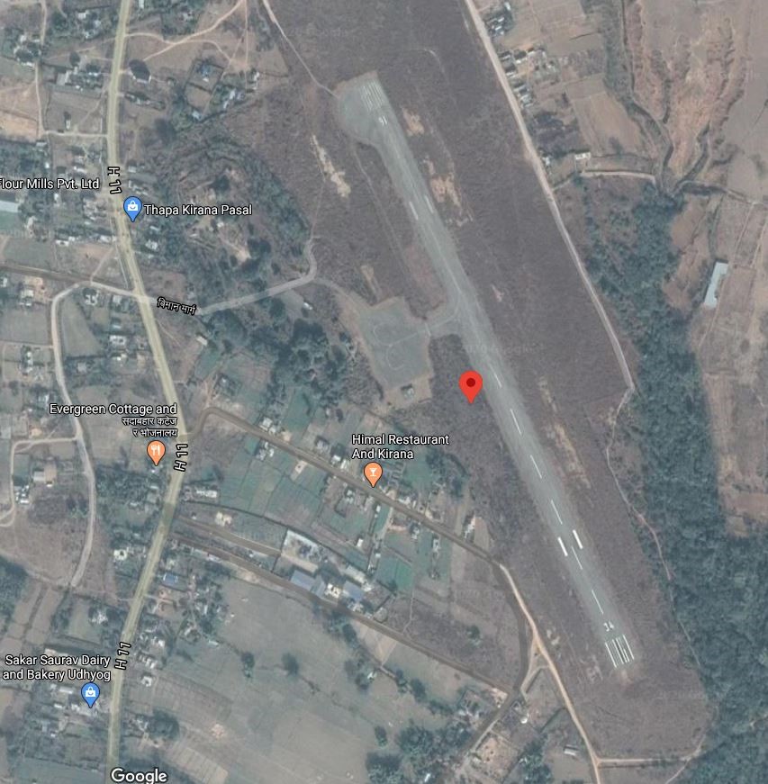
Dang Airport, also known as Tarigaun Airport, is in the West of Dang District in Lumbini Province. The airport is located in Tulsipur, 2 km south of the town center, and 23 km (14 mi) NW of Ghorahi.
Nepal Airlines operates weekly 3 fflights to and from Kathmandu. The airport is operational.
The operation hours are as follows:
-
16 Nov to 15 Feb 0630 hrs to 1230 hrs LT
-
16 Feb to 15 Nov 0600 hrs to 1200 hrs LT
|
Airport Location and Contact |
|
|---|---|
|
Country |
Nepal |
|
Province or District |
Lumbini province/ Dang |
|
Nearest Town or City |
2 kms South of Tulsipur |
|
Airport’s Complete Name |
Dang Airport |
|
Latitude |
28.11205 |
|
Longitude |
82.29408 |
|
Elevation (ft and m) |
2080 ft (634 m) |
|
IATA Code |
DNP |
|
ICAO Code |
VNDG |
|
Managing Company or Airport Authority |
Civil Aviation Authority of Nepal, Dang Airport Tel: 977-82521269 AFS: VNDGYDYX |
|
Management Contact Person |
Chet Raj Kapadi Bhatta |
|
NGO and/or UN Presence at Airport? |
NO |
Runway
|
Runway #1 |
|
|---|---|
|
Runway Dimensions |
2460 × 98 ft (750 × 30 m) |
|
Runway Orientation |
16 / 34 |
|
Runway Surface |
Asphalt Concrete |
|
Runway Condition |
Operational |
Airport Infrastructure Details
|
Infrastructure |
|||
|---|---|---|---|
|
Passenger / Cargo Security Screening |
Metal Detector: Handheld |
Runway Lighting |
No |
|
Refuelling Capacity |
Yes |
Ground Handling Services |
Manual |
|
Air Traffic Control |
One Man Position Tower Console with Associated Equipment and Accessories |
Fire Fighting Equipment |
Yes, Four hanhled fire extinguisher of 6 each and One 25 Kg extinguisher |
|
Weather Information |
Tower Observation and Met Display |
Aircraft Parking Space |
4500sqm of concrete Apron; 2 DHC6 Types |
|
Navigation Aids |
AFIS |
Perimeter Fencing |
Yes |
|
Windsock |
Yes |
|
|
Fuel Services Charges
The airport takes support from Nepal Oil Corporation for the provision of Jet fuel for the aircraft.
|
|
Price per Litre USD - $ |
|---|---|
|
Jet A-1 |
1.02 / ltr (Duty Paid) * |
|
Avgas |
No |
*As of 11 Oct 2023
*Exchange rate 1 USD: 132.90 NPR
Royalties / Non Objection Fees (NOFs)
n/a
Nepal - 2.2.34 Rolpa Domestic Airport
Airport Overview
|
|
|
Pic: Aerial view of Rolpa Airport |
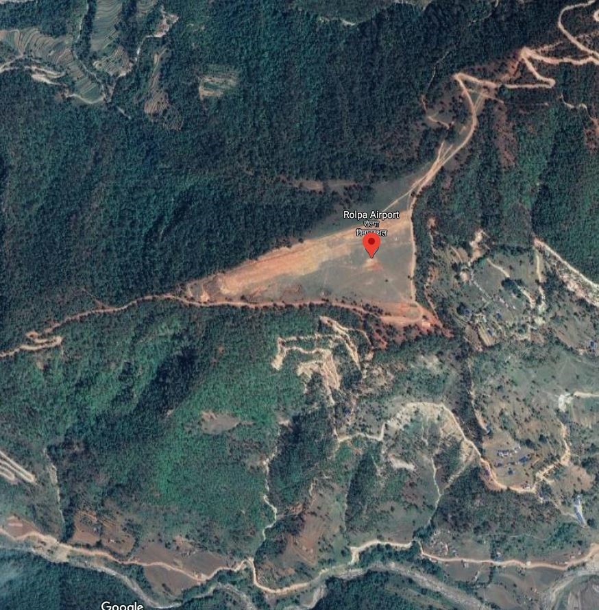
Rolpa Airport is situated at Bodachaur Municipality of Rolpa District, Lumbini Province . This airport is not in operation.
|
Airport Location and Contact |
|
|---|---|
|
Country |
Nepal |
|
Province or District |
Lumbini Province, Rolpa |
|
Nearest Town or City |
Bhalubang 2 hrs, 80 km south |
|
Airport’s Complete Name |
Rolpa Airport |
|
Latitude |
28.26732 |
|
Longitude |
82.75658 |
|
Elevation (ft and m) |
1250 m./4100 ft |
|
IATA Code |
RPA |
|
ICAO Code |
VNRP |
|
Managing Company or Airport Authority |
Civil Aviation Authority of Nepal AFS VNRPYDYX |
|
Management Contact Person |
N/A |
|
NGO and/or UN Presence at Airport? |
NO |
Runway
|
Runway #1 |
|
|---|---|
|
Runway Dimensions |
457 m x 30 m |
|
Runway Orientation |
06/24 |
|
Runway Surface |
Earthen |
|
Runway Condition |
Not in operation |
Nepal - 2.2.35 Bhojpur Domestic Airport
Airport Overview
|
|
|
Pic: Aerial view of Bhojpur Airport |
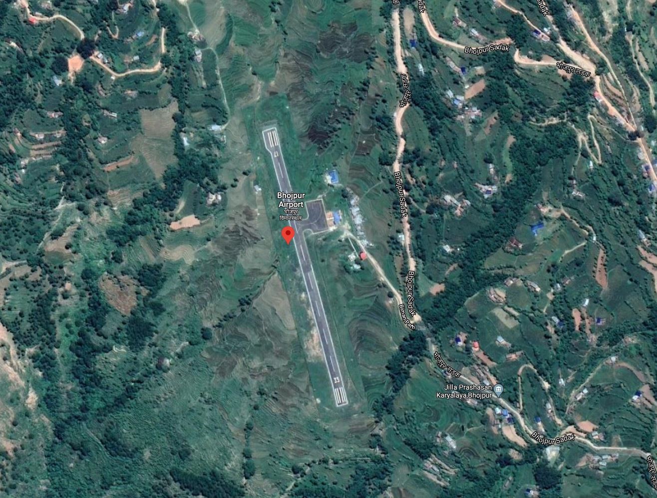
Bhojpur Airport is situated at Bhojpur, a town in the Bhojpur District in Koshi Province.
Currently Nepal Airlines has flights back and forth from Bhojpur to Kathmandu and Biratnagar.
The types of aircrafts that has been making the trip to the airport are DHC6, L410, Y12, C208. In 2019, 436 flights carried 5991 passengers and 713 kgs of cargo between destinations.
The operation is all year but with hour schedules as of now is as follows:
-
16 Feb to 15 Nov 0600 hrs – 1215 hrs LT
-
16 Nov to 15 Feb 0630 hrs – 1215 hrs LT
|
Airport Location and Contact |
|
|---|---|
|
Country |
Nepal |
|
Province or District |
Koshi Province/ Bhojpur |
|
Nearest Town or City |
5 Kms South of the District HQ |
|
Airport’s Complete Name |
Bhojpur Airport |
|
Latitude |
27.14821 |
|
Longitude |
87.05189 |
|
Elevation (ft and m) |
3962 ft (1208 m) |
|
IATA Code |
BHP |
|
ICAO Code |
VNBJ |
|
Managing Company or Airport Authority |
Civil Aviation Authority of Nepal, Bhojpur Airport Tel 977 -29-420118 AFS : VNBJYDYX |
|
Management Contact Person |
|
|
NGO and/or UN Presence at Airport? |
NO |
Runway
|
Runway #1 |
|
|---|---|
|
Runway Dimensions |
1771 × 65 ft (540 × 20 m) |
|
Runway Orientation |
17 - 35 - |
|
Runway Surface |
Asphalt concrete |
|
Runway Condition |
Operational |
Airport Infrastructure Details
|
Infrastructure |
|||
|---|---|---|---|
|
Passenger / Cargo Security Screening |
Handheld Metal Detector / CCTV surveillance |
Runway Lighting |
No |
|
Refuelling Capacity |
Not available |
Ground Handling Services |
|
|
Air Traffic Control |
Communication through HF SSB, VHF |
Fire Fighting Equipment |
No |
|
Weather Information |
Yes (Tower Observation) |
Aircraft Parking Space |
Apron of 65 x 32 m (three small Aircrafts) |
|
Navigation Aids |
None |
Perimeter Fencing |
|
|
Windsock |
|
|
|
Fuel Services Charges
N/A
Royalties / Non Objection Fees (NOFs)
N/A
Nepal - 2.2.36 Phaplu Domestic Airport
Airport Overview
|
|
|
Pic: Aerial view of Phaplu Airport |
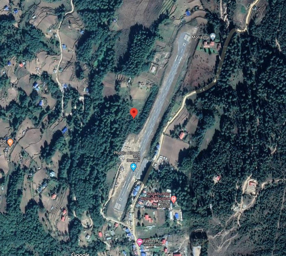
Phaplu Airport is located in Solu Dudhkunda municipality, Solukhumbu District, Koshi Province. It is within the premise of District Headquarter Salleri. It is one of the four airports in Solukhumbu district (Tenzing-Hillary, Kangle Danda, Syangboche). The airport runway was blacktopped in 2013. of Solu Dudhkunda municipality, Solukhumbu District, Koshi Province. It is within the premise of District Headquarter Salleri. It is one of the four airports in Solukhumbu district (Tenzing-Hillary, Kangle Danda, Syangboche). The airport runway was blacktopped in 2013.
Nepal Airlines, Tara Air and Summit Air provide services from Kathmandu all year-round on the following operation hours:
-
16 Feb to 15 Nov 0600 hrs – 1215 hrs LT
-
16 Nov to 15 Feb 0630 hrs – 1215 hrs LT
|
Airport Location and Contact |
|
|---|---|
|
Country |
Nepal |
|
Province or District |
Koshi Province/ Solukhumbu |
|
Nearest Town or City |
3 Kms from District HQ |
|
Airport’s Complete Name |
Phaplu Airport |
|
Latitude |
27.51657 |
|
Longitude |
86.58442 |
|
Elevation (ft and m) |
8097 ft (2468 m) |
|
IATA Code |
PPL |
|
ICAO Code |
VNPL |
|
Managing Company or Airport Authority |
Civil Aviation Authority of Nepal, Phaplu Airport Tel 977 38520153 AFS VNPLYDYX |
|
Management Contact Person |
|
|
NGO and/or UN Presence at Airport? |
NO |
Runway
|
Runway #1 |
|
|---|---|
|
Runway Dimensions |
2230 × 65 ft (680 × 20 m) |
|
Runway Orientation |
02 - 20 - |
|
Runway Surface |
Asphalt Concrete |
|
Runway Condition |
Operational |
Airport Infrastructure Details
|
Infrastructure |
|||
|---|---|---|---|
|
Passenger / Cargo Security Screening |
Metal detector: Handheld |
Runway Lighting |
No |
|
Refuelling Capacity |
No |
Ground Handling Services |
|
|
Air Traffic Control |
Uncontrolled |
Fire Fighting Equipment |
No |
|
Weather Information |
AFIS, Tower Observation |
Aircraft Parking Space |
1600 sqm of concrete apron, 3 D228 Types |
|
Navigation Aids |
None |
Perimeter Fencing |
|
|
Windsock |
|
|
|
Fuel Services Charges
N/A
Royalties / Non Objection Fees (NOFs)
N/A
Nepal - 2.2.37 Kangledanda Domestic Airport
Airport Overview
|
|
|
Pic: Aerial view of kangle Danda Airport at Kangledanda |
Kangel danda Airport is in Dudhkaushika rural municipality in the central part of Solukhumbu district of Koshi Province. It is one of the four airports in Solukhumbu district (Tenzing-Hillary, Phaplu, Syangboche). It is 12 kms SE of district HQ at Salleri. Road access is limited to the airport and nearest point of feeder road passing by is 6 kms away. This airport is not operational.
The terrain on which the airport is located is hilly and the flights to and from can be difficult due to high wind speeds and low visibility. When it was operational, during rainy season the airport remained closed.
Source: Airports of Nepal: Kangel Danda
|
Airport Location and Contact |
|
|---|---|
|
Country |
Nepal |
|
Province or District |
Koshi Province/ Solukhumbu |
|
Nearest Town or City |
12 kms SE of Salleri bazaar and 6 kms of limited access from the nearest point in F052 |
|
Airport’s Complete Name |
Kangeldanda Airport |
|
Latitude |
27.41096 |
|
Longitude |
86.64686 |
|
Elevation (ft and m) |
6880 ft (2097 m) |
|
IATA Code |
KGN |
|
ICAO Code |
VNKL |
|
Managing Company or Airport Authority |
Civil Aviation Authority of Nepal, Kangeldanda Airport AFS: VNKLYDYX |
|
Management Contact Person |
|
|
NGO and/or UN Presence at Airport? |
NO |
Runway
|
Runway #1 |
|
|---|---|
|
Runway Dimensions |
1706 × 85 ft (520 × 26 m) |
|
Runway Orientation |
11 - 29- |
|
Runway Surface |
Earthen |
|
Runway Condition |
Not in Operation |
Airport Infrastructure Details
|
Infrastructure |
|||
|---|---|---|---|
|
Passenger / Cargo Security Screening |
Manual search by Nepal Police |
Runway Lighting |
No |
|
Refuelling Capacity |
No |
Ground Handling Services |
|
|
Air Traffic Control |
Uncontrolled ATC |
Fire Fighting Equipment |
No |
|
Weather Information |
AFIS, Tower observation |
Aircraft Parking Space |
Two L410 Types, 2100 sq.m. apron |
|
Navigation Aids |
None |
Perimeter Fencing |
Fenced with wire mesh |
|
Windsock |
yes |
|
|
Fuel Services Charges
n/a
Royalties / Non Objection Fees (NOFs)
n/a
Nepal - 2.2.38 Manamaya Rai Khanidanda Domestic Airport
Airport Overview
|
|
|
Pic: Aerial view of Khani Danda Aiport at Diktel |
Khani Danda Airport also known as Manmaya Rai Airport is located in Diktel of Rupakot Majhuwagadhi municipality, Khotang district, Koshi Province. It is 6 kms SW of District HQ which is accessed via Khani Danda Road.
The runway was upgraded to bituminous Asphalt in 2015. The airport is not in operation.
|
Airport Location and Contact |
|
|---|---|
|
Country |
Nepal |
|
Province or District |
Koshi Province/ Khotang |
|
Nearest Town or City |
6 kms SW of District HQ which is accessed via Khani Danda Road |
|
Airport’s Complete Name |
Manamaya Rai Khanidanda Airport |
|
Latitude |
27.18142 |
|
Longitude |
86.77254 |
|
Elevation (ft and m) |
1352 m./4435 ft. |
|
IATA Code |
KDN |
|
ICAO Code |
VNKD |
|
Managing Company or Airport Authority |
Civil Aviation Authority of Nepal, Khani Danda Airport AFS VNKDYDYX |
|
Management Contact Person |
|
|
NGO and/or UN Presence at Airport? |
NO |
Runway
|
Runway #1 |
|
|---|---|
|
Runway Dimensions |
1903 × 82 ft (580 × 25 m) |
|
Runway Orientation |
08 - 26- |
|
Runway Surface |
Asphalt Concrete |
|
Runway Condition |
Not in operation |
Airport Infrastructure Details
|
Infrastructure |
|||
|---|---|---|---|
|
Passenger / Cargo Security Screening |
Handheld metal detector |
Runway Lighting |
No |
|
Refuelling Capacity |
NO |
Ground Handling Services |
|
|
Air Traffic Control |
One Man Position Tower Console with Associated Equipment and Accessories |
Fire Fighting Equipment |
No |
|
Weather Information |
AFIS Tower Observation |
Aircraft Parking Space |
2800 sqm of Concrete Apron |
|
Navigation Aids |
No |
Perimeter Fencing |
|
|
Windsock |
|
|
|
Fuel Services Charges
n/a
Royalties / Non Objection Fees (NOFs)
n/a
Nepal - 2.2.39 Lamidanda National Airport
Airport Overview
|
|
|
Pic: Aerial view of Lamidanda Airport |
Lamidanda Airport is located at Lamidanda, Rawabesi Rural Municipality in Khotang District, Koshi Province, Nepal. It is 25 km north of the district headquarter Diktel. It is one of the three STOL airports in the district besides Thamkharka Airport and Man Maya (Khani Danda) Airport. The airport is currently not operational.
|
Airport Location and Contact |
|
|---|---|
|
Country |
Nepal |
|
Province or District |
Koshi Province, Khotang |
|
Nearest Town or City |
25 kms north of Diktel |
|
Airport’s Complete Name |
Lamidanda Airport |
|
Latitude |
27.25284 |
|
Longitude |
86.67222 |
|
Elevation (ft and m) |
4026 ft (1227 m) |
|
IATA Code |
LDN |
|
ICAO Code |
VNLD |
|
Managing Company or Airport Authority |
Civil Aviation Authority of Nepal, Lamidanda Airport Tel 977 36690093 AFS VNLDYDYX |
|
Management Contact Person |
|
|
NGO and/or UN Presence at Airport? |
NO |
Runway
|
Runway #1 |
|
|---|---|
|
Runway Dimensions |
1706 × 66 ft (520 × 20 m) |
|
Runway Orientation |
08- 26 - |
|
Runway Surface |
Asphalt Concrete |
|
Runway Condition |
Not in Operation |
Airport Infrastructure Details
|
Infrastructure |
|||
|---|---|---|---|
|
Passenger / Cargo Security Screening |
Metal Detector: Handheld |
Runway Lighting |
No |
|
Refuelling Capacity |
NO |
Ground Handling Services |
No |
|
Air Traffic Control |
One Man Position Tower Console with Associated Equipment and Accessories |
Fire Fighting Equipment |
No |
|
Weather Information |
AFIS, Tower Observation |
Aircraft Parking Space |
1800 sqm of concrete Apron; 2 DHC6 Types |
|
Navigation Aids |
No |
Perimeter Fencing |
Yes |
|
Windsock |
|
|
|
Fuel Services Charges
n/a
Royalties / Non Objection Fees (NOFs)
n/a
Nepal - 2.2.40 Rumjatar Domestic Airport
Airport Overview
|
|
|
Pic: Aerial view of Rumjatar Airport |
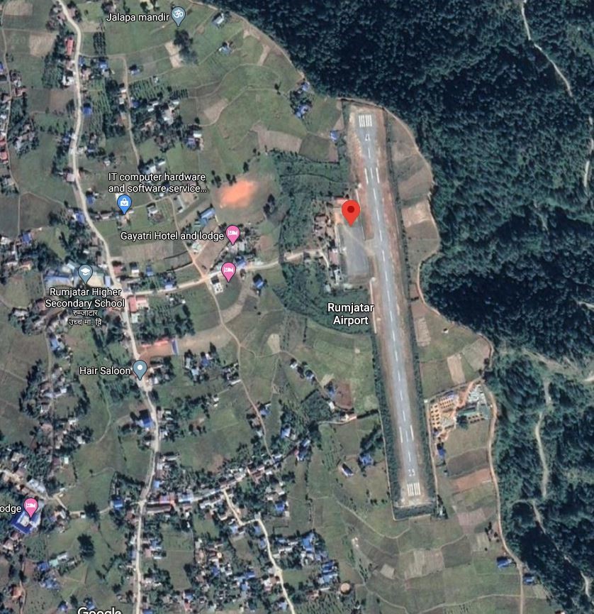
Rumjatar Airport is in Rumjatar, a village in the Okhaldhunga district of Koshi Province . It is 13 kms ESE of District HQ and is accessed Via Feeder Road F052 and Local Road.
The airport came back to operation in 2019 after 3 years of inactivity. Currently, this airport does not have any scheduled flights due to lack of enough passengers. The operating hours are as follows:
-
Nov 1st to Jan 30th (Kartik 16th to Magh 15th) 1000LT-1600LT
-
Feb 1st to Oct 30th (Magh 16th to Kartik 15th) 1000LT-1700LT
|
Airport Location and Contact |
|
|---|---|
|
Country |
Nepal |
|
Province or District |
Koshi rovince/ Okhaldhunga |
|
Nearest Town or City |
13 kms SE of District HQ accessed Via F052 and Local Road |
|
Airport’s Complete Name |
Rumjatar Airport |
|
Latitude |
27.30344 |
|
Longitude |
86.55026 |
|
Elevation (ft and m) |
4498 ft (1371 m) |
|
IATA Code |
RUM |
|
ICAO Code |
VNRT |
|
Managing Company or Airport Authority |
Civil Aviation Authority of Nepal, Rumjatar Airport Tel 977 37540118 Tower: 977-37540149 AFS VNRTYDYX |
|
Management Contact Person |
|
|
NGO and/or UN Presence at Airport? |
NO |
Runway
|
Runway #1 |
|
|---|---|
|
Runway Dimensions |
1906 × 66 ft (581 m × 20 m) |
|
Runway Orientation |
17/35 |
|
Runway Surface |
Asphalt Concrete |
|
Runway Condition |
All weather Operational |
Airport Infrastructure Details
|
Infrastructure |
|||
|---|---|---|---|
|
Passenger / Cargo Security Screening |
Metal Detector: Handheld |
Runway Lighting |
No |
|
Refuelling Capacity |
NO |
Ground Handling Services |
|
|
Air Traffic Control |
AFIS HF SSB, VHF, VFR, One Man Position Tower Console with Associated Equipment and Accessories
|
Fire Fighting Equipment |
Not Available |
|
Weather Information |
AFIS, Tower Observation, |
Aircraft Parking Space |
2700 sqm of concrete Apron, 2 D228 Types a |
|
Navigation Aids |
VHF |
Perimeter Fencing |
|
|
Windsock |
No |
|
|
Fuel Services Charges
N/A
Royalties / Non Objection Fees (NOFs)
N/A
Nepal - 2.2.41 Syangboche Domestic Airport
Airport Overview
|
|
|
Pic: Aerial view of Syangboche Airport |
Syangboche Airport is situated at Kumjung Municipality of Solukhumbu District, Koshi Province. It is the gateway to the Mount Everest and is a STOL airport. The airport lies inside the Sagarmatha National Park. Nowadays, this airport is not in operation. It is 37 kms due NNE of the District HQ in Namche Bazar with limited road access.
It is one of the four airports (Tenzing-Hillary Airport, Kangel Danda Airport, and Phaplu Airport) in Solukhumbu district. The airport is not in operation.
|
Airport Location and Contact |
|
|---|---|
|
Country |
Nepal |
|
Province or District |
Koshi Province/ Solukhumbu |
|
Nearest Town or City |
In proximity of Namche Bazaar |
|
Airport’s Complete Name |
Syangboche Airport |
|
Latitude |
27.81141 |
|
Longitude |
86.71259 |
|
Elevation (ft and m) |
12293 ft./3748 m. |
|
IATA Code |
SYH |
|
ICAO Code |
VNSB |
|
Managing Company or Airport Authority |
Civil Aviation Authority of Nepal, Syangboche Airport AFS: VNSBYDYX |
|
Management Contact Person |
|
|
NGO and/or UN Presence at Airport? |
NO |
Runway
|
Runway #1 |
|
|---|---|
|
Runway Dimensions |
1328 × 100 ft (405 × 30 m) |
|
Runway Orientation |
13/31 -
|
|
Runway Surface |
Earthen |
|
Runway Condition |
Not in Operation |
Airport Infrastructure Details
|
Infrastructure |
|||
|---|---|---|---|
|
Passenger / Cargo Security Screening |
No |
Runway Lighting |
No |
|
Refuelling Capacity |
NO |
Ground Handling Services |
N/A |
|
Air Traffic Control |
AFIS, VFR |
Fire Fighting Equipment |
No |
|
Weather Information |
No |
Aircraft Parking Space |
No |
|
Navigation Aids |
No |
Perimeter Fencing |
N/A |
|
Windsock |
|
|
|
Fuel Services Charges
N/A
Royalties / Non Objection Fees (NOFs)
N/A
Nepal - 2.2.42 Taplejung Domestic Airport
Airport Overview
|
|
|
Pic: Aerial view of Taplejung Airport |
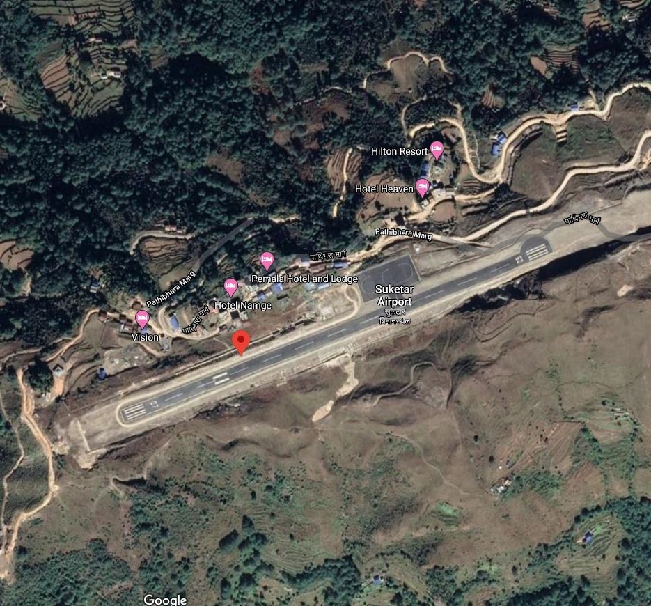
Taplejung Airport, also known as Suketar Airport is in Suketar, Taplejung Koshi Province. It is 4kms due east of district HQ at Taplejung and 8 Km from Phungling Bazaar. The airport serves as a gateway to Kanchanjanga Conservation Area and the famous Pathivara Temple thus is a very important destination for tourist movement. It is linked by air with Chandragadhi and Kathmandu with all weather serviceability. In 2020 it had 248 aircraft movements and 2,083 passengers and 30 kg of cargo.The runway was blacktopped in 2016.
The operation hours are as follows:
-
16th Feb to 15th Nov - 0600LT-1215LT
-
16th Nov to 15th Feb - 0630LT-1215LT
|
Airport Location and Contact |
|
|---|---|
|
Country |
Nepal |
|
Province or District |
Koshi Province /Taplejung |
|
Nearest Town or City |
4km Due east of the District HQ |
|
Airport’s Complete Name |
Taplejung Airport |
|
Latitude |
27.35103 |
|
Longitude |
87.69505 |
|
Elevation (ft and m) |
7936 ft (2419 m) |
|
IATA Code |
TPJ |
|
ICAO Code |
VNTJ |
|
Managing Company or Airport Authority |
Civil Aviation Authority of Nepal, Taplejung Airport Tel 977 24460518 AFS VNTJYDYX |
|
Management Contact Person |
|
|
NGO and/or UN Presence at Airport? |
NO |
Runway
|
Runway #1 |
|
|---|---|
|
Runway Dimensions |
2297 × 66 ft (700 m × 20 m) |
|
Runway Orientation |
07/25 |
|
Runway Surface |
Asphalt Concrete |
|
Runway Condition |
Good, operational |
Airport Infrastructure Details
|
Infrastructure |
|||
|---|---|---|---|
|
Passenger / Cargo Security Screening |
Metal Detector: Handheld |
Runway Lighting |
No |
|
Refuelling Capacity |
NO |
Ground Handling Services |
|
|
Air Traffic Control |
HF SSB, VHF, Tower Observation, VFR, One Man Position Tower Console with Associated Equipment and Accessories
|
Fire Fighting Equipment |
Not available |
|
Weather Information |
AFIS,VHF |
Aircraft Parking Space |
3600 sqm of concrete Asphalt; 3 D228 Types |
|
Navigation Aids |
HF, SSB, VHF |
Perimeter Fencing |
|
|
Windsock |
|
|
|
Nepal - 2.2.43 Thamkharka Domestic Airport
Airport Overview
|
|
|
Pic: Aerial view of location of Thamkharka Airport |
Thamkharka Airport is situated at Badka Diyale Municipality of Khotang District, Koshi Province. The airport has air link with Kathmandu only. Including Thamkharka, Khotang District comprises of three airports. Thamkharka Airport is an airport in Khotehang rural municipality in Khotang district of Koshi Province It is 20 Kms due South of the District HQ at Diktel. It is one of the three airports (Man Maya Airport, Lamidanda Airport) in the district. The airport is operational.
Air Traffic Service operational hours all year-round are as follows:
-
16th Feb to 15th Nov 0600LT-1215LT
-
16th Nov to 15th Feb 0630LT-1215LT
|
Airport Location and Contact |
|
|---|---|
|
Country |
Nepal |
|
Province or District |
Koshi Province Khotang |
|
Nearest Town or City |
Khotang Bazaar is connected by Khotang bazaar -Airport RD. Three hours walking distance from Khotang Bazaar |
|
Airport’s Complete Name |
Thamkharka Airport |
|
Latitude |
27.04817 |
|
Longitude |
86.85791 |
|
Elevation (ft and m) |
5252 ft/1601 m. |
|
IATA Code |
TMK |
|
ICAO Code |
VNTH |
|
Managing Company or Airport Authority |
Civil Aviation Authority of Nepal, Thamkharka Airport Tel 977 AFS VNTHYDYX |
|
Management Contact Person |
|
|
NGO and/or UN Presence at Airport? |
NO |
Runway
|
Runway #1 |
|
|---|---|
|
Runway Dimensions |
2034× 66 ft (620 × 20 m) |
|
Runway Orientation |
18/36
|
|
Runway Surface |
Asphalt Concrete |
|
Runway Condition |
Operational/ Asphalt Concrete |
Airport Infrastructure Details
|
Infrastructure |
|||
|---|---|---|---|
|
Passenger / Cargo Security Screening |
Metal Detector: handheld |
Runway Lighting |
No |
|
Refuelling Capacity |
Not available |
Ground Handling Services |
NO |
|
Air Traffic Control |
AFIS, Tower Observation |
Fire Fighting Equipment |
Not available |
|
Weather Information |
AFIS, VFR |
Aircraft Parking Space |
3600 sqm of concrete Apron; 2 DHC6 Types |
|
Navigation Aids |
HF SSB, VHF |
Perimeter Fencing |
NO |
|
Windsock |
N/A |
|
|
Fuel Services Charges
N/A
Royalties / Non Objection Fees (NOFs)
N/A
Nepal - 2.2.44 Domestic Airport – Bajhang
Airport Overview
|
|
|
Pic: Aerial view of Bajhang airport |
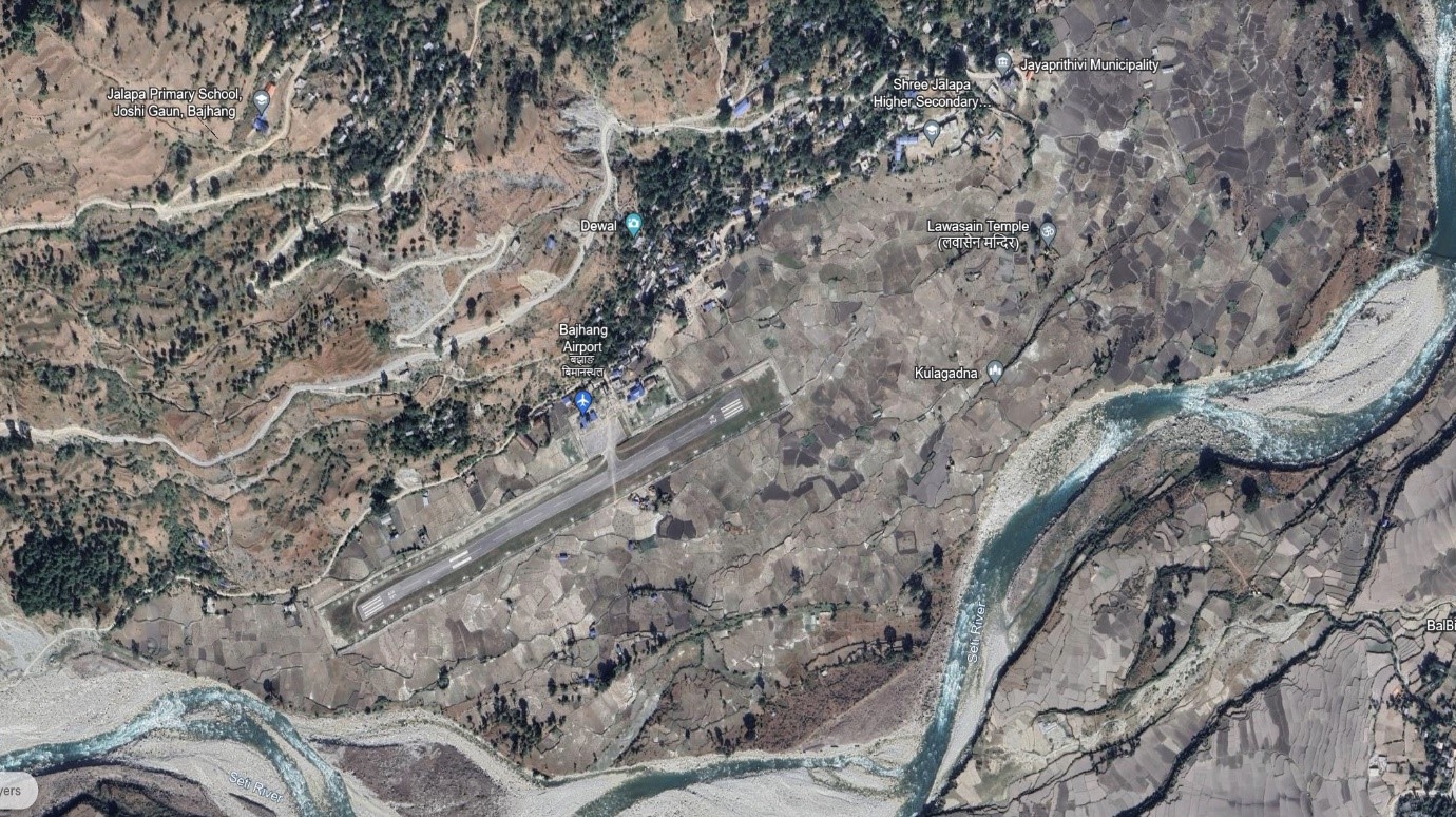
Bajhang Airport is situated at Rithapata Municipality of Bajhang district, Sudurpaschim Province.
The airport is operational. Summit Air operates scheduled flights twice a week from Dhangadhi Airport to Bajhang Airport.
The operation hours are as follows:
-
Nov 1st to Jan 30th (Kartik 16th to Magh 15th) 1000LT-1600LT
-
Feb 1st to Oct 30th (Magh 16th to Kartik 15th) 1000LT-1700LT
|
Airport Location and Contact |
|
|---|---|
|
Country |
Nepal |
|
Province or District |
Sudurpaschim, Bajhang District |
|
Nearest Town or City |
2 kms South of the City Centre |
|
Airport’s Complete Name |
Bajhang Airport |
|
Latitude |
29.53956 |
|
Longitude |
81.18398 |
|
Elevation (ft and m) |
4015 ft (1224 m) |
|
IATA Code |
BJH |
|
ICAO Code |
VNBG |
|
Managing Company or Airport Authority |
Civil Aviation Authority of Nepal, Bajhang Airport Tel: 977-92421060 AFS: VNBGYDYX |
|
Management Contact Person |
|
|
NGO and/or UN Presence at Airport? |
NO |
Runway
|
Runway #1 |
|
|---|---|
|
Runway Dimensions |
2067 × 321 ft (630 × 20 m) |
|
Runway Orientation |
06 / 24 |
|
Runway Surface |
Asphalt Concrete |
|
Runway Condition |
Operational |
Airport Infrastructure Details
|
Infrastructure |
|||
|---|---|---|---|
|
Passenger / Cargo Security Screening |
Manual search |
Runway Lighting |
N/A |
|
Refuelling Capacity |
No |
Ground Handling Services |
N/A |
|
Air Traffic Control |
Visual Flight Rule (VFR), VHF |
Fire Fighting Equipment |
No |
|
Weather Information |
AFIS, Tower Observation |
Aircraft Parking Space |
1800sqm of concrete Apron for Two DHC6 Types or Equivalent |
|
Navigation Aids |
AFIS |
Perimeter Fencing |
Yes |
|
Windsock |
N/A |
|
|
Fuel Services Charges
n/a
Royalties / Non Objection Fees (NOFs)
n/a
Nepal - 2.2.45 Domestic Airport - Doti
Airport Overview
|
|
|
Pic: Aerial view of Doti Airport |
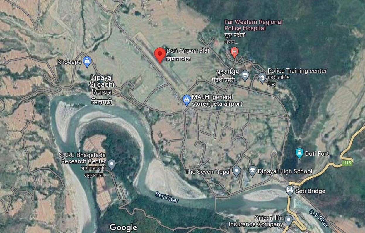
Doti Airport is situated at Dipayal Municipality of Doti District, Sudurpaschim Province. The runway was upgraded in 2022 to asphalt concrete. Currently, there are no scheduled flights from this airport.
|
Airport Location and Contact |
|
|---|---|
|
Country |
Nepal |
|
Province or District |
Sudurpaschim Province, Doti |
|
Nearest Town or City |
Main town of Silgadhi is 2 km southeast from the airport |
|
Airport’s Complete Name |
Doti Airport |
|
Latitude |
29.26316 |
|
Longitude |
80.93617 |
|
Elevation (ft and m) |
577 m / 1893 ft |
|
IATA Code |
SIH |
|
ICAO Code |
VNDT |
|
Managing Company or Airport Authority |
Civil Aviation Authority of Nepal AFS VNDTYDYX |
|
Management Contact Person |
|
|
NGO and/or UN Presence at Airport? |
NO |
Runway
|
Runway #1 |
|
|---|---|
|
Runway Dimensions |
490 m x 20 m |
|
Runway Orientation |
14/32 |
|
Runway Surface |
Bituminous Paved (Asphalt Concrete) |
|
Runway Condition |
Operational |
Airport Infrastructure Details
|
Infrastructure |
|||
|---|---|---|---|
|
Passenger / Cargo Security Screening |
Metal Detector/ Manual search |
Runway Lighting |
No |
|
Refuelling Capacity |
No |
Ground Handling Services |
Yes, Manual |
|
Air Traffic Control |
One man position tower console with associated equipment and accessories |
Fire Fighting Equipment |
No |
|
Weather Information |
Tower Observation |
Aircraft Parking Space |
1800 sqm of concrete Apron |
|
Navigation Aids |
AFIS |
Perimeter Fencing |
Yes |
|
Windsock |
Yes |
|
|
Fuel Services Charges
N/A
Royalties / Non-Objection Fees (NOFs)
N/A
Nepal - 2.2.46 Domestic Airport – Falgunanda
Airport Overview
|
|
|
Pic: Aerial view of Falgunanda Airport in Sukilumba, Ilam District |
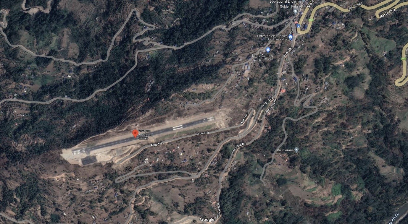
Falgunanda Airport , is a small airport in Sukilumb, Ilam District, Koshi Province in eastern Nepal. It is 1 km west from Golakharka Bhanjyang.
In 2018, the first test flight landed at the airport. As of October 2022, the airport is categorized as operational however no scheduled flights have been materialized. The airport is operational and it operates weekly two flights
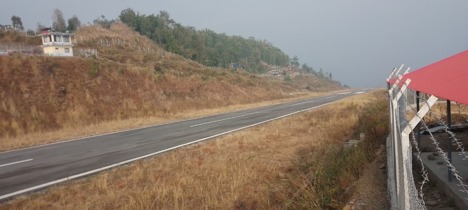
|
Airport Location and Contact |
|
|---|---|
|
Country |
Nepal |
|
Province or District |
Koshi Province / Solukhumbu |
|
Nearest Town or City |
1 km west from Golakharka Bhanjyang |
|
Airport’s Complete Name |
Falgunanda Airport |
|
Latitude |
26.87760 |
|
Longitude |
87.90508 |
|
Elevation (ft and m) |
2800 ft (853.95 m) |
|
IATA Code |
|
|
ICAO Code |
VNFN |
|
Managing Company or Airport Authority |
Civil Aviation Authority of Nepal
|
|
Management Contact Person |
|
|
NGO and/or UN Presence at Airport? |
NO |
Runway
|
Runway #1 |
|
|---|---|
|
Runway Dimensions |
670 m X 20 m |
|
Runway Orientation |
08 / 26 |
|
Runway Surface |
Earthen (Upgrading to Asphalt Concrete) |
|
Runway Condition |
Good |
Fuel Services Charges
n/a
Royalties / Non Objection Fees (NOFs)
n/a
Nepal - 2.2.47 Minor Domestic Airport - Resunga
Airport Overview
Resunga Airport is a domestic airport in Simichaur, Resunga, a town in Gulmi District, Lumbini Province, Nepal. It has a 520-metre-long Asphalt Concrete runway and a has direct airlink with Tribhuvan International Airport, Kathmandu. This airport operates schedule flight twice a week on Wednesdays and Fridays.
|
Airport Location and Contact |
|
|---|---|
|
Country |
Nepal |
|
Province or District |
Lumbini |
|
Nearest Town or City |
Tamghas, 6 Km North |
|
Airport’s Complete Name |
Gulmi (Resunga) Airport |
|
Latitude |
28.02498 |
|
Longitude |
83.25365 |
|
Elevation (ft and m) |
5015 ft. / 1529.267 m. |
|
IATA Code |
|
|
ICAO Code |
VNRG |
|
Managing Company or Airport Authority |
Civil Aviation Authority of Nepal, Gulmi |
|
Management Contact Person |
|
|
NGO and/or UN Presence at Airport? |
No |
Runway(s)
|
Runway #1 |
|
|---|---|
|
Runway Dimensions |
520 m X 20 m |
|
Runway Orientation |
15 / 33 |
|
Runway Surface |
Asphalt Concrete |
|
Runway Condition |
Operational |
Airport Infrastructure Details
|
Infrastructure |
|||
|---|---|---|---|
|
Passenger / Cargo Security Screening |
Yes |
Runway Lighting |
No |
|
Refueling Capacity |
No |
Ground Handling Services |
Yes, manual |
|
Air Traffic Control |
Yes |
Fire Fighting Equipment |
No |
|
Weather Information |
Yes, Tower Observation |
Aircraft Parking Space |
Yes, 1800 sq. m |
|
Navigation Aids |
AFIS |
Perimeter Fencing |
Yes |
|
Windsock |
Yes |
|
|
Fuel Services Charges
Not available at this airport
Royalties / Non Objection Fees (NOFs)
N/A
Nepal - 2.2.48 Tikapur Domestic Airport
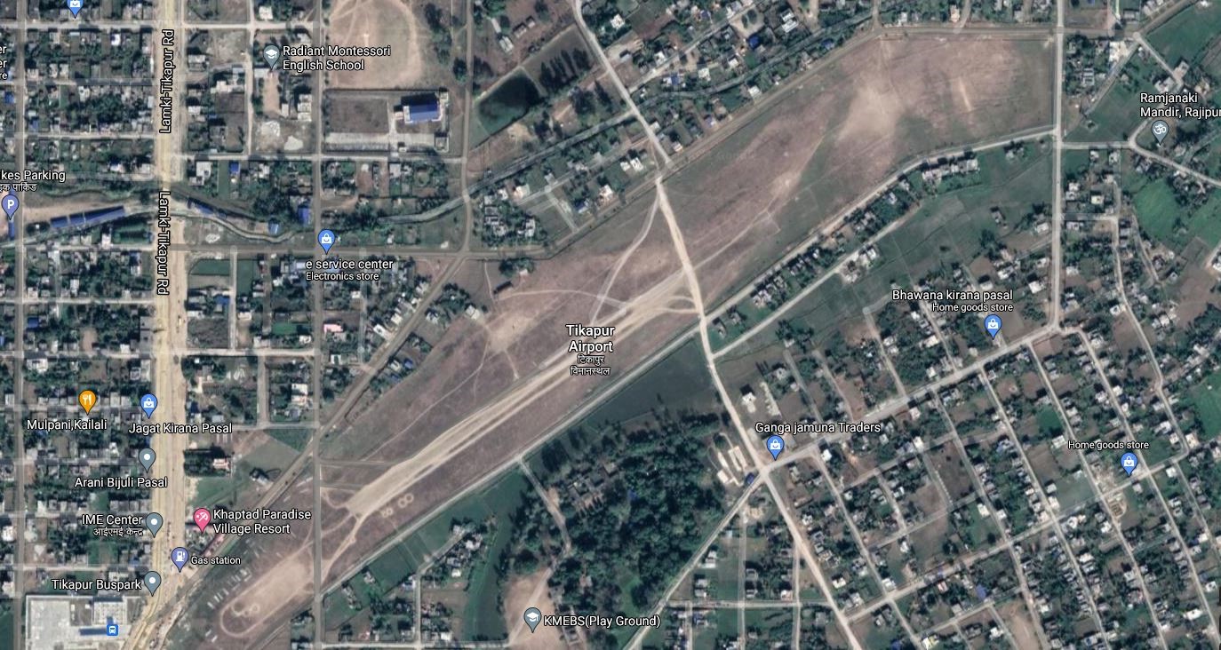
Airport Overview
Tikapur Airport is situated at Tikapur Municipality of Kailali District, Sudur-Paschim Province. The airport began operations on 11 October 1984. It served as a hub in western Nepal, as road connections were lacking until the Nepalese Civil War. This airport is not in operation since 1997.
|
Airport Location and Contact |
|
|---|---|
|
Country |
Nepal |
|
Province or District |
Kailali District, Sudur-Paschim Province |
|
Nearest Town or City |
Tikapur/ Kailali |
|
Airport’s Complete Name |
TIKAPUR AIRPORT |
|
Latitude |
28.52277 |
|
Longitude |
81.12194 |
|
Elevation (ft and m) |
515 ft./157 m. |
|
IATA Code |
TPU |
|
ICAO Code |
VNTP |
|
Managing Company or Airport Authority |
Civil Aviation Authority of Nepal, AFS: VNTPYDYX |
|
Management Contact Person |
|
|
NGO and/or UN Presence at Airport? |
NO |
Runway(s)
|
Runway #1 |
|
|---|---|
|
Runway Dimensions |
573 m x 30 m |
|
Runway Orientation |
05/23 |
|
Runway Surface |
Gravel |
|
Runway Condition |
Not in operation |
Airport Infrastructure Details
|
Infrastructure |
|||
|---|---|---|---|
|
Passenger / Cargo Security Screening |
No |
Runway Lighting |
No |
|
Refueling Capacity |
No |
Ground Handling Services |
No |
|
Air Traffic Control |
No |
Fire Fighting Equipment |
No |
|
Weather Information |
No |
Aircraft Parking Space |
No |
|
Navigation Aids |
No |
Perimeter Fencing |
No |
|
Windsock |
No |
|
|
Fuel Services Charges
N/A
Royalties / Non Objection Fees (NOFs)
N/A
Nepal - 2.2.49 Darchula Domestic Airport
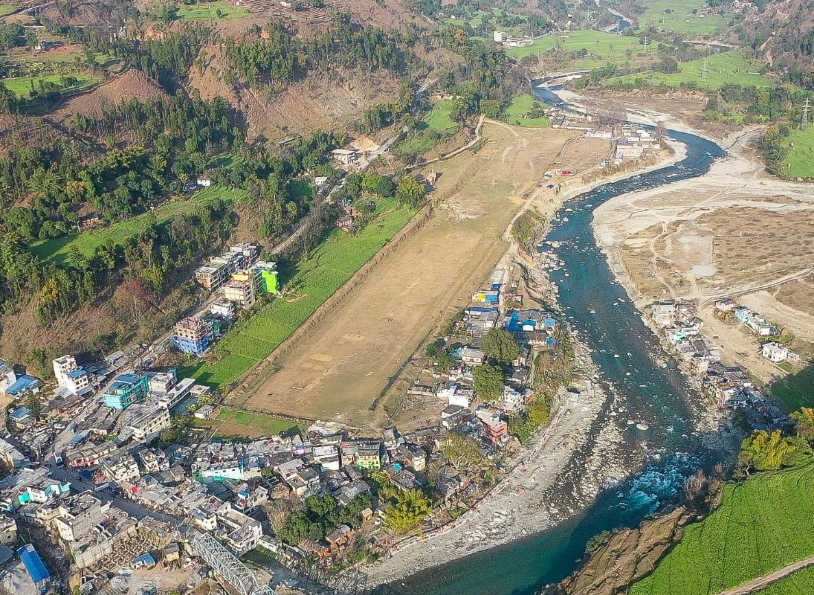
Airport Overview
Darchula Airport is situated at Gokuleswor Municipality of Darchula District, Sudur-Paschim Province. It has an earthen runway but is not clearly marked. This airport is not in operation.
|
Airport Location and Contact |
|
|---|---|
|
Country |
Nepal |
|
Province or District |
Sudur-Paschim/Darchula |
|
Nearest Town or City |
Located at Gokuleswor bazaar. |
|
Airport’s Complete Name |
Darchula Airport |
|
Latitude |
29.66939 |
|
Longitude |
80.54909 |
|
Elevation (ft and m) |
2218 ft./676 m. |
|
IATA Code |
DAP |
|
ICAO Code |
VNDL |
|
Managing Company or Airport Authority |
Civil Aviation Authority of Nepal AFS: VNDLYDYX |
|
Management Contact Person |
N/A |
|
NGO and/or UN Presence at Airport? |
No |
Runway(s)
|
Runway #1 |
|
|---|---|
|
Runway Dimensions |
590 m x 30 m |
|
Runway Orientation |
07/25 |
|
Runway Surface |
Earthen |
|
Runway Condition |
Not in operation |
Airport Infrastructure Details
|
Infrastructure |
|||
|---|---|---|---|
|
Passenger / Cargo Security Screening |
No |
Runway Lighting |
No |
|
Refueling Capacity |
No |
Ground Handling Services |
No |
|
Air Traffic Control |
No |
Fire Fighting Equipment |
No |
|
Weather Information |
No |
Aircraft Parking Space |
Two DHC6 Types |
|
Navigation Aids |
No |
Perimeter Fencing |
No |
|
Windsock |
No |
|
|
Fuel Services Charges
N/A
Royalties / Non Objection Fees (NOFs)
N/A
Nepal - 2.2.50 Minor Domestic Airport – Mahendranagar
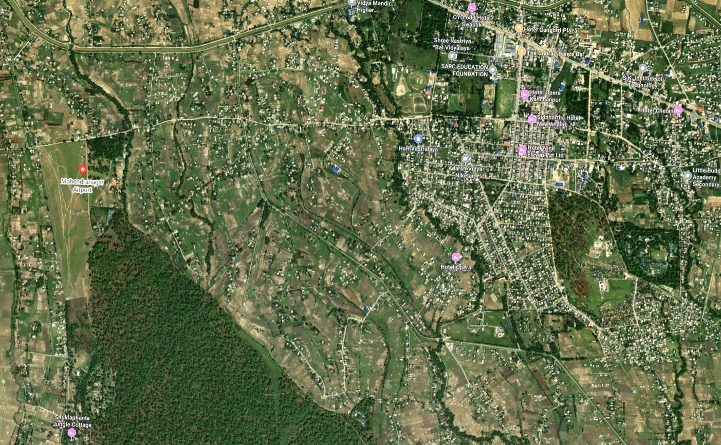
Airport Overview
Mahendranagar Airport is located at Bhimdatta municipality in Kanchanpur district, Sudurpaschim province. It is close to Shukla Phanta Wildlife Reserve. This airport is currently not operational.
|
Airport Location and Contact |
|
|---|---|
|
Country |
Nepal |
|
Province or District |
Sudurpaschim |
|
Nearest Town or City |
Mahendranagar, 2 KM east |
|
Airport’s Complete Name |
Mahendranagar Airport |
|
Latitude |
28.96104 |
|
Longitude |
80.14794 |
|
Elevation (ft and m) |
709 ft. / 216 m. |
|
IATA Code |
XMG |
|
ICAO Code |
VNMN |
|
Managing Company or Airport Authority |
AFS: VNMNYDYX |
|
Management Contact Person |
|
|
NGO and/or UN Presence at Airport? |
No |
Runway(s)
|
Runway #1 |
|
|---|---|
|
Runway Dimensions |
884 m x 30 m |
|
Runway Orientation |
17/35 |
|
Runway Surface |
Earthen |
|
Runway Condition |
Not Operational |
Airport Infrastructure Details
|
Infrastructure |
|||
|---|---|---|---|
|
Passenger / Cargo Security Screening |
No |
Runway Lighting |
No |
|
Refueling Capacity |
No |
Ground Handling Services |
No |
|
Air Traffic Control |
No |
Fire Fighting Equipment |
No |
|
Weather Information |
No |
Aircraft Parking Space |
No |
|
Navigation Aids |
No |
Perimeter Fencing |
Yes |
|
Windsock |
No |
|
|
Fuel Services Charges
Not available at this airport
Royalties / Non Objection Fees (NOFs)
N/A
Nepal - 2.2.51 KHIJI CHANDESHWORI Domestic Airport
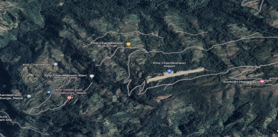
Airport Overview
Khiji Chandeshwori Airport is located in Okhaldhunga District, Koshi Province. It lies near the populated Khiji Phalante locality. The test flight was conducted on 23 December 2019. The airport has one runway and is not in operation.
|
Airport Location and Contact |
|
|---|---|
|
Country |
Nepal |
|
Province or District |
Koshi Province/Okhaldhunga |
|
Nearest Town or City |
24.1 km to the nearest town Okhaldhunga |
|
Airport’s Complete Name |
Khiji Chandreswori |
|
Latitude |
27.45513 |
|
Longitude |
86.30944 |
|
Elevation (ft and m) |
6789 ft./ 2070 m. |
|
IATA Code |
|
|
ICAO Code |
VNKC |
|
Managing Company or Airport Authority |
Civil Aviation Authority |
|
Management Contact Person |
|
|
NGO and/or UN Presence at Airport? |
No |
Runway(s)
|
Runway #1 |
|
|---|---|
|
Runway Dimensions |
580 m x 20 m |
|
Runway Orientation |
15/33 |
|
Runway Surface |
Gravel |
|
Runway Condition |
Gravel |
Airport Infrastructure Details
|
Infrastructure |
|||
|---|---|---|---|
|
Passenger / Cargo Security Screening |
No |
Runway Lighting |
No |
|
Refueling Capacity |
No |
Ground Handling Services |
No |
|
Air Traffic Control |
No |
Fire Fighting Equipment |
No |
|
Weather Information |
No |
Aircraft Parking Space |
Two DHC6 Types Size of Apron 1375 sq.m |
|
Navigation Aids |
No |
Perimeter Fencing |
No |
|
Windsock |
Yes / No |
|
|
Fuel Services Charges
N/A
Royalties / Non Objection Fees (NOFs)
N/A
Nepal - 2.2.52 Dolpa Masinechaur National Airport
Airport Overview
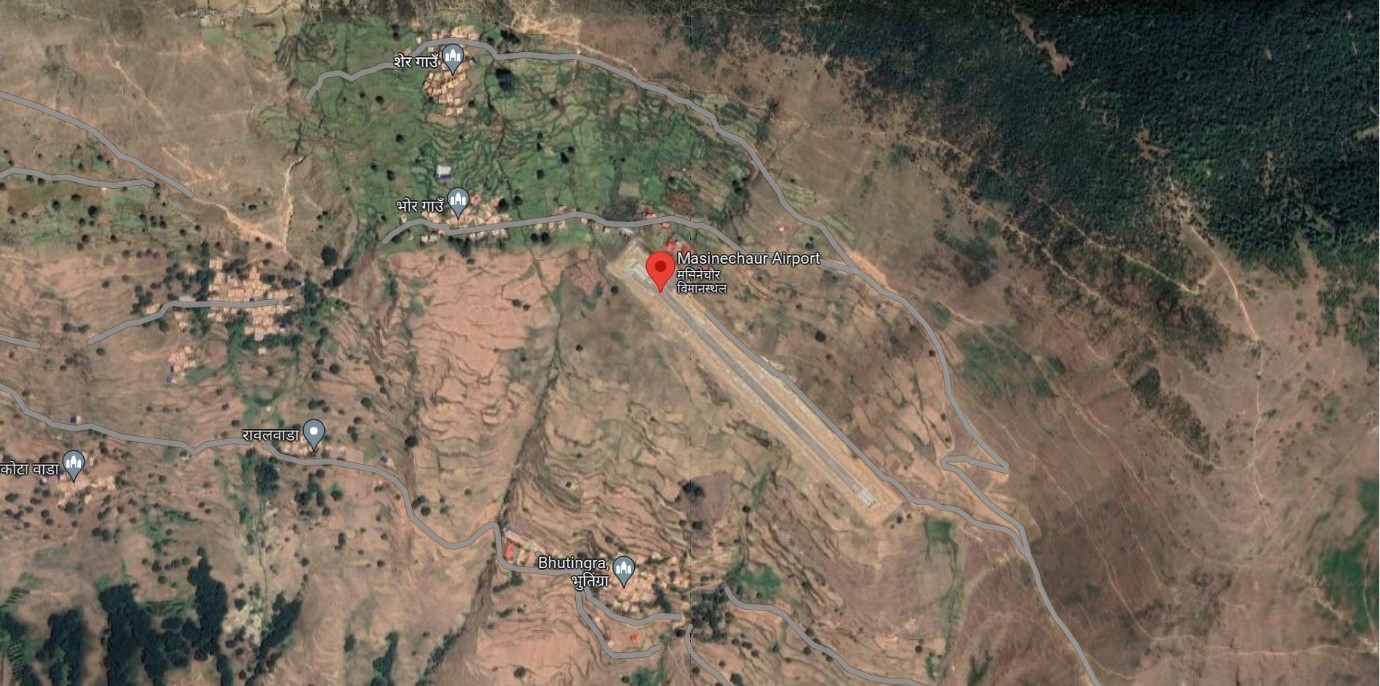
Ariel view of Dolpa Masinechaur Airport
Masinechaur Airport is situated at Pahada Rural Municipal of Dolpa District, Karnali Province. The airport is about 6 Km from the existing airport at Juphal. The popular trekking route to Jumla from this airport is nearly 4 days walking distance from the airport. This airport is getting upgraded to Asphalt Concrete. This airport is currently not in operation.
|
Airport Location and Contact |
|
|---|---|
|
Country |
Nepal |
|
Province or District |
Karnali |
|
Nearest Town or City |
6 KM |
|
Airport’s Complete Name |
Dolpa Masinechaur Airport |
|
Latitude |
29.05918 |
|
Longitude |
82.74408 |
|
Elevation (ft and m) |
9200 ft./ 2804 m. |
|
IATA Code |
|
|
ICAO Code |
VNMC |
|
Managing Company or Airport Authority |
Civil Aviation Authority of Nepal (CAAN) |
|
Management Contact Person |
|
|
NGO and/or UN Presence at Airport? |
No |
Runway(s)
|
Runway #1 |
|
|---|---|
|
Runway Dimensions |
600 m x 30 m |
|
Runway Orientation |
14 / 32 |
|
Runway Surface |
Gravel |
|
Runway Condition |
Not operational |
Airport Infrastructure Details
|
Infrastructure |
|||
|---|---|---|---|
|
Passenger / Cargo Security Screening |
N/A |
Runway Lighting |
No |
|
Refueling Capacity |
No |
Ground Handling Services |
N/A |
|
Air Traffic Control |
N/A |
Fire Fighting Equipment |
No |
|
Weather Information |
N/A |
Aircraft Parking Space |
Two DHC6 types |
|
Navigation Aids |
N/A |
Perimeter Fencing |
|
|
Windsock |
N/A |
|
|
Fuel Services Charges
Refueling is not available at this airport
Royalties / Non Objection Fees (NOFs)
N/A
Nepal - 2.2.53 Rukum Chaujahari Minor Domestic Airport
Airport Overview
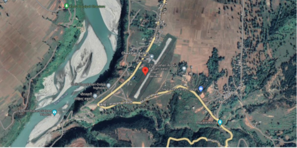
Ariel view of Rukum Chaurjhari Airport
Chaurjahari Airport is situated at Bijeshwori Municipality of West Rukum District, Karnali Province. This airport is currently not operational.
|
Airport Location and Contact |
|
|---|---|
|
Country |
Nepal |
|
Province or District |
Karnali |
|
Nearest Town or City |
Chaurjahari, 1.5 KM South |
|
Airport’s Complete Name |
Rukum Chaurjahari Airport |
|
Latitude |
28.62694 |
|
Longitude |
82.19359 |
|
Elevation (ft and m) |
2431 ft. / 741 m. |
|
IATA Code |
HRJ |
|
ICAO Code |
VNCJ |
|
Managing Company or Airport Authority |
Civil Aviation Authority of Nepal, Chaurjahari, West Rukum Off: 977-89680156 Tower: 977-89680156 Fax: 977-89680156 AFS: VNCJYDYX |
|
Management Contact Person |
|
|
NGO and/or UN Presence at Airport? |
No |
Runway(s)
|
Runway #1 |
|
|---|---|
|
Runway Dimensions |
600 m x 20 m |
|
Runway Orientation |
03/21 |
|
Runway Surface |
Bituminous Paved (Asphalt Concrete) Surface |
|
Runway Condition |
Not in operation |
Airport Infrastructure Details
|
Infrastructure |
|||
|---|---|---|---|
|
Passenger / Cargo Security Screening |
Yes, handheld metal detector |
Runway Lighting |
No |
|
Refueling Capacity |
No |
Ground Handling Services |
N/A |
|
Air Traffic Control |
One Man Position Tower Console with Associated Equipment and Accessories |
Fire Fighting Equipment |
No |
|
Weather Information |
Tower Observation |
Aircraft Parking Space |
2800 sq.m. |
|
Navigation Aids |
HF SSB, VHF |
Perimeter Fencing |
|
|
Windsock |
|
|
|
Fuel Services Charges
Fuel service is not avialable
Royalties / Non Objection Fees (NOFs)
N/A
Nepal - 2.3 Road Network
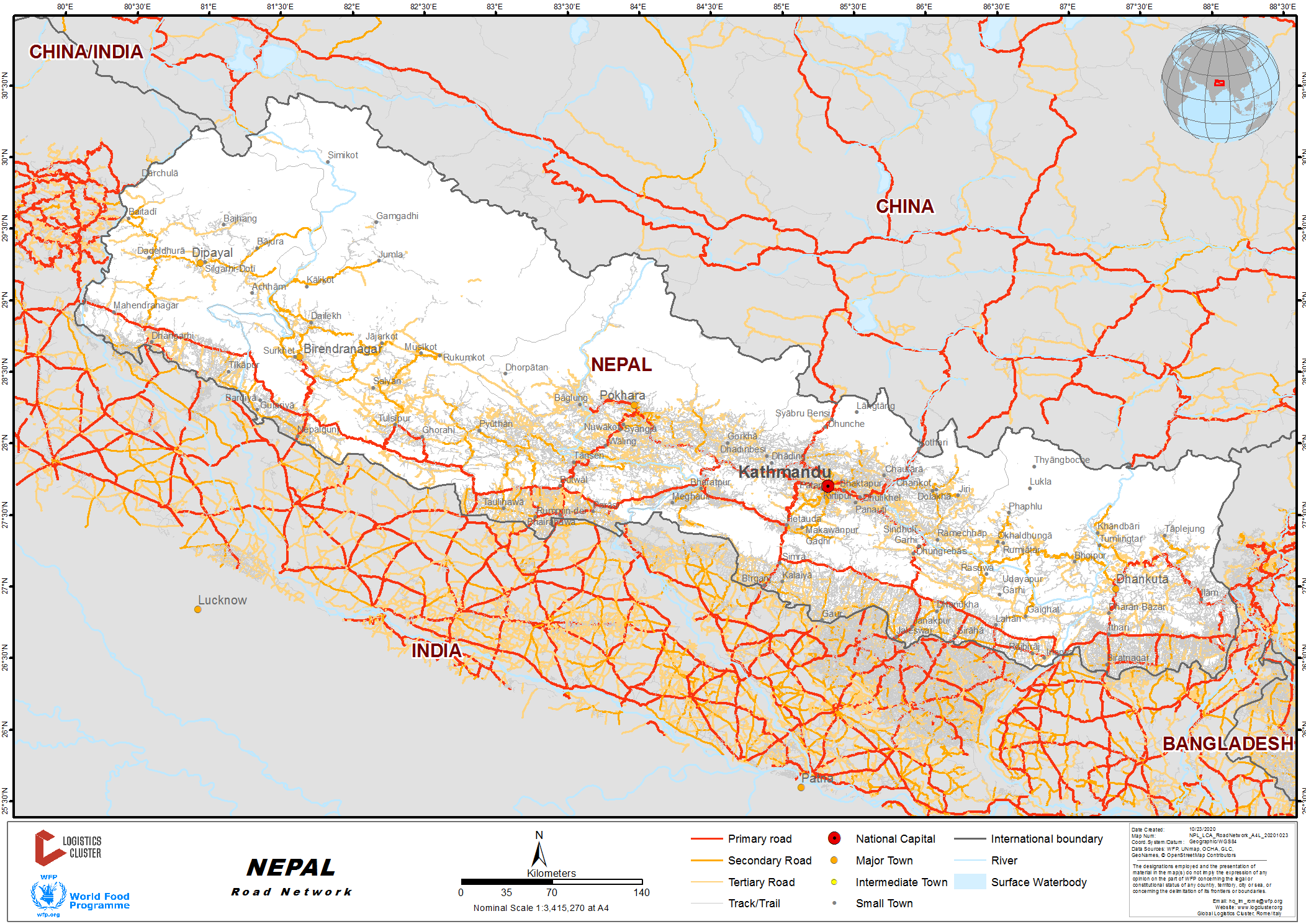
Roads are the predominant mode of transport in Nepal. The road network of Nepal is categorized into the strategic road network (SRN), which comprises highways and feeder roads, and the local road network (LRN), comprising district roads and Urban roads. Nepal’s road network consists of about 64,500 km of roads. Of these, about 14,913 km belong to the SRN, the core network of national highways and feeder roads connecting district headquarters.
The network density is low, at 14 km per 100 km2 and 0.9 km per 1,000 people. 60% of the road network is concentrated in the lowland (Terai) areas. A Department of Roads (DoR) survey shows that 50% of the population of the hill areas still must walk two hours to reach an SRN road.
(Source: Sector Assessment (Summary): Road Transport)
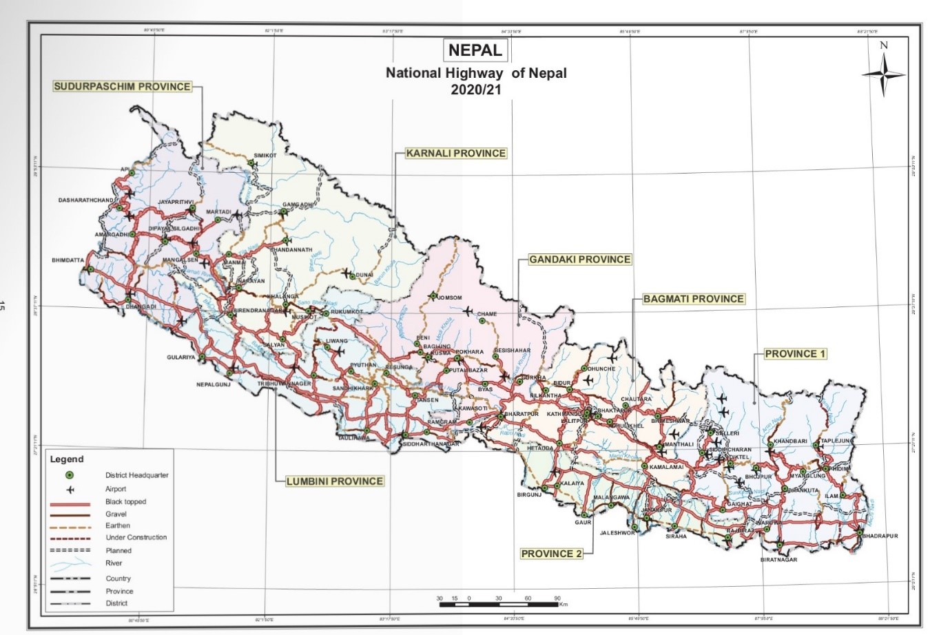
(Picture: Statistics of National Highway)
National Highways in Nepal
|
S.No |
National |
Name of National Highway |
Listed Length |
Provinces |
||||||
|---|---|---|---|---|---|---|---|---|---|---|
|
Koshi |
Madhes |
Bagmati |
Gandaki |
Lumbini |
Karnali |
Sudurpashchim |
||||
|
1 |
NH01 |
Existing East-West Highway |
1,028 |
135 |
245 |
92 |
23 |
403 |
|
130 |
|
2 |
NH02 |
Kechana-Chandragadhi-Charali-llam-Phidim, Ganeshchok-Taplejung-Olanchungola (Mechi Ragman,) |
352 |
352 |
|
|
|
|
|
|
|
3 |
NH03 |
Pushpalal Mid Hill Highway |
1,787 |
525 |
|
270 |
360 |
65 |
305 |
262 |
|
4 |
NH04 |
Birtamod-Chandragadi-Bhadrapur-Mechi Pul |
15 |
15 |
|
|
|
|
|
|
|
5 |
NH05 |
Postal Highway |
1,016 |
124 |
310 |
55 |
12 |
360 |
|
155 |
|
6 |
NH06 |
Chatara-Mulghat-Majhita,Arnarapurdancla-Ganeshchok (Tamor Corridor) |
135 |
135 |
|
|
|
|
|
|
|
7 |
NH07 |
Pakall-Nays Koshipul-Rupnagar, Pakall-Nadaha Koshipul Chatara |
66 |
48 |
18 |
|
|
|
|
|
|
8 |
NH08 |
Rani-Biratnagar-Itahari-Dharan-Dhankuta-Hite, Leguwaghat-Tumlingtar-Kha ndbari-NumKimathanka (Koshi Rajmarg) |
320 |
320 |
|
|
|
|
|
|
|
9 |
NH09 |
Bahundangi-Shantinagar-Dharan-Chatara-Ghaighat-Katah Sindhulimach-Hetauda-Gaidakot- Rarnpur-RamdkRidi-Balkot-Sandhikharka-Bijuwar-Sitalpati-Surkhet-Baddichaur-Sahajpur-BudarJoglaudha-Rupal (Madan Bhandari Rajmarg) |
1200 |
250 |
|
190 |
50 |
376 |
210 |
124 |
|
10 |
NH10 |
Deurall-Mudhe-Chainpur-Bohoratar |
92 |
92 |
|
|
|
|
|
|
|
11 |
NH11 |
Phikkal-Shreeantu-Chabloise, Ilarn |
19 |
19 |
|
|
|
|
|
|
|
12 |
NH12 |
Ghurrni-Chatara Udayapur |
163 |
163 |
|
|
|
|
|
|
|
13 |
NH13 |
Bardibas-Sindhuli-Khurkot-Dhulikhel (B. P. Rajmarg) |
160 |
|
12 |
148 |
|
|
|
|
|
14 |
NH14 |
Gaighat-Mahuli Khola-Ftupani-Rajbiraj-Chhinnarnasta Niur, Kunauli-Rajloiraj-Kanchanpur Barrie, Phattepur-Basaha Udayapur |
100 |
40 |
60 |
|
|
|
|
|
|
15 |
NH15 |
Gwarko-Lubhu-Lakurihhanjyang-Kushadevi-Panauti-Dahaltar |
128 |
|
|
128 |
|
|
|
|
|
16 |
NH16 |
Thadi-Bhagawanpur-Lahan, Kadmahachok-Gaighat-Mohure-Kharpa-Solu |
144 |
111 |
33 |
|
|
|
|
|
|
17 |
NH17 |
Naubise-Mugling-Pokhara (Prithvi Rajmarg) |
173 |
|
|
83 |
90 |
|
|
|
|
18 |
NH18 |
Balaju-Trishuli-Dhunche-Syaphrobesi |
65 |
|
|
65 |
|
|
|
|
|
19 |
NH19 |
Ridi-Balkot-Hanshpur-Pyuthan, Pyothan-Surkhet Road |
220 |
|
|
|
|
220 |
|
|
|
20 |
NH20 |
Madar-Chauharwa, Mirchaiya-Katan-Ghurmi, Hilepani-Okhaldhunga-Salleri |
193 |
161 |
32 |
|
|
|
|
|
|
21 |
NH21 |
Sitapaila-Dharke |
24 |
|
|
24 |
|
|
|
|
|
22 |
NH22 |
Dhalkebar-Janakpur-Jatahi, Ghorghans-Nirrichaur-Thalahighat-Akraharghat |
48 |
|
48 |
|
|
|
|
|
|
23 |
NH23 |
Diktel-Solu-Junbesi-Khahare-Jiribazar-Tamakoshi -Charikot-Khadichaur |
291 |
108 |
|
183 |
|
|
|
|
|
24 |
NH24 |
Lalgadh-Ranibas (R T.O. Road)-Bishmat-Bahunmara-B.P. Rajmarg |
29 |
|
29 |
|
|
|
|
|
|
25 |
NH25 |
Durnre-Beshisahar-Chame |
108 |
|
|
|
108 |
|
|
|
|
26 |
NH26 |
Jamunibas-Bateshwar-Shantipur-Kurtha-Janakpur |
19 |
|
19 |
|
|
|
|
|
|
27 |
NH27 |
Shitalpati Salyan Kubhinde Ealuuwa Sangra hi |
40 |
|
|
|
|
|
40 |
|
|
28 |
NH28 |
Bhittamod-Jaleswor-Bardibas, Khurkot-Manthali-Tamakoshi-Singati-Lamagagar-Lapchegau |
281 |
|
42 |
239 |
|
|
|
|
|
29 |
NH29 |
Kanchanban-Janaki- Medical College-Mthileshwar Sabaila-Siraha-Naktajijh-Ramlaxrnan Chowk- Healthpost Maherdra Rajmarg |
30 |
|
30 |
|
|
|
|
|
|
30 |
NH30 |
Janakpur (Mujeliya) Dhanushadham-Dharapani Ramayan Circuit, Tarapatti-Pathos-Ma Ratida - Pushpalpur |
36 |
|
36 |
|
|
|
|
|
|
31 |
NH31 |
Dolalghat-Chautara |
25 |
|
|
25 |
|
|
|
|
|
32 |
NH32 |
Nawalpur-Malangawa-Sonbarsha |
30 |
|
30 |
|
|
|
|
|
|
33 |
NH33 |
Nijgadh-Kathmandu |
76 |
|
10 |
66 |
|
|
|
|
|
34 |
NH34 |
Kathmandu-Dhulikhel-Dolalghat-Khadichaur-Kodari (Arniko Rajmarg) |
112 |
|
|
112 |
|
|
|
|
|
35 |
NH35 |
Piluhawa Faanmat-Kalaiya - Methawa |
25 |
|
25 |
|
|
|
|
|
|
36 |
NH36 |
Chandranigahpur-Gaur |
45 |
|
45 |
|
|
|
|
|
|
37 |
NH37 |
Hetauda-Bagmati-Tikabhairav-Bhaisepati-Ekantakuna (Kanti Rajpath) |
86 |
|
|
86 |
|
|
|
|
|
38 |
NH38 |
Kathmandu Outer Ringroad |
68 |
|
|
68 |
|
|
|
|
|
39 |
NH39 |
Kathmandu Ringroad |
27 |
|
|
27 |
|
|
|
|
|
40 |
NH40 |
Samakhushi-Tokha-Gurje-Bidur |
26 |
|
|
26 |
|
|
|
|
|
41 |
NH41 |
Sirsiya-Pathlaiya, Hetauda-Bhaise-Palung-Naubise-Kathmandu (Tribhuvan Rajpath) |
155 |
|
28 |
127 |
|
|
|
|
|
42 |
NH42 |
Thodi-Bhandara-Malekhu, Galchi-Trishuli-Betrawati-Mailung-Syaphrubesi-Rasuwagadhi |
197 |
|
|
197 |
|
|
|
|
|
43 |
NH43 |
Malekhu-Dhading-Salyantar |
57 |
|
|
57 |
|
|
|
|
|
44 |
NH44 |
Thori-Bharatpur-Mugling, Aanbukharieni-Gorkha-Ghyampesal, Aarughat-Sirdibas-Roila |
300 |
|
|
105 |
195 |
|
|
|
|
45 |
NH45 |
Khairenitar Eihimad Kairtrasoti |
106 |
|
|
|
106 |
|
|
|
|
46 |
NH46 |
Bhurnahi-Parasi |
9 |
|
|
|
|
9 |
|
|
|
47 |
NH47 |
Belahiya-Bhairahawa-Butwal-Hadung-Ramdi-Syangja-Pokhara (Siddharth Rajmarg) |
184 |
|
|
|
99 |
85 |
|
|
|
48 |
NH48 |
Tansen-Ridi-Karla |
254 |
|
|
|
254 |
|
|
|
|
49 |
NH49 |
Bartung- Tansen Ridi Wamitaksar Kharwang |
98 |
|
|
|
18 |
80 |
|
|
|
50 |
NH50 |
Jitpur-Taulihawa-Khunuwa |
30 |
|
|
|
|
30 |
|
|
|
51 |
NH51 |
Taulihawa-Gorusinge-Sandhikharka |
83 |
|
|
|
|
83 |
|
|
|
52 |
NH52 |
Kakarhawa(IB)-Rudrapur, Sajlhandi-Sandhikhark-Devisthan, Burtibang-Dhorpatan |
222 |
|
|
|
22 |
200 |
|
|
|
53 |
NH53 |
Bhalubang Liwang Rolpa Madichaur Darbot |
130 |
|
|
|
|
130 |
|
|
|
54 |
NH54 |
Kailabas-Lamahi, Arjunkholagau-Chorahi-Holeri-Charligaun-Thawang-Lukum (Sahid Marg) |
211 |
|
|
|
|
211 |
|
|
|
56 |
NH55 |
Arneliya-Tulsipur-Shitalpti-Tharmare-Musikot |
169 |
|
|
|
|
40 |
129 |
|
|
56 |
NH56 |
Tharmare-Chaurjahari-Jajarkot Khalanga-Jumla Kudari-Mugu Rara (Rara Rajmarg) |
263 |
|
|
|
|
|
263 |
|
|
57 |
NH57 |
Chinchu-Kudu-Jajarkot -Dunai-Dho-Tinje-Marim (Bhedi Corridor) |
317 |
|
|
|
|
|
317 |
|
|
58 |
NH58 |
Jamunaha-Nepalgunj-Kohalpur-Surkhet-Khulalu-Hilsa (Karnali Rajmarg) |
538 |
|
|
|
|
69 |
469 |
|
|
59 |
NH59 |
Murfiya (IB)-Gulariya-Bhurigaun-Telpani-Surkhet-Mathillo Dungeshwor-Bank-Bayuli Nagma |
154 |
|
|
|
|
50 |
104 |
|
|
60 |
NH60 |
Surkhet-Dailekh-Mahabulekh-Galje, Nagma-Gamgadhi-Nakchelagna |
302 |
|
|
|
|
|
302 |
|
|
61 |
NH61 |
Surkhet Tallo Dundeshwor-Saatkhamba-Dullu-Pipalkot-Khulalu-Manma-Jumla Sadak |
168 |
|
|
|
|
|
168 |
|
|
62 |
NH62 |
Khakraula-Tikapur-Lamki-Lodeghat-Bayalpata, Saphebagar-Chainpur |
228 |
|
|
|
|
|
|
228 |
|
63 |
NH63 |
Sap hebagar-Martadi-Kotti |
111 |
|
|
|
|
|
|
111 |
|
64 |
NH64 |
Khodpe-Chainpur (Bajhang) |
108 |
|
|
|
|
|
|
108 |
|
65 |
NH65 |
Khuttiya-Dipayal-Chainpur-Uraibhanjyang |
296 |
|
|
|
|
|
|
296 |
|
66 |
NH66 |
Dhangadhi-Sahajpur-Budar-Syaule, Satbajh-Thaktoli-Darchula-Tinkar |
350 |
|
|
|
|
|
|
350 |
|
67 |
NH67 |
Chandani-Bhimdatta-Brarnhadev-Pan cheshwar-Jhulaghat |
201 |
|
|
|
|
|
|
201 |
|
68 |
NH68 |
Bhimad-Rampur-Mityal-Arung Khola |
80 |
|
|
|
40 |
40 |
|
|
|
69 |
NH69 |
Jagat Bhanjyang-Mandalithan-Keware Bhanjyang-Barikuna-Kishan-Chapakot-Gajarkot Sadak. Syanhja |
42 |
|
|
|
|
42 |
|
|
|
70 |
NH70 |
Seti Dovan-Wejang-Panchmul-Aaruchaur Ghante Deurali, Syangja |
46 |
|
|
|
|
46 |
|
|
|
71 |
NH71 |
Bhaluwang-Nuwakot-Khandaha-Kharwang |
170 |
|
|
|
|
170 |
|
|
|
72 |
NH72 |
Dumkibas-Baguhan Trivoni |
23 |
|
|
|
23 |
|
|
|
|
73 |
NH73 |
Surunga-Sharnamati-Tangandubba-Lasunganj, Jhapa |
25 |
25 |
|
|
|
|
|
|
|
74 |
NH74 |
Ilam (Biplate)-Maipokhari-Sandakpur, Ilarn |
50 |
50 |
|
|
|
|
|
|
|
75 |
NH75 |
Swoma Sagarmalha Ring road (Okhaldhunga-Solu-Salleri-Khotang-Diktel-Okhaldhungay |
135 |
135 |
|
|
|
|
|
|
|
76 |
NH76 |
Damak-Chisapan-Rabi |
44 |
44 |
|
|
|
|
|
|
|
77 |
NH77 |
Bharatpur Mahanagariya Brihat Ghakrapalh |
105 |
|
|
105 |
|
|
|
|
|
78 |
NH78 |
Damak Na.Pa. Chak.path |
100 |
100 |
|
|
|
|
|
|
|
79 |
NH79 |
Dadar (Dhanusha) Chisapani-Mainawati-Kalapani-Dudhauli, Sindhuli |
20 |
|
20 |
|
|
|
|
|
|
80 |
NH80 |
Mahendra Rajmarg Bastipurchowk (Siraha)-B.P. Cancer Hospital-Belsot-Katari, Udayapur |
30 |
|
|
30 |
|
|
|
|
|
Total |
14,913 |
2,952 |
1,072 |
2,508 |
1,400 |
2,709 |
2,307 |
1,965 |
||
|
Note: The Listed length is based on the length provided in the Cabinet Decision approved on 2076/02/06 BS (2019/09/19 AD) |
||||||||||
(Source: Statistics of National Highway [SNH 2020-21] || Department Of Roads (dor.gov.np))
Major Road Construction Projects
-
Kathmandu Terai/Madhesh Expressway
The Expressway known as Fast Track road connecting Kathmandu and Nijgadh in the southern Terai region of Nepal is being constructed under the responsibility of the Nepali Army (NA). The Expressway consists of a dual carriageway with a double-lane high-design speed highway. The overall 72.5 km length stretches from Khokana (Lalitpur) to Nijgadh (Bara) interconnecting Kathmandu and Makwanpur district in between. The project has started and completed 30.96% of its physical progress as of 15 February 2024 and will be completed in 2027. Currently, construction of three tunnels is underway which stretch a combined total of 6.415km. So far, 4.352 km or 67.43% of work has been completed. It’s being built as per the Primary Class (Asian Highway Design Standard 1993. (Source: Fast Track Road Project)
-
Construction of Major Highways Connecting East to West of Country
-
Pushpa Lal (Mid Hill) Highway Project: Pushpalal Highway’s (H18) proposed length 1776 km would be the longest highway of Nepal once completed. 850 km of the 1776 km has been blacktopped. The government had aimed to accomplish the Mid-Hill Highway by the fiscal year 2022/2023. But due to the delay by the contractor company, the compensation dispute, and the inability to manage the contract for the remaining sections, the construction of the project has been delayed beyond the stipulated time. So far, 93 bridges, out of 137, have been completed. The overall physical progress of the Mid-Hill Highway was 64.16 percent by the end of June of the financial year 2021/22. Out of 1879 km, 797 km has been paved and 462 km by other bodies. So far, 1259 kilometers have been tarred. Currently, 415 kilometers of road and 25 bridges are under construction. (Source: (Mid Hill) Highway Project)
-
Madan Bhandari Inner Terai Highway: Inner Terai highway, an ongoing project once completed would extend 1390 km from east to west. The highway would run parallel to Mid Hill highway to the North and Mahendra Highway to the south. 1390 km out of which about 740 Km of road sections are being implemented by Madan Bhandari Highway Project Directorate while remaining are being implemented by other Projects and Road Divisions under Department of Roads as well as some sections by offices under Province. Among 740 km road 240 km road has been Blacktopped and 77 number of bridges has been completed till 2022, 63km of road upgrading and 31 nos. of bridges in Dharan-Jhapa Road Section have been contracted till fiscal year 2022.
-
East-West Postal Highway: The East-West Postal Highway, popularly known as Hulaki Marga, connects 20 districts in the southern Terai belt (from Bhadrapur, Jhapa in the east to Dodhara, Kanchanpur in the west). The highway extends 975 km from east to west. The project also includes another 817 km of roads that will connect all Terai districts. Construction work has started on the road sections in Madhesh Province. The progress of road construction was slow due to the covid-19 pandemic. Meanwhile, construction of 910 km road and 115 bridges has been completed. Moreover, Construction of 250 km road in between Dang, Bardiya and Nepalgunj is in tender process and about 500 km of road is under construction. Traffic is regular in completed road. There is dispute in some construction sites of road sections and however solution on disputed sites is going on in coordination with relevant stakeholders as well. (Source: Postal Highway project latest update/East-West Highway/Postal Highway (Hulaki Raajmarga) new update – YouTube)
These projects once completed would relieve pressure on Mahendra Highway by being alternative routes to traverse east to west of the country.
|
Ministry in Charge |
Contact Names, Address & Email |
Telephone & Fax |
||
|---|---|---|---|---|
|
Ministry of Physical Infrastructure & Transport |
Name: Sushil Babu Dhakal Title: Director General /Speaker Address: Department of Roads Chakupat, Patan |
T: +977-1-5429075 F: +977-1-5529106 |
||
|
Summary of Role and Services DOR is responsible for management of motorized surface transport infrastructure i.e. road transport regarding planning, designing, construction and maintenance activities of Strategic Road Network (SRN). Thus, maintenance of roads is one of the major tasks of Department of Roads. Also, it continuously develops and expands existing SRN to improve existing access to District Headquarters. |
||||
|
|
Contact Names, Address & Email |
Telephone & Fax |
||
|
Ministry of Physical Infrastructure & Transport |
Name: Ramhari Pokharel Title: I Deputy Director General/ Spokesperson Address: Roads Board Nepal N.K. Singh Marga, Minbhawan, Kathmandu Nepal Email: info@rbn.org.np Web: rbn.org.np |
T: +977-1-5529098 F: +-977-1-4493542 |
||
|
Summary of Role and Services RBN is a self-governing, self-sustaining and organized entity based on Public-Private Partnership [PPP] model. The major function of RBN is to collect, manage and allocate fund for road maintenance to the Road Agencies. Board Requests Annual Road maintenance plan (ARMP) from Road Agencies to consolidate the report into one Integrated Annual Road maintenance plan (IARMP) to better allocate the fund.
|
||||
For more information on government contact details, please see the following link: 4.1 Government Contact List.
Distance Matrix
|
Distances from Capital City to Province Capitals (km) |
||||||||
|---|---|---|---|---|---|---|---|---|
|
|
Kathmandu |
Hetauda |
Janakpur |
Biratnagar |
Bhairahawa |
Pokhara |
Birendranagar |
Dhangadhi |
|
Kathmandu |
|
85 |
222 |
374 |
264 |
202 |
594 |
670 |
|
Hetauda |
85 |
|
165 |
317 |
194 |
199 |
516 |
588 |
|
Janakpur |
222 |
165 |
|
201 |
357 |
367 |
678 |
687 |
|
BIratnagar |
374 |
317 |
201 |
|
508 |
519 |
803 |
903
|
|
Bhairahawa |
264 |
194 |
357 |
508 |
|
179 |
333 |
406 |
|
Pokhara |
202 |
199 |
367 |
519 |
179 |
|
426 |
551 |
|
BIrendranagar |
594 |
516 |
678 |
803 |
333 |
426 |
|
243 |
|
Dhangadhi |
670 |
588 |
687 |
903 |
406 |
551 |
243 |
|
|
Travel Time from Capital City to Province Capitals (hours) |
||||||||
|---|---|---|---|---|---|---|---|---|
|
|
Kathmandu |
Hetauda |
Janakpur |
Biratnagar |
Bhairahawa |
Pokhara |
Birendranagar |
Dhangadhi |
|
Kathmandu |
|
3:40 |
6:20 |
9:41 |
8:26 |
7:13 |
15:28 |
16:50 |
|
Hetauda |
3:40 |
|
3:45 |
6:50 |
5:47 |
6:22 |
12:52 |
14:15 |
|
Janakpur |
6:20 |
3:45 |
|
4:51 |
9:23 |
9:45 |
14:47 |
16 |
|
BIratnagar |
9:41 |
6:50 |
4:51 |
|
11 |
11:50 |
17:50 |
18:40 |
|
Bhairahawa |
8.26 |
5:47 |
9:23 |
11 |
|
5.35 |
7.25 |
8:50 |
|
Pokhara |
7:13 |
6:22 |
9:45 |
11:50 |
5:35 |
|
13.06 |
13.09 |
|
BIrendranagar |
15:28 |
12:52 |
14:47 |
17:50 |
7:25 |
13:06 |
|
5:41 |
|
Dhangadhi |
16.50 |
14:15 |
16 |
18:40 |
8:50 |
13:09 |
5:41 |
|
Road Security
The risk posed by the treacherous slope of mountains, the narrow width of the lanes, sharp corners and negligence and inexperience of drivers lead to traffic fatalities. On average, 14 deaths occur die to road traffic injuries per 100K people in Nepal. The most common type of road traffic accidents or crashes in Nepal involve motorcycles. A total of 2,320 people lost their lives in road traffic accidents between April 2022 and April 2023, while 28,526 people were injured, many of them impaired for life (Source: Nepal Times).
General strikes, or Bandhs, can involve blockage and shutdown of major roads. It is advisable to avoid travel during these strikes.
Weighbridges and Axle Load Limits
Department of Transport Management (DoTM) is mandated to control vehicle overloading in Nepal. A basic policy of vehicle overloading control has been included in National Transport Policy (2002) by the Government of Nepal, Ministry of Physical Infrastructure and Transport. The government has established and operated weigh bridges at Ampatari of Chitwan district and Bardibas of Mahottari district. Provisions have been made to establish and operate weigh bridges even from the private sector by amending the load-bearing guidelines. One private formal permit has been obtained in Mahottari and three in Kavre. (Source: Bulletion of DoTM) The Federation of Truck Transport Entrepreneurs Nepal (FTTEN) is operating fifteen (15) weighbridges in major freight routes.
Medium-sized trucks (seven to ten-ton payload) operate over two-lane asphalt roads at relatively low average speeds, in the range of 200 to 400 km per day. The movement of containers on the Nepal roadways is limited due to the terrain and condition of the roads. Most of the trucks used in cross-border movements are 2-3 axle (six or ten wheel) trucks carrying payloads up to 18 mt. Trucks carrying bulk cargo are generally overloaded, causing additional damage to roads.
(Source: Road Transport Safety and Axle Load Control Study in Nepal)
|
Axle Load Limits (MT) |
LCA Country (Nepal) |
Transit Country #1 (India) |
|---|---|---|
|
Truck with 2 Axles (4 wheeled) |
12 |
|
|
Truck with 2 Axles (6 wheeled) |
16.2 |
19 |
|
Truck with 3 Axles (6 -10 Wheeled) |
25 |
28.5 |
|
Truck with 4 Axles (8- 12-Wheeled) |
31 |
36 |
|
Tridem with 3 Axle (12 wheeled) |
24 |
|
|
Semi-trailer with 4 Axles |
30 |
40 |
|
Semi-trailer with 5 Axles |
40.2 |
46 |
|
Semi-trailer with 6 Axles |
|
55 |
|
Truck & Drawbar Trailer with 4 Axles |
|
42 |
|
Truck & Drawbar Trailer with 5 Axles |
|
51.5 |
|
Truck & Drawbar Trailer with 6 Axles |
|
55 |
|
Truck & Drawbar Trailer with 7 Axles |
|
|
(Source: https://www.dotm.gov.np/MainData/ProcedureCodeofConduct)
Road Class and Surface Conditions
Roads in Nepal are classified as follows:
Administrative Classification: Administrative classification of roads is intended for assigning national importance and level of government responsible for overall management and methods of financing. According to this classification roads are classified into:
-
National Highways
-
Feeder Roads
-
District Roads and
-
Urban Roads
National Highways: National Highways are main roads connecting East to West and North to South of the Nation. These serve directly the greater portion of the longer distance travel, provide consistently higher level of service in terms of travel speeds, and bear the inter-community mobility. These roads shall be the main arterial routes passing through the length and breadth of the country as a whole. They are designated by the letter “H‟ followed by a two-digit number.
Feeder Roads: Feeder roads are important roads of localized nature. These serve the community’s wide interest and connect District Headquarters, Major economic centres, Tourism centres to National Highways or other feeder roads. They are designated by letter „F‟ followed by 3-digit number.
District Roads: District Roads are important roads within a district serving areas of production and markets and connecting with each other or with the main highways.
Urban Roads: Urban Roads are the roads serving within the urban municipalities.
In Nepal the overall management of National Highways and Feeder Roads comes within the responsibility of the Department of Roads (DOR). These roads are collectively called Strategic Roads Network (SRN) roads. District Roads and Urban Roads are managed by Department of Local Infrastructure Development and Agricultural Roads (DOLIDAR). These roads are collectively called Local Roads Network (LRN) roads.
Functional Classification
For assigning various geometric and technical parameters for design, roads are categorized into classes as follows:
Road Functional Class
-
Class-I roads: Have a divided carriageway and access control (Expressways) with Average Daily Traffic (ADT) of 20,000 Passenger Car Unit (PCU) or more in 20 yrs. perspective period. Design speed in plain terrain is 120 km/h.
-
Class-II (arterial roads): Have ADT of 5,000-20,000 PCU in 20 yrs. perspective period. Design speed of this class of roads in plain terrain is 100 km/h.
-
Class-III (collector roads): Have ADT of 2,000-5,000 PCU in 20 yrs. perspective period. Design speed of this class of roads in plain terrain is 80 km/h.
-
Class-IV (local roads): Have ADT of less than 2,000 PCU in 20 yrs. perspective period. Design speed of this class of roads in plain terrain is 60 km/h.
Approximate correlation can be established between the administrative and functional classifications of the roads as follows.
|
|
Plain and Rolling Terrain |
Mountainous and steep terrain |
|---|---|---|
|
National Highway |
I, II |
II, III |
|
Feeder Roads |
II, III |
III, IV |
(Source: Nepal Road Standard 2070)
-
Surface / Road conditions
Factors influencing road driving conditions in Nepal are:
-
Construction quality: Many roads constructed have design flaws (narrow width lane, lack of safety barriers, lane markings or drainage systems, thin or low-quality surfacing). Increased vehicles traffic, heavy trucks and monsoon rains lead to quick deterioration and surface cracks and pot-holes.
-
Maintenance: The Road Board Nepal oversees the maintenance of roads by respective Road Agencies. However, for many roads maintenance and repair is not carried out regularly.
-
Weather: During rainy season the risk of landslides or floods that may block roads, is significantly increased. This affects immediate transportation and wreaks havoc on the longevity of the infrastructure.
-
Ratna Highway is two-lane, black-topped highway in good condition. Ratna Highway (Nepali) also referred to as H12) is a highway in western Nepal that crosses the districts of Banke and Surkhet in a south to north direction. The 113.08 km highway starts at Nepalgunj,
-
Karnali Highway is a vital transport link between two provinces in Nepal. This highway links the towns of Jumla, the Karnali capital, and Surkhet. Karnali Province is the largest, remotest and the least developed Province in Nepal. In general, the highway has two-lanes; the highway is both black-topped and earthen, and construction is still under progress.
-
Feeder Roads (Nagma to Gamgadhi): Earthen, Work in Progress, Rocky Terrain
-
Bhimdutta Highway (Dhangadi – Dadeldhura): Blacktopped, Good condition.
-
Mechi Highway (H06) is two-lane highway with the length of 268 km. It is blacktopped and is in good condition. On its hilly section, the problem of landslides especially during rainy season should be considered.
-
Koshi Highway (H08) is 390 km road envisioned as shortest north south corridor to connect China and India via Nepal. The road section from Biratnagar (India-Nepal Border) to Khandbari is blacktopped but beyond Khandbari to Kimanthanka (China-Nepal Border) the construction is ongoing. Hilly section of the highway faces the issue of landslides during rainy season.
-
Araniko Highway (H03) is 115 km blacktopped highway connecting Kathmandu with Kodari (China-Nepal border). This highway is among the difficult highways of Nepal to navigate during rainy season.
-
Siddhartha Highway (H10) is 181 km long blacktopped highway connecting Nepal India border at Siddharthanagar to Pokhara, a major city in Gandaki Province. Butwal-Palpa section at the hilly region of the highway consists of rocky terrain. Rockfalls and debris deposition are common. Landslides is frequent during rainy season.
-
Mahendra Highway which traverses east to west of country, Prithivi Highway which connects Kathmandu with Pokhara, major tourist destination, Araniko highway which connects Kathmandu with Kodari, a town bordering China, Tribhuvan Highway which connects Kathmandu with Birgunj, a major business hub bordering India and Siddhartha Highway which connects Siddharthanagar, a town bordering India with Pokhara are the five busiest highways of Nepal.
-
Nepal Access Constraints Maps : The National Logistics Cluster updates Road Access constraints maps periodically in the monsoon season, during flood/landslide emergencies.
Traffic capacity (Heavy, Heavy with trailer, Light vehicle, Motorbike) and any seasonal variations
The maximum dimensions of vehicles considered for design of roads in Nepal are as follows:
-
Maximum Width, m 2.50
-
Maximum Height, m 4.75
-
Maximum Length, m 18.00
-
Maximum single axle load, kilo Newton (kN) 100
Koshi Province
All the districts of Koshi Province are connected by road, although some roads in high altitudes are not blacktopped and conditions of those roads worsen during the rainy season. Major highways of the province which connects plain land of Terai to high altitude regions are as follows:
-
Mechi Highway: 268 km long two lanes freeway which connects Jhapa to Taplejung. The main destinations along the highway include Prithivinagar, Bhadrapur, Duhagadhi, Budhabare, Kanyam, and Phikkal.
-
Koshi Highway: Two lanes of road and 159 km long, starts from Biratnagar and connects Myanglung with it. Itahari, Dharan, Dhankuta, Bhedetar, Hile etc. are the destinations along with highway.
-
Sagarmatha Highway: Two lanes, 265 km long highway starts from Kadmaha of Madhesh Pradesh and connects Solukhumbu with it. Gaighat, Saune etc. are the destinations along with highway.
-
Mahendra Highway The major East-West Highway of Nepal starts from Kakarbhitta of Koshi Province
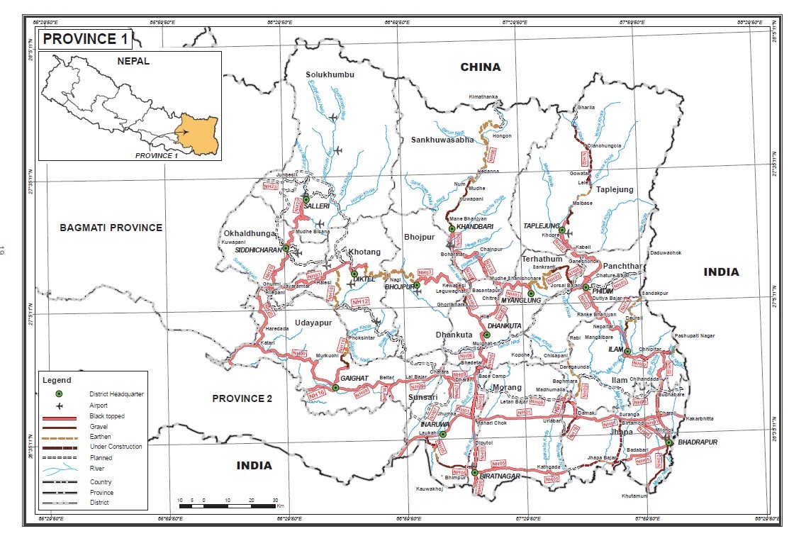 Road network in Koshi Province: Statistics of National Highway
|
Distances from Koshi Province Capital to Major Towns (km) |
||||||||
|---|---|---|---|---|---|---|---|---|
|
|
Biratnagar |
Itahari |
Dharan |
Mechinagar |
Gaighat Via Beltar |
Birtamod via Mahendra HY |
Damak |
Suryodaya via Rangeli |
|
BIratnagar |
|
24.7 |
42 |
108 |
108 |
91.3 |
58.9 |
202 |
|
Itahari |
24.7 |
|
16.8 |
91.7 |
92 |
75.1 |
42.1 |
119 |
|
Dharan |
42 |
16.8 |
|
108 |
72.5 |
91.5 |
57.8 |
140 |
|
Mechinagar |
108 |
91.7 |
108 |
|
174 |
18.8 |
52.1 |
23.4 |
|
Gaighat |
108 |
92 |
72.5 |
174 |
|
160 |
124 |
211 |
|
Birtamod |
93.4 |
77.3 |
91.5 |
18.8 |
160 |
|
37.8 |
48 |
|
Damak |
58.9 |
42.1 |
57.8 |
52.1 |
124 |
37.8 |
|
79.8 |
|
Suryodaya |
202 |
119 |
136 |
23.4 |
211 |
48 |
79.8 |
|
|
Travel Time from Koshi Province Capital City to Major Towns (hours) |
||||||||
|---|---|---|---|---|---|---|---|---|
|
|
Biratnagar |
Itahari |
Dharan |
Mechinagar |
Gaighat |
Birtamod |
Damak |
Suryodaya |
|
BIratnagar |
|
00:38 |
00:57 |
2:43 |
2:26 |
2:20 |
1:11 |
4:53 |
|
Itahari |
00:38 |
|
00:24 |
2:27 |
2:04 |
2:05 |
1.00 |
3.13 |
|
Dharan |
00:57 |
00:24 |
|
2:40 |
1:29 |
2:19 |
1:16 |
3.38 |
|
Mechinagar |
2:43 |
2:27 |
2:40 |
|
3:39 |
00:31 |
1:14 |
00:45 |
|
Gaighat |
2:26 |
2:04 |
1:29 |
3:39 |
|
3:58 |
2:49 |
5:16 |
|
Birtamod |
2:20 |
2:05 |
2:19 |
00:31 |
3:58 |
|
00:54 |
1:18 |
|
Damak |
1:11 |
1:00 |
1:16 |
1:14 |
2:49 |
00:54 |
|
2:16 |
|
Suryodaya |
4:53 |
3:13 |
3:38 |
00:45 |
5:16 |
1:18 |
2:16 |
|
The SRN connecting districts of Koshi Province are relatively obstructed by landslide and flash flood in hilly region, flood in terai region and numerous bridge building activities would be diverted roads into small rivulets. And can delay traffic and can be temporarily obstructed during the monsoon season.
Madhesh Pradesh Province
The East-West Highway runs longitudinally across the Madhesh Pradesh. All major cities of the province are connected to the highway. Janakpurdham, Rajbiraj , Birgunj and Gaur lie 25, 10, 24 and 42 km south of the Mahendra Highway, respectively. The Tribhuvan Highway is an important to link as it connects the province to Kathmandu and to India. The starting point of Tribhuvan Highway i.e. Birgunj is the most important international gateway and trade way for this province and the entire country and hence as the Tribhuvan Highway is also referred to as "The Gateway of Nepal". Birendra highway which is connected to Mahendra highway from headquarter of Rautahat district Gaur to the Chandranigahpur (the largest city of Rautahat) is 42km in length. However, to access the capital of Madhesh Pradesh Janakpur city from Kathmandu the fastest suggested route is the Bisheshwor Prasad Koirala (BP) highway till Bardibas, Mahottari and then 1 h 12 min (43.9 km) via E - W Hwy/AH2 and Dhulikhel Sindhuli Bhittamod Rajmarg.
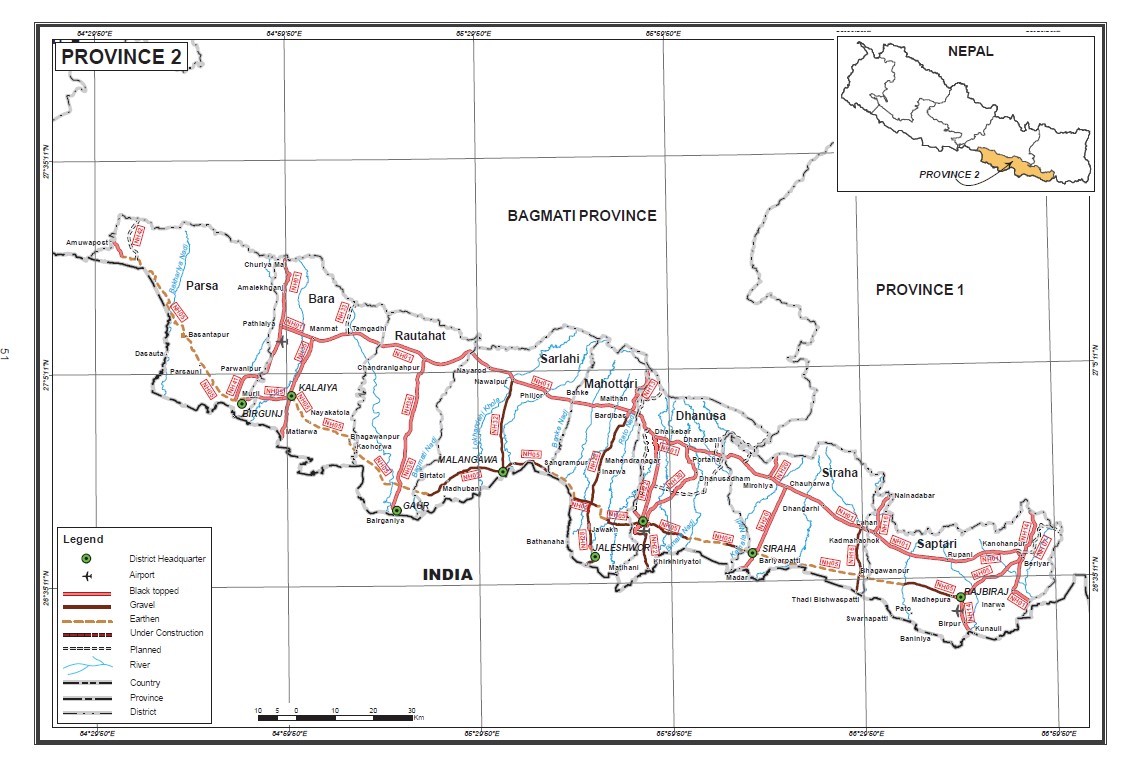 Strategic Road Network of Madhesh Pradesh: Statistics of National Highway
Distance Matrix (Madhesh Pradesh)
|
Distance from Madhesh Capital City to Major Towns (km) |
||||||||
|---|---|---|---|---|---|---|---|---|
|
|
Janakpur |
Birgunj |
Kalaiva |
Gaur |
Malangawa |
Jaleshower |
Siraha |
Rajbira |
|
Janakpur |
|
158 |
143 |
136 |
60.1 |
18.3 |
87.3 |
122 |
|
Birgunj |
158 |
|
17.5 |
64.9 |
114 |
157 |
196 |
230 |
|
Kalaiva |
143 |
17.5 |
|
47.5 |
99.3 |
142 |
181 |
251 |
|
Gaur |
136 |
64.9 |
47.5 |
|
92.4 |
135 |
174 |
208 |
|
Malangawa |
60.1 |
114 |
99.3 |
92.4 |
|
41.8 |
120 |
155 |
|
Jaleshower |
18.3 |
157 |
142 |
135 |
41.8 |
|
95 |
137 |
|
Siraha |
87.3 |
196 |
181 |
174 |
120 |
95 |
|
82 |
|
Rajbiraj |
122 |
230 |
251 |
208 |
155 |
137 |
82 |
|
|
Travel Time from Madhesh Capital City to Major Towns (hours: minutes) |
||||||||
|---|---|---|---|---|---|---|---|---|
|
|
Janakpur |
Birgunj |
Kalaiva |
Gaur |
Malangawa |
Jaleshower |
Siraha |
Rajbira |
|
Janakpur |
|
3:10 |
2:56 |
2:56 |
1:25 |
00:30 |
2:07 |
3:00 |
|
Birgunj |
3:10 |
|
00:28 |
1:41 |
2:20 |
3:15 |
4:10 |
5:10 |
|
Kalaiya |
2:56 |
00:28 |
|
1:13 |
2:05 |
3:00 |
4:00 |
5:00 |
|
Gaur |
2:56 |
1:41 |
1:13 |
|
2:00 |
3:00 |
3:56 |
3:00 |
|
Malangawa |
1:25 |
2;20 |
2:05 |
2:00 |
|
1:00 |
3:00 |
4:00 |
|
Jaleshower |
00:30 |
3:15 |
3:00 |
3:00 |
1:00 |
|
2:29 |
3:30 |
|
Siraha |
2:07 |
4:10 |
4:00 |
3:56 |
3:00 |
2:29 |
|
2:00 |
|
Rajbiraj |
3:00 |
5:10 |
5:00 |
3:00 |
4:00 |
3:30 |
2:00 |
|
The SRN connecting districts of Madhesh Province are generally obstructed by flood during the monsoon season and can be halted traffic for few days during the season.
Bagmati Province
All 13 districts of Bagmati Province are connected by roads. However, people living in the high altitude regions of Rasuwa, Sindhuplachok and Dolakha experience difficulty accessing roadways perennially. Major highways of the province are as follows:
-
Tribhuvan Highway: Tribhuvan Highway (H02) which is also part of Asian Highway 42 (AH42) connects the capital city with Birgunj, a major business hub in Madhesh Pradesh bordered with India.
-
Araniko Highway: Araniko Highway (H03) which is also part of AH42 connects capital city with Kodari on the Nepal-China border.
-
Prithivi Highway: Prithivi Highway (H04) connects capital city via Naubise, Dhading with Pokhara in Gandaki Province. This landslide-prone and heavily congested highway passes through five districts: Kathmandu, Dhading, Chitwan, Tanahu and Kaski.
-
BP Koirala Highway: The BP Highway, also known as the Banepa- Bardibas Highway, links Kathmandu Valley with Madhesh Pradesh and connects with eastern Nepal.
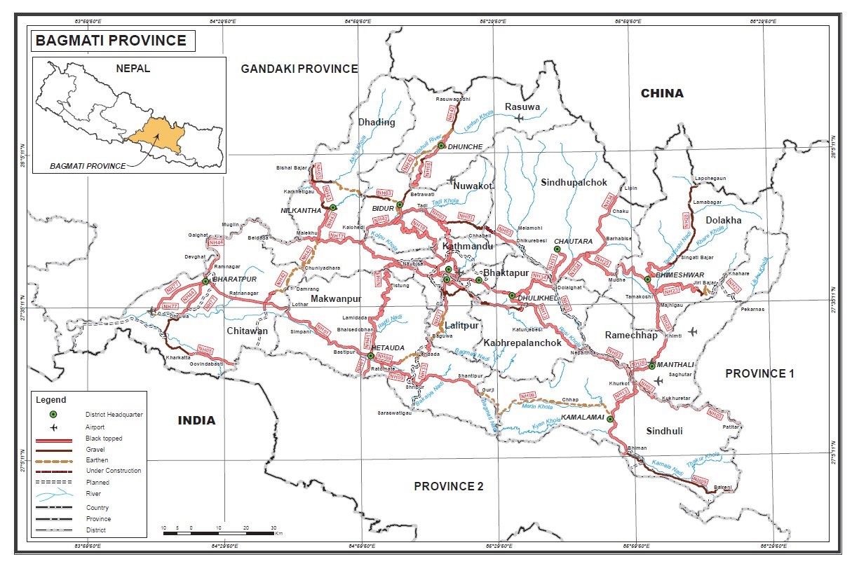 Road Network in Bagmati Province: Statistics of National Highway
Distance Matrix
|
Distances from Bagmati Province Capital City to Major Towns (km) |
|||||||
|---|---|---|---|---|---|---|---|
|
|
Hetauda |
Kathmandu |
Ratnanagar |
Bhimeshowr |
Bidur |
Dhunche |
Chautara |
|
Hetauda |
|
85 |
62.7 |
207 |
121 |
168 |
172 |
|
Kathmandu |
85 |
|
159 |
127 |
50 |
98.8 |
94.5 |
|
Ratnagar |
62.7 |
159 |
|
276 |
133 |
181 |
233 |
|
Bhimeshowr |
207 |
127 |
276 |
|
178 |
224 |
109 |
|
Bidur |
121 |
50 |
133 |
176 |
|
49.1 |
115 |
|
Dhunche |
168 |
98.8 |
181 |
224 |
109 |
|
164 |
|
Chautara |
172 |
94.5 |
233 |
109 |
115 |
164 |
|
|
Travel Time from Bagmati Province Capital City to Major Towns (hours 00:00) |
|||||||
|---|---|---|---|---|---|---|---|
|
|
Hetauda |
Kathmandu |
Ratnanagar |
Bhimeshowr |
Bidur |
Dhunche |
Chautara |
|
Hetauda |
|
3:53 |
1:14 |
7:49 |
4:30 |
6:27 |
6:45 |
|
Kathmandu |
3:53 |
|
5:04 |
4:01 |
2:00 |
3:52 |
3:27 |
|
Ratnagar |
1:14 |
5:04 |
|
8:28 |
3:25 |
5:20 |
8:10 |
|
Bhimeshowr |
7:49 |
4:10 |
8:28 |
|
6:00 |
8:00 |
3:30 |
|
Bidur |
4:30 |
2:00 |
3:25 |
6:00 |
|
2:03 |
5:24 |
|
Dhunche |
6:27 |
3:52 |
5:20 |
8:00 |
2:03 |
|
7:02 |
|
Chautara |
6:45 |
3:27 |
8:10 |
3:30 |
5:24 |
7:02 |
|
Connecting road to Kathmandu (Bagmati Province), the capital of Nepal through the Narayngadh Mugling Highway/HO5 can be obstructed by large scale landslide and the main route to the capital city from the rest of the country can also be blocked by debris flow during monsoon season.
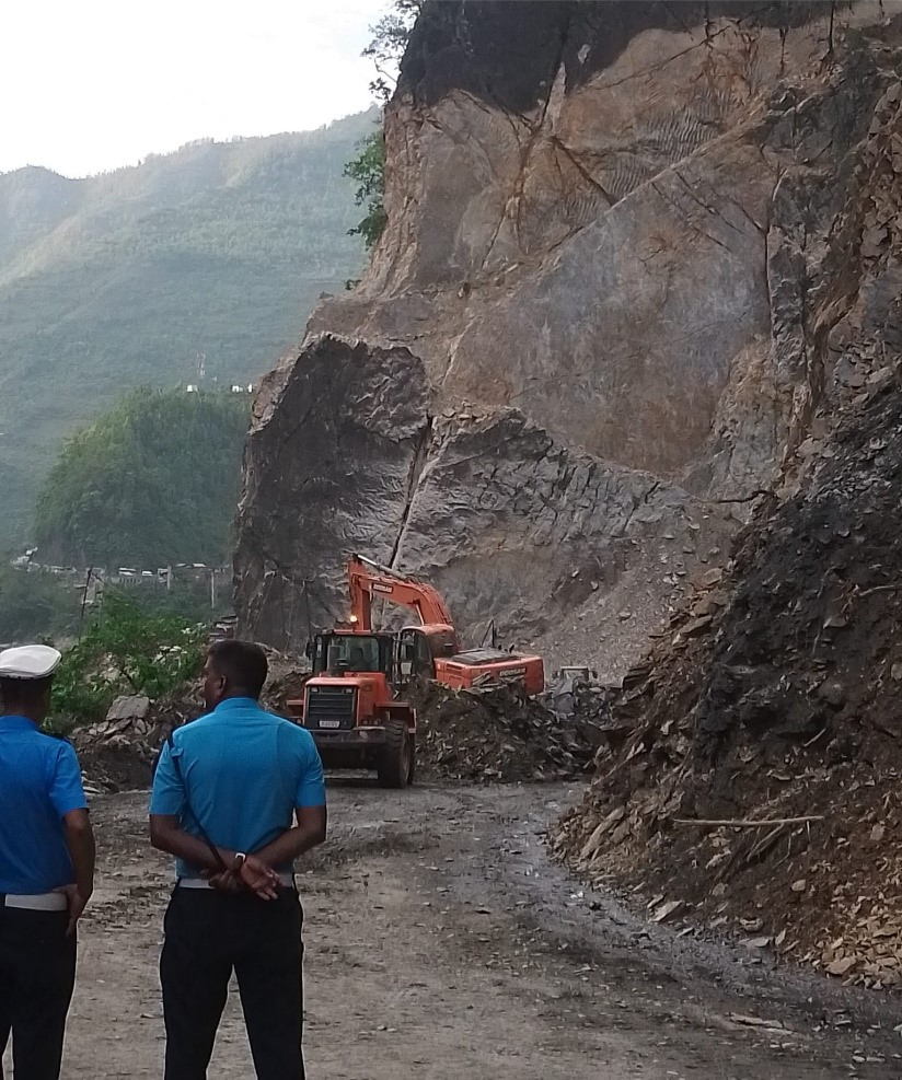
Landslide Disrupts Narayagarh-Mugling Road Section
Gandaki Province
Nine out of 11 districts of Gandaki Province are connected via blacktopped road (530.24 km). Road connection to Myagdi, Mustang and Manang although navigable are earthen and gravelled and can pose serious issues during rainy season.
-
Siddhartha Highway: Siddhartha Highway (H10) connects Gandaki Provicne to Gandaki Province. The highway starts at Nepal-India Border in Siddharthanagar and terminates at Prithivi chowk, Pokhara. The major settlements on the highway are Siddharthanagar, Butwal, Tansen, Waling, Putalibazar, Syangja and Pokhara.
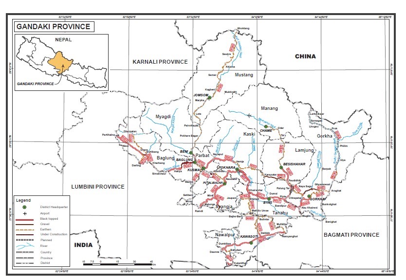
Road Network in Gandaki Province: Statistics of National Highway
|
Distances from Gandaki Province Capital City to Major Towns (km) |
||||||||
|---|---|---|---|---|---|---|---|---|
|
|
Pokhara |
Vyas |
Gaindakot |
Baglung |
Gorkha |
Beshisahar |
Chame |
Jomsom |
|
Pokhara |
|
50.1 |
121 |
80.7 |
73.8 |
106 |
169 |
159 |
|
Vyas |
51.1 |
|
102 |
131 |
43.2 |
57.9 |
121 |
209 |
|
Gaindakot |
121 |
102 |
|
202 |
116 |
115 |
178 |
298 |
|
Baglung |
80.7 |
131 |
202 |
|
186 |
187 |
249 |
94.3 |
|
Gorkha |
73.8 |
43.2 |
116 |
186 |
|
66.5 |
144 |
265 |
|
Besisahar |
106 |
57.9 |
115 |
187 |
66.5 |
|
67.4 |
265 |
|
Chame |
169 |
121 |
178 |
249 |
144 |
67.4 |
|
328 |
|
Jomsom |
159 |
209 |
298 |
94.3 |
265 |
265 |
328 |
|
|
Travel Time from Gandaki Province Capital City to Major Towns (hours 00:00) |
||||||||
|---|---|---|---|---|---|---|---|---|
|
|
Pokhara |
Vyas |
Gaindakot |
Baglung |
Gorkha |
Beshisahar |
Chame |
Jomsom |
|
Pokhara |
|
2:09 |
5:12 |
2:13 |
4:00 |
4:04 |
7:44 |
5:55 |
|
Vyas |
2:09 |
|
3:00 |
4:18 |
1:44 |
2:00 |
5:40 |
8:04 |
|
Gaindakot |
5:12 |
3:00 |
|
7:04 |
4:22 |
3:34 |
7:14 |
11:35 |
|
Baglung |
2:13 |
4:18 |
7:04 |
|
6:00 |
6:05 |
9:47 |
4:09 |
|
Gorkha |
4:00 |
1:44 |
4:22 |
6:00 |
|
2:28 |
6:21 |
10:00 |
|
Besisahar |
4:04 |
2:00 |
3:34 |
6:05 |
2:28 |
|
4:00 |
10:00 |
|
Chame |
7:44 |
5:40 |
7:14 |
9:47 |
6:21 |
4:00 |
|
12:36 |
|
Jomsom |
5:55 |
8:04 |
11:35 |
4:09 |
10:00 |
10:00 |
12:36 |
|
Lumbini Province
All 12 districts of Lumbini Province are connected via blacktopped road (1428.90 km). Major highways of the province are as follows:
-
Rapti Highway: Rapti Highway (H11) starts from Ameliya, Dang and terminates at Musikot West Rukum. This highway makes hilly regions of Rolpa, Salyan West Rukum and east Rukum accessible.
-
Ratna Highway: Ratna Highway (H12) connects Lumbini Province to Karnali Province. It starts at Nepal- India border in Nepalgunj and terminates at Birendranagar, Surkhet. The highway transition into Karnali Highway system from the point it terminates.
-
Mahendra highway: Mahendra highway traverses districts of Bardiya, Banke, Dang, Kapilvastu, Rupandehi, Parasi latitudinally. It connects Lumbini Province to Bagmati Province to east and Sudurpaschim Province to the west.
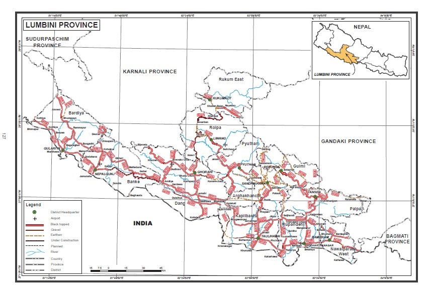
Road Network in Lumbini Province: Statistics of National Highway
|
Distances from Lumbini Province Capital City to Major Towns (km) |
|||||||
|---|---|---|---|---|---|---|---|
|
|
Butwal |
Ghorahi |
Nepalgunj |
Kapilvastu |
Rajapur |
Bhairahawa |
Ramgram |
|
Butwal |
|
148 |
249 |
48.5 |
316 |
25.1 |
35.3 |
|
Ghorahi |
148 |
|
146 |
120 |
220 |
180 |
185 |
|
Nepalgunj |
249 |
146 |
|
221 |
289 |
41.8 |
67.9 |
|
Kapivastu |
48.5 |
120 |
221 |
|
289 |
41.8 |
67.9 |
|
Rajapur |
316 |
220 |
289 |
289 |
|
330 |
356 |
|
Bhairahawa |
25.1 |
180 |
41.8 |
41.8 |
330 |
|
25.2 |
|
Ramgram |
35.3 |
185 |
67.9 |
67.9 |
356 |
25.2 |
|
|
Travel Time from Lumbini Province Capital City to Major Towns (hours:minutes) |
|||||||
|---|---|---|---|---|---|---|---|
|
|
Butwal |
Ghorahi |
Nepalgunj |
Kapilvastu |
Rajapur |
Bhairahawa |
Ramgram |
|
Butwal |
|
3:22 |
5:13 |
1:00 |
6:40 |
00:42 |
1:03 |
|
Ghorahi |
3:22 |
|
3:31 |
2:46 |
4:20 |
3:42 |
4:30 |
|
Nepalgunj |
5:13 |
3:31 |
|
4:48 |
6:04 |
5:43 |
6:25 |
|
Kapivastu |
1:00 |
2:46 |
4:48 |
|
7:00 |
00:52 |
1:16 |
|
Rajapur |
6:40 |
4:20 |
6:04 |
7:00 |
|
7:03 |
7:38 |
|
Bhairahawa |
00:42 |
3:42 |
5:43 |
00:52 |
7:03 |
|
00:31 |
|
Ramgram |
1:03 |
4:30 |
6:25 |
1:16 |
7:38 |
00:31 |
|
There are 12 districts in Lumbini Province. Of them, six districts of the Terai – West Nawalparasi, Rupandehi, Kapilvastu, Dang, Banke, and Bardiya – are at high risk of floods. Similarly, hilly districts – Gulmi, Arghakhanchi, Pyuthan, Rolpa, and Palpa – are at high risk of landslides and road can be obstructed during monsoon season and adhere to the precaution notification of the Department of Hydrology and Meteorology (DHM) for movement.
Karnali Province
The East-West Highway (EWH, 1,024 km) is the main traffic artery in the country but does not traverse Karnali province. The juncture with the EWH at Kohalpur along Ratna Rajmarg is 87 KM away from Karnali Province’s capital, Birendranagar.
The last 40km of the Ratna Highway from the border at Bheriganga Municipality, Surkhet with Bardiya district joins Lumbini Province with Karnali Province’s capital. The Karnali Highway (233km) traverses Surkhet, Dailekh, Kalikot, and Jumla crossing Mid Hill EW Highway at Sahijyula, Dailkeh. The Mid-hill EW highway which is 1,776 km long extending from Panchthar to Baitadi is the parallel highway which will provide an alternative to EW highway through hills. 278 km of Midhill highway traverses Dailekh (125 km), Jajarkot (83 km) and West Rukum (70 km) from Sahijyula, Dailekh to Ghorkhani in West Rukum. 176 km of Rapti Highway connects Salyan and West Rukum with EWH in Ameliya, Dang of that 124 km traverses Salyan and West Rukum from Salyan district border with Dang district till Musikot. At Musikot it meets Midhill EWH.
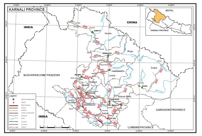
Road Network in Karnali Province: Statistics of National Highway
Distance Matrix (Karnali Province)
|
Distances from Karnali Province capital, Birendranagar to Major Towns (km) |
||||||||||||
|---|---|---|---|---|---|---|---|---|---|---|---|---|
|
|
Surkhet |
Chhinchu |
Dullu |
Dailekh |
Manma |
Nagma |
Jumla |
Gamgadhi |
Chaurjhari |
Jajarkot |
Rukum |
Salyan |
|
Surkhet |
|
27 |
86.7 |
125 |
147 |
196 |
229 |
251.5 |
117 |
148 |
175 |
107 |
|
Chhinchu |
27 |
|
98 |
120 |
174 |
223 |
255 |
327.5 |
87.1 |
119 |
145 |
76.2 |
|
Dullu |
86.7 |
98 |
|
17.9 |
84.2 |
133 |
180 |
223.5 |
184 |
215 |
242 |
173 |
|
Dailekh |
125 |
120 |
17.9 |
|
106 |
155 |
188 |
263.5 |
206 |
238 |
264 |
195 |
|
Manma |
147 |
174 |
84.2 |
106 |
|
49.3 |
82.4 |
174.5 |
260 |
291 |
318 |
249 |
|
Nagma |
196 |
223 |
133 |
155 |
49.3 |
|
47 |
91.5 |
356 |
340 |
367 |
298 |
|
Jumla |
229
|
255 |
180 |
188 |
82.4 |
47 |
|
124.5 |
356 |
387 |
414 |
346 |
|
Gamgadhi |
251.5 |
327.5 |
223.5 |
263.5 |
174.5 |
91.5 |
124.5 |
|
|
406.5 |
436.5 |
391.5 |
|
Chaurjhari |
117 |
87.1 |
184 |
206 |
260 |
356 |
356 |
|
|
61.1 |
57.9 |
89.1 |
|
Jajarkot |
148 |
119 |
215 |
238 |
291 |
340 |
387 |
406.5 |
61.1 |
|
105 |
122 |
|
Rukum |
175 |
145 |
242 |
264 |
318 |
367 |
414 |
436.5 |
57.9 |
105 |
|
98 |
|
Salyan |
107 |
76.2 |
173 |
195 |
249 |
298 |
346 |
391.5 |
89.1 |
122 |
98 |
|
|
Travel Time from Birendranagar, Surkhet to Major Towns (hours:minutes 00:00) |
|||||||||||||
|---|---|---|---|---|---|---|---|---|---|---|---|---|---|
|
|
Surkhet |
Chhinchu |
Dullu |
Dailekh |
Manma |
Nagma |
Jumla |
Gamgadhi |
Chaurjhari |
Jajarkot |
Rukum |
Salyan |
|
|
Surkhet |
|
0:45 |
2:43 |
3:31 |
5:47 |
8:00 |
9:08 |
14:25 |
4:00 |
4:25 |
6:13 |
3:30 |
|
|
Chhinchu |
00:45 |
|
3:20 |
4:04 |
6:25 |
8:35 |
9:41 |
15:50 |
3:19 |
3:44 |
5:32 |
2:46 |
|
|
Dullu |
2:43 |
3:20 |
|
0:58 |
3:39 |
5:47 |
7:36 |
13:50 |
6:31 |
7:00 |
8:44 |
5:56 |
|
|
Dailekh |
3:31 |
4:04 |
00:58 |
|
4:17 |
6:19 |
7:34 |
11:00 |
7:16 |
7:14 |
9:29 |
8:00 |
|
|
Manma |
5:47 |
6:25 |
3:39 |
4:17 |
|
2:05 |
3:52 |
8 |
9:19 |
10:04 |
11:30 |
9:06 |
|
|
Nagma |
8:00 |
8:35 |
5:47 |
6:19 |
2:05 |
|
1:47 |
6.5 |
11:24 |
12:09 |
13:35 |
11:05 |
|
|
Jumla |
9:08 |
9:41 |
7:36 |
7:34 |
3:52 |
1:47 |
|
8 |
13:10 |
13:55 |
15:21 |
12:58 |
|
|
Gamgadhi |
14:25 |
15:50 |
13:50 |
11 :00 |
8 |
6.5 |
8 |
|
|
19.75 |
21 |
18 |
|
|
Chaurjhari |
4:00 |
3:19 |
6:31 |
7:16 |
6:54 |
11:24 |
13:10 |
8:00 |
|
1:27 |
2:10 |
3:29 |
|
|
Jajarkot |
4:25 |
3:44 |
7:00 |
7:41 |
10:0 |
10:04 |
13:55 |
19.75 |
|
|
2:38 |
4:21 |
|
|
Rukum |
6:13 |
5:32 |
8:44 |
9:29
|
11:30 |
13:35 |
15:21 |
21 |
1:27 |
2:38 |
|
4:01 |
|
|
Salyan |
3:30 |
2:46 |
5:56 |
6:46 |
9:06 |
11:05 |
12:58 |
18 |
3:29 |
4:21 |
4:01 |
|
|
Known obstacles and bridges in Karnali Province
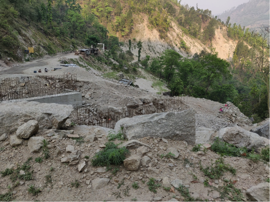
Construction of Bridge on Karnali Highway on the way to Manma
The SRN connecting districts of Karnali Province are relatively unobstructed by landslides. But numerous bridge building activities have diverted roads into small rivulets, which can delay traffic and can be temporarily obstructed during the monsoon season.
Construction of bridges on the lengths of highways could delay the movement but are not a hindrance. Numerous bridges are being constructed.
The district of Humla is not yet connected with road network. A project to link the Humla with Karnali Highway is under progress in Kalikot district. A special travel arrangement could be made in the form of the ferry to carry vehicles across the Karnali river but that is not possible during the rainy season. Historically, an ancient foot trail from Simikot to Hilsa, that goes along the mountain slopes on the left side of the Humla Karnali river. This route has been used by locals for trading at the nearby old trade mart of Taklakot in Tibet, and for undertaking the pilgrimage to the nearby holy sites of Lake Manasarovar and Mount Kailash in Tibet. This route involves a 4-5 day walk from Simikot to Hilsa,
Dolpa is also not accessible through a connecting road. The government is attempting to link the roadway to Dolpa, Dunai. The road is linked to Rukum, Jajarkot districts. The road is 118 km long, of which 73 km road construction has been completed.
Sudurpashchim Province
The East-West highway is the lifeline to all 9 districts in Sudurpashchim Province. The road networks joining province capitals Kailali and district headquarter, Kanchanpur, south of the East-West highway and other seven districts headquarter with north of East-west highway are accessible but the problem of inundation in Terai and frequent lands8:44lide often pose severe access constraints during the monsoon season. Puspalal Mid hill Highways is5 in the construction process but at a slow pace.
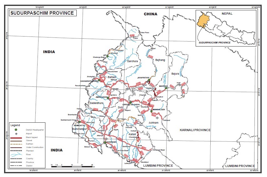
Strategic Road Network of Sudurpaschim Province: Statistics of National Highway
Distance Matrix (Sudurpashchim Province)
|
Distances from Sudurpaschim Province capital, Dhangadi to Major Towns (km)
|
|||||||||
|---|---|---|---|---|---|---|---|---|---|
|
|
Kailali |
Kanchanpur |
Dadeldhura |
Baitadi |
Darchula |
Bajhang |
Doti |
Bajura |
Achham |
|
Kailali |
|
63.6 |
140 |
210 |
327 |
270 |
195 |
306 |
300 |
|
Kanchanpur |
63.6 |
|
200 |
272 |
390 |
331 |
258 |
289 |
208 |
|
Dadeldhura |
140 |
200 |
|
80.3 |
148 |
160 |
144 |
254 |
251 |
|
Baitadi |
210 |
272 |
80.3 |
|
142 |
267 |
250 |
361 |
235 |
|
Darchula |
327 |
390 |
148 |
142 |
|
267 |
254 |
370 |
358 |
|
Bajhang |
270 |
331 |
160 |
267 |
267 |
|
196 |
312 |
299 |
|
Doti |
195 |
258 |
144 |
250 |
254 |
196 |
|
135 |
132 |
|
Bajura |
306 |
289 |
254 |
361 |
370 |
312 |
135 |
|
93.2 |
|
Achham |
300 |
208 |
251 |
235 |
358 |
299 |
132 |
93.2 |
|
|
Travel Time from Sudurpaschim Province capital, Dhangadi to Major Towns (km)
|
|||||||||
|---|---|---|---|---|---|---|---|---|---|
|
|
Kailali |
Kanchanpur |
Dadeldhura |
Baitadi |
Darchula |
Bajhang |
Doti |
Bajura |
Achham |
|
Kailali |
|
1:27 |
4:03 |
6:27 |
10:28 |
8:38 |
6:00 |
9:40 |
9:20 |
|
Kanchanpur |
1:27 |
|
5:30 |
8:00 |
12:00 |
10:00 |
7:30 |
11:00 |
8:00 |
|
Dadeldhura Amargadi |
4:03 |
5:30 |
|
2:45 |
6:30 |
5:45 |
5:00 |
8:40 |
8:30 |
|
Baitadi |
6:27 |
8:00 |
2:45 |
|
5:00 |
9:30 |
8:30 |
12:30 |
12:00 |
|
Darchula |
10:28 |
12:00 |
6:30 |
5:00 |
|
9:20 |
8:30 |
12:30 |
12:00 |
|
Bajhang |
8:38 |
10:00 |
5:45 |
9:30 |
9:20 |
|
6:40 |
10;50 |
10:20 |
|
Doti |
6:00 |
7:30 |
5:00 |
8:30 |
8:30 |
6:40 |
|
1:15 |
5:00 |
|
Bajura |
9:40 |
11:00 |
8:40 |
12:30 |
12:30 |
10:50 |
1:15 |
|
3:30 |
|
Achham |
9:20 |
8:00 |
8:30 |
12:00 |
12:00 |
10:20 |
5:00 |
3:30 |
|
Known obstacles and bridges in Sudurpashchim province
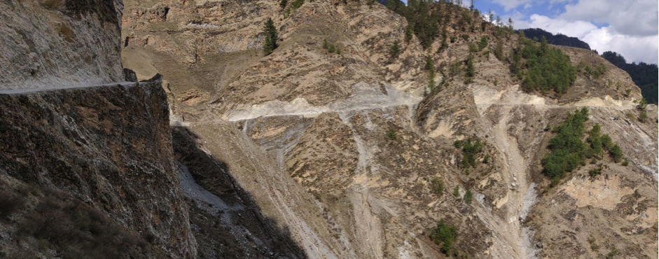
Rocky section of F154 in Bumramadichaur joining Nagma to Gamgadhi, Mugu
Landslide and flood-prone area in a different location throughout the Sudurpashchim province
|
Address |
GR/Map sheet |
Latitude |
Longitude |
Hazard and Risk |
Remark |
|---|---|---|---|---|---|
|
Kakada |
46709130 |
N29° 47'08'' |
E80° 26'09'' |
Landslide |
Mahakali highway |
|
Kimtadi |
53559990 |
N29° 49'32'' |
E80° 30'07'' |
Landslide |
Mahakali highway |
|
Khaulchaura |
46879012 |
N29° 44'01'' |
E80° 27'05'' |
Landslide |
Mahakali highway |
|
Terselake |
50759012 |
N29° 44'20'' |
E80° 29'09'' |
Landslide |
Mahakali highway |
|
Dudhali Gard |
52578957 |
N29° 46'28'' |
E80° 30'48'' |
Landslide |
Mahakali highway |
|
Baitadi |
NA |
N29° 39'158'' |
E80° 31'229'' |
Landslide |
Baitadi Road |
|
Baitadi -Bangabagar |
NA |
N29. 664634' |
E80.545070' |
Flash flood |
Mahakali Highway |
|
Bajura-Dwari, Kailashmandu |
NA |
N 29.399555 |
E81.393506 |
Landslide |
Bajura Road |
|
Lalmatiya Bhaluwang- Dang |
NA |
N27.837510 |
E82.763178 |
Road damage- east-west highway |
Due to irrigation project |
Flood-prone districts of 6 provinces of Nepal where susceptibility of road blocked is high during monsoon season (June-August) and vehicular movement need to adhere to the early notification of rain by Department of Hydrology and Meteorology of Nepal for vehicular movement.
|
Flood Prone Districts of 7 province of Nepal |
|||||
|---|---|---|---|---|---|
|
Koshi |
Bagamati |
Gandaki |
Madhesh |
Lumbini |
Sudurpaschim |
|
Jhapa |
Chitawan |
Nawalparasi |
Bara |
Banke |
Kailali |
|
Morang |
Sindhuli |
|
Dhanusha |
Bardiya |
Kanchanpur |
|
Sunsari |
|
|
Mahottari |
Dang |
|
|
Udayapur |
|
|
Parsa |
Kapilbastu |
|
|
|
|
|
Rautahat |
Nawalparasi |
|
|
|
|
|
Saptari |
Rupandehi |
|
|
|
|
|
Sarlahi |
|
|
|
|
|
|
Siraha |
|
|
Nepal - 2.3.1 Major Border Crossing of Kakarbhitta - Mechi
Overview
Kakarbhitta is the eastern terminus of Nepal's east-west Mahendra Highway at the country's eastern border with Darjeeling District, West Bengal state, India. The Panitanki neighbourhood of Naxalbari is on the other side. It is an open border for Nepali / Indian foot traffic, up to 10,000 people per day. The construction work of 690 meters long open foundation bridge has been completed. The bridge (Mechi/Miteri bridge) over Mechi River in Kakarvitta came into operation on 1st January 2023 it is connected with the Asian Highway with 6-lane road connectivity and 2 & 3-wheeler vehicles are not allowed to travel via this bridge. The width of the new bridge is 22 meters. Roads are good on both sides of the border. The road to Kolkatta is good with a distance of 658 km. Imports from India account for 90% of the traffic at this border crossing. Customs can process up to 150-200 trucks a day.
Kakarbhitta is the 7th largest border crossing point, with 2.87% share of total import value (ref: Dept of Customs, 2019/20).
|
Border Crossing Location and Contact |
|
|---|---|
|
Name of Border Crossing
|
Nepal: Kakarbhitta India: Naxalbari / Pantanki |
|
Province or District |
Koshi Province, Mechi Municipality-6, Jhapa District |
|
Nearest Town or City with Distance from Border Crossing |
Mechi (adjacent) Bhadrapur (18 km) |
|
Latitude |
26.64611 |
|
Longitude |
88.15777 |
|
Managing Authority / Agency |
Immigration Office, Mechi Customs Office |
|
Contact Person |
Shree Ram Prasad Regmi Tel: 023-562234 Email: mechi@customs.gov.np |
|
Travel Times |
|
|---|---|
|
Nearest International Airport |
Baghdogra Airport, India Distance: 18 km Truck: 45 minutes Car: 30 minutes |
|
Nearest Port |
Calcutta Port, India Distance: 586 km Truck Travel Time: 15 hours Car Travel time: 10 hours |
|
Nearest location with functioning wholesale markets, or with significant manufacturing or production capacity |
Silguri, India Distance: 27 km Truck Travel Time: 1 hour Car Travel time: 45 minutes & Panitanki, India Distance: 2 km Truck: 15 minutes Car: 5 minutes |
|
Other Information
|
The market is 18 kms from Baghdogra Airport. It is very large–it takes 1 hour to travel from the fringes to the centre of the market. Roads to the markets are good with fuel stations on the route. Passengers, 2 & 3 wheeler vehicle crosses using Old Mechi Bridge for shopping at Panitanki or other markets in India. The Asian Highway between Nepal & India is connected by Mechi/Miteri Bridge and heavy-loaded transports and light four-wheeler vehicle crosses the border point of Nepal via Mechi/Miteri Bridge. |
|
Hours of Operation |
|
|---|---|
|
MONDAY |
Trucks/Goods: 10:00 – 18:00 |
|
TUESDAY |
Trucks/Goods: 10:00 – 18:00 |
|
WEDNESDAY |
Trucks/Goods: 10:00 – 18:00 |
|
THURSDAY |
Trucks/Goods: 10:00 – 18:00 |
|
FRIDAY |
Trucks/Goods: 10:00 – 18:00 |
|
SATURDAY |
Trucks/Goods: 10:00 – 18:00 |
|
SUNDAY |
Trucks/Goods: 10:00 – 18:00 |
|
NATIONAL HOLIDAYS: |
Generally, 3 days during Dashain (Nepal national festival) and up to another 7 days / year at Government’s discretion. The Customs procedure is closed on Jesth 15 (28 or 29 April every year) on account of New Fiscal Budget Announcement but for services to immigration & passenger remains continue. |
|
SEASONAL CONSTRAINTS: |
None |
Daily Capacity
-
Operating hours can be extended to 06:00-22:00 for exceptionally high truck traffic if required.
-
Average clearing time: 2½ hours / truck
-
There is rarely a backlog. All trucks are cleared daily.
Customs Clearance
Compulsory Document for custom clearance.
-
D & T Exemption Certificate
-
Performa invoice
-
Invoice
-
AWB/BL/Other Transport Documents- Freights
-
Donation/Non-Commercial Certificates
-
Packing list
-
Letter of credit
-
Mode of payments (LC/TT/Draft)
-
Certificate of origin
-
Certificate of insurance
-
Bill of Lading/Airway Bill for 3rd country imports
-
Industry Registration Certificates
-
EXIM Code. (EXIM Code is mandatory for Commercial trading and not mandatory for humanitarian support goods.
-
Bill of Entry from Indian Customs Office
-
Exit Note (TransNepal Freight Service (P) Ltd charges as per their Discharge Rate and Terminal Handling Charges for using Terminal and Warehouse facilities which is linked to ASYCUDA and allowed to exit the vehicles following proper verification.
-
VCTS
-
Recommendation letter
-
Tariff will be imposed on imported goods as per the Integrated Customs Tariff 2080/081 for FY 2080/81 (FY- 2023/024)
-
GST Bill
For more information on customs in Nepal, please see the following link: 1.3 Customs Information.
Other Relevant Information
-
Foot traffic is mixed with vehicles on the bridge and may present logistics safety issues.
-
The bridge (approx. 400 m) old one and a new bridge (Mechi or Miteri bridge) constructed over the Mechi River in Kakarvitta which came into operation on 1st January 2023 and has connected Kakadvitta, Nepal and Panitanki of India. This bridge connects the Asian Highway.
-
A logistical problem would present if both bridges were damaged.
For more information on government contact details, please see the following link: 4.1 Government Contact List.
Pictures
|
Aerial view of Border crossing with 1. Immigration Office of kakarbhitta, (2) Mechi Customs Office, (3) Mechi Bridge |
|
Updated Aerial view of Border crossing with Immigration Office of kakarbhitta, Mechi Customs Office, and both Mechi Bridge
|
|
Mechi/Miteri bridge over Mechi River at Kakarvitta ICD & Customs Office
|
|
Over to India via Miteri Bridge at Kakarvitta
|
|
Mechi Customs Office, Kakarvitta, Jhapa, Koshi Province
|
|
Asian Highway that connects Nepal and India at Kakarvitta Border point
Truck parking and shade storage |
|
Truck parking and shade storage |
|
Warehouse storage |
|
Way to Old Mechi bridge and river. |
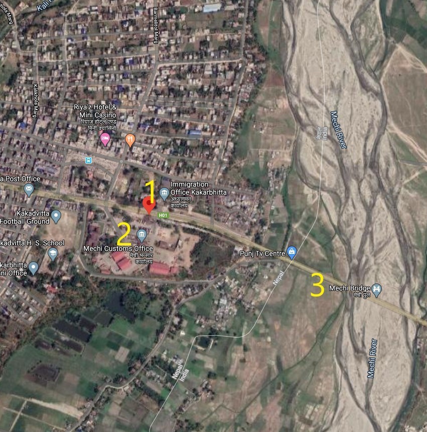
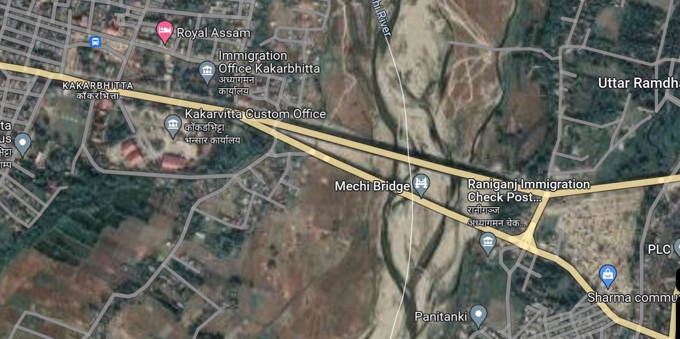
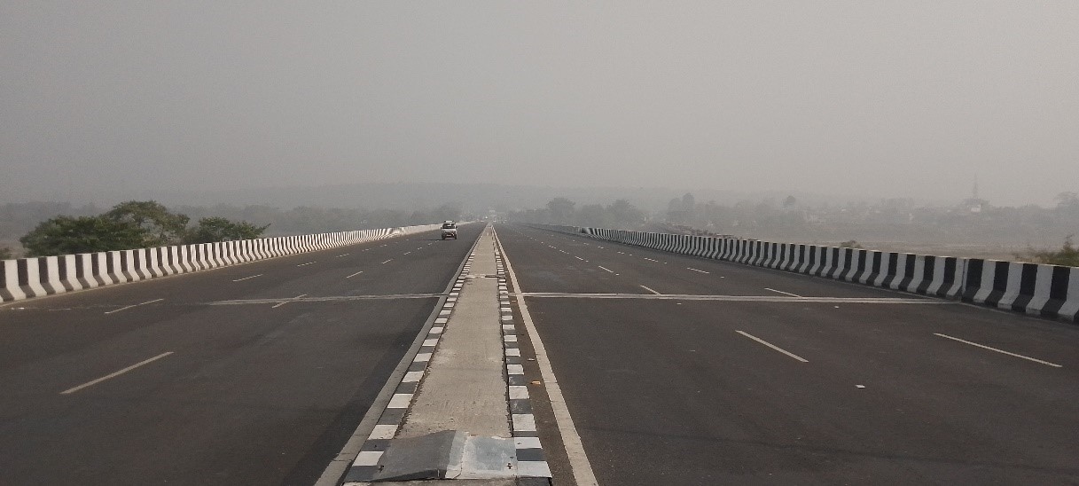
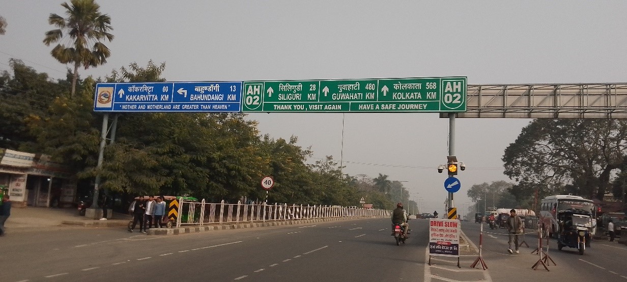
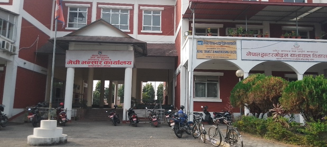
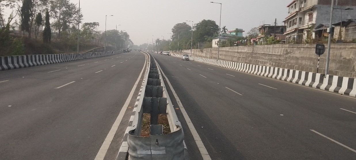
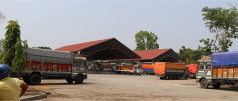
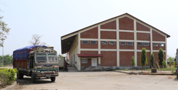
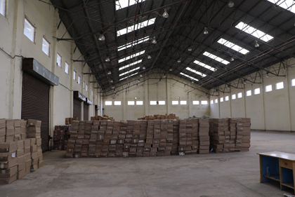
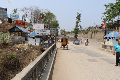
Nepal - 2.3.2 Major Border Crossing of Rani/Jogbani
Overview
|
|
|
Aerial view of Border crossing with (1) Biratnagar ICP, (2) Biratnagar Customs Office, (3) Jogbani Railway Station |
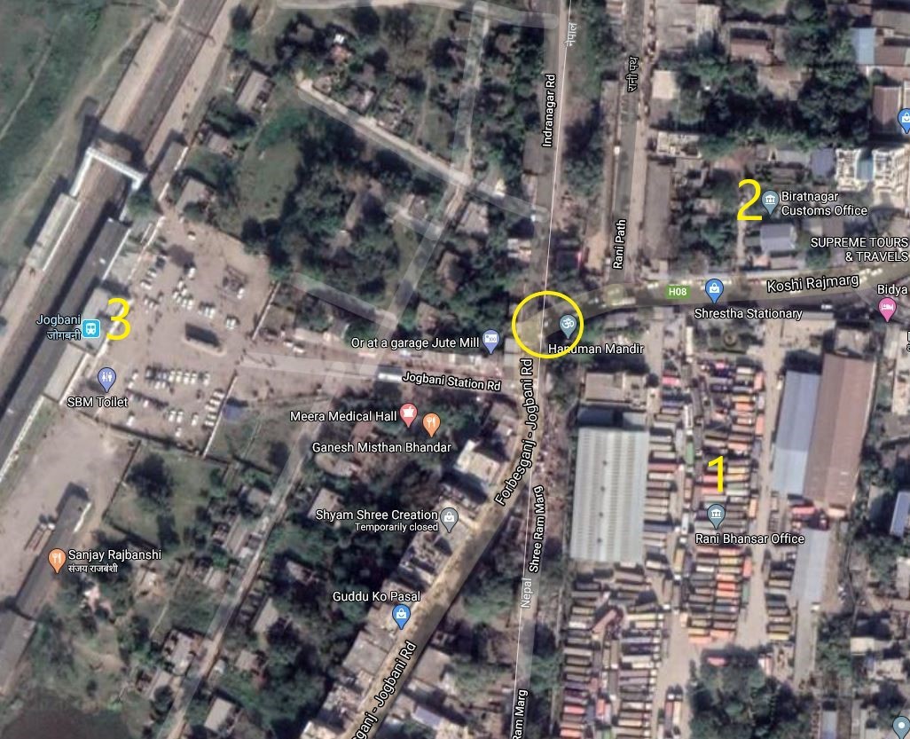
The city of Biratnagar is 7 kilometres (4 mi) north of Nepal's southern border with Bihar state, India. Indian and Nepalese nationals cross freely as the border is open for local movement. The checkpoint is under the joint oversight of Armed Police Force along with Local Police unit for overall security and Biratnagar Customs Office for administrative and record keeping responsibilities.
Jogbani town in Araria District is on the Indian side, where a rail line ends at Jogbani Station (JBN) under Katihar Division of Northeast Frontier railways. Nepal’s eastern border of Kakarbhitta lies at a distance of 108 kilometres (67.5 mi) from the city and can be reached via frequent buses running half-hourly from the city's bus park.
Biratnagar is the 4th largest border crossing point, with 11.57% share of total import value (ref: customs.gov.np).
Biratnagar Custom Office is opened for passengers and local customers for purchasing of goods of maximun NPR 5000 per person only. No cargo transports are allowed to enter from this point except mini private cars, vehicles. This border crossing had a significant importance for trade, commerce, and the movement of people between Nepal and India. But after the operation of ICP all the cargo crosses the border via ICP, Buddhanagar to Nepal.
It has 9 sub-customs offices which are as follows: Mayaganj, Rangeli, Diniya, Madhumalla, , Tariga, Kadamaha, Chuniwari, Doria and Chowkighat Sub Customs Office.
|
Border Crossing Location and Contact |
|
|---|---|
|
Name of Border Crossing
|
Nepal: Biratnagar India: Jogbani |
|
Province or District |
Koshi Province, Morang |
|
Nearest Town or City with Distance from Border Crossing |
Biratnagar |
|
Latitude |
26.4029474 |
|
Longitude |
87.2668259 |
|
Managing Authority / Agency |
Biratnagar Customs Office, Armed Police Force |
|
Contact Person |
Shree Gyanendra Dhakal Tel: 021-444005 Fax: 021-436323 Official Mob: 9852037345 E-mail: biratnagar@customs.gov.np |
|
Travel Times |
|
|---|---|
|
Nearest International Airport |
Baghdogra, India |
|
Nearest Port |
Kolkota, India |
|
Nearest location with functioning wholesale markets, or with significant manufacturing or production capacity |
Siliguri, India |
|
Other Information
|
4 Lane highway to the market at Siliguri |
|
Hours of Operation (for passengers) |
|
|---|---|
|
Mondays |
06:00 – 21:00 |
|
Tuesdays |
06:00 – 21:00 |
|
Wednesdays |
06:00 – 21:00 |
|
Thursdays |
06:00 – 21:00 |
|
Fridays |
06:00 – 21:00 |
|
Saturdays |
06:00 – 21:00 |
|
Sundays |
06:00 – 21:00 |
|
National Holidays
|
Generally, 3 days during Dashain (Nepal national festival, 3 days for Tihar, 1 day for Chhat pooja and 1 day Holi) and up to another 7 days / year at Government’s discretion. Passenger checking and immigration procedure continues |
|
Seasonal Constraints |
None |
Daily Capacity
N/A. Closed to Cargo and container trucks.
Customs Clearance
No import/export customs clearance procedure is conducted at this point. Only passengers are allowed to cross from this border area. All the cargos are diverted to ICP Buddhanagr and crosses the border point after clearing all customs procedures through ICP Biratnagar Customs office.
As this border point used as for only immigration purposes. Vehicles and means of transport that are temporarily crosses from India will be subjected to customs duties as per the scheduled below:
-
Motorcycles and scooters NPR 200.00
-
Three-Wheeled vehicle NPR 400.00
-
Including tractor tailor NPR 500.00
-
Cars, Jeep Vans, Minibuses and other tourist vehicles NPR 600
-
Trailor, trucks and other vehicles NPR 1700
-
Excavator, Dozer, Loader, Roller, JCB and Crane used in construction work NPR 1700.
For more information on customs in Nepal, please see the following link: 1.3 Customs Information.
For more information on government contact details, please see the following link: 4.1 Government Contact List.
Nepal - 2.3.3 Major Border Crossing of Bhairahawa / Sunauli
Overview
|
|
|
Aerial view of Border crossing at Sunauli, 1. Customs Office 2. Bhairahawa ICD |
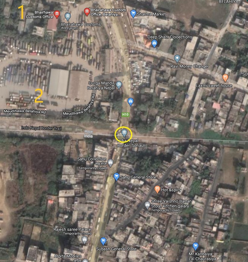
Sunauli is 95 km north of Gorakhpur (India) and 5 km south of Bhairahawa. The Indian side is "Sunauli" and Nepal side is Belahiya.
The Border Crossing being official entry point for heavy and light vehicles tends to be busy and congested all year round. Immigration Office at Belahiya is present, to efficiently cater to the 2nd busiest border crossing in Nepal, with 15.19 % share of total import value (ref: Dept of Customs, 2022/23). There are seven sub customs offices under this customs office: (1) Paklihawa, (2) Lumbini (3) Vucchivareva, (4) Amuwa, (5) Thumuwa, (6) Manjharia and (7) Bethry. Among these only Lumbini sub customs office is working.
|
Border Crossing Location and Contact |
|
|---|---|
|
Name of Border Crossing
|
Nepal: Belahiya / Bhairahawa |
|
Province or District |
Lumbini Province, Rupandehi |
|
Nearest Town or City with Distance from Border Crossing |
Bhairahawa |
|
Latitude |
27.47611 |
|
Longitude |
83.47000 |
|
Managing Authority / Agency |
Bhairahawa Customs Office, Immigration Office Belahiya, Armed Police Force |
|
Contact Person |
Narendra Prasad Chaudhary Siddharthanagar Muncipality ward no. 1, Belahiya, Rupandehi
Tel: 071-418003 Fax: 071-418026 E-mail: bhairahawa@customs.gov.np |
|
Travel Times |
|
|---|---|
|
Nearest International Airport |
Gautam Buddha International Airport Distance: 8 km Truck Travel Time: 20 minutes Car Travel time: 20 minutes |
|
Nearest Port |
Kolkota Distance: 910 km Truck: Travel Time Unknown Car: More than 24 hrs |
|
Nearest location with functioning wholesale markets, or with significant manufacturing or production capacity |
Bhairahawa (Nepal) / Sunauli (India) |
|
Other Information
|
Weighbridge / |
|
Hours of Operation |
|
|---|---|
|
Mondays |
10:00 - 17:00 |
|
Tuesdays |
10:00 - 17:00 |
|
Wednesdays |
10:00 - 17:00 |
|
Thursdays |
10:00 - 17:00 |
|
Fridays |
10:00 - 17:00 |
|
Saturdays |
10:00 - 12:00 |
|
Sundays |
10:00 - 12:00 |
|
National Holidays
|
Generally, 3 days during Dashain (Nepal national festival) and up to another 7 days / year at Government’s discretion. |
|
Seasonal Constraints |
None. Currently, road expansion work is going on near the customs office, so there might be some disturbance in movement of vehicles. |
Daily Capacity
-
Up to 300 Heavy Goods Vehicle (HGV) per day in both directions.
Customs Clearance
Due to clearance delay from Indian side, trucks queue up to 7 KM, due to this some trucks divert to Krishnanagar and Suthauli customs. If all supporting documents are okay, the clearance procedure can be completed in 2 hours.
Please see the Government directives regarding waiver of duty when a State of Emergency is declared. Under these circumstances, the DG will designate a specific area for clearance of aid cargo.
For more information on customs in Nepal, please see the following link: 1.3 Customs Information.
For more information on government contact details, please see the following link: 4.1 Government Contact List.
Nepal - 2.3.4 Minor Border Crossing - Krishnanagar
Overview
This border crossing is on Nepal’s southern border with India across from Barhani Bazar. The movement of Indian and Nepalese nationals across the border is unrestricted; however, there is a customs checkpoint for goods. Goods bound for Dang and Arghakhanchi cross here. Krishnanagar connects by road to the east–west Mahendra Highway. There are two routes from the border point: to Butwal and to Bhairahawa. The roads are good but single lane in places. There are four small customs offices under this office at Bhilmi, Hariharpur Kushhawa and Hardauna.
|
Border Crossing Location and Contact |
|
|---|---|
|
Name of Border Crossing
|
Nepal: Krishnanagar India: Barhni |
|
Province or District |
Lumbini Province, Kapilvastu |
|
Nearest Town or City with Distance from Border Crossing |
Bhairahawa |
|
Latitude |
27.49389 |
|
Longitude |
82.79406 |
|
Managing Authority / Agency |
Government of Nepal / Ministry of Finance / Department of Customs |
|
Contact Person |
Man Bahadur Paudel (Customs chief) Tel.: 076-520030 Fax: 076-520073 Email: krishnanagar@customs.gov.np |
|
Travel Times |
|
|---|---|
|
Nearest International Airport |
Gautam Buddha International Airport, Bhairahawa |
|
Nearest Port |
Kolkota, India Distance: 1,020 km |
|
Nearest location with functioning wholesale markets, or with significant manufacturing or production capacity |
The border crossing and Customs is located within the Krishnanagar market area. |
|
Other Information
|
N/A |
|
Hours of Operation |
|
|---|---|
|
Mondays |
10:00 to 18:00 hrs |
|
Tuesdays |
10:00 to 18:00 hrs |
|
Wednesdays |
10:00 to 18:00 hrs |
|
Thursdays |
10:00 to 18:00 hrs |
|
Fridays |
10:00 to 18:00 hrs |
|
Saturdays |
10:00 to 16:00 hrs |
|
Sundays |
10:00 to 18:00 hrs |
|
National Holidays
|
Generally, 3 days during Dashain (Nepal national festival) and up to another 7 days / year at Government’s discretion.
|
|
Seasonal Constraints |
N/A |
Daily Capacity
50 to 60 trucks per day.
Customs Clearance
The customs clearance process can be completed within 2 days if all required documents are presented. Customs uses a sophisticated CCTV surveillance system which has a control room in the Customs office at Krishnanagar but is monitored online by HQ in Kathmandu.
For more information on customs in Nepal, please see the following link: 1.3 Customs Information.
Other Relevant Information
The customs office is equipped with a weighbridge, and it has plant, animal, and food quarantine. It does not have any warehouse for storage but an open parking yard which can accommodate 20 trucks at a time. The main items imported from this customs office are Fly Ash, Clinker, Gypsum, Iron Ore, Coal, M. S. Billets, veneer seats, green fruits and vegetables, edibles, malt, tobacco products, bottles, etc. Similarly, the main items exported include resins and herbs.
Nepal - 2.3.5 Minor Border Crossing - Dhangadi/Kailali
Overview
The Kailali customs office in Dhangadhi sub-metropolitan city, Ward No. 3, Trinagar Kailali is the main customs office under the Department of Customs of Nepal for Sudurpaschim province. The Kailali border crossing at Dhangadi is rated no. 9 of 27 border crossings with 1.64% of total import value (Ref: Dept. of Customs 2022/23).
From the Kailali-Dhangadhi border crossing in Nepal the nearest cities in India are Lucknow and New Delhi. The Bhimdatta Highway connects the Customs Office to Dhangadhi city and the East-West Highway at Attariya, Nepal. Nepali immigration is open from 7am to 8pm. ATMs of different banks and foreign exchange are available in Dhangadhi around 4 Km north of the border. An extension counter of Rastriya Banijya Bank is available inside the customs area.
The customs office does not have any warehouses within the premises, but has an open shed of 500 sqm. 7588 sqm of open space is available outside the compound wall of customs office which is across the road. The open space is suitable for non-food items, there is a national reserve forest in the Indian side of the border and many monkeys are present in the area, the authorities suggest not to store food items in the open space. In Dhangadhi city there are national transport companies available, such as Pashupati and Shivashakti company.
|
|
|
Picture: Boarding crossing –Dhangadhi Kailali (Sudurpashchim) |
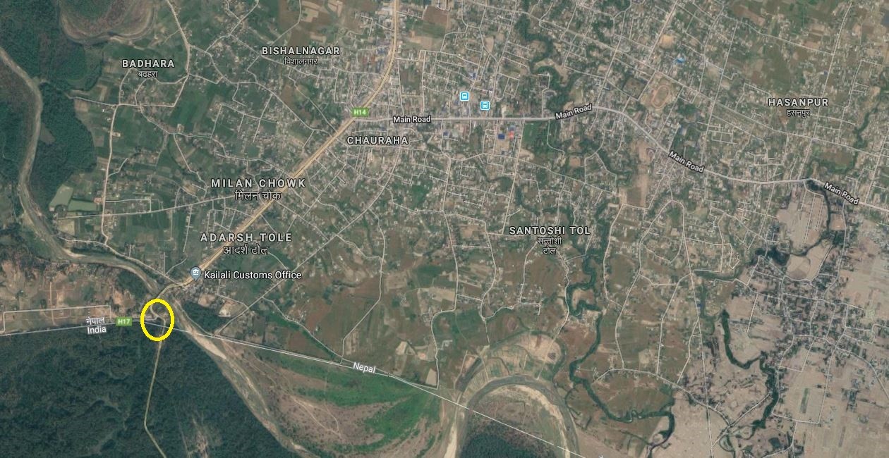
|
Border Crossing Location and Contact |
|
|---|---|
|
Name of Border Crossing
|
Nepal: Dhangadhi |
|
Province or District |
Sudurpaschim Province in Nepal Uttar Pradesh in India |
|
Nearest Town or City with Distance from Border Crossing |
Dhangadi in Nepal Distance: 4 km Palia in India Distance 40 km |
|
Latitude |
28.73004 |
|
Longitude |
80.54606 |
|
Managing Authority / Agency |
Government of Nepal-Ministry of finance Department of Custom-Kailali Custom Office |
|
Contact Person |
Mr. Pabitra Khadka (Information Officer) Office Phone: 9858477021 Email: kailali@customs.gov.np |
|
Travel Times |
|
|---|---|
|
Nearest International Airport |
Name: Gautam Buddha International Airport, Bhairahawa Distance in km: 403 KM Truck Travel Time: 10-12 hrs Car Travel time: 8-10 hrs |
|
Nearest Port |
Name: Dhangadhi Custom Office Truck Travel Time: 5 Minutes Car Travel time: 5 Minutes |
|
Nearest location with functioning wholesale markets, or with significant manufacturing or production capacity |
Name: Dhangadhi Distance in 1 km Truck Travel Time: 5 Minutes Car Travel time: 5 Minutes |
|
Other Information
|
Kolkata is the nearest seaport in Indian side to import and export third country goods 1,255 KM away from Dhangadi takes minimum 25 Hours travel time, but 7 days by truck. |
|
Hours of Operation |
|
|---|---|
|
Mondays |
0700 hrs to 2000 hrs |
|
Tuesdays |
0700 hrs to 2000 hrs |
|
Wednesdays |
0700 hrs to 2000 hrs |
|
Thursdays |
0700 hrs to 2000 hrs |
|
Fridays |
0700 hrs to 2000 hrs |
|
Saturdays |
0700 hrs to 2000 hrs |
|
Sundays |
0700 hrs to 2000 hrs |
|
National Holidays
|
The customs office remains closed on first Saturday of every month as per Nepali calendar. But will remain open if there is an emergency. |
|
Seasonal Constraints |
No |
Daily Capacity
The customs office has a daily capacity of 200 to 300 trucks per day.
Customs Clearance
Compulsory Document for custom clearance.
-
D & T Exemption Certificate
-
Invoice
-
AWB/BL/Other Transport Documents
-
Donation/Non-Commercial Certificates
-
Packing list
-
Letter of credit
-
Certificate of origin
-
Certificate of insurance
-
Bill of Lading / Airway Bill
-
Industry Registration Certificates
-
Permanent Account Number (with VAT Registration and Income Tax Registration if not exempt)
For more information on customs in Dhangadi-Kailali, Nepal, please see the following link: 1.3 Customs Information.
Other Relevant Information
The delays at the Kailali-Dhangadi Border Post can be extensive – from 2 days to a week-long but the integrated check, post (ICP) in Birgunj can process goods quicker than this custom office.
Major imports from this office are petroleum products, mill machinery, food grains, biscuits, motor parts and industrial raw materials and exported from this office: Rosin, Turpentine and Kaththa.
Other facilities: Bank facility within the office premises for revenue filing, office for import and export. Animal Quarantine is at 1.5 km and Plant Quarantine and Food Quarantine Office is located at a distance of 2.5 km.
For more information on government contact details, please see the following link: 4.1 Government Contact List.
Nepal - 2.3.6 Minor Border Crossing - Kanchanpur/Mahendranagar
Overview
The Kanchanpur customs office is the second customs office for Sudurpashchim province. It lies on the border of Nepal - India at the Sarada Barrage in Bhimdatta Municipality, along the Mahakali River of Sudurpashcim Province, Nepal. The local population rely on an old bridge of the Sarada barrage. Loaded vehicles are prohibited to use the Sarada barrage bridge. The closest bridge is approximately 15 Km away from the customs office at Tanakpur over the Mahakali river, which connects to the Indian road network.
Kanchanpur is a minor border crossing, rated no.16 of 27 border crossings in terms import share, 0.09% of total country import share value during July 2022-May 2023.
|
|
|
Picture: Border Crossing point between Nepal and India on the western side |
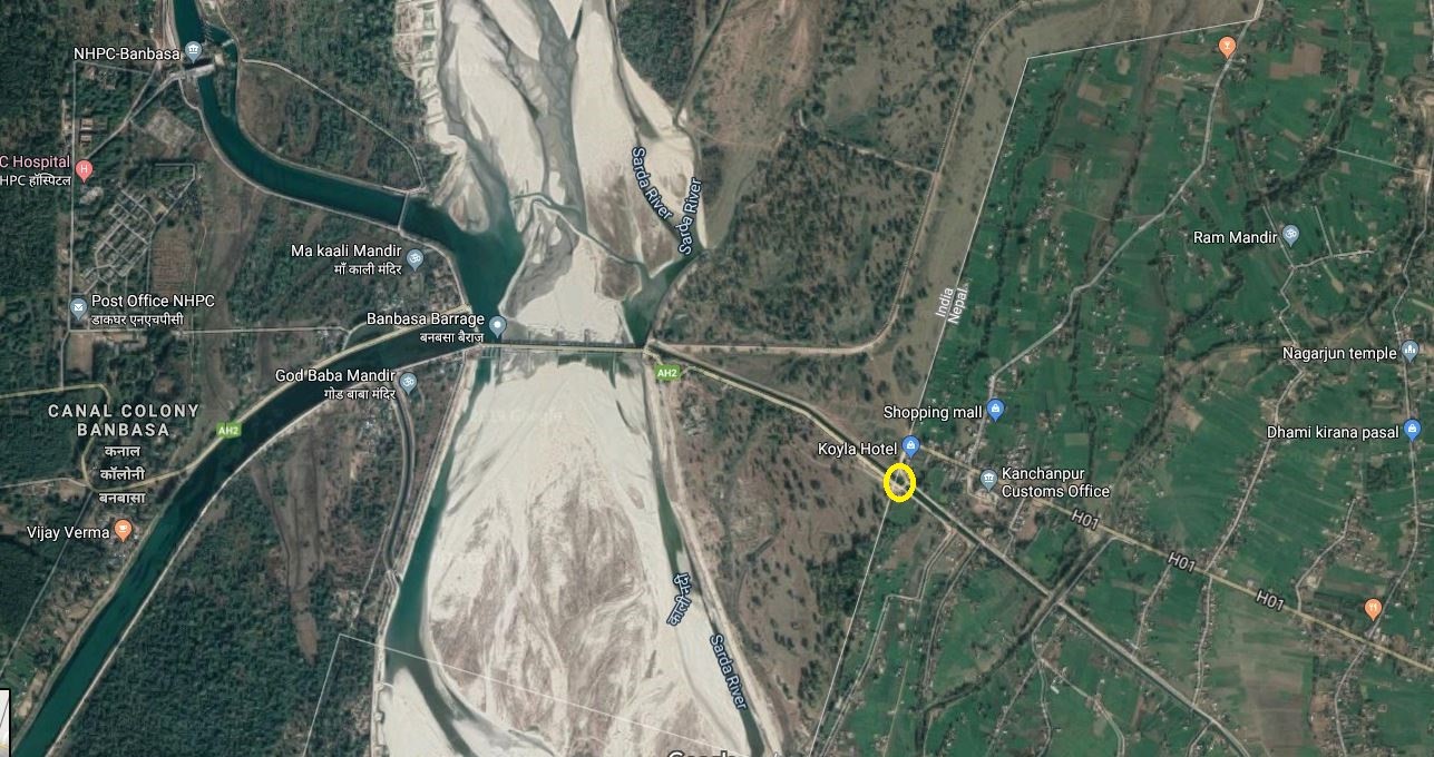
|
Border Crossing Location and Contact |
|
|---|---|
|
Name of Border Crossing
|
Nepal: Mahendranagar |
|
Province or District |
Sudurpaschim Province in Nepal Uttar Pradesh in India in South and Uttarakhand, India in West |
|
Nearest Town or City with Distance from Border Crossing |
Mahendranagar, Bhimdatta in Nepal Distance 5 km Banbassa in India Distance 5 km |
|
Latitude |
28.99388 |
|
Longitude |
80.12110 |
|
Managing Authority / Agency |
Government of Nepal-Ministry of finance Department of Custom-Kanchanpur Custom Office |
|
Contact Person |
Rajan Babu Kafle Phone: +977-9858779666 Email: kanchanpur@customs.gov.np |
Two warehouses and one shed are present within the Kanchanpur customs office premises. Each has a capacity of 400 m2. A total area of 10,117.2 m2 of open space is also available.
|
Travel Times |
|
|---|---|
|
Nearest International Airport |
Dhangadi Airport, Kailai –Domestic Name: Gautam Buddha International Airport, Bhairawaha Distance in km: 445 KM Truck Travel Time: 10-12 hrs Car Travel time: 9-10 hrs |
|
Nearest Port |
Name: Kanchanpur Custom office Distance in 5 km Truck Travel Time: 15-20 Minutes Car Travel time: 10 Minutes |
|
Nearest location with functioning wholesale markets, or with significant manufacturing or production capacity |
Name: Mahendranagar Distance in 5 km Truck Travel Time: 15-20 Minutes Car Travel time: 10Minutes |
|
Other Information
|
Kolkota is the nearest sea port in India side to import and export third country goods 1,290 KM away from Mahendranagar takes 26 Hours travel time.
The only one Integrated check post with the port facility is available only in Birgunj- Bara in Nepal, which is 680 KM away from Dhangadi-Kailali takes 15 hour travel time. |
|
Hours of Operation |
|
|---|---|
|
Mondays |
07:00 HOURS 06:00 AM to 8:00 AM 10:00 AM to 12:00 AM 14:00 PM to 16:00 PM 18:00 PM to 19: 00 PM |
|
Tuesdays |
07:00 HOURS 06:00 AM to 8:00 AM 10:00 AM to 12:00 AM 14:00 PM to 16:00 PM 18:00 PM to 19: 00 PM |
|
Wednesdays |
07:00 HOURS 06:00 AM to 8:00 AM 10:00 AM to 12:00 AM 14:00 PM to 16:00 PM 18:00 PM to 19: 00 PM |
|
Thursdays |
07:00 HOURS 06:00 AM to 8:00 AM 10:00 AM to 12:00 AM 14:00 PM to 16:00 PM 18:00 PM to 19: 00 PM |
|
Fridays |
07:00 HOURS 06:00 AM to 8:00 AM 10:00 AM to 12:00 AM 14:00 PM to 16:00 PM 18:00 PM to 19: 00 PM |
|
Saturdays |
07:00 HOURS 06:00 AM to 8:00 AM 10:00 AM to 12:00 AM 14:00 PM to 16:00 PM 18:00 PM to 19: 00 PM |
|
Sundays |
07:00 HOURS 06:00 AM to 8:00 AM 10:00 AM to 12:00 AM 14:00 PM to 16:00 PM 18:00 PM to 19: 00 PM |
|
National Holidays
|
N/A |
|
Seasonal Constraints |
Flood in Mahakali river during July and August |
Daily Capacity
Daily capacity of the customs office is 100 to 200 trucks per day. The bridge over the Mahakali River on the India side (Banabassa) is dilapidated and allows only 10 MT vehicle maximum.
Customs Clearance
Compulsory Document for custom clearance.
-
D & T Exemption Certificate
-
Invoice
-
AWB/BL/Other Transport Documents
-
Donation/Non-Commercial Certificates
-
Packing list
-
Letter of credit
-
Certificate of origin
-
Certificate of insurance
-
Bill of Lading / Airway Bill
-
Industry Registration Certificates
-
Permanent Account Number (with VAT Registration and Income Tax Registration if not exempt)
For more information on customs in Mahendranagar-Kanchanpur, Nepal, please see the following link: 1.3 Customs Information.
Other Relevant Information
The delays at Border Posts can be extensive – from 2 days to a week long but Integrated check post (ICP) in Birgunj takes shorter days than a main custom office. ASYCUDA (Automatic System in Customs Data) was implemented in this office from the fiscal year 2013/014. Passengers' bags are being checked with X-ray machines. Temporary import and travel baggage of vehicles have been collected from the customs gate as per the customs duty approved rules and regulations. The tariff of other commercial goods has been collected from the office after customs clearance as per the approved rules.
For more information on government contact details, please see the following link: 4.1 Government Contact List.
Nepal - 2.3.7 Minor Border Crossing - Darchula/Mahakali
Overview
The Darchula customs office is located at Khalanga of Darchula district in Sudurpashchim Province. It lies on the western border –between India and Nepal. There is a parallel road on the Nepal and India side, but the roads are not connected across the Mahakali River and hence, inaccessible for vehicles. A suspension bridge for pedestrians is the only means to cross this border between Nepal and India.
Mahakali-Darchula is a minor border crossing, not rated among the main 23 border crossing points in terms of import share. Therefore, this crossing point is not recommended for cargo import & export.
There is an Animal quarantine, but Food and Plant quarantine is not available in Darchula.
|
|
|
Picture: Boarding crossing –Mahakali, Darchula (Sudurpashchim) |
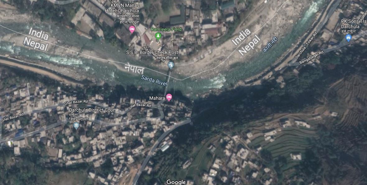
|
Border Crossing Location and Contact |
|
|---|---|
|
Name of Border Crossing
|
Nepal: Darchula |
|
Province or District |
Sudurpaschim Province in Nepal Uttarakhand, India |
|
Nearest Town or City with Distance from Border Crossing |
Mahakali Municipality in Nepal Distance 0.2 km Pithauragad in India Distance 91 km |
|
Latitude |
29.80148 |
|
Longitude |
80.46415 |
|
Managing Authority / Agency |
Government of Nepal-Ministry of finance Department of CustomDarchula Customs Office |
|
Contact Person |
Mr. Shiva Chandra Prasad Office No: 9858783030 |
|
Travel Times |
|
|---|---|
|
Nearest International Airport |
Name: Gautam Buddha International Airport, Bhairahawa Distance in km: 705 KM Truck Travel Time: 20-22 hrs Car Travel time: 18-20 hrs |
|
Nearest Port |
Name: Purano bazar Darchula Distance in 0.2 km Truck Travel Time: 5 Minutes Car Travel time: 2 Minutes |
|
Nearest location with functioning wholesale markets, or with significant manufacturing or production capacity |
Name: Purano bazar Darchula Distance is 0.2 km Truck Travel Time: 5 Minutes Car Travel time: 2 Minutes |
|
Other Information
|
Kolkota is the nearest seaport in India side to import and export third country goods 1,640 KM away from Darchula takes 35-40 Hours travel time.
|
|
Hours of Operation |
|
|---|---|
|
Mondays |
0615 hours to 1915 hours Summer 0615 hours to 1815 hours Winter |
|
Tuesdays |
0615 hours to 1915 hours Summer 0615 hours to 1815 hours Winter |
|
Wednesdays |
0615 hours to 1915 hours Summer 0615 hours to 1815 hours Winter |
|
Thursdays |
0615 hours to 1915 hours Summer 0615 hours to 1815 hours Winter |
|
Fridays |
0615 hours to 1915 hours Summer 0615 hours to 1815 hours Winter |
|
Saturdays |
0615 hours to 1915 hours Summer 0615 hours to 1815 hours Winter |
|
Sundays |
0615 hours to 1915 hours Summer 0615 hours to 1815 hours Winter |
|
National Holidays
|
Generally, 3 days during Dashain (Nepal national festival) and up to another 7 days / year at Government’s discretion. |
|
Seasonal Constraints |
Flood in Mahakali River during July and August |
Note: The hours of operations for summer and winter are decided upon mutual agreement between the customs and security officials of both countries.
Daily Capacity
The Mahakali Road is usually not congested with traffic and is also in good condition (operates 12 months in a year). However, the road is single lane. Approximately 500m near the Nepal-India border the road is not black-topped given that the suspension bridge is only for pedestrian purposes, porters are required to transport goods. The nearest Indian city is Pithauragadh (91km) and takes approximately 2 hours by vehicle.
Customs Clearance
Compulsory Document for custom clearance.
-
D & T Exemption Certificate
-
Invoice
-
AWB/BL/Other Transport Documents
-
Donation/Non-Commercial Certificates
-
Packing list
-
Letter of credit
-
Certificate of origin
-
Certificate of insurance
-
Bill of Lading / Airway Bill
-
Industry Registration Certificates
-
Permanent Account Number (with VAT Registration and Income Tax Registration if not exempt)
For more information on customs in Darchula, Sudurpashchim,Nepal, please see the following link: 1.3 Customs Information.
Other Relevant Information
The delays at Border Posts can be extensive – from 2 days to a weeklong. This is not an appropriate crossing border point to import and export goods in huge volume.
For more information on government contact details, please see the following link: 4.1 Government Contact List.
Nepal - 2.3.8 Minor Border Crossing - Mahakali-Jhulaghat
Overview
The Mahakali Customs office is the main customs office under the Department of Customs of Nepal for Sudurpashchim province. The office manages the custom related activities of 6 other sub-customs offices in the region. The Mahakali River separates the border between Nepal and India. Both Nepal and India have parallel road on each side of the border, but the roads are not connected and hence this border crossing is inaccessible for vehicles. A small suspension bridge for pedestrians only links the two countries.
Mahakali-Jhulaghat is a minor border crossing, not rated among the main 23 border crossing points in terms of import share. Therefore, this crossing point is not recommended for cargo import & export.
|
|
|
Picture: Border Crossing in Jhulaghat, Baitadi in between Nepal-India |
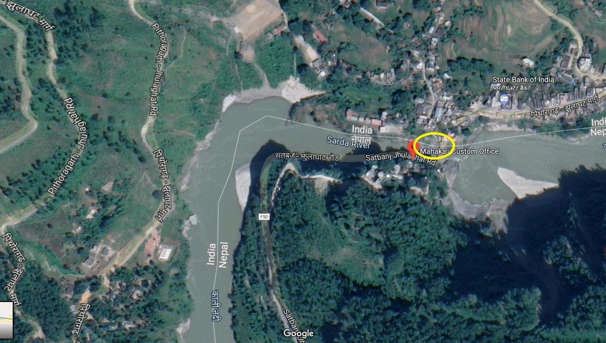
|
Border Crossing Location and Contact |
|
|---|---|
|
Name of Border Crossing
|
Nepal: Mahakali |
|
Province or District |
Sudurpaschim Province in Nepal Uttarakhand, India |
|
Nearest Town or City with Distance from Border Crossing |
Dashrathchand Municipality-Khalanga-Baitadi in Nepal Distance 17 km Pithauragad in India Distance 36 km |
|
Latitude |
29.80144 |
|
Longitude |
80.46421 |
|
Managing Authority / Agency |
Government of Nepal-Ministry of finance Department of Custom-Mahakali-Jhulaghat Custom Office |
|
Contact Person |
Mr. Anil Jha Email: mahakali@customs.gov.np
|
The customs office has two small rooms used as warehouses measuring 12 ft x 15 ft each and an open space area of 7587 m2 available.
|
Travel Times |
|
|---|---|
|
Nearest International Airport |
Name: Gautam Buddha International Airport, Bhairawaha Distance in km: 618 KM Truck Travel Time: 16 – 18 hrs Car Travel time: 15 hrs |
|
Nearest Port |
Name: Dashrathchand Municipality-Khalanga Baitadi Distance is 17 km Truck Travel Time: 45 Minutes Car Travel time: 30 Minutes |
|
Nearest location with functioning wholesale markets, or with significant manufacturing or production capacity |
Name: Dashrathchand Municipality-Khalanga Baitadi Distance is 17 km Truck Travel Time: 45 Minutes Car Travel time: 30 Minutes |
|
Other Information
|
Kolkota is the nearest seaport in India side to import and export third country goods 1,478 KM away from Jhulaghat -Mahakali takes 30-32 Hours travel time.
The only one Integrated check post with the port facility is available only in Birgunj- Bara in Nepal, which is 835 KM away from Jhulaghat takes around 20 hour travel time. |
|
Hours of Operation |
|
|---|---|
|
Mondays |
07:00 AM to 07:00 PM |
|
Tuesdays |
07:00 AM to 07:00 PM |
|
Wednesdays |
07:00 AM to 07:00 PM |
|
Thursdays |
07:00 AM to 07:00 PM |
|
Fridays |
07:00 AM to 07:00 PM |
|
Saturdays |
07:00 AM to 07:00 PM |
|
Sundays |
07:00 AM to 07:00 PM |
|
National Holidays
|
Generally, 3 days during Dashain (Nepal national festival) and up to another 7 days / year at Government’s discretion.
|
|
Seasonal Constraints |
Flood in Mahakali River during July and August |
Daily Capacity
The bridge over the Mahakali River is a small suspension bridge and serves only as a pedestrian bridge. The nearest Indian city close to this border is Pithauragad, which is 36 KM away from Jhulaghat and takes one and half-hour by vehicle.
Customs Clearance
Compulsory Document for custom clearance.
-
D & T Exemption Certificate
-
Invoice
-
AWB/BL/Other Transport Documents
-
Donation/Non-Commercial Certificates
-
Packing list
-
Letter of credit
-
Certificate of origin
-
Certificate of insurance
-
Bill of Lading / Airway Bill
-
Industry Registration Certificates
-
Permanent Account Number (with VAT Registration and Income Tax Registration if not exempt)
For more information on customs in Jhulaghat-Baitadi, Nepal, please see the following link: 1.3 Customs Information.
Other Relevant Information
In Nepal side, There is a Feeder road F-50 at Jhulaghat, which is connected with Mahakali Highway at Satbanjh, at 37 kilometres (23 mi) of distance. jhulaghat is the end point of Mid-Hills Highway of Nepal which starts at Chiyo Bhanjyang. Chiyo Bhanjyang is a border point between Koshi Province (Nepal) and Sikkim (India). The Mid-Hill highway runs. 1,776 KM through Mid hills of Nepal. The delays at Border Posts can be extensive – from 2 days to a weeklong. This is not an appropriate crossing border point to import and export goods.
For more information on government contact details, please see the following link: 4.1 Government Contact List.
Nepal - 2.3.9 Minor Border Crossing - Dhanusha/Janakpur
Overview
Janakpur Customs office in Janakpur, Dhanusha is situated in the heart of Janakpur city,14 km away from the nearest land border with India. Border crossing is officially known Customs office or Custom check post in Nepal. Under this Customs Office, there are 8 sub-offices (Lagma-Jatahi, Einrwa, Bhadaria, Khajuri-Mahuwa, Khajuri-Station, Mahinathpur, Vaidehi, Kathal, and 3 out of 8 (Lagma-Jatahi, Einrwa, Bhadaria) are working. Along with the operation of railway service from Jayanagar in India to Janakpur in Nepal, it is proposed to upgrade the Enrwa Chhoti customs office and make it the main customs office. At present, the work of the main customs office is being conducted from Lagma-Jatahi Chhoti customs office.
Janakpur is a minor border crossing, rated no.17 of 27 border crossings in terms import share, 0.08% of total country import share value during Mid-July 2022-Mid July 2023.
|
|
|
Aerial View of Janakpur Customs Office. |
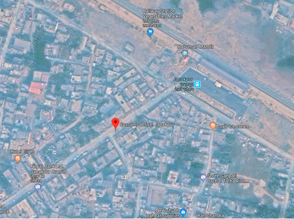
|
Border Crossing Location and Contact |
|
|---|---|
|
Name of Border Crossing |
Nepal: Janakpur Custom office India: Bhitthamode |
|
Province or District |
Madhesh Province |
|
Nearest Town or City with Distance from Border Crossing |
In the City, Janakpur Distance: 1.5 km |
|
Latitude |
26.6422797 |
|
Longitude |
85.8925652 |
|
Managing Authority / Agency |
Department of Customs |
|
Contact Person |
Mr. Rajendra Basnet Janakpur Customs Office Janakpur Municipality Ward No. 1, Station Road, Dhanusha Tel : 041-520166 Email : janakpur@customs.gov.np Official Mob: 9854029589 |
|
Travel Times |
|
|---|---|
|
Nearest International Airport |
Tribhuvan International Airport 220 KM via B.P. highway Truck Travel Time: 10 hrs Car Travel time: 6 hrs Darbhanga Airport, Bihar, India Distance: 80 km Truck Travel Time: 3 hrs Car Travel Time: 2 hrs |
|
Nearest Port |
Jaleswar Custom Office Mahottari Truck Travel Time: 0:45 hrs Car Travel time: 0:30 hrs |
|
Nearest location with functioning wholesale markets, or with significant manufacturing or production capacity |
Janakpur City is at a distance of 110 mtr only and is the biggest market in India and has railway access. Distance: 34 km Truck Travel Time: 2hrs. Car Travel time: 1:10 hrs. |
|
Other Information
|
Janakpur Railway Station is in the distance of 110m |
|
Hours of Operation |
|
|---|---|
|
Mondays |
6:00 am to 11:00pm |
|
Tuesdays |
6:00 am to 11:00pm |
|
Wednesdays |
6:00 am to 11:00pm |
|
Thursdays |
6:00 am to 11:00pm |
|
Fridays |
6:00 am to 11:00pm |
|
Saturdays |
6:00 am to 11:00pm |
|
Sundays |
6:00 am to 11:00pm |
|
National Holidays |
Generally, 3 days during Dashain (Nepal national festival, 3 days for Tihar, 1 day for Chhat pooja and 1 day Holi) and up to another 7 days / year at Government’s discretion. The Customs office is closed on Jesth 15 (28 or 29 April every year) on account of New Fiscal Budget Announcement Day. |
|
Seasonal Constraints |
Rainy Seasons Due to Flood Inundation, Also the custom is right in the heart of the city thus the movement of vehicles leads to traffic congestion. |
Daily Capacity
Private cars are not provided the separate lane. Railway cargo train is not operational therefore this customs office not busy in customs services. The road is double lane; lane for incoming vehicle and an adjacent lane for outgoing vehicles.
4-5 trucks daily.
Customs Clearance
Compulsory Document for custom clearance.
-
D & T Exemption Certificate
-
Performa invoice
-
Invoice
-
AWB/BL/Other Transport Documents- Freights
-
Donation/Non-Commercial Certificates
-
Packing list
-
Letter of credit
-
Mode of payments (LC/TT/Draft)
-
Certificate of origin
-
Certificate of insurance
-
Bill of Lading/Airway Bill for 3rd country imports
-
Industry Registration Certificates
-
EXIM Code. (EXIM Code is mandatory for Commercial trading and not mandatory for humanitarian support goods.
-
Bill of Entry from Indian Customs Office
-
Exit Note
-
VCTS
-
Recommendation letter
-
Tariff will be imposed on imported goods as per the Integrated Customs Tariff 2080/081 for FY 2080/81 (FY- 2023/024)
-
GST Bill
Other Relevant Information
The entry point of Jayanagar- Janakpur is also at the customs point. Track upgrading and improving is ongoing. Since Janakpur custom office is 18 km away from the border, the sub customs office at Lagmajatahi acts as a major entry point for the goods.
Nepal - 2.3.10 Minor Border Crossing - Mahottari/Jaleshwor
Overview
Jaleshwor Customs office in Mahottari district oversees six sub-customs/entry points in the district. Jaleshwor customs Office, Maliwara border crossing, rated no.12 of 27 border crossings in terms of import share, 0.52% of total country import share value of mid-July 2022 -Mid-July 2023.
Ref: Barsik Pragati Bibaran 2079-80 Final file for WEB.pdf (customs.gov.np)
|
Border Crossing Location and Contact |
|
|---|---|
|
Name of Border Crossing
|
Nepal: Jaleswar India: Bhitamore (Sursand) |
|
Province or District |
Madhesh Province, Mahottari |
|
Nearest Town or City with Distance from Border Crossing |
Jaleshwor, 4 km NE |
|
Latitude |
26.6325086 |
|
Longitude |
85.7713174 |
|
Managing Authority / Agency |
Department of Customs |
|
Contact Person |
Amit Paudel Chief Custom Officer Official M: 9854030815 |
|
Travel Times |
|
|---|---|
|
Nearest International Airport |
Tribhuvan International Airport 232 km Truck Travel Time: 6:30 hrs Car Travel time: 6 hrs |
|
Nearest Port |
Birgunj Dry Port, Nepal Distance: 163 Km Truck Travel Time: 4:30 hrs Car Travel Time: 3:35 min |
|
Nearest location with functioning wholesale markets, or with significant manufacturing or production capacity |
Nepal: Jaleshowar India: Sursan, Sitamodi, 36 Km Truck Travel Time: 2:15 mins Car Travel time: 1 hour |
|
Other Information |
4 lane Jaleshwor Road to Janakpur is operational. The main objective of this road is to connect the capital city, Kathmandu with the Eastern Terai and hence linking to neighbouring cities in India. |
|
Hours of Operation |
|
|---|---|
|
Weekdays |
7:00 am – 8:00 pm for truck and 8:00- 17:00 for passengers |
|
National Holidays |
Generally, 3 days during Dashain (Nepal national festival, 3 days for Tihar, 1 day for Chhat pooja and Holi-1day) and up to another 7 days/year at the Government’s discretion. The Customs service and procedure is closed on Jestha 15 (28 or 29 April every year) on account of the New Fiscal Budget Announcement but the services for passengers and immigration remain to continue. |
|
Seasonal Constraints |
Rainy Seasons Due to Flood Inundation. |
Daily Capacity
-
Private cars are not provided a separate lane.
-
Passenger Clearance: 5000 passengers on average.
-
Trucks Clearance: 60-70 trucks daily.
-
Clearing hour: 1-2 hour.
-
Infrastructure: Goods shed- 1, Weighing bridge- 2 with 1& 80 mt capacity.
-
Food and Plant Quarantines are available.
-
No of Yard: 2.
-
Parking Area: 4680 m2, -Truck Parking capacity: 50 trucks.
Customs Clearance
Compulsory Document for custom clearance.
-
D & T Exemption Certificate
-
Performa invoice
-
Invoice
-
AWB/BL/Other Transport Documents- Freights
-
Donation/Non-Commercial Certificates
-
Packing list
-
Letter of credit
-
Mode of payments (IC/TT/Draft)
-
Certificate of origin
-
Certificate of insurance
-
Bill of Lading/Airway Bill for 3rd country imports
-
Industry Registration Certificates
-
EXIM Code. (EXIM Code is mandatory for Commercial trading and not mandatory for humanitarian support goods.
-
Bill of Entry from Indian Customs Office
-
Exit Note
-
VCTS
-
Recommendation letter
-
Tariff will be imposed on imported goods as per the Integrated Customs Tariff 2080/081 for FY 2080/81 (FY- 2023/024)
-
GST Bill
For more information on customs in Nepal, please see the following link: 1.3 Customs Information.
Other Relevant Information
This border point is proposed to expand to ICP and is in the process of expansion.
For more information on government contact details, please see the following link: 4.1 Government Contact List.
Pictures
|
Parking Yard
|
|
Jaleshwor Customs Office Entrance |
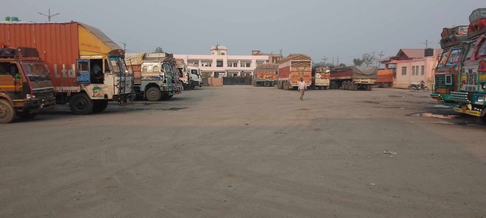
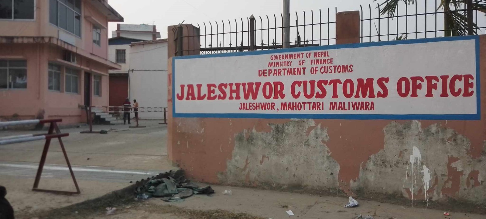
Nepal - 2.3.11 Minor Border Crossing - Rautahat/Gaur
Overview
Gaur Customs is the main customs office in the Rautahat district. Gaur is a minor border crossing, rated no.7 of 27 border crossings in terms of import share, 0.07% of the total country import share value during July 2022 - June 2023. Besides the Gaur customs office, there are 5 other entry points in the district; Bangkul, Brahmapuri, Aurahiya, Rampur Khap, and Mathiya, which are even smaller and not listed separately in the Nepal customs statistics.
|
|
|
Aerial View of Gaur Customs Office. |
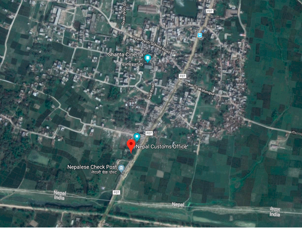
|
Border Crossing Location and Contact |
|
|---|---|
|
Name of Border Crossing |
Nepal: Gaur |
|
Province or District |
Madhesh Province, Rautahat |
|
Nearest Town or City with Distance from Border Crossing |
Gaur 1 km N |
|
Latitude |
26.756107439 |
|
Longitude |
85.276012108 |
|
Managing Authority / Agency |
Department of Customs |
|
Contact Person |
Amindra Shingh Gaur Customs Office Gaur Municipality Ward No. 2 , Rautahat Tel: 055-520110, 9855044220 |
|
Travel Times |
|
|---|---|
|
Nearest International Airport |
Tribhuvan International Airport 197 KM Truck Travel Time: 10 hrs Car Travel time: 6 hrs |
|
Nearest Port |
Sirsiya Dry Port, Birgunj 64.5 Km Truck Travel Time: 3 hrs Car Travel time: 1:45 Darbhanga Airport, Bihar, India Distance: 122 Km Truck Travel Time: 5 hrs Car Travel Time: 3 hr 50 Min |
|
Nearest location with functioning wholesale markets, or with significant manufacturing or production capacity |
Gaur, Chandranigahapur, Jaleswar, Birgunj Truck Travel Time: - 1 – 2 hrs Car Travel time: 1 hr Bairgirniya, Bihar, India Distance: 5 km Truck Travel Time: 30 min Car Travel Time: 17 min |
|
Other Information |
Voter card, Aadhar Card and PAN card are the required document for Indian to cross the border. Certain restrictions are enforced on many edible and electronic products, and they are properly checked before allowing them to cross |
|
Hours of Operation |
|
|---|---|
|
Mondays |
6:00 am to 9:00 pm For Passenger 6:00 am to 5:00 pm.
|
|
Tuesdays |
6:00 am to 9:00 pm For Passenger 6:00 am to 5:00 pm. |
|
Wednesdays |
6:00 am to 9:00 pm For Passenger 6:00 am to 5:00 pm. |
|
Thursdays |
6:00 am to 9:00 pm For Passenger 6:00 am to 5:00 pm. |
|
Fridays |
6:00 am to 9:00 pm For Passenger 6:00 am to 5:00 pm. |
|
Saturdays |
6:00 am to 9:00 pm For Passenger 6:00 am to 5:00 pm. |
|
Sundays |
6:00 am to 9:00 pm For Passenger 6:00 am to 5:00 pm. |
|
National Holidays
|
Generally, 3 days during Dashain (Nepal national festival, 3 days for Tihar, 1 day for Chhat pooja and Holi-1) and up to another 7 days / year at Government’s discretion. The Customs procedure is closed on Jestha 15 (28 or 29 April every year) on account of New Fiscal Budget Announcement but the services for passenger and immigration remains continue. |
|
Seasonal Constraints |
Rainy Seasons Due to Flood Inundation |
Daily Capacity
Private cars are not provided the separate lane. The road is double-lane; lane for incoming vehicle and an adjacent lane for outgoing vehicles. Daily 10 to 12 trucks passes through this checkpoint.
The parking area is under construction in a 2675.61 Sqm area.
Quarantine- 1 Animal quarantine
A weighing bridge is not available.
Customs Clearance
Compulsory Document for custom clearance.
-
D & T Exemption Certificate
-
Performa invoice
-
Invoice
-
AWB/BL/Other Transport Documents- Freights
-
Donation/Non-Commercial Certificates
-
Packing list
-
Letter of credit
-
Mode of payments (LC/TT/Draft)
-
Certificate of origin
-
Certificate of insurance
-
Bill of Lading/Airway Bill for 3rd country imports
-
Industry Registration Certificates
-
EXIM Code. (EXIM Code is mandatory for Commercial trading and not mandatory for humanitarian support goods.
-
Bill of Entry from Indian Customs Office
-
Exit Note
-
VCTS
-
Recommendation letter
-
Tariff will be imposed on imported goods as per the Integrated Customs Tariff 2080/081 for FY 2080/81 (FY- 2023/024)
-
GST Bill
For more information on customs in Nepal, please see the following link: 1.3 Customs Information.
Other Relevant Information
There is no parking space or yard for the trucks withheld for further inspection purposes. There are no warehouses, but 4 small rooms are present for storage purposes. Road condition to the border crossing point from India is double lane and is in good condition also the road leading away from the border point into the country is double lane and is blacktopped. The main import goods from this border point are mainly raw sugar, coal, marble tiles, clothes, and fancy goods items and export goods are PVC pipes.
For more information on government contact details, please see the following link: 4.1 Government Contact List.
Nepal - 2.3.12 Minor Border Crossing - Saptari/ Rajbiraj
Overview
Rajbiraj Customs Office located in Tilathi Koiladi Rural Municipality of Saptari district is one of the minor border crossings between Nepal and India. These minor crossings play a crucial role in facilitating trade, movement of people, and cultural exchanges between the two neighbouring countries. Despite being a minor border crossing, it holds significance for the local communities on both sides of the border. It facilitates cross-border trade, contributing to economic activities in the region.
The Rajbiraj Customs Office has seven sub-customs offices which are Belhi, Kushaha Pato, Gobindapur, Kodarkatti, Banainiya, Hanuman nagar and Swarnapatti. Among the seven sub-customs office, four are close and only Belh, Kushaha Pato and Gobindapur are functional.
Border crossing is officially known Customs office or Customs check post in Nepal. The border town of this customs office is Kunauli Bazar in Supaul district of Bihar state, India. The land customs office of India is about 1 km from this customs office. There is a small river called Khado Khola/Jita that separates this customs office from Kunauli town in India. Rajbiraj is a minor border crossing, rated no.17 of 27 border crossings in terms import share, 0.01% of total country import share value during 2022/23)
|
|
|
Aerial View of Rajbiraj Customs Office. |
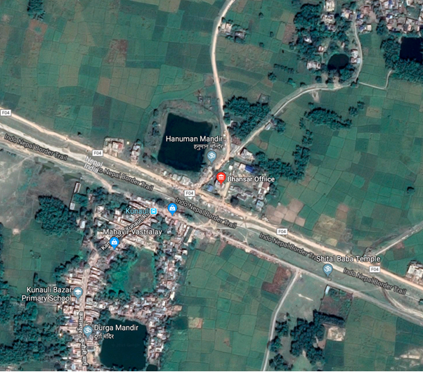
|
Border Crossing Location and Contact |
|
|---|---|
|
Name of Border Crossing |
Nepal: Rajbiraj |
|
Province or District |
Madhesh Province, Saptari District |
|
Nearest Town or City with Distance from Border Crossing |
Rajbiraj 11.6 KM North |
|
Latitude |
26.4561923, |
|
Longitude |
86.7775198 |
|
Managing Authority / Agency |
Department of Customs |
|
Contact Person |
Mr. Shatya Narayan Shingh Rajbiraj Customs Office Belahi, Saptari Official Mob: 9852821466 E-mail: rajbiraj@customs.gov.np |
|
Travel Times |
|
|---|---|
|
Nearest International Airport |
Durbhanga, Bihar, India (Follow NH 27 to Bhawanipur - Pratapganj Rd/SH 91 in Bhimpur Tribhuvan International Airport 302 km Truck Travel Time: 12-13 hrs Car Travel time: 8:24 hrs |
|
Nearest Port |
Biratnagar Customs Office 82 KM Truck Travel Time: 5-6 hrs Car Travel time: 2.5 hrs Sunsari Customs Office 22 KM Truck Travel Time: 2 hrs Car Travel time: 0:40 hrs |
|
Nearest location with functioning wholesale markets, or with significant manufacturing or production capacity |
Rajbiraj City 8 km Truck Travel Time: 1 hr Car Travel time: 30 mins Niramali Market Bihar |
|
Other Information
|
No goods are exported to India from this customs office. Sunday is closed due to the weekend in the Indian Customs Office. |
|
Hours of Operation |
|
|---|---|
|
Weekdays |
Trucks/Goods 10:00 am to 18:00pm
|
|
National Holidays |
Generally, 3 days during Dashain (Nepal national festival, Chhath- 1 day and Holi Festival- 1 day) and up to another 7 days / year at Government’s discretion. Customs procedure is closed on 15 Jestha (on 28 or 29th April of the year) on account of New Fiscal Budget Announcement where the tariff may change for the coming up fiscal year of the country. Note: Customs remains open 24 /7 for emergencies |
|
Seasonal Constraints |
Rainy Seasons due to Flood Inundation. Tilathi Koiladi may face challenges related to infrastructure development, customs procedures, and security. Efforts are continually made by both Nepal and India to address these issues and enhance the efficiency of cross-border operations. |
Daily Capacity
Private cars are not provided a separate lane. The road is a double lane; a lane for incoming vehicles and an adjacent lane for outgoing vehicles.
Daily Capacity:
Trucks 30 to 40 trucks per day
Operating hours can be extended from 6:00 to 22:00 for exceptionally high truck traffic if required.
Average clearing time: 2:30 hrs
There is no backlog.
Customs Clearance
Compulsory Document for custom clearance.
-
D & T Exemption Certificate
-
Performa invoice
-
Invoice
-
AWB/BL/Other Transport Documents- Freights
-
Donation/Non-Commercial Certificates
-
Packing list
-
Letter of credit
-
Mode of payments (LC/TT/Draft)
-
Certificate of origin
-
Certificate of insurance
-
Bill of Lading / Airway Bill for 3rd country imports.
-
Industry Registration Certificates
-
EXIM Code is compulsion.
-
Bill of Entry from Indian Customs Office
-
GST Bill
-
Exit Note
-
VCTS
-
Tariff will be imposed on imported goods as per the Integrated Customs Tariff 2080/081 for FY 2080/81 (FY- 2023/024)
For more information on customs in COUNTRY NAME, please see the following link: 1.3 Customs Information.
Other Relevant Information
Major imported goods through this custom are clothes, motor parts, cosmetic goods, and household goods. One needs to cross the border town where the border army checks all the visitors at the checkpoint. For Indian nationals can get permission based on a Voter card, Adhaar card, or PAN card. Security is provided by Tilathi Koiladi BoP of APF in this customs office location. For banking purposes, Prabhu Bank Ltd is in operation in its location area.
For more information on government contact details, please see the following link: 4.1 Government Contact List.
Nepal - 2.3.13 Minor Border Crossing - Sarlahi/Malangawa
Customs Office Overview
Sarlahi Customs Office is at Malangwa Municipality-8 and oversees 7 entry points (Sangrampur, Parsa, Tribhuvanngar, Bhadsar, Fenha, Bara, and Balara Sub-custom Office, except Balara Sub-custom office, other six are closed) in the district. Sarlahi is a minor border crossing, 0.14% of total country import share value as of the statistics of 2022/23.
|
|
|
Aerial View of Sarlahi Customs Office. |
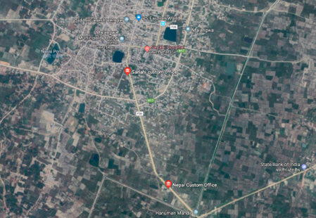
|
Border Crossing Location and Contact |
|
|---|---|
|
Name of Border Crossing |
Nepal: Malangawa / Sarlahi |
|
Province or District |
Madhesh Province , Sarlahi |
|
Nearest Town or City with Distance from Border Crossing |
Malangwa 2 km N |
|
Latitude |
26.8522745 |
|
Longitude |
85.5595633 |
|
Managing Authority / Agency |
Department of Customs |
|
Contact Person |
Mr. Naresh Shah (Custom Officer) Sarlahi Custom Office Tel: 046-520154 Mob: 9854030125 Official Mob:9854042144 |
|
Travel Times |
|
|---|---|
|
Nearest International Airport |
Tribhuvan International Airport 206 KM Truck Travel Time: 11 hrs Car Travel time: 6:35 hrs |
|
Nearest Port |
Sirsiya Dry Port 118 Km Truck Travel Time: 5-6 hrs Car Travel time: 3 hrs |
|
Nearest location with functioning wholesale markets, or with significant manufacturing or production capacity |
Malangwa 2 KM Truck Travel Time: 4 hrs mins Car Travel time: 2:34 mins |
|
Other Information |
Bank facilities within the office premises for revenue filing, office for export and import at a distance of 1 km, animal quarantine, plant quarantine office and food quarantine 40 km at Jaleshwar. |
|
Hours of Operation |
|
|---|---|
|
Weekdays |
6:00 am to 11:00 pm |
|
National Holidays |
Generally, 3 days during Dashain (Nepal national festival, 3 days for Tihar, 1 day for Chhat pooja and 1 day Holi) and up to another 7 days / year at Government’s discretion. The Customs office is closed on Jesth 15 (28 or 29 April every year) on account of New Fiscal Budget Announcement day. |
|
Seasonal Constraints |
Rainy Seasons Due to Flood Inundation. |
Daily Capacity
Private cars are not provided the separate lane. The road is double lane; lane for incoming vehicle and an adjacent lane for outgoing vehicles.
Customs Clearance
Compulsory Document for custom clearance.
-
D & T Exemption Certificate
-
Performa invoice
-
Invoice
-
AWB/BL/Other Transport Documents- Freights
-
Donation/Non-Commercial Certificates
-
Packing list
-
Letter of credit
-
Mode of payments ( LC/TT/Draft)
-
Certificate of origin
-
Certificate of insurance
-
Bill of Lading/Airway Bill for 3rd country imports
-
Industry Registration Certificates
-
EXIM Code. (EXIM Code is mandatory for Commercial trading and not mandatory for humanitarian support goods.
-
Bill of Entry From Indian Customs Office
-
Exit Note
-
VCTS
-
Recommendation letter
-
Tariff will be imposed on imported goods as per the Integrated Customs Tariff 2080/081 for FY 2080/81 ( FY- 2023/024)
-
GST Bill
For more information on government contact details, please see the following link: 4.1 Government Contact List.
Nepal - 2.3.14 Minor Border Crossing - Siraha/Khairatoka
Overview
Siraha is a minor border crossing, rated no.21 of 27 border crossings in terms import share, 0.02% of total country import share value during Mid July 2022 - Mid July 2023. Bariyarpatti, Lagadigadayani (Sikhjyoti), and Aurahi are other sub-customs office or entry points of the district, which are even smaller and not listed separately in the Nepal customs statistics.
Aerial View of Siraha Customs Office.
|
Border Crossing Location and Contact |
|
|---|---|
|
Name of Border Crossing |
Nepal: Khairatoka / Siraha
|
|
Province or District |
Madhesh Province, Siraha District |
|
Nearest Town or City with Distance from Border Crossing |
6 km north, Siraha Municipality |
|
Latitude |
26.6185915 |
|
Longitude |
86.1751599 |
|
Managing Authority / Agency |
Department of Customs |
|
Contact Person |
Mr. Shree Ramraj Prasad Chaurasiya Custom Officer. Siraha Customs Office, Siraha Municipality Madar VDC Ward No. 17 Khairatoka , Siraha 033-400022 Official Mob: 9852834622 E-mail: siraha@customs.gov.np |
|
Travel Times |
|
|---|---|
|
Nearest International Airport |
Tribhuvan International Airport 259 km via Bardbas Truck Travel Time: 11 hrs Car Travel time: 6.5 hrs |
|
Nearest Port |
Janakpur Customs Office 89 KM Truck Travel Time: 6-7 hrs Car Travel time: 3 hrs |
|
Nearest location with functioning wholesale markets, or with significant manufacturing or production capacity |
Siraha Municipality : 6 Km Truck Travel Time: .25 hrs Car Travel time: 15 mins |
|
Other Information |
Madar Petrol Pump is on the way to Siraha Municipality Other Closest market area: and Golbazar, Lahan, Ramnagar Mirchaiya, |
|
Hours of Operation |
|
|---|---|
|
Weekdays |
6:00am to 11:00pm |
|
National Holidays |
Generally, 3 days during Dashain (Nepal national festival, 3 days for Tihar, 1 day for Chhat pooja and 1 day Holi) and up to another 7 days / year at Government’s discretion. The Customs service is closed on Jesth 15 (28 or 29 April every year) on account of New Fiscal Budget Announcement but passenger checking, and immigration service remains continue. |
|
Seasonal Constraints |
Rainy Seasons Due to Flood Inundation |
Daily Capacity
Private cars are not provided a separate lane. The road is double lane; a lane for incoming vehicles and an adjacent lane for outgoing vehicles. There is no dedicated parking space or yard for holding vehicles. They have to parked on the road.
Clearance hours: 2:30 hrs
Daily Average Capacity: 20 trucks
Customs Clearance
-
D & T Exemption Certificate
-
Performa invoice
-
Invoice
-
AWB/BL/Other Transport Documents- Freights
-
Donation/Non-Commercial Certificates
-
Packing list
-
Letter of credit
-
Mode of payments (LC/TT/Draft)
-
Certificate of origin
-
Certificate of insurance
-
Bill of Lading/Airway Bill for 3rd country imports
-
Industry Registration Certificates
-
EXIM Code. (EXIM Code is mandatory for Commercial trading and not mandatory for humanitarian support goods.
-
Bill of Entry from Indian Customs Office
-
Exit Note
-
VCTS
-
Recommendation letter
-
Tariff will be imposed on imported goods as per the Integrated Customs Tariff 2080/081 for FY 2080/81 (FY- 2023/024)
-
GST Bill
-
For more information on government contact details, please see the following link: 4.1 Government Contact List.
Nepal - 2.3.15 Major Border Crossing of Nepalgung / Rupaidiha
Overview
Nepalgunj is the 16th largest border crossing point, with 4.2% share of total import value (ref: Dept of Customs, 2022/23). The main goods imported through this border crossing point are petroleum products such as diesel, petrol, LP Gas, automobiles and automobile parts, sugar, rice, coal, cloths, aluminium scrap items, copper scrap, and processed plastic for industrial use. The main goods exported are herbal medicines and buffalo meat. Kolkata is the nearest India seaport for this entry point. The entry point on the Indian side is Rupadiya, Bahraich district, Uttar Pradesh.
An ICP (Integrated Check Point) is under construction at Nepalgunj that will house customs office, bank, animal quarantine, plant quarantine, food technology and quality control necessary for customs clearance. It was scheduled to be completed by June 2023 but is delayed due to covid-19 and other factors.
|
|
|
Aerial view of Border crossing at Nepalgunj-Rupaidiha |
|
Border Crossing Location and Contact |
|
|---|---|
|
Name of Border Crossing
|
|
|
Province or District |
Lumbini Province, Banke District |
|
Nearest Town or City with Distance from Border Crossing |
Nepalgunj |
|
Latitude |
28.02278 |
|
Longitude |
81.60031 |
|
Managing Authority / Agency |
Nepalgunj Customs Office |
|
Contact Person |
Purna Prasad Lamsal Nepalgunj Sub-Metropolitan City Ward No. 16, Jaispur, Banke Tel: 081-412001/4 Fax: 081-520276 E-mail: nepalgunj@customs.gov.np
Tikaram Adhikari (Information Officer) Immigration Office Jamunaha Jamunaha, Nepalgunj Tel: 081-412005 Mobile: 9844880112 jumanaha@nepalimmigration.gov.np
|
|
Travel Times |
|
|---|---|
|
Nearest International Airport |
Name: Gautam Buddha International Airport, Bhairawaha Distance in km: 2 kms NE of border-crossing is Nepalgunj domestic Airport. Truck Travel Time: hrs Car Travel time: hrs |
|
Nearest Port |
Name Distance in km Truck Travel Time: hrs Car Travel time: hrs |
|
Nearest location with functioning wholesale markets, or with significant manufacturing or production capacity |
Nepalgunj City is 5 kms N of the Border crossing. Rupaidiha town (India) has a market to south, next to the border. |
|
Other Information
|
An Integrated Check Point (ICP) is under construction, customs and immigration offices will move to ICP premises; however the exact date of re-location is not yet confirmed by the authorities. |
|
Hours of Operation |
|
|---|---|
|
Mondays |
Trucks/Goods: 9:00 – 20:00 |
|
Tuesdays |
Trucks/Goods: 9:00 – 20:00 |
|
Wednesdays |
Trucks/Goods: 9:00 – 20:00 |
|
Thursdays |
Trucks/Goods: 9:00 – 20:00 |
|
Fridays |
Trucks/Goods: 9:00 – 20:00 |
|
Saturdays |
Trucks/Goods: 9:00 – 20:00 |
|
Sundays |
Trucks/Goods: 9:00 – 20:00 |
|
National Holidays
|
Every third Saturday of the month as per Nepali calendar, and a |
|
Seasonal Constraints |
Rainy Season due to water logging in the yards Summer season due to exposure of goods in high temperature. |
Daily Capacity
-
Daily Average 100/150 trucks.
-
Warehouse is temporary construct of Truss in the Yards
-
Yard can accommodate 500 trucks.
-
Yard is secured from all sides by concrete wall.
Customs Clearance
The establishment is more of a holding centre for transportations meaning goods are rarely unloaded and repackaged therefore yards are used to hold trucks during the process of clearance.
For information on Nepal customs, please see the following link: 1.3 Nepal Customs Information
For more information on government agency contact details, please see the following link: 4.1 Nepal Government Contact List
Nepal - 2.3.16 Land Border Crossing of Pashupatinagar
Overview
Pashupatinagar is near Nepal's eastern border at Darjeeling District, West Bengal, India. There is a border crossing to Sukhiapokhari town with a Custom Checkpoint. Indian and Nepalese nationals cross without restriction. Pashupatinagar is a mountain side market in the Ilam district of Nepal which is just 2 kilometers away from the borer of India on the Darjeeling Mirik road.
The government opened an immigration office, a convenient India Nepal border crossing in the eastern hills of Nepal, here to facilitate the movement of tourists from India only to Pashupatinagar, Nepal.
Pashupati Nagar neighborhood of India is on the other side. Pashupatinagar border crossing is the minor crossing point to east of Nepal.
|
Border Crossing Location and Contact |
|
|---|---|
|
Name of Border Crossing
|
Nepal: Pashupatinagar India: Sukhia Pokhari
|
|
Province or District |
Koshi Province/ Ilam |
|
Nearest Town or City with Distance from Border Crossing |
Pashupatinagar, Ilam Distance 2 kilometers away from the border of India on the Darjeeling Mirik Road. |
|
Latitude |
26.9487923 |
|
Longitude |
88.1185345 |
|
Managing Authority / Agency |
Pashupatinagar Custom Office, Ilam Contact: 027-550004 Fax: 027-550004 |
|
Contact Person |
Mr. Prawin Subba Limbu Custom Officer. Official Mob: 9852680304 |
|
Travel Times |
|
|---|---|
|
Nearest International Airport |
Baghdogra, India |
|
Nearest Port |
Name: Kakarvitta Dry port, Jhapa Distance: 60.5 in km Truck Travel Time: 1 hr 46 min Car Travel time: 1 hr 35 min |
|
Nearest location with functioning wholesale markets, or with significant manufacturing or production capacity |
Name: Mirik & Sukhiya Pokhari of Darjeeling, West Bengal, India Distance: 32.5 km Truck Travel Time: 1 hr 16 min Car Travel time: 1 hr |
|
Other Information
|
|
|
Hours of Operation |
|
|---|---|
|
Mondays |
Trucks/Goods: 10:00 – 18:00 |
|
Tuesdays |
Trucks/Goods: 10:00 – 18:00 |
|
Wednesdays |
Trucks/Goods: 10:00 – 18:00 |
|
Thursdays |
Trucks/Goods: 10:00 – 18:00 |
|
Fridays |
Trucks/Goods: 10:00 – 18:00 |
|
Saturdays |
Trucks/Goods: 10:00 – 18:00 |
|
Sundays |
Trucks/Goods: 10:00 – 18:00 |
|
National Holidays
|
Generally, 3 days during Dashain (Nepal national festival) and up to another 7 days / year at Government’s discretion. On 15th Jesth (28 or 29 April) the customs service is hold due to ASYCUDA system update on Budget Announcement for the New Fiscal year, |
|
Seasonal Constraints |
Winter months, rainy season, etc. |
Daily Capacity
No loaded trucks enter through this border crossing. Only Cars and Motorbike are allowed to cross the border point. On average, daily 150 cars and motorcycles cross the point. Due to no functional Indian customs, no import is undergoing through this border point. India has opened a check post only.
As this border point used as for only immigration purposes. Vehicles and means of transport that are temporarily crosses from India to Nepal will be subject to customs duties as per the detailed scheduled below:
|
Type of Vehicles |
Cost (in NPR) |
|---|---|
|
Motorcycles and scooters |
200 |
|
Three-wheeled vehicle |
400 |
|
Including tractor trailer |
500 |
|
Cars, Jeep Vans, Minibuses, and other tourist vehicles |
600 |
|
Trailor, trucks, and other vehicles |
1700 |
|
Excavator, Dozer, Loader, Roller, JCB and Crane used in construction work |
1700 |
Customs Clearance
No, goods are imported using this border point.
For more information on customs in Nepal, please see the following link: 1.3 Customs Information.
Other Relevant Information
Indian nationals can get the permission based on Voter card, Adhaar card or Pan card. While Nepali citizens requires citizenship Card, PAN Card, Driving Licence, Passport and other any documents which reflects Nepali Residence to enter India. It takes 5-10 minute for immigration if required document authentic.
Nepal - 2.3.17 Border Crossing of Bhadrapur, Jhapa
Overview
Bhadrapur Customs Office is located on the west side of Mechi River, Bhadrapur Municipality, Ward No. 7, Jhapa District, Koshi Province of Nepal. Bhadrapur Border Crossing is near Nepal's eastern border at Kishangunj District, Bihar, India. There is a border crossing to Galgalia town with a customs checkpoint. Indian and Nepalese nationals cross without restriction. This customs office has been operating as the main customs office since 2018. There are 5 small customs offices under this office, which include Pathamari, Panthapada, Gherwari, Kechna, and Jhapa Kumarkhod small customs offices. Out of which only Jhapa Kumarkhod Sub-Customs is currently in operation.
|
Border Crossing Location and Contact |
|
|---|---|
|
Name of Border Crossing
|
Nepal: Bhadrapur India: Galgalia
|
|
Province or District |
Koshi Province/Jhapa |
|
Nearest Town or City with Distance from Border Crossing |
Town Name: Chandradagi Lekhnath Chowk, mani city, Nepal, 4 km distance away from it. Distance 1.4 km away from the Galgaliya, West Bengal border of India |
|
Latitude |
26.5415937 |
|
Longitude |
88.0946423 |
|
Managing Authority / Agency |
Bhadrapur Custom Office, Jhapa Contact: 023-523039 Email:bhadrapur@customs.gov.np |
|
Contact Person |
Mr. Amit Tiwari Customs Officer Mob: 9852030559 Official Mob: 9852620622 |
|
Travel Times |
|
|---|---|
|
Nearest International Airport |
Baghdogra, India |
|
Nearest Port |
Name: Kakarvitta Dry port, Jhapa Distance: 20.7 km Truck Travel Time: 46 min Car Travel time: 35 min |
|
Nearest location with functioning wholesale markets, or with significant manufacturing or production capacity |
Name: Galgaliya Market, West Bengal, India & Kisangunj/Bihar, India Distance: 1.5 km Truck Travel Time: 16 min Car Travel time: 1 hr |
|
Other Information |
|
|
Hours of Operation |
|
|---|---|
|
Mondays |
Trucks/Goods: 8:00 - 17:00 Passengers: 06:00 – 22:00 |
|
Tuesdays |
Trucks/Goods: 8:00 - 17:00 Passengers: 06:00 – 22:00 |
|
Wednesdays |
Trucks/Goods: 8:00 - 17:00 Passengers: 06:00 – 22:00 |
|
Thursdays |
Trucks/Goods: 8:00 - 17:00 Passengers: 06:00 – 22:00 |
|
Fridays |
Trucks/Goods: 8:00 - 17:00 Passengers: 06:00 – 22:00 |
|
Saturdays |
Trucks/Goods: 8:00 - 17:00 Passengers: 06:00 – 22:00 |
|
Sundays |
Trucks/Goods: 8:00 - 17:00 Passengers: 06:00 – 22:00 |
|
National Holidays
|
Generally, 3 days during Dashain, Chhat-1 day and Holi- 1 day (Nepal national festival) and up to another 7 days / year at Government’s discretion. No any customs procedure is conducted on 15th Jestha (28 or 29 April) due to new tariff is announced through New Fiscal Budget of the year but immigration and passenger checking remains continue. |
|
Seasonal Constraints |
Winter months, rainy season, etc. |
Daily Capacity
-
Trucks: 10- 20 per day.
-
Parking capacity: 5 trucks only. Future planned of parking area for 200 trucks.
-
Weighbridge of 200 kg (2) and 100 kg (1)
-
Quarantine facility: Animal/Plant & Lab
-
Warehouse- 1 with a capacity of 75 MT.
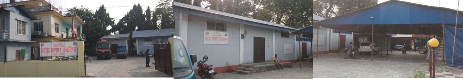
Customs office premises of Bhadrapur, Warehouse Yard
There is no export taking place through this point as there is no customs office at the India border point. There is only a check post in India. Vegetables, packaged tea, clothes, and raw materials of plywood factories are the main import items from this border point.
Customs Clearance
Compulsory Document for custom clearance.
-
D & T Exemption Certificate
-
Performa invoice
-
Invoice
-
AWB/BL/Other Transport Documents- Freights
-
Donation/Non-Commercial Certificates
-
Packing list
-
Letter of credit
-
Mode of payments (LC/TT/Draft)
-
Certificate of origin
-
Certificate of insurance
-
Bill of Lading for import from 3rd country
-
Industry Registration Certificates
-
EXIM Code. (EXIM Code is mandatory for Commercial trading and not mandatory for humanitarian support goods.
-
Bill of Entry from the Indian Customs Office
-
Tariff will be imposed on imported goods as per the Integrated Customs Tariff 2080/081 for FY 2080/81 (FY- 2023/024)
-
GST Bill
-
Exit Note
-
VCTS
-
Recommendation letter
For more information on customs in Nepal, please see the following link: 1.3 Customs Information.
Other Relevant Information
There are three warehouses in this office, out of which one has been used for litigation purposes and two for other purposes.
Nepal - 2.3.18 Border Crossing of Birgunj
Overview
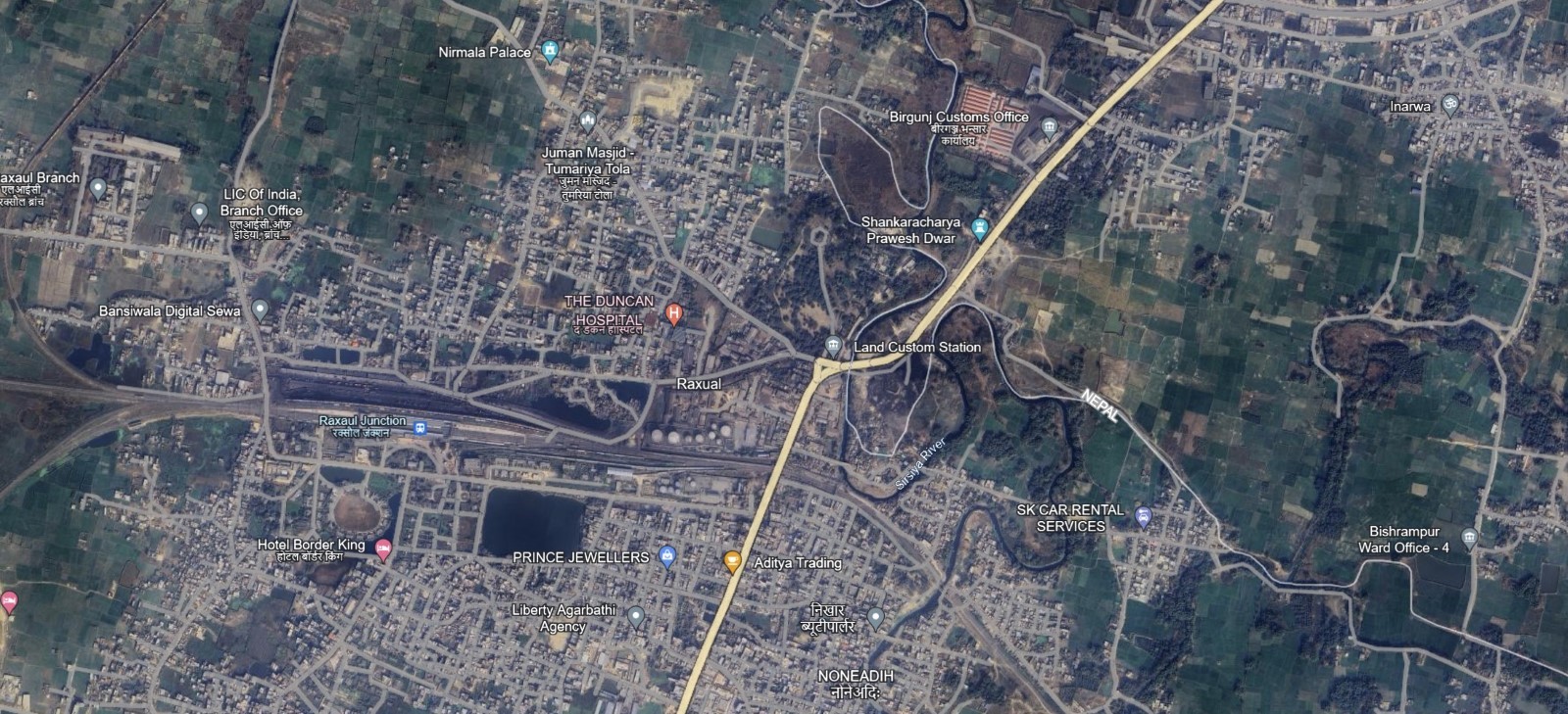
Birgunj Customs is located in Birgunj Municipality, ward no 19, Inarwa. After the promulgation of the Customs Act in 2019 BS, the customs have been functioning as a modern custom having two functional branches, main office at Birgunj as Birgunj Office and another office in Birgunj ICP Customs Office at Alau. The customs office mainly imports vehicles and their spare parts, petroleum products, coal, iron rods, pipes, cement clinker, readymade garments, soft drink concentrates, industrial machinery and raw materials, feed supplements, sports shoes. Good including juice jam, khudo, aluminum rods, jamboth cloth, CR seat, handbag, iron sheet, hat and copper goods are being exported.
There are 11 small customs offices under this customs office including Matiarwa, Sirsia, Piparpati, Simraungadh, Bhiswa Amritdhara (Thori), Avhi, Kacharwa, Alou, Gadhparsauni, and Janaki Tola.
In terms of revenue, the Birgunj Customs Office has 1st position in collecting country's total customs revenue.
|
Border Crossing Location and Contact |
|
|---|---|
|
Name of Border Crossing
|
Nepal: Birgunj India: Raxual |
|
Province or District |
Madhesh Province/ Parsa District |
|
Nearest Town or City with Distance from Border Crossing |
Town Name: Birgunj Ghantaghar city, Nepal, 4 km distance away from it.
Distance 2 km away from the Raxaul, Bihar border of India |
|
Latitude |
27.0168168 |
|
Longitude |
84.8425888 |
|
Managing Authority / Agency |
Birgunj Customs Office, Parsa Contact: 051-22220 Fax: Email:birgunj@customs.gov.np |
|
Contact Person |
Mr. Dila Ram Panthi Customs Officer Mob:9841613228 Office Mob:9855034634 |
|
Travel Times |
|
|---|---|
|
Nearest International Airport |
Raxaul Airport India |
|
Nearest Port |
Name: Birgunj Dry port, Jhapa Distance: 2 km Truck Travel Time: 8 Min Car Travel time: 5 hrs
|
|
Nearest location with functioning wholesale markets, or with significant manufacturing or production capacity |
Name: Raxaul Market, Bihar, India Distance: 1.5 km Truck Travel Time: 16 min Car Travel time: 8 min |
|
Other Information
|
4078 hector area, with 70 Rooms, weighing machine, 2 warehouses, link |
|
Hours of Operation |
|
|---|---|
|
Mondays |
Trucks/Goods: 6:00 – 22:00 |
|
Tuesdays |
Trucks/Goods: 6:00 – 22:00 |
|
Wednesdays |
Trucks/Goods: 6:00 – 22:00 |
|
Thursdays |
Trucks/Goods: 6:00 – 22:00 |
|
Fridays |
Trucks/Goods: 6:00 – 22:00 |
|
Saturdays |
Trucks/Goods: 6:00 – 22:00 |
|
Sundays |
Trucks/Goods: 6:00 – 22:00 |
|
National Holidays
|
Generally, 3 days during Dashain, Tihar-3 days, Chhat –1 day, Holi-1 day (Nepal national festival) and up to another 7 days / year at Government’s discretion and on 15 Jestha (28 or 29 April) Customs procedure is closed due to the new Fiscal Budget Announcement. Passengers checking and immigration procedure is not available at this point. |
|
Seasonal Constraints |
Rainy season |
Daily Capacity
-
500-600 trucks,
-
Clearance hour: 2:30 hours (max.)
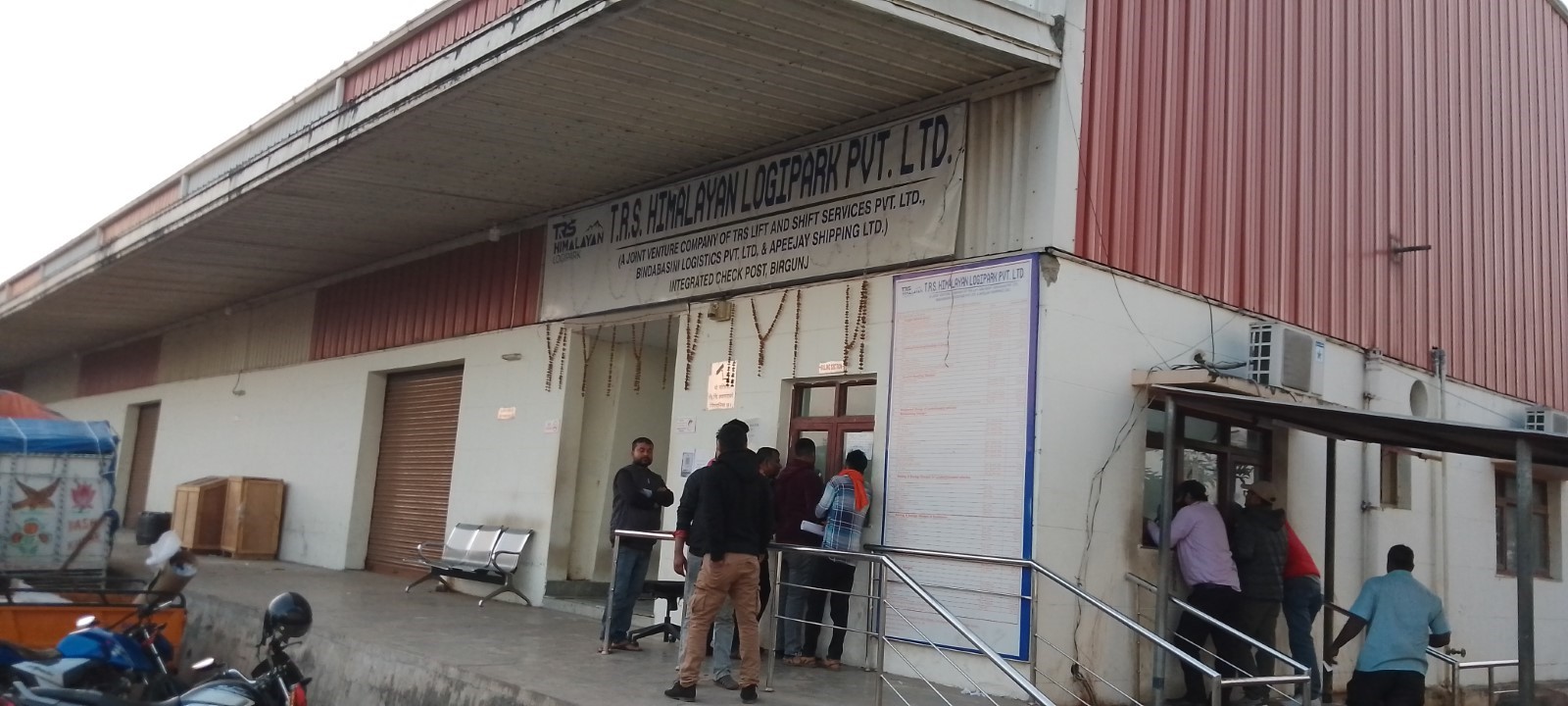
Terminal Clearance Office, TRS Himalayan Logi Park (P) Ltd.
Customs Clearance
Compulsory Document for custom clearance.
-
D & T Exemption Certificate
-
Performa invoice
-
Invoice
-
AWB/BL/Other Transport Documents- Freights
-
Donation/Non-Commercial Certificates
-
Packing list
-
Letter of credit
-
Mode of payments ( LC/TT/Draft)
-
Certificate of origin
-
Certificate of insurance
-
Bill of Lading for import from 3rd country
-
Industry Registration Certificates
-
EXIM Code. (EXIM Code is mandatory for Commercial trading and not mandatory for humanitarian support goods.
-
Bill of Entry From Indian Customs Office
-
Tariff will be imposed on imported goods as per the Integrated Customs Tariff 2080/081 for FY 2080/81 ( FY- 2023/024)
-
GST Bill
-
Exit Note
-
VCTS
-
Recommendation letter
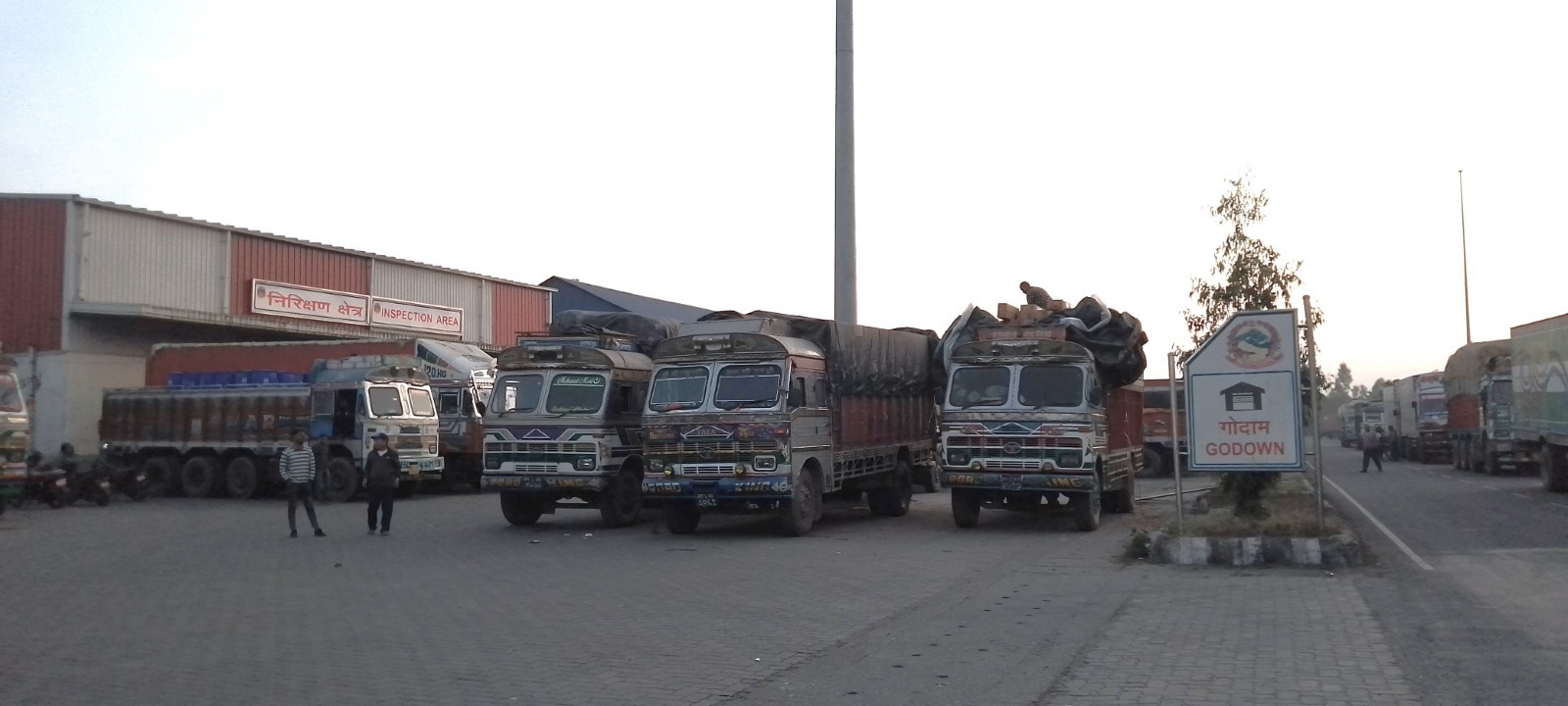
Customs inspection Building Area
Potential delays or restrictions:
-
Congestion inside the yard and customs clearance processing time may cause delays.
-
Both unbearable heat in Terai and landslides in mountain, accidents along the highway and road construction work may cause delays in vehicle movement.
-
And Lab testing may delay the clearance process which needs time for new imported items through this customs only.
For more information on customs in Nepal, please see the following link: 1.3 Customs Information.
Nepal - 2.3.19 Minor Border Crossing Koilabas, Dang
Overview
Koilabas Border Crossing in the Dang district of Lumbini Province is one of the oldest trade centers between Nepal and India. This border point had lost its glory after the construction of the East – West Mahendra highway in the 1960s. This border point is expected to gain momentum after the provincial capital of Lumbini is shifted to Deukhuri. The Indian side has also opened a customs office in Jarwa.
|
Border Crossing Location and Contact |
|
|---|---|
|
Name of Border Crossing
|
Nepal: Koilabas |
|
Province or District |
Lumbini |
|
Nearest Town or City with Distance from Border Crossing |
Lamahi 33 KM |
|
Latitude |
27.689607 |
|
Longitude |
82.525177 |
|
Managing Authority / Agency |
Department of Customs |
|
Contact Person |
Deepak Sharma Phone: 9857851051 (Office number) |
|
Travel Times |
|
|---|---|
|
Nearest International Airport |
Gautam Buddha International Airport, Bhairawaha Distance: 158 KM Truck Travel Time: 5 – 6 hours Car Travel time: 3.5 – 4 hours |
|
Nearest Port |
Kolkata Distance: 1006 Km Truck Travel Time: 28 – 30 hours Car Travel time: 24 – 26 hours |
|
Nearest location with functioning wholesale markets, or with significant manufacturing or production capacity |
Lamahi Distance: 33 KM Truck Travel Time: 1.5 – 2 hours Car Travel time: 1 hour |
|
Other Information
|
N/A |
|
Hours of Operation |
|
|---|---|
|
Mondays |
0600 hrs to 2100 hrs Summer 0700 hrs to 2100 hrs Winter |
|
Tuesdays |
0600 hrs to 2100 hrs Summer 0700 hrs to 2100 hrs Winter |
|
Wednesdays |
0600 hrs to 2100 hrs Summer 0700 hrs to 2100 hrs Winter |
|
Thursdays |
0600 hrs to 2100 hrs Summer 0700 hrs to 2100 hrs Winter |
|
Fridays |
0600 hrs to 2100 hrs Summer 0700 hrs to 2100 hrs Winter |
|
Saturdays |
0600 hrs to 2100 hrs Summer 0700 hrs to 2100 hrs Winter |
|
Sundays |
0600 hrs to 2100 hrs Summer 0700 hrs to 2100 hrs Winter |
|
National Holidays
|
3 days during Dashain holidays (in between Sep – Oct) there is less movement. However, at least one custom officer will remain in border for customs related activities. |
|
Seasonal Constraints |
N/A |
Daily Capacity
This border point can clear 30 to 40 loaded trucks per day, but due to a lack of quarantine facility trucks do not enter through this border.
Customs Clearance
This border point has not yet processed any loaded trucks for customs clearance, the revenue generated at this customs point is from Indian number-plated cars and bikes that enter Nepal through this border, and from local people carrying household items.
For more information on customs in Nepal, please see the following link: 1.3 Customs Information.
Other Relevant Information
This border point has a small yard where four trucks can be parked. However, there is no proper warehouse to store goods.
Nepal - 2.3.20 Border Crossing of Setobadha, Sunsari
Overview
Sunasri Customs Office is at Koshi Rural Municipality Ward No. 8 of Sunsari district, Koshi Province. Its office is located on the east-south side of the Setubandhu Koshi Barrage-Saptakoshi River. Madhesh Province is a state demarcated by the Koshi River on the north-east are located Koshi Tappu and Sri Lanka Tappu, known as the destinations of internal and external tourists of Sunsari district, while on the south side is the small market of Supaul, and the border district of Bihar province of India. There are seven sub-customs offices under this customs office, namely: Bhantabari, Laukahi, Kauwakjoj, Ghuso, and Sahebanj which are in operation, and the Lahi and Sisuwa are not in operation due to the lack of physical facilities. The Indian Customs office lies at Bhimnagar, Supaul District of Bihar State in India. The major exporting and importing items from this customs office are agricultural products, fish, and a few animals like goats, buffaloes, etc.
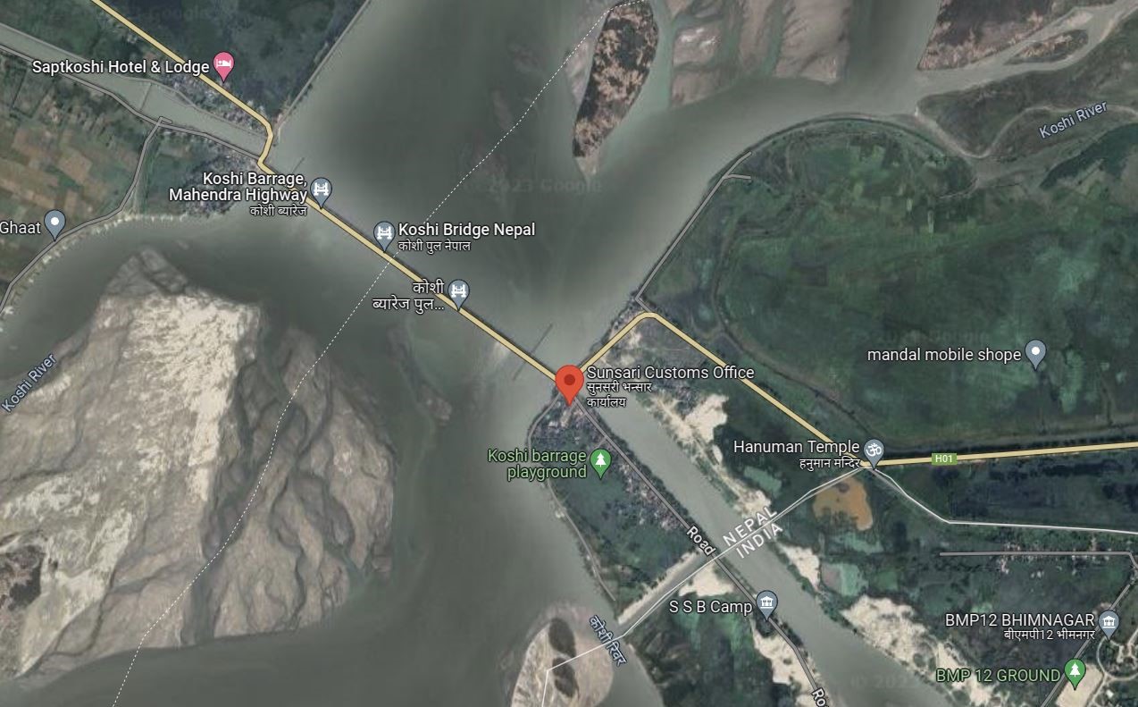
|
Border Crossing Location and Contact |
|
|---|---|
|
Name of Border Crossing
|
Nepal: Setobadha / Sunsari India: Bhimnagar, Bihar |
|
Province or District |
Koshi Province/Sunsari |
|
Nearest Town or City with Distance from Border Crossing |
Town Name: Bhantabari Distance 3.3 kilometer away from the borer of India |
|
Latitude |
26.522401 |
|
Longitude |
86.9295532 |
|
Managing Authority / Agency |
Sunsari Custom Office, Contact: Fax: Mobile: 9852064020 Office Mobile: 9852064020 Email:sunsari@customs.gov.np |
|
Contact Person |
Mr. Chudamani Sharma Kattel Mobile: 9841444301
|
|
Travel Times |
|
|---|---|
|
Nearest International Airport |
Darbhanga Airport, Bihar India Madhubani, Bihar, India Distance: 127 Km |
|
Nearest Port |
Name: Biratnagar Dry port, Jhapa Distance: 63.2 in km Truck Travel Time: 3 hr Car Travel time: 2 hr |
|
Nearest location with functioning wholesale markets, or with significant manufacturing or production capacity |
Name: Farbezgunj, Bihar India Distance: 58 km Truck Travel Time: 3 hr 16 min Car Travel time: 1 hr 30 min
Name: Bhantabari, Nepal (Bhimnagar Entry Point from India) Distance: 3.5 km Truck Travel Time: 25 min Car Travel time: 10 min
|
|
Other Information
|
Supaul, India is the nearest market point from this border point and it takes 1:30 hrs to reach travel by car. |
|
Hours of Operation |
|
|---|---|
|
Mondays |
Trucks/Goods: 8:00– 20:00 |
|
Tuesdays |
Trucks/Goods: 8:00– 20:00 |
|
Wednesdays |
Trucks/Goods: 8:00– 20:00 |
|
Thursdays |
Trucks/Goods: 8:00– 20:00 |
|
Fridays |
Trucks/Goods: 8:00– 20:00 |
|
Saturdays |
Trucks/Goods: 8:00– 20:00 |
|
Sundays |
Trucks/Goods: 8:00– 20:00 |
|
National Holidays
|
Generally, 3 days during Dashain (Nepal national festival, Chhath- 1 day and Holi Festival- 1 day) and up to another 7 days / year at Government’s discretion. Customs procedure remains close on 15 Jestha (probably falls on 28 or 29th April of the year) on account of New Fiscal Budget Announcement, a day where the tariff may change for the coming up fiscal year of the country. Customs remains open during emergency period. |
|
Seasonal Constraints |
Winter months, rainy season, etc. |
Daily Capacity
-
Maximum trucks: 10 trucks daily
-
Daily average: 10 trucks
-
Operating hours are 08:00-20:00 and can be extended as per need.
-
Average clearing time: 2:30 hrs
-
There is rarely a backlog.
Customs Clearance
Compulsory Document for custom clearance.
-
D & T Exemption Certificate
-
Performa invoice
-
Invoice
-
AWB/BL/Other Transport Documents- Freights
-
Donation/Non-Commercial Certificates
-
Packing list
-
Letter of credit
-
Mode of payments (LC/TT/Draft)
-
Certificate of origin
-
Certificate of insurance
-
Bill of Lading/Airway Bill for 3rd country imports
-
Industry Registration Certificates
-
EXIM Code. (EXIM Code is mandatory for Commercial trading and not mandatory for humanitarian support goods.
-
Bill of Entry from the Indian Customs Office
-
Exit Note
-
VCTS
-
Recommendation letter
-
Tariff will be imposed on imported goods as per the Integrated Customs Tariff 2080/081 for FY 2080/81 (FY- 2023/024)
-
GST Bill
Potential delays: No
Restriction: Prohibited to import goods as declared by Government of Nepal
For more information on customs in Nepal, please see the following link: 1.3 Customs Information.
Other Relevant Information
One needs to cross the border town where the border army checks all the visitors at the checkpoint. Indian nationals can get permission based on a Voter card, Adhaar card, or PAN card. The border areas in Sunsari district connect communities on both sides of the border. People from neighboring regions use these crossings for various purposes, including trade, family visits, and cultural events.
Nepal - 2.3.21 Border Crossing of Rasuwa, Tumure
Overview
Rasuwa Customs Office in Gosainkunda Rural Municipality, Ward no- 2, Rasuwa district, an important historical and archaeological site of Nepal, was established in 2013 B.S. This customs office in Rasuwagadi, is aimed at supporting the barter trade to fulfil the daily life of the residents of Rasuwa district and the people of Kerung region of Tibet through barter. It has a passenger section office near Miteri Bridge (China & Nepal Border point) for passenger and immigration checkpoints.
Rasuwagadi Customs Office, Rasuwa is a major road-linked border crossing with China and is rated no.8th of 27 border crossings in terms of import share, 1.87% of total country import share value of mid-July 2022 Mid-July 2023.
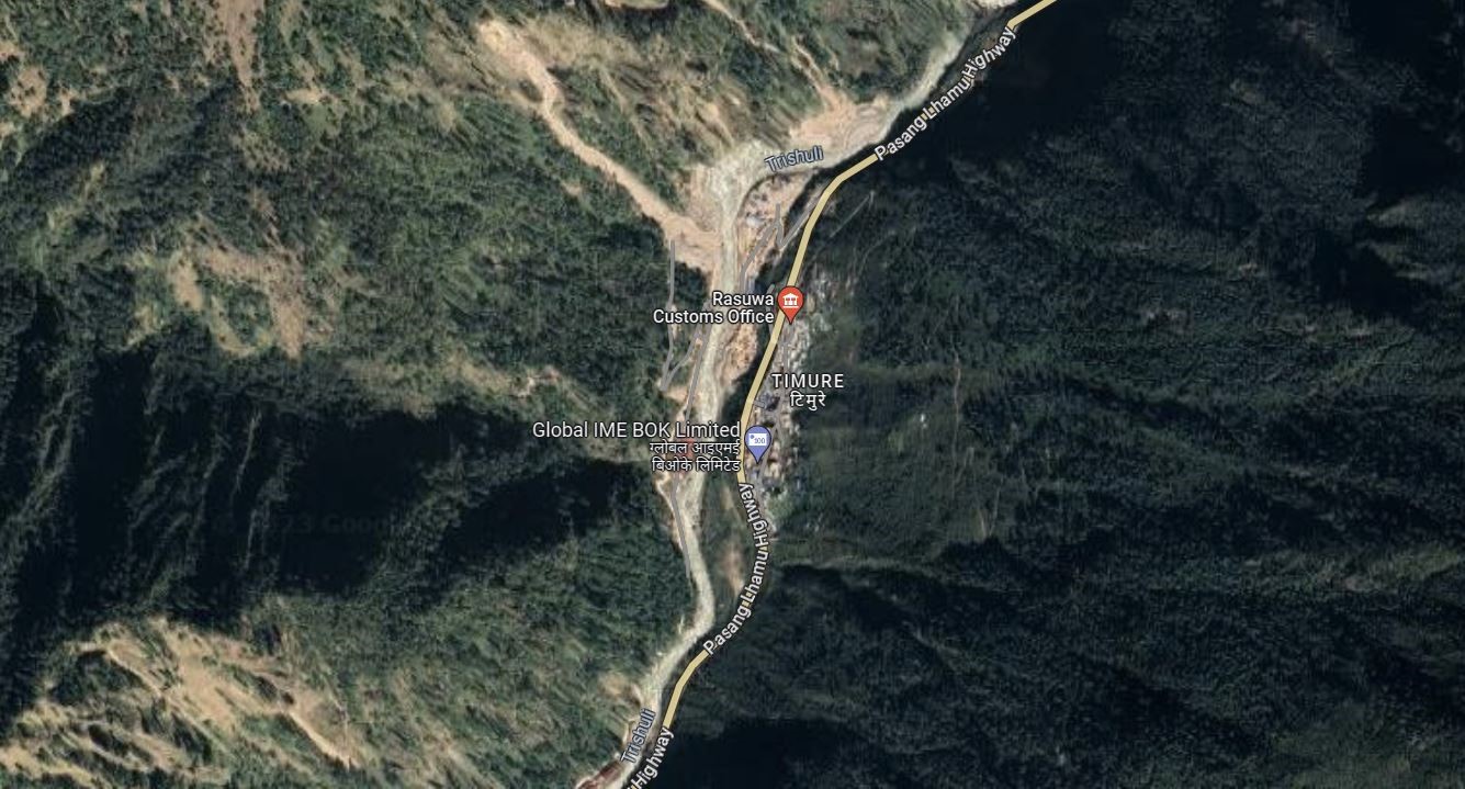
|
Border Crossing Location and Contact |
|
|---|---|
|
Name of Border Crossing
|
Nepal: Rasuwagadi Customs Office China: Jhilungkot |
|
Province or District |
Bagmati Province/ Rasuwa |
|
Nearest Town or City with Distance from Border Crossing |
Timure, Gosaikunda Rural Municipality- 2 |
|
Latitude |
28.256173211 |
|
Longitude |
85.366792768 |
|
Managing Authority / Agency |
Department of Customs |
|
Contact Person |
Rasuwagadi Customs Office Mr. Ram Prasad Pathak Chief Customs Officer Tel: 010-670182 Official Mob: 9851318439 E-mail: rasuwa@customs.gov.np
|
|
Travel Times |
|
|---|---|
|
Nearest International Airport |
Tribhuvan International Airport 126 KM Truck Travel Time: 7 hours Car Travel time: 6 hrs |
|
Nearest Port |
Kerung Bazaar, China Distance: 24 Km Truck Travel Time: 1 hour Car Travel Time: 0:30 min Chovar Dry Port, Kirtipur, Nepal |
|
Nearest location with functioning wholesale markets, or with significant manufacturing or production capacity |
# Nepal: Timure, Gasaikunda Rural Municipality-2 # China : Kerung Distance: 24 km Truck Travel Time: 1 hour Car Travel Time: 0:30 min |
|
Other Information
|
The ongoing construction of integrated customs and security posts, restoration of the historic Rasuwagadhi wall damaged during the 2015 earthquake, The construction of a service building near Miteri Bridge to support daily operations, and the management of facilities such as health decks, have contributed to increased traffic and the movement of truck containers through Miteri Bridge for the import and export of goods... |
|
Hours of Operation |
|
|---|---|
|
Mondays |
7:00 am – 8:00 pm for truck 8:00 am - 5:00 pm for passengers |
|
Tuesdays |
7:00 am – 8:00 pm for truck 8:00 am - 5:00 pm for passengers |
|
Wednesdays |
7:00 am – 8:00 pm for truck 8:00 am - 5:00 pm for passengers |
|
Thursdays |
7:00 am – 8:00 pm for truck 8:00 am - 5:00 pm for passengers |
|
Fridays |
7:00 am – 8:00 pm for truck 8:00 am - 5:00 pm for passengers |
|
Saturdays |
7:00 am – 8:00 pm for truck 8:00 am - 5:00 pm for passengers |
|
Sundays |
7:00 am – 8:00 pm for truck 8:00 am - 5:00 pm for passengers |
|
National Holidays
|
Generally, 3 days during Dashain (Nepal national festival, 3 days for Tihar, 1 day for Chhat pooja, and 1 day Holi) and up to another 7 days/year at the Government’s discretion. The Customs procedure is closed on Jesth 15 (28 or 29 April every year) on account of New Fiscal Budget Announcement Day. |
|
Seasonal Constraints |
Rainy Seasons. |
Daily Capacity
-
Private cars are not provided a separate lane.
-
Passenger Clearance: 200 passengers on average
-
Trucks Clearance: 15 to 20 trucks daily.
-
Containers: 10-15
-
Clearing hour: 1-2 hour
-
Weighing bridge 1, 80 mt capacity
Customs Clearance
Compulsory Document for custom clearance.
-
D & T Exemption Certificate (during an emergency)
-
Performa invoice
-
Invoice
-
AWB/BL/Other Transport Documents- Freights
-
Donation/Non-Commercial Certificates
-
Packing list
-
Letter of credit
-
Mode of payments (LC/TT/Draft)
-
Certificate of origin
-
Certificate of insurance
-
Bill of Lading/Airway Bill for 3rd country imports
-
Industry Registration Certificates
-
EXIM Code. (EXIM Code is mandatory for Commercial trading and not mandatory for humanitarian support goods. (For NGO/INGO- a one-time EXIM code is generated on request if support is taken from customs agents).
-
Bill of Entry from China Customs Office
-
Exit Note
-
VCTS
-
Recommendation letter
-
Tariff will be imposed on imported goods as per the Integrated Customs Tariff 2080/081 for FY 2080/81 (FY- 2023/024)
-
GST Bill
Potential delays or restrictions: Road construction work may cause delays in vehicle movement. And Lab testing may delay the clearance process which needs time for new imported items through these customs only.
For more information on customs in Nepal, please see the following link: 1.3 Customs Information.
Other Relevant Information
Rasuwagadi ICD is under construction. Because of the ongoing construction of a dry port in Bhotekoshi Bagar of Timure, private hotels in Timure and Ghattekhola areas, and the development of buildings for the Nepal Army, Armed Police, Force, and Nepal Police have enhanced the beauty of the region from Timure to Rasuwagadhi. The face of Timure, Ghattekhola, and Rasuwagadhi is gradually changing with development programs such as the infrastructure development plan of the federal, state, and local governments, and the support plan for the residents affected by the 111 MW Rasuwagadhi hydropower project, and they are hopeful that all kinds of structures will be built in the next two/four years.
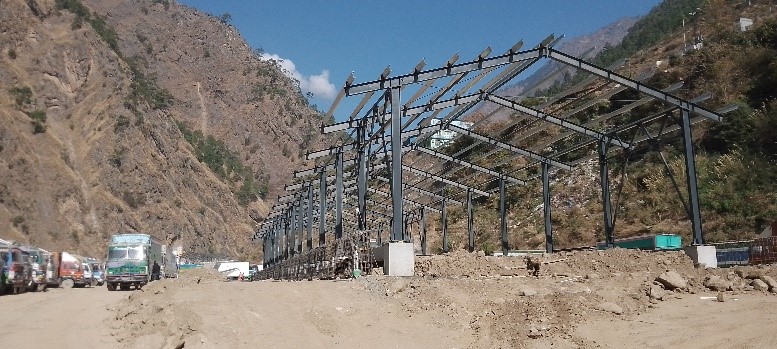
Customs inspection Building Area Under Construction
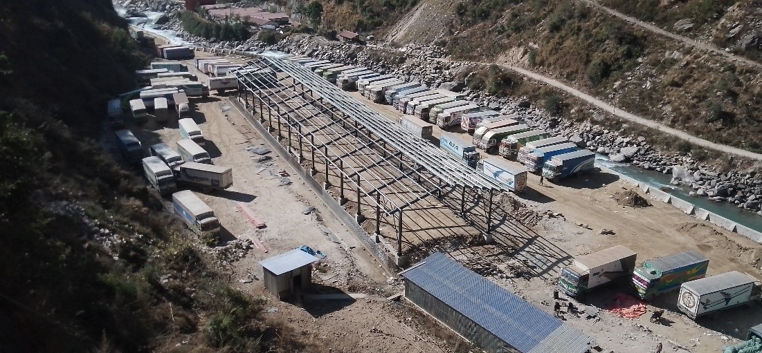
Parking area with a capacity of 500 trucks under construction.
The construction of a service building near Miteri Bridge to support daily operations.
Nepal - 2.3.22 Minor Border Crossing – Lagma Jatai, Dhanusha
Overview
Lagma Jatai Customs office in Jatahi, Dhanusha is situated in the heart of Janakpur city,18 km away from the nearest land border with India.
Lagma Jatahi Customs Office, is one of sub-customs office of Janakpur Customs Office and currently major customs services are providing from this border crossing point. Since the railway cargo from Janakpur is closed, the Janakpur Customs office is not busy customs office and major customs services are conducted from Lagma Jatahi Sub-Customs Office.
There are 8 sub-offices of Janakpur Customs Office, (Lagma-Jatahi, Einrwa, Bhadaria, Khajuri-Mahuwa, Khajuri-Station, Mahinathpur, Vaidehi, Kathal, and 3 out of 8 (Lagma-Jatahi, Einrwa, Bhadaria) are working.
Currently, the major work of the main customs office is being conducted from Lagma-Jatahi Sub-customs office.
Lagma Jatahi Janakpur is a minor border crossing, rated no.17 of 27 border crossings in terms import share, 0.08% of total country import share value during Mid-July 2022-Mid July 2023.
|
|
|
Aerial View of Lagma Jatahi Customs Office. |
|
Border Crossing Location and Contact |
|
|---|---|
|
Name of Border Crossing |
Nepal: Lagma Jatahi |
|
Province or District |
Madhesh Province, Dhanusha |
|
Nearest Town or City with Distance from Border Crossing |
In the City, Janakpur Distance: 3.5 km |
|
Latitude |
26.711925545 |
|
Longitude |
85.923936515 |
|
Managing Authority / Agency |
Department of Customs |
|
Contact Person |
Mr. Rajendra Basnet Janakpur Customs Office Janakpur Municipality Ward No. 1, Station Road, Dhanusha Tel: 041-520166 Official Mob: 9854029589 Email : janakpur@customs.gov.np |
|
Travel Times |
|
|---|---|
|
Nearest International Airport |
Tribhuvan International Airport 220 km via B.P. highway Truck Travel Time: 10 hrs Car Travel time: 6 hrs
Darbhanga Airport, India Distance: 56 km Truck Travel Time: 2 hrs Car Travel Time: 1:30 hrs |
|
Nearest Port |
Jaleswar Custom office, Maliwara, Mahottari Truck Travel Time: 1:45 hrs Car Travel time: 1 hrs |
|
Nearest location with functioning wholesale markets, or with significant manufacturing or production capacity |
Janakpur City is at a distance and Buspatti, Jayanagar is the biggest market in Bihar, Distance: 56 km Truck Travel Time: 3 hrs. Car Travel time: 2 hrs |
|
Other Information |
Janakpur Railway Station is in the distance of 4 km |
|
Hours of Operation |
|
|---|---|
|
Weekdays |
6:00 am to 10:00 pm for passengers 9:00 am to 10:00 pm for truck |
|
National Holidays |
Generally, 3 days during Dashain (Nepal national festival, 3 days for Tihar, 1 day for Chhat pooja, and 1 day Holi) and up to another 7 days/year at the Government’s discretion. The Customs procedure is closed on Jesth 15 (28 or 29 April every year) on account of New Fiscal Budget Announcement Day. |
|
Seasonal Constraints |
Rainy Seasons Due to Flood Inundation, Also the custom is right in the heart of the city thus the movement of vehicles leads to traffic congestion. |
Daily Capacity
Private cars are not provided the separate lane. The road is double lane; lane for incoming vehicle and an adjacent lane for outgoing vehicles.
-
4-5 trucks daily.
Customs Clearance
Compulsory Document for custom clearance.
-
D & T Exemption Certificate
-
Performa invoice
-
Invoice
-
AWB/BL/Other Transport Documents- Freights
-
Donation/Non-Commercial Certificates
-
Packing list
-
Letter of credit
-
Mode of payments (LC/TT/Draft)
-
Certificate of origin
-
Certificate of insurance
-
Bill of Lading/Airway Bill for 3rd country imports
-
Industry Registration Certificates
-
EXIM Code. (EXIM Code is mandatory for Commercial trading and not mandatory for humanitarian support goods.
-
Bill of Entry from Indian Customs Office
-
Exit Note
-
VCTS
-
Recommendation letter
-
Tariff will be imposed on imported goods as per the Integrated Customs Tariff 2080/081 for FY 2080/81 (FY- 2023/024)
-
GST Bill
Other Relevant Information
The entry point of Jayanagar- Janakpur is also at the customs point. Track upgrading and scaling up the track is ongoing. Since the Janakpur customs office is 18 km away from the border, the sub-customs office at Lagmajatahi acts as a major entry point for the goods. The major Customs service is provided by the Lagma Jatahi Customs Office, Dhanusha.
Nepal - 2.4 Railway Assessment
The Department of Railway (DORW) falls under the Ministry of Physical Infrastructure and Transport (MOPIT). The main goal of the DORW is to help in policy formulation, development, and expansion of railway infrastructure and provide suggestions on railway services operation. network in Nepal. The only passenger train service in Nepal is operated by Nepal Railway between Jaynagar in India to Bhangha (Dhanusa) in Nepal. It covers 51.136 km between the two stations. This section is under further extension up to Bardibas of Mahottari District adding further 16km rail track, and the construction of this project is underway. Nepal also has two other rail connectivity with India that are used for cargo transport. A 6 KM long broad-gauge track connects the Indian town of Raxaul to Birgunj ICD in Nepal and an eight KM track connects Bathnaha of India to Biratnagar ICP in Nepal.
Railway Companies and Consortia
Rail transport of Nepal is managed by the state-run Nepal Railways Corporation Ltd. Some of the future projects outlined by the Nepal Railways Corporation Ltd are as follows:
-
The East-West Railway Line: An alternative mode of transportation to traverse east to west of the country relieving pressure on East-West highway.
-
Raxaul–Birgunj-Kathmandu: Upgrade and Extension of existing railway line to connect Kathmandu.
-
Nepal signed a framework agreement in 2017 to explore the feasibility to connect Nepal with Lhasa, Tibet, China via Kerung, Rasuwa a northern border point.
Link to the official website: http://www.dorw.gov.np/
Key Route Information
|
Standard Route Information |
|||
|---|---|---|---|
|
|
Jaynagar, India to Bhangha, Nepal (Nepal Railway Overview) |
Raxaul, India to Sirsiya Inland Container Depot (or dry port/ICD) near Birgunj |
Bathnaha, India to Biratnagar ICP |
|
Track gauge |
51.136 kms of 762 mm (2 ft 6 in) gauge, broad gauge |
6 kms (3.7 mi) Broad-gauge railway line |
8 Kms Broad-gauge railway line |
|
Total track distance (single and / or double) |
59 kms, Janakpur Railway: Jaynagar, India to Bijalpura, Nepal |
6 kms (3.7 mi), Raxaul, India to Sirsiya ICD, Nepal |
8 Kms, Bathnaha, India to Biratnagar ICP, Nepal |
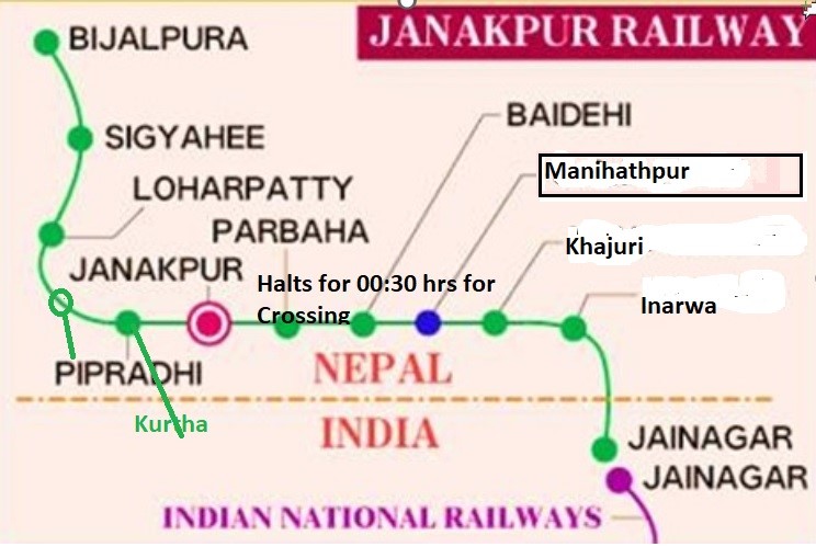
 Janakpur Railway Station.
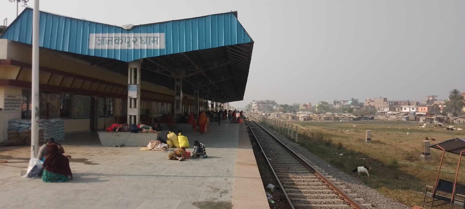 Janakpurdham Railway Station
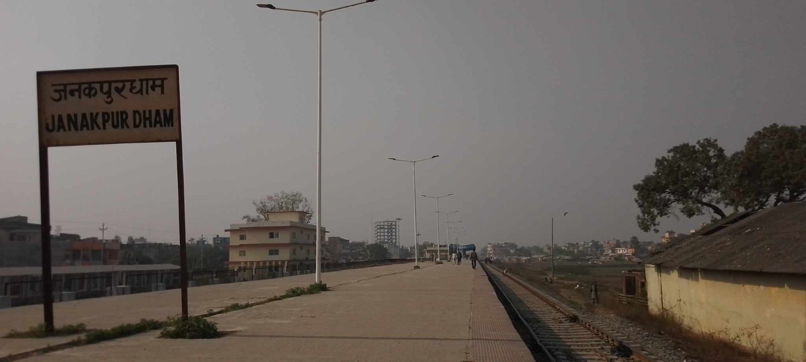
Janakpurdham Railway Platform
Nepal - 2.5 Waterways Assessment
There are no waterways in Nepal for inland navigation. The only practical seaport for goods bound for Nepal is Kolkata, India.
Nepal and India have carried out studies on the possibility of having navigational use of the Gandak River system. Along the Ganga-Bhagirathi-Hooghly river system, National Waterway 1 (NW 1) of India Gandak river meets at Hajipur (marked with green circle) and Koshi river meets at Kursela (marked with blue circle). The two rivers from Hajipur and from Kursela to Nepal are currently not navigable and require dredging. India started dredging the 300km river section from Hajipur to Nepal in 2020, to make the river navigable for 1,000-2,000 MT vessels. The confluences of these rivers with the Ganga could potentially link Nepal to the Port of Kolkota via river. However, cargo transport from Kolkota port by river would need to compete with the cost and speed of transport by rail and road. The Nepal Shipping Office was established under the Ministry of Physical Infrastructure and Transport on 14th February 2019 to oversee the progress on Nepal-India Transit Treaty to use three inland- waterways (Kolkata-Kalughat-Raxaul; Kolkata-Sahebgunj-Biratnagar and Kolkata-Varanasi-Raxaul routes).
(Sources: Are Nepali waters navigable?; http://www.indianetzone.com/29/gandak_indian_river.htm)
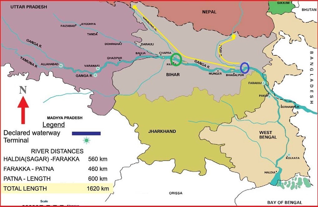
[image from Water Resources Information System of India]
Nepal - 2.6 Storage Assessment
While Nepal has an abundance of low-volume storage for the commercial sector. Large-scale warehousing for the humanitarian community is more difficult to locate. The Food Management and Trading Company (FMTC), previously Nepal Food Corporation, appears to be the largest provider of warehousing capacity for rent, but the availability of their facilities is linked to the harvest season of paddy.
For more information on storage company contact details, please see the following link: 4.6 Storage and Milling Companies Contact List.
Storage Used by Humanitarian Organizations
|
Location |
Organization |
Sharing Possibility
|
Capacity (MT / m² / m³) |
Type [1] |
Access [2] |
Condition [3] |
|---|---|---|---|---|---|---|
|
Janakpur |
UNFPA |
Yes |
30.24 m3 |
Container |
Raised-Siding
|
Appears Intact
|
|
Dhanusha |
UNICEF |
15 |
160 m² |
Container |
Raised-Siding |
Appears Intact |
|
Dhanusha |
UNICEF |
Open Space = 169 m2 |
120 m² |
Rubb hall |
Raised-Siding
|
Appears Intact |
|
Janakpur |
UNDP |
No |
No |
No |
No |
No |
|
Koshi Province |
Ministry of Internal Affairs and Law (MOIAL) |
No |
1500 m3 |
Concrete |
Raised-Siding |
Need to repair rainwater leakage |
|
Biratnagar |
UNFPA |
No |
150 m2 |
Room |
Concrete |
Appears Intact |
|
Lalitpur |
Save the Children |
No |
600 m2 |
Concrete |
Flat |
Appears Intact |
|
Kathmandu |
Save the Children |
No |
20 m2 |
Concrete |
Flat |
Appears Intact |
|
Bardibas |
Save the Children |
No |
300 m2 |
Concrete |
Flat |
Appears Intact |
|
Biratnagar |
Save the Children |
No |
35 m2 |
Container |
Flat |
Appears Intact |
|
Nepalgunj |
Save the Children |
No |
200 m2 |
Concrete |
Flat |
Appears Intact |
|
Dhangadi |
Save the Children |
No |
120 m2 |
Container |
Flat |
Appears Intact |
|
Janakpur |
Plan International Nepal |
No |
278 m2 |
Concrete building |
Flat |
Appears Intact |
Humanitarian Staging Area
World Food Programme (WFP) with funding support from the Unite Kingdom’s Foreign, Commonwealth and Development Office (FCDO) and Australia’s Department of Foreign Affairs and Trade (DFAT), in close collaboration with the Government of Nepal (GoN) has successfully established Humanitarian Staging Area (HSA) at Tribhuvan International Airport (TIA) in Kathmandu, six Provincial Humanitarian Staging Areas (PHSAs) in five provinces namely: Koshi Province (Biratnagar), Madhesh Province (Birgunj), Lumbini Province (Bhairahawa and Nepalgunj), Karnali Province (Surkhet) and Sudurpaschim Province (Dhangadhi) and Mobile Humanitarian Staging Areas (MHSAs) in four districts, namely: Baitadi, Jumla, Mahottari and Terhathum. The purpose of these facilities is to enhance the emergency preparedness and response capacity of GoN and the humanitarian community. The HSA has been managed on behalf of Ministry of Home Affairs (MoHA) by WFP on a full cost-recovery basis, overseen by a user-group steering committee.
In the event of crises, the National logistics cluster of the country activates the HSA’s and initiates logistics services to fill gaps. Updates on the requirement to procure services can be attained through Log cluster’s page dedicated to Nepal.
|
Location |
Organization |
Sharing Possibility
|
Capacity (MT / m² / m³) |
Type [1] |
Access [2] |
Condition [3] |
|---|---|---|---|---|---|---|
|
Kathmandu |
World Food Programme |
Yes |
5500 mt |
Rub-hall, container |
Flat |
Appears Intact |
|
Biratnagar |
World Food Programme |
Yes |
2000 mt |
Rub-hall, container |
Flat |
Appears Intact |
|
Terhathum |
World Food Programme |
Yes |
750 mt |
Rub-hall, container |
Flat |
Appears Intact |
|
Birgunj |
World Food Programme |
Yes |
2000 mt |
Rub-hall, container |
Flat |
Appears Intact |
|
Mahottari |
World Food Programme |
Yes |
750 mt |
Rub-hall, container |
Flat |
Appears Intact |
|
Bhairahawa |
World Food Programme |
Yes |
1000 mt |
Rub-hall, container |
Flat |
Appears Intact |
|
Nepalgunj |
World Food Programme |
Yes |
1875 mt |
Rub-hall, container |
Flat |
Appears Intact |
|
Jumla |
World Food Programme |
Yes |
750 mt |
Rub-hall, container |
Flat |
Appears Intact |
|
Surkhet |
World Food Programme |
Yes |
750 mt |
Rub-hall, container |
Flat |
Appears Intact |
|
Kailali |
World Food Programme |
Yes |
1535 mt |
Rub-hall, container |
Flat |
Appears Intact |
|
Baitadi |
World Food Programme |
Yes |
687 mt |
Rub-hall, container |
Flat |
Appears Intact |
|
Kaski |
World Food Programme |
Yes |
750 mt |
|
|
Proposed |
[1] Warehouse Type: Open storage, container, rub-hall, silo, concrete, other, unspecified
[2] Warehouse Access: Raised-siding, flat
[3] Warehouse condition: Appears intact, appears damaged, under construction/repair
Nepal Red Cross Society
The Nepal Red Cross Society (NRCS) is the only humanitarian organization that has its own storage. All other I/NGOs uses commercial warehouses as required.
|
Location |
Organization |
Sharing Possibility
|
Capacity (MT / m² / m³) |
Type [1] |
Access [2] |
Condition [3] |
|---|---|---|---|---|---|---|
|
Kathmandu |
Nepal Red Cross Society |
No |
220 m² |
Concrete |
Flat |
Appears Intact |
|
Biratnagar |
Nepal Red Cross Society |
No |
92.5 m² |
Concrete |
Flat |
Appears Intact |
|
Katari |
Nepal Red Cross Society |
No |
88 m² |
Concrete |
Flat |
Appears Intact |
|
Phidim |
Nepal Red Cross Society |
No |
56 m² |
Concrete |
Flat |
Appears Intact |
|
Birgunj |
Nepal Red Cross Society |
No |
136 m² |
Concrete |
Flat |
Appears Intact |
|
Pokhara |
Nepal Red Cross Society |
No |
68 m² |
Concrete |
Flat |
Appears Intact |
|
Myagdi |
Nepal Red Cross Society |
No |
22.5 m³ |
Concrete |
Flat |
Appears Intact |
|
Rajbiraj |
Nepal Red Cross Society |
No |
392 m³ |
Concrete |
Flat |
Appears Intact |
|
Bhadrapur |
Nepal Red Cross Society |
No |
535 m² |
Concrete |
Flat |
Appears Intact |
|
Ilam |
Nepal Red Cross Society |
No |
891 m² |
Concrete |
Flat |
Appears Intact |
|
Janakpur |
Nepal Red Cross Society |
No |
2948 m³ |
Concrete |
Flat |
Appears Intact |
[1] Warehouse Type: Open storage, container, rub-hall, silo, concrete, other, unspecified
[2] Warehouse Access: Raised-siding, flat
[3] Warehouse condition: Appears intact, appears damaged, under construction/repair
|
District Warehouse, NRCS, Janakpur |
|
Provincial Warehouse, NRCS, Janakpur |
|
Warehouse, NRCS, Ilam |
|
Warehouse, NRCS, Jhapa
|
|
Office and Warehouse, NRCS, Rasuwa |
|
Warehouse, NRCS, Kaski Provincial NRCS Warehouse, Kaski |
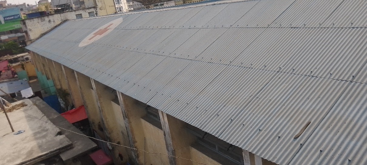
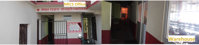
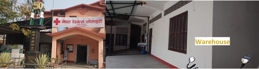
Public Sector Storage
The Food Management and Trading Company Private Limited (FMTC) is a government company established by merging the National Trading Limited and Nepal Food Corporation. It is the main provider of commercial warehouse space for private businesses and humanitarian organizations. FMTC’s current network consists of a head office in Kathmandu, 7 Provincial Offices at (Biratnagar, Janakpur, Kathmandu, Pokhara, Surkhet, Bhairhawa and Dhangadi), 5 branch offices at Birtamod, Lahan, Nepalgunj, Tulsipur and Rajpur, and 26 Branch Offices, 25 Depos and 74 sales centers. The total storage capacity of warehouses under the management of FMTC is 138620 mt.
|
Location |
Ministry / Agency |
Use Possibility |
Capacity (MT / m² / m³) |
Type [1] |
Access [2] |
Condition [3] |
|---|---|---|---|---|---|---|
|
Koshi Province |
Food Management and Trading Company |
Yes |
31980 MT |
Concrete |
Flat |
Appears Intact |
|
Madhesh Province |
Food Management and Trading Company |
Yes |
22500MT |
Concrete |
Flat |
Appears Intact |
|
Bagmati Province |
Food Management and Trading Company |
Yes |
27950 MT |
Concrete |
Flat |
Appears Intact |
|
Gandaki Province |
Food Management and Trading Company |
Yes |
4600 MT |
Concrete |
Flat |
Appears Intact |
|
Lumbini Province |
Food Management and Trading Company |
Yes |
31910 MT |
Concrete |
Flat |
Appears Intact |
|
Karnali Province |
Food Management and Trading Company |
Yes |
7500MT |
Concrete |
Flat |
Appears Intact |
|
Surdurpaschim Province |
Food Management and Trading Company |
Yes |
12180 MT |
Concrete |
Flat |
Appears Intact |
|
Inaruwa, Sunsari |
Ministry of Internal Affairs and Law, Koshi Province |
No |
1500 m³ |
Concrete |
Raised-siding |
Need to repair, rainwater leakage |
|
Janakpur |
MoHA/Madhesh Province |
Yes |
792 m³ |
Concrete |
Flat |
Appears Intact |
|
Janakpur |
MoHA/Madhesh Province |
Yes |
3627 m³ |
Concrete |
Flat |
Appears Intact |
|
Janakpur |
PHLMC |
Yes |
86.8 m³ |
MSU |
Flat |
Appears Intact |
|
Birgunj |
Birgunj Metropolitian City |
Yes |
42642 m 2 |
Open space |
Flat |
Open Space |
|
Pokhara |
Ministry of Internal Affairs and Law, Gandaki Province |
Yes |
5815 m³ (Four warehouses available) |
Concrete |
Flat |
Appears Intact (needs minor repair) |
[1] Warehouse Type: Open storage, container, rub-hall, silo, concrete, other, unspecified
[2] Warehouse Access: Raised-siding, flat
[3] Warehouse condition: Appears intact, appears damaged, under construction/repair
Cold Chain
Ministry of Health and Population
There are five provincial cold chains, one central storage facility and two sub cold chain centres under the Management Division (MD) of the Ministry of Health and Population (MoHP). At the district level, public health offices have small cold chain storage facilities, and they provide service to the community. The MD under the MoHP and Provincial Health Logistics Management Center (PHLMC) under Provincial Ministry of Health manages the storage, transportation and distribution of vaccines and syringes for expanded program for immunization (EPI).
|
Location |
Organization / Owner |
Type [1] |
Cooling / Power [2] |
Quantity |
Total Capacity (m³) |
Condition |
|---|---|---|---|---|---|---|
|
Hetauda |
MoHP / PHLMC |
Walk-in cooler |
+2 to +8C, comp |
2 |
12250 |
Good |
|
Pokhara |
MoHP / PHLMC |
Walk-in cooler |
+2 to +8C, comp |
5 |
29750 |
Good |
|
Butwal |
MoHP / PHLMC |
Walk-in cooler |
+2 to +8C, comp |
5 |
31250 |
Good |
|
Pathlaiya, Bara |
MoHP /MD |
Walk-in cooler |
+2 to +8C, comp |
4 |
25000 |
Good |
|
Pathlaiya, Bara
|
MOHP/MD |
Refer Container with Genrator |
-450C to -450C |
1 |
67317 |
Good |
|
Biratnagar |
MoHP / PHLMC |
Walk-in cooler |
+2 to +8C, comp |
5 |
28511.8 |
Good |
|
Nepalgunj |
MOHP/PHLMC |
Walk-in cooler |
+2 to +8C, comp |
3 |
9750 |
Good |
|
Dhangadhi |
MoHP / PHLMC |
Walk-in cooler |
+2 to +8C, comp |
5 |
29750 |
Good |
|
Teku (Kathmandu) |
MoHP/MD |
Walk-in cooler |
+2 to +8C, comp |
16 |
117750 |
Good |
|
Janakpur |
MOHP/PHLMC |
Walk-in cooler |
+2 to +8C, comp |
3 |
12000 |
Good |
|
Janakpur |
MOHP/PHLMC |
Refer Container with Generator |
-450C to -450C |
1 |
67317 |
Good |
|
Surkhet |
MOHP/PHLMC |
Walk-in cooler |
+2 to +8C, comp |
3 |
18750 |
Good |
|
Jhapa |
MOHP/HO |
Walk-in cooler |
+2 to +8C, comp |
1 |
5000 |
Good |
|
Saptari |
MOHP/HO |
Walk-in cooler |
+2 to +8C, comp |
1 |
5000 |
Good |
|
Kathmandu |
MOHP/HO |
Walk-in cooler |
+2 to +8C, comp |
1 |
5000 |
Good |
|
Bhaktapur |
MOHP/HO |
Walk-in cooler |
+2 to +8C, comp |
1 |
10000 |
Good |
|
Baglung |
MOHP/HO |
Walk-in cooler |
+2 to +8C, comp |
1 |
5000 |
Good |
|
Rupandehi |
MOHP/HO |
Walk-in cooler |
+2 to +8C, comp |
1 |
5000 |
Good |
|
Surkhet |
MOHP/HO |
Walk-in cooler |
+2 to +8C, comp |
1 |
5000 |
Good |
|
Kailali |
MOHP/HO |
Walk-in cooler |
+2 to +8C, comp |
1 |
5000 |
Good |
|
Sunsari |
MOHP/HO |
Walk-in cooler |
+2 to +8C, comp |
1 |
5000 |
Good |
|
Udaypur |
MOHP/HO |
Walk-in cooler |
+2 to +8C, comp |
1 |
5000 |
Good |
|
Siraha |
MOHP/HO |
Walk-in cooler |
+2 to +8C, comp |
1 |
5000 |
Good |
|
Chitwan |
MOHP/HO |
Walk-in cooler |
+2 to +8C, comp |
1 |
5000 |
Good |
|
Syanja |
MOHP/HO |
Walk-in cooler |
+2 to +8C, comp |
1 |
5000 |
Good |
|
Dang |
MOHP/HO |
Walk-in cooler |
+2 to +8C, comp |
1 |
5000 |
Good |
|
Dadeldhura |
MOHP/HO |
Walk-in cooler |
+2 to +8C, comp |
1 |
5000 |
Good |
[1] Cold Room Positive, Cold Room Negative, Refrigerator, Freezer,
[2] Compression, Absorption, Solar, Other, unspecified
|
1: Cold Chain, Janakpur 2: Reefer Container, Janakpur
|
|
Cold chain facility, Pokhara |
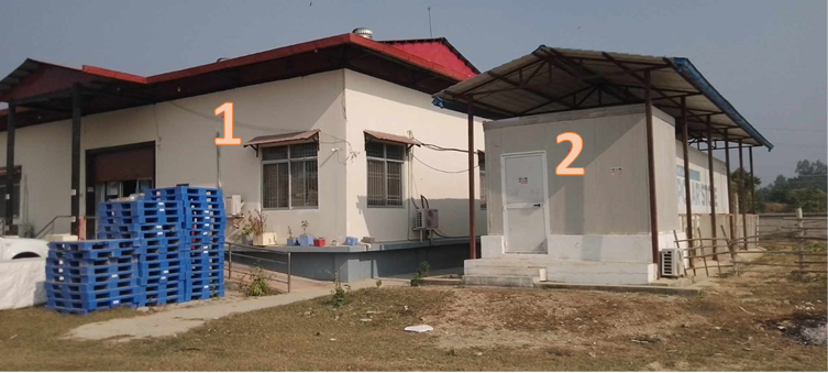
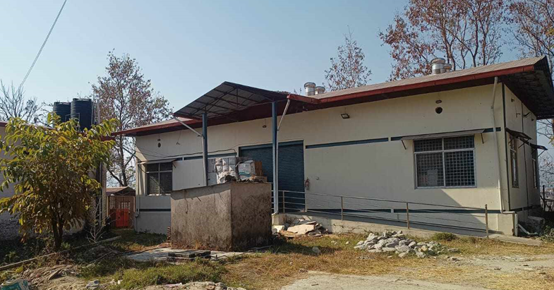
Nepal - 2.7 Milling Assessment
The major agriculture production area of Nepal is in the plain lands of Terai. Because of this, most of the country’s mills and processing facilities are also located in this region. There are limited numbers of mills outside of this region. Production of rice in the Terai is not enough to meet the daily consumption requirement of the nation. Therefore, to meet the demand, milled rice, and paddy is imported from India.
Nepal has about 350 private commercial mills in operation although more than 500 are registered. State-owned Food Management and Trading Company (FMTC) is also a major actor in the collection and distribution of rice, but their milling capacity is limited to two mills; 2 mt/h in Rajapur, Bardiya (Aruwa Makwanpur: raw coarse rice) and 1 mt/h in Janakpur, Dhanusha (Basmati). These 350 mills are further segmented into small, medium, and big depending upon their production per hour. (100 mills of 1 MT/h, 215 mills of 1-5 mt/h; 35 mills of 5-8 mt/h). The collective production of these mills across all segments is dependent on the mill operation hours in a day, the seasonality of the harvest, milling capacity of the production unit.
Generally, most of the mills operate for 1 single shift for 8 hours per day and that is only for 5 months harvest season of May through September.
For more information on milling company contact details, please see the following link: 4.6 Storage and Milling Companies Contact List.
K. L. Dugar Group (Dugar Brothers), Nepalgunj, Lumbini Province
Sourcing: Fine rice from India and coarse rice from Nepal
Processing: Two rice mills, one mill with two processing lines of 3 mt/h and 2 mt/h capacity and another with a processing line of 5 mt/h
Output: Their annual output last year was 10,000 MT of which 5,000 mt were fine rice and 5,000 mt coarse rice. Their targets for this year have increased to 8,000 mt of fine rice and
5-7,000 mt coarse rice.
Supply: Dugar’s output goes to their depot in Kathmandu from where goods are picked up by traders/wholesalers who distribute to various types of retailers.
Medium/smaller-sized mills in Nepalgunj, Lumbini Province
|
Company Name |
Milling Capacity |
|---|---|
|
Hardik Rice Mill |
1.5 Mt/h of paddy, Annual output: 2,400 mt milled rice |
|
Pratibha Rice Mill |
1.5 Mt/h of paddy, Annual output: 1,200 mt milled rice |
|
Mittal Rice and Oil Mill |
1.5 Mt/h of paddy, Annual output: 1,800 mt milled rice |
All of them are sourcing Nepalese rice (mainly coarse) and supply 90-100 percent of their output to the hill and mountain areas of Gandaki Province, Lumbini Province, and Karnali Province of Nepal. The transportation costs increase significantly not only by distance but also by the degree of difficulty of road access (or path). From May to September, some areas are simply inaccessible by land transport because of floods and landslides.
Century Food Pvt. Ltd., Biratnagar, Koshi Province
Century Food is a trading company of mainly Indian rice, repacked and distributed in Nepal.
Sourcing: 99 per cent Indian milled rice;
Processing: repacking in Nepalese branded bags;
Output: Century’s annual trading volume is 40,000 mt, the biggest company in this regard.
Their warehouse has a capacity of 5,000 MT in Biratnagar; 2,000 mt in Narayanghat and 1,000 mt in Kathmandu. They are supplying three major territories: Kathmandu, Pokhara and Narayanghat.
Bohra Group (including Himalayan Industries)
Bohra Group is a market-oriented food producer, among others, operating two rice mills with a 5 MT per hour production capacity (Bohra Industries) and five MT per hour milling capacity (Himalayan Industries) respectively.
Sourcing: Bohra prefers to source Nepalese rice, but economic considerations lead to 20-30 per cent imports from India (with a trend to getting less)
Processing: Eight MT/h and five MT/h
Output: 15,000 MT/annum of premium rice and 10-15,000 MT/annum of raw rice
Packaging and distribution: One kg to 30 kg retail packs
Supplying: Kathmandu and wide local network (Biratnagar and Terai)
(Source: Albani, Martin, et al. Landscape Study for Rice Fortification. Department of Health Services, Nepal in support of WFP RBB, 2017.)
Food Management and Trading Company (FMTC)
The Food Management and Trading Company (FMTC, formerly Nepal Food Corporation) is a state-owned enterprise. FMTC contributes to food security by supplying subsidized food commodities to people in food insecure and food deficit areas and it plays a role in influencing the market by procuring and encouraging the production of indigenous food commodities.
FMTC has two rice mills:
-
A mill in Rajapur, Bardiya with a capacity of two MT/h and runs in the high season two shifts of 10 hours (night) and eight hours (day); they source exclusively Nepalese paddy and the monthly average output is 200-350 mt of milled rice or 2,200 mt/annum. The mill has four warehouses with a total storage capacity of 6,000 mt.
A mill in Janakpur, Dhanusha with a capacity of one mt/h. They have a paddy quota of 1,000 mt/annum of coarse rice (Mansuli) and 700 mt of Basmati. They have two warehouses with a combined storage capacity of 3,000 mt.
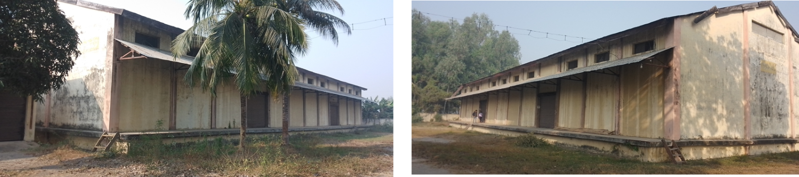
Two Operational Warehouses of FMTC, Janakplur, Dhanusha, Madhesh Province
(Source: World Food Programme. Rationalisation of the Food Management and Trading Company Warehouse Network. Food Management and Trading Company, 2019.)
For information on Nepal Milling contact details, please see the following link: HQ staff will input a link to section 4.6 Storage and Milling Companies Contact List here.
Milling Company: Ganesh Agro Pvt. Ltd.
|
Company Name and Address |
Contact Names and Email |
Telephone and Fax |
|---|---|---|
|
Ganesh Agro (P) Ltd Jhapa Chowk Bhadrapur – 4, Jhapa, Koshi Province, Nepal |
Name: Ujjwal Shrestha Title: Manager Email: rytvhmvteam@gmail.com
|
Tel: +977-23-524319
|
|
Facilities |
||
|---|---|---|
|
Parking Area Inside Compound (m²) |
Adequate space available with an area of 4572 m² |
|
|
Drainage |
Good |
|
|
Fire Fighting Equipment |
Yes |
|
|
Number of Ventilators (screened) |
10 |
|
|
Electricity Load (KVA) |
500 KVA |
|
|
Backup Generator(s) |
Yes |
125 KVA |
|
Milling Equipment |
|||
|---|---|---|---|
|
Origin of Machinery |
Year of Mfg |
Year of Installation |
Condition |
|
India -1 |
2018 |
2019 |
Good |
|
German |
2018 |
2019 |
Operational |
|
Maintenance |
|||
|---|---|---|---|
|
Duration |
All maintenance is performed on all equipment on monthly basis to ensure the highest standards of operation |
Type of Maintenance |
Monthly by skilled technician |
|
Other Equipment or Machinery Installed |
||||
|---|---|---|---|---|
|
Type of Equipment |
Available |
Number |
Owned |
Comments |
|
Fortification Feeder |
No |
N/A |
N/A |
Planning to install |
|
Bag Cleaning Plant |
Yes |
3 |
Procured |
Readymade supply from Altab Factory, Biratnagar |
|
Moisture Tester |
Yes |
2 |
Yes |
Operational |
|
De-stoning Plant |
Yes |
3 |
Yes |
Operational |
|
Metal Extractor |
Yes |
10 |
Yes |
Operational |
|
Staffing |
|
|---|---|
|
Number of Full Time Skilled Workers |
11 operators |
|
Number of Full Time Labourers |
25 at full capacity |
|
Weighbridge |
||||
|---|---|---|---|---|
|
Number |
1 |
Capacity (MT) |
Length (m) |
Type |
|
Within Compound |
60 |
10 |
Digital |
|
|
Building |
|||
|---|---|---|---|
|
|
Length (m) |
Width (m) |
Height (m) |
|
Building – Mill |
32.91 |
32.91 |
7.62 |
|
Building – Storage |
32.91 |
36.57 |
7.62 |
|
Walls |
Concrete |
||
|
Roof |
Steel and concrete |
||
|
Floor |
Concrete |
||
|
Conditions & Cleanliness |
||
|---|---|---|
|
|
Outside |
Inside |
|
Cracks in Walls or Roof |
No |
No |
|
Signs of Rodent Activity |
Yes |
No |
|
Signs of Birds Entry |
No |
No |
|
Damaged Gutters/Drains |
Yes |
No |
|
Signs of Moisture |
No |
No |
|
Adjacent Vegetation |
Yes |
No |
|
Cleanliness |
Good |
Good |
|
Pest Control |
|||||
|---|---|---|---|---|---|
|
Fumigation |
No |
Frequency |
N/A |
Contracted |
No |
|
Spraying |
No |
Frequency |
N/A |
Contracted |
No |
|
Rodenticides |
No |
Frequency |
N/A |
Contracted |
No |
|
Rodent Trapping |
No |
Frequency |
N/A |
Contracted |
No |
|
Security |
|
|---|---|
|
Security |
Good |
|
Compound |
Yes – Concrete wall |
|
Other Comments |
N/A |
|
Access |
|||
|---|---|---|---|
|
Distance from Main Town (km) |
2 minutes/500 m |
||
|
Travel Time if not Located in Town (hours) |
5 minutes |
||
|
Road Condition to Mill |
Good/Asphalt |
||
|
Road Limitations (if any) |
None |
||
|
Rail Connections |
No |
||
|
On the Railway From |
N/A |
To |
N/A |
|
Other Comments |
N/A |
||
|
Milling Capacity |
||
|---|---|---|
|
Commodities |
Daily Capacity (MT) |
Monthly Activity (MT) |
|
Rice |
100 mt/day/24 hour |
3000 |
|
Storage Capacity |
||
|---|---|---|
|
Storage in Metric Tons |
Rice – Covered (MT) |
Paddy – Covered (MT) |
|
Within the Compound |
100 |
4000 |
|
Outside the Compound |
N/A |
N/A |
|
Capacity to Blend |
|---|
|
N/A |
|
Loading & Discharge Rates |
|---|
|
The loading/discharge/delivery rates are not payable by the industry. Buyers must manage loading and discharge rates. |
|
Transport Capacity at Mill |
|---|
|
Two 6-wheeled trucks with a capacity of 10 MT are available to deliver and delivery charges can be negotiated into the contract with loading/offloading as per milling rate. |
Milling Company: Surya Pulse and Processing Pvt. Ltd
|
Company Name and Address |
Contact Names and Email |
Telephone and Fax |
|---|---|---|
|
Surya Pulse and Processing (P) Ltd Mechinagar – 14, Dhaijan, Jhapa, Koshi Province, Nepal |
Name: Ramesh Kumar Minda Title: Email: makhhagroup@gmail.com |
Tel: +977-23-460487
|
|
Summary of Role and Services |
||
|
Surya Pulse and Processing P. Ltd. (SPPPL) is a private company established in 2008 and started its commercial operation from July 2013 to process, import and export various kinds of Pulses & Grains. SPPPL is registered with Department of Cottage and Small Scale Industries and has total licensed capacity of 19,950 Metric Ton Per Annum. SPPPL deals in various kinds of pulses like Masoor Dal (Red Lentils), Australian Channa/ Dal, Maas Dal (Urad/Black Matpe), Green Mung Dal, Arahar Dal (Pigeon Peas), Hariyo kerao (Green Peas), Seto Kerao (Yellow Peas) etc. |
||
|
Facilities |
||
|---|---|---|
|
Parking Area Inside Compound (m²) |
1225m2 |
|
|
Drainage |
Good |
|
|
Fire Fighting Equipment |
Yes, fire extinguishers |
|
|
Number of Ventilators (screened) |
20, screened |
|
|
Electricity Load (KVA) |
500 KVA |
|
|
Backup Generator(s) |
Yes |
160 KVA |
|
Milling Equipment |
|||
|---|---|---|---|
|
Origin of Machinery |
Year of Mfg |
Year of Installation |
Condition |
|
India -1 |
2005 |
2012 |
Good working condition |
|
UK - 2 |
2020 |
2023 |
Operational |
|
Maintenance |
|||
|---|---|---|---|
|
Duration |
All maintenance is performed on all equipment every month to ensure the highest standards of operation |
Type of Maintenance |
By company technician |
|
Other Equipment or Machinery Installed |
||||
|---|---|---|---|---|
|
Type of Equipment |
Available |
Number |
Owned |
Comments |
|
Fortification Feeder |
No |
N/A |
N/A |
N/A |
|
Bag Cleaning Plant |
No |
N/A |
N/A |
N/A |
|
Moisture Tester |
Yes |
2 |
Yes |
Operational |
|
De-stoning Plant |
Yes |
2 |
Yes |
Operational |
|
Metal Extractor |
Yes |
2 |
Yes |
Operational |
|
Staffing |
|
|---|---|
|
Number of Full Time Skilled Workers |
2 head operators, 2 assistant operators, and 2 support labours |
|
Number of Full Time Labourers |
19 at full capacity |
|
Weighbridge |
||||
|---|---|---|---|---|
|
Number |
1 |
Capacity (MT) |
Length (m) |
Type |
|
Within Compound |
100 |
15 |
Digital |
|
|
Building |
|||
|---|---|---|---|
|
|
Length (m) |
Width (m) |
Height (m) |
|
Building – Mill |
50 |
30 |
20 |
|
Building – Storage |
30 |
10 |
20 |
|
Walls |
Concrete |
||
|
Roof |
Steel and concrete |
||
|
Floor |
Concrete |
||
|
Conditions & Cleanliness |
||
|---|---|---|
|
|
Outside |
Inside |
|
Cracks in Walls or Roof |
Yes |
No |
|
Signs of Rodent Activity |
No |
Yes |
|
Signs of Birds Entry |
Yes |
No |
|
Damaged Gutters/Drains |
No |
No |
|
Signs of Moisture |
No |
No |
|
Adjacent Vegetation |
Yes |
No |
|
Cleanliness |
Good |
Good |
|
Pest Control |
|||||
|---|---|---|---|---|---|
|
Fumigation |
Yes |
Frequency |
Every 4 months |
Contracted |
No |
|
Spraying |
Yes |
Frequency |
Daily |
Contracted |
No |
|
Rodenticides |
No |
Frequency |
N/A |
Contracted |
No |
|
Rodent Trapping |
No |
Frequency |
N/A |
Contracted |
No |
|
Security |
|
|---|---|
|
Security |
Good |
|
Compound |
Yes – Fenced with concrete wall |
|
Other Comments |
N/A |
|
Access |
|||
|---|---|---|---|
|
Distance from Main Town (km) Birtamode |
10 km (E) |
||
|
Travel Time if not Located in Town (hours) |
5 minutes |
||
|
Road Condition to Mill |
Good/Asphalt |
||
|
Road Limitations (if any) |
None |
||
|
Rail Connections |
No |
||
|
On the Railway From |
|
To |
N/A |
|
Other Comments |
N/A |
||
|
Milling Capacity |
||
|---|---|---|
|
Commodities |
Daily Capacity (MT) |
Monthly Activity (MT) |
|
Pulse |
40 mt/day |
1000 |
|
Storage Capacity |
||
|---|---|---|
|
Storage in Metric Tons |
Pulse – Covered (MT) |
Paddy – Covered (MT) |
|
Within the Compound |
2500 (covered) |
N/A |
|
Outside the Compound |
2400 (silo type) |
N/A |
|
Capacity to Blend |
|---|
|
This mill processes all kinds of pulses. |
|
Loading & Discharge Rates |
|---|
|
The loading/discharge/delivery rates are not payable by the industry. Buyers must manage loading and discharge rates. |
|
Transport Capacity at Mill |
|---|
|
Surya Pulse and Processing has two 6-wheeled trucks with a capacity of 4 mt and 6 mt available for delivery and delivery charges can be negotiated into the contract with loading/offloading as per milling rate. |
Milling Company: Surya Agro Pvt. Ltd
|
Company Name and Address |
Contact Names and Email |
Telephone and Fax |
|---|---|---|
|
Surya Agro (P) Ltd Mechinagar – 14, Dhaijan, Jhapa, Koshi Province, Nepal |
Name: Ramesh Kumar Minda Title: Email: makhhagroup@gmail.com |
Tel: +977-23-460487
|
|
Summary of Role and Services |
||
|
Surya Agro (P) Ltd is for Business & Trade, Food Grain Retailer. |
||
|
Facilities |
||
|---|---|---|
|
Parking Area Inside Compound (m²) |
1500 m2 , adequate space available for 10 trucks |
|
|
Drainage |
Good |
|
|
Fire Fighting Equipment |
Yes, fire extinguishers |
|
|
Number of Ventilators (screened) |
Opened unscreened |
|
|
Electricity Load (KVA) |
500 KVA |
|
|
Backup Generator(s) |
Yes |
20 KVA 200 KVA 625 KVA |
|
Milling Equipment |
|||
|---|---|---|---|
|
Origin of Machinery |
Year of Mfg |
Year of Installation |
Condition |
|
India -1 |
2003 |
2004 |
Good working condition |
|
Buller UK -1 |
2008 |
2008 |
Operational |
|
Maintenance |
|||
|---|---|---|---|
|
Duration |
All maintenance is performed on all equipment every month to ensure the highest standards of operation |
Type of Maintenance |
By company technician |
|
Other Equipment or Machinery Installed |
||||
|---|---|---|---|---|
|
Type of Equipment |
Available |
Number |
Owned |
Comments |
|
Fortification Feeder |
No |
N/A |
N/A |
N/A |
|
Bag Cleaning Plant |
Yes |
3 |
Yes |
Operational |
|
Moisture Tester |
Yes |
3 |
Yes |
Operational |
|
De-stoning Plant |
Yes |
2 |
Yes |
Operational |
|
Metal Extractor |
Yes |
8 |
Yes |
Operational |
|
Staffing |
|
|---|---|
|
Number of Full Time Skilled Workers |
10 operators |
|
Number of Full Time Labourers |
16 at full capacity |
|
Weighbridge |
||||
|---|---|---|---|---|
|
Number |
1 |
Capacity (MT) |
Length (m) |
Type |
|
Within Compound |
100 |
15 |
Digital |
|
|
Building |
|||
|---|---|---|---|
|
|
Length (m) |
Width (m) |
Height (m) |
|
Building – Mill |
30 |
12 |
12 |
|
Building – Storage |
60 |
12 |
12 |
|
Walls |
30 m high Concrete |
||
|
Roof |
Steel and concrete |
||
|
Floor |
Concrete |
||
|
Conditions & Cleanliness |
||
|---|---|---|
|
|
Outside |
Inside |
|
Cracks in Walls or Roof |
No |
No |
|
Signs of Rodent Activity |
No |
Yes |
|
Signs of Birds Entry |
Yes |
No |
|
Damaged Gutters/Drains |
No |
No |
|
Signs of Moisture |
No |
No |
|
Adjacent Vegetation |
Yes |
No |
|
Cleanliness |
Good |
Good |
|
Pest Control |
|||||
|---|---|---|---|---|---|
|
Fumigation |
Yes |
Frequency |
Weekly |
Contracted |
No |
|
Spraying |
Yes |
Frequency |
Daily |
Contracted |
No |
|
Rodenticides |
No |
Frequency |
N/A |
Contracted |
No |
|
Rodent Trapping |
No |
Frequency |
N/A |
Contracted |
No |
|
Security |
|
|---|---|
|
Security |
Good |
|
Compound |
Yes – Fenced with concrete wall |
|
Other Comments |
N/A |
|
Access |
|||
|---|---|---|---|
|
Distance from Main Town Birtamode (km) |
10 km |
||
|
Travel Time if not Located in Town (hours) |
5 minutes |
||
|
Road Condition to Mill |
Good/Asphalt |
||
|
Road Limitations (if any) |
None |
||
|
Rail Connections |
No |
||
|
On the Railway From |
|
To |
N/A |
|
Other Comments |
N/A |
||
|
Milling Capacity |
||
|---|---|---|
|
Commodities |
Daily Capacity (MT) |
Monthly Activity (MT) |
|
Rice |
40 mt/day |
Max. 1100 mt/month |
|
Maize |
|
|
|
Storage Capacity |
||
|---|---|---|
|
Storage in Metric Tons |
Rice – Covered (MT) |
Paddy – Covered (MT) |
|
Within the Compound |
300 (covered) |
N/A |
|
Outside the Compound |
2400 (silo type) |
N/A |
|
Capacity to Blend |
|---|
|
This mill processes all kinds of rice. |
|
Loading & Discharge Rates |
|---|
|
The loading/discharge/delivery rates are not payable by the industry. Buyers must manage loading and discharge rates. |
|
Transport Capacity at Mill |
|---|
|
Surya Agro has one 10-wheeled truck of 10 mt capacity and five 6-wheeled trucks of 10 mt capacity available for delivery and delivery charges can be negotiated into the contract with loading/offloading as per milling rate. |
Milling Company: Radha Krishna Industries Pvt. Ltd
|
Company Name and Address |
Contact Names and Email |
Telephone and Fax |
|---|---|---|
|
Radha Krishna Industries (P) Ltd Itabhatta – 7 Gokul Marga, Jhapa, Nepal |
Name: Arun Kumar Shah Title: Email: |
Tel: +977-9801178225
|
|
Summary of Role and Services |
||
|
Radha Krishna industries (P) Ltd is dealing in rice production and distribution at Jhapa. |
||
|
Facilities |
||
|---|---|---|
|
Parking Area Inside Compound (m²) |
Adequate space available for 8 trucks with an area of 1400 m² |
|
|
Drainage |
Good |
|
|
Fire Fighting Equipment |
Yes, fire extinguishers |
|
|
Number of Ventilators (screened) |
Six, screened |
|
|
Electricity Load (KVA) |
150 KVA |
|
|
Backup Generator(s) |
No |
|
|
Milling Equipment |
|||
|---|---|---|---|
|
Origin of Machinery |
Year of Mfg |
Year of Installation |
Condition |
|
China |
2019 |
2020 |
Good working condition |
|
Maintenance |
|||
|---|---|---|---|
|
Duration |
All maintenance is performed on all equipment regularly to ensure the highest standards of operation |
Type of Maintenance |
By skilled technician |
|
Other Equipment or Machinery Installed |
||||
|---|---|---|---|---|
|
Type of Equipment |
Available |
Number |
Owned |
Comments |
|
Fortification Feeder |
No |
N/A |
N/A |
N/A |
|
Bag Cleaning Plant |
No |
No |
Procured |
Readymade supply from Altab Factory, Biratnagar |
|
Moisture Tester |
Yes |
2 |
Yes |
Operational |
|
De-stoning Plant |
Yes |
2 |
Yes |
Operational for paddy and rice |
|
Metal Extractor |
Yes |
1 |
Yes |
Operational |
|
Staffing |
|
|---|---|
|
Number of Full Time Skilled Workers |
1 head operator and 1 assistant operator |
|
Number of Full Time Labourers |
12 at full-time labourers |
|
Weighbridge |
||||
|---|---|---|---|---|
|
Number |
4 |
Capacity (MT) |
Length (m) |
Type |
|
Within Compound |
2 |
|
Digital |
|
|
Within Compound |
0.1 |
|
Digital |
|
|
Building |
|||
|---|---|---|---|
|
|
Length (m) |
Width (m) |
Height (m) |
|
Building – Mill |
30 |
30 |
8.22 |
|
Building – Storage |
12 |
18 |
8.22 |
|
Walls |
Concrete |
||
|
Roof |
Steel and concrete |
||
|
Floor |
Concrete |
||
|
Conditions & Cleanliness |
||
|---|---|---|
|
|
Outside |
Inside |
|
Cracks in Walls or Roof |
N/A |
yes |
|
Signs of Rodent Activity |
Yes |
Yes |
|
Signs of Birds Entry |
Yes |
No |
|
Damaged Gutters/Drains |
No |
No |
|
Signs of Moisture |
No |
N0 |
|
Adjacent Vegetation |
No |
No |
|
Cleanliness |
Good |
Good |
|
Pest Control |
|||||
|---|---|---|---|---|---|
|
Fumigation |
No |
Frequency |
N/A |
Contracted |
No |
|
Spraying |
Yes |
Frequency |
Quarterly |
Contracted |
Yes |
|
Rodenticides |
No |
Frequency |
N/A |
Contracted |
No |
|
Rodent Trapping |
No |
Frequency |
N/A |
Contracted |
No |
|
Security |
|
|---|---|
|
Security |
Good |
|
Compound |
Yes – Fenced with concrete wall |
|
Other Comments |
N/A |
|
Access |
|||
|---|---|---|---|
|
Distance from Main Town (km) |
500 m |
||
|
Travel Time if not Located in Town (hours) |
10 minutes |
||
|
Road Condition to Mill |
Good/Asphalt |
||
|
Road Limitations (if any) |
None |
||
|
Rail Connections |
No |
||
|
On the Railway From |
|
To |
|
|
Other Comments |
N/A |
||
|
Milling Capacity |
||
|---|---|---|
|
Commodities |
Daily Capacity (MT) |
Monthly Activity (MT) |
|
Rice |
10-15 mt/day |
Based on need |
|
Storage Capacity |
||
|---|---|---|
|
Storage in Metric Tons |
Rice – Covered (MT) |
Paddy – Covered (MT) |
|
Within the Compound |
200 (covered) |
N/A |
|
Outside the Compound |
200 |
N/A |
|
Capacity to Blend |
|---|
|
N/A |
|
Loading & Discharge Rates |
|---|
|
The loading/discharge/delivery rates are not payable by the industry. Buyers must manage loading and discharge rates. |
|
Transport Capacity at Mill |
|---|
|
The mill has one 6-wheeled truck of 8 mt capacity is available for delivery and delivery charges can be negotiated into the contract with loading/offloading as per milling rate. |
Milling Company: Shivam Agro Industries Pvt. Ltd
|
Company Name and Address |
Contact Names and Email |
Telephone and Fax |
|---|---|---|
|
Shivam Agro Industries (P) Ltd Sugauli – 23, Birgunj
|
Name: Rajan Chulbul Title: Proprietor Email: raja.chulbul12@gmail.com |
Tel: +977-9855010434
|
|
Summary of Role and Services |
||
|
Shivam Agro Industries Private Limited (SAIPL) is a private limited company, incorporated on July 24, 2012. It is promoted by individual promoters having long experience in Nepalese Agro industry. SAIPL’s operations involve processing of paddy into rice having a fully automated rice mill plant in Parsa, Birgunj, Nepal. SAIPL’s products include short grain rice and long grain rice in 7 different registered brands names with packaging ranging from 5kg to 30kg |
||
|
Facilities |
||
|---|---|---|
|
Parking Area Inside Compound (m²) |
Adequate space available (2000 m2) |
|
|
Drainage |
Good |
|
|
Fire Fighting Equipment |
Yes |
|
|
Number of Ventilators (screened) |
No |
|
|
Electricity Load (KVA) |
110 KVA |
|
|
Backup Generator(s) |
Yes |
125 KVA |
|
Milling Equipment |
|||
|---|---|---|---|
|
Origin of Machinery |
Year of Mfg |
Year of Installation |
Condition |
|
India |
2012 |
2013 |
Good working condition |
|
Maintenance |
|||
|---|---|---|---|
|
Duration |
All maintenance is performed on all equipment regularly to ensure the highest standards of operation |
Type of Maintenance |
Monthly |
|
Other Equipment or Machinery Installed |
||||
|---|---|---|---|---|
|
Type of Equipment |
Available |
Number |
Owned |
Comments |
|
Fortification Feeder |
No |
N/A |
N/A |
N/A |
|
Bag Cleaning Plant |
No |
No |
Procured |
Readymade supply from Altab Factory, Biratnagar |
|
Moisture Tester |
Yes |
4 |
Yes |
Operational |
|
De-stoning Plant |
Yes |
1 |
Yes |
Operational for paddy and rice |
|
Metal Extractor |
Yes |
15 |
Yes |
Operational |
|
Staffing |
|
|---|---|
|
Number of Full Time Skilled Workers |
10 operators |
|
Number of Full Time Labourers |
30 at full time labourers |
|
Weighbridge |
||||
|---|---|---|---|---|
|
Number |
2 |
Capacity (MT) |
Length (m) |
Type |
|
Within Compound |
50-60 |
9 |
Digital |
|
|
Within Compound |
100 |
16 |
Digital |
|
|
Building |
|||
|---|---|---|---|
|
|
Length (m) |
Width (m) |
Height (m) |
|
Building – Mill |
30 |
15 |
9 |
|
Building – Storage |
12 |
15 |
9 |
|
Walls |
Concrete |
||
|
Roof |
Steel and concrete |
||
|
Floor |
Concrete |
||
|
Conditions & Cleanliness |
||
|---|---|---|
|
|
Outside |
Inside |
|
Cracks in Walls or Roof |
Yes |
No |
|
Signs of Rodent Activity |
No |
Yes |
|
Signs of Birds Entry |
No |
No |
|
Damaged Gutters/Drains |
No |
No |
|
Signs of Moisture |
No |
No |
|
Adjacent Vegetation |
No |
No |
|
Cleanliness |
Good |
Good |
|
Pest Control |
|||||
|---|---|---|---|---|---|
|
Fumigation |
Yes |
Frequency |
Weekly |
Contracted |
Yes |
|
Spraying |
Yes |
Frequency |
Weekly |
Contracted |
No |
|
Rodenticides |
No |
Frequency |
N/A |
Contracted |
No |
|
Rodent Trapping |
No |
Frequency |
N/A |
Contracted |
No |
|
Security |
|
|---|---|
|
Security |
Good |
|
Compound |
Yes – Fenced with concrete wall |
|
Other Comments |
N/A |
|
Access |
|||
|---|---|---|---|
|
Distance from Main Town Birgunj (km) |
8 km |
||
|
Travel Time if not Located in Town (hours) |
5 minutes |
||
|
Road Condition to Mill |
Good/Asphalt |
||
|
Road Limitations (if any) |
None |
||
|
Rail Connections |
No |
||
|
On the Railway From |
|
To |
|
|
Other Comments |
N/A |
||
|
Milling Capacity |
||
|---|---|---|
|
Commodities |
Daily Capacity (MT) |
Monthly Activity (MT) |
|
Rice |
60 mt/day |
Max 1800 mt/month |
|
Storage Capacity |
||
|---|---|---|
|
Storage in Metric Tons |
Rice – Covered (MT) |
Paddy – Covered (MT) |
|
Within the Compound |
304 (covered) |
N/A |
|
Outside the Compound |
N/A |
N/A |
|
Capacity to Blend |
|---|
|
N/A |
|
Loading & Discharge Rates |
|---|
|
The loading/discharge/delivery rates are not payable by the industry. Buyer has to manage loading and discharge rates. |
|
Transport Capacity at Mill |
|---|
|
N/A |
Milling Company: Shree Radha Krishna Rice Pvt. Ltd
Shree Radha Krishna Rice Mill is in Badaiya, Nagarpalika ward no.7 in Banke District which purchase locally produced paddy and process it. Its prime objective is to produce quality rice and sell to the consumer in reasonable price.
|
Company Name and Address |
Contact Names and Email |
Telephone and Fax |
|---|---|---|
|
Shree Radha Krishna Rice Pvt.Ltd. Badaiya Nagarpalika ward no.7 |
Name: Himalayan Tripathi |
Tel: +977-9858024703
|
|
Summary of Role and Services |
||
|
Rice milling and selling |
||
|
Facilities |
||
|---|---|---|
|
Parking Area Inside Compound (m²) |
Adequate space available |
|
|
Drainage |
Good |
|
|
Fire Fighting Equipment |
No |
|
|
Number of Ventilators (screened) |
N/A |
|
|
Electricity Load (KVA) |
80 KVA |
|
|
Backup Generator(s) |
No |
No |
|
Milling Equipment |
|||
|---|---|---|---|
|
Origin of Machinery |
Year of Mfg |
Year of Installation |
Condition |
|
India |
2015 |
2015 |
Good |
|
|
|
|
|
|
Maintenance |
|||
|---|---|---|---|
|
Duration |
All maintenance is performed on all equipment regularly to ensure the highest standards of operation |
Type of Maintenance |
preventive |
|
Other Equipment or Machinery Installed |
||||
|---|---|---|---|---|
|
Type of Equipment |
Available |
Number |
Owned |
Comments |
|
Fortification Feeder |
No |
N/A |
N/A |
N/A |
|
Bag Cleaning Plant |
No |
N/A |
N/A |
N/A |
|
Moisture Tester |
Yes |
3 |
Yes |
operational |
|
De-stoning Plant |
Yes |
1 |
Yes |
operational |
|
Metal Extractor |
Yes |
1 |
Yes |
operational |
|
Staffing |
|
|---|---|
|
Number of Full Time Skilled Workers |
1 operator |
|
Number of Full Time Labourers |
7-8 normally, 55-60 at full time labourers |
|
Weighbridge |
||||
|---|---|---|---|---|
|
Number |
1 |
Capacity (MT) |
Length (m) |
Type |
|
Within Compound |
60 |
12 |
Digital |
|
|
Within Compound |
yes |
yes |
yes |
|
|
Building |
|||
|---|---|---|---|
|
|
Length (m) |
Width (m) |
Height (m) |
|
Building – Rice Mill |
10000 m2 |
||
|
Walls |
Brick and Concrete |
||
|
Roof |
Steel |
||
|
Floor |
Concrete |
||
|
Conditions & Cleanliness |
||
|---|---|---|
|
|
Outside |
Inside |
|
Cracks in Walls or Roof |
No |
No |
|
Signs of Rodent Activity |
yes |
No |
|
Signs of Birds Entry |
No |
No |
|
Damaged Gutters/Drains |
No |
No |
|
Signs of Moisture |
No |
No |
|
Adjacent Vegetation |
No |
No |
|
Cleanliness |
Good |
Good |
|
Pest Control |
|||||
|---|---|---|---|---|---|
|
Fumigation |
Yes |
Frequency |
On need |
Contracted |
Self |
|
Spraying |
Yes |
Frequency |
On need |
Contracted |
Self |
|
Rodenticides |
Yes |
Frequency |
On need |
Contracted |
Self |
|
Rodent Trapping |
Yes |
Frequency |
On need
|
Contracted |
Self |
|
Security |
|
|---|---|
|
Security |
Not good |
|
Compound |
Compounding under construction |
|
Other Comments |
N/A |
|
Access |
|||
|---|---|---|---|
|
Distance from Main Town (km) |
12 Km away from Gulariya city |
||
|
Travel Time if not Located in Town (hours) |
10 minutes from Mainapokhara city |
||
|
Road Condition to Mill |
Good |
||
|
Road Limitations (if any) |
None |
||
|
Rail Connections |
No |
||
|
On the Railway From |
|
To |
No |
|
Other Comments |
N/A |
||
|
Milling Capacity |
||
|---|---|---|
|
Commodities |
Daily Capacity (MT) |
Monthly Activity (MT) |
|
Rice |
2.5 mt/hr |
750 |
|
|
|
|
|
Storage Capacity |
||
|---|---|---|
|
Storage in Metric Tons |
Rice – Covered (MT) |
Flour – Covered (MT) |
|
Within the Compound |
10,000 MT - 5 buildings for raw materials (35000 sq. ft) |
N/A |
|
Outside the Compound |
N/A |
N/A |
|
Capacity to Blend |
|---|
|
N/A |
|
Loading & Discharge Rates |
|---|
|
The loading / discharge rates are based on the negotiated rates at time of contract signing. Loading rate has been set at Rs 110 / mt. |
|
Transport Capacity at Mill |
|---|
|
Shree Radha Krishna Rice Mill has a truck fleet to move product from this facility on a standby basis or the customer can rely on commercial carriers to arrange transport. |
Milling Company: BLC Instant Food Pvt. Ltd
|
Company Name and Address |
Contact Names and Email |
Telephone and Fax |
|---|---|---|
|
BLC Instant Foods Pvt. Ltd Duhabi, Sunsari, Nepal
|
Name: Shalendra Kumar Shukla Title: General Manager Email: shalendra.shukla@blc.com.np |
M: 9801237148
|
|
Facilities |
||
|---|---|---|
|
Parking Area Inside Compound (m²) |
Loading parking area- 532.42 m2 Offloading parking area- 419 m2 |
|
|
Drainage |
Good |
|
|
Fire Fighting Equipment |
Yes, well equipped |
|
|
Number of Ventilators (screened) |
12 |
|
|
Electricity Load (KVA) |
500 KVA |
|
|
Backup Generator(s) |
No |
|
|
Milling Equipment |
|||
|---|---|---|---|
|
Origin of Machinery |
Year of Mfg |
Year of Installation |
Condition |
|
Italy |
1997 |
1998 |
Good working condition |
|
Maintenance |
|||
|---|---|---|---|
|
Duration |
All maintenance is performed on all equipment regularly to ensure the highest standards of operation |
Type of Maintenance |
N/A |
|
Other Equipment or Machinery Installed |
||||
|---|---|---|---|---|
|
Type of Equipment |
Available |
Number |
Owned |
Comments |
|
Fortification Feeder |
Yes |
1 |
Yes |
N/A |
|
Bag Cleaning Plant |
No |
N/A |
N/A |
|
|
Moisture Tester |
Yes |
1 |
Yes |
|
|
De-stoning Plant |
Yes |
1 |
Yes |
|
|
Metal Extractor |
Yes |
8 |
Yes |
|
|
Staffing |
|
|---|---|
|
Number of Full Time Skilled Workers |
10 operators and a supervisor |
|
Number of Full Time Labourers |
25 at full time labourers |
|
Weighbridge |
||||
|---|---|---|---|---|
|
Number |
|
Capacity (MT) |
Length (m) |
Type |
|
Within Compound |
This facility does not have a standard weighbridge but uses a 300 kg scale. |
|
|
|
|
Building |
||||
|---|---|---|---|---|
|
|
Nos. |
Length (m) |
Width (m) |
Height (m) |
|
Building – Mill |
|
53.34 |
21.95 |
5.49 |
|
Building – Storage |
1) |
33.52 |
15.54 |
9.14 |
|
2) |
33.52 |
15.54 |
9.14 |
|
|
3) |
30.78 |
11.88 |
9.14 |
|
|
4) |
30.48 |
13.1 |
7.6 |
|
|
Walls |
|
Concrete |
||
|
Roof |
|
Steel and concrete |
||
|
Floor |
|
Concrete and tiles, cota stone |
||
|
Conditions & Cleanliness |
||
|---|---|---|
|
|
Outside |
Inside |
|
Cracks in Walls or Roof |
No |
No |
|
Signs of Rodent Activity |
No |
Yes |
|
Signs of Birds Entry |
No |
No |
|
Damaged Gutters/Drains |
No |
No |
|
Signs of Moisture |
No |
No |
|
Adjacent Vegetation |
No |
No |
|
Cleanliness |
Good |
Good |
|
Pest Control |
|||||
|---|---|---|---|---|---|
|
Fumigation |
Yes |
Frequency |
Monthly |
Contracted |
Yes |
|
Spraying |
Yes |
Frequency |
Weekly |
Contracted |
Yes |
|
Rodenticides |
Yes |
Frequency |
Weekly |
Contracted |
Yes |
|
Rodent Trapping |
Yes |
Frequency |
Weekly |
Contracted |
Yes |
|
Security |
|
|---|---|
|
Security |
Good |
|
Compound |
N/A |
|
Other Comments |
N/A |
|
Access |
|||
|---|---|---|---|
|
Distance from Main Town (km) |
300 m |
||
|
Travel Time if not Located in Town (hours) |
25 minutes |
||
|
Road Condition to Mill |
Good |
||
|
Road Limitations (if any) |
None |
||
|
Rail Connections |
No |
||
|
On the Railway From |
|
To |
|
|
Other Comments |
N/A |
||
|
Milling Capacity |
||
|---|---|---|
|
Commodities |
Daily Capacity (MT) |
Monthly Activity (MT) |
|
Wheat Soya Blend (WSB) |
10-15 mt/day |
Irregular, max 300 mt/month |
|
Corn Soya Blend (CSB) |
10-15 mt/day |
N/A |
|
Storage Capacity |
||
|---|---|---|
|
Storage in Metric Tons |
Wheat – Covered (MT) |
Flour – Covered (MT) |
|
Within the Compound |
300 mt, covered |
200 mt |
|
Outside the Compound |
N/A |
N/A |
|
Capacity to Blend |
|---|
|
This mill can mill all grains and fortify with vitamins and minerals, adding salt and sugar. |
|
Loading & Discharge Rates |
|---|
|
The loading/discharge/delivery rates are based on the negotiated rates at the time of contract signing. |
|
Transport Capacity at Mill |
|---|
|
N/A |
Milling Company: Nutri Foods (P) Ltd
|
Company Name and Address |
Contact Names and Email |
Telephone and Fax |
|---|---|---|
|
Nutri Foods (P) Ltd.
|
Name: Pradeep Sharda Title: Managing Director Email: pradeep@sharadagroup.com |
Tel: +977-1-4229888 Fax: +977-14229800
|
|
Facilities |
||
|---|---|---|
|
Parking Area Inside Compound (m²) |
1200 m2 |
|
|
Drainage |
Good |
|
|
Fire Fighting Equipment |
Yes, well equipped |
|
|
Number of Ventilators (screened) |
8, Screened |
|
|
Electricity Load (KVA) |
Unspecified |
|
|
Backup Generator(s) |
Yes |
630 KVA |
|
Milling Equipment |
|||
|---|---|---|---|
|
Origin of Machinery |
Year of Mfg |
Year of Installation |
Condition |
|
India |
2005 |
2005 |
Good |
|
Maintenance |
|||
|---|---|---|---|
|
Duration |
All maintenance is performed on all equipment regularly to ensure the highest standards of operation |
Type of Maintenance |
N/A |
|
Other Equipment or Machinery Installed |
||||
|---|---|---|---|---|
|
Type of Equipment |
Available |
Number |
Owned |
Comments |
|
Fortification Feeder |
Yes |
2 |
No |
N/A |
|
Bag Cleaning Plant |
No |
N/A |
N/A |
N/A |
|
Moisture Tester |
Yes |
1 |
No |
N/A |
|
De-stoning Plant |
Yes |
1 |
No |
N/A |
|
Metal Extractor |
Yes |
1 |
No |
N/A |
|
Staffing |
|
|---|---|
|
Number of Full Time Skilled Workers |
12 operators |
|
Number of Full Time Labourers |
30 at full time labourers |
|
Weighbridge |
||||
|---|---|---|---|---|
|
Number |
1 |
Capacity (MT) |
Length (m) |
Type |
|
Within Compound |
60 |
8 |
N/A |
|
|
Within Compound |
N/A |
N/A |
N/A |
|
|
Building |
|||
|---|---|---|---|
|
|
Length (m) |
Width (m) |
Height (m) |
|
Building – Mill |
30 |
10 |
8 |
|
Building – Storage |
20 |
12 |
10 |
|
Walls |
Concrete |
||
|
Roof |
Steel and concrete |
||
|
Floor |
Concrete |
||
|
Conditions & Cleanliness |
||
|---|---|---|
|
|
Outside |
Inside |
|
Cracks in Walls or Roof |
No |
No |
|
Signs of Rodent Activity |
No |
No |
|
Signs of Birds Entry |
No |
No |
|
Damaged Gutters/Drains |
No |
No |
|
Signs of Moisture |
No |
No |
|
Adjacent Vegetation |
No |
No |
|
Cleanliness |
Good |
Good |
|
Pest Control |
|||||
|---|---|---|---|---|---|
|
Fumigation |
Yes |
Frequency |
Every four months |
Contracted |
Yes |
|
Spraying |
Yes |
Frequency |
Weekly |
Contracted |
No |
|
Rodenticides |
Yes |
Frequency |
Fortnightly |
Contracted |
Yes |
|
Rodent Trapping |
Yes |
Frequency |
Fortnightly |
Contracted |
Yes |
|
Security |
|
|---|---|
|
Security |
Good |
|
Compound |
Fenced |
|
Other Comments |
N/A |
|
Access |
|||
|---|---|---|---|
|
Distance from Main Town Biratnagar (km) |
15 km |
||
|
Travel Time if not Located in Town (hours) |
20 minutes |
||
|
Road Condition to Mill |
Good |
||
|
Road Limitations (if any) |
None |
||
|
Rail Connections |
No |
||
|
On the Railway From |
|
To |
|
|
Other Comments |
N/A |
||
|
Milling Capacity |
||
|---|---|---|
|
Commodities |
Daily Capacity (MT) |
Monthly Activity (MT) |
|
Wheat Soya Blend (WSB) |
15-20 |
Irregular, max 300 |
|
Corn Soya Blend (CSB) |
15-20 |
Irregular, max 300 |
|
Storage Capacity |
||
|---|---|---|
|
Storage in Metric Tons |
Wheat – Covered (MT) |
Flour – Covered (MT) |
|
Within the Compound |
300 mt, covered |
300 mt, covered |
|
Outside the Compound |
N/A |
N/A |
|
Capacity to Blend |
|---|
|
This mill can mill all grains and fortify with vitamins and minerals, adding salt and sugar. |
|
Loading & Discharge Rates |
|---|
|
Nutri Foods has the truck fleet to move product from this facility and the delivery charges can be negotiated into the contract with the loading/unloading/milling rates. |
|
Transport Capacity at Mill |
|---|
|
Nutri Foods has the truck fleet to move products from this facility and the delivery charges can be negotiated into the contract with the loading/unloading/milling rates. |
Milling Company: Bohra Industries Pvt. Ltd
|
Company Name and Address |
Contact Names and Email |
Telephone and Fax |
|---|---|---|
|
Bohra Industries Pvt. Ltd Biratnagar, Nepal
|
Name: Ankit Bohar, Satish Kumar Bohar Title: Director Email: bohragroup7@gmail.com |
Tel: +977-1-5366861
|
|
Facilities |
||
|---|---|---|
|
Parking Area Inside Compound (m²) |
Adequate space available |
|
|
Drainage |
Good |
|
|
Fire Fighting Equipment |
No |
|
|
Number of Ventilators (screened) |
N/A |
|
|
Electricity Load (KVA) |
380 KVA |
|
|
Backup Generator(s) |
Steam turbine |
120 KVA |
|
Milling Equipment |
|||
|---|---|---|---|
|
Origin of Machinery |
Year of Mfg |
Year of Installation |
Condition |
|
India |
2015 |
2015 |
Good |
|
Maintenance |
|||
|---|---|---|---|
|
Duration |
All maintenance is performed on all equipment regularly to ensure the highest standards of operation |
Type of Maintenance |
N/A |
|
Other Equipment or Machinery Installed |
||||
|---|---|---|---|---|
|
Type of Equipment |
Available |
Number |
Owned |
Comments |
|
Fortification Feeder |
No |
N/A |
N/A |
N/A |
|
Bag Cleaning Plant |
No |
N/A |
N/A |
N/A |
|
Moisture Tester |
Yes |
3 |
Yes |
operational |
|
De-stoning Plant |
Yes |
2 |
Yes |
N/A |
|
Metal Extractor |
Yes |
1 |
Yes |
N/A |
|
Staffing |
|
|---|---|
|
Number of Full Time Skilled Workers |
15 operators |
|
Number of Full Time Labourers |
40 normally, 55-60 at full time labourers |
|
Weighbridge |
||||
|---|---|---|---|---|
|
Number |
This facility does not have a standard weighbridge. |
Capacity (MT) |
Length (m) |
Type |
|
Within Compound |
N/A |
N/A |
N/A |
|
|
Building |
|||
|---|---|---|---|
|
|
Length (m) |
Width (m) |
Height (m) |
|
Building – Wheat Mill |
15000 ft 2
|
||
|
Building – Maize Mill |
35000 ft 2 |
||
|
Walls |
Concrete |
||
|
Roof |
Steel |
||
|
Floor |
Concrete |
||
|
Conditions & Cleanliness |
||
|---|---|---|
|
|
Outside |
Inside |
|
Cracks in Walls or Roof |
No |
No |
|
Signs of Rodent Activity |
No |
No |
|
Signs of Birds Entry |
No |
No |
|
Damaged Gutters/Drains |
No |
No |
|
Signs of Moisture |
No |
No |
|
Adjacent Vegetation |
No |
No |
|
Cleanliness |
Good |
Good |
|
Pest Control |
|||||
|---|---|---|---|---|---|
|
Fumigation |
Yes |
Frequency |
On need |
Contracted |
Self |
|
Spraying |
Yes |
Frequency |
Regularly |
Contracted |
Self |
|
Rodenticides |
Yes |
Frequency |
Regularly |
Contracted |
Self |
|
Rodent Trapping |
Yes |
Frequency |
Regularly
|
Contracted |
Self |
|
Security |
|
|---|---|
|
Security |
Good |
|
Compound |
Fenced |
|
Other Comments |
N/A |
|
Access |
|||
|---|---|---|---|
|
Distance from Main Town (km) |
Located in the city |
||
|
Travel Time if not Located in Town (hours) |
10 minutes |
||
|
Road Condition to Mill |
Good |
||
|
Road Limitations (if any) |
None |
||
|
Rail Connections |
No |
||
|
On the Railway From |
|
To |
N/A |
|
Other Comments |
N/A |
||
|
Milling Capacity |
||
|---|---|---|
|
Commodities |
Daily Capacity (MT) |
Monthly Activity (MT) |
|
Rice |
5 |
150 |
|
Storage Capacity |
||
|---|---|---|
|
Storage in Metric Tons |
Rice – Covered (MT) |
Flour – Covered (MT) |
|
Within the Compound |
10,000 mt - 5 buildings for raw materials (35000 ft 2) |
N/A |
|
Outside the Compound |
N/A |
N/A |
|
Capacity to Blend |
|---|
|
N/A |
|
Loading & Discharge Rates |
|---|
|
The loading / discharge rates are based on the negotiated rates at time of contract signing. Loading rate has been set at Rs 110/mt. |
|
Transport Capacity at Mill |
|---|
|
Bohra Industries has a truck fleet to move product from this facility on a standby basis or the customer can rely on commercial carriers to arrange transport. |
Milling Company: Dakshya Agro House (P). Ltd
|
Company Name and Address |
Contact Names and Email |
Telephone and Fax |
|---|---|---|
|
Dakshya Agro House (P). Ltd Head/Corporate Office – Gadhi – 4, Sunsari Nepal
|
Name: Dipendra Sah Title Title: General Manager Email: shyamasah001@gmail.com |
M: +977-9852032651
|
|
Summary of Role and Services |
||
|
Dakshya Agro House is a cereal-based manufacturing plant producing rice, rice flour, and maize flour. These products are available in the market under “DYD” brands. |
||
|
Facilities |
||
|---|---|---|
|
Parking Area Inside Compound (m²) |
5000 ft 2 |
|
|
Drainage |
Good |
|
|
Fire Fighting Equipment |
Fire extinguisher, water reservoir pond |
|
|
Number of Ventilators (screened) |
|
|
|
Electricity Load (KVA) |
200 KVA |
|
|
Backup Generator(s) |
Yes |
125 KVA |
|
Milling Equipment |
|||
|---|---|---|---|
|
Origin of Machinery |
Year of Mfg |
Year of Installation |
Condition |
|
India |
2015 |
2015 |
Good |
|
Maintenance |
|||
|---|---|---|---|
|
Duration |
Few hours to 1-2 days |
Type of Maintenance |
Breakdown and preventive |
|
Other Equipment or Machinery Installed |
||||
|---|---|---|---|---|
|
Type of Equipment |
Available |
Number |
Owned |
Comments |
|
Fortification Feeder |
No |
N/A |
N/A |
N/A |
|
Bag Cleaning Plant |
No |
N/A |
N/A |
N/A |
|
Moisture Tester |
Yes |
2 |
Owned |
In working conditions |
|
De-stoning Plant |
Yes |
1 |
Owned |
Running |
|
Metal Extractor |
Yes |
3 |
Owned |
On-line magnets |
|
Staffing |
|
|---|---|
|
Number of Full Time Skilled Workers |
5 |
|
Number of Full Time Labourers |
35 |
|
Weighbridge |
||||
|---|---|---|---|---|
|
Number |
1 |
Capacity (MT) |
Length (m) |
Type |
|
Within Compound |
80 |
18.2 |
Load cell |
|
|
Within Compound |
N/A |
N/A |
N/A |
|
|
Building |
|||
|---|---|---|---|
|
|
Length (m) |
Width (m) |
Height (m) |
|
Building – Wheat Mill |
42.67 |
24.38 |
9.75 |
|
Building – Maize Mill |
42.67 |
24.38 |
9.75 |
|
Walls |
Concrete |
||
|
Roof |
Galvanized corrugated sheet and POP ceiling |
||
|
Floor |
Stone finish |
||
|
Conditions & Cleanliness |
||
|---|---|---|
|
|
Outside |
Inside |
|
Cracks in Walls or Roof |
No |
No |
|
Signs of Rodent Activity |
No |
No |
|
Signs of Birds Entry |
Yes |
No |
|
Damaged Gutters/Drains |
No |
No |
|
Signs of Moisture |
Yes |
No |
|
Adjacent Vegetation |
Yes |
No |
|
Cleanliness |
Good |
Good |
|
Pest Control |
|||||
|---|---|---|---|---|---|
|
Fumigation |
Yes |
Frequency |
Half-yearly |
Contracted |
No |
|
Spraying |
Yes |
Frequency |
Monthly |
Contracted |
No |
|
Rodenticides |
No |
Frequency |
N/A |
Contracted |
No |
|
Rodent Trapping |
Yes |
Frequency |
Yearly |
Contracted |
No |
|
Security |
|
|---|---|
|
Security |
Good |
|
Compound |
Fenced |
|
Other Comments |
N/A |
|
Access |
|||
|---|---|---|---|
|
Distance from Main Town Biratnagar(km) |
20 km |
||
|
Travel Time if not Located in Town (hours) |
20 minutes |
||
|
Road Condition to Mill |
Good |
||
|
Road Limitations (if any) |
None |
||
|
Rail Connections |
No |
||
|
On the Railway From |
|
To |
N/A |
|
Other Comments |
N/A |
||
|
Milling Capacity |
||
|---|---|---|
|
Commodities |
Daily Capacity (MT) |
Monthly Activity (MT) |
|
Wheat |
40 |
800 |
|
Maize |
30 |
600 |
|
Storage Capacity |
||
|---|---|---|
|
Storage in Metric Tons |
Rice – Covered (MT) |
Flour – Covered (MT) |
|
Within the Compound |
5000 |
400 |
|
Outside the Compound |
- |
- |
|
Capacity to Blend |
|---|
|
2 MT |
|
Loading & Discharge Rates |
|---|
|
The loading/discharge rates are based on the negotiated rates at the time of contract signing. The loading rate has been set at Rs 150 per/mt |
|
Transport Capacity at Mill |
|---|
|
Five vehicles of 21 MT capacity and Four Vehicle of 6 MT capacity |
Milling Company: Vikas Food Products
|
Company Name and Address |
Contact Names and Email |
Telephone and Fax |
|---|---|---|
|
Vikas Food Products (P). Ltd Banke, Nepal
|
Name: Pradeep Chajjer Title: Chief Executive Officer Email: pradeep@kldugargroup.com |
T: +977-9858020210
|
|
Summary of Role and Services |
||
|
Vikash Food Products (P.) Ltd. is a cereal based manufacturing plant producing Wheat Flour, Whole Wheat Flour, Multi-grains Atta, Blended fortified Foods, Rice & Rice flours, Maize Grits & flour, Gram flour and roasted gram flour. These range of products are available in the market under GYAN & AASHIRVAAD BRANDS. |
||
|
Facilities |
||
|---|---|---|
|
Parking Area Inside Compound (m²) |
25000 sq.ft |
|
|
Drainage |
Good |
|
|
Fire Fighting Equipment |
Fire extinguisher, water reservoir pond |
|
|
Number of Ventilators (screened) |
|
|
|
Electricity Load (KVA) |
650 KVA in super cereal plants (total 1900 KVA) |
|
|
Backup Generator(s) |
Yes |
900 KVA |
|
Milling Equipment |
|||
|---|---|---|---|
|
Origin of Machinery |
Year of Mfg |
Year of Installation |
Condition |
|
India |
2008 |
2008 |
Good |
|
Maintenance |
|||
|---|---|---|---|
|
Duration |
Few hours to 1-2 days |
Type of Maintenance |
Breakdown and preventive |
|
Other Equipment or Machinery Installed |
||||
|---|---|---|---|---|
|
Type of Equipment |
Available |
Number |
Owned |
Comments |
|
Fortification Feeder |
Yes |
3 |
Yes |
Running condition |
|
Bag Cleaning Plant |
No |
N/A |
N/A |
N/A |
|
Moisture Tester |
Yes |
3 |
Yes |
In working condition |
|
De-stoning Plant |
Yes |
1 |
Yes |
Running |
|
Metal Extractor |
Yes |
3 |
Yes |
On-line magnets |
|
Staffing |
|
|---|---|
|
Number of Full Time Skilled Workers |
50 |
|
Number of Full Time Labourers |
150 |
|
Weighbridge |
||||
|---|---|---|---|---|
|
Number |
1 |
Capacity (MT) |
Length (m) |
Type |
|
Within Compound |
80 |
60 ft |
Load cell |
|
|
Within Compound |
N/A |
N/A |
N/A |
|
|
Building |
|||
|---|---|---|---|
|
|
Length (m) |
Width (m) |
Height (m) |
|
Building – Wheat Mill |
120 ft |
105 ft |
30 ft |
|
Building – Maize Mill |
60 ft |
60 ft |
30 ft |
|
Walls |
Concrete |
||
|
Roof |
Galvanized corrugated sheet and POP ceiling |
||
|
Floor |
Stone and marble finish |
||
|
Conditions & Cleanliness |
||
|---|---|---|
|
|
Outside |
Inside |
|
Cracks in Walls or Roof |
No |
No |
|
Signs of Rodent Activity |
No |
No |
|
Signs of Birds Entry |
Yes |
No |
|
Damaged Gutters/Drains |
No |
No |
|
Signs of Moisture |
Yes |
No |
|
Adjacent Vegetation |
Yes |
No |
|
Cleanliness |
Good |
Good |
|
Pest Control |
|||||
|---|---|---|---|---|---|
|
Fumigation |
Yes |
Frequency |
Monthly |
Contracted |
Orien Pest Solution P. Ltd |
|
Spraying |
Yes |
Frequency |
Monthly |
Contracted |
In-house |
|
Rodenticides |
No |
Frequency |
N/A |
Contracted |
N/A |
|
Rodent Trapping |
Yes |
Frequency |
Yearly |
Contracted |
In-house |
|
Security |
|
|---|---|
|
Security |
Good |
|
Compound |
Fenced |
|
Other Comments |
N/A |
|
Access |
|||
|---|---|---|---|
|
Distance from Main Town (km) |
8 km from Nepalgunj and 7 km from Kohalpur |
||
|
Travel Time if not Located in Town (hours) |
Located on the main highway |
||
|
Road Condition to Mill |
Good |
||
|
Road Limitations (if any) |
None |
||
|
Rail Connections |
No |
||
|
On the Railway From |
|
To |
|
|
Other Comments |
N/A |
||
|
Milling Capacity |
||
|---|---|---|
|
Commodities |
Daily Capacity (MT) |
Monthly Activity (MT) |
|
Wheat |
40 mt |
800 mt |
|
Maize |
30 mt |
600 mt |
|
Storage Capacity |
||
|---|---|---|
|
Storage in Metric Tons |
Wheat – Covered (MT) |
Flour – Covered (MT) |
|
Within the Compound |
20000 |
400 |
|
Outside the Compound |
|
|
|
Capacity to Blend |
|---|
|
2 mt/hr |
|
Transport Capacity at Mill |
|---|
|
400 mt/day |