Ghana - 2 Logistics Infrastructure
Logistics Infrastructure Narrative
The provision of infrastructure and operations in all modes of transport in Ghana are dominated by the state. Except in the case of road transport, the public sector has been heavily involved in operations in all modes and has monopoly over rail and inland water transport.
Road:
Road transport is by far the dominant carrier of freight and passengers in Ghana's land transport system. It carries over 95% of all passenger and freight traffic and reaches most communities, and is classified under three categories of trunk roads, urban roads, and feeder roads. The Ghana Highway Authority, established in 1974 was tasked with developing and maintaining the country's trunk road network totalling 13,367 km, which makes up 33% of Ghana's total road network of 40,186 km.
Trunk roads in Ghana are classified as National roads, Regional roads, and Inter-regional roads, all of which form the Ghana road network. National roads, designated with the letter N, link all the major population centres in Ghana. Regional roads, designated with the letter R, are a mix of primary and secondary routes, which serve as feeder roads to National roads; while Inter-Regional roads, designated with the prefix IR, connect major settlements across regional borders.
With respect to this mode of transport, many people prefer to use the public means. Many of the town and cities in the country can be reached using urban buses known as "trotro" or taxis. For inter-regional transport bigger buses are normally used.
Road transport buses are the main mode of transport accounting for about 60% of passenger movement. Taxis account for only 14.5% with the remaining accounted for by private cars. One important trend in road transport (especially inter-city) is that there has been a shift from minibuses towards medium and large cars with capacities of 30-70 seats. There has been a growing preference for good buses as the sector continues to offer more options to passenger in tons of quality of vehicles used. According to the Ministry of Roads and Transport.
The Ghana road network is estimated at 94,203km, with 27% paved and 73% unpaved. The interventions over the last 6 years have led to a marked improvement of Ghana’s road network to 44% good, 34% fair and 22% poor, that is, a 7% reduction in the proportion of roads in poor condition,”
The road transportation are the most dominant choice of transportation in Ghana. Road transport infrastructure in Ghana can be used throughout to facilitate the exchange of commodities and enable regular school attendance and fast access to health facilities in Ghana. The intention is to have many of the existing highways tolled and private-sector participation in road construction and ownership.
Railways:
The railways network is managed by the “Ghana Railway Company Limited” GRCL, is a public sector organization, under the tutelage of the Ministry of Railways development.
Ghana's small but economically vital rail network is confined to the southern half of the country. The company operates a network comprising the Western line (Tokaradi, Dunkwa, Awaso & Kumasi), Central line (Huni valley – Kotoku) and Eastern line (Accra, Tema, - Kumasi) with a total track length of 1,300 kilometres. The network has five major branch lines, three of which are on the Western Line and one each on the Eastern and the Central Lines. GRCL is noted for its hauling of Cocoa, Timber, Bauxite and Manganese. Before its deterioration, it was traditionally an important export corridor. Cocoa, Timber and Flour were handled on the Eastern Line through Tema Port, with the Central and Western lines handling these goods for Takoradi Port. Other Commodities conveyed on the network include Cement, Flour and Petroleum products. Freight services are basically the hub and the pivotal link of GRCL which accounts for most of the profits by the company. Currently GRCL is a major carrier of the country’s manganese at Nsuta hauling thousands of tonnes in a day.
Air Travel:
The country is at the hub of an extensive international (and national) airline network that connects Ghana to Africa and the rest of the world. Most major international carriers fly regularly to Kotoka International Airport (KIA) in Accra, the main entry point to Ghana by air. This is the result of Ghana’s open skies policy, which frees an air space regulator from the constraints on capacity, frequency, route, structure and other air operational restrictions. In effect, the policy allows the Ghana Civil Aviation Authority (GCAA) to operate with minimal restrictions from aviation authorities, except in cases of safety and standards and/or dominant position to distort market conditions. Ghana is working to position herself as the gateway to West Africa. KIA remains the leading and preferred airport in the sub-region, having attained Category One status by the US Federal Aviation Administration (FAA) audit as part of their International Aviation Safety Audit (IASA) programme.
As at now, Ghana is one of nine countries in Africa in this category. The others are Senegal, Ethiopia, Cabo Verde, Egypt, South Africa, Nigeria, Kenya and Morocco. The airport has been recognised as the "Best Airport in Africa" (2-5 Million pax per annum) for 2019, 2020 and 2021 by Airports Council International.
The airport consists of two passenger terminals, Terminal 2 and Terminal 3. Terminal 2 serves only domestic flights, while Terminal 3 serves regional, international and long-haul operators. Terminal 1 is presently no longer in use. Terminal 3 has the capacity for large aircraft such as the Airbus A380, the construction officially commenced in March 2016, and it is capable of handling 5 million passengers a year, with an expansion potential of up to 6.5 million. The Terminal 3 handles 1,250 passengers an hour, equipped with three business lounges, large commercial and retail area and six boarding bridges. The terminal opened to passengers in September 2018.
It handles the highest volume of cargo in the sub-region and has all the requisite safety facilities, recommended practices and security standards.
Water Transport:
The Volta Lake was created in the early 1960’s by building a dam at Akosombo and flooding the long valley of the river Volta. It is the largest man-made lake in the world stretching 415km from Akosombo 101km north of Accra, to Buipe in northern Ghana, about 200km from Ghana’s border with Burkina Faso. As a waterway, the Volta Lake plays a key role in the “Ghana Corridor” programme by providing a useful and low-cost alternative to road and rail transport between the north and the south. Ghana is in an advantageous position, by virtue of her seaports and inland lake transport system, to service the maritime needs of land-locked countries to the north of Ghana.
All services are provided by the Volta Lake Transport Company (VLTC) a state-owned company.
The operations of the Company fall under two main areas:
North/South operations link the two in-land ports of Akosombo (South) and Buipe (North). The North/South operations involve the transportation of both liquid, solid cargo and passengers.
Currently with one pusher tug, the ‘MV Buipe with two VLTC petroleum barges and two BOST petroleum barges with total storage capacity of 3200 m3, the company has the capacity of transporting 90,310 m3 (76,800 tonnes) from Akosombo to Buipe, annually if the product were to be available.
With one pusher tug and three barges which are in good condition supported by appropriate forklift trucks, VLTC has the capacity to transport 2,250 tonnes per week, or approximately 80,000 metric tons of solid cargo annually on the Akosombo to Buipe trip. This can in theory be doubled per year if cargo can be obtained for the Buipe to Akosombo leg. Reviews of previous performance records once again show that the company hardly achieves even 30% of this potential annually due to unavailability of cargo.
Cement now constitutes almost exclusively the solid cargo transported by the company. Previously, significant quantities of fertilizer and cotton were transported on the northward and southward trips respectively. Due to the decline in cotton farming in the north, this business has been lost entirely. Most of the business has been lost to transporters from Burkina Faso on their trips to the Tema Port.
VLTC operates cross ferry services at five (5) areas namely: Adawso (Eastern Region), Yeji (Brono- East Region), Kete-Krachi (Oti Region), Agordeke (Eastern Region) and Dambai (Oti Region).
The ferry services are mainly regarded as the social responsibility by the Government of Ghana towards communities displaced and cut off from existing road connections after the construction of the Volta Dam and the subsequent creation of the lake. Tariffs charged for the services have therefore never been able to cover direct operational as well as depreciation costs since tariffs set in recent times have been reduced after insistence from the local authorities.
The company operates five (5) ferry crafts - "MV Millennium Challenge" at Adawso, "MV Nana Mprah Besemuna" at Yeji, "MV Senchi" at Dambai, "MV Damen Ferry" at Agordeke and "MV Freedom and Justice" at Kete-Krachi. There is also one ferry that is currently at the Akosombo Port waiting to be refurbished – “MV Ndewura Jakpa” as well as "MV Akrade" currently docked at Yeji.
It is a well acknowledged fact that water provides the most cost-effective mode for the transport of goods through the economy of scale it offers compared to other modes of transport. VLTC’s operations on the Volta Lake are therefore more competitively priced compared to road transport which dominates the transport of goods and services.
The company's price competitiveness is particularly evident in the haulage of bulk cargo fuel and cement from Akosombo to Buipe, 415 kilometres. The freight paid to VLTC for the haulage of fuel to Buipe is normally set and approved by the National Petroleum Authority (NPA) at 60 % of the rates approved for Bulk Road vehicles (BRV). The company can transport a minimum of 1.5 million litres weekly with its two (2) fuel barges. Each trip undertaken by VLTC also implies the withdrawal of the equivalent of 50 BRV’s from the country’s roads, leading to less damage to roads and fewer road accidents.
With respect to the haulage of cement, VLTC currently charges GH¢48.40 per tonne for the trip of 415 km. This compares favourably with what is paid by GHACEM to road transporters for transporting cement for 721 km. In addition, each trip undertaken by VLTC again implies the non-use of the equivalent of 50 articulated road trucks on roads.
To improve the company's efficiency in the transportation of cement on the North/South route, efforts must be made to obtain cargo for the return trip, i.e., Buipe to Akosombo, without increasing the overall return trip time. Previous efforts in this direction have been largely unsuccessful due to the erratic delivery of the return cargo at Buipe, and its uncoordinated evacuation from Akosombo by customers. This situation often led to overall loss in revenue to the company. To redress this problem, scheduled and well-coordinated deliveries at Buipe, and prompt evacuation from Akosombo, are required.
VLTC’s operational assets consists of two pusher tugs; Volta Queen and Buipe Queen, and three solid cargo and two petroleum barges that were constructed in 1985-1988, and a combined passenger cum cargo vessel, the Yapei Queen for the North-South operations which was rehabilitated in 1995. The company also operates five (5) ferry crafts; "MV Millennium Challenge" at Adawso, "MV Nana Mprah Besemuna" at Yeji, "MV Senchi" at Dambai, Damen ferry at Agordeke and "MV Freedom and Justice" at Kete-Krachi. There is also one ferry that is currently at the Akosombo Port waiting to be refurbished.
The Company also has a floating dock for the maintenance and repairs of the vessels.
The Government through the Ministry of Transport has acquired three (3), 52-seater water buses and a modular ferry to augment the fleet of vessels and expand its route network.
The state of the equipment is very precarious. The engines on both "MV Buipe Queen" and "MV Volta Queen" are now weak and need to be replaced as soon as possible.
Despite the best efforts of the technical staff, however, the poor state of the key equipment has impacted negatively on the company’s credibility with major customers. Return trip duration for the "MV Buipe Queen" on the North/South route now averages twenty - one (21) days. Deliveries of cement and petroleum products have therefore frequently fallen behind schedule leading to loss of confidence by main clientele.
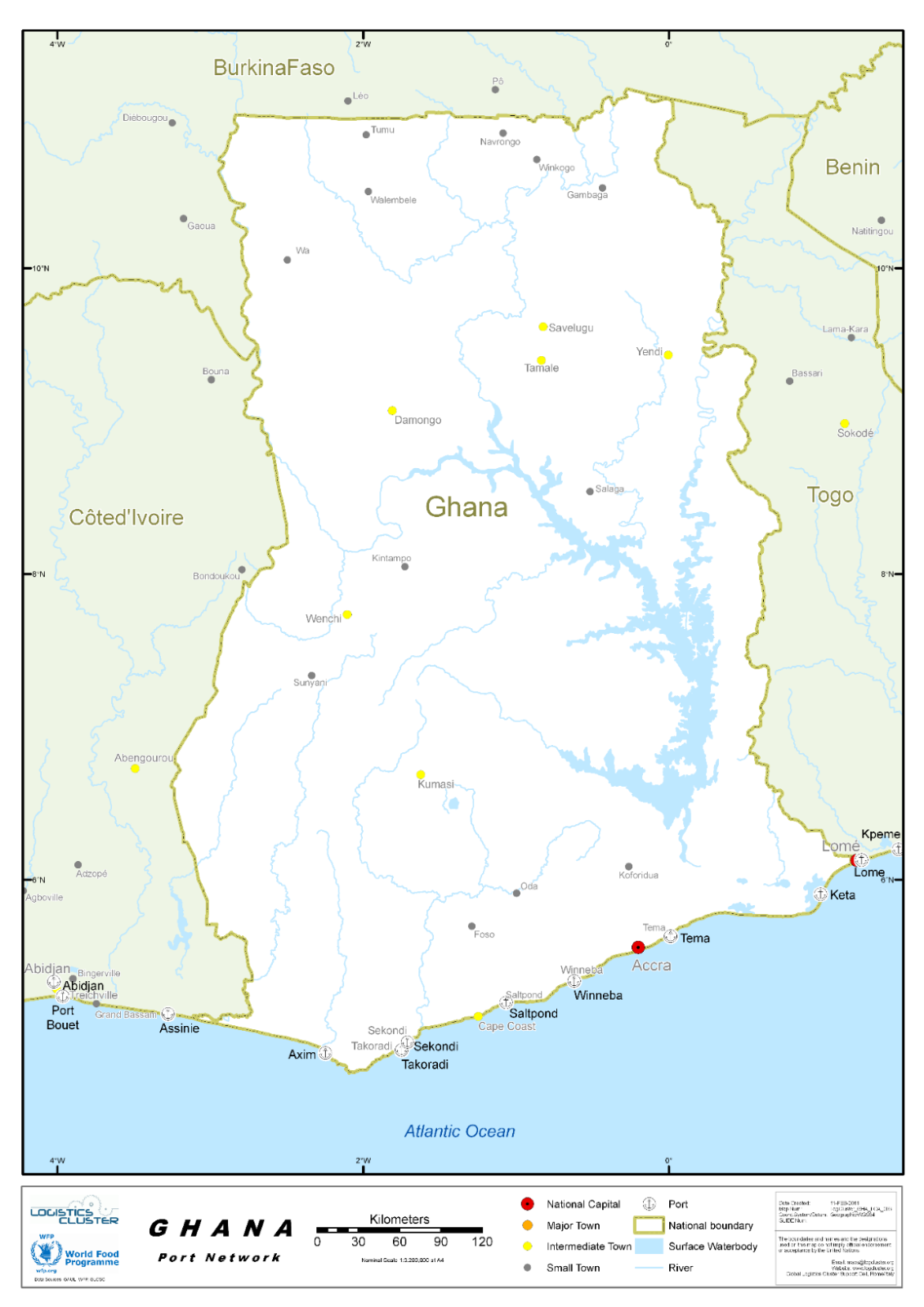
Ghana - 2.1 Port Assessment
Port Assessment
The Ghana Ports and Harbours Authority (GPHA) is the national port authority of Ghana, responsible for the governance, maintenance and operation of the ports of Ghana, principally the Port of Sekondi-Takoradi, and Port of Tema, and the Fishing Harbour at Tema. GPHA HQs are in Tema, offices are also located in Sekondi-Takoradi, and the “Office National des Ports du Ghana” is in Ouagadougou, Burkina Faso.
The Takoradi Harbour and Tema Harbour and ports serve Sekondi-Takoradi and Tema's role as manufacturing centres and handles cargo in transhipment to and from bordering countries north of Ghana.
Container traffic through Tema Port has seen a lot of growth as well as shipping activities in Takoradi port as a result of the oil find and therefore there is the need to expand both ports to meet the demands of the shipping and oil companies.
Ghana, being a coastal country, has seen the emergence of some shipping companies which are responsible for transporting all the items from other countries into the country. See link
Top Shipping Companies in Ghana
The shipping companies are also responsible for planning, implementing as well as controlling procedures for the effective movement and storage of goods into the country from their point of origin.
Hapag-Lloyd has been in the African market since 2007 and has experienced steady growth in volume and expansion in coverage through the years.
The West African sub area, headquartered in Tema, Ghana offers customers connections to Ghana, Nigeria, Ivory Coast, Benin, Mauritania and Senegal, as well as connections into the hinterland locations of Niger, Burkina Faso and Mali.
MSC Ghana has been supporting customers to ship cargo in and out of the Republic of Ghana since 2007. Today, we operate five dedicated services, connecting 200 global routes and moving more than 200,000 TEU every year. When it comes to shipping, this company is not only a leader in Ghana, but also a global leader in the industry with operations in more than 155 countries of the world and a staff strength of about 70,000 qualified professionals.
The head office in Switzerland and they have base operations in the US, Australia, Germany and South Africa.
With offices in Tema, Takoradi and Kumasi, Maersk is uniquely placed to help Ghanaian businesses connect to the world. Whether you are shipping standard, refrigerated or oversized cargo, we have the local expertise and global network needed to get it to its destination – wherever in the world that happens to be. We offer regular connections to and from Tema and Takoradi. From here, the rest of the world is just a short hop away with our vast ocean fleet.
CMA CGM Ghana is expertise in the carriage of all types of cargo; reefer, Out of Gauge, hazardous cargo, etc.
The CMA CGM Group’s mission is to contribute to sustainable globalization through better balanced international trade that fosters both economic and social development while respecting the integrity of all men and women and the planet. With a presence in 160 countries through 755 offices, 750 warehouses, 110,000 employees and a wide fleet of 566 vessels, CMA CGM serves 420 of the world’s 521 commercial ports and operates 285 shipping lines.
The company is one of the few shipping companies in the country that are into the transportation of Gold. They have been strategically situated to offer shipping services in the country. They have operations in the UK and Israel.
They are rated as one of the best in the country because of their top-notch customer services.
By the end of January 2024, COSCO SHIPPING Lines owned and operated 382 container vessels with a total capacity of approximately 2.1 million TEUs (the Company and Oriental Overseas International, a subsidiary of COSCO SHIPPING Holdings, owned and operated 503 container vessels with a total capacity of 3.1 million TEUs, leading the industry in terms of shipping capacity). The Company operates 405 international and domestic shipping routes, including 266 international routes (including international feeder services). The Company’s fleet has called 602 ports located in 144 countries and regions worldwide.
Grimaldi Gh. Ltd. located at Torman/Fishing Harbour Rd. Community 1, Tema, Ghana provides services in Transportation & Logistic Services - Shipping Companies.
They provide solutions for various business and organization's Transportation & Logistic Services needs.
During 2022 the ports of Tema and Takoradi have managed a traffic of 2600 vessels, 1679 for Tema, and 921 for Takoradi.
In terms of metric tons, during the same period, the total cumulated was above 27 million mt, Tema with about 18,65 million mt, while Takoradi was 7,34 million mt.
The containers traffic, TeU (twenty-foot equivalent unit) has reached a total of 1,244,245 units, Tema for over 1,190,695 units, while Takoradi handled 38,699 units.
Ghana - 2.1.1 Port of Takoradi
Port of Takoradi
Key port information can also be found at: link
Port Overview:
The Port is located in the south-western part of Ghana, specifically in the city of Takoradi about 230 kilometers west of Accra – the capital city of Ghana.
Port of Takoradi is well connected to its hinterland which makes it the preferred and ideal gateway to the central and northern parts of Ghana and the Sahelian countries of Burkina Faso, Niger and Mali. It is Ghana’s premier commercial Port commissioned for business in 1928 to facilitate Ghana’s international trade. The Port is strategically located on latitude 4°532’north, 1°345’west. The strategic location of the Port makes it a very cost-effective route to and from Europe, America and Asia, as well as a cost-effective corridor to serve the population of Ghana and the three Sahelian countries.
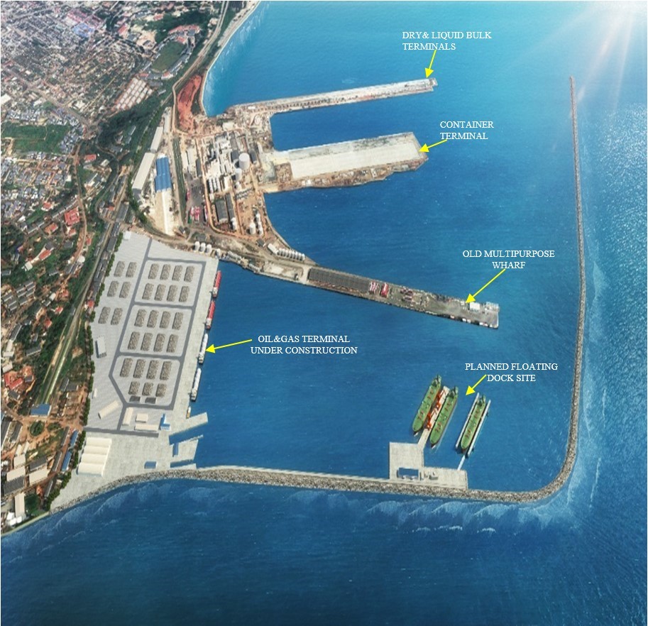
Prior to the year 2013, when the Port Expansion Master Plan was rolled out, the berthing facilities of the Port consisted of seven (7) berths and four (4) working buoys. The depth of the berths ranges from 8.6 to 10.0 metres, while the buoys are within 7 to 11 meters. As part of the implementation of the Port Expansion Master Plan, between 2015 and 2022, seven additional berths were added as follows: a three-berth 800 metre automated dry bulk terminal with a draft of minus 16 meters chart datum, the deepest of its kind in West Africa; a two-berth 600 meter container terminal with a draft of minus 16 meters chart datum and a one-berth 300 meter liquid bulk terminal with a draft of 14 meters chart datum. This brought total number of available operable berths in the Port to fourteen (14). A three-berth 550 meter upstream oil and gas terminal with a draft of 10 meters chart datum is under construction and is due to be completed in September 2024.
Services provided by the Port in collaboration with its business partners include, but not limited to: Vessel handling(pilotage, towage,mooring/unmooring), Cargo Handling, Craft and Equipment Hire, spatial and storage facilities rental, Ship Waste reception and management, Port Security, Fire and Safety, Bunkering, Utilities (electricity and freshwater), Vessel Maintenance and Repair services, Fishing Harbour and Health services.
In 2023, the Port handled 32.6% of Ghana’s seaborne traffic, 69.3% of Ghana’s seaborne exports and 17% of Ghana’s seaborne imports. Major commodities handled through the Port are manganese, bauxite, clinker, ammonium nitrate, wheat, bulk and bagged cocoa, quicklime, containerised cargo, equipment for the mining and oil/gas industries.
Traffic through the Port is facilitated by leading shipping lines like Maersk, MSC, Grimaldi, DELMAS and CMA-CGM which have extended the trading influence of our clients globally. With its wide range of equipment stock and the support of the private sector, the Port offers a range of services to facilitate the efficient and cost-effective delivery of value to clients.
The Port of Takoradi, since the discovery of oil in commercial quantities offshore in Ghana in 2007, about 70 nautical miles from its location, has contributed significantly to Ghana’s economy and continues to be the main strategic logistics support base for the offshore exploration and production of oil/gas in Ghana and beyond. Indeed, vessel calls have increased from a little under 600 per annum (pre oil discovery in 2007) to over 1000 calls per annum since 2010 up to 2020, before dropping to between 918 and 861 vessel calls from 2021 to 2023, largely because of slowdown in operations in the offshore oil fields due to, among others the knock-on effect of the COVID-19 pandemic and other significant developments on the global economy and oil prices. Offshore supply vessels calls as a percentage of total vessel calls of the Port, increased from 11% in 2007 to an annual average of 60% from 2011 through to 2019, before declining to 49%, 48%, 46% and 43% in 2020, 2021, 2022 and 2023 respectively.
Port website: Takoradi Port
|
Port Location and Contacts |
|
|---|---|
|
Country |
Ghana |
|
Province or District |
Western Region |
|
Town or City (Closest location) with Distance (km) |
Name: Takoradi km: 1 Km |
|
Port's Complete Name |
Port of Takoradi |
|
Latitude |
4°532’N |
|
Longitude |
1°345’W |
|
Managing Company or Port Authority (If more than one operator, break down by area of operation) |
Ghana Ports and Harbours Authority |
|
Management Contact Person |
Director of Port Mr. Peter Amoo-Bediako |
|
Closest Airport and Frequent Airlines to / from International Destinations |
Airport Name: Takoradi Airport Airlines: Domestic flights only |
Port Picture

Services Delivery Responsibilities and Conditions
Vessel Handling
All vessel handling operations are solely the responsibility of the Ghana Ports and Harbours Authority, performed by the Marine Operations Department under the supervision of the Harbour Master.
Pilotage
This service is available 24 /7 and is compulsory for all vessels entering and leaving or shifting berths in the Port. Vessels wishing to enter the Port must await pilots at eight cables NE of starboard breakwater (lee breakwater head) or buoys. Alternatively, they should anchor at Quarantine anchorage.
Towage
This service is compulsory within the main harbour and is ordered through the signal station or via an agent. Tugs of up to 1,250hp are available on special application. Three tugs of 1250kw to5050kw with about 40 to 80 tonnes bollard pulls are available for towage service.
Mooring / Unmooring / Berthing
The service for mooring and berthing includes tying of ropes and the supply of necessary boats and crew for the purposes of mooring and the allocation of berths to vessels.
Mooring and berthing charges are payable whether a ship is berthed alongside a quay or at the buoys. There is payment for each movement.
Stevedoring
Stevedoring services are provided by the Ghana Ports and Harbours Authority (GPHA).
Waste Reception Facilities
Waste reception service is provided by Zeal Environmental Technologies, a private company in the Port.
Fresh Water Supply
The supply of fresh water is provided by GPHA Fire & Safety Department. Fresh water is available by pipe at berths 2, 4, 5 and 6. Rate of supply is 20 tonnes/ hour. Water barges supply vessels moored at buoys.
Dock Labour Service
The Ghana Dock Labour Company (GDLC) is responsible for the supply of labour to companies operating in the Port.
Storage and Warehousing Services
The Port has sheds with storage covered area of 140,000m², open storage area of 250,000m² with container holding capacity of 5000teus. There are also private warehouses in and around the Port to augment its capacity.
Fire and Safety
The Port's Fire and Safety Department has a 24/7 well-organized, well trained, committed and dedicated firefighting service personnel with modern firefighting equipment. Tugs are fitted with firefighting equipment with fire monitors. The Department is also responsible for the operation of fire hydrants planted at wharfs 2,4, 5, 6 and within 100m radius everywhere in the Port. Other services provided include monitoring of hot works, hazardous cargo and confined spaces in the Port, as well as ship bunkering standby and pumping duties. The promised response time to incidents within the Port’s fence is 3 minutes. Fire service can be contacted from all boxes on transit sheds and at the main gate. Alternatively, call +233312022191 ext. 4906 VHF radio communication channel 14.
Security
The Port of Takoradi is renowned for its excellent security network. It has well skilled operations staff, drilled and dedicated security personnel to ensure the safety and security of all types of cargo.
The security network has further been improved with the installation of a closed-circuit television (CCTV)network in the Port. With this, cargoes and personnel working in the Port are safe and secured. Our Port Security Department works hand in hand with the National Security, the Police Service, the National Investigations Bureau (NIB) and the Narcotics Control Commission of Ghana.
Ship Repair Facility
The Port has a shipyard that is equipped with a dry-dock and slipway that has been modernized and expanded to accommodate vessels and crafts up to 400 tons. The shipyard can boast of the following:
-
Longstanding dependable experience in the Marine Crafts Maintenance Business since 1928.
-
State-of the-art machinery and equipment that fit the third millennium requirements for Ships’ Refurbishment, Treatment and Maintenance.
-
Highly skilled and experienced workforce, well trained and certified by Lloyds and ABS.
-
Versatile skill-mix to carry out every type of task to be done on any kind of vessel with LOA 45m, beam of 9m and draft of 3.5m.
Port Call Requirements and Navigational Information
ARRIVAL (Advising ETA)
Advance notice of 72 hours is required, prior to estimated time of arrival (ETA) of a vessel, one (1) hour prior notice is required of ships to prepare their engines before berth.
ANCHORAGE
Vessels can anchor anywhere NE of the lee breakwater head. Depth is mostly over 15m with good holding ground. A wreck with depth of 8.5m is in position approximately 04 degrees 53.3N 001 43.0W. A patch of about 14m is positioned approximately 04 degrees 53.7N 001 42.5W.
TOWAGE
The Port has three (3) tugboats and two must always be in attendance for berthing, sailing and shifting. The tugs are fitted with monitors for firefighting. Tugs reaches up to 1,250 hp, available on special application. Two tugs of 1,860kw with about 40 tones bollard pull and a third one with 80tons bollard pull, are available.
TIDES
It has a semi-diurnal with a range of about 1 meter.
RADIO
The signal station may be contacted 24hrs through VHF on channels 14 (port working channel) and 16 (international). On the average, vessels can be reached between 30-40 nautical miles away from the Port (3hrs away from anchorage). During the harmattan seasons, signals can be heard as far as Abidjan, Togo and Nigeria. The Port of Takoradi is linked to the Global Maritime Distress and Safety System (GMDSS).
APPROACH
Approach to entrance is free from hazards apart from a reef south of the main breakwater and wrecks noted on the Admiralty chart NO. 3102. Channel depth at entrance is about 17m.
WEATHER
Two rainy seasons occur within a year: April to July and September to mid-November. Prevailing winds are from SW except during the harmattan season when NE wind dominates.
TANKERS
Tankers up to 300 metres in length and 14 metres draught carrying a load of 60,000tons of liquid bulk cargo, can be accommodated at the liquid bulk terminal of the Port known as the Marshall Oil & Gas Services Liquid Bulk Terminal - the deepest in-harbour liquid bulk terminal in Ghana. The terminal is fitted with automated fire-fighting equipment.
Port Performance
Total vessel calls recorded as at the end of 2023 was 861. Significantly, the Dry Bulk Terminal alone received and loaded 30 export vessels – of which 11 were capsize and mini-capsize bulk carriers, with Length Overall (LOA) ranging from 230 metres to 300 metres.
Port cargo traffic in metric tonnes (MTs), at the end of 2023, was 7.5 million MTs, compared to 7.3 million MTs recorded in the same period for 2022, resulting in a growth variance of 234,550 MTs representing 3.19 percent.
Manganese export traffic in 2023 was a little over 3 million MTs compared to 3.1 million MTs recorded for the same period in 2022. This resulted in a variance of -39,941MTs, representing 1.28 percent decline.
Bauxite export traffic in 2023 was 1.2 million MTs compared to 534,595 MTs recorded in 2022. Consequently, resulting in a positive variance of 686,253MTs representing 128.36 percent growth.
Port Container Twenty-Foot Equivalent Units (TEUs) traffic as at end of 2023 was 35,940 TEUs, compared to 38,699 TEUs recorded in 2022 – thus resulting in a variance of -2,759 representing 7.12 percent less than the previous year.
PORT COMMUNTIY STAKEHOLDERS
-
Ghana Revenue Authority - Customs Division,
-
Shipping Lines/Agents,
-
Ghana Shippers' Authority (GSA)
-
Customs House Agents/Ghana Institute of Freight Forwarders (GIFF),
-
Nick-TC Scan
-
Food and Drugs Authority (FDA)
-
Ghana Standards Authority (GSA)
-
Environmental Protection Agency (EPA)
-
Minerals Commission
-
Narcotics Control Commission
-
Veterinary Services
-
Port Health
-
Plant Quarantine
-
Port Marine Police
-
Ghana Police Service (Arms and Ammunitions)
-
National Intelligence Bureau (NIB)
-
Office of the National Security Coordinator
-
National Security
-
IbisTek - Takoradi Container Terminal (TACOTEL)
CUSTOMS EXCISE AND PREVENTIVE SERVICE (CEPS)
The Ghana Revenue Authority (GRA) Customs Division is mandated by Government to collect duties on all imports and exports. They promote the protection of revenue through the prevention of smuggling of goods across Ghana's borders. In addition, the Customs Division is a member of Ghana's security services. Thus, they have responsibility to protect the boundaries of Ghana by preventing external aggression and maintaining the territorial integrity of Ghana. Import and export restrictions and prohibitions are supervised by the Customs Division. For further information visit: www.gra.gov.gh
IMPORT CLEARANCE PROCESS
Customs clearance of cargo through the Port involves dealing with several logistics service providers and governmental bodies in order toto fulfil all contractual and tax obligations that might be associated with the imported consignment. The agencies include the Customs, the Port, other receipt delivery service providers, shipping lines and agents.
Customs act 2015 act 891 section 43 enjoins all importers except for Self-Declarants to engage the services of licensed Customs House Agents for the clearance of cargo at any freight station in Ghana.
The clearance process comprises the following:
-
Declaration of cargo data on to the UNIPASS-Ghana Integrated Customs Management System (ICUMS) System
-
Customs Document Verification, System Validation, cargo Classification and Valuation, Risk Assessment and quality assurance, payment of duty, cargo verification.
-
Release by the Shipping Agent,
-
Delivery by the Port and other receipt delivery service providers
-
Customs physical examination or scanning of cargo before cargo is allowed to exit the Port.
See: https://gra.gov.gh/customs/import-procedures/
EXPORT PROCEDURES
Exports are grouped into two main categories - traditional exports and non-traditional exports.
See: https://gra.gov.gh/customs/export-procedures/
Traditional Exports
Commodities that are grouped under Traditional Export are:
-
Cocoa Beans
-
Sawn Timber
-
Mineral Ore (e.g., unprocessed Manganese and Bauxite)
-
Fresh fish
-
Fresh yam
N.B.: This list could change depending on government policy. Commodities that are grouped under Non-Traditional Exports are all commodities outside the Traditional Export List.
The UNIPASS-Ghana ICUMS System
UNIPASS-Ghana operates an electronic integrated customs management system (ICUMS) for processing trade and customs documents in Ghana. This network managed by the Ghana Revenue Authority Customs Division, facilitates the clearance of cargo from the Port. This service helps to reduce illegalities in tax payment and collection. The system provides complete audit trail on all imports and exports through the Port. For guidance visit: https://stakeholders.unipassghana.com/how-to
Clearing and Forwarding Agencies
Port of Takoradi has available experienced and dedicated clearing and forwarding agents for the professional handling of all cargoes through the Port. For further information, the Ghana Institute of Freight Forwarders can be contacted through their email and website at:
Email: giff@ghana.org or giff@ghanafreightforwarders.org
Website: www.ghanafreightforwarders.org/
|
Seasonal Constraints |
Yes / No |
From <month> to <month> |
|---|---|---|
|
Rainy Season |
No |
|
|
Major Import Campaigns |
No |
|
|
Other |
|
|
|
Handling Figures |
Year 2023 |
|---|---|
|
Vessel Calls |
861 |
|
Container Traffic (TEUs) |
35,940 |
|
Handling Figures Bulk and Break Bulk |
Year 2023 |
|---|---|
|
Bulk (MT) |
6,891,339 |
|
Break bulk (MT) |
688,130 |
Discharge Rates and Terminal Handling Charges
Information on discharge rates and terminal handling charges could be found in the following link: Port Tariffs
Berthing facilities – Lengths and Draughts
DRY BULK TERMINAL: DBT 1,2,3 Length:800m, Depth 16m
ATS CONTAINER TERMINAL: ATST 1& 2 Length: 600m Depth: 16m
MARSHAL OIL&GAS LIQUID BULK TERMINAL: MOGS 1 Length: 300m Depth: 14m
|
Type of Berth |
Quantity |
Length (m) |
Maximum Draft (m) |
|---|---|---|---|
|
Conventional Berth |
3 |
153 153 183 |
9 9 9 |
|
Container Berth |
2 |
225 |
10 |
|
Silo Berth |
No |
|
|
|
Berthing Tugs |
3 |
One on standby |
|
|
Water Barges |
1 |
|
|
Ghana Ports & Harbours Authority
General Cargo Handling Berths
|
Cargo Type |
Berth Identification |
|---|---|
|
Imports - Bagged Cargo |
All berths are multipurpose |
|
Exports - Bagged Cargo |
Idem |
|
Imports and Exports - RoRo |
Idem |
|
Other Imports |
|
Port Handling Equipment
Is the port equipment managed by the government or privately? By the government/YILPORT-ATSL
|
EQUIPMENT |
CAPACITY |
QUANTITY |
CONDITION |
|---|---|---|---|
|
Forklift |
10 Tons |
1 |
Good |
|
Forklift |
16 Tons |
1 |
Good |
|
Forklift |
5 Tons |
2 |
Good |
|
Teletruck |
3.5 Tons |
1 |
Good |
|
Terminal /Tug Master |
36 Tons |
5 |
Good |
|
Loaderdall |
4 Tons |
1 |
Good |
|
Roro Trailers |
50 Tons |
10 |
Good |
|
Terminal Trailers |
65 Tons |
7 |
Good |
|
ReachstackerReach stacker |
45 Tons |
3 |
Good |
|
ReachstackerReach stacker |
10Tons |
1 |
Good |
|
Mobile Crane |
80 Tons |
1 |
Good |
|
Liebherr Mobile Harbour Crane LHM 550 |
144Tons |
3 |
Good |
For edible bulk e.g.; Sugar and Rice, we use (the Tele Truck 3.5 Tons) Terminal trailers and Terminal tractors flat.
Other bulk cargo like Wheat, hoppers are mostly used.
|
Equipment |
Available (Yes / No) |
Total Quantity and Capacity Available |
Comments on Current Condition and Actual Usage |
|---|---|---|---|
|
Dockside Crane |
Yes |
144 Tons x3 |
One of the two in good condition |
|
Container Gantries |
No |
|
|
|
Mobile Cranes |
Yes |
3 x 55mt |
Good condition |
|
ReachstackerReach stacker |
Yes |
15 x (20mt & 40mt) |
Good condition |
|
RoRo Tugmaster (w/ Trailer) |
Yes |
18 x (40mt, 50mt & 80mt) |
|
|
Grain Elevator w/ Bagging Machines |
No |
|
|
|
TranstrainerTranstainer |
No |
|
|
|
Forklifts |
Yes |
14 x (5mt to 32 mt) |
Good condition |
Container Facilities
The container yard has a capacity of 5000 TEUs.
|
Facilities |
20 ft |
40 ft |
|---|---|---|
|
Container Facilities Available |
Yes |
Yes |
|
Container Freight Station (CFS) |
Yes |
Yes |
|
Refrigerated Container Stations |
Yes |
Yes |
|
Other Capacity Details |
|
|
|
Daily Take Off Capacity (Containers per day) |
300 TEU per day |
|
|
Number of Reefer Stations (connection points) |
100 |
|
|
Emergency Take-off Capacity (Give an indication) |
120 TEU |
|
|
Off take capacity of gang shift (in Containers per shift) |
20 movements / hour |
|
Terminal Information
Multipurpose Terminal
All 5 berths are multipurposemultipurpose, and each one can serve to provide RoRo facilities.
Grain and Bulk Handling
There aren’t any facilities for direct bagging from ship discharge.
Main Storage Terminal
Port has sheds with storage covered area of 140,000m2, open storage area of 250,000m2 with container holding capacity of 5000teus. There are also private warehouses in and around the port to augment the ports capacity.
|
Storage Type |
Number of Storage Facilities |
Area (square meters) |
|---|---|---|
|
Bagged Cargo |
Private warehouses |
32,000 MT |
|
Refrigerated Cargo |
Only reefer containers |
|
|
General Cargo |
As for Bagged Cargo |
|
Stevedoring
As already stated above, stevedoring services are provided by GPHA and 4 licensed private stevedoring companies. The port stevedore department handles 25% with the remaining 75% allocated to the four (4) companies licensed to operate in the Port. Cargo allocations are handled by the Harbour Master. Private Stevedore companies operating in the port are: Advance Stevedore, Atlantic Port Services, Speedline Company, Gemini Maritime Services, Golden Gate Services.
Hinterland Information
The transportation of the goods from the Port can only be done through GHTDA Ghana Haulage Truck Drivers Association and if transit to Burkina Faso, then must consult the Burkina Shippers’ Council as there is a quota sharing regarding this market. The Port of Takoradi has dedicated clearing and forwarding agents for the professional handling of all cargoes through the port. For further information, the Ghana Institute of Freight Forwarders can be contacted through their email and website at: GIFF
Port Security
As already mentioned above, the Port of Takoradi is renowned for its excellent security network. It has well skilled operations staff, drilled and dedicated security personnel to ensure the safety and security of all types of cargo.
The security network has further been improved with the installation of a closed – circuit television network in the Port. With this, cargoes and personnel working in the Port are safe and secured. The Port Security Department works hand in hand with the National Security, Police, The National Investigations Bureau (NIB) and the Narcotics Control Commission of Ghana.
Also, the Port's Fire and Safety Department has a 24/7 well-organized, well trained, committed and dedicated fire – fighting service personnel with modern firefighting equipment. Tugs are fitted with firefighting equipment with fire monitors. The Department is also responsible for the operation of fire hydrants planted at wharfs 2,4, 5, 6 and within 100m radius everywhere in the Port. Other services provided include monitoring of hot works, hazardous cargo and confined space in the Port, as well as ship bunkering standby and pumping duties. The promised response time to incidents within the Port’s fence is 3 minutes. Fire service can be contacted from all boxes on transit sheds and at the main gate. Alternatively, call +233312022191 ext. 4906 VHF radio communication channel 14.
|
Security |
||
|---|---|---|
|
ISPS Compliant (Yes / No) |
Yes |
|
|
Current ISPS Level |
1 |
Level 1 = Normal, Level 2 = Heightened, Level 3 = Exceptional |
|
Police Boats |
2 |
|
|
Fire Engines |
2 |
|
Useful Addresses
Ghana Ports and Harbours Authority (GPHA)
Headquarters
P.O. Box 150,
Tema, Ghana
Tel. +233 (0)303-219120
headquarters@ghanaports.gov.gh
GPHA Port of Takoradi
P.O. Box TD 708
Takoradi, Ghana
Tel. +233 (0)31 203 4131
Ghana Revenue Authority (GRA) Customs Division
Tel. +233(0)242435662
+233(0)242435663
Webpage: https://gra.gov.gh/customs/
Ghana - 2.1.2 Port of Tema
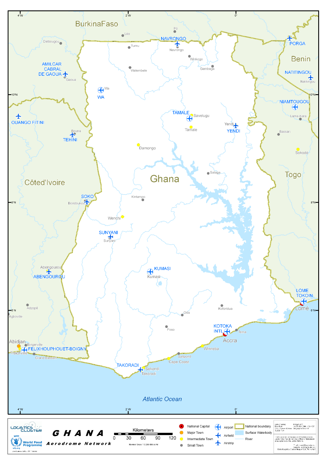
Ghana - 2.2 Aviation
Aviation
The Ghana Civil Aviation Authority (GCAA) is the regulatory agency of the Republic of Ghana for air transportation in the country. It also provides air navigation services within the Accra Flight Information Region (FIR), which comprises the airspace over the Republic of Ghana and a large area over the Atlantic Ocean in the Gulf of Guinea.
The GCAA was established in 1930 as a unit with Public Works Department (PWD); in 1953 GCAA was granted Departmental Status. It became an Authority under PNDC Law 151 from 16th May 1986. In the year 2004 the GCAA Act was enacted to replace PNDC Law 151.
The Civil Aviation Act, act 678 of November 2004 provides for the establishment of a Civil Aviation Authority, which will focus on the core functions of Airspace management and Safety Regulations whilst allowing for a different organization to handle Airport development and operations.
Pursuant to the above, the GCAA was restructured into two bodies, that is, the new GHANA Civil Aviation Authority (GCAA) and the Ghana Airports Company Limited (GACL) on 1st January 2007.
Ghana Airports Company Limited (GACL) was established as a result of the decoupling of the existing Ghana Civil Aviation Authority (GCAA) in line with modern trends in the aviation industry.
The company was registered in January 2006 with specific responsibility for planning, developing, managing and maintaining all airports and aerodromes in Ghana including Kotoka International Airport (KIA), Kumasi Airport, Tamale Airport, Sunyani Airport, Ho Airport, WA Airstrip as well as various Airstrips. GACL is an implementing agency under the Ministry of Transport.
FUNCTIONS OF GCAA UNDER ACT 678
Under the GCAA Act 678, the functions of GCAA include the following:
-
Licensing and Certification of Air Transport Operators
-
Licensing and Certification of Aerodromes and the Construction, Operation, Maintenance and Managements of Navigation Sites.
-
Provision of Air Navigation Services (Air Space Management) within the Accra Flight Information Region (FIR).
-
Regulation of Air Transport Services.
-
Promoting the Development of Civil Air Transport Industry in Ghana.
-
Advising Government on all matters Concerning Civil Aviation, among other functions.
-
Provision of oversight for all activities related to civil aviation.
Different charges fees are applied, according to some criteria, such as Aircraft charges/ton, Parking and Lighting fees, for International, Sub-Regional and Domestic flights. See the link for more detailed information.
There are currently eight operational airports in the country -- Kotoka International Airport’s Terminal Two, and six domestic airports, the Kumasi, Sunyani, Sekondi-Takoradi, Wa, Ho and Tamale Airports.
Passenger:
Twenty-five companies (three Nationals, twenty-two Internationals) have regular passenger flights to KIA, another company, ITA Airways, will begin operations in June 2024.
|
Rome–Fiumicino (begins 5 June 2024) |
|
|
Dakar–Diass, Freetown, Monrovia–Roberts, Nairobi–Jomo Kenyatta |
|
Cargo:
Kotoka International Airport is served by numerous cargo airlines on a regularly scheduled basis, in addition to ad-hoc cargo flights. Here below the main companies operating in KIA:
For more information on government agency and airport company contact information, please see the following links: 4.1 Government Contact List and 4.5 Airport Companies Contact List.
Procedures for Foreign Registered Aircraft
The proper registration of aircraft is fundamental to the Safety of International Air Operations. International provisions require that each aircraft must be registered in a State and each State must maintain a Registry of aircraft. For an aircraft to be accepted for registration, the following requirements will have to be fulfilled:
a. The aircraft must not have been registered in any other State or if previously registered proof of de-registration will be required.
b. Proof of ownership should be established or an appropriate agreement between the owners of the aircraft and the one in whose name the aircraft is being registered shall be provided; and
c. In the case of aircraft to be operated for hire and reward, the applicant must have reached an advanced stage in the certification process for the issue of an AOC, before any application for aircraft registration will be considered for processing.
- Application (how and where to obtain it)
a. Application for Registration of aircraft must be made on form CA 7 in duplicate and forwarded to the Director General. The applicant will be informed by the DSR if the application is acceptable.
b. Operational and Maintenance history of the aircraft shall be provided. Checks and inspections required for the issuance of a Certificate of Airworthiness shall be carried out by Aviation Safety Inspector(s) assigned by the Director Safety Regulation.
c. The assigned Inspector{s} shall inform the applicant about the requirements for the Registration of aircraft and give the necessary guidelines.
d. The Inspector shall make a search in the electronic format of Master Aircraft Register for the next sequential registration marks and assign this as provisional registration marks to the aircraft to avoid a re-issue of registration marks which have been used.
e. When the applicant requests for special registration marks, the Inspector shall ensure that the marks have not been issued already and that the applicant pays the appropriate fee for the special registration marks, in addition to the prescribed registration fee and any other charges.
f. The applicant shall make the aircraft available at a time and place acceptable to the Authority for such checks and inspections considered necessary. Aviation Safety Inspectors (ASIs) shall use Aircraft Registration/ Issue of C of A form SRD/AIR/001 as a guide to conduct the necessary checks and inspections.
g. The Inspector(s) shall ensure that all the aircraft data submitted by the applicant conform to that of the manufacturer and are correct in every detail.
h. Having completed the required checks and inspections, the Inspector{s} shall submit a report with recommendations to the Director Safety Regulation (DSR) through the Head of Airworthiness.
i. If all registration requirements, in accordance with the CAR have been met, and the recommendations of the Inspector{s} are acceptable to the DSR, the DSR shall submit the report to the Director General for final approval. Two copies of the Registration Certificate shall be issued for the Director-General’s signature. The original of the Certificate shall be given to the applicant and the other copy put in the specific aircraft file. The Certificate of Registration shall be always carried on the aircraft.
j. If the aircraft is not acceptable for registration based on the report and recommendations of the Inspector(s), the applicant shall be informed in writing by the DSR stating reasons why the aircraft cannot be registered in Ghana.
k. The Inspector(s) shall enter all the required aircraft details in the Civil Aircraft Register and submit the Register to the Head of Airworthiness who should ensure that, all relevant aircraft data are recorded in the Register. The Register shall be kept under lock and key by the DSR.
The Inspector shall also ensure that the electronic copy of the Register is updated.
An electronic backup of the register shall be made and kept under lock and key by the DDGT.
Access to the electronic format of the aircraft register is by a (Password) only
- Registration and Safety Requirements
The following documents shall be provided by the applicant for retention by the Authority:
a. Prior to import, a copy of the type certificate and supporting type data sheets approved by the Authority of the State of Design for acceptance by the Authority.
b. Export certificate of airworthiness from the state of registry, or in the case of a new aircraft, the state of manufacture.
c. Significant deviations from the approved build standard, certified by the State of Registry or State of Design. If there are no deviations from the approved build standard, a certified statement to that effect by the State of Registry.
d. Noise certificate from the designed state or state of export (if required);
- Operator, Aircraft and Crew Documentation
When an Aircraft is registered it shall be issued with a Certificate of Registration and shall be kept permanently on a file with the following documents:
a. Application for registration of aircraft.
b. Application for issue of Certificate of Airworthiness.
c. Certificate of Registration.
d. Certificate of Airworthiness.
e. Noise Certificate.
f. Radio Licence.
g. Certificate of FM immunity (if necessary)
h. De-registration Certificate.
i. Bill of Sale (Proof of ownership)
j. Type Certificate Data Sheet.
k. Previous C of R.
l. Previous C of A.
m. Previous Radio Licence.
n. Record of Major Modifications (if necessary)
o. Weight and Balance Certificate.
p. Compliance status for CPCP.
q. Compliance status for ADs/SBs.
r. Compliance status for SSID.
s. Life Limited Components.
t. List of Avionics Equipment’s including RVSM and TCAS Certificates (if any).
u. Test Flight Report (if necessary).
v. Maintenance Release and
w. Inspection Report
x. Any other documents
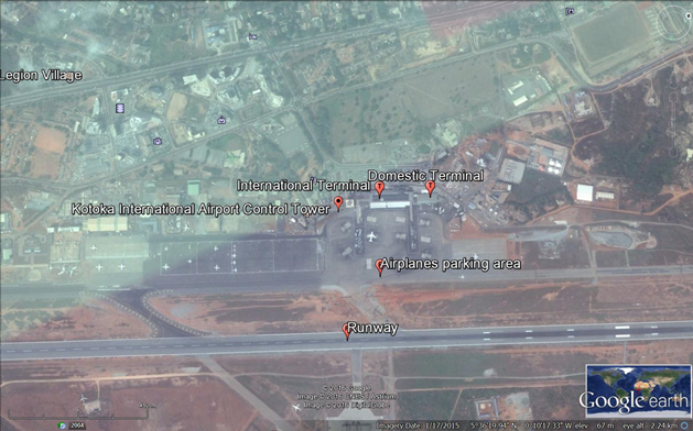
Ghana - 2.2.1 Kotoka International Airport
The airport occupies 1,610 acres (651 hectares) within the city of Accra, and is about 10 kilometres from the City Centre. Kotoka is the country’s most important airport and is one of only five airports in Africa to have FAA accreditation to operate flights directly to the United States. Having recently undergone a renovation program, the airport now offers services and facilities that are in line with international standards. The Ghana Airports Company Limited (GACL) was established as a result of the decoupling of the existing Ghana Civil Aviation Authority (GCAA) in line with the modern trends in the aviation industry. The company was registered in January 2006 with the responsibility for planning, developing, managing and maintaining all airports and aerodromes in Ghana namely Kotoka International Airport (KIA) and the regional airports namely Kumasi, Tamale, Sunyani as well as various airstrips.
| Location Details | |||
|---|---|---|---|
| Country | Ghana | Latitude | 5.596389 |
| Province / District | Greater Accra | Longitude | -.17 |
| Town or City (Closest) | Accra | Elevation (ft and m) | 203 ft / 62 m |
| Airfield Name | Kotoka International Airport | IATA and ICAO Codes | ACC /DGAA |
| Open From (hours) | 00:00 | Open To (hours) | 24:00 |
Runways
|
Runway #1 |
|
|---|---|
|
Runway Dimensions |
3,403 x 61 meters |
|
Orientation |
03/21 |
|
Surface |
Asphalt |
Helicopter Pad(s)
There isn’t any dedicated helicopter pad in the airport but helicopters can land in the available parking lots or runway.
Airport Infrastructure Details
The revamped terminal features a passenger lounge, public telephone booths, a porter service desk and a lost-and-found office. A police station is situated at the airport car park, while a medical clinic offers 24-hour medical and travel immunization services. Passengers with special needs should contact the information desk in advance to arrange for a wheelchair and porter assistance.
|
Customs |
Yes |
JET A-1 fuel |
Yes |
|---|---|---|---|
|
Immigration |
Yes |
AVGAS 100 |
N/A |
|
Terminal Building |
Yes |
Single Point Refueling |
N/A |
|
Passenger Terminal |
Yes |
Air Starter Units |
Yes |
|
Cargo terminal |
Yes |
Ground Power (mobile) |
Yes |
|
Pax transport to airfield |
Yes |
Ground Handling Services |
Yes |
|
Control Tower |
Yes |
Latrine Servicing |
Yes |
|
Weather Facilities |
Yes |
Fire Fighting Category (ICAO) |
Yes |
|
Catering Services |
Yes |
De-icing Equipment |
N/A |
|
Base Operating Room |
Yes |
Parking Ramp Lighting |
Yes |
|
Airport Radar |
Yes |
Approach & Runway Lights |
Yes |
|
NDB |
Yes |
VOR |
Yes |
|
ILS |
Yes |
|
Passenger and Cargo Performance Indicator
|
Performance for 2014 |
Annual Figures |
Monthly |
Daily |
|---|---|---|---|
|
Total aircraft movements |
24,871 |
2,072 |
69 |
|
Total passengers |
1,650,520 |
137,543 |
4,584 |
|
Total capacity of the airport (metric tonnes) |
100,000 |
||
|
Current activity of the airport (metric tonnes) |
54,383 |
4,531 |
151 |
|
Current use by Humanitarian flights (UNHAS) |
N/A |
N/A |
N/A |
Airport Operating Details
|
Operating Details |
|||
|---|---|---|---|
|
Maximum sized aircraft which can be offloaded on bulk cargo: |
An 225 |
||
|
Maximum sized aircraft that can be offloaded on pallet |
B 747 |
||
|
Total aircraft parking area (m²) |
18,418 m² |
||
|
Storage Area (mt) |
7,826 m² |
Cubic Meters (m³) |
N/A |
|
Cargo Handling Equipment Available (Yes / No) |
Yes |
If "Yes" specify below |
|
|
Elevators / Hi Loaders (Yes / No) |
Yes |
Max Capacity (mt) |
35 mt |
|
Can elevators / hi loaders reach the upper level of a B747 (Yes / No) |
Yes |
||
|
Loading Ramps (Yes / No) |
Yes |
||
Storage Facilities
Bonded Warehouse, Free Port/Foreign Trade Zone, Aircraft Maintenance, Mechanical Handling, Air-Conditioned Storage, Refrigerated Storage, Animal Quarantine, Fresh Meat Inspection, Livestock Handling, Health Officials, X-Ray Equipment, Security for Valuables, Express/Courier Centre. The Perishable Cargo Centre (PCC) at the Kotoka International Airport is part of the post harvest intervention provided under the Ghana compact of the Millennium Challenge Account. The facility provides handling and temporary storage of perishable produce (fruits and vegetables) for export. It is an approximately 1,200 m2 facility with a storage and cold room of 200 m2. The facility has a packing area of 350 m2 and work room of 600 m2. The throughput for the facility is expected to increase by 5% minimum annually from the current 20,000 metric tons. The PCC is part of an integrated cold chain for the horticultural sub-sector required to achieve better produce quality and higher export market prices. The facility is currently managed by Air Ghana Perishable Cargo Centre (APCC) on concession.
Airfield Cost
Navigation Charges
Air navigation charges for all international flights over four tons operating within the Accra FIR as at 2010 were charged US $0.75 per kilometre flown. The minimum charge within the Accra FIR is US $200 and a maximum of US $600.
Fuel Services Charges
Vitol Aviation, TOTAL and GOIL (Ghana Oil Company Limited) operate a Joint Venture depot at the Kotoka International Airport for the supply of Aviation JET A1 fuel to various customers.
|
Price per Unit |
|
|---|---|
|
Jet A-1 |
US $0.611 / Litre |
|
Avgas |
N/A |
Cargo Terminal Charges
Kotoka International Airport (Accra) is served by aviance & AHS Menzies - two notable cargo handling & ground services agents who act as intermediaries between shippers and the carriers (Airline operators). Aviance Ghana is the largest cargo handler in Ghana with approximately 90% of all the airport cargo being processed by our experienced staff. The import cargo warehouse is able to accommodate up to 2,200 pallets of cargo and is totally protected by a state of the art Pelco CCTV system that operates 24/7.
|
Import |
Rate US$ / kg |
|---|---|
|
Handling Charge per kg |
0.16 / kg (Minimum US $25) |
|
Break Bulk Fee |
0.02 / kg (Minimum US $30) |
|
Diplomatic Mail |
N/A |
|
Strong Room – per consignment |
160 |
|
Cold Storage Fee |
0.30 / kg (Minimum US $30) |
|
Delivery outside normal working hours |
N/A |
|
Preparation of substitute AOA – Invoice – Receipt |
30 |
|
Storage per kg per day – Grace period? hours |
0.10 / kg - 8 days |
|
Export |
Rate US$ / kg |
|
Handling charges – Unpalletized cargo |
0.08 / kg (Minimum US $25) |
|
International Air WayBill |
15 |
|
Local Air WayBill |
15 |
|
Air Way Bill Amendment - Cancellation |
15 |
|
Air Way Bill Documentation |
15 |
|
Diplomatic Mail |
N/A |
|
Storage charges per kg per day |
0.04 / kg |
Air-bridge Charges
Air-bridges are not available at the airport.
Security
CCTV is being installed in the airport premises. Scanning machines are available at the airport. The airport is fenced and guarded by security guards from GPHA.
Companies Available
Airlines Serving Airport:
- Air Burkina
- Air Ghana
- Air Mali
- Air Namibia
- Air Nigeria
- Alitalia
- Arik Air
- Asky Airlines
- British Airways
- Brussels Airlines
- CEIBA Intercontinental
- Delta Air Lines
- Egyptair
- Emirates
- Ethiopian Airlines
- KLM
- Kenya Airways
- Lufthansa
- MEA
- Royal Air Maroc
- South African Airways
- TAP-Air Portugal
- Turkish Airlines
- UNMIL
- United Airlines
- Virgin Atlantic Airways
For information on Ghana Kotoka International Airport contact details, please see the following links:
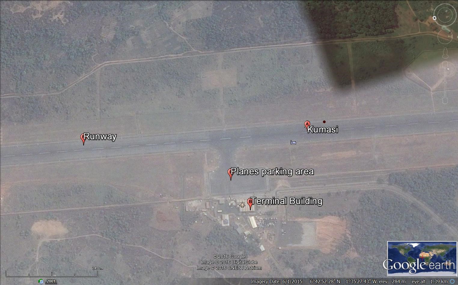
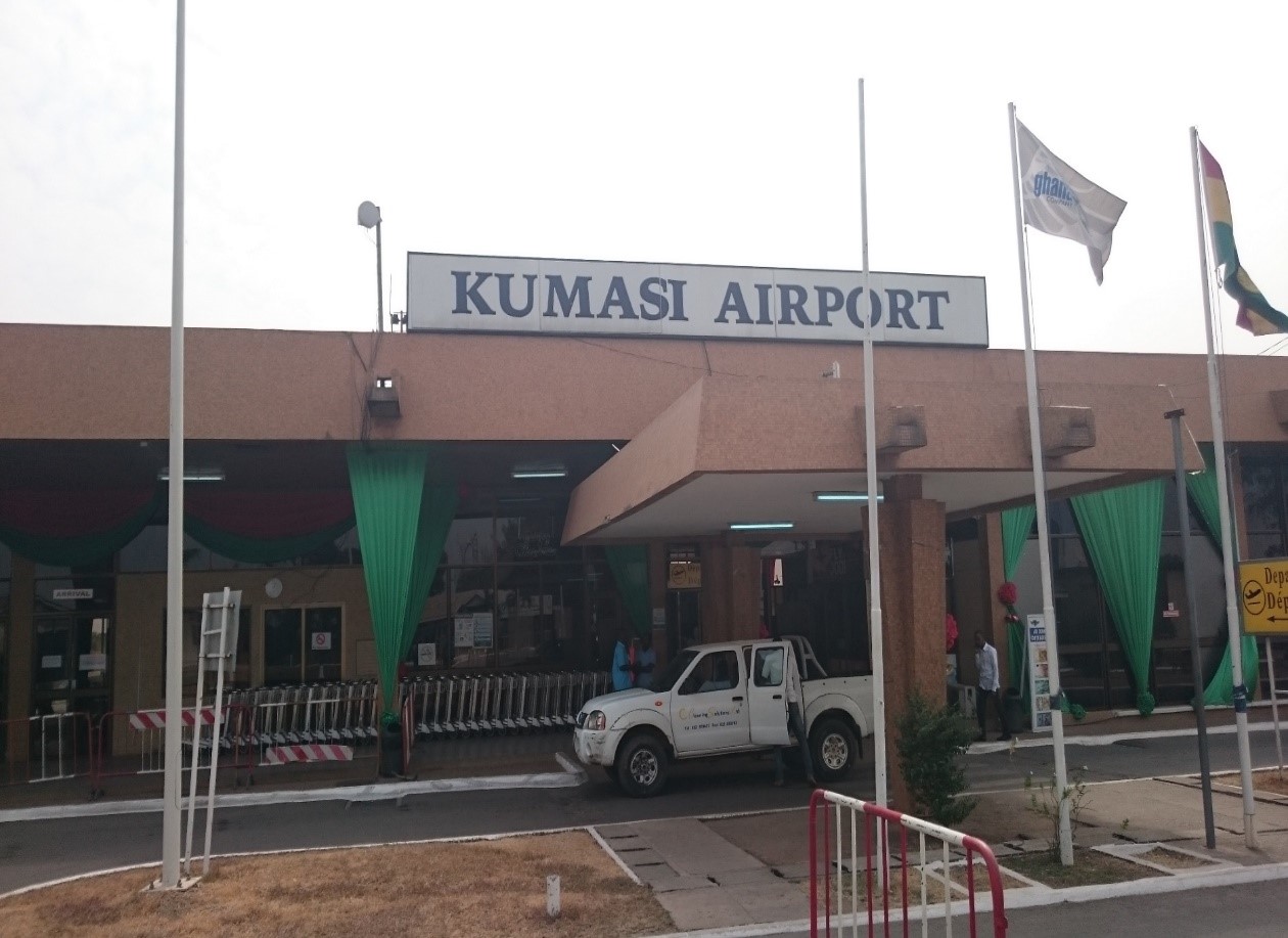
Ghana - 2.2.2 Kumasi International Airport
Airport Overview
Kumasi International Airport (IATA: KMS, ICAO: DGSI) is a national airport in Ghana serving Kumasi, the capital of the Ashanti Region. In 2022, the airport handled over 476,000 passengers, making it the second busiest airport in Ghana after Kotoka International Airport in Accra.
Kumasi International Airport is located 6 kilometres (4 mi) from Kumasi. It was changed from a military base to an airport in 1999. The airport has undergone several renovation and expansion projects to help push its status as an international airport.
The Kumasi Airport attained international status in 2014. However, the airport only operated on a regional level, even though it had had the full complement of security, customs, and immigration staff in place since 2003. Even though it had attained that status, work to upgrade the physical structures had yet to be fully put in place. The Kumasi Airport has undergone several rehabilitations and upgrades to help ensure its status as an international airport.
In 2012, initial renovation works were started on the existing facilities involved patching and filing of the main runway, construction of addition of waiting room and building a car park to make way for future renovation and upgrades targeted for the following year.
As of 2023, the airport is purely serving domestic air traffic. The airfield is in good condition and receives a daily domestic flight from Accra. Currently there are two national airlines serving the airport: Africa World and Passion Air. The airport has a restaurant, exchange office, ATM, different travel agencies offices and airlines offices. There aren’t any issues regarding the approach, landing, security, or communications. No storage facilities at the airport but there are about 60 hectares of land around the airport that can be used in case of emergency, to install a logistics base. The security of the airport is ensured by the Aviation security within Ghana Airport Limited Company. Regarding the electricity, the airport is connected to the national Grid and there is a dedicated line as backup in addition to a generator of 1000 KVA, two generators of 200 KVA each and one of 101 KVA for the LGA (airport lights). Works are undergoing to increase the length of the runway from 1981 m to 2320 m.
|
Airfield Details |
|||
|---|---|---|---|
|
Country |
Ghana |
Latitude |
N06 43’ 09 |
|
Province / District |
Ashanti region |
Longitude |
W01 34’ 59” |
|
Airfield Name |
Kumasi Airport |
Elevation |
287 m 942 ft |
|
IATA & ICAO codes |
KMS / DGSI |
Surface |
Paved |
|
Town or City (closest) |
Kumasi |
Runway Condition |
Good |
|
NGO / UN (on ground) |
None |
Passenger / Cargo Security Screening (Yes / No) |
Yes |
|
Runway Dimension |
1981 (m) X 45 (m) |
Ground Handling (Yes / No) |
No |
|
Refuelling Capacity |
Yes |
Runway Lighting (Yes / No) |
Yes |
|
Runway Heading |
02/20 |
Fire Fighting Equipment (Yes / No) |
Yes |
|
Air Traffic Control (Yes / No) |
Yes |
Windsock (Yes / No) |
Yes |
|
Weather Information (Yes / No) |
Yes |
Aircraft Parking space (Yes / No) |
Yes |
|
Navigation Aids (Yes / No) |
Yes |
Perimeter fencing (Yes / No) |
Yes |
Airfield Cost
Navigation Charges
Here below the table with fees applied for different services. link
|
Aircraft Weight - MTOW (tons) |
Aircraft charges USD - $
Flat charges |
Lighting fees Domestic $ |
|
|---|---|---|---|
|
0 |
5 |
5 |
Lighting charge of $5.00 will be charged for landing and/or take-off under these conditions: Between sunset & sunrise Where runway lights are switched on, on request due to bad weather |
|
6 |
10 |
10 |
|
|
11 |
20 |
15 |
|
|
21 |
30 |
20 |
|
|
31 |
40 |
25 |
|
|
Parking fees Domestic |
|
The first five (5) hours are free; thereafter a rate of $0.15 per ton per hour is applied. |
Fuel Services Charges
The fuel services are provided by Ghana Goil and operated by the airport. There is a tanker available at the airport with a capacity of 34,000 Litres. The contracts for fuel provision are to be negotiated at Goil main office in Accra
|
|
Price per Unit |
|---|---|
|
Jet A-1 |
0.53 US$ / Litre Source: link |
|
Avgas |
n/a |
Royalties / Non-Objection Fees (NOFs)
Different fees are payables at the airport such as landing fees, navigation fees, tax on passengers and for operation in the night.
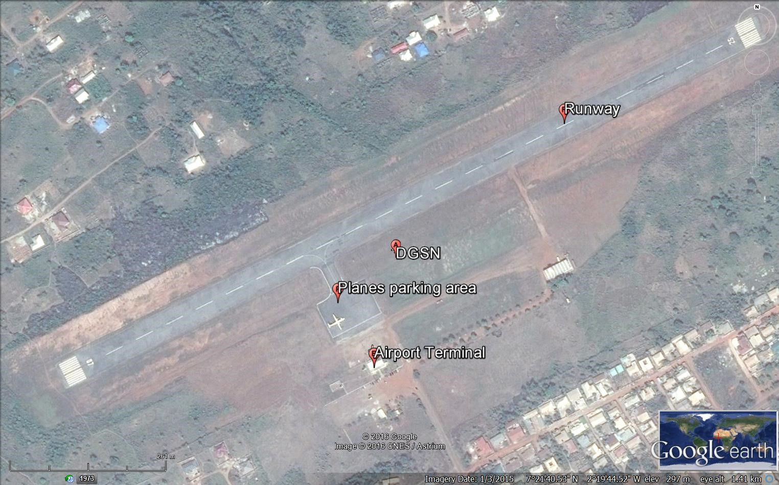
Ghana - 2.2.3 Sunyani National Airport
Airport Overview
Sunyani Airport dates back as 1942, when a communication outpost and aerodrome was built for the use of Allied Forces. The 1,400-metre runway of Sunyani Airport cannot be extended due to a gully at one end and a hill at the other. This limitation renders the airport unsuitable for use by medium range jets. Sunyani airport is one of the domestic airports under the management of the GACL.
|
Airfield Details |
|||
|---|---|---|---|
|
Country |
Ghana |
Latitude |
7° 21’ 33” N |
|
Province / District |
Brong-Ahafo Region |
Longitude |
2° 19’ 45” W |
|
Airfield Name |
Sunyani |
Elevation (ft) |
1,041 ft (309m) |
|
IATA & ICAO codes |
NYI / DGSN |
Surface |
Asphalt |
|
Town or City (closest) |
Sunyani |
Runway Condition |
Good |
|
NGO / UN (on ground) |
UNHCR |
Passenger / Cargo Security Screening (Yes / No) |
Yes |
|
Runway Dimension |
4227 x 147 ft 1288 m x 45 m |
Ground Handling (Yes / No) |
Yes |
|
Refuelling Capacity |
No |
Runway Lighting (Yes / No) |
No |
|
Runway Heading |
07/25 (marked at End as 20) |
Fire Fighting Equipment (Yes / No) |
Yes |
|
Air Traffic Control (Yes / No) |
Yes |
Windsock (Yes / No) |
Yes |
|
Weather Information (Yes / No) |
Yes |
Aircraft Parking space (Yes / No) |
Yes |
|
Navigation Aids (Yes / No) |
Yes |
Perimeter fencing (Yes / No) |
Yes |
Airfield Cost
Navigation Charges
Here below the table with fees applied for different services. link
|
Aircraft Weight - MTOW (tons) |
Aircraft charges USD - $
Flat charges |
Lighting fees Domestic $ |
|
|---|---|---|---|
|
0 |
5 |
5 |
*Note: Lighting facilities are presently not available in Sunyani. |
|
6 |
10 |
10 |
|
|
11 |
20 |
15 |
|
|
21 |
30 |
20 |
|
|
31 |
40 |
25 |
|
|
Parking fees Domestic |
|
The first five (5) hours are free; thereafter a rate of $0.15 per ton per hour is applied. |
Fuel Services Charges
Not available at the airport.
|
|
Price per Unit |
|---|---|
|
Jet A-1 |
0.53 US$ / Litre Source: link |
|
Avgas |
n/a |
Royalties / Non-Objection Fees (NOFs)
Different fees are payables at the airport such as landing fees, navigation fees, tax on passengers and for operation in the night.
Ghana - 2.2.4 Takoradi National Airport
Airport Overview
Takoradi Airport (IATA: TKD, ICAO: DGTK) is an airport in Sekondi-Takoradi, a city and capital of Western Region southern Ghana. It is the fourth busiest airport in Ghana, with 123,930 passengers in 2022. The airport is a military airport but also used as a civilian for domestic flights.
|
Airfield Details |
|||
|---|---|---|---|
|
Country |
Ghana |
Latitude |
04° 53' 45.80" N |
|
Province / District |
Western Region |
Longitude |
1° 46' 29.12" W |
|
Airfield Name |
Takoradi |
Elevation |
22 ft, 6.7 m |
|
IATA & ICAO codes |
TKD / DGTK |
Surface |
Asphalt |
|
Town or City (closest) |
Takoradi |
Runway Condition |
Good |
|
NGO / UN (on ground) |
n/a |
Passenger / Cargo Security Screening (Yes / No) |
Yes |
|
Runway Dimension |
1751 x 45 m 5,745 x 147 ft |
Ground Handling (Yes / No) |
n/a |
|
Refuelling Capacity |
n/a |
Runway Lighting (Yes / No) |
n/a |
|
Runway Heading |
04/22 |
Fire Fighting Equipment (Yes / No) |
Yes |
|
Air Traffic Control (Yes / No) |
Yes |
Windsock (Yes / No) |
Yes |
|
Weather Information (Yes / No) |
Yes |
Aircraft Parking space (Yes / No) |
Yes |
|
Navigation Aids (Yes / No) |
Yes |
Perimeter fencing (Yes / No) |
Yes |
Fuel Services Charges
|
|
Price per Unit |
|---|---|
|
Jet A-1 |
0.53 US$ / Litre Source: link |
|
Avgas |
n/a |
n/a
Royalties / Non-Objection Fees (NOFs)
n/a
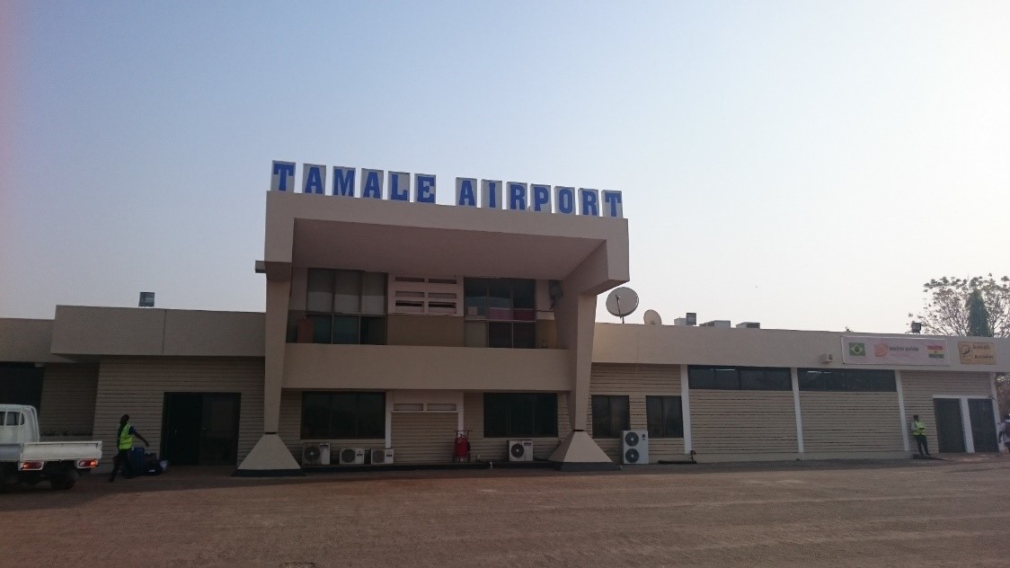
Ghana - 2.2.5 Tamale National Airport
Airport Overview
Tamale International Airport (IATA: TML, ICAO: DGLE) is an airport serving Tamale, a city in the Northern Region of Ghana. It is the third international airport in the country in addition to Kotoka International Airport and Kumasi International Airport. TML is the third-busiest airport in Ghana, with 148,548 passengers in 2020 and 217,958 passengers in 2021.
The airport is in the northern part of the city of Tamale, approximately 23 kilometres (14 mi) north of the city centre off Highway N10. The geographical coordinates of the airport are 9°33'25"N, 00°51'47"W (Latitude: 9.556944; Longitude: -0.863056). The airport is located approximately 553 feet (169 m) above mean sea level.
In 2008 this airport was upgraded by: resurfacing the single runway, the taxiways and aprons, upgrading the terminal building, constructing a modified fire service building, rehabilitation of the tower building, paving of an outside car park and creation of a VVIP lounge. In addition, provisions for Immigration and Customs Services were made.
Starting in July 2019, the following components were included:
-
Construction of a terminal building, measuring 5,000 square metres (54,000 sq. ft), capable of handling 400,000 passengers annually.
-
Construction of a VIP lounge.
-
Construction of two boarding gates.
-
Construction of two self-service check-in kiosks.
-
Construction of eight check-in desks.
-
Construction of airline offices and commercial retail spaces.
-
Construction of a car park that can accommodate 330 cars.
-
A new 5-kilometer road network off the Tamale-Bolgatanga Road was constructed to ease airport accessibility.
Tamale Airport is used for both civil and military operations and for special international flights and is now under the management of the GACL. The runway slope varies from 2.0% uphill to 2.0% downhill on differing areas. The infrastructure is good with security measures in place.
In August 2016, Tamale International airport was cleared to uplift pilgrims to Prince Mohammad bin Abdulaziz Airport in Madina in three batches of 500 passengers. Flynas air services providers were contracted to uplift the pilgrims using leased Lion Air Boeing 747-400 jets. The upgraded airport also serviced Hajj pilgrimage flights in 2022 and 2023.
|
Airfield Details |
|||
|---|---|---|---|
|
Country |
Ghana |
Latitude |
09° 33’ 25’’N |
|
Province / District |
Northern Region |
Longitude |
00° 51’ 47’’ W |
|
Airfield Name |
Tamale |
Elevation (ft) |
552 ft (169m) |
|
IATA & ICAO codes |
TML / DGLE |
Surface |
Asphalt |
|
Town or City (closest) |
Tamale |
Runway Condition |
Good |
|
NGO / UN (on ground) |
|
Passenger / Cargo Security Screening (Yes / No) |
Yes |
|
Runway Dimension |
2438 m 7,999 ft |
Ground Handling (Yes / No) |
Yes |
|
Refuelling Capacity |
Yes, Jet A1 without icing inhibitor. 100/130 MIL Spec, low lead, aviation gasoline (Blue) |
Runway Lighting (Yes / No) |
Yes |
|
Runway Heading |
05/23 |
Fire Fighting Equipment (Yes / No) |
Yes |
|
Air Traffic Control (Yes / No) |
Yes |
Windsock (Yes / No) |
Yes |
|
Weather Information (Yes / No) |
Yes |
Aircraft Parking space (Yes / No) |
Yes |
|
Navigation Aids (Yes / No) |
Yes |
Perimeter fencing (Yes / No) |
Yes |
Fuel Services Charges
n/a
|
|
Price per Unit |
|---|---|
|
Jet A-1 |
0.53 US$ / Litre Source: link |
|
Avgas |
n/a |
Royalties / Non Objection Fees (NOFs)
n/a
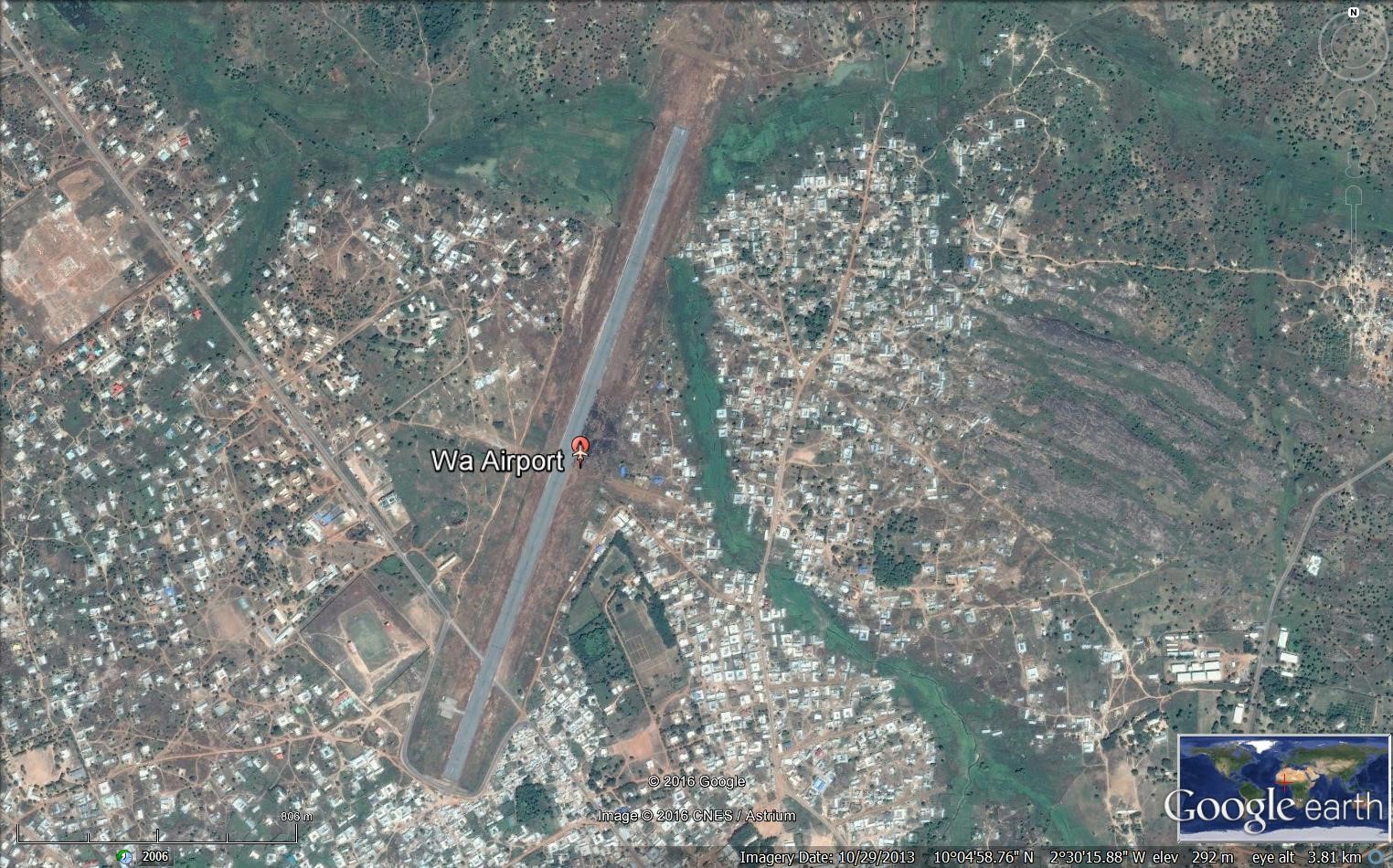
Ghana - 2.2.6 Wa Airstrip
Airport Overview
Wa Airport (IATA: WZA, ICAO: DGLW) is an airport serving Wa, a city in the Upper West Region of Ghana which is also its capital. The airport is operated by Ghana Airports Company Limited. It is the fifth busiest commercial airport in Ghana with over 25,800 passengers passing through in 2022.The airport opened to scheduled commercial flight operations on 15 October 2019 with service by Africa World Airlines from Accra via Tamale using an Embraer 145 regional jet. Services were suspended in March 2020 due to the COVID-19 pandemic and remain suspended pending resolution of various safety challenges.
In December 2021, Passion Air announced 3 weekly services to Accra via Tamale. This service was subsequently increased to 5 weekly non-stop services using a Dash 8 aircraft.
|
Airfield Details |
|||
|---|---|---|---|
|
Country |
Ghana |
Latitude |
10°04′57″N |
|
Province / District |
Upper West Region |
Longitude |
002°30′27″W |
|
Airfield Name |
Wa Airport |
Elevation (ft) |
1,010 ft / 308 m |
|
IATA & ICAO codes |
DGLW |
Surface |
Paved |
|
Town or City (closest) |
Wa |
Runway Condition |
Good |
|
NGO / UN (on ground) |
|
Passenger / Cargo Security Screening (Yes / No) |
n/a |
|
Runway Dimension |
2015 m 6610 ft |
Ground Handling (Yes / No) |
n/a |
|
Refuelling Capacity |
n/a |
Runway Lighting (Yes / No) |
n/a |
|
Runway Heading |
03/21 |
Fire Fighting Equipment (Yes / No) |
n/a |
|
Air Traffic Control (Yes / No) |
n/a |
Windsock (Yes / No) |
Yes |
|
Weather Information (Yes / No) |
n/a |
Aircraft Parking space (Yes / No) |
n/a |
|
Navigation Aids (Yes / No) |
n/a |
Perimeter fencing (Yes / No) |
Yes |
Fuel Services Charges
|
|
Price per Unit |
|---|---|
|
Jet A-1 |
0.53 US$ / Litre Source: link |
|
Avgas |
n/a |
n/a
Royalties / Non-Objection Fees (NOFs)
n/a
Ghana - 2.2.7 Navrongo National Airport/Paga Airstrip
Airport Overview
Navrongo-Paga is an airstrip serving Paga and Navrongo, towns in Kassena-Nankana District of the Upper East Region of Ghana. The airstrip is currently operational.
|
Airfield Details |
|||
|---|---|---|---|
|
Country |
Ghana |
Latitude |
10°56′34″N |
|
Province / District |
Upper East Region |
Longitude |
1°05′14″W |
|
Airfield Name |
Navrongo - Paga |
Elevation (ft) |
690 ft / 210 m |
|
IATA & ICAO codes |
DGLN |
Surface |
Unpaved |
|
Town or City (closest) |
Navrongo |
Runway Condition |
Bad |
|
NGO / UN (on ground) |
WFP |
Passenger / Cargo Security Screening (Yes / No) |
No |
|
Runway Dimension |
1514 x 40 m 4,966 x 131 ft |
Ground Handling (Yes / No) |
No |
|
Refuelling Capacity |
No |
Runway Lighting (Yes / No) |
No |
|
Runway Heading |
14/32 |
Fire Fighting Equipment (Yes / No) |
No |
|
Air Traffic Control (Yes / No) |
No |
Windsock (Yes / No) |
No |
|
Weather Information (Yes / No) |
No |
Aircraft Parking space (Yes / No) |
No |
|
Navigation Aids (Yes / No) |
No |
Perimeter fencing (Yes / No) |
No |
Fuel Services Charges
No facilities for fuelling services.
|
|
Price per Unit |
|---|---|
|
Jet A-1 |
0.53 US$ / Litre Source: link |
|
Avgas |
n/a |
Royalties / Non-Objection Fees (NOFs)
Not applicable.
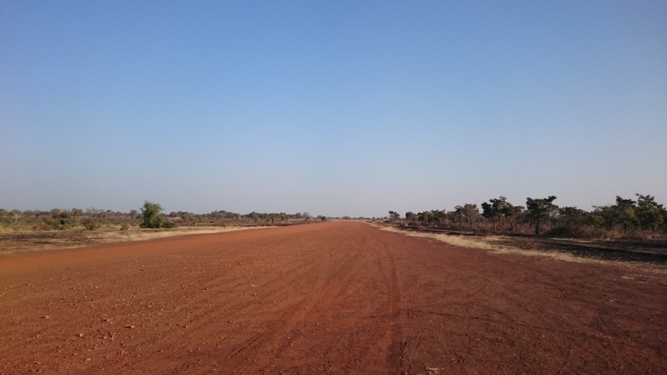
Figure 1 Picture of the Paga Airstrip
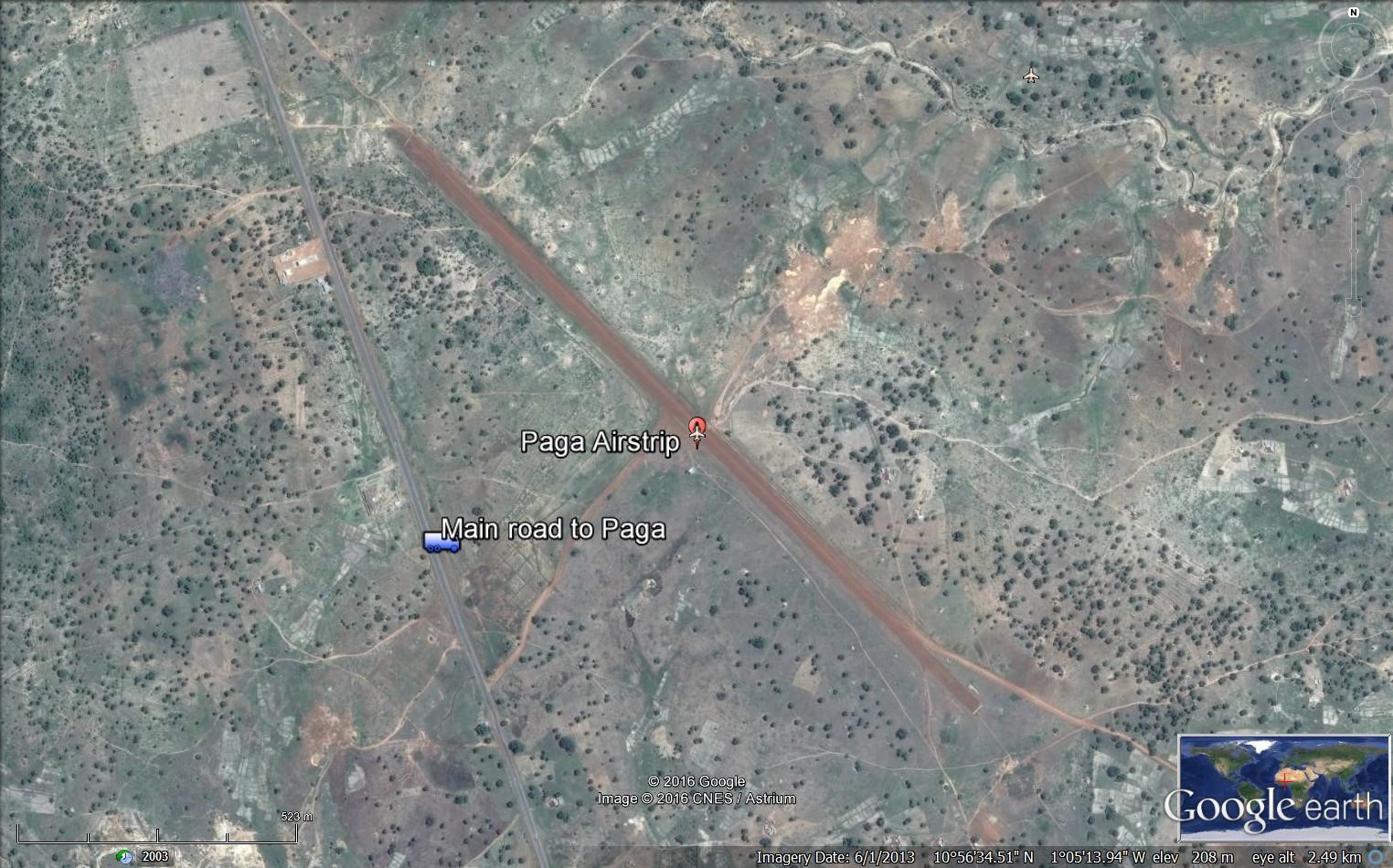
Figure 2 Paga Airstrip plan
Ghana - 2.2.8 Yendi National Airport
Airport Overview
Yendi Airport (ICAO: DGLY) is an airfield serving Yendi, a town in the Northern Region of Ghana. The airstrip can be used by helicopters in case of emergencies.
|
Airfield Details |
|||
|---|---|---|---|
|
Country |
Ghana |
Latitude |
09°25′30″N |
|
Province / District |
Northern Region |
Longitude |
00°00′17″W |
|
Airfield Name |
Yendi Airport |
Elevation (ft) |
2408 ft 224 m |
|
IATA & ICAO codes |
DGLY |
Surface |
Dirt |
|
Town or City (closest) |
Yendi |
Runway Condition |
Good |
|
NGO / UN (on ground) |
n/a |
Passenger / Cargo Security Screening (Yes / No) |
No |
|
Runway Dimension |
1372 x 29 m 4501 x 95 |
Ground Handling (Yes / No) |
No |
|
Refuelling Capacity |
n/a |
Runway Lighting (Yes / No) |
No |
|
Runway Heading |
04/22 |
Fire Fighting Equipment (Yes / No) |
n/a |
|
Air Traffic Control (Yes / No) |
No |
Windsock (Yes / No) |
Yes |
|
Weather Information (Yes / No) |
No |
Aircraft Parking space (Yes / No) |
Yes |
|
Navigation Aids (Yes / No) |
No |
Perimeter fencing (Yes / No) |
No |
Fuel Services Charges
|
|
Price per Unit |
|---|---|
|
Jet A-1 |
0.53 US$ / Litre Source: link |
|
Avgas |
n/a |
n/a
Royalties / Non-Objection Fees (NOFs)
n/a
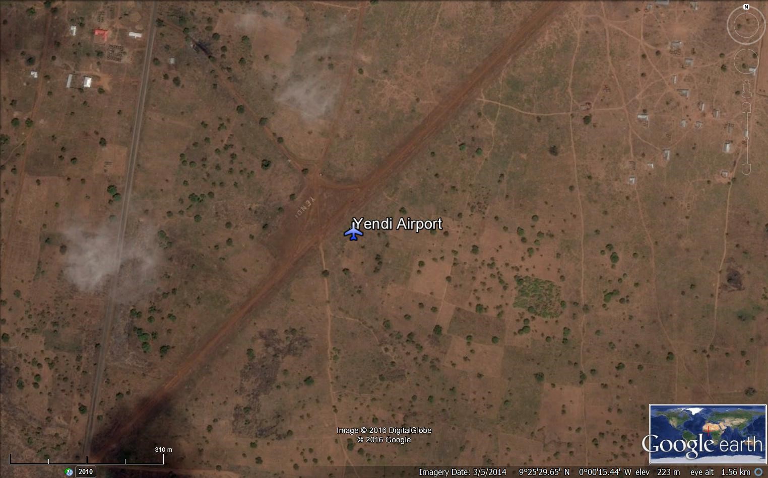
Ghana - 2.3 Road Network
Road Network
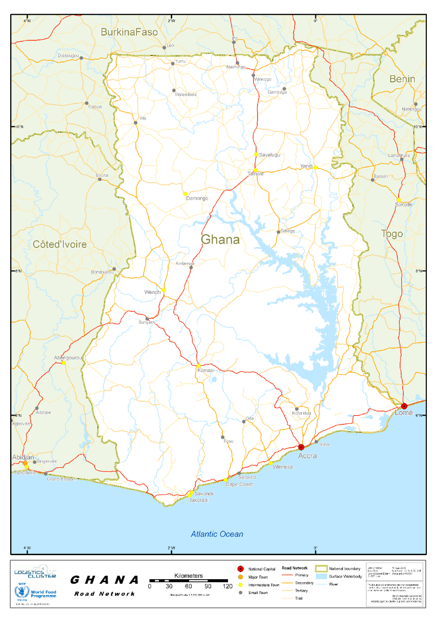
Road transport is by far the dominant carrier of freight and passengers in Ghana's land transport system. It carries over 95% of all passenger and freight traffic and reaches most communities, and is classified under three categories of trunk roads, urban roads, and feeder roads. The Ghana Highway Authority, established in 1974 was tasked with developing and maintaining the country's trunk road network.
The county’s total road network was estimated at 94,203km, with 27% paved and 73% unpaved. The interventions over the last 6 years have led to a marked improvement of Ghana’s road network to 44% good, 34% fair and 22% poor, that is, a 7% reduction in the proportion of roads in poor condition”. source
Trunk roads in Ghana are classified as “National roads”, “Regional roads”, and “Inter-regional roads”, all of which form the Ghana road network.
National roads, designated with the letter N, link all the major population centres in Ghana. Regional roads, designated with the letter R, are a mix of primary and secondary routes, which serve as feeder roads to National roads; while Inter-Regional roads, designated with the prefix IR, connect major settlements across regional borders.
With respect to this mode of transport, many people prefer to use the public means. Many of the town and cities in the country can be reached using urban buses known as "trotro" or taxis. For inter-regional transport bigger buses are normally used.
Road transport buses are the main mode of transport accounting for about 60% of passenger movement. Taxis account for only 14.5% with the remaining accounted for by private cars. One important trend in road transport (especially inter-city) is that there has been a shift from minibuses towards medium and large cars with capacities of 30-70 seats. There has been a growing preference for good buses as the sector continues to offer more options to passenger in tons of quality of vehicles used. According to the Ministry of Roads and Transport.
The Ghana road network is 94,203 km and road transportation are the most dominant choice of transportation in Ghana. Road transport infrastructure in Ghana can be used throughout to facilitate the exchange of commodities and enable regular school attendance and fast access to health facilities in Ghana. The intention is to have many of the existing highways tolled and private-sector participation in road construction and ownership.
For more information on government agency and airport company contact information, please see the following links: 4.1 Government Contact List.
Distance Matrix
Distances from Capital City to Major Towns (km)
|
|
Accra |
Bolgatanga |
Cape Coast |
Ho |
Koforidua |
Kumasi |
Sunyani |
Takoradi |
Wa |
|---|---|---|---|---|---|---|---|---|---|
|
Accra |
- |
815 |
145 |
156 |
85 |
272 |
403 |
229 |
721 |
|
Bolgatanga |
815 |
- |
765 |
567 |
742 |
543 |
588 |
823 |
275 |
|
Cape Coast |
145 |
765 |
- |
317 |
216 |
272 |
353 |
84 |
710 |
|
Ho |
156 |
567 |
317 |
- |
135 |
336 |
515 |
388 |
720 |
|
Koforidua |
85 |
742 |
216 |
135 |
- |
200 |
330 |
283 |
688 |
|
Kumasi |
272 |
543 |
272 |
336 |
200 |
- |
130 |
305 |
444 |
|
Sunyani |
403 |
588 |
353 |
515 |
330 |
130 |
- |
436 |
375 |
|
Takoradi |
229 |
823 |
84 |
388 |
283 |
305 |
436 |
- |
752 |
|
Wa |
721 |
275 |
710 |
720 |
688 |
444 |
375 |
752 |
- |
Travel Time from Capital City to Major Towns (hours)
|
|
Accra |
Bolgatanga |
Cape Coast |
Ho |
Koforidua |
Kumasi |
Sunyani |
Takoradi |
Wa |
|---|---|---|---|---|---|---|---|---|---|
|
Accra |
- |
10 |
2 |
2 |
1 |
4 |
5 |
3 |
9 |
|
Bolgatanga |
10 |
- |
10 |
7 |
9 |
7 |
7 |
10 |
4 |
|
Cape Coast |
2 |
10 |
- |
4 |
3 |
4 |
5 |
1 |
9 |
|
Ho |
2 |
7 |
4 |
- |
2 |
4 |
7 |
5 |
9 |
|
Koforidua |
1 |
9 |
3 |
2 |
- |
3 |
4 |
4 |
9 |
|
Kumasi |
4 |
7 |
4 |
4 |
3 |
- |
2 |
4 |
6 |
|
Sunyani |
5 |
7 |
5 |
7 |
4 |
2 |
- |
6 |
5 |
|
Takoradi |
3 |
10 |
1 |
5 |
4 |
4 |
6 |
- |
10 |
|
Wa |
9 |
4 |
9 |
9 |
9 |
6 |
5 |
10 |
- |
Road Security
The National Road Safety Authority (NRSA), is the lead agency for road safety management in Ghana under the Ministry of Transport. It was established by the NRSA Act, 2019 (Act 993) to develop and promote road safety, to coordinate and regulate activities, procedures and standards related to road safety and to provide for related matters.
The Act has since August 2, 2019, received presidential assent, and repeals the NRSC Act, 1999 (Act 567) that established the National Road Safety Commission. In addition to the existing mandate under the Commission of promoting best road safety practices among road users and coordinating road safety activities, the NRSA Act provides for an enhanced mandate where the Authority is now empowered to regulate, ensure implementation and enforcement of road safety standards and procedures.
With regards to the new Act, Act 2019 (Acts 993) the National Road Safety Authority is mandated to issue compliance notices to institutions or organizations who breach road safety standards.
OBJECTIF OF THE AUTHORITY
The Objectif of the Authority is to reduce the incidence of road traffic crashes, fatalities and injuries through the:
-
Promotion of road safety
-
Development and coordination of policies in relation to road safety
-
Implementation and enforcement of standards for road safety
The Key functions of the Authority under the Act 993 include the following:
-
Nationwide road safety education, campaigns and publicity.
-
Ensure the implementation and enforcement of road safety standards and procedures in addition to the earlier mandate of promoting best road safety practices among road users and coordinating road safety activities.
-
Develop a long-term plan for the promotion of road safety and the reduction of road traffic crashes, fatalities and injuries and collaborate with the Driver and Vehicle Licensing Authority, road agencies, enforcement agencies, crash response agencies and road transport service providers to implement the plan.
-
Collaborate with other relevant agencies to co-ordinate, monitor and evaluate road safety activities, programmes and strategies.
-
Issue notices in the form of directives, procedures or cautions to persons to provide or correct irregularity in procedures, standards, practices and operations to prevent or minimize road traffic crashes, fatalities and injuries.
-
Receive complaints and investigate violations of road safety standards, Regulations and best practices and advise the Minister on the measures required to prevent or minimize road safety risks.
-
Ensure institutional compliance with procedures and standards related to road safety.
-
Collaborate with the Ghana Education Service and other relevant bodies to develop road safety education as part of the curriculum for pre-tertiary level schools and colleges of education.
-
Collaborate with the Building and Road Research Institute, the Ghana Standards Authority and other bodies with relevant knowledge and expertise in road safety to develop standards for road safety equipment and ensure compliance.
-
Regulate road transport and related services.
Weighbridges and Axle Load Limits
Axle load control and management is a critical issue for all the countries in the sub-region since excessive loading of trucks is one of the causes of early deterioration of the roads. The Supplementary Act Act/SP.17/02/12 relating to the Harmonisation of Standards and Procedures for the Control of Dimensions, Weigh and Axle Load of Goods Vehicle within Member States of the Economic Community of West African States was approved by the HoSG in Abuja 16-17 February 2012. Ghana commenced its program in earnest in June 2009 as part of an agreement with WAEMU countries. The sector has been implementing the Axle Load Control and management in accordance with the Road Traffic Act 683 and the Road Traffic Regulations 2012 (LI 2180) which has incorporated sections of the ECOWAS Supplementary Act. Intensive education and sensitization on the new regulation has been undertaken. Key stakeholders such as Freight Forwarders, Haulers, Truckers, Ports, Private Weighbridge Station Operators have been involved in this sensitization programme under the Axle Load Working group chaired by the Ministry of Roads and Highways. The current allowable load limit in Ghana is 60 tones even though authorities say they are working gradually to achieve a 51 tons maximum load limit in the very near future. The allowable height is 4.5 metres and allowable width is 2.55 metres.
PERMISSIBLE AXLE LOAD, GROSS WEIGHT AND DIMENSION LIMITS
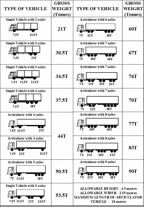
|
Axle load limits |
Ghana |
Togo |
ECOWAS |
|---|---|---|---|
|
Truck with 2 axles |
21 mt |
23 mt |
18 mt |
|
Truck with 3 axles |
30.5 mt |
34 mt |
26 mt |
|
Truck with 4 axles |
37.5 mt |
41 mt |
31 mt |
|
Semi-trailer with 3 axles |
34.5 mt |
39 mt |
30 mt |
|
Semi-trailer with 4 axles |
44 mt |
50 mt |
38 mt |
|
Semi-trailer with 5 axles |
50.5 mt |
50 mt |
43 mt |
|
Semi-trailer with 6 axles |
60 mt |
68 mt |
51 mt |
|
Truck & drawbar trailer with 4 axles |
44 mt |
50 mt |
38 mt |
|
Truck & drawbar trailer with 5 axles |
50.5 mt |
61 mt |
46 mt |
|
Truck & drawbar trailer with 6 axles |
60 mt |
68 mt |
51 mt |
|
Truck & drawbar trailer with 7 axles |
60 mt |
n/a |
n/a |
Ghana - 2.3.1 Border Crossing of Sampa
Land Border Crossing Overview:
Sampa is a town in the Brong-Ahafo Region of Ghana, on the border with Côte d'Ivoire. It is the capital of Jaman North District and was formerly the site of a slave market. It is the biggest border town in Ghana with a population of over 36,000. There are 8 entry points in the region, but Sampa is the biggest entry point to the northern of Ivory Coast.
|
BORDER CROSSING LOCATION & CONTACT |
|
|---|---|
|
Name of Border Crossing: (If crossing has a different name in each country, please indicate in the following format: Name [Country]/Name[Country]) |
Sampa [Ghana] / Soko [Ivory Coast] |
|
Province or District: |
Western Region / Brong-Ahafo |
|
Nearest Town or City: (Nearest location with distance from port) |
Sampa 3 (km) |
|
Latitude: |
7°58'18.1"N |
|
Longitude: |
2°43'08.0"W |
|
Managing Authority/Agency: |
Customs Division |
|
Contact number |
+233244374266 |
|
Travel Times |
|
|---|---|
|
Nearest International Airport: |
Bondoukou in Ivory Coast 13 (km) Truck: 1 hour Car: 15 minutes |
|
Nearest Port: |
Tema in Ghana 520 (km) Truck: 14 Car: 8 hours |
|
Nearest Major Market: (Nearest location with functioning wholesale markets, or with significant manufacturing or production capacity.) |
Sampa on Mondays 3 (km) Truck: 10 minutes Car: 5 minutes |
|
Other Information: (Please provide additional details of this route if relevant, such as information about whether there are fuelling stations or weighing bridges en-route.)
|
There are 7 fuelling stations in Sampa. There aren’t any weighing bridges en route. |
|
Hours of Operation |
|
|---|---|
|
MONDAYS |
06:00 – 18:00 |
|
TUESDAYS |
06:00 – 18:00 |
|
WEDNESDAYS |
06:00 – 18:00 |
|
THURSDAYS |
06:00 – 18:00 |
|
FRIDAYS |
06:00 – 18:00 |
|
SATURDAYS |
06:00 – 18:00 |
|
SUNDAYS |
06:00 – 18:00 |
|
NATIONAL HOLIDAYS: (List dates of closure and hours of operation if different from regular schedule.) |
No dates of closure during the year. |
|
SEASONAL CONSTRAINTS: (i.e., winter months, rainy season, etc.) |
During the rainy season from May to September. |
Daily Capacity:
There isn’t any lane for private car. A parking area is available at the site with security during the night. Around 10 trucks cross the border on daily basis in both ways and around 20 private vehicles.
Customs Clearance:
The Post is not computerized but uses the manual method. For the exportation: A custom document titled ‘Non-Traditional Export Form’ should be filled by the exporter. The customs process the document made in 10 copies; 1 for the exporter, 1 for the Customs, 1 for the Ministry of Trade, 1 for the Ministry of Finance, 1 for the Statistical Services, 1 for the Customs HQ and 1 for the Ministry concerned. For the importation, the truck and cargo should be accompanied by Proforma Invoice which is considered the ‘Bill of Lading’, the Waybill, packing list. For the food imported, the representative of the Ministry of Agriculture should approve the consignment. There is lab available at Sunyama where a sample of the cargo will be examined. Depending on the feedback from the lab, the Ministry of Agriculture issues an import certificate to be joined to the documents. The consignment then could be released from the Customs. The process takes 1 day or 2 days depending on the information. All foreign trucks must enter with a temporary importation certificate. There is only one inspection conducted on the truck and the cargo with the presence of all the representatives of the ministries concerned. The customs duties if applicable are paid at the post in cash.
Other Relevant Information:
Trucks need to wait 1 day to 2 days depending on the information from the outside. Only one inspection is conducted on the truck and cargo. The importation of medicines requires an importation permit from the Ministry of Health and if livestock then a health permit is needed from the Vet. Services.
For more information on government agency and airport company contact information, please see the following links: 4.1 Government Contact List.
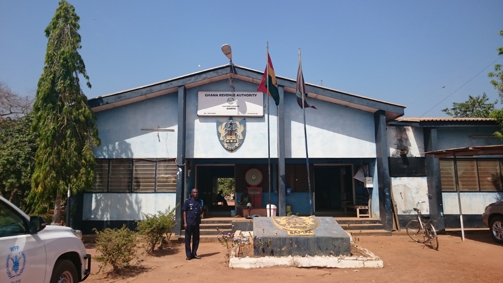
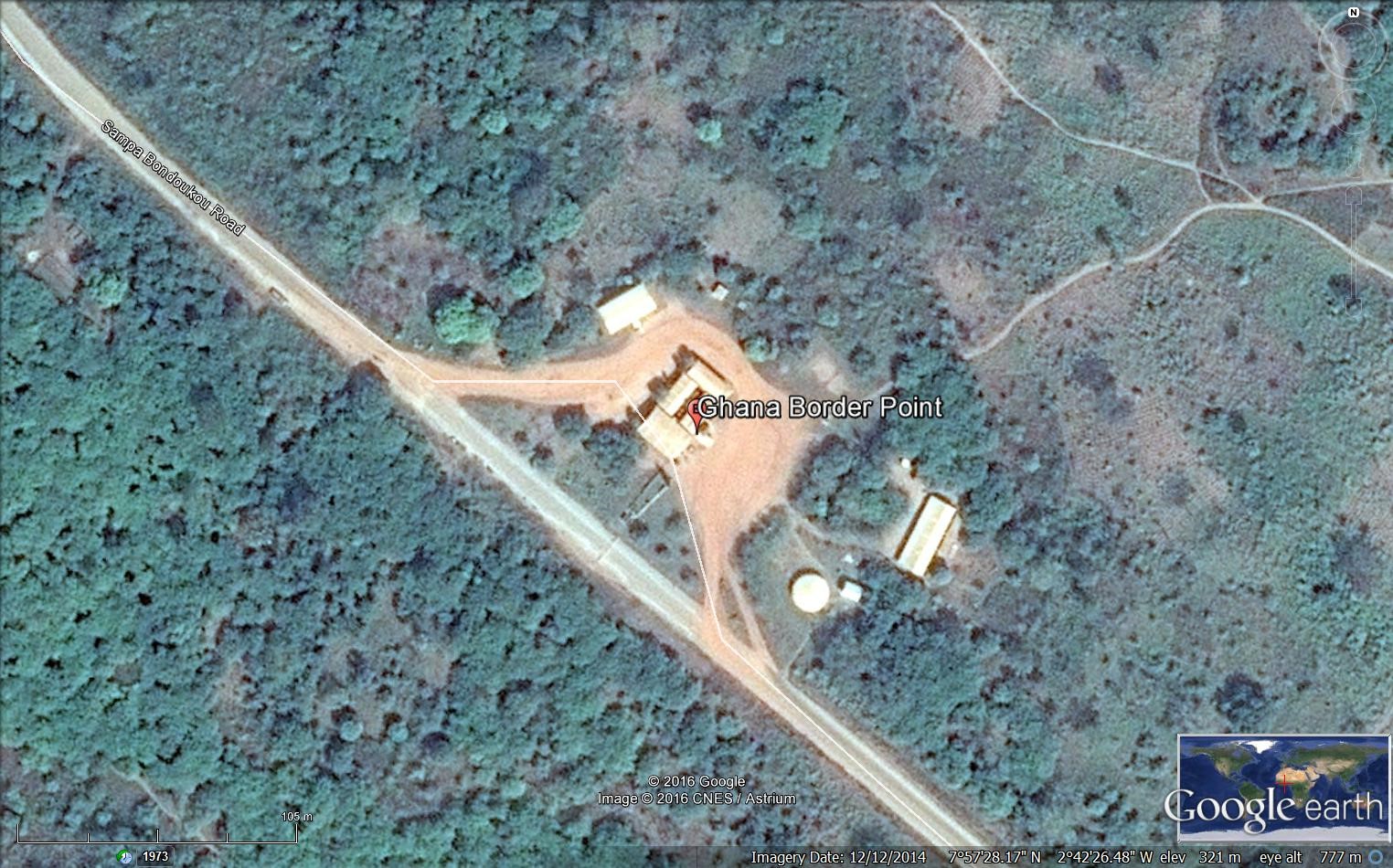
Ghana - 2.3.2 Border Crossing of Elubo
Land Border Crossing Overview:
Elubo is a village in the Jomoro district, a district in the Western Region of Ghana and is the main border crossing between Ghana and Cote d'Ivoire to the west. There are two additional customs entry points, the very remote post of Oseekodwokrom, and farther north, the town of Gonnokuram, on the road to Sunyani. The road to Elubo is paved and in good condition. At all land crossings, a visa is required for non-ECOWAS citizens. There is a bridge to cross the river separating the two countries.
|
BORDER CROSSING LOCATION & CONTACT |
|
|---|---|
|
Name of Border Crossing:
|
Elubo [Ghana] / Noe [Ivory Coast] |
|
Province or District: |
Western Region / Jomoro |
|
Nearest Town or City: (Nearest location with distance from port) |
Takoradi 145 (km) |
|
Latitude: |
5° 17’ 20.37’’ N |
|
Longitude: |
2° 46’ 46.44’’ W |
|
Managing Authority/Agency: |
Ghana Revenue Authority – Customs Division |
|
Contact number |
+233244541888 |
|
Travel Times |
|
|---|---|
|
Nearest International Airport: |
Kotoka International Airport in Accra 362 (km) Truck: 8 hours Car: 6 hours |
|
Nearest Port: |
Takoradi 145 (km) Truck: 3 hours Car: 2 hours |
|
Nearest Major Market: (Nearest location with functioning wholesale markets, or with significant manufacturing or production capacity.) |
Elubo 1 (km) Truck: 10 min Car: 10 min |
|
Other Information: (Please provide additional details of this route if relevant, such as information about whether there are fuelling stations or weighing bridges en-route.)
|
There are fuelling stations and weighing bridges enroute. |
|
Hours of Operation |
|
|---|---|
|
MONDAYS |
0600 - 1800 |
|
TUESDAYS |
0600 - 1800 |
|
WEDNESDAYS |
0600 - 1800 |
|
THURSDAYS |
0600 - 1800 |
|
FRIDAYS |
0600 - 1800 |
|
SATURDAYS |
0600 - 1800 |
|
SUNDAYS |
0600 - 1800 |
|
NATIONAL HOLIDAYS: (List dates of closure and hours of operation if different from regular schedule.) |
Idem. No closing during the national holidays. |
|
SEASONAL CONSTRAINTS: (i.e., winter months, rainy season, etc.) |
No seasonal constraints. |
Daily Capacity:
Private cars are not provided a separate lane. This border deals with a high level of traffic as it is the only crossing point for transit trucks to Ivory Coast.
Customs Clearance:
Requirements for customs clearance: 1. Original Bill of Lading/Airway Bill 2. Invoice 3. Packing List 4. Final Classification and Valuation Report (FCVR) 5. Import Declaration Form (IDF) from the Ministry of Trade and Industry. 6. Tax Clearance certificate from the Domestic Tax Revenue Division issued in the name of the importer or 1% of CIF payment fee. 7. Tax Identification Number (TIN) from the Ghana Revenue Authority. 8. Permit or License from the appropriate Ministry/ Agency Department / as applicable for restricted goods. 9. Appropriate letter of Exemption from payment of duty and/or taxes as applicable.
Other Relevant Information:
The waiting time for crossing might vary depending on the traffic. Goods are subject to one inspection by the customs authority. Foreign cargo vehicles entering Ghana must obtain a temporary importation permit. Customs issues this document, called a “laissez passer/C59,” at the border. The permit is valid for 30 days. If it expires, drivers must return with the vehicle to the same border entry to renew it. The maximum renewal period that may be granted is 90 days. Customs will require drivers to produce the following documents in order to process the C59 form: • An international driver’s licence • ECOWAS Brown Card
For more information on government agency and airport company contact information, please see the following links: 4.1 Government Contact List.
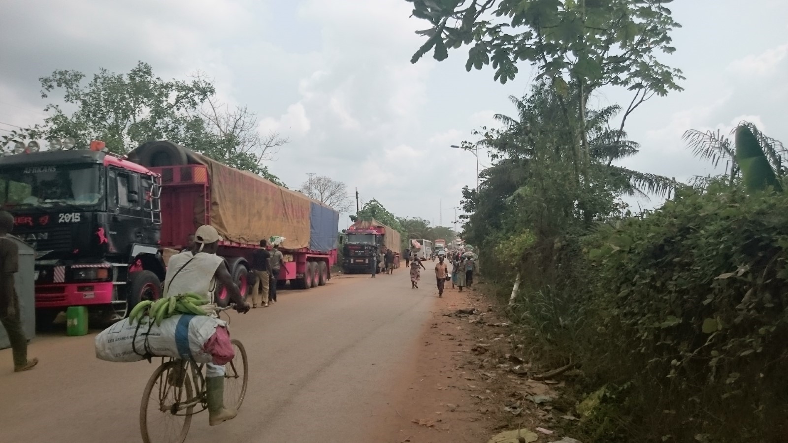
Figure 1 The road between the two border points
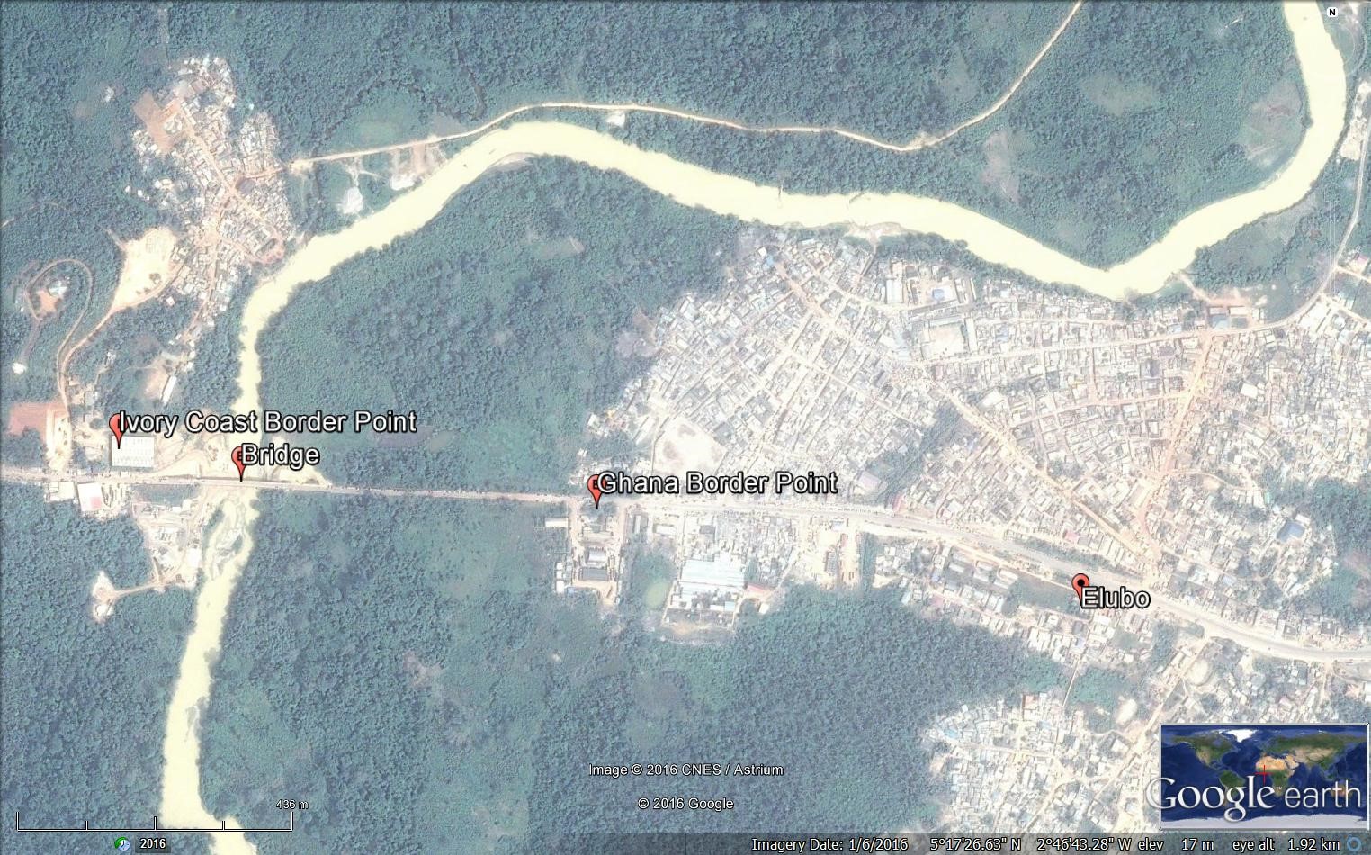
Ghana - 2.3.3 Border Crossing of Vankrogu Chache
Land Border Crossing Overview:
Chache is a small and basic land border crossing between Ghana and Ivory Coast. All the documents should be finalized at Bole Customs Division office prior to reaching this point. There is a small ferry with a capacity of less than 10 mt to cross the Black Volta River. There is a weekly rotation for the officers in charge who are based in Bole. At the border there are Immigration officer, Health officer, Agric. Officer in addition to the customs officer.
|
BORDER CROSSING LOCATION & CONTACT |
|
|---|---|
|
Name of Border Crossing: (If crossing has a different name in each country, please indicate in the following format: Name[Country]/Name[Country]) |
Vankrogu Chache [Ghana] / Bouna [Ivory Coast] |
|
Province or District: |
Bole District in the Northern Region |
|
Nearest Town or City: (Nearest location with distance from port) |
Bole 36 (km) |
|
Latitude: |
9° 00’24.25’’ N |
|
Longitude: |
2° 39’ 06.56’’ W |
|
Managing Authority/Agency: |
Ghana Revenue Authority – Customs Division |
|
Contact number |
+233244572706 |
|
Travel Times |
|
|---|---|
|
Nearest International Airport: |
Kokota International Airport 597 (km) Truck: 12 hours Car: 8 hours |
|
Nearest Port: |
Takoradi Port 625 (km) Truck: 12 hours Car: 8 hours |
|
Nearest Major Market: (Nearest location with functioning wholesale markets, or with significant manufacturing or production capacity.) |
Bole 36 (km) Truck: 2 hours Car: 1 hour |
|
Other Information: (Please provide additional details of this route if relevant, such as information about whether there are fuelling stations or weighing bridges en-route.)
|
There aren’t any weighing bridges in route. The fuelling stations are available near Bole town. |
|
Hours of Operation |
|
|---|---|
|
MONDAYS |
0600 - 1800 |
|
TUESDAYS |
0600 - 1800 |
|
WEDNESDAYS |
0600 - 1800 |
|
THURSDAYS |
0600 - 1800 |
|
FRIDAYS |
0600 - 1800 |
|
SATURDAYS |
0600 - 1800 |
|
SUNDAYS |
0600 - 1800 |
|
NATIONAL HOLIDAYS: (List dates of closure and hours of operation if different from regular schedule.) |
0600 - 1800. No closing during national holidays. |
|
SEASONAL CONSTRAINTS: (i.e., winter months, rainy season, etc.) |
During the rainy season, this border point can be difficult to access. |
Daily Capacity:
Private cars are not provided a separate lane. This border sees more pedestrians crossing the border than vehicles.
Customs Clearance:
All the procedures should be done at Bole Customs Division. The Requirements for customs clearance: 1. Original Bill of Lading/Airway Bill 2. Invoice 3. Packing List 4. Final Classification and Valuation Report (FCVR) 5. Import Declaration Form (IDF) from the Ministry of Trade and Industry. 6. Tax Clearance certificate from the Domestic Tax Revenue Division issued in the name of the importer or 1% of CIF payment fee. 7. Tax Identification Number (TIN) from the Ghana Revenue Authority. 8. Permit or License from the appropriate Ministry/ Agency Department / as applicable for restricted goods. 9. Appropriate letter of Exemption from payment of duty and/or taxes as applicable.
Other Relevant Information:
The waiting time for crossing might vary depending on the traffic as there is only one small ferry. Goods are subject to two inspections by the customs authority and Quarantine authority. Foreign cargo vehicles entering Ghana must obtain a temporary importation permit. Customs issues this document, called a “laissez passer/C59,” at the border. The permit is valid for 30 days. If it expires, drivers must return with the vehicle to the same border entry to renew it. The maximum renewal period that may be granted is 90 days. Customs will require drivers to produce the following documents in order to process the C59 form: • An international driver’s license • ECOWAS Brown Card
For more information on government agency and airport company contact information, please see the following links: 4.1 Government Contact List.
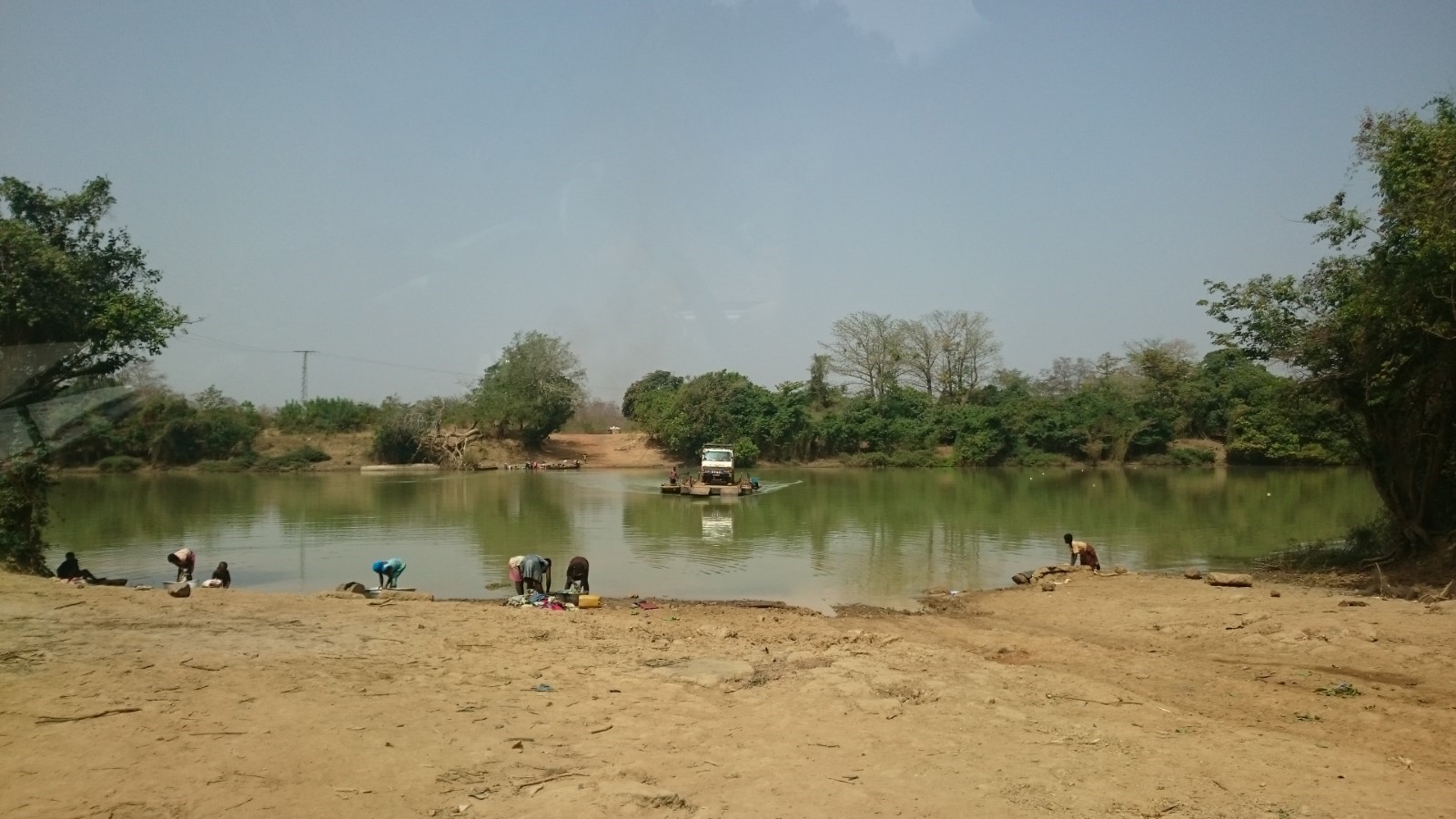
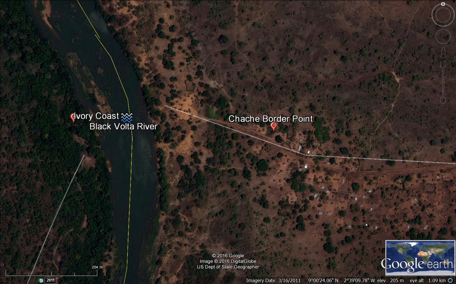
Ghana - 2.3.4 Border Crossing of Hamile
Land Border Crossing Overview:
While there are many informal points of crossing along Ghana's northern border with Burkina Faso, there are only two recognized customs entry posts. The main post is at Paga in the Northeast Region, while there is a less used entry point at Hamile in the north-western corner of Ghana. This post is computerized. There aren’t any laboratories available at this post so all the samples should go to WA which might take several days to receive the results. The trucks stay at the Free zone area as there aren’t any warehouses available.
|
BORDER CROSSING LOCATION & CONTACT |
|
|---|---|
|
Name of Border Crossing: (If crossing has a different name in each country, please indicate in the following format: Name[Country]/Name[Country]) |
Hamile [Ghana] / Ouessa [Burkina Faso] |
|
Province or District: |
Upper West Region |
|
Nearest Town or City: (Nearest location with distance from port) |
Hamile 1 (km) |
|
Latitude: |
11° 00’ 06.86’ N |
|
Longitude: |
2° 44’ 50.88’’ W |
|
Managing Authority/Agency: |
Ghana Revenue Authority – Customs Division |
|
Contact number |
+233240654400 |
|
Travel Times |
|
|---|---|
|
Nearest International Airport: |
Kotoka International Airport 810 (km) Truck: 18 hours Car: 12 hours |
|
Nearest Port: |
Tema Port 836 (km) Truck: 18 hours Car: 12 hours |
|
Nearest Major Market: (Nearest location with functioning wholesale markets, or with significant manufacturing or production capacity.) |
Hamile 1 (km) Truck: 5 minutes Car: 5 minutes |
|
Other Information: (Please provide additional details of this route if relevant, such as information about whether there are fuelling stations or weighing bridges en-route.)
|
There aren’t any weighing bridges in the region. Fuelling stations are available along the road. |
|
Hours of Operation |
|
|---|---|
|
MONDAYS |
0600 - 1800 |
|
TUESDAYS |
0600 - 1800 |
|
WEDNESDAYS |
0600 - 1800 |
|
THURSDAYS |
0600 - 1800 |
|
FRIDAYS |
0600 - 1800 |
|
SATURDAYS |
0600 - 1800 |
|
SUNDAYS |
0600 - 1800 |
|
NATIONAL HOLIDAYS: (List dates of closure and hours of operation if different from regular schedule.) |
0600 - 1800 |
|
SEASONAL CONSTRAINTS: (i.e., winter months, rainy season, etc.) |
The road network to Hamile is bad and is affected by the harvest season from September to November. |
Daily Capacity:
Private cars are not provided a separate lane. The post treats around 60 – 70 trucks per day.
Customs Clearance:
Requirements for customs clearance: 1. Original Bill of Lading/Airway Bill 2. Invoice 3. Packing List 4. Final Classification and Valuation Report (FCVR) 5. Import Declaration Form (IDF) from the Ministry of Trade and Industry. 6. Tax Clearance certificate from the Domestic Tax Revenue Division issued in the name of the importer or 1% of CIF payment fee. 7. Tax Identification Number (TIN) from the Ghana Revenue Authority. 8. Permit or License from the appropriate Ministry/ Agency Department / as applicable for restricted goods. 9. Appropriate letter of Exemption from payment of duty and/or taxes as applicable.
Other Relevant Information:
The waiting time for crossing might vary depending on the traffic. Goods are subject to several inspections by the different agencies operating at the post. Foreign cargo vehicles entering Ghana must obtain a temporary importation permit. Customs issues this document, called a “laissez passer/C59,” at the border. The permit is valid for 30 days. If it expires, drivers must return with the vehicle to the same border entry to renew it. The maximum renewal period that may be granted is 90 days. Customs will require drivers to produce the following documents in order to process the C59 form: • An international driver’s license • ECOWAS Brown Card
For more information on government agency and airport company contact information, please see the following links: 4.1 Government Contact List.
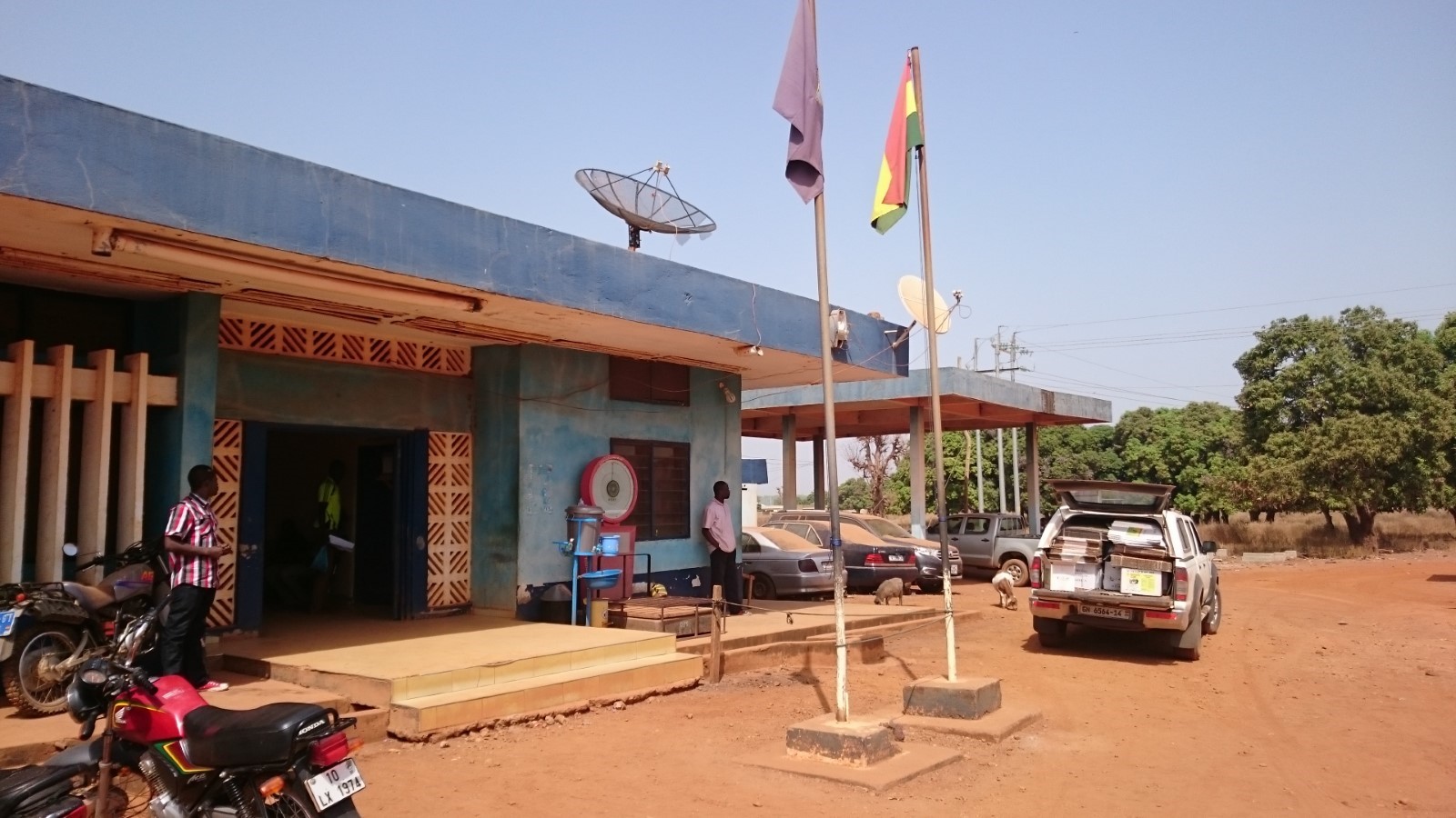
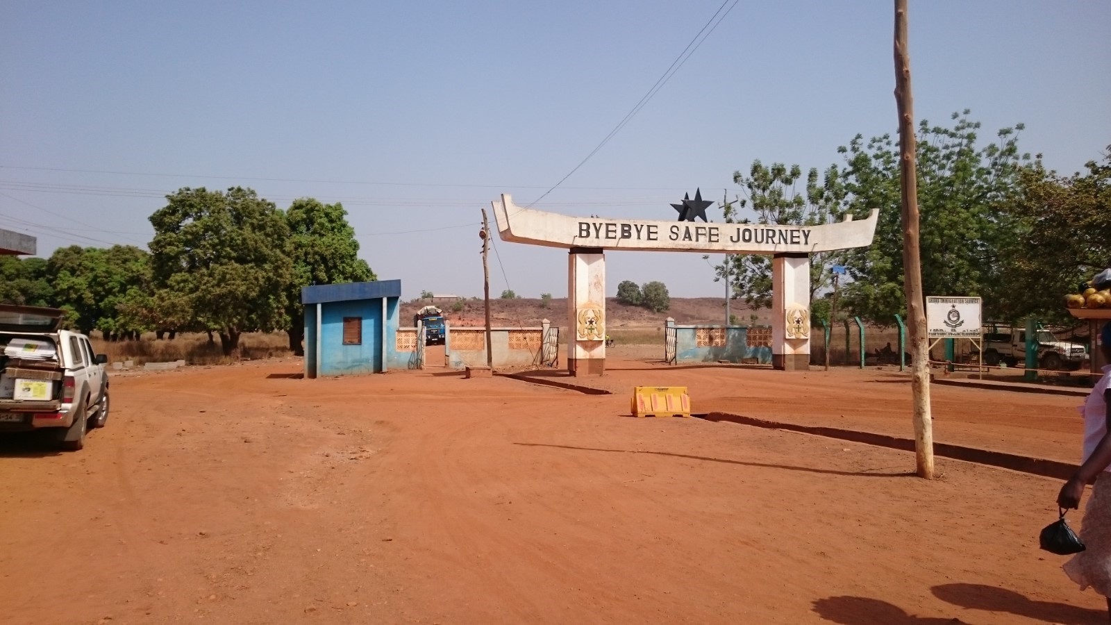
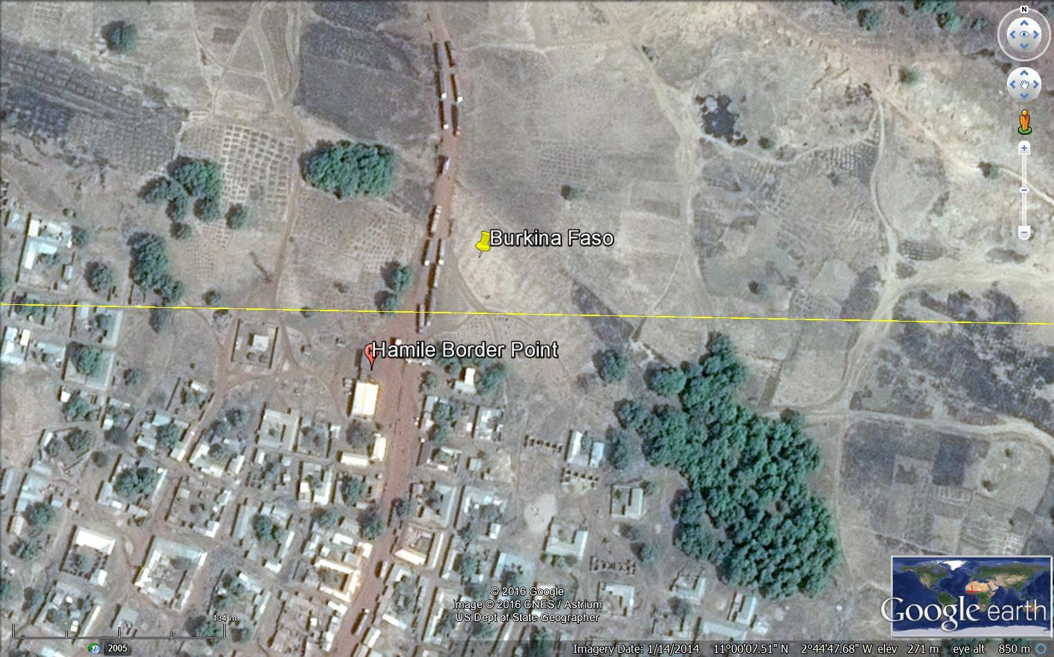
Ghana - 2.3.5 Border Crossing of Tumu
Land Border Crossing Overview:
Tumu is a small town and is the capital of Sissala East district, a district in the Upper West Region of north Ghana. Tumu is connected by road to the town of Navrongo. This Border Point is not considered as one of the main entry/exit points.
|
BORDER CROSSING LOCATION & CONTACT |
|
|---|---|
|
Name of Border Crossing: (If crossing has a different name in each country, please indicate in the following format: Name[Country]/Name[Country]) |
Tumu [Ghana] / Leo [Burkina Faso] |
|
Province or District: |
Upper West |
|
Nearest Town or City: (Nearest location with distance from port) |
Tumu 3 (km) |
|
Latitude: |
10° 53’ 37.76’’ N |
|
Longitude: |
1° 59’ 17.48’’ W |
|
Managing Authority/Agency: |
National Revenue Authority – Customs Division |
|
Contact number |
+233246332297 |
|
Travel Times |
|
|---|---|
|
Nearest International Airport: |
Kotoka International Airport 920 (km) Truck: 18 hours Car: 14 hours |
|
Nearest Port: |
Tema Port 943 (km) Truck: 18 hours Car: 14 hours |
|
Nearest Major Market: (Nearest location with functioning wholesale markets, or with significant manufacturing or production capacity.) |
Tumu (every five days) 3 (km) Truck: 10 min Car: 5 min |
|
Other Information: (Please provide additional details of this route if relevant, such as information about whether there are fuelling stations or weighing bridges en-route.)
|
Fuelling stations are available in Tumu and en-route. No weighing bridges. |
|
Hours of Operation |
|
|---|---|
|
MONDAYS |
0600 – 1800 |
|
TUESDAYS |
0600 – 1800 |
|
WEDNESDAYS |
0600 – 1800 |
|
THURSDAYS |
0600 – 1800 |
|
FRIDAYS |
0600 – 1800 |
|
SATURDAYS |
0600 – 1800 |
|
SUNDAYS |
0600 – 1800 |
|
NATIONAL HOLIDAYS: (List dates of closure and hours of operation if different from regular schedule.) |
0600 – 1800. No closing during holidays. |
|
SEASONAL CONSTRAINTS: (i.e., winter months, rainy season, etc.) |
The road condition is poor during the rainy season. |
Daily Capacity:
Private cars are not provided a separate lane. Not many trucks pass through this point as not considered an international crossing post.
Customs Clearance:
Requirements for customs clearance: 1. Original Bill of Lading/Airway Bill 2. Invoice 3. Packing List 4. Final Classification and Valuation Report (FCVR) 5. Import Declaration Form (IDF) from the Ministry of Trade and Industry. 6. Tax Clearance certificate from the Domestic Tax Revenue Division issued in the name of the importer or 1% of CIF payment fee. 7. Tax Identification Number (TIN) from the Ghana Revenue Authority. 8. Permit or License from the appropriate Ministry/ Agency Department / as applicable for restricted goods. 9. Appropriate letter of Exemption from payment of duty and/or taxes as applicable. An additional document is required at the border points not equipped with computers which is called SAD Forms (Self-Assessment Declaration).
Other Relevant Information:
The waiting time for crossing might vary depending on the traffic and the information needed. Goods are subject to one inspection by the customs authority. Transit trucks are not accepted in this border point. Foreign cargo vehicles entering Ghana must obtain a temporary importation permit. Customs issues this document, called a “laissez passer/C59,” at the border. The permit is valid for 30 days. If it expires, drivers must return with the vehicle to the same border entry to renew it. The maximum renewal period that may be granted is 90 days. Customs will require drivers to produce the following documents in order to process the C59 form: • An international driver’s licence • ECOWAS Brown Card
For more information on government agency and airport company contact information, please see the following links: 4.1 Government Contact List.
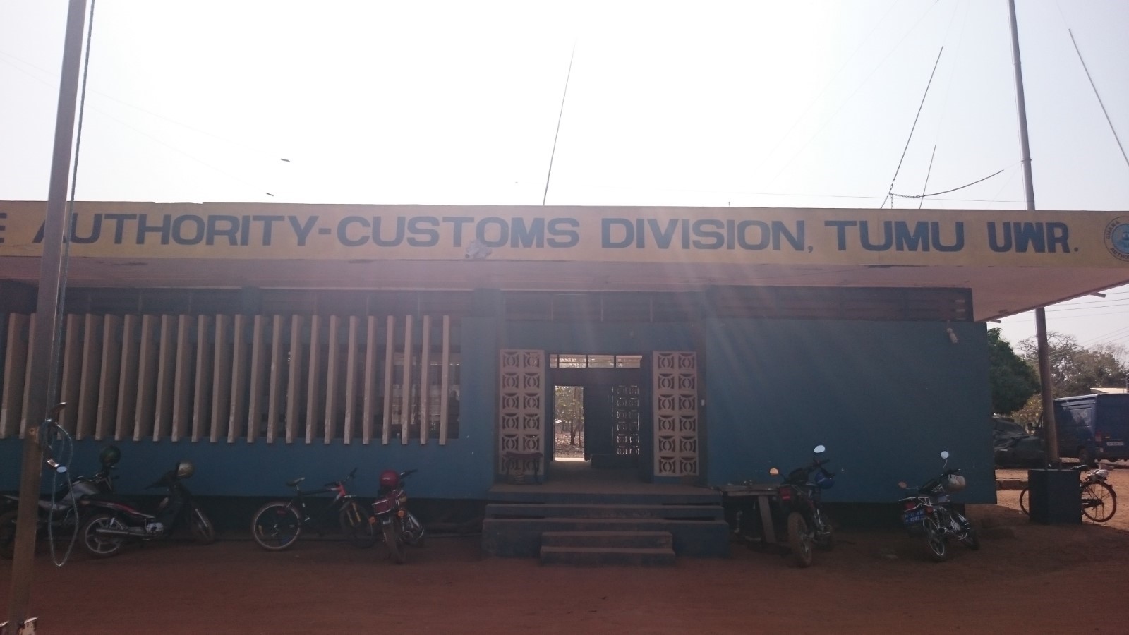
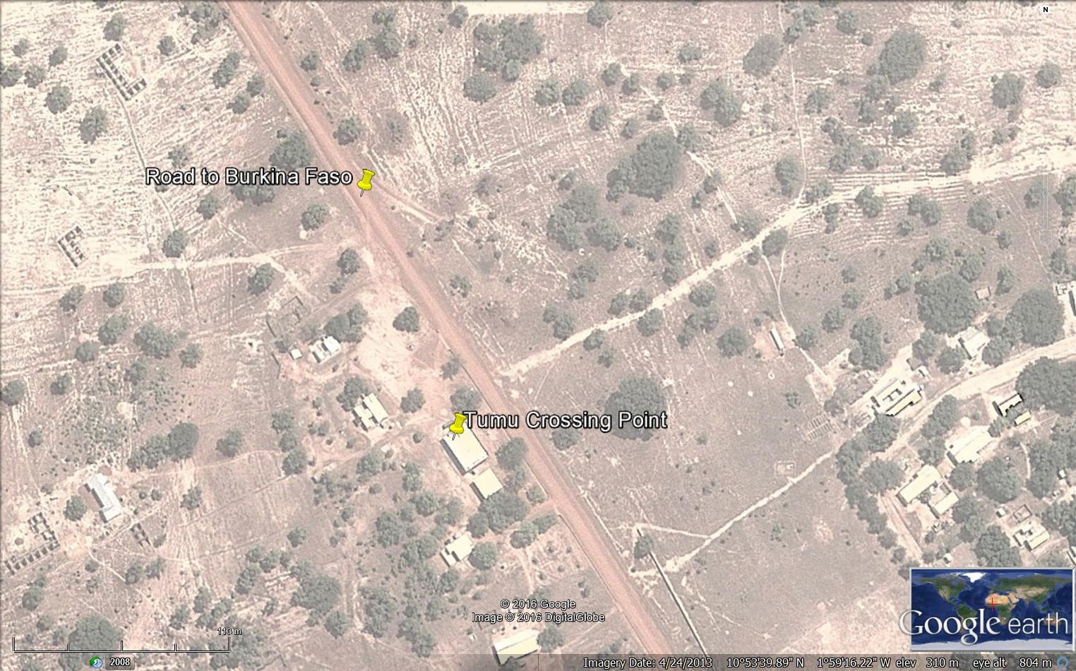
Ghana - 2.3.6 Border Crossing of Paga
Land Border Crossing Overview:
While there are many informal points of crossing along Ghana's northern border with Burkina Faso, there are only two recognized customs entry posts. The main post is at Paga in the Northeast Region, while there is a less used entry point at Hamale in the northwestern corner of Ghana.
|
BORDER CROSSING LOCATION & CONTACT |
|
|---|---|
|
Name of Border Crossing: (If crossing has a different name in each country, please indicate in the following format: Name[Country]/Name[Country]) |
Paga [Ghana] / Dakola [Burkina Faso] |
|
Province or District: |
Upper East Region |
|
Nearest Town or City: (Nearest location with distance from port) |
Navrongo 28 (km) |
|
Latitude: |
10° 59’ 45.40’’ N |
|
Longitude: |
1° 06’ 49.12’’ W |
|
Managing Authority/Agency: |
Ghana Revenue Authority – Customs Division |
|
Contact number |
+233242133766 |
|
Travel Times |
|
|---|---|
|
Nearest International Airport: |
Kotoka International Airport 938 (km) Truck: 18 hours Car: 12 hours |
|
Nearest Port: |
Tema Port 922 (km) Truck: 18 hours Car: 12 hours |
|
Nearest Major Market: (Nearest location with functioning wholesale markets, or with significant manufacturing or production capacity.) |
Navrongo 28(km) Truck: 1 hour Car: ½ hour |
|
Other Information: (Please provide additional details of this route if relevant, such as information about whether there are fuelling stations or weighing bridges en-route.)
|
There are fuelling stations enroute but not weighing bridges. |
|
Hours of Operation |
|
|---|---|
|
MONDAYS |
0600 – 1800 |
|
TUESDAYS |
0600 - 1800 |
|
WEDNESDAYS |
0600 - 1800 |
|
THURSDAYS |
0600 - 1800 |
|
FRIDAYS |
0600 - 1800 |
|
SATURDAYS |
0600 - 1800 |
|
SUNDAYS |
0600 - 1800 |
|
NATIONAL HOLIDAYS: (List dates of closure and hours of operation if different from regular schedule.) |
Regular working hours. |
|
SEASONAL CONSTRAINTS: (i.e., winter months, rainy season, etc.) |
Regular working hours. |
Daily Capacity:
Private cars are not provided a separate lane. This border deals with a high level of traffic as it is the only crossing point for transit trucks to Ivory Coast.
Customs Clearance:
Requirements for customs clearance: 1. Original Bill of Lading/Airway Bill 2. Invoice 3. Packing List 4. Final Classification and Valuation Report (FCVR) 5. Import Declaration Form (IDF) from the Ministry of Trade and Industry. 6. Tax Clearance certificate from the Domestic Tax Revenue Division issued in the name of the importer or 1% of CIF payment fee. 7. Tax Identification Number (TIN) from the Ghana Revenue Authority. 8. Permit or License from the appropriate Ministry/ Agency Department / as applicable for restricted goods. 9. Appropriate letter of Exemption from payment of duty and/or taxes as applicable.
Other Relevant Information:
The waiting time for crossing might vary depending on the traffic. Goods are subject to one inspection by the customs authority. Foreign cargo vehicles entering Ghana must obtain a temporary importation permit. Customs issues this document, called a “laissez passer/C59,” at the border. The permit is valid for 30 days. If it expires, drivers must return with the vehicle to the same border entry to renew it. The maximum renewal period that may be granted is 90 days. Customs will require drivers to produce the following documents in order to process the C59 form: • An international driver’s license • ECOWAS Brown Card
For more information on government agency and airport company contact information, please see the following links: 4.1 Government Contact List.
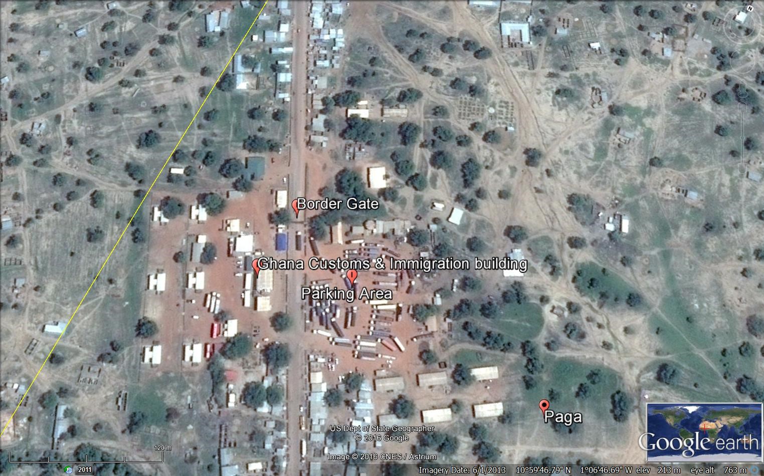
Ghana - 2.4 Railway Assessment
Railway Assessment
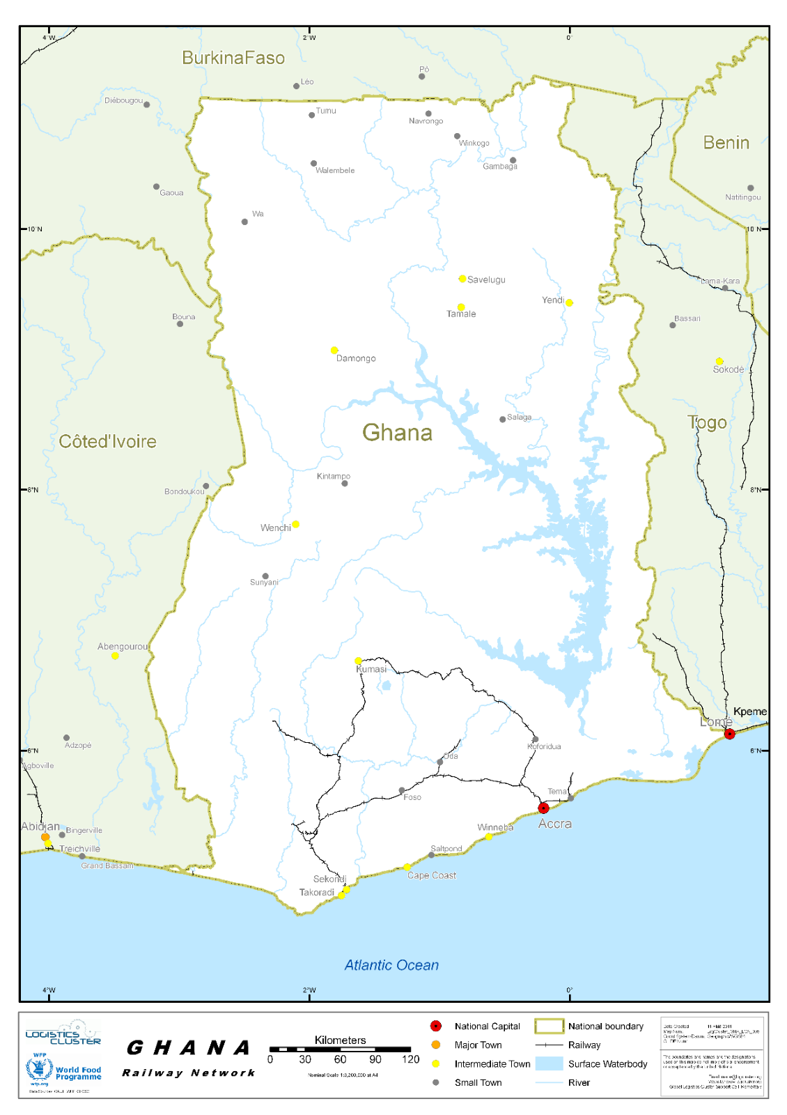
The railways network is managed by the “Ghana Railway Company Limited” GRCL, is a public sector organization, under the tutelage of the Ministry of Railways development.
Ghana's small but economically vital rail network is confined to the southern half of the country. The company operates a network comprising the Western line (Tokaradi, Dunkwa, Awaso & Kumasi), Central line (Huni valley – Kotoku) and Eastern line (Accra, Tema, - Kumasi) with a total track length of 1,300 kilometres. The network has five major branch lines, three of which are on the Western Line and one each on the Eastern and the Central Lines. GRCL is noted for its hauling of Cocoa, Timber, Bauxite and Manganese. Before its deterioration, it was traditionally an important export corridor. Cocoa, Timber and Flour were handled on the Eastern Line through Tema Port, with the Central and Western lines handling these goods for Takoradi Port. Other Commodities conveyed on the network include Cement, Flour and Petroleum products. Freight services are basically the hub and the pivotal link of GRCL which accounts for most of the profits by the company. Currently GRCL is a major carrier of the country’s manganese at Nsuta hauling thousands of tonnes in a day.
The railway network in Ghana resembles a large capital "A" with 3 components - a "Western Division" (the left leg of the "A") from Secondi/Takoradi to Kumasi (280 km, 168 mi), an "Eastern Division" (the right leg of the "A") from Accra to Kumasi, and a "Central Division" (the horizontal bar of the "A") from Huni Valley to Kotoku. The 953 km (570 mi) network includes branch lines on the "Western Division" to Prestea and Awaso, a branch line to Kade on the "Central Division", and branch lines to Tema and Shai Hills on the "Eastern Division". Very little of the railway network remains in operation. Accra to Tema, Accra to Kotoku, and Awaso to Dunkwa and south to Takoradi are the only parts that are known to be in operation. Very little is known about the current operating state of the rest of the system.
The services provided by the GRCL are the following:
PASSENGERS:
The GRCL provides effective and safe mode of passenger transportation via rail. The rail passenger transport serves as one of the convenient ways of carrying passengers from all areas in the country through fast and effective means. The company can carry personnel across the country through its social responsibility roles. GRCL provides passenger carriage services by providing relative comfort and safety of rail transport, which have weighted with the government in assigning a vital role to railways in the overall scheme of meeting the transport needs of the country.
FREIGHT:
GRCL is noted for its hauling of Cocoa, Timber, Bauxite and Manganese. Before its deterioration, it was traditionally an important export corridor. Cocoa, Timber and Flour were handled on the Eastern Line through Tema Port, with the Central and Western lines handling these goods for Takoradi Port. Other Commodities conveyed on the network include Cement, Flour and Petroleum products. Freight services are basically the hub and the pivotal link of GRCL which accounts for most of the profits by the company. Currently GRCL is a major carrier of the country’s manganese at Nsuta hauling thousands of tonnes in a day.
PARCEL CARRIAGE:
GRCL, as far as its core services are concerned, also deal in parcel carriage. The company through its trains carry parcels of all weight and quantities across the length and breadth of the country. Aside carrying parcels of the general public, it also serves as the link of communication between its workers by sending parcels, letters and other smaller goods to its members across areas connected by rail.
For more information on railway company contact details, please see the following link: 4.1 Government Contact List and 4.10 Railway Companies Contact List.
Ghana - 2.5 Waterways Assessment
Waterways Assessment
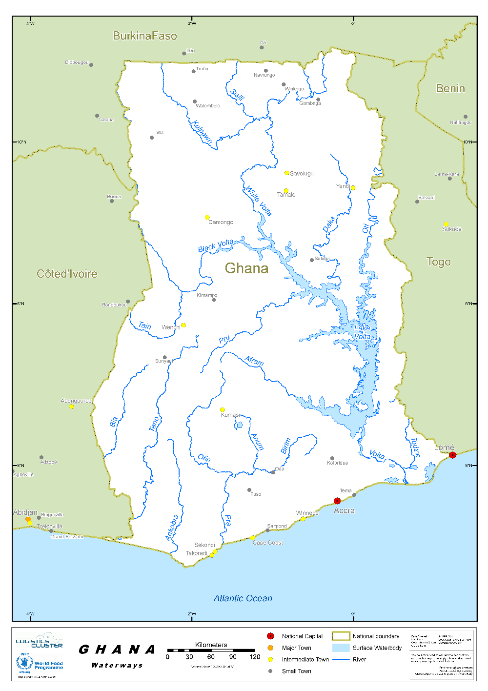
For more information on waterway company contact details, please see the following link: 4.1 Government Contact List and 4.4 Port and Waterways Companies Contact List.
Company Information
The Volta Lake Transport Company (VLTC), incorporated in 1970, operates river transportation for passengers, bulk haulage of petroleum products and significant quantities of cement and cross-lake ferry services along the Volta Lake. As part of VLTC’s re-evaluation of strategies to attract funding to improve its operations, it plans to overhaul its aged and faulty vessels to improve efficiency and subsequently reduce the turn-around time for its services and operations. It has also considered acquiring or leasing additional barges to increase its capacity and fleet to enable it attracts a larger client base.
The VLTC also plans to engage the Government of Ghana in exploring the synergies and commercial benefits of the intended Tema-Akosombo railway line and the Eastern Corridor Multi-Modal Transport Project (ECMMTP). This is to attract new markets and business opportunities that will increase productivity in port and transit services.
VLTC was established with the following objectives:
-
To operate as public carriers of all forms of water-borne transport including hovercraft, for persons and/or freight on the Volta Lake.
-
To act as ship owners, charterers, warehousemen, storekeepers, bailees, wharfingers, lighter men, and stevedores.
-
To operate such other forms of transport including rail and road transport as may be necessary for or ancillary to the business of the company.
-
To do such other things or act as may be necessary for carrying out the business of the company.
The operations of the Company fall under two main areas:
-
North/South Operations
North/South operations link the two in-land ports of Akosombo (South) and Buipe (North). The North/South operations involve the transportation of both liquid, solid cargo and passengers.
Prospects for Wet/Liquid Cargo Operations:
Currently with one pusher tug, the ‘MV Buipe with two VLTC petroleum barges and two BOST petroleum barges with total storage capacity of 3200 m3, the company has the capacity of transporting 90,310 m3 (76,800 tonnes) from Akosombo to Buipe, annually if the product were to be available.
Prospects for Dry Cargo Operations:
With one pusher tug and three barges which are in good condition supported by appropriate forklift trucks, VLTC has the capacity to transport 2,250 tonnes per week, or approximately 80,000 metric tons of solid cargo annually on the Akosombo to Buipe trip. This can in theory be doubled per year if cargo can be obtained for the Buipe to Akosombo leg. Reviews of previous performance records once again show that the company hardly achieves even 30% of this potential annually due to unavailability of cargo.
Cement now constitutes almost exclusively the solid cargo transported by the company. Previously, significant quantities of fertilizer and cotton were transported on the northward and southward trips respectively. Due to the decline in cotton farming in the north, this business has been lost entirely. Most of the shea-nut business has been lost to transporters from Burkina Faso on their trips to the Tema Port.
Ferry Crossing Services
VLTC operates cross ferry services at five (5) areas namely: Adawso (Eastern Region), Yeji (Brono- East Region), Kete-Krachi (Oti Region), Agordeke (Eastern Region) and Dambai (Oti Region).
Prospects for Ferry Operations:
The ferry services are mainly regarded as the social responsibility by the Government of Ghana towards communities displaced and cut off from existing road connections after the construction of the Volta Dam and the subsequent creation of the lake. Tariffs charged for the services have therefore never been able to cover direct operational as well as depreciation costs since tariffs set in recent times have been reduced after insistence from the local authorities.
The company operates five (5) ferry crafts - "MV Millennium Challenge" at Adawso, "MV Nana Mprah Besemuna" at Yeji, "MV Senchi" at Dambai, "MV Damen Ferry" at Agordeke and "MV Freedom and Justice" at Kete-Krachi. There is also one ferry that is currently at the Akosombo Port waiting to be refurbished – “MV Ndewura Jakpa” as well as "MV Akrade" currently docked at Yeji.
It is a well acknowledged fact that water provides the most cost-effective mode for the transport of goods through the economy of scale it offers compared to other modes of transport. VLTC’s operations on the Volta Lake are therefore more competitively priced compared to road transport which dominates the transport of goods and services.
The company's price competitiveness is particularly evident in the haulage of bulk cargo fuel and cement from Akosombo to Buipe, at 415 kilometres distance. The freight paid to VLTC for the haulage of fuel to Buipe is normally set and approved by the National Petroleum Authority (NPA) at 60 % of the rates approved for Bulk Road vehicles (BRV) and currently stands at 0.172470418Gp per litre of product for the trip. Given that the company can transport a minimum of 1.5 million litres weekly with its two (2) fuel barges, VLTC's fuel operations could potentially lead to more than GHS258,705 per week provided the vessels are in good condition. Each trip undertaken by VLTC also implies the withdrawal of the equivalent of 50 BRV’s from the country’s roads, leading to less damage to roads and fewer road accidents.
With respect to the haulage of cement, VLTC currently charges GH¢48.40 per tonne for the trip of 415 km. This compares favourably with what is paid by GHACEM to road transporters for transporting cement at 721 km distance. In addition, each trip undertaken by VLTC again implies the non-use of the equivalent of 50 articulated road trucks on our roads.
To improve the company's efficiency in the transportation of cement on the North/South route, efforts must be made to obtain cargo for the return trip, i.e., Buipe to Akosombo, without increasing the overall return trip time. Previous efforts in this direction have been largely unsuccessful due to the erratic delivery of the return cargo at Buipe, and its uncoordinated evacuation from Akosombo by customers. This situation often led to overall loss in revenue to the company. To redress this problem, scheduled and well-coordinated deliveries at Buipe, and prompt evacuation from Akosombo, are required.
In 2021, the company carried the average of 647,000 passengers and 57,000 cars per year, on all its ferries. link
Ghana - 2.6 Storage Assessment
Storage facilities are available in the country with enough capacity to satisfy the current needs. The main constraint can take place during the harvest season especially in the north of the country. Reliable facilities are easy to locate in the different regions.
For information on storage company contacts, please see the following link: 4.6 Ghana Storage and Milling Company Contact List
Commercial Storage
There are many storage facilities including bonded warehouses in the vicinity of the Ports of Tema and Takoradi. The main Clearing and forwarding agents operate large storage facilities which are well equipped with logistics services. In the northern part of the country, there are some commercial warehouses but are relatively small and not designed for large scale warehousing and their availability is affected during the harvest season of maize and rice.
|
Location |
Owner |
Available for Rent |
Capacity |
Type [1] |
Access [2] |
Condition [3] |
|---|---|---|---|---|---|---|
|
Tema |
Bolloré Africa (Bonded) |
Yes |
2,500 m² |
Concrete |
Flat |
Appears intact |
|
Tema |
Bolloré Africa |
Yes |
5 x 1,500 m² |
Concrete |
Flat |
Appears intact |
|
Kumasi |
Enepa Ventures Limited |
Yes |
1,680 m² / 11,760 m³ |
Concrete |
Flat |
Appears intact |
|
Kumasi |
Enepa Ventures Limited |
Yes |
1,600 m² / 11,200 m³ |
Concrete |
Flat |
Appears intact |
|
Kumasi |
Enepa Ventures Limited |
Yes |
1,600 m² / 11,200 m³ |
Concrete |
Flat |
Appears intact |
|
Kumasi |
Enepa Ventures Limited |
Yes |
1,258 m² / 8,806 m³ |
Concrete |
Flat |
Appears intact |
|
Kumasi |
Enepa Ventures Limited |
Yes |
992 m² / 6,944 m³ |
Concrete |
Flat |
Appears intact |
|
Takoradi |
Stella Logistics |
N/A |
7,800 m² |
Concrete |
Flat |
Appears intact |
[1] Warehouse Type: Open storage, container, rub-hall, silo, concrete, other, unspecified
[2] Warehouse Access: Raised-siding, flat
[3] Warehouse condition: Appears intact, appears damaged, under construction/repair
Storage Used by Humanitarian Organizations
Major humanitarian organizations store their own items; however, more organizations are opting to deliver their humanitarian goods directly from the port of entry to their implementing partners. This option reduces the need for a central warehouse. The presence of UNHRD in the country is also considered as a temporarily storage option for some organizations. The national Red Cross has little storage capacity in the country; a new storage facility in Accra of 120 m² is under finalization.
|
Location |
Organization |
Sharing Possibility |
Capacity |
Type [1] |
Access [2] |
Condition [3] |
|---|---|---|---|---|---|---|
|
Accra |
UNHRD |
Yes |
3,600 m² |
Concrete |
Flat |
Appears intact |
|
Accra |
UNHRD |
Yes |
5,000 m² |
Open Storage |
Flat |
Appears intact |
|
Accra |
UNHRD |
Yes |
1,100 m² |
Temperature-controlled space |
Flat |
Appears intact |
|
Accra |
Ghana Red Cross |
Yes |
120 m² / 480 m³ |
Concrete |
Flat |
Appears intact |
|
Takoradi |
UNHCR |
Yes (if space available) |
102 m² / 910 m³ |
Concrete |
Flat |
Appears intact |
|
Takoradi |
UNHCR |
Yes (if space available) |
92 m² / 818 m³ |
Concrete |
Flat |
Appears intact |
|
Accra |
UNHCR |
Yes (if space available) |
1,000 m³ |
Concrete |
Flat |
Appears intact |
|
Accra |
UNHCR |
Yes (if space available) |
200 m³ |
Concrete |
Flat |
Appears intact |
|
Sunyani |
NCS |
Yes |
80 m² / 320 m³ |
Concrete |
Flat |
Appears intact |
|
Sunyani |
NCS |
Yes |
72 m² / 100 m³ |
Concrete |
Flat |
Appears intact |
|
Tamale |
WFP |
Yes |
1,200 mt |
Concrete |
Flat |
Appears intact |
[1] Warehouse Type: Open storage, container, rub-hall, silo, concrete, other, unspecified
[2] Warehouse Access: Raised-siding, flat
[3] Warehouse condition: Appears intact, appears damaged, under construction/repair
Public Sector Storage
NADMO has storage facilities in all districts with different capacities. Ministries of Agriculture & Education have different warehouses in the country that could be used in case of emergency.
|
Location |
Ministry / Agency |
Use Possibility |
Capacity |
Type [1] |
Access [2] |
Condition [3] |
|---|---|---|---|---|---|---|
|
Kumasi |
NADMO |
Yes |
2 x (100 m² / 200 m³) |
Concrete |
Flat |
Appears intact |
|
Kumasi |
NADMO |
Yes |
2 x (120 m² / 360 m³) |
Concrete |
Flat |
Appears intact |
|
Sunyani |
NADMO |
Yes |
2 x (180 m² / 160 m³) |
Concrete |
Flat |
Appears intact |
|
Tamale |
GES |
Yes |
3,000 mt |
Concrete |
Flat |
Appears intact |
|
Tamale |
NADMO |
Yes |
224.48 m² |
Concrete |
Flat |
Appears intact |
|
Tamale |
Public Works |
Yes |
224 m² |
Concrete |
Flat |
Appears intact |
|
Bolgatanga |
MOFA |
Yes |
3,000 mt |
Concrete |
Flat |
Appears intact |
|
Bolgatanga |
MOFA |
Yes |
4,000 mt |
Concrete |
Flat |
Appears intact |
|
Bolgatanga |
MOFA |
Yes |
600 mt |
Concrete |
Flat |
Appears intact |
|
Wa |
NADMO |
Yes |
280 m² |
Concrete |
Flat |
Appears intact |
|
Wa |
NADMO |
Yes |
225 m² |
Concrete |
Flat |
Appears intact |
|
Takoradi |
Regional Medical Store |
Yes |
1,224 m² |
Concrete |
Flat |
Appears intact |
[1] Warehouse Type: Open storage, container, rub-hall, silo, concrete, other, unspecified
[2] Warehouse Access: Raised-siding, flat
[3] Warehouse condition: Appears intact, appears damaged, under construction/repair
Cold Chain
UNHRD has a good cold chain capacity in the country, also EPI has cold chain storage capacities in all districts and regions (1 cold room positive of 40 m³ in each region), freezers of 145 litres and refrigerators of 108 litres. There aren’t any solar fridges at EPI centres.
|
Location |
Organisation / Owner |
Type [1] |
Cooling / Power [2] |
Quantiy |
Total Capacity |
Condition |
|---|---|---|---|---|---|---|
|
Accra |
UNHRD |
Cold Room Positive |
Compression |
1 |
40 m² |
Appears intact |
|
Tamale |
EPI |
Cold Room Positive |
Compression |
2 |
40 m³ |
Appears intact |
|
Tamale |
EPI |
Cold Chain Negative |
Compression |
1 |
20 m³ |
Appears intact |
|
Wa |
EPI |
Cold Chain Positive |
Compression |
1 |
53.2 m² |
Appears intact |
|
Wa |
EPI |
Cold Chain Negative |
Compression |
1 |
15.8 m² |
Appears intact |
|
Takoradi |
EPI |
Cold Chain Positive |
Compression |
1 |
24 m³ |
|
Ghana - 2.7 Milling Assessment
Milling Assessment
There are four major wheat milling companies in Ghana, 3 located in Tema (GAFCO, Irani Brothers & Golden Spoons Ltd) and one (Takoradi Milling Ltd) in Takoradi. Premium Foods Limited – the object of the assessment - is specialized only in Corn milling as the corn is the main staple in Ghana.
Milling Company
Premium Foods Limited
Premium Foods Limited is the only corn milling facility operating in Kumasi and is considered amongst the biggest in West Africa region.
|
Company Name & Address |
Contact Names & Email |
Telephone & Fax |
|---|---|---|
|
Premium Foods Limited Kwaso Factory, Ejisu - Bekwai Rd. Jachie-Pramso, Bosomtwe District Ashanti Region of Ghana |
Name: Tom Gambrah Title: Managing Director Email: tgambrah@premiumfoodsgh.com Email: info@premiumfoodgh.com Mr Ralph Adotei Brown Title : Factory Manager Email: rabrown@premiumfoodsgh.com
|
Tel: +233596994553 Tel: +233277762413 Mobile: +233277549800
Mobile: +233558183629
|
|
Summary of Role and Services: Premium Foods Limited (PFL) is a limited liability food processing company established in 1999 with two factories at Jachie and Kwaso have a combined operating capacity of 133,440 metric tons annually to blend maize, soya and millet (96,000 metric tons at Kwaso) and (37,440 metric tons at Jachie) one of the few with such capabilities in the West African Sub region. |
||
|
Facilities |
|||
|---|---|---|---|
|
Parking area inside compound m² |
Yes (200square meters) |
||
|
Drainage (Good / Fair / Poor / Non Existent) |
Yes |
||
|
Fire Fighting Equipment (Yes / No) |
Yes |
||
|
Number of Ventilators |
1 |
Screened |
|
|
Electricity Load (KVA) |
1,000 |
||
|
Backup Generator (Yes / No / KVA) |
Yes |
1,650 |
KVA |
|
Milling Equipment |
|||
|---|---|---|---|
|
Origin of Machinery |
Year of Mfg. |
Year of Installation |
Condition |
|
South Africa |
2016 |
2018 |
Very Good |
|
Maintenance |
|||
|---|---|---|---|
|
Duration (hours / week) |
8 hours / weeks |
Type of maintenance |
Preventive maintenance |
|
Duration (hours / week) |
2 weeks / Year |
Type of maintenance |
Major Maintenance (Overhaul or retrofit) with closure of the milling during that period. |
|
Other Equipment or Machinery Installed |
||||
|---|---|---|---|---|
|
Type of Equipment |
Yes/No |
Number |
Owned |
Comments |
|
Fortification Feeder |
Yes |
6 |
Yes |
Good |
|
Bag Cleaning Plant |
No |
n/a |
n/a |
n/a |
|
Moisture Tester |
Yes |
1 |
Yes |
Good |
|
De-stoning Plant |
Yes |
2 |
Yes |
Good |
|
Metal Extractor |
Yes |
2 |
Yes |
Good |
|
Staffing |
|
|---|---|
|
Number of full time skilled workers |
89 |
|
Number of full time labourers |
150 |
|
Weighbridge |
||||
|---|---|---|---|---|
|
Number |
None |
Capacity (MT) |
Length (m) |
Type |
|
Within Compound |
n/a |
n/a |
n/a |
|
|
Within Compound |
n/a |
n/a |
n/a |
|
Weighbridge under consideration now (100MT, Length 18m ground level)
|
Building |
|||
|---|---|---|---|
|
|
Length (m) |
Width (m) |
Height (m) |
|
Building – Wheat Mill |
n/a |
n/a |
n/a |
|
Building – Maize Mill |
160 |
70 |
20 |
|
Walls |
Fenced with wire mesh |
||
|
Roof |
Concrete roof top |
||
|
Floor |
Epoxy on production floors and concrete on the compound |
||
|
Conditions & Cleanliness |
||
|---|---|---|
|
|
Outside |
Inside |
|
Cracks in walls or roof (Yes / No) |
No |
No |
|
Signs of rodent activity (Yes / No) |
No |
No |
|
Signs of birds’ entry (Yes / No) |
Yes |
No |
|
Damaged gutters/drains (Yes / No) |
No |
No |
|
Signs of moisture (Yes / No) |
No |
No |
|
Adjacent Vegetation (Yes / No) |
Yes |
No |
|
Cleanliness (Good / Poor) |
Good |
Good |
|
Pest Control |
|||||
|---|---|---|---|---|---|
|
Fumigation |
Yes |
Frequency |
Every (6 – 8) weeks for the mills Every 10 - 12 weeks for the products in silos |
Contracted (Yes / No) |
Yes |
|
Spraying |
Yes |
Frequency |
Every Week |
Contracted (Yes / No) |
No |
|
Rodenticides |
Yes |
Frequency |
Weekly |
Contracted (Yes / No) |
Yes |
|
Rodent Trapping |
Yes |
Frequency |
Weekly |
Contracted (Yes / No) |
Yes |
|
Security |
|
|---|---|
|
Security (Good / Poor) |
Good |
|
Compound (Fenced / Not Fenced) |
Fenced |
|
Other Comments |
There is a CCTV system in the production area and compound. In place a log book to register every visitor and worker and badges. |
|
Access |
|||
|---|---|---|---|
|
Distance from main town (km) |
22 Km |
||
|
Travel time if not located in town (hours) |
45 minutes |
||
|
Road condition to Mill |
Fair |
||
|
Road limitation (if any) Maximum Width and Max. Tonnage |
5m high when in town and axle load for 20ft container is 25 MT whilst 40ft containers is 27.6 MT |
||
|
Rail connections (Yes / No) |
No |
||
|
On the railway from |
n/a |
to |
n/a |
|
|||
|
Milling Capacity (MT) |
||
|---|---|---|
|
Commodities |
Daily Capacity (MT) |
Monthly Activity (MT) |
|
Wheat |
No |
No |
|
Maize |
100 |
3,000 |
|
Storage Capacity |
||
|---|---|---|
|
Storage in Metric Tonnes |
Grains – Covered (MT) |
Finished Products – Covered (MT) |
|
Within the Compound |
16,000 MT |
2,300 MT |
|
Outside the Compound |
5,000 MT |
0 |
|
Capacity to Blend |
|---|
|
|
Loading & Discharge Rates |
|---|
|
|
Transport Capacity at Mill |
|---|
|
|
Additional Notes |
|---|
|
The only milling company in Sunyani.
Milling Company Yedent Agro Food Processing
A local company with a mix of imported and locally manufactured milling equipment. The milling company concerns cereal legume blends and extruded products.
|
Company Name & Address |
Contact Names & Email |
Telephone & Fax |
|---|---|---|
|
Yedent Agro Food Processing Plot No. 27 Abesim Kyidom Industrial Area, Sunyani |
Name: Samuel Ntim Title: CEO Email: ntimadu@yahoo.co.uk Email:info@yedentghana.com Web: www.yedentghana.com Name: Divine R. Amenya Title: General Manager Email: amenyadivine@gmail.com
|
Tel: +233208166021 +233243212389 Mobile: +233208166021
Mobile: +233244932979 |
|
Summary of Role and Services: Maize grit processing for the brewery and poultry industry. |
||
|
Facilities |
|||
|---|---|---|---|
|
Parking area inside compound m² |
Available |
||
|
Drainage (Good / Fair / Poor / Non-Existent) |
Good |
||
|
Fire Fighting Equipment (Yes / No) |
Yes |
||
|
Number of Ventilators |
7 |
Screened |
|
|
Electricity Load (KVA) |
n/a |
||
|
Backup Generator (Yes / No / KVA) |
Yes |
|
500 KVA |
|
Milling Equipment |
|||
|---|---|---|---|
|
Origin of Machinery |
Year of Mfg |
Year of Installation |
Condition |
|
Imported and locally manufactured (7) |
2002 and plus |
2002 and plus |
Good |
|
|
|
|
|
|
Maintenance |
|||
|---|---|---|---|
|
Duration (hours / week) |
3 hours’ weekly |
Type of maintenance |
Regular |
|
Duration (hours / month) |
8 hours’ monthly |
Type of maintenance |
Monthly |
|
Other Equipment or Machinery Installed |
||||
|---|---|---|---|---|
|
Type of Equipment |
Yes/No |
Number |
Owned |
Comments |
|
Fortification Feeder |
No |
n/a |
n/a |
n/a |
|
Bag Cleaning Plant |
No |
n/a |
n/a |
n/a |
|
Moisture Tester |
Yes |
2 |
Yes |
A lab available at site |
|
De-stoning Plant |
Yes |
2 |
Yes |
|
|
Metal Extractor |
Yes |
20 |
Yes |
Magnets |
|
Staffing |
|
|---|---|
|
Number of full time skilled workers |
86 |
|
Number of full time labourers |
30 |
|
Weighbridge |
||||
|---|---|---|---|---|
|
Number 1 |
No |
Capacity (mt) |
Length (m) |
Type |
|
Within Compound |
120 |
18 |
LEOIN |
|
|
Within Compound |
|
|
|
|
|
Building |
|||
|---|---|---|---|
|
|
Length (m) |
Width (m) |
Height (m) |
|
Building – Wheat Mill |
n/a |
n/a |
n/a |
|
Building – Maize Mill |
60 |
42 |
15 |
|
Walls |
|
||
|
Roof |
|
||
|
Floor |
|
||
|
Conditions & Cleanliness |
||
|---|---|---|
|
|
Outside |
Inside |
|
Cracks in walls or roof (Yes / No) |
No |
n/a |
|
Signs of rodent activity (Yes / No) |
No |
n/a |
|
Signs of birds’ entry (Yes / No) |
No |
n/a |
|
Damaged gutters/drains (Yes / No) |
No |
n/a |
|
Signs of moisture (Yes / No) |
No |
n/a |
|
Adjacent Vegetation (Yes / No) |
No |
n/a |
|
Cleanliness (Good / Poor) |
Good |
n/a |
|
Pest Control |
|||||
|---|---|---|---|---|---|
|
Fumigation |
Yes |
Frequency |
quarterly |
Contracted (Yes / No) |
Yes |
|
Spraying |
Yes |
Frequency |
quarterly |
Contracted (Yes / No) |
Yes |
|
Rodenticides |
Yes |
Frequency |
quarterly |
Contracted (Yes / No) |
Yes |
|
Rodent Trapping |
Yes |
Frequency |
daily |
Contracted (Yes / No) |
No |
|
Security |
|
|---|---|
|
Security (Good / Poor) |
Good |
|
Compound (Fenced / Not Fenced) |
Fenced |
|
Other Comments |
|
|
Access |
|||
|---|---|---|---|
|
Distance from main town (km) |
2 Km |
||
|
Travel time if not located in town (hours) |
15 minutes |
||
|
Road condition to Mill |
Fair |
||
|
Road limitation (if any) Maximum Width and Max. Tonnage |
None |
||
|
Rail connections (Yes / No) |
No |
||
|
On the railway from |
n/a |
to |
n/a |
|
|||
|
Milling Capacity (Mt) |
||
|---|---|---|
|
Commodities |
Daily Capacity (mt) |
Monthly Activity (mt) |
|
Wheat |
n/a |
n/a |
|
Maize |
22 mt |
484 mt |
|
Storage Capacity |
||
|---|---|---|
|
Storage in Metric Tonnes |
Grains – Covered (mt) |
Finished product – Covered (mt) |
|
Within the Compound |
3800 mt |
120 mt |
|
Outside the Compound |
1000 mt |
n/a |
|
Capacity to Blend |
|---|
|
|
Loading & Discharge Rates |
|---|
|
|
Transport Capacity at Mill |
|---|
|
|
Additional Notes |
|---|
|